Embed Size (px)
Citation preview

Asthma Distribution patterns and their relationship with the urban landscape and
social conditions in Newark NJ
Authors:
Francisco Artigas, Leonard Beilory, Richard Holowczak,
Kumar Patel
Primary author affiliation:
CIMIC - Rutgers University, [email protected]
IHGC 2000Sunday March 19, 2000

Problem Statement
• Recent estimates suggest that roughly 50% of school children in the City of Newark suffer from some form of asthma. Similar urban areas across the country exhibit much lower rates.
• Hospital admissions:– 110 per 100,000 in Newark– 46 per 100,000 in surrounding Suburban/rural

Research Objectives
• Build a robust spatial data-set about asthma cases in Newark (focus area).
• Find spatial correlation between asthma case locations and urban landscape features

Data Sources
• Admission records from UMDNJ University Hospital 1997-1998 (n = 542 and n = 624)
• Landsat 5 thermal images (1997)• High resolution aerial photographs (1995)• Geo-coded street address vector coverage of
Newark• Census tracts from 1990

Overview of Data
1997 1998
• Male 280 305
• Female 261 329
• Black 485 561
• White 2 3
• Filipino 0 1
• Other 4 35
• Unknown 49 34
Age 1997
• Min /Max 0 / 82
• Average 17
• Median 8
Len.of Stay 1997 1998
• Min 1 1
• Max 24 87
• Average 3 3.1
• Median 2 2

Analytical Tools
• ARC/INFO and ARCVIEW
• MapObjects
• IDRISI Image processing software
• SPSS statistics software
• Wizsoft data mining software

Research Approach
• Clean and organize asthma case data from UMDNJ University Hospital
• Generate X and Y coordinates from address lists for 1997 and 1998
• Perform cluster analysis
• Intersect asthma cases with census data
• Spatial analysis of asthma cases with Landscape texture and features

Assumption• Asthma cases are uniformly distributed across:
– Streets– Landscape texture– Socio-economics indicators
• Asthma cases are uniformly distributed from: – Emission focal points

Cluster Analysis
• Method: Use K-means cluster analysis (K=5, K=10 and K=15) on X, Y coordinates
• Characteristics of clusters:– Size (membership) of clusters– Location of cluster centers– Cluster migration from year to year– Cluster homogeneity
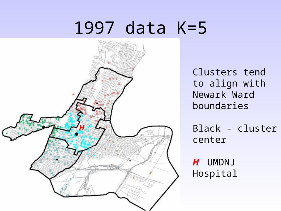
1997 data K=5
Clusters tend to align with Newark Ward boundaries
Black - cluster center
H UMDNJ HospitalH

1997 data K=15
Clusters tend to align with neighborhood boundaries
H UMDNJ Hospital
H

1998 data K=5
Clusters tend to align with Newark Ward boundaries
Black - cluster center
H UMDNJ HospitalH
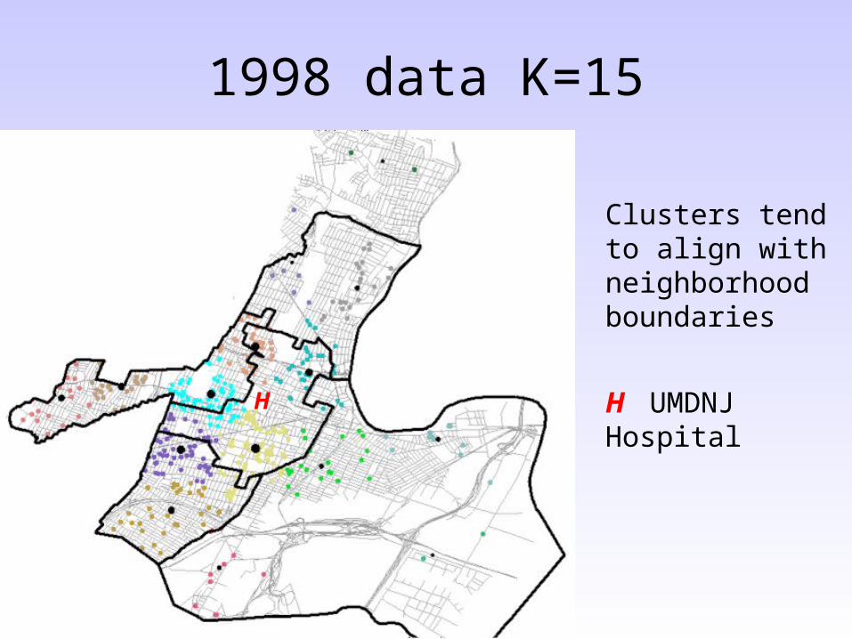
1998 data K=15
Clusters tend to align with neighborhood boundaries
H UMDNJ Hospital
H

Cluster Migration ‘97 to ‘98
Blue: 1997 Cluster centers
Red: 1998 Cluster centers
Central ward clusters tend to migrate less
H UMDNJ Hospital
H
Rt. 280

Cluster Homogeneity• Compare %Race in population with %Race of
cases
n/a
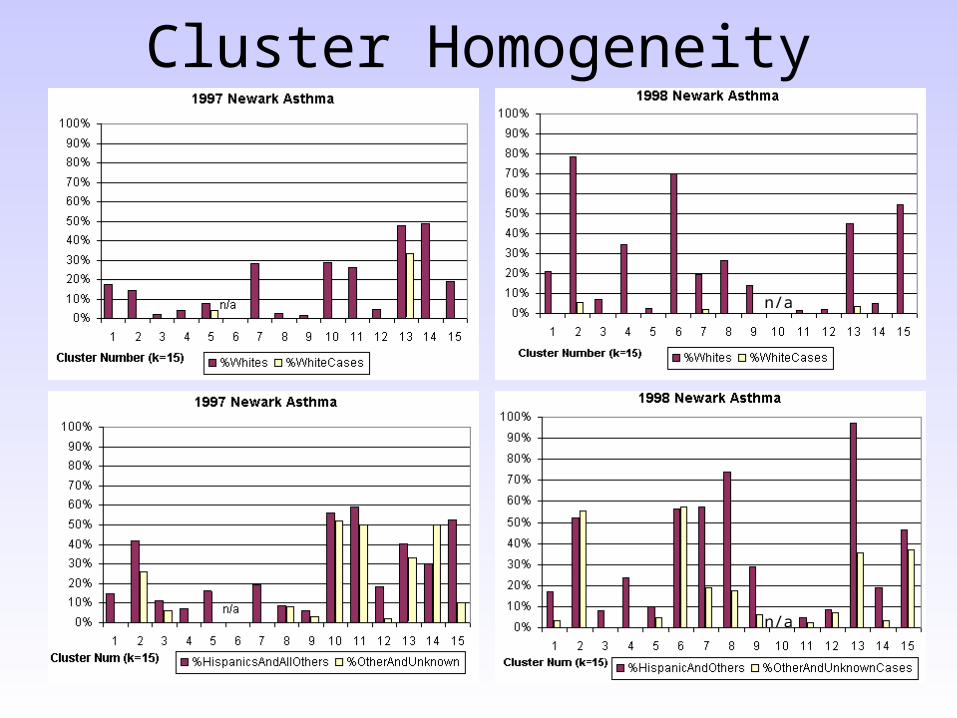
Cluster Homogeneity
n/a
n/a
Cluster Homogeneity
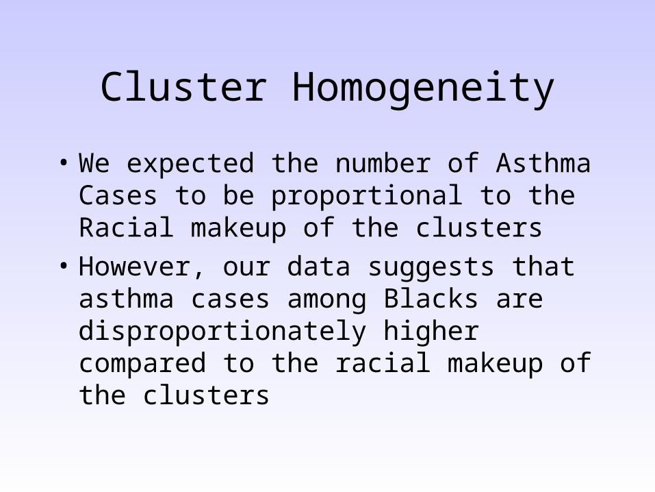
• We expected the number of Asthma Cases to be proportional to the Racial makeup of the clusters
• However, our data suggests that asthma cases among Blacks are disproportionately higher compared to the racial makeup of the clusters

Spatial analysis• Intersection of tract census data with asthma cases
• Observation of asthma cases and urban landscape texture
• Asthma cases at the street level
• Spatial relationship between diesel fume sources and asthma cases
• Spatial correlation between urban heat islands (UHI) and asthma cases.

Intersection of census tract information and asthma cases

Less than half on PAV
Half on PA
More than half on PA
Cluster Centers
1997 Cases in terms of Public Assistance

Less than half on PA
Half on PA
More than half on PA
1998 Cases in terms of Public Assistance
Cluster Centers

Landscape Texture
• “Expect to see more cases in high-density housing areas than in low-density housing areas”

1997 cases in terms of population density
Low pop. density
Medium pop. density
High pop. density
Cluster Centers

Low pop. density
Medium pop. density
High pop. density
Cluster Centers
1998 cases in terms of population density

Urban Landscape Texture
High density housing
Low density housing
South Orange Ave.

Low density housing High density housing
Urban Landscape Texture
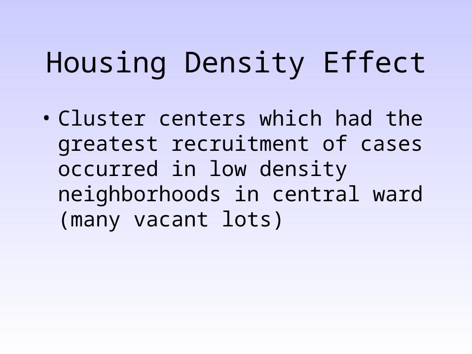
Housing Density Effect
• Cluster centers which had the greatest recruitment of cases occurred in low density neighborhoods in central ward (many vacant lots)

“Sick” Streets
• “All streets should exhibit a proportional number of cases”

Sick Streets1997 Yellow
1998 Green
H UMDNJ Hospital
S. Orange Ave.
H H
FairmountCemetery
S. 11th St.

Sick Streets1997 Yellow
1998 Green
S. Orange Ave.
Manufacturing Facility

Sick Streets
• An unusually high number of asthma cases congregate along specific streets
• We need to further investigate the impact of nearby manufacturing facilities and TRI sites

Spatial Relationship between Diesel Fumes and Asthma
• Extracted addresses from digital yellow pages of trucking facilities in Newark where trucks are likely to congregate
• X and Y coordinates were extracted for each facility
• Trucking facility locations were mapped together with asthma case locations

Diesel fume sources
Asthma case

Newark Urban Heat Islands
• Landsat 5 Thermal• Ground level ozone is
a photo chemical reaction
• Greater ozone levels are expected in hotter areas of the city

Newark Urban Heat Islands
• 1997 asthma cases correlated against urban heat islands

Newark Urban Heat Islands
• 1998 asthma cases correlated against urban heat islands

Newark Urban Heat Islands
Conclusions
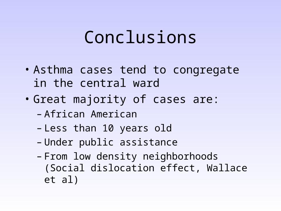
• Asthma cases tend to congregate in the central ward
• Great majority of cases are:– African American– Less than 10 years old – Under public assistance– From low density neighborhoods (Social
dislocation effect, Wallace et al)

Conclusions (continued)
• Cluster centers tend to persist in the central ward and along heavy traffic corridors.
• Some streets in mixed industrial/residential neighborhoods have an unusually high number of asthma cases
• According to our data (limited number of years and only 1 hospital) we found no significant correlation between diesel fume sources or urban heat islands and asthma

Conclusions (continued)
• The evidence suggests that the external environmental conditions we studied are not strong indicators of asthma

Future Work• Continue to build asthma database for
different years and from different hospitals in Newark
• Incorporate daily and seasonal air quality measurements from monitoring stations to the data set
• Map TRI sites in Newark
• Employ more robust statistical tools
• Investigate temporal relationships (seasons vs. admissions)

End

High-D vs. Low-D housing

Socio-economics
• “Expect asthma cases uniformly distributed across all socio-economic indicators”– Race– Income: % Public assistance– Home ownership/Rentals– Population density
• People per census tract
• People per household

Image 11

Image 12
Image 13

Image 15

Image 16
Windrose