Embed Size (px)
Citation preview
Archaeological Geophysics – a quick lookMagnetics, Radar, and Resistivity
www.umt.edu/geosciences
Steve SheriffProfessor of GeophysicsUniversity of Montana – Missoulawww.umt.edu/geosciences
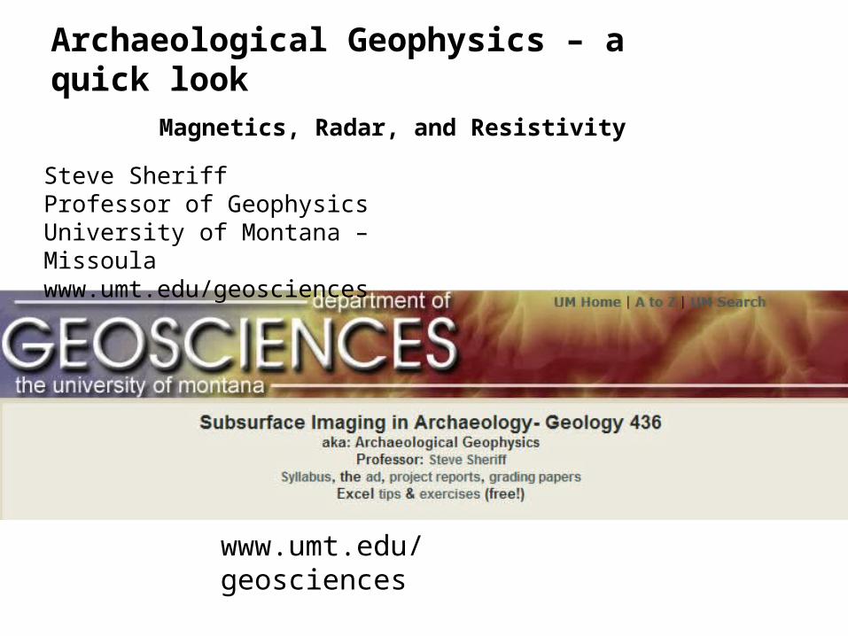
Bar magnetic and iron filings Earth’s magnetic field
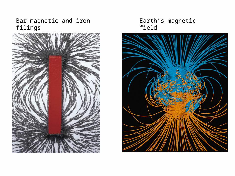
Total Field Magnetics
Magnetics exploits changes in subsurface magnetic properties:
• measure subtle changes in Earth’s magnetic field at the surface
• map those changes
• Interpret the results
The best all round tool for archaeological investigation
Use for large area
Use other tools on smaller areas outlined by magnetic anomalies
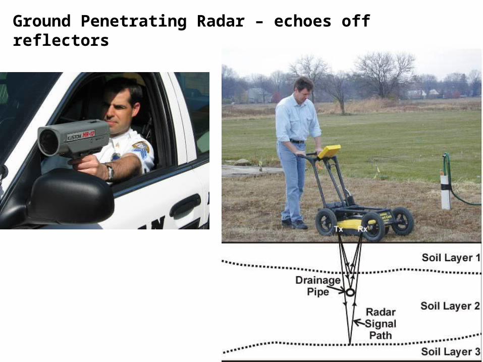
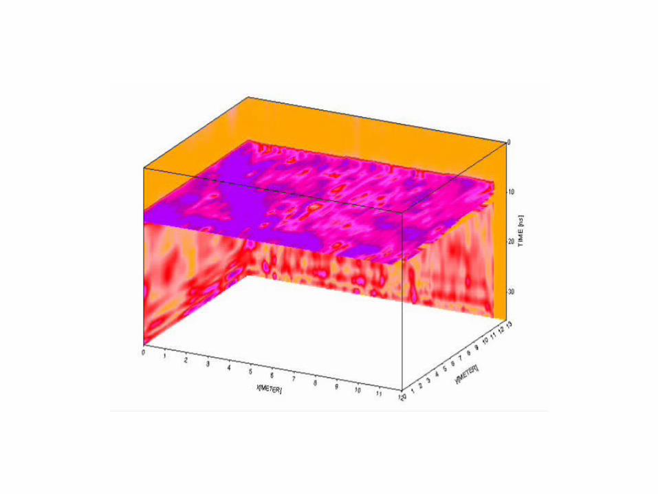
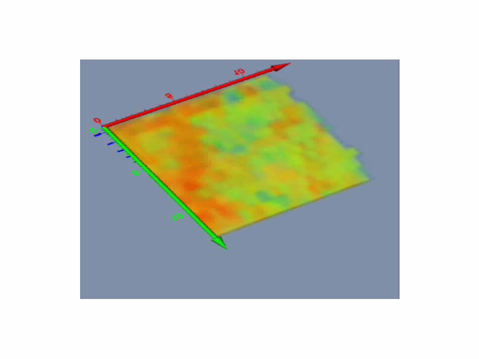
Ground Penetrating Radar – echoes off reflectors
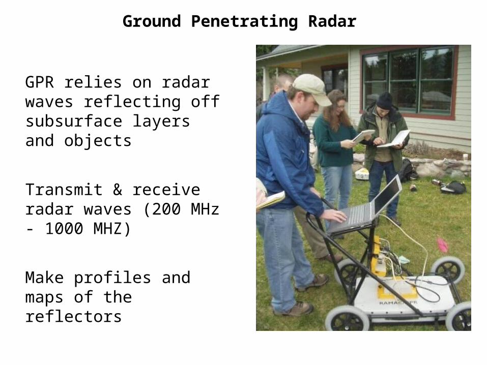
Ground Penetrating Radar
GPR relies on radar waves reflecting off subsurface layers and objects
Transmit & receive radar waves (200 MHz - 1000 MHZ)
Make profiles and maps of the reflectors
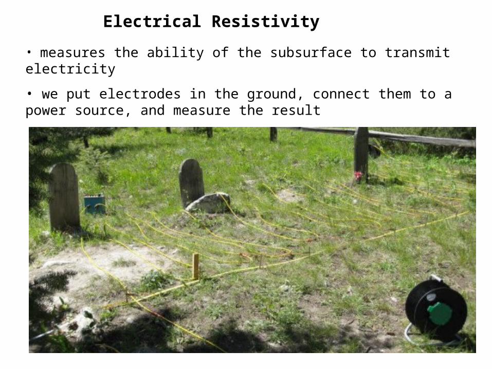
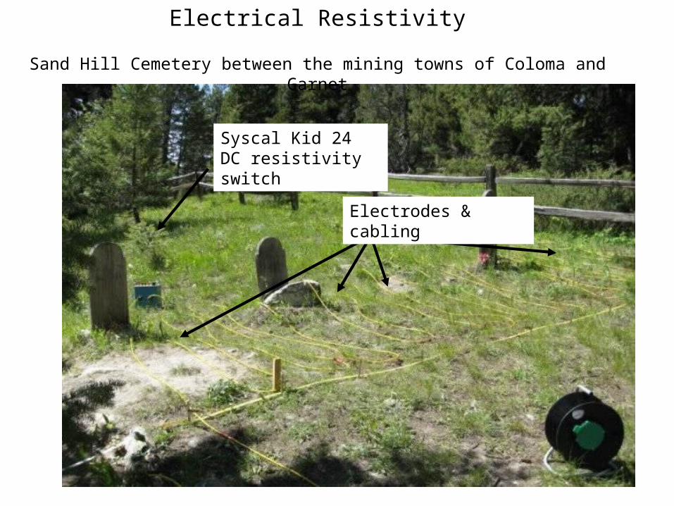
Electrical Resistivity
• measures the ability of the subsurface to transmit electricity
• we put electrodes in the ground, connect them to a power source, and measure the result
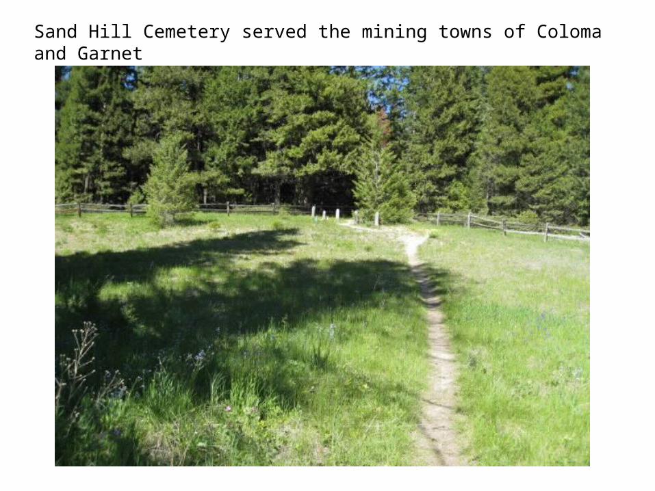
Sand Hill Cemetery served the mining towns of Coloma and Garnet
Electrical Resistivity
Sand Hill Cemetery between the mining towns of Coloma and Garnet
Syscal Kid 24 DC resistivity switch
Electrodes & cabling
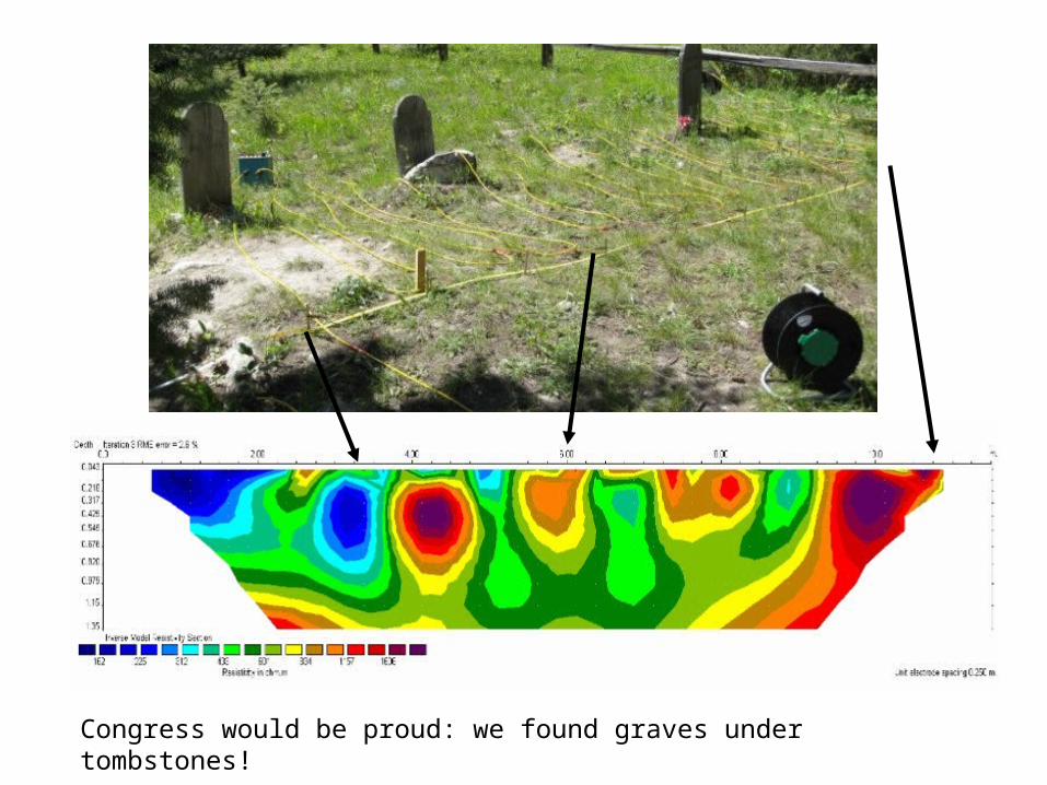
Congress would be proud: we found graves under tombstones!
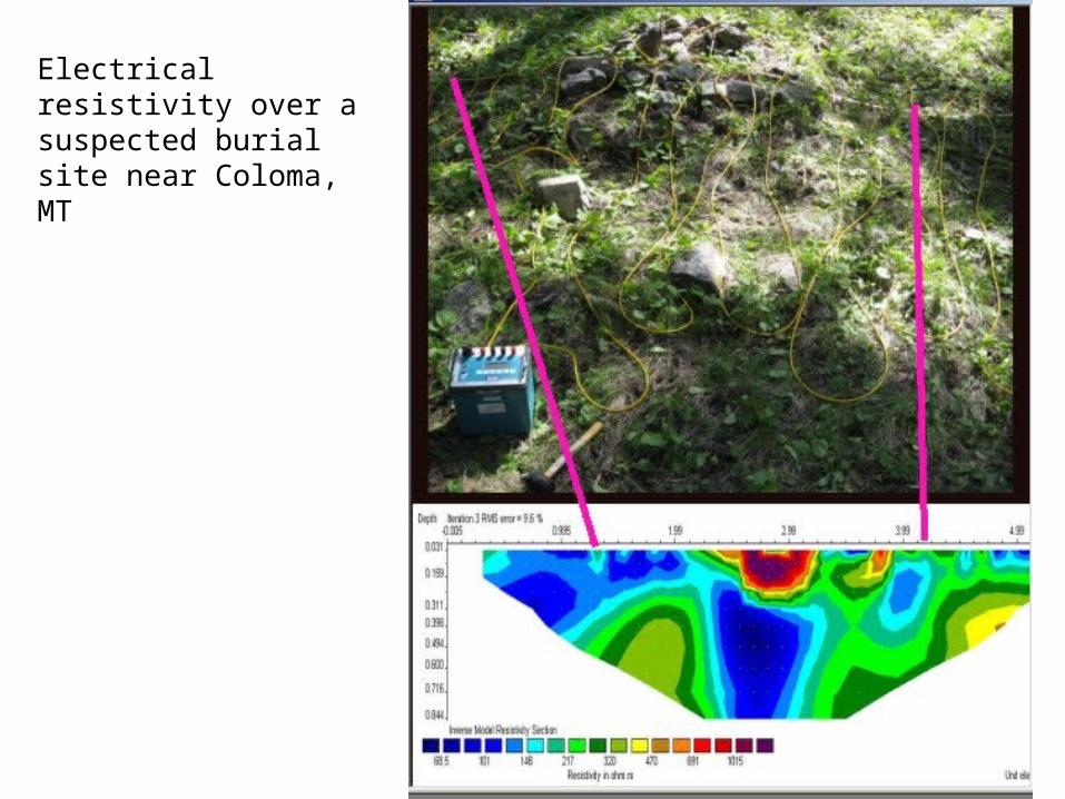
Electrical resistivity over a suspected burial site near Coloma, MT
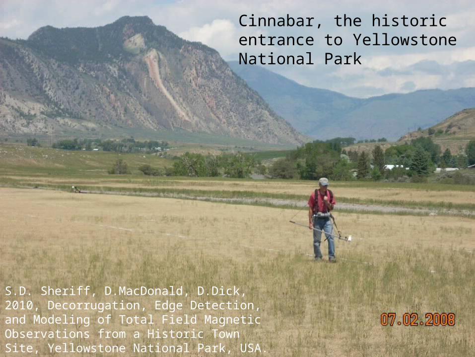
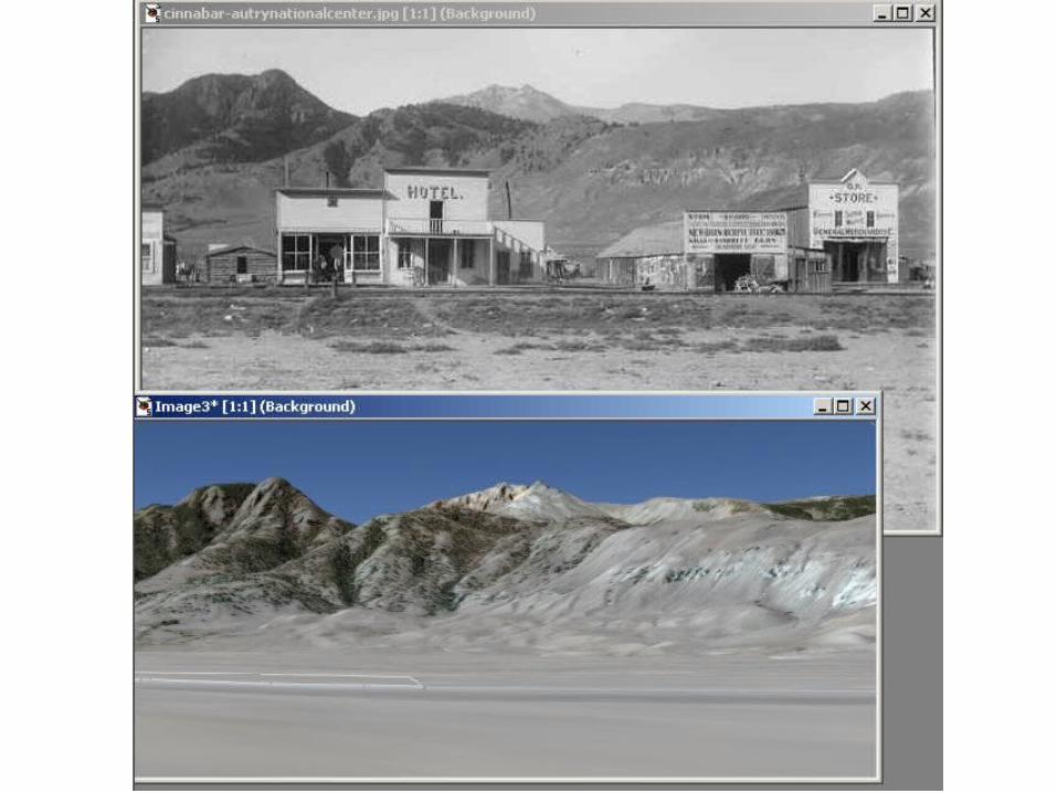
Cinnabar, the historic entrance to Yellowstone National Park
S.D. Sheriff, D.MacDonald, D.Dick, 2010, Decorrugation, Edge Detection, and Modeling of Total Field Magnetic Observations from a Historic Town Site, Yellowstone National Park, USA. Archaeological Prospection, V. 17, p.49-60.
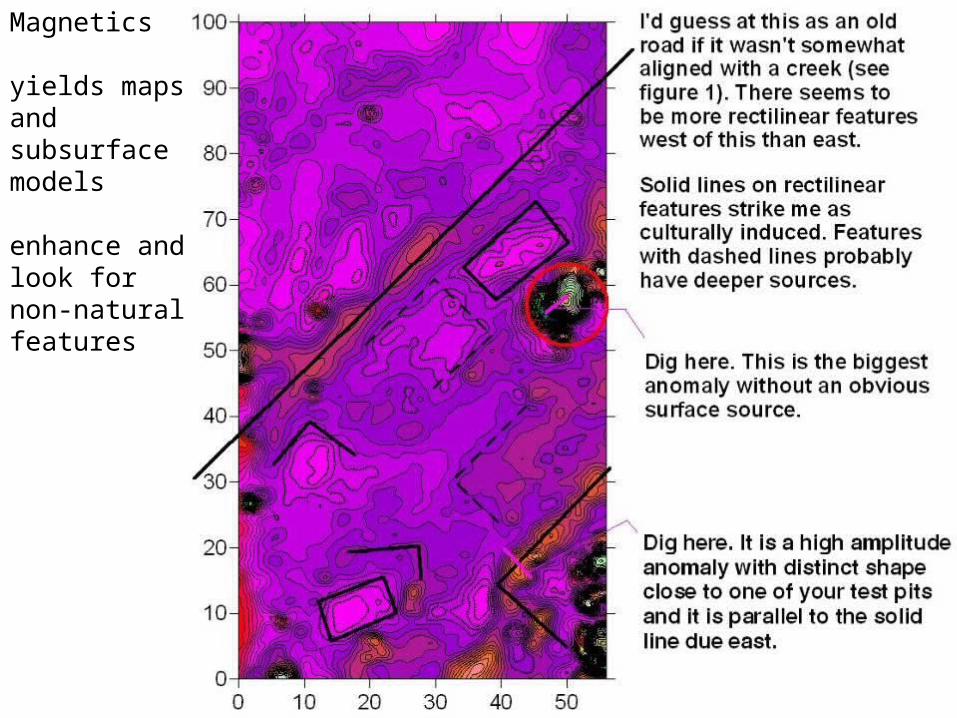
Magnetics
yields maps and subsurface models
enhance and look for non-natural features
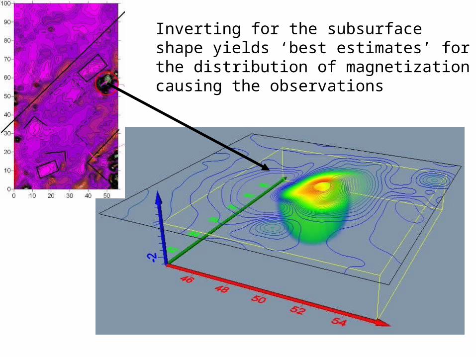
Inverting for the subsurface shape yields ‘best estimates’ for the distribution of magnetization causing the observations
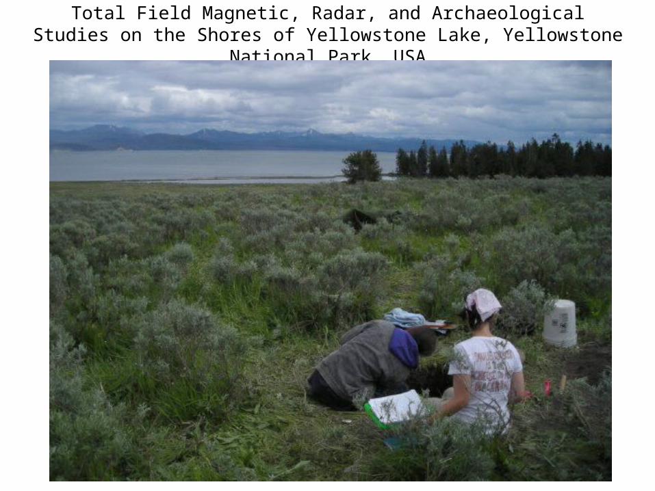
Total Field Magnetic, Radar, and Archaeological Studies on the Shores of Yellowstone Lake, Yellowstone National Park, USA
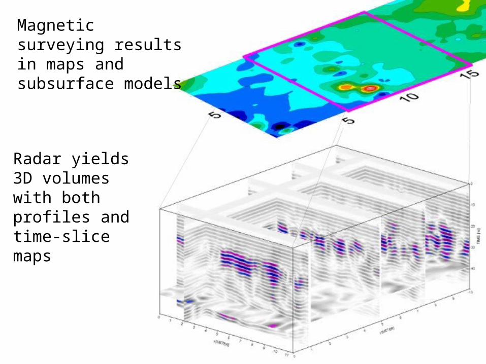
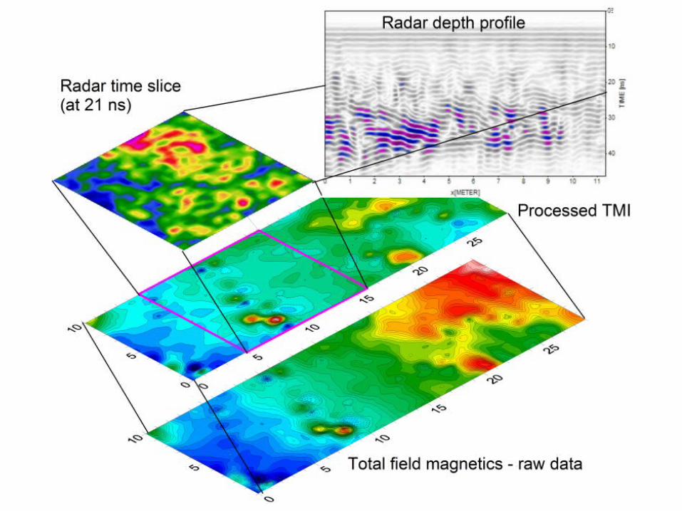
Magnetic surveying results in maps and subsurface models
Radar yields 3D volumes with both profiles and time-slice maps

• TU 1 yielded a fire hearth dating to 1720±40 B.P. (Beta-265305), as well as abundant evidence of obsidian stone tool manufacture • TUs 2, 3, and 4 yielded only boulders. We excavated these, despite each individual anomaly having the character of a boulder with remanent magnetization, because their concentration and alignment was promising. In a nearby area with similar analysis one such buried boulder turned out to be a long-term bench for flaking and other cultural activities.
• At about 0.8 meters below ground surface, TU 5 contained a fire hearth dating to 2920±40 B.P. (Beta-265306).
• TU 6 contained a rock concentration (likely a hearth) dated at 3,100±40 B.P. (Beta-265307).
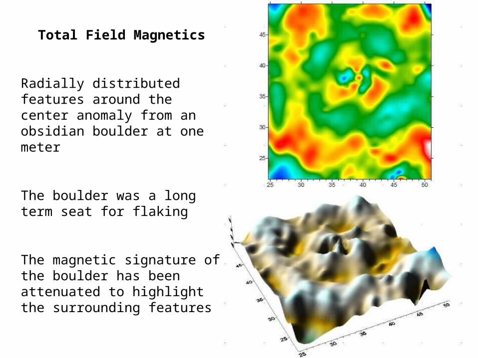
Total Field Magnetics
Radially distributed features around the center anomaly from an obsidian boulder at one meter
The boulder was a long term seat for flaking
The magnetic signature of the boulder has been attenuated to highlight the surrounding features
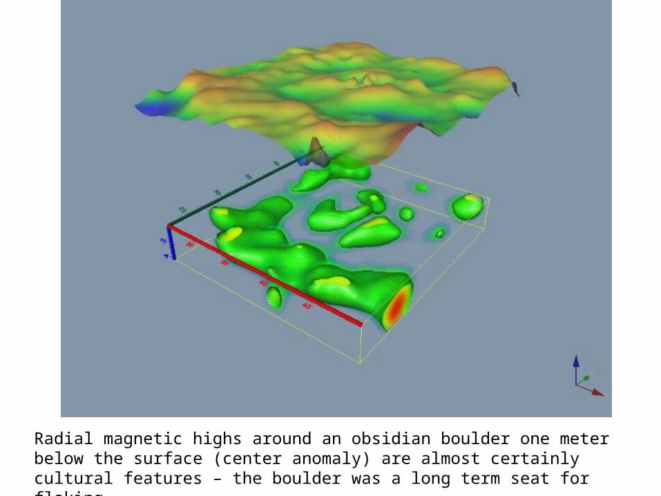
Radial magnetic highs around an obsidian boulder one meter below the surface (center anomaly) are almost certainly cultural features – the boulder was a long term seat for flaking
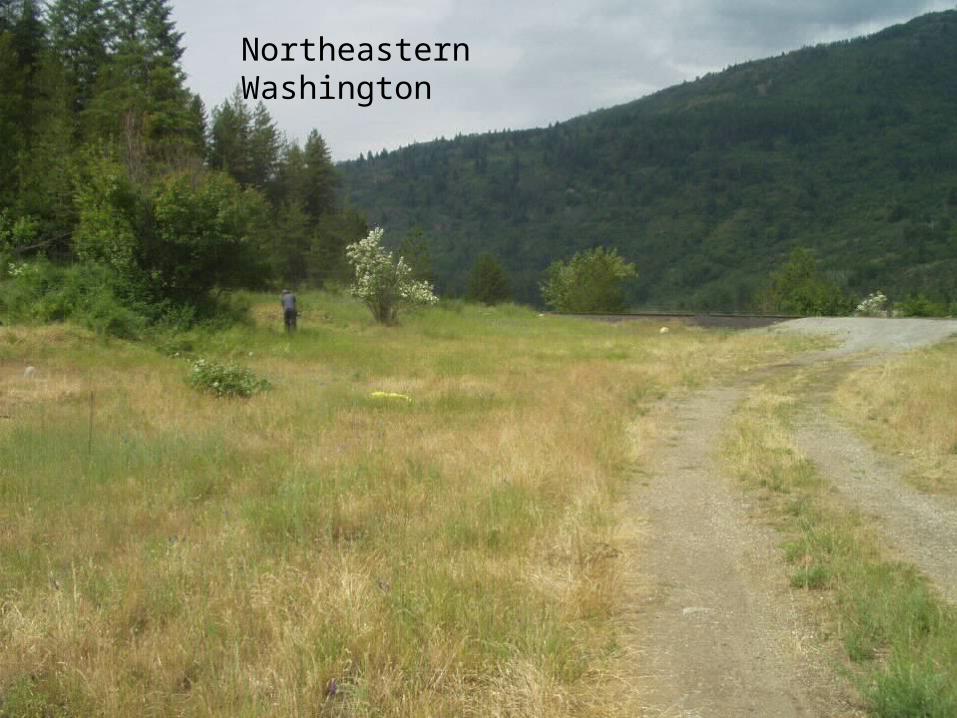
Northeastern Washington
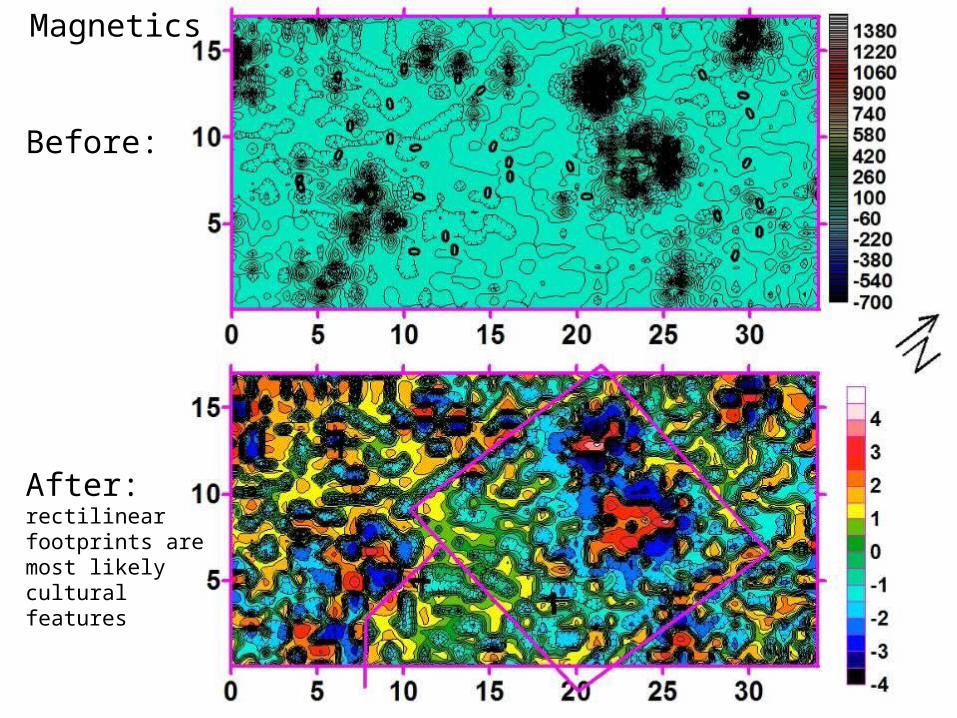
Magnetics
Before:
After:rectilinear footprints are most likely cultural features
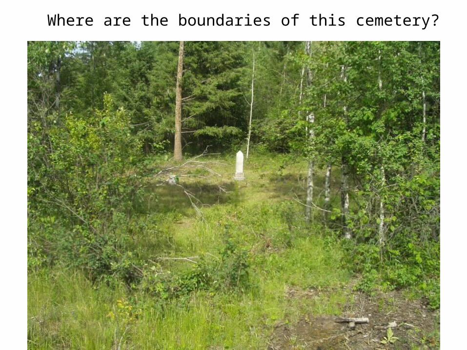
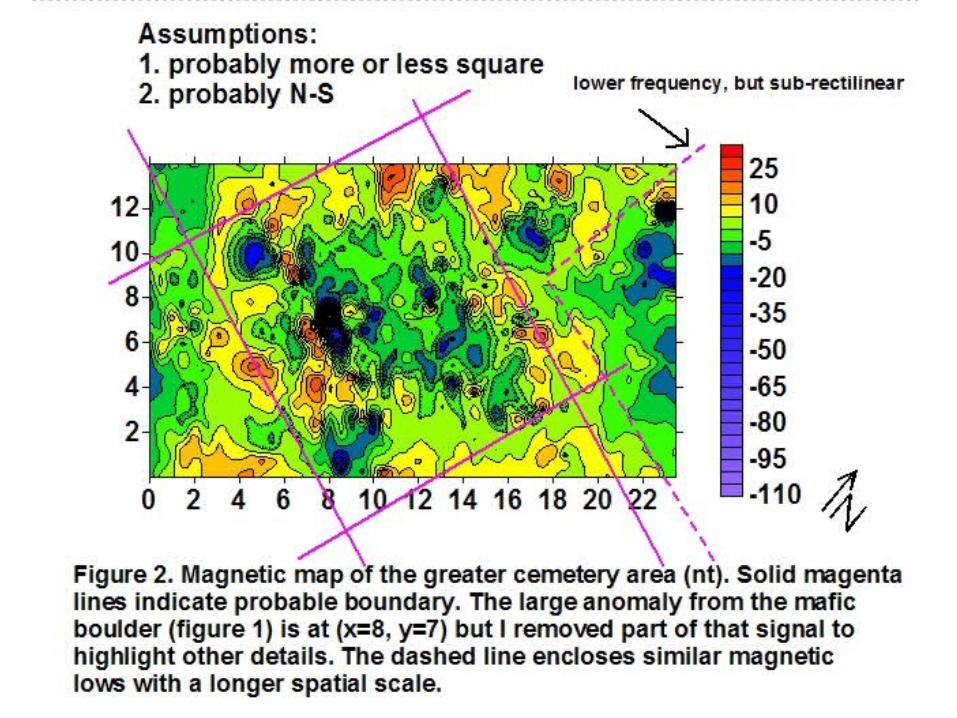
Where are the boundaries of this cemetery?
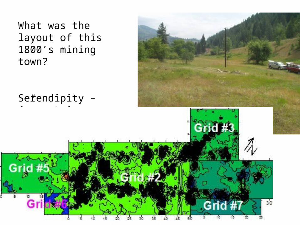
What was the layout of this 1800’s mining town?
Serendipity – 4” cast iron pipe!
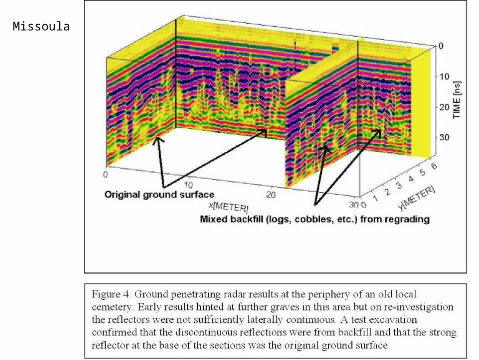
Missoula
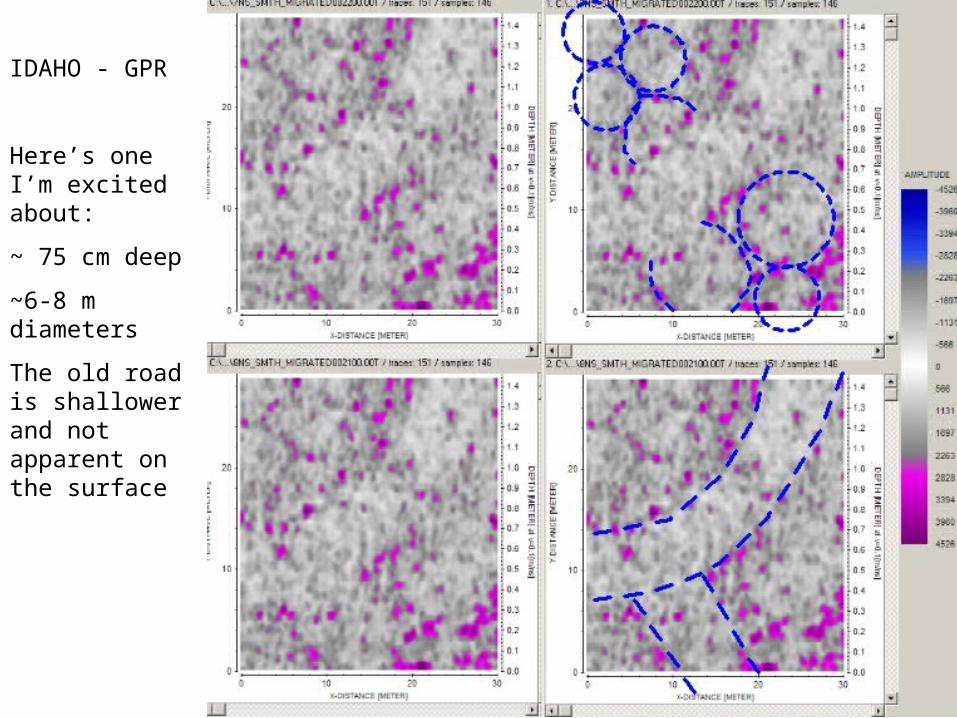
IDAHO - GPR
Here’s one I’m excited about:
~ 75 cm deep
~6-8 m diameters
The old road is shallower and not apparent on the surface
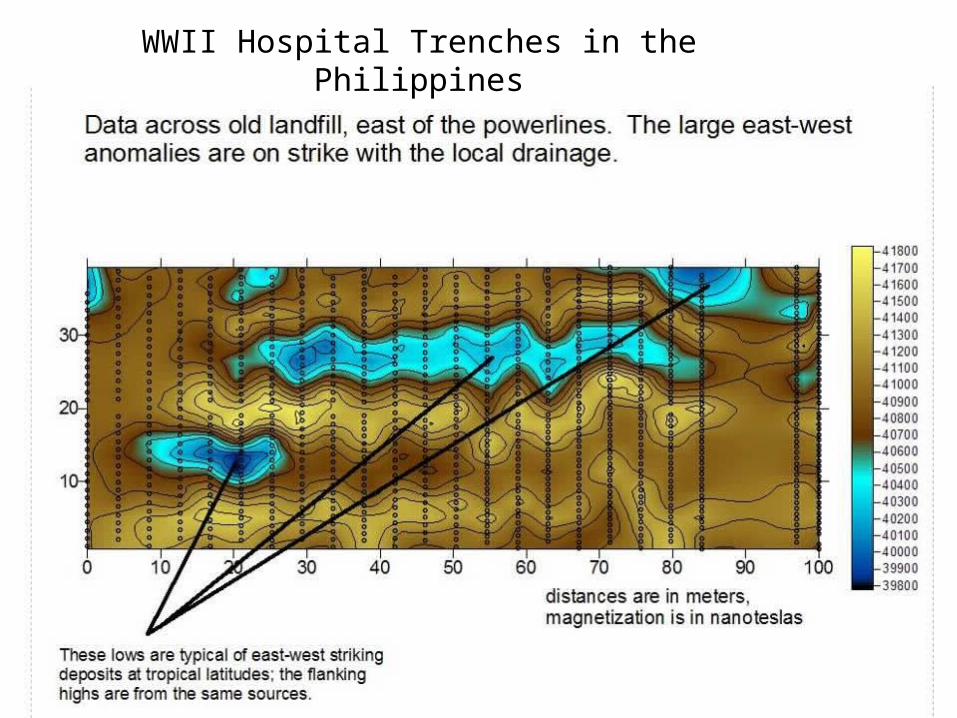
WWII Hospital Trenches in the Philippines

S.D. Sheriff, D.MacDonald, D.Dick, 2010, Decorrugation, Edge Detection, and Modeling of Total Field Magnetic Observations from a Historic Town Site, Yellowstone National Park, USA. Archaeological Prospection, V. 17, p.49-60.
S.D. Sheriff, D.MacDonald, 2010, Total Field Magnetic, Radar, and Archaeological Studies on the Shores of Yellowstone Lake, Yellowstone National Park, USA. International Society of Archaeological Prospection (ISAP), v. 23, April 2010, p.3-5.
S.D. Sheriff, 2010, Matched Filter Separation of Magnetic Anomalies Caused by Scattered Surface Debris at Archaeological Sites. Near Surface Geophysics, v. 8, #2, p. 145-150.
S.D. Sheriff and P.T. Doughty, 2009, Magnetic and Radar Investigations of Site 45CH703, Tumwater Canyon, Washington. Report (not refereed) prepared for Archaeological and historical Services, Eastern Washington University, 46 p.
S.D. Sheriff and G. Carlson, 2009, Total Field Magnetometry and Ground Penetrating Radar Investigations at Kelly Forks Work Center, Clearwater National Forest, Idaho. Report (not refereed) prepared for USFS Clearwater National Forest, 32 p.
S.D. Sheriff, 2009, Archaeological Scale Magnetic and Radar Investigations at Northwestern Yellowstone Lake, Yellowstone national Park, USA. Report (not refereed) presented to Yellowstone National Park Center for Resources, Yellowstone National Park, USA, 41 p.
S.D. Sheriff, 2009, Archaeological Scale magnetic, Electrical, and Radar Investigations at Boundary, Washington, LPOE, USA. Report (not refereed) prepared for Historical Research Associates, Inc., Missoula, MT, USA, 46 p.
Schmidt, R., Crossland, N., Ballas, M., McKeown, and Sheriff, S., 2008, Remote Sensing of Pineview Park Missoula Montana. Student Project Report (not refereed) completed for Missoula Parks & Recreation Department, Missoula, Montana.