Embed Size (px)
Citation preview
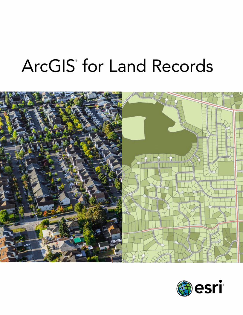
ArcGIS®
for Land Records

Purpose Built and ConfigurableGone are the days of building a custom real-time land records operation from scratch. Such systems are costly to maintain, lack capability, and don’t integrate well with other business systems. ArcGIS® for Land Records is a complete, interoperable, and purpose-built solution for local government land records management, valuation analysis, citizen engagement and field operations management. It’s built on a modern, commercial off-the-shelf (COTS) web geographic information system (web GIS) platform with open, standards-based capabilities to meet your land records and assessment challenges.
Using ArcGIS, assessors and their staff gain access to powerful data, templates, and tools that improve land records management and value analysis throughout the department.
ArcGIS for Land Records helps assessors
• Reduce costs and minimize appeals.
• Find untaxed improvements.
• Improve data quality.
• Enhance citizen engagement with government.
• Increase efficiency.
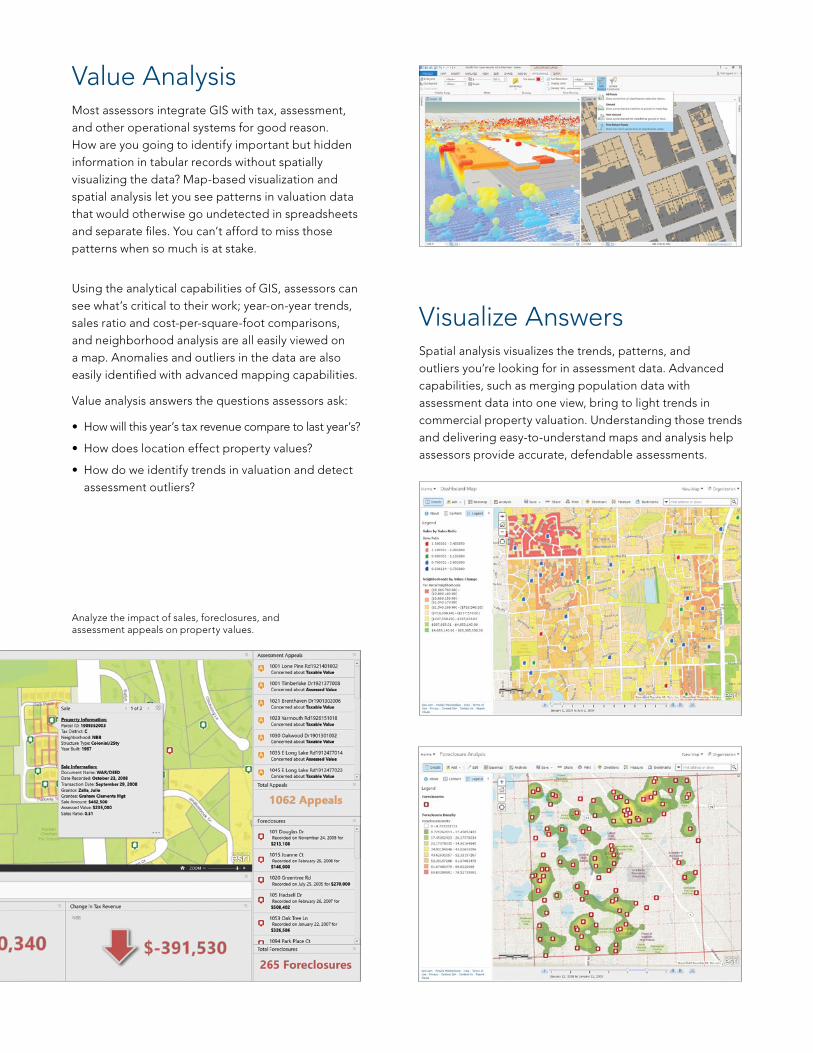
Value AnalysisMost assessors integrate GIS with tax, assessment, and other operational systems for good reason. How are you going to identify important but hidden information in tabular records without spatially visualizing the data? Map-based visualization and spatial analysis let you see patterns in valuation data that would otherwise go undetected in spreadsheets and separate files. You can’t afford to miss those patterns when so much is at stake.
Using the analytical capabilities of GIS, assessors can see what’s critical to their work; year-on-year trends, sales ratio and cost-per-square-foot comparisons, and neighborhood analysis are all easily viewed on a map. Anomalies and outliers in the data are also easily identified with advanced mapping capabilities.
Value analysis answers the questions assessors ask:
• How will this year’s tax revenue compare to last year’s?
• How does location effect property values?
• How do we identify trends in valuation and detect assessment outliers?
Visualize AnswersSpatial analysis visualizes the trends, patterns, and outliers you’re looking for in assessment data. Advanced capabilities, such as merging population data with assessment data into one view, bring to light trends in commercial property valuation. Understanding those trends and delivering easy-to-understand maps and analysis help assessors provide accurate, defendable assessments.
Analyze the impact of sales, foreclosures, and assessment appeals on property values.
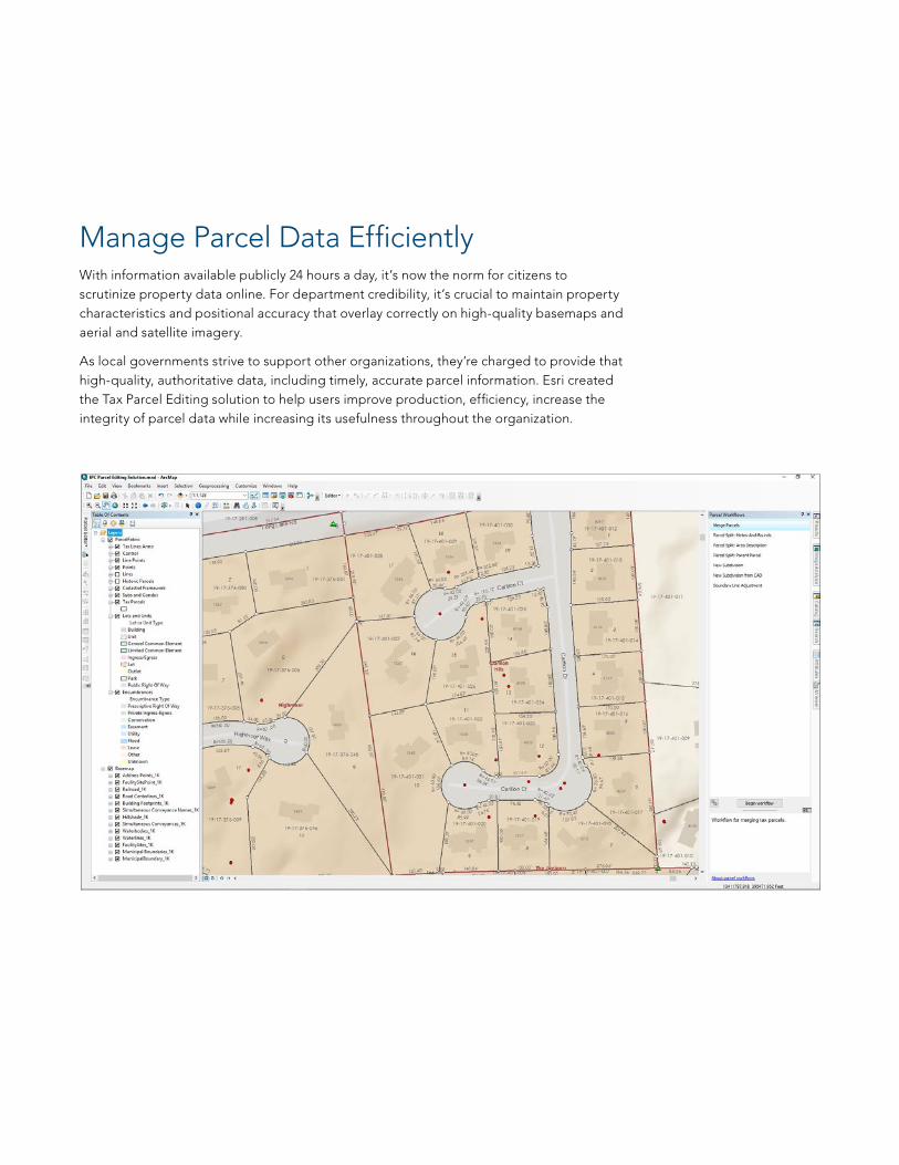
Manage Parcel Data EfficientlyWith information available publicly 24 hours a day, it’s now the norm for citizens to scrutinize property data online. For department credibility, it’s crucial to maintain property characteristics and positional accuracy that overlay correctly on high-quality basemaps and aerial and satellite imagery.
As local governments strive to support other organizations, they’re charged to provide that high-quality, authoritative data, including timely, accurate parcel information. Esri created the Tax Parcel Editing solution to help users improve production, efficiency, increase the integrity of parcel data while increasing its usefulness throughout the organization.
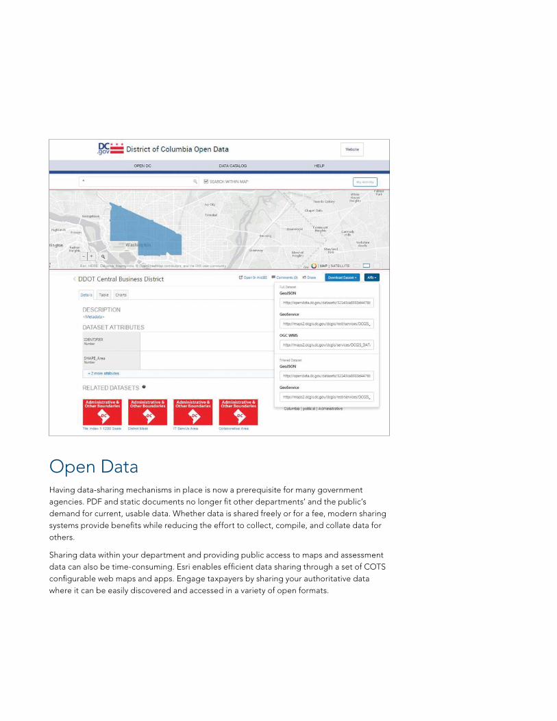
Open DataHaving data-sharing mechanisms in place is now a prerequisite for many government agencies. PDF and static documents no longer fit other departments’ and the public’s demand for current, usable data. Whether data is shared freely or for a fee, modern sharing systems provide benefits while reducing the effort to collect, compile, and collate data for others.
Sharing data within your department and providing public access to maps and assessment data can also be time-consuming. Esri enables efficient data sharing through a set of COTS configurable web maps and apps. Engage taxpayers by sharing your authoritative data where it can be easily discovered and accessed in a variety of open formats.

Assessment OperationsIncrease the efficiency of field workflows with ArcGIS. In many assessment jurisdictions, more than 60 percent of an assessor’s time is spent in the field. Assign fieldwork based on location and assessor abilities, accurately estimate field effort, route from one property to another, and understand the status of work on an easy-to-configure dashboard. Use your own data, interface with other apps and web maps, and work while disconnected from the office to exceed previous maximum efficiency levels.
All-in-One ViewWhether you want to see yearly value changes, estimate the resources needed for the appeals backlog, or understand the status of work in the field, the ArcGIS platform provides dashboards to meet these needs with maps, graphs, charts, and tabular web reports. These dashboards can be easily configured to answer specific questions. Whether you’re in the office or the field, you have access to your data and analysis on any device, anywhere, anytime.

ArcGIS for Land Records COTS apps speed department work and increase efficiency where you need it most. All solutions work in ArcGIS and are supported and automatically updated with the Esri platform. With Esri templates and ready-made apps, you’ll never need to manually update or develop custom applications again. The apps in these solutions can easily be configured to meet your day-to-day needs, so you can focus on getting work done rather than on costly custom programming.
The following solutions are quickly activated and easily deployed:
Tax Parcel Editing—Maintain an accurate inventory of tax parcels, subdivisions, lots, encumbrances, and related survey framework
Deed Drafter—Quickly enter metes-and-bounds descriptions, check for closure errors, and share data with others
ArcGIS® Maps for Office—Use the Microsoft Office suite to create maps to analyze sales ratios, neighborhood boundaries, and other assessment data
Tax Parcel Viewer—Access parcel information and related assessment data on smartphones, tablets, and desktop computers
Collector for ArcGIS—Put mapping into the hands of your field workforce to improve the accuracy and currency of your spatial data and make more timely and informed decisions
Workforce for ArcGIS—Assign field assessment inspections, route your assessors, and know the status of work at all times
Navigator for ArcGIS—Schedule and route your assessors with turn-by-turn directions and work seamlessly with Collector and Workforce
Open Data—Quickly deploy public-facing websites to share your live authoritative data in a variety of open formats
Map Books—Easily produce tax map books
Inventory Real Property—Collect delinquent property tax information when visiting with owners
Floodplain Inquiry—Allow constituents to locate parcels impacted by Federal Emergency Management Agency (FEMA) floodplain boundaries
Photo Survey—Collect and use street-level imagery
Assessment Appeal—Citizens can file an online request for the review of a property assessment
Public Comment—Let citizens comment on land-use cases and capital projects
Maintain Survey Framework—Maintain an accurate inventory of control points and related Public Land Survey System (PLSS) data
Solutions That Solve Real Problems

Printed in USA
Contact Esri
380 New York Street Redlands, California 92373-8100 usa
1 800 447 9778 t 909 793 2853 f 909 793 5953 [email protected] esri.com
Offices worldwide esri.com/locations
Esri inspires and enables people to positively impact their future through a deeper, geographic understanding of the changing world around them.
Governments, industry leaders, academics, and nongovernmental
organizations trust us to connect them with the analytic knowledge
they need to make the critical decisions that shape the planet. For
more than 40 years, Esri has cultivated collaborative relationships
with partners who share our commitment to solving earth’s most
pressing challenges with geographic expertise and rational resolve.
Today, we believe that geography is at the heart of a more resilient
and sustainable future. Creating responsible products and solutions
drives our passion for improving quality of life everywhere.
Copyright © 2016 Esri. All rights reserved. Esri, the Esri globe logo, ArcGIS, @esri.com, and esri.com are trademarks, service marks, or registered marks of Esri in the United States, the European Community, or certain other jurisdictions. Other companies and products or services mentioned herein may be trademarks, service marks, or registered marks of their respective mark owners.
150075G73178