Embed Size (px)
Citation preview

Aqua Alta
Oceanographic Tower 12 30'N 45 18'51E
Institute of Marine Sciences National Research Council !
www.ve.ismar.cnr.it/piattaforma/!

January 1970!
March 1970!
November 1966!

Venice High Tides!a �Glocal� issue!
Venice, CNR Institute, 1 december 2008!
Couple of days ago!
Acqua Alta networks!
• LTER (Long Term Ecological Research)!
!
• Jerico (FP7 infrastr.)!
• Aeronet (NASA)!

Evolution in 40 years!
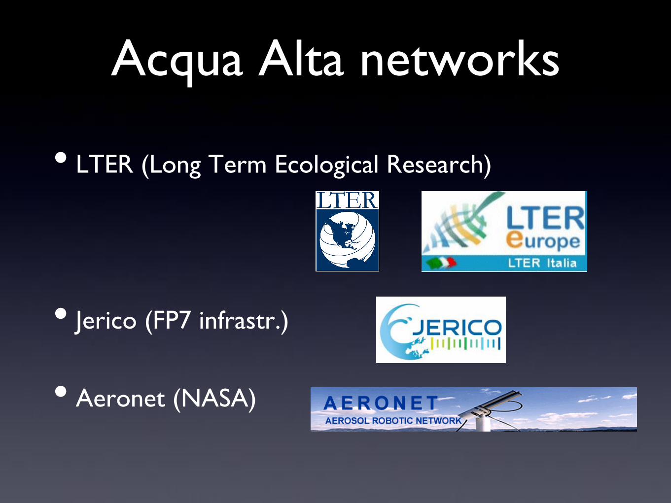
First Floor!
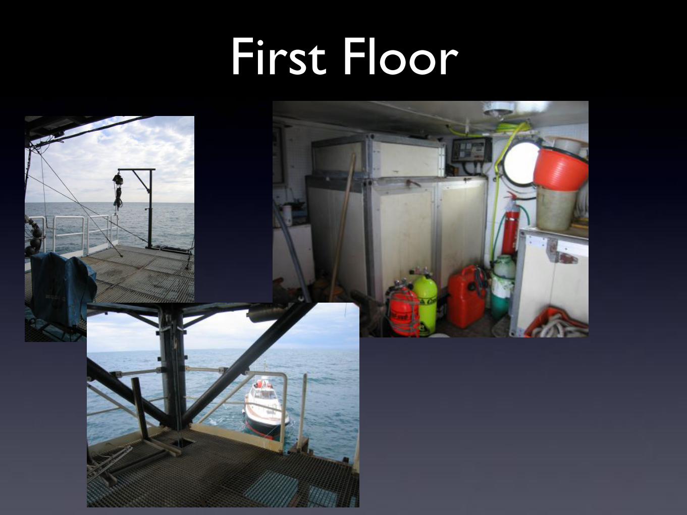
Second floor!

Third floor "(terrazza)!
mast! instrum. jrc! meteo !City of Venice!

Running activities (CNR)!
• Meteo, waves, tide!• meteo, waves, ! ! !ADCP AWAC marea (sens. Radar) !
• Waves cinematics ! ! !Hi-res 3D cameras!
• Models validation!
• Fish population ! !underwater webcams!
• Pollution! ! ! !Deposimeters, SQM (Sky Quality Meter)!
• Hydrology!• Water column ! ! ! !3 Seabird microcat SBE 37, 10 SBE 56 !
• CO2 ! ! ! ! !CO2 Contros HydroC ! ! ! !!

Running activities (external)!• City of Venice!
• meteo!
• tidal level!
• ISPRA (Nat. Env. Agency)!
• meteo!
• tidal level!
• JRC!
• bio optical, remote sensing sea truth!
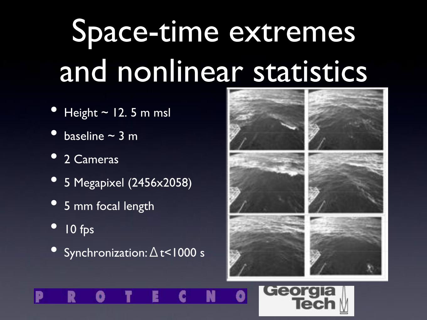
Space-time extremes and nonlinear statistics!
• Height ~ 12. 5 m msl !
• baseline ~ 3 m !
• 2 Cameras !
• 5 Megapixel (2456x2058) !
• 5 mm focal length !
• 10 fps!
• Synchronization:Δt<1000 s!

Intrument maintenance!
Even if technology helps a lot of hand work is required!
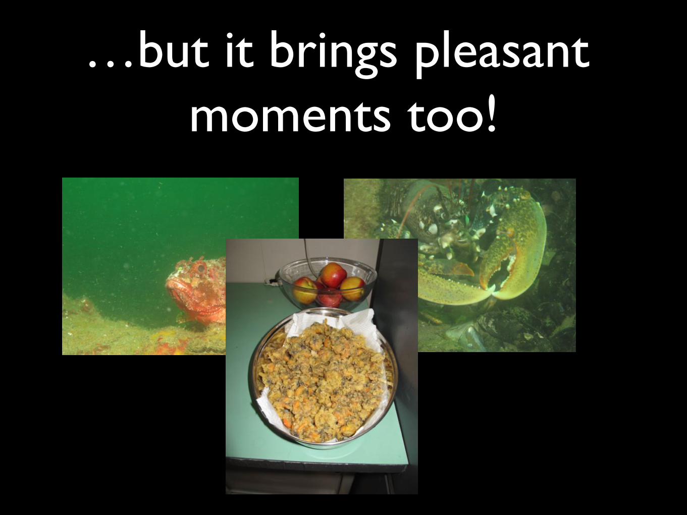
…but it brings pleasant moments too!!

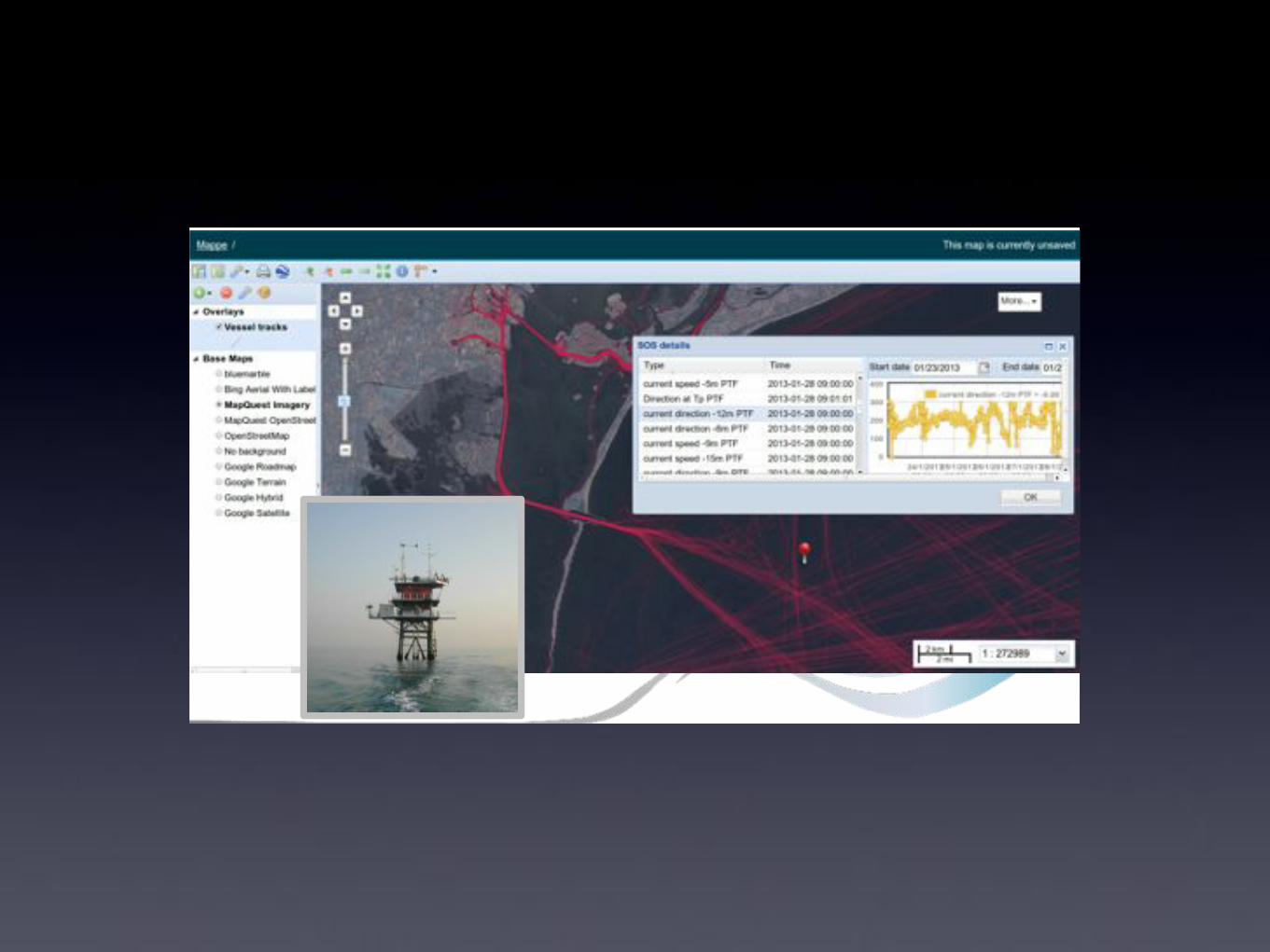
REAL real-time!
Two redundant link!
• Link 17 Ghz PTF-Torre S. Nicolo-new building arsenale!
!
• Link 5 Ghz PTF-San Camillo-old building sette martiri!
!
!

ICTP collaboration!

QoS?!
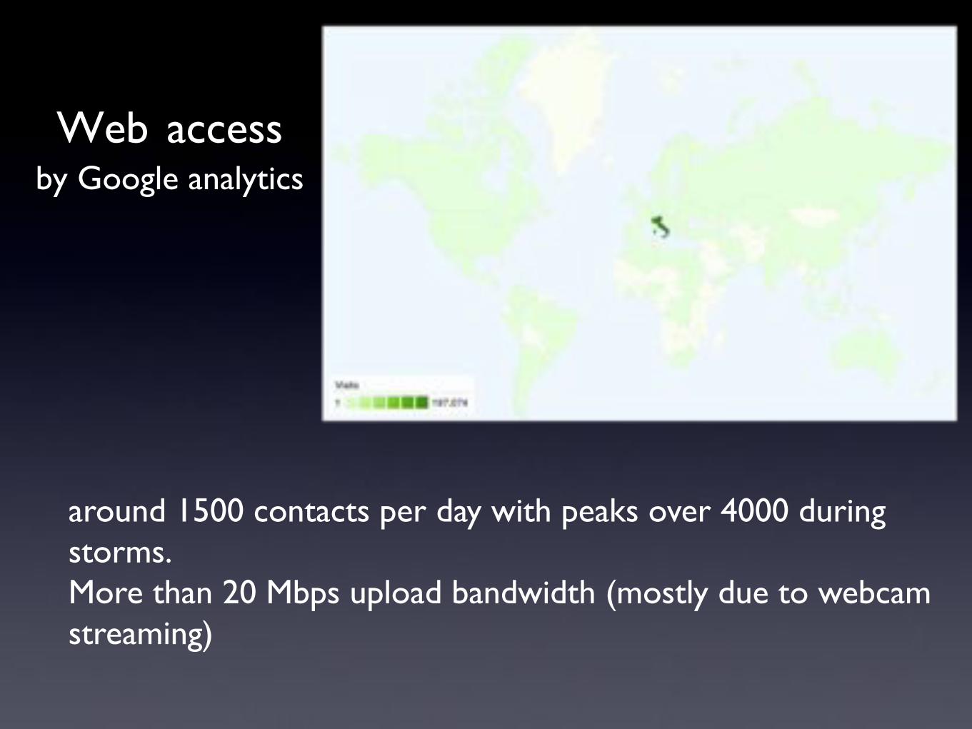
Web access"by Google analytics!
around 1500 contacts per day with peaks over 4000 during storms.!More than 20 Mbps upload bandwidth (mostly due to webcam streaming)!
!!!!!
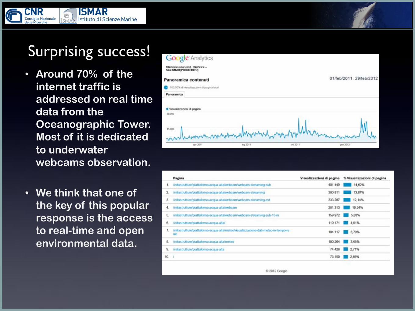
Surprising success!!• Around 70% of the
internet traffic is addressed on real time data from the Oceanographic Tower. Most of it is dedicated to underwater webcams observation.
• We think that one of the key of this popular response is the access to real-time and open environmental data.

!!!!!
Visual'Census'of'the'pelagic'ichthyofauna'using'an'underwater'webcam'in'the'Gulf'of'Venice'(Acqua'
Alta'Oceanographic'Tower)''
Sp.'degree'thesis'in'ConservaBon'of'the'Environment,'Science'Faculty,'Parma'University'
Tommaso'Marzolini!

!!!!!
Pros
- reliability, accuracy, low cost - Minimally invasive;
- Very long temporal series potential;
- Good objectivity and statistical indipendence of
samples.
Cons
- Some limitations in low transparency situations;
- Reduced observing field; - Spatial limits; - Tigmotropic influence of the
structure.

!!!!!
Seasonal and diel variations

!!!!!
febbraio marzo aprile maggio giugno luglio agosto settembre ottobre-10
0
10
20
30
40
50
60
70
80
90
n pe
sci
Media Media±ES Media±DS
demersal species
febbraio marzo aprile maggio giugno luglio agosto settembre ottobre-4
-2
0
2
4
6
8
10
12
14
16
n pe
sci
Media Media±ES Media±DS
Pelagic species

!!!!!
Toward a citizen science approach
• Why? Who? When?
• Fish populatios are mainly studied by fishing activity data (often not reliable)
• Antropic induced environmental changes often involves fish populations (overfishing, meridionalization, jellyfish swarms)
• We’ll look not only at long-term variations in fish population but also at critical phenomena(jelly fish swarms, mucillage events)
• Enlarge the chance to observe in-situ marine life
• We need long-term reources, people need to get involved
• The preliminary target will be primary school
• Starting this summer

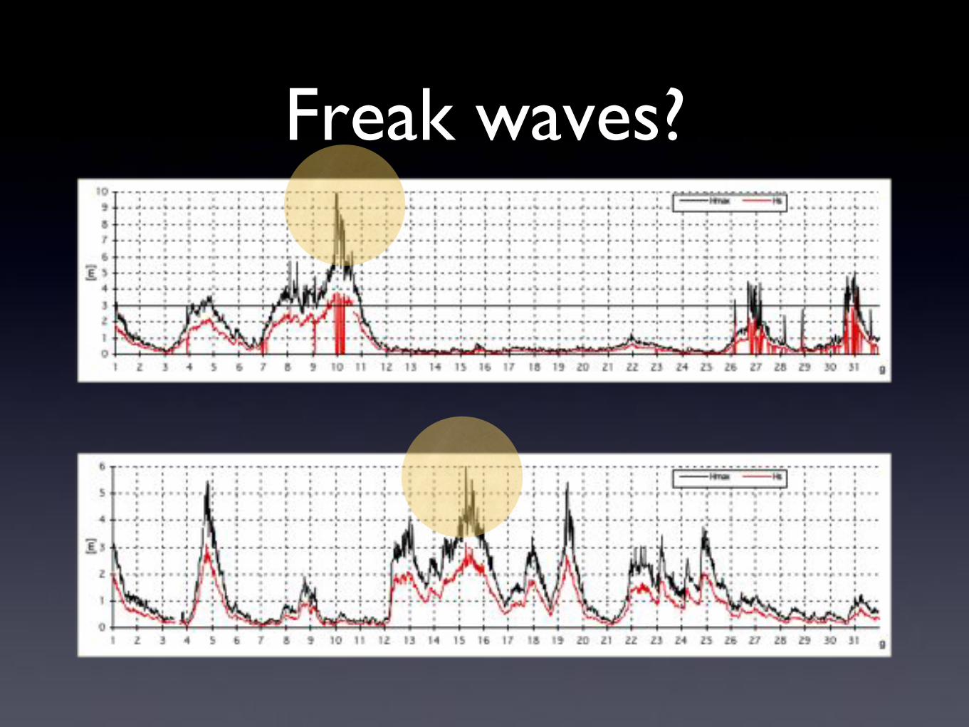
Freak waves?!

Webcams helps!

!!!!!
!"#$%&'()$"&*+,-%#'!"&*-."
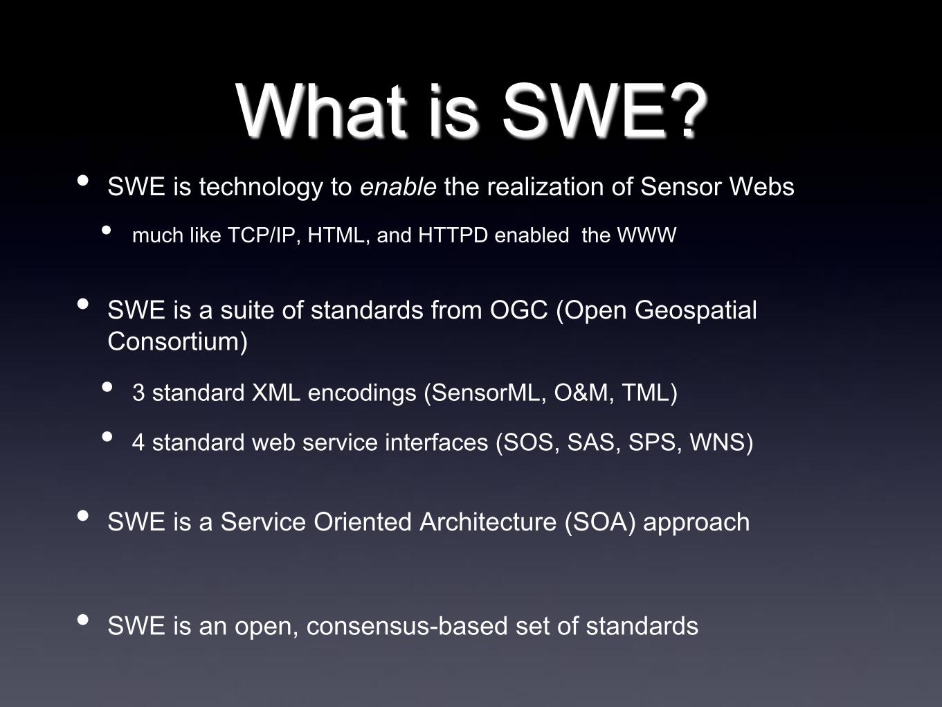
What is SWE? • SWE is technology to enable the realization of Sensor Webs
• much like TCP/IP, HTML, and HTTPD enabled the WWW
• SWE is a suite of standards from OGC (Open Geospatial Consortium)
• 3 standard XML encodings (SensorML, O&M, TML)
• 4 standard web service interfaces (SOS, SAS, SPS, WNS)
• SWE is a Service Oriented Architecture (SOA) approach
• SWE is an open, consensus-based set of standards
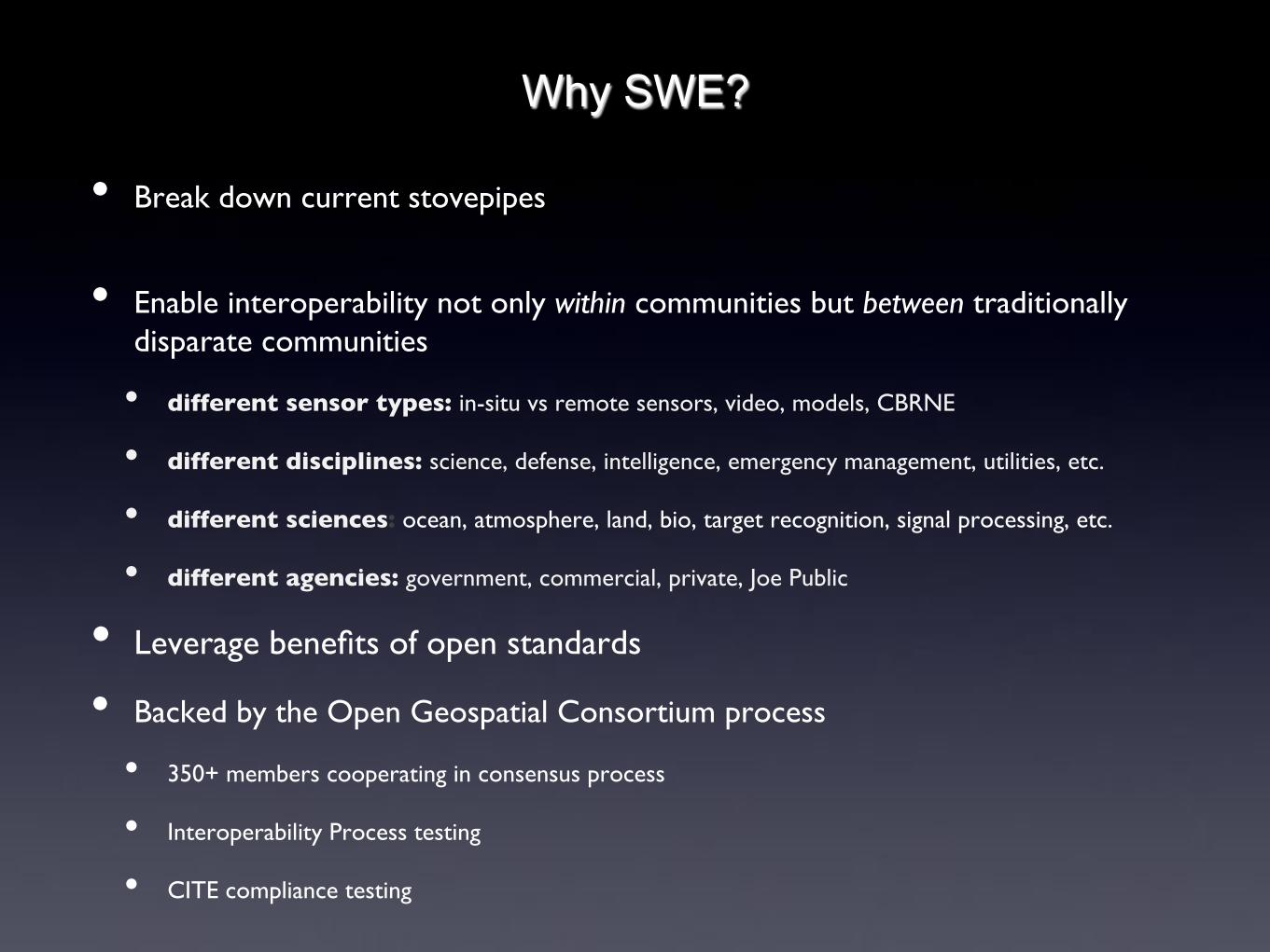
Why SWE?
• Break down current stovepipes"!
• Enable interoperability not only within communities but between traditionally disparate communities!
• different sensor types: in-situ vs remote sensors, video, models, CBRNE!
• different disciplines: science, defense, intelligence, emergency management, utilities, etc.!
• different sciences: ocean, atmosphere, land, bio, target recognition, signal processing, etc.!
• different agencies: government, commercial, private, Joe Public!
• Leverage benefits of open standards!
• Backed by the Open Geospatial Consortium process!
• 350+ members cooperating in consensus process!
• Interoperability Process testing!
• CITE compliance testing!

What are the benefits of SWE?
• Sensor system agnostic - Virtually any sensor or model system can be supported
• Net-Centric, SOA-based
• Distributed architecture allows independent development of services but enables on-the-fly connectivity between resources
• Semantically tied
• Relies on online dictionaries and ontologies for semantics
• Key to interoperability
• Traceability
• observation lineage
• quality of measurement support


![New Aqua Key Aqua Facts - Earth Observing System · 2017. 1. 26. · Earth Science Reference Handbook [ Missions: Aqua ] 73 Aqua Summary Aqua is a major international Earth Science](https://img.dokumen.tips/doc/110x75/604176e56ec9bf22204cde4b/new-aqua-key-aqua-facts-earth-observing-system-2017-1-26-earth-science-reference.jpg)