Embed Size (px)
Citation preview

Applications of Digital Archival
Geographic Information in K12 Education
Department of Geography , National Taiwan University jinn-Guey Lay
2009PNC 2009/10/08
1
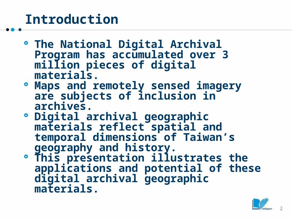
Introduction
The National Digital Archival Program has accumulated over 3 million pieces of digital materials.
Maps and remotely sensed imagery are subjects of inclusion in archives.
Digital archival geographic materials reflect spatial and temporal dimensions of Taiwan’s geography and history.
This presentation illustrates the applications and potential of these digital archival geographic materials.
2
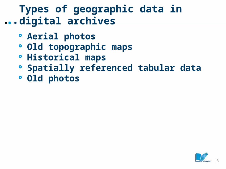
Types of geographic data in digital archives
Aerial photos Old topographic maps Historical maps Spatially referenced tabular data Old photos
3
Role of GIS in K-12 geography
Communication tool– GIS as a visualization media
Mapping and analytical tool– for solving geographic problems
Data management tool– GIS provides a platform that facilitates the int
egration and manipulation of geographic data.
4

Benefits of using GIS in K-12
Improving the quality of learning in the classroom,
Widening the scope of teaching, Helping children transit into an information-
rich society, For educators seeking new technologies and
concepts to enhance the quality of education, GIS appears very promising in both conceptual and practical aspects.
5

Problems of GIS application
Training of teachers, Curriculum integration, Purchase of equipment, Provision of curriculum materials.
6

Actions taken by the ASPA Program
For better application of these materials in K12 education, the Academic and Social Promotions and Application (ASPA) Program Office conducted the following tasks:
Compiling geographic data: converting analog materials to digital data and integrating them to geographic datasets.
Development of course modules: revealing the geographic and historical meanings of places;
Holding workshops: introducing the above mentioned modules to teachers all over Taiwan.
7
Data compilation
Scanning Geo-referencing Digitizing Associating spatial and attribute data
8

Map-making
Hundreds of maps have been made over these two years.
Subjects of maps include: environmental change, population, land use, and names of places.
The application of these maps in K-12 education has been identified.
9

Development of sample modules
Studying curriculum standards and identifying topics for GIS inclusion
Design of course outline Technology should be used in classrooms to
support the primary objectives of learning Too much content and too little time The purpose and approach of introducing GIS
into geography courses need to be clearly defined
10
Sample Result: Revitalizing Old Maps
Using the digitizing and geo-referencing functions of GIS, an old map of 1874AD was converted into digital map layers.
These map layers can be flexibly integrated with modern geographic data and reveals the history and geography of Taiwan.
11

Digital version of historical map
12

Enthinic group and place names
13
Application of GIS: Urban Growth of Taipei
Old maps ranged from 1895 to date were scanned and digitized so that the urban sprawl of Taipei can be identified and analyzed.
14

Result and discussion
Hundreds of geography and history teachers have participated workshops of DAGI applications.
The value and potential of DAGI are highly regarded by these teachers.
Further promotion of DAGI applications to general teachers are desired.
Approaches and channels for dissemination need to be identified.
Web Map Service (such as Google Map/Google Earth) possess great potential for future promotion.
15

Conclusion
Introducing DAGI to K-12 will greatly enhance the value of digital archive program.
Application of DAGI in K-12 education is very promising.
Future promotion requires the collaboration of experts from GIS, pedagogy, and other relevant fields
16

17