Embed Size (px)
Citation preview

FIG Congress 2010 Facing the Challenges – Building the Capacity
Sydney, Australia, 11‐16 April 2010 1
Tracing Tramways Application of GIS in Transport Archaeology
Alexandra LYLE and Samsung LIM, Australia
Sydney’s Trams

FIG Congress 2010 Facing the Challenges – Building the Capacity
Sydney, Australia, 11‐16 April 2010 2
Sydney’s Trams
Popularity of motor vehicle & a declining network post WWII resulted in the final tram line being closed in 1961
Today
ULU ‐ Utility Location Unit RTA ‐ Roads and Traffic Authority of New South Wales
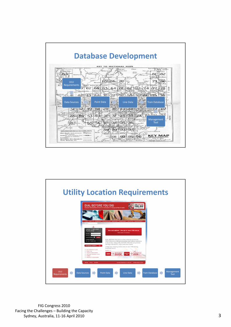
FIG Congress 2010 Facing the Challenges – Building the Capacity
Sydney, Australia, 11‐16 April 2010 3
Database Development
ULU Requirements
Data Sources Point Data Line Data Tram Database
Management Tool
Utility Location Requirements
ULU Requirements
Data Sources Point Data Line Data Tram Database Management
Tool

FIG Congress 2010 Facing the Challenges – Building the Capacity
Sydney, Australia, 11‐16 April 2010 4
Data Sources
ULU Requirements
Data Sources Point Data Line Data Tram Database Management
Tool
Tram Map 1937 Train Map 2010
Data Sources
ULU Requirements
Data Sources Point Data Line Data Tram Database Management
Tool
1921 Sydney Tramways Map Contains: • Side Street Data • Tram Stop Locations • Tram Depot Locations
Circular Quay
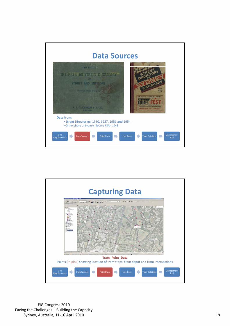
FIG Congress 2010 Facing the Challenges – Building the Capacity
Sydney, Australia, 11‐16 April 2010 5
Data Sources
ULU Requirements
Data Sources Point Data Line Data Tram Database Management
Tool
Data from: • Street Directories: 1930, 1937, 1951 and 1954 • Ortho photo of Sydney (Source RTA): 1943
Capturing Data
ULU Requirements
Data Sources Point Data Line Data Tram Database Management
Tool
Tram_Point_Data Points (in pink) showing location of tram stops, tram depot and tram intersections
FIG Congress 2010 Facing the Challenges – Building the Capacity
Sydney, Australia, 11‐16 April 2010 6
Capturing Data
ULU Requirements
Data Sources Point Data Line Data Tram Database Management
Tool
Tram_Line_Data Connecting of points from Tram_Point_Data
Capturing Data
ULU Requirements
Data Sources Point Data Line Data Tram Database Management
Tool
1943 Road and Bridge network Location: Fivedock, Sydney
Final Adjusted Data
1943 2009
1943 Road and Bridge, 2009 Ortho Photo
1943 & 2009
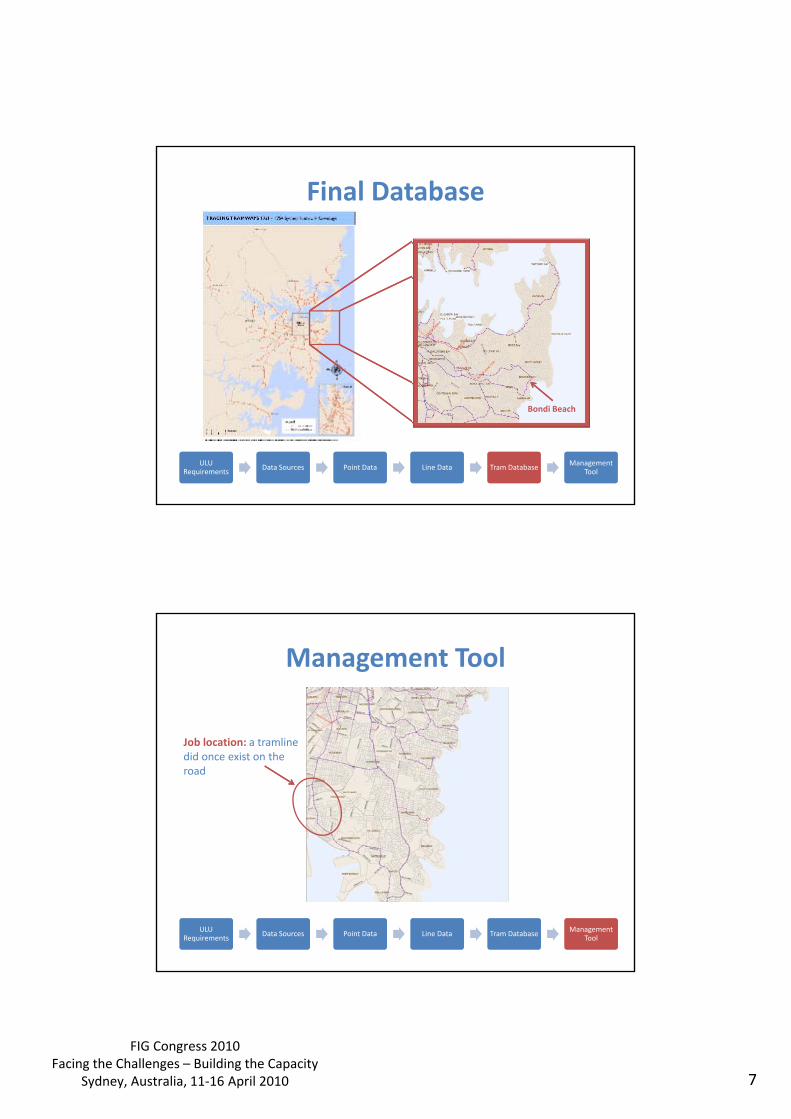
FIG Congress 2010 Facing the Challenges – Building the Capacity
Sydney, Australia, 11‐16 April 2010 7
Final Database
ULU Requirements
Data Sources Point Data Line Data Tram Database Management
Tool
Bondi Beach
Management Tool
ULU Requirements
Data Sources Point Data Line Data Tram Database Management
Tool
Job location: a tramline did once exist on the road
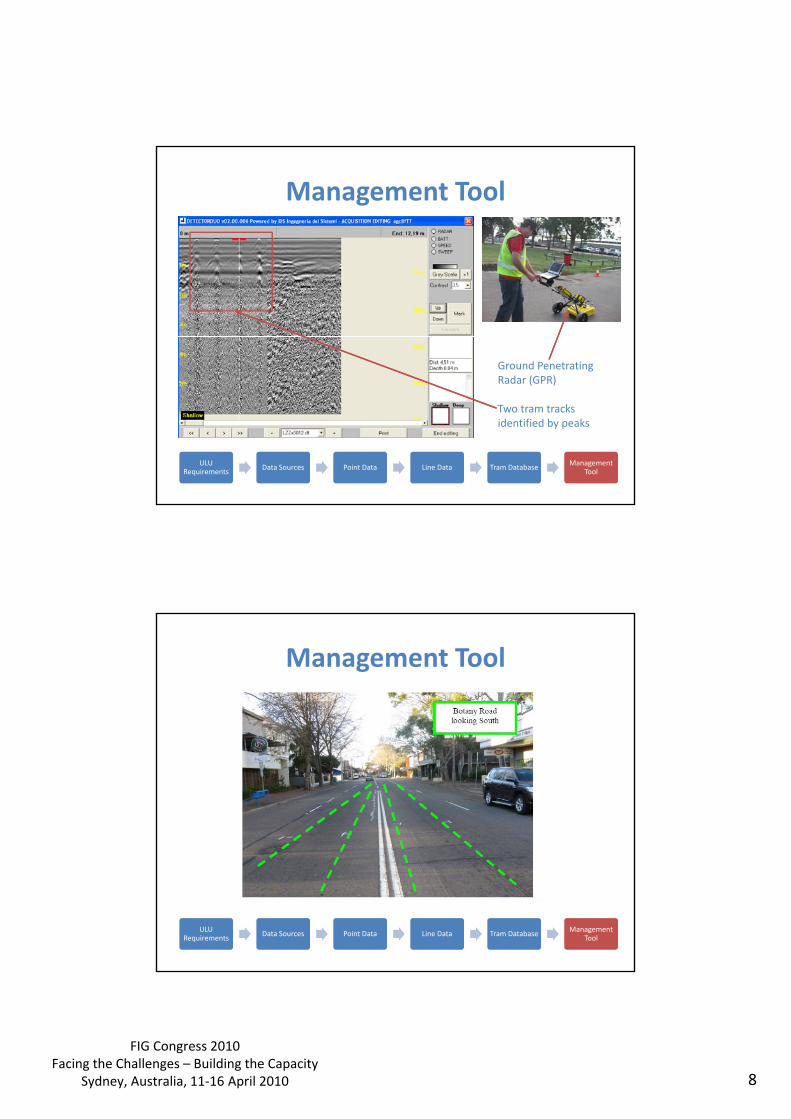
FIG Congress 2010 Facing the Challenges – Building the Capacity
Sydney, Australia, 11‐16 April 2010 8
Management Tool
ULU Requirements
Data Sources Point Data Line Data Tram Database Management
Tool
Ground Penetrating Radar (GPR) Two tram tracks identified by peaks
Management Tool
ULU Requirements
Data Sources Point Data Line Data Tram Database Management
Tool

FIG Congress 2010 Facing the Challenges – Building the Capacity
Sydney, Australia, 11‐16 April 2010 9
Management Tool
ULU Requirements
Data Sources Point Data Line Data Tram Database Management
Tool
Management Tool
ULU Requirements
Data Sources Point Data Line Data Tram Database Management
Tool
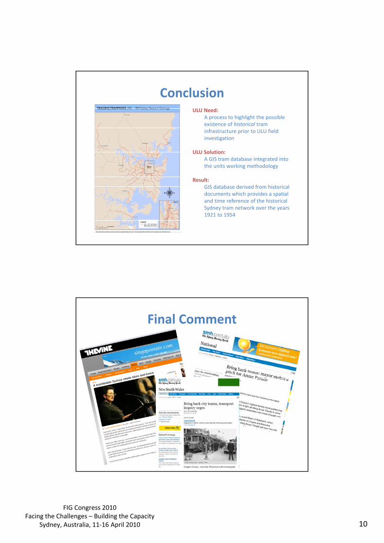
FIG Congress 2010 Facing the Challenges – Building the Capacity
Sydney, Australia, 11‐16 April 2010 10
Conclusion ULU Need:
A process to highlight the possible existence of historical tram infrastructure prior to ULU field investigation
ULU Solution: A GIS tram database integrated into the units working methodology
Result: GIS database derived from historical documents which provides a spatial and time reference of the historical Sydney tram network over the years 1921 to 1954
Final Comment