Embed Size (px)
Citation preview

APPENDIX F MAP FOLIO

!(
!(
!(
!(
!(
!(
!(
!(
!(
!(
!(
!.
£¤395
¬«020
¬«292
¬«025
¬«031
¬«291
¬«231
¬«020
PendOreille
Upper LakeRooseveltKettle
Colville
Middle LakeRoosevelt
LittleSpokane
LowerSpokane
Lower LakeRoosevelt
SpokaneCounty
StevensCounty
PendOreilleCounty
LincolnCounty
FerryCounty
Addy
Chewelah
Clayton
Colville
DeerPark
Hunters
KettleFalls
Suncrest
Marcus
Northport
Springdale
Map 1Regional ContextStevens County Partnership Shoreline Master ProgramStevens County, WA
0 4 82Miles
Legend!. County Seat!( Populated Place
City BoundariesHighwaysLAMIRDSUrban Growth AreaNational BoundaryStevens County BoundaryOther County BoundarySMA JurisdictionHydrologic Unit
´
¥¦84
¥¦5
¥¦205
¥¦90
¥¦182
¥¦405
¥¦82
Docu
men
t Pat
h: V
:\GI
SCoo
rdin
ator
\Pro
ject
s\Sh
oreL
ine2
015\
Map1
.mxd
NOTES:1. This information is to be used forplanning purposes only. Data is displayed as is and without anyguarantee of accuracy or completeness.2. Aerial image from USDA NAIP(2013).3. Hydrologic unit data acquired fromUSGS and NCRS.
esho
emak
erm
affe
i8/6
/201
53:3
7:22
PM

!(
!(
!(
!(
Big SheepCreek
DeepCreek
LittleSheepCreek
MillCreek
North ForkDeep Creek
OnionCreek
RockyCreek
South ForkDeep Creek
KettleRiver
ColumbiaRiver
PhalonLake
PepoonLake
CoffinLake
CedarLakeNorth
LakeHeritage
GilletteLake
TwinLakes
MissionLake
SherryLake
ThomasLake
BlackLake
PierreLake
CedarLakeSouth
WilliamsLake
DeepLake
RyanLake
PerkinsLake
Leo Lake
DillyLake
EchoLake
R 1
SR 1a
SR 1a
SR 1b
SR 1c
SR 1a
SR 1b
SR 1a
SR 1b
R 1
R 1SR 1a
SR 1b SR 1c
SR 1a
SR 1b
SR 1c
SR 1d
SR 1e
SR 1f
R 1
SR 1jSR 1l
SR 2a
SR 2c
SR 2dSR 2e
SR2f
SR3a
SR 3b
R 1
SR2b
I
I I
I
II
I
I
I I
I
II
I I
I
IIII
II
I
I
II I
II
I
I
II
I
I
I
I
I
I
I
II
I
I
I
II
II
I
I
I
IKettleFalls
Orient
NorthwestLakes
NortheastLakes
Little PendOreilleLakes
Columbia River(Franklin D.
Roosevelt Lake)
Map 2aShoreline Jurisdiction and Reach BreaksStevens County Partnership Shoreline Master ProgramStevens County, WA
0 4 82Miles
Spokane
Stevens
PendOreille
Lincoln
Ferry
Docu
men
t Pat
h: V
:\GI
SCoo
rdin
ator
\Pro
ject
s\Sh
oreL
ine2
015\
Map2
a.m
xdes
hoem
aker
maf
fei8
/6/2
0153
:35:
35 P
M
NOTES:1. This information is to be used for planningpurposes only. Data is displayed as is andwithout any guarantee of accuracy orcompleteness.2. Aerial image courtesty of USDA NAIP(2013).3. Frequently flooded area data acquiredfrom FEMA.
Legend
I Reach and Subreach (SR) Break
!( Populated PlaceFEMA Floodway100 yr FloodplainLAMIRDsUrban Growth AreaNational BoundaryStevens County BoundaryCity BoundariesSMA Jurisdiction
Lake GroupLittle Pend Oreille LakesNortheast LakesNorthwest Lakes

!(
!(
!(
ChewelahCreek
ColvilleRiver
Little PendOreilleRiver
MillCreek
Columbia River(Franklin D.
Roosevelt Lake)
RockyLake
BayleyLake
McDowellLake
CoffinLake
LakeHeritage
GilletteLake
TwinLakes
MissionLake
WhiteMud Lake
SherryLake
ThomasLake
StarvationLake
HorseshoeLake
FourmileLake
BlackLake
HatchLake
BeiteyLake
ClarkLake
NelsonLake
BrownsLake
SR 1aR 1
SR 1b
SR 1c
SR 1a
SR 1b
SR 1d
SR 1e
SR 1f (Addy UGA)
SR 1g
SR 1h
SR 1i
SR 1jSR 1l
SR 3b
SR3c
SR 3d
SR3e
SR 3f
SR 3g
SR 1b
SR 1c
SR 1dI
I
I
III
II
II
I
I
II
II
I
II
I
III
I
III
II
II
III
I
£¤395
¬«020
¬«025
¬«020
¬«231
¬«020
Chewelah
Colville
KettleFalls
SouthwestLakes Southeast
Lakes
SouthCentralLakes
Little PendOreille
Lakes - USFS
Little PendOreille Lakes
EastCentralLakes
CentralLakes
Map 2bShoreline Jurisdiction and Reach BreaksStevens County Partnership Shoreline Master ProgramStevens County, WA
0 4 82Miles
Docu
men
t Pat
h: V
:\GI
SCoo
rdin
ator
\Pro
ject
s\Sh
oreL
ine2
015\
Map2
b.m
xdes
hoem
aker
maf
fei8
/6/2
0153
:40:
00 P
M
NOTES:1. This information is to be used for planningpurposes only. Data is displayed as is andwithout any guarantee of accuracy orcompleteness.2. Aerial image courtesty of USDA NAIP(2013).3. Frequently flooded area data acquiredfrom FEMA.
Legend
I Reach and Subreach (SR) Break
!( Populated PlaceHighwaysFEMA Floodway100 yr FloodplainLAMIRDsUrban Growth AreaNational BoundaryStevens County BoundaryCity BoundariesSMA Jurisdiction
Lake GroupCentral LakesEast Central LakesLittle Pend Oreille LakesLittle Pend Oreille Lakes - USFSSouth Central LakesSoutheast LakesSouthwest Lakes
¥¦90Spokane
Stevens
PendOreille
Lincoln
Ferry

!(
!(
!(
!(
!(
ChamokaneCreek
Spokane River(Little FallsReservoir)
SpokaneRiver Arm
SpokaneRiver (Long
Lake)
MudgettLake
McCoyLake
JumpoffJim Lake
GraysLake
PonderosaLake
HorseshoeLake
FourmileLake
JumpoffJoe Lake
BeiteyLake
ClarkLake
NelsonLake
BrownsLake
SR 3h
SR 1b
SR1a
SR 1a
SR 1b
SR 1c
SR1d
SR 1e
SR 1a
SR 1b(Suncrest
UGA)
SR 1c
SR 1dR 2
SR 3a
SR 3b
SR 3c
SR 3d
SR 3e
SR 3f
SR 3g
SR 3i
SR 1b
SR 1c
(Valley UGA)
II
II
I
I
I
I
I
I
I
IIII
I
I
I
II
II
II
Columbia River(Franklin D.
Roosevelt Lake)
£¤395
£¤002
£¤002
£¤002
¬«291
¬«206
¬«292
¬«231¬«025
Clayton
DeerPark
Hunters
Suncrest
Springdale
WaittsLake
SouthwestLakes
SoutheastLakes
SouthCentralLakes
LoonLake
DeerLake
Map 2cShoreline Jurisdiction and Reach BreaksStevens County Partnership Shoreline Master ProgramStevens County, WA
0 4 82Miles
Docu
men
t Pat
h: V
:\GI
SCoo
rdin
ator
\Pro
ject
s\Sh
oreL
ine2
015\
Map2
c.mxd
esho
emak
erm
affe
i8/6
/201
53:4
1:19
PM
NOTES:1. This information is to be used for planningpurposes only. Data is displayed as is andwithout any guarantee of accuracy orcompleteness.2. Aerial image courtesty of USDA NAIP(2013).3. Frequently flooded area data acquiredfrom FEMA.
Legend
I Reach and Subreach (SR) Break
!( Populated PlaceHighwaysFEMA Floodway100 yr FloodplainLAMIRDsUrban Growth AreaNational BoundaryStevens County BoundaryCity BoundariesSMA Jurisdiction
Lake GroupDeer LakeLoon LakeSouth Central LakesSoutheast LakesSouthwest LakesWaitts Lake
¥¦90Spokane
Stevens
PendOreille
Lincoln
Ferry

!(
!(
!(
!(
!(
Big SheepCreek
DeepCreek
LittleSheepCreek
MillCreek
North ForkDeep Creek
OnionCreek
RockyCreek
South ForkDeep Creek
KettleRiver
ColumbiaRiver
PhalonLake
PepoonLake
CoffinLake
CedarLakeNorth
LakeHeritage
GilletteLake
TwinLakes
MissionLake
SherryLake
ThomasLake
BlackLake
PierreLake
CedarLakeSouth
WilliamsLake
DeepLake
RyanLake
PerkinsLake
Leo Lake
DillyLake
EchoLake
I
I
I
I I
I
I
I
III
III
I
I
I
I
I
I
I
I
I
I
Barstow
KettleFalls
Marcus
Northport
Orient
£¤395
¬«020
¬«025
¬«031
¬«020
NorthwestLakes
NortheastLakes
Little PendOreilleLakes
Reach 1
Marcus
Reac
h1
Reac
h 1
Reac
h 1
Reach 1
Reach 1
Reac
h 3
Reach 1
Reach 1
Reac
h 1
Reach 2
Reach 1
Map 3aTransportation and UtilitiesStevens County Partnership Shoreline Master ProgramStevens County, WA
0 4 82Miles
Docu
men
t Pat
h: V
:\GI
SCoo
rdin
ator
\Pro
ject
s\Sh
oreL
ine2
015\
Map3
a.m
xdes
hoem
aker
maf
fei8
/6/2
0153
:51:
56 P
M
NOTES:1. This information is to be used for planningpurposes only. Data is displayed as is andwithout any guarantee of accuracy orcompleteness.2. Aerial image courtesty of USDA NAIP(2013).3. Frequently flooded area data acquiredfrom FEMA.
Legend
I Reach Break
!( Populated PlaceHighwaysOther RoadRailRoadCity BoundariesNational BoundaryLAMIRDsUrban Growth AreaStevens County BoundarySMA Jurisdiction
Lake GroupLittle Pend Oreille LakesNortheast LakesNorthwest Lakes
Spokane
Stevens
PendOreille
Lincoln
Ferry

!(
!(
!(
!(
ChewelahCreek
ColvilleRiver
Little PendOreilleRiver
MillCreek
Columbia River(Franklin D.
Roosevelt Lake)
RockyLake
BayleyLake
McDowellLake
CoffinLake
LakeHeritage
GilletteLake
TwinLakes
MissionLake
WhiteMud Lake
SherryLake
ThomasLake
StarvationLake
HorseshoeLake
FourmileLake
BlackLake
HatchLake
BeiteyLake
ClarkLake
NelsonLake
Leo Lake
BrownsLake
I
III
I
II
I
I
I I
IIAddy
Chewelah
Colville
KettleFalls
£¤395
¬«020
¬«020
¬«025
¬«231
¬«020¬«020
SouthwestLakes Southeast
Lakes
SouthCentralLakes
NortheastLakes
Little PendOreille
Lakes - USFS
Little PendOreilleLakes
EastCentralLakes
CentralLakes
Reac
h1
Reac
h 1
Reach 1
Reac
h1
Reach 1
Reach 1
Reac
h3
Map 3bTransportation and UtilitiesStevens County Partnership Shoreline Master ProgramStevens County, WA
0 4 82Miles
Docu
men
t Pat
h: V
:\GI
SCoo
rdin
ator
\Pro
ject
s\Sh
oreL
ine2
015\
Map3
b.m
xdes
hoem
aker
maf
fei8
/6/2
0153
:45:
42 P
M
NOTES:1. This information is to be used for planningpurposes only. Data is displayed as is andwithout any guarantee of accuracy orcompleteness.2. Aerial image courtesty of USDA NAIP(2013).3. Frequently flooded area data acquiredfrom FEMA.
Legend
I Reach Break
!( Populated PlaceHighwaysOther RoadRailRoadCity BoundariesNational BoundaryLAMIRDsUrban Growth AreaStevens County BoundarySMA Jurisdiction
Lake GroupCentral LakesEast Central LakesLittle Pend Oreille LakesLittle Pend Oreille Lakes - USFSNortheast LakesSouth Central LakesSoutheast LakesSouthwest Lakes
Spokane
Stevens
PendOreille
Lincoln
Ferry

!(
!(
!(
!(
!(
ChamokaneCreek
Spokane River(Little FallsReservoir)
SpokaneRiver Arm
SpokaneRiver (Long
Lake)
MudgettLake
McCoyLake
JumpoffJim Lake
GraysLake
PonderosaLake
HorseshoeLake
FourmileLake
JumpoffJoe Lake
BeiteyLake
ClarkLake
NelsonLake
BrownsLake
I
I
I
I
I
II
I
I
I I
Clayton
DeerPark
Hunters
Suncrest
Springdale
Columbia River(Franklin D.
Roosevelt Lake)
£¤395
£¤002
£¤002
£¤002
¬«292
¬«291
¬«231¬«025
WaittsLake
SouthwestLakes
SoutheastLakes
SouthCentralLakes
LoonLake
Reach 3 Reach 2
Reach
1
Reac
h 1
Reac
h 1
Reach 3
DeerLake
Map 3cTransportation and UtilitiesStevens County Partnership Shoreline Master ProgramStevens County, WA
0 4 82Miles
Docu
men
t Pat
h: V
:\GI
SCoo
rdin
ator
\Pro
ject
s\Sh
oreL
ine2
015\
Map3
c.mxd
esho
emak
erm
affe
i8/6
/201
53:4
7:00
PM
NOTES:1. This information is to be used for planningpurposes only. Data is displayed as is andwithout any guarantee of accuracy orcompleteness.2. Aerial image courtesty of USDA NAIP(2013).3. Frequently flooded area data acquiredfrom FEMA.
Legend
I Reach Break
!( Populated PlaceHighwaysOther RoadRailRoadCity BoundariesNational BoundaryStevens County BoundaryLAMIRDsUrban Growth Area
Lake GroupDeer LakeLoon LakeSouth Central LakesSoutheast LakesSouthwest LakesWaitts Lake
Spokane
Stevens
PendOreille
Lincoln
Ferry
Valley

!.
£¤395
¬«020
¬«292
¬«025
¬«031
¬«291
¬«231
¬«020
Addy
Barstow
Chewelah
Clayton
Colville
DeerPark
Hunters
KettleFalls
Suncrest
Marcus
Northport
Orient
Springdale
Map 4Surficial GeologyStevens County Partnership Shoreline Master ProgramStevens County, WA
0 4 82Miles´
¥¦84
¥¦5
¥¦205
¥¦90
¥¦182
¥¦405
¥¦82
Docu
men
t Pat
h: V
:\GI
SCoo
rdin
ator
\Pro
ject
s\Sh
oreL
ine2
015\
Map4
.mxd
NOTES:1. This information is to be used forplanning purposes only. Data is displayed as is and without anyguarantee of accuracy or completeness.2. Aerial image from USDA NAIP(2013).3. Geology data acquired fromWashington Dept. of NaturalResources.
esho
emak
erm
affe
i8/6
/201
53:4
7:46
PM
!. County Seat
Populated Place
Highways
LAMIRDs
Urban Growth
National BoundaryStevens CountyBoundaryCities
SMAGeologic
Dunes
Alluvial Deposits
Loess
Flood Deposits
Metasedimentary rocks
Glacial Deposits
Columbia River Basalts
Sedimentary Deposits
Metamorphic Deposits
Igneous DepositsMass-Wasting Deposits,Mostly LandslidesWater

!.
£¤395
¬«020
¬«292
¬«025
¬«031
¬«291
¬«231
¬«020
Addy
Barstow
Chewelah
Clayton
Colville
DeerPark
Hunters
KettleFalls
Suncrest
Marcus
Northport
Orient
Springdale
Map 5Hydrologic SoilsStevens County Partnership Shoreline Master ProgramStevens County, WA
0 4 82Miles
Legend!. County Seat
Populated PlaceHighwaysLAMIRDsUrban Growth AreaNational BoundaryStevens County BoundarySMA Jurisdiction
Hydric RatingHydric (100%)Predominantly Hydric (66 to 99%)Partially hydric (33 to 65%)Predominantly nonhydric (1 to 32%)Nonhydric (0%)
´
¥¦84
¥¦5
¥¦205
¥¦90
¥¦182
¥¦405
¥¦82
Docu
men
t Pat
h: V
:\GI
SCoo
rdin
ator
\Pro
ject
s\Sh
oreL
ine2
015\
Map5
.mxd
NOTES:1. This information is to be used forplanning purposes only. Data is displayed as is and without anyguarantee of accuracy or completeness.2. Aerial image from USDA NAIP(2013).3. Soils data acquired from NCRS. Datais displayed using SSURGO hydricclassification.
esho
emak
erm
affe
i8/6
/201
53:4
8:27
PM

I
I
I
I I
I
I
I
III
III
I
I
I
I
I
I
I
I
I
I
Barstow
KettleFalls
Marcus
Northport
Orient
Big SheepCreek
ColvilleRiver
DeepCreek
LittleSheepCreek
MillCreek
North ForkDeep Creek
OnionCreek
RockyCreek
South ForkDeep Creek
KettleRiver
ColumbiaRiver
Columbia River(Franklin D.
Roosevelt Lake)
PhalonLake
PepoonLake
CedarLakeNorth
LakeHeritage
GilletteLake
MissionLake
SherryLake
ThomasLake
PierreLake
CedarLakeSouth
WilliamsLake
DeepLake
RyanLake Perkins
Lake
Leo Lake
DillyLake
EchoLake
£¤395
Cliffs/bluffs
Cliffs/bluffs
BaldEagle
¬«020
¬«025
¬«031
¬«020
NorthwestWhite-tailed
Deer
NorthwestWhite-tailed
Deer
NorthwestWhite-tailed
Deer
Northwest White-tailedDeer
RockyMountain
Elk
RockyMountain
Elk
RockyMountain
Elk
MuleDeer Mule
Deer
MuleDeer
MuleDeer
Reach 1
Marcus
Reac
h1
Reac
h 1
Reac
h 1
Reach 1
Reach 1
Reac
h 3 Reach 1
Reach 1
Reac
h 1
Reach 2
Reach 1
Map 6aFish, Wildlife and Habitat AreasStevens County Partnership Shoreline Master ProgramStevens County, WA
0 4 82Miles
Docu
men
t Pat
h: V
:\GI
SCoo
rdin
ator
\Pro
ject
s\Sh
oreL
ine2
015\
Map6
a.m
xdes
hoem
aker
maf
fei8
/6/2
0153
:50:
50 P
M
Legend
I Reach Break
!( Populated PlaceHighwaysLAMIRDsUrban Growth AreaNational BoundaryStevens County BoundaryCity BoundariesSMA Jurisdiction
Priority Species OccurrenceBirdsMammals
Priority HabitatBiodiversity Areas and CorridorCliff/BluffOld Growth/Mature ForestTalus SlopesWetlands
Wetland TypeFreshwater Emergent WetlandFreshwater Forested/Shrub WetlandFreshwater PondLakeRiverineOther
Spokane
Stevens
PendOreille
Lincoln
Ferry
Priority Fish Species in Stevens County:Brown Trout, Burbot, Dolly Varden/Bull Trout, Eastern Brook Trout,Kokanee Salmon, Largemouth Bass, Mountain Whitefish, Pygmy Whitefish, Rainbow Trout, Smallmouth Bass, Summer Steelhead, Walleye, Westslope Cutthroat, White SurgeonSensitive Species in Stevens County: Bald Eagle, Common Loon, and Peregrine FalconCandidate Species in Stevens County: Black-backed woodpecker, California floater, Columbia Pebblesnail, Columbia spotted frog, lammulated owl, Golden eagle, Lake Chub, Lewis' woodpecker, Northern goshawk, Pileated woodpecker, Townsend's Big-eared Bat, Vaux's swift, Western toad, White-headed woodpecker, WolverineThreatened Species in Stevens County: Canada LynxEndangered Species in Stevens County: Fisher, Gray Wolf, GrizzlyBear
Columbia RiverMigratory and Rearing Habitat for:Chinook (Spring, Summer, and Fall Runs)CohoDolly Varden/Bull TroutLamprey (Pacific and River)SockeyeSummer SteelheadWhite Sturgeon
NOTES:1. This information is to be used for planningpurposes only. Data is displayed as is andwithout any guarantee of accuracy orcompleteness.2. Aerial image courtesty of USDA NAIP(2013).3. Wetland data acquired from NationalWetlands Inventory, USFWS.4. Frequently flooded area data acquiredfrom FEMA.5. Priority species and habitat data acquiredfrom WDFW.

!(
!(
!(
!(
I
III
I
II
I
I
I I
IIAddy
Chewelah
Colville
Kettle Falls
ChewelahCreek
ColvilleRiver
Little PendOreilleRiver
MillCreek
Columbia River(Franklin D.
Roosevelt Lake)
RockyLake
BayleyLake
McDowellLake
CoffinLake
GilletteLake
TwinLakes
WhiteMud Lake
SherryLake
ThomasLake
StarvationLake
HorseshoeLakeFourmile
Lake
WaittsLake
BlackLake
HatchLake
ClarkLake
BrownsLake
Cliffs/bluffs
£¤395
BaldEagle
Bald Eagle
BaldEagle
WaterfowlConcentrations
¬«020
¬«020
¬«025
¬«231
¬«020
¬«020
NorthwestWhite-tailed
Deer
NorthwestWhite-tailed
Deer
NorthwestWhite-tailed
Deer
RockyMountain
Elk
MuleDeer
Mule Deer
MuleDeer
Reac
h1Re
ach
1
Reac
h 1
Reach 1
Reach 1Re
ach
1
Reach
1
Reach 3
Map 6bFish, Wildlife and Habitat AreasStevens County Partnership Shoreline Master ProgramStevens County, WA
0 4 82Miles
Docu
men
t Pat
h: V
:\GI
SCoo
rdin
ator
\Pro
ject
s\Sh
oreL
ine2
015\
Map6
b.m
xdes
hoem
aker
maf
fei8
/6/2
0153
:53:
25 P
M
Legend
I Reach Break
!( Populated PlaceHighwaysLAMIRDsUrban Growth AreaNational BoundaryStevens County BoundaryCity BoundariesSMA Jurisdiction
Priority Species OccurrenceBirdsMammals
Priority HabitatBiodiversity Areas and CorridorCliff/BluffOld Growth/Mature ForestTalus SlopesWetlands
Wetland TypeFreshwater Emergent WetlandFreshwater Forested/Shrub WetlandFreshwater PondLakeRiverineOther
Spokane
Stevens
PendOreille
Lincoln
Ferry
Priority Fish Species in Stevens County:Brown Trout, Burbot, Dolly Varden/Bull Trout, Eastern Brook Trout,Kokanee Salmon, Largemouth Bass, Mountain Whitefish, Pygmy Whitefish, Rainbow Trout, Smallmouth Bass, Summer Steelhead, Walleye, Westslope Cutthroat, White SurgeonSensitive Species in Stevens County: Bald Eagle, Common Loon, and Peregrine FalconCandidate Species in Stevens County: Black-backed woodpecker, California floater, Columbia Pebblesnail, Columbia spotted frog, lammulated owl, Golden eagle, Lake Chub, Lewis' woodpecker, Northern goshawk, Pileated woodpecker, Townsend's Big-eared Bat, Vaux's swift, Western toad, White-headed woodpecker, WolverineThreatened Species in Stevens County: Canada LynxEndangered Species in Stevens County: Fisher, Gray Wolf, GrizzlyBear
Columbia RiverMigratory and Rearing Habitat for:Chinook (Spring, Summer, and Fall Runs)CohoDolly Varden/Bull TroutLamprey (Pacific and River)SockeyeSummer SteelheadWhite Sturgeon
NOTES:1. This information is to be used for planningpurposes only. Data is displayed as is andwithout any guarantee of accuracy orcompleteness.2. Aerial image courtesty of USDA NAIP(2013).3. Wetland data acquired from NationalWetlands Inventory, USFWS.4. Frequently flooded area data acquiredfrom FEMA.5. Priority species and habitat data acquiredfrom WDFW.
KettleFalls
Addy

!(
!(
!(
!(
!(
I
I
I
I
I
II I
I I
Clayton
DeerPark
Hunters
Suncrest
Springdale
ChamokaneCreek
ColvilleRiver
Spokane River(Little FallsReservoir)
Columbia River(Franklin D.
Roosevelt Lake)
SpokaneRiver Arm
SpokaneRiver
(Long Lake)
MudgettLake
McCoyLake
JumpoffJim LakeGrays
Lake
PonderosaLake
WaittsLake
JumpoffJoe Lake
BeiteyLake
DeerLake
LoonLake
NelsonLake
Cliffs/bluffs
£¤395
£¤002
£¤002
£¤002
BaldEagle
BaldEagle
WaterfowlConcentrations
¬«206
¬«291
¬«292
¬«231
¬«025
NorthwestWhite-tailed
Deer
NorthwestWhite-tailed
Deer
NorthwestWhite-tailed
Deer
RockyMountain Elk
RockyMountain
Elk
MuleDeer
MuleDeer
Reach 3
Reac
h 1
Reach 2
Reac
h 1
Reac
h 1
Reach 3
Map 6cFish, Wildlife and Habitat AreasStevens County Partnership Shoreline Master ProgramStevens County, WA
0 4 82Miles
Docu
men
t Pat
h: V
:\GI
SCoo
rdin
ator
\Pro
ject
s\Sh
oreL
ine2
015\
Map6
c.mxd
esho
emak
erm
affe
i8/6
/201
54:0
0:49
PM
Legend
I Reach Break
!( Populated PlaceHighwaysLAMIRDsUrban Growth AreaNational BoundaryStevens County BoundaryCity BoundariesSMA Jurisdiction
Priority Species OccurrenceBirdsMammals
Priority HabitatBiodiversity Areas and CorridorCliff/BluffOld Growth/Mature ForestTalus SlopesWetlands
Wetland TypeFreshwater Emergent WetlandFreshwater Forested/Shrub WetlandFreshwater PondLakeRiverineOther
Spokane
Stevens
PendOreille
Lincoln
Ferry
Priority Fish Species in Stevens County:Brown Trout, Burbot, Dolly Varden/Bull Trout, Eastern Brook Trout,Kokanee Salmon, Largemouth Bass, Mountain Whitefish, Pygmy Whitefish, Rainbow Trout, Smallmouth Bass, Summer Steelhead, Walleye, Westslope Cutthroat, White SurgeonSensitive Species in Stevens County: Bald Eagle, Common Loon, and Peregrine FalconCandidate Species in Stevens County: Black-backed woodpecker, California floater, Columbia Pebblesnail, Columbia spotted frog, lammulated owl, Golden eagle, Lake Chub, Lewis' woodpecker, Northern goshawk, Pileated woodpecker, Townsend's Big-eared Bat, Vaux's swift, Western toad, White-headed woodpecker, WolverineThreatened Species in Stevens County: Canada LynxEndangered Species in Stevens County: Fisher, Gray Wolf, GrizzlyBear
Columbia RiverMigratory and Rearing Habitat for:Chinook (Spring, Summer, and Fall Runs)CohoDolly Varden/Bull TroutLamprey (Pacific and River)SockeyeSummer SteelheadWhite Sturgeon
NOTES:1. This information is to be used for planningpurposes only. Data is displayed as is andwithout any guarantee of accuracy orcompleteness.2. Aerial image courtesty of USDA NAIP(2013).3. Wetland data acquired from NationalWetlands Inventory, USFWS.4. Frequently flooded area data acquiredfrom FEMA.5. Priority species and habitat data acquiredfrom WDFW.
Valley

!(
!(
!(
!(
!(
Big SheepCreek
DeepCreek
LittleSheepCreek
MillCreek
North ForkDeep Creek
OnionCreek
RockyCreek
South ForkDeep Creek
KettleRiver
ColumbiaRiver
PhalonLake
PepoonLake
CoffinLake
CedarLakeNorth
LakeHeritage
GilletteLake
TwinLakes
MissionLake
SherryLake
ThomasLake
BlackLake
PierreLake
CedarLakeSouth
WilliamsLake
DeepLake
RyanLake
PerkinsLake
Leo Lake
DillyLake
EchoLake
I
I
I
I I
I
I
I
III
III
I
I
I
I
I
I
I
I
I
I
Kettle Falls
Marcus
Orient
£¤395
¬«020
¬«025
¬«031
¬«020
InvasiveExotic
Species
DissolvedOxygen
pHpHBacteria
pH
pH
pH
TemperatureDissolvedOxygen
pHDissolvedOxygen
Bacteria
Bacteria
Zinc
DissolvedOxygen
Temperature
pH
DissolvedOxygen
DissolvedOxygen
pHDissolvedOxygen
Bacteria
pH
DissolvedOxygen
DissolvedOxygen
DissolvedOxygen
pHDissolvedOxygen
Bacteria
pH
pH
DissolvedOxygen
pH
DissolvedOxygen
pH
Bacteria
DissolvedOxygen
pH
pHTemperature
DissolvedOxygen
DissolvedOxygenDissolved
Oxygen
DissolvedOxygen pH
pH
DissolvedOxygen
DissolvedOxygen
BacteriapH
pH
Bacteria
DissolvedOxygen
pH
pH
DissolvedOxygen
Temperature
Temperature
pH
DissolvedOxygen
pHpH
PCB
Bacteria
Bacteria
Temperature
Temperature
pH
pH
pH
BacteriaDissolvedOxygen
Bacteria
DissolvedOxygen
Bacteria
Bacteria
pHDissolvedOxygen
DissolvedOxygenTemperature
Temperature
Bacteria
Bacteria
DissolvedOxygen
Bacteria
DissolvedOxygen
DissolvedOxygenBacteria
Bacteria
pH
TemperatureTurbidity
4,4'-DDTAlpha-BHC
PCB
Reach 1
Reac
h 1
Reac
h 1
Reach 1
Reach 1
Reac
h 3
Reach 1
Reach 1
Reac
h 1
Reach 2
Reach 1
Map 7aWater Quality AssessmentStevens County Partnership Shoreline Master ProgramStevens County, WA
0 4 82Miles
Docu
men
t Pat
h: V
:\GI
SCoo
rdin
ator
\Pro
ject
s\Sh
oreL
ine2
015\
Map7
a.m
xdes
hoem
aker
maf
fei8
/6/2
0154
:02:
11 P
M
Legend
I Reach Break
!( Populated PlaceHighwaysRailRoadCity BoundariesNational BoundaryLAMIRDsUrban Growth AreaStevens County BoundarySMA Jurisdiction
305B Rating5 - Required TMDL4C - Impaired by Non-Pollutant Factors4A - Approved TMDLActively Implemented2 - Waters of Concern
Spokane
Stevens
PendOreille
Lincoln
Ferry
NOTES:1. This information is to be used for planningpurposes only. Data is displayed as is andwithout any guarantee of accuracy orcompleteness.2. Aerial image courtesty of USDA NAIP(2013).3. Water quality data acquired from WashingtonState Dept. of Ecology (2012).

!(
!(
!(
!(
ChewelahCreek
ColvilleRiver
Little PendOreilleRiver
MillCreek
Columbia River(Franklin D.
Roosevelt Lake)
RockyLake
BayleyLake
McDowellLake
CoffinLake
LakeHeritage
GilletteLake
TwinLakes
MissionLake
WhiteMud Lake
SherryLake
ThomasLake
StarvationLake
HorseshoeLake
FourmileLake
BlackLake
HatchLake
BeiteyLake
ClarkLake
NelsonLake
BrownsLake
I
III
I
II
I
I
I I
IIAddy
Chewelah
Colville
Kettle Falls
£¤395
¬«020
¬«020
¬«025
¬«231
¬«020
¬«020
InvasiveExotic
Species
TemperaturepH
Temperature
DissolvedOxygen
pH
pH
Temperature
pH
DissolvedOxygen
DissolvedOxygen
Temperature
pH
DissolvedOxygen
pH
Bacteria
Temperature
TemperatureBacteria
BacteriapH
Bacteria
DissolvedOxygen
Temperature pHDissolvedOxygen
BacteriaTemperature
DissolvedOxygenpH
pHpH
pH
pH
pH
pHTemperature
Chlorine
Temperature
Bacteria
DissolvedOxygen
Bacteria
pH
Temperature DissolvedOxygenDissolved
Oxygen
BacteriapH
pH
pH
pH
pH
pH
pH
Bacteria
pH
pH
pH
Mercury
Temperature
Temperature
Temperature
Bacteria
Bacteria
TemperatureBacteria
Temperature
Temperature
Temperature
Temperature
Temperature
Temperature
DissolvedOxygen Bacteria
Temperature
DissolvedOxygen
Temperature
Temperature
Temperature
Turbidity
Mercury
DissolvedOxygen
DissolvedOxygen
Reac
h 1
Reac
h 1
Reach 1
Reach 1Re
ach
1
Reach 1
Reach 3
Map 7bWater Quality AssessmentStevens County Partnership Shoreline Master ProgramStevens County, WA
0 4 82Miles
Docu
men
t Pat
h: V
:\GI
SCoo
rdin
ator
\Pro
ject
s\Sh
oreL
ine2
015\
Map7
b.m
xdes
hoem
aker
maf
fei8
/6/2
0154
:02:
58 P
M
Legend305B Rating
5 - Required TMDL4C - Impaired by Non-Pollutant Factors4A - Approved TMDLActively Implemented2 - Waters of ConcernSMA Jurisdiction
I Reach Break
LAMIRDs!( Populated Place
HighwaysCity BoundariesNational BoundaryUrban Growth AreaStevens County Boundary
Spokane
Stevens
PendOreille
Lincoln
Ferry
KettleFalls
Addy

!(
!(
!(
!(
!(
ChamokaneCreek
Spokane River(Little FallsReservoir)
SpokaneRiver Arm
SpokaneRiver (Long
Lake)
MudgettLake
McCoyLake
JumpoffJim Lake
GraysLake
PonderosaLake
JumpoffJoe Lake
BeiteyLake
ClarkLake
NelsonLake
I
I
I
I
I
II I
I I
Clayton
DeerPark
Hunters
Suncrest
Springdale
£¤395
£¤002
£¤002
£¤002
¬«206
¬«291
¬«292
¬«231¬«025
InvasiveExotic
Species
SedimentBioassay
2,3,7,8-TCDD
TEQ
TotalPhosphorus
pH
Lead
pHpH
DissolvedOxygenBacteria
pHDissolvedOxygen
Bacteria
Bacteria
Bacteria
pHBacteria
Bacteria
Bacteria
DissolvedOxygen
DissolvedOxygen
pH
MercuryDDT
TemperatureTemperature
pHpH
Arsenic ArsenicZinc
MercuryArsenicMercury
Lead
DissolvedOxygen
Arsenic
Bacteria
pH
pH
Bacteria
DissolvedOxygen
pH
ChlordaneDDTPCB
Dieldrin
DieldrinPCB
DissolvedOxygen
DissolvedOxygen
Bacteria
DissolvedOxygen
DissolvedOxygen
BacteriaDissolvedOxygen
Bacteria
DissolvedOxygen
DissolvedOxygen
pH
Bacteria
Bacteria
Bacteria
TotalDissolved
Gas
TotalDissolved
Gas
TotalDissolved
GasTotal
DissolvedGas
PCBPCB
DissolvedOxygen
Bacteria
Temperature
DissolvedOxygen
DissolvedOxygen
Bacteria
Temperature
PCB
PCB PCB
2,3,7,8-TCDD
Reach 3
Reac
h 1
Reach 2
Reac
h 1
Reac
h 1
Reach 3
Map 7cWater Quality AssessmentStevens County Partnership Shoreline Master ProgramStevens County, WA
0 4 82Miles
Docu
men
t Pat
h: V
:\GI
SCoo
rdin
ator
\Pro
ject
s\Sh
oreL
ine2
015\
Map7
c.mxd
esho
emak
erm
affe
i8/6
/201
54:0
3:41
PM
Legend
I Reach Break
!( Populated PlaceHighwaysLAMIRDsUrban Growth AreaNational BoundaryStevens County BoundaryCity BoundariesSMA Jurisdiction
305B Rating5 - Required TMDL4C - Impaired by Non-Pollutant Factors4A - Approved TMDLActively Implemented2 - Waters of Concern
Spokane
Stevens
PendOreille
Lincoln
Ferry Valley

!(
!(
!(
!(
!(
!(
!(
!(
!(
!(
!(
!(
!(
!.
î
ÆQ
î
¡º
ÆQ
¡º
Æü
¡º
ÆQ
ÆQ
ÆQ
ÆQ
ÆQ
Æü
ÆQ
¡º
ÆQÆQ
Æü
ÆQ
î
ÆQ
!B
¡ºî
ÆQ
ÆQ
ÆQ
î
Æü
¡ºÆü
ÆQ
ÆQ
ÆQ
î
î
î î
îî
îî
î
îî
î
î
î
î
ÆQî
î
ÆQî
ÆQî
ÆQîîî
îîîî
îîî
î ÆQîÆQ
îî
î
î
î
!B
Æü
ÆQ
ÆQ
!B
!B
!B
£¤395
¬«292
¬«025
¬«231
¬«020
Addy
Barstow
Chewelah
Clayton
Colville
Hunters
KettleFalls
Suncrest
Marcus
Northport
Orient
Springdale
Wellpinit
Map 8Land Ownership and Public AccessStevens County Partnership Shoreline Master ProgramStevens County, WA
0 4 82Miles
Legend!. County Seat!( Populated PlacePublic Accessî BoatÆQ Campground¡ºFallsÆü Parking
!B TrailheadHighwaysLAMIRDsUrban Growth AreaNational BoundaryStevens County BoundaryCity BoundariesSMA Jurisdiction
OwnershipLocalFederalStateSpokane Reservation (Local)Spokane Reseration (Federal)Spokane Reservation (State)PRIVATE
´
¥¦84
¥¦5
¥¦205
¥¦90
¥¦182
¥¦405
¥¦82
Docu
men
t Pat
h: V
:\GI
SCoo
rdin
ator
\Pro
ject
s\Sh
oreL
ine2
015\
Map8
.mxd NOTES:
1. This information is to be used forplanning purposes only. Data is displayed as is and without anyguarantee of accuracy or completeness.2. Aerial image from USDA NAIP(2013).3. Land ownership data acquired fromStevens County.4. Public access data from USFS,Stevens County, State of WA.
esho
emak
erm
affe
i8/6
/201
54:0
8:41
PM

!(
!(
!(
!(
!(
!(
!(
!(
!(
!(
!.
£¤395
¬«020
¬«292
¬«291
¬«025
¬«031
¬«231
¬«020
Addy
Chewelah
Clayton
Colville
Hunters
KettleFalls
Suncrest
Marcus
Northport
Springdale
Map 9Land UseStevens County Partnership Shoreline Master ProgramStevens County, WA
0 4 82Miles
Legend!. County Seat!( Populated Place
HighwaysLAMIRDsUrban Growth AreaNational BoundaryStevens County BoundaryCity BoundariesSMA JurisdictionSpokane Indian ReservationLittle Pend Oreille Wildlife Refuge
Land UseForest LandsAgricultural LandsRural
´
¥¦84
¥¦5
¥¦205
¥¦90
¥¦182
¥¦405
¥¦82
Docu
men
t Pat
h: V
:\GI
SCoo
rdin
ator
\Pro
ject
s\Sh
oreL
ine2
015\
Map9
.mxd NOTES:
1. This information is to be used forplanning purposes only. Data is displayed as is and without anyguarantee of accuracy or completeness.2. Aerial image from USDA NAIP(2013).3. Land use data acquired from StevensCounty.
esho
emak
erm
affe
i8/6
/201
54:1
1:01
PM

!(
!(
!(
!(
!(
!(
!(
!(
!(
!(
!(
!(
!(
!(
!.
£¤395
¬«292
¬«025
¬«231
¬«020
Addy
Barstow
Chewelah
Clayton
Colville
DeerPark
Hunters
KettleFalls
Suncrest
Marcus
Northport
Orient
Springdale
Wellpinit
Map 10ZoningStevens County Partnership Shoreline Master ProgramStevens County, WA
0 4 82Miles
Legend!. County Seat!( Populated Place
HighwaysLAMIRDsUrban Growth AreaNational BoundaryStevens County BoundaryCity BoundariesSMA Jurisdiction
Zoning & Resource Lands5 Acre10 Acre20 AcreRural AgricultureForest LandsAgricultural Lands
´
¥¦84
¥¦5
¥¦205
¥¦90
¥¦182
¥¦405
¥¦82
Docu
men
t Pat
h: V
:\GI
SCoo
rdin
ator
\Pro
ject
s\Sh
oreL
ine2
015\
Map1
0.m
xd NOTES:1. This information is to be used forplanning purposes only. Data is displayed as is and without anyguarantee of accuracy or completeness.2. Aerial image from USDA NAIP(2013).3. Land use data acquired from StevensCounty.
esho
emak
erm
affe
i8/6
/201
54:1
1:32
PM

Map 11Northport ZoningStevens County Partnership Shoreline Master ProgramStevens County, WA
0 1,000 2,000500Feet
Legend!. County Seat
HighwaysLAMIRDsUrban Growth AreaCitiesSMA Jurisdiction
Zoning & Resource Lands5 Acre10 Acre20 AcreRural AgricultureForest LandsAgricultural Lands
Northport ZoningCommercialExemptIndustrialMulti-FamilyOpenPublicResidential
´
Docu
men
t Pat
h: V
:\GI
SCoo
rdin
ator
\Pro
ject
s\Sh
oreL
ine2
015\
Map1
1.m
xd
NOTES:1. This information is to be used forplanning purposes only. Data is displayed as is and without anyguarantee of accuracy or completeness.2. Aerial image from USDA NAIP(2013).3. Land use data acquired from StevensCounty.
esho
emak
erm
affe
i8/6
/201
52:4
0:54
PM
R NorthportIIR 1
SR2a

Map 12Marcus ZoningStevens County Partnership Shoreline Master ProgramStevens County, WA
0 1,000 2,000500Feet
Legend!. County Seat
HighwaysLAMIRDsCitiesSMA Jurisdiction
Zoning & Resource Lands5 Acre10 Acre20 AcreRural AgricultureForest LandsAgricultural Lands
Marcus ZoningCity OwnedCommercial/ResidentialLight IndustrialMarcusOpen SpaceResidential
Urban Growth AreaOpen SpaceR-1 Residential
´
NOTES:1. This information is to be used forplanning purposes only. Data is displayed as is and without anyguarantee of accuracy or completeness.2. Aerial image from USDA NAIP(2013).3. Land use data acquired from StevensCounty.
SR Marcus1a (UGA)
SR Marcus1b
I
I
IIeshoemakermaffei8/6/20152:55:58 PMDo
cum
ent P
ath:
V:\
GISC
oord
inat
or\P
roje
cts\
Shor
eLin
e201
5\Ma
p12.
mxd
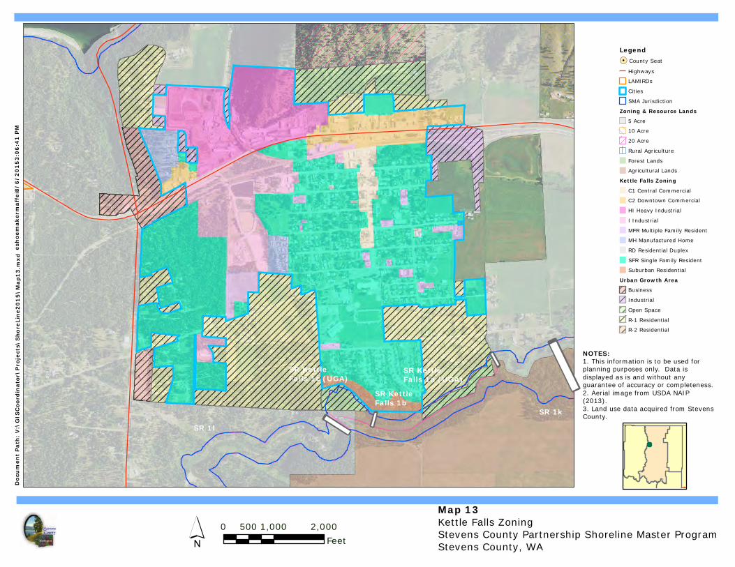
Map 13Kettle Falls ZoningStevens County Partnership Shoreline Master ProgramStevens County, WA
0 1,000 2,000500Feet
Legend!. County Seat
HighwaysLAMIRDsCitiesSMA Jurisdiction
Zoning & Resource Lands5 Acre10 Acre20 AcreRural AgricultureForest LandsAgricultural Lands
Kettle Falls ZoningC1 Central CommercialC2 Downtown CommercialHI Heavy IndustrialI IndustrialMFR Multiple Family ResidentMH Manufactured HomeRD Residential DuplexSFR Single Family ResidentSuburban Residential
Urban Growth AreaBusinessIndustrialOpen SpaceR-1 ResidentialR-2 Residential
´
Docu
men
t Pat
h: V
:\GI
SCoo
rdin
ator
\Pro
ject
s\Sh
oreL
ine2
015\
Map1
3.m
xd
NOTES:1. This information is to be used forplanning purposes only. Data is displayed as is and without anyguarantee of accuracy or completeness.2. Aerial image from USDA NAIP(2013).3. Land use data acquired from StevensCounty.
esho
emak
erm
affe
i8/6
/201
53:0
6:41
PM
I I
I ISR KettleFalls 1c (UGA)
SR KettleFalls 1a (UGA)
SR KettleFalls 1b
SR 1kSR 1l