Embed Size (px)
Citation preview

1
Appendix B: Results of Metal Detector Survey Carried out as Part of the Auburn Project
Kimberly Tinkham
and Alyson L. Wood

2
Table of Contents Table of Contents........................................................................................................................2 List of Figures .............................................................................................................................3 Scope of Work.............................................................................................................................5 Methodology ...............................................................................................................................5
Site-Specific Methodology .......................................................................................................7 Results......................................................................................................................................10 Site 7: Silbersiepe Site ..............................................................................................................11 Site 8: Marshall Site (Military Component Only) .........................................................................29 Complete Catalogue of Artifacts Recovered from the 2008 Metal Detector Survey of the Auburn Project Locale ...........................................................................................................................35

3
List of Figures
Figure B- 1. Photographs showing general methodology used during metal detector survey. Left: JMU student working with metal detectorist. Right: Students laying out transect lines with tapes. (JMU, 2008)........................................................................................................................5
Figure B- 2. View to the southwest showing transit team documenting metal detecting hits (JMU, 2008). .................................................................................................................................6
Figure B- 3. View to the north showing the western end of artifact Concentration 1 on the forested upland ridge in the northwest corner of the Silbersiepe property. Material culture associated with encampment activity ended at the ridgeline. This image shows metal detectorists conducting non-systematic transects in the area between the ridgeline and the Silbersiepe farm complex. No military artifacts were recovered in this area (JMU, 2008)...............................7
Figure B- 4. Map showing the general location of Test Areas 1, 2 and 3 on the Silbersiepe Property (USGS Topographic Map, Catlett, VA Quadrangle, 1966; photo-revised, 1978). ..................8
Figure B- 5. View to the east along the south side of Route 605 showing engineers stakes that define the area to be included in the planned widening of the road (JMU, 2008).............................9
Figure B- 6. Map showing approximate location of Test Area 4 on the Heath/Marshall property in reference to the estimated location of General J.E.B. Stuart's troops on the morning of October 14, 1863 (USGS Topographic Map, Catlett, VA Quadrangle, 1966; photo-revised 1978). .10
Figure B- 7. Map showing the location of Silbersiepe site boundaries and site components (USGS Topographic Map, Catlett, VA Quadrangle, 1966; photo-revised 1978). .............................11
Figure B- 8. View northeast showing the grove of oak trees and general conditions of the Silbersiepe property. Auburn Church can be seen in the background as can the intersection and north trending trace of Rogues Road (JMU, 2008)......................................................................12
Figure B- 9. View to the north from vicinity of Rte. 605 showing access road to Silbersiepe Farm. Artifacts associated with Concentration 1 on the Silbersiepe Site lie on the face and upper west trending slopes of the forested high ground center and left in the image. Virtually no military artifacts were found on the low ground along the access road (JMU, 2008). ......................15
Figure B- 10. View to the west from Rouges Road showing the defined north-south extent of the Silbersiepe Site. The site stretches from Route 605 (on the right side of the image) to the woodline at the Silbersiepe dependency (left). Artifact Concentrations 1 and 2 occur on the weathered ridges as identified in the picture. Concentration 3 lies on the high ground below the modern house at the right of the image (JMU, 2008). ........................................................15
Figure B- 11. View to the south showing the upland ridge north of the Silbersiepe dependency where Concentration 2 was identified, which appears to represent an area of Union encampment (JMU, 2008)......................................................................................................................16
Figure B- 12. View to the west from Rogues Road (Route 602) showing the east end of the large northern concentration of artifacts (Concentration 1). Artifacts are few in number toward the shallow ravine in the foreground (JMU, 2008)....................................................................17
Figure B- 13. Map showing the locations of Concentrations 1, 2 and 3 on the Silbersiepe Property (USGS Topographic Map, Catlett, VA Quadrangle, 1966: photo-revised, 1978). ................19
Figure B- 14. A sample of bullets recovered from the larger Auburn project. Note the Williams Cleaner type bullet in the upper left. All other bullets are examples of three ring Minie balls (JMU, 2008)......................................................................................................................20
Figure B- 15. A sample of the variety of bullets recovered from the larger Auburn project. Clockwise from top left: Williams Cleaner bullet, Gardner bullet, Burnside bullet, fired Sharps Carbine bullet, Williams Cleaner Bullet, type II, Gardner bullet (JMU, 2008)....................................21
Figure B- 16. A sample of pistol bullets recovered from the larger Auburn project. From left to right: Remington pistol bullet, unidentified pistol bullet, .44 caliber pistol bullet (JMU, 2008)........21
Figure B- 17. Sample of buttons and a Union J-hook associated with the encampment of Caldwell�s Division. (clockwise from left): ca. 1840's flat eagle button, "H.B. & A Extra" button back, brass button back (flattened), brass snap button, brass j-hook (Union), and a shoe eyelet (JMU, 2008)..........................................................................................................................................22

4
Figure B- 18. Sample of melted lead recovered from areas associated with Union encampment (JMU, 2008). ...............................................................................................................................23
Figure B- 19. A sample of camp-related items from the Auburn project: a single tree iron (left), two spoons (center) and a lantern top (right) (JMU, 2008)........................................................24
Figure B- 20. Two friction primers recovered from the Silbersiepe property (JMU, 2008). ...........25 Figure B- 21. Sample of artillery shell fragments recovered from the Auburn project (JMU, 2008).26 Figure B- 22. Examples of horse-related artifacts recovered from the larger Auburn project.
Clockwise from left: horseshoe, iron ring, horse harness ring, D-ring from saddle, bridle piece with brass rivet (JMU, 2008)..............................................................................................27
Figure B- 23. Sample of artifacts recovered from the Auburn project area. Top (left to right): brass spur, cavalry cuff button, brass button; Center (left to right): brass rivet, sword rivet, Union Eagle button, knapsack hook; Bottom (left to right): scabbard tip and ½ of a US box plate (JMU, 2008).........................................................................................................................................28
Figure B- 24. Topographic map showing the approximate locations of artifact scatters associated with the military component of the Marshall Site (Site 8) along with the location of the domestic component (Site 4) (USGS Topographic Map, Catlett, VA Quadrangle, 1966; photo-revised, 1978). ...............................................................................................................................29
Figure B- 25. View to the southwest across Route 670 showing the location of the artifact scatter associated with the military component of the Marshall site (Site 8) (JMU, 2008). ..............32
Figure B- 26. Photograph showing two cook pot fragments (left and center) and fragments of a mouth harp (right) recovered from the Marshall Site (Site 8) (JMU, 2008). .........................33
Figure B- 27. Photographs showing the hand-forged ax head recovered from the Marshall property (Site 8) (JMU, 2008)..........................................................................................................34

5
Scope of Work As outlined in the main body of this report, the scope of work for the metal detector survey of the Auburn project was aimed at locating evidence of certain key elements of the of the larger military actions taking place on October 13 and 14 1863. These included:
• the location of the military screen established by the 10th NY Cavalry on the Dumfries or Warrenton Road (Route 605);
• evidence for the deployment of Caldwell�s Division on the northern extent of �Coffee Hill;� • the fields approximately ¼ mile east of Auburn where Stuart�s dismounted and mounted
cavalry commanded by Funston and Gordon respectively attacked the front of Hays� Division; and
• the site of the contest between Lomax and III Corps infantry on the heights above and south of Auburn and north of Casanova (Three Mile Switch) along Rogues Road.
As mentioned in the introduction to Appendix A, the unanticipated success and historical significance of the results of field work on �Coffee Hill� in delineating evidence for Caldwell�s deployment and features of Confederate General Rodes�s attack called for more of the time scheduled for metal detecting to be expended in that area. As a result, field testing on the north end of Chichester Hill where the Union III Corps skirmished with the dismounted cavalry of Lunsford Lomax was not undertaken. Within the areas of study, a strategy of �wild-cat� metal detecting was to be used to identify those areas where historically relevant metal artifacts occurred. These areas of artifact concentration were then to be tested in a more systematic or controlled manner. Metal detector strategies implemented were modified as needed throughout the course of the project. As completed, metal detector survey was carried out on the Silbersiepe and Marshall properties. Both �wild-cat� and more systematic approaches were utilized to identify potential site areas and to help interpret the larger battlefield setting. All metal detection was carried out by members of the Northern Virginia Chapter of the Archaeological Society of Virginia, accompanied by JMU students and field crew under the leadership of Dr. Clarence Geier assisted by Alyson Wood and Kimberly Tinkham. We are particularly grateful to Mr. Michael Kehoe for the time he spent in organizing these field teams.
Methodology
Figure B-1. Photographs showing general methodology used during metal detector survey. Left: JMU student working with metal detectorist. Right: Students laying out transect lines with tapes. (JMU, 2008).

6
The metal detector survey was carried out over the course of four field visits on March 15, March 22, March 29, and May 5, all in 2008. The specific methodology varied slightly with each field visit given the circumstances of the various site areas. Given time limitations established in the cooperative agreement directing the larger project, strategies evolved which allowed the most successful use of the skill of the metal detectorists and at the same time allowed for appropriate control of the material culture they recovered. These differences are discussed with reference to each field date below; however, there was a consistent, overlying methodology applied to the entire metal detecting project. All areas that underwent metal detector survey were selected based on high potential for military activity or known presence of military sites. This information was derived from historic military maps and historic accounts of the Battle of Auburn prepared through the research of Dr. Joseph Whitehorne and as approved for this purpose by the ABPP (See Appendix A - Maps A 1-7). In addition, landowners and local residents provided information about previous metal detecting and artifacts recovered from the larger area. Two properties, the Silbersiepe property (Figure B-4) and the Marshall property (Figure B-6) were ultimately selected for testing. The goal of testing on the Silbersiepe property was initially to identify evidence for the location of the defensive screen established by the Union 10th NY Cavalry across the Dumfries Road (Route 605) at and west of Auburn Church. This was one of the first Union forces to be engaged by Rodes�s advancing Confederate infantry on the morning of October 14, 1863. As field work in this area was undertaken, the project was expanded due to the unanticipated, but extremely significant, result of identifying what are interpreted as northern encampments associated with the deployment of General Caldwell�s Division on �Coffee Hill.� Yet a third bonus was the location of what is interpreted as a location of one of the sites where Rodes�s artillery commanded by Ltd. Col. Thomas Carter went into battery as Rodes pursued the withdrawing Union II Corps. The second area examined was the property of Charlotte Heath and Danny and Melvin Marshall east of Auburn. This property was selected for metal detector survey in order to search for evidence of General JEB Stuart�s dismounted/mounted cavalry attack on the front of General Hays�s Division of the Union Army. As metal detecting test areas were defined, the physical boundaries of the areas to be tested were
delineated in the field (see below). Metal detector operators from the Northern Virginia Chapter of the Archaeological Society of Virginia then worked with trained archaeologists and archeology students to recover all hits within the defined boundaries of the test area. Modern hits not related to the military actions or other historically significant activities were collected and removed from the site but were not spatially marked. Once a contributing artifact was located, students assisting the metal detectorists assigned a field ID number to the hit, recorded the depth at which the artifact was located, and provided a brief field description of the artifact found. These marked historic and military hits
Figure B-2. View to the southwest showing transit team documenting metal detecting hits (JMU, 2008).

7
were then were mapped in one of two ways. Hits were either mapped using a Nikon Total Station or using GPS technology (Figure B-2). A Trimble GeoExplorer 2005 Series and a Garmin Etrex Venture were used to mark hits using GPS.
All recovered artifacts were returned to the JMU Archeology Laboratory. Modern hits were separated out and were not catalogued. Historic hits (both military and domestic) were cleaned and catalogued and prepared for final storage. The artifacts recovered from the metal detector survey will be held in storage at the JMU Archeology Lab until they can be transferred to an approved museum location. Field procedures used in examining these are described below.
Site-Specific Methodology • March 15, 2008: Metal detecting on March 15 was conducted in an area designated Test
Area 1, which was located in the northwest corner of the Silbersiepe property (Figure B-4). Natural and cultural boundaries were used to define the test area. Fence-lines were used to mark three sides of the test area. The western test area boundary was created by the fence-
line that paralleled the driveway to the Silbersiepe residence. The fence-line along Dumfries Road (Route 605) served as a northern boundary. A third fence-line extending south from Route 605 marked the eastern boundary of the test area. The southern boundary of the test area was created by a natural drop in the high ground/ridge line. Except for a narrow area along the entrance to the Silbersiepe residence, this entire area was characterized by the presence of a stand of very old, mature oak trees. Test Area 1 (as defined above) was thoroughly tested. Metal detectorists moved from the northern fence-line boundary to the south in transects, eventually covering the entire test area (Figure B-
3). In addition, one metal detectorist moved in an east/west direction to ensure additional coverage. Following the completion of the transects, detectorists moved in a more random manner across the area in an effort to obtain additional hits and more clearly establish the boundaries of the pattern. Once Test Area 1 was completely detected, detectorist moved outside of the southern boundary (Figure B-2) of the defined test area to do more informal testing of the south facing slopes of the high ground within the project area. This was done to confirm the presence or absence of additional, related artifact scatters. Significantly, no military artifacts were found in this area. All hits from Test Area 1 were mapped using a Trimble GeoExplorer 2005 Series GPS unit.
Figure B-3. View to the north showing the western end of artifact Concentration 1 on the forested upland ridge in the northwest corner of the Silbersiepe property. Material culture associated with encampment activity ended at the ridgeline. This image shows metal detectorists conducting non-systematic transects in the area between the ridgeline and the Silbersiepe farm complex. No military artifacts were recovered in this area (JMU, 2008).

8
Figure B-4. Map showing the general location of Test Areas 1, 2 and 3 on the Silbersiepe Property (USGS Topographic Map, Catlett, VA Quadrangle, 1966; photo-revised, 1978).
• March 22, 2008: Metal detecting on March 22 was conducted along the northern boundary of
the Silbersiepe property in an area paralleling Route 605 (Figure B-4) and to the southeast of Test Area 1. This area was designated Test Area 2 and was investigated in an effort to further examine an extensive pattern of Union military artifacts identified on the high ground within Test Area 1. The post and wire fence-line bordering Route 605 marked the northern boundary of the site. Archaeologists measured 300� off of this fence-line to form the southern boundary of the test area, which was marked with engineer�s flags. The fence-line that marked the eastern boundary for Test Area 1 became the western boundary for Test Area 2. The fence-line paralleling Rogues Road (Route 602) served as the initial eastern boundary for Test Area 2. As the day progressed, it became clear that time would not allow adequate testing at the eastern end of the study area. In addition, field evidence suggested that the observed pattern of artifact scatter diminished as a southeast trending ravine that cut the project area near its eastern margin was approached. As a result, the easternmost 200� of Study Area 2 was excluded from the study area and re-assigned to Study Area 3 evaluated on March 29 (Figure B-4). Metal detectorists initially moved in roughly parallel, informal, unmarked transects from north to south, separated by approximately 25� across Study Area 2. These transects were investigated twice, once in the southern pass and again as the detectorist moved north. Once those transects had been completed, the detectorists moved in between the transect lines to fill in the remaining space, giving more complete coverage. Artifacts recovered within Test Area 2 were mapped in two ways. An area extending from the western boundary of

9
Test Area 1 approximately 200 feet east was determined to be a test area for marking hits with the total station. The remaining hits in Test Area 1 were marked using the hand held Trimble Geo-Explorer 2005 Series GPS unit. Use of the total station was clearly the more accurate strategy, and was used to obtain a more detailed sample of the larger pattern of debris that was being revealed by the project team. Jointly the two procedures allowed for a relatively accurate definition of the larger artifact scatter as well as locate potentially important interpretive areas within it.
[Note: An area approximately 75 feet wide x 1,000 feet east and west of a point centering on Auburn Church has been taken to be used in road widening activities by Fauquier County (Figure B-5). Anticipating the destruction and loss of this terrain, that section lying within Test Areas 1 and 2 underwent a slightly more rigorous examination. While a small number of artifacts found in this area by earlier metal detecting were obtained by Mr. Silbersiepe and shown to the field team, no field report of an archaeological examination of this property conducted on behalf of the County was available.]
• March 29, 2008: Metal detecting on March 29 was conducted along the eastern edge of the Silbersiepe property in an area designated Test Area 3 (Figure B-4). The fence line that parallels Rogues Road (Route 602) was used as the eastern boundary of Test Area 3. The north end terminated at the fence bounding Route 605 and included the section of Test Area 2 not covered on March 22. The southern boundary of the study area conformed to the fence-line bounding the west trending access road to the Silbersiepe dependency area. In test Area 3, tapes were used to measure out 200� west of the fence line paralleling Rogues Road (Route 602) and engineer�s flags were used to mark this western boundary. Once metal detecting in Test Area 3 was completed using a strategy similar to that described in Test Area 2, the transects being oriented east-west, metal detectorists moved north and west outside the test area to do a less controlled �wild cat� survey on the high ground slightly south and east of the center of the field in an area where Mr. Silbersiepe had reported an earlier recovery of military artifacts including some Union eagle buttons (Figure B-4; note the light blue area near the center of the field). The detectorists covered the crest of the hill and down the eastern slopes. The artifacts within the defined boundaries of Test Area 3 were documented using the total station. Artifacts recovered outside of the test area were marked using the Trimble GeoExplorer 2005 Series GPS unit.
Figure B-5. View to the east along the south side of Route 605 showing engineers stakes that define the area to be included in the planned widening of the road (JMU, 2008).

10
Figure B-6. Map showing approximate location of Test Area 4 on the Heath / Marshall property in reference to the estimated location of General J.E.B. Stuart's troops on the morning of October 14, 1863 (USGS Topographic Map, Catlett, VA Quadrangle, 1966; photo-revised 1978).
• May 5, 2008: Testing on May 5 was carried out on the Heath / Marshall property, located on both sides of the Old Auburn Road (Route 670). This area was designated Test Area 4, and included the property on both the northern and southern sides of the road (Figure B-6). Because of the moderate size of the property and the small number of artifacts found, the entire area south of the road was detected using a �wild cat� survey technique. No significant patterns of artifacts were observed that allowed a more controlled pattern to be established. The fence lines marking the property boundaries served as the boundaries for Test Area 4 on the south side of the road. Discussions with local residents provided evidence of a possible 18th century structure in the fields north of the road. As a result, metal detectorists used a similar �wild-cat� strategy for surveying this area. The smaller and more localized setting allowed a more �total� coverage approach as opposed to pre-selected sample areas. All historic hits recovered from the Marshall property were recorded using the Nikon Total Station.
Results As a result of the metal detector surveys carried out as part of the Auburn project, two distinct site areas were identified with individual site components designated as follows. The Marshall Site (domestic structure) located within the boundaries of the Heath / Marshall property is discussed further in Appendix A.

11
Site Archaeological Components Description Location
A Potential Union encampment Silbersiepe Property
B Location of Confederate Artillery � Rhodes Division Silbersiepe Property
Site 7: The Silbersiepe
Site C General battle debris Silbersiepe Property
A Domestic Structure (see description in Appendix A) Marshall Property Site 8: The
Marshall Site B General battle debris Marshall Property
Table B1: Sites Identified during Metal Detector Survey of the Auburn Project Area The following discussion outlines the larger site areas with additional information about areas that may define sub-sites within the broader site complex. For additional information on Site 8: The Marshall Site (defined as the potential domestic structure), see Appendix A.
Site 7: Silbersiepe Site
State Number: Survey Date: March 15, March 22, March 29, 2008 Team Leaders: Clarence Geier, Alyson Wood, Kimberly Tinkham Site Class: Terrestrial-open air Site Age: October 13 and 14, 1863 Cultural Affiliation: Euro-American Thematic Context: military, battlefield, artillery
Figure B-7. Map showing the location of Silbersiepe site boundaries and site components (USGS Topographic Map, Catlett, VA Quadrangle, 1966; photo-revised 1978).

12
Historic Context:
(Historic Context of the Larger Silbersiepe Site Area) The lands comprising the Silbersiepe property were key to the flow of military events associated with the Auburn conflict. Military events thought to have taken place within the boundaries of or in immediate proximity to the current Silbersiepe property include (See Whitehorne in main text; Maps A, 1 �7 in folder):
• Possible positions of the 10th NY Cavalry situated to screen the Warrenton Road (Route 605) against possible Confederate movements from Warrenton area
• Temporary camp of portions of Brigadier General John C. Caldwell�s 1st Division of the Union Army (Figure 24, main text)
• Lands passed over by the advance of General Rodes�s Confederate infantry as it moved to confront and pursue Caldwell�s troops as they disengaged while the II Corps trains moved past Auburn on their way to Catlett.
Located at the intersections of the Warrenton Road (Route 605) and Rogues Road (Route 602) the Silbersiepe property would have been of key strategic importance. Troops from the 10th NY Cavalry
would have moved across (or near) the Silbersiepe property in their role as advance skirmishers against Rodes�s Confederate Division moving toward Auburn from the northwest. Dr. Whitehorne in his history of the battle presented in the main text provides the following:
�General Warren ordered D.M. Gregg to screen the approaches from Warrenton along the Warrenton and Double Poplars Roads. Gregg, in turn, ordered the Tenth New York Cavalry from Col. Irvin M. Gregg�s Second Cavalry Brigade to cross Cedar Run and follow the road taken by the III Corps [Rogues Road, Route 602] to a point where it could screen the Warrenton Road [Route 605]. The New Yorkers deployed about one and three quarters miles northwest of Auburn (OR 29: 253) on the Warrenton Road [Route 605] west of its intersection with the northward turn of Rogues Road [Route 602].
Captain George Vanderbilt led out a two company squadron to act as vedettes. They built a hasty barrier across the road while the rest of the regiment formed in reserve, ready to move instantly. The men described their �front as covered with stumps and scrub-oaks,� adding to the difficulty of cavalry skirmishing (Preston 1892: 146)�.
As will be noted, evidence of the presence of Union cavalry within the Silbersiepe Site was identified in the recovered artifacts; however, the exact location of the 10th NY skirmish line is uncertain. That site may actually lie slightly farther west along Route 605. (Historic Context Related to the Encampment of Caldwell�s Division � Site Component A) As discussed in the main text of this report, the deployment of Caldwell�s encamped division on �Coffee Hill� is a principle feature and part of the existing description of the events of October 14, 1864. Having said that, except for Brookes� Regiment and the general sequence of deployment of the other regiments to the north, there are no specific maps or physical descriptions of the deployment. Metal detecting between March15 and March 29, 2008 identified an extensive pattern of Union encampment including two areas of concentration (Figure B-7), which Whitehorne�s review of
Figure B-8. View northeast showing the grove of oak trees and general conditions of the Silbersiepe property. Auburn Church can be seen in the background as can the intersection and north trending trace of Rogues Road (JMU, 2008).
13
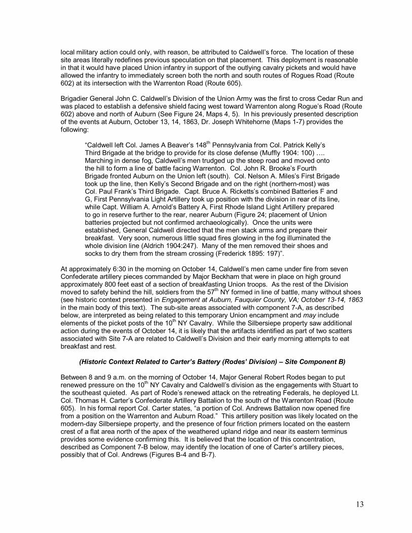
local military action could only, with reason, be attributed to Caldwell�s force. The location of these site areas literally redefines previous speculation on that placement. This deployment is reasonable in that it would have placed Union infantry in support of the outlying cavalry pickets and would have allowed the infantry to immediately screen both the north and south routes of Rogues Road (Route 602) at its intersection with the Warrenton Road (Route 605). Brigadier General John C. Caldwell�s Division of the Union Army was the first to cross Cedar Run and was placed to establish a defensive shield facing west toward Warrenton along Rogue�s Road (Route 602) above and north of Auburn (See Figure 24, Maps 4, 5). In his previously presented description of the events at Auburn, October 13, 14, 1863, Dr. Joseph Whitehorne (Maps 1-7) provides the following:
�Caldwell left Col. James A Beaver�s 148th Pennsylvania from Col. Patrick Kelly�s Third Brigade at the bridge to provide for its close defense (Muffly 1904: 100) �. Marching in dense fog, Caldwell�s men trudged up the steep road and moved onto the hill to form a line of battle facing Warrenton. Col. John R. Brooke�s Fourth Brigade fronted Auburn on the Union left (south). Col. Nelson A. Miles�s First Brigade took up the line, then Kelly�s Second Brigade and on the right (northern-most) was Col. Paul Frank�s Third Brigade. Capt. Bruce A. Ricketts�s combined Batteries F and G, First Pennsylvania Light Artillery took up position with the division in rear of its line, while Capt. William A. Arnold�s Battery A, First Rhode Island Light Artillery prepared to go in reserve further to the rear, nearer Auburn (Figure 24; placement of Union batteries projected but not confirmed archaeologically). Once the units were established, General Caldwell directed that the men stack arms and prepare their breakfast. Very soon, numerous little squad fires glowing in the fog illuminated the whole division line (Aldrich 1904:247). Many of the men removed their shoes and socks to dry them from the stream crossing (Frederick 1895: 197)�.
At approximately 6:30 in the morning on October 14, Caldwell�s men came under fire from seven Confederate artillery pieces commanded by Major Beckham that were in place on high ground approximately 800 feet east of a section of breakfasting Union troops. As the rest of the Division moved to safety behind the hill, soldiers from the 57th NY formed in line of battle, many without shoes (see historic context presented in Engagement at Auburn, Fauquier County, VA; October 13-14, 1863 in the main body of this text). The sub-site areas associated with component 7-A, as described below, are interpreted as being related to this temporary Union encampment and may include elements of the picket posts of the 10th NY Cavalry. While the Silbersiepe property saw additional action during the events of October 14, it is likely that the artifacts identified as part of two scatters associated with Site 7-A are related to Caldwell�s Division and their early morning attempts to eat breakfast and rest.
(Historic Context Related to Carter�s Battery (Rodes� Division) � Site Component B)
Between 8 and 9 a.m. on the morning of October 14, Major General Robert Rodes began to put renewed pressure on the 10th NY Cavalry and Caldwell�s division as the engagements with Stuart to the southeast quieted. As part of Rode�s renewed attack on the retreating Federals, he deployed Lt. Col. Thomas H. Carter�s Confederate Artillery Battalion to the south of the Warrenton Road (Route 605). In his formal report Col. Carter states, �a portion of Col. Andrews Battalion now opened fire from a position on the Warrenton and Auburn Road.� This artillery position was likely located on the modern-day Silbersiepe property, and the presence of four friction primers located on the eastern crest of a flat area north of the apex of the weathered upland ridge and near its eastern terminus provides some evidence confirming this. It is believed that the location of this concentration, described as Component 7-B below, may identify the location of one of Carter�s artillery pieces, possibly that of Col. Andrews (Figures B-4 and B-7).
14
(Historic Context Related to the General Flow of Battle Including the 10th NY Cavalry and the Advance of Rodes� Division � Site Component C)
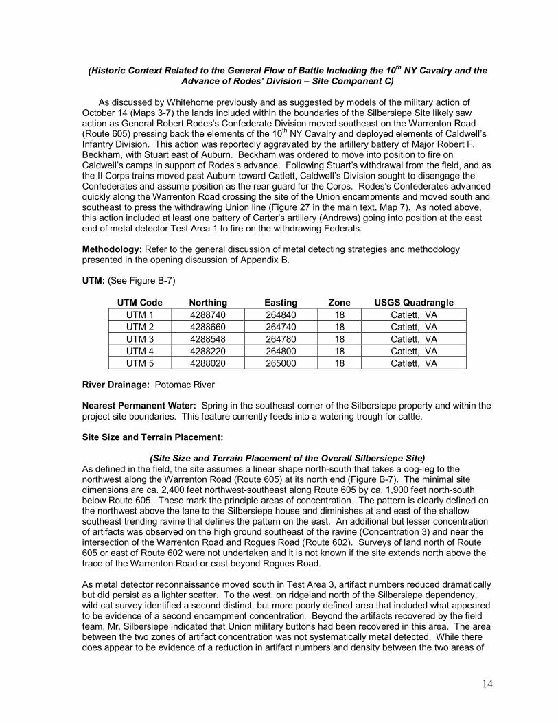
As discussed by Whitehorne previously and as suggested by models of the military action of
October 14 (Maps 3-7) the lands included within the boundaries of the Silbersiepe Site likely saw action as General Robert Rodes�s Confederate Division moved southeast on the Warrenton Road (Route 605) pressing back the elements of the 10th NY Cavalry and deployed elements of Caldwell�s Infantry Division. This action was reportedly aggravated by the artillery battery of Major Robert F. Beckham, with Stuart east of Auburn. Beckham was ordered to move into position to fire on Caldwell�s camps in support of Rodes�s advance. Following Stuart�s withdrawal from the field, and as the II Corps trains moved past Auburn toward Catlett, Caldwell�s Division sought to disengage the Confederates and assume position as the rear guard for the Corps. Rodes�s Confederates advanced quickly along the Warrenton Road crossing the site of the Union encampments and moved south and southeast to press the withdrawing Union line (Figure 27 in the main text, Map 7). As noted above, this action included at least one battery of Carter�s artillery (Andrews) going into position at the east end of metal detector Test Area 1 to fire on the withdrawing Federals.
Methodology: Refer to the general discussion of metal detecting strategies and methodology presented in the opening discussion of Appendix B. UTM: (See Figure B-7)
UTM Code Northing Easting Zone USGS Quadrangle UTM 1 4288740 264840 18 Catlett, VA UTM 2 4288660 264740 18 Catlett, VA UTM 3 4288548 264780 18 Catlett, VA UTM 4 4288220 264800 18 Catlett, VA UTM 5 4288020 265000 18 Catlett, VA
River Drainage: Potomac River Nearest Permanent Water: Spring in the southeast corner of the Silbersiepe property and within the project site boundaries. This feature currently feeds into a watering trough for cattle. Site Size and Terrain Placement:
(Site Size and Terrain Placement of the Overall Silbersiepe Site) As defined in the field, the site assumes a linear shape north-south that takes a dog-leg to the northwest along the Warrenton Road (Route 605) at its north end (Figure B-7). The minimal site dimensions are ca. 2,400 feet northwest-southeast along Route 605 by ca. 1,900 feet north-south below Route 605. These mark the principle areas of concentration. The pattern is clearly defined on the northwest above the lane to the Silbersiepe house and diminishes at and east of the shallow southeast trending ravine that defines the pattern on the east. An additional but lesser concentration of artifacts was observed on the high ground southeast of the ravine (Concentration 3) and near the intersection of the Warrenton Road and Rogues Road (Route 602). Surveys of land north of Route 605 or east of Route 602 were not undertaken and it is not known if the site extends north above the trace of the Warrenton Road or east beyond Rogues Road. As metal detector reconnaissance moved south in Test Area 3, artifact numbers reduced dramatically but did persist as a lighter scatter. To the west, on ridgeland north of the Silbersiepe dependency, wild cat survey identified a second distinct, but more poorly defined area that included what appeared to be evidence of a second encampment concentration. Beyond the artifacts recovered by the field team, Mr. Silbersiepe indicated that Union military buttons had been recovered in this area. The area between the two zones of artifact concentration was not systematically metal detected. While there does appear to be evidence of a reduction in artifact numbers and density between the two areas of

15
known concentration, this is a subjective observation. It is quite possible that subsequent field work could find the two patterns are joined. The areas of artifact concentration (designated Concentration 1 and Concentration 2) tend to lie on the apex and upper slopes of a pair of weathered upland ridges lying south of Route 605 and west of Route 602 (See Figures B-7 through B-10 and B-13). These lie at the northwestern extent of �Coffee Hill� as interpreted and described in the main text of this report. Artifacts clearly diminish east and west of the two ridges and reduce in number in the saddle area between them. The exception to this is a third concentration identified on the slightly elevated rise in the extreme northeast corner of the property at the intersection of Route 605 and Route 602 (Concentration 3) (See Figure B-13). The lands south of the Concentration 2 and west of Rogues Road were not metal detected and there is no record of previous work in that area.
Figure B-9. View to the south from vicinity of Route 605 showing access road to Silbersiepe Farm. Artifacts associated with Concentration 1 on the Silbersiepe Site lie on the face and upper west trending slopes of the forested high ground center and left in the image. Virtually no military artifacts were found on the low ground along the access road (JMU, 2008).
Figure B-10. View to the west from Rouges Road showing the defined north-south extent of the Silbersiepe Site. The site stretches from Route 605 (on the right side of the image) to the wood line at the Silbersiepe dependency (left). Artifact Concentrations 1 and 2 occur on the weathered ridges as identified in the picture. Concentration 3 lies on the high ground below the modern house at the right of the image (JMU, 2008).
(Site Size and Terrain Placement Related to the Encampment of Caldwell�s Division � Site
Component A)
The northern-most scatter of camp-related debris was located within Concentration 1, located on the northwest facing slopes and apex of an upland ridge east of the entrance to the Silbersiepe farm and extending across the upland feature south of Route 605. This concentration measures ca. 1,200 feet northeast-southwest by ca. 300 to 450 feet northeast-southwest (Figures B-7). It is quite possible that the encampment scatter could extend southeast into the area designated as general military, though less clearly identified encampment debris was noted in this area.

16
The southern-most scatter of camp-related debris (Concentration 2) is also situated on the apex and upper slopes of a second weathered upland ridge placed to the south of the Concentration 1 (Figures B-9 and B-10). Concentration 2 has a minimum dimension of 600 feet north-south by 300 feet east-west (See Figures B-7, B-11 and B-13). Only the eastern-facing slope of the hill was investigated, and artifacts were recovered from this area. It is possible that additional testing would have yielded more artifacts on the various faces of the hill slopes. It should also be noted that the flatter, lower lying area that connected these two hillocks was not investigated. It is uncertain if the scatter of camp-related debris links these two distinct areas. The two identified artifact scatters indicate that troops attempted to take advantage of high ground. The viewscapes provided by these ridges are consistent with the assigned goal of providing a defensive shield against Confederate forces approaching from Warrenton. This is particularly true in the case of the western part of artifact Concentration 1. A camp-site or picket post in this location would have allowed soldiers a view toward Warrenton in addition to allowing them to be able to monitor activities on Rogues Road (Route 602) and the Warrenton Road (Route 605). The presence of an intermittent stream running east/west along the southern edge of the property, would have certainly created wet areas, particularly in the what is currently the southeast corner of the Silbersiepe property. A spring in this area would have provided water for camped soldiers.
Figure B-11. View to the south showing the upland ridge north of the Silbersiepe dependency where Concentration 2 was identified, which appears to represent an area of Union encampment (JMU, 2008).

17
Figure B-12. View to the west from Rogues Road (Route 602) showing the east end of the large northern concentration of artifacts (Concentration 1). Artifacts are few in number toward the shallow ravine in the foreground (JMU, 2008).
(Site Size and Terrain Placement Related to Carter�s Battery (Rodes� Division) � Site Component B)
What is interpreted as a likely location for an artillery piece associated with Carter�s Battery (Rodes�s Division) was located on the northeast side of the apex of a slight rise near the central northern boundary of the Silbersiepe property (See Figures B-4 and B-7) and within the boundaries of Concentration 1. This position, lying south of the Warrenton Road (Route 605) matches historic accounts of the actions later in the morning on October 14 and as describe earlier. Given the surrounding terrain, this slight flattened rise would have been a logical location for an artillery battery. The actual size of the battery position could not be defined by the artifact scatter recovered, but four friction primers were identified within 25 feet of each other in this general vicinity.
(Site Size and Terrain Placement Related to the General Flow of Battle Including the 10th NY Cavalry and the Advance of Rodes� Division � Site Component C)
Evidence for general battle (non-camp related military artifacts) can be seen across the larger area defined as the Silbersiepe Site; however, the eastern end of Concentration 1 (described above) appears to be more closely tied to battle-related activity than with encampment. In addition, a light scatter of military artifacts was identified on the slightly elevated slopes and weathered, flattened apex of a small rise at the northeastern corner of the property (Figure B-7 and B-13), near the intersection of the Warrenton Road (Route 605) and the section of Rogues Road (Route 602) to Auburn. This area, designated Concentration 3, measures approximately 400� north/south along Rogues Road and approximately 200� east/west at its widest point. The ability of Rodes�s Infantry to take this position allowed him to move quickly south along Rogue�s Road and southeast, possibly along the trace of the Old Colonial Road, in pursuit of Caldwell�s withdrawing Federals. Given the nature of Concentration 1 it is possible that some of the items in that area may actually be camp drops. Contour Interval: Overall site ranges from 380� ASL to 420� ASL

18
Terrain Slope: Terrain slope across the larger site area varies from virtually no slope in parts of the open field to more moderately sloped hillocks; however, no parts of the site exceed a 10 percent slope. Marked slopes at the northwest end of Concentration 1 serve to define the boundaries of scatter in those areas. Condition: At present the site locale includes two ecological settings. The northwest corner is covered in the remains of a mature stand of white oak, many of which are dying (Figures B-8 and B-12). The central and eastern sectors are currently in open pasture (Figure B-5) and used for grazing livestock. A strip of land extending approximately 75 feet south of Route 605 and measuring 1,000 feet east and west of a point centering on Auburn Church is scheduled for road expansion and widening. The margins of this construction within the site area were marked (Figure B-5). No formal shovel test pitting was carried out over the larger site area as per the scope of work, so no statements can be made about sub-grade disturbance, although the current conditions of the area suggest minimal, if any disturbance to potential sub-grade features. Mr. Silbersiepe indicated that very little previous metal detecting has been conducted on the site to his knowledge, and may speak to the number and preservation of artifacts recovered as part of the metal detector survey carried out in 2008. Archaeological Features and Artifacts: Visual reconnaissance of the Silbersiepe property revealed no above-grade archaeological features. Instead, metal detector strategies identified sub-grade artifact concentrations that serve to indicate components within the larger context of the overall site area. These concentrations have been designated Concentration 1, Concentration 2 and Concentration 3 (Figure B-13). The locations of these concentrations are described in the above text. The artifacts associated with these Concentrations tend to indicate three distinct uses of the overall site: encampment of Caldwell�s Division, the location of Carter�s Battery, and a general scatter of artifacts related to the flow of battle over the larger site. These site components as they relate to the artifacts recovered are discussed below:

19
Previous Archeology Because of the planned widening of a narrow strip of land lying south of Route 605 and extending to a point ca. 200 feet west of the southerly intersection of Route 602 there is a report of a program of metal detecting reconnaissance across those lands. This work is reported to have been carried out by Patrick O�Neill. No study of the site history was conducted and no formal report of findings was available to review. A small number of military items was recovered but were not deemed adequate to support further archaeological or historical study. Of particular note in this assemblage of items was the recovery of a saddle stirrup of a sort used by Union cavalry. Aside from O�Neill�s study of the area to be impacted by the road, some localized metal detecting has occurred on the property in the past; however, there is no report of the extensive metal detecting that has taken place elsewhere on the Silbersiepe property.
(Artifacts Related to the Encampment of Caldwell�s Division � Site Component A)
Metal detecting as part of the 2008 JMU project revealed two areas of artifact concentration that appear to be associated with military encampment attributed to elements of Caldwell�s 1st Division, II Corps. The first of these was located near the northwestern corner of the Silbersiepe property at the western end of the larger Concentration 1 (Figure B-13), the second is defined by Concentration 2. The artifacts within these scatters were unique from the larger overall military debris in that they were characterized by significant concentrations of hooks, buttons, dropped bullets, melted lead, and personal items such as eating utensils. Other than dropped bullets, many of these types of material culture were absent in the eastern end of Concentration 1 and in Concentration 3, which appear more closely tied to the battle-related activities known to have moved across the larger site area. The specific artifacts associated with the encampment of Caldwell�s Division are discussed below: Bullets (Figures B-14 through B-16): A total of 29 bullets were found within the areas designated as potential encampment sites. The majority of these bullets (n=21) were three ring minie balls. Of those 14 were .58 caliber, 11 of which were dropped, one fired and one pulled). A single pulled .54 caliber three ring minie ball was recovered. Six minie balls were of uncertain caliber. A single dropped pistol bullet and three Williams Cleaner bullets were also recovered. Of the Williams Cleaner type bullets, one was dropped, one was fired and one was pulled. Two round balls, one .36 caliber and one identified as a likely piece of buck shot from a buck and ball were recovered. It is possible that the .36 caliber round ball could be a pistol round. Two unidentified bullets were also recovered.
Figure B-13. Map showing the locations of Concentrations 1, 2, and 3 on the Silbersiepe Property (USGS Topographic Map, Catlett, VA Quadrangle, 1966: photo-revised, 1978).

20
An analysis of the bullets recovered from areas designated as likely encampment sites suggests several things. First, the significant numbers of dropped .58 caliber three ring minie balls can most likely be attributed to Union troops as can the Williams Cleaner bullets. Dropped bullets would be expected at an encampment site. The presence of several fired bullets along with the round balls or shot does suggest that the archaeological footprint of the early morning camp sites may have been impacted by the advance of Rodes� Division and resistance by the 10th NY Cavalry later in the day. This is to be expected, and there is virtually no way to segregate bullets associated with the encampment and bullets associated with the battle other than through generalizations about the types of bullets one would expect to be related to each.
Figure B-14. A sample of bullets recovered from the larger Auburn project. Note the Williams Cleaner type bullet in the upper left. All other bullets are examples of three ring Minie balls (JMU, 2008).

21
Figure B-15. A sample of the variety of bullets recovered from the larger Auburn project. Clockwise from top left: Williams Cleaner bullet, Gardner bullet, Burnside bullet, fired Sharps Carbine bullet, Williams Cleaner Bullet, type II, Gardner bullet (JMU, 2008).
Figure B-16. A sample of pistol bullets recovered from the larger Auburn project. From left to right: Remington pistol bullet, unidentified pistol bullet, .44 caliber pistol bullet (JMU, 2008).

22
Buttons (Figure B-17): A total of nine bullets were identified within the artifact scatters thought to be attributed to the encampment of Caldwell�s Division. These included two Union Eagle buttons, one of which was of early manufacture. The remaining buttons appear to be related to domestic manufacture and could be associated with under shirts or other clothing items. These buttons included four parts of plain, brass buttons and/or button backs. One brass snap button was recovered, along with a button imprinted with the lettering �H.B. & A. Extra.� A single unidentified button was recovered. Historical accounts indicate that Caldwell�s men made an attempt to eat breakfast and to dry out their shoes (Whitehorne, main section of this text) and likely parts of their clothing while they were encamped on the morning of October 14. The presence of so many buttons within a defined area could be an archaeological indication that such activity did indeed take place.
Figure B-17. Sample of buttons and a Union J-hook associated with the encampment of Caldwell�s Division. (clockwise from left): ca. 1840's flat eagle button, "H.B. & A Extra" button back, brass button back (flattened), brass snap button, brass j-hook (Union), and a shoe eyelet (JMU, 2008).
Melted Lead (Figure B-18): A total of 21 pieces of melted lead were recovered from areas thought to be associated with Union encampment. In fact, the presence of melted lead in such high amounts was one of the major indications that these concentrations of artifacts did indeed represent areas of encampment as opposed to a general scatter of battle debris.

23
Figure B-18. Sample of melted lead recovered from areas associated with Union encampment (JMU, 2008).
Various hooks, clothing parts accoutrement parts: Aside from melted lead, the presence of knapsack hooks, and accoutrement parts were key to identifying areas that likely represent encampment. A total of four Union J-hooks were recovered from within these areas along with two knapsack hooks. Sword-related rivets and adjustments (n=4) were identified within Concentration 2. A single grommet and a single shoe eyelet were recovered along with four utensils (including portions of a fork, spoons, and a knife handle) (See Figure B-19). In addition to these items, portions of a brass tampion with cork attached were recovered, and it is likely that it may have been used in the face of foggy, damp conditions on the morning of October 14. Two Indian-head pennies dating to 1863 were also recovered and serve to date the site to the appropriate time period for the events associated with the Battle of Auburn.

24
Figure B-19. A sample of camp-related items from the Auburn project: a single tree iron (left), two spoons (center) and a lantern top (right) (JMU, 2008). Artillery: While not directly associated with encampment activities, several artillery-related artifacts were recovered within areas thought to be attributed to the encampment of Caldwell�s Division. Part of a fuse from an artillery shell was recovered from within the encampment area in Concentration 1, and a fragment from a Hotchkiss shell was recovered from Concentration 2. It is possible that the fuse and part of a shell fragment could be related to incoming fire from either Carters� or Beckham�s Artillery both of which are known to have fired on the camp during the early part of the contest on October 14.
(Artifacts Related to Carter�s Battery (Rodes�s Division) � Site Component B)
Artifacts related to the positioning and placement of Carter�s Battery, which was ordered into position along Route 605 during the advance of Rodes�s Confederate Division on October 14 were limited the identification of four friction primers within an area no larger than roughly 25� (See Figures B-4, B-7 and B-20). The location of these four friction primers is consistent with historic descriptions for the location of Carter�s battery (see Historic Context above), and the presence of four primers likely indicates the location of a single or small number of guns. The friction primers were unique in terms of the larger artifact assemblage due to the fact that they were concentrated within a single, definable area. In addition, they were likely deposited by an artillery piece firing in from the field locale as opposed to shot, shells, and shrapnel associated with incoming rounds. The only other artillery-related artifacts recovered included part of a fuse from an artillery shell (incoming) recovered from the western end of Concentration 1. Two shell fragments and a piece of grape shot were identified in Concentration 2 to the southeast, and could be the products of incoming fire from Beckham�s or Carter�s artillery in the morning.

25
Figure B-20. Two friction primers recovered from the Silbersiepe property (JMU, 2008).
(Artifacts Related to the General Flow of Battle Including the 10th NY Cavalry and the Advance
of Rodes� Division � Site Component C) A variety of military artifacts that could not be directly linked to areas thought to represent sites of encampment were identified. These artifacts have been attributed to general battle activities as the 10th NY Cavalry and Caldwell�s infantry faced Rodes�s Confederates advancing down the Warrenton Road (Route 605). The exact event to which these artifacts are related is difficult to define, but given the numbers of men and types of activities that would have taken place on the Silbersiepe lands, these artifacts do provide significant evidence of the battle, and even indicate the presence of Union cavalry forces. Certainly some of the dropped items found in Concentration 1 could be from Union troops encamped in the area. Artifacts assigned to this component were recovered from two areas, the eastern half of Concentration 1 along the northern property boundary paralleling Route 605 and from Concentration 3, identified at the intersection or Route 605 and Rogues Road (Route 602). Bullets (See Figures B-14 through B-16): A total of 42 bullets were recovered outside of the areas designated as potential encampment sites (Component A). The majority of the bullets were .58 caliber 3-ring minie balls (n=17). Of these, four were fired and 13 were dropped. Three 3-ring minie balls ranging from .52 to .54 caliber were recovered, and all of these were dropped. Whether or not the number of dropped bullets can be attributed to the early morning encampment or the actual flow of battle is difficult to say; however, these dropped 3-ring bullets likely represent a Union troops in the area. Four Williams Cleaner type bullets (two dropped and two pulled), which are also typically attributed to Union troops were recovered. Interestingly, four Sharps bullets were recovered (2 dropped, 1 fired, and 1 pulled). These types are associated with the Sharps Carbine, which was shorter and lighter weight than a traditional Sharps weapon, and was often used by cavalry. The presence of Sharps bullets within the artifact assemblage may be indicative of the presence of the 10th NY Cavalry. Three Gardner bullets were recovered (2 fired and 1 dropped). Gardner bullets are typically attributed to Confederate troops, and the fact that two were fired may indicate that Union soldiers in the area were taking incoming fire, most likely from Rodes�s Confederates as they advanced. In addition, a single Enfield bullet, also typically associated with Confederate troops was recovered. Five pistol bullets, which may be associated with officers, were recovered including two

26
.44 caliber bullets and two Smith bullets. In addition, three .36 caliber round balls were recovered. Whether or not these were associated with buck shot from a buck and ball or were pistol rounds is uncertain. The remaining two bullets recovered were unidentified. Artillery (Figure B-21): Aside from the friction primers note above, artillery-related artifacts found include: a sabot from an artillery shell, one unidentified shell fragment, one piece of shrapnel, and one piece of grape shot. It is possible that these artifacts could represent incoming rounds from either Carter�s or Beckham�s artillery units.
Figure B-21. Sample of artillery shell fragments recovered from the Auburn project (JMU, 2008).
Horse-related (Figure B-22): A total of 11 horse shoes or horse shoe fragments were recovered. These are particularly significant for several reasons. First, given the number of men who would have been in camp as part of Caldwell�s Division, as well as the number of troops moving through the area (both Union and Confederate) as the day progressed, one would expect a significant number of horses to have been on the field in one capacity or another. Secondly, it is possible that the number of horse shoes may be related to the presence of the 10th NY Cavalry. Interestingly, a cluster of four metal detector hits within 25 feet of each other revealed four horse shoes. In addition to the horseshoes, a single snaffle horse bit was recovered. Certainly, historic agricultural activities and domestic transit along the primary roads that define the larger site on the north and east could account for some of the horse related items.

27
Figure B-22. Examples of horse-related artifacts recovered from the larger Auburn project. Clockwise from left: horseshoe, iron ring, horse harness ring, D-ring from saddle, bridle piece with brass rivet (JMU, 2008).
Buttons: A total of five buttons were recovered outside of the areas thought to be associated with Union encampment. Of these, three were Union general service buttons, one of which was a button back. A cavalry cuff button was recovered, again suggesting the presence of the 10th NY Cavalry. A single Union Eagle A coat button (1861-1865) was also recovered. The only non-military button recovered was a single brass hook and eye button. Other artifacts of note: Several other artifacts of military significance were recovered, and appear to be related to the general activities that would have occurred on the site. These include half of a U.S. box plate, a brass poncho grommet, a piece of brass which is thought to be part of a sword hanger and a scabbard tip. A spur was also recovered, and could be attributed to the 10th NY Cavalry or possibly an officer on the field (Figure B-23). In addition to these artifacts, a pocket knife, a single tree, hand-wrought iron hanger, a spoon, and a brass rivet were recovered. These artifacts (particularly the single tree hanger) could be associated with the encampment of Caldwell�s Division, but were located outside of areas that could be attributed to encampment sites with any degree of certainty.

28
Overall, the artifacts (non-camp related) recovered from the Silbersiepe property do show clear evidence of military action. The artifacts tend to suggest a strong Union presence with some evidence for incoming Confederate fire. In addition, the presence of numerous horseshoes, Sharps Carbine bullets, a cavalry cuff button, and a spur may all indicate the presence of the 10th NY Cavalry at the site. One additional spur had been located during the earlier investigation of the Silbersiepe property to be involved with the widening of Route 605. No distinct concentration of these items was identified except to note that they tended to be found in the northern sector of Concentration 1 and on lands closer to the Warrenton Road. Rather than an established picket site this could reflect a relatively rapid movement of cavalry through the area. Summary and Historical Significance The Silbersiepe Site is believed to house artifacts from a number of episodes of military action associated with events on the morning of October 14, 1863 and the Battle of Auburn. These include evidence for the deployment of the 10th NY cavalry deployed to shield the advancing II Corps from Confederate threats by way of the Warrenton Road, elements of the encampment of Caldwell�s 1st Division II Corps who were assigned a similar defensive role, and evidence of the military action between Caldwell, Stuart�s Cavalry and Artillery
deployed east of Auburn, and the advancing Confederate force of General Rodes. As discussed above the site is defined based on the identification of artifact concentrations which can be reasonably associated with these actions. To some degree the site boundaries are a product of the testing that was conducted. It is quite possible that additional and similar areas of material culture will be found to extend beyond the limits of the site, particularly on the opposite sides of the primary roads that define the site, and south on �Coffee Hill� towards Auburn. Accepting that the Battle of Auburn is a historically significant event, this site is identified as a historically significant site that contributes unique and previously unknown insight into the events of the battle.
Figure B-23. Sample of artifacts recovered from the Auburn project area. Top (left to right): brass spur, cavalry cuff button, brass button; Center (left to right): brass rivet, sword rivet, Union Eagle button, knapsack hook; Bottom (left to right): scabbard tip and ½ of a US box plate (JMU, 2008)

29
Site 8: Marshall Site (Military Component Only) Note: The portions of the Marshall site discussed in Appendix B are directly tied to the metal detecting on the south side of the Old Auburn Road (Route 670). For additional information on the domestic component of the site, please see Site 4: Marshall Site in Appendix A. In the case of the larger Marshall site, the presence of military artifacts confirmed military actions, but the scatter of material culture identified was not adequate to attribute the site area to specific events or troops associated with the Battle at Auburn.
State Number: Survey Date: May 5, 2008 Team Leaders: Dr. Clarence Geier, Kimberly Tinkham, Alyson Wood Site Class: Open air, terrestrial Site Age: October 13 and 14, 1863 Cultural Affiliation: Euro-American Thematic Context: Military, Civil War Historic Context: The Heath / Marshall lands were important in terms of the movements and actions of Confederate General JEB Stuart late on October 13 and early in the morning of October 14. According to historic research conducted by Dr. Joseph Whitehorne and presented in the main body of this text:
On October 13, 1863: � J.E.B. Stuart in the meantime had collected his force near St. Stephen�s Church and approached Auburn (Figure 23, main text). There at about 1,800 his advance skirmished with Federal vedettes. He concluded that he could not break through the III Corps column and found a sanctuary about a half mile east of Auburn. He moved Funston�s and Gordon�s Brigades along with his trains and Maj. Robert F. Beckham�s seven guns from the Stuart Artillery up a modest tributary of Cedar Run to a plateau shielded from observation, but within earshot of the passing Federals.
Figure B-24. Topographic map showing the approximate locations of artifact scatters associated with the military component of the Marshall Site (Site 8) along with the location of the domestic component (Site 4) (USGS Topographic Map, Catlett, VA Quadrangle, 1966; photo-revised, 1978).

30
According to Whitehorne, on the morning of October 14, 1863:
Stuart could have gotten out of his fix when the road cleared briefly following the passage of the III Corps. However, he reasoned doing so in the darkness might add to the confusion since he assumed that at least some of his messengers had reached Robert E. Lee and help was on the way toward his last known position. Remaining in place might also put the Federals between two forces, creating a tactical opportunity for the Confederates (OR 29: 441; Freeman 1944, 3:255-6). He ordered Maj. Beckham to deploy his seven guns on a rise about 800 yards east of Caldwell�s men (Henderson 156) where they could clearly see the twinkling breakfast fires through the mist (Figure 25). The move was so brazen that the Federals who saw them assumed they were friendly (Simons 155-6) and did not immediately move against them. The sound of the Tenth New York Cavalry�s skirmishing with Rodes�s vanguard at about 0630 was the signal for Beckham�s Confederate guns to open fire on Caldwell�s unsuspecting breakfasters (OR 29: 270).
As the morning progressed, five companies of the 125th NY (Hays Division) under the command of Col. Owen pressured Stuart�s men, who also came under fire from Rickets and Arnold�s artillery. Dr. Whitehorne (main text) describes the events as follows:
�General Hays ordered Col. Owen to deal with the Confederates and to re-open the road to Catlett�s Station. Owen advanced five companies from Lt. Col. Levin Crandall�s 125th New York as skirmishers while Ricketts�s and Arnold�s Artillery pounded Stuart�s guns. Stuart ordered Maj. Beckham to pull his guns back out of harm�s way and deployed Funston�s Brigade, dismounted, to deal with the New Yorkers advancing from less than a quarter of a mile away. He then ordered General Gordon to mount a charge with his brigade against the 125th New York to push it back while the rest of the Confederates began to withdraw. Seeing the 125th Companies forced back by this charge, Hays ordered Col. James M. Bull�s 126th New York to reinforce it and continue the attack down the road, the 125th companies closest to Cedar Run (Figure 25, Map 5,6). Colonel Bull �instantly led his men on the double-quick, under sharp fire, toward the wood covered knoll in the front where a battery seemed to be posted. The meadow was covered with strong, tall grass and on the right was a high fence� (Willson 1870: 214).� General Owen drew up the remainder of his brigade (Eighth, Eleventh, and 125th New York) into a battle line to support the renewed attack. Col. Thomas A. Smyth�s Brigade remained on the St. Stephen�s Church Road in column just east of the Auburn Bridge. He placed Maj. Daniel Woodall�s First Delaware in a skirmish line north of the road, actually fronting toward Caldwell�s position. This bizarre deployment is a reflection of the confusion over the situation as the Blue Hens served no purpose. The rest of the brigade focused toward Owen in case he needed help (Murphy 1866: 137). By this time Stuart realized he was confronting a formidable force and little further firing could be heard in Rodes�s direction, indicating he could get no help from that source. His only choice was to stave off Owen�s attack long enough to get his command out of its situation. Stuart, therefore, ordered Gordon to regroup for a second charge. The Confederate cavalry rode toward the 126th and 125th New York�s skirmish line which was formed on a rise about a quarter of a mile east of Auburn. The horsemen were channelized by the fence to the right of the New Yorkers. [Note: while part of the historic record, this fence was not identified in the course of field survey.] The latter slightly changed front and volleyed repeatedly into Gordon�s onrushing men (Willson 1870: 214). He was wounded seriously in the melee and Col. Thomas Ruffin of the First North Carolina was mortally wounded (See cover art). However, their sacrifice allowed the rest of the command to break contact and get away. [Note: Lieutenant Alfred B. Chapman of the 57th NY reported that his men were fired on �by a section of artillery on the road in the rear� (of the Confederates). Assuming this to be the

31
case Beckham apparently left at least one piece in position to help cover Stuart�s withdrawal]. Stuart moved south down the St. Stephen�s Church Road, then cross country to a �mill race� near Cedar Run [headrace to Bastable Mill]. He then crossed the Three Mile Switch Road south of Castle Murray (Melrose) and rode along Turkey Run to Double Poplars Road where he joined Fitzhugh Lee (OR 29: 448)�.
As Gouverneur Warren became aware of Stuart�s withdrawal from the battlefield he ordered Hays to advance towards Catlett. As Hays and the II Corps wagon train moved through and past Auburn, Caldwell was ordered to withdraw and take position as the rear guard for the Corps. As this took place Brooke�s Brigade, who found themselves at the end of the Union line came in contact with Rodes�s Confederate infantry who were harrying the Union withdrawal. This action took place at about the same location as the cavalry charges discussed earlier. It is possible that Rodes may have used the connector between Old Colonial Road and the Stephens Church Road in part of this action. Whitehorne (main text) notes the following:
About a quarter of a mile south of Auburn, Rodes�s men hit Brooke from the north and west, actually blocking the road (Figure 27, Map 7). The Fifty-Seventh New York was cut off, but evaded eastward overland through woods to get around the Confederates (OR 29: 271; Frederick 1895:198). Brooke otherwise aggressively pushed through scattered Confederate opposition until he linked with Kelly, effectively ending the engagement.
Methodology: Refer to the general discussion of metal detecting strategies and methodology presented in the opening discussion of Appendix B. UTM: (Figure B-23).
UTM Code Northing Easting Zone USGS Quadrangle UTM 1 4287050 265661 18 Catlett, VA UTM 2 4286961 265621 18 Catlett, VA UTM 3 428700 265425 18 Catlett, VA UTM 4 4287065 265420 18 Catlett, VA
River Drainage: Potomac River

32
Nearest Permanent Water: Cedar Run � An unnamed intermittent tributary of Cedar run cuts north/south through the property. Site Size and Terrain Placement: The scatter of material culture associated with military actions on the Marshall property was identified on the southeast trending slopes and flattened apex to the east of an intermittent stream and ravine, which bisect the Heath / Marshall property. The area of concentration is oriented east/west and measures approximately 600� by 250� at its longest and widest points (Figures B-23 and B-24). Contour Interval: 290� to 300� ASL Terrain Slope: Less than 10 percent slope
Condition: The setting of the military component of the Marshall site is currently in open pasture used for grazing livestock. A clapboard-type wooden outbuilding is located along the northern-central property boundary. An intermittent tributary of Cedar Run runs north / south, bisecting the site locale. In this area, which is typically wetter than the surrounding terrain, the presence of livestock and natural forces have eroded the banks of the stream. Prehistoric artifacts (quartz flakes) were identified eroding out of the stream banks, and it is likely that other types of artifacts have been impacted in a similar way. Additionally, conversations with Mr. Marshall and Mr. Dave Landman indicate that the property has been heavily metal detected in the past. No shovel test pitting was carried out at the site, but aside from stream bank erosion, past agricultural activity would have mixed items within a plow zone. However, the impact of previous metal detecting on the context of the site cannot be underestimated as a type of site disturbance. Archaeological Features and Artifacts: Visual survey of the military component of the Marshall site revealed no above-grade archaeological features. The site was defined by a scatter of military-related artifacts recovered using metal detector survey. The artifacts recovered from the military component of the Marshall site are of a number and variety of types but area as a whole consistent with the types of military activity described above for the site locale; i.e. the movement of a wagon train, artillery fire, and a sharp skirmish of the type described. However, the artifacts are not of the type or number that would allow them to be affiliated with particular troops or a single event known to have occurred in the vicinity as part of the Battle of Auburn. (Note: The artifacts discussed here were all identified as part of the concentration recovered on the south side of Route 670 in what has been determined as the military site area. Artifacts recovered as part of the metal detector survey, but associated with the domestic component of the site (Marshall Site: Site 4 � Appendix A) are discussed in Appendix A. Artifacts attributed to Site 8 are individually identified in Table B-1, and are listed under the date April 5: A summary is as follows: Bullets: A total of seven bullets were recovered. A single, dropped .38 caliber pistol round was recovered. Four three ring minie balls were identified. Two were .58 caliber, one of which was dropped and one of which was fired. The remaining two minie balls were .52 and .54 caliber, and both were dropped. In addition, two Sharps bullets, both fired, were recovered. Again, the types of bullets, their caliber, and condition are significant enough to indicate battle activity, but are not
Figure B-25. View to the southwest across Route 670 showing the location of the artifact scatter associated with the military component of the Marshall site (Site 8) (JMU, 2008).

33
numerous or have attributes that can be associated with a particular set of troops. The exception to this might be the Sharps bullets, which are often affiliated with cavalry troops. Artillery: One possible fuse from an artillery shell and two shell fragments were recovered. JEB Stuart�s cavalry troops were reportedly under fire from both Ricketts�s and Arnold�s Artillery as they attempted to disengage from the action on October 14. At least one piece of Confederate artillery was also in action in support of the Stuart�s skirmish with Hays. Horse-related: A significant number of horse and tack-related artifacts were identified. Given the passage of Union II Corps wagons along the Stephens Church Road, the wagon train of Stuart�s forces, the fact that the site lies along a primary domestic roadway, and the existence of possibly two mounted cavalry charges, this number is not surprising. These artifacts include three horseshoes or horseshoe fragments, three pieces of bridle hardware (including two fragments of bridle leather, one with a brass rivet), a D-ring from a saddle, and a harness ring. Buttons: The back of a Union general service button and a gilded flower civilian button were recovered. Bayonet: A single bayonet blade tip was recovered. Possible camp-related artifacts: Several artifacts that may represent encampment-types of activities were recovered from within the military component of the Marshall site. These artifacts included fragments of iron cook pots (n=3), and a piece of a mouth harp (Figure B-26).
Figure B-26. Photograph showing two cook pot fragments (left and center) and fragments of a mouth harp (right) recovered from the Marshall Site (Site 8) (JMU, 2008).
Wagon-related: A total of four wagon parts or bolts were recovered. The existence of the old and economically important Dumfries wagon road could account for these artifacts. At the same time Stuart�s trains and the entire wagon train of the Union II Corps were in this area en route to Catlett Station on October 14. Because of the similar types of artifacts associated with both the domestic and military use of the site, it is impossible to attribute the wagon-related artifacts recovered specifically with elements of the Battle of Auburn. Other: A single, hand-forged ax head, two wedges, a chain link, and a total of six machine cut and hand forged nails were recovered. These artifacts are likely associated with the domestic use of the

34
site, and are probably linked to the Marshall Site (domestic component) identified on the north side of Route 670 (see Marshall Site: Site 4, Appendix A) (Figure B-27).
Figure B-27. Photographs showing the hand-forged ax head recovered from the Marshall property (Site 8) (JMU, 2008).
Historical Significance: The military component of the Marshall site as defined by the 2008 metal detector survey is significant in that it does confirm the Heath / Marshall land as contributing to the overall flow of the Battle of Auburn, October 13 and 14, 1863. In addition the presence of the Wagon Road, located to the east of the property boundary would have been a key landscape / terrain feature at the time of the battle. The identification of several hand-forged and machine cut nails south of Route 670 may indicate the possibility of an outbuilding associated with the domestic component of the Marshall site (See Site 4: Appendix A). This would have certainly been significant in terms of its placement on the battlefield landscape. While the military artifacts recovered from the military component of the Marshall site do confirm battle-related activity, they are not diagnostic in terms of identifying specific troops or even isolated events within the realm of actions known to have taken place within the vicinity of the Heath / Marshall lands. Historic accounts would indicate that the artifacts recovered from the military site on the Marshall lands are associated with Confederate General JEB Stuart�s cavalry and their engagement with Union troops of Hays Division. It is also likely that certain of the artifacts are associated with Hay�s move to Catlett as events progressed on October 14, 1863.

35
Complete Catalogue of Artifacts Recovered from the 2008 Metal
Detector Survey of the Auburn Project Locale
Artifacts Recovered from the Silbersiepe Site Artifact Number Description Caliper Weight Length Depth Date
MDL1 round ball (buck shot) 0.325 3.3 0 0 05-Mar-08 MK4 round ball 0.36 0 0 0.6 15-Mar-08 GJ15 williams type II cleaner 0.58 0 1.082 0 15-Mar-08 MK15 3-ring bullet (dropped) 0.58 0 1.079 0.1 15-Mar-08 MK7 3-ring bullet (pulled) 0.58 0 0 0.7 15-Mar-08 MK11 3-ring bullet (w/ some cork inside) 0 0 1.047 0.3 15-Mar-08 GJ11 3-ring bullet (fired) 0 0 1.073 0 15-Mar-08 MK3 3-ring bullet (union star) dropped 0.58 0 1.037 0.8 15-Mar-08 MK6 3-ring bullet (fired) 0.58 0 0 0.2 15-Mar-08 LC8 3-ring bullet (dropped) 0.57 0 1.022 0 15-Mar-08 LC6 fired bullet 0 0 0 0.4 15-Mar-08 GJ6 3-ring bullet (wormed) 0.58 0 0 0.75 15-Mar-08 GJ17 3-ring bullet 0.59 0 1.027 0.75 15-Mar-08 GJ18 3-ring bullet 0 1.5 0 0.75 15-Mar-08 GJ16 3-ring bullet w/ part of cartridge 0 1 0 15-Mar-08 LC2 broken friction primers 0 4.5 2.126 0.3 15-Mar-08 LC1 brass tube (broken friction primer?) 0 4.4 2.087 0.3 15-Mar-08 LC10 part of fuse (lead) 0 0 0 0 15-Mar-08 GJ4 brass plug 0 20.5 1.169 0 15-Mar-08 MK12 melted lead 0 0 0 0.3 15-Mar-08 GJ13 small tin cap 0 0.2 0 0 15-Mar-08 MK10 melted lead 0 0 0 0.1 15-Mar-08 MK8 melted lead 0 0 0 0.2 15-Mar-08 MK9 melted lead 0 0 0 0.2 15-Mar-08 RE7 tin fragment 0 0.6 0 0.1 15-Mar-08 RE1 wood and iron handle fraction knife 0 0 0 0.3 15-Mar-08 RE2 cut nail (broken) 0 0 0 0.4 15-Mar-08 MK1 horseshoe 0 0 0 0 15-Mar-08 RE4 button back "H.B. & A. Extra" 0 0.7 0 0.4 15-Mar-08 GJ5 brass snap button 0 2 0 0 15-Mar-08 GJ14 brass button back 0 0.3 0 0 15-Mar-08 LC12 button back 0 1.1 0.3 15-Mar-08 GJ8 union j-hook 0 0 0 0.9 15-Mar-08 LC3 brass tompion (w/some cork inside) 0 0 0.914 0.5 15-Mar-08 LC11 brass button back 0 0 0 0.3 15-Mar-08 MK5 broken haversack j-hook 0 7.1 0 0.2 15-Mar-08 LC7 pulled 3-ring bullet 0 10.5 0 0 15-Mar-08 GJ9 brass j-hook (union) 0 0 2.48 0.7 15-Mar-08 LC4 broken brass finial (burned) 0 0.6 0 0 15-Mar-08 GJ1 chain (5 links) 0 0 0 0 15-Mar-08

36
RE8 part of pit (iron) 0 0 0 0.1 15-Mar-08 LC9 penny 0 2.9 0 0 15-Mar-08 GJ12 1863 penny 0 0 0 0 15-Mar-08 MK13 1863 penny 0 0 0 0.2 15-Mar-08 GJ10 Hand wrought iron hook 0 5.3 0 0 15-Mar-08 RE9 Hand forged nail 0 0 0 0.18 15-Mar-08 GJ7 early flat eagle I button 0 0 0 15-Mar-08 ML2 brass o-ring 0.58 0 0.937 0.2 15-Mar-08 RE6 brass grommit 0 0 0 0.5 15-Mar-08 ML1 brass ring 0 0 0 0.2 15-Mar-08 RE3 Hand wrought nail 0 19.7 0 0.52 15-Mar-08 ML3 iron fragment 0 0 0 0.5 15-Mar-08 MK14 shoe eyelet 0 0.4 0 0.2 15-Mar-08 GJ2 iron fragment 0 0 0 0 15-Mar-08 LC5 thin brass fragment 0 12.1 0 0 15-Mar-08 MK2 small thin brass fragment 0 1.6 0 0.4 15-Mar-08 RE5 iron spike 0 0 6.5 0.24 15-Mar-08 GJ3 iron unknown 0 0 0 0 15-Mar-08 JW12 remington pistol 0.45 0 0.57 0 22-Mar-08 JW8 sharps 0.52 0 0.98 0 22-Mar-08 JW18 sharps 0.53 0 0.94 0 22-Mar-08 DM6 pistol bullet 0.22 2.4 0 0 22-Mar-08 JW19 pistol bullet 0.44 13.1 0 0 22-Mar-08 DM4 pistol bullet from Watervlict 0.44 0 0.79 0 22-Mar-08 DM5 round ball confederate 0.36 3.6 0 0 22-Mar-08 MK7 round ball 0.36 5.1 0 0.4 22-Mar-08 MK2 round ball 0.36 6.5 0 0.6 22-Mar-08 MK4 3 ring minie 0.58 31.9 1.03 0.6 22-Mar-08 DM16 3 ringer 0.56 0 1 0 22-Mar-08 DM11 3 ringer 0.57 0 0.98 0 22-Mar-08 IZ10 3 ringer 0.56 0 1.01 0 22-Mar-08 IZ16 3 ringer 0.52 0 0.98 0 22-Mar-08 IZ15 union pulled bullet 0.56 0 0.92 0 22-Mar-08 DM3 Gardner bullet 0.58 0 1.05 0 22-Mar-08 JW17 3-ringer minie-fired 0.58 31.7 1.25 0 22-Mar-08 MK12 melted bullet 0 27.3 0 0.2 22-Mar-08 MK3 3-ring minie 0.58 31.2 1.1 0.8 22-Mar-08
LZ26 Williams type II:3-ringer, disk, plunger 0.58 34.8 0.99 0.3 22-Mar-08
MK9 williams type II 0.58 374.4 1 0.3 22-Mar-08 DM8 3-ring minie 0.54 29.1 0.92 0.5 22-Mar-08 MK8 3-ring minie 0.58 29.2 0.95 0.4 22-Mar-08 LZ4 3-ring bullet 0.52 26.9 1.002 0 22-Mar-08 MK10 confederate Gardner 0.58 30.9 1.094 0.5 22-Mar-08 DM13 3 ringer 0 0 1.6 0 22-Mar-08 DM9 Union 3-ring bullet (star in cavity) 0.56 29 0.969 0 22-Mar-08 DM1 3-ringer 0.56 0 1.005 0 22-Mar-08 DM12 3-ring bullet 0.57 30 1.012 0 22-Mar-08

37
DM15 3 ringer 0.56 0 1 0 22-Mar-08 MK17 smith bullet 0.52 0 0.86 0.5 22-Mar-08 LZ3 3-ring bullet 0.58 30.1 1.028 0 22-Mar-08 JW3 confederate enfield 0.577 0 1.05 0 22-Mar-08 MK19 sharps 0.52 0 0.9 0.6 22-Mar-08 MK5 RM 0.56 0 1.02 0.6 22-Mar-08 DM14 3-ringer 0.57 0 0.99 0 22-Mar-08 MK6 smith bullet 0.52 0 0.87 0.2 22-Mar-08 MK11 friction primer: brass 0 2.3 0 0.2 22-Mar-08 MK13 friction primer brass 0 2.3 0 0.4 22-Mar-08 IZ12 canon friction primer 0 3.1 0 0 22-Mar-08 IZ13 canon friction primer 0 2.5 0 0 22-Mar-08 LZ2 3-ringer 0.56 0 0.95 0.3 22-Mar-08 JW13 camp lead 0 13.9 0 0 22-Mar-08 JW9 piece of lead 7.2 0 0.4 22-Mar-08 JW10 camp lead 0 3.4 0 0 22-Mar-08 LZ7 brass grommet (prob tent) 0 13.5 0 0 22-Mar-08 DM18 brass spoon 0 7.2 0 0 22-Mar-08 IZ14 melted lead 0 16.6 0 0 22-Mar-08 IZ7 melted lead 0 13 0 0 22-Mar-08 IZ5 top of lantern 0 18.4 0 0 22-Mar-08 IZ4 horseshoe, whole 0 489.7 0 0 22-Mar-08 LZ1 horseshoe, whole 0 439.9 0 0.3 22-Mar-08 MK18 snaffle horse bit 0 44.2 0 0 22-Mar-08 JW20 horse shoe 0 112 0 0 22-Mar-08 MK16 union: general service button back 0 0.9 0 0.6 22-Mar-08 MK20 ponche grommet: brass 0 0.8 0 0.1 22-Mar-08 JW6 Calvary cuff button 0 1.2 0 0.3 22-Mar-08 DM7 brass hook & eye button 0 5.8 0 0.4 22-Mar-08 MK15 brass spur 0 104.2 0 1 22-Mar-08 JW5 brass- part of cartridge 0 2.1 0 0 22-Mar-08 JW14 rece of brass, sword hanger? 0 12.8 0 0 22-Mar-08 MK14 burned side 0.52 0 0.78 0.8 22-Mar-08 IZ8 union general service button 0 1.2 0 0 22-Mar-08 IZ9 union: general service button back 0 1 0 0 22-Mar-08 IZ6 nail, hand wrought? 0 4.9 0 0 22-Mar-08 DM10 iron hitch 0 73.3 5 0 22-Mar-08 MK1 single tree iron-hand wrought 0 242.8 0 0.2 22-Mar-08 IZ11 rounded nail 0 4.8 0 0 22-Mar-08 IZ2 nail 0 6 0 0 22-Mar-08 IZ9 machine-cut nail shank 0 0.5 1 0 22-Mar-08 IZ1 possible square nail 0 1.8 0 0 22-Mar-08 JW11 brass rivet 0 4 0 0 22-Mar-08 DM17 square nail 0 1.4 0 0 22-Mar-08 IZ13 indian head penny 0 4 0 0.5 22-Mar-08 JW7 piece of iron 0 23.5 0 0 22-Mar-08 LZ28 unknown brass 0 2.6 0 0 22-Mar-08 LZ25 1918 dime 0 2.4 0 0.4 22-Mar-08

38
JW15 iron wire 0 8.4 4 0.2 22-Mar-08 DM2 modern bullet 0.22 3.1 0 0 22-Mar-08 JW16 scabbard tip 0 12.9 0 0 22-Mar-08 WA21 pistol bullet 0 5.2 0 0.75 29-Mar-08 IZ6 confederate gardier 0.56 0 1.03 0.2 29-Mar-08 MK7 3 ringer 0.56 0 1.03 0.6 29-Mar-08 GJ9 fired bullet 0 0 1 29-Mar-08 GJ17 melted bullet 0 0 1.61 0.6 29-Mar-08 WA22 3 ringer 0.56 0 1 0.2 29-Mar-08 WA1 type II Williams clone bullet 0.56 0 1.07 0 29-Mar-08 JW14 3-ringer 0.56 0 1.01 0.5 29-Mar-08 JW6 Minnie bullet 0.56 0 0.99 0.5 29-Mar-08 MK6 fired sharps 0 28.8 0 0.2 29-Mar-08 GJ22 3 ringer, 2 0.56 0 1.05 0.4 29-Mar-08 JW13 3 ringer 0.56 0 0.99 0.6 29-Mar-08 JW12 3 ringer 0.54 0 0.96 0.3 29-Mar-08 IZ14 3 ringer 0.56 0 1.01 0.7 29-Mar-08
RE5 dropped williams cleaner cullet type II 0.54 0 1.08 0 29-Mar-08
JW15 3 ringer 0 0 0.95 0.9 29-Mar-08 JW7 minnie bullet, 3 ringer 0.56 0 0.99 0.2 29-Mar-08 JW10 grape shot 0 109.5 0 0.9 29-Mar-08 GJ8 shell piece, hodges 0 313.2 0 0.4 29-Mar-08 RE4 shell fragment 0 13 0 0 29-Mar-08 WA26 knapsack hook 0 8.01 0 0.7 29-Mar-08 RE1 shrapnel 0 4.3 0 0.3 29-Mar-08 JW11 brass spoon 0 13.6 0 0.4 29-Mar-08 RE9 bronze eating utensil pieces 0 3 0 0.2 29-Mar-08 WA3 farm equipment 0 516.8 0 0.4 29-Mar-08 WA17 melted lead 0 22.1 0 0.65 29-Mar-08 WA25 melted lead 0 3 0 0.8 29-Mar-08 GJ3 jar lid 0 11.1 0 0.2 29-Mar-08 RE8 fork piece 0 12.6 0 0 29-Mar-08 WA13 half horse shoe 0 165.4 0 0.6 29-Mar-08 WA9 horseshoe, whole 0 230.5 0 8.5 29-Mar-08 IZ7 horse shoe, whole 0 317.8 0 0.3 29-Mar-08 WA2 half horseshoe 0 133.5 0 0 29-Mar-08 WA8 half horse shoe 0 148.9 0 0.6 29-Mar-08 WA7 half piece horseshoe 0 135.5 0 0 29-Mar-08 RE6 2 horseshoe halves 0 269.7 0 0.4 29-Mar-08 JW16 knapsack hook 0 10.1 0 0.6 29-Mar-08 MK5 pocket knife, nail piece 0 93.1 0 0.7 29-Mar-08 GJ14 button 0 1 0 0.4 29-Mar-08 MK8 suspender 0 1.9 0 0.1 29-Mar-08 GJ12 sword rivit 0 10.4 0 0 29-Mar-08 WA23 button ring 0 0.3 0 0.7 29-Mar-08 LZ2 williams cleaner 0.56 0 1.03 0.98 29-Mar-08 GJ7 1/2 US Box Plate 0 51.4 0 0.94 29-Mar-08

39
GJ10 sword belt hanger 0 18.7 0 0.98 29-Mar-08 LZ1 williams cleaner 0.56 0 1.07 0.4 29-Mar-08 WA18 J hook belt adjustment 0 3.4 0 0.6 29-Mar-08 WA11 sabot off a canon shell 0 31.7 0 0.4 29-Mar-08 GJ11 sword rivit 0 9.7 0 0.57 29-Mar-08 IZ1 Eagle A Coat Button (1850-1865) 0 1.9 0 0.4 29-Mar-08 WA14 sword adjustment rivet 0 12.7 0 0.4 29-Mar-08 JW5 piece of iron 0 7.7 0 0.3 29-Mar-08 JW3 brass sleeve 0 2 0 0.35 29-Mar-08 JW8 iron, coat hook? 0 16.3 0 0.2 29-Mar-08 GJ13 button and fragments 0 1.4 0 0.1 29-Mar-08 GJ19 eagle button 0 1.8 0 0.6 29-Mar-08 IZ12 brass wedding ring 0 1.2 0 0.4 29-Mar-08 IZ10 square nail 0 3.9 0 0.4 29-Mar-08 IZ18 indian head penny 0 3.8 0 0.5 29-Mar-08 IZ5 nail fragment 0 1 0 0.3 29-Mar-08 JW2 wire nail 0 1 0 0.25 29-Mar-08 MK3 piece of chain link 0 12.3 0 0.5 29-Mar-08 WA6 possible chain 0 600 0 0.4 29-Mar-08 IZ4 square nail 0 3.1 0 0.5 29-Mar-08 IZ2 square nail 0 3.4 0 0 29-Mar-08 WA4 square nail 0 3.4 0 0 29-Mar-08 RE2 machine cut nail 0 3.7 0 0 29-Mar-08 MK4 cut nail 0 1.3 0 0.08 29-Mar-08 WA10 hinge? 0 72.7 0 0.8 29-Mar-08 JW9 period shotgun shell 0 2.1 0 0.5 29-Mar-08 IZ9 square nail 0 2.8 0 0.4 29-Mar-08 GJ2 brass ring 0 5.2 0 0.2 29-Mar-08 RE3 3 iron chain fragments 0 11.8 0 0.2 29-Mar-08 WA24 metal piece 0 28.5 0 0.6 29-Mar-08 IZ8 iron fragment nail head? 0 1.7 0 1.01 29-Mar-08 IZ11 piece of iron 0 35.9 0 0.4 29-Mar-08 GJ15 unidentified metal 0 7 0 0.6 29-Mar-08 WA12 iron? 0 18.6 0 0.65 29-Mar-08 IZ19 iron piece 0 46.1 0 0.3 29-Mar-08 MK2 unknown brass 0 0.6 0 0.75 29-Mar-08 RE7 shotgun shell 0 7.3 0 0.4 29-Mar-08 JW4 piece of iron 0 4 0 0.2 29-Mar-08 JW1 pieces of iron, 2 0 1.9 0 0 29-Mar-08 WA5 wire 0 16.3 0 0.5 29-Mar-08 MK1 buck shot 0 2.3 0 0.25 29-Mar-08 GJ6 1882 indian head penny 0 2.5 0 0.2 29-Mar-08 GJ4 modern pocket knife 0 13.1 0 0.2 29-Mar-08 WA15 melted lead 0 7.9 0 0.8 29-Mar-08 WA20 melted lead 0 5.2 0 0.92 29-Mar-08 IZ16 melted lead 0 6.8 0 0.98 29-Mar-08 MK10 melted lead 0 10.3 0 1.03 29-Mar-08 LZ3 melted lead 0 15 0 0 29-Mar-08

40
GJ15 melted lead 0 0 0 0 29-Mar-08 IZ3 flattened lead 0 9.2 0 0.3 29-Mar-08 RE10 melted lead 0 14.9 0 0 29-Mar-08 IZ15 melted lead 0 9.6 0 0.6 29-Mar-08 IZ17 melted lead 0 6.8 0 0.5 29-Mar-08 WA16 melted lead 0 10.3 0 0.65 29-Mar-08 WA19 melted lead 0 19.7 0 0.75 29-Mar-08
Artifacts Recovered from the Marshall Site (Site 8) Artifact Number Description Caliper Weight Length Depth Date
GJ12 pistol bullet w/ part of cartridge 0.38 0 0.765 0.7 05-Apr-08 MK6 canister ball (fired) 0 0 0 0.2 05-Apr-08 GJ14 3 ringer 0.52 0 0.969 0.7 05-Apr-08 MK2 sharps bullet 0.52 0 0 0.1 05-Apr-08 GJ4 3-ring bullet (fired) 0.56 0 1.013 0.7 05-Apr-08 WA11 3-ring dropped 0.57 0 1.01 0.25 05-Apr-08 LZ6 3-ring bullet 0.54 0 0.915 0.5 05-Apr-08 WA4 4-ring Ring tail Sharps Bullet 0.52 0 1.06 0.5 05-Apr-08 WA5 possible artillery fuse 0 0 6 0.25 05-Apr-08 WA9 shell fragment 0 0 0 0.3 05-Apr-08 WA9 shell fragment 0 0 0 0.3 05-Apr-08 JW17 shell fragment 0 0 0 0.3 05-Apr-08 JW14 shell fragment 0 0 0 0.3 05-Apr-08 WA7 iron- possible hoe 0 0 1 05-Apr-08 MDL3 handle or foot of cook pot 0 0 3.217 0.4 05-Apr-08 JW11 head of spike 0 0 0 0.3 05-Apr-08 GJ17 piece of iron cook pot 0 0 0 0.4 05-Apr-08 GJ16 unidentified iron (possible cook pot) 0 0 0 0.4 05-Apr-08 JW12 iron cook pot hook or ladle handle 0 0 0 0.3 05-Apr-08 MD11 iron hook 0 0 0 0 05-Apr-08 JW3 stake 0 0 4 0.2 05-Apr-08 JW10 iron rim 0 0 0 0.3 05-Apr-08 JW8 hand-forged iron spike 0 0 8 0 05-Apr-08 MK1 cook pot piece (foot) 0 0 0 0.1 05-Apr-08 LZ3 hand forged axe head 0 0 6.75 0 05-Apr-08 JW5 iron handle 0 0 0 0.2 05-Apr-08 WA3 horse harness ring 0 0 0 0.5 05-Apr-08 LZ5 horseshoe 1/2 0 0 0 0 05-Apr-08 JW3 1/2 horseshoe w/ nail 0 0 0 0 05-Apr-08 JW13 horse shoe (2 pieces) 0 0 0 0 05-Apr-08 LZ2 bridle/reigns hardware 0 0 0 0 05-Apr-08 GJ11 leather bridal- burned 0 5.5 0 0.5 05-Apr-08 GJ8 d-ring from saddle 0 12.2 0 0 05-Apr-08 GJ15 rivet w/ bridal leather 0 0 0 0 05-Apr-08 LZ10 horseshoe 0 0 0 0 05-Apr-08 JW9 bayonet tip 0 0 0 0 05-Apr-08 GJ5 back of union button 0 0.9 0.68 0.7 05-Apr-08
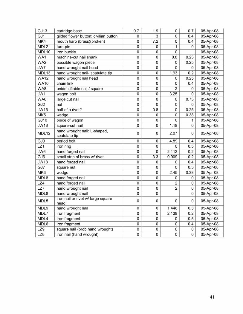
41
GJ13 cartridge base 0.7 1.9 0 0.7 05-Apr-08 GJ1 gilded flower button: civilian button 0 3 0 0.4 05-Apr-08 MK4 mouth harp (brass)(broken) 0 7.2 0 0.4 05-Apr-08 MDL2 turn-pin 0 0 1 0 05-Apr-08 MDL10 iron buckle 0 0 0 05-Apr-08 WA1 machine-cut nail shank 0 0 0.8 0.25 05-Apr-08 WA2 possible wagon piece 0 0 0 0.25 05-Apr-08 JW7 hand wrought nail head 0 0 0 0 05-Apr-08 MDL13 hand wrought nail- spatulate tip 0 0 1.93 0.2 05-Apr-08 WA12 hand wrought nail head 0 0 0 0.25 05-Apr-08 WA10 chain link 0 0 0 0.4 05-Apr-08 WA8 unidentifiable nail / square 0 0 2 0 05-Apr-08 JW1 wagon bolt 0 0 3.25 0 05-Apr-08 WA6 large cut nail 0 0 0 0.75 05-Apr-08 GJ2 nut 0 0 0 0 05-Apr-08 JW15 half of a rivet? 0 0.8 0 0.25 05-Apr-08 MK5 wedge 0 0 0 0.38 05-Apr-08 GJ10 piece of wagon 0 0 0 1 05-Apr-08 JW16 square-cut nail 0 0 1.18 0 05-Apr-08
MDL12 hand wrought nail: L-shaped, spatulate tip 0 0 2.07 0 05-Apr-08
GJ9 period bolt 0 0 4.89 0.4 05-Apr-08 LZ1 iron ring 0 0 0 0.5 05-Apr-08 JW6 hand forged nail 0 0 2.112 0.2 05-Apr-08 GJ6 small strip of brass w/ rivet 0 3.3 0.909 0.2 05-Apr-08 JW18 hand forged nail 0 0 0 0.4 05-Apr-08 GJ7 square nut 0 0 0 0.5 05-Apr-08 MK3 wedge 0 0 2.45 0.38 05-Apr-08 MDL8 hand forged nail 0 0 0 0 05-Apr-08 LZ4 hand forged nail 0 0 2 0 05-Apr-08 LZ7 hand wrought nail 0 0 2 0 05-Apr-08 MDL8 hand wrought nail 0 0 0 05-Apr-08
MDL5 iron nail or rivet w/ large square head 0 0 0 0 05-Apr-08
MDL9 hand wrought nail 0 0 1.446 0.3 05-Apr-08 MDL7 iron fragment 0 0 2.138 0.2 05-Apr-08 MDL4 iron fragment 0 0 0 0.5 05-Apr-08 MDL6 iron fragment 0 0 0 0.4 05-Apr-08 LZ9 square nail (prob hand wrought) 0 0 0 0 05-Apr-08 LZ8 iron nail (hand wrought) 0 0 0 0 05-Apr-08

1
App
endi
x C
: C
urre
nt C
ondi
tion
of C
hara
cter
Def
inin
g Fe
atur
es
Aub
urn
Bat
tlefie
ld C
hara
cter
Def
inin
g Fe
atur
es
Feat
ure
Rol
e in
Bat
tle
Loca
tion
Con
ditio
n 1.
C
arol
ina
/ R
ogue
s R
oad
/ Th
ree
Mile
S
witc
h R
oad
Rou
te o
f 3rd
Cor
ps m
arch
from
Thr
ee M
ile
Sw
itch
to G
reen
wic
h.
Follo
ws
Rou
te 6
02 fr
om
Cas
anov
a th
roug
h A
ubur
n to
in
ters
ect t
he m
oder
n W
arre
nton
R
oad
(Rou
te 6
05).
Follo
ws
a tra
ce th
at h
as b
een
mod
erni
zed
and
wid
ened
but
doe
s no
t sho
w s
igni
fican
t de
viat
ion
from
the
orig
inal
trac
e. T
he s
ettin
g th
at is
com
para
ble
to th
at tr
aver
sed
in 1
863.
2.
W
oods
on
the
apex
and
nor
th
end
of
�Chi
ches
ter H
ill�
As
the
III C
orps
adv
ance
d no
rth o
n th
e af
tern
oon
of O
ctob
er 1
3th o
n th
e ro
ad fr
om
Thre
e M
ile S
witc
h (m
oder
n R
ogue
s R
oad
/ R
oute
602
) tow
ards
Aub
urn,
the
dism
ount
ed
cava
lry o
f Brig
. Gen
. Lun
sfor
d L.
Lom
ax
mov
ed to
cha
lleng
e th
e ad
vanc
e fro
m th
e w
oods
on
the
apex
and
nor
th e
nd o
f �C
hich
este
r Hill.
� Th
e U
nion
Brig
ades
of C
ol.
Cha
rles
C. T
. C
ollis
and
Col
. Reg
is d
e Tr
obria
nd d
eplo
yed
quic
kly
to th
e fro
nt ta
king
po
sitio
n in
the
open
fiel
ds e
ast a
nd w
est o
f the
ro
ad.
At th
e co
mm
and
of M
aj. G
en. D
anie
l B.
Fren
ch, C
apt.
Hen
ry S
leep
er�s
10t
h M
assa
chus
etts
Arti
llery
mov
ed in
to b
atte
ry
and
fired
can
iste
r int
o Lo
max
�s d
ism
ount
ed
troop
s. L
omax
�s tr
oops
rapi
dly
with
drew
ac
ross
Ced
ar R
un in
to A
ubur
n, m
ount
ed th
eir
hors
es, a
nd m
oved
wes
t and
sou
th a
cros
s C
edar
Run
on
the
Dou
ble
Pop
lars
Roa
d (m
oder
n O
ld A
ubur
n R
oad
/ Rou
te 6
70).
Loca
ted
on b
oth
side
s of
Rou
te
602
to s
outh
sid
e of
Rou
te 6
70
The
land
s in
volv
ed in
this
act
ion
still
reta
in
muc
h of
thei
r his
toric
cha
ract
er.
Cha
nges
in
clud
e th
e co
nstru
ctio
n of
a la
rge
man
sion
on
the
bluf
f of C
hich
este
r Hill
and
the
cons
truct
ion
of a
sm
all n
umbe
r of r
esid
ence
s on
the
east
sid
e of
Rou
te 6
70 e
ast o
f the
po
int w
here
the
road
beg
ins
to d
esce
nd
tow
ards
Aub
urn.
The
se e
vent
s ar
e no
t of a
m
agni
tude
or v
isib
ility
to d
ram
atic
ally
alte
r the
�s
ense
� of t
he la
ndsc
ape.
The
woo
dlan
ds o
n th
e ap
ex a
nd n
orth
end
of C
hich
este
r Hill
ap
pear
to b
e m
ore
exte
nsiv
e th
an a
t the
tim
e of
the
battl
e.
3.
Brid
ge C
edar
R
un a
t Aub
urn
Use
d by
3rd
Cor
ps to
cro
ss C
edar
Run
at
Aub
urn.
The
exi
sten
ce o
f the
Ced
ar R
un
brid
ge c
ross
ing
at A
ubur
n w
as a
key
feat
ure
that
spu
rred
and
sha
ped
the
battl
e; th
e br
idge
pr
ovid
ing
a cr
ossi
ng o
f the
run
for t
he h
isto
ric
Rog
ues
(Rou
te 6
02) a
nd D
umfri
es ro
ads
(rou
tes
605,
670
, and
667
). T
he b
ridge
was
ke
y to
the
abilit
y of
the
Uni
on to
rapi
dly
depl
oy
its in
fant
ry a
nd c
aval
ry, b
ut m
ost i
mpo
rtant
ly
thei
r abi
lity
to m
ove
thei
r ext
ensi
ve tr
ains
to
war
ds G
reen
wic
h an
d C
atle
tt.
At o
r nea
r loc
atio
n of
mod
ern
Rou
te 6
02 b
ridge
V
iew
ed to
pogr
aphi
cally
the
brid
ge a
ppea
rs
muc
h as
it d
id o
n th
e m
ilitar
y m
aps
of th
e ba
ttle.
The
brid
ge is
a m
oder
n st
ruct
ure
and
the
east
and
wes
t app
roac
hes
of ro
utes
670
an
d 60
2 ha
ve b
een
wid
ened
and
cut
into
the
bluf
f bel
ow �C
hich
este
r Hill�
to a
ccom
mod
ate
mod
ern
traffi
c. R
emna
nts
of w
hat m
ay b
e el
emen
ts o
f an
earli
er tr
ace
for s
ectio
ns o
f R
oute
602
are
the
Ced
ar R
un b
otto
ms
and
alon
g th
e as
cend
ing
trace
of R
oute
670
. A
seco
nd, c
urre
ntly
aba
ndon
ed ro
ad tr
ace
brea
ks fr
om R
oute
602
and
des
cend
the
ravi
ne e
ast o
f Chi
ches
ter H
ill. T
his
trace
de
scen
ds in
to th
e bo
ttom
s of
Ced
ar R
un
whe
re it
is lo
st to
vie
w.
It m
ay b
e a
rem
nant

2
of th
e ea
rly 1
9th
cent
ury
Thre
e M
ile S
witc
h R
oad,
or m
ay a
ctua
lly b
e a
seco
nd, p
aral
lel
trace
of t
he m
id-1
9th
cent
ury
road
that
wou
ld
have
allo
wed
mor
e re
ady
acce
ss fo
r veh
icle
s ut
ilizin
g th
e br
idge
. D
espi
te th
e m
oder
n,
wid
ened
, and
pav
ed b
ridge
and
rem
oval
of a
ll ev
iden
ce o
f the
ear
lier b
ridge
head
, the
ge
nera
l cha
ract
er o
f the
brid
ge is
con
sist
ent
with
that
of t
he m
id-1
9th
cent
ury
and
is n
ot
belie
ved
to s
igni
fican
tly c
ompr
omis
e th
e vi
sual
con
text
or s
ettin
g of
the
battl
efie
ld.
4.
War
rent
on /
Dou
ble
Pop
lars
R
oad
Dou
ble
Pop
lars
Chu
rch
and
adjo
inin
g fie
lds
The
broa
d ro
lling
upla
nds
north
and
sou
th o
f D
oubl
e P
opla
rs R
oad
prov
ided
a z
one
of
enca
mpm
ent f
or th
e tro
ops
of F
itzhu
gh L
ee o
n th
e ev
enin
g of
Oct
ober
13
and
faci
litat
ed h
is
adva
nce
agai
nst t
he U
nion
troo
ps s
cree
ning
th
e II
Cor
ps a
dvan
ce o
n O
ctob
er 1
4. M
etal
de
tect
ing
data
pro
vide
d by
a lo
cal c
olle
ctor
in
dica
tes
that
a la
rge
num
ber o
f arti
llery
fra
gmen
ts w
ere
foun
d on
the
high
ridg
e ea
st
of th
e K
ettle
Win
d fa
rm c
ompl
ex.
It is
be
lieve
d th
at th
is id
entif
ies
the
area
whe
re L
t. C
ol. H
ilary
Jon
es C
onfe
dera
te a
rtille
ry w
ent
into
bat
tery
and
rece
ived
cou
nter
-bat
tery
fire
fro
m U
nion
arti
llery
on
�Cof
fee
Hill�
(Fig
ure
25.
Map
5, F
igur
e 85
).
Mod
ern
Rou
te 6
70 w
est o
f A
ubur
n Th
e ro
ad tr
ace
east
of D
oubl
e P
opla
rs
Chu
rch
tow
ards
Aub
urn
has
been
wid
ened
, re
surfa
ced
and
mod
erni
zed
to a
ccom
mod
ate
mod
ern
vehi
cula
r tra
ffic
but d
oes
not d
evia
te
sign
ifica
ntly
from
that
of t
he m
id-1
9th
cent
ury.
S
ome
loca
l ref
ores
tatio
n ha
s oc
curr
ed b
ut th
e se
nse
of th
e br
oad
upla
nd a
gric
ultu
ral f
ield
s an
d pa
stur
es th
at b
ound
the
road
in 1
863
rem
ains
. D
oubl
e P
opla
r Chu
rch
rem
ains
in
plac
e th
ough
it m
ay h
ave
been
som
ewha
t en
larg
ed. W
ith th
e ex
cept
ion
of th
e 20
th
cent
ury
stru
ctur
es o
n K
ettle
Win
d fa
rm th
at
dom
inat
es th
e hi
gh g
roun
d ab
ove
Ced
ar R
un
wes
t of A
ubur
n (F
igur
e 36
), an
d th
e co
nstru
ctio
n of
som
e m
oder
n re
side
nces
on
the
ridge
s al
ong
Rou
te 6
70 w
here
the
road
de
scen
ds to
war
d A
ubur
n br
idge
, the
fiel
ds
reta
in m
uch
of th
e sa
me
char
acte
r the
y ha
d at
the
time
of th
e ba
ttle
(Fig
ure
46.
Map
A).
S
ectio
ns o
f the
hol
low
wes
t of t
he R
oute
670
de
scen
t to
Ced
ar R
un th
at w
ere
iden
tifie
d as
w
oode
d at
the
time
of th
e ac
tion
have
bee
n cl
eare
d.
5.
St.
Ste
phen
s C
hurc
h B
ecau
se o
f its
loca
tion
and
its m
ilitar
y st
rate
gic
impo
rtanc
e it
was
not
unc
omm
on fo
r tro
ops
from
bot
h si
des
to e
ncam
p on
the
chur
ch g
roun
ds.
At t
he in
ters
ectio
n of
Rou
te 6
67
and
Rou
te 6
03
St.
Ste
phen
s C
hurc
h di
d no
t sur
vive
the
Civ
il W
ar.
The
chur
ch b
urne
d so
met
ime
late
in
the
war
but
the
exac
t dat
e an
d th
e id
entit
y of
th
e tro
ops
invo
lved
is n
ot k
now
n 6.
S
t. S
teph
ens
Roa
d se
rved
as
rout
e of
Stu
art�s
retu
rn to
Aub
urn
and
site
of s
kirm
ishi
ng n
ear A
ubur
n M
oder
n O
ld D
umfri
es R
oad
(Rou
te 6
67)
Whi
le s
how
ing
clea
r evi
denc
e of
wid
enin
g an
d gr
adin
g ap
prop
riate
to m
akin
g th
e ro
ad
usef
ul to
mod
ern
vehi
cles
, the
re is
no
evid
ence
to s
ugge
st th
at th
is ro
ad h
as b
een
sign
ifica
ntly
mov
ed fr
om it
s m
id-1
9th c
entu
ry
trace

3
7.
Hill
on a
nd e
ast
of ro
utes
603
an
d 67
7 ab
ove
Ced
ar R
un
Use
d by
Stu
art o
n O
ctob
er 1
3th
to v
iew
Uni
on
mov
emen
ts a
t Cat
lett
Sta
tion.
A
ccor
ding
to M
cCle
llan,
Stu
art r
ode
from
A
ubur
n to
war
ds S
t. St
ephe
ns C
hurc
h on
the
afte
rnoo
n of
Oct
ober
13t
h. �
Abo
ut th
ree
mile
s fro
m A
ubur
n th
e ro
ad d
ebou
ches
from
the
woo
ds in
to th
e ex
tens
ive
open
fiel
ds th
roug
h w
hich
pas
ses
the
Ora
nge
and
Ale
xand
ria
Rai
lroad
, and
from
this
poi
nt th
e w
hole
co
untry
bet
wee
n C
atle
tt's
Stat
ion
and
Han
over
Jun
ctio
n is
pla
inly
vis
ible
. H
ere
an
exci
ting
scen
e m
et th
e ga
ze o
f the
C
onfe
dera
te h
orse
men
. A
n im
men
se p
ark
of
wag
ons
occu
pied
the
field
s be
twee
n th
e tw
o st
atio
ns; w
hile
infa
ntry
, arti
llery
, and
wag
on
train
s w
ere
hurr
ying
nor
thw
ard
alon
g th
e lin
e of
the
railr
oad,
at f
irst i
n fre
quen
t de
tach
men
ts, a
fterw
ard
in s
tead
y co
lum
ns.
Hid
den
in th
e w
oods
, Stu
art r
emai
ned
in
obse
rvat
ion
of th
e en
emy
for a
long
tim
e�
(pag
e 38
8).
Sou
thea
st o
f the
inte
rsec
tion
of
rout
es 6
03 a
nd 6
77
The
exac
t loc
atio
n of
this
obs
erva
tion
poin
t ha
s no
t bee
n lo
cate
d, in
par
t bec
ause
ther
e is
no
loca
tion
whe
re R
oute
677
�deb
ouch
es
from
the
woo
ds in
to th
e ex
tens
ive
open
fie
lds.
� Th
is e
ntire
are
a re
mai
ns
unde
velo
ped,
how
ever
, a fe
w s
catte
red
farm
stea
ds b
eing
the
only
pos
t-war
stru
ctur
es
in v
iew
.
8.
Aub
urn
Ham
let w
hich
ser
ves
as b
attle
field
land
mar
k ne
ar c
ore
of e
ngag
emen
t. H
ays�
s U
nion
tro
ops
depl
oyed
acr
oss
open
fiel
ds
imm
edia
tely
eas
t of A
ubur
n to
def
end
agai
nst
Stu
art�s
cha
lleng
e as
he
atte
mpt
ed to
w
ithdr
aw fr
om th
e fie
ld.
At i
nter
sect
ion
of ro
utes
602
and
67
0 an
d C
edar
Run
Th
e m
oder
nize
d m
ill st
ruct
ure
and
asso
ciat
ed
race
s; th
e m
iller
�s h
ouse
, and
an
expa
nsiv
e se
t of f
eatu
res
asso
ciat
ed w
ith th
e ar
chae
olog
ical
rem
ains
of t
he M
cCor
mic
k co
mpl
ex a
re e
xtan
t. N
ew h
ouse
s st
and
on
the
low
er s
lope
s of
�Cof
fee
Hill
� beh
ind
and
east
of t
he M
cCor
mic
k co
mpl
ex, a
nd tw
o la
te
19th
/ear
ly 2
0th
cent
ury
fram
e st
ruct
ures
st
and
aban
done
d ea
st o
f the
mill
seat
. W
ith
the
exce
ptio
n of
the
aban
done
d fra
me
stru
ctur
es, t
he m
oder
n ho
uses
sta
nd fa
r en
ough
aw
ay fr
om th
e ro
ads
that
they
do
not
visu
ally
impa
ir th
e �s
ense
� of t
he c
omm
unity
as
it m
ay h
ave
been
in 1
863.
9.
C
edar
Run
O
bsta
cle
to th
e U
nion
adv
ance
at c
ross
ing
of
Rou
te 6
70
Aub
urn
Ced
ar R
un it
self
appe
ars
to b
e si
mila
r to
that
m
id-1
9th
cent
ury.
Whi
le th
e st
ream
bed
has
be
en e
rode
d by
floo
ding
the
open
ings
of t
he
tailr
ace
and
wha
t app
ears
to b
e a
mill
bypa
ss
race
, eas
t and
wes
t of t
he b
ridge
resp
ectiv
ely
are
still
in e
vide
nce.

4
10.
Cof
fee
Hill
Ove
r 1,0
00 m
en o
f Cal
dwel
l�s D
ivis
ion
mov
ed
onto
the
hill
in th
e ea
rly m
orni
ng h
ours
of
Oct
ober
14t
h to
form
a li
ne o
f bat
tle fa
cing
W
arre
nton
. C
ol. J
ohn
R. B
rook
e�s
4th
Brig
ade
was
in p
ositi
on a
bove
Aub
urn,
with
th
e re
mai
ning
brig
ades
of C
ol. N
elso
n A
. M
iles
(1st
), C
ol. P
atric
k K
elly
(2d)
, and
Col
. P
aul F
rank
s (3
d) d
eplo
ying
uph
ill, th
e 3d
B
rigad
e as
sum
ing
Cal
dwel
l�s ri
ght f
lank
.
With
in C
aldw
ell�s
com
man
d, tw
o U
nion
ar
tille
ry b
atte
ries
wer
e de
ploy
ed.
Thes
e w
ere
Cap
t. B
ruce
A. R
icke
tts�s
com
bine
d B
atte
ries
F &
G, F
irst P
enns
ylva
nia
Ligh
t Arti
llery
who
he
ld p
ositi
ons
behi
nd th
e fo
rmin
g ba
ttle
line
and
Cap
t. W
illiam
A. A
rnol
d�s
Bat
tery
A, F
irst
Rho
de Is
land
Lig
ht A
rtille
ry d
escr
ibed
as
bein
g in
rese
rve
furth
er to
the
rear
nea
r A
ubur
n.
Nor
thw
est o
f the
Rou
te 6
02 /
Rou
te 6
70 c
ross
ing
of C
edar
Run
Th
e la
nd w
here
eac
h pr
obab
ly w
ent i
nto
batte
ry h
as u
nder
gone
20t
h ce
ntur
y re
side
ntia
l dev
elop
men
t.
11.
Woo
ded
heig
ht
Terr
ain
feat
ure
whe
re C
arro
ll�s
Uni
on b
rigad
e w
as s
ituat
ed s
outh
of A
ubur
n A
s th
e U
nion
II
Cor
ps a
dvan
ced
north
on
the
afte
rnoo
n of
O
ctob
er 1
3th
on th
e ro
ad fr
om T
hree
Mile
S
witc
h (m
oder
n R
ogue
s R
oad
/ Rou
te 6
02)
tow
ards
Aub
urn,
Tay
lor�s
Cav
alry
and
C
arro
ll�s
Uni
on in
fant
ry to
ok p
ositi
on o
n th
e he
ight
s at
the
north
end
of �
Chi
ches
ter H
ill� to
sc
reen
the
adva
ncin
g tra
ins
from
any
C
onfe
dera
te a
dvan
ce a
long
the
Dou
ble
Pop
lars
Roa
d (R
oute
670
). T
hey
rem
aine
d in
th
is v
icin
ity u
ntil
Stua
rt�s
atta
ck o
n th
e m
orni
ng
of th
e 14
th.
This
ser
ves
as th
e op
posi
ng h
ill to
C
offe
e H
ill.
Th
e la
nds
invo
lved
in th
is a
ctio
n st
ill re
tain
m
uch
of th
eir h
isto
ric c
hara
cter
. C
hang
es
incl
ude
the
cons
truct
ion
of a
larg
e m
ansi
on
on th
e bl
uff o
f Chi
ches
ter H
ill an
d th
e co
nstru
ctio
n of
a s
mal
l num
ber o
f res
iden
ces
on th
e ea
st s
ide
of R
oute
670
eas
t of t
he
poin
t whe
re th
e ro
ad b
egin
s to
des
cend
to
war
ds A
ubur
n. T
hese
eve
nts
are
not o
f a
mag
nitu
de o
r vis
ibilit
y to
dra
mat
ical
ly a
lter t
he
�sen
se� o
f the
land
scap
e. T
he w
oodl
ands
on
the
apex
and
nor
th e
nd o
f Chi
ches
ter H
ill
appe
ar to
be
mor
e ex
tens
ive
than
at t
he ti
me
of th
e ba
ttle.
12
. D
umfri
es R
oad
Rou
te o
f Rod
es�s
adv
ance
to th
e ba
ttlef
ield
fro
m W
arre
nton
C
onfo
rms
to m
oder
n R
oute
605
.
13.
Nea
vil�s
Mill
H
isto
ric m
ill si
te p
rese
nt a
t tim
e of
bat
tle
at th
e so
uthe
ast c
orne
r of r
oute
s 60
2 an
d 67
0 N
eavi
l�s M
ill ha
s be
en re
nova
ted
and
mod
erni
zed,
but
man
y of
the
seco
ndar
y he
ad
and
tailr
ace
feat
ures
are
stil
l pre
sent
to b
e in
terp
rete
d.
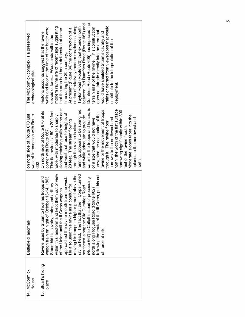
5
14.
McC
orm
ick
Hou
se
Bat
tlefie
ld la
ndm
ark
on n
orth
sid
e of
Rou
te 6
70 ju
st
wes
t of i
nter
sect
ion
with
Rou
te
602
The
McC
orm
ick
com
plex
is a
pre
serv
ed
arch
aeol
ogic
al s
ite.
15.
Stu
art�s
hid
ing
plac
e R
avin
e us
ed b
y S
tuar
t to
hide
his
troo
ps a
nd
wag
on tr
ain
on n
ight
of O
ctob
er 1
3-14
, 186
3.
Stu
art h
id h
is c
aval
ry, t
rain
s, a
nd a
rtille
ry
with
in th
is la
ndfo
rm a
nd k
ept t
hem
out
of v
iew
of
the
Uni
on u
ntil
the
II C
orps
wag
ons
appr
oach
ed th
e ra
vine
mou
th fr
om th
e w
est.
H
e al
so u
sed
this
ravi
ne a
s a
cond
uit f
or
mov
ing
his
troop
s to
hig
her g
roun
d ab
ove
the
ravi
ne h
ead.
The
fact
that
the
II C
orps
turn
ed
sout
heas
t alo
ng th
e O
ld D
umfri
es R
oad
(Rou
te 6
67) t
o C
atle
tt in
stea
d of
pro
ceed
ing
north
alo
ng R
ogue
s R
oad
(Rou
te 6
02)
follo
win
g th
e ro
ute
of th
e III
Cor
ps, p
ut h
is c
ut
off f
orce
at r
isk.
On
north
sid
e of
Rou
te 6
70 a
t its
co
rner
with
Rou
te 6
67.
This
flat
ravi
ne is
150
to 2
00 fe
et
wid
e, w
ith m
oder
ate
to s
harp
ly
slop
ing
reta
inin
g w
alls
on
the
east
an
d w
est t
hat r
ose
to h
eigh
ts o
f 20
feet
. Th
e st
ream
flow
ing
thro
ugh
the
ravi
ne is
cle
ar
runn
ing,
app
ears
to b
e sp
ring
fed,
an
d w
hile
ade
quat
e to
pro
vide
w
ater
for t
he tr
oops
and
hor
ses,
is
of a
siz
e th
at w
ould
not
hav
e pr
even
ted
the
occu
patio
n of
the
ravi
ne o
r the
mov
emen
t of t
roop
s th
roug
h it.
The
ravi
ne fl
oor
narr
ows
to th
e no
rthw
est a
nd
north
, the
wid
th o
f the
flat
sur
face
na
rrow
ing
sign
ifica
ntly
with
in 3
00
feet
of t
he ra
vine
mou
th.
Mod
erat
e sl
opes
tape
r int
o th
e up
land
s to
the
north
wes
t and
no
rth.
His
toric
acc
ount
s su
gges
t tha
t the
ravi
ne
wal
ls a
nd fl
oor a
t the
tim
e of
the
battl
e w
ere
devo
id o
f for
est.
Woo
dlan
ds w
ithin
the
mod
ern
ravi
ne a
re o
f rec
ent a
ge s
ugge
stin
g th
at th
e ar
ea h
ad b
een
defo
rest
ed a
t som
e tim
e du
ring
the
20th
cen
tury
,.
At p
rese
nt (F
igur
e 84
) the
con
stru
ctio
n of
a
serie
s of
rela
tivel
y m
oder
n re
side
nces
alo
ng
Tayl
or R
oad
(Rou
te 6
70) t
hat e
xten
ds n
orth
be
twee
n O
ld D
umfri
es R
oad
(Rou
te 6
67) a
nd
Dum
fries
Roa
d (R
oute
605
) has
impa
cted
the
terr
ain
east
of t
he ra
vine
. Th
is c
onst
ruct
ion
does
not
intru
de d
irect
ly in
to th
e ar
ea th
at
wou
ld h
ave
shie
lded
Stu
art�s
cav
alry
and
tra
ins
or d
etra
ct fr
om v
iew
scap
es th
at w
ould
co
ntrib
ute
to th
e in
terp
reta
tion
of th
e de
ploy
men
t.