Embed Size (px)
Citation preview
U N I T 3 G E O G R A P H Y C H A L L E N G E
© Teachers’ Curriculum Institute1 Unit 3 Geography Challenge © Teachers’ Curriculum Institute1 Unit 3 Geography Challenge
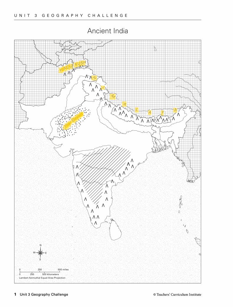
Ancient India
H
I
M
AL
A YA
N
S
EW
0 250 500 kilometers
0
Lambert Azimuthal Equal-Area Projection
250 500 miles
HINDU KUSH
Thar Desert
H
I
M
AL
A YA
HINDU KUSH
Thar Desert
N
S
EW
0 250 500 kilometers
0
Lambert Azimuthal Equal-Area Projection
250 500 miles
AW_ISN_U03_01 Indian subcontinentSecond ProofTCI18 107
U N I T 3 G E O G R A P H Y C H A L L E N G E
© Teachers’ Curriculum Institute Unit 3 Geography Challenge 2
Geography SkillsAnalyze the maps in “Setting the Stage” for Unit 3 in the Student Text. Then answer the following questions and fill out the map as directed.
1. Which bodies of water surround the southern part of ancient India? Label them on your map.
2. India is part of which continent?
3. Locate the Indus, Ganges, and Brahmaputra rivers on your map and label them.
4. Between what two mountain ranges is the Deccan Plateau located? Label these mountains and the plateau.
5. Locate the Himalayas on your map and circle the label. What makes this mountain range unique?
6. Look at the large map of ancient India in the Unit 3 “Setting the Stage” in the Student Text. Also look at the small map that shows the Mauryan Empire, an empire in ancient India. Describe the geographical boundaries of the Mauryan Empire.
7. Now look in your the Student Text at the small map of the Gupta Empire. Which empire was larger, the Mauryan or the Gupta?
8. Into what body of water does the Indus River empty? The Ganges River?
U N I T 3 G E O G R A P H Y C H A L L E N G E
© Teachers’ Curriculum Institute3 Unit 3 Geography Challenge © Teachers’ Curriculum Institute3 Unit 3 Geography Challenge
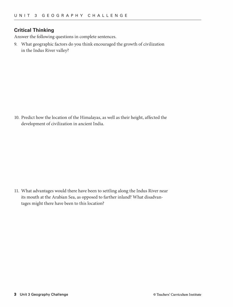
Critical ThinkingAnswer the following questions in complete sentences.9. What geographic factors do you think encouraged the growth of civilization
in the Indus River valley?
10. Predict how the location of the Himalayas, as well as their height, affected the development of civilization in ancient India.
11. What advantages would there have been to settling along the Indus River near its mouth at the Arabian Sea, as opposed to farther inland? What disadvan-tages might there have been to this location?
P R E V I E W
© Teachers’ Curriculum Institute Geography and the Early Settlement of India 4
Geography and the Early Settlement of India
I N T E R A C T I V E S T U D E N T N O T E B O O K
How did geography affect early settlement in India?
You are part of a group of people living in ancient times. Your group needs to move, and you have been chosen to find a new location for resettlement. You travel until you find the perfect spot. No one lives there, and it has everything your group needs. What a location! Now you have to convince the others that this is the right place for your group’s new home.
In the space below, draw and label a picture of the place you have chosen. Show the types of features and characteristics that make this an ideal place to settle.
Social Studies VocabularyAs you complete the Reading Notes, use these terms in your answers.
R E A D I N G N O T E S
subcontinent monsoon plateau
I N T E R A C T I V E S T U D E N T N O T E B O O K
© Teachers’ Curriculum Institute5 Geography and the Early Settlement of India
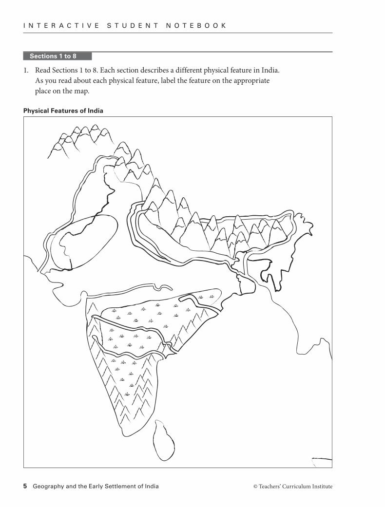
Sections 1 to 8
1. Read Sections 1 to 8. Each section describes a different physical feature in India. As you read about each physical feature, label the feature on the appropriate place on the map.
AW_ISN_13_01 India’s Physical FeaturesBlack First ProofTCI18 57
Physical Features of India
I N T E R A C T I V E S T U D E N T N O T E B O O K
© Teachers’ Curriculum Institute Geography and the Early Settlement of India 6
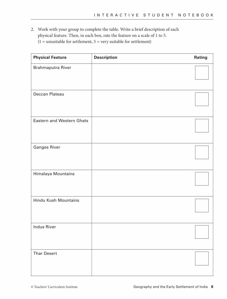
2. Work with your group to complete the table. Write a brief description of each physical feature. Then, in each box, rate the feature on a scale of 1 to 5. (1 = unsuitable for settlement, 5 = very suitable for settlement)
Physical Feature Description Rating
Brahmaputra River
Deccan Plateau
Eastern and Western Ghats
Ganges River
Himalaya Mountains
Hindu Kush Mountains
Indus River
Thar Desert
I N T E R A C T I V E S T U D E N T N O T E B O O K
© Teachers’ Curriculum Institute7 Geography and the Early Settlement of India
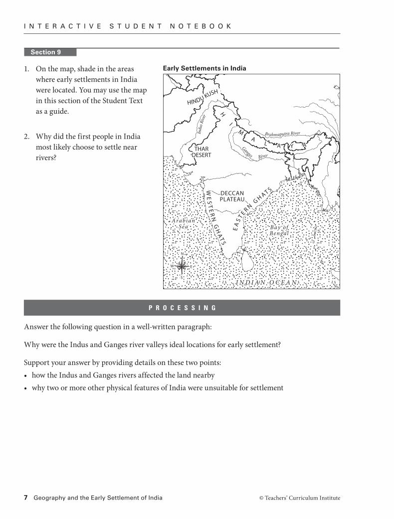
1. On the map, shade in the areas where early settlements in India were located. You may use the map in this section of the Student Text as a guide.
2. Why did the first people in India most likely choose to settle near rivers?
Answer the following question in a well-written paragraph:
Why were the Indus and Ganges river valleys ideal locations for early settlement?
Support your answer by providing details on these two points:• how the Indus and Ganges rivers affected the land nearby• why two or more other physical features of India were unsuitable for settlement
P R O C E S S I N G
THARDESERT
DECCANPLATEAU
H
IM
AL A Y A
WE
ST
ER
N G
HA
TS
EA
ST E R N
GH AT S
I N D I A N O C E A N
Bay ofBengal
ArabianSea
THARDESERT
DECCANPLATEAU
H
IM
AL A Y A
HINDU KUSH
WE
ST
ER
N G
HA
TS
EA
ST E R N
GH AT S
I N D I A N O C E A N
Bay ofBengal
ArabianSea
Ganges River
Indu
s Rive
r
Brahmaputra River
N
S
EW
Early Settlements in India
Section 9
I N T E R A C T I V E S T U D E N T N O T E B O O K
© Teachers’ Curriculum Institute Geography and the Early Settlement of India 8
Preparing to Write: Finding Accurate InformationThe article “Saving the Ganges” contains both facts and opinions. Facts are statements that can be proved or verified to be true. Opinions are statements of belief or judgment that cannot be proved and that differ among people.
List five facts the article tells you about the Ganges (not the opinions of the author or of the people mentioned in the article). For each fact, suggest some possible sources where the information might be found and verified.
Example: The Ganges begins where a number of small streams form from melting glaciers in the Himalaya Mountains. (maps, photographs)
1.
2.
3.
4.
5.
R E A D I N G F U R T H E R
I N T E R A C T I V E S T U D E N T N O T E B O O K
© Teachers’ Curriculum Institute9 Geography and the Early Settlement of India
Planning a Research ReportSuppose that you wanted to write an environmental report on the water used by your community. Think about the article you have just read about the Ganges River. What important questions would you ask? What would be your sources of information? How could you evaluate the accuracy of the different sources?
Add three questions to the left column of the chart. In the right column, list source(s) that could most accurately help you find the answers. Two examples are provided.
Use this rubric to evaluate your questions. Make changes to your work if you need to.
Score Description
3 Each question is very relevant to the research topic. The source or sources will provide a reliable, factual answer to each question. There are no spelling or grammar errors.
2 The questions are somewhat relevant to the topic. Sources may be helpful in answering the question. There are some spelling or grammar errors.
1 Few or none of the questions are relevant to the topic. Sources are randomly chosen and may not reliably answer the questions. There are many spelling or grammar errors.
What do you want to know? What sources could you use for information?
How clean is the water in your community for drinking, cooking, and bathing?
Longtime residents of your community City water department City, county, or state health department Water-system engineers Web sites Maps
Where does our water supply come from?
City or town water department, maps