Embed Size (px)
Citation preview
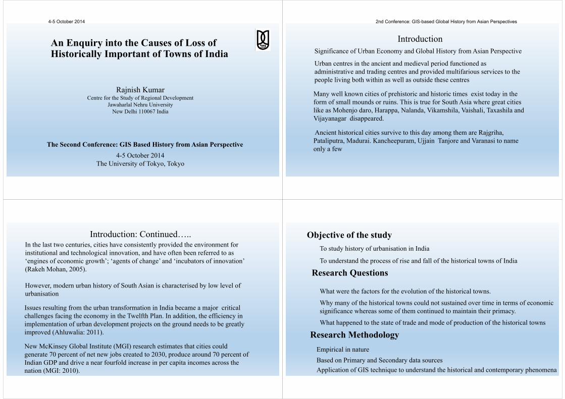
An Enquiry into the Causes of Loss of Historically Important of Towns of India
Rajnish KumarCentre for the Study of Regional Development
Jawaharlal Nehru UniversityNew Delhi 110067 India
The Second Conference: GIS Based History from Asian Perspective4-5 October 2014
The University of Tokyo, Tokyo
Many well known cities of prehistoric and historic times exist today in the form of small mounds or ruins. This is true for South Asia where great cities like as Mohenjo daro, Harappa, Nalanda, Vikamshila, Vaishali, Taxashila and Vijayanagar disappeared.
Ancient historical cities survive to this day among them are Rajgriha, Pataliputra, Madurai. Kancheepuram, Ujjain Tanjore and Varanasi to name only a few
Urban centres in the ancient and medieval period functioned as administrative and trading centres and provided multifarious services to the people living both within as well as outside these centres
IntroductionSignificance of Urban Economy and Global History from Asian Perspective
Introduction: Continued…..In the last two centuries, cities have consistently provided the environment for institutional and technological innovation, and have often been referred to as ‘engines of economic growth’; ‘agents of change’ and ‘incubators of innovation’ (Rakeh Mohan, 2005).
However, modern urban history of South Asian is characterised by low level of urbanisation
Issues resulting from the urban transformation in India became a major critical challenges facing the economy in the Twelfth Plan. In addition, the efficiency in implementation of urban development projects on the ground needs to be greatly improved (Ahluwalia: 2011).
New McKinsey Global Institute (MGI) research estimates that cities could generate 70 percent of net new jobs created to 2030, produce around 70 percent of Indian GDP and drive a near fourfold increase in per capita incomes across the nation (MGI: 2010).
Objective of the study
Research Questions
Research Methodology
To study history of urbanisation in India
To understand the process of rise and fall of the historical towns of India
Empirical in natureBased on Primary and Secondary data sourcesApplication of GIS technique to understand the historical and contemporary phenomena
What were the factors for the evolution of the historical towns.
Why many of the historical towns could not sustained over time in terms of economic significance whereas some of them continued to maintain their primacy.
What happened to the state of trade and mode of production of the historical towns
4-5 October 2014 2nd Conference: GIS-based Global History from Asian Perspectives

The first urbanization took place during the bronze age in the arid and semi‐arid region of northwest India in the valleys of the Indus and the Saraswati rivers, the latter represented by the now dry Ghaggar–Hakra bed. This urbanization is known as the Indus or Harappan civilization which flourished during 3500–1500 B.C. (Mishra, 2001)
Map 1Spatial Distribution of Settlements of Indus Valley Civilization
Lothal
Harrapa
KalibanganMohenjo Daro
The second phase of urbanization of India, marked by trade, coinage, script and birth of the first Indian empire, namely Magadha, with its capital at Pataliputra (modern Patna) also took place in this region in the sixth century B.C. (Mishra, 2001)
Middle Ganga Plains emerges as cradle of civilization with sixteen Janpadas found spread over North, Central and Eastern India
Sixteen Janpadas: Patna, Mathura, UjjainSouthern India: Pandayas, Chola and Cherarulers Tanjore, Madurai and Kanchipuram
The third phase of urbanization of India began with the Turko-Afghans. The need for ruling over provinces led to some Turko-Afghan officials and nobles being stationed in the various provinces of the state which led emergence of new TownsSpatial Expansion across North and East India: Dehli, Fatehpur Sikri, Agra, Lucknow, Jaunpur, etc.Western, Central and South India also
Towns of Middle Ganga Plain1170-1290: Jaunpur, Benarus, Chunar Patna, Maner, Gaya Rajmahal, Gaur and Lakhnaur( Khiljis) Ruled by MAMLUKS1290-1390: Jaunpur, Benarus, Chunar, Halhi simraioan, Sugauna, Patna, Maner, Gaya, Bihar Sharif, , Gaur and Lakhnaur( Tughlaq)1390-1526: Jaunpur, Benarus, Chunar, Rohtasgarh, Sugauna, Patna, Maner, Kahalgoan, Hajipur, Barh, , Gaur and Lakhnaur( Lodhi)1526-1760: Jaunpur, Benarus, Chunar, Rohtasgarh, Chausa, Sasaram, Patna, Monghyr, Kahalgoan, Hajipur, Bihar, , Teliyagarhi, Pandua, British Admin Division 1860: Bihar Saran, Tirhut, Monghyr, Bhagalpore, Purnea, Behar, Patna, Shahabad(A Historical Atlas of South Asia: Edited by J E Schwartzberg)
European traders especially Ducth, Portuguse, British and French facilitated fourth phase of urbanisation which was influenced by western concept of civic body and town planning. Costal belt of India and inland river ports was their favourite destination for the selection of town siteThe Portuguese were the first to establish new port towns in India – Panaji in Goa in 1510 and Bombay in 1532. They were followed by the Dutch –Machilipatnam in 1605 and Nagapattinam in 1658; and the French –Pondicherry in 1673 and Chandranagore in 1690. The British established Madras in 1639 and Calcutta in 1690.
Madras : Corporation for urban governance in 1642Calcutta: 1726 Urban local bodyEmergence of Urban Local Body in Bengal: Bengal District Municipal Act 1864Lalganj Municipality 1869
Urban Local Body
4-5 October 2014 2nd Conference: GIS-based Global History from Asian Perspectives

Fourth Phase of Urbanisation:Emergence of Colonial Towns: Mumbai, Kolkata, Chennai, Goa etc.Fifth Phase of Urbanisation: Modern Town Industrial: Bhillai, Asansole, Dhanbad, Jamsedpur, Ludhiana, Faridabad
Census of India: 53 Million Plus CityKerala has the highest, Odisha and North East has noneMiddle Ganga plain and South India: Ancient towns like Patna, Benarus, Prayag, Madurai became million plus townMajority of Million plus cities are historical towns which came into existence during medieval period. North, Central and Western India has dominance of million plus towns
Tirhut
KosiSaran
Bhagalpur
Patna
Magadh
Purnia
Munger
Darbhanga
2011
BIHAR: Administrative Divisions
Spatio‐temporal Pattern of Urbanisation in BiharPATNA: Only Million Plus City Kosi: Least Urbanised regionPurnia and Kosi: Stagnant Urbanisation Level during last 50 Years
Distribution of Towns in Bihar1901 As per Census Town Directory: 43 Towns in 1901
TOWN ULB AREA POP_1901 POP_1951 POP_2011 Density
PATNA M. Corp. 108.34 134785 283470 1684222 15546BHAGALPUR M. Corp. 30.17 75760 114530 400146 13263
LALGANJ NP 7.86 11502 12394 37098 4720
PHULWARI SHARIF NP 6.48 3415 0 81740 12614
SHERGHATI NP 10.79 2641 7009 40666 3769
Lalganj Lalganj
Town Growth Index(1901=100)Katihar (2467)Phulwari (2394)Aurangabad (2182)Patna (1250)Hajipur (690)Muzaffarpur ( 777)Lalganj (323)Tekari (331)Mirganj (271)
4-5 October 2014 2nd Conference: GIS-based Global History from Asian Perspectives

A Study of Lalganj: A Historical Town, Vaishali, Bihar• Location: Lalganj Nagar Panchayat is situated at the left bank of the river Gandak.
It is connect with Hajipur, Patna and Muzaffarpur through road network. It is very near to Vaishali archaeological site
• History: Religious significance for Hindu, Muslim, Buddhist and SikhHindu religious literature: Ashram of Chaman Rishi and Shringi RishiJama Masjid: 300 year old mosque in the heart of the townGuru Govind singh: birth place of his sonBuddha kotigram (biddupur) and Nadikagram ( lalganj) reached Vaishali
In Budhishist pali literature it has been identified as Singiya (pali Simhika) Riverportvinaypapak and mahabhag: trade with patligram and rajgriha• Influence of Muslim ruler of medival period, it got Muslim name Lalganj by Lal
Khan Hajipur (hazi Illias)• Muslim settlements: Sarai, Ganj, Chak,• Important cultural centre in freedom struggle (Sharda Sadan Library)
Tin Pulwa Chowk
Ghandhi Chowk
Nagar Panchayat Office
Sharda Library
Jama Masjid
Emergence of Lalganj Town
• Agriculture surplus, trade and manufacturingRice and sugarcaneCotton two main cash cropOilseed, indigo, poppy, tobacco Raw silkPlantation of mulberry trees
• Land and water connectivity• European traders realised Commercial potential of the region• Jobe Charnock: 1659 instrumental in opening factory at Singia Indigo Factory,
Lalganj• Extreme proximity to primate city like Patna • Served as transit town on way to Nepal.
Lalganj: A Centre of Trade and Manufacturing during 18th Centaury
• Textile, saltpetre, silk, sugar, indigo, metallic goods, agricultural tools swords, shields etc., boat making, oil processing
• Patna: main textile centre• Saltpetre of good quality and great quantity: Three variety
Doboras cobessa refined varietydabara and kutcha (raw)Refining is done by both local and Europian companies
• Sugar: brown sugar candy and white sugar• Contemporary trading centres: Baikunthpur, Chapra, Gaya, Dumra, Hathidih,
more, Mokamah, Pandarak, Barh, Athmal gola, Rani Sarie, Futuh (John Marshall)• Hajipur ( Minapore-pottery; Jahnabad-cotton goods Nanagaur nine mile saltpetre• Spices
4-5 October 2014 2nd Conference: GIS-based Global History from Asian Perspectives

010203040506070
% WPR Cultivator Agrilabour
HHIndustry
Others
2011 1961
115029074
71489192 9481
123941355915798
19535
24927
29873
37098
‐30.0
‐20.0
‐10.0
0.0
10.0
20.0
30.0
05000
10000150002000025000300003500040000
1901
1911
1921
1931
1941
1951
1961
1971
1981
1991
2001
2011
Lalganj Domography
Population Growth Employment Characteristics
Decadal Growth Rate
Population Growth
Lalganj was important Qasba and river port. It was the part of Tirhut district and became Lalganj Municipal Board in 1869 with 11 Commissioners along with Hajipur and Sitamarhi. The town lost 3 sq miles area during 1951 Census.Lalganj Municipality had 4 wards till 1972, 1981: 12 wards, 14 wards: 2001 and 19 ward: 2011
Lalganj TownFreedom struggle and GandhijiA Cultural Centre: Sharda SadanLibrary: Swami Satyanand ParivrajakEarthquake of 1934Lalganj serves as a local town of
AdministrationMarketEducationHealth
State of Urban GovernanceExecutive OfficeBasic infrastructureNo street lightPoor Waste collectionPoor Road connectionNo public toilet
State of Development and Human Development at Lalganj
Human Capital: Low literacy in many southern wardsEconomic Activities: Agriculture is still dominant in many of the municipal wards
Why Lalganj Lagged behind
Geographical : Primacy of Neighbourhood towns like Hajipur. Muzaffarpur and PatnaLoss of hinterlandRegional backwardness
Economic:Modern Technology: Decline of Inland water trade
Change in mode of production (Agriculture and manufacturing)Decline in public investment
Political: Quality of Governance
Historical: Shift in Centre of Power:Influx of Plague
Social: Social stratification and LeadershipNatural: Flood and Earthquake
The history of major Indian towns do not match with theory of modern urbanisation. Urbanisation is generally promoted by (i) economies of scale in production particularly in manufacturing; (ii) the existence of information externalities; (iii) technology development, particularly in building and transportation technology; (iv) substitution of capital for land as made possible by techno-logical developments.Indian urban centres have become a service hub where urban governance, basic infrastructure and manufacturing has not been given much priority
The causative factors behind urbanization varied from time to time,leading to not one but several urbanization processes at different pointsin time
The story of urbanization in India in historical times is a story of spatial and temporal discontinuities
Conclusion
4-5 October 2014 2nd Conference: GIS-based Global History from Asian Perspectives

The Way ForwardIncreasing disparity between urban agglomeration and metropolis like Dhaka, Delhi, Mumbai, Karachi and rural areas of South Asia demands balanced regional development where there should be synergies among all three sectors (primary, secondary and tertiary) of economy.
Exploring the possibility of rejuvenation of the less developed historical towns may become the pathway for sustainable urbanisation.
Function of Towns and Urban Morphology in the historical times witnesses significant change which requires further investigation. GIS can help us in better understanding of global history of urbanisation.
Thank [email protected]
4-5 October 2014 2nd Conference: GIS-based Global History from Asian Perspectives

4-5 October 2014 2nd Conference: GIS-based Global History from Asian Perspectives

4-5 October 2014 2nd Conference: GIS-based Global History from Asian Perspectives