Embed Size (px)
Citation preview
AkhmadiRahmithaYudi Fajar
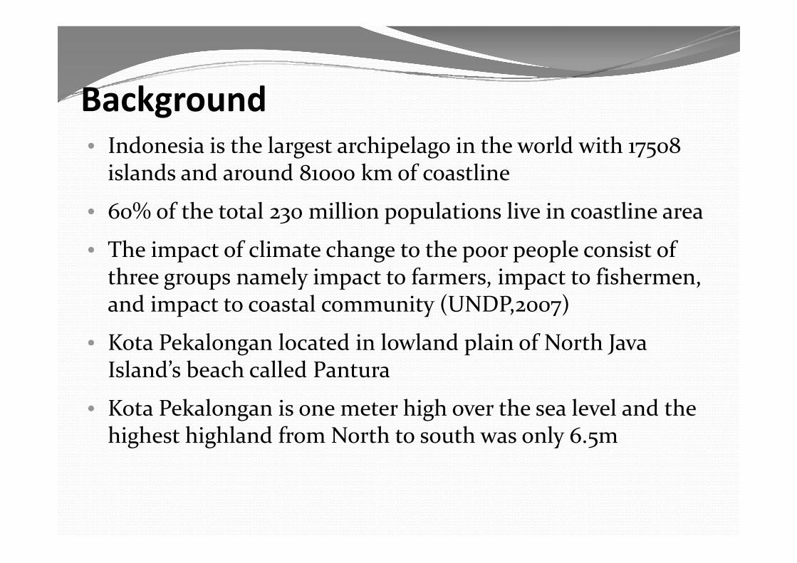
B k dBackground• Indonesia is the largest archipelago in the world with 17508 g p g 75
islands and around 81000 km of coastline
• 60% of the total 230 million populations live in coastline area60% of the total 230 million populations live in coastline area
• The impact of climate change to the poor people consist of three groups namely impact to farmers impact to fishermenthree groups namely impact to farmers, impact to fishermen, and impact to coastal community (UNDP,2007)
• Kota Pekalongan located in lowland plain of North JavaKota Pekalongan located in lowland plain of North Java Island’s beach called Pantura
• Kota Pekalongan is one meter high over the sea level and the• Kota Pekalongan is one meter high over the sea level and the highest highland from North to south was only 6.5m
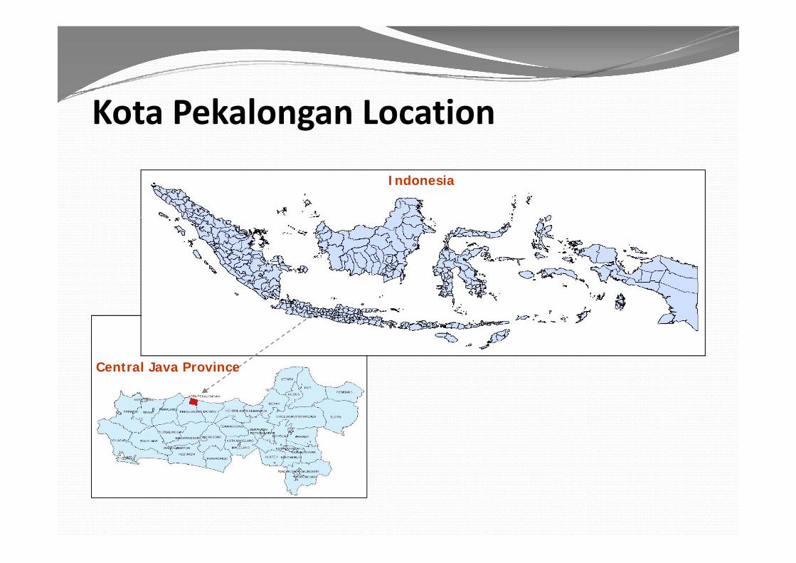
Kota Pekalongan Location
Indonesia
Central Java Province
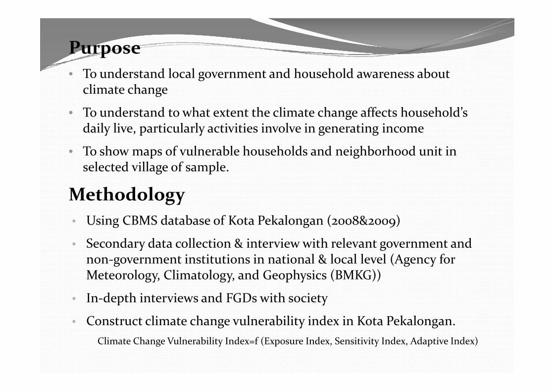
Purpose• To understand local government and household awareness about
climate change
d d h h l h ff h h ld’• To understand to what extent the climate change affects household’s daily live, particularly activities involve in generating income
• To show maps of vulnerable households and neighborhood unit in• To show maps of vulnerable households and neighborhood unit in selected village of sample.
MethodologyMethodology• Using CBMS database of Kota Pekalongan (2008&2009)
S d d t ll ti & i t i ith l t t d• Secondary data collection & interview with relevant government and non-government institutions in national & local level (Agency for Meteorology, Climatology, and Geophysics (BMKG))
• In-depth interviews and FGDs with society
• Construct climate change vulnerability index in Kota Pekalongan.Climate Change Vulnerability Index=f (Exposure Index, Sensitivity Index, Adaptive Index)
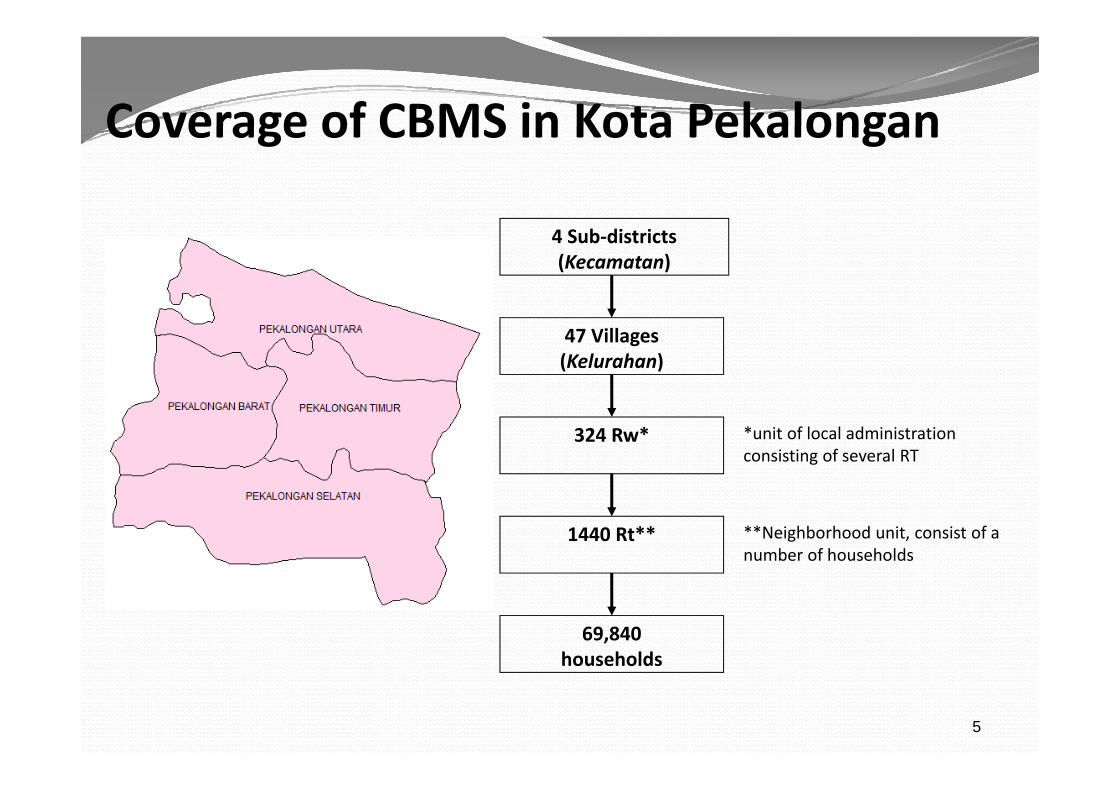
Coverage of CBMS in Kota PekalonganCoverage of CBMS in Kota Pekalongan
4 Sub-districts(Kecamatan)
47 Villages(Kelurahan)
324 Rw* *unit of local administration consisting of several RT
1440 Rt** **Neighborhood unit, consist of a number of households
69,840 households
5
households
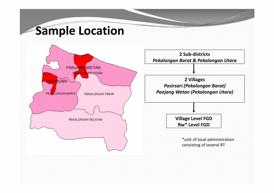
Sample LocationSample Location
2 S b di i2 Sub-districtsPekalongan Barat & Pekalongan Utara
2 VillagesPasirsari (Pekalongan Barat)
Panjang Wetan (Pekalongan Utara)
Village Level FGDVillage Level FGDRw* Level FGD
*unit of local administrationunit of local administration consisting of several RT

Drainage System
Kandang PanjangBandengan Panjang Baru
Ke Kab. Pekalongan
LAUT JAWA
Kandang PanjangBandengan Panjang Baru
Ke Kab. Pekalongan
LAUT JAWA
According to geographical location, KEC. PEKALONGAN UTARA
Kandang PanjangPanjang Wetan
Krapyak Lor
Degayu
Krapyak Kidul
Krapyak Kidul
KlegoSugih Waras
Sampangan
Kraton Kidul
Dukuh
DukuhKraton Lor
Kraton Kidul
Wil. KabPekalongan Wil. Kab
Pekalongan
Pabean
Kramatsari
Pasir Sari
KAB. PEKALONGAN
Ke Batang
KEC. PEKALONGAN UTARA
Kandang PanjangPanjang Wetan
Krapyak Lor
Degayu
Krapyak Kidul
Krapyak Kidul
KlegoSugih Waras
Sampangan
Kraton Kidul
Dukuh
DukuhKraton Lor
Kraton Kidul
Wil. KabPekalongan Wil. Kab
Pekalongan
Pabean
Kramatsari
Pasir Sari
KAB. PEKALONGAN
Ke Batang
Kota Pekalongan is vulnerable from climate hazards (Floods, coastal inundation, Landslide)
KEC. PEKALONGAN TIMUR
KEC. PEKALONGAN BARAT
Poncol
Kauman
KeputranKergon
Noyontaan
Karang Malang
Gamer
Baros
Sokorejo
Y j
Bumirejo
Tirto
Podosugih
Bendang
KAB. BATANG
Pringlangu
Medono
KebulenLandung Sari
KEC. PEKALONGAN TIMUR
KEC. PEKALONGAN BARAT
Poncol
Kauman
KeputranKergon
Noyontaan
Karang Malang
Gamer
Baros
Sokorejo
Y j
Bumirejo
Tirto
Podosugih
Bendang
KAB. BATANG
Pringlangu
Medono
KebulenLandung Sari
Rivers at Three Drainage System in Kota Pekalongan
KEC. PEKALONGAN SELATAN
Soko
Yosorejo
Kuripan Lor
Jenggot
KradenanBuaran
Banyuurip Alit
Banyuurip Ageng
Ke Kajen
Kuripan Kidul
Kertoharjo Duwet
KAB.
KEC. PEKALONGAN SELATAN
Soko
Yosorejo
Kuripan Lor
Jenggot
KradenanBuaran
Banyuurip Alit
Banyuurip Ageng
Ke Kajen
Kuripan Kidul
Kertoharjo Duwet
KAB.
West Center East
Kali Bremi Kali Sibulanan Kali BangerKali Kranding Kali Banger Lama Kali SusukanKali Pekalongan Kali Cempagan
K li Sit t k
Rivers at Three Drainage System in Kota Pekalongan
Akses Menuju Tol
PEKALONGAN KAB. BATANG
Akses Menuju Tol
PEKALONGAN KAB. BATANG
Kali SitotokKali SokorejoKali Gabus
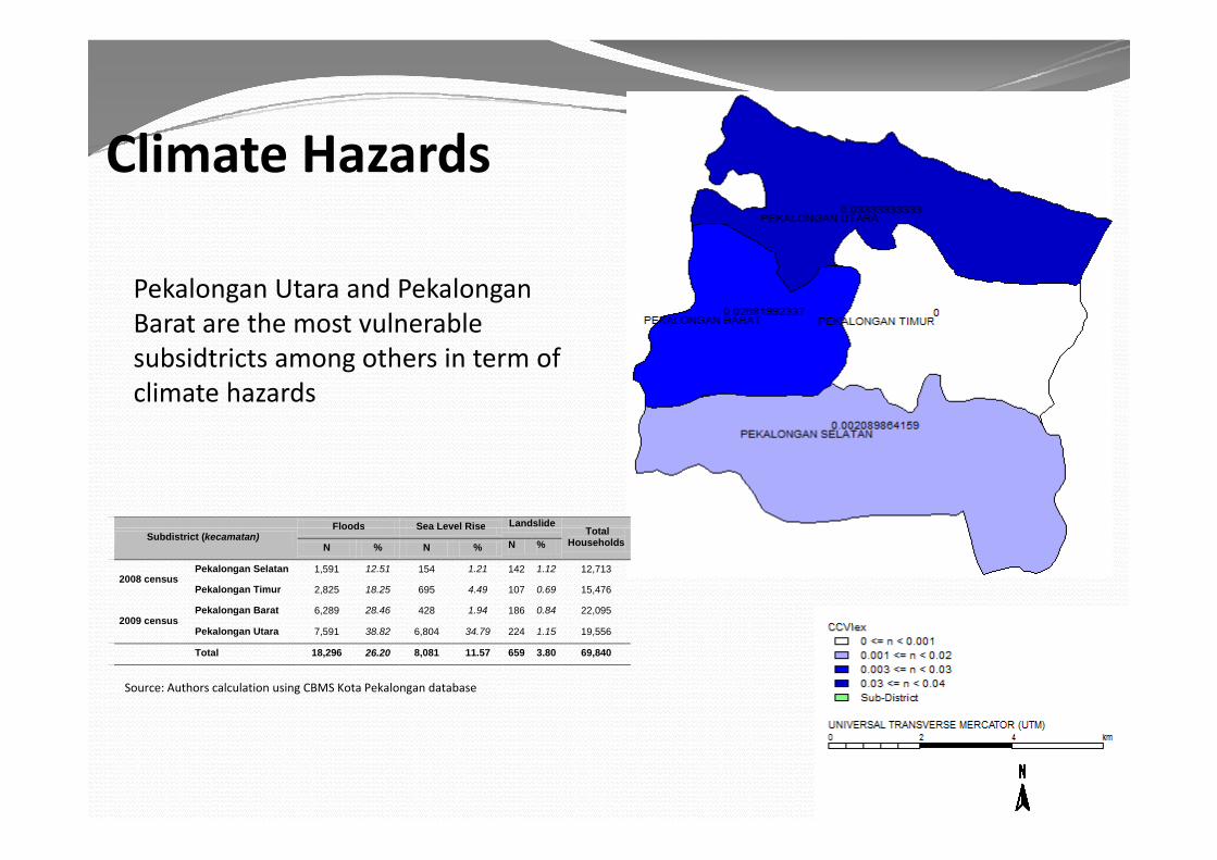
Cli H dClimate Hazards
Pekalongan Utara and Pekalongan Barat are the most vulnerable a a a e e os u e ab esubsidtricts among others in term of climate hazards
Floods Sea Level Rise LandslideT t lSubdistrict (kecamatan)
Floods Sea Level Rise Total Households N % N % N %
2008 census Pekalongan Selatan 1,591 12.51 154 1.21 142 1.12 12,713
Pekalongan Timur 2,825 18.25 695 4.49 107 0.69 15,476
2009 censusPekalongan Barat 6,289 28.46 428 1.94 186 0.84 22,095
Pekalongan Utara 7,591 38.82 6,804 34.79 224 1.15 19,556
Total 18,296 26.20 8,081 11.57 659 3.80 69,840
Source: Authors calculation using CBMS Kota Pekalongan database
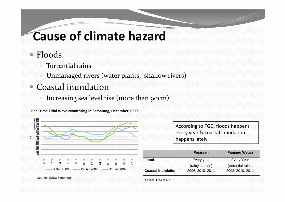
C f li h dCause of climate hazard Floods Floods
Torrential rains Unmanaged rivers (water plants, shallow rivers)g ( p , )
Coastal inundation Increasing sea level rise (more than 90cm)g ( 9 )
120130140
Real Time Tidal Wave Monitoring in Semarang, December 2009
According to FGD, floods happens every year & coastal inundation happens lately
30405060708090
100110120
Cm
Pasirsari Panjang Wetan
Flood Every year
(rainy season)
Every Year
(torrential rains)C t l i d ti 2006 2010 2011 2008 2010 2011
0102030
00.0
0
02.0
0
04.0
0
06.0
0
08.0
0
10.0
0
12.0
0
14.0
0
16.0
0
18.0
0
20.0
0
22.0
0
1 Dec 2009 15 Dec 2009 31 Dec 2009 Coastal inundation 2006, 2010, 2011 2008, 2010, 2011
Source: FDG result
1 Dec 2009 15 Dec 2009 31 Dec 2009
Source: BMKG Semarang

Sensitivity (Impact of Climate Hazards)E iEconomico Batik Sector:
L d i f b tik d b fl d d d i Longer drying process of batik caused by flooded drying areas Deteriorate the quality of batik color because of immersion
waters are contaminated o Agricultural sector: flooded farm (1Ha Rp 30M$3000)o Fishery Sector: s e y Sec o : Dwindling catch Farther fishing areag Unemployed fish porters Low demand of ice manufactures
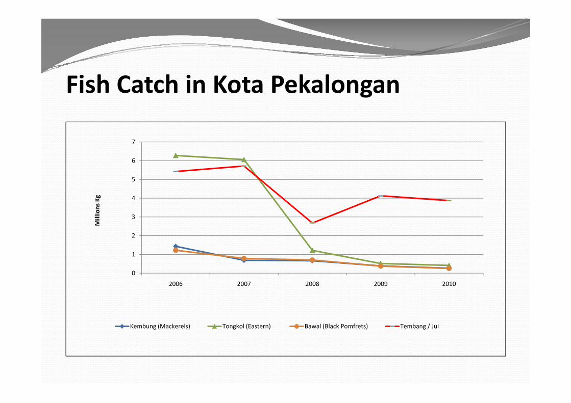
Fish Catch in Kota Pekalongan
7
4
5
6
Kg
2
3
Mill
ions
0
1
2006 2007 2008 2009 2010
Kembung (Mackerels) Tongkol (Eastern) Bawal (Black Pomfrets) Tembang / Jui

Sensitivity (Impact of Climate Hazards) Con’tEducation
o Close the access to the school buildingso Close the access to the school buildings
o Disturb school activities Half holiday/HolidayHealth
o Skin irritation such as itchiness and small bump
o Respiratory diseases such as cough, dengue, diarrhea
P iti di l fil i io Parasitic diseases namely filariasis.
SensitivitySensitivity (Impact of Climate Hazards) Con’tEnvironment and Ecologyo Damaging heritage buildings: mosque in Pasirsari & Prisono Damaging heritage buildings: mosque in Pasirsari & Prison
in Panjang Wetano Damaging animal habitat: less buffalo habitat along the g g g
beacho Damaging fruit and flower garden: disappear of jasmine
d & dgarden & mango gardenHouseholds
D i d i i ff f kio Decreasing productivity off from workingo Damaging household goods made of iron such as bicycle,
motorcycle or fencemotorcycle, or fence
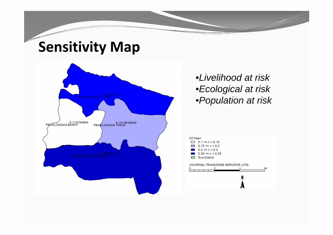
Sensitivity Map
•Livelihood at risk•Ecological at riskEcological at risk•Population at risk
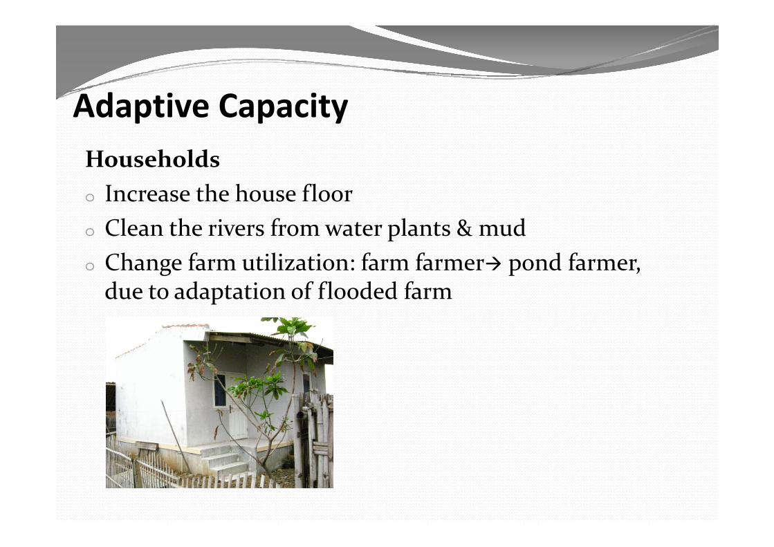
Adaptive Capacityh ldHouseholds
o Increase the house flooro Clean the rivers from water plants & mudo Change farm utilization: farm farmer pond farmer, g p ,
due to adaptation of flooded farm

Adaptive Indexf•Infrastructure
•Technological Information•Health Facility•Health Facility•Institution•Economic
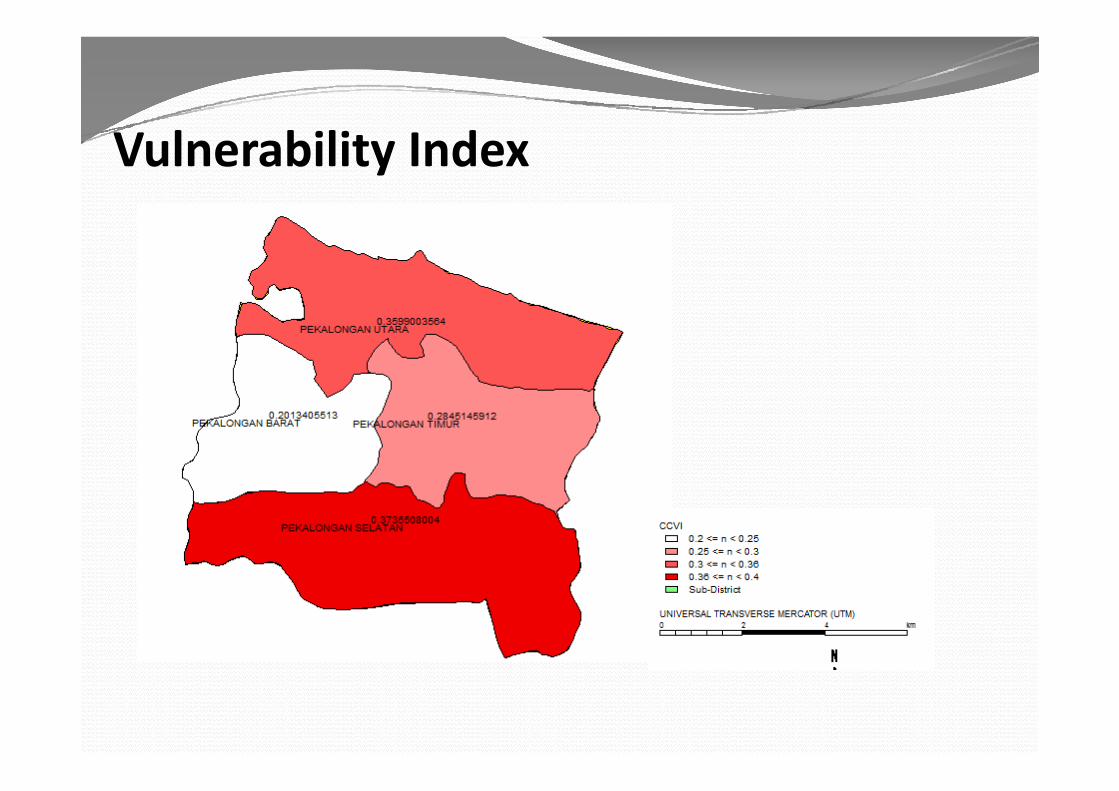
Vulnerability Index
Role of GovernmentRole of GovernmentCentral Government The ratification of the UN Framework Convention on Climate
Change in Law No.6/1994 & ratification of the Kyoto Protocol in Law No.17/2004.
In 2007, National Action Plan Addressing Climate ChangeMitigation Reducing Global Greenhouse Gases with a focus on the
energy sector and LULUCF (Land-Use, Land-Use Change and Forestry)
Ad i Th bili h i k f li hAdaptation The ability to overcome the risks of climate change categorized generally as natural disasters.
In 2008 the Indonesian Government formed the National In 2008, the Indonesian Government formed the National Council on Climate Change (DNPI)
Role of GovernmentRole of GovernmentCentral Government (con’t)Central Government (con t) In 2010, National Development Planning Board published the
Indonesia Climate Change Sectoral Roadmap (ICCSR) with the g p ( )aim of mainstreaming climate change into the five year medium-term plan (RPJMN) 2010-14 and moving forward until the target
fyear of 2029.
On 20 September 2011, the National Action Plan to Reduce Greenhouse Gases (RAN GRK) through Presidential InstructionGreenhouse Gases (RAN-GRK) through Presidential Instruction No.61/2011, as a sign of the President of Indonesia’s commitment to reduce greenhouse gas emissions
Role of Government (Con’t)( )
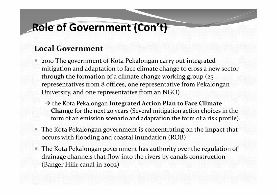
Local Government 2010 The government of Kota Pekalongan carry out integrated
mitigation and adaptation to face climate change to cross a new sector th h th f ti f li t h ki (through the formation of a climate change working group (25 representatives from 8 offices, one representative from Pekalongan University, and one representative from an NGO)
the Kota Pekalongan Integrated Action Plan to Face Climate Change for the next 20 years (Several mitigation action choices in the form of an emission scenario and adaptation the form of a risk profile).form of an emission scenario and adaptation the form of a risk profile).
The Kota Pekalongan government is concentrating on the impact that occurs with flooding and coastal inundation (ROB)
The Kota Pekalongan government has authority over the regulation of drainage channels that flow into the rivers by canals construction (Banger Hilir canal in 2002)(Banger Hilir canal in 2002)
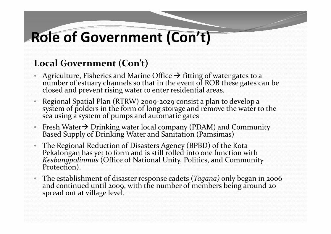
Role of Government (Con’t)Role of Government (Con t)Local Government (Con’t)Local Government (Con t)• Agriculture, Fisheries and Marine Office fitting of water gates to a
number of estuary channels so that in the event of ROB these gates can be closed and prevent rising water to enter residential areasclosed and prevent rising water to enter residential areas.
• Regional Spatial Plan (RTRW) 2009-2029 consist a plan to develop a system of polders in the form of long storage and remove the water to the sea using a system of pumps and automatic gatessea using a system of pumps and automatic gates
• Fresh Water Drinking water local company (PDAM) and Community Based Supply of Drinking Water and Sanitation (Pamsimas)Th R i l R d ti f Di t A (BPBD) f th K t• The Regional Reduction of Disasters Agency (BPBD) of the Kota Pekalongan has yet to form and is still rolled into one function with Kesbangpolinmas (Office of National Unity, Politics, and Community Protection).)
• The establishment of disaster response cadets (Tagana) only began in 2006 and continued until 2009, with the number of members being around 20 spread out at village level.p g
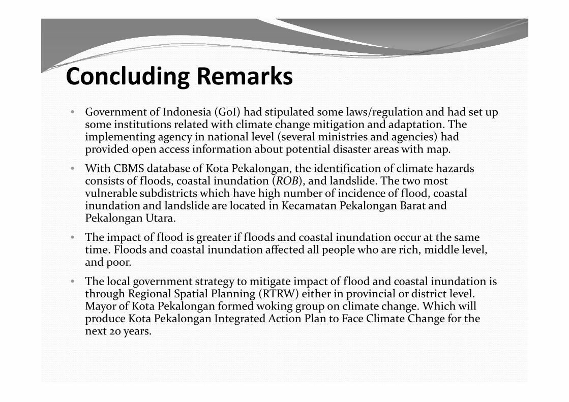
Concluding RemarksG t f I d i (G I) h d ti l t d l / l ti d h d t• Government of Indonesia (GoI) had stipulated some laws/regulation and had set up some institutions related with climate change mitigation and adaptation. The implementing agency in national level (several ministries and agencies) had provided open access information about potential disaster areas with map.p p p p
• With CBMS database of Kota Pekalongan, the identification of climate hazards consists of floods, coastal inundation (ROB), and landslide. The two most vulnerable subdistricts which have high number of incidence of flood, coastal
d d l d l d l d k l dinundation and landslide are located in Kecamatan Pekalongan Barat and Pekalongan Utara.
• The impact of flood is greater if floods and coastal inundation occur at the same ti Fl d d t l i d ti ff t d ll l h i h iddl l ltime. Floods and coastal inundation affected all people who are rich, middle level, and poor.
• The local government strategy to mitigate impact of flood and coastal inundation is through Regional Spatial Planning (RTRW) either in provincial or district levelthrough Regional Spatial Planning (RTRW) either in provincial or district level. Mayor of Kota Pekalongan formed woking group on climate change. Which will produce Kota Pekalongan Integrated Action Plan to Face Climate Change for the next 20 years.
The Next Steps
• To identify which neighborhood unit and household in selected village are the most vulnerable to climatein selected village are the most vulnerable to climate change
• To produce maps of vulnerable households and• To produce maps of vulnerable households and neighborhood unit
• To get more information and understanding to what• To get more information and understanding to what extent the climate change affects household’s daily live particularly activities involve in generatinglive, particularly activities involve in generating income


![IPM 2013 Prov. Jawa Tengah - sdm.data.kemdikbud.go.idsdm.data.kemdikbud.go.id/upload/files/[23022015] Profil Provinsi... · Kota Pekalongan Kab. Semarang Kab. Karanganyar Kota Tegal](https://img.dokumen.tips/doc/110x75/5cc2843c88c993ff568b5785/ipm-2013-prov-jawa-tengah-sdmdata-23022015-profil-provinsi-kota-pekalongan.jpg)