Embed Size (px)
Citation preview
Anyone who requires an auxiliary aid or service for effective communication, or a modification of policies or procedures to participate in a City program, service, or activity, should contact Dani Blin at 319 286-5780 or email [email protected] as
soon as possible but no later than 48 hours before the event.
City Planning Commission 101 First Street SE
Cedar Rapids, IA 52401 Telephone: (319) 286-5780
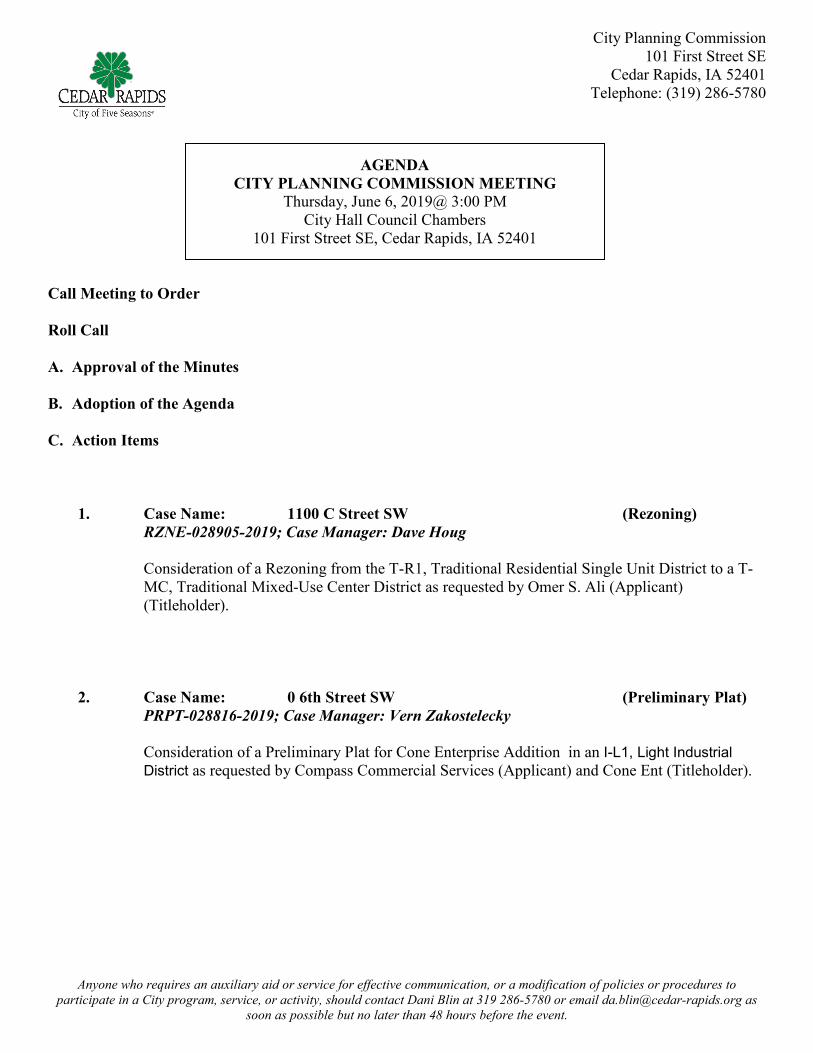
AGENDA
CITY PLANNING COMMISSION MEETING Thursday, June 6, 2019@ 3:00 PM
City Hall Council Chambers 101 First Street SE, Cedar Rapids, IA 52401
Call Meeting to Order
Roll Call A. Approval of the Minutes B. Adoption of the Agenda C. Action Items
1. Case Name: 1100 C Street SW (Rezoning)
RZNE-028905-2019; Case Manager: Dave Houg Consideration of a Rezoning from the T-R1, Traditional Residential Single Unit District to a T-MC, Traditional Mixed-Use Center District as requested by Omer S. Ali (Applicant) (Titleholder).
2. Case Name: 0 6th Street SW (Preliminary Plat)
PRPT-028816-2019; Case Manager: Vern Zakostelecky
Consideration of a Preliminary Plat for Cone Enterprise Addition in an I-L1, Light Industrial District as requested by Compass Commercial Services (Applicant) and Cone Ent (Titleholder).

1
Development Services Department City Services Center 500 15th Avenue SW
Cedar Rapids, IA 52404 Telephone: (319) 286-5780
STAFF REPORT TO CITY PLANNING COMMISSION City – Initiated Rezoning
CPC Date: June 6, 2019 To: City Planning Commission From: Development Services Department Applicant: City of Cedar Rapids Titleholder: Omer S. Ali Location: 1100 “C” Street SW Request: Change of zone from T-R1, Traditional Residential Single Unit Zone District
to T-MC, Traditional Mixed-Use Center Zone District Case Manager: David Houg Case Number: RZNE-028905-2019
BACKGROUND INFORMATION: This is a request to rezone a parcel from T-R1, Traditional Residential Single Unit Zone District to T-MC, Traditional Mixed-Use Center Zone District on the currently adopted zoning map. The City adopted a new Zoning Ordinance and Zoning Map on January 1, 2019. Prior to adoption of the new map the subject property was zoned O-S, Office/Service Zone District. The property was inadvertently assigned a residential zoning designation as a result of a mapping error. The property owner has requested the property be restored to a commercial designation. The property is identified as “Urban Medium Intensity” on the City’s Future Land Use Map in EnvisionCR, the City’s Comprehensive Plan. FINDINGS: Section 32.02.030.C.5.e of the Zoning Ordinance requires the City Planning Commission to review the application based on the following criteria: 1. Whether the amendment is required to correct a technical mistake in the existing zoning
regulations
Staff Comment: This amendment is meant to correct a technical mistake on the existing Zoning Map.
2. Consistency with the Comprehensive Plan and other studies
Staff Comment: Not applicable

2
3. Public facilities, Services and Suitability Staff Comment: Not applicable
4. Character
Staff Comment: Not applicable

SITE LOCATION

1
Development Service Department City Services Center 500 15th Avenue SW
Cedar Rapids, IA 52404 Telephone: (319) 286-5043
STAFF REPORT TO CITY PLANNING COMMISSION
Major Preliminary Plat
CPC Date: June 6, 2019 To: City Planning Commission From: Development Services Department Applicant: Compass Commercial Services Titleholder: Cone Ent Plat Name: Cone Enterprise Addition Location: East of 6th Street SW and south of 58th Avenue SW Request: Consideration of a Major Preliminary Plat in an I-L1, Light Industrial District Case Manager: Vern Zakostelecky Case Number: PRPT-028816-2019 BACKGROUND INFORMATION: The applicant is requesting approval of a Major Preliminary Plat for land located east of 6th Street SW and south of 58th Avenue SW. The property is currently undeveloped and zoned I-L1, Light Industrial District. The applicant wishes to subdivide the property for development of light industrial/warehousing uses. The preliminary plat as submitted includes the following: The total site area - 15.77acres: Total lots – 7. Storm water management will be provide with regional detention facility. Access to proposed 60th Ave. SW and 4th St. SW Street extension provided to south property line.
FINDINGS: The City Planning Commission shall review the application based on the following criteria:
1. That the proposed use and development will be consistent with the intent and purposes of the Comprehensive Plan and other applicable codes and regulations.
Staff Comments: The proposed uses and development are consistent with the intent and purposes of the Comprehensive Plan. The property is shown as “Urban Medium-Intensity” on Future Land Use Map in EnvisionCR, the City’s Comprehensive Plan. The proposed subdivision and zoning would be in accord with the Future Land Use Map

2
designation and the goals and objectives of the City’s Comprehensive Plan. Future development will comply with all other applicable codes, regulations and approvals.
RECOMMENDED CONDITIONS: If the City Planning Commission approves the proposed major preliminary plat, adoption of the following conditions as recommended by Development Services should be considered. The City Planning Commission may approve with additional conditions. 1. If Lot 1 only is final platted first, 60th Ave. SW shall be improved to a point as is shown on the
approved preliminary plat and subsequent site plan. 2. Traffic signals at 60th Ave SW & 6th St SW shall be designed and installed as approved by the City
Traffic Engineer at no expense to the City. 3. Upon development of additional lots (Lot 2 through Lot 7), 60th Ave SW street improvements shall
be completely built out to 4th St. SW and 4th St. SW shall be extended to the South with code compliant fire turnaround(s) as needed to serve the developed lots.
4. The property owner is responsible to extend sanitary sewer to serve the development. If sewer extensions crossing private property are necessary to serve the subject property, as determined by the City, the property owner shall be responsible for the related costs including (but not limited to) planning and design of the sewer, acquisition of right-of-way and/or easements, construction, administration, inspection and other incidental costs.
5. PRIOR TO THE ISSUANCE OF A CERTIFICATE OF OCCUPANCY, the property owner shall be responsible to complete the following: A. Prior to the issuance of a certificate of occupancy, Lots 1-7, all inclusive, which overland
conveyance of the 100-year storm water runoff may occur, a professional civil engineer licensed in the State of Iowa shall certify in writing that required building opening elevations specified on the approved plans have been met or exceeded.
B. Construction of concrete sidewalk along 6th St. SW, 60th Ave. SW and 4th St. SW adjoining this site. The property owner shall construct the sidewalk improvements in accordance with City Standards, City policy, ADA requirements, and improvement plans accepted by the City. The property owner may request deferral of the sidewalk installation requirement if in accordance with the sidewalk installation policy.

IN THE CITY OF CEDAR RAPIDS, LINN COUNTY, IOWA
(NOT TO SCALE)
LOCATION MAP
MAJOR PRELIMINARY PLAT
CONE ENTERPRISE ADDITION
CAD
File: I:\projects\10200\10293-19-Ahm
ann\10293-19-1-S-6th Street Cone Site\D
WG
\Plats\10293-19-1-S PP.dw
g D
ate Plotted : Apr 25, 2019 - 9:12am
Plotted By : BD
V
www.halleng.com
LANDSCAPE ARCHITECTURE
LAND DEVELOPMENT PLANNING
HALL & HALL ENGINEERS, INC.
1860 BOYSON ROAD, HIAWATHA, IOWA 52233
PHONE: (319) 362-9548 FAX: (319) 362-7595
LAND SURVEYING
CIVIL ENGINEERING
THIS PLAN IS A CONCEPTUAL REPRESENTATION OF THE PROPOSED DEVELOPMENT. ANY FINAL PLAT AND RELATED
IMPROVEMENTS REQUIRED BY THIS DEVELOPMENT SHALL MEET REQUIREMENTS OF THE CEDAR RAPIDS METROPOLITAN
AREA ENGINEERING DESIGN MANUAL.
NOTES
SHEET INDEX
PROJECT
LOCATION
HALL AND HALL PROJECT NUMBER:
OWNER:
APPLICANT:
CONE ENT
1345 76TH AVE SW
CEDAR RAPIDS IA 52404
STREET CLASSIFICATIONS
BRIAN D. VOGEL, PE
(319) 362-9548Telephone Number
Contact Person
(319) 362-7595
Fax Number
Date Revised
Date Submitted
E-Mail Address
Date Revised
Mailing Address 1860 Boyson Rd
Hiawatha, IA 52233
04/25/19
PP1 COVER
PP2 MAJOR PRELIMINARY PLAT
60TH AVENUE SW
58TH AVENUE SW
6TH
STREET SW
COMPASS COMMERCIAL SERVICES
%GEOFF FRANZENBURG
1950 BOYSON ROAD
HIAWATHA IA 52233
(319)899-2907
EXISTING: I-LI
PROPOSED: I-LI
ZONING
DIMENSION STANDARDS: I-LI
FRONT YARD SETBACK: 25 FT
SIDE YARD, INTERNAL:15 FT
SIDE YARD, STREET: 25 FT
REAR YARD SETBACK: 25 FT
BUILDING MAXIMUM HEIGHT: 100 FEET
MINIMUM LOT SIZE: 20,000 SQ.FT.
MINIMUM LOT WIDTH: N/A
MINIMUM FRONTAGE: N/A
MAXIMUM COVERAGE: N/A
EXISTING/PROPOSED USE
EXISTING USE: VACANT LAND
PROPOSED USE: GENERAL MANUFACTURING AND SERVICE
DESIGN DATA - URBAN
STREET CLASSIFICATION
STREET
WIDTH
ROW
WIDTH
DESIGN
SPEED
PAVEMENT
THICKNESS
6TH STREET SW
60TH AVENUE SW
MAJOR ARTERIAL I 52' 125' 45 MPH 9" PCC
MINOR ARTERIAL 40 MPH 8" PCC41' 80'
7TH
STREET SW
IN
TER
S
TA
TE 3
8
0
4TH
STREET SW
THE N ½ N ½ NW ¼ SECTION 16-T82N-R7W OF THE 5
TH
P.M., LINN COUNTY, IOWA, LYING WEST OF THE WEST RIGHT-OF-WAY
LINE OF HIGHWAY I-380, EXCEPTING THEREFROM THE WEST 660 FEET. (THE WEST RIGHT-OF-WAY LINE OF HIGHWAY I-380 AS
SHOWN ON THE PATENT RECORDED IN BOOK 1803 AT PAGES 184, 185, AND 186 IN THE OFFICE OF THE LINN COUNTY RECORDER,
IS ASSUMED TO BEAR N9°31 ½'E.)
AND
THE WEST 660 FEET OF THE NORTH ½ OF THE NORTH ½ OF THE NW ¼ OF SECTION 16-82-7, LINN COUNTY, IOWA, EXCEPTING
THEREFROM THE SOUTH 255.89 FEET. EXCEPT THE PUBLIC HIGHWAY
LEGAL DESCRIPTION
HORSESHOE CATCH BASIN W/FLUME
HORSESHOE CATCH BASIN W/O FLUME
CABLE TV-OVERHEAD
CABLE TV-UNDERGROUND
CABLE TV PEDESTAL
TELEPHONE MANHOLE
FLARED END SECTION
CLEANOUT, STORM OR SANITARY
TRAFFIC SIGNAL W/MAST
UTILITY/CONTROL CABINET
TELEPHONE PEDESTAL
SANITARY MANHOLE
LIGHT POLE W/MAST
LIGHT POLE W/O MAST
TELEPHONE-UNDERGROUND
FIBER OPTIC-OVERHEAD
FIBER OPTIC-UNDERGROUND
ELECTRIC-UNDERGROUND
TELEPHONE-OVERHEAD
ELECTRIC-OVERHEAD
FORCE MAIN W/SIZE
WATER MAIN W/SIZE
STORM SEWER W/SIZE
SANITARY SEWER W/SIZE
GAS VALVE
OR
SW-509 INTAKE
RA-8 INTAKE
RA-6 INTAKE
STORM MANHOLE
SW-507 INTAKE
GRATE INTAKE
GUY ANCHOR
GUY POLE
POWER POLE
TELEPHONE POLE
STEAM
8
0
0
SILT FENCE
FENCE LINE
CONTOUR LINE
GAS
SUBDRAIN
FOUND RIGHT OF WAY RAIL
SECTION CORNER FOUND AS NOTED
SECTION CORNER SET AS NOTED
PLAT OR SURVEY BOUNDARY
DECIDUOUS SHRUB
TREE STUMP
TREE LINE DRIP EDGE
CONIFEROUS SHRUB
OR
1/4-1/4 SECTION LINE
DECIDUOUS TREE
CONIFEROUS TREE
BUILDING SETBACK LINE
EXISTING LOT LINE
( )
EASEMENT LINE
SECTION LINE
1/4 SECTION LINE
PLAT LOT LINE
CENTERLINE
CUT "X" IN CONCRETE
RECORDED AS
SURVEY CONTROL MONUMENT AS NOTED
FOUND SURVEY MONUMENT AS NOTED
SET ___ REBAR W/CAP NO.____
<> <> <> <> <> <> <> <>
OHC OHC
C C
E E
OHE OHE
S S
OHT OHT
8
0
0
T T
OHF OHF
F F
FM6
W12
G G
SS8
ST18
SET PK NAIL
WATER SHUTOFF
WATER VALVE
WATER BLOWOFF
FIRE HYDRANT
BOLLARD
STREET SIGN
SOIL BORING
WELL
BENCHMARK
NOTE: THIS IS A STANDARD LEGEND. SOME ITEMS MAY NOT APPEAR ON DRAWINGS.
FP
FW
CORP
FLOODPLAIN LIMITS
FLOODWAY LIMITS
CITY CORPORATION LIMITS

KINSER JOHN
ZONING: I-LI
CONE ENT
ZONING: I-LI
CONE ENT
ZONING: I-LI
CO
RTEZ JO
AN
NE R &
CO
RTEZ RICH
ARD
J
ZO
NIN
G:
I-LI
BU
SSE IN
VESTM
EN
TS IN
C
ZO
NIN
G:
I-LI
WILSON BRETT A
ZONING: I-LI
PROPOSED 60TH AVENUE SW
EXISTING 60TH
AVENUE SW
EXISTIN
G 6TH
STREET SW
FUTURE 60TH AVENUE SW
219'
217'
LOT 1 FUTURE LINE MANUFACTURING
3.29 AC
W8
W8
W8
W8
W8
W8
W8
W8
W8
W8
W8
W8
W8
W8
W8
235'
386'
599'
57'
F
U
T
U
R
E
4
T
H
S
T
R
E
E
T
S
W
W8
W
8
W
8
W
8
W
8
W
8
W
8
W
8
W
8
W
8
SS
8
SS
8
SS
8
SS
8
S
S
8
S
S
8
S
S
8
S
S
8
S
S
8
S
S
8
LOT 4
0.98 AC
LOT B
1.27 AC
LOT 6
1.25 AC
LOT 5
1.31 AC
LOT 3
1.09 AC
LOT 2
1.19 AC
LOT 1
6.52 AC
LOT A
0.55 AC
LOT 7
1.61 AC
9'
1
3
'
1
5
2
'
1
5
2
'
1
5
2
'
2
5
6
'
2
0
3
'
2
1
3
'
271'
61'
271'
150'
106'
301'
50'
16
2
'
4
2
'
2
0
3
'
2
1
4
'
360'
1
5
2
'
325'
56'
40'
57'
386'
271'
271'
44'
150'
330'
599'
599'
366'
40'
57'
ST15ST15
ST15ST15
ST21
ST21
ST21
ST24
ST24
ST
21
PROPOSED STORMWATER
MANAGEMENT AREA
901 RO
CKFO
RD
LLC
ZO
NIN
G: I-LI
CO
NE EN
T
ZO
NIN
G: I-LI
MROTS & LEETS INC
ZONING: I-LI
W6
SMITH STEVEN J
ZONING: I-LI
S
S
8
EXISTIN
G 4TH
STREET SW
I
N
T
E
R
S
T
A
T
E
3
8
0
CONE ENT
ZONING: I-LI
CONE ENT
ZONING: I-LI
CONE ENT
ZONING: I-LI
CORRIDOR DEVELOPERS LLC
ZONING: I-LI
S
T
2
1
ST
21
ST
21
S
T
1
8
S
T
1
8
S
T
1
8
7
6
0
7
6
5
7
7
0
7
7
5
780
7
8
5
7
9
0
7
6
5
7
7
0
7
7
5
7
8
0
7
8
5
7
9
0
7
9
5
7
9
5
7
9
5
7
9
5
7
9
5
8
0
0
805
7
8
5
7
7
0
7
7
5
7
8
0
765
7
6
5
770
7
7
0
7
7
5
7
8
0
7
5
5
755
7
6
0
7
6
0
7
6
5
7
7
0
7
7
5
7
7
5
7
8
0
7
8
0
7
7
5
7
8
0
7
8
5
7
9
0
CJZ
BDV
04/25/19
FIELD BOOK:
DRAWN BY:
CHECKED BY:
APPROVED BY:
DATE:
NO. REVISION DESCRIPTION
BDV
APPROVED DATE
/ /
/ /
/ /
/ /
PROJECT NO: 10293-19-1-S
SHEET
CONE ENTERPRISE ADDITION
IN THE CITY OF CEDAR RAPIDS, LINN CO., IOWA
CAD
File: I:\projects\10200\10293-19-Ahm
ann\10293-19-1-S-6th Street Cone Site\D
WG
\Plats\10293-19-1-S PP.dw
g D
ate Plotted : Apr 25, 2019 - 9:12am
Plotted By : BD
V
www.halleng.com
LANDSCAPE ARCHITECTURE
LAND DEVELOPMENT PLANNING
HALL & HALL ENGINEERS, INC.
1860 BOYSON ROAD, HIAWATHA, IOWA 52233
PHONE: (319) 362-9548 FAX: (319) 362-7595
LAND SURVEYING
CIVIL ENGINEERING
MAJOR PRELIMINARY PLAT
PP2
252
52' B-B
41' B-B
125' R.O.W.
EXISTING 20' UTILITY AND DRAINAGE EASEMENT
PROPOSED 15' UTILITY EASEMENT
EXISTING
WATER
MAIN
EXISTING
SANITARY
SEWER
20.5'
5'
2'
PROPOSED STORM SEWER
EXISTING POWER POLES
TO BE RELOCATED
EXISTING POWER POLES
TO BE RELOCATED
PROPOSED WATER
SEWER SERVICE
EXISTING WIRE FENCE
(TO BE REMOVED)
PROPOSED
ENTRANCE DRIVE
FOR LOT 1
20.5'
LOTS A & B TO BE DEDICATED TO THE CITY OF CEDAR RAPIDS AS R.O.W. FOR STREET PURPOSES
PROPOSED 5' WIDE
SIDEWALK (TYP.)
DEFERMENT TO BE REQUESTED
FOR PROPOSED 5' WIDE
SIDEWALK ALONG 6TH STREET SW
EAST PORTION OF 60TH AVE SW
(INCLUDING EAST PORTION OF SIDEWALK
AND WATERMAIN) TO BE INSTALLED WITH
FUTURE IMPROVEMENTS TO 60TH AVE SW
WEST PORTION OF 60TH
AVE SW TO BE INSTALLED
WITH THE IMPROVEMENTS
TO LOT 1 OF FUTURE LINE
FIRST ADDITION
TEMPORARY TURN
AROUND TO BE INSTALLED
WITH THE INSTALLATION
OF WEST PORTION OF
60TH AVE SW
41' B-B
80' R.O
.W
.
EXISTIN
G 40' H
ALF
STREET R.O
.W
.
PRO
PO
SED
10' U
TILITY EASEM
EN
T
R
3
5
'
R
3
5
'
EXISTING POWER POLES
TO BE RELOCATED
EXISTING POWER POLES
TO BE RELOCATED
6
0
'
R
.
O
.
W
.
PROPOSED
ENTRANCE DRIVE
FOR LOT 1
PROPOSED SANITARY
SEWER SERVICE
33' B-B
FUTURE 4TH ST SW AND UTILITY
EXTENSIONS TO BE INSTALLED WITH
FUTURE CONE ENTERPRISE DEVELOPMENTS
P
R
O
P
O
S
E
D
1
0
'
U
T
I
L
I
T
Y
E
A
S
E
M
E
N
T
P
R
O
P
O
S
E
D
1
0
'
U
T
I
L
I
T
Y
E
A
S
E
M
E
N
T
3
1
'
B
-
B
PROPOSED 15' UTILITY EASEMENT
PROPOSED 10' UTILITY EASEMENT
78'
PRO
PO
SED
20' STO
RM
SEW
ER AN
D D
RAIN
AG
E EASEM
EN
T
5' SIDEWALK (TYP)
STORM WATER
MANAGEMENT EASEMENT