Embed Size (px)
Citation preview
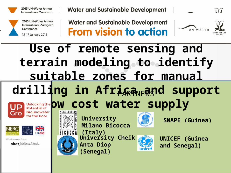
University Milano Bicocca (Italy)
University Cheik Anta Diop (Senegal)
SNAPE (Guinea)
UNICEF (Guinea and Senegal)
PARTNERS
Use of remote sensing and terrain modeling to identify suitable zones for manual drilling in
Africa and support low cost water supply

MANUAL DRILLING techniques of drilling boreholes for groundwater exploitation using
human or animal power (not mechanized equipment).
These techniques are well known in countries with large alluvial deposits
(India, Nepal, Bangladesh, etc)
High quality hand drilled wells can provide sustainable and clean water supply
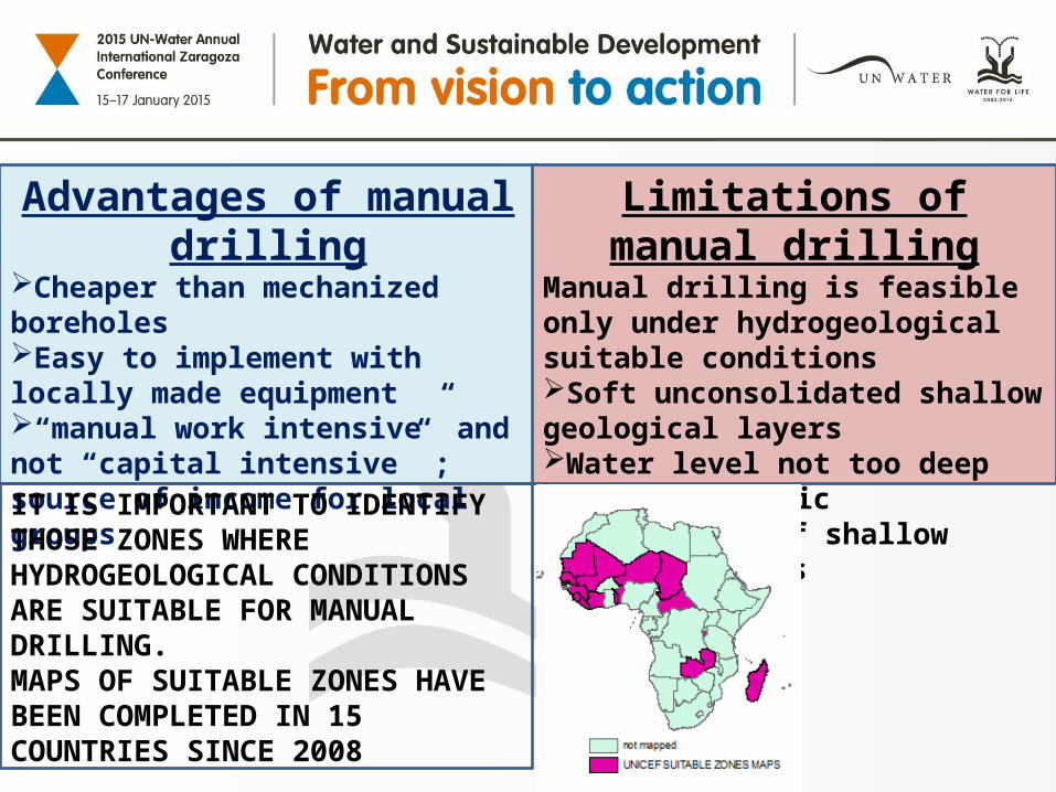
Advantages of manual drillingCheaper than mechanized boreholesEasy to implement with locally made equipment“manual work intensive” and not “capital intensive” ; source of income for local groups
Limitations of manual drillingManual drilling is feasible only under hydrogeological suitable conditionsSoft unconsolidated shallow geological layers Water level not too deep Good hydraulic conductivity of shallow porous aquifers
IT IS IMPORTANT TO IDENTIFY THOSE ZONES WHERE HYDROGEOLOGICAL CONDITIONS ARE SUITABLE FOR MANUAL DRILLING.MAPS OF SUITABLE ZONES HAVE BEEN COMPLETED IN 15 COUNTRIES SINCE 2008

OBJECTIVE OF THE RESEARCHIntegration of direct hydrogeological information from existing database with indirect parameters from Remote Sensing and terrain modeling to characterize shallow aquifers and identify suitable zones for manual drillingDURATIONNovember 2013 – April 2015STUDY AREAREGION OF LOUGA – KEBEMER (NORTH WEST SENEGAL
REGION OF KANKAN AND FARANAH (EAST GUINEA)

ACTIVITY ACADEMIA NATIONAL INSTITUTIONS
INTERNATIONAL ORGANISATIONS
SCIENTIFIC RESEARCHANDCAPACITY BUILDING
-UNIVERSITY MILANO BICOCCA (IT)-UNIVERSITY CHEIK ANTA DIOP (SEN)-University of Thies (SEN)
DISSEMINATION As above -UNICEFINTEGRATION RESEARCH INTO NATIONAL STRATEGY FOR WATER SUPPLY
-SNAPE (Guinea)- DGPRE (Sen)
COORDINATION WITH MANUAL DRILLING PROGRAM
-UNIVERSITY MILANO BICOCCA (IT)
-SNAPE (Guinea) - UNICEF- Practica
FUNDING NERC (UK) - scientific research UNICEF (with external donors) for manual drilling in Guinea
Role of partners and external stakeholders

Geo-Environmental indicators (Geology, Soil, Morphometry, Vegetation dynamics, Soil moisture, Thermal Inertia)
Thematic maps, Remote Sensing (optical, radar), Digital terrain model
(Geo)Statistical model
Borehole logs interpretation, pump test, geophysics
Map of suitable zones for manual drilling
Hydrogeological features at observation points
Scientific approach

Source of data
NATIONAL DATABASE OF WATER POINT
Free satellite images (MODIS)
THEMATIC MAPS
Radar images (obtained from European Space Agency free of cost)
THE RESEARCH IS BASED ON AVAILABLE AND FREE OF COST DATA AND WITH LIMITED COST FOR FIELD DATA COLLECTION.
THIS FACILITATE THE EXTENSION OF THIS METHOD TO OTHER REGIONS,

Estimating feasibility and potential for manual drilling at
borehole positions
VEGETATION DYNAMICS - DRY SEASON MEAN NDVI
LOUGA
0.1 0.25
Extraction of environmental parameters from remote
sensing
Preliminary results achieved

Expected final outputs- Definition and validation of structured method to infer shallow hydrogeology and suitability for manual drilling from indirect data
- Generation of maps of suitability for manual drilling in 2 study area
FACTORS OF SUCCESS-Collaboration between partners-Coordination between scientific research, training of drilling teams, implementation of hand drilled wells in target zones, advocacy- Deep Involvement by national institution (SNAPE)-Active role of UNICEF in support and fund raising
Factor of success

Thanks very much for the attention