Embed Size (px)
Citation preview

A Radar Calibration CubeSat
Ho‘oponopono“To Make Right”
University of HawaiiNanosat-6
Nick Fisher August 8th, 2010
Logan, Utah

UH CubeSat Projects
2
2001 2003 2007
Mea Huaka`i (Voyager)
Ho`okia`i (Watchman)Program Sponsors
Ho`okele (Way Finder)
Hokulua (Twin Stars)
2009
Kumu a`o(Source of Learning)
2005
Ho`oponopono(To Make Right)
Ho’i Mai(To Return)

Guinness…the only way to survive a crash
Surviving the Crash
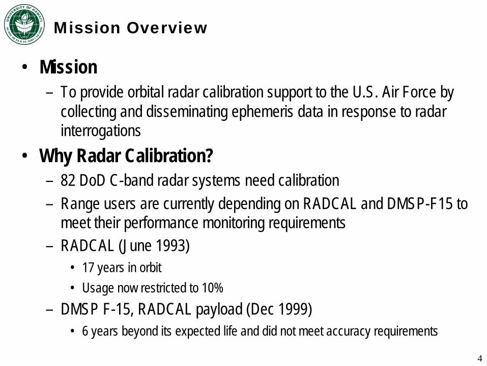
Mission Overview
• Mission– To provide orbital radar calibration support to the U.S. Air Force by
collecting and disseminating ephemeris data in response to radar interrogations
• Why Radar Calibration?– 82 DoD C-band radar systems need calibration– Range users are currently depending on RADCAL and DMSP-F15 to
meet their performance monitoring requirements– RADCAL (June 1993)
• 17 years in orbit• Usage now restricted to 10%
– DMSP F-15, RADCAL payload (Dec 1999)• 6 years beyond its expected life and did not meet accuracy requirements
4

Mission Operation Diagram
5
Interrogation RequestInterrogation RequestInterrogation Request Interrogation ScheduleInterrogation ScheduleInterrogation Schedule
raw GPS Data
raw GPS Data
raw GPS Data
Orbital Model
Orbital Model
Orbital Model
raw GPS Dataraw GPS Dataraw GPS DataOrbital DataOrbital DataOrbital Data Ground Station
C-Band Radar Stations NGA
GPS DataProcessing Center
VAFB RADCAL Coordinator
Radar InterrogationRadar InterrogationRadar Interrogation Uplink: ScheduleDownlink: GPS Data
Uplink: ScheduleUplink: ScheduleDownlink: GPS DataDownlink: GPS Data
GPS Data CollectionGPS Data CollectionGPS Data CollectionSpace SegmentSpace Segment
Ground SegmentGround Segment
User SegmentUser Segment

Mission Operation Diagram
6
Interrogation RequestInterrogation RequestInterrogation Request Interrogation ScheduleInterrogation ScheduleInterrogation Schedule
Ground Station
C-Band Radar Stations NGA
GPS DataProcessing Center
VAFB RADCAL Coordinator
Uplink: ScheduleUplink: ScheduleUplink: Schedule

Mission Operation Diagram
7
Ground Station
C-Band Radar Stations NGA
GPS DataProcessing Center
VAFB RADCAL Coordinator
Radar InterrogationRadar InterrogationRadar Interrogation

Mission Operation Diagram
8
raw GPS Data
raw GPS Data
raw GPS Data
Orbital Model
Orbital Model
Orbital Model
raw GPS Dataraw GPS Dataraw GPS DataOrbital DataOrbital DataOrbital Data Ground Station
C-Band Radar Stations NGA
GPS DataProcessing Center
VAFB RADCAL Coordinator
Downlink: GPS DataDownlink: GPS DataDownlink: GPS Data
GPS Data CollectionGPS Data CollectionGPS Data Collection

Mission Operation Diagram
9
Interrogation RequestInterrogation RequestInterrogation Request Interrogation ScheduleInterrogation ScheduleInterrogation Schedule
raw GPS Data
raw GPS Data
raw GPS Data
Orbital Model
Orbital Model
Orbital Model
raw GPS Dataraw GPS Dataraw GPS DataOrbital DataOrbital DataOrbital Data Ground Station
C-Band Radar Stations NGA
GPS DataProcessing Center
VAFB RADCAL Coordinator
Radar InterrogationRadar InterrogationRadar Interrogation Uplink: ScheduleDownlink: GPS Data
Uplink: ScheduleUplink: ScheduleDownlink: GPS DataDownlink: GPS Data
GPS Data CollectionGPS Data CollectionGPS Data CollectionSpace SegmentSpace Segment
Ground SegmentGround Segment
User SegmentUser Segment

Mission Success Criteria
• Nominal success criteria– Demonstrate the collection of accurate (<5m) ephemeris data– Provide radar calibration information at an average rate of five radar
ranges every day for 1 year• Minimum success criteria
– Demonstrate the collection of ephemeris data– Provide radar calibration information at an average rate of one radar
range every week for 1 year
10

System Block Diagram
11

12

System Model
Solar PanelSolar Panel
Gravity Gradient BoomGravity Gradient Boom
GPS AntennaGPS AntennaPCB StackPCB Stack
TransponderTransponder
Battery
Box
Battery
Box
Patch AntennaPatch Antenna
Transponder
Antenna
Transponder
Antenna
13
ACS BoxACS Box

Build Status: Engineering Design Unit (EDU)
14
Mock Solar PanelMock Solar Panel
GPS AntennaGPS Antenna
TransponderModel
TransponderModel
Battery BoxBattery Box Transponder
Ant. Model
Transponder
Ant. Model
PCB StackPCB Stack

Build Progress
15

Future Work
• UH is proactively working on a solution for RADCAL• Flight Concept Review is in January 2010• Further question can be answered at our Smallsat Conference
Exhibit
16
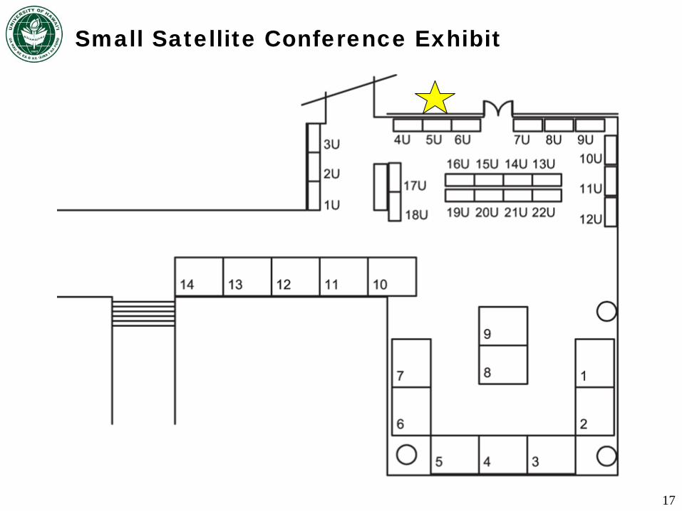
Small Satellite Conference Exhibit
17