Embed Size (px)
Citation preview
04/19/23GEM 3366
1
Lecture 20 Content
Flight preparation– Equipment– Weather conditions– Flying height– Coverage

04/19/23GEM 3366
2
Flight preparation– a single flight of an aircraft includes a
take off to touch down
– To secure satisfactory air cover, the following must be considered:
Proper equipment must be used
Weather conditions, including height and sun intensity must be favorable

04/19/23GEM 3366
3
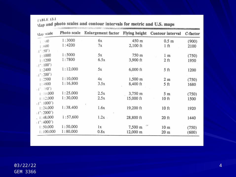
The flying height is so chosen that, with the given lens, contact prints of a suitable mean photo scale are produced
The accuracy for contouring with certain instruments in the United States is often defined by:
C-factor = Flying Height (H) / Contour Interval (CI)
Used for vertical wide-angle photography with nominal focal length of 150mm
Scale of photograph = f / (H-h)
04/19/23GEM 3366
4
04/19/23GEM 3366
5
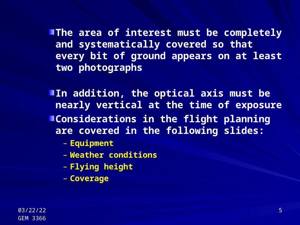
The area of interest must be completely and systematically covered so that every bit of ground appears on at least two photographs
In addition, the optical axis must be nearly vertical at the time of exposure
Considerations in the flight planning are covered in the following slides:
– Equipment– Weather conditions– Flying height– Coverage

04/19/23GEM 3366
6
– EquipmentThe aircraft:
– The aircraft must be able to carry the aerial camera
– The aircraft must be capable of flying at the height required (high or low)
The camera:– Mounted on the gimbal to keep the camera
stationary, ensuring that the optical axis passes through the center of the lens
– Free to rotate about the optical axis to facilitate different camera orientation

04/19/23GEM 3366
7
– Weather conditionsThe following affect the stability of the aircraft and should be avoided:
– Dense, whitish, turbulent clouds– Cumulus clouds are turbulence– Air pockets, in which there is a sudden downward
current of air
Photographs cannot be normally taken through cloud or fog, smoke, dust or haze.High sun intensity implies that the shadows of the photograph become too dense, and obscure detail Rainy conditions must be avoided

04/19/23GEM 3366
8
Shadows obscure details, so that the sun should be fairly high in the sky to give a reasonably short shadow
Necessary for aircraft, camera and crew to stand by for many days before the desired weather conditions is obtained
Cost of flying is very high

04/19/23GEM 3366
9
– Flying heightThe mean average scale of the air cover should be approximately the same as the desired scale of the compilation map
Given focal length of the camera lens, and a given compilations scale, the necessary height of the aircraft can be calculated using:
Scale of photograph = f / (H-h)

04/19/23GEM 3366
10
– An example:The photo scale 1/10,000 is required, focal length is 150mm and h is 100m above mean sea level
H
f
S
A B
b a
h
Horizontal planeRepresenting mean ground level
Mean sea level
Scale of photograph = f / (H-h)
04/19/23GEM 3366
11
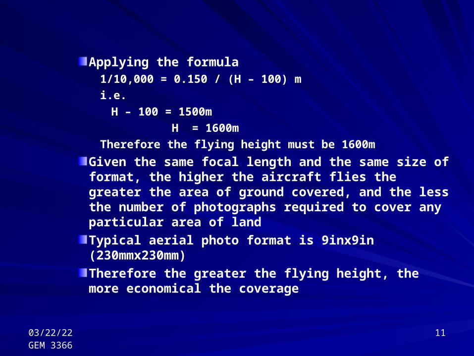
Applying the formula1/10,000 = 0.150 / (H – 100) m
i.e.
H – 100 = 1500m
H = 1600m
Therefore the flying height must be 1600m
Given the same focal length and the same size of format, the higher the aircraft flies the greater the area of ground covered, and the less the number of photographs required to cover any particular area of land
Typical aerial photo format is 9inx9in (230mmx230mm)
Therefore the greater the flying height, the more economical the coverage

04/19/23GEM 3366
12
Alternatively, the less the flying height, the greater the scale, the more detail that can be readily discerned and the greater the plotting accuracy
Greater the flying height increases the thickness of haze and dust that light rays must penetrate, with consequent loss in the photograph quality
Normal flying heights maybe between 1000m to 4500m above ground level, therefore we expect flying cost to increase in mountainous areas

04/19/23GEM 3366
13
– CoverageSystematic coverage is obtained by flying the aircraft at a fixed height, in a series of straight lines, and taking photographs at regular intervals
The photographs taken during the time that the aircraft flies along any one of these straight lines are known collectively as a “run”

04/19/23GEM 3366
14
Each photograph in a run should overlap its predecessor by 60%
60%overlap double
overlap
1st 2nd 3rd1st 2nd
Aircraft Aircraft
Double overlap usually is 20%of each of the three photographs

04/19/23GEM 3366
15
Having flown one complete run the aircraft must turn around and fly back another straight line, again taking photographs at regular intervalsThe second strip of photographs must also overlap the first run, this is known as the “lateral overlap”Lateral overlap is usually between 20 to 30%Runs will normally flown in a direction parallel with the longest dimension of the land to be covered

04/19/23GEM 3366
16
{{{
{
1st run
2nd run
3rd run
4th run
Plan showing later overlaps
Lateraloverlap

04/19/23GEM 3366
17
Overlap between Runs or SwathsOverlap between Runs or Swaths
30% overlap between runs or swaths
Run #1
Run #2
04/19/23GEM 3366
18
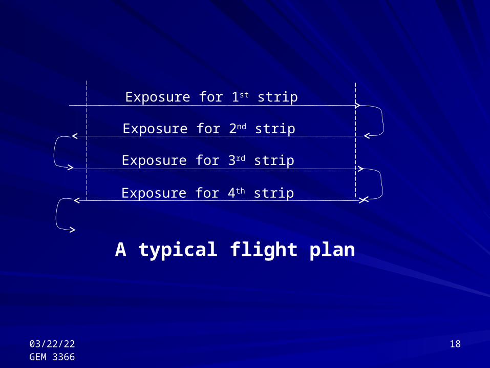
Exposure for 1st strip
Exposure for 2nd strip
Exposure for 3rd strip
Exposure for 4th strip
A typical flight plan

04/19/23GEM 3366
19
Other factors to be considered in planning aerial photography include: The intended use of photography (quantitative or interpretive) The desired product (Map, orthophoto, mosiac, etc) The specified accuracy The size and shape of the interested area The amount and disposition of relief The scale of photography (influences the final scale of the end
product, camera to be used, and so on)

Photogrammetry …. Lecture 14Photogrammetry …. Lecture 14Dr. Steve RamroopDr. Steve Ramroop04/19/23
GEM 336620
… The End …