Embed Size (px)
Citation preview
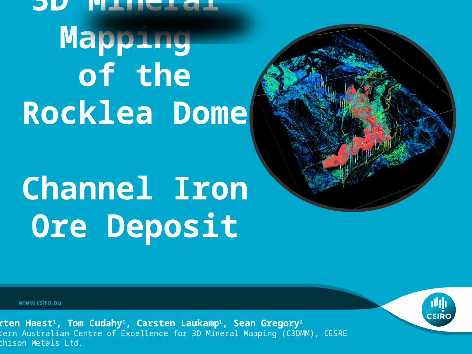
3D Mineral Mapping
of theRocklea Dome
Channel Iron Ore Deposit
Maarten Haest1, Tom Cudahy1, Carsten Laukamp1, Sean Gregory2 1Western Australian Centre of Excellence for 3D Mineral Mapping (C3DMM), CESRE 2Murchison Metals Ltd.

Interpretation of visible-near to shortwave infrared reflectance drill core data from a channel iron deposit in the Hamersley Province (WA)
• Channel iron deposits (CID) 2nd most important source for Fe production in WA
• CIDs developed along Tertiary paleochannels
• Fe-(oxyhydr-)oxide pelletoids and ferruginised wood fragments, cemented in goethite matrix
• Rare detrital components (e.g. qtz, BIF fragments or clays)
• Many pelletoids are ooids, with hematite or goethite core and goethite shells
Morris et al. (1993)
Ramanaidou et al. (2003)

Interpretation of visible-near to shortwave infrared reflectance drill core data from a channel iron deposit in the Hamersley Province (WA)• internal variations of ore types in CID
(pure endmember forms in figure to the right):
• Vitreous goethite
• often ass. with silica
• wide CFA above 900nm
• steep reflectance slope between 1400 and 1800nm
• Ochreous goethite
• powdery, strong yellow colour
• often ass. with Al-clays
• “Original” CID
• usually goethite (hematite) pelletoids, mixed with ferruginised wood fragments in goethite matrix
from Maarten Haest

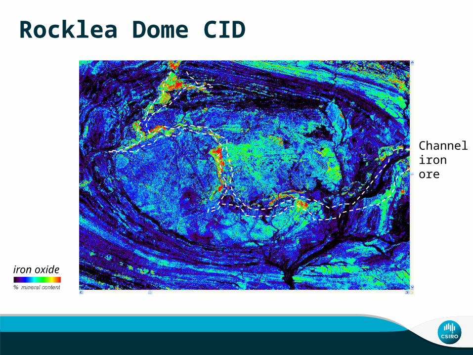
Rocklea Dome CID • ASTER
• Airborne hyperspectral
• 14DD hylogged
• ~150 RC hylogged
iron oxide (B4/B3)low high
Rocklea Dome CID
iron oxide5 40
Channel iron ore

: RC cores with XRF
: RC cores with XRF + HyLogging
Haest et al. (2012a, b)


“hyperspectral” Fe3+ content – Rocklea Dome data
RMSE: 9.1 wt% Fe
SiO2 wt% XRFHyLogger 900 nm absorption depth
(900D – fitted 2nd order polynomial 760-1050 nm)
XR
F F
e 2O
3 co
nten
t
Haest et al. (2012a, b)

Iron ore resource delineation
Haest et al. (2012a, b)

Iron ore type characterisation
Ochreous goethite: soft and powdery
Vitreous goethite: hard and shiny

Clay type characterisation
Haest et al. (2012a, b)

Airborne
Drill core
Kaolin crystallinity (airborne+drillcore) Height exaggeration: 12*
modelled CID resource
modelled base of channel

Conclusions – Rocklea Dome• Quantitative mineralogy from surface and subsurface infrared
spectroscopic data, when processed in 3D provide• Rapid iron ore resource delineation• Iron ore type characterisation processing• Clay mineralogy geotechnical purposes• Clay composition guide to CID exploration potential
• Airborne hyperspectral (and satellite multispectral data) can be used for CID exploration and characterisation
• Same routines are being applied to diamond and rock chip drill cores from BHP Billiton’s BID and CID deposits in the Hamersley Range and to many other commodity types across Australia

Further Reading• Cudahy, T.J., and Ramanaidou, E.R., 1997, Measurement of the hematite: goethite ratio using field visible
and near-infrared reflectance spectrometry in channel iron deposits, Western Australia: Australian Journal of Earth Sciences, v. 44, p. 411−420.
• Haest, M., Cudahy, C., Rodger, A., Laukamp, C., Martens, C., Caccetta, M. (2013): Unmixing vegetation from airborne visible-near to shortwave infrared spectroscopy-based mineral maps over the Rocklea Dome (Western Australia), with a focus on iron rich palaeochannels.- Remote Sensing of Environment, 129, 17-31.
• Haest, M., Cudahy, T., Laukamp, C., Gregrory, S. (2012): Quantitative mineralogy from visible to shortwave infrared spectroscopic data - I. Validation of mineral abundance and composition products of the Rocklea Dome channel iron deposit in Western Australia.- Economic Geology, 107, 209 - 228.
• Haest, M., Cudahy, T., Laukamp, C., Gregrory, S. (2012): Quantitative mineralogy from visible to shortwave infrared spectroscopic data - II. 3D mineralogical characterisation of the Rocklea Dome channel iron deposit, Western Australia - Economic Geology, 107, 229 - 249.
• Ramanaidou, E.R., Morris, R.C., and Horwitz, R.C., 2003, Channel iron deposits of the Hamersley Province, Western Australia: Australian Journal of Earth Sciences, v. 50, p. 669−690.

Thank youCSIRO Earth Science and Resource EngineeringCarsten LaukampGeoscientistt +61 8 6436 8754e [email protected] http://c3dmm.csiro.au/
Western Australian Centre of Excellence for 3D Mineral Mapping/ MDU Flagship