Embed Size (px)
Citation preview


! Road
o
R/W
i
!
I ,
i
0•
~
2303
Location: 11-30/27 ;Width: 15 feet iTemporary No. SO 45-62
I ndex Page 41-A iWork Order No. 2514 iHap No. 6-la.2303 HI
:Description: Additional width Wilson Road.
HINUTE DATE BK/P
IACT ION:
IProperty Hanagement Dept. authorized to obtain title reports, 159/ 1-8-63 Iletter and map filed.
IChairman authorized to sign Agreement with Frank Delcid, 163/ 9-10-63 et al; filed.
Policy of Title Insurance & Grant Deed from Frank Delcid, 164/105 10-15-63 et al - filed.
Chairman authorized to sign Supplementary Settlement 1651119 1-7-64 Agreement with Antonio S. Madruga et ux; filed.
Declared a Publ ic Highway:
Officially Named:
Easements: DATE OFFICIAL SURVEYOR BK/P BK/P
Accepted; Ordered Recorded
Norman C. Grasessle & 3648/244 166/61 163/380 9-17-63 Gladys Graessle Frank Delcid, et ill
9~5-63
3650/301 166/91 163/380 9-17-63 Naomi Brown
9-7-63 9-10-63 3648/239 166/56 163/381 9-17-63
Bobby HcFiren & 3648/241 166/589-10-63 163/382 9-17-63 Ca rleen HcF i ren Edward D. Poole & 9-10-63 3648/242 166/59 163/383 9-17-63 Mary H. Poole Helvin F. Hadruga & 9-12-63 3648/243 I66/1b0 163/385 9-17-63 Charlotte E. Hadruga Paul H. Hudson & 9-12-63 3651/21 166/96 163/425 9-24-63 Sylvia L. Hudson Preston Campbell & 3651/21 166/94 163/427 9-24-63 Dorothy Campbell Dee Harris &
9-13-63
9-12-63 3651/25 166/98 163/428 9-24-63 Thelma Harris Roberto H. Serrano & 9-12-63 3651/19 166/92 163/428 9-24-67 Hickie Serrano Antonio S. Hadruga & 9-16-6} 3651/26 166/99 163/431 9-24-63 Hary S. MadrugaHary H. Pinheiro 9-16-63 3651/27 166/100 163/431 9-24-63
esolution of Acceptance 3642/242 165/9~-A 163/291 9-6-63roo'.'
ccepted & Ordered ecorded Societa Italiana Hutuo 3651/187 16611 019-23-63 164117 10-1-63 Soccorso Dante Alighieri
I
i
I 0

\ Ii 2304
i Locat ion: 30-29129 I Width: 25 feet and 15 fe I SO 52-62 ! Road I ndex Book. Page 51I
I Descr i pt ion: o
et
! ACTION:
Declared a Public Highway :
Officially Named:
R/W Easements:
o Accepted & Recorded Gulf Oil Corporation of Cal ifornia
o
o
51C
Add i tiona I right-of-way Niles Street and Horning Drive.
;
DATE
7-12-63
MINUTE BKIP
OFFIC IAL SURVEYOR SKIP SKIP
36331137 164/87 163/66
.
DATE I i
7-30-63

2305
location: 4-27/40 Width: 30 feet ~O 55-62 Road Index Book, Page 103 I
Description: Additional 30 feet dedication on Eaton Avenue. Incorporated into City of Ridgecrest
-r------,------~ ACTION:
Proposed County Road No. 2305, letter from Planning Commission requesting approval - approved; filed.
Dedication of 30 foot width on West side of Eaton Street, North of Upjohn Road - accepted; letter filed.
Declared a Public Highway:
I Off i cia II y Named:
I I
o RIW Easements:
Accepted, Recorded & Declared
leo Neal Webb & Mary louise Webb
o
o
DATE OFF IC IAl SURVEYOR BK/P BK/P
II _?(..-(.? 3564/637 155144
MINUTE DATE BK/P
, 1591 12-26-62
1591 1-2-63
159/188 12-26-62
159/188 12-26-62

2306
Location: 35-29/28 Width: 15 feet
• Map No. 6-la.2306 HI i Work Order No. 2558 , Road I ndex Book Page 55
o Description: Additional 15 feet on Sterling Road and Virginia Avenue
ACTION:
Proposed County Road 2306, Request of Planning Commission for Acceptance - approved; filed
i Additional RIW on Sterling Road and Virginia Avenue-i Approved; Property Management to obtain rights of way; i Surveyor to make necessary surveys I
: Declared a Publ ic Highway:
MINUTE BK/P
1591
1591
159/187
1591187
159/187
\'"
DATE
12-26-62
1-2-63
12-26-62
12-26-62
12-26-62
o
o
o
, Off Ic ia Ily Named:
: RIW Easements:
Accepted, Recorded &
Declared Basil Clerieo &
Geneive L. Clerlco Ba s i I C I e rico &
Geneive L. Clerico
DATE OFFICIAL SURVEYOR BK/P BK/P
12-6-62 3564/638 155145
12-6-62 3564/639 155/46

- •... • 1..,.._'4N'" _ ¥!A iU an • u ; • ; 44 •
2307 INACTIVE
I I . ILocat~on: 30/27-2 iWidth: 15 feet 'so: 51-62 IRoad Index Book: 39 IWork Order No. 2538 IField Book 618, Page 72
I 'Description: Proposed additional right of way South side I
Belle Terrace East of Real Road.
o
o
o

~~~-~=='~~~==·='~=========··~-==·===·======2=30=8====================================~~~a~'~i~
Location: 9-32/38 Width: 55 feet Road Index Book - Page 5
Description: North:.li5 fe of County R o
I I ACTION:
Establishment of County R land (Portion)
I I •
I Officially Named:
R/W Easements
o Accepted & Recorded
Edwa rds-Town, Inc. Lowe II H. Lass &
Helen S. Lass
o
o
et of Section 9 and East 55 feet North oad 636 (City of Cal ifornia City)
MINUTE DATE BKIP
oad 2308 over parcel of public 159/152 12-18-62
DATE OFFICIAL SURVEYOR BK/P BK/P
10-11-62 3554/17 154113 159/32 12-4-62 11-16-62 3554/19 154/15 159/32 12-4-62
.

o
o
o
'0
f"IIIIII'l eu ;:; 4
2309
p; ;4
right-of-way Columbus at River Boulevard.
DATEHINUTE BK/P
ulevard at River Boulevard 158/ ized to survey.
:
location: 17-29/28 Width: Work Order No. 2539 Road Index Book, Page 43
Description; Additional
ACTION:
Realignment of Skyline Bo : Approved; Surveyor author
Declared a Public Highway
Officially Named:
R/W Easements:
Accepted; Returned to Peoperty Management to Put in Escrow
Warde D. Watson Realty Company
DATE OFFICIAL SURVEYOR BK/P SKIP
2-8-63 6608/405 161/25 160/76 2-13-63
.

- + ..
(
o
o
2310
I location: 14-28/24 i Width:
Work Order No. 2542 SO 62-62 Rmad Index Book, Page 74
Description: Additional width on
ACT ION:
Proposed Deed for right-of-way, Extension of los Angeles Street between Palm Avenue & Magnolia Avenue - Property Management authorized to obtain additional right-of-way.
Declared a Public Highway:
Officially Named:
R/W Easements:
Accepted & Recorded Ed Rueb & Aletha Bonnie Rueb leland I. Kroeker &
, Peggy J. Kroeker Siemens Bros.
DATE OFFIC IAl SURVEYOR BK/P BK/P
7-15-63 3673/572 170/3
10-11-63 3673/573 170/4
11-12-63 3673/574 170/5
los Angeles Street.
MINUTE BK/P
DATE
158/
164/465
164/1*65
164/465
11-20-62
12-10-63
12-10-63
12-10-63

-2311
4.
i Location: 36-29/28 , Width: 15 feet
Road Index Book, Page 51AI I Description: Additional
ACTION:
#. Declared a Publ ic Highway :
Officially Named:
R/W Easements:
o Declared
o
.# •
width Pioneer Drive - North 15 feet Pioneer Park
MINUTE DATE BK/P
12-18-62159/134
DATE OFFICIAL SURVEYOR SKIP BK/P
12-18-621591134
-0

0
5
o·
o
2312
i Location: 32-29/28 Width: 5 feet Road Index Book, Page 52 wO# 2549
Description: Additional right-of-way 3rd Street Wood Street.
ACT ION:
Declared a Public Highway:
4iWII\I~'
Union Avenue to
MINUTE DATE BK/P
Officially Named:
R/W Easements:
lccepted & Recorded Theodore N. Tepper & Yvonne M. Tepper
DATE OFFICIAL SURVEYOR BK/P BK/P
7-19-63 3634/509 165/ II 163/108 8-6-63
()

-
0
2313
Location: 13-30/27 Width: 15 feet Road Index Book, Page 42-AIWO# 2550
Description: Additional right-of-way On Planz Road,
MINUTE BK/P
::lDATE
160/73
160/73
2-13-63
2-13-63
o
City of Bakersfield
SURVEYOR BK/P
156/72
...
o· ACTION:
Declared a Public Highway:
Officially Named:
R/W Easements:
~ccepted, Recorded & peclared
Sherman Harmon & Opal D. Harmon
DATE
2-4-63
OFFle IAL BK/P
3577/274

7-16-63
4i"I!~' 1,2314
location: 21-32/33 so 63-62 Width: 40 feet WO# 2592 Road Index Book Page 96 o Description: Extension of Anita Drive.
Annexed into City of Tehachapi
MINUTE DATE BK/P
ACTl ON:
162/458 Tehachapi - requests approved. Proposed Access to High Sc hoo, Extension of Anita Drive,
174/534Completion of Road Connect ion at Dennison Road and Anita 7-27-65 Drive, Tehachapi High Schoo I - Referred to County Counsel to prepare Agreement; to Surveyor for surveys, to Property Management Dept for immediate acquisition, f i led.
eclared a Public Highway:
Officially Named:
o .
SURVEYOR BKIP
DATE OFFICIALRIW Easements: SKIP
ccepted Jacobsen Brothers 10-4-65 207/25 10-13-65 Turf Farms
3884/473 1771179
-
o
J

2315 INACTIVE
o
o
o
o·
Additional width on Church Street
Location: 27/40-3 Width: 30 feet Road Index Book Page 103A Work Order No. 2579 Field Book 675, Page I Map No. 6-la.2315 MI
ACTION:
Referral from Board to make survey. 1-15-63

--
0
2316
• CMI~
MINUTE DATE BKIP
160/206 160/206
160/31 2-5-63 160/31 2-5-63
Locat ion: 2,3,10,11-32138 Width: 55 feet and 110 feet Road Index Book Page 5
Description: Access Road Tract 2715 Incorporatea into City of California City
ACTION;
Establishment of County Road 2316 over parcel of public
'0
o
land.
Officially Named:
R/W Easements:
Accepted & Recorded Edwards-Town. Inc. Edwards-Town, Inc.
DATE
12-14-62 1-23-63
OFFICIAL SURVEYOR BKIP BK/P
3574/998 156150 3574/997 156149

$ 4A'4 lAW.... as a 4 i a sa &; A
2317
•• • 4
Locat ion: 13-20/27 Width: 60 feet Road Index Book Page ~2-A
Description: Portion of,Mesa Grande Relinquished to County.
o ACTION: MINUTE Date
BK/P
Declared a Public Highway: 160/77 2-13-63
ff j cia 11 y Named:
o DATERIW Easements: OFF I C IAL SURVEYOR BKIP BKIP
ccepted, Recorded & eclared Director's Deed from 1:-28-63 156/653577/152 160/77 2-13-63 State of California
o
o

'0
o
o
o
2318
Location: 1~31/28 Width: 60 feet SO 6~63 Road Index Book Page 90
Description: Extension (Southerly) of Stobaugh Street.
DATE SKIP
MINUTEACTION:
Proposed Extension - Roa d Commissioner's recommendation to 160/134 2-19-63 approve approved, etc.
8-13-63Stobaugh Street Extension Improvement Agreement
Declared a Public Highway:
Officially Named:
DATEI SURVEYOR BK/P
OFF Ie IALRIW Easements: BK/P
Accepted & Ordered Recorded
Bear Mountain Develop 4-26-62 165/84 163/208 8-20-63 ment Corp.
3640/744

o
o
o
o
2319
Location: 33-26/40 Widtn:· 30 feet SO 14-63 Road Index Book, Page 10
Description: Future Stre
ACTION:
Declared a Public Highway:
Officially Named:
R/W Easements:
Resolution of Acceptance Adopted
2
et in Tract City of Ridgecrest
1401. Lots 78. 79, 90
Resolution of Acceptance
DATE OFFICIAL SURVEYOR SKIP SKIP
3588/593 157196
MINUTE DATE SKIP
160/345 3-19-63
160/345 3-19-63

_ ¢4
0
••
,0
CO
•
2320
Location: 26,25-32/35 &19,20,21-32/36 Width: 80 feet Road Index Book, Page 3 and 3A
Description: Randsburg Cut-off from State Rt. 58 and St.
ACTION:
Declared a Public Highway:
Officially Named:
R/W Easements: Date Official Surveyor Bk/P Bk/P
Accepted: Hazel Vrba & 1- 5 .-65 3810/341Barbara Ruettgers Adolf W. Schwartz 3804/524 & Reinhilde Schwartz Adolf W. Schwartz & 1-5-65
1-5-65
3804/523 Reinhilde Schwartz
Establishment of Co. Rd. 2320 over parcels of Public Land Accepted:
Raleigh E. Guynes & Marvin E. Brooks Raleigh E. Guynes & Marvin E.Brooks Minnie Blumer & Lucille Pash Stan J. & Mary C. Anstett Kurt L. & iEda Dobler Margaret Cole Morris et al John R. Hansen
Richard William Thomas
) ) Not )
1-20-65
1-20-65
2-2-65
2-11-65
1-27-65
ecoroed
3810/739
3810/739
3817/869
3817/871
3819/785
3823/8592-20-65 2-24-65 3822/111
3-5-65 3823/638 Thomas A. Gugliuzza 4-1::-65 3827/567 & Howard R.Priceetux ,. _" Matthew Charlton & Marjorie M.Charlton Joseph Louis & Diane M. Thurman George Howard McCool Executor Winslow Maxwell Joseph P. Lobacz S.M. Harkiss
2-7-65
5-6-65
5-11-65 4-20-65 5-13-65 3-13-65
Winslow Maxwell 7-15-65 3864/85 Security First N.B. 10-29-65 3884/242 for Homer Hansen
Final Order-Condemnation 4022/541#92987-Wesley I.Jolin et al
Lis Pendins Wesley I. Jolin et al 6-21-65 3850/835
189/73
188/74
188/73
189/75
189/75
190/58
190/60
190/72
191/4
190/94
190/105 196/90
196/1
195/95
198/5 d 3864/85 OR
196/105 196/106 201/70 210/15
251/93
199/15
Rt. 23
MINUTE Bk/P
171/
171/192
171/192
171/
171/
171/
171/419
171/418
171/
171/ 172/18
172/
·172/ 172/221
172/
172/500 172/501 172/501 172/501 174/482 178/
DATE
1-12-65
1-12-65
1-12-65
1-12-65
2-2-65
2-2-65
2-23-65
2-23-65
3-2-65
3-2-65 3-9-65
3-16-65
3:'30-65 4-13-65
5-18-65
5-25-65 5-25-65 5-25-65 5-25-65 7-27-65 11-16-65
1-27-67
3842/104
3841/893
3847/828 Not ReCOroE 3844/876 3844/877

.....
o
o
o
.. • : ......,:, "'---·':·:·"~::::~:~=22=·'-=·"'.:"'.:-:·-:·-:·---:::~·:'::::::""'::::":":'::':":::::::::::::::~::::==='~~\~"'i"lf~
location: 33-26/40 Width: 45 feet SO 13-63 Road Index Book Page 102
Description: Additiona I Los FloreS
ACTION:
Declared a Public Highw
Officially Named: Chan
RIW Easements:
Accepted & Recorded Grace lubhern Church
right-of-way On Sierra Street (Changed to Avenue) Incorporated into City of Ridgecrest,
MINUTE BK/P
ay:
ged to los Flores Avenue
I DATE OFFICIAL SURVEYOR
BK/P BKIP
3-29-63 3606/525 161/7 161/200
[lATE
4-30-63
' __ I iF .,. 44 -, ala a;;;; £Qijj,I'~
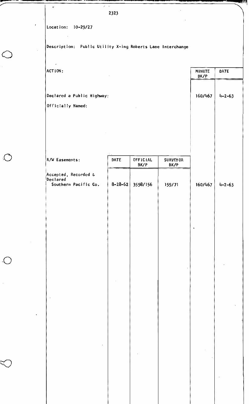
2323
Location: 10-29/27
Description: Public Utility X-ing Roberts Lane Interchange
o ACTION:
Declared a Public Highway:
Officially Named:
R/W Easements: DATE OFFICIAL BK/P
Accepted, Recorded & Declared
j Southern Pacific Co. 8-28-62 3598/156i
MINUTE DATE BK/P
'1=~~=!======1
160/467 4-2-63
SURVEYOR BK/P
159/71 160/467 4-2-63

-..........~I!'w...._ ..,_'W 4 : 14 ••• W -,. Hi
"
2324
Relinquishment by County - Crossing between Sections 3 and 4. Location: 29/27-3,4
o See SO Bk I, Page 80 for original deed.
Southern Pacific &AtchinTopica &Santa Fe.
o
·0
o

= = = ~~
o
o
{j
2325
,,:::"':::'==--_---======::.,====~..::,...::..::......:,,=::..::..-...:...-=.=.. ... .........:.. ....:.---===-==_......::.==========:::::~1Wijl~'~..=
LOCATION: 26-30/31 WIurH: 60 feet SO 10-63 ROAD INDEX BOOK, PAGE 6 DESCRIPTION: Realignment County Road No. 1859, Bealville road &
Caliente Bodfish Road Intersection
ACl'ION: MINUTE BKlP
DATE
Bealville Road and Caliente Road Intersection Realigrment -Recommendations pf Planning and Road CoIlllli.ssioner approved with exception; letters filed.
Additional right of way at intersection of Bealville road and Caliente-Bodfish Road - approved; SUrveyor to survey and prepare descriptions; Property 11iinagement Department to acquire; letter and map filed.
Declared a Public Highway:
1611
166/
Rlw Easements DATE OFFICIAL BK/P
SURVEYOR BK/P
4-9-63
3-17-64
I\ccepted: Donald G. Hawkins, et al 3-8-65 1721 3-16-65

""':::==:.:::.===::;::===-:.:-:.-::-::.,:--:::-.:-=-:...:..::==-==-:::::.:::--:::...::....:-:,:-===.....;::===___-==::::::::;.:..::===::..:.::=~:"'i"!lWI1
2326 INACTIVE
location: 30-29/27 so 11-63 Petition No. 1043 Road Index Book Page 95
Description: Proposed opening of alley in Tr.act No. 2602.
o

"*4 _ A ." ,~, ..... __ ........ _ 44 __ .. _,",,", __ ~_ ._ "W'
o
o
o
,
2327-(
LOCATION: 10-29/27 WIDI'H: 45 feet TEMPORARY NUMBER SO 7-63 PETITION NO. 1042 ROAD INDEX PAGE 25-A
DESCRIPl'ION:
Easterly extension of Columbine Street and Northerly along East boundary of Tract No. 1386.
ACTION: MINUTE DATE BKiP
Declared a Public Highway:
Officially Named:
Road Petition No. 1042, Streets in Tract No. 1386, 1611 4-9-63 l-bhawk Street and Columbine Street. Parcel 1 Denied; Parcel No. 2 approved subject to conditions of Road Commissioner; letters filed.

---- -
o
o
o
o
.... • $4ifi!~
Location: 33-26/40 Width: 60 feet Temporary Number SO 22-63 Road Index Page 102
2328
Description: Northerly extension Fairview Street (Incorporated into City of Ridgecrest)
ACTION:
Declared a Public Highway: Resolution establishing County Road No. accepting it into County Road System
Officially Named:
2328 and
MINUTE SKIP
162/364
DATE
7-2-63
R/W Easements:
Accepted & Recorded George S. Page & Marian M. Page
DATE
5-27-63
OFFICIAL SKIP
3633/143
SURVEYOR SKIP
164193 162/363 7-2-63
.. ____ ~ ..... ·'-·' __ ·-___ ·-~' ........... __ -··' ___ 4_ ''''''-IIII"
2329 INACTIVE
location: 11/9-33 Road Index Page 115
Description: Alley in Tract No. 2107
o
o
o
o

0
,; ·_.V~~"-:.:=---====:r-=='='=~":::'=='::"":-':":::=-=-~4==-=='=:::'::'=~4~':::~$::'~"'::'~~~~~~~~~~'~~'IIII!lIl' ~ , ~ "
;
2330
Location: 2-30/27 Width: Temporary Number SO 29-63 Road Index Page 39
Description: Road adjacent to County Road 2170 - Future Street
o
o
in Tract 1334
ACTION:
Dec 1 a red a Pub 1i cHi ghway: (Port ion)
Officially Named:
R/W Easements:
~ccepted. Recorded 6Declared (Portion)
Arthur H. Scheer & Louise Scheer
DATE
5-26-63
OFF Ie IAL SKIP
3621/468
HINUTE DATE SKIP
162/27
SURVEYOR SKIP
163/20 162/27 6-4-63

0
o
o
.. ¥. n 44_« ..... 4
2331
Location: 17-29/28 Width: 15 feet Temporary Number SO 66-62 Road Index Page 43 Hap No. 6-la.233IHI
Description: Additional width on Columbus Street
•
ACTION: DATE SKIP
MINUTE
Declared a Public Highway:
Officially Named:
RIW Easements: DATE OFF IC IAL SURVEYOR BK/P BK/P
Accepted & Recorded First Southern NG 7-12-63 164/64 10-8-63 Bapt i st Church
Firs t Sout hern 10-31-63- 3664/787 168/95 164/285 11-12-63 Baptist Church

o
o
o
'0
2332
Location: 29/28-33 Width: Work Order No. 2739 Field Book 675, Page 26 et seq Hap No.
Description: Additional width on California Avenue.
Action:
Cal ifornia Avenue project between Sunset Railroad tracks and Mt. Vernon Avenue - Surveyor to survey and 'furnish escriptions; Property Management to obtain right of
way; letter filea.
Board authorization for survey oard authorization for survey
Purchasing Agent authorized to dispose of structures, letter i led.
~ettlement Agreement with Refugaa B. Quiroz for County Road 2332 - Chairman authorized to sign; filed. Refugia H. Quiroz - Chairman authorized to sign escrow ~nstructions; filed. Settlement Agreement with San Joaquin Vetermnary Land Co. ~or County Road 2332 - Chairman authorized to sign; filed. San Joaquin Veterinary Land Company - Chairman authorized I •to sign.
I,n re: County Road 2332 in Tract No. 1475 - Resolution of~cceptance Adopted.
In re: County Road 2332 in Tract No. 1122 - Resolution of Acceptance Adopted.
Chairman authorized to sign escrow instructions, Helen Leona Cameron; County Counsel authorized to dismiss Court act ion, etc.
Settlement Agreement, Bernabe Hoi inar and Helen Molinar, Chairman authorized to sign; filed. Chairman authorized to sign escrow instructions; escrow instructions referred to County Counsel with instructions to dismiss Court action, etc; filed. Notice of Recission of Agreement filed, etc.
Final Order of Condemnation No. 89369
Declared a Public Highway:
Officially Named:
MINUTE BK/P
DATE
162/37 ,6-4-63
167/
6-4-63 3-24-64
6-3-64
166/l6~
166/1611
166/168
166/168
4-14-64
4-14-64
4-14-64
4-14-64
166/293 4-28-64
166/293 4-28-64
167/55 6-3-64
167/56
167/56
6-3-64
6-3-64
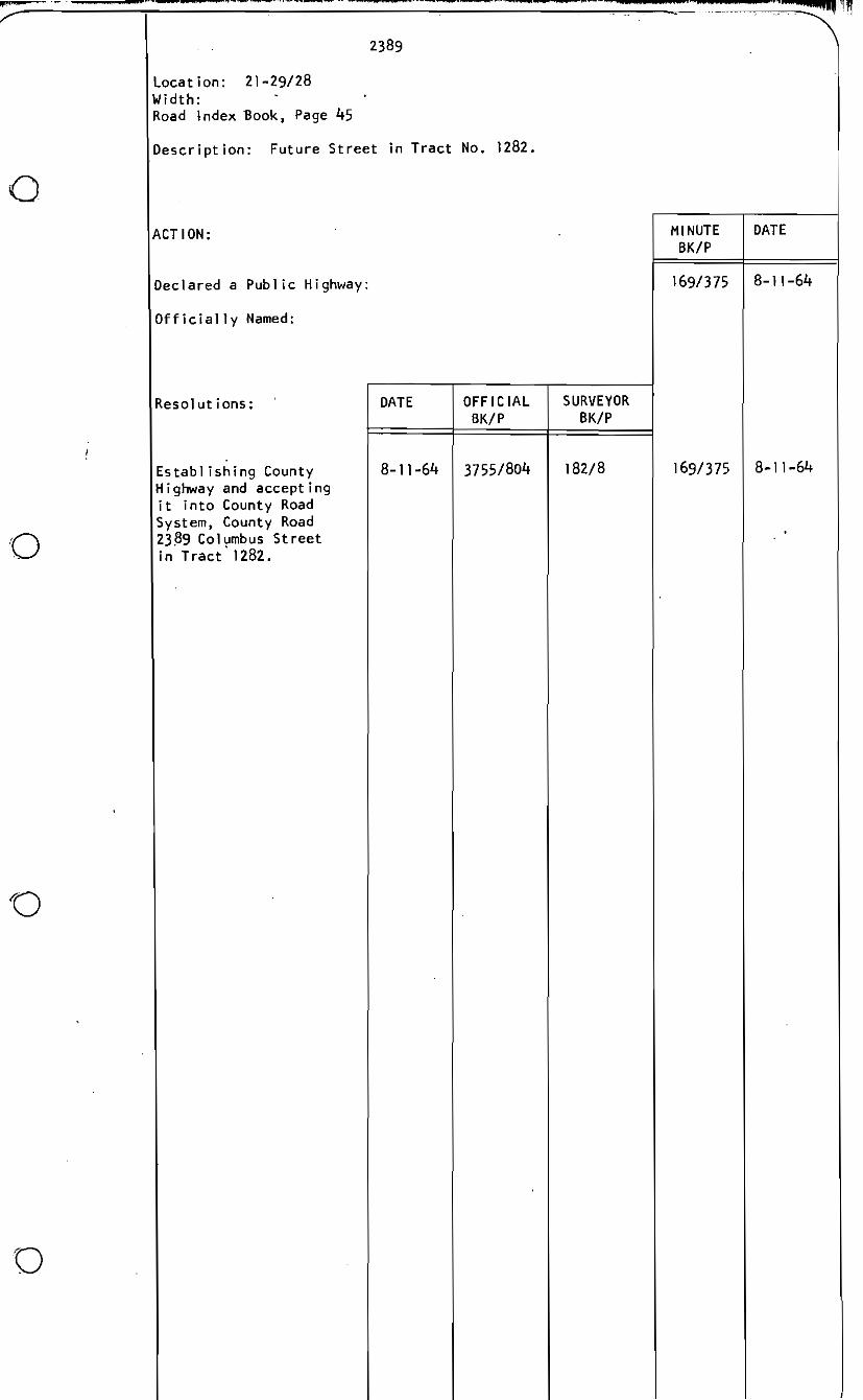
169/375 8-11-64
5-6-66

2332 - continued
i R/W Easements: DATE OFFICIAL SURVEYOR MINUTE DATE
SKIP SKIP SKIP
Accepted: Florence M. Gastineau 2-17-64 3698/978 172/37 165/382 2-25-64 Harvin D. & Mildred A. 2-19-64 3703/471 173/19 165/383 2-25-64 Keller Daisy Wi II lams 2-13-64 3704/39 173/20 165/383 2-25-64 Apolinar L. Hunoz 2-17-64 3705/567 165/417173133 3-3-64 Beatrice Maude Pnillips 2-21-64 165/4163705/565 173/31 3-3-64 Ancelmo G. & Josepnine 2-27-64 3710/201 165/418173/96 3-3-64 Gaona Paul S. Swartz, Saran Ann 2-24-64 3705/566 173/32 165/418 3-3-64 Swartz, Dolores Swartz Edwin R. Keck, et ux 2-28-64 165/4183707/415 173/65 3-3-64 Felipe & Victoria Padilla 2-24-64 165/46037041783 173/29 3-10-64 Jonn & Jovita Gutierrez 166/263- JI-64 3708/410 173/80 3-17-64 Ben & Byrd Lee Aguilar 3-17-64 37221936 166/57 3-24-64 Guy B. Wood & Adeline Wood
174133 174/88 1661713-19-64 3-24-64
Carlos L. Cruz & Luella 3713/953
3-26-64 166/1323721/377 175/55 4-7-64 Cruz Jose S. Escalera. Sr. & 3-26-64 166/1323721/376 175/54 4-7-64 Flora R. Escalera Charles Chagi & Thelma 4-4-64 166/167o 4-14-64 Ruth Chagi
175/563721/379
Rufugia B. Quiroz 4-10-64 177/66 166/16!! 4-14-64 San Joaquin Veterinary
3729/555 166/1683720/219 175/494-13-64 4-14-64
Land Company Sam Bernson, et al 4-10-64 37221226 175/94 166/170 4-14-64 O. T. Washington 4-21-64 Eugene S. Rya II
4-15-64 3718/860 175/14 166/253 166/2884-20-64 4-28-64
Victor H. Hutz, et al 3727/259 177/55
166/2894-23-64 37221616 175/100 4-28-64 Victor H. Hutz & Mary 166/289 4-28-64 Burtis Mutz Robert J. Matsumato
4-23-64 3722/615 175/99
4-24-64 166/289 4-28-64 Resolution of Acceptance
Tract 1475
3727/256 177/54
166/293 4-28-64 Tract 1122
3730/822 177178 4-28-64
Accepted; John P. & Betty L.
3730/823 166/293177179
177/60 166/3304-23-64 3727/816 5-5-64 Van Denburgn O. T. Washington 4-24-64 177/16 1661330 5-5-643723/683H.G. Hears & Florence G. 177/61 166/3444-23-64 3727/825 5-5-64 Mears Columbus L. & Irene 177/815-11-64 3731/147 166/376o 5-12-64 Starkey Virgil Lee & Evelyn 166/4135-12-64 3730/147 177/77 5-19-64 Cora Benson Hr. Violet D. Hurta 177/80 166/4135-14-64 3731/146 5-19-64 Richard & Annette Staats 178/51 167/165-22-64 5-26-64 Ken Knauber et al
3734/504 178/49 167/17 5-26-64
Helen Leona Cameron 5-25-64 3734/502
179/94 167/55 6-3-64 Santa Barbara Hutual Building
5-27-64 3745/959 6-3-64
Bernabe Holinar &Helen 4-29-64 167/5537331328 178137
167/56 6-3-64 Hoi iner James H. Webb & Nora Webb
5-27-64 177/963745/976
180/35 167/96 LP Dismissed this 1'1.0.
Anderson. Clayton & Co.
6-5-64 3749/137
168/15 6-16-64 Gladys O. Plessen &
5-28-64 3741/199 179/13 179/17 , 169/1016-18-64 6-23-64
Velma L. Osborne Carmen Marquez
3742133
187/217-28-64 169/344 8-4-64 Carmen Harquez
3786/196 7-28-64 185/15 169/3443769/638 8-4-6~
Walter A. Boruch & Betty 185/26 169/5229-3-64 3771/337 9-8-64 J. Soruch Pearl A. Wilson 10-6-64 Dina M. Connor
10-2-64 186/59 170/1113779/627 186/64 ,]]0/154o 10-13-64
Frank B. Bowker Estate 3780/8210-7-64
172/1002-26-65 3-23-65 Final Order of Condemnation
No. 89369 223/515-6-66 3946/467
6-9-64


" -- --",au
o
o
........... ..,~........... ..... q .. ''''~ • -..-..... Pi ¥hlllll. 2. AU• ......
2395
location: 1-32/38 Width: 95 feet Road Index Book Page 5
Description: Rudnick Boulevard and EsseEBoulevard City of California City
ACTION:
Declared a Public Highway:
Officially Named:
Rlw Easements:
Acceptance
h2!'1l1~
in Tract 2715
MINUTE DATE SKIP
170/73 9-29-64
DATE SURVEYOROFFICIAL
185/147 170/733773/428 9-29-64

-.. IN
'0
o
o
o
_. ............'$14 II
location: 6-32/39 Width: 55 feet Road Index Book, Page 5
Description: Additional width for County Road No. 2395.
. 2396
ACTION: MINUTE BK/P
DATE
Establishment of County Road
Officially Named:
No. 2396 170/72 9-29-64
_ ,

2397
Location: 21-9/12 Width: 25 feet Temporary No. SO 36-64 Road Index Book, Page 98
o Description: Additional width on Marie Avenue
ACTION:
Declared a Publ ic Highway:
Officially Named:
o
DATEMINUTE BKIP

~ __ 4 AIJ" ·sa/"./
o
o
o
a
4 "¥Que
2398
.Location: 6-30/28 Width: 2 feet Temporary No. SO 37-64 Road Index Book, Page 4I
Description: Additional dedication South P Street
•
IACTION: MINUTE DATE BK/P
Declared a Public Highwa y:
Officially Named:
R/W Easements: DATE OFFICIAL SURVEYOR BK/P BKIP
Accepted Victor Deluca, Jr. ~: ,; j 9-10-64 3775/938 186/33 170/152 10-13-64 et 81
!

0
.,~
2399
Location: 34-11/9 Width: 60 feet Temporary No. SO 50-62
,'T"P "_I"" ; __• ;!II""
Petition No. 1040 Road Index Book, Page 4 Work Order No. 3222 Field Book 710, Page 32 Map No. 6-1a.2399 Ml
Description: Extension of Flint Street
ACTION:
Petition for road - referred to Surveyor for bond est imate, etc.
Surveyor to prepare deeds; Property Management Dept. to obtain rights of way at no cost to County for 60 foot road
Intention to establish a portion of a proposed County Road No. 2399 on U. S. Government property.
o Hearing on Intention to Establish a portion of proposed County Road 2399 on U. S. Government property - Held; Concluded; Approved; Property Management, Surveyor, Road Commissioner to proceed with project, etc.
Declared a Publ ic Highway:
Officially Named:
DATE OFFICIAL SURVEYOR BK/P
R/W Easements: BK/P
-
~ccepted: Arl ene D. Millholl in 12-22-64 3847/234 197/81 El izabeth Z. McNe 11 y 2-25-65 3847/228 197175 Genevieve P. Holmburg 2-5-65 3847/230 197177 Frank M. Schultz & 1-8-65 3847/232 197179 Lydia M. Schultz The Roman Catholic 6-2-65 198/89 Bishop of Honterey-Fresno Joshua Tra i ler Sales
3849/977
210/1811-3-65 3894/245
MINUTE BK/P
158/
169/
173/151
174/64
173/19 173/18 173/19 173/19
173/134
178/235
•
DATE
11-27-62
9-8-64
6-15-65
7-6-65
6-1-65 6-1-65 6-1-65 6-1-65
6-15-65
11-16-65
~/'
4jll'I'~