Embed Size (px)
Citation preview

2d‐ Drainage Analysis & Spatial Data
1
Spatial Data:Drainage Analysis, Basin delineation
CIVE 781: Principles of Hydrologic Modelling
University of Waterloo
2
Summary
• Drainage analysis / basin delineation– How it works
– Tips & strategy
– Issues
Model Evaluation Against data
1
2

2d‐ Drainage Analysis & Spatial Data
2
3
Spatial Delineation
• Definitions– Spatial delineation : the process of separating a watershed into homogeneous computational units for use in a hydrologic model
– Subbasin: • the drainage area of a location on a stream network minus the drainage areas of one or more upstream subbasins which flow directly into that subbbasin.
– Hydrological response unit (HRU) • an area with hydrologically unique response to meteorological events.
4
Spatial Delineation
• Standard approach:
– Delineate subbasins via terrain analysis (GIS) [TODAY]
– Delineate HRUs via map overlay analysis (GIS) [NEXT DAY]
3
4

2d‐ Drainage Analysis & Spatial Data
3
5
Catchment: Definition• Common hydrologic modelling task is to
delineate drainage basins upstream of a point of interest
• This is a fundamental model discretization step
• Watershed/basin/subbasin/catchment/drainage basin
• Drainage basin (Water Survey of Canada) : – The area enclosed by a topographic divide such
that surface runoff drains by gravity into a river, lake or other water body Corresponds to a single outlet point on 2D landscape
6
Data Source: Catchments
• ECCC product: WSC catchments– Unlike U.S., not finely discretized– Outlets don’t correspond to stream gauge
locations– Simply organizational
• Some provinces (e.g., BC) have finer resolutioncatchment product
• NRCan/ECCC working on better national product, – CHyF – Canadian Hydrologic Features– Part of National Hydrographic Network (NHN)
• UW group has developed a North American discretization product (more later!)
• Unfortunately, we will usually have to do the work of catchment delineation ourselves…
5
6

2d‐ Drainage Analysis & Spatial Data
4
7
Drainage Analysis
• Basis of catchment delineation, stream network creation, and runoff accumulation models– The topography of a watershed controls the distribution of water drainage
• Based upon 1 premise:– ‘Water flows downhill’– i.e., water will follow the path of steepest descent
• Also used to track soil, sediment, or contaminants carried by water
8
Manual Drainage Analysis
• (1) Identify outlet point
• (2) Trace a line perpendicular to the topographic map contours
– Look for ridges
–May intersect peaks
–Watch out for saddle points
– Look at neighboring streams
8
7
8

2d‐ Drainage Analysis & Spatial Data
5
99
1010
9
10

2d‐ Drainage Analysis & Spatial Data
6
11
DEMs
• Digital Elevation models
11
12
Canadian DEM Source Data
• Geobase – CDED (Canadian Digital Elevation Data:– Complete coverage of Canada– Compatible with translators for USGS DTED– Grid resolution of 8 to 23 m (1:50,000), 32 to 93 m (1:250,000)– http://geogratis.gc.ca/api/en/nrcan‐rncan/ess‐sst/
• WWF HydroSHEDS– Hydrologically Conditioned DEMs and Flow directions– Grid resolution of 3 arc‐seconds (<60‐90m) above 49°N– Lower quality (and not publically available) above 60°N– Great starting point for basin delineation in rugged terrain– Developed by B. Lehner at McGill University– http://www.hydrosheds.org/
• ArcticDEM– High quality product north of 60N ‐2m resolution!!!
– Links at http://cshs‐cwra.ca/greyjay/
11
12

2d‐ Drainage Analysis & Spatial Data
7
13
1 degree DEMs
• 1‐degree ‐ A.K.A. 1:250,000 scale DEMs
• Digitized from a 1:250,000 scale map
– 1201x1201 grids • Each grid cell is 3x3 arc‐seconds (3x6 or 3x12 towards north pole)
• 15‐minute ‐ A.K.A. 1:50,000 scale DEMs
– 1201x1201 grids • Each grid cell is 0.75x0.75 arc‐seconds (0.75x1.5 or 0.75x3 towards north pole)
• Horizontal resolution increases as we go north
3”
3”
N
14
Understanding DEM Scales
1 deg.
1 deg.
15 min DEM0.75 arc‐sec cells
7.5 min DEM30 m3 m1 m…
(UTM, NAD1983)
13
14

2d‐ Drainage Analysis & Spatial Data
8
15
Finer Resolutions
• Both Provincial and Federal governments provide more detailed DEMs, typically in UTM coordinate systems
– Typically referred to by resolution:
• 30 meter (1:10,000) scale
• 10 meter
• <1 meter (if you are lucky) (LIDAR)
• 2 meter (ArcticDEM)
16
Lidar
https://www.e‐education.psu.edu/lidar/book/
Lidar is useful for some applications, but usually overkill (and sometimes problematic) for regional scale watershed modelling
15
16

2d‐ Drainage Analysis & Spatial Data
9
17
CDED‐ known issues
• It is not seamless and certain files present certain deficiencies such as edge matching, holes‐spikes and unknown accuracy
• Inconsistent: created over a large time span using many different technologies and from various sources
• 1‐m vertical resolution insufficient in many areas of the country
• Not hydrologically conditioned – Automatically generated catchments may be erroneous
18
Automated Drainage Analysis
17
18

2d‐ Drainage Analysis & Spatial Data
10
19
8‐direction pour‐point model
• 8 Slopes calculated from adjacent cells:
– maximum slope determines flow direction
67 56 49
53 44 37
58 55 22
1m
Slope = (44‐22)/2 = 15.56
67 56 49
53 44 37
58 55 22
1m
Slope = (44‐37)/ 1 = 7
20
Flow Direction Grid
• Calculated from 8‐pour point model
67 56 49
53 44 37
58 55 22
46 50
38 48
31 24
61 47 21 16 19
53 34 12 11 12
2 2 4
1 2 4
128 1 2
4 8
8 4
4 8
2 1 4 4 4
1 1 1 2 16
DEM Flow Direction
Grid
Flow Direction Grid(meaning)
19
20

2d‐ Drainage Analysis & Spatial Data
11
21
Alternate: D‐infinity model
Flow direction is defined as steepest downward slope on planar triangular facets on a block centered grid.
Each cell can/will have two outlets
Tarboton, 1997, "A New Method for the Determination of Flow Directions and Contributing Areas in Grid Digital Elevation Models," Water Resources Research, 33(2): 309‐319
22
Flow Direction Grid
21
22

2d‐ Drainage Analysis & Spatial Data
12
23
Flow Network
• Derived directly from flow direction grid, by connecting cell centers:
24
Calculating Catchment Boundaries
• Catchment Defined as all cells draining into a given cell or stream node (drainage outlet point)
Drainage Outlet“Pour Point”
23
24

2d‐ Drainage Analysis & Spatial Data
13
26
Flow Accumulation Grid
• Used to calculate net volumetric flow to surface water features
• Simple flow accumulation Grid– Each cell contains the number of cells draining into it
– A proxy for drainage area of a point
• Weighted flow accumulation Grid– Each cell contains the quantity of runoff draining into it (from another dataset)
• weighting grid in units of m3/cell/day – usually annual avg. runoff
– Can be used to track other parameters (e.g., contaminant, soil) • weighting grid in units of kg/cell/day
27
Flow Accumulation Grid
• Simple flow grid:
– each cell contains # of inputs
Cumulative flow (# of cells)
0 0 0
0 3 2
0 0 11
0 0
2 0
0 1
0 0 1 15 0
0 2 5 24 1
26
27

2d‐ Drainage Analysis & Spatial Data
14
28
Flow Accumulation Grid
Flow Accumulation Grid
• Once the flow accumulation grid is calculated, we can obtain
– Catchment boundaries
• Defined by cells that contribute to downstream point
– Stream delineation
– Estimate of surface water/mass fluxes
28
30

2d‐ Drainage Analysis & Spatial Data
15
31
Automated Stream Delineation
• Streams are defined by a threshold number of cells draining into them
Streams defined as having a threshold > 2 Cells
32
31
32

2d‐ Drainage Analysis & Spatial Data
16
33
Watershed Delineation
Requires specification of “pour points” (outlet points)
34
Pour point snapping
• Must be pretty careful about pour point placement on rasterized stream
• Snapping algorithms move outlet to nearest (or most appropriate) stream cell
33
34

2d‐ Drainage Analysis & Spatial Data
17
35
Drainage Analysis: Problems
• Pits:– There may be cells (or groups of cells) with no downslope (pits)
• They can be errors in the DEM or natural groundwater recharge areas/ponds, prairie sloughs…
– These typically must be corrected:• Raise the elevation of all the cells in a pit to the minimum elevation of the surrounding cells (filling)
• Remove the edge cells around a pit (breaching)
• Most drainage analysis requires a “sink‐less” DEM– A.k.a. a ‘hydrologically conditioned’ DEM
36
Automated Filling of DEM sinks
• To calculate realistic drainage basins, “sinks” in the DEM must be removed using “fillling” algorithms
35
36

2d‐ Drainage Analysis & Spatial Data
18
37
Filling a DEM
Obvious pit –one cell, no outflows
Less obvious pit –many cells, no outflows
Iterative Process!!!
38
Breaching a DEM
Lawrence W Martz, Jurgen Garbrecht, An outlet breaching algorithm for the treatment of closed depressions in a raster DEM, Computers & Geosciences, Volume 25, Issue 7, 1999
37
38

2d‐ Drainage Analysis & Spatial Data
19
39
Breaching/carving a DEM
Blockage removed
Iterative Process!!!
40
From S. Šamanović et al., 2016, Analysis of the pit removal methods in digital terrain models of variousresolutions, XXIII ISPRS Congress, 12–19 July 2016, Prague, Czech Republic
Original DEMBreached DEM Filled DEM
Filling a DEM is much more invasive, especially in pockholed landscapes. Breaching algorithms are more complex than filling algorithms and aren’t present in some GIS software
39
40

2d‐ Drainage Analysis & Spatial Data
20
41
Drainage Analysis: Overview
Real Elevations DEM Flow Direction
Weighted Flow/mass Accumulation
Drainage Watersheds
Fill*
42
41
42

2d‐ Drainage Analysis & Spatial Data
21
43
Delineation dangers: Porous landscapes
From Simon Lin, 2020 PAGE 43
“The Lake Panasoffkee watershed differs from the Lake Panasoffkeebasin, which is a much larger area that could theoretically contribute surface‐water flow to Lake Panasoffkee based on physiography but does not because of the karst terrain and its well‐developed internal drainage system.” (USGS Scientific Investigations Report, 2010)
Toolbox Delineation USGS Reference Delineation
44
Delineation dangers: Urban watersheds
From Simon Lin, 2020 PAGE 44
Toolbox Delineation Reference Delineation
Source: Peace River – Saddle Creek watershed outline (Lake County Water Atlas)• Flat
• Stormwater system dominated
43
44

2d‐ Drainage Analysis & Spatial Data
22
45
Automatic Delineation: Symptoms
• Getting catchment areas wrong is similar to getting precipwrong in a hydrologic model
–Wrong contributing area=wrong amount of water entering the basin
• Can also lead to some secondary errors
– Truncate/miss critical land use (glacier cover)
– Can miss relevant flow paths (contaminant/isotope transport)
46
Automatic Delineation: Thoughts
• Comparing automatically generated streams/catchments to mapped streams is a useful exercise– Don’t trust automated catchment implicitly– Verify against surface water feature map– May have to manually adjust boundaries/areas– Plotting DEM differences pre‐/post‐filling is enlightening
• Resolution Issues:– Need for lidar in some domains– Poor coverage of small basins problematic
• Sometimes we *want* sinks in our landscape (e.g., Prairie Potholes)– Actually correspond to non‐contributing area– Not a lot of automated tricks for this
45
46

2d‐ Drainage Analysis & Spatial Data
23
47
Data Source: National Hydro Network
• National Hydro Network
– Useful basemap information –Rivers, water bodies, impoundments
– Organized by major watersheds
– Useful reference for verifying calculated watershed boundaries
51
Spatial Delineation Strategy
• Fundamental decisions:– How many subbasins are desirable for proper routing?
• # of stream gauges
• Model purpose (simulating ungauged subbasins?)
– What level of land use/soil/aspect detail is desirable in HRU?• Tempting access to “map overlay overkill”
– Thousands of unnecessary HRUs
• Soils data are often not particularly useful for hydrologic applications– Influence subtle to evaluate; local impacts smooth out over watershed
• South/north aspect can be critical– Volumetric flows correct
47
51

2d‐ Drainage Analysis & Spatial Data
24
52
Subbasin Delineation Strategy
• Many ways to break up the landscape
Source: Choi et al. (2011), A new algorithm for grid‐based hydrologic analysis by incorporating stormwater infrastructure. Computers & Geosciences. Volume 37, Issue 8, Pages 1035–1044
Subbasin Delineation Ground rules
• Gauge locations correspond to subbbasin outlets
– No need for fancy corrections
– Output::Observations : Apples::Apples
– Often pointless to use “standard” hydrologic unit catchments
– don’t do it
• Subbasins generally similar in size
– Generally as subbbasin size decreases, routing skill increases
• Subbasins at major branches in river network
• Dams/lakes/reservoirs correspond to subbbasin outlets (for reservoir treatment in Raven)
– Small reservoirs/hydraulic controls treated a bit differently from large ones
• Self draining (isolated) subbasins handled carefully
• Ideally, some subbasins will have dominant land use/soil type
– Useful for calibration
52
53

2d‐ Drainage Analysis & Spatial Data
25
54
Subbasin Delineation Ground rules
• Other reasons to break into smaller subbasins
– Landscape changes (e.g. mountains to hills to flatlands)
– Groundwater characteristics (if known)
– Trade‐off between modelling event timing with time of concentration vs in‐channel routing
55
Subbasin Delineation: TINs/Grids?
I don’t like low‐resolution grids in hydrological modelsThey throw away / smears out one of the few things that we actually know.
54
55

2d‐ Drainage Analysis & Spatial Data
26
Subbasin Delineation: Challenges
Source: Ehsanzadeh, E., van der Kamp, G. and Spence, C. (2012), The impact of climatic variability and change in the hydroclimatology of Lake Winnipeg watershed. Hydrol. Process., 26: 2802–2813.
Non‐contributing areas
57
Subbasin Delineation: Challenges
• Must verify consistency with river network
• Very wary of lakes• Topology must be properly encoded
• Circular networks sometimes problematic
• Larger networks mandate more subbasins to explicitly represent channel travel time
56
57
2d‐ Drainage Analysis & Spatial Data
27
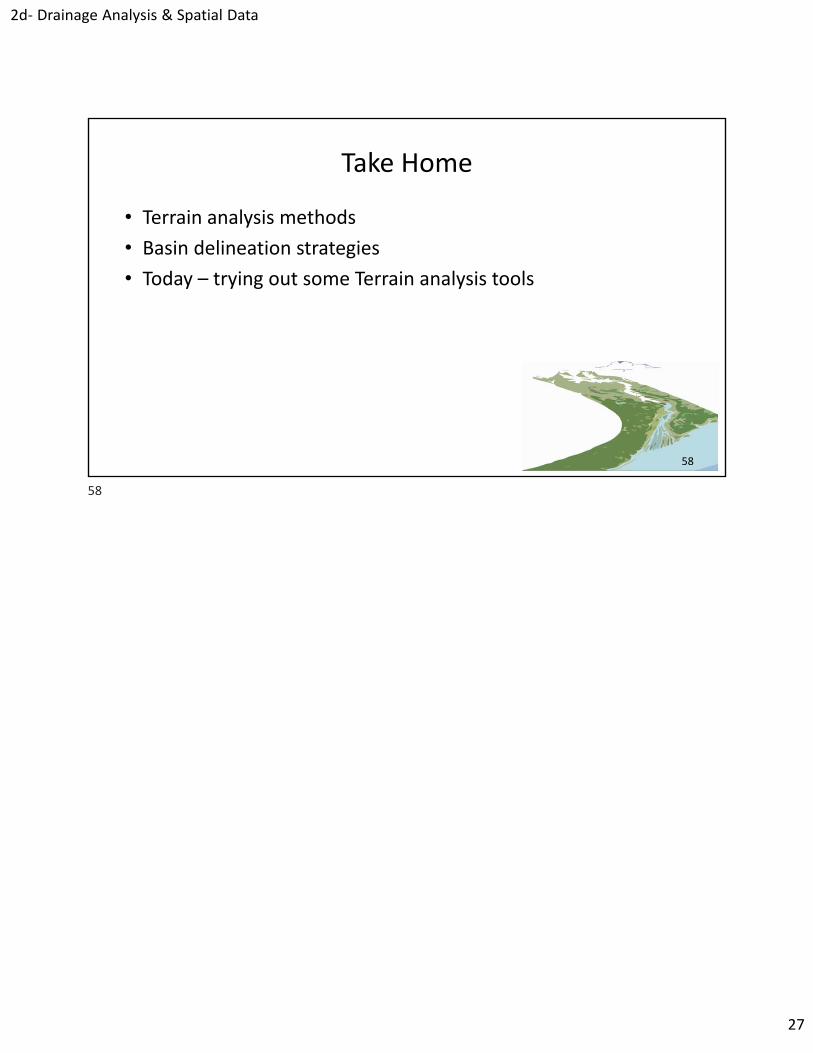
58
Take Home
• Terrain analysis methods
• Basin delineation strategies
• Today – trying out some Terrain analysis tools
58


![Exploring Spatial Context for 3D Semantic Segmentation of ...3D points can be mapped to a 2D representation followed by 2D convolutions [27]. In [2], the authors are perform-ing 2D](https://img.dokumen.tips/doc/110x75/5f4f099287ace20c387ea4de/exploring-spatial-context-for-3d-semantic-segmentation-of-3d-points-can-be-mapped.jpg)