Embed Size (px)
Citation preview

21 July 2010
1) What is the age of the oldest fossil?2) It is famous for the exceptional
preservation of the fossils found within it, in which the soft parts are preserved. It is 505 million years (Middle Cambrian) in age, making it one of the earliest fossil beds to preserve the soft parts of animals.

3) This results when original remains of the organism have been completely dissolved or otherwise destroyed and all that is left is an organism-shaped hole in the rock
4) This is a result of chemical reduction of the complex organic molecules composing the organism's tissues
5) Give an example of trace fossil.6) This galaxy is a collection of billion
of stars bound together by gravity, including the solar system.
7)What is the discontinuity between crust and mantle?
8) What is the relatively soft layer below the lithosphere?

9) What is the deepest seafloor depression in the world?
10) Who developed the Plate Tectonics Theory?
11) Illustrate the Geologic Time Scale.

RADIOACTIVE DATING
It is the principal source of information about the absolute age of rocks and other geological features, including the age of thE Earth itself, and can be used to date a wide range of natural and man-made materials. Together with stratigraphic principles, radiometric dating methods are used in geochronology to establish the geological time scale.

Among the best-known techniques are radiocarbon dating, potassium-argon dating and uranium-lead dating.

EARTHAn oxygen-rich and protective atmosphere, moderate temperatures, abundant water, and a varied chemical composition enable Earth to support life, the only planet known to harbor life. The planet is composed of rock and metal, which are present in molten form beneath its surface. The Apollo 17 spacecraft took this snapshot in 1972 of the Arabian Peninsula, the African continent, and Antarctica (most of the white area near the bottom).

EARTH’s QUICK FACTS Equatorial radius 6,378 km Equatorial inclination 23.5° Mass 5.97×1024 kg Average density 5.5 g/cm3 Rotational period 0.997 days Orbital period 1 year Average distance from the Sun 149.6 million km Perihelion 147.1 million km Aphelion 152.1 million km Orbital eccentricity 0.0167 Orbital inclination 0.0003° Moons: 1
EARTH
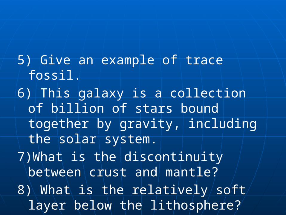
One of the planets in the solar system
71% covered with water Surrounded by layer of gases –
atmosphere Venus – almost identical to Earth but
has too much heat-trapping carbon dioxide in its atmosphere, extremely hot surface (462 C)

EARTH, SOLAR SYSTEM, GALAXY
Earth is 3rd planet from sun (ave dist:150 million km)
All planets revolve around the sun due to force of gravitation
Earth’s orbital path : slightly elliptical Solar system is part of Milky Way
Galaxy Milky Way Galaxy – collection of
billion of stars bound together by gravity

LAYERS of the ATMOSPHERE
Troposphere – layer in which weather occurs, extends from surface to about 16km (10 mi) above sea level
Stratosphere – upper boundary of 50 km (30mi)
Mesosphere – 50 to 90km (30-60mi) Thermosphere – at 90km Ionosphere – layers of ionized air
extending from almost 60km Exosphere – beyond thermosphere

LAYERS OF THE ATMOSPHERE
Divisions of the Atmosphere Without our atmosphere, there would be no life on Earth. A relatively thin envelope, the atmosphere consists of layers of gases that support life and provide protection from harmful radiation.


DYNAMICS of the EARTH’S INTERIOR
CRUST – consists of the continents, other land areas and the basins, or floors of the oceans
CONTINENTAL CRUST – dry land of earth’s surface; 15 to 75 km (9 to 47 mi) thick; consists of lighter-colored less dense igneous rocks, such as granite and diorite; also includes metamorphic and igneous rocks

OCEANIC CRUST – thinner than continental crust; 5 to 10 km (3 to 6 mi); consists of dar, dense, igneous rocks such as basalt and gabbro

PLATE TECTONICS
LITHOSPHERE – outer part of Earth, consisting of the crust and upper mantle; “rock layer”; 65 to 100 km thick (40 to 60 mi); relatively cool, outermost layer of the planet; rigid shell; brittle; behaves as single mass in the motion of the rocky plates that make up the Earth’s surface
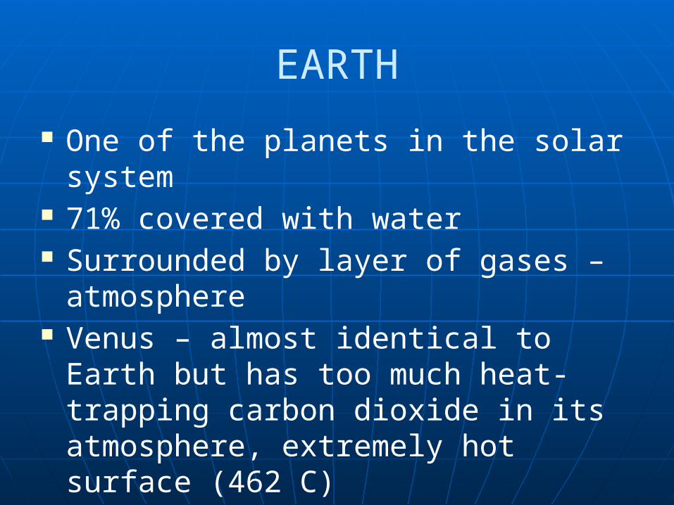
PARTS of LITHOSPHERE:Crust – granite and basaltUpper Mantle – peridotite (olivine and
pyroxene)

ASTHENOSPHERE – At depth of about 100 km (60 mi), seismic waves slow down; underlying softer layer
*Motion of lithospheric plates result from their attachment to the plastic, slowly flowing asthenosphere, thus the PLATE TECTONICS THEORY

PLATE TECTONICS – theory that outer shell of the earth is made up of thin, rigid plates that move relative to each other.
- jigsaw puzzle by Alfred Wegener in 1912 (Continental Drift Theory)

Volcanoes and Plate Tectonics Scientists have determined that there is a
close connection between the formation of volcanoes and the movement of the tectonic plates. Nearly 80% of the earth’s volcanoes are found near the tectonic plate boundaries of the Pacific Ocean. The oceanic crust is subducting, or plunging beneath, the continental crust in this region. Volcanoes can also be found at divergent plate boundaries where tectonic plates are splitting apart, or in the middle of tectonic plates, such as the volcanoes of the Hawaiian Islands in the North Pacific Ocean.

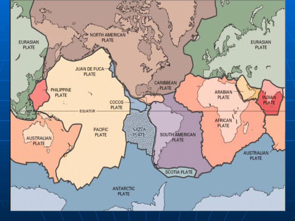


Large Plates: PACIFIC PLATE, NORTH AMERICAN PLATE, EURASIAN PLATE, ANTARCTIC PLATE
AFRICAN PLATE
Small Plates: COCOS PLATE, NAZCA PLATE, CARRIBBEAN PLATE
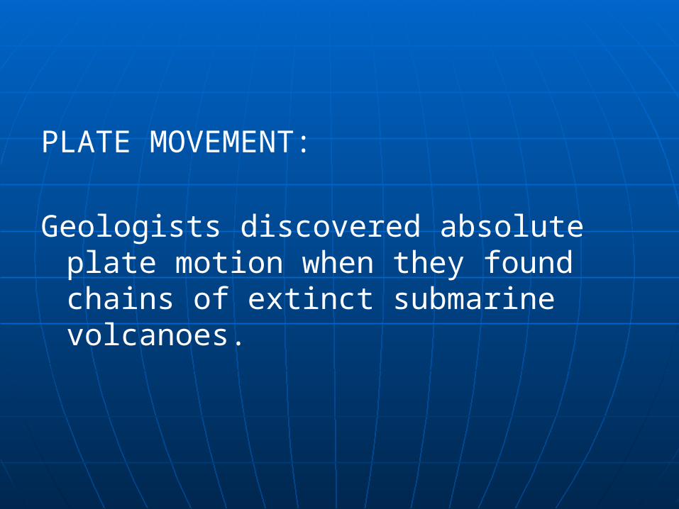
PLATE MOVEMENT:
Geologists discovered absolute plate motion when they found chains of extinct submarine volcanoes.
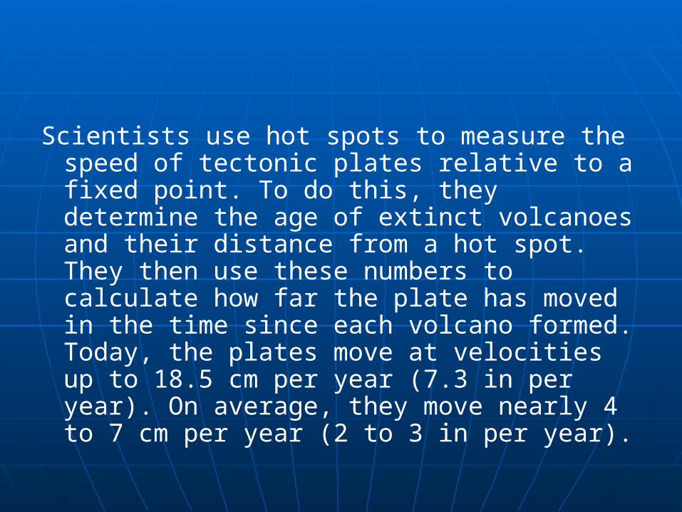
Scientists use hot spots to measure the speed of tectonic plates relative to a fixed point. To do this, they determine the age of extinct volcanoes and their distance from a hot spot. They then use these numbers to calculate how far the plate has moved in the time since each volcano formed. Today, the plates move at velocities up to 18.5 cm per year (7.3 in per year). On average, they move nearly 4 to 7 cm per year (2 to 3 in per year).

“HOTSPOT”

DIVERGENT PLATE BOUNDARIES - occur where two plates are moving apart from each other. When plates break apart, the lithosphere thins and ruptures to form a divergent plate boundary. In the oceanic crust, this process is called seafloor spreading, because the splitting plates are spreading apart from each other. On land, divergent plate boundaries create rift valleys—deep valley depressions formed as the land slowly splits apart.


Rift valleys are long, deep valleys bounded by parallel faults. They form where Earth’s crust is being pulled apart. Rift valleys can appear on land or beneath bodies of water.

MID-ANLANTIC RIDGE - an underwater mountain range created at a divergent plate boundary in the middle of the Atlantic Ocean. It is part of a worldwide system of ridges made by seafloor spreading. The Mid-Atlantic Ridge is currently spreading at a rate of 2.5 cm per year (1 in per year). The mid-ocean ridges today are 60,000 km (about 40,000 mi) long, forming the largest continuous mountain chain on earth.

CONVERGENT PLATE BOUNDARIES - occur where plates are consumed, or recycled back into the earth’s mantle.
3 TYPES:1) OCEANIC-OCEANIC 2) CONTINENTAL-CONTINENTAL3) OCEANIC-CONTINENTAL
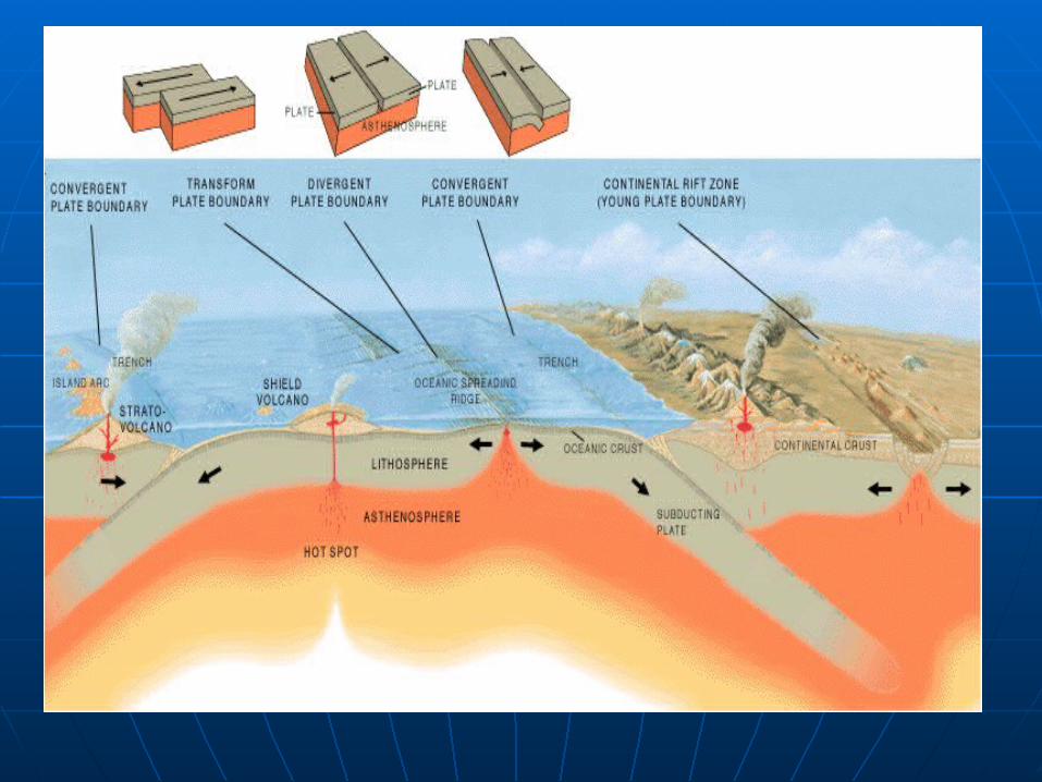

1) OCEANIC-OCEANIC: Chains of active volcanoes develop 100 to 150 km (60 to 90 mi) above the descending slab as magma rises from under the plate. Also, where the crust slides down into the earth, a trench forms. Together, the volcanoes and trench form an intra-oceanic island arc and trench system.
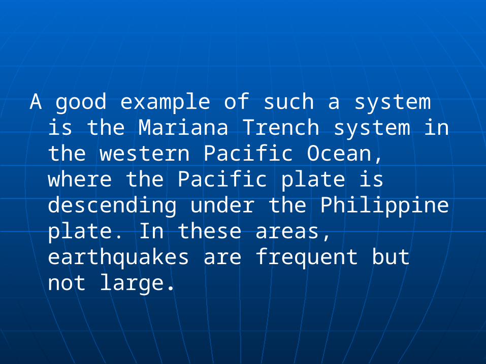
A good example of such a system is the Mariana Trench system in the western Pacific Ocean, where the Pacific plate is descending under the Philippine plate. In these areas, earthquakes are frequent but not large.

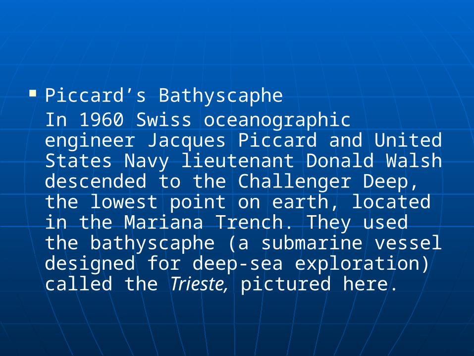
Piccard’s Bathyscaphe In 1960 Swiss oceanographic engineer Jacques Piccard and United States Navy lieutenant Donald Walsh descended to the Challenger Deep, the lowest point on earth, located in the Mariana Trench. They used the bathyscaphe (a submarine vessel designed for deep-sea exploration) called the Trieste, pictured here.
MARIANAS TRENCH - the deepest seafloor depression in the world. It is located just east of the Mariana Islands in the western part of the ocean basin. The Mariana Trench is an arc-shaped valley extending generally northeast to southwest for 2,550 km (1,580 mi); its average width is 70 km (40 mi). The Mariana is one of many deepwater ocean trenches formed by the geologic process of subduction. Near its southwestern extremity, 340 km (210 mi) southwest of the island of Guam, is the deepest point on earth. This point, the Challenger Deep, is estimated to be 11,033 m (36,198 ft) deep. The Challenger Deep was named after HMS Challenger II, the vessel of those who discovered the point in 1948.

2)Continental-Continental : the incoming plate drives against and under the opposing continent. This often affects hundreds of miles of each continent and, at times, doubles the normal thickness of continental crust. Colliding continents cause earthquakes and form mountains and plateaus.

The collision of India with Asia has produced the Himalayan Mountains and Tibetan Plateau.
3) OCEANIC-CONTINENTAL: occur between the ocean and land create continental margin arc and trench systems near the margins, or edges, of continents. Volcanoes also form here. Stress can develop in these areas and cause the rock layers to fold, leading to earthquake faults, or breaks in the earth’s crust called thrust faults. The folding and thrust faulting thicken the continental crust, producing high mountains.

Many of the world’s large destructive earthquakes and major mountain chains, such as the Andes Mountains of western South America, occur along these convergent plate boundaries.
TRANSFORM PLATE BOUNDARYalso known as a transform fault system, forms as plates slide past one another in opposite directions without converging or diverging.

Geophysicist J. Tuzo Wilson studied the direction of faulting along fracture zones that divide the mid-ocean ridge system and confirmed that transform plate boundaries were different than convergent and divergent boundaries. Within the ocean, transform faults are usually simple, straight fault lines that form at a right angle to ocean ridge spreading centers.
As a transform plate boundary cuts perpendicularly across the edges of the continental crust near the borders of the continental and oceanic crust, the result is a system such as the San Andreas transform fault system in California.
TRIPLE JUNCTIONS Rarely, a group of three plates, or a combination of plates, faults, and trenches, meet at a point called a triple junction. The East African Rift Zone is a good example of a triple plate junction. The African plate is splitting into two plates and moving away from the Arabian plate as the Red Sea meets the Gulf of Aden.
PLATE MOVEMENT changes the size of our oceans and shapes of continents:
Pacific plate moves at an absolute motion rate of 9 cm per year (4 in per year) away from the East Pacific Rise spreading center
India moves north at 5 cm per year (2 in per year) as it crashes into Asia, while Australia moves slightly farther away from Antarctica each year.
Causes of Plate Motion?Although plate tectonics has explained most
of the surface features of the earth, the driving force of plate tectonics is still unclear. According to geologists, a model that explains plate movement should include three forces. Those three forces are the pull of gravity; convection currents, or the circulating movement of fluid rocky material in the mantle; and thermal plumes, or vertical columns of molten rocky material in the mantle.

CAUSES OF PLATE MOTION:A. Plate Mov’t caused by Gravity:
Geologists believe that tectonic plates move primarily as a result of their own weight, or the force of gravity acting on them. Since the plates are slightly denser than the underlying asthenosphere, they tend to sink. Their weight causes them to slide down gentle gradients, such as those formed by the higher ocean ridge crests, to the lower subduction zones.

Once the plate’s leading edge has entered a subduction zone and penetrated the mantle, the weight of the slab itself will tend to pull the rest of the plate toward the trench. This sinking action is known as slab-pull because the sinking plate edge pulls the remainder of the plate behind it. Another kind of action, called ridge-push, is the opposite of slab-pull, in that gravity also causes plates to slide away from mid-ocean ridges. Scientists believe that plates pushing against one another also causes plate movement.
B. Convection Currents:In 1929 British geologist Arthur Holmes proposed the concept of convection currents—the movement of molten material circulating deep within the earth—and the concept was modified to explain plate movement. A convection current occurs when hot, molten, rocky material floats up within the asthenosphere, then cools as it approaches the surface.

As it cools, the material becomes denser and begins to sink again, moving in a circular pattern. Geologists once thought that convection currents were the primary driving force of plate movement. They now believe that convection currents are not the primary cause, but are an effect of sinking plates that contributes to the overall movement of the plates.

Alfred Wegener
In 1912 German meteorologist Alfred Wegener proposed that all the continents were once joined in a single landmass, which he called Pangaea. Wegener relied on geological evidence and fossil records to support his theory that the landmass gradually separated through continental drift. In the 1960s researchers confirmed Wegener’s theory when they observed seafloor spreading and other phenomena. This research eventually led to the theory and study of plate tectonics.

EVIDENCES of POLAR WANDERING, CONTINENTAL DRIFT and SEA-FLOOR SPREADING:
1) Matching of Continental Outlines – best fit between continents

2) Paleoclimatology – certain kinds of rocks are found in areas where present climates are not conducive to their deposition.
- Cold climate at poles- Warm , moist climates near equator
3) Paleontological Evidence:
a) 64% of Carboniferous and 34%of Triassic reptile faunas are the same for the Southern continents

b) Freshwater reptile Mesosaurus has been found only in South America and Africa. Bone structure of this salamander-like organism is such that it would have not been able to swim a large ocean

c) Numerous bones of terrestrial reptiles have been discovered in Triassic rocks in Antarctica which is now completely isolated from other continents.
d) Paleozoic marine invertebrate assemblages are quite similar on both sides of Atlantic Ocean

e) Fossil leaves of cycads and seed ferns belonging to Glossopteris flora of Permian age have been found on all southern continents and India.

4) Stratigraphic Evidence: similarities; stratigraphy of Antarctica is remarkably similar to that of southern continents.
5) Structural Evidence: continuity in landforms (Atlantic)

6) Paleomagnetism
The direction of north and south we take for granted, but magnetic north and south have switched places in the past and may do so again in the near future.
The Earth's magnetosphere is what generates the Earth's magnetic poles. It also protects us from harmful solar wind emanating from the Sun and radiation from outside our solar system. It sheathes the Earth and extends outside the atmosphere.
Origin of the MagnetosphereAt the center of the Earth is a core of iron and other heavy metals. Iron is a magnetic metal and this is what produces the magnetosphere. The Earth is unusual to have so much iron at it's core. It is now widely believed from the findings of the Apollo missions that this a result from a collision with another object during the Earth's formation. A majority of heavier elements combined from both objects to make the Earth, and a lot of the lighter elements combined to make the Moon.

The Dynamic Magnetic FieldThe magnetosphere is not quite a perfect
sphere. It's more like an apple, with the poles where the stem of an apple is. It constantly changes shape and strength, and different patches can favor different magnetic directions. The magnetic field varies and shifts on a small scale. If the field is chaotic enough it is believed that a geomagnetic reversal may occur.
History of Geomagnetic ReversalScientists know that reversals have occurred
many times in the past. The direction of magnetic grains laid down successively in the Earth's crust, particularly the sea floor are a primary piece of evidence. When the rock is new and molten the grains are free to align themselves with the prevailing magnetic field. As the rock cools, the grains are frozen in time. As the sea floor expands outward (in the Atlantic), it is regularly striped with rock oriented in different directions. This indicates that the magnetic poles have reversed many times throughout the Earth's history.

Paleomagnetism All rocks have magnetic fields owing to the presence of magnetic minerals, such as magnetite. By measuring the direction and inclination of the magnetic field, it is possible to calculate the approximate position of the magnetic poles of the earth at the time of crystallization or deposition of the rock.
Rock magnetism furnishes a ‘fossil compass’.
Assumptions:1) Magnetic axis of rock was oriented
parallel to the earth’s magnetic field when the rock formed
2) Average position of magnetic pole is assumed to approx. that of rotational pole.

3) Earth’s magnetic field is assumed to have always been dipolar, with one north and one south magnetic pole.

‘Natural Remanent Magnetism’ may be due to:
1) Thermoremanent magnetism – rocks cool past their Curie temperature. Magnetite has Curie temp of 578 C.
2) Chemical Remanent magnetism – produced during formation of iron-bearing minerals in low temp. Hematite in arkosic red beds forms by weathering in place of such minerals as biotite and hornblende. Such beds would have magnetsim parallel to earth’s magnetic field at time of formation of hematite.

RESULTS:Paleomagnetic pole positions have been
determined for formation of various ages and from various continents.
Positions of rotational poles have changed relative to the continents:
i) Paleozoic poles were generally located near equator but late Paleozoic poles were near mid latitudes

ii) Mesozoic and Cenozoic poles were located near the present geographical poles.

SEA-FLOOR SPREADING:Harry Hess was the first to propose
that blocks of sea-floor are moving relative to one another in response to the motion of convection currents within the mantle.

Marine Magnetics – magnetism in ocean floor; presence of a series of north-south trending magnetic anomalies.
‘magnetic anomaly’ – deviation from average intensity of earth’s magnetic field. In area of positive anomaly, earth’s magnetic field has a greater than average intensity, whereas in an area with negative magnetic anomaly, intensity is below average.
RESULT:Studies of direction of magnetization
within sequences of rocks have shown that in some, the direction of magnetization is exactly the opposite of that in adjacent strata.

Samples of volcanic rocks that have been dated radiometrically as less than 690,000 years have the north-seeking pole of their magnetic axis pointing approximately in the direction of the magnetic North Pole.
Normal Polarity, were formed when earth’s magnetic field was approximately the same as it is today.
Rock samples between 690, 000 yrs to 890,000 yrs old have an opposite direction of magnetization (Reverse Polarity) and were formed during a time when the earth’s magnetic field was the reverse of what it is today.
Oceanic Volcanoes – earliest indication is general increase in age of volcanic islands and seamounts away from the Mid-Atlantic ridge.

THE ORIGIN OF EARTH AND ITS EARLY HISTORY
Early Theorization on universe:Early man : earth consisted of a saucer
balanced on the back of a monstrous reptile
Thales (550 B.C.), Greek: earth was a flat disk floating on water
Anaximander (550 B.C.), Greek: universe was a cylinder in a great void

Aristarchus (third century B.C.), Greek: heliocentric universe
Hipparchus (second century, A.D.), Greek: the geocentric universe
Ptolemy (second century, A.D.), Egyptian: the geocentric model with stars and planets on fixed spheres around the earth.

Copernicus (1543) – revived the heliocentric model of the solar system and proposed that earth was one of several planets orbiting the sun.
Galilieo (1609) – constructed first astronomical telescope; gathered evidence that supported Copernican model

BIG BANG THEORY – (by Georges Lemaître)
is the cosmological model of the initial conditions and subsequent development of the universe that is supported by the most comprehensive and accurate explanations from current scientific evidence and observation..

As used by cosmologists, the term Big Bang generally refers to the idea that the Universe has expanded from a primordial hot and dense initial condition at some finite time in the past (currently estimated to have been approximately 13.7 billion years ago), and continues to expand to this day

HYPOTHESES ON ORIGIN of the SOLAR SYSTEM:
Based on close encounter:Protoplanet Theory. Buffon, 1979: a
passing star or comet caused the sun to shred rings of matter, which ultimately condensed to form planets orbiting the sun.

Planetismal Hypothesis. T.C. Chamberlin and F.R. Moulton, 1895, a passing star and eruptive activity in the sun caused solar material to go
into orbit and form the planets.
Tidal Hypothesis. J. Jean and H. Jeffreys, 1917: a near collison between the sun and another star drew out of the sun and another star drew out of the sun a tide of gases which broke up to form the planets.
Double Star Hypothesis. Lyttleton, 1936: a companion star of the sun collided with a third star to form the solar system.

Based on Contraction of Nebula:Nebular Hypothesis. Kant, 1755:
Laplace, 1796: the nebula contracted gravitationally and by conservation of angular momentum began to rotate, separated into rings with centers of gravitation which became the planets and their satellites.
Turbulent eddies hypothesis. Carl von Weizsacker, 1944: the cosmic dust and gas contracted into a rotating disk of turbulent eddies, of which the smaller, denser eddies produced the plantes.

Dust cloud hypothesis. F. Whipple, 1946: the solar system formed through contraction of globule.

Protoplanet hypothesis. G. Kuiper, 1950: a condensing and rotating globule flattened and its dense central mass formed the sun. The protoplanet which were larger that the modern planets, developed from orbiting eddies and their lighter gases (hydrogen, helium) were driven off by the sea.

THEORIES OF EARTH-MOON RELATIONSHIPS:
1) Moon was once part of the earth and separated from it as a result of rapid rotation of the earth.
2) Earth and moon formed nearby in space at approximately the same time and from the same raw materials.
3) Moon formed elsewhere in the solar system and was subsequently captured by the earth.

ASTEROIDS, METEORITES AND EARTH HISTORY
Asteroids – small bodies, probabl representing remains of disrupted planets
Meteorites – asteroids that strike the earth
Stony meteorite – silicates Metallic meteorite – nickel-iron
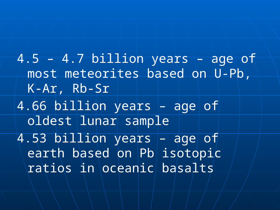
4.5 – 4.7 billion years – age of most meteorites based on U-Pb, K-Ar, Rb-Sr
4.66 billion years – age of oldest lunar sample
4.53 billion years – age of earth based on Pb isotopic ratios in oceanic basalts

SEPARATION OF EARTH’S CORE, MANTLE, CRUSTAs the earth contracted in its formative stages, its interior began to heat up through release of grav’l energy and decay of radioactive isotopes; the nickel-iron melted and the resulting liquid sank toward the center of the earth.

SUN : 86% hydrogen: 13.7% helium : <1 % elements heavier than
heliumJovian planets are further from the sun
and therefore colder, having lost less of their original mass.
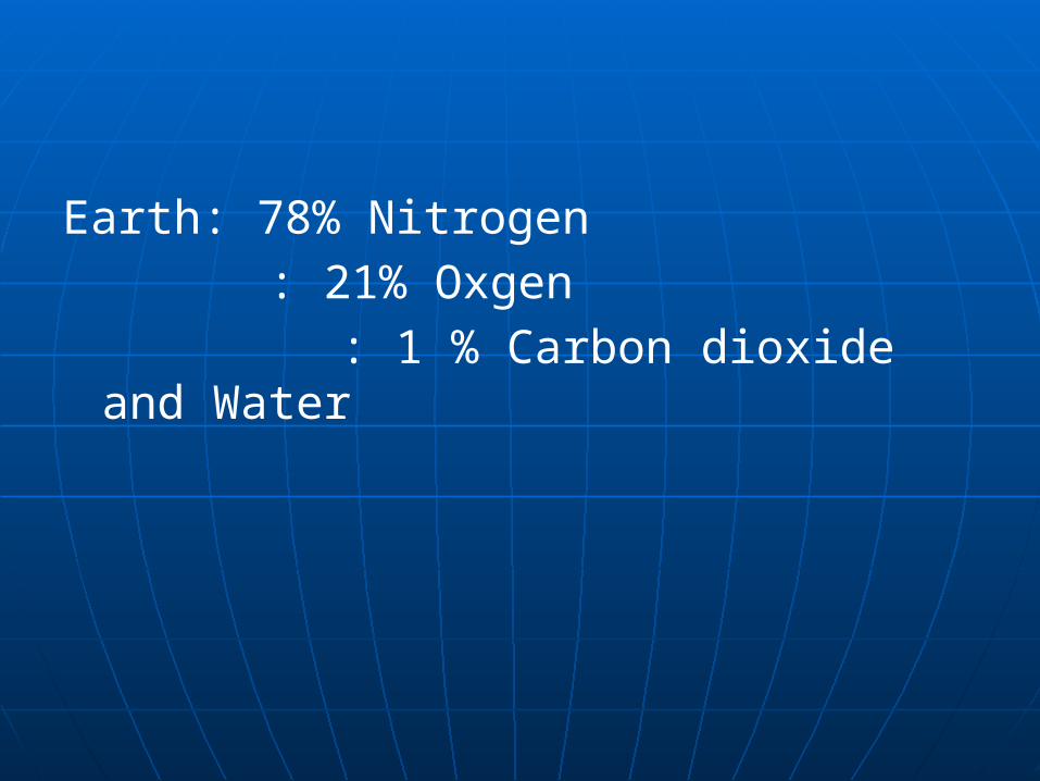
Earth: 78% Nitrogen : 21% Oxgen
: 1 % Carbon dioxide and Water
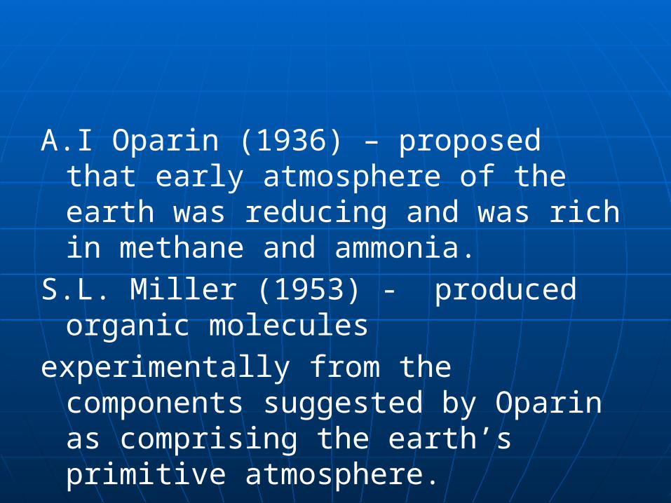
A.I Oparin (1936) – proposed that early atmosphere of the earth was reducing and was rich in methane and ammonia.
S.L. Miller (1953) - produced organic molecules
experimentally from the components suggested by Oparin as comprising the earth’s primitive atmosphere.

Miller passed an electric spark through a closed chamber filled with a mixture of ammonia, methane, water vapor and hydrogen. Spark produced the necessary energy to bring about the reaction (lightning or UV rays). Resulting organic molecules were amino acids, building blocks of protein.

P. Abelson (1957) – added carbon dioxide, carbon monoxide and nitrogen to Miller’s original mixture and was able to produce all amino acids found in living matter, plus some proteins.

BUT it should be remembered that even the simplest forms of life are far more complex than the proteins that have been synthesized and man is still a long way from creating living molecules in the lab.