Embed Size (px)
Citation preview


2016 Barn Hollow Conservation Area Management Plan Page 3
OVERVIEW
• Official Area Name: Barn Hollow Natural Area, # 7941 • Year of Initial Acquisition: 1979 • Acreage: 252 acres • County: Texas, Howell • Division with Administrative Responsibility: Forestry • Division with Maintenance Responsibility: Forestry • Statements of Purpose:
A. Strategic Direction Protect the natural communities of the Barn Hollow Natural Area (NA), including Ozark headwater streams, gravel washes, upland forests/woodlands, dolomite bluffs/cliffs and caves.
B. Desired Future Condition The desired future condition of the Barn Hollow NA is a high quality riparian/tributary system to the Jacks Fork River.
C. Federal Aid Statement N/A
GENERAL INFORMATION AND CONDITIONS
I. Special Considerations A. Priority Areas: Current River Hills Conservation Opportunity Area, Upper Jacks
Fork Hills Conservation Opportunity Area, Priority Forest Landscape. B. Natural Areas: The original Missouri Department of Conservation (the
Department) Barn Hollow NA was 115 acres nominated in 1980. An additional 30 acres were added in 2007. The National Park Service owns an adjoining 45 acres. The total Barn Hollow NA (both Department and National Park Service) is 190 acres.
II. Important Natural Features and Resources
A. Species of Conservation Concern: Species of conservation concern are known from this area. Area Managers should consult the Natural Heritage Database annually and review all management activities with the Natural History Biologist.
B. Caves: Yes, records kept with the Department Natural History Biologist. Managers should follow the Cave Management policy found in the Department Resource Policy Manual. All caves on this and other Conservation Areas are closed or restricted to public access. The fungus that causes White-nose Syndrome in bats has been documented in Missouri, resulting in the Department’s White-nose Syndrome Action Plan that limits public access to protect bats.
2016 Barn Hollow Conservation Area Management Plan Page 4
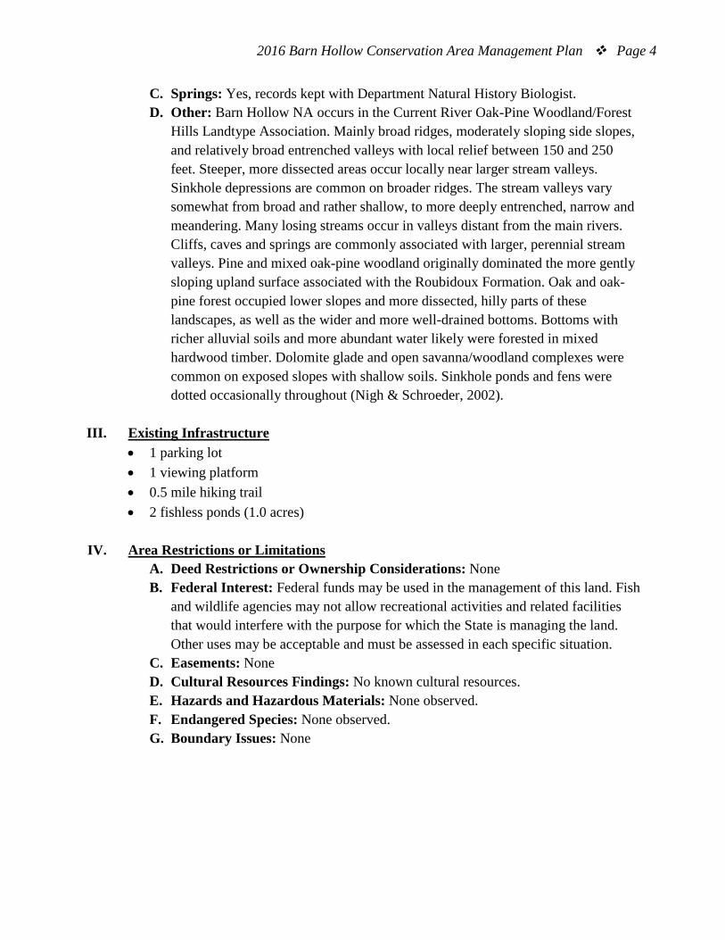
C. Springs: Yes, records kept with Department Natural History Biologist. D. Other: Barn Hollow NA occurs in the Current River Oak-Pine Woodland/Forest
Hills Landtype Association. Mainly broad ridges, moderately sloping side slopes, and relatively broad entrenched valleys with local relief between 150 and 250 feet. Steeper, more dissected areas occur locally near larger stream valleys. Sinkhole depressions are common on broader ridges. The stream valleys vary somewhat from broad and rather shallow, to more deeply entrenched, narrow and meandering. Many losing streams occur in valleys distant from the main rivers. Cliffs, caves and springs are commonly associated with larger, perennial stream valleys. Pine and mixed oak-pine woodland originally dominated the more gently sloping upland surface associated with the Roubidoux Formation. Oak and oak-pine forest occupied lower slopes and more dissected, hilly parts of these landscapes, as well as the wider and more well-drained bottoms. Bottoms with richer alluvial soils and more abundant water likely were forested in mixed hardwood timber. Dolomite glade and open savanna/woodland complexes were common on exposed slopes with shallow soils. Sinkhole ponds and fens were dotted occasionally throughout (Nigh & Schroeder, 2002).
III. Existing Infrastructure
• 1 parking lot • 1 viewing platform • 0.5 mile hiking trail • 2 fishless ponds (1.0 acres)
IV. Area Restrictions or Limitations
A. Deed Restrictions or Ownership Considerations: None B. Federal Interest: Federal funds may be used in the management of this land. Fish
and wildlife agencies may not allow recreational activities and related facilities that would interfere with the purpose for which the State is managing the land. Other uses may be acceptable and must be assessed in each specific situation.
C. Easements: None D. Cultural Resources Findings: No known cultural resources. E. Hazards and Hazardous Materials: None observed. F. Endangered Species: None observed. G. Boundary Issues: None

2016 Barn Hollow Conservation Area Management Plan Page 5
MANAGEMENT CONSIDERATIONS
V. Terrestrial Resource Management Considerations
Barn Hollow NA is dissected by the steep rugged 1.2 mile canyon-like Barn Hollow. Dry chert woodlands and dry-mesic chert woodlands are the main upland habitat type. These are dominated by black oak, white oak, scarlet oak, shortleaf pine, dogwood, aromatic sumac and lowbush blueberry. Dry-mesic chert forests are also present on the north-facing slopes of the hollow. These are dominated by white oak, black oak, sugar maple and musclewood. Dry to moist dolomite cliffs/bluffs are found along the rim of the hollow. Rare plants can be found on the cliffs.
The upland areas outside of the designated Natural Area were previously cleared. They are dominated by short-leaf pine, eastern red cedar, oaks, hickories and some invasive species (like serecia lespedeza). Fields on the northern and southern parts of the area are managed as open fields using prescribed burns and agricultural food plots.
Challenges and Opportunities:
1) Protect the high quality cliff and bluff habitat and rare plant species. 2) Maintain the woodland habitat surrounding the hollow using natural and man-
made disturbances. 3) Control invasive species and prevent their spread into the high quality natural
communities of the designated Natural Area.
Management Objective 1: Maintain the integrity of the high quality natural communities on the cliffs, bluffs, woodlands and forests surrounding the hollow.
Strategy 1: Survey for populations of rare and endangered species. (Wildlife) Strategy 2: Utilize disturbances such as thinning or prescribed fire, where appropriate, to promote healthy populations of native trees, shrubs and plants best suited to the site. Conduct a forest inventory on the forest stands prior to any mechanical thinning activities to determine tree species composition, health, and density (Forestry) Strategy 3: Utilize best management practices to protect sensitive sites such as springs, caves and cliffs. (Forestry)

2016 Barn Hollow Conservation Area Management Plan Page 6
Strategy 4: Monitor the spread of invasive species in the woodland/forest areas. Control if found. (Forestry)
Management Objective 2: Manage open fields outside of the designated Natural Area for a variety of upland wildlife species.
Strategy 1: Utilize prescribed fire and/or agricultural practices to improve native cover and food sources for wildlife (Forestry). Strategy 2: Manage invasive species to prevent their spread (Forestry).
VI. Public Use Management Considerations
Challenges and Opportunities: 1) Provide hunting and viewing opportunities for the public. 2) Discourage illegal activities (e.g., all-terrain vehicle use, vandalism).
Management Objective 1: Provide public hunting and viewing opportunities. Strategy 1: Conduct management activities that will provide habitat for a diversity of species of plants and wildlife. (Forestry). Strategy 2: Keep the area boundaries, the designated Natural Area boundaries and the caves signed appropriately. (Forestry)
Management Objective 2: Discourage illegal uses and vandalism.
Strategy 1: Communicate with Protection Division and the area maintenance contractor to monitor illegal all-terrain vehicle use and vandalism activities. (Forestry, Protection)
Management Objective 3: Facilitate a good working relationship with neighboring land owners.
Strategy 1: Maintain relationships with neighbors to minimize any boundary, trespass or vandalism affecting Barn Hollow NA or private property (Forestry, Protection). Strategy 2: Promote habitat management on neighboring landowner properties (Private Land Services, Forestry).
VII. Administrative Considerations
Challenges and Opportunities: 1) Maintain area infrastructure at current levels. 2) Acquisition of land.

2016 Barn Hollow Conservation Area Management Plan Page 7
Management Objective 1: Maintain area infrastructure at current levels.
Strategy 1: Maintain area infrastructure in accordance with Department guidelines. (Forestry, Design & Development).
Lands Proposed for Acquisition:
When available, adjacent land may be considered for acquisition from willing sellers. Tracts that improve area access, provide public use opportunities, contain unique natural communities and/or species of conservation concern, or meet other Department priorities, as identified in the annual Department land acquisition priorities, may be considered.
MANAGEMENT TIMETABLE
All strategies for this management plan are considered ongoing.

2016 Barn Hollow Conservation Area Management Plan Page 8
APPENDICES
Area Background: Barn Hollow Conservation Area is located in Texas County, approximately 3 miles north of Mountain View. Barn Hollow is the local name for a clear Ozark stream that drains directly into the Jacks Fork River. The 252-acre area is deeply dissected by the 1.2-mile canyon-like Barn Hollow. The Department purchased the area in 1979. To protect the unique rugged topography and native flora, 115 acres of the tract were designated as a natural area. Visitors may view the narrow, steep-walled hollow from a viewing platform located at the end of a one-half mile foot trail. The trail originates at the area parking lot, near the south boundary. During your visit to the area, you may notice various wildlife habitat improvement projects in the old fields and young pine plantings. Current Land and Water Types:
Land/Water Type Acres Feet % of Area
Forest and Woodland 202 80 Old Field 49 20 Fishless Pond 1 <1 Total 252 100 Stream Frontage 5,937
Public Input Summary: The draft Barn Hollow Natural Area Management Plan was available for a public comment period August 1–31, 2015. The Missouri Department of Conservation received comments from one respondent (Appendix A). The Barn Hollow Natural Area Management Plan Planning Team carefully reviewed and considered these ideas as they finalized this document. A brief summary of public input themes, including how they were incorporated or why they were not, can be found below. Rather than respond to each individual comment, comments are grouped into general themes and are addressed collectively.
2016 Barn Hollow Conservation Area Management Plan Page 9
Department responses to themes and issues identified through Barn Hollow Natural Area public comment period Concerned about invasive species on area spreading to adjacent properties. The Missouri Department of Conservation is dedicated to the removal and control of non-native invasive tree, shrub and herbaceous species on our publicly owned conservation areas. We are currently in the process of mapping all conservation area’s invasive species. This step begins our approach to provide a systematic way to prioritize our efforts for invasive species management. Interested in the replanting of pines. An important species to Barn Hollow’s native flora is shortleaf pine, Missouri’s only native pine. A small plantation (<1 acre) is located on the east side of the hiking trail and shortleaf pine can be found throughout the forest canopy across all 115 acres. Successful establishment of shortleaf pine requires control of hardwood competition. In order to provide appropriate conditions for the replanting of shortleaf pine extensive site preparation must take place before and after planting. It is the Department’s objective to minimize development on natural areas and allow them to function as biological communities.
References: Missouri Department of Conservation. (1997). Ozark Region resource inventory. Jefferson City, Missouri: Missouri Department of Conservation. Nigh, T. A. (1998). East-central region ecological classification and LTA descriptions. Columbia, Missouri: Missouri Resource Assessment Partnership. Nigh, T. A. (1999). Southeast region ecological classification and LTA descriptions. Columbia, Missouri: Missouri Resource Assessment Partnership. Nigh, T. A., & Schroeder, W. A. (2002). Atlas of Missouri ecoregions. Missouri: Missouri Department of Conservation. Maps: Figure 1: Area Map Figure 2: Aerial Map Figure 3: Topographic Map Figure 4: Ownership Map

2016 Barn Hollow Conservation Area Management Plan Page 10
Appendices: Appendix 1: Barn Hollow Conservation Area Management Plan Public Comments
2016 Barn Hollow Conservation Area Management Plan Page 11
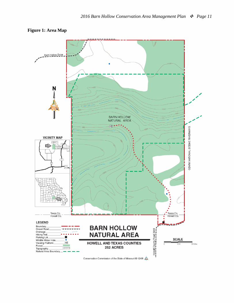
Figure 1: Area Map
2016 Barn Hollow Conservation Area Management Plan Page 12
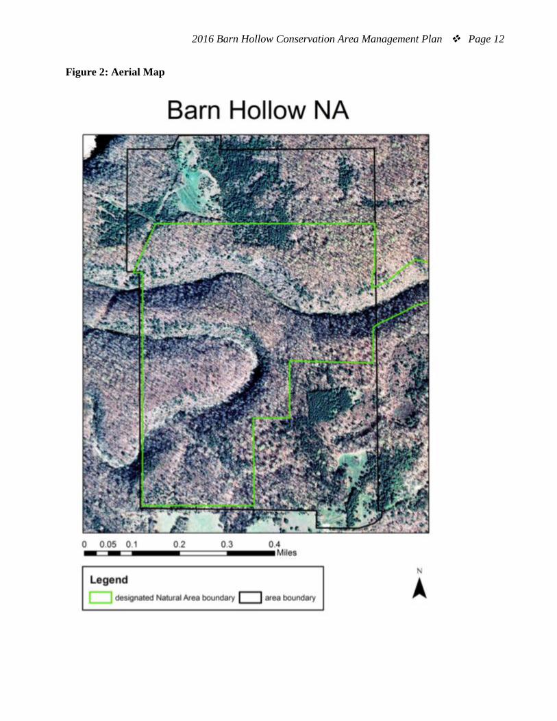
Figure 2: Aerial Map

2016 Barn Hollow Conservation Area Management Plan Page 13
Figure 3: Topographic Map

2016 Barn Hollow Conservation Area Management Plan Page 14
Figure 4: Ownership Map

2016 Barn Hollow Conservation Area Management Plan Page 15
Appendix 1. Barn Hollow Conservation Area Management Plan Public Comments Received during public comment period (August 1-31, 2015): I am sorry to report because of travel plans, I have not thoroughly read the info that you have furnished. I did take 4 friends from the Mtn. View Garden Club on a walk to the overlook a few days ago. We were pleased to walk on the mowed path down to the overlook. I was glad the broken wooden parts of the overlook had been replaced. As an adjoining landowner, I am concerned about invasive species on the area spreading to our property. I am interested in what measures are being taken to preserve our native species on the area. My husband is interested in the replanting of the pine trees. We feel fortunate to have such conservation minded neighbors. Thank you for giving us the opportunity to comment, and please do not hesitate to contact us or visit on one of your trips to this lovely area.