Embed Size (px)
Citation preview

Municipal Service Review/Sphere of Influence Plan
City of Patterson, Stanislaus County, California
Prepared for:
Stanislaus Local Agency Formation Commission 1010 Tenth Street, 3rd Floor
Modesto, CA 95354 Phone: 209.525.7660
Contact: Marjorie Blom, Executive Officer
Prepared by:
Michael Brandman Associates 2000 “O” Street, Suite 200
Sacramento, CA 95811 916.447.1100
Contact: Jason Brandman, Project Director
Grant Gruber, Project Manager
Adopted: December 4, 2013

City of Patterson Municipal Service Review/Sphere of Influence Plan Table of Contents
Michael Brandman Associates i H:\Cient (PN-JN)|1790\17900002\W Patterson MSR\17900002 West Patterson MSR.doc
This page left blank intentionally.

City of Patterson Municipal Service Review/Sphere of Influence Plan Table of Contents
Michael Brandman Associates ii H:\Cient (PN-JN)|1790\17900002\W Patterson MSR\17900002 West Patterson MSR.doc
TABLE OF CONTENTS
Section 1: Introduction ......................................................................................................... 1 Section 2: Municipal Service Review Factors .................................................................. 11 Section 3: Sphere of Influence Factors ............................................................................ 75 Section 4: References ........................................................................................................ 84 Section 5: Persons and Organizations Consulted/List of Preparers ............................. 86
LIST OF TABLES
Table 1: Population Estimates and Projections .................................................................... 11
Table 2: Summary of Gross Acres by General Plan Land Use Category ............................. 13
Table 3: Annual Groundwater Supply Available in the Study Area ....................................... 18
Table 4: Supply Reliability for 2032 ...................................................................................... 19
Table 5: City of Patterson Groundwater Well Summary ....................................................... 19
Table 6: City Historic Groundwater Production ..................................................................... 20
Table 7: Groundwater Pumped for SOI Expansion Area ...................................................... 20
Table 8: Annual Groundwater Supply Available in the Study Area ....................................... 20
Table 9: Water Budget Items for Project ............................................................................... 31
Table 10: Police Protection Facility Needs to Serve Buildout of City’s Planning Area ..................................................................................................................... 51
Table 11: Patterson Fire Department Station Summary ....................................................... 53
Table 12: West Stanislaus County Fire Protection District Station Summary ....................... 54
Table 13: City General Fund Revenue for FY 2009–2010 .................................................... 63
Table 14: City General Fund Expenditures for FY 2009-2010 .............................................. 65
Table 15: CFD Bond Debt Obligations as of FY 2010-2011 ................................................. 67
Table 16: City Service Rates ................................................................................................ 67
Table 17: Surrounding Land Use Designations .................................................................... 82

City of Patterson Municipal Service Review/Sphere of Influence Plan Table of Contents
Michael Brandman Associates iii H:\Cient (PN-JN)|1790\17900002\W Patterson MSR\17900002 West Patterson MSR.doc
LIST OF EXHIBITS
Exhibit 1: Regional and Local Vicinity Map ............................................................................. 5
Exhibit 2: Proposed and Existing Patterson Sphere of Influence Map .................................... 6
Exhibit 3: Del Puerto Water District Boundary Adjustment ..................................................... 7
Exhibit 4: Public Facilities Map ................................................................................................ 8
Exhibit 5a: Water Master Plan – Arambel ............................................................................. 25
Exhibit 5b: Water Master Plan - KDN .................................................................................... 26
Exhibit 6a: Non-Potable Water Master Plan – Arambel ........................................................ 27
Exhibit 6b: Non-Potable Water Master Plan – KDN .............................................................. 28
Exhibit 7a: Sewer Master Plan – Arambel ............................................................................. 35
Exhibit 7b: Sewer Master Plan – KDN .................................................................................. 36
Exhibit 7c: Sewer Master Plan – Offsite ................................................................................ 37
Exhibit 8a: Storm Drainage Master Plan – Arambel .............................................................. 42
Exhibit 8b: Storm Drainage Master Plan – KDN ................................................................... 43
Exhibit 8c: Storm Drainage Master Plan – Shed Areas ........................................................ 44
Exhibit 9: 100-Year Flood Hazard Areas ............................................................................... 45
Exhibit 10: Roadway Sections ............................................................................................... 48
Exhibit 11: Agricultural Lands Map ........................................................................................ 77

City of Patterson Municipal Service Review/Sphere of Influence Plan Introduction
Michael Brandman Associates 1 H:\Cient (PN-JN)|1790\17900002\W Patterson MSR\17900002 West Patterson MSR.doc
SECTION 1: INTRODUCTION
1.1 - Municipal Service Review and Sphere of Influence requirements
Municipal Service Review (MSR) and Sphere of Influence (SOI) requirements are described in detail in the following sections.
1.1.1 - Municipal Service Review
Municipal Service Reviews (MSRs) were added to the Local Agency Formation Commission’s (LAFCO’s) mandate with the passage of the Cortese Knox Hertzberg Local Government Reorganization Act of 2000 (CKH Act), pursuant to Government Code 56000, et seq. A service review is a comprehensive study designed to better inform LAFCO, local agencies, and the community about the provision of municipal services. Service reviews attempt to capture and analyze information about the governance structures and efficiencies of service providers, and to identify opportunities for greater coordination and cooperation among providers. The service review is a prerequisite to a Sphere of Influence (SOI) amendment and may also lead a LAFCO to take other actions under its authority (Government Code Section 56430).
The State Legislature established the MSR requirement after the release of two studies recommending that LAFCOs conduct reviews of local agencies. The first study was completed by the “Little Hoover Commission,” which focused on the need for oversight and consolidation of special districts. The second study was completed by the “Commission on Local Governance for the 21st Century,” which focused on the need for regional planning to ensure adequate and efficient local government services to serve the growing population of California.
In 2000, the Little Hoover Commission’s report, Special Districts: Relics of the Past or Resources for
the Future?, focused on governance and financial problems among independent special districts and barriers to LAFCOs’ pursuit to facilitate change when necessary. The report “notes the underlying patchwork of special district governments has become unnecessarily redundant, inefficient and unaccountable” (Little Hoover Commission 2000). It raised concerns about a lack of visibility and accountability among some independent special districts. The report called on the legislature to increase the oversight of special districts by requiring LAFCOs to identify service duplication and to study reorganization alternatives when service duplications are identified, when a district appears insolvent, when district reserves are excessive, when rate inequities surface, when a district’s mission changes, when a new city incorporates, and when service levels are unsatisfactory. The report recommended that the State strengthen the independence and funding of LAFCOs, require districts to report to their respective LAFCO, and require LAFCOs to study service duplications.
A second report, Growth Within Bounds: Planning California Governance for the 21st Century, was also completed in 2000. It explored how local government is organized and operates, and established a vision of how the State will grow “by making better use of the often invisible LAFCOs in each

City of Patterson Municipal Service Review/Sphere of Influence Plan Introduction
Michael Brandman Associates 2 H:\Cient (PN-JN)|1790\17900002\W Patterson MSR\17900002 West Patterson MSR.doc
county” (Growth Within Bounds 2000). This report, in addition to addressing California’s growth and loss of open space, suggested that LAFCOs could not achieve their purpose without a comprehensive review of the services available within the county, their efficiencies, future needs, and expansion capacity of each service provider. The report concluded that LAFCOs should be required to conduct such reviews. These recommendations were made a part of the CKH Act.
The CKH Act requires LAFCO to review and update, as necessary, SOIs not less than every five (5) years and to review municipal services before updating SOIs. The CKH Act also requires that an MSR be prepared for proposed SOI expansions, as necessitated by the proposed West Patterson Business Park Expansion Project1. Stanislaus LAFCO has prepared this service review in compliance with the CKH Act, which requires the preparation of a service review for all cities and special districts that provide municipal services to county residents. In 2012, Stanislaus LAFCO amended the previously adopted Policies and Procedures for Spheres of Influence, Service Reviews and Annexations. The MSR has been prepared in accordance with these policies and procedures.
The focal point of the service review process lies with the preparation of written statements of determination regarding the agency’s ability to provide services. The determinations are declaratory statements that arrive at a conclusion based on all information and evidence presented. LAFCO must make written determinations on the seven categories.
Service reviews do not require LAFCO to initiate changes based on service review findings, but only to make determinations regarding the provision of public services. LAFCO, local agencies, and the public may subsequently use the determinations to analyze prospective changes of organization or reorganization or to establish or amend spheres of influence.
1.1.2 - Sphere of Influence Plan
In conjunction with the requirement to conduct a service review, the CKH Act requires LAFCO to review and update, as necessary, SOIs for each local agency within LAFCO’s jurisdiction, pursuant to Government Code Section 56425. An SOI is a planning tool that is designed to provide guidance in reviewing proposals, promoting the efficient and effective provision of municipal services, and preventing duplication of service responsibility. LAFCO is responsible for determining that an agency is reasonably capable of providing needed resources and basic infrastructure to serve areas within the agency’s boundaries and sphere. The SOI is the area that LAFCO expects development might reasonably be expected to occur and need services or, in case of districts, where services will be provided within a 5- to 10-year and a 20-year period.
The adoption of an SOI is perhaps the most important planning function given to LAFCO by the State Legislature. The CKH Act (California Government Code Section 56425) describes spheres of influence as an important tool for “planning and shaping the logical and orderly development and
1 The West Patterson Business Park Expansion Project is also known as the Arambel-KDN Reorganization to the City of
Patterson.

City of Patterson Municipal Service Review/Sphere of Influence Plan Introduction
Michael Brandman Associates 3 H:\Cient (PN-JN)|1790\17900002\W Patterson MSR\17900002 West Patterson MSR.doc
coordination of local governmental agencies so as to advantageously provide for the present and future needs of the county and its communities.” Spheres of influence serve a similar function in LAFCO determinations as general plans do for cities and counties. The SOI boundary and written determinations adopted by LAFCO should guide the provision of services for areas within the SOI. The service review will provide LAFCO with a clear indication of whether an agency has the services available to support a sphere boundary.
1.2 - Purpose of the Municipal Service Review/Sphere of Influence Plan
This joint Municipal Service Review (MSR)/Sphere of Influence Update (SOI Update) document has been developed to provide an analysis of the available services within the city limits and determine if City services can be extended to adequately serve the West Patterson Business Park Expansion Project that is proposed to be included within the City’s boundaries.
This MSR/SOI Update will be utilized to guide the proposed annexation of the West Patterson Business Park Expansion Project and update the City’s SOI, consistent with the City’s General Plan. Updating the City’s SOI will allow the opportunity for future annexation of lands within the SOI into the City’s boundaries, upon approval by Stanislaus LAFCO. Exhibit 1 provides a regional location map as well as a vicinity map showing the proposed SOI expansion area that would accommodate the West Patterson Business Park Expansion Project.
This MSR examines the structure and operation of City services and identifies the plans and ability to ensure adequate service provision to future development outside of the current City boundaries. Key resources for this study are department-specific information gathered through research and interviews, as well as Stanislaus LAFCO’s Municipal Service Review Guidelines. This MSR has been prepared for the City of Patterson to be submitted to the Stanislaus LAFCO. The MSR is in accordance with the requirements of the Cortese- Knox-Hertzberg Local Reorganization Act of 2000 and Stanislaus LAFCO as a means of identifying and evaluating public services for the City of Patterson and proposed changes to the City’s SOI.
1.3 - Proposed action requiring Municipal Service Review and Sphere of Influence plan
The City of Patterson intends to annex and has approved development plans for the West Patterson Business Park Expansion Project. Buildout of the land uses contemplated by the project will significantly alter the demand for, and provision of, services by the City Patterson and other service providers. Annexation and development of the West Patterson Business Park Expansion Project will necessitate an expansion of the City’s Sphere of Influence and Primary Area to encompass the 1,119 gross-acre project site. No other aspect of the existing Sphere of Influence is being altered.
The entire West Patterson Business Park Expansion Project site is currently within the Del Puerto Water District boundaries. The project site will be detached from the Water District concurrent with
City of Patterson Municipal Service Review/Sphere of Influence Plan Introduction
Michael Brandman Associates 4 H:\Cient (PN-JN)|1790\17900002\W Patterson MSR\17900002 West Patterson MSR.doc
annexation into the City of Patterson. The property owners will seek an out-of-boundary service agreement from the Water District to allow for continued delivery of irrigation water for agricultural land use activities.
The City of Patterson will provide potable water to the West Patterson Business Park Expansion Project as it builds out. The project applicant will install potable and non-potable water distribution systems to facilitate this service. Once the entire project site is fully built out, the out-of-boundary service would be terminated.
As noted above, an MSR is required as part of the application package submitted to LAFCO prior to consideration of the SOI amendment, detachment, and annexation requests.
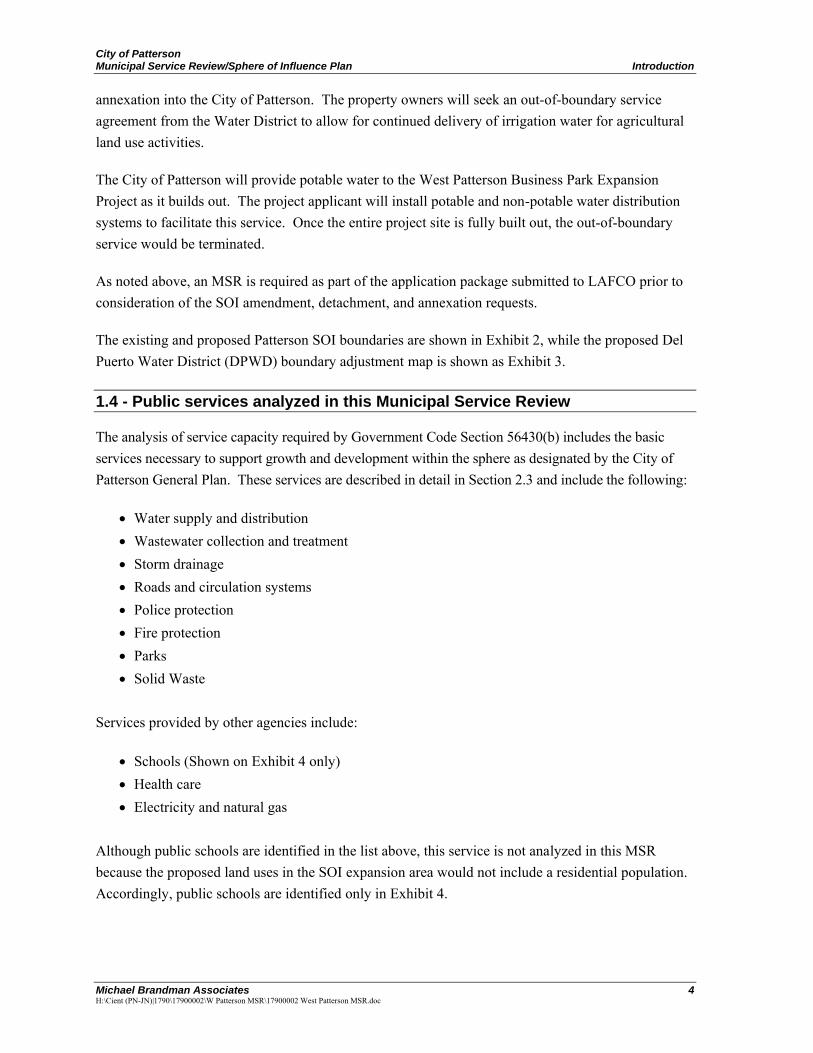
The existing and proposed Patterson SOI boundaries are shown in Exhibit 2, while the proposed Del Puerto Water District (DPWD) boundary adjustment map is shown as Exhibit 3.
1.4 - Public services analyzed in this Municipal Service Review
The analysis of service capacity required by Government Code Section 56430(b) includes the basic services necessary to support growth and development within the sphere as designated by the City of Patterson General Plan. These services are described in detail in Section 2.3 and include the following:
Water supply and distribution Wastewater collection and treatment Storm drainage Roads and circulation systems Police protection Fire protection Parks Solid Waste
Services provided by other agencies include:
Schools (Shown on Exhibit 4 only) Health care Electricity and natural gas
Although public schools are identified in the list above, this service is not analyzed in this MSR because the proposed land uses in the SOI expansion area would not include a residential population. Accordingly, public schools are identified only in Exhibit 4.


City of Patterson Municipal Service Review/Sphere of Influence Plan Introduction
Michael Brandman Associates 9 H:\Cient (PN-JN)|1790\17900002\W Patterson MSR\17900002 West Patterson MSR.doc
1.5 - Service review and Sphere of Influence factors
The analysis is organized into the following seven factors corresponding to the requirements of Government Code Section 56430:
1.5.1 - Municipal Service Review Factors
1) The growth and population projections for the affected area.
This factor analyzes the projected growth within the City and within the probable physical boundaries and service area of the City over the next 40 years (buildout of the General Plan).
2) The location and characteristics of any disadvantaged unincorporated communities within
or contiguous to the Sphere of Influence.
With the passage of Senate Bill (SB) 244, which became effective January 1, 2012, LAFCOs are now required to consider the location and characteristics of any disadvantaged unincorporated communities within or contiguous to the Sphere of Influence of cities or special districts. The definition of a disadvantaged unincorporated community is an inhabited territory (12 or more registered voters) that is composed of no less than 10 dwelling units adjacent or in close proximity to one another with a median household income of 80 percent or less than the statewide median household income ($48,704 for 2010).
3) Present and planned capacity of public facilities, adequacy of public services, and
infrastructure needs or deficiencies including needs or deficiencies related to sewer,
municipal and industrial water, and structural fire protection in any disadvantaged,
unincorporated communities within or contiguous to the Sphere of Influence.
This factor analyzes present and planned capacity of public facilities and adequacy of public services, including infrastructure needs or deficiencies. Public services studied in this MSR are noted above.
4) Financial ability of the agencies to provide services.
This factor examines the financial ability of the City to provide services. The City’s funding sources, rate structure, expenditures, and debts are evaluated to determine viability and ability to meet existing and expanded service demands.
5) Status of, and opportunities for, shared facilities.
This factor examines the status of, and opportunities for, shared facilities in order for City departments and agencies to reduce costs.

City of Patterson Municipal Service Review/Sphere of Influence Plan Introduction
Michael Brandman Associates 10 H:\Cient (PN-JN)|1790\17900002\W Patterson MSR\17900002 West Patterson MSR.doc
6) Accountability of community service needs, including governmental structure and
operational efficiencies.
This factor examines how well the City makes its processes transparent to the public and invites and encourages public participation. Overall management practices are discussed and considered, including the existing government structure, boundaries, and future service areas.
7) Any other matter related to effective or efficient service delivery, as required by commission
policy.
Government Code Section 56430 also allows for a section discussing any other matter related to effective or efficient service delivery, as required by Commission Policy.
1.5.2 - Sphere of Influence Factors
In establishing a sphere boundary, LAFCO must consider five factors and make written determinations with respect to each of the following:
1. The present and planned land uses in the area, including agricultural and open-space lands.
2. The present and probable need for public facilities and services in the area.
3. The present capacity of public facilities and adequacy of public services that the agency provides or is authorized to provide.
4. The existence of any social or economic communities of interest in the area if the commission determines that they are relevant to the agency.
5. For any update of a Sphere of Influence of a city or special district that provides public facilities or service related to sewers, municipal and industrial water, or structural fire protection, that occurs pursuant to subdivision (g) on or after July 1, 2012, the present and probable need for those public facilities and services of any unincorporated communities within the existing Sphere of Influence.

City of Patterson Municipal Service Review/Sphere of Influence Plan Municipal Service Review Factors
Michael Brandman Associates 11 H:\Cient (PN-JN)|1790\17900002\W Patterson MSR\17900002 West Patterson MSR.doc
SECTION 2: MUNICIPAL SERVICE REVIEW FACTORS
2.1 - The growth and population projections for the affected area
This section reviews the projected growth within the City and within the probable physical boundaries and service area of the City over the next 20 years.
2.1.1 - Current Boundaries and Population
Patterson lies about 15 miles southwest of the City of Modesto. The San Joaquin River lies 3 miles to the east and Interstate 5 (I-5) passes just west of the City. Farther west lies the Diablo Mountain Range. Patterson’s city limits lie generally south of Eucalyptus Road, west of Sycamore Avenue, north of the West Stanislaus Irrigation District Canal No. 6, and east of Rogers Road. The current city limits and Sphere of Influence are shown in Exhibit 2.
The City of Patterson is predominantly a mix of urban and rural areas with a growing population. As shown in Table 1, the estimated 2012 population is 20,634. Over 70 percent, or 2,674 acres, of the land within the City are undeveloped land designated for residential, commercial or industrial uses. Of the developed land, almost 13 percent is devoted to residential uses, almost 2 percent to commercial uses, approximately 4 percent to industrial uses, almost 4 percent to institutional uses, and 4 percent is vacant land other than agriculture. Long-term growth is projected in all areas even in light of the recent economic downturn.
2.1.2 - Projected Growth
Based upon its rate of population growth, the City projects that additional areas to accommodate future residents will be needed. Between 2000 and 2006, the City’s average annual population growth rate was about 8 percent per year. However, since 2007, the economic downturn combined with instability in the banking industry has brought housing construction and population growth to a virtual standstill. Table 1 shows the population projections. According to Stanislaus Council of Governments (Stan COG) population projections, the population of Patterson will grow to 39,067 persons by the year 2030. According to the U.S. Census Bureau 2008–2010 American Community Survey 3-Year Estimate, Patterson had a total of 6,439 housing units in 2010 (U.S. Census Bureau 2010).
Table 1: Population Estimates and Projections
Population 2011 2012 Percent Change 2030 2050
Net Growth 2012-2040
Population1,2,
3 20,501 20,634 0.6 39,067 66,673 46,039
Notes: 1 Population for City of Patterson based on California Department of Finance Estimate, Table E-1, 2012. 2 Population in 2030 is based on StanCOG projections, as cited in the General Plan, 2010. 3 Population in 2050 is based on General Plan projections, 2010.

City of Patterson Municipal Service Review/Sphere of Influence Plan Municipal Service Review Factors
Michael Brandman Associates 12 H:\Cient (PN-JN)|1790\17900002\W Patterson MSR\17900002 West Patterson MSR.doc
As of January 1, 2012, the Department of Finance estimated the City’s population to be 20,634. However, the City’s actual population may be higher than estimated because of multiple families occupying one dwelling unit. Based on observations, this trend is common throughout the Central Valley and frequently skews population estimates.
Future Growth Areas
As mentioned above, approximately 2,674 acres of land within the current city limits are undeveloped. As shown in Exhibit 2, the City is surrounded to the north, east, and south by open lands used primarily for agriculture and related industry. Interstate 5 and the California Aqueduct form the western and southern boundary of the proposed SOI expansion area. The freeway sits upon a raised embankment that ranges from 80 to 160 feet above the elevation of the SOI expansion area, while the aqueduct sits atop a raised embankment that ranges from 20 to 60 feet above the elevation of most of the SOI expansion area. The Diablo Range foothills are located west of the freeway. Accordingly, future growth areas can occur only in those areas where the City is not physically constrained by existing development and entitlements or topography.
Growth Planning/Current Plans
The City has anticipated the West Patterson Business Park Expansion Project within the General Plan. The neighboring West Patterson Master Development Plan was a cooperative effort of the City, Stanislaus County, and the property owners in the Plan area. When it was adopted in 2002, it was intended to supplement the general plans of both jurisdictions by establishing area-specific development standards and design guidelines that will apply to all new development. In 2003, LAFCO approved expansion of the City’s Sphere of Influence to accommodate the entire business park. Subsequently, the City annexed the entire area, including the Villa del Lago highway commercial center at Rogers Road and Sperry Avenue. All subsequent development proposals within the Plan area must be found to be consistent with the Master Development Plan, which in turn must be consistent with the City’s General Plan.
The Patterson City Council adopted a General Plan Update on November 30, 2010 that contemplated further development of business park, general commercial, and light industrial uses on the land immediately west of the West Patterson Business Park between Rogers Road and I-5 and the ultimate annexation of this land into the Patterson city limits. The proposed the westerly expansion of the West Patterson Business Park is consistent with the General Plan’s vision for this area. The SOI expansion proposed in this MSR/SOI Update is consistent with the future growth projections included in the City’s General Plan.
Existing Plans
The City’s long-range planning and evaluation of future improvement needs are based upon the General Plan, which projects the locations and land use types of future growth within the City of Patterson. The current General Plan, as adopted on November 30, 2010, serves as the overall decision-making policy document for land use, development, and environmental quality for the City.

City of Patterson Municipal Service Review/Sphere of Influence Plan Municipal Service Review Factors
Michael Brandman Associates 13 H:\Cient (PN-JN)|1790\17900002\W Patterson MSR\17900002 West Patterson MSR.doc
The assignment and development intensity of all present and future uses of land in the community is included in the General Plan’s Land Use Element. The General Plan includes a site-specific land use map that indicates the preferred location of various land uses. Proposed development that occurs within the City must be consistent with the City’s General Plan and the City’s Zoning Ordinance.
As implementation tools for the General Plan, the Zoning Ordinance and Zoning Map provide detailed development and land use regulations for the City. In implementing the General Plan, the Zoning Ordinance promotes, protects, and preserves the general public health, safety, and welfare of the residents. The Housing Element of the City’s General Plan adheres to the State-mandated requirement for the City to accommodate a portion of the Regional Housing Need. The State requires the City to update its Housing Element more frequently (5-year cycle) than the 10-to-20-year timeline of the General Plan, this requirement is a significant issue in providing land for future residential development, specifically affordable housing. This issue can be revisited and adjusted as needed during the typical 5-year update cycle for the MSR.
Projected Land Demands
The City of Patterson has projected its land demands within the General Plan in accordance with General Plan land use designations and gross acreage, as shown in Table 2. This acreage is intended to accommodate the City’s long-term demands over the next 20-40 years. Of this acreage, the City anticipates demands for increased commercial and industrial inventory and, as such, desires to expand its Sphere of Influence to accommodate growth in these areas over the next 20 years.
Table 2: Summary of Gross Acres by General Plan Land Use Category
General Plan Land Use Category Gross Acres1
Mixed-Use Hillside Development2 650
Estate Residential 1,038
Low Density Residential 4,937
Medium Density Residential 369
High Density Residential 58
Downtown Residential 203
Downtown Core 69
Regional Commercial 0
General Commercial 792
Highway Service Commercial 113
Neighborhood Commercial 0
Medical/Professional Office 6
Light Industrial 1,701

City of Patterson Municipal Service Review/Sphere of Influence Plan Municipal Service Review Factors
Michael Brandman Associates 14 H:\Cient (PN-JN)|1790\17900002\W Patterson MSR\17900002 West Patterson MSR.doc
Table 2 (cont.): Summary of Gross Acres by General Plan Land Use Category
General Plan Land Use Category Gross Acres1
Heavy Industrial 492
Public/Quasi-Public3 444
Parks and Recreation4 258
Other5 664
Total Acres: 11,794
Notes: 1 Gross acres refers to the total area inclusive of streets. 2 The Mixed-Use Hillside Development land use designation includes the range of uses and
percentage of uses prescribed by Policy LU-1.4. 3 Includes 145 acres associated with the wastewater treatment plant. 4 Does not include parkland required within residential expansion areas or Mixed-Use
Hillside Development required by policies LU-1.3 and LU1.4, respectively. 5 Land not classified by a land use designation. Includes canals, I-5 right-of-way and other
land. Source: CMCA, 2009
2.1.3 - Effect of Sphere of Influence Plan
All of the area proposed for inclusion in the expanded SOI is already within the City’s General Plan Planning Area and identified for future urbanization. According to the City, the proposed SOI update is also consistent with the General Plan’s Economic Development Element goals. Specific economic development goals identified in the General Plan are as follows:
Goal ED-1: To establish and maintain a supportive business climate and a healthy, sustainable economy.
Goal ED-2: To prepare and acquire an educated skilled workforce to match the needs of the local and regional economies.
Goal ED-3: To promote a diverse and balanced mix of employment and housing opportunities. Goal ED-4: To preserve, enhance, and expand the existing downtown areas as the
community’s primary economic focal point.
2.2 - The location and characteristics of any disadvantaged unincorporated communities within or contiguous to the Sphere of Influence
2.2.1 - Median Household Income
The proposed SOI expansion area is located within Census Tract 33, which, according to the U.S. Census Bureau, had a median household income of $53,611 in 2010. The median household income for California in 2010 was $60,883 according to the U.S. Census Bureau. As such, 80 percent of the California median household income is $48,706.

City of Patterson Municipal Service Review/Sphere of Influence Plan Municipal Service Review Factors
Michael Brandman Associates 15 H:\Cient (PN-JN)|1790\17900002\W Patterson MSR\17900002 West Patterson MSR.doc
2.2.2 - Population Density
The 2010 U.S. Census identified 1,808 housing units within Census Tract 33 (U.S. Census Bureau 2010). Based upon a land area of 247 square miles, the population density of this Census Tract is 7.32 housing units per square mile.
2.2.3 - Effect of Sphere of Influence Plan
With the passage of SB 244, which became effective January 1, 2012, LAFCOs are required to consider the location and characteristics of any disadvantaged unincorporated communities within or contiguous to the Sphere of Influence of cities or special districts. The definition of a disadvantaged unincorporated community is an inhabited territory (12 or more registered voters) that is composed of no less than 10 dwelling units adjacent or in close proximity to one another with a median household income of 80 percent or less than the statewide median household income ($48,704 for 2010). The legislation is directed to needs and deficiencies related to sewer, municipal and industrial water, and structural fire protection. As discussed above, the median household income for Census Tract 33 is $53,611, which is greater than 80 percent of the statewide median household income of $48,704. Accordingly, the affected community is not a disadvantaged unincorporated community and would not be impacted by this MSR/SOI update.
2.3 - Present and planned capacity of public facilities, adequacy of public services, and infrastructure needs or deficiencies including needs or deficiencies related to sewer, municipal and industrial water, and structural fire protection in any disadvantaged, unincorporated communities within or contiguous to the Sphere of Influence
This section evaluates the adequacy of the City’s major public services and infrastructure and the ability of those public services and infrastructure to be expanded to meet future service demands for this proposed SOI amendment and annexation. The adequacy of each service is determined based upon information provided by the specific service provider and supplemented with outside sources, including industry standards, as needed.
Within this section, each service area is evaluated relative to the availability of public services and facilities to meet existing and future service demands. With the exception of police protection, solid waste disposal, health care, electricity, and natural gas service, the City of Patterson provides all primary municipal services to areas within its city limits.
Each service area is analyzed in terms of the current level of service and proposed future level of service. The current level of services examines the City’s current infrastructure and the services currently being provided. The future level of service reviews planned improvements and service expansions of the City relative to the proposed SOI expansion.
Future levels of service will be determined by City policies concerning standards acceptable to the residents of the City of Patterson, while infrastructure improvements needed for specific projects will

City of Patterson Municipal Service Review/Sphere of Influence Plan Municipal Service Review Factors
Michael Brandman Associates 16 H:\Cient (PN-JN)|1790\17900002\W Patterson MSR\17900002 West Patterson MSR.doc
be based upon the development review process. This section describes the City’s ability to provide services to the proposed SOI expansion area. Specific plans for the provision of infrastructure to the West Patterson Business Park expansion area have been prepared as part of the development application submitted to the City.
Exhibit 4 contains a map that identifies the locations of the public services and facilities described in this section.
2.3.1 - Water Supply and Distribution
The City of Patterson Public Works Department provides water service to the City of Patterson. City staff is responsible for maintaining and repairing the City’s water system. The Water Division consists of five operators and a supervisor.
Currently, the City uses local (within city boundaries) groundwater to meet all of its municipal and industrial water demands. The City provides domestic water service to 5,761 residential customers, 27 multifamily customers, 206 commercial customers, five industrial customers, and 121 institutional customers.
The majority of the information in this section is from the West Patterson Business Park Expansion Project Final EIR (2013), the Water Supply Assessment prepared for the EIR (2012), and the Supplement to the Water Supply Assessment (2013). This section of the MSR reflects comments on the EIR received from local water districts, including Del Puerto Water District and Patterson Irrigation District. The Final EIR responded to those comments, and those responses are reflected in the MSR, as necessary.
Water System Master Plan
The City of Patterson has an existing Water System Master Plan that was prepared in the 1990s and reflected the growth projections contained in the 1992 General Plan. With the adoption of the General Plan in 2010, the City of Patterson is undertaking an update to the Water System Master Plan. At the time of this writing, the update is not complete and is not expected to be completed for at least two years. The West Patterson Business Park Expansion Project applicants have developed a comprehensive water plan that is compatible with the existing Water System Master Plan and is anticipated to be compatible with the updated Water System Master Plan.
Description and Capacity of Current Facilities
The City receives all of its drinking water from groundwater. The City of Patterson is within the San Joaquin River Hydrologic Region, as defined by the California Department of Water Resources (DWR).
The City of Patterson pumps water from the Delta-Mendota Subbasin of the San Joaquin River Hydrologic Region. The Delta-Mendota Subbasin has not been adjudicated; that is, the amount of

City of Patterson Municipal Service Review/Sphere of Influence Plan Municipal Service Review Factors
Michael Brandman Associates 17 H:\Cient (PN-JN)|1790\17900002\W Patterson MSR\17900002 West Patterson MSR.doc
groundwater available is not subject to a court settlement. According to DWR’s Bulletin 118 (2003), the Delta-Mendota Subbasin is not overdrafted, nor is it projected to become overdrafted if present management conditions continue.
Distribution, Treatment, and Storage System
The City of Patterson has recently contracted for studies of the localized groundwater subbasin from which the City pumps. Similar to the 2010 Urban Water Management Plan, for purposes of this analysis, the “Study Boundary” delineated by Kenneth D. Schmidt and Associates, Groundwater Consultants, which incorporates the City of Patterson and surrounding areas, serves as the “Study Area” for comparison and supplies and demands. Groundwater studies of the “local basin” from 2002 through 2010 conducted by Kenneth D. Schmidt and Associates state: “Groundwater is present in two aquifers beneath the City of Patterson . . . water levels in both aquifers have apparently been relatively stable over the long term.”
The studies confirmed that there are essentially two aquifers underlying the Study Area: a lower, confined zone and an upper, unconfined zone. The thick, semi-impermeable Corcoran Clay layer separates the two aquifers. Because of the importance of understanding the sustainability of groundwater for future planning, Kenneth D. Schmidt and Associates conducted a 6-day aquifer test during the week of February 21, 2006. In summary, the new testing efforts resulted in the following conclusions:
1. The lower aquifer (below Corcoran Clay) transmissivity is 80,000 gallons per day per foot (gpd/ft), with a storage coefficient of 0.0003 (compared with 100,000 gpd/ft and 0.001, respectively, from the 2002 report);
2. No significant downward leakage was found between the upper and lower aquifers (through the Corcoran Clay);
3. Groundwater flow moves in a northwesterly direction, rather than a northeasterly direction as previously suspected;
4. Total sustainable production from the lower aquifer was higher than estimated in the 2002 study.
Natural inflows to the two aquifers underlying the Study Area were estimated by Kenneth D. Schmidt and Associates to be 3,500 acre-feet/year (upper) and 8,900 acre-feet/year (lower), based on basin hydraulic conductivity, transmissivity, and gradients.
Potable Water Supply
Based on the groundwater studies by Kenneth D. Schmidt and Associates, the City assumes that 8,900 acre-feet per year are available from the lower aquifer to meet existing and future demands in the Study Area. The lower aquifer is used for potable water purposes, while the upper aquifer is used for non-potable water purposes.

City of Patterson Municipal Service Review/Sphere of Influence Plan Municipal Service Review Factors
Michael Brandman Associates 18 H:\Cient (PN-JN)|1790\17900002\W Patterson MSR\17900002 West Patterson MSR.doc
Groundwater Supply Summary
When the lower aquifer and upper aquifer groundwater supplies are combined, the total available groundwater supply in the Study Area is estimated to be a maximum of 12,400 acre-feet/year on an average annual basis. Table 3 shows the available potable and nonpotable groundwater supplies. The City anticipates this supply will be available for the foreseeable future.
Table 3: Annual Groundwater Supply Available in the Study Area
Supply Acre-Feet per Year Ever Used
Potable Groundwater 8,900 Yes
Non Potable Groundwater 3,500 Yes
Source: City of Patterson, 2012.
Dry Year Supplies
Generally, the City has a reliable supply of source water. However, recent groundwater studies indicate that the aquifer is susceptible to water level fluctuations during dry periods. Based on a local hydrograph measuring water level trends in the upper aquifer, water levels have twice fallen over a period of years in the recent past. A downward trend in water levels over a period of years is distinct from seasonal variation in water levels, when it is expected that groundwater levels fall during the summer and fall irrigation season and rise again in the winter and spring. The recent water level declines in the upper aquifer occurred during the 1990–1995 period and again between about 2006 and 2009. Whether these long-term declines are attributable to an increase in groundwater withdrawals due to reduced surface water deliveries from the Delta-Mendota Canal and/or the San Joaquin River, or whether they are attributable to fallowing (i.e., non-growing for one or more cycles), thereby reducing groundwater recharge through deep percolation, is uncertain. After the 1990–1995 decline, the water level has risen, though it has not returned to the level it was before beginning to decline in 1990. Accordingly, the data indicates that the aquifer is susceptible to long-term declines during dry periods; however, the water level has shown an ability to rebound following a decline.
While demand is currently low enough and recharge is still significant, the water supply from the upper aquifer has been highly reliable. This could change with urbanization and a reduction in recharge to the upper aquifer. Assuming there is a net increase in groundwater production as land historically in agricultural production urbanizes and urbanization reduces groundwater recharge, groundwater supplies may be less reliable in dry years because of the potential imbalance in the groundwater budget. However, the City does not currently have estimates of the extent to which any of these factors may influence dry-year supply reliability; therefore, based on the data currently available, Table 4 shows 100 percent of the estimated inflow as available in all year types.

City of Patterson Municipal Service Review/Sphere of Influence Plan Municipal Service Review Factors
Michael Brandman Associates 19 H:\Cient (PN-JN)|1790\17900002\W Patterson MSR\17900002 West Patterson MSR.doc
Table 4: Supply Reliability for 2032
Normal Water Year
Acre-Feet/Year
Single Dry Water Year
Multiple Dry Water Years
Year 1 Year 2 Year 3 Year 4
Lower Aquifer
8,900 8,900 8,900 8,900 8,900 8,900
% of Normal 100.0% 100.0% 100.0% 100.0% 100.0%
Upper Aquifer
3,500 3,500 3,500 3,500 3,500 3,500
Percent of Normal 100.0% 100.0% 100.0% 100.0% 100.0%
Source: City of Patterson, 2012.
Wells
The City owns and operates nine water production wells, with a total production capacity of approximately 13 million gallons per day (mgd). Two of the production wells are dedicated for non-potable use. Characteristics of each well are provided in Table 5.
Table 5: City of Patterson Groundwater Well Summary
Well Type Year Built Depth (feet) Screens
(feet) Flow (gpm)
2 Production 1947 360 170–356 750
4 Production (Non-Potable) 1971 433 204–433 850
5 Production 1986 565 390–565 1,400
6 Production 1994 365 225–255
500 345–355
7 Production 1999 597 342–597 1,400
8 Production 2004 470 340–390
1,000 444–460
9 Production 2009 480 320–470 850
10 Monitor 2001 550 310–530 NA
11 Production 2007 540 320–450 1,200
N/A Keystone (Non-Potable) 2011 286 176–272 1,200
Total City Well Production 9,150
Notes: Well No. 1was destroyed in 1998. Well No. 3 was placed in inactive status by the City in 1998 because of excessive sand production. Source: City of Patterson, 2012.

City of Patterson Municipal Service Review/Sphere of Influence Plan Municipal Service Review Factors
Michael Brandman Associates 20 H:\Cient (PN-JN)|1790\17900002\W Patterson MSR\17900002 West Patterson MSR.doc
As with numerous other Central Valley cities that rely solely on groundwater, the City of Patterson relies on historic production records to support its groundwater right. Table 6 shows groundwater production by year for the period between 2006 and 2010. The City has pumped between 3,272 and 4,400 acre-feet/year during this period. The production records appear to support a claim to approximately 4,000 acre-feet of groundwater, assuming it is being applied to a beneficial use.
Table 6: City Historic Groundwater Production
Year Production (acre-feet/year)
2006 3,750
2007 3,272
2008 4,401
2009 3,836
2010 3,884 Source: City of Patterson, 2012.
Table 7 provides the quantity of groundwater produced for agricultural irrigation at the SOI expansion area. The SOI expansion area is located in the Study Area and would constitute a groundwater demand on the local basin in addition to the City’s demand.
Table 7: Groundwater Pumped for SOI Expansion Area
Year Production (acre-feet/year)
2007 1,743 2008 1,594 2009 2,543 2010 2,887 2011 1,049
Source: City of Patterson, 2012.
Table 8 shows the amount and type of groundwater that the City anticipates pumping through 2032.
Table 8: Annual Groundwater Supply Available in the Study Area
Source
Acre-Feet/Year
2010 2012 2017 2022 2027 2032
Potable 3,884 4,378 4,695 5,132 6,059 6,986
Non-potable — 365 666 1,217 2,218 3,220
Total 3,884 4,743 5,361 6,349 8,278 10,206
Source: City of Patterson, 2012.

City of Patterson Municipal Service Review/Sphere of Influence Plan Municipal Service Review Factors
Michael Brandman Associates 21 H:\Cient (PN-JN)|1790\17900002\W Patterson MSR\17900002 West Patterson MSR.doc
Based upon a projected demand of 4,743 af/yr in 2012, Table 8 indicates the City has capacity to serve current demands.
Storage Facilities
According to the Water Division, the City has seven potable groundwater wells that produced a combined 1,066,074,021 gallons in 2011 (Andrade, pers. comm.). The pumps range from 60 horsepower (HP) to 150 HP. Each of three pressure zones has one storage tank. The tanks are inspected and cleaned on a yearly basis.
Zone 1: 1.2 million gallons Zone 2: 1.0 million gallons Zone 3: 1.0 million gallons.
All of the water facilities are inspected Monday through Friday and water pumping and facility data are recorded each day. The system is electronically monitored by a Supervisory Control and Data Acquisition (SCADA) system. The system allows the operators to review the system at a glance as well as focus on each site. The SCADA system alerts the operators to facility/system alarms via phone, and the on-call operator can access the system remotely using a laptop computer.
Distribution System
The City supplies potable groundwater for residential, industrial, and commercial uses through a combination of groundwater wells, storage tanks, and network of piping. Each water service is equipped with a water meter for accounting and billing. The City is responsible for operating and maintaining the water system up to the water meter. Water meters for residential services range from -inch to 1 inch in diameter. Commercial services are typically 1 inch or greater, depending on the type of use. The largest connection is 6 inches in diameter.
Treatment/Water Quality
The City treats water via chlorine injection at the wellhead. The City routinely monitors its wells for compliance with federal and state water quality standards. Currently, all wells meet applicable federal and state water quality standards. The City is studying future treatment options as part of its Water Master Plan, which is currently in the process of being prepared.
Water Conservation
The City has implemented several General Plan policies pertaining to water conservation. These policies require the City to promote water conservation both in City operations and in private development to minimize the need for development of new water sources. Additionally, the City requires the use of reclaimed water by industrial, commercial, recreational, agricultural and roadway landscaping uses. Lastly, the City requires that new development use best available technologies for water conservation, including but not limited to water-conserving toilets, showerheads, faucets, and irrigation systems.

City of Patterson Municipal Service Review/Sphere of Influence Plan Municipal Service Review Factors
Michael Brandman Associates 22 H:\Cient (PN-JN)|1790\17900002\W Patterson MSR\17900002 West Patterson MSR.doc
In addition to the potable water system, a non-potable system is served by two wells. According to the Water Division, this system is still in its early stages with a limited number of parks and stormwater basins in the loop. This system also services three schools. The City’s goal is to service all parks and schools in the City with non-potable water in the future.
Finally, the City intends to adopt a Climate Action Plan, which is expected to contain policies and strategies to promote water conservation while reducing greenhouse gas emissions.
Other Providers
The Del Puerto Water District (DPWD) provides water service to the proposed SOI expansion area for agricultural uses. As previously mentioned, detachment from the DPWD would be required. The property owners would receive out-of-boundary service from DPWD to allow for continued delivery of irrigation water for agricultural land use activities. Once the project site is fully built out, out-of-boundary service would be terminated.
The DPWD was originally formed in 1947 and is located on the west side of the City of Patterson (see Exhibit 3). In 1995, the district reorganized and consolidated with 10 other districts, increasing its size to approximately 47,400 acres. The district area is about 50 miles long but is relatively narrow, since it stays within 2 miles of the Delta Mendota Canal footprint. The district boundaries, illustrated in Exhibit 3, span Stanislaus, San Joaquin, and Merced Counties (Urban Water Management Plan 2010). The district receives its Central Valley Project (CVP) supply directly through turnouts on the Delta‐Mendota Canal. DPWD does not have any distribution facilities and does not own any pumps, pipelines, or canals to transport the CVP supply. All turnouts, pumps, pipelines, and canals in the district are privately owned, maintained, and operated. As such, they will not be further analyzed in this MSR.
Supplemental Water Information
Kenneth D. Schmidt and Associates prepared a Supplement to the Water Supply Assessment for the West Patterson Business Park Expansion Project, dated August 19, 2013. The Supplement provides additional information about the City of Patterson’s water supply, as well as groundwater management practices within the Planning Area. The complete Supplement is provided under separate cover. Key findings from the Supplement are provided as follows:
1. Existing pumpage for irrigation at the project site is supplied primarily from wells tapping the lower aquifer (below the Corcoran Clay). The project would result in about 1,200 acre-feet per year less pumping from the lower aquifer in the City of Patterson (including the project site). This would be beneficial in terms of lower aquifer drawdowns and land subsidence.
2. An average of 2,100 acre-feet per year of DMC water has been delivered to the project site by the Del Puerto Water District. Unless some of this water continues to be used or recharged at the project site, it would be lost to the project site.

City of Patterson Municipal Service Review/Sphere of Influence Plan Municipal Service Review Factors
Michael Brandman Associates 23 H:\Cient (PN-JN)|1790\17900002\W Patterson MSR\17900002 West Patterson MSR.doc
3. Consumptive use for the proposed project would be about 1,740 acre-feet per year less than for crop irrigation (pre-project).
4. Overall, the project would have a beneficial impact on groundwater, due to the decrease consumptive use, decrease pumping from the lower aquifer, and recharge of urban storm runoff.
5. The project as proposed would have a negative impact on the groundwater in the upper aquifer (above the Corcoran Clay). This is because there would be much less deep percolation from irrigation, combined with pumping from new upper aquifer wells for non-potable use at the project site.
6. Part of the negative impact on groundwater in the upper aquifer could be reduced by using on-site wells tapping the lower aquifer, instead of the upper aquifer, for the non-potable use.
7. The remaining impact could be reduced by deliveries of canal water to lands north and downgradient of the project site. This is the main off-site area that has benefited from previous canal water deliveries to the project site.
8. The 20-year buildout of lands in the 2010 Planning Area would result in a groundwater balance, because of the much lower consumptive use (4,760 acre-feet per year) compared to the existing consumptive use (20,150 acre-feet per year). Pumpage is projected to be 10,200 acre-feet per year, significantly lower than at present (estimated 19,200 acre-feet per year).
9. The City can benefit through cooperative programs with local water and irrigation districts to allow canal water to be recharged or continue to be used in the City Planning Area or nearby.
10. The City should consider adopting a water well ordinance, to address concerns such as the possible future export of groundwater by others out of the City.
Description and Capacity of Planned Facilities
The City of Patterson General Plan forecasts a buildout population of approximately 67,000 persons. As part of the General Plan Update process, a Water Supply Assessment was prepared for both build‐out and 2030 development and population estimates, as defined in the General Plan. This Water Supply Assessment accounted for all areas within the existing SOI and the proposed expanded SOI.
Future development within the SOI expansion area would be required to connect to the City’s water system. Developers are required to fund and construct any water supply improvements needed to serve future developments that will be included in the City. Based upon this requirement, adequate water supplies would be available to serve proposed developments in the SOI expansion area.

City of Patterson Municipal Service Review/Sphere of Influence Plan Municipal Service Review Factors
Michael Brandman Associates 24 H:\Cient (PN-JN)|1790\17900002\W Patterson MSR\17900002 West Patterson MSR.doc
Planned Improvements
According to the Urban Water Management Plan, in 2009 the City began replacing aging water infrastructure in its Old Town area. This work is expected to be completed in 3 phases, with Phase 1 to be complete in 2011, and subsequent phases expected to be completed in later years. In 2008, the City approved construction of a non‐potable water program for the purpose of delivering lower quality water for irrigation of public and commercial landscapes (Urban Water Management Plan 2011). Additionally, the City has been actively replacing water and sewer infrastructure servicing these areas, and will be implementing plumbing fixture retrofit programs in the near future, in accordance with Senate Bill 407 (Padilla 2009).
The City of Patterson and West Patterson Business Park Expansion Project applicant intend to pursue a Community Facilities District or other financing mechanism similar to the existing Community Facilities District No. 2005-01 for the West Patterson Business Park expansion area to fund and implement public infrastructure improvements for the proposed project. The financing mechanism would be overseen by the City of Patterson and would have the ability to issue bonds for infrastructure improvements and levy assessments against property owners within the district boundaries to repay the bonds. When project buildout triggers the need for the improvements, the City would use the bond proceeds to install the improvements. This financing mechanism would be
the means by which water infrastructure is constructed and maintained. Exhibits 5a and 5b depict the proposed potable water system and Exhibits 6a and 6b depict the non-potable water system.
Additional Water Supply Sources
The City of Patterson 2010 Urban Water Management Plan’s long-range water supply planning projections account for the proposed SOI expansion area’s water demand. The Urban Water Management Plan projects City water demand to consist of 6,986 acre-feet of potable demand (lower aquifer) and 3,220 acre-feet of non-potable demand (upper aquifer). Supplies are anticipated to consist of 8,900 acre-feet of potable water (lower aquifer) and 3,500 acre-feet of non-potable (upper aquifer). As such, groundwater supplies available are projected to be sufficient for the proposed project and the City’s planned demands during normal, single dry, and multiple dry water years over a 20-year time horizon.
The Water Supply Assessment noted that the City of Patterson is pursuing other water supply options including non-potable/recycled water, artificial recharge, and surface water transfer. Each option is briefly summarized.
Non-potable/recycled water is the most advanced option, with the City currently implementing a non-potable/recycled water program that uses non-potable groundwater from the upper aquifer for non-potable use. The non-potable/recycled water system is now partially completed with a small number of landscaped areas being irrigated with non-potable groundwater. Ultimately, the City plans on adding treated wastewater from the Water Quality Control Facility for a portion of the non-potable supply.


City of Patterson Municipal Service Review/Sphere of Influence Plan Municipal Service Review Factors
Michael Brandman Associates 29 H:\Cient (PN-JN)|1790\17900002\W Patterson MSR\17900002 West Patterson MSR.doc
The City plans to implement a groundwater recharge program that will use stormwater, recycled water, and surface water to recharge the groundwater basin. According to the Water Supply Assessment prepared for the EIR, at buildout of the City’s General Plan area, the City estimates it could achieve annual average recapture of recharged water between 6,651 and 9,838 acre-feet.
Finally, surface water transfer is considered a conceptual option for augmenting water supply in the long-term. The City has not executed any formal agreements for surface or groundwater transfers. The City proposes to develop a water program master plan, which will identify transfer options, including capacities, locations, costs, treatment systems, conveyance systems, reliability, and other characteristics. In the future, through transfer agreements, the City may be able to acquire water from the San Joaquin River, Delta Mendota Canal, or California Aqueduct.
Effect of Sphere of Influence Plan
According to City’s Director of Public Works, upon annexation and approval, the West Patterson Business Park Expansion Project will contribute to the City’s long-term water supply solution through payment of development impact fees that will be used to help secure alternative water sources, including surface water supplies. General Plan policies PS-1.1 and PS-1.3 address the issue of multiple water sources and demonstrated assurance of water supply prior to development approval. In addition, Policy PS-1.4 addresses the City’s effort to coordinate water resource development with other water agencies.
Based on the analysis above, including the Water Supply Assessment, sufficient water supplies are projected to be available for the proposed SOI expansion area (which encompasses the West Patterson Business Park Project Site) and the City’s planned demands during normal, single dry, and multiple dry water years.
Impacts of Proposed Project
Impacts of the proposed project on groundwater conditions include consideration of:
1) Pumpage 2) Canal water use 3) Consumptive use 4) Urban stormwater runoff 5) Land subsidence 6) Groundwater quality
Pumpage
Pumpage for irrigation at the project site averaged 1,960 acre-feet per year between 2007 and 2011. Well construction data indicate that almost all of this pumpage was from the lower aquifer. Potable water for the proposed project would be about 740 acre-feet per year from the City well field east of SR-33. This pumpage would thus be from the lower aquifer. An additional pumpage of about 655

City of Patterson Municipal Service Review/Sphere of Influence Plan Municipal Service Review Factors
Michael Brandman Associates 30 H:\Cient (PN-JN)|1790\17900002\W Patterson MSR\17900002 West Patterson MSR.doc
acre-feet per year of non-potable water was proposed to be pumped from several shallow onsite wells. An estimated two or three such wells were proposed to be constructed near storm runoff basins. The total pumpage for the proposed project would be about 1,395 (1,400 rounded) acre-feet per year. This pumpage would be about 560 acre-feet per year less than for the pre-project condition.
Canal Water Use
An average of 2,100 acre-feet per year of canal water has been delivered for irrigation at the project site. Unless some of this water was used or recharged at the project site, all of the water would be used offsite.
Consumptive Use
The pre-project crop consumptive use of applied water is about 2,350 acre-feet per year (900 acres times 2.6 acre-feet per acre per year. The consumptive use due to outdoor water use for the proposed project was estimated. The outside water use is the difference between the pumpage (1,400 acre-feet per year) and the wastewater generated (625 acre-feet per year), or about 775 acre-feet per year. Assuming an irrigation efficiency of 70 percent, the consumptive use from outside irrigation would be 540 acre-feet per year. There would also be an additional consumptive use due to evaporation from the City WWTF percolation ponds. The pond evaporation was about 150 acre-feet per year in 2012. Pond evaporation was about 10 percent of the discharged effluent in 2012. Thus, the pond evaporation for the proposed project would be about 80 acre-feet per year. The total consumptive use for the proposed project would be about 620 acre-feet per year, or 1,730 acre-feet per year less than for the pre-project condition.
Urban Stormwater Runoff
Based on an average precipitation of 12 inches per year at Patterson, and a project area of about 880 acres, there would be an average of about 880 acre-feet per year of precipitation at the project site. Experience elsewhere indicates that about 40 percent of this water would be recharged from stormwater basins at the project site, or an average of about 350 acre-feet per year.
Land Subsidence
Land subsidence in the Patterson vicinity is primarily due to pumping below the Corcoran Clay. Because of the reduction in lower aquifer pumpage for the project, this would result in less land subsidence, which would be very beneficial.
Groundwater Quality
For the proposed project, less groundwater would be pumped from the lower aquifer. This would help preserve this water for future potable use.
Water Budget Items
Table 9 shows water budget items for the pre-project and for the project. Pumpage for the proposed project would be 560 acre-feet per year less than for the pre-project. Consumptive use for the proposed project would be 1,730 acre-feet per year less than for the pre-project. An average of 2,100

City of Patterson Municipal Service Review/Sphere of Influence Plan Municipal Service Review Factors
Michael Brandman Associates 31 H:\Cient (PN-JN)|1790\17900002\W Patterson MSR\17900002 West Patterson MSR.doc
acre-feet per year less canal water would be used at the project site than for the pre-project condition. Combined with the urban stormwater recharge, there would be a change in the water budget of +150 acre-feet per year.
Table 9: Water Budget Items for Project
Item
Amount (acre-feet per year)
Pre-Project Project Difference
Pumpage 1,960 1,400 -560
Canal Water Applied for Irrigation 2,100 0 -2,100
Crop Consumptive Use 2,350 0 -2,350
Urban Consumptive Use 0 620 +620
Total Consumptive Use 2,350 620 -1,730
Urban Stormwater Runoff Recharge 0 350 +350
Net Change for Canal Water,
Consumptive Use, & Storm Runoff — —
+150
Source: Kenneth D. Schmidt Associates, 2013.
In separating the evaluation into the upper and lower aquifers, there would be a positive effect on the lower aquifer in the City of Patterson, due to a reduction in pumping. The proposed non-potable water demand would require more pumping from the upper aquifer at the project site. For the pre-project, the deep percolation is the difference between the applied water (2,100 acre-feet per year of canal water and 1,960 acre-feet per year of irrigation well pumpage) minus the crop consumptive use (2,340 acre-feet per year), or 1,720 acre-feet per year. The deep percolation at the project site for the proposed project would be the non-potable demand (655 acre-feet per year) times 30 percent (deep percolation percentage for an irrigation efficiency of 70 percent), or 195 acre-feet per year. The decreased recharge to the upper aquifer at the project site would thus be about 1,175 acre-feet per year (allowing an average urban stormwater recharge of 350 acre-feet per year). If the non-potable pumpage at the project site was from the upper aquifer as proposed, this would add another 655 acre-feet per year to the deficit, making the deficit about 1,830 acre-feet per year. Part of this upper aquifer deficit could be handled by pumping onsite lower aquifer wells for the non-potable use.
In terms of the upper aquifer, the existing deep percolation recharge from irrigation at the project site primarily benefits downgradient landowners north of the project site. The project would result in decreased deep percolation and would provide less benefit to downgradient landowners to the north and outside of the City 2010 pumping area. This could be mitigated by the delivery of some of the average of 2,100 acre-feet per year of canal water now used at the project site to lands north of the proposed project, or retaining it for onsite recharge or nonpotable use.

City of Patterson Municipal Service Review/Sphere of Influence Plan Municipal Service Review Factors
Michael Brandman Associates 32 H:\Cient (PN-JN)|1790\17900002\W Patterson MSR\17900002 West Patterson MSR.doc
Summary
The proposed SOI expansion to encompass the West Patterson Business Park Expansion Project site would not result in adverse impacts to local water supply. Moreover, a net decrease of 150 acre-feet per year in consumptive use is anticipated as a result of the conversion of the SOI expansion area from agricultural to urban use. As such, adequate water supplies are anticipated to be available to serve the project and expanded SOI. Furthermore, the project applicant has proposed a comprehensive potable and non-potable water distribution system to serve the project and expanded SOI; refer to Exhibits 5a, 5b, 6a, and 6b.
2.3.2 - Wastewater Collection and Treatment
The Wastewater Division of the Patterson Public Works Department provides wastewater transmission, treatment, and disposal for both the City of Patterson and Diablo Grande, a small community located 6 miles to the west. The Patterson wastewater collection system currently serves 5,663 residential customers and 225 commercial/industrial customers.
Wastewater System Master Plan
The City of Patterson has an existing Wastewater System Master Plan that was prepared in the 1990s and reflected the growth projections contained in the 1992 General Plan. With the adoption of the General Plan in 2010, the City of Patterson is undertaking an update to the Wastewater System Master Plan. At the time of this writing, the update is not complete and is not expected to be completed for at least 2 years. The West Patterson Business Park Expansion Project applicants have developed a comprehensive wastewater plan that is compatible with the existing Wastewater System Master Plan and is anticipated to be compatible with the updated Wastewater System Master Plan.
Description and Capacity of Current Facilities
Wastewater Collection
The City of Patterson has an adequate wastewater collection system to serve land uses within the City. A network of sanitary sewer collection pipelines approximately 63.4 miles in length and ranging in diameter from six to 33 inches collects wastewater throughout the City. The main trunk pipeline is located beneath Walnut Avenue. Two lift stations assist in the conveyance of wastewater to the Water Quality Control Facility (WQCF). The City performs regular maintenance to keep the collection system in working condition.
Wastewater Treatment
The WQCF, which occupies approximately 160 acres, is located at 14901 Poplar Avenue. According to the Department of Public Works, an average of 1.433 million gallons of effluent is received by the WQCF each day. Treated effluent is disposed of via percolation and evaporation in ponds. The WQCF is comprised of three treatment individual treatment systems with a total permitted treatment capacity of 2.25 mgd. The three systems in operation are the North Activated Sludge Treatment System (NASTS), the South Activated Sludge Treatment System (SASTS) and the Advanced Integrated Ponds System (AIPS). The oldest system, the NASTS, was constructed in 1980 and has an

City of Patterson Municipal Service Review/Sphere of Influence Plan Municipal Service Review Factors
Michael Brandman Associates 33 H:\Cient (PN-JN)|1790\17900002\W Patterson MSR\17900002 West Patterson MSR.doc
individual capacity of 0.80 mgd. The AIPS has a capacity is 0.20 mgd and began operation in 2000. The most recently constructed system, the SASTS, was completed in 2005 and has the ability to treat up to 1.25 mgd of wastewater per day. The NASTS was recently rehabilitated in 2010. All three systems are in generally good physical condition.
The Central Valley Regional Water Quality Control Board (Regional Board) regulates operation of the City’s treatment plant. In accordance with Regional Board requirements, the City samples raw wastewater coming into the WQCF and effluent that has completed treatment at each of three treatment systems. Sampling is completed a minimum of two times per month. The volume of flow received at the plant is continuously measured by means of a magnetic flow meter. The City’s staff on a daily basis assess physical conditions during routine operation of the facility.
The City completed a mechanical sludge dewatering facility in November of 2010. This project made sludge dewatering and handling more efficient by replacing the existing sludge dry beds that were used for wastewater sludge dewatering.
Other Services
City staff responds to sewer backups and wastewater spills as needed. In the past 10 years, the City has constructed a number of storm drain projects that have reduced the inflow of stormwater into the sanitary sewer system.
Private Users
There are no other wastewater collection and treatment providers within the City of Patterson. According to the General Plan EIR, the City provides wastewater collection, treatment and disposal service for all residents, schools, commercial and industrial establishments in the City except for Patterson Frozen Foods, which has its own onsite treatment system, and a few residences, which are served by their own onsite septic tank systems. No analysis of these private septic tank systems is required for this MSR. The City also treats and disposes of wastewater (up to 0.75 mgd) from the Diablo Grande community located outside of the City boundaries.
Description and Capacity of Planned Facilities
Buildout of the City to approximately 67,000 persons under the General Plan would generate wastewater flows that exceed the rated capacity of the wastewater treatment plant. The shortfall in capacity for the 40-year buildout horizon would be 4.15 mgd. As such, expansion of the existing WQCF would be required. As stated in General Plan Policy PS-2.2, the City shall ensure the provision of adequate sewer service to all new development in the city and support the extension of sewer service to existing developed areas where this service is lacking.
The City of Patterson has prepared improvement plans and acquired land for the expansion of the existing WQCF. This expansion, generally referred to as the Phase III Expansion, plans for increasing the plant capacity by 1.25 mgd to bring total plant capacity to 3.5 mgd. After completion of the expansion, the facility would have an unallocated capacity 0.736 mgd to provide to new

City of Patterson Municipal Service Review/Sphere of Influence Plan Municipal Service Review Factors
Michael Brandman Associates 34 H:\Cient (PN-JN)|1790\17900002\W Patterson MSR\17900002 West Patterson MSR.doc
development after taking into account the current flow of 1.432 mgd and fulfilling previous commitments of 1.332 mgd.
The Central Valley Regional Water Quality Control Board has already authorized expansion of the facility under Order R5-2007-0147, which was issued in November of 2007. The planned facility includes a denitrifying activated sludge oxidation ditch, an 80-foot diameter secondary clarifier, sludge/scum pumping facilities, aerobic sludge digesters, sludge dewatering facilities, and other appurtenant facilities.
As a separate project, the City is evaluating and planning installation of photovoltaic cells on the existing WQCF property. The solar power generated would be used to offset the electrical demand from existing facilities and the Phase II Expansion.
The City also has several collection system improvements planned. To serve expected development in the western portion of the City’s SOI, a new sewer trunk line would be constructed. The new trunk line would be constructed from the end of the existing 27-inch sewer line in M Street. As described in the Western Expansion Area Sanitary Sewer Collection System report, the new sewer trunk line would run along M Street, cross SR-33 and the railroad tracks, and then continue down Walnut Avenue to the wastewater treatment plant.
Once constructed, the M Street and Walnut Street trunk line that was previously approved as part of the Creekside Development would convey wastewater generated by the Master Development Plan area from the existing 27-inch line in M Street to the wastewater treatment plant.
The proposed West Patterson Business Park Expansion project collection system would consist of 12-inch-diameter and 8-inch-diameter pipelines. The southern portion of the project (south of the Delta-Mendota Canal) would convey effluent south via gravity to an existing 12-inch-diameter sewer line within Rogers Road. The northern portion of the project (north and west of the Delta-Mendota Canal) would convey effluent via gravity to a pump station located along Rogers Road.
From the pump station, effluent would be conveyed via a force main to an existing manhole within Sperry Avenue on the east side of the Delta-Mendota Canal, via one of three offsite utility alignments summarized in Table 6. At this manhole, effluent would enter an existing 18-inch-diameter sewer pipeline with Sperry Avenue that conveys flows to the Water Quality Control Facility. Exhibits 7a and 7b depict the proposed wastewater system, and Exhibit 7c depicts the offsite sewer improvements.
Effect of Sphere of Influence Plan
According to the West Patterson Business Park Expansion Project EIR, future development within the SOI expansion area would generate 0.534 mgd at buildout. The City’s WQCF has an existing capacity of 2.250 mgd and receives an average daily flow of 1.432 mgd. The City has existing commitments to accept another 1.332 mgd in effluent from other approved but unbuilt projects.


City of Patterson Municipal Service Review/Sphere of Influence Plan Municipal Service Review Factors
Michael Brandman Associates 38 H:\Cient (PN-JN)|1790\17900002\W Patterson MSR\17900002 West Patterson MSR.doc
(Note that the other projects would be required to pay fees to the City of Patterson to fund WQCF improvements). Thus, a minimum of 0.534 mgd of additional treatment capacity would be required to serve the proposed West Patterson Business Park Expansion Project.
As previously discussed, the Phase III Expansion of the WQCF would increase treatment capacity to 3.5 mgd, which would be sufficient to serve the existing flow of 1.432 mgd, the committed but not yet realized flow of 1.332 mgd, and the proposed West Patterson Business Park Expansion Project flow of 0.534 mgd. The combined total demand would be 3.298 mgd. The City and the West Patterson Business Park Expansion Project applicants intend to establish a Community Facilities District that would issue bonds to be repaid through assessments to fund the Phase III Expansion of the City’s wastewater plant.
Because the average daily flow of 1.432 mgd is below the existing capacity of 2.250 mgd, it is anticipated that the initial phase of the West Patterson Business Park Expansion Project could be served by the WQCG for an interim period; however, the Phase III Expansion would need to be initiated shortly thereafter. For these reasons, adequate wastewater collection, and treatment facilities are anticipated to be available to serve the proposed SOI expansion area consistent with the City’s policies.
2.3.3 - Storm Drainage
The City’s Streets and Collections Division is responsible for flood control and the storm drainage collection system.
Storm Drainage Master Plan
The City of Patterson has an existing Storm Drainage Master Plan that was prepared in the 1990s and reflected the growth projections contained in the 1992 General Plan. With the adoption of the General Plan in 2010, the City of Patterson is undertaking an update to the Storm Drainage Master Plan. At the time of this writing, the update is not complete and is not expected to be completed for at least 2 years. The West Patterson Business Park Expansion Project applicants have developed a comprehensive drainage plan that is compatible with the existing Storm Drainage Master Plan and is anticipated to be compatible with the updated Storm Drainage Master Plan.
Description and Capacity of Current Facilities
According to the West Patterson Business Park Expansion Project EIR, the developed areas of the City are served by a municipal storm drain system. On the west side of the City, the storm drain system discharges runoff into Salado Creek. In the project vicinity, limited storm drainage facilities exist (roadside ditches, swales, etc.), reflecting the current agricultural uses of the SOI expansion area and surrounding area. This area is not currently served by the City’s municipal storm drainage system.
The proposed SOI expansion area contains agricultural uses and does not contain formal storm drainage facilities (inlets, piping, etc.). Runoff typically will either pond onsite or flow into ditches or

City of Patterson Municipal Service Review/Sphere of Influence Plan Municipal Service Review Factors
Michael Brandman Associates 39 H:\Cient (PN-JN)|1790\17900002\W Patterson MSR\17900002 West Patterson MSR.doc
swales, which ultimately convey runoff to Salado Creek or Del Puerto Creek. A Storm Drainage Analysis has been prepared by GDR Engineering as part of the preparation of the West Patterson Business Park Expansion Project EIR. The study concluded that all pipes and basins would have adequate capacity to handle the storm drainage flow from the SOI expansion area.
According to the Public Works Department, the storm system is maintained with the use of a vacuum truck and two staff members assigned to the Collections Division. The staff members are responsible for approximately 42.6 miles of storm sewer. Maintenance activities include cleaning the mainline as well as the drain inlets. The City’s goal is to clean approximately 10 miles of the system each year, but this is challenging, as the crew is also responsible for maintaining the sanitary sewer system (Andrade, pers. comm.). In addition, the system also has eight storm sewer lift stations that are inspected and tested on a weekly basis. The facilities are on a 15-year preventive maintenance schedule that includes facility upgrades and pump replacement. Three of the larger facilities are on the City’s SCADA system.
Stormwater Quality
The City maintains its storm drainage system consistent with state and federal law. Primary water quality issues concern the San Joaquin River and Salado Creek. According to the General Plan EIR, waters at high elevations originate as snow melts and are of excellent quality, but irrigation drainage and waste discharges flowing into the San Joaquin River on the valley floor continuously degrade water quality. Dissolved salts and nutrients in agricultural return flows, along with seepage from municipal and industrial percolation ponds, are the sources of water quality degradation. The General Plan EIR further states that no surface water quality data are available for Salado Creek. However, qualitative observations can be made about the expected water quality within the creek based on land uses within the watershed. With the exception of the Diablo Grande development in the upper portion of the watershed, Salado Creek drains sparsely developed lands in the uplands to the west. Cattle grazing (with open access to the creek) was observed in the upland portion of the watershed.
Direct access to the creek by cattle would be expected to result in elevated levels of nutrients, pathogens, and sediment in the creek water. In addition, Salado Creek receives discharges of return water from agricultural operations, and therefore may contain residual pesticides, herbicides, and nutrients from this source. Downstream of the SOI expansion area, the creek may receive additional agricultural runoff and urban pollutants (petroleum hydrocarbons, metals, sediment) from roadway and industrial site runoff through the City of Patterson storm drainage collection and conveyance system.
Water quality and flow monitoring of the San Joaquin River occurs at the Patterson Bridge station, while additional monitoring takes place downstream at the Vernalis monitoring station, located about 15 miles north of Patterson. The nearest station upstream from Patterson is located near Crows Landing. Previous stormwater management efforts completed by the City include improvements identified in the Storm Water Master Plan, the Salado Creek Flood Mitigation project, and Patterson

City of Patterson Municipal Service Review/Sphere of Influence Plan Municipal Service Review Factors
Michael Brandman Associates 40 H:\Cient (PN-JN)|1790\17900002\W Patterson MSR\17900002 West Patterson MSR.doc
Gardens project drainage improvements.
Major Storm Events
Flooding has occurred on Salado Creek several times in the 1990s, including 1995 and 1998 (City of Patterson General Plan EIR 2009). Accordingly, the City’s stormwater facilities have been designed with sufficient capacity to accommodate most significant storm events. The 2001 Master Storm Drainage Plan, City of Patterson, Western Expansion Area (Master Drainage Plan) was prepared to guide storm drain infrastructure improvements required to adequately serve the anticipated growth in the Patterson Gardens and Business Park areas. The Master Drainage Plan specified detention and discharge to Salado Creek as the preferred alternative to address the drainage challenges of the west Patterson area. The identified improvements regarding Salado Creek were completed in 2005.
Flood Hazard Mapping
The City of Patterson General Plan Figure LU-2 indicates that Del Puerto Creek and its associated floodplain are subject to flooding during major storm events. Although the project site is mapped “Zone X,” which signifies areas with a 0.2 percent or less chance of flooding, areas immediately north of Zacharias Road are mapped “Zone AD” and “Zone AE,” signifying expected flood depths of 1 to 3 feet. Additionally, the 200-year floodplain is also located entirely within the channel of Del Puerto Creek.
Furthermore, as set forth in Mitigation Measure BIO-4 in the West Patterson Business Park Expansion Project EIR, the proposed project must maintain a 100-foot setback from the high water mark or outside edge of riparian vegetation, whichever is greater. This would serve to protect the integrity of the waterway and provide additional protection against flooding.
Finally, the West Patterson Business Park Expansion Project site (as is most of Patterson) is outside of the State Plan of Flood Control Planning Area established by the 2012 Central Valley Flood Protection Plan.
Description and Capacity of Planned Facilities
Future development within the SOI expansion area would increase impervious surface coverage and, therefore, would require new drainage facilities to prevent downstream flooding. The proposed West Patterson Business Park Expansion Project’s storm drainage system would consist of underground piping and detention basins that would capture and detain runoff. Pipelines ranging from 12 inches to 72 inches in diameter would convey runoff to eight stormwater basins within the project site ranging in size from 1.45 to 12.36 acres. In accordance with the City of Patterson’s standards, these basins would be sized for a 50-year, 24-hour storm event, which is equivalent to 2.24 inches of rainfall.
Basins would consist of both detention and recharge: the detention basins would be located in areas where soil conditions are unsuitable for percolation, and recharge basins would be located in areas where soil conditions are suitable for percolation. Runoff would generally be conveyed in a south-to-

City of Patterson Municipal Service Review/Sphere of Influence Plan Municipal Service Review Factors
Michael Brandman Associates 41 H:\Cient (PN-JN)|1790\17900002\W Patterson MSR\17900002 West Patterson MSR.doc
north direction. A force main would be used to convey runoff from a detention basin in the KDN portion of the site to the Arambel portion of the site where the recharge basins would be located.
An approximately 19-acre portion of the KDN Retail Center/Business Park adjacent to Rogers Road would discharge runoff to an existing 18-inch storm drain line located within Keystone Pacific Parkway, which ultimately outlets into Salado Creek. During peak storm events, stormwater would be detained onsite in a basin. Once the storm event is over and the City’s municipal storm drain system is clear, runoff will be released into the City system at a controlled rate. This design is intended to avoid creating a need for downstream improvements to the City’s municipal storm drain system.
Note that the proposed project would not use or rely upon any existing storm drainage facilities that serve the Villa Del Lago commercial project to the south of the project site and also would not discharge runoff into the Delta-Mendota Canal.
Exhibits 8a and 8b depict the proposed storm drainage system and Exhibit 8c depicts the shed areas.
Future development and urbanization within the SOI expansion area would increase runoff and will require adequate storm drainage facilities and improvements. The City requires all development to fund and install the necessary infrastructure. New storm drainage infrastructure is usually constructed by developers, in accordance with City design standards, and then dedicated to the City for operation and maintenance. New development is required to retain stormwater runoff onsite (low-impact development). This ensures adequate infrastructure to accommodate stormwater flows for future development. City consultant staff designs, reviews, and inspects the majority of the City’s current capital improvement programs and all improvements to the City’s infrastructure.
Effect of Sphere of Influence Plan
As discussed above, stormwater drainage runoff from the site would be captured in onsite detention basins and conveyed in underground pipes. According to the EIR, design and construction of stormwater drainage facilities in accordance with City requirements and participation in a Community Facilities District are anticipated to fully mitigate potential impacts from stormwater drainage within the proposed SOI expansion area. Within the SOI expansion area boundaries, the Del Puerto Creek channel is mapped as a 100-year flood hazard area. However, the portions of the SOI expansion area outside of the creek channel are not within the 100-year flood hazard area.2 As such, the proposed SOI expansion area would not locate structures within a 100-year flood hazard area. Exhibit 9 depicts the 100-year flood hazard areas associated with Del Puerto Creek as they relate to the locations of proposed development.
2 A small portion of the SOI expansion area near Del Puerto Creek was previously mapped as being within the 100-year
flood plain of the waterway. The property owner received a Letter of Map Revision from FEMA, dated June 16, 2011, which reduced the extent of the 100-year flood plain, thereby removing the developable portion of the project site from the flood plain.


City of Patterson Municipal Service Review/Sphere of Influence Plan Municipal Service Review Factors
Michael Brandman Associates 46 H:\Cient (PN-JN)|1790\17900002\W Patterson MSR\17900002 West Patterson MSR.doc
2.3.4 - Roadways
The City of Patterson Streets and Collections Division is responsible for maintenance and repair of all City streets, sidewalks, curb and gutter, streetlights, signal lights, and alleys.
Description and Capacity of Current Facilities
Roadways
The City of Patterson has an adequate network of roads to serve its residents. The City’s main thoroughfares are East Las Palmas Avenue, Second Street, and Sperry Avenue. A high volume of traffic is experienced on these major thoroughfares. I-5 runs north to south and is located west of the City. According to the 2010 traffic counts obtained from Caltrans, I-5 carries between 35,000 to 41,000 vehicles per day in the vicinity of Sperry Avenue (Caltrans 2010). SR-33 is located approximately 3 miles to the east of I-5. SR-33 provides north-south access to Westley to the north and Newman to the south. Its average daily trip (ADT) count is approximately 6,000 vehicles per day, and it is the main north-south roadway in Patterson.
The City currently maintains 80.32 miles of roadways. Roadway maintenance is an ongoing challenge for the City because of funding constraints. According to city staff, the City monitors roadway conditions using a computerized Pavement Management System called Streetsaver (Willett, pers. comm.). Based upon available funding, this system is utilized to determine the schedule of required roadway maintenance.
In order to maintain the current street network, the City completes ongoing roadway maintenance when adequate funding is available. This is conducted in accordance with Pavement Management System criteria. Primary asphalt maintenance activities include pothole filling, crack sealing, and overlays.
Street Sweeping
The City completes street sweeping through a contract on all public roads within the city limits. According to the City, for the last 4 years, the City’s street sweeping operation has been on bi-weekly schedule for all residential areas. However, there are some areas that require more attention than others. The downtown core, which consists of El Circulo in towards Plaza, is swept on a daily basis. Paved alleys in this area are swept once a week. Northmead Elementary, Las Palmas Elementary, and Patterson High School are also swept daily. Once collected, the street sweeping materials are deposited at a landfill.
Transit
The City contracts with Stanislaus Regional Transit (StaRT) to provide transit services that include fixed-route bus, shuttles, runabout, and dial-a-ride service within Stanislaus County. StaRT operates six fixed bus routes, two of which serve the Patterson area (Routes 40 and 45). StaRT also operates Patterson Dial-A-Ride service within the Patterson area.

City of Patterson Municipal Service Review/Sphere of Influence Plan Municipal Service Review Factors
Michael Brandman Associates 47 H:\Cient (PN-JN)|1790\17900002\W Patterson MSR\17900002 West Patterson MSR.doc
Service is provided on weekdays from 7:00 a.m. to 12:00 p.m. and 1:00 p.m. to 6:00 p.m., and on Saturday from 8:00 a.m. to 12:00 p.m. and 1:00 p.m. to 4:30 p.m.
Street Lighting
The City of Patterson’s Streets and Collections Division of the Public Works Department maintains the City’s streetlights. Existing street lighting provides adequate public safety.
County Roadways
County roads outside of the City’s boundaries are maintained by Stanislaus County. Specifically, the Stanislaus Council of Governments (StanCOG) is responsible for preparation of a Regional Transportation Plan (RTP), which guides the planning, funding, construction, and maintenance of roads in the County. The RTP is required by federal and state law to list all of the projects required to achieve the region’s mobility goals, including local projects identified in municipal general plans. The City does not provide any roadway maintenance work outside of its boundaries. Major Stanislaus County roadways within the proposed SOI expansion area include Rogers Road and Zacharias Road.
Description and Capacity of Planned Facilities
Roadways that require maintenance and rehabilitation are continually identified by the City, utilizing the Pavement Management System’s inventory of roadway conditions. Increased funding would be needed to increase roadway system maintenance activities. City consulting staff designs, reviews, and inspects the majority of the City’s current capital improvement programs and all improvements to the City’s infrastructure. New projects will also be added into the Pavement Management System as they are constructed.
The proposed West Patterson Business Park Expansion Project would involve the construction of new roadways and the improvement of existing facilities. The following are summaries of key circulation improvements. Roadway cross-sections are shown in Exhibit 10.
Rogers Road: This existing 50-foot-wide roadway would be improved to provide a 100-foot section along the project frontage. The roadway would feature 78 feet of curb-to-curb width and a 22-foot-wide area on the west side of the roadway for landscaping and a sidewalk.


City of Patterson Municipal Service Review/Sphere of Influence Plan Municipal Service Review Factors
Michael Brandman Associates 49 H:\Cient (PN-JN)|1790\17900002\W Patterson MSR\17900002 West Patterson MSR.doc
Zacharias Road: This existing roadway would be improved to provide an interim 65-foot-wide section along the project frontage. (Zacharias Road is being considered as the future alignment of the South County Expressway in the project vicinity, which would include an interchange with I-5.) The interim roadway section would provide 41 feet of curb-to-curb width (25 feet eastbound; 16 feet westbound) with swales on either side for storm drainage. The interim section is intended to be in place until the roadway is improved to expressway standards, provided that the South County Expressway is actually developed and follows the Zacharias Road alignment. Note that construction of the complete South County Expressway (including I-5 interchange) is independent of the proposed project and subject to separate environmental review.3
Keystone Pacific Parkway Extension: This roadway would be extended westward from its current terminus at Rogers Road to the new north-south internal roadway. This new roadway would include a crossing of the Delta-Mendota Canal. The roadway would provide a 70-foot-wide section featuring 50 feet of curb-to-curb width (one 25-foot-wide lane in each direction), and 10 feet of landscaping and sidewalk on each side.
North-South Internal Roadway: A new internal roadway would be developed that would intersect Rogers Road at the existing intersection with Rogers Court and extend northward to the project boundary, paralleling the east side of the California Aqueduct. This new roadway would include a crossing of Del Puerto Creek. The roadway would provide a 96-foot-wide section featuring 72 feet of curb-to-curb width (36 feet in each direction), and 12 feet of landscaping and sidewalk on each side within the KDN portion of the project site.
Within the Arambel portion of the site, it would transition to a 70-foot-wide section featuring 50 feet of curb-to-curb width (25 feet in each direction), and 10 feet of landscaping and sidewalk on each side.
East-West Internal Roadway. A new internal roadway would be developed that would link Rogers Road with the new north-south internal roadway. This new roadway would include a crossing of the Delta-Mendota Canal. The roadway would provide a 70-foot-wide section featuring 50 feet of curb-to-curb width (25 feet in each direction), and 10 feet of landscaping and sidewalk on each side.
In addition, a network of smaller streets would provide local access to the uses within the proposed project.
3 Stanislaus Council of Governments (StanCOG) is the lead agency for the South County Expressway Project. At the
time of this writing, the South County Expressway is contemplated to be a 4- to 6-lane facility linking I-5 with Turlock. No funding has been obtained for this improvement and no implementation schedule has been identified.

City of Patterson Municipal Service Review/Sphere of Influence Plan Municipal Service Review Factors
Michael Brandman Associates 50 H:\Cient (PN-JN)|1790\17900002\W Patterson MSR\17900002 West Patterson MSR.doc
Effect of Sphere of Influence Plan
As stated in the West Patterson Business Park Expansion Project EIR, the project applicant would be required to fully fund all identified transportation improvement measures. Implementation of these measures would ensure that an adequate roadway network is available to serve the proposed SOI expansion area.
2.3.5 - Police Protection
Police services in Patterson are provided on a contractual basis by the Stanislaus County Sheriff’s Department.
Description and Capacity of Current Facilities
Staffing
The Police Services currently employs 21 sworn staff and 4 non-sworn civilian staff. The existing staffing ratio of 0.94 deputies per thousand residents is below the Peace Officer Standards in Training recommended average. The City has adopted a policy to increase the staffing level to 1.5 officers per thousand. The City has not yet increased staffing levels to meet this goal.
Facilities
Within Patterson, the Police Services is headquartered at 33 South Del Puerto Avenue in downtown Patterson. All law enforcement operations and support services for Patterson originate from the Police Services headquarters.
Dispatching
Police units are currently dispatched to calls in the City of Patterson through the Stanislaus County Communications center in Modesto. According to the Patterson Police Chief, in 2010 Patterson Police Services received 17,663 calls for service, and it was indicated that this rate of calls has remained steady over the previous 3 years. According to the Patterson General Plan, the goal for average response time for Priority 1 (emergency) calls is 3 minutes. According to the Police Chief, response time for Priority 1 calls is generally within 3 minutes, and therefore meets the General Plan goal.
Services
Patterson Police Services of the Stanislaus County Sheriffs Department provides the City of Patterson with the following services:
Investigation Bureau Central Dispatch Office Record Bureau Administrative Volunteers in Public Service Training Patrol Community Service Officers Traffic Enforcement Computer Information Services Specialized Enforcement Teams
Specialized services such as SWAT, Air Support, Hostage Negotiation Team, Bomb Disposal, Canine, Dive Team, Search and Rescue, Internal Affairs, Homicide Unit, and Marine Unit services

City of Patterson Municipal Service Review/Sphere of Influence Plan Municipal Service Review Factors
Michael Brandman Associates 51 H:\Cient (PN-JN)|1790\17900002\W Patterson MSR\17900002 West Patterson MSR.doc
are available by contracting with the Sheriff’s Department.
In 2010, Patterson Police Services issued 2,324 traffic citations, investigated 144 traffic collisions, handled 89 domestic violence calls, handled 27 gang-related calls for service, and made 595 arrests (Stanislaus County Sheriff’s Department 2010). Police Services also sponsored the City’s neighborhood watch program, provided security for the Apricot Fiesta, appeared on Westside TV with Barbosa Video to discuss crime prevention, and assisted with the National Night Out program.
The Division will respond to requests from other agencies outside the city limits when necessary. Other agencies that may request assistance include the California Highway Patrol, the Stanislaus County Sheriff, the City of Modesto Police Department, and the City of Hughson Police Department.
Volunteers
The Stanislaus County Sheriff’s Department also utilizes volunteers as part of its STARS citizen volunteers program. These volunteers provide basic police services allowing deputies to focus on broader issues.
Description and Capacity of Planned Facilities
Projected buildout of the City’s General Plan would generate additional demands on Patterson’s Police Services. Additional facility and staffing requirements would be required to maintain adequate police protection services and are discussed below.
In 2000, the City prepared an updated capital improvement program and associated development impact fee study for public safety. The list of facilities and associated costs were updated in 2006 as part of an update of the City’s development impact fees. The fee study identifies facilities and equipment that will be necessary to maintain acceptable police protection safety standards through buildout of the General Plan. Table 10 lists the costs of the recommended police facilities.
Table 10: Police Protection Facility Needs to Serve Buildout of City’s Planning Area
Item Facility Quantity Cost
Building 1 $1,351,200
Land (improved) 21,780 sq. ft. $217,800
Vehicles and Other Improvement — $319,500
Office Equipment — $326,955
Total $2,215,455
According to the General Plan EIR, based upon a projected buildout population of approximately 67,000 persons, 79 additional deputies would be required to meet the City’s adopted staffing ratio policy identified above. The City will calculate and collect development fees, which in addition to property taxes collected will be sufficient to fund costs resulting from new development.

City of Patterson Municipal Service Review/Sphere of Influence Plan Municipal Service Review Factors
Michael Brandman Associates 52 H:\Cient (PN-JN)|1790\17900002\W Patterson MSR\17900002 West Patterson MSR.doc
Effect of Sphere of Influence Plan
According to the West Patterson Business Park Expansion Project EIR, the Patterson Police Chief provided an email response dated November 22, 2011 that indicated that the proposed project would be anticipated to result in an increase in calls for service, primarily associated with burglaries, theft, shoplifting, alarms, vehicle accidents, graffiti, trash, panhandling, and vandalism. The Police Chief indicated that the increase in calls for service would create a need for a minimum of two additional deputies per shift. The addition of these deputies would allow one deputy to be on calls at the site while two deputies remain to serve the rest of the City.
The Patterson City Council has discretion over police staffing levels. The proposed project’s uses would generate new fiscal revenues for the City of Patterson in several ways, including sales tax, property tax, and business license fees, which may be used to fund additional police staffing.
The Police Chief also indicated that security measures such as video surveillance should be installed around buildings and parking lots to protect the public and provide evidence to law enforcement in the event of a crime. The City has the ability adopt mitigation measures as part of the EIR and impose conditions on the proposed project that would address potential impacts on law enforcement services.
Finally, the proposed project would be required to pay development fees in accordance with the City’s development fee schedule at the time building permits are issued. Collection of such fees is a ministerial action undertaken by City staff in conjunction with issuance of development permits. The fee schedule includes fees that would fund capital improvements to police protection facilities and required equipment needs.
Based upon the security measures and development impact fees described above, adequate police services would be available within the proposed SOI expansion area.
2.3.6 - Fire Protection
The Patterson Fire Department (Fire Department) provides fire protection and emergency medical services to the City of Patterson. The West Stanislaus County Fire Protection District (Fire Protection District) provides fire protection and emergency medical services to areas outside the Patterson city limits, including the proposed SOI expansion area. The Fire Protection District would continue to provide fire protection and emergency medical services to the SOI expansion area after annexation.
Patterson Fire Department
Description and Capacity of Current Facilities
Fire Department services include fire prevention, public education, fire hydrant maintenance, hazardous materials response, and nuisance abatement. The Fire Department operates two stations, which are summarized in Table 11.

City of Patterson Municipal Service Review/Sphere of Influence Plan Municipal Service Review Factors
Michael Brandman Associates 53 H:\Cient (PN-JN)|1790\17900002\W Patterson MSR\17900002 West Patterson MSR.doc
Table 11: Patterson Fire Department Station Summary
Station No. 1 Address Apparatus Staffing
1* (Headquarters)
344 West Las Palmas Avenue, Patterson, CA
Type 1 Engine (2) Type 2 Rescue Apparatus (1) Chief Officer (Command) Vehicle (3)
Fire Chief (1) Division Chief (2) Line Personnel (2 per 48-hour shift)
2 1950 Keystone Pacific Parkway, Patterson, CA
Type-1 Fire Engine* (1-Initial Attack, 1-Reserve Engine) Type-1 Ariel 105-foot Ladder Truck* (1) IRB Rescue Boat (1)
Line Personnel (2 per 48-hour shift)
Note: * Shared with the West Stanislaus County Fire Protection District Source: City of Patters, 2012.
Staffing
The Fire Department is a combination career/volunteer fire agency. The Fire Department’s sworn personnel consist of the Fire Chief, two Division Chiefs, 12 full-time career firefighters, and approximately 30 volunteer firefighters. The Fire Department staffs two stations 24 hours a day, 7 days a week with career personnel and additional response provided by volunteers.
Calls for Service
In 2010, the Fire Department responded to 975 calls for service, which included the following calls:
75 for fires (structure, vehicle, trash, vegetation, etc.) 748 for medical aids/rescues (EMS, vehicle accidents, water rescues, etc.) 27 for hazardous conditions (gas leaks, power lines down, structural damage, etc.) 50 for service calls (broken hydrants, vehicle lock-outs, public assists, etc.) 10 for good intent calls (smoke checks, unauthorized burning, etc.) 64 for false alarms (malicious alarms, system malfunctions, smoke detector activations etc.) 1 for special incidents (mutual aid, etc.)
Response Times
The Fire Department indicated that the average response time in 2008 was 5 minutes, 31 seconds. According to the Patterson General Plan, the goal for average response time for Priority 1 (emergency) calls is 5 minutes for 95 percent of the calls.
Aid Agreements
The Fire Department has a mutual aid agreement with the West Stanislaus Fire District, neighboring fire agencies located within Stanislaus County (including Woodland Avenue Fire District, Salida Fire District, Westport Fire District, and Mountain View Fire District), and CalFire.
West Stanislaus County Fire Protection District
The West Stanislaus County Fire Protection District (Fire Protection District) provides fire protection

City of Patterson Municipal Service Review/Sphere of Influence Plan Municipal Service Review Factors
Michael Brandman Associates 54 H:\Cient (PN-JN)|1790\17900002\W Patterson MSR\17900002 West Patterson MSR.doc
and emergency medical services to an approximately 625-square-mile service area that consists of the unincorporated areas that are located west of the San Joaquin River. The Fire Protection District operates six stations, including two shared stations with the Patterson Fire Department and Newman Fire Department. Table 12 summarizes the Fire Protection District’s fire stations and apparatus.
Table 12: West Stanislaus County Fire Protection District Station Summary
Station Location Address Apparatus
Patterson* (Headquarters) 344 West Las Palmas Avenue, Patterson, CA
Type 1 Engine (2) Type 3 Engine (1) Water Tender (1) Rescue Vehicle (1) Truck (1) Command Vehicle (4)
Newman** 1162 N Street, Newman, CA Type 1 Engine (1) Type 3 Engine (1) Rescue Vehicle (1)
Crows Landing 22012 G Street, Crows Landing, CA Type 1 Engine (2)
Westley 8598 Kern Street, Westley, CA Type 1 Engine (1) Water Tender (1) Rescue Vehicle (1)
El Solyo (Vernalis) 3926 River Road, Vernalis, CA Type 1 Engine (2)
Diablo Grande 20899 Vineyard Avenue, Patterson, CA Type 1 Engine (1) Type 3 Engine (1)
Notes: * Shared with the Patterson Fire Department ** Shared with the Newman Fire Department Source: West Stanislaus Fire Protection District, 2012.
Staffing
The Fire Protection District is staffed by three (3) career chief officers, three (3) career administrative staff persons, 10 volunteer chief officers, 10 volunteer officers, and 100 volunteer firefighters.
Calls for Service
The Fire Protection District responded to 627 calls for service in 2011.
Response Times
The Fire Protection District average response time to emergency calls is 7 minutes, 29 seconds.
Mutual Aid Agreements
The Fire Protection District has mutual aid agreements with the Patterson Fire Department, the Newman Fire Department, Cal Fire, and CAL-EMA/OES.

City of Patterson Municipal Service Review/Sphere of Influence Plan Municipal Service Review Factors
Michael Brandman Associates 55 H:\Cient (PN-JN)|1790\17900002\W Patterson MSR\17900002 West Patterson MSR.doc
Joint Powers Authority (Planned)
The City of Patterson and the Fire Protection District have announced their mutual intention to create a Joint Powers Authority for fire protection and emergency medical services in the Patterson area. The planning effort for the Joint Powers Authority is in its initial stages and is expected to take several years. The ultimate objective is to have a single agency serve the City of Patterson and nearby unincorporated areas of Stanislaus County.
As noted above, an out-of-boundary agreement with the Fire Protection District or detachment from this special district is requested as part of this MSR/SOI update. As such, the Fire Protection District is not further analyzed within this MSR.
Description and Capacity of Planned Facilities
The Villages of Patterson project, which was approved in 2006, has dedicated a building site as well as $3 million toward the cost of constructing a third fire station on the east side of the City. In addition, the developers of the Villages of Patterson project have agreed to impose a $270 fee on each dwelling to help fund the necessary staffing of the station. Together, the contribution of the project will provide adequate fire protection services for the SOI expansion area and will help fund fire protection for the City (City of Patterson General Plan EIR 2009).
According to the General Plan EIR, based on a projected buildout of approximately 67,000 persons, 46 additional Fire Department personnel would be required to maintain the City’s staffing ratio identified above. Funding for additional fire stations, personnel, and resources is anticipated to be partially covered by development impacts fees.
Effect of Sphere of Influence Plan
The West Stanislaus County Fire Protection District Chief, who also serves as the Patterson Chief, provided a written response dated November 9, 2011 that indicated that the proposed West Patterson Business Park Expansion Project would be anticipated to increase the Fire District’s annual calls for service by 10 to 15 percent, depending on end use. The Fire Chief stated that the majority of calls would be expected to involve medical emergencies; false alarms; vehicle accidents; and vehicle, trash, or vegetation fires. The Fire Chief indicated that compliance with the Fire Code would be expected to minimize calls associated with structural fires.
The Fire Chief indicated that the estimated increase in calls for service would create a need for an additional fire station (and apparatus) within the northern portion of the project site. The project applicant has identified a potential location for this station along the East-West Internal Roadway within the Arambel Business Park.
In addition, the Fire Chief indicated that additional staffing at Patterson Fire Station No. 2 (located 1 mile east of the project site on Keystone Pacific Parkway) would allow both the Fire Engine and Ladder Truck to be staffed, thereby eliminating the need for “cross-staffing” of equipment and
City of Patterson Municipal Service Review/Sphere of Influence Plan Municipal Service Review Factors
Michael Brandman Associates 56 H:\Cient (PN-JN)|1790\17900002\W Patterson MSR\17900002 West Patterson MSR.doc
allowing two individually staffed apparatus to respond to simultaneous calls. This additional staffing would benefit the SOI expansion area under the contemplated Joint Powers Authority.
According to the West Patterson Business Park Expansion Project EIR, the City of Patterson and the project applicant intend to pursue a Community Facilities District or other financing mechanism similar to the existing Community Facilities District No. 2005-01 for the West Patterson Business Park to fund and implement public infrastructure improvements for the proposed project. The financing mechanism would be overseen by the City of Patterson and would have the ability to issue bonds for infrastructure improvements and levy assessments against property owners within the district boundaries to repay the bonds. When project buildout triggers the need for the improvements, the City would use the bond proceeds to install the improvements. Mitigation requires the applicant and the City to establish the financing mechanism prior to recordation on the first final subdivision map. This financing mechanism would be the means by which the new fire station is constructed and maintained.
Finally, the proposed project would be required to pay development fees in accordance with the City’s development fee schedule at the time building permits are sought. Collection of such fees is a ministerial action undertaken by City staff in conjunction with issuance of development permits. The fee schedule includes fees that would fund capital improvements to fire protection facilities.
Based upon the analysis above, adequate fire protection and emergency medical services would be available to serve the proposed SOI expansion area.
2.3.7 - Parks
The City of Patterson is responsible for the maintenance and operation of parks within the City. The Department of Public Works, Parks and Recreation Division serves the residents of Patterson and also provides recreational opportunities for those in the Westside communities of Crows Landing, Westley, Grayson, and Diablo Grande.
The City operates one Aquatic Center, 140 acres of park and streetscapes, the Sports Complex, and 33 neighborhood parks (City of Patterson, 2012). Professional staff include three administrative staff, two recreational programs staff members, and nine park maintenance staff members. The City’s Parks and Recreation Commission includes seven members and the Youth Action Commission consists of 19 members. The City’s General Fund and approximately 12 landscape maintenance districts provide the majority of annual funding for the Parks and Recreation Division.
Recreational services and programs offered by the City include youth sports, adult sports, aquatic centers, senior programs, special events, open gyms, and sports facilities.
Description and Capacity of Current Facilities
The City’s adopted minimum standard for the provision of parkland is 5 acres of developed parkland

City of Patterson Municipal Service Review/Sphere of Influence Plan Municipal Service Review Factors
Michael Brandman Associates 57 H:\Cient (PN-JN)|1790\17900002\W Patterson MSR\17900002 West Patterson MSR.doc
(combined pocket, neighborhood, and community) per 1,000 residents. According to the General Plan EIR, there are approximately 230 acres of park and recreational land available in Patterson (199.3 acres without school property). This includes developed parkland, other recreational facilities, undeveloped land dedicated for park use, and school facilities. With an estimated 20,634 people in Patterson, the current ratio of developed parkland of approximately 3.6 acres per 1,000 residents is below the current General Plan standard.
Description and Capacity of Planned Facilities
Based upon the projected General Plan buildout of 67,000 residents, an estimated 256 acres of additional parkland would be required to serve the City’s population. The City’s General Plan includes a number of development standard related policies for new residential development to assist in meeting the stated parkland goals.
According to the Parks and Recreation Division, planned improvements include constructing additional baseball and soccer fields at the City’s Sports Park and constructing a teen center (Tafoya, pers. comm.). A new park, Ameryllis Park, is also planned at the intersection of Sperry Avenue and American Eagle Avenue. Construction of this park is anticipated to begin in June 2013. Lastly, the City is in the process of preparing a Parks and Recreation Master Plan.
Effect of Sphere of Influence Plan
The proposed project does not contain any residential uses and would not directly induce population growth. The estimated 10,093 employment opportunities created by the proposed project would occur over a 20-year period. The California Economic Development Department indicates that as of February 2012, there were 1,400 unemployed persons in Patterson (23.1 percent unemployment) and 40,400 unemployed persons in Stanislaus County (17.1 percent unemployment). According to the West Patterson Business Park Expansion Project EIR, this indicates ample local labor is available to fill the new employment opportunities created in the near-term such that it would be unlikely that an influx of significant population growth would occur in Patterson that would result in a need for new or expanded park facilities. Over the long term, the City of Patterson General Plan projects a buildout population of 67,000 persons, or an increase of more than 46,000 persons relative to the 2012 population estimate. To the extent that future project employees may relocate to Patterson, this would be in accordance with the General Plan’s growth projections. Furthermore, this level of population growth would require the construction of new dwelling units, the development of which would be tied to the timely provision of essential public services and utilities, including parks. This would ensure that adequate parkland is available with the SOI expansion area.

City of Patterson Municipal Service Review/Sphere of Influence Plan Municipal Service Review Factors
Michael Brandman Associates 58 H:\Cient (PN-JN)|1790\17900002\W Patterson MSR\17900002 West Patterson MSR.doc
2.3.8 - Solid Waste
Bertolotti Disposal, a private provider, provides solid waste collection and disposal within the City of Patterson under contract with the City. Because private providers are not under the jurisdiction of LAFCO, a detailed review of solid waste services is not required for this MSR.
Description and Capacity of Current Facilities
The City has a franchise agreement with Bertolotti Disposal to provide City residences with trash and curbside recycling collection services. These services include weekly collection for single-family homes, mobile homes, and multi-family residences. Bertolotti Disposal also provides commercial and industrial waste pickup. Recycling containers are provided at no cost to interested participants. After collection, solid waste is disposed of at the Fink Road Landfill, which has approximately 10 million cubic yards of remaining capacity (CalRecycle 2010).
Description and Capacity of Planned Facilities
Waste generation, both construction and operational, was reviewed in the West Patterson Business Park Expansion Project EIR. It was determined that sufficient capacity exists to serve the proposed SOI expansion area.
Effect of Sphere of Influence Plan
Bertolotti Disposal as part of their contract with the City would address potential increases in solid waste generated within the proposed SOI expansion area. According to the City and Bertolotti Disposal, no service issues are anticipated relative to the proposed boundary adjustment.
2.3.9 - Health Care
The City of Patterson and SOI expansion area lie within the boundaries of the Del Puerto Health Care District (DPHCD or District). The District was formed in 1947 for the purpose of funding hospital services in Patterson, and covers not only the City but also the unincorporated portions of western Stanislaus County, west of the San Joaquin River. Unincorporated communities in the District include Westley, Crows Landing, Vernalis, and Grayson.
Description and Capacity of Current Facilities
According to the Stanislaus Local Agency Formation Commission Draft Municipal Service Review and Sphere of Influence Update for the Del Puerto Health Care District adopted in 2009, the District provided hospital services until 1998 when, for economic reasons, the hospital was forced to close. The District has maintained ambulance services since 1986, and as of June of 2003 provides outpatient care through the Del Puerto Health Center.
Current services include the following:
The Patterson District Ambulance provides emergency medical services within the District. Ambulances are staffed with Paramedics and EMTs. Currently, one 24-hour and one 12-hour

City of Patterson Municipal Service Review/Sphere of Influence Plan Municipal Service Review Factors
Michael Brandman Associates 59 H:\Cient (PN-JN)|1790\17900002\W Patterson MSR\17900002 West Patterson MSR.doc
ambulance serve the District, as well as provide mutual aid to surrounding areas. As a service to area hospitals, the District offers long distance and critical care transports, which allow the Patterson Ambulance to assist with the overcrowded system. The District is able to provide 18 trips per week without straining resources.
Del Puerto Health Center provides 6-day-a-week urgent/primary care to west Stanislaus County. The Center is open Monday through Friday, 8:30 a.m. to 8:30 p.m. and Saturday 8:30 a.m. to 4:30 p.m. Services include primary care, women’s health exams, obstetrics, family care, industrial medicine, drug screenings, physicals, workers compensation care, urgent care, etc. Specialized pediatric care is provided Monday through Friday 8 a.m. to 5 p.m. Other visiting specialists include cardiologists and neurologists. The Center also provides lab and X-ray services.
The District promotes community education and outreach efforts, including but not limited to the following: providing nursing and paramedic scholarships; public service/education on topics such as seatbelt safety, safe fireworks, and stroke information; and attending community events (e.g., Patterson Apricot Festival and Health Fairs). The District also sponsors Project FIITNESS (Fostering Individual Improvement Through Nutrition Exercise Student Specialists), a club for middle school students to prevent diabetes. Other sponsorships or collaborations include women’s health events held twice a year (for breast exams, pap exams, and cholesterol screenings), and a heart-healthy screening program in the spring. The District is currently applying for a comprehensive prenatal services program.
The Patterson Ambulance staff provide CPR and first aid classes. This low-cost service targets individuals, businesses, and those whose job requires certification. Five employees are trained to teach.
The District is designated as a teaching facility. Staff training is not only provided, but periodically, the District partners with the Patterson Fire District and Westside Ambulance to provide mutual training and has hosted EMS Agency training. Senior paramedics instruct paramedic and EMT interns. The District assists with the emergency medical system by training approximately eight paramedics a year and providing paramedic scholarships to District EMTs.
Patterson Ambulance provides fire standby for local and state fire agencies, and standby for sporting and other local events.
Description and Capacity of Planned Facilities
The District created a Strategic Plan that covers all aspects of future medical care needs for the Westside. In 2008, it was determined that the Health Center was out of room and that instead of expanding to an additional space, the District planned to purchase or construct a building to house specialists, additional providers, and ancillary services. In 2010, the District relocated its

City of Patterson Municipal Service Review/Sphere of Influence Plan Municipal Service Review Factors
Michael Brandman Associates 60 H:\Cient (PN-JN)|1790\17900002\W Patterson MSR\17900002 West Patterson MSR.doc
administrative offices and clinic to the Keystone Business Park.
While there is no operating hospital in the DPHCD, the District continues to receive taxes within its boundaries, and is managed by a five-member board elected at large.
According to the most recent data available from the District’s Impact Fee Study, the estimated total service population was 22,189 persons in 2005. The study projects a total service population of 55,511 in 2020. The City could revise its Development Fee schedule to include impact fees pursuant to the District’s Impact Fee Study, which would be collected at the time of building permit issuance. This estimate was made utilizing current population and employment data; Stanislaus Council of Government’s projections; and information regarding approved developments, including those in the City of Patterson, that have not yet been built out (e.g., Villages of Patterson). While there are other communities within the District (Westley, Grayson, and Vernalis), it is unlikely that there will be major growth in these communities in the near future. In 2008, the District responded to over 1,500 ambulance calls (an average of 125 calls per month) and served approximately 6,500 established patients and 26,000 visits at their Health Center. New development will continue to generate additional demand for healthcare services.
Effect of Sphere of Influence Plan
According to the City’s General Plan EIR, depending on the pace of development over the next 10 years, the City’s population alone by 2020 could be as much as 50,000 which is just less than the total service area population assumed by the District’s fee justification study. The future service population for the District will likely exceed the District’s projected service population for 2020. Presently, it is unknown what additional health care facilities (if any) would be needed to serve the additional service population. For this reason, sufficient service capacity to the SOI expansion area beyond 2020 may require the construction of additional health care facilities such as those identified in the 2006 development impact fee justification study (hospital, medical office building, ambulances, etc.). The City has the ability adopt mitigation measures as part of the EIR and impose conditions on the proposed project that would address potential impacts on health services provided by DPHCD. As noted above, and in accordance with General Plan Policy PS-8.4, the City could identify a development impact fee that would be paid at the time individual building permits are issued in the SOI expansion area.
Future development within the SOI expansion area would be required to pay this mitigation fee to assist with the construction of additional health care facilities, as needed.
2.3.10 - Electricity
Turlock Irrigation District (TID), a special district based in Turlock, provides electricity service to a 662-square-mile service area that encompasses portions of Stanislaus, Merced, Tuolumne, and Mariposa Counties. The City of Patterson and the SOI expansion area are within TID’s electrical service area in Stanislaus County.

City of Patterson Municipal Service Review/Sphere of Influence Plan Municipal Service Review Factors
Michael Brandman Associates 61 H:\Cient (PN-JN)|1790\17900002\W Patterson MSR\17900002 West Patterson MSR.doc
Description and Capacity of Current Facilities
TID obtains electricity from generation sources including hydroelectric, natural gas, coal, wind, solar, geothermal, and methane gas fuel cell. TID delivered 3.3 million megawatt-hours of electricity in 2008.
Description and Capacity of Planned Facilities
There are several projects being undertaken to help with power consumption within TID’s electrical service area. With the addition of the Almond 2 Power Plant, TID will add 174 megawatts to its current generating output. The added output will assist TID in meeting reliability obligations as a Balancing Authority, and will improve the economy, efficiency, and flexibility of the District’s electrical system, including the integration of intermittent renewable resources. Additionally, the Hughson-Grayson 115kV Transmission Line and Substation Project was approved in 2010. The project is intended to improve upon reliability issues as well as accommodation for larger capacity for future growth within the service area. A future project being explored is the building of a small reservoir adjacent to the existing Don Pedro Reservoir. Water would be pumped into the reservoir when demand for energy is low and the price for electricity is less expensive. The water would then be released back into Don Pedro Reservoir to generate power when the demand and price for electricity is high.
Effect of Sphere of Influence Plan
According to the West Patterson Business Park Expansion Project EIR, TID provided a letter dated October 18, 2011 confirming that it could provide electricity service to the proposed SOI expansion area. The existing overhead high-voltage transmission power lines that parallel the California Aqueduct and serve the TID substation would remain in their current location.
2.3.11 - Natural Gas
Pacific Gas and Electric Company (PG&E) provides natural gas to most of the northern and central portions of California, including Patterson. PG&E obtains more than 59 percent of its natural gas supplies from western Canada and the balance from U.S. sources. As a private provider, PG&E does not fall under the jurisdiction of LAFCO.
Description and Capacity of Current Facilities
PG&E operates approximately 49,000 miles of transmission and distribution pipelines. In 2010, PG&E delivered 842 billion cubic feet (Bcf) of natural gas to its customers.
Description and Capacity of Planned Facilities
As stated in the West Patterson Business Park Expansion Project EIR, PG&E provided a letter dated October 19, 2011 confirming that it could provide natural gas service to the proposed SOI expansion area. This confirms that the energy provider has adequate supplies and transmission capacity to serve the proposed SOI expansion area.

City of Patterson Municipal Service Review/Sphere of Influence Plan Municipal Service Review Factors
Michael Brandman Associates 62 H:\Cient (PN-JN)|1790\17900002\W Patterson MSR\17900002 West Patterson MSR.doc
Effect of Sphere of Influence Plan
As concluded above, PG&E is projected to have sufficient natural gas supplies and infrastructure to serve the proposed SOI expansion area.
2.4 - Financial ability of the agencies to provide services
The purpose of this section is to evaluate the City’s fiscal status with regard to its provision of services. The City’s rate structure, funding sources, long-term debts, risk management, and expenditures are addressed in this section to determine the City’s fiscal viability and potential impacts that would result from the Sphere of Influence (SOI) expansion.
2.4.1 - City Finances
General Fiscal Condition
The City of Patterson is financially stable. However, the City has had to make adjustments to adapt to the unprecedented changes in California’s economic climate and the national economic recession. For the City, these economic changes have resulted in declining revenues, and they have adjusted for declining revenue by making reductions in expenditures. For example, the FY 2011-2012 Preliminary Budget was set in the amount of $36,040,115, a 9-percent net decrease from the previous year’s $39,261,367 budget.
The FY 2010-2011 Projected Budget revenues totaled $41,507,962, which resulted in a surplus of $2,309,595 when compared with that fiscal year’s total expenditures. This left the City’s projected cash balance, which consists of all funding sources (as of 6/30/2011), at $42,538,639.
The FY 2011-2012 Projected Budget revenues total $33,906,483, which resulted in a reduction of $2,133,632 when weighed against the fiscal year’s total projected expenditures. This left the City’s projected cash balance, which consists of all funding sources (as of 6/30/2012), at $40,405,007 for the FY 2011-2012. This is a 5-percent decrease from the prior year’s balance.
General Funds and Enterprise Funds
The City’s General Fund and Enterprise Funds defray the majority of expenses associated with the City’s public services. The General Fund is under the discretion of the City Council and is used for the City’s day-to-day operational expenses. In contrast, Enterprise Funds provide municipal services at rates that make the service-providing entities financially self-sustaining. For example, revenues earned for a particular service in this fund would be used to pay the costs that have accrued in the process of providing that service. Water and wastewater are examples of such services.
Fiscal Trends
Reviewing the City’s annual budget reports over the last 2 years reveals a general trend of reductions in both revenues and expenditures of the City’s General Fund. Although a reduction in the fund’s balance has been projected, the City’s Preliminary Budget for the FY 2011-2012 estimates increases in both revenues and expenditures; that is, the General Fund’s expenditures are expected to be greater

City of Patterson Municipal Service Review/Sphere of Influence Plan Municipal Service Review Factors
Michael Brandman Associates 63 H:\Cient (PN-JN)|1790\17900002\W Patterson MSR\17900002 West Patterson MSR.doc
than the fund’s revenues. The General Fund’s balance is estimated to be $8,385,821 (as of 6/30/11) to $7,968,831 (as of 6/30/12). The fund’s revenues have increased from $8,261,972 (as of 6/30/2011) to a projected $8,573,892 (as of 6/30/2012), while expenditures have increased from $8,554,302 (as of 6/30/2011) to a projected $8,990,882 (as of 6/30/2012).
Revenue
The primary sources of revenue for the City’s General Fund include but are not limited to taxes, licensing, permits and various intergovernmental sources (such as grants). Table 13 provides an overview of the relative sizes of General Fund revenues for the FY 2009-2010, with descriptions of the revenue sources provided below the table.
Table 13: City General Fund Revenue for FY 2009–2010
Source of Revenue Amount Percentage
Taxes $3,654,670 42.0
Licenses & Permits $428,357 4.9
Intergovernmental $1,965,074 22.6
Charges for Services $191,326 2.2
Recreation $148,515 1.7
Fines & Forfeitures $166,310 1.9
Investments/Other $238,132 2.7
Transfers In $1,899,334 21.9
Total General Fund Revenue $8,691,716 100.0
Source: City of Patterson 2011-2012 Preliminary Budget
Descriptions of the General Fund’s Sources of Revenue
Taxes. Tax revenues for the General Fund consist of but are not limited to Property Tax, Tax Increment, Sales Tax, and Transient Occupancy Tax.
- Property tax is an ad valorem tax that is imposed on land, permanently attached improvements to land, and tangible personal property. Property taxes are based on the value of the property, and for every $1.00 collected in property tax, the City receives approximately $0.14. For the first time in several decades, a net decline in property tax revenues was observed in the FY 2008-2009 (an approximate 27-percent drop from the prior year), and again in the FY 2009-2010 (an approximate 32-percent drop from FY 2008-2009). However, a 7.7-percent increase in property tax revenue had been projected for FY 2010-2011.
- The tax increment serves as the primary source of revenue for the Redevelopment Agency (dissolved in 2012 by direction of the Governor), and is calculated as the difference

City of Patterson Municipal Service Review/Sphere of Influence Plan Municipal Service Review Factors
Michael Brandman Associates 64 H:\Cient (PN-JN)|1790\17900002\W Patterson MSR\17900002 West Patterson MSR.doc
between the Agency’s property value when it was originally assessed during the FY 2000-2001 ($91,491,305), and its current value, which is determined by assessments that are made annually.
- The sales tax rate in the City is currently 7.375 percent.
- The transient occupancy tax is a tax levied on guests of the City’s lodging facilities; the
current rate is 8 percent. Of that 8 percent, the City receives 6 percent, and the County receives the remaining 2 percent.
Licenses and Permits. Building regulation and inspection are provided by the City as part of the building permit process. Additionally, annual business license fees are levied on businesses that operate within the city limits. Other sources of revenue in this category include encroachment permits, application fees, plan checks, and other licenses and permits.
Intergovernmental. Grants and funding from other governmental agencies may include additional revenue through the Abandoned Vehicle Abatement Program, housing rehabilitation through HUD, Gas Tax, COPS (a state program that provides the funds for a gang enforcement officer), and other grants.
Charges for Services. These revenue sources include but are not limited to administration fees, rental income, return check charges, senior center reservation fees, weed and mistletoe abatements, and park reservation fees.
Recreation. Youth sports, swim lessons, open swim fees, swim team revenue, concession stand, day camp, the youth commission, and special events provide revenue for Recreation.
Fines and Forfeitures. This category includes revenues from parking fines, traffic fines, asset seizures, store vehicle seizures, and code enforcement.
Investments/Other. Other investment and revenue sources come from donations, interest income, reimbursements to the Sheriff’s office, salary reimbursements, and other miscellaneous sources.
Transfers In. Transfers into the General Fund can come from other funds such as Enterprise funds or the Gas Tax fund. Transfers may also come from various districts, such as:
- Building Benefit Assessment Districts (BADs) are created for the provision of services that
maintain and manage storm drain systems/lines and provide street lighting. These funds are sustained through fees that are levied on recipients of the services within a given district through their property tax bills. The rate varies from district to district, and the assessments range from roughly $27 to $435 per year.
- Landscape Maintenance Districts (LMDs) are created for the provision of services that

City of Patterson Municipal Service Review/Sphere of Influence Plan Municipal Service Review Factors
Michael Brandman Associates 65 H:\Cient (PN-JN)|1790\17900002\W Patterson MSR\17900002 West Patterson MSR.doc
maintain parks, streetscape landscaping, and graffiti removal. Similar to the Benefit Assessment District, these funds are sustained through fees that are levied to the recipients of the services through their property tax bills. The rate varies from district to district, and the assessments range from roughly $20 to $1,100 per year.
- Community Facilities Districts (CFDs) empower the local government to levy special taxes
and issue bonds to finance local capital improvements. To date, three separate districts have been formed: CFD 2001-01, CFD 2003-01, and CFD 2005-01.
Development Impact Fees
According to the City’s General Plan, the City will, through a combination of development impact fees and other funding mechanisms, ensure that new development pays its fair share of the costs of infrastructure improvements. Development impact fees are imposed on development projects to lessen the demands they place on public utilities and infrastructure. These fees are either collected upfront with an agreement between the developers and the City or collected at the time of building permit issuance. These fees take into consideration projected population growth, and the capital needs of the community.
Expenditures
The majority of the City’s General Fund expenditures are used to provide public services. Major expenditures for the FY 2009-2010 are organized by department type and are shown as relative proportions in Table 14.
Table 14: City General Fund Expenditures for FY 2009-2010
Department Expenditures Percentage
Administration (salaries, retirement, etc.) $534,869 5.9
Attorney $179,963 2.0
City Council $274,680 3.0
Finance $549,590 6.1
Non Departmental $238,740 2.6
Community Development/Planning $551,833 6.1
Building Inspection $520,676 5.7
Fire $922,546 10.2
Police $2,930,148 32.3
Crossing Guards $37,716 0.4
Recreation Administration $301,217 3.3

City of Patterson Municipal Service Review/Sphere of Influence Plan Municipal Service Review Factors
Michael Brandman Associates 66 H:\Cient (PN-JN)|1790\17900002\W Patterson MSR\17900002 West Patterson MSR.doc
Table 14 (cont.): City General Fund Expenditures for FY 2009-2010
Department Expenditures Percentage
Recreation Programs $75,532 0.8
Aquatic Center $201,254 2.2
Hammon Senior Center $29,321 0.3
Building Maintenance $150,027 1.7
Park Maintenance $532,859 5.9
Street Maintenance $664,148 7.3
Urban Forestry $357,648 3.9
Transfers Out $21,749 0.2
Total General Fund Expenses $9,074,517 100.0
* Source: City of Patterson 2011-2012 Preliminary Budget
City Finances: Revenues Versus Expenditures
Comparing the General Fund’s revenues and expenditures allows one to analyze their influence on the fund’s balance. As shown by the revenues and expenditure tables (above), the total revenue for the General Fund during the FY 2009-2010 was $8,691,716 and the total expenditures were $9,074,516. Evaluating revenue minus expenses with the two aforementioned totals reveals a difference of -$382,801; in other words, the net revenue versus expenses reduced the General Fund’s balance for that year by $382,801. The same analysis of the City’s Projected Budgets for the FY 2010-2011 and FY 2011-2012 show differences of -$292,330 and -$416,991, respectively.
Long Term Debts
The West Patterson Financing Authority was formed in 2001 with the purpose of funding and implementing the public infrastructure improvements that would be required for new developments on the west side of the City. Community Facilities Districts (CFDs) were established by the Authority, and, as previously discussed, three CFDs have been formed to allow the City to levy special taxes and issue bonds to finance local capital improvements. CFD 2001-01 funds public improvements. As shown in Table 15, it has issued seven bonds and two anticipation notices for the 2,448 parcels it covers. If refinancing does not occur, this general obligation will cover a 30-year period.
The second district is CFD 2003-01, which is a Public Safety District that funds Fire Department operations. In contrast, there will be no bonds issued for CFD 2003-01. The most recent of the three Community Facilities Districts is the CFD 2005-01, which covers the 12 parcels that comprise the West Patterson Business Park. To date, no bonds have been issued for CFD 2005-01.

City of Patterson Municipal Service Review/Sphere of Influence Plan Municipal Service Review Factors
Michael Brandman Associates 67 H:\Cient (PN-JN)|1790\17900002\W Patterson MSR\17900002 West Patterson MSR.doc
Table 15: CFD Bond Debt Obligations as of FY 2010-2011
Name Initial Amount Payoff Year Balance
(as of 06/30/2011) Status
CFD 2001-1 Tax Bonds 2002 A $3,865,000 2035 $3,010,000 Outstanding
CFD 2001-1 Tax Bonds 2003 A $11,100,000 2036 $9,780,000 Outstanding
CFD 2001-1 Tax Bonds 2003 B $15,040,000 2038 $15,035,000 Outstanding
CFD 2001-1 Tax Bonds 2004 A $19,100,000 2039 $19,035,000 Outstanding
CFD 2001-1 Tax Bonds 2004 B $19,890,000 2039 $19,650,000 Outstanding
CFD 2001-1 Tax Bonds 2009 A $2,615,000 2039 $2,615,000 Outstanding
CFD 2001-1 Tax Bonds 2009 B $3,240,000 2032 $3,215,000 Outstanding
CFD 2001-1 Tax Anticipation Note 2005A $4,100,000 N/A $0 Paid
CFD 2001-1 Tax Anticipation Note 2007A $4,810,000 N/A $0 Paid
Sources: City of Patterson 2011-2012 Preliminary Budget, & West Patterson Financing Authority Annual Financial Report for the Year Ended June, 30 2011
Since 2002, $73 million in Special Tax Bonds have been issued by the West Patterson Financing Authority to finance capital improvements. Special tax levies are assessed to properties within the Community Facilities Districts in order to repay the bonds. An audit of the West Patterson Financing Authority for the FY 2010-2011 failed to find any significant deficiencies with regard to the Authority’s financial practices.
2.4.2 - Rates for Services
As previously discussed, the City’s Enterprise Funds provide municipal services at rates that make the service-providing entities financially self-sustaining. The City’s services that have Enterprise Funds include garbage collection, sewage, and water services. The current rates for these services are shown in Table 16.
Table 16: City Service Rates
Utility Billing Rate
Water Meter (flat rate meter fee)
¾-inch meter: $9.82 1-inch meter: $13.20 2-inch meter: $24.48 4-inch meter: $84.40 8-inch meter: $188.95
Water Usage (tiered)
0-3 Units: $1.10 per unit 3.1-20 Units: $1.42 per unit 20.1-50 Units: $1.74 per unit > 50 Units: $2.45 per unit

City of Patterson Municipal Service Review/Sphere of Influence Plan Municipal Service Review Factors
Michael Brandman Associates 68 H:\Cient (PN-JN)|1790\17900002\W Patterson MSR\17900002 West Patterson MSR.doc
Table 16 (cont.): City Service Rates
Utility Billing Rate
Sewage (flat rate)
Residential & Commercial: $30.75 per month* Industrial, Flow (per gallon): $0.00385587 Industrial, BOD (per pound): $0.48440146 Industrial, SS (per pound): $0.48440146
Garbage (flat rate) Residential (regular): $24.01 per month Residential (seniors, 60 years+): $15.57 per month Commercial/Industrial: variable
Extra Garbage Pick-Up Charge $15.00 per pick-up Commercial/Industrial: variable
Notes: 1 water rate unit = 100 cubic feet = 748 gallons * $1.75 or every 100 cf. of water consumed over the initial 1,000 cf. Source: City of Patterson
The rates listed in Table 16 are subject to change, as the City updates its rates for services often enough to reflect the accurate costs of providing such services. Future developments will require service upgrades and expansions of City services to cover their demands. The costs associated with these expansions and upgrades will be paid for by development impact fees. There is no evidence to suggest that the City would not be able to provide services in the Sphere of Influence expansion area at rates that are consistent with the fees imposed throughout the rest of the City.
2.4.3 - Risk Management
The City’s insurance and investment risks are discussed below.
Insurance
The City is a member of the Central San Joaquin Valley Risk Management Authority (CSJVRMA). CSJVRMA is a pool of cities that have become jointly insured for automotive and general liability, property, and Workers’ Compensation insurance. By partaking in this pooled insurance program, the City is able to spread its risks and minimize the costs of providing worker’s compensation and general liability insurance coverage.
Investment Risks
There are additional risks that are associated with the City’s financial investments, such as interest rate risk and credit risk. Interest rate risk is derived from fluctuations in the market that cause variability in the interest rate of a bond, which can, at times, be an adverse change. In contrast, credit risk comes from the possibility that a borrower does not make its payments to an investor, as promised; in other words, the investor does not fulfill its obligation to the investment holder. The West Patterson Financial Authority has successfully mitigated the risks associated with the City’s financial investments by (a) having no investments that would be considered highly susceptible to interest rate fluctuations (as of 6/30/2011) and (b) limiting the amount of investments being held by

City of Patterson Municipal Service Review/Sphere of Influence Plan Municipal Service Review Factors
Michael Brandman Associates 69 H:\Cient (PN-JN)|1790\17900002\W Patterson MSR\17900002 West Patterson MSR.doc
any one issuer (as stipulated by the California Government Code).
2.4.4 - Stanislaus County Finances
Goodwin Consulting Group prepared a reported titled “Analysis of Fiscal Impacts to Stanislaus County Assuming Annexation to Patterson” in June 2013 to assess the fiscal impacts on the County of Stanislaus resulting from the annexation of the West Patterson Business Park Expansion Project site into the Patterson city limits. The following is a summary of the report’s conclusions.
The County will provide countywide services, such as health and public assistance services, to the proposed development. The County’s General Fund is the primary discretionary fund that will be impacted by new development proposed as part of the project and, as a result, is the sole fund analyzed in this study. After buildout, the project is expected to generate annual fiscal revenues for the County of approximately $4.7 million. Public Safety Sales Tax is the largest source of projected County revenues from the project, accounting for approximately 35.8 percent of the total. The next largest sources of projected county revenues are Property Tax In-Lieu of Vehicle License Fee and Secured Property Tax, accounting for approximately 34.9 percent and 25.8 percent of the total, respectively.
After buildout, it is anticipated that the County will incur annual fiscal expenses totaling approximately $1.6 million to serve the project. Costs associated with Detention & Correction represent the largest projected county expense from the project, accounting for approximately 55.3 percent of the total. The next largest expenses are Judicial and General Government, accounting for approximately 20.9 percent and 18.3 percent of the total, respectively.
In summary, the completed project is expected to generate approximately $4.7 million in fiscal revenues and $1.6 million in fiscal expenses, creating an annual surplus of approximately $3.1 million in the County’s General Fund. Goodwin Consulting Group concludes that it appears that the project will generate more than sufficient revenues for the County to provide the appropriate services to new development in the project area. Goodwin Consulting Group also evaluated the project on a phased basis and concluded that all four phases show a net fiscal surplus generated by the project.
2.4.5 - Effect of Sphere of Influence Plan
The Sphere of Influence Plan calls for an expansion in the West Patterson SOI area to include a 1,119-acre expansion of the West Patterson Business Park. New development in the SOI expansion area will have an effect on the City’s finances. However, tax revenues generated by the commercial and industrial land use activities within the expanded SOI area would offset the cost of providing services such that any financial burdens on the City’s current residents will be avoided. In addition, new developments would increase the City’s revenues with sales tax, property tax, business license fees, and other charges for services. The City is in the process of reevaluating its development fee schedule to ensure that the development impact fees accurately reflect the costs that will be incurred with the capital improvements needed to serve the SOI expansion area.

City of Patterson Municipal Service Review/Sphere of Influence Plan Municipal Service Review Factors
Michael Brandman Associates 70 H:\Cient (PN-JN)|1790\17900002\W Patterson MSR\17900002 West Patterson MSR.doc
If it is determined that future growth requires further funding for the implementation and expansion of public infrastructure, then the project applicants and the City could work in conjunction with one another to pursue a financing option, such as a new Community Facilities District, to fund such improvements. Depending on the type of service, level of service, and the service’s recipients, a new CDF may be established. Based on the measures described above, future growth in the SOI expansion area should have no significantly negative impacts on the fiscal status of the City or place undue fiscal burden on its current residents.
Finally, the County of Stanislaus is expected to receive a net surplus in fiscal revenues from the West Patterson Business Park Expansion Project after annexation to the City of Patterson and development of the project. As such, the project would have no significantly negative impacts on the fiscal status of the County or place undue fiscal burden on its current residents.
2.5 - Status of, and opportunities for, shared facilities
The current status of, and opportunities for, shared facilities are analyzed in this section. Service agreements with other agencies, as well as any potential service duplication are also examined relative to efforts to eliminate duplication over overlapping services and reduce costs.
2.5.1 - Service Agreements with Other Agencies
Service agreements with other agencies include:
Stanislaus County Sheriff. Since 2000, the City has contracted with the Stanislaus County Sheriff’s Department for the provision of police services because the City has determined this is a more cost-effective manner for the City to provide police protection to its residents compared to staffing and maintaining its own police force.
Police Services Mutual Aid. Patterson Police Services4 will respond to requests from other agencies outside the city limits when necessary. Other agencies that may request assistance include the California Highway Patrol, the Stanislaus County Sheriff, the City of Modesto Police Department, and the City of Hughson Police Department.
Wastewater Treatment. An agreement exists with the community of Diablo Grande to treat and dispose of Diablo Grande wastewater flows at the City’s WQCF.
Park/School Joint Use. An agreement exists with the Patterson Joint Unified School District for the use of school grounds as informal recreation areas after school hours to supplement the City’s park facilities.
Fire Services Mutual Aid. The City’s Fire Department has mutual aid agreements with the West Stanislaus Fire District, neighboring fire agencies located within Stanislaus County
4 Stanislaus County Sheriff’s Department operates as “Patterson Police Services” within Patterson.

City of Patterson Municipal Service Review/Sphere of Influence Plan Municipal Service Review Factors
Michael Brandman Associates 71 H:\Cient (PN-JN)|1790\17900002\W Patterson MSR\17900002 West Patterson MSR.doc
(including Woodland Avenue Fire District, Salida Fire District, Westport Fire District, and Mountain View Fire District), and CalFire.
2.5.2 - Services and Facilities Shared with Other Agencies
Services and facilities shared with other agencies include:
Park/Storm Drainage. The City has endeavored to incorporate shared facilities into the design of new residential neighborhoods through the use of parks that double as storm drainage detention basins. In some cases, the developer has agreed through a development agreement to construct park improvements concurrently with storm drainage detention facilities, providing savings to both the City and the developer.
City/District Fire Chief. The City shares a full time fire chief and other capital assets with the West Stanislaus Fire Protection District. West Stanislaus County Fire Protection District operates six stations, including two shared stations with the Patterson Fire Department and Newman Fire Department.
2.5.3 - Opportunities for Shared Services and Facilities
The City is currently exploring the following opportunities for shared services and facilities:
Fire Services. The City intends to annex the proposed SOI expansion area into the City while keeping it within the West Stanislaus Fire Protection District for fire protection purposes. Because the both the Patterson Fire Department and West Stanislaus Fire Protection District currently share facilities, this arrangement would continue this practice.
2.5.4 - Services and Facilities Duplicated
No duplication of services or facilities was identified as part of this MSR. The City utilizes volunteers for various parks and recreation programs, firefighters, and police services through the Stanislaus County Sheriff’s Department STARS citizen volunteers program.
A competitive bid process is used by the City for major services that are contracted to private providers. Requests for proposals are distributed to prospective bidders based upon demand and the availability of funding. This process has been effective in controlling costs because it enables the City to select the lowest-cost qualified contractor to provide services.
2.5.5 - Effect of Sphere of Influence Plan
As noted previously, annexation and development of the West Patterson Business Park Expansion Project will necessitate detachment from, the Del Puerto Water District. The City would assume responsibility for the provision of municipal water service to the expanded SOI. Additionally, the proposed SOI expansion would not interfere with any of the City’s current or planned shared facilities and services.

City of Patterson Municipal Service Review/Sphere of Influence Plan Municipal Service Review Factors
Michael Brandman Associates 72 H:\Cient (PN-JN)|1790\17900002\W Patterson MSR\17900002 West Patterson MSR.doc
2.6 - Accountability of community service needs, including governmental structure and operational efficiencies
This section reviews the extent to which the City makes its governmental processes transparent to the public and invites public participation. In addition to general management practices, existing government structure, boundaries, and future service areas are discussed.
2.6.1 - City Organizational Structure
The City of Patterson was incorporated on December 22, 1919. As a legally separate and fiscally independent agency, it can issue debt, set and modify budgets and fees, and sue and be sued.
The City is a general law city and operates under a City Council/City Manager form of local government. Patterson is a full-service City providing the following services: police, fire protection and emergency services, parks and recreation, street maintenance, water distribution, wastewater collection, storm drainage, and general government services.
City Staff, Volunteers, and Consultants
The City’s management team includes the City Manager, City Clerk, Police Chief, City Attorney, City Treasurer, Community Development Director (currently vacant), Public Works Director, Finance Director, Building Official, and Fire Chief.
Volunteer opportunities are available by serving on the Beautification Committee, Economic Strategic Commission, Parks and Recreation Commission, Planning Commission, and Senior Board of Directors. The Stanislaus County Sheriff’s Department also utilizes volunteers as part of its STARS citizen volunteers program.
The City of Patterson contracts with the Stanislaus County Sheriff’s Department for police services and garbage collection service with Bertolotti Disposal. City Attorney services are also provided under contract.
Decision Makers
The City Council serves as the legislative body for the City. City Council members are directly elected by Patterson residents for 4-year overlapping terms. The City Manager is responsible for all other personnel appointments within the City. General Municipal elections are held on the first Tuesday of November in odd numbered years. Current City Council members are as follows:
Luis Molina, Mayor Elected: November 6, 2012 Term Expires: December 2, 2014
Larry Buehner, Mayor Pro Tem Appointed: March 7, 2011* Term Expires: December 2, 2014
Deborah Novelli, Councilmember Elected: November 2, 2010 Term Expires: December 2, 2014

City of Patterson Municipal Service Review/Sphere of Influence Plan Municipal Service Review Factors
Michael Brandman Associates 73 H:\Cient (PN-JN)|1790\17900002\W Patterson MSR\17900002 West Patterson MSR.doc
Sheree Lustgarten, Councilmember Elected: November 6, 2012 Term Expires: December 6, 2016
Dominic Farinha, Councilmember Elected: November 6, 2012 Term Expires: December 6, 2016
* Larry Buehner was appointed to fill the unexpired term of Eusebio “Sam” Cuellar, who died on January 8, 2011 after having been reelected on November 2, 2010.
Key duties of the City Council include creating City policies and ordinances, making land use decisions, hearing appeals of decisions made by City staff or citizen advisory groups, and appointing a City Manager. The City Manager functions as the administrative head of city government overseeing the departments identified above.
2.6.2 - Public Involvement
The City of Patterson encourages participation by Patterson residents in City Council and Planning Commission meetings. The Council holds regular meetings and committee meetings that are open to the public. The City Council meets every first and third Tuesday of the month at 7:00 p.m. in the Council Chambers located at City Hall, 1 Plaza. The Planning Commission meets on the second and fourth Thursdays of each month at 7:00 p.m. in the Council Chambers; these meetings are also open to the public.
Additionally, City Council meetings are broadcasted live on Comcast Cable Channel 7. Videos of past City Council meetings are also available on the City’s website (http://www.ci.patterson.ca.us).
Residents are provided an opportunity to speak on items not appearing on the Council or Commission regular agendas, as well as to offer testimony in public hearings. Agendas for the City Council meetings and Council committee meetings are available online and in the City Clerk’s Office.
Public information is accessible on the City’s website. Residents may also contact the City at 1 Plaza, or by telephone at (209) 895-8000.
2.6.3 - Previous Boundary Adjustments
The City of Patterson’s current municipal boundaries are a result of annexations since the incorporation of the City in 1919. According to Stanislaus LAFCO, the City annexed a total of 2,157.88 acres between 2001 and 2010, which represents an annual growth rate of 8.08 percent (Stanislaus LAFCO, 2011). As stated in the Stanislaus LAFCO Annual City Annexation Summary, the City of Patterson grew more than twice its size from 2000 to 2010. Likewise, in this time period, it annexed the most property (2,158 acres) in Stanislaus County, closely followed by the City of Turlock (with 2,094 acres annexed) (Stanislaus LAFCO, 2011). As previously discussed, 2,674 acres of the land within the City are undeveloped.

City of Patterson Municipal Service Review/Sphere of Influence Plan Municipal Service Review Factors
Michael Brandman Associates 74 H:\Cient (PN-JN)|1790\17900002\W Patterson MSR\17900002 West Patterson MSR.doc
2.6.4 - Effect of Sphere of Influence Plan
The City budget is typically an indicator of management efficiency. As considered in this MSR, the City is financially stable and complies with all accounting requirements for a municipality (see also Section 2.4). The mission of each department, goals for that fiscal year, and accomplishments are included in the City’s budget.
No significant management deficiencies were identified relative to coordination or oversight of the public services provided by outside agencies. Accordingly, the proposed Sphere of Influence plan would have no effect on this determination.
2.7 - Any other matter related to effective or efficient service delivery, as required by commission policy
There are no additional issues other than those discussed in Section 2.

City of Patterson Municipal Service Review/Sphere of Influence Plan Sphere of Influence Factors
Michael Brandman Associates 75 H:\Cient (PN-JN)|1790\17900002\W Patterson MSR\17900002 West Patterson MSR.doc
SECTION 3: SPHERE OF INFLUENCE FACTORS
The Sphere of Influence (SOI) plan for the City of Patterson, as described in Section 1.0, Introduction and in this section, addresses the four factors that, pursuant to California Government Code Section 56425, LAFCO must consider in order to act upon an SOI plan. LAFCO is required to make written determinations with respect to the following four factors:
The present and planned land uses in the area, including agricultural and open-space lands
The present and probable need for public facilities and services in the area
The present capacity of public facilities and adequacy of public services that the agency provides or is authorized to provide; including the present and probable need for sewer, municipal and industrial water or structural fire protection services for any disadvantaged unincorporated communities within the existing Sphere of Influence
The existence of any social or economic communities of interest This SOI plan supports the SOI amendment described in Section 1.3 of this report.
3.1 - The present and planned land uses in the area, including agricultural and open-space lands
Table 2 describes General Plan land use designations and gross acreage for the land within the City’s Planning Area. As shown in Table 2, 7,255 acres (61.5 percent) of the City’s Planning Area is designated for residential use, 980 acres (8.3 percent) is designated for commercial use, and 2,193 acres (18.6 percent) is designated for industrial use. There is no land with the City’s Planning Area that is designated for agricultural use; however, according to the Stanislaus County General Plan, all of the land surrounding the City’s Planning Area is designated Agriculture and is zoned General Agriculture, 40-acre Minimum. The Patterson General Plan land use designations for the proposed SOI expansion area are Light Industrial and General Commercial.
With regard to existing land use, over 70 percent of the land within the City planning area is currently devoted to agricultural uses, almost 13 percent to residential uses, almost 2 percent to commercial uses, approximately 4 percent to industrial uses, almost 4 percent to institutional uses, and 4 percent is vacant land other than agriculture. Note, however, that no land within the city limits is designated in the General Plan for agricultural use.
Exhibit 11 describes Farmland designations for the proposed SOI expansion area. As shown, the SOI expansion area contains 749.1 acres of Prime Farmland, 278.2 acres of Unique Farmland, and 81.4 acres of Farmland of Statewide Importance. Buildout of the SOI expansion area as envisioned in the West Patterson Business Park Expansion Project would result in the conversion of this farmland acreage to

City of Patterson Municipal Service Review/Sphere of Influence Plan Sphere of Influence Factors
Michael Brandman Associates 76 H:\Cient (PN-JN)|1790\17900002\W Patterson MSR\17900002 West Patterson MSR.doc
non-agricultural use.
Williamson Act contracts affect much of the agricultural land surrounding the City’s Planning Area. Williamson Act contracts also cover 30 acres of the West Patterson Business Park expansion area; however, these contracts are scheduled to expire by December 31, 2014. The proposed West Patterson Business Park Expansion Project contains phasing provisions that are intended to allow for the logical and orderly development of urban uses within the SOI expansion area boundaries. Economic conditions will dictate the exact timing and characteristics of each phase. As such, these phasing provisions would allow for the continued use of agricultural lands until the point that urban uses are proposed. This is consistent with the City objective of maintaining the physical and economic integrity of agricultural lands.
The proposed SOI amendment that would accommodate the West Patterson Business Park Expansion Project encompasses a 1,119-acre portion of the Patterson Planning Area that is designated Industrial and General Commercial in the Patterson General Plan. The expansion area is immediately contiguous with the existing West Patterson Business Park, located east of Rogers Road. The SOI amendment would extend westward to I-5, allowing for annexation and eventual development of the 1,119-acre business park expansion area in accordance with the development application that has been submitted to the City and has undergone environmental review. The proposed West Patterson Business Park Expansion Project would include 652.5 acres for light industrial uses, 105.3 acres for business park uses, and 122.8 acres for general commercial uses.
The current land use of the West Patterson Business Park project area is primarily agriculture, consisting of orchards and row crops. The site also contains a single-family residence, agricultural structures, the California Aqueduct, the Delta Mendota Canal, and a 1.3-millon-gallon, water storage tank.
Regarding anticipated market demand for developable land within the Patterson Planning Area, the City of Patterson retained Applied Development Economics, Inc. (ADE) to prepare a report titled “Industrial and Commercial Demand Projections for Patterson.” ADE indicated that there is anticipated to be sufficient industrial demand to support 395 to 789 net acres (including a 5-percent vacancy factor) and sufficient business park demand to support 28 to 140 net acres over the next 20 years.
Patterson has 405 acres (365 net) of industrial/business park zoned land in its western industrial area, which is most similar to the type of property in the proposed West Patterson Business Park Expansion Project. The proposed West Patterson Business Park Expansion Project would add 758 acres (671 net) of industrial/business park land. Based on the above projections, at the high end of projected growth, about three-quarters of the land without significant constraints within the proposed Sphere of Influence would be absorbed in the 20-year time horizon.

City of Patterson Municipal Service Review/Sphere of Influence Plan Sphere of Influence Factors
Michael Brandman Associates 78 H:\Cient (PN-JN)|1790\17900002\W Patterson MSR\17900002 West Patterson MSR.doc
If the entitlements for the non-vacant land within the City are not completed by the property owners, then nearly 90 percent of the remaining available land, including the proposed project, would be absorbed in 20 years. It is important to note that very few of the remaining industrial sites within the City have sufficient size or configuration to support the type of large-scale distribution facilities anticipated for the proposed West Patterson Business Park Expansion Project.
Regarding the commercial components of the proposed West Patterson Business Park Expansion Project, ADE projects demand for 48 to 69 net acres of highway commercial, including auto sales, lodging, a truck stop, and additional eating establishments. The existing City Limits include a 60.6-acre site (48 net acres) available for expansion of highway commercial at the Sperry Rd./I-5 interchange. However, that property is currently planted in an apricot orchard and is not immediately available for development. Over a 20-year time frame, it may anticipated that the site will become available, but in the meantime, there are only 13.6 acres of small sites available in the remainder of the Villa del Lago development on Rogers Road. If Patterson does not have an alternative site to offer when major development such as an auto center or a truck stop is ready to go, then the City will lose the opportunity. Additional interchange-oriented commercial land ready for final development would assist the City in remaining competitive for these uses.
In terms of other regional retail opportunities, 44.4 gross acres are also available within the existing City Limits for community/regional commercial opposite the new Walmart store at Sperry Avenue/Ward Avenue. ADE’s retail demand projections indicate that this site could be occupied by a home center, discount clothing outlet, junior general merchandise center, and additional food establishments. This site should provide adequate area for the 20-year time frame for these kinds of community-level shopping opportunities, particularly when combined with available infill sites near downtown and on SR-33.
Finally, approximately 45 percent of the industrial land and more than 80 percent of the commercial land in Patterson has some development constraint associated with it. Some of the sites have insufficient size and poor configuration, while other constraints indicate that there are existing uses on the sites that would have to be redeveloped or that entitlements are not complete to the point where prospective businesses could immediately pull building permits to develop the land. Over a 20-year period, one would expect that some of such constraints would be addressed. However, businesses such as Amazon.com require sites that can be developed immediately, and if the real estate market in Patterson absorbs its remaining readily available land and cannot supply sites within a short time frame, it may lose economic development opportunities despite the fact that sufficient land is zoned. This is a particular concern for the highway commercial property within the city limits.
3.2 - The present and probable need for public facilities and services in the area
Public services and facilities are provided to the City Planning Area by a combination of service providers, including the City of Patterson, the West Stanislaus County Fire Protection District, and

City of Patterson Municipal Service Review/Sphere of Influence Plan Sphere of Influence Factors
Michael Brandman Associates 79 H:\Cient (PN-JN)|1790\17900002\W Patterson MSR\17900002 West Patterson MSR.doc
the Del Puerto Water District. The City provides water, wastewater, and storm drainage facilities, as well as fire service to areas within the city limits. The City also provides police protection services through a contract with the Stanislaus Sheriff’s Department. Since the undeveloped SOI expansion area is currently outside the city limits, the only public services and facilities presently available to the area are those provided by the Del Puerto Water District, the West Stanislaus County Fire Protection District, and the Stanislaus County Sheriff’s Department. In its present undeveloped condition, traditional urban services are not required at the SOI expansion area.
All of the services and facilities listed below will be required to serve development proposed in the SOI expansion area upon annexation to the City of Patterson.
Provided below is a description of probable need for each of the required public facilities and services that were described above. Additional information concerning service demand associated with the proposed SOI expansion is included in Section 2.3 of the report.
Fire Protection. According to the EIR for the West Patterson Business Park Expansion Project, land uses proposed in the SOI expansion area would increase service calls. Mitigation of the service impact included in the EIR calls for dedication of a fire station site. Construction of the new fire station would be funded by a Community Facility District or similar financing mechanism.
Police Protection. The EIR indicates that development proposed in the SOI expansion area would generate the need for two additional deputies per shift. Impacts on police services would be mitigated through a combination of development fees and security measures.
Water. Potable and non-potable water will be required to serve the proposed land uses in the SOI expansion area. According to the EIR, 742 acre-feet per year of potable water and 654 acre-feet per year of non-potable water will be required. Mitigation of the potential impact calls for implementation of water conservation Best Management Practices. The majority of the information describing water supply and demand is from the West Patterson Business Park Expansion Project EIR and the Water Supply Assessment prepared for the EIR. Comments on the EIR received from local water districts, including Del Puerto Water District and Patterson Irrigation District were responded to in the Final EIR and are reflected in this MSR, as necessary.
Wastewater. The EIR indicates that the proposed land uses in the SOI expansion area can be expected to generate 533,900 gallons of wastewater per day, which totals 194 million gallons (or 598 acre-feet) per year. According to the EIR, the potential impact on the City’s wastewater treatment facilities would be fully mitigated by payment of development fees, participation in a Community Facilities District or other financial mechanism.
Storm Drainage. Stormwater drainage runoff from the site would be captured in onsite detention basins and conveyed in underground pipes. According to the EIR, design and construction of stormwater drainage facilities in accordance with City requirements and participation in a Community

City of Patterson Municipal Service Review/Sphere of Influence Plan Sphere of Influence Factors
Michael Brandman Associates 80 H:\Cient (PN-JN)|1790\17900002\W Patterson MSR\17900002 West Patterson MSR.doc
Facilities District are expected to fully mitigate potential impacts from stormwater drainage.
3.3 - The present capacity of public facilities and adequacy of public services that the agency provides or is authorized to provide; including the present and probable need for sewer, municipal and industrial water or structural fire protection services for any disadvantaged unincorporated communities within the existing Sphere of Influence
Additional information concerning the capacity of services can be found in Section 2.3. As previously stated, the affected community is not a disadvantaged unincorporated community and would not be impacted by this MSR/SOI update relative to the proposed SOI expansion area. Further, there are no disadvantaged unincorporated communities within the existing SOI.
Fire Protection. The Patterson Fire Department provides fire protection services and emergency medical services to areas within the city limits. The West Stanislaus County Fire Protection District (District) serves areas outside the city limits. The Fire Department operates two stations, one of which is located 1.0 mile from the SOI expansion area and one of which is located 3.7 miles away. The Fire Department staffs these two stations 24 hours a day, 7 days a week with career personnel. Additional response is provided by volunteers.
The Fire Department indicated that the average response time in 2008 was 5 minutes, 31 seconds. According to the Patterson General Plan, the goal for average response time for Priority 1 (emergency) calls is 5 minutes for 95 percent of the calls.
The Patterson Fire Department has a mutual aid agreement with the West Stanislaus County Fire Protection District, neighboring fire agencies located within Stanislaus County (including Woodland Avenue Fire District, Salida Fire District, Westport Fire District, and Mountain View Fire District), and CalFire.
The District provides fire protection and emergency medical services to an approximately 625-square-mile service area that consists of the unincorporated areas that are located west of the San Joaquin River. The District operates six stations, including two shared stations with the Patterson Fire Department and Newman Fire Department. The District is staffed by three career Chief Officers, three career administrative staff persons, 10 volunteer chief officers, 10 volunteer officers, and 100 volunteer firefighters
The Del Puerto Health Care District, founded in 1949, is headquartered at 875 E Street in Patterson. The District operates a health center in Patterson at 1700 Keystone Parkway and provides ambulance services to Patterson and surrounding communities. The Center is open weekends and Saturdays.
Police Protection. Police services in Patterson are provided on a contractual basis by the Stanislaus County Sheriff’s Department. Within Patterson, the Police Services is headquartered in downtown

City of Patterson Municipal Service Review/Sphere of Influence Plan Sphere of Influence Factors
Michael Brandman Associates 81 H:\Cient (PN-JN)|1790\17900002\W Patterson MSR\17900002 West Patterson MSR.doc
Patterson. The Police Services currently employs 21 sworn staff and four non-sworn civilian staff.
According to the Patterson General Plan, the goal for average response time for Priority 1 (emergency) calls is 3 minutes. The Police Services has indicated that the response time for Priority 1 calls for service are generally within 3 minutes and, therefore, meets the General Plan goal.
Water. The City of Patterson Public Works Department provides water service to all areas within the City. Currently, the City uses local (within City boundaries) groundwater to meet all of its municipal and industrial water demands. The City claims an appropriative water right to local groundwater. California groundwater law provides an overlying landowner or groundwater appropriator the right to pump and use the local groundwater for reasonable and beneficial uses. Because groundwater is not regulated by the State, the City is not required to obtain a permit for the use of groundwater. Moreover, the City does not contract with other agencies for delivery of groundwater.
The City of Patterson pumps water from the Delta-Mendota Subbasin of the San Joaquin River Hydrologic Region. According to the DWR’s Bulletin 118 (2003), the Delta-Mendota Subbasin is not overdrafted, nor is it projected to become overdrafted if present management conditions continue. Natural inflows to the two aquifers underlying the study area were estimated by Kenneth D. Schmidt and Associates to be 3,500 acre-feet/year (upper) and 8,900 acre-feet/year (lower), based on basin hydraulic conductivity, transmissivity, and gradients. (Refer to Section 2.3.1 for additional information.)
Wastewater. The Patterson Public Works Department Wastewater Division provides wastewater transmission, treatment, and disposal for both the City of Patterson and Diablo Grande, a small community located 6 miles to the west. A network of sanitary sewer collection pipelines collects wastewater throughout the City. The main trunk pipeline is located beneath Walnut Avenue. Two lift stations assist in the conveyance of wastewater to the Water Quality Control Facility (WQCF). The WQCF, which occupies approximately 160 acres, is located at 14901 Poplar Avenue and is permitted to treat 2.25 million gallons of effluent per day. According to the Department of Public Works, an average of 0.432 million gallons of effluent is received by the WQCF each day. Treated effluent is disposed of via percolation and evaporation in ponds.
The City of Patterson has prepared improvement plans and acquired land for the expansion of the WQCF. The plans call for expanding the facility’s treatment capacity by 1.25 million gallons per day (mgd) to 3.50 mgd.
Storm Drainage. The developed areas of the City of Patterson are served by a municipal storm drain system. On the west side of the City, the storm drain system discharges runoff into Salado Creek. In the vicinity of the SOI expansion area, limited storm drainage facilities exist (roadside ditches, swales, etc.), reflecting the current agricultural uses of the area.

City of Patterson Municipal Service Review/Sphere of Influence Plan Sphere of Influence Factors
Michael Brandman Associates 82 H:\Cient (PN-JN)|1790\17900002\W Patterson MSR\17900002 West Patterson MSR.doc
3.4 - The existence of any social or economic communities of interest
The SOI expansion area abuts the western edge of the city limits and the City SOI. While the southern half of the expansion area will abut the existing West Patterson Business Park, the northern half will abut an area designated in the Patterson General Plan for Low Density Residential land use. Current land use surrounding the SOI expansion area is dominated by agricultural uses to the north and the northern half of the eastern boundary of the triangular-shaped project area. The land uses contiguous with the southern half of the eastern boundary consist of uses in the West Patterson Business Park and the Villa Del Lago highway commercial center on the extreme southern boundary. Land to the west of I-5 consists of undeveloped Diablo Range foothills. Table 17 below describes existing General Plan land use designations and zoning of land surrounding the SOI expansion area. There are no residential communities adjacent to the SOI expansion area or within 1 mile of the expansion area. Accordingly, there are no communities of social or economic interest that would be affected by the SOI expansion.
Table 17: Surrounding Land Use Designations
Land Use
Relationship to SOI
Expansion Area Jurisdiction
Land Use
General Plan Zoning
Diablo Range foothills
West Unincorporated Stanislaus County
Agriculture General Agriculture – 40 Acre Minimum (A-2-40)
Agriculture (Orchards)
North Unincorporated Stanislaus County
Agriculture General Agriculture – 40 Acre Minimum (A-2-40)
Agriculture (Orchards)
East Unincorporated Stanislaus County
Agriculture General Agriculture – 40 Acre Minimum (A-2-40)
West Patterson Business Park
East City of Patterson Light Industrial West Patterson Industrial Business Park (IBP) – Planned Development Overlay
Villa del Lago highway commercial center
East City of Patterson Highway Service Commercial
Highway Service Commercial (HSC)
Undeveloped land/ Water storage tank
South City of Patterson Highway Service Commercial
Highway Service Commercial (HSC)
Note: General Plan and Zoning reflect the current jurisdiction each surrounding land use is located within. Source: City of Patterson, 2011. County of Stanislaus, 2011.
The conversion of the 1,119-acre SOI expansion area from agricultural use to light industrial and general commercial use could affect agricultural communities in the area economically by incrementally reducing the amount of land available for agricultural production. However, the economic effect cannot be readily quantified. By comparison, development of the SOI expansion area as proposed would be expected to yield economic benefits to the City and surrounding area in

City of Patterson Municipal Service Review/Sphere of Influence Plan Sphere of Influence Factors
Michael Brandman Associates 83 H:\Cient (PN-JN)|1790\17900002\W Patterson MSR\17900002 West Patterson MSR.doc
form of new jobs (some of which could be available to unemployed farmworkers), an expanded tax base, and greater economic activity.
The proposed project would further social interests, albeit indirectly, largely as a result of the economic benefits. For example, the economic benefits (e.g., new jobs and tax revenues) may yield advancements in local health, safety, and welfare.
3.5 - The existence of any disadvantaged unincorporated communities within the City’s existing Sphere of Influence
The City of Patterson’s existing Sphere of Influence includes unincorporated areas adjacent to the north, east, and south sides of the City limits. Generally, these areas are characterized as large parcel, agricultural/rural residential uses. Because they are located outside of the Patterson city limits, these properties are served by the Stanislaus County Sherriff’s Department and the West Stanislaus County Fire Protection District, they rely on onsite well or irrigation district water, and they employ onsite wastewater disposal treatment (i.e., septic).
These properties are anticipated to remain in unincorporated Stanislaus County until urban levels of development are pursued (if ever), at which point they would be annexed into the City of Patterson. Under Government Code Section 56033.5, “disadvantaged unincorporated community” is defined as an inhabited community with an annual median household income that is less than 80% of the statewide annual median household income. Upon review of available Census data and identified communities, no disadvantaged unincorporated communities were identified within or contiguous to the City’s Sphere of Influence.

City of Patterson Municipal Service Review/Sphere of Influence Plan References
Michael Brandman Associates 84 H:\Cient (PN-JN)|1790\17900002\W Patterson MSR\17900002 West Patterson MSR.doc
SECTION 4: REFERENCES
AECOM. 2010. City of Patterson General Plan Storm Drainage Study. June.
Andrade, Robert. Deputy Director of Operations and Maintenance, Public Works Department, City of Patterson. Personal communication: e-mail. June 5, 2012.
Applied Development Economics, Inc. 2013. Draft Industrial and Commercial Demand Projections for Patterson. June 21.
City of Patterson. 2009. General Plan EIR.
City of Patterson. 2010. General Plan. November.
City of Patterson. 2010. Preliminary Budget 10-11.
City of Patterson. 2011. Preliminary Budget 10-11.
City of Patterson. 2012. Water Supply Assessment for Arambel Business Park/KDN Retail Center Final Draft. April.
Crawford Multari & Clark Associates. 2006. City of Patterson Sphere of Influence Combined Service Review, Sphere of Influence Plan, and Master Services Element. December.
Del Puerto Health District. 2012. Website http://www.dphealth.org. Accessed May 24, 2012.
Gaiser, Richard. Special Projects Coordinator, West Stanislaus County Fire Protection District. Personal communication: letter. May 30, 2012.
Goodwin Consulting Group. 2013. Proposed Arambel Business Park/KDN Retail Center, Analysis of Fiscal Impacts to Stanislaus County Assuming Annexation to Patterson. June 3.
Hughes, Tori. Patterson Police Chief. Personal communication, verbal. June 21, 2012.
Kenneth D. Schmidt and Associates. 2013. Supplement to Water Supply Assessment for Arambel Business Park/KDN Retail Center. June 14.
LEE and RO, Inc. 2010. City of Patterson Wastewater Master Plan. May.
Michael Brandman Associates. 2012. City of Patterson West Patterson Business Park Expansion Project Draft Environmental Impact Report. May 1.
Pollock, James. Senior Civil Engineer, LEE and RO, Inc. Personal communication: e-mail. June 4, 2012.

City of Patterson Municipal Service Review/Sphere of Influence Plan References
Michael Brandman Associates 85 H:\Cient (PN-JN)|1790\17900002\W Patterson MSR\17900002 West Patterson MSR.doc
Pollock, James. Senior Civil Engineer, LEE and RO, Inc. Personal communication: telephone. June 11, 2012.
Santina and Thompson, Inc. 1992. City of Patterson Storm Drainage Master Plan. January.
Stanislaus County Fire Authority. 2010. 2009-2010 Annual Report. October 7.
Stanislaus LAFCO. 2008. Stanislaus LAFCO Policies and Procedures. January 23.
Stanislaus LAFCO. 2011. Annual City Annexation Summary. January 26.
Stanislaus Sheriff’s Department. 2010. Patterson Police Services 2010 Year- End Report.
Stoddard & Associates. 2001. Master Storm Drainage Plan City of Patterson Western Expansion Area. July.
Tafoya, Ronnie. Parks Supervisor, Public Works Department, City of Patterson. Personal communication: e-mail. June 4, 2012.
The H2O Group. 2011. City of Patterson Urban Water Management Plan 2010 Update. May.
Turlock Irrigation District. 2010. 2010 Annual Report.
Turlock Irrigation District. 2012. Website http://www.tid.org. Accessed May 29, 2012.
U.S. Census Bureau. 2008. 2005–2009 American Community Survey 5-Year Estimates.
U.S. Census Bureau. 2012. Website http://www.census.gov . Accessed May 29, 2012.
Willett, Mike. Public Works Director, City of Patterson. Personal communication: e-mail. June 2, 2012.

City of Patterson Persons and Organizations Consulted/ Municipal Service Review/Sphere of Influence Plan List of Preparers
Michael Brandman Associates 86 H:\Cient (PN-JN)|1790\17900002\W Patterson MSR\17900002 West Patterson MSR.doc
SECTION 5: PERSONS AND ORGANIZATIONS CONSULTED / LIST OF PREPARERS
5.1 - Persons and Organizations Consulted
City of Patterson
Community Development Department
City Planner ........................................................................................................................ Joel Andrews
Engineering and Inspection Department
Director ............................................................................................................................ Ken Irwin, P.E.
Public Works Department
Director ................................................................................................................................ Mike Willett
LEE and RO, Inc
Consulting Senior Civil Engineer ...................................................................................... James Pollock
Stanislaus Local Agency Formation Commission
Executive Officer .............................................................................................................. Marjorie Blom Assistant Executive Officer ......................................................................................... Sara Lytle-Pinhey
5.2 - List of Preparers
Michael Brandman Associates
Project Director ......................................................................................................... Jason M. Brandman Project Manager .......................................................................................................... Jason Hade, AICP Project Manager .................................................................................................................. Grant Gruber Research Analyst .................................................................................................................. Ian McIntire Research Analyst ................................................................................................................ Cory Phillips Technical Editor/Word Processor ...................................................................................... Ed Livingston GIS Supervisor ........................................................................................................... Karlee McCracken Reprographics ..................................................................................................................... José Morelos
Octavio Perez