Embed Size (px)
Citation preview
LOOP 9 SOUTHEAST
1
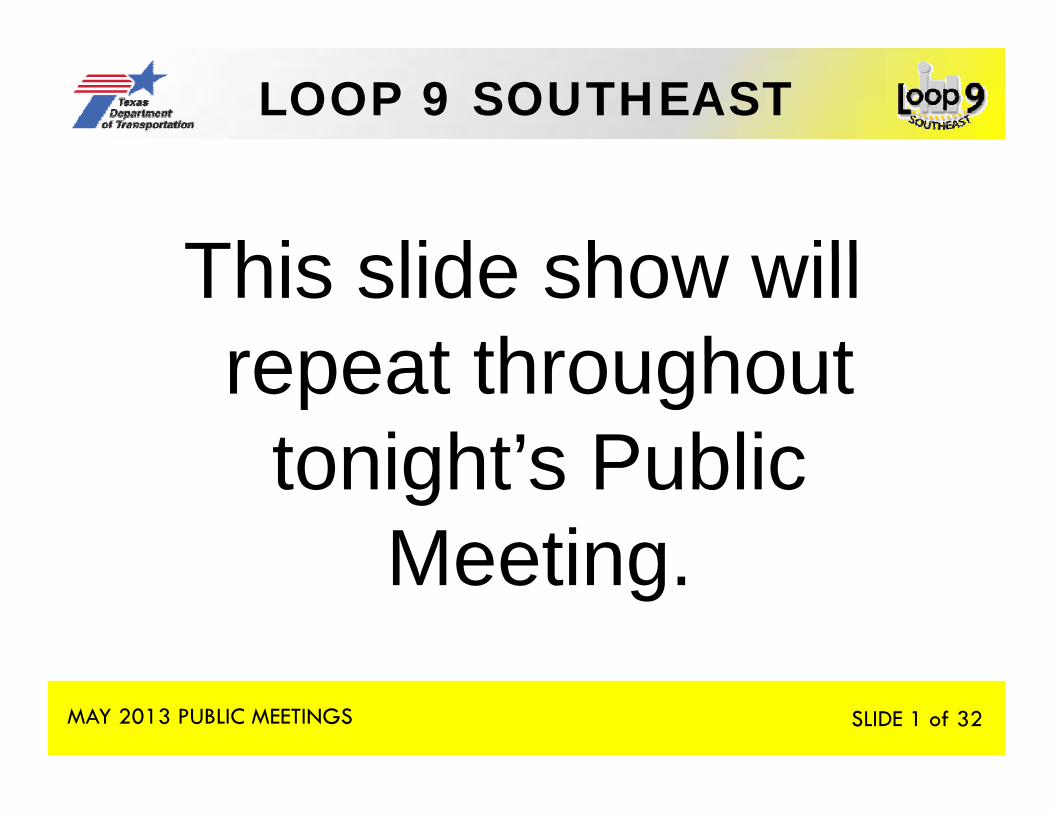
Thi lid h illThis slide show will repeat throughoutrepeat throughout
tonight’s Publictonight s Public MeetingMeeting.
MAY 2013 PUBLIC MEETINGS SLIDE 1 of 32
LOOP 9 SOUTHEAST
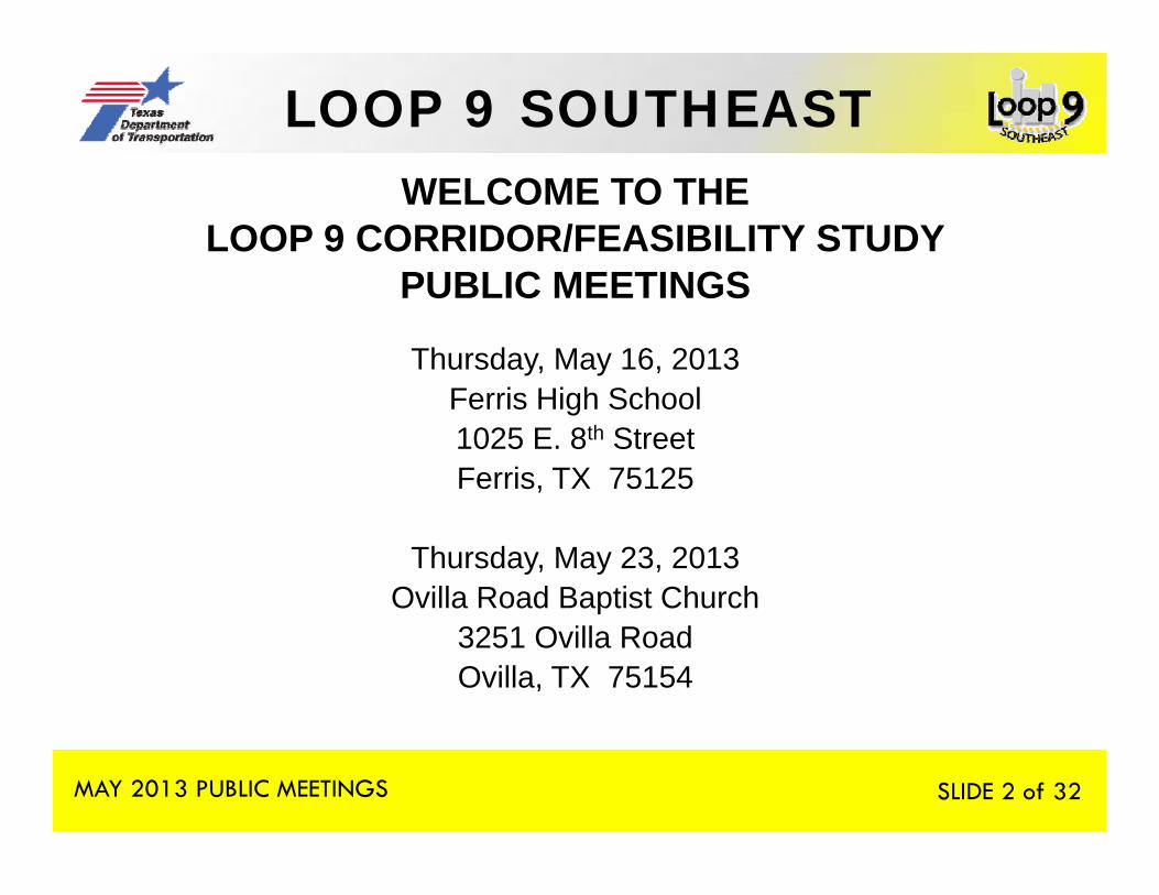
2WELCOME TO THE
LOOP 9 CORRIDOR/FEASIBILITY STUDYPUBLIC MEETINGSPUBLIC MEETINGS
Thursday, May 16, 2013F i Hi h S h lFerris High School1025 E. 8th StreetFerris, TX 75125
Thursday, May 23, 2013Ovilla Road Baptist Church
3251 Ovilla RoadOvilla, TX 75154
MAY 2013 PUBLIC MEETINGS SLIDE 2 of 32
LOOP 9 SOUTHEAST
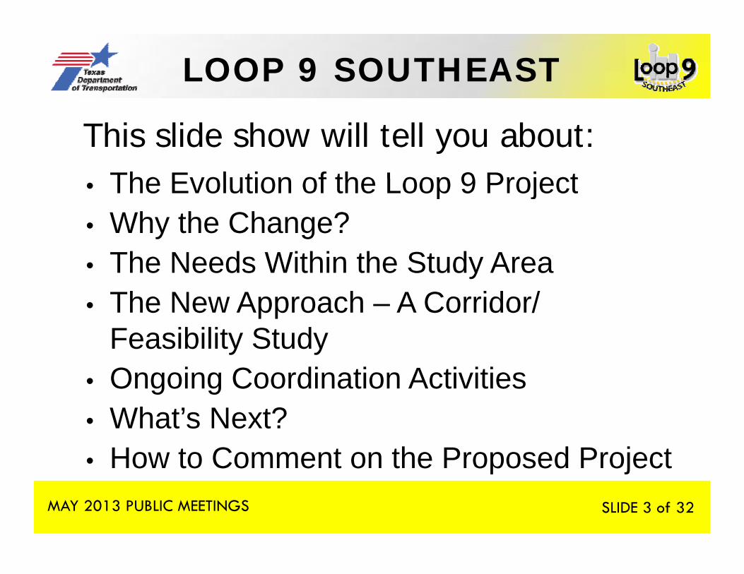
3 This slide show will tell you about:The Evolution of the Loop 9 Project• The Evolution of the Loop 9 Project
• Why the Change?S• The Needs Within the Study Area
• The New Approach – A Corridor/ Feasibility Study
• Ongoing Coordination Activities• What’s Next?• How to Comment on the Proposed Project
MAY 2013 PUBLIC MEETINGS
o to Co e t o t e oposed ojectSLIDE 3 of 32

LOOP 9 SOUTHEAST
4
EVOLUTION OF THEEVOLUTION OF THE LOOP 9 PROJECTLOOP 9 PROJECT
MAY 2013 PUBLIC MEETINGS SLIDE 4 of 32

LOOP 9 SOUTHEAST
5 EVOLUTION OF THE LOOP 9 PROJECTFirst conceived in 1957 the project has been• First conceived in 1957, the project has been studied by local, regional and state agencies at various times.
• In 2007, TxDOT began environmental studies for the Loop 9 project from US 287 near Mansfield to I-20 in Mesquite.
• Loop 9 put on hold in January 2012• The Notice of Intent to prepare an environmental
study was rescinded in March 2013.
MAY 2013 PUBLIC MEETINGS SLIDE 5 of 32
LOOP 9 SOUTHEAST
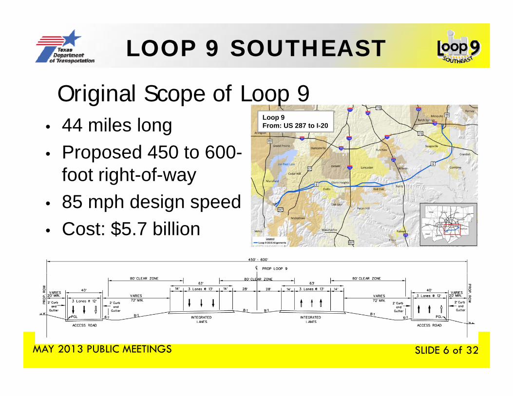
6 Original Scope of Loop 9 44 miles long Loop 9
F US 287 t I 20• 44 miles long• Proposed 450 to 600-
foot right of way
From: US 287 to I-20
foot right-of-way• 85 mph design speed
C t $5 7 billi• Cost: $5.7 billion
MAY 2013 PUBLIC MEETINGS SLIDE 6 of 32
LOOP 9 SOUTHEAST
7
WHY THE CHANGE?WHY THE CHANGE?
MAY 2013 PUBLIC MEETINGS SLIDE 7 of 32
LOOP 9 SOUTHEAST
8 WHY THE CHANGE?
Based on several factors• Removal of the Trans-Texas Corridor from
statewide plans • Removal of the Regional Outer Loop fromRemoval of the Regional Outer Loop from
regional transportation plans
MAY 2013 PUBLIC MEETINGS SLIDE 8 of 32

LOOP 9 SOUTHEAST
9 Review of 2035 Traffic ProjectionsBased on the North Central Texas Council ofBased on the North Central Texas Council of
Governments (NCTCOG) transportation plan, estimated traffic volumes were less than half of the pre io sl projected ol mes based on Mobilitpreviously projected volumes based on Mobility 2030
Reasons for low projected traffic on Loop 9 included:easo s o o p ojec ed a c o oop 9 c uded• Toll• Lack of Regional Outer Loop to the west• Lack of connection to statewide Trans-Texas Corridor 35 • Revised regional demographics
MAY 2013 PUBLIC MEETINGS SLIDE 9 of 32

LOOP 9 SOUTHEAST
10
THE NEEDS WITHIN THETHE NEEDS WITHIN THE STUDY AREA
MAY 2013 PUBLIC MEETINGS SLIDE 10 of 32
LOOP 9 SOUTHEAST
11 THE NEEDS WITHIN THE STUDY AREAThere still is a need for an east west facilityThere still is a need for an east-west facility
within the Study Area to provide:Connectivity• Connectivity
• Travel time savingsS t t ti l i d l t• Support potential economic development opportunities
To meet these needs, a NEW APPROACH was developed for Loop 9.
MAY 2013 PUBLIC MEETINGS
p p
SLIDE 11 of 32

LOOP 9 SOUTHEAST
12
THE NEW APPROACH –A CORRIDOR/FEASIBILITY
STUDYSTUDY
MAY 2013 PUBLIC MEETINGS SLIDE 12 of 32
LOOP 9 SOUTHEAST
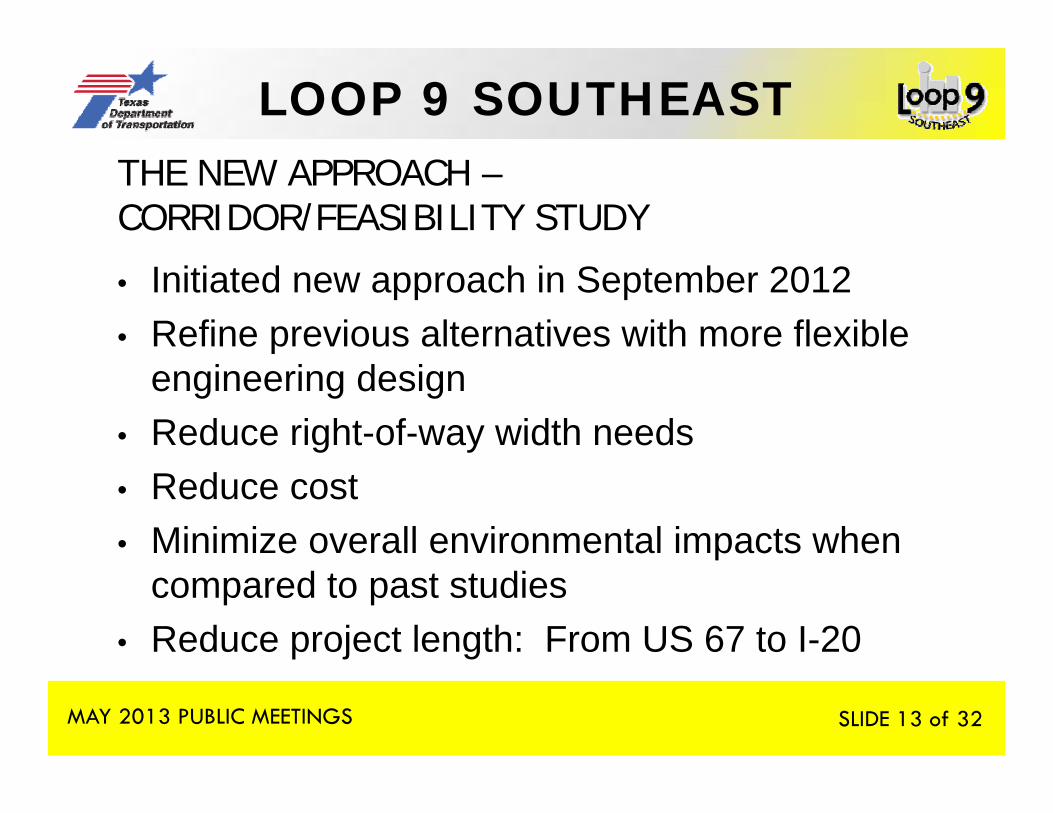
13THE NEW APPROACH –CORRIDOR/FEASIBILITY STUDY
• Initiated new approach in September 2012• Refine previous alternatives with more flexible
engineering design• Reduce right-of-way width needs• Reduce cost• Minimize overall environmental impacts when
compared to past studies• Reduce project length: From US 67 to I-20
MAY 2013 PUBLIC MEETINGS SLIDE 13 of 32
LOOP 9 SOUTHEAST
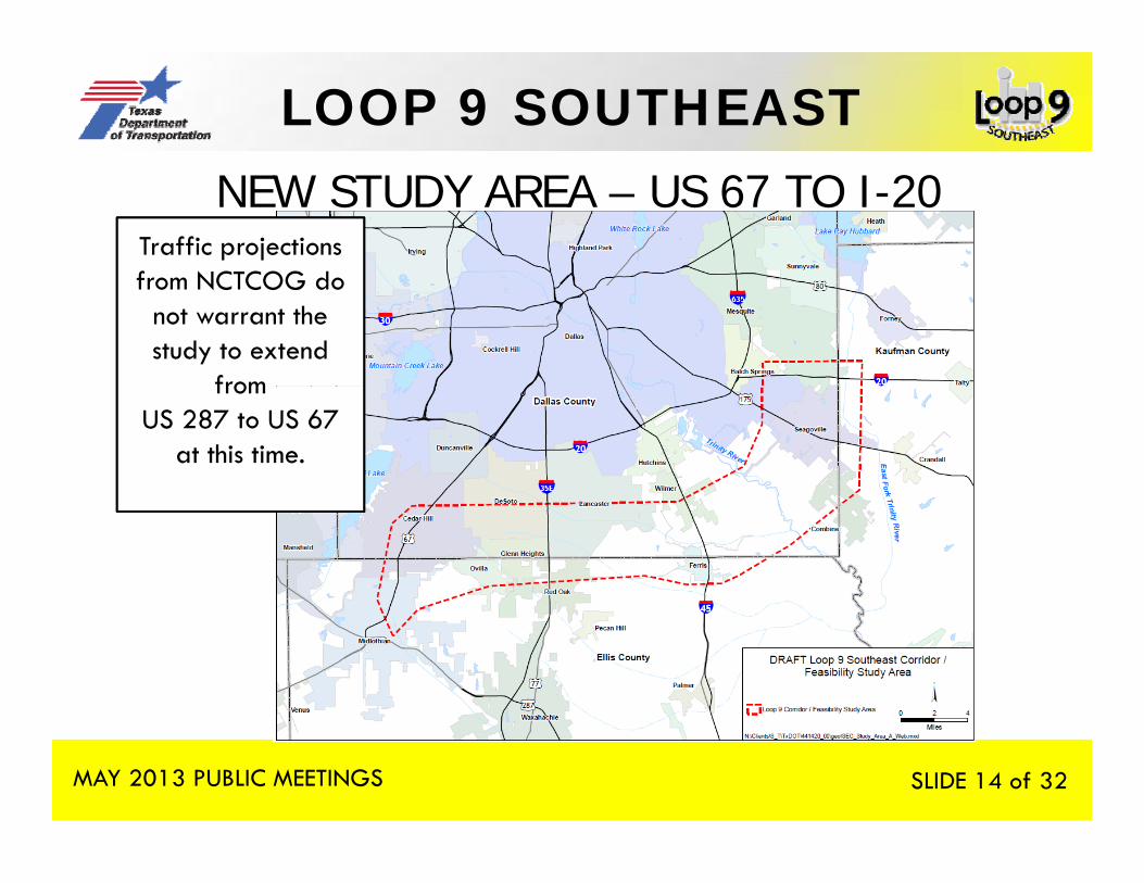
14 NEW STUDY AREA – US 67 TO I-20Traffic projections f NCTCOG d from NCTCOG do
not warrant the study to extend
from from US 287 to US 67
at this time.
MAY 2013 PUBLIC MEETINGS SLIDE 14 of 32
LOOP 9 SOUTHEASTTHE NEW APPROACH
15
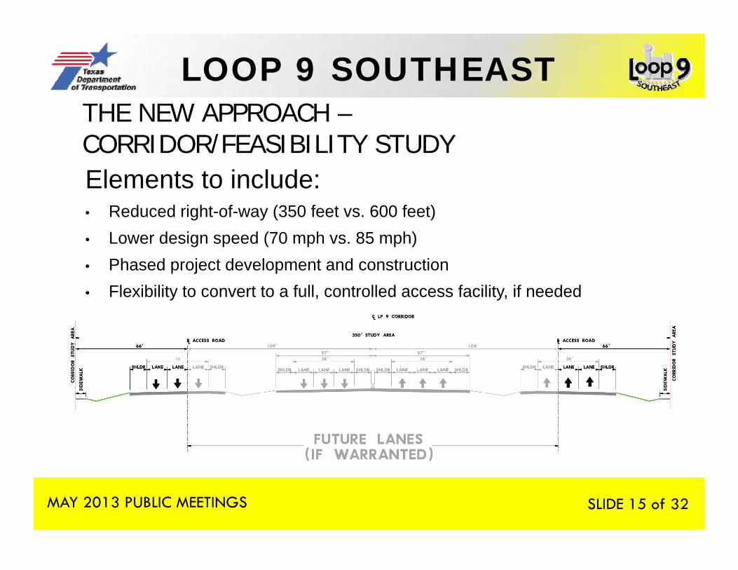
Elements to include:
THE NEW APPROACH –CORRIDOR/FEASIBILITY STUDY Elements to include:• Reduced right-of-way (350 feet vs. 600 feet)• Lower design speed (70 mph vs. 85 mph)• Phased project development and construction• Flexibility to convert to a full, controlled access facility, if needed
MAY 2013 PUBLIC MEETINGS SLIDE 15 of 32
LOOP 9 SOUTHEAST
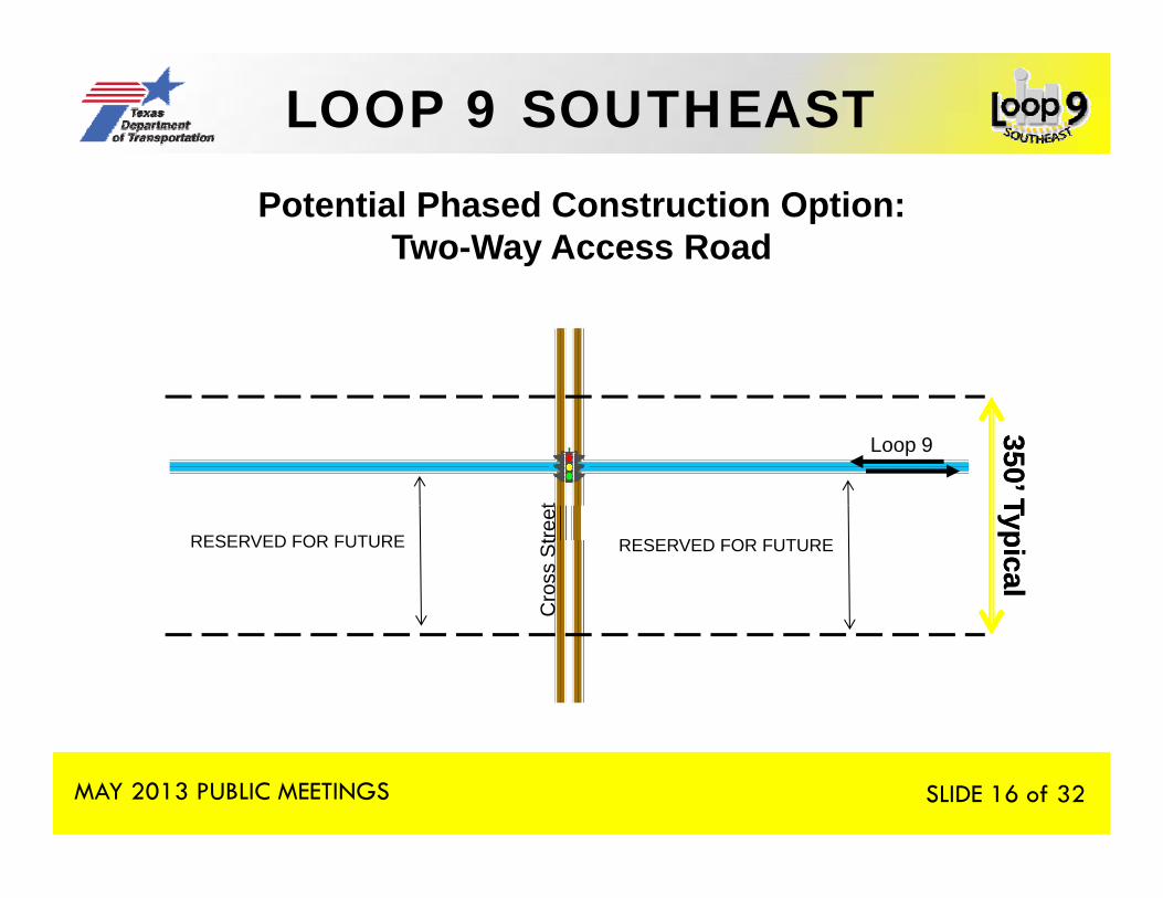
16 Potential Phased Construction Option:Two-Way Access Road
Loop 9
350’ T350’ Tt Typical
Typical
RESERVED FOR FUTURE RESERVED FOR FUTUREC
ross
Stre
et
MAY 2013 PUBLIC MEETINGS SLIDE 16 of 32

LOOP 9 SOUTHEAST
17 Potential Phased Construction Option:Two-Way Access Road
350’ Typical350’ Typical350 Typical350 Typical
RESERVED FOR
FUTURE
MAY 2013 PUBLIC MEETINGS SLIDE 17 of 32

LOOP 9 SOUTHEAST
18Potential Phased Construction Option:
One-Way Access Roads
Stre
et
Loop 9
350’ T350’ T
Cro
ss S
Loop 9
TypicalTypical
RESERVED FOR FUTURE RESERVED FOR FUTURE
MAY 2013 PUBLIC MEETINGS SLIDE 18 of 32
LOOP 9 SOUTHEAST
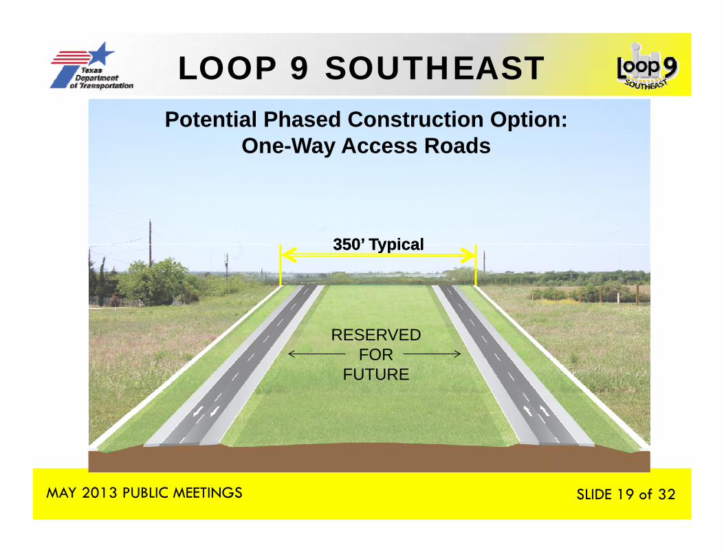
19Potential Phased Construction Option:
One-Way Access Roads
350’ Typical350’ Typical350 Typical350 Typical
RESERVED FOR
FUTURE
MAY 2013 PUBLIC MEETINGS SLIDE 19 of 32
LOOP 9 SOUTHEAST
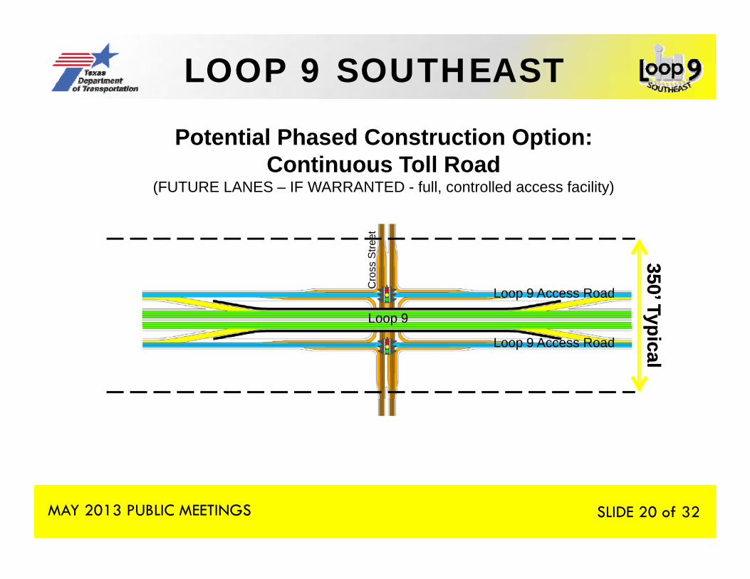
20 Potential Phased Construction Option:Continuous Toll Road
(FUTURE LANES – IF WARRANTED - full, controlled access facility)
Stre
et
350’ Typ350’ TypLoop 9
Cro
ss S
Loop 9 Access Road
picalpical
Loop 9 Access Road
MAY 2013 PUBLIC MEETINGS SLIDE 20 of 32
LOOP 9 SOUTHEAST
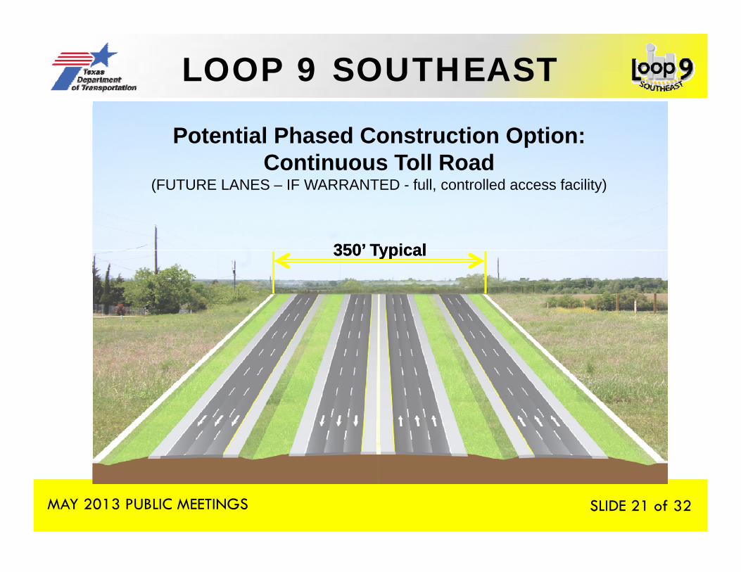
21 Potential Phased Construction Option:Continuous Toll Road
(FUTURE LANES – IF WARRANTED - full, controlled access facility)
350’ Typical350’ Typical350 Typical350 Typical
MAY 2013 PUBLIC MEETINGS SLIDE 21 of 32
LOOP 9 SOUTHEAST
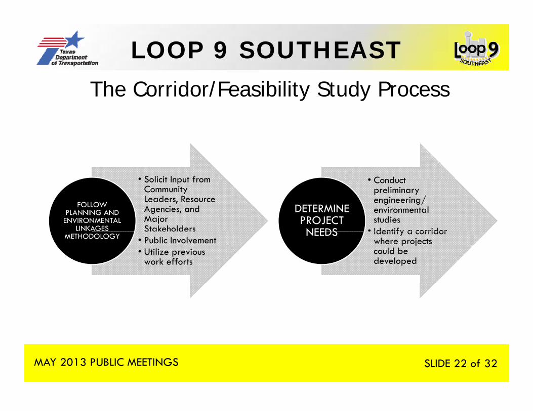
22 The Corridor/Feasibility Study Process
• Solicit Input from • Conduct • Solicit Input from Community Leaders, Resource Agencies, and Major Stakeholders
FOLLOW PLANNING AND ENVIRONMENTAL
LINKAGES
• Conduct preliminary engineering/ environmental studies
• Identify a corridor
DETERMINE PROJECT NEEDSStakeholders
• Public Involvement• Utilize previous
work efforts
METHODOLOGY • Identify a corridor where projects could be developed
NEEDS
MAY 2013 PUBLIC MEETINGS SLIDE 22 of 32
LOOP 9 SOUTHEAST
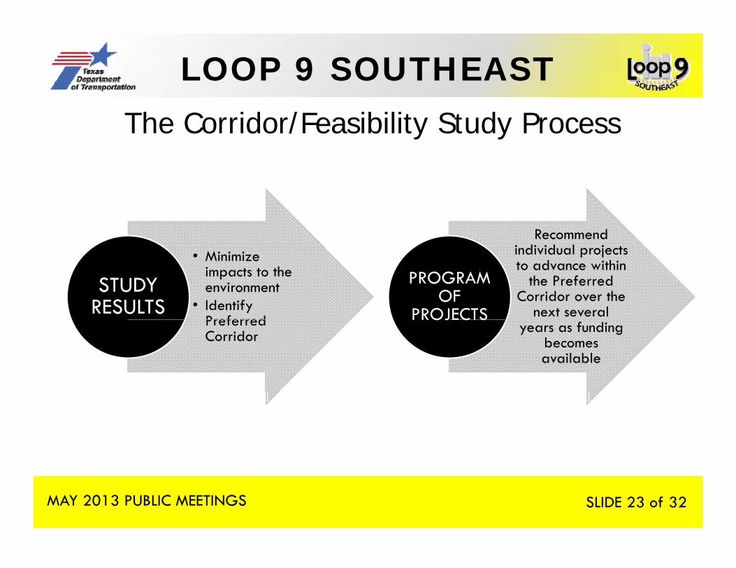
23 The Corridor/Feasibility Study Process
Recommend individual projects • Minimize
impacts to the environment
• Identify Preferred
STUDY RESULTS
individual projects to advance within
the Preferred Corridor over the
next several
PROGRAM OF
PROJECTSPreferred Corridor years as funding
becomes available
OJ C S
MAY 2013 PUBLIC MEETINGS SLIDE 23 of 32
LOOP 9 SOUTHEAST
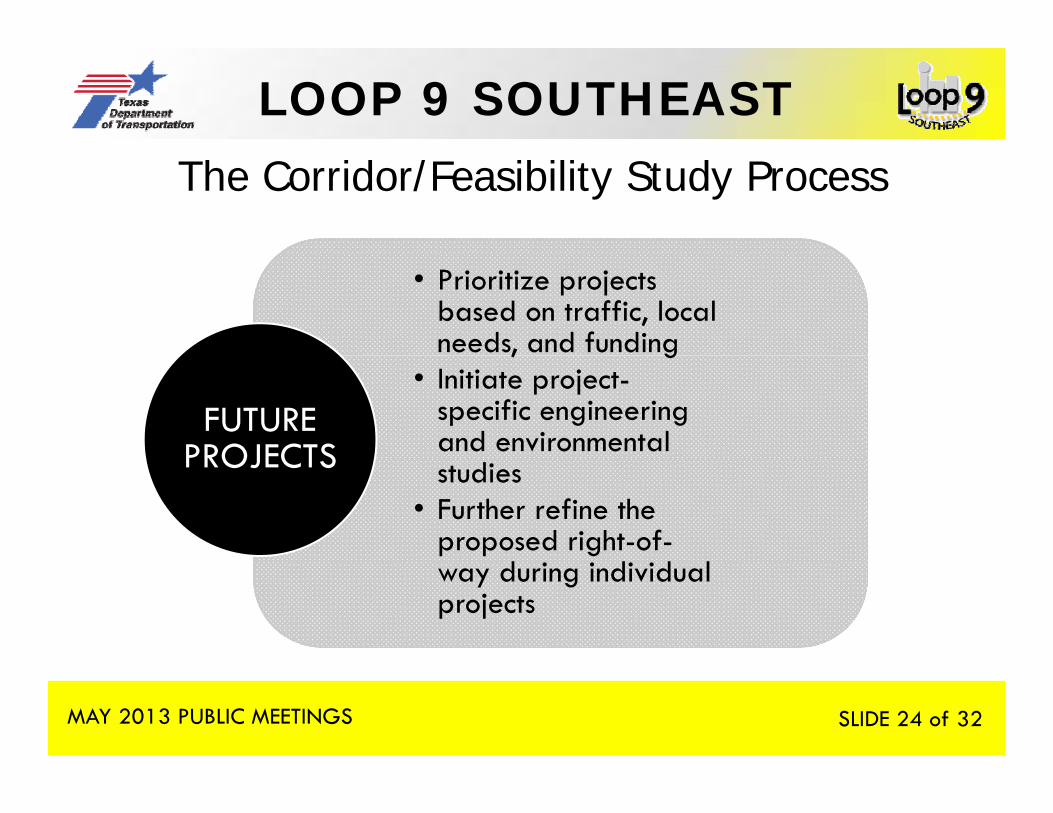
24 The Corridor/Feasibility Study Process
• Prioritize projects based on traffic, local needs, and funding , g
• Initiate project-specific engineering and environmental
FUTURE PROJECTS studies
• Further refine the proposed right-of-
PROJECTS
way during individual projects
MAY 2013 PUBLIC MEETINGS SLIDE 24 of 32
LOOP 9 SOUTHEAST
25
ONGOING COORDINATIONONGOING COORDINATION ACTIVITIES
MAY 2013 PUBLIC MEETINGS SLIDE 25 of 32
LOOP 9 SOUTHEAST
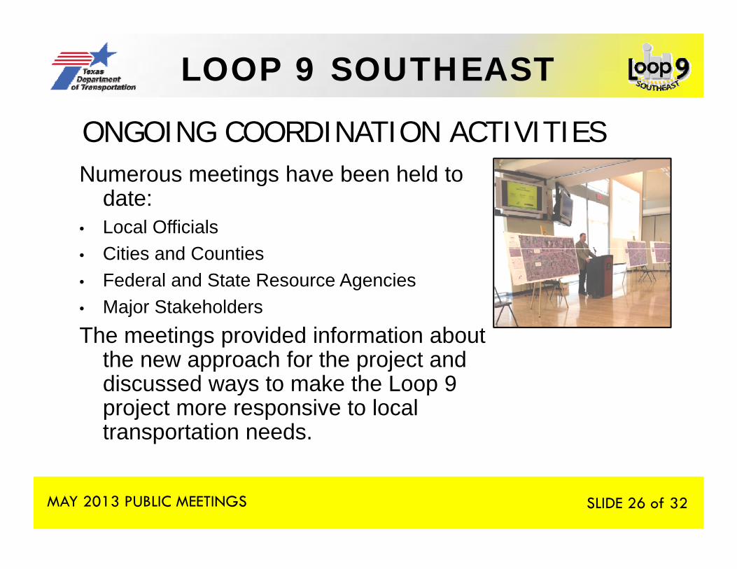
26 ONGOING COORDINATION ACTIVITIESNumerous meetings have been held toNumerous meetings have been held to
date:• Local Officials
Citi d C ti• Cities and Counties• Federal and State Resource Agencies• Major StakeholdersThe meetings provided information about
the new approach for the project and discussed ways to make the Loop 9 y pproject more responsive to local transportation needs.
MAY 2013 PUBLIC MEETINGS SLIDE 26 of 32

LOOP 9 SOUTHEAST
27
WHAT’S NEXT?WHAT S NEXT?
MAY 2013 PUBLIC MEETINGS SLIDE 27 of 32
LOOP 9 SOUTHEAST
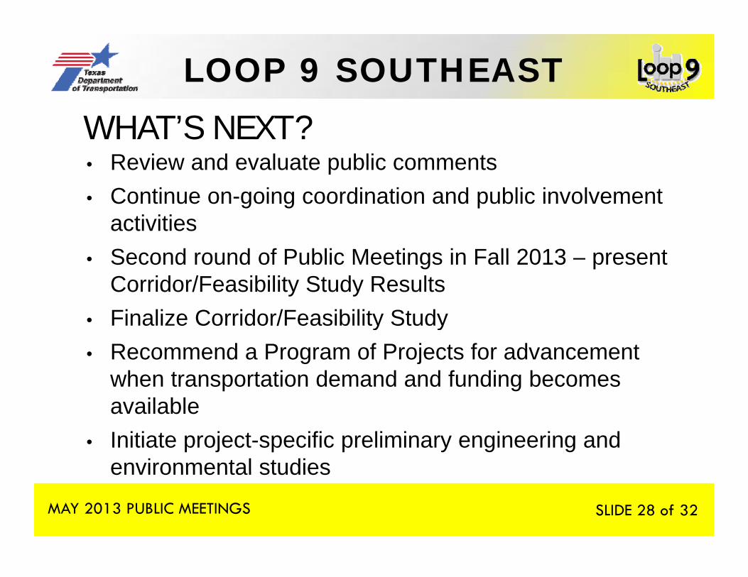
28 WHAT’S NEXT?• Review and evaluate public comments• Continue on-going coordination and public involvement
activitiesS d d f P bli M ti i F ll 2013 t• Second round of Public Meetings in Fall 2013 – present Corridor/Feasibility Study Results
• Finalize Corridor/Feasibility StudyFinalize Corridor/Feasibility Study• Recommend a Program of Projects for advancement
when transportation demand and funding becomes il blavailable
• Initiate project-specific preliminary engineering and environmental studies
MAY 2013 PUBLIC MEETINGS
environmental studies
SLIDE 28 of 32
LOOP 9 SOUTHEAST
29
HOW TOHOW TO COMMENT
ON THE PROPOSEDPROPOSED PROJECT
MAY 2013 PUBLIC MEETINGS SLIDE 29 of 32
LOOP 9 SOUTHEAST
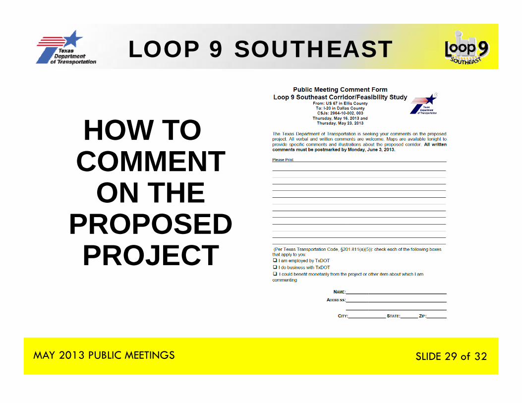
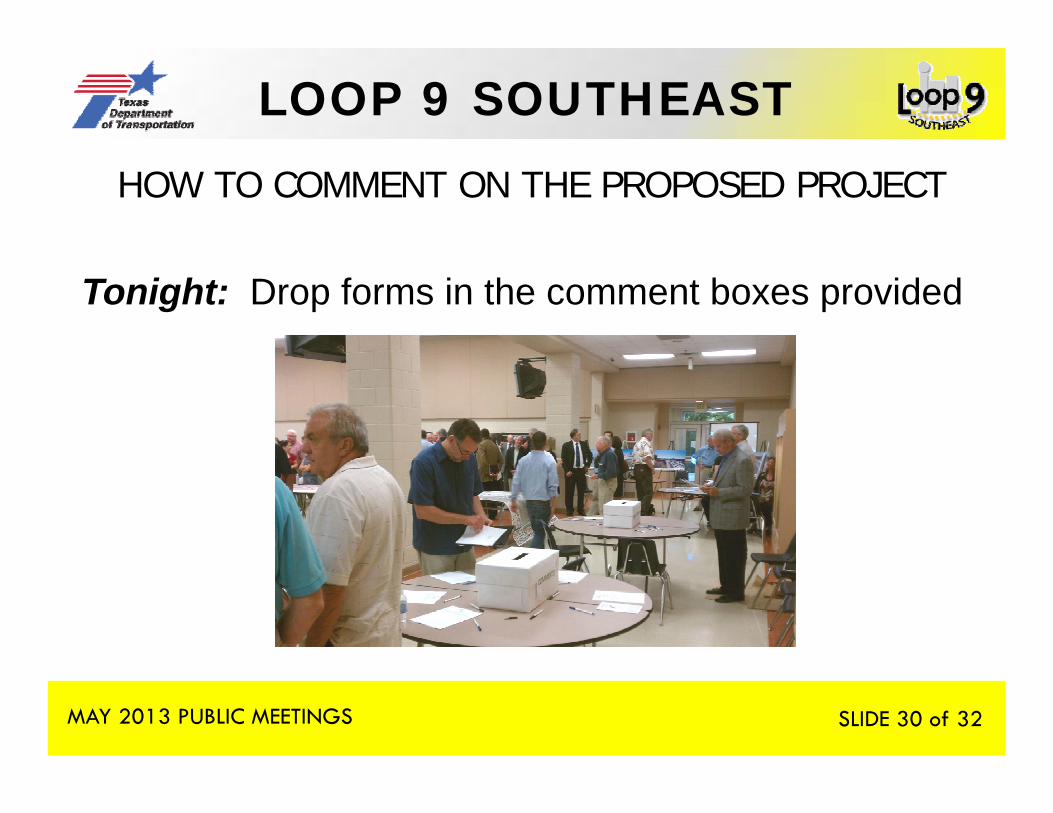
30 HOW TO COMMENT ON THE PROPOSED PROJECT
Tonight: Drop forms in the comment boxes provided
MAY 2013 PUBLIC MEETINGS SLIDE 30 of 32
LOOP 9 SOUTHEAST
31
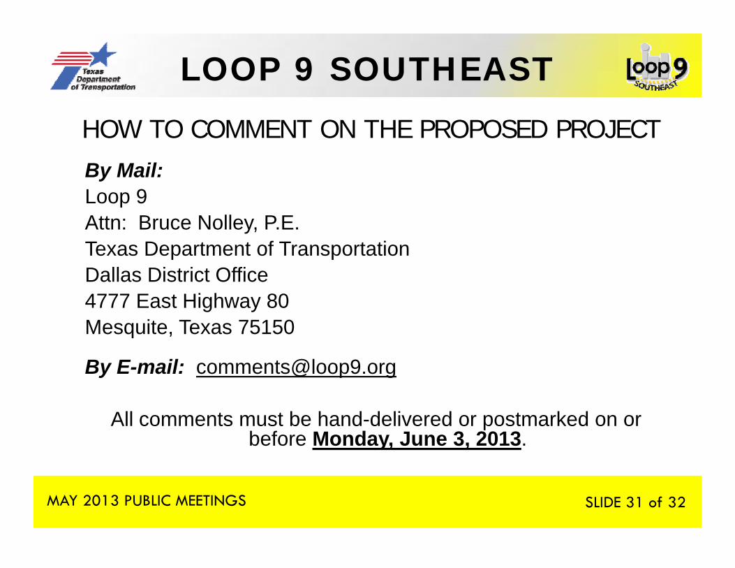
By Mail:
HOW TO COMMENT ON THE PROPOSED PROJECT By Mail:Loop 9Attn: Bruce Nolley, P.E. Texas Department of TransportationTexas Department of TransportationDallas District Office4777 East Highway 80 M it T 75150Mesquite, Texas 75150
By E-mail: [email protected]
All comments must be hand-delivered or postmarked on or before Monday, June 3, 2013.
MAY 2013 PUBLIC MEETINGS SLIDE 31 of 32

LOOP 9 SOUTHEAST
32Information from tonight’s public meeting will be available
on the project website: www.loop9.org
MAY 2013 PUBLIC MEETINGS SLIDE 32 of 32