Embed Size (px)
Citation preview

1
GOES-R Ground Segment Overview:
Products and Data DistributionTom Renkevens, NOAA/NESDIS/OSDPD/SSD
Many thanks to Vanessa Griffin, Bill Mazur, Andrew Royle, Tracy Zeiler and numerous others from GOES-R Ground Segment Project!
McIDAS Users’ GroupMadison, WI
Wednesday June 3, 2009

2
My McIDAS Background• Undergraduate student at Millersville University of PA 1987-1992
– One McIDAS workstation in 1988, expanded to 3– 16 frames of imagery, several minutes to load a 4 frame loop– Called “sectors”
• Graduate student at University of Oklahoma 1992-1995– Resurrected McIDAS workstation from inoperable state
• was using WEFAX hardcopy images for satellite data
• Satellite (Synoptic) Analysis Branch and Satellite Service Division 1995-2005– 24x7 use of McIDAS in products creation and dissemination
• GOES-R 2005-2008– Helped define Ground Segment specs
• SSD 2008- current– User Services….. Disclaimer: Not an official spokesperson for GOES-R!!!

3
Topics
• GOES Mission Overview
• GOES-R Capabilities
• GOES-R Ground Segment Overview
• GOES-R Direct Broadcast
– GOES Rebroadcast (GRB)
– Emulated GOES Variable format (eGVAR)
– High Rate Information Transmission/Emergency Managers Weather Information Network (HRIT/EMWIN)
• GOES-R Products
• McIDAS Connection
4
GOES Mission Overview
• Provides geostationary coverage of Earth and space weather over the Western Hemisphere
• Data distribution to users via– Direct broadcast– Terrestrial distribution (performed by NOAA’s Office of Satellite
Data Processing and Distribution (OSDPD))– Long-term Archive and Access
• Primary products provided through imaging in visible, infrared (IR), and near-IR channels
• Highly reliable operational system– Always “On,” always available

5
GOES-R Overview
• GOES-R is the first in NOAA’s follow-on series of geostationary satellites, with initial launch expected in 2015
• Consists of new and enhanced instrumentation– Advanced Baseline Imager (ABI)– Geostationary Lightning Mapper (GLM)– Space Weather instruments
• Space Environment In-situ Suite (SEISS)• Solar Ultraviolet Imager (SUVI)• Extreme ultraviolet and X-ray Irradiance Sensor (EXIS)• Magnetometer
• GOES-R also will develop a new Ground Segment for satellite control and data processing

6
GOES-R System Capabilities
GOES I-P GOES-R
Full Disk Image 30 minutes 5 minutes
Imager bands 5 16
Visible Resolution 1 kilometer 0.5 kilometer
Near Infrared Resolution N/A 1 kilometer
Infrared Resolution 4 kilometer 2 kilometer
Bit Depth 10 bits 12 bits – Visible,
14 bits Infrared
Raw Instrument Data 2.62 Mbps Up to 106 Mbps
(ABI: up to 67 Mbps)
Space Weather ~100 kbps 3.6 Mbps
Geostationary Lightning Mapper
N/A 5.5 Mbps
Telemetry 4 kbps 4 & 32 kbps
Planned Data Outage >300 hrs/year <3 hrs/year

7
Instrument Downlink Comparison
GLM Data
ABI Data
Space Weather Data
Fill Packets
Mbp
s

8
Ground Segment Objectives
• Support the primary mission operations goals to safely launch and safely operate the GOES-R series spacecraft
• Design, develop, integrate and test the Ground Segment in a manner minimizing the GOES-R overall program costs
• Minimize the impact to existing users during the transition to GOES-R services
• Provide cost effective Ground Segment sustainment and maintenance once transitioned to Government operations
• Provide cost effective and timely solutions to meet GOES-R evolving Ground Segment requirements
– Open standards
– Modular, scalable, flexible system design
– Industry standard system and software engineering practices
• Maintain compatibility with existing and enhanced versions of NOAA institutional systems required to support the GOES-R series spacecraft

9
Mission Management
Includes satellite mission operations (telemetry and command), mission scheduling, mission state-of-health trending, satellite orbital analysis, and processing raw data to Level 0 (L0)
Product Generation
Includes processing L0 data to Level 1b (including calibration, and navigation & registration) and creation of GOES-Rebroadcast (GRB), creation of eGVAR, and creation of higher level data products (Level 2/2+) including operational formatted products.
Product Distribution
Includes distribution of GRB, distribution of KPPs to AWIPS, distribution and access to data and formatted products via the GOES-R Access Point, and distribution of data and formatted products to CLASS
Enterprise Management
Infrastructure
Provides situational awareness of all functions of the GOES-R GS by monitoring and reporting the configuration of the security, networks, communications, and operational systems
Includes telecommunications, facilities, and software infrastructure
Notional Functional Overview
Remote Backup(RBU)
NOAA Wallops GroundStation (WCDAS)
NOAA SatelliteOperations
Facility(NSOF)
GOES-R Ground Segment Facilities
UserCommunity
Archive and Access(CLASS*; GAS*)
GOES-R Ground Segment Functional Elements
MissionManagement
-- Enterprise Management --
GOES Rebroadcast
(GRB)
GOES EastGOES West
*CLASS: Comprehensive Large Array-data Stewardship System*GAS: GOES-R Access System (contained within
ESPC: Environmental Satellite Processing Center )
ProductGeneration Product
Distribution

10
GOES-R Product Distribution
• AWIPS– Delivery of sectorized cloud and moisture imagery products to the AWIPS interface point via a
dedicated path
• GOES-R Access Subsystem (GAS)– Data ingest (no data processing) and distribution system for GOES-R products and data to
authorized users– 7-day rolling storage (~23 TB)
• Comprehensive Large-Array data Stewardship System (CLASS)– Long-term archive for GOES-R products (L1b, L2+) and data (L0, cal/val, algorithm software,
documentation)
• GOES Rebroadcast (GRB)– Data assembled from Level 1b in the form of CCSDS Transfer Frames for rebroadcast by the
GOES-R satellites
• Emulated GVAR (eGVAR) – Data selected and assembled from Level 1b for continuity of GOES operations and to facilitate
transition from GOES-I/P to GOES-R.– Delivered to the IF interface point at WCDAS for rebroadcast by the legacy GOES-I/P system.– For transition purposes, assuming availability of non-operational GOES-I/P series spacecraft

11
Roles and Responsibilities
Ground Segment Project Office
Project Management, GS validation, system engineering, major acquisitions
Ground Segment Contractor
EM, MM, PG and PD development, segment integration, System Engineering, Integration and Test (SEIT) support for the entire GS
Antenna Contractor Antennas/RF (Receive/Transmit, IF Switching, Signal Monitoring)
OSD: Office of Systems Development
GOES-R Access Subsystem (access point and 7-day data storage)
Ancillary Data Relay System (“broker”)
Domain-5 Development (HRIT modulation/encoding)
CLASS (permanent archive)
Facilities Upgrades
Long-term Maintenance and Sustainment of GFP
OSO: Office of Satellite Operations
Terrestrial Telecommunications Circuits/Services
eGVAR interface
Instrument VendorsL1b Algorithm Packages
L1b Cal/Val through initial ops
AWG: Algorithm Working Group
L2+ Algorithm Packages, including:
proxy data input and simulated output
L1b Cal/Val (Post-Operational), L2+ Product validation

12
Ground Segment Contract Baseline and Options Include:• Development of Core Ground Segment
– Mission Management Element– Enterprise Management Element – Product Generation Element– Subset of Product Distribution Element
• GOES Rebroadcast (GRB)• Advanced Weather Information Processing System (AWIPS)
distribution– Internal telecommunications/networks (i.e., intra-site) – Option 1: Improved Latency / Option 2: Additional L2+ Products
• Total Ground Segment Integration and checkout– Integration of GFP systems, including Antennas and GOES-R Access
Subsystem (GAS)– Interfaces to external systems, including CLASS and Ancillary Data
Relay System (ADRS)
• Transition to NOAA Operations
GOES-R Ground Segment Contract

13
Algorithm Working Group (AWG)
• AWG is developing the Level 2+ Product algorithms to be used to produce the GOES-R data products.
• AWG consists of a Government lead team from NESDIS/STAR and scientists from multiple aligned universities
• Individual product algorithms are selected by the AWG from a ‘best-of-breed’ down-select from candidate algorithms meeting GOES-R product performance requirements
• Algorithm Packages (AP) consist of the algorithm description, ancillary data requirements, sample software, test data, and test results.
• APs are independently reviewed by the Government and then delivered to the GS Contractor for implementation
• Operational implementation of the algorithms is the responsibility of the GS Contractor
• Contractor implementation is initially verified using AWG provided test data and results
• Contractor implementation is validated using live instrument data post-launch.

14
AWG Status
• 14 Application Teams developing algorithms– Responsible for developing Algorithm Theoretical Basis Documents
(ATBDs) and Algorithm Packages– Three ATBD deliveries: Draft, 80%, and 100%
• Integrated Baseline Review (cost and schedule) completed Jul 2008
• Algorithm Integration Team integrating application team algorithms and software using consistent processing framework
• Algorithm Development Status– Draft ATBDs delivered Sep 2008– Baseline Products
• 100% of Algorithm Design Reviews completed • 100% of Critical Design Reviews completed• 64% of Test Readiness Reviews completed
– Option 2 Products (only)• 84% of Algorithm Design Reviews completed (97% after June 9)• 75% of Critical Design Reviews completed• 22% of Test Readiness Reviews completed

15
GOES-R Remote Backup (RBU)
• RBU will provide back up for mission critical GOES-R functions– RBU will support two operational and one stored GOES R-series
spacecraft – Mission Command and Control, and Mission Planning– Raw Instrument data acquisition and Level 0 processing– Level 1B processing and GRB production (no eGVAR from RBU)
– Level 2+ product processing for the GOES-R key performance parameters (KPPs; i.e., Cloud and Moisture Imagery)
• Product delivery to AWIPS– Data and product delivery to CLASS– RBU location will be in Fairmont, WV– NOAA is working with GSA Region 3 to acquire facility space for
the RBU in which to locate the GS processing systems, and land on which to locate the antennas

16
Antennas
• Antennas necessary to support GOES-R are being procured by the GSP through a stand-alone contract
• Antenna systems (receivers, transmitters, IF switching and distribution, and signal monitoring) will be provided as Government Furnished Property (GFP) to the GS Contractor for integration with the core GS
• NOAA Satellite Operations Facility (NSOF; Suitland, MD)– upgraded (existing) 9-meter L-band receive antennas
• Wallops Command & Data Acquisition Station (WCDAS; Wallops, VA)– new 16.4-meter transmit/receive L-/S-/X-Band antennas
– upgraded (existing)16.4-meter transmit/receive L-/S-/X-Band antennas
• RBU– new 16.4-meter transmit/receive L-/S-/X-Band antennas
• Draft RFP expected for released in June 2009

17
GOES-R Access Subsystem (GAS)
• GAS provides real-time distribution of GOES-R Level-2+ products and is the user’s terrestrial product access point and 7-day temporary data store
• GAS will provide both push and pull product delivery• GAS will support product subscriptions as well as ad-hoc
product queries• GAS requirements call for support of 1000
simultaneously connected users, 200 simultaneous subscription requests, 100 simultaneous ad-hoc requests, and provide an initial continuous data delivery capability of 500 Mbps
• Acquisition to be initiated in mid-2009
18
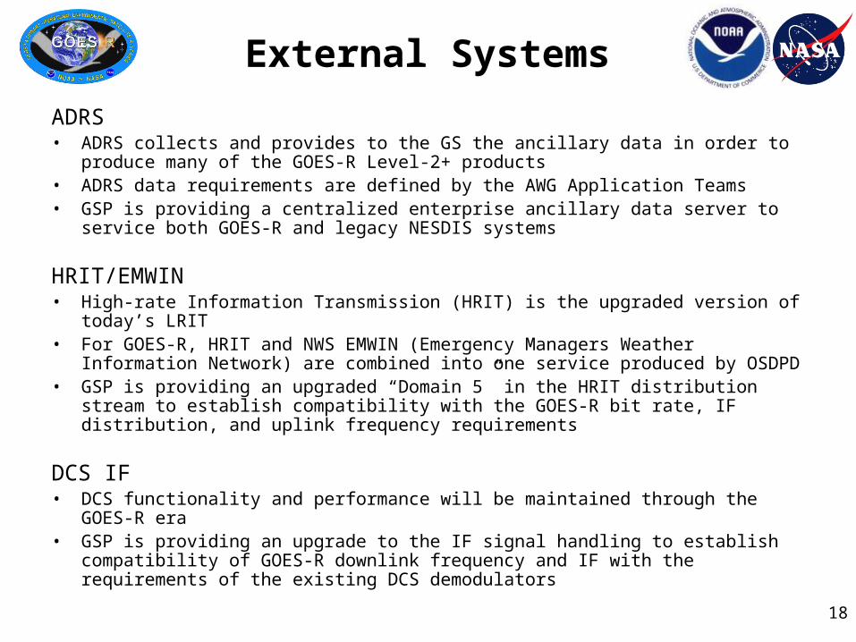
External Systems
ADRS• ADRS collects and provides to the GS the ancillary data in order to produce many of
the GOES-R Level-2+ products • ADRS data requirements are defined by the AWG Application Teams• GSP is providing a centralized enterprise ancillary data server to service both GOES-
R and legacy NESDIS systems
HRIT/EMWIN• High-rate Information Transmission (HRIT) is the upgraded version of today’s LRIT • For GOES-R, HRIT and NWS EMWIN (Emergency Managers Weather Information
Network) are combined into one service produced by OSDPD• GSP is providing an upgraded “Domain 5” in the HRIT distribution stream to establish
compatibility with the GOES-R bit rate, IF distribution, and uplink frequency requirements
DCS IF• DCS functionality and performance will be maintained through the GOES-R era• GSP is providing an upgrade to the IF signal handling to establish compatibility of
GOES-R downlink frequency and IF with the requirements of the existing DCS demodulators

19
CLASS
• Comprehensive Large-Array data Stewardship System (CLASS) is the NOAA enterprise archive and access system used by the NOAA National Data Centers for long-term data storage and retrospective data access
• CLASS will store Level 0, Level 1b, and Level 2+ products– Subject to review and acceptance of each product for archive by the
NOSC (NOAA Observing System Council)
• GSP relies on enterprise capabilities and functionality of CLASS• GSP funds expansion of CLASS sufficient to ingest and store
GOES-R data rates and volumes expected in excess of a Petabyte a year
• CLASS System Requirements Review (for GOES-R) in Jun 2009

20
GSP Groups and Teams
• Working Groups (WGs):– Functional focus– Crosscutting impact – Independent reporting – Examples:
• Algorithm Validation• Cal/Val• Telecommunications• Data
Engineering/Metadata• Integration• Security • Software Engineering
• Integrated Product Teams (IPTs):– Product focus– Impact on a GS function or group of
functions– Reports through the development
oversight organization– Examples:
• Access Subsystem• Antenna/RF/IF• Archive• AWIPS• eGVAR• Enterprise Management • Facilities / Installation• Launch Support• Transition to Operations• Product Generation Data Ingest

2121
06/19/2008 v2 21
Wallops Command and Data Acquisition Station (WCDAS)
Wallops, VA
NOAASatellite Operations
Facility (NSOF)Suitland, MD
RemoteBackup (RBU) Facility
Fairmont, WV
GOES-East75° West
GOES-West137° West
GOES-R System ConfigurationGOES-R System ConfigurationGOES-R System ConfigurationGOES-R System Configuration
Command & control, R
aw data
Proce
ssed
(L1b
) Dat
a
Command & control, raw data
Direct Readout Users
Processed (L1b) Data
GOES-R Direct Readout Overview

22
GOES-R Series Instruments Comparison
GOES I-P GOES-R Significant Changes
Imager ABI Greater resolution & Channels
Sounder -- ABI to provide most legacy
capabilities
SXI SUVI Increased channels
EUV & XRS EXIS Same
Magnetometer Magnetometer Same
HEPAD & EPS SEISS Greater energy ranges
-- GLM Geostationary Lightning Mapper

23
GOES-R Series Instruments Comparison

24
GOESGOES
Downlink Frequencies

25
Current vs. Future Direct Readout Characteristics
GVAR GOES Rebroadcast (GRB)
Full Disk Image 30 minutes 5 minutes (Mode 4)
15 min (Mode 3)
Other modes Rapid Scan,Super Rapid Scan
3000 km x 5000 km CONUS: 5 min
1000 km x 1000 km Mesoscale: 30 sec
Polarization Linear Dual circular
Receive Frequency
1685.7 MHz (L-band) 1690 MHz (L-band)
Packetization GVAR Blocks CCSDS 133.0-B-1
Data Compression None Lossless compression
Data Rate 2.11 Mbps ~28.4 Mbps (31 Mbps link rate)
Antenna Coverage Earth coverage to 5° Earth coverage to 5°
Data Sources Imager and Sounder
SXI (MDL Link)
SEM & Magnetometer (PCM/Telemetry link)
ABI (16 bands), GLM, SEISS, EXIS, SUVI, MAG
Space Weather None ~2 Mbps
Lightning Data None ~0.5 Mbps

26
GOES-R Direct Broadcast Coverage (5°
Elevation)

27
GOES Rebroadcast Service (GRB)
• Provides full resolution products from all instruments– All data will be calibrated and navigated (“Level 1b”)– Some products, such as the GLM, are higher level products
(“Level 2+”)
• Replaces current GVAR service– 31 Mbps in GRB versus 2.1 Mbps of GVAR– DRO receive systems specified for same size antennas (G/T of
15.2 dB/K), however with significant changes:• Dual polarization (feed changes and dual receiver chain)• High-level modulation (e.g. QPSK, OQPSK, or 8-PSK (TBD))• Forward error detection coding (Low Density Parity Check
(LDPC) (TBR)) to reduce required C/No

28
GRB Dual Polarization Characteristics
• Currently the L-band frequency spectrum of 1683 MHz to 1698 MHz is available for use by Geostationary Meteorological Satellites– As such it is a protected resource for the user community– Obtaining new frequencies anywhere in the RF spectrum is extremely
difficult so maximizing the utilization of this resource is necessary
• Dual Polarization is a well known technique for doubling the capacity of satellite channels– Notably at C-band for television distribution– No dual-polarization utilization data is available for the L-band frequencies
currently used by weather satellites (1600-1700 MHz)
• GOES-R program research indicates GRB will meet availability requirements under almost all conditions with margin– Extensive testing at the Wallops, VA Command and Data Acquisition
Station characterized cross polarization effects for L-band dual circularly polarized links

29
GRB 99.99% Availability Coverage
0.01% Exceedence of 22 dB
interference level based on “Initial Bound Equation” determined by the
conducted measurements and the ITU-R 0.01% rain rate for given areas in the GOES antenna footprint.
Interferen
ce Level
GOES West GOES EastThe dark blue areas may see a reduction in link
margin, but the link will still close.

30
Other GRB Service Design Considerations
• Modulation type, coding and other link characteristics to be defined by Spacecraft contractor in conjunction with Government and Ground contractor through an Integrated Product Team (IPT)– DVB-S2 link characteristics and compatibility under consideration
• Data formatting and product details to be defined by the GOES-R Ground Segment contractor in conjunction with GRB IPT; but will have – CCSDS packetization– Data types segregated between polarizations
• LHCP to provide subset of imagery (0.64, 3.9, 6.185, 7.34, 11.2, 12.3, 13.3 micron channels);
• RHCP to provide remaining 9 channels, plus all other instruments.

31
Emulated GVAR (eGVAR)
• GOES-R will provide a limited capability to produce emulated GVAR (eGVAR) Imagery to Users capable of receiving today’s GVAR data stream– Relies on availability of a spare satellite from the GOES N/O/P series to
broadcast to users.– Transmitted signal will have GVAR characteristics:
• Same transmit frequency and power levels• Same GVAR format• Five channels from the ABI (0.64, 4.9, 6.19, 11.2, 13.3 µm)
– Similar to the GOES Imager channel wavelengths • Imagery will be mapped to GOES N/O/P resolution• No Sounder data • Limited to Full Disk scenes on the half-hour
– No Mesoscale data

32
eGVAR & GRB Flows
LegendInstrument Raw Data downlinkGRB relay uplinkeGVAR relay uplinkGRB RF BroadcasteGVAR RF BroadcastTerrestrial/Network Comm
GOES-R Satellite
GOES-N/O/P Series Satellite
eGVAR User GRB User
GOES-N/O/P SSGS
GOES-N/O/P RF

33
One Concept for a GRB Small User Receive System
DVB-S2* PCI Card Receiver
•~$550/polarization– $~200 for a PCI-Card
–$350 for an equivalent new PC from Dell
Data Aggregator •$350 for an equivalent new PC from Dell
LNAFilter90 degHybrid RHCP
LHCP
LNAFilter
Demodulator
Data Handling
Demodulator Storage
Antenna & Feed Downconverter & Demodulator
Data Aggregator
* Use of DVB-S2 is under consideration for GRB—currently TBD

34
HRIT/EMWIN
• Individual Low Rate Information Transmission broadcast (LRIT) and the Emergency Managers Weather Information Network broadcast (EMWIN) combined onto common carrier
• Provides growth path for both Services to a combined 400 Kbps information rate
– LRIT currently 128 Kbps information rate
– EMWIN currently: 9.6 Kbps (GOES 11&12), 19.2 Kbps* for GOES 13-15.
• Will utilize BPSK modulation w/ convolutional and Reed-Solomon coding
– Same as LRIT, but higher data rate
– Allows maximum EIRP from satellite due to Power Spectral Density restrictions
– EMWIN Users modulation type changes from uncoded FSK (GOES I-M), from coded OQPSK (GOES-NOP) to coded BPSK

35
HRIT/EMWIN (Cont.)
• Name change to High Rate Information Transmission (HRIT) required by CGMS categorization of services
• Virtual Channel Data Units used to separate EMWIN and LRIT data:– Virtual channels used in LRIT today
• Prototype Software Defined Radio developed and demonstrated by Aerospace Corporation
– One hardware/software configuration can receive all current and future EMWIN, LRIT and HIRT/EMWIN signals
– Technology demonstration to proves low cost, PC-based terminals are possible for all data rates and modulation types

36
GOES-R Products ListObservables- Product Sets 1 & 2
Baseline Products# GOES-R GS End-Products
Observables- Product Sets 3 & 4Option 2 Products
# GOES-R GS End-Products
Aerosol Detection (incl Smoke & Dust) 6 Aerosol Particle Size 2 Suspended Matter / Optical Depth 4 Aircraft Icing Threat 2 Volcanic Ash: Detection & Height 2 Cloud Ice Water Path 6 Cloud & Moisture Imagery 54 Cloud Imagery: Coastal 2 Cloud Optical Depth 4 Cloud Layers / Heights and Thickness 6 Cloud Particle Size Distribution 6 Cloud Liquid Water 6 Cloud Top Phase 6 Cloud Type 6 Cloud Top Height 6 Convective Initiation 4 Cloud Top Pressure 4 Enhanced “V” / Overshooting Top Detection 4 Cloud Top Temperature 4 Low Cloud and Fog 2 Hurricane Intensity 2 Turbulence 4 Lightning Detection: Events, Groups, & Flashes*
12 Visibility 2
Rainfall Rate / QPE 2 Probability of Rainfall 2 Legacy Vertical Moisture Profile 6 Rainfall Potential 2 Legacy Vertical Temperature Profile 6 Total Water Content 6 Derived Stability Indices 30 Absorbed Shortwave Radiation: Surface 2 Total Precipitable Water 2 Downward Longwave Radiation: Surface 4 Clear Sky Masks 6 Upward Longwave Radiation: Surface 4 Radiances* 6 Upward Longwave Radiation: TOA 4 Downward Solar Insolation: Surface 6 Ozone Total 4 Reflected Solar Insolation: TOA 4 SO2 Detection 2 Derived Motion Winds 36 Flood/Standing Water 4 Fire / Hot Spot Characterization 8 Ice Cover/Landlocked 2 Land Surface (Skin) Temperature 6 Snow Depth 6 Snow Cover 6 Surface Albedo 2 Sea Surface Temperature 6 Surface Emissivity 2 Energetic Heavy Ions* 1 Vegetation Fraction: Green 2 Magnetospheric Electrons and Protons: Low Energy*
1 Vegetation Index 2
Magnetospheric Electrons and Protons: Medium & High Energy*
1 Currents 4
Solar and Galactic Protons* 1 Currents: Offshore 4 Geomagnetic Field* 1 Sea & Lake Ice: Age 2 Solar Flux: EUV* 1 Sea & Lake Ice: Concentration 4 Solar Flux: X-Ray* 1 Sea & Lake Ice: Extent 2 Solar Imagery: X-Ray* 2 Sea & Lake Ice: Motion 4 * GRB Product
ABI GLM SUVI/EXIS SEISS MAG

37
ABI – Advanced Baseline Imager
Continuity of GOES Legacy Sounder
Products from ABI
SEISS – Space Env. In-Situ Suite
EXIS – EUV and X-Ray Irradiance
Sensors
GLM – Geostationary
Lightning Mapper
Magnetometer SUVI – Solar extreme
UltraViolet Imager
1 Aerosol Detection (including Smoke & Dust)
2 Volcanic Ash: Detection and Height
1 Cloud & Moisture Imagery (KPPs)
1 Cloud Optical Depth
1 Cloud Particle Size Distribution
1 Cloud Top Phase
1 Cloud Top Height
1 Cloud Top Pressure
1 Cloud Top Temperature
2 Hurricane Intensity
2 Lightning Detection
1 Suspended Matter / Optical Depth
2 Snow Cover
1 Energetic Heavy Ions #
1 Mag Electrons & Protons: Low Energy #
1 Mag Electrons & Protons: Med & High Energy #
1 Solar & Galactic Protons #
1 Solar Flux: EUV #
1 Solar Flux: X-Ray #
1 Solar Imagery: X-Ray #
2 Geomagnetic Field #
2 Rainfall Rate / QPE
1 Legacy Atm. Vertical Moisture Profile
1 Legacy Atm. Vertical Temp Profile
2 Derived Stability Indices
1 Total Precipitable Water
1 Clear Sky Masks
1 Radiances #
2 Downward Solar Insolation: Surface
2 Reflected Solar Insolation: TOA
2 Derived Motion Winds
2 Fire / Hot Spot Characterization
2 Land Surface (Skin) Temperature
34 - Current GOES-R Product List Baseline Products: Product Sets #1 &
#2
25 - AWG L2+ Products
2 Sea Surface Temps
1 Aerosol Detection (including Smoke & Dust)
2 Volcanic Ash: Detection and Height
1 Cloud & Moisture Imagery (KPPs)
1 Cloud Optical Depth
1 Cloud Particle Size Distribution
1 Cloud Top Phase
1 Cloud Top Height
1 Cloud Top Pressure
1 Cloud Top Temperature
2 Hurricane Intensity
1 Lightning Detection
1 Suspended Matter / Optical Depth
2 Snow Cover
2 Rainfall Rate / QPE
1 Legacy Atm. Vertical Moisture Profile
1 Legacy Atm. Vertical Temp Profile
2 Derived Stability Indices
1 Total Precipitable Water
1 Clear Sky Masks
2 Downward Solar Insolation: Surface
2 Reflected Solar Insolation: TOA
2 Derived Motion Winds
2 Fire / Hot Spot Characterization
2 Land Surface (Skin) Temperature
2 Sea Surface Temps
# 9 - Instrument Vendor L1b Products

38
ABI – Advanced Baseline Imager
Continuity of GOES Legacy Sounder
Products from ABI
SEISS – Space Env. In-Situ Suite
EXIS – EUV and X-Ray Irradiance
Sensors
GLM – Geostationary
Lightning Mapper
Magnetometer SUVI – Solar extreme
UltraViolet Imager
3 Aerosol Particle Size
4 Aircraft Icing Threat
3 Cloud Imagery: Coastal
3 Cloud Layers / Heights & Thickness
3 Cloud Ice Water Path
3 Cloud Liquid Water
3 Cloud Type
3 Convection Initiation
4 Enhanced “V” / Overshooting Top Detection
3 Low Cloud & Fog
3 Turbulence
4 Visibility
3 Surface Albedo
3 Surface Emissivity
4 Vegetation Index
4 Currents
4 Sea & Lake Ice / Age
4 Sea & Lake Ice / Concentration
4 Sea & Lake Ice / Extent
4 Sea & Lake Ice / Motion
4 Ice Cover / Landlocked: Hemispheric
4 Snow Depth (Over Plains)
4 Vegetation Fraction: Green
4 Currents: Offshore
4 Probability of Rainfall
4 Rainfall Potential
3 Total Water Content
3 Absorbed Shortwave Radiation: Surface
3 Downward Longwave Radiation: Surface
3 Upward Longwave Radiation: Surface
3 Ozone Total
3 SO2 Detection
4 Flood / Standing Water
3 Upward Longwave Radiation: TOA
34 - Current GOES-R Product List Option 2 Products: Product Sets #3 &
#4
32 - AWG L2+ Products Low Maturity Algorithm 2- Deleted L2+ Products

39
The McIDAS Connection
• GOES-R Functional and Performance Specification:– GSFPS-3149
• The GS will produce products in NetCDF (currently version 4) and McIDAS for Atmosphere, Land, and Ocean Products, and NetCDF (currently version 4) and FITS for Space Products
• GOES-R Applicable Document:– SSEC Storing Satellite Imagery In McIDAS Data
Structures. Feb 1997 N/A - Web-based• http://www.ssec.wisc.edu/mcidas/doc/misc_doc/area2.html

40
Summary
• System Requirements, communications requirements, and the Ground Segment architecture have been defined for the entire system, including Direct Broadcast Services
• Detailed definition of communication link characteristics have not yet been fully finalized, and will be refined through the Spacecraft and Ground Segment design processes following contract awards
• GRB will replace current forms of instrument data broadcast and provide full resolution, calibrated, navigated, near real-time direct broadcast data

41
Summary of SEB Activities
• Initial Proposals received Jul 2008• Final Proposal Revisions received Feb 2009• Contract Award expected in Jun 2009
• Additional Information on the GS acquisition is available from:– FedBizOpps http://www.fedbizopps.gov/
• DG133E-08-RP-0068
• Additional GOES-R technical documentation is available online at the official GOES-R website:
http://www.GOES-R.gov

Backup Slides

43
GOES-R Instrument Suite
04/19/2343
The GOES-R instrument suite will offer new direct broadcast data types and products from a enhanced suite of on-board instruments, observing atmospheric, ocean, land, lightning, and space weather.
ABIThe Advanced Baseline Imager (ABI) is a multi-channel (visible through infrared) passive imaging radiometer designed to provide variable area imagery and radiometric information of the Earth’s surface, atmosphere and cloud cover. The ABI provides moderate spatial and spectral resolution at high temporal and radiometric resolution to monitor rapidly changing weather. ABI is designed to measure solar reflected and emissive radiance simultaneously in 16 spectral channels. The ABI can complete a full Earth disk scan in 5 min and a 1000 x 1000 km mesoscale scan in 30 sec.GLMThe Geostationary Lightning Mapper (GLM) will detect the frequency and location of lightning activity. The GLM instrument will not directly produce images, but will provide event data to the ground system, which will use spacecraft telemetry, orbit and attitude information and other data to generate calibrated and navigated products mapping lightning discharges over the hemisphere.SUVIThe Solar Ultraviolet Imager (SUVI) provides narrowband imaging in the soft X-ray to EUV wavelength range at a high cadence. It replaces the current GOES-M/P series Solar X-ray Imager (SXI) instrument and represents a change in both spectral coverage and spatial resolution over the SXI. EXISThe Extreme ultraviolet and X-ray Irradiance Sensor (EXIS) comprises two distinct instruments. The Extreme Ultraviolet Sensor (EUVS) is a full disk FOV (40 arc min) detector measuring integral solar EUV flux. The X-ray Sensor (XRS) measures the full disk integral solar X-ray flux and will monitor the duration and magnitude of X-ray flares. The EXIS and SUVI are mechanically integrated on a common Sun-pointing platform.SEISSThe Space Environment In-Situ Suite (SEISS) is a set of energetic particle sensors that monitor the charged particle environment at geosynchronous orbit. The SEISS consists of the Energetic Heavy Ion Sensor (EHIS), the Magnetospheric Electron and Proton Sensor (MPS) and the Solar and Galactic Proton Sensor (SGPS).MAGThe Magnetometer (MAG) measures the magnitude and direction of the Earth's magnetic field in three orthogonal directions. These data provide geomagnetic variations and a map of the space environment that controls charged particle dynamics in the outer region of the magnetosphere.

4444
GOES Rebroadcast Components Potential UsesLeft-Hand Circular Polarization (LHCP) Data
ABI 0.64 μm band* Daytime cloud imaging
ABI 3.9 μm band* Surface and cloud/fog at night; fireABI 6.185 μm band* Upper tropospheric water vapor
ABI 7.34 μm band Lower tropospheric water vapor; SO2 detection
ABI 11.2 μm band* Total water; cloudsABI 12.3 μm band Total water; ash; sea surface temperatureABI 13.3 μm band* Air temperature; cloud heights
Right-Hand Circular Polarization (RHCP) Data
ABI 0.47 μm band Daytime aerosol-on-land/coastal water mapping
ABI 0.865 μm band Daytime vegetation; aerosol-on-waterABI 1.378 μm band Daytime cirrus clouds
ABI 1.61 μm band Daytime cloud water; snowABI 2.25 μm band Daytime land/cloud properties; particle size; vegetation
ABI 6.95 μm band Middle tropospheric water vapor
ABI 8.5 μm band Total water for stability; cloud phase; dust; SO2
ABI 9.61 μm band Total ozone
ABI 10.35 μm band Supports 11.2 and 12.3 μm bands to enhance cloud particle size measures
Lightning Detection: Events & Flashes Geostationary detection of lightning events and flashes
Energetic Heavy Ions Measures energetic heavy ions (10 - 200 MeV/n) in 4 mass groups: He, (C,N,O),Ne-S, & Fe
Magnetospheric Electrons and Protons: Low Energy Measures electrons and protons in the 30 eV - 30 keV range
Magnetospheric Electrons and Protons: Medium & High Energy
Measures electrons in the 30 keV - 4 MeV rangeMeasures protons in the 30 keV - 1 MeV range
Solar and Galactic Protons Measures solar energetic protons and galactic cosmic ray protons (1 MeV - 500 MeV
Geomagnetic Field Measures Earth’s magnetic field and its variations at geosynchronous orbit
Solar Flux: EUV Measures disk-integrated solar extreme ultraviolet flux
Solar Flux: X-Ray Measures disk-integrated solar X-ray flux
Solar Imagery: X-Ray Measures solar images in the X-ray region
* Included in eGVAR
Advanced Baseline Imager (ABI)
Geostationary Lightning Mapper (GLM)
Solar Ultraviolet Imager (SUVI)/ Extreme ultraviolet and X-ray Irradiance Sensor (EXIS)
Space Environment In-Situ Suite (SEISS)
Magnetometer