Embed Size (px)
Citation preview

1
G. P. S.The Global Position
System
Miles Logsdon,College of Ocean and Fishery Sciences
Phil Hurvitz, College of Forest Resouces

2
Basic Concepts
GPS U.S. government NAVigation System with Time And
Ranging– NAVSTAR
• 24 satellites
Russian systeGLONASS
3
Geography
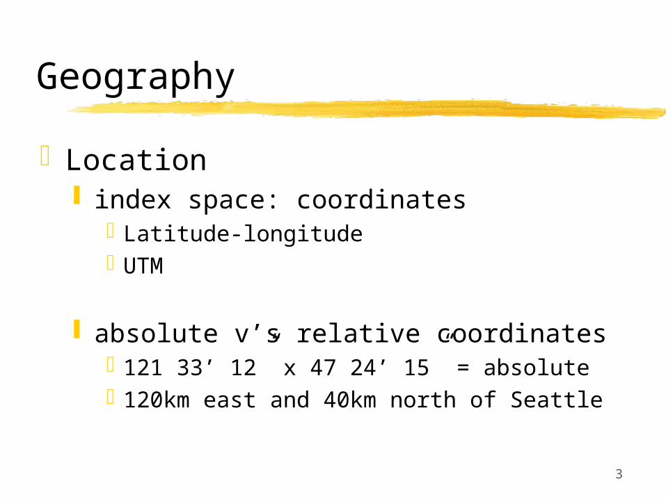
Location index space: coordinates
Latitude-longitudeUTM
absolute v’s relative coordinates121 33’ 12” x 47 24’ 15” = absolute120km east and 40km north of Seattle
4
Position v’s Location
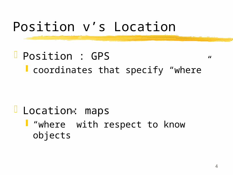
Position : GPS coordinates that specify “where”
Location: maps “where” with respect to know objects
5
Why use GPS (1)
Availability: 1995, DoD NAVSTAR, civilian use
foreseeable futureAccuracy: Factors
work with “primary” data sources High inherent accuracy (2.5m medium-
quality properly corrected receiver) Time Corrected to 1/1 billionth of a
second
6
Why use GPS (2)
Ease of use stop and read a single coordinate =
20m accuracy (+/- 5m) real-time
3-D data horizontal (x & y) and altitude (z) variances in z = horizontal * 2

7
Satellite Transmitter Specifications(1)
Radio wave transmission (~20cm)
Not good without direct view of sky (i.e. inside, underground, under canopy, precipitation
24 solar-powered radio transmitters, 3 spares
“middle altitude”, 20,200km, below geosynchronous orbit
GPS SV

8
Satellite Transmitter Specifications(2)
Neither polar nor equatorialeach execute a single 12 hour orbit4 satellites in each of 6 orbital planesspeed of 3.87 km/sec ( 8,653 mph)weigh ~ 1 ton with 27 feet of solar panelsOrbit tacks monitored by 4 base stations
Master control station in Colorado Springs
Each satellite monitored twice a day

9
Finding distance by measuring time
X
A B
u
Almanac: predicted position of satellitesConstellation: set of satellites usedDOP: Dilution of PrecisionPRN: Pseudo random noise codeElectromagnetic radiation (EM) 299,792.5 Km/sec
4:00 p.m. >> << 7/100 of a secondafter 4:00
G J K E T Y U O W V W T D H K …
G J K E T Y U O W ...
Receiver:Satellite:
10
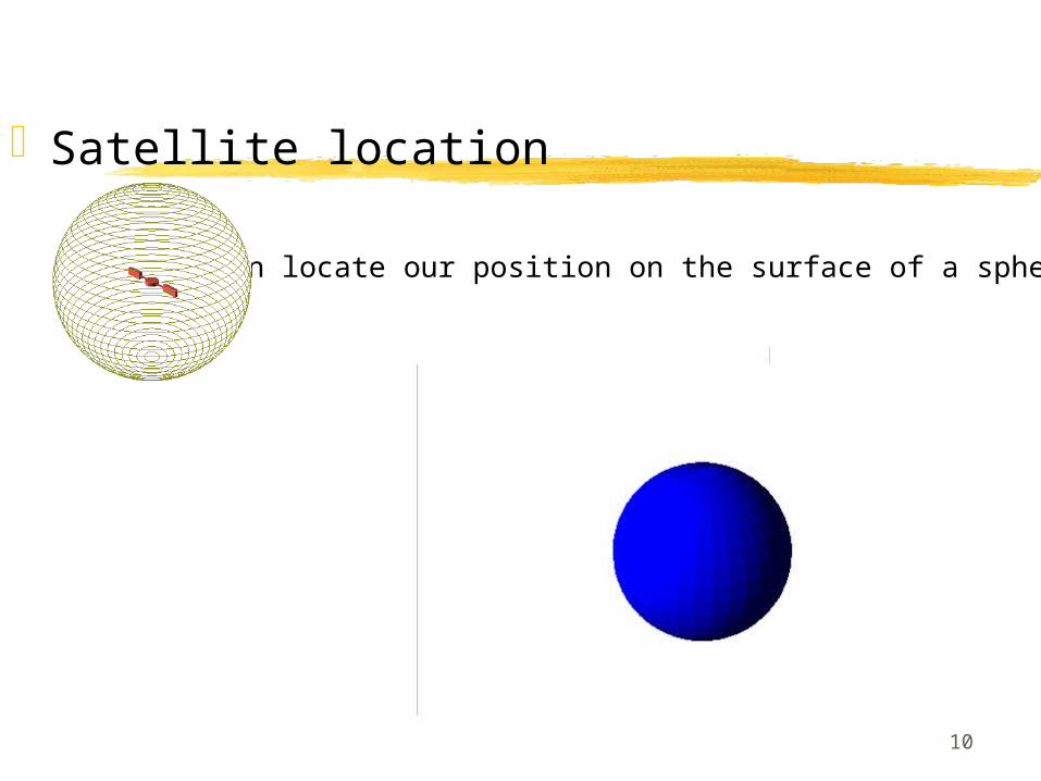
Satellite location
• Given 1 satellite … • We can locate our position on the surface of a sphere
11
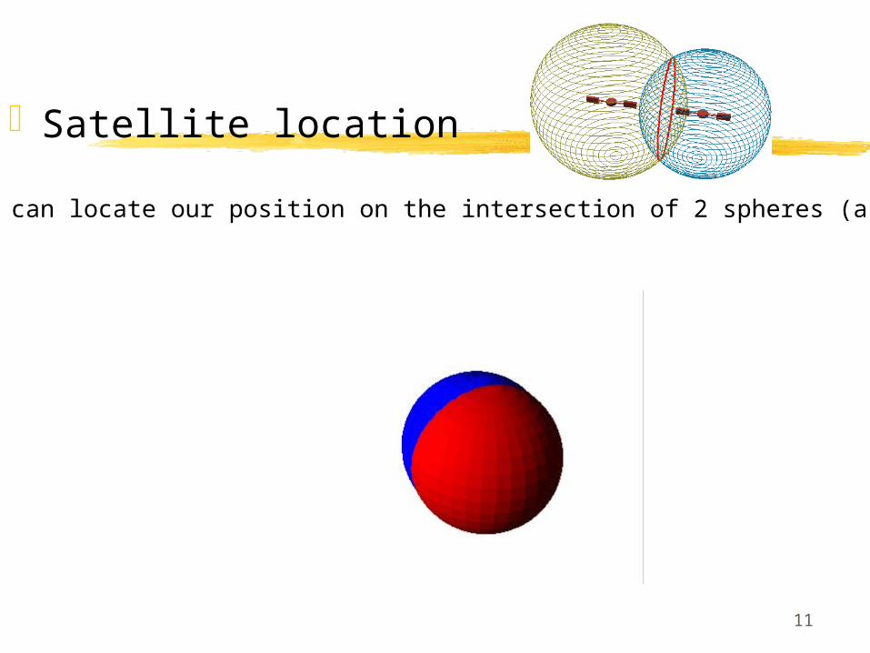
Satellite location
• Given 2 satellites … • We can locate our position on the intersection of 2 spheres (a circle)
12
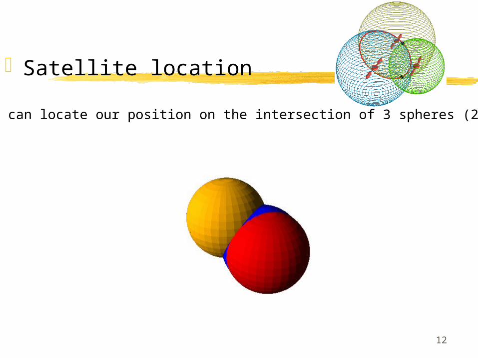
Satellite location
• Given 3 satellites … • We can locate our position on the intersection of 3 spheres (2 points)

13
Satellite location
• Given 4 satellites … • We can locate our position on the intersection of 4 spheres (1 point)

14
Satellite location
• The point can be located on the earth’s surface

15
Satellite location
• The precise location is determined

16
More on timing: Setting receiver clock
• After the correct position is determined, the receiver’s clock is adjusted
• Adding or subtracting time will make the location more or less precise
• If the receiver’s clock is ahead, the position will be over-estimatedfor each signal

17
More on timing
• If the receiver’s clock is behind, the position will be under-estimatedfor each signal
18
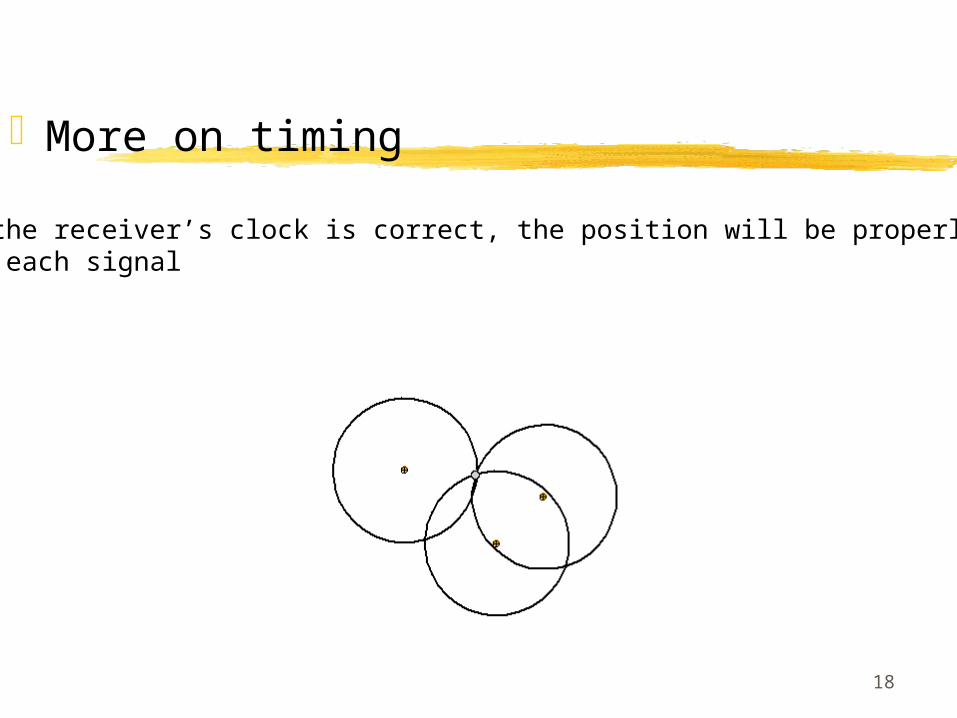
More on timing
• If the receiver’s clock is correct, the position will be properly estimatedfor each signal
19
More on timing
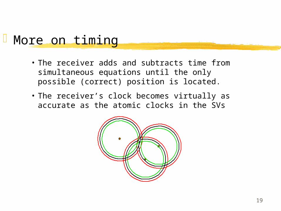
• The receiver adds and subtracts time from simultaneous equations until the only possible (correct) position is located.
• The receiver’s clock becomes virtually as accurate as the atomic clocks in the SVs

20
Sources of error: Dilution of precision (DOP)
• The best spread of satellites makes the best trilateration
• We want low DOP
• Satellites that are close to each other result in higher DOP:
• HDOP: horizontal DOP• VDOP: vertical DOP• PDOP: positional DOP (combination of HDOP & VDOP)• TDOP: time DOP• GDOP: geometric DOP (combination of PDOP & TDOP)

21
Major Factors of error
Satellite clock errors < 1 meter Ephemeris errors (satellite position) < 1
meter Receiver errors < 2 meters Ionosphere errors (upper atmos.) < 2 meters Troposphere errors (lower atmos.) < 2 meters Multipath errors (bounced signals) ??? “Selective Availability” signal transmission 0 - off
(< 33m if on)

22
Error Atmospheric
Light travels at 299,792,458 m/s only in a vacuum Ionospheric effects: ionizing radioation Tropospheric effects: water vapor Light is “bent” or reflected
Clock Receiver clock errors, mostly corrected by software in receiver Satellite clock errors Satellite time stamp errors Time stamp errors are not correctable SV timing & clocks are constantly monitored and corrected
Receiver Power interrupts On-board microprocessor failure Firmware Software Blunders (user error)

23
Sources of error: Selective availability (S/A)• Clock timing error factor introduced by the DOD
• Standard operation on the satellites.
• S/A changes the time stamp of the outgoing signals
• Calculated positions are erroneous
• SA causes locations to be in error up to 100 m
• Each satellite encrypts its own data separately
• Encryption keys shift frequently
• In the event of warfare, enemy forces cannot use the same accuracy as the US armed forces
• Military-grade have the ability to decrypt the time dithering,which lowers error to about 15 m from ~100 m uncorrected

24
Recording Data
180 fixes needed for maximum accuracy for a receiver and constellations
1 fix every 3 secondsYou’ll need ~ 9 minutes
25
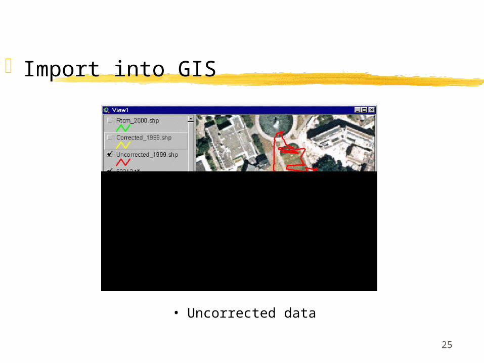
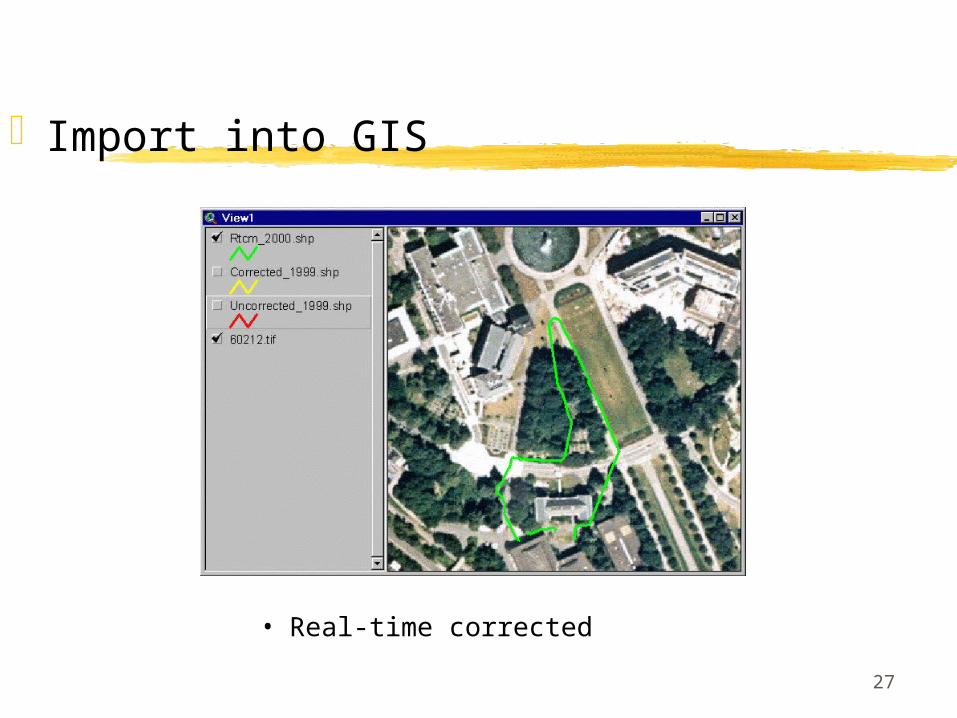
Import into GIS
• Uncorrected data

26
Import into GIS
• Differentially post-processed
27
Import into GIS
• Real-time corrected