Embed Size (px)
Citation preview
1
California’s Water
California Water Resources Using a Web-BasedGeographic Information System
September 19, 2009
2
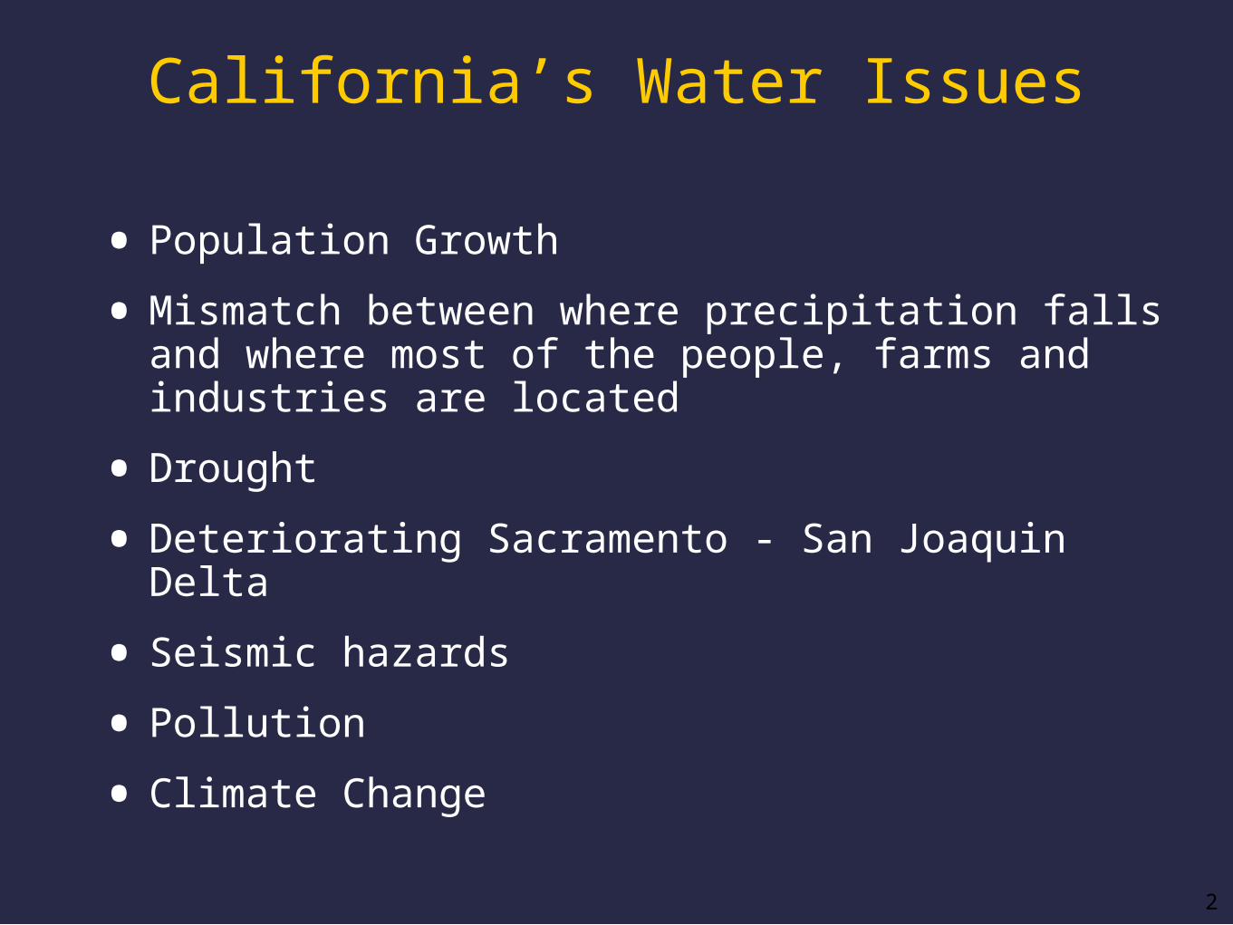
California’s Water Issues
• Population Growth
• Mismatch between where precipitation falls and where most of the people, farms and industries are located
• Drought
• Deteriorating Sacramento - San Joaquin Delta
• Seismic hazards
• Pollution
• Climate Change
3
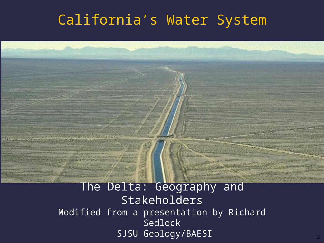
The Delta: Geography and StakeholdersModified from a presentation by Richard Sedlock
SJSU Geology/BAESI
California’s Water System

4
41
11
48
In simplified, big-picture terms, the major types of uses/users of collected precipitation in California
are:
____ %
____ %
____ %
Agriculture
Cities/industries
“Environmental” water
“Developed” water
Wild & Scenic RiversDelta outflow“unused” flow to oceandiversions to ag & cities
The California Water Map (Water Education Foundation)
take these percentageswith a grain of salt....
5
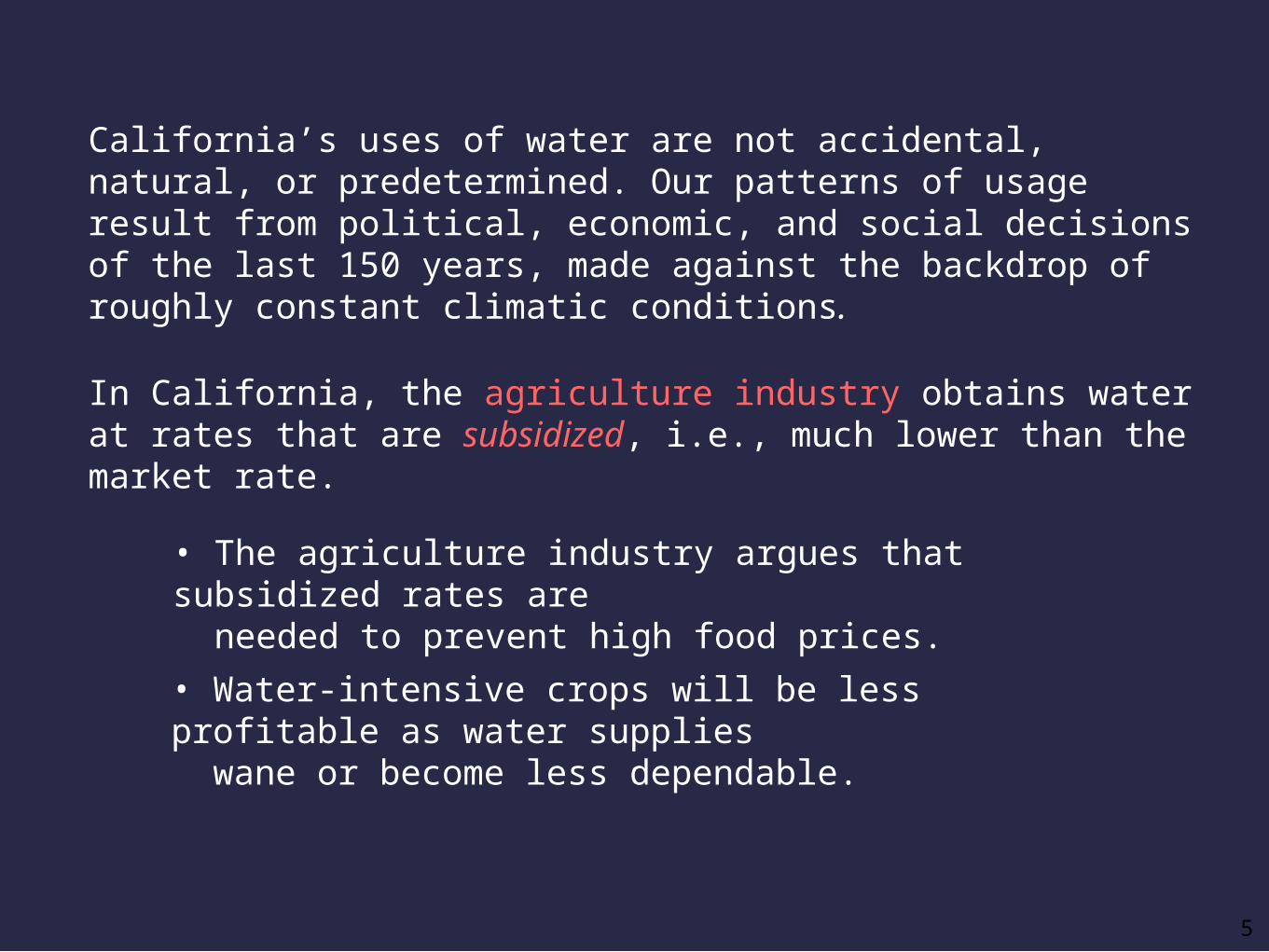
California’s uses of water are not accidental, natural, or predetermined. Our patterns of usage result from political, economic, and social decisions of the last 150 years, made against the backdrop of roughly constant climatic conditions.
• The agriculture industry argues that subsidized rates are needed to prevent high food prices.
• Water-intensive crops will be less profitable as water supplies wane or become less dependable.
In California, the agriculture industry obtains water at rates that are subsidized, i.e., much lower than the market rate.

6
The agriculture industry argues that subsidized water helps support the California economy (13% of U.S. agricultural products in 2006).
Compare the agriculture industry’s contribution to California’s Gross Domestic Product (below) with its water use.

“The Delta”
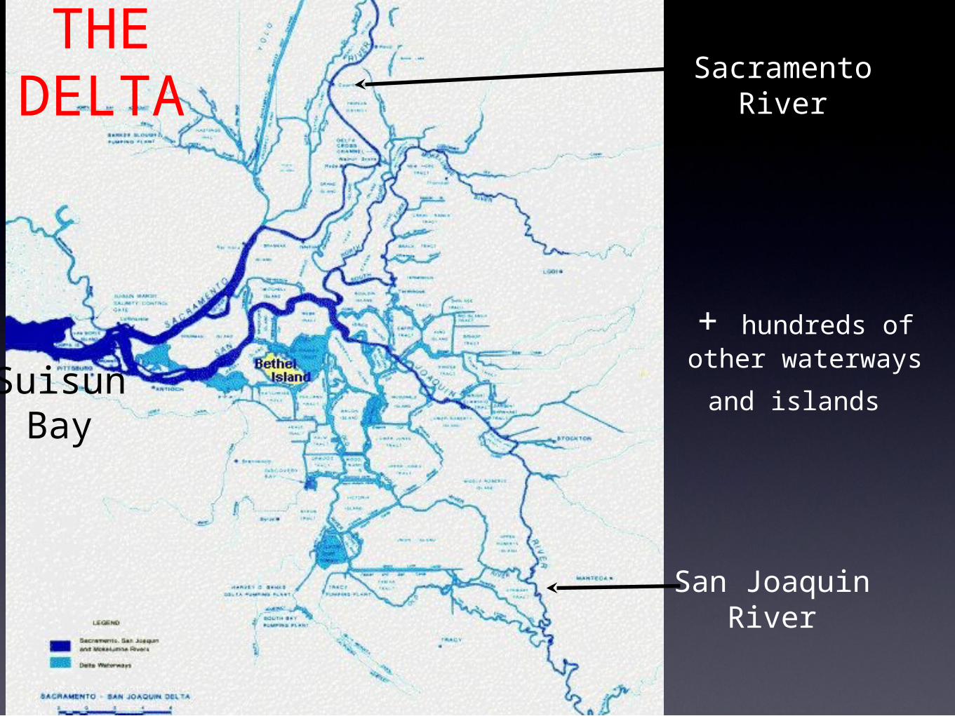
SacramentoRiver
San JoaquinRiver
SuisunBay
+ hundreds of other waterways and
islands
THE DELTA

9
Both fish are fundamental parts of the food web in the Bay-Delta estuary.
Delta smelt
Since 2003, the abundance of each is <3% of the 1993 abundance.
In May 2007, juvenile smelt populations were 8% of May 2006 populations.Causes: (1) reductions in Delta’s freshwater outflow; (2) “entrainment” due to water diversions; (3) changes in available food; (4) pesticides
Ecological conditions in the estuary have degraded badly in last 25 years.
Longfin smelt

The Delta is a key hub in the Pacific
Flyway
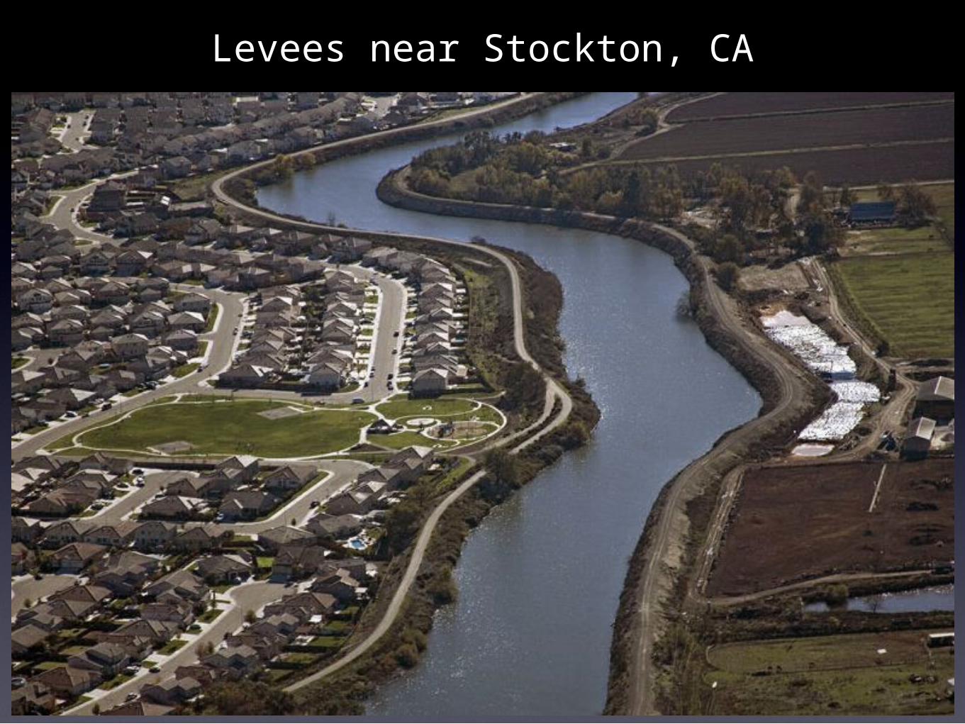
Levees near Stockton, CA
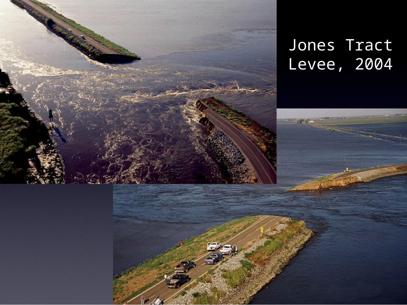
Jones TractLevee, 2004
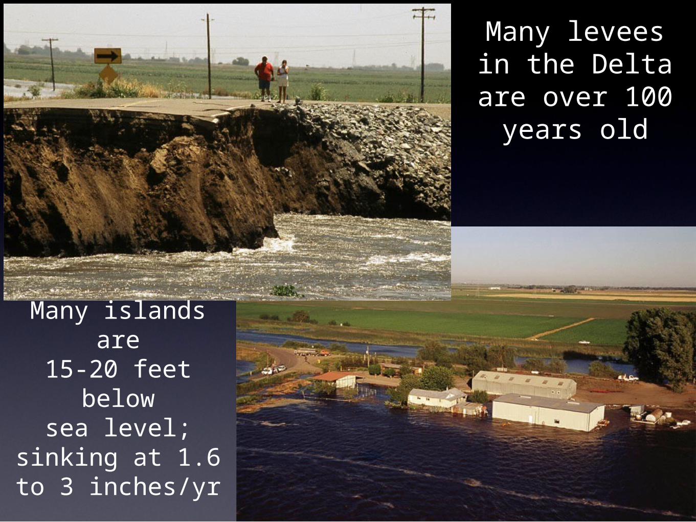
Many levees in the Delta are
over 100 years old
Many islands are15-20 feet belowsea level; sinking
at 1.6 to 3 inches/yr

Expensive repairs and proposed construction
The Peripheral Canal
The Delta
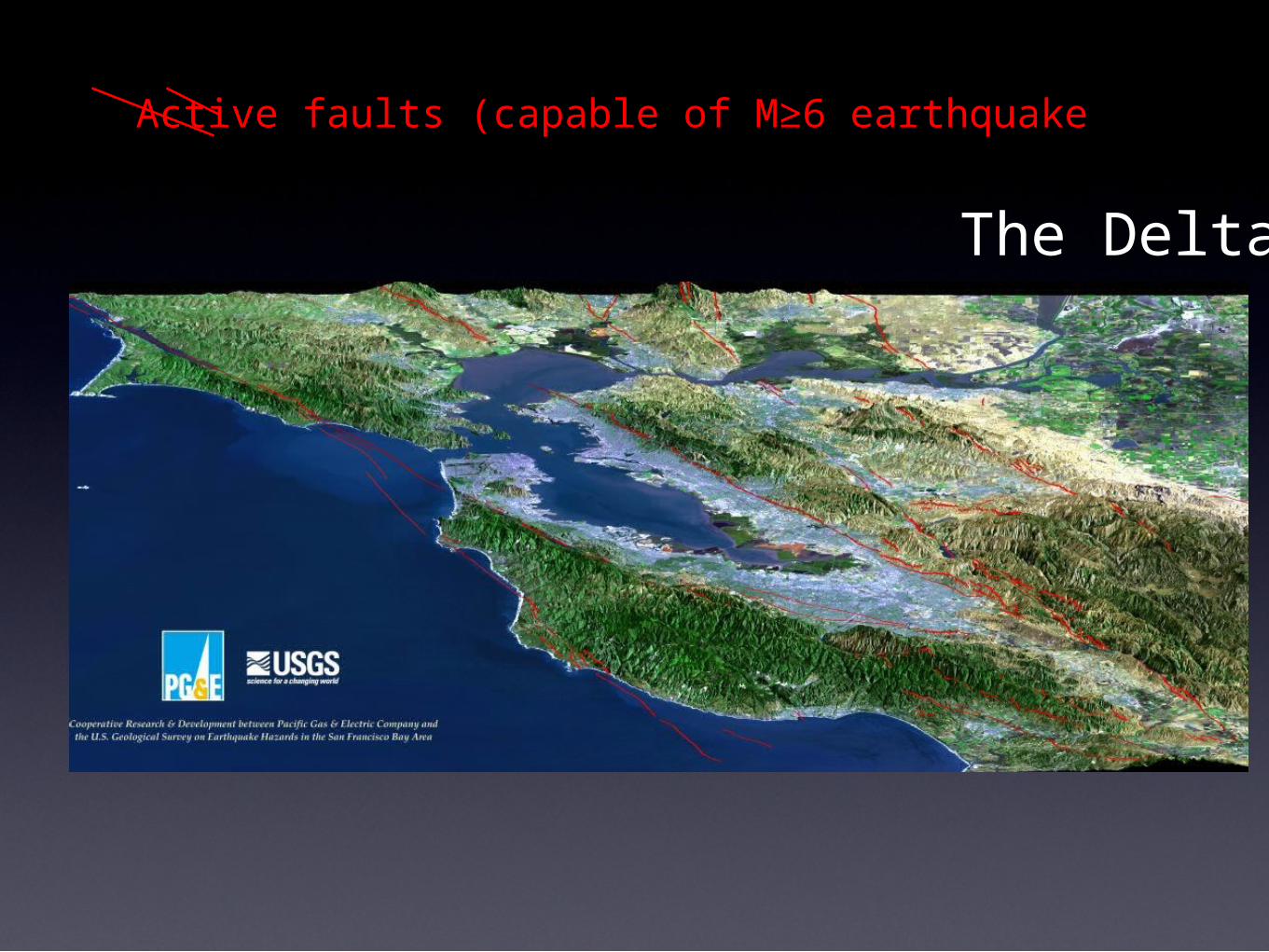
Active faults (capable of M≥6 earthquake

16
Area flooded by a1-meter rise in sea
level
17
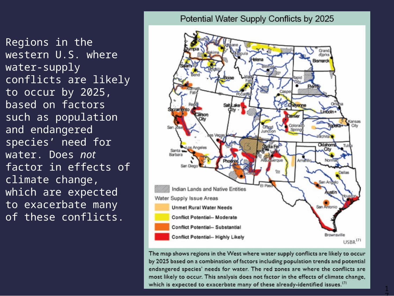
Regions in the western U.S. where water-supply conflicts are likely to occur by 2025, based on factors such as population and endangered species’ need for water. Does not factor in effects of climate change, which are expected to exacerbate many of these conflicts.

18

19
19% of California’s
energy expenditure
s move water.

20
http://www.fs.fed.us/emphasis/products/water-climate-brochure.pdf
Climate Change = Hydrologic Change
21
http://www.water.ca.gov/climatechange/docs/062807factsheet.pdf
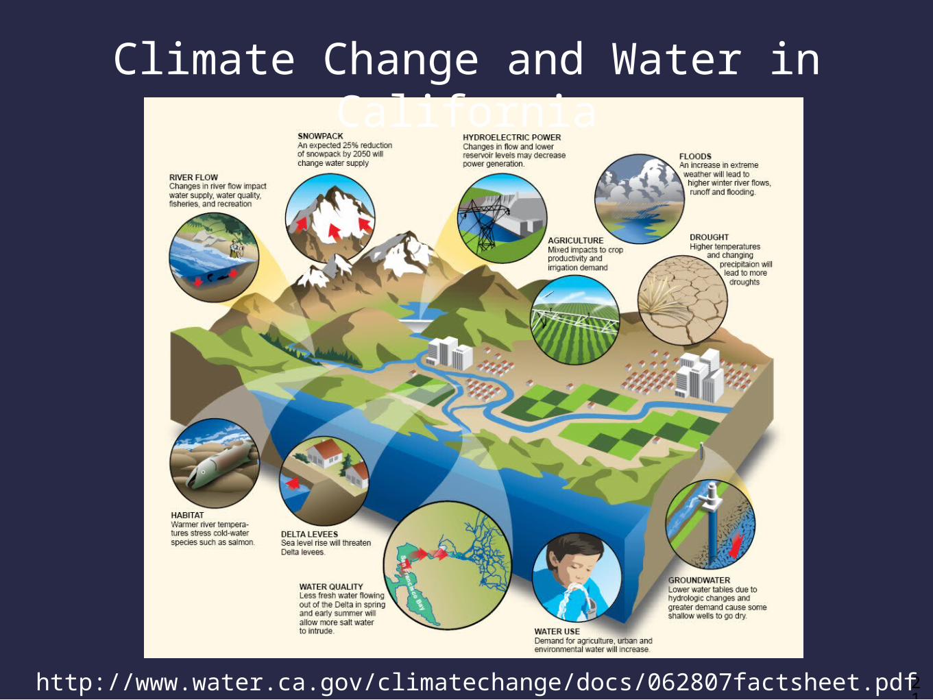
Climate Change and Water in California
22
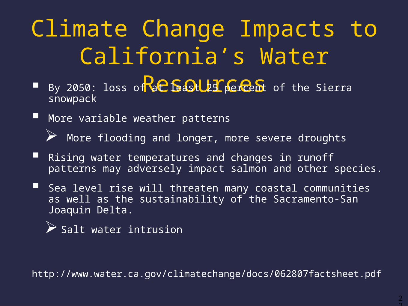
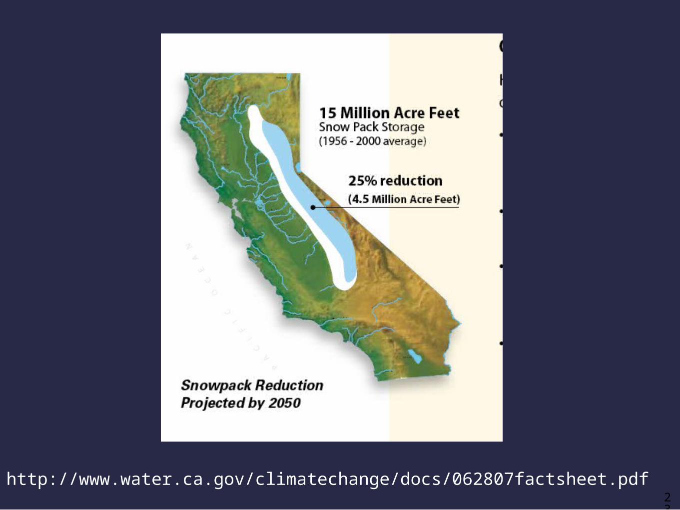
Climate Change Impacts to California’s Water Resources By 2050: loss of at least 25 percent of the Sierra snowpack
More variable weather patterns
More flooding and longer, more severe droughts
Rising water temperatures and changes in runoff patterns may adversely impact salmon and other species.
Sea level rise will threaten many coastal communities as well as the sustainability of the Sacramento-San Joaquin Delta.
Salt water intrusion
http://www.water.ca.gov/climatechange/docs/062807factsheet.pdf
23
http://www.water.ca.gov/climatechange/docs/062807factsheet.pdf
24
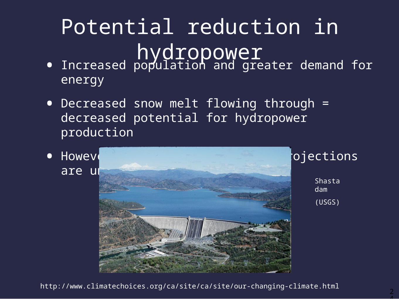
Potential reduction in hydropower
• Increased population and greater demand for energy
• Decreased snow melt flowing through = decreased potential for hydropower production
• However, future precipitation projections are uncertain.
Shasta dam
(USGS)
http://www.climatechoices.org/ca/site/ca/site/our-changing-climate.html
25
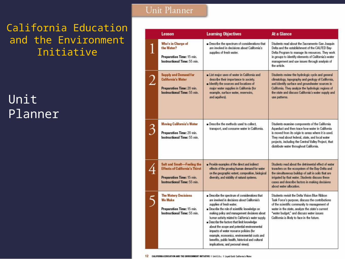
UnitPlanner
California Education and the Environment
Initiative

26
UnitPlanner,continued