Embed Size (px)
Citation preview

ET Faculteit der Economische Wetenschappen en Econometrie
05348
Serie Research Memoranda
Geographic Information Systems and Spatial Analysi
M.M. Fischer R N ij kamp
Research-Memorandum 1992-54 December 1992
vrije Universiteit amsterdam


Geographic Information Systems
and Spatial Analysis
Manfred M. Fischer Peter Nijkamp Department of Economie and Social Geography Department of Economics
Vienna University of Economics and Business Free University Amsterdam
Administration
Paper presented at the Seventh European Colloquium on Mathematical and Quantitative Geography, Stockholm,
September 1991


1. Introduction
In the past two decades a new tooi in information handling has emerged, viz. Geographic Information Systems (GIS), dealing with a special type of information, namely spatially referenced data. Spatial data sets are frequently heterogeneous and comprise often data sources with differing scales, coordinate systems, accuracies, and areal coverage. Managing and analysing spatial data cannot be accomplished appropriately by applying typical data base management systems which are designed to handle only numerical and textual information.
Since the mid 1980s, major breakthroughs in cost, speed and data-storage capacity of computer hardware in genera! and the advent of stand-alone workstations and PCs capable of running GIS applications in particular, as well as sufficiënt progress in GIS software have made GIS technology nowadays available, affordable and accessible to local, regional and federal agencies as well as to small and medium sized companies in a variety of fields, such as, for example, environmental management, economie development, marketing and public service delivery. The increasing interest in geographical information systems is also reflected in govemment funding of academie research, with the establishment of the National Center for Geographic Information and Analysis (NCGIA) in the USA (see Abler 1987) and the Regional Research Laboratory in the framework of the Economie and Social Research Council (ESRC - RRL) in the UK (see Masser and Blackmore 1988), as well as in the establishment of large scale professional and academie conferences dedicated to GIS (among them the IGIS Symposium in 1987, the GIS/LIS Conferences which started in 1988 and the EGIS Conferences which started in 1990). Every geography department with some degree of self esteem has now its own GIS experts; every national physical planning agency is establishing a GIS, and even middle and large sized towns use increasingly GIS for urban planning purposes (van Teefelen 1991).
Although at present GISs have reached a certain stage of maturity, current systems have realised only a small portion of their potential up to now. Despite widespread recognition that spatial analysis is central to the purpose of GISs, the lack of integration of spatial statistical procedures and spatial models is perceived as a major shortcoming (see Goodchild 1991, Clarke 1990, Openshaw 1990a, Birkin et al. 1987).
1
A central argument of this paper is that current GISs are failing to fulfil their great potential. The major research efforts of the GIS community centre around technological issues related to data storage, retrieval and display, and are more market-driven and applied than basic research-oriented. This is clearly reflected in the origins of the field of GISs in defence and remote sensing industries (Clarke 1990). It is argued here that it is necessary to increase both the analytical and modeling capabilities and the level of intelligence of GISs, so that decision-makers in the public and private sphere can more appropriately explore the possible effects of their decisions in broader decision-making environments.
2. Spatial Data and Spatial Database Design
The ability of GISs to store, handie and analyse spatial data is usually seen as the characteristic which distinguishes geographic information systems from information systems developed to serve the needs for business data processing as well as from computer aided design (CAD) systems or other systems whose primary objective is map production.
Spatial data sets provide two types of information:
• data describing the locational positions of objects in spatial or space-time systems (so-called positional data or spatial attributes eventually incorporated in topological systems or relationships), and
• data describing non-spatial attributes of the objects recorded (so-called attribute or thematic data).
The spatial refencing can take several forms. The reference may locate a single data point to an exact location in a spatial system (e.g. the position of a house). It can be a set of references locating a more complex entity in space, e.g. the route of a road, or it can be a reference to an area (e.g. an administrative area). The primitive elements of spatial data are referred to as objects. Point, line and area are primitives. The elements of the object classes are characterised by attributes (non-spatial information). Object pairs (dyads of objects) combine any types and are especially important in spatial analysis. In this paper the term GIS is used as a generic term for the whole field of
2
spatially referenced data systems, including land use information systems (LIS).
To cope with the above mentioned features of spatial data, the database management system (DBMS) used in a GIS may include thus types of measurement of data, viz. numerical data and non-numerical data, as well as regional and non-regional data. A DBMS should namely fulfil certain practical requirements (see Hadzilacos and Tryfona 1991, Oosterom and Vijlbrief 1991), especially the following ones which are relevant for the user:
• to store spatial attributes (locational data), specify their types (point, line, area or combination) and coordinate systems,
• to link layers to spatial attributes and specify the mam layer defining attribute along with lts range of values,
• to store non-spatial attributes and relate them to spatial attributes, • to represent complex objects (i.e. objects characterised by spatial and non-
spatial attributes from several layers), • to enable the exchange of complete geographic data sets, • to support or to be extentable to support both raster and vector data, • to specify the topological relationships between objects, • to support spatial analysis operators, • to provide spatial index structures for handling point data in any dimension,
polyline and polygone data structure, and • to allow the implementation of an advanced graphic user-interface.
There are different ways in which spatial data are stored for data processing. These may vary considerably from one GIS to another and may be quite significant in terms of specific technical considerations. A general way is to organize geographic data as a hierarchy of different components: data layers (also termed overlays) representing different themes, resolutions, orientations, zones, attribute values, locations and coordinates (see Tomlin 1990). The specifics relating to storage structure, however, do not affect the general considerations in this paper.
3
3. Current Geographical Information Systems
A geographical information system may be defined as a computer-based information system which attempts to capture, store, manipulate, analyse and display spatially referenced and associated tabular attribute data, for solving complex research, planning and management problems. The system may be viewed to embody:
• a database of spatially referenced data consisting of locational and associated tabular attribute data,
• appropriate software components encompassing procedures for the interrelated transactions from input via storage and retrieval, and the adhering manipulation and spatial analysis facilities to output (including specialised algorithms for spatial analysis and specialised computer languages for making spatial queries), and
• associated hardware components including high-resolution graphic displays, large-capacity electronic storage devices which are organized and interfaced in an efficiënt and effective manner to allow rapid data storage, retrieval and management capabilities and facilitate the analysis.
Efficiency in this context means that the system uses the minimum number of information resources to achieve the output level the system's users require: effectiveness means that the system performs the intended function and that the users get information needed in the right form and in a timely fashion.
Important fields of current GIS applications are natural resource (agricultural, forestry) management, land use planning, public health, environmental assessment, environmental protection and economie development, urban and regional planning, public Utilities planning and management (telephone, water, gas and electrical Utilities), transportation planning, facility siting, distribution planning and marketing analysis at different spatial scales (see Harts et al. 1990a, b, 1991a, b, Tomlinson 1987). Each field is supported by specific disciplines. Almost any discipline using information with a spatial component is a potential candidate for GIS applications. Applications in the private sector (geo-marketing and locational analysis) tend to increase in importance.
4

The function of an information system is to assist a user in solving more or less complex research, planning and management problems and, thus to improve a user's ability to evaluate policy issues, compare policy alternatives and to facilitate decision making. Data processing in an information system may be viewed as a number of interrelated transactions from input via storage and retrieval, and the adhering manipulation and analysis facilities to output. A GIS may be considered as a subsystem of an information system which itself has five major component subsystems (see Borrough 1986, Smith et al. 1987a, Guptill 1988, Linden 1990, Star and Estes 1990) including:
• data input processing, • data storage, retrieval and database management, • data manipulation and analysis, • display and product generation, and • a user interface.
These main components which are summarized in Figure 1 will be described in some more detail in the sequel. It has to be noted that - depending on the application field, the level of detail chosen and/or the products required -different application-specific GISs may be specified. Then issues like facility and information management, quality control and user requirements have to be taken into consideration, too.
Data input covers all aspects of transforming spatial and non-spatial (textual or feature attribute) information from both printing and digital files into a GIS data base. To capture spatially referenced data effectively, a geographic information system should be able to provide alternative methods of data entry. These usually include digitising (both manual and automatic), satellite images, scanning and keyboard entry. The data may come from many sources such as existing analogue maps, air photography, remote sensing (data from satellites and from sensors from other platforms), existing digital data sets (for example, from other geographical information systems), (field) surveys and other information systems. Often the data require operations of manual or automated processing prior to encoding, including format conversion, data reduction and generalisation of data, error detection and editing, merging of points into lines, edge matching, rectification and registration, interpolation (see the component of data manipulation).
5

Figure 1: Component Subsystems of a Geographical Information Syste
G e o g r a p h i c a l I n f o r m a t i o n S y s t e m
Data Input
Processing
Data Storage, Retrieval and
Database Management
Data Manipulation
and Analysis
n T Other
Geographical Information Systems
User Interface
(editirrg, querles, answer, leaming,
tracing)
Ëxternal Statistical and Model Packages
Display and
Product Generato
Database management functions control the creation of, and access to, the database itself. For the storage, integration and manipuiation of large volumes of different data types at a variety of spatial scales and levels of resolution, a GIS has to provide the facilities available within a database management system (DBMS). Most commercial GISs (such as, for example, ARC/INFO) have a dual architecture. The non-spatial attribute information is stored in a relational database management system and the spatial information in a separate subsystem which enables to deal with spatial data and spatial queries. Such an architecture, however, reduces the performance because objects have to be retrieved and compiled from components stored in the two subsystems (Oosterom and Vijlbrief 1991). This problem is not easy to solve. Spatial data processing is performed with vector, raster or a combination of these geometrie data formats (see Spencer and Menard 1989). As mentioned above, the vector format has three subtypes of geometrie data formats: point, polyline and polygon. The vector representation allows more object-oriented manipulations, though the raster data structure also has advantages, especially in terms of efficiency and data preparation. Rapid, precise and accurate data integration is a key issue to successfully merge raster and vector data structures within GIS.
The most important distinguishing feature which a GIS has over a mere computer mapping system is the ability to manipulate and analyse spatial data. The manipuiation and analysis procedures which are usually integrated in a GIS are often limited, however, to simple spatial operations such as:
• geometrie calculation operators such as distance, length, perimeter, area, closest intersection and union,
• topological operators such as neighbourhood, next link in a polyline network, left and right polygons of a polyline, start and end nodes of polylines,
• spatial comparison operators such as intersects, inside, larger than, outside, neighbourof, etc.,
• multilayer spatial overlay involving the integration of nodal, linear and polygone layers, and to
• restricted forms of network analysis.
7
Generally, GIS software is also poor for carrying out Standard non-spatial analyses. Only SPANS (Tydac, Canada), a new generation of GIS software, offers a rudimentary framework which allows a range of (spatial) analysis functions, including the possibility to analyse origin-destination relationships to be built in (Openshaw 1990b). An example is Transcad, a special GIS tooi for transportation models.
Product generation is the phase where final products from the geographical information system are created. The displays and products may take various forms such as statistical reports, maps and graphics of various kinds, depending upon the characteristics depending of the media chosen. These include video sereens for an animated time-sequence of displays similar to a movie, laser printers, ink jet and electrostatie plotters, colour film recorders, micro film devices and photographic media.
The final module of a geographic information system (see Figure 1) consists of software capabilities which simplify and organize the interaction between the user and the GIS software via, for example, menu-driven command systems.
4. The Need for More Sophisticated Spatial Analytic Tools
Most current geographic information systems are strong in the domains of data storage and retrieval, and graphic display. Their capabilities for more sophisticated forms of spatial analysis and decision making, however, are rather limited. This lack of analytical and modelling functionality is widely recognized as a major deficiency (see, for example, Goodchild 1991, Clarke 1990, Openshaw 1990a,b). As mentioned above, the analytic possibilities basically and usually refer to polygon overlay with logical operations, buffering in vector maps, interpolations, zoning and simplified network analysis. GIS capabilities for location-allocation problems, optimal land use allocation, and management routing vehicles for delivery of goods and services, for example, are currently limited to simplistic types of analysis.
Spatial analysis - which in its widest sense can be considered as analysing spatial- and non-spatial-information of phenomena in spatial or space-time systems as an aid of their description, explanation and prediction - offers a
8

wide range of methodologies and procedures relevant to GIS research. Spatial analysis is more general than statistical analysis of non-spatial information because it requrres access not only to attributes (non-spatial information), but also to locational (and topological) information. The poor analytical and modelling capabilities of current geographical information systems, however, are paralleled by a similar lack of special statistical software packages for spatial data. One of the few exceptions is SpacStat, a software which has been developed by Luc Anselin (Department of Geography, University of Califomia at Santa Barbara) and built on top of GAUSS.
There is an enormous range of basic spatial analysis procedures and techniques available which might be used to increase the analytic and modelling functionality of geographic information systems. Based on Goodchild's (1987) view seven fundamental and generic types of spatial analysis operations may be distinguished from a GIS-oriented perspective:
• operations which require access only to attributes of one class of objects (for example, classification procedures for an object class of areas; such operations do not belong to spatial procedures in a strict sense, but are important in spatial analysis too),
• operations which require access only to locational information of one class of objects (for example, point pattern analysis),
• operations which require access to both attributes and locational information of one class of objects (for example, homogenous regionalisation procedures for an object class of areas),
• operations which create object-pairs from one or more classes of objects (for example, pairing of points to generate a line object class),
• operations which analyse attributes of object-pairs (for example, spatial autocorrelation indices, nearest neighbour analysis),
• operations which require access to attributes and locational information for more than one class of objects or object-pairs (for example, spatial interaction models, shortest path procedures, optimum tour routing),
9
• operations which create a new class from one or more existing classes of objects (for example, Thiessen polygons from point objects, polygon overlay).
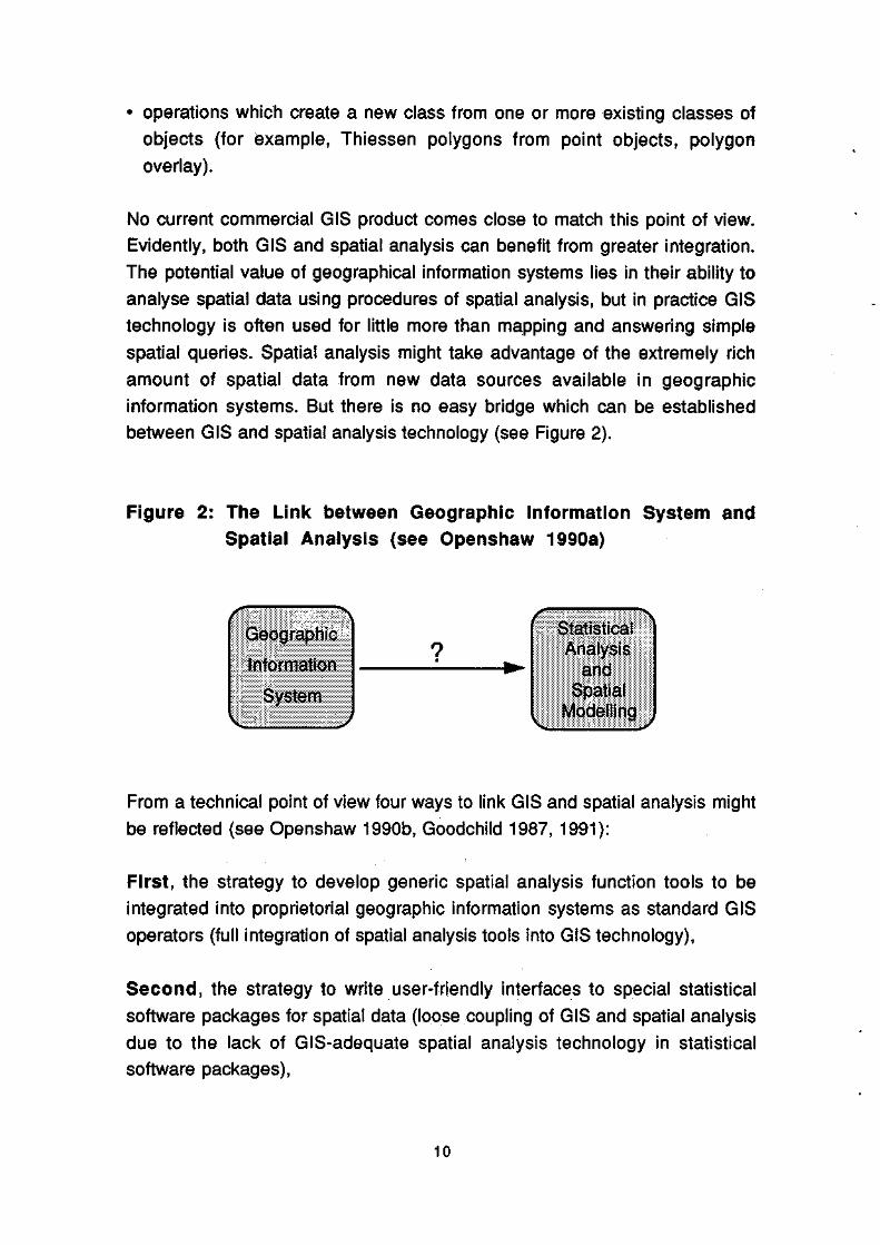
No current commercial GIS product comes close to match this point of view. Evidently, both GIS and spatiai analysis can benefit from greater integration. The potential value of geographical information systems lies in their ability to analyse spatiai data using procedures of spatiai analysis, but in practice GIS technology is often used for little more than mapping and answering simple spatiai queries. Spatiai analysis might take advantage of the extremely rich amount of spatiai data from new data sources available in geographic information systems. But there is no easy bridge which can be established between GIS and spatiai analysis technology (see Figure 2).
Figure 2: The Link between Geographic information System and Spatiai Analysis (see Openshaw 1990a)
Geographic
Information
System
Statistical Analysis
and Spatiai
Modelling
From a technical point of view four ways to link GIS and spatiai analysis might be reflected (see Openshaw 1990b, Goodchild 1987, 1991):
First, the strategy to develop generic spatiai analysis function tools to be integrated into proprietorial geographic information systems as Standard GIS operators (full integration of spatiai analysis tools into GIS technology),
Second, the strategy to write user-friendly interfaces to special statistical software packages for spatiai data (loose coupling of GIS and spatiai analysis due to the lack of GIS-adequate spatiai analysis technology in statistical software packages),
10

Third, the strategy to develop a basic spatial tooi box for inclusion in Standard statistical packages (SPSS-X, SAS, GLIM, GAUSS or RATS) to provide a set of independent portable spatial analysis macros which can co-exist with a targeted GIS (close coupling of GIS and spatial analysis),
Fourth, the strategy to embed GIS procedures (a strategy inverse to the first one) within spatial analysis or modelling frameworks which attempt to exploit the unique capabilities of GIS technology to devise new and more relevant analytical procedures (full integration of GIS procedures into spatial analysis and modelling frameworks).
The first strategy of full integration of spatial analysis tools into GIS revolves around deciding which spatial analysis operations should be included and assumes functions which are on a sufficiënt scale general and generic to justify the efforts (Openshaw 1990a). Given the nature of GIS software industry on the one side and the tremendous efforts needed on the other, this strategy seems uniikely to be realised in near future. The second strategy is relatively simple because the availability of export facilities in geographic information systems makes data transfer easy, but f aces the lack of GIS-relevant Standard spatial statistical packages. Concerning the third - the most likely - strategy the unresolved problem refers to the nature of the user-friendly interface for the linkage. Possibilities range from source code through subroutine libraries, high-level languages, commands, menus to virtual reality. The final strategy mentioned above is quite different to the other ones and inverse to the strategy to embed spatial analytic functions into GIS. Here GIS technology is embedded within spatial analysis and modelling frameworks via utilising GIS databases and access at the subroutine level.
The strategy to export spatial data from GIS to Standard statistical software packages which is currently being widely used has to be judged to be a less adequate solution, due to two major reasons. First, none of the Standard software packages (SPSS-X, SAS, GLIM, GAUSS, RATS) has a spatial statistics module which would enable to treat spatial data approximately (problem of spatial autocorrelation). The specific nature of spatial data requires more or less specific spatial analytic procedures. Second and closely related, these packages are unable to preserve the spatial structure in such a way that output from such software systems can be imported back adequately into a geographic information system.
11

Finally, attention has to be paid to the issue to identify GIS-relevant spatial analysis functions. The procedures considered to be strong candidates for integ ratio n should fuif NI certain requirements, at least enable to handle large data sets without major difficulty and to take the specific nature of spatial data explicitly into account.
The following procedures may be considered as a non-exhaustive set of examples of GIS-relevant spatial analytic procedures and techniques (see also Openshaw 1990b):
• exploratory point pattern and area data analysis procedures for identifying spatial pattems and relationships,
• regionalisation (i.e. classification with contiguity constraint) to deal with the zone design and spatial representation issues, and aggregation procedures suitable for use with large spatial data sets,
• spatial response models of various kinds including regression procedures coupled with the Moran coëfficiënt function and its Standard error to test for spatial autocorrelation in residuals,
• space-time statistical models for acquisition, storage, analysis and forecasting,
• tools for handling origin-destination relationships in spatial and space-time systems,
• location - allocation models, • optimum route procedures, • spatial search procedures, • spatial data interpolation procedures (co-kriging interpolation), • Thiessen models in which point information is modeled into a series of
polygon definitions, using nearest neighbour concepts, • Gaussian diffusion models for a single point and for multiple points, •techniques for monitoring the propagation of errors (Monte Carlo
Simulation), • fuzzy set based analytic procedures to deal with imprecision in
measurements, inconsistency of data and imprecision in concept, • artificial based spatial analysis models.
No current commercial geographical information system comes close to provide these spatial procedures. Advanced spatial analysis modules may be
12
considered to be critical elements for the next generation of more intelligent geographic information systems based on principles of artificial intelligence.
5. Towards Knowledge-Based Geographic Information Systems
Since the early 1980s decision support systems have become increasingly important in business decision making. Expert systems may be viewed as systems which achieve expert-level performance, utilising artificial intelligence (Al) concepts and programming techniques such as connectionist models (for example, the concept of neural networks), symbolic representation, inference and heuristic search. Spatial expert systems (i.e. expert systems with a spatial domain) provide a framework to incorporate analytical and modelling capabilities into geographical information systems and may support spatial analysis and decision making.
Knowledge-based systems emphasize domain-specific knowledge, rather than more general problem solving strategies. Since the knowledge of experts tends to be domain-specific rather than general, expert systems are often termed knowledge-based (Benfer et al. 1991). Four kinds of software tools are available for developing expert systems: conventional languages such a C, Al languages such as LISP and Prolog, expert system shells (for example NEXPERT Object, and Al development environments such as KEE (Knowledge Engineering Environment, Intillcorp). Expert system shells and Al development environments greatly reduce the cost of developing expert systems.
Spatial expert systems have evolved in a manner which parallels that of expert systems in the business data procesing community (see, for example, Kim et al. 1990). A fully fledged spatial expert system may be considered to have four essential components (see Benfer et al. 1991, Forsyth 1989b, etc):
• a knowledge base consisting of spatial and non-spatial knowledge about some substantive domain,
• an inference engine consisting of a set of general (search and) inference procedures to reason from knowledge in the knowledge base and to infer additional conclusions,
13
• a knowledge-acquisition module to assist in expressing knowledge in a form suitable for inclusion in the knowledge base,
• an user interface which assists the user to consult the spatial expert system.
The knowledge base is elicitated from a domain expert and reformulated as a collection of rules, a network of facts or a frame-based structure. The relative maturity of expert systems is reflected in the variety of alternative, and sometimes complementary, knowledge representation techniques. The mainstream approach to knowledge representation has been inspired by the insights of mathematica! logic and is symbolic in nature. The production rules format, simple condition-conclusion or condition-action statements (IF condition THEN action, or IF condition THEN action 1 ELSE action 2), is the most widely used way of symbolic encoding of knowledge. More complex representations are mostly frame or object-ohented systems. The knowledge-based GIS, termed KBGIS-II and developed by Smith et al. 1987, may serve as an example of an object-oriented system. In contrast to a symbolic representation of knowledge the connectionist architectures, strongly inspired by the concept of neural networks, are more commited to the principle of inter-connectivity (Shadbolt 1989). One major difference between symbolic and connectionist types of knowledge refers to whether knowledge has to be explicitly or implicitly represented (see Forsyth 1989c).
In general, the knowledge in a knowledge base may consist of three types:
• Declarative or factual knowledge (spatial object knowledge and useful spatial and non-spatial feature information about the objects),
• Procedural or strategie knowledge (the core of a knowledge base) including concepts and various relationships (definitional, taxonomie, associational and empirical relationships) among them,
• Contrei knowledge (usually based on rules of thumb) for a variety of control strategies which allow to rule out obviously wrong solutions and to focus on the mere promising ones.
14

An inference engine consists of search and reasoning procedures which enable an expert system to arrive at conclusions which are to be plausible rather than valid in the strict lógical sense. The choice of an inference strategy and the choice of knowledge representation are inextricably bound together. In the predominant rule-based systems it is common practice to employ all or some of the following reasoning strategies: backward chaining, forward chaining and/or Bayesian inference (see Graham 1989). Many expert systems operate in task domains where the available information is inherently imprecise. Rules derived from experts may be inexact, measurements unreliable etc. This tends to be true especially in complex spatial task domains. Fuzzy-set logic which extends the operations of Boolean algebra to cover fractional truth-values intermediate between 0 (false) and 1 (true) may be considered to provide a promising logica! approach of reasoning in the context of fuzzy information making spatial expert systems more powerful.
The knowledge acquisition module serves to interact with the domain expert to acquire information relevant to both the knowledge domain and judgmental behaviour of the expert. The conventional approach in knowledge acquisition is based on dialogue. This approach is widely viewed as a major bottleneck in developing expert systems because of three reasons: deliberate resistance, inarticulacy, and cognitive mismatch (Forsyth 1989b). Consequently, major recent research efforts in the field of Al focus on replacing the conventional approach in knowledge acquisition by procedures of machine learning.
The user interface is a general module which controls the l-O-behaviour of the system and facilitates user interaction with the system. The interface fulfills basically two functions: first, to provide the user with the information required to solve his problem, to display the conclusions and explain its reasoning; and second, to translate queries from the user into specific goals for the expert system's engine machine.
The most active areas of expert system research are chemestry, computer systems, electronics and engineering. Up to now, there are only few applications in the field of spatial analysis (see Smith et al. 1987, Kim et al. 1990, Ortolano and Perman 1990). But it may be safely predicted that in the near future expert systems will increasingly be developed. Suitable areas are the design of cartographic displays of various kinds, land use and facility location planning (especially retail site location, social services location,
15
marketing), emergency management, transportation planning (vehicle navigation and routing systems), support of spatial modelling by providing assistance in choosing, calibrating and interpreting the output of complex models in urban and regionai planning.
Although expert systems were initially viewed as an entirely new form of software for standalone applications, attention is increasingly becoming focused on forming links between expert systems and the conventional problems of data processing, including the interface between expert systems and geographical information systems (see, for example, Wright 1990, Heikkila et al. 1990). The integration of (spatial) expert systems into a GIS environment leads to - what may be called - a knowledge-based geographic information system and would greatly enhance the power and usefulness of geographical information systems for spatial decision making. More precisely defined, a kowledge-based GIS may be considered as the embodiment of a knowledge-based component in such a way that the GIS can offer intelligent advice or take an intelligent decision about a geoprocessing function. The style architecture to obtain these characteristics may be rule-based programming or object-oriented. For solving complex spatial problems with fuzzy information, the overall system should have several fuzzy expert systems on substantive domains, a GIS including a fuzzy information retrieval module, and a model base including fuzzy set based spatial and evaluation models as integral parts. Figure 3 depicts the system architecture of a knowledge-based geographic information system and shows the linkage of an expert system with a model-based geographic information system.
A knowledge-based GIS would be able to link spatial analysis and GIS intelligently for specific domains closer and would assist the user to choose the best set of spatial analysis procedures and tools to solve his problem within the constraints of data, data quality, cost and accuracy. It would also report to the user where the major sources of error come from and would offer a set of options with which better results might be obtained. Consequently, knowledge-based geographical information systems may be considered as a key research area to improve the analytical and modelling capacities of GIS as well as the quality of applied GIS research.
16

Figure 3: System Architecture of a Knowledge-Based Geographic Information System
Support Elements
Domain Expert
Knowledge Acquisitlon Interface
Core System of e (Fuzzy) Expert System
c UtM*ÉM*MÉM
User I n te rf ace
Knowledge Base
Declarative Knowledge j
< ' *>
Procedural Knowledge
Controt Knowledge
Data Structure Interface
llllGeogra^liclll ||:;||n|orMl|i:öI:i:ill̂ ||;:l|||||$t|||llll||; l|{irt|iillïbö:iiilll|i|l:i information retrieval
)
Inference Engine
Jnference System
Statistical ;::Én;a1pèi|;i:
i|pdS!lRp tÊÊèÈÈê.

6. Summary and Outlook
There is a wide agreement in both the GIS community and the modelling community that the future success of GIS technology will depend to a large extent on incorporating more powerful analytical and modelling capabilities, on increasing lts capacity to handle large, spatially indexed data bases, and on increasing its level of intelligence (NCGIA 1988). The theme of GIS and spatial analysis is a major concern of research efforts, especially untertaken by the US National Center for Geographical Information and Analysis and by the ESRC's Regional Research Laboratory in the UK (see Masser 1988). Nevertheless, progress to link spatial analytical tools with GIS is rather slow. An effective form of tight coupling in which data can be passed between a geographical information system and a spatial analysis module without loss of higher structure is still missing (Goodchild 1991).
Geographic information systems are often either explicitly or at least implicitly designed to assist decision makers. The capabilities of current geographic information systems for specialist forms of spatial search and decision making are limited. A successful GIS has to attempt to support the analytical and statistical modelling required by decision-makers in urban and regional planning. Scholars around the world are currently looking at fields of artificial intelligence (especially expert systems) to make geographic information systems and spatial analysis more efficiënt and more friendly to users with limited computer analytical literacy. From the viewpoint of the next generation of more intelligent geographic information systems spatial model tools and current GIS technology may be considered as intermediate tools for developing knowledge-based information systems supporting activities in urban, regional and environmental planning and decision-making.
Acknowledgement: Partial support for this research from the Wirtschaftsuniversitatspreis 1991 der Wiener Handelskammer is gratefully acknowledged.
18
References
Abler, R. F. (1987): The National Science Foundation National Center for Geographic Information and Analysis, International Journal of Geographic Information Systems, vol. 1, pp. 303-326.
Batty, M. (1988): Informative planning: The intelligent use of information systems in the policy-making process. Technical Reports in Geo-Information Systems, Computing and Cartography, No. 10.
Batty, M. and Yeh, A.G.O. (1990): Applications of geographic information systems in urban and regional planning, Environment and Planning B, vol. 17, pp. 369-374.
Benfer, R.A., Brent, E.E. Jr. and Furbee, L. (1991): Expert Systems. Sage University Paper 77.
Birkin, M., Clarke, G.P., Clarke, M. and Wilson, A.G. (1987): Geographical information systems and model-based locational analysis: Ships in the night or the beginning of a relationship? Working Paper 498, School of Geography, University of Leeds.
Burrough, P.A. (1986): Principles of Geographical Information Systems for Land Resources Assessment, Monographs on Soil and Resources Survey 12. Oxford: Clarendon Press.
Burrough, P.A. (1991): The development of intelligent geographical information systems, in Harts, J., Ottens, H.F.L. and Scholten, H.J. (eds.): EGIS "91 . Proceedings, Second European Conference on Geographical Information Systems, Volume 1, pp. 165-174. Utrecht: EGIS Foundation.
Chorley, R. (1988): Some reflections on the handling of geographical information, International Journal of Geographical Information Systems, vol. 2, pp. 3-9.
Clarke, M. (1990): Geographical information systems and model based analysis: Towards effective decision support systems, in Scholten, M.J. and Stillwell, J.C.M, (eds.): Geographical information Systems for Urban and Regional Planning, pp. 165-175, Dordrecht et al.: KI uwer.
Forsyth, R. (ed.) (1989a): Expert Systems. Principles and Case Studies. London et al.: Capman and Hall.
Forsyth, R. (1989b): The expert systems phenomenon, in Forsyth, R. (ed.): Expert Systems. Principles and Case Studies, pp.3-21. London et al.: Chapman and Hall.
19
Forsyth, R. (1989c): Knowledge representation in man and machine, in Forsyth, R. (ed.): Expert Systems. Principles and Case Studies, pp.125-141. London et al.: Chapman and Hall.
Frank, A.U. (1988): Requirements for a database management system for a GIS, Photogrammetric Engineering and Remote Sensing, vol. 54, pp. 1557-1564,
Goodchild, M. (1987): A spatial analytical perspective on geographical information systems, International Journal of Geographical Information Systems, vol. 1, pp. 327-334.
Goodchild, M.F. (1991): Progress on the GIS research agenda, in Harts, J., Ottens, H.F.L. and Scholten , M.J. (eds.): EGIS '91. Proceedings, Second European Conference on Geographical Information Systems, Volume 1, pp. 342-350. Utrecht: EGIS Foundation.
Goodchild, M. and Gopal, S. (eds.) (1989): Accuracy of Spatial Databases. London et al.: Taylor and Francis.
Graham, I. (1989): Inside the inference engine, in Forsyth, R. (ed.): Expert Systems. Principles and Case Studies, pp. 57-83. London et al.: Chapman and Hall.
Guptill, S.C. (ed.) (1988): A Process for Evaluating Geographic Information Systems. Technology Exchange Working Group - Technical Report 1, Federal Interagency Coordinating Committee on Digital Cartography.
Hadzilacos, T. and Tryfona, N. (1991): A conceptual scheme for geographic databases, in Harts, J. Ottens, H.F.L. and Scholten, H.J. (eds.): EGIS '91. Proceedings, Second European Conference on Geographical Information Systems, Volume 2, pp. 396-405. Utrecht: EGIS Foundation.
Han, S.-Y. and Kim, T.J. (1990): Intelligent urban information systems: Review and prospects, in Kim, T.J., Wiggins, L.L. and Wright, J.R. (eds.): Expert Systems: Applications to Urban Planning, pp. 241-264. New York et al.: Springer.
Harts, J., Ottens, H.F.L. and Scholten, H.J. (eds.) (1990a): EGIS '90. Proceedings, First European Conference on Geographical Information Systems, Volume 1. Utrecht: EGIS Foundation.
Harts, J., Ottens, H.F.L. and Scholten, H.J. (eds.) (1990b): EGIS '90. Proceedings, First European Conference on Geographical Information Systems, Volume 2. Utrecht: EGIS Foundation.
Harts, J., Ottens, H.F.L. and Scholten, H.J. (eds.) (1991a): EGIS '91. Proceedings, Second European Conference on Geographical information Systems, Volume 1. Utrecht: EGIS Foundation.
20
Harts, J., Ottens, H.F.L and Scholten, H.J. (eds.) (1991b): EGIS '91. Proceedings, Second European Conference on Geographical Information Systems, Volume 2. Utrecht: EGIS Foundation.
Heikkila, E.J., Moore, J.E. and Kim, T.J. (1990): Future directions for EGIS: Applications to landuse and transportation planning, in Kim, T.J., Wiggins, L.L. and Wright, J.R. (eds.): Expert Systems: Applications to Urban Planning, pp. 225-240. New York et al.: Springer.
Henvelink, G.B.M., Burrough, P.A. and Stein, A. (1989): Propagation of errors in spatial modelling with GIS, International Journal of Geographical Information Systems, vol. 3, pp. 303-322.
Jensen, R.G., Griffith, D.A., Monmonier, M., DeGloria, S., Herrington, L, Mc Master, R. and Can, A. (1990): New York State Program in Geographic Information and Analysis. Final Report submitted to the New York State Science and Technology Foundation. Syracuse: Department of Geography, Syracuse University.
Kim, T.J., Wiggins, L.L. and Wright, J.R. (eds.) (1990): Expert Systems: Applications to Urban Planning. New York et al.: Springer.
Linden, G. (1990): Education in geographical information systems, in Scholten H.J. and Stillwell, J.C.M, (eds): Geographical Information Systems for Urban and Regional Planning, pp. 191-201. Dordrecht et al: Kluwer.
Masser, I. (1990): The Regional Research Laboratory Initiative: An overview, Regional Research Laboratory Initiative Discussion Paper No. 1.
Masser, I. and Blakemore, M. (1988): The Regional Research Laboratoy Initiative: The experience of the trial phase. Swindon: ESRC.
Oosterom, P. van and Vijlbrief, T. (1991): Building GIS on the top of the open DBMS "Postgres", in Harts, J., Ottens, H.F.L. and Scholten, H.J. (eds.): EGIS '91. Proceedings, Second European Conference on Geographical Information Systems, Volume 2, pp. 775-787. Utrecht: EGIS Foundation.
Openshaw, S. (1990a): Spatial analysis and geographical information systems: A review of progress and possibilities, in: Scholten, M.J. and Stillwell, J. C. M. (eds.): Geographical Information Systems for Urban and Regional Planning, pp. 153-163. Dordrecht et al.: Kluwer.
Openshaw, S. (1990b): A spatial analysis research strategy for the Regional Research Laboratory Initiative, Regional Research Laboratory Initiative Discussion Paper No. 3.
21

Ortolano, L. and Perman, CD. (1990): Application to urban planning: An overview, in Kim, T.J., Wiggins, L.L. and Wright, J.R. (eds.): Expert Systems: Applications to Urban Planning, pp. 3-13. New York et al.: Springer.
Rhind, D. (1988): A GIS research agenda, International Journal of Geographical Information Systems, vol. 2, pp. 23-28
Scholten, H. J. and Stillwell, J.C.H, (eds.) (1990): Geographical Information Systems for Urban and Regional Planning. Dordrecht et al.: Kluwer.
Shadbolt, N. (1989): Knowledge representation in man and machine, in Forsyth, R. (ed.): Expert Systems. Principles and Case Studies, pp.142-170. London et al.: Chapman and Hall.
Smith, T.R., Menon, S., Star, J.L. and Estes, J.E. (1987a): Requirements and principles for the inplementation and construction or large-scale geographic information systems, International Journal of Geographic Information Systems, vol. 1, pp. 13-31.
Smith, T.R., Penquet, D., Menon, S., and Agarwal, (1987b): KBGIS-II. A knowledge-based geographical information system, International Journal of Geographic Information Systems, vol. 1, pp. 149-172.
Spencer, R. and Menard, R.D. (1989): Integrating vector/raster technology in a geographic information system, in American Congress on Surveying and Mapping, American Society for Photogrammetry and Remote Sensing, Association of American Geographers, Urban and Regional Information Systems and AM/FM International (eds.): GIS/LIS '89. Proceedings, volume 1, pp. 1-8.
Star, J. and Estes, J. (1990): Geographic Information Systems. An Introduction. Englewood Cliffs: Prentice-Hall.
Teeffelen, P.B.M, van (1991): Analyzing interaction data with GIS techniques in developing countries: The use of "flowmap" in Mali and Mexico, in Harts, J., Ottens, H.F.L and Scholten, H.J. (eds.): EGIS '91. Proceedings, Second European Conference on Geographical Information Systems, Volume 2, pp 1058-1066. Utrecht: EGIS Foundation.
The University of California, Santa Barbara, The State University of New York at Buffalo and The University of Maine (NCGIA) (1988): The National Center for Geographic Information and Analysis, Proposal to the National Science Foundation submitted January 27, 1988, NCGIA Technical Paper 88-1.
Tomlin, CD. (1990): Geographic Information Systems and Carto-graphic Modeling. Englewood Cliffs: Prentice-Hall.
22

Tomlinson, R.F. (1987): Current and potential users of geographical information systems. The North American experience, International Journal of Geographical Information Systems, vol. 1, pp. 203-208.
Worrall, L. (ed.) (1990): Geographic Information Systems: Developments and Applications. London and New York: Belhaven Press.
Wright, J.R. (1990): ISIS: Toward an integrated spatial information system. in Kim, T.J., Wiggins, L.L and Wright, J.R. (eds.): Expert Systems: Applications to Urban Planning, pp. 43-66. New York et al.: Springer.
23

1991-1 N.M. van Dijk On the Effect of Small Loss Probabililies in Inpul/Oulput Transmis-sion Dclay Systems
1991-2 N.M. van Dijk Letters In llic Edilor: On a Simplc Proof of Unifórmization for Continious and Discrcte-Stale Conlinious-Timc Markóv Chains
1991-3 N.M. van Dijk An Error Bound for Approximating Discrete Time Scrvicing P.G. Taylor by a Processor Sharing Modification
195)1-4 W. Hcndcrson lnscnsilivity in Discrete Time Ocncrali/cd Scmi-Markov C.E.M. Pearce Processes P.G. Taylor N.M. van Dijk
1991-5 N.M. van Dijk On Error Bound Analysis for Transienl Conlimious-Timc
Markov Rcwaid Structurcs
1991-6 N.M. van Dijk On Unii'ornii/ation for Nonhomogcneous Markov Chains
1991-7 N.M. van Dijk Product Forms lor Metropolitan Area Networks
1991-8 N.M. van Dijk A Product Form I-'xlcnsion for Discreie-Timc ComnHiniea-
tion Protocols
1991-9 N.M. van Dijk A Note on Monolouicily in Mullicasling
1991-10 N.M. van Dijk An Exact Sohition for a l'inile Slotted Server Model
1991-11 N.M. van Dijk On Product Form Approximations for Communication Networks wilh
Losses: Error tiounds
1991-12 N.M. van Dijk Simplc Performaliility Bounds for Coniniunication Networks
1991-13 N.M. van Dijk Product Forms for Oucucing Networks with Limited Clusters
1991-14 F.A.G. den Butler Technische Ontwikkeling, (iroei en Aibcidsproduklivilcit
1991-15 J.C.J.M, van den Operationali/ing Sustainable Development: Dynamic Bcrgh, V. Nijkamp Economic-Iïcological Models
1991-16 J.C.J.M. van den Sustainable Economie Development: An Overview Bergh
1991-17 J. Barendregt Het mededingingsbeleid in Nederland: Konjunkttiurgcvoelighcid en effektiviteil
1991-18 B. Man/on On the C:losure of Several Sets of AUMA and Lincar State Space Models with a given Slruclurc
1991-19 S. Eijflinger The Japanese Financial System and Monelary Policy: A. van Rixlel a Descriptive Review
1991-20 L.J.Ci. van Wissen A Dynamic Model of Siinullaneous Migralion and l.aliour F. Bonnerman Market Bchaviour
1991-21 J.M. Sneck
1991-22 J.M. Sncek
1991-23 B. Hanzon R. Hut
1991-24 R J . Veldwijk E.R.K. Spoor M. Boogaard M.V. van Dijk
1991-25 C. Canirferman
1991-26 D.van der Wal
1991-27 J.A. Vijlbrief
1991-28 H.L.M. Kox
1991-29 H. Tijms
1991-30 B. Hanzon
1991-31 R.L.M. Peelcrs
1991-32 A.A.M. Boons H.J.É. Roberts F.A. Roozen
1991-33 J.C. van Ours
1991-34 R. van Zijp
1991-35 R.M. de Jong H.J. Bierens
1991-36 K. Burger J.W. Gunning
1991-37 M. Boogaard R.J. Veldwijk Ë.R.K. Spoor M.V. van Dijk
1991-3S R. Dekker E. Smeitink
On the App Opcralions
Approximatin Arima Proces
New Results
On Data Mod Point of View
Sonrc aspecls
Monetary Po
Unemploymc lands
The "Non-Po Exporls
A New Hcu Oueues
On the Estirn
Commcnts o Polynomial in
The Use of A Setting: a cas
Union Growt
The Melhodo
On the Limit the Number Preliminary V
(iendcr Issue Tanzania and
On Gctieraliz
Prevenlive M Duration