Embed Size (px)
Citation preview

COMMONWEALTH OF MASSACHUSETTSEXECUTIVE OFFICE OF ENERGY & ENVIRONMENTAL AFFAIRS
DEPARTMENT OF ENVIRONMENTAL PROTECTIONONE WINTER STREET, BOSTON, MA 02108 617-292-5500
THE OFFICE OF APPEALS AND DISPUTE RESOLUTION
August 10, 2012
_______________________
In the Matter of OADR Docket No. WET-2012-006Town of Brewster DEP File No. SE 9-1534 Brewster, MA _______________________
RECOMMENDED FINAL DECISION
INTRODUCTION
In this appeal, the Petitioner Dion C. Dugan challenges a Superseding Order of
Conditions (“SOC”) that the Southeast Regional Office of the Massachusetts Department of
Environmental Protection (“MassDEP” or “the Department”) issued to the Town of Brewster,
Massachusetts (“the Applicant” or “the Town”) on February 3, 2012, under the Massachusetts
Wetlands Protection Act, G.L. c. 131, § 40 (“MWPA”), and the Wetlands Regulations, 310 CMR
10.00 et seq. (“the Wetlands Regulations”). The Department’s SOC affirmed a prior Order of
Conditions (“OOC”) of the Town’s Conservation Commission approving the Town’s proposed
replacement of an existing three-foot diameter culvert at 0 Paines Creek Road in Brewster (“the
Site”) with a ten-foot wide by six-foot high open-bottom concrete box culvert. SOC Transmittal
Letter, at p. 1. The proposed new culvert is part of the Freemans Pond Restoration Project, and
will be 11 feet shorter than the existing culvert and result in the existing road over the culvert
This information is available in alternate format. Call Michelle Waters-Ekanem, Diversity Director, at 617-292-5751. TDD# 1-866-539-7622 or 1-617-574-6868
DEP on the World Wide Web: http://www.mass.gov/dep Printed on Recycled Paper

being replaced with a sand cover and pedestrian foot path. Id.; Department’s Pre-Screening
Statement, at p. 1.
According to the Town, the current culvert is failing and the new culvert “will . . . restore
tidal flow and, in turn, enhance the salt marsh functions and water quality within [Freemans
Pond, a] five (5) acre salt pond. . . .” Town’s Pre-Hearing Statement, at p. 1. Both the Town and
the Department contend that the proposed culvert work has been conditioned to protect the
wetlands resource areas of Coastal Beach, 310 CMR 10.27; Coastal Dune, 310 CMR 10.28;
Barrier Beach, 310 CMR 10.29; Coastal Bank, 310 CMR 10.30; and Salt Marsh, 310 CMR
10.32. Department’s Pre-Screening Statement, at pp. 1-2; Town’s Pre-Hearing Statement, at pp.
1-3, 5-7.
The Petitioner contends that he “is the owner of property which will be flooded by the
[proposed new] culvert . . . .” Petitioner’s Appeal Notice, at p. 1. He contends that the proposed
new culvert will be significantly larger than the current culvert and will adversely affect the
wetlands resource areas of Coastal Dune and Barrier Beach. Id.; [Petitioner’s] Pre-Hearing
Statement, at pp. 1-4. He contends that “[u]nder the project, the [current] 60 foot long, three foot
wide aluminum tube culvert will be replaced by a highway style concrete culvert whose opening
will be ten feet wide[,] . . . six feet high[,] and fifty feet deep.” [Petitioner’s] Pre-Hearing
Statement, at pp. 1-2. He contends that “each end of the [new] culvert will be flanked by fifteen
to twenty foot long concrete wings which will be anchored into the surrounding dune resulting in
a massive solid structure being located in [an] eroding barrier beach.” Id., at p. 2. He contends
“that the project could be allowed to flood and alter up to ten acres of marsh and
In the Matter of Town of Brewster, OADR Docket No. WET-2012-006Recommended Final DecisionPage 2 of 56

bordering vegetated wetland[,] a significant portion of which is [purportedly] owned by [him].”
Petitioner’s Appeal Notice, at p. 1.
The Issues for Resolution in this appeal are the following:
1. Whether the Petitioner has standing to appeal the SOC as an aggrievedparty within the meaning of 310 CMR 10.04?1
2. Whether the Town spoliated evidence and engaged in fraud “to hideevidence and distort the outcome of this [appeal]”?2
3. Does 310 CMR 10.05(4)(a) require the written permission of the owner of land that will be altered by an activity proposed by an applicant on other land?3
4. If so, is the Petitioner’s property altered within the meaning of 310 CMR10.05(4)(a), thus requiring his written permission on the Notice of Intent (“NOI”) application?4
5. Does the Project, as proposed and approved by the SOC, meet thePerformance Standards under the Wetlands Regulations5 for Coastal Bank,Coastal Dune, Barrier Beach, and Beach, as applicable?6
On June 27, 2012, I conducted a View of the Site (“Site Visit”) with the parties and their
respective legal counsel and wetlands experts pursuant to 310 CMR 1.01(5)(a)14 and 310 CMR 1 This issue arose as a result of the Petitioner’s cross-examination testimony at the recent Adjudicatory Hearing (“Hearing”) that called into question his contention that he owns real property that will be flooded by the new culvert. See below, at pp. 16-24.
2 This issue arose as a result of the Petitioner’s filing of a Motion for Sanctions against the Town on June 26, 2012 accusing the Town of misconduct. See below, at pp. 24-28.
3 This issue was agreed upon by the parties at the Pre-Screening Conference (“Conference”) that I conducted with them on March 22, 2012. Pre-Screening Conference Report and Order, March 22, 2012 (“PSC Rept. & Order”), at p. 4. 4 This issue was agreed upon by the parties at the Conference. PSC Rept. & Order, at p. 4.
5 “Performance Standards” are “th[e] requirements established by [the Wetlands Regulations] for activities in or affecting [specific wetlands areas protected by MWPA].” 310 CMR 10.04. The Performance Standards appear at 310 CMR 10.25 through 10.35 and 10.37, and 310 CMR 10.54 through 10.60. Id. See below, at pp. 30-53.
6 This issue was agreed upon by the parties at the Conference. PSC Rept. & Order, at p. 5. The parties also agreed upon another Issue for Resolution for this appeal: the identity of the wetlands resource areas on the west side of the culvert. Id. Prior to the Hearing, however, the Petitioner waived this issue. See Petitioner’s Memorandum of Law On Issues for Resolution, May 7, 2012 (“Petitioner’s Pre-Hearing Brief”).
In the Matter of Town of Brewster, OADR Docket No. WET-2012-006Recommended Final DecisionPage 3 of 56

1.01(13)(j) to assist me in “[my] understanding of the evidence that ha[d] been or [would] be
presented” by the parties in the appeal. Site Visit Report and Order, June 29, 2012 (“SVRO”).
In accordance with 310 CMR 1.01(5)(a)14 and 310 CMR 1.01(13)(j), the parties “point[ed] out
objects [at] or features [of the Site] that . . . assist[ed] [me] in understanding [the] evidence” in
this appeal. In accordance with the same rules, I “rel[ied] on the . . . observations [that I made]
during [the] view as evidence to the same extent permissible as if observed in the hearing room”
at the Hearing that I conducted on July 9, 2012 to resolve the Issues in the appeal. 310 CMR
1.01(5)(a)14 and 310 CMR 1.01(13)(j).
At the Hearing, all parties were represented by legal counsel and called witnesses in
support of their respective positions in the appeal. The witnesses were cross-examined on Pre-
filed Testimony (“PFT”) and affidavits that they filed prior to the Hearing.
Two witnesses testified on behalf of the Petitioner at the Hearing:
(1) the Petitioner;7 and
(2) Peter S. Rosen, Ph.D (“Dr. Rosen”), a Coastal Geologist and privateenvironmental consultant with GEO/PLAN Associates with “over 35 years experience in the study of coastal landform evolution and processes on the Massachusetts coastline, including Cape Cod and Buzzards Bay” and 30
7 The Petitioner was cross-examined on the affidavit that he submitted in supported of his Motion for Sanctions against the Town. Affidavit of Dion C. Dugan, June 26, 2012 (“Mr. Dugan’s Affidavit”); SVRO, at p. 5, n.3.
In the Matter of Town of Brewster, OADR Docket No. WET-2012-006Recommended Final DecisionPage 4 of 56

years experience in “wetland delineation and evaluating compliance with performance standards under the . . . Wetlands . . . Regulations.”8
The Town called six witnesses at the Hearing:
(1) Jeffrey Oakes (“Mr. Oakes”), a Massachusetts licensed ProfessionalEngineer (“P.E.”) and private environmental consultant with CLE Engineering (“CLE”) with “over 25 years experience in wetland resource identification and assessment related to site engineering of coastal and inland projects for private, commercial, and public concerns”;9
(2) M. Leslie Fields, M.S. (“Ms. Fields”), a Coastal Geologist and privateenvironmental consultant with the Woods Hole Group (“WHG”) with over 23 years of experience in “environmental studies of coastal and marine projects, including resource and existing conditions surveys, impact analyses, . . . mitigation/restoration planning[,] . . . coastal wetland delineations, scientific and technical reporting, and permitting at local, state, and federal levels”;10
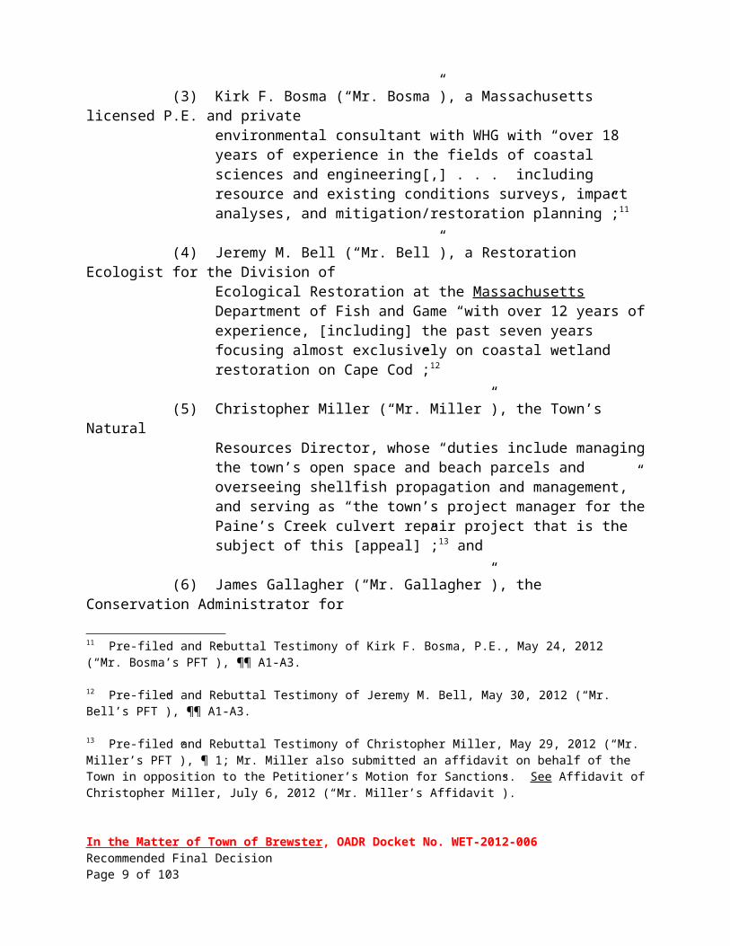
(3) Kirk F. Bosma (“Mr. Bosma”), a Massachusetts licensed P.E. and privateenvironmental consultant with WHG with “over 18 years of experience in the fields of coastal sciences and engineering[,] . . . including resource and existing conditions surveys, impact analyses, and mitigation/restoration planning”;11
(4) Jeremy M. Bell (“Mr. Bell”), a Restoration Ecologist for the Division ofEcological Restoration at the Massachusetts Department of Fish and Game “with over 12 years of experience, [including] the past seven years focusing almost exclusively on coastal wetland restoration on Cape Cod”;12
(5) Christopher Miller (“Mr. Miller”), the Town’s NaturalResources Director, whose “duties include managing the town’s open space and beach parcels and overseeing shellfish propagation and
8 Pre-filed Testimony of Peter S. Rosen, Ph.D, May 6, 2012 (“Dr. Rosen’s PFT”), ¶¶ 1-4; Pre-filed Rebuttal Testimony of Peter S. Rosen, Ph.D, June 12, 2012 (“Dr. Rosen’s Rebuttal PFT”).
9 Pre-filed and Rebuttal Testimony of Jeffrey Oakes, P.E., May 23, 2012 (“Mr. Oakes’ PFT”), ¶¶ A1-A3.
10 Pre-filed and Rebuttal Testimony of M. Leslie Fields, M.S., B.S, May 24, 2012 (“Ms. Fields’ PFT”), ¶¶ A1-6.
11 Pre-filed and Rebuttal Testimony of Kirk F. Bosma, P.E., May 24, 2012 (“Mr. Bosma’s PFT”), ¶¶ A1-A3.
12 Pre-filed and Rebuttal Testimony of Jeremy M. Bell, May 30, 2012 (“Mr. Bell’s PFT”), ¶¶ A1-A3.
In the Matter of Town of Brewster, OADR Docket No. WET-2012-006Recommended Final DecisionPage 5 of 56

management,” and serving as “the town’s project manager for the Paine’s Creek culvert repair project that is the subject of this [appeal]”;13 and
(6) James Gallagher (“Mr. Gallagher”), the Conservation Administrator forthe Town’s Conservation Commission.14
The Department called one witness at the Hearing: James Mahala (“Mr. Mahala”), a
senior Environmental Analyst in the Department’s Wetlands Program with more than 25 years of
experience in administering and enforcing the MWPA and Wetlands Regulations, including
identifying and delineating coastal and inland wetlands and assessing the potential impact of a
proposed project on wetlands resources areas protected by the MWPA and the Wetlands
Regulations.15
Based on the evidence introduced at the Hearing, I recommend that the Department’s
Commissioner issue a Final Decision affirming the SOC because (1) the Petitioner lacks standing
to challenge the SOC as an aggrieved party and (2) the Department properly issued the SOC
under the MWPA and the Wetlands Regulations.
STATUTORY AND REGULATORY FRAMEWORK
The purpose of the MWPA and the Wetlands Regulations is to protect wetlands and to
regulate activities affecting wetlands areas in a manner that promotes the following important
public interests:
(1) protection of public and private water supply;
(2) protection of ground water supply;
13 Pre-filed and Rebuttal Testimony of Christopher Miller, May 29, 2012 (“Mr. Miller’s PFT”), ¶ 1; Mr. Miller also submitted an affidavit on behalf of the Town in opposition to the Petitioner’s Motion for Sanctions. See Affidavit of Christopher Miller, July 6, 2012 (“Mr. Miller’s Affidavit”).
14 Without objection from the Petitioner and the Department, Mr. Gallagher provided oral testimony at the Hearing on behalf of the Town in opposition to the Petitioner’s Motion for Sanctions.
15 Pre-filed Testimony of James Mahala, June 5, 2012 (“Mr. Mahala’s PFT”), ¶¶ 1-4.
In the Matter of Town of Brewster, OADR Docket No. WET-2012-006Recommended Final DecisionPage 6 of 56

(3) flood control;
(4) storm damage prevention;
(5) prevention of pollution;
(6) protection of land containing shellfish;
(7) protection of fisheries; and
(8) protection of wildlife habitat.
G.L. c. 131, § 40; 310 CMR 10.01(2); In the Matter of Stephen D. Peabody, OADR Docket
No. WET-2008-063, Final Decision (April 12, 2011), 2011 MA ENV LEXIS 39, at 8. As
discussed below, at pp. 30-53, Coastal Beach (310 CMR 10.27), Coastal Dune (310 CMR
10.28), Barrier Beach (310 CMR 10.29), and Coastal Bank (310 CMR 10.30), are wetlands
resource areas protected by the MWPA and the Wetlands Regulations.
The MWPA and the Wetlands Regulations provide that “[n]o person shall remove, fill,
dredge[,] or alter16 any [wetlands] area subject to protection under [the MWPA and Wetlands
16 The Wetlands Regulations at 310 CMR 10.04 define “alter” as “chang[ing] the condition” of any wetlands area subject o protection under the MWPA and the Wetlands Regulations. Examples of alterations include, but are not limited to, the following:
(a) the changing of pre-existing drainage characteristics, flushing characteristics, salinity distribution, sedimentation patterns, flow patterns and flood retention areas;
(b) the lowering of the water level or water table;
(c) the destruction of vegetation;
(d) the changing of water temperature, biochemical oxygen demand (BOD), and other physical, biological or chemical characteristics of the receiving water.
310 CMR 10.04. “Dredge” is defined as “deepen[ing], widen[ing], or excavat[ing], either temporarily or permanently” a protected wetlands area, and “[f]ill means to deposit any material [in a protected wetlands area] so as to raise an elevation, either temporarily or permanently.” Id.
In the Matter of Town of Brewster, OADR Docket No. WET-2012-006Recommended Final DecisionPage 7 of 56

Regulations] without the required authorization, or cause, suffer or allow such activity . . . .”
G.L. c. 131 § 40, ¶ 32; 310 CMR10.02(2)(a); In the Matter of West Meadow Homes, Docket
Nos. 2009-023 & 024, Recommended Final Decision (June 20, 2011), 2011 MA ENV LEXIS
85, at 7, adopted as Final Decision (August 18, 2011), 2011 MA ENV LEXIS 84.
“Any activity proposed or undertaken within [a protected wetlands] area[,] . . . which will
remove, dredge or alter that area, is subject to Regulation under [the MWPA and the Wetlands
Regulations] and requires the filing of a Notice of Intent” (“NOI”) with the permit issuing
authority. 310 CMR10.02(2)(a). Also subject to an NOI filing, is “[a]ny activity . . . proposed or
undertaken within 100 feet of [any protected wetlands]” described as “the Buffer Zone” by the
Regulations, “which, in the judgment of the [permit] issuing authority, will alter [any protected
wetlands].” 310 CMR 10.02(2)(b).
The “[permit] issuing authority” is either the local Conservation Commission when
initially reviewing the applicant’s proposed work in a wetlands resource area protected by the
MWPA and the Wetlands Regulations, or the Department if it assumes primary review of the
proposed work or on appeal from a local Conservation Commission decision. See Healer v.
Department of Environmental Protection, 73 Mass. App. Ct. 714, 717-19 (2009). Under the
MWPA, “[l]ocal [Conservation Commissions] are allowed to ‘impose such conditions as will
contribute to the protection of the interests described [in MWPA and the Wetlands
Regulations]’” and to require that “‘all work shall be done in accordance’ with the conditions
they might impose. . . .” Id. Any “order [by the Department] shall supersede the prior order of
the conservation commission . . . and all work shall be done in accordance with the
In the Matter of Town of Brewster, OADR Docket No. WET-2012-006Recommended Final DecisionPage 8 of 56
[Department’s] order.” Id.
DISCUSSION
I. THE PETITIONER’S BURDEN OF PROOF AT THE HEARING
At the Hearing, the Petitioner had the burden of proving by a preponderance of the
evidence (1) that he had standing to challenge the SOC as an aggrieved party within the meaning
of 310 CMR 10.04, and (2) that the Department erred in issuing the SOC. See 310 CMR
10.03(2), 10.05(7)(j)2.b.iv, 10.05(7)(j)2.b.v, 10.05(7)(j)3.a, 10.04, 10.05(7)(j)3.b; In the Matter
of Beachwood Knoll School. Docket No. WET 2008-050, 15 DEPR 257 (2008); In the Matter of
John and Margaret Reichenbach, OADR Docket No. WET-2011-012, Recommended Final
Decision (October 20, 2011), 20211 MA ENV LEXIS 111, at 12-14, adopted as Final Decision
(November 2, 2011), 2011 MA ENV LEXIS 110. The relevancy, admissibility, and weight of
evidence that the Petitioner and the other parties sought to introduce in the Hearing was
governed by G.L. c. 30A, § 11(2) and 310 CMR 1.01(13)(h)(1). 2010 MA ENV LEXIS 183, at
8-9. Under G.L. c. 30A, § 11(2):
[u]nless otherwise provided by any law, agencies need not observe the rules of evidence observed by courts, but shall observe the rules of privilege recognized by law. Evidence may be admitted and given probative effect only if it is the kind of evidence on which reasonable persons are accustomed to rely in the conduct of serious affairs. Agencies may exclude unduly repetitious evidence, whether offered on direct examination or cross-examination of witnesses.
Under 310 CMR 1.01(13)(h), “[t]he weight to be attached to any evidence in the record . . .
rest[ed] within the sound discretion of the Presiding Officer. . . .” As discussed below, the
In the Matter of Town of Brewster, OADR Docket No. WET-2012-006Recommended Final DecisionPage 9 of 56

Petitioner failed to meet his burden of proof at the Hearing.
II. FINDINGS
Based on the evidence introduced at the Hearing, I make the following findings based on
a preponderance of the evidence:
A. The Proposed Replacement Culvert is Necessary to Replace an Existing, Failing Culvert and to Restore Ecological Balance in the Area.
Freemans Pond is a five acre salt pond located in the Town on the north shore of Cape
Cod, Massachusetts. Petitioner’s Exhibit 1, Attachment E, at p. 1.17 It is connected to Stony
Brook to the west by the Freemans Pond Channel that runs parallel to Paine’s Creek Beach
approximately 250 feet to the north on Cape Cod Bay. Id. Freemans Pond is connected to Cape
Cod Bay by the Freemans Pond Channel, which discharges through the existing culvert at the
Site to Stony Brook and Paine’s Creek. Id.
Freemans Pond is surrounded by salt marsh and other coastal wetlands. Mr. Bell’s
PFT, ¶ C1. Salt marsh is:
a coastal wetland that extends landward up to the highest high tide line, that is, the highest spring tide of the year, and is characterized by plants that are well adapted to or prefer living in, saline soils. Dominant plants within salt marshes are salt meadow cord grass (Spartina patens) and/or salt marsh cord grass (Spartina alterniflora). A salt marsh may contain tidal creeks, ditches and pools.
310 CMR 10.32(2). Other coastal wetlands include:
any bank, marsh, swamp, meadow, flat or other lowland subject to tidal action or coastal storm flowage.
G.L. c. 131, § 40, ¶ 6.
17 Petitioner’s Exhibit 1 is the NOI that the Town filed with its Conservation Commission on August 26, 2011 pursuant to the MWPA and the Wetlands Regulations seeking approval for the proposed culvert replacement project at issue in this appeal. Attachment E to Petitioner’s Exhibit 1 is the Project Narrative.
In the Matter of Town of Brewster, OADR Docket No. WET-2012-006Recommended Final DecisionPage 10 of 56

The surrounding salt marsh and coastal wetlands at Freemans Pond are impaired by
the invasive plant Phragmites (Phragmites australis) inhabiting portions of the area. Mr.
Bell’s PFT, ¶ C1. Phragmites are a tall, perennial grass that can grow to over 15 feet in height.
http://www.nps.gov/plants/alien/fact/phau1.htm.
Phragmites for[m] dense stands which include both live stems and standing dead stems from previous year’s growth. Leaves are elongate and typically 1-1.5 inches wide at their widest point. Flowers form bushy panicles in late July and August and are usually purple or golden in color. As seeds mature, the panicles begin to look “fluffy” due to the hairs on the seeds and they take on a grey sheen. Below ground, Phragmites for[m] a dense network of roots and rhizomes which can go down several feet in depth. The plant spreads horizontally by sending out rhizome runners which can grow 10 or more feet in a single growing season if conditions are optimal.
Id. When Phragmites begin inhabiting a marsh area, they can quickly take over the area,
crowding out native plants, changing marsh hydrology, altering wildlife habitat, and increasing
fire potential. Id.
Phragmites are widespread on Cape Cod and are commonly found dominating areas
where the natural tides are restricted from a marsh or coastal pond, and, as discussed above,
can overtake native species through its robust growth. Mr. Bell’s PFT, ¶ C1. Such native
species include big cord-grass (Spartina cynosuroides), a state Threatened plant species,
found at the perimeter of the marsh at the Site that is being overtaken by Phragmites. Id.
Eventually, the big cord-grass will likely be completely replaced with Phragmites, and the
biodiversity of the site will be further impaired. Id.
The Town, in conjunction with a private environmental advocacy organization and
several state and federal environmental agencies (collectively “the Town’s Project Team”),
proposes to restore tidal flushing to Freemans Pond and the associated 21.3 acres of salt
marsh/wetlands by replacing the existing culvert at the Site with a larger culvert designed to
In the Matter of Town of Brewster, OADR Docket No. WET-2012-006Recommended Final DecisionPage 11 of 56

increase the tidal prism or volume of water within Freemans Pond and the approximately one
quarter mile long tidal Freemans Pond Channel. Id. 18 The larger culvert is intended to improve
the Freemans Pond Channel and Freemans Pond water quality, vegetative cover, and wildlife
habitat, including preventing the further spread of Phragmites. Id.; Mr. Bell’s PFT, ¶¶ B1 (p. 2),
C1-C4 (pp. 4-5). It is also intended to promote the safety of swimmers who swim at the nearby
Paine’s Creek Beach. Mr. Miller’s PFT, ¶ 7.
The existing culvert, which is located on Town owned land, is a corrugated metal
cylinder structure located beneath the north end of Paine’s Creek Road that is three feet in
diameter and 61 feet long. Petitioner’s Exhibit 1, Attachment E, at p. 2; Mr. Oakes’ PFT, ¶¶ B1,
C5. It has deteriorated and is failing. Id. During the last several years, the Town has had to
regularly fill sinkholes above the culvert and patch the overlying pavement due to
undermining and collapse. Mr. Miller’s PFT, ¶ 2. The mouth of the culvert on the west
(Paine’s Creek) side is damaged, and the undermining of the pavement at the culvert poses a
threat to the integrity of the culvert. Id.
18 The members of the Town’s Project Team are:
(1) the Association for the Preservation of Cape Cod, a private environmental advocacy organization;
(2) the Division of Ecological Restoration of the Massachusetts Department of Fish and Game;
(3) the Cape Cod Conservation District;
(4) the Natural Resources Conservation Service (“NRCS”) of the U.S. Department of Agriculture; and
(5) the Restoration Center of the National Marine Fisheries Service, a federal agency within the National Oceanic and Atmospheric Administration (“NOAA”).
Petitioner’s Exhibit 1, Attachment E, at p. 1. The culvert replacement project is being funded by the federal government through a grant administered by NOAA under the American Reinvestment and Recovery Act (“ARRA”) of 2009. Id.
In the Matter of Town of Brewster, OADR Docket No. WET-2012-006Recommended Final DecisionPage 12 of 56

In September 2009, the Town retained WHG, an environmental consulting firm in
Falmouth, Massachusetts, to identify the wetlands in the vicinity of the existing culvert
protected by the MWPA and the Regulations, and determine whether the proposed culvert
replacement would comply with the MWPA and the Wetlands Regulations. Petitioner’s
Exhibit 1, Attachment E, at pp. 11-19; Mr. Oakes’ PFT, ¶¶ D1-D3; Ms. Fields’ PFT, ¶¶ B1-
B3, C1-C3, D1-D2; Mr. Bosma’s PFT, ¶ B1-B4, C1, D1; Mr. Miller’s PFT, ¶ 3.
During the course of its work, WHG completed a preliminary hydraulic analysis,
including tide data collection, of the existing culvert. Mr. Bosma’s PFT, ¶ B2. At that time,
the existing culvert showed signs of deterioration because visible damage was evident to
both the external and internal parts of the culvert. Id., Figure 1, at p. 3 of Mr. Bosma’s
PFT.19 The seaward (Paine’s Creek) entrance to the culvert was also armored with a
combination of riprap, poured asphalt, stones, and other anthropogenic (human) materials.
Id. As such, WHG’s preliminary hydraulic analysis identified several potential benefits that
could result from the replacement of the existing culvert including ecological restoration,
improved water quality, enhanced migratory fish passage, increased flood water drainage,
and a return to the more natural conditions that historically existed in Freemans Pond. Mr.
Bosma’s PFT, ¶ B2.
Subsequently in 2011, WHG worked with CLE, a national marine, civil, and
environmental engineering firm in Marion, Massachusetts, to evaluate the tidal exchange
associated with potential proposed engineering alternatives being considered for the culvert
replacement. Mr. Bosma’s PFT, ¶ B2; Mr. Miller’s PFT, ¶¶ 3-11. This analysis included
19 Figure 1 is a photograph taken in January 2009 depicting the seaward end of the existing culvert connecting Paine’s Creek (Stony Brook) with Freemans Pond.
In the Matter of Town of Brewster, OADR Docket No. WET-2012-006Recommended Final DecisionPage 13 of 56

assessment of water surface elevations, tidal velocities, and scour potential as related to the
currently proposed culvert. Id.
Design considerations for the culvert replacement also included maintaining
pedestrian and vehicular access to Paine’s Creek Beach located north of the culvert. Mr.
Miller’s PFT, ¶ 5. The Beach is the Town’s largest beach area and is a popular swimming
beach in the summer, where visitors float down the shallow stream onto the tidal flats. Id.
The replacement culvert area needed to be designed to enable emergency vehicles to access
the Beach during the busy summer season. Mr. Miller’s PFT, ¶ 6. It also had to be
designed to allow for truck access to deliver sand for a separate re-nourishment project to
the north of the proposed replacement culvert. Id.
Design considerations also included promoting safety for swimmers at the Beach
because the existing three foot wide culvert causes high flow velocities during the tidal
exchange which may pull a swimmer into the culvert. Mr. Miller’s PFT, ¶ 7. The federal
government, the funding source for the culvert replacement project, required that swimmer
safety be a prime consideration in the design of the replacement culvert. Id.
WHG and CLE analyzed a number of culvert sizes for the replacement culvert at the Site
and determined the best culvert size to increase the tidal range in the marsh and improve the tidal
connection between Cape Cod Bay and Freeman’s Pond. Petitioner’s Exhibit 1, Attachment E,
at pp. 4, 6-9; Mr. Miller’s PFT, ¶ 8. They determined that a 50 foot long, ten-foot wide by six-
foot high open-bottom concrete box culvert and wing walls in the same location would be
the best replacement culvert. Id.; Mr. Oakes’ PFT, ¶¶ C5-C8. They determined that
installation of this shorter, but higher and wider sized replacement culvert would increase
swimmer safety by reducing high flow velocities. Mr. Miller’s PFT, ¶ 8. They also
In the Matter of Town of Brewster, OADR Docket No. WET-2012-006Recommended Final DecisionPage 14 of 56

determined that the replacement culvert would increase tidal range (the vertical difference
between high tide and the succeeding low tide), which in turn, would help to remediate the
degraded marsh area adjacent to Freemans Pond by increasing soil salinity and impeding the
spread of the invasive Phragmites. Petitioner’s Exhibit 1, Attachment E, at pp. 4, 6-9; Mr.
Bell’s PFT, ¶ C1-C4.
WHG and CLE determined that the enlarged culvert would increase the tidal
range in the Freemans channel by one foot, meaning that the water would be six inches
higher at Mean High Water and six inches lower at Mean Low Water. Mr. Bell’s PFT,
¶ C2; Petitioner’s Exhibit 1, Attachment E, at p. 4. This increase in tidal exchange would
result in numerous, significant benefits to the Freemans Pond channel, Freemans Pond,
and the surrounding wetland system. Mr. Bell’s PFT, ¶¶ C3-C4. Specifically, it would
improve water quality, sediment transport, and nutrient exchange with Cape Cod Bay.
Id. As discussed above, existing stands of big cord-grass are currently being overtaken
by the invasive Phragmites. Id. WHG and CLE determined that the greater frequency
and duration of inundation of Phragmites by full salinity tidal water would prevent
further encroachment of this invasive species into the marsh interior and possibly result
in its retreat, allowing native salt marsh species to re-colonize areas of the marsh. Id.
They also determined that increased sediment transport upstream, carried by the force of
the Cape Cod Bay tides, would enhance the marshes natural accretion process, resulting
in a greater ability of the marsh to adapt to future sea level rise and receive nutrients for
increased growth and productivity. Id.
Under the Town’s culvert replacement project, the asphalt surface of Paine’s Creek
Road covering the existing culvert will be removed and replaced with a sand cover,
In the Matter of Town of Brewster, OADR Docket No. WET-2012-006Recommended Final DecisionPage 15 of 56

maintaining existing access to the public beach at the end of the former roadway. Mr.
Oakes’ PFT, ¶ C6; Petitioner’s Exhibit 1, Attachment E, at p. 10. During construction, the
proposed culvert will be contained within an 11,200 square foot steel sheetpile cofferdam, and a
three foot diameter temporary bypass culvert, consistent with the specifications of the current
culvert, will be built adjacent to the work area to maintain tidal flow while the replacement
culvert is being built. SOC Transmittal Letter, at p. 1; Petitioner’s Exhibit 1, Attachment E, at p.
10; Mr. Oakes’ PFT, ¶ C7. The new culvert and its wing walls will be backfilled with
previously excavated and stockpiled material to the design grade. Petitioner’s Exhibit 1,
Attachment E, at p. 10.
As discussed below, at pp. 30-53, the Department properly authorized the Town’s culvert
replacement project under the MWPA and the Wetlands Regulations. Several other issues,
including whether the Petitioner lacks standing to challenge the Department’s determination and
whether the Town engaged in misconduct during the course of the proceedings of this appeal
warranting denial of its culvert replacement project, need to be addressed first.
B. The Petitioner Lacks Standing to Appeal the SOC as an Aggrieved PartyWithin the Meaning of 310 CMR 10.04.
Standing “is not simply a procedural technicality.” Save the Bay, Inc. v. Department of
Public Utilities, 366 Mass. 667, 672 (1975). Rather, it “is a jurisdictional prerequisite to being
allowed to press the merits of any legal claim.” R.J.A. v. K.A.V., 34 Mass. App. Ct. 369, 373 n.8
(1993); Ginther v. Commissioner of Insurance, 427 Mass. 319, 322 (1998) (“[w]e treat standing
as an issue of subject matter jurisdiction [and] . . . of critical significance”); see also United
States v. Hays, 515 U.S. 737, 115 S.Ct.2431, 2435 (1995) (“[s]tanding is perhaps the most
important of the jurisdictional doctrines”).
In the Matter of Town of Brewster, OADR Docket No. WET-2012-006Recommended Final DecisionPage 16 of 56

A party’s lack of standing to maintain an administrative appeal challenging Department
action is an appropriate ground for dismissal of the appeal. See In the Matter of Mitchell, Docket
No. 98-169, 6 DEPR 183 (1999). Because standing is a jurisdictional prerequisite to
maintenance of an appeal, it may be raised as an issue at any time by any party or the Presiding
Officer. In the Matter of Steven and Diane Miers, Docket No. DEP-04-434, Recommended
Final Decision (March 11, 2005), adopted as Final Decision (March 30, 2005); In the Matter of
Gallagher Group, Docket No. 2003-019, Recommended Final Decision (May 2, 2005), adopted
as Final Decision (July 8, 2005), Reconsideration Denied (September 23, 2005); In the M atter of
Nguyen, DEP Docket No. WET-2008-031, Recommended Final Decision (June 20, 2008),
adopted as Final Decision (July 18, 2008).
In this case, in order to have standing to challenge the Department’s SOC authorizing the
Town’s culvert replacement project, the Petitioner must demonstrate that he is a “person
aggrieved” by the SOC. 310 CMR 10.04 (definition of “aggrieved” and “person aggrieved”);
310 CMR 10.05(7) (j)2. The Wetlands Regulations define “person aggrieved” as:
any person who because of an act or failure to act by the issuing authority may suffer an injury in fact which is different either in kind or magnitude from that suffered by the general public and which is within the scope of the interests identified in [MWPA]. . . .
310 CMR 10.04; In the Matter of Trammell Crow Residential, 2011 MA ENV LEXIS 21
(MA ENV 2011).
A “person aggrieved” as that term is used in the MWPA must assert “a plausible claim of
a definite violation of a private right, a private property interest, or a private legal interest. . . . Of
particular importance, the right or interest asserted must be one that the statute . . . intends to
protect.” In the Matter of Town of Southbridge Department of Public Works, OADR Docket
In the Matter of Town of Brewster, OADR Docket No. WET-2012-006Recommended Final DecisionPage 17 of 56

No. WET-2009-022, Recommended Final Decision, at p. 4 (September 18, 2009), adopted as
Final Decision (October 14, 2000); In the Matter of Onset Bay Marina, OADR Docket No. 2007-
074, Recommended Final Decision (January 30, 2009), 16 DEPR 48, 50 (2009), adopted as Final
Decision (April 1, 2009); Compare, Standerwick v. Zoning Board of Appeals of Andover, 447
Mass. 20, 27-28 (2006) (definition of “person aggrieved” under G.L. c. 40B). To establish
standing and status as a “person aggrieved” a party must “establish -- by direct facts and not by
speculative personal opinion -- that [its] injury is special and different from the concerns of the
rest of the community.” Southbridge, at p. 4; Onset Bay, 16 DEPR at 50; Standerwick, 447
Mass. at 33-37.
In sum, it is the Petitioner’s burden to prove that he has standing to challenge the
Department’s SOC authorizing the Town’s culvert replacement project, and his failure to meet
that burden is an appropriate ground for dismissal of this appeal. See In the Matter of
Beachwood Knoll School. Docket No. WET 2008-050, 15 DEPR 257 (2008). The Petitioner
failed to meet his burden for the following reasons.
When he filed this appeal, the Petitioner claimed that he had standing to challenge the
SOC because he owns property “which [would] be flooded by the enlarged culvert.”
Petitioner’s Appeal Notice, at p. 1. He repeated the same claim in the Pre-Hearing Brief that
he filed as part of his Direct Case prior to the Hearing. Specifically, he asserted in his Pre-
Hearing Brief that “[he] is an owner of land that will be daily flooded by high tides in
excess of that which now occurs if the proposed project is completed.” Petitioner’s Pre-
Hearing Brief, at p. 2. He supported his claim with three documents that he attached to his
In the Matter of Town of Brewster, OADR Docket No. WET-2012-006Recommended Final DecisionPage 18 of 56

Pre-Hearing Brief as Exhibits 1, 2, and 3, respectively. These documents, coupled with the
Petitioner’s cross-examination testimony at the Hearing and repudiation of the testimony after
the Hearing, do not provide me with a reasonable basis to conclude that he has a colorable
claim of title to real property that purportedly will be flooded by the new culvert.20
Exhibit 1 is a copy of a Town certified list of abutters within 300 feet of the culvert
dated April 7, 2011 that the Town submitted as part of its NOI for the culvert
replacement project. This abutters list notes that “Dugan, Dorothea Et Al.”21 are abutters
who own real property at “0 Lower Road” identified by the Town as “Parcel 19/9/0.” This
abutters list does not list the Petitioner’s name as an abutter.
Exhibit 2 is a copy of the Town Assessor’s Card for Parcel 19/9/0 for Fiscal Year
2012 (July 1, 2011 to June 30, 2012) which notes that “Dugan, Dorothea Et Al.” own the
property based on a Deed that was recorded in the Barnstable County Registry of Deeds on
January 24, 1986, at Book 4903, Page 148 (“January 1986 Deed”). The Assessor’s Card
does not list the Petitioner’s name as one of the owners of the property.
Exhibit Three is a copy of the January 1986 Deed, which notes that on January 24,
1986 “Mary E. Dugan” conveyed 11 parcels of land in Brewster, Orleans, and North
Brewster, Massachusetts to 20 different grantees, including the Petitioner, as “Tenants in
Common.” The January 1986 Deed, however, does not include any specific reference to
20 Although the Department does not resolve property ownership disputes, the Petitioner must demonstrate, at a minimum for purposes of establishing standing that he has a colorable claim of title to real property that purportedly will be impacted adversely by the proposed new culvert. See Tindley v. Department of Environmental Protection, 10 Mass. App. Ct. 623, 626-27 (1980); In the Matter of John Schindler, OADR Docket Nos. WET-2011-024 and 026, Recommended Final Decision (December 5, 2011), at pp. 5, 7-8, 9-10, 22, adopted as Final Decision (December 27, 2011),
21 It is generally understood that “Et Al” is an abbreviation used in legal documents for the Latin phrase “and others.”
In the Matter of Town of Brewster, OADR Docket No. WET-2012-006Recommended Final DecisionPage 19 of 56

Freeman’s Pond or the Freeman’s Pond channel. As discussed above, at p. 10, Freemans
Pond is connected to Cape Cod Bay by the Freemans Pond Channel, which discharges
through the existing culvert at the Site to Stony Brook and Paine’s Creek.
At the Hearing, the Petitioner, while under cross examination by the Town’s counsel,
outlined with a pink marker the property that he claims to own on the Town Assessor’s Map
as Parcel 19/9/0, which he contends will be flooded by the proposed new culvert. Dugan
Exhibit 1; Mr. Dugan’s Cross Examination Testimony, Hearing Recording Vol. I at 18:15-
20:10. He then testified unequivocally and without objection from his counsel that the
January 1986 Deed does not contain that property. Mr. Dugan’s Cross Examination
Testimony, Hearing Recording Vol. I at 20:13-26:37. 21:05. Specifically, he testified that
“[t]he parcel in question is not in [the January 1986 Deed].” Id., at 21:05. He also testified
that he owns the property at issue with his brother and sister, but conceded on cross-
examination that those ownership interests are not reflected in any instruments recorded at
the Barnstable County Registry of Deeds. Id., at 20:20.
As a result of the Petitioner’s cross examination testimony repudiating his prior claim
that the January 1986 Deed is evidence of his ownership of real property that will be flooded
by the new culvert, both the Town and the Department gave notice at the conclusion of the
Hearing that they intended to seek dismissal of the Petitioner’s appeal for lack of standing.
Hearing Recording, Vol. II at 1:01:26-1:05:07. The Town and the Department followed
through with their intention when they filed their Closing Briefs in the case on July 16, 2012.
Applicant Town of Brewster’s Motion to Dismiss [Appeal] for Lack of Standing, July 16,
2012; Applicant Town of Brewster’s Closing Brief, July 16, 2012, at pp. 7-9 (¶¶ 16-23),
In the Matter of Town of Brewster, OADR Docket No. WET-2012-006Recommended Final DecisionPage 20 of 56

pp. 9-11; [Department’s] Closing Brief and Motion to Dismiss for Lack of Standing, July 16,
2012, at pp. 1-4.
In response, the Petitioner filed several Post-Hearing Briefs that repudiated his cross
examination testimony regarding the January 1986 Deed by contending that the Deed does in
fact evidence his ownership of real property that will be flooded by the new culvert.
Petitioner’s Closing Brief, July 16, 2012 (“Petitioner’s First Post-Hearing Brief”), at pp. 7-
10; Petitioner’s Opposition to Motion to Dismiss Including Request to take Notice of
Relevant Title Documents, July 19, 2012 (“Petitioner’s Second Post-Hearing Brief”), at 1-7;
Petitioner’s Opposition to Motion to Strike, July 27, 2012 (“Petitioner’s Third Post-Hearing
Brief”), at p. 2. He attempted to justify his conflicting positions by blaming the Town for his
predicament. Petitioner’s First Post-Hearing Brief, at pp. 7-10; Petitioner’s Second Post-
Hearing Brief, at pp. 1, 6; Petitioner’s Third Post-Hearing Brief, at p. 2. Specifically, he
accused the Town of having created a “false” standing issue by cross-examining him, “a
layman/non-expert witness . . . on title issues relating to his family’s property,” and procuring
“ambiguous testimony” from him regarding the January 1986 Deed. Id. He also attempted
to buttress his claims by seeking to introduce additional evidence in support of his
resurrected claim that the January 1986 Deed proves that he owns property that will be
flooded by the new culvert. See documents attached to Petitioner’s Second Post-Hearing
Brief.22
I reject the Petitioner’s after the fact repudiation and characterizations of his cross-
22 The additional evidence that the Petitioner seeks to introduce are copies of deeds recorded in the Barnstable County Registry Deeds in 1883, 1897, 1899, and 1917. He also seeks to introduce copies of probate documents filed with the Barnstable County Probate Court in 1950 and 1978.
In the Matter of Town of Brewster, OADR Docket No. WET-2012-006Recommended Final DecisionPage 21 of 56

examination testimony and his additional evidence for the following reasons.
First, the cross-examination questions that the Town’s counsel posed to the Petitioner
regarding the January 1986 Deed were fair given that the Petitioner had included the Deed as
part of his Direct Case challenging the Department’s SOC and for proof of his standing to
challenge the SOC. See Exhibit 3 to Petitioner’s Pre-Hearing Brief. Moreover, the
Petitioner created the standing issue when he testified unequivocally at the Hearing that the
January 1986 Deed does not contain the property that he claims will be flooded by the
new culvert.
Second, as discussed above, the Petitioner was cross-examined by the Town’s
counsel at the Hearing regarding the January 1986 Deed without objection from the
Petitioner’s counsel that the Petitioner was “layman/non-expert witness” unqualified to
testify about the Deed. The Petitioner’s counsel should have objected if he believed that the
questions posed by the Town’s counsel called for the opinion of an expert witness. Nothing
prevented the Petitioner’s counsel from objecting at the Hearing. Having failed to object, the
objections were waived. See 310 CMR 1.01(13)(h)4 (“[p]arties shall object to evidence
offered and give their reasons at the time that a ruling is made or sought, or if a party has no
opportunity to object or seek a ruling at that time, within three days of notification of the
action taken or refused”). Id.
Third, the Petitioner’s claims that he is a “layman” and not versed in real estate
matters are unsworn allegations by the Petitioner. He did not support his claims with an
affidavit, and, accordingly, his claims should be accorded little or no weight, especially given
that he made the claims to repudiate his sworn cross-examination testimony. Moreover, after
having observed and heard the Petitioner at length at the Hearing, he does not strike me as an
In the Matter of Town of Brewster, OADR Docket No. WET-2012-006Recommended Final DecisionPage 22 of 56

individual who is a “layman” on real estate matters, but instead, is well versed in those
matters. Throughout his testimony, he was confident and unequivocal regarding his
purported real estate holdings. Indeed, his testimony repudiating the January 1986 Deed was
clear, and not, “ambiguous” as he now claims.
Lastly, his attempt to introduce additional evidence after the Hearing concluded
regarding the January 1986 Deed is improper. The provisions of 310 CMR 1.01(13)(n)2
make clear that:
[n]o evidence shall be admitted after completion of a hearing or after a case has been submitted on the record, unless otherwise ordered by the Presiding Officer or the Commissioner. The Presiding Officer may require any party, with appropriate notice to the other parties, to submit additional evidence on any matter relevant to the adjudicatory appeal.
Here, the Petitioner seeks to introduce the additional evidence set forth above in n. 22, p. 21,
notwithstanding my directive to the parties at the Hearing that the standing issue would be
resolved by utilizing only the evidence in the Administrative Record as of the Hearing’s
conclusion. Hearing Recording, Vol. II, at 1:03:15-1:03:33. The Petitioner ignored my
directive. Moreover, the evidence that the Petitioner seeks to introduce was available to him
prior to the Hearing, and he chose not to bring it forward until after the Hearing concluded and
after he had critically wounded his standing claim at the Hearing with his cross examination
testimony. See 310 CMR 1.01(14)(e) (party seeking to re-open hearing for “purpose of receiving
new evidence . . . shall show that the evidence to be introduced was not reasonably available for
presentation at the hearing”).
In sum, the Petitioner has failed to prove that he has standing to challenge the SOC as
an aggrieved party within the meaning of 310 CMR 10.04 because he has failed to
demonstrate that he has a colorable claim of title to real property that purportedly will be
In the Matter of Town of Brewster, OADR Docket No. WET-2012-006Recommended Final DecisionPage 23 of 56

flooded by the proposed replacement culvert. His cross-examination testimony at the
Hearing regarding the January 1986 Deed and repudiation of the testimony after the Hearing,
raise credibility issues regarding his standing claim. His appeal of the SOC, therefore,
should be dismissed. Even if he has standing, he still does not prevail because, as discussed
below, at pp. 24-53, his claims fail on the merits.
C. The Town Has Neither Spoliated Evidence Nor Engaged In Fraud To Hide Evidence and Distort the Outcome of This Appeal.
The doctrine of spoliation allows a judge to impose sanctions and remedies for the
destruction of evidence in civil litigation, “based on the premise that a party who has negligently
or intentionally lost or destroyed evidence known to be relevant for an upcoming legal
proceeding should be held accountable for any unfair prejudice that results.” Keene v. Brigham
& Women’s Hospital, Inc., 439 Mass. 223, 234 (2003) (default appropriate against hospital that
lost records critical to plaintiff's case); Kippenhan v. Chaulk Servs., Inc . , 428 Mass. 124, 127
(1998) (spoliation sanction appropriate where reasonable person would realize that evidence
might be relevant to possible action). A judge has broad discretion to impose a variety of
sanctions against a party for spoliation of evidence. Keene, supra, at 235. “Exclusion of
evidence both sanctions the party responsible for destroying certain evidence and remedies the
unfairness that such spoliation created.” Gath v. M/A-Com, Inc., 440 Mass. 482, 488 (2003).
The sanction, however, should be narrowly “addressed to the precise unfairness that would
otherwise result.” Keene, supra at 235. “As a general rule, a judge should impose the least
severe sanction necessary to remedy the prejudice to the nonspoliating party.” Id.
Here, the Petitioner asserts that on June 25, 2012, two days before my Site Visit, the
Town engaged in “blatant spoliation of evidence and down right fraudulent [actions] . . . in an
In the Matter of Town of Brewster, OADR Docket No. WET-2012-006Recommended Final DecisionPage 24 of 56

apparent attempt to hide evidence and distort the outcome of this proceeding” by “dump[ing]
multiple truck loads of sand [at the Site], remov[ing] wrack from recent flooding events at or
near the location of the culvert project causing the filling of areas of erosion[,] and removing
and obscuring evidence that would have been observed during [my Site Visit] . . . . ”
Petitioner’s Motion for Sanctions, June 26, 2012, at pp. 1-2. As a result of this purported
misconduct, the Petitioner requests that the Town “be sanctioned by the issuance of decision
[in this appeal] in favor of the [Petitioner] . . . and [d]enying [approval of the Town’s culvert
replacement project].” Id., at p. 2.
The Petitioner’s spoliation and fraud claims against the Town are without merit. Based
on the testimony that the Town’s witnesses Mr. Miller and Mr. Gallagher provided at the
Hearing, the Town neither concealed nor sought to conceal evidence at the Site prior to my Site
Visit. Mr. Miller’s Affidavit, ¶¶ 1-20. Instead, the Town carried out lawful beach re-
nourishment activities pursuant to a separate Order of Conditions that the Town’s Conservation
Commission issued to the Town in May 2011 under the MWPA and the Wetlands Regulations.
Id.
Mr. Miller testified that on May 6, 2011, the Town’s Conservation Commission issued
an Order of Conditions authorizing the Town’s project to remove the eroding paved parking
area at Paine’s Creek Beach. Mr. Miller’s Affidavit, ¶ 4; Exhibit A to Mr. Miller’s Affidavit.23
Specifically, the Order of Conditions, which is in effect until May 6, 2014, approved the
Town’s removal of the asphalt parking lot located to the North of the existing culvert,
converting that area into Coastal Beach and Coastal Dune, and creating a new parking area to
the South of the culvert. Mr. Miller’s Affidavit, ¶¶ 5, 11. The Order of Conditions required the
23 Exhibit A to Mr. Miller’s Affidavit is a copy of the May 2011 Order of Conditions.
In the Matter of Town of Brewster, OADR Docket No. WET-2012-006Recommended Final DecisionPage 25 of 56

Town to: (1) nourish the area of the removed parking lot to the North of the Project Site
(Condition B(26)-(28)); (2) plant dune grass and vegetation on the East and West sides of the
removed parking lot (Condition B(29)-(31)); and (3) remove asphalt from the former parking
area (Condition B(16)). Mr. Miller’s Affidavit, ¶ 6; Exhibit A to Mr. Miller’s Affidavit
(Addendum pp. 3- 5).
Mr. Miller testified that the initial work under the May 2011 Order of Conditions was
performed by the Town prior to the July 4, 2011 holiday weekend. Mr. Miller’s Affidavit, ¶ 7.
He testified that each year prior to the 4th of July holiday weekend, when the Town’s population
more than quadruples from 8,500 to 35,000 people, he tours all the Town-owned beaches,
including Paine’s Creek Beach, and determines what, if any, maintenance work needs to be done
at the beaches. Mr. Miller’s Affidavit, ¶ 8. He testified that usually, this work involves
nourishment of the beaches with additional sand and that Paine’s Creek Beach has been
nourished annually prior to the July 4th holiday weekend for at least four and one-half years--
since November 2007 when he became the Town’s Natural Resources Director. Id.
Mr. Miller testified that on June 12, 2012, approximately one month before the 4th of July
Holiday, he toured the Town-owned beaches with the Town Administrator and Town
Superintendent of Public Works (“DPW Superintendent”) to determine whether the beaches
needed any maintenance work. Mr. Miller’s Affidavit, ¶ 9. He testified that they visited Paine’s
Creek Beach and determined that some of the sand used to nourish the area of the removed
parking lot in 2011 had washed away during storms over the winter season, and, as a result, they
determined that the area should be re-nourished with additional sand. Id.
Prior to performing the beach re-nourishment work at Paine’s Creek Beach, the Town
sought approval of the work from the Town’s Conservation Commission. Mr. Miller’s Affidavit,
In the Matter of Town of Brewster, OADR Docket No. WET-2012-006Recommended Final DecisionPage 26 of 56

¶¶ 10-11; Mr. Miller’s Re-Direct Examination Testimony, Hearing Recording, Vol. I at 3:33:14;
Mr. Gallagher’s Direct Examination Testimony, Hearing Recording, Vol. II at 05:20; 06:23. On
June 19, 2012, the Town’s Conservation Commission conducted a hearing on the Town’s
request, and determined that the work fell within the parameters of the May 2011 Order of
Conditions. Id. As a result, on June 25, 2012, the Town conducted the beach re-nourishment
work at Paine’s Creek Beach. Mr. Miller’s Affidavit, ¶ 12. During the course of performing the
work, and in accordance with the requirements of the May 2011 Order of Conditions, Town
employees removed small piles of broken asphalt that had been collected over the course of the
year from Paine’s Creek Beach by Town volunteers. Mr. Miller’s Affidavit, ¶ 16; Mr. Miller’s
Re-Direct Examination Testimony, Hearing Recording, Vol. I at 3:32:33.
Two days later, on the date of my Site Visit, loose pavement and large pieces of asphalt
remained visible at the culvert area. Mr. Miller’s Affidavit, ¶ 17. The cement patch and the
cavity above the culvert were also plainly visible at the Site Visit. Mr. Miller’s Affidavit, ¶ 18.
Wrack lines and evidence of erosion also remained visible in the project area. Id.
Photographs taken of the area by the Town on the day of my Site Visit depict the erosion, loose
pavement, the cavity beneath the cement patch, and the wrack lines alleged by the Petitioner to
have been covered over by the Town on June 25, 2012. Mr. Miller’s Affidavit, ¶ 19; Exhibit B
to Mr. Miller’s Affidavit.24 The Petitioner admitted as much under cross-examination at the
24 Exhibit B to Mr. Miller’s Affidavit contains copies of the photographs that the Town took of the area on the day of my Site Visit.
In the Matter of Town of Brewster, OADR Docket No. WET-2012-006Recommended Final DecisionPage 27 of 56

Hearing. In sum, the Petitioner should not have brought his motion for sanctions against the
Town.
D. The Town Did Not Need the Petitioner’s Consent to File the NOI forCulvert Replacement Project.
As discussed above, at pp. 7-8, any proposed activity within a protected wetlands area,
which will remove, dredge or alter that area, is subject to regulation under the MWPA and the
Wetlands Regulations and requires the filing of an NOI with the permit issuing authority. 310
CMR10.02(2)(a). The Wetlands Regulations 310 CMR 10.05(4)(a) provide that:
[i]f the [permit] applicant and landowner are not the same, [the] applicant shall obtain written permission from the landowner(s) prior to filing [the] [NOI] for [the] proposed work, except for work proposed on Great Ponds or Commonwealth tidelands. . . . .
(emphasis supplied).
By its terms, 310 CMR 10.05(4)(a) focuses on the proposed work in a wetlands area and
not on any potential alterations from the work. Nevertheless, the Petitioner contends that 310
CMR 10.05(4)(a) requires an applicant to obtain written permission to file an NOI from all
landowners (no matter where their property is located) if the landowner contends that the
proposed work will alter wetlands on the landowner’s property. See Petitioner’s Pre-Hearing
Brief, at pp. 4-8. The Petitioner’s construction of 310 CMR 10.05(4)(a) is unreasonable because
it is not in keeping with the intent of the regulation, and will make the filing of an NOI an overly
cumbersome and unpredictable procedure and produce absurd or unreasonable results. See
Attorney Gen. v. School Comm. of Essex, 387 Mass. 326, 336 (1982) (in construing statutes or
regulations, courts will not adopt a construction that would create an absurd or unreasonable
In the Matter of Town of Brewster, OADR Docket No. WET-2012-006Recommended Final DecisionPage 28 of 56

consequence); Lowery v. Klemm, 446 Mass. 572, 578 (2006) (same).
Put another way, the plain meaning of the second sentence of 310 CMR 10.05(4)(a) is
that the written permission of the landowner where the proposed work is to be performed prior
to filing an NOI for that work, is required if that landowner is not the applicant. Prior
administrative law decisions interpreting 310 CMR 10.05(4)(a) confirm this construction of the
regulation.
In Schindler, supra, it was determined that a third party must consent “to the extent
work is proposed to be located on, through, or over” any property owned by the third party.
Recommended Final Decision, at 2. In this case, none of the proposed work for the Town’s
culvert replacement project is proposed “on, through or over” any of the property that the
Petitioner claims to own. Accordingly, the Town did not need the Petitioner’s written
permission to file the NOI for the culvert replacement project.
The Petitioner contends that the prior administrative law decision, In the Matter of John
Sloan, OADR Docket No. 2006-096, DALA Docket No. DEP 06-0864, Ruling on Motions for
Summary Decision (March 7, 2007), 14 DEPR 60 (2007), adopted as Recommended Final
Decision (June 13, 2007), 14 DEPR 120 (2007) and as Final Decision (October 16, 2007),
supports his contention that Town was required to obtain his written consent prior to filing the
NOI. Petitioner’s Pre-Hearing Brief, at pp. 4-5. The Petitioner’s claim is without merit because
in Sloan, the third party was an easement holder who had a colorable claim to the property on
which the proposed work was to take place. Specifically, in Sloan , the Department allowed work
on a shared driveway by the dominant estate, without the permission of the servient owner
(citing Tindley, supra, that authorized an easement holder to build a ramp and float on flats owned
by a third party without that party’s permission). 14 DEPR at 60-61. Here, in contrast, no work has
In the Matter of Town of Brewster, OADR Docket No. WET-2012-006Recommended Final DecisionPage 29 of 56

been proposed on Petitioner’s purported property. Instead, the replacement of the culvert is
confined solely to Town-owned property.
The Petitioner’s construction of 310 CMR 10.05(4)(a) is also invalid because it would
require applicants proposing any work in a coastal area to obtain the signature and consent of any
undetermined number of landowners from any number of undetermined locations. This would
create a cumbersome and unpredictable procedure that would be contrary to the stated purpose of
the Wetlands Regulations: “to define and clarify that process by establishing standard definitions
and uniform procedures by which the conservation commission and the Department may carry
out their responsibilities under [the MWPA].” 310 CMR 10.01(2). Simply stated, the
Petitioner’s construction would not create clarity, but rather, would create confusion and
uncertainty.
E. The Department Properly Issued the SOC Authorizing the Town’sCulvert Replacement Project Under the MWPA and the Wetlands Regulations.
In connection with Town’s culvert replacement project, WHG and CLE identified the
wetlands areas in the vicinity of the existing culvert that are protected by the MWPA and the
Wetlands Regulations, including wetlands that are subject of this appeal: Coastal Beach (310
CMR 10.27), Coastal Dune (310 CMR 10.28), Barrier Beach (310 CMR 10.29), and Coastal
Bank (310 CMR 10.30). Petitioner’s Exhibit 1, Attachment E, at pp. 11-19; Mr. Oakes’ PFT,
¶¶ D1-D3; Ms. Fields’ PFT, ¶¶ B1-B3, C1-C3, D1-D2; Mr. Bosma’s PFT, ¶ B1-B4, C1, D1.
As discussed below, the Department properly determined that the Town’s culvert
replacement project is protective of these wetlands areas as required by the MWPA and the
In the Matter of Town of Brewster, OADR Docket No. WET-2012-006Recommended Final DecisionPage 30 of 56

Wetlands Regulations.
1. Coastal Beach
The Wetlands Regulations at 310 CMR 10.27(2) define Coastal Beach as:
unconsolidated sediment subject to wave, tidal and coastal storm actionwhich forms the gently sloping shore of a body of salt water and includes tidal flats.25 Coastal beaches extend from the mean low water line landward to the dune line, coastal bankline or the seaward edge of existing man-made structures, when these structures replace one of the above lines, whichever is closest to the ocean.
“When a proposed project involves the dredging, filling, removal or alteration of a
coastal beach, the [permit] issuing authority shall presume that the coastal beach is significant to
the interests [of storm damage prevention, flood control and the protection of wildlife habitat].”
Id. “This presumption may be overcome only upon a clear showing that a coastal beach does not
play a role in storm damage prevention, flood control or the protection of wildlife habitat, . . .
and if the [permit] issuing authority makes a written determination to that effect.”
310 CMR 10.27(1).
If a Coastal Beach is determined to be significant to storm damage prevention, flood
control, or protection of wildlife habitat, the Performance Standards of 310 CMR 10.27(3) and
10.27(4) govern a proposed project on a Coastal Beach. Under 310 CMR 10.27(3), the project:
shall not have an adverse effect by increasing erosion, decreasing the volume or
25 A tidal flats is
any nearly level part of a coastal beach which usually extends from the mean low water line landward to the more steeply sloping face of the coastal beach or which may be separated from the beach by land under the ocean.
310 CMR 10.27(2).
In the Matter of Town of Brewster, OADR Docket No. WET-2012-006Recommended Final DecisionPage 31 of 56

changing the form of any such coastal beach or an adjacent or downdrift coastal beach.
Under 310 CMR 10.27(4), any groin, jetty, solid pier, or other solid fill structure which will
interfere with littoral drift must be constructed as follows:
(a) It shall be the minimum length and height demonstrated to be necessary to maintain beach form and volume. In evaluating necessity, coastal engineering, physical oceanographic and/or coastal geologic information shall be considered.
(b) Immediately after construction any groin shall be filled to entrapment capacity in height and length with sediment of grain size compatible with that of the adjacent beach.
(c) Jetties trapping littoral drift material shall contain a sand by-pass system to transfer sediments to the downdrift side of the inlet or shall be periodically redredged to provide beach nourishment to ensure that downdrift or adjacent beaches are not starved of sediments.
With respect to this case, Coastal Beach resources are present west of Paine’s Creek
Road, to the north and south of the culvert opening. Ms. Fields’ PFT, ¶ C3 (p. 4); Petitioner’s
Exhibit 1, Attachment E, at pp. 11-12, 16. The Coastal Beach extends from the seaward edge
of the stone rip rap along the roadway to the mean low water line at the edge of Paine’s
Creek. Id. The Coastal Beach is composed of unconsolidated sand that is subject to tidal
flow through the creek, as well as elevated water levels during coastal storms. Id.
The proposed culvert replacement project will result in a loss of 90 square feet of
Coastal Beach to the southwest of the culvert due to installation of the wing wall and
associated rip rap. Ms. Fields’ PFT, ¶ D2 (p. 10); Petitioner’s Exhibit 1, Attachment E, at
pp. 11-12. The wing wall structure is necessary to direct tidal flow as it enters and exits the
culvert and protects the culvert structure from flanking by the tidal currents, and the rip rap
is designed to eliminate current scour along the shoreline behind the wing wall. Id. Sand
In the Matter of Town of Brewster, OADR Docket No. WET-2012-006Recommended Final DecisionPage 32 of 56

backfill is also proposed to cover the rip rap. Id.
An additional 210 square feet of Coastal Beach resource will be impacted near the
downstream (west) end of the culvert by placement of the scour apron composed of six to
eight inch cobbles (rocks larger than pebbles but smaller than boulders). Id. Temporary
construction-related impacts will take place over 90 square feet of the Coastal Beach
northwest of the culvert as a result of cofferdam installation and the laying of the bypass
culvert. Id.
As demonstrated by the testimony of the Town’s witness, Ms. Fields, the proposed
culvert replacement project meets the Performance Standards for Coastal Beach under 310
CMR 10.27(3) and 10.27(4). Ms. Fields’ PFT, ¶ D2 (p. 10); Petitioner’s Exhibit 1,
Attachment E, at p. 16. With respect to 310 CMR 10.27(3), the wing wall and associated rip
rap proposed southwest of the culvert, as well as the scour apron at the culvert entrance are
designed to minimize erosion of the adjacent coastal beach and salt marsh resources. Id.
The proposed structures will not result in a change to the existing processes (reflection, tidal
currents), nor will they increase the potential for beach erosion. Id.
The proposed culvert replacement project has also been designed to meet the
performance standards of 310 CMR 10.27(4). Id. As discussed above, the requirements of
310 CMR 10.27(4) govern solid fill structures that will interfere with littoral drift. Id. Here,
structural alterations to the Coastal Beach are proposed for areas that are subject to tidally-
induced sediment transport, and not areas subject to littoral drift. Id. The structural
modifications of the Coastal Beach resources are required to minimize tidal erosion of the
In the Matter of Town of Brewster, OADR Docket No. WET-2012-006Recommended Final DecisionPage 33 of 56

beach form and sediment volume. Id.
The Petitioner did not present any evidence regarding whether the proposed culvert
replacement project meets the Performance Standards for Coastal Beach. See Mr. Dugan’s
Affidavit; Dr. Rosen’s PFT; and Dr. Rosen’s Rebuttal PFT. As a result, the Petitioner has
conceded the issue to the Town and the Department, and waived any claim asserting that the
Performance Standards for Coastal Beach have not been met. 310 CMR 10.05(7)(j)(3)(c)
(appellant must establish legal and factual basis for its claim on issue in appeal and failure to do
so constitutes a waiver by appellant of its claim on issue).
2. Coastal Dunes
The Wetlands Regulations at 310 CMR 10.28(2) define a Coastal Dune as:
any natural hill, mound or ridge of sediment landward of a coastal beach deposited by wind action or storm overwash. Coastal dune also means sediment deposited by artificial means and serving the purpose of storm damage prevention or flood control.
“When a proposed project involves the dredging, filling, removal or alteration of a
coastal dune, the [permit] issuing authority shall presume that the area is significant to the
interests of storm damage prevention, flood control and the protection of wildlife habitat.”
310 CMR 10.28(1). “This presumption may be overcome only upon a clear showing that a
coastal dune does not play a role in storm damage prevention, flood control or the protection of
wildlife habitat, and if the [permit] issuing authority makes a written determination to that
effect.” Id.
If a Coastal Dune is determined to be significant to storm damage prevention, flood
control, or protection of wildlife habitat, the Performance Standards of 310 CMR 10.28(3)
In the Matter of Town of Brewster, OADR Docket No. WET-2012-006Recommended Final DecisionPage 34 of 56

govern a proposed project on a Coastal Dune. Under 310 CMR 10.28(3):
Any alteration of, or structure on, a coastal dune or within 100 feet of a coastal dune shall not have an adverse effect on the coastal dune by:
(a) affecting the ability of waves to remove sand from the dune;
(b) disturbing the vegetative cover so as to destabilize the dune;
(c) causing any modification of the dune form that would increase the potential for storm or flood damage;
(d) interfering with the landward or lateral movement of the dune;
(e) causing removal of sand from the dune artificially; or
(f) interfering with mapped or otherwise identified bird nesting habitat.
In this case, a large Coastal Dune system is located between the existing culvert and
Cape Cod Bay. Ms. Fields’ PFT, ¶ C3 (pp. 3-4); Petitioner’s Exhibit 1, Attachment E, at pp.
12, 16. The Coastal Dune runs parallel to the Cape Cod Bay shoreline, starting near the edge
of Paine’s Creek and extending east towards Robbins Hill. Id. The Coastal Dune forms a
ridge of sand between the Bay and the tidal creek to Freemans Pond. Id. Sediments in the
Coastal Dune are fine- to medium-grained sand and the primary vegetation is beach grass,
with woody species such as bayberry (Myrica pensylvanica), beach rose (Rosa spp.), and
arrowood (Viburnum spp.) on the landward (south) flank of the Dune. Id.
While much of the primary Coastal Dune system lying between Cape Cod Bay and
Paine’s Creek is in a natural, unaltered condition, the western end of the Dune near the
culvert has been significantly altered by anthropogenic (human) activities associated with
road construction and maintenance, beach parking, revetment construction, and culvert
installation. Ms. Fields’ PFT, ¶ D2 (p. 6). Recent work performed by the Town pursuant to
the separate May 2011 Order of Conditions issued by the Town’s Conservation Commission
In the Matter of Town of Brewster, OADR Docket No. WET-2012-006Recommended Final DecisionPage 35 of 56

to relocate the Paine’s Creek Beach Parking area from the end of Paine’s Creek Road by
removal of asphalt pavement has restored a portion of the Coastal Dune, but the Dune in the
vicinity of the culvert still remains highly altered. Id.; Figure 1, at p. 7 of Ms. Fields’ PFT.26
The small vegetated Coastal Dune located north of the culvert and west of Paine’s
Creek Road is armored by stone rip rap and underlain by several layers of asphalt pavement.
Id. The sand thickness above the pavement is approximately one to two feet. Id.
The Coastal Dune to the east of Paine’s Creek Road in the vicinity of the culvert is
underlain by angular trap rock, approximately one to three inches in size, likely placed
during a prior construction phase at the Site. Ms. Fields’ PFT, ¶ D2 (p. 7); Figure 2, at p. 7
of Ms. Fields’ PFT;27 Ms. Fields’ Re-direct Examination Testimony, Hearing Recording
Vol. I at 2:00:10-2:02:01. The trap rock is located above the existing culvert and extends
approximately six to eight feet around the culvert opening. Id. The thickness of sand above
the trap rock is approximately one to five inches. Id.
Coastal Dune resources at the existing culvert are contiguous with a larger Coastal
Dune system that extends eastward from Paine’s Creek and runs parallel with the Cape Cod
Bay shoreline. Ms. Fields’ PFT, ¶ D2 (p. 8). The western end of this Coastal Dune system
has been altered by anthropogenic activities (550 feet long revetment and two stone groins
on Cape Cod Bay, 170 feet long revetment on Paine’s Creek, road construction and
maintenance, culvert installation and rip rap shore protection). Id. Although these
anthropogenic alterations in the vicinity of the existing culvert have diminished the
26 Figure 1 is an April 2012 photograph of the altered Coastal Dune west of Paine’s Creek Road that depicts the underlying asphalt pavement.
27 Figure 2 is an April 2012 photograph of the altered Coastal Dune east of Paine’s Creek Road that depicts the base layer of trap rock.
In the Matter of Town of Brewster, OADR Docket No. WET-2012-006Recommended Final DecisionPage 36 of 56

functions of the Coastal Dune, the Dune nevertheless is still able to provide limited
functions that serve the interests of storm damage prevention and flood control. Mr.
Mahala’s PFT, ¶ 5. As the Department’s wetlands expert, Mr. Mahala testified:
during periods of astronomical high tides and storm events, the coastal dune can still erode and supply sediment to the adjacent coastal beach. Although the volume of sand available to erode is limited, the dune still plays a role in supplying sand to the adjacent coastal beach during storm events.
Id.
Approximately 80 square feet of Coastal Dune on the north west corner and 787 square
feet on the east end of existing culvert will be altered temporarily during the installation of the
new culvert and the bypass culvert. Petitioner’s Exhibit 1, Attachment E, at p. 12. All but
approximately 205 square feet will be replaced upon completion of the new culvert. Id.
Approximately 205 square feet of the landward back side of the Coastal Dune will be replaced
with an open water channel and salt marsh restoration as a result of installation of the shorter
new culvert (50 feet in length vs. 61 feet in length for existing culvert). Id.
The proposed replacement culvert complies with the Performance Standards for
Coastal Dunes at 310 CMR 10.28(3) because there will be no adverse effect on the Coastal
Dune function. Mr. Mahala’s PFT, ¶¶ 6-8. The new culvert will re-use the existing stone rip
rap on the western end to stabilize the side slopes and prevent flanking of the culvert. Id., ¶ 6.
Because the proposed culvert will be 11 feet shorter in length than the existing culvert, the
proposed culvert will interfere to a lesser extent with overwash processes (the landward transport
of beach sediments across a Coastal Dune area by storm-induced waves) and/or the ability of the
Coastal Dune to migrate landward. Id. In addition, the culvert replacement project proposes to
remove the asphalt surface of Paine’s Creek Road over the culvert and to replace it with a
In the Matter of Town of Brewster, OADR Docket No. WET-2012-006Recommended Final DecisionPage 37 of 56

sand cover. Id. All of these activities will have no adverse effect on the function of the
Coastal Dune and may have some beneficial effect. Id. In sum, the existing and proposed
conditions at the ends of the proposed new culvert are comparable as well as their effects on
coastal processes. Id., at ¶ 7.
While a former parking area for the Paine’s Creek Beach located over 250 feet to the
North of the culvert site has experienced erosion from winter storms, that area is very different
from the culvert site. Mr. Bosma’s Cross Examination Testimony, Hearing Recording, Vol. I at
2:18:00; Mr. Mahala’s Cross Examination Testimony, Hearing Recording Vol. II at 24:19; Ms.
Fields’ Re-direct Examination Testimony, Hearing Recording Vol. I at 1:51:45; Mr. Bosma’s
Re-direct Examination Testimony, Hearing Recording Vol. I at 2:33:56; Mr. Miller’s Re-direct
Examination Testimony, Hearing Recording Vol. I at 3:29:30; Compare Figures 3-8, at pp. 4-6
of WHG September 2009 Study (Fields Exhibit 4) with Figures 9-10, at p. 7 of Study.28 Unlike
the former parking area, which had only a line of stones to protect it from erosional forces, the
28 The WHG September 2009 Study, which was introduced in evidence at the Hearing as Fields Exhibit 4, is a study that WHG prepared for the Town dated September 1, 2009 entitled “Feasibility Study for Paine’s Creek Beach Parking Area Protection and Improvements, Brewster, MA.” Figures 3-8 and 9-10 appearing at pp. 4-7 of the WHG September 2009 Study are photographs that depict the following:
Figure 3 depicts the stone dike at Paine’s Creek Beach and the seaward end of the parking area (looking northeast);. Figure 4 depicts the western end of the Paine’s Creek Beach parking area protected by boulders; Figure 5 depicts Dune formation east of the parking area (looking northwest); Figure 6 depicts replenishment of sand material at the western end of the Paine’s Creek Beach parking area; Figure 7(a) depicts progressive erosion occurring at the western end of the Paine’s Creek Beach parking are on February 13, 2009; Figure 7(b) depicts progressive erosion occurring at the western end of the Paine’s Creek Beach parking are on March 26, 2009; Figure 8 depicts an elevated water level and ensuing erosion at the western end of the Paine’s Creek Beach parking area, including the elevated water level encroaching on the parking area (Figure 8(a)) and the displacement of a boulder and erosion of sand fill (Figure 8(b)); Figure 9 depicts the seaward end of the culvert connecting Stony Brook with Freemans Pond and deteriorating embankment protection on January 23, 2009; and Figure 10 depicts Paine’s Creek Road with several sinkholes forming at the road surface and the top of the embankment protection at the seaward end of the culvert on January 23, 2009.
In the Matter of Town of Brewster, OADR Docket No. WET-2012-006Recommended Final DecisionPage 38 of 56

culvert area is surrounded by 110 feet of substantial rip rap, more akin to a coastal engineering
structure. Id. This structure protects the culvert site from the erosion experienced in the
Northwest corner of the former parking lot. Id.
At the Hearing, the Petitioner’s wetlands expert, Dr. Rosen, testified that “the
proposed [culvert replacement] project is an ecological restoration [project] based on
erroneous plans [prepared by the Town’s expert witnesses] that will have major negative
impacts on wetlands resource areas (coastal dune) that have not been identified or
reviewed,” and, as a result, “the project . . . cannot be approved” under the MWPA and the
Wetlands Regulations. Dr. Rosen’s PFT, ¶ 39. I disagree with Dr. Rosen’s assessment
based on the voluminous and persuasive evidence that the Town and the Department’s
respective expert witnesses presented at the Hearing. Moreover, as discussed below, those
witnesses also presented persuasive testimony demonstrating that Dr. Rosen reached his
conclusions based on inaccurate calculations, and mischaracterizations and misstatements
regarding the anticipated impacts of the proposed replacement culvert on the surrounding
wetlands areas. Mr. Oakes’ PFT, ¶ E1; Mr. Bosma’s PFT, ¶ E1; Ms. Fields’ PFT, ¶ E1; Mr.
Mahala’s PFT, ¶ 7.
For instance, throughout his testimony, Dr. Rosen did not take into account that the
existing Coastal Dune spanning the shoreline at the confluence (joining) of the Freemans
Pond channel and Paine’s Creek (Stony Brook) is significantly armored with a combination
of hard anthropogenic (human) components, including concrete, asphalt and rock. Mr.
Bosma’s PFT, ¶ E2. Additionally, the Cape Cod Bay shoreline, located approximately 240
feet north of existing culvert, is also heavily armored with a significant coastal revetment
In the Matter of Town of Brewster, OADR Docket No. WET-2012-006Recommended Final DecisionPage 39 of 56

and coastal groins impeding any landward migration of the shoreline. Id.; Figure 3, at p. 6 of
Mr. Bosma’s PFT.29
Other inaccuracies or errors in Dr. Rosen’s testimony include his assertion that
installation of the replacement culvert will result in 4,800 cubic feet of sand being removed
from the Coastal Dune surrounding the existing culvert, and that an additional 1,200 cubic
feet of Coastal Dune will be eliminated at the eastern/upstream culvert end. Dr. Rosen’s
PFT, ¶¶ 7, 21 (1st);30 Dr. Rosen’s Rebuttal PFT, ¶¶ 4A, 5-8. As Mr. Oakes pointed out in
his testimony, Dr. Rosen’s characterization that the existing culvert is surrounded by
“Coastal Dune” ignores the fact that the existing culvert is currently surrounded by stone rip
rap and/or trap rock on either side of Paine’s Creek Road, and, as a result, in those areas, the
new culvert will be replacing stone rip rap and/or trap rock and not dune sand. Mr. Oakes’
PFT, ¶ E2. Dr. Rosen’s characterization also fails to account for the fact that the sand
between the two ends of the culvert was, until very recently, covered in the asphalt for
Paine’s Creek Road, a public roadway. Id.
Dr. Rosen also incorrectly calculated the amount of sand that will be replaced by the
new culvert. Mr. Oakes’ PFT, ¶ E3; Mr. Bosma’s PFT, ¶ E4. Mr. Oakes testified that the
total volume of sand to be removed will be 4,147 cubic feet and not 6,025 cubic feet as Dr.
Rosen stated because the formula that Dr. Rosen used to make his calculation failed to
accurately describe the existing culvert volume and to account for the volume of sand placed
29 Figure 3, at p. 6 of Mr. Bosma’s PFT is a March 26, 2009 photograph depicting a westward view of the Cape Cod Bay shoreline directly east of the Paine’s Creek inlet. The photograph shows the shoreline consisting of significant coastal revetment and groin structures.
30 There are two paragraphs in Dr. Rosen’s PFT that are numbered 21.
In the Matter of Town of Brewster, OADR Docket No. WET-2012-006Recommended Final DecisionPage 40 of 56

into the culvert to restore the existing channel bottom grade. Id.
Dr. Rosen testified that the northern side of the proposed culvert, which faces the
Cape Cod Bay shoreline, will be exposed to wave action and create a solid obstacle to the
landward movement of sediment. Dr. Rosen’s PFT, ¶ 8. He also testified that due to
historical erosion, the culvert will be exposed and deflect wave action causing erosion
elsewhere in the area. Id. As Mr. Bosma testified, however, the proposed culvert
replacement will be located approximately 240 feet landward of the Cape Cod Bay
shoreline, which is armored with a significant coastal revetment structure that spans
approximately 550 feet and is bracketed by large coastal groins. Mr. Bosma’s PFT, ¶ E5;
Figure 4, at p. 8 of Mr. Bosma’s PFT.31 As result, the Cape Cod Bay parallel portion of the
proposed culvert will not be exposed to wave action from the north (Cape Cod Bay) or
become exposed to wave action. Id. Mr. Bosma testified that although the shoreline had
historically eroded prior to the revetment construction, Dr. Rosen incorrectly assumed that
the shoreline would continue to erode. Id. Mr. Bosma testified that since the construction
of the Cape Cod Bay revetment, the Cape Cod Bay coastline has not (and cannot) retreat
because the revetment inhibits shoreline erosion landward of the culvert. Id. According to
Ms. Bosma, this armoring not only prevents the Cape Cod Bay coastline from eroding, but it
also interrupts the natural process of landward dune migration. Id. Since the shoreline is
not eroding, the Coastal Dune is restrained from migrating landward at this particular
location. Id. Accordingly, the proposed culvert will not be exposed to wave action, reflect
31 Figure 4, at p. 8 of Mr. Bosma’s PFT is a photograph taken on March 11, 2012 depicting an aerial view of the Cape Cod shoreline at issue. The photograph shows that the shoreline consists of a significant coastal revetment and groin structures.
In the Matter of Town of Brewster, OADR Docket No. WET-2012-006Recommended Final DecisionPage 41 of 56

waves, or exacerbate erosion given the current situation and structures in the vicinity of the
shoreline. Id.
Dr. Rosen testified that erosion on the Paine’s Creek side of the existing culvert
(west facing) is primarily caused by wind and wave action. Dr. Rosen’s PFT, ¶ 9 (1st).32
Mr. Bosma testified, however, that the erosion in this area is more consistent with
erosional processes caused by tidal currents and not wave action. Mr. Bosma’s PFT, ¶ E6.
He testified that the crescent shaped erosion and meandering creek shape along the eastern
estuarine bank of Paine’s Creek is due to the currents associated with tidal flow. Id. As a
result, the primary cause of historic erosion, prior to the rip-rap stabilization in this region,
is related to the flood and ebb of water in Paine’s Creek (Stony Brook). Id. In addition,
Dr. Rosen’s assessment that the area is exposed to an open fetch (larger storm impacts) is
inaccurate. Id. According Mr. Bosma, a more regional view of the area, as shown in
Figure 5, at p. 10 of his PFT, reveals the significant shoals and limited exposure to direct
wave energy both currently and historically in the area. Id.33 These shoals, natural
features, and physical barriers dissipate wave energy, cause the waves to break, and
prevent significant wave energy from reaching the proposed culvert location, even during
storm events. Id. Thus, this location is not representative of an open fetch, high-energy
wave environment, as Dr. Rosen claimed in his testimony. Id. Also, the western facing
32 There are two paragraphs in Dr. Rosen’s PFT that are numbered 9.
33 Figure 5, at p. 10 of Mr. Bosma’s PFT contains four photographs depicting a regional aerial view of the Paine’s Creek region in 2003, 2007, 2010, and 2012, respectively. Each photograph depicts the culvert location, significant offshore shoals, coastal features, and limited fetch/wave exposure.
In the Matter of Town of Brewster, OADR Docket No. WET-2012-006Recommended Final DecisionPage 42 of 56

side of the proposed replacement culvert, is also fully armored with existing riprap. Id.
Dr. Rosen testified that the area south of the existing Freemans Pond channel is
indicative of a Coastal Dune that has been transported landward at this location. Dr.
Rosen’s PFT, ¶ 24. This is not the case as demonstrated by Mr. Oakes’ and Mr. Bosma’s
testimony. Mr. Oakes’ PFT, ¶ E6; Mr. Bosma’s PFT, ¶ E12.
Mr. Oakes and Mr. Bosma testified that the existing east-west trending channel to
Freemans Pond is a man-made channel constructed between 1907 and 1933 based on several
historical maps prepared in 1872, 1907, and 1933, respectively. Id. A Coast Guard Chart of
Cape Cod Bay published in 1872 Chart shows the original channel extended in a north-south
direction through the barrier to Cape Cod Bay. Id.34 The existing channel was constructed
through the landward flank of the Coastal Dune, and as such, it is entirely likely that dune
deposits are present on the south side of the channel as shown in a 1933 Nautical Chart of
Cape Cod Bay prepared by the U.S. Coast and Geodetic Survey (Figure 7, at p. 14 of Mr.
Bosma’s PFT). Mr. Bosma’s PFT, ¶ E12. According to Mr. Bosma, contrary to Dr.
Rosen’s claims, the presence of Dune deposits south of the Freemans Pond channel does not
demonstrate that barrier dune sand has been, and is currently being, transported across the
channel. Id. Rather, existing vegetation on the landward side of the Dune suggests a stable
landform with minimal windblown transport. Id. Mr. Bosma testified that if significant
Dune migration had occurred after the channel to Freemans Pond was constructed, it is also
34 A copy of the 1872 Coast Guard Chart is contained in Figure 6 at p. 13 of Mr. Bosma’s PFT.
In the Matter of Town of Brewster, OADR Docket No. WET-2012-006Recommended Final DecisionPage 43 of 56

likely that the channel would have been shoaled with windblown or storm transported sand.
Id.
Dr. Rosen testified that CLE’s Engineering Site Plan for the Town’s culvert
replacement project identified the area surrounding Freemans Pond as Salt Marsh, when it
should have been identified as Coastal Dune. Dr. Rosen’s PFT, ¶ 32. Dr. Rosen is incorrect
because, as Mr. Oakes testified, CLE neither delineated nor identified the wetlands areas
surrounding Freemans Pond because those areas are several hundred feet from the culvert
area. Mr. Oakes’ PFT, ¶ E8; Mr. Bosma’s PFT, ¶ 17. Moreover, the wetlands information
on the CLE’s Engineering Site Plan cited by Dr. Rosen is based on the Department’s
Wetlands Map and a map prepared of the area by the Massachusetts Office of Geographic
Information (“MassGIS”). Mr. Oakes’ PFT, ¶ E8.35 The Department’s Wetlands Map the
MassGIS map identify the area surrounding Freemans Pond as Salt Marsh. Id.
Dr. Rosen testified that the area surrounding the stream that drains Freemans Pond is
“clearly Coastal Dune.” Dr. Rosen’s PFT, ¶ 33. This is not the case because the
Department’s Wetlands Map, as well as the Conservation Restriction Map that Dr. Rosen
attached to his PFT as Exhibit 4 shows otherwise. Mr. Oakes’ PFT, ¶ E9.
Dr. Rosen testified that the culvert replacement project will adversely impact Coastal
Dune in the area north of Freemans Pond because the Dune will be inundated by water. Dr.
Rosen’s PFT, ¶ 16. The area that Dr. Rosen identified as Coastal Dune is depicted in a
photograph in Figure 8, at p. 16 of Mr. Bosma’s PFT. The photograph is an eastward view
from the existing culvert location towards Freemans Pond, and shows the Pond channel
35 Through MassGIS, the Commonwealth has created a comprehensive, statewide database of spatial information for mapping and analysis supporting environmental planning and management. http://www.mass.gov/anf/research-and-tech/it-serv-and-support/application-serv/office-of-geographic-information-massgis/
In the Matter of Town of Brewster, OADR Docket No. WET-2012-006Recommended Final DecisionPage 44 of 56

running through the area Dr. Rosen has identified as Coastal Dune. Mr. Bosma’s PFT, ¶ 18.
This area was not delineated by CLE directly, because it is several hundred feet from the
culvert site and outside MWPA jurisdiction. Id.
Mr. Bosma testified that even if this area is considered Coastal Dune, inundation of
Dune resource should not be considered a negative resource impact because Coastal dunes,
when inundated, promote the movement and migration of sediment, the function of the
Dune. Id. He testified that while the area will wet and dry more frequently, that does not
mean that Coastal Dune area will be lost. Id. He testified that WHG evaluated the expected
changes in water levels both within Freemans Pond and the channel connecting Paine’s
Creek and Freemans Pond, and determined that in the Freemans Pond channel, the tide
range will increase by approximately one foot. Id. He testified that the water will be
approximately six inches higher at mean high water, and six inches lower at Mean Low
Water than it currently is under existing conditions. Id. He testified that an increase of six
inches in this channel will not significantly inundate more area in this region, as indicated in
WHG’s analysis. Id.
Dr. Rosen testified that the Coastal Dune flanking the upstream of the Freemans
Pond channel is very flat, and, as a result, increased inundation or flooding of the area will
lead to increased salinity in the area’s soil and a proliferation of Phragmites. Dr. Rosen’s
PFT, ¶ 37; Dr. Rosen’s Rebuttal PFT, ¶¶ 38-45. This is not the case for several reasons.
First, as Mr. Bell testified, Dr. Rosen’s testimony implies that the culvert
replacement project will introduce Phragmites to the area, when, in fact there is already an
extensive amount of Phragmites at the site due to low salinity caused by the poor drainage
of freshwater and the restriction of the incoming tides. Mr. Bell’s PFT, ¶ D3. He testified
In the Matter of Town of Brewster, OADR Docket No. WET-2012-006Recommended Final DecisionPage 45 of 56

that under current conditions, the entire area within the High Tide Line is suitable
Phragmites habitat, and that raising the salinity across the site would likely stop the increase
of Phragmites, and may reduce the overall aerial extent of Phragmites in the system. Id.
Mr. Bell’s testimony is supported by a 1998 study performed by the U.S. Fish and
Wildlife Service that determined that Phragmite seed germination is affected by flooding and
salinity; that “[a] depth of two inches or more of water and salinities above 20 parts per
thousand (“ppt”) . . . prevent germination”; and that “[i]n the Northeast, [soil] salinities
above 18 ppt tend to significantly restrict the growth of [Phramites].” Mr. Oakes, PFT, ¶
E11; Exhibit B to Mr. Oakes’ PFT, at p. 2.36
Mr. Bell’s testimony was also supported by Mr. Bosma, who testified that he has
evaluated and designed numerous marsh restoration projects, many of which have been
focused on restoring native salt marsh vegetation and eradicating invasive species such as
Phragmites, and that the goal in all these cases was to increase salinity to eliminate the
invasive species. Mr. Bosma’s PFT, ¶ 19. He testified that increased salinity is detrimental
to Phragmites, and that intertidal zones below Spring High Water levels are not ideal for growth
of that invasive species of plant. Id. He testified that the proposed culvert replacement project
will result in a net reduction in Phragmites. Id.
Dr. Rosen testified that the prior administrative law decision, In the Matter of
Stephen D. Peabody, Docket No. 2002-053, Final Decision, 13 DEPR 37 (January 25, 2006),
prohibits construction of the replacement culvert because of the impact the structure will have on
Coastal Dune. Dr. Rosen’s PFT, ¶ 26. Dr. Rosen’s contention is incorrect because the Peabody
36 Exhibit B to Mr. Oakes’ PFT contains excerpts from the 1998 study performed by the U.S. Fish and Wildlife Service entitled “Managing Common Reed (Phragmites australis) In Massachusetts: An Introduction to the Species and Control Techniques.”
In the Matter of Town of Brewster, OADR Docket No. WET-2012-006Recommended Final DecisionPage 46 of 56

case involved a vastly different proposed project and work on an unaltered Coastal Dune. 13
DEPR 37, 45; Mr. Bosma’s PFT, ¶ E14.
In Peabody, a property owner proposed to construct “a 1,080 square foot house with a 576
square foot deck on piles, a septic system and parking area of gravel located underneath, and a
300 square foot driveway” on Plum Island in Newbury, Massachusetts, directly on the Atlantic
Ocean. 13 DEPR at 37. During the past decade, Plum Island has suffered significant beach
erosion prompting Newbury Town Government to declare a local state of emergency and
undertake restoration efforts. See Plum Island Erosion Information,
http://www.townofnewbury.org/Pages/plum_island_erosion. Restoration efforts have included a
beach replenishment project with the assistance of the U.S. Army Corps of Engineers and a Dune
Stabilization Project.
The Department’s Northeast Regional Office (“NERO Office”) denied approval of the
proposed Project in Peabody under the MWPA and the Wetlands Regulations because it failed to
meet the regulatory performance standards for work in a Coastal Dune under the Wetlands
Regulations at 310 CMR 10.28(3)(b). 13 DEPR at 37, 45. In response to the property owner’s
administrative appeal challenging the denial, the Department’s then Commissioner, Robert W.
Golledge (“former Commissioner Golledge”), in January 2006 issued a Final Decision affirming
the denial. Id. In upholding the denial, former Commissioner Golledge stated:
The applicant seeks to construct a pile supported house . . . on Plum Island[,] . . . directly on the Atlantic Ocean. Plum Island is a barrier beach, and the lot contains several resource areas protected under the Department’s wetlands regulations: coastal beach, coastal dunes, barrier beach, and land subject to coastal storm flowage. . . . At issue . . . is the siting of the project where all potential impacts are entirely within the dune closest to the coastal beach, also known as the primary coastal dune. . . . I deny the project because it fails to meet the performance standards for work on a primary coastal dune on a barrier beach, a highly protected resource area under the [MWPA] because of its contribution to
In the Matter of Town of Brewster, OADR Docket No. WET-2012-006Recommended Final DecisionPage 47 of 56

the public interests of storm damage protection and flood control. . . . In doing so, I reaffirm the Department’s commitment to the protection of public health and safety that would otherwise be jeopardized by unsound coastal development. . . .
13 DEPR at 37, 45.37
Unlike the situation in this case, the Coastal Dune in Peabody was not armored. Mr.
Bosma’s PFT, ¶ E14; Mr. Mahala’s PFT, ¶ 7. Here, the Coastal Dune is armored on both ends
of the existing culvert, and the replacement culvert proposes the re-use of existing stone to
stabilize the side slopes and prevent flanking of the culvert. As a result, as Mr. Mahala
testified, the existing and proposed conditions at the ends of the proposed culvert are
comparable as well as their effects on coastal processes. Id.
Lastly, contrary to the Petitioner’s assertions, the prior administrative law decision,
In the Matter of John Allen and Barbara Cordi-Allen, Docket Nos. 2000-083, 2007-087,
Recommended Final Decision (July 6, 2006), 2006 MA ENV LEXIS 67, adopted as Final
Decision (August 23, 2006),38 is of no avail to the Petitioner because that case also involved
a vastly different proposed project and work on an unaltered Coastal Dune. Mr. Mahala’s
Cross-Examination Testimony, Hearing Recording, Vol. II at 25:29, 52:05, 53:38.
In Cordi-Allen, property owners purchased an undersized waterfront lot in Truro,
Massachusetts containing a small 400 square foot cottage (originally built as a boathouse)
and sought to (1) expand the cottage into a 640 square foot residence; (2) erect a new 1,512
square foot home with an attached 1,750 square foot garage on a solid foundation with crawl
37 The property owner’s subsequent request under 310 CMR 10.00 for a Variance from the requirements of the MWPA and the Wetlands Regulations was denied in 2008 and 2011 by former Commissioner Golledge’s successor Commissioners: Laurie Burt and Kenneth Kimmell. In the Matter of Stephen D. Peabody, OADR Docket No. WET-2008-063, Final Decision (April 12, 2011), 2011 MA ENV LEXIS 39; Final Decision on Reconsideration (December 27, 2011), 2011 MA ENV LEXIS 141.
38 See also Cordi-Allen v. Conlon, 494 F.3d 245 (1st Cir. 2007).
In the Matter of Town of Brewster, OADR Docket No. WET-2012-006Recommended Final DecisionPage 48 of 56

space drainage; and (3) install a large (450 square foot) swimming pool with adjacent decks.
Cordi-Allen, 2006 MA ENV LEXIS 67, at 1-5; 494 F.3d at 248-49. As Mr. Mahala testified,
this proposed project involved the proposed altering of 15,000 square feet of previously
undisturbed, vegetated Coastal Dune-- nothing like the Town’s culvert replacement project in
this case. Mr. Mahala’s Cross-Examination Testimony, Hearing Recording, Vol. II at 52:05.
In contrast, Mr. Mahala testified that the Town’s culvert replacement project is more akin to an
“in kind” replacement of hardscape for hardscape. Id. at 53:38. I find Mr. Mahala’s testimony
persuasive on this issue given that he was the Department’s wetlands expert in Cordi-Allen.
2006 MA ENV LEXIS 67, at 9-11. Interestingly enough, the property owners’ wetlands
expert in Cordi-Allen was Dr. Rosen, who contended incorrectly that the wetlands resource
at issue in that case was not Coastal Dune, but a “coastal bank comprised of deposits
dredged from the Mill River in 1919 and placed over a salt marsh,” and that there was “no
evidence of the landward transport of sand.” Id., at 9-10.
3. Barrier Beaches
The Wetlands Regulations at 310 CMR 10.29(2) define a Barrier Beach as:
a narrow low-lying strip of land generally consisting of coastal beaches and coastal dunes extending roughly parallel to the trend of the coast. It is separated from the mainland by a narrow body of fresh, brackish or saline water or a marsh system. A barrier beach may be joined to the mainland at one or both ends.
“When a proposed project involves removal, filling, dredging or altering of a barrier
beach, the [permit] issuing authority shall presume that the barrier beach, including all of its
coastal dunes, is significant to the interest(s) specified above.” 310 CMR 10.29(1). “This
presumption may be overcome only upon a clear showing that a barrier beach, including all of its
coastal dunes, does not play a role in storm damage prevention, flood control, or the protection
In the Matter of Town of Brewster, OADR Docket No. WET-2012-006Recommended Final DecisionPage 49 of 56

of marine fisheries, wildlife habitat, or land containing shellfish, and if the issuing authority
makes a written determination to such effect.” Id.
When a Barrier Beach is determined to be significant to storm damage prevention, flood
control, marine fisheries, or protection of wildlife habitat, the Performance Standards for a
proposed project on a Barrier Beach are the same as the Performance Standards for a proposed
project on a Coastal Beach and Coastal Dune as described above, at pp. 31-49. 310 CMR
10.29(3).
The culvert site here is located on a Barrier Beach. Ms. Fields’ PFT, ¶¶ C3 (p. 4), D2
(p. 11); Petitioner’s Exhibit 1, Attachment E, at pp. 12, 17. As discussed above, the proposed
culvert replacement project at the culvert site complies with the Performance Standards for
Coastal Beach and Coastal Dune. As also discussed above, the Petitioner presented no evidence
regarding whether the culvert replacement project complies with the performance standards for
Coastal Beach, and the testimony of his wetlands expert, Dr. Rosen, that the project does not
comply with the Performance Standards for Coastal Dune lacks merit. I also note the following:
Utilizing an aerial photograph entitled “Barrier Beaches at Paine’s Creek, low
tide,”39 Dr. Rosen testified that the Barrier Beach on which the replacement culvert will be
located is exposed to an open fetch to the northeast through northwest directions. Dr.
Rosen’s PFT, ¶ 21 (2nd).40 As Mr. Bosma testified, Dr. Rosen’s contention is inaccurate
39 See Exhibit 5 attached to Dr. Rosen’s PFT.
40 There are two paragraphs in Dr. Rosen’s PFT that are numbered 21.
In the Matter of Town of Brewster, OADR Docket No. WET-2012-006Recommended Final DecisionPage 50 of 56

and the aerial photograph that he relied upon to make the contention is misleading. Mr.
Bosma’s PFT, ¶ E9. Mr. Bosma testified that the aerial photograph does not present
enough of a regional view to assess the exposure to wave energy, which is more accurately
evaluated by viewing the regional area as shown in Figure 5, at p. 10 of Mr. Bosma’s PFT.
Id. A regional view indicates the significant coastal features and shoals that will limit the
wave energy that can propagate into the tidal creek (Paine’s Creek). Id. As discussed
above, the erosion along the western side of the existing culvert is primarily caused by tidal
currents in Paine’s Creek, not the limited wave energy that can propagate to this location.
Id. In addition, this region is no longer naturally eroding since the shoreline is armored
with riprap. Id.
Dr. Rosen also testified that the replacement culvert “is designed to alter a barrier
beach and other wetland areas to increase the frequency of flooding on [various areas of] the
barrier beach[,] . . . [and that] [t]his is inconsistent with the storm damage and flood control
interests associated with coastal dunes and barrier beaches in the [MWPA].” Dr. Rosen’s
PFT, ¶ 30; Mr. Oakes’ PFT, ¶ E7. As Mr. Oakes testified, Dr. Rosen is incorrect.
Mr. Oakes testified that the wetlands areas that Dr. Rosen referred to in his testimony
flood under current conditions and the proposed replacement culvert will improve storm
damage and flood control interests. Mr. Oakes’ PFT, ¶ E7. Mr. Oakes testified that the
installation of the larger culvert will provide improved flood mitigation as the new culvert
will allow for the more rapid draining of flood waters resulting from storm tidal surges and
storm water runoff. Id. At the present time, storm waters impound or collect in Freemans
In the Matter of Town of Brewster, OADR Docket No. WET-2012-006Recommended Final DecisionPage 51 of 56

Pond and the adjacent properties due to the failed existing culvert. Id.
4. Coastal Bank
The Wetlands Regulations at 310 CMR 10.30(2) define Coastal Bank as:
the seaward face or side of any elevated landform, other than a coastal dune, which lies at the landward edge of a coastal beach, land subject to tidalaction, or other wetland.
“When a proposed project involves dredging, removing, filling, or altering a coastal bank,
the [permit] issuing authority shall presume that the area is significant to storm damage
prevention and flood control.” 310 CMR 10.30(1). “This presumption may be overcome only
upon a clear showing that a coastal bank does not play a role in storm damage prevention or
flood control, and if the issuing authority makes a written determination to such effect.” Id.
The Performance Standards under the Wetlands Regulations for Coastal Bank govern
proposed activities within 100 feet landward of a Coastal Bank determined to be significant to
storm damage prevention or flood control. 310 CMR 10.30(3)-10(8). Different Performance
Standards apply depending on whether the Coastal Bank supplies sediment to Coastal Beaches,
Coastal Dunes, or Barrier Beaches (310 CMR 10.30(3)-10(5)), or is a vertical buffer to storm
waters (310 CMR 10.30(6)-10(8)).
If the Coastal Bank supplies sediment to Coastal Beaches, Coastal Dunes, or Barrier
Beaches, the Performance Standards provide that a new or modified bulkhead, revetment
seawall, groin, or other coastal engineering structure may constructed on the Coastal Bank
provided that the structure is necessary to prevent storm damage to buildings constructed prior to
August 10, 1978 or re-constructed after that date if:
(a) the new or modified coastal engineering structure has been designed and constructed to minimize, using best available measures, adverse effects on adjacent or nearby coastal beaches due to changes in wave action; and
In the Matter of Town of Brewster, OADR Docket No. WET-2012-006Recommended Final DecisionPage 52 of 56

(b) the applicant demonstrates that no method of protecting the building other than the proposed coastal engineering structure is feasible.
310 CMR 10.30(3)(a)-(3)(b). The Performance Standards also authorize “protective planting
designed to reduce erosion . . . .” 310 CMR 10.30(3)(c).
In this case, a Coastal Bank resource is present west of Paine’s Creek Road, to the
south of the existing concrete ramp. Ms. Fields’ PFT, ¶ C3 (pp. 4-5); Petitioner’s Exhibit 1,
Attachment E, at p. 12. The proposed activities associated with the culvert replacement
project, however, are located more than 100 feet laterally from the Coastal Bank. Ms.
Fields’ PFT, ¶ D2 (p. 11). As a result, the Performance Standards for Coastal Bank under
310 CMR 10.30 do not apply to the proposed project. Id. The Petitioner did not present any
evidence to the contrary. See Mr. Dugan’s Affidavit; Dr. Rosen’s PFT; and Dr. Rosen’s
Rebuttal PFT. Accordingly, the Petitioner conceded the issue to the Town and the
Department, and has waived any claim asserting that the Performance Standards for Coastal
Bank have not been met. 310 CMR 10.05(7)(j)(3)(c).
CONCLUSION
Based on the foregoing, I recommend that the Department’s Commissioner issue a Final
Decision affirming the SOC authorizing the Town’s culvert replacement project because (1) the
Petitioner lacks standing to challenge the SOC and (2) the Department properly issued the SOC
under the MWPA and the Wetlands Regulations.
Date: __________ __________________________Salvatore M. GiorlandinoChief Presiding Officer
In the Matter of Town of Brewster, OADR Docket No. WET-2012-006Recommended Final DecisionPage 53 of 56

NOTICE-RECOMMENDED FINAL DECISION
This decision is a Recommended Final Decision of the Presiding Officer. It has been
transmitted to the Commissioner for his Final Decision in this matter. This decision is therefore
not a Final Decision subject to reconsideration under 310 CMR 1.01(14)(d) and/or 14(e), and
may not be appealed to Superior Court pursuant to G.L. c. 30A. The Commissioner's Final
Decision is subject to rights of reconsideration and court appeal and will contain a notice to that
effect. Because this matter has now been transmitted to the Commissioner, no party and no other
person directly or indirectly involved in this administrative appeal shall neither (1) file a motion
to renew or reargue this Recommended Final Decision or any part of it, nor (2) communicate
with the Commissioner's office regarding this decision unless the Commissioner, in his sole
discretion, directs otherwise.
In the Matter of Town of Brewster, OADR Docket No. WET-2012-006Recommended Final DecisionPage 54 of 56

SERVICE LIST
Petitioner: Dion Dugan
Legal representative: Paul Revere, III226 River View LaneCenterville, MA 02632e-mail: [email protected];
The Local Conservation Commission:
Town of Brewster Conservation Commissionc/o Jim Gallagher, Conservation
2198 Main StBrewster, MA 02631e-mail: [email protected];
Legal representative: Sarah Turano-Flores Nutter, McClennen, & Fish Route 132-1471 Iyannough RoadP.O. Box 1630 Hyannis MA 02601e-mail: [email protected];
The Department:
Elizabeth A. KouloherasJim MahalaMassDEP/Southeast Regional OfficeBureau of Resource Protection20 Riverside DriveLakeville, MA 02347e-mail: [email protected]; e-mail: [email protected];
Legal Representative: MacDara Fallon, Senior Counsel MassDEP/Office of General CounselOne Winter StreetBoston, MA 02108;e-mail: [email protected];
[continued next page]
In the Matter of Town of Brewster, OADR Docket No. WET-2012-006Recommended Final DecisionPage 55 of 56

[continued from preceding page]
cc: Rebecca Tobin, Chief Regional CounselMassDEP/Southeast Regional OfficeBureau of Resource Protection20 Riverside DriveLakeville, MA 02347;
Deneen Simpson, Litigation and Enforcement CoordinatorMassDEP/Southeast Regional OfficeBureau of Resource Protection20 Riverside DriveLakeville, MA 02347;
Leslie DeFilippis, ParalegalMassDEP/Office of General CounselOne Winter StreetBoston, MA 02108.
In the Matter of Town of Brewster, OADR Docket No. WET-2012-006Recommended Final DecisionPage 56 of 56