Embed Size (px)
Citation preview

COLERAIN TOWNSHIP
SUBDIVISION ANDLAND DEVELOPMENT
ORDINANCE
ADOPTED MARCH 16, 2016

ARTICLE I
ADOPTION, AUTHORITY AND JURISDICTION
SECTION 101 Adoption, Authority and Repealer. 101.01 The Board of Supervisors of Colerain Township, pursuant to the Pennsylvania
Municipalities Planning Code, Act 247 of 1968, as reenacted and amended by Act 170 of 1988, and as subsequently amended, 53 P.S. 10101 et seq., hereby enacts and ordains the following Ordinance governing subdivisions and land developments within the limits of Colerain Township, Lancaster County, Pennsylvania.
101.02 All provisions of the Lancaster County Subdivision and Land Development Ordinance as amended are hereby repealed and the provisions of this Ordinance shall substitute for the former.
SECTION 102 Jurisdiction. 102.01 Reserved
102.02 The standards and requirements contained in this Ordinance shall apply as minimum standards for subdivisions and land developments located within Colerain Township. However, when the Township zoning ordinance, building code, road ordinance, or other ordinance, code, resolution, or regulation other than this ordinance imposes more restrictive standards and requirements than contained herein, such other standards and requirements shall prevail. These Township standards and requirements shall be subject to enforcement by the agency assigned such jurisdiction by said ordinance, code, resolution, or regulation. All Township ordinance requirements should be met or agreed to by the developer to the satisfaction of the Township prior to approval of the plan by Colerain Township.
Approval of a plan shall not be construed as an indication that the plan complies with the local standard or requirement, only that the plan complies with the standards of this Ordinance and relevant requirements of law.
102.03 With the Exception of Sections 102.04 and 102.05, the provisions of this Ordinance shall apply to and control all subdivisions and/or land developments whose plans have not been recorded in the office of the Recorder of Deeds in and for Lancaster County, Pennsylvania, prior to the effective date of these regulations.
102.04 The provisions of this Ordinance shall not affect an application for approval of a Preliminary or Final Plan which is pending before the Lancaster County Planning Commission action at the time of the effective date of this Ordinance, in which case the applicant shall be entitled to a decision in accordance with the governing ordinances as they stood at the time the application for the Plan was
1
filed. Additionally, this Ordinance shall not affect any suit or prosecution pending or to be instituted, to enforce any provision of the Lancaster County Subdivision and Land Development Ordinance, or its applicable predecessor regulations, on an act done, contract executed, or liability incurred prior to the effective date of this Ordinance, nor shall any provisions of this Ordinance be construed to waive the obligations imposed upon an applicant to complete a previously approved Preliminary or Final Plan including the installation of all improvements required hereunder, in strict compliance with the requirements of the Lancaster County Subdivision and Land Development Ordinance or any applicable predecessor regulations.
102.05 If an applicant has received approval of a Preliminary or Final Plan prior to the effective date of this Ordinance, no provision of this Ordinance shall be applied to adversely affect the right of the applicant to commence and complete any aspect of the approved Preliminary or Final Plan in accordance with the terms of such approval within five (5) years of the date of such application. When approval of a Final Plan has been preceded by approval of a Preliminary Plan, the five (5) years shall be counted from the date of Preliminary Plan approval. If there is any doubt as to the terms of approval, the terms shall be construed in light of the provisions of the governing ordinances or plans as they stood at the time when the application for such approval was duly filed.
102.06 In accordance with the provisions of the Pennsylvania Municipalities Planning Code, Act 247 of 1968, as reenacted and amended by Act 170 of 1988, and as subsequently amended, applications for subdivisions and/or land developments located within Colerain Township shall, upon receipt by Colerain Township, be forwarded to both the Colerain Township Planning Commission and the Lancaster County Planning Commission in accordance with Article III, Section 302 for review and report. Colerain Township shall not approve applications until the Planning Commission report(s) is/are received or until the expiration of thirty (30) days from the date the application was forwarded to the said Commissions.
SECTION 103 Title.This Ordinance shall be known and may be cited as the "Colerain Township Subdivision and Land Development Ordinance."
SECTION 104 Notice to School District.Each month the Township shall notify in writing the superintendent of a school district in which a plan for a residential development was finally approved by Colerain Township during the preceding month. The notice shall include, but not be limited to, the location of the development, the number and types of units to be included in the development and the expected construction schedule of the development.
ARTICLE II
2

DEFINITIONS
SECTION 201 General.Unless otherwise expressly stated, the following terms shall, for the purpose of this Ordinance, have the meaning indicated below.
SECTION 202 General Terms.In this Ordinance the following rules of interpretation shall be used:
Words used in the singular imply the plural, and words used in the plural imply the singular.
The male includes the female and neuter genders.
The word "person" indicates a corporation, an unincorporated association, a partnership, estate or any other legally recognized entity, as well as an individual.
The word "lot" includes the word "plot" or "parcel".
The word "buildings" includes "structures" and shall be construed as if followed by the words "or a part thereof".
The word "watercourse" includes "drain," "ditch," and "stream".
The word "may" is directory; the words "shall" and "will" are mandatory.
Words in the present tense may imply the future tense.
SECTION 203 Specific Terms.Other terms or words used herein shall be interpreted or defined as follows:
Access Drive. A private drive providing vehicular access to and between parking areas for more than two parking spaces within a land development; any drive servicing two or more units of occupancy on a single lot.
AADT. Annual average daily traffic count. Computed by application of a day of the week by month factor to an average twenty-four (24) hour traffic count. Such information is available in the latest volume of the Pennsylvania Department of Transportation Traffic Data Collection and Factor Development Report.
Agricultural Land. Land used exclusively for the cultivation of the soil, the production of crops or livestock, or the science of forestry; also, land diverted from agricultural use by an active Federal farm program, provided the diverted land has a conservation cover of grass, legume, trees, or wildlife shrubs.
3

Agricultural land may include, to a minor degree, farmsteads inhabited by the cultivator of the land housing for farm employees, and land, used for preparation of agricultural products by the cultivator of the land.
Alluvial Soil. Soils formed from material such as gravel, sand, or silt deposited by a stream of water and showing little or no modification of the original materials by soil forming processes. These soils may be identified by the Soil Survey of Lancaster County, Pennsylvania, or through an on-site analysis.
Application for Development. Every application, whether preliminary, tentative or final, required to be filed and approved prior to start of construction or development, including but not limited to an application for a building permit, for the approval of a subdivision plat or plan, or for the approval of a development plan.
Applicant. A developer and/or landowner, as hereinafter defined, including heirs, successors, and assigns, who has filed an application for subdivision and/or land development.
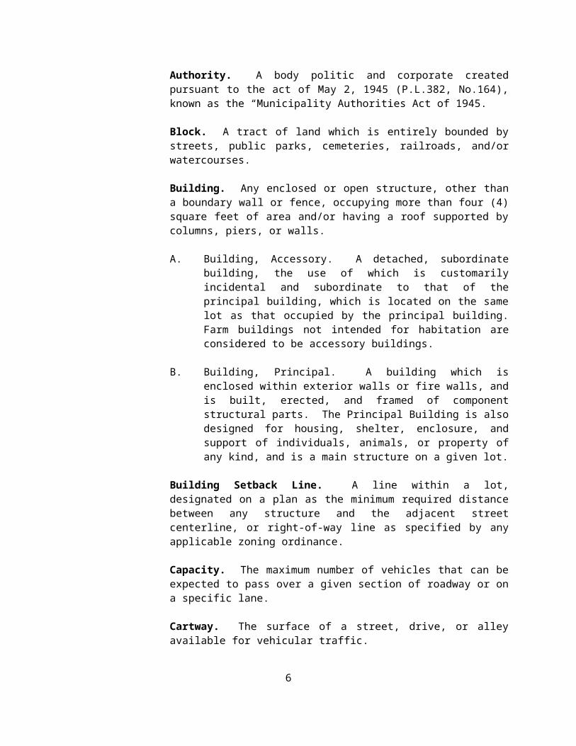
Authority. A body politic and corporate created pursuant to the act of May 2, 1945 (P.L.382, No.164), known as the “Municipality Authorities Act of 1945.
Block. A tract of land which is entirely bounded by streets, public parks, cemeteries, railroads, and/or watercourses.
Building. Any enclosed or open structure, other than a boundary wall or fence, occupying more than four (4) square feet of area and/or having a roof supported by columns, piers, or walls.
A. Building, Accessory. A detached, subordinate building, the use of which is customarily incidental and subordinate to that of the principal building, which is located on the same lot as that occupied by the principal building. Farm buildings not intended for habitation are considered to be accessory buildings.
B. Building, Principal. A building which is enclosed within exterior walls or fire walls, and is built, erected, and framed of component structural parts. The Principal Building is also designed for housing, shelter, enclosure, and support of individuals, animals, or property of any kind, and is a main structure on a given lot.
Building Setback Line. A line within a lot, designated on a plan as the minimum required distance between any structure and the adjacent street centerline, or right-of-way line as specified by any applicable zoning ordinance.
Capacity. The maximum number of vehicles that can be expected to pass over a given section of roadway or on a specific lane.
4
Cartway. The surface of a street, drive, or alley available for vehicular traffic.
Clear Sight Triangle. An area of unobstructed vision at a street intersection defined by a line of sight between points at centerlines.
Colerain Township. The Township of Colerain in Lancaster County, Commonwealth of Pennsylvania (See, also Township).
Commission. The Colerain Township Planning Commission.
Community Water Supply. A utility operated by a municipality or a company, regulated by the Public Utility Commission, which supplies potable, domestic water for use by more than one household, business, or institution.
Comprehensive Plan. The official public document prepared in accordance with the Pennsylvania Municipalities Planning Code, Act 247 of 1968, as reenacted and amended by Act 170 of 1988, and as subsequently amended, consisting of maps, charts, and textual material, that constitutes a policy guide to decisions about the physical and social development of Colerain Township.
Condominium. A multiple unit land development in which there is a system of separate ownership of individual units of occupancy and undivided interest of land and common facilities.
Corner Lot. A lot adjacent to a street intersection with frontage on two or more streets. Corner lots shall have two front yards.
Dedication. The deliberate appropriation of land by its owner for general public use.
Deed. A written instrument whereby an estate in real property is conveyed.
Deed Restriction. A restriction upon the use of a property placed in a deed.
Density. The number of dwelling units or units of occupancy per acre, exclusive of street rights-of-way.
Detention Basin. A reservoir which temporarily contains storm water runoff and releases it gradually into a watercourse or storm water facility.
Developer. Any landowner, agent of such landowner, equitable owner, or tenant with the permission of the landowner, for whom subdivision or land development plans are being or have been made.
Development Plan. The provisions for development, including a planned residential development, a plat of subdivision, all covenants relating to use,
5

location and bulk of buildings and other structures, intensity of use or density of development, streets, ways and parking facilities, common open space and public facilities. The phrase "provisions of the development plan" when used in this Ordinance shall mean the written and graphic materials referred to in this definition.
Double Frontage Lot. A lot with front and rear street frontage.
Drainage Easement. The land required for the installation of storm sewer or drainage facilities, or required along a natural stream or watercourse for preserving the channel and providing for the flow of water therein, or to safeguard the public against flood damage.
Driveway. A private drive providing vehicular access between a street or access drive and a parking area for a single residential unit of occupancy, or a private drive for non-residential uses permitted to provide less than three parking spaces.
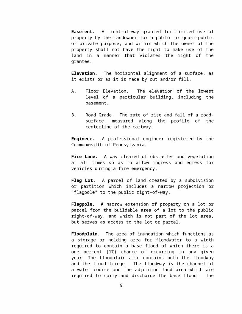
Easement. A right-of-way granted for limited use of property by the landowner for a public or quasi-public or private purpose, and within which the owner of the property shall not have the right to make use of the land in a manner that violates the right of the grantee.
Elevation. The horizontal alignment of a surface, as it exists or as it is made by cut and/or fill.
A. Floor Elevation. The elevation of the lowest level of a particular building, including the basement.
B. Road Grade. The rate of rise and fall of a road-surface, measured along the profile of the centerline of the cartway.
Engineer. A professional engineer registered by the Commonwealth of Pennsylvania.
Fire Lane. A way cleared of obstacles and vegetation at all times so as to allow ingress and egress for vehicles during a fire emergency.
Flag Lot. A parcel of land created by a subdivision or partition which includes a narrow projection or "flagpole" to the public right-of-way.
Flagpole. A narrow extension of property on a lot or parcel from the buildable area of a lot to the public right-of-way, and which is not part of the lot area, but serves as access to the lot or parcel.
Floodplain. The area of inundation which functions as a storage or holding area for floodwater to a width required to contain a base flood of which there is a
6
one percent (1%) chance of occurring in any given year. The floodplain also contains both the floodway and the flood fringe. The floodway is the channel of a water course and the adjoining land area which are required to carry and discharge the base flood. The flood fringe is the adjoining area which may be covered by water of the base flood. The location of a floodplain shall be established in accordance with Section 607.03, and may include an area of greater magnitude than the base flood if a greater flood hazard area is designated by a Township ordinance.
Flood-proofing. Any combination of structural and/or nonstructural provisions, additions, changes, or adjustments to structures or contents which are designed or adapted primarily to reduce or eliminate flood damage to those structures or contents.
Future Access Strip. A right-of-way reserved for the future improvement of a street.
Half Street. A street of less than the required right-of-way and/or cartway width, such as a street built from the shoulder edge to the eventual centerline. (See also Street).
Historic Feature. Any building, site, structure, object, district or area that:
A. Is listed on the National Register of Historic Places; or
B. Has received a Determination of Eligibility for the National Register from the National Park Service; or
C. Which is listed on the Lancaster County Historic Sites Register or the Comprehensive Site Survey of Lancaster County, both of which are maintained by the Historic Preservation Trust of Lancaster County; or
D. Which is listed on any officially adopted Township register or inventory of historic features.
This term shall include the site, principal structures, accessory structures, yards, vegetation, fences, road alignments, and signage associated with such features.
Horizon Year. The anticipated opening year of a development, assuming full buildout and occupancy.
Improvement Construction Assurance. The procedures, specified in Article V, by which a developer assures the construction of improvements required by this Ordinance.
Improvements. Physical changes to the land, including but not limited to, grading, paving, curbs, gutters, storm sewers and drains, improvements to
7

existing watercourses, sidewalks, street signs, monuments, water supply facilities, and sewage disposal facilities.
Influence Area. An area which contains 80% or more of the trips that will be attracted to a development site.
Land Development. The development of property as specified below:
A. The improvement of one lot or two or more contiguous lots, tracts, or parcels of land for any purpose involving:
(1) A group of two or more residential or nonresidential buildings, whether proposed initially or cumulatively, or a single nonresidential building on a lot or lots regardless of the number of occupants or tenure; or
(2) The division or allocation of land or space, whether initially or cumulatively, between or among two or more existing or prospective occupants by means of, or for the purpose of, streets, common areas, leaseholds, condominiums, building groups, or other features;
B. A subdivision of land.
C. "Land Development" shall not include:
(1) The conversion of an existing single family detached dwelling or single family semi-detached dwelling into not more than three residential units, unless such units are intended to be a condominium;
(2) The addition of an accessory building, including farm buildings, on a lot or lots subordinate to an existing principal building; or
(3) The addition or conversion of buildings or rides within the confines of an enterprise which would be considered an amusement park. For purposes of this subclause, an amusement park is defined as a tract or area used principally as a location for permanent amusement structures or rides. This exclusion shall not apply to newly acquired acreage by an amusement park until initial plans for the expanded area have been approved.
Landowner. The legal, beneficial, equitable owner or owners of land, including the holder of an option or contract to purchase (whether or not such option or contract is subject to any conditions), a lease (if he is authorized under the lease
8

to exercise the right of the landowner), or another person having a proprietary interest in land.
Landscape Architect. A landscape architect registered by the Commonwealth of Pennsylvania.
Lateral. A utility line between a main line, located in a utility easement or street right-of-way, and the building which the line serves.
Level-of-Service. A measure of the effect of traffic on the capacity of a road.
Lot. A designated parcel, tract, or area of land established by a plat or otherwise permitted by law and to be used, developed, or built upon as a unit.
Lot Add-On Plan. See Plan, Lot Add-on Plan.
Lot Area. The area contained within the property lines of the individual parcel of land, excluding space within the street right-of-way. The lot area includes the area of any utility easement or storm water management facility, but does not include the "flagpole" of a flag lot unless otherwise specified in the Colerain Township Zoning Ordinance.
Lot Depth. The average distance between the street right-of-way and the rear lot line, measured perpendicular or radial to the right-of-way.
Lot Frontage. That side of a lot abutting on the street right-of-way and regarded as the front of the lot.
Lot Line Marker. A metal plate or pin used to identify lot line intersections.
Lot Width. The average distance between the side lot lines of a lot, measured parallel to the right-of-way.
Mediation. A voluntary negotiating process in which parties in a dispute mutually select a neutral mediator to assist them in jointly exploring and settling their difference, culminating in a written agreement which the parties themselves created and consider acceptable.
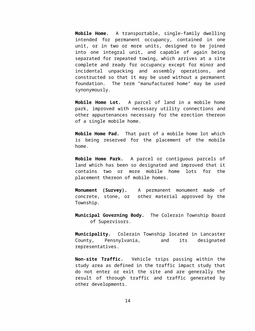
Mobile Home. A transportable, single-family dwelling intended for permanent occupancy, contained in one unit, or in two or more units, designed to be joined into one integral unit, and capable of again being separated for repeated towing, which arrives at a site complete and ready for occupancy except for minor and incidental unpacking and assembly operations, and constructed so that it may be used without a permanent foundation. The term "manufactured home" may be used synonymously.
9
Mobile Home Lot. A parcel of land in a mobile home park, improved with necessary utility connections and other appurtenances necessary for the erection thereon of a single mobile home.
Mobile Home Pad. That part of a mobile home lot which is being reserved for the placement of the mobile home.
Mobile Home Park. A parcel or contiguous parcels of land which has been so designated and improved that it contains two or more mobile home lots for the placement thereon of mobile homes.
Monument (Survey). A permanent monument made of concrete, stone, or other material approved by the Township.
Municipal Governing Body. The Colerain Township Board of Supervisors.
Municipality. Colerain Township located in Lancaster County, Pensnylvania, and its designated representatives.
Non-site Traffic. Vehicle trips passing within the study area as defined in the traffic impact study that do not enter or exit the site and are generally the result of through traffic and traffic generated by other developments.
Official Map. An ordinance adopted and amended from time-to-time pursuant to Article V of the Pennsylvania Municipalities Planning Code by the Township Board of Supervisors containing a drawing or drawings that show the precise location of future road right-of-ways or lands to be publicly acquired either through purchase or dedication, and which is used to facilitate the proper placement of structures in relation to future property lines.
Ordinance. The Colerain Township Subdivision and Land Development Ordinance as subsequently amended.
Parcel. See Lot.
Pass-by-Trips. (See Shared Trips).
Peak Hour. The hour during which the heaviest volume of traffic occurs on a road.
Pedestrian Way. A right-of-way, publicly or privately owned, intended for human movement by walking.
Performance Guarantee. Any financial security which may be accepted in lieu of certain improvements being made prior to Final Plan approval, pursuant to Section 509 of the Pennsylvania Municipalities Planning Code.
10

Plan. A drawing, together with supplementary data, that describes property
A. Centerline Separation Plan. A complete and exact subdivision plan which creates two (2) lots by using a street centerline as the common boundary, and which meets the criteria specified in Section 311 of this Ordinance.
B. Preliminary Plan. A complete and exact subdivision and/or land development plan, including all supplementary data specified in Section 302 of this Ordinance.
C. Final Plan. A complete and exact subdivision and/or land development plan, including all supplementary data specified in Section 403 of this Ordinance.
D. Lot Add-On Plan. A complete and exact subdivision plan including all supplementary data specified in Section 404 of this Ordinance. The sole purpose of which is to increase the lot area of an existing lot or tract.
E. Minor Land Development Plan. A complete and exact land development plan which meets one of the thresholds specified in Section 305 of this Ordinance and is designed in accordance with the requirements of Section 403.
F. Minor Subdivision Plan. A complete and exact subdivision plan which meets the criteria specified in Section 310.01 and is designed to meet the specifications of Section 405 of this Ordinance.
G. Record Plan. A Final Plan which contains the original endorsement of the Township, which is intended to be recorded with the Lancaster County Recorder of Deeds.
H. Sketch Plan. An informal plan, not necessarily to exact scale, indicating salient existing features of a tract and its surroundings, with the general layout of proposal prepared in accordance with Section 401 of this Ordinance.
Planning Commission. The planning agency appointed by the Township.
Plat. The map or plan of a subdivision or land development, whether preliminary or final.
Professional Consultant. Person or persons who provide expert or professional advice, including, but not limited to, architects, attorneys, certified public accountants, engineers, geologists, land surveyors, landscape architects or planners.
11

Public Grounds. Include:
A. Parks, playgrounds, trails, paths, other recreational areas and other public areas;
B. Sites for schools, sewage treatment, refuse disposal and other publicly owned or operated facilities; and
C. Publicly owned or operated scenic and historic sites.
Public Hearing. A formal meeting held pursuant to public notice, intended to inform and obtain public comment, prior to taking action in contested cases or prior to amending this Ordinance.
Public Meeting. A forum held pursuant to notice under the act of July 3, 1986 (P.L. 388, No. 84), known as the "Sunshine Act", as amended.
Retention Basin. A reservoir designed to retain storm water runoff with its primary release of water being through the infiltration of said water into the ground.
Reverse Frontage Lot. A lot with front and rear street frontage, where vehicular access is prohibited to and from the higher intensity street.
Right-of Way. The total width of any land reserved or dedicated as a street, alley, pedestrian way, or for other public or private use.
Runoff. The surface water discharge and rate of discharge of a given watershed after a full rain or snow that does not enter the soil but runs off the surface of the land.
Sedimentation. The process by which soil or other surface material is accumulated or deposited by wind, water, or gravity.
Service Street. See Street, Alley, or (Service Street).
Setback Line. See Building Setback Line.
Shared Trips. Vehicle trips entering and exiting the site which were using the facility on the adjacent streets and therefore did not generate new trips on the road.
Sight Distance. The length of road visible to the driver of a vehicle at any given point in the road when viewing is unobstructed by traffic.
Site. The existing lot of record proposed for land development, including subdivision.
12

Soil Survey Report. The most recent edition of the Soil Survey of Lancaster County, Pennsylvania, published by the U.S. Department of Agriculture, Soil Conservation Service.
Steep Slopes. Those areas of the Township where the natural slope of land exceeds the percentage(s) as set forth in Section 6.46 the Township’s Zoning Ordinance, as amended form time to time.
Storm Water Management Data. The plan information, designed in accordance with Section 607 of this Ordinance, which identifies design and construction details for managing the quantity and quality of storm water runoff.
Storm Water Management Facilities. Those controls and measures (e.g., storm sewers, berms, terraces, bridges, dams, basins, infiltration systems, swales, watercourses, and floodplains) used to implement a storm water management program.
Street. A strip of land, including the entire right-of-way, publicly or privately owned, serving primarily as a means of vehicular and pedestrian travel, and furnishing access to abutting properties. This term shall include the terms avenue, boulevard, road, highway, freeway, parkway, lane, alley, viaduct or any other way used for similar purposes. Streets shall conform to one of the following categories:
A. Principal Arterial. An interregional road in the street hierarchy system which carries vehicle traffic to and from the region as well as any through traffic. This street may be a controlled access street.
B. Minor Arterial. The Minor arterial street system interconnects with the principal arterial system. It provides connections between boroughs, larger villages, major resort areas and other traffic generators which develop substantial volumes of traffic.
C. Collector. This classification includes streets that provide connections with local access and arterial streets. They may serve a traffic corridor connecting villages, small boroughs, shopping points, mining and agricultural areas on an intra-county or municipal basis.
D. Local Access. This classification provides direct access to adjacent land and includes connections to farms, individual residences and commercial properties, and to higher classes of highway systems.
E. Rural Residential Street. A street serving a very low-density area (minimum two (2) acre zoning). The maximum AADT level limits the number of single-family homes on this road to twenty (20). Rural residential streets shall be designed as a two lane street.
13

F. Alley (Service Street). A service road that provides secondary means of access to lots. Alleys are on the same level as a local access street, and are used in cases of narrow lot frontages. No parking shall be permitted, and alleys should be designed to discourage through traffic. AADT level corresponds to that of local access street. Number of units served should not exceed seventy-six (76). Alleys may be designed as one lane streets.
G. Cul-de-sac. A street with a single means of ingress and egress and having a turnaround. The design of the turnaround may vary. Cul-de-sacs shall be classified and designed according to anticipated ADT level: A residential street will use the design standards of a local access street; a non-residential street will use the design standards for Commercial/Industrial streets.
H. Marginal Access Street. A service street that runs parallel to a higher-order street and provides access to abutting properties and separation from through traffic. Marginal Access Street may be designed as local access street or collector according to anticipated daily traffic.
I. Divided Street. A street in which the traffic directions are physically separated.
J. Stub Street. A short dead-end street which is a portion of a street which has been approved in its entirety. Stub streets may extend to a property line to permit connection of streets in adjoining subdivisions.
Street Line. The right-of-way line of any given street.
Street, private. A street not accepted for dedication by Colerain Township.
Structure. Any man-made object having an ascertainable stationary location on or in land or water, whether or not affixed to the land.
Subdivision. The division or redivision of a lot, tract, or parcel of land by any means into two or more lots, tracts, parcels, or other divisions of land, including changes in existing lot lines for the purpose, whether immediate or future, of lease, partition by the court for distribution to heirs or devises, transfer of ownership, or building, or lot development; provided, however, that the subdivision by lease of land for agricultural purposes into parcels of more than ten (10) acres, not involving any new street or easements of access or any residential dwelling shall not be considered as subdivisions within the meaning of this Ordinance.
Subject Tract. The site proposed for land development, including subdivision.
14
Substantially Completed. Where, in the judgment of Colerain Township, at least ninety percent (90%) (based on the cost of the required improvements for which financial security was posted) of those improvements required as a condition for final approval have been completed in accordance with the approved plan, so that the project will be able to be used, occupied or operated for its intended use.
Surface Drainage Plan. A plan showing all present and proposed grades and facilities for storm water drains.
Surveyor. An individual registered with the Commonwealth of Pennsylvania as authorized to measure the boundaries of tracts of land, establish locations, and perform the requirements of a survey.
Swale. A wide shallow ditch which gathers or carries surface water.
Township. See Colerain Township.
Tract. See Lot.
Trip. A single or one-directional vehicle movement.
Unit of Occupancy. An allocation of space within a building or structure that is independent of other such space and that constitutes a separate use. This shall include both fee simple ownership and leaseholds.
Unbuildable Site. A portion of a tract of land which due to physical or environmental conditions cannot support or is inappropriate for construction of a road, structure, or any other man-made improvement. Examples include wetlands, sinkholes, landslides, endangered species habitats, and hazardous waste dumps.
Waiver. A process for alleviating specific requirements imposed by this Ordinance and provided under Sections 307 and 904 of this Ordinance.
Watercourse. A permanent topographic feature, whether natural or man-made, that serves to gather and carry flowing surface water such as a permanent or intermittent stream, a river, creek, brook, run, or swale; and which measured by the width of the channel during normal high water.
Watershed. All land and water within the confines of a drainage basin.
Wetlands. Areas that are inundated or saturated by surface or groundwater at a frequency and duration sufficient to support, and that under normal circumstances do support, a prevalence of vegetation typically adapted for life in saturate soil conditions, including swamps, marshes, bogs, and similar areas.
15

16

ARTICLE III
PLAN PROCESSING PROCEDURES
SECTION 301 Pre-Application Review.
301.01Pre-Application Review.
A. The purpose of the pre-application meeting or sketch plan review is to afford the applicant the opportunity to receive the advice and assistance of the Township prior to formal application for approval. Such meeting and/or review shall be considered as confidential, to the extent permitted by applicable law, between the applicant, staff, and the Township.
B. Applicants for proposals which require a preliminary plan approval, plans which involve the creation of new streets or community storm water detention or retention facilities, and plans for the development of nonresidential structures are strongly urged to discuss such proposals with the Township and to prepare and submit Sketch Plans for review prior to submission of the formal application for approval. Submission of a Sketch Plan, even though strongly recommended, is not mandatory and shall not constitute formal filing of a plan with the Township.
C. Sketch Plan reviews are not required to be consistent with procedures of Section 508 of the Pennsylvania Municipalities Planning Code, as amended. Sketch Plans prepared for review and discussion should include those items listed in Section 401 of this Ordinance.
D. Applicants for proposals other than those described in subsection B are still encouraged to discuss such proposals and submit Sketch Plans for review.
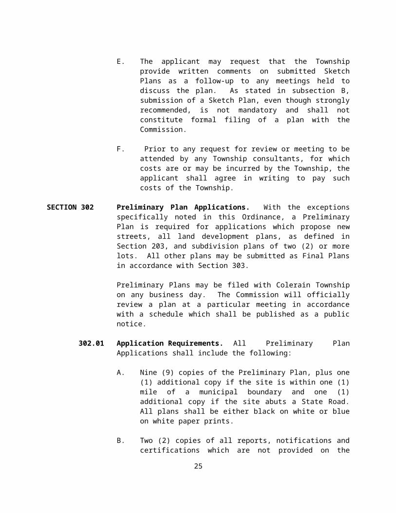
E. The applicant may request that the Township provide written comments on submitted Sketch Plans as a follow-up to any meetings held to discuss the plan. As stated in subsection B, submission of a Sketch Plan, even though strongly recommended, is not mandatory and shall not constitute formal filing of a plan with the Commission.
F. Prior to any request for review or meeting to be attended by any Township consultants, for which costs are or may be incurred by the Township, the applicant shall agree in writing to pay such costs of the Township.
SECTION 302 Preliminary Plan Applications. With the exceptions specifically noted in this Ordinance, a Preliminary Plan is required for applications which propose new streets, all land development plans, as defined in Section 203, and subdivision
17

plans of two (2) or more lots. All other plans may be submitted as Final Plans in accordance with Section 303.
Preliminary Plans may be filed with Colerain Township on any business day. The Commission will officially review a plan at a particular meeting in accordance with a schedule which shall be published as a public notice.
302.01 Application Requirements. All Preliminary Plan Applications shall include the following:
A. Nine (9) copies of the Preliminary Plan, plus one (1) additional copy if the site is within one (1) mile of a municipal boundary and one (1) additional copy if the site abuts a State Road. All plans shall be either black on white or blue on white paper prints.
B. Two (2) copies of all reports, notifications and certifications which are not provided on the Preliminary Plan, including storm water management plans and calculations.
C. One (1) application form (See Appendix 24) completely and correctly executed, with all information legible, and bearing all required signatures.
D. Filing fee (see fee schedule available at the Township’s office). Note: A separate filing fee must be submitted for each application. If one check is issued for multiple plans, a detailed breakdown of the individual fee assessments must accompany the payment. Fees relating to any appeal of a decision on an application shall not be considered review fees and may not be charged to an applicant.
E. Notification signed by the Township zoning officer that the proposal is generally in conformance with applicable zoning regulations, and that if any zoning variance, special exception, or conditional use is required that such approval has been granted or the status of any such application which has not been granted. A copy of the Township decision, including all conditions imposed, shall be submitted as part of any Preliminary Plan application.
F. When connection to an existing sanitary sewer system is proposed, written notice from the authority providing sanitary sewer service indicating that sufficient capacity to service the proposed development is available shall be provided. Such notice shall:
(a) Be dated within six (6) months of the plan application
(b) Identify the term of reservation and
18

(c) Provide capacity for the entire development (partial capacity based on phases of development will not be acceptable).
G. Incomplete Applications. A preliminary plan application shall be accompanied by all required plans and documents and the required filing fee. The designee of Colerain Township shall have seven (7) days from the date of submission of an application to check the plans and documents to determine if on their face they are in proper form and contain all the information required by this Ordinance. If defective, the application may be returned to the applicant with a statement that the application is incomplete within the seven (7) day period; otherwise the application shall be deemed accepted for filing as of the date of submission. Acceptance shall not, however, constitute a waiver of any deficiencies or irregularities. The applicant may appeal a decision by the designee under this Section to the Colerain Township Board of Supervisors in accordance with Section 905 of this Ordinance.
302.02 Plan Requirements. All Preliminary Plans shall be prepared in conformance with the provisions of Section 402 of this Ordinance and any other applicable requirement of law.
302.03 Distribution. Colerain Township shall distribute one (1) copy of the Preliminary Plan to each of the following individuals:
A. Township secretary or manager.
B. Township planning commission secretary.
C. Fire company or Fire Marshall.
D. Pennsylvania Department of Transportation (if the subject site abuts a State road).
E. Lancaster County Conservation District.
F. Lancaster County Planning Commission.
G. Adjoining municipality (if site is located within one (1) mile of a municipal boundary).
H. Township Engineer
I. Township Solicitor
302.04 Municipal Action. Colerain Township will schedule the Preliminary Plan application for action at a regularly scheduled public meeting within ninety (90)
19

days of the first public meeting of the Planning Commission after the date of filing.
302.05 Notification of Township Action. Within fifteen (15) consecutive days after the meeting at which the Preliminary Plan is reviewed and acted upon, the staff shall send written notice of Colerain Township action to the following individuals:
A. Landowner or his agent.
B. Applicant.
C. Township secretary or manager.
D. Township planning commission secretary.
E. Lancaster County Planning Commission.
F. Township Engineer.
G. Township Solicitor.
If the application is disapproved, Colerain Township will notify the above individuals, in writing, of the defects in the application and will identify the requirements which have not been met, citing the provisions of the statute or ordinance relied upon.
302.06 Compliance with Township Action. If Colerain Township conditions its Preliminary Plan approval upon receipt of additional information, changes, and/or notifications, such data shall be submitted and/or alterations noted on two (2) copies of the Plan to be submitted to Colerain Township for approval.
302.07 Township Approval and Certification. Colerain Township will acknowledge the satisfactory compliance with all conditions, if any, of the Preliminary Plan approval at a regularly scheduled public meeting. All materials to be considered by Colerain Township at such meeting shall be submitted by the applicant to Colerain Township at least fourteen (14) days prior to the meeting. Additionally, at the option of the applicant, after receipt of Preliminary Plan approval and compliance with all conditions of approval, a Preliminary Plan may be presented to Colerain Township for acknowledgment through a formal statement on the Plan. (See Appendix 17.)
Approval of a preliminary application shall constitute approval of the proposed subdivision and/or land development as to the character and intensity of development and the general arrangement of streets, lots, structures, and other planned facilities, but shall not constitute Final Plan approval. The Preliminary
20

Plan may not be recorded in the office of the Lancaster County Recorder of Deeds.
Preliminary Plan approval will be effective for a five-year period, or as otherwise provided for by State Law, from the date of the Township's approval of the Preliminary Plan application; therefore, Final Plan applications for the entire project must be made within five (5) years of Preliminary Plan approval unless Colerain Township grants a waiver by extending the effective time period of the approval.
The Applicant may, after receipt of acknowledgment from Colerain Township of the satisfactory completion of any conditions of Preliminary Plan approval, proceed to construct the improvements required by this Ordinance and shown on the approved Preliminary Plan. The applicant shall indicate the intent to construct the improvements in writing to the Commission prior to the start of construction. Additionally, the applicant shall complete and enter into the appropriate Memorandum of Understanding. The applicant shall indicate the timetable for the construction of the improvements including a schedule and plan of the proposed phasing of sections of the plan.
Construction and completion of the improvements shall not constitute permission to sell lots or occupy proposed buildings shown on the plan.
SECTION 303 Final Plan Application. An application for Final Plan Approval can be submitted only after the following, when required as noted, have been completed.
The receipt of an unconditional Preliminary Plan approval in accordance with Section 302 of this Ordinance, when a Preliminary Plan approval is required, and.
The completion of the improvements required by this Ordinance when the improvements are not assured by the kind of guarantees provided in Section 502 of this Ordinance.
Final Plans may be filed with Colerain Township on any business day; however, the Township will officially review a plan at a particular meeting only if the Plan was filed at least thirty (30) business days prior to that meeting. A schedule of the Township’s meetings for each calendar year and the corresponding dates for submission of plans and applications shall be published as a public notice.
The Final Plan may be submitted in sections, each section covering a reasonable portion of the entire proposed subdivision or land development as shown on the approved Preliminary Plan; provided that each section, except for the last section, shall contain a minimum of twenty-five percent (25%) of the total number of units of occupancy as depicted on the approved Preliminary Plan unless Colerain Township specifically approves a lesser percentage for one or more sections.
21

Colerain Township may accept a Final Plan modified to reflect a change to the site or its surroundings which occurs after the Preliminary Plan review. The Township shall determine whether a modified Final Plan will be accepted or whether a new Preliminary Plan shall be submitted.
303.01 Application Requirements. All Final Plan applications shall include the following:
A. Nine (9) copies of the Final plan sheet(s) to be recorded, plus one (1) additional copy if the site is within one (1) mile of a municipal boundary and one (1) additional copy if the site abuts a State road. All plans shall be either black on white or blue on white paper prints.
B. Two (2) copies of all reports, notifications and certificates which are not provided on the Final Plan, including storm water management plans and calculations.
C. One (1) correct and complete application form. (See Appendix 24.)
D. A Filing fee shall accompany the Final Plan (See fee schedule available at the Township). Note: A separate filing fee must be submitted for each application. If one check is issued for multiple plans, a detailed breakdown of the individual fee assessments must accompany the payment. Fees relating to any appeal of a decision on an application shall not be considered review fees and may not be charged to an applicant.
E. Notification signed by the Township zoning officer that the proposal is generally in conformance with applicable zoning regulations, and that if any zoning variance, special exception, or conditional use is required that such approval has been granted or the status of any such application which has not been granted. A copy of the Township decision, including all conditions imposed, shall be submitted as part of any Final Plan application.
F. One (1) copy of all applicable supplementary data, notices and certificates required in Sections 403.04 and 403.05 of this Ordinance.
G. One (1) verification form (see Appendix 33).
H. A Final Plan application shall be accompanied by all required plans and documents and the required filing fee. The designee of Colerain Township shall have seven (7) days from the date of submission of an application to check the plans and documents to determine if on their face they are in proper form and contain all the information required by this Ordinance. If defective, the application will be returned to the
22

applicant with a statement that the application is incomplete within the seven (7) day period; otherwise the application shall be deemed accepted for filing as of the date of submission. Acceptance shall not, however, constitute a waiver of any deficiencies or irregularities. The applicant may appeal a decision by the designee under this Section to the Colerain Township Board of Supervisors in accordance with Section 905 of this Ordinance.
I. Written notice from the authority providing sanitary sewer service indicating that sufficient capacity to service the proposed development has been reserved.
303.02 Plan Requirements. All Final Plans shall be prepared in conformance with the provisions of Section 403 of this Ordinance and any other applicable requirements of law.
303.03 Distribution. The Township shall distribute one (1) copy of the Final Plan to each of the following:
A. Township secretary or manager.
B. Planning commission secretary.
C. Fire company or Fire Marshal.
D. Pennsylvania Department of Transportation (if the subject site abuts a State road).
H. Lancaster County Conservation District.
I. Lancaster County Planning Commission.
J. Adjoining municipality (if the site is located within one (1) mile of a municipal boundary).
The Township will also notify the landowner, applicant, Township Solicitor, Township Engineer, and school district of the filing of the Plan.
303.04 Township Action. The Township will schedule the Final Plan application for action at a regularly scheduled public meeting within ninety (90) days of the first public meeting of the Township after the date of filing.
In general, the Township will schedule the Final Plan application for review at the first Township meeting which is at least thirty (30) days after the Township’s Planning Commission review. Final Plan approval will be effective for ninety (90) days from the date of the Township’s action on the Final Plan, or as otherwise provided for by State Law, unless the Township grants a waiver by extending the
23

effective time period of the approval. Within this time period the applicant must meet all conditions of approval, if any; certify plans as specified in this Ordinance; and record plans as specified in this Ordinance.
303.05 Notification of Township Action. Within fifteen (15) consecutive days after the meeting at which the Final Plan is reviewed, the staff shall send written notice of the Township’s action to the following:
A. Landowner or his agent.
B. Applicant.
C. Township secretary or manager.
D. Township planning commission secretary.
E. Lancaster County Planning Commission.
F. Township Engineer.
G. Township Solicitor.
303.06 Compliance with Township Action. If the Township conditions its Final Plan approval upon receipt of additional information, changes, and/or notifications, such data shall be submitted and/or alterations noted on two (2) copies of the Plan to be submitted to the Township for approval.
303.07 Final Plan Certification. After the Township’s approval of the Final Plan and the required changes, if any, are made, the applicant shall proceed to prepare two (2) sets of Final Plans which shall be transparent reproductions of the original plan which shall be black line on stable plastic base film and one (1) set of Final Plans which shall be a paper copy for the Township’s files. The two (2) transparent copies of the Final Plan shall be certified as set forth in the appendices attached hereto.
303.08 Reserved
303.09 Township Signature required. Both Final Plans shall be presented to the Township for the signature of the Colerain Township Board of Supervisors Chairman and Vice-Chairman or their designees. The Township signatures shall be placed on the Final Plan after a period of not less than twenty-four (24) hours. Signatures shall be affixed as soon after the twenty-four hours as is reasonably possible. (See Appendix 19.) Final Plans will not be signed by the Township if submitted more than ninety (90) days from the Township’s final approval action unless the Township grants a waiver by extending the effective time period of the approval.
24

303.10 Final Plan Recordation. Upon approval and certification of a Final Plan, the applicant shall record the Plan in the office of the Lancaster County Recorder of Deeds within 90 days of such final approval or 90 days after the date of delivery of an approved plan signed by the Township Board of Supervisors, following completion of conditions imposed for such approval, whichever is later.
Should the applicant fail to record the Final Plan within ninety (90) days of the Township’s Final Plan approval, the Township’s action on the plan shall be null and void unless the Township has granted a waiver by extending the effective time period of the approval.
303.11 Prior Sale of Lots Prohibited. The Final Plan shall be filed with the Lancaster County Recorder of Deeds before proceeding with the sale of lots.
303.12 Approval Signature Required. No Final Plan for any subdivision or land
development may be recorded unless it bears the signature of an authorized representative of the Township denoting approval of the plan by the Township.
303.13 Dedication by Recording the Final Plan. After approval of the Final Plan by the Township, the act of recording the Final Plan shall have the effect of an irrevocable offer to dedicate all streets and other areas designated for public use, unless reserved by the landowner as provided below. However, the approval of the Township duty upon the Commonwealth, County, or Township acceptance, maintenance, or improvement of any such dedicated areas or portion of same until proper authorities of the Commonwealth, County, or Township actually accept same by ordinance or resolution, or by entry, use, or improvement.
303.14 Notice of Reservation from Public Dedication. The landowner shall place a notation on the Final Plan when there is no offer of dedication to the public of certain designated areas, in which event the title to such areas shall remain with the owner, and the Commonwealth, County, and local authorities shall assume no right to accept ownership or right-of-way.
SECTION 304 Revised Subdivision and/or Land Development Plan Application. Any replatting or resubdivision of recorded plans or revision of approved final plans which have not yet been recorded, excluding lot grading plans in subdivisions, shall be considered as a new application and shall comply with all requirements of this Ordinance, except that survey corrections can be made.
304.01 In every case where a plan alteration conforms to the above, the applicant shall:
A. Submit to the Township two black on white or blue on white paper copies of the revised Final Plan, one application form and the appropriate filing fee. (See Appendix 24.) Upon review of the revision, the Township will, in writing, advise the applicant whether or not the
25
revision complies with the standards of Section 403.04 of this Ordinance.
B. If the revision complies, the applicant shall prepare two (2) Plans, which shall be transparent black line reproductions of the original plan and one (1) set of paper copies of the Plan for the municipality’s files, and which shall specifically identify the alteration(s) to the previously recorded plan.
C. The applicant shall then submit the Plan to the Township secretary or authorized Township official for certification as specified in Section 303.08 of this Ordinance and the Lancaster County Planning Commission for signature as specified in Section 303.09 of this Ordinance. (See Appendices 22 and 19).
D. The Plans shall then be recorded as specified in Section 303.10 of this Ordinance.
E. Prior to any rerecording, a note shall be placed on the replat specifying the Record Plan Book number of the original final plan.
SECTION 305 Minor Land Development Plans. Land development plans may be submitted as final plans in accordance with the provisions of this Ordinance provided the proposal meets one of the following conditions:
A. The development of a single, non-residential building of less than thirty thousand (30,000) square feet on a lot that was approved for such non-residential use by a plan reviewed and approved under the Lancaster County Subdivision and Land Development Ordinance or this Ordinance. This lot shall be on a plan of record and the installation of all improvements associated with the approval of such plan shall be completed. Further, access to the lot shall meet the standards of the current ordinance and traffic generated by the proposed use shall not exceed five hundred (500) AADT.
B. The development of a second principal building of less than ten thousand (10,000) square feet on a lot which contains an existing principal building. Traffic generated by the new use shall not exceed two hundred (200) AADT.
C. The development of a single principal building with an area of fifteen hundred (1500) square feet or less and which will generate fifty (50) or fewer AADT.
D. The development of a residential building with less than five (5) units of occupancy.
26

All land development plans which do not meet one or more of these conditions or which propose to either establish an access which does not meet the safety criteria of the current ordinance, or to phase construction of required infrastructure including, but not limited to, streets, sewer and water facilities, and storm water management facilities shall be submitted as a preliminary plan in accordance with the requirements of Section 302 of this Ordinance.
SECTION 306 Lot Add-On Plans. A plan which proposes to alter the location of lot lines between existing lots of separate ownership for the sole purpose of increasing lot size may be approved by the Township for recording purposes.
306.01 Lot Add-on Requirements. Lot Add-on Plans shall only be permitted when:
A. No lot or tract of land is created which is smaller than the minimum size permitted by the applicable Zoning Ordinance; and
B. Drainage easements or rights-of way are not altered; and
C. Access to the affected parcels is not changed; and
D. Street alignments are not changed; and
E. No new lots are created.
306.02 Lot Add-on Plan Required. Where the above conditions are satisfactorily proven to exist, a plan shall be prepared and submitted in accordance with the requirements of Section 404 of this Ordinance.
306.03 Deed Required. A copy of the deeds to be recorded for the both the receiving and donating tracts shall be submitted prior to recording of the lot add-on plan. The deed shall provide a description of the tract which reflects the proposal to join it in common with the acreage to be conveyed.
306.04 Lot Add-on Plan Submission and Recording Procedures. In every case where a proposal conforms to the requirements of this Section, the application shall comply with the following procedures:
A. Submit to the Township four (4) black on white or blue on white paper copies of a Lot Add-On Plan prepared to the standards specified in Section 404 of this Ordinance one (1) correctly completed application form (see Appendix No. 24), notification from the Township zoning officer that the proposal is generally in conformance with applicable zoning regulations, or that, if any zoning variance, special exception, or conditional use is required, that such approval has been granted, and the appropriate filing fee. Upon review of the proposal, the Township will, in writing, advise the applicant whether or not the proposal qualifies as a lot add-on.
27

B. If the Plan qualifies, the applicant shall prepare two (2) Plans for recording, which shall be transparent reproductions of the original plan with black line on stable plastic base film, and one (1) set of paper copies of the Plan for the Township’s files. The two (2) transparent copies of the Plan shall be certified by the Township (See Appendix 20). The applicant shall record the Plans with the Lancaster County Recorder of Deeds. These Plans shall be filed with the County Recorder of Deeds prior to the execution of a deed for the land.
C. All plans approved under this subsection shall be recorded as specified in Sections 303.10, 303.11, 303.12, and 303.14 of this Ordinance.
SECTION 307 Procedure for Requesting Consideration of Waiver of Provisions of This Ordinance.
307.01 Application Requirements. All requests for waivers shall be made in accordance with the following procedure:
A. All requests for a waiver shall be made in writing and shall accompany and be a part of the application for development. The request shall state in full the grounds and facts of unreasonableness or hardship on which the request is based, or the alternative standard proposed to provide equal or better results, the section or sections of this Ordinance which are requested to be waived, and the minimum modification necessary. The request shall be accompanied by a plan prepared at least to the minimum standards of a sketch plan (see Section 401).
B. Should a revision to a submitted plan require a waiver which was not apparent at the time of initial plan submission, the request for a waiver shall be submitted in accordance with subsection (A). above, at the time of submission of the revised plans.
C. Requests for waivers shall be considered by the Township at a public meeting which is at least fourteen (14) days after the submission of the waiver request.
307.02 Township Commission Action. At a scheduled public meeting, the Township shall review the request to determine if the literal compliance with any mandatory provision of the Ordinance is demonstrated by the applicant to exact undue hardship or to be unreasonable, or that an alternative standard has been demonstrated to provide equal or better results, provided that such modification will not be contrary to the public interest and that the purpose and intent of this Ordinance is observed. The applicant shall demonstrate that the alternative proposal represents the minimum modification necessary. If the Township determines that the applicant has met his burden, it may grant a waiver from the literal compliance with the terms of this Ordinance.
28

307.03 Notification of Township Commission Action. After the meeting at which the waiver was reviewed, the Township shall send notice of the Township’s action to the following individuals:
A. Landowner or his agent.
B. Applicant.
C. Township secretary or manager.
D. Township planning commission secretary.
E. Lancaster County Planning Commission.
F. Township Engineer.
G. Township Solicitor.
If the Township denies the request, the Township will notify the above individuals, in writing, of the justification for denial. If the Township grants the request, the Final Plan shall include a note which identifies the specific waiver(s) as granted.
SECTION 308 Reserved
SECTION 309 Reserved
SECTION 310 Minor Subdivision Plans. On a subject tract for which the development rights have been specifically restricted by effective Agricultural, Land Conservation, or Open Space zoning to allow the creation of less than five (5) lots, a proposal to subdivide two (2) or less lots for single family residential development (not including the remaining lot created by the subdivision of such lot(s)) or, a land development proposal which seeks to establish a second residential dwelling unit on such subject tract, may be approved by the Township for recording purposes, if it is in conformance with the criteria specified in Section 310.01.
Subdivision of the subject tract which exceeds a cumulative total of two (2) lots, subdivision of a subject tract for which lots received a waiver under the LCPC Storm Water Management Waiver Policy of 28 January 1993, or further subdivision of either of the lots created by this or the previous waiver procedure, must be processed in accordance with the standard subdivision procedures as specified in Article III of this Ordinance.
310.01 Minor Subdivision Plan Criteria. Minor subdivision plans shall only be permitted when all of the following criteria are satisfied:
29

A. Development of the proposed lots respects the particular topographic and environmental features of the site and does not adversely impact any sensitive environmental features such as floodplain, wetlands, steep slopes, or sinkholes. It shall be the responsibility of the professional certifying the accuracy of the plan that such features are accurately identified and appropriately protected. However, if determined by Colerain Township that the protection of such features has not been adequately demonstrated, the proposal shall be disapproved.
B. The proposed lots are designed in accordance with the provisions of the applicable zoning district and no flag lots are created other than as provided for by section 604.04(E)(3).
C. All lots shall front on a public or private street and shall provide for vehicular access which does not interfere with the normal movement of traffic.
D. The amounts of impervious area permitted on the subject tract shall be in accordance with the following:
Acreage Minimum Amount ofOf Subject ImperviousTract Distance* Area Permitted
<1 acre 25' 5,000 sq.ft.1-2 acres 100' 10,000 sq.ft.2-5 acres 250' 15,000 sq.ft. >5 acres 500' 20,000 sq.ft.
*The minimum distance between the proposed impervious area to the down slope property line.
E. Sewer and water service shall be available for all lots to the satisfaction of the Township All existing and proposed onsite systems shall have received the necessary approvals from DEP and the Township, and the same shall meet all necessary and appropriate setback requirements.
F. No point discharge of runoff will result from the proposal. The applicant shall demonstrate by submission of existing contour information and a grading plan that storm water flows from the site leave the site in the same manner as in pre-development condition.
310.02 Application Requirements. The designee of Colerain Township shall have seven (7) days from the date of submission of an application to check the plans and documents to determine if, on their face, they are in proper form and contain all the information required by this ordinance. If defective, the application will be returned to the applicant with a statement that the
30

application is incomplete. Otherwise, the application shall be deemed accepted for filing as of the date of the submission. Acceptance shall not however, constitute a waiver of any deficiencies or irregularities. The applicant may appeal a decision by the designee under this Section to the Colerain Township governing body in accordance with Section 905 of this Ordinance. All minor subdivision plans shall include the following information:
A. Six (6) copies of the plan plus one (1) additional copy if the site abuts a State road. All plans shall be either black on white or blue on white paper prints.
B. Two (2) copies of all applicable supplementary data.
C. One (1) correct and complete application form (see Appendix # 24).
D. A filing fee (see fee schedule available at the Township office). Note: A separate filing fee must be submitted for each application. If one check is issued for multiple plans, a detailed breakdown for the individual fee assessments must accompany the payment. Fees relating to any appeal of a decision on an application shall not be considered review fees and may not be charged to an applicant.
E. Notification signed by the Township zoning officer that the proposal is generally in conformance with applicable zoning regulations, and that if any zoning variance, special exception, or conditional use is required, that such approval has been granted. A copy of the Township decision, including all conditions imposed shall be submitted to the Township as part of the application.
F. Notification from the Department of Environmental Protection that either approval of the Sewer Facility Plan Revision (Plan Revision Module for Land Development) or Supplement has been granted or that such approval is not required.
G. Where the subject tract contains an electric transmission line, a gas pipeline, a telecommunication line, or a petroleum or petroleum product transmission line located within the lots proposed to be developed, written notice from the entity with rights to such area as to the location of required setback and/or right-of-way lines and approval of any changes to the land located within such area shall be provided.
H. Written notice from the Lancaster County Conservation District which indicates that an acceptable Erosion and Sedimentation Control Plan has been submitted for the proposed project.
310.03 Plan Requirements. All minor subdivision plans shall be prepared in conformance with the provisions of Section 405 of this Ordinance and any other
31

applicable requirements of law.
310.04 Certification. After the plan has been reviewed and the required changes, if any, are made, the applicant shall proceed to prepare two (2) sets of plans which shall be transparent reproductions of the plan which shall be black line on stable plastic base film and one (1) set of plans which shall be a paper copy for the Township’s files. The two (2) transparent copies of the plan shall be certified in accordance with the provisions of Section 405.03 and the appendices attached hereto.
310.05 Reserved
310.06 Township Signature Required. Both Final Plans shall be presented to the Township for the signature of the Board of Supervisors.
310.07 Recordation. Upon approval and certification, the applicant shall record the plan in accordance with the provisions of Sections 303.10, 303.11, 303.12, and 303.14 of this Ordinance.
SECTION 311 Centerline Separation Plans. The division of an existing tract along the centerline of an existing road to create two (2) lots whose common boundary is said centerline, may be approved for recording purposes, if it is in conformance with the criteria specified below:
A. The resultant lots conform to the configuration requirements of Section 604.04 of this ordinance.
B. The resultant lots meet all requirements of the applicable zoning district.
C. The resultant lots shall retain adequate access to accommodate potential development in accordance with the current zoning district regulations.
311.01 Application Requirements. All applications shall include the following:
A. One (1) correct and complete application form (see Appendix #24).
B. A filing fee.
C. Draft legal descriptions and Deeds for the resulting lots.
D. Notification signed by the Township zoning officer that the proposal is generally in conformance with applicable zoning regulations.
E. Notification from the Department of Environmental Protection that either approval of the Sewer Facility Plan Revision (Plan Revision
32

Module for Land Development) or Supplement has been granted or that such approval is not required.
F. Four (4) black on white or blue on white paper prints of the plan.
311.02 Plan Requirements. All centerline separation plans shall be prepared in conformance with the provisions of Section 406 of this Ordinance and any other applicable requirements of law.
311.03 Certification. After the plan has been reviewed and the required changes, if any,
are made, the applicant shall proceed to prepare two (2) sets of plans which shall be transparent reproductions of the plan which shall be black line on stable plastic film and one (1) set of plans which shall be a paper copy for the Township’s files. The two (2) transparent copies of the plan shall be certified in accordance with the provisions of Section 406.03 and the appendices attached hereto.
311.04 Reserved
311.05 Township Signature Required. Both Final Plans shall be presented to the Township for the signature of the Board of Supervisors.
311.06 Deed Required. Recordation of such plan does not serve to separate the proposed lots. To be considered as separate land holdings, deeds must be recorded to reflect the descriptions as provided on the recorded plan.
311.07 Future Development. Any development of the lots created through this process must follow standard plan processing procedures as specified in Article III of this Ordinance.
311.08 Recordation. Upon approval and certification, the applicant shall record the plan in accordance with the provisions of Sections 303.10, 303.11, 303.12, and 303.14 of this Ordinance.
33

ARTICLE IV
INFORMATION TO BE SHOWN ON OR SUBMITTEDWITH SUBDIVISION AND LAND DEVELOPMENT PLANS
SECTION 401 Sketch Plans. The scale and sheet size of Sketch Plans shall be as required for Preliminary Plans in Section 402.01(A) and (D). The Sketch Plan shall show or be accompanied by the following data, legible in every detail and drawn to scale, but not necessarily containing precise dimensions:
A. Name and address of the developer (if applicable) and landowner.
B. Name of the individual and/or the firm that prepared the Plan.
C. Location map with sufficient information to locate the property.
D. North arrow.
E. Written and graphic scales.
F. Existing tract boundaries accurately labeled with the name(s) of adjacent landowner(s).
G. The location of any municipal boundary line(s) if located within the vicinity of the tract.
H. Significant topographical and man-made features (e.g., bodies of water, quarries, floodplains, tree masses, structures).
I. Proposed street, parking, building, and lot layout.
J. Proposed land use; if several land uses are proposed, the location of each land use shall be indicated.
K. Statement explaining the methods of water supply and sewage disposal to be used.
SECTION 402 Preliminary Plans. Preliminary Plans shall be prepared by an engineer, a surveyor, or a landscape architect. The Preliminary Plan shall show, be accompanied by, or be prepared in accordance with the following and shall provide sufficient design information to demonstrate conformance with the requirements of Article VI of this Ordinance:
34

402.01Drafting Standards:
A. The Plan shall be clearly and legibly drawn at a scale of 10 feet to the inch or a multiple there of and be legible to review without magnification or other assistance.
B. Dimensions shall be in feet and decimals; bearings shall be in degrees, minutes and seconds. Lot line descriptions shall read in a clockwise direction.
C. The survey shall not have an error of closure greater than one (1) foot in ten thousand (10,000) feet.
D. The sheet size shall be no smaller than eighteen by twenty-two (18 x 22) inches and no larger than twenty-four by thirty-six (24 x 36) inches. If the Plan is prepared in two (2) or more sections, a key map showing the location of the sections shall be placed on each sheet, with match lines to identify said sheets. If more than one (1) sheet is necessary, each sheet shall be the same size and numbered to show the relationship to the total number of sheets in the Plan (e.g., Sheet 1 of 5).
E. Plans shall be legible in every detail.
402.02Location and Identification:
A. The proposed project name or identifying title.
B. If the tract of land is located in the vicinity of a municipal boundary line, the location of the boundary shall be shown.
C. The name and address of the owner of the tract (or an authorized agent), the developer/subdivider, and the firm that prepared the plans.
D. The file or project number assigned by the firm that prepared the plan, the plan date, and the date(s) of all plan revisions.
E. A north arrow, a graphic scale, and a written scale.
F. The entire existing tract boundary with bearings and distances. (If a landowner is to retain a single lot with a lot area in excess of ten (10) acres, the boundary of that lot may be identified as a deed plotting and may be drawn at any legible scale; if the remaining lot has a lot area of ten (10) or less acres, it must be described to the accuracy requirements of this Ordinance.)
G. The total acreage of the entire existing tract.
35

H. The district and lot size and/or density requirements of the Township zoning ordinance.
I. The location of existing lot line markers along the perimeter of the entire existing tract.
J. A location map, drawn to a scale of a minimum of one inch equal to two thousand feet (1" = 2,000') relating the subdivision to at least two (2) intersections of road center lines. The approximate distance to the intersection of the centerlines of the nearest improved street intersection shall be identified.
K. A note indicating the types of sewer or water facilities to be provided.
402.03Existing Features:
A. Existing contours at a minimum vertical interval of one (1) foot for land with average natural slope of four (4) percent or less and at a minimum vertical interval of two (2) feet or five (5) feet for more steeply sloping land. Contours shall be accompanied by the location of the bench mark and notation indicating the datum used. Contours plotted from the United States Geodetic Survey will not be accepted.
B. The names of all immediately adjacent landowners and the names and plan book record numbers of all previously recorded plans for adjacent projects.
C. The following items when located within two hundred (200) feet of the subject tract:
(1) The location and name of existing rights-of-way and cartways for streets, access drives, driveways, and service streets.
(2) The location of the following features and any related rights-of-way: sanitary sewer mains, water supply mains, fire hydrants, buildings, and storm water management facilities.
(3) The location of existing rights-of-way for electric, gas, and oil transmission lines, and railroads.
(4) The size, capacity, and condition of the existing storm water management system and any other facility that may be used to convey storm flows from the subject tract.
D. The following items when located within the subject tract:
36

(1) The location, name, and dimensions of existing rights-of-way and cartways for streets, access drives, driveways, and service streets.
(2) The location and size of the following features and related rights-of-way: sanitary sewer mains, water supply mains, fire hydrants, buildings, and storm water management facilities.
(3) The location of existing rights-of-way for electric, gas, and oil transmission lines, and railroads.
(4) The size, capacity, and condition of the existing storm water management system and any other facility that may be used to convey storm flows.
E. The following items when located within two hundred (200) feet of the subject tract or upon the site proposed for development: significant environmental or topographic features including but not limited to flood plains, wetlands, quarry sites, solid waste disposal areas, historic features, cemetery or burial sites, archaeologic sites, highly erosive soils, steep slopes, or wooded areas. Additionally, the preliminary plan shall indicate any proposed disturbance, encroachment, or alteration to such features when located upon the site proposed for development.
402.04 Plan Information:
A. The layout of streets, alleys, and sidewalks, including cartway and right-of-way widths.
B. The layout of lots, with approximate dimensions.
C. Block and lot numbers in consecutive order (e.g., Block "A," Lots 1 through 10; Block "B," Lots 11 through 22).
D. In the case of land developments, the location and configuration of proposed buildings, parking compounds, streets, access drives, driveways, and all other significant planned facilities.
E. Total number of lots, units of occupancy, density, and proposed land use; (if a multiple land use is proposed, an indication of the location of each land use).
F. Easements.
G. Building setback lines, with distances from the street centerline or street right-of-way line, whichever requirement is applicable under the Township zoning ordinance.
37

H. Identification of buildings, other structures and historic features proposed to be demolished.
I. Typical street cross section for each proposed street and typical cross section for any existing street which will be improved as part of the application. Each cross section shall include the entire right-of-way width.
J. Street centerline profile for each proposed street shown on the Preliminary Plan.
K. The preliminary design of the proposed sanitary sewer mains and water supply mains. The information shall include the approximate size, material, and vertical and horizontal location, when applicable.
L. The following storm water management data designed in accordance with the Colerain Township stormwater management ordinance. The information may be provided on a sheet with other data or on separate sheets. In the case of any dispute in the methodology used in the design of any storm water management plan and/or in the presentation of such information, the municipality shall make the final determination.
(1) All calculations, assumptions, criteria, and references used in the design of the storm water management facilities, the establishment of existing facilities capacities, and the pre and post development discharges.
(2) All plans and profiles of the proposed storm water management facilities, including the horizontal and vertical location, size, and type of material.
(3) For all basins, a plotting or tabulation of the storage volumes and discharge curves with corresponding water surface elevations, inflow hydrography, and outflow hydrography.
(4) The guidelines for lot grading within the subdivisions. This information shall identify the direction of storm water runoff flow within each lot and the areas where storm water runoff flows will be concentrated. This information shall be shown by flow arrows or topographical data (see Appendix 28 for examples).
M. A statement on the Plan indicating that all zoning approvals and all zoning variances have been obtained, if applicable.
38

N. A statement on the Plan indicating any waivers requested of or granted by the Township.
O. Proposed street names.
P. The current tax map parcel numbers for the tract to be developed.
402.05 Certificates, Notifications, and Reports:
A. Where the Preliminary Plan covers only a part of the entire landholding, a sketch of the future street system of the unsubmitted part shall be furnished. The street system of the submitted part will be considered in light of adjustments and connections with future streets in the part not submitted.
B. Where the land included in the subject application has an electric transmission line, telecommunications line, a gas pipeline, or a petroleum or petroleum products transmission line located within the tract, the application shall be accompanied by a letter from the owner or lease of such right-of-way stating any conditions on the use of the land and the minimum building setback and/or right-of-way lines. This requirement may also be satisfied by submitting a copy of the recorded agreement.
C. Certificate, signature, and seal of the surveyor to the effect that the survey is correct, and certificate, signature, and seal of the surveyor, engineer, or landscape architect that prepared the Plan that all other information shown on the plat is accurate. (See Appendix 14.)
D. Reserved
E. In the case of a Preliminary Plan calling for the phased installation of improvements, a schedule shall be filed delineating all proposed sections as well as deadlines within which applications for Final Plan approval of each section are intended to be filed. Each section in any residential subdivision or land development, except for the last section, shall contain a minimum of twenty-five percent (25%) of the total number of dwelling units as depicted on the Preliminary Plan unless the Township specifically approves a lesser percentage for one or more of the sections.
F. Where the subdivision or land development involves a site that meets any of the following criteria, a statement from the Lancaster County Conservation District that an acceptable Erosion and Sedimentation Control Plan has been submitted to that agency:
39

(1) Sites where earth disturbance greater than five (5) acres will occur.
(2) Sites where piping of storm water or the alteration of natural or man-made watercourses occurs.
(3) Sites with slopes greater than ten (10) percent.
(4) Sites that contain or border a stream or body of water.
(5) Sites that offer the potential for sedimentation to nearby bodies of water.
G. Where the subdivision or land development proposal will generate one hundred (100) or more additional trips to or from the site during the development's anticipated peak hour, a traffic impact study as required by this Ordinance shall be submitted with the Preliminary Plan.
H. Where the land included in the subject application has an agricultural, woodland or other natural resource easement located within the tract, the application shall be accompanied by a letter from the party holding the easement stating any conditions on the use of the land. This requirement may be satisfied by submitting a copy of the recorded agreement.
I. Where the developer intends to construct the improvements required by this Ordinance after unconditional preliminary plan approval, the applicant shall submit the appropriate executed Memorandum of Understanding (See Appendix No.34).
402.06 Filing Fee. The Preliminary Plan shall be accompanied by a filing fee. (See fee schedule available at the Township’s office). Note: A separate filing fee must be submitted for each application.
SECTION 403 Final Plans. Final Plans shall be prepared by an engineer, a surveyor, or a landscape architect. The Final Plan shall show, be accompanied by, or be prepared in accordance with the following and shall provide sufficient design information to demonstrate conformance with the requirements of Article VI of this Ordinance:
403.01 Drafting Standards. The same standards shall be required for a Final Plan as specified for a Preliminary Plan in Section 402.01 of this Ordinance.
403.02 Location and Identification. The same standards shall be required for a Final Plan as specified for a Preliminary Plan in Section 402.02 of this Ordinance.
40
403.03Existing Features.
A. Contour lines representing the topography of the site, if a Preliminary Plan was not required or the contours identified with the Preliminary Plan were altered. Such contours shall show elevations at a minimum vertical interval of one (1) feet for land with average natural slope of four (4) percent or less and at a minimum vertical interval of two (2) to five (5) feet for more steeply sloping land. Contour information shall be accompanied by the location of the bench mark and a notation indicating the datum used. Contours plotted from the United States Geodetic Survey will not be accepted. This information may be provided on separate sheets and is not subject to recording with the Final Plan.
B. The names of all immediately adjacent landowners and the names and plan book record numbers of all previously recorded plans for adjacent projects.
C. Significant environmental and topographic features including but not limited to flood plains, wetlands, quarry sites, steep slopes, and woodlands. When available, information regarding solid waste disposal areas, historic features, cemetery or burial sites, archeological sites, or areas with highly erosive soils may be shown as inventoried in the Lancaster County Geographic Information System. The location of such features not inventoried by the GIS shall be field verified. The final plan shall indicate any proposed disturbance, encroachment, or alteration to such features when located upon the site proposed for development.
D. The following items when located within two hundred (200) feet of the subject tract:
(1) The approximate location and name of existing rights-of-way and cartways for streets, access drives, and service streets.
(2) The approximate location of the following features and any related rights-of-way: sanitary sewer mains, water supply mains, fire hydrants, and storm water management facilities which affect the storm water runoff on the subject tract.
(3) The size, capacity, and condition of the existing storm water management system and any other facility that may be used to convey storm flows from the subject tract.
E. The following items when located within the subject tract:
(1) The location and size of the following features and related rights-of-way: on-lot sewage disposal systems, on-lot water
41

supplies, sanitary sewer mains, water supply mains, fire hydrants, buildings, and storm water management facilities. This information may be provided on separate sheets and need not be recorded with the Final Plan.
(2) The location of existing rights-of-way for electric, telecommunications, gas, and oil transmission lines and railroads.
(3) The size, capacity, and condition of the existing storm water management system and any other facility that may be used to convey storm flows.
403.04Plan Information:
A. Complete description of the centerline and the right-of-way line for all new streets. This description shall include distances and bearings with curve segments comprised of radius, tangent, arc, and chord.
B. Lot lines, with accurate bearings and distances, and lot areas for all parcels. Curve segments shall be comprised of arc, chord, bearing and distance. Along existing street rights-of-way, the description may utilize the existing deed lines or road centerlines; along all proposed street rights-of-way, the description shall be prepared to the right-of-way lines.
C. Block and lot numbers in consecutive order (e.g., Block "A," lots 1 through 10; Block "B," Lots 11 through 22).
D. The location and configuration of proposed buildings, parking compounds, streets, access drives, driveways, landscaping, and all other significant facilities.
E. Total number of lots, units of occupancy, density, and proposed land use; (if a multiple land use is proposed, an indication of the location of each land use).
F. Easements.
G. Building setback lines, with distances from the street centerline or street right-of-way line, whichever requirement is applicable under the Township zoning ordinance.
H. Identification of buildings, other structures and historic features proposed to be demolished.
42

I. Typical street cross section for each proposed street and a typical cross section for any existing street which will be improved as part of the application. Each cross section shall include the entire right-of-way width.
J. Final vertical and horizontal alignment for each proposed street, sanitary sewer, and water distribution system. All street profiles shall show at least the existing (natural) profile along the centerline, proposed grade at the centerline, and the length of all proposed vertical curves for streets. All water distribution and sanitary sewer systems shall provide manhole locations and size and type of material. This information may be provided on separate sheets and is not subject to recording with the Final Plan.
K. Source of title to the land included within the subject application, as shown by the books of the Lancaster County Recorder of Deeds.
L. Final street names.
M. Location and material of all permanent monuments and lot line markers, including a note that all monuments and lot line markers are set or indicating when they will be set.
N. A grading plan. The grading plan shall include finished land contours and grades, directions of water movement, type of soils, location of water bars or silt fences and ground floor elevations. This information may be provided on separate sheets and is not subject to recording with the Final Plan.
O. Identification of any waivers granted by the Township.
P. Identification of any lands to be dedicated or reserved for public, semi-public, or community use.
Q. The following storm water management data for all plans designed in accordance with the Colerain Township stormwater management ordinance. This information may be provided on a sheet with other data or on separate sheets and need not necessarily be recorded with the Final Plan. In the case of any dispute in the methodology used in the design of any storm water management plan and/or in the presentation of such information, the Township shall make the final determination on design criteria, methodology, and form of presentation.
(1) All calculations, assumptions, criteria, and references used in the design of the storm water management facilities, the
43

establishment of existing facilities capacities, and the pre and post development peak discharges.
(2) All plans and profiles of the proposed storm water management facilities, including the horizontal and vertical location, size, and type of material. This information shall be to a detail required for the construction of the facilities.
(3) For all basins, a plotting or tabulation of the storage volumes and discharge curves with corresponding water surface elevations, inflow hydrography, and outflow hydrography.
(4) For all basins which hold two (2) acre feet or more of water and have an embankment that is six (6) feet or more in height, soil structure and characteristics shall be provided. Plans and data shall be prepared by a registered professional engineer. These submissions shall provide design solutions for frost-heave potential, spring-swell potential, soil bearing strength, water infiltration, soil settling characteristics, fill and back-filling procedures, and soil treatment techniques as required to protect the improvements for adjacent structures.
(5) All erosion and sedimentation control measures, temporary as well as permanent, including the staging of the earth moving activities, in sufficient detail to clearly indicate their function.
(6) The guidelines for lot grading within subdivisions. This information shall identify the direction of storm water runoff flow within each lot and the areas where storm water runoff flows will be concentrated. This information shall be provided by flow arrows or topographic data (see Appendix 28 for examples). In areas where the Township feels additional lot grading information is needed to assure proper function of the storm water management facilities, specific grading information will be required as part of the Final Plan submittal.
403.05 Certificates, Notifications, and Reports:
A. When applicable, notification from the Department of Environmental Protection that either approval of the Sewer Facility Plan Revision (Plan Revision Module for Land Development) or Supplement has been granted or that such approval is not required. If the Final Plan is conditionally approved pursuant to Section 609, notification that the plan is subject to a pending Sewage Facilities Plan Revision Module and
44

that approval shall be obtained prior to the sale of any lots or the commencement of construction.
B. Where the land included in the subject application as an electric transmission line, a gas pipeline, a telecommunication line, or a petroleum or petroleum product transmission line located within the tract, the application shall be accompanied by a letter from the owner or lease of such right-of-way stating any conditions on the use of the land and the minimum building setback and/or right-of-way lines. This requirement may also be satisfied by submitting a copy of the recorded agreement.
C. Notice from Lancaster County-Wide Communications stating that the proposed street names are acceptable.
Appendix 35 shall be used to provide such notice. This form is to be completed by the applicant and sent by facsimile machine to Lancaster County-Wide Communications (717-664-1126). The returned, signed facsimile may then be submitted to the Township.
D. Certificate, signature, and seal of the surveyor, to the effect that the survey is correct and certificate, signature and seal of the surveyor, engineer, or landscape architect that prepared the Plan that all other information shown on the plat is accurate. (See Appendix 14.)
E. Certificate for approval by Colerain Township. (See Appendix 19)
F. A statement, duly acknowledged before an officer authorized to take acknowledgment of deeds and signed by the landowner, to the effect that the subdivision or land development shown on the Plan is the act and the deed of the owner, that all those signing are all the owners of the property shown on the survey and Plan, and that they desire the same to be recorded as such (See Appendix 16.) This statement must be dated following the last change or revision to said plan.
G. A certificate of dedication of streets and other public property. (See Appendix 16.)
H. Certificate of notification to be signed by the Lancaster County Planning Commission. (See Appendix 21.)
I. Reserved
J. A note to be placed on the Plan indicating any area that is not to be offered for dedication, if applicable.
45

K. An appropriately executed Memorandum of Understanding which sets forth the responsibilities of all parties regarding the installation and inspection of the required improvements. (See Appendix No.34).
L. All improvements have been made to the standards of the Ordinance or that an improvement guarantee has been submitted and was accepted by Colerain Township. (See Appendix No.26 or 27 for Notice and Article V for the Administration.)
M. Such written notices of approval as required by the Ordinance, including written notices approving the water supply systems, sanitary sewage systems, and storm water runoff to adjacent properties. (See Section 609 for specific requirements.)
N. The submission of a controlling agreement in accordance with Section 602.02 when an application proposes to establish a street which is not offered for dedication to public use.
O. In the case of a plan which requires access to a highway under the jurisdiction of the Pennsylvania Department of Transportation, the inclusion of the following plan note:
"A Highway Occupancy Permit is required pursuant to Section 420 of the Act of June 1, 1945 (P.L. 1242, No. 428), known as the "State Highway Law," before driveway access to a State highway is permitted. Access to the State highway shall only be as authorized by a Highway Occupancy Permit, and Colerain Township’s approval of this plan in no way implies that such permit can be acquired.”
P. For all storm water management facilities that affect an existing watercourse or have an upland drainage area greater than one-half (1/2) square miles, notification from the Department of Environmental Protection of approval or that no approval is required.
Q. Where the subdivision involves a site that meets the following criteria, a statement from the Lancaster County Conservation District that an acceptable Erosion and Sedimentation Control Plan has been submitted to that agency:
(1) Sites where earth disturbance greater than five (5) acres will occur.
(2) Sites where piping of stormwater or the alteration of natural or man-made watercourses occurs.
(3) Sites with slopes greater than ten (10) percent).
46

(4) Sites that contain or border a stream or body of water.
(5) Sites that offer the potential for sedimentation to nearby bodies of water.
R. Where the land included in the subject application has an agricultural woodland, or other natural resource easement located within the tract, the application shall be accompanied by a letter from the party holding the easement stating any conditions on the use of the land. This requirement may be satisfied by submitting a copy of the recorded agreement.
403.06 Filing Fee. The Final Plan shall be accompanied by a filing fee. (See fee Schedule available at the Township’s office).
SECTION 404 Lot Add-On Plan Requirements. Lot Add-On Plans shall be prepared by a registered surveyor and shall be subject to the following requirements:
404.01Drafting Standards:
A. The plan shall be clearly and legibly drawn on (18x22) or twenty-four by (24x36) inch sheets.
B. Dimensions shall be in degrees, minutes, and seconds with an error of closure no greater than one (1) foot in ten thousand (10,000) feet.
404.02 Plan Information. The following information shall be provided on the sheet to be recorded:
A. Project name.
B. If in vicinity of municipal boundary line, municipal line to be shown as well as name of adjacent municipality.
C. Name and address of the owner of the tract and all adjacent landowners affected by the proposed conveyance.
D. Name and address of the firm that prepared the plan and the file or project number assigned by the firm.
E. A north arrow, graphic scale, written scale, plan date, and the date(s) of all plan revisions.
F. A location map, at a scale not less than one inch equal to two thousand feet (1" = 2,000'), with sufficient information to locate the specific property involved. All existing roads in the vicinity of the site shall be identified.
47

G. The total number of lots, total acreage, density of development, present zoning classification, and minimum lot area requirements.
H. The location, size, and dimensions of existing right-of-way easements and utilities on or adjacent to both the conveying and receiving tracts.
I. The names of all immediately adjacent landowners and their respective parcel numbers.
J. Source of title to the tract being subdivided.
K. An accurate description of the parcel to be conveyed. If the remainder of the conveying tract has a lot area of ten (10) acres or less, it must also be described to the accuracy requirements of this Ordinance. If the remaining acreage is in excess of ten (10) acres, its boundary and the boundary of the receiving tract shall be described by deed plottings drawn at a legible scale.
L. Location and material of all permanent monuments and lot line markers, including a note indicating when they will be set.
M. Lot numbers.
N. Identification of any previous or new waivers granted by the Township.
404.03 Certificates:
A. Certificate signature and seal of the surveyor to the effect that the survey is correct. (See Appendix 14).
B. Certificate for approval by Colerain Township (See Appendix 20).
C. A statement, duly acknowledged before an officer authorized to take acknowledgment of deeds and signed by the landowner, to the effect that the subdivision as shown on the plan is the act and deed of the owner, that all those signing are all the owners of the property shown on the survey and plan, and that they desire the same to be recorded as such (See Appendix 16).
D. A statement, duly acknowledged before an officer authorized to take acknowledgment of deeds and signed by the owner of the receiving tract, to the effect that the conveyance as shown on the plan is in accordance with the intent of the landowner, that all those signing are all of the owners of the property shown on the plan, and that they desire the same to be recorded as such. (See Appendix 16).
48

SECTION 405 Minor Subdivision Plans. When the applicable criteria are satisfactorily proven to exist, a plan shall be prepared and submitted in accordance with the following requirements:
405.01Drafting Standards.
A. The plan shall be prepared by an engineer or a surveyor registered in the Commonwealth of Pennsylvania, and shall be clearly and legibly drawn on an eighteen by twenty-two (18x22) or twenty-four by thirty-six (24x36) inch sheet.
B. Dimensions shall be in degrees, minutes, and seconds with an error of closure no greater than one (1) in ten thousand (10,000) feet.
405.02 Plan Information. The sheet to be recorded shall provide the following information:
A. Project name and plan status
B. If in vicinity of municipal boundary line, municipal line to be shown as well as name of adjacent municipality.
C. Name and address of the owner of the tract
D. Name and address of the firm that prepared the plan and the file or project number assigned by that firm
E. A north arrow, graphic scale, written scale, plan date, and date of all plan revisions.
F. A location map, at a scale not less than one inch equal to two thousand feet (1"=2,000'), with sufficient information to locate the specific property involved. All existing roads in the vicinity of the site shall be identified.
G. The total number of lots, total acreage, density of development, present zoning classification, and minimum lot area requirements.
H. The location, size, and dimensions of existing rights-of-way, easements, and utilities on or adjacent to the proposed lots.
I. The names of all immediately adjacent landowners and the names and plan book record numbers of all previously recorded plans for projects adjacent to the subject tract.
J. The source of title to the subject tract.
49

K. An accurate description of the proposed lots and an identification of the proposed lot area. Along existing street rights-of-way, the description may utilize the existing deed lines or road centerline.
L. Location and material of all permanent monuments and lot line markers, including a note indicating when they will be set.
M. Lot numbers and block designations.
N. Identification of the number of building lots remaining to be subdivided from the parent tract (if any) in accordance with the provisions of the applicable zoning district regulations.
O. A deed plotting of the subject tract at a scale not less than 1"= 400' which accurately identifies the configuration and acreage, as well as the location of all structures, floodplain and drainage easements, points of ingress and egress, easements, and sewer and water facilities.
P. The location of proposed on-lot sewer facilities and replacement area, if required. Well location areas shall also be identified. If the plan is conditionally approved pursuant to Section 609, notification that the plan is subject to a pending Sewage Facilities Plan Revision Module and that approval shall be obtained prior to the sale on any lots or the commencement of construction.
Q. In case of a plan which requires access to a highway under the jurisdiction of the Pennsylvania Department of Transportation, the inclusion of the following plan note:
“A Highway Occupancy Permit is required pursuant to Section 420 of the Act of June 1, 1945 (P.L. 1242, No. 428) known as the “State Highway Law”, before driveway access to a State highway is permitted. Access to the State highway shall only be as authorized by a Highway Occupancy Permit, and Colerain Township approval of this plan in no way implies that such permit can be acquired.”
R. On and within 200' feet of the lots proposed for development, identify the location of all proposed structures, existing floodplain and drainage easements, points of ingress and egress, easements, and sewer and water facilities.
The capacity and condition of all storm water management facilities located on and within two hundred (200') feet of the lots proposed to be developed must be identified. Any adverse impact to such facilities resulting from increased flows from the site must be addressed in conformance with the provisions of the Colerain Township stormwater management ordinance.
50

405.03 Certificates.
A. The following certificates shall be provided on the plan and shall be signed and dated on or after the latest plan revision.
(1) A statement, duly acknowledged before an officer authorized to take acknowledgment of deeds and signed by the landowner, to the effect that the subdivision shown on the plan is the act and deed of the owner, and that all those signing are all the owners of the property shown on the survey and plan, and that they desire the same to be recorded as such (See Appendix No.16).
(2) A certificate of approval by Colerain Township. (See Appendix No.19).
(3) Certificate, signature, and seal of the surveyor to the effect that the survey and plan are correct to the accuracy requirements of the ordinance. (See Appendix No.14).
(4) Reserved
(5) A certificate to be completed by the professional responsible for ensuring the accuracy of the plan with regard to the location and protection of any topographic and/or environmental features (See Appendix 36).
(6) A Certificate of Notification to be signed by the Lancaster County Planning Commission (see Appendix 21).
SECTION 406 Centerline Separation Plans. Plans shall be prepared by a Professional land surveyor registered in the Commonwealth, and shall be prepared in accordance with the following requirements:
406.01Drafting Standards.
A. Plans shall be clearly and legibly drawn on18x22 or 24x36 inch sheets at a scale not less than one inch equals one hundred 1"=100'.
B. Dimensions shall be in degrees, minutes, and seconds with an error of closure no greater than one (1) foot in ten thousand (10,000) feet.
406.02Plan Information.
A. Project name and parcel number and tax map Block and Unit number
51
B. Name and address of the record owner of the tract, source of title, and copy of current deed.
C. Name and address of the firm which prepared the plan and the file or project number assigned by the firm.
D. North arrow, graphic scale, written scale, plan date, and date of all plan revisions.
E. A location map, at a scale not less than one inch equals 1"=2000', with sufficient information to locate the specific property involved. All existing roads, municipal boundaries, and zoning district boundaries in the vicinity of the subject tract shall be identified.
F. The total number of lots, total acreage, units of occupancy, density of development, present zoning classification, and zoning regulations.
G. The names of immediately adjacent landowners, their respective parcel numbers, and the names and plan book record numbers
H. Existing rights-of-way, easements, and utilities on or adjacent to the subject tract.
I. A statement indicating the method of water supply and sewage disposal which will service the lots and the location of any such existing systems. If the plan is conditionally approved pursuant to Section 609, notification that the plan is subject to a pending Sewage Facilities Plan Revision Module and that approval shall be obtained prior to the sale of any lots or the commencement of construction.
J. Location of all existing improvements on the subject tract including, but not limited to, units of occupancy, accessory buildings, and points of access.
K. Location of building setback lines.
L. Lot and block designations and acreage of each proposed lot.
M. Location and width of existing street cartway(s) and right(s)-of-way adjacent to the subject tract.
N. Location and material of all existing and proposed permanent monuments and lot line markers, including an indication of when they will be set.
O. In the case of plans which require access to a highway under the jurisdiction of the Pennsylvania Department of Transportation, the
52

inclusion of the following plan note:
“A Highway Occupancy Permit is required pursuant to Section 420 of the Act of June 1, 1945 (P.L. 1242, No. 428), known as the “State Highway Law”, before driveway access to a State Highway is permitted. Access to the State Highway shall only be as authorized by a Highway Occupancy Permit, and Colerain Township approval of this plan in no way implies that such permit can be acquired.”
406.03 Certificates. The following certificates shall be provided on the plan and shall be signed and dated on or after the latest plan revision.
A. Certificate signature and seal of the Professional land surveyor to the effect that the survey is accurate and that all plan information is correct (see Appendix #14).
B. Certificate for approval by Colerain Township (see Appendix #19).
C. Certificate for Notification to be signed by the Lancaster County Planning Commission (see Appendix #21).
D. Reserved
E. A statement, duly acknowledged before an officer authorized to take acknowledgment of deeds and signed by the land owner, to the effect that the subdivision as shown on the plan is the act and deed of the owner, that all those signing are all the owners of the property shown on the survey and plan, and that they desire the same to be recorded as such (see Appendix #16).
ARTICLE V
IMPROVEMENT CONSTRUCTION ASSURANCES
SECTION 501 Improvement Required. No project shall be considered in compliance with this Ordinance until the streets, street signs, sidewalks and walkways, gutters and curbs within street rights-of-way, buffer planting, shade trees, storm drainage facilities, sanitary sewer facilities for dedication (exclusive of laterals), water supply facilities (exclusive of laterals), fire hydrants, lot line markers, survey monuments, street lights, street trees and other improvements as may be required have been installed in accordance with this Ordinance.
SECTION 502 Plan Improvements.
502.01 Improvements Required. No plan shall be signed by Colerain Township for recording in the office of the Lancaster County Recorder of Deeds unless all improvements required by this Ordinance have been installed in accordance with this Ordinance except as provided in Section 503.
53
502.02 Improvement Construction. Upon approval of the Preliminary Plans specified in this Ordinance, the applicant may construct the required improvements shown on the plan. The developer shall indicate the intent to construct the required improvements by executing the applicable Memorandum of Understanding to be submitted at the time an application is made for approval of a Preliminary Plan.
502.03 Inspection of Required Improvements. As stipulated in the executed Memorandum of Understanding, the Township Engineer shall be responsible for inspection and approval of the required improvements. The Township Engineer and developer shall agree upon a notification procedure and a schedule of inspections to be made during construction and upon completion of all improvements.
502.04 Recording of Final Plan. Upon completion of the required improvements and notification from the Township Engineer that all improvements have been completed in accordance with this Ordinance, the developer may proceed to submit Final Plans. Final Plans shall be prepared and submitted in conformance with the requirements of this Ordinance. Upon review and approval of the Final Plans as stipulated in this Ordinance, the plans may be recorded in the Office of the Lancaster County Recorder of Deeds. The Final Plans shall be recorded before the sale of any lots or the construction and occupancy of buildings shown on the plans.
SECTION 503 Improvement Construction Guarantee. In lieu of the construction and completion of the improvements required by this Ordinance prior to recordation, the developer may deposit financial security in an amount sufficient to cover the costs of such improvements or common amenities. Said Improvement Construction Guarantee shall be prepared in accordance with this Ordinance and is subject to the acceptance by Colerain Township. The developer shall indicate the intent to provide an Improvement Construction Guarantee by executing the applicable Memorandum of Understanding to be submitted as stipulated at the time application is made for approval of a Final Plan.
The administration of Improvement Construction Assurances shall comply with the provisions of this Article and other applicable laws of the Commonwealth.
All guarantees shall be prepared by the developer in the form required by Colerain Township.
503.01 Form of Financial Security. The following are acceptable forms of guarantees. All other forms of guarantees must be individually approved by Colerain Township.
54

A. Surety Performance Bond. A security bond from a surety bonding company authorized to do business in the Commonwealth of Pennsylvania. The bond shall be payable to Colerain Township.
B. Escrow Account. A deposit of cash either with (1) Colerain Township or (2) in escrow with a Federal or Commonwealth chartered financial institution. In the case of an escrow account, the developer shall file, with Colerain Township, an agreement between the financial institution and himself guaranteeing the following:
(1) That the funds of said escrow account shall be held in trust until released by Colerain Township and may not be used or pledged by the developer as security in any other matter during that period.
(2) In the case of a failure on the part of the developer to complete said improvements, the institution shall immediately make the funds in said account available to Colerain Township for use in the completion of those improvements.
C. Letter of Credit. An irrevocable commercial letter provided by the developer from a Federal or Commonwealth chartered financial institution or other reputable institution authorized to do business in Pennsylvania. This letter shall be deposited with Colerain Township and shall certify the following:
(1) The amount of credit.
(2) In case of failure on the part of the developer to complete the specified improvements within a time period specified in a written agreement between Colerain Township, the creditor shall pay to Colerain Township, immediately and without further action, upon presentation of a sight draft drawn on the issuing lending institution in an amount to which Colerain Township is entitled, or upon presentation of the original letter of credit, such funds as are necessary to finance the completion of those improvements, up to the limit of credit stated in the letter.
(3) The letter of credit is irrevocable and may not be withdrawn, or reduced in amount, until release or partially released by Colerain Township.
503.02 Amount of Guarantee.
A. The amount of financial security to be posted for the completion of the required improvements shall be equal to one hundred ten percent
55

(110%) of the cost of completion estimated as of ninety (90) days following the date scheduled for completion by the developer. Annually, Colerain Township may adjust the amount of the financial security by comparing the actual cost of the improvements which have been completed and the estimated cost for the completion of the remaining improvements as of the expiration of the ninetieth (90th) day after either the original date scheduled for completion or a rescheduled date of completion. Subsequent to said adjustment, the developer shall post additional security in order to assure that the financial security equals said one hundred ten (110%) percent. Any additional security shall be posted by the developer in accordance with this subsection.
B. The amount of financial security required shall be based upon an estimate of the cost of completion of the required improvements, submitted by an applicant or developer and prepared by a professional engineer licensed as such in this Commonwealth and certified by such engineer to be a fair and reasonable estimate of such cost. Colerain Township upon the recommendation of the Township Engineer, may refuse to accept such estimate for good cause shown. If the applicant or developer and Colerain Township are unable to agree upon an estimate, then the estimate shall be recalculated and recertified by another professional engineer licensed as such in this Commonwealth and chosen mutually by Colerain Township and the applicant or developer. The estimate certified by the third engineer shall be presumed fair and reasonable and shall be the final estimate. In the event that a third engineer is so chosen fees for the services of said engineer shall be paid equally by the applicant or developer and Colerain Township.
C. If the party posting the financial security requires more than one year from the date of posting of the financial security to complete the required improvements, the amount of financial security may be increased by an additional ten (10%) percent for each one-year period beyond the first anniversary date from each posting of financial security or to an amount not exceeding one hundred ten (110%) percent of the cost of completing the required improvements as reestablished on or about the expiration of the preceding one (1) year period by using the above bidding procedure.
503.03 Protection of Final Phases. In the case where development is projected over a period of years, Colerain Township may authorize submission of final plats by section or stages of development subject to such requirements or guarantees as to improvements in future sections or stages of development as it finds essential for the protection of any finally approved section of the development.
56
503.04 As Built Plan. After Final Plan approval and upon completion of all required improvements, the developer shall submit an As Built Plan showing the location, dimension, and elevation of all improvements. Such plan shall indicate that the required grading, drainage structures, and/or drainage systems and erosion and sediment control practices have been installed in substantial conformance with the previously approved Final Plan. The As Built Plan shall specify all deviations from the previously approved drawings. Two (2) paper copies and one (1) digital copy of the plan shall be submitted to Colerain Township.
503.05 Partial Release of Funds. As the work of installing the required improvements proceeds, the party posting the financial security may request Colerain Township to release or authorize the release, from time-to-time, such portions of the financial security necessary for payment to the contractor or contractors performing the work. Any such requests shall be in writing addressed to Colerain Township and shall be accompanied by as built drawings. Colerain Township shall have forty-five (45) days from receipt of such request within which to allow the Colerain Township or Township Engineer, to certify, in writing that such portion of the work upon the improvements has been completed in accordance with the approved plat. Upon such certification, Colerain Township shall authorize release by the bonding company or lending institution of an amount fairly representing the value of the improvements completed. If Colerain Township fails to act within said forty-five (45) day period, the governing body of the agency shall be deemed to have approved the release of funds as requested. Prior to final release at the time of completion and certification by its engineer, Colerain Township may require retention of ten (10%) percent of the original estimated cost of the aforesaid improvements.
503.06 Release from Improvement Bond
A. When the developer has competed all of the necessary and appropriate improvements, the developer shall notify Colerain Township that will accept dedication of the improvements, in writing, by certified or registered mail, of the completion of the aforesaid improvements and shall send a copy thereof to the Township Engineer. Colerain Township shall, within ten (10) days after receipt of such notice, direct and authorize its engineer to inspect the improvements. A detailed report of the inspection shall be prepared and mailed to Colerain Township within thirty (30) days of such authorization. A copy of the report shall also be mailed by registered or certified mail to the developer. The report shall contain the engineer's recommendations of approval or rejection, either in whole or in part, of any improvements. If any improvement is not approved by the engineer, the engineer shall report to Colerain Township the conditions and reasons upon which the disapproval is based.
B. Colerain Township shall notify the developer within fifteen (15) days of receipt of the engineer's report, in writing by certified or registered
57

mail, of the decision to accept or not accept the improvements.
C. If Colerain Township or the Township Engineer fails to comply with the time limitation provisions contained herein, all improvements will be deemed to have been approved and the developer shall be released from all liability, pursuant to its performance guaranty bond or other security agreement.
D. If any portion of the said improvements shall not be approved or shall be rejected, the developer shall proceed to complete the same and, upon completion, the same procedure of notification, as outlined herein, shall be followed.
E. Nothing herein, however shall be construed in limitation of the developer's right to contest or question by legal proceedings or otherwise, any determination.
SECTION 504 Inspection During Construction.
504.01 Inspections Required. Colerain Township shall require inspections of the Plans for correctness, and inspections of the construction of the improvements. Colerain Township may elect to perform inspections of the construction for any improvement that will be accepted under their jurisdiction ort that will be connected to any public improvement or pubic system, in which case the financial guarantee will be deposited in the Township, by notifying Colerain Township for each project that inspection responsibility will be assumed. The applicant shall agree to pay the cost of any such inspections. Such reimbursement shall be based upon a schedule established by ordinance or resolution. Such expense shall be reasonable and in accordance with the ordinary and customary fees charged by the Township Engineer or consultant for work performed for similar services in the community, but in no event shall the fees exceed the rate or cost charged by the engineer or consultant to Colerain Township when fees are not reimbursed or otherwise imposed on applicants.
A. In the event the applicant disputes the amount of any such expense in connection with the inspection, the applicant shall within ten (10) working days of the date of billing, notify Colerain Township which performed the inspection that such expenses are disputed as unreasonable or unnecessary. A subdivision or land development application or any approval or permit related to development shall not be delayed or disapproved due to the applicant's request over disputed engineer expenses.
B. If, within twenty (20) days from the date of billing, Colerain Township and the applicant cannot agree on the amount of expenses which are reasonable and necessary, then the applicant and public agency shall
58
jointly, by mutual agreement, appoint another professional engineer licensed as such in the Commonwealth of Pennsylvania to review the said expenses and make a determination as to the amount thereof which is reasonable and necessary.
C. The professional engineer so appointed shall hear such evidence and review such documentation as the professional engineer in his or her sole opinion deems necessary and render a decision within fifty (50) days of the billing date. The applicant shall pay the entire amount determined in the decision immediately.
D. In the event that Colerain Township and applicant cannot agree upon the professional engineer to be appointed within twenty (20) days of the billing date, then, upon application of either party, the President Judge of the Court of Common Pleas of the judicial district in which the Township is located (or if at the time there be no President Judge, then the senior active judge then sitting) shall appoint such engineer, who, in that case, shall be neither the Township Engineer nor any professional engineer who has been retained by, or performed services for, Colerain Township or the applicant within the preceding five (5) years.
E. The fee of the appointed professional engineer for determining the reasonable and necessary expenses shall be paid by the applicant if the amount of payment required in the decision is equal to or greater than the original bill. If the amount of payment required in the decision is less than the original bill by one thousand dollars ($1,000) or more, Colerain Township shall pay the fee of the professional engineer, but otherwise each party shall pay one-half of the fee of the appointed professional engineer.
F. The developer shall provide at least twenty-four (24) hours notice prior to the start of construction of any improvements that are subject to inspection.
SECTION 505 Dedication of Improvements. All improvements shall be deemed to be private improvements and only for the benefit of the specific project until such time as the same have been offered for dedication and formally accepted by Colerain Township by ordinance, resolution, deed, or other formal document. No responsibility of any kind with respect to improvements shown on the Final Plan shall be transferred until the improvements have been formally accepted. No improvement shall be accepted for dedication except upon submission of as-built drawings by the developer and inspection of the final construction.
SECTION 506 Maintenance Guarantee. When Colerain Township has accepted dedication of certain improvements, it may, at its discretion, require the applicant to submit financial Security to secure structural integrity of said improvements as well as the functioning of said improvements in accordance with the design and
59

specifications as depicted on the final plans. Such guarantee shall be posted or shown on the application for a period eighteen (18) months from the date of the Township’s acceptance of dedication. Such financial security shall be of the same type as required to guarantee construction of improvements, and shall not exceed fifteen (15%) percent of the actual cost of installation of said improvements.
60
ARTICLE VI
DESIGN STANDARDS
SECTION 601 General. The standards and requirements contained in this Article shall apply as minimum design standards for subdivisions and/or land developments as prescribed in Section 102 of this Ordinance.
601.01 Compliance with Township Ordinances Required. All plans shall be designed in compliance with the Colerain Township zoning ordinance and all other applicable ordinances and requirements.
601.02 Township Approvals Required Prior to Plan Submission. Whenever the Colerain Township zoning ordinance provides that the use proposed by the applicant for subdivision or land development approval shall constitute a use by special exception or conditional use, the applicant shall obtain such special exception or conditional use approval from the Colerain Township governing body or Zoning Hearing Board, as applicable, prior to the submission of the Preliminary Plan. The plan shall be designed and developed in accordance with any conditions which have been imposed upon the grant of such special exception or conditional use by the Township governing body or Zoning Hearing Board, as applicable.
601.03 Variances Required Prior to Plan Submission. Whenever the plan indicates that a variance from the applicable zoning ordinance shall be required, the applicant shall obtain such variance from the Colerain Township Zoning Hearing Board prior to the submission of the Preliminary Plan. The plan shall be designed and developed in accordance with any conditions which have been imposed upon the grant of such variance by the zoning hearing board.
SECTION 602 Streets, Access Drives and Driveways.
602.01 General Arrangement. The following criteria shall be considered in the design of streets in all subdivision and land development plans:
A. The arrangement of streets shall conform to the circulation plan of the County and Township comprehensive plans, to official maps, and to such County, Township and State road and highway plans as have been duly adopted.
B. For streets not shown on the circulation plan or official map, the arrangement shall provide for the appropriate extension of existing streets and shall conform as closely as possible to the original topography.
61

C. Residential local streets shall be arranged so as to minimize through traffic and discourage excessive speeds.
D. Streets shall be designed with drainage grates that are safe for crossing by bicycles or horse-drawn vehicles.
E. Adequate vehicular and pedestrian access shall be provided to all lots.
F. Curvilinear streets and cul-de-sacs should be utilized only where their use will be consistent with adjoining development patterns, topography, and natural features of the site. Cul-de-sacs shall not be used where it is possible to provide loop streets that provide better access for emergency vehicles, fewer restrictions for snow removal, and improved pedestrian access. Curvilinear streets shall not be used immediately adjacent to an existing grid street system without providing a transition that continues and protects the historic grid. New project street systems, platted adjacent to an existing borough or village, shall not be merely looped back on local access streets within the borough or village, but shall connect with or be designed to connect with, in the future, streets of a higher class (See Appendix 2). Consideration shall be given to the dispersal of traffic from commercial and employment centers, and to the ultimate functioning of the street system.
G. Streets shall be laid out to provide convenient and safe access to the property. Where appropriate, the Township may require additional cartway improvements and/or right-of-way width along existing street frontages to accommodate the anticipated traffic increases and to facilitate vehicular turning movements to and from individual lots.
H. Where a development abuts an existing or proposed arterial street, Colerain Township may require the use of marginal access streets, reverse frontage lots, or other such treatment that will provide protection for abutting properties, reduce the number of intersections with the arterial street, and separate the local and through traffic.
602.02 Street Hierarchy.
A. Streets shall be classified in a street hierarchy system with design tailored to function and average daily traffic (ADT).
B. The street hierarchy system shall be defined by road function and ADT, calculated by trip generation rates prepared by the Institute of Transportation Engineers (ITE) as indicated in Appendix 1 or as listed in the latest edition of the ITE Trip Generation Manual. Trip generation rates from other sources may be used if the applicant demonstrates that these sources better reflect local conditions.
62

C. Each street shall be classified and designed for its entire length to meet the standards for one of the street types defined in Appendix 2.
D. The applicant shall demonstrate to Colerain Township satisfaction that the distribution of traffic to the proposed street system will not exceed the ADT thresholds indicated in Appendix 2 for any proposed street type for a design period of ten (10) years from the proposed date of completion of the road.
E. Private Streets. Private streets are prohibited unless such streets meet the design standards of these regulations for local access streets. All subdivision streets shall be offered for dedication to the public unless design objectives of the development warrant private ownership. Approval of a subdivision involving a private street shall be solely at the discretion of Colerain Township. Applications which propose a private street shall be accompanied by an agreement which shall be recorded with the Lancaster County Recorder of Deeds as part of the Final Plan. This agreement shall establish the conditions under which the street will be constructed and maintained, as well as conditions controlling an offer of dedication, and shall stipulate:
(1) That the street shall be constructed and maintained to conform to the specifications of this Ordinance.
(2) That the owners of the abutting lots will include, with any future offer for dedication, sufficient monies, as estimated by the Township, to restore the street to conformance with Township standards.
(3) That an offer for dedication of the street shall be made only for the street as a whole.
(4) The method of assessing maintenance and repair cost.
(5) That an agreement by the owners of fifty-one (51%) percent of the front footage thereon shall be binding on the owners of the remaining lots.
F. Arterial Street Design. The design standards for arterial streets shall be as specified by the Pennsylvania Department of Transportation for state roads, and by Colerain Township road ordinances for Township roads classified as arterial streets under the Federal Aid System. An arterial street is a street which provides for inter-community travel. Applications which propose developments or subdivisions along arterial streets must include citations to appropriate current road specifications and standards or include notice of improvement and access approval from the appropriate agency.
63

602.03 Determination of Required Right-Of-Way and Cartway Width for Local and Collector Streets.
A. Right-of-way and cartway width for each local and collector street classification shall be determined by the proposed use, projected ADT and the intensity of development of each street.
B. Parking and shoulder requirements shall also be based on intensity of development. Intensity of development shall be determined by lot frontage and ADT as follows:
Table I
INTENSITY OF DEVELOPMENT
LOT AVERAGE DAILY TRAFFIC
FRONTAGE (IN FEET) Less than 400 400 to 1000 Greater than 1000
Less than 149 Low Medium High
150 or More Low Low Medium
C. Right-of-way and cartway widths for each street classification are as shown in Appendix 3. Each street shall be designed for its entire length, to meet the design requirements of the most intense use with all non-residential uses designed to commercial/industrial street standards. All plans shall be designed to provide for the entire required right-of-way and cartway.
D. The right-of-way shall be measured from lot line to lot line and shall be sufficiently wide to contain the cartway, curbs, shoulders, sidewalks, graded areas, utilities and shade trees.
E. The right-of-way width of a new street that is a continuation of an existing street shall in no case be continued at a width less than the existing street. Where the right-of-way width of the new street is greater than the existing street, a transition area shall be provided, the design of which is subject to Colerain Township approval.
F. The right-of-way shall reflect future development as indicated by the duly adopted Colerain Township comprehensive plan or official map.
602.04Shoulders.
64

A. Colerain Township shall require construction of shoulders and drainage swales where curbs are not required.
B. Shoulder requirements shall vary according to street hierarchy and intensity of development in accordance with the requirements set forth in Appendix 3, or where non-motorized vehicle use is prevalent.
602.05 Curbs and Gutters.
A. Curbing may be required by Colerain Township for:
(1) storm water management,
(2) road stabilization,
(3) to delineate parking areas,
(4) ten (10) feet on each side of drainage inlets,
(5) at intersections,
(6) at corners, and
(7) at tight radii.
B. Curb requirements shall vary according to street hierarchy and intensity of development in accordance with the requirements of Appendix 4. Curbing shall generally be required on streets with on-street parking.
C. Where curbing is required, this requirement may be waived and shoulders and/or drainage swales used when it can be shown that:
(1) shoulders are required,
(2) soil and/or topography make the use of shoulders and/or drainage swales preferable, and/or
(3) it is in the best interest of the community to preserve its rural character by using shoulders and/or drainage swales instead of curbs.
In cases of medium development intensity, the curbing requirement may be waived where front setbacks exceed forty (40) feet and it can be demonstrated that sufficient on-site parking exists.
65

D. Flexibility regarding curb type shall be permitted as long as the curb type accommodates the system of drainage proposed.
E. Curbs shall be constructed according to the specifications set forth in Appendix 11, except where Colerain Township has adopted curbing standards.
F. Curbing shall be designed to provide a ramp for bicycles and/or wheel chairs at each intersection, at the principal entrances to buildings which front on parking lots, and at all crosswalks.
602.06 Sidewalks.
A. Sidewalks and/or graded areas shall be required depending on road classification and intensity of development in accordance with the requirements set forth in Appendix 4.
B. Where sidewalks are optional, they may be required by Colerain Township when the project is close to pedestrian generators such as schools, to continue a walk on an existing street, to link areas, or as indicated in the Colerain Township comprehensive plan.
C. In conventional developments, sidewalks shall be placed parallel to the street within the right-of-way unless a waiver has been granted to preserve topographical or natural features, or to provide visual interest, or unless the applicant shows that an alternative pedestrian system provides safe and convenient circulation. In commercial and in high density residential areas, sidewalks may abut the curb.
D. In planned developments, sidewalks may be located away from the road system to link dwelling units with other dwelling units, the street, and on-site activity centers such as parking areas and recreational areas. They may also be required parallel to the street for safety and other reasons.
E. Pedestrian way easements ten (10) feet wide may be required by Colerain Township through the center of blocks more than six hundred (600) feet long to provide circulation or access to schools, playgrounds, shopping, or other community facilities.
F. Sidewalk width shall be five (5) feet; wider widths may be necessary near pedestrian generators and employment centers. Where sidewalks abut the curb and cars overhang the sidewalk, widths shall be five (5) feet.
G. Sidewalks and graded areas shall be constructed according to the specifications set forth in Appendix 4 and 12, except where Colerain
66

Township has adopted standards for sidewalks and pedestrian ways.
602.07 Vertical Alignments. Vertical street alignments shall be measured along the centerline. The minimum grade and maximum grade of all streets shall be as specified in Appendix 5 of this Ordinance.
A. Vertical curves shall be used in changes in grade exceeding one (1%) percent. The minimum lengths (in feet) of vertical curves shall be fifteen (15) times the algebraic difference in grade. For example, if a three (3%) percent upgrade is followed by a four (4%) percent downgrade, the algebraic difference in grade is seven [3-(-4)=7]; the minimum length of the vertical curve would then be one hundred five (105) feet [fifteen by seven equals one hundred five (15x7=105)].
B. Where the approaching grade exceeds seven (7%) percent on any or all streets at a four-way street intersection, or the terminating street at a three-way intersection, a leveling area shall be provided on the street(s) with such excessive grade. Such leveling area(s) shall have a maximum grade or four (4%) percent for a minimum length of seventy-five (75) feet measured from the intersection of the centerlines as specified in Appendix 5.
C. The grade within the diameter of a turnaround at the terminus of a permanent cul-de-sac shall be as specified in Appendix 5.
602.08 Horizontal Alignments. Horizontal street alignments shall be measured along the centerline. Horizontal curves shall be used at all angle changes in excess of two (2) degrees. Single, long radius curves shall be used rather than a series of curves with varying radii and/or a series of short curves separated by short, straight segments. The minimum horizontal curve radius for streets shall be one hundred and fifty (150) feet.
A. Perimeter Streets. Plans with street locations along the perimeter of a property shall be required to show building setback lines and clear sight triangles within the adjacent properties. Permission shall be obtained from the adjacent landowner.
B. Cartway Alignment. The centerline of the street cartway shall correspond with the centerline of the street right-of-way.
602.09 Street Intersections.
A. Intersections involving the junction of more than two streets are prohibited.
67

B. The distance between the centerline of streets intersecting at grade with a local street shall be no less than one hundred and fifty (150) feet measured along the centerline of the street being intersected based on the safe stopping distance of a road with a design speed of twenty-five (25) mph at a moderate grade.
C. The distance between the centerline of streets intersecting at grade with a collector street shall be no less than three hundred (300) feet measured along the centerline of the street being intersected based on the safe stopping distance of a road with a design speed of forty (40) mph at a moderate grade.
D. The distance between the centerline of streets intersecting at grade with an arterial street shall be no less than six hundred (600) feet measured along the centerline of the street being intersected based on the safe stopping distance of a road with a design speed of fifty-five (55) mph at a moderate grade.
E. Right angle intersections shall be used whenever possible. No street shall intersect another at an angle of less than seventy-five (75) degrees.
F. The cartway edge at street intersections shall be rounded by a tangential arc with a minimum radius as specified in Appendix 5. The right-of-way radii at intersections shall be substantially concentric with the edge of the cartway.
G. Where appropriate, Colerain Township may require additional traffic lanes to facilitate vehicular turning movements at existing or proposed street intersections within or bordering subdivision or land development plans.
H. Clearly marked crosswalks shall be provided at all intersections when sidewalks or pedestrian easements are provided in a development. Crosswalks may also be required by Colerain Township at other locations to promote the convenience and safety of pedestrian traffic. The design of crosswalks and the materials used shall be consistent with other crosswalks in the area.
602.10Sight Distance at Intersections.
A. Proper sight distance shall be provided at all new street and all new access drive intersections in accordance with the latest edition of the Pennsylvania Department of Transportation Design Manual - Part 2, Highway Design (Publication 13), Section 2.18.F. Sufficient design and
68

plan information shall be submitted with the plan application proving that this minimum standard will be achieved. Such design information shall be sealed by a professional registered in Pennsylvania to perform such design work.
B. At all intersections where stop signs or other stop control devices are not proposed, sight triangle easements or dedicated right-of-way shall be required and shall include the area on each street corner that is bounded by the line which connects the sight or "connecting" points located on each of the right-of-way lines of the intersecting street. The planting of trees or other plantings or the location of structures exceeding thirty (30) inches in height that would obstruct the clear sight across the area of the easements or right-of-way shall be prohibited; and a public right-of-entry shall be reserved for the purpose of removing any object, material or otherwise, that obstructs the clear sight. The distances shown in Appendix 6 between the connecting points and the intersection of the right-of-way lines shall be required.
602.11 Lot Access.
A. Colerain Township may disapprove any point of ingress or egress to any lot, tract, parcel, or development from any street or highway when the proposed ingress or egress would create unsafe conditions, reduce the capacity of the adjoining street or highway, or result in substandard circulation and impaired vehicle movement.
B. Colerain Township may require the applicant to provide ingress and egress to a particular lot or tract through the remainder of his property or other properties over which he has control.
C. In approving ingress or egress from any State road or highway, Colerain Township can only approve those access points that are not in conflict with safety standards of the Pennsylvania Department of Transportation. A Highway Occupancy Permit is required for each access point onto a state road or highway. A Township driveway permit and /or Road Opening Permit maybe required for a driveway in a Township Road.
D. The receipt of a Highway Occupancy Permit does not assume direct approval of Colerain Township. Colerain Township may require the applicant to reapply for a permit if the location of the permit approved access is in conflict with any provision of this ordinance or if Colerain Township feels the location of the access will hinder the safe and efficient movement on any state road or highway or the proper development of the site. In the event that, after such reapplication, PennDOT refuses to modify the Highway Occupancy Permit to conform
69

with the provisions of this Ordinance, the PennDOT decision shall prevail.
602.12 Non-motorized Vehicle Lanes. All non-motorized vehicle lanes shall be designed according to one of the following standards:
A. Separate bicycle paths shall be required if such paths have been specified as part of an adopted Township comprehensive plan and/or official map.
B. Bicycle lanes, where required, shall be placed in the outside lane of a roadway, adjacent to the curb or shoulder. When on-street parking is permitted, the bicycle lane shall be between the parking lane and the outer lane of moving vehicles. The lanes shall be delineated with markings, striping and bicycle symbols, and required signage shall be installed. Raised reflectors or curbs shall not be used.
C. Separate carriage lanes shall be required if such lanes have been specified as part of an adopted Township plan or recommended in an adopted transportation study.
D. Carriage lanes, when required, shall be located adjacent to the outside travel lane of the cartway and may be contained within the shoulder. When on-street parking is permitted, the carriage lane shall be located between the outside travel lane and the parking lane.
E. Movement within the non-motorized lanes shall flow in the same direction as the adjacent travel lane.
F. Non-motorized vehicle lanes shall be constructed according to the specifications set forth in Appendix 13.
602.13 Street Provisions for Future Developments. Where appropriate, areas shall be reserved for future street usage in conjunction with the development of adjacent tracts. Areas reserved for future street usage will not be required to be improved; however, these areas shall be reserved for street improvements to be provided by the developer of the adjacent tract.
Wherever there exists a dedicated or platted area reserved for future street usage along the boundary of a tract being developed, the adjacent street shall be extended into the proposed project provided this use is not adverse to the man-made or natural features of the site.
602.14 Extension of Existing Streets. The extension of existing streets which are presently constructed with a cartway different from the standards of this Ordinance shall be provided with a transition area, the design of which is subject to Colerain Township approval.
70
602.15 Street Improvements. All new local streets shall be designed with one of the cross-sectional specifications as set forth in Appendix 2.
602.16 Cul-de-Sac Streets.
A. A cul-de-sac shall not be permitted when a through street is feasible. The feasibility of a through street shall be based on the physical features of the tract proposed for development, the potential for extension of the street to adjoining lands, restrictions imposed by other government regulations, and the ability of the design to meet all other requirements of this Ordinance. When cul-de-sac streets, are proposed, the application shall be accompanied by a written analysis of the merits of the design and the reasons that a through street would not be feasible. Approval of cul-de-sac streets shall be at the sole discretion of Colerain Township.
B. Permanent cul-de-sac streets, when permitted shall be designed to serve a maximum of two hundred fifty (250) AADT for residential development and a maximum of five hundred (500) AADT for non-residential development.
C. All cul-de-sac streets shall have a minimum length of two hundred and fifty (250) feet. Permanent cul-de-sac streets shall have a maximum length of six hundred (600) feet. Temporary cul-de-sac streets shall not exceed eight hundred (800) feet in length.
D. The length of a cul-de-sac street shall be measured from the centerline intersection with the through street to the center point of the turnaround.
E. Permanent cul-de-sacs shall have a paved, circular turnaround with a minimum radius of fifty (50) feet. The right of way for the turnaround shall maintain the same distance between the cartway edge and the right of way line as is maintained for the straight sections of the street.
F. Temporary cul-de-sacs may have circular, "T" shaped or "hammerhead" shaped turnarounds. Turnarounds shall be constructed completely within the right-of-way. Restoration of paved areas within the right of way shall be the responsibility of the developer connecting to the temporary cul-de-sac.
G. Any temporary cul-de-sac street designed for access to an adjoining property or for authorized phased development and which is greater than one lot deep shall be provided with a temporary all-weather turnaround within the subdivision or land development. The use of
71
such turnaround shall be guaranteed to the public until such time as the street is extended.
602.17 Future Access Strips. Future access strips and street plugs are rights-of-way reserved for future street improvements. They shall be designed in conformance with the design requirements of a street, and the contiguous parcels must contain proper setbacks and sight distance reservations.
602.18 Special Purpose Street. Off-street parking must be provided for all parcels which abut a special purpose street, and the prohibition of on-street parking must be identified along the cartway.
602.19 Access Drives. Access drives shall be designed to meet the following requirements
A. Any property which utilizes an access drive shall have frontage along a public or private street.
B. The plan shall note that the access drive does not qualify for dedication to the Township and that the landowner assumes all responsibility for its maintenance.
C. Parallel parking shall only be permitted along access drives when sufficient cartway width is proposed to accommodate both the travel lanes and parking stalls. Perpendicular parking which would require vehicles to back into the travel lanes of an access drive is prohibited.
D. Access drives shall maintain a centerline separation distance of one-hundred and fifty (150) feet from all other access drives and streets along local streets; three hundred (300) feet along collector streets; and six hundred (600) feet along arterial streets. Access drive intersections with other access drives within the site shall not be subject to such restrictions.
E. Proper sight distance shall be provided at access drive intersections with existing streets according to the requirements of Section 602.10.
F. Colerain Township reserves the authority to disapprove the location of any access drive intersection with an existing or proposed street as stipulated in Section 602.11.
G. Access drives shall be paved. The paving specification for access drives shall conform to the specification for parking compounds as set forth in Appendix 2.
602.20 Driveways. Proposed driveways shall conform to any Township standards which may exist within the applicable zoning ordinance or separately adopted
72

driveway ordinance. Additionally, all driveways shall, at a minimum, be designed in accordance with the following:
A. Driveway locations shall not interfere with the normal traffic movement nor be inconsistent with the design, maintenance, and drainage of the street.
B. Colerain Township may limit the number of driveways providing access to a single property or development from collector or arterial streets. Any access from such streets must be designed in conformance with the safe stopping distance and respective intersection separation distance requirements specified in this Ordinance.
C. Driveway access to a local street shall not be located less than fifty (50) feet from the edge of the cartway of any street intersection and shall provide adequate sight distance.
D. Driveway access to lots shall be provided to the street of lesser classification.
E. Colerain Township may require the joint or shared use of driveways to provide ingress and egress when such design would increase traffic safety by decreasing the potential for vehicular conflicts.
F. Every lot must be provided with at least one driveway location which meets the above criteria. Should a site contain more than one location which conforms to these requirements, the plan may delineate the range of available driveway locations. As an alternative, the plan may show locations where driveways are not permitted due to noncompliance with this or other applicable ordinance or regulation.
G. Developments with internal drive systems, shall investigate and develop proper turning radii for both fire equipment and the largest delivery trucks needed to serve the development.
602.21 Street Names. Continuations of existing streets shall be known by the same name. Names for new streets shall not duplicate or closely resemble names of existing streets. All new street names are subject to the approval of Lancaster County-Wide Communications. Notice that the proposed new street names are acceptable shall be submitted prior to final plan approval. All street names shall conform, where applicable, to the Colerain Township plan for street names. Private streets shall be named in conformance with this section. (See Appendix No.35).
602.22 Signs.
73

A. Design and placement of traffic signs shall follow the requirements specified in the Manual on Uniform Traffic Control Devices for Streets and Highways, published by the U.S. Department of Transportation.
B. At least two (2) street name signs shall be placed at each four-way street intersection and one at each "T" intersection. Signs shall be installed under light standards and free of visual obstruction. The design of street name signs should be consistent, of a style appropriate to the Township, of a uniform size and color, and erected in accordance with Township standards.
Private streets shall be provided with street name signs in conformance with this section. The plan shall note that it is the responsibility of the developer to install the street name signs for private streets.
C. Parking regulation signs shall be placed along roadways within the right-of-way in areas that restrict parking.
D. Site information signs in planned residential developments shall follow a design theme related and complementary to other elements of the overall site design.
602.23 Utility and Shade Tree Areas.
A. Utilities and shade trees shall generally be located within the right-of-way on both sides of and parallel to the street (An alternative placement for shade trees is outside the public right-of-way).
B. Utility and shade areas shall be planted with grass, ground cover, or treated with other suitable cover material.
602.24 Lighting.
A. Lighting for highway safety shall be provided at street intersections, entryways to commercial land developments, and in parking lots adjacent to public streets.
B. Lighting shall be provided in accordance with an illumination plan designed by Pennsylvania Power & Light or in conformance with the IES Lighting standards contained in Appendix 10.
C. Spacing of standards shall be equal to approximately four (4) times the height of the standard.
D. The maximum height of standards shall not exceed the maximum building height permitted, or twenty-five (25) feet, whichever is less.
74
E. The height and shielding of lighting standards shall provide proper lighting without hazard to drivers or nuisance to residents, and the design of lighting standards shall be of a type appropriate to the development and the Township.
F. Spotlights, if used, shall be placed on standards pointing toward the buildings and positioned so as not to blind the residents, rather than on the buildings and directed outward which creates dark shadows adjacent to the buildings.
602.25 Underground Wiring.
A. All electric, telephone, television, and other communication facilities, both main and service lines servicing new developments, shall be provided by underground wiring within easements or dedicated public rights-of-way, installed in accordance with the prevailing standards and practices of the utility or other companies providing such services.
B. Lots which abut existing easements or public rights-of-way where overhead electric or telephone distribution supply lines and service connections have heretofore been installed may be supplied with electric and telephone service from those overhead lines, but the service connections from the utilities' overhead lines shall be installed underground. In the case of existing overhead utilities, should a road widening, or an extension of service, or other such condition occur as a result of the subdivision and necessitate the replacement or relocation of such utilities, such replacement or relocation shall be underground.
C. Where overhead lines are permitted as the exception, the placement and alignment of poles shall be designed to lessen the visual impact of overhead lines as follows: Alignments and pole locations shall be carefully routed to avoid locations along horizons; clearing swaths through treed areas shall be avoided by selective cutting and a staggered alignment; trees shall be planted in open areas and at key locations to minimize the view of the poles and the alignments; and alignments shall follow rear lot lines and other alignments.
D. Year-round screening of any utility apparatus appearing above the surface of the ground, other than utility poles, shall be required.
SECTION 603 Vehicular Parking Facilities. All vehicular parking facilities and internal drives within parking areas shall be designed to allow for the safe and efficient movement of vehicles within a development and on the adjacent street.
603.01 General Standards. Off-street vehicular parking facilities shall be provided in accordance with the following standards unless such standards are covered
75

under adopted Colerain Township ordinances and therefore supersede these standards:
A. The number of parking spaces required shall be determined by the Colerain Township zoning ordinance or adopted parking ordinance. Should Colerain Township not have adopted off-street parking areas, all subdivisions and land developments shall meet the standards of Appendix 9 of this Ordinance.
B. Off-street parking areas shall be oriented to and within a reasonable walking distance of the buildings they are designed to serve according to the following standards:
(1) Handicapped parking shall be provided for all non-residential developments and multi-family structures of more than two units. These spaces shall be located closest to the nearest accessible entrance. The number of spaces shall be provided according to the following chart:
Total Required Minimum Required Parking Spaces Handicapped Spaces
5 to 25 1 26 to 50 2
51 to 75 376 to 100 4
101 to 150 5 151 to 200 6 201 to 300 7 301 to 400 8 401 to 500 9 501 to 1000 2% of total 1001 and over 20 + 1 for each 100
C. Parking facilities shall not be permitted within ten (10) feet of a side or rear property line unless formal arrangements, satisfactory to Colerain Township, have been made for the establishment of a common parking facility unless otherwise specified under the Colerain Township zoning ordinance.
76

D. Parking compound dimensions shall be no less than those listed in the following chart:
E. Each angled off-street parking space shall measure nine (9) feet in width by nineteen (19) feet in length. Parking spaces for the physically handicapped shall be twelve (12) feet wide. Parallel parking spaces shall measure eight (8) feet wide and a minimum of twenty-three (23) feet long.
F. Where sidewalks occur in parking areas, parked vehicles shall not overhang or extend over the sidewalk unless an additional two (2) feet of sidewalk width is provided in order to accommodate such overhang. Further, wheel stops may be used to prevent vehicles from overhanging the sidewalk.
G. Parking areas shall be suitably landscaped to minimize noise, glare and other nuisance characteristics as well as to enhance the environment and ecology of the site and surrounding area. Large parking lots, containing more than fifty (50) spaces, shall be broken down into sections, not to exceed fifty (50) spaces, separated from other sections by landscaped dividing strips, berms, and similar elements.
H. Not less than a four (4) foot radius of curvature shall be permitted for horizontal curves in parking areas.
I. All dead end parking lots shall be designed to provide, when necessary, sufficient back-up area for all end stalls.
J. Painted lines, arrows, and dividers shall be provided and maintained to control parking, and when necessary to direct vehicular circulation.
77

K. The typical section of any parking compound shall be prepared to meet the following minimum standards:
(1) Crushed aggregate based course with a minimum thickness of six (6) inches, as specified in the Pennsylvania Department of Transportation Specifications, Form 408, and its latest revisions, or other PennDOT approved equivalent.
(2) Pavement shall consist of a minimum of one and one-half (1-1/2) inches of binder courses and one (1) inch wearing surface. Material shall be equal or superior to Pennsylvania Department of Transportation Specifications for Bituminous Surface Course ID-2 and shall be applied in accordance with the Pennsylvania Department of Transportation Specifications, Form 408, and its latest revisions or other PennDOT approved equivalent.
L. All parking facilities (and associated loading areas) shall include proper turning radii for both fire equipment and the largest delivery trucks needed to serve the development without conflict with parking areas, drive aisles, driveways, or streets.
603.02 Parking Facilities for Mixed-Use Developments.
A. For mixed-use developments, a shared parking approach to the provision of off-street parking shall be permitted following the methodology described in the publication Shared Parking. (Urban Land Institute and Barton Aschman Associates, Inc., Urban Land Institute, 1984).
B. Where the total number of off-street parking spaces required may not be immediately required for a particular use, a staged development plan may be permitted which requires that only a portion of the parking area, but not less than sixty-five (65%) percent of the required spaces be completed initially.
C. The site plan shall clearly indicate both the portion of the parking area to be initially paved and the total parking needed to provide the number of spaces required.
D. The site plan shall provide for adequate drainage of both the partial and total parking areas.
E. The portion of the parking area not to be paved initially shall be landscaped.
F. The applicant shall post separate performance guarantees, in addition to the performance guarantees required for other improvements which
78

shall reflect the cost of installing the additional parking facilities necessary to provide the total number of parking spaces required.
G. Prior to the expiration of a two (2) year period, the applicant may either install the additional parking shown on the site plan or apply to Colerain Township after the use has been in operation a minimum of eighteen (18) months for a determination as to whether or not the initial parking area provided is adequate. If Colerain Township determines that the parking facility is adequate as originally constructed, the performance guarantees shall be released. If, however, Colerain Township determines that the partial off-street parking area is not adequate, the applicant shall be required to install the additional parking facilities in accordance with the terms of the performance guarantees.
603.03 Bicycle Parking Facilities. Bicycle parking facilities for non-residential land uses shall be provided in accordance with the following regulations:
A. Five (5%) percent of the first fifty (50) vehicular spaces shall be for bicycle use. If more than fifty (50) spaces are to be provided, at least three (3%) percent of the number of spaces over fifty (50) shall be for bicycle use.
B. Each bicycle space shall be equipped with a device to which a bicycle frame and one (1) wheel can be attached using a chain or cable. There shall be adequate separation between adjacent devices to allow bicycles to be attached or removed without moving other bicycles. The devices shall also be suitable for use by bicycles not equipped with kickstands, and the appearance of the device shall be generally consistent with nearby urban design features.
C. Bicycle parking spaces shall be convenient to the structure for which they are provided. They shall be visible from at least one (1) entrance to the structure and shall be provided with lighting.
D. Bicycle parking devices shall permit at least two (2) feet of free space between any bicycle attached to the device and the edge of the curb or sidewalk. For areas where motor vehicles are permitted to park overhanging the curb or sidewalk, the distance shall be increased to four (4) feet. For roads having no curb or sidewalk, the minimum clearance shall be three (3) feet between any bicycle attached to a parking device and the outside edge of the roadway shoulder.
SECTION 604 Blocks and Lots.
79

604.01 Lot Configuration. The configuration of blocks and lots shall be based upon the minimum and maximum lot area requirements, the salient natural features, the existing improvements, the proposed improvements, and the adjacent development pattern. Lot configurations should provide for flexibility in building locations, while providing safe vehicular and pedestrian circulation.
604.02 Residential Blocks.
A. All blocks in a residential subdivision shall have a minimum length of three hundred (300) feet and a maximum length of ten times the minimum required lot width, not to exceed two thousand (2000) feet.
B. Blocks along arterial streets shall not be less than eight hundred (800) feet in length.
C. The design of blocks longer than eight hundred (800) feet shall give special consideration to the requirements of fire protection, pedestrian access, and utility service. Colerain Township may require easements as necessary for these purposes.
604.03 Nonresidential Blocks. Blocks in nonresidential areas may vary from the requirement of Section 604.02 when required by the nature of the use. Adequate provisions shall be made for off-street parking, loading areas, and traffic circulation.
604.04 Specific Lot Configuration Requirements.
A. In order to avoid jurisdictional problems, lot lines shall, wherever feasible, follow municipal boundaries rather than cross them. Where a lot is divided by a municipal boundary, the minimum standards of both municipalities shall apply.
B. Generally, side lot lines shall be radial to street right-of-way lines. Exceptions may include cases where proposed lot lines follow existing lot lines, improvements, or natural features.
C. All lots shall front on a public street, unless a private street is approved for access pursuant to Section 602.02(E). Principal vehicular access to lots shall be provided from the frontage along the approved street.
D. Flaglots shall not be created when there is an alternative design available. Notwithstanding the above, flaglots may, in limited situations, represent a viable design alternative. In such cases Colerain Township may, at its sole discretion, approve the platting of flaglots when:
80

(1) Flaglots are designed for infill situations in which a court is to be created by the placement of not more than two flagpoles side-by-side and where up to four (4) lots are oriented to a common private street easement. “Infill” shall mean the development of remnants of land created by previous development of a site. Such areas shall be served by public sewer and water and the flag lot design shall maximize the permitted density; or
(2) Flaglots proposed to create lots for home sites which are to be located to the rear of an existing tract of land where there is no potential for the construction of a public or private street to provide access to the proposed lot. In such cases, the applicant must demonstrate that there is no potential to construct a street due to (a) severe topographic or other environmental constraints which limit the design of a street, or (b) other factors inherent in the site which make the construction of a public or private street impractical. In such cases, evidence shall be submitted to Colerain Township which documents the above circumstances and demonstrates that the platting of flaglots shall not restrict the development potential and pattern of development of the tract and adjacent lands, shall not result in unsafe driveway locations on public streets, and shall not restrict future development at the maximum lawful density, or
(3) Flaglots proposed on agriculturally zoned land so as to create building lots on the least agriculturally suitable portion of the tract. Evidence shall be presented which demonstrates why the area of the proposed flag lot is less productive or inappropriate for agricultural uses. The proposal shall identify how the proposed flag lot will be coordinated with any further development of the farming operation permitted by the applicable zoning regulations.
F. No more than two contiguous flaglots shall be permitted.
G. The "flagpole" or access portion of the flag lot shall maintain a minimum width of twenty-five (25) feet and shall not change direction more than once. The area of the flagpole shall not be included with the area of the "flag" or the body of the lot in satisfying Colerain Township zoning standards for minimum lot size unless otherwise specified under the Colerain Township zoning ordinance.
H. No portion of any "flagpole", shall be used for on-site sewage disposal.
I. Colerain Township may attach any reasonable conditions to the creation of flaglots as it finds necessary or desirable to provide for the orderly development of land and street systems.
81

J. Double frontage lots are prohibited except where provided as reverse frontage lots. Reverse frontage lots are only permitted when a reduction of driveway intersections along a street with a high volume of vehicular movements is desired. Additionally, reverse frontage lots may be permitted when rear alleys are proposed to provide vehicular access to lots. All reverse frontage lots shall include an identification of the frontage for use as a road access.
K. All residential reverse frontage lots shall have within every rear yard that is adjacent to any street right-of-way, other than an alley, a planted buffer easement of at least ten (10) feet in depth, running the entire width of the proposed lot, across which there shall be no vehicular access.
SECTION 605 Easements. Easements for sanitary sewer facilities, storm water drainage facilities, public or private utilities, or pedestrian access shall meet the following standards:
605.01 Location of Easements. To the fullest extent possible, easements shall be adjacent to property lines.
605.02 Easement Conflicts Prohibited. Nothing shall be placed, planted, set, or put within the area of an easement that would adversely affect the function of the easement or conflict with the easement agreement.
605.03 Width of Pedestrian Easements. Pedestrian easements shall have a minimum width of ten (10) feet. Pedestrian easements located in the middle of the block pursuant to Section 602.06 (E) shall have a minimum width of ten (10) feet.
605.04 Width of Utility Easements. Public utility easements shall have a minimum width of twenty (20) feet, and private utility easements shall have a minimum width of ten (10) feet. All utility companies are encouraged to use common easements.
605.05 Stormwater Drainage Easements Required. The applicant shall reserve easements where storm water or surface water drainage facilities are existing or proposed, whether located within or beyond the boundaries of the property. Easements shall have a minimum width of twenty (20) feet and shall be adequately designed to provide area for the collection and discharge of water, the maintenance, repair, and reconstruction of the drainage facilities, and the passage of machinery for such work. The easements shall clearly identify who has the right-of-access and responsibility of maintenance.
605.06 Variable Petroleum Easement Widths. Where any petroleum or petroleum product transmission line traverse a subdivision or land development, the applicant shall confer with the applicable transmission or distribution company
82

to determine the minimum distance which shall be required between each structure and the centerline of such petroleum or petroleum product transmis-sion line. Additionally, Colerain Township shall require, with the Final Plan application, a letter from the owner of the tract and the right-of-way, a copy of the recorded agreement which shall contain the above data.
SECTION 606 Survey Monuments and Markers.
606.01 Sufficient Monument (Survey) locations must be shown on the final plan to define the exact location of all streets and to enable the re-establishment of all street lines. In general, they shall be set on the street line on one side of the street at the beginning and ending of all curves and at those points on the curve at the street intersections necessary to establish the actual intersection.
606.02 Permanent Monuments (Survey) shall be accurately placed along at least one side of each street at the beginning and end of all curves and at all angles or other monuments approved by the Township Engineer.
606.03 Markers shall be set at all points where lot lines intersect curves, at all angles in property lines and at the intersection of all other property lines.
606.04 Monument (Survey) shall have a flat top having a minimum width or diameter of four (4) inches and a minimum length of thirty (30) inches. Concrete monuments shall be marked with a three-quarter (3/4) inch copper or brass dowel; stone or precast monuments shall be marked on the top with an identifiable inscription and a drill hole. Markers shall consist of iron pipes or steel bars at least thirty (30) inches long and not less than three-quarters (3/4) of an inch in diameter.
606.05 All monuments, markers, and drilled holes shall be placed by a registered professional land surveyor.
606.06 All existing and proposed monuments, lot line markers, property corners, and shall be shown on the Final Plan. Those that are proposed shall be labeled as such. Drilled holes in curbing shall be referenced mathematically to a point on the right-of-way line.
SECTION 607 Storm Water Management and Floodplain Controls.Refer to the adopted Colerain Township Stormwater Management Ordinance, as may be amended.
607.01 Wetlands. In addition to the above requirements no subdivision or land development shall involve uses, activities or improvements which would entail encroachment into, the regrading of, or the placement of fill in wetlands in violation of state or federal regulations. Applicants must submit evidence to Colerain Township that, if wetlands are present on the site, the Pennsylvania Department of Environmental Protection (Bureau of Waterways Engineering
83

and Wetlands) and the U.S. Army Corps of Engineers have been contacted to determine the applicability of state and federal wetland regulations. Any approval of Colerain Township shall be contingent on full compliance with any requirements of any regulatory agency, and no action by Colerain Township shall be relied on in lieu of a permit issued by the appropriate agency.
SECTION 608 Landscaping. Landscaping shall be provided, consistent with the standards of this Ordinance, in all subdivisions and land developments, except where Colerain Township has adopted more restrictive specifications, in which case the standards shall supersede this Ordinance.
608.01 Buffer Planting.
A. Buffer planting shall be provided along the rear of reverse frontage lots and along the side and rear lot lines of commercial or industrial properties where such lots abut residentially zoned property. Parking and buildings are prohibited within the buffer area. The use of the buffer area for accessways shall be limited. Buffer areas shall consist of one (1) row, staggered, of mixed evergreen and deciduous trees which shall be 2 inches caliper measured one foot above grade and shall be at least six (6) feet in height when planted and shall be spaced not more than ten (10) feet apart on center and two rows, staggered, of mixed broad leaf and needle evergreen shrubs which shall be at least three (3) feet in height when planted and shall be spaced not more than five (5) feet apart on center. The trees shall be of such species so as to attain a height at maturity of not less than twenty (20) feet. The shrubs shall be of such species as to provide continued screening from the ground to a height of six (6) feet at maturity. Deciduous plant materials shall comprise no more than thirty (30%) percent of the number of plants in the buffer. The required height of the buffer planting may be achieved in part by mounding or installation of plants along a berm.
B. Service loading and trash disposal areas such as dumpster or compactor sites shall be effectively screened so as not to be visible from parking areas, roadways, or adjacent properties. Such areas shall be screened with a combination of architectural masonry (or fencing) and landscaping with a height of at least six (6) feet.
C. Parking and storage of vehicles in front yards of properties, other than lots in single-family subdivisions, shall be screened from the public right-of-way by an earthen berm and/or plant matter which provides a dense visual screen to at least six (6) feet in height at maturity. Plant matter shall consist of two rows of mixed broad leaf and needle evergreen shrubs planted in staggered rows. Plants shall be spaced not more than five (5) feet apart on center and shall be at least three (3) feet in height when planted. Additional planting in the form of non-canopy trees and deciduous shrubs is acceptable.
84
D. All planting shall be performed in conformance with good nursery and landscape practice. Plant materials shall conform to the standards recommended by the American Association of Nurseryman, Inc., in the American Standard of Nursery Stock, ANSI Z60, current edition, as amended.
608.02 Existing Wooded Areas. Existing wooded areas shall be protected to prevent unnecessary destruction. At least twenty-five (25%) percent of the number of trees (minimum trunk caliper of five (5) inches at six (6) inches above ground) that exist at the time of Plan submission shall be maintained or replaced immediately following construction. Replacement trees shall be a minimum trunk caliper of two (2) inches at a height of six (6) inches above finished grade and located within unbuildable sections of the site (i.e., floodplain, steep slope, and setback areas). Plans shall be submitted showing existing trees and proposed construction and which indicate conformance with this Section.
608.03 Street Trees. Except where street trees are prohibited or restricted by Colerain Township ordinance, street trees shall be provided in all residential subdivisions with densities greater than one (1) dwelling per acre and all commercial and residential land developments. Street trees may be required by Colerain Township in other developments. All street trees shall be provided by the applicant in accordance with the following standards:
A. The trees shall be nursery grown in a climate similar to that of the locality of the project. Varieties of trees shall be subject to the approval of Colerain Township.
B. All trees shall have a normal habit of growth and shall be sound, healthy, and vigorous; they shall be free from disease, insects, insect eggs, and larvae.
C. The caliper, measured at a height of one (1) foot above finish grade, shall be a minimum of two (2) inches.
D. Trees shall be planted between the street right-of-way line and the building setback line except where the Township has authorized placement of trees within the street right-of-way. The trees’ growth shall not interfere with the street cartway, sidewalk, or utility line. Street tree branching shall not interfere with clear sight triangles. Typical branching shall not be within ten (10') feet of ground level after ten (10) years of growth.
E. All planting shall be performed in conformance with good nursery and landscape practice and to the standards established by the authority which accepts ownership of the planting.
85

F. Requirements for the measurements, branching, grading, quality, balling, and the burlapping of trees shall follow the code of standards recommended by the American Association of Nurserymen, Inc., in the American Standard for Nursery Stock, ANSI Z60, current edition, as amended.
G. A minimum of two (2) canopy street trees shall be provided for every one hundred (100) feet of public right-of-way. Street trees shall be placed a minimum of forty (40) feet apart along the right-of-way, and shall be located so as to maximize the growth potential of the plant material, minimize the potential for root interference with public infrastructure, and enhance the quality of the development. Street trees shall be one of the following species:
Acer rubrum cultivars Red MapleAcer saccharum Sugar MapleAesculus hippocastanum Common Horse ChestnutAesculus x cornea Red HorsechestnutCladrastus lutea American YellowwoodGleditsia triacanthos inermis Thornless Honey LocustLiquidambar styraciflua Sweet GumOstrya virginiana Hop HornbeamQuercus acutissima Sawtooth OakQuercus palustris Pin Oak Quercus rubra Red OakTilia cordata Littleleaf LindenTilia x euchlora Crimean LindenTilia tomentosa Silver LindenUlmus parvifolia Lacebark ElmZelkova serrata Japanese Zelkova
Other tree species may be used provided acceptable information is submitted to indicate that the species are hardy street trees. No one species shall comprise more than twenty-five (25%) percent of the entire number of street trees in a particular development.
H. Street trees are to be maintained and guaranteed for a minimum of two years. Planting of trees shall occur within the standard planting season (March through November). No more than one-third (1/3) of the tree shall be damaged or dead without replacement. Replacement trees shall conform to all requirements of this section and shall be maintained and guaranteed for a minimum of two planting seasons.
608.04 Ground cover. Ground cover shall be provided on all areas of the project to prevent soil erosion. All areas which are not covered by paving, stone, or other solid material shall be protected with a suitable ground cover, consisting of
86

spreading plants including sods and grasses less than eighteen (18) inches in height.
SECTION 609 Sanitary Wastewater Disposal and Water Supply.
609.01 Sanitary Wastewater Disposal. The applicant shall provide the highest type of sanitary wastewater disposal facility consistent with existing physical, geographical, geological, and economic conditions. The following types of sanitary sewage wastewater disposal facilities are listed in order of desirability:
A. Publicly owned sanitary wastewater disposal system.
B. Privately owned sanitary wastewater system used by one unit of occupancy with subsurface absorption.
C. Privately owned sanitary wastewater system used by two (2) or more units of occupancy with treatment other than subsurface absorption or holding tank which is owned by a single individual.
D. Privately owned subsurface absorption or drainage fields used by two (2) or more units of occupancy.
E. If the project is located within an Urban Growth Boundary or if the site is within an area planned for sewer service by a Township sewage facilities plan adopted pursuant to Act 537 of 1966 and if public sewer service is available within the following distances, subdivisions and land developments shall be connected to an existing public sanitary sewer system: two hundred (200) feet for one-unit; four hundred (400) feet for two-unit; six hundred (600) feet for three-unit; eight hundred (800) feet for four-unit; and one thousand (1,000) feet for five-unit to fifteen-unit developments. For developments of greater than fifteen (15) units which are within one mile from an existing public sanitary sewer system, adequate justification shall be provided as to why they should not provide a connection to the existing public sanitary sewer system. For developments of greater than fifteen (15) units which are more than one mile from an existing system, the sanitary sewer strategy shall be determined on a case-by-case basis, taking into consideration the density of development, economic considerations, and the requirements of the Township sewage facilities plan.
F. If a public system is not in place or cannot be extended, the developer may provide individual subsurface disposal systems subject to applicable regulations of the Pennsylvania Department of Environmental Protection. Provided that, if a public sanitary sewer system will be provided to such areas within a six-year period as indicated in the Township sewage facilities plan, adopted pursuant to
87

Act 537 of 1966, Colerain Township may require installation of a capped system within the road right-of-way.
G. Colerain Township shall require that approval from the Pennsylvania Department of Environmental Protection be granted prior to approval of the Final Plan:
(1) When appropriate, Colerain Township may grant conditional approval of the Final Plan upon the receipt of the approval of the Plan Revision Module prior to the sale of lots or commencement of construction.
(2) When a Plan Revision Module for Land Development is not required, or such approval has been waived by the appropriate authority, written notice of such action shall be submitted.
H. When connection to an existing sanitary sewer system is proposed:
(1) The Preliminary plan application shall include a statement from the authority or organization providing such service that sufficient capacity to service the proposed development is available. Such notice shall:
(a) be dated within six (6) months of the plan application
(b) identify the term of the reservation
(c) provide capacity for the entire development [partial capacity, based on phases of development, will not be acceptable].
(2) The Final plan application shall include a statement from the authority or organization providing such service indicating approval of the plans for design, installation and financial guarantees as well as indicating the reservation of sufficient capacity to accommodate the project.
I. On-site sanitary wastewater disposal facilities shall be constructed in accordance with Title 25, Chapter 73, Rules and Regulations of the Pennsylvania Department of Environmental Protection, as amended. If Township ordinances require that all newly created lots be tested by a sewage enforcement officer, such testing to prove that each lot is suitable for on-site wastewater disposal shall be completed prior to the submission of the Final Plan. No lot shall be created in an area without public sewer, unless such lot is suitable for on-site wastewater disposal.
88

609.02 Water Supply. Whenever an existing or approved water system is accessible to a proposed project, a distribution system shall be provided to furnish an adequate supply of water to each unit.
A. Applicants shall submit to Colerain Township documentation in the form of a copy of a Certificate of Public Convenience from the Pennsylvania Public Utility Commission that the project is located in an area served by a public utility and a statement that the utility has the capacity to serve the project at this time; or a cooperative agreement or an agreement to serve the project from a bonafide cooperative association of lot owners or from a Township corporation, authority, or utility. A water system shall be considered accessible to a project, and shall be connected to the project, if public service is available within the following distances: two hundred (200) feet for one unit; four hundred (400) feet for two units; five hundred (500) feet for three to ten units; and within one thousand (1,000) feet for any development resulting in ten (10) or more units of occupancy.
B. Whenever the water supply system contains sufficient capability or is planned to have such capability within two (2) years from the date of Final Plan approval, fire hydrants shall be provided; when provided, the location and kind of fire hydrant shall meet the specifications of the local fire company and the Township when applicable. A copy of the approval of such system by the appropriate agency or utility company which provides the service shall be submitted with the Final Plan. Suitable agreements shall be established for the ownership and maintenance of such a distribution system.
(1) Hydrants shall be spaced to provide necessary fire flow, and the average area per hydrant typically should not exceed one hundred twenty thousand (120,000) square feet. In addition, hydrants shall be spaced so that each residence shall be within six hundred (600) feet of a hydrant.
(2) A hydrant shall be located at all low points and at all high points with adequate means of drainage provided.
(3) If an approved water system will be extended to the subdivision within six (6) years, Colerain Township may require installation of a capped water distribution system.
C. Where a regional system is not accessible, particularly where on-site sanitary disposal systems are to be used, a community water supply may be required. If such a system is provided, it shall be approved by the Pennsylvania Department of Environmental Protection, and appropriate measures shall be provided to ensure adequate maintenance.
89

D. When connection to an existing water supply system is proposed, the Final Plan application shall include a statement from the authority or organization providing such service indicating the approval of the plans for design, installation, and financial guarantee.
609.03 Aquifer Test Required. Prior to installation of any new water system or the subdivision of land into lots which would be served by individual wells in areas or in proximity to areas of known groundwater contamination or inadequate yields of potable supplies, aquifer and water quality tests shall be performed. Areas of known groundwater problems shall be mapped and such information shall be maintained in the offices of Colerain Township.
A. Areas of known ground water problems shall include:
(1) Areas underlain by serpentinic or schistostic geologic formations.
(2) Areas in proximity (one (1) mile) of sinkholes, ghost lakes, or drainage entering the ground.
(3) Contaminated aquifers, including designated clean-up sites.
(4) Other areas with documented water quantity or quality problems, including pollutants in excess of federal safe drinking water standards.
B. Aquifer Test Standards and Procedures. No person shall develop land within an area of known groundwater quantity problems without administering and passing on said land the aquifer test required by this Section in compliance with the following objectives, standards, methods and procedures:
(1) Test Objective. The objectives of an aquifer test shall be one or more of the following:
(a) To obtain sufficient data for the calculations of aquifer performance, including the coefficients of transmissibility and storage, permeability, and specific yield.
(b) To determine the location and character of geologic boundaries.
(c) To ascertain the effects of well interference.
90

(d) To provide a guide in the spacing of wells for the development of a well field.
(2) Test Standard. The aquifer test shall establish that the proposed well is capable of supplying potable water at the minimum rate of four hundred (400) gallons per day per unit of occupancy at a demand rate of not less than eight (8) gallons per minute for one (1) hour, either with or without the use of a storage system.
(3) Test Supervision and Evaluation. The aquifer test shall be conducted under the supervision of a qualified geologist or professional engineer, using testing procedures hereinafter set forth. The geologist or engineer shall be responsible for notifying Colerain Township five (5) working days prior to the start of the test. He or she will also summarize the test and its significance and make recommendations as to the suitability of the well or wells for the intended uses. The final report of the supervising person shall include an opinion as to whether the proposed use of the well will have an impact upon other existing wells in the immediate surrounding area. The supervising person shall provide Colerain Township with a copy of all field notes and test results.
(4) Test Method. The method for conducting the aquifer test shall be as follows:
An aquifer test shall be conducted for a minimum of twelve (12) hours at a constant rate of pumping. The pumped well shall be the one proposed for the specific subdivision or land development for which the test is conducted. Two (2) observation wells which have hydraulic continuity with the pumped well are required. The preferred method of analysis of the aquifer test data is the non-equilibrium formula, although other methods are available and may be used. These include various methods of analysis of either the drawdown or recovery data.
(5) Collection of Data. Data shall be collected in conjunction with the aquifer test as follows:
(a) Prior to the test:
(1) Collection of geologic data of the area to be tested including well logs, if available.
(2) History of water level fluctuations in the area when available.
91

(3) The location, relative elevations and static water levels in the pumped well and the observation well or wells.
(4) The expected discharge of the pumped well.
(b) During the test: A standard aquifer test field data sheet will be required for a pumped well and each observation well. The data sheet shall include columns for listing:
(1) The date.
(2) Clock time.
(3) Elapsed time since pumping started/stopped (in minutes + seconds).
(4) Depth to water below land surface.
(5) Drawdown or recovery (in feet) + 10ths.
(6) Observed discharge at specified intervals
(c) Following the test:
In accordance with recognized principles of well hydraulics, graphs shall be prepared to show time drawdown and time recovery for the pumped well and the observation wells. A distance drawdown graph will be required for anticipated rates of pumping. Computation of the coefficients of transmissibility and storage as well as the rate of pumping, time and drawdown are required as well as other data which may be considered necessary to satisfy the test objectives.
609.04 Water Quality Test. No person shall develop land within an area of known groundwater quality problems without conducting a water quality test. In addition, a water quality test shall be conducted concurrently with any aquifer test required in Section 609.03 of this Ordinance. Such tests shall be conducted by a certified laboratory. The quality of the water tested shall meet the minimum public health drinking water standards as set forth in the National Safe Drinking Water Regulations of the Environmental Protection Agency as it presently exists or may hereafter be amended, or be capable of treatment to attain said standard of quality. No person shall divide or use land unless the
92

water to be supplied by the proposed water system meets the minimum standards set forth herein.
609.05 Criteria For a Request of Exemption. A proposed land development or subdivision which intends to use a groundwater source to supply water to the property may be exempted from these requirements by Colerain Township if one or more of the following criteria are satisfied:
A. The proposed project is located one quarter (1/4) mile or less, in the same geologic unit, from a previous aquifer test, within the past two (2) years, and the previous test showed transmissibility (T) values greater than one thousand (1,000).
B. The proposed project has had two (2) aquifer tests on different sides of the proposed project within one-half (1/2) mile in the same geologic unit within the past two (2) years, with "T" values greater than one thousand (1,000).
C. The proposed land development or subdivision is recommended for exemption by a qualified geologist based upon certified hydrogeological information.
D. If Section 609.04 applies to the proposed project and the documented water problem relates to quality and not quantity, then the aquifer test may be exempted. However, a water quality test must be conducted.
609.06 Hazards Associated with Carbonate Rocks. All subdivisions and land developments located in areas underlain by carbonate geologic formations shall be designed and constructed to minimize any impacts which may affect, increase, diminish, or change any natural drainage, natural springs, or water table. No development that in the opinion of Colerain Township poses significant risks in stimulating the formation of sinkholes or in causing hydrologic connection of contaminated surface water with subsurface aquifers shall be approved.
A. Hydrogeologic Report Required. When, in the opinion of Colerain Township, there is a probable likelihood that a project will affect or be affected by carbonate geologic hazards Colerain Township shall require submission of a hydrogeologic report. In reaching a determination of whether a project will affect or be affected by carbonate geologic hazards, Colerain Township shall consider the presence or absence of carbonate features in the vicinity of the project, the testimony of qualified expert witnesses, the recommendation of the affected Township, and such other reasonable information as may be available. Any hydrogeologic report shall be prepared at the applicant's expense by a hydrogeologist or professional engineer qualified in such matters. Each hydrogeologic report shall contain:
93

(1) A map showing all sinkholes, depressions, lineaments, faults, outcrops, springs, drainage entering the ground, water table, soil mottling and ghost lakes, and all features that may relate to the quality and availability of groundwater within a mile distance.
(2) A map outlining all wells, or drinking water supplies within a radius of three (3) miles of the proposed site.
(3) A listing of all referenced data, published and otherwise.
(4) A topographic site map with the site clearly outlined.
(5) A map indicating the location and design of all on-site wastewater disposal systems.
(6) A description of anticipated water quality impacts to areas located downgradient and areas located along the geologic strike.
(7) A description of any mitigation measures that could be applied to minimize impacts of the project or to correct existing problems.
B. Specifications for Stormwater Management Basins
(1) No stormwater management basin shall be placed in or over the following features:
(a) sinkholes
(b) closed depressions
(c) lineaments in carbonate areas
(d) fracture traces
(e) caverns
(f) ghost lakes
(g) disappearing streams
(2) Stormwater management basins shall not be located closer than one hundred (100) feet from the rim of sinkholes or closed depressions, nor within one hundred (100) feet from
94

disappearing streams; nor shall these basins be located closer than fifty (50) feet from lineaments or fracture traces; nor shall these basins be located closer than twenty-five (25) feet from surface or identified subsurface pinnacles.
SECTION 610 Parks and Open Space Uses
610.01 Dedication. All plans for residential subdivision of land or residential land developments shall provide for the dedication of land for park and open space uses, and/or, upon agreement by the applicant, the construction of recreation facilities, the payment of fees in lieu thereof, the private reservation of land, or any combination thereof. All dedications of land for park and open space purposes shall be consistent with standards contained within an officially adopted Colerain Township comprehensive plan if such chapter meets the intent and criteria of Section 503 (11) of the Pennsylvania Municipalities Planning Code.
Any such dedications shall be determined to be acceptable by Colerain Township.
610.02 General Requirements. Applicants shall designate areas of residential subdivisions or residential land developments for parks, playgrounds, or other public open space and recreational uses in accordance with the provisions of Colerain Township’s adopted master park and recreation plan. If no Township standards are provided, dedication shall be in accordance with the requirements of this ordinance (Section 610). If the applicable park and open space plan specifically designates a future park site within the proposed development, all plans shall be designed in conformance with such provision and shall identify the location of the land to be dedicated such that it corresponds to the park and recreation plan designation. The applicant shall make an irrevocable offer of dedication of such land to Colerain Township. Title to such land shall be good and marketable, free of liens or other defects, and acceptable to the Solicitor of Colerain Township or other entity which will accept dedication of the land. Colerain Township may require the transfer of the land to a homeowner’s association or to a non-profit corporation whose purpose is the conservation or preservation of land.
610.03 Amount of Land to be Dedicated. The amount of park and open space land to be dedicated shall be equal to, and in conformance with, standards adopted by Colerain Township as expressed in their officially adopted park and recreation plan or qualifying comprehensive plan. Where no such standards are provided, the following criteria shall be utilized:
A. Consistent with the National Recreation and Park Association, the amount of park and open space land to be dedicated shall equal twenty-five hundredths (0.25) of an acre per each forty (40) projected residents or fraction thereof. The developer shall provide Colerain Township with
95
information concerning the density based upon the number and type of dwelling units proposed. In the event of a dispute as to the estimated population of the proposed residential subdivision or land development, the determination of Colerain Township shall control.
B. Residential subdivisions of land involving less than three (3) lots individually or cumulatively, and residential land developments consisting of less than three (3) units of occupancy individually or cumulatively, shall be exempt from this requirement.
C. Residential subdivisions of land where more than twenty (20%) percent of the units are to be reserved for the housing of low-income households or where the housing is financed by public monies, may be exempted from these requirements if adequate parks and open space is provided by other means.
(1) The applicant shall enter into an agreement with Colerain Township to provide low-income housing and shall demonstrate that such housing, is affordable to low-income households within Colerain Township. A low-income household is defined as a household earning less than fifty (50) percent of the median family income of Colerain Township.
(2) After development, it shall be the responsibility of the developer to present evidence to Colerain Township, that the housing, as constructed, is affordable to low-income households. Failure to provide low-income housing when dedication of park and open space land has been exempted because of the pledge to provide such housing shall constitute a violation of this ordinance and shall require that the applicant pay a fee in lieu of the dedication in accordance with Section 610.04 herein.
610.04 Fee in lieu of Dedication. Notwithstanding anything contained in the above Sections, the applicant may, with the consent and approval of Colerain Township, elect to pay a fee, to be used only for the purpose of providing , acquiring, operating or maintaining park or recreational facilities reasonably accessible to the development, to the Township in lieu of the park and open space dedication.
A. The amount of any fee to be paid in lieu of dedication of land shall be equal to the average fair market value of the land otherwise required by this section of the ordinance or shall be in accordance with any existing Colerain Township adopted flat fee-in-lieu schedule which establishes a fixed price per lot, unit, or acre. The formula to be used in computing the fee based upon fair market value shall be:
96

N x (average FMV of one acre) = fee.
Where: N = the number of acres required to be dedicated for park and open space purposed, calculated in accordance with Section 610.03, and FMV = fair market value.
The applicant shall provide Colerain Township with all information necessary to determine the fair market value of the land, including but not limited to the following:
(1) If the applicant is the equitable owner, or purchased the land in fee simple less than two (2) years prior to the preliminary or final plan submission, a copy of the agreement of sale or real estate transfer tax affidavit of value or,
(2) If the applicant is the equitable owner, or purchased the land in fee simple more than two (2) years prior to the preliminary or final plan submission, an opinion of value of the property by a state certified appraiser acceptable to Colerain Township.
Any applicant aggrieved by the fee established shall have the right to secure a second opinion of value of the property by a state certified appraiser acceptable to Colerain Township. The two (2) estimated values shall be averaged, with the result being the amount upon which the fee will be based.
Such fee shall be payable to Colerain Township prior to the recording of each final phase of the plan and shall be in an amount equal to the percentage of the total number of dwelling units in the phase.
610.05 Parkland Acquisition Fund. All fees paid by the developer in lieu of dedication of park and open space land shall be paid to Colerain Township and upon its receipt shall be deposited in a separate interest-bearing account. Fees deposited to this account shall be administered as required by the Pennsylvania Municipalities Planning Code (Act 247 of 1968, as amended by Act 170 of 1988, and as subsequently revised).
610.06 General Design Criteria. Except as provided in Sections 610.08 and 610.09 below, the type of areas to be dedicated for park and open space land within a subdivision or land development plan shall principally involve neighborhood parks which are defined as “those parks providing primarily active outdoor recreational opportunities located within one half (1/2) mile radius from a majority of the residences to be served thereby”. Exceptions to this will be when dedications are made to a community park which serves the subdivision and is located within a two (2) mile radius of the majority of the residences to be served, or a County park which serves residences located within a ten (10) mile radius.
97

The land set aside for park and open space uses shall meet the following design criteria:
A. The park and open space land shall be reasonably located so as to serve all of the residents of the subdivision or land development.
B. The park and open space land shall be accessible from a public street or shall adjoin and become a part of an already existing public park or open space area which is accessible from a public street. Where access to the park is by public road, the width of the frontage shall be a minimum length deemed necessary by the Township for access, visibility of the site, and public safety.
C. No more than twenty-five (25%) percent of the park and open space land shall contain detention basins or other storm water management facilities, or be located within a floodplain or wetland unless such area is part of a linear trail or green way along an existing watercourse.
D. The park and open space land shall be compact and contiguous and shall meet lot configuration requirements for lots within a residential subdivision unless the land shall be used as a continuation of an existing trail as set forth in Section 610.07, as a trail or linear park as set forth in Section 610.08 herein, or the land is located adjacent to and combined with existing park and open space land, or specific topographic features require a different configuration. An example of such topographic features would be the provision of public open space along a scenic creek.
E. When the park and open space land required to be dedicated is less than five (5) acres in size, the park and open space land shall be located at a suitable place on the periphery of the subdivision or land development so a more usable tract will result when additional park and open space land is obtained upon development of the adjacent land.
F. When public park and open space land exists adjacent to the tract to be subdivided or developed, the park and open space land shall be located to adjoin and enlarge the presently existing park and open space land.
G. At least fifty (50%) percent of the finished grade of the site shall have a slope of three (3%) percent or less unless the land shall be used as a continuation of an existing trail as set forth in Section 610.07, as a trail or linear park as set forth in Section 610.08 herein, or the preservation of specific, valuable topographic features results in a greater slope (e.g. provision of public space along a scenic watercourse).
98

H. The park and open space land shall be accessible to utilities such as sewer, water, and power that are provided within the subdivision, and if so requested by Colerain Township, the developer shall extend such utilities to the park and open space land.
I. If the developer is planning to construct facilities for recreation on the dedicated property as an amenity for the development, such facilities shall be constructed in accordance with current standards established by the National Recreation and Park Association. Where applicable, facilities constructed shall also comply with the accessibility guidelines of the Americans with Disabilities Act of 1990. Playground equipment constructed or placed on parkland shall be in compliance with guidelines from the Consumer Products Safety Commission.
610.07 Existing Trails. When a subdivision or land development is traversed by or abuts an existing public trail, customarily used by pedestrians and/or equestrians, the applicant shall make provision for the continued recreational use of the trail subject to alterations of the course of the trail within the boundaries of the development under the following conditions:
A. The points at which the trail enters and exits the tract shall remain unchanged.
B. The proposed alteration exhibits quality trail design according to the generally accepted principles of landscape architecture.
C. The proposed alteration does not run coincidentally with the paved road intended for use by motorized vehicles.
The land set aside for the continuation of such existing trail shall be included within the amount of park and open space land required by Section 610.03 herein.
610.08 Trails and Linear Parks. Colerain Township may require, as a condition of final plan approval the dedication and improvement of trails and linear parks, which may be credited toward the park and open space land requirement described in Section 610.03. Trails and linear parks developed and dedicated for public use may be credited toward the park and open space land requirement provided that such trails and linear parks meet the following standards:
A. Actual dedications of land shall be a minimum width of seventy-five (75) feet, and, if to be dedicated to Colerain Township, must be approved by the governing body.
B. The trail or linear park shall conform to any applicable Township master park and open space plan, any county-wide trail and recreation master
99

plan, and appropriate Colerain Township and County Comprehensive Plans.
C. The minimum right-of-way width of an easement containing a trail which crosses private land shall be ten (10) feet. Easements may be dedicated to Colerain Township, the County, or other organization which, in the judgment of Colerain Township, is appropriate. In all cases, however, such easements must provide for public use at reasonable times.
D. Trails shall have a vertical clearance of no less than ten (10) feet.
E. Width of the trail surface may vary depending upon type of use to be accommodated, but in no case shall such width be less than five (5) feet.
610.09 Township Fund Reimbursement. Colerain Township may from time-to-time decide to purchase land for parks in or near the area of actual or potential development. If Colerain Township does purchase park and open space land within a distance of one-half (1/2) mile, subsequent park and open space land dedications within that area may, upon agreement with the applicant, be in cash only and shall be calculated on a percentage basis to reimburse Colerain Township's actual cost of acquisition and/or cost of development of such land for park and open space purposes. The cash amount shall be equal to the sum of the average price per acre of such land plus the actual costs of adjacent streets and on-site utilities (or an estimate of such actual costs provided by the Township Engineer) divided by the number of lots or dwelling units in the development. Once Colerain Township has been reimbursed entirely for all such park and open space land, this subsection shall cease to apply and the other subsections of this section shall again be applicable.
610.10 Additional Recreation Reservations. The provisions of this section are minimum standards and shall not be construed as prohibiting a developer, with the approval of Colerain Township, from dedicating or reserving other land for recreation purposes in addition to the requirements of this ordinance.
610.11 Private Reservation of Land. Notwithstanding anything contained in the above sections, the applicant may, with the consent and approval of Colerain Township, elect to fulfill the open space requirements through the private reservation of a recreation area.
A. Any project which proposes the private reservation of land shall be accompanied by an agreement, which is acceptable to the Solicitor of Colerain Township, and which shall be recorded prior to or concurrent with the preliminary plan approval. Such agreement shall stipulate:
(1) That maintenance of the designated open space is the responsibility of either the applicant, a home owners’
100

association, a condominium unit owners’ association, or other recognized conservation organization,
(2) The availability of such private open space to non-residents of the development and,
(3) The method by which the private reservation may be offered for public dedication,
(4) That the land cannot be developed for other than open space purposes, and
(5) That the land cannot be sold or disposed of by the association except to another organization formed to own and maintain said open space and without first offering to dedicate the land and improvements to Colerain Township.
B. If such lands are to become common elements of a homeowners’ or unit owners’ association of any type, then such association’s organizational by-laws must conform to the requirements of applicable state law.
610.12 Construction of Recreation Facilities. Notwithstanding anything contained in the above sections, the applicant may, with the consent and approval of Colerain Township, elect to fulfill the open space requirements through the construction of recreational facilities.
A. All approved recreation facilities constructed in lieu of land dedication shall be completed and dedicated to Colerain Township before fifty (50%) percent occupancy has been reached in any applicable subdivision or land development.
Colerain Township may avail itself of all remedies provided by the Municipalities Planning Code, including but not limited to, the withholding of permits to ensure compliance with this provision.
SECTION 611 Historic and Cultural Resources.
611.01 Archaeologic Investigations. No project shall be developed on a site identified by the Pennsylvania Historical and Museum Commission as containing features of archaeological significance until:
A. A complete level 1 and level 2 archeological survey of the site is completed; or
B. The State Historic Preservation Officer determines that the project will not disturb the cultural significance or artifacts on the site.
101

611.02 Method of Survey. If a complete archaeological survey is required, it shall be conducted under the supervision of a professional archeologist in compliance with standards prescribed by the Pennsylvania Historical and Museum Commission. Even if a complete survey is not required, Colerain Township may, upon advice of the State Historic Preservation Officer, require the developer to retain the services of, and have present at the site during any excavations or trenching, an archeologist with authority to investigate and document any cultural material that might be unearthed.
611.03 Report Required. A complete copy of the report of the archeologist, including a copy of the field notes shall be submitted to Colerain Township and the State Historic Preservation Officer. Arrangements shall be made by the developer for transfer of any significant artifacts to a depository where such items can be conserved and made available for future study.
611.04 Preservation of Historic Features. Subdivisions and land developments shall be designed to preserve, adaptively reuse, or otherwise provide for the historic features of Lancaster County and Colerain Township. Modifications or exterior alterations to historic features or sites or new construction adjacent to historic features shall be consistent with the Secretary of the Interior's Standards for Rehabilitation of Historic Properties as published by the National Park Service. Subdivisions and land developments shall also be designed so that new structures do not block historic views, or obstruct the view of historic properties, and new construction should be visually complementary to historic structures, consistent with the Secretary of the Interior's Guidelines. If because of size, scale, construction material, or type of use a proposed land development or subdivision would jeopardize the historic value of a site or structure, such new construction shall be screened or otherwise visually buffered.
611.05 Demolition Restricted. No historic feature as defined in this Ordinance shall be demolished or moved from its original foundations without approval of Colerain Township. The applicant shall submit to Colerain Township a letter from either the State Historic Preservation Officer or from the Preservation Trust of Lancaster County identifying the significance of the property, potential effects of the project that would be adverse, and possible mitigation measures that could be employed. In evaluating any request for demolition of a historic feature Colerain Township shall take into account the significance of the property, the condition of the feature the potential for repair, restoration, stabilization, and reuse, the impact of the feature in relation to the total project, and the hardship, if any, on the applicant.
611.06 Retention of Local Names. Applicants are encouraged to perpetuate historic names or geographic references that are traditionally associated with the area in which a project is located, rather than proposing project names that
102

are not consistent with Lancaster County and Colerain Township traditions or culture.
103

ARTICLE VII
TRAFFIC IMPACT STUDIES
SECTION 701 Purpose. Whenever a proposed project will generate one hundred (100) new vehicle trips in the peak direction (inbound or outbound) during the site peak traffic hour, the applicant shall perform a traffic impact study. Based on this study, certain improvements may be identified to provide safe and efficient access to the development.
In addition, a traffic impact study shall be prepared whenever either one of the following conditions exist within the impact study area:
A. Current traffic problems exist in the local area, such as a high-accident location, confusing intersection, or a congested intersection which directly affects access to the development.
B. The ability of the existing, roadway system to handle increased traffic, or the feasibility of improving the roadway system to handle increased traffic is limited.
SECTION 702 Traffic Impact Study.
702.01 Area of Traffic Impact Study. The traffic impact study area shall be based on the characteristics of the surrounding area. The intersections to be included in the study shall be adjacent to the site or have direct impact upon the access to the site. The intersections shall be mutually agreed upon by Colerain Township and the municipalities in which the proposed project is located and the traffic engineer preparing the study. If there is any dispute as to the area to be studied, Colerain Township shall have the final determination.
702.02 Preparation by Transportation Engineer Required. Traffic impact studies shall be prepared under the supervision of qualified and experienced transportation engineers with specific training in traffic and transportation engineering and at least 2 years of experience related to preparing traffic studies for existing or proposed developments.
702.03 Horizon Year. The traffic forecasts shall be prepared for the anticipated opening year of the development, assuming full buildout and occupancy. This year shall be referred to as the horizon year in the remainder of this ordinance.
702.04 Non-Site Traffic Estimates. Estimates of non-site traffic shall be made, and will consist of through traffic and traffic generated by all other developments within the study area for which preliminary or final plans have been approved. Non-site traffic may be estimated using any one of the following three methods: "Build-up" technique, area transportation plan data or modeled volumes, and trends or growth rates.
104

702.05 Trip Generation Rates Required. The traffic impact study report shall include a table showing the categories and quantities of land uses, with the corresponding trip generation rates or equations (with justification for selection of one or the other), and resulting number of trips. The trip generation rates used must be either from the latest edition of Trip Generation by ITE, or from a local study of corresponding land uses and quantities. All sources must be referenced in the study.
702.06 Consideration of Pass-By Trips. If pass-by trips or shared trips are a major consideration for the land use in question, studies and interviews at similar land uses must be conducted or referenced.
702.07 Rate Sums. Any significant difference between the sums of single-use rates and proposed mixed-use estimates must be justified in the study report.
702.08 Explanations Required. The reasoning and data used in developing a trip generation rate for special/unusual generators must be justified and explained in the report.
702.09 Definition of Influence Area. Prior to trip distribution of site-generated trips, an influence area must be defined which contains eighty (80%) percent or more of the trip ends that will be attracted to the development. A market study can be used to establish the limits of an influence area, if available. If no market study is available, an influence area should be estimated based on a reasonable documented estimate. The influence area can also be based on a reasonable maximum convenient travel time to the site, or delineating area boundaries based on locations of competing developments.
Other methods such as using trip data from an existing development with similar characteristics or using an existing origin-destination survey of trips within the area can be used in place of the influence area to delineate the boundaries of the impact.
702.10 Estimates of Trip Distribution Required. Trip distribution can be estimated using any one of the following three methods:
A. Analogy
B. Trip distribution model
C. Surrogate data
Whichever method is used, trip distribution must be estimated and analyzed for the horizon year. A multi-use development may require more than one distribution and coinciding assignment for each phase (for example, residential
105

and retail phases on the same site). Consideration must also be given to whether inbound and outbound trips will have similar distributions.
702.11 Trip Assignments. Assignments must be made considering logical routings, available roadway capacities, left turns at critical intersections, and projected (and perceived) minimum travel times. In addition, multiple paths should often be assigned between origins and destinations to achieve realistic estimates rather than assigning all of the trips to the route with the shortest travel time. The assignments must be carried through the external site access points and in large projects (those producing five hundred (500) or more additional peak direction trips to or from the site during the development's peak hour) through the internal roadways. When the site has more than one access drive, logical routing and possibly multiple paths should be used to obtain realistic driveway volumes. The assignment should reflect conditions at the time of the analysis. Assignments can be accomplished either manually or with applicable computer models.
If a thorough analysis is required to account for pass-by trips, the following procedure should be used:
A. Determine the percentage of pass-by trips in the total trips generated.
B. Estimate a trip distribution for the pass-by trips.
C. Perform two separate trip assignments, based on the new and pass-by trip distributions.
D. Combine the pass-by and new trip assignment.
Upon completion of the initial site traffic assignment, the results should be reviewed to see if the volumes appear logical given characteristics of the road system and trip distribution. Adjustments should be made if the initial results do not appear to be logical or reasonable.
702.12 Total Traffic Impacts. Traffic estimates for any site with current traffic activity must reflect not only new traffic associated with the site's redevelopment, but also the trips subtracted from the traffic stream because of the removal of a land use. The traffic impact report should clearly depict the total traffic estimate and its components.
702.13 Capacity Analysis. Capacity analysis must be performed at each of the major street and project site access intersection locations (signalized and unsignalized) within the study area. In addition, analyses must be completed for roadway segments, deemed sensitive to site traffic within the study area. These may include such segments as weaving sections, ramps, internal site roadways, parking facility access points, and reservoirs for vehicles queuing off site and on site. Other locations may be deemed appropriate depending on the situation.
106

The recommended level-of-service analysis procedures detailed in the most recent edition of the Highway Capacity Manual must be followed. Colerain Township considers the overall level-of-service ratings A, B, C and D to be acceptable for signalized intersections (Levels C or better are considered desirable); level-of-service E or F is considered to be unacceptable.
The operational analyses in the Highway Capacity Manual should be used for analyzing existing conditions, traffic impacts, access requirements, or other future conditions for which traffic, geometric, and control parameters can be established.
702.14 Required Levels of Service. The recommendations of the traffic impact study shall provide safe and efficient movement of traffic to and from and within and past the proposed development, while minimizing the impact to non-site trips. The current levels of service must be maintained if they are C or D, not allowed to deteriorate to worse than C if they are currently A or B, and improved to D if they are E or F.
702.15 Documentation Required. A traffic impact study report shall be prepared to document the purpose, procedures, findings, conclusions, and recommendations of the study.
A. The documentation for a traffic impact study shall include, at a minimum:
(1) Study purpose and objectives.
(2) Description of the site and study area.
(3) Existing conditions in the area of the development.
(4) Recorded or approved nearby development.
(5) Trip generation, trip distribution, and modal split.
(6) Projected future traffic volumes.
(7) An assessment of the change in roadway operating conditions resulting from the development traffic.
(8) Recommendations for site access and transportation improvements needed to maintain traffic flow to, from, within, and past the site at an acceptable and safe level of service.
B. The analysis shall be presented in a straight forward and logical sequence. It shall lead the reader step-by-step through the various
107
stages of the process and resulting conclusions and recommendations.
C. The recommendations shall specify the time period within which the improvements should be made (particularly if the improvements are associated with various phases of the development construction), and any monitoring of operating conditions and improvements that may be required.
D. Data shall be presented in tables, graphs, maps, and diagrams wherever possible for clarity and ease of review.
E. To facilitate examination by Colerain Township, an executive summary of one or two pages shall be provided, concisely summarizing the purpose, conclusions, and recommendations.
F. The report documentation outlined above provides a framework for site traffic access/impact study reports. Some studies will be easily documented using this outline. However, the specific issues to be addressed, local study requirements, and the study results may warrant additional sections.
SECTION 703 Improvements.
703.01 Responsibility for Improvements. The applicant shall be responsible for the improvements required to provide safe and convenient ingress and egress to the development site.
703.02 Coordination with Township Requirements. The applicant shall be responsible for other improvements as may be agreed to or which are required by any Colerain Township impact fee ordinance to be installed or paid for by the applicant consistent with provisions of Article V-A of the Pennsylvania Municipalities Planning Code, Act 247 of 1968, as amended.
108
ARTICLE VIII
MANUFACTURED HOUSING
SECTION 801 General. In accordance with the provisions of the Pennsylvania Municipalities Planning Code, Act 247 of 1968, as reenacted and amended by Act 170 of 1988, and as subsequently amended, mobile home parks and sites for the placement of manufactured housing are governed as subdivisions or land developments, subject to the procedures and standards specified by this Ordinance.
109

ARTICLE IX
ADMINISTRATION
SECTION 901 General. This section outlines the procedures for enforcement and amendment of this Ordinance, as well as procedures for challenges and appeals of decisions rendered under this Ordinance.
SECTION 902 Amendment.
902.01 Procedures for Amendment. Amendments to this Ordinance shall become effective only after public notice is given and public hearing is held pursuant to public notice in the manner prescribed for enactment of a proposed Ordinance in the Pennsylvania Municipalities Planning Code, Act 247 of 1968, as amended by Act 170 of 1988, and as subsequently amended.
902.02 Review by Planning Commission Required. In the case of an amendment other
than that prepared by Colerain Township, Colerain Township governing body shall submit each amendment to the Planning Commission for recommendations at least thirty (30) days prior to the date of the public hearing on such proposed amendment.
SECTION 903 Acceptance of Conditions of Plan Approval. When a plan, whether preliminary or final has been approved subject to conditions, and when the applicant rejects the conditions, the applicant shall so notify Colerain Township in writing within thirty (30) days of the date of the action. Such notification of rejection of the conditions of approval shall serve to automatically rescind the approval of the plan.
Failure by the applicant to notify Colerain Township of acceptance or rejection of the conditions of approval within the time so specified shall serve to automatically rescind approval of the plan.
SECTION 904 Waivers.
904.01 Review by Colerain Township. The provisions of these regulations are intended as a minimum standard for the protection of the public health, safety and welfare. If the literal compliance with any mandatory provision of these regulations is shown by the applicant, to the satisfaction of a majority of the members of the Colerain Township governing body present at a public meeting, to be unreasonable and to cause undue hardship because of peculiar conditions pertaining to the particular property and if the applicant shows that an alternative proposal will allow for equal or better results, Colerain Township may grant a waiver from such mandatory provision, so that substantial justice may be done and the public interest secured while permitting the reasonable
110

utilization of the property. However, the granting of a waiver shall not have the effect of making null and void the intent and/or purpose of this Ordinance.
904.02 Authority to Impose Conditions. In granting waivers, Colerain Township may impose such conditions as will, in its judgment, secure substantially the objectives of the standards and requirements of this Ordinance.
904.03 Procedures for Processing Waivers. All requests for waivers shall be processed in accordance with the requirements of this Ordinance.
SECTION 905 Challenges and Appeals
905.01 Right to Appeals. Any person aggrieved by a finding, decision, or recommendation of Colerain Township with respect to the approval or disapproval of a plan or waiver request may appeal as provided for in the Pennsylvania Municipalities Planning Code, Act 247 of 1968, and as subsequently amended.
SECTION 906 Penalties for Violations. Any person, partnership, or corporation who or which
being the owner or agent of any lot, tract, or parcel of land shall lay out, construct, open, or dedicate any street, sanitary sewer, storm sewer, water main, or other improvements for public use, travel or other purposes or for the common use of occupants of buildings abutting thereon, or who sells, transfers or agrees or enters into an agreement to sell any land in a subdivision or land development whether by reference to or by other use of a plat of such subdivision or land development or erect any building thereon, unless and until such is in full compliance with the provisions of this Ordinance as provided herein, shall, upon being found in violation of the requirements of this Ordinance by a district justice in a civil enforcement proceeding, pay a judgment not exceeding five hundred ($500) dollars, plus all court costs, including reasonable attorney fees incurred by Colerain Township.
906.01 Authority to Initiate Court Actions. In addition to the penalties imposed in the event of violations, Colerain Township may also institute and maintain appropriate legal proceedings in law or in equity before any Court of competent jurisdiction to restrain, correct or abate violations including but not limited to, requiring compliance with all applicable provisions of the Ordinance, including the requirement of submitting the plans in compliance with the provisions of this Ordinance to prevent unlawful construction, to recover damages and to prevent illegal occupancy of a building, structure or premises.
906.02 Recordation Prohibited Prior to Commission Approval. No deeds shall be executed or recorded for lots, nor shall the construction of any structure be initiated, before Colerain Township has approved the Final Plan and such Plan is filed with the Lancaster County Recorder of Deeds.
111

906.03 Notice of Violation. Upon discovery of an alleged violation, Colerain Township may, pursuant to Section 515.1 of the Pennsylvania Municipalities Planning Code, as subsequently amended, refuse to issue any permit or grant any approval necessary to further improve or develop any real property held in violation of the requirements of this Ordinance.
906.04 Abatement of Violations. No approval shall be granted to any subsequent phases of a development until all outstanding violations are abated and the project is in full compliance with the standards and conditions of this Ordinance.
SECTION 907 Records. Colerain Township shall keep an accurate, public record of its findings, decisions, and recommendations relevant to all applications filed with it for review or approval.
SECTION 908 Validity. Should any section, subsection or provision of this Ordinance be declared by a Court of competent jurisdiction to be invalid, such decisions shall not affect the validity of the Ordinance as a whole, or of any other part thereof.
SECTION 909 Conflicts. Whenever there is a difference between the minimum applicable standard specified herein and those included in other applicable Township regulations, the more stringent requirement shall apply.
112