Embed Size (px)
Citation preview
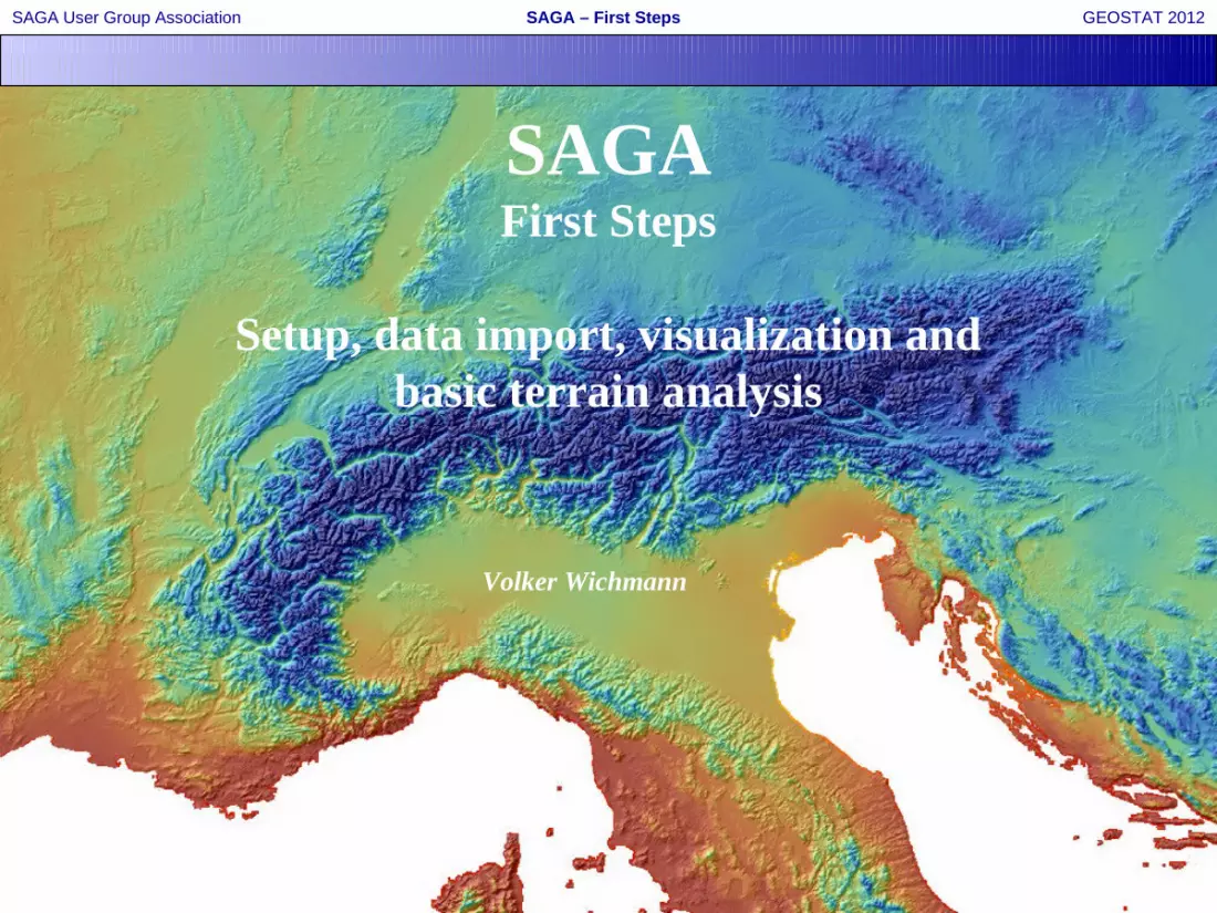
SAGA – First StepsSAGA User Group Association GEOSTAT 2012
SAGAFirst Steps
Setup, data import, visualization andbasic terrain analysis
Volker Wichmann

SAGA – First StepsSAGA User Group Association GEOSTAT 2012
2V. Wichmann
SAGA | Setup on Windows
Download of SAGA 2.0.8 binaries
(1) www.saga-gis.org
(2) >> Downloads (@ SourceForge)

SAGA – First StepsSAGA User Group Association GEOSTAT 2012
3V. Wichmann
SAGA | Setup on Windows
(3) >> SAGA - 2.0
(4) >> SAGA 2.0.8
64bit
32bit

SAGA – First StepsSAGA User Group Association GEOSTAT 2012
4V. Wichmann
SAGA | Setup on Windows
(5) Extract zip file:

SAGA – First StepsSAGA User Group Association GEOSTAT 2012
5V. Wichmann
SAGA | Setup on Linux, FreeBSD
Binary packages, see
https://sourceforge.net/apps/trac/saga-gis/wiki/Binary%20Packages
Compiling from source, see
https://sourceforge.net/apps/trac/saga-gis/wiki/Compiling%20a%20Linux%20Unicode%20version
https://sourceforge.net/apps/trac/saga-gis/wiki/Compiling%20SAGA%20on%20FreeBSD

SAGA – First StepsSAGA User Group Association GEOSTAT 2012
6V. Wichmann
SAGA | Data Import
Native Formats
Tables (tab-delimited *.txt, *.dbf) Shapes (ESRI Shapefiles, *.shp) Grids (SAGA grids, *.sgrd) Point Clouds (SAGA pointcloud, *.spc)
Other Formats
10 Import/Export module libraries with almost 70 modules including
GDAL/OGR (includes a SAGA grid driver since version 1.7.1) libLAS

SAGA – First StepsSAGA User Group Association GEOSTAT 2012
7V. Wichmann
SAGA | Data Import
Import From GeoTIFF
A B
C
Grids get sorted by Grid System: Cellsize Colums / Rows Lower left coordinate

SAGA – First StepsSAGA User Group Association GEOSTAT 2012
8V. Wichmann
SAGA | Data Visualization – Map View
Visualization in a Map View
A double left-click on the dataset in the Data tab opens a new Map View
Explore the Object Properties window: Settings, Description, Legend and History

SAGA – First StepsSAGA User Group Association GEOSTAT 2012
9V. Wichmann
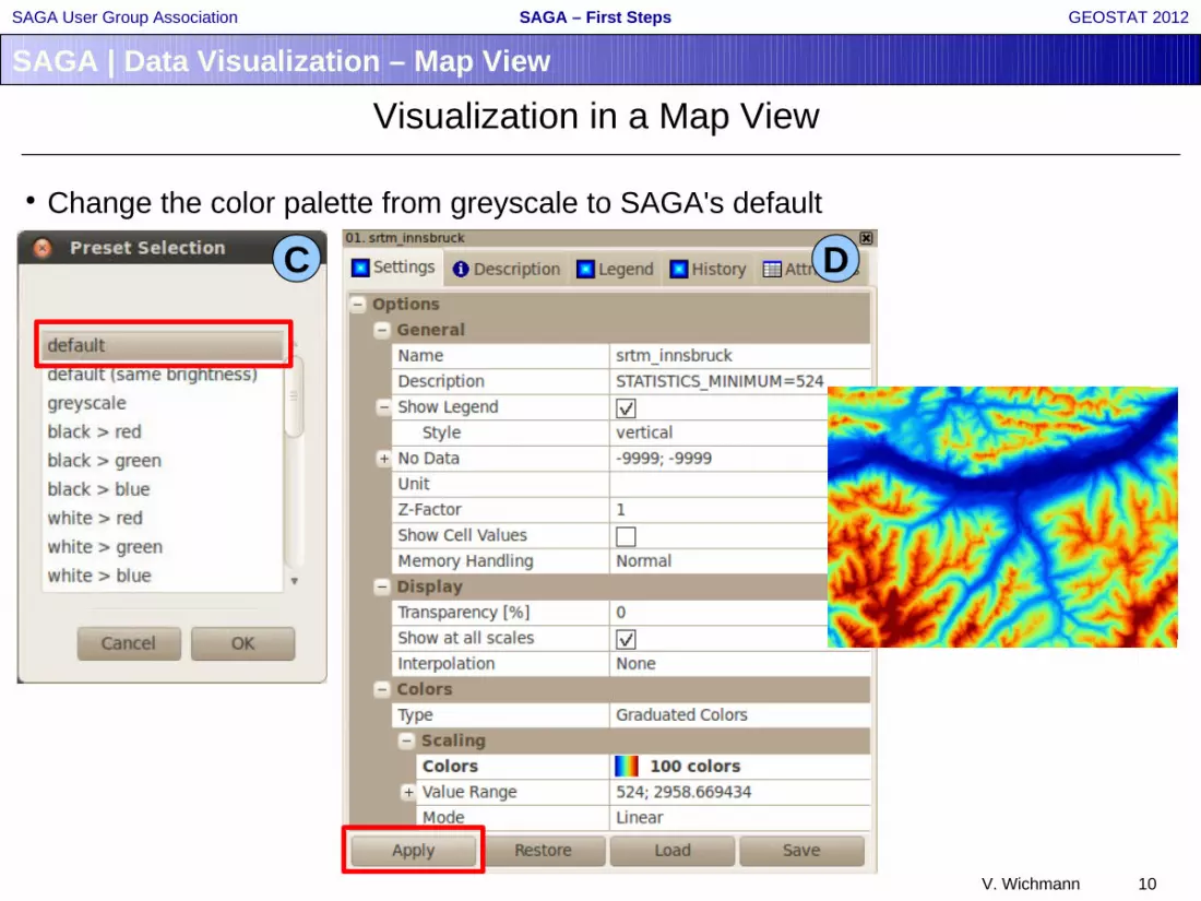
SAGA | Data Visualization – Map View
Visualization in a Map View
Change the color palette from greyscale to SAGA's default
A B
SAGA – First StepsSAGA User Group Association GEOSTAT 2012
10V. Wichmann
SAGA | Data Visualization – Map View
Visualization in a Map View
Change the color palette from greyscale to SAGA's default
C D

SAGA – First StepsSAGA User Group Association GEOSTAT 2012
11V. Wichmann
SAGA | Data Visualization
Analytical Hillshading
A B
C D
double left-click

SAGA – First StepsSAGA User Group Association GEOSTAT 2012
12V. Wichmann
SAGA | Data Visualization
Analytical Hillshading

SAGA – First StepsSAGA User Group Association GEOSTAT 2012
13V. Wichmann
SAGA | Data Visualization – 3D View
Visualization in a 3D View
Every Map View can be visualized in 3D
A B

SAGA – First StepsSAGA User Group Association GEOSTAT 2012
14V. Wichmann
SAGA | Data Visualization – 3D View
Visualization in a 3D View

SAGA – First StepsSAGA User Group Association GEOSTAT 2012
15V. Wichmann
SAGA | Terrain Analysis
Basic Terrain Analysis
A selection of basic parameters and objects to be derived from a Digital Terrain Model using standard settings.
The meta-module is coupling the following modules:
Terrain Analysis – Preprocessing: Sink Removal -> hydrological sound DTMTerrain Analysis – Lighting, Visibility: Analytical HillshadingTerrain Analysis – Morphometry: Slope, Aspect, Curvature -> slope, aspectGrid – Filter: Simple Filter -> smooth DTMTerrain Analysis – Morphometry: Slope, Aspect, Curvature -> profile and
plan curvatureTerrain Analysis – Morphometry: Convergence IndexTerrain Analysis – Hydrology: Catchment Area (Parallel)Terrain Analysis – Hydrology: Flow Width and Specific Catchment AreaTerrain Analysis – Hydrology: Topographic Wetness Index (TWI)Terrain Analysis – Hydrology: LS FactorTerrain Analysis – Channels: Channel Network and Drainage BasinsTerrain Analysis – Channels: Vertical Distance to Channel Network

SAGA – First StepsSAGA User Group Association GEOSTAT 2012
16V. Wichmann
SAGA | Terrain Analysis
Basic Terrain Analysis
A
B
C

SAGA – First StepsSAGA User Group Association GEOSTAT 2012
17V. Wichmann
SAGA | Terrain Analysis
Basic Terrain Analysis
Analytical Hillshading Slope Aspect
Plan Curvature Profile Curvature Convergence Index

SAGA – First StepsSAGA User Group Association GEOSTAT 2012
18V. Wichmann
SAGA | Terrain Analysis
Basic Terrain Analysis
Catchment Area Wetness Index LS Factor
Altitude above Ch. Network Ch. Network Base Level Ch. and Drainage Basins


