Embed Size (px)
Citation preview
Ironb
ridge
Arc
haeo
logy
Th
e A
rcha
eolo
gy U
nit o
f the
Iron
brid
ge G
orge
Mus
eum
Tru
st
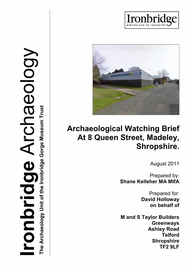
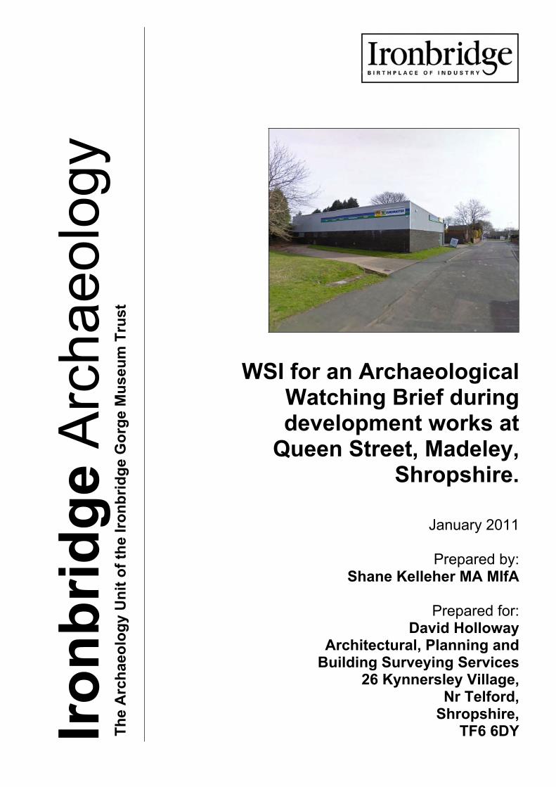
Archaeological Watching Brief At 8 Queen Street, Madeley,
Shropshire.
August 2011
Prepared by:
Shane Kelleher MA MIfA
Prepared for: David Holloway
on behalf of
M and S Taylor Builders Greenways
Ashley Road Telford
Shropshire TF2 9LF
Ironbridge Archaeology Final Report
Archaeological Watching Brief at 8 Queen Street, Madeley, Shropshire August 2011 i
1Contents
Figures .................................................................................................................................... ii
Plates ..................................................................................................................................... iii
Acknowledgments .................................................................................................................. iv
Summary ................................................................................................................................. v
1 INTRODUCTION ................................................................................................................ 6
1.1 Background to the Project .......................................................................................... 6
1.3 Aims and Objectives .................................................................................................. 7
1.4 Methodology ............................................................................................................... 7
1.5 Site Location and Designations .................................................................................. 7
1.6 Topography and Geology ........................................................................................... 8
2.1 ....................................................................................................... 8
2.2 Archaeological Context ............................................................................................ 10
2.3 ....................................................... 10
3 BRIEF MAP REGRESSION ............................................................................................. 11
6 THE ARCHAEOLOGICAL WATCHING BRIEF ............................................................... 13
6.1 Introduction ............................................................................................................... 13
6.2 Removal of Leyland Cypress Trees and Concrete Communications Pad ............. 13
6.3 Site Clearance .......................................................................................................... 13
6.4 Foundation Trench A ................................................................................................ 13
6.5 Foundation Trench B ................................................................................................ 14
7 DISCUSSION ................................................................................................................... 14
7.1 Introduction ............................................................................................................... 14
7.2 Re-evaluation of the Pottery/porcelain ..................................................................... 14
7.3 Conclusions .............................................................................................................. 14
8 ACKNOWLEDGEMENTS ................................................................................................ 14
9 Bibliography ...................................................................................................................... 16
Appendix 1: WRITTEN SCHEME OF INVESTIGATION ......................................................... 17
Ironbridge Archaeology Final Report
Archaeological Watching Brief at 8 Queen Street, Madeley, Shropshire August 2011 ii
FIGURES
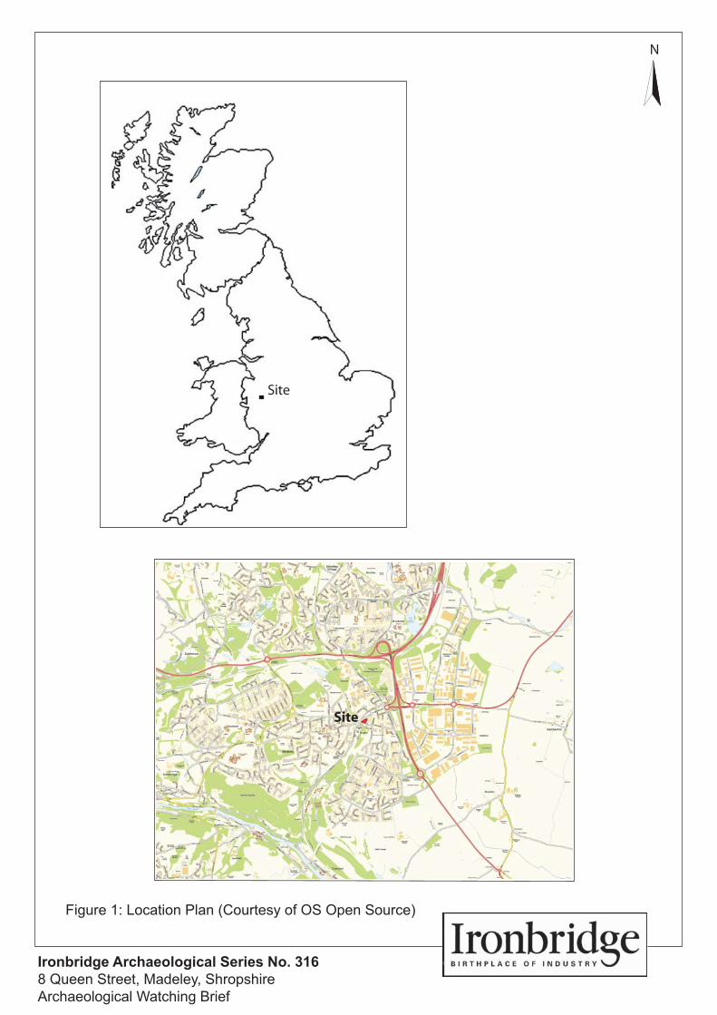
Figure 1. Location plan (Courtesy of Ordnance Survey Open Source)
Figure 2. Site plan (Courtesy of Ordnance Survey Open Source)
Figure 3. Aerial view (Courtesy of Google Earth)
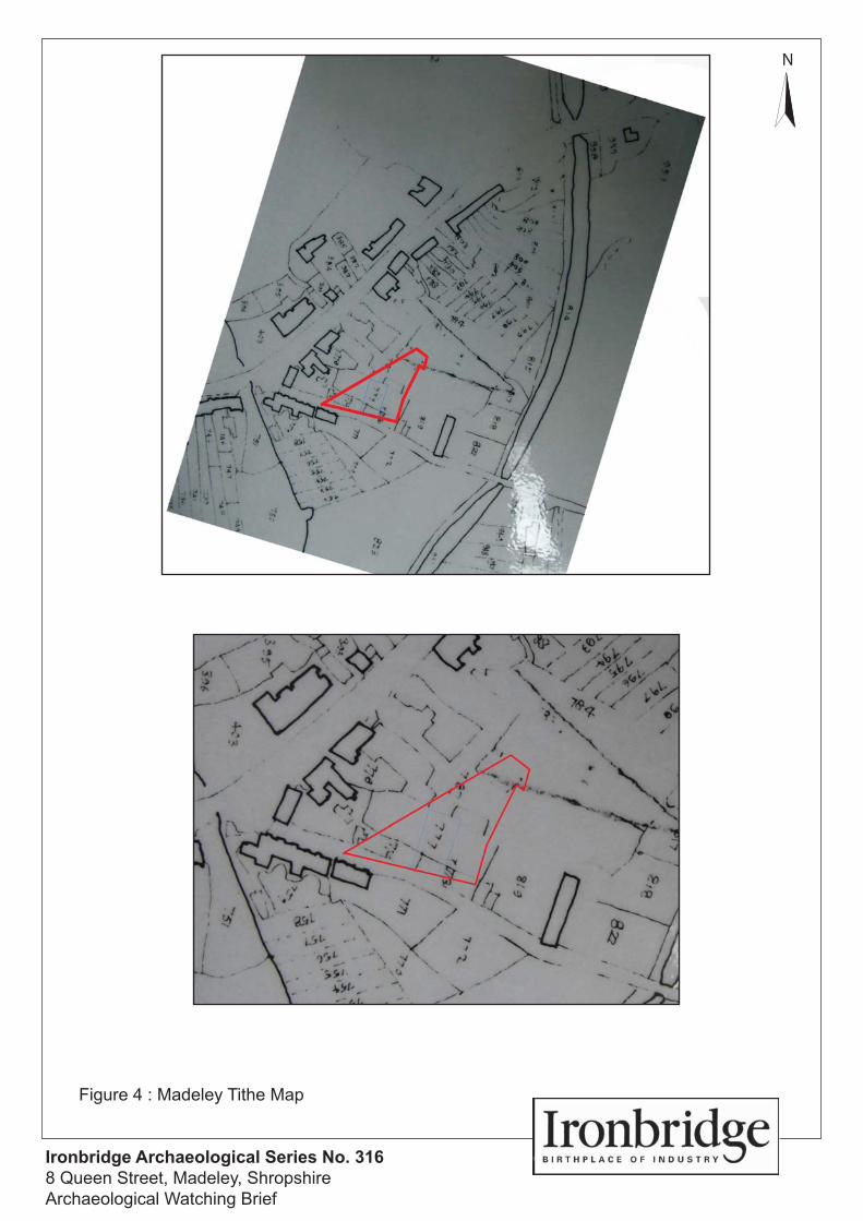
Figure 4. Madeley Tithe Map 1847
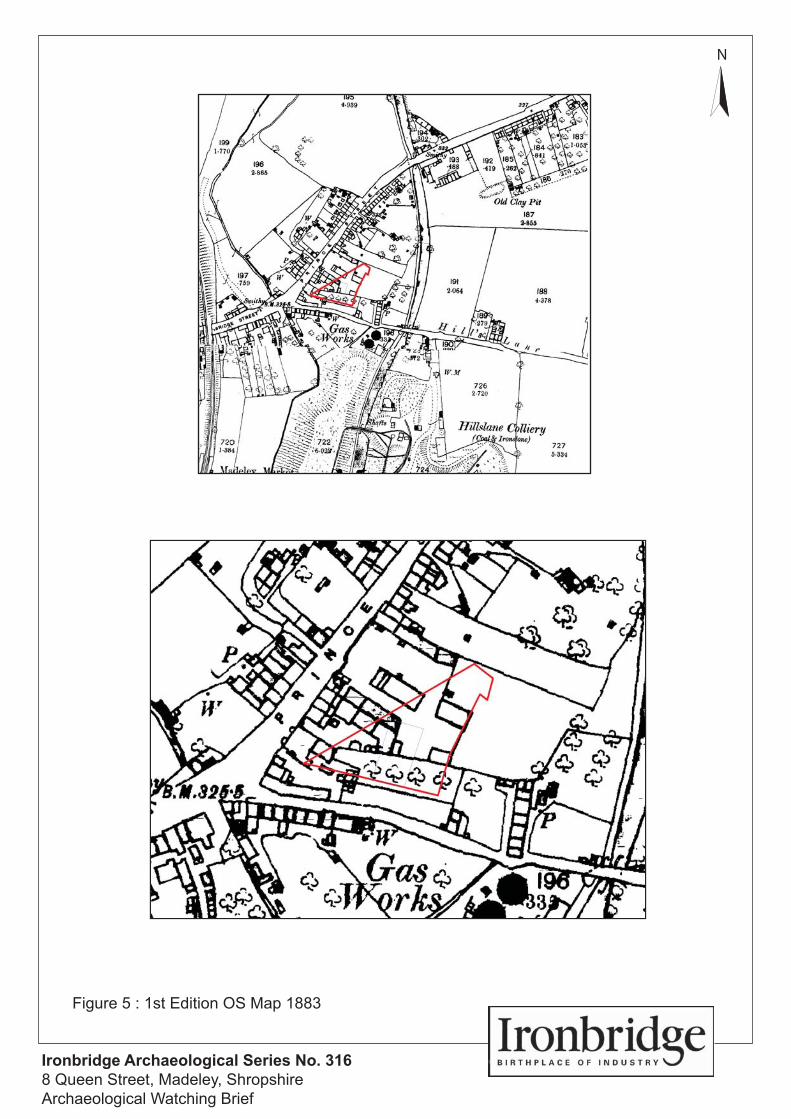
Figure 5. 1st Edition OS map 1883
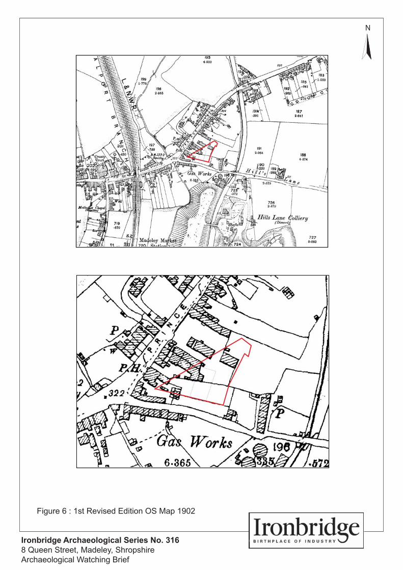
Figure 6. 1st Revised Edition OS map 1903
Figure 7. 2nd Revised Edition OS map 1927
Figure 8. OS map 1956
Figure 9. OS map 1979
Figure 10. Trench Location Plan
Ironbridge Archaeology Final Report
Archaeological Watching Brief at 8 Queen Street, Madeley, Shropshire August 2011 iii
PLATES
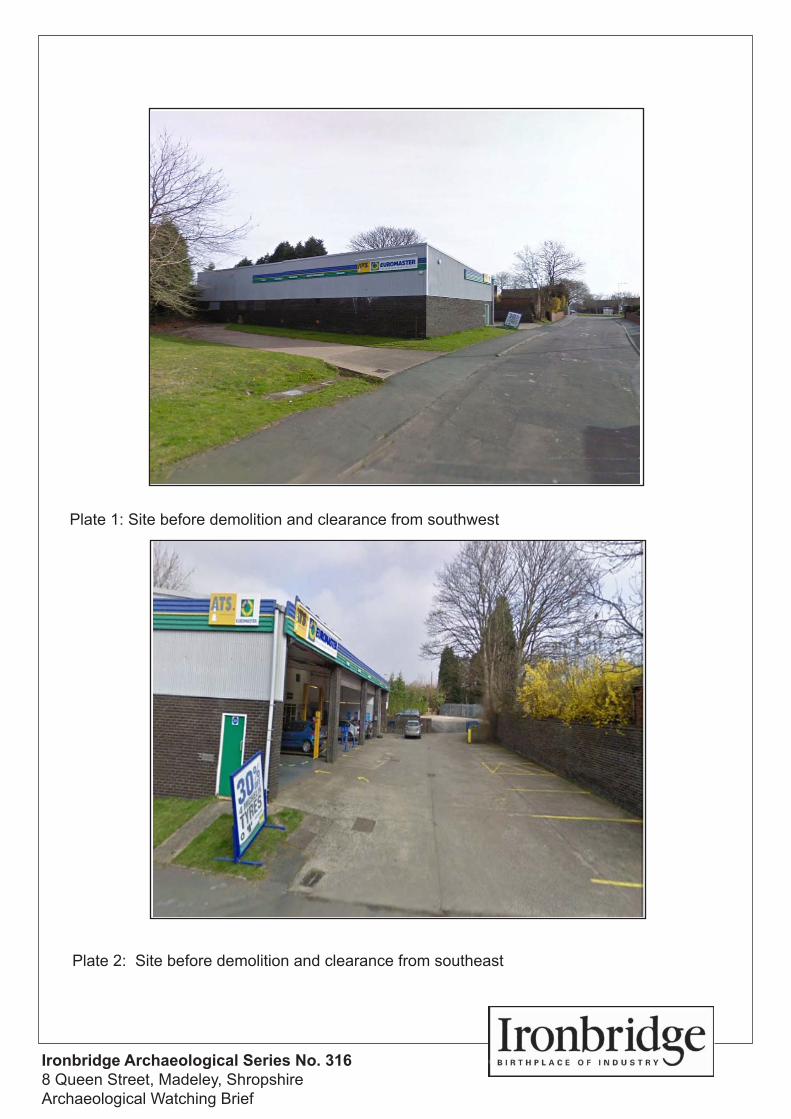
Plate 1. Site before demolition and clearance from southwest
Plate 2. Site before demolition and clearance from southeast
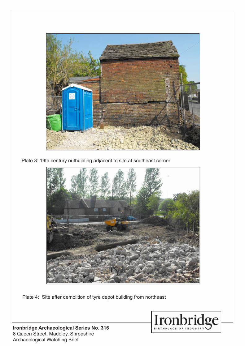
Plate 3. 19th century outbuilding adjacent to site at southeast corner
Plate 4. Site after demolition of tyre depot building from northeast
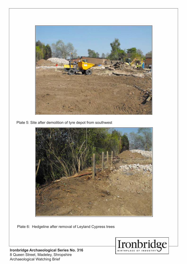
Plate 5. Site after demolition of tyre depot building from southwest
Plate 6. Hedgeline after removal of Leyland Cypress trees
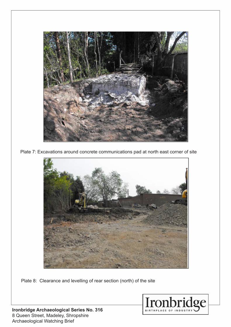
Plate 7. Excavations around concrete communications pad at northeast corner of the site
Plate 8. Clearance and levelling at rear section (north) of the site
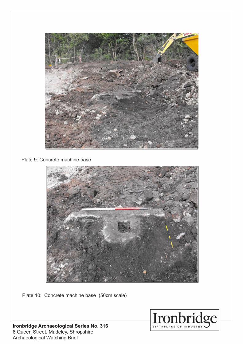
Plate 9. Concrete machine base
Plate 10. Concrete machine base (50cm scale)
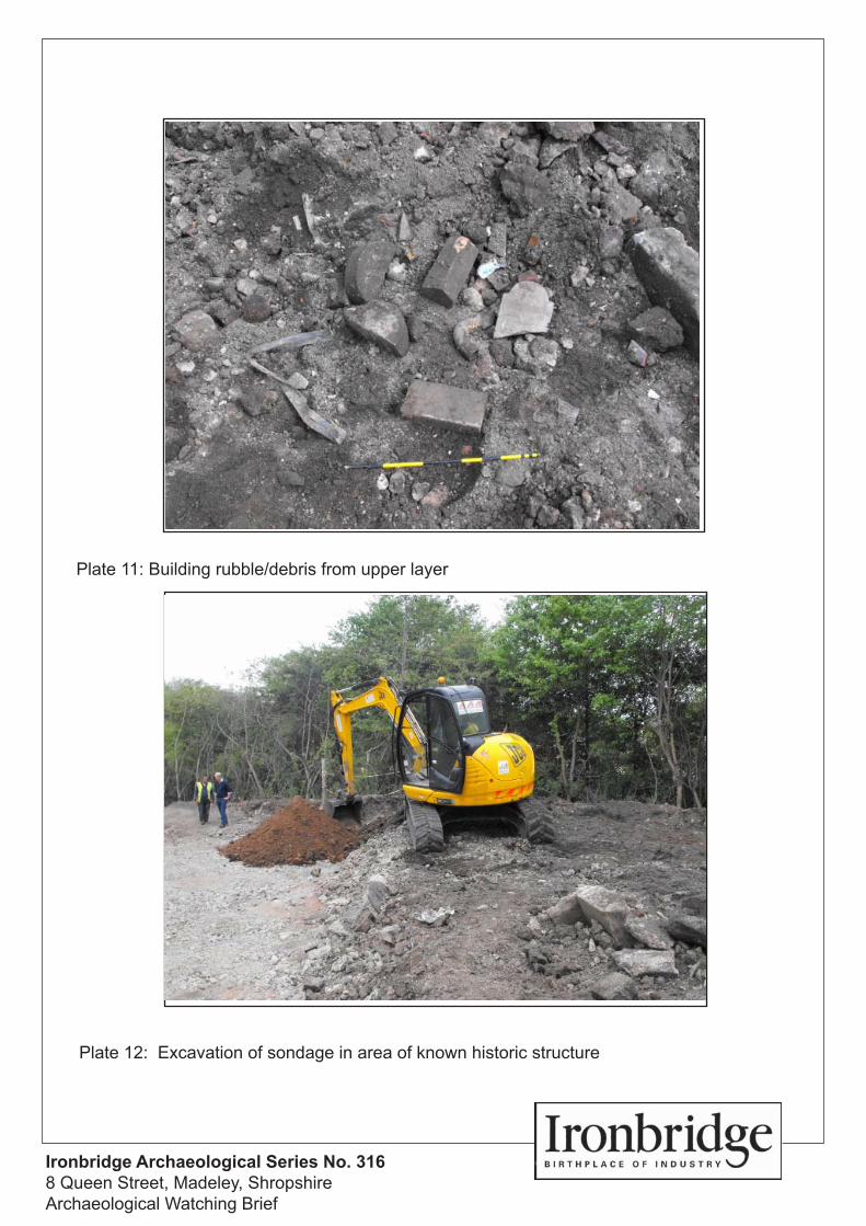
Plate 11. Building rubble/debris from upper layer
Plate 12. Excavation of sondage in area of known historic structure
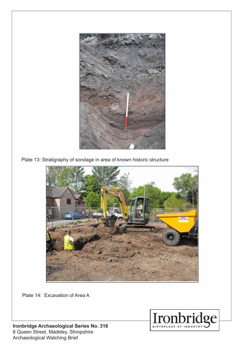
Plate 13. Stratigraphy of sondage in area of known historic structure
Plate 14. Excavation of Area A
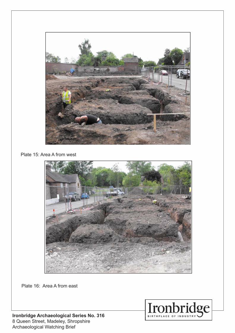
Plate 15. Area A from west
Plate 16. Area A from east
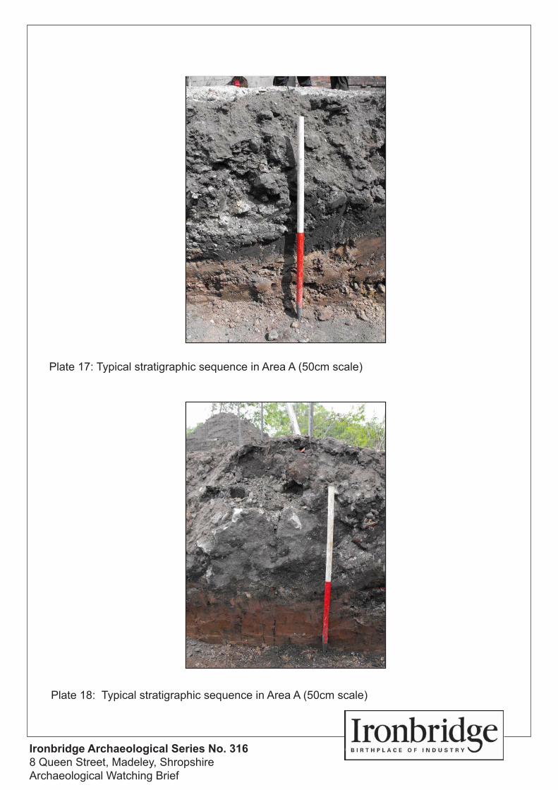
Plate 17. Typical stratigraphic sequence in Area A (50cm scale)
Plate 18. Typical stratigraphic sequence in Area A (50cm scale)
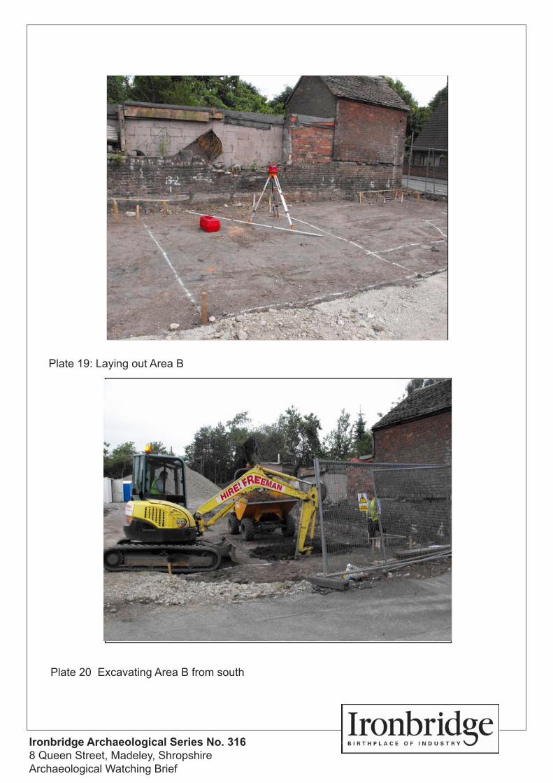
Plate 19. Laying out Area B
Plate 20. Excavating Area B from south
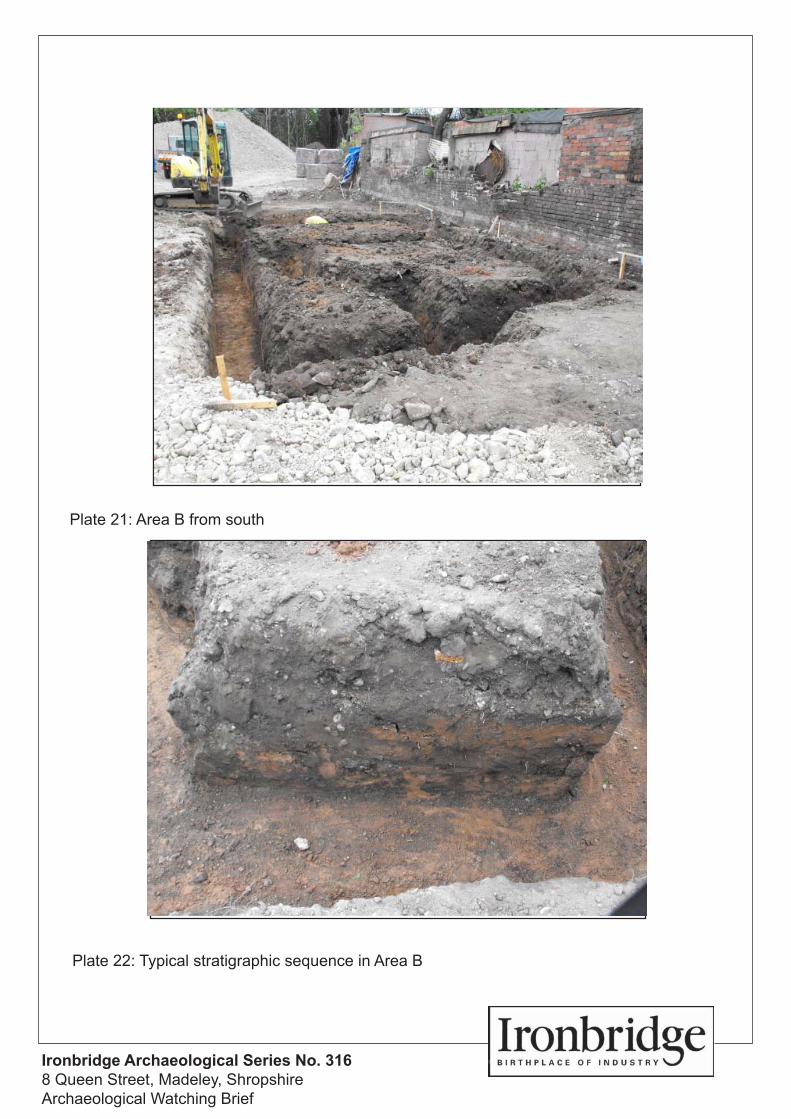
Plate 21. Area B from south
Plate 22. Typical stratigraphic sequence in Area B
Ironbridge Archaeology Final Report
Archaeological Watching Brief at 8 Queen Street, Madeley, Shropshire August 2011 iv
ACKNOWLEDGMENTS
This project was managed for the Ironbridge Gorge Museum Trust by Shane Kelleher
BA MA MIfA who also carried out the fieldwork and produced this report.
A hard copy of this report, together with the site archive (including all field drawings,
notebooks and photographs) is archived at the Ironbridge Gorge Museum Trust in the
Long Warehouse, Coalbrookdale.
© 2011, Ironbridge Gorge Museum Trust
Copies are available on request from:
Ironbridge Archaeology
Ironbridge Gorge Museum Trust
Ironbridge
Telford
TF8 7DQ
Tel: +44 (0)19 52 43 59 00
Fax: +44 (0)19 52 43 59 99
E-mail: [email protected]
Ironbridge Archaeology Final Report
Archaeological Watching Brief at 8 Queen Street, Madeley, Shropshire August 2011 v
SUMMARY
Between April and May 2011, Ironbridge Archaeology undertook an archaeological
watching brief at 8 Queen Street, Madeley, Shropshire during the redevelopment of
the former ATS Tyre Depot (centred on NGR SJ 673 034). The archaeological
watching brief, which was commissioned by David Holloway on behalf of M & S
Taylors Builders, involved the attendance of an appropriately skilled and experienced
archaeologist during groundworks for the development, including topsoil stripping,
foundation trenches, access and services.
The archaeological watching brief was necessitated due to an understanding that
Thomas Martin Randall located his Madeley Chinaworks (c.1826-1840) in the vicinity
of the site, a belief which was further ameliorated by the fact that a surface collection
carried out by archaeologists in advance of an extension to the tyre depot in the
1980s revealed a large amount of kiln furniture and porcelain sherds which may have
been related to the elusive Madeley Chinaworks.
Unfortunately the current redevelopment of the site, which saw the demolition of the
tyre deport building, levelling of the site and the erection of 6 two storey dwellings,
for
the archaeological watching brief did reveal is a site which experienced a great deal
Kemberton Road in the mid-20th century.
Ironbridge Archaeology Final Report
Archaeological Watching Brief at 8 Queen Street, Madeley, Shropshire August 2011 6
1 INTRODUCTION
This report describes the results of an archaeological watching brief at 8 Queen Street,
Madeley, Shropshire, NGR SJ 673 034.
1.1 BACKGROUND TO THE PROJECT
Ironbridge Archaeology was commissioned by David Holloway (Architectural, Planning
and Building Services) on behalf of M&S Taylor Builders to undertake an archaeological
watching brief during the redevelopment of the former ATS Tyre and Exhaust Depot, 8
Queen Street, Madeley, Shropshire, TF7 4BL, NGR centred on SJ 70315 04420.
The proposed development involved the erection of 6 two-storey dwellings following the
demolition of the existing retail tyre and exhaust depot.
Team) deemed that development at Queen Street may expose and disturb below-ground
archaeological remains and imposed the following condition of planning consent:
Planning Application TWC/2010/0594
Condition 9: Development shall not take place until the applicant has secured the implementation of a programme of archaeological work in accordance with a written scheme of investigation which has been submitted by the applicant and approved in writing by the Local Planning Authority. Such a programme must be prepared and carried out under the supervision and with the agreement of an archaeologist in writing by the Local Planning Authority.
Reason: The site is known to be in an area of archaeological importance-Previous finds from this site suggested that this may be the site of the 19th century Madeley China Works.
1.2 Scope of the Project
The project was undertaken in accordance with a Written Scheme of Investigation (WSI)
prepared by Ironbridge Archaeology (2011; Appendix A) which was approved by
Shropshire Archaeology Service in advance of works.
This report outlines the results of the archaeological watching brief, which was prepared
in accordance with the Institute for Archaeologists Standard and Guidance for
Archaeological Watching Briefs (IfA 2008).
Ironbridge Archaeology Final Report
Archaeological Watching Brief at 8 Queen Street, Madeley, Shropshire August 2011 7
1.3 AIMS AND OBJECTIVES
The principal aim of the archaeological watching brief was to record any archaeological
features, structures, deposits, or horizons exposed during intrusive groundworks related
to the development of the site.
A more specific objective was to try to uncover any further evidence as to whether this
Chinaworks.
1.4 METHODOLOGY
An appropriately skilled and qualified archaeologist was on site to observe groundworks
for the development, including topsoil stripping, foundation trenches, access and services.
Any archaeological features were recorded by means of a written, drawn and
photographic record.
All stratigraphic sequences were recorded, even where no archaeology was present.
Archaeological features were drawn (where deemed necessary) at either 1:20 or 1:50
depending on the complexity of features uncovered, whilst sections were drawn of all cut
features and significant vertical stratigraphy at a minimum scale of 1:10. A comprehensive
written record was maintained using a continuous numbered context system on pro-forma
cards where any archaeological features were found to be present. Written records and
scale plans were supplemented by photographs using digital photography.
No archaeological excavation was undertaken other than cleaning exposed deposits for
better definition. Adequate time was allowable by the on-site contractors for observation
and recording to take place.
Finds were retrieved as they were revealed during groundworks for cleaning. Recovered
finds were cleaned, marked and remedial conservation work was undertaken when
necessary. Treatment for all finds conformed to guidance contained within First Aid for
Finds (Watkinson and Neal 1998).
1.5 SITE LOCATION AND DESIGNATIONS
The site is centred at NGR SJ 70315 04420, it is situated c.1.5km to the east of Madeley
Town Centre, and occupies a wedge-shaped parcel of land on the junction of Queen
Street and Kemberton Road. The northwest boundary of the site to Kemberton Road is
formed by a hedgerow interspersed with mature Leyland Cypress trees. The southern
boundary is formed by Queen Street itself, overlooked by a modern bungalow and an
extended Victorian cottage. The eastern boundary between the site and A.K. Williams
Builders Providers (the eastern boundary of which is formed by the line of the historic
canal c.60m to the east of the development site) is formed by a mid-20th century red brick
wall, modern steel mesh fencing, and the external wall of a mid-20th century flat roof
Ironbridge Archaeology Final Report
Archaeological Watching Brief at 8 Queen Street, Madeley, Shropshire August 2011 8
structure. The southern extent of this boundary wall abuts the side elevation of what
appears to be a small red brick pitched roof Victorian outbuilding.
There are no Scheduled Ancient Monuments on or in the vicinity of the proposed
development site, whilst the Shropshire HER (accessed via www.heritagegateway.org.uk)
contains six records within 100m of the site (namely: Tenement Plots south of High
Street, Madeley; Site of Smithy and Attached House, Bridge Street; Hills Lane Colliery;
Sandpit east of Hills Lane Colliery, a Gas Works; and the site of a pair of houses and
smithy, Bridge Street, Madeley) .
1.6 TOPOGRAPHY AND GEOLOGY
The site is located on a wedge-shaped parcel of land which tapers sharply towards its
northeastern end, respecting the lines of Queen Street to the south and Kemberton Road
to the west. The site is located on a slight slope which runs from north-south, and is
considerably elevated above the adjacent Kemberton Road suggesting that a great deal
-20th century. This
has been attested to by locals who remember the current site being used as a depot for
the machinery and plant used in building the road, and that when they were finished on
site a great deal of backfill material was deposited on the site in order to level it (Pers
Comm during watching brief).
Sheets 153 (Wolverhampton
Thomas Consulting as part of their Trial Hole Investigation of the site) confirms that the
site is
Hole Investigation revealed predominantly natural sands containing traces of slightly
clayey sand, below varying depths of made ground.
2 BRIEF HISTORIC AND ARCHAEOLOGICAL CONTEXT
2.1 MADELEY S HISTORY
The Madeley Living History Project has recently (2009) produced an accessible and
useful pamphlet outlining the history and development of Madeley. Here it notes that:
- Madda being an Anglo-Saxon
personal name. The first surviving reference dates from A.D. 727 when Madeley
was purchased by Mildburga of Wenlock Priory. Two curvilinear streets-probably
relate to this early Anglo Saxon settlement.
at the time of the Domesday Survey Madeley was valued at 50 shillings, and in
1269, it achieved town status with the granting of a charter for a weekly market
Ironbridge Archaeology Final Report
Archaeological Watching Brief at 8 Queen Street, Madeley, Shropshire August 2011 9
and an annual fair. The planned town was aligned on an axial street, the Shifnal
to Much Wenlock Road and other streets have been identified as medieval lanes
giving access to the open fields. Madeley remained part of the Borough of
Wenlock until 1966 when it became part of Telford New Town.
Wenlock Priory was dissolved in 1540 and its properties passed to the Crown. In
1544, Robert Brooke-later speaker of the House of Commons-bought the Manor
of Madeley. He built a new house, Madeley Court, on the site of an existing Priory
Grange and the Brooke family owned the Manor until 1727.
During the Civil War Madeley was garrisoned, briefly, by Royalists in February
1645 and in April 1645 the church was occupied by a troop of Parliamentarian
Soldiers. In 1650 Madeley provided a hifing place for the future Charles II during
his escape after defeat at the Battle of Worcester.
Mining had taken place locally since at least the middle of the 13th century but
between 1570 and 1670 the population apparently increased tenfold because of
industrial expansion. In 1620 Basil Brooke (grandson of Robert) built the first
cementation steel furnace in England at Upper Forge, Coalbrookdale, whilst in
the early 18th century Abraham Darby leased Madeley Court for a time.
In 1759 John Fletcher, friend of John Wesley and a leading light of the Methodist
movement, became vicar of Madeley and the town became an important centre
of non-conformism.
The 19th century saw many changes as improved communications and industrial
expansion encouraged prosperity. The Madeley China Works opened in 1823
and new leisure facilities arrived- such as the Cricket Club in 1853. There were
tragedies too. An 1832 cholera outbreak killed many locals and 1864 saw the
fell to their deaths at Brick Kiln Leasowe Pit.
The 20th century was a time of decline for the old industries and brought a change
of status for the town. The last Madeley pit (Kemberton on Halesfield) closed in
1967 and the same decade saw Madeley become part of Dawley (later Telford)
New Town. The end of the 1960s saw the rebuilding of the centre and the
construction of the new estates of Sutton Hill and Woodside. At the beginning of
the 21st century yet another makeover is underway (Madeley Living History
Project 2009).
Ironbridge Archaeology Final Report
Archaeological Watching Brief at 8 Queen Street, Madeley, Shropshire August 2011 10
2.2 ARCHAEOLOGICAL CONTEXT
y Unit made a surface collection of
Street, Madeley. Archaeology in Ironbridge 1981-5 notes that:
urniture.
The kiln furniture was a mixture of earthenware saggar dividers, and biscuit
porcelain supports (for the vessels in the saggar). Several small sherds of
earthernware and a group of porcelain wasters were also found.
The assemblage, small though it is, suggests the presence of a porcelain kiln site
in the locality. It is known that a China Works operated in Madeley under Thomas
Martin Randall from 1825, probably on two different sites, but neither of these
sites have been pin-pointed. The Tyre Garage is located near the canal, in the
is possible that this is the site of Madeley China Works (IGMAU 1988 160- .
2.3 THOMAS MARTIN RANDALL S MADELEY CHINAWORKS
Thomas Martin Randall
Edmundson 1994, 23). He was born in Broseley, the son of a Severn
bargemaster, and trained at the Caughley works before moving to Derby and then
London where he became one of the leading china decorators of the early 1820s. He
relocated to Madeley c.1826 where he continued decorating for London retailers Mortlock,
Jarman and Baldock
and other kilns, a Randall 1877). It is believed that
two kinds of china were made at Madeley and a third kind was decorated there. The first
type was a soft paste china that was similar to the porcelain of Nantgarw (near Swansea)
and the earlier Sevres, the second was a china whose body was somewhat harder and
redecorated. In 1840 Randall moved to Shelton in the Staffordshire Potteries where he is
1994 ibid).
however Roger Edmundson, an expert on the work of Randall, believes that it must be in
the Prince Street, Queen Street, Hills Lane area of Madeley near the canal (Edmundson
1993, 40). Edmundson also notes that an unpublished study by A. McCall deduced that
that it was at the western end of Queen Street where a large traffic island is now located.
However, Edmundson favours the present nos. 86 and 87 Prince Street as the former
Ironbridge Archaeology Final Report
Archaeological Watching Brief at 8 Queen Street, Madeley, Shropshire August 2011 11
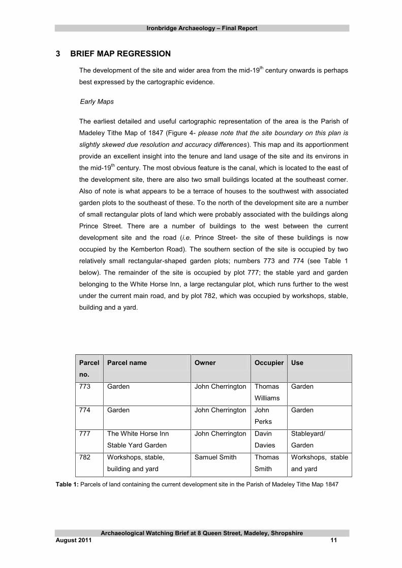
3 BRIEF MAP REGRESSION
The development of the site and wider area from the mid-19th century onwards is perhaps
best expressed by the cartographic evidence.
Early Maps
The earliest detailed and useful cartographic representation of the area is the Parish of
Madeley Tithe Map of 1847 (Figure 4- please note that the site boundary on this plan is
slightly skewed due resolution and accuracy differences). This map and its apportionment
provide an excellent insight into the tenure and land usage of the site and its environs in
the mid-19th century. The most obvious feature is the canal, which is located to the east of
the development site, there are also two small buildings located at the southeast corner.
Also of note is what appears to be a terrace of houses to the southwest with associated
garden plots to the southeast of these. To the north of the development site are a number
of small rectangular plots of land which were probably associated with the buildings along
Prince Street. There are a number of buildings to the west between the current
development site and the road (i.e. Prince Street- the site of these buildings is now
occupied by the Kemberton Road). The southern section of the site is occupied by two
relatively small rectangular-shaped garden plots; numbers 773 and 774 (see Table 1
below). The remainder of the site is occupied by plot 777; the stable yard and garden
belonging to the White Horse Inn, a large rectangular plot, which runs further to the west
under the current main road, and by plot 782, which was occupied by workshops, stable,
building and a yard.
Parcel no.
Parcel name Owner Occupier Use
773 Garden John Cherrington Thomas
Williams
Garden
774 Garden John Cherrington John
Perks
Garden
777 The White Horse Inn
Stable Yard Garden
John Cherrington Davin
Davies
Stableyard/
Garden
782 Workshops, stable,
building and yard
Samuel Smith Thomas
Smith
Workshops, stable
and yard
Table 1: Parcels of land containing the current development site in the Parish of Madeley Tithe Map 1847
Ironbridge Archaeology Final Report
Archaeological Watching Brief at 8 Queen Street, Madeley, Shropshire August 2011 12
The First Edition Ordnance Survey Map 1883 (Figure 5) shows the development of a
colliery and gasworks adjacent to the canal to the south and southeast of the current site.
The east side of Prince Street appears to have been further built upon, whilst the land to
the immediate north of the site remains undeveloped despite a number of plot boundaries
being removed. The current site itself was largely still undeveloped by this time. The
southern part of the site appears to have been use as an orchard or garden, however a
number of buildings have been constructed along the north, west and east boundaries of
the site. It is unclear from the map as to what these represent.
The 1st Revised Edition OS Map 1902 (Figure 6) shows very few major changes within or
outside of the development site area. The colliery to the southeast is now marked as
disused, whilst one of the buildings shown within the site in the previous map has been
removed.
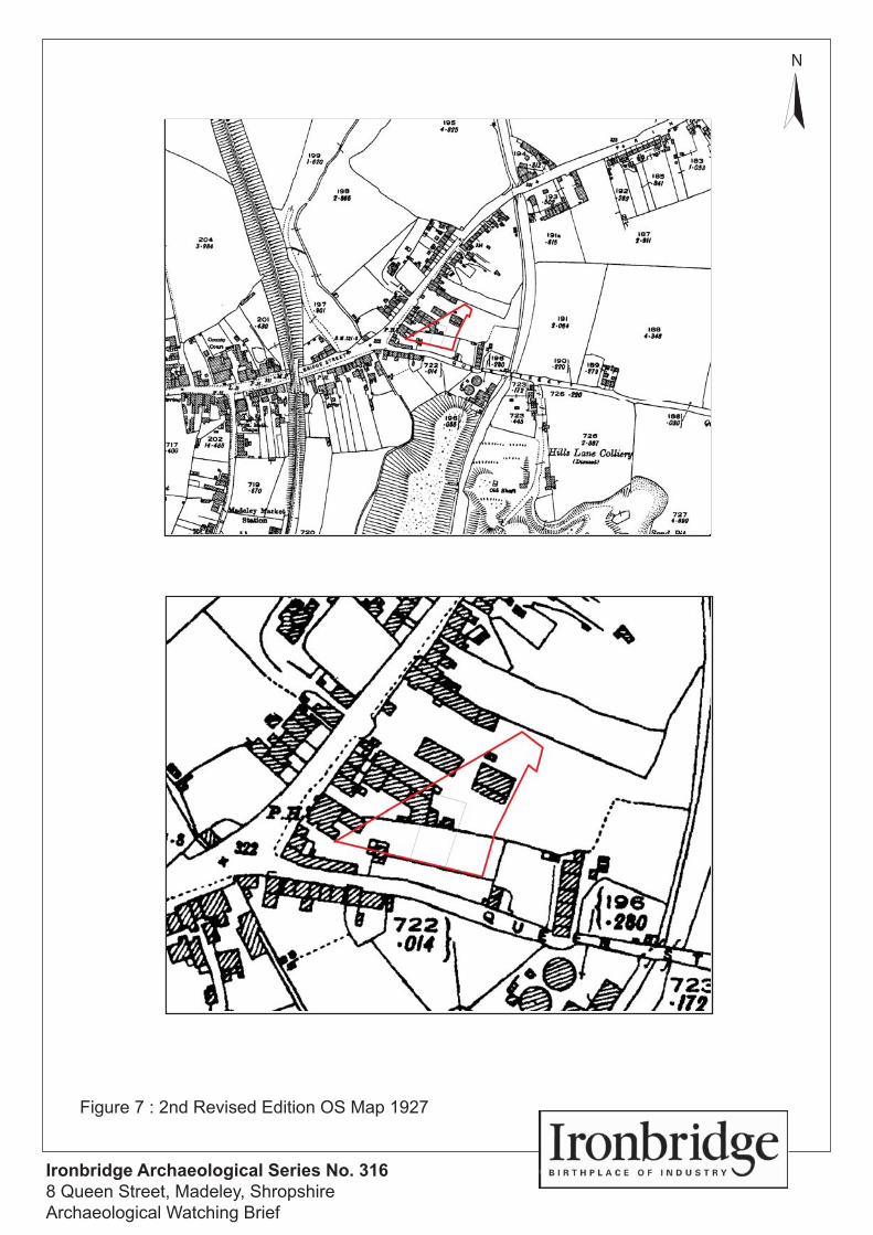
Little had changed by the time of the 2nd Revised Edition OS Map 1927 (Figure 7),
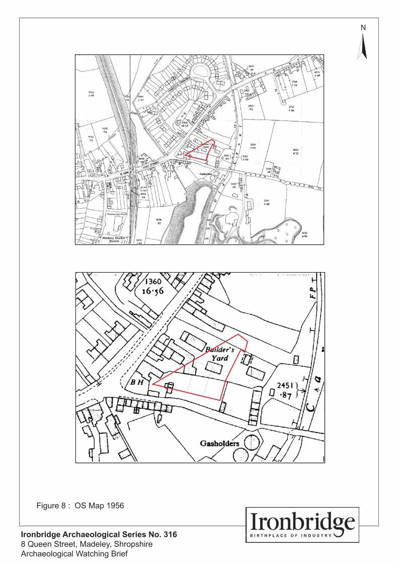
however, by the time of the 1956 OS map (Figure 8) the canal had gone out of use, whilst
the Tweedale Crescent housing estate had been constructed to the northwest of the site.
Yard, have been removed.
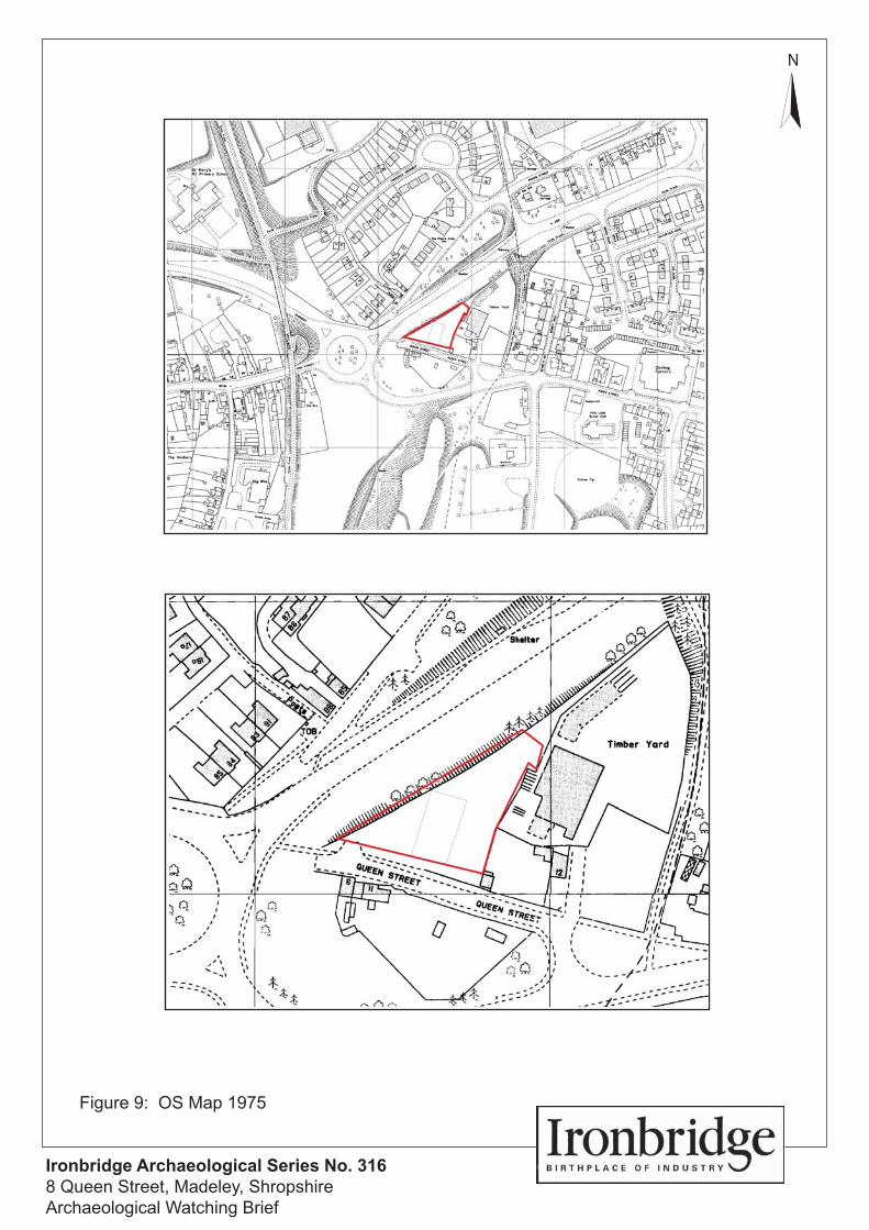
The interim period between the 1956 map and the 1975 OS map saw great changes in
the topography and character of the area surrounding and within the development site.
This period saw the construction of the Kemberton Road to the immediate west of the site.
This necessitated the demolition of all of the buildings on the east side of Prince Street
and the removal of all of the buildings and property boundaries within the development
site, a fact attested to by the oral evidence above, which suggests that the site was used
in this period as a depot for the road builders.
The tyre depot was constructed shortly after this and was extended in 1984.
Ironbridge Archaeology Final Report
Archaeological Watching Brief at 8 Queen Street, Madeley, Shropshire August 2011 13
6 THE ARCHAEOLOGICAL WATCHING BRIEF
6.1 INTRODUCTION
An archaeological watching brief was carried out during groundworks for the
redevelopment of the site, including topsoil stripping, foundation trenches, access and
services.
6.2 REMOVAL OF LEYLAND CYPRESS TREES AND CONCRETE COMMUNICATIONS PAD
Following the demolition of the former tyre depot building and the levelling of the site the
first task carried out was the removal of a number of Leland Cypress trees (Plate 6) which
lined the northwest boundary of the site. This necessitated the removal of significant root
systems under archaeological observation. Nothing of interest was uncovered.
A sizeable concrete communications pad (Plate 7) located in the northeast corner of the
site was excavated and removed under archaeological observation. Nothing of interest
was uncovered.
6.3 SITE CLEARANCE
The preparation of the site for the proposed development included a significant amount of
levelling and landscaping, particularly to the middle and rear of the site where the carpark
was to be located. This levelling, which was carried out under archaeological supervision
did not appear to disturb anything of significance. A concrete machine base, likely to be
associated with the tyre depot, was uncovered adjacent to the former building, whilst
much of the upper layer (topsoil) of this part of the site was dumped material consisting of
clinker, slag and building debris suggesting historic levelling/clearance.
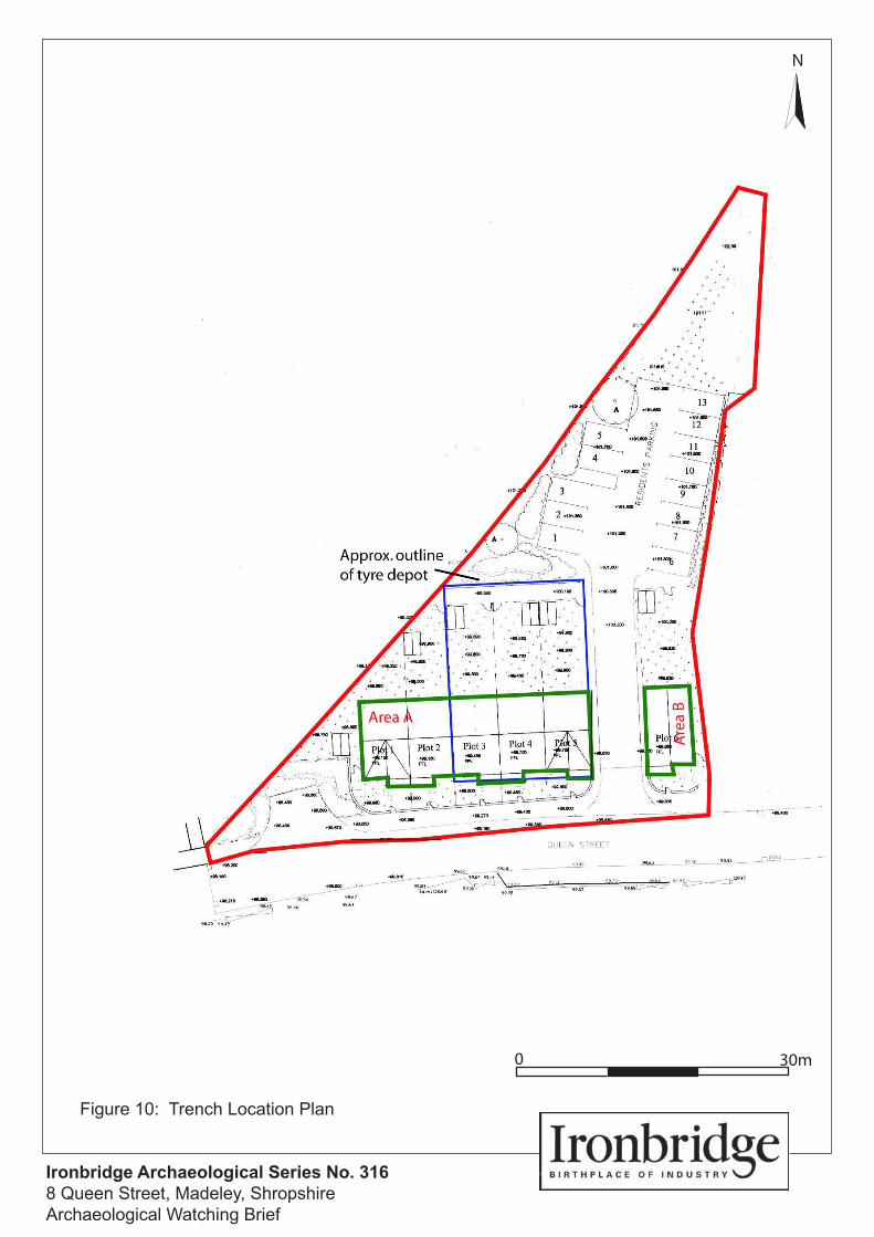
6.4 FOUNDATION TRENCH A
A sondage was excavated using a mechanical excavator with toothless bucket at the
northwest corner of Trench A in order to provide an understanding of the stratigraphic
sequence of this part of the site and to ascertain if any remains of a building seen on the
1st edition OS map could be uncovered. The sondage revealed no evidence for this
structure, and the stratigraphic sequence suggested that a significant amount of
clearance, dumping and levelling had taken place as part of the construction of the
nearby Kemberton Road in the mid-20th century.
The remainder of Trench A, which measured c.25m x 9m, exhibited a similar stratigraphic
sequence. The trench was excavated to a depth of 1100mm on the eastern side to
1180mm on the western side (due to the sloping nature of the site). This consisted of a
well compacted yet friable topsoil layer, measuring c.500mm-600mm, of made ground
consisting of soil, clinker, slag, building debris, animal bone and a small quantity of
Ironbridge Archaeology Final Report
Archaeological Watching Brief at 8 Queen Street, Madeley, Shropshire August 2011 14
pottery/ceramics. This overlay a well compacted dark brown silty clay layer, measuring c.
200mm to 300mm in depth. This possibly represents the historic topsoil layer before the
site was prepared for use as a compound during the construction of the nearby road. The
with few inclusions apart from occasional limestone deposits. The trench had to be
excavated much deeper on the south side near the road due to the presence of a modern
sewer which presumably related to the construction of the tyre depot.
6.5 FOUNDATION TRENCH B
Trench B measured c.6m x 9m and displayed a very similar stratigraphic sequence to
Area A above.
7 DISCUSSION
7.1 INTRODUCTION
The archaeological watching brief failed to reveal any evidence to suggest that this site was
elusive Madeley Chinaworks. However, if this
was the site of the works it is unlikely to have survived the vicissitudes of the mid-20th
century, which saw the clearance of much of the surrounding area due to the construction of
the adjacent Kemberton Road, and more specifically the clearance of the current site for use
as a compound for use by the road builders.
7.2 RE-EVALUATION OF THE POTTERY/PORCELAIN
Roger Edmundson, expert on the work of Thomas Martin Randall, very kindly agreed to
assess the small amount of pottery/porcelain uncovered during this programme of works and
the porcelain collected by Ironbridge Gorge Museum Archaeology Unit in 1984. Mr
Edmundson concluded that none of the sherds in these assemblages are likely to have been
uding earthenwares
and later porcelain), and dates from the early 19th century to the mid-20th century present,
thus supporting the belief that a great deal of material/debris was dumped upon this site
before/during or after the construction of the nearby road.
7.3 CONCLUSIONS
The archaeological watching brief failed to reveal any evidence to suggest that this site was
indeed the location of the elusive Madeley Chinaworks.
8 ACKNOWLEDGEMENTS
This project was commissioned by David Holloway on behalf of M & S Taylors Builders.
Thanks are extended to David Holloway and Steve Taylor for their support during the works.
Thanks also go to the on-site team for their assistance during the watching brief and to

Ironbridge Archaeology Final Report
Archaeological Watching Brief at 8 Queen Street, Madeley, Shropshire August 2011 15
Shropshire Archaeology Service for approving the WSI and overseeing the project on behalf
of Telford and Wrekin Council.
Shane Kelleher carried out the archaeological watching brief, compiled and illustrated this
report and managed the project for Ironbridge Archaeology on behalf of the Ironbridge Gorge
Museum Trust.
Ironbridge Archaeology Final Report
Archaeological Watching Brief at 8 Queen Street, Madeley, Shropshire August 2011 16
9 BIBLIOGRAPHY
Thomas Martin Randall: China Decorator and Manufacturer . The Journal of the Northern Ceramic Society 10 pp 23-69.
Antique Collecting 28.8. pp23-26.
Institute for Archaeologists 2008 Standard and guidance for an archaeological
watching brief; IfA blue folder of policy, standards and guidance. IFA.
Ironbridge Archaeology 2011 Written Scheme of Investigation for archaeological watching brief during development works at Queen Street, Madeley. Ironbridge Gorge Museum Trust.
Ironbridge Gorge Museums Archaeology Unit (IGMAU) 1988 Archaeology in Ironbridge 1981-1985. Ironbridge Gorge Museum Trust.
Madeley Living History Project 2009. Madeley Heritage Trail. Madeley Parish Council.
Salopian Monthly Illustrated Journal.
Thomas Consulting 2011 Trial Hole Investigation at Former ATS Depot, Queen Street, Madeley, Telford. Thomas Consulting LLP.
Watkinson, D. and Neal, V. 1998 First Aid for Finds (3rd Edition), RESCUE and the Archaeology Section of the United Kingdom Institute for Conservation.
Cartographic Sources:
1847 Madeley Tithe Map
1883 1st Edition 1:2500 OS map
1903 1st Revised Edition 1:2500 OS map
1927 2nd Revised Edition OS 1:2500 map
1956 OS map
1979 OS map
Published Geology Sheets 153 (Solid and Drift-Woverhampton)
Websites consulted:
www.heritagegateway.org.uk
Ironbridge Archaeology Final Report
Archaeological Watching Brief at 8 Queen Street, Madeley, Shropshire August 2011 17
APPENDIX 1: WRITTEN SCHEME OF INVESTIGATION
The
Arc
haeo
logy
Uni
t of t
he Ir
onbr
idge
Gor
ge M
useu
m T
rust
WSI for an Archaeological Watching Brief during development works at
Queen Street, Madeley, Shropshire.
January 2011
Prepared by: Shane Kelleher MA MIfA
Prepared for: David Holloway
Architectural, Planning and Building Surveying Services
26 Kynnersley Village, Nr Telford,
Shropshire,TF6 6DY
Ironbridge Archaeology – WSI
WSI for Archaeological Watching Brief at Queen Street, Shropshire T11/002 January 2011 1
WSI FOR AN ARCHAEOLOGICAL WATCHING BRIEF AT QUEEN STREET, MADELEY, SHROPSHIRE.
Contents
1 Introduction.........................................................................................................................2Project background........................................................................................................2Previous archaeological work .......................................................................................2Site location and status .................................................................................................3
2 AIMS AND OBJECTIVES....................................................................................................33 METHODOLOGY...............................................................................................................34 STAFFING ...........................................................................................................................35 REPORTING....................................................................................................................... 46 ARCHIVING....................................................................................................................... 47 PROFESSIONAL STANDARDS ........................................................................................ 48 HEALTH AND SAFETY......................................................................................................59 REFERENCES......................................................................................................................510 COPYRIGHT AND CONFIDENTIALITY........................................................................ 6
Copyright....................................................................................................................... 6Confidentiality .............................................................................................................. 6
Appendix – Shane Kelleher CV.............................................................................................7
Ironbridge Archaeology – WSI
WSI for Archaeological Watching Brief at Queen Street, Shropshire T11/002 January 2011 2
1 Introduction This document describes the programme of work required to undertake anarchaeological watching brief during the proposed redevelopment of the former Tyreand Exhaust Depot, Queen Street, Madeley, Shropshire. It forms the projectdesign/written scheme of investigation. It forms the project design for the work, whichis a requirement of Shropshire County Council. Any variation in the scope of workwould be agreed with Shropshire County Archaeologist Mike Watson beforeimplementation. It has been prepared in response to a request by David Holloway(Architectural, Planning and Building Surveying Services) who is acting on behalf M&STaylor Builders.
Development at Queen Street, Madeley may expose and disturb below groundarchaeological remains. This project design allows for the identification and recordingof any archaeological features exposed by the development.
This document includes:
A project design and proposed programme
Brief resume of the Project Manager and Principal Fieldworker
Project background Application no. TWC/2010/0594 is for the demolition of existing retail Tyre & ExhaustDepot and Change of Use for the erection of 6 affordable two storey dwellings, privateaccess road and associated residents car parking area.
An archaeological watching brief has been requested by Shropshire County Council totake place during groundworks for the above development.
Previous archaeological work David Holloway (Agent) believes that a previous archaeological intervention1 tookplace at or near the current site (possibly carried out by Ironbridge Museums c.1984).It is believed by Mr Holloway that this previous archaeological work uncovered a largequantity of kiln furniture and porcelain sherds which may have been related to theMadeley China Works, which was opened c.1825 by Thomas Martin Randall.
1 A cursory inspection of the Ironbridge Archaeology archives has yet to reveal any details of such an archaeologicalintervention. However, it is likely (the Ironbridge Museum archaeology unit was set up in 1985) that the work wascarried out on an informal basis and the results may be stored at the Ironbridge Museums archives or the countyarchives).
Former ATS Tyre & Exhaust DepotQueen Street,Madeley,Telford,Shropshire,TF7 4BLProject DesignPlanning Application no: TWC/2010/0594Archaeologist: Ironbridge Archaeology
Ironbridge Archaeology – WSI
WSI for Archaeological Watching Brief at Queen Street, Shropshire T11/002 January 2011 3
Site location and status The site is located at NGR SJ 70315 04420, it is situated c.1.5 km to the east of MadeleyTown Centre, and occupied a wedge shaped parcel of land on the junction of QueenStreet and Kemberton Road. There are no Scheduled Ancient Monuments on or in thevicinity of the proposed development site, whilst the Shropshire HER2 contains sixrecords within 100m of the site (namely: Tenement Plots south of High Street,Madeley, Site of Smithy and Attached House, Bridge Street, Hills Lane Colliery,Sandpit east of Hills Lane Colliery, a Gas Works, and the site of a pair of housessmithy, Bridge Street Madeley).
2 AIMS AND OBJECTIVES The principal aims of the archaeological watching brief will be to record anyarchaeological features, structures, deposits, or horizons exposed during intrusivegroundworks related to the proposed redevelopment of the site.
3 METHODOLOGY An appropriately skilled and qualified archaeologist will be on site to observegroundworks for the development, including topsoil stripping, foundation trenches,access and services. Any archaeological features are to be recorded by means of awritten, drawn and photographic record.
All stratigraphic sequences will be recorded, even where no archaeology is present.Archaeological features will be drawn at either 1:20 or 1:50 depending on thecomplexity of features uncovered, whilst sections will be drawn of all cut features andsignificant vertical stratigraphy at a minimum scale of 1:10. A comprehensive writtenrecord will be maintained using a continuous numbered context system on pro formaon pro forma cards should any archaeological features be found to be present. Writtenrecords and scale plans will be supplemented by photographs using digitalphotography.
No archaeological excavation will be undertaken other than cleaning exposed depositsfor better definition. Adequate time should be allowable by the on site contractors forobservation and recording to take place.
Finds will be retrieved as they are revealed during groundworks for cleaning.Recovered finds will be cleaned, marked and remedial conservation work will beundertaken as necessary. Treatment for all finds will conform to guidance containedwithin First Aid for Finds (Watkinson and Neal 1998).
4 STAFFING The project will be managed carried out for the Ironbridge Gorge Museums Trust byShane Kelleher MA MIfA.
Specialist assistance will be sought where appropriate.
2 Extracted from www.heritagegateway.org.uk.
Ironbridge Archaeology – WSI
WSI for Archaeological Watching Brief at Queen Street, Shropshire T11/002 January 2011 4
5 REPORTING The results of the archaeological observation and recording will be presented as awritten report, containing appropriate illustrations. A bound hard copy of the reportand an electronic copy in pdf format will be sent to the Planning Archaeologist.
This report will be in the format required by the Management of ArchaeologicalProjects 2 (English Heritage 1991) and Management of Research Projects in the HistoricEnvironment (English Heritage 2008) guidelines as appropriate, and will include:
1. Summary
2. Description of the archaeological background
3. Method
4. A narrative description of the results and discussion of evidence, set in theirlocal, regional and national research context, supported by any relevant plans(the results of the watching brief will be annotated on pre existing engineeringdrawings when deemed necessary and appropriate), sections and photographs
5. Summary of the finds
6 ARCHIVING The full site archive will include all artefactual remains recovered from the site. Findsand the paper archive will be deposited with a depository identified by ShropshireCouncil Museum Service.
Preparation and deposition of the site archive will be undertaken with reference toGuidelines for the Preparation of Excavation Archives for Long Term Storage (Walker1990) and Archaeological Archives: a guide to best practice in creation, compilation,transfer and curation (Brown 2007).
The archive will include:
All field notes, logbooks and other documentation generated by the fieldworkstage.
Research notes, tracings and other documentation generated by research work.
All field drawings and sketches, including working drawings, annotated plans,sections and details, together with all final inked up drawings. All will be fullyindexed and cross referenced.
All photographic images on CD with digital images, fully indexed and crossreferenced.
A hard copy of the site report.
7 PROFESSIONAL STANDARDS Shane Kelleher is a Member of the Institute for Archaeologists (MIfA).
Shane Kelleher will follow the code of conduct of the IfA at all times.
The watching brief will be undertaken in accordance with the standards laid down inthe ‘Standard and Guidance for Archaeological Watching Briefs’ (IfA 2008).
Ironbridge Archaeology – WSI
WSI for Archaeological Watching Brief at Queen Street, Shropshire T11/002 January 2011 5
8 HEALTH AND SAFETY All current Health and Safety legislation, regulations and guidance will be compliedwith. The watching brief will conform to the Workplace (Health, Safety and Welfare)Regulations 1992, Management of Health and Safety at Work Regulations 1999, andConstruction (Design and Management) Regulations 2007 and any other health andsafety legislation where appropriate. Work will be carried out in accordance with theguidelines laid out in Health and Safety in Field Archaeology Manual (SCAUM 2007).
It is understood that a detailed risk assessment is being compiled by the CDMcoordinator for the project. Ironbridge Archaeology staff (and any approved visitors)will be inducted on site and will read and adhere to the mitigations and findings of therisk assessment.
In order to further mitigate these risks, a brief risk assessment will be undertaken byIronbridge Archaeology in the set up stage of the project, and appropriate actions willbe taken.
Ironbridge Archaeology is fully covered under the insurance policies of the IronbridgeGorge Museum Trust for the following:
Employers Liability (up to £10,000,000)
Public and Products Liability (up to £10,000,000 any one occurrence, unlimitedin the aggregate)
Contractors All Risk (up to £2,500,000 any one loss)
The insurance is provided by AXA, through Willis Insurance Brokers. Please contactMartin Cummins, Senior Account Manager, Willis Commercial Risks, Willis UKLimited, Peat House, 1 Waterloo Way, Leicester LE1 6LQ for further information.
9 REFERENCES Brown, D. 2007. Archaeological Archives. A guide to best practice in creation,
compilation, transfer and curation. Archaeological Archives Forum andInstitute of Field Archaeologists.
English Heritage 1991 The Management of Archaeological Projects. English Heritage:London.
English Heritage 2006 Management of Research Projects in the Historic Environment:The MoRPHE project managers’ guidelines. English Heritage: London
English Heritage 2008 Management of Research Projects in the Historic EnvironmentPPN 3: Archaeological Excavation. English Heritage: London
Institute of Field Archaeologists 2008 Standard and guidance for an archaeologicalwatching brief; IFA blue folder of policy, standards and guidance. IFA.
Institute of Field Archaeologists 2001 Standard and guidance for the collection,documentation, conservation and research of archaeological materials, IFAblue folder of policy, standards and guidance. IFA.
Ironbridge Archaeology – WSI
WSI for Archaeological Watching Brief at Queen Street, Shropshire T11/002 January 2011 6
Museums and Galleries Commission. 1992 Standards in the museum care ofarchaeological collections. London: Museums and Galleries Commission
Standing Conference of Archaeological Unit Managers (SCAUM), 2007 Health & Safetyin Field Archaeology Manual.
Walker, K. 1990 Guidelines for the preparation of excavation archives for long termstorage, Archaeology Section of the United Kingdom Institute forConservation.
Watkinson, D. and Neal, V. 1998 First Aid for Finds (3rd edition), RESCUE and theArchaeology Section of the United Kingdom Institute for Conservation.
10 COPYRIGHT AND CONFIDENTIALITY Copyright The Ironbridge Gorge Museum Trust shall retain full copyright of all commissionedreports, tender documents, drawings, photographs and any other projectdocumentation under the Copyright, Designs and Patents Act 1988 with all rightsreserved; excepting that it hereby provide an exclusive licence for English Heritage forthe use of such documents by English Heritage for whatever purpose they see fit,providing that the Ironbridge Gorge Museum Trust is acknowledged as the author andoriginator of the material so used.
ConfidentialityThe Ironbridge Gorge Museum Trust undertakes to respect all requirements forconfidentiality about any of English Heritage’s activities in relation to the Iron Bridgewhich may become known during the course of this work. It is expected that suchconditions shall not unreasonably impede the satisfactory delivery of the servicesrequired. Ironbridge Gorge Museum Trust further undertake to keep confidential anyconclusions about the likely implications of such proposals for the historicenvironment, until such time as the information is in the public domain. It is expectedthat David Holloway and M&S Taylor Builders respect Ironbridge Gorge MuseumTrust’s general ethical obligations not to suppress significant archaeological data for anunreasonable period.
Ironbridge Archaeological Series No. 3168 Queen Street, Madeley, ShropshireArchaeological Watching Brief
N
Figure 1: Location Plan (Courtesy of OS Open Source)
Site
Site

Ironbridge Archaeological Series No. 3168 Queen Street, Madeley, ShropshireArchaeological Watching Brief
N
Figures 2 and 3: Site Plan and Aerial View(Courtesy of OS Open Source and Google Earth)
Ironbridge Archaeological Series No. 3168 Queen Street, Madeley, ShropshireArchaeological Watching Brief
N
Figure 4 : Madeley Tithe Map
Ironbridge Archaeological Series No. 3168 Queen Street, Madeley, ShropshireArchaeological Watching Brief
N
Figure 5 : 1st Edition OS Map 1883
Ironbridge Archaeological Series No. 3168 Queen Street, Madeley, ShropshireArchaeological Watching Brief
N
Figure 6 : 1st Revised Edition OS Map 1902
Ironbridge Archaeological Series No. 3168 Queen Street, Madeley, ShropshireArchaeological Watching Brief
N
Figure 7 : 2nd Revised Edition OS Map 1927
Ironbridge Archaeological Series No. 3168 Queen Street, Madeley, ShropshireArchaeological Watching Brief
N
Figure 8 : OS Map 1956
Ironbridge Archaeological Series No. 3168 Queen Street, Madeley, ShropshireArchaeological Watching Brief
N
Figure 9: OS Map 1975
Ironbridge Archaeological Series No. 3168 Queen Street, Madeley, ShropshireArchaeological Watching Brief
N
Figure 10: Trench Location Plan
0 30m
Ironbridge Archaeological Series No. 3168 Queen Street, Madeley, ShropshireArchaeological Watching Brief
Plate 2: Site before demolition and clearance from southeast
Plate 1: Site before demolition and clearance from southwest
Ironbridge Archaeological Series No. 3168 Queen Street, Madeley, ShropshireArchaeological Watching Brief
Plate 4: Site after demolition of tyre depot building from northeast
Plate 3: 19th century outbuilding adjacent to site at southeast corner
Ironbridge Archaeological Series No. 3168 Queen Street, Madeley, ShropshireArchaeological Watching Brief
Plate 6: Hedgeline after removal of Leyland Cypress trees
Plate 5: Site after demolition of tyre depot from southwest
Ironbridge Archaeological Series No. 3168 Queen Street, Madeley, ShropshireArchaeological Watching Brief
Plate 8: Clearance and levelling of rear section (north) of the site
Plate 7: Excavations around concrete communications pad at north east corner of site
Ironbridge Archaeological Series No. 3168 Queen Street, Madeley, ShropshireArchaeological Watching Brief
Plate 10: Concrete machine base (50cm scale)
Plate 9: Concrete machine base
Ironbridge Archaeological Series No. 3168 Queen Street, Madeley, ShropshireArchaeological Watching Brief
Plate 12: Excavation of sondage in area of known historic structure
Plate 11: Building rubble/debris from upper layer
Ironbridge Archaeological Series No. 3168 Queen Street, Madeley, ShropshireArchaeological Watching Brief
Plate 14: Excavation of Area A
Plate 13: Stratigraphy of sondage in area of known historic structure
Ironbridge Archaeological Series No. 3168 Queen Street, Madeley, ShropshireArchaeological Watching Brief
Plate 16: Area A from east
Plate 15: Area A from west
Ironbridge Archaeological Series No. 3168 Queen Street, Madeley, ShropshireArchaeological Watching Brief
Plate 18: Typical stratigraphic sequence in Area A (50cm scale)
Plate 17: Typical stratigraphic sequence in Area A (50cm scale)
Ironbridge Archaeological Series No. 3168 Queen Street, Madeley, ShropshireArchaeological Watching Brief
Plate 20 Excavating Area B from south
Plate 19: Laying out Area B
Ironbridge Archaeological Series No. 3168 Queen Street, Madeley, ShropshireArchaeological Watching Brief
Plate 22: Typical stratigraphic sequence in Area B
Plate 21: Area B from south


