Embed Size (px)
Citation preview
1
A Participatory Assessment Of The Land Tenure Situation Of Indigenous Peoples In Guyana
Report for Region 7
July 2019
Ina Nono, Ina Uko’manto’Eina Pata, Eina Komantok
Amerindian Peoples Association, Forest Peoples Programme, and Rainforest Foundation US
OUR LAND, OUR LIFE
2
OUR LAND, OUR LIFE: A participatory assessment of the land tenure situation of indigenous peoples in Guyana
Report for Region 7
Authors: Orlanson Agard, Sharon Atkinson, Paul Benjamin, Shane Cornelius, William Daniels, Keron Hastings, Ron James, Gregory Joseph, Shane Joseph, Romona Larson, Michael Mc Garrell, Chris Peters, Terry Richmond, Kemal Robinson, Devroy Thomas, Nilza Thompson, and Norman Walker, with contributions from Laura George and Dwight Larson
Editors: Tom Griffiths, Christine Halvorson, and Lan Mei
Maps: Cameron Ellis, Dan James, Ron James, and Michael Mc Garrell
Design and layout: Qian Mei (www.q-mart.net)
Photos: Amerindian Peoples Association/Forest Peoples Programme
The cover depicts Pagalambu Wubu, a spiritual mountain in Arau.
The contents of this report may be reproduced and distributed for non-commercial purposes if prior notice is given to the copyright holders and the source and authors are duly acknowledged.
Disclaimer: Map figures contained in this report are for indicative and illustrative purposes only and do not purport to have accurate geo-referenced information of indigenous village titles or other boundaries and locations. Please note that the map information may become out of date over time. While all efforts have been made by the land tenure assessment teams and authors to verify and validate the tenure analysis contained in this report, the information provided is not exhaustive and some elements may be out of date. Land tenure information (including details on land title extension requests) in the village summaries in Part II therefore may not be construed to be the final and definitive record of the land tenure situation of indigenous peoples in Region 7 of Guyana. Likewise, this report should not be considered to be a full account of indig-enous peoples’ traditional occupation, use and settlement of their lands and territories.
Legal disclaimer: Any summaries of legal documents and court cases should not be tak-en as authoritative interpretations of the law and should not be considered to be a legal opinion or legal advice. They are intended solely to be plain English explanations of the law and legal decisions to help provide the reader with some background information.
3
Donor funding for this land tenure assessment came from the Norway’s International Climate and Forest Initiative, the United Kingdom’s Department for International De-velopment, and the European Union. The views and analysis contained in this report do not necessarily reflect the opinions of the donor organisations.
ISBN Number: 978-0-9955991-8-5
© Amerindian Peoples Association, Forest Peoples Programme, and Rainforest Foun-dation US, 2019
Amerindian Peoples Association
200 Charlotte Street, Bourda Georgetown, Guyana
Tel: +592 2238150
apaguyana.com
Forest Peoples Programme
1c Fosseway Business Centre, Stratford Road, Moreton-in-Marsh, UK
Tel: +44 1608 652893
forestpeoples.org
Rainforest Foundation – US
1000 Dean Street, Suite 430
Brooklyn, NY 11238, USA
Tel: +1 212 431 9098
rainforestfoundation.org
4
ContentsForewordAcknowledgements Note about SpellingsAcronymsExecutive SummaryPart I: Methods, Historical Background, and Land Policies Past and Present1. How the Land Tenure Assessment was Done 2. History of How Indigenous Peoples Have Used and Occupied Their Lands3. Past and Present Guyanese Law and Policy Dealing with Indi-genous Peoples’ Land Rights4. Recent Land Policy and the Current Situation of Indigenous Land TenurePart II: Land Tenure Assessment in Region 75. Summary Assessment by Village/Settlement5.1 Upper Mazaruni5.1.1 Chinoweing5.1.2 Jawalla 5.1.3 Kako5.1.4 Kamarang/Warawatta5.1.5 Kambaru/Omanaik5.1.6 Paruima5.1.7 Phillipai5.1.8 Waramadong5.2 Middle Mazaruni5.2.1 Isseneru5.2.2 Kangaruma5.2.3 Tassarene5.3 Lower Mazaruni and Cuyuni5.3.1 Batavia 5.3.2 Dagg Point5.3.3 Kaburi5.3.4 Karrau5.3.5 Kartabo5.4 Upper Cuyuni5.4.1 Arau5.4.2 Kaikan5.4.3 Kurutuku5.4.4 Onopik6. Results, Analysis, Conclusions and Recommendations6.1 Main Findings6.2 Analysis of Tenure Insecurity and Land Conflicts
6789
1016
1726
36
51
5859596169778497
104110118125125135142147149154158163171174174183193201205205211
5
6.3 Concluding Observations6.4 Proposals for ActionAnnex I: TestimoniesResident, Wayalayen, Phillipai VillageDougal Marshall, Kako VillageDavid Joseph, Tassarene VillageFranize Abrams, Phillipai VillageAnnex II: Summary Findings of LTA Survey in Region 7GraphsLTA Results at A Glance: Region 7, 2018-2019MapsMap 1: Indigenous peoples’ settlements and titled villages in Region 7Map 2: Indigenous peoples’ settlements, titled villages, and log-ging and mining concessions in Region 7Map 3: Upper Mazaruni 1959 district boundary and territorial claim in courtMap 4: Akawaio and Arecuna customary resource use in the Upper MazaruniMap 5: Chinoweing title Map 6: Jawalla title description and boundary on GLSC databaseMap 7: Kako title description and boundary on GLSC database Map 8: Kamarang/Warawatta title Map 9: Kambaru/Omanaik titleMap 10: Paruima title description and boundary on GLSC data-baseMap 11: Phillipai titleMap 12: Waramadong titleMap 13: Isseneru titleMap 14: Kangaruma proposed titleMap 15: Tassarene proposed titleMap 16: Batavia titleMap 17: Kaburi titleMap 18: Karrau titleMap 19: Arau title description and boundary on GLSC databaseMap 20: Kaikan title description and boundary on GLSC databaseMap 21: Kurutuku titleTablesTable 1: ALC recommendations compared to 1991 titles for villa-ges in Region 7Table 2: Villages included in the ALT work programme (2013-18)BoxesBox 1: Akawaio and Arecuna spiritual attachment to territory Box 2: UMDC Monitoring ProgrammeBox 3: Deficiencies in Amerindian Act 2006
215219223
226
22
24
46
49
64768291
102108
114119126134141148157164177185195
41
55
6062
209
6
Foreword
This Region 7 land tenure report is the third in the series of participatory land ten-ure assessments undertaken by the Amerindian Peoples Association (APA). Previous reports were published for Regions 1&2 and 8, and similar to the previous reports, this one represents the result of research activities carried out by community members themselves where they investigated the land tenure situation of their communities. This report is intended to clarify the people’s occupation, use and ownership of their land so they can use it in dialogue with the government and other relevant agencies as part of their decades-long quest for recognition of their customary lands.
The land tenure assessment work for Region 7 involved research activities in the Upper and Middle Mazaruni and the Upper and Lower Cuyuni and involved community field investigations and the collection of mapping data for locations recommended by the communities. Research and verification took place during 2017, 2018, and 2019.
The Akawaio and Arecuna peoples have been seeking the legal recognition of their lands, with limited success, since independence from the British government. The Upper Mazaruni communities’ request for a collective title in 1969 during the Amerindian Lands Commis-sion investigation was ignored. When the villages in the Upper Mazaruni received individual titles in 1991, they again petitioned the government for collective title. When their requests were again rejected, they took the government to court, bringing an action before the High Court in 1998. That case remains undecided today, more than twenty years later.
Our peoples in Region 7 face significant challenges and pressures, both external as a result of their situation as border communities with Venezuela but also internal, in-cluding the decades-long issue of mining and related land conflicts, establishment of hydro-power projects, and the more recent moves to have certain areas earmarked for outsider-imposed (termed by some as ‘colonial’) forest conservation projects. These activities have resulted in uncertainty about formal legal ownership of much of these lands and pressures to relinquish them. Communities hold no doubts however as to their traditional ownership and rights to these very lands.
The state must listen to communities and accept the information contained in reports such as this one in order to fulfill its obligations to the indigenous peoples of the Upper and Middle Mazaruni and the Upper and Lower Cuyuni in their quest for recognition of their land rights. With the pending adoption of a Green State Development Strategy and REDD+ strategy, it is important that the people who have held their territories together, who have indeed maintained the first protected areas, and who have history and cul-ture embedded in these lands, be recognized as the rightful owners. Such recognition, or denial of it, would have long lasting implications, not only for the Akawaio and Are-cuna peoples, but for indigenous peoples in Guyana as a whole.
Jean La Rose
Executive Director, APA
77
Acknowledgements
The LTA team and the APA wish to thank all the communities in Region 7 that took part in this land tenure assessment:
In the Upper Mazaruni, the village councils and residents of Chinoweing, Jawalla, Kako, Kambaru/Omanaik, Paruima, Phillipai, Waramadong, and Kamarang/Warawat-ta, as well as the councils and residents of the satellite villages of Wax Creek, Que-benang, and Emoikeng, and the Upper Mazaruni District Council, the body that col-lectively represents the villages in the Upper Mazaruni;
In the Middle Mazaruni, the village councils and residents of Isseneru, Kangaruma, and Tassarene, as well as the families living in Kurupung;
In the Lower Mazaruni, the village councils and residents of Batavia, Karrau, and Riv-er View, as well as the community development councils and residents of Dagg Point, Kartabo, and Saxacalli; and
In the Upper Cuyuni, the village councils and residents of Arau, Kaikan, and Kurutuku, as well as the community of Onopik and the Peters family in Ekereku.
Special thanks are extended to the local guides, knowledge holders and interview-ees, translators, and cooks.
The authors also wish to thank the following persons for their invaluable inputs during the editing and review process: Audrey Butt Colson, Tom Griffiths, and Chris-tine Halvorson.
8
Note about Spellings
Indigenous words
The authors of this report have attempted as much as possible to use a standard set of spellings for Akawaio and Arecuna words and names throughout. However, the authors note that although there are ‘official’ Akawaio and Arecuna dictionaries, they are not currently widely used or commonly accepted. As a result, the authors of the report have deferred as much as possible to the spellings agreed upon in the communities during validation meetings. In some instances, the authors have included alternate spellings for place names indicated by [alt. sp.] to assist the reader in identifying refer-enced locations.
The authors do not attempt to claim any of the spellings used in this report as definitive or authoritative. For the purposes of clarity and to assist the reader, the following tips may be useful for readers in cross-referencing information in this report against other sources:
‘b’ and ‘p’ are often used interchangeably
‘g’ and ‘k’ are often used interchangeably
‘c’ and ‘k’ are sometimes used interchangeably
‘r’ and ‘l’ are often used interchangeably
Some words may be alternately spelled with the ending ‘-ng’ or ‘-n’
Various vowels may be used interchangeably – for example, ‘o’ and ‘u’ may occasional-ly be used interchangeably
In some sources, the barred i and u may be spelled without the bar or the ‘i’ and ‘u’ may be used interchangeably
Names of people and places in the historical record
In Part I, Section 2, the authors have retained the spellings used by the authors of the historical sources referenced. Alternate, modern-day spellings are provided in brack-ets. The authors have relied primarily upon the work of social anthropologist Audrey Butt Colson to match up historical spellings of place names with modern-day spellings.
9
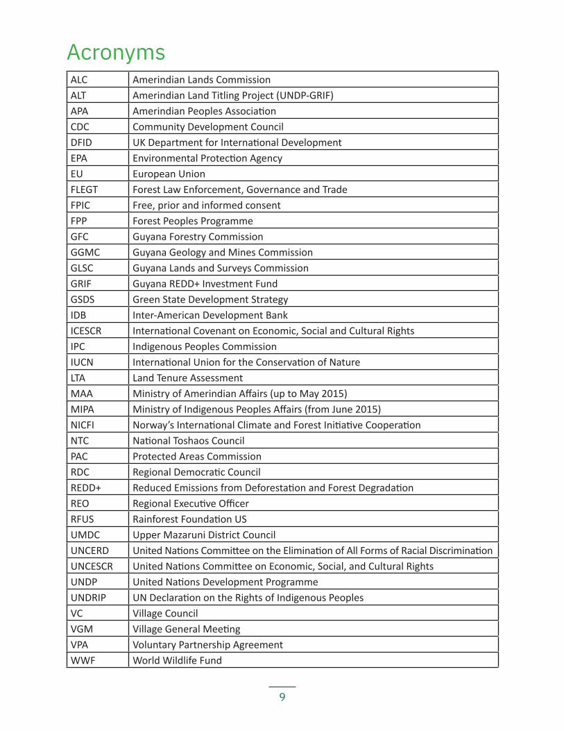
AcronymsALC Amerindian Lands CommissionALT Amerindian Land Titling Project (UNDP-GRIF)APA Amerindian Peoples AssociationCDC Community Development CouncilDFID UK Department for International DevelopmentEPA Environmental Protection AgencyEU European UnionFLEGT Forest Law Enforcement, Governance and TradeFPIC Free, prior and informed consentFPP Forest Peoples ProgrammeGFC Guyana Forestry CommissionGGMC Guyana Geology and Mines CommissionGLSC Guyana Lands and Surveys CommissionGRIF Guyana REDD+ Investment FundGSDS Green State Development StrategyIDB Inter-American Development BankICESCR International Covenant on Economic, Social and Cultural RightsIPC Indigenous Peoples CommissionIUCN International Union for the Conservation of NatureLTA Land Tenure AssessmentMAA Ministry of Amerindian Affairs (up to May 2015)MIPA Ministry of Indigenous Peoples Affairs (from June 2015)NICFI Norway’s International Climate and Forest Initiative CooperationNTC National Toshaos CouncilPAC Protected Areas CommissionRDC Regional Democratic CouncilREDD+ Reduced Emissions from Deforestation and Forest DegradationREO Regional Executive OfficerRFUS Rainforest Foundation USUMDC Upper Mazaruni District CouncilUNCERD United Nations Committee on the Elimination of All Forms of Racial DiscriminationUNCESCR United Nations Committee on Economic, Social, and Cultural RightsUNDP United Nations Development ProgrammeUNDRIP UN Declaration on the Rights of Indigenous PeoplesVC Village CouncilVGM Village General MeetingVPA Voluntary Partnership AgreementWWF World Wildlife Fund
10
Executive Summary
This report presents the results of sixteen months of research on the land tenure situation of indigenous communities in the Cuyuni-Mazaruni Region in Guyana (Region 7). The Am-erindian Peoples Association (APA) carried out this study in collaboration with community members at the end of 2017 and throughout 2018. Additional literary research was under-taken at the start of 2019 during the compilation of this report. The study covers twenty communities — fifteen of which are titled and five of which possess no legal documents to their land. The LTA team also visited two satellite villages located within the titled boundar-ies of other villages; a few families who are living within their traditional lands, but who do not have formal governance bodies; and two communities located in close proximity and similarly situated to other Region 7 villages but which are formally located in other regions.
Together with the preceding reports — covering Regions 1 and 21 and Region 82 — this report highlights the lived experience of indigenous communities in Guyana relating to their lands. The information is vitally important to informing ongoing efforts to reform existing and draft new national policies and laws on land and resource tenure, and to bring them in line with Guyana’s international human rights commitments and obliga-tions. The communities that took part in this land tenure study urge the Government of Guyana, as well as international development organisations, to use the information contained in this report to inform and guide:
— Revisions to the 2006 Amerindian Act to ensure full protection for our rights, and specifically, our customary land rights. Notably, six communities in the Upper Mazaruni are involved in a lawsuit (see Part I, Section 3.5) against the government, seeking collective title to Akawaio and Arecuna territory. The law-suit has been pending since it was filed in 1998. A revision to the law allowing for collective territorial titles would resolve the issue raised in the court case;
— Official measures to resolve land conflicts, particularly with third parties that are operating within our traditional lands, including our titled lands, without our consent;
— National legal and policy reforms needed to ensure that our traditional lands, including customary untitled lands, are no longer allocated to outside con-cession holders without respect for our rights, notably, our right to free, prior and informed consent (FPIC).
Part I of the report provides a background to the study, starting with the methodology (Sec-tion 1) followed by a brief history of indigenous peoples’ occupation and use of the Cuyuni-Mazaruni Region (Section 2). Sections 3 and 4 provide brief accounts of Guyana’s past and present land policies and laws. Part II presents the land tenure assessment done by this study, starting with summary findings for each of the twenty communities visited (Section 5) and ending with a synthesis of the findings, conclusions and recommendations (Section 6).
11
The main findings of this study, distilled from the synthesis in Section 6, are as follows:
Legal recognition and tenure rights
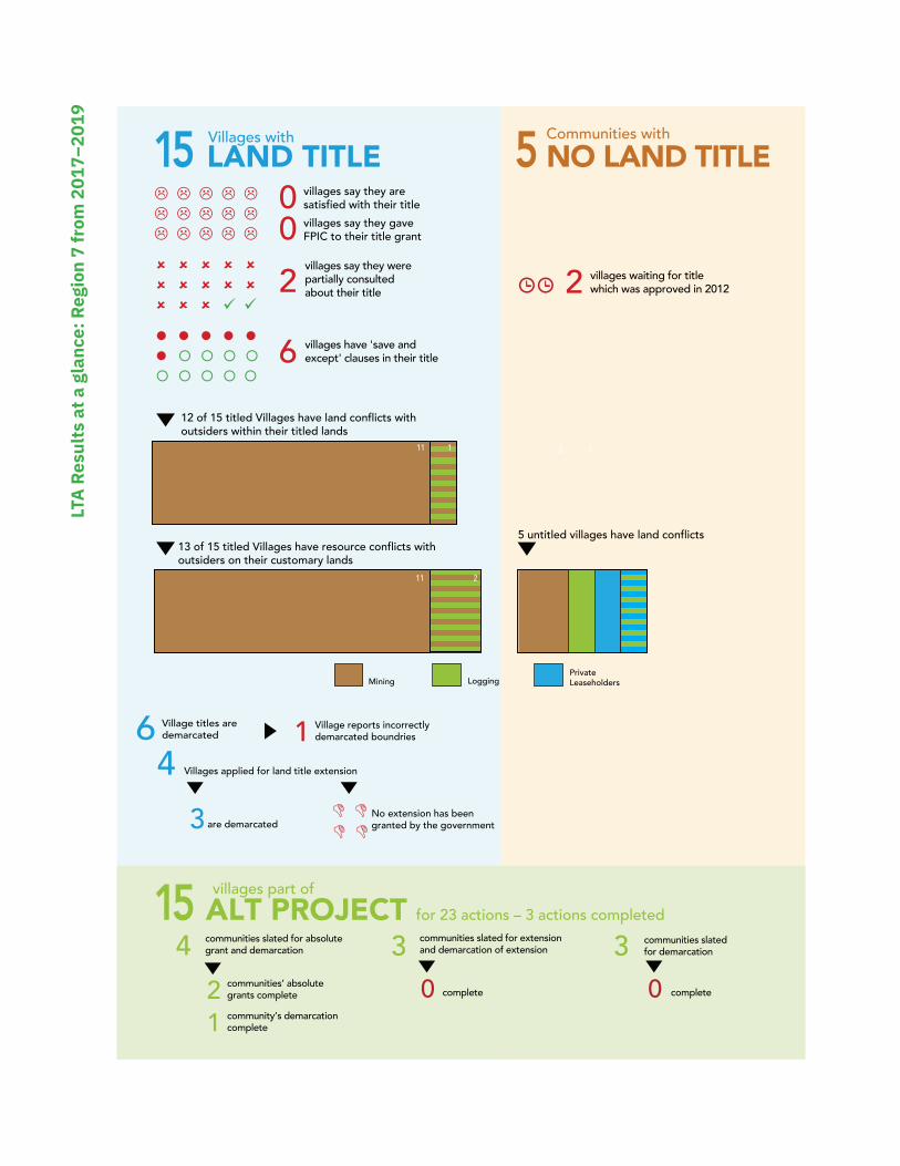
— 15 of the 20 communities3 visited had land titles; however, all of these titled villages report that they are dissatisfied with their titles;
— 2 communities have been told by the Attorney General that they have legal title, but they have not yet received valid title documents;
— The land tenure security of 6 titled villages is limited by a ‘save and except’ clause in their absolute grant and/or their certificate of title. These ‘save and except’ clauses exclude third-party private property or land lease interests from the titled area if they predate the title grant. This means that mining concessions, logging concessions, or leases granted on the land before title was issued are allowed to remain after title is issued. For at least two of the-se villages, the ‘save and except’ clause further limits the village’s ability to control the right of passage through village lands;
— Joint requests for collective land title have been ignored. Specifically, the Upper Mazaruni communities’ request for collective title during the 1960s ALC process was ignored, and the communities’ lawsuit seeking collective title has been pen-ding a decision in the High Court for more than 20 years since it was filed in 1998. The Middle Mazaruni’s request for collective title in 1993 was similarly ignored;
— At least 11 of the 15 titled villages report that they were not consulted nor asked for their FPIC to the area granted as title4;
— The titles of at least 14 of the 15 titled villages fail to cover the full customary areas traditionally occupied and used by the villages5;
— Residents in 12 of the 15 titled villages report that they depend on land out-side the title for hunting and fishing and farming;
— Residents in 11 of the 15 titled villages report that they depend on land outside the title for gathering of medicinal plants, materials for crafting and building, etc.);
— 10 of the 15 titled villages report that they have homesteads and small sett-lements outside their title boundaries;
— 10 of the 15 titled villages report that they have important cultural and spiri-tual sites located outside their title boundaries;
— 12 of the titled villages report land conflicts with mining interests inside title boundaries;
— 15 communities (11 of them titled) report land conflicts with mining intere-sts in non-titled lands;
— 4 communities (1 titled) have land conflicts with logging interests in untitled lands; — 1 titled village has land conflicts with logging interests inside titled boundaries; — 2 communities report land conflicts with private leaseholders; — 1 titled village is having conflicts with army and police presence on their tit-
led lands; and — Many villages and communities visited are dissatisfied with the way indivi-
dual village titles have fragmented their collective territory.
12
Titling, demarcation, and extension processes
— 6 out of the 15 titled villages have been demarcated; — 1 of the demarcated villages reports flaws in its title demarcation, with the
demarcation not following the title description; — Of the 4 extension applications filed by the villages visited, none has yet
been granted at the time of writing this report; and — 6 villages in the Upper Mazaruni are seeking collective title to a larger
Akawaio and Arecuna territory through a court case against the government. The current system of titling communities individually does not cater for the fact that much of the customary land of communities has traditionally been shared between neighbouring villages within a collectively-held territory.
Land conflicts and threats to livelihoods
— All communities visited reported some sort of land and resource conflict with external parties on their titled and customary lands. Most of the issues rela-te to mining and logging, with one instance of conflict with state authorities, including the army and police;
— 11 of the 15 titled villages have problems with mining activities or movement of unauthorised miners on their titled land;
— At least 2 villages have reported explicit incidences of bullying and violence by miners;
— 16 communities report that commercial mining and logging are harming the environment and livelihoods that the communities depend on; and
— Main concerns related to livelihoods include: resources within titled areas are be-coming scarce due to population growth; titled areas are too small and lack su-itable farmland; mining is causing pollution, deforestation, and scarcity of game animals and fish; and changing weather patterns, in particular, heavier rains, have damaged crops and caused the failure of some traditional fishing methods.
Causes of land tenure insecurity and land conflicts
The main causes of violations of indigenous land rights in Region 7, similar to the fin-dings in Regions 1, 2, and 8, include:
— flawed national laws, including the Amerindian Act of 2006; — problems with the way land is allocated by the government to mining and
logging interests, notably, state issuance of mining rights in customary lands under claim, including over a large portion of lands in the Upper Mazaruni River basin, which are the subject of legal proceedings in the High Court;
— lack of effective and meaningful participation in decision-making, including FPIC; and
— lack of effective means of redress for indigenous communities.
13
Proposals for action
In their recommendations, communities call on the Government of Guyana to legally recognise and provide with secure title all lands that the Akawaio, Arecuna, Carib, Ar-awak, Patamona, and Warrau peoples of the Mazaruni, Cuyuni, and surrounding areas have traditionally owned, occupied and used and where they hold close attachment to the land. These areas include lands upon which their foreparents depended and which people continue to occupy and use for farming, hunting, fishing and gathering today, as well as spiritual sites, cultural heritage sites, and other areas of historical importance.
Key proposals include calls for measures by the state and its authorities and agencies to:
— Revise existing laws, policies, and governmental practices to fully respect indigenous peoples’ rights to their lands, territories, and resources, as well as their right to FPIC, consistent with Guyana’s obligations under internatio-nal law and international standards, as incorporated into the Constitution of Guyana6, and to ensure their right to protection of the law7;
— Grant indigenous peoples titles to the full extent of their traditional lands, and allow for titles to larger territories to be held collectively by multiple villages through a district council, which the Upper Mazaruni villages are seeking;
— Revise the process for processing title and extension applications so they can be approved in a timely and efficient manner;
— Refrain from granting mining and logging concessions on communities’ tradi-tional and titled lands without their FPIC;
— Revoke all mining and logging concessions granted on indigenous lands wi-thout FPIC, and return lands taken to build government compounds back to the communities;
— When granting new titles and extensions of title, remove third party en-cumbrances on the land and return that land to the villages, and issue titles without any ‘save and except’ clauses;
— Direct a recommendation to the Chancellor of the Judiciary to expedite the resolution of the Upper Mazaruni land case;
— Investigate reports of rights abuses committed by miners, loggers, police, and soldiers, and discipline perpetrators;
— Provide communities with regularly updated information regarding the status of concessions, airstrips, and other possible encumbrances on their lands;
— Respect FPIC when making decisions that affect communities, including in deciding whether to grant mining or logging concessions and approval for development projects, such as road or dam building;
— Carry out a systematic study of the pollution and destruction of forests cau-sed by mining in Region 7; and
— Centralize and synchronize the mapping databases across all government agencies, including in particular the GLSC, GGMC, and GFC, so all government maps display the same (and correct) information regarding village titles.

14
The villages and communities call on their village councils, the National Toshaos Coun-cil, and indigenous advocacy organisations to take unified positions and proactive ap-proaches to ensure that indigenous land and resource rights in Region 7 and through-out Guyana are protected.
12
LAND TITLE15 Villages with 5 Communities with
NO LAND TITLE/ / / / // / / / // / / / /
8 8 8 8 88 8 8 8 88 8 8 99
2 2
00
2
Mining Logging Private Leaseholders
1
villages say they were partially consulted about their title
6 villages have 'save and except' clauses in their title
villages waiting for title which was approved in 2012
12 of 15 titled Villages have land conflicts with outsiders within their titled lands
5 untitled villages have land conflicts 13 of 15 titled Villages have resource conflicts with outsiders on their customary lands
villages say they are satisfied with their titlevillages say they gave FPIC to their title grant
' '' '
11 1
z z z z zz { { { {{ { { {{
11 2
6 Village titles are demarcated
No extension has been granted by the government
1 Village reports incorrectly demarcated boundries
4 Villages applied for land title extension
3 are demarcated
ALT PROJECT for 23 actions – 3 actions completed15 villages part of
4
communities slated for absolute grant and demarcation 3 communities slated for extension
and demarcation of extension
2 communities’ absolute grants complete 0 complete complete
3 communities slated for demarcation
01 community’s demarcation
complete
LTA
Resu
lts a
t a g
lanc
e: R
egio
n 7
from
201
7–20
19

16
Part I Methods, Historical Background, and Land Policies Past and Present
17
1. How the Land Tenure Assessment was Done
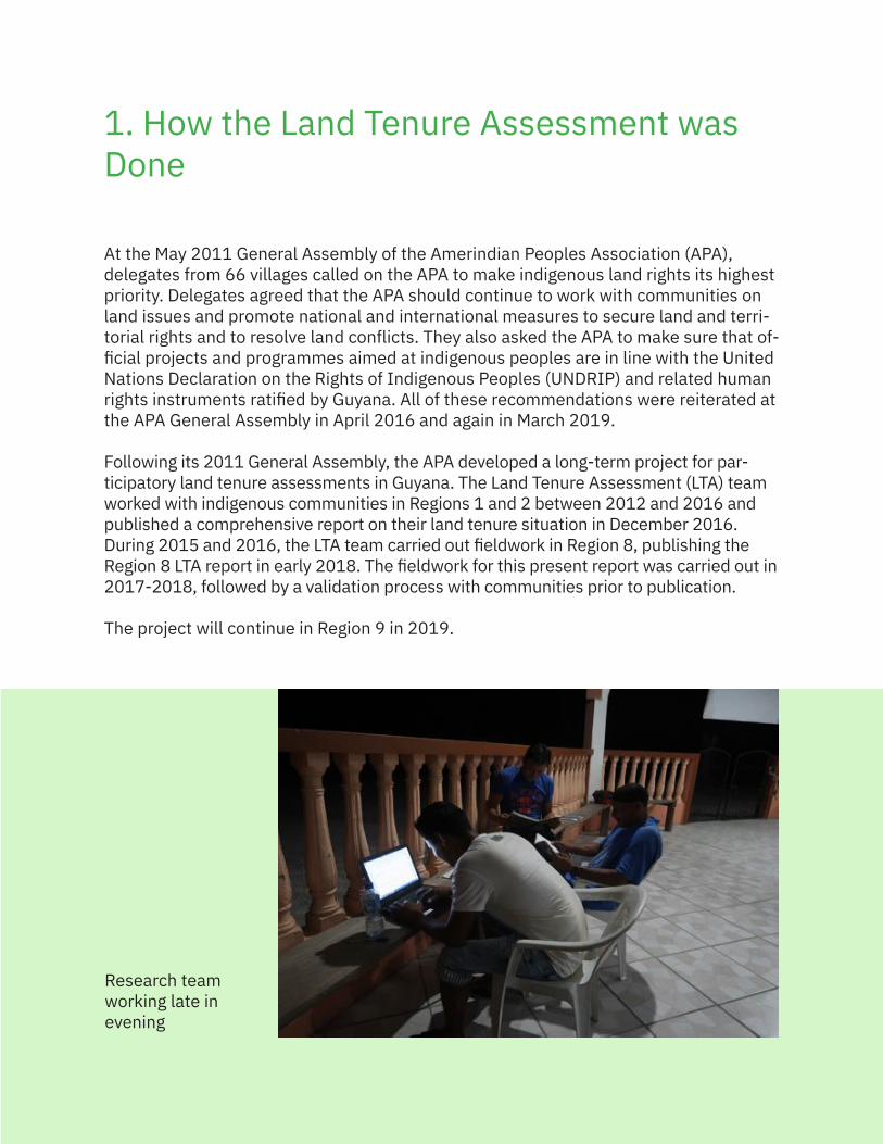
At the May 2011 General Assembly of the Amerindian Peoples Association (APA), delegates from 66 villages called on the APA to make indigenous land rights its highest priority. Delegates agreed that the APA should continue to work with communities on land issues and promote national and international measures to secure land and terri-torial rights and to resolve land conflicts. They also asked the APA to make sure that of-ficial projects and programmes aimed at indigenous peoples are in line with the United Nations Declaration on the Rights of Indigenous Peoples (UNDRIP) and related human rights instruments ratified by Guyana. All of these recommendations were reiterated at the APA General Assembly in April 2016 and again in March 2019.
Following its 2011 General Assembly, the APA developed a long-term project for par-ticipatory land tenure assessments in Guyana. The Land Tenure Assessment (LTA) team worked with indigenous communities in Regions 1 and 2 between 2012 and 2016 and published a comprehensive report on their land tenure situation in December 2016. During 2015 and 2016, the LTA team carried out fieldwork in Region 8, publishing the Region 8 LTA report in early 2018. The fieldwork for this present report was carried out in 2017-2018, followed by a validation process with communities prior to publication.
The project will continue in Region 9 in 2019.
Research team working late in evening
18
Purpose
The LTA studies collect information on the present situation of indigenous peoples’ land and territorial rights in Guyana, with the hope that they will be actively used by indige-nous communities, village councils, district councils, local and national indigenous peo-ples’ organisations, and policy makers. The main purpose of the series of LTA reports is to provide land tenure information and evidence for indigenous peoples in Guyana and their representative organisations seeking recognition of and respect for their rights to their lands, territories and resources. The LTA project collects information through par-ticipatory fieldwork and in-depth interviews and discussions with community members. This action research increases community awareness about their territorial rights and collective rights to land. It has also informed communities and district bodies about the national and international laws and policies affecting their security of land tenure.
Indigenous villages and communities may use the land tenure information presented in Part II of this report in their interactions with national policy processes, including the Guyana Green State Development Strategy (GSDS), the Natural Resources Fund, the Low Carbon Development Strategy (LCDS), Reduced Emissions from Deforestation and Forest Degradation (REDD+), and the EU-Guyana FLEGT-VPA process. The infor-mation gathered by the project is likewise intended for use by communities when they are talking to agencies such as the Ministry of Indigenous Peoples Affairs (MIPA), the Guyana Lands and Surveys Commission (GLSC), the Guyana Geology and Mines Com-mission (GGMC), the Guyana Forestry Commission (GFC), the Ministry of Natural Re-sources (MNR), the Environmental Protection Agency (EPA), the Protected Areas Com-mission (PAC), the Ministry of Agriculture, and the Office of Climate Change.
Team training and field methods
At the beginning of the first LTA study done in Regions 1 and 2, communities and lo-cal APA units nominated eight people to join the land tenure research team. These team members were trained in participatory action research methods over four days in Georgetown in February 2012. Experience gained during the extensive research for the report on Regions 1 and 2 indicated that it would be useful for the original researchers to continue in Region 8 and bring on a set of new persons from this region who had in-depth knowledge about the area. New and old team members met in Kato (Region 8) in October 2015 to evaluate methods used so far, including the project’s questionnaire on land tenure, and to agree on methodology for the upcoming work. After testing an off-line toolbox browser form to record information, the team identified technical problems at a further meeting in July 2016 and decided to return to using pen and paper notes.
For the LTA study of Region 7, the LTA team consisted of some of the team members who had worked on the LTA assessments of Regions 1, 2, and 8, along with new team mem-bers from Region 7. The team, both old and new members, met in September 2017 for a comprehensive training on research methods. The team used the same methodology for
19
the study as they had in Region 8 — pen and paper notes, with smart phones for taking geo-referenced photos and videos. The field data, including sound files, photographs of documents and sketch maps, typed field notes, testimonies and Village Input Forms were saved on USB drives and later uploaded to secure online servers.
Validation and sharing of information collected
In each community visited, the team collected information by questionnaire and by more in-depth structured, semi structured and informal interviews; returned to the village to request additional information or clarify information already collected; and organised a validation meeting with the residents to check that the information was correct. In some cases, further information could not be obtained because residents could not recall the details of what happened or official documents (including land title documents and copies of their own communications with the government) were miss-ing from village records. The authors requested information regarding land title and ex-tension issues and overlapping concessions from MIPA, GLSC, the GGMC, and the GFC where necessary, but the government did not always respond to the authors’ requests.
From November 2018-January 2019, the authors sent the draft summary reports, syn-thesised from the data collected, back to the respective villages so they could point out any mistakes or add additional information. The authors then visited the villages to do a final validation meeting prior to publication.
The LTA team has made every effort to verify and confirm the information presented in this report. Where information was not available or unclear, this is recorded in the summary report for each community. Any remaining errors or omissions in this report are unintentional and are the sole responsibility of the authors of this publication.
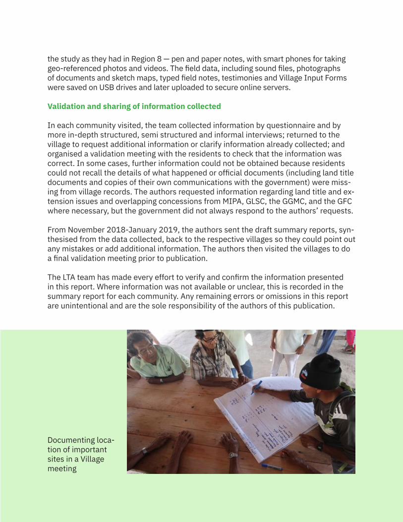
Documenting loca-tion of important sites in a Village meeting
20
What the study covers
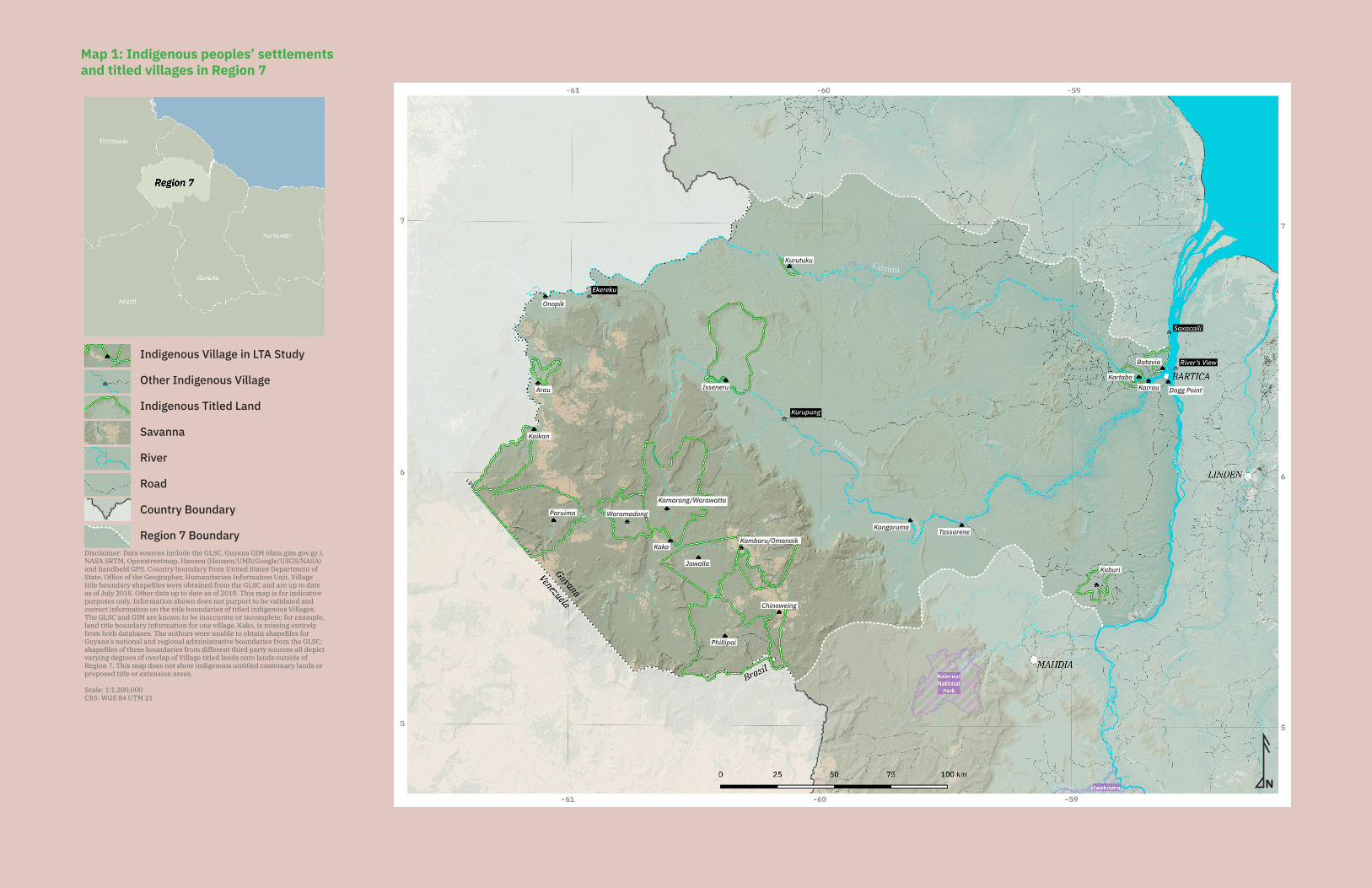
The study covers twenty communities in Region 7, the Cuyuni-Mazaruni region in west-northwest Guyana (see Map 1). These include all the titled villages in the Region, as well as several communities that do not have title. The research team also visited two communities in Region 7 that do not have separate summary reports in this re-port—Kurupung (Middle Mazaruni) and Ekereku (Upper Cuyuni). The families in Kuru-pung and Ekereku follow traditional Akawaio ways of life and consider themselves to be Akawaio and to be part of a larger Akawaio territory. The areas in which these two communities are located are also part of Akawaio traditional lands. The absence of a separate summary report on these families is mostly due to the small size of the settle-ment. More information about the two communities will be presented in the introduc-tory overview to the two sub-regions in which they belong. The team also visited two communities in close proximity to other Region 7 villages in the Lower Mazaruni-Lower Cuyuni — River’s View and Saxacalli. While not formally part of Region 7, these commu-nities are similarly situated to the other communities in that area.
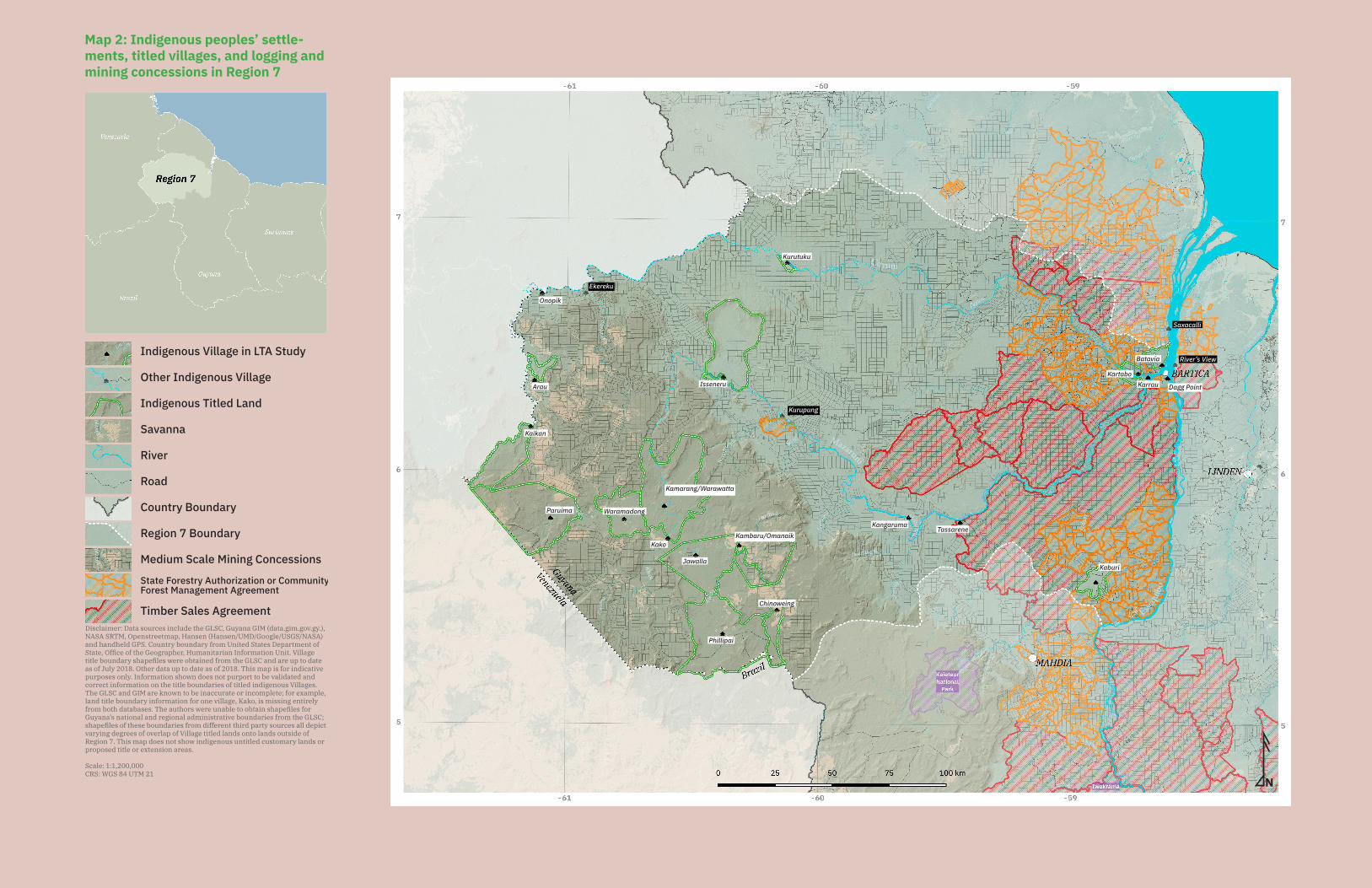
12 of the villages and settlements visited were mainly Akawaio, four are mainly Carib, one is mainly Arecuna, one is mainly Arawak, one is mainly Patamona, and one is main-ly Warrau. Most of them are located along the Mazaruni and Cuyuni Rivers and their tributaries. The vast majority of Region 7 is considered to be the traditional territory of the Akawaio and Arecuna peoples. Historically, the traditional territory of the Akawaio spanned even further down the lower Mazaruni and Cuyuni Rivers, but evidence indi-cates that they were forced further up these rivers during colonial times by conflicts with other indigenous nations, mining and logging interests (still a major source of con-flicts; see Map 2), and by the threat of disease. The lower Mazaruni and Cuyuni Rivers were also part of the traditional lands of the Caribs, Arawaks and Warraus of the North-west (Regions 1 and 2). Indeed, today most of the residents of these Lower Mazaruni communities are Carib, Arawak, and Warrau.
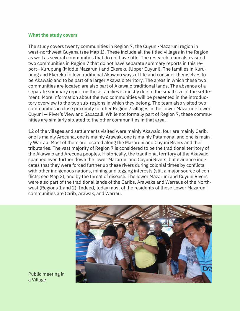
Public meeting ina Village
21
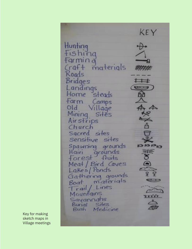
Key for making sketch maps in Village meetings
MAP 2
Mazaruni
Cuyuni
N
Disclaimer: Data sources include the GLSC, Guyana GIM (data.gim.gov.gy.), NASA SRTM, Openstreetmap, Hansen (Hansen/UMD/Google/USGS/NASA) and handheld GPS. Country boundary from United States Department of
title boundary shapefiles were obtained from the GLSC and are up to date as of July 2018. Other data up to date as of 2018. This map is for indicative
The GLSC and GIM are known to be inaccurate or incomplete; for example, land title boundary information for one village, Kako, is missing entirely
Guyana’s national and regional administrative boundaries from the GLSC; shapefiles of these boundaries from different third party sources all depict
Region 7. This map does not show indigenous untitled customary lands or
Onopik
Arau
Kaikan
Isseneru
Paruima Waramadong
Kamarang/Warawatta
Kako
Jawalla
Kambaru/Omanaik
Chinoweing
Phillipai
Kangaruma Tassarene
Kaburi
Kurutuku
Kartabo
Batavia
Karrau Dagg Point
River’s View
Saxacalli
Kurupung
Ekereku
Essequ
ibo
Indigenous Village in LTA Study
Other Indigenous Village
Indigenous Titled Land
Savanna
River
Road
Country Boundary
Region 7 BoundaryDisclaimer: Data sources include the GLSC, Guyana GIM (data.gim.gov.gy.), NASA SRTM, Openstreetmap, Hansen (Hansen/UMD/Google/USGS/NASA) and handheld GPS. Country boundary from United States Department of State, Office of the Geographer, Humanitarian Information Unit. Village title boundary shapefiles were obtained from the GLSC and are up to date as of July 2018. Other data up to date as of 2018. This map is for indicative purposes only. Information shown does not purport to be validated and correct information on the title boundaries of titled indigenous Villages. The GLSC and GIM are known to be inaccurate or incomplete; for example, land title boundary information for one village, Kako, is missing entirely from both databases. The authors were unable to obtain shapefiles for Guyana’s national and regional administrative boundaries from the GLSC; shapefiles of these boundaries from different third party sources all depict varying degrees of overlap of Village titled lands onto lands outside of Region 7. This map does not show indigenous untitled customary lands or proposed title or extension areas.
Scale: 1:1,200,000CRS: WGS 84 UTM 21
Map 1: Indigenous peoples’ settlements and titled villages in Region 7
Mazaruni
Cuyuni
N
Onopik
Arau
Kaikan
Isseneru
Paruima Waramadong
Kamarang/Warawatta
Kako
Jawalla
Kambaru/Omanaik
Chinoweing
Phillipai
Kangaruma Tassarene
Kaburi
Kurutuku
Kartabo
Batavia
Karrau Dagg Point
River’s View
Saxacalli
Kurupung
Ekereku
Essequ
ibo
Medium Scale Mining Concessions
Disclaimer: Data sources include the GLSC, Guyana GIM (data.gim.gov.gy.), NASA SRTM, Openstreetmap, Hansen (Hansen/UMD/Google/USGS/NASA) and handheld GPS. Country boundary from United States Department of
title boundary shapefiles were obtained from the GLSC and are up to date as of July 2018. Other data up to date as of 2018. This map is for indicative
The GLSC and GIM are known to be inaccurate or incomplete; for example, land title boundary information for one village, Kako, is missing entirely
Guyana’s national and regional administrative boundaries from the GLSC; shapefiles of these boundaries from different third party sources all depict
Region 7. This map does not show indigenous untitled customary lands or
State Forestry Authorization or Community
Indigenous Village in LTA Study
Other Indigenous Village
Indigenous Titled Land
Savanna
River
Road
Country Boundary
Region 7 Boundary
Medium Scale Mining Concessions
Disclaimer: Data sources include the GLSC, Guyana GIM (data.gim.gov.gy.), NASA SRTM, Openstreetmap, Hansen (Hansen/UMD/Google/USGS/NASA) and handheld GPS. Country boundary from United States Department of State, Office of the Geographer, Humanitarian Information Unit. Village title boundary shapefiles were obtained from the GLSC and are up to date as of July 2018. Other data up to date as of 2018. This map is for indicative purposes only. Information shown does not purport to be validated and correct information on the title boundaries of titled indigenous Villages. The GLSC and GIM are known to be inaccurate or incomplete; for example, land title boundary information for one village, Kako, is missing entirely from both databases. The authors were unable to obtain shapefiles for Guyana’s national and regional administrative boundaries from the GLSC; shapefiles of these boundaries from different third party sources all depict varying degrees of overlap of Village titled lands onto lands outside of Region 7. This map does not show indigenous untitled customary lands or proposed title or extension areas.
Scale: 1:1,200,000CRS: WGS 84 UTM 21
State Forestry Authorization or Community Forest Management Agreement
Timber Sales Agreement
Map 2: Indigenous peoples’ settle-ments, titled villages, and logging and mining concessions in Region 7
26
2. History of How Indigenous Peoples Have Used and Occupied Their Lands
The Akawaio and Arecuna, as well as the Carib, Arawak, and Warrau, have occupied the land that we now call the Cuyuni-Mazaruni Region, or Region 7, for millennia. This section of the report will mostly focus on the history of the Akawaio and Arecuna peo-ples, whose traditional territories span the vast majority of Region 7.8 Carib, Arawak and Warrau communities in Region 7 are mostly located in the Lower Mazaruni/Cuyuni, in areas that might be considered extensions of their traditional lands in the North-west. For more information on the history of these nations, the authors refer the reader to Section 2 of the LTA Report on Regions 1 and 2. In Region 7, only Kaburi Village is predominantly Patamona. For a history of the Patamona people, the authors refer the reader to Section 2 of the LTA Report on Region 8.
Akawaio
The Akawaio refer to themselves as ‘Kapon’. The name ‘Kapon’ is also used by the Pa-tamona people, who occupy much of what is today Region 8 of Guyana.9 The Akawaio have historically occupied the river valleys in the Corentyne (in present-day Suriname), Berbice, Demerara, Essequibo, Cuyuni, Mazaruni, Potaro, Barima, Barama, Waini, and Cotingo (in present-day Brazil) Rivers.
Archaeologist Denis Williams has described the settlement of the Akawaio across vast areas of land as being a result of the ecological conditions of the land, twinned with traditional subsistence practices, emphasizing that rotational farming was necessary to allow for regrowth and renewal of soil nutrients. He observed that this system of cassava cropping and rotating of lands is a ‘sustainable low-input form of cultivation which can continue indefinitely on these infertile soils provided the carrying capacity of the land is not exceeded. Its obvious limitation is that it can usually support only 10-20 persons/km2 because at any time only around 10 percent of the available land is under cultiva-tion…’ This, combined with the labor intensiveness of cassava horticulture, meant that there was ‘relatively sedentary habitation by families scattered over a wide area.’10
Arecuna
The Arecuna who refer to themselves as ‘Pemon’. The name ‘Pemon’ is also used by the Macushi and other peoples, including the Taurepang people in Venezuela and Brazil. The Arecuna historically occupied the Kavanayen and the upper Kamarang River valley, extending from Wompamota (San Rafael de Kamoiran Village in Venezuela) down river to Paruima Village. On the Gran Sabana in Venezuela, their lands extend to the Ka’ma River, which forms the boundary between their lands and the lands of the Taurepang.11
27
2.1 PrehistoryThe available archaeological record in Region 7 is sparse, with almost no dedicated ar-chaeological studies done in the region. Many of the artefacts found in Region 7, particular-ly in the Cuyuni River, were discovered accidentally by miners dredging up the river beds.12
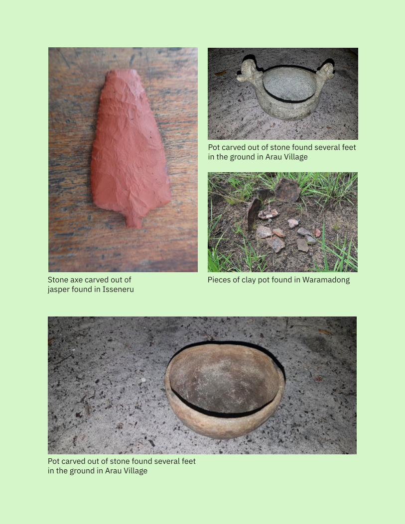
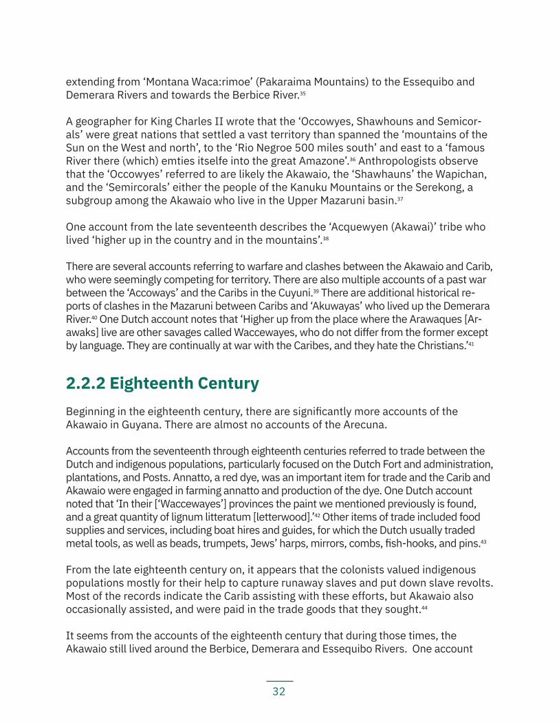
Although there has been limited archaeological activity in the region, the available ar-chaeological evidence shows that indigenous peoples have continuously occupied and used the lands, forests, and waterways in what is today known as Region 7 from long before the arrival of Europeans on the continent. It should be noted that this report only records archaeological evidence that has been formally published — individuals and communities visited by the LTA team also know of the existence of sites with human skeletal remains; burial urns; old wooden clubs; stone axes; stone arrowheads; ancient pottery; beads; and other artefacts which people affirm were left by their ancestors. They consider these artefacts and ancient sites to be evidence of the traditional and sustained occupation of their lands and territories over many generations and centuries by their foreparents. Local knowledge holders also point out that specific archaeological and cultural heritage sites embody their collective history and their attachment to land and territory. Examples of such sites include former battlefields, burial grounds, and sites containing ceramic vessels used in ceremonial preparations for battle.
Evidence recorded by archaeologist Denis Williams shows that the Akawaio were living in the Mazaruni River basin at least 2,000 years before present (b.p.).13 Specifically, Williams reports that the earliest known site occupied by the Akawaio, currently sub-merged under the Mazaruni River, was occupied around +/- 2100 b.p.14 He noted that ‘the Kapon [Akawaio] descendants of the Karinya [Carib] had pioneered the settlement of the Mazaruni basin by horticulturalists before 80 B.C. [approx. 2100 b.p.].’15
Some of the evidence Williams relied upon included analysis of Koriabo phase pottery. This phase of pottery likely derived from a Karinya [Carib] pottery tradition, and as early as 200 B.C., there were ceramics along the Pomeroon River that exhibited certain traits that would become definitive of the Koriabo phase of pottery.16 Williams concluded from the evidence of the origins of Koriabo phase ceramics that the Akawaio are likely descendants of the Karinya [Carib], who lived in the Northwest of Guyana, and spread throughout Guyana, perhaps along the Essequibo River and other major rivers.17 Wil-liams also linked the occurrence and distribution of Koriabo phase pottery to the dis-persion of Carib languages, including Akawaio and Arecuna.18
Koriabo pottery has been excavated on Quartz and Lanciana Islands in the Lower Mazaruni. There is also evidence of Akawaio pottery in other sites, including Bartica and Saxacalli.19 Notably, ‘[w]hile the Akawaio occupied the greater part of the Mazaruni River including Quartz Island and Lanciana Island, they were also at Woi Creek tributary of the Potaro River. At Tumatumari Falls where, it is said, fish ‘jump’ the falls at certain times of the year and are easily captured, and which is believed to have been used as a fishing
28
Pieces of clay pot found in Waramadong
Pot carved out of stone found several feet in the ground in Arau Village
Stone axe carved out of jasper found in Isseneru
Pot carved out of stone found several feet in the ground in Arau Village
29
Pieces of clay pot in Chinoweing
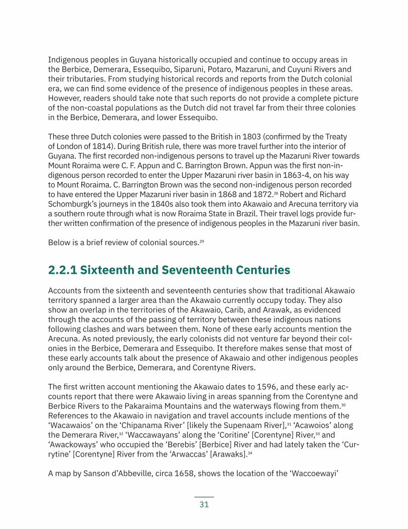
Stone mortar found in Arau
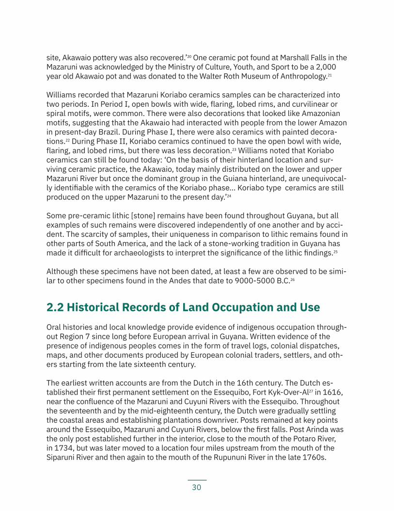
Stone figure found in Kangaruma
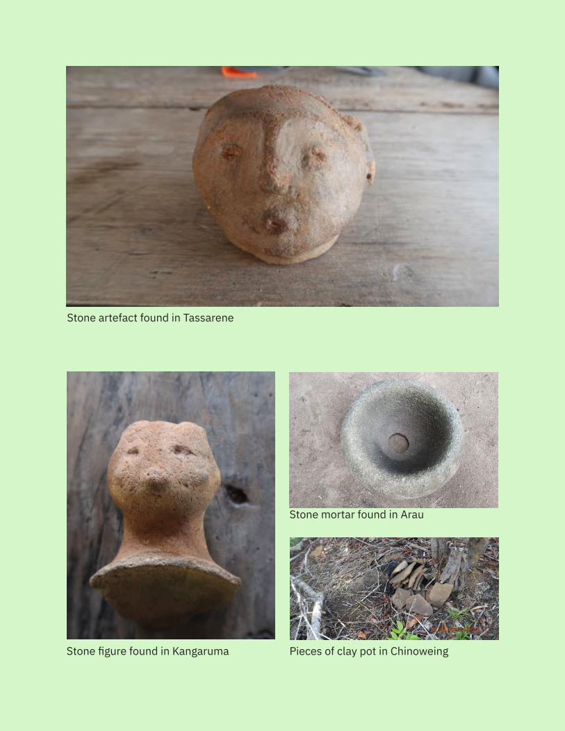
Stone artefact found in Tassarene
30
site, Akawaio pottery was also recovered.’20 One ceramic pot found at Marshall Falls in the Mazaruni was acknowledged by the Ministry of Culture, Youth, and Sport to be a 2,000 year old Akawaio pot and was donated to the Walter Roth Museum of Anthropology.21
Williams recorded that Mazaruni Koriabo ceramics samples can be characterized into two periods. In Period I, open bowls with wide, flaring, lobed rims, and curvilinear or spiral motifs, were common. There were also decorations that looked like Amazonian motifs, suggesting that the Akawaio had interacted with people from the lower Amazon in present-day Brazil. During Phase I, there were also ceramics with painted decora-tions.22 During Phase II, Koriabo ceramics continued to have the open bowl with wide, flaring, and lobed rims, but there was less decoration.23 Williams noted that Koriabo ceramics can still be found today: ‘On the basis of their hinterland location and sur-viving ceramic practice, the Akawaio, today mainly distributed on the lower and upper Mazaruni River but once the dominant group in the Guiana hinterland, are unequivocal-ly identifiable with the ceramics of the Koriabo phase… Koriabo type ceramics are still produced on the upper Mazaruni to the present day.’24
Some pre-ceramic lithic [stone] remains have been found throughout Guyana, but all examples of such remains were discovered independently of one another and by acci-dent. The scarcity of samples, their uniqueness in comparison to lithic remains found in other parts of South America, and the lack of a stone-working tradition in Guyana has made it difficult for archaeologists to interpret the significance of the lithic findings.25
Although these specimens have not been dated, at least a few are observed to be simi-lar to other specimens found in the Andes that date to 9000-5000 B.C.26
2.2 Historical Records of Land Occupation and UseOral histories and local knowledge provide evidence of indigenous occupation through-out Region 7 since long before European arrival in Guyana. Written evidence of the presence of indigenous peoples comes in the form of travel logs, colonial dispatches, maps, and other documents produced by European colonial traders, settlers, and oth-ers starting from the late sixteenth century.
The earliest written accounts are from the Dutch in the 16th century. The Dutch es-tablished their first permanent settlement on the Essequibo, Fort Kyk-Over-Al27 in 1616, near the confluence of the Mazaruni and Cuyuni Rivers with the Essequibo. Throughout the seventeenth and by the mid-eighteenth century, the Dutch were gradually settling the coastal areas and establishing plantations downriver. Posts remained at key points around the Essequibo, Mazaruni and Cuyuni Rivers, below the first falls. Post Arinda was the only post established further in the interior, close to the mouth of the Potaro River, in 1734, but was later moved to a location four miles upstream from the mouth of the Siparuni River and then again to the mouth of the Rupununi River in the late 1760s.
31
Indigenous peoples in Guyana historically occupied and continue to occupy areas in the Berbice, Demerara, Essequibo, Siparuni, Potaro, Mazaruni, and Cuyuni Rivers and their tributaries. From studying historical records and reports from the Dutch colonial era, we can find some evidence of the presence of indigenous peoples in these areas. However, readers should take note that such reports do not provide a complete picture of the non-coastal populations as the Dutch did not travel far from their three colonies in the Berbice, Demerara, and lower Essequibo.
These three Dutch colonies were passed to the British in 1803 (confirmed by the Treaty of London of 1814). During British rule, there was more travel further into the interior of Guyana. The first recorded non-indigenous persons to travel up the Mazaruni River towards Mount Roraima were C. F. Appun and C. Barrington Brown. Appun was the first non-in-digenous person recorded to enter the Upper Mazaruni river basin in 1863-4, on his way to Mount Roraima. C. Barrington Brown was the second non-indigenous person recorded to have entered the Upper Mazaruni river basin in 1868 and 1872.28 Robert and Richard Schomburgk’s journeys in the 1840s also took them into Akawaio and Arecuna territory via a southern route through what is now Roraima State in Brazil. Their travel logs provide fur-ther written confirmation of the presence of indigenous peoples in the Mazaruni river basin.
Below is a brief review of colonial sources.29
2.2.1 Sixteenth and Seventeenth CenturiesAccounts from the sixteenth and seventeenth centuries show that traditional Akawaio territory spanned a larger area than the Akawaio currently occupy today. They also show an overlap in the territories of the Akawaio, Carib, and Arawak, as evidenced through the accounts of the passing of territory between these indigenous nations following clashes and wars between them. None of these early accounts mention the Arecuna. As noted previously, the early colonists did not venture far beyond their col-onies in the Berbice, Demerara and Essequibo. It therefore makes sense that most of these early accounts talk about the presence of Akawaio and other indigenous peoples only around the Berbice, Demerara, and Corentyne Rivers.
The first written account mentioning the Akawaio dates to 1596, and these early ac-counts report that there were Akawaio living in areas spanning from the Corentyne and Berbice Rivers to the Pakaraima Mountains and the waterways flowing from them.30 References to the Akawaio in navigation and travel accounts include mentions of the ‘Wacawaios’ on the ‘Chipanama River’ [likely the Supenaam River],31 ‘Acawoios’ along the Demerara River,32 ‘Waccawayans’ along the ‘Coritine’ [Corentyne] River,33 and ‘Awackoways’ who occupied the ‘Berebis’ [Berbice] River and had lately taken the ‘Cur-rytine’ [Corentyne] River from the ‘Arwaccas’ [Arawaks].34
A map by Sanson d’Abbeville, circa 1658, shows the location of the ‘Waccoewayi’
32
extending from ‘Montana Waca:rimoe’ (Pakaraima Mountains) to the Essequibo and Demerara Rivers and towards the Berbice River.35
A geographer for King Charles II wrote that the ‘Occowyes, Shawhouns and Semicor-als’ were great nations that settled a vast territory than spanned the ‘mountains of the Sun on the West and north’, to the ‘Rio Negroe 500 miles south’ and east to a ‘famous River there (which) emties itselfe into the great Amazone’.36 Anthropologists observe that the ‘Occowyes’ referred to are likely the Akawaio, the ‘Shawhauns’ the Wapichan, and the ‘Semircorals’ either the people of the Kanuku Mountains or the Serekong, a subgroup among the Akawaio who live in the Upper Mazaruni basin.37
One account from the late seventeenth describes the ‘Acquewyen (Akawai)’ tribe who lived ‘higher up in the country and in the mountains’.38
There are several accounts referring to warfare and clashes between the Akawaio and Carib, who were seemingly competing for territory. There are also multiple accounts of a past war between the ‘Accoways’ and the Caribs in the Cuyuni.39 There are additional historical re-ports of clashes in the Mazaruni between Caribs and ‘Akuwayas’ who lived up the Demerara River.40 One Dutch account notes that ‘Higher up from the place where the Arawaques [Ar-awaks] live are other savages called Waccewayes, who do not differ from the former except by language. They are continually at war with the Caribes, and they hate the Christians.’41
2.2.2 Eighteenth CenturyBeginning in the eighteenth century, there are significantly more accounts of the Akawaio in Guyana. There are almost no accounts of the Arecuna.
Accounts from the seventeenth through eighteenth centuries referred to trade between the Dutch and indigenous populations, particularly focused on the Dutch Fort and administration, plantations, and Posts. Annatto, a red dye, was an important item for trade and the Carib and Akawaio were engaged in farming annatto and production of the dye. One Dutch account noted that ‘In their [‘Waccewayes’] provinces the paint we mentioned previously is found, and a great quantity of lignum litteratum [letterwood].’42 Other items of trade included food supplies and services, including boat hires and guides, for which the Dutch usually traded metal tools, as well as beads, trumpets, Jews’ harps, mirrors, combs, fish-hooks, and pins.43
From the late eighteenth century on, it appears that the colonists valued indigenous populations mostly for their help to capture runaway slaves and put down slave revolts. Most of the records indicate the Carib assisting with these efforts, but Akawaio also occasionally assisted, and were paid in the trade goods that they sought.44
It seems from the accounts of the eighteenth century that during those times, the Akawaio still lived around the Berbice, Demerara and Essequibo Rivers. One account
33
observed that ‘The Aquais live in the upper zone of the Berbice, Demerary and Isequeb; they have their own language and have very little or no contact with other tribes.’45
Reports in the eighteenth century begin to talk of the Akawaio also living in the Upper Mazaruni, however. A series of dispatches to the Dutch West India Company by van ‘s Gravesande report several clashes and wars between the Akawaio and Carib in the area of Post Arinda (at the Siparuni mouth) through the 1750s and 1760s.46 The re-ports indicated that Arinda Post had to be abandoned and relocated in 1765 because of one particular encounter between the Carib and Akawaio in the ‘Upper Massaruni’ [the Dutch did not know about the course or the headwaters of the river, so the ‘up-per Massaruni’ referred to the lower part of the river above the first falls on the river], and that ‘the [Capuchin] missionaries are the cause of the war between the Caribs and that tribe [the ‘Akuways’], the natives being incited and provided with arms by them.’47 The Akawaio had also attacked Dutch plantations and van ‘s Gravesande noted that although the Dutch had made peace with the ‘Acuways’ of the Demerara by 1756, they had yet to make peace with the ‘Acuways’ of the ‘Massaruni’ and of the Essequibo.48 These dispatches indicate that the Akawaio lived across a vast territory, spreading across three major rivers in Guyana — the Demerara, Essequibo, and Mazaruni.
The first mention of a particular area that Akawaio lived in the Upper Mazaruni River ba-sin is ‘Camoeran’ (Kamarang River), and it appears that the Kamarang area was occupied by Akawaio as a refuge from the Carib down the river, with whom they were in conflict.49
There was also documented evidence in the eighteenth century showing that tradition-al Akawaio trading routes spanned into the Orinoco valley in Venezuela. One Dutchman described the ‘Acquowayen’ as using blowpipes and poisoned darts, which he noted that no other indigenous communities in the Dutch colonies used.50 The Akawaio would have traded for these blowpipes, which were made by the Ye’kwana (known as the Makiritare or Maiongkong) people in the Caura and Erebato Rivers areas up in the Orinoco valley.
2.2.3 Nineteenth and Twentieth CenturiesAccounts from the nineteenth and twentieth centuries provide further information about the extent of Akawaio territory and start to mention the Arecuna people. They also add to the evi-dence explaining the presence of different indigenous communities throughout the region.51
Akawaio
The written accounts of the nineteenth and twentieth centuries provide more evi-dence of trade between indigenous peoples and the colonists. Once the capital city of Georgetown was established in the early nineteenth century, many indigenous peo-ples travelled to Georgetown to trade hammocks, baskets, parrots, and crafts such as feather headdresses and various ornaments, for metal tools (like axes, knives, files),
34
beads, cloth, guns and powder and shot, fish-hooks, and salt.52 Some accounts note that the Akawaio were traders among indigenous peoples and would travel into the in-terior during dry season to trade goods such as hammocks, dogs, parrots and monkeys, which they would bring to Georgetown and sell for knives, ammunition, glass beads, and other items.53 Accounts also note that the Akawaio travelled from Venezuela to trade items such as hammocks and arrowroot in Bartica.54
The accounts also describe some changes in livelihoods for indigenous peoples, with evidence showing that many indigenous peoples would work for months or years on the Demerara and Berbice Rivers’ timber-cutting concessions.55
Accounts from the nineteenth and twentieth centuries also provide more detailed information about the locations of Akawaio settlements and population sizes. There are records that in the Demerara River, the ‘Accaways’ numbered about 700 and in the ‘Massaroony’, they numbered about 1500.56
On one journey up the ‘Massaroony’ in 1830, William Hilhouse recorded a number of ‘Ac-caway’ villages along the river and some of its tributaries, including the ‘Coorobung’ (Ku-rupung) River and the ‘Ehping’ (Eping) Creek. On this same journey, he learned about the Merume trail, which leads to the source of the Mazaruni and to the ‘Quaw-ding’ (Kwatin, on the upper Cotingo River in Brazil). This trail was traditionally used by the Akawaio who lived in Imbaimadai and Chinoweing to reach settlements in the lower Mazaruni. Hilhouse also learned that the ‘Accaways’ came from the west and south, along a trail leading to the Membaru River (which flows into the upper Mazaruni) and had moved into the region below the Pakaraima escarpment, which had formerly been populated by the Carib.57
Robert Schomburgk also documented the presence and activities of the Akawaio through his travel journals. He noted that the ‘Accaways’ traded with the ‘Macusies’ [Macushi] and that hammocks were the chief article of trade.58 His brother, Richard Schomburgk, detailed villages of ‘Akawais’ close to the source of the ‘Carimang’ (Kamarang) River, on the Wenamu River, and at the junction of the Wenamu and Cuyuni Rivers.59
One expedition in 1857, led by Daniel Blair, went through the Northwest and up the Cuyuni River. They came across an ‘Accaway’ settlement at the mouth of the Ekereku River and encountered canoes of Akawaio coming from the headwaters of the Cuyuni to visit the settlement on the Ekereku.60 Along the upper Barama and Cuyuni Rivers, they also encountered Carib settlements.61
An expedition led by C. F. Appun in 1863-64 went from the mouth of the Mazaruni to the foot of the Pakaraima escarpment. Along the way, they encountered numerous Akawaio settlements and groups of Akawaio on their way to Georgetown to trade. He observed there were many Caribs, ‘Accawai’s and Arawaks in the Essequibo and ‘Massaruni’ and that there were many more in the 1830s, but diseases and the introduction of alcohol had led to significant decreases in the population. They reported the presence of Akawaio
35
settlements above Cartabo Point, at Ituribiisi Creek, at the mouth of Wayamu creek near the mouth of the Puruni, past the Merume Creek and near the Sororieng mountain range, up the ‘Curupung’ (Kurupung) River, along the Cako (Kako) River, along the ‘Cucunu’ (Kukui) Creek, and at Cotinga/Coating (Kwatin) River.62 Audrey Butt Colson notes that these old travel diaries show that many Akawaio settlements along the Mazaruni used to be situated in forest clearings about one or two hours’ walk from the river or creek. This remained the case until the 1930 and 1940s, when missionaries and the government encouraged the Akawaio and Arecuna to move closer to the banks of larger rivers.63
Barrington Brown made a couple expeditions to the Upper Mazaruni and recorded some of the villages and places he encountered. He recorded having visited Apiopai Village as well as villages before Chichi falls, up the ‘Haiacker’ (Haieka) River, and in the Haiacker Village on the trail to the Ireng River and ‘Orindouie’ (Orinduik) Falls.64 He had also noted that every rock below Chichi Falls with an odd shape had an indigenous name.65
Arecuna
Mentions of the Arecuna are sparse; however, it seems clear that the Arecuna were well-established in their lands and territory in Guyana by the 19th century.
Most accounts observe that the territory of the Arecuna spread around the Mount Roraima area. The missionary W. H. Brett observed that the Arecuna ‘inhabit the high table-land, from among which the mountain Roraima rises 8,000 feet above the sea’66 and that at Mount Roraima, Arecuna territory begins.67 Robert Schomburgk wrote that the Arecuna ‘inhabit the mountainous regions at the head-waters of the Caroni and Cuyuni. They are a powerful tribe, but are more properly the inhabitants of the Venezu-elan territory; about 150 live at the south-western tributaries of the Mazaruni.’68
On his trip to Roraima in 1838-39, Robert Schomburgk encountered several Arecuna communities, including along the ‘Yawaira’ and ‘Cukenam’ rivers and at the base of Ro-raima.69 On a second trip from 1840-44, the two Schomburgk brothers together visited the Roraima area in 1842, establishing a base case in Kukenan valley near an Arecuna settlement. They received assistance from or encountered several Arecuna villages, including Canaupang and Wararite.70 Later that year, Richard Schomburgk left and Rob-ert Schomburgk continued the journey. He found Arecuna settlements in the Paruima area of the Kamarang and also down the Wenamu River.71 The expedition mounted by physician Daniel Blair in 1857 encountered Arecuna settlements in the Yuruan valley, starting at the confluence of the Yuruan with the Cuyuni (present-day El Dorado town, Venezuela) and down in the Yuruari valley.72
Arecuna territory bordered Akawaio and Macushi territory, and there are many ac-counts of interrelationships between the Arecuna, Akawaio and Macushi. H. I. Perkins, a boundary commissioner engaged in the demarcation of the boundary with Venezuela, observed that the Arecuna ‘seem to be mainly savannah Indians living round Roraima.
36
In fact those around the mountains appear to be a mixture of Arecunas, Macusis and Akawoios.’73 Schomburgk had recorded that the Arecuna used to war with the Macushi over territory.74 During his travels, he encountered a people called the Zapara who were a mix of Macushi and Arecuna and who lived in settlements in the Tupae-eng and Waikamang Mountains and along Paruima River.75 Schomburgk also recorded con-tacts between the Arecuna and Akawaio, recording that the Arecuna would travel to the Mazaruni and would trade the Akawaio ‘spun cotton, hammocks, dogs, and feath-er-decorations for small articles of European manufacture’.76 Social anthropologists note that the records from the nineteenth and twentieth centuries show frequent con-tact between the Akawaio of the Upper Mazaruni and the Arecuna, and that the villages of Paruima and Kaikan are just two examples of villages with interethnic populations of both Akawaio and Arecuna peoples.77
37
3. Past and Present Guyanese Law and Policy Dealing with Indigenous Peoples’ Land Rights
3.1 Pre-IndependencePrior to colonization, indigenous land tenure was defined by indigenous peoples them-selves and by the relations between various indigenous nations. The Dutch arrived in the sixteenth century and began to establish trading posts, which eventually became the Gui-ana colonies. Relations with indigenous peoples were initially governed by treaties between the indigenous nations and the Dutch. In fact, when the Dutch government issued a charter to the Dutch West India Company in 1621, granting it exclusive authority over the first Gui-ana colony, there were provisions in the charter catering for the establishment of treaties with indigenous nations and preventing any actions to undermine such treaties.78 An order of government handed down in 1629—which held constitutional status in Guyana for about two centuries after—explicitly states that indigenous land rights should be respected.79
The British began to take over colonies that are now part of present-day Guyana in 1814.80 The earliest laws established by the British — the Creek Bill (1838) and the Crown Land Ordinance (1887) — provided that rights and privileges Amerindians previ-ously enjoyed over ‘crown’ (now called ‘State’) lands were protected. However, they did start to restrict indigenous land rights — the Crown Land Ordinance allowed the governor to make regulations defining the rights of Amerindians on crown lands, and these regula-tions restricted the rights of Amerindians to farm on lands belonging to the crown [sic].
In 1902, the British passed the Aboriginal Indians Protection Ordinance, which allowed the governor to declare areas of Guyana to be Amerindian reservations. Ten reservations were declared by 1904 under this Ordinance. This Ordinance was replaced in 1910 by the Ab-original Indians Ordinance, under which four additional reservations were established, in-cluding the 1911 Mazaruni District, which included the Upper, Middle, and Lower Mazaruni.
The 1911 Mazaruni District was described as being bounded:
On the north by the boundaries of His Majesty’s Penal Settlement Reserve and by a line extending from the mouth of the Awiapi Creek across the com-mencement of the Kartabu-Puruni Road on the right bank of the Cuyuni River, thence along the northern edge of the said road to the northern watershed of the Mazaruni River. On the east by a line extending in a south-east direc-tion from the mouth of the Karau Creek to Bartica Point on the right bank of the Mazaruni River and thence by the watershed between the Mazaruni and Essequibo River. On the South by the southern watershed of the Mazaruni
38
River to the source of the Ireng River and thence westwards by the boundary between the colony and Brazil. On the west by the western watershed of the Mazaruni River and the boundary between the colony and Venezuela.81
According to one historian, Menezes, reservations established under these early ordi-nances were recognised to be legally held by Amerindians but excluded rights to sub-surface minerals.82 However, there was no transfer of title of any of the lands within the boundaries of the reservations, and the reservations could be easily abolished by order.83
In 1933, the Lower and Middle Mazaruni were de-reserved and opened for mining. In 1945, the Upper Mazaruni was officially established as a separate district, the Mazaruni Indian Reservation, by Proclamation No. 2 of 1945:
That portion of the drainage basin of the Mazaruni River and its tributaries above the foot of the Serikoeng Falls bounded on the west by the internation-al boundary, on the south by the international boundary and the Ayanganna Mountain, on the east by the Merume escarpment and the Marabaikru cliffs and the north by the watershed of the Mazaruni River.84
With the creation of this Reservation, the indigenous communities in the Upper Mazaruni experienced direct government administration. In 1946, a District Officer began living in the government station at Imbaimadai and there was direct radio-tele-phone contact with Georgetown. A dispensary, store and official dwelling were also built.85 In 1949, the government station was transferred to a more central location at the Kamarang mouth.86 The government also began encouraging people to move and abandon their scattered, smaller settlements to live in more concentrated villages.
The Amerindian Ordinance 1951 replaced the 1910 Ordinance and began to introduce a limited form of self-government, allowing for colonial administrators to establish District, Area or Village Councils, which were to include both colonial officials and the captains87 of the District, Area or Village.
Order No. 59 of 1953 established the Upper Mazaruni Amerindian District under the Amerindian Ordinance 1951. This order renamed the previous reservation to be an Amerindian District, but otherwise kept the boundaries the same:
A tract of Crown land being that portion of the drainage basin of the Mazaruni River and its tributaries above the foot of the Serikoeng Falls bounded on the west by the interna-tional boundary, on the south by the international boundary and the Ayanganna Mountain, on the east by the Merume escarpment and the Marabaikru cliffs and on the north by the watershed between the Mazaruni and Cuyuni rivers. Area 4,500 square miles (approx.).88
In 1959, thousands of miners moved into the Upper Mazaruni because of a major diamond find. The government de-reserved approximately 1,500 square miles in the
39
Upper Mazaruni in the Imbaimadai area, officially opening the area for mining. Order No. 91 of 1959, coming into effect on 15th November 1959, amended the boundaries of the Upper Mazaruni Amerindian District as follows:
A tract of Crown Land commencing at the source of the Wenamu River thence along the watershed of the Mazaruni and Cuyuni Rivers to the source of the Warakabang River, thence down the left bank Warakabang River to its mouth, thence along the right bank Mazaruni River to a point opposite the mouth of the Kebezik River, thence along the right bank Kezebik River to its source, thence along the watershed between the Mazaruni and Kurupung Rivers to the source of the Yamanak River thence due south in a straight line crossing the Mazaruni River about one mile below Tamanak River to the Kumuda Mountain, thence along the watershed between the Mazaruni and Kukui Rivers to the International Boundary mark B/BG 13 at the source of the Ireng River, thence along the International Boundary between British Guiana and Brazil to the Tri-national Boundary mark on Mt. Roraima, thence along the International Boundary between British Guiana and Venezuela to the point of commence-ment and containing an area of approximately 3,000 square miles.89
3.2 Independence and the Amerindian Lands CommissionIn 1962, the British Guiana Independence Conference opened to discuss Guyana’s eventual independence from the United Kingdom. Steven Campbell90 attended the Conference in Lon-don and presented a petition calling for secure land rights, signed by 26 captains (leaders) of indigenous villages, to the British authorities.91 Through these efforts, Campbell and the indigenous community leaders succeeded in inserting text about indigenous land rights into the report of the Conference. This report was issued in 1965 and its Annex C provided that:
The government of British Guiana has decided that the Amerindians should be granted legal ownership or rights of occupancy over areas and reserva-tions or parts thereof where any tribe or community of Amerindians is now ordinarily resident or settled and other legal rights, such as rights of passage, in respect of any other lands where they now by tradition or custom de facto enjoy freedoms and permissions corresponding to rights of that nature. In this context it is intended that legal ownership shall comprise all rights nor-mally attaching to such ownership.92
Guyana became an independent country on 26 May 1966. To comply with the legal obligation to regularise indigenous land rights contained in Independence Order 1966, an Amerindian Lands Commission (ALC) was set up in 1966 and Commission members were appointed by 1967.93 The Commission reported that it visited communities, held public meetings, carried out investigations and documented the areas that indigenous communities asked to have legally recognised as their own lands.
40
The Commission did not properly consult with indigenous communities however, nor obtain their agreement to its final recommended areas before completing its report. Al-though the Commission claimed to have given communities advance notice of their visit, they also noted that the majority of people were ‘entirely ignorant of the functions of the Commission’,94 suggesting that communities were not able to prepare proper descriptions or maps of their traditional lands prior to the Commission’s visit. There are also reports from villages that the ALC team did not hold formal village meetings or engage villages in participatory decision-making to describe their traditional lands. The lack of a clear and ro-bust process that respected the rights of the communities to participate in decision-mak-ing meant that many of the land title requests documented in the final ALC Report were not accurate nor the result of a collective decision-making process in the villages. This is likely the reason many village elders and traditional knowledge holders nowadays de-scribe their traditional lands differently from what is presented in the final ALC Report.
In 1967-68, the Commission visited eleven of the villages and settlements in and around the Mazaruni and Cuyuni, nine of which are included in the present land tenure assess-ment (of the other two villages listed in the ALC report, one is currently considered a satellite community of another village, and the other is no longer an active village). The village of Imbaimadai in the Upper Mazaruni is listed as having been visited by the ALC team, but there is no discussion of it nor were any recommendations made regarding the land tenure needs of this settlement.95 The ALC report also mentions Kurupung in the Middle Mazaruni. It notes that there were pockets of Akawaio at Kurupung but made no recommendation for these families and settlements in this location.96 Kurupung nowa-days has become a mining landing and only a few Akawaio families still live there.
Six of the villages in the Upper Mazaruni, in addition to reportedly having requested individual titles, requested joint title to a shared territory. The ALC noted that:
In the Upper Mazaruni District the Captains jointly and severally have stated that they are prepared to settle for nothing short of the 3,000 odd square miles which now officially constitute the Upper Mazaruni Amerindian District. They have, no doubt, identified reservation with right of ownership rather than with protection or sanctuary and they have been somewhat fortified in this view by the fact that a number of persons for one reason or another have from time to time been referring to the dereservation of 1,500 square miles in 1959 as an unwarrantable act carried out in favour of non-Amerindians for political or other ends.97
The request for collective title made by the leaders of the Upper Mazaruni was based on a decision they took while together at an Amerindian Lands Conference held in Ku-maka, Moruca River, in October 1967, at which the Commission began its field visits to communities.98 It seems that despite this call for joint and collective title, the Commis-sion nevertheless visited the communities individually and handed out questionnaires to be completed.99 It is unclear whether the Commission collected one single question-
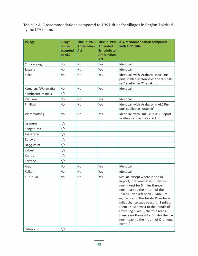
41
Village Village request accepted by ALC
Title in 1976 Amerindian Act
Title in 1991 Amended Schedule to Amerindian Act
ALC recommendation compared with 1991 title
Chinoweing No No Yes IdenticalJawalla No No Yes IdenticalKako No No Yes Identical, with ‘Arabaro’ in ALC Re-
port spelled as ‘Arabaio’ and ‘Chinak-uru’ spelled as ‘Chenakuru’
Kamarang/Warawatta No No Yes IdenticalKambaru/Omanaik n/aParuima No No Yes IdenticalPhillipai No No Yes Identical, with ‘Arabaro’ in ALC Re-
port spelled as ‘Arabaio’Waramadong No No Yes Identical, with ‘Tukuk’ in ALC Report
written incorrectly as ‘Kukui’Isseneru n/aKangaruma n/aTassarene n/aBatavia n/aDagg Point n/aKaburi n/aKarrau n/aKartabo n/aArau No No Yes IdenticalKaikan No No Yes IdenticalKurutuku No No Yes Similar, except where in the ALC
Report, it recommends ‘…thence north-west for 5 miles thence north-east to the mouth of the Takatu River, left bank Cuyuni Riv-er, thence up the Takatu River for 4 miles thence south-east for 8 miles, thence south-west to the mouth of Otomung River…’, the title reads, ‘…thence north-west for 5 miles thence north-east to the mouth of Otomung River…’
Onopik n/a
Table 1: ALC recommendations compared to 1991 titles for villages in Region 7 visited by the LTA teams
42
naire from each village or collected questionnaires ad hoc from village members. The ALC Report merely notes that the Commission collected hundreds of questionnaires and examined them to make their recommendations.100 The questionnaires ask the respondents to ‘Describe the boundaries of Reservation, Area, Village or Settlement’.101
The Upper Mazaruni’s request for collective title was made by the leaders of Kamarang, Paruima, Phillipai, Morowta (now Kako), Jawalla, and Waramadong, who wrote:
[W]e the representatives of the Amerindian Communities settled in the Up-per Mazaruni River lands and Merume and Mountain Range are satisfied that the interests of our respective communities would be well served if the exist-ing boundaries of our communal reservation were retained and the rivers and lands within the reservation reserved for the use of the Amerindian commu-nities in this area alone.102
…
The boundaries of the reservation under reference start at a point along the Wenamu river thence along the valleys of Mount Karamutta and Mount Holi-tipu to Warakabang on the Mazaruni River, thence along the Merume moun-tain range, the Kamuda Mountain, thence to a point on the Ireng river on the frontier with Brazil, thence to Roraima Mountain thence back, along the Venezuelan border to the starting point on the Wenamu River.103
In requesting collective title, the captains of the Upper Mazaruni villages wrote: ‘We ask that the lands included in the reservation should be vested in the Upper Mazaruni community and not divided and transported [a form of granting of land rights] individ-ually.’104 The ALC ignored the request for collective title, instead merely recommending the establishment of a District Council: ‘The area of a District Council’s authority in the interior would follow roughly the present areas of tribal occupation… For the Kamarang District Council the natural drainage area of the Upper Mazaruni River could from [sic] the District… Experience gained in the formation of both Village and District Councils will be of value when other communities are established in the interior.’105
3.3 Land Titles Issued under the 1976 Amerindian ActThe 1951 Amerindian Ordinance was amended by the Amerindian (Amendment) Act 1976, which kept many of the paternalistic provisions adopted in 1951. The Schedule for the 1976 Act106 vested titles in sixty-two villages and two districts, based on the ALC’s recommendations. None of the villages in Region 7 that were recommended for title by the ALC received title under the 1976 amended Act. This was due to govern-ment plans to relocate many of those villages to make way for a hydroelectric dam.107 The dam project was abandoned after significant community resistance and interna-
43
tional pressure, and the ALC villages in the Upper Mazaruni and Upper Cuyuni were eventually granted title in 1991.
The 1976 Act was the first time that indigenous land ownership rights over titled areas were legally recognised, but the recognition was partial. Indigenous peoples’ freehold ownership was limited by the following constraints, listed under Sec. 20A of the 1976 Act:
— No title to rivers or any land within 66 feet of the mean-low water mark; — Titles did not include any minerals or mineral rights over or in any lands; — Titles did not include any airstrips, whether designated as such before or
after the coming into effect of the Act; — Titles did not include any government buildings or installations; — The Minister of Amerindian Affairs had the power to revoke or modify titles
without consultation if such an act was ‘in the public interest’; — The Minister of Amerindian Affairs had the authority to revoke or modify title
allowing the State to reoccupy the land if it was within ten miles of an inter-national border ‘in the interest of defence, public safety or public order’;
— The Minister of Amerindian Affairs could order the title forfeited if members (two or more) of the Amerindian community showed themselves to be ‘di-sloyal or disaffected to the state or have done any voluntary act which was incompatible with their loyalty to the state’; and
— The Minister of Amerindian Affairs had the power to change title boundaries without consulting with the community or obtaining its agreement.
The 1976 Amerindian Act did, however, allow for the transfer of rights and interests held by third parties in land situated within an Amerindian District, Area or Village to the District, Area or Village Council. This had to be done within one year of the coming into operation of that section of the Act, but it provided some measure towards the restitution of lands to indigenous communities.108
3.4 Land Titles Issued from 1991 OnwardsIn 1991, ten additional villages were added to the Schedule to the Amerindian Act.110 That same year, absolute grants for these additional villages were issued by President Hoyte, along with absolute grants for the villages that had already received title in 1976. All of these absolute grants state that the community in question ‘has from time imme-morial been in occupation of [the] tract of State Land’ indicated in the description.
Although the 1991 absolute grants do not change the description of the titles granted under the 1976 Act (whether under the original Schedule or the 1991 Amended Sched-ule), the 1991 grants were not issued under the Amerindian Act but under Section 3 of the State Lands Act, which empowers the President ‘to make absolute or provisional grants of any State lands of Guyana, subject to such conditions (if any) as he thinks
44
fit...’. These grants, also known as Presidential Grants, were made ‘absolutely and for-ever’ and can only be revoked for failure to comply with specific conditions in the grant. The only condition attached was that mineral rights were not given to the grantee but retained by the state — the grants include the provision, ‘Provided that this grant shall not confer on the grantee the right to any gold, silver or other metals, minerals, ores, bauxite, gems or precious stones, rock, coal, mineral oil, uranium or subterranean wa-ter in or under the land hereby granted, all of which remain vested in the State.’
In addition, titles under Section 3 of the State Lands Act apply to all of the lands de-scribed therein, differing from Section 20A(2) of the 1976 Amerindian Act which ex-cludes rivers, river banks, airstrips, and pre-1976 government buildings and installations. It is unclear whether the Hoyte government meant to grant indigenous communities title to the rivers, airstrips and government buildings that were excluded by the 1976 Act.
The Region 7 LTA teams visited the ten villages that received title under the 1991 amended Schedule. With the exception of Kurutuku, the other nine titled areas de-scribed in the 1991 amended Schedule are identical to those recommended in the 1969 ALC report (see Table 1), save for some use of different spellings of place names. These villages report not having been properly consulted prior to the ALC’s recommen-dation and not being consulted prior to the issuance of their titles in 1991. The titles were also not surveyed on the ground. This resulted in the issuance of titles that do not correspond to indigenous culture, ways of life, and collective customary land tenure (see Map 3 for an example). They were, and remain, inconsistent with indigenous peo-ples’ rights under common law and international law.
This land tenure survey has found that the land titles in the region granted after 1991 are also absolute grants made under Section 3 of the State Lands Act, but these and associated maps have inserted conditions stating that certain areas are excluded from village ownership. For example, Batavia’s title includes a clause that reads ‘Save and except 66 feet on either side of all navigable rivers and creeks, all lands privately owned and legally held as well as the rights to access to these lands.’
3.5 Requests for Collective TitleUpper Mazaruni
When the Upper Mazaruni received title in 1991 as individual villages and not as one collective territory, as requested during the 1969 ALC investigation, indigenous leaders from the Upper Mazaruni were concerned. They raised their concerns in various forums and continued to demand collective title. At a meeting with then-President Cheddi Jagan in 1994, the President challenged the leaders to demonstrate how they use their land and explain why they were demanding ownership over a larger territory. The Upper Mazaruni leaders sought advice from the APA, who contracted a lawyer to inves-
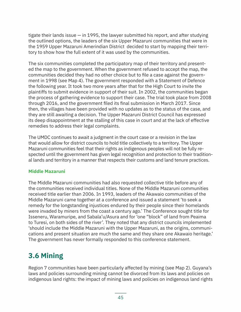
45
tigate their lands issue — in 1995, the lawyer submitted his report, and after studying the outlined options, the leaders of the six Upper Mazaruni communities that were in the 1959 Upper Mazaruni Amerindian District decided to start by mapping their terri-tory to show how the full extent of it was used by the communities.
The six communities completed the participatory map of their territory and present-ed the map to the government. When the government refused to accept the map, the communities decided they had no other choice but to file a case against the govern-ment in 1998 (see Map 4). The government responded with a Statement of Defence the following year. It took two more years after that for the High Court to invite the plaintiffs to submit evidence in support of their suit. In 2002, the communities began the process of gathering evidence to support their case. The trial took place from 2008 through 2016, and the government filed its final submission in March 2017. Since then, the villages have been provided with no updates as to the status of the case, and they are still awaiting a decision. The Upper Mazaruni District Council has expressed its deep disappointment at the stalling of this case in court and at the lack of effective remedies to address their legal complaints.
The UMDC continues to await a judgment in the court case or a revision in the law that would allow for district councils to hold title collectively to a territory. The Upper Mazaruni communities feel that their rights as indigenous peoples will not be fully re-spected until the government has given legal recognition and protection to their tradition-al lands and territory in a manner that respects their customs and land tenure practices.
Middle Mazaruni
The Middle Mazaruni communities had also requested collective title before any of the communities received individual titles. None of the Middle Mazaruni communities received title earlier than 2006. In 1993, leaders of the Akawaio communities of the Middle Mazaruni came together at a conference and issued a statement ‘to seek a remedy for the longstanding injustices endured by their people since their homelands were invaded by miners from the coast a century ago.’ The Conference sought title for Isseneru, Waramuripe, and Sabala’u/Asura and for ‘one “block” of land from Peaima to Turesi, on both sides of the river’. They noted that any district councils implemented ‘should include the Middle Mazaruni with the Upper Mazaruni, as the origins, communi-cations and present situation are much the same and they share one Akawaio heritage.’ The government has never formally responded to this conference statement.
3.6 MiningRegion 7 communities have been particularly affected by mining (see Map 2). Guyana’s laws and policies surrounding mining cannot be divorced from its laws and policies on indigenous land rights: the impact of mining laws and policies on indigenous land rights
46 47
Map 3: Akawaio and Arecuna customary resource use in the Upper Mazaruni
Savanna
Indigenous Village in LTA Study
Other Indigenous Village
Indigenous Titled Land
River
Road
Country Boundary
Region 7 BoundaryDisclaimer: Data sources include the GLSC, Guyana GIM (data.gim.gov.gy.), NASA SRTM, Openstreetmap, Hansen (Hansen/UMD/Google/USGS/NASA) and handheld GPS. Country boundary from United States Department of State, Office of the Geographer, Humanitarian Information Unit. Village title boundary shapefiles were obtained from the GLSC and are up to date as of July 2018. Other data up to date as of 2018. This map is for indicative purposes only. Information shown does not purport to be validated and correct information on the title boundaries of titled indigenous Villages. The GLSC and GIM are known to be inaccurate or incomplete; for example, land title boundary information for one village, Kako, is missing entirely from both databases.
This customary use data on this map is sourced from Peter Poole (1998). This map does not purport to be a complete and comprehensive depiction of all customary use areas or of all types of customary land use in the Upper Mazaruni.
Scale: 1:400,000CRS: WGS 84 UTM 21
Mazaruni
N
UMD/Google/USGS/NASA) and handheld GPS. Country boundary from United States Department of State, Office of the Geographer,
to be validated and correct information on the title boundaries
information for one village, Kako, is missing entirely from both
Paruima Waramadong
Kamarang/Warawatta
Kako
Jawalla
Kambaru/Omanaik
Chinoweing
Phillipai
48
begins with the premise in Guyanese law that the state owns all mineral resources and extends to the physical impact of mining activities on the land and environment.
Mining activities, at least prospecting for gold, in the Mazaruni and Cuyuni Rivers began as early as the 1880s, if not earlier. In the 1920s-30s, there was an influx of miners into the Lower and Middle Mazaruni in search of gold and diamonds. Many Akawaio relocated to the Upper Mazaruni to avoid the disturbance to their lives. Many of those who stayed died from the new diseases introduced, particularly tuberculosis, and lost much of their language and culture.
In 1933, the Middle and Lower Mazaruni were officially de-reserved from the former-ly-established Mazaruni Indian District and opened up for mining. That left the then-called Upper Mazaruni Reservation at 4,500 square miles. In 1959, the discovery of diamonds led to the de-reservation of an additional 1,500 square miles from the Upper Mazaruni Reservation for mining. The reduction in the boundaries of the reserved area allowed an influx of gold and diamond miners into the area. Chinoweing and Imbaima-dai (now a government area within Kambaru/Omanaik) were excised from the reserve by this de-reservation and were left unprotected against mining activities. Many min-ers settled in Imbaimadai and worked the river and tributaries up to the head, causing water pollution, decreases in fish and other river resources, and the introduction of malaria. Since then, various parts of Region 7 have been opened and alternately closed for prospecting and mining.
The issue of mining is extraordinarily complex and is the cause of internal village conflicts as well as many conflicts with external parties. The granting of mining concessions on indigenous lands without the affected communities’ FPIC, as well as the damage mining activities have caused on indigenous lands, are some of the primary complaints of indige-nous communities in Region 7 when it comes to the insecurity of land tenure.
Partly as a result of the environmental and livelihoods impacts caused by mining over time and partly as a result of the increasing integration of indigenous peoples into a cash-based economy, many indigenous people are also beginning to work in the mining industry. Some are getting into mining themselves and have their own mining operations. This has, predictably, resulted in numerous internal village discussions over the role of (particular-ly commercial) mining in indigenous economies and its impact on indigenous traditional livelihoods and ways of life. There have also been instances in which village councils have granted permissions to both outside and resident miners to conduct mining operations in the village over the objections of a significant portion of village residents. The unresolved questions raised by these discussions are reflected in the fact that village residents often report both that working in the mining industry is part of the village’s economy and that mining has caused numerous significant environmental and livelihood impacts.
Nevertheless, communities agree that mining operations by outsiders that are en-croaching on their traditional lands without consulting them and without their FPIC are
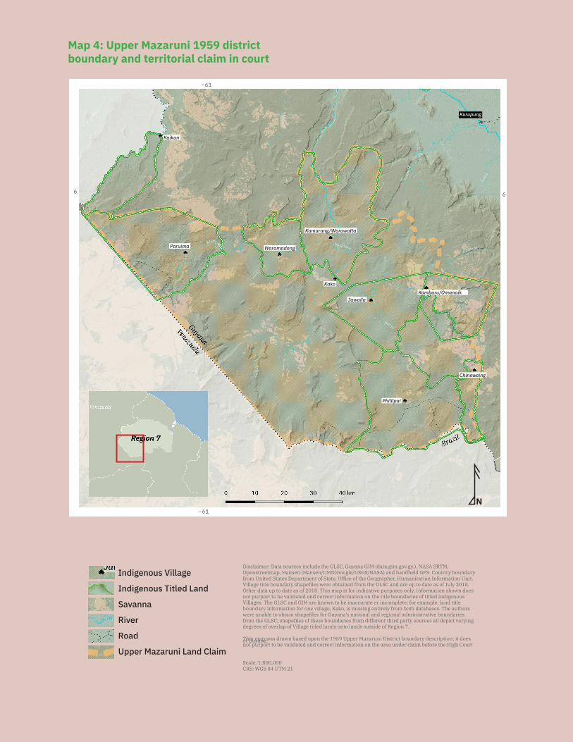
49
Map 4: Upper Mazaruni 1959 district boundary and territorial claim in court
Indigenous Village
Indigenous Titled Land
Savanna
River
Road
Upper Mazaruni Land Claim
Disclaimer: Data sources include the GLSC, Guyana GIM (data.gim.gov.gy.), NASA SRTM, Openstreetmap, Hansen (Hansen/UMD/Google/USGS/NASA) and handheld GPS. Country boundary from United States Department of State, Office of the Geographer, Humanitarian Information Unit. Village title boundary shapefiles were obtained from the GLSC and are up to date as of July 2018. Other data up to date as of 2018. This map is for indicative purposes only. Information shown does not purport to be validated and correct information on the title boundaries of titled indigenous Villages. The GLSC and GIM are known to be inaccurate or incomplete; for example, land title boundary information for one village, Kako, is missing entirely from both databases. The authors were unable to obtain shapefiles for Guyana’s national and regional administrative boundaries from the GLSC; shapefiles of these boundaries from different third party sources all depict varying degrees of overlap of Village titled lands onto lands outside of Region 7.
This map was drawn based upon the 1959 Upper Mazaruni District boundary description; it does not purport to be validated and correct information on the area under claim before the High Court of Guyana.
Scale: 1:800,000CRS: WGS 84 UTM 21
NDisclaimer: Data sources include the GLSC, Guyana GIM (data.gim.gov.gy.), NASA SRTM,
Kaikan
Paruima Waramadong
Kamarang/Warawatta
Kako
JawallaKambaru/Omanaik
Chinoweing
Phillipai
Kurupung
50
unacceptable. They consider, and have made several public statements over the years complaining, that the issuance of concessions and the conducting of operations with-out their consent is a violation of their rights, including their rights to their traditional lands and resources; their right to participate in decision-making affecting them; their right to FPIC; and their right to a healthy environment and to health, among others.
The impacts of mining on indigenous communities and on indigenous rights are well-documented by outside organizations as well. A report commissioned by the GLSC observed ‘severe degradation’ of lands and waters in the Mazaruni Mining District and that ‘current degraded areas are not likely to recover … the reason being that there is little if any reclamation by miners with modern mining technologies’. One human rights report noted that ‘the government has permitted miners to prospect and mine on dis-puted lands, such that by the time the land disputes are resolved, the lands in question may no longer be fit for use by the Amerindian communities claiming them’.
Others have observed that indigenous peoples in Guyana are ‘severely affected by min-ing’ and experience ‘a disruption and disappearance of their fishing and farming ground and languages, the prevalence of new diseases such as AIDS, flooding, pollution of riv-ers and creeks, depopulation and a degraded environment. In some cases indigenous peoples are considered squatters on their own land, experience poor education/school conditions, veiled racism, malaria, lack of piped water and electricity, and are paid poor salaries.’ The summary reports for each community visited contain more details about the specific impacts of mining on that particular community.
51
4. Recent Land Policy and the Current Situation of Indigenous Land Tenure
4.1 Land Title DemarcationOver the past two decades, there have been several changes to the policies and laws affecting the land and resource rights of indigenous peoples in Guyana. In 1995, the Government of Guyana designed a two-phased approach to deal with unresolved in-digenous land claims. Phase one was demarcation of the [then] existing seventy-four legally recognised (titled) Amerindian communities. Phase two was addressing ex-tensions of titled communities and resolving requests for title by those communities without legally recognised lands.
The government altered the policy in 2002 to allow regions that had completed demar-cation to move onto phase two without waiting for other regions to finish. A new pro-cess was outlined in the revised Amerindian Act 2006 which does not require actions to take place in phases either as a nation or as a region, though maintains that each individual village can apply for extension only after demarcation of their title.
Many of the villages visited for this assessment that are not satisfied with their existing titles disagree with this process. For example, Kambaru/Omanaik and Kaikan want the full extent of what they know to be their land to be secured before it is demarcated. Notably, the six villages of the Upper Mazaruni that filed suit seeking legal recognition for their traditional territory — Jawalla, Kako, Paruima, Phillipai, Waramadong, and Kamarang/Warawatta — are refusing demarcation until their court case is resolved. The Amerindian Act 2006 requires that villages must accept demarcation first and can only apply for extension for the rest of the land afterwards.
For the six villages that have been demarcated, several reported that they were not aware of the plan to carry out the demarcation exercise until a GLSC team appeared in the village. Residents also report that either they were not consulted on the area to be surveyed or that they did not consent to it. While villagers participated in the survey exercises, as line-cutters or to haul equipment, this did not amount to any authority to influence the process itself.
The lack of adequate participation has led to a situation where in one village, the line on the ground does not accurately follow the description of the title document. Even where the demarcation accurately follows the title description, villages report that they are not satisfied with the demarcation that has been carried out. This is due in part to the fact that the purpose of demarcation was not properly explained to the village, and they thought the demarcation exercise was to mark out the extent of their traditional lands, not just the titled area.
52
4.2 Amerindian Act 2006For many years, indigenous peoples’ organisations in Guyana, including the APA, point-ed out the serious shortcomings and discriminatory provisions on land in the 1951 Amerindian Act (amended in 1976). In 2002, the Government of Guyana finally agreed to review the Act and carried out consultations with communities between 2002 and 2003. When the Bill was shared in 2005, indigenous peoples welcomed the removal of some of the most offensive provisions of the former Act, including the powers to extinguish titles without consultation or consent of affected villages. But they were dismayed that many of their most important recommendations on rights to land and other fundamental rights had not been taken up. Despite the inclusion of some useful elements, the final Amerindian Act 2006 creates or maintains many legal constraints on indigenous rights. A few examples (see also Box 3, Part II, Section 6):
— Sec. 53 of the Act allows the GGMC to issue mining concessions on village traditional lands (both titled and untitled) without the FPIC of the village, subject to the vague condition that it ‘satisfy itself that the impact of mining on the Village will not be harmful’;
— Sec. 56 of the Act allows the GFC to issue forestry concessions on lands con-tiguous with titled lands without the FPIC of the village, subject to the vague condition that it ‘first consider the impact on the Village’;
— Sec. 50 of the Act allows the government to grant permission for large-scale mining operations to go forward on even titled lands over the objection of the communities;
— Sec. 2 of the Act limits the definition of a ‘traditional right’ to only a ‘subsi-stence right or privilege’ that existed in 2006 and restricts such rights to tho-se ‘exercised sustainably’ in accordance with indigenous peoples’ ‘spiritual relationship’ with their lands, a discriminatory condition that does not apply to any other ethnic group in Guyana;
— Sec. 57 of the Act protects traditional rights, as narrowly defined in Sec. 2, in State lands and forests, but they are subject to the rights of any private leaseholders that were in effect in 2006;
— The Act retains the unjust, discretionary and overly broad powers of the Minister of Indigenous Peoples Affairs to determine title boundaries and to interfere in and reject village rules or decisions. For example, when deciding whether or not to grant land titles, the Minister only has to ‘take into account’ and ‘consider’ diffe-rent sorts of information regarding the applicant’s ‘... physical, traditional, cultural association with or spiritual attachment to the land requested.’ The Minister can also grant title to smaller areas of land than that requested without explanation.
Since the enactment of the Amerindian Act 2006, the APA and other indigenous peo-ples’ organisations have objected to its failure to include many of their most important recommendations. Multiple international human rights treaty bodies have also urged Guyana to revise the Amerindian Act 2006.
53
In 2006, the United Nations Committee for the Elimination of Racial Discrimination (UNCERD) urged Guyana:
to remove the discriminatory distinction between titled and untitled communi-ties from the 2006 Amerindian Act and from any other legislation. In particular, it urges the State party to recognize and support the establishment of Village Councils or other appropriate institutions in all indigenous communities, vest-ed with the powers necessary for the self-administration and the control of the use, management and conservation of traditional lands and resources.
It further urged the Government of Guyana:
...in consultation with the indigenous communities concerned, (a) to demar-cate or otherwise identify the lands which they traditionally occupy or use, (b) to establish adequate procedures, and to define clear and just criteria to resolve land claims by indigenous communities within the domestic judicial system while taking due account of relevant indigenous customary laws.
In October 2015, the UN Committee on Economic, Social and Cultural Rights (CESCR) recommended:
...that the State party revise the Amerindian Act 2006 and other relevant laws with a view to ensuring, in accordance with the United Nations Declaration on the Rights of Indigenous Peoples, that the Amerindian people’s rights to their lands, territories and resources are fully recognized and protected and that their free, prior and informed consent is obtained in respect of the adoption of any legisla-tion, policy and/or project affecting their lands or territories and other resourc-es. It also recommends that the State party consider ratifying the International Labour Organization Indigenous and Tribal Peoples Convention, 1989 (No. 169).
The former administration repeatedly refused to amend the Act to remove the land titling problems and discriminatory conditions identified by UNCERD. The coalition gov-ernment elected in May 2015, however, committed to revising the Act. In September 2015, Minister Trotman of the MNR told the CESCR that:
... Necessary amendments would be made to the Amerindian Act within the context of a review of land distribution and titling procedures to be carried out by a land commission that the government was planning to establish shortly.
Nevertheless, the government failed to act on their promise to revise the Act during the first few years of its administration, and only began the start of official consultations on the revision process in 2018. The National Toshaos Council issued a statement at the July 2018 National Toshaos Conference calling on the government to ensure that the newly revised Act would incorporate the provisions of the UNDRIP as the minimum stan-dard for ensuring that the rights of indigenous peoples would be adequately protected.
54
As of the date of writing this report, the Amerindian Act has not yet been revised. How-ever, the authors of this LTA study hope that a revised draft of the law will be prepared soon based on the recommendations submitted by various villages, communities and district councils, as well as the recommendations made in this report. The authors urge the Government of Guyana to adopt recommendations made by the villages and com-munities, and also respect the overall recommendations made by the National Toshaos Council at the National Toshaos Conference in July 2018.
4.3 Land Conflicts and Overlapping Land ClaimsMany of the communities in Region 7 are facing significant land conflicts. The majority of these conflicts are with miners, but there are also conflicts with loggers (see Map 2), as well as a few situations of other conflicts, including with the army and police and with private leaseholders.
The Amerindian Act 2006 provides that small- and medium-scale miners must obtain the permission of the village — after they have already been granted a concession by the GGMC — in order to mine on titled lands. However, the LTA teams have found that miners do not always follow this requirement, and mining still occurs on indigenous titled lands without permission. Twelve of the titled villages visited by the LTA research team have problems with mining activities or the movement of unauthorised miners on their legally recognised lands.
There are almost no protections in the law for untitled indigenous lands against en-croachment by miners. Two untitled communities — Tassarene and Kangaruma — have hundreds of mining concessions each on their proposed titles which have been approved without their consent and while they are awaiting official title documents. Fifteen communities report conflicts with miners on traditional, untitled lands.
Besides mining, communities also face conflicts with other third-party interests. One village reports conflicts with logging interests inside their titled lands, and four commu-nities report conflicts with logging interests on customary, untitled lands. One village is reporting conflicts with the army and police personnel who have been stationed in their village. Two villages are reporting conflicts with private leaseholders.
4.4 Amerindian Land Titling (ALT) ProjectThe ALT Project began in October 2013, funded under the Guyana REDD+ Investment Fund (GRIF). It includes fifteen of the communities in Region 7 involved in this study (see Table 2). The ALT project did not consult with villages prior to drawing up plans for which villages to include.
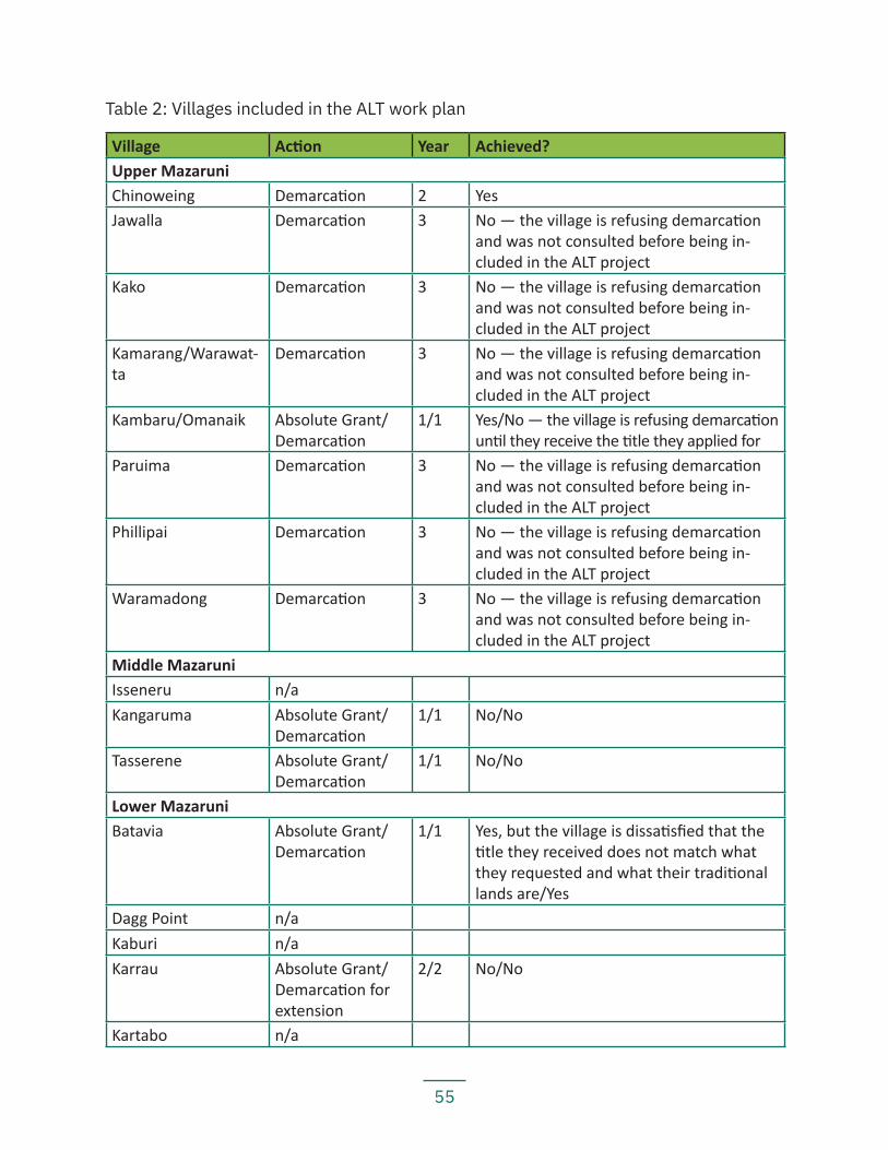
55
Table 2: Villages included in the ALT work plan
Village Action Year Achieved?Upper MazaruniChinoweing Demarcation 2 YesJawalla Demarcation 3 No — the village is refusing demarcation
and was not consulted before being in-cluded in the ALT project
Kako Demarcation 3 No — the village is refusing demarcation and was not consulted before being in-cluded in the ALT project
Kamarang/Warawat-ta
Demarcation 3 No — the village is refusing demarcation and was not consulted before being in-cluded in the ALT project
Kambaru/Omanaik Absolute Grant/Demarcation
1/1 Yes/No — the village is refusing demarcation until they receive the title they applied for
Paruima Demarcation 3 No — the village is refusing demarcation and was not consulted before being in-cluded in the ALT project
Phillipai Demarcation 3 No — the village is refusing demarcation and was not consulted before being in-cluded in the ALT project
Waramadong Demarcation 3 No — the village is refusing demarcation and was not consulted before being in-cluded in the ALT project
Middle MazaruniIsseneru n/aKangaruma Absolute Grant/
Demarcation1/1 No/No
Tasserene Absolute Grant/Demarcation
1/1 No/No
Lower MazaruniBatavia Absolute Grant/
Demarcation1/1 Yes, but the village is dissatisfied that the
title they received does not match what they requested and what their traditional lands are/Yes
Dagg Point n/aKaburi n/aKarrau Absolute Grant/
Demarcation for extension
2/2 No/No
Kartabo n/a
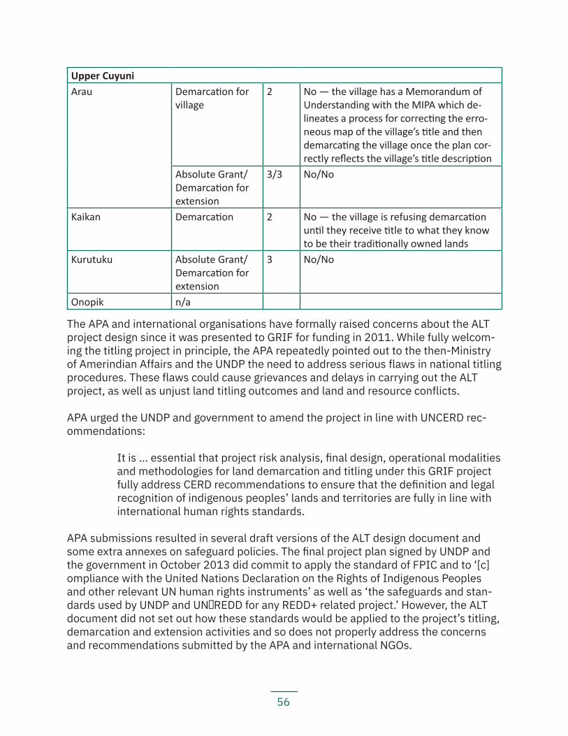
56
Upper CuyuniArau Demarcation for
village2 No — the village has a Memorandum of
Understanding with the MIPA which de-lineates a process for correcting the erro-neous map of the village’s title and then demarcating the village once the plan cor-rectly reflects the village’s title description
Absolute Grant/Demarcation for extension
3/3 No/No
Kaikan Demarcation 2 No — the village is refusing demarcation until they receive title to what they know to be their traditionally owned lands
Kurutuku Absolute Grant/Demarcation for extension
3 No/No
Onopik n/a
The APA and international organisations have formally raised concerns about the ALT project design since it was presented to GRIF for funding in 2011. While fully welcom-ing the titling project in principle, the APA repeatedly pointed out to the then-Ministry of Amerindian Affairs and the UNDP the need to address serious flaws in national titling procedures. These flaws could cause grievances and delays in carrying out the ALT project, as well as unjust land titling outcomes and land and resource conflicts.
APA urged the UNDP and government to amend the project in line with UNCERD rec-ommendations:
It is ... essential that project risk analysis, final design, operational modalities and methodologies for land demarcation and titling under this GRIF project fully address CERD recommendations to ensure that the definition and legal recognition of indigenous peoples’ lands and territories are fully in line with international human rights standards.
APA submissions resulted in several draft versions of the ALT design document and some extra annexes on safeguard policies. The final project plan signed by UNDP and the government in October 2013 did commit to apply the standard of FPIC and to ‘[c]ompliance with the United Nations Declaration on the Rights of Indigenous Peoples and other relevant UN human rights instruments’ as well as ‘the safeguards and stan-dards used by UNDP and UN‐REDD for any REDD+ related project.’ However, the ALT document did not set out how these standards would be applied to the project’s titling, demarcation and extension activities and so does not properly address the concerns and recommendations submitted by the APA and international NGOs.
57
In 2015, the new Social and Environmental Compliance Unit (SECU) of the UNDP re-viewed the ALT Project and found that the project did not meet past or present UNDP policies. A UNDP-Government of Guyana action plan was therefore drawn up to write guidelines clarifying the titling procedure, putting in place a protocol for consultation and consent, and setting up a grievance mechanism. To implement the plan, a nation-al stakeholder platform (the ‘Representative Platform’) was set up to agree steps to make ALT keep to project standards (including UNDP safeguard policies, UNDRIP and other international human rights treaties), improve the way it is carried out, and uphold the FPIC standard. The Platform met in June, September and December 2016 and the Project Board adopted ‘A Guideline for Amerindian Land Titling in Guyana’ in April 2017. In December 2016, the GRIF Steering Committee approved a two-year no-cost extension of the project.
In October 2018, the extension period for the ALT project expired, and the Steering Com-mittee approved a 2-month extension to evaluate the project. As of the writing of this re-port, the ALT Project Board and the UNDP are applying for a 5-year extension of the project.
58
Part II Land Tenure Assessment in Region 7
59
5. Summary Assessment by Village/Settle-ment
5.1 Upper Mazaruni The Upper Mazaruni sub-region encompasses part of the traditional lands of the Akawaio and Arecuna peoples (see Box 1 for information about spiritual attachments to the Upper Mazaruni territory). Historically occupied in numerous scattered settlements, today there are eight titled villages in the district — Chinoweing, Jawalla, Kako, Kama-rang/Warawatta, Kambaru/Omanaik, Paruima, Phillipai, and Waramadong. Despite a distant history of conflict between the Akawaio and Arecuna, particularly for control over some of the lands in the Upper Mazaruni, the Akawaio and Arecuna arrived at mu-tual agreement to respect each other’s territorial limits. In 1969, the leaders of six vil-lages in the Upper Mazaruni agreed to request joint and collective title to a part of their traditional territory. At the time, the request for collective title followed the 1959 district boundaries (see Map 4), which excluded Chinoweing and Kambaru/Omanaik, which had been de-reserved as mining areas. The six villages filed a case in the High Court of Guy-ana in 1998 (see Section 3.5). The case remains pending without any decision.
Today, all the villages in the Upper Mazaruni agree that should they win their court case, they would then request that Chinoweing and Kambaru/Omanaik also be inclu-ded to hold title jointly and collectively. In the meantime, the UMDC has begun a pro-gramme to monitor mining activities and environmental impacts and changes in their territory (see Box 2 for more information about the monitoring programme).
60
Box 1: Akawaio and Arecuna spiritual attachment to territory
That the Upper Mazaruni is considered traditional territory for the Akawaio and Arecuna peoples is evident in the presence of former and old settlements scattered throughout the territory, local knowl-edge of the good farming grounds, local names for all the creeks and mountains, and stories and legends about various landmarks.
Mount Roraima is, for instance, a spiritually important place for the Akawaio and several neighbouring in-digenous peoples in Guyana, Brazil and Venezuela. There are different Akawaio versions of the story about why the mountain is important. One is that Imee, the mother of Makanaima and Siki, who were twins, lived on and around Mount Roraima. The Akawaio believe themselves to be the descendants of Siki. Wui was the husband of Imee. He was the sun and transformed to come down to be with Imee. He was so hot that he was destroying the land, so Siki, also known as Pia, told his father to go farther away. That is why to this day, the sun is high in the sky.
The name “Roraima” comes from the Akawaio roriwa, which means splendid and beautiful, and was the term the Akawaio had given to the land around Mount Roraima. The word “Roraima” is an Anglicized cor-ruption of the Akawaio place name. There are many stories about Roraima, including various versions of Akawaio origin stories, evidencing the cultural importance of this mountain landmark for the Akawaio people.
Mount Ayanganna is another important site in Akawaio territory. The story goes that there was a woman who had a baby. After the baby cried for a long time, the mother didn’t want to pick up the child, the child got frustrated and fatigued and eventually the cassava leaves the mother gave the child to play with be-came wings and the child flew away. When the child had flown away, the mother went to look for the child to see if she could get the child back, but the child was already far away. The mother brought two other women to try and track the child with her. The three women followed where the child was flying. At some point, they sat down to pick lice from their hair as they waited and turned into stone. That is why Mount Ayanganna has three peaks. The proper name of Mount Ayanganna is Ayan (“louse”) kankanin nan wu-pu(“persons picking out lice”).
At the confluence of the Mazaruni, Kako and Kamarang Rivers is another important site, a mountain called Ankauri ko’ tupu. Long ago, the masurimu ko’ (“people of the Mazaruni River”), the kakoru ko’ (“the people of the Kako River”), and the kamurani ko’ (“people of the Kamarang River”) used to fight and war with each other to gain control of the territories around the rivers for land and for fish. They used to fight primarily around one mountain in the Kako headwaters, which became known as ankauri ko’ tupu due to the fight-ing. The grandfather of all of the people of those three rivers was known as wakau pamu. One time, when the other two communities had invaded the lands of the kamurani ko’, they found the grandfather. They decided not to harm him and realized they were one people and had to be kind to each other.
Another important site is the Iminari keng, the mouth of the Demerara River, where the ancestors of the Akawaio lived. Their knowledge of this place confirms the accounts that the Akawaio had previously lived around the Demerara and other rivers closer to the coast of Guyana.
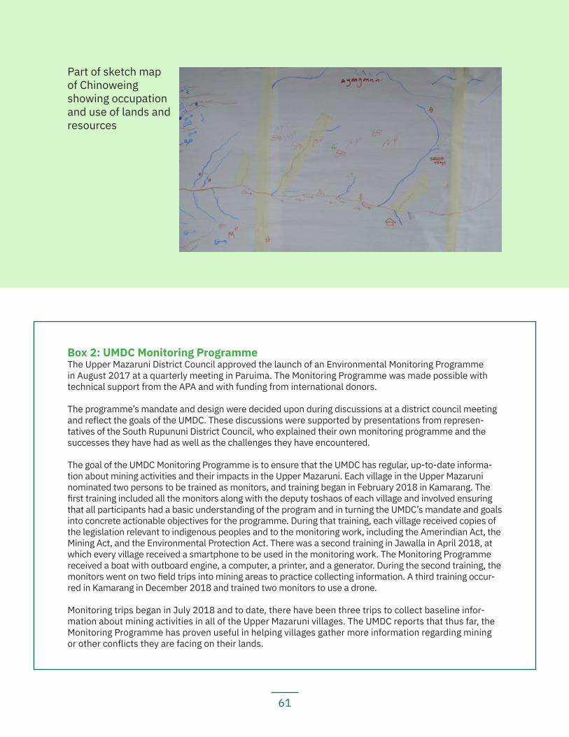
61
Box 2: UMDC Monitoring ProgrammeThe Upper Mazaruni District Council approved the launch of an Environmental Monitoring Programme in August 2017 at a quarterly meeting in Paruima. The Monitoring Programme was made possible with technical support from the APA and with funding from international donors.
The programme’s mandate and design were decided upon during discussions at a district council meeting and reflect the goals of the UMDC. These discussions were supported by presentations from represen-tatives of the South Rupununi District Council, who explained their own monitoring programme and the successes they have had as well as the challenges they have encountered.
The goal of the UMDC Monitoring Programme is to ensure that the UMDC has regular, up-to-date informa-tion about mining activities and their impacts in the Upper Mazaruni. Each village in the Upper Mazaruni nominated two persons to be trained as monitors, and training began in February 2018 in Kamarang. The first training included all the monitors along with the deputy toshaos of each village and involved ensuring that all participants had a basic understanding of the program and in turning the UMDC’s mandate and goals into concrete actionable objectives for the programme. During that training, each village received copies of the legislation relevant to indigenous peoples and to the monitoring work, including the Amerindian Act, the Mining Act, and the Environmental Protection Act. There was a second training in Jawalla in April 2018, at which every village received a smartphone to be used in the monitoring work. The Monitoring Programme received a boat with outboard engine, a computer, a printer, and a generator. During the second training, the monitors went on two field trips into mining areas to practice collecting information. A third training occur-red in Kamarang in December 2018 and trained two monitors to use a drone.
Monitoring trips began in July 2018 and to date, there have been three trips to collect baseline infor-mation about mining activities in all of the Upper Mazaruni villages. The UMDC reports that thus far, the Monitoring Programme has proven useful in helping villages gather more information regarding mining or other conflicts they are facing on their lands.
Part of sketch map of Chinoweing showing occupation and use of lands and resources
62
5.1.1 ChinoweingKey findings:
— Chinoweing received title in 1991, but the title excludes all of its farming grounds and most of its hunting, fishing, and gathering grounds.
— Chinoweing was demarcated in 2016. Its demarcation map includes many unnamed creeks and misspelled creek names, and the demarcation team did not consult with the village prior to demarcation or ask the village for their traditional knowledge to assist in doing the demarcation.
— There are hundreds of mining concessions in the village’s traditional lands, and mining activities have already caused deforestation, water pollution, and a scarcity of fish.
— One particular ‘draga’ operating above Chi Chi Falls has destroyed a landing at Warang Creek and parts of river banks in that area.
— Water is scarce in the village and there is no proper community water system. — There is currently some mining activity happening in the village’s traditional
untitled lands, which is causing great concern to the village as it is causing water pollution and deforestation.
— One of the mining companies operating on customary untitled lands is cur-rently building a road through the village to access its concessions without FPIC, and in fact, against the village’s wishes.
— The village is concerned about the use of an airstrip at Chi Chi East, which they believe is being used by Brazilians to traffic illegal drugs in and out. They are also reporting that both the airstrip at Chi Chi East and the govern-ment-funded airstrip at Chi Chi West were built without the village’s FPIC.
Location: Upper Mazaruni, Region 7
History: Chinoweing is Chinao Yeng in Akawaio. The village got its name because a kanaima used to live in a hole close to the village and would lure villagers, especially women, to it and cause them harm by pretending to be a chinao (a frog locally known as ‘mountain chicken’). Another story of how the village got its name is that it comes from sinau yen (‘frog cave’). During a tribal war, a young man hid himself in a cave that frogs lived in, and made frog sounds to fool the enemy as they passed.
Important spiritual and cultural heritage sites evidence prolonged occupation of the area. Some important spiritual sites and sensitive areas include: Ayanganna Mountain, Ayankankaneingna, Tukuk, Odiuma, and Kuriseima. Burial grounds, some with artefacts or old bones, include: Pang, Kuiwa, Murupeyapai, Koseh, Tangwanamong, Bianamurupai and Chinoweing. All of these areas are located outside of the village’s titled lands.
63
Village residents recall that in the 1950s, villagers were asked to move to Phillipai because the government had opened up the area for mining. Most families moved to Kwaimalu, a satellite village of Phillipai, and only two families remained — those of King George and Headly George. King was Headly’s elder brother and was seen as the leader of the village. Other families eventually moved back to Chinoweing.
Main neighbouring communities: Phillipai, Kambaru/Omanaik
Estimated population: 681 (437 in main village, 244 in the satellite village, Wax Creek)
Identities of residents: Mostly Akawaio, with a few Wapichan, Arecuna, Carib, and Macushi, and one Patamona
Local government: A village council consisting of a toshao; vice toshao; treasurer; secretary; councillor for mining; councillor for environment; and a senior councillor for Wax Creek.
Land use and economy: Most village residents engage in subsistence farming. Al-most all farming areas are outside of the village’s demarcated land because there are no fertile soils within its existing title. The main crops grown in the village are ground provisions such as cassava, bananas, cane, corn, pumpkins, and greens, such as bora and pak choy. Village residents make local foods, including cassava bread, and tuma with fish or meat. They also produce local drinks, including kasak, piwari, cane juice, pine juice, potato drink, corn drink, and yam drink. Village residents also go hunting and fishing and gather materials for crafting and building. Almost all of the villagers’ hunting, fishing and gathering grounds are outside of the village’s title.
Community projects: The village is currently undertaking some projects to repair bridges in the community. They also have a village shop.
Institutions and services: There is cell phone signal in some hotspots around the village; a radio; electricity via solar panels and private generators; and a health post. There is no internet service. The village has a primary school with a nursery class. For secondary school, students go to the school in Waramadong, unless they get scholar-ships to attend school in Georgetown.
Current land title status: The village was granted title (see Map 5) in 1991. Its title is listed under the amended schedule to the Amerindian Act and recorded in an absolute grant under the State Lands Act.
Existing title description: ‘A tract of state land situate at the left bank Haieka River, Left bank Mazaruni River, commencing at the mouth of the Waparu Creek, thence up the Waparu Creek to its source, thence west to the watershed between the Kukui and Haieka Rivers, thence south along the said watershed to the Guyana-Brazil boundary Mark
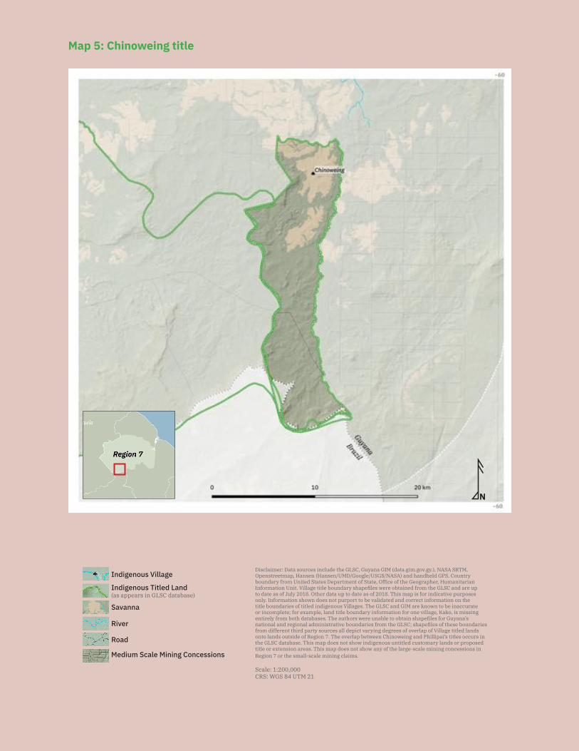
64
N
Disclaimer: Data sources include the GLSC, Guyana GIM (data.gim.gov.gy.), NASA SRTM, Openstreetmap, Hansen (Hansen/UMD/Google/USGS/NASA) and handheld GPS. Country boundary from United States Department of State, Office of the Geographer, Humanitarian Information Unit. Village title boundary shapefiles were obtained from the GLSC and are up to date as of July 2018. Other data up to date as of 2018. This map is for indicative purposes only. Information shown does not purport to be validated and correct information on the title boundaries of titled indigenous Villages. The GLSC and GIM are known to be inaccurate or incomplete; for example, land title boundary information for one village, Kako, is missing entirely from both databases. The authors were unable to obtain shapefiles for Guyana’s national and regional administrative boundaries from the GLSC; shapefiles of these boundaries from different third party sources all depict varying degrees of overlap of Village titled lands onto lands outside of Region 7. The overlap between Chinoweing and Phillipai’s titles occurs in the GLSC database. This map does not show indigenous untitled customary lands or proposed title or extension areas. This map does not show any of the large-scale mining concessions in Region 7 or the small-scale mining claims.
Scale: 1:200,000CRS: WGS 84 UTM 21
Savanna
Medium Scale Mining Concessions
Road
River
Indigenous Titled Land(as appears in GLSC database)
Indigenous Village
Map 5: Chinoweing title
65
No. 13, thence to the source of the Haieka River, thence down the Haieka River to the point of commencement.’
Title suitability: Inadequate. The village was not consulted prior to the issuance of title and the title does not cover the extent of the village’s traditional lands.
The ALC Report records Chinoweing’s request as: ‘Area above Chi-Chi Falls in the headwaters of the Upper Mazaruni and Haieka Rivers.’ Elders do not recall how the ALC determined the village’s request, but they recall requesting the lands: ‘From Ireng to Mount Ayanganna to the Merume Mountains then across to Ouyang source then across the Mazaruni to Orowang to its source then up to Phillipai boundary’, which is a larger area than that recorded in the ALC Report. Residents believe that the village as a whole was not adequately consulted during the ALC investigation process.
The ALC recommended: ‘The area commencing at the mouth of the Waparu Creek left bank Haieka River, left bank Mazaruni River, thence up the Waparu Creek to its source, thence west to the watershed between the Kukui and Haieka Rivers, thence south along the said watershed to the Guyana-Brazil boundary mark No. 13 - source of the Ireng River - thence to the source of the Haieka River, thence down the Haieka River to the point of commencement.’
The ALC also ‘recommend[ed] that residents should have beneficial rights to use all trails and to cut dry weather farms on unalienated Crown Lands at the source of the Mazaruni River and at Ayanganna Mountain.’
The area recommended by the ALC is identical to the area granted in the 1991 title. The ALC noted that the recommended area was ‘considered as being necessary for subsistence and development needs in view of the poor quality of the soils’. However, village residents note that only about 1/6 of the land requested was included in the village’s title. Currently, large swaths of the village’s traditional lands are exclud-ed from the title. The title only includes the savannahs. All of the village’s bush and farmlands, most of their fishing, hunting, gathering areas and important cultural heri-tage sites are situated out of the title. Chinoweing’s satellite community of Wax Creek is likewise outside of Chinoweing’s titled land.
The village feels that they belong to a larger Akawaio territory. Village residents sta-tethat their parents and grandparents, and they themselves, travel all the way to Is-sano in the Middle Mazaruni from the head of the Mazaruni River. They use a trail that has been used for a long time to go to the Middle Mazaruni to catch larger fish and to go hunting. Chinoweing Village acted as a landing for all the Upper Mazaruni villages who went on fishing trips to the Middle Mazaruni. Chinoweing was excluded from the Up-per Mazaruni land claim because at the time, the captains of the Upper Mazaruni were requesting the 1959 reservation boundaries as the extent of their title; however, that reservation did not include Chinoweing. The village reports that they would still like to
66
be seen as part of a collective Upper Mazaruni district however and would like joint and collective title along with the rest of the Upper Mazaruni. The other Upper Mazaruni villages have affirmed that they would welcome the inclusion of Chinoweing into a joint and collective Upper Mazaruni territory.
Title demarcation: The village was demarcated during the period from 1 April to 7 May 2016. The demarcation plan description includes the following clause: ‘Save and except all lands that are legally held, 66’ feet on either side of all navigable rivers and creeks, as well as the right to access (right of way), all existing airstrips and 300 yards buffer from the Guyana/Brazil international border.’ The authors were unable to obtain a copy of the village’s Certificate of Title or to verify whether the village has yet re-ceived one.
Demarcation suitability: Accurate but dissatisfied. Village residents agree that the demarcation accurately follows the boundaries of the village as described in their title documents. However, the village did not understand and was not made aware ahead of time of what demarcation meant. The villagers thought that the demarcation process was to demarcate the land they knew to be their traditional lands. They did not under-stand that the area being demarcated was just the area described in the title.
The demarcation team held a meeting with the toshao and village council prior to the start of the demarcation process. The village identified Timothy Lacruz, Andries Lemon, James Stanley, Oral Headly, Archiegrant Thomas, Gabriel Agustus and Clifford Wil-liams, along with Norman Williams and Filliman Williams from Wax Creek, to work with the demarcation team and assist in cutting lines. The demarcation team was split into two, one team working from the south and the other from the north. The demarcation teams used GPS receivers to guide them in the line cutting and navigation of the wa-tershed between the Kukui and Haieka Rivers; they did not use the village residents’ knowledge of the areas to help guide them.
The demarcation team promised the village to return within two weeks to train them in the use of GPS technology so that they could verify that demarcation was done proper-ly. However, this never happened.
The village is unaware if GLSC held consultations with neighbouring villages about its boundaries before demarcation was completed. The village was not consulted about the demarcation of neighbouring villages.
Although the village agrees that the demarcation accurately followed the boundaries in their title document, they found that some of the names are spelled incorrectly and there are many unnamed creeks and places in the demarcation map.
Extension status: The village sent in an application for extension of title to the MIPA on 5 October 2015.
67
Extension description: ‘A tract of land commencing at the mouth of Waparu Creek left bank Haieka River left bank Mazaruni River. Thence up the Haieka River to its source, thence to the Guyana-Brazil boundary mark No. 13. Thence easterly to a point with co-ordinates N 5˚ 27.423 W 59˚ 56.811 and then to a point north-easterly with UTM co-ordinates N 5˚ 35.106 W 59˚ 59.897 and north-westerly to the coordinates E 822183 N 633724. Thence in a south-westerly direction to a point on the right bank Mazaruni River with coordinates E 815268 N 616109, thence down the Mazaruni River to a point on the left bank, coordinates E 813198 N 615132, and westerly to coordinates on the left bank Mazaruni River E 802845 N 613889. Thence north-westerly to UTM coordi-nates E 795225 N 626245, thence to the existing Amerindian boundary line, heading south along this line to adjoin Chinoweing boundary on its north and leading east to-ward the mouth of the Waparu Creek to the commencement of this tract of land.’
Extension justification: The extension would bring the village’s customary lands into their title and would include vital farming, hunting, and fishing areas, as well as sa-cred sites that are currently out of the title area. The extension area also incorporates the satellite village of Wax Creek. At the time of application for extension, Wax Creek residents had agreed to be included in Chinoweing’s extension. There was a period of confusion following the demarcation, when Wax Creek residents believed they had to apply for title separately since the demarcation cut them off from Chinoweing. But residents report that since then, Wax Creek has understood that they can still be part of Chinoweing’s extension area and do not need to apply for title separately.
Response from government: The village has not yet received any response from the government, even to confirm that their extension application had been received. Minis-ter of Indigenous Peoples Affairs Sydney Allicock promised in 2015 that the extension process would commence within six months, but this never happened.
Minister Allicock informed the village in August 2017 that they were not listed for extension under the ALT Project, but he promised the village he would try to add them to the project list. However, through the time of the validation of this report, the village had received no formal correspondence from the Ministry to confirm the status of their extension application.
The village sent a delegation to Georgetown and met with the MIPA and the President on 17 May 2018, but the village was not provided with a satisfactory update as to the status of their land claim. The village intends to send another delegation to George-town to continue to follow up on the matter in the first quarter of 2019.
Land and resource conflict(s): The village is currently facing land and resource con-flicts in both its titled and traditional lands.
The village reports that as far as it is aware, there are no mining concessions within the village titled lands. This is backed up by information from the government GIM website. However, the village has had some land and resource conflicts with miners operating
68
in their traditional lands and by others building airstrips in their traditional lands. There are two unregistered land dredges and numerous concessions within the village’s tra-ditional lands. Village residents complain that mining at Auyang River is causing river pollution and deforestation.
The village also reports that miners, although not mining in their title, are building an access road through their titled land. Although the village has complained to the miners that they do not have permission to build a road, the miners have persisted in damaging the village’s traditional lines (foot paths) and expanding them into a larger road. The mining company building the road is SP Gold Mining Solutions and is report-edly currently building a road to Auyang. The village has written complaints about this situation to the MIPA and GGMC but has to date received no response.
Besides mining, the village is concerned about the construction and use of two airstrips in the village’s customary untitled lands. One airstrip is at Chi Chi East and is suppos-edly operated by Brazilians. The village worries that this airstrip is being used for drug smuggling and that there are illegal drugs entering the community. The village is addi-tionally concerned that the government is currently spending funds to upgrade the air-strip at Chi Chi West. They were not asked for their FPIC for the building of the airstrip. The village had requested that the government divert the funds from that airstrip to helping the village upgrade their own airstrip, which is within the title. The village had thus far not received any response to their request.
Land security: The village does not feel that it has secure land tenure, because its title does not cover the full extent of its traditional lands, and because of its lack of control over conflicting third-party interests within both its titled and untitled lands. As far as the village is aware, there are no mining concessions on their titled land. However, there are hundreds of concessions on their customary lands. The village was not con-sulted or asked for its FPIC prior to any of these concessions being granted.
The village has complained to the MIPA and GGMC multiple times about these conces-sions but has received no response. The toshao has also asked the GGMC on several occa-sions to check with the village when visiting the area. Unfortunately, the GGMC has thus far disregarded that request and visits the area without first reporting to the village council.
Livelihood security and environmental integrity: The village is concerned that mining activities are harming their livelihoods and their environment. Residents report that the Mazaruni headwaters are being polluted by the mining operations there and that fish are dying in the Mazaruni River.
The village is also concerned about the river ‘draga’ (cutterhead) currently operating above the Chi Chi Falls, which has destroyed a landing at Warang Creek and river banks immediately opposite that area. Village residents have observed that the cutterheads working the river banks are destroying trees and causing deforestation.
69
Water is currently scarce in the village and there is no proper water system servicing the main settlement. This makes the pollution of the rivers particularly harmful. The village has complained numerous times about the issues caused by mining. In one meeting, President Granger committed his government to addressing the ‘untenable mining practices that are polluting water sources on which communities depend’ and resolving these issues for the village.
Recognition and measures sought: The village recommends that:
— The government should expedite the processing of the village’s extension application and should approve it in an efficient and timely manner;
— The government should revise its process for processing extension applications so that it can approve extension applications and title applications in a timely and efficient manner;
— The government should refrain from issuing any mining concessions on titled and customary lands;
— The government should order miners working on village titled and untitled lands without permission to cease mining immediately;
— The government should divert funds away from repairing and maintaining the airstrip at Chi Chi West, and it should instead fund the village’s own airstrip; and
— The National Toshaos Council must take more active positions against mining on traditional lands.
5.1.2 JawallaWe feel that without our lands, we would no longer to be able to live, to be free. – Jawalla resident
Key findings:
— Jawalla received title in 1991. — The village’s title excludes much of its fertile farmlands, sacred sites, heritage
sites, fishing grounds, hunting grounds, gathering grounds, and homesteads. — Jawalla is one of the six villages in the Upper Mazaruni case, seeking legal
recognition for the larger traditional Akawaio and Arecuna territory. — Jawalla has refused demarcation because it is currently seeking legal reco-
gnition to collective territory as opposed to individual, piecemeal titles. — Mining activities, by both village residents and non-residents, particularly the
use of excavators, have destroyed hunting and fishing grounds. — Mining by both village residents and non-residents has polluted the water and
forced villagers to travel farther to seek out sources of water they can use.
Location: Upper Mazaruni, Region 7
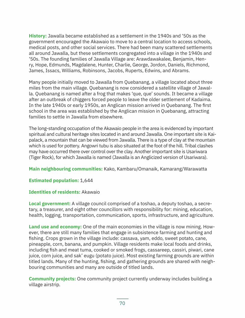
70
History: Jawalla became established as a settlement in the 1940s and ‘50s as the government encouraged the Akawaio to move to a central location to access schools, medical posts, and other social services. There had been many scattered settlements all around Jawalla, but these settlements congregated into a village in the 1940s and ‘50s. The founding families of Jawalla Village are: Arawdawakalee, Benjamin, Hen-ry, Hope, Edmunds, Magdalene, Hunter, Charlie, George, Jordon, Daniels, Richmond, James, Issacs, Williams, Robinsons, Jacobs, Ruperts, Edwins, and Abrams.
Many people initially moved to Jawalla from Quebanang, a village located about three miles from the main village. Quebanang is now considered a satellite village of Jawal-la. Quebanang is named after a frog that makes ‘que, que’ sounds. It became a village after an outbreak of chiggers forced people to leave the older settlement of Kadaima. In the late 1940s or early 1950s, an Anglican mission arrived in Quebanang. The first school in the area was established by the Anglican mission in Quebanang, attracting families to settle in Jawalla from elsewhere.
The long-standing occupation of the Akawaio people in the area is evidenced by important spiritual and cultural heritage sites located in and around Jawalla. One important site is Kai-palack, a mountain that can be viewed from Jawalla. There is a type of clay at the mountain which is used for pottery. Angowri tubu is also situated at the foot of the hill. Tribal clashes may have occurred there over control over the clay. Another important site is Usariwara (Tiger Rock), for which Jawalla is named (Jawalla is an Anglicized version of Usariwara).
Main neighbouring communities: Kako, Kambaru/Omanaik, Kamarang/Warawatta
Estimated population: 1,644
Identities of residents: Akawaio
Local government: A village council comprised of a toshao, a deputy toshao, a secre-tary, a treasurer, and eight other councillors with responsibility for: mining, education, health, logging, transportation, communication, sports, infrastructure, and agriculture.
Land use and economy: One of the main economies in the village is now mining. How-ever, there are still many families that engage in subsistence farming and hunting and fishing. Crops grown in the village include: cassava, yam, eddo, sweet potato, cane, pineapple, corn, banana, and pumpkin. Village residents make local foods and drinks, including fish and meat tuma, cooked or smoked frogs, cassareep, cassiri, piwari, cane juice, corn juice, and sak’ eugu (potato juice). Most existing farming grounds are within titled lands. Many of the hunting, fishing, and gathering grounds are shared with neigh-bouring communities and many are outside of titled lands.
Community projects: One community project currently underway includes building a village airstrip.
71
Institutions and services: The village has a radio communication set; a village internet system, as well as private internet; and electricity generated through private genera-tors and solar panels. The village has a nursery school and a primary school. For sec-ondary school, students attend the school in Waramadong, unless they obtain scholar-ships to attend schools in Bartica or Georgetown. The village has a health post with one resident doctor, two health workers, one midwife, and two nursing assistants.
Current land title status: The village was granted title in 1991. Its title is listed under the amended schedule to the Amerindian Act and recorded in an absolute grant under the State Lands Act.
Existing title description: ‘A tract of State Land situate on the Banks at the Mouth of the Kukui River, Left Bank Mazaruni River commencing at the Mouth of the Wanawau Creek, Right Bank Kukui River, thence up the Wanawau Creek to its source, thence North along the Boundary of the existing Upper Mazaruni District to the source of the Abau Creek, thence South West to the Mazaruni River one mile below Apiapai Landing, thence South by West to Ankaritipu Mountain, thence South East to the Source of the Yara Creek, Left Bank Kukui River, thence down the Yara Creek to its Mouth, thence down the Kukui River to the point of commencement.’
Title suitability: Inadequate. The village was not consulted before the issuance of title and the title the village was given does not cover the extent of the village’s traditional lands.
The ALC Report records Jawalla’s title request as: ‘From Emoi Creek in the Kukui to the eastern boundary of the present District up the Mazaruni and down the Mazaruni to one mile below Apiapai Settlement.’
The ALC recommended: ‘The area commencing at the mouth of the Wanawau Creek, right bank Kukui River, left bank Mazaruni River thence up the Wanawau Creek to its source, thence north along the boundary of the existing Upper Mazaruni District to the source of the Abau Creek; thence south-west to the Mazaruni River one mile below Apiapai Landing; thence south by west to Ankaritipu Mountain, thence south-east to the source of the Yara Creek, left bank Kukui River, thence down the Yara Creek to its mouth thence down the Kukui River to the point of commencement.’
The ALC ‘consider[ed] the area recommended as being necessary for subsistence needs and for future development needs.’
The actual title given is identical to that recommended by the ALC; however, villagers complain that it represents only a small portion of what the village had requested and excludes many areas of customary lands that they used for hunting, fishing, gathering, artisanal mining, and farming.
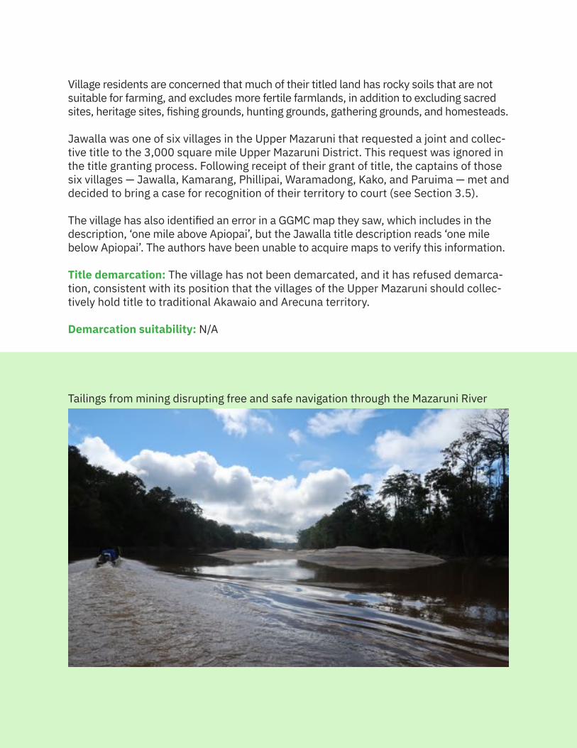
72
Village residents are concerned that much of their titled land has rocky soils that are not suitable for farming, and excludes more fertile farmlands, in addition to excluding sacred sites, heritage sites, fishing grounds, hunting grounds, gathering grounds, and homesteads.
Jawalla was one of six villages in the Upper Mazaruni that requested a joint and collec-tive title to the 3,000 square mile Upper Mazaruni District. This request was ignored in the title granting process. Following receipt of their grant of title, the captains of those six villages — Jawalla, Kamarang, Phillipai, Waramadong, Kako, and Paruima — met and decided to bring a case for recognition of their territory to court (see Section 3.5).
The village has also identified an error in a GGMC map they saw, which includes in the description, ‘one mile above Apiopai’, but the Jawalla title description reads ‘one mile below Apiopai’. The authors have been unable to acquire maps to verify this information.
Title demarcation: The village has not been demarcated, and it has refused demarca-tion, consistent with its position that the villages of the Upper Mazaruni should collec-tively hold title to traditional Akawaio and Arecuna territory.
Demarcation suitability: N/A
Tailings from mining disrupting free and safe navigation through the Mazaruni River
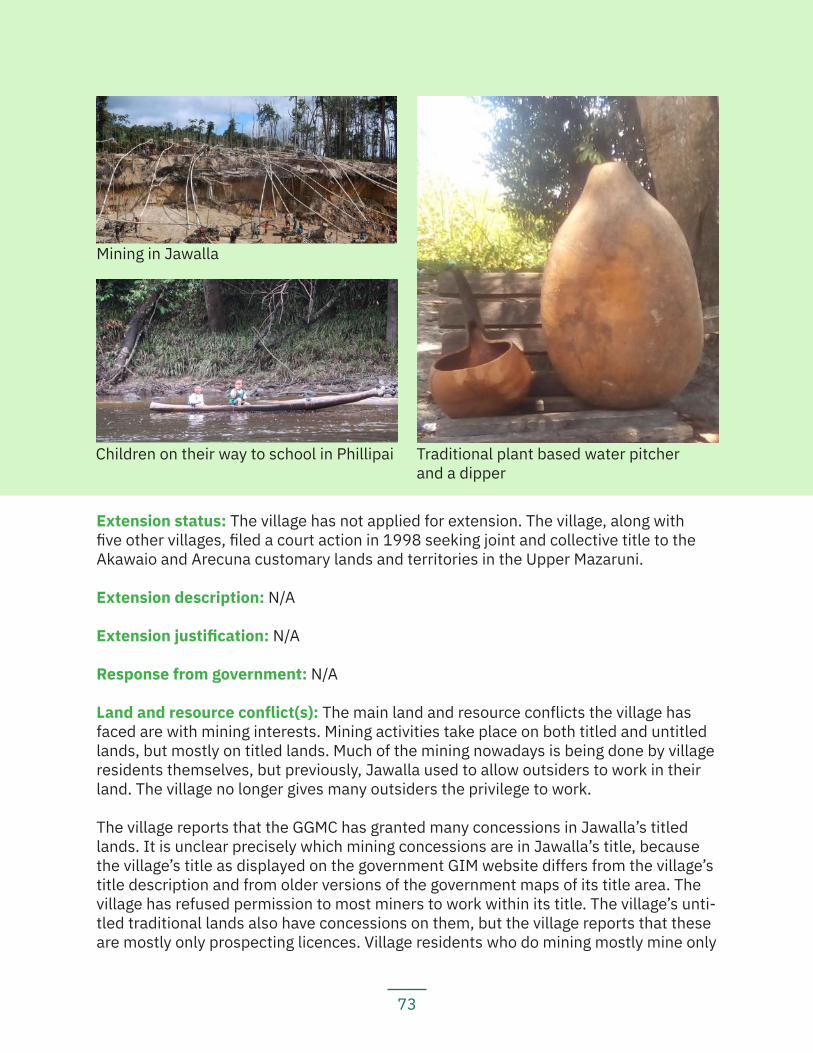
73
Extension status: The village has not applied for extension. The village, along with five other villages, filed a court action in 1998 seeking joint and collective title to the Akawaio and Arecuna customary lands and territories in the Upper Mazaruni.
Extension description: N/A
Extension justification: N/A
Response from government: N/A
Land and resource conflict(s): The main land and resource conflicts the village has faced are with mining interests. Mining activities take place on both titled and untitled lands, but mostly on titled lands. Much of the mining nowadays is being done by village residents themselves, but previously, Jawalla used to allow outsiders to work in their land. The village no longer gives many outsiders the privilege to work.
The village reports that the GGMC has granted many concessions in Jawalla’s titled lands. It is unclear precisely which mining concessions are in Jawalla’s title, because the village’s title as displayed on the government GIM website differs from the village’s title description and from older versions of the government maps of its title area. The village has refused permission to most miners to work within its title. The village’s unti-tled traditional lands also have concessions on them, but the village reports that these are mostly only prospecting licences. Village residents who do mining mostly mine only
Mining in Jawalla
Traditional plant based water pitcherand a dipper
Children on their way to school in Phillipai
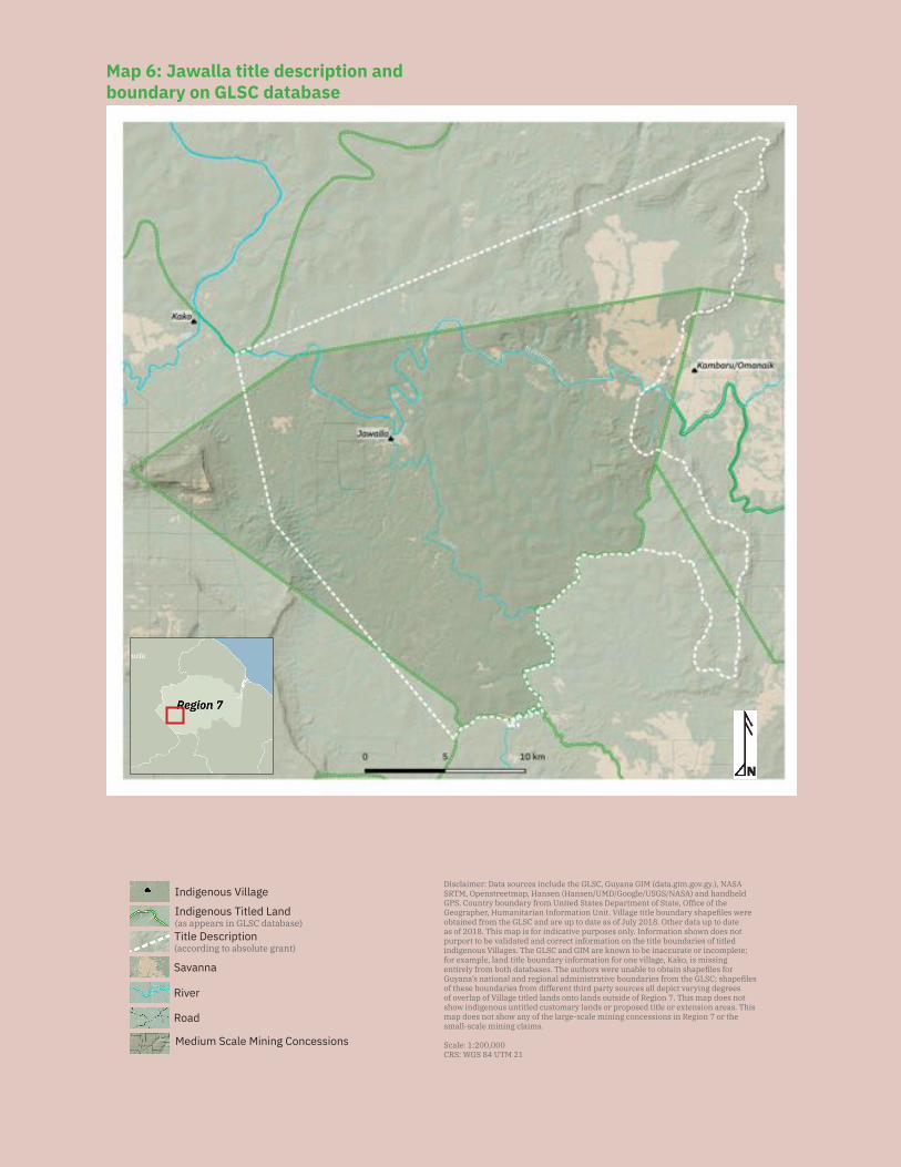
74
Savanna
Disclaimer: Data sources include the GLSC, Guyana GIM (data.gim.gov.gy.), NASA SRTM, Openstreetmap, Hansen (Hansen/UMD/Google/USGS/NASA) and handheld
f e es e e f e, Offi e f e e e , f ll e le s efiles e e
obtained from the GLSC and are up to date as of July 2018. Other data up to date s f s s f e ses l f s es
purport to be validated and correct information on the title boundaries of titled e s ll es e e e e le e
for example, land title boundary information for one village, Kako, is missing e el f ses e s e e le s efiles f
s l e l s e es f e s efiles of these boundaries from different third party sources all depict varying degrees of overlap of Village titled lands onto lands outside of Region 7. This map does not s e s le s l s se le e e s e s s
es s f e l e s le ess s e e s ll s le l s
Scale: 1:200,000CRS: WGS 84 UTM 21
Medium Scale Mining Concessions
Road
River
Indigenous Titled Land(as appears in GLSC database)
Indigenous Village
Title Description (according to absolute grant)
Mazaruni
Map 6: Jawalla title description and boundary on GLSC database
75
in the village titled lands and not as much in their untitled traditional lands.
Although Jawalla Village has not obtained any mining concessions from GGMC because they are working on their own lands, the GGMC has granted the village licences for the excavator that is half-owned by the village, as well as to the dredges owned by pri-vate individuals in the village. It is the wealthier village residents who tend to do more mining. It is this group that owns excavators and more than one dredge, including both land and water dredges. The village residents who do mining have all obtained permis-sion to mine from the village council.
Some village residents report that mining activities have caused some conflicts over the use of subsoil resources, such as white sand (used for construction purposes), lat-erite, fireside red mud, and clay used to make pots.
Land security: Village residents feel that they have some land tenure security on their ti-tled lands, but not over their untitled traditional lands. One of the biggest threats many in the village fear is that GGMC has the legal authority to give out concessions on their lands because village titles do not give villages the right to own subsurface minerals. Although thus far the village has been successful in refusing permission to miners who had been granted concessions in their titled lands, they worry that the GGMC will continue to grant mining concessions on their lands, leading to possible conflicts in the future. Notably, the GGMC has said that the village’s refusal of permission to mine has been offset by the GGMC finding alternate pieces of land to grant outside miners as concessions.
The village is currently in a court case over permission granted by GGMC, without the village’s FPIC, to a non-resident miner to mine along the Mazaruni River, which passes through the village. Village residents note that mining there would cause significant water pollution and damage to the environment, as well as changing the flow of the current and inhibiting travel down the river.
The village also worries that because many people cannot understand their title de-scription, they may not know where their title boundary lies. They also worry that min-ers and others can feign ignorance and pretend they did now know where the boundary of the village is. This concern is compounded by the fact that the High Court in the above-mentioned case commented that the Mazaruni River does not pass ‘through’ the village but rather ‘along’ the village boundary.
It is unclear to which map the High Court was referring, because whether reading Jawalla’s title description or looking at the current GLSC map of Jawalla, the Mazaruni River does pass ‘through’ the village (see Map 6).
Livelihood security and environmental integrity: Mining and climate change are negatively impacting the environment and residents’ livelihoods. Mining along the Mazaruni River has caused and continues to cause significant environmental damage.
76
Village residents complain that the use of excavators in particular is destroying hunting and fishing areas, forcing residents to travel further to hunt and fish. The soil near the mining areas is exhausted and residents have to travel farther, miles up the Kukui River, to find good farming areas.
Mining activities have significantly polluted the waterways used by village residents, with many persons complaining of itching skin after they bathe in the river. Villagers have also noticed that the outside miners, notably Brazilian miners, do not follow the mining laws and pour their tailings directly into the river. Because much of the mining activity takes place along the Mazaruni River, the village’s main source of water, village residents have had to look for other sources of water to use. Village residents observe that the Kukui River can still be used for water during rainy season, when the water levels are high, but during dry season, even the water in that river is murky.
Residents have also noticed that weather patterns have been changing, affecting their crops. In particular, heavy rains followed by dry weather have destroyed many cassava crops, causing them to rot.
Recognition and measures sought: The residents of Jawalla recommend that:
— The government legally recognize our traditional lands and territories, no-tably, it should legally recognize the tract of land we have identified since the 1960s as traditional Akawaio and Arecuna territory;
— The government revise the Amerindian Act 2006, the State Lands Act, the Mining Act, and other relevant laws to grant resource rights to indigenous peoples, inclu-ding ownership of subsoil resources and ownership of our traditional waterways;
— The GGMC stop the issuance of mining concessions to outside miners on both titled and untitled lands;
— The various agencies in the government, including the GLSC, the GGMC, and the GFC must update and synchronize their maps;
— The government include GLSC members as part of their team when visiting communities;
— The GGMC must rectify the mistake in their map of the village’s titled lands; — The government carry out a systematic study on the pollution of the Mazaru-
ni River and of the destruction of the forest and of its resources; — The Jawalla Village Council must create a management plan and evaluate
and manage the mining in and around the village; — The Jawalla Village Council should seek help from an outside organization or
institution to test the waters and people in the village for mercury contami-nation and poisoning.
77
5.1.3 KakoKey findings:
— Kako received its land title in 1991. — Kako’s land title excludes many homesteads, camps, and farms, particularly
in Murubik, Mayarupai, and up the Kiara Creek head. The title also excludes many hunting and fishing areas along the branches of the Kako River.
— Kako is one of the six villages in the Upper Mazaruni case, seeking legal reco-gnition for the larger traditional Akawaio and Arecuna territory.
— Kako has refused demarcation because it is currently seeking legal reco-gnition to a collective territory for the Akawaio and Arecuna, as opposed to individual, piecemeal titles.
— The village has discovered that there are over 60 mining concessions on their titled land, granted in 2012 without any notification or consultation, let alo-ne FPIC. There are also hundreds of concessions on their untitled customary lands under claim in the High Court.
Location: Kako River, Upper Mazaruni, Region 7
History: Kako Village and the Kako River are both named after the kako (jasper) stone, commonly found in the Kako River. The village used to be called Morowta, after a rock at the landing for the village. The rock was named after a big animal called Molaima that lived there.
People have been living in and around what is present-day Kako Village since time immemorial. Old settlement sites and spiritual, sacred and cultural heritage sites all evidence the prolonged occupation of the area. Old settlements were located along the Kako River and its branches, including at Kiayara head (Reikipak), Watabaru, Kuiwa, Obadoi, Odowanda, Erwak, Wiiyeng, Sarabita, and Tueneng. Some old settlement areas that are also sacred areas include: Mayurupai, Obadoi, Tuweneng, Kyawutei, Kuyara. Some old settlement sites that are also burial sites are: Ayadei, Akaiepu, Kurakashieta, Kuaneit, Kuiwa, Kamariyayeng, Anakabo, Waiyakmapo, Sanda Creek head, and Aroan. Several areas at Arubaru [alt. sp. ‘Arabaro’] and Kako head are set aside as bodawa, meaning that the areas are reserved for future use, and that current hunting, fishing, and farming activity is restricted.
Elders recall stories describing the original founder of the earliest settlements at Kia-yara Creek as Chibegu and his wife Marai’a. During those times, there was a lot of tribal war with the Kamalatokok tribe in Venezuela. Chibegu and his people moved down to Mairupai because of this war. In the 20th century, a white Adventist pastor came to Tueneng and encouraged people to come together to a site where there would be a church, school, and health post. Other residents had been living across the river at Wilackmapo and moved across the river. The first families of the new village founded in
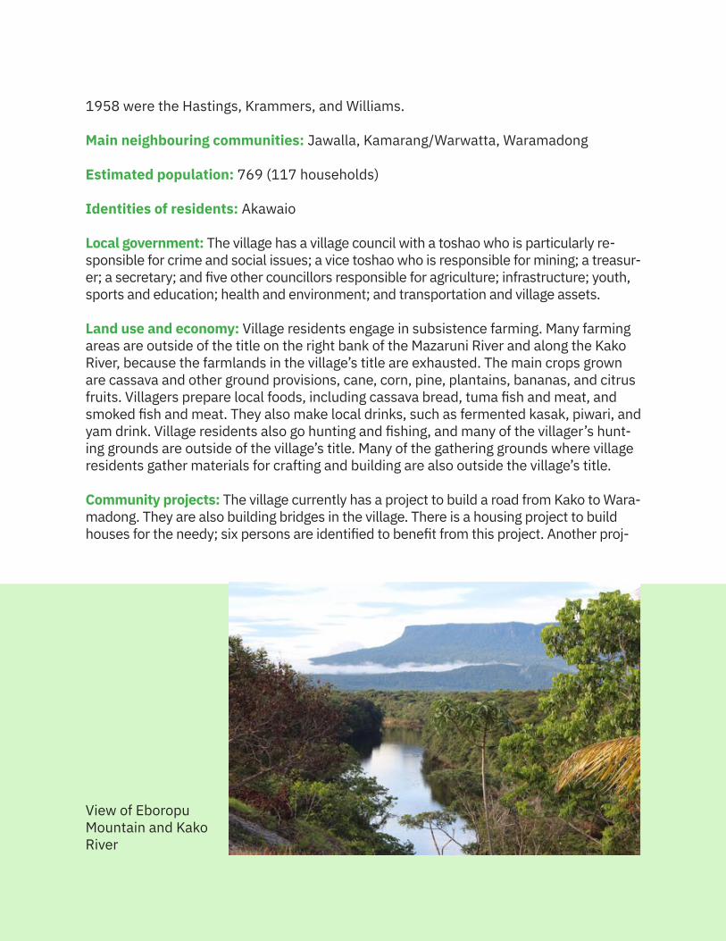
78
1958 were the Hastings, Krammers, and Williams.
Main neighbouring communities: Jawalla, Kamarang/Warwatta, Waramadong
Estimated population: 769 (117 households)
Identities of residents: Akawaio
Local government: The village has a village council with a toshao who is particularly re-sponsible for crime and social issues; a vice toshao who is responsible for mining; a treasur-er; a secretary; and five other councillors responsible for agriculture; infrastructure; youth, sports and education; health and environment; and transportation and village assets.
Land use and economy: Village residents engage in subsistence farming. Many farming areas are outside of the title on the right bank of the Mazaruni River and along the Kako River, because the farmlands in the village’s title are exhausted. The main crops grown are cassava and other ground provisions, cane, corn, pine, plantains, bananas, and citrus fruits. Villagers prepare local foods, including cassava bread, tuma fish and meat, and smoked fish and meat. They also make local drinks, such as fermented kasak, piwari, and yam drink. Village residents also go hunting and fishing, and many of the villager’s hunt-ing grounds are outside of the village’s title. Many of the gathering grounds where village residents gather materials for crafting and building are also outside the village’s title.
Community projects: The village currently has a project to build a road from Kako to Wara-madong. They are also building bridges in the village. There is a housing project to build houses for the needy; six persons are identified to benefit from this project. Another proj-
View of Eboropu Mountain and Kako River
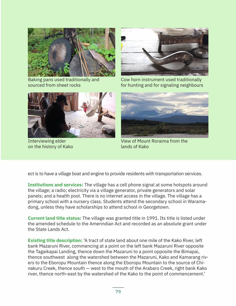
79
ect is to have a village boat and engine to provide residents with transportation services.
Institutions and services: The village has a cell phone signal at some hotspots around the village; a radio; electricity via a village generator, private generators and solar panels; and a health post. There is no internet access in the village. The village has a primary school with a nursery class. Students attend the secondary school in Warama-dong, unless they have scholarships to attend school in Georgetown.
Current land title status: The village was granted title in 1991. Its title is listed under the amended schedule to the Amerindian Act and recorded as an absolute grant under the State Lands Act.
Existing title description: ‘A tract of state land about one mile of the Kako River, left bank Mazaruni River, commencing at a point on the left bank Mazaruni River opposite the Tagaikapai Landing, thence down the Mazaruni to a point opposite the Bimapai, thence southwest along the watershed between the Mazaruni, Kako and Kamarang riv-ers to the Eboropu Mountain thence along the Eboropu Mountain to the source of Chi-nakuru Creek, thence south — west to the mouth of the Arabaro Creek, right bank Kako river, thence north-east by the watershed of the Kako to the point of commencement.’
Cow horn instrument used traditionally for hunting and for signaling neighbours
Interviewing elderon the history of Kako
View of Mount Roraima from the lands of Kako
Baking pans used traditionally and sourced from sheet rocks
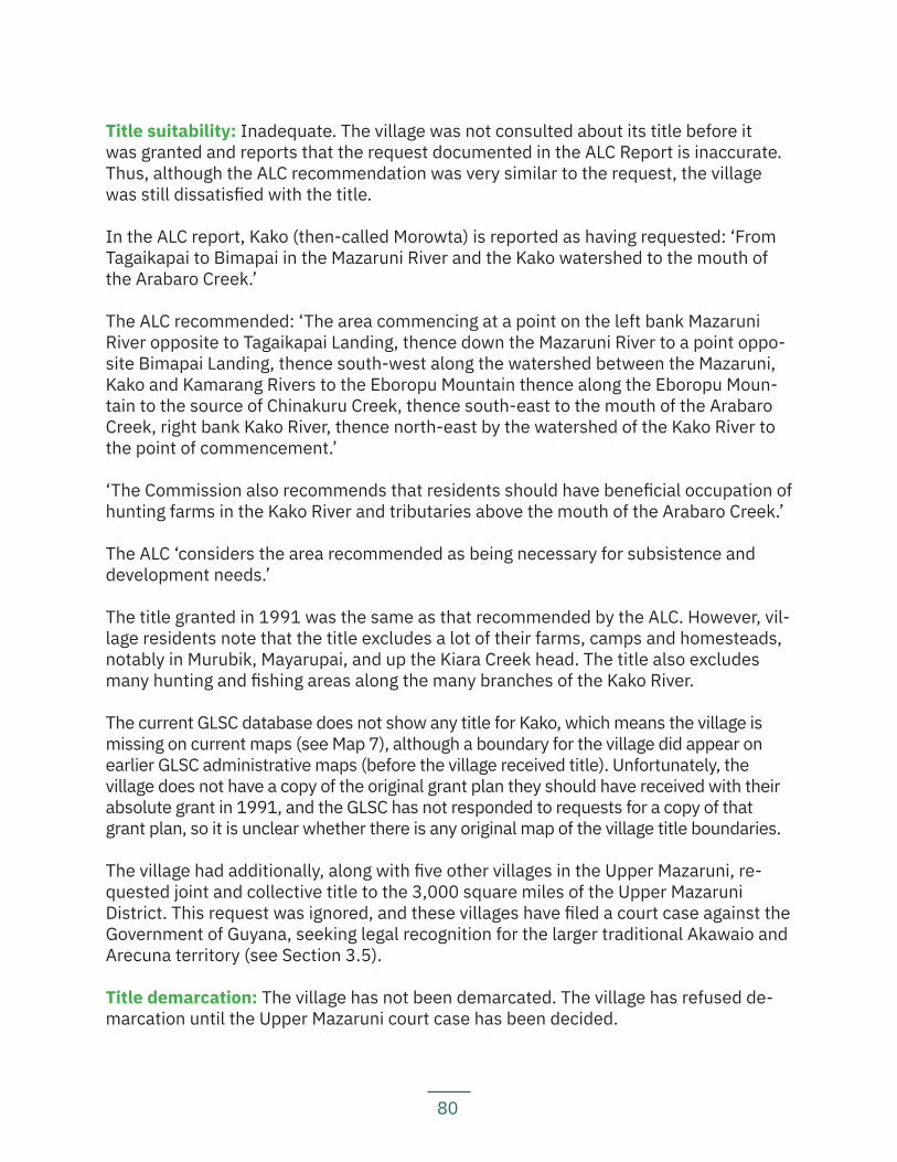
80
Title suitability: Inadequate. The village was not consulted about its title before it was granted and reports that the request documented in the ALC Report is inaccurate. Thus, although the ALC recommendation was very similar to the request, the village was still dissatisfied with the title.
In the ALC report, Kako (then-called Morowta) is reported as having requested: ‘From Tagaikapai to Bimapai in the Mazaruni River and the Kako watershed to the mouth of the Arabaro Creek.’
The ALC recommended: ‘The area commencing at a point on the left bank Mazaruni River opposite to Tagaikapai Landing, thence down the Mazaruni River to a point oppo-site Bimapai Landing, thence south-west along the watershed between the Mazaruni, Kako and Kamarang Rivers to the Eboropu Mountain thence along the Eboropu Moun-tain to the source of Chinakuru Creek, thence south-east to the mouth of the Arabaro Creek, right bank Kako River, thence north-east by the watershed of the Kako River to the point of commencement.’
‘The Commission also recommends that residents should have beneficial occupation of hunting farms in the Kako River and tributaries above the mouth of the Arabaro Creek.’
The ALC ‘considers the area recommended as being necessary for subsistence and development needs.’
The title granted in 1991 was the same as that recommended by the ALC. However, vil-lage residents note that the title excludes a lot of their farms, camps and homesteads, notably in Murubik, Mayarupai, and up the Kiara Creek head. The title also excludes many hunting and fishing areas along the many branches of the Kako River.
The current GLSC database does not show any title for Kako, which means the village is missing on current maps (see Map 7), although a boundary for the village did appear on earlier GLSC administrative maps (before the village received title). Unfortunately, the village does not have a copy of the original grant plan they should have received with their absolute grant in 1991, and the GLSC has not responded to requests for a copy of that grant plan, so it is unclear whether there is any original map of the village title boundaries.
The village had additionally, along with five other villages in the Upper Mazaruni, re-quested joint and collective title to the 3,000 square miles of the Upper Mazaruni District. This request was ignored, and these villages have filed a court case against the Government of Guyana, seeking legal recognition for the larger traditional Akawaio and Arecuna territory (see Section 3.5).
Title demarcation: The village has not been demarcated. The village has refused de-marcation until the Upper Mazaruni court case has been decided.
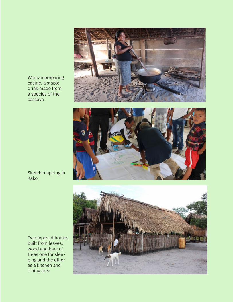
81
Woman preparing casirie, a staple drink made from a species of the cassava
Sketch mapping in Kako
Two types of homes built from leaves, wood and bark of trees one for slee-ping and the other as a kitchen and dining area
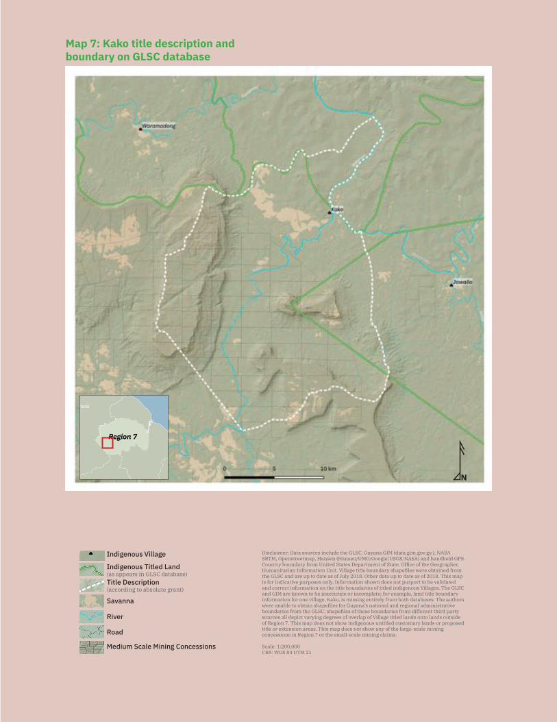
82
N
Disclaimer: Data sources include the GLSC, Guyana GIM (data.gim.gov.gy.), NASA SRTM, Openstreetmap, Hansen (Hansen/UMD/Google/USGS/NASA) and handheld GPS. Country boundary from United States Department of State, Office of the Geographer, Humanitarian Information Unit. Village title boundary shapefiles were obtained from the GLSC and are up to date as of July 2018. Other data up to date as of 2018. This map is for indicative purposes only. Information shown does not purport to be validated and correct information on the title boundaries of titled indigenous Villages. The GLSC and GIM are known to be inaccurate or incomplete; for example, land title boundary information for one village, Kako, is missing entirely from both databases. The authors were unable to obtain shapefiles for Guyana’s national and regional administrative boundaries from the GLSC; shapefiles of these boundaries from different third party sources all depict varying degrees of overlap of Village titled lands onto lands outside of Region 7. This map does not show indigenous untitled customary lands or proposed title or extension areas. This map does not show any of the large-scale mining concessions in Region 7 or the small-scale mining claims.
Scale: 1:200,000CRS: WGS 84 UTM 21
Mazaruni
Kako
Savanna
Medium Scale Mining Concessions
Road
River
Indigenous Titled Land(as appears in GLSC database)
Indigenous Village
Title Description (according to absolute grant) N
Disclaimer: Data sources include the GLSC, Guyana GIM (data.gim.gov.gy.), NASA SRTM, Openstreetmap, Hansen (Hansen/UMD/Google/USGS/NASA) and handheld GPS. Country boundary from United States Department of State, Office of the Geographer, Humanitarian Information Unit. Village title boundary shapefiles were obtained from the GLSC and are up to date as of July 2018. Other data up to date as of 2018. This map is for indicative purposes only. Information shown does not purport to be validated and correct information on the title boundaries of titled indigenous Villages. The GLSC and GIM are known to be inaccurate or incomplete; for example, land title boundary information for one village, Kako, is missing entirely from both databases. The authors were unable to obtain shapefiles for Guyana’s national and regional administrative boundaries from the GLSC; shapefiles of these boundaries from different third party sources all depict varying degrees of overlap of Village titled lands onto lands outside of Region 7. This map does not show indigenous untitled customary lands or proposed title or extension areas. This map does not show any of the large-scale mining concessions in Region 7 or the small-scale mining claims.
Scale: 1:200,000CRS: WGS 84 UTM 21
Mazaruni
Kako
Savanna
Medium Scale Mining Concessions
Road
River
Indigenous Titled Land(as appears in GLSC database)
Indigenous Village
Title Description (according to absolute grant)
Map 7: Kako title description and boundary on GLSC database
83
Demarcation suitability: N/A
Extension status: The village has not applied for extension. They are awaiting a deci-sion in the Upper Mazaruni court case.
Extension description: N/A
Extension justification: N/A
Response from government: N/A
Land and resource conflict(s): The village has experienced conflicts with miners who were operating on the village’s lands. Several years back, the village won court cases that allowed it to expel two miners — Belina Charlie and Clarence DeAbru — from mining in the Kako River. However, the cost of these court cases has made the village wary about its abili-ty to continue to fight mining cases in the courts. In one case, the toshao of the village faced charges of contempt of court and possible jail time for refusing to allow a miner to pass through the village despite a court order requiring the village to allow the miner to pass.
The village reports that in the past year, there have been other miners entering the Kako River to do mining upriver from the village. The village is adamant that they do not want any mining up the Kako River, because they are concerned about the pollution of this vital waterway and fishing ground. Any traditional mining currently engaged in by village residents has the approval of village general meetings and is downriver, not upriver.
Land security: The village does not feel it has land tenure security. The village is dis-turbed, angry and upset about the numerous mining concessions on their lands, which were given out without the village’s FPIC.
Information about the overlap of mining concessions on the village’s title unfortunate-ly cannot be verified against the government GIM website, on which Kako does not appear as a titled village at all, and which does not provide information on the types of mining concessions. Although the GIM website does not show the title boundary of Kako Village, it is clear that there are numerous concessions on the village’s customary lands. Indeed, the village’s customary lands are virtually blanketed in mining conces-sions. GIM also shows three large-scale concessions, owned by Guyinfra, Inc. in the Kumarau area of the village’s customary lands. Because of the lack of information on the government database, it is unclear what types of mining concessions they are.
Livelihood security and environmental integrity: Village residents feel that apart from mining, there are no other major dangers or concerns regarding environmental integrity or livelihood security that they are aware of. They had heard a few years ago that there were some yarrow fish dying upstream in the Kako River and its tributar-ies and sent some samples to be tested in Georgetown, but the village never got any results back. Nevertheless, village residents believe the Kako River is one of the only
84
black water creeks remaining in their village which is still clean and safe to drink from.
Village residents report some recent problems with occasional rat infestations that destroy crops such as yam and pumpkin. Village residents report that they do not know where the rats are coming from or why this new problem is happening in the village.
Recognition and measures sought: The village recommends:
— The government must refrain from issuing new mining concessions and must revoke and remove those currently on titled and customary lands without the village’s FPIC;
— The government must allow indigenous peoples to demarcate their titles themselves, because only the people themselves know their boundaries and where all the creeks, rivers, mountains, and other landmarks are;
— The government should make a request to the Chancellor of the Judiciary to expedite the decision in the Upper Mazaruni court case;
— The government must grant the Akawaio and Arecuna of the Upper Mazaruni title to their territory jointly and collectively; and
— The National Toshaos Council must be more active in advocating for the ri-ghts of indigenous peoples.
5.1.4 Kamarang/WarawattaI have spoken for so many years over and over and telling my younger generation to continue to say no to destruction and confiscation of our lands. I insist that they must continue fighting. This is our land. Where will you go if you stop fighting? You have to fight for keep our lands for your generations. – Josephine Ranny
Key findings:
— Kamarang/Warawatta received title in 1991. — Kamarang/Warawatta’s title excludes many of the village’s traditional hun-
ting, fishing, gathering, and mining grounds. — The village’s title also excludes the government compound. — Kamarang/Warawatta is one of the six villages in the Upper Mazaruni case se-
eking legal recognition for the larger traditional Akawaio and Arecuna territory. — Kamarang/Warawatta has refused demarcation because it is currently se-
eking legal recognition to a collective territory as opposed to individual, piecemeal titles.
— Mining activities, including those approved by the village council, are de-stroying areas reserved for fishing and hunting or for protecting fish species, for example, at Kulaiyak and at Urigu Creeks.
85
— Mining activities, including those approved by the village council, have de-stroyed farming grounds. They have also destroyed creek mouths, causing the flooding out of farms. Farming areas at Mi’na Baru, Coroba and Maik Palu Creek have all been damaged by mining.
— Miners, including those granted permission to mine in village titled lands by the village council, have destroyed the village’s traditional trails to their far-ming, hunting, and fishing grounds. They have damaged other roads, making them more difficult to travel, and they have otherwise restricted villagers’ access to some of their traditional trails.
— Villagers have been pressured and coerced by miners into guiding miners to areas in which they can find gold.
— Non-residents living in the government compound have started moving onto village lands without the village’s permission.
— Mining activities have caused significant forest loss and water pollution around the Mazaruni River, including mercury poisoning. They have damaged many fish spawning grounds as well, and pollution has caused fish to decrease in size. The village is concerned that mining is now starting in the Kamarang River as well, and the village is worried that there will be a shortage of potable water.
— Mining activities have caused loss of wildlife habitat and decreased the num-bers of game animals.
— During dry season, the village faces a shortage of clean water. The one clean creek left is far away and not accessible to most villagers as drinking water.
Location: Kamarang and Mazaruni Rivers, Upper Mazaruni, Region 7
History: The Akawaio who have always lived along the Kamarang River were called the Kamranigok (the people of the Kamarang River). A similar word that may be the origin of the village’s name is amarang keng, which means ‘gathering point’. The name ‘War-awatta’ likely comes from the Waruwa Creek, along which many waruwa trees grew. The waruwa tree has many uses for the village, including as insect repellent, as a can-dle, and for medicinal purposes.
Akawaio families have lived in the Kamarang area for generations. Families lived in various settlements around the entire area, including at Coroba, which is down the Mazaruni River and had originally been planned to be the site of the present-day vil-lage. The building of schools and more churches at the site of the main village, and the opening of the government station, began in the 1940s.
More families started moving closer to the site of the present-day village of Kamarang/Warawatta in the mid-1900s when the Anglican Church was established there. The first set of families to move to the present-day site of the village were those of: Kenneth Williams, Kenneth Melville, and Krammar.
Numerous important spiritual and cultural heritage sites evidence prolonged occupa-
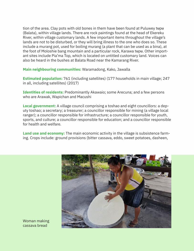
86
tion of the area. Clay pots with old bones in them have been found at Puluwey tupu (Balata), within village lands. There are rock paintings found at the head of Ekereku River, within village customary lands. A few important items throughout the village’s lands are not to be disturbed, or they will bring illness to the one who does so. These include a murang pot, used for boiling murang (a plant that can be used as a bina), at the foot of Moloshie bang mountain and a particular rock, Karawa tupu. Other import-ant sites include Pia’ma Top, which is located on untitled customary land. Voices can also be heard in the bushes at Balata Road near the Kamarang River.
Main neighbouring communities: Waramadong, Kako, Jawalla
Estimated population: 761 (including satellites) (177 households in main village; 247 in all, including satellites) (2017)
Identities of residents: Predominantly Akawaio; some Arecuna; and a few persons who are Arawak, Wapichan and Macushi
Local government: A village council comprising a toshao and eight councillors: a dep-uty toshao; a secretary; a treasurer; a councillor responsible for mining (a village local ranger); a councillor responsible for infrastructure; a councillor responsible for youth, sports, and culture; a councillor responsible for education; and a councillor responsible for health and welfare.
Land use and economy: The main economic activity in the village is subsistence farm-ing. Crops include: ground provisions (bitter cassava, eddo, sweet potatoes, dasheen,
Woman makingcassava bread
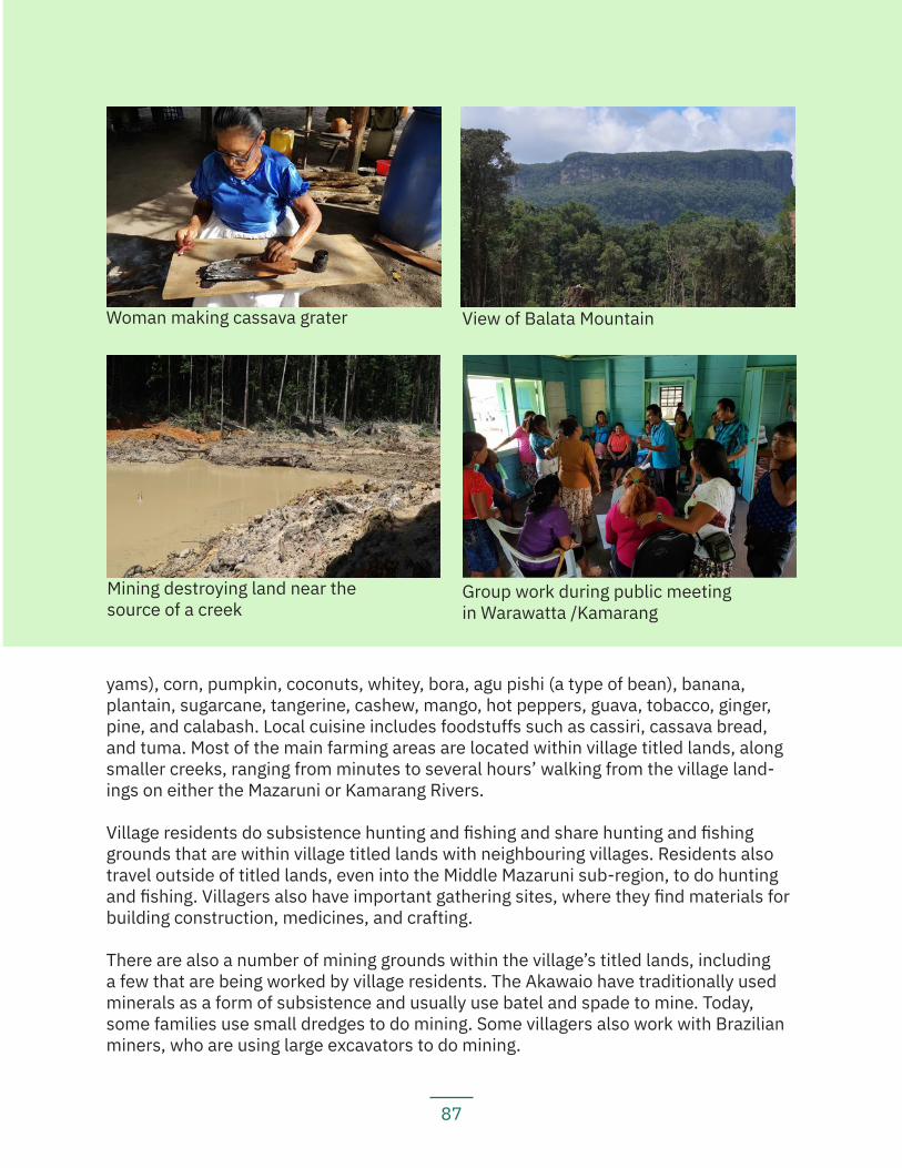
87
yams), corn, pumpkin, coconuts, whitey, bora, agu pishi (a type of bean), banana, plantain, sugarcane, tangerine, cashew, mango, hot peppers, guava, tobacco, ginger, pine, and calabash. Local cuisine includes foodstuffs such as cassiri, cassava bread, and tuma. Most of the main farming areas are located within village titled lands, along smaller creeks, ranging from minutes to several hours’ walking from the village land-ings on either the Mazaruni or Kamarang Rivers.
Village residents do subsistence hunting and fishing and share hunting and fishing grounds that are within village titled lands with neighbouring villages. Residents also travel outside of titled lands, even into the Middle Mazaruni sub-region, to do hunting and fishing. Villagers also have important gathering sites, where they find materials for building construction, medicines, and crafting.
There are also a number of mining grounds within the village’s titled lands, including a few that are being worked by village residents. The Akawaio have traditionally used minerals as a form of subsistence and usually use batel and spade to mine. Today, some families use small dredges to do mining. Some villagers also work with Brazilian miners, who are using large excavators to do mining.
View of Balata MountainWoman making cassava grater
Group work during public meeting in Warawatta /Kamarang
Mining destroying land near the source of a creek
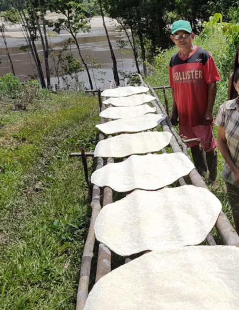
88
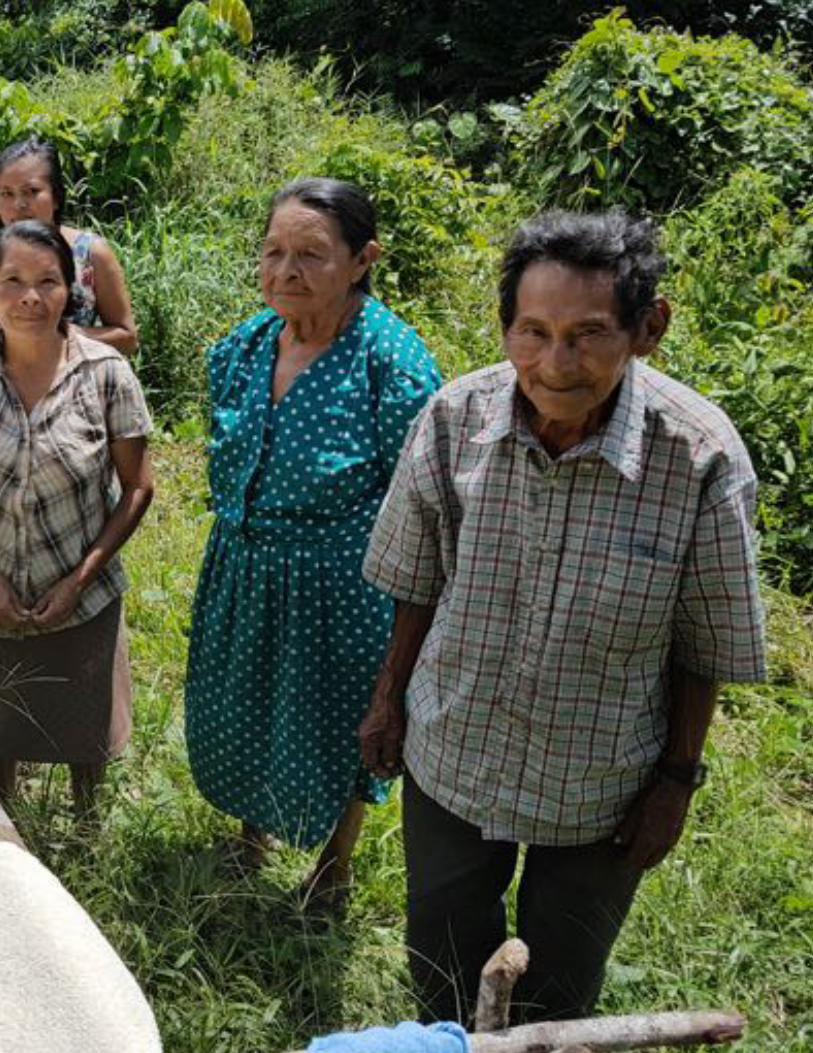
89
90
Community projects: A few self-funded community projects include building bridges, a village dining hall, the village office, a guest house in Warawatta, and access roads within the village. Government-funded projects include a children’s play park, a village canteen, and the Kamarang-Waramadong road.
Institutions and services: The village has cellular phone network access, a radio, a nursery school, and a primary school. The government Education Office has internet access via satellite dish and one family also has private internet access. Residents can access electricity via solar panels and private generators. The village is the site of a District Hospital. For secondary school, students go to the secondary school in Wara-madong Village and Bartica. For tertiary education, students go to the Kurukuru Col-lege, government Technical Institute, the Guyana School of Agriculture, the Cyril Potter School of Education, and the University of Guyana.
Current land title status: The village was granted title (see Map 8) in 1991. Its title is listed under the amended schedule to the Amerindian Act and recorded as an absolute grant under the State Lands Act.
Existing title description: ‘A tract of land situate on the Right Bank Mazaruni River commencing at the mouth of the Warakabang Creek, Left Bank Mazaruni River, thence up the Mazaruni River to the Kebezik Creek, Right Bank Mazaruni River, thence up the Kebezik Creek to its source, thence south and west along the watershed of the Mazaruni River to the Bimapai Landing, Mazaruni River, thence along the watershed be-tween the Mazaruni, Kako and Kamarang Rivers to Eboropu Mountain, thence down the Tukuk Creek to its mouth, Right Bank Kamarang River, thence up the Kamarang River to Abaru Creek, thence up the Abaru Creek to its source, thence north to the Puluwatapu Mountain and to the source of the Warakabang Creek to the point of commencement, save and except the government Station at Kamarang.’
Title suitability: Inadequate. Village residents were never consulted about their title before it was granted and the title does not cover the full extent of their traditional lands.
Elders recall that during the first Amerindian Lands Commission meeting held in Ka-marang, there were calls for legal recognition to a wider Akawaio and Arecuna territory that started at Wagawagapö Creek, went up to the Ekereku River and up to the Parui-ma Mountains, thence down to Mount Roraima and right back to Ayanganna Mountain, from there to the source of the Mazaruni River, and from there to the source of the Surung Creek, and then back to Wagawagapö. They note that this area would have cov-ered the original 4,500 square mile Upper Mazaruni District boundary. Nevertheless, when the captains presented their memorandum requesting joint title to the ALC, they decided to, for legal reasons, request the reduced 1959 3,000 square mile boundary, which had de-reserved Chinoweing and Kambaru/Omanaik for mining.
During the ALC investigation, the final individual request reportedly made by Kama-
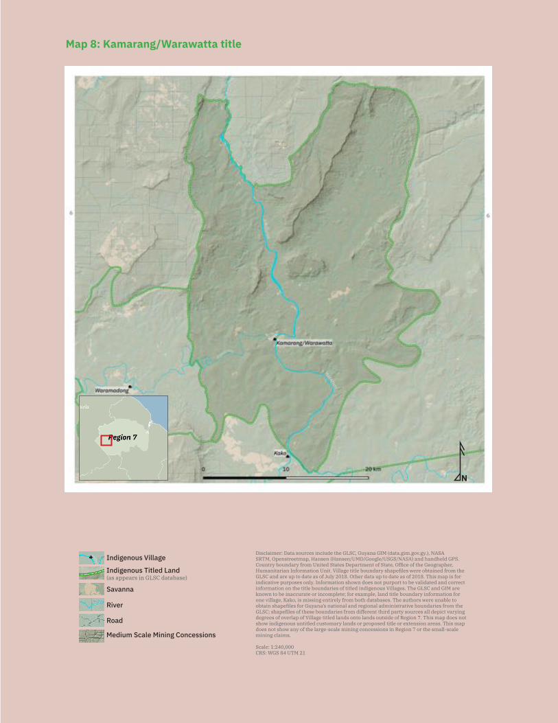
91
NDisclaimer: Data sources include the GLSC, Guyana GIM (data.gim.gov.gy.), NASA SRTM, Openstreetmap, Hansen (Hansen/UMD/Google/USGS/NASA) and handheld GPS. Country boundary from United States Department of State, Office of the Geographer, Humanitarian Information Unit. Village title boundary shapefiles were obtained from the GLSC and are up to date as of July 2018. Other data up to date as of 2018. This map is for indicative purposes only. Information shown does not purport to be validated and correct information on the title boundaries of titled indigenous Villages. The GLSC and GIM are known to be inaccurate or incomplete; for example, land title boundary information for one village, Kako, is missing entirely from both databases. The authors were unable to obtain shapefiles for Guyana’s national and regional administrative boundaries from the GLSC; shapefiles of these boundaries from different third party sources all depict varying degrees of overlap of Village titled lands onto lands outside of Region 7. This map does not show indigenous untitled customary lands or proposed title or extension areas. This map does not show any of the large-scale mining concessions in Region 7 or the small-scale mining claims.
Scale: 1:240,000CRS: WGS 84 UTM 21
Savanna
Medium Scale Mining Concessions
Road
River
Indigenous Titled Land(as appears in GLSC database)
Indigenous Village
Mazaruni
Map 8: Kamarang/Warawatta title
92
rang was for ‘The area extending from Bimapai Landing to Warakabang Creek in the Mazaruni and to the Itabu in the Kamarang including the watershed of the rivers.’ The village notes that ‘Itabu’ should be Indaga. The actual title recommended was ‘The area commencing at the mouth of the Warakabang Creek, left bank Mazaruni River, thence up the Mazaruni River to the Kebezik Creek, right bank Mazaruni River, thence up the Kebezik Creek to its source; thence south and west along the watershed of the Mazaruni River to the Bimapai Landing, Mazaruni River, thence along the wa-tershed between the Mazaruni, Kako and Kamarang Rivers to the Eboropu Mountain, thence down the Tukuk Creek to its mouth, right bank Kamarang River, thence up the Kamarang River to Abaru Creek, thence up the Abaru Creek to its source, thence north to the Puluwatapu Mountain and to the source of the Warakabang Creek; thence down the Warakabang Creek to the point of commencement, save and except the govern-ment station at Kamarang.’
The ALC noted that ‘The area recommended is less than that requested, but is consid-ered adequate for subsistence needs and development’.
The title granted in 1991 was identical to that recommended by the ALC. The village reports that the title included several names of creeks and other places that are incor-rect. For example, ‘Warakabang’ is actually known as the Wayakka bang, the ‘Abaru’ is known as the Eu balu, and ‘Puluwatapu’ is Puluwa tupu. In addition, the title the village received in 1991 excludes the government compound, in which ten families live.
More importantly, the title Kamarang/Warawatta Village received in 1991 was an individual title for the village and not a collective title, as they had requested. This meant that it excluded much of what they consider to be Akawaio traditional territo-ry, including lands at Meruwang, Attabrau, the Kako valley, the Arubaru valley, all the lands around Mount Roraima, Ayanganna Mountain, the Mazaruni head (Imbaimadai, Omanaik, etc.), and lands in the Ekereku Valley in the north. These customary areas include many hunting, fishing, gathering, and mining grounds, including the trails and camps used for those activities. Some of these areas include hunting grounds around Ayangaik Mountain; hunting and fishing grounds and a bodawa (reserved hunting, fishing and gathering grounds) on the Upper Membaru up to Surung Mountain; hunting, fishing and prospecting grounds on the Upper Ekereku River and savannah; and sensitive sites, prospecting areas, hunting and fishing camps, and gathering grounds at Balata Mountain.
Kamarang/Warawatta joined five other villages to file a court case against the Govern-ment of Guyana, seeking legal recognition for the larger traditional Akawaio and Arecu-na territory (see Section 3.5).
Title demarcation: The village has not been ‘officially’ demarcated and issued with a certificate of title. The village plans to continue refusing demarcation by the gov-ernment until their court action, in which they are seeking communal title held by six villages in the Upper Mazaruni together, is resolved. The village feels that the govern-
93
ment is pressuring the village to accept demarcation. Recently the government even asked the village to accept demarcation during their visit to conduct consultations on the Amerindian Act revision.
The village had previously demarcated their own boundary over the course of three years, before the government project to demarcate villages. Village elders cut a line around the boundary to mark it out, following the description in their title. The bound-ary that the government is pressuring the village to demarcate is smaller than what the village knows to be their boundary line, based on following their title description.
Demarcation suitability: N/A
Extension status: The village has not applied for extension and does not plan to apply for extension. They are awaiting a decision on the Upper Mazaruni court case.
Extension description: N/A
Extension justification: N/A
Response from government: N/A
Land and resource conflict(s): The village is facing many conflicts with miners over lands. According to the government GIM database, there are three large-scale con-cessions owned by Goldstone Resources Ltd. in the village’s title, as well as one medi-um-scale concession. Due to the lack of information provided by the GIM database, it is unclear whether these are mining or prospecting permissions.
Villagers feel that their lands are ‘being raped’ and the natural resources are being de-stroyed by outsiders. Much of the mining in the village is, however, approved by the village because mining on titled lands helps bring in revenue. Some of the mining taking place without the village’s permission is particularly devasting — mining is destroying special areas reserved for fishing and hunting (for example, the Meruwang area, outside the village’s title, on customary lands), or places conserved for valuable fish stocks (for example, Urigu on the lower bank of the Mazaruni River, inside the village’s title). Gather-ing grounds being destroyed by mining activities include an area at Meraik Creek.
Farming grounds are also being destroyed by mining activities, including by mining activ-ities approved by the village. A large mine and excavator operating at Mikna Baru Creek mouth, on the lower bank of the Mazaruni River, have destroyed the creek mouth and dis-rupted the whole swamp, causing serious flooding of the farms at Coroba and destroying the farm trails. In some cases, miners are operating within just a half hours’ walk of existing farms. Other farming areas being damaged by mining activities include those at Maipiapai Creek on the lower bank of the Kamarang River. Most farmers say that they never agreed to mining in their areas and that the village approved the mining over their objections.
94
In several cases, local village residents report that they have been pressured by outside miners, including miners coming from Brazil, to show them creeks they can mine in. Villag-ers have also been bullied into guiding outside miners to their own mining work grounds.
In cases of mining on titled lands, there are internal conflicts within the village as to whether to grant permission for mining to occur. Although many elders, tezak (own-ers of the land), and padawong (the original people, the owners of the land) oppose non-traditional, mechanized mining, many youths in the village feel that they need the mining jobs, and many young women in the village have married outsider miners. Some village residents concerned with mining feel that they are overruled by the village council, who maintain that the village needs the mining royalties as revenue.
In addition to the mining conflicts, there are ongoing conflicts over coastlanders living on village lands adjacent to the government compound in the village. The boundary of the government compound had been marked off by a fence, but non-village residents took it down and have begun living on village lands. Village residents are concerned because these outsiders are involved in drug dealing and threaten them when asked to leave. The village has asked the regional government authorities to assist with moving the outsiders out of village lands, but to date, the government has failed to take any action, claiming that they cannot do anything because they lost the official plan of the government compound and cannot determine the correct boundary.
Land security: The village does not feel that they have secure land tenure, in part be-cause their title does not cover their traditional territory, but also because of the gov-ernment’s powers to impose encumbrances on even their titled land. Villagers recall that in the 1980s, the government approached the village with a proposal to relocate them to make way for a large hydro-dam. The captain and villagers strongly opposed the dam project and refused to move. The hydro-dam project was abandoned within a few years. However, village residents are concerned because a government team visit-ed the village in 2015 to inform them that the hydro-dam project was being revived and the plans were to build the dam at Sand Landing. The government told people that the new dam would not be so harmful and would only flood a small area; however, village residents still oppose the dam. The toshao obtained information that the village and its churches would go underwater as a result of even the revised project plan. The village’s position on the dam was supported and affirmed by a statement issued by the Upper Mazaruni District Council at a meeting in Phillipai Village in February 2017. At that meeting, the UMDC issued a public statement declaring that any development projects, extractive activities, or other issues affecting their territory must go through an FPIC process with the district council.
Preparations for the proposed hydro-dam project included the building of a road through the village’s customary lands that the government said was needed to bring heavy machinery and equipment to Sand Landing to build the dam. The construction of the road, though no longer necessary for the hydro-dam project once the project
95
was abandoned, was supported by miners who wanted a road to transport their min-ing equipment. The road, running from Pot Falls to Sand Landing, was completed in 2011, without the prior consent of the village and overruling their objections. Village residents complain that their original fears that the road would be used to bring heavy mining equipment and excavators into the village have indeed been realized.
There are several mining blocks that overlap with the village’s title. Although the village is aware of some of these blocks and has given miners permission to mine on some, the village council has also reported that it is unaware of other mining blocks, for ex-ample, one near Kibizik Creek. Some residents believe this particular overlapping con-cession could be due to an error in government maps. More than 75% of the village’s untitled customary lands are covered in mining concessions. The government has nev-er given the village any information about, let alone asked for their FPIC prior to grant-ing, the concessions on the lands that the village, along with other Akawaio villages, is claiming as part of its territory in the High Court. Villagers and elders feel deeply upset about the GGMC’s disrespect for the land case in court. They are espcecially indignant that the disputed legal status of the land has been entirely disregarded by the govern-ment mining agency, despite written protests being submitted to the GGMC by lawyers acting on behalf of the Akawaio plaintiffs.
Livelihood security and environmental integrity: Conflicts over lands and resources are causing village residents concerns about environmental degradation and their abili-ty to maintain their livelihood.
Outside miners, including coastlanders and Brazilians, have destroyed trails to farming, hunting, and fishing grounds through their mining activities. The heavy mining ma-chinery also damages roads, making it more dangerous for village residents to travel on them. In addition to that, miners have stopped village residents from moving freely within their own lands and from using their own trails to access their farming, hunting, or fishing grounds. In other cases, miners have stopped village residents from work-ing on their own lands. Where mining activities have destroyed creeks, there have also been problems with mashed up swamps flooding residents’ farms.
Mining activities are also causing significant environmental destruction. The village does not currently set any customary or other laws governing environmental protection into written agreements with miners who are working on titled lands. The bush cleared by miners does not grow back, and with the use of excavators the pace of forest loss is increasing rapidly.
Many creeks and water sources have already been polluted by mining with mercury and by other sediments. It has also had negative effects on peoples’ health. With the use of large excavators, an entire creek can be destroyed within a matter of months. Village residents complain that during dry weather spells, there is a shortage of clean water. Wells are not able to resolve that problem because the households in the village are widely dispersed, making carrying water from a village well impractical. Village res-
96
idents report that Membaru River is one of the few clean waterways left, because the village has remained firm in refusing miners permission to enter that river. However, the river is far and not accessible to most village residents for drinking water.
Fish have become scarce in the Mazaruni River, and some creeks now only have fish closer to the headwaters. Mining activities have destroyed many fish spawning grounds. Fishermen report that the size of fish has also been decreasing. Hunters re-port that game animals are scarce around mining grounds and that they have to travel far to find game. Mining excavation is also causing loss of farming grounds and fertile soils. Consequently, village residents are also experiencing a shortage of fruit from trees that require fertile soils to grow.
Recognition and measures sought: The residents of Kamarang/Warawatta recom-mend that:
The Amerindian Act be revised to fully respect indigenous peoples’ right to land and territory, consistent with Guyana’s obligations under international law and international standards. Other laws, policies, and governmental practices be revised in Guyana to respect indigenous peoples’ right to FPIC over traditional (not just titled) lands. This means, for example, that the government must provide more detailed information to villages regarding proposed development projects, such as road and dam building projects, as well as about mining permits, concessions and other properties affecting Akawaio and Arecuna territory;
— The government must cancel and annul concessions and mining blocks that have been granted on their customary lands (and in particular, lands under claim in court) without their prior consent, including all the blocks in the Kako Valley, Meruwang and Attabrau;
— The government must cease any further issuance of mining blocks on Akawa-io untitled lands without the village’s FPIC;
— The government must return the land of the government compound to the village; — The government must respect the village in decisions regarding development
projects, such as road and dam building; — The High Court should make a decision in favour of the villages in the pen-
ding court case about traditional Akawaio and Arecuna territory; — The village council must respect elders in decision-making processes and
respect customary laws by refusing to allow mining on sensitive areas and important fishing, hunting, and farming grounds;
— The village must be stricter in managing its lands and the village must put in place a better land use management plan that includes respect for customary laws; and
— The village council must improve its internal village decision-making process and ensure that it is consulting with elders and other sections of the community.
97
5.1.5 Kambaru/Omanaik All of our history and legends are written on the land. – Kambaru/Omanaik resident
Our land is special because we get everything from it — medicine, we fish and hunt. It is like our market. It is like a mother to us. – Phillip Morris
Key findings:
— Kambaru/Omanaik received title in 2015. Like Tassarene and Kangaruma Vil-lages in the Middle Mazaruni, it originally received title in 2012, but the title document was taken away immediately. Unlike Tassarene and Kangaruma, the village finally received valid title documents in 2015.
— When the village applied for title, the Ministry responded with a letter pur-porting to ‘correct’ their title request. The title the village eventually received is smaller than what the village applied for.
— The village’s title excludes much of their traditional lands, and about a third of their title was covered by mining concessions before being granted to the village.
— The village is refusing demarcation until they receive the title they had applied for. — The village faces significant conflicts with miners on their titled and untitled
customary lands. There are mining blocks in many farming areas, including in Chilipi, Rabumupe Creek, Agaigalapai, Araibalu, Wuarigamupai, and Obaimapai.
— Miners have destroyed churches, farms, crops, landings, boats, and other important sites in the village. They have also physically abused, including raped, villagers. They also prevent villagers from passing through their con-cessions to travel to farming, hunting, and fishing areas.
— Dredging in the Mazaruni River has caused some parts of the river to be al-most unnavigable in dry season when the river is low.
— Mining activities have polluted rivers and fishing grounds and have caused significant forest loss.
Location: Upper Mazaruni, Region 7
History: The village of Kambaru/Omanaik encompasses two settlements — Kambaru and Omanaik — along with the government compound of Imbaimadai. Imbaimadai, located between Kambaru and Omanaik, was a larger former settlement. There are three differ-ent stories as to how Imbaimadai got its name. The first is that the village was named after the Imba creek. The second is that it was named after the imbu tree, which is a sawari nut tree. The third is that a long time ago, an imbai (human shoulder blade and arm) was found in the area. Omanaik is named after a creek that in turn is named for a giant that used to live there and would eat people. Kambaru is also named after a creek. The story goes that this creek took its name from a little man who used to cry every day when his parents left to work in the morning. The little man’s name was Karambaru.
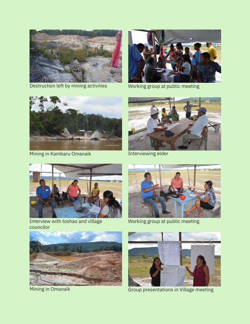
98
Destruction left by mining activities
Working group at public meeting
Mining in Kambaru Omanaik Interviewing elder
Interview with toshao and villagecouncilor
Mining in Omanaik Group presentations in Village meeting
Working group at public meeting
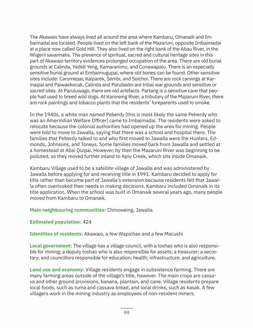
99
The Akawaio have always lived all around the area where Kambaru, Omanaik and Im-baimadai are located. People lived on the left bank of the Mazaruni, opposite Imbaimadai at a place now called Gold Hill. They also lived on the right bank of the Abau River, in the Wiigerii savannahs. The presence of spiritual, sacred and cultural heritage sites in this part of Akawaio territory evidences prolonged occupation of the area. There are old burial grounds at Calinda, Yedidi Yeng, Kamaranimu, and Cunawapalu. There is an especially sensitive burial ground at Embaimugupai, where old bones can be found. Other sensitive sites include: Carumepai, Kaiparek, Sembi, and Soichoi. There are rock carvings at Kar-inaipai and Paiwaekecak. Calinda and Parubadoi are tribal war grounds and sensitive or sacred sites. At Paruluwago, there are old artefacts. Partang is a sensitive cave that peo-ple had used to breed wild dogs. At Karoreing River, a tributary of the Mazaruni River, there are rock paintings and tobacco plants that the residents’ foreparents used to smoke.
In the 1940s, a white man named Peberdy [this is most likely the same Peberdy who was an Amerindian Welfare Officer] came to Imbaimadai. The residents were asked to relocate because the colonial authorities had opened up the area for mining. People were told to move to Jawalla, saying that there was a school and hospital there. The families that Peberdy talked to and who first moved to Jawalla were the Hunters, Ed-monds, Johnsons, and Toneys. Some families moved back from Jawalla and settled at a homestead at Abai Quipai. However, by then the Mazaruni River was beginning to be polluted, so they moved further inland to Apiu Creek, which sits inside Omanaik.
Kambaru Village used to be a satellite village of Jawalla and was administered by Jawalla before applying for and receiving title in 1991. Kambaru decided to apply for title rather than become part of Jawalla’s extension because residents felt that Jawal-la often overlooked their needs in making decisions. Kambaru included Omanaik in its title application. When the school was built in Omanaik several years ago, many people moved from Kambaru to Omanaik.
Main neighbouring communities: Chinoweing, Jawalla
Estimated population: 424
Identities of residents: Akawaio, a few Wapichan and a few Macushi
Local government: The village has a village council, with a toshao who is also responsi-ble for mining; a deputy toshao who is also responsible for assets; a treasurer; a secre-tary; and councillors responsible for education; health; infrastructure; and agriculture.
Land use and economy: Village residents engage in subsistence farming. There are many farming areas outside of the village’s title, however. The main crops are cassa-va and other ground provisions, banana, plantain, and cane. Village residents prepare local foods, such as tuma and cassava bread, and local drinks, such as kasak. A few villagers work in the mining industry as employees of non-resident miners.
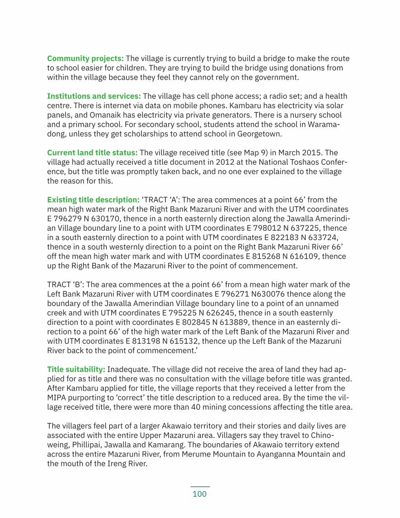
100
Community projects: The village is currently trying to build a bridge to make the route to school easier for children. They are trying to build the bridge using donations from within the village because they feel they cannot rely on the government.
Institutions and services: The village has cell phone access; a radio set; and a health centre. There is internet via data on mobile phones. Kambaru has electricity via solar panels, and Omanaik has electricity via private generators. There is a nursery school and a primary school. For secondary school, students attend the school in Warama-dong, unless they get scholarships to attend school in Georgetown.
Current land title status: The village received title (see Map 9) in March 2015. The village had actually received a title document in 2012 at the National Toshaos Confer-ence, but the title was promptly taken back, and no one ever explained to the village the reason for this.
Existing title description: ‘TRACT ‘A’: The area commences at a point 66’ from the mean high water mark of the Right Bank Mazaruni River and with the UTM coordinates E 796279 N 630170, thence in a north easternly direction along the Jawalla Amerindi-an Village boundary line to a point with UTM coordinates E 798012 N 637225, thence in a south easternly direction to a point with UTM coordinates E 822183 N 633724, thence in a south westernly direction to a point on the Right Bank Mazaruni River 66’ off the mean high water mark and with UTM coordinates E 815268 N 616109, thence up the Right Bank of the Mazaruni River to the point of commencement.
TRACT ‘B’: The area commences at the a point 66’ from a mean high water mark of the Left Bank Mazaruni River with UTM coordinates E 796271 N630076 thence along the boundary of the Jawalla Amerindian Village boundary line to a point of an unnamed creek and with UTM coordinates E 795225 N 626245, thence in a south easternly direction to a point with coordinates E 802845 N 613889, thence in an easternly di-rection to a point 66’ of the high water mark of the Left Bank of the Mazaruni River and with UTM coordinates E 813198 N 615132, thence up the Left Bank of the Mazaruni River back to the point of commencement.’
Title suitability: Inadequate. The village did not receive the area of land they had ap-plied for as title and there was no consultation with the village before title was granted. After Kambaru applied for title, the village reports that they received a letter from the MIPA purporting to ‘correct’ the title description to a reduced area. By the time the vil-lage received title, there were more than 40 mining concessions affecting the title area.
The villagers feel part of a larger Akawaio territory and their stories and daily lives are associated with the entire Upper Mazaruni area. Villagers say they travel to Chino-weing, Phillipai, Jawalla and Kamarang. The boundaries of Akawaio territory extend across the entire Mazaruni River, from Merume Mountain to Ayanganna Mountain and the mouth of the Ireng River.
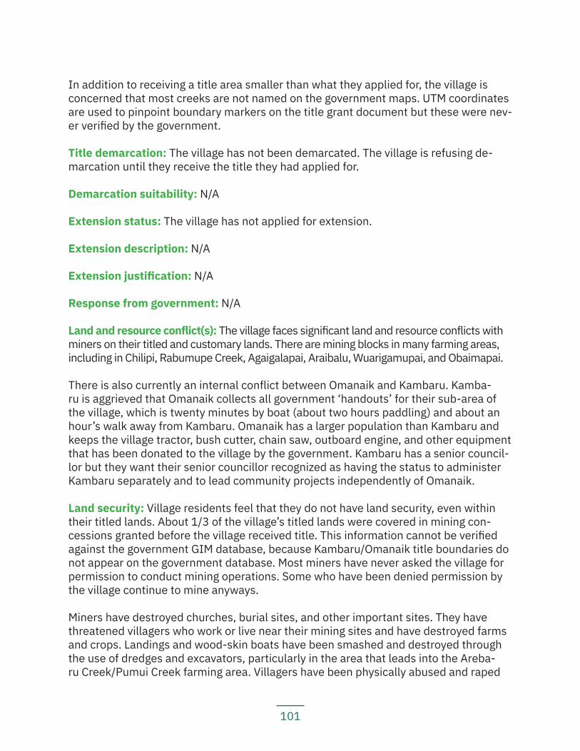
101
In addition to receiving a title area smaller than what they applied for, the village is concerned that most creeks are not named on the government maps. UTM coordinates are used to pinpoint boundary markers on the title grant document but these were nev-er verified by the government.
Title demarcation: The village has not been demarcated. The village is refusing de-marcation until they receive the title they had applied for.
Demarcation suitability: N/A
Extension status: The village has not applied for extension.
Extension description: N/A
Extension justification: N/A
Response from government: N/A
Land and resource conflict(s): The village faces significant land and resource conflicts with miners on their titled and customary lands. There are mining blocks in many farming areas, including in Chilipi, Rabumupe Creek, Agaigalapai, Araibalu, Wuarigamupai, and Obaimapai.
There is also currently an internal conflict between Omanaik and Kambaru. Kamba-ru is aggrieved that Omanaik collects all government ‘handouts’ for their sub-area of the village, which is twenty minutes by boat (about two hours paddling) and about an hour’s walk away from Kambaru. Omanaik has a larger population than Kambaru and keeps the village tractor, bush cutter, chain saw, outboard engine, and other equipment that has been donated to the village by the government. Kambaru has a senior council-lor but they want their senior councillor recognized as having the status to administer Kambaru separately and to lead community projects independently of Omanaik.
Land security: Village residents feel that they do not have land security, even within their titled lands. About 1/3 of the village’s titled lands were covered in mining con-cessions granted before the village received title. This information cannot be verified against the government GIM database, because Kambaru/Omanaik title boundaries do not appear on the government database. Most miners have never asked the village for permission to conduct mining operations. Some who have been denied permission by the village continue to mine anyways.
Miners have destroyed churches, burial sites, and other important sites. They have threatened villagers who work or live near their mining sites and have destroyed farms and crops. Landings and wood-skin boats have been smashed and destroyed through the use of dredges and excavators, particularly in the area that leads into the Areba-ru Creek/Pumui Creek farming area. Villagers have been physically abused and raped
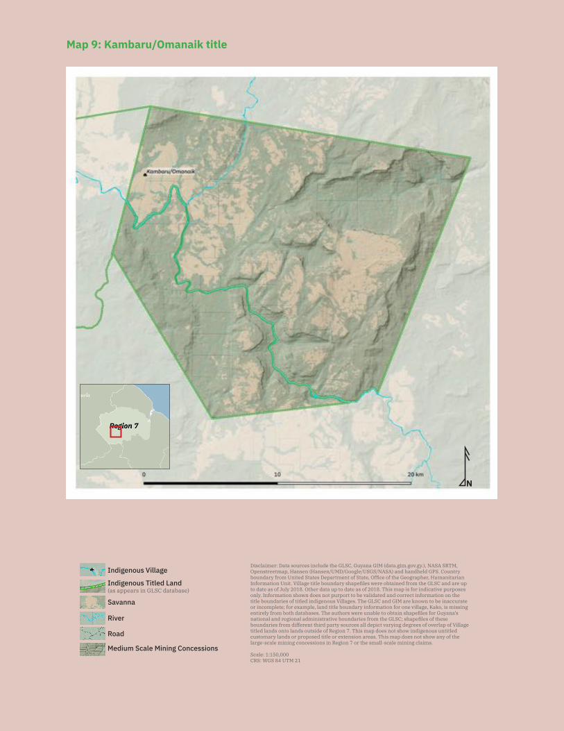
102
N
Disclaimer: Data sources include the GLSC, Guyana GIM (data.gim.gov.gy.), NASA SRTM, Openstreetmap, Hansen (Hansen/UMD/Google/USGS/NASA) and handheld GPS. Country boundary from United States Department of State, Office of the Geographer, Humanitarian Information Unit. Village title boundary shapefiles were obtained from the GLSC and are up to date as of July 2018. Other data up to date as of 2018. This map is for indicative purposes only. Information shown does not purport to be validated and correct information on the title boundaries of titled indigenous Villages. The GLSC and GIM are known to be inaccurate or incomplete; for example, land title boundary information for one village, Kako, is missing entirely from both databases. The authors were unable to obtain shapefiles for Guyana’s national and regional administrative boundaries from the GLSC; shapefiles of these boundaries from different third party sources all depict varying degrees of overlap of Village titled lands onto lands outside of Region 7. This map does not show indigenous untitled customary lands or proposed title or extension areas. This map does not show any of the large-scale mining concessions in Region 7 or the small-scale mining claims.
Scale: 1:150,000CRS: WGS 84 UTM 21
Savanna
Medium Scale Mining Concessions
Road
River
Indigenous Titled Land(as appears in GLSC database)
Indigenous Village
Map 9: Kambaru/Omanaik title
103
by miners. A GGMC official once told the toshao of the village that he was not a real toshao and that their title was invalid. Most of these incidents happened years ago and the village reports that there has not been a recent incident of this nature. Miners are, however, now extracting lumber from the titled lands for housing, as well.
The village has complained to the GGMC many times about conflicts with miners. Village res-idents feel at this point that it is a waste of time complaining to the GGMC because nothing is ever done. They have additionally met with the MIPA, but no solution has been found yet.
The village is worried at the moment about reports that more lands are to be given to miners in Imbaimadai. They have not been consulted about this move by the GGMC and do not want more miners encroaching on their lands and territory.
Village residents also report that there is a Digicel tower on village lands, but the village is receiving no revenue from this tower. The tower was built on land that used to be an active mining concession. The miner working there had dredged away the land, tearing down a resident’s home in the process. After the miner had mined the area and moved out, the Digicel tower was built. The village was not consulted before either the miner or Digicel established their operations on village lands.
Livelihood security and environmental integrity: Village residents do not feel that they have livelihood security and they are concerned about environmental damage. Many farmlands have been destroyed by mining and villagers have to go further to find good land and soil to farm. Miners prevent villagers from building farms on their con-cession areas and from passing through their claims on their way to their village land-ings or to their farming, hunting and fishing areas.
Mining is also causing significant environmental and social concerns. Village residents report that most of the Mazaruni River and its banks have been dredged out. This is causing navigation problems and when the river is low, it is almost impossible to pass in some areas. Mining activities have polluted the rivers and fishing grounds. The heavy mining equipment and machinery have caused game to become scarce, and there has been significant forest loss.
Village residents report, however, that they have food security and there is enough food. Village residents report that they must travel much further to reach other hunting and fishing grounds, however, because they ones close by are polluted or otherwise destroyed.
Recognition and measures sought: The village recommends that:
— The government revoke and cancel all mining concessions that are on their titled lands without their FPIC;
— The government inform the village as to who owns the land situated at the airstrip at Imbaimadai;
104
— The government must legally recognize and give title to the rest of the villa-ge’s traditional lands;
— The government must remove the GGMC office which is on their titled lands; and — The government must discipline the police force and require them to investigate
and prosecute when villagers report incidents of beatings of villagers by miners.
5.1.6 ParuimaKey findings:
— Paruima received title in 1991. — Paruima’s title excludes some of their hunting, fishing, and gathering
grounds, as well as some farming grounds and homesteads. — Paruima is one of the six villages in the Upper Mazaruni case seeking legal
recognition for the larger traditional Akawaio and Arecuna territory. — Paruima has refused demarcation because it is currently seeking legal reco-
gnition to a collective territory as opposed to individual, piecemeal titles. — There are many mining concessions in the village’s titled and untitled lands
that were granted without the village’s FPIC. — The village is concerned that a recently activated airstrip north of the village
could become a hub for illegal activity, particularly coming from Venezuela. — Villagers are concerned that climate change is causing rising river water le-
vels, which is making it more difficult for them to catch fish using traditional poisoning methods.
— Although mining activity around the village is limited at the moment, villagers have reported that miners have prevented them from hunting and fishing at va-rious places where there are mining concessions, including Werubang, Karabu, and Ekereku Creeks/Rivers.
Location: Upper Mazaruni, Region 7
History: The present-day village came together in 1930 when an Adventist named Gonzalves encouraged people to come together to a central settlement. However, families were living at Paruima River mouth (in present-day Venezuela), Komarau River, along the Kamarang River and the surrounding areas long before this. The founding families of the current village were the Chambers, Percys, Henritos, and McNaughtons.
Elders recall that the Adventist religion took hold in the region when a white man named O.E. Davis passed through Paruima on his way to Mount Roraima to meet Auka (an indigenous prophet) in 1911. At the time, Paruima had not been established as a village, but people were living in various places around it, including in Ulalamape (on the trail to Kaikan), up the Paruima River.
The long-standing occupation of the area is evidenced by the many important spiritu-
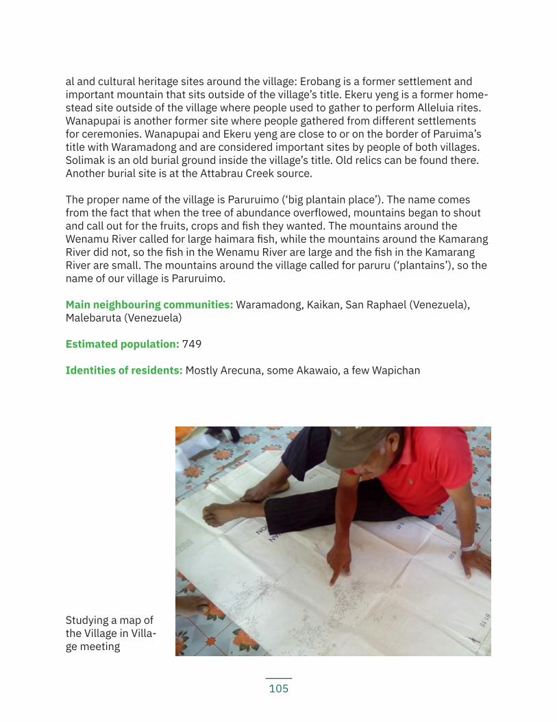
105
al and cultural heritage sites around the village: Erobang is a former settlement and important mountain that sits outside of the village’s title. Ekeru yeng is a former home-stead site outside of the village where people used to gather to perform Alleluia rites. Wanapupai is another former site where people gathered from different settlements for ceremonies. Wanapupai and Ekeru yeng are close to or on the border of Paruima’s title with Waramadong and are considered important sites by people of both villages. Solimak is an old burial ground inside the village’s title. Old relics can be found there. Another burial site is at the Attabrau Creek source.
The proper name of the village is Paruruimo (‘big plantain place’). The name comes from the fact that when the tree of abundance overflowed, mountains began to shout and call out for the fruits, crops and fish they wanted. The mountains around the Wenamu River called for large haimara fish, while the mountains around the Kamarang River did not, so the fish in the Wenamu River are large and the fish in the Kamarang River are small. The mountains around the village called for paruru (‘plantains’), so the name of our village is Paruruimo.
Main neighbouring communities: Waramadong, Kaikan, San Raphael (Venezuela), Malebaruta (Venezuela)
Estimated population: 749
Identities of residents: Mostly Arecuna, some Akawaio, a few Wapichan
Studying a map of the Village in Villa-ge meeting
106
Local government: A village council comprised of a toshao also responsible for social work; a vice toshao also responsible for sports; a secretary; a treasurer; an assistant secretary/treasurer; and councillors responsible for works and infrastructure; consum-ables, goods and protection; health; ensuring that tools and equipment are accounted for; equipment and maintenance; and mining.
Land use and economy: Village residents engage in subsistence farming. Some of their farming grounds are shared with neighbouring communities, including with commu-nities in Venezuela. Some farming areas are bodawa (reserved areas). The main crops grown include: cassava and other ground provisions, beans, bananas, plantains, cal-laloo, bora, okra, corilla, pumpkin, watermelon, and citrus fruits. Villagers prepare local foods, including cassava bread and tuma. Villagers report that their favourite drinks are fresh plantain and banana juice.
Villagers also go fishing, and many fishing grounds are outside of the title and shared with neighbouring communities. Hunting grounds in the title are diminishing, so people are going further out and traveling far away to hunt. Villagers also gather materials for crafting and building; as with the hunting and fishing grounds, many of these gathering grounds are outside title and are shared with neighbouring communities. A few residents engage in seasonal, traditional batel and spade mining, and a few families use small dredges to mine.
Community projects: The village is engaged in a community project to improve the infrastructure around the community, including by building bridges.
Institutions and services: The village has a radio at the health post; private internet access; electricity via solar panels, a village generator and private generators; a health post; a nursery school; a primary school; and a school run by missionaries from grade seven upwards. For secondary school, students attend the school in Waramadong, unless they have a scholarship to go to school in Georgetown.
Current land title status: The village was granted title in 1991. Its title is listed under the amended schedule to the Amerindian Act and recorded as an absolute grant under the State Lands Act.
Existing title description: ‘A tract of state land situate on the Right Bank Kamarang River, commencing at the mouth of the Attabrao Creek to the top of the Attabrao Falls, thence south along the watershed of the Kamarang river, to the Guyana-Venezuela Border, thence north west along the Guyana-Venezuela Border to the source of the of the Wenamu River, thence east along the existing Upper Mazaruni District to the Holitipu Mountain, thence to the source of the Ubai Creek, Left Bank Kamarang River, thence down the Ubai Creek to its mouth, thence down the Kamarang River to the point of commencement.’
Title suitability: Inadequate. Village residents report that they were never consulted before title was granted; that they requested a larger individual village title and also that
107
they had requested collective territorial title with other villages. The village’s title is small-er than what they had requested. More importantly, though, the village is disappointed that the ALC and the government ignored their request for joint and collective title.
During the ALC investigation, Paruima requested ‘The area enclosed by the watershed of the Kamarang River from the Attabrao Creek to the Venezuelan border including the Paruima River watershed.’
The area recommended was ‘The area commencing at the mouth of the Attabrao Creek, right bank Kamarang River, left bank Mazaruni River, thence up the Attabrao Creek to the top of the Attabrao Falls, thence south along the watershed of the Kama-rang River to the Guyana-Venezuelan border, thence north-west along the Guyana-Ven-ezuelan border to the source of the Wenamu River, thence east along the boundary of the existing Upper Mazaruni District to Holitipu Mountain, thence to the source of the Ubai Creek, left bank Kamarang River, thence down the Ubai Creek to its mouth, thence down the Kamarang River to the point of commencement.’
The title granted to Paruima in 1991 is identical to the area recommended by the ALC. The ALC had noted that it ‘considers the following area necessary for subsistence and development needs.’
However, Village residents need and use areas outside of the present title: they hunt on the Karayeng Mountain range; there are farms, homesteads, and house materials on the right bank of the Attabrau River; and they hunt and fish in the Imatai mountains and savannahs.
The official map of the title differs from the village’s title description (see Map 10), and the title does not quite make sense in several respects: (1) the map shows Attabrao Falls in the wrong place; (2) the boundary line from Attabrao heads south west instead of south from the point above, but based on the title description, the line should go due south to include more of the land around the Kamarang River; (3) the title extends to the source of the Wenamu River, which is in Venezuela; (4) there is uncertainty about where precisely the Mazaruni District boundary, which describes the northern title boundary, falls; (5) the title describes a point on Mount Holitipu, but the map shows this point at a different location than where the village knows it to be; and (6) the title describes a point on the source of the Ubai Creek, but the map shows this point at a location different from where the village knows it to be.
Aside from the deficiencies in the village’s individual title, Paruima was one of six villag-es in the Upper Mazaruni that requested joint and collective title to the 3,000 square miles of the 1959 Upper Mazaruni District boundaries in the ALC process. This request was ignored, and in 1998, the six villages took the Government of Guyana to court to seek legal recognition of their traditional territory (see Section 3.5).
Title demarcation: The village has not been demarcated and is refusing demarcation
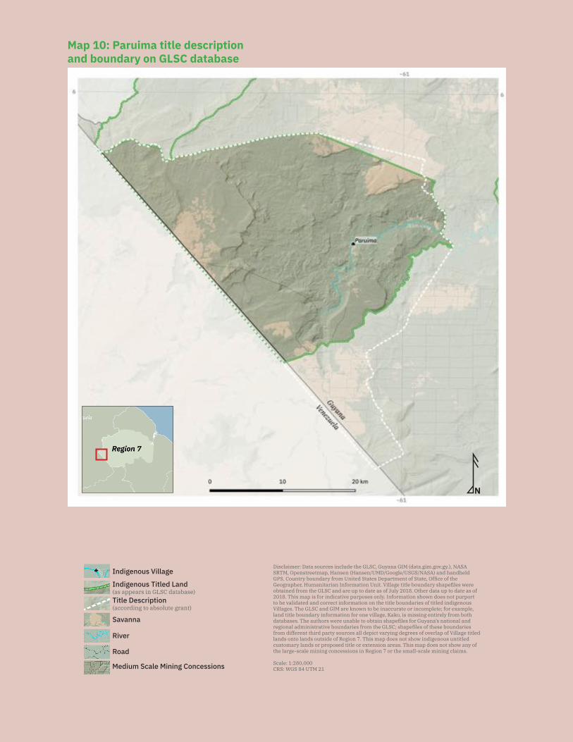
108
N
Savanna
Medium Scale Mining Concessions
Road
River
Indigenous Village
Title Description (according to absolute grant)
Disclaimer: Data sources include the GLSC, Guyana GIM (data.gim.gov.gy.), NASA SRTM, Openstreetmap, Hansen (Hansen/UMD/Google/USGS/NASA) and handheld GPS. Country boundary from United States Department of State, Office of the Geographer, Humanitarian Information Unit. Village title boundary shapefiles were obtained from the GLSC and are up to date as of July 2018. Other data up to date as of 2018. This map is for indicative purposes only. Information shown does not purport to be validated and correct information on the title boundaries of titled indigenous Villages. The GLSC and GIM are known to be inaccurate or incomplete; for example, land title boundary information for one village, Kako, is missing entirely from both databases. The authors were unable to obtain shapefiles for Guyana’s national and regional administrative boundaries from the GLSC; shapefiles of these boundaries from different third party sources all depict varying degrees of overlap of Village titled lands onto lands outside of Region 7. This map does not show indigenous untitled customary lands or proposed title or extension areas. This map does not show any of the large-scale mining concessions in Region 7 or the small-scale mining claims.
Scale: 1:280,000CRS: WGS 84 UTM 21
Indigenous Titled Land(as appears in GLSC database)
Kamarang
Map 10: Paruima title description and boundary on GLSC database
109
until the resolution of the Upper Mazaruni court case.
Demarcation suitability: N/A
Extension status: The village has not applied for extension because of the pending Upper Mazaruni court case.
Extension description: N/A
Extension justification: N/A
Response from government: N/A
Land and resource conflict(s): The village has faced some land and resource con-flicts with miners. The village reports that there are mining concessions granted on the village’s untitled traditional lands, and the village was never consulted prior to the granting of these mining concessions. The government GIM website does not show any mining concessions in the village’s title but shows that the village title is surrounded by mining concessions. Residents report that outside miners have prevented villag-ers from hunting and fishing at Werubang Creek, Karabu [alt. sp. ‘Karabo’] Creek and Mountain, and at Ekereku River. These incidents were few though, and residents report that thus far, mining activity is limited.
Land security: The village does not feel that it has secure land tenure, both because of its inadequate title and because it feels that it has a lack of authority over activities on its lands, even titled lands. The village has not been consulted prior to the granting of mining concessions in its lands. The village has had some success in complaining to the GGMC about mining taking place in their traditional lands, however. For example, some miners had been mining in Meruwang Creek, which is a homestead outside of the village’s title where people used to live at the creek head. In that case, after submitting a complaint to the GGMC, GGMC personnel came in and ordered the miners to cease working and to leave. Vil-lagers cannot recall if the reason the GGMC took their complaint seriously was because the miners had no valid concession or they were mining illegally too close to persons’ homes.
Aside from mining, the village is concerned about security issues as a result of the airstrips north of their title boundary that have recently become active. The village is worried that these airstrips are very close to the Venezuela border and might be used for illegal activities.
The village is additionally concerned about research activities which took place in the Wakaoweng/Aagauyeng area, which is a bodawa and inside the village’s titled lands. The village reports that some researchers visited the area a few years ago and said they were studying bats. However, they have heard that the researchers are returning to visit again, and the village does not know why. Villagers report that they were not
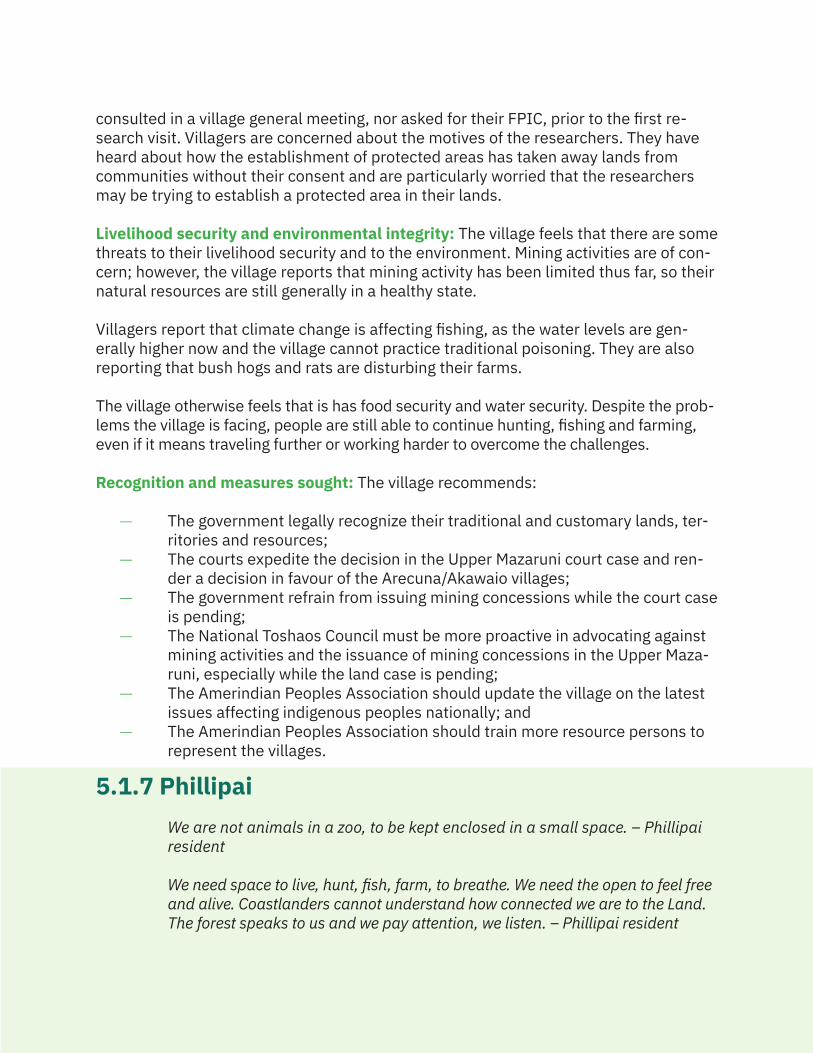
110
consulted in a village general meeting, nor asked for their FPIC, prior to the first re-search visit. Villagers are concerned about the motives of the researchers. They have heard about how the establishment of protected areas has taken away lands from communities without their consent and are particularly worried that the researchers may be trying to establish a protected area in their lands.
Livelihood security and environmental integrity: The village feels that there are some threats to their livelihood security and to the environment. Mining activities are of con-cern; however, the village reports that mining activity has been limited thus far, so their natural resources are still generally in a healthy state.
Villagers report that climate change is affecting fishing, as the water levels are gen-erally higher now and the village cannot practice traditional poisoning. They are also reporting that bush hogs and rats are disturbing their farms.
The village otherwise feels that is has food security and water security. Despite the prob-lems the village is facing, people are still able to continue hunting, fishing and farming, even if it means traveling further or working harder to overcome the challenges.
Recognition and measures sought: The village recommends:
— The government legally recognize their traditional and customary lands, ter-ritories and resources;
— The courts expedite the decision in the Upper Mazaruni court case and ren-der a decision in favour of the Arecuna/Akawaio villages;
— The government refrain from issuing mining concessions while the court case is pending;
— The National Toshaos Council must be more proactive in advocating against mining activities and the issuance of mining concessions in the Upper Maza-runi, especially while the land case is pending;
— The Amerindian Peoples Association should update the village on the latest issues affecting indigenous peoples nationally; and
— The Amerindian Peoples Association should train more resource persons to represent the villages.
5.1.7 PhillipaiWe are not animals in a zoo, to be kept enclosed in a small space. – Phillipai resident
We need space to live, hunt, fish, farm, to breathe. We need the open to feel free and alive. Coastlanders cannot understand how connected we are to the Land. The forest speaks to us and we pay attention, we listen. – Phillipai resident
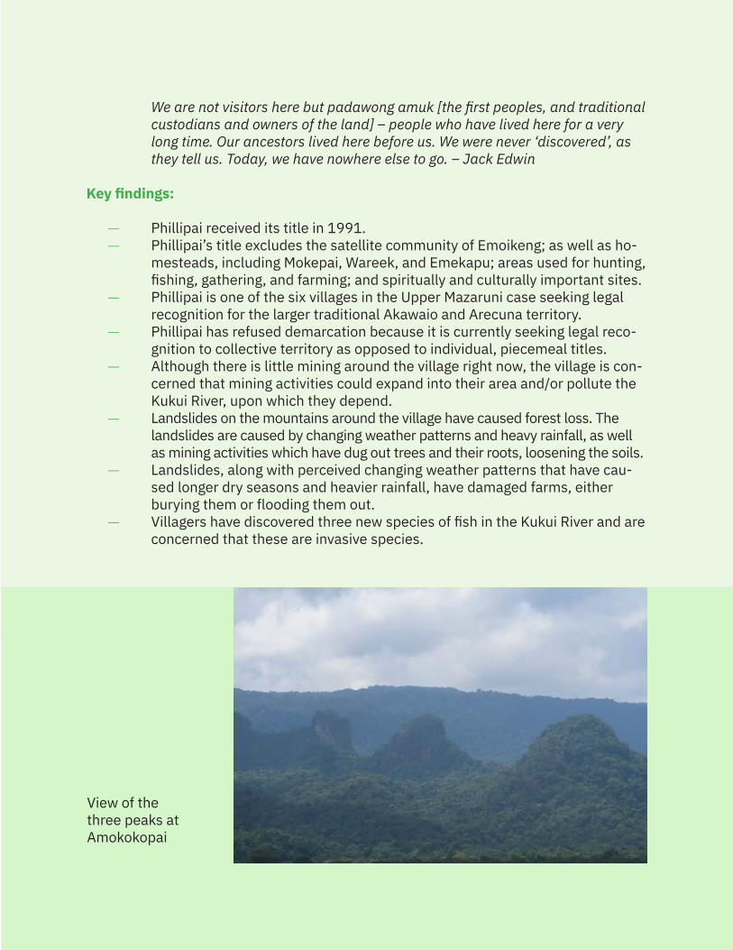
111
We are not visitors here but padawong amuk [the first peoples, and traditional custodians and owners of the land] – people who have lived here for a very long time. Our ancestors lived here before us. We were never ‘discovered’, as they tell us. Today, we have nowhere else to go. – Jack Edwin
Key findings:
— Phillipai received its title in 1991. — Phillipai’s title excludes the satellite community of Emoikeng; as well as ho-
mesteads, including Mokepai, Wareek, and Emekapu; areas used for hunting, fishing, gathering, and farming; and spiritually and culturally important sites.
— Phillipai is one of the six villages in the Upper Mazaruni case seeking legal recognition for the larger traditional Akawaio and Arecuna territory.
— Phillipai has refused demarcation because it is currently seeking legal reco-gnition to collective territory as opposed to individual, piecemeal titles.
— Although there is little mining around the village right now, the village is con-cerned that mining activities could expand into their area and/or pollute the Kukui River, upon which they depend.
— Landslides on the mountains around the village have caused forest loss. The landslides are caused by changing weather patterns and heavy rainfall, as well as mining activities which have dug out trees and their roots, loosening the soils.
— Landslides, along with perceived changing weather patterns that have cau-sed longer dry seasons and heavier rainfall, have damaged farms, either burying them or flooding them out.
— Villagers have discovered three new species of fish in the Kukui River and are concerned that these are invasive species.
View of the three peaks at Amokokopai
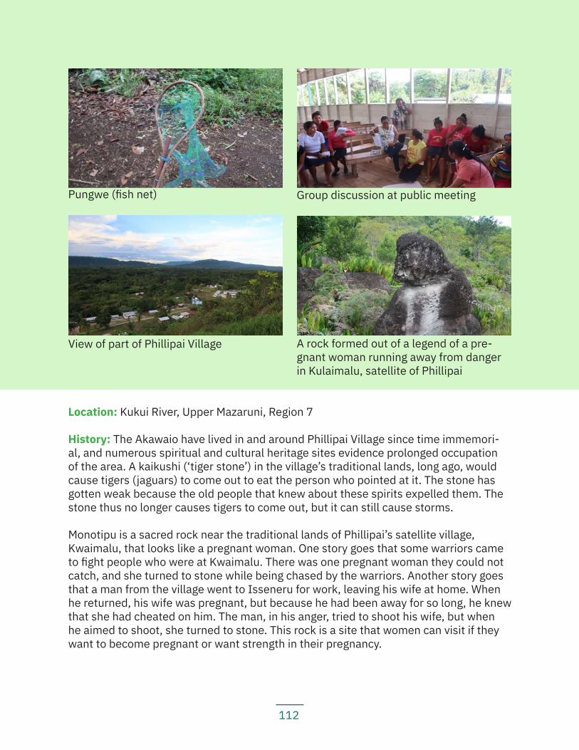
112
Location: Kukui River, Upper Mazaruni, Region 7
History: The Akawaio have lived in and around Phillipai Village since time immemori-al, and numerous spiritual and cultural heritage sites evidence prolonged occupation of the area. A kaikushi (‘tiger stone’) in the village’s traditional lands, long ago, would cause tigers (jaguars) to come out to eat the person who pointed at it. The stone has gotten weak because the old people that knew about these spirits expelled them. The stone thus no longer causes tigers to come out, but it can still cause storms.
Monotipu is a sacred rock near the traditional lands of Phillipai’s satellite village, Kwaimalu, that looks like a pregnant woman. One story goes that some warriors came to fight people who were at Kwaimalu. There was one pregnant woman they could not catch, and she turned to stone while being chased by the warriors. Another story goes that a man from the village went to Isseneru for work, leaving his wife at home. When he returned, his wife was pregnant, but because he had been away for so long, he knew that she had cheated on him. The man, in his anger, tried to shoot his wife, but when he aimed to shoot, she turned to stone. This rock is a site that women can visit if they want to become pregnant or want strength in their pregnancy.
Pungwe (fish net) Group discussion at public meeting
View of part of Phillipai Village A rock formed out of a legend of a pre-gnant woman running away from danger in Kulaimalu, satellite of Phillipai
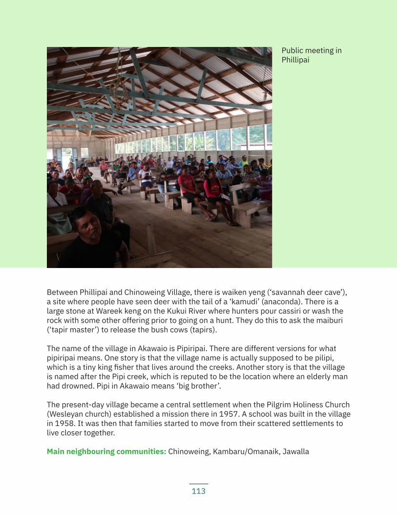
113
Between Phillipai and Chinoweing Village, there is waiken yeng (‘savannah deer cave’), a site where people have seen deer with the tail of a ‘kamudi’ (anaconda). There is a large stone at Wareek keng on the Kukui River where hunters pour cassiri or wash the rock with some other offering prior to going on a hunt. They do this to ask the maiburi (‘tapir master’) to release the bush cows (tapirs).
The name of the village in Akawaio is Pipiripai. There are different versions for what pipiripai means. One story is that the village name is actually supposed to be pilipi, which is a tiny king fisher that lives around the creeks. Another story is that the village is named after the Pipi creek, which is reputed to be the location where an elderly man had drowned. Pipi in Akawaio means ‘big brother’.
The present-day village became a central settlement when the Pilgrim Holiness Church (Wesleyan church) established a mission there in 1957. A school was built in the village in 1958. It was then that families started to move from their scattered settlements to live closer together.
Main neighbouring communities: Chinoweing, Kambaru/Omanaik, Jawalla
Public meeting in Phillipai
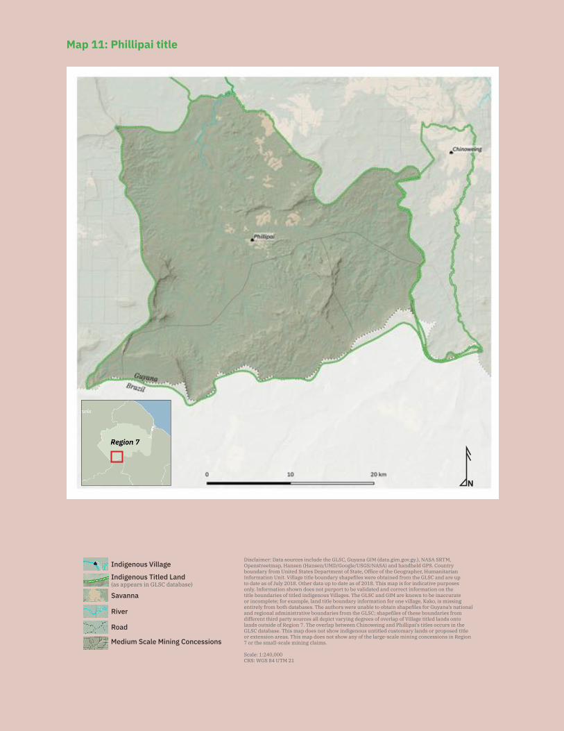
114
N
Savanna
Medium Scale Mining Concessions
Road
River
Indigenous VillageDisclaimer: Data sources include the GLSC, Guyana GIM (data.gim.gov.gy.), NASA SRTM, Openstreetmap, Hansen (Hansen/UMD/Google/USGS/NASA) and handheld GPS. Country boundary from United States Department of State, Office of the Geographer, Humanitarian Information Unit. Village title boundary shapefiles were obtained from the GLSC and are up to date as of July 2018. Other data up to date as of 2018. This map is for indicative purposes only. Information shown does not purport to be validated and correct information on the title boundaries of titled indigenous Villages. The GLSC and GIM are known to be inaccurate or incomplete; for example, land title boundary information for one village, Kako, is missing entirely from both databases. The authors were unable to obtain shapefiles for Guyana’s national and regional administrative boundaries from the GLSC; shapefiles of these boundaries from different third party sources all depict varying degrees of overlap of Village titled lands onto lands outside of Region 7. The overlap between Chinoweing and Phillipai’s titles occurs in the GLSC database. This map does not show indigenous untitled customary lands or proposed title or extension areas. This map does not show any of the large-scale mining concessions in Region 7 or the small-scale mining claims.
Scale: 1:240,000CRS: WGS 84 UTM 21
Indigenous Titled Land(as appears in GLSC database)
Map 11: Phillipai title
115
Estimated population: 1,440 (382 households)
Identities of residents: Akawaio
Local government: A village council comprised of a toshao; vice toshao; treasurer; sec-retary; councillors for agriculture, sports, education, health, mining, and forestry; and two other councillors.
Land use and economy: Village residents engage in subsistence farming. Crops farmed include: cassava, yam, dasheen, eddo, banana, plantain, tangerine, orange, corn, beans, and pepper. Prepared foods in the village include fish and meat tuma, caterpillars, frogs, farine, and cassava bread. Village residents also make different local drinks including cassiri, parakari, piwari, yam juice, cane juice, banana wine, pump-kin wine, and pine juice. Village residents go hunting and fishing and gather material for crafts and building. There are numerous farming, hunting, fishing and gathering grounds which sit outside the village’s title.
Community projects: government-funded projects include building an airstrip; clean-ing the river; a village shop; an outboard motor for the school; and a village boat.
Institutions and services: The village has a radio set; electricity generated through so-lar panels and private generators; a health post with two health workers and one mid-wife; an environmental field assistant; one microscope; a nursery school; and a primary school. For secondary school, students attend the school in Waramadong.
Current land title status: The village was granted title (see Map 11) in 1991. Its title is listed under the amended schedule to the Amerindian Act and recorded as an absolute grant under the State Lands Act.
Existing title description: ‘A tract of State land situate on the Left Bank Haieka River, Left Bank Mazaruni River, commencing at the mouth of an unnamed creek, Right Bank Kukui River one mile below the Mouth of Agageng Creek, thence up the said unnamed Creek to its source, thence South along the watershed between the Kukui and Haieka Rivers to the Guyana-Brazil Boundary mark no. 13, thence West along the Guyana- Brazil Boundary to the source of Ataro River, thence North along the watershed between the Ataro and the Arabaio Rivers to the source of an unnamed Creek, left Bank Kukui River, the Mouth being a little below and opposite the starting point of this Area, thence down the said unnamed Creek to its Mouth, thence up the Kukui River to the point of commencement.’
Title suitability: Inadequate. The village’s title does not reflect the extent of its customary lands, and the village was not consulted before receiving title. No FPIC process was followed.
Although the village was visited during the ALC investigation, their request for legal rec-ognition of their customary lands was ignored. In the ALC Report, Phillipai is recorded
116
as having requested: ‘The area enclosed by the Kukui-Ataro watershed extending down the Kukui River to the mouth of the Emoi Creek on the right bank Kukui River.’
The village reports that this was not a community recommendation; they are unclear who gave this request to the ALC.
The ALC recommended area was: ‘The area commencing at the mouth of an unnamed creek, right bank Kukui River one mile below the mouth of Abageng Creek, thence up the said unnamed creek to its source; thence south along the watershed between the Kukui and Haieka Rivers to Guyana-Brazil boundary mark No. 13 - source of the Ireng River - thence west along the Guyana-Brazil boundary to the source of the Ataro River, thence north along the watershed between the Ataro and Arabaro Rivers to the source of an unnamed creek, left bank Kukui River, the mouth being a little below and oppo-site the starting point of this area, thence down the said unnamed creek to its mouth, thence up the Kukui River to the point of commencement.’
The title granted in 1991 is identical to the title recommended by the ALC, with a few misspellings. Village residents have noted that many places are incorrectly named or misspelt on their title description and grant maps. In the title description, the ‘Arabaio River’ is a misspelling of the Arubaru River (spelled ‘Arabaro’ in the ALC Report), which is a tributary of the Kako River. The ‘Agageng Creek’ is a misspelling of the Abageng Creek, a tributary of the Kukui River. The ‘Haieka River’ in the title description (and in the ALC description) is actually the Aga River. There are two ‘unnamed Creeks’ in the title description. One is the Emekapu Creek, which connects to the Arubaru (‘Arabaio’) River. Another ‘unnamed Creek’ in the title description is Uamo Creek, which does not connect to the Arubaru River.
The ALC noted that it ‘considers the area recommended as being necessary for their subsistence and development needs’.
However, village residents complain that the title is not adequate. One satellite com-munity, Emoikeng, currently sits outside of the village’s title, as do a few homesteads. Areas used for hunting, fishing, gathering and farming, as well as sites that are sacred or otherwise have historical significance for the Akawaio people are not included in the village’s land title. The village reports that for now, they would like these sites to be included in the village’s title, but if they receive title to the Upper Mazaruni district, they would all be within this larger territory.
The village has self-described boundaries of traditional Akawaio and Arecuna territory as: ‘From Tangwanamu, Wenamu, to Roraima, Pakaraimas, Ireng River, Wayagabang to Keybizick, Ayangana, Uruparu, Lower Mazaruni River, Middle and Upper Mazaruni Rivers, Issano, Kurupung, Isseneru.’ They know their traditional territory to extend throughout the Mazaruni, into both the Middle and Lower Mazaruni. Phillipai was one of the six villages in the Upper Mazaruni to request joint and collective title to the
117
3,000 square miles of the 1959 Upper Mazaruni District boundaries through the Upper Mazaruni court case (see Section 3.5).
Title demarcation: The village has not been demarcated. The village has repeatedly rejected the past and present government demarcation process as unjust and unfair, and the village is refusing demarcation until the Upper Mazaruni court case is resolved and they have joint and collective title to one Upper Mazaruni territory.
Demarcation suitability: N/A
Extension status: The village has not applied for extension to its current titled lands because it is awaiting a decision in the Upper Mazaruni court case.
Extension description: N/A
Extension justification: N/A
Response from government: N/A
Land and resource conflict(s): Village residents currently have no complaints about resource conflicts. Indeed, the village was unaware until the research team visited that there is one medium-scale mining concession on its titled lands, according to the gov-ernment GIM website. Since the time the report was being researched, the village had its first direct interaction with miners trying to build a road through village customary untitled lands on their way to their concessions. The miners did not ask for the village’s permission to build the roads. When confronted by the village, the miners told them that the village had no control over those lands and would continue building the road.
Land security: The village does not feel that it has full land tenure security. Village residents are concerned about the lack of full protection for resource rights on titled lands. Although at present residents have not experienced any particular resource con-flicts in the village, they are worried that lack of legal protections over resources means they would lack any control over potential resource conflicts if the government were to give out mining concessions on or near their lands. Mining outside of village lands could still severely impact the village if the mining activities pollute rivers like the Kukui River.
Livelihood security and environmental integrity: Village residents feel that they lack food security — the lands in and near the village have been used up for crops sever-al times and the soil is currently not suitable for producing all the types of crops they need to grow. The forests around the village have been degraded by landslides. Land-slides, in addition to long dry seasons and heavy rainfall, have damaged farms, either burying them or causing the farms to flood and crops to rot. Some residents of the village consider that the landslides may be caused in part by mining activities outside the village which have been damaging roots and causing erosion of soil.
118
Although the village has no specific complaints about environmental harms at the mo-ment, residents have recently discovered three new species of fish in the Kukui River. They are concerned they might be invasive species.
Recognition and measures sought: The village residents recommend that:
— The government revise existing laws so that indigenous peoples can legally own their lands, territories, and resources, including subsoil resources and waterways;
— The government should refrain from issuing any mining concessions on indi-genous titled and customary lands;
— The villages of the Upper Mazaruni should meet and make a plan together on how to protect their waterways;
— Other indigenous villages around Guyana should support the Upper Mazaruni lawsuit;
— Other indigenous villages seeking collective legal ownership of their traditional territories should take the government to court, like the Upper Mazaruni has;
— All indigenous communities must not give up the struggle for their lands, and they must continue to fight for their rights;
— The National Toshaos Council should support the Upper Mazaruni lawsuit; and — The village council must keep the village updated on issues relevant to indi-
genous peoples in Guyana and elsewhere
5.1.8 WaramadongKey findings:
— Waramadong received its title in 1991. — Waramadong’s title excludes many hunting, fishing, gathering, and farming
grounds, as well as important spiritual and cultural sites. — Meruwang, a satellite community of Waramadong, was recommended for
title in the ALC Report, but neither received title nor is included within Wara-madong’s title.
— The ‘Kukui’ Creek named in Waramadong’s title should be the ‘Tukuk’ Creek. As the title actually reads, Waramadong’s title encompasses several of the other villages in the Upper Mazaruni.
— Waramadong is one of the six villages in the Upper Mazaruni case seeking legal recognition for the larger traditional Akawaio and Arecuna territory.
— Waramadong has refused demarcation because it is currently seeking legal recognition to collective territory as opposed to individual, piecemeal titles.
— Mining activities have affected some farming grounds in the village. Miners have also defaced some cultural heritage sites, such as rock paintings on the Ekereku River.
— Mining activities have polluted their waters and led to a decrease in both the size and quantity of fish in the rivers. Villagers also suspect that mining activi-
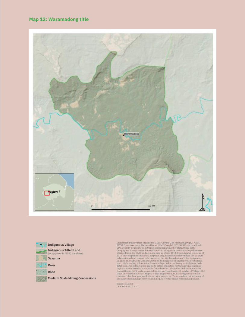
119
N
Savanna
Medium Scale Mining Concessions
Road
River
Indigenous VillageDisclaimer: Data sources include the GLSC, Guyana GIM (data.gim.gov.gy.), NASA SRTM, Openstreetmap, Hansen (Hansen/UMD/Google/USGS/NASA) and handheld GPS. Country boundary from United States Department of State, Office of the Geographer, Humanitarian Information Unit. Village title boundary shapefiles were obtained from the GLSC and are up to date as of July 2018. Other data up to date as of 2018. This map is for indicative purposes only. Information shown does not purport to be validated and correct information on the title boundaries of titled indigenous Villages. The GLSC and GIM are known to be inaccurate or incomplete; for example, land title boundary information for one village, Kako, is missing entirely from both databases. The authors were unable to obtain shapefiles for Guyana’s national and regional administrative boundaries from the GLSC; shapefiles of these boundaries from different third party sources all depict varying degrees of overlap of Village titled lands onto lands outside of Region 7. This map does not show indigenous untitled customary lands or proposed title or extension areas. This map does not show any of the large-scale mining concessions in Region 7 or the small-scale mining claims.
Scale: 1:150,000CRS: WGS 84 UTM 21
Indigenous Titled Land(as appears in GLSC database)
Map 12: Waramadong title
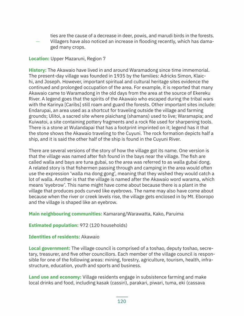
120
ties are the cause of a decrease in deer, powis, and marudi birds in the forests. — Villagers have also noticed an increase in flooding recently, which has dama-
ged many crops.
Location: Upper Mazaruni, Region 7
History: The Akawaio have lived in and around Waramadong since time immemorial. The present-day village was founded in 1935 by the families: Adricks Simon, Klaic-hi, and Joseph. However, important spiritual and cultural heritage sites evidence the continued and prolonged occupation of the area. For example, it is reported that many Akawaio came to Waramadong in the old days from the area at the source of Ekereku River. A legend goes that the spirits of the Akawaio who escaped during the tribal wars with the Karinya [Caribs] still roam and guard the forests. Other important sites include: Endarupai, an area used as a shortcut for traveling outside the village and farming grounds; Ulitoi, a sacred site where piaichang (shamans) used to live; Waramapia; and Kuiwatoi, a site containing pottery fragments and a rock file used for sharpening tools. There is a stone at Wulandapai that has a footprint imprinted on it; legend has it that the stone shows the Akawaio traveling to the Cuyuni. The rock formation depicts half a ship, and it is said the other half of the ship is found in the Cuyuni River.
There are several versions of the story of how the village got its name. One version is that the village was named after fish found in the bays near the village. The fish are called walla and bays are tuna gubai, so the area was referred to as walla gubai dong. A related story is that fishermen passing through and camping in the area would often use the expression ‘walla ma dong gong’, meaning that they wished they would catch a lot of walla. Another is that the village is named after the Akawaio word warama, which means ‘eyebrow’. This name might have come about because there is a plant in the village that produces pods curved like eyebrows. The name may also have come about because when the river or creek levels rise, the village gets enclosed in by Mt. Eboropo and the village is shaped like an eyebrow.
Main neighbouring communities: Kamarang/Warawatta, Kako, Paruima
Estimated population: 972 (120 households)
Identities of residents: Akawaio
Local government: The village council is comprised of a toshao, deputy toshao, secre-tary, treasurer, and five other councillors. Each member of the village council is respon-sible for one of the following areas: mining, forestry, agriculture, tourism, health, infra-structure, education, youth and sports and business.
Land use and economy: Village residents engage in subsistence farming and make local drinks and food, including kasak (cassiri), parakari, piwari, tuma, eki (cassava
121
bread), and farine. Village residents go hunting and fishing and travel to gather materi-als for crafts and building. Many hunting and fishing sites are shared with neighbouring communities, and some are outside of the village’s title. Some gathering grounds are also outside of the village’s title; notably, to obtain clay for making pots, villagers have to go to Quebenang, the satellite village of Jawalla, which is outside the village’s title. Some villagers engage in mining activities, with some working for themselves and oth-ers working as employees of non-resident miners.
Community projects: The village has an ongoing agricultural project to build a farm to plant cassava and other vegetables as an economic venture. They have a newly built industrial training centre and they are planning to start physical education classes.
Institutions and services: The village has access to a mobile network in a few hotspots in the village; a radio at the health post; electricity through solar panels and private generators; internet service at the schools; a health post with a resident doctor, nurse, and health worker; a nursery school; a primary school; and a secondary school, the D.C. Caesar Fox Secondary School, with 423 students enrolled (171 male and 252 female).
Current land title status: The village was granted title (see Map 12) in 1991. Its title is listed under the amended schedule to the Amerindian Act and recorded as an absolute grant under the State Lands Act.
Existing title description: ‘A tract of state land situate on the Right Bank, Kamarang River commencing at the Mouth of Abaru Creek. Left Bank Kamarang River, Left Bank Mazaruni River, Thence up the Abaru Creek, to its Source, thence North to Puluwatapu Mountain and the boundary of the existing Upper Mazaruni District, thence South West along the said boundary for 12 miles, thence South to the source of an unnamed creek, Left Bank Kamarang River, thence down the said unnamed creek, to its mouth thence down the Kamarang River, thence down the said unnamed creek to its mouth thence down the Kamarang River to the Shuwowyeng Creek, Right Bank Kamarang River, thence up the Shuwowyeng Creek to its source, thence East along the water shed of the Right Bank, Kamarang River to Eboropu Mountain, thence down the Kukui Creek to its Mouth Right Bank Kamarang River, thence up the Kamarang River to Abaru Creek to the point of commencement.’
Title suitability: Inadequate. In the process of granting of the title, the requests and recommendations by the village were ignored.
During the ALC investigation, the village reportedly requested the area: ‘Both banks of the Kamarang River to the watersheds north and south of the river from Kaikandabu downstream to the bottom of ‘Canoe Haulover’.’
Villagers report that this is not an accurate description of what they consider to be their traditional lands, however. In turn, the ALC recommended: ‘The area commencing at the
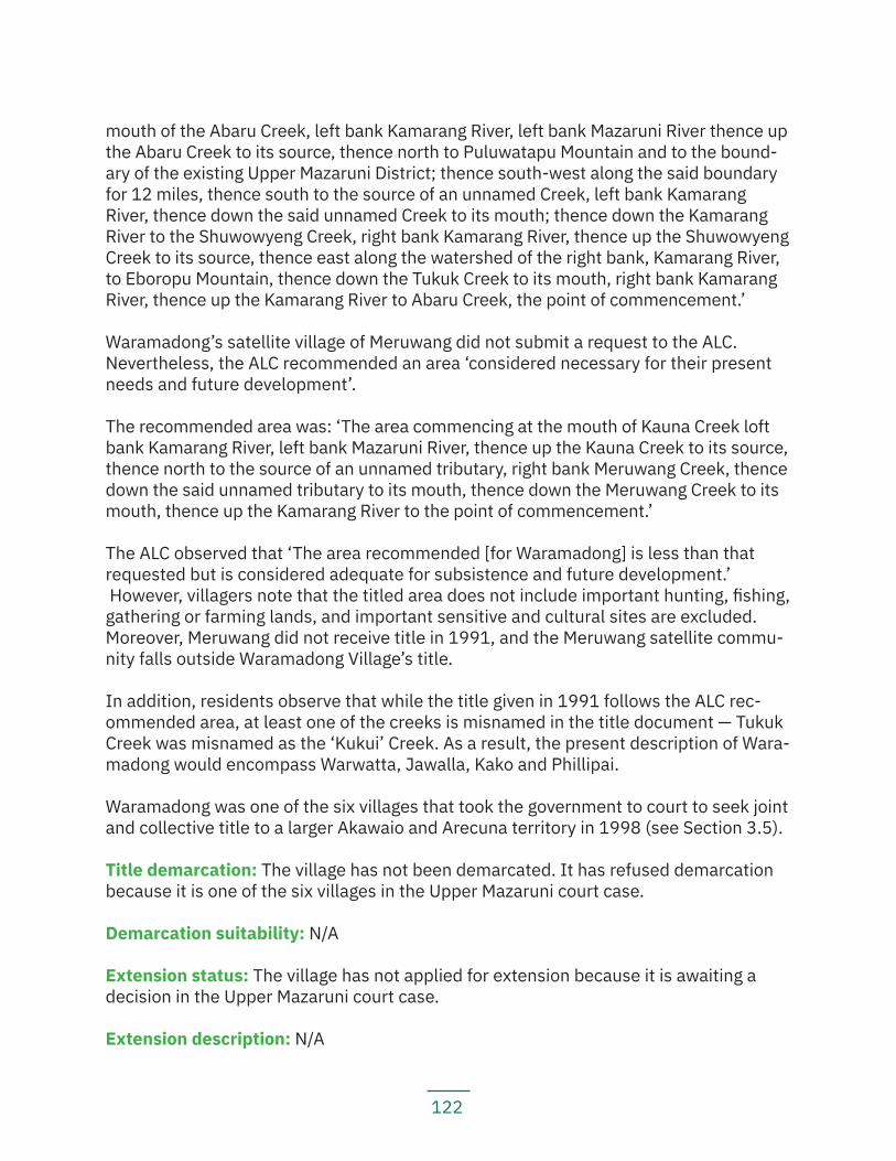
122
mouth of the Abaru Creek, left bank Kamarang River, left bank Mazaruni River thence up the Abaru Creek to its source, thence north to Puluwatapu Mountain and to the bound-ary of the existing Upper Mazaruni District; thence south-west along the said boundary for 12 miles, thence south to the source of an unnamed Creek, left bank Kamarang River, thence down the said unnamed Creek to its mouth; thence down the Kamarang River to the Shuwowyeng Creek, right bank Kamarang River, thence up the Shuwowyeng Creek to its source, thence east along the watershed of the right bank, Kamarang River, to Eboropu Mountain, thence down the Tukuk Creek to its mouth, right bank Kamarang River, thence up the Kamarang River to Abaru Creek, the point of commencement.’
Waramadong’s satellite village of Meruwang did not submit a request to the ALC. Nevertheless, the ALC recommended an area ‘considered necessary for their present needs and future development’.
The recommended area was: ‘The area commencing at the mouth of Kauna Creek loft bank Kamarang River, left bank Mazaruni River, thence up the Kauna Creek to its source, thence north to the source of an unnamed tributary, right bank Meruwang Creek, thence down the said unnamed tributary to its mouth, thence down the Meruwang Creek to its mouth, thence up the Kamarang River to the point of commencement.’
The ALC observed that ‘The area recommended [for Waramadong] is less than that requested but is considered adequate for subsistence and future development.’ However, villagers note that the titled area does not include important hunting, fishing, gathering or farming lands, and important sensitive and cultural sites are excluded. Moreover, Meruwang did not receive title in 1991, and the Meruwang satellite commu-nity falls outside Waramadong Village’s title.
In addition, residents observe that while the title given in 1991 follows the ALC rec-ommended area, at least one of the creeks is misnamed in the title document — Tukuk Creek was misnamed as the ‘Kukui’ Creek. As a result, the present description of Wara-madong would encompass Warwatta, Jawalla, Kako and Phillipai.
Waramadong was one of the six villages that took the government to court to seek joint and collective title to a larger Akawaio and Arecuna territory in 1998 (see Section 3.5).
Title demarcation: The village has not been demarcated. It has refused demarcation because it is one of the six villages in the Upper Mazaruni court case.
Demarcation suitability: N/A
Extension status: The village has not applied for extension because it is awaiting a decision in the Upper Mazaruni court case.
Extension description: N/A
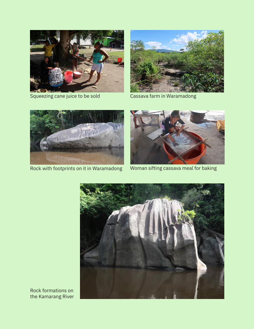
123
Rock formations on the Kamarang River
Woman sifting cassava meal for baking
Squeezing cane juice to be sold Cassava farm in Waramadong
Rock with footprints on it in Waramadong
124
Extension justification: N/A
Response from government: N/A
Land and resource conflict(s): The village is facing resource conflicts with miners. According to the government GIM website, there are no mining concessions on the vil-lage’s titled lands. However, villagers report that there are miners working on their titled lands, although some of these are working with the permission of the village council. There are some mining concessions in the village’s non-titled lands at the Attabrao mouth, but there are no currently active mining operations in that area. Villagers report that mining has destroyed some farming grounds, but the village council is now trying to monitor mining activities more closely so they do not go into farming areas. Cultural her-itage sites, including rock paintings, on the Ekereku River have been defaced by miners.
Land security: The village does not feel that it has secure land tenure. Village residents are concerned about the lack of control they have over their lands, including even their titled lands. They are unhappy that mining concessions have been granted in their ti-tled lands even after the village received legal title, and the village was never consulted or asked for its FPIC prior to the granting of these concessions.
Livelihood security and environmental integrity: Village residents are concerned that mining activities throughout their customary lands are causing damage to their terri-tory. Pollution in the rivers is affecting aquatic life; now, only small fish can be found in the rivers and in small quantities. Village residents have also noticed that deer, powis and marudi birds are becoming scarcer. In addition, the village reports that only a small part of the village has access to clean drinking water. The village has also experienced flooding in recent years, which causes crops, particularly cassava, to rot.
Recognition and measures sought: The village recommends that:
— The government should refrain from granting mining concessions on the vil-lage’s traditional and titled lands;
— The government should legally recognize indigenous traditional lands to pro-tect them from the destruction of their lands, resources and cultural heritage and spiritual sites;
— The National Toshaos Council should support the Upper Mazaruni’s claim in their court case;
— The NTC should visit villages to understand the issues they are facing; — All villages should take the government to court and initiate their own law
suits over land claims; and — Villages should demarcate their own boundaries.

125
5.2 Middle MazaruniThe Middle Mazaruni is traditional Akawaio territory; there are still many trails that link the Middle Mazaruni to the Upper Mazaruni. One settlement visited, Kurupung, does not have its own separate summary report, because few families live there now. It is worth making note of here, however, because it is an important Akawaio site. Founded by the Henry family in the 1900’s, it has become a mining landing and many families have since moved away. The few Akawaio families still living in Kurupung know of important cultural and spiritual sites in the area. Some of these sites include: Jagrosha, Aleluwa, Aliwong Creek, Aqo Creek, and Caripia. The families living there still engage in subsistence farming, hunting and fishing activities. They complain that mining conces-sions are on their customary lands and were granted without their FPIC. They note that many families moved because of mining activities, which have destroyed their hunting, fishing and gathering grounds. The remaining families have to travel further to find game and fish because of the polluted waterways and destroyed forests.
5.2.1 IsseneruKey findings:
— Isseneru received title to one tract of land in 2007 and title to a second tract of land in 2009.
— The village was demarcated in 2010. — Isseneru’s title is only about one-quarter of that requested and excludes
much of the village’s traditional lands. — Much of the village’s titled and untitled lands are burdened with mining con-
cessions. — Mining activities are causing deforestation and habitat loss, causing animals
to move further away. — Mercury poisoning in the rivers has contaminated fish, making them unsafe
for consumption. — The Mazaruni River and Isseneru Creek are heavily polluted by mining acti-
vities. Villagers report having to travel outside the village’s titled lands to collect spring water during the dry season to use for drinking and cooking.
— Residents report having had illnesses they believe are caused by pollution of the water and the influx of coastlanders in the area.
Location: Middle Mazaruni, Region 7
History: Present-day Isseneru and other traditional areas were occupied and used from time immemorial by the foreparents of John Issacs, Ginder Joseph, Edna Joseph, and Oscar Daniels. These families formally established the present-day community in 1978.
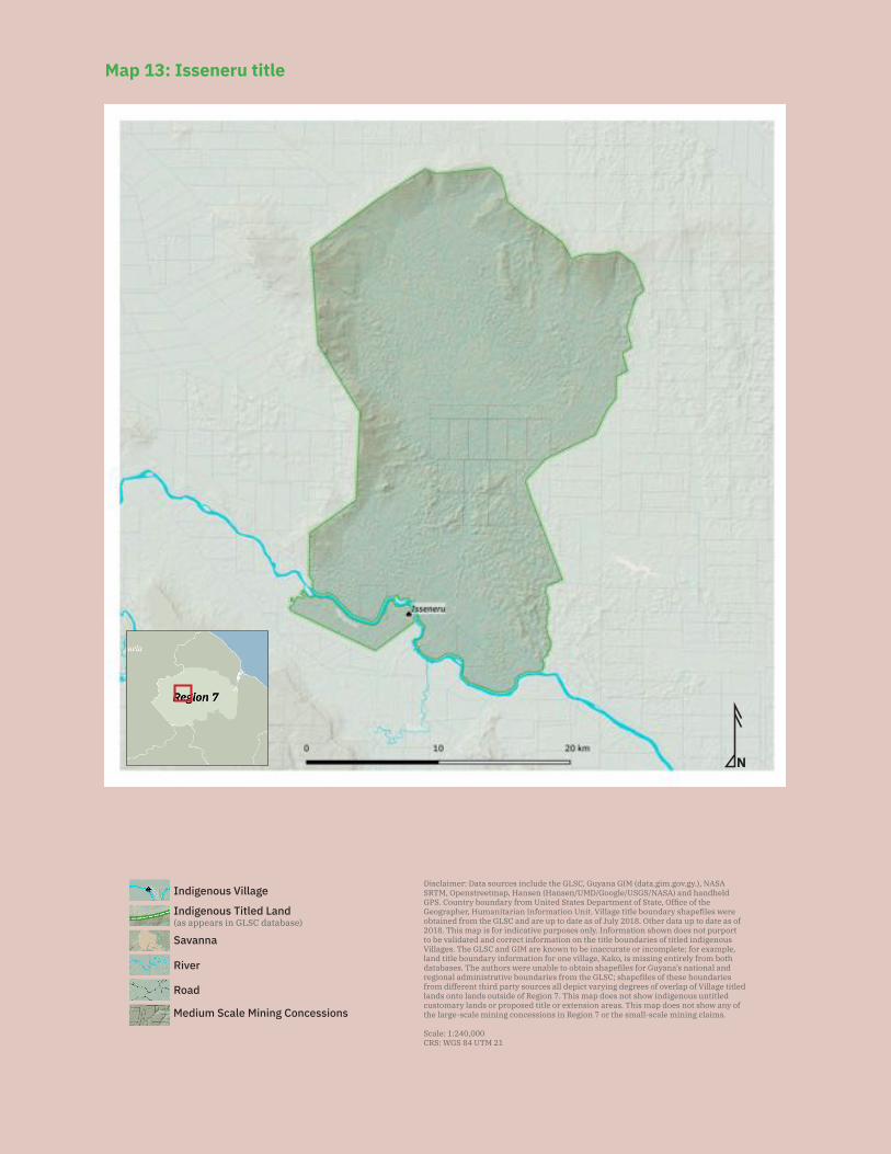
126
N
Savanna
Medium Scale Mining Concessions
Road
River
Indigenous VillageDisclaimer: Data sources include the GLSC, Guyana GIM (data.gim.gov.gy.), NASA SRTM, Openstreetmap, Hansen (Hansen/UMD/Google/USGS/NASA) and handheld GPS. Country boundary from United States Department of State, Office of the Geographer, Humanitarian Information Unit. Village title boundary shapefiles were obtained from the GLSC and are up to date as of July 2018. Other data up to date as of 2018. This map is for indicative purposes only. Information shown does not purport to be validated and correct information on the title boundaries of titled indigenous Villages. The GLSC and GIM are known to be inaccurate or incomplete; for example, land title boundary information for one village, Kako, is missing entirely from both databases. The authors were unable to obtain shapefiles for Guyana’s national and regional administrative boundaries from the GLSC; shapefiles of these boundaries from different third party sources all depict varying degrees of overlap of Village titled lands onto lands outside of Region 7. This map does not show indigenous untitled customary lands or proposed title or extension areas. This map does not show any of the large-scale mining concessions in Region 7 or the small-scale mining claims.
Scale: 1:240,000CRS: WGS 84 UTM 21
Indigenous Titled Land(as appears in GLSC database)
Map 13: Isseneru title
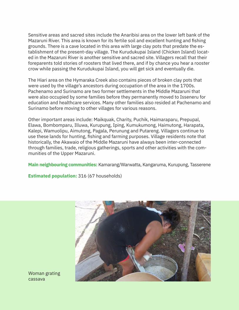
127
Sensitive areas and sacred sites include the Anaribisi area on the lower left bank of the Mazaruni River. This area is known for its fertile soil and excellent hunting and fishing grounds. There is a cave located in this area with large clay pots that predate the es-tablishment of the present-day village. The Kurudukupai Island (Chicken Island) locat-ed in the Mazaruni River is another sensitive and sacred site. Villagers recall that their foreparents told stories of roosters that lived there, and if by chance you hear a rooster crow while passing the Kurudukupai Island, you will get sick and eventually die.
The Hiari area on the Hymaraka Creek also contains pieces of broken clay pots that were used by the village’s ancestors during occupation of the area in the 1700s. Pachenamo and Surinamo are two former settlements in the Middle Mazaruni that were also occupied by some families before they permanently moved to Isseneru for education and healthcare services. Many other families also resided at Pachenamo and Surinamo before moving to other villages for various reasons.
Other important areas include: Maikquak, Charity, Puchik, Haimaraparu, Prepupal, Elawa, Bombomparu, Illuwa, Kurupung, Iping, Kumukumong, Haimutong, Harapata, Kalepi, Wamuolipu, Aimutong, Pagala, Perunung and Putareng. Villagers continue to use these lands for hunting, fishing and farming purposes. Village residents note that historically, the Akawaio of the Middle Mazaruni have always been inter-connected through families, trade, religious gatherings, sports and other activities with the com-munities of the Upper Mazaruni.
Main neighbouring communities: Kamarang/Warwatta, Kangaruma, Kurupung, Tasserene
Estimated population: 316 (67 households)
Woman grating cassava
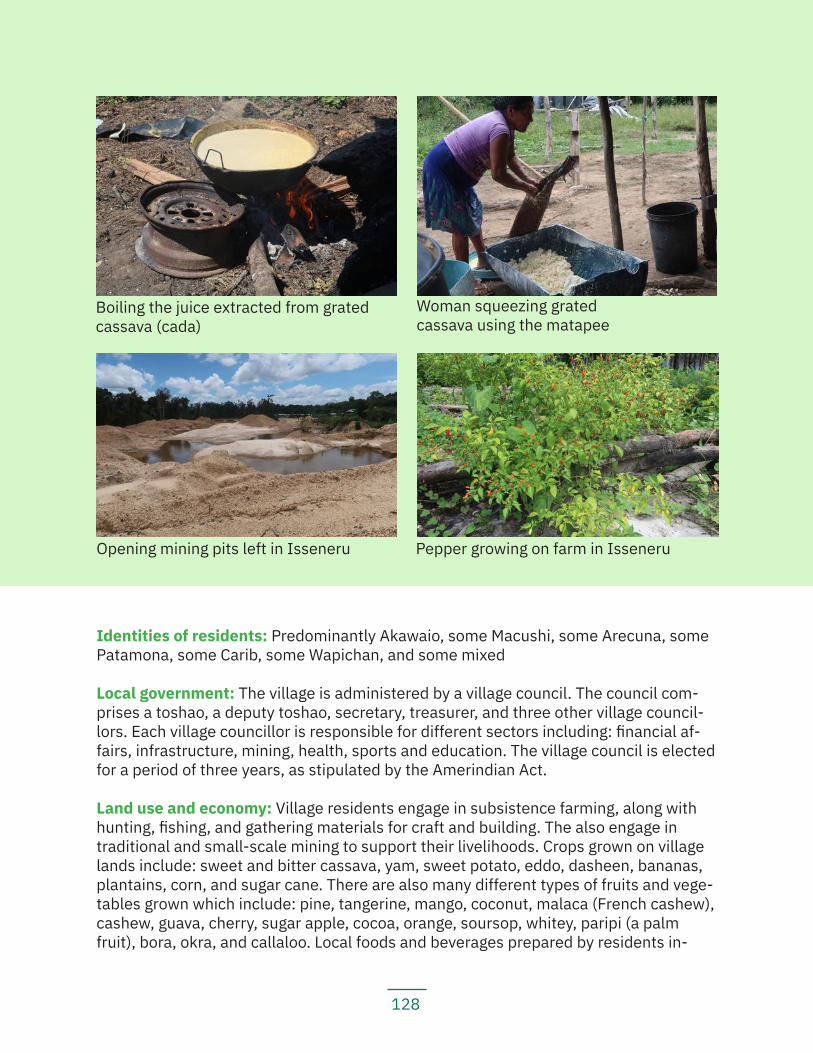
128
Identities of residents: Predominantly Akawaio, some Macushi, some Arecuna, some Patamona, some Carib, some Wapichan, and some mixed
Local government: The village is administered by a village council. The council com-prises a toshao, a deputy toshao, secretary, treasurer, and three other village council-lors. Each village councillor is responsible for different sectors including: financial af-fairs, infrastructure, mining, health, sports and education. The village council is elected for a period of three years, as stipulated by the Amerindian Act.
Land use and economy: Village residents engage in subsistence farming, along with hunting, fishing, and gathering materials for craft and building. The also engage in traditional and small-scale mining to support their livelihoods. Crops grown on village lands include: sweet and bitter cassava, yam, sweet potato, eddo, dasheen, bananas, plantains, corn, and sugar cane. There are also many different types of fruits and vege-tables grown which include: pine, tangerine, mango, coconut, malaca (French cashew), cashew, guava, cherry, sugar apple, cocoa, orange, soursop, whitey, paripi (a palm fruit), bora, okra, and callaloo. Local foods and beverages prepared by residents in-
Boiling the juice extracted from grated cassava (cada)
Woman squeezing grated cassava using the matapee
Opening mining pits left in Isseneru Pepper growing on farm in Isseneru
129
clude cassava bread, farine, sipipa (starch bread), cassiri, piwari, corn wine, fly (potato drink), sorrel drink, cashew drink, parakari, mango drink, and cane juice.
Many of the fertile farming areas are outside of the titled area, and this poses serious challenges for residents to access these lands. Fishing and hunting grounds are shared by the neighbouring communities including Kangaruma and Kamarang/Warwatta. Many of these fishing and hunting grounds are also outside of titled lands.
Community projects: The village is building a school kitchen, partially funded by the government and otherwise funded by the village council.
Institutions and services: The village has a mobile phone network; internet service; a public radio; electricity provided through mobile generators and solar panels; a health centre; and a primary school with a nursery department. Students who are successful in their Grade Six Assessments have the opportunity to pursue secondary education in Bartica or Georgetown. Others pursue tertiary education at the government Technical Institute and the University of Guyana.
Current land title status: The village received title (see Map 13) first in September 2007. The village received a second grant in August 2009.
Existing title description: ‘Tract A: The area commencing at the mouth of Isseneru River, left bank Mazaruni River at a point 66 feet from the Main High Water Mark and its boundaries extends thence up the left bank of the Mazaruni River to the mouth of an unnamed creek of the Mazaruni River opposite the Illama Island UTM coordinates E:78.2448, N:707681 thence up the unnamed creek to its source UTM coordinates E:782170, N:708594 thence in a northly direction for approximately two miles to a point on the Amaraparu Mountain UTM coordinates E:782183, N: 711861 thence in a north easterly direction for approximately 2.57 miles to a point in the Warushima Range UTM coordinates E:785675, N:714397, thence in a northly direction through the Warushima Range approximately 4.25 miles to a point UTM coordinate E:785902, N:721034, thence in a north westerly direction for approximately 3.75 miles to a point UTM coordinate E:782644, N:26150 thence in a northerly direction for approximately 4.5 miles to a point UTM coordinates E:782039, N:733500 thence in a north easterly and a south easterly direction through the water shed of the Isseneru Uriuawra and Kamong River to a point UTM coordinates E:807571, N:730557 thence in a southerly direction through the water shed of the Putareng and White River to a point, UTM coor-dinates E:803868, N:719525, thence in a South Westerly direction for approximately 2.75 miles to a point on the Tamakay Creek UTM coordinates E:799949, N:717613 thence in a south westerly direction for approximately 1.5 miles to a point UTM coor-dinate E:798480, N:716045 thence in a south easterly direction for approximately 5 miles to a point 66 feet of the source of the Warong River UTM coordinates E:801394, N:708474 thence down the right Bank of the Warong River to the mouth Left Bank Mazaruni River UTM coordinates E:799988, N:701490 thence the Mazaruni River to the
130
point of commencement. Save and except all lands legally held.
Tract B: The area commences at the mouth of an Unknown creek approximately 1.5 miles UTM coordinates E:790335, N:705169, above the Apaikwa Creek, Right bank Mazaruni River, 66 feet from mean high water mark and its boundaries extends thence in a south westerly direction for approximately 2.25 miles UTM coordinates E:787321, N:702895, thence in a north westerly direction to a point on the Illama river approxi-mately 4.50 miles UTM coordinates E:780843, N:705877, thence down the Illama riv-er to its mouth Right Bank Mazaruni River thence down the Right Bank Mazaruni River to the point of commencement. Save and except all lands legally held.’
Title suitability: Inadequate. Isseneru’s title is only about one-quarter of the size re-quested, and excludes large portions of traditional lands. The ‘save and except’ clause has allowed many mining concessions to remain within titled lands, which continues to be problematic for Isseneru.
Village residents note that there was no consultation with the village before title was granted. This was done without the FPIC of the village, and more so, was given arbi-trarily. The title given to Isseneru Village is engulfed by mining concessions and villag-ers are disturbed by illegal mining activities on their lands. They observe that the exist-ing title is too enclosed and does not include many of their farming, hunting and fishing grounds, forcing many villagers to farm, hunt and fish outside of titled lands.
They also note with concern that they would like to seek recognition to their traditional and customary lands and seek restitution for the damages caused by heavy mining on those lands.
There are a few creeks, mountains, and other places named incorrectly on the grant plan, including, for example, Bombomparu Creek.
Title demarcation: The village was demarcated, and it received three Certificates of Title (one for each parcel) in May 2010. The authors of the report were unable to obtain a copy of the village’s demarcation plan and thus a description of the village’s demar-cated boundaries.
Demarcation suitability: Accurate but dissatisfied. Villagers were invited to partici-pate in the demarcation process and were involved in the boundary line cutting. The persons involved in the process as boundary line cutters were: Dhaness Larson, Lewis Larson, Benjamin Ritchie, Hilary Francis, Meguel Joseph, Aubrey John, Roy Joseph, Dean Joseph, Claude Bennett, and Lawrence Joseph. The village council and persons
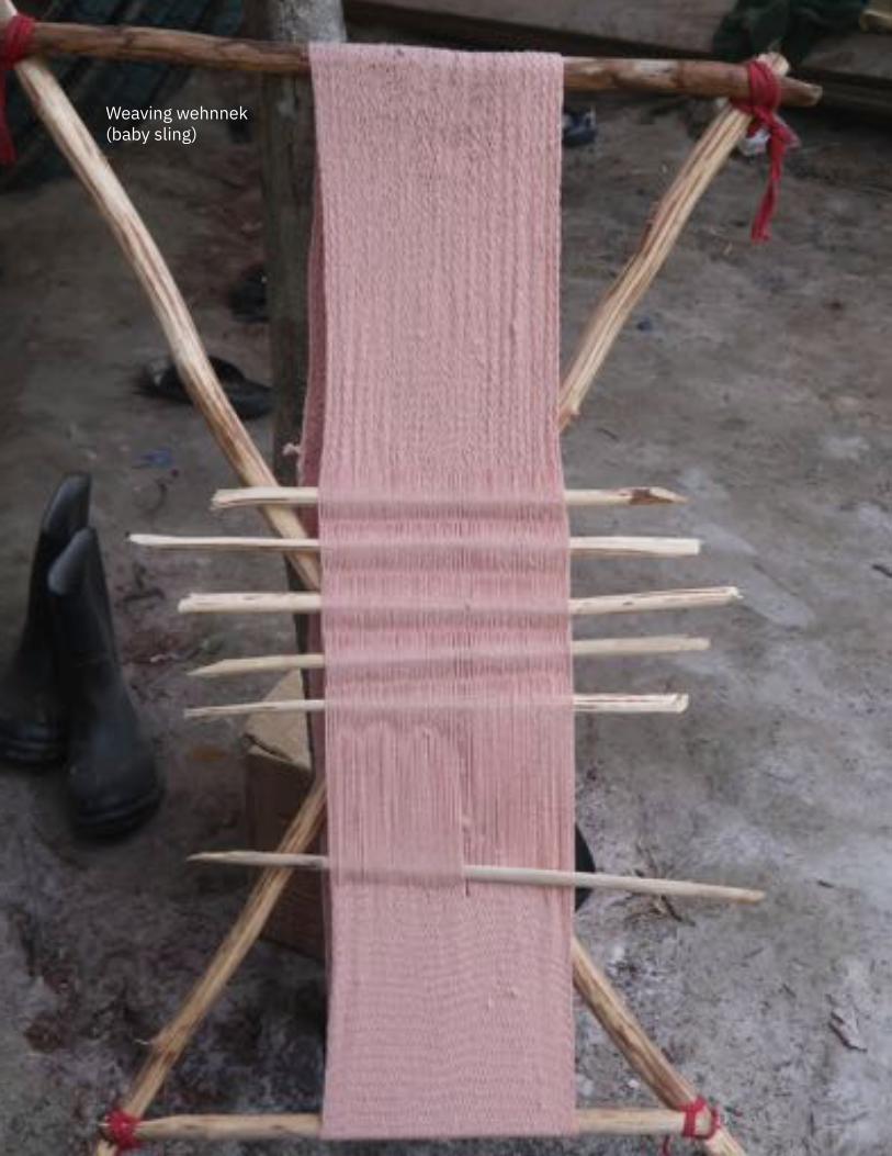
131
Weaving wehnnek (baby sling)
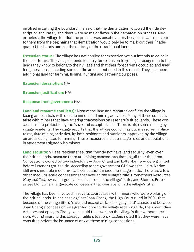
132
involved in cutting the boundary line said that the demarcation followed the title de-scription accurately and there were no major flaws in the demarcation process. Nev-ertheless, the village felt that the process was unsatisfactory because it was not clear to them from the beginning that demarcation would only be to mark out their (inade-quate) titled lands and not the entirety of their traditional lands.
Extension status: The village has not applied for extension yet but intends to do so in the near future. The village intends to apply for extension to get legal recognition to the lands they know to belong to their village and that their foreparents occupied and used for generations, including some of the areas mentioned in this report. They also need additional land for farming, fishing, hunting and gathering purposes.
Extension description: N/A
Extension justification: N/A
Response from government: N/A
Land and resource conflict(s): Most of the land and resource conflicts the village is facing are conflicts with outside miners and mining activities. Many of these conflicts arise with miners that have existing concessions on Isseneru’s titled lands. These con-cessions are protected by the ‘save and except’ clause. There is also some mining by village residents. The village reports that the village council has put measures in place to regulate mining activities, by both residents and outsiders, approved by the village on areas designated for mining. These measures include village rules and stipulations in agreements signed with miners.
Land security: Village residents feel that they do not have land security, even over their titled lands, because there are mining concessions that engulf their title area. Concessions owned by two individuals — Joan Chang and Lalta Narine — were granted before Isseneru got its title. According to the government GIM website, Lalta Narine still owns multiple medium-scale concessions inside the village’s title. There are a few other medium-scale concessions that overlap the village’s title. Prometheus Resources (Guyana) Inc. owns a large-scale concession in the village’s title, and Blume’s Enter-prises Ltd. owns a large-scale concession that overlaps with the village’s title.
The village has been involved in several court cases with miners who were working on their titled lands. In one case against Joan Chang, the High Court ruled in 2001 that because of the village title’s ‘save and except all lands legally held’ clause, and because Joan Chang’s concession was granted prior to the village receiving title, the Amerindian Act does not apply to Chang, who could thus work on the village’s title without permis-sion. Adding injury to this already fragile situation, villagers noted that they were never consulted before the issuance of any of these mining concessions.
133
Livelihood security and environmental integrity: Residents are concerned that mining activities on the village’s titled and traditional lands are negatively impacting their liveli-hoods and their environment. Mining activities are causing animals to move further away, as the forests are increasingly cut down and the sound of machinery disturbs their normal feeding grounds. The Isseneru Creek and the Mazaruni River, which once served as the major sources of drinking water for the village, are heavily polluted by mining activities.
Villagers note that both of those waterways are polluted and they have to go to a source outside of the village’s title to collect spring water for drinking, cooking, and making local drinks. There is also an alarming increase in sicknesses in the village caused by polluted water. A 2002 study funded by the Canadian International Develop-ment Agency, for instance, showed that up to 96 percent of the population surveyed in Isseneru ‘had dangerous levels of mercury contamination.’
The high levels of mercury found in fish make them unsafe for consumption. There has also been a rise in social problems in the community caused by the influx of coastlander miners.
The village has complained about these issues to the authorities, including the GGMC and the MNR, several times, but they have received no response. They have taken a couple of the miners to court over the violation of their rights; while one case has been resolved because the case took so long that the situation complained of has changed (the miners have since abandoned their concession), another case is still pending in the court sys-tem. Because of the delay in reaching a decision in one case, Isseneru was forced to file a complaint against the government before the Inter-American Commission on Human Rights and is presently awaiting a decision from that international human rights body.
Recognition and measures sought: The village of Isseneru recommends that:
— The government amend the Amerindian Act 2006 so that it protects the rights of indigenous peoples, in particular, rights to their lands, territories and resources;
— The government revoke all mining concessions given out on titled lands; — The government stop issuing mining concessions on indigenous peoples’
traditional lands; — The government stop issuing title documents with the ‘save and except’
clause to indigenous villages; — The National Toshaos Council must be more proactive in advocating for the
rights of indigenous peoples; and — The Indigenous Peoples Commission must work along with other bodies and
NGOs to examine land titling issues in the Middle Mazaruni and other areas faced with similar land rights issues.
134
5.2.2 KangarumaKey findings:
— Kangaruma does not have valid title documents. — In 2012, Kangaruma’s toshao received a title document (an abosolute grant)
at the National Toshaos Conference, but the title document was taken back within minutes. Although the Attorney General has assured the village that they have valid title and merely need an amended grant to be drawn up, the village has still not received any valid title documents from the government up to the time of writing of this report.
— The village’s untitled traditional and proposed titled lands (as represented on GLSC and GGMC maps) are covered with mining and forestry concessions.
— Mining operations have caused animals to move further away. — Pollution of the rivers has contaminated fish.
Location: Middle Mazaruni, Region 7
History: Kangaruma Village was re-established as an independent village in 1970 by various families. Village elders at that time saw the need to push for formal recognition of their tra-ditional lands. A large influx of outsider miners in the main village of Tasserene had caused increasing social problems among residents, such as alcohol and drug abuse and teenage pregnancy, and led elders to want to establish Kangaruma as an independent village.
Sensitive, spiritual, and culturally important sites evidence prolonged occupation of the area. Some of these areas include: Aya paru, a sacred site on the lower left bank of the Asura Creek, where voices can be heard. The Alautaima and Tipoko Falls on the Mazaruni River are also sacred sites where boats can sink if people remain there fishing for too long. Another such site is Seman head, where thunder can be heard in the water if persons remain in the area for too long. Other important sites include the Pond at the Tipoko Mountain top, where there is a large cave leading into the mountain. There are also old settlements at Asura, Koti ekwa, Sablawe (Higgings Landing), and Kassana. The settlements at Sablawe (Higgings Landing) and Kassana still exist today.
For generations, villagers have used various trails to visit and trade with the Upper Mazaruni and the Region 8 communities, including the Seman Trail, the Merume Trail and the Karanang Trail. These trails connect the Middle Mazaruni with the Upper Mazaruni and are part of a wider Akawio territory.
Main neighbouring communities: Isseneru, Tassarene, Chinoweing
Estimated population: 368
Identities of residents: Predominantly Akawaio, some Wapichan, some Patamona, some Macushi, and some mixed race
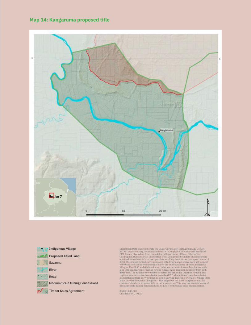
135
N
Savanna
Medium Scale Mining Concessions
Road
River
Indigenous Village Disclaimer: Data sources include the GLSC, Guyana GIM (data.gim.gov.gy.), NASA SRTM, Openstreetmap, Hansen (Hansen/UMD/Google/USGS/NASA) and handheld GPS. Country boundary from United States Department of State, Office of the Geographer, Humanitarian Information Unit. Village title boundary shapefiles were obtained from the GLSC and are up to date as of July 2018. Other data up to date as of 2018. This map is for indicative purposes only. Information shown does not purport to be validated and correct information on the title boundaries of titled indigenous Villages. The GLSC and GIM are known to be inaccurate or incomplete; for example, land title boundary information for one village, Kako, is missing entirely from both databases. The authors were unable to obtain shapefiles for Guyana’s national and regional administrative boundaries from the GLSC; shapefiles of these boundaries from different third party sources all depict varying degrees of overlap of Village titled lands onto lands outside of Region 7. This map does not show indigenous untitled customary lands or proposed title or extension areas. This map does not show any of the large-scale mining concessions in Region 7 or the small-scale mining claims.
Scale: 1:240,000CRS: WGS 84 UTM 21
Proposed Titled Land
Timber Sales Agreement
Map 14: Kangaruma proposed title
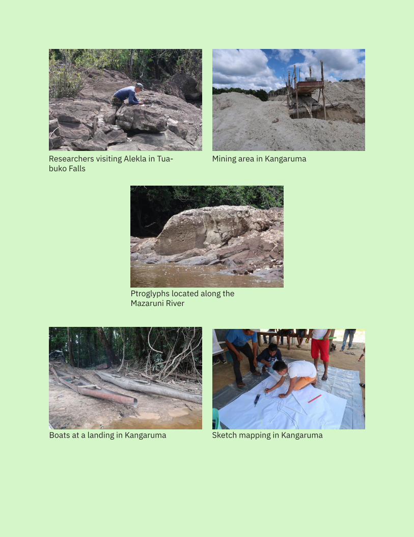
136
Researchers visiting Alekla in Tua-buko Falls
Boats at a landing in Kangaruma Sketch mapping in Kangaruma
Ptroglyphs located along the Mazaruni River
Mining area in Kangaruma
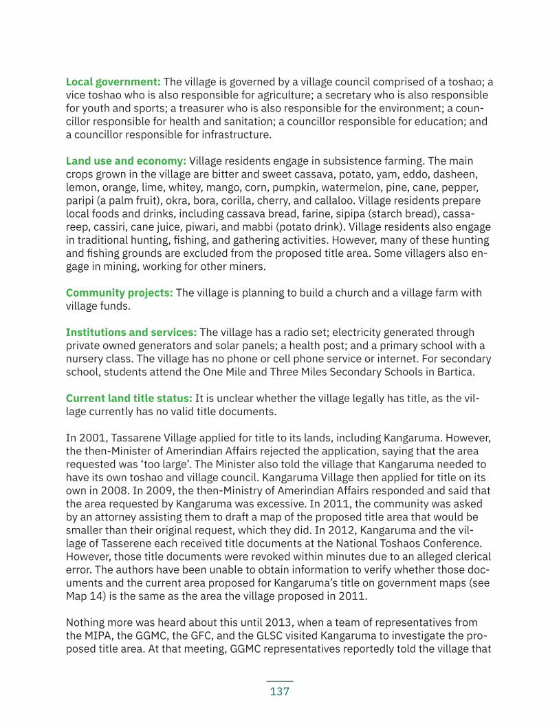
137
Local government: The village is governed by a village council comprised of a toshao; a vice toshao who is also responsible for agriculture; a secretary who is also responsible for youth and sports; a treasurer who is also responsible for the environment; a coun-cillor responsible for health and sanitation; a councillor responsible for education; and a councillor responsible for infrastructure.
Land use and economy: Village residents engage in subsistence farming. The main crops grown in the village are bitter and sweet cassava, potato, yam, eddo, dasheen, lemon, orange, lime, whitey, mango, corn, pumpkin, watermelon, pine, cane, pepper, paripi (a palm fruit), okra, bora, corilla, cherry, and callaloo. Village residents prepare local foods and drinks, including cassava bread, farine, sipipa (starch bread), cassa-reep, cassiri, cane juice, piwari, and mabbi (potato drink). Village residents also engage in traditional hunting, fishing, and gathering activities. However, many of these hunting and fishing grounds are excluded from the proposed title area. Some villagers also en-gage in mining, working for other miners.
Community projects: The village is planning to build a church and a village farm with village funds.
Institutions and services: The village has a radio set; electricity generated through private owned generators and solar panels; a health post; and a primary school with a nursery class. The village has no phone or cell phone service or internet. For secondary school, students attend the One Mile and Three Miles Secondary Schools in Bartica.
Current land title status: It is unclear whether the village legally has title, as the vil-lage currently has no valid title documents.
In 2001, Tassarene Village applied for title to its lands, including Kangaruma. However, the then-Minister of Amerindian Affairs rejected the application, saying that the area requested was ‘too large’. The Minister also told the village that Kangaruma needed to have its own toshao and village council. Kangaruma Village then applied for title on its own in 2008. In 2009, the then-Ministry of Amerindian Affairs responded and said that the area requested by Kangaruma was excessive. In 2011, the community was asked by an attorney assisting them to draft a map of the proposed title area that would be smaller than their original request, which they did. In 2012, Kangaruma and the vil-lage of Tasserene each received title documents at the National Toshaos Conference. However, those title documents were revoked within minutes due to an alleged clerical error. The authors have been unable to obtain information to verify whether those doc-uments and the current area proposed for Kangaruma’s title on government maps (see Map 14) is the same as the area the village proposed in 2011.
Nothing more was heard about this until 2013, when a team of representatives from the MIPA, the GGMC, the GFC, and the GLSC visited Kangaruma to investigate the pro-posed title area. At that meeting, GGMC representatives reportedly told the village that
138
the GGMC and GGDMA were objecting to the issuance of title due to the large number of mining concessions overlapping the proposed title area.
The toshao has been informed by the current legal advisor to the Minister of Indig-enous Peoples Affairs that the village legally has title, but the village still has not re-ceived valid title documents. Although the toshao has written to the Ministry and the President several times to request a status update, the village has to date received no information regarding when they can expect valid title documents.
Existing title description: The village does not have valid title documents; however, the absolute grant that the village received in 2012 that was soon revoked gave the title description as:
‘Tract ‘A’: The area commenced at the mouth of the Merawai Creek, Right Bank Mazaruni River and its boundary extend thence up the Right Bank Merawa Creek to its source, thence in a south easternly [sic] to the mouth of the Mazanapa Creek, Right Merume River thence up the Right Bank Mazanapa Creek to its source, thence south easternly to the source of the Marapaikuru Creek, Left Bank Karanang River, thence down the Left Bank Marapaikuru Creek to its mouth, thence south easternly to Tas-sarence [sic] boundary line, thence north to the source of the Mashainbaru Creek, thence down the Left Bank Mashainbaru Creek to its mouth Right Bank Mazaruni River, thence up the Right Bank Mazaruni River back to the point of commencement. Save and except 66 feet on either sides of all navigable rivers and creeks and all lands pri-vately owned and legally held as well as the right to access to these lands.
Tract ‘B’: The area commenced at the mouth of the Orima Creek, Left Bank Mazaruni River and its boundary extend thence up the Right Bank Orima Creek to its source, thence north to a point of the Sororieng peat [sic] mountains, thence westernly along the Sororieng peak mountains, to the source of the Rumong Rumong River, thence down the Left Bank Rumong Rumong River to its mouth, Left Bank Mazaruni River, thence down the Left Bank of the Mazaruni River back to the point of commencement. Save and except 66 feet on either sides of all navigable rivers and creeks and all lands privately owned and legally held as well as the right to access to these lands.’
Title suitability: N/A
Title demarcation: N/A
Demarcation suitability: N/A
Extension status: N/A
Extension description: N/A
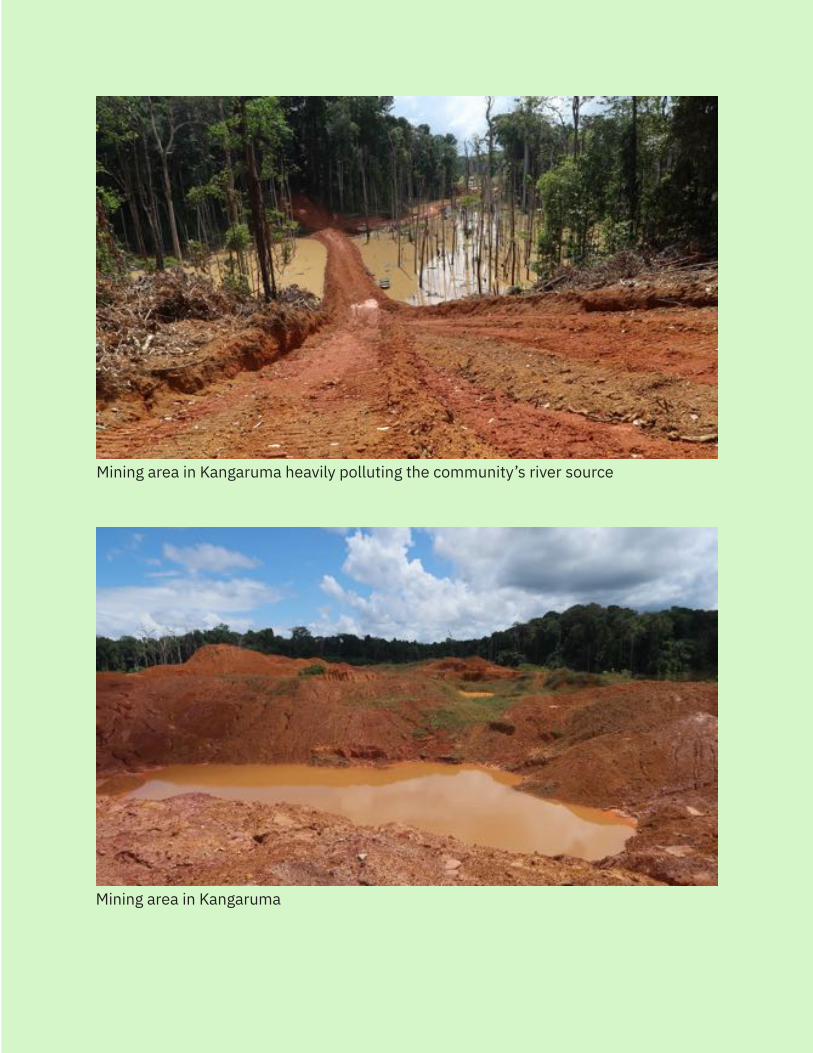
139
Mining area in Kangaruma
Mining area in Kangaruma heavily polluting the community’s river source
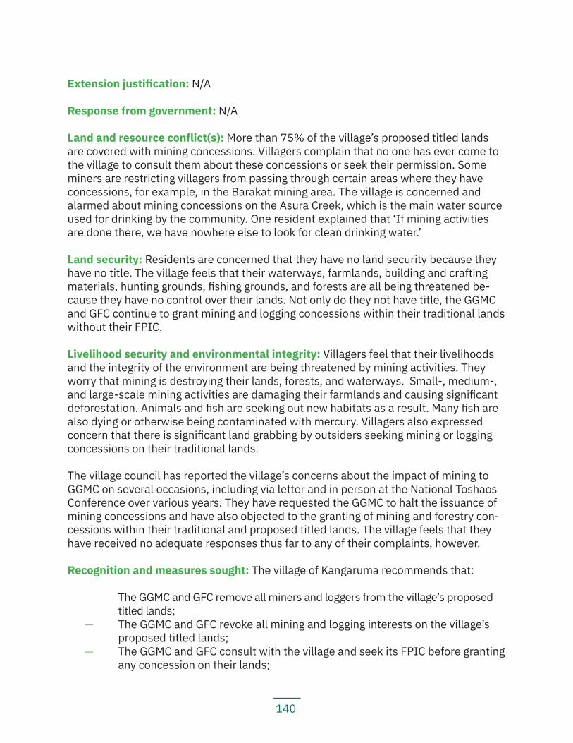
140
Extension justification: N/A
Response from government: N/A
Land and resource conflict(s): More than 75% of the village’s proposed titled lands are covered with mining concessions. Villagers complain that no one has ever come to the village to consult them about these concessions or seek their permission. Some miners are restricting villagers from passing through certain areas where they have concessions, for example, in the Barakat mining area. The village is concerned and alarmed about mining concessions on the Asura Creek, which is the main water source used for drinking by the community. One resident explained that ‘If mining activities are done there, we have nowhere else to look for clean drinking water.’
Land security: Residents are concerned that they have no land security because they have no title. The village feels that their waterways, farmlands, building and crafting materials, hunting grounds, fishing grounds, and forests are all being threatened be-cause they have no control over their lands. Not only do they not have title, the GGMC and GFC continue to grant mining and logging concessions within their traditional lands without their FPIC.
Livelihood security and environmental integrity: Villagers feel that their livelihoods and the integrity of the environment are being threatened by mining activities. They worry that mining is destroying their lands, forests, and waterways. Small-, medium-, and large-scale mining activities are damaging their farmlands and causing significant deforestation. Animals and fish are seeking out new habitats as a result. Many fish are also dying or otherwise being contaminated with mercury. Villagers also expressed concern that there is significant land grabbing by outsiders seeking mining or logging concessions on their traditional lands.
The village council has reported the village’s concerns about the impact of mining to GGMC on several occasions, including via letter and in person at the National Toshaos Conference over various years. They have requested the GGMC to halt the issuance of mining concessions and have also objected to the granting of mining and forestry con-cessions within their traditional and proposed titled lands. The village feels that they have received no adequate responses thus far to any of their complaints, however.
Recognition and measures sought: The village of Kangaruma recommends that:
— The GGMC and GFC remove all miners and loggers from the village’s proposed titled lands;
— The GGMC and GFC revoke all mining and logging interests on the village’s proposed titled lands;
— The GGMC and GFC consult with the village and seek its FPIC before granting any concession on their lands;
141
— The government ensure that the village receives its valid title documents; — The government revise the Amerindian Act 2006 to protect Indigenous peo-
ple’s rights including their rights to their land, territories and resources; — When the village receives its title, the government must ensure that the villa-
ge fully and effectively participates in the demarcation process; — The Amerindian Peoples Association provide capacity building and GPS trai-
ning to the village; and — The National Toshaos Council advocate on the village’s behalf to ensure that
the village receives their valid title documents.
5.2.3 Tassarene Key findings:
— Tassarene does not have valid title documents. — In 2012, Tassarene’s toshao received a title document at the National Tosha-
os Conference, but it was taken back within minutes. Although the Attorney General has assured the village that they have valid title and merely need an amended grant to be drawn up, the village has still not received any valid title documents from the government up to the time of writing of this report.
— The village’s traditional and proposed titled lands (as represented on GLSC and GGMC maps) are covered with mining and forestry concessions.
— Mining activities have destroyed the village’s farming, hunting, and fishing grounds.
— Mining activities have caused a scarcity of fresh water and in dry season, residents report having to travel for miles to collect fresh water to use.
Location: Middle Mazaruni, Region 7
History: Tassarene Village was originally located at Issano. With the influx of coast-landers in the region, mostly due to mining, the village moved to its current lo-cation. The present village settlement was founded in 1970 by the foreparents of the elders James McDonald, George Daniels, Marian Griffith, Arnold Joseph, David Joseph, William Griffiths, George Jacobs, Michael Murphy, James Williams, and others.
Important spiritual and cultural sites evidence prolonged occupation of the area around Tassarene and Issano. One particular site at Melaybishi Creek has many clay pots used by the Akawaio, as well as human bones from tribal wars. Other sacred sites are: Wera-ro (a rock shaped like a large toad), Kataurepu (big eagle), Maluk, Pagapaga (cow), Cura-doo (a place where many caimans used to live), and Sai. Many of these sites are located on the best farming, hunting and fishing grounds in the Tassarene/Issano area but are threatened by mining activities. Turuturu, Kuroitche (Turusi Falls), Kurubelay, Odagee (Itiki falls), Chiwiriki Falls, Peroga, Putunapu, Waiarimupai, Cuzangmari, Totupu, Palepu, Wairaremapai, and Arungparu are important fishing, hunting, and farming areas.
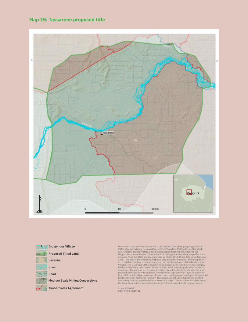
142
N
Savanna
Medium Scale Mining Concessions
Road
River
Indigenous Village Disclaimer: Data sources include the GLSC, Guyana GIM (data.gim.gov.gy.), NASA SRTM, Openstreetmap, Hansen (Hansen/UMD/Google/USGS/NASA) and handheld GPS. Country boundary from United States Department of State, Office of the Geographer, Humanitarian Information Unit. Village title boundary shapefiles were obtained from the GLSC and are up to date as of July 2018. Other data up to date as of 2018. This map is for indicative purposes only. Information shown does not purport to be validated and correct information on the title boundaries of titled indigenous Villages. The GLSC and GIM are known to be inaccurate or incomplete; for example, land title boundary information for one village, Kako, is missing entirely from both databases. The authors were unable to obtain shapefiles for Guyana’s national and regional administrative boundaries from the GLSC; shapefiles of these boundaries from different third party sources all depict varying degrees of overlap of Village titled lands onto lands outside of Region 7. This map does not show indigenous untitled customary lands or proposed title or extension areas. This map does not show any of the large-scale mining concessions in Region 7 or the small-scale mining claims.
Scale: 1:260,000CRS: WGS 84 UTM 21
Timber Sales Agreement
Proposed Titled Land
Map 15: Tassarene proposed title
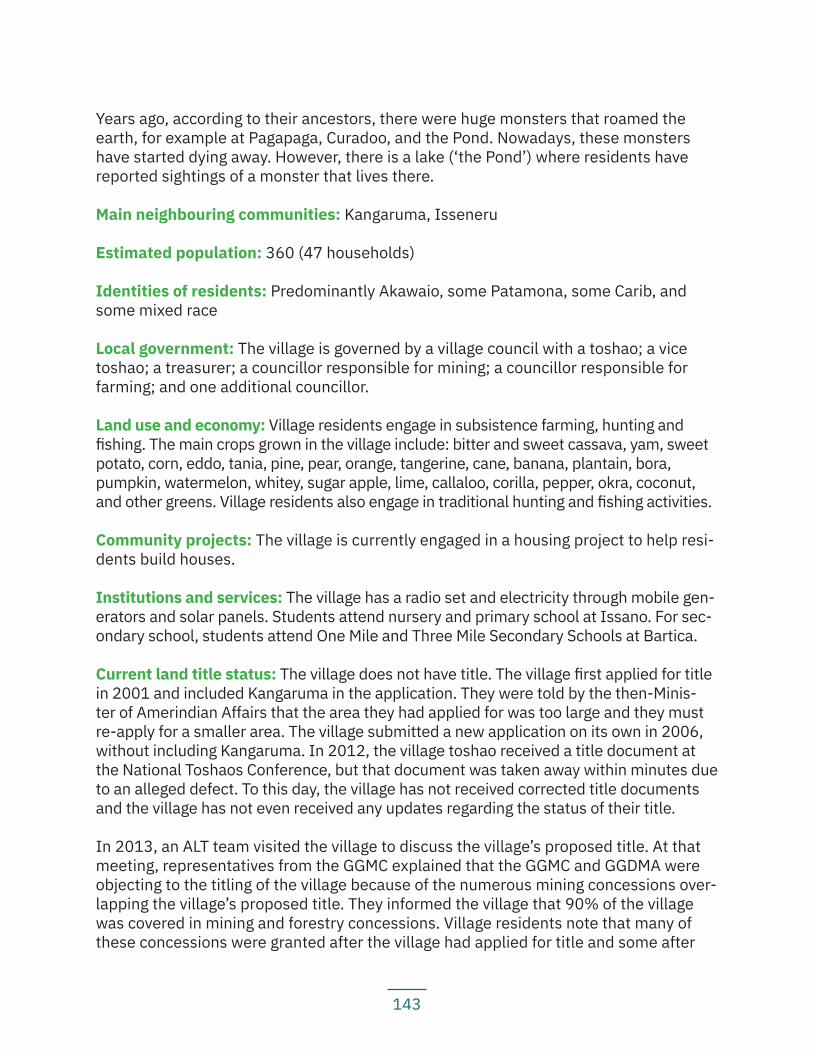
143
Years ago, according to their ancestors, there were huge monsters that roamed the earth, for example at Pagapaga, Curadoo, and the Pond. Nowadays, these monsters have started dying away. However, there is a lake (‘the Pond’) where residents have reported sightings of a monster that lives there.
Main neighbouring communities: Kangaruma, Isseneru
Estimated population: 360 (47 households)
Identities of residents: Predominantly Akawaio, some Patamona, some Carib, and some mixed race
Local government: The village is governed by a village council with a toshao; a vice toshao; a treasurer; a councillor responsible for mining; a councillor responsible for farming; and one additional councillor.
Land use and economy: Village residents engage in subsistence farming, hunting and fishing. The main crops grown in the village include: bitter and sweet cassava, yam, sweet potato, corn, eddo, tania, pine, pear, orange, tangerine, cane, banana, plantain, bora, pumpkin, watermelon, whitey, sugar apple, lime, callaloo, corilla, pepper, okra, coconut, and other greens. Village residents also engage in traditional hunting and fishing activities.
Community projects: The village is currently engaged in a housing project to help resi-dents build houses.
Institutions and services: The village has a radio set and electricity through mobile gen-erators and solar panels. Students attend nursery and primary school at Issano. For sec-ondary school, students attend One Mile and Three Mile Secondary Schools at Bartica.
Current land title status: The village does not have title. The village first applied for title in 2001 and included Kangaruma in the application. They were told by the then-Minis-ter of Amerindian Affairs that the area they had applied for was too large and they must re-apply for a smaller area. The village submitted a new application on its own in 2006, without including Kangaruma. In 2012, the village toshao received a title document at the National Toshaos Conference, but that document was taken away within minutes due to an alleged defect. To this day, the village has not received corrected title documents and the village has not even received any updates regarding the status of their title.
In 2013, an ALT team visited the village to discuss the village’s proposed title. At that meeting, representatives from the GGMC explained that the GGMC and GGDMA were objecting to the titling of the village because of the numerous mining concessions over-lapping the village’s proposed title. They informed the village that 90% of the village was covered in mining and forestry concessions. Village residents note that many of these concessions were granted after the village had applied for title and some after
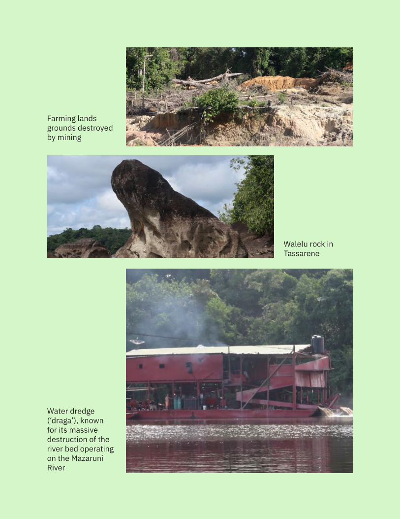
144
Walelu rock in Tassarene
Water dredge (‘draga’), known for its massive destruction of the river bed operatingon the MazaruniRiver
Farming lands grounds destroyed by mining
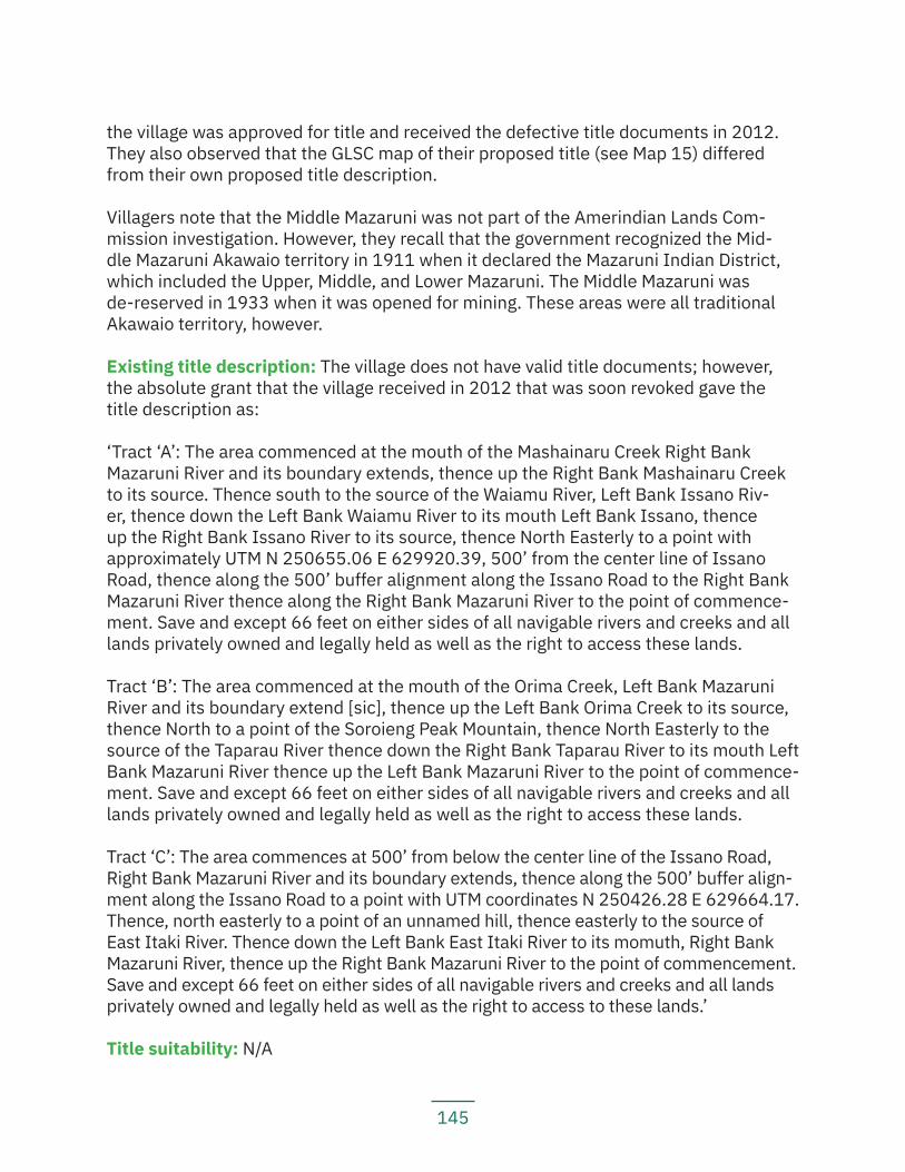
145
the village was approved for title and received the defective title documents in 2012. They also observed that the GLSC map of their proposed title (see Map 15) differed from their own proposed title description.
Villagers note that the Middle Mazaruni was not part of the Amerindian Lands Com-mission investigation. However, they recall that the government recognized the Mid-dle Mazaruni Akawaio territory in 1911 when it declared the Mazaruni Indian District, which included the Upper, Middle, and Lower Mazaruni. The Middle Mazaruni was de-reserved in 1933 when it was opened for mining. These areas were all traditional Akawaio territory, however.
Existing title description: The village does not have valid title documents; however, the absolute grant that the village received in 2012 that was soon revoked gave the title description as:
‘Tract ‘A’: The area commenced at the mouth of the Mashainaru Creek Right Bank Mazaruni River and its boundary extends, thence up the Right Bank Mashainaru Creek to its source. Thence south to the source of the Waiamu River, Left Bank Issano Riv-er, thence down the Left Bank Waiamu River to its mouth Left Bank Issano, thence up the Right Bank Issano River to its source, thence North Easterly to a point with approximately UTM N 250655.06 E 629920.39, 500’ from the center line of Issano Road, thence along the 500’ buffer alignment along the Issano Road to the Right Bank Mazaruni River thence along the Right Bank Mazaruni River to the point of commence-ment. Save and except 66 feet on either sides of all navigable rivers and creeks and all lands privately owned and legally held as well as the right to access these lands.
Tract ‘B’: The area commenced at the mouth of the Orima Creek, Left Bank Mazaruni River and its boundary extend [sic], thence up the Left Bank Orima Creek to its source, thence North to a point of the Soroieng Peak Mountain, thence North Easterly to the source of the Taparau River thence down the Right Bank Taparau River to its mouth Left Bank Mazaruni River thence up the Left Bank Mazaruni River to the point of commence-ment. Save and except 66 feet on either sides of all navigable rivers and creeks and all lands privately owned and legally held as well as the right to access these lands.
Tract ‘C’: The area commences at 500’ from below the center line of the Issano Road, Right Bank Mazaruni River and its boundary extends, thence along the 500’ buffer align-ment along the Issano Road to a point with UTM coordinates N 250426.28 E 629664.17. Thence, north easterly to a point of an unnamed hill, thence easterly to the source of East Itaki River. Thence down the Left Bank East Itaki River to its momuth, Right Bank Mazaruni River, thence up the Right Bank Mazaruni River to the point of commencement. Save and except 66 feet on either sides of all navigable rivers and creeks and all lands privately owned and legally held as well as the right to access to these lands.’
Title suitability: N/A
146
Title demarcation: N/A
Demarcation suitability: N/A
Extension status: N/A
Extension description: N/A
Extension justification: N/A
Response from government: N/A
Land and resource conflict(s): The village is facing significant land and resource con-flicts with miners working on the village’s traditional and proposed title lands. Mining activities have polluted the main creek used by villagers for domestic purposes. Villag-ers also expressed that several complaints were made to the GGMC and the EPA, but nothing has been done to rectify the situation. A resident explained that ‘Sometimes the GGMC doesn’t even come through the village council before going to mining areas’, and ‘When the GGMC or EPA leave for Georgetown, people start working again.’
The village council has asked miners to leave but has been ignored. Miners claim that the proposed titled lands are a ‘no man’s land’, but the village knows that their forepar-ents used and occupied these lands before outsiders started pouring in to do mining. Village residents report that several good farming grounds and gathering sites have been bulldozed and their fishing grounds are polluted and contaminated by mercury. They also note that mining activities have impacted farming activities because the min-ers have excavated the best farming grounds in the village.
Land security: The village feels that they have no control over the land because they have no valid title document. They note that when you look at a map, you can see that the village centre is sitting in a mining concession. There are approximately 380 medi-um-scale and five large-scale mining concessions in the village’s proposed title. Miners say it is ‘no-man’s land’, or they’re labelled ‘State lands’, but the village knows those lands to be their traditional lands. The village believes that if they had title, they would have some more control over what activities happen on their lands.
Livelihood security and environmental integrity: Village residents are concerned that farmlands and hunting and fishing areas are being destroyed by mining. They note that soils and forests have been destroyed and waters polluted, causing animals and fish to relocate. Villagers also observe that there is no clean water in Tassarene now, and in the dry season, they have to go for miles to fetch clean water. The village has made several complaints to the GGMC and MIPA, but they have thus far not received any sat-isfactory response from the government.
147
Recognition and measures sought: The village recommends:
— The government must immediately revoke mining concessions on the villa-ge’s traditional lands to prevent miners from destroying their farming, fishing, and hunting grounds;
— The government must expedite the land titling process and give valid title documents to Tassarene and Kangaruma villages and all other communities affected by similar issues;
— The government must grant titles to indigenous communities without any ‘save and except’ clauses;
— The government must give indigenous people legal rights to their lands, terri-tories, and resources;
— The village council must write letters to the MNR and the EPA to request mi-nes officers to check on the mining activities on a regular basis; to stop illegal miners who have no concessions and no legal documents; and to check the quality of the water, especially in dry season; and
— The APA must hold capacity building workshops in the village.
5.3 Lower Mazaruni and CuyuniThere are several communities located around the area of Bartica township in the lower reaches and confluence of the Mazaruni, Cuyuni and Essequibo Rivers. This area was the location of the first Dutch forts. During the colonial period, many indigenous communities moved away from the area as a permanent settlement site. Historical sources—for example reports of clashes between the Carib, Arawak and Akawaio over control of the territory—suggest however that this area may have been a contested strategic trade location and/or possibly an interethnic space where parts of the tradi-tional territories of different indigenous nations overlapped or adjoined one another.
Following independence, indigenous peoples, particularly from Regions 1 and 2, began to move back to the area to work on timber concessions. From this movement, several indigenous communities became re-established in the area.
This area is an intermediate area between several regions, but the communities share similar histories and face similar issues. In researching this report, the LTA team visited two communities, River’s View and Saxacalli, which are in the same geographical area as the Region 7 communities but which are in, respectively, Regions 10 and 3. Accord-ingly, this report will mention them briefly here, but there will be no separate summary report for these two communities, as they are not officially part of Region 7.
River’s View is a titled village in Region 10. The village was demarcated in 2015, but the village reports that the surveyors did not complete the demarcation and that there is a gap in the boundary, where it appears the demarcation lines do not meet. The village has not yet applied for extension. Village residents report that they believe the village coun-
148
cil had given permission to a logger to work in their titled lands, but the village was not consulted and they are unhappy with the operation. According to the government GIM website, there is a large-scale forestry concession that overlaps with the village’s title, covering approximately 50% of the title area. Village residents are concerned that log-ging activities are threatening the forests and wildlife in the area. They also report that there is a bauxite mining operation in Sara Sara Creek, which is polluting their waters.
Saxacalli is an untitled community in Region 3 governed by a community development council. The community is mostly Arawak. The community notes that they are facing resource conflicts with outsiders who are applying for and being granted lands that the community needs. One resident reported that he had been cutting and working on a farm at Groet Creek for a year, only to one day be told by a man that the land was his. The community found out from government officials later that the man had only ap-plied for and paid for the land just the day before.
5.3.1 BataviaKey findings:
— Batavia received title in 2014, but the village reports that their title does not reflect what they applied for and what their traditional lands encompass.
— Half of the residents live outside of the title and seven miles have been left out from either end of the village boundary.
— There is a logger currently passing through the village’s titled lands without their permission in order to access his logging concessions.
— Logging and mining activities in the village’s traditional lands are disturbing their hunting and gathering grounds.
— Villagers report that fish are scarce in the Cuyuni River. — Village residents do not feel the water in the river is safe for drinking or co-
oking anymore and depend on rainwater.
Location: Batavia, Lower Cuyuni and Mazaruni Rivers, Region 7
History: The village was founded in 1970 by the families of Lawrence Lawlist, Paymon Boodhoo, and Patrick Henry. The residents of Batavia mostly migrated from the North-west District or are descendants of those who did. The reason most people moved to Batavia in the twentieth century was for jobs in the timber concessions that covered the area. There were people living in the area long before that as well, however. When divers explore the river bed that passes through the village, they find clay pots, ancient arrows, and stone axes, which provide evidence of earlier occupation of the area.
Main neighbouring communities: Kartabo, Karrau
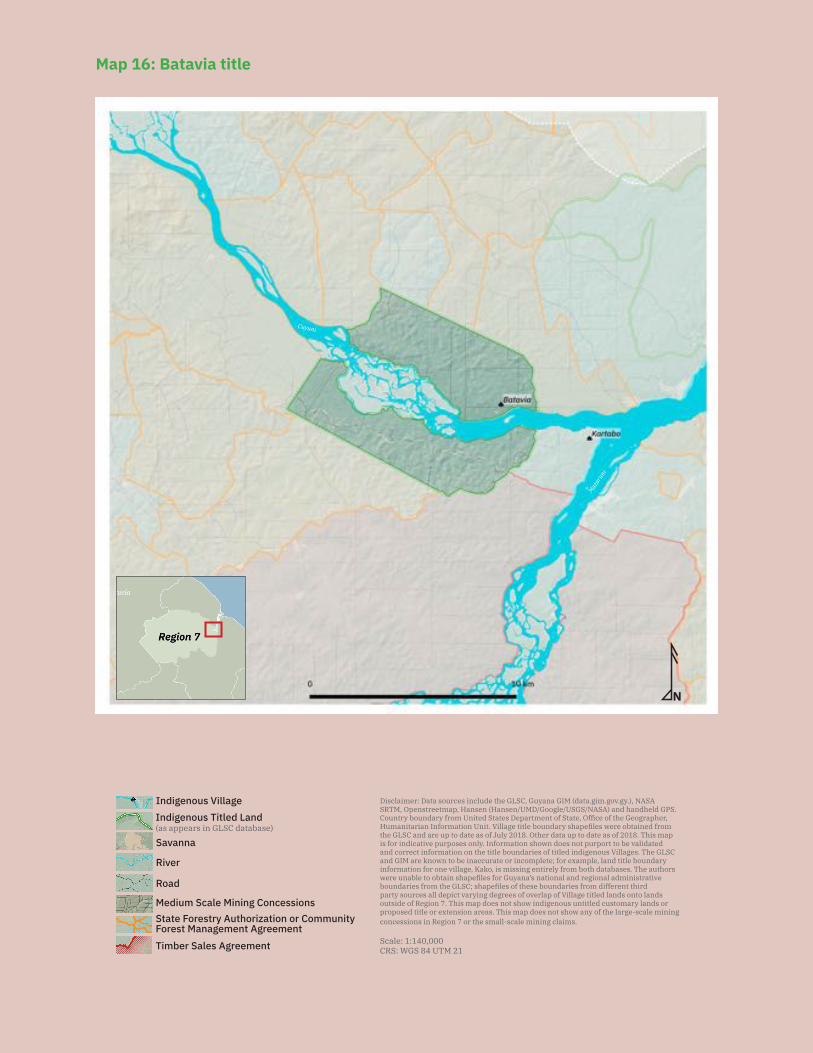
149
N
Disclaimer: Data sources include the GLSC, Guyana GIM (data.gim.gov.gy.), NASA SRTM, Openstreetmap, Hansen (Hansen/UMD/Google/USGS/NASA) and handheld GPS. Country boundary from United States Department of State, Office of the Geographer, Humanitarian Information Unit. Village title boundary shapefiles were obtained from the GLSC and are up to date as of July 2018. Other data up to date as of 2018. This map is for indicative purposes only. Information shown does not purport to be validated and correct information on the title boundaries of titled indigenous Villages. The GLSC and GIM are known to be inaccurate or incomplete; for example, land title boundary information for one village, Kako, is missing entirely from both databases. The authors were unable to obtain shapefiles for Guyana’s national and regional administrative boundaries from the GLSC; shapefiles of these boundaries from different third party sources all depict varying degrees of overlap of Village titled lands onto lands outside of Region 7. This map does not show indigenous untitled customary lands or proposed title or extension areas. This map does not show any of the large-scale mining concessions in Region 7 or the small-scale mining claims.
Scale: 1:140,000CRS: WGS 84 UTM 21
Savanna
Road
River
Indigenous Titled Land(as appears in GLSC database)
Indigenous Village
State Forestry Authorization or Community Forest Management AgreementTimber Sales Agreement
Medium Scale Mining Concessions
Mazar
uni
Cuyuni
N
Disclaimer: Data sources include the GLSC, Guyana GIM (data.gim.gov.gy.), NASA SRTM, Openstreetmap, Hansen (Hansen/UMD/Google/USGS/NASA) and handheld GPS. Country boundary from United States Department of State, Office of the Geographer, Humanitarian Information Unit. Village title boundary shapefiles were obtained from the GLSC and are up to date as of July 2018. Other data up to date as of 2018. This map is for indicative purposes only. Information shown does not purport to be validated and correct information on the title boundaries of titled indigenous Villages. The GLSC and GIM are known to be inaccurate or incomplete; for example, land title boundary information for one village, Kako, is missing entirely from both databases. The authors were unable to obtain shapefiles for Guyana’s national and regional administrative boundaries from the GLSC; shapefiles of these boundaries from different third party sources all depict varying degrees of overlap of Village titled lands onto lands outside of Region 7. This map does not show indigenous untitled customary lands or proposed title or extension areas. This map does not show any of the large-scale mining concessions in Region 7 or the small-scale mining claims.
Scale: 1:140,000CRS: WGS 84 UTM 21
Savanna
Road
River
Indigenous Titled Land(as appears in GLSC database)
Indigenous Village
State Forestry Authorization or Community Forest Management AgreementTimber Sales Agreement
Medium Scale Mining Concessions
Mazar
uni
Cuyuni
Map 16: Batavia title
150
Estimated population: 503
Identities of residents: Mostly Carib, Akawaio, Arawak, Warrau, Wapichan, Patamona, mixed race
Local government: The village is governed by a village council comprised of a toshao, a deputy toshao, a secretary, a treasurer, and five additional councillors.
Land use and economy: Most villagers work in mining concessions to earn money. Vil-lagers also find work on boat transportation services and trucking services. They also engage in subsistence farming, and main crops grown include: sweet and bitter cassa-va, yam, corn, pineapple, sugar cane, plantain, banana, greens, coconut, lime, lemon, guava, sugar apple, and soursop. Some villagers still do traditional hunting, but there is not much fishing activity in the village anymore.
Community projects: The village is currently working on setting up a marketplace for village produce. They are hoping to sell their produce to miners who pass through, as well as to tourist spots like Aruwai Resort, which are close by. The village is scattered, living on both the right and left banks of the river, so the village is trying to bring people together to one area. The village is also planning a housing project to build houses in one area to con-centrate the population. The community plans to set up a solar system and water system.
Institutions and services: The village has cellular network; a radio set; electricity via mobile generators and solar panels; and a health post with three health workers. The village has a primary school with a nursery class. For secondary school, students go to 1 Mile and 3 Miles Secondary Schools in Bartica.
Current land title status: The village received title (see Map 16) on 7 November 2014.
Existing title description: ‘Tract ‘A’: The area commences at the mouth of the Tabutu River with UTM coordinates E 309951 N 707317, thence up the said river to a point, 3 km from its mouth with UTM coordinates E 309252 N 710082, thence in a south east-erly direction to the source of the Siparikuru Creek with UTM coordinates E 302308 N 713373, thence down the said river to its mouth with UTM coordinates E 300650 N 711329, thence up the right bank of the Cuyuni River back to the point of commence-ment. Save and except 66 feet on either side of all navigable rivers and creeks, all lands privately owned and legally held as well as the right to access to these lands.
Tract ‘B’: The area commence opposite the mouth of the Tabutu River, left bank Cuyuni River with UTM coordinates E 299456 N 709966 thence in a south westerly direction for 3 km with UTM coordinates E 297749 N 707437, thence in a south easterly direc-tion to a point on the Kartabu/Puruni Road with UTM coordinates E 305216 N 703426, thence in an north easterly direction of the Kartabu/Puruni Road to a source of an unnamed Creek opposite the Siparikuru creek and with UTM coordinates E 309609 N
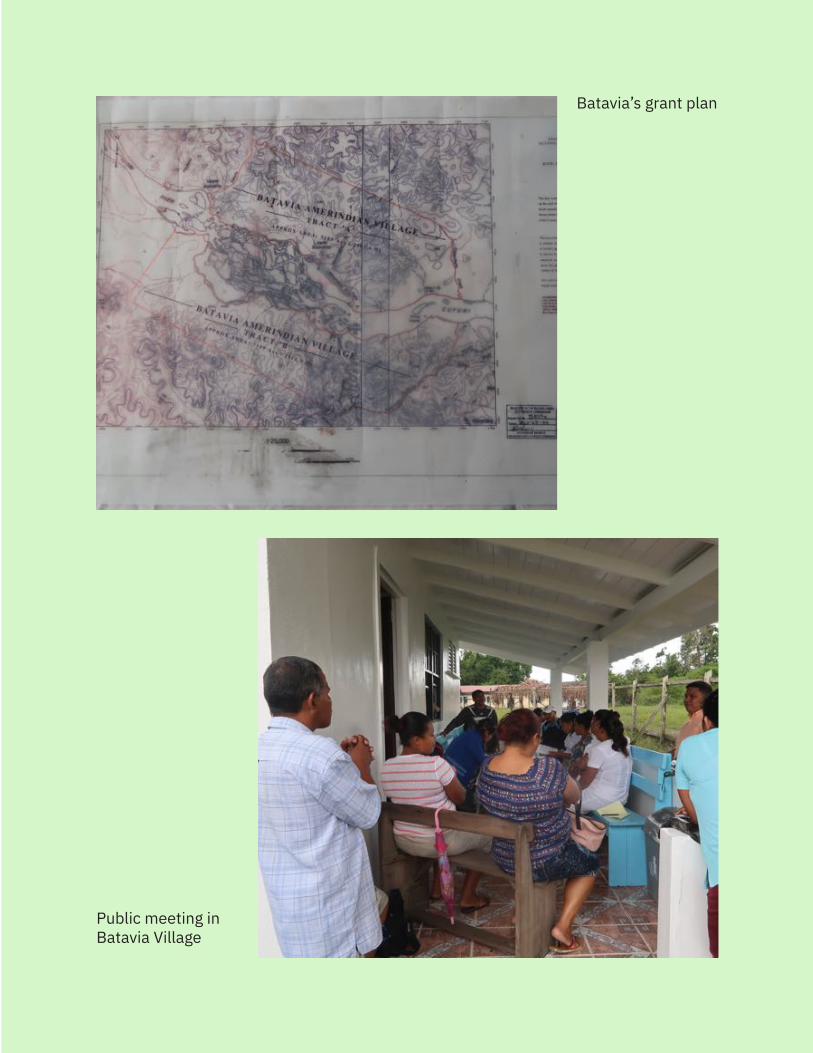
151
Batavia’s grant plan
Public meeting in Batavia Village
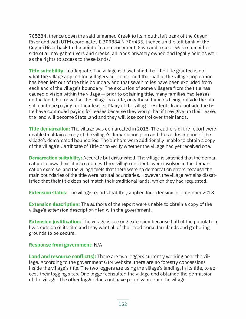
152
705334, thence down the said unnamed Creek to its mouth, left bank of the Cuyuni River and with UTM coordinates E 309884 N 706435, thence up the left bank of the Cuyuni River back to the point of commencement. Save and except 66 feet on either side of all navigable rivers and creeks, all lands privately owned and legally held as well as the rights to access to these lands.’
Title suitability: Inadequate. The village is dissatisfied that the title granted is not what the village applied for. Villagers are concerned that half of the village population has been left out of the title boundary and that seven miles have been excluded from each end of the village’s boundary. The exclusion of some villagers from the title has caused division within the village — prior to obtaining title, many families had leases on the land, but now that the village has title, only those families living outside the title still continue paying for their leases. Many of the village residents living outside the ti-tle have continued paying for leases because they worry that if they give up their lease, the land will become State land and they will lose control over their lands.
Title demarcation: The village was demarcated in 2015. The authors of the report were unable to obtain a copy of the village’s demarcation plan and thus a description of the village’s demarcated boundaries. The authors were additionally unable to obtain a copy of the village’s Certificate of Title or to verify whether the village had yet received one.
Demarcation suitability: Accurate but dissatisfied. The village is satisfied that the demar-cation follows their title accurately. Three village residents were involved in the demar-cation exercise, and the village feels that there were no demarcation errors because the main boundaries of the title were natural boundaries. However, the village remains dissat-isfied that their title does not match their traditional lands, which they had requested.
Extension status: The village reports that they applied for extension in December 2018.
Extension description: The authors of the report were unable to obtain a copy of the village’s extension description filed with the government.
Extension justification: The village is seeking extension because half of the population lives outside of its title and they want all of their traditional farmlands and gathering grounds to be secure.
Response from government: N/A
Land and resource conflict(s): There are two loggers currently working near the vil-lage. According to the government GIM website, there are no forestry concessions inside the village’s title. The two loggers are using the village’s landing, in its title, to ac-cess their logging sites. One logger consulted the village and obtained the permission of the village. The other logger does not have permission from the village.
153
According to the government GIM website, there are multiple medium-scale mining concessions owned by various individuals inside the village’s title. These concessions had been inactive, and the village had only recently realized that the concessions exist-ed, after the village began to do some small-scale mining itself. After the village began its own small-scale operation, one of the mining concession owners returned to his concession and destroyed the village’s mining equipment and operations. The miner claimed he had legal rights over the village because he received his concession before the village received title, which saves and excepts ‘all lands legally held’. The village complained to the GGMC and the MIPA, and the government agencies stepped in to ar-range a dialogue between the village and the miner. The village and the miner met, with the MIPA facilitating, twice in 2018. They are scheduled to sit and meet with the miner again to discuss an agreement in the early part of 2019.
Land security: The village does not feel it has full land security and it does not have con-trol of 100% of its lands. The village is concerned that there are still active mining blocks in their land. Villagers feel that they cannot decide for themselves what they want to do with their lands or resources. In addition to the mining concessions, the village is divided across both sides of the river and because the village has no control over the waterway, there are outsiders stopping on the river every day, in the middle of the village.
Livelihood security and environmental integrity: Village residents feel that logging and mining in their traditional lands are disturbing their hunting and gathering grounds. Mining activities at the head of the Cuyuni River have caused water pollution and villag-ers report that fish are scarce. The water is no longer safe for drinking or cooking and villagers depend on rain water; sometimes during dry season, they have to buy water. Villagers are worried that continued logging will threaten the forest and their crafting and building materials.
Recognition and measures sought: The village requests that:
— The government must revise the village’s title to include the lands that were left out of the original title document;
— The village council must stand stronger in representing the village and ensu-ring that their customary rights are respected;
— The government must give indigenous people the rights to their lands, terri-tories and resources;
— The government must meet with indigenous villages to inform them about the various policies and laws in the country; and
— The government must listen and respond to the concerns of indigenous peoples.
154
5.3.2 Dagg PointKey findings:
— Dagg Point does not have title and is governed by a community development council. The community is unaware of the geographical extent of the CDC’s jurisdiction.
— The community is included within Bartica township, but was not consulted before being included.
— Most residents have private leases on the land and do not fully understand what it would mean to apply for title collectively.
— Community members are concerned because Bartica township is restricting residents from cutting farms and building houses.
— Mining activities have caused mercury poisoning of the rivers, making the fish in the river unsafe for consumption.
Location: Dagg Point, Lower Cuyuni and Mazaruni Rivers, Region 7
History: The community was founded in 1970 by the Jones and John families. Most people in the community came from Waikerabi on the Barama River. They moved to Dagg Point in the 1970s to work on logging concessions.
Main neighbouring communities: Agatash (a non-indigenous CDC), Bartica Town, River’s View
Estimated population: 360
Identities of residents: Mostly Carib, some Arawak, some Warrau, some mixed
Local government: The community is governed by a community development council, with a chair, secretary, treasurer, and six additional councillors.
Land use and economy: The main economic activities in the community are logging and mining. Community members used to engage in subsistence farming on land that they had been given permission to use as a community farming area. However, in the last few years, the government has taken the land to construct a solar farm, so the community now has no land on which they can farm. The community notes that the government had promised them to find alternate lands for a community farming area, but they have heard nothing to date. In the meantime, the township of Bartica restricts residents from farming within the township.
Very few community members still engage in traditional hunting, fishing or gathering activities. The community reports that even those few persons who still make crafts will often buy materials from Georgetown.
155
Community projects: The CDC community members came together and bought a log-ging concession as a Logger’s Association.
Institutions and services: The community has access to mobile network and electricity via private generators and solar panels. For health services, residents visit the Bartica District Hospital. There is no school in Dagg Point; instead, students attend school in Bartica.
Current land title status: None. The community does not currently have title and has never applied for title.
The community had not yet been established by the time of the ALC investigations and Report. The ALC Report notes, however, that in those years, timber operators recruited itinerant indigenous peoples as about half of their labour force. These timber operators had recommended the granting of land to indigenous peoples in riverine areas adjacent to their timber leases in the lower Essequibo and Cuyuni so indigenous peoples work-ing on their leases could farm the lands and establish villages near their concessions.
Community residents note that they have never thought to apply for title. Instead, individuals and families have or have applied for private leases through the GLSC. The community has been structured in this way since the 1970s and ‘80s.
Existing title description: N/A
Title suitability: N/A
Title demarcation: N/A
Demarcation suitability: N/A
Extension status: N/A
Extension description: N/A
Extension justification: N/A
Response from government: N/A
Land and resource conflict(s): The community reports land and resource conflicts with the township of Bartica and with concession owners. The township has been restricting villagers from cutting farms and because the community no longer has a community farming area, very few residents are able to do any subsistence farming anymore.
Residents recall that when the community had first been established, people had tried to go hunting and fishing, but concession owners prevented them from passing through their concessions, so now, very few residents still do traditional hunting and fishing.
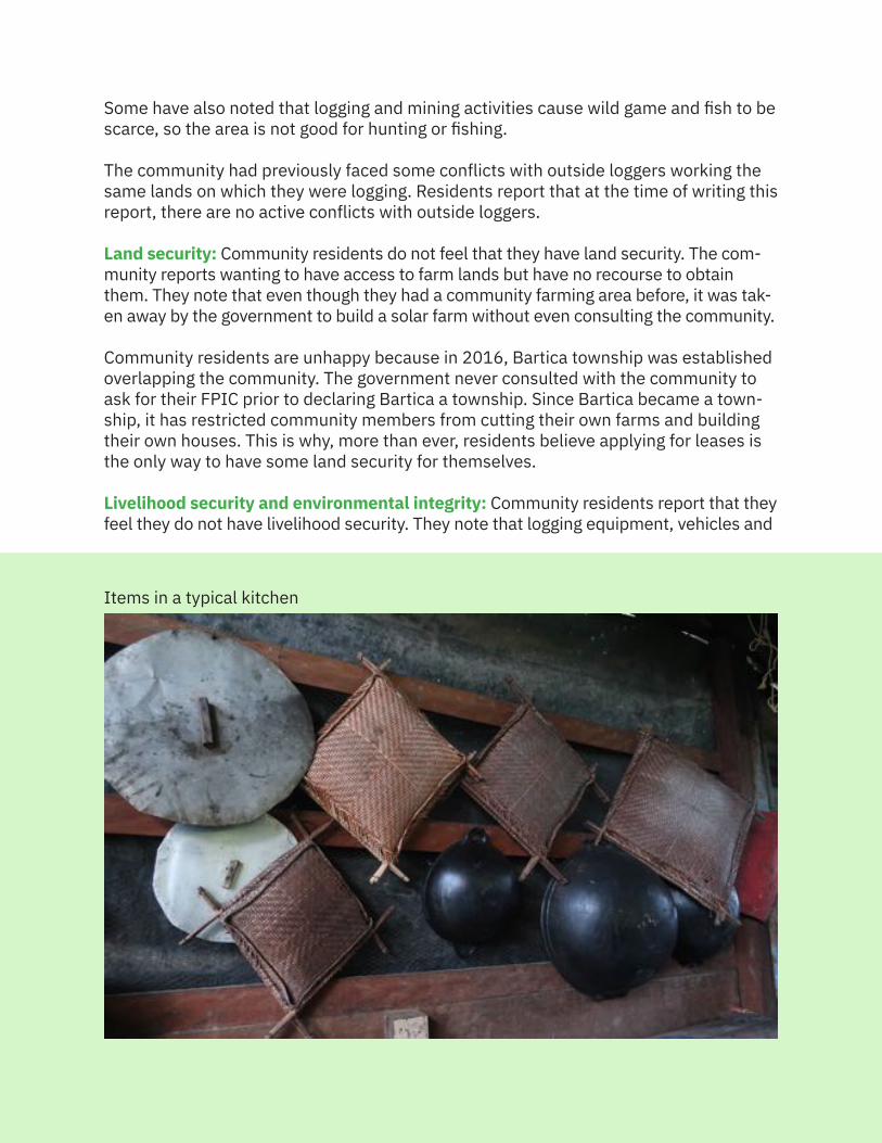
156
Some have also noted that logging and mining activities cause wild game and fish to be scarce, so the area is not good for hunting or fishing.
The community had previously faced some conflicts with outside loggers working the same lands on which they were logging. Residents report that at the time of writing this report, there are no active conflicts with outside loggers.
Land security: Community residents do not feel that they have land security. The com-munity reports wanting to have access to farm lands but have no recourse to obtain them. They note that even though they had a community farming area before, it was tak-en away by the government to build a solar farm without even consulting the community.
Community residents are unhappy because in 2016, Bartica township was established overlapping the community. The government never consulted with the community to ask for their FPIC prior to declaring Bartica a township. Since Bartica became a town-ship, it has restricted community members from cutting their own farms and building their own houses. This is why, more than ever, residents believe applying for leases is the only way to have some land security for themselves.
Livelihood security and environmental integrity: Community residents report that they feel they do not have livelihood security. They note that logging equipment, vehicles and
Items in a typical kitchen
157
associated noise and activities have caused game animals to move further away. Mining activities are causing the pollution of waters, depleting the fish stock. They also note that mercury pollution in the waters is making fish unhealthy for human consumption.
The township of Bartica has refused to allow residents to cut and plant farms, and the gov-ernment has to date failed to provide the community with an alternate farming area. This has forced the community to depend on the cash economy and purchase food in the market.
Recognition and measures sought: Dagg Point recommends that:
— The government recognize indigenous rights to our lands, territories, and resources;
— The government and the township of Bartica set aside lands for the commu-nity as a farming area;
— Every indigenous leader and village council ensure that they have the best interests of their people at heart; and
— The government visit indigenous communities on a regular basis to listen to and respond to their concerns.
5.3.3 KaburiKey findings:
— Kaburi received title in 2006. — The village was demarcated in 2008 and received a Certificate of Title in
2011. — The village’s title is smaller than that requested and excludes much of the
village’s hunting and fishing grounds. — The village borders forestry concessions, but the village reports that there
are no current land or resource conflicts with the loggers operating outside their title. There is a small loggers’ association formed by village residents that has a forestry concession bordering the village titled land, as well.
Location: Kaburi Village, 72 Miles, Bartica-Potaro Road, Region 7
History: The village of Kaburi was established in 1935 as an administrative centre for persons working on the construction of the Bartica-Potaro and Issano Roads, as well as the Denham suspension bridge over the Potaro River. Most of those workers living in the area were Patamona and Akawaio, recruited by the British superintendent of the area, John Aldi. Mr. Moses Aaron was the first indigenous man to come to work in the area, hailing from Kamarang in the Upper Mazaruni, to work as a huntsman, fisherman, and surveyor in the area. Others had come from the Upper Cuyuni in Region 7, as well as villages in Venezuela, including one near the base of Mount Roraima, and the North Pakaraimas in Region 8.
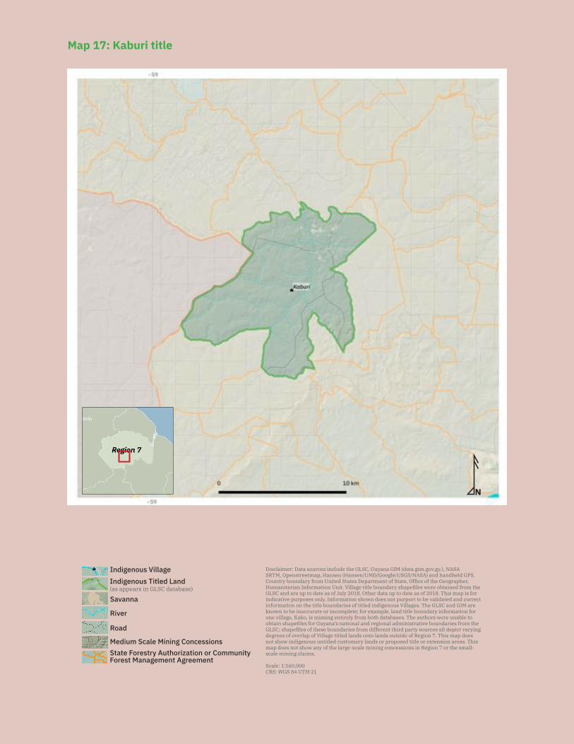
158
N
Disclaimer: Data sources include the GLSC, Guyana GIM (data.gim.gov.gy.), NASA SRTM, Openstreetmap, Hansen (Hansen/UMD/Google/USGS/NASA) and handheld GPS. Country boundary from United States Department of State, Office of the Geographer, Humanitarian Information Unit. Village title boundary shapefiles were obtained from the GLSC and are up to date as of July 2018. Other data up to date as of 2018. This map is for indicative purposes only. Information shown does not purport to be validated and correct information on the title boundaries of titled indigenous Villages. The GLSC and GIM are known to be inaccurate or incomplete; for example, land title boundary information for one village, Kako, is missing entirely from both databases. The authors were unable to obtain shapefiles for Guyana’s national and regional administrative boundaries from the GLSC; shapefiles of these boundaries from different third party sources all depict varying degrees of overlap of Village titled lands onto lands outside of Region 7. This map does not show indigenous untitled customary lands or proposed title or extension areas. This map does not show any of the large-scale mining concessions in Region 7 or the small-scale mining claims.
Scale: 1:160,000CRS: WGS 84 UTM 21
Savanna
Road
River
Indigenous Titled Land(as appears in GLSC database)
Indigenous Village
State Forestry Authorization or Community Forest Management Agreement
Medium Scale Mining Concessions
Map 17: Kaburi title
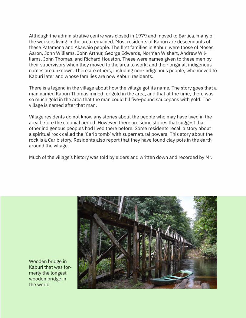
159
Although the administrative centre was closed in 1979 and moved to Bartica, many of the workers living in the area remained. Most residents of Kaburi are descendants of these Patamona and Akawaio people. The first families in Kaburi were those of Moses Aaron, John Williams, John Arthur, George Edwards, Norman Wishart, Andrew Wil-liams, John Thomas, and Richard Houston. These were names given to these men by their supervisors when they moved to the area to work, and their original, indigenous names are unknown. There are others, including non-indigenous people, who moved to Kaburi later and whose families are now Kaburi residents.
There is a legend in the village about how the village got its name. The story goes that a man named Kaburi Thomas mined for gold in the area, and that at the time, there was so much gold in the area that the man could fill five-pound saucepans with gold. The village is named after that man.
Village residents do not know any stories about the people who may have lived in the area before the colonial period. However, there are some stories that suggest that other indigenous peoples had lived there before. Some residents recall a story about a spiritual rock called the ‘Carib tomb’ with supernatural powers. This story about the rock is a Carib story. Residents also report that they have found clay pots in the earth around the village.
Much of the village’s history was told by elders and written down and recorded by Mr.
Wooden bridge in Kaburi that was for-merly the longest wooden bridge in the world
160
Christopher Edwards in 2015.
Main neighbouring communities: Maicobie, Issano, 14 Miles-Issano Road (mining town), Bartica
Estimated population: 300
Identities of residents: Mostly Patamona, Akawaio, Arawak, some mixed
Local government: A village council comprised of a toshao, deputy toshao, and five other councillors. Two of the councillors are responsible for the village shop and one councillor is responsible for issuing permits and tags to loggers.
Land use and economy: Most people in the village earn their living by logging. They mostly work timber inside the village’s title and have to obtain permission from the village council. The residents have also formed the Kaburi Loggers Association that has a State Forestry Permit adjacent to their title that they work on. They do not process the logs themselves but sell them to businesses in Georgetown. Residents also engage in subsistence farming, hunting and fishing. Village residents make cassava bread and cassiri, and the meats they hunt include wild hog, deer, bush cow (tapir), laba, and agouti. Some people in the village also work on mining concessions as employees.
Community projects: The village is planning to build a sports hall and is seeking Presi-dential Grant funding for this project.
Institutions and services: The village has a limited mobile phone network in a few spots; electricity provided through solar and private generators; a health post; and a primary school with a nursery class. Students attend secondary school in Bartica, some on scholarship. A few students attend school in Georgetown if they obtain a scholar-ship to do so. There is no internet service or radio access in the village.
Current land title status: The village was granted title (see Map 17) on 20 June 2006.
Existing title description: ‘The tract commences at the junction of Issano Branch Road and the Bartica Potaro Road, thence along the eastern side of the Bartica-Potaro Road for approximately 5 ¼ miles, thence in an approximate southeasterly direction for approximately 1500 feet to the source of an unknown creek, thence along the left bank of the said unknown creek to its confluence with an unknown creek, thence along the left bank of the said unknown creek to its confluence with the East Kaburi River, thence up the East Kaburi River for approximately 2 ¼ miles to its confluence with an unknown tributary, thence along the right bank of the said tributary for approximately 3 ¼ miles, thence in an approximate north northwesterly direction for approximately 2000 feet to the source of an unknown creek, thence along the left bank of the unknown creek to its confluence with an unknown creek, thence up the right bank of the said unknown creek
161
to its source, thence in an approximate south southeasterly direction for approximate-ly 1 ¼ miles to the source of an unknown creek, thence along the left bank of the said unknown creek for approximately 5 miles to its confluence with an unknown creek, thence up the right bank of the said unknown creek to its source, thence in an approx-imate northwesterly direction for approximately 2 miles to the source of an unknown creek, thence along the left bank of the said unknown creek to its confluence with the East Kaburi River, thence up the right bank of the East Kaburi River for approximately 1 mile, thence across the East Kaburi River to the mouth of an unknown creek, thence along the right bank of the said unknown creek to its source, thence in an approximate southwesterly direction for approximately 1200 feet to the eastern side of the Issano Branch Road, thence along the eastern side of the Issano Branch Road for approxi-mately ¾ mile in a southeasterly direction back to the point of commencement save and except all road reserves and privately owned lands contained therein.’
Title suitability: Inadequate. The title the village received is smaller than what they re-quested, and village residents still use areas outside of their title for hunting and fishing.
Although the village existed in the 1960s at the time the Amerindian Lands Commis-sion was conducting its investigation, the ALC team never visited. Village residents believe the reason was that although the village population was mostly indigenous, it was an administrative centre and was considered a mixed community. Nevertheless, following independence, the government told the community to appoint a Captain, thus treating the village as other indigenous communities for administrative purposes.
The village has been seeking title since the tenure of Captain Lucas David (1986-1994). However, one logging company, Interior Forest Industries (IFI), held two concessions that complicated the village’s request for title and delayed the granting of the request for years. One of IFI’s concessions was over the northern portion of the village’s title request, and the other was over the southern portion. In 2005, representatives from the logging company and the GFC met with the village to negotiate a compromise to release some lands that IFI held on Kaburi’s traditional lands. Some village residents recall that the reason that IFI eventually agreed to give up one of their two concessions was that most of the company’s employees were village residents and they had already worked out one of the two areas. As a result of this meeting, the company gave up the southern concession and the village received title in 2006 to that portion of the land they had requested as title, but not to the whole of their request.
Title demarcation: The village was demarcated in July 2008 and received a Certificate of Title on 11 March 2011. The demarcation description includes a clause that reads: ‘Save and except parcel 6 (reserve for roadway), 20.1168m (or 66.00’) on either side of all navigable rivers and creeks and all other lands legally held or privately owned.’
Demarcation suitability: Accurate. Several village residents participated in the demar-cation and walked the village boundaries with the surveyors. Village residents were hired
162
as guides and to help clear boundary lines. When they finished the demarcation, each participant in the process was given a copy of the surveyed lands. The map was presented at a village meeting and the residents agreed that the map matched their title description. However, residents noted again that it was not what the village had requested as title.
Extension status: The village has not applied for extension. The village is considering that they may apply for an extension in the future.
Extension description: N/A
Extension justification: The village’s current title does not reflect the village’s tradi-tional lands and what the village had originally requested as title. Residents still use areas outside of the title for hunting and fishing, and they consider that they may need additional land as the population increases.
Response from government: N/A
Land and resource conflict(s): The village reports that there are currently very few land and resource conflicts. Although village residents hunt and fish outside of their title and although those areas sit inside logging concessions, as of this writing, village residents report that they have not been prevented from utilizing those areas.
The only resource conflict village residents recall is that when the Amaila Falls hy-drodam project was active, signs on the road told people they could not hunt, fish, log, or mine in the areas staked out by the project. That project is no longer active, however.
Land security: The village generally feels that they have control over their titled lands. When miners or loggers want to do mining or logging in the village, they have usually asked the village council for permission and gone away when the village council denied them that permission. Village residents also generally feel free to do hunting and fish-ing in the areas outside of their title. They have never been told that they cannot do so.
Livelihood security and environmental integrity: Village residents generally feel that they have livelihood security and that their environment is clean. There has been one area of concern to the village, however. Residents have been told by persons working for Troy Gold Resources that they should not hunt or fish in the West Kaburi River, or Wayou, because the company’s mining activities have likely caused cyanide pollution in the waters there. Village residents recall that before the mining started, in 2013, Troy Gold Resources held a meeting in the village about an environmental and social im-pact assessment. People present at the meeting did not understand most of what was discussed because the language was technical. The village reports that the company never came to follow up and there was only one meeting held about the ESIA.
Recognition and measures sought: The village recommends:
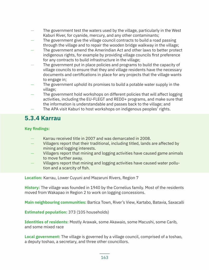
163
— The government test the waters used by the village, particularly in the West Kaburi River, for cyanide, mercury, and any other contaminants;
— The government give the village council contracts to build a road passing through the village and to repair the wooden bridge walkway in the village;
— The government amend the Amerindian Act and other laws to better protect indigenous rights, for example by providing village councils first preference for any contracts to build infrastructure in the village;
— The government put in place policies and programs to build the capacity of village councils to ensure that they and village residents have the necessary documents and certifications in place for any projects that the village wants to engage in;
— The government uphold its promises to build a potable water supply in the village;
— The government hold workshops on different policies that will affect logging activities, including the EU-FLEGT and REDD+ programs, and make sure that the information is understandable and passes back to the village; and
— The APA visit Kaburi to host workshops on indigenous peoples’ rights.
5.3.4 KarrauKey findings:
— Karrau received title in 2007 and was demarcated in 2008. — Villagers report that their traditional, including titled, lands are affected by
mining and logging interests. — Villagers report that mining and logging activities have caused game animals
to move further away. — Villagers report that mining and logging activities have caused water pollu-
tion and a scarcity of fish.
Location: Karrau, Lower Cuyuni and Mazaruni Rivers, Region 7
History: The village was founded in 1940 by the Cornelius family. Most of the residents moved from Wakapao in Region 2 to work on logging concessions.
Main neighbouring communities: Bartica Town, River’s View, Kartabo, Batavia, Saxacalli
Estimated population: 373 (105 households)
Identities of residents: Mostly Arawak, some Akawaio, some Macushi, some Carib, and some mixed race
Local government: The village is governed by a village council, comprised of a toshao, a deputy toshao, a secretary, and three other councillors.
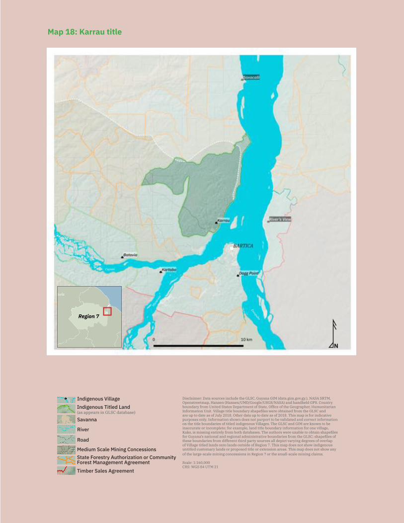
164
N
Disclaimer: Data sources include the GLSC, Guyana GIM (data.gim.gov.gy.), NASA SRTM, Openstreetmap, Hansen (Hansen/UMD/Google/USGS/NASA) and handheld GPS. Country boundary from United States Department of State, Office of the Geographer, Humanitarian Information Unit. Village title boundary shapefiles were obtained from the GLSC and are up to date as of July 2018. Other data up to date as of 2018. This map is for indicative purposes only. Information shown does not purport to be validated and correct information on the title boundaries of titled indigenous Villages. The GLSC and GIM are known to be inaccurate or incomplete; for example, land title boundary information for one village, Kako, is missing entirely from both databases. The authors were unable to obtain shapefiles for Guyana’s national and regional administrative boundaries from the GLSC; shapefiles of these boundaries from different third party sources all depict varying degrees of overlap of Village titled lands onto lands outside of Region 7. This map does not show indigenous untitled customary lands or proposed title or extension areas. This map does not show any of the large-scale mining concessions in Region 7 or the small-scale mining claims.
Scale: 1:160,000CRS: WGS 84 UTM 21
Savanna
Road
River
Indigenous Titled Land(as appears in GLSC database)
Indigenous Village
State Forestry Authorization or Community Forest Management AgreementTimber Sales Agreement
Medium Scale Mining Concessions
Mazar
uni
Cuyuni
Essequibo
Map 18: Karrau title
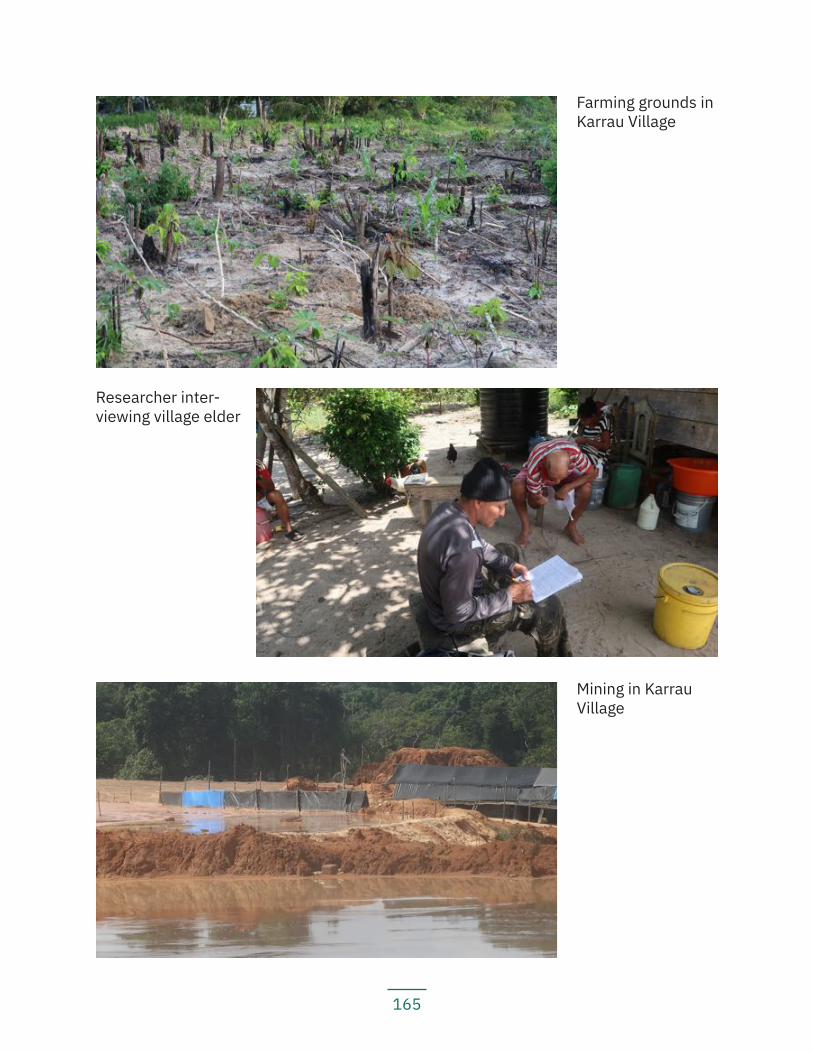
165
Researcher inter-viewing village elder
Mining in Karrau Village
Farming grounds in Karrau Village

166
Land use and economy: The main economic activities in the village are working in the logging and mining industries. Village residents engage in subsistence farming and plant crops including: bitter and sweet cassava, banana, plantain, eddo, dasheen, pumpkin, and green vegetables. Very few villagers still do traditional hunting.
Community projects: The village has built a toll gate at which outsiders must pay to pass through the village. The village reports that many times, it is miners who pass through village lands. There is also a village tractor that the village rents out to loggers working outside their title.
Institutions and services: The village has cellular network access; electricity through solar panels and mobile generators; a health post; a nursery school; and a primary school. For secondary school, students attend school in Bartica.
Current land title status: The village received title (see Map 18) in 2007.
Existing title description: ‘The area commences at the mouth of the Tiger River Left Bank Essequibo River, thence up the said Tiger River for approximately 5 miles to the mouth of an unnamed tributary on the left bank of the Tiger River, thence up the said unnamed tributary to its source, thence South West for approximately 1 mile to a point on another unnamed tributary of the said Tiger River, thence down the said unnamed tributary for approximately 3¼ miles, thence South East approximately 1¼ miles thence South West for approximately 1¼ mile to a point on the Karau Creek, thence South East along the Karau Creek to its mouth Left Bank Cuyuni River, Left Bank Es-sequibo River, thence down the left bank of the Essequibo River to the point of com-mencement. Save and except all lands legally held.’
Title suitability: Inadequate. The village is not satisfied with their title because it is in-adequate for their present and future needs. The village has thus requested extension.
Title demarcation: The village was demarcated, and it received a Certificate of Title on 15 September 2008. The authors of the report were unable to obtain a copy of the vil-lage’s demarcation plan and thus a description of the village’s demarcated boundaries.
Demarcation suitability: Accurate. The village is satisfied with the demarcation of their existing title. The village nominated residents to be line cutters and to work with the demarcation team, and they report that the demarcation follows their title bound-aries accurately.
Extension status: The village cannot recall precisely when they applied for extension; however, the village’s extension is part of the ALT project and it was stated during the ALT team visit to the village in 2015 that they had applied for extension in 2005.
Extension description: The authors of the report were unable to obtain a copy of the
167
village’s extension description filed with the government.
Extension justification: The village’s current title is inadequate for their needs.
Response from government: The village received no formal response from the govern-ment regarding their extension application since the ALT team visit. Instead, residents report that when the village asked, the person they spoke with at MIPA informed them that the government had no extension application on file. Some residents expressed a concern that perhaps the MIPA had lost their application.
Land and resource conflict(s): The village reports that their customary, including titled, lands are affected by mining and logging interests. According to the government GIM website, there are a few medium-scale mining concessions that overlap with the village’s title. The village notes that miners are mining in the village’s title without per-mission from the village.
The village reports that although the MIPA, the GGMC, the Chairman of the Regional Democratic Council of Region 7, and a National Toshaos Council representative have all visited Karrau at various points in time, none of them have done anything about the miners and loggers, who are still working on their lands.
Land security: The village does not feel that they have land security, because they do not have control over even their titled lands when it comes to mining and logging activ-ities. There are operators working without the village’s permission and without having consulted with the village or asked for their FPIC.
Livelihood security and environmental integrity: Villagers report that although at the moment they feel that they have food security, their lands, forests, and soil are being threatened by increasing logging and mining activity, and animals have moved further away. They note that the water is polluted, and fish are scarce.
Recognition and measures sought: The village recommends:
— The government must make all necessary legal and policy framework revi-sions to protect indigenous customs and traditions;
— The government must remove all concessions and permits from indigenous lands when granting title;
— The MIPA, GGMC, GLSC, GFC and EPA must visit the community together to hear from the villagers their concerns and must act upon those concerns to resolve them immediately;
— The village council must represent the needs of its villagers; — The APA must visit the village to inform them about the latest developments
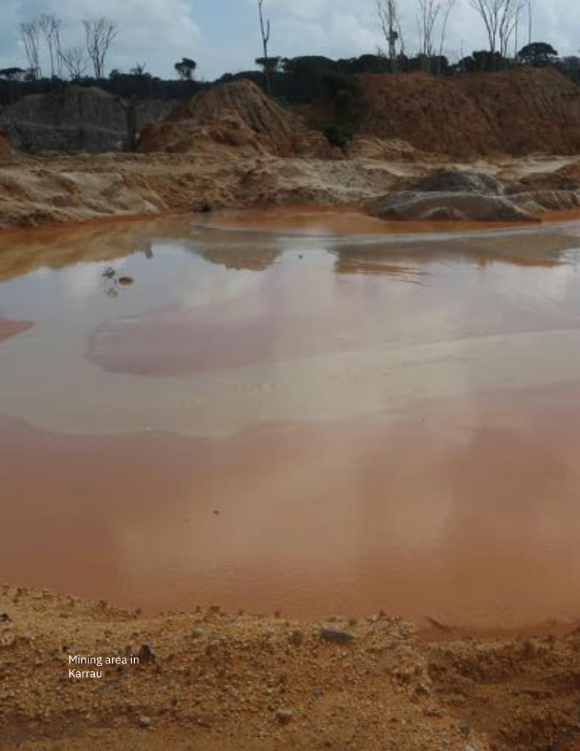
168
Mining area in Karrau
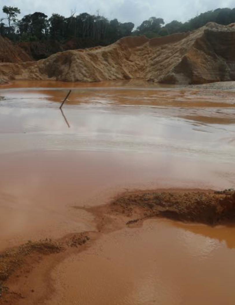
169
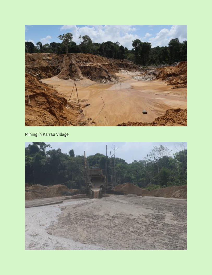
170
Mining in Karrau Village
171
in the country affecting indigenous peoples; and — The APA must visit the village and hold a workshop about indigenous peo-
ples’ rights and human rights.
5.3.5 KartaboWe feel that the land is our everything. We get our food from the land, house materials from the land, and medicine from the forest on the land. – Kartabo resident
Key findings:
— Kartabo does not have title. The community is governed by a community development council.
— Community members are concerned that their forests are being threatened due to logging activities.
— Loggers are restricting community members from accessing forest products they traditionally use.
— Mining and logging activities have caused animals to relocate further away. — Mining activities have polluted the waterways, making the water unsafe for
consumption and causing a scarcity of fish. — The community is concerned that their youth are being attracted away from
traditional indigenous lifestyles by logging and mining activities. This has led to a shortage of people working in farms, which, in addition to the de-struction of their crops by animals, has caused some food shortages.
Location: Kartabo, Lower Cuyuni and Mazaruni Rivers, Region 7
History: The first family to live where the present community is located was Morgan Williams’ family, in 1900. The community reports that there had been many scattered settlements around the area, populated by people who had moved to work on the logging concessions. They also report that during the Dutch colonial days, the area had been earmarked for a sugar plantation, but the area did not produce enough sugarcane, so the plans were abandoned. Instead, when the timber industry started up, the area became a camping ground for itinerant workers coming to work on the concessions.
There are a few spiritual sites around the village, for example, at Takuyaaha Bay in the Cuyuni River, where a mysterious object or creature makes noise and disappears.
Main neighbouring communities: Itaballi landing, Bartica Town, Batavia, Karrau
172
Estimated population: 327 (69 households)
Identities of residents: Mostly Warrau, with some mixed race
Local government: The community is governed by a community development council, with a chairman, a vice chairman, a secretary, a treasurer, and two other councillors.
Land use and economy: Most community members earn a living by working in mining and logging concessions. Community members engage in subsistence farming, with main crops planted including: sweet and bitter cassava, yam, eddo, dasheen, banana, plantain, green vegetables, mango, pear, and lime. Community residents also still en-gage in some hunting and gathering activities. The community does not do much tradi-tional fishing.
Community projects: The community has a community shop and community-run poul-try farm.
Institutions and services: The community has access to mobile network; electricity via mobile generators; health services; and a primary school with a nursery class. For secondary school, students attend school in Bartica.
Current land title status: None. The community does not have legal title. The commu-nity reports that they have never applied for title because they have been led to believe that having individual leases gives them better security of land tenure. Community members already have private leases, while others are still in the process of applying for leases and waiting to hear back from GSLC. Some families had older, established leases, and some community members were in recent years deciding to apply for leases to regularize their claims to the lands. Community members report that they were told by GLSC that if and when they obtained village title, they would not be able to obtain any loans from the bank if they needed. Community members were made to be-lieve that by having individual leases to individual plots of land, they might eventually own their own plots of land that they could use as collateral to obtain bank loans. They believe that this indicates that they would have more land tenure security. The commu-nity reports that they have been encouraged by GLSC to apply for individual leases as opposed to communal title.
Existing title description: N/A
Title suitability: N/A
Title demarcation: N/A
Demarcation suitability: N/A
Extension status: N/A
173
Extension description: N/A
Extension justification: N/A
Response from government: N/A
Land and resource conflict(s): The community is concerned that there are logging concessions in areas bordering their leases. Community members report that they are prevented from passing through these concessions to do hunting. Community mem-bers cannot themselves cut lumber as they used to, because the loggers tell them that the forests do not belong to them. The community is worried that as the loggers contin-ue to extract lumber for sale, soon their forests will be gone.
Land security: Many community members do not feel that they have security over their lands. Aside from the logging concessions, there are other individual leases in their community that do not belong to community members. These leases are owned by outsiders who do not live in the community, but occasionally, outsiders will come into the community to use those leased plots. The community feels powerless because they do not own those leases and have no control over those areas.
Livelihood security and environmental integrity: Community members worry that their forests are in danger due to ongoing logging activities. They have noticed that animals are moving further away. Mining activities have caused water pollution, mak-ing the water unsafe for drinking or cooking, and causing a scarcity of fish. Community members are also concerned that the introduction of logging and mining and non-in-digenous culture has attracted their youth away from their traditional lifestyles, lead-ing to a shortage of people working on farms and thus a food and crop shortage. This shortage is compounded by the fact that sometimes, wild animals come onto their farms and destroy some of their crops. They report that they cannot hunt these animals to protect their farms, because once the animals run off, they cannot follow them into the logging concession areas.
Recognition and measures sought: The village recommends:
— The government must cease granting lands or other land rights to outsiders; — The government must grant indigenous peoples rights to their lands, territo-
ries and resources; — The village council must represent the village to ensure that the villagers get
lands to build their homes and farms; — The government must give all indigenous communities titles to their lands
and make the process more efficient; — Government officials must visit communities and listen to their concerns;
174
— The government must first consult the community prior to granting titles, lea-ses, concessions, or other land rights on traditional lands to outsiders; and
— The APA must visit the community regularly to provide updates on develop-ments around the country affecting indigenous peoples.
5.4 Upper CuyuniThe Upper Cuyuni area currently marks the northwestern extent of Akawaio territory in Guyana. Many families in the Upper Cuyuni note that traditional Akawaio territory did not stop at the international border, however, and they have family members on the other side of the border in Venezuela. While this report does not include a separate section on the community living at Ekereku, it is worth noting that the extended Peters family had been living in both Guyana and Venezuela and is currently seeking to return to their traditional lands in Ekereku [an Anglicisation of Eclung Eku].
The Peters family, numbering about 250 persons, or 60 households, moved from Wara-madong to settle at Caiwalak Palu on the Ekereku River and at Tulungbang [Etering-bang] several generations ago. The family’s lands were close to the Venezuelan border and the family would cross over to Venezuela to access health care and other services which were not available on the Guyana side of the border. The family then settled in Venezuela so that their children would have easier access to healthcare and education. Since 2017 - 2018, when the economic and political situation in Venezuela worsened, the family has been looking to return to their lands in Ekereku.
Upon the family’s return, they have faced land conflicts with miners operating on their traditional lands. One Brazilian miner threatened to harm the family if they hunt and fish upstream of their camp. Miners also bulldozed the family’s houses and farms, leav-ing the family to live in makeshift tents. The Peters family has asked the government for legal recognition of their lands and one of the Ministers of Indigenous Peoples’ Affairs has visited the community, promising a solution for them, but to date, not deliv-ering on that promise.
5.4.1 ArauKey findings:
— Arau received title in 1991, but the title does not reflect their traditional lands and was not what they requested. The village centre itself, including all homes, actually sits outside of the title.
— The original grant plan for the village has been misplaced by GLSC and villa-gers cannot recall if they had ever received an original copy. The replacement grant plan in the GLSC office is incorrect. The government (GLSC and MIPA, through the ALT Project) has agreed that the plan is incorrect and that they will
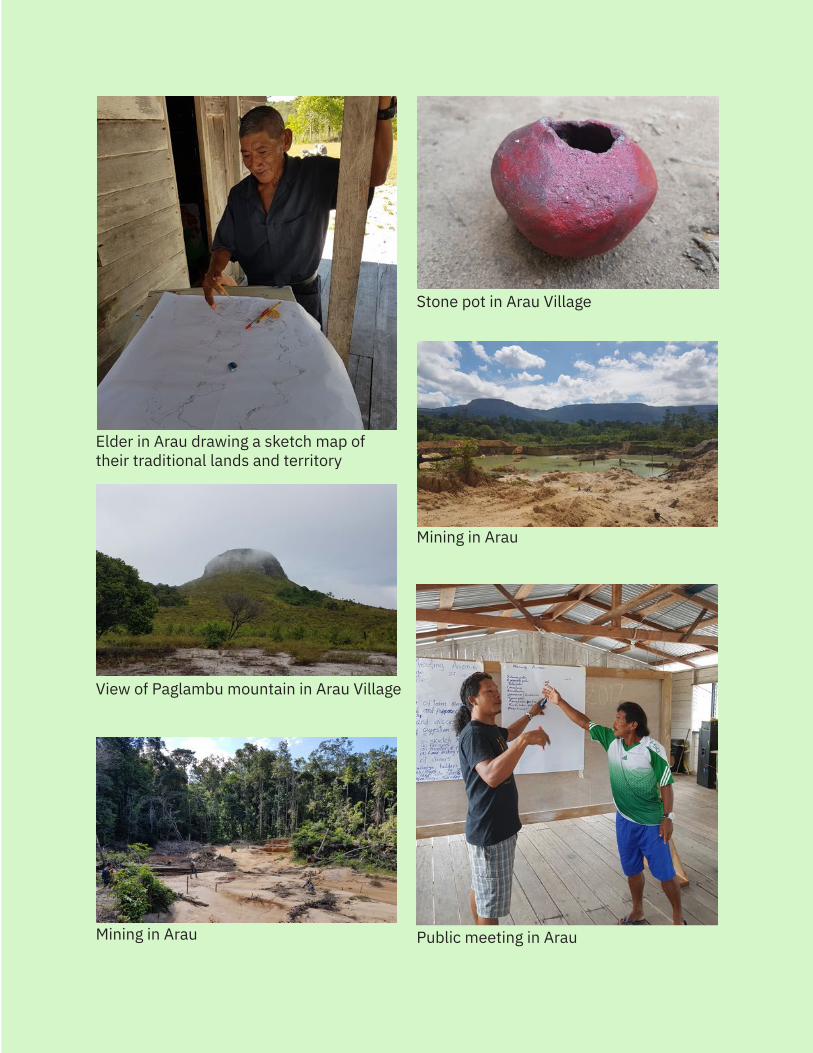
175
Elder in Arau drawing a sketch map of their traditional lands and territory
Mining in Arau
Stone pot in Arau Village
Mining in Arau Public meeting in Arau
View of Paglambu mountain in Arau Village
176
correct it before demarcating the village. — Arau has tried to ensure that their extension application does not conflict
with Kaikan Village’s extension and that they instead share a boundary. — The village’s farmlands in both titled and customary untitled lands are cove-
red with mining concessions and being destroyed by miners. — Miners have stolen crops from the villagers’ farms, and their animals have
destroyed villagers’ farm produce. Excavators and dredges have also de-stroyed entire farms.
— Mining activities have polluted the village’s main waterways and destroyed fishing grounds.
— The Arau River has high levels of turbidity and is essentially now considered by villagers to be a ‘dead’ river.
— Arau residents access potable water through a piped water system that carries water from the Pakarampa Mountain, because the water in the rivers is not safe for consumption.
— Mining activities have also disturbed the village’s hunting grounds, chasing wildlife farther away.
— The village is concerned about the activities of Venezuelan sindicatos (armed criminal gangs), who have demanded payments from businessmen and mi-ners on the pretext of providing them with security services.
— Village residents are concerned about the increasing criminal activity caused by the influx of outsiders doing business (including illegal drug and arms traffi-cking) in the mining areas. They have noticed an increasing number of killings in these mining areas as well.
Location: Arau and Wenamu Rivers, Upper Cuyuni, Region 7
History: The Akawaio have been occupying the land in and around Arau Village since time immemorial. The present-day village was ‘founded’ in the 1800s by the families: Benjamin, Thomas, Randolph, Sammy, Ascento, Jose, Lucio, King, Brown, and Lewis. They moved together to a more central location because missionaries had established a school and church. Later, some families moved south to what is today Kaikan, so in fact, Arau and Kaikan share the same traditional lands.
The village is mentioned in the 1969 Amerindian Lands Commission report, but the vil-lage has moved locations from where it was when that report was written. The previous location was about 1.5 hours walking from the current location, which is very close to the Pakarampa Mountain.
Pakarampa Mountain is an important spiritual site. Oral history says that the first vil-lage was located at the foot of the mountain, and the Arecuna had come and killed almost all of the residents there, except for one girl, who had hidden. The spirit of the mountain came to the girl and she asked him to take revenge on the Arecuna. The spirit told her that he could not do it, but his brother who lived on another mountain could
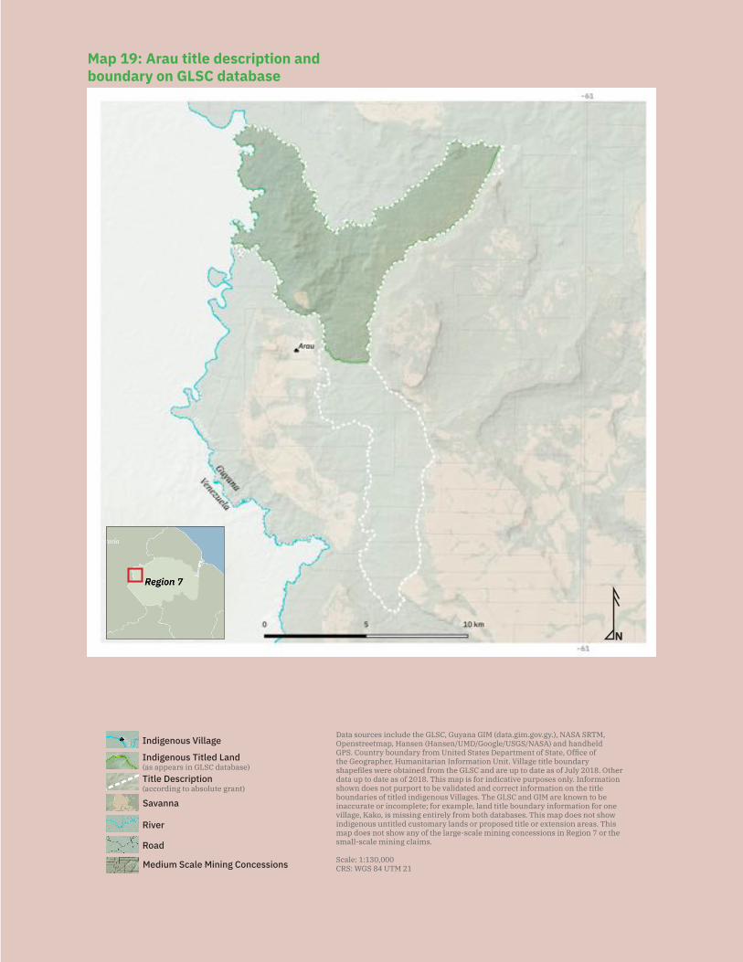
177
N
Data sources include the GLSC, Guyana GIM (data.gim.gov.gy.), NASA SRTM, Openstreetmap, Hansen (Hansen/UMD/Google/USGS/NASA) and handheld GPS. Country boundary from United States Department of State, Office of the Geographer, Humanitarian Information Unit. Village title boundary shapefiles were obtained from the GLSC and are up to date as of July 2018. Other data up to date as of 2018. This map is for indicative purposes only. Information shown does not purport to be validated and correct information on the title boundaries of titled indigenous Villages. The GLSC and GIM are known to be inaccurate or incomplete; for example, land title boundary information for one village, Kako, is missing entirely from both databases. This map does not show indigenous untitled customary lands or proposed title or extension areas. This map does not show any of the large-scale mining concessions in Region 7 or the small-scale mining claims.
Scale: 1:130,000CRS: WGS 84 UTM 21
Savanna
Medium Scale Mining Concessions
Road
River
Indigenous Titled Land(as appears in GLSC database)
Indigenous Village
Title Description (according to absolute grant) N
Data sources include the GLSC, Guyana GIM (data.gim.gov.gy.), NASA SRTM, Openstreetmap, Hansen (Hansen/UMD/Google/USGS/NASA) and handheld GPS. Country boundary from United States Department of State, Office of the Geographer, Humanitarian Information Unit. Village title boundary shapefiles were obtained from the GLSC and are up to date as of July 2018. Other data up to date as of 2018. This map is for indicative purposes only. Information shown does not purport to be validated and correct information on the title boundaries of titled indigenous Villages. The GLSC and GIM are known to be inaccurate or incomplete; for example, land title boundary information for one village, Kako, is missing entirely from both databases. This map does not show indigenous untitled customary lands or proposed title or extension areas. This map does not show any of the large-scale mining concessions in Region 7 or the small-scale mining claims.
Scale: 1:130,000CRS: WGS 84 UTM 21
Savanna
Medium Scale Mining Concessions
Road
River
Indigenous Titled Land(as appears in GLSC database)
Indigenous Village
Title Description (according to absolute grant)
Map 19: Arau title description and boundary on GLSC database
178
help as he had the bina. He went to his brother and brought the bina in a pakarampa (small bag). The girl went with the spirit to the Arecuna village where they put the Are-cuna to sleep and killed them in revenge.
The tribal wars between the Akawaio and Arecuna gave the village its name. The vil-lage’s name is properly Kwayou, which means ‘tribal warriors’ in Akawaio. All of the vil-lage’s foreparents were kwayou. Outsiders could not pronounce Kwayou, so the village name ended up becoming ‘Arau’.
Main neighbouring communities: Kaikan, San Juan (Akawaio community in Venezuela)
Estimated population: 232 (54 households)
Identities of residents: Predominantly Akawaio, with a few Arecuna and Arawak
Local government: The village is governed by a village council, consisting of a toshao; a deputy toshao; a treasurer; a secretary; a councillor responsible for health; a coun-cillor responsible for youth and sports; a councillor responsible for agriculture; and a councillor responsible for mining.
Land use and economy: Villagers engage in subsistence farming, and some of the main crops planted include cassava, potato, and sugarcane. Residents prepare local drinks, including cassiri and cane juice, and engage in traditional hunting, fishing, and gathering activities. Villagers report that all of their hunting, fishing, and gathering grounds are outside of their titled lands, and some are shared with neighbouring com-munities. Village residents have always engaged in traditional mining, and elders tell of their foreparents using blocks of gold as pot stands and as ornaments.
Community projects: The village has plans to build a micro-hydrodam to support the vil-lage’s electricity needs. The village also plans to open a road from the village to Paruima and Waramadong villages in the Upper Mazaruni, to connect Arau to the Upper Mazaruni. There are additionally future plans to construct an airstrip to service the village.
Institutions and services: The village has a radio set; access to internet (through Wi-Fi operated by the village); access to electricity via generators and solar panels; a health post; a nursery school; and a primary school. For secondary school, students attend the secondary school in Waramadong in the Upper Mazaruni.
Current land title status: The village was granted title in 1991. Its title is listed under the amended schedule to the Amerindian Act and recorded as an absolute grant under the State Lands Act.
Existing title description: ‘A tract of State land situate Right Bank Wenamu River, commencing at the mouth of the Muruwawe River, Right Bank Wenamu River, thence

179
up the Muruwawe River to the edge of the escarpment, thence south along the edge of the escarpment to the Arau River, thence down the Arau River to its mouth, thence down the Wenamu River to the point of commencement.’
Title suitability: Inadequate. The village was not consulted during the process of granting title. The village considers that their traditional lands extend to the sources of the Arau, Muruwari (incorrectly spelled as ‘Murawawe’ in the title description) and the Manawaka Rivers. During the ALC investigation, Arau requested ‘From Arawai Falls to Muruwawe River on the Wenamu and back to the escarpment.’ Village residents report that the request in the ALC Report does not accurately reflect their traditional lands or what their foreparents requested, because they had request-ed the lands beyond the escarpments, of which there are three. The description as it appears in the ALC report was given by an Afro-Guyanese teacher to the ALC investiga-tors, and the teacher did not properly understand the description given by the villagers.
The ALC recommended ‘The area commencing at the mouth of the Muruwawe River, right bank Wenamu River, thence up the Muruwawe River to the edge of the escarpment, thence south along the edge of the escarpment to the Arau River, thence down the Arau River to its mouth, thence down the Wenamu River to the point of commencement.’
The title granted in 1991 is identical to the area recommended by the ALC. The ALC noted that ‘The area recommended is less than that requested… The Commission con-siders this area to be adequate for present needs and future development’. However, the village feels this area to be inadequate and the village centre, including all homes, actually sits outside of their title.
The village also observed that the names of places on government maps are incorrect and are not how they know them to be — a few examples include: Muruwari is spelled incorrectly as ‘Murawawe’; Manawaka is spelled incorrectly as ‘Manowak’; and Kwayou is spelled incorrectly as ‘Arau’.
The village today also faces a problem in that the grant plan on file at the GLSC office is incorrect and excludes the southern and eastern portions of their title (see Map 19). The original grant plan is missing, but village residents believe the original plan cor-rectly showed these portions of their title. The government, through the ALT project (namely, the GLSC and MIPA) have agreed that the plan needs to be corrected, and the village has agreed to demarcation once the plan is corrected. However, although the government agreed to correct the grant plan more than a year ago and even concluded a Memorandum of Understanding with Arau to that effect, to date, nothing has been done and the village is still awaiting the correction to the plan.
Title demarcation: The village has not yet been demarcated. The village has agreed to the government’s process of demarcation before extension, provided that their erro-neous grant plan is first corrected. The village believed that agreeing to demarcation
180
would expedite the processing and granting of their extension, so that their title will actually encompass their traditional lands, including the main village centre, as well as various homesteads and farms.
Demarcation suitability: N/A
Extension status: The village has applied for extension. They sent in an initial applica-tion in 2006 and sent a second application in 2008 after the then-Minister of Amerindi-an Affairs told the village that their first application was lost.
Extension description: The description of Arau’s extension as it appears on the official plan showing the village’s proposed extension is: ‘The area commenced [sic] at a point of the left bank of the Muruwawe River, from its mouth and with UTM coordinates E 717,114 N 713,733, thence up the Muruwawe River to its sources [sic] and with UTM coordinates E 731,762 N 684,015, thence in a north westerly direction to the source of the Arau River and with UTM coordinates E 714,955 N 688,142, thence down the Arau River to a point and with UTM coordinates E 710,891 N692,185, thence in a westerly direction to the source of the Manowak Creek and with UTM coordinates E 692,358 N 709,392, thence down the Manowak Creek to its mouth, right bank Wenamu Riv-er and with UTM coordinates E 693,861 N 708,911, thence down the Wenamu Riv-er to the mouth of the Arau Creek and with UTM coordinates E 703,949 N 708,611, thence along the common boundary of tract ‘A’ [Arau’s title] and back to the point of commencement. Save and Except all access to right of way [sic]. 300 Yards from Guyana-Venezuela International Boundary, 66’ feet from either side of the navigable creeks and rivers. All lands that are legally held, and all existing airstrip [sic].’
Extension justification: The village wants their extension to include the village centre and all of their homesteads and farms. The village council reports that they had infor-mally discussed their proposed extension boundaries with the then-toshao of Kaikan Village prior to applying for extension to try to ensure the two villages requested exten-sion to the same boundary point, rather than overlapping.
Response from government: The village has not received any official written response from the government. An ALT project team, comprised of representatives from the MIPA, the GLSC, and the GGMC visited the village in 2015 and asked the village what they wanted as their extension because there were two applications seeking extension on two different pieces of land. The first extension application, which the then-MoAA lost, had not been lost by the GLSC and wasused by GLSC to prepare a first map of the requested extension. When the village sent in their second application in 2008, they amended the request so as to avoid conflict with Kaikan’s extension. This was the second map. During the ALT visit, the village chose the map that would not overlap with Kaikan’s extension.
The government has told the village that they would fast-track the process for demar-cation and extension because the village sits outside of the title.
181
Land and resource conflict(s): Villagers complain that their farmlands are covered with mining blocks and are being mined out. Village residents report situations of min-ers’ animals (including mules and horses) destroying their farm produce and of miners themselves stealing crops (including bananas, plantains, cassava, coconuts, and cane) from their farms. In one case, a miner and resident got into a fight with wooden clubs when a resident was trying to protect his home from being raided by the miner. There have also been reports of miners bulldozing over farms. Some villagers have moved their farms and others are planning to move their farms because they do not feel se-cure with miners around.
The presence of active mining concessions and camps in and around the village is causing an influx of foreigners, notably Venezuelans and Brazilians, who are engaged in drug and arms trafficking and are bringing increased crime into the area. There has been an increasing number of killings in the mining areas around the village as a result of some of these activities. These outsiders are also bringing diseases into the village; the increase in prostitution around the village is especially causing a rise in STDs. The presence of drugs and alcohol around the village is causing social problems.
In addition, miners are preventing village residents from passing through their mining concessions, even to access their farms on the other side of the concessions. They also prevent villagers from doing traditional mining activities, stopping some village resi-dents from mining altogether and forcing others to go further out to mine.
The government GIM website does not show any mining concessions in the village’s titled lands; however, the government GIM website also does not accurately reflect the village’s title. A southern portion of the village’s title is missing, as in the case of the GLSC’s official replacement grant plan of the village. The government has agreed that this is an error and the GLSC must issue a corrected grant plan of the village. There do appear to be mining concessions in that land that should be part of the village’s title.
Land security: The village is concerned that there are mining blocks on their titled lands, and particularly, in their farming areas. The village says that the main settlement sits on a mining block. Villagers report that there were never any consultations held with them before any of the mining concessions were granted, and they only learned about these mining concessions after seeing maps with the concessions on them. Resi-dents believe that these concessions were issued after the village received its land title. The village reports that some miners are working on their titled land with the permis-sion of the village council; however, most of the miners are working without permission.
The village has complained to the GGMC repeatedly about mining issuesbut has not received any response from that agency. The village also complained to the MIPA about the mining concessions on their lands, but the Ministry has told them that they could not do anything about it and that the village would have to take those matters to court.
182
The village did, in fact, take matters to court in 2009, and the court decided that: 1) the mining activities happening on the village’s titled lands were violating the village resi-dents’ Constitutional right to an environment which is not harmful to their health and well-being; and 2) the GGMC had a Constitutional duty to ‘make all reasonable efforts to ensure that mining activities [on the lands occupied by the village]’ did not diminish the value of land to the way of the life of the village residents as indigenous people. Despite this court decision, mining activities continue to cause environmental and health issues and to violate the residents’ right to their way of life. Moreover, this court decision did nothing to reverse the existence of mining concessions on the village’s ti-tle, though they had sought a court order voiding the concessions granted on their title.
In general, village residents feel that they do not have control over their traditional lands. For example, at the village’s original location (as recorded in the ALC Report), many coastlanders and foreigners have started businesses because of the mining camps around, but without the village’s permission. The coastlanders are also selling drugs, and some of them have marijuana farms in that area.
Livelihood security and environmental integrity: Mining in Arau’s titled and cus-tomary lands has caused significant environmental damage. Villagers report that the waters they use are polluted and fishing grounds are being destroyed, meaning that they have to travel further to catch fish. The water in the Arau River is reportedly ‘dead’, with high levels of turbidity. Villagers are also concerned that there is mercury poison-ing in the water because they know that the miners use mercury in their operations. Because there is no potable water in the rivers, the village has water supplied to their residences by pipe. This water system works via gravity and uses water coming off the Pakarampa Mountain into a reservoir. However, even that water is contaminated, be-cause the miners’ animals are roaming around the Pakarampa Mountain and defecat-ing around it. Rain washes all the contaminated waters and soil into the reservoir.
The operation of heavy machinery in the forest has chased away wildlife, causing villagers to need to travel further to find good hunting grounds. Villagers also report that their farms have been destroyed, and even some farms which were actively being cultivated were dredged away and completely dug up. Excavators are also generally causing significant deforestation and clearing large amounts of vegetation. Many of the trees being cut down to clear the land for mining are left unused, or are used by miners to make sluice boxes and other structures.
Mining activities close to the village have also caused increased disease, such as ma-laria. Increased prostitution activity is also causing an increase in STDs and particu-larly, HIV. Families living in the areas closer to where the outsiders have established businesses, in the village’s original location, complain about the businesses dumping trash everywhere without regard for homes. They also report indecent exposure by miners and prostitutes, even when little children are around.
183
The village feels increasingly threatened by mining activities, reporting that the miners have brought criminal activity into the area. At the time this report was being written, numerous dead bodies had been found around the village. These people were Vene-zuelan migrants; the village does not know why they were killed, but they suspect they were the victims of robberies or were killed by criminals wanted in Venezuela. The vil-lage is close to the border with Venezuela and residents are fearful of the Venezuelan sindicatos, criminal organisations that have been demanding payments from business-men and miners on the pretext of providing them with security services.
Recognition and measures sought: The village recommends:
— The Arau Village Council must advocate harder for the village’s land issues to be resolved. They must follow through on the process they have started with the government;
— The government must immediately correct the erroneous official grant plan for the village. The government must then demarcate the village with the vil-lage’s effective participation and expedite the processing and granting of the village’s extension request;
— The government must immediately cease renewing prospecting and mining licences and must refrain from giving out new licences on the village’s custo-mary (including titled) lands;
— Government agencies must visit the village more frequently to gain a first-hand understanding of the issues the village is facing, in particular intrusions on their lands by miners and criminals;
— The government must ensure that the police and army soldiers and other enforcement officials do their work more effectively to prevent crime in and around the village;
— The government should send in a medical team to inspect the sanitary health of the mining areas and to prevent any disease outbreaks;
— The government must expedite the training and arms licensing of the Com-munity Policing Group so they can more effectively protect the village; and
— The National Toshaos Council should make more visits to communities to fully understand the issues being faced, since many communities face similar issues.
5.4.2 KaikanKey findings:
— Kaikan received title in 1991, but its title is smaller than what they requested and excludes most of their traditional lands.
— Most of the village’s farming grounds lie outside of the village’s title. — During the ALC investigation, the ALC team reportedly told the village that
they could not get what they requested because they would not be able to manage such a large piece of land.
184
— The village reports that two of their creeks are misnamed in their title, thus ina-dvertently making their title even smaller than what it was intended to cover.
— Current government maps of the village’s title do not correspond to their title description, cutting off a southeastern corner of their title. As a result, some mining concessions that were granted in their titled lands are shown as being outside of the village’s title on government maps.
— The village is refusing demarcation until the government recognizes all of their traditional lands.
— Miners have restricted villagers from accessing parts of their traditional lands to access their trails or traditional mining sites.
— Police officers and army soldiers have entered the village supposedly to do pa-trols and provide security for the airstrip; however, villagers report that these police and army soldiers have assaulted women and stolen from the village.
— The village is located on the border with Venezuela and has seen an influx of Venezuelans, which is bringing increased crime.
— Villagers are concerned that mining activities will cause their hunting and fishing grounds to be destroyed.
— The village’s waterways have been polluted, including with mercury and hu-man faeces.
— The village traditionally uses the same polluted waters for cooking and drin-king, and many residents receive water to their homes through a system that pumps water directly from the river to storage tanks that then distribute water through a pipe network. The village has no water treatment facility.
Location: Kaikan, Wenamu River, Upper Cuyuni, Region 7
History: The Akawaio have been living in and around Kaikan for generations, in numer-ous settlements, for example at Mouruari Keng, Samburapai, Kanawapu, Sacarapu-ree, Chipodu, Mosapai, Sukapee, Itabu, and Pidonopai (in order of location from north to south). The old settlements extend from present-day Arau south to present-day Kaikan, indicating that the two villages share the same traditional lands.
Kaikan itself is named after the armadillo, which is called kaikan in Akawaio and is plentiful around the area. The present-day village had been a settlement at which Adventist missionaries found Akawaio living. The missionaries founded a school in the settlement and more families moved from various surrounding settlements and started to congregate in the present-day Kaikan Village around 1920. The families organized into a village and elected a chief. The founder families in the village are Peter Angel (Inchelu in Akawaio), John Brown, Francisco Frederick (Franjiko in Akawaio), Benjie Nathaniel, Jose Peter, Ramon Charlie, David King, Long John (Karana in Akawaio), Elu-wone, Equapik, and Tak Waning.
Important cultural and spiritual sites, along with former settlements around the area, testify to the prolonged indigenous occupation of the area. One important spiritual site
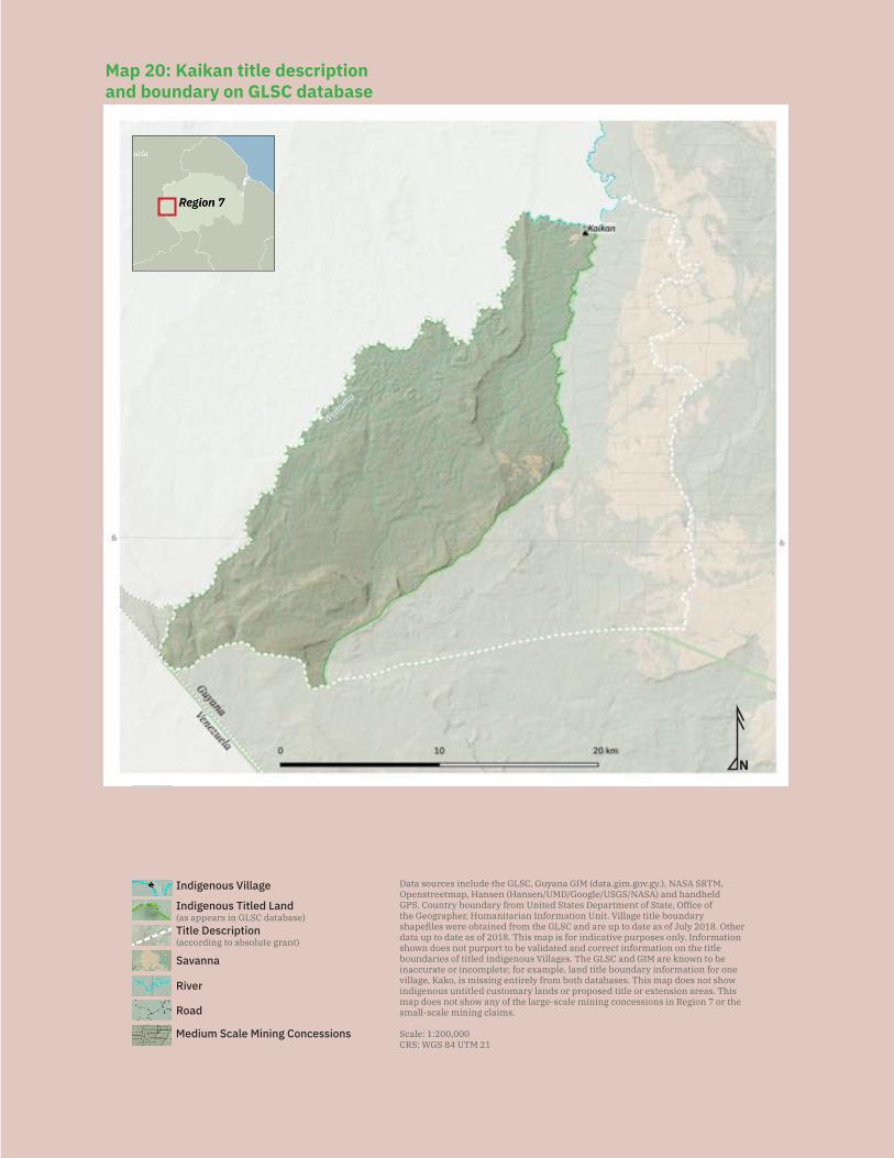
185
N
Data sources include the GLSC, Guyana GIM (data.gim.gov.gy.), NASA SRTM, Openstreetmap, Hansen (Hansen/UMD/Google/USGS/NASA) and handheld GPS. Country boundary from United States Department of State, Office of the Geographer, Humanitarian Information Unit. Village title boundary shapefiles were obtained from the GLSC and are up to date as of July 2018. Other data up to date as of 2018. This map is for indicative purposes only. Information shown does not purport to be validated and correct information on the title boundaries of titled indigenous Villages. The GLSC and GIM are known to be inaccurate or incomplete; for example, land title boundary information for one village, Kako, is missing entirely from both databases. This map does not show indigenous untitled customary lands or proposed title or extension areas. This map does not show any of the large-scale mining concessions in Region 7 or the small-scale mining claims.
Scale: 1:200,000CRS: WGS 84 UTM 21
Savanna
Medium Scale Mining Concessions
Road
River
Indigenous Titled Land(as appears in GLSC database)
Indigenous Village
Title Description (according to absolute grant)
Wenamu
Map 20: Kaikan title description and boundary on GLSC database
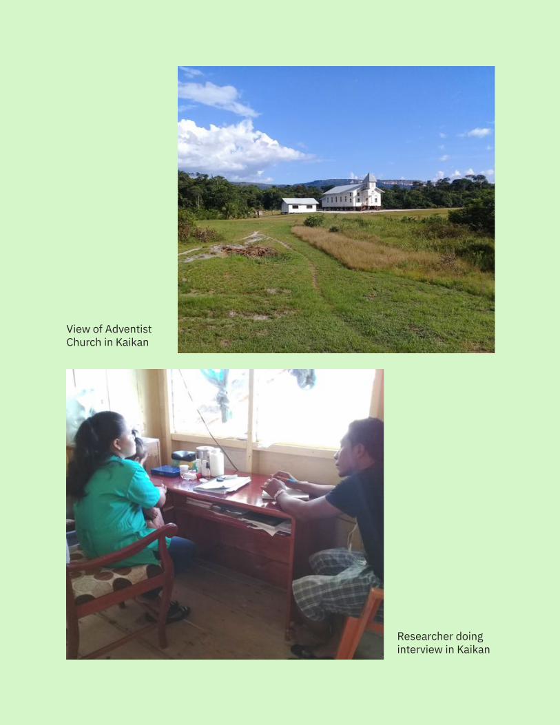
186
Researcher doinginterview in Kaikan
View of Adventist Church in Kaikan
187
is Carak Yeng, at the source of the Tshuau River (actually named the Carak Paru and in-correctly labelled on government maps; the actual Tshuau River is further east). Carak Yeng was the place where a monster named carak used to live. Carak was a half-an-imal, half-human monster. The carak used to eat people, and to this day, beads from the victims’ clothes can still be found at this site.
In other places, for example, on Kaikan’s border with Venezuela, clay pots can be found, demonstrating that people used to live across the area without being divided by inter-national borders. The border between Guyana and Venezuela is the Wenamu River and is named for wenamuk (rations). The story goes that people would come from far away to fish at the river and would bring wenamuk (rations) so they could stay and fish for days or more. When their rations ran out, they would travel to Telyn (pot) Falls, where there was a pot-shaped area in the water where fish would spawn, and they could catch fish there. The actual Tshuau River is named for the Akawaio word for ‘that look when hair is chilled, tumbled and messy because the environment and water is too cold’.
Main neighbouring communities: Arau, Paruima
Estimated population: 385 (72 households)
Identities of residents: Mostly Akawaio mixed with Waika and Arecuna
Local government: The village is governed by a village council consisting of a toshao who is also responsible for security; a vice toshao; a treasurer; a secretary; a councillor responsible for youth and sports; a councillor responsible for health; a councillor re-sponsible for education; a councillor responsible for agriculture; and a councillor re-sponsible for mining.
Land use and economy: Village residents engage in subsistence farming. Most of the village’s farming areas are outside of titled lands, as that is where they have tradition-ally farmed, and of those areas, most are affected by mining activities. The main crops grown in the village are: bitter and sweet cassava, potato, eddo, yam, dasheen, tania, pumpkin, sugar cane, bora, pineapple, sweet pepper, plantain, callaloo, cucumber, shallot, banana, papaya, guava, pak choy, soursop, peanut, orange, lemon, corn, coco-nut, corilla, avocado, squash, cashew, and whitey. Villagers also engage in traditional hunting and fishing activities, as well as traditional gold mining activities.
Community projects: The village has a village farm and the crops grown contribute towards activities held in the village. The village plans in the future to do eco-tourism and cattle rearing in the Karabo (originally known as Tshuau) area, which is currently outside of the village’s title but in the village’s traditional lands.
Institutions and services: The village has a radio set; internet (two privately operated and one army-operated service); electricity via private generators and solar panels; a
188
health post; and a primary school with a nursery class. For secondary school, students attend the school in Waramadong Village in the Upper Mazaruni.
Current land title status: The village was granted title in 1991. Its title is listed under the amended schedule to the Amerindian Act and recorded as an absolute grant under the State Lands Act.
Existing title description: ‘A tract of state land situate at the Right Bank Cuyuni River, com-mencing at the mouth of the Tshuau river, Right Bank Wenamu River, thence up the Tshuau River to its source, thence west along the watershed of the Paruima River to the source of the Wenamu River, thence down the Wenamu River to the point of commencement.’
Title suitability: Inadequate. The village reports that their current land title does not cover their traditional lands and covers less than half the area recommended to the Am-erindian Lands Commission, which was already less than the full extent of their traditional lands. Elders report that the recommendation made in the ALC report was made with-out consultation with the village. The description given to the ALC was given by the head teacher at the time, Mr. Bagot, who was not from Kaikan but from the Essequibo. The captain of the village at the time was out of the village attending a meeting in Kamarang.
As a result, during the ALC investigation, Kaikan is reported as having requested ‘From Wenamu Head to Pakarampa Mountain and from the river to the escarpment with hunt-ing rights above the escarpment.’
The area described is vague and does not accurately describe the village, particularly its extent to the east. It does accurately reflect that the village’s traditional lands ex-tend up into what is today Arau. (This is reflected by the fact that many of the village’s old settlements are in Arau.) Today, to avoid conflict with Arau Village over boundaries, the boundary that the elders of the village describe as their traditional lands is: ‘The area commencing at mouth of the Manowaka Creek, thence along the left bank of the Manowaka Creek to its source at the point of the escarpment, thence along the escarp-ment in an easterly direction to the Arau River, thence up the Arau to its source, thence in a straight line to the source of the Muruwawe River, thence along the watershed of the Ekereku to the existing boundary of Paruima, thence along the watershed of the Paruima and Wenamu to the source of the Wenamu, thence down the right bank of Wenamu to the point of commencement.’
The area recommended by the ALC was ‘The area commencing at the mouth of the Tshuau River, right bank Wenamu River, right bank Cuyuni River, thence up the Tshuau River to its source, thence west along the watershed of the Paruima River to the source of the Wenamu River, thence down the Wenamu River to the point of commencement.’
The title granted in 1991 is identical to that recommended by the ALC. The ALC noted that ‘The area recommended is less than that requested… The Commission considers the
189
following area to be adequate for present needs and future development’. The ALC team reportedly told the village during their investigation that they would not be able to man-age the lands requested and therefore recommended, in the ALC report, a smaller area.
The village reports that government maps have gotten the names of a couple creeks wrong: the creek called Tshuau is actually the Carak Paru. The creek known as Karabo on government maps is really the Tshuau. The word ‘Karabo’ is an Anglicization of Carak Paru, so it appears that the government confused the two rivers. Because the maps in-correctly mixed up the names of these two creeks, the village reports that the boundaries of the village have been reduced from even what the title intended to cover (see Map 20).
The village has additionally noticed that current government maps have cut off another piece of the village’s title, because now the maps show that the village’s eastern boundary follows the Tshuau River south and then heads southwest along the Powis Creek, rather than following the Tshuau River to its source. The village council office has a copy of the 1st edition of the GLSC Administrative Map from 1982 showing the title correctly except for the confusion of Carak Paru with Tshuau, as well as a copy of the 2nd edition of the GLSC Administrative Map from 2011 showing the title with the now missing southeastern corner.
Title demarcation: The village has not yet been demarcated. They have refused de-marcation until the government has recognized all of their traditional lands. The village has told the ALT team that they feel that the money that the government has allocated for demarcation can be used to recognize and title their ancestral and traditional lands. They believe it does not make sense to demarcate their existing title, when the govern-ment would eventually have to legally recognize, title, and demarcate the remainder of their traditional lands as well. The government has told the community that they must accept demarcation before they can receive any extensions to their land title.
Demarcation suitability: N/A
Extension status: The community has not applied for an extension because they are requesting that the government recognize all of their traditional lands as described by elders. The community provided the ALT team when they visited a copy of a map they drew showing their title and traditional lands. The government has told the community that they must first accept demarcation and then apply for an extension for any lands they believe are traditional lands. The village does not view the situation as one requir-ing an extension of title application, but merely as one of correcting the title to reflect the lands they know to be theirs.
Extension description: N/A
Extension justification: N/A
Response from government: N/A
190
Land and resource conflict(s): The village is currently facing significant conflicts with miners, police, army soldiers, and Venezuelans occupying their traditional lands.
According to the government GIM website, there are no mining concessions inside the village’s title, but the village is surrounded by medium-scale mining concessions. How-ever, due to the error in the current government maps showing the village’s title, there actually are mining concessions inside the village’s title description.
Miners are causing a series of problems that prevent free movement within village lands, including erecting fences around their mining camps. For example, miners working for a Mr. Mohan in the Karabo [Tshuau] area — which is within the village’s title description but excluded from the village’s grant plan due to the incorrectly labelled creek — are blocking residents from passing along their traditional trails. The village reports that the concession is not actually owned by Mr. Mohan, but he had been con-tracted to work there by the original concession owner, Paul Mortimer, who is now deceased. Miners also block residents from doing traditional mining, forcing village residents to find alternate sites to work.
More generally, village residents report that the areas covered in mining concessions are important resources for the village. The village has plans to do cattle rearing and eco-tour-ism in the area east of the Tchuau (Carak Paru), and they are unhappy that mining activities are causing damage and loss to an area that has significant farming and tourism potential.
Residents report that the entry of police and soldiers of the Guyana Defence Force (GDF) into the village has caused significant security and social problems. The GDF had entered the village during border patrols and remained, claiming to be providing security for the airstrip. The village has complained over the years that women in the community have been sexually assaulted and that army soldiers have had relationships with married women, causing strife. Village residents additionally report being threat-ened and intimidated by soldiers when they try to protect their daughters from soldiers who come uninvited to their homes. Police and army soldiers have also stolen from the village over the years, breaking into village shops to steal food and other items. Villag-ers report that recently army and police officers have also been taking advantage of Venezuelan prostitutes, taking away their identity cards and forcing the women to have sex with them in order to have their documents returned.
Village residents note that they understand the army is supposed to be providing security for the village because they are on the border with Venezuela. Although some residents report being concerned about escalating tensions between Guyana and Venezuela, they also note that the GDF’s presence is unnecessary because they do not provide additional security beyond what the village council and Community Policing Group already provide. Instead, the GDF is causing additional problems in the village. Moreover, the presence of the army base in the village centre directly next to the school is causing Venezuelan helicopter flyovers right above them. The village has requested repeatedly that the army
191
barracks be removed from the village. They note that at the very least, the army base must be moved so it is no longer in the village centre and that it is not next to the school.
The village is additionally concerned about the influx of people fleeing Venezuela to trade or work in the mines. Residents report that the migration of Venezuelans is leading to increased crime. There have been increased thefts in the village, along with illegal drug smuggling and trafficking of unlicensed guns through and around the vil-lage. There is a ‘kayamu’ (brothel) that has been established just across the Tshuau (Carak Paru) and army soldiers also bring prostitutes into the village at the army base. The increased number of outsiders is also spreading some diseases in the village. The Venezuelans coming across the border are not indigenous.
Land security: The village does not feel that they have secure land tenure, partly because their title is inadequate and does not secure large portions of their traditional lands, but also because of outside interests on their lands. Most of the farming grounds of community members lie outside of the current title. These farms are located on the right bank of the Tshuau River (Carak Paru), which is covered by mining blocks.
Villagers report that there are some mining concessions on their titled lands, granted after the village got title. Although the government GIM database shows that there are no mining concessions inside the village’s title, there are concessions in the southeast-ern corner, which was left out of recent government maps. There are also several mining concessions immediately adjacent to the village’s title, and the village reports that they were never consulted or even informed before those concessions were granted, which is a violation of the Amerindian Act. The Amerindian Act, Section 53, requires the GGMC to notify the village and be satisfied that the impact of the mining will not be harmful to the village if it is planning to grant a concession in lands contiguous with the village.
The village complains that it has never been consulted prior to the granting of a mining concession. Miners also transport fuel and other equipment through village titled lands without the village’s permission, to access mining sites downriver from the village.
Village residents further note that there is nothing in their title that reserves land for an army base, yet the army has established its base in the centre of the village, right in the middle of a residential area. The village believes the army should leave the village as requested, and at the very least move the base outside of the village centre.
Livelihood security and environmental integrity: The village believes that the health of their natural resources is rapidly deteriorating as a result of mining activities on their traditional lands. They have noticed the rivers being polluted at alarming rates and fear that their fishing grounds will soon be completely destroyed. Their waters have been polluted with mercury, used in mining, and human faeces, because many of the Vene-zuelans setting up makeshift camps on the border across the river do not have toilets
192
and are using the river instead. These polluted waters are the same waters village residents traditionally use for cooking and drinking. Residents receive water pumped directly from the river to storage tanks for distribution to residents via a pipe network. There is no water treatment facility in the village. The village has had recent outbreaks of diarrhoea due to the use of the contaminated river waters.
The village is also worried that the increasing use of excavators in the area will destroy the forests to the point where only large swathes of barren land will remain.
The destruction of their lands by mining activities is not only causing food insecurity and health concerns but causing other livelihood concerns. Village residents are being blocked from doing their own traditional mining and are worried that outsiders’ more aggressive mining activities will destroy the lands they had planned to reserve for eco-tourism and cattle rearing.
The village is additionally concerned about food security because of the increasing de-struction of farms and crops by acushi ants and by wild hogs. The community has been requesting firearms licenses to better protect their farms.
Recognition and measures sought: The village recommends:
— The government must recognize all of the village’s traditional lands prior to demarcating them;
— The government must stop issuing mining and other concessions on indige-nous traditional lands;
— The government must revoke all mining concessions previously granted on the village’s traditional lands;
— The government must ensure that miners repair all roads and trails they have damaged through their mining activities, and that contractors repair any da-mage done when they were contracted to upgrade the airstrip;
— The government must remove the army and police from the village immedia-tely and instead pay the village Community Policing Group a stipend;
— The government needs to update its laws to provide for all indigenous tradi-tional lands being legally recognized and titled and to provide that villages do not need to demarcate their existing titles prior to seeking a correction or extension to their title;
— The government must update and correct its maps to ensure that they reflect what is described in their title document;
— The government must ensure that its agencies provide adequate support to indigenous village councils. It must ensure that villages are included in natio-nal program consultations, engagements, and discussions;
— The government must include the effective participation of the village in any future projects affecting it, and must involve residents in those projects;
— The village council must follow up and pressure the government to ensure that all of the village’s traditional lands are legally recognized;
193
— The village council must hold regular meetings for the village to discuss their lands issues; and
— The National Toshaos Council should visit the village more frequently so that they can hear from the people and make informed recommendations to the government.
5.4.3 KurutukuAs people who belong to the forest, our whole life depends on everything that exists within the forest. Every tree, every vine, every bark is my family. The trees, the vines, the barks are where we get our medicines. The trees we dig for our canoes and also to build our houses. They provide material for our hand-icraft. The animals, fish, birds provide for our food. This is why every single thing that God made in the forest — we have uses for them, so they are all my family. This is why I need the government to demarcate our lands so that we the people of Kurutuku and our younger generation will continue to live a peaceful life, as our customary life is supposed to be. – Timothy Lewis
Key findings:
— Kurutuku received title in 1991. — The village was demarcated and received a Certificate of Title in 2010. — The main village centre and most families in the village live outside of the
existing land title. — Half of the village’s farming grounds and most of the village’s hunting
grounds are also outside of the village’s title. — The village’s title excludes all of the islands in the Cuyuni River that village
residents traditionally farm on. — The demarcation of the village was in 2010 and excluded pieces of land that
are part of the village’s title because the boundary lines were not cut correctly. — The village has applied for extension but has not yet received any response
to their request. — The village’s traditional lands are covered with mining concessions. — Mining activities have polluted most of the village’s potable water supplies,
including with mercury poisoning. The GGMC has done studies in the rivers in the area and found dangerously high levels of mercury, advising residents not to eat any animals that live in or drink from the water.
— Mining activities have destroyed hunting and gathering grounds, causing a scarcity of animals, including fish, turtles and birds.
— During dry season, potable water is scarce, and villagers have to visit a creek that is four miles away to carry back potable water.
Location: Kurutuku, Upper Cuyuni, Region 7
History: The village was founded in 1967 by the families: Brown, Douglas, Williams,
194
Robert, Melville, Henson, Jackson, John, Max, and Bernard. People used to live in scattered settlements around the area but moved to the village’s current site upon the advice of a forestry officer who advised that they could set up a church and a school in a more central location. The people chose the site of the current village as a place that was rich in resources and suitable for living.
The village gets its name from Coludugu Beach, located in the middle of the Cuyuni River. The beach is believed to be the home of the Lado (water people). The story goes that an old man was collecting iguana and turtle eggs on the beach when he heard a rooster crowing. Knowing that there were no other people around, he listened careful-ly to ascertain where the sound was coming from. He eventually heard it coming from below the sand. The old man named the place Colodugu, or ‘chicken’ in Carib.
Other important spiritual and cultural heritage sites evidence prolonged occupation of the area. The creek head of Aranasi Creek is a site where people have found clay pots. One family found a large clay pot while hunting at the Aranasi creek head, for example, and used it to make cassareep and cassiri.
Main neighbouring communities: Eteringbang (a mining landing), San Martin (a border village in Venezuela)
Estimated population: 165 (25 households)
Identities of residents: Predominantly Carib, some Macushi, some Wapichan
Local government: The village is governed by a village council comprised of a toshao, a deputy toshao who is also the treasurer, a secretary, and two other councillors.
Land use and economy: Village residents engage in subsistence farming. Some of the main crops grown are: cassava, dasheen, potato, plantain, banana, and sugar cane. Village residents also engage in traditional hunting and fishing activities. Villagers also work in the mining industry, with some working on their own and a few even owning their own land dredges, and others working on others’ mining concessions as well as traditional mining done with a ‘batel’ and spade.
Community projects: No current projects.
Institutions and services: The village has a radio set; access to electricity via solar panels and generators; a health post; and a primary school. Nursery level students at-tend a nursery class within the primary school. For secondary school, students attend school in Bartica.
Current land title status: The village was granted title (see Map 21) in 1991. Its title is listed under the amended schedule to the Amerindian Act and recorded as an absolute
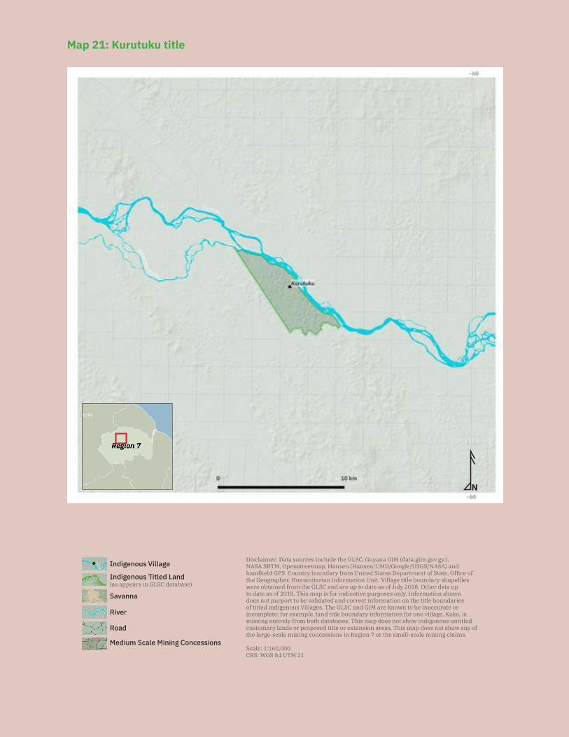
195
N
Disclaimer: Data sources include the GLSC, Guyana GIM (data.gim.gov.gy.), NASA SRTM, Openstreetmap, Hansen (Hansen/UMD/Google/USGS/NASA) and handheld GPS. Country boundary from United States Department of State, Office of the Geographer, Humanitarian Information Unit. Village title boundary shapefiles were obtained from the GLSC and are up to date as of July 2018. Other data up to date as of 2018. This map is for indicative purposes only. Information shown does not purport to be validated and correct information on the title boundaries of titled indigenous Villages. The GLSC and GIM are known to be inaccurate or incomplete; for example, land title boundary information for one village, Kako, is missing entirely from both databases. This map does not show indigenous untitled customary lands or proposed title or extension areas. This map does not show any of the large-scale mining concessions in Region 7 or the small-scale mining claims.
Scale: 1:160,000CRS: WGS 84 UTM 21
Savanna
Medium Scale Mining Concessions
Road
River
Indigenous Titled Land(as appears in GLSC database)
Indigenous Village
Map 21: Kurutuku title
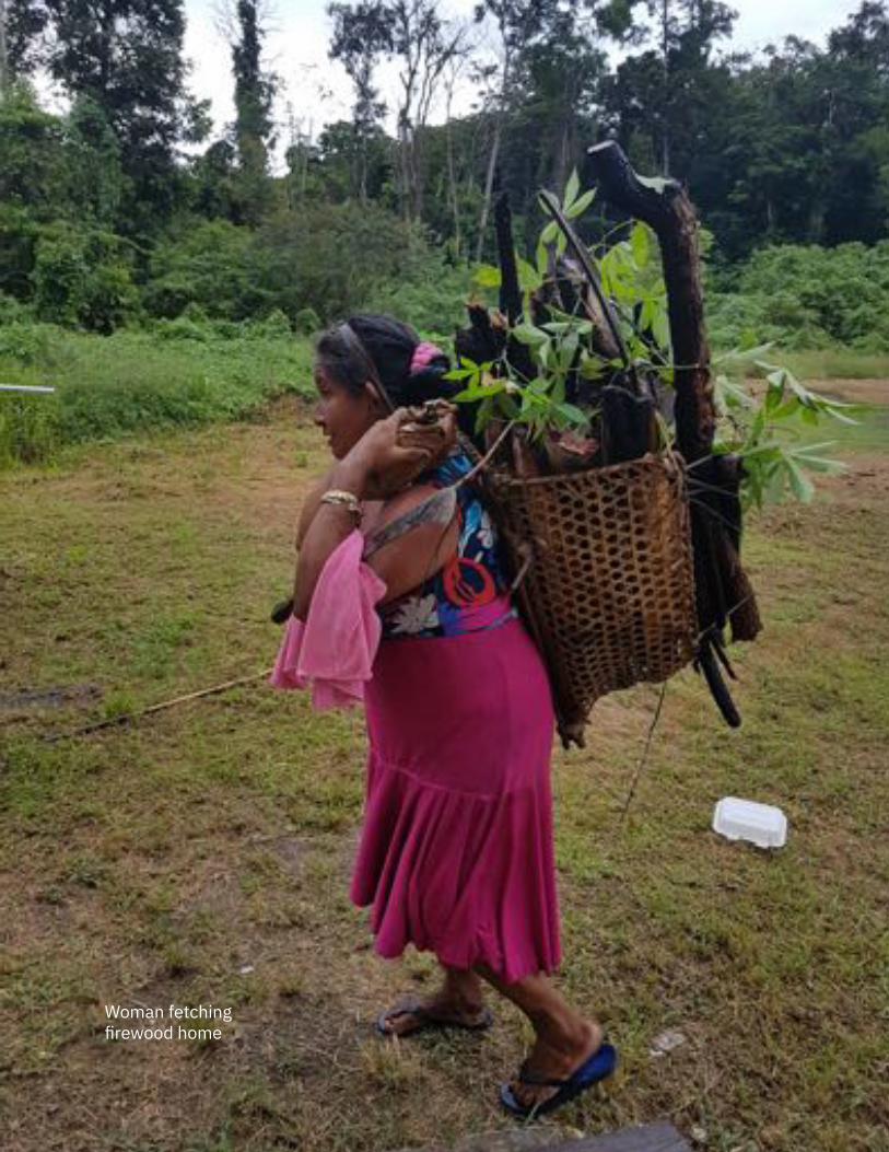
196
Woman fetching firewood home
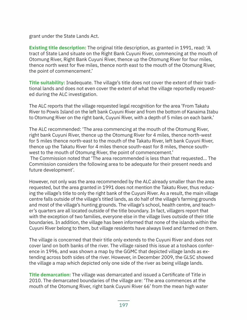
197
grant under the State Lands Act.
Existing title description: The original title description, as granted in 1991, read: ‘A tract of State Land situate on the Right Bank Cuyuni River, commencing at the mouth of Otomung River, Right Bank Cuyuni River, thence up the Otomung River for four miles, thence north west for five miles, thence north east to the mouth of the Otomung River, the point of commencement.’
Title suitability: Inadequate. The village’s title does not cover the extent of their tradi-tional lands and does not even cover the extent of what the village reportedly request-ed during the ALC investigation.
The ALC reports that the village requested legal recognition for the area ‘From Takatu River to Powis Island on the left bank Cuyuni River and from the bottom of Kanaima Itabu to Otomung River on the right bank, Cuyuni River, with a depth of 5 miles on each bank.’
The ALC recommended: ‘The area commencing at the mouth of the Otomung River, right bank Cuyuni River, thence up the Otomung River for 4 miles, thence north-west for 5 miles thence north-east to the mouth of the Takatu River, left bank Cuyuni River, thence up the Takatu River for 4 miles thence south-east for 8 miles, thence south-west to the mouth of Otomung River, the point of commencement.’ The Commission noted that ‘The area recommended is less than that requested… The Commission considers the following area to be adequate for their present needs and future development’.
However, not only was the area recommended by the ALC already smaller than the area requested, but the area granted in 1991 does not mention the Takatu River, thus reduc-ing the village’s title to only the right bank of the Cuyuni River. As a result, the main village centre falls outside of the village’s titled lands, as do half of the village’s farming grounds and most of the village’s hunting grounds. The village’s school, health centre, and teach-er’s quarters are all located outside of the title boundary. In fact, villagers report that with the exception of two families, everyone else in the village lives outside of their title boundaries. In addition, the village has been informed that none of the islands within the Cuyuni River belong to them, but village residents have always lived and farmed on them.
The village is concerned that their title only extends to the Cuyuni River and does not cover land on both banks of the river. The village raised this issue at a toshaos confer-ence in 1996, and was shown a map by the GGMC that depicted village lands as ex-tending across both sides of the river. However, in December 2009, the GLSC showed the village a map which depicted only one side of the river as being village lands.
Title demarcation: The village was demarcated and issued a Certificate of Title in 2010. The demarcated boundaries of the village are: ‘The area commences at the mouth of the Otomung River, right bank Cuyuni River 66’ from the mean high water
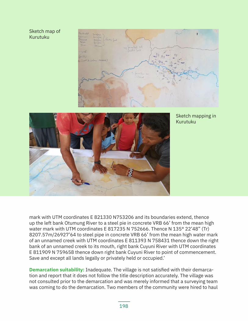
198
mark with UTM coordinates E 821330 N753206 and its boundaries extend, thence up the left bank Otumung River to a steel pie in concrete VRB 66’ from the mean high water mark with UTM coordinates E 817235 N 752666. Thence N 135° 22’48” (Tr) 8207.57m/26927’64 to steel pipe in concrete VRB 66’ from the mean high water mark of an unnamed creek with UTM coordinates E 811393 N 758431 thence down the right bank of an unnamed creek to its mouth, right bank Cuyuni River with UTM coordinates E 811909 N 759658 thence down right bank Cuyuni River to point of commencement. Save and except all lands legally or privately held or occupied.’
Demarcation suitability: Inadequate. The village is not satisfied with their demarca-tion and report that it does not follow the title description accurately. The village was not consulted prior to the demarcation and was merely informed that a surveying team was coming to do the demarcation. Two members of the community were hired to haul
Sketch mapping in Kurutuku
Sketch map of Kurutuku
199
equipment. Villagers have noticed that the boundary lines cut were not straight and as a result, the demarcation may have excluded pieces of land that should have been demarcated. There is also a report that the boundary line does not follow the title de-scription on the boundary from Otomung River to the ‘unnamed’ creek (Julian Creek).
Extension status: The village reports that they applied for extension in 2009. They re-port that they sent in their application a second time in 2010 when they were informed that the Ministry did not have their original application on file.
Extension description: The village reports that the area they have requested for ex-tension is: ‘situated on the left bank of the Upper Cuyuni River, commencing from the mouth of the Otumung River on the opposite side thence north easterly direction to the Assay Creek, thence in a NNW direction to the headwaters of the Arnasi Creek, thence in a south western direction back to the Cuyuni. Thence across the Cuyuni in a south-western direction to the taramu itabu, thence southernly for approximately 12 miles, thence south easterly to the Otumung River.’
Extension justification: The village is seeking extension so that all of their traditional lands can be titled and legally recognized. The requested extension includes the areas that many villagers live and farm; their traditional hunting grounds; and other tradition-al lands, including former settlement sites.
Response from government: The ALT team visited the village in December 2016. Since that visit, the village has received no communication from the government about the sta-tus of their application. During that visit, villagers also asked the ALT team why the gov-ernment had granted mining blocks in their titled lands; the response was that the GGMC had been taken to court by a miner and was forced to issue those mining blocks.
Land and resource conflict(s): The main resource conflicts the village residents have been having is with miners over access to clean water. Mining activities have been pol-luting their waterways, which they depend on for drinking. One of the most toxic pollut-ants is mercury, which is also making the fish and game that village residents typically hunt unsafe for consumption. Mining activities have expanded into the village’s hunting and gathering grounds, destroying them to the point where they cannot be used.
Residents in the village report that increased mining activities have caused social ills as well, with increased rates of alcoholism and prostitution, as well as related increases in domestic violence. In a recent tragic incident, the toshao of the village was killed by his daughter’s partner with a cutlass while trying to defend her from domestic abuse. The toshao’s son was also cut and injured in the same incident. The son is recovering in a hos-pital now and the man responsible is in jail awaiting trial. Village residents note that this was one sad reflection of broader social problems in the community caused by mining.
Land security: The village is concerned about the lack of land tenure security for their
200
traditional lands. Village residents are also concerned that it is unclear which govern-ment maps are accurate and up-to-date. They have seen one map that shows 121 mining concessions in the area the village has requested for extension. They have also seen a different, later government map, that shows that the area does not have many mining concessions, with just a few concessions on the outer boundaries of the exten-sion area. The government GIM website shows no mining concessions inside the vil-lage’s title. According to that database, the village’s title borders a large-scale forestry concession and is surrounded by mining concessions and other forestry concessions.
The village has never been consulted prior to the granting of any mining concessions and has publicly complained that mining ‘would really damage the existence of Kuru-tuku village’ and ‘the permission of the village was never sought nor was it informed.’
Livelihood security and environmental integrity: Village residents complain that min-ers have polluted almost all of their potable water supplies. They report that extensive mining activities have caused the rivers to be poisoned with mercury and have deplet-ed their fish stocks. The water turbidity levels are high and the villagers report that they cannot use it freely. The GGMC has done studies in the area and found that mercury levels were dangerously high; they advised residents that they should not eat any ani-mals that drink from the river, because they could get mercury poisoning as well.
Some of the village’s hunting and gathering grounds have been mined out, mostly by non-resident miners, making it unfeasible for them to hunt and gather there anymore. Villag-ers report that the heavy machinery used by the miners has killed many of the turtles in the area, and even birds are scarce now. Village residents are worried about their food supply, because it is difficult to find meat and fish nowadays, and what they do catch near the village is likely contaminated with mercury. Some residents feel that they have no choice but to eat it, despite what the GGMC advised, because otherwise they would have nothing to eat.
The village reports that they collect rain water for drinking and cooking. However, during dry season, water is scarce, and villagers have to go to a creek about four miles away to haul potable water. The village currently does not have any wells installed.
Recognition and measures sought: The village recommends:
— The government must implement the land title extension process more efficiently; — The government must remove miners from their lands immediately; — The government must improve road networks so the cost of transportation
into and out of the community is lower; — The government must install wells in the village to provide potable water;
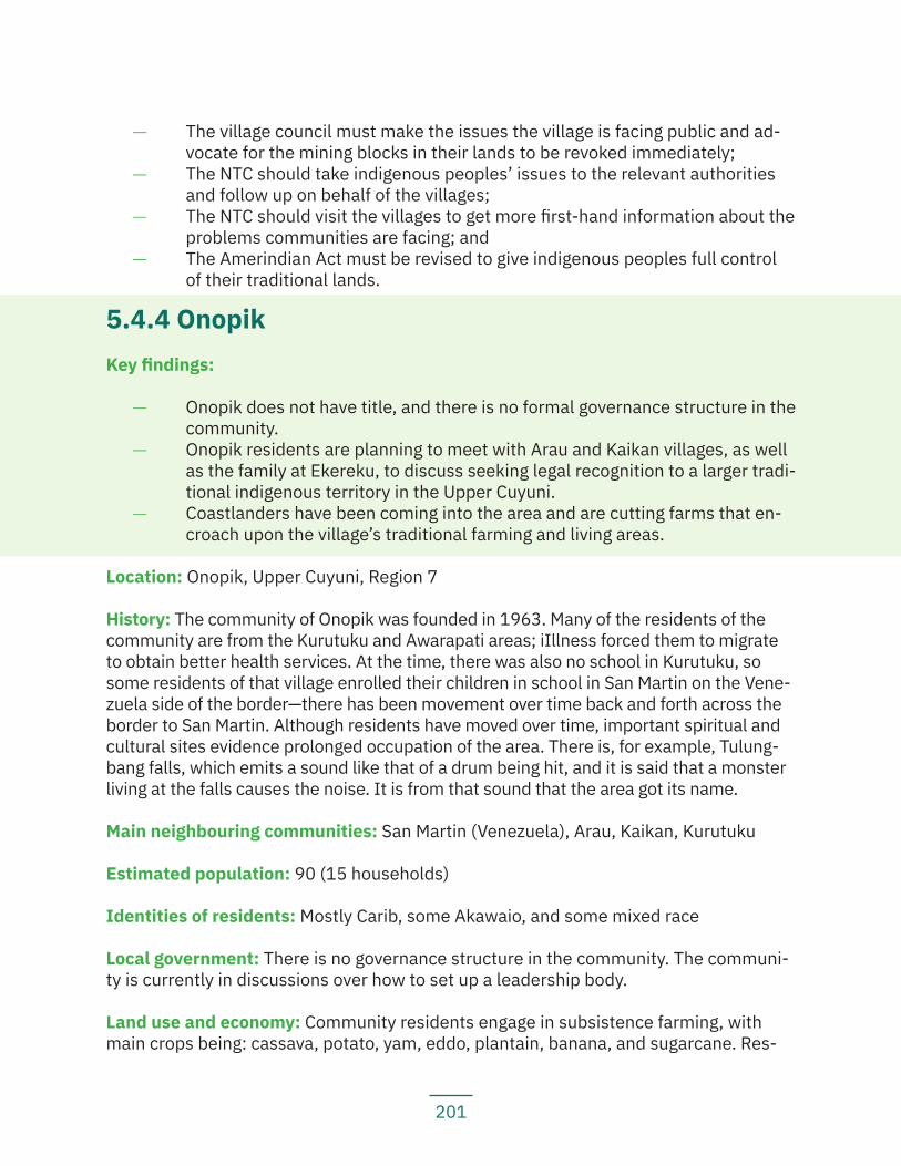
201
— The village council must make the issues the village is facing public and ad-vocate for the mining blocks in their lands to be revoked immediately;
— The NTC should take indigenous peoples’ issues to the relevant authorities and follow up on behalf of the villages;
— The NTC should visit the villages to get more first-hand information about the problems communities are facing; and
— The Amerindian Act must be revised to give indigenous peoples full control of their traditional lands.
5.4.4 OnopikKey findings:
— Onopik does not have title, and there is no formal governance structure in the community.
— Onopik residents are planning to meet with Arau and Kaikan villages, as well as the family at Ekereku, to discuss seeking legal recognition to a larger tradi-tional indigenous territory in the Upper Cuyuni.
— Coastlanders have been coming into the area and are cutting farms that en-croach upon the village’s traditional farming and living areas.
Location: Onopik, Upper Cuyuni, Region 7
History: The community of Onopik was founded in 1963. Many of the residents of the community are from the Kurutuku and Awarapati areas; iIllness forced them to migrate to obtain better health services. At the time, there was also no school in Kurutuku, so some residents of that village enrolled their children in school in San Martin on the Vene-zuela side of the border—there has been movement over time back and forth across the border to San Martin. Although residents have moved over time, important spiritual and cultural sites evidence prolonged occupation of the area. There is, for example, Tulung-bang falls, which emits a sound like that of a drum being hit, and it is said that a monster living at the falls causes the noise. It is from that sound that the area got its name.
Main neighbouring communities: San Martin (Venezuela), Arau, Kaikan, Kurutuku
Estimated population: 90 (15 households)
Identities of residents: Mostly Carib, some Akawaio, and some mixed race
Local government: There is no governance structure in the community. The communi-ty is currently in discussions over how to set up a leadership body.
Land use and economy: Community residents engage in subsistence farming, with main crops being: cassava, potato, yam, eddo, plantain, banana, and sugarcane. Res-
202
idents also engage in traditional hunting and fishing activities. Some residents also engage in mining activities.
Community projects: N/A.
Institutions and services: The community has access to a mobile network and inter-net via the mobile network; and access to electricity via private generators. There is no school in the area, except across the border in Venezuela, where some of the children attend school. However, residents report that the school is oftentimes without teachers and students are left in the school unattended. In addition, many of their children do not speak Spanish and struggle to understand what is being taught in school.
Current land title status: The community does not have title. They have never applied for title. The former village of Awarapati, where many residents moved from, was rec-ommended for title in the 1969 Amerindian Lands Commission report.
During the ALC investigation, Awarapati requested ‘The Cuyuni River frontage from Rapantie Creek to Tariapau Creek extending back to the escarpment.’
The ALC recommended: ‘The area commencing at Awarapati settlement right bank Cuyuni River, thence two miles above and two miles below and inland to the escarpment.’
The Commission noted that ‘The area recommended is less than that requested…, but the Commission considers it adequate for present needs and future development.’
Other residents of Onopik had moved from the titled village of Kurutuku.
The current residents of Onopik are currently in discussions to have their lands legally recognized. Some residents have applied to GLSC for private residential leases in the meantime, feeling that it is better to have some land security, even if in the form of individual land rights as opposed to collective title. Community members have always wanted to organize to apply for title but were unfamiliar with the process for doing so. They feel that the need to apply for legal recognition of their lands is more urgent now because more and more outsiders are coming and moving into the area, particularly an overflow of people from Eteringbang and also from Georgetown and Venezuela.
The community is planning to meet with Arau Village, Kaikan Village, and Ekereku to discuss seeking a collective title over the larger territory.
Existing title description: N/A
Title suitability: N/A
Title demarcation: N/A
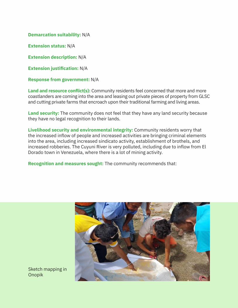
203
Demarcation suitability: N/A
Extension status: N/A
Extension description: N/A
Extension justification: N/A
Response from government: N/A
Land and resource conflict(s): Community residents feel concerned that more and more coastlanders are coming into the area and leasing out private pieces of property from GLSC and cutting private farms that encroach upon their traditional farming and living areas.
Land security: The community does not feel that they have any land security because they have no legal recognition to their lands.
Livelihood security and environmental integrity: Community residents worry that the increased inflow of people and increased activities are bringing criminal elements into the area, including increased sindicato activity, establishment of brothels, and increased robberies. The Cuyuni River is very polluted, including due to inflow from El Dorado town in Venezuela, where there is a lot of mining activity.
Recognition and measures sought: The community recommends that:
Sketch mapping in Onopik
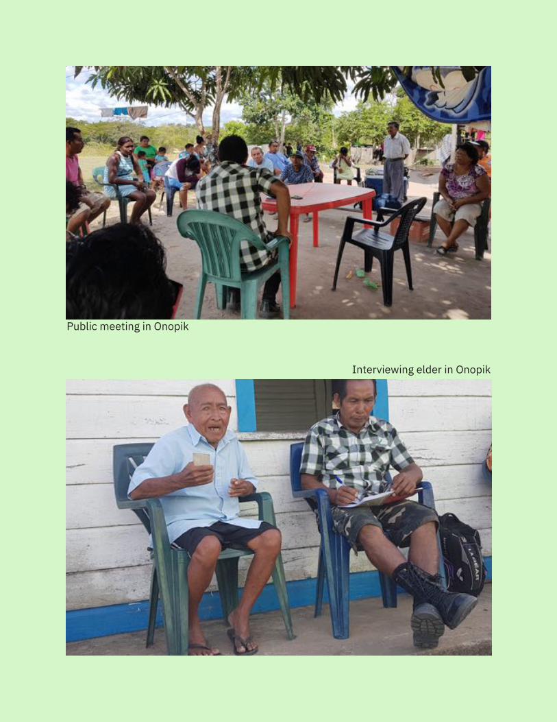
204
Public meeting in Onopik
Interviewing elder in Onopik
205
— The government construct a school in the area. There are at least 60 school children in that area who have no access to proper schooling;
— The government send health workers to the village. A health centre was constructed in February 2017; however, to date, there have been no medical personnel staffing the health centre;
— The government grant the community title so they can have land security.
6. Results, Analysis, Conclusions and Rec-ommendations
6.1 Main Findings
6.1.1 Legal recognition of tenure rightsThe majority of the communities surveyed have land titles, but these are limited and inadequate
15 of the 20 communities surveyed have land title. However, the land titles are limited in extent and do not adequately recognise and protect the villages’ customary lands. Four villages that received title after 1991 — Isseneru, Batavia, Kaburi, and Karrau — additionally have ‘save and except’ clauses in their title grant that further limit the extent of their title and compromise the ability of their village councils to exercise effective control over the lands. Two other villages — Chinoweing and Kurutuku — had title grants that did not contain any ‘save and except’ clauses, but such clauses were inserted after they were demarcated. The ‘save and except’ clauses added onto the demarcation descriptions appear to be more restrictive than the ones appearing in the absolute grant, including 66’ on either side of all navigable rivers and creeks. Batavia’s grant and Chinoweing’s certificate of title also save and except rights of access. Due to the problems with the titling process, the village centres of Arau and Kurituku actually lie outside of the lands that have been titled as theirs.
Five communities do not have any secure land tenure
Tassarene and Kangaruma Villages have been told by the Attorney General that they have legal title to their lands; however, they do not feel they have secure land tenure because they have not actually received valid title documents. Dagg Point cannot apply for title because their community is located within the boundaries of Bartica Township. Kartabo residents are unsure whether they should apply for title or what the process for applying entails. Onopik residents are talking about having their lands legally recog-nized but have not applied for title yet.
206
Joint requests for collective title were dismissed
The ALC Report (1969) acknowledged that six of the Upper Mazaruni villages — Jawal-la, Kako, Kamarang, Paruima, Phillipai, and Waramadong — requested collective title. However, the ALC dismissed the request, instead recommending individual village titles. It did recommend a District Council to be established in the Upper Mazaruni, but not to hold title. The six villages filed a court case against the Government of Guyana to obtain collective title over the non-titled lands between and around the existing titles. The case has been pending in court for more than 20 years now and there is still no decision from the High Court. The communities of the Middle Mazaruni also request-ed collective title to their lands in a statement made in 1993, but the government has never responded to this request. Given the evidence of ancestral occupation and use of Akawaio and Arecuna lands in Region 7, this report underscores the fact that titling village by village has failed to uphold our peoples’ rights to our traditional territory as enshrined in international law.
Titles do not cover areas customarily occupied and used by communities
All 15 titled villages report that their titles exclude significant portions of the lands they use and know to be theirs, including homesteads, important spiritual and cultural sites, farming grounds, hunting and fishing grounds, and gathering grounds. Some even exclude the residential area of the village itself.
In 10 of the titled villages, there are residents living in satellite villages or homesteads outside of the title. In 12 villages, residents customarily hunt and fish in areas outside of the title. In 12 villages, important farming grounds lie outside of the title. 11 of the titled villages reported having gathering sites customarily used outside the title. 10 titled villages reported cultural heritage sites outside their title. Batavia’s title excludes half of the village population, and Arau’s and Kurutuku’s titles exclude the majority of the village populations and the village centres.
Communities feel that they do not have security of land tenure
The majority of communities report that even with land title, they feel insecure on their lands because the government can grant extractive concessions on their lands, both titled and untitled, without their consent. Even in villages that have limited or no mining activities on their lands at present, there are worries about extractive activities eventu-ally taking place, or that pollution of the environment in neighbouring communities will affect their village, as well.
Individual village titles fragment collective territories and undermine traditional ways of life
Some communities, particularly in the Upper Mazaruni, feel that the system of titling
207
and demarcation of individual villages has undermined their traditional ways of life. The granting of title only to individual villages has fragmented traditional territories and disrupted collective resource management systems.
Villages were not consulted and did not give their free, prior and informed consent (FPIC) to titled areas
All 15 titled villages report that they were not asked for their FPIC prior to being grant-ed title to the areas as defined by the government. At least 11 of the 15 titled villages report there having been no consultation prior to the granting of title. Kaburi and Bat-avia report that they recall having meetings to discuss the proposed titles before they were granted, but ultimately, they did not agree to the titles they were granted, which were smaller than requested. Only Kaburi reports understanding why the remainder of their request was excluded from their title grant, though they are dissatisfied with that decision. Other villages reported that they had no opportunity to review the title that the government was proposing granting or to understand why the title being granted was smaller than that requested. Although titles granted under the 1991 amendments to the Amerindian Act followed the ALC Report recommendations closely, the ALC failed to accurately report the lands communities were requesting.
6.1.2 Title demarcation and extensionsSix of the fifteen titled villages have been demarcated
6 villages have been demarcated in Region 7 — Chinoweing, Isseneru, Batavia, Kaburi, Karrau, and Kurutuku. 5 villages (all except Kurutuku) report that the demarcation of their villages accurately follows their title description. Although Chinoweing reports that the demarcation line followed the title description, their local knowledge of their lands was not used to guide the demarcation process, and the resulting demarcation plan has incorrect spellings of creek names, as well as many unnamed creeks.
One village found errors in their demarcation
Kurutuku reports that their demarcation has errors, and pieces of the title were exclud-ed from the demarcation.
Eight titled villages are refusing demarcation
All six villages involved in the Upper Mazaruni court case against the government are refusing demarcation until the court case is resolved. They all agree that if they win their case and obtain title jointly and collectively, then there is no need to demarcate individual village titles. Two other villages — Kambaru/Omanaik and Kaikan — are also refusing demarcation until their original title request is met.
208
One village has accepted demarcation but an error in their grant plan is holding up the process
Arau has agreed to accept demarcation before its extension application is processed. However, there is a significant error in its grant plan, of which the original has been lost. The MIPA and GLSC have agreed that there was an error in the existing replacement grant plan and that it does not accurately reflect the title description. The village has an agreement with the ALT project team that it will accept demarcation once the GLSC produces a correct grant plan to reflect what its title description reads. However, more than a year after the government agreed to the process needed to move forward with Arau’s titling situation, Arau still has no corrected grant plan.
All demarcated villages report dissatisfaction with the demarcation process
Even in villages that reported no errors with their demarcation, residents still reported that they felt dissatisfied because their title itself was still inadequate. In Chinoweing and Isseneru, the villages reported that there was inadequate consultation and res-idents reported feeling disappointed with the demarcation because they had under-stood that demarcation would be over their traditional lands. It was not made clear to the village that demarcation would only follow the more restrictive title boundaries. All villages report disappointment that their traditional lands were never properly recog-nized, so the demarcation process was unable to mark out their customary boundaries as they know them to be.
Four villages have applied for extension; two are planning to apply
Four villages — Chinoweing, Arau, Kurutuku, and Karrau — have applied for extension already. Two villages — Isseneru and Batavia — are planning to apply for extension.
Eight villages do not plan to apply for extension; they are demanding that the gov-ernment give them the original title they requested
The same villages that are refusing demarcation have not applied for and do not intend to apply for extension for the same reasons they are refusing demarcation. They argue that their lands should be recognized as a whole, following international standards.
There is no official process to ensure that villages consult and agree on common title/extension boundaries
This survey found that only two villages consulted with their neighbours prior to send-ing in extension applications. Kaikan and Arau Villages had an informal discussion and each decided to adjust its requested boundaries to avoid overlap with the other. Kaikan adjusted its request for correction of its title over its traditional lands to accommo-date Arau’s title request; the village notes that it has provided the government with
209
the description of its traditional lands although it is rejecting the existing demarcation/extension process. Arau Village also revised its extension application to avoid overlap with Kaikan. As far as the authors of this report are aware, the government has no clear rules requiring such consultation. This means that villages could end up sending in overlapping title or extension applications.
The government has failed to efficiently and promptly resolve land titling and de-marcation applications and issues
Box 3: Deficiencies in Amerindian Act 2006
The Amerindian Act 2006 has several deficiencies in relation to indigenous peoples’ land rights, includ-ing that it:
— Stipulates that all untitled lands are held by the State, contradicting international law, which says that indigenous peoples have inherent rights to their lands, territories, and resources;
— Does not, as a corollary to the above, recognise indigenous peoples’ pre-existing inherent rights to their lands, territories and resources;
— Does not have a logical process for land demarcation and titling; — Does not require, contrary to international law, that titling is based on customary land tenure
systems and customary laws on land and resource ownership; — Only allows individual villages to have titles to land and does not allow any other type of
entity to hold title for several communities jointly; — Does not protect the land and resource rights of communities that do not have a legal land title; — Sets arbitrary conditions on communities that want to apply for land title; — Allows mining and logging concessions to be granted on and immediately bordering titled
lands without the FPIC of the village; the obligations of State agencies in this regard are minimal and do not seem to be applied in practice;
— Allows mining and logging concessions to be granted on untitled customary lands without the FPIC of the community and without even informing the community;
— Allows a mechanism for large-scale mining to proceed on titled lands even over village op-position;
— Gives the government excessive powers to interfere in the ways indigenous peoples’ gover-ning bodies operate and make decisions;
— Gives leaseholders and other outsiders rights above the customary rights of indigenous peo-ples in “State” lands and forests; and
— Provides limited options for legal redress if the community disagrees with the Minister’s deci-sion on granting title or if there are mistakes in titling and demarcation.
210
Arau and Kurutuku Villages both applied for extension about a decade ago, and both still have no updates from the government as to when they can expect their extensions to be granted. Arau Village has noted that its grant plan is incorrect and has been meet-ing with both the MIPA and the GLSC for more than a year to try and resolve this issue. Although a way forward with clearly delineated steps has been agreed upon, the gov-ernment has to date taken no action to correct Arau’s grant plan and to proceed with demarcation and extension. Six of the villages in the Upper Mazaruni have been waiting since October 1998 to have their court case decided by the High Court, the court of first instance. Now, more than 20 years later, their case is still pending, without any decision.
6.1.3 Overlapping land claims and threats to livelihoodsMining and forestry concessions overlap titled lands
At least six villages have mining or logging concessions in their titled lands, according to the government GIM database. However, this number does not reflect the reality on the ground or the full extent of conflicts over titled lands. Two villages with title, Kako and Kambaru/Omanaik, do not appear on the government GIM website at all. Jawalla’s title appears in a different location on the GIM website from its title description. Paruima and Kamarang’s titles also appear to be different on the GIM website as compared to their title description. Due to an error in the plan and incorrect river names, Kaikan’s title appears smaller than its description in two areas. Arau’s title appears smaller than its description as well, and the government has agreed that its maps depicting Arau are incorrect.
Mining and forestry concessions overlap communities’ customary lands
According to the government GIM maps, all of the titled villages are bordered by mining or logging concessions, or both. Almost all villages report that they are concerned about land and resource conflicts with extractive industries. There are also instances of miners de-stroying village lines (traditional trails used to access farming, hunting, fishing, or gathering grounds) to create roads to access their concessions which are outside of the village’s title.
Commercial mining and logging are damaging the environment and indigenous peoples’ livelihoods
Many of the communities are concerned that extractive activities, particularly mining, are destroying their environment and could cause food and water insecurity. Several communities have reported concerns about mercury pollution in the Mazaruni River and its tributaries. There are also reports of fish in the rivers being unhealthy, with re-ports of decreased numbers of, decreased sizes of, and sometimes odd shapes of fish. In some cases, there are also instances of miners deliberately destroying farms and working out areas that are clearly the village’s farming grounds.
211
Third parties occupying indigenous customary lands have been reported threaten-ing and assaulting village residents
There have been numerous reports of deliberate rights violations by miners, GGMC officers, the police, and soldiers, who are occupying indigenous customary, including titled, lands. There are complaints of miners bulldozing residents’ farms and destroying villages’ traditional trail lines. There are also reports of miners threatening village res-idents. Kaikan has complained that police and soldiers stationed in their village have sexually assaulted women and stolen from the village. Kambaru/Omanaik has reported rapes of community members.
Villagers have to travel increasingly farther out from the village for resources
While only a few villages report food insecurity, many residents report that they have travel much farther outside the village to go hunting, fishing and gathering. They report that they are still able to hunt, fish, and gather as before, except that the grounds they used to visit closer to the village are often destroyed or facing a scarcity of wildlife. Villages also report that increasing population pressures are making land and resource availability more of a concern.
6.2 Analysis of Tenure Insecurity and Land ConflictsThis study, along with the studies for Regions 1, 2, and 8, reveal that insecurity of indige-nous land tenure in Guyana is due in large part to flawed governmental laws and policies, notably including the lack of sufficient recognition of land rights in the law, and the actual delimitation of indigenous lands in arbitrary ways not based on customary tenure systems.
6.2.1 Flawed laws and policiesAlmost all of the flaws in Guyanese laws and policies relating to indigenous land tenure stem from the fundamental problem that the government does not fully recognise the customary tenure systems of indigenous peoples and the rights that arise therefrom. When Guyana gained independence and formed the Amerindian Lands Commission to investigate indigenous land tenure, the ALC often made recommendations that were inconsistent with customary tenure. Crucially, the ALC did not properly consult with villages beforehand and get their agreement to its final recommendations. As a result, the ALC rejected or reduced almost half of the villages’ land claims. Its faulty recom-mendations, in part, then became law under the Schedule to the 1976 Amerindian Act and later the amended Schedule in 1991 (see Table 1, Section 3).
The 1976 amendments to the Amerindian Act set the scene for insecure land tenure and land and resource conflicts by granting titles without community agreement on the
212
boundaries and without verifying the boundaries on the ground in advance. Indeed, title descriptions were largely developed in Georgetown solely on the basis of aerial photographs. These problems have carried over into the 2006 Amerindian Act, which also does not provide sufficient protections for indigenous peoples’ collective rights to lands, territories and resources (see Box 3).
The 2006 Amerindian Act falls short of the international legal standards and obliga-tions to which Guyana has agreed under treaties it has ratified, a view that has been repeatedly confirmed by the expert bodies that supervise these treaties. These laws and standards require governments to recognise the rights of indigenous peoples to their lands, territories and resources that they have traditionally owned, occupied, and used. They therefore require Guyana to recognise, delimit, demarcate and title indige-nous peoples’ lands using clear and un-biased rules in accordance with their traditional occupation and use of the land. The UN Committee on the Elimination of All Forms of Racial Discrimination has specifically expressed its concerns over the granting of mining concessions and the conduct of mining operations on their titled lands without the FPIC of Isseneru and Kako villages. It has expressed concern about similar issues affecting Tassarene and Kangaruma villages and recommended that the government give the two villages legal title and valid title documents and promptly demarcate their lands.
Land tenure security is inherently limited by the 2006 Amerindian Act’s failure to make any amendments to Guyanese laws regarding resource rights, leaving the relevant gov-erning law to be the 1903 State Lands Act (Art. 5). Section 20(2)(a) of the 1919 State Lands Regulations appears to be the origin of the clauses in demarcation maps and title registration documents that exclude lands next to larger rivers and creeks. These ‘savings’ clauses are apparently meant to protect rights of way and transportation along rivers by non-residents, but it is not clear why the state has to have the owner-ship rights to these zones, as there are other legal and less onerous ways of guarantee-ing rights of way on rivers.
Setting aside the insecurity caused by the lack of ownership of resource rights, the 2006 Act introduced legal rules that have increased land tenure insecurity for indig-enous communities. For example, the Act favours the rights of private leaseholders over traditional rights it otherwise grants indigenous peoples over state lands and state forests. The Act also fails to provide for measures of restitution, which would return third party property rights and interests existing within indigenous lands to indigenous communities. To compound this, the GLSC began issuing titles with ‘save and except’ clauses after 2006. Although there is no definitive interpretation of this clause by Guy-ana’s highest court, the Caribbean Court of Justice, this clause has been interpreted by Guyana’s High Court to place the rights of miners to access and operate in their mining concessions over and above the tenure rights of indigenous communities and the juris-diction of village councils.
The Act fails to set out clear and fair rules for defining and agreeing on land titles and
213
also lacks clear ways of resolving land disputes. The law gives overly broad discretion to the Minister of Indigenous Peoples Affairs, which has resulted in land titling deci-sions that infringe upon indigenous land rights, including titles that exclude the main residential centre of the village, and titles that exclude key farming, hunting, fishing, or gathering grounds or important spiritual sites.
Customary lands left untitled due to this process are not sufficiently protected un-der the Amerindian Act or other national laws. Untitled lands are designated as ‘State lands’ or ‘State forests’, i.e., public lands that the government can sell, lease, or otherwise grant rights to exploit to miners, loggers, commercial farmers, ranch-ers, infrastructure projects, conservation projects, or other investments. In short, the government defines indigenous peoples’ lands only as village titled lands, and legal protections (including a form of FPIC for new small and medium-scale mining conces-sions) only apply to these same titled lands. Outside the title boundary, national laws deny any right to the vital FPIC safeguard for indigenous peoples’ lands. This means that state authorities can grant concessions and allocate lands to outsiders on the untitled customary lands of indigenous peoples without the affected communities’ agreement. Indeed, outside titled lands, national laws even deny the right to even a basic notification of villages when decisions are made that would affect them. The one exception is that the government is required to notify villages when granting conces-sions adjacent to titled lands. However, even there, the existence of numerous inactive licences that can be renewed annually at extremely low cost means that many commu-nities only discover they have mining concessions on their titles when a mapping team visits and shows them the government maps or when the licence holder decides to start working on the concession and it becomes active.
Since passage of the 2006 Amerindian Act, two other major pieces of national legis-lation have been passed that significantly affect indigenous rights. The first was the 2009 Forests Act. The updated Forests Act repeats the 2006 Amerindian Act’s lack of adequate protection for untitled indigenous lands. This has meant that the government has routinely given out concessions on untitled community forest lands without the agreement of the affected communities. For the past couple of years, the Government of Guyana and the European Union have been in negotiations over timber exports under the EU Forest Law Enforcement, Governance and Trade (FLEGT) initiative. Indigenous peoples’ organisations and indigenous communities have been calling on the Govern-ment of Guyana and the EU to correct these major problems in all Voluntary Partnership Agreements (VPA) and Legality Assurance Systems (LAS) proposed under the FLEGT since the start of negotiations. In November 2018, the government and the EU initialled an agreement in principle, with no solid guarantees in place, and as of the writing of this report, there has been no firm guarantee that the proposed VPA and LAS will protect indigenous peoples’ customary tenure rights and FPIC over untitled community forests.
The second major piece of legislation affecting indigenous rights introduced after the Amerindian Act 2006 was the 2011 Protected Areas Act. This law adds a few protec-
214
tions for indigenous rights in protected areas; however, it continues to offer no protec-tion for the land rights of untitled communities. Any rights of untitled communities on protected areas were limited to consultation without the requirements of FPIC, and communities are limited to subsistence rights. The legislation also precludes exten-sions of title or new titles within areas previously recognized as protected areas, a significant concern for a number of indigenous communities.
6.2.2 Lack of consultation and free, prior and informed consent (FPIC) from the communities One of the crucial deficiencies in national legislation that has been replicated in national policies is the failure to adequately consult with communities and to obtain their FPIC. In the process of titling, demarcation, and granting of concessions, government agencies continue to make decisions without the communities’ participation and without obtaining their agreement in advance. All villages surveyed in Region 7 report that they were not asked for their FPIC prior to receiving title; nor were they consulted and asked for their FPIC prior to the granting of any mining or logging concessions on their lands. The lack of consultation with villages has caused titles to be granted that have mistakes in the names of creeks and rivers; that have unnamed creeks and rivers; and that generally do not match the village’s traditional lands. It has also caused situations in which many residents are feeling threatened by the fact that there could be new mining activities or logging ac-tivities on their lands at any given moment without their prior knowledge and consent.
If a village disagrees with a decision about its title, the only official way it can appeal is by taking the case to the High Court. But this is not a suitable approach for villages, as the High Court may take years (or even decades, as in the Upper Mazaruni land case) to make a judgement, and the process is often costly. Moreover, given the considerable discretion accorded to the Minister, the only viable means of appeal would seem to rely on administrative law remedies that are neither well developed nor well suited to re-solving potentially complex land titling issues. Village councils can, and do, send written complaints to Ministers or other organisations such as the Indigenous Peoples Commis-sion. However, this assessment found that in many cases, villages receive no response to their complaints, or the government’s response proved ineffective and violations of their rights continue. This series of land tenure assessments has found that Guyana’s laws and administration dealing with land issues do not have clear and consistent ways of resolving disputes where there is more than one claim on the land, either for indig-enous titled lands or for tracts of land requested for extension. Officials decide on a case-by-case basis, and the results are highly variable according to each case.
6.2.3 Problems with Maps and Surveys
215
One significant issue affecting indigenous land rights is the lack of a centralized map-ping system and the many erroneous and conflicting maps in government databases. Some mistakes stem from the title descriptions themselves, which include ‘unnamed creeks’ or incorrect creek names. These omissions and errors have led to boundary errors that continue through the demarcation process. In other instances, vague title descriptions have led to conflicting interpretations of village boundaries — one notable example is Arau, whose title description mentions an ‘escarpment’, but whose tradi-tional lands encompass at least three escarpments.
Other errors and conflicts have stemmed from poor record-keeping in the government databases. The GLSC lost the original copy of Arau Village’s grant plan and had to make a replacement grant plan for the village. In this replacement grant plan, the village’s title is missing the southern portion of the title that contains the village centre. It is un-clear how the replacement grant plan was made, with this piece missing. The GLSC and MIPA have both agreed that the current replacement grant plan is incorrect and the grant plan for the village must be corrected; however, a year after the agencies agreed to this, the village still shows up incorrectly in the government databases.
Different government map databases also display villages in different locations. For example, older versions of the GLSC maps seen by the research team show Jawalla in completely different locations, and the village’s title description would locate it differ-ently than it currently appears on GLSC maps. Other villages have also shifted slightly, and it is unclear whether that is due to errors in converting between different projec-tion and coordinate systems or other types of errors. One village, Kako, does not ap-pears in the GLSC databases at all as a titled village. Although an administrative map of Guyana from 1982 <INSERT 1982 picture somewhere near here> depicts Kako accord-ing to, presumably, its ALC recommended title (given that no Region 7 villages got title before 1991), the village has since disappeared from government maps.
There is also apparently no centralized mapping database that is accessible by all government agencies. Instead, the authors of the report have found out from a GLSC official that the GLSC sends over an updated map of indigenous land titles to the GGMC and GFC, along with the MIPA and other relevant government agencies, annually. The latest GGMC maps obtained by the authors of this report, however, are only up to date through April 2012 and do not depict updated land titles and proposed title areas. It is unclear at what point the transmission of information between the GLSC and the GGMC breaks down. What this means, however, is that the GGMC grants concessions on new-ly titled lands without considering the impact on the affected community or informing them, as required by the Amerindian Act.
6.3 Concluding ObservationsMuch of the land indigenous communities know to be theirs in Region 7 is not legally
216
recognized or protected by the government, whose land and natural resource agencies have continued to issue third-party rights over indigenous lands without prior consul-tation and consent of the affected villages and customary landowners. This has meant that most of these untitled, customary lands are covered in mining and logging conces-sions. Even land that is legally recognized and protected is not fully controlled by indig-enous communities, meaning that mining concessions can still be granted (or renewed) on titled lands without the FPIC of the titled village. In Region 7, mining in particular has been a key driver of many land and resource conflicts, as the Mazaruni region has been opened as a mining district since early in the previous century.
Some recent developments may affect the legal regime governing indigenous rights as well as the land tenure situation of indigenous communities. The Amerindian Land Titling Project is currently under review for a second extension following its first ex-tension in 2016. This second extension would give the ALT team a second chance to follow through with the titles, demarcations, and extensions it had set out to do under the project. In requesting an extension, the ALT Project Board met to review the project and to decide on steps that need to be taken in order to justify an extension and that will need to be implemented should an extension be granted. As of the writing of this report, it is still unclear whether an extension will be approved.
In December 2018, the National Assembly held a no-confidence vote against the governing coalition. The coalition government has since stated their intention to chal-lenge the results of the no-confidence vote up through the court system to the Carib-bean Court of Justice, the highest appeals court. According to Guyana’s Constitution, a no-confidence motion passed against the government requires elections to be held to conduct new elections within a 3-month period. As a result of the court challenges and the Election Commission’s stated inability to conduct elections within the Constitu-tional 3-month period, as of this writing, it is unclear when the next national elections will be held. The uncertain timing of elections leaves much uncertainty as to the future of the ongoing process to revise the Amerindian Act, a commitment undertaken by the current governing coalition. Revision of the Act has the potential to address many of the problems with the existing legislation and documented in this report.
6.4 Proposals for ActionThe communities visited as part of this land tenure assessment made both general and specific recommendations for actions needed to protect their land rights, encourage good governance, and resolve land conflicts. This section summarises the recommen-dations made.
To the government, national decision-makers and lawmakers:
Communities call on the government to:
217
— Revise existing laws and policies, particularly the Amerindian Act, to legal-ly recognize and fully respect indigenous peoples’ right to their traditional lands, territories, and resources, including subsoil resources and waterways, as well as their right to FPIC, consistent with Guyana’s obligations under international law and international standards;
— Grant indigenous communities titles to the full extent of their traditional lands in ways that respect their customary tenure practices;
— Request the Chancellor of the Judiciary to expedite a decision in the Upper Mazaruni court case;
— Revise the process of titling to remove the need to apply for extensions and to ensure that appropriate titles can be approved and demarcated with the FPIC of the community in a timely and efficient manner;
— Refrain from granting mining and logging concessions on indigenous traditio-nal (and titled) lands without their FPIC;
— Remove all mining and logging concessions, government compounds, army and police presence, and other third-party interests which were granted on indigenous lands without FPIC;
— When granting new titles and extensions of title, remove third party en-cumbrances on the land and return that land to the villages, and issue titles without any ‘save and except’ clauses;
— Respect the FPIC of the village when making decisions that affect them, including in deciding whether to grant mining or logging concessions and approval for development projects, such as road or dam building;
— Rectify mistakes in the maps of villages’ titles; — Centralize and synchronize the mapping databases across all government
agencies, including in particular the GLSC, GGMC, and GFC, so all government maps display the same (and corrected) information regarding village titles;
— Carry out a systematic study of the pollution and destruction of forests cau-sed by mining;
— Investigate reports of rights abuses committed by miners, loggers, police, and soldiers;
— Provide villages with regularly updated maps showing and information regar-ding the status of concessions, airstrips, and other possible encumbrances on their lands;
— Visit villages more frequently, particularly with MIPA, GLSC, GGMC, GFC, and EPA team members, to hear about village concerns and act upon them immediately; and
— Visit villages regularly to inform them about legal and policy developments around the country and to ensure that villages are fully engaged in national policy discussions and consultation processes.
To the National Toshaos Council (NTC):
Communities call on the NTC to:
218
— Express its support for the Upper Mazaruni court case; — Be more proactive in advocating against mining activities and the issuance of
mining concessions on indigenous lands without FPIC; — Be more active in advocating for the rights of indigenous peoples; — Visit communities more frequently to fully understand the issues being faced
by communities and to take informed advocacy positions; and — Advocate on behalf of communities and make informed recommendations to
authorities and follow up.
To village councils:
Communities call on their village councils to:
— Take stronger stances regarding their land issues, including by following the example of the Upper Mazaruni and taking the government to court;
— Be strong in advocating for indigenous rights and for their villages; — Undertake their own demarcations of their boundaries; — Keep their communities up-to-date on issues affecting indigenous peoples in
Guyana and around the world; — Collaborate with one another in neighbouring communities or in sub-regions
to protect shared resources, like shared waterways; — Engage in participatory decision-making within the village by consulting with,
in particular, elders and other cross-sections within the community; and — Respect and enforce customary laws, including by developing land use
management protocols if necessary, and refuse to allow mining on sensitive areas and important fishing, hunting, and farming grounds.
To the Indigenous Peoples Commission (IPC):
Communities call on the IPC to:
— Visit communities to understand the issues they are facing; and — Advocate for the full protection of indigenous rights.
To the Amerindian Peoples Association (APA):
Communities call on the APA to:
— Train more resource persons who can represent and help villages; — Visit villages more regularly to update them on the latest issues affecting
indigenous peoples nationally; and — Visit villages to hold workshops about indigenous rights and human rights.
219
Annex I: Testimonies
Resident, Wayalayen, Phillipai Village
We should continue holding to what we have been saying all along and not lose focus. We must also try to remember what positions we have been saying, even though there will be amongst us some who want to betray us for a few dollars. Money trees do not grow. What we are fighting for is our land. The government will give you money, and you will enjoy it, but money doesn’t have seeds that will grow when planted. Money is not like that, but yet there are amongst us who say that they want to have money to spend in exchange to give up their lands. I’ve heard these statements. But where are you going to get your food? Your farmlands? Where will you find land for your people?
Our land is not like that. Whatever we plant, we reap. It spreads so that we can con-tinue getting more. The lands and waters are there in the Arubaru tah, where there are spawning grounds that we can continue going fishing. When outside people talk to you about lands, they do not talk about lands as we know them. Have you been to [George]town? When you go to town, you will see that their lands are small and fenced by wires. They have to pay for these lands and find it hard to pay for it. It is similar to big cities such as Boa Vista and in Venezuela. That is the way of life they are trying to introduce to us—to pay to live so that when you want to come by me, you have to pay, and when I want to go by you, I have to pay, too.
If you need a drink, you have to pay. This cassiri you see here is what I have fetched a long distance for you to drink, and I will not ask that you pay for it. That is the kind of life we want for ourselves, and how we should live.
[Resident of Wayalayen, Phillipai, October 2017. Translated from Akawaio by Laura George.]
Dougal Marshall, Kako Village
My name is Dougal Marshal. I was born 15 January 1940 in Kako. Ahn Nagabu is the name of the mountain that one can see whilst travelling up the Mazaruni River—that is where I was born. Then my parents took me to the Middle Mazaruni which was the home of my father. Sammy Marshal was my father. When he got very ill, he returned back here because he could not access medical treatment there. That is how we came back here. He died here.
After my father died, while growing up, I started realizing that there were discussions about lands. There was Joseph Isaac, who was coming around, asking us what to say as he was going to see the Queen. These discussions would of course have started a long time before I became aware of myself and before I was born. There was talk about iden-
220
tifying our lands for the benefit of our future generations. Let us identify lands which are fertile and where there are resources that we use and that our grandchildren will need, where we can hunt, fish, and farm. This is what Lawrence advised Joseph Isaac.
That is how our lands were identified. This also happened in other areas such as Jawal-la, Waramadong, and other places. This is how our areas here were identified so that indigenous peoples in the Upper Mazaruni could have lands to live on. It is important that our lands are recognized; we can only imagine that this is what Isaac would have impressed upon when he went to the Queen and to others. We were involved by living off these lands and identifying resources such as those found in the balata area and fishing grounds such as in Membaru.
Today, I am the customary elder and owner of these areas. These areas also include Moloshie bang. So we continue to live here. I have a wife and we produced five children — three boys and two girls. I now have twenty-six grandchildren and six great-grand children. I am in charge of the family, which will now be handed to Rawlence to be the head of the family as I am elderly now. Yes, Rawlence is capable of taking over from me.
Even though I have lived on this land, I am still awaiting the ‘59 boundary to be legally recognized as our lands, and I hope this will be righted soon. My last thoughts are won-dering and grieving as to why the government refuses to recognize our lands as ours. I wonder if the government doesn’t want to give us our lands because they may want to sell or exchange to another country or person, such as what happened in the case of Jim Jones. I am worried that we continue to live in these small areas of lands.
I do not know why people say we gave permission to Brazilian miners to build roads. I cannot answer, as I do not know exactly how permission was given. We were never informed that they were coming. Sometimes the village council can also be weak in staving off these people. The council is weak and gives permissions. It should not be the toshao alone giving permissions. It should be done as a village council, but also, more collectively as all toshaos together, so that we have one voice.
I am concerned that my testimony may be cited as an individual testimony and not as coming from the community or village council.
We have often wondered if the government even listens to us, or do they just come and talk to us and then do nothing about the concerns we have raised? We significantly objected to construction of the hydrodam, and we still maintain that position. As to the road that has now been built [from Pot falls to Sand Landing], that road was pushed through without talking to us, without any consultation with us. With the opening of roads, we now have excavators coming onto our lands. We do not want anymore exca-vators coming as they will destroy our lands. This wanton destruction despite our strong objections leaves us helpless because the government has refused to listen to us.
221
I have a message to the President of Guyana. When Guyana was achieving indepen-dence, the Queen had said to Burnham that if he did not recognise our lands, they will take back this country. I am of the understanding then that this land should then be tak-en back by the Queen, since these governments refuse to legally protect and recognize our lands. This is what I would like — for President Granger to hear our pleas to recog-nize and protect our lands in their entirety. We would like our people to be respected. With regards to the court matter, we are only awaiting the outcome of the court case and we will continue to pursue it to the highest court and not to give up at all.
[Dougal Marshall, Kako, October 2017. Translated from Akawaio by Laura George.]
David Joseph, Tassarene Village
From way back, our elders used to tell us to expect something like this. I want to say to this end that we, as they call us the Amerindians, we the Akawaios, especially, I know were here ever long before the non-Amerindians were existing in this part of the Middle Mazaruni and the Upper Mazaruni. There is no boundary limit to where we occupy and use.
This Issano Road, as it is called, it was built sometime in 1913 or 1914. However, be-fore that, the people who were working on the road during the time of the British, they met nobody except the kapong amuk Amerindians.
We know these areas as our lands where our elders used to farm, hunt, and where they even had their own places and form of worship. We (as younger ones) didn’t have much time with our own history because we became distracted with the pressures of being told to go to school. However, we still have enough knowledge to know that our fore-parents were here ever long, as far back as when the white people came. When they came, they met us here.
Today, we live here through the generations as a people with no boundaries, using our roads to go to visit other people in distant places. They were far but we knew how to cut short the distance, so for example, they used a track from Issano to get to Region 8, as it is known today.
We know our land and this belongs to us. What the government is doing, instead of asking us for land, they want us to ask them. We should be recognized as the rightful owners to this part of the country.
[David Joseph, Tassarene, October 2017. Translated from Akawaio by Laura George.]
Franize Abrams, Phillipai Village
I tell the youth not to give up on the fight for our lands. This is for their own benefit as the government is also fighting for its own benefit, for example to get monies from the
222
World Bank. That is why the government is forcing us to accept demarcation—to give the impression that we are all in agreement and that this area is the only area we are satisfied with. This demarcation is also causing problems with our neighbours and it is not something good for us.
I will say this and speak up for the sake of my grandchildren. After I am gone, I want them to continue fighting for these lands and also talk to our younger ones about it. A release of our lands to be recognized as ours will not happen soon, so it’s important that we talk to our younger generation. We have our land court case and I believe that gives us some guarantee that we will have our lands, but maybe after 50 years.
[Franize Abrams, Phillipai, October 2017. Translated from Akawaio by Laura George.]
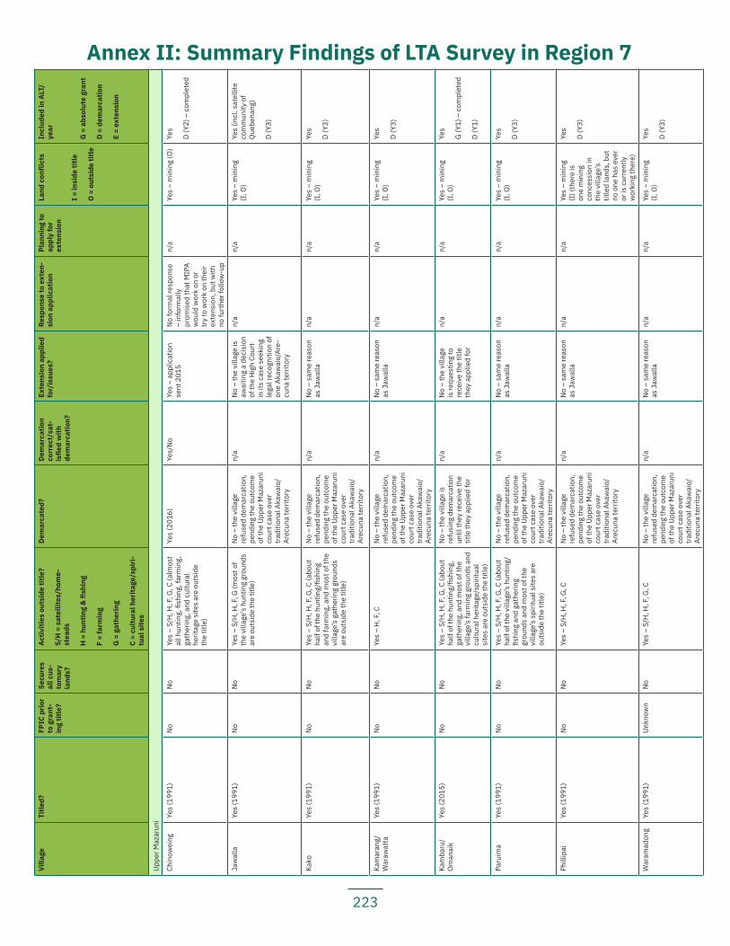
223
Villa
geTi
tled?
FPIC
prio
r to
gra
nt-
ing
title
?
Secu
res
all c
us-
tom
ary
land
s?
Activ
ities
out
side
title
?
S/H
= s
atel
lites
/hom
e-st
eads
H =
hun
ting
& fi
shin
g
F =
farm
ing
G =
gat
herin
g
C =
cultu
ral h
erita
ge/s
piri-
tual
site
s
Dem
arca
ted?
Dem
arca
tion
corr
ect/
sat-
isfie
d w
ith
dem
arca
tion?
Exte
nsio
n ap
plie
d fo
r/is
sues
?Re
spon
se to
ext
en-
sion
app
licat
ion
Plan
ning
to
appl
y fo
r ex
tens
ion
Land
con
flict
s
I = in
side
title
O =
out
side
title
Incl
uded
in A
LT/
year
G =
abs
olut
e gr
ant
D =
dem
arca
tion
E =
exte
nsio
n
Uppe
r Maz
arun
i
Chin
owei
ngYe
s (1
991)
No
No
Yes
– S/
H, H
, F, G
, C (a
lmos
t al
l hun
ting,
fish
ing,
farm
ing,
ga
ther
ing,
and
cul
tura
l he
ritag
e si
tes
are
outs
ide
the
title
)
Yes
(201
6)Ye
s/N
oYe
s –
appl
icat
ion
sent
201
5N
o fo
rmal
resp
onse
–
info
rmal
ly
prom
ised
that
MIP
A w
ould
wor
k on
or
try
to w
ork
on th
eir
exte
nsio
n, b
ut w
ith
no fu
rthe
r fol
low
-up
n/a
Yes
– m
inin
g (O
)Ye
s
D (Y
2) –
com
plet
ed
Jaw
alla
Yes
(199
1)N
oN
oYe
s –
S/H
, H, F
, G (m
ost o
f th
e vi
llage
’s h
untin
g gr
ound
s ar
e ou
tsid
e th
e tit
le)
No
– th
e vi
llage
re
fuse
d de
mar
catio
n,
pend
ing
the
outc
ome
of th
e Up
per M
azar
uni
cour
t cas
e ov
er
trad
ition
al A
kaw
aio/
Arec
una
terr
itory
n/a
No
– th
e vi
llage
is
awai
ting
a de
cisi
on
of th
e H
igh
Cour
t in
its
case
see
king
le
gal r
ecog
nitio
n of
on
e Ak
awai
o/Ar
e-cu
na te
rrito
ry
n/a
n/a
Yes
– m
inin
g (I
, O)
Yes
(incl
. sat
ellit
e co
mm
unity
of
Que
bena
ng)
D (Y
3)
Kako
Yes
(199
1)N
oN
oYe
s –
S/H
, H, F
, G, C
(abo
ut
half
of th
e hu
ntin
g/fis
hing
an
d fa
rmin
g, a
nd m
ost o
f the
vi
llage
’s g
athe
ring
grou
nds
are
outs
ide
the
title
)
No
– th
e vi
llage
re
fuse
d de
mar
catio
n,
pend
ing
the
outc
ome
of th
e Up
per M
azar
uni
cour
t cas
e ov
er
trad
ition
al A
kaw
aio/
Arec
una
terr
itory
n/a
No
– sa
me
reas
on
as J
awal
lan/
an/
aYe
s –
min
ing
(I, O
)Ye
s
D (Y
3)
Kam
aran
g/W
araw
atta
Yes
(199
1)N
oN
oYe
s –
H, F
, CN
o –
the
villa
ge
refu
sed
dem
arca
tion,
pe
ndin
g th
e ou
tcom
e of
the
Uppe
r Maz
arun
i co
urt c
ase
over
tr
aditi
onal
Aka
wai
o/Ar
ecun
a te
rrito
ry
n/a
No
– sa
me
reas
on
as J
awal
lan/
an/
aYe
s –
min
ing
(I, O
)Ye
s
D (Y
3)
Kam
baru
/O
man
aik
Yes
(201
5)N
oN
oYe
s –
S/H
, H, F
, G, C
(abo
ut
half
of th
e hu
ntin
g/fis
hing
, ga
ther
ing,
and
mos
t of t
he
villa
ge’s
farm
ing
grou
nds
and
cultu
ral h
erita
ge/s
pirit
ual
site
s ar
e ou
tsid
e th
e tit
le)
No
– th
e vi
llage
is
refu
sing
dem
arca
tion
until
they
rece
ive
the
title
they
app
lied
for
n/a
No
– th
e vi
llage
is
requ
estin
g to
re
ceiv
e th
e tit
le
they
app
lied
for
n/a
n/a
Yes
– m
inin
g (I
, O)
Yes
G (Y
1) –
com
plet
ed
D (Y
1)
Paru
ima
Yes
(199
1)N
oN
oYe
s –
S/H
, H, F
, G, C
(abo
ut
half
of th
e vi
llage
’s h
untin
g/fis
hing
and
gat
herin
g gr
ound
s an
d m
ost o
f the
vi
llage
’s s
pirit
ual s
ites
are
outs
ide
the
title
)
No
– th
e vi
llage
re
fuse
d de
mar
catio
n,
pend
ing
the
outc
ome
of th
e Up
per M
azar
uni
cour
t cas
e ov
er
trad
ition
al A
kaw
aio/
Arec
una
terr
itory
n/a
No
– sa
me
reas
on
as J
awal
lan/
an/
aYe
s –
min
ing
(I, O
)Ye
s
D (Y
3)
Phill
ipai
Yes
(199
1)N
oN
oYe
s –
S/H
, H, F
, G, C
No
– th
e vi
llage
re
fuse
d de
mar
catio
n,
pend
ing
the
outc
ome
of th
e Up
per M
azar
uni
cour
t cas
e ov
er
trad
ition
al A
kaw
aio/
Arec
una
terr
itory
n/a
No
– sa
me
reas
on
as J
awal
lan/
an/
aYe
s –
min
ing
(I) (
ther
e is
on
e m
inin
g co
nces
sion
in
the
villa
ge’s
tit
led
land
s, b
ut
no o
ne h
as e
ver
or is
cur
rent
ly
wor
king
ther
e)
Yes
D (Y
3)
War
amad
ong
Yes
(199
1)Un
know
nN
oYe
s –
S/H
, H, F
, G, C
No
– th
e vi
llage
re
fuse
d de
mar
catio
n,
pend
ing
the
outc
ome
of th
e Up
per M
azar
uni
cour
t cas
e ov
er
trad
ition
al A
kaw
aio/
Arec
una
terr
itory
n/a
No
– sa
me
reas
on
as J
awal
lan/
an/
aYe
s –
min
ing
(I, O
)Ye
s
D (Y
3)
Annex II: Summary Findings of LTA Survey in Region 7
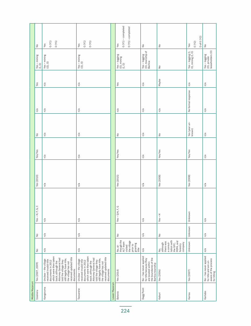
224
Mid
dle
Maz
arun
i
Isse
neru
Yes
(200
7, 2
009)
No
No
Yes
– H
, F, G
, CYe
s (2
010)
Yes/
Yes
No
n/a
Yes
Yes
– m
inin
g (I
, O)
No
Kang
arum
aUn
clea
r – th
e vi
llage
re
ceiv
ed in
valid
title
do
cum
ents
in 2
012
whi
ch w
ere
then
take
n ba
ck; a
lthou
gh th
e At
torn
ey G
ener
al h
ad
told
the
villa
ge th
ey
still
lega
lly h
ave
title
, th
e vi
llage
has
not
re
ceiv
ed u
pdat
ed ti
tle
docu
men
ts
n/a
n/a
n/a
n/a
n/a
n/a
n/a
n/a
Yes
– m
inin
g ((I
), O
)Ye
s
G (Y
1)
D (Y
1)
Tass
aren
eUn
clea
r – th
e vi
llage
re
ceiv
ed in
valid
title
do
cum
ents
in 2
012
whi
ch w
ere
then
take
n ba
ck; a
lthou
gh th
e At
torn
ey G
ener
al h
ad
told
the
villa
ge th
ey
still
lega
lly h
ave
title
, th
e vi
llage
has
not
re
ceiv
ed u
pdat
ed ti
tle
docu
men
ts
n/a
n/a
n/a
n/a
n/a
n/a
n/a
n/a
Yes
– m
inin
g ((I
), O
)Ye
s
G (Y
1)
D (Y
1)
Low
er M
azar
uni
Bata
via
Yes
(201
4)N
o, a
l-th
ough
the
ALT
team
vi
site
d th
e vi
llage
pr
ior t
o gr
antin
g tit
le
No
Yes
– S/
H, F
, GYe
s (2
015)
Yes/
Yes
No
n/a
Yes
Yes
– lo
ggin
g (O
), m
inin
g (I
, O)
Yes
G (Y
1) –
com
plet
ed
D (Y
1) –
com
plet
ed
Dagg
Poi
ntN
o –
has
neve
r app
lied
for t
itle
beca
use
they
ar
e lo
cate
d w
ithin
th
e bo
unda
ries
of th
e Ba
rtic
a to
wns
hip
n/a
n/a
n/a
n/a
n/a
n/a
n/a
n/a
Yes
– lo
ggin
g (O
), to
wns
hip
of
Bart
ica
No
Kabu
riYe
s (2
006)
No,
al
thou
gh
ther
e w
as
a co
nsul
-ta
tion
with
th
e G
FC,
MIP
A, a
nd
fore
stry
co
mpa
ny
No
Yes
– H
Ye
s (2
008)
Yes/
Yes
No
n/a
May
beN
oN
o
Karr
auYe
s (2
007)
Unkn
own
Unkn
own
Unkn
own
Yes
(200
8)Ye
s/Ye
sYe
s (y
ear u
n-kn
own)
No
form
al re
spon
se
n/a
Yes
– lo
ggin
g (I
, O
), m
inin
g (I
, O)
Yes
E (Y
2)
D of
E (Y
2)
Kart
abo
No
– ha
s ne
ver a
pplie
d fo
r titl
e an
d ar
e un
-aw
are
of th
e pr
oces
s fo
r titl
ing
n/a
n/a
n/a
n/a
n/a
n/a
n/a
n/a
Yes
– lo
ggin
g (O
), pr
ivat
e le
aseh
olde
rs (O
)
No
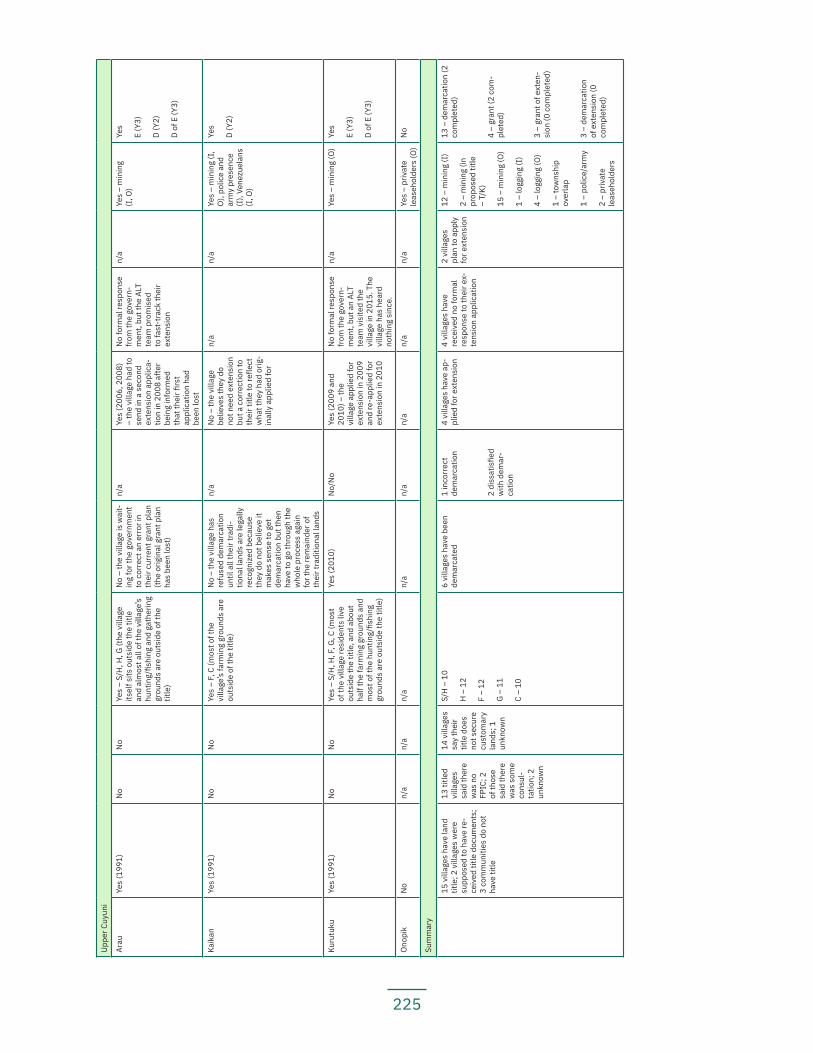
225
Uppe
r Cuy
uni
Arau
Yes
(199
1)N
oN
oYe
s –
S/H
, H, G
(the
vill
age
itsel
f sits
out
side
the
title
an
d al
mos
t all
of th
e vi
llage
’s
hunt
ing/
fishi
ng a
nd g
athe
ring
grou
nds
are
outs
ide
of th
e tit
le)
No
– th
e vi
llage
is w
ait-
ing
for t
he g
over
nmen
t to
cor
rect
an
erro
r in
thei
r cur
rent
gra
nt p
lan
(the
orig
inal
gra
nt p
lan
has
been
lost
)
n/a
Yes
(200
6, 2
008)
–
the
villa
ge h
ad to
se
nd in
a s
econ
d ex
tens
ion
appl
ica-
tion
in 2
008
afte
r be
ing
info
rmed
th
at th
eir fi
rst
appl
icat
ion
had
been
lost
No
form
al re
spon
se
from
the
gove
rn-
men
t, bu
t the
ALT
te
am p
rom
ised
to
fast
-tra
ck th
eir
exte
nsio
n
n/a
Yes
– m
inin
g (I
, O)
Yes
E (Y
3)
D (Y
2)
D of
E (Y
3)
Kaik
anYe
s (1
991)
No
No
Yes
– F,
C (m
ost o
f the
vi
llage
’s fa
rmin
g gr
ound
s ar
e ou
tsid
e of
the
title
)
No
– th
e vi
llage
has
re
fuse
d de
mar
catio
n un
til a
ll th
eir t
radi
-tio
nal l
ands
are
lega
lly
reco
gniz
ed b
ecau
se
they
do
not b
elie
ve it
m
akes
sen
se to
get
de
mar
catio
n bu
t the
n ha
ve to
go
thro
ugh
the
who
le p
roce
ss a
gain
fo
r the
rem
aind
er o
f th
eir t
radi
tiona
l lan
ds
n/a
No
– th
e vi
llage
be
lieve
s th
ey d
o no
t nee
d ex
tens
ion
but a
cor
rect
ion
to
thei
r titl
e to
refle
ct
wha
t the
y ha
d or
ig-
inal
ly a
pplie
d fo
r
n/a
n/a
Yes
– m
inin
g (I
, O
), po
lice
and
arm
y pr
esen
ce
(I),
Vene
zuel
ans
(I, O
)
Yes
D (Y
2)
Kuru
tuku
Yes
(199
1)N
oN
oYe
s –
S/H
, H, F
, G, C
(mos
t of
the
villa
ge re
side
nts
live
outs
ide
the
title
, and
abo
ut
half
the
farm
ing
grou
nds
and
mos
t of t
he h
untin
g/fis
hing
gr
ound
s ar
e ou
tsid
e th
e tit
le)
Yes
(201
0)N
o/N
oYe
s (2
009
and
2010
) – th
e vi
llage
app
lied
for
exte
nsio
n in
200
9 an
d re
-app
lied
for
exte
nsio
n in
201
0
No
form
al re
spon
se
from
the
gove
rn-
men
t, bu
t an
ALT
team
vis
ited
the
villa
ge in
201
5. T
he
villa
ge h
as h
eard
no
thin
g si
nce.
n/a
Yes
– m
inin
g (O
)Ye
s
E (Y
3)
D of
E (Y
3)
Ono
pik
No
n/a
n/a
n/a
n/a
n/a
n/a
n/a
n/a
Yes
– pr
ivat
e le
aseh
olde
rs (O
)N
o
Sum
mar
y
15 v
illag
es h
ave
land
tit
le; 2
vill
ages
wer
e su
ppos
ed to
hav
e re
-ce
ived
title
doc
umen
ts;
3 co
mm
uniti
es d
o no
t ha
ve ti
tle
13 ti
tled
villa
ges
said
ther
e w
as n
o FP
IC; 2
of
thos
e sa
id th
ere
was
som
e co
nsul
-ta
tion;
2
unkn
own
14 v
illag
es
say
thei
r tit
le d
oes
not s
ecur
e cu
stom
ary
land
s; 1
un
know
n
S/H
– 1
0
H –
12
F –
12
G –
11
C –
10
6 vi
llage
s ha
ve b
een
dem
arca
ted
1 in
corr
ect
dem
arca
tion
2 di
ssat
isfie
d w
ith d
emar
-ca
tion
4 vi
llage
s ha
ve a
p-pl
ied
for e
xten
sion
4 vi
llage
s ha
ve
rece
ived
no
form
al
resp
onse
to th
eir e
x-te
nsio
n ap
plic
atio
n
2 vi
llage
s pl
an to
app
ly
for e
xten
sion
12 –
min
ing
(I)
2 –
min
ing
(in
prop
osed
title
–
T/K)
15 –
min
ing
(O)
1 –
logg
ing
(I)
4 –
logg
ing
(O)
1 –
tow
nshi
p ov
erla
p
1 –
polic
e/ar
my
2 –
priv
ate
leas
ehol
ders
13 –
dem
arca
tion
(2
com
plet
ed)
4 –
gran
t (2
com
-pl
eted
)
3 –
gran
t of e
xten
-si
on (0
com
plet
ed)
3 –
dem
arca
tion
of e
xten
sion
(0
com
plet
ed)
226
Works Cited
1 APA and FPP (2016), Wow-Rorah, Wa-Kakoh; Na’Na Nonori, Na’Na Emamiri; Ca Hota, Ma Taho; Our Land, Our Life: A Participatory Assessment of the Land Tenure Situation of Indigenous Peoples in Guyana: Report for Region 1 and Region 2, http://www.forestpeoples.org/sites/fpp/files/publication/2016/12/lta-study.pdf
2 APA, FPP, and RFUS (2018), Ina Pata, Ko’Mangnàtok Yeselu; Our Land, Our Life: A Participatory As-sessment of the Land Tenure Situation of Indigenous Peoples in Guyana: Report for Region 8, https://www.forestpe-oples.org/sites/default/files/documents/Our%20Land%2C%20Our%20Life.pdf
3 Throughout this Report, the authors will follow the convention used in the Amerindian Act and by the government; that is, using “community” either generically or for those specific communities without title and “villa-ge” for communities with title. Exceptionally, Tassarene and Kangaruma are referred to as “villages” though they do not yet have valid title documents.
4 The other villages did not explicitly report a lack of FPIC in the granting of title, but no villages are satisfied with their existing title. Two villages did report having held a meeting in the village that was intended to be a consultation over the title, but they did not give their FPIC to the final area delimited for titling.
5 This information was not obtained from one of the titled communities, which did not specify which activities they use their extension for.
6 See Constitution of Guyana, 20 February 1980, Art. 154A (incorporating into the Constitution, among others, the International Convention on the Elimination of All Forms of Racial Discrimination, the International Cove-nant on Civil and Political Rights, and the International Covenant on Economic, Social, and Cultural Rights)
7 See Maya Leaders Alliance et al. v. Attorney General of Belize, [2015] CCJ 15 (AJ), Caribbean Court of Justice, 15 October 2015, at paras. 48-54
8 Much of the historical evidence and records of the Akawaio and Arecuna occupation of land in Guyana has been compiled by social anthropologist Audrey Butt Colson. This report used her book, Land: its occupation, management, use and conceptualization: the case of the Akawaio and Arekuna of the Upper Mazaruni District, Guya-na, Panborough, Near Wells, Somerset, U.K.: Last Refuge, 2009, as the primary guide for compiling the information in this section, and the authors are deeply grateful for her work. This book will be hereinafter cited as A B Colson 2009.
9 For more information about the Patamona and Region 8 of Guyana, see the LTA report for Region 8
10 Williams, Dennis (2003), Prehistoric Guiana, Kingston, Jamaica, and Miami, USA: Ian Randle Publi-shers (hereinafter cited as D Williams 2003) at 387-8
11 AB Colson 2009 at 111-112
12 D Williams 2003 at 371
13 Williams, Dennis (1998), “The Archaic Colonization of the Western Guiana Littoral and its Aftermath,” Journal of the Walter Roth Museum of Anthropology, 12:22-41 (cited in AB Colson 2009 at 15)
14 D Williams 2003 at 370
15 Ibid at 392
16 Ibid at 370 (cited in AB Colson 2009 at 16)
17 Ibid at 370-1
18 Ibid at 368
19 Ibid at 383
20 Wishart, Jennifer E. (2000), “Guyana this millennium,” Guyana Review, 28 (cited in AB Colson 2009 at 15)
21 “2,000 year-old Akawaio pot donated to Walter Roth Museum”, Stabroek News, 20 September 2014,
227
https://www.stabroeknews.com/2014/news/guyana/09/20/2000-year-old-akawaio-pot-donated-walter-roth-mu-seum/
22 D Williams 2003 at 380
23 Ibid at 381
24 Ibid at 367-8 (cited in AB Colson 2009 at 16)
25 Evans, Clifford and Meggars, Betty J. (1960), “Archeological Investigations in British Guiana”, Smith-sonian Institution: Bureau of American Ethnology Bulletin, 177:1-418 at 23
26 D Williams 2003 at 65-6
27 Alternative spellings include ‘Kijkoveral’ and ‘Kykoveral’
28 A B Colson 2009 at 101-102
29 This review does not claim to provide an exhaustive account of the people in Region 7 at the time of European arrival and exploration.
30 AB Colson 2009 at 86
31 Keymis, Laurence (1596), “A Relation of the second Voyage to Guiana, performed and written in the yeere 1596,” in Hakluyt, Richard (1904), The Principal Navigations Voyages Traffiques & Discoveries of the English Nation, Glasgow: James MacLehose and Sons, Vol. X: 441-501 (cited in AB Colson 2009 at 20)
32 Rodway, James (1596), “The Indian Town Maburesa, 1596,” in Timehri, Journal of the Royal Agricul-tural and Commercial Society of British Guiana (August 1921), Vol. VII (3rd ser.), Occasional Notes, 153 (cited in AB Colson 2009 at 20)
33 Masham, M. Thomas, “The third voyage set forth by sir Walter Ralegh to Guiana, with a pinnesse called The Watte, in the yeere 1596,” in Hakluyt, Richard (1904), The Principal Navigations Voyages Traffiques & Di-scoveries of the English Nation, Glasgow: James MacLehose and Sons, Vol. XI: 1-15 (cited in AB Colson 2009 at 21)
34 Ley, John, “The Reluctant Go-between: John Ley’s Survey of Aboriginal Settlement on the Guayana Coastline,” in Lorimer, Joyce (1994), The European Outthrust and Encounter: The first phase c. 1400-c. 1700, eds. Cecil H. Clough and P. E. H. Hair, Liverpool University Press, 191-223 (cited in AB Colson 2009 at 21)
35 Referenced in AB Colson at 86-7
36 Major John Scott, Geographer to King Charles II, “The Discription of Guyana” (Sloane Mss. 3662, ff. 37b-42b), reproduced in Colonising Expeditions to the West Indies and Guiana, 1623-1667, ed. Vincent T. Harlow, The Hakluyt Society, 1924, Ser. II, Vol. LVI: 132-148 (cited in AB Colson 2009 at 22)
37 A B Colson 2009 at 23
38 van Berkel, Adriaan, Travels in South America between the Berbice and Essequibo Rivers and in Surinam 1670-1689, trans. from Dutch and ed. by W. E. Roth (1925), The Guiana Edition, No. 2, ed. Vincent Roth, Georgetown: The Daily Chronicle Ltd., 1948 (cited in AB Colson 2009 at 24)
39 See, e.g., The Commandeur, Essequibo, to the West India Company, Arbitration with the United States of Venezuela, June 28, 1680, 1681, July 18, 1682, and February 27, 1683 (1898), Appendix to the Case on Behalf of the government of Her Britannic Majesty, Vol. I (1593-1723), Nos. 94:183, 95:184, 96:185, and 97:185, London: Foreign Office (cited in AB Colson 2009 at 24-5).
40 Extract from Essequibo Council Minutes, Enclosure in dispatch from the Commandeur, Essequibo, to the West India Company, October 20, 1686, Arbitration with the United States of Venezuela (1898), Appendix to the Case on Behalf of the government of Her Britannic Majesty, Vol. I (1593-1723), No. 110, 201-2, London: Foreign Office (cited in A B Colson 2009 at 25).
41 de Laet, Johannes (1993), Nieuwe Wereldt ofte Beschriijvinghe van West-Indien (Leyden), trans. into Spanish by Marisa Vanini de Gerulewicz, Colección Viajes y Descripciones, No. 23, Caracas: Fundación de Promoción Cultural de Venezuela, trans. into English by A. Butt Colson (cited in AB Colson 2009 at 22).
42 Ibid
228
43 A B Colson, pp. 92-3.
44 AB Colson 2009 at 94. See also, C.A. Harris and J.A.J. de Villiers, Storm van ’s Gravesande: The Rise of British Guiana, Vol. I: 176, 287, The Despatch of van ’s Gravesande to the West India Company, August 31, 1752 (The Hakluyt Society, Ser. II, Vols XXVI-XXVII, London, 1911) (cited in AB Colson 2009 at 28)
45 F. Staehelin (ed.), Die Mission der Brudergemeine in Suriname und Berbice im achtzehnten Jahrun-dert, II, ii, 175, Paramaribo: C. Kersten and Co, 1913-19 (cited in AB Colson 2009 at 28).
46 See generally C.A. Harris and J.A.J. de Villiers, Storm van ’s Gravesande: The Rise of British Guiana, Vols. I and II, The Despatch of van ’s Gravesande to the West India Company, (The Hakluyt Society, Ser. II, Vols XXVI-XXVII, London, 1911) (cited in AB Colson 2009 at 27-35)
47 Ibid
48 Ibid
49 Director-General, Essequibo, to West Indian Company, March 12, 1756, British Guiana-Venezuela Border Arbitration, Venezuela, No. 3 (1896), Further Documents relating to the Question of Boundary between British Guiana and Venezuela, Inclosure in No. 124, 107, Examination of Arraytana, the Caraiban Chief, by Adriaen Christiaense, 17 December 1755 (cited in AB Colson 2009 at 29-30).
50 AB Colson 2009 at 35 (referencing Hartsinck, J. J. (1770), Beschryving van Guiana, of de Wilde Kust in Zuid-America, Amsterdam; facsimile reprint, S. Emmering, 1974.
51 See AB Colson 2009 at 46-7
52 AB Colson 2009 at 94
53 Brett, W. H. (1860), Legends and Myths of the Aboriginal Indians of British Guiana, London: Wells Gardner (cited in AB Colson 2009 at 51)
54 Brown, C. Barrington (1876), Canoe and Camp Life in British Guiana, London at 19
55 AB Colson 2009 at 94
56 Hilhouse, William (1825), Indian Notices at 20 (cited in AB Colson 2009 at 37)
57 Hilhouse, William (1834), “Journal of a voyage up the Massaroony in 1831,” Journal of the Royal Geo-graphical Society, Vol. IV: 25-40 and map (cited in AB Colson 2009 at 37-8)
58 Schomburgk, Robert (1837), “Diary of an ascent of the River Berbice, in British Guayana, in 1836-37,” Journal of the Royal Geographical Society, Vol. VII: 308-310, 312, 340 (cited in AB Colson 2009 at 38-9)
59 Schomburgk, Richard (1848), Travels in British Guiana, 1840-44, Leipzig; trans. By W. E. Roth (1922) from original German, Georgetown: The Daily Chronicle, Vol. II: 273, 277 (cited in AB Colson 2009 at 43-4)
60 Blair, Daniel (1980), “Notes of an Expedition from Georgetown to the Gold Diggings on the Borders of Venezuela (1857),” Journal of the Walter Roth Museum of Archeology and Anthropology, Vol. 3, No. 1 (cited in AB Colson 2009 at 45-46)
61 Ibid
62 Brett, W. H. (1860), Legends and Myths of the Aboriginal Indians of British Guiana, London: Wells Gardner (cited in AB Colson 2009 at 47-56)
63 AB Colson 2009 at 55
64 Brown, C. Barrington (1876), Canoe and Camp Life in British Guiana, London: Stanford, chapters 3, 4, and 15 (cited in AB Colson 2009 at 61-2)
65 Ibid
66 Brett, W.H. (1851), Indian Missions in Guiana, London: Bell at 297-9 (cited in AB Colson 2009 at 44).
67 Brett, W. H. (1860), Legends and Myths of the Aboriginal Indians of British Guiana, London: Wells Gardner (cited in AB Colson 2009 at 47-56).
229
68 Schomburgk, Richard (1840), A Description of British Guiana, Geographical and Statistical: exhibiting its Resources and Capabilities, together with the Present and Future Condition and Prospects of the Colony. London: Simpkin, Marshall, and Co. at 50 (cited in Colson, AB (2009), “Naming, Identity and Structure: The Pemon”, Antro-pológica, Tomo LIII, 111-112: 35-114, 56)
69 Schomburgk, Robert (1840), “Journey from Fort San Joaquim, on the Rio Branco, to Roraima, and Thence by the Rivers Parima and Merewari to Esmeralda, on the Orinoco, in 1838-9”, The Journal of the Royal Geo-graphical Society of London, Vol. 10 at 191-207+209-247, 203-204
70 Schomburgk, Richard (1848), Travels in British Guiana, 1840-44, Leipzig; trans. By W. E. Roth (1922) from original German, Georgetown: The Daily Chronicle, Vol. II: 184, 188 (cited in AB Colson 2009 at 141-42)
71 Ibid
72 Blair, Daniel (1980), “Notes of an Expedition from Georgetown to the Gold Diggings on the Borders of Venezuela (1857)”, Journal of the Walter Roth Museum of Archeology and Anthropology, Vol. 3, No. 1 (cited in AB Colson 2009 at 45-6)
73 Perkins, H. I. (1903), “Demarcation of the Boundary with Venezuela”, Report to the Hon. government Secretary, 9th January 1905, on the work of the Boundary Commission from September 1903, London: The National Archives, CO III/544 at 51 (cited in AB Colson 2009 at 69).
74 Schomburgk, Robert (1840), “Journey from Fort San Joaquim, on the Rio Branco, to Roraima, and Thence by the Rivers Parima and Merewari to Esmeralda, on the Orinoco, in 1838-9”, The Journal of the Royal Geo-graphical Society of London, Vol. 10 at 191-207+209-247, 195
75 Ibid at 218
76 Schomburgk, Richard (1848), Travels in British Guiana, 1840-44, Leipzig; trans. W. E. Roth (1922) from original German, Georgetown: The Daily Chronicle, Vol. II: 189 (cited in AB Colson 2009 at 43)
77 A B Colson 2009 at 145-148, 150
78 Charter of the Dutch West India Company: 1621 in: Thorpe, Francis Newton (1909), The Federal and State Constitutions Colonial Charters, and Other Organic Laws of the States, Territories, and Colonies Now or Heretofore Forming the United States of America Compiled and Edited Under the Act of Congress of June 30, 1906, Washington, DC: government Printing Office, available at: http://avalon.law.yale.edu/17th_century/westind.asp. Section II of the Charter allowed the company to make “contracts, engagements and alliances with the princes and natives” and Section XLV required the company to “maintain and establish the Company in the things contained in this charter, in all treaties of peace, alliances and agreements with the neighboring princes, kingdoms and countries, without doing anything, or suffering any thing to be done which will weaken their establishment”.
79 Ordre van Regieringe soo in Policie als Justitie in de Plaetsen verovert ende te veroveren in West-In-diën (1629), in Burge’s Commentaries on Colonial and Foreign Laws Generally and in their Conflict with the Law of England (1907), eds. A.W. Renton & G.G. Phillimore, Sweet & Maxwell, London, Vol.1 at 119 (referenced in Ram-sahoye, Fenton (1966), The Development of Land Law in British Guiana at 2-3). Article 14 stated: “[T]he Spaniards, Portuguese and Naturals of the land who subject themselves to the government and obedience of the lords Sta-tes-General will keep their ingenios, lands, houses and other goods and will remain and protected in the free pos-session and use thereof…”
80 The colonies were surrendered to Great Britain in 1803 and formally ceded by the Treaty of London in 1814.
81 Districts under the Aboriginal Indians Protection Ordinance, 1910, British Guiana
82 UMDC, APA and FPP (2000), Indigenous Peoples, Land Rights and Mining in the Upper Mazaruni: A Report, Global Law Association: The Netherlands (hereinafter cited as the Upper Mazaruni Report 2000) at 12
83 Ibid at 13-14
84 Proclamation No. 2 of 1945 made by W. L. Heape, Colonial Secretary in The Official Gazette – April 14th, 1945
85 AB Colson 2009 at 103
86 AB Colson 2009 at 104
230
87 The 1951 Ordinance allowed Districts, Areas, and Villages to select leaders termed “captains”. The Amerindian Act of 2006 began the use of the term “toshao” to refer to village leaders.
88 “Order in Council Made Under the Amerindian Ordinance 1951 (No. 22 of 1951), No. 59 of 1953
89 Order in Council Made Under The Amerindian Ordinance (Chapter 58), No. 91 of 1959 in The Official Gazette – 14th November 1959
90 Champion of Amerindian land rights and first indigenous member of Parliament in 1958.
91 “The Pioneering Days of Stephen Campbell”, Kaieteur News, 24 January 2016, http://www.kaieteur-newsonline.com/2016/01/24/the-pioneering-days-of-stephen-campbell/
92 Annex C, Report of the British Guiana Independence Conference 1965. Annex C was repeated ver-batim in the Amerindian Lands Commission Act. Sections 2 and 3 of the Amerindian Lands Commission Act were entrenched in Section 17 of the Guyana Independence Order 1966 and in Section 20 of the 1980 Guyana Consti-tution. Section 20 of the 1980 Guyana Constitution reads: “notwithstanding anything contained in this constitution, Sections 2 and 3 of the Amerindian Lands Commission Act as in force immediately before the appointed day may be amended by Parliament only in the same manner as the provisions specified in Article 164(2)(6) of the constitution.” Section 164(2)(6) requires a two-thirds majority of Parliament and submission of the proposed amendment to a vote by the electorate, prior to signature by the President.
93 Amerindian Lands Commission Ordinance 1966. This ordinance was re-enacted as the Amerindian Lands Commission Act (Cap. 59:03).
94 Report by the Amerindian Lands Commission (1969), Amerindian Lands Commission, Guyana (herei-nafter cited as ALC Report) at 13
95 Ibid at 4
96 Ibid at 130, para. 250
97 Ibid at 5, para. 13
98 See Ibid at 2, para. 8
99 Ibid at 4, paras. 18-20
100 Ibid at para. 20
101 Ibid at Appendix IV, quest. 2(a)
102 Ibid at Appendix III, para. 3
103 Ibid at Appendix III, para. 4. It appears that the letter mistakenly reports a decrease in the size of the reservation from 3000 sq. miles to 2000 sq. miles following the de-reservation of the Imbaimadai mining area, but the decrease was actually from 4500 sq. miles to 3000 sq. miles.
104 Ibid at Appendix III, para. 8
105 Ibid at Appendix X and 42, Part I, Summary of General Recommendations, para. IV(9)
106 While this law is formally the 1951 Amerindian Act (as amended in 1976), it has also been commonly referred to as the ‘1976 Amerindian Act’ and the authors of the report will also follow that convention.
107 Upper Mazaruni Report 2000 at 29-30
108 The 2006 Amerindian Act contains no corresponding provision, although restitution is authorized by the Constitution. This is an area where the 2006 Amerindian Act falls short, even beyond the 1976 Act, and fails adequately to incorporate protections for indigenous rights.
109 It also included two additional Districts, but these had been established by order in 1977. See Order Made Under The Amerindian Act (Cap. 29:01), No. 67 of 1977 in The Official Gazette – 24th September, 1977, Legal Supplement – B
110 See, e.g., UNDRIP Article 26(3)
111 Statement of the Conference of Middle Mazaruni Villagers at Sabala-u, Tiboku, 16-18 October 1993
231
112 Waramuripe was to be a new village comprised of the people of Serenamu and Pashenamu Villages. Waramuripe is no longer an active village.
113 Sabala’u/Asura was to be the resettlement site of the former village at Issano. Sabala’u/Asura is no longer an active village.
114 Ramsahoye, Fenton H.W. (1966), The Development of Land Law in British Guiana, New York at 180
115 Upper Mazaruni Report 2000 at 27
116 Ibid
117 Ibid
118 AB Colson 2009 at 109
119 See, e.g., “Mining wrecking traditional way of life in Cuyuni/Mazaruni -community leaders tell Parlia-ment committee”, Stabroek News, 3 December 2005, cited in http://www.forestpeoples.org/sites/fpp/files/publi-cation/2010/08/guyanacerduajan06eng.pdf (explaining how indigenous leaders from the Mazaruni region detailed before the Parliament and various ministries and agencies of state that “Mining activities in Cuyuni/Mazaruni (Region Seven) have destroyed the way of life for many of the Amerindian communities as a result of the environmental hazards, including the pollution of the rivers and creeks”); and “Region Seven’s Toshaos blast treatment at Amerin-dian conference”, Kaieteur News, 15 August 2012, https://www.kaieteurnewsonline.com/2012/08/15/region-se-vens-toshaos-blasts-treatment-at-amerindian-conference/ (recording a statement by Akawaio toshaos that “As leaders of villages spanning Upper, Middle and Lower Mazaruni, the common issue of mining close to lands held by Amerindians or those traditionally used by us, is a cause for concern. For far too long, we, as well as our brothers and sisters of other villages have suffered the consequences of mining. In practice what happens is a case where applications are processed without village councils having knowledge of it. After a decision would have been made on the application, a letter is usually sent to the community telling them of the decision. What has happened to your right to be part of the decision making process?”)z
120 Development Policy and Management Consultants, National Assessment of Land Degradation in Guyana: Diagnostic Report (2008), Guyana Lands and Surveys Commission, Georgetown: Guyana at 53
121 Harvard Law School: International Human Rights Clinic (2007), Gold Mining in Guyana. The Failure of government Oversight and the Human Rights of Amerindian Communities at 26, http://zunia.org/sites/default/files/media/node-files/al/157177_AllThatGlitters1.pdf
122 Canterbury, D. (1997), “Consultative Processes in Guyana’s Mineral Sector: Bauxite and Gold: Paper presented at World Bank Conference on Mining and the Community” at 10-1. See also, Roopnarine, L. (2006), “Small-scale gold mining and environmental policy challenges in Guyana: protection or pollution”, Canadian Journal of Latin American and Caribbean Studies (detailing serious and systemic failures to monitor and regulate mining and substantial harm to indigenous peoples caused by mining), http://www.thefreelibrary.com/Small-scale+gold+mi-ning+and+environmental+policy+challenges+in...-a0147115108; Thomas, C. (2009), TOO BIG TO FAIL: A Scoping Study of The Small and Medium Scale Gold and Diamond Mining Industry in Guyana, Institute of Development Stu-dies: University of Guyana at 72-4, http://guyanaminers.com/sites/default/files/documents/files/Gold%20and%20Diamond%20Mining%20Study.pdf
123 “Land Tenure”, Ministry of Indigenous Peoples’ Affairs, https://moipa.gov.gy/land-tenure/
124 Ibid
125 The government agreed to review the Act, with support from a World Bank grant, at least in part because the Guyana Protected Areas Systems Project, funded by the Global Environment Facility of the World Bank, would not commence until a draft bill was tabled before Parliament. See World Bank (2004), “Guyana Pro-tected Areas System Project: Indigenous Peoples Development Plan”, http://documents.worldbank.org/curated/en/993921468252259777/pdf/IPP75010revised.pdf. The new Amerindian Act was approved by Parliament in April 2006, and the GPAS Project was cancelled in May 2006, because despite the new law, the new legal framework in place was still inadequate to address indigenous land rights. See Renshaw, Jonathan (2007), “Guyana: Technical Note on Indigenous Peoples”, Inter-American Development Bank at 32
126 Amerindian Act 2006, Act No. 6 of 2006, Cap. 29:01, Art. 62(2)
127 UNCERD (2006), Concluding observations of the Committee on the Elimination of Racial Discrimina-tion: GUYANA, CERD/C/GUY/CO/14 at para. 15
232
128 Ibid at para. 16
129 UNCESCR (2015), Concluding observations on the combined second to fourth periodic reports of Guyana, E/C.12/GUY/CO/2-4 at para. 15
130 UNCERD (2008), REPORTS SUBMITTED BY STATES PARTIES UNDERARTICLE 9 OF THE CONVEN-TION: Information provided by the Government of Guyana on the implementation of the concluding observations of the Committee on the Elimination of Racial Discrimination, CERD/C/GUY/CO/14/Add.1
131 See, for example, “Urgent reform planned to strengthen land rights under Amerindian Act – Allicock”, Stabroek News, 8 November 2015, https://www.stabroeknews.com/2015/news/guyana/11/08/urgent-reform-plan-ned-to-strengthen-land-rights-under-amerindian-act-allicock/
132 UNCESCR (2015), Summary record of the 60th meeting, E/C.12/2015/SR.60 at para. 36
133 “Consultation for revision of Amerindian Act 2006 begins”, Department of Public Information, 16 April 2018, https://dpi.gov.gy/consultation-for-revision-of-amerindian-act-2006-begins/
134 Comments by the APA on the Government of Guyana project concept note on ‘Amerindian Land Titling and Demarcation’ submitted to the Guyana REDD Investment Fund (GRIF), January 2011.
135 ALC Report at 139, para. 13
136 Ibid at para. 14
137 Ibid
138 Ibid
139 “Chinoweing Toshao calls on President Granger”, Ministry of the Presidency, 18 May 2018, https://motp.gov.gy/index.php/2015-07-20-18-49-38/2015-07-20-18-50-14/2961-chinoweing-toshao-calls-on-president-granger
140 ALC Report at 135, para. 13
141 Ibid at para. 14
142 Ibid
143 See Jawalla Village Council v. James Krawowsky, Timna Mining Guyana Inc., and GGMC, No. 72-Apl, High Court of Guyana, 2 October 2015. See also, “Jawalla residents shocked by court decision over Mazaruni mining -says Chief Justice has ‘taken’ Mazaruni River out of their village”, Guyana Chronicle, 15 October 2015, http://guya-nachronicle.com/2015/10/15/jawalla-residents-shocked-by-court-decision-over-mazaruni-mining-says-chief-justi-ce-has-taken-mazaruni-river-out-of-their-village.
144 Ibid
145 This is likely the same as the Kamarakoto tribe, which is another people who called themselves Pe-mon, like the Arecuna.
146 ALC Report at 136, para. 13
147 Ibid at para. 14
148 Ibid
149 Ibid
150 “Kako toshao faces jail after denying miner entry”, Stabroek News, 3 November 2012, https://www.stabroeknews.com/2012/news/guyana/11/03/kako-toshao-faces-jail-after-denying-miner-entry/. See also, “Kako Village in standoff with miner”, Stabroek News, 16 October 2012, http://www.stabroeknews.com/2012/news/sto-ries/10/16/kako-village-in-standoff-with-miner/
151 Amerindian Lands Commission report, http://parliament.gov.gy/documents/documents-lai-d/14210-report_by_the_amerindian_lands_commission_august_1969.pdf, p. 133, para. 13.
152 ALC report, p. 133, para. 14.
233
153 ALC report, p. 133, para. 14.
154 Region 7 Land Conference: Public Statement, 2 March 2017, Phillipai
155 See also APA and FPP, Indigenous Peoples’ Rights, Forests and Climate Policies in Guyana: A Special Report, 2014 at 46-48
156 ALC Report at 141, para. 13
157 Ibid at 142, para. 14
158 Ibid
159 The authors did not have the opportunity to verify whether the ‘Karabu’ creek in Paruima is the same as the river mistakenly label as the ‘Tshuau’ River in Kaikan that Kaikan residents know as Carak Paru or whether it is the same as the river that is mistakenly labeled as the ‘Karabo’ (that Kaikan residents know as the ‘Tshuau’) on government maps.
160 ALC Report at 137, para. 13
161 Ibid at 138, para. 14
162 Ibid
163 ALC Report at 134, para. 13
164 Ibid at para. 14
165 Ibid at 140, para. 13
166 Ibid
167 Ibid at 134, para. 14
168 See, e.g., “Isseneru scaling down on fish to limit mercury poisoning”, Stabroek News, 6 August 2009, http://www.stabroeknews.com/2009/archives/08/06/isseneru-scaling-down-on-fish-to-limit-mercury-poi-soning/. See also, “ENVIRONMENT-GUYANA: Influx of Gold Miners Worries Scientists”, Inter Press Service, 26 June 2001 (stating that “Isseneru used to be a quiet village in western Guyana’s Mazaruni District. Today, it is at the centre of growing concern about environmental and health problems stemming from gold mining. Most of the few hundred people who live in the village are indigenous Amerindians who eke out a living mostly from subsistence farming. In recent years, however, small-time gold miners from the coastland and prospectors from neighbouring Brazil, working legally and illegally, have moved into the area in response to a ‘gold shout’, or promising find. The mi-ners have arrived not only with food, camping and work equipment, but also large quantities of mercury, which they use to extract gold from the tons of ore they rummage through each day. That’s where the problem lies, say environ-mentalists: A recent survey shows higher than usual concentrations of mercury in the bodies of the villagers. ‘We are concerned about it,’ says David Singh, head of technical services at Guyana’s Institute of Applied Science and Tech-nology. ‘The human contamination is definitely associated with gold mining’”), http://www.ipsnews.net/2001/06/environment-guyana-influx-of-gold-miners-worries-scientists/
169 ALC Report at Introduction, “Industries: The Timber Industry”, para. 131
170 ALC Report at 144, para. 13
171 Ibid at para. 14
172 Ibid
173 Devroy Thomas and Arau Village Council v. AG and GGMC, No. 166-M, High Court of Guyana, 30 April 2009 at 45-46
174 ALC Report at 143, para. 13
175 Ibid at para. 14
176 Ibid at para. 14
177 ALC Report at 199, para. 13
234
178 Ibid at para. 14
179 Ibid at para. 14
180 This is likely a reference to the case In the matter of an Application by the Guyana Gold and Diamond Miners Association, No. 30/12-CM, High Court of Guyana, 5 October 2012. The GGDMA had brought the case on behalf of a miner whose payments for renewal of medium scale mining permits had been refused by the GGMC. The GGMC claimed that the decision was based upon the fact that the permits overlapped proposed indigenous titles. Chief Justice Chang of the High Court found that the GGMC’s decision not to accept payment for the renewal of the concessions was invalid, in pertinent part because the overlap of concessions with proposed indigenous titles is not a rational basis for the GGMC to refuse to a renewal application. It should be noted that the village’s question was in regards to mining concessions being issued within their title, whereas the case forcing GGMC to renew mining concessions concerned proposed title areas.
181 See, e.g., “Kurutuku being devastated by mining pollution, Toshao warns – village seeking urgent demarcation”, Stabroek News, 18 August 2012 (stating, inter alia, that “Toshao of the Region Seven community of Kurutuku, Solomon Lewis says that an increase in mining since last year has created problems for the remote com-munity and is appealing for demarcation of land to be done quickly, since the damage could cause the death of the village… He said that pleas to the government have fallen on deaf ears”)
182 ALC Report at 145, para. 13
183 Ibid at para. 14
184 Ibid at para. 14
185 See Amerindian Lands Commission Act, Cap. 59:03, 20 May 1966.
186 The ALC recommended 24,000 sq. miles out of the approximately 43,000 sq. miles requested. Of the area recommended, to date, the government has titled only approximately one-half.
187 See, e.g., UNCERD (2006), Concluding observations of the Committee on the Elimination of Racial Di-scrimination: Guyana, CERD/C/GUY/CO/14 at para. 15; UNCESCR (2015), Concluding observations on the combined second to fourth periodic reports of Guyana, E/C.12/GUY/CO/2-4 at paras. 14-5.
188 See, e.g., Gilbert, J. (2006), Indigenous Peoples’ Land Rights in International Law: From Victims to Actors, Transnational, Ardsley, NY; Martinus Nijhoff, Leiden; IACHR (2009), Indigenous and Tribal Peoples’ Rights Over Their Ancestral Lands and Natural Resources: Norms and Jurisprudence of the Inter American Human Rights System, OASOEA/Ser.L/V/II. Doc. 56/09, http://www.oas.org/en/iachr/indigenous/docs/pdf/ancestrallands.pdf
189 UNCERD (2013), EWUA – Action Letter, CERD/82nd/GH/MC/SW, 1 March 2013
190 UNCERD (2018), EWUA – Action Letter, CERD/95th/EWUAP/SK/ks, 17 May 2018
191 The reservation of mineral rights to the state dates back as far as the 1903 State Lands Act, though the Act has since been amended several times since.
192 The State Lands Regulations date back to 1919 and have been amended several times since.
193 See, e.g., An Application by Daniel Dazell, No. 158-M, High Court of Guyana, 13 August 2008 (ruling that “the lands would not be part of the Isseneru Amerindian Village since they would have been excepted under the words ‘save and except all lands legally held’ in the state grant of lands to the Isseneru Amerindian Village. Such words in such grants clearly indicate the state’s respect for private occupational rights and its intention not to derogate from them outside of any factual condition or legal requirement which may attend them. Indeed, any such derogation would invite constitutional challenge for breach of Article 142 which protects property rights”).
194 See, e.g., In the matter of an Application by Joan Chang, No. 136-M, High Court of Guyana, 17 January 2013 (stating that because Isseneru Village Council could not show that the mining concessions dated to after the entry into force of the 2006 Amerindian and bwere not excluded under the village title’s “save and except” clause, “the IVC [Isseneru Village Council] cannot exercise control over the Far eye [sic] mining claims”); and In the matter of an application by Wayne Vieira, No. 2-M, High Court of Guyana, 17 May 2013 (ruling that the mining permi-ts were excluded by the village title’s “save and except” clause and thus the Amerindian Act did not apply, meaning that the village council had no authority over the operation).
195 The court in Devroy Thomas and Arau Village Council v. AG and GGMC, No. 166-M, High Court of Guyana, 30 April 2009, did require GGMC to ensure that mining activities would not diminish the usufructary value
235
of the land to the way of life of the indigenous people occupying the land, whether the land is titled or not. This ruling has set a precedent, though it is not law per se.
196 Insofar as there are any safeguards for untitled indigenous customary lands at all, the VPA and its annexes, as they stand, only contain commitments to publish lands deemed ‘vacant’ and available for forestry exploitation, which in theory indigenous peoples would be allowed to challenge via a proposed FLEGT grievance mechanism.
197 The Indigenous Peoples Commission was established by the Constitution of Guyana, Article 212G(1)(c).
198 See also APA and FPP, Indigenous Peoples’ Rights, Forests and Climate Policies in Guyana: A Special Report, 2014 at 29
199 “Govt indicates intent to go all the way to the CCJ”, Department of Public Information, 31 January 2019, https://dpi.gov.gy/govt-indicates-intent-to-go-all-the-way-to-the-ccj/
200 See, e.g., “House-to-house registration to begin”, Department of Public Information, 19 February 2019, https://dpi.gov.gy/house-to-house-registration-to-begin/
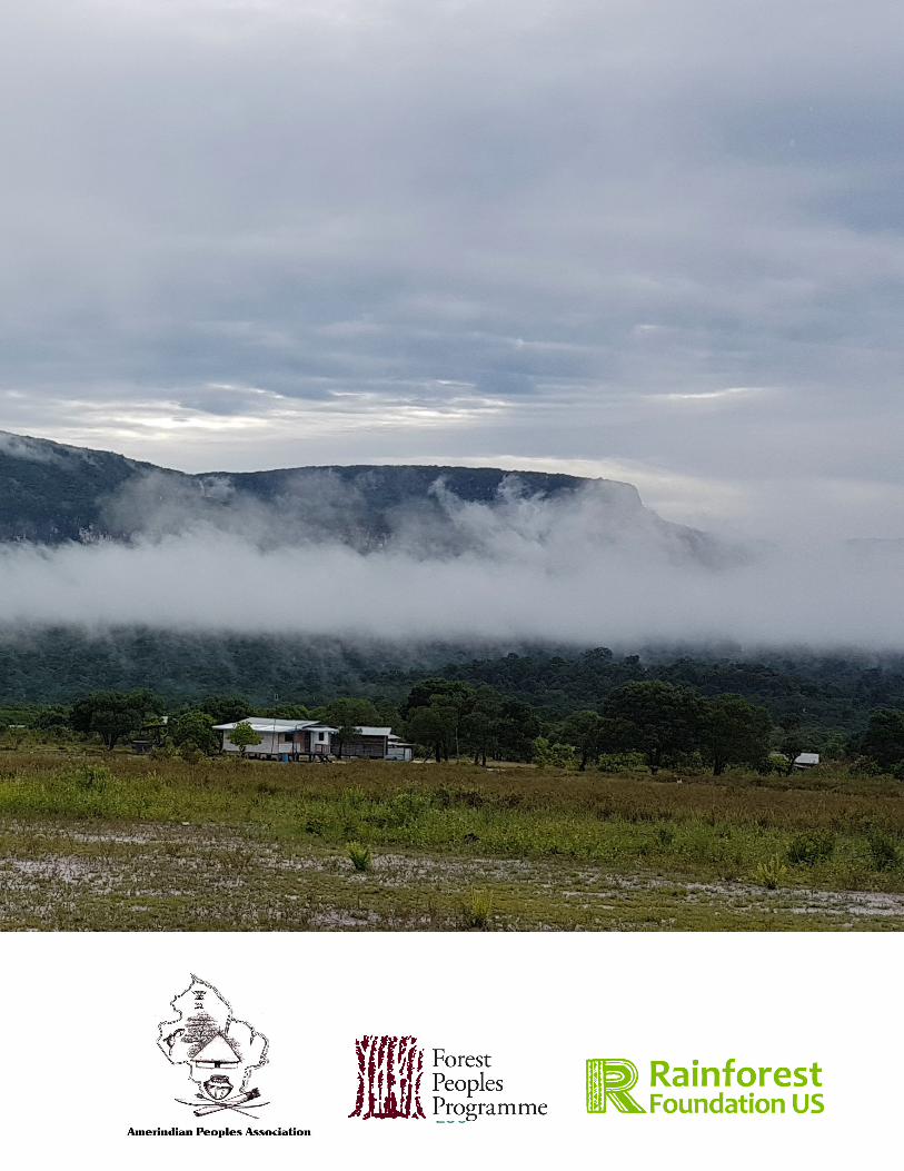
236


