Embed Size (px)
Citation preview

illzJf^X c/?
ff)OLp C\S

Digitized by the Internet Archive
in 2012
http://archive.org/details/ordnancegazettv200groo

-.
t»<«*
Eh
go
«!
O
oop
Woo1-5
ORDNANCE
GAZETTEER OF SCOTLAND
1 SURVEY OF SCOTTISH TOPOGRAPHY,
Statistical Qiaymffiml, anir Historical
EDITED BY
FRANCIS H. GROOME,ASSISTANT EDITOR OF 'THE GLOBE ENCYCLOPEDIA.
,-JS^V^A^
VOLUME II.
EDINBURGH;THOMAS C. JACK, GRANGE PUBLISHING WORKS.
LONDON: 45 LUDGATE HILL.
GLASGOW: 48 GORDON STREET. ABERDEEN. 26 BROAD STREET.
18 84.
; d %• JY2<1G
'c. 19S4

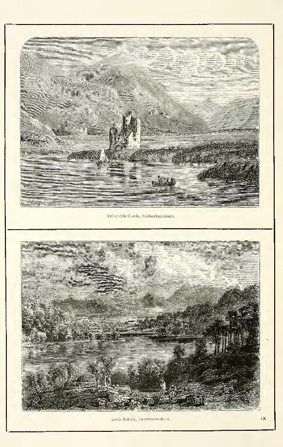
Ardvraick Castle, Sutherland sliire.
Loeli Arkaig, Inverness-shire. IX
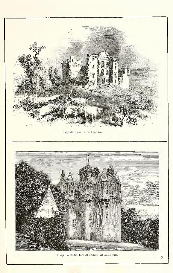
Crnighall House, Cores, Fifeshire.
Ciaigicivar Castle, Leochel-Cushnie, Aberdjuiishire

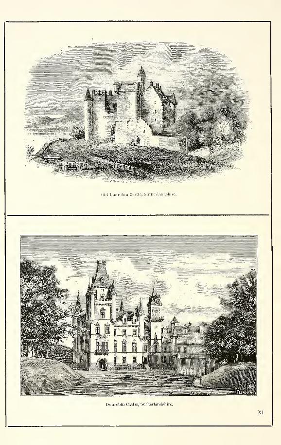
Old Dunrobin Castle, Sutheilandshire.
Dunrobin Castle, Sutherlandshire.
XI
m,
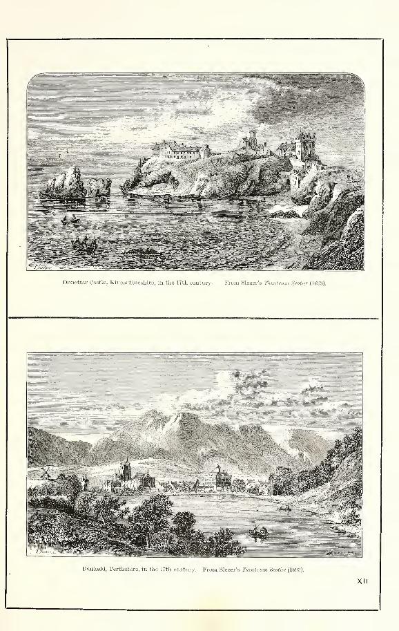
Dunottar Castle, Kincardineshire, in the 17th century. From Slezer's Thcatnuu Scotia' (Hit)3).
Uunkeld, Perthshire, in the 17th century. Prom Slezer's Tkeatrum Scotite (1893).
XII

%/f rr<"i7
Fort Augustus, Inv.-rness- shire.
«fi(to<*i/s!i
Frendrauglvt House, Aberdeenshire, with the ruins of the old Castle.
XIII
Sculptured Front of Old College, Glasgow (founded in 1450).
Part of the Quadrangle, Old College, Glasgow,* XIV

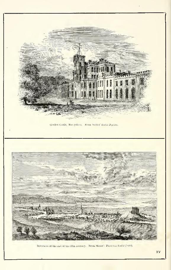
Gordon Castle, Moi-.iyskire. From Nattes' Scotia Depicta.
^-,9;i
Inverness at the end of the 17th century. From Slezer's Thtutnm Scotia (1693).
XV
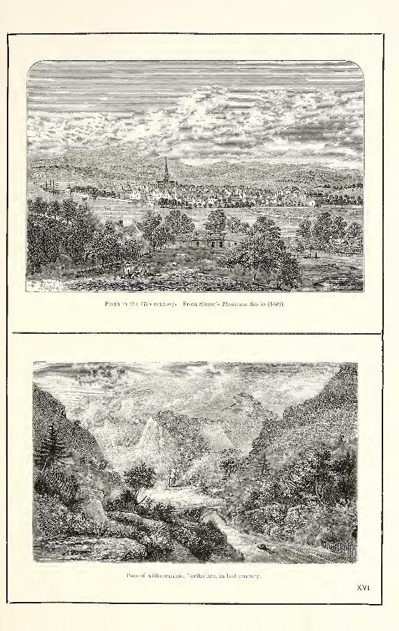
Perth in the 17th cuntury. From Slezer's Thtatrum Scotia (1693).
;;'il&
m iMmm
0c£m
a«
Pass of Killieoraakie, Perths'iire, in last century.
XVI
1RDNANCE GA JOHN BARTHOLOMEW EDINBURGH
«*« ,0H
40
-x K^r? T Ns ^1*3, i.S^»i
|j|i!l!W|
CORWAR
Corwar, an estate, with a mansion, in Colmonellparish, S Ayrshire, 3J miles ESK of Barrhill station.
See Colmonell.Corymulzie. See Corriemulzie.Coryvreckan. See CorrievrechanCoshieville, a place, with an inn, in Strath Appin,
Dull parish, Perthshire, 5i miles W by N of Aberfeldy,
on a road leading northward to Tummel Bridge, over a
pass 1262 feet high.
Cossans. See Glamis.Costa, a headland at the northern extremity of the
mainland of Orkney, on the mutual border of Evie andBirsay parishes. Projecting to a point 4 miles ENE of
the Brough of Birsay, it comprises a hill 478 feet high,
and presents to the ocean a bold precipitous cliff. SeeEvie.
Costerton House. See Crtchton.Cotburn, a hill (559 feet) on the njitual border of
Turriff and Jlonquhitter parishes, 1ST Aberdeenshire, 4Jmiles NE of the town of Turriff.
Cotehill, a loch, measuring li by 1 furlong, in Slains
parish, E Aberdeenshire, 1 mile W by N of the church.
Cothal, a place with factories of tweed and woollencloth in Fintray parish, Aberdeenshire, on the left bankof the Don, 7J miles NNW of Aberdeen, and 2j NNWof Dyce Junction. The factories were established in
1798, and are famous for both the quantity and thequality of the tweeds which they turn out.
Cothiemuir. See Keig.Cotton, a village in Auchindoir and Kearn parish, W
Aberdeenshire, 7 furlongs ESE of Rhyme.Coul, a mansion in Contin parish, SE Ross-shire, a
little NE of the parish church. Built in 1821, it
is a handsome edifice, with finely-wooded policies ; its
owner, Sir Arthur-Geo. -Ramsay Mackenzie, eleventhBart, since 1673 (b. 1865 ; sue. 1873), holds 43,189acres in the shire, valued at £5215 per annum.
Coul, a mansion in the parish and 1 mile ENE of thestation of Auchterarder, SE Perthshire.
Coulatt, a loch on the mutual border of Knockandoand Dallas parishes, Elginshire, 4 miles W by N of
Knockando church. Lying 1100 feet above sea-level,
it measures 1J by 1 furlong, and sends off the Burnof Coulatt, flowing 6-J miles E and SSE to the Spey, 7furlongs SSE of the said church.
—
Ord. Sur., sh. 85,
1876.
Coull, a collier hamlet in Markinch parish, Fife, Ifmile NW of Markinch town.
Coull, a parish of S Aberdeenshire, whose churchstands 3J miles NNW of Aboyne station, this being 32JmilesW by S of Aberdeen. It is bounded N by Leochel-Cushnie, E by Lumphanan, S by Aboyne, W by Logie-Coldstone and Tarland-Migvie. Irregular in outline, it
has an utmost length from NNE to SSW of 5j miles, avarying breadth of 5J furlongs and 4g miles, and an area
of 9053 acres. The drainage is carried mainly to theDee, but partly also to the Don—by the Burn of Tarlandto the former, and to the latter by the Burn of Corse.
In the extreme SE the surface sinks to 410 feet abovesea-level, thence rising westward to Scar Hill of Tilly-
duke (984 feet), and northward to *Mortlich (1248),Leadhlich (1278), *Crag (1563), and Loanhead (994),where asterisks mark those summits that culminate onthe confines of the parish. The rocks are all of primaryformation, the eastern hills consisting chiefly of reddish,the western of greyish, granite ; and the soils vary fromgravel-mixed clay to loam and moorish uplands. A' Druidical ' circle on Tomnaverie, a number of smallcairns upon Corse Hill, and traces of the Terry Chapelon Newton of Corse make up the antiquities, with theruined castles of Corse and Coull. The latter at theopening of the 13th century was the seat of the greatDurward family, of whom it was said that, a Durwarddying, the church bell of Coull tolled of its own accord.A stately pile, it measured some 50 yards square, andhad five turrets and four hexagonal towers. Corse Castlebears date 1581, and, though long roofless, is compara-tively entire. The lands of Corse, forming part of thebarony of Coull and O'Neil, were in 1476 bestowed on
19
COUPAR-ANGTJS
Patrick Forbes, armour-bearer to James III. , and youngestson of the second Lord Forbes. Among his descendantswere Patrick Forbes (1564-1635), Bishop of Aberdeenfrom 1618 ; and his son, John Forbes (1593-1648), thescholar and Episcopalian confessor, whose estate wasrepeatedly ravaged by the famous freebooter Gilderoy.The bishop's male line failing with his grandchildren,Corse passed to the Forbeses of Craigievar, and now is
held by the late Sir John Forbes' second son, JamesOchoncar Forbes, Esq. (b. 1837 ; sue. 1846), who owns1946 acres in the shire, valued at £1679 per annum. Hismodern mansion, near the old castle, is 8J miles NWof Lumphanan station, and 4| NE of Coull church.Two proprietors hold each an annual value of £500 andupwards, 2 others holding between £100 and £500,and 1 between £50 and £100. In the presbytery ofKincardine ONeil and synod of Aberdeen, Coull hassince 1621 given off the Corse division quoad sacra toLeochel-Cushnie ; the living is worth £202. The church(1792 ; restored 1876 ; 220 sittings) has a fine-toned bell
that was cast in Holland in 1644. A public school, withaccommodation for 103 children, had (1880) an averageattendance of 83, and a grant of £79, 12s. 6d. Valua-tion (1881) £4006, 15s. 7d. Pop. (1801) 679, (1831)767, (1851) 734, (1871) 824, (1881) 783.—CW. Sur., sh.
76, 1874.
Coull, Braes of. See Lintrathen.Coullin. See Cttchullin.Coulmony House. See Ardclach.Coulport, a hamlet on the W side of Roseneath parish,
Dumbartonshire, on Loch Long, 4 miles N by W of
Cove. It maintains a ferry across Loch Long to Arden-tinny, and has a new pier, erected in 1 880, when also seve-
ral acres were laid out for feuing purposes. The KibbleCrystal Palace, in the Glasgow Botanic Gardens, wasremoved from Coulport in 1S72.
Coulter, a loch in the S of St Ninians parish, Stirling-
shire, near the foot of the Lennox Hills, 6J miles SSWof Stirling. With an utmost length and width of 5 and3 furlongs, it is shallow towards the W, but very deepto the NE ; contains perch and pike ; and sends off its
superfiuence by Auchenhowie Burn to the Carron. Dur-ing the great earthquake of Lisbon (1735) it was vio-
lently agitated, and sank about 10 or 12 feet.
—
Ord.Sur., sh. 31, 1867.
Coulter, Lanarkshire. See Culter.Coultra. See Balmerino.Countesswells, an estate, with an old mansion, in
Peterculter parish, Aberdeenshire, 4| miles WSW of
Aberdeen. Its owner, Major And. Gammell of Drurn-tochty Castle, holds 5208 acres in the shire, valued at
£5470 per annum. There are a post office of Countess-wells under Aberdeen and a public school.
Coupar-Angus, a town and a parish partly in Forfar,
but mainly in Perth, shire. The town stands in thecentre of Strathmore, near the left bank of the Isla, on asmall tributary of that river, 4J miles SE of Blair-
gowrie, 12J NE by N of Perth, and 15 NW of Dundee;
whilst its station, the junction for Blairgowrie, on theScottish Midland section of the Caledonian, is 15J milesfrom Perth, 22 from Dundee, 62| N by W of Edinburgh,and 791 NE of Glasgow. The part of it on the left bankof the rivulet is in Angus or Forfarshire ; and, beingthe older portion, occasioned the whole to be called
Coupar-Angus. Dating from a remote antiquity, thetown was long a time-worn, decayed, and stagnant place,
but within recent years has undergone great revival andimprovement, and become a centre of much traffic and aseat of considerable trade. It is governed by nine policecommissioners, under selected sections of the generalpolice and improvement act of Scotland, adopted in July1871 ; and has a post office, with money order, savings'bank, insurance, and telegraph departments, branches ofthe Bank of Scotland, the Union Bank, and the NationalBank, a local savings' bank, five principal inns, a gascompany, a town-house with a steeple, a literary associa-
tion, masonic and good templar lodges, a Bible society, ayoung men's Christian association, bowling and curlingclubs, and a volunteer corps. In 1874 a much-needed
289
COUE
water supply was introduced, at a cost of nearly £4000,from springs on the Pitcur estate, which are guided to
a reservoir close to the Dundee turnpike, containing
55,000 gallons. There are three linen-works, a tannery,
farina works, a hrewery, and steam saw-mills. A grain
market is held on Thursday, and cattle markets fall onthe third Thursday of every month but June, August,September, and October. The Queen has driven thrice
through Coupar-Angus, on 11 Sept. and 1 Oct. 1844,
and 31 Aug. 1850. Henry Guthrie (1600-76), Bishopof Dunkeld, was a native. A Roman camp here, imme-diately E of the churchyard, is supposed to have beenformed either by Agrieola or Lollius Urbicus, and seemsto have been a square of 1200 feet, with two strong
ramparts and wide ditches ; but now is represented onlyby remains of the eastern part of the ramparts. In1164 King Malcolm the Maiden founded the Cistercian
abbey of St Mary's within the area of this Roman camp.A large and stately structure, richly endowed by several
of the Scottish kings and by the Hays of Errol, it passed
at the dissolution to the Balmerino family. An ivy-
clad fragment, in the SW corner of the churchyard, is
all that is left of it, a beautiful arch having beendemolished in 1780 to furnish material for the parish
church. This, dating originally from 1681, was in great
measure reconstructed in 1780, and thoroughly rebuilt
in 1859. Other churches are the Free, U.P. (1790),Evangelical Union (1789), Original Secession (1826),
and Episcopal (1847). A new one-story public school,
erected (1876-77) at a cost of £2700, with accommoda-tion for 502 children, had in 1SS0 an average attendance
of 299, and a grant of £286, 18s. 6d. Pop. (1793) 1604,
(1841) 1868, (1861) 1943, (1871) 2149, (1881) 1959.
The parish, containing also the villages of Arthur-stone, Balbrogie, and Washington, is bounded N byAlyth, NE by Meigle, SE by Meigle and Eettins, S byCargill, and S W by Caputh, Blairgowrie, andBendochy.Its greatest length, from NE to SW, is 6 miles ; its
breadth varies between 5 furlongs and 2f miles ; and its
area is 4769J acres, of which 1S4 are in Forfarshire, and
70J are water. The Isla, winding 10§ miles ' in manya loop and link,' roughly traces all the northern andnorth-western border ; along it lies a considerable ex-
tent of haugh-land, protected by embankments, 7 feet
high, from inundations by the river. The rest of the
area mainly consists of the level grounds of Strathmore,but is bisected from NE to SW by a ridge, along whichruns the great highway from Perth to Aberdeen, andwhich commands a splendid view of the Sidlaw Hills
along the one side of the strath, and of the GrampianMountains on the other. In the extreme SW the sur-
face sinks to 100 feet above sea-level, thence rising to
224 near Keithick, 172 at Eemphill, 210 at Easter Den-head, and 208 near Arthurbank. The formation is OldRed sandstone ; and the soil is mainly a good sandyloam. Mansions are Balgersho House, Keithick House,Isla Park, Balbrogie, Arthurstone, Denhead, Kinloch,
and Bankhead ; and 6 proprietors hold teach an annualvalue of £500 and upwards, 15 of between £100 and£500, 14 of from £50 to £100, and 45 of from £20 to
£50. Giving off a portion quoad sacra to Meigle,
Coupar-Angus is in the presbytery of Meigle and synodof Angus and Mearns ; the living is worth £442. Valua-tion (1SS2) £16,297, 14s. 2d., of which £1S44, 16s. Id.
was for the Forfarshire section. Pop. of civil parish
(1801) 2416, (1831) 2615, (1861) 2929, (1871) 3055, (18S1)2819, of whom 265 were in Forfarshire ; of q. s. parish
(1871) 2797, (1SS1) 2546.—Ord Sur., shs. 4S, 56, 1S6S.See the Rev. C. Rogers' and Major-Gen. A. S. Allan'sRental Book and Historical Notices of the Abbey ofCoupar-Angus (2 vols., Grampian Club, 1879-80).
Cour, a mansion in Saddell parish, Kintyre, Argyll-shire, on Kilbrannan Sound, 7J miles N by E of Carra-dale.
Courance, a hamlet in Kirkmichael parish, Dumfries-shire, 9 miles NW of Lockerbie, under which it has apost office. Courance House is the seat of John Seton-Wightman, Esq. (b. 1846 ; sue. 1879), who owns 2750acres in the shire, valued at £1705 per annum.
290
COVESEA
Courthill. See Laxgside.Cousland, a village in Cranston parish, Edinburgh-
shire, Si miles ENE of Dalkeith, under which it has apost office. It was burned by the Protector Somerset in
1547, at the time of the battle of Pinkie. A chapelryof Cousland was annexed to Cranston parish about theera of the Reformation ; its chapel stood on the SWside of the village, and has left some remains.
Couston. See Bathgate.Couthally. See Cowthallt.Couttie, a hamlet in Bendochy parish, E Perthshire,
on the right bank of the Isla, 1 mile NW of Coupar-Angus.
Cove, a fishing village in Nigg parish, Kincardineshire,with a station on the Caledonian railway, 4f miles S byE of Aberdeen, under which it has a post office. Atit are St Mary's Episcopal church (186S), a public andan Episcopal school, an hotel, and a harbour, which,mainly natural, or very slightly improved by art, serves
often as a place of refuge to boats in high north-easterly
winds. The fishermen engage in various kinds of fishery,
and have considerable reputation for the diwiug andsmoking of haddocks. A cave enters from the beach in
the vicinity, and probably gave name to the village.
Pop. (1861) 385, (1871) 450, (1S81) 550.
Cove, a charming watering-place in Roseneath parish,
Dumbartonshire, to the right or E of the entrance to
Loch Long, 1J mile WNW of Kilcreggan, and 6 milesby water WNW of Greenock. Of modern growth, andconjoined as a police burgh with Kilcreggan, it comprisesa number of neat villas and cottages. At it are a postoffice, with money order, savings' bank, and telegraph
departments, a steamboat pier, and Craigrownie quoadsacra church. See Kilcbeggan and Craigrownie.
Cove, a fishing hamlet in Cockbt/rnspath parish,
Berwickshire, 3 furlongs E of Cockburnspath station.
Its harbour, 3 furlongs further to the eastward, is ap-
proached through a sloping tunnel, which, hewn out of
soft rock, is 65 yards long, and just wide enough to
admit a horse and cart ; it has a pier for fishing-boats ona little bay, surrounded by cliffs 100 to 200 feet in
height. The hamlet, consisting of little more than a
score of one-story cottages, had a fishing population of
21, of whom no fewer than 11 perished, within A mile
of home, in the disastrous gale of 14 Oct. 1881.
Cove, an estate, with a mansion, in Kirkpatrick-
Fleming parish, Dumfriesshire, on the left bank of Kirtle
Water, 1 mile W of Kirkpatrick station.
Cove. See Ulva and Caolisport.Cove-a-Chiaran. See Campbeltown.Covesea (popularly Causca), a little village on the
coast of Drainie parish, Elginshire, 5| miles NNW of
Elgin, and 3J W of Lossiemouth. The shore here is
rocky, precipitous, and strikingly picturesque. In oneplace a gently sloping road leads through a natural arch,
with stately pillars, to a stretch of fine natural meadow onthe beach, shut in to the landward by smooth and muralOld Red sandstone cliffs, 60 to 100 feet high ; elsewhere
are caves, fissures, arches, stacks, and fantastic forms of
rock, various and romantic as the ruins of a vast city,
and far too numerous to be appreciably damaged for
ages to come by either the elements or the hand of man.Two peculiarly interesting objects are an isolated rock,
which, looking like an inverted pyramid, is 60 feet high,
30 across the top, but only 8 across the base ; and the
Laird's Stable, a cavern, which, once the abode of a
hermit, was used as a stable by Sir Robert Gordon of
Gordonstown during the '45. In another cave, near
Hopeman, have been found a flint arrow-head, bones of
the beaver and the crane, and other traces of prehistoric
occupancy ; and the roof of a third is sculptured with
figures of the half-moon, sceptre, fish, and suchlike
symbols of ancient Celtic art. A reef or chain of skerries,
extending parallel to the coast, about J mile from the
shore, was the scene of many shipwrecks ; but since
1846 it has been crowned with a lighthouse, built at a
cost of £11,514, and showing a revolving light, visible
at the distance of 18A nautical miles. The light appears
in its brightest state once every minute, and, from W by
COVINGTON
N J N to SE by E J E, it ig of the natural appearance;
but from SE by E J E to SE J S, it has a red colour.
See pp. 323-337 of Jas. Brown's Mound Table Club(Elgin, 1S73).
Covington, a hamlet and a parish in the Upper "Wardof Lanarkshire. The hamlet stands between the Clydeand the Caledonian railway, 1J mile N by E of its
station and post-town Thankerton, this being 33J miles
SW of Edinburgh and 36$ SE of Glasgow ; at it is theparish church (230 sittings), an old building enlarged in
the early part of last century. A neighbouring tower,
built in 1442 by Lindsay of Covington barony, is now a
fine ruin ; and Covington Mill was the place where that
famous martyr of the Covenant, Donald Cargill, wasseized by Irving of Bonshaw in May 1681.
The parish, containing also the villages of Thankerton,Newtown of Covington (7 furlongs NNE of Thankerton),and Hillhead (f mile NNE of the church), comprisesthe ancient parishes of Covington and Thankerton,united some time between 1702 and 1720. BoundedN¥ by Pettinain, E by Libberton, SE by Syming-ton, and W by Carmichael, it has an utmost lengthof 5 miles from NNE to SSW, viz., from the Clydebelow Brown Ford to the top of Tinto ; its greatest
breadth, from E to W, is 2§ miles ; and its area is
5167J acres, of which 53 are water. The Clyde, herewinding 3f miles west-north-westward and northward,roughly traces all the boundary with Libberton ; andthree or four burns run to it through the interior or onthe borders of the parish. In the extreme NE the sur-
face sinks to 630 feet above sea-level, thence rising to
829 at HUlhead, 1019 near Wellbrae, 1013 at Chester,
661 at Thankerton bridge, and 2335 on Tinto ; it is
divided among meadows or low well-cultivated fields
along the Clyde, pastoral slopes, and heathy uplands.
Nearly two-fifths of the entire area are under the plough,and about 80 acres are in wood. Other antiquities thanCovington Tower are a cairn, three camps, and a'Druidical temple.' Here, in 1S28, his father beingparish minister, was born the late Lord Advocate, Wil-liam "Watson, who in 1880 was raised to the peerage as
Baron Watson of Thankerton. .St John's Kirk is theonly mansion : and 2 proprietors hold each an annualvalue of more, 2 of less, than £500. Covington is in
the presbytery of Biggar and synod of Lothian andTweeddale ; the living is worth £265. A public school
at Newtown of Covington, with accommodation for 70children, had (1S80) an average attendance of 44, anda grant of £48, 3s. Valuation (1SS2) £64S7, 9s. Pop.
(1801) 456, (1831) 521, (1861) 532, (1871) 454, (18S1)444.—Orel. Sur., sh. 23, 1865.
Cowal, the mid eastern district of Argyllshire. Its
north-western extremity is an isthmus between the headof Loch Fyne and the boundary with Perthshire ; whilstits north-eastern is a range of mountains along theboundary with Perth and Dumbarton shires, to thehead of Loch Long ; and all the rest is a peninsulabounded E by Loch Long and the Firth of Clyde, S bythe Kyles of Bute, and W by Loch Fyne. Its length,
from the head of Glen Fyne on the NNE to LamontPoint on the SSW, is 37 miles ; and its greatest breadthis 16J miles. It comprehends the parishes of Lochgoil-head and Kilmorieh, Dunoon and Kilmun, StrachurandStralachlan, Inverchaolain, Kilmodan, and Kilfinan, andthe quoad sacra parishes of Ardentinny, Inellan, Kirn,and Sandbank, with the chapelries of Strone, Toward,Kilbride, and Tighnabruaich. See Argyllshire.Cowcaddens. See Glasgow.Cowdailly. See Cowthally.Cowdenbeath, a village in the S of Beath parish, Fife, 2
miles WSW of Lochgelly, and 3 furlongs N by "W of Cow-denbeath station on the Edinburgh, Perth, and Dundeesection of the North British, this being 5£ miles ENEof Dunfermline. It has a post office under Lochgelly,with money order, savings' bank, and telegraph depart-ments, a Free church, and a public school ; and in theneighbourhood are the extensive collieries of the Cowden-beath Coal Co. Pop. (1861) 114S, (1871) 1457, (1881)2712.
COWPITS
Cowden Castle, a mansion in Muckart parish, Perth-shire, 2J miles ENE of Dollar. Occupying the site of
an ancient fortalice, which belonged to the see of St
Andrews, it is the seat of John Christie, Esq. (b. 1824;
sue. 1859), who owns 1672 acres in the shire, valued at
£1625 per annum.Cowdenhill, a hamlet near Borrowstounness, N"W
Linlithgowshire.
Cowdenknowes, an estate, with a mansion, part ancientand part modern, in Earlston parish, Berwickshire, onthe left bank of Leader Water, 1 mile S of Earlstonvillage. Its strong old tower, with deep pit beneathand ' hanging tree ' outside (the latter cut down barely
50 years since), was the seat of those ancestors of theEarls of Home whose feudal cruelties called forth themalediction
—
' Vengeance ! vengeance ! when and where?Upon the house of Cowdenknowes, now and ever mair.'
Their estate has long been alienated, and now is held byWilliam Cotesworth, Esq. (b. 1827), who owns 2331acres in Berwick and Roxburgh shires, valued at £2702per annum. Behind the house rises Earlston BlackHill (1031 feet), a picturesque conical eminence, crownedwith remains of a Roman camp. All know the plaintive
ah- and one at least of the three versions of the ballad
—
' " O the broom, and the honny, bonny broom,And the broom of the Cowdenknowes,"
And aye sae sweet as the lassie sang1' the bught, milking the ewes.'
But the broorn-sprmkled braes and haughs of Cowden-knowes— ' one of the most classical and far-famed spots
in Scotland'—had been sadly stripped of their golden
adornments by the so-called march of agricultural im-provement, when, in the winter of 1861-62, the hand of
Nature nipped what man had spared. See pp. 133-137
of Lauder's Scottish Rivers (ed. 1874).
Cowey's Linn, a waterfall of 35 feet in leap in Eddie-
stone parish, Peeblesshire, on a head-stream of Eddlestone
WTater, 3 miles N by W of Eddlestone village.
Cowgate. See Dundee, Edinburgh, and Mauch-line.
Cowglen, a hamlet and a mansion in Eastwood parish,
Renfrewshire, 2 miles W by S of Pollokshaws. Coal
and limestone are worked in the vicinity.
Cowhill Tower, a mansion in Holywood parish, Dum-friesshire, on the right bank of the Nith, 4| milesNNWof Dumfries.
Cowie, a fishing village and a stream of Kincardine-
shire. The village, in Fetteresso parish, stands on the
N side of Stonehaven Bay, and | mile N by E of Stone-
haven town. Anciently it was a free burgh, undercharter of Malcolm Ceannmor, who, on a rock over-
looking the sea, is said to have built a small fortalice
—
the Castle of Cowie. Of this some vestiges remain,
while its First Pointed chapel, which afterwards be-
longed to Marischal College, Aberdeen, is a picturesque
ruin, with a burying-ground still in use. Cowie House,hard by, is a seat of Alex. Innes, Esq. of Raemoir (b.
1812 ; sue. 1S63), who owns 4750 acres in the shire,
valued at £2S47 per annum. Cowie Water, rising onthe western border of Glenbervie parish at 1000 feet
above sea-level, winds 13 miles eastward through the
rocky and wooded scenery of Glenbervie and Fetteresso
parishes, and at Stonehaven falls into Stonehaven Bay.
It is fairly stocked with small trout ; is subject to highfreshets, which often do considerable damage ; and is
crossed, J mile NNW of Stonehaven, by the grandfourteen-arched Glenury Viaduct of the Aberdeen rail-
way, which, in one part 190 feet high, commands a fine
view of the river's ravine, the vale and town of Stone-
haven, Dunnottar Castle, and other features of the sur-
rounding landscape.
—
Orel. Sur., sirs. 66, 67, 1871.
Cowiefauld, a hamlet in Strathmiglo parish, Fife, 2
miles WSWTof Strathmiglo village.
Cowie's Linn. See Cowey's Linn.Cowlairs. See Glasgow.Cowlatt, Loch. See Coulatt.Cowpits, a village in Inveresk parish, Edinburghshire,
COWSHAVEN
on the right bank of the Esk, 1J mile S of Mussel-burgh.
Cowshaven. See Aberdotjr.Cowthally, a ruined castle in Carnwath parish, Lanark-
shire, on the edge of a moss li mile NW of Carnwathvillage. From the reign of David I. (1124-53) to 1603it was the seat of the powerful family of Somerville,
which, ennobled in 1430 under the title of Baron Somer-ville, became extinct in 1870 on the death of the nine-
teenth Lord. Burned by the English in 1320, butafterwards rebuilt, it was surrounded by moat and ram-part, and accessible only by a drawbridge. James V.
and VI. were both entertained here with great magni-ficence, the latter punningly remarking that the castle
rather should be called Cow-daily, because a cow andten sheep were killed there every day. See Drum andthe eleventh Lord Somerville's curious Memorie of the
Somervilles (2 vols., 1815).
Coxton, an old castellated mansion in St Andrews-Lhanbride parish, Elginshire, 2 miles ESE of Elgin. Atall square structure, with turrets at the angles, it bears
date 1644, but is fully a century older; and it was the
residence of the Inneses of Invermarkie, but belongs
now to the Earl of Fife. See vol. i. of Billings' BaronialAntiquities (1845).
Coyle or Coila (popularly Kill), a stream of Kyle dis-
trict, Ayrshire. It rises in the S of Ochiltree parish
close to the boundary with Coylton, and winds 14imiles north-westward to the river Ayr, at a point 3 fmiles E of the town of Ayr. It makes a cascade, 25
feet wide and 15 feet in fall, under the ridge on whichstands Sundrum House ; its yellow trout are good, butnot over plentiful ; and at Millmunnoch, on its bank,Burns makes the ' Poor and Honest Sodger ' return to
his ain dear maid.Coylton, a village and a parish in Kyle district, Ayr-
shire. The village stands 2 miles W by N of Dronganstation and 6 ESE of Ayr, under which it has a postoffice, and consists of two parts, Coylton proper andNew Coylton. It is traditionally said to have got its
name from the 'Auld King Coil' of Coilsfield, butfigures in old records as Quiltoim and Cuiltoun.
The parish, containing also the villages of Craighall,
Woodside, Rankinston, and Joppa, is bounded N byTarbolton, E by Stair and Ochiltree, S by Dalmellington,SW by Dalrymple, W by Ayr, and NW by St Quivox.Its greatest length, from NNW to SSE, is 8J miles ; its
breadth varies between 7 furlongs and 3| miles ; and its
area is ll,752f acres, of which 160| are water. From a
little below Stair church to just above Mainholm, theriver Ayr winds 7f miles west-south-westward along all
the northern and north-western border ; to it flows theWater of Coyle, latterly through the NE interior, butchiefly along the boundary with Ochiltree and Stair.
Lochs Martnaham (1J x J mile) and Snipe (1J x f furl.
)
lie on the Dalrjmiple border ; and on the Ayr border is
Loch Fergus (3x1 furl.). Where the Ayr quits theparish the surface sinks to less than 50 feet above sea-
level, thence rising to 139 feet near Craighall, 356 at
Kaithhill, 253 near Joppa, 799 at Craigs of Coyle, 1241at Ewe Hill, 1122 at Brown Rig, and 1426 at Benwhat,which last, however, culminates just beyond the southernborder. Coal, ironstone, trap rock, sandstone, lime-
stone, and potter's clay are worked, the recent great
increase in the population being due to mining develop-ment
;plumbago was mined, from 1808 till 1815, on
the farm of Laigh Dalmore ; fire-clay abounds in theneighbourhood of a limestone quarry ; and Water-of-Ayr stone, used for hones, was raised for some years onKnockshoggle farm. The soil of the holms or flat
grounds along the streams is light and loamy, on a
sandy or gravelly bottom ; elsewhere it is mostly a poorcohesive clay on a stiff, cold, tilly subsoil, with patchesof moss or peat. About 70 per cent, of the entire landarea is in tillage, 23 in pasture, and 7 under wood.Antiquities are a large stone, by tradition associated
with the name of ' Auld King Coil ;' the castellated por-
tion of Sundrum House ; fragments of the old parish
church ; and the sites of two pre-Reformation chapels.
292
CRAIG
A field on Bargleuch has yielded four stone coffins ; andsilver coins of Elizabeth, James VI., and Charles I.
have been dug up on Bargunnoch farm. Mansions areSundrum, Gadgirth, Rankinston, Martnaham Muir, andOakbank ; and the property is divided among 14 land-owners, 6 holding each an annual value of £500 andupwards, 3 of between £100 and £500, 1 of from £50 to£100, and 4 of from £20 to £50. Coylton is in thepresbytery of Ayr and synod of Glasgow and Ayr ; theriving is worth £331. The church, built in 1836, is agood Gothic edifice, with a tower upwards of 60 feet
high, and contains 744 sittings. Two public schools,
Coylton and Littlemill, with respective accommodationfor 293 and 220 children, had (1880) an average attend-ance of 191 and 134, and grants of £162, 12s. 6d. and£96, 19s. Valuation (1860) £10,481, (1882) £20,454,8s. 9d., including £911 for railway. Pop. (1S01) 848,
(1831) 13S0, (1861) 1604, (1871) 1440, (1881) 3100.—Orel. Sur., sh. 14, 1S63.
Crag or Craiglich, an eminence (1563 feet) on themutual border of Coull and Lumphanan parishes, Aber-deenshire, 7J miles SSW of Alford.
Craggie or Creagach, a loch on the mutual border ofLairg and Rogart parishes, SE Sutherland, 3J milesENE of Lairg village. Lying 525 feet above sea-level,
it measures 1 mile by 2J furlongs, and, with a stiffish
breeze, affords as good trouting as any in Sutherland.
—
Orel. Sur., sh. 102, 1881.
Craggie or Creagach, a loch in Tongue parish, Suther-land, receiving the superfluence of Loch Loyal, andsending off its own to Loch Slaim, through two shortreaches of the river Borgie, each 1 furlong long. Ly-ing 369 feet above sea-level, it is If- mile long from S toNNE ; varies in breadth between 1J and 3i furlongs
;
and contains magnificent trout and salmo-ferox, withoccasional salmon and grilse. One of its trout scaled
8 lbs.—Orel. Sur., sh. 114, 1880.
Craibstone. See Aberdeen, p. 17.
Craichie. See Dtjnnichen.Craig, an estate, with a mansion, in Colmonell parish,
S Ayrshire, on the Stinchar, 2 miles ENE of Colmonellvillage.
Craig, an estate, with a mansion, in Kilmaurs parish,
Ayrshire, between Carmel Water and the river Irvine,
4 miles W by S of Kilmarnock. Its owner, Allan Pol-
lok-Morris, Esq. (b. 1836; sue. 1862), holds 165 acres
in the shire, valued at £846 per annum.Craig. See Neilston.Craig, a hamlet and a coast parish of Forfarshire.
The hamlet, Kirkton of Craig, stands on the brow of agentle acclivity, 1J mile SSW of Montrose, and com-mands a splendid view over Montrose Basin and townaway to the Grampians.The parish, containing also the fishing villages of
Ferryden and Usan or Ulysses' Haven, comprises theancient parishes of Inchbrayock or Craig and St Skeochor Dunninald, united in 1618. It is bounded N byMontrose Basin and the mouth of the South Esk, SEby the German Ocean, S by the Dysart section of
Maryton and by Lunan, SW by Kinnell, W by Far-nell, and NW by Maryton proper. Its utmost lengthis 5§ miles from ENE to WSW, viz., from the Nessto tiny Nicholls Loch upon Ross Muir ; its widthvaries between 1 J and 2J miles ; and its area is 4S65facres, of which 345-J are foreshore, and 137J water.
The northern border slopes gently down to MontroseBasin ; and Rossie island there, lying at the head of
the South Esk's effluence to the sea, and separated
from the mainland only by a narrow channel, belongs
to Craig, but will be separately noticed. The E coast
is rocky, and toward the S precipitous, at BoddinPoint rising rapidly to 200 feet above sea-level. Onthe Ness, or most easterly point of the coast, where theSouth Esk falls into the sea, is a lighthouse, whose light,
fixed white till 1881, is now double intermittent or
occulting, visible at a distance of 17 nautical miles. Theinterior, with gradual southward and south-westwardascent, forms, for the most part, an undulating table-
land ; and, attaining 234 feet near Balkeillie, 426 near
CRAIG
Balstout, and 503 near the Reformatory, commandsfrom many points extensive views. The rocks are
chiefly eruptive and Devonian, and include greenstone,
amygdaloid, sandstone, and limestone. A coarse sand-
stone is worked in several quarries for building ; lime-
stone was long extensively worked ; and many varieties
of beautiful pebbles are found in the amygdaloid. Thesoil in the E is sandy, westward inclines to moorish,
and in the central and much the largest section is a
strong rich loam. Fully five-sevenths of the entire
area are in cultivation, a little less than a fourrli being
either in pasture or commonage, whilst some 300 acres
are under wood. An old castle stood on the coast, in
the immediate vicinity of Boddin, and has left slight
vestiges called Black Jack ; and a square earthen bat-
tery, traditionally said to have been thrown up byOliver Cromwell, stood on a small headland at the
mouth of the South Esk. The most interesting
antiquity, however, is the strong castle of the baronyof Craig,—a barony nearly identical with the present
estate of Rossie. Frequently mentioned by Scottish
chroniclers, it stood on the N side of the parish, and is
now represented by a tower and gateway, and by part
of a dwelling-house added in 1639. Mansions are Rossie
Castle, Dunninald House, and Usan House ; and the
property is divided among 4 landowners, 1 holding anannual value of over £5000, 2 of over £2000, and 1 of
over £400. Craig is in the presbytery of Brechin andsynod of Angus and Mearns ; the living is worth £360.The parish church, erected in 1799, is a good building
with a square tower 80 feet high, and figures finely in thelandscape ; a Free church is at Ferryden. Four public
schools—Craig, Ferryden Senior, Ferryden Infant, andWesterton—with respective accommodation for 143, 160,
165, and 42 children, had (18S0) an average attendanceof 99, 144, 165, and 25, and grants of £88, 0s. 6d.,
£91, Is., £132, 10s., and £32, 3s. Rossie Reformatory,towards the south-western corner of the parish, 5J miles
SW of Montrose, was established in 1857, and had onan average 72 inmates in 1880, when its total receipts
were £1193, inclusive of a Treasury allowance of
£1093. Valuation (1882) £12,486, 8s. 2d., including£1225 for railway. Pop. (1801) 1328, (1S31) 1552,
(1861) 2177, (1871) 2402, (1881) 2589.—(3rd Sur., sh.
57, 1S68.
Craig or Craig-of-Madderty. See St David's.Craigallion, a loch in Strathblane parish, SW Stir-
lingshire, 2 miles WSAV of Strathblane station. Lying380 feet above sea-level, it measures 3| furlongs by 1&,and has finely-wooded shores.
Craigandarroch. See Ballater.Craiganeoin, a deep natural amphitheatre in Moy and
Dalarossie parish, Inverness-shire, 1 mile SE of Moychurch. Surrounded by high rocks, and accessible onlythrough one narrow passage, it was used in old timesby the Highland caterans for concealing their wivesand children during their raids into the low country
;
and was the scene of a skirmish in the '45, known as
the Rout of Moy.Craiganfhiach or Raven's Rock, a precipitous crag in
the W of Fodderty parish, Ross-shire. It gives off avery distinct echo, and is near a strong chalybeate spring,the Saints' Well.
Craiganoin. See Craiganeoin.Craiganroy, a commodious and safe harbour in Glen-
shiel parish, Ross-shire, at the S corner of LochDuich.
Craigarestie, a chief summit of the Kilpatrick Hills,
in Old Kilpatrick parish, Dumbartonshire. It cul-minates 1J ruile NNE of Bowling, on the SW side ofLoch Humphrey, at 1166 feet above sea-level.
Craigbarnet, an estate, with a mansion, in the W ofCampsie parish, S Stirlingshire, If mile W by N ofCampsie Glen station. Its owner, Major Chs. Graham-Stirling (b. 1827 ; sue. 1852), holds 3343 acres in theshire, valued at £1716 per annum.
Craigbeg, a hill, 1054 feet high, in Durris parish, Ein-cardiueshire, 5| miles ESE of Banchory.
Craigbhockie and Craigboddich, two lofty cliffs in
CRAIGDOW
Loth parish, Sutherland, confronting each other onopposite sides of a small burn running to Loch Glen.
Craigcaffie Castle, the old square tower of the Neil-
sons in Inch parish, Wigtownshire, 3| miles NE of
Stranraer. It was surrounded by a fosse, but nevercould have been a place of much strength ; now it is
occupied by farm labourers.
Craig Castle. See Auchindoir and Kearn, andCastle Craig.
Craigehailliach,a summit (2990feet)in the Finlarig sec-
tion ofWeem parish,Perthshire, 3J miles NbyW of Killin.
Craig Cluny, a precipitous granite height in Crathieparish, Aberdeenshire, 1£ mile E of Castleton of Brae-mar. It overhangs the public road, and is clothed far
up with rowan, weeping birch, and lofty pines. SeeCharters Chest.Craigcrook Castle, a picturesque old mansion in
Craniond parish, Edinburghshire, nestling at the foot
of the north-eastern slope of Corstorphine Hill, 1
mile W of Craigleith station, and 3J miles W of Edin-burgh. Built probably in the 16th century by one of
the Adamsons, it was sold in 1659 to John Mein, in
1670 to John Hall, in 1682 to Walter Pringle, and in
1698 to John Strachan, who, dying about 1719, be-queathed for charitable uses all his property—334 acres,
valued now at £1259 per annum. From early in this
century till 1814 it was the residence of the publisher,
Archibald Constable (1775-1S27), whose son and bio-
grapher, Thomas (1S12-S1), was born here, and who in
1815 was succeeded by the celebrated critic and lawyer,
Francis Jeffrey (1773-1850). The latter describes it as' an old narrow high house, 18 feet wide and 50 long, withirregular projections of all sorts, three little staircases,
turrets, a large round tower at one end, and an oldgarden (or rather two, one within the other), stuck close
on one side of the house, and surrounded with massiveand aged walls, 15 feet high.' He straightway set
about the task of reformation ; and during the thirty-
five summers that he passed at Craigcrook, by extendingand remodelling the gardens (a prototype of those of' Tully-Veolan ' in Scott's JFaverley), and by additionsto the house in 1S35 and earlier, he made it at last alovely and most delightful spot. See Cockburn's Life
of Lord Jeffrey (2 vols., Edinb. 1852).
Craigdaimve, a sea inlet on the W side of NorthKnapdale parish, Argyllshire, branching from the Soundof Jura near Keils Point.
Craigdam, a hamlet in Tarves parish, Aberdeenshire,
1J mile SW of Tarves village. At it are a U.P. church(1806 ; 600 sittings) and a girls' public school.
Craigdarroch, an estate, with a mansion, in Glencairnparish, Dumfriesshire, 2|- miles W of Moniaive. Its
owner, Robert Cutlar Fergusson, Esq. (b. 1855 ; sue.
1859), holds 2264 acres in the shire, valued at £1755per annum. Craigdarroch Burn, rising upon the eastern
slope of Cornharrow Hill at 1500 feet above sea-level,
close to the boundary with Kirkcudbrightshire, runs 6
miles east-by-southward to the vicinity of Moniaive,where it unites with Dalwhat and Castlefern burns to
form the river Cairn.—Ord. Sur., sh. 9, 1S63.
Craigdarroch, an estate, with a modern mansion, in
Contin parish, SE Ross-shire, 4 miles WSW of Strath-peffer. The mansion stands amid romantic scenery,
near the north-eastern shore of Loch Achilty.
Craig-David. See Bervie Brow.Craigderg, a ridge ofgranitic rocks in Inverness parish,
Inverness-shire, adjacent to the side of Loch Dochfour.An ancient watchtower stood upon it, and is supposedto have been an outpost of Castle-Spiritual.
Craigdhuloch, a stupendous cliff in the SW cornerof Glenmuick parish, Aberdeenshire, adjacent to theboundary with Forfarshire. It overhangs the S side ofthe small, dark, sequestered Loch Dhuloch ; soars to
the height of more than 1000 feet; and is thought bysome observers to be grander than the famous rocks of
Lochnagar.Craigdow, a loch (If x 1J furl.) on the mutual border
of Kirkoswald and Maybole parishes, W Ayrshire, 3Jmiles SW of Maybole town.
293
CRAIGELLACHIE CRAIGFORTH
Craigellachie (Gael, creag-eagalach, ' rock of alarm'),a bold and wooded height (1500 feet) on the mutual borderof Duthil and Alvie parishes, E Inverness-shire, nearthe left bank of the Spey, above Aviemore station. It
gave the clan Grant their slogan or war-cry, ' Stand fast,
Craigellachie.
'
Craigellachie, a village in the N of Aberlour parish,
AV Banffshire, finely seated, 300 feet above sea-level, onthe left bank of the Spey, which here receives the Fid-dich, and here is crossed by a handsome iron bridge,
with round embattled towers at the angles and a single
arch of 100 feet span, erected in 1815 at a cost of £S0OO,as also by the viaduct (1857) of the Great North of
Scotland railway. The junction of the Morayshire,Keith, and Strathspey sections of that system, it is 12£miles SSE of Elgin, 14f WSW of Keith, 68 NW by Wof Aberdeen, 33J NE of Boat of Garten, and 121| N byE of Perth ; and has a post office, with money order,
savings' bank, and telegraph departments, two insuranceagencies, gas-works, an hotel, an Established church,with 116 sittings, and a girls' school, with accommoda-tion for 81 children. "Water has been introduced, andbuilding actively carried on since the summer of 1880,when a new street was sanctioned round the top of thelofty quartz crag above the station, on feus given off byLord Fife at £8 per acre.
—
Ord. Sur., sh. 85, 1876.
Craigencat, a hill on the N border of Dunfermlineparish, Fife, f mile E by S of Loch Glow, and If SSEof Cleish village. Rising to an altitude of 921 feet
above sea-level, it mainly consists of basaltic rock,
which is quarried for dykes and road-metal, and it
exhibits very regular basaltic columns with manyhorizontal divisions.
Craigend, a farm on the N border of Newabbeyparish, Kirkcudbrightshire, 3| miles NW of Newabbeyvillage. A rocking-stone on it, 15 tons in weight, maybe put in motion by a child.
Craigend, an estate, with a mansion, in Strathblaneparish, Stirlingshire, 3J miles N by W of Milngavie.The mansion, Craigend Castle, was built in 1812, andis a splendid edifice, standing amid fine grounds ; its
owner is the ex-diplomatist, the Right Hon. Sir AndrewBuchanan, G.C. B., of Dunburgh, Bart. (cr. 1S7S), who,born in 1S07, succeeded his father in 1S60, and holds
883 acres in the shire, valued at £948 per annum.Craigend, a hamlet and a moor in Campsie parish,
Stirlingshire. The hamlet lies on Powburn, adjacent to
the Blane Valley railway, 2 miles E by S of Strathblanestation. The moor extends from the southern vicinity
of the hamlet to the boundary with Baldernock, andattains an altitude of 634 feet above sea-level.
Craigend, a village in Perth East Church parish, Perth-shire, 2 miles S of Perth. At it are a public school anda U.P. church (1780 ; 413 sittings).
Craigend, a mansion in Liberton parish, Edinburgh-shire, near Craigmillar Castle, 2f miles SSE of Edin-burgh. Built in 1869, it is a large edifice in the Gothicstyle, and has, at the SE corner, a circular tower 60 feet
high.
Craigendarroch. See Ballatek.Craigends, an estate, with an old mansion, in Kil-
barchan parish, Renfrewshire, on the right bank of the
Gryfe, 3 miles NNW of Johnstone. Its owner, JohnCharles Cunninghame, Esq. (b. 1851 ; sue. 1866), holds
3136 acres in the shire, valued at £9985 per annum, in-
cluding £2508 for minerals.
Craigengelt, an estate in the SW of St Niniansparish, Stirlingshire, W of Loch Coulter, and 5^ milesWNW of Denny. It includes a considerable mass of
the Lennox Hills, and contains a circular cairn ormound called the Ghost's Knowe, which, 300 feet in cir-
cumference, is engirt by twelve very large stones. Thisis one only out of several artificial mounds, clothed withfine grass, and called the Sunny Hills ; and Craigengeltis believed to have been, in olden times, the scene of
main' tragical events.
Craigengower, a hill in Straiton parish, Ayrshire,9 furlongs SE of Straiton village. Rising to a height of
1160 feet above sea-level, it is crowned with a handsome294
monument to Colonel Blair, who fell in the Crimea ; andit commands an extensive view.
Craigenputtoch, a lonely farm at the head of Dun-score parish, in Nithsdale, Dumfriesshire, lying, 700feet above sea-level, at the SW base of CraigenputtochMoor (1038 feet), 10 miles WSW of Auldgirth station,
and 15 WNW of Dumfries. From May 1828 to May1834 it was the home of Thomas Carlyle (1795-1881)and his wife, Jane Welsh (1801-66), she having inherited
it from her father, whose ancestors owned it for manylong generations, going back, it may be, to great JohnWelsh of Ayr (1570-1623). Here he wrote Sartor Be-sartus, here received two visits from Lord Jeffrey, andhence sent Goethe a description of his residence as ' notin Dumfries itself, but 15 miles to the NW, among the
granite hills and the black morasses which stretch west-
ward through Galloway, almost to the Irish Sea. Inthis wilderness of heath and rock our estate stands forth
a green oasis, a tract of ploughed, partly enclosed, andplanted ground, where corn ripens, and trees afford a
shade, although surrounded by sea-mews and rough
-
woolled sheep. Here, with no small effort, have webuilt and furnished a neat substantial dwelling ; here,
in the absence of professional or other office, we live to
cultivate literature according to our strength, and in
our own peculiar way.' In 1S67, the year succeeding
the death of Mrs Carlyle, he bequeathed the estate—773acres, valued at £250 per annum—to Edinburgh Uni-versity, to found ten equal competitive ' John Welshbursaries,' five of them classical, five mathematical.
—
Ord. Sur., sh. 9, 1863. See Carlyle's Reminiscences
(1881), and his Life by J. A. Froude (1882).
Craigenscore, a mountain in the N of Glenbucketparish, W Aberdeenshire, 2| miles N of the church. It
has an altitude of 2000 feet above sea-level.
Craigentinny (Gael, creag-an-teine, ' rock of fire '), anestate, with a mansion, in South Leith parish, Mid-lothian, lying between Edinburgh and the Firth of
Forth, 2J miles ENE of the city. The property of
Samuel Christie-Miller, Esq. (b. 1811; sue. 1862), it
extends over only 652 acres, yet is valued at £5739 per
annum. This high rental is due to the fact that here
are the most extensive meadows in Scotland, all of
which have been under regular sewage irrigation for
upwards of 35 years. The produce is annually sold to
cow-keepers at £16 to £28 (in one year £44) an acre, andthe grass per acre is estimated at from 50 to 70 tons.
It is cut five times a year ; and two men suffice to keepthe ditches in order (Trans. HigM. and Ag. Soc, 1877,
p. 24).
Craigenveoch, a mansion in Old Luce parish, Wigtown-shire, on the N side of Whitefield Loch, 3J miles ESEof Glenluce. Built in 1876, it is a splendid Scottish
baronial pile, the seat of Admiral Right Hon. Sir Jn.
Chs. Dalrymple Hay, third Bart, since 1798 (b. 1821;
sue. 1861), who, having previously represented Wake-field and Stamford, was in 1880 elected member for the
Wigtown burghs, and who owns 7400 acres in the shire,
valued at £6601 per annum.Craigflower, an estate, with a mansion, in Torryburn
parish, SW Fife, 3| miles E of Culross. It was the pro-
perty of the Right Hon. Sir Jas. Wm. Colvile of Ochil-
tree (1810-S0), Indian jurist and privy councillor, whoowned 1002 acres in the shire, valued at £2279 per
annum.Craigfoodie, a hill and a mansion in the N of Dairsie
parish, Fife. The hill, culminating 3J miles NE of
Cupar, at 554 feet above sea-level, presents to the SWa mural front, partly consisting of columnal basalt.
The mansion stands on the SE slope of the hill, 1j mile
NW of Dairsie station.
Craigford, a village in St Ninians parish, Stirling-
shire, distant 1 mile from Bannockburn.
Craigforth, an estate, with a mansion, in Stirling
parish, Stirlingshire. The mansion stands on the right
bank of the river Forth, 2 miles WNW of the town;
and, together with the estate, takes name from a bold
and wooded crag. It is a seat of Geo. Fred. Wil.
Callander, Esq. of Ardkinglass (b. 1848 ; sue. 1S51),
CRAIG GIBBON CEAIGIELANDS
who holds 601 acres in Stirlingshire, and 51,670 in
Argyllshire, valued respectively at £18S6 and £5626 per
annum. Here lived and died the antiquary, John Cal-
lander (1710-89).
Craig-Gibbon, a summit in a detached section of
Methven parish, Perthshire, 3J miles SSW of Dunkeld.One of the Lower Grampians, it rises to a height of 1263feet above sea-level, and is surmounted by an obelisk.
Craig-Gowan, a wooded height (1437 feet) in Crathie
and Braemar parish, SW Aberdeenshire, 9 furlongs S byE of Balmoral. On it are Prince Albert's Cairn (1S63),
and others, the first of which was reared on 11 Oct. 1S52,
by the Queen, the Prince Consort, and all the royal
children, according to age. See Balmoeal and p. 101
of the Queen's Journal (ed. 1877).
Craighall, a village in the NW of Coylton parish,
Ayrshire, on the left bank of the river Ayr, and 4 miles
E by N of Ayr town.
Craighall, an estate, with a ruined, castellated man-sion, in Ceres parish, Fife. The ruined mansion stands
on the N side of a deep wooded den, traversed by a
burn, 3:} miles SE of Cupar ; and, built by Sir ThomasHope, King's Advocate to Charles I., still presents agrand appearance. See Pinkie.
Craighall, an estate, with a mansion, in Rattrayparish, Perthshire, 3 miles N of Blairgowrie. ' A modern-ised ancient edifice, on a peninsulated rock, rising 214feet sheer from the Erieht, and formerly defended onthe land side by a fosse and two towers,' the mansionwas visited by Scott in the summer of 1793, and was oneof the prototypes of ' Tully-Veolan' in Waverley. TheRattrays of Craighall-Rattray are said to date back to
the reign of Malcolm Ceannmor (1057-93) ; and thepresent proprietor, Lieut. -Gen. Clerk Rattray, OB.(b, 1832 ; sue. 1S51), holds 3256 acres in the shire,
yalupd at £292S per annum.Craighall, New, a collier village on the mutual border
of Liberton and Inveresk parishes, Edinburghshire, nearNew Hailes station on the North British, and 2 milesWSW of Musselburgh. At it are an Established chapelof ease (1S7S), built, like the houses, of brick, and theBenhar Coal Co. 's school, which, with accommodationfor 403 children, had (1S80) an average attendance of
240, and a grant of £166, 6s. Pop. (1861) 336, (1881)978.
Craighall, Old, a collier village, with a school, inInveresk parish, Edinburghshire, If mile SSW of
Musselburgh.Craighead. See Campsie.Craighead, a village in Redgorton parish, Perthshire,
on the left bank of the Almond, 1 mile N by W ofAlmondbank station.
Craighead, an estate, with a mansion, in Blantyreparish, Lanarkshire, on the left bank of the Clyde, 1
mile S of Bothwell village.
Craighead, a place where Caaf Water forms a fine
cascade in a narrow wooded dell, on the mutual boun-dary of Dairy and Kilwinning parishes, Ayrshire.
Craigheads, a village connected with Barrhead town,in Renfrewshire.
Craighirst, one of the Eilpatriek Hills in Old Kil-patrick parish, Dumbartonshire, 2$ miles N of Dun-tocher. It has an altitude of 1074 feet above sea-
level.
Craighlaw, an estate, with a handsome' modern man-sion, engirt by well-wooded policies, in Kirkcowanparish, Wigtownshire, 1J mile W by N of Kirkcowanvillage. Its owner, Malcolm Fleming Hamilton, Esq.(b. 1869 ; sue. 1876), holds 6300 acres in the shire,
valued at £2577 per annum.Craighorn. See Alva, Stirlingshire.
Craig House, a fine old, many-gabled Scottish man-sion in St Cuthberts parish, Midlothian, on the north-eastern slope of wooded Craiglockhart Hill, 2i milesSW of Edinburgh. Haunted ('tis said) by the ghost ofone Jacky Gordon, it belonged to Sir William Dick,Knight, of Braid, who, from being Lord Provost of Edin-burgh, and possessor of £226,000, equal to £2,000,000of our present money, died in the King's Bench a pauper
in 1655. Long after, it was the residence of the his-
torian, John Hill Burton (1S09-81).
Craigie, a village and a parish in Kyle district, Ayr-shire. The village stands 4 miles S of Kilmarnock,under which it has a post office.
The parish, including part of the ancient parish of
Barnweill, was itself united to Riccarton till 1647.
It is bounded N by Riccarton, NE by Galston, E bvMauchline, SE by Tarbolton, SW by Monkton, andNW by Symington. Rudely resembling a triangle,
with south-westward apex, it has an utmost length fromNE to SW of 5J miles, an utmost breadth of 4^miles, and an area of 6579J acres, of which 3 arewater. Cessnock Water winds 1 mile along the Galstonborder ; but the drainage is mostly carried southward or
south-westward by the Water of Fail and the PowBurn. The surface is undulating, attaining 507 feet
above sea-level near Harelaw in the NW, and 458 nearPisgah in the S, heights that command a brilliant
panoramic view, away to Ben Lomond, Jura, and theIrish coast. Coal, both bituminous and anthracitic,
has here been mined in several places and at different
times, though never with much success ; whilst the work-ing of limestone of the finest quality has lately been aban-doned, chiefly on account of the distance from railway.
Great attention is paid to dairy-farming, more than half of
the entire area being in pasture, whilst about 170 acres are
under wood. William Roxburgh (1759-1815), physicianand botanist, was born at Underwood in this parish.
Its chief antiquities are artificial mounds, which either
were seats of justice or military encampments, and theruins of Craigie Castle, 14. mile WSW of the church. Avery ancient structure, this was the seat, first of theLindsays, and then of the Wallaces of Craigie. (See
Locheyan House, Wigtownshire.) Mansions are
Cairnhill, Barnweill, and Underwood. Craigie is in thepresbytery of Ayr and synod of Glasgow and Ayr ; theliving is worth £300. The church, erected in 1776,stands at the village, as also does a public school, which,with accommodation for 126 children, had (1880) anaverage attendance of 40, and a grant of £30, 14s.
Valuation (1882) £10,724, 5s. 2d. Pop. (1801) 786,
(1831) 824, (1861) 730, (1871) 61S, (1881) 590.—Ord.Sur., sh. 22, 1865.
Craigie, an estate, with a mansion, in St Quivoxparish, Ayrshire, on the right bank of the river Ayr, and1J mile E by S of Ayr town. Wallacetown lies on theestate, whose owner, Rich. Fred. Fothringham Camp-bell, Esq. (b. 1831 ; sue. 1860), holds 2099 acres in theshire, valued at £3770 per annum.
Craigie, an estate, with a mansion, in Dundee parish,
Forfarshire, near the Firth of Tay, 2 miles E by N of
Dundee town. Its owner, David Chs. Guthrie, Esq. (b.
1861 ; sue. 1873), holds 309 acres in the shire, valuedat £979 per annum.
Craigie. See Perth and Belhelvie.Craigie, a village in Caputh parish, Perthshire, 4J
miles WSW of Blairgowrie, under which it has a postoffice.
Craigie or Creagach, Loch. See Borgie.Craigiebarns. See Dunkeld.Craigiebuckler. See Banchoey-Devenick.Craigieburn, an estate, with a mansion, in Moffat
parish, Dumfriesshire, on the right bank of MoffatWater, 2| miles E of Moffat town. Craigieburn Woodwas a favourite haunt of the poet Burns about 1789, thebirthplace of Jean Lorimer, his ' Chloris.
'
Craigiehall, an estate, with a mansion, in the SE of
Dalmeny parish, Linlithgowshire, on the left bank ofthe Almond, 7 furlongs W of Cramond Bridge, and 3Jmiles W by S of Davidson's Mains. Its owner, JamesCharles Hope Vere (b. 1858; sue. 1S72), holds 2217 acres
in Mid and West Lothian, valued at £5433 per annum.(See also Blackwood, Lanarkshire. ) The park aroundthe mansion is finely wooded ; and the Almond, whereskirting it, forms a picturesque cascade beneath a rustic
bridge. See Dalmeny.Craigielands, a neat modern village in Kirkpatrick-
Juxta parish, Dumfriesshire, near Beattock station, and295
CRAIGIEVAR
2J miles SSW of Moffat, under which it has a postoffice. Craigielands House, a modern mansion, is in its
southern vicinity.
Craigievar (Gael, creagach-bharr, ' the rocky point '),
a hamlet and an estate, with a mansion, in Lumphananand Leochel-Cushnie parishes, central Aberdeenshire,
3f and 4§ miles NNW of Lumphanan station, this
being 27 miles W by S of Aberdeen, under which thereis a post office of Craigievar. The hamlet has a publicschool ; and fairs for cattle, sheep, and horses are heldat it on the Friday before the third Wednesday of April,
the Friday before 26 May (or 26th, if Friday), theThursday after the last Tuesday of June o. s. , the dayof July after St Sairs, the Thursday after the secondTuesday of August o. s., and the Friday after the first
Tuesday of September o. s. The estate belonged to theMortimers from 1457 and earlier down to 1610, when it
was purchased by William Forbes of Menie (1566-1627),a cadet of the Forbeses of Corse, who, ' by his diligent
merchandising in Denmark and other parts, had becomeextraordinary rich.' His son and namesake (1593-
1648), a zealous Covenanter, and the breaker up of thefreebooter Gilderoy's band, was created a baronet in
1630 ; his sixth descendant, the present and eighthbaronet, Sir William Forbes (b. 1836 ; sue. 1846), holds9347 acres in the shire, valued at £8539 per annum.The Mortimers are said to have commenced the castle,
but to have been stayed by lack of funds ; by WilliamForbes it was finished in 1626. Built of granite, a tall,
narrow clustered tower, seven stories high, it is in thebest style of Flemish castellated architecture, one of themost perfect specimens extant, and as such is figured in
five of Billings' plates—three showing the exterior withits corner turrets, corbelling, and crow-stepped gables
;
one, the banqueting hall, with mighty fireplace, oakenfurnishings, and ' curiously plaistered ' ceiling andchimney-piece ; and the fifth, a bedroom, not so unlikeQueen Mary's at Holyrood.
—
Orel. Sur., sh. 76, 1874.
See vol. i. of Billings' Baronial Antiquities (1845).
Craiglea, a hill (1737 feet), with a slate quarry, in
Fowlis-Wester parish, Perthshire, on the Logiealmondestate, 6| miles NW of Methven Junction. The slate
vein is of excellent quality; yields two kinds of slates,
the one dark blue, the other of a sea-green hue ; and haslong been worked to the extent of above 1,200,000 slates
a year.
Craigleith, an islet of North Berwick parish, Had-dingtonshire, 1 mile N ofNorth Berwick town. Measur-ing 1| by 1 furlong, it rises to a height of 80 feet
;
consists of greenstone, bare and barren ; and is inhabitedonly by rabbits, jackdaws, and sea-fowl. In 1814 Sir
Hew Dalrymple bought it from the Town Council for
£400.
Craigleith, an extensive sandstone quarry near theW border of St Cuthberts parish, Edinburghshire, Jmile E of Blackhall village, and 2 miles W by N of
Edinburgh ; close to it is Craigleith station on the Leithbranch of the Caledonian. Belonging to the uppergroup of the Calciferous Sandstone series, it presents a
deep excavation 12 acres in area, and long supplied mostof the stone with which the New Town of Edinburghwas built, its original rental of only £50 rising to
£5500 during the great building period in Edinburgh,from 1820 till 1826. The Craigleith stone is of twokinds—the one of a fine cream colour, called liver rock
;
the other of a greyish white, called feak rock. Threetrunks of great fossil coniferous trees have been herediscovered.
Craigleoeh, a cliff on the western verge of Rattrayparish, Perthshire, at a very romantic gorge in thechannel of the river Ericht, a little above Craighall.
Craiglockhart, an ancient baronial fortalice in Lanarkparish, Lanarkshire, on the right bank of Mouse Water,opposite Jerviswood. It probably was erected by someremote ancestor of the Lockharts of Lee ; but it figures
very slightly in either records or tradition ; and it nowis a ruined, lofty, picturesque tower.
Craiglockhart, a wooded basaltic hill in Colinton
parish, Midlothian, I- mile ESE of Slateford, and 1\296
CRAIGMILLAR CASTLE
miles SW by W of Edinburgh. Attaining a height of550 feet above sea-level, it commands a wide westwardview, away to the frontier Grampians ; at its base is askating-pond, formed in 1873 by Mr Cox of the Edin-burgh Gymnasium. It got its name from the neigh-bouring square tower or keep, built by an ancestor ofthe Lockharts of Lee about the middle of the 13thcentury, and now represented by only the basementarched story ; and in turn it has given name to a man-sion, a poorhouse, an Established mission church, anda hydropathic establishment, in its vicinity. Themansion, built about 1823, stands between the hill andSlateford, on the verge of a wooded bank, sloping downto the Water of Leith. The Edinburgh Poorhouse, atthe back or SE of the hill, was built in 1869, and, asenlarged in 1878, has accommodation for 827 inmates.The church, an iron one, opened in 1S80, is near the oldtower, as this again is near the hydropathic establish-
ment, which occupies a commanding site to the SW of thehill, and which, designed by Messrs Peddie & Kinnear,was erected during 1878-80, being a plain but dignified
edifice, rustic Italian in style, with central tower, slightly
projecting wings, and accommodation for 200 visitors.
Craigluscar, a hill (744 feet) in Dunfermline parish,Fife, 3 miles NW of Dunfermline town. A limestonequarry near its summit exhibits a bed of trap interposedbetween two of limestone.
Craiglush, a loch (JxJ mile) in Caputh parish, EPerthshire, traversed by Lunan Bum, which runs fromit 1 furlong south-south-eastward to the beautiful Lochof Lows.Craigmaddie, an estate in Baldernock and Strathblane
parishes, Stirlingshire, 2 miles NE of Milngavie. It
contains a stately modern mansion ; a fragmentary ruinof the moated tower of the Galbraiths, dating from 1238or earlier ; a group of cairns, alleged to mark the sceneof a battle between the Danes and the Picts ; thatsingular cromlech known as the Auld Wives' Lift ; alake of about 10 acres ; a fine expanse of park and wood
;
and an extensive moor, rising to an altitude of 633 feet,
and going into junction with Craigend Moor.Craigmark, a mining village in Dalmellington parish,
Ayrshire, 1J mile NNW of Dalmellington town. Pop.(1861) 543, (1871) 616, (1881) 383.
Craigmarloch, a small village on the mutual borderof Kilsyth parish, Stirlingshire, and Cumbernauldparish, Dumbartonshire.
Craigmile, an' estate, with a mansion, in KincardineO'Neil parish, S Aberdeenshire, 1J mile E of Torphinsstation.
Craigmill, a small village in the Clackmannanshiresection of Logie parish, at the southern base of AbbeyCraig. It formerly was notorious for the smuggling of
whisky.Craigmill. See Rattray.Craigmillar Castle, a grand old ruin in Liberton
parish, Midlothian, 3 miles SE of Edinburgh. Crown-ing the brow of a gentle eminence, it commands from its
topmost roof a magnificent view of Arthur's Seat, the Sside of the city, the firth and the shores of Fife, Aber-lady Bay, and the Pentlands ; and itself consists of alofty square keep or tower, an inner ivy-clad court, anda quadrangular embattled wall, 30 feet high, withcircular corner towers—the whole engirt by an outer
rampart or else, in places, by a moat. The ' new part,'
to the W, was added so late as 1661 ; the keep must be
older than 1427 (the earliest date preserved) ; but muchof the building, as it stands to-day, was reared mostlikely after its burning by Hertford in 1544. ' On theboundary wall,' says Sir Walter Scott, 'may be seen
the arms of Cockburn of Ormiston, Congalton of Con-galton, Moubray of Barnbougle, and Otterburn of Red-ford, allies of the Prestons of Craigmillar ; whilst in onecorner of the outer court, over a portal arch, are thearms of the family, three unicorns' heads couped, witha cheese-press and barrel or tun, a wretched rebus to
express their name '—this sculptured fragment bearing
date 1510. Within are the noisome dungeons, in whosepartition wall a skeleton was found bricked up (1813);
CRAIGMORE CRAIGNISH
the kitchen, with mighty oven;Queen Mary's hower,
with two or three dubious relics ; her bedchamber,measuring but 7 by 5 feet, yet having two windows anda fireplace ; and the great banqueting hall, 36 feet long,
and 22 feet broad, with walls 10 feet in thickness,
chimney 11 feet wide, a barrel-vaulted roof, and deepembrasured windows, on the stone seat of one of whichmay be faintly traced a diagram of the old game of the' Walls of Troy. ' The name of this place occurs pretty
early in the national records, in a charter of mortifica-
tion granted in 1212 by William, son of Henry deCraigmillar, whereby he gives, ' in pure and perpetualalms,' to the church and monastery of Dunfermline, a
certain toft of land in Craigmillar, in the southern part
leading from the town of Nidreif to the church of
Liberton, which Henry de Edmonton holds of him.Later, Craigmillar belonged to one John de Capella, andfrom him it was purchased in 1374 by Sir SimonPreston, whose descendants retained it for nearly three
centuries, and, during that period held the highestoffices in the magistracy of Edinburgh. In 147S John,Earl of Mar, 'ane fair and lustie man,' was here im-prisoned by James III. , his brother, and only removedto meet his doom by treacherous lancet in the Canon-gate ; and James V., with Gawin Douglas, his tutor,
was sent here during his minority, when the pest wasraging in Edinburgh. Queen Mary, after her returnin 1561, made Craigmillar so frequent a residence,
that a neighbouring hamlet, where her French retinuelodged, retains to this day the name of Little France
;
in December 1566 we read of her lying here sick,
and ever repeating these words, ' I could wish to bedead. ' Here, too, in the same month, her divorce fromDarnley was mooted by Bothwell, Murray, Lething-ton, Argyll, and Huntly, in the so-called ' Conferenceof Craigmillar,' and propounded to Mary herself; andto Craigmillar it was at first proposed to have Darnleyconveyed, instead of to Kirk of Field. Mary's son,
James VI. , is said to have planned at Craigmillar hismatrimonial excursion to Denmark; and Mary's de-scendant, Queen Victoria, in 1842 drove by its ruins,
which have been sketched and written of by ' fat, fodgel
'
Grose, Sir Walter Scott, Thomson of Duddingston,"SirThomas Dick Lauder, Hill Burton, and many others.
—
Ord. Sur., sh. 32, 1857. See vol. i. of Billings' BaronialAntiquities (1845), and Historical Sketches of CraigmillarCastle (Edinb. 1875).
Craigmore, a precipitous hill, 1271 feet high, in Aber-foyle parish, Perthshire, flanking the Laggan's northernbank, and culminating 1 mile NWof Aberfoyle hamlet.
Craigmore. See Bex-an-Aemuinn.Craigna-Ban, a rounded, granitic, fir-clad hill (1736
feet) in Crathie and Braemar parish, SW Aberdeenshire,
1J mile SE of Abergeldie. On it, to save his own life,
a wizard is said to have hunted down a witch and handedher over to justice ; and on it Prince Frederick Williamof Prussia gave the piece of white heather (emblem ofgood luck) to the Princess Eoyal on the day of theirbetrothal, 29 Sept. 1855.
Craig-na-Faoilinn, a stupendous crag, 934 feet high,in Durness parish, Sutherland, overhanging the publicroad at the head of Loch Eriboll, near the mouth ofStrath Beg.
Craignafeile, a stack or rocky tower-like islet off theNE coast of the Isle of Skye, Inverness-shire, near acascade falling to the sea, in the vicinity of Loch Staffin.
It presents some resemblance to a statue in Highlandcostume ; hence the name creag-na-fheilidh, ' the rock ofthe kilt.'
Craignaiolar or Creag na h-Iolaire (Gael, 'eagle'scrag '), a rocky hill (1750 feet) projecting from a moun-tain range, in Duthil parish, Elginshire, 3J miles NNWof the parish church. It has several fissures, one ofwhich, near the western extremity, cuts it sharply fromtop to bottom. See also Ben-an-Armuinu'.
Craignair. See Buittle.Craigneil, an ancient fortalice in Colmonell parish,
SW Ayrshire, near the left bank of the Stinchar, 7 fur-longs S of Colmonell village. Built in the 13th century,
it was a hiding-place of Robert Bruce ; was afterwardsa feudal prison and place of execution ; and is now a
picturesque ruin, crowning a rocky mount, and com-manding a view of the Stinchar's valley from Penmoreto Knockdolian.
Craignethan, a ruined castle or, rather, fortified
manor-house, in Lesmahagow parish, Lanarkshire, \mile ENE of Tillietudlem station on the Lesmahagowbranch of the Caledonian, and 5i milesWNW of Lanark.It stands on the left bank of the river Nethan, \\ mileabove its influx near Crossford village to the Clyde ; andis said to have been rebuilt by the celebrated architect,
Sir James Hamilton of Fynnart, commonly known asthe Bastard of Arran. He was beheaded in 1540, butthree years later the family estates were restored to his
son, Sir James Hamilton of Evandale. Popularly iden-
fied with the ' Tillietudlem ' of Old Mortality, Craig-nethan, to quote James Hunnewell's Lands of Scott
(1871), 'is a mere shell and wreck of its former self;
yet, like most ruined castles, it is not wanting in
picturesqueness and romance. It is approached by aroad like that described in the novel—steep, winding,and stony, and leading through a ford of the Nethan.This is a shallow stream, flowing over a rocky bed, andbending around a point that rises, with grey crags andsteep, grass or tree clad banks, to a commanding eleva-
tion, on which is the castle, built of sandstone, nowfaded and weather-worn. The extent of Craignethanonce was great ; even now there is a large garden withinits walls. The keep, at the outer or river side, is veryruinous ; and indeed the whole structure is much dila-
pidated, large quantities of materials having been takenfrom it for the construction of ignoble buildings. Butthere can still be found in it many picturesque combina-tions of wall and tower, of stone-arched ceiling, or of
broken vaulting, streaming with graceful ivy-sprays, orof shattered battlements, garlanded with shrubbery.A story told of many old residences is told of this
:
Queen Mary is said to have occupied, during several
days before the battle of Langside, a large hall, yetpartly existing, and called the Queen's Room. Craig-
nethan has been an important fortress, held by Haniil-tons, by Hays, and by Douglases. The scenery aroundit has some degree of grandeur as well as beauty ; andSir Walter, on his visit in 1799, was so much pleasedwith the place, that the proprietor offered him use for
life of a small house within the walls. I was told thatthe novel is commemorated here by quite a large periodi-
cal festivity, held by the families of farmers and others,
and called the Tillietudlem Ball.'
—
Ord. Sur., sh. 23,1865. See also J. B. Greenshield's Annals of the Parishof Lesmahagow (Edinb. 1S64).
Craigneuk, a mining village in Dalziel parish, Lanark-shire, 1J mile WNW of "Wishaw, and If ESE of
Motherwell. Forming since 1874 part of Wishaw police
burgh, it has a Primitive Methodist chapel, a smallRoman Catholic school, and a public school. Pop.(1S61) 716, (1871) 1377, (1881) 2330.
Craignish, a South Argyll parish on the W coast of
Argyllshire, adjoining the steamboat route from Glas-
gow, via the Crinan Canal, to Oban, and containing thehamlet of Ardfern, with a post office under Lochgilp-
head, 18 miles to the SE. It anciently was called
indiscriminately Kilmorie and Craignish, and it retains
a burial-ground and a ruined chapel, still bearing thename of Kilmhori. Its south-south-western half is pen-insular, and its entire outline approaches that of ascalene triangle, with south-south-westward vertex. Its
peninsula is bounded E by Loch Craignish and W bythe Atlantic Ocean ; on its other sides the parish bor-
ders on Kilninver, Eilchrenan, and Kilmartin. Its
greatest length, from NNE to SSW, is 11 miles, andits average breadth is about 2 miles. The extent of
coast is fully 16 miles. Loch Craignish, opening fromthe lower part of the NE side of Loch Crinan, pene-trates 6 miles to the NNE, and diminishes in width from3 miles at the mouth to 7 furlongs near the head, whereit forms a commodious harbour, with good anchorage.Craignish Point flanks the W side of the loch's mouth,
297
CRAIGNOOK
and terminates the parish's peninsula ; and both that
point and the small neighbouring island of Garbhreisaare faced with cliffs. A strait, called Dorusmore or the
Great Door, between Craignish Point and Garbhreisa, is
swept by a rapid tidal current, but has a deep channel,
and is usually traversed by the steamers from Port Crinanto Oban. Abreast of the mainland, chiefly in the S andwithin Loch Craignish, are upwards of twenty islands
and numerous islets and rocks, serried round with ro-
mantic cliffs. The peninsula commences, in the south-
south-western extremity, in a near point ; extendsto a length of about 6 miles ; widens gradually to 2Jmiles ; swells, on the eastern side, into numerous greeneminences of 300 feet and less in elevation ; has, alongLoch Craignish shore, a narrow strip of land ; and is
cut there into numerous little headlands and windingbaylets. A flat tract, less than J mile broad, and veryslightly elevated above the sea ; extends from the
western shore across the head of the peninsula to a
rivulet in the E, running along the boundary withKilmartin. The district N of that tract is partly a
section of the valley of Barbreck, extending upwardfrom the head of Loch Craignish, and mainly a rugged,
heathy, hilly region, attaining an extreme altitude of
700 feet above sea-level, and commanding, from its
higher points, extensive and diversified views. Thereare twelve lakes, many rills, and numerous perennial
springs. The prevailing rock is clay slate. The soil of
the arable grounds is principally a loamy mould, less
fertile than it looks to be. Much good land, or landwhich might be profitably reclaimed, lies waste. Re-mains of a large, strong, medieval fortalice are near the
north-western boundary ; and vestiges of rude forts,
supposed to be Scandinavian, are in eleven places.
Craignish Castle, standing on the peninsula, 2^ miles
from the point, includes a strong old fortalice, whichwithstood a six weeks' siege by Colkitto, but is mostlya good modern mansion, rebuilt about 1832 ; its owner,Fred. Chs. Trench-Gascoigne (b. 1814), holds 5591 acres
in the shire, valued at £1013 per annum. Other man-sions are Barbreck and Dail ; and the property is
divided among 6 landowners, 3 holding each an annualvalue of £500 and upwards, 2 of between £100 and£500, and 1 of from £50 to £100. Craignish is in the
presbytery of Inverary and synod of Argyll ; the living
is worth £215. The church, 8 miles NW of Kilmartin,
was erected in 1826, is a neat edifice, and contains 500sittings. There is also a Free Church preaching station.
Craignish public and Barbreck girls' schools, with re-
spective accommodation for 85 and 41 children, had(1880) an average attendance of 35 and 33, and grants
of £43, 10s. 6d. and £41, 4s. Valuation (1882) £38S9,12s. Id. Pop. (1801) 904, (1831) 892, (1861) 618, (1871)
481, (1881)451.Craignook. See Craigneuk.Craignure, a hamlet in Torosay parish, Mull island,
Argyllshire, on a small bay of its own name, at the SEend of the Sound of Mull, 2\ miles KW of Achnaeraig.It has an inn, a post-office under Oban, and a steamboatpier.
Craigo, a village, with a public school, in Logiepertparish, Forfarshire, on the North Esk's right bank, witha station on the Aberdeen section of the Caledonian, 3Jmiles MW of Dubton Junction, and 6J NNW of
Montrose. Craigo House, 1J mile S by E of Craigostation, is the property of Thos. Macpherson-Grant,Esq., W.S. (b. 1S15; sue. his cousin, Thos. Carnegy,Esq., 1856), who holds 4713 acres in the shire, valued at
£7082 per annum. Pop. of village (1861) 359, (1871)
376, (1881) 124, a decrease due to the stoppage of a flax
spinning-mill and a bleachfield. See Logiepert.Craigoch, a burn in Portpatrick parish, Wigtownshire,
running 4 miles west-south-westward to the North Chan-nel at Dunskey Castle, 5 furlongs SSE of Portpatrick
town. It supplies a small artificial lake, stocked withtrout, in the vicinity of Dunskey House.
Craigowl. See Glammis.Craigphadrick, a wooded hill in Inverness parish,
Inverness-shire, between Beauly Firth and the valley of
298
CEAIGSTON CASTLE
the Ness, If mileW of Inverness town. Terminating th i
north-western hill-flank of the Great Glen of Scotland,it rises to an altitude of 430 feet above sea-level ; andits rocky tabular summit is crowned with a double-walled, rectangular vitrified fort, 240 feet long and 90wide, which commands an extensive view. The palaceof King Brude, near the river Ness, which Columbavisited in 565, was by Dr Reeves identified with Craig-phadrick ; but Skene observes that ' it seems unlikelythat in the 6th century a royal palace should have beenin a vitrified fort, on the top of a rocky hill nearly 500feet high, and it is certainly inconsistent with Adamnan'snarrative that the Saint should have had to ascend suchan eminence to reach it' {Celtic Scotland, ii. 106, note,
1877).
Craigrie, a village in the parish and 5 furlongs WSWof the town of Clackmannan.Craig Rossie, a green hill on the mutual border of
Auchterarder and Dunning parishes, Perthshire, 2^ milesE by S of Auchterarder town. It is one of the mostconspicuous of the Ochils, rising to an altitude of 1250feet above sea-level.
Craigrostan. See Craigroyston".Craigrothie, a village, with a public school, in Ceres
parish, Fife, 1£ mile WSW of Ceres town. It is aburgh of barony, governed by a bailie and councillors.
Pop. (1861) 308, (1S81) 192.
Craigrownie, a quoad sacra parish in Roseneathparish, Dumbartonshire, comprising the police burgh of
Cove and Kilcreggan. It is in the presbytery of Dum-barton and synod of Glasgow and Ayr ; the stipend is
£120. Its church stands at the E side of the entranceto Long Loch, near Barons Point ; in its vicinity is
Craigrownie Castle. Pop. (1871) 1103, (1881) 1136.
See Cove and Kilcreggan.Craigroy, an eminence in the W centre of Ross-shire,
5 miles ESE of the head of Loch Maree.Craigroyston or Rob Roy's Cave, a cavern in Buchanan
parish, Stirlingshire, at the E side of Loch Lomond, 7furlongs N byW of Inversnaid. It occurs, within a steep
rugged rock, a little above the water's edge ; is wild anddeep ; and has a narrow entrance, partly concealed byfallen blocks. Robert Bruce spent a night in it after
the battle of Dairy ; and Rob Roy frequented it as aplace of consultation with his subalterns for planninghis raids.
Craigs, a hamlet in Liberton parish, Edinburghshire,
5 furlongs NE of Liberton village.
Craigs. See Duntocher.Craigs, a mansion in the parish and 2 miles ESE of
the town of Dumfries.
Craigs, Stirlingshire. See Rttmford.Craigskean, an old baronial fortalice, now reduced to
a ruinous fragment, in Maybole parish, Ayrshire.
Craigs of Blebo. See Bleeo Craigs.Craigs of Coyle. See Cotlton.Craigs of Ness, a rocky gorge on the mutual border
of Straiton and Dalmellington parishes, Ayrshire, in the
course of the river Doon, immediately below its efflux
from Loch Doon. Cliffs on each side, 230 feet high, are
richly clothed with shrubs and trees, and form so close
a gorge as to leave a width of not more than 4 or 5
yards for the fretting current of the river.
Craigsparrow, a hilly section of Newburgh parish,
Fife, projecting southward from the main body of the
parish, and rising to an altitude of about 600 feet abovesea-level.
Craigston. See Barra.Craigston Castle, a mansion in King-Edward parish,
NW Aberdeenshire, 4J miles NNE of Turriff. Foundedin 1604-7 by John Urquhart, Tutor of Cromarty, it con-
sisted originally of a central tower and two projecting
wings, but was so altered by connecting archwork as to
be made quadrangular, and is now an interesting edifice,
with beautiful grounds and plantations ; among its por-
traits are three by Jameson and four of the dethronedStuarts. The present owner, Francis Edward RomulusPollard-Urquhart (b. 184S ; sue. 1871), holds 3998 acres
in the shire, valued at £2856 per annum.
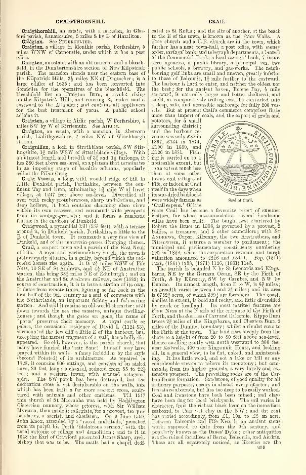
CRAIGTHORNHILL CRAIL
Craigthornhill, an estate, with a mansion, in Glas-I
ford parish, Lanarkshire, 5 miles S by E of Hamilton.Craigton. See Peteeoulter.Craigton, a village in Monikie parish, Forfarshire, 5
miles ¥N¥ of Carnoustie, under which it has a post
office.
Craigton, an estate, with an old mansion and a bleach-
field, in the Dumbartonshire section of New Eilpatrick
parish. The mansion stands near the eastern base of
the Eilpatrick Hills, 3J miles NE of Duntocher ; is a
large edifice of 1635 ; and has been converted into
domiciles for the operatives of the bleachfield. Thebleachfield lies on Craigton Burn, a rivulet rising
on the Eilpatrick Hills, and running 3J miles south-
eastward to the Allander ; and contains all appliances
for the best treatment of yarns. A public school
adjoins it.
Craigton, a village in Airlie parish, W Forfarshire, 4
miles SW by W of Eirriemuir. See Airlie.Craigton, an estate, with a mansion, in Abercorn
parish, Linlithgowshire, 2 miles NW of Winchburghstation.
Craigullian, a loch in Strathblane parish, SW Stir-
lingshire, If mile WSW of Strathblane village. Withan utmost length and breadth of 3| and 1 J furlongs, it
lies 3S0 feet above sea-level, on a plateau that terminatesin an imposing range of basaltic columns, popularlycalled the Pillar Craig.
Craig Vinean, a long, wild, wooded ridge of hill in
Little Dunkeld parish, Perthshire, between the con-
fluent Tay and Bran, culminating 1§ mile W of Invervillage, at 1247 feet above sea-level. Diversified all
over with rocky protuberances, sharp undulations, anddeep hollows, it both contains charming close viewswithin its own recesses, and commands wide prospectsfrom its vantage-grounds ; and it forms a romanticfeature in the environs of Dunkeld.
Craigwood, a pyramidal hill (558 feet), with a terrace
around it, in Dunkeld parish, Perthshire, a little to theE of Dunkeld town. It commands a very fine view ofDunkeld, and of the mountain-passes diverging thence.
Crail, a seaport town and a parish of the East Neukof Fife. A royal and parliamentary burgh, the town is
picturesquely situated in a gully, beyond which the red-
roofed houses rise again. It is 2| miles WSW of Fife
Ness, 10 SE of St Andrews, and 4J NE of Anstrutherstation, this being 38| miles NE of Edinburgh ; and onthe Anstruther and St Andrews railway, now (1882) incourse of construction, it is to have a station of its own.It dates from remote times, figuring so far back as thefirst half of the 9th century as a seat of commerce withthe Netherlands, an important fishing and fish-curingstation. And still it retains an old-world character ; still
down towards the sea rise massive, antique dwelling-houses ; and though the gates are gone, the name of' ports ' preserves their memory. A royal castle orpalace, the occasional residence of David I. (1124-53),surmounted the low cliff a little E of the harbour, but,excepting the merest fragment of a wall, has wholly dis-
appeared. So old, however, is the parish church, thatmany have fancied the ' sair Sanct ' himself may haveprayed within its walls—a fancy forbidden by the style(Second Pointed) of its architecture. As repaired in
1828, it contains 900 sittings, and consists of an aisled
nave, 80 feet long ; a chancel, reduced from 55 to 22§feet ; and a western tower, with stunted octagonalspire.
_The SW porch has been destroyed, but the
dedication cross is yet decipherable on the walls, intowhich has been built a far more ancient cross, sculp-tured with animals and other emblems. Till 1517this church of St Macrubha was held by HaddingtonCistercian nunnery, whose prioress, with Sir WilliamMyreton, then made it collegiate, for a provost, ten pre-bendaries, a sacrist, and choristers. On 9 June 1559,John Enox, attended by a ' rascal multitude,' preachedfrom its pulpit his Perth 'idolatrous sermon,' with theusual outcome of pillage and demolition ; and to it in1648 the Earl of Crawford presented James Sharp, arch-bishop that was to be. The castle had a chapel dedi-
Seal of Crail.
cated to St Rufus ; and the site of another, at the beachto the E of the town, is known as the Prior Walls. AFree church and a U.P. church are in the town, whichfurther has a neat town-hall, a post office, with moneyorder, savings' bank, and telegraph departments, a branchof the Commercial Bank, a local savings' bank, 7 insur-
ance agencies, a public library, a principal inn, twopublic schools, a brewery, and gas-works. The neigh-bouring golf links are small and uneven, greatly inferior
to those of Balcomie, lj mile further to the eastward.The harbour is hard to enter, and neither the oldest northe best ; for the ancient haven, Roome Bay, J mileeastward, is naturally larger and better sheltered, andcould, at comparatively trifling cost, be converted intoa deep, safe, and accessible anchorage for fully 200 ves-
sels. But at present Crail's commerce comprises little
more than import of coals, and the export of grain andpotatoes, for a smallsurrounding district
;
and the harbour re-
venue was only £82 in
1867, £134 in 1874,£190 in 1880, and£126 in 1881. Fish-
ing is carried on to anoticeable extent, butto an extent much less
than at some othertowns and villages of
Fife, or indeed at Crail
itself in the days whenits sun-dried haddockswere widely famous as' Crail capons. ' Of late
years Crail has become a favourite resort of summervisitors, for whose accommodation several handsomevillas have been built. The burgh, first chartered byRobert the Bruce in 1306, is governed by a provost, 2
bailies, a treasurer, and 5 other councillors ; with StAndrews, Cupar, Eilrenny, the two Anstruthers, andPittenweem, it returns a member to parliament ; the
municipal and parliamentary constituency numbering190 in 18S2, when the corporation revenue and burghvaluation amounted to £226 and £3444. Pop. (1841)
1221, (1861) 1238, (1871) 1126, (1881) 1145.
The parish is bounded N by St Leonards and Eings-
barns, NE by the German Ocean, SE by the Firth of
Forth, S by Eilrenny, SW by Carnbee, and NW byDunino. Its utmost length, from E to W, is 6J miles
;
its breadth varies between 1 and 2§ miles ; and its area
is 6782f acres, of which 399J are foreshore. The coast,
6 miles in extent, is bold and rooky, and little diversified
by creek or headland. Its most marked features are
Fife Ness at the N side of the entrance of the Firth of
Forth, and the skerries of Carr and Balcomie. Kippo Burntraces 2| miles of the Kingsbarns, and Chesters Burn 2
miles of the Dunino, boundary ; whilst a rivulet runs to
the Firth at the town. The land rises steeply from the
shore to a height of from 20 to 80 feet above sea-level,
thence swelling gently west-north-westward to 300 feet
near Redwells, 400 near Eingsmuir House, and looking
all, in a general view, to be flat, naked, and uninterest-
ing. It has little wood, and not a lake or hill or anyconsiderable stream to relieve its monotony ; but com-mands, from its higher grounds, a very lovely and ex-
tensive prospect. The prevailing rocks are of the Car-
boniferous formation. Sandstone, of good quality for all
ordinary purposes, occurs in almost every quarter ; andlimestone abounds, but lies too deep to be easily worked.
Coal and ironstone have both been mined ; and clays
have been dug for local brickyards. The soil varies in
character, from the richest black loam on the immediateseaboard, to thin wet clay in the NW ; and the rent
has varied accordingly, from £1, 10s. to £8 an acre.
Between Balcomie and Fife Ness is an ancient stone
work, supposed to date from the 9th century, andpopularly known as the Danes' Dyke ; other antiquities
are the ruined fortalices of Barns, Balcomie, and Airdrie.
These are all separately noticed, as likewise are the
299
CRAILING
mansions of Kingsmuir, Kirkmay, and Worniistone.Eight proprietors hold each an annual value of £500and upwards, 6 of between £100 and £500, 11 of from£50 to £100, and 14 of from £20 to £50. Crail is in
the presbytery of St Andrews and synod of Fife ; the liv-
ing is worth (1882) £379. The two public schools, Eastand West, with respective accommodation for 180 and142 children, had (18S0) an average attendance of 110and 84, and grants of £91, 12s. and £56, 14s. lid.
Valuation (1882) £11,631, 6s. 8d. Pop. (1801) 1652,
(1831) 1824, (1861) 1931, (1871) 1847, (1881) 1740.—Oral. Sur., sh. 41, 1857. See the Rev. C. Rogers'Register of the Collegiate Cliurch of Crail (GrampianClub, 1877).
Crailing, a village and a parish of Teviotdale, in
Roxburghshire. The village stands on Oxnam Water,
1J mile ESE of Nisbet station on the Jedburgh branchof the North British, i\ miles NE of Jedburgh, and 7
SSW of Kelso, under which it has a post office.
The parish, containing also the village and station of
jSTisbet, comprises the ancient parishes of Crailing, Nisbet,and Spittal. It is boundedNW and NE by Roxburgh,E by Eckford, SE by Oxnam, SW by Jedburgh, and \V
by Ancrum. Its greatest length, from N by W to S byE, is 4| miles ; its greatest breadth, from E to W, is 4
miles ; and its area is 6043J acres, of which 78 are water.
The Teviot, winding 4J miles east-north-eastward onthe Jedburgh border and through the interior, here fromthe S receives Oxnam Water, whose last 2f miles belongto Crailing. The surface, where the Teviot quits theparish, sinks to 150 feet above sea-level, thence rising to
619 feet near Littlelonley, on the S side of the river ; onthe 1ST, to 774 at Peniel Heugh and 527 near Blackrigplantation. On Peniel Heugh is the Waterloo Column,150 feet high, whose top is gained by a spiral staircase,
and which bears inscription, ' To the Duke of Wellingtonand the British Army, William Kerr, sixth Marquis of
Lothian, and his tenantry, dedicate this monument, 30June 1815.' These heights excepted, most of the parish
consists of parts of the lowest, warmest, richest, and mostlovely region of the Teviot's basin. The rocks of thehills are eruptive, those of the valley Devonian ; andsandstone, of fine building quality, has been quarriedin two places. The soil in general is a light loam.About 300 acres are under wood, less than 1000 are in
permanent pasture, and nearly all the rest is under theplough. A Roman road may still be traced in the west
;
and two camps, supposed to be Roman, have left somevestiges on Peniel Heugh. David Calderwood, theChurch historian, here entered on the ministry about1604 ; and Samuel Rutherford (1600-61), the eminentCovenanting divine, was the son of a Nisbet farmer.
Mounteviot, a seat of the Marquis of Lothian, is one of
the three chief mansions, the others being Palace andCrailing House, a plain modern mansion, which crowns a
gentle eminence above thewooded banks of Oxnam Water.Its owner, Jn. Paton, Esq. of Crailing (b. 1805 ; sue. 1S26),
holds 1493 acres in the shire, valued at £2323 per annum,and shares nearly all this parish with the Marquis, the
latter owning its northern, and the former its southern,
division. Crailing is in the presbytery of Jedburgh andsynod of Merse and Teviotdale ; the living is worth£370. The church, rebuilt about the middle of last
century, is a very plain structure containing 300 sittings
A Free church contains 262 sittings ; and a public school,
with accommodation for 81 children, had (1880) an averageattendance of 63, and a grant of £49, 9s. 6d. Valuation(18S2) £9374, 19s. 6d. Pop. (1801) 669, (1831) 733,
(1861) 673, (1871) 657, (1881) 638.—Orel. Sur., shs. 17,
25, 1S64-65.
Crammag or Crummag, a precipitous headland on theW coast of Kirkmaiden parish, Wigtownshire, 5 milesNW of the MuU of Galloway. It is cut off from theneighbouring nioc/r by remains of a trench and a vitrified
rampart.
Cramond, a village in the NW corner of Edinburgh-shire, and a parish partly also in Linlithgowshire. Thevillage is prettily situated on the Firth of Forth, at theE side of the mouth of the river Almond, 5 miles S of
300
CRAMOND
Aberdour, 3 WWW of Craigleith station on the Leithbranch of the Caledonian, and 5 WNW of Edinburgh,with which it communicates four times a day by omnibus.Its name in Celtic signifies ' the fort upon the Almond ;'
and it occupies the site of an important Roman station,
which was connected by a fine military way with thegreat English Watling Street and with Antoninus' Wall,and which has yielded coins of eleven emperors, threealtars, a pavement, and other Roman remains. From1628 to 1730 it gave the title of Baron to the family of
Richardson. At it are a post office, boys' and girls'
schools, and the parish church.The parish, containing also the seaport of Granton,
the villages ofDavidson's Mains and Ckamond Bridge,and a small part of Leith burgh, is bounded N by theFirth of Forth, E by St Cuthberts, S by Corstorphine,SW by Kirkliston, and W by Dalmeny. Its greatest
length, from E to W, is 4|, or from ENE to WSW 5J,miles ; its greatest breadth, from N to S, is 2 miles ; andits area is 6662 acres, of which 704f are foreshore, and
42J are water, whilst 1185 belong to Linlithgowshire.
Cramond Island, f mile NNE of the village, may bereached at low water on foot, and, measuring 3 by 1Jfurlongs, affords pasturage for a few sheep ; 1J mile
further is another still smaller basaltic islet, InchMickery. The shore line, 5 miles long, is fringed at
places with low beds of mussel-mantled rocks, and backedby a terrace, marking the former lower level of the land
;
the walk along it from Granton to Cramond village is
one of the pleasantest round Edinburgh. The Almondwinds 3| miles east-north-eastward and north-north-
eastward to the Firth, roughly tracing all the Linlith-
gowshire boundary ; from Craigiehall onward its banksare finely wooded. The surface, though undulating,
nowhere much exceeds 200 feet above sea-level, except
in the S which includes the northern slopes, but notthe tower-crowned summit (520 feet) of hr-clad Cor-storphine Hill. The whole, however, is so richly
adorned with mansions and parks, woods and well-
cultivated fields, as everywhere to present a charmingaspect. The trees include the four splendid sycamoresof Braehead, Cammo, Cramond House, and Craigiehall,
which, with respective height of 101, 75, 89, and 70 feet,
girth 12J, 1SJ, 18£, and 16J feet at 1 foot from the
ground ; and Cramond House has also a beech and anoak, 85 and 60 feet high, and 26J and 10 feet in circum-
ference. The rocks belong mainly to the Calciferous
Limestone series, but diorite intrudes on Corstorphine
Hill, and basalt at five different localities—on the coast,
at the Almond's mouth, and on its banks higher up.
Clay ironstone has been raised here by the Carron Com-pany ; and a mineral spring, in the grounds of Barnton,
as Marehfield Spa enjoyed once some medicinal celebrity.
The soil is various, but on the whole is good. Oyster
and other fisheries have greatly declined in value, butemployment is given by Granton's industrial establish-
ments, by the ink and chemical works of CarolinePark, by the British and Oriental Ship Coating Com-pany, and by Cramond Iron Company, which dates from
1771. Families formerly connected with this parish
were those of Hope of Grantoun, Ramsay of Barutou,
Howison of Braehead, Adamson of Craigerook, Inglis of
Cramond, Argyll, and Balmerino : amongst its illus-
trious natives or residents were John Law of Lauriston
(1671-1729), projector of the Mississippi scheme; Geo.
Cleghorn (1716-89), professor of anatomy in Dublin
University; Jas. Hamilton, M.D. (1749-1835); JohnPhilip Wood (1760-1S38), antiquary; Archibald Con-
stable (1775-1827), the celebrated publisher ; his son
and biographer, Thomas Constable (1S12-81) ; Scott s
darling, Marjorie Fleming (1803-11); Francis Lord
Jeffrey (1773-1850), the famous critic; and AndrewLord Rutherford (1791-1851), an eminent judge of ses-
sion. At Marehfield, too, the late William Sharpe of
Hoddam bred Martha Lynn, the dam of Voltigeur, from
whom all the best racing blood in England is descended.
Cramond House, a little eastward from the village, is a
handsome and commodious mansion, founded about 1680,
and greatly enlarged in 1772 ; a square three-storied
CRAMOND BRIDGE CRATHES CASTLE
tower to the NW is the only remains of a 15th centurypalace of the Bishops of Dunkeld. Its present owner,
successor of the Inglises, is Lieut. -Col. John Cornelius
Craigie-Halkett (b. 1830 ; sue. 1877), who holds 637acres in Midlothian, valued at £2520 per annum. Othermansions are Barnton, Braehead, Broomfield, Craig-crook, Drylaw, Lauriston, MuiRHOTJ"SE,Cammo orNewSaughton, and Silverknowes ; and 10 proprietors
hold each an annual value of £500 and upwards, 7 of
between £100 and £500, 7 of from £50 to £100, and 23
of from £20 to £50. Cramond is in the presbytery of
Edinburgh and synod of Lothian and Tweeddale ; the
living is worth £480. The cruciform parish church,
originally dedicated to St Columba, was rebuilt in 1656,
and, as enlarged in 1701 and 1811, contains 958 sittings.
Other places of worship are noticed under Granton andDavidson's Mains ; and five public schools—Cramond,Cramond female, Davidson's Mains, Granton mixed andinfant, and Lennie—with respective accommodation for
164, 70, 123, 211, and 62 children, had (1S80) an average
attendance of 86, 58, 98, 209, and 49, and grants of
£67, 6s., £46, 5s., £67, 9s., £163, 4s. 6d., and £36, 12s.
Valuation (1860) £23,078, (1882) £38,606, of which£9S3 belonged to the Linlithgowshire section, and £3600was for railways, waterworks, &c. Pop. (1801) 1411,
(1831) 1984, (1861) 2695, (1871) 3020, (1881) 2945, of
whom 84 belonged to Linlithgowshire.
—
Ord. Sur., sh.
32, 1857. See John P. "Wood's Ancient and ModernState of the Parish of Cramond (Edinb. 1794).
Cramond Bridge, a hamlet in Cramond parish, at theboundary between Edinburgh and Linlithgow shires,
on the river Almond, and on the Queensferry highroad,
5 miles WJfW of Edinburgh, and 1J mile SSW of
Cramond village. It has a post office under Cramond,a good inn, and an eight-arched bridge, erected in 1823.
See Braehead.Cramond Regis. See Barnton.Crane, a deep triangular lochlet (§ x J furl. ) in Dunsyre
parish, E Lanarkshire, amid the moorish south-westernPentlands, 1100 feet above sea-level, and 3J miles NWof Dunsyre village. It abounds with perch and pike.
Cranloeh. See St Andrews, Elginshire.
Crannich. See Weem.Cranshaws, a Lammermuir hamlet and parish in the
N of Berwickshire. The hamlet lies, 676 feet abovesea-level, on the right bank of Whitadder "Water, 16miles SE by E of Haddington, and 9 NW of Dunse,under which it has a post office.
The parish consists of two sections, which are sepa-
rated from each other by a strip (f mile broad at thenarrowest) of Longformacus, and the northernmost of
which contains the hamlet. This, with an utmostlength and breadth of 2J and 2| miles, is bounded Nby the Gamelshiel section of Stenton in Haddington-shire, E and S by Longformacus, and W by Whitting-ham in Haddingtonshire. The southern and largerdivision measures 5^ miles from E to W ; has a varyingwidth, from N to S, of 1J and 3J miles ; and is boundedNW, N, and E by Longformacus, S by Greenlaw andWestruther, and SW by Lauder. Including 30-| acres
of water, the total area is 8738J acres, of which 2589belong to the northern, and 6149J to the southern, por-tion. The Whitadder runs 3§ miles on or near to thenorthern and eastern border of Cranshaws proper, whosehighest points are Cranshaws Hill (1245 feet) and Main-slaughter Law (1381) ; whilst Dye Water runs 5 mileseast-by-southward along all the northern boundary ofthe lower division, whose surface rises from less than 700feet above sea-level to 1298 on Dunside Hill and 1522 onBlyth Edge. The rocks are Silurian ; and much of the soil
is poor, the arable land along the streams amounting toonly some 900 acres. A tumulus crowns MainslaughterLaw, which is said to have got its name from the battlefought in 1402 between Hepburn of Hailes and the Earlof Dunbar. The fine old peel tower called CranshawsCastle, standing towards the centre of the northernsection, measures 40 by 24 feet, and is 65 feet high ; aformer stronghold of tie Douglases, and the haunt of adrudging brownie, it now is the seat of the eldest son
of the Earl of Morton, Sholto-George-Watson Douglas,Lord Aberdour (b. 1844), who, holding 2551 acres in the
shire, valued at £1050 per annum, divides this parish
with 2 other landowners. It is in the presbytery of
Dunse and synod of Merse and Teviotdale ; the living is
worth £200. The church, at the hamlet, was built in
1739, and contains 120 sittings ; whilst a public school,
with accommodation for 55 children, had (1S80) anaverage attendance of 35, and a grant of £52, 14s. 6d.
Valuation (18S2) £2492, 16s. Pop. (1801) 166, (1831)
136, (1S61) 134, (1871) 142, (1881) 106.—Ord Sur., sh.
33, 1863.
Cranston, a parish on the NE border of Edinburgh-shire, containing the villages of Cousland, Edgehead,and Ford, the last being J mile W by N of Pathhead,and 4J miles ESE of Dalkeith, under which it has a
post office, with money order, savings' bank, and tele-
graph departments. Irregular in outline, Cranston is
bounded NW by Inveresk ; N by Tranent, and E byOrmiston and Hurubie, in Haddingtonshire ; SW byCrichton and Borthwick ; and W by Newbattle andDalkeith. Its greatest length, from NNW to SSE, is 4|miles ; its breadth, from E to W, varies between 3J fur-
longs and 3J miles ; and its area is 5102j acres, of which2| are water, and 677J belong to the Cakehuir section,
lying If mile S of the SE angle of the main body.Tyne Water, here a very small stream, bisects theparish north-north-eastward, running chiefly within thebeautiful parks of Oxenford and Prestonhall. Where,below Whitehouse mill, it passes into Ormiston, thesurface sinks to 300 feet above sea-level, thence rising
north-westward to 500 feet near Airfield and 637near Mutton Hole, whilst in the Cakeniuir section it
attains an altitude of over 1000 feet. The formationbelongs to the Carboniferous Limestone series ; andsandstone, limestone, and coal are largely worked, thelast in Edgehead and Prestonhall collieries. About 250acres are under wood ; and nearly all the remaining area,
with the exception of rather less than a third of theCakemuir division, is in a state of high cultivation.
Cranston Dean Bridge, over the Tyne, on the southernborder, with three semicircular arches, each 17 feet in spanand 46 high, is a modern structure ; as likewise is LothianBridge, also over the Tyne, which, 82 feet high, has five
semicircular arches, each 50 feet in span, surmountedby ten segment arches of 54 feet in span and 8 feet of rise.
Cakemuir Castle is the chief and almost sole antiquity
;
the quaint old manse, near Prestonhall, having been de-
molished forty or fifty years since. A hospice formerly,
connected with that of Soutra, it bore the monkishinscription— ' Diversorium infra, Habitaculum supra.
'
To the Cranston family this parish gave the title of
Baron in the peerage of Scotland from 1609 till thedeath of the last and eleventh Lord in 1869. The man-sions are Oxenford and Prestonhall, 4 proprietors
holding each an annual value of more, and 1 of less,
than £500. Cranston is in the presbytery of Dalkeithand synod of Lothian and Tweeddale ; the living is
worth £372. The parish church, near Ford, the secondbuilt within this century, is a good Gothic edifice, witha tower ; and at Ford itself is a U. P. church. Twopublic schools, Cousland and Cranston, with respective
accommodation for 93 and 116 children, had (18S0) anaverage attendance of 83 and 113, and grants of £63, 6s.
and £99, 4s. Valuation (1882) £9048, including £19for a short reach of the Macmerry branch of the NorthBritish. Pop. (1801) 895, (1831) 1030, (1861) 1035,
(1871) 1036, (1881) 998.—Ord. Sur., shs. 32, 33, 1857-63.
Cranstonhall. See Glasgow.Craspul or Craisaphuill, a loch (4f x 1J furl.) in
Durness parish, NW Sutherland, 1 furlong W of Dur-ness manse, and J mile NE of Loch Borlay, like whichit is fed by subterraneous tunnels through limestonerocks, and abounds in excellent trout.
Crathes Castle, a mansion in Banchory-Ternan parish,
NW Kincardineshire, J mile N of the left bank of theDee, and 1J WNW of Crathes station, this being 14miles WSW of Aberdeen, and 3 E by N of Banchory. A
301
CRATHIE AND BRAEMAR
fine old chateau-like structure, with a lofty grauite tower,
square and turreted, it was built partly in 1528, partly
at later periods, and is the seat of the Burnetts of Leys,
whose founder, Alexander de Burnard, in 1324 obtained
a charter of lands in Kincardineshire. His great-grand-
son, Robert Burnett (flo. 1409), was the first ' Baron o'
Leys,' a title familiar from an ancient ballad ; andThomas Burnett, twelfth proprietor of Leys, and uncle
of Bishop Gilbert Burnett, was in 1626 created a baronetof Nova Scotia. His eighth descendant, Sir RobertBurnett of Leys, eleventh Bart. (b. 1833 ; sue. 1876),
owns 12,025 and 84 acres in Kincardine and Aberdeenshires, valued at £5007 and £109 per annum. See
Banchory-Ternan.Crathie and Braemar, a large parish of SW Aberdeen-
shire, whose church stands, 920 feet above sea-level,
near the left bank of the Dee, 7\ miles W by S of
Ballater station, and 51 of Aberdeen, under whichCrathie has a post office.
The parish, containing also the village of Castleton,comprises the ancient parish of Braemar, annexed at a
period unknown to record. It is bounded N by Kirk-michael in Banffshire, and by Strathdon ; NE by Glen-
muick ; SE by Glenmuick, and. by Glenisla in Forfarshire
;
S by Kirkmichael and Blair Athole, in Perthshire ; W bythe Glenfeshie portion of Alvie, in Inverness-shire ; andNW by Duthil-Rothiemurchus, also in Inverness-shire.
Irregular in outline, it has a varying length from E to
W of 8^ and 24 miles, a varying width from N to S of
9£ and 16J miles, and an area of 1S3.237J acres, of
which 9S0J are water. The Dee, rising close to the
Inverness-shire border, runs 11 miles south-south-east-
ward to the Geldie's confluence, and thence winds 25Jmiles east-north-eastward, mostly through the middleof the parish, but for the last 4| miles along the
Glenmuick boundary. During this course it descendsfrom 4060 feet above sea-level at its source to 1318where it receives the Geldie, 1214 at the Linn of Dee,1108 at Victoria Bridge near Mar Lodge, 872 opposite
Crathie manse, and 720 at the Girnock's confluence
in the furthest E ; its principal affluents here, all of
them rising in Crathie and Braemar, and all de-
scribed in separate articles, are Geldie Burn, Lui Water,Ey Burn, Quoich Water, Clunie Water with its tributary
Callader Burn, Feardar Burn, Gelder Burn, and GirnockBurn. Lakes, with their utmost length and breadth,
and with their altitude above sea-level, are Loch Etch-achan (4 x SI furl. ; 3200 feet), Loch Brodichan (24 x1 furl.; 2303 'feet), Loch Callader (6Jx 1$ furl.; 1627feet), Loch Ceannmor (ljxj furl.; 2196 feet), andLochnagar (2J x If furl. ; 2570 feet), besides thirteen
smaller tarns. From W to E the chief elevations to the
left of the Dee are *Braeriach (4248 feet), *Ben Mac-dhui (4296), Derry Cairngorm (3788), Cam a Mhaim(3329), Cam Crom (2847), Sgor Mor (2666), Cam Mor(2057), *Beinna1
Chaoruinn(3553), Beinn Bhreae(3051),Meall na Guaille (2550), Creag a Bhuilg (2190), *Bena-eoued (3924), Carn Elrig Mor (2068), Cam Eas (3556),
Cam na Drochaide (2681), *Ben Avon (3S43), CarnLiath (2821), Meikle Elrick (2318), *Meikle Geal Cham(2533), *Brown Cow Hill (2721), Culardoch (2933),
Craig Leek (20S5), Meall Alvie (1841), Leac Ghorm(1946), Tom Bhreac (2276), An Creagan (1857), andCreag Mhor (1643), where asterisks mark those summitsthat culminate on the borders of the parish. To theleft or W and S of the Dee rise Cairntov/l (4241 feet),
The Devil's Point (3303), *Monadh Mor (3651), BeinnBhrotain (3795), Carn-Cloich-rnhuilinn (30S7), Duke'sChair (2010), Cam Geldie (2039), *Carn an Fhilleir
(3276), *An Sgarsoch (3300), Cnapan Garbh (2206), CarnLiath (2676), * Beinn Iutham Mhor (3424), Mor Shron(2819), Carn Aosda (3003), * The Caimwell (3059), SronDubh(1909), Carn an Tuirc (3340), * Cairn na Glasha
(3484), Creag Choinnieh (1764), Carn nan Sgliat (2260),
Creag nan Leachda (2549), Meall an t-Sluichd (2771),
Creag Doineanta (1910), the Princess Royal's Cairn
(1479), Ripe Hill (1678), Carn Fiaclan (2703), *Loch-nagar (3786), Princess Alice's Cairn (1278), Prince
Albert's Cairn (1437), Creag a Ghaill (1971), *Conaeh-302
CRAWFORD
craig Hill (2777), *Meall Gorm (1809), and CreagGhiubhais (1593). Containing thus parts or the wholeof three of the four highest summits in Scotland, Crathiepresents a landscape as varied as it is beautiful—its
clear-flowing salmon river and sweep of valley withbroad plantations, green fields, and stately mansions, its
rounded corries and narrow glens, its sombre deer-forests
and heathery grouse moors, all set in a ring of trackless,
serrated mountains. (See Aberarder, Alt-na-Giutha-sach, Carr, Cairnaqtjeen, Charters Chest, Corrie-mulzie, Craig-Cluny, Craig-Gowan, Craig-na-Ban,Garrawalt, Monaltrie, etc.) The prevailing rockis granite, alternating in places with gneiss, lime-
stone, and quartz, near Castleton traversed by a vein of
serpentine ; the soil of the arable lands is generally alight sandy loam. Woods and natural forests of Scotchfirs, larch, and birch must cover an enormous area,
acres on acres of rocky hillside having been planted withmillions of trees, both, native and foreign, within the
last hundred years, whilst in Mar Forest are firs fromtwo to three centuries old, and containing 100 or 200cubic feet of timber (pp. 273-275, Trails. Bighl. and Ag.Soc, 1874). The mansions are Balmoral Castle, Aber-geldie Castle, Invercatjld House, and Mar Lodge
;
the Queen, the Earl of Fife, and Farquharson of Inver-
cauld holding each an annual value of more, and 31
other proprietors of less, than £100. Giving off since
1879 the quoad sacra parish of Braemar, Crathie is
in the presbytery of Kincardine O'Neil and synodof Aberdeen ; the living is worth £370. The parish
church is a plain edifice of 1806, seated for 800,
and adorned with a two-light stained-glass window,erected by Her Majesty in 1S73 to the memory of
Norman Macleod, who preached his first sermon as
court chaplain here on 29 Oct. 1854. At Easter Bal-
moral, on the opposite bank of the Dee, across a sus-
pension bridge, is Crathie Free church, with a spire
;
other places of worship are noticed under Castleton.Besides the school there, Crathie public, Aberarder,
Abergeldie female, and Crathie Side schools, with re-
spective accommodation for 98, 184, 39, and 67 children,
had (1880) an average attendance of 65, 15, 18, and 35,
and grants of £4S, 2s., £22, 17s., £14, 6s., and £46,8s. 6d. Valuation (1860) £7868, (1881) £14,430. Pop.
(1801) 1876, (1831) 1808, (1861) 1574, (1871) 1566,
(1881) 1613.—Ord. Shir., sirs. 65, 64, 75, 1870-76. See
the Rev. James M. Crombie's Braemar and Balmoral(2d ed. 1S75).
Craufurdland Castle. See Crawfurdland.Crawford, a village and a parish in the upper ward
and the south-eastern extremity of Lanarkshire. Thevillage, toward the NW comer of the parish, stands onthe left bank of the Clyde (here crossed by a chain bridge
of 75 feet span), opposite the influx of Midlock andCamps Waters, and adjacent to the Caledonian railway,
2f miles SE of its post-town and station, Abington, this
being 43J miles SW of Edinburgh. Enjoying anciently
the privileges of a burgh of barony, it was, prior to the
railway period, an important resting-place for travellers,
but now is little more than a rural hamlet, with anhotel, the parish church, and a public school.
The parish, containing also the village of Leadhills,is traversed for 12J miles by the main trunk of the
Caledonian, which here attains its summit level (1012
feet), and here has the stations of Abington and Elvan-
foot. It is bounded N by Lamington ; NE by Culter ; Eby Tweedsmuir, in Peeblesshire ; SE by Moffat and Kirk-
patrick-Juxta, in Dumfriesshire ; S by Closeburn, andSW by Durisdeer and Sanquhar, all three also in Dum-friesshire ; W and NW by Crawfordjohn. Its utmostlength, from N to S, is 14A miles ; its breadth, from E to
W, varies between 1J and 11| miles ; and its area is
6S,S39J acres, of which 313 are water. Evan Water is
formed by several head-streams in the E of the parish;
otherwise the drainage system has been already sketched
under the Clyde, which here from its source near the
southern boundary takes a northerly course of 28 miles,
andwhich here receives, on the left hand, Powtrail, Elvan,
and Glengonner Waters, and, on the right, Little Clydes
CRAWFORDJOHN CRAWFURDLAND CASTLE
Bum and Midlock and Camps Waters—all of them rising
in Crawford, and all of them separately noticed. Wherethe Clyde quits the parish, the surface sinks to 800 feet
ahove sea-level, these rising southward, south-eastward,
and eastward to mountain watersheds of the SouthernHighlands, which separate Clydesdale from Nithsdale,
Aunandale, and Tweeddale The chief elevations fromN to S to the W of the Clyde are Eavengill Dod(175S feet), Wellgrain Dod (1813), Lousie Wood Law(2028), Dun Law (2216), Green Lowther (2403), andBallencleuch Law (2267) ; whilst to the E rise South-wood Rig (1556), the Pinnacle (1819), *Coomb Dod(2082), Yearngill Head (1804), Wintercleuch Fell (1804),
*Whiteside Hill (1817), and Earncraig Hill (2000), whereasterisks mark those summits that culminate on the
borders of the parish. The glens or vales for the mostpart have considerable breadth of bottom, and are partly
dry, partly wet and spongy. The rocks are in places
metamorphic, but chiefly Silurian. Roofing slate hasbeen worked in one small quarry ; lead ore is extensively
mined at Leadhills, where also many valuable minerals,as gold, silver, calamine, blende, manganese, malachite,
azure copper ore, iron pyrites, etc., have been found.
The soil on the banks of the Clyde, and near the mouthsof its affluents, is variously alluvial, loamy, sandy, andgravelly ; that of nearly all the remaining area is moorish.About 2200 acres are arable, less than 160 are underwood, and all the rest is either pastoral or waste.
Crawford Castle, or Tower Lindsay, on the right bankof the Clyde, opposite Crawford village, is a ruinedbaronial stronghold, once defended by a moat ; from theclose of the 12th century till 14SS it was the seat of theLindsays, who in 1398 received the earldom of Crawford.(See Cults and Balcarkes.) The parish is traversedby a Roman road, branching off near Elvanfoot to Niths-dale and Aunandale, and flanked by two well-preservedRoman camps on Boadsberry Hill and White Campfarm. It also contains three native camps or hill-forts,
and the sites of several pre-Reformation chapels. New-ton House is the only mansion ; but the property is
divided among 12 landowners, 8 holding each an annualvalue of £500 and upwards, 1 of between £100 and £500,1 of from £50 to £100, and 2 of from £20 to £50.Detached from Leadhills for church and school andregistration purposes, Crawford is in the presbytery ofLanark and synod of Glasgow and Ayr ; the living is
worth £335. The church, rebuilt in 1875, contains280 sittings ; and three public schools—Crawford, Daer-Powtrail, and Summit—with respective accommodationfor 103, 27, and 53 children, had (1SS0) an averageattendance of 57, 14, and 22, and grants of £71, 9s.,
£27, 16s., and £32, 14s. Valuation (I860) £13,774,(1882) £22,598, 17s. Pop. of civil parish (1801) 1671,(1831) 1850, (1861) 1590, (1871) 1829, (1881) 1763;of g. s. parish (18S1) 698.—Orel. Sur., shs. 15, 16, 1864.
Crawfordjohn, a village and a parish in the SW of
the upper ward of Lanarkshire. The village stands, 950feet above sea-level, near the left bank of DuneatonWater, 6| miles N by E of Leadhills, and 4 W of its
post-town and station, Abington, this being 43J milesSW of Edinburgh. At it are a post office, 2 inns, themanse, the parish church, and a public school ; and byDorothy Wordsworth, who, with her brother and Cole-ridge, drove through it in August 1803, it was describedas ' a pretty, cheerful-looking village, but one that mustbe very cold in winter, for it stands on a hillside, andthe vale itself is very high ground, unsheltered bytrees.' One specialty has Crawfordjohn, that the curl-ing-stones made at it are the best to be found inScotland.
The parish, containing also Abington village, is
bounded N by Douglas, NE by Wiston, E by Laming-ton, SE by Crawford, SW by Sanquhar and Kirkconnelin Dumfriesshire, W by Auchinleck and Muirkirk inAyrshire. Its utmost length is 12g miles from E by NtoW by S, viz. , from Abington to the Ayrshire boundary
;
its breadth diminishes from 9 J miles in the E to 7 furlongsin theY/; and its area is 26, 460J acres, ofwhich 103J arewater. The Clyde flows 2J miles northward along all the
eastern boundary, whilst the south-eastern is traced for
2,| miles by its affluent, Glengonner Water. Snar Water,draining the south-eastern district, runs 6 miles north-
ward to Duneaton Water ; and Duneaton Water itself
rises close to the Ayrshire border, and thence winds 19
miles east-by-northward to the Clyde, its first 6J miles
following the Douglas, and its last 15 mile the Wiston,boundary. Where the Clyde quits the parish, the sur-
face sinks to 750 feet above sea-level, thence rising to
1130 at Knock Leaven, 1260 at Black Hill, 1400 at
Mountherrick, 15S4 at Drake Law, 1620 at Rake Law,1S0S at Wanlock Dod (just within Sanquhar), 1616 at
Cairn Kinny, and 1843 at Stony Hill (just withinAuchinleck). The rocks are mainly metamorphic andSilurian, partly carboniferous ; and they include lime-
stone and white sandstone, with traces of coal and of lead
and copper ores. The soil of some of the low groundsalong the streams is a deep rich loam, of others sandyor gravelly ; whilst here and there on the hill-slopes it
is a strong red clay, and elsewhere generally moorish.
Some 3200 acres are arable, and not more than 50 are
under wood. Vestiges of three old castles are at MossCastle, Glendorch, and Snar ; and traces of one large
ancient camp crown the SE shoulder of Black Hill
;
whilst near Shieldholm is another, supposed to be
Roman. In 1839, the Eglinton Tournament year, Prince
Louis Napoleon, French emperor that was to be, arrived
at Abington inn, wet, tired, and hungry, from a day's
grouse-shooting on Crawford Muir. He could get nositting-room, so took his supper by the kitchen fire,
slipped away to bed, and early nest morning started again
on foot. Abington House is the only mansion ; and 3
proprietors hold each an annual value of £500 and up-wards, 6 of between £100 and £500, and 5 of from £20to £50. Giving off a small portion to Leadhills quoadsacra parish, Crawfordjohn is in the presbytery of Lanarkand synod of Glasgow and Ayr ; the living is worth£356. The parish church, enlarged and repewed in 1817,
contains 310 sittings. At Abington is a Free church
;
and three schools— Crawfordjohn, Whitecleuch, andAbington—with respective accommodation for 72, 23,
and 93 children, had (1880) an average attendance of 64,
12, and 50, and grants of £54, 17s., £27, 8s. 2d., and£53. Valuation (1SS2) £11,007, 19s. Pop. (1801) 712,
(1S31) 991, (1861) 980, (1871) 853, (1881) 843.— Orel.
Sur., sh. 15, 1864.
Crawford Priory, a mansion in the 1ST of Cults parish,
central Fife, near the right bank of the Eden, 3 miles
SW of Cupar. Built in 1813 by Lady Mary LindsayCrawford, who in 1808 had succeeded to the Crawford-Lindsay estates on the death of her brother, the twenty-second Earl of Crawford, it was originally a splendid castel-
lated edifice in the Gothic style, but fell into neglect anddilapidation, till in 1871-72 it was thoroughly renovatedand enlarged, a carriage porch and vestibule being thenerected at the S entrance, and a Gothic tower and spire,
115 feet high, at the E side, whilst a portion of the
interior was converted into a private Episcopal chapel.
It now is a seat of George Frederick Boyle, sixth Earl of
Glasgow (b. 1S25 ; sue. 1869), who owns 5625 acres in
the shire, valued at £90S5 per annum. See also Cum-brae, Hawkhead, and Kelburn.
Crawfordton, an estate, with a modern mansion, in
Glencairn parish, W Dumfriesshire, 1J mile fromMoniaive. Its owner, George Gustavus Walker, Esq.
(b. 1831), was county member 1S65-6S and 1869-74;and holds 7660 acres in the shire, valued at £347S per
annum.Crawfurdland Castle, a mansion in Kilmarnock
parish, Ayrshire, on the left bank of CrawfurdlandWater, 3 miles NE of Kilmarnock town. Comprisinga strong, thick-walled, ancient tower, and a fine modernGothic centre, it has been for upwards of six centuries
the seat of a branch of the Craufurds ; its present holder,
Lieut. -Col. Jn. Reg. Houison-Craufurd (b. 1811 ; sue.
1871), owns 1876 acres in the shire, valued at £1988perannum. (See also Braehead.) Crawfurdland Water,formed by two head-streams in Fenwick parish, close to
the Renfrewshire border, winds 8J miles south-westward303
CRAWICK
through Fenwiok and Kilmarnock parishes, and, 1^ mileNNE of Kilmarnock town, unites with the Fenwick to
form Kilmarnock Water.
—
Orel. Sur., sh. 22, 1865.
Crawick, a rivulet of NW Dumfriesshire, formed, at
780 feet above sea-level and -within a mile of the Lanark-shire border, by the confluence of Wanlock and SpangoWaters. Thence it winds 8 miles south-south-westwardalong the boundary between Sanquhar and Kirkconnelparishes, and falls into the Nith f mile WNW of San-quhar town.
—
Ord. Sur., sh. 15, 1864.
Crawick Mill, a village in Sanquhar and Kirkconnelparishes, Dumfriesshire, on Crawick Water, 1 mile NWof Sanquhar town. It lies within Sanquhar burghbounds, and has an extensive carpet and tartan factory.
Cray, a place in Kirkmichael parish, NE Perthshire,
on the left bank of Shee Water, 15 miles N by W of
Blairgowrie. Here are a Free church and Cray House,whose owner, Mrs Robertson, holds 437 acres in the
shire, valued at £113 per annum.Crayinch, a wooded islet of Kilmaronock parish, Dum-
bartonshire, in Loch Lomond, J mile NE of Inchmurrin.Triangular in shape, it measures 2 by 1$ furlongs.
Creack, a village in Auchindoir parish, W Aberdeen-shire, 3J miles SW of Rhynie.
Creagach. See Craggie.Creca. See Annan.Cree, a river of Galloway, issuing from Loch Moan,
which lies, 675 feet above sea-level, on the mutualboundary of Ayr and Kirkcudbright shires. Thence it
winds 11 miles south-south-westward along that bound-ary, and next 21J miles south-eastward along all the
boundary between Kirkcudbright and Wigtown shires,
past Newton-Stewart, till at Creetown it falls into the
head of Wigtown Bay, the Lena jEstuarium of Ptolemy.On its right lie the parishes of Barr, Colmonell, and Pen-ninghame, on its left of Minnigaff and Kirkmabreck
;
and on its left it receives Minnoch Water, Penkill Burn,and Palnure Burn. Navigable for small craft as highas Carty, it assumes near Penninghame House a lake-
like appearance, widening at intervals to close on a
furlong ; here were of old the celebrated ' Cruives of
Cree,' i. e. , salmon-traps in the stone cauls or dam-dykes,which, serving the country-folk for bridges, came to bewell-known landmarks. Throughout most of its lowercourse the ' crystal Cree ' flows through flat flowery
meadows, its banks being only occasionally adorned withheathery knolls and lichened or fern-clad rocks ; butfrom Bargrennan upwards its scenery is wild and moun-tainous, a succession of desolate moorlands. Trout maybe caught in considerable quantities in the upper waters
;
salmon and sea-trout at several good casts about Penning-hame House ; and smelt or Sperling, during March, in
the brackish waters of the estuary.
—
Ord. Stir., shs. 8,
4, 1857-63. See pp. 12-22 of Wm. M'llraith's Wigtown-shire (2d ed., Dumf., 1877).
Creebridge, a village, with a public school, in Minni-gaff parish, Kirkcudbrightshire, on the left hank of the
Cree, opposite Newton-Stewart, with which it is con-
nected by a five-arch bridge, erected in 1813 at a cost of
£6000.Creed (Gael. Amhuinn Ghride), a rivulet in the S of
Stornoway parish, Lewis island, Ross-shire. Formedby two head-streams at an altitude of 300 feet above sea-
level, it winds 9J miles east-south-eastward to the
western side of Stornoway Harbour, f mile SSW of
Stornoway town. It traverses Loch an Oash and Locha Chlachain, and makes a fall opposite Sir JamesMatheson's Grotto, up to which point it abounds in sea-
trout, grilse, and salmon.
—
Ord. Sur., sh. 105, 1858.
Creeinch. See Crayinch.Creetown, a small seaport town in Kirkmabreck parish,
SW Kirkcudbrightshire, on the estuary of the river
Cree or head of Wigtown Bay, 3| miles as the crowflies NE of Wigtown, and 1 mile S of Creetown station
on the Portpatrick railway, this being 6i- miles SE of
Newton -Stewart, and 43J WSW of Dumfries. Avillage, called Creth, occupying its site, was in 1300 therendezvous of an English army ; and either that village
or a successor to it, bearing the name of Ferrytown of
304
CREICH
Cree, became nearly extinct in the 18th century. Thepresent town, founded in 1785, embraced some houseswhich still remained of the old village, and was made aburgh of barony in 1792, to be governed by a bailie andfour councillors, elected triennially by the residentfeuars. It stands between Moneypool and English-man's Burns, amid a great expanse of beautiful scenery
;
and, chiefly consisting of modern houses, each with its
garden and orchard, relies in great measure for supporton the neighbouring granite quarries. At it are a postoffice, with money order, savings' bank, and railwaytelegraph departments, 2 chief inns, a public school,
the parish church (1834 ; 800 sittings), and a neat U.P.church (300 sittings) ; whilst in the immediate neigh-bourhood are the mansions of Barholm and Cassencarie.
Capt. Jas. Murray Denniston (1770-1857), author of
Legends of Galloway, died at Creetown. Pop. (1841)9S4, (1851) 1302, (1861) 96S, (1871) 805, (1881) 970.—Ord. Sur., sh. 4, 1857.
Creggans. See Strachttr.Creich, a parish of N Fife, extending to within 5
furlongs of the Firth of Tay, and containing the villages
of Luthrie and Brunton, each with a post office under,and respectively 54 and 6J miles NW of, Cupar-Fife.It is bounded NW by Flisk, NE by Balmerino, E byKilmany and Moonzie, S by Monimail, SW by Dunbog.and W by the easternmost section of Abdie, havingan utmost length from NNE to SSW of 3J miles, awidth of 1J mile, and an area of 2341 acres. The sur-
face, sinking in the south-eastern corner to less than200 feet above sea-level, is elsewhere a congeries of hills,
which on the NW border attain 568 feet, and at BlackCraig in the NE 665—heights that command a magni-ficent view of the Tay's basin, away to the Sidlaws and.the Grampians. Some of the hills are cultivated to thetop ; others are partly covered with plantations ; andothers, again, are rocky and heathy. Several burns,
rising here, unite near Luthrie to form Motray Water, a
tributary of the Eden. The rocks, eruptive mainly,include greenstone, amygdaloid, clinkstone, and basalt
;
and a laminar or stratified trap has been worked in onequarry, basaltic clinkstone in another. The soil is vari-
able, ranging from black or thin sharp gravelly loam to
clay or moss. On Green Craig is a hill-fort, consisting
of two concentric lines of circumvallation ; and a little
to the SE are the ruins of the old parish church, and of
Creich Castle, which, three stories high, and 47 feet longby 39 broad,' appears to have been a place of veryconsiderable strength, and was defended on one side bya morass, now drained, on the other by outworks. In1502 the estate around it was acquired from the Littles
or Liddels by Sir David Bethune, whose daughter,
Janet, Lady Buccleuch, is the ' Ladye of Branxholm '
in Sir Walter's Lay, and whose great-granddaughterwas one of the ' Queen's four Maries
;
' it passed bypurchase to the Bethunes of Balfour about the middleof the 17th century. Of Parbroath Castle, a seat of the
Setons, in the S of the parish, hardly a vestige remains.
Natives were the Rev. Alex. Henderson (1583-1646),
the zealous Covenanter, and John Sage (1652-1711),
nonjuring Archbishop of Glasgow. Creich is in the
presbytery of Cupar and synod of Fife ; the living is
worth £282. The parish church, \ mile NNW of
Luthrie, is a good Gothic structure, built in 1832, andcontaining 252 sittings. A Free church stands near
Brunton. The public school, with accommodation for
80 children, had(lSSO) an average attendance of 74, anda grant of £59, 8s. Valuation (18S2) £4044, 16s. 8d.
Pop. (1801) 405, (1831) 419, (1861) 377, (1871) 387,
(18S1) 386.—Ord Sur., sh. 48, 1868.
Creich, a very large Highland parish in the S of
Sutherland, containing, towards its SE corner, the
village of Bonar-Bridge, and traversed for 5| miles bythe Sutherland railway, with Invershin station thereon,
3J miles NNW of Ardgay, and 17£ NW of Tain. It is
bounded at its north-western extremity by Assynt and
Eddrachillis ; along its north-eastern side by Lairg,
Rogart, and Dornoch ; at its south-eastern corner by the
upper waters of Dornoch Firth which separate it from
CEEID
Edderton in Ross-shire ; and along its south-western
side by Kincardine, likewise in Ross-shire. From SE to
NW its greatest length is 31} miles ; its breadth varies
between 1J and 9} miles ; and its area is 110,7365 acres,
of which 735 are foreshore and 1911} water, it thus
being nearly half the size of all Midlothian. Lakes
of the interior, from SE to NW, with their utmost
length and width and their altitude above sea-level, are
Loch Migbale (2 miles x 3 furl. ; 115 feet) Loch a'
Ghobhair (4x1 furl. ; 742 feet), Loch an Lagain (7JxIf furl. ; 446 feet), sending off the Evelix, Loch Laro
(7* x 1J furl. ; 600 feet), Loch na Claise Moire (7x3furl. ; 774 feet), Loch na Faiehde (4 x 1 J furl. ; 1400
feet), Loch Garn nan Conbhairean (4 x If furl. ; 1104
feet), and a number of smaller tarns. On the Dornochborder lies Loch Buie (1} x } mile ; 527 feet) ; on the
Rogart, Loch Cracail Mor (6 x 1 J furl. ; 620 feet) ; onthe~Kincardine, Loch Ailsh (7 x 4J furl. ; 498 feet) ; andon the Eddrachillis, Gorm Loch Mor (7x4 furl. ; 846
feet). The river Cassley, issuing from the last, hurries
20J miles south-eastwai-d along the middle of the parish
to the Oikell, which itself winds 35} miles south-
south-eastward and east-south-eastward along all the
Kincardine boundary, through Loch Ailsh and the Kyleof Sutherland, to the head of Dornoch Firth, at Bonar-
Bridge. At Invershin, lower down than the Cassley, it is
joined from the N by the Shin, whose last 5} .miles lie
either on the boundary with Lairg or through the
interior of Creich. The surface, hilly everywhere, in
the NW is mountainous, attaining 1090 feet on MeallMoraig, 937 on Meall Mor, 1318 on Cnoc a Choire, 1341
on Beinn an Rasail, 1785 on Beinn na Eoin, 2345 onMeall an Aonaich, and 3273 on Benmore Assynt, the
loftiest summit of Sutherland. Benmore is made up of
Silurian quartzite and trap ; lower down are carboni-
ferous and Old Red sandstone rocks. Very hard trap
has been worked in two quarries ; and a small vein of
manganese occurs at Rosehall, which, in common withFlode, Pulrossie, and other places, also yields excellent
clay ; but coal and shale have been sought for in vain.
Woods cover a considerable area round Bonar-Bridge,where the soil of the plough-lands is mostly a light
gravelly loam ; and there are several good arable andsheep farms. The largest of the latter is Invercassley,
which, extending to 35,000 acres, comprises muchblack land, lying high, and so exposed to wind andfrost. Prof. Harry Rainy, M.D. (1792-1876), was a
native. Antiquities are a ' Pictish tower ' and a stonecircle near Rosehall, two groups of stone circles nearBonar-Bridge, and, near the church, a vitrified fort onthe Dun of Creich and a standing stone, 8 feet long by4 broad, which is said to have been reared on the graveof a Danish chieftain. Rosehall House is the principal
mansion, and 3 proprietors hold each an annual value
of £1800 and upwards, 3 of between £500 and £830, 4
others of more, and 2 of less, than £100. Creich is in
the presbytery of Dornoch and synod of Sutherland;
the living is worth £260. The parish church, on Dor-noch Firth, 3J miles ESE of Ardgay, was built in 1790,and contains 500 sittings. There are also two Freechurches of Creich and Rosehall ; and four publicschools—Bonar-Bridge, Invershin, Larachan, and Rose-hall—with respective accommodation for 158, 47, 100,and 90 children, had (1880) an average attendance of
60, 20, 47, and 71, and grants of £50, 15s., £34, £53, 13s.
6d., and £60, lis. 6d. Valuation (I860) £5466, (1882)£11,732, lis. 4d., including £649 for railway. Pop.(1801) 1974, (1831) 2562, (1861) 2521, (1871) 2524,(1881) 2223, of whom 1571 were in Bonar, and 652 in
Rosehall, registration district.
—
Ord. Sur., sh. 102, 1881.
Creid. See Creed.Creineh. See Ckayinch.Creoch, Loch. See Cumnock, New.Creran, a stream and a sea-loch in the N of Argyll-
shire, separating the district of Appin from the parishof Ardchattan. The stream rises 4f miles SSE of Balla-chulish, on the south-western slope of Sgor na h-Ulaidh(3258 feet), at 2500 feet above sea-level, and thence winds11} miles west-south-westward to the head of the sea-loch.
20
CRICHTON
The lower part of its glen is finety wooded, and here it
receives the Ure, and traverses Loch Fasnacloich ; its
waters are strictly preserved, and the salmon and trout
fishing is good.—The sea-loch curves 8 miles west-south-
westward, north-westward, and south-westward to LochLinnhe, opposite the upper part of Lismore Island, andnowhere is more than 1§ mile broad, whilst narrowingto 2 furlongs at its mouth near Shian Ferry, and to 1
furlong towards its head near Creagan Ferry, beingcrossed at these two ferries by different routes from Obanto Ballachulish. With an average depth of 15 fathoms,and a spring-tido of 15 feet, it affords good harbouragein all its lower parts. By Dorothy Wordsworth it is
described as ' a large irregular sea-loch, with low sloping
banks, coppice woods, and uncultivated grounds, with ascattering of cornfields ; as it appeared to us, verythinly inhabited ; mountains at a distance.' See Glen-creran.—Ord. Sur., shs. 45, 53, 1S76-77.
Creth. See Creetown.Crianlarich, a hamlet in Killin parish, W Perthshire,
at the mouth of Strathfillan, with a station on the Cal-
lander and Oban railway, 5} miles SE of Tyndrurn.Lying 522 feet above sea-level, it has an hotel and apublic school, and by coach communicates with Ardluiat the head of Loch Lomond, 9 miles to the SSW.
Crib Law, a hill (1389 feet) in the Selkirkshire por-tion of Roberton parish, 3 miles ENE of the meeting-point of Selkirk, Roxburgh, and Dumfries shires.
Crichie, a hill (500 feet) in the N of Kintore parish,
Aberdeenshire, If mile S by W of Inverurie. Brucewas encamped here in 1308 at the time of his victoryover the Comyns in Bourtie parish.
Crichie House, a mansion in Old Deer parish, NEAberdeenshire, f mile SE of Stuartfield.
Crichope Linn. See Closebtjrn.Crichton, a parish on the E border of Edinburghshire,
containing, at its northern extremity, the village ofPathhead, on the road from Edinburgh to Lauder, 5miles ESE of Dalkeith, and 3g N of Tynehead station.
Tynehead itself and Fala Dam hamlet (2f miles SE of
Pathhead) also belong to Crichton, which is boundedNE by Cranston and by Humbie in Haddingtonshire,SE by Fala, the Blackshiels section of Humbie, theCakemuir section of Cranston, the CowbraehiU sectionof Borthwick, and the Falahill section of Stow, SW andW by the main body of Borthwick. Its utmost length,
from N to S, is 4J miles ; its width, from E to W, varies
between 3§ furlongs and 3J miles ; and its area is 4S21£acres, of which nearly f acre is water. Tvne Water,rising close to Tynehead station, meanders 3 milesnorth-north-eastward along all the western border ; theinterior is drained by several subaffluents of HumbieWater. The surface, sinking near Pathhead to close on400 feet above sea-level, and to 600 at Costerton, attains
804 feet at a point 7 furlongs ESE of the church, and900 upon Crichton Moss. The rocks belong mainly to
the Carboniferous Limestone series, with a patch of basalt
on the higher ground ; limestone has been largelyworked
;
and coal occurs, though not under conditions to be pro-fitably mined. The soil over fully four-fifths of thearea is rich and deep, accessible most of it to the plough,and yielding abundant crops ; the high lands are shel-
tered by belts of thriving plantation. A rising-groundat Longfaugh, commanding a wide and beautiful pro-spect, is crowned by remains of a fort, supposed by someto be a Roman camp ; but Crichton's chief antiquityis Crichton Castle, a magnificent massive ruin, whichforms the grand feature in the landscape, as it rises froma projecting terreplein within a hundred yards or so of
the top of the hill on the Tyne's right bank, } mile S ofthe church. A Turstan de Creichton is one of thewitnesses to the charter of foundation of HolyroodAbbey (1128) ; his most famous descendant was SirWilliam Crichton, the founder of both castle and church,who, as chancellor of Scotland, was alternately rival andfriend of Sir Alexander Livingston, and who in 1440 at
Edinburgh Castle beheaded the young Earl of Douglasand his brother—an act of treachery for which his ownfortress was taken and dismantled by the Douglases. (See
305
CRICHTON
Douglas Castle. ) In 1445 Sir William was made LordCriehton, the third holder of which title lost his estates
in 1484 for joining Albany against James III. After four
years' tenure by the minion Ramsay, they were grantedin 1488 to Patrick Hepburn, first Earl of Bothwell, bywhose great-grandson, Darnley's murderer, they wereonce more forfeited in 1567. Nine years later James VI.bestowed them on his ill-starred cousin, Francis Stewart,
fifth Earl of Bothwell; and subsequently they passedthrough the hands of a dozen proprietors, from one of
whom, Hepburn of Humbie (c. 1649), the Castle wasnicknamed Humbie's Wa's, till at last they came to theCallendars. Queen Mary feasted in the castle hall, onoccasion of the marriage here of her natural brother, Sir
John Stewart ; but Crichton's chief interest lies, withmost readers, in the visit paid to it by ' Marmion.
'
Scott's lines describe the ruin faithfully :
—
' Criehton ! though now thy miry courtBut pens the lazy steer and sheep;Thy turrets rude, and totter'd keep,
Have been the minstrel's loved resort.
Oft have I traced within thy fort,
Of mouldering shields the mystic sense.Scutcheons of honour or pretence,
Quarter'd in old armorial sort,
Remains of rude magnificence.Nor wholly yet has time defacedThy lordly gallery fair
;
Nor yet the stony cord unbraced,"Whose twisted knots, with roses laced,
Adorn thy ruin'd stair.
Still rises unimpair'd belowThe courtyard's graceful porticoAbove its cornice, row and rowOf fair hewn facets richly showTheir pointed diamond form.'
'Criehton,' he adds in the Notes, 'is a large ruinouscastle on the banks of the Tyne, built at different times,
and with a very different regard to splendour and accom-modation. The oldest part of the building is a narrowkeep or tower, such as formed the mansion of a lesser
Scottish baron ; but so many additions have been madeto it, that there is now a large courtyard, surrounded bybuildings of different ages. The eastern front of the
court is raised above a portico, and decorated withentablatures bearing anchors. All the stones in this
front are cut into diamond facets, the angular projections
of which have an uncommonly rich appearance. Theinside of this part of the building appears to have con-
tained a gallery of great length and uncommon elegance.
Access was given to it by a magnificent staircase, nowquite destroyed. The soffits are ornamented with twin-
ing cordage and rosettes ; and the whole seems to havebeen far more splendid than was usual in Scottish
castles.' So that Criehton still offers a signal contrast
to its grim square neighbour, Borthwick, even although,
since Sir Walter's day, its courtyard has been encum-bered by the fall of a huge portion of the massive north-
eastern tower. Costerton House, 3J miles ESE of
Pathhead, at the eastern extremity of the parish, is
the principal mansion, the seat of David Ainslie,
Esq. ; and the property is mostly divided among 5
heritors. Criehton is in the presbytery of Dalkeith andsynod of Lothian and Tweeddale ; the living is worth£353, exclusive of manse and glebe. The collegiate
church of SS. Mary and Kentigern, 1J mile SSW of
Pathhead, was founded in 1449 for a provost, 8 pre-
bendaries, a sacrist, and 2 singing boys. SecondPointed in style, it was to have been cruciform, butnever received the nave, so now comprises a chancel,
with sedilia ; transepts, the northern of which is blockedup with an unsightly vault ; and a massive, square,
saddle-backed tower. The chancel, which, serving for
parish church, contains 500 sittings, is disfigured by agallery, and several of the windows have been blockedup ; but the whole might at no great cost be restored to
its pristine beauty. A public school, with accommoda-tion for 209 children, had (1880) an average attendanceof 183, and a grant of £174, lis. Valuation (1882)£8343, including £532 for railway. Pop. (1801) 923,
(1831) 1325, (1861) 1364, (1871) 1223, (1881) 1094.—Ord. Sur., shs. 32, 33, 1857-63. See Billings' Baronial
306
CRIEFF
and Ecclesiastical Antiquities (1845) ; Sir Thos. DickLauder's Scottish Rivers (new ed. 1874); and J. W. Small's
Leaves from ray Sketch Books (1880).
Crichup Linn. See Closebukn.Criech. See Ceeioh.Crieff (Gael, crubha, ' haunch '), a town and a parish
of central Perthshire. The town stands on groundascending from the Earn's left bank, 100 to 400 feet
above sea-level, at the terminus of the Crieff Junctionand the Crieff & Methven branches of the Caledonian,opened respectively in 1856 and 1866. By road it
is 6i miles E by S of Comrie, and by rail 18 W of
Perth, 108 SW of Aberdeen, 38 WSW of Dundee, 9
NNW of CrieffJunction, 26 NNE of Stirling, 62J NNWof Edinburgh, and 56J NNE of Glasgow. Boldly rest-
ing on a sunny or southward slope, and sheltered fromcold winds by pine-clad eminences, this ' Montpelier of
Scotland ' has long been famous for its pure, dryclimate no less than for its exquisite surroundings.' From every street,' to quote the Beauties of UpperStratheam, ' a landscape of rare sweetness and beauty is
disclosed. The valley, here widening to 10 or 15 miles,
is studded E, S, and W, as far as the eye can reach,
with mansions and villages, embowered in oak or pine
woods. Here and there the Earn—no mean stream—is
seen gliding along its winding course, now with the
dash of a mountain torrent, and anon with the measuredtread of a royal pageant, till the eastern view is lost
under the receding slopes of the Ochils. On the N andNW the Grampians, with Ben Choxzie (3048 feet) for
centre piece, rear their dark forms against the sky-line,
in summer and autumn shining in their natural bloom.
'
Charters were dated from Crieff so long ago as 1218,
and for centuries it has been recognised as the capital of
Strathearn, the seat of the great civil jurisdiction of the
Earls Palatine till 1483, and of the criminal courts of
the Stewards or Seneschals down to the abolition of herit-
able jurisdiction in 1748. The 'kind gallows of Crieff,'
whence sometimes of a morning a score of plaids haddangled in a row, still stood at the western end of the
town, when Scott came hither in 1796 ; and he notes in
Waverley how the Highlanders would touch their
bonnets to it, with the ejaculation— ' God bless her nain
sell, and the Tiel tamn you !' To this day may be seen
the ponderous iron stocks, and near them an octagonal
stone fleur-de-lis, 10 feet in height, the cross of the
burgh of regality of Drummond (1688) ; whilst further
to the eastward is the Cross of Crieff, transferred to its
present position little more than a century since fromthe ancient barony of Trowan, and by some arclueolo-
gists pronounced to be of Norman, by others of Runic,
character (Sculptured Stones of Scotland, 1867). Otherantiquities the town has none ; for its massy Tolboothof 1685, with cage and clock-tower and corbie-stepped
gables, was demolished in 1S42 ; and, though it gaveshelter to the great Montrose, Crieff dwindled into a
mere kirktown between 1483 and 16S3. Then it beganto revive, George Drummond of Milnab, afterwards
provost of Edinburgh, giving off pieces of his lands in
feu ; but on 26 Jan. 1716, it was burned to the last house
by 350 of the Chevalier's Highland adherents. Forsome years it lay in ruins ; but from 1731 James Drum-mond, titular third Duke of Perth, bestirred himself in
the work of repair and improvement, laying out JamesSquare and extending the town westward, whilst found-
ing a large linen factory. This was destroyed in the
'45, when the loyal town narrowly escaped a second
singeing, and the Drummond estates were forfeited to
the Crown. By the commissioners, however, whomanaged them from 1752 to 1784,* bleaching, tanning,
* In 17S4 the Drummond estates were conferred by George III.
on Captain James Drummond, who claimed to be heir-male of
Lord John Drummond, brother of the third Duke of Perth,
and who, In 1797, was created Baron Perth. They now are held
by his grand-daughter, Clementina Heathcote-Drummond-Wil-loughby, Baroness Willoughby de Eresby, and Joint HereditaryChamberlain of England, having been unsuccessfully claimed
(1S68-71) by George Drummond, Earl of Perth and Melfort, as
nearest heir-male of the third Duke. See Drdjimond Castle,
Perth, and Strathearn.
CRIEFF
paper-making, and other industries were fostered to a
height that bade fair to make Crieff an importantindustrial centre ; and the woollen manufacture wasadded in 1S12, about which time three whisky distil-
leries, with eight malting house, were also started. Thelast were all closed in 1828 ; and, generally speaking,
Crieff's manufactures received a signal blow from thetermination of the great war with France, as well as fromchanges in fashions, machinery, and modes of transit.
Prospects brightened once more with the opening of the
railway ; and since 1856 Crieff ^s made rapid progress,
so that, where scarcely thirty years ago villas and cot-
tages ornees were 'almost totally wanting,' they nowmay be counted by dozens, and only within the last
decade £200,^00 has been expended on new buildings.
Wordsworth and his sister Dorothy here passed thenight of 9 Sept. 1803 ; and on 10 Sept. 1842 the Queendrove through the town, which has given birth to the
poet David Mallet (1700-65), the chemist Prof. Thos.Thomson (1773-1852), and Prof. Jas. Gibson, D.D.(1799-1871).
The old Drummond Arms, where Prince CharlesEdward, after reviewing his forces, held a stormycouncil of war (3 Feb. 1746), was recently feued to theCommercial Bank of Scotland, and premises for thebank and a large hotel have been built. The Royal,too, one of three other hotels, besides two temperanceones, has been greatly enlarged ; but the chief hospicefor tourists and invalids is Strathearn House, the large
hydropathic establishment, erected in 1867 at a cost of
£30,000, 1 mile NNE of the station. It stands 440 feet
above sea-level, on the southern slope of the sheltering
Knock, in grounds 70 acres in extent ; and is a dignified
Elizabethan structure, four stories high, and 345 feet
long, with a turreted square tower and 200 apartments,of which the dining and drawing rooms are 84 feet
long, 30 wide, and 15 and 30 high. It has Turkishand other baths in great variety ; and its water-sup-ply, 20,000 gallons per diem, is brought from springs,
gathered in a reservoir an acre in extent, and 4 milesdistant, and by Prof. Brazier of Aberdeen was reportedto be one of the finest and purest waters he had everexamined. At or near the town are a post office, withmoney order, savings' bank, insurance, and telegraphdepartments, branches of the Bank of Scotland and theBritish Linen Co., Clydesdale, Commercial, North of
Scotland, and Union Banks, a local savings' bank, anugly town-house (1850), containing a mechanics library,
a masonic lodge, a recreation ground (18S0), gas-works,a commodious station (improved 1873), a cemetery, abridge across the Earn (rebuilt 1867-68) three manufac-tories of woollen shirtings, blankets, tweeds, and plaid -
ings, two chemical manure works, two tanneries, andone distillery. There are two Saturday papers published—the Liberal Strathearn Herald (1856) and the Liberal-Conservative Crieff Journal (1857). Tuesday is market-day, and fairs are held on the first Tuesday of everymonth ; but the famous Michaelmas Tryst, where30,000 black cattle would be sold by the Highlanders toEnglish drovers for 30,000 guineas and upwards, wasremoved to Falkirk about 1770. MacKy, in hisJourney Through Scotland (1723), has sketched its
humours with a vigorous hand ; and Robert Donn'sGaelic poem describes the home-sickness that came overhim while counting of droves in its enclosures.Nowhere is the great building activity of modern
Crieff displayed more markedly than in its schools andchurches. The ancient parish church of St Thomas wasdemolished in 1787, when forty gold coins of Robert I.
were found in its Gothic walls. On its site arose theplain East church, with an ill-designed bell-tower ; butthis, in turn, in 1S81 gave place to a goodly Gothicedifice in Strathearn Terrace, built at a cost of £4500,and seating 1000 worshippers. The West church, builtas a chapel of ease in 1838, and raised to quoad sacrastatus in 1864, also contains 1000 sittings. In 1881the Free church was rebuilt in Comrie Street, at a costof £4500, exclusive of site ; and, Scoto-Gothic in style,has 860 sittings and a massive tower, whose slated spire
CRIEFF
rises to 120 feet. The U.P. church (533 sittings) wasrebuilt in 1S37 ; St Fillan's Roman Catholic church(200 sittings) in 1871; and St Columba's Episcopal
church (600 sittings) in 1877, the last at a cost of £6000,in the Early Decorated style, with a spire 130 feet high.
There are, moreover, Baptist and Independent chapels.
Thomas Morison, native of Muthill, and builder in
Edinburgh, dying in 1826, left the residue of his
fortune to accummulate to the value of £20,000, withwhich, in 1859, was founded Morison's Academy, aScottish Baronial structure, standing in grounds 10 acres
in extent, just to the N of the town, whilst St Mar-garet's College, at the E end of Crieff, was afterwards
purchased by the seven trustees for the rector's residence
and boarders. As remodelled in 1878, the Academy hasa rector, English, mathematical, and modern languagesmasters, and a lady superintendent, and gives a liberal
education to 120 boys and girls of the upper and middleclasses. Taylor's Institution, under 6 managers, wasfounded by William Taylor of Cornton, tallow chandler
in Crieff (d. 1841), for the children of the poor of theparish, and in 1859 was enlarged by addition of afemale industrial school. It and the public school, withrespective accommodation for 252 and 450 children, had(1880) an average attendance of 211 and 309, and grantsof £170, 9s. and £247, 4s.
Having adopted the General Police and ImprovementAct in 1864, Crieff is governed by a senior and a junior
magistrate and 10 police commissioners. Its municipalconstituency numbered 560 in 1882, when the burghvaluation'amounted to £20,439, the revenue being £1098,including assessments. Pop. (1776) 1532, (1792) 2071,
(1835) 3835, (1851) 3824, (1861) 3903, (1871) 4027(1881) 4469, of whom 110 were in Muthill parish, and 3
in that of Monzievaird and Strowan.The parish comprises two divisions, united by a strip
5 furlongs wide at the narrowest, and belonging—thesouthern to Strathearn, the northern to Glenalmond.The southern, containing the town, is bounded NE byMonzie and Fowlis-Wester, SE by Madderty and theInnerpeffray section of Monzie, S and SW by Muthill,
and W by Monzievaird-Strowan ; whilst the northern,
containing Corriemuchloch hamlet, is almost enclosed
by the main and outlying portions of Monzie andFowlis-Wester. The utmost length of the whole is lOjmiles from SSE to NNW, viz. , from the Earn at Stra-
geath Ferry tc the summit of Beinn na Gainimh ; theutmost widtn of the southern division is 3J miles fromE to W, of the northern 7 J miles from SE to NW ; andthe area of the entire parish is 20,546f acres, of which162 are water, and 90J lie detached within Fowlis-Wester. The Earn winds 4J miles south-eastward,roughly tracing all the Muthill boundary ; and its
tributary, Turret Water, flows 2 miles southward alongthe Monzievaird and Strowan border, which higher upis traced by Barviok Burn. The Shaggie Burn,another of the Turret's affluents, has here a west-south-
westerly run of 1^ mile, and itself receives KeltieBurn, flowing 4J miles south-south-eastward along the
boundary with Monzie. Lastly, the Almond takes awinding east-south-easterly course of 10 miles in thenorthern division, during which it descends from 870 to
500 feet above sea-level. The surface, sinking at theSE corner to less than 100 feet, thence rises to 911 feet
on the Knock of Crieff, 1196 on the Hill of Callander,and 2498 on Stonefield Hill ; in the Glenalmond portionthe chief elevations are Beinn na Gainimh (2367 feet),
Meall Reanihar (2186), and Dun Mor (1520). The rocksare chiefly Old Red sandstone in the south, and clay-
slate in the N ; the soil near the town is a pretty rich
loam, but elsewhere ranges from sandy or gravelly to
stiff, reddish, tilly clay. With the exception of some560 acres under wood, the whole almost of the Strath-
earn division is under cultivation ; the Glenalmondportion, on the other hand, is everywhere Highland in
character. Anticpiities are the Roman camp of Fen-doch, Clach-na-Ossian, a fort on Dun Mor, and acairn on the opposite hill. Fern Tower is the prin-
cipal mansion ; and 8 proprietors hold each an annual307
CRIEFF JUNCTION
value of £500 and upwards, 11 of between £100 and£500, 32 of from £50 to £100, and 60 of from £20 to
£50. Crieff is in the presbytery of Auehterarder andsynod of Perth and Stirling ; the living is worth £293.Valuation (1868) £17,926, 13s. 2d., (1882) £30,680,15s. Sd. Pop. (1801) 2876, (1831) 4786, (1861) 4490,
(1871) 4598, (1881) 4852.—Ord. Sur., sh. 47, 1869.
See S. Korner's Rambles round Crieff and Excursions
into the Highlands (Edinb. 1858); Beautiesof Upper Strath-earn (Crieff, 1854 ; 3d. ed. 1870) ; and Crieff, its
Traditions and diameters, with Anecdotes of Strathcarn(Edinb. 1881).
Crieff Junction, a station in Blackford parish, Perth-
shire, at the deflection of the Crieff Junction railway
from the Caledonian, 2J miles SSW of Auehterarder,
and 9 SSE of Crieff.
Criffel, a barren though verdant granitic mountain-group of SE Kirkcudbrightshire, commencing in New-abbey parish near the Nith, and running south-westwardacross Kirkgunzeon, Urr, and Colvend, down almost to
the shore of the Solway Firth. It culminates in conical,
peaked Knockendoch (1867 feet), 2| miles S by W of
Newabbey village, and from this ' huge Criffel's hoarytop, ' as Wordsworth calls it, commands in clear weather
a map-like view of the Solway's basin and the Cumber-land mountains beyond, with far-away glimpses of
Arran, Ireland, and the Isle of Man. 'Drayton,' says
Dorothy Wordsworth, 'has prettily described the con-
nection this neighbourhood has with Cumberland whenhe makes Skiddaw say
—
' " Scurfell from the sky,That Annandale doth crown, with a most amorous eyeSalutes me every day, or at my pride looks grim,Oft threat'ning me with clouds, as I oft threat'uing him." '
According to a prophecy ascribed to Thomas the Rhymer,' in the evil day coming safely shall nowhere be found
except atween Criffel and the sea.'
—
Ord. Sur., sh. 5,
1867.
Crimond (anc. Creichmont, ' clay hill '), a hamlet and a
coast parish of Buchan, NE Aberdeenshire. The hamlet,
lying 2J miles inland, is 3 miles ESE of Lonmay station,
8| SE by S of Fraserburgh, and 9 NW of Peterhead,
under which it has a post office.
The parish, containing also the fishing hamlet of
Rattray, formerly a royal burgh, 2 miles to the ENE,is bounded SW, NW, and N by Lonmay, NE and E bythe German Ocean, and SE by St Fergus in Banffshire
(detached). Its utmost length is 6f miles from ENE to
WSW, viz., from Rattray Head to a little beyond the
Loch of Kininmonth ; its width in an opposite direction
varies between 1§ and 2$ miles ; and its area is 62S1Jacres, of which 243J are water, and 14SJ foreshore.
The coast-line, 2§ miles in extent, includes the low,
rocky, shelving promontory of Rattray Head ; and else-
where presents a broad band of flat beach, backed by bent-
covered sand-hills. The interior rises abruptly from the
shore to 106 feet above sea-level near the coastguard
station, and, thence descending gradually towards the
centre, ascends again gently southward and south-west-
ward to 136 feet near South Mosstown, 228 at UpperRidinghill, and 284 at Lochhills. Loch Stratheeg,
2| miles long, and from 2 to 4J furlongs broad, lies onthe northern border, and receives burns and runnels
draining the interior ; the Loch of Kininmonth (3x1furl. ), in the SW, has been recently drained. Streams
of pure water are scarce, most being tainted with iron.
Dark blue granite prevails in the E ; red granite, gene-
rally in a crumbling condition, is found in the W ; trap
rock is also abundant ; and limestone was at one time
quarried. The soil near the coast is light and sandy ;
towards the centre is generally of a black loamy nature,
resting on a clay bottom ; and elsewhere is cold andwet. Nearly five-sevenths of the entire area are arable,
less than one-eighth is pastoral, and plantations cover
a considerable extent. Crimond estate belonged once
to the Earls of Errol, whilst Logie was the seat of
a branch of the Gordons ; but both belong now to
Ethel, daughter (b. 1S69) of the late Sir Alex. Banner-
man of Ckimonmogate. Logie was the scene of the
308
CRINAN
fine old Jacobite song, O Logie o' Buchan, believed
to have been written about 1736 by George Halket,schoolmaster at Rathen ; and at a spot called the BattleFauld, tradition points out the grave of the hero of thefamous ballad, Sir James the Hose. A circular mound,called Castle Hill, at the E end of Loch Strathbeg, wasthe site of a castle of Comyn, Earl of Buchan ; and nearit are the First Pointed ruins of St Mary's chapel of
Rattray ; whilst on the farm of Netherton of Logie is
an ancient Caledonian circle in a high state of preserva-tion. John Farquhar (1751-1826), known as ' the rich
Farquhar of Fonthill,' was a native. Rattray House is
the principal mansion ; and 3 proprietors hold each anannual value of more, 5 of less, than £100. Giving off
a south-western portion to the quoad sacra parish of
Kininmonth, Crimond is in the presbytery of Deer andsynod of Aberdeen ; the living is worth £296. Thepresent church, at the hamlet, was built in 1812, and,
containing 500 sittings, has a steeple and clock ; its
ruined predecessor, near the manse, f mile N by W, is
said to have been a prebend of St Machar's at Aberdeenin 1262, and bears date 1576. A public school, withaccommodation for 142 children, had (1880) an average
attendance of 98, and a grant of £84, 2s. Valuation(1S81) £5997, 12s. 7d. Pop. of civil parish (1801) 862,
(1821) 900, (1841) 767, (1851) 893, (1871) 887, (1881)
827 ; of ecclesiastical parish (1881) 815.
—
Ord. Sur., shs.
97, 87, 1876.
Crimonmogate, a mansion in Lonmay parish, Aber-deenshire, If mile W of Lonmay station. Grecian in
style, with a hexastyle granite portico, it was built
towards the middle of the present century at a cost of
£10,000 ; in its finely-planted grounds is a granite
obelisk to the memory of Patrick Milne, who bequeathedthe estate to the Bannermans. The present owner, Sir
George Bannerman of Elsick, tenth Bart, since 1682 (b.
1829 ; sue. 1877), holds 7660 acres in the shire, valued
at £7745 per annum.Crinan, a village, a sea-loch, and a canal, in Argyll-
shire. The village, called sometimes Port-Crinan, stands
in Kilmartin parish, on the northern side of the sea-
loch, not far from the W end of the canal, 5J miles
WNW of Lochgilphead, under which it has a post
office ; at it are an excellent inn, a wharf and slip, anda lighthouse. The steamers, in the line of communica-tion between Glasgow and Oban, call at it ; and here
the Queen and Prince Albert spent the night of 18 Aug.
1843 on board the royal yacht.—The sea-loch, extend-
ing 4-| miles north-westward, opens into the upper part
of the Sound of Jura, adjacent to the mouth of LochCraignish ; and leads the way, round Craignish Point,
to the passage, between Scarba and Luing islands, to
the Firth of Lorn. Its head is narrow and tame ; butmost of its north-eastern side is rich in interesting
features ; and its mouth, 3 miles wide, between Craig-
nish and Ardmore Points, with a group of islets in its
own waters, and with the northern extremity of Jura in
front, is strikingly picturesque.—The canal goes from
the middle of the W side of Loch Gilp, 9 miles west-
north-westward, to Loch Crinan, in the vicinity of
Crinan village, and enables vessels of 200 tons burden,
from the upper Firth of Clyde to the Firth of Lorn, to
avoid the difficult and circuitous passage of 70 miles
round the Mull of Kintyre. Projected by Sir JohnRennie in 1793, at an estimated cost of £63,678, it wasopened in 1801 at an actual cost of £141,810 ; and even
then other loans had to be obtained, which by 1814
had burdened the Company with a debt of £67,810. It
is cut chiefly through chlorite schist, traversed by trap
dykes, and showing indications of great geognostic dis-
turbance ; and has eight locks between Loch Gilp and
the summit-level (59 feet), and seven between that and
Loch Crinan, thirteen of these locks being each 96 feet
long and 24 wide, and the other two 108 feet long and
27 wide. The average depth of water is only 10 feet,
the canal being fed by reservoirs on the hill above, whose
bursting (2d Feb. 1859) washed away part of the banks
and choked the channel for upwards of a mile with debris.
The repairs took a sum of £12,000, which was disbursed
CRINGLETIE CROMARTY
by Government. The canal is nsed chiefly by small
coasting and fishing vessels, by goods steamboats plying
between the Clyde and Inverness, and by an elegant,
roomy, and well-appointed steamboat conveying passen-
gers between large steamers at Ardrishaig and Port-
Crinan. Since 181S the canal has been managed by the
Commissioners of the Caledonian Canal. Its revenues
arising from the tolls have, on the average, been barely
sufficient to cover the current expenses of maintenanceand repair. The receipts and expenditure, in mostyears, have been nearly equal, in the year ending 30thApril 1864 being £3605 and £4545; in 1869, £4316 and£4394 ; in 1873, £4614 and £4727 ; in 1876, £5057 and£4341 ; in 1878, £5966 and £4381 ; and in 1879, £5730and £4929, whilst the passages in the last-named year
numbered 2668.
Cringletie, an estate, with a mansion, in Eddlestoneparish, Peeblesshire, 3 miles NNW of Peebles. Themansion, standing on a finely-wooded plateau, to theright of Eddleston Water, was rebuilt in 1863 in the old
Scotch manor-house style, and contains some fine familyportraits by Gainsborough, Raeburn, and others. Formore than two centuries it has been the seat of a branchof the Murrays, which has produced a gallant soldier
and an eminent judge—Col. Alex. Murray (d. 1762),and Jas. Wolfe Murray, Lord Cringletie (1760-1836).
The son and namesake of the latter (b. 1814) holds 5108acres in the shire, valued at £2647 per annum.
Crocach. See Crokaoh.Crocketford, a village on the mutual border of Urr
and Kirkpatriek-Durham parishes, Kirkcudbrightshire,near Achenreoch and Milton Lochs, 9 miles WSW of
Dumfries. Founded by the Buchanites in 1787, it hasa post office under Dumfries, and a public school ; nearit is Crocketford House.
Croe, a clear-flowing river of Glenshiel parish, SWRoss-shire, formed by two head-streams at an altitude
of ISO feet above sea-level, and running 5J miles west-north-westward—latterly along the Kintail border—to
the head of Loch Duich. It abounds in salmon and sea-
trout, but is preserved.
—
Orel. Sur., sh. 72, 1880.
Croftanrigh. See Dalry and Edinburgh.Crofthead. See Neilston.Crofthead, a large mineral village in Whitburn parish,
SW Linlithgowshire, 3J miles S by W of Whitburnvillage, and 1J mile ENE of Crofthead station on theMorningside section of the North British, this being 6fmiles SSW of Bathgate. It has itself a Free churchand a public school ; and it practically forms one withFauldhouse and Greenburn villages, lying 1 mile WSWand j mile SW. See Fatjldhouse.
Croftinloan, an estate, with a mansion, in Logieraitparish, Perthshire, near the left bank of the Tay, 2miles SE of Pitlochrie. Its owner, Admiral Jack HenryMurray (b. 1810), holds 110 acres in the shire, valuedat £225 per annum.
Croftmartaig, a hamlet adjoining the village ofAcharn.
Croftness, a hamlet, with a Christian KnowledgeSociety's female school, in Glenlivet quoad sacra parish,
Banffshire.
Crofts. See Crossmichael.Crogo, a hamlet in the SE of Balmaclellan parish,
NE Kirkcudbrightshire, 1J mile NNW of Corsock.Croick, a quoad sacra parish in Kincardine parish,
Ross-shire, whose church (1827), manse, and school standin the Black Water's sequestered valley, 10 miles W ofits station and post-town, Ardgay. It is in the presby-tery of Tain and synod of Ross ; the minister's stipendis £120, with a manse and a glebe worth each £5 a year.—Ord. Sur., sh. 102, 1881. See Kincardine.^ Crokach, a loch in Assynt parish, Sutherland, 3 milesN of Lochinver. Lying 380 feet above sea-level, it is
1| mile long, and from J furlong to 3 furlongs wide ; is
studded with thirteen islets ; and contains fine, well-shaped trout.
Crokach, a loch in the SW oorner of Reay parish,Sutherland, 5J miles W by N of Forsinard station.Lying 950 feet above sea-level, it contains two islets,
and presents an irregular outline, with utmost lengthand breadth of 5J and 4 furlongs.
Crolin. See Croulin.Crom, a loch on the mutual border of Fodderty and
Kincardine parish, Ross-shire, 7J miles NW of the headof Loch Glass. Lying 1720 feet above sea-level, it hasan utmost length and breadth of | mile and 3^ furlongs,
and communicates with the river Carron.
Cromack. See Crammag.Cromal or Cromwell's Mount, a circular elevation in
Ardersier parish, NE Inverness-shire, on the ridge of hill
behind Campbeltown. It rises about 20 feet above theadjacent level of the ridge ; is crowned by an ancientCaledonian fort, with a rampart 5 feet high and 360feet in circumference ; and commands a very extensiveview, including parts of seven or eight counties.
Cromar, a sub-district of Aberdeenshire, on the N side
of the middle reach of the river Dee. It comprehendsthe parishes of Coull, Tarland, and Logie-Coldstone, anda small part of Glenmuick.
Cromarty, the county town and a parish of Cromarty-shire. A seaport and parliamentary burgh, the townlies low on the southern shore of the Cromarty Firth, 2miles W by S of its Sutor-guarded entrance, 4| miles Eby S of Invergordon by water and 8 by the shore-road
and Invergordon ferry, llf SSE of Tain, 9 NNE of
Fortrose, and 19i NNE of Inverness. For more thanthree centuries the sea has been steadily gaining on its
site, so that where the old burgh stood is covered deepby each returning tide ; but at a remote period the sea
came higher up than now, and its ancient margin is
marked by an eminence that, rising abruptly from thelevel to a height of 100 feet, next forms a tableland, andthence sweeps gently upward to the Southern Sutor.
On the said eminence, right above the town, stood theold castle of the Urquharts, a massy, time-worn building,
battlemented, stone-roofed, and six stories high. It wasrased to the ground in 1772, and its place is occupied byCromarty House ; hard by, a column, 40 feet high, is sur-
mounted by Handyside Ritchie's life-size statue (1S59) of
Cromarty's most celebrated son, the stonemason geolo-
gist and author, Hugh Miller (1S02-56). Even before
his day the antique gabled houses of 'Old Cromarty
'
had mostly disappeared ; but their successors have in
turn grown old, and the whole place presents an appear-ance of picturesque decay and desolation, 30 out of its
287 domiciles standing untenanted in 1881. The Bayof Cromarty forms one of the finest natural harbours in
the world, and during winter storms ship after shipcomes pressing into it for shelter. Thither they are
guided by a lighthouse, whose fixed red light is visible
for 13 nautical miles, and which was built on the Pointin 1846 at a cost of £3203. From a commodious quay,constructed in 1785, and repaired and extended in 18S0,goods valued at £25,000 were shipped to London in 1807.
But by the railway the commerce of Easter Ross hasbeen diverted to Invergordon ; and fishing and fish-
curing are now the only industries of Cromarty. It still
is head of the fishery district between Findhorn andHelmsdale Loch, in which during 18S0 there were cured2223 barrels of white herrings, besides 1504 cod, ling,
and hake,—taken by 298 boats of 2451 tons ; the personsemployed being 904 fishermen and boys, 8 fish-eurers,
12 coopers, and 831 others, and the total value of boats,
nets, and lines being estimated at £30,505. A brewery,a hemp and cloth factory, and one or two timber-yardshave all been closed ; two fairs have become extinct
;
but a weekly market is held, in name at least, on Tues-day. There are three churches—the 16th centuryparish church, described as ' a true Presbyterian edi-
fice ;' an Established Gaelic church, built about 1785;
and a Free church : and Cromarty has besides a postoffice, with money order, savings' bank, and telegraphdepartments, branches of the Caledonian and Commer-cial Banks, 5 insurance agencies, 3 hotels, a neat town-hall (1782) with cupola and clock, a masonic lodge,and 3 benevolent societies. A royal burgh once, it wasreduced in 1672 to the rank of a burgh of barony, butby the Reform Act of 1833 unites with the other five
309
CROMARTY
Wick burghs in returning a member to Parliament ; and,
haying adopted the General Police and ImprovementAct of 1862, is governed by a provost, 9 councillors, and9 police commissioners. Its parliamentary and muni-cipal constituency numbered 83 in 1882, when its valua-
tion amounted to £1922. Pop. (1801) 1993, (1831)
2215, (1851) 1988, (1861) 1491, (1871) 1476, (1881)1352.
The parish, forming the north-eastern extremity of
the Black Isle peninsula, is bounded N by CromartyFirth, SE by the Moray Firth and Rosemarkie, SW byRosemarkie, andW by Resolis. Its utmost length, fromNE to SW, is 7| miles ; its width, fromNW to SE, varies
between 1£ and 2-| miles ; and its area is 7060 acres.
The coast-line, 9J miles long, presents for 3 miles to theMoray Firth a huge brown wall of beetling precipice,
rising to 225 feet near M'Farquhar's Bed, and 463 at
the Southern Sutor, whose highest knoll is termed the
Gallow Hill, from its having been the place of execution.
The northern shore, on the other hand, all along Cro-
marty Bay, is fringed by the level strip, already noticed,
behind which the green bank slopes upwards to a heightin places of 100 feet ; further inland the surface ascends
to the broad Ardmeanach ridge, attaining 241 feet near
Newton, 477 near Bannan, and 548 near Glenurquhart.The Sutor, or ' Hill of Cromarty,' to quote Hugh Miller,' is one of a chain belonging to the great Ben Nevis line
of elevation ; and, though it occurs in an Old Red sand-
stone district, is itself a huge primary mass, upheavedof old from the abyss, and composed chiefly of granitic
gneiss and a red splintery hornstone. It contains also
numerous veins and beds of hornblend rock and chlorite
schist, and of a peculiar-looking granite, of which thequartz is white as milk, and the felspar red as blood.
'
In the cliff are two lines of caves—one hollowed by thewaves long centimes ago, and another that the surf is
still busy scooping out. Many of the former—as the
Doocot or Pigeon Caves, and the inferior though better-
known Dropping Cave—'are lined with stalactites, de-
posited by springs that, filtering through the cracks andfissures of the gneiss, find time enough in their passage
to acquire what is known as a petrifying, though, in
reality, only an incrusting quality. ' Garnets are plenti-
ful along the shore, where, too, are the Clach Mallochor Cursed Stone, an enormous granitic boulder, and five
vast natural archways in the rocks. But for full exposi-
tion of Cromarty's sermons in stones the reader himselfmust turn to Hugh Miller's Scenes and Legends of the
North of Scotland (1835) and My Schools and School-
masters (1854), which further record its memories of
Macbeth, Thane of Cromarty ; of Wallace's fabled defeat
of the English, 4| miles SW of the town ; of the Chap-lain's Lair; of the Black Years (1694-1701); of the
Meal Mob (1741), etc. Towards the close of the 13thcentury one William Urquhart of Cromarty was heritable
sheriff of the county ; among his descendants was theail-but admirable Sir Thomas Urquhart (1613-60), trans-
lator of Rabelais, and author of 128J folio quires of MS.,wherein he discussed as many or more original inventions.
That wily statesman, Sir Geo. Mackenzie of Tarbat (1630-
1714), was created Viscount Tarbat in 1685 and Earl of
Cromartie in 1703. His second son, Kenneth, whobecame a baronet in 1704, obtained the extensive estate
of Cromarty ; but his eldest son, Sir Geo. Mackenzie,member for the shire, was driven by bankruptcy to sell
it in 1741 to William Urquhart of Meldrt/m. Fiveyears later the earldom was attainted in the person of
George, third Earl, for his part in the '45; nor was it
revived till 1861, and then in favour of his fourthdescendant, Anne Hay-Mackenzie, Duchess of Suther-land, with limitation to her second son, Francis, ViscountTarbat. There are now in the parish 6 lesser land-
owners, 1 holding an annual value of between £100 and£500, 2 of from £50 to £100, and 3 of from £20 to £50
;
but much the largest proprietor is Col. Geo. Wm. HolmesRoss of Cromarty House (b. 1825 ; sue. 1852). Hisestate extends over 7946 acres, of which 4112 are arable,
2625 in pasture, and 1209 under wood ; its rental hasbeen raised, by reclamations and other improvements,
310
CROMARTYSHIRE
from £5144 in 1850 to £6128. The soil is principally
loam, but clay abounds in some parts, and moorish soil
in others ; and the rent of an acre ranges from 10s. to 60s.
The moorish land reclaimed at a cost of £20 per acre
was previously under wood ; on the other hand, all theavailable waste has been planted (pp. 107-111 of Trans.Highl. and Ag. Soc, 1877). Cromarty is in the pres-
bytery of Chanonry and synod of Ross ; the living is
worth £399. Prior to the Reformation there were six
chapels within its bounds, three of which were dedicated
to SS. Duthac, Bennet, and Regulus ; but scarcely a
vestige remains of any one of them ; whilst a Red or
Trinitarian priory, founded about 1271, has vanishedutterly. In 1875-76 two new board schools were built
at a cost of £6000 in the town and at Peddieston, 4Jmiles to the SW. With respective accommodation for
300 and 120 children, these had (1880) an average
attendance of 164 and 40, and grants of £134, 8s. 6d.
and £19, 5s. Pop. (1801) 2413, (1831) 2901, (1S41)
2662, (1861) 2300, (1871) 2180, (1881) 2009.—Ord. Sur.,
sh. 94, 1878. See P. Bayne's Life of Hugh Miller (2
vols., 1871), andWm. Fraser's Earls of Cromartie : their
Kindred, Country, and Correspondence (2 vols., 1876).
Cromarty Bay, a southward expansion of CromartyFirth, 4§ miles wide across a chord drawn west-by-
southward from Cromarty to Newhall Point, the distance
from that chord to the inmost recess of the shore being
1J mile. Its sandy south-western corner, offering at
low-water a broad expanse of foreshore, is known as
Udale Bay.Cromarty Firth, the estuary of the river Cc-nan, in
Ross and Cromarty, commencing between Maryburghand Dingwall, 5J miles N of the head of Beauly Firth,
and thence extending 19| north-eastward and eastward
to the Moray Firth, where its entrance, 7 furlongs broad,
is guarded by the North and South Sutors, 400 and463 feet high. Its width is If mile near KinnairdHouse, If at Kiltearn manse, 1 at Balconie Point,
1J at Alness Bay, § at Invergordon, and 7| miles fromthe head of Udale Bay north-eastward to the head of
Nigg Bay ; but that of its channel nowhere exceeds 9
furlongs above Invergordon. On its right lie the parishes
of Urquhart, Resolis, and Cromarty, on its left of Ding-wall, Kiltearn, Alness, Rosskeen, Kilmuir Easter, Logie
Easter, and Nigg ; and it receives the Peffery, Ault-
grande, and Alness rivers on its left side, which is closely
followed by the Highland railway. Again we must turn
to Hugh Miller for a description of the broad and deeplowest reach, as viewed from the Moray Firth in a clear
morning of summer :—
' The foreground is occupied bya gigantic wall of brown precipices, beetling for manymiles over the edge of the firth, and crested by darkthickets of furze and pine. A multitude of shapeless
crags lie scattered along the base, and we hear the noise
of the waves breaking against them, and see the reflected
gleam of the foam flashing at intervals into the darker
recesses of the rock. The waters find entrance, as de-
scribed by Buchanan, through a natural postern scooped
out of the middle of this immense wall. The huge pro-
jections of cliff on either hand, with their alternate
masses of light and shadow, remind us of the out-jets
and buttresses of an ancient fortress ; and the two Sutors,
towering over the opening, of turrets built to commanda gateway. The scenery within is of a softer and moregentle character. We see hanging woods, sloping pro-
montories, a little quiet town, and an undulating line
of blue mountains, swelling as they retire into a bolder
outline and a loftier altitude, until they terminate, some20 miles away, in snow-streaked, cloud-capped BenWyvis.'—Ord. Sur., shs. 83, 93, 94, 1881-78.
Cromartyshire, a county, interlaced with Ross-shire,
in the N of Scotland. It comprehends an ancient
sheriffdom, hereditary in the family of Urquhart of Cro-
marty, and detached districts annexed in the latter part
of the 17th century, at the instance of Viscount Tarbat,
afterwards Earl of Cromarty. The ancient sheriffdom,
or old shire, comprises Cromarty parish, the greater
part of Resolis parish, and an undefined portion of the
Mullbuy ; and is usually stated to have a length of about
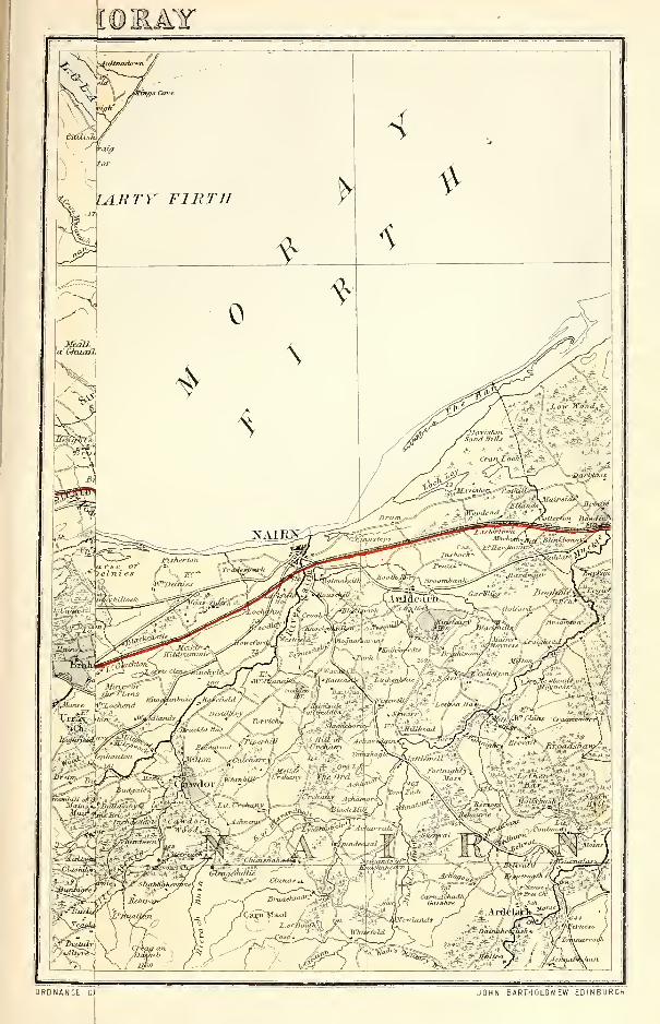
JOHN BARTHOLOMEW EDINBURGH
-
<t02i
CROMBIE CROOK
16 miles, a breadth of about 6J or 7 miles, and an area
of about 39,690 acres. The detached districts are a
district surrounding Tarbat House, on the NE seaboard
of Cromarty Firth ; a district commencing on the Dor-noch Firth a little E of Tain, and extending eastward
to the Moray Firth in the vicinity of Geanis ; two small
tracts in Kincardine parish, adjacent to the river Carron
;
a district extending west-north-westward from the vici-
nity of Dingwall, and including Castle-Leod and part of
Ben Wyvis ; two tracts on the N of respectively LochFannich and Loch Nid ; a tract along the S side of the
middle and upper parts of Little Loch Broom ; the large
district of Coigach, lying between Loch Broom andSutherland, and extending to Loch Enard and Rhu Morepromontory ; and the Summer islands, lying in the Nside of the mouth of Loch Broom. These eight are esti-
mated to measure aggregately about 344 square miles,
or 220,586 acres. The ancient valuation of the propertywas £12,896 ; but the modern valuation of the property,
and all the other modern statistics, are merged into
those of Ross-shire. The county has a court of lieuten-
ancy of its own ; but it has no sheriff or even sheriff-
substitute of its own ; and, as to its fiscal affairs, its
parliamentary representation, and even its parochialdistribution and its territorial character, with the ex-
ception only of Cromarty parish, it is always practically
treated as simply a component part of Ross-shire.
Crombie, a small village and an ancient parish in theSW extremity of Fife. The village stands 1J mile S of
Cairneyhill, and 3| miles SW of Dunfermline. Theparish is now incorporated with Torryburn, comprisingthat part of it to the S of the Burn of Torry, and also
certain detached lands, which, distant 71- miles, are
annexed quoad sacra to Saline. Its church stood on acommanding site, overlooking the Firth of Forth, andis now represented by some ruins.
Crombie, a burn in Kingoldrum parish, Forfarshire.
It rises 2 miles N of Kingoldrum village ; runs past thatvillage ; describes a semicircle toward the E ; proceeds
If mile west-south-westward; and falls into the river
Melgum.Crombie, a burn in the S of Inveraven parish, Banff-
shire, rising close to the Aberdeenshire border, at 2400feet above sea-level, and running 7J miles north-north-westward to Livet Water at Tombae.
Crombie, a burn and an old castle in Marnoeh parish,
Banffshire. The burn, rising near the Ordiquhill border,
runs 3 miles southward to the Deveron at Marnoehmanse ; and the castle stands on the right side of theburn, 1-J mile N of the said manse. Supposed to bevery ancient, and looking to have been a place of somestrength, it now consists of three stories, but formerly wasmuch higher ; and belongs now to the Earl of Seafield.
Crombie Point, a small headland, a small harbour,and a hamlet in Torryburn parish, SW Fife, on theFirth of Forth, 1J mile SE of Torryburn village, andIf W by N of Charlestown. The harbour is a calling
place of the Granton and Stirling steamers.
Cromdale, a parish, chiefly in Elginshire, but partlyalso in Inverness-shire. In its Elginshire portion, on theSpey's right bank, is Cromdale station on the Strathspeysection of the Great North of Scotland, 3 miles NE ofGrantown station and 21 SW of Craigellachie Junction
;
near it are a post office under Grantown, a new publicschool (1877), the parish church (1809; 900 sittings),
and a wire suspension footbridge (1881) over the Spey,195 feet in span.
The parish, till 1870 mainly in Inverness-shire, con-tains also the town of Grantown ; the station of Dava,at the NW border, 8J miles NBW of Grantown ; thestation of Advie
; and the station of Broomhill, 3fmiles SSW of Grantown. It is bounded NW by Edin-killie ; NE by Knockando ; E by Inveraven, and SE byKirkmichael, in Banffshire
; S by Abernethy, and SWby Duthil, in Inverness-shire ; and W by Ardelach, inNairnshire. Its utmost length, from NE to SW, is 16miles ; its utmost breadth, from NW to SE, is 11| miles
;
and its area is 64,253 acres, of which S99J are water. TheSpey winds 20| miles north-eastward along the border
and through the interior, descending in this course fromabout 680 to 480 feet above sea-level ; and the Divieand Dorbock, feeders of the Findhorn, rise in the NWcorner of the parish, the Dorbock issuing from Lochin-dorb, which, 2J miles long and from 1 J to 5 furlongs
broad, lies at an altitude of 769 feet on the Edinkillie
boundary. To the S of it lie Loch an t-Sithein (2f x 1
furl. ), Lochan Dubh (1 x A furl. ), and Loch Ruigh a'
Bhuair(2xl furl.). Chief elevations to the left or Wof the Spey, from NE to SW, are Gallow Hill (1210feet), Geal Charn (1487), Carn na h-Eige (1673), LarigHill (1783), Creag a' Bharrain (1324), Carn an Loin(1798), Carn na Doire (1294), Carn Bad na Caorach(1557), Craig Tiribeg (1586), and Beinn Mhor (1545);whilst to the right, on the Banffshire and Inverness-
shire border, rise Tom a Chait (1646 feet), Creag anTarmachain (2121), Carn Eachie (2329), and Tom Biath
(1163), these latter belonging to the heathy CromdaleHills. Granite is a predominant rock ; and limestone
of prime quality abounds in places, and has been largely
worked for both building and manure. The soil of thehaughs along the Spey is very fertile ; that of the other
arable lands is generally thin and dry. Barely a tenthof the entire area is under the plough, and woods andplantations cover at least as much, the country roundGrantown, and indeed the whole strath of the Spey,
being finely adorned with trees. On May 1, 1690, thewar in Scotland between James VII. and William of
Orange was virtually ended by the affair of the Haughsof Cromdale, when, at a spot 24 miles E by S of Crom-dale station, the dragoons of Sir Thomas Livingstonesurprised Buchan's sleeping Highlanders, 800 in number,slaying more than 300, and taking 100 prisoners.
The ruined castle of Muckerach is separately noticed, as
likewise is Castle-Grant,whose owner, Ian Charles Grant-Ogilvie, eighth Earl of Seafield (b. 1851 ; sue. 1881),
is almost the sole proprietor. In the presbytery of
Abernethy and synod of Moray, Cromdale comprises theancient parishes of Inverallan and Advie, and is nowdivided into the quoad sacra parishes of Inverallan andCromdale, the latter being worth £298, with manse andglebe. Besides two schools in Grantown, four public
schools—Achanarrow, Advie, Cromdale, and Dava
—
with respective accommodation for 70 90, 100, and 50children, had (18S0) an average attendance of 33, 34,
55, and 29, and grants of £40, 2s., £26, lis., £35, 16s.,
and £36, 13s. 6d. Valuation (1881) £13,554, 2s., of
which £1627, 18s. was in the Inverness-shire section.
Pop. (1801) 2187, (1S31) 3234, (1861) 3943, (1871) 3817,
(1881) 3642, of whom 1166 were in Cromdale quoad sacra
parish.—Ord. Sur., shs. 74, 75, 84, 85, 1876-77.
Cromlix, a barony in Dunblane parish, Perthshire,
around Dunblane town. Cromlix Cottage, 4 miles Nof Dunblane, is a seat of the Hon. Arthur Hay Drum-mond, the late Earl of Kinnoull's third son (b. 1833 ;
sue. 1866), who owns 7465 acres in the shire, valued at
£4240 per annum. The mineral wells of Cromlix are
noticed in connection with Dunblane HydropathicEstablishment.
Cromore. See Erisort, Loch.Cromwell Park, a village, with bleach-works, in Red-
gorton parish, Perthshire, on the left bank of the
Almond, H mile NW of Almondbank.Cromwell's Fort. See Ayr and Inverness.Cromwell's Mount. See Broxmoitth.Crona, two small flat islets of Assynt parish, Suther-
land, 5 furlongs SW of Oldany island.
Cronberry, a village of recent origin in Auchinleckparish, Ayrshire, 2 miles NE by N of Lugar. It owesits origin to iron-works of the Egiinton Iron Co. , andhas a school in connection therewith. Pop. (1871) 997,
(1881) 799.
Crook or Creueh, a summit (1446 feet) on the westernborder of Kilmalcolm parish, Renfrewshire, f mile fromthe Ayrshire border, and 5 miles S by W of Greenock.
Crook, a place on the N border of St Ninians parish,
Stirlingshire, on the Bannock rivulet, 1| mile ESE of
Stirling. Miss Elizabeth Hamilton (1758-1816) resided
at it whilst writing her Cottagers of Glenburnie.
311
CROOK
Crook, an inn on the mutual border of Tweedsmuirand Diummelzier parishes, S Peeblesshire, standing, 746feet above sea-level, near the left bank of the Tweed, 1Jmile NNE of Tweedsmuir church and 12 miles SSE of
Biggar, under which it has a post office. A well-knownhostelry in the old coaching days, it now is only a resort
of anglers for the head-waters of the Tweed. NetherOliver Dod (1673 feet) culminates f mile to the WSW.
Crook, Forfarshire. See Cruick.Crookedholm, a village in Kilmarnock parish, Ayr-
shire, on the right bank of the Irvine, 1^ mile ESE of
Kilmarnock town, and j mile N of Hurlford Junction.At it are a public school and a worsted spinning-mill,
in connection with carpet factories in Kilmarnock. Pop.
(1861) 620, (1871) 770, (1S81) 657.
Crook of Alves, a hamlet in Alves parish, Elginshire,
3J furlongs N of Alves station.
Crook of Devon, a small old village in the Kinross-
shire section of Fossoway parish, on the left bank of theDevon, at its sharp westward bend or crook, with a
station on the Devon Valley section of the North British,
H mile ENE of Rumbling- Bridge, and 6 miles WSW of
Kinross. It is a burgh of barony.Crookston, an estate, with a ruined castle, on the E
border of Abbey parish, Renfrewshire. The estate be-
longed in the 12th century to Robert de Croc, a gentle-
man of Norman ancestry, and passing by marriage in
the 13th to the illustrious family of Stewart, was thenunited to the estates of Darnley, Neilston, Inchinnan,and Tarbolton. It was held by Henry, Lord Darnley(1546-67), who became the husband of Queen Mary
;
and in 1572 was granted to his younger brother CharlesStewart, fifth Earl of Lennox. Afterwards it passedthrough many hands to the Duke of Montrose, andwas purchased from the second Duke in 1757 by Sir
John Maxwell of Pollok. The castle stands on thesummit of a wooded slope, overhanging the left bank of
Levern Water, 3 furlongs above its influx to the WhiteCart, and 3| miles ESE of Paisley. Once a massiveedifice, with centre, two lofty towers, and battlementedwings, surrounded by a rampart and a moat, it nowconsists of only one shattered tower, 50 feet high. JohnWilson, Tannahill, Motherwell, Burns, and many anony-mous poets have celebrated Crookston in verse ; andmost persons, though on little better authority thanloose tradition, believe that it, not Wemyss, was the
scene of Lord Darnley's betrothal to Queen Mary in
1565, and the place where they spent the days im-
mediately after their marriage. A stately yewT, knownas ' the Crookston Tree,' standing a little to the E, andpopularly regarded as having been a favourite haunt of
the royal lovers, became eventually blasted and leafless,
less from natural decay than in consequence of being
hacked and hewn by relic-hunters for pieces to be con-
verted into snuff-boxes and small ornamental articles,
till it was eventually rooted up by Sir John Maxwell in
1817. Common tradition, too, asserts that Queen Maryfrom Crookston Castle viewed the battle of Langside,
—
a tradition adopted by AVilson in his poem of the Clyde,
and by Sir Walter Scott, both in his novel of The Abbotand in his History of Scotland; but the castle is 3
J
miles W by N of the battlefield, is completely hid fromit by intervening heights, and, moreover, was in the
rear, not of the Queen's army, but of the enemy.
—
Ord.
Sur., sh. 30, 1866. See David Semple's Tree of Crocston :
being a Refutation of the Fables of the Courtship of QueenMarie and Lord Darnley under the Yew Tree (Paisley,
1876).
Crookston, an estate in Borthwick and Stow parishes,
Edinburghshire. Its mansion, in the NE of Stow,stands on the left bank of Gala Water, If mile N of
Fountainhall station, and is the seat of John Borthwick,Esq. (b. 1825; sue. 1846), who holds 9723 acres in
Edinburgh and Berwick shires, valued at £5851 perannum. See Bokthwiok.
Croot, a loch (1| x § furl.) in Kirkmichael parish,
Ayrshire, near Barnshean Loch, and 3J miles NE of
Kirkmichael village.
Crosbol. See Craspul.312
CROSSGATES
Crosby. See Troon and Dundonald.Cross. See Luce, Water of.
Cross. See Barvas, Lewis.
Crossall, a small eminence in Dalmeny parish, Lin-lithgowshire, If mile ESE of Queensferry. It is sur-mounted by remains of an ancient stone cross, and, inpre-Reformation times, was a station of devotees onpilgrimage to Dunfermline.
Cross and Burness, a united parish in the N ofOrkney, comprising the south-western and north-western limbs of Sanday island, and also, in its quoadcivilia estate, the island of North Ronaldshay. It
contains a post office of the name of Sanday, with moneyorder and savings' bank departments, under Kirkwall
;
and, bordered on the E for If mile by Lady parish, is
on all other sides surrounded by the sea. Cross, whichforms the south-western section, terminates in a dismalmoor of 200 acres, separating it from Burness. Wellsheltered by Eday from westerly winds, it presents adiversified surface, which rises at two points to morethan 300 feet above sea-level, and breaks down, at oneof its heights, in a coast precipice perforated by curiouscaverns ; a considerable lake is occasionally visited byflocks of wild swans. Burness, separated on the E fromthe greater part of Lady parish by Otterswick Bay, hasflat shores and a verdant fertile surface. The rocks are
sandstone, sandstone flag, and a little limestone. Theneighbouring sea-waters produce enormous quantities of
shell-fish. This parish is in the presbytery of NorthIsles and synod of Orkney ; the living is worth £245.There are two parish churches, Cross, with 24S sittings,
and Burness with 262. In May 1880, in making ex-
cavations for the foundations of an addition to themanse, it was discovered that the old building, lately
demolished, had been standing on the ruins of an ancientbroch. For schools and population see Sanday.
Crossbasket, an estate, with a mansion, in the NEcorner of East Kilbride parish, Lanarkshire, | mile Wby S of High Blantyre station.
Crossbost, a hamlet in Lochs parish, Lewis island,
Outer Hebrides, Ross-shire, on the northern shore of
salt-water Loch Luirbost, 9 miles SSW of Stornoway,under which it has a post office. Near it are a newFree church (1881), and Luirbost public school.
Crosschain Hill. See Fala.Crossfield Hill. See TJnst.
Crossford, a village in the N of Lesmahago parish,
Lanarkshire, near the left bank of the Clyde, imme-diately above the Nethan's influx, 4f miles NW by Wof Lanark, under which it has a post office. At it are
Free and U. P. churches ; and near it are the ruins of
Craignethan. ' In 16S6, ' says honest Patrick Walker,' many people gathered together about Crossford, wherethere were showers of bonnets, hats, guns, and swords,
which covered the trees and ground ; companies of men in
arms marching along the water side ; companies meetingcompanies all through other, and then all falling to the
ground, and disappearing, and other companies appear-
ing the same way. I went there three afternoons
together, and, as I could observe, there were two of the
people that were together saw, and a third that saw not
;
and though I could see nothing, yet there was such a
fright and trembling upon those that did see, that wasdiscernible to all from those that saw not,' etc. (Cham-bers's Domestic Annals, ii. 485). Pop. (1841) 431,
(1861) 530, (1871) 543, (1881) 816.—Ord. Sur., sh. 23,
1865.
Crossford, a village, with a public school, in Dunferm-line parish, Fife, 1J mile WSW of Dunfermline town.
Crossford. See Glencairn, Dumfriesshire.
Crossgatehall, a hamlet in Inveresk parish, Edin-
burghshire, 2 miles SSE of Inveresk station.
Crossgates, a village on the mutual border of Dun-fermline and Dalgety parishes, Fife, with a station on
the North British railway, 3i miles ENE of>Dunferm-
line. Inhabited chiefly by colliers, it is surrounded at
near distances by extensive coal mines ; adjoins lines of
mineral railway, communicating with St David's har-
bour on Inverkeithing Bay ; and has a post office, with
CROSSGATES
money order, savings' bank, and telegraph departments,
2 hotels, a U.P. church (1802; 531 sittings), and a
public school, which, with accommodation for 160children, had (1880) an average attendance of 124, anda grant of £91, 2s. Pop. (1841) 646, (1861) 1115, (1871)
1181, (1881) 1215.
Crossgates, a hamlet on the W border'of Cults parish,
Fife, 3 furlongs SW of Pitlessie.
Crossgellioch, a wild mossy moor in Carsphairnparish, N Kirkcudbrightshire. Three Covenanters, plain
country men, when returning from a conventicle in the
vicinity, in the winter of 1684, were met here by Claver-
house and a party of his men, and were summarily shot.
Their bodies were buried on the moor ; and, at a recent
period, were found embalmed in the moss, ' shrouded in
their hosen, in their coats, and in their bonnets, exactly
as they fell.'
Crossgills, a hamlet in Ruthwell parish, S Dum-friesshire, 3 furlongs NW of Ruthwell station.
Crosshall, a colliery village in the S"\V of Polmontparish, Stirlingshire, 2J miles SSE of Falkirk.
Crosshall, an ancient monument in Eccles parish, Ber-
wickshire, 1 mile N of Eccles village. It comprises a
monolithic sandstone pedestal, 9 feet square and 2J high,
and a monolithic sandstone column, rising fully 10 feet
from the pedestal, through which it passes deep into
the ground, and carved in its N and S faces with curious
sculptures. It is thought by some antiquaries to havebeen raised to the memory of a Percy of Northumberland,by others to have been erected after the second crusade,
in the latter half of the 12th century, to the memory of
the father of Sir John de Soulis. The place where it
stands was formerly called Deadriggs, and is tradition-
ally said to have been the scene of a bloody battle.
Crosshands, a village, with a public school, in Mauch-line parish, Ayrshire, 2 miles NNW of Mauchliuevillage.
Crosshill, a village in Eirkmichael parish, Ayrshire,
and a quoad sacra parish partly also in Kirkoswald andMaybole parishes. The village stands on the left bankof Girvan Water, 3 miles SE of Maybole, and 2| NE of
Kilkerran station. Chiefly consisting of a long regularstreet of one-story houses, running at right angles fromthe river, it has a post office under Maybole, withmoney order and savings' bank departments, a principalinn, an Established church (1838), a Free church, and a
school. The quoad sacra parish, constituted in 1853, is
in the presbytery of Ayr and synod of Glasgow andAyr ; its two public schools, Crosshill and KilkerranHillside, with respective accommodation for 270 and61 children, had (18S0) an average attendance of 159and 52, and grants of £125, 14s. and £39, 3s. Pop.of village (1841) 1163, (1861) 1107, (1871) 835,(1881)740 ; oiq. s. parish (1871) 1372, (18S1) 1284, of whom1006 were in Kirkmichael.—Ord. Sur., sh. 14, 1863.
Crosshill, a south-eastern outbreak of Bailliestonvillage, in Old Monkland parish, Lanarkshire.
Crosshill. See Govanhill.Crosshill. See Strathaven.Crosshouse, a village in Kilmaurs parish, Ayrshire,
on Carmel "Water, 2J- miles W of Kilmarnock, and 1
mile SSW of Crosshouse station. At it is the handsomeEstablished church (1882 ; 450 sittings) of a quoadsacra parish, formed out of Kilmaurs and Dreghorn, andalso a public school. Coal has long been wrought in thevicinity, and ironstone during the last 12 or 13 years.Pop. of village (1861) 468, (1871) 713, (1881) 631 ; ofq. s. parish (1881) 2424.
Crosshouses, a hamlet in Kettle parish, Fife, 2 milesSE by E of Kettle village.
Cross Isle, a small island in Dunrossness parish,Shetland, off the mouth of Quendal Bay, 3\ milesWNWof Sunburgh Head.
Crosskirk, a place on the SW coast of "WestrayIsland, Orkney, distant 1 mile from "Westray manse.A pre-Reformation church here was used by Presby-terians till about 1776, and then became ruinous ; its
ancient burying-ground is still in use.Crosslee, a hamlet in Stow parish, Edinburghshire,
CROSSPOL
on the south-eastern verge of the county, near Gala"Water and Bowland station, 3 miles S of Stow village,
under which it has a post office.
Crosslee, a village in Houston parish, Renfrewshire,on the left bank of the Gryfe, 2J miles NW of John-stone station. A cotton mill, built here in 1793, wasburned down about 185S ; and the villagers now are
mainly employed in the neighbouring oil-works of
Clippens. Pop. (1861) 3S3,(1871) 379, (1881) 400.
Crossmichael, a village and a parish of central Kirk-cudbrightshire. The village, pleasantly-seated on theleft bank of the lake-like Dee, with a station upon theGlasgow and South-Western, 3j miles NW of Castle-
Douglas, has an inn and a post office ; but its cross, StMichael's, round which was held a Michaelmas fair, haslong since disappeared.
Containing also Clarebrand hamlet and a north-western outskirt of Castle-Douglas, the parish is
bounded NE by Kirkpatrick-Durham and Urr, SE byBuittle, S by Kelton, SWT
by Balmaghie, and NW byParton. Its utmost length, from NW to SE, is 5g miles ;
its breadth, from NE to SW, varies between 2| and 4Jmiles ; and its area is 10,148-| acres, of which 220J are
water. The Dee winds 4 4 miles south-south-eastward
along all the boundary with Balmaghie, Urr Water
4J along that with Kirkpatrick-Dm'ham and Urr ; andin the interior are Lochs Culgruft (2 x 1 furl.), Erncrogo(3 x 1J), Roan (3J x 2g), and Smaddy (1 x |), with three
or four tinier lakelets. The surface, which sinks alongthe Dee to less than 200, and along Urr Water to less
than 100, feet above sea-level, has a general north-north-westerly rise, being studded by a number of loweminences, and culminating at 711 feet on the westernshore of Loch Roan. The rocks are chiefly Silurian
;
and the soils of the arable lands, along the streams andamong the hills, which in places are cultivated up to
the top, are extremely various, including fine alluviumand rich loam, with some tilly clay, but chiefly present-
ing a sandy character. Near Glenlochar Bridge stood
an abbey, whose history is utterly lost ; and of six moats,the largest and best-defined is that of Crofts, whichrises in several stages to a round grassy plat, 280 feet in
diameter, and commands a beautiful prospect. Weaponsand urns, supposed to be Roman, have been found ; anda cairn at Blackerne yielded in 1756 a silver ring and anamber bead, now in the Edinburgh Antiquarian Museum.Mansions are Greenlaw, Glenlochar Lodge, DanevalePark, Mollance, and Ernespie ; and 10 proprietors holdeach an annual value of £500 and upwards, 17 of be-
tween £100 and £500, 2 of from £50 to £100, and 7 of
from £20 to £50. Crossmichael is in the presbytery of
Kirkcudbright and synod of Galloway ; the living is
worth £339. The parish church, at the hamlet, wasbuilt in 1751, and contains 650 sittings ; in the grave-
yard is a tombstone to ' William Graham, shot dead bya party of Claverhouse's troop, for his adherence to
Scotland's Reformation Covenants, 1682.' There is also
a U.P. church, near Castle-Douglas ; and two public
schools, Crossmichael and Clarebrand, with respective
accommodation for 200 and 100 children, had (1880) anaverage attendance of 89 and 79, and grants of £96,Is. 6d. and £88, 7s. 6d. Valuation (1S60) £10,725,
(1882) £15,024, 4s. lOd. Pop. (1801) 1084, (1831)
1325, (1861) 1536, (1871) 1492, (1881) 1343.—OrdSur., sh. 5, 1857.
Crossmill. See Corsemill.Crossmyloof, a village in the NW corner of Cathcart
parish, Renfrewshire, 1 mile NE of Pollokshaws, and
1J SSW of Glasgow, under which it has a post andtelegraph office. At it are a public school, an Established
mission station, and an extensive bakery, started in
1847. At a council of war here, according to a popularmyth, Queen Mary, on the morning of the battle of
Langside, laid a small crucifix on her hand, saying, ' Assurely as that cross lies on my loof, I will this dayfight the Regent,'—hence the name Crossmyloof. Pop.
(1841)587, (1861) 939, (1871) 988, (1881) 1195.
Crosspol, a bay in the S of Coll island, Argyllshire.
It measures 2 miles across, but lies exposed to the S and313
CROSSRAGUEL
the SW, and is profusely studded with sunken rooks.
A sandy beach, about a mile long, fringes it on the N>,
and is the chief feature of its kind in Coll.
Crossraguel, a ruined Clugniac abbey in Kirkoswaldparish, Ayrshire, 2 miles SW of Maybole. It seems to
have derived its name (Lat. CruxRegalis, 'king's cross')
from a cross of St Oswald, King of Northumbria (ob.
643), but itself was dedicated to the Virgin Mary, andwas founded about 1240 by Duncan, first Earl of Car-
rick, for Clugniacs of Paisley, from which it was madeexempt in 1244. The last of its abbots, QuentinKennedy, in 1562 held a famous dispute with JohnKnox at Maybole ; he died in 1564, when a pension of
£500 a year was conferred upon George Buchanan outof the abbey's revenues. Their bulk was granted to
Allan Stewart, who, as commendatorvisitingthe bounds of
Crossraguel in 1570, was pounced on by Quentin'snephew,Gilbert, fourth Earl of Gassillis, and carried off to the sea-
castle of Dunure, there, in the Black Vault, to be' roasted in sop ' until he consented to subscribe ' a five-
year tack and a nineteen-year tack and a charter of feu of
all the lands of Crossraguel, with all the clauses necessar
for the great King of Carrick to haste him to hell ' (Cham-bers's Dom. Ann., i. 65-67). To the Earl's desire, how-ever, to turn it to his own account we probably owe the
partial preservation of the abbey. Its ruins, SecondPointed in style, comprise some portions of the domesticbuildings on the S side, the walls of the church, andthe square chapter-house, with high arched roof upborneby a clustered pillar. The roofless church is a narrowaisleless oblong, measuring internally 160 by 25 feet, anddivided nearly midway by a gabled wall, containing a
doorway. The choir ends in a three-sided apse, andretains an aumbry, sedilia, and an altar tomb. See
vol. ii. of Grose's Antiquities of Scotland (1791), andvol. i. of Billings' Baronial and Ecclesiastical Aiitiquities
(1845).
Crossroads. See Grange, Banffshire.
Crossroads. See Dreghorn, Ayrshire.
Croulin Isles, a group of islets in Applecross parish,
Ross-shire, off the N side of the entrance of Loch Carron.
Croulinmore, the largest of them, is 1 mile long.
Crovie, a fishing village in Gamrie parish, NE Banff-
shire, on the E side of Gamrie Bay, 1 mile NE of Gar-denstown. Supposed to have been founded early in the
18th century, it stands in a rocky ravine, which is
traversed by a brook ; and it presents the gable end of
its houses to the sea, the other end to a bank of the
ravine. Pop. (1881) 258.
Crowbutt, a hamlet in Chirnside parish, Berwickshire,
1 mile NE of Chirnside village.
Crowlista. See Uig.
Croy, a station in the W of Cumbernauld parish,
Dumbartonshire, on the Edinburgh and Glasgow section
of the North British, If mile SSE of Kilsyth, and 11Jmiles NE of Glasgow.
Croy, a hamlet on the NE border of Inverness-shire,
and a parish partly also in Nairnshire. The hamlet lies
8 miles SW of Nairn and 3 S of Fort George station,
which is 10J miles NE of Inverness, and under whichit has a post office.
The parish, containing also Clephanton village, 6Jmiles SW of Nairn, comprises the ancient parishes of
Croy and Dalcross, united in the latter part of the 15thcentury. Bounded N by Nairn parish, E by Cawdor,S by Moy and Daviot, and NW by Daviot and Petty,
it has an utmost length, from NNE to SSW, of 10J miles
;
a varying width of 1J and 4§ miles ; and a land area of
22,779 acres. This last includes the Leys or south-
western division, which, severed from the main body bya strip (5 furlongs wide at the narrowest) of Daviot, is
on all other sides surrounded by Inverness, its greatest
length and breadth being 6 J and If mDes. The river
Nairn winds 12f miles north-eastward along the bor-
ders and through the interior of the main portion, fromjust below Daviot House to just above Rosefield ; the
Loch of the Clans (2x1 furl.) lies in the northern ex-
tremity, and on the Petty boundary is Loch Flemington
(ii x 1J furl.). The beautiful strath of the Nairn here
314
CRUDEN
sinks from 400 to 100 feet above sea-level ; but the sur-
face generally is flat and forbidding in aspect, includingthe wide bleak moors of Clava and Culloden, and onlyin the south-eastern corner rising steeply to 1000 feet
on Saddle Hill, 1027 on Creagan Glas, and 1787 onBeinn Buidhe Mhor. The rocks are variously granite,
gneiss, Old Red sandstone, unconsolidated drift, andliassic limestone, the last of which has been calcined for
economic purposes. The soil in the eastern division is
of all descriptions, so interspersed with one another thatscarcely two continuous acres can be found of the samequality ; that of the western is also various, but forms,
on the whole, a fine mixture of clay black land andsandy or gravelly material. Great improvements havebeen effected since 1S45, hundreds of acres that oncewere barren moor having either been planted or broughtunder the plough. A remarkable ancient Caledonianmonument, comprising two concentric circles of large
stones, two large slabs within the inner circle, and a
huge upright of conglomerate a few feet W of the outer,
crowns a round gravel mound on the NW border of the
parish ; and remains of crannoges or ancient lake-dwell-
ings, formed of alternate strata of stones, earth, and oak,
and resting on oaken piles strongly fixed by transverse
beams, were discovered at the draining of a lake in theeastern end of the parish. The Stones of Clava are
separately noticed, as likewise are the battlefield of
Culloden, the ruins of Dalcross Castle, and the four
mansions, Cantray House, Holme Rose, Kilravock Castle,
and Leys Castle. Seven proprietors hold each an annualvalue of more, and five of less, than £500. Croy is in the
presbytery of Nairn and synod of Moray ; the living is
worth £384. The parish church, at the hamlet, wasbuilt in 1767, and contains 527 sittings ; a Free churchstands 1 mile to the SSW. Two schools, Clava andCroy, with respective accommodation for 100 and 150children, had (1880) an average attendance of 32 and129, and grants of £36, 10s. and £129, 3s. 6d. Valua-tion (1880) £10,399, 19s. 2d., of which £3699, Is. 6d.
was in Nairnshire. Pop. (1801) 1601, (1831) 1664,
(1861) 1873, (1871) 1841, (1881) 1709.—Orel. Sur., sh.
84, 1876.
Cruach or Stob na Cruaich, a mountain (2420 feet)
on the NW border of Perthshire, culminating If mile
NW of Loch Laidon.
Cruachan. See Ben Cruachan.Cruachlussa (Gael. ' mountain of plants '). See
Knapdale, North.Crucifield. See Unst.Cruden (croju or crash Dane, according to the popular
etymology), a coast parish of Buchan, NE Aberdeen-
shire, with a post office of its own name at Auchiries
hamlet, 8J miles SSW of Peterhead, and 9f NE of its
station and post-town, Ellon, with which it communicatesdaily by coach. It is bounded NW by Longside, NEby Peterhead, E by the German Ocean, S by Slains andLogie-Buchan, SWandWby Ellon. Its utmost length,
from E to W, is 7J miles ; its breadth, from N to S, varies
between 2g and 6J miles; and its area is 18,444J acres,
of which 164J are foreshore and 14 water. Except
for 2 miles of sands at Cruden Bay, the coast-line,
7J miles long, is fringed with a range of stupendous
cfiffs, projecting the headlands of Hare Craig, MurdochHead, and Wardhill, and indented by Long Haven,Yoag's Haven, North Haven, the Bullers of Buchan,Robie's Haven, and Twa Havens, whilst off them lie
Dunbuy islet and a long sunken reef, the Scares of
Cruden. The cliffs to the S, 100 feet high, consist of
greenstone or basalt ; and those to the N, at points
attaining 200 feet, of reddish granite, with trap-dykes
on the Blackhill. Inland the general surface sinks little
below 100, and little exceeds 200, feet above sea-level
;
but rises to 281 at the Hill of Ardiffery, 354 at the Hill
of Auquharney, 447 at the Corse of Balloch, 346 at Hill-
side of Aldie, and 374 near Newtown, the three last close
to the Longside border. Cruden Water, rising just
within Longside, winds 11 miles east-by-southward to
the northern corner of Cruden Bay, dividing the parish
into two nearly equal parts, and receiving the burns of
CRUGGLETON CUILLIE
Lacca and Gask ; its current has been utilised to drive
a wool-mill at Auquharney and several meal-mills lowerdown. Great quantities of peat-moss lie along thenorthern boundary ; and forests of oak and other hard-wood trees anciently occupied much of the area, but noware represented only by a few old trees, dwarfed by thesea-breeze that has stunted the clumps and plantationsof Slains and Auquharney. Granite and trap are theprevailing rocks ; and the former has been quarriedalong the northern cliffs, under great disadvantages of
both working and transport. The neighbouring watersteem with fish ; and at a cost of £8000 a new harbourhas recently been formed at the village of Port Erroll,where Cruden Water falls into the bay ; it consists of
an outer and an inner basin, the latter 5400 squareyards in area. On the plain skirting Cruden BayMalcolm II. of Scotland is said to have defeated Canute,afterwards King of England, in 1014 ; but the battle is
one of those which, in Dr Hill Burton's words, ' onlyfind a local habitation and a name, along with theusual details, from late and questionable authority.'
A mound, evidently artificial, and popularly called theBattery, crowns a height to the N of the Hawklaw, andto the SE of that mound are remains of what seems to
have been a vitrified wall. Another artificial mound,the Moathill, a seat most probably of feudal justice, andan eminence, called Gallowhill, where criminals wereexecuted, are on Ardiffery farm ; whilst Highlaw, 1 milefrom the coast, is crowned by a tumulus, said to havebeen used for beacon fires, and commanding a fine viewover the low surrounding country, away to the Gram-pians. A 'Druidical circle,' J mile W of the parishchurch, was demolished in 1831 ; a necklace of jet andamber, three stone cists, flint implements, a rude old
granite font, and other relics of antiquity, have beenfrom time to time discovered ; and the Bishop's Bridgeover Cruden Water, near the church, was built in
1697 by the Right Rev. Dr Jas. Drummond of Brechin,and widened by the Earl of Erroll in 1763. SlainsCastle, however, is the chief artificial feature in theparish, where 8 proprietors hold each an annual valueof £500 and upwards, 4 of between £100 and £500, and3 of from £20 to £50. Giving off portions to Ardallie,
Blackhill, and Boddam quoad sacra parishes, Cruden is
in the presbytery of Ellon and synod of Aberdeen ; theliving is worth £300. The parish church, on the rightbank of Cruden Water, 1 mile SSW of Auchiries, wasbuilt in 1776, and enlarged in 1834, when two roundtowers were added ; it contains 820 sittings, and hasa church-hall beside it. At Hatton, If mile WNW,stands the Free church (1844) ; and | mile SSW is StJames's Episcopal church (1843; 440 sittings), which,Early English in style, has a nave and chancel, a spire
90 feet high, an organ, and three stained-glass windows.Of St Olave's or Olaus' chapel, near the New Bridge,said to have been founded by Canute, the last remainswere carried away for road-metal in 1837. Errol Epis-copal school and the public schools of Auchiries, Bog-brae, Coldwells, and Hatton, with respective accommo-dation for 140, 102, 68, 90, and 150 children, had (1880)an average attendance of 87, 78, 72, 100, and 108, andgrants of £50, 13s., £61, 18s., £54, £72, 16s., and£92, 3s. Valuation (1843) £8792, (1881) £16,072, 13s.
6d. Pop. (1801) 1934, (1831) 2120, (1861) 2743, (1871)3124, (1881) 3444.—Ord. Sur., sh. 87, 1876.
Cruggleton, an ancient coast parish of SE Wigtown-shire, united in the middle of the 17th century to Kirk-madrine and Sorbie, and now forming the south-easternsection of the present Sorbie. Its ruined Norman church,3 mdes S of Garliestown, belonged to Whithorn priory,and, consisting of nave and chancel, measures 67J by 30feet. Cruggleton Castle, 3 furlongs to the E, stood ona bold rocky headland, over 100 feet high, mid-waybetween Rigg or Cruggleton Bay and Port Allan. Sup-posed to have been built by Norsemen, it was longthe seat of the Irish M'Kerlies ; is said to have beencaptured by both Edward I. and Wallace ; and afterpassing through many hands, came eventually to theAgnews. It is now represented by only an arch, the
foundations of some walls, and distinct traces of a
fosse.
Cruicksfield, an estate, with a mansion, in the S of
Bunkle parish, Berwickshire, 4 miles NE of Dunse.Cruick Water, a stream of NE Forfarshire, rising at
the northern extremity of Fearn parish, and running15| miles south-south-eastward and east-north-eastward
through Fearn, Menmuir, and Stracathro, till it falls
into the North Esk, 5 furlongs E of Stracathro church.
A capital trouting stream, but possessed of little beauty,it descends from 1480 to 118 feet above sea-level, andbecomes after heavy rains a voluminous and furious
torrent, though dwindling to a mere rill in time of
drought. —Ord. Stir., sh. 57, 1868.
Cruikston. See Crookston.Cruin. See Inchcruin.Cruister, a hamlet near Sandwick, in Dunrossness
parish, Shetland.
Cruivie, a ruined square tower on the lands of Straiton,
in Logie parish, NE Fife, 2J miles NNE of Logiechurch.
Crummag Head. See Crammac.Crutherland, an estate, with a mansion, in Glasford
parish, Lanarkshire, on the right bank of Calder Water,2| miles SE of East Kilbride.
Cryston. See Chryston.Cuan, a narrow sound separating Luing island from
Seil island, in Kilbrandon and Kilchattan parish, Argyll-
shire. It has a very strong current, running at the rate
of 7 or 8 miles an hour ; and, in consequence of the
church standing near it, gives name popularly to the
parish.
Cuchullins or Coolins, a group of savagely picturesque
mountains in Bracadale and Strath parishes, Isle of
Skye, Inverness-shire. Rising from the sea-shore to theE of Loch Brittle and N of Loch Scavaig, and extendingnorth-eastward to Glen Sligachan, eastward to the valley
of Strath, they occupy an area of about 35 square miles,
and are a confused assemblage of barren heights, from2000 to 3000 feet high, distinguishable, by striking
differences in outline, feature, and colouring, into twogreat sections. The southern and larger of these con-
sists of smooth, conoidal masses, that rise from alabyrinth of low ground—each separate from its fellow,
nearly all streaked from summit to base with broadreddish sheets of debris, and many of them abrupt,
acclivitous, and rounded like vast bare cones. Thenorthern section, on the other hand, consists of singularly
rugged and serrated ranges and masses of mountains,intersected by wild ravines, and shooting up in sharp
and jagged peaks. It is mainly formed of hypersthene,
whose dark metallic aspect is relieved by scarce oneblade of vegetation ; and, strongly attracting rain-clouds
from the ocean, it often is lashed with storms. Always,even amid the blaze of summer sunshine, a region of
desolation, without any play of colours, it looks under a
wreathing of clouds to be little else than an assemblage
of deep and horrible abysses, which the eye vainly en-
deavours to penetrate ; dark Loch Coruisk lies in its
very core. The loftiest peak is Scuir-na-Gillean (-3183
feet), 4i miles S of Sligachan inn ; and six other summitsare estimated to exceed 3000 feet above sea-level. See
chaps, v. and vi. of Alexander Smith's Summer in Skye
(1865).
Cuckold-Le-Roi. See Cocklerue.Cuen or Loch nan Cuinne. See Baden.Cuff Hill. See Beith, Ayrshire.
Cuil, a bay in Appin, Argyllshire, opening from LochLinnhe, 4J miles NE of Shuna island. With a semi-
circular outline, on a chord of 1J mile, it is engirt witha fine sandy beach, receives the river Duror, and is
often frequented by iarge shoals of herrings.
—
Ord. Sur.,
sh. 53, 1877.
Cuilhill, a village in Old Monkland parish, Lanark-shire, 2 miles W of Coatbridge.
Cuillie or Culaidh, a loch in the upper part of Kildonanparish, Sutherland, 2J miles SSW of Forsinard station.
Rudely triangular in shape, it has an utmost length of
3 and 2 fur-longs, and teems with trout.
315
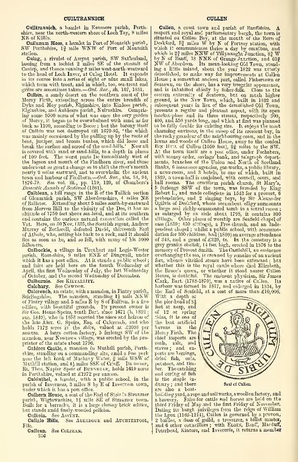
CUILTRANNICH
Cuiltrannich, a hamlet in Kenmore parish, Perth-
shire, near the north-western shore of Loch Tay, 9 miles
NE of Ellin.Cuilunum Moss, a hamlet in Port of Monteith parish,
SW Perthshire, 1| mile WNW of Port of Monteithstation.
Culag, a rivulet of Assynt parish, SW Sutherland,
issuing from a lochlet 2 miles SE of the summit of
Canisp, and thence running 8 miles west-north-westwardto the head of Loch Inver, at Culag Hotel. It expandsin its course into a series of eight or nine small lakes,
which teem with trout, and in which, too, sea-trout andgrilse are sometimes taken.
—
Ord. Sur., sh. 107, 1881.
Culbin, a sandy desert on the southern coast of the
Moray Firth, extending across the entire breadth of
Dyke and Moy parish, Elginshire, into Kinloss parish,
Elginshire, and Auldearn parish, Nairnshire. Compris-ing some 9500 acres of what was once the very gardenof Moray, it began to be overwhelmed with sand as far
back as 1100, according to Boece ; but the barony itself
of Culbin was not destroyed till 1670-95, 'the whichwas mainly occasioned by the pulling up by the roots of
bent, juniper, and broom bushes, which did loose andbreak the surface and scroof of the sand-hills. ' Now all
is covered with sand or sand-hills, to a depth in places
of 100 feet. The worst parts lie immediately west of
the lagoon and mouth of the Findhorn river, and these
underwent so great a change as to shift the river's mouthnearly 2 miles eastward, and to overwhelm the ancient
town and harbour of Findhorn.
—
Ord. Sur., shs. 84, 94,
1876-78. See vol. iii., pp. 119, 120, of Chambers'sDomestic Annals of Scotland (1861).
Culblean, a hill range in the E of the Tullich section
of Glenmuick parish, SW Aberdeenshire, 4 miles NEof Ballater. Extending about 5 miles south-by-eastward
from Morven Hill to the vicinity of the Dee, it has analtitude of 1750 feet above sea-level, and at its southern
end contains the curious natural excavation called the
Vat. Here, on 30 Nov. 1335, the Scottish regent, AndrewMurray of Bothwell, defeated David, thirteenth Earl
of Athole, who, setting his back to a rock, said it should
flee as soon as he, and so fell, with many of his 3000followers.
Culboekie, a village in Urquhart and Logie-Wester
parish, Koss-shire, 9 miles ENE of Dingwall, underwhich it has a post office. At it stands a public school
;
and fairs are held here on the fourth Wednesday of
April, the first Wednesday of July, the last Wednesdayof October, and the second Wednesday of December.
Culburnie. See Kiltarlity.Culchary. See Cawdor.Culcreuch, an estate, with a mansion, in Fintry parish,
Stirlingshire. The mansion, standing 1J mile NNWof Fintry village and 5 miles E by S of Balfron, is a fine
edifice, with beautiful grounds. Its present owner is
Sir Geo. Home-Speirs, tenth Bart, since 1671 (b. 1832;
sue. 1849), who in 1858 married the niece and heiress of
the late Alex. G. Speirs, Esq. of Culcreuch, and whoholds 7172 acres in the shire, valued at £2098 per
annum. A large cotton factory, 5 furlongs SW of the
mansion, near Newtown village, was erected by the pro-
prietor of the estate about 1796.
Culdees Castle, a mansion in Muthill parish, Perth-
shire, standing on a commanding site, amid a fine parknear the left bank of Machany Water, f mile WSW of
Muthill station, and 4| miles SSE of Crieff. Its owner,
Et. Thos. Napier Speir of Burnbrae, holds 1619 acres
in Perthshire, valued at £1972 per annum.Culduthel, a hamlet, with a public school, in the
parish of Inverness, 3 miles S by E of Inverness town,under which it has a post office.
Culhorn House, a seat of the Earl of Stair in Stranraer
parish, Wigtownshire, 1J mile SE of Stranraer town.
Built for a barracks, it is a large clumsy brick edifice,
but stands amid finely-wooded policies.
Culkein. See Assynt.Cullalo Hills. See Aberdour and Auchtertool,
Fife.
Cullean. See Colzean.316
CULLEN
Cullen, a coast town and parish of Banffshire. Aseaport and royal and parliamentary burgh, the town is
situated on Cullen Bay, at the mouth of the Burn ofDeskford, 5| miles W by N of Portsoy station, withwhich it communicates thrice a day by omnibus, andwhich is 2J miles NNW of Tillynaught Junction, 8| Wby N of Banff, 18 NNE of Grange Junction, and 61fNW of Aberdeen. Its mean-looking Old Town, stand-ing a little inland, about the year 1822 was utterlydemolished, to make way for improvements at CullenHouse ; a somewhat ancient part, called Fishertown orSeatown, on the shore, has a very irregular appearance,and is inhabited chiefly by fisher-folk. Close to theeastern extremity of Seatown, but on much higherground, is the New Town, which, built in 1822 andsubsequent years in lieu of the demolished Old Town,presents a regular and pleasant aspect, with its openmarket-place and its three streets, respectively 300,400, and 550 yards long, and which at first was plannedto be fully double its existing size. It enjoys the mostcharming environs, in the sweep of its crescent bay, inthe rocky grandeur of the neighbouring coast, and in thelawns and woods of Cullen House, away to the conicalBin Hill of Cullen (1050 feet), 2| miles to the SW.At the town itself are a post office, under Fochabers,with money order, savings' bank, and telegraph depart-ments, branches of the Union and North of ScotlandBanks, 6 insurance agencies, gas-works, a public library,
a news-room, and 3 hotels, to one of which, built in1829, a town-hall is conjoined, with council, court, andball rooms. The cruciform parish church, St Mary's,5 furlongs SSW of the town, was founded by KingRobert I., and made collegiate in 1543 for a provost, 6prebendaries, and 2 singing boys, by Sir AlexanderOgilvie of Deskford, whose recumbent effigy surmountsa large and richly-ornamented tomb in a mural recess
;
as enlarged by an aisle about 1798, it contains 800sittings. Other places of worship are Seafield chapel ofease (1839; 450 sittings), a Free church, and an Inde-pendent chapel ; whilst a public school, with accommo-dation for 300 children, had (1S80) an average attendanceof 348, and a grant of £329, 4s. In the cemetery is agrey granite obelisk, 14 feet high, erected in 1876 to thememory of Provost Smith. The Castlehill, an eminenceoverhanging the sea, is crowned by remains of an ancientfort, whence vitrified stones have been extracted ; butwhether this is the royal castle where died Elizabeth,the Brace's queen, or whether it stood nearer CullenHouse, is doubtful. The eminent physician, Sir JamesClark, Bart. (1788-1870), was a native of Cullen. It8
harbour was formed in 1817, and enlarged in 1834, bythe Earl of Seafield, at a cost of more than £10,000.With a depth at
the pier-head of 8^feet at neap, andof 12 at spring
tides, it is one of
the best artificial
havens in the
Moray Firth. Thechief imports are
coals, salt, andstaves ; and ex-
ports are herrings,
dried fish, oats,
potatoes, and tim-
ber. The catching
and curing of fish
is the staple in-
dustry ; and there
are also a boat-
building yard, a rope and sail works, awoollen factory, and
a brewery. Fairs for cattle and horses are held on the
third Friday of May and the first Friday of November.
Dating its burgh privileges from the reign of William
the Lyon (1165-1214), Cullen is governed by a provost,
2 bailies, a dean of guild, a treasurer, a billet master,
and 6 other councillors ; with Elgin, Banff, Macduff,
Peterhead, Kintore, and Inverurie, it returns a member
Seal of Cullen.
CULLENOCH
to parliament. Its parliamentary and municipal con-
stituency numbered 322 in 1882, when the burghvaluation amounted to £3616, whilst the corporation
revenue was £67. Pop. (1841) 1423, (1851) 1697, (1861)
1821, (1871) 2056, (1881) 2033.
The parish of Cullen, triangular in shape, is boundedN by the Moray Firth, E by Fordyce, and SW byKathven. Its utmost length, from N to S, is 1§ mile
;
its utmost width, from E to W, is 1J mile ; and its
area is 925 acres, of which 38j are foreshore, and15 water. The coast-line, 1J mile long, presents a
bold rocky front to the Bay of Cullen, which is 2Jmiles wide across a chord drawn from Scar Nose to
Logie Head, and which from that chord measures 7
furlongs to its innermost recess. Three singular massesof rock here have been named the Three Kings of Culleu,
most likely after the Magi, or Three Kings of Cologne
—
Caspar, Melchior, and Balthazar—whose skulls are shownin the cathedral there. The deep-channelled Bum of
Deskford, otherwise known as Cullen Water (Gael, cud-cm.,
' back-lying water'), flows 2J miles north-north-westwardalong all the Rathven border ; and the surface attains
143 feet above sea-level at the cemetery, and 211 towardsthe centre. A bed of stratified quartz, reposing conform-ably on a thick stratum of compact greywacke, underlies
all the parish ; Old Red sandstone forms two of the ThreeKings, £ mile W of which are two patches of NewRed sandstone, on disrupted greywacke and beneathbeds of drift ; and in the S is fine lias clay, well
marked by lias fossils. The soil near the shore is
a mixture of sand and gravel, and elsewhere ranges fromstrong clay or light loam to a fine rich loam incumbenton a soft clay bottom. Cullen House, near the parish
church, is a huge pile erected at various periods ; thewhole, as remodelled and enlarged in 1861 by the late
Mr David Bryce, is a noble specimen of Scottish Baronialarchitecture. It crowns a steep rock on the right bankof the Burn of Deskford, across which a one-arch bridge
of 82 feet span leads to the grounds and park, which,beautiful with streams and lakelets, trim lawns andstately groves, extend far into Rathven parish, andamong whose adornments is a graceful temple, com-manding a splendid view over the neighbouring sea.
The house itself is rich in works of art ; and its charter-
room contains a valuable series of documents, extendingback three centuries from 1705. Sir Walter Ogilvie,
Knight, of Auchleven, younger brother of that Sir JohnOgilvie who received a grant of the castle of Aielie,towards the middle of the 15th century married Mar-garet, sole daughter and heiress of Sir John Sinclair of
Deskford and Findlater, and thereby acquired the said
estates. His seventh descendant was in 1638 created
Earl of Findlater. That title expired with James,seventh Earl, in 1811 ; and Cullen now is held by IanCharles Grant-Ogilvie, eighth Earl of Seafield since 1701(b. 1851 ; sue. 1881), who owns 48,946 acres in Banffshire,
valued at£34,260 per annum. (See also Castle-Grant. )
Three lesser proprietors hold each an annual value of
from £50 to £100, and 23 of from £20 to £50. Cullenis in the presbytery of Fordyce and synod of Aberdeen
;
the living is worth £226. Valuation, exclusive of burgh(1882), £1217, 4s. lOd. Pop. of entire parish (1801)
1076, (1831) 1593, (1861) 1975, (1871) 2215, (1881) 2187.
Ord. Sur., sh. 96, 1876.
Cullenoeh, the ancient name of Laurieston, a village
in Balmaghie parish, Kirkcudbrightshire, 6 miles WNWof Castle-Douglas. It was the meeting-place of theKirkcudbrightshire war committee of the Covenanters,constituted in 1640.
Cullen of Buchan. See Gamrie.Cullen Park, a mansion in Avondale parish, Lanark-
shire, close to Strathaven.
Cullen Water. See Deskford, Burn of.Cullerley. See Echt.Cullicudden, a hamlet and an ancient parish in Reso-
lis palish, Ross-shire. The hamlet lies on the SE shoreof Cromarty Firth, 4i miles WSW of Invergordon, and25J N of Inverness ; at it are a public school and a postoffice, with money order and savings' bank departments.
CULLODEN
The parish, united to Kirkmiehael subsequent to 1688,now forms the western district of Resolis. A fragmentof its church is still standing. A quarry of sandstonesuited for many kinds of public buildings, and varyingin colour from red to deep yellow, has long been workedin the vicinity of the hamlet.
Cullin. See Cuchullin.Cullisaid or Cuil na Sith, a loch in the SE of Tongue
parish, Sutherland. Lying 390 feet above sea-level, it
measures 7$ furlongs by 1, and sends off a stream Ifmile east-north-eastward to the head of Loch Loyal.
Cullivoe, a hamlet and a bay in North Yell parish,
Shetland, 40 miles N of Lerwick, under which thehamlet has a post and telegraph office.
Culloden (Gael, cul-oitir, ' back-lying coast-ridge '),
an estate and a battlefield on the NE verge of Inverness-shire, in the parishes of Inverness, Croy, Daviot-Dun-lichity, and Petty. Culloden House stands 1J mile SEby S of Culloden station on the Highland railway, this
being close to the Firth of Beauly and 3J miles ENE of
Inverness. Backed by plantations, it commands a magni-ficent view, and ' has been renewed in an elegant style
'
since 1746, when our engraving shows it to have been a
plain four-storied edifice, with battlemented front andcentral bell-turret. Within it hang portraits of 'Grey'Duncan Forbes (1572-1654), M. P. and provost of Inver-
ness, who bought the estate from the laird of M'Intoshin 1626 ; of his great-grandson and namesake, the cele-
brated Lord President of the Court of Session (1685-1747)
;
and of many others of the line— ' a cluster,' Hill Burtonobserves, ' of open, handsome, and ingenuous counte-
nances.' The present and tenth laird, also a DuncanForbes (b. 1851 ; sue. 1879), holds 5655 acres, valuedat £4553 per annum.About If mile ESE of the mansion is the battlefield,
Culloden or Drummossie Muir, a broad, flat, sandstoneridge that from 500 feet above sea-level sinks gently to
300 feet along the left bank of the river Nairn, across
which rise the steeper heights of Croy and Dalcrossparish—Saddle Hill (1000 feet), Creagan Glas (1027),and Beinn Bhuidhe Mhor (1797). Planting and culture
have somewhat changed its aspect, so that now it is butan opening in a wood,—an opening the size of a park of
6 or 8 acres,—traversed by a carriage road from Inver-
ness to Nairn, and studded with grassy mounds thatmark the graves of the slain. In the summer of 1S81these graves were cared for by the present proprietor,
one stone being inscribed with the names of the clans
M'Gillivray, M'Lean, and M'Lauchlan, whilst there are
separate stones for Clan Stewart ofAppin, Clan Cameron,and Clan M'Intosh, and two graves are marked ' Clansmixed. ' Then on a new ' Great Cairn, ' 20 feet in height,a slab has been placed, .vith this legend :
— 'The Battleof Culloden was fought on this moor, 16th April 1746.
The graves of the gallant Highlanders who fought for
Scotland and Prince Charlie are marked by the namesof their clans.'
The invasion of England over and the battle of Fal-
kirk won, the Highland army, from besieging Stirling
Castle, retired to Inverness, where, on 12 April 1746,
news reached them, scattered and disorganised, that the
Duke of Cumberland had marched from Aberdeen.
Fording the deep and rapid Spey, he on the 14th entered
Nairn, where the Prince's outposts halted till he waswithin a mile of the town, beginning their retreat in
sight of the British army. Next day, the Duke's birth-
day, the royal camp was a scene of festivity, provisions
being plentifully supplied by a fleet of storeships that
had followed along the coast ; but the Prince, enjoying
no such advantage, found himself forced to hasten the
issue of the contest by a third appeal to arms. It wastherefore resolved in a council of war to attack the
enemy's camp in the night, and thus to compensate, so
far as might be, for inferiority of numbers, and yet morefor the want of cavalry and cannon. But as a surprise,
to be successful, must be effected with speed and concert,
'
it is manifest that prompt obedience and accurate calcu-
lation are indispensable. The Highlanders did not finish
their preparations till the evening was far advanced,317
CULLODEN
and, the night being very dark, they could not com-plete their march until it was too late to hazard anonset with any prospect of advantage. Orders weretherefore given for a retreat, and the wearied clansmen,retracing their steps under a load of melancholy andsuspicion, resumed their original ground on CullodenMuir. In the opinion of the wisest among Charles's
officers, his army, after a march at once so harassing
and discouraging, should have taken up a position be-
yond the river Nairn, where the bank was high andinaccessible to cavalry. But to such reasonable pro-
posals he turned a deaf ear, being moved by a romanticnotion that it was unworthy of him to retire in thepresence of an enemy, or even to avail himself of anysuperiority that might be attained by the judicious
choice of a field of battle. He would rather await theonset of the Duke of Cumberland, who, profiting by theexperience of Cope and Hawley, made his dispositions
with much more skill and foresight than had beenshown at Prestonpans or Falkirk.
Before commencing the march, written instructions,
which had been communicated to the commanders of
the different regiments, were read at the head of everycompany in the line. They ran, that if those to whomthe charge of the train or baggage horses was entrustedshould abscond or leave them, they should be punishedwith instant death ; and that if any officer or soldier
misconducted himself during the action, he should besentenced. The infantry marched in three parallel
divisions or columns, of five regiments each, headed byGeneral Huske on the left, Lord Sempill on the right,
and General Mordaunt in the centre. The artillery andbaggage followed the first column on the right ; and thedragoons and horse, led by Generals Hawley and Bland,were on the left, forming a fourth column. Forty of
Kingston's horse and Argyllshire men led the van.The charge of ranging the Highland army in line of
battle on this important occasion was entrusted to
O'Sullivan, who acted in the double capacity of adjutantand quartermaster-general. This officer, in the opinionof Lord George Murray, a high authority certainly, wasutterly unfit for such a task, and committed gross blun-ders on every occasion of moment. In the presentinstance, he did not even visit the ground where thearmy was to be drawn up, and committed a ' fatal error
'
in omitting to throw down some park walls on theleft of the English army, which being afterwards takenpossession of by the Duke of Cumberland, it was foundimpossible to break the English lines from the destruc-
tive flank-fire opened therefrom on the right of theHighland army, as it advanced to the attack. Whilethe Duke of Cumberland was forming his line of battle,
Lord George Murray was very desirous to advance anddemolish these walls ; but as such a movement wouldhave broken the line, the officers about him consideredthat the attempt would be dangerous, and he therefore
did not make it.
The Highland army was drawn up in three lines.
The first, or front line, consisted of the Athole brigade,which had the right, the Camerons, Stewarts of Appin,Frasers, M'lntoshes, M'Lauchlans, M'Leans, John RoyStewart's regiment, and Farquharsons, united into oneregiment ; the M'Leods, Chisholms, M'Donalds of Clan-ranald, Keppoch, and Glengarry. The three M'Donaldregiments formed the left. Lord George Murray com-manded on the right, Lord John Drummond in thecentre, and the Duke of Perth on the left, of the first
line. There had been, a day or two before, a violentcontention among the chiefs about precedency of rank.The M'Donalds claimed the right as their due, in sup-port of which claim they stated, that as a reward for thefidelity of Angus M 'Donald, Lord of the Isles, in pro-tecting Robert the Bruce for upwards of nine months in
his dominions, that prince, at the battle of Bannock-burn, conferred the post of honour, the right, on theM'Donalds,—that this post had ever since been heldby them, unless when yielded from courtesy, as to thechief of the M'Leans at the battle of Harlaw. LordGeorge Murray, however, maintained that, under the
318
CULLODEN
Marquis of Montrose, the right had been assigned to theAthole men, and he insisted that that post should nowbe conferred upon them. In this unseasonable demand,Lord George is said to have been supported by Lochieland his friends. Charles refused to decide a questionwith the merits of which he was imperfectly acquainted
;
but, as it was necessary to adjust the difference imme-diately, he prevailed upon the commanders of theM'Donald regiments to waive their pretensions in thepresent instance. The M'Donalds in general were far
from being satisfied with the complaisance of their com-manders, and, as they had occupied the post of honourat Prestonpans and Falkirk, they considered their de-
privation of it on the present occasion ominous. TheDuke of Perth, while he stood at the head of the Glen-garry regiment, hearing the murmurs of the M'Donalds,said, that if they behaved with their wonted valourthey would make a right of the left, and that he woiddchange his name to M'Donald ; but the haughty clans-
men paid no heed to him.The second line of the Highland army consisted of
the Gordons under Lord Lewis Gordon, formed in
column on the right, the French Royal Scots, the Irish
piquets or brigade, Lord Kilmarnock's foot guards,
Lord John Drummond's regiment, and Glenbucket'sregiment in column on the left, flanked on the right byFitz-James's dragoons, and Lord Elcho's horse-guards,
and on the left by the Perth squadron, under LordsStrathallan and Pitsligo, and the Prince's body-guardsunder Lord Balmerino. General Stapleton had the
command of this line. The third line, or reserve, con-
sisted of the Duke of Perth's and Lord Ogilvy's regi-
ments, under the last-mentioned nobleman. ThePrince himself, surrounded by a troop of Fitz-James's
horse, took his station on a very small eminence behindthe centre of the first line, from which he had a com-plete view of the whole field of battle. The extremities
of the front line and the centre were each protected byfour pieces of cannon.
The English army continued steadily to advance in
the order already described, and, after a march of eight
miles, formed in line of battle, in consequence of the
advance guard reporting that they perceived the High-land army at some distance making a motion towardsthem on the left. Finding, however, that the High-landers were still at a considerable distance, and that
the whole body did not move forward, the Duke of
Cumberland resumed his march, and continued to
advance till within a mile of the enemy, when heordered a halt, and, after reconnoitring the position of
the Highlanders, re-formed his army for battle in three
lines, and in the following order.
The first line consisted of six regiments, viz., the
Royals (the 1st), Cholmondeley's (the 34th), Price's
(the 14th), the Scots Fusileers (the 21st), Monro's(the 37th), and Barrel's (the 4th). The Earl of Albe-
marle had the command of this line. In the interme-
diate spaces between each of these regiments were placed
two pieces of cannon, making ten in all. The second
line consisted of five regiments, viz. , those of Pulteney
(the 13th), Bligh (the 20th), Sempill (the 25th), Li-
gonier (the 48th), and Wolfe's (the Sth), and was underthe command of General Huske. Three pieces of
cannon were placed between the exterior regiments of
this line and those next them. The third line or corps
dc reserve, under Brigadier Mordaunt, consisted of four
regiments, viz., Battereau's (the 62d), Howard's (the
3d), Fleming's (the 36th), and Blakeney's (the 27th),
flanked by Kingston's dragoons (the 3d). The order in
which the regiments of the different lines are enume-rated is that in which they stood from right to left.
The flanks of the front line were protected on the left
by Kerr's dragoons (the 11th), consisting of three
squadrons, commanded by Lord Ancrum, and on the
right by Cobham's dragoons (the 10th), consisting also
of three squadrons, under General Bland, with the ad-
ditional security of a morass, extending towards the
sea ; hut, thinking himself quite safe on the right, the
Duke afterwards ordered these last to the left, to aid in
CULLODEN
an intended attack upon the right flank of the High-landers. The Argyll men, with the exception of 140,
who were upon the left of the reserve, remained in
charge of the baggage.
The dispositions of both armies are considered to
have been well arranged ; but both were better cal-
culated for defence than for attack. The arrangementof the English army is generally considered to havebeen superior to that of the Highlanders ; as, from the
regiments in the second and third lines being placed
directly behind the vacant spaces between the regiments
in the lines before them, the Duke of Cumberland, in
the event of one regiment in the front line beingbroken, could immediately bring up two to supply its
place. But this opinion is questionable, as the High-landers had a column on the flanks of the second line,
which might have been used either for extension or
ichelon movement towards any point to the centre, to
support either the first or the second line.
In the dispositions described, and about the distance
of a mile from one another, did the two armies standfor some time, each expecting the other to advance.
Whatever may have been the feelings of Prince Charles
on this occasion, those of the Duke of Cumberland ap-
pear to have been far from enviable. The thoughts of
Prestonpans and Falkirk could not but raise in himdireful apprehensions for the result of a battle affecting
the very existence of his father's crown ; and that heplaced but a doubtful reliance upon his troops is evident
from a speech which he now made to his army. Hesaid that they were about to fight in defence of their
king, religion, liberties, and property, and that if onlythey stood firm he had no doubt he should lead them onto certain victory ; but that as he would much rather be
at the head of one thousand brave and resolute menthan of ten thousand mixed with cowards, if there
were any amongst them, who, through timidity, werediffident of their courage, or others, who, from con-
science or inclination, felt a repugnance to perform their
duty, he begged them to retire immediately, and pro-
mised them free pardon for so doing, since by remainingthey might dispirit or disorder the other troops, andbring dishonour and disgrace on the army under his
command.As the Highlanders remained in their position, the
Duke of Cumberland again put his army in marchingorder, and, after it had advanced, with fixed bayonets,
within half a mile of the front line of the Highlanders,it again formed as before. In this last movement theEnglish army had to pass a piece of hollow ground,which was so soft and swampy, that the horses whichdrew the cannon sank ; and some of the soldiers, after
slinging their firelocks and unyoking the horses, had to
drag the cannon across the bog. As by this last move-ment the army advanced beyond the morass which pro-
tected the right flank, the Duke immediately ordered upKingston's horse from the reserve, and a small squadronof Cobham's dragoons, which had been patrolling, to
cover it ; and to extend his line, and prevent his beingoutflanked on the right, he also at the same time orderedup Pulteney's regiment (the 13th), from the second line
to the right of the Royals ; and Fleming's (the 36th),Howard's (the 3d), and Battereau's (the 62d), to theright of Bligh's (the 20th) in the second line, leavingBlakeney's (the 27th) as a reserve.
During an interval of about half an hour somemanoeuvring took place, in attempts by each army to
outflank the other. Meanwhile a heavy shower of sleet
came on, which, though discouraging to the Duke'sarmy, from the recollection of the untoward occurrenceat Falkirk, was not considered very dangerous, as theyhad now the wind at their backs. To encourage hismen, the Duke of Cumberland rode along the linesaddressing himself hurriedly to every regiment as hepassed. He exhorted his men to rely chiefly upon theirbayonets, and to allow the Highlanders to mingle withthem, that they might make them ' know the men theyhad to deal with. ' After the changes mentioned hadbeen executed, His Highness took his station behind the
CULLODEN
Royals, between the first and the second line, and almost
in front of the left of Howard's regiment, waiting for
the expected attack. Meanwhile, a singular occurrence
took place, characteristic of the self-devotion which the
Highlanders were ready on all occasions to manifest
towards the Prince and his cause. Conceiving that byassassinating the Duke of Cumberland he would confer
an essential service on the Prince, a Highlander re-
solved, at the certain sacrifice of his own life, to makethe attempt. With this intention he entered the
English lines as a deserter, and, being granted quarter,
was allowed to go through the ranks. He wanderedabout with apparent indifference, eyeing the different
officers as he passed along, and it was not long till anopportunity occurred, as he conceived, for executing his
fell purpose. The Duke having ordered Lord Bury, one
of his aides-de-camp, to reconnoitre, his lordship crossed
the path of the Highlander, who, mistaking him, fromhis dress, for the Duke (the regimentals of both being
similar), instantly seized a musket from the ground, anddischarged it at his lordship. He missed his aim, anda soldier, who was standing by, shot him dead on the
spot.
The advance of Lord Bury to within a hundred yards
of the insurgents appears to have been considered by the
Highlanders as the proper occasion for beginning the
battle. Taking off their bonnets, they set up a loud
shout, which being answered by the royal troops with a
huzza, the Highlanders about one o'clock commenceda cannonade on the right, which was followed by the
cannon on the left ; but the fire from the latter, owingto the want of cannoneers, was, after one round, discon-
tinued. The first volley from the right seemed to
create some confusion on the left of the royal army, but
so badly were the cannon served and pointed, that
though the cannonade was continued upwards of half anhour, only one man in Bligh's regiment, who had a leg
carried off by a cannon-ball, received any injury. After
the Highlanders had continued firing for a short time,
Colonel Belford, who directed the cannon of the Duke'sarmy, opened fire from the cannon in the front line, at
first aiming chiefly at the horse, probably either because
from their conspicuous situation they offered a better
mark than the infantry, or because it was supposed that
Charles was among them. Such was the accuracy of
the aim taken by the royal artillery, that several balls
entered the ground among the horses' legs and be-
spattered the Prince with the mud that they raised
;
and one of them struck the horse on which he rode twoinches above the knee. The animal became so unman-ageable, that Charles was obliged to change him for
another, and one of his servants, who stood behind witha led horse in his hand, was killed on the spot. Ob-serving that the wall on the right flank of the Highlandarmy prevented bin from attacking on that point, the
Duke ordered Colonel Belford to continue the cannonade,
with the view of provoking the Highlanders and draw-
ing them on to attack. They, on the other hand, en-
deavoured to lure the royal army forward, and sent downseveral parties by way of defiance. Some of these ap-
proached three several times within a hundred yards of
the right of the enemy, firing their pistols and brandish-
ing their swords ; but with the exception of the small
squadron of horse on the right, which advanced a little,
the line remained immovable.Meanwhile, Lord George Murray, observing that a
squadron of the English dragoons and a party of foot,
consisting of two companies of the Argyllshire men, andone of Lord Loudon's Highlanders, had detached them-selves from the left of the royal army, and were march-ing down towards the river Nairn, conceived that it
was their intention to flank the Highlanders, or to comeupon their rear when engaged in front, so directed Gordonof Avochy to advance with his battalion, and prevent
the foot from entering the enclosure. But before this
battalion could reach them, they had broken into it, andthrowing down part of the east wall, and afterwards a
piece of the west wall in the rear of the second line,
made a free passage for the dragoons, who formed in the
CULLODEN CULLODEN
rear of the Prince's army. Upon this, Lord Georgeordered the guards and Fitz-James's horse to formopposite to the dragoons to keep them in check. Eachparty stood upon one side of a ravine, the ascent to
which was so steep, that neither could venture across in
presence of the other with safety. The foot remainedwithin the enclosure, and Avochy's battalion wasordered to watch their motions.
It was now high time for the Highlanders to come to
i close engagement. Lord George had sent ColonelKerr to the Prince, to know if he should begin the
attack ; the Prince ordered him to do so, but his lord-
ship, for some reason or other, delayed advancing. It
is probable he expected that the Duke would comeforward, and that by remaining where he was, andretaining the wall and a small farmhouse on his
right, he would avoid the risk of being flanked.
Perhaps he waited for the advance of the left wing,which, being not so far forward as the right, wasdirected to begin the attack, and orders had been sent
to the Duke of Perth to that effect ; but the left remainedmotionless. Anxious for the attack, Charles sent a fresh
order by an aide-de-camp to Lord George Murray, buthis Lordship never received it, as the bearer was killed
by a cannon-ball while on his way to the right. Hesent a message about the same time to Lochiel, desiring
him to urge upon Lord George the necessity of an imme-diate attack.
Galled beyond endurance by the fire of the English,
which carried destruction among the clans, the High-landers grew clamorous, and called aloud to be led
forward without further delay. Unable any longer to
restrain their impatience, Lord George had just resolved
upon an immediate advance ; but before he had time to
issue the order along the line, the M'Intoshes, with a
heroism worthy of that brave clan, rushed forward
enveloped in the smoke of the enemy's cannon. Thefire of the centre field-pieces, and a discharge of mus-ketry from the Scotch Fusileers, forced them to incline
a little to the right ; but all the regiments to their
right, led on by Lord George Murray in person, and the
united regiment of the M'Lauchlans and M'Leans ontheir left, coming down close after them, the wholemoved forward together at a pretty quick pace. Whenwithin pistol-shot of the English line, they received a
murderous fire, not only in front from some field-pieces,
which for the first time were loaded now with grape,
but in flank from a side battery supported by the
Campbells, and Lord Loudon's Highlanders. Wholeranks were swept away by the terrible fire of the Eng-lish. Yet, notwithstanding the carnage in their ranks,
the Highlanders continued to advance, and, after giving
their fire close to the English line, which, from the
density of the smoke, was scarcely visible even within
pistol-shot, the right wing, consisting of the AtholeHighlanders and the Camerons, rushed onward swordin hand, and broke through Barrel's and Monroe's regi-
ments, which stood on the left of the first line. Theseregiments bravely defended themselves with their spon-
toons and bayonets ; but such was the impetuosity of
the onset, that they would have been cut to pieces hadthey not been supported by two regiments from the
second line, on whose approach they retired behind the
regiments on their right, after sustaining a loss in killed
and wounded of upwards of 200 men. After breakingthrough these two regiments, the Highlanders hurried
forward to attack the left of the second line. They weremet by a tremendous fire of grape from the three field-
pieces on the left of the second line, and by a discharge
of musketry from Bligh's and Sempill's regiments, whichcarried havoc through their ranks, and made them at
first recoil ; but, maddened by despair, and utterly
regardless of their lives, they rushed upon an enemywhom they felt but could not see amid the cloud of
smoke in which the assailants were WTapped. By the
Stewarts of Appin, the Frasers, the M'Intoshes, andthe other centre regiments, a charge as fierce was madeon the foe before them, driving them back upon the
second line, which they also attempted to break ; but,
320
finding themselves unable, they gave up the contest,
not, however, until numbers had been cut down at thecannon's mouth. While advancing towards the secondline, Lord George Murray, in attempting to dismountfrom his horse, which had become unmanageable, wasthrown ; hut, recovering himself, he ran to the reaT andbrought up two or three regiments from the second line
to support the first ; but though they gave their fire,
nothing could be done,—all was lost. Unable to breakthe second line, and terribly cut up by the fire of Wolfe'sregiment, and by Cobham's and Kerr's dragoons, whohad formed en potence on their right flank, the rightwing also gave up the contest, and, turning about, cuttheir way back, sword in hand, through those who hadadvanced and formed on the ground they had passedover in charging to their front.
In consequence of the unwillingness of the left to
advance first as directed, Lord George Murray had sentthe order to attack from right to left ; but, hurriedby the impetuosity of the M'Intoshes, the right andcentre did not wait till the order, which required someminutes in the delivery, had been communicated alongthe line. Thus the right and centre had considerablythe start, and, quickening their pace as they went along,
had closed with the front line of the English army before
the left had got half way over the ground that separatedthe two armies. The difference between the right andcentre and the left was rendered still more considerable
from the circumstance, as noted by an eye-witness, thatthe two armies were not exactly parallel to one another,
the right of the Prince's army being nearer the Duke'sthan the left. Nothing could be more unfortunate for
the Prince than this isolated attack, as it was only by ageneral shock on the whole of the English line that hehad any chance of victory.
The clan regiments on the left of the line, fearful
that they would be flanked by Pulteney's regiment andthe horse which had been brought up from the corps dereserve, held back. After receiving the fire of the regi-
ments opposite to them, they answered it by a generaldischarge, and drew their swords for the attack ; but,
observing that the right and centre had given way, theyturned their backs and fled without striking a blow.
Stung to the quick by the misconduct of the M'Donalds,the gallant Keppoch advanced with drawn sword in onehand and pistol in the other ; but he had not gone far
when a musket-shot brought him down. He was fol-
lowed by Donald Roy M 'Donald, formerly a lieutenant
in his own regiment, and now a captain in Clanranald's,
who, on Keppoch's falling, entreated him not to throwaway his life, assuring him that his wound was notmortal, and that he might easily join his regiment in
the retreat ; but—with the exclamation, ' My God !
have the children of my tribe forsaken me ?'—Keppochrefused to listen to the solicitations of his clansman,
and, after recommending him to look to himself, andreceiving another shot, he fell to rise no more.
Fortunately for the Highlanders, the English armydid not follow up the advantage it had gained by animmediate pursuit. Kingston's horse at first chased the
M'Donalds, some of whom were almost surrounded bythem ; but they were kept in check by the Frenchpiquets. The dragoons on the left of the English line
were in like manner kept at bay by Ogilvy's regiment,
which faced about upon them several times. After
these ineffectual attempts, the English cavalry on the
right and left met in the centre ; and, the front line
having dressed its ranks, orders were issued for the
whole to advance in pursuit.
Charles, who, from the small eminence on which hestood, had observed with the deepest concern the defeat
and flight of the clans, was about to advance to rallj
them, contrary to the earnest entreaties of Sir ThomasSheridan and others, who assured him that he wouldnot succeed. All their expostulations would, it is said,
have failed, had not General O'Sullivan laid hold of
the bridle of Charles's horse, and led him off the field.
It was, indeed, full time to retire, as the whole armywas now in full retreat, followed by Cumberland's forces.
CULLODEN
To protect the Prince and secure his escape, most of his
horse assembled about his person ; but there was little
danger, as the victors advanced very leisurely, and con-
fined themselves to cutting down defenceless stragglers
who fell in their way. After leaving the field, Charles
put himself at the head of the right wing, which retired
in such order that the cavalry sent to pursue could makeno impression on it.
At a short distance from the field of battle, Charles
separated his army into two parts. One of these divi-
sions, consisting, with the exception of the Frasers, of
the whole of the Highlanders and the low country regi-
ments, crossed the river Nairn, and proceeded towards
Badenoch ; the other, comprising the Frasers, LordJohn Drummond's regiment, and the French piquets,
took the road to Inverness. The first division passed
within pistol-shot of the body of English cavalry which,
before the action, had formed in the rear of the High-land army, without the least interruption. An English
officer, who had the temerity to advance a few paces to
seize a Highlander, was instantly cut down by him andkilled on the spot. The Highlander, instead of runningaway, deliberately stooped down, and, pulling out a
watch from the pocket of his victim, rejoined his com-panions. From the evenness of the ground over whichit had to pass, the smaller body of the Prince's army wasless fortunate, as it suffered considerably from the
attacks of the Duke's light horse before it reachedInverness. Numerous small parties, which had de-
tached themselves from the main body, fell under the
sabres of the cavalry ; and many of the inhabitants of
the town and neighbourhood, who, from motives of
curiosity, had come out to witness the battle, wereslaughtered without mercy by the ferocious soldiery,
who, from the similarity of garb, were perhaps unableto distinguish them from Charles's troops. This indis-
criminate massacre continued all the way from the field
of battle to a place called Mill-burn, within a mile of
Inverness. Not content with the profusion of blood-
shed in the heat of action and during the pursuit, theinfuriated soldiery, provoked by their disgraces at Pres-
tonpans and Falkirk, traversed the field of battle, andmassacred in cold blood the maimed and dying. Evensome officers, whose station in society, apart altogether
from feelings of humanity, to which they were utter
strangers, should have made them superior to this
vulgar triumph of base and illiberal minds, joined in
the work of assassination. To extenuate the atrocities
committed in the battle, and the subsequent slaughters,
a forged regimental order, bearing to be signed by LordGeorge Murray, by which the Highlanders were enjoinedto refuse quarter to the royal troops, was afterwardspublished, it is said under the auspices of the Duke of
Cumberland ; but the deception was easily seen through.As no such order was alluded to in the official accountsof the battle, and as, at the interview which took place
between the Earl of Kilmarnock and Lord Balmerino, onthe morning of their execution, both these noblemenstated their entire ignorance of it, no doubt whatevercan exist of the forgery. The conduct of Charles andhis followers, who never indulged in any triumph overtheir vanquished foes, but always treated them withhumanity and kindness, high as it is, stands higher still
in contrast with that of the royal troops and their com-mander.From the characteristic bravery of the Highlanders,
and their contempt of death, it is likely that some ofthose who perished, as well on the field after the battle
as in the flight, did not yield their lives without adesperate struggle ; and history has preserved one caseof individual prowess, in the person of Golice Macbane,that deserves to be recorded. This man, who is repre-
sented to have been of the gigantic stature of 6 feet 4Jinches, was beset by a party of dragoons. Assailed, heset his back against a wall, and, although covered withwounds, defended himself with target and claymoreagainst the onset. Some officers, who observed theunequal conflict, were so struck with the desperatebravery of Macbane, that they gave orders to save him
;
21
CULLODEN
but the dragoons, exasperated by his resistance, and the
dreadful havoc he had made among their companions,thirteen of whom lay dead at his feet, would not desist
till they had cut him down.According to the official accounts published by the
government, the royal army had only 50 men killed,
and 259 wounded, including 18 officers, i of whom werekilled. Lord Robert Kerr, second son of the Marquis of
Lothian, and captain of grenadiers in Barrel's regiment,was the only person of distinction killed ; he fell covered
with wounds, at the head of his company, when theHighlanders attacked his regiment. The loss on theopposite side was never ascertained with any degree of
precision. The number of the slain is stated, in somepublications of the period, to have amounted to upwardsof 2000 men, but these accounts are exaggerated. Theloss could not, however, be much short of 1200 men.The Athole brigade alone lost more than the half of its
officers and men, and some of the centre battalions cameoff with scarcely a third of their men. The MTn-toshes, who were the first to attack, suffered most.With the exception of three only, all the officers of this
brave regiment, including M'Gillivray of Drumnaglass,its colonel, the lieutenant-colonel, and major, were killed
in the attack. All the other centre regiments also lost
several officers. M'Lauchlan, colonel of the unitedregiment of M'Lauchlan and M'Lean, was killed by a
cannon-ball in the beginning of the action, and M'Leanof Drimmin, who, as lieutenant-colonel, succeeded to
the command, met a similar fate from a random shot.
He had three sons in the regiment, one of whom fell in
the attack, and, when leading off the shattered remainsof his forces, he missed the other two, and, in returningto look after them, received the fatal bullet. CharlesFraser, younger of Inverallochie, lieutenant-colonel of
the Fraser regiment, and, in the absence of the Masterof Lovat, commander of it on this occasion, was also
killed. When riding over the field after the battle, theDuke of Cumberland observed this brave youth lyingwounded. Eaising himself upon his elbow, he lookedat the Duke, who, offended at him, said to one of his
officers :' Wolfe, shoot me that Highland scoundrel
who thus dares to look on us with so insolent a stare.
'
Wolfe, horrified at the inhuman order, replied that his
commission was at his royal highness's disposal, butthat he would never consent to become an executioner.
Other officers refusing to commit this act of butchery, aprivate soldier, at the command of the Duke, shot thehapless youth before his eyes. The Appin regiment had17 officers and gentlemen slain, and 10 wounded ; andthe Athole brigade, which lost fully half its men, had19 officers killed and 4 wounded. The fate of the heroic
Keppoch has been already mentioned. Among thewounded, the principal was Lochiel, who was shot in
both ankles with grape-shot at the head of his regiment,after discharging his pistol, and while in the act ofdrawing his sword. On falling, his two brothers, be-tween whom he was advancing, raised him up, andcarried him off the field in their arms. To add to his
misfortunes, Charles also lost a considerable number ofgentlemen, his most devoted adherents, who had chargedon foot in the first rank.
Lord Strathallan was the only person of distinction
that fell among the low country regiments. Lord Kil-
marnock and Sir John Wedderburn were taken prisoners.
The former, in the confusion of the battle, mistook,amidst the smoke, a party of English dragoons for Fitz-
James's horse, and was taken. Having lost his hat, hewas led bare-headed to the front line of the Englishinfantry. His son, Lord Boyd, who held a commissionin the English army, unable to restrain his feelings,
left the ranks, and, going up to his unfortunate parent,took off bis own hat, placed it on his father's head, andreturned to his place without uttering a word.At other times, and under different circumstances, a
battle like that of Culloden would have been regardedas an ordinary occurrence, of which, when all matterswere duly considered, the victors could make 'smallboast. The Highland army did not exceed 5000 iight-
321
\
CULLODEN
ing men ; and when it is considered that they hadbeen two days without sleep, were exhausted by themarch of the preceding night, and had scarcely tasted
food for forty-eight hours, the wonder is that they foughtgo well as they did, against an army almost double in
point of numbers, and labouring under none of the dis-
advantages to which, in a more especial manner, theoverthrow of the Highlanders is to be ascribed. Never-theless, as the spirits of the great majority of the nationhad been sunk to the lowest state of despondency by thereverses of the royal arms at Prestonpans and Falkirk,this unlooked-for event was hailed as one of the greatest
military achievements of ancient or modern times ; andthe Duke of Cumberland, who had, in consequence, anaddition of £25,000 per annum made to his income byparliament, was regarded as the greatest hero of ancientor modern times. In its consequences, as entirely andfor ever destructive of the claims of the unfortunatehouse of Stuart, the battle was one of the most import-ant ever fought. Though vanquished, the Highlandersretired from the field with honour, and free from thatfoul reproach which has fixed an indelible stain uponthe memories of the victors.
After the carnage of the day had ceased, the brutal
soldiery, who, from the fiendish delight which they tookin sprinkling one another with the blood of the slain,' looked,' as stated by one of themselves, ' like so manybutchers rather than an army of Christian soldiers,'
dined on the field of battle. After his men had finished
their repast, the Duke of Cumberland marched forwardto take possession of Inverness, and on his way received
a letter, which had been addressed to General Bland,signed by six of the French officers in the insurgent
army, offering in behalf of themselves and their men to
surrender unconditionally to His Royal Highness. Ashe was about to enter the town he was met by a drum-mer, who brought him a message from General Staple-
ton, offering to surrender and asking quarter. Onreceiving this communication, the Duke ordered Sir
Joseph Yorke, one of his officers, to alight from his
horse, and pencil a note to General Stapleton, assuring
him of fair quarter and honourable treatment. Thetown was then taken possession of by Captain Campbell,of Sempill's regiment, with his company of grenadiers.
Notwithstanding the massacres which were committedimmediately after the battle, a considerable number of
wounded Highlanders still survived, some of whom hadtaken refuge in a few cottages adjoining the field of
battle, while others lay scattered among the neighbour-ing inclosures. Many of these men might have recovered
if ordinary attention had been paid to them ; but the
stern Duke, considering that those who had risen in
rebellion against his father were not entitled to the
rights of humanity, entirely neglected them. But, bar-
barous as such conduct was, it was only the prelude to
enormities of a still more revolting description. At first
the victors conceived that they had completed the workof death by killing all the wounded they could discover
;
but when they were informed that some still survived,
they resolved to despatch them. A Mr Hossack, whohad filled the situation of provost of Inverness, and whohad, under the direction of President Forbes, performedimportant services to the government, having gone to
pay his respects to the Duke of Cumberland, foundGenerals Hawley and Huske deliberating on this in-
human design. Observing them intent upon their
object, and actually proceeding to make out orders for
killing the wounded Highlanders, he ventured to remon-strate against such a barbarous step. ' As his majesty's
troops have been happily successful against the rebels,
I hope,' he said, 'your excellencies will be so good as
to mingle mercy with judgment.' Hawley, in a rage,
cried out, ' D—n the puppy ! does he pretend to dictate
here ? Carry him away !
' Another officer ordered Hos-sack to be kicked out, and the order was obeyed withsuch instantaneous precision, that the ex-provost foundhimself at the bottom of two flights of steps almost in a
twinkling.
In terms of the cruel instructions alluded to, a party
322
COLLOW
was despatched from Inverness the day after the battle
to put to death all the wounded they might find in theinclosures adjoining the field of Culloden. These orders
were fulfilled with a punctuality and deliberation that
is sickening to read of. Instead of despatching their
unfortunate victims on the spot where they found them,the soldiers dragged them from the places where theylay weltering in their gore, and, having ranged them onsome spots of rising ground, poured in volleys of mus-ketry upon them. Next day parties were sent to search
all the houses in the neighbourhood of the field of battle,
with instructions to carry thither all the wounded High-landers they could find and despatch them. Many werein consequence murdered ; and the young laird of
M'Leod was heard frankly to declare, that on this
occasion he himself saw seventy-two persons killed in
cold blood. The feelings of humanity were not, how-ever, altogether obliterated in the hearts of some of the
officers, who spared a few of the wounded. In one in-
stance the almost incredible cruelty of the soldiery wasstrikingly exemplified. At a short distance from the
field of battle there stood a small hut, used for shelter-
ing sheep and goats in cold and stormy weather, into
which some of the wounded had crawled. On discover-
ing them the soldiers immediately secured the door, to
prevent egress, and thereupon set fire to the hut in
several places, and all the persons within, to the numberof between thirty and forty, perished in the flames.
Another instance of fiendish cruelty occurred the
same day. Almost immediately after the battle, nine-
teen wounded officers of the Highland army, unable to
follow their retiring companions, secreted themselves in
a small plantation near Culloden House. Thence theywere afterwards carried to the courtyard of the mansion,where they remained two days in great torture weltering
in their blood, and without the least medical aid or
attention but such as they received from the President's
steward, who, at the hazard of his own life, alleviated
the sufferings of his unhappy countrymen by several
acts of kindness. These wretched sufferers were nowtied with ropes by the brutal soldiery, thrown into
carts, and carried out to a park wall at a short distance
from Culloden House. Dragged out of the carts, theywere ranged in order along the wall, and were told bythe officer in command of the party to prepare for death.
Such of them as retained the use of their limbs fell downupon their knees in prayer ; but they had little timeallowed them to invoke mercy, for in a minute the sol-
diers received orders to fire, and, from a distance of only
two or three yards, the unfortunate gentlemen were almostall instantly shot dead. To complete the butchery,
the soldiers were ordered to club their muskets and dash
out the brains of such as showed any symptoms of life,
an order which, horrible to tell, was actually fulfilled.
A gentleman named John Fraser, who had been an offi-
cer in the Master of Lovat's regiment, alone survived.
He had received a ball, and, being observed to be still
alive, was struck on the face by a soldier with the butt
end of his musket. Though one of his cheek-bones andthe upper part of his nose were broken, and one of his
eyes dashed out by the blow, he still lived, but the
party, thinking they had killed him, left him for dead.
He would probably have expired, had not the attention
of Lord Boyd, son of the Earl of Kilmarnock, whenriding past, been fortunately attracted by the numberof dead bodies lying together. Espying, at a little dis-
tance from the heap, one body stirring, his lordship
went up, and having ascertained from the mouth of the
sufferer who he was, ordered his servant to carry MrFraser to a cottage near at hand, where he lay concealed
for three months. He lived several years afterwards,
but was a cripple for life.
See The Culloden Papers, 1625-1748 (1815); Hill
Burton's Life ofDuncan Faroes (1848), and vol. viii., pp.
486-496, of his History of Scotland (ed. 1876); Robert
Chambers's History of the Rebellion (1S47); and Alex.
Charles Ewald's Life and Times of Prince Charles
Stuart (2 vols., 1S76).
Cullow, a farm in the parish and near the hamlet of
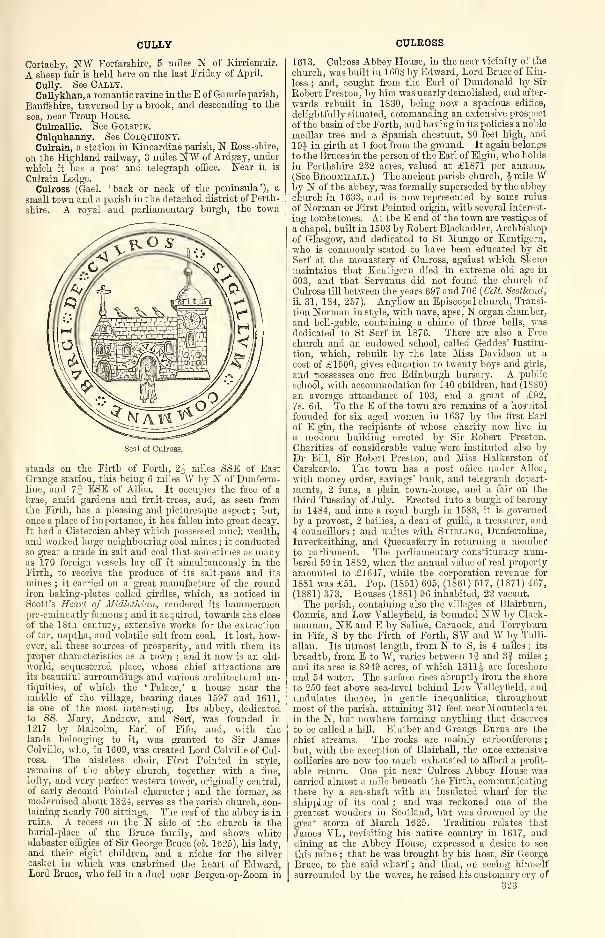
CULLY
Cortachy, NW Forfarshire, 5 miles N of Kirriemuir.
A sheep fair is held here on the last Friday of April.
Cully. See Cally.Cullykhan, a romantic ravine in the E of Gamrie parish,
Banffshire, traversed by a brook, and descending to the
sea, near Troup House.
Culmallie. See Golspie.Culquhanny. See Colquhony.Culrain, a station in Kincardine parish, N Ross-shire,
on the Highland railway, 3 miles NW of Ardgay, under
which it has a post and telegraph office. Near it is
Culrain Lodge.
Culross (Gael, 'hack or neck of the peninsula'), a
small town and a parish in the detached district of Perth-
shire. A royal and parliamentary burgh, the town
Seal of Culross.
stands on the Firth of Forth, 2J miles SSE of EastGrange station, this being 6 miles W by N of Dunferm-line, and 7| ESE of Alloa. It occupies the face of a
brae, amid gardens and fruit-trees, and, as seen fromthe Firth, has a pleasing and picturesque aspect ; hut,
once a place of importance, it has fallen into great decay.
It had a Cistercian abbey which possessed much wealth,
and worked large neighbouring coal mines ; it conductedso great a trade in salt and coal that sometimes as manyas 170 foreign vessels lay off it simultaneously in theFirth, to receive the produce of its salt-pans and its
mines ; it carried on a great manufacture of the roundiron baking-plates called girdles, which, as noticed in
Scott's Heart of Midlothian, rendered its hammermenpre-eminently famous ; and it acquired, towards the close
of the 18th century, extensive works for the extraction
of tar, naptha, and volatile salt from coal. It lost, how-ever, all these sources of prosperity, and with them its
proper characteristics as a town ; and it now is an old-
world, sequestered place, whose chief attractions areits beautiful surroundings and various architectural an-tiquities, of which the ' Palace, ' a house near themiddle of the village, bearing dates 1597 and 1611,is one of the most interesting. Its abbey, dedicatedto SS. Mary, Andrew, and Serf, was founded in
1217 by Malcolm, Earl of Fife, and, with thelands belonging to it, was granted to Sir JamesColville, who, in 1609, was created Lord Colville of Cul-ross. The aisleless choir, First Pointed in style,
remains of the abbey church, together with a fine,
lofty, and very perfect western tower, originally central,
of early Second Pointed character ; and the former, asmodernised about 1824, serves as the parish church, con-taining nearly 700 sittings. The rest of the abbey is inruins. A recess on the N side of the church is theburial-place of the Bruce family, and shows whitealabaster effigies of Sir George Bruce {ob. 1625), his lady,and their eight children, and a niche for the silver
casket in which was enshrined the heart of Edward,Lord Bruce, who fell in a duel near Bergen-op-Zoom in
CULROSS
1613. Culross Abbey House, in the near vicinity of the
church, was built in 1608 by Edward, Lord Bruce of Kin-
loss ; and, bought from the Earl of Dundonald by Sir
Robert Preston, by him was nearly demolished, and after-
wards rebuilt in 1830, being now a spacious edifice,
delightfully situated, commanding an extensive prospect
of the basin of the Forth, and having in its policies a noble
medlar tree and a Spanish chestnut, 80 feet high, and19J in girth at 1 foot from the ground. It again belongs
to the Bruces in the person of the Earl of Elgin, who holds
in Perthshire 232 acres, valued at £1871 per annum.(See Broomhall. ) The ancient parish church, J mile Wby N of the abbey, was formally superseded by the abbeychurch in 1633, and is now represented by some ruins
of Norman or First Pointed origin, with several interest-
ing tombstones. At the E end of the town are vestiges of
a chapel, built in 1503 by Robert Blackadder, Archbishopof Glasgow, and dedicated to St Mungo or Kentigern,
who is commonly stated to have been educated by St
Serf at the monastery of Culross, against which Skenemaintains that Kentigern died in extreme old age in
603, and that Servanus did not found the church of
Culross till between the years 697 and 706 {Celt. Scotland,
ii. 31, 184, 257). Anyhow an Episcopal church, Transi-
tion Norman in style, with nave, apse, N organ chamber,
and bell-gable, containing a chime of three bells, wasdedicated to St Serf in 1876. There are also a Free
chinch and an endowed school, called Geddes' Institu-
tion, which, rebuilt by the late Miss Davidson at a
cost of £1500, gives education to twenty boys and girls,
and possesses one free Edinburgh bursary. A public
school, with accommodation for 140 children, had (1880)
an average attendance of 103, and a grant of £92,
7s. 6d. To the E of the town are remains of a hospital
founded for six aged women in 1637 by the first Earl
of Elgin, the recipients of whose charity now live in
a modern building erected by Sir Robert Preston.
Charities of considerable value were instituted also byDr Bill, Sir Robert Preston, and Miss Halkerston of
Carskerdo. The town has a post office under Alloa,
with money order, savings' bank, and telegraph depart-
ments, 2 inns, a plain town-house, and a fair on the
third Tuesday of July. Erected into a burgh of baronyin 1484, and into a royal burgh in 1588, it is governed
by a provost, 2 bailies, a dean of guild, a treasurer, and4 councillors ; and unites with Stirling, Dunfermline,
Inverkeithing, and Queensferry in returning a memberto parliament. The parliamentary constituency num-bered 59 in 1882, when the annual value of real property
amounted to £1647, while the corporation revenue for
1881 was £51. Pop. (1851) 605, (1861) 517, (1S71) 467,
(1881) 373. Houses (18S1) 96 inhabited, 22 vacant.
The parish, containing also the villages of Blairburn,
Comrie, and Low Valleyfield, is bounded NW by Clack-
mannan, NE and E by Saline, Carnock, and Torryburnin Fife, S by the Firth of Forth, SW and W by Tulli-
allan. Its utmost length, from N to S, is 4 miles ; its
breadth, from E to W, varies between If and 3| miles
;
and its area is 8949 acres, of which 1311J are foreshore
and 54 water. The surface rises abruptly from the shore
to 250 feet above sea-level behind Low Valleyfield, andundulates thence, in gentle inequalities, throughoutmost of the parish, attaining 317 feet near Mounteclaret
in the N, but nowhere forming anything that deserves
to be called a hill. Brother and Grange Burns are the
chief streams. The rocks are mainly carboniferous;
but, with the exception of Blairhall, the once extensive
collieries are now too much exhausted to afford a profit-
able return. One pit near Culross Abbey House wascarried almost a mile beneath the Firth, communicatingthere by a sea-shaft with an insulated wharf for the
shipping of its coal ; and was reckoned one of the
greatest wonders in Scotland, but was drowned by the
great storm of March 1625. Tradition relates that
James VI., revisiting his native country in 1617, anddining at the Abbey House, expressed a desire to see
this mine ; that he was brought by his host, Sir GeorgeBruce, to the said wharf ; and that, on seeing himself
surrounded by the waves, he raised his customary cry of
323
CULROY
'Treason.' Whereon Sir George, pointing to an elegantpinnace moored at the wharf, offered him the choice of
going ashore in it, or of returning by the way he came;
and the King, preferring the shortest way, was takendirectly ashore, expressing much satisfaction at what hehad beheld (Forsyth's Beauties of Scotland, 1S05). Iron-
stone occurs in thin seams between beds of clay slate,
in different places, though not plentifully enough to
defray the expense of working ; and a bed of limestone18 feet thick is found in one place at an awkward inclina-
tion. Fire-clay also occurs, and has been used for pot-
tery. The soil, for the most part argillaceous, is mixedin many places with sand, and rests commonly onmasses of sandstone or shale. Natives were Robert Pont(1529-1606), churchman and senator of the College of
Justice; Henry Hunter, D.D. (1741-1802), a distin-
guished divine ; and Thomas Cochrane, tenth Earl of
Dundonald (1775-1860), author of Autobiography of aSeaman. The principal mansions are Culross Abbey,Culross Park, Valleyfield, Comrie Castle, Blair Castle,
Brankston Grange, Balgownie Lodge (old but modern-ised), and Dunimarle Castle, whose ancient predecessor
was the traditional scene of the murder of Lady Macduffand her children. Seven proprietors hold each an annualvalue of £500 and upwards, 5 of between £100 and £500,and 16 of from £20 to £50. In the presbytery of Dun-fermline and synod of Fife, Culross has been a collegiate
charge since about 1640, when the town was at theheight of its prosperity ; the stipend of each ministeris on an average £200. Valuation (1871) £9328, 4s. 6d.,
(1882) feSSo^lls. 7d. Pop. (1801) 1502, (1831) 14SS,
(1861) 1423, (1S71) 1354, (1881) 1130.—Ord. Sur., sh.
39, 1869. See The Legends and Commemorative Cele-
brations of St Kcntigem (Edinb. 1872); the Rev. A. "W.
Hallen's ' Notes on the Secular and Ecclesiastical Anti-quities of Culross,' in vol. xii. of Procs. Soc. Ants. Scotl.
(1878); and D. Beveridge's Culross and Tnlliallan(Edinb. 1882).
Culroy, a hamlet in Maybole parish, Ayrshire, 3 milesN of Maybole town.
Culsalmond, a hamlet and a parish in Garioch district,
Aberdeenshire. The hamlet—a farm-house, the church,and the manse—stands at 600 feet above sea-level, nearthe left bank of the Ury, 4J miles NNE of its post-townand station, Insch, this being 27J miles NW of Aberdeen.
Containing also Colpy post-office hamlet, and boundedN by Forgue, NE by Auchterless, E by Rayne, S byOyne, SW and W by Insch, the parish has an utmostlength from N to S of 5 miles, a varying width from Eto W of If and 3| miles, and an area of 6995 acres,
of which 1 is water. The drainage is carried south-south-
eastward by the upper Ury ; and the surface, sinking in
the S to 310 feet above sea-level, thence rises northwardto 431 feet at Little Ledikin, 521 near Mellenside, 607at Fallow Hill, 107S at the wooded Hill of Skares, and1249 at the Hill of Tillymorgan. A fine blue slate wasquarried prior to 1860; and a vein of ironstone, extend-
ing across the parish from Rayne to Insch, was proved,
by specimens sent to Carron works, to contain a large
proportion of good iron. A subterranean moss, in someparts more than 8 feet deep, occurs on Pulquhite farm
;
and a strong mineral spring, said to be beneficial in
scrofulous complaints, is at Saughen-loan. The soil is
mainly a yellowish clay loam, lighter and mixed withfragments of slate on the uplands, and at Tillymorgangiving place to moss and inferior clay. Plantations covera considerable area. Cairns were at one time numerous
;
two stone circles have left some traces on Colpy farm;
two sculptured standing -stones (figured in Dr JohnStuart's great work, 1866) are on the lands of Newton
;
and stone coffins, flint implements, etc., have beenfrom time to time discovered. Newton and William-ston are the principal mansions ; and 5 proprietors
hold each an annual value of more, 3 of less, than£100. Culsalmond is in the presbytery of Gariochand synod of Aberdeen ; the living is worth £220. Theparish church, an old building, was the scene of one of
those contests that led to the Disruption ; and theneighbouring Free church, Early English in style, with
324
CULTER
a tower, was erected in 1866 at a cost of £2000, its
predecessor from 1843 having been a mere woodenshed, in the ' deep hollow of Caden.' There are also
an Independent church and Tillymorgan Episcopalchapel (1851) ; whilst Culsalmond public school (re-
built 1876) and Tillymorgan Episcopal school, with re-
spective accommodation for 150 and 64 children, had(1880) an average attendance of 100 and 43, and grantsof £61, 8s. and £33, 13s. 6d. Valuation (1881) £6415,16s. 5d. Pop. (1801) 730, (1831) 113S, (1861) 1165,
(1871) 896, (1881) 828.—Ord. Sur., sh. 86, 1876.
Culsh. See Deer, New.Culter, a station, an estate, and a rivulet on the SE
border of Aberdeenshire. The station is on the Deesiderailway, within Peterculter parish, near the influx of
Culter rivulet to the river Dee, 7f miles WSW of Aber-deen. The estate is mainly in Peterculter parish, partly
in Drumoak, and from the 13th century till 1726 be-
longed to a branch of the Curnmings. Culter Househere, 1 mile NE of the station, is a large old mansion,said to have been built by Sir Alexander dimming, who,in 1695, was created a Baronet, and whose son, Sir
Archibald (1700-75), for a time was ruler of theCherokees. It now is a seat of Rt. Win. Duff, Esq. of
Fetteresso and Glassaugh, who, born in 1835, has sat
for Banffshire since 1861, and who owns 1588 acres inthe shire, valued at £1747 per annum. The rivulet,
rising on the W border of Cluny parish, meanders 10miles eastward, through Cluny and on Cluny's boundarieswith Midmar and Edit ; expands into Loch Skene, onthe mutual boundary of Edit and Skene ; and proceedsthence 4 miles south-eastward, partly on the sameboundary partly through Peterculter, to the Dee. Its
lower reaches, with features of lake and linn, steep
banks and wooded cliffs, bridges and mills, present aseries of romantic scenes. See Peterculter.
Culter, a village in the upper ward and the E of
Lanarkshire, and a parish partly also in Peeblesshire.
The village stands upon Culter Water, 2| miles SSW of
Biggar, and 1§ mile SSE of Culter station on the
Peebles branch of the Caledonian, this being 1 J mile Wby N of Symington Junction, and 17J miles W by S of
Peebles. It chiefly consists of neat houses, emboweredamong shrubs and trees ; at it are the parish church, a
public school, and a post office under Biggar ; whilst a
Free church stands 1 mile to the N.The parish is bounded N by Biggar and Skirling, E
by the Kilbucho and Glenholm portions of Broughton,SE by Drummelzier, SAT by Crawford and Lamington,and NW by Symington. In shape resembling a rudetriangle with southward apex, it has an utmost length
froniN by W to S by E of 7| miles, an utmost breadthfrom E to W of 3-| miles, and an area of 11,932J acres,
of which 48! are water, and 1713 belong to Peeblesshire,
being also, however, claimed for Broughton. TheClyde winds 2§ miles north-north-eastward along all
the Symington border ; and its affluent Culter Water,formed by three head-streams in the southern extremity
of the parish, runs 6f miles northward and north-west-
ward, first through a narrow glen, where it makes someromantic falls, and next across a finely-wooded, culti-
vated plain. The surface sinks near Culter station, at
the NW corner of the parish, to 665 feet above sea-
level, thence rising eastward to 1345 feet on the Har-tree Hills, and southward to 820 near Cornhill, 745 at
Highfield, 939 at Nether Hangingshaw, 1187 on Snaip
Hill, 1596 on Turkey Hill, 18S0 on 'Scawdmans Hill,
2087 on *King Bank Head, 1578 on Ward Law, 2454 on*Culter Fell, 1769 on Woodycleuch Dod, 1679 onKnock Hill, 1874 on Snowgill Hill, and 2141 on *Hill-
shaw Head, where asterisks mark those summits that
culminate on the Peeblesshire border. The northern
district, including the Peeblesshire section, comprises a
considerable portion of the broad dingle extending from
the Clyde in the neighbourhood of Symington eastward
to the lower reach of Biggar Water ; with its mansions,
lawns, and groves, it presents an aspect more like that
of a rich English level than like that of a Scottish hill
region. The southern district exhibits a striking con-
CULTERCULLEN
trast to the northern, a long range of green hills, partly
planted and parked, rising steeply from the plains andgradually merging into heathy mountains, the ' divide
'
between Clydesdale and Tweeddale. The rocks include
some Devonian conglomerate, but are mainly Silurian;
whilst the soil over most of the lower grounds is a sandyloam, in the eastern part of the Peeblesshire section
inclines to clay, and on the braes and hills is light anddry. About one-third of the area is either regularly or
occasionally in tillage, and upwards of 400 acres are
under wood. The antiquities include five circular
camps, two tumuli, the remains of Cow Castle near the
eastern border, and, in the Peeblesshire portion, the site
of Hartree Tower. Culter Allers House, near thevillage, a Scottish Baronial edifice of 1S82, is the seat
of John Menzies Baillie, Esq. of Culter Allers (b. 1826;
sue. 1880), who owns 4648 acres in the shire, valued at
£2010 per annum ; and other mansions, separately
noticed, are Birthwood, Cornhill, Culter Mains, and Har-tree. In all, 3 proprietors hold each an annual value of
more, and 4 of less, than £500. Culter is in the presby-
tery of Biggar and synod of Lothian and Tweeddale ; theliving is worth £290. The parish church, built in
1S10, contains 300 sittings ; and the Free church,
dating from 1S43, was restored in 1874 at a cost ex-
ceeding £900. The public school, with accommodationfor S9 children, had (1880) an average attendance of 66,
and a grant of £64, lis. Valuation (1882) £8941,7s. 6d. , of which £2141, 14s. 6d. was in Peeblesshire.
Pop. (1801) 369, (1831) 497, (1861) 665, (1871) 593,
(1881) 574.—Orel. Sur., sh. 24, 1864.
Cultercullen, a village, with a public school, in
Foveran parish, Aberdeenshire, 1J mile E by S of Udnystation, and 15 miles N by W of Aberdeen, under whichit has a post office.
Culter Mains, an estate, with a mansion, in Culterparish, Lanarkshire, 3£ miles SW of Biggar.
Cultoquhey, an estate, with a mansion, on the Wborder of Fowlis-Wester parish, Perthshire. The man-sion stands 24 miles NE of Crieff, and is a graceful
edifice in the Tudor style, after designs by Smirke.The property of the Maxtones since 1410 and earlier,
the estate is now held by Jas. Maxtone Graham, Esq.
(b. 1819 ; sue. 1846), the thirteenth in unbroken maledescent, who assumed the name of Graham on succeed-
ing in 1S59 to the lands of Redgorton, and who owns2519 acres in the shire, valued at £3117 per annum.
Cults, a parish of central Fife, containing to theW thepost-office village of Pitlessie, 4J miles SW of Cupar and2J E of its station and post-town, Ladybank, this being
2SJ miles N by E of Edinburgh. Bounded N byMoni-mail and Cupar, E by Ceres, S by Kettle, and W byKettle and Collessie, it has an utmost length from Nto S of 2J miles, a varying width from E to W of 9
furlongs and 2| miles, and an area of 2925 acres, of
which 95 lie detached, and 1 is water. The Eden winds3 miles north-eastward along the Collessie and Cuparborders and through the interior ; where it quits theparish in the furthest N, the surface sinks to close on100 feet above sea-level, thence rising to 698 feet nearBrotus in the SW and 622 at Walton Hill, which latter,
however, culminates just within Ceres. The rocks are
chiefly carboniferous ; and sandstone and limestone are
extensively worked, whilst coal was at one time mined.The soil, in the N, is a light brownish sand ; in the centre,
is chiefly a soft black loam ; on the sides and tops of thehills, is a strong fertile clay. A fort on the westernslope of Walton Hill is the only antiquity of Cults,
whose greatest son was Scotland's greatest painter, SirDavid Wilkie (1785-1841), born in the simple manse.His father was parish minister, and at the school hereDavie is said to have liked best ' to lie agroufe on thegrun wi' his slate and pencil,' at the church to havesketched the portraits for 'Pitlessie Fair' (1804) andthe ' Village Politicians ' (1806). Crawford Priory is
the chief mansion, and the Earl of Glasgow is chief pro-prietor, 3 others holding each an annual value ofbetween £100 and £500, 1 of from £50 to £100, and 5 offrom £20 to £50. Giving off a portion to Springfield
CUMBERNAULD
quoad sacra parish, Cults is in the presbytery of Cuparand synod of Fife ; the living is worth £210, Thechurch, 1 mile ENE of Pitlessie, was built in 1793, and,
as enlarged in 1835, contains 430 sittings ; the interior
is adorned with a noble piece of sculpture by Chantrey,erected by Wilkie in memory of his parents. AtPitlessie also are a U.P. church and Cults public school,
which, with accommodation for 150 children, had(18S0) an average attendance of 82, and a grant of £64,17s. Valuation (1882) £6596, 17s. 8d. Pop. (1801)699, (1831) 903, (1861) 800, (1871) 767, (1881) 704.—Orel. Sur., sh. 40, 1867.
Cults, a hamlet in the Aberdeenshire section of
Banchory-Devenick parish, near the left bank of theDee, with a station on the Deeside railway, 4 milesWSW of Aberdeen, under which it has a post andtelegraph office. At it are a Free church and an en-dowed school ; and near it stands Cults House, whoseowner, Rt. Shirra-Gibb, Esq. (b. 1S47 ; sue. 1880),holds 981 acres in the shire, valued at £1669 perannum. Two stone coffins, containing human remains,were found a little to the N of this mansion in 1850
;
and three large cairns are still on the estate.
Culvain, a summit, 3224 feet high, in Kilmallie parish,
Inverness-shire, 2J miles SSE of the head of Loch Ar-chaig.
Culzean. See Colzean.Cumbernauld, a thriving town and a parish in the
detached section of Dumbartonshire. The town is
situated on the high road from Glasgow to Edinburghthrough Falkirk, 1j mile N of Cumbernauld station onthe Caledonian, and 2 miles SW of Castleeary station onthe North British, this being 15i miles NE of Glasgow,6£ W by S of Falkirk, and S1J W by N of Edinburgh.A picturesque old place, sheltered to E and SE by thegrounds of Cumbernauld House, it was created a burghof barony in 1649, and has a post office under Glasgow,a branch of the Royal Bank, a local savings' bank, 2
chief inns, gas-works, many new handsome villas, and acattle-fair on the second Thursday of May. The parishchurch here is an old building, containing 660 sittings
;
the Free church dates from 1826, having belonged to
the Original Secession, but has been lately almost rebuilt
;
and there is also a new U.P. church. Handloomweaving of checks and other striped fabrics is still
carried on, but mining and quarrying are the staple
industry. Pop. (1861) 1561, (1871) 1193, (1881) 1064.
The parish, containing also the village of Condoerat,was disjoined from Kirkintilloch in 1649, under the
name of Easter Lenzie. It is bounded NW by Kilsyth,
NE by Denny, and E by Falkirk, all three in Stirling-
shire ; S by New Monkland, in Lanarkshire ; and W byKirkintilloch. Its utmost length, from E to W, is
7i miles ; its utmost breadth, from N to S, is 4 miles ;
and its area is 11,804 acres, of which 168J are water.
Fannyside Loch, 2J miles SE of the town, is the only
one that has not been drained of several lakes ; it is 6jfurlongs long and from 1 to 2 furlongs broad. Thenew-born Kelvin traces 3£ miles of the north-western,
and Luggie Water 4-^ miles of the southern, border;
whilst the former throughout is also closely followed by
4J miles of the Forth and Clyde Canal. The surface is
prettily diversified with gentle acclivities and fertile
vales, sinking in the W to close on 200 feet above sea-
level, and rising eastward to 4S2 feet at Croy Hill, 513near Carrickstone, 528 near West Forest, and 580 near
Garbet on Fannyside Muir, which, yielding now nothing
but gorse and heather, was, down to a comparatively
recent period, occupied by a remnant of the ancient
Caledonian Forest. Here, till at least 1571, the savage
white cattle still ran wild, since in that year a writer
complains of the havoc committed by the King's party
on the deer in the forest of Cumbernauld and its ' quhit
ky and bullis, to the gryt destructione of polecie andhinder of the commonweil. For that kynd of ky andbullis lies bein keipit this money yeiris in the said
forest ; and the like was not mentenit in ony uther
partis of the lie of Albion.' The rocks are partly erup-
tive, partly belong to the Carboniferous Limestone325
CUMBRAE, GREAT, BIG, OR MEIKLE
series. A colliery is at Netherwood ; ironstone has beenmined to a small extent by the Carron Company ; andlimestone, brick -clay, sandstone, and trap are all of themlargely worked, the sandstone for building, the trap for
road-metal, paving, and rough masonry. The soil
varies in quality, but is chiefly a deep clay of tolerable
fertility. Fully eleven-sixteenths of the entire area are
under the plough ; woods may cover one-sixteenth more
;
and the rest is pastoral or waste. Antoninus' Wall,traversing all the northern border, nearly in the line of
the canal, has left some scanty remains ; and a Romanroad, leading southward from Castlecary, is partially
traceable on Fannyside Muir. On the standing-stone
of Carrickstone Bruce is said by tradition to haveplanted his standard, when marshalling his forces onthe eve of the battle of Bannockburn ; and pre-Reforma-tion chapels are thought to have existed at Achenbee,Aehenkill, Chapelton, Kildrum, Kilmuir, and Croy.
Cumbernauld House, standing amid an extensive park,
\ mile ESE of the town, superseded an ancient castle,
which, with its barony, passed about 1306 from the
Comyns to Sir Robert Fleming, whose grandson, Sir
Malcolm, was lord of both Biggar and Cumbernauld;
it is now a seat of John William Burns, Esq. of Kilma-hew (b. 1837 ; sue. 1871), owner of 1670 acres in the
shire, valued at £3391 per annum. Other mansionsare Dnllatur House, Nether Croy, and Greenfaulds ; and4 proprietors hold each an annual value of £500 andupwards, 16 of between £100 and £500, 12 of from £50to £100, and 35 of from £20 to £50. Taking in quoadsacra a small portion of Falkirk parish, Cumbernauld is
in the presbytery of Glasgow and synod of Glasgow andAyr ; the living is worth £380. Three public schools
—
Cumbernauld, Condorrat, and Arns—and DrumglassChurch school, with respective accommodation for 350,
229, 50, and 195 children, had (1SS0) an average at-
tendance of 225, 98, 30, and 171, and grants of £230,6s. 6d., £90, 3s., £41, 5s., and £162, 8s. 6d. Valuation(1S60) £15,204, (1SS2) £25,098, 15s. Pop. (1S01) 1795,
(1831) 3080, (1861) 3513, (1871) 3602, (1881) 4270.—Ord. Sur., sh. 31, 1867.
Cumbrae, Great, Big, or Meikle, an island of Bute-shire in the Firth of Clyde, 2J miles E of Bute at the
narrowest, and 1J mile WSW of Largs in Ayrshire.
Resembling a pointed tooth in outline, with Farlandand Portachur Points for fangs, and between them the
town of Millport on isleted Millport Bay, it has anutmost length of 3f miles from NNE to SSW, viz., fromTomont End to Portachur Point ; an utmost width,
from E to W, of 2 miles ; a circumference of 10J miles;
and an area of 3120J acres. A road has been lately
formed right round the island, whose immediate sea-
board is a low, flat beach, backed generally by steepish
slopes, and, to the SE, by bolder but verdure-clad cliffs
that rise to 302 feet within 3 furlongs of the shore, andpresent in the Lion Rock a quasi-miniature of Arthur's
Seat. The interior is hilly, culminating at 417 feet
towards the centre of the island, to the W of three little
lochs, one of which sends off a rivulet southward to
Millport Bay. The principal rock is Old Red sandstone,
disrupted and overlaid by various traps. The sand-
stone is similar to that of the mainland, from which it
appears to have been severed by sea erosion ; the traps
are chiefly greenstone, and in the form of dykes havestrangely altered the sandstone strata, fusing and recon-
solidating them into a dark quartz -like substance.
Many of the dykes, having better withstood the de-
nudating influence of air and water, stand out boldly
from the sandstone ; and two especially, to the SE, look
like Cyclopean walls, 100 and 205 feet long, and 40 and75 feet high. These are deemed, in the island folklore,
to be remains of a huge bridge, reared by witchcraft
and devilry to link Cumbrae to the Ayrshire coast. Thesoil is varied. On the higher parts of the island it is
light, gravelly, and thin, bedded on moss, and covered
with heath ; in some of the valleys is a fertile loam, andproduces excellent crops ; along the E coast is light andsandy ; and in the S abounds in marl. Draining, sea-
weed manuring, and liming have effected great improve-326
CUMLODDEN
ments ; and wheat, early potatoes, and turnips are veryextensively grown. Most of the farms carry stocksof from 20 to 40 dairy cows. The climate is bothhealthy and pleasant, less moist than that of Arranor the mainland. Included once in the Hebrides,Cumbrae was held by the Norsemen ; and, after
its cession to Scotland, belonged for some time tothe Stewarts, who later mounted the throne. A cairnon the NE coast and the remains of Billikellet arethe only antiquities, as no traces are left of the campthat Haco is said to have formed on the eve of the battleof Largs. In 1609 we find the captain of DumbartonCastle complaining that ' Robert Huntar of Huntarstonand Thomas Boyd, provost of Irwyn, had gone to theIsle of Comra, and tane away all the hawks thereon,'which hawks, it appears, were a famous breed belongingto the king. The Garrison is the only mansion, andits owner, the Earl of Glasgow, divides the island
with the Marquis of Bute ; but 7 feuars hold each anannual value of between £100 and £200, 30 of from £50to £100, and 59 of from £20 to £50. By itself GreatCumbrae is a parish in the presbytery of Greenock andsynod of Glasgow and Ayr ; the living is worth £160.Places of worship are noticed under Millport ; and apublic school, with accommodation for 300 children, had(1880) an average attendance of 185, and a grant of
£156, 14s. Valuation (1882) £16,910. Pop. (1801)506, (1831) 912, (1861) 1236, (1871) 1613, (1881) 1856.—Ord. Sur., sh. 21, 1870. See D. Landsborough'sExcursions to Arran and the two Cumbraes (Edinb. 1851),and Arch. M'Neilage, ' On the Agriculture of Buteshire
'
in Trans. Highl. and Ag. Soc, 1881.
Cumbrae, Little, an island of Buteshire,* 1£ mileSSW of Millport, and about the same distance E of thesouthern extremity of Bute and W of the Ayrshirecoast. Triangular in shape, with base to SW and apexto NNE, it has an utmost length and breadth of Ifmile and 7| furlongs, whilst its area is estimated at 700acres. The surface rises, in a series of terraces, to 409feet above sea-level toward the middle of the island,
and, with exception of a few patches of potatoes andordinary garden produce, is all wild moorland, burrowedby rabbits, and grazed by scattered sheep. The geolo-
gical formation is Secondary trap, resting on a sub-
stratum of Old Red sandstone. A circular lighthouse,
30 feet high, the earliest but one in Scotland, was built
on the highest point about 1750, and commands a mag-nificent panoramic view ; but has been superseded byanother lighthouse on the western coast, which wasbuilt in 1826, raises its lantern 106 feet above highwater, and shows a fixed light, visible at a distance of
15 miles. A strong old tower, on an islet off the Ecoast, believed to have been erected as a watch-postagainst the Scandinavian rovers, was surrounded by a
rampart and a fosse, and accessible only by a draw-bridge. It belonged to the Eglinton family, who still are
proprietors of the island;gave refuge, in times of trouble,
to that family's friends ; was surprised and burned bythe troops of Oliver Cromwell ; and now is roofless anddilapidated. On the NE slope of the hill are the tomband ruined chapel of St Vey. Valuation (1882) £308.
Pop. (1831) 17, (1861) 20, (1871) 11, (1881) 23.
Cuminestown, a straggling village in Monquhitterparish, N Aberdeenshire, 6 miles ESE of Turriff, underwhich it has a post office, with money order and savings'
bank departments. Founded in 1763 by Cumine of
Auchry, it contains a branch of the Aberdeen Town andCounty Bank and the plain Episcopal chapel of St Luke(1844 ; 130 sittings), whilst adjoining the parish churchand Free church of Monquhitter. A fair is held at it onthe Thursday after 27 April. Pop. (1841) 477, (1861)
459, (1871) 572, (1881) 565.
Cumlodden, a quoad sacra parish in Glassary andInverary parishes, Argyllshire, on the NW side of LochFyne, its church (1841 ; 300 sittings) standing 1 mile
WSW of Furnace and 8 miles SW of its post-town,
Inverary. Constituted in 1853, it is in the presbytery
* Little Cumbrae is assigned in the census to West Kilbride, butto Ardrossan in the Ordnance maps and valuation rolls.
CUMLODEN
of Inverary and synod of Argyll ; the minister's stipendis £120. Two public schools, Cumlodden and Furnace,with respective accommodation for 78 and 110 children,
had (1880) an average attendance of 48 and 78, andgrants of £23, 10s. "2d. and £78, 6s. Pop. of q. s.
parish (1871) 826, (1881) 837 ; of registration district of
Cumlodden and Minard (1881) 1142.
Cumloden, a summer residence of the Earl of Gal-
loway in Minnigatf parish, Kirkcudbrightshire, pictur-
esquely seated upon Penkill Water, 2 miles NE of
Newton-Stewart.Cummertrees, a village and a coast parish of Annandale,
Dumfriesshire. The village stands, f mile inland, onPow Water, near Cummertrees station on the Glasgowand South-Western railway, llf miles ESE of Dumfries,and 3J W of Annan, under which it has a post office.
The parish, containing also the village of Powfoot,and comprising, since 1609, the ancient parish or chapelryof Trailtrow, is bounded N by St Mungo and Hoddam, Eby Annan, S by the Solway Firth, and W by Ruthwelland Dalton. Its utmost length, from N to S, is 5J miles
;
its breadth, from E to W, varies between 2J and 4
J
miles ; and its area is 11,7474 acres, of which 2206J are
foreshore and 75J water. The river Annan winds 24miles E by S along all the northern boundary ; and PowWater, entering from Ruthwell, flows through theinterior south-eastward to the Firth, which here at highwater has a breadth of 4 to 6 miles, at low of only 3 to 7
furlongs. At flow of tide, its waste of level sand is
swept by the Solway's celebrated ' bore,' which, rushingupwards at the speed of 8 or 10 miles an hour, roars
with a tumult heard over'all the parish, and sometimes 12or 15 miles further northward. The seaboard, 3J mileslong, is low and sandy, in the E alone attaining to 65feet above sea-level ; but, however featureless by nature,it has its interest as one of the scenes in Scott's novel of
Redgauntlet. Inland the ground rises slowly northwardto 87 feet near Hurkledale, 160 at Muirhouse, 183 at
Upper Mains, 242 near Norwood, and 350 on RepentanceHill, from which again it descends rather rapidly to
less than 100 feet along the Annan. The rocks are
mainly Devonian. Limestone, 30 feet thick and contain-ing 96 per cent, of carbonate of lime, is extensivelyworked at Kelhead ; and sandstone has been got fromtwo quarries. The soil is sandy along the coast ; insome of the central parts is a fertile loam incumbenton limestone ; and northward is loam incumbent onsandstone, whilst elsewhere it ranges from a thin wetclay incumbent on hard till, and requiring much manureand labour, to reclaimed bog, drained and improved atgreat expense. About 6200 acres are regularly oroccasionally in tillage, and 1300 under wood. In afield called Bruce's Acres, on the farm of Broom,Robert Bruce is said to have sustained a severe repulsefrom the English. Hoddam Castle and the Tower ofRepentance, the chief antiquities, are separately noticed,as also are the mansions of Kinmount and Murray-thwaite. The Marquis of Queensberry is much the largest
proprietor, 5 holding each an annual value of £500 andupwards, 1 of between £100 and £500, and 2 of from£20 to £50. Giving off a small portion to Bridekirkquoad sacra parish, Cummertrees is in the presbyteryof Annan and synod of Dumfries ; the living is worth£200. The church, which was founded by RobertBruce has been repeatedly rebuilt and enlarged, andnow contains 450 sittings. Two public schools, Cum-mertrees and Trailtrow, with respective accommodationfor 130 and 44 children, had (1880) an average attend-ance of 86 and 32, and grants of £69, lis. and £39, 10s.
Valuation (1882) £9607, 13s. 5d. Pop. of civil parish,
(1801) 1633, (1831) 1407, (1861) 1232, (1871) 1116,(1881) 1092; of quoad sacra parish (1871) 1072, (1881)1068.—On?. Sur., shs. 6, 10, 1863-64.Cumming's Camp. See Bouetie.Cumming's Castle. See Dalswinton.Cummingstown, a straggling coast village in Duffus
parish, Elginshire,1 J mile E of Burghead. Pop. (1851)
155, (1871) 288, (1881)244.Cummmstown. See Cuminestown.
CUMNOCK, NEW
Cumnock (Celt, cumar, 'meeting,' and oich, 'water'),
a town of Ayrshire, chiefly in Old Cumnock parish, butpartly also in Auchinleck. It lies in a sheltered hollow,
362 feet above sea-level, on the left bank of windingLugar Water, joined here by Glaisnock Burn, 5 furlongs
WSW of one station on the main line of the Glasgowand South-Western, and 4 mile N by W of another onits Ayr and Cumnock section, by rail being 15J milesSE of Kilmarnock, 494 S of Glasgow (394 vid Barrhead),
33 SW of Carstairs, 61$ SW by W of Edinburgh, 424IW of Dumfries, and 17J E by S of Ayr. With central
square, three spacious streets, and a number of narrowlanes, it presents a pleasant, well-to-do appearance, andhas a post office, with money order, savings' bank, andtelegraph departments, branches of the Bank of Scot-land, the Clydesdale Bank, and the Royal Bank, 15 in-
surance agencies, 3 hotels, a gas company, an athenaeum(1792), a fine cemetery, and 2 Saturday papers
—
the Cumnock Express (1866) and the Liberal Cum-nock Ncios (1880). Thursday is market-day, andfairs are held on the Thursday in February after OldCandlemas (cattle and horses), the Thursday after 6
March (race and hiring), the Wednesday after 6 June(cattle), the Wednesday after 13 July (cattle and hiring),
and the Wednesday after 27 October (fat stock). Thesnuff-box manufacture, so famous 50 years since, is
wholly extinct, transferred to Mauchline ; and thoughthere are two establishments for the weaving of tweedsand other woollen stuffs, a pottery, and two dairy andagricultural machine works, mining is now the staple
industry, the neighbourhood abounding in coal andblackband ironstone. The central square was formerlythe churchyard, and the present churchyard was once theplace of execution ; it contains the graves of two Cove-nanting worthies, shot here in 1685, and also the ashesof the Prophet Peden (1626-86), which, buried in Auchin-leck kirkyard, were forty days after lifted by dragoons,and reinterred at the foot of the Cumnock gallows. Theparish church, rebuilt in 1867, is a good Second Pointedstructure, with 1100 sittings, stained-glass windows, aturret clock, and a fine organ, the last erected in 1881.There are also a Free church, a U.P. church with 900sittings, a new Congregational church (1882) on theAuchinleck side of the Lugar, and a handsome RomanCatholic church (1881-82). The public school, too,
built since the passing of the Education Act, is a veryelegant and commodious edifice, among the finest in theSouth of Scotland. Having adopted the Lindsay Actin 1868, Cumnock is governed by a senior magistrateand 8 other police commissioners. Its municipal con-stituency numbered 472 in 1882, when the burgh valua-tion amounted to £8043. Pop. (1S01) 1798, (1851) 2395,
(1861) 2316, (1871) 2903, (1881) 3334, of whom 93 werein Auchinleck parish.
—
Ord. Sur., sh. 14, 1863.
Cumnock, New, a village and a parish of Kyle district,
E Ayrshire. Nearly adjoining Afton-Bridgend, Path-head, and Mansfield, the village stands, 600 feet abovesea-level, on the right bank of the Nith, at the influx of
Afton Water, and has a station on the Glasgow andSouth-Western railway, 54 miles SE of Cumnock, and214 SE of Kilmarnock. At it are a post office, withmoney order, savings' bank, and telegraph departments,branches of the Bank of Scotland and the Royal Bank,9 insurance agencies, 3 chief inns, and a parish library
(1828) ; a fair is held here on 18 May.The parish, containing also the villages or hamlets of
Afton-Bridgend, Pathhead, Mansfield, Castle, ConnellPark, Craigbank, and Dalleagles, formed till 1650 partof Old Cumnock. It is bounded N by Old Cumnockand Auchinleck ; E by Kirkconnel and Sanquhar, inDumfriesshire ; SE and S by Dairy and Carsphairn, in
Kirkcudbrightshire ; SW by Dalmellington ; and NWby Ochiltree. Its greatest length is 15 miles from ENEto WSW, viz., from the Dumfriesshire border nearGlengaber Hill, to the Dalmellington boundary nearBenbain ; its breadth varies between 34 furlongs and10| miles ; and its area is 48,3574 acres, of which 261Jare water. The Nith, rising in the SW corner, winds
15f miles northward, north-eastward, and eastward327
CUMNOCK, OLD
through the interior, its left bank being closely followed,
from the village downwards, by the Glasgow and South-western railway ; of its numerous feeders here, theprincipal is Afton Water, flowing 9 miles northwardfrom the southern extremity of the parish. The drain-
age goes thus mainly to the Solway, but partly also to
the Firth of Clyde, as Black and Guelt Waters, sub-affluents of the river Ayr, trace most of the Ochiltree
and Auchinleck boundaries. North-westward of thevillage are three little lakes in a row, Meikle CreochLoch (3 x 2f furl. ), Little Creoch Loch (3 x 1\ furl. ), andBlack Loch (2x1 furl. ). The surface sinking along theshallow and sluggish Nith to less than 600 feet abovesea-level, is everywhere hilly, mountainous in the S.
Chief elevations to the left of the Nith from its source
are Prickeny Hill (1676 feet), Black Hill (1076), Cars-
gailoch HD1 (1176), Carnivan Hill (1061), High Polquheys(1027), *Craigdully Hill (1352), Corsancone Hill
(1547), Clocklowie Hill (1441), and *Niviston Hill
(1507), where asterisks mark those summits that cul-
minate on the confines of the parish ; to the right rise
Enoch Hill (1865), Benty Cowan (1560), Milray Hill
(1724), Ashmark Hill (1218), Auchincally Hill (1662),
Struthers Brae (1778), Wedder Hill (1961) Dalhanna Hill
(1177), Blackwood Hill (898), Hare Hill or the Knipe(1950), Blaokcraig Hill (2229), *Blacklarg Hill (2231),
*Alwhat (2063), and *Albang (2100). The rocks in the Sare chiefly Silurian, in the N carboniferous. Limestoneand sandstone, the latter coarse-grained and yellowish
white in hue, have both been worked in several quarries;
and coal, partly canuel, partly splint, is mined at Afton,Bank, Knoekshinnock, Lanemark, Pathhead, and SouthBoig. Galena has been got in considerable quantities onthe Afton estate ; and ironstone occurs plentifully in
bands and balls. The soil of the Silurian tracts is
chiefly of a gravelly nature, and that of the Carboni-
ferous tracts is generally argillaceous. Fully 6000acres have been reclaimed from a waste or almost un-
profitable condition since 1818 ; and now about 9300acres are either regularly or occasionally in tillage, whilst
some 270 are under wood. An ancient tumulus onPolquhaise farm was found, on removal, to contain a
sarcophagus and fragments of human bones. Onebaronial fortalice stood near the village, another at
Blackcraig, and a third near the source of the Nith ; butall have disappeared and left no vestige. In March 1882,
at Craigs, near the foot of Blackcraig, in lonely GlenAfton, a shepherd found 40 gold and over 140 silver
eoius of James V. Mansfield House, Lochside House,Craigdarroch, and Bank House are the principal man-sions ; and 10 proprietors hold each an annual value of
£500 and upwards, 5 of between £100 and £500, 3 of
from £50 to £100, and 20 of from £20 to £50. NewCumnock is in the presbytery of Ayr and sj'nod of
Glasgow and Ayr ; the living is worth £250. Theparish church, between Afton-Bridgend and New Cum-nock villages, was built in 1832, and is a handsomeedifice, containing 1000 sittings. There are also three
Free churches—New Cumnock, Afton, and Bank ; andthree public schools—Bank, Dalleagies, and New Cum-nock—with respective accommodation for 160, 85, and450 children, had (18S0) an average attendance of 182,
75, and 295, and grants of £127, lis., £30, 18s. 4d.,
and £249, 18s. Valuation (1S60) £17,496, (1S82)
£34,592, 13s. 6d., including £2934 for railway. Pop.
(1801) 1381, (1831) 2184, (1861) 2891, (1871) 3434,
(1881) 3781.—Ord. Sur., shs. 15, 14, 1864-63.
Cumnock, Old, a parish in the E of Kyle district, Ayr-shire. It contains the station and most of the town of
Cumnock, besidesasmall part of Lugar Iron-works, andformed one parish with New Cumnock till 1650, when,being curtailed by the separation of New Cumnock, it
changed its name from Cumnock to Old Cumnock. It
is bounded N and NE by Auchinleck, E and S by NewCumnock, and W by Ochiltree. Its utmost length, fromE to W, is 9J miles ; its breadth, from N to S, varies
between 9 furlongs and 4$ miles ; and its area is 14,209^
acres, of which 69-i are water. All the Auchinleckborder is traced, first, by Guelt Water, running 2| miles
328
CUNNINGHAME
north-westward to Glenmore Water ; next, by Glen-more Water, running 4§ miles west-north-westward to
form Lugar Water ; lastly, by the Lugar itself, wind-ing 7J miles west-by-southward : and a number of burnsflow northward through the interior to these three
streams. In the NW, near Pennyfadzeoch, where the
Lugar quits the parish, the surface sinks to close on 300feet above sea-level, thence rising to 693 near Whitehill,
1198 at Hogh Mount, 764 near Shield, 1081 at AvisyardHill, 1034 at Airds Hill, and 1352 at Craigdollyeart
Hill in the SE. The scenery, tame in places, in mostpresents a pleasing, finely cultivated aspect, and alongthe Lugar is often highly picturesque. The rocks are
chiefly carboniferous. Limestone and sandstone, both of
excellent quality, are worked ; and bituminous andanthracitic coal is mined. The soil by the Lugar is
frequently a fine alluvium, and elsewhere is mostly of a
clayey nature, incumbent on strong till ; but on the
higher lands is mossy. About 2000 acres are moorland,500 or so are planted, and the rest are all under the
plough. The chief antiquities are ruins of FerringzeanCastle within the policies of Dumfries House, traces of
Boreland Castle on the S side of the parish, vestiges of
a small pre-Reformation chapel on the farm of Chapel-
house, and graves or memorials of several martyrs of the
Solemn League and Covenant. Hugh Logan, ' the
Laird of Logan ' and celebrated wit of Ayrshire, resided
on Logan estate ; and James Taylor, the associate of
Miller of Dalswinton in the invention of steam-navigation,superintended the mines on that of Dumfries Houseabout the close of the 18th century. Mansions, all
separately noticed, are Dumfries House, Garrallan, Glais-
nock, and Logan ; and 6 proprietors hold each an annualvalue of £500 and upwards, 7 of between £100 and £500,21 of from £50 to £100, and 28 of from £20 to £50.
Old Cumnock is in the presbytery of Ayr and synod of
Glasgow and Ayr ; the living is worth £315, or £365with voluntary supplement from heritors. Garrallan
public, Old Cumnock public, and Old Cumnock RomanCatholic school, with respective accommodation for 1 00,
600, and 216 children, had (1880) an average attendance
of 93, 574, and 140 children, and grants of £75, 3s.,
£471, 9s., and £128, 3s. 6d. Valuation (1860) £14,424,
(1882) £27,225, 12s. 9d., including £4S99 for railways.
Pop. (1801) 1991, (1831) 2763, (1861) 3721, (1S71) 4041,
(1881) 4860.—Ord. Sur., shs. 14, 15, 1863-64.
Cumrue, Loch. See Kirkmichael, Dumfriesshire.
Cumston. See Compstone.Cunnigar, an artificial mound in Midcalder parish,
Edinburghshire, between Midcalder village and the
river Almond. On it witches are said to have been
burned in bygone days.
Cunninghame, a poor-law combination and a terri-
torial district in Ayrshire. The combination includes
only part of the district, yet extends southward into
Kyle, comprising the parishes of Ardrossan, Beith, Dairy,
Dreghorn, Dundonald, Dunlop, Galston, Irvine, Kil-
birnie, West Kilbride, Kilmarnock, Kilwinning, Loudon,Stevenston, Stewarton, and Symington. The poorhouse
contains accommodation for 279 inmates. Pop. (1871)
102,015, (18S1) 106,014.—The territorial district is the
northern one of the three districts into which Ayrshire is
divided. It comprises the parishes of Ardrossan, Beith,
Dairy, Dreghorn, p>art of Dunlop, Fenwick, Irvine, Kil-
birnie, West Kilbride, Kilmarnock, Kilmaurs, Kilwin-
ning, Largs, Loudon, Stevenston, and Stewarton ; andcontains the towns and villages of Ardrossan, Saltcoats,
Beith, Dairy, Dunlop, Fenwick, Irvine, Kilbirnie, Glen-
garnock, West Kilbride, Kilmarnock, Kilmaurs, Cross-
house, Kilwinning, Largs, Fairlie, Newmilns, Darvel,
Stevenston, and Stewarton. It is bounded N and NEby Renfrewshire, E by Lanarkshire, S by the river
Irvine, which separates it from Kyle, SW and W bythe Firth of Clyde. Its greatest length from NW to SEis 29| miles, and its greatest breadth in the opposite
direction 12| miles. The surface is pleasantly diversi-
fied with hill and dale, and rises, in the NW, into con-
siderable heights, but cannot be said to have anyinountains. The chief streams, besides the Irvine, are
CUNNINGHAMHEAD
the Rye, the Caaf, the Garnock, the Dusk, the Lugton,
the Annick, the Fenwick, and the Craufurdland or
Kilmarnock. The only considerable sheet of fresh
water is Kilbirnie Loch. Trap rocks constitute most of
the hills, but carboniferous rocks prevail elsewhere, andare rich in sandstone, limestone, ironstone, and coal.
Extensive iron-works are at Dairy and Glengarnock, andvery productive coal mines are in various places. Thedairy husbandry rose to high perfection in Dunlop,Beith, and Stewarton in the latter part of last century, andit has ever since maintained a high character throughoutmost of the district. The ancient family of De Morville,
the constables of Scotland, were in the 12th and 13th cen-
turies proprietors of almost all the land, and they are
supposed to have had their residence at either Glengar-nock or Southannan. Many other families subsequentlybecame proprietors ; and not a few of them, particularly
those of Eglinton, Glencairn, and Loudon, took a lead-
ing part in the affairs of the kingdom during its mostagitated times. The district appears to have been at
one time under the control of the corporation of Irvine,
and, for a long period prior to the abolition of feudal
jurisdictions, it formed a bailiwick under the Earls
of Eglinton. Valuation (1882) £434,248, including£38,512 for railways. Pop. (1831) 63,453, (1861) 95,593,(18S1) 105,231. See Ayrshire and Cunninghanw,Topographised by Timothy Pont, A.M., 1604-8, withContinuations and illustrative Notices by the late JamesDobie of Crummock (1S76).
Cunninghamhead, a mansion in Dreghorn parish,
Ayrshire, near Cunninghamhead station on the Glasgowand South-Western railway, this being 4 miles WNWof Kilmarnock. Its owner, Richard Kerr, Esq. (b.
1845 ; sue. 1S53), holds 560 acres in the shire, valuedat £1440 per annum.
Cunninghar. See Tillicoultry.Cunning or Currnan, a holm of about 50 acres at the
right side of the mouth of the river Doon, in Ayrshire.It formerly lay on the left side of the river, but came to
be on the right side in consequence of the river alteringits course ; and, though now in Kyle district, it belongsto the Carrick parish of Maybole.Cunningsburgh. See Conningsburgh and Dun-
ROSSNESS.
Cunnoquhie, an estate, with a handsome modernmansion, in Monimail parish, Fife, 1 mile NE of Moni-mail church, and 4J miles W by N of Cupar. Its
owner, Mrs W. Pitcairn, holds 561 acres in the shire,
valued at £937 per annum.Cunzierton, a hill (1100 feet) in Oxnam parish, Rox-
burghshire, 6j miles ESE of Jedburgh. It is crownedwith a large, double-trenched, ancient Caledonian camp
;
and is engirt, at about 150 feet from the summit, witha defensive mound.
Cupar, the north-western of the four divisions of Fife,
consistiug chiefly of the upper and middle basin of theEden, and of the parts of the seaboard of the Firth ofTay from the boundary with Perthshire to a point a fewhundred yards W of the original Tay Bridge, and nearlyopposite Dundee. It comprises the parishes of Abdie,Auchtermuchty, Balmerino, Ceres, Collessie, Creich,Cults, Cupar, Dairsie, Dunbog, Falkland, Flisk, Kettle,Kilmany, Logie, Monimail, Moomrie, Newburgh, andStrathmiglo, with parts of Abernethy and Arngask. Itslength north-eastward is about 17J miles ; and its
breadth is about 10 miles. See Fife.Cupar or Cupar-Fife, a town and a parish of central
Fife. A royal and parliamentary burgh, the politicalcapital of the shire, and a seat of considerable trade, thetown stands 100 feet above sea-level, amid undulating andrichly-wooded environs, mainly on the left bank of theEden. By road it is 12} miles S of Dundee, 10 W by Sof St Andrews, and 30 NNE of Edinburgh ; whilst bythe Edinburgh, Perth, and Dundee section of the NorthBritish it is 5J miles NE of Ladybank Junction, 25}ESE of Perth, 44 ENE of Stirling, 13} NNE of ThorntonJunction, 29 NE of Dunfermline, 33| NNE of Edin-burgh, 11} SSW of Tayport, and 16J S of Dundee viathe new Tay Bridge. It had a royal charter from
CUPAR
David II. in 1363, but prior to that appears to havebeen a royal burgh, and has made some figure in history.
A castle which stood on the eminence now called SchoolHill, but which has utterly disappeared, was the seat of
the Macduffs, Earls of Fife, who first are heard of in thereign of David I. (1124-53). Almost a hundred years
earlier, according to Leighton's Fife Illustrated, ' whenthe castle of Cupar was the residence of Macduff, thelord or Maormore of Fife, it was the scene of that horrid
tragedy, the murder of his wife and children by Macbeth,of which Shakespeare has made such a beautiful use in
his play of Macbeth. ' But Skene has shown that thewhole well-known tale of Macduff, ' Thane of Fife '—
a
title unknown to history—appears first in the Chronicleof Fordun and his interpolator Bower, i. e. , belongs to
the 14th and loth centuries (Celtic Scotland, iii. 303-306,
18S0). The court of the Stewartry of Fife was heldat this castle till the forfeiture of Albany, Earl of Fife,
in 1425, when it was transferred to Falkland. Theproverbial expression, ' He that will to Cupar maun to
Cupar,' alludes to the times when Cupar was the seat
of the ancient courts of justice for Fife, and signifies
much the same as ' A wilful man must have his ownway.' Theatrical representations, called Mysteries or
Moralities, professing to serve purposes such as now are
served by at once the pulpit and the press, were ex-
hibited on the northern slopes of the School Hill, thencalled the Playfield, for many ages till the Reformation—among them Sir David Lindsay's Satyre of the ThrieEstailis (1535), that scathing attack on the priests,
which has been termed ' by far the greatest interlude ir
English literature.' Whether Sir David was born in
Monimail at the Mount or in East Lothian is a mootquestion, but there is no doubt that the Mount was his
property and frequent residence, and that he sat for Cuparin the parliaments of 1542 and 1543. Many of the
kings and princes of Scotland, including nearly all the
Jameses, Mary of Guise, Queen Mary, and Charles II.
,
visited the town, and were entertained by its magistrates,
Charles getting ' some desert to his foure houres in the
Tolbooth, and a musicke song or two from Mr AndroAndersone, scholemaster ther for the tyme,' 6 July 1650.
John Knox, in 1560, preached here to the Lords of theCongregation ; and a noted conference was held in the
previous year, on Tarvit Hill, 1| mile to the S, betweenthe Congregation and Mary of Guise, the Queen Regent.The Rev. William Scot, who wrote the Apologetical
Narration of the State of the Kirk of Scotland, wasminister of Cupar from 1595 till 1642, and at his ownexpense erected the spire of the parish church, whichstill exists. A handsome mural tombstone to his memoryis still to be seen in the churchyard, though its Latininscription is quite illegible. In the churchyard, too,
is a plain upright stone inscribed :
—' Here lies interred
the heads of Laur. Hay and Andrew Pitulloch, whosuffered martyrdom at Edinburgh, July 13th, 1681, for
adhering to the Word of God and Scotland's covenantedwork of reformation ; and also oue of the hands of DavidHackston of Eathillet, who was most cruelly murderedat Edinburgh, July 30th, 16S0, for the same cause.'
Which Hackston was one of the twelve murderers of
Archbishop Sharp on Magus Muir in 1679. At Cupar,in 1718, the Archbishop's descendant, Sir James Sharp,Lord George Murray, and Sir David Threipland of
Fingask were arraigned for their share in the '15, butthe proceedings against them proved abortive. John,Lord Campbell (17S1-1S61), Chancellor of England, wasborn in a house still standing in the Crossgate, his
father being parish minister ; and the Life of himby his daughter, published in 18S0, contains much of
interest relating to Cupar. Another native was theportrait and landscape painter, Charles Lees, R.S.A.(1800-80).
Old Cupar lay all on the left or N side of the Eden,and had six gates or ports at thoroughfares which mostlyretain their ancient names. The West Port stood at
the W end of Bonnygate ; the Lady Port towards thenorthern extremity of Lady Wynd; the East Portalmost opposite the Town Hall ; the Bridge Port at
329
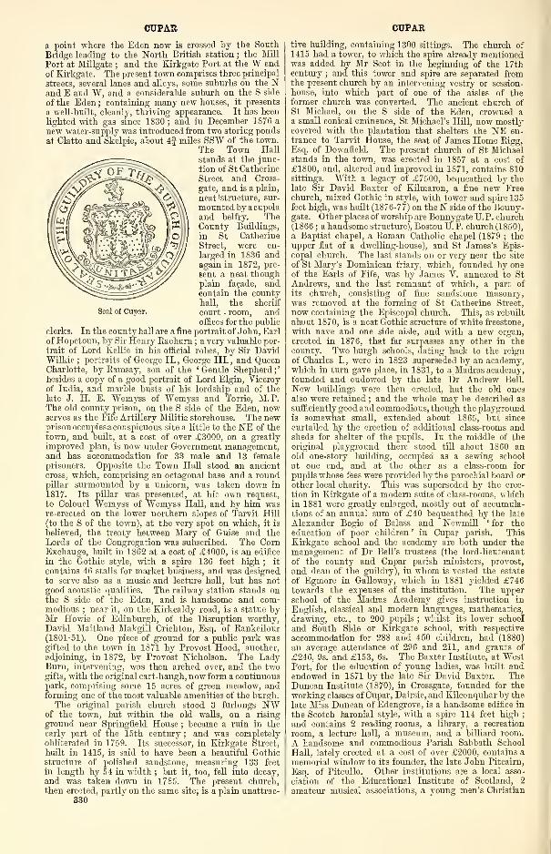
Seal of Cupar.
CUPAR
a point where the Eden now is crossed by the SouthBridge leading to the North British station ; the Mill
Port at Millgate ; and the Kirkgate Port at the W endof Kirkgate. The present town comprises three principal
streets, several lanes and alleys, some suburbs on the Nand E and W, and a considerable suburb on the S side
of the Eden ; containing many new houses, it presents
a well-built, cleanly, thriving appearance. It has been
lighted with gas since 1830 ; and in December 1876 a
new water-supply was introduced from two storing pondsat Clatto and Skelpie, about 4§ miles SSW of the town.
The Town Hallstands at the junc-
tion of St Catherine
Street and Cross-
gate, and is a plain,
neat 'structure, sur-
mounted by a cupola
and belfry. TheCounty Buildings,
in St Catherine
Street, were en-
larged in 1836 andagain in 1872, pre-
sent a neat thoughplain facade, andcontain the countyhall, the sheriff
court - room, andoffices for the public
clerks. In the county hall are a fine portrait of John, Earl
of Hopetoun, by Sir Henry Raeburn ; a very valuable por-
trait of Lord Kellie in his official robes, by Sir DavidWilkie
;portraits of George II., George III., and Queen
Charlotte, by Eamsay, son of the ' Gentle Shepherd ;
'
besides a copy of a good portrait of Lord Elgin, Viceroyof India, and marble busts of his lordship and of the
late J. H. E. "Wemyss of Wemyss and Torrie, M.P.The old county prison, on the S side of the Eden, nowserves as the Fife Artillery Militia storehouse. The newprison occupies a conspicuous site a little to the NE of thetown, and built, at a cost of over £3000, on a greatly
improved plan, is now under Government management,and has accommodation for 33 male and 13 femaleprisoners. Opposite the Town Hall stood an ancientcross, which, comprising an octagonal base and a roundpillar surmounted by a unicorn, was taken down in
1817. Its pillar was presented, at hie own request,
to Colonel Wemyss of Wemyss Hall, and by him wasre-erected on the lower northern slopes of Tarvit Hill
(to the S of the town), at the very spot on which, it is
believed, the treaty between Mary of Guise and theLords of the Congregation was subscribed. The CornExchange, built in 1862 at a cost of £4000, is an edifice
in the Gothic style, with a spire 136 feet high ; it
contains 46 stalls for market business, and was designedto serve also as a music and lecture hall, but has notgood acoustic qualities. The railway station stands onthe S side of the Eden, and is handsome and com-modious ; near it, on the Kirkcaldy road, is a statue byMr Howie of Edinburgh, of the Disruption worthy,David Maitland Makgill Crichton, Esq. of Rankeilour(1801-51). One piece of ground for a public park wasgifted to the town in 1871 by Provost Hood, another,
adjoining, in 1872, by Provost Nicholson. The LadyBurn, intervening, was then arched over, and the twogifts, with the original cart-haugh, now form a continuouspark, comprising some 15 acres of green meadow, andforming one of the most valuable amenities of the burgh.The original parish church stood 3 furlongs NW
of the town, but within the old walls, on a rising
ground near Springfield House ; became a ruin in theearly part of the 15th century ; and was completelyobliterated in 1759. Its successor, in Kirkgate Street,
built in 1415, is said to have been a beautiful Gothicstructure of polished sandstone, measuring 133 feet
in length by 54 in width ; but it, too, fell into decay,
and was taken down in 1785. The present church,then erected, partly on the same site, is a plain unattrac-
330
CUPAR
tive building, containing 1300 sittings. The church of
1415 had a tower, to which the spire already mentionedwas added by Mr Scot in the beginning of the 17thcentury ; and this tower and spire are separated fromthe present church by an intervening vestry or session-
house, into which part of one of the aisles of theformer church was converted. The ancient church ofSt Michael, on the S side of the Eden, crowned aa small conical eminence, St Michael's Hill, now mostlycovered with the plantation that shelters the NE en-
trance to Tarvit House, the seat of James Home Rigg,Esq. of Downfield. The present church of St Michaelstands in the town, was erected in 1857 at a cost of
£1800, and, altered and improved in 1871, contains 810sittings. With a legacy of £7500, bequeathed by thelate Sir David Baxter of Kilmaron, a fine new Freechurch, mixed Gothic in style, with tower and spire 135feet high, was built (1876-77) on the N side of the Bonny-gate. Oth er places of worship are Bonnygate U. P. church(1866 ; a handsome structure), Boston U. P. church (1850),
a Baptist chapel, a Roman Catholic chapel (1879 ; theupper flat of a dwelling-house), and St James's Epis-copal church. The last stands on or very near the site
of St Mary's Dominican friary, which, founded by oneof the Earls of Fife, was by James V. annexed to StAndrews, and the last remnant of which, a part of
its church, consisting of fine sandstone masonry,was removed at the forming of St Catherine Street,
now containing the Episcopal church. This, as rebuilt
about 1870, is a neat Gothic structure of white freestone,
with nave and one side aisle, and with a new organ,
erected in 1876, that far surpasses any other in thecounty. Two burgh schools, dating back to the reign
of Charles I., were in 1823 superseded by an academy,which in turn gave place, in 1831, to a Madras academy,founded and endowed by the late Dr Andrew Bell.
New buildings were then erected, but the old onesalso were retained ; and the whole may be described as
sufficiently good and commodious, though the playgroundis somewhat small, extended about 1865, but since
curtailed by the erection of additional class-rooms andsheds for shelter of the pupils. In the middle of theoriginal playground there stood till about 1860 anold one-story building, occupied as a sewing school
at one end, and at the other as a class-room for
pupils whose fees were provided by the parochial board or
other local charity. This was superseded by the erec-
tion in Kirkgate of a modern suite of class-rooms, whichin 1881 were greatly enlarged, mostly out of accumula-tions of an annual sum of £40 bequeathed by the late
Alexander Bogie of Balass and Newmill ' for the
education of poor children ' in Cupar parish. ThisKirkgate school and the academy are both under the
management of Dr Bell's trustees (the lord-lieutenant
of the county and Cupar parish ministers, provost,
and dean of the guildry), in whom is vested the estate
of Egmore in Galloway, which in 1881 yielded £746towards the expenses of the institution. The upperschool of the Madras Academy gives instruction in
English, classical and modern languages, mathematics,
drawing, etc., to 200 pupils ; whilst its lower school
and South Side or Kirkgate school, with respective
accommodation for 288 and 450 children, had (1880)
an average attendance of 296 and 211, and grants of
£246, 9s. and £153, 6s. The Baxter Institute, at WestPort, for the education of young ladies, was built andendowed in 1871 by the late Sir David Baxter. TheDuncan Institute (1870), in Crossgate, founded for the
working classes of Cupar, Dairsie, and Kilconquhar by the
late Miss Duncan of Edengrove, is a handsome edifice in
the Scotch baronial style, with a spire 114 feet high;
and contains 2 reading-rooms, a library, a recreation
room, a lecture hall, a museum, and a billiard room.
A handsome and commodious Parish Sabbath School
Hall, lately erected at a cost of over £2000, contains a
memorial window to its founder, the late John Pitcairn,
Esq. of Pitcullo. Other institutions are a local asso-
ciation of the Educational Institute of Scotland, 2
amateur musical associations, a young men's Christian
CUPAR
association, an Established Church young men's mutualimprovement society, a floral and horticultural society,
chess, curling, golf, cricket, bowling, and athletic games'
clubs, 4 masonic lodges, a property investment company,2 friendly societies, a temperance society, and GoodTemplars' and Foresters' lodges.
The town has a head post office, with money order,
savings' bank, insurance, and railway telegraph depart-
ments, offices of the Royal, National, Commercial,Clydesdale, and British Linen Co. 's banks, a national
security savings' bank, 23 insurance agencies, 5 hotels,
and 3 weekly newspapers—the Thursday Liberal Fife
Herald (1822), the Thursday Conservative Fifeshire
Journal (1833), and the Saturday Fife News (1870).
A weekly corn market is held on Tuesday ; a horse
and cattle market on the first, and an auction martfor cattle on the first and third, Tuesdays of every
month ; fairs and feeing markets on the first Tuesdayof August and either on 11th November or the fol-
lowing Tuesday. Large trade is done in the selling andgrinding of corn ; and other industries are brewing,
malting, dyeing, tanning, flax-spinning, and the weavingof all kinds of linens ; whilst much business accrues
from the town's position and character as the political
capital of the county. It was distinguished, too, at
one time for the production of beautiful specimens of
typography and the publication of many useful books,
Cupar being then the seat of publication for St AndrewsUniversity. The earliest extant charter constituting
Cupar a royal burgh is David II. 's of 1363. The burghis governed by a provost, 3 bailies, a dean of guild, a
treasurer, and 12 councillors, who also act as police
commissioners ; and it unites with St Andrews, Crail,
Kilrenny, the Anstruthers, and Pittenweem in sendinga member to parliament. A guildry exists apart fromthe dean of guild court, a shadowy relic of the old times
of monopoly, that lingers on chiefly or solely because
its president is ex officio a trustee of the Madras academy.Five incorporated trades—hammermen, wrights, weavers,
tailors, and fleshers—also prolong a formal existence fromthe past. The municipal constituency numbered 725and the parliamentary 733 in 1882, when the annualvalue of real property within the burgh amounted to
£20,830, 10s. id. (£15,178 in 1871), whilst the corpora-
tion revenue for 1881 was £193. Pop. of parliamentaryburgh (1851) 5605, (1861) 5029, (1871) 5105, (1881)5010. Houses (1881) 1118.
The parish, containing also the villages of Brighton,Springfield, and Gladney, comprises the ancient parish
of St Michael-Tarvit, annexed in 1618. It is boundedN by Kilmany and Dairsie, E by Dairsie and Kemback,S by Ceres and Cults, W by Monimail, and NW byMoonzie. Its greatest length, from N to S, is 3g miles
;
its greatest breadth, from E to W, is 3J miles
;
and its area is 5737 acres, of which 1^ are water.
The river Eden winds 4f miles north-eastward and east-
north-eastward along the Ceres border and through theinterior ; it originally traced all the boundary betweenCupar proper and St Michael-Tarvit, but, in conse-
quence of an artificial straightening of its course at
the town, has now a small portion of St Michael'son its N bank. Lady Burn, coming in from Moni-mail, and receiving an affluent from the confines of
Dairsie, drains most of the northern district, and falls
into the Eden at the E end of the town. The sur-
face is beautifully diversified by undulations or rising-
grounds, and makes a rich display of culture and wood.In the extreme E the Howe of Fife or Strathedendeclines to less than 80 feet above sea-level, thencerising to 313 feet at Hawklaw and 400 at KilmaronHill on the left, and to 600 at Tarvit Hill on theright, side of the Eden. A ridgy mound of fresh-watergravel, commencing at the School Hill, the site of theancient castle of Cupar, strikes northward up the flankof Lady Burn, and runs in a serpentine direction till it
culminates in a sort of peak—the Mote or Moat Hill,
traditionally said to have been the meeting-place ofcouncils of war and courts of justice under the ' Thanesof Fife.' Sandstone conglomerate prevails along the
CURLING HALL
Lady Burn, and elsewhere white sandstone of excellent
building quality ; whilst trap rocks, chiefly greenstoue
and clinkstone, form most of the rising-grounds. Thesandstone is worked in four quarries, the greenstone in
two. The soil, in the N and the E, is chiefly a friable
loam on a gravelly subsoil ; in the S and the W, is
more inclined to sand ; but, almost everywhere, hasbeen highly improved, and produces the finest crops.
The mansions are Kilmaron, Tarvit, Springfield, WemyssHall, Dalgairn (formerly Dalyell Lodge), Hilton, Cairnie,
Pitbladdo, Prestonhall, Foxton, Ferrybank, Belmore,Bellfield, Bonville, Blalowan, and Westfield, and mostof them are separately noticed. Six proprietors holdeach an annual value of £500 and upwards, 28 of between£100 and £500, 43 of from £50 to £100, and 93 of from£20 to £50. Cupar is the seat of a presbytery in thesynod of Fife ; and it includes the greater part of thequoad sacra parish of Springfield. The charge is
collegiate, the two ministers officiating alternately in
the parish church and St Michael's,"andthe living of thefirst charge being worth £448, of the second £411.An ancient chapel stood on the lands of Kilmaron.Brighton public school, with accommodation for 67children, had (18S0) an average attendance of 37, and a
grant of £26, 4s. Valuation (1866) £25,280, 6s. 5d.,
(1882) £36,480, 8s. id., plus £1680 for railway. Pop.
(1S01) 4463, (1831) 6473, (1861) 6750, (1871) 7102,
(1881) 7404.—Ord. Sur., sirs. 48, 40, 186S-67.
The presbytery of Cupar comprehends the quoad civilia
parishes of Abdie, Auchtermuchty, Balmerino, Ceres,
Collessie, Creich, Cults, Cupar, Dairsie, Dunbog, Falk-
land, Flisk, Kettle, Kilmany, Logie, Monimail, Moonzie,
Newburgh, and Strathmiglo, and the quoad sacra
parishes of Freuchie, Ladybank, and Springfield. Pop.
(1871) 30,679, (1881) 26,693, of whom 7507 were com-municants of the Church of Scotland in 1878.—The Free
Church also has a presbytery of Cupar, with churches
at Newburgh, Auchtermuchty, Ceres, Collessie, Cupar,Dairsie, Falkland, Flisk, Kettle, Logie, Monimail, andStrathmiglo, which together had 2307 communicants in
1881.—Lastly the United Presbyterian Synod has a pres-
bytery of Cupar, with 2 churches in Auchtermuchty, 2
in Ceres, 2 in Cupar, and 6 in respectively Freuchie,
Kettle, Lathones, Pitlessie, Rathillet, and St Andrews,the 12 having 2746 members in 1880.
Cupar-Angus. See Coupar-Ansus.Cupar-Grange. See Coupar-Grange.Cuparmuir, a village in Cupar parish, Fife, If mile
W of Cupar town. It consists of a few scattered cot-
tages, with a tile-work and a sandstone quarry.
Cupinshay. See Copenshay.Cur, a stream of Strachur parish, Cowal, Argyllshire,
formed by two head-streams at an altitude of 380 feet,
and running 6f miles south-westward and south-east-
ward to the head of Loch Eck. Its course, for the
first 2 miles, is rough and rapid, and forms several fine
cascades ; but lower down becomes smoother, and makesa number of beautiful turns.
—
Ord. Sur., sh. 37, 1876.
Curate's Steps, a small pass at the side of the river
Ayr, near Sorn Castle, in Sorn parish, Ayrshire. It
got its name from a tradition that an obnoxious Epis-
copalian minister fled by it from his enraged flock, in
the times of forced Episcopacy prior to 1688.
Curate's Well, a copious intermittent spring on the
glebe of Dunsyre, in Dunsyre parish, Lanarkshire. It
issues from two circular patches of soft sand, engirt withvery hard clay and gravel ; and at intervals of five or ten
minutes it bubbles up as if emitting air.
Curgarff. See Corgarf.Curgie, a small bay in Kirkmaiden parish, Wigtown-
shire, on the W side of Luce bay, 3 miles N of the Mullof Galloway.
Curlee or Caerlee. See Innerleithen.Curling Hall, an estate, with a mansion, in Largs
parish, Ayrshire, near the shore, a little S of the town.
It includes part of the battlefield of Largs, and contains
a memorial of the battle, in the form of a sculptured
stone, with an inscribed copper plate affixed to it by DrJohn Cairnie in 1S23.
331
CURE
Curr, a hill (1849 feet) in Morebattle parish, Rox-burghshire, 5£ miles E by S of Morebattle village, and
J mile from the English Border.
Curreath, an estate, with a modern mansion, in Dun-donald parish, Ayrshire, 3 miles ENE of Troon.
Currie, a village and a parish of W central Edinburgh-shire. The village, a pleasant little place, stands on thesteep left bank of the Water of Leith, here spanned bya 14th century bridge, 6 miles SW of Edinburgh, havingone station (Curriehill) on the main line of the Cale-
donian, and another (Currie) on its Balerno loop ; at it
is a post office, with money order, savings' bank, insur-
ance, and telegraph departments. Pop. (1861) 345, (1871)
329, (1881) 255.
The parish containing also the villages of Balernoand Hermiston, is bounded N by Corstorphine, E byCorstorphine and Colinton, SE by Penicuik and the
Listonshiels section of Kirkliston, SW by Midcalder,
W by Eirknewton, and NW by Ratho. Its utmostlength, from NNE to SSW, is 8J miles ; its breadthvaries between 44 furlongs and 4J miles ; and its area is
11,236 acres, of which 132J are water. The Water of
Leith, coming in from the uplands of Midcalder, winds1]- mile north-north-eastward along the Eirknewton bor-
der, next 6 miles east-north-eastward across the middleof the parish, receiving by the way Dean, Cock, andBavelaw Burns, and other still smaller tributaries.
Near the Colinton and Penicuik boundaries lie Clubbie-
dean, Harelaw, and Threipmuir reservoirs, supplyingthe Edinburgh waterworks ; and the Union Canal runs
2J miles through the northern interior in the vicinity of
Hermiston. The surface, in the N" forming part of the
Corstorphine plain, has a general southerly rise to the
Pentland Hills from less than 200 feet above sea-level to
800 on Warlaw Hill, 1250 near Craigenterry, and 800 at
East Rig. The rocks belong mainly to the Calciferous
Limestone series, traversed at Ravelrig by a mass of
diorite ; whilst just to the SE of Threipmuir reservoir is
one of three separate localities among the Pentlands,
where rocks of Upper Silurian age are so surrounded andcovered unconformably by the Lower Old Red sandstone,
that their relations to the Lower Silurian series can no-
where be ascertained. Excellent sandstone aboundsalong the left bank of the Water of Leith, especially in
the neighbourhood of Balerno, and has been largely
quarried ; limestone of inferior quality has been workedon the Malleny estate ; and a German, one Joachim Gonel,
proposed in 16S3 to open a copper-mine near East Mill,
but the scheme would seem to have fallen to the ground.
The soil of the uplands is moorish ; but that of the lowtracts is rich and highly cultivated, the rental of one or
two farms here having increased 700 per cent, withinthe last 150 years. Dairy-farming and sheep-farming
are also carried on ; and within the parish are 2 large
paper-niills and 2 snuff manufactories. Sibbald andother antiquaries identified Currie with ' Coria,' the
chief seat of the Damnonii in the 2d century, a.d.,
which Skene, however, places at Carstairs ; among its
antiquities are a supposed Roman station on Ravelrig
Hill and the ruins of Lennox Tower and Curriehill
Castle. Illustrious natives or residents were Sir ThomasCraig (1538-160S), author of Jus Feudale ; the LordClerk Register, Sir John Skene of Curriehill (1549-1612),
legal antiquary ; his son, Lord President Sir JamesSkene (15S0-1633) ; Sir Archibald Johnston, Lord War-riston (1610-63), lawyer and statesman ; Jas. Anderson,LL.D. (1739-1808), writer on agriculture; General
Thomas Scott of Malleny (1745-1841) ; John Marshall,
Lord Curriehill (1794-1S6S) ; and his son and namesake
CUTTLEHILL
(1827-81), also an eminent judge. The principal man-sions are Baberton, Curriehill, Hermiston, Lennox Lea,Lymphoy, Malleny, Ravelrig, and Riccarton ; and 13proprietors hold each an annual value of £500 and up-wards, 9 of between £100 and £500, 9 of from £50 to
£100, and 25 of from £20 to £50. Currie is in the pres-
bytery of Edinburgh and synod of Lothian and Tweed-dale ; the living is worth £395. The parish church, at
the village, successor to one that down to the reign o:
Charles I. appears to have been subordinate to thecollegiate church of Corstorphine, was built about 1785,and contains 800 sittings. A Free church for Currie
and Colinton stands at Juniper Green ; at Balernoare a UP. church and St Mungo's Episcopal chapel;and two public schools, Balerno and Currie, and BalernoEpiscopal school, with respective accommodation for
176, 200, and 126 children, had (1880) an averageattendance of 103, 122, and 57, and grants of £82,5s. 6d., £95, 18s., and £39, 4s. Valuation (I860)
£1S,692, (1882) £32,217, including £8443 for railways
and waterworks. Pop. (1801) 1112, (1831) 1883, (1861)224S, (1871) 2360, (1881) 2390.—Ord. Sur., sh. 32, 1857.
Currie, an estate, with a mansion, in Borthwick parish,
Edinburghshire. The mansion, standing on a head-stream of Gore Water, 1\ miles SE of Gorebridge, con-
sists partly of a former inn, partly of excellent additions,
and reposes among sheltering wood under the shadowof Borthwick Castle. Its owner, Stuart Brown, Esq.(b. 1818), holds 904 acres in the shire, valued at £866per annum. A previous mansion, demolished about1809, stood on a rising-ground overlooking the oldchurch and valley of Borthwick.
Curriehill, an estate, with a mansion, in Currie parish,
Edinburghshire, 1 mile SW of Curriehill station on the
Caledonian, this being 5$ miles SW of Edinburgh. Acastle, a little W of the mansion, figured as a place of
strength in the time of Queen Mary, being held by the
Queen's opponents. See Currie.Cushieville. See Coshieville.Cushnie, an ancient parish in Alford district, Aber-
deenshire, annexed in 1798 to Leochel, and now form-
ing the western section of that parish. Cushnie or
Sockaugh Hill, at the meeting-point with Towie, Logie-
Coldstone, and Tarland, 7 miles SW of Alford village,
has an altitude of 2032 feet above sea-level, and com-mands a very extensive view. Cushnie Burn, rising onthe north-western shoulder of the hill, runs 4A_ miles
east-north-eastward along Cushnie Glen and the Howeof Cushnie to a confluence with Leochel Water at Brigton
of Ininteer. Cushnie barony, originally called Cus-
senin (Gael, ch'oisinn, 'corner'), belonged, in the 12thcentury, to a family of its own name ; went by marriage,
in the early part of the 14th century, to the Leslies,
ancestors of the Earls of Rothes ; and passed, in 1628,
to the Lumsdens. The old House of Cushnie, built in
1707, has long been uninhabited ; but near it a small
neat mansion was erected by the late proprietor, the
Rev. Hy. T. Lumsden (died 1S67), whose widow holds
3000 acres in the shire, valued at £2588 per annum.His uncle, Matthew Lumsden, LL.D. (17SS-1S56), wasan eminent orientalist.
—
Ord. Sur., sh. 76, 1874. See
Leochel-Cushnie.Cuthill or Cuttle, a suburb of Prestonpans town,
Haddingtonshire. Separated from the W end of that
town by a rill, it is a dingy unpleasant place ; andformerly had a salt work, a magnesia manufactory, andan extensive pottery.
Cuttlehill, a mansion in Aberdour parish, Fife, |mile E by S of Crossgates station.
332
DAAN DALAROSSIE
DDAAN, a burn of Edderton parish, Ross -shire,
formed by two head-streams, and running 2|miles north-north-eastward to the inner DornochFirth, at Ardmore Point, lj mile W by N of
Meikle Ferry.
Daer Water, the principal head-stream of the Clyde,rising in the extreme S of the parish of Crawford and of
the shire of Lanark, at 2000 feet above sea-level, on theNE slope of Gana Hill (2190 feet), within J mile of the
Dumfriesshire border and of a sub-affluent of the Annan.Thence it runs 10J miles northward to a confluence withPowtrail Water, at a point 2J miles S of Elvanfoot ; andtheir united waters thenceforward bear the name of the
river Clyde. Traversing a dreary region of bleak moun-tains and moorish uplands, and joined by sixteen little
affluents, it has a rapid, noisy, and frolicsome current
;
enjoys high repute as a trouting stream ; and gives thetitle of Baron (ere. 1646) to the Earl of Selkirk.
—
Orel.
Sur., sh. 15, 1864.
Daharick, a moor in Midmar parish, Aberdeenshire,
said to have been the scene of a battle between Wallaceand Conryn.
Daiglen, a burn in Tillicoultry parish, Clackmannan-shire, rising at an altitude of 1750 feet, and running 1Jmile south-eastward to form with Gannel Burn the Burnof Tillicoultry.
Dailly, a village and a parish in Carrick district, Ayr-shire. The village of New Dailly stands on the left
bank of Girvan Water, 7 furlongs SSE of Dailly station,
on the Ayr and Girvan railway, this being 5i miles ENEof Girvan, and 7§ SSW of Maybole, under which it hasa post office, with money order, savings' bank, and tele-
graph departments. Greatly improved and enlargedsince 1825, it is substantially built and regularly aligned
;
at it are a principal inn, the parish and Free churches,
a public school, and a working men's club. Pop. (1841)
591, (1861) 650, (1871) 554, (1881) 696.
The parish, called anciently Dalmaolkeran ('dale of
St Eeiran '), had its church till 1691 at Old Dailly, 3|miles to the WSW ; in 1653 it was shorn of a large tract
to form Barr parish, but acquired a small annexationfrom Eirkoswald. It includes Ailsa Craig
;yet itself
at no point touches the sea, being bounded NW and Nby Eirkoswald, NE by Kirkmichael, E by Kirkmichaeland Straiton, S by Barr, SW and W by Girvan.Its utmost length, from E to W, is 7J miles ; its
breadth, from N to S, varies between H and 6 miles;
and its area is 18,078J acres, of which 82J are water.
GlRVAJJ Water, followed pretty closely by the railway,winds 9J miles west-south-westward through the north-western interior or along the northern and westernborders ; and several burns run to it from the interior.
In the SW, where it passes off into Girvan, the surface
sinks to close upon 50 feet above sea-level, thence rising
north-eastward to 500 feet at High Craighead, 329 nearKilgrammie, 700 at Quarrel Hill, and 850 at Kirk Hill
;
south-eastward and eastward to 908 at Green Hill, 1059at Hadyard Hill, 981 at Peat Rig, 1049 at Barony Hill,
1007 at Cairn Hill, and 1385 at Garleffin Fell. Therocks belong partly to the Calciferous Sandstone series,
partly to the Carboniferous Limestone ; and coal is
worked at Bargany and Dalquharran, limestone at Craig-head, while sandstone also is plentiful. The tractalong Girvan Water is a pleasant vale, fertile, richlywooded, and well cultivated ; the soil is here partlyalluvial, and elsewhere ranges from argillaceous or lightand dry, incumbent on gravel, to thin, wet, and spongyon the hills, which, naturally heathy or mossy, havebeen in places reclaimed, and almost everywhere affordgood pasturage. Baronial fortalices stood at Old Kil-kerran, Dalquharran, Brunston, and Penkill ; a chapelof St Macarius * stood at MachryMU, another of OurLady in Ladyrjlcn, and a third at AUichapel; whilst
• * In Procs. Ayr a7id Wigtown Archccol. Soc. (18S2) is a notice ofthe sole relic of this chapel—a stone supposed to have been a bap-tismal font of hijjh antiquity.
on the western shoulder of Hadyard Hill, which com-mands a magnificent view, is a doubly-entrenched camp,possibly formed in the days of Robert Bruce, and measur-ing 300 feet by 195. Natives of Dailly were the poet,
Hew Ainslie (1792-1878) ; Thos. Thomson (1768-1852),lawyer and antiquary ; and his painter brother, the Rev.Jn. Thomson of Duddingston (1778-1840) : and Prof.
Alex. Hill, D.D. (1785-1867), was minister from 1816 to1840. Mansions, all separately noticed, are Bargany,Dalquharran Castle, Kilkerran, Killochan Castle, andPenkill Castle ; and 5 proprietors hold each an annualvalue of £500 and upwards, 2 of between £100 and £500,and 6 of from £20 to £50. Dailly is in the presbyteryof Ayr and synod of Glasgow and Ayr ; the living is
worth £397. In 1881 it was all but resolved to rebuildthe parish church (1766 ; 600 sittings), but for the pre-
sent things are at a standstill. Four schools—Daillypublic, Kilgrammie public, Old Dailly public, and Wal-lacetown Works—with respective accommodation for 227,
109, 75, and 90 children, had (18S0) an average attend-ance of 168, 55, 39, and 89, and grants of £135, 14s.,
£27, 13s., £40, 14s., and £61, 4s. Valuation (1882)£16,288, 18s. 10d., plus £2618 for railway. Pop. (1801)1756, (1S31) 2074, (1861) 2050, (1871) 1932, (1S81) 2204.
—Orel. Sur., shs. 14, 8, 1863.
Dairsie, a parish in the NE of Fife, containing at its
eastern border the village of Dairsiemuir or Osnaburgh,5 furlongs NNW of Dairsie station, this being 3J milesSSW of Leuchars Junction, and 3 ENE of Cupar, underwhich it has a post office, with money order, savings'
bank, and railway telegraph departments. BoundedNW by Kilmany and Logie, N and E by Leuchars, SEby Kemback, SW and W by Cupar, the parish has anutmost length from E to W of 2| miles, a varyingbreadth from N to S of 5 furlongs and 2J miles, andan area of 2560J acres, of which 5J are water. TheEden winds 2J miles north-eastward along all the Kem-back border ; and where, close to Dairsie station, it
quits this parish, the surface declines to less than 100feet above sea-level, thence rising westward and north-westward to 505 feet on Foodie Hill, and 554 on Ckaig-foodie, which, presenting to the SW a precipitous andquasi-columnar front, commands a very extensive view.Sandstone abounds in the S ; and trap-rock is quarriedin two places. The soil, in most parts fertile, in manyis rich and deep ; and little or nothing is waste. Dairsie
Castle, a ruin on a rising-ground near the Eden, was themeeting-place of a parliament in 1335, and was occupiedby John Spottiswood, Archbishop of St Andrews, whenwriting his History of tlie Cliurch and State of Scotland.Craigfoodie is the chief mansion ; and 4 proprietors holdeach an annual value of £1000 and upwards, 2 of between£500 and £1000, 1 of from £100 to £500, and 3 of from£20 to £50. Dairsie is in the presbytery of Cupar andsynod of Fife ; the living is worth £400. The parishchurch containing 313 sittings, was 'built and adornedafter the decent English fashion ' by Archbishop Spottis-
wood in 1621. A squat, four-bayed oblong, with octa-
gonal bell-turret and dwarf-spire, it 'only shows,' saysHill Burton, ' that the hand of the builder had lost its
cunning, and that neither the prelate nor his biographerhad an eye for mediaeval art ; it is a piece of cold
mimicry, like the work of the cabinetmaker rather thanof the architect,' etc. (Hist. Scot., vii. 102, ed. 1876).
There is also a Free church ; and a public school, withaccommodation for 135 children, had (1880) an averageattendance of 112, and a grant of £90, 9s. Valuation(1882) £6573, 3s. lid. Pop. (1801) 550, (1831) 605,
(1861) 638, (1871) 687, (1S81) 693.—Ord. Sur., shs.
48, 49, 1868-65. See vol. i. of Billings' Antiquities
(1845).
Dairsiemuir. See Dairsie.Dalarossie (Gael, dail-a-rois, 'field of the point'), an
ancient parish of NE Inverness-shire, now annexed to
Moy. More populous than Moy, it lies along the Find-horn river, and on its left bank, 3| miles SW of Findhorn
333
DALAVICH
bridge and 20^ SE of Inverness, has a church (1790 ; 450sittings) and a public school.
Dalavich, an ancient parish and a registration district
in Lorn, Argyllshire. The parish, now annexed to Kil-
chrenan, lies along the loch and river of Avich, onwardto Loch Awe, on whose western shore, 14 miles WNWof Inverary, stand its church and its public school.
Pop. of district (1871) 217, (1881) 225. See Kil-CHEENAN.
Dalbarber, a village on the E border of Fowlis-Westerparish, Perthshire, 2 miles WSW of Methven village.
Dalbeattie, a thriving police burgh in Urr parish, SEKirkcudbrightshire, standing, 80 feet above sea-level, onDalbeattie Burn, 7 furlongs from its influx to UrrWater, with a station on the Glasgow and South-Westernrailway, 5£ miles ESE of Castle-Douglas, 154 NE by Eof Kirkcudbright, 14i SW of Dumfries, 108~J SSW of
Edinburgh, and 106J S by E of Glasgow. Founded as
a mere village in 1780, this ' Granite City of the South
'
owes its quick recent extension to the neighbouringquarries of Craignair in Buittle, to the opening of the
railway in 1860, and to its situation near the Urr,which, for large vessels, is navigable as high as Dub o'
Hass, 5 miles to the S, and for small craft up to quite
close to the town. It consists of a main street withothers diverging, and has a post office, with money order,
savings' bank, and telegraph departments, a branch of
the Union Bank, 1 1 insurance agencies, 4 hotels, a gas
company, a town-hall with illuminated clock, a mechanics'institute (1877), a literary association, bowling andquoiting greens, masonic, oddfellows', and foresters'
lodges, etc. There are extensive bone, paper, bobbin, saw,
and flour mills, dye-works, an iron-forge, and concrete
ivorks ; but Dalbeattie's chief industrial establishments
are the great steam granite-polishing works of MessrsNewall and Messrs Shearer, Field, & Co. , which employseveral hundreds of workmen as quarriers, hewers, andpolishers ; have furnished granite for the Liverpool docks,
the Thames Embankment, lighthouses in Ceylon, andthe paving of many large cities at home and abroad
;
and, besides other monuments, supplied that at Hughen-den to Viscountess and Viscount Beaconsfield. Hiringfairs are held on the second Tuesday of April and Octo-
ber. Dalbeattie forms a quoad sacra parish in the pres-
bytery and synod of Dumfries, its minister's stipend
being £300. A new parish church, Early English in
style, with 900 sittings and a spire 130 feet high, wasbuilt in 18S0 at a cost of £5000 ; and, at a cost of nearly
£2000, a new Free church, Romanesque in style, wasbuilt in 1881. Other places of worship are a U.P.church (1818 ; 350 sittings), an Evangelical Unionchurch, St Peter's Roman Catholic church (1814 ; 300sittings), and Christ Church Episcopal (1875), anotherEarly English edifice, with tower unfinished. A public,
a female public, and a Roman Catholic school, withrespective accommodation for 500, 65, and 154 children,
had (1880) an average attendance of 384, 57, and 80,
and grants of £327, lis. 2d., £47, 2s., and £65, lis.
Under the General Police and Improvement Act of 1862,
the burgh is governed by a senior and two junior magis-trates and six other police commissioners. Its munici-pal constituency numbered 750 in 1882, when the annualvalue of real property amounted to £9712. Pop. of
burgh (1841) 1430, (1861) 1736, (1871) 2937, (1881)
3862; of quoad sacra parish (18S1) 4132.
—
Ord. Sur.,
sh. 5, 1857.
Dalblair. See Glenmtjir.Dalcairnie Linn. See Bereeth.Dalcapon. See Dunkeld and Dowally.Dalchally, a glen in Glenisla parish, Forfarshire,
traversed by Cally Water to the river Isla at a point 6
miles N of Glenisla church.
Dalchonzie, an estate, with a modern mansion, in
Comrie parish, Perthshire, on the right bank of the
Earn, 24. miles W of Comrie village.
Dalchosnie, an estate, with a mansion, in Fortingall
parish, NW Perthshire, near the right bank of theTummel, 1 \ mile ESE of Kinloch Rannoch. Its owner,General Alastair M'lan M'Donald, of Dun Alastair
334
DALGETY
(b. 1830; sue. 1866), chief of the M'Donalds of Keppoch,holds 14,000 acres in the shire, valued at £2676 perannum.
Dalehreichard, a hamlet, with a public school, inUrquhart and Glenmoriston parish, Inverness-shire, onthe left bank of the Moriston, 1 mile W of TorgyleBridge.
Dalcross, a ruined castle in the united parish of Croyand Dalcross, NE Inverness-shire, 2 miles SE of Dalcrossstation on the Highland railway, this being 6| milesNE of Inverness. Built by the eighth Lord Lovat in
1621, it afterwards passed to the MTntoshes, whose nine-
teenth chief, Lachlan, lay here in state from 9 Dec. 1703till 18 Jan. 1704, when 2000 of the Clan Chattan fol-
lowed his remains—scanty enough, one would fancy—to
their last resting-place in Petty church. Here, too,
the Royal troops were put in array immediately before
the battle of Culloden. Dalcross stands high (362 feet
above sea-level), and commands a continuous view fromMealfourvonie to the Ord of Caithness ; it consists of
two square, lofty, corbie-gabled blocks, joined to eachother at right angles. See Croy.
Dalcruive or Dalcrue, a place in Methven parish,
Perthshire, 2 miles NE of Methven village, on the right
bank of the Almond, which here is crossed by a fine
bridge, erected in 1836-37, with one semicircular archof SO feet span.
Daldawn or Dildawn, an estate, with a modern man-sion, in Kelton parish, Kirkcudbrightshire, on the left
bank of the Dee, 3 miles SW of Castle-Douglas.
Dalduff, an ancient baronial fortalice in Mayboleparish, Ayrshire, now represented by only ruinouswalls, 3 miles SE of Maybole town.
Dale, a village of Shetland, 3J miles from its post-
town, Lerwick.
Dalgain. See Sorn.Dalgarnock, an ancient parish in Nithsdale, Dumfries-
shire, annexed to Closeburn in 1697. It nearly sur-
rounded the original parish of Closeburn ; and its
beautiful churchyard, \\ mile S of Thornhill, contains
the grave and tombstone of the persecuted CovenanterJames Harkness. Here stood a village, a burgh of
barony, where a famous market-tryst was held, that
seems to have been continued after most or all of the
houses had disappeared, and is alluded to in Burns's
lines
:
1 But a' the next week, as I fretted wi' care,
I gaed to the tryst o' Dalgarnock
;
And wha but rny fine fickle lover was there !
I glowr'd as I'd seen a warlock, a warlock
;
I glowr'd as I'd seen a warlock.1
Dalgarven, a village in Kilwinning parish, Ayrshire,
on the right bank of the Garnock, contiguous to the
Glasgow and South-Western railway, 2 miles N by Wof Kilwinning town.
Dalgenross. See Dalgineoss.Dalgety or Delgaty, an estate, with a mansion, in
Turriff parish, N Aberdeenshire, 2 miles ENE of Turriff
town. For three centuries and a half the property of
the Hays of Erroll, it was sold in 1762 to Peter Garden,
Esq. of Troup, and by his son resold in 1798 to James,second Earl of Fife, whose nephew, Gen. the Hon. Sir
Alexander Duff (1778-1851), long made it his residence.
Finally it was purchased by a younger brother of the
present Governor of Madras, Ainslie Douglas Ainslie,
Esq., who, born in 1838, changed in 1866 his nameGrant-Duff to that of Ainslie, and who holds 2S22 acres
in the shire, valued at £1768 per annum. The oldest
part of Dalgety Castle, with walls more than 7 feet
thick, is older perhaps than its earliest extant date
(1579); and, added to at various periods down to the
present century, the whole is now a stately square,
winged pile, its battlements—66 feet from the ground
—
commanding a beautiful view. The grounds are finely
wooded, and contain a lake (24 x J furl.).
—
Ord. Sur.,
sh. 86, 1876.
Dalgety, a coast parish of SW Fife, containing the vil-
lages of St Davids, Fordel, and Mossgreen, with part of
Ckossqates, and traversed down to the coast at St Davids
DALGINROSS DALINTOBEE
by the Fordel mineral railway ; whilst its church stands
l| mile W by S of the post-town Aberdour, and 4^ milesW by S of Burntisland. It is bounded W and N byDunfermline, NE by Aberdour, and SE by the Firth of
Forth, here from If to 4j miles broad. Its utmostlength, from N to S, is 4£ miles ; its breadth, from E to
W, varies between 4^ furlongs and 2§ miles ; and its
area is 3710J acres, of which 357J are foreshore and 12fwater. The coast-line is fully 5J miles long, if onefollows the bends of Barnhill, Braefoot, Dalgety, andDonibristle Bays, the largest of which, Dalgety Bay,measures 6^ furlongs across the entrance, and 3J thenceto its inmost recess. From the shore, which in places
is beautifully wooded right down to the water's edge, thesurface here and there rises steeply to 100 feet andmore above sea-level, thence gently ascending through-out the interior, till close to the northern border, J mileE of Crossgates, it attains 426 feet. A darkly-woodedglen, cleaving the grounds of Fordel, is traversed by a
brook which makes a fine waterfall of 50 feet ; and abeautiful little loch is at Otterston, which still boastssome magnificent trees. Among them are a beech andan ash, 90 and 80 feet high, and 15^ in girth at 5 feet
from the ground ; but a gale of January 1882 laid lowtwo venerable walnut-trees, the largest of which girthed15| feet at 16 from the ground. The rocks are chiefly
of the Carboniferous formation, and include greatabundance of sandstone, limestone, and coal ; thelast, of very superior quality, is mined at Fordel. Thearable soil is loam, partly light and dry, more generallydeep and strong. A village of Dalgety stood at the headof Dalgety Bay, i mile SSE of the present church ; butthe ivy-clad ruins of St Bridget's kirk, dating fromthe 12th century, are all that now mark its site. FirstPointed in style, these retain a piscina and a number ofquaint old epitaphs ; whilst Chancellor Seton, first Earlof Dunfermline (1555-1622), is buried in a vault to theW. Almost the last to preach within their walls wasEdward Irving. Other antiquities are Fordel Castle anda fragment of Couston Castle, at the E end of OtterstonLoch, the retreat this of Charles I. 's persecuted chaplain,the Rev. Robert Blair (1583-1666), whose grave is atAberdour ; of Seton's favourite residence, DalgetyHouse, not so much as a stone remains. The chiefmansions are Donibristle House, Fordel House, Cook-airnie, and Otterston (15S9), the two last both theproperty of Captain Moubray, R.N. (b. 1818; sue.
1848), whose ancestor, a cadet of the Barnbougle Mou-brays, settled here in 1511, and who owns 500 acres inthe shire, valued at £794 per annum. In all, 3 pro-prietors hold each an annual value of £500 and upwards,2 of from £50 to £100, and 5 of from £20 to £50. Givingoff its northern portion to the quoad sacra parish of Moss-green, Dalgety is in the presbytery of Dunfermline andsynod of Fife ; the living is worth £358. The presentchurch, built in 1830, is a good Gothic structure, con-taining 500 sittings ; and 2 public schools, Hillendand Mossgreen, with respective accommodation for 116and 220 children, had (1880) an average attendance of102 and 168, and grants of £S0, lis. and £147.Valuation (1882) £7695, 15s. 5d. Pop. (1801) 890,(1831) 1300, (1861) 1569, (1871) 1310, (1881) 1321.—Ord. Sur.
, shs. 32, 40, 1857-67. See pp. 25-54 of J. C.R. Buckner's Rambles Round Aberdour (Edinb. 1881).
Dalginross (Gael, dail-chinn-rois, ' field at the head ofthe point '), a village in Comrie parish, Perthshire, onthe peninsula between the Water of Ruchill and theriver Earn, 3 furlongs S of Comrie town. DalginrossPlain, to the S of the village, contained two Romancamps, one of them occupying an area of 16 acres, sup-posed by some antiquaries to have been the ' Victoria
'
of the ninth Legion. See Blairinroar.Dalgnise, a village, with a Society's school, in Little
Duukeld parish, central Perthshire, on the right bankof the Tay, with a station on the Highland railway, 4Jmiles NNW of Dunkeld, under which it has a postand telegraph office. The railway crosses the Tay, Jmile N of the station, on a latticed iron-girder viaduct360 feet in span, resting on one stone pier, and terminat-
ing at each end in handsome towers and wings of
masonry 71 feet long, and there it begins to open on thebeautiful Vale of Athole. Dalguise House, near the vil-
lage, is partly an old building, partly modern ; theestate was given by William the Lyon to Dunkeldchurch, and in 1543 was transferred by Bishop Crichtonto John, second son of Steuart of Arntullie, whose de-
scendant, John Steuart, Esq., tenth Laird of Dalguise(b. 1799; sue. 1S21), holds 1750 acres in Perthshire,
valued at £1036 per annum, but is non-resident, havingbeen one of the earliest settlers in Cape Colony, wherehe is Master of the Supreme Court.
Dalhalvaig. See Reat.Dalhonzie. See Dalohonzie.Dalhousie Castle, a noble mansion in Cockpen parish,
Midlothian, on the left bank of the river South Esk, 2Jmiles S by W of Dalkeith, If mile SE of Bonnyrigg,and 1J S by W of Dalhousie station on the Waverleyroute of the North British, this being 9 miles SE of
Edinburgh. In the first half of the 12th century Simonde Ramsay received a grant of lands in Midlothian fromDavid I. ; in 1296 and 1304 William de Ramsay sworefealty to Edward I. of England for the lands of ' Dal-wolzie. ' His son, Sir Alexander, was one of the great
Scotch leaders in the War of Independence, the capturerof Roxburgh, who for reward was starved to death in
the Castle of Hermitage (1342) ; in 1400 his namesakeand fourth descendant successfully defended Dalhousieagainst Henry IV. of England. This Sir Alexanderwas slain at Homildon (1402), as was another at Flodden(1513). In 1618 George Ramsay, eleventh in descentfrom the first Sir Alexander, was raised to the peerageas Lord Ramsay of Melrose, a title changed in the fol-
lowing year to that of Lord Ramsay of Dalhousie ; andin 1633 his son and successor, William, was created Earlof Dalhousie and Baron Ramsay of Kerington. Duringhis time we find Oliver Cromwell dating his letters fromDalhousie Castle, 8 and 9 Oct. 1648. The fifth, sixth,
seventh, and ninth Earls were all of them soldiers,
George, the ninth (1770-1838), for service done in thePeninsula being raised in 1815 to the peerage of theUnited Kingdom as Baron Dalhousie of Dalhousie. Histhird son and successor, the Indian administrator, JamesAndrew Broun-Ramsay (1812-60), was born and died at
Dalhousie, at Dalhousie received a call from the Queenand Prince Albert on 4 Sept. 1S42, was Governor-General of India from 1S47 to 1S55, and in 1S49 wascreated Marquis of Dalhousie, of Dalhousie Castle andthe Punjaub. This title died with him, but those of
Earl of Dalhousie and Baron Ramsay devolved on his
cousin, Fox Maule, second Lord Panmure (1801-74),
whose cousin and successor Admiral George Ramsay(1806-80) became a peer of the United Kingdom in 1875as Baron Ramsay of Glenmark. His son, the presentand thirteenth Earl, John William Ramsay, CommanderR.N., K.T. (b. 1847), is eighteenth in descent from thefirst Sir Alexander, and holds 1419 acres in Midlothianand 136,602 in Forfarshire, valued respectively at £3452and £55,602 per annum. (See Brechin and Panmuke. )
Dating from the 12th century, Dalhousie is described bythe Queen as ' a real old Scottish castle, of reddish stone;
'
but by the ninth Earl it was so altered and enlargedthat it is hard to say how much is old and how muchmodern. Anyhow it is a stately castellated pile, withlofty tower and a fine collection of family portraits ; on10 Oct. 1867 it narrowly escaped entire destruction byfire, with the loss of the third story and attics of thecentral portion. The park is finely wooded, and thegarden of singular beauty. Less than a half mile to theNW flows Dalhousie Burn, which, rising near New-bigging, runs 5 miles north-eastward along the boundaryof Carrington with Lasswade and Cockpen, and throughthe interior of the latter parish, till near Dalhousiestation it joins the South Esk. A pretty streamlet,
with steep but wooded banks, it makes a descent fromabout 700 to less than 200 feet above sea-level.
—
Ord.
Sur., sh. 32, 1857. See Peter Mitchell's Parish ofCockpen in the Olden Times (Dalkeith, 18S1).
Dalintober, a suburban village in Campbeltown parish,
335
DALJARROCH
Argyllshire, on the N side of the head of CampbeltownLoch. Lying within the parliamentary boundaries of
Campbeltown burgh, it is a thriving place, with a sub-
stantial small pier.
Daljarroch, an estate, with a mansion, in Colmonellparish, S Ayrshire, on the right bank of the Stinchar,
near Pinmore station, and 4 miles ENE of Colmonellvillage. Comprising 1927 acres, it was sold in 1S75 for
i48,000. There is a post office of Daljarroch.
Dalkairnie Linn. See Berbeth.Dalkeith, a town and a parish in the E of Edinburgh-
shire. The town stands, 182 feet above sea-level, on a
peninsula from 3 to 5 furlongs wide between the Northand South Esks, and by road is 4£ miles S by W of
Musselburgh and 6 SE of Edinburgh, whilst, as ter-
minus of a branch line 3| furlongs long, it is 8f miles
SE of Edinburgh. It is also accessible from Eskbankstation, 5 furlongs to the SW, on the main Waverleyroute of the North British, this being 8J miles SE of
Edinburgh and 90^ N by W of Carlisle. A low andflat-backed ridge, the peninsula slopes more steeply to
the North than the South Esk ; of the town's fair sur-
roundings this picture is given in David Moir's MansieWauch
:
—' Pleasant Dalkeith ! with its bonny river,
its gardens full of gooseberry bushes and pear-trees, its
grass parks spotted with sheep, and its grand greenwoods.' The High Street widens north-eastward from30 to 85 feet, and terminates at a gateway leading up to
Dalkeith Palace, the principal seat of the Duke of Bue-cleuch, which palace, as centring round it all the chief
episodes in Dalkeith's history, must here be treated of
before Dalkeith itself.
The Anglo-Norman knight, William de Graham, a
witness to the foundation charter of Holyrood Abbey(1128), received from David I. the manor of Dalkeith
;
his seventh descendant, John de Graham, dying withoutissue about the middle of the 14th century, left twosisters, his heiresses, of whom one, Marjory, conveyedDalkeith by marriage to the Douglases. ' In myyouth,' says Froissart, ' I, the author of this book,
travelled all through Scotland, and was full fifteen daysresident with William, Earl of Douglas, at his castle of
Dalkeith. Earl James was then very young, but a pro-
mising youth,' etc. Doughty Earl James it was who,capturing Hotspur's trophy, cried out that he would set
it high on the tower of his castle of Dalkeith—a taunt
that led to the battle of Otterburn (13S8). In 1452 the
town was plundered and burned by the brother of the
murdered sixth Earl of Douglas, but the castle held out
gallantly under Patrick Cockburn, its governor ; in
1458 James II. conferred on James Douglas of Dalkeiththe title of Earl of Morton ; and at the second Earl's castle
James IV. first met his affianced Queen, the Princess
Margaret of England, 3 Aug. 1503, when, ' havinggreeted her with knightly courtesy, and passed the dayin her company, he returned to his bed at Edinburgh,very well content of so fair meeting.' In 1543, Cardinal
Beaton was committed prisoner to Dalkeith Castle,
which in 1547 had to yield to the English victors of
Pinkie after a valiant defence. James, fourth Earl of
Morton, the cruel and grasping Regent, built at Dal-
keith about 1575 a magnificent palace, richly adornedwith tapestries and pictures, and. fitter for king thansubject—the ' Lion's Den ' the country people called it.
Hither on Sunday, June 11, 1581, just nine days after
the Lion's head had fallen beneath the Maiden's axe,
James VI. returned from the parish kirk with twopipers playing before him and with the Duke of Lennox,Morton's accuser and successor. The Modern Solomonrevisited Dalkeith in 1617, when Archibald Symson, theparish minister, addressed to him a congratulatory
poem, Philomela Lalkethensis ; and in 1633 Charles I.
was here magnificently entertained. In the winter of
1637-38, following close on the Liturgy tumults, the
Privy Council adjourned from Linlithgow to DalkeithPalace, whither twelve out of the sixteen ' Tables,' or
commissioners, representing the supplicants of everyestate, came to present their menacing protestation ; andisi the spring of 1639 these Tables made themselves
336
DALKEITH
masters of the palace. Within it, besides militarystores, were found the regalia—crown, sceptre, andsword—which, with all reverence, were brought backby the nobles to Edinburgh Castle. Francis Scott,
second Earl of Buccletjch, purchased Dalkeith from theninth Earl of Morton in 1642. Dying in 1651, he left
two daughters, Mary (1648-61) and Anne (1651-1732),who, successively Countesses of Buccleuch in their ownright, married, at the early ages of 11 and 12, WalterScott of Highchester and the ill-fated Duke of Mon-mouth, both of them lads of only 14 years. The CountessMary's custodier was the celebrated General Monk, whoas such had a five years' lease of Dalkeith (1654-59), andlived there quietly, busying himself with gardening, butever regarded jealously by Cromwell. Her mother, whofor third husband had taken the Earl of Wemyss, is
described by Baillie as a witty, active woman, throughwhom Monk acted on the Scottish nobles, and throughwhom the Scottish nobles acted in turn on Monk ; andthat ' sly fellow' is said to have planned the Restorationin rooms, still extant, overhanging the Esk. Monmouthhimself must often have been here ; in 1663 he and his
child spouse were created Duke and Duchess of Buccleuchand Earl and Countess of Dalkeith. The Duchess of
the Lay of the Last Minstrel, she, after Monmouth'sexecution (1685), lived chiefly at Newark Castle in
princely style, more rarely at Dalkeith Palace, which, as
it stands to-day, was mainly built by her. Her grandsonand successor, Francis, second Duke of Buccleuch (1695-
1751), in whose time Prince Charles Edward passed twonights at Dalkeith (1 and 2 Nov. 1745), married theeldest daughter of James, second Duke of Queensberry ;
and their grandson Henry, third Duke (1746-1812),inherited the dukedom of Queensberry in 1810. With a
younger brother, assassinated at Paris in 1766, he hadmade the grand tour under the tutelage of Adam Smith ;
and he did much to improve his tenantry and vast
estates. To him Scott owed his appointment (1799) as
sheriff-depute of Selkirkshire ; and his son and successor,
Charles William Henry (1772-1S19), is also rememberedas a kindly friend to both Sir Walter and the EttrickShepherd. His son, Walter-Francis Montagu-Douglas-Scott (b. 1806 ; sue. 1819), has entertained royaltytwice, in the persons of George IV. (15-29 Aug. 1822)and Queen Victoria and Prince Albert (1-6 and 13-15
Sept. 1842). He is the fourth largest landowner in
Scotland, holding 432,338 acres, valued at £187,156 perannum, viz., 3536 in Midlothian (£28,408, including£1479 for minerals and £10,601 for Granton harbour),
253,514 in Dumfriesshire (£97,530), 104,461 in Rox-burghshire (£39,458), 60,428 in Selkirkshire (£19,828),9091 in Lanarkshire (£1544), and 1308 in Fife, Eirkcud-bright, and Peebles shires (£388). See Bowhill,Drumlanrig Castle, and Branxholm. Such are
some of the memories of Dalkeith Palace, which, crown-ing a steep, rocky knoll above the North Esk's right
bank, was mainly rebuilt by the Duchess of Monmouth in
the early years of the 18th century. Her architect, Sir
John Vanbrugh, better known for his plays than his build-
ings, chose as a model Loo Palace in the Netherlands ;
the result is a heavy-looking Grecian pile of reddish stone,
with recessed centre and projecting wings. The interior,
however, is rich in treasures of art—six family portraits
by Gainsborough and Sir Joshua Reynolds, Wilkie's
portrait of George IV., three landscapes by Claude, andother paintings by Holbein, Rembrandt, AnnibalCaracci, Van Dyck, etc., with the furniture given to
Monmouth by Charles II. The park, extending into
Newton and Inveresk parishes, and ringed by a high
stone wall, has a total area of 1035 acres, 130 of whichare occupied by a remnant of the ancient Caledonian
Forest. One kingly oak is 93 feet high, and girths 1SJfeet at 1 foot from the ground ; whilst an ash and three
beeches, with respective girth of 13j, 17, 16|, and 14Afeet, are 95, 110, 103, and 95 feet high. Landscapegardening has done much to enhance the beauties due
to an undulating surface and to the windings of the
rivers Esk, which unite 7 furlongs below the palace ; and
the formality in the general disposition of the grounds
DALKEITH
and in the planting, that offended both Gilpin andStoddart, is ever softening with the lapse of years. See
William Fraser, The Scotts of Bucclcuch (Edinb. 1878).
Apart from castle and palace, Dalkeith has nothingmore notable in its history than Mr Gladstone's electoral
address of 20 March 1880. Connected with it by birth,
education, or residence were the poet, John Rolland(flo. 1575) ; David Calderwood (1575-1650), ecclesiastical
historian ; Archibald Pitcairne (1652-1713), poet andphysician ; the judge, William Calderwood, Lord Polton
(1661-1733) ; John Love (1695-1750), Buchanan's vin-
dicator, and rector of the grammar school from 1739 till
his death ; Alexander Wedderburn, Lord Longboroughand first Earl of Rosslyn (1733-1S05), Lord High Chan-cellor of England ; the historian, Principal WilliamRobertson, D.D. (1721-93); Henry Dundas, ViscountMelville (1742-1811) ; John Kay, the caricaturist (1742-
1826), for six years 'prentice to a Dalkeith barber ;
Ralph Wardlaw, D.D. (1779-1853), an eminent divine;
Robert Mushet (1782-1828), of the Royal Mint ; andNorman Macleod, D.D. (1S12-72), who was minister
from 1843 to 1851.
Nor, apart from its church, has the town much to
show in the way of antiquities—a few old sculpturedstones let into modern buildings, ' Cromwell's orderly
house ' in Chapelwell Close, and a fragment of a piscina
in an old house near the palace gate. The market-crosshas long since disappeared, but hiring fairs are held onthe last Thursday of February, the first Thursday of
April, and the second Thursday of October ; horse andcattle fairs on the Thursday of May after Rutherglenand the third Tuesday of October, and corn markets onevery Thursday in the year.* The Corn Exchange, built
in 1855 at a cost of £3800 from designs by the late D.
Cousin of Edinburgh, is a large hall, 172 by 50 feet, and45 feet high, with open-timbered roof and a gable-front
to the High Street, adorned by a panel bearing theDuke's arms. The Town-hall, a plain old building,
stands also in the High Street ; the Foresters' hall, in
Buccleuch Street, measuring 80 by 45 feet, seats 800persons, and was erected in 1877 at a cost of £4700 ; andthe Combination poorhouse, for eleven parishes, at Gal-lowshall, accommodates 121 inmates, and was built at a
cost of £4058 in 1S49, being the first of such houses in
Scotland. Dalkeith has besides a post office, with moneyorder, savings' bank, insurance, and telegraph depart-ments, branches of the Commercial (1810), the National(1825), the Royal(1836), and theClydesdale Banks (1858),a National Security Savings' bank (1839), 20 insuranceagencies, 6 chief inns, gas-works (1827), a working men'sclub and institute (1867), a scientific association (1835),a science school (1870), an agricultural society (1836),Liberal and Conservative clubs (1879), a masonic hall, atown mission (1846), a Royal Infirmary auxiliary society
(1841), a total abstinence society (1S37), bowling,cricket, and curling clubs, two papers—the ThursdayDalkeith Advertiser and the Saturday Dalkeith Herald,etc. The streets are fairly well paved, but thedrainage is very defective, as also was the water supply,till in 1878 an arrangement was made with the Edin-burgh Water Company to bring in a fresh supply fromthe Moorfoot Hills, under their recent Extension Act,the works being carried out in 1879 at a cost of £6000.Ironfounding, brushmaking, and market-gardening arethe leading industries.
The old or East Parish church is of unknown date;
but Pope Sixtus' bull of 1475 refers to the collegiate
establishment of St Nicholas of Dalkeith, consisting ofa provost, 5 canons, and 5 prebends, as having been'founded and endowed from ancient times.' SecondPointed in style, it consists of an aisled navs (78 x 53feet), a choir (44 x 27) with trigonal apse, N and S tran-septs, and a western clock-tower and octagonal spire 85feet high. The choir, however, which, with its canopiedniches, is much more highly decorated than the rest of
_* The weekly corn market was changed from Sunday (on which
it had been held ' past memory of man ') to Thursday by an Actof the Scottish Parliament of 1581, which also appointed tlie yearlyOctober fair.
22
DALKEITH
the fabric, has long been roofless, cut off from the naveby an unsightly wall ; and forty years since nave andtransepts were ' choked with galleries, rising tier abovetier behind and around the pulpit—a curious exampleof Scotch vandalism. There was, however, something of
the picturesque in the confused cramming of these "lofts"into every nook and corner, in the quaint shields, de-
vices, and texts emblazoned in front of the seats allotted
to different guilds. The weavers reminded the congre-gation of how life was passing " swiftly as the weaver'sshuttle," and the hammermen of how the Word of Godsmote the rocky heart in pieces' (Life ofNorman Macleod,1876). Now, as restored by the late David Bryce,R.S.A.,in 1852, the church contains 760 sittings, and presentsa goodly appearance, but for the lack of the choir, inwhich are two recumbent effigies, probably of James,first Earl of Morton, and his dame, as also the graves ofthe young Countess Mary and her sister, the Duchess of
Monmouth. The West Church, on a commanding site
above the North Esk, was erected in 1840 at the cost of
the Duke of Buccleuch, and is a cruciform Early Englishstructure, with 950 sittings, and a spire 167 feet high.
King's Park U. P. church, also Early English in style,
with 700 sittings and a spire of 140 feet, was built in
1869-70 at a cost of £3300 ; and Buccleuch Street U. P.
church, a Lombardo-Venetian edifice, in 1879, at a cost
of £8767. Other places of worship are Back Street U.P.church (436 sittings), a Free church, a Congregationalchurch (300 sittings), Wesleyan, Baptist, and EvangelicalUnion chapels, St David's Roman Catholic church (1854
;
500 sittings), and St Mary's Episcopal church (1845 ; 250sittings). The last, situated just within the gateway of
the ducal park, is a beautiful Early English building,
comprising a nave with open roof, a chancel elaborately
groined in stone, and a S vestry. Back Street public
school, the new Burgh public school, and the RomanCatholic school, with respective accommodation for 204,
500, and 235 children, had (1S80) an average attendanceof 107, 340, and 135, and grants of £94, 15s., £239, 10s.,
and £117, 9s.
Under the successive holders of castle and palace,
Dalkeith was for centuries a burgh of barony ; on theabolition of hereditary jurisdictions, in 1747, the Dukeclaimed £4000 for the regality, and was allowed £3400.In terms of Acts passed between 1759 and 1S25 twelvetrustees were appointed, of whom the baron-bailie wasalways one ; but in 1878 the General Police Act wasadopted after repeated rejection, and the town is nowgoverned by a chief magistrate, 2 other magistrates, and 9
commissioners. Valuation (1882) £27,806. Pop. (1841)
4831, (1851) 5086, (1861) 5396, (1871) 6386,(1881) 6711.
The parish, containing also the village of Lugton andthe greater part of Whitehill village, is bounded NWby Newton, NE by Inveresk, E by Cranston, SE andS by Newbattle, and SW by Lasswade. Its utmostlength, from E to W, is 3| miles ; its utmost breadth,
from N to S, is 1§ mile ; and its area is 2345J acres, of
which 1^ are water. The North Esk winds 2J miles,
mostly through the interior, but partly along the Lass-
wade and Newton borders, till, near the northern ex-
tremity of the parish, it is joined by the South Esk,which, entering from Newbattle, has a northerly course
here of 2 miles. As the river Esk, their united watersflow on 1 furlong north-eastward along the Newtonboundary ; and, at the point where they pass into In-
veresk, the surface declines to 100 feet above sea-level,
thence rising gently south-south-westward and south-
eastward to 182 feet at Dalkeith High Street, 300 at
Longside, and 400 near Easter Cowden. The rocksbelong to the coal-measures of the Carboniferous forma-tion, and coal is largely worked, whilst an extensive bedof brick and tile clay occurs at Newfarm and near Gal-lowsball. The soil is generally a good deep loam, withsubsoil of clay and gravel ; and the rent of the land is
high, particularly that occupied by gardens. The Dukeof Buccleuch holds about seven-eighths of the entire
parish, 2 other proprietors holding each an annualvalue of £500 and upwards, 31 of between £100 and£500, 52 of from £50 to £100, and 113 of from £20 to
337
DALLACHY
£50. Part of Kestalrig deanery till 1592, and now theseat of a presbytery in the synod of Lothian and Tweed-dale, Dalkeith is divided ecclesiastically into East and"West parishes, the former a living worth £506. Twoschools under the landward hoard, Dalkeith public andWhitehill colliery, with respective accommodation for
163 and 121 children, had (18S0) an average attendanceof 137 and 98, and grants of £128, 9s. 6d. and £36, 10s.
Valuation (1860) £23,847; (1882) £34,868, plus £2154
for railways and waterworks. Pop. (1801) 3906, (1821)
5169, (1841) 5S30, (1861) 7114, (1871) 7667, (1881) 7707.—Qrd. Sitr., sh. 32, 1857.
The presbytery of Dalkeith, established in 1581, com-prises the ancient parishes of Borthwick, Carrington,
Cockpen, Cranston, Crichton, Dalkeith, Fala and Soutra,
Glencorse, Heriot, Inveresk, Lasswade, Newbattle, New-ton, Ormiston, Penicuik, and Temple ; the quoad sacraparishes of West Dalkeith, North Esk, Rosewell, Roslin,
and Stobhill ; and the chapelry of New Craighall. Pop.
(1871) 45,099, (1881) 50,932, of whom 8990 were com-municants of the Church of Scotland in 1878.—TheFree Church also has a presbytery of Dalkeith, compris-
ing the churches of Carlops, Cockenzie, Cockpen, Dal-
keith, Gorebridge, Loanhead, Musselburgh, Ormiston,Penicuik, Roslin, and Temple, which together had 2688members in 18S1.
Dallachy. See Bellib.Dallas, a village and a parish of central Elginshire.
The village stands on the left bank of the Lossie, 11
miles SW of Elgin, and 84 SE of Forres, under whichit has a post office.
The parish, containing also Kellas village, 3J miles
to the ENE, is bounded N by Elgin, E by Birnie, SEby Rothes and Enockando, W by Edinkillie, and NWby Rafford. Rudely triangular in outline, it has anutmost length of 10| miles from its north-eastern angle,
near Lennocside, to Carn Kitty, at its south-westernapex ; an utmost breadth from E to W of 74 miles ; andan area of 22,024| acres, of which 122 are water. TheLossie, issuing from Loch Trevie, near the south-westerncorner of the parish, winds 154 miles north-north-east-
ward and east -north -eastward through the interior,
descending in this course from 1300 to 300 feet abovesea-level ; near Lennocside, at the north-eastern corner,
it is joined by Lennoc Burn, flowing 4 miles northwardalong all the Birnie border, and forming a waterfall, theEss of Glenlatteeach ; whilst Black Burn, another of
the Lossie's affluents, runs 3| miles north-eastward alongall the boundary with Rafford, thence passing off into
Elgin. Lochs Dallas (3J x 1J furl.) and Trevie(l x 4 furl.
)
lie right upon the Edinkillie border ; Loch Coulatt (1 J x1 furl.) falls just within Knockando ; and fifteen loch-
lets, tinier still, are dotted over the south-western in-
terior. From NE to SW the chief elevations to theright of the Lossie are Mill Buie (1100 feet), Cairn Uish(1197), Meikle Hill (932), Cas na Smorrach (1146), andCarn Kitty (1711) ; to the left rise wooded Mulundy Hill
(768), another Mill Buie (1216), and Carnache (1179).
These hills are variously arable, planted, and heathy;
the straths are well cultivated, and exhibit much naturalbeauty. Granite is the prevailing rock, but sandstoneand grey slate have both been quarried ; the soil is
generally light loam on a gravelly bottom along theLossie, a vegetable mould incumbent on till in parts of
the uplands, and moor or moss along the southern bor-
der. Tor Castle, 4 mile N by E of the village, wasbuilt in 1400 by Sir Thomas Cumming of Altyke, and,long the Cummings' stronghold, consists now only ofruined outworks and a moat. The property is mostlydivided among three. Dallas is in the presbytery of
Forres and synod of Moray ; the living is worth £188.The present church, near the village, was built in 1794,and contains 250 sittings ; its ancient, heather-thatchedpredecessor was dedicated to St Michael ; and a stoneshaft, 12 feet high, in the kirkyard, surmounted by afleur-de-lis, is the old market-cross. A Free churchstands | mile NE of the village ; and two public schools,
Dallas and Kellas female, with respective accommoda-tion for 140 and 60 children, had (18S0) an average
338
DALMELLINGTON
attendance of 85 and 27, and grants of £81, 9s. 6d. and£18. Valuation (1881) £5542, 12s. Pop. (1801) 818,(1841) 1179, (1861) 1102, (1871) 1060, (1881) 915.—Ord. Sur., sh. 85, 1876.
Dallintober. See Dalintobee.Dalmahoy (Gael, dail-ma-thuath, 'field to the north'),
a mansion in Ratho parish, Edinburghshire, 14 mile Sby E of Ratho village, and 2| milesW byN of Curriehill
station. Built partly in the early years of last century,partly at subsequent periods, it has grounds of greatbeauty, commanding fine distant views, and open tostrangers. The estate, having belonged from 1296 andearlier to the family of Dalmahoy, passed in the middleof the 17th century to the Dalrymples, from whom it
was purchased about 1750 by the seventeenth Earl ofMorton ; and Dalmahoy is now the chief seat of Sholto-John Douglas, twentieth Earl of Morton since 1458 (b.
1818 ; sue. 1858), who holds 8944 acres in the shire,
valued at £9041 per annum. (See also Abeedoue andCona.) Dalmahoy Crags, overlooking the Caledonianrailway 1J mile SSW of Dalmahoy House, rise to analtitude of 6S0 feet above sea-level, stoop precipitouslyto the W, and constitute a grand feature in the generallandscape of the Western Lothians. Dalmahoy has anEpiscopal chapel, St Mary's.
Dalmally, a village in Glenorchy parish, Argyllshire,on the left bank of the Orchy, near the north-easternextremity of Loch Awe, with a station on the Callanderand Oban railway, 24| miles E of Oban, 62J WNW of
Stirling, and 16 by road NNE of Inverary. Nestlingamong trees, and at the same time commanding magnifi-cent views of the basin and mountain screens of LochAwe, it is a favourite resort of anglers, and has a postoffice, with money order, savings' bank, and telegraphdepartments, an hotel, a Free church, a public school,
and a fair on the Friday of October after Kilmichael
;
whilst on an islet in the Orchy here stands Glenorchyparish church (1811 ; 570 sittings), an octagonal Gothicstructure with a spire.
Dalmary. See Gaetmoee.Dalmelling. See Dalhtjllen.Dalmellington, a small town and a parish on the S
border of Kyle district, Ayrshire. The town stands,
600 feet above sea-level, in a recess sheltered by hills,
at the terminus of a branch (1S56) of the Glasgow andSouth-
W
restern, f mile NE of the Bogton Loch expan-
sion of the river Doon, and 9 miles SE of Hollybush, 15SE of Ayr, 51 SSW of Glasgow, and 72 SW of Edin-burgh. Dating from the 11th century, and a burgh of
barony, it was long little else than a stagnating village,
but in recent times has become a centre of traffic in
connection with new neighbouring iron-works ; at it are
a post office, with money order, savings' bank, andtelegraph departments, a branch of the Royal Bank, 4
insurance agencies, 2 hotels, gas-works, a reading-roomand library, and a public school, erected in 1875 at acost of £3000, whilst fairs are held here on the last
Thursday of February and the day after Moniaive, i. c. ,
on the second or third Saturday of August. The parish
church, built in 1846, is a handsome edifice in the Saxonstyle, with a lofty tower and 640 sittings ; and other
places of worship are a Free church (400 sittings), anEvangelical Union chapel, and the Roman Catholic
church of Our Lady of the Rosary (1860 ; 170 sittings).
Pop. (1861) 1299, (1871) 1514, (1881) 1453.
The parish, containing also the mining villages of Ben-quhat, Burnfoothill, Craigmark, Lethanhill, and Water-side, is bounded N by Coylton and Ochiltree, E by NewCumnock, SE by Carsphairn in Kirkcudbrightshire, SWby Loch Doon and Straiton. Its greatest length, fromNWto SE, is 9J miles ; its breadth, from NE to SW, varies
between 1J and 44 miles ; and its area is 17, 926 j acres, of
which 144 are water. Loch Doon, with utmost length
and width of 5f miles and 64 furlongs, lies just within
Straiton, 680 feet above the level of the sea; and, issuing
from it, the river Doon winds 10J miles north-westward
along all the rest of the Straiton border, near the townexpanding into Bogton Loch (6 x 2J furl. ), and receiving
Muck Water and other burns from the interior. On the
DALMELLINGTON DALMENT
Kirkcudbrightshire border, 4 miles SSE of the town, is
Loch Muck (5 x 1j furl. ). Below Dalhareo, where the
Doon quits Dalmellington, the surface sinks to 500 feet
above sea-level, thence rising eastward and south-east-
ward to 1103 feet near Hillend, 9S6 on Green Hill, 1426on Benquhat, 925 on Craigmark Hill, 1521 on Ben-eeoch, 1333 on Benbain, 1107 on Knockskae, 1621 onBenbrack, 1760 on Windy Standard, 1484 on Camp-bell's Hill, and 1071 on Muckle Eriff Hill. A plain or
very gentle slope lies along the Doon over a length of
about 3 miles in the vicinity of the town, and, measuring1 mile in extreme width at the middle, has nearly the
figure of a crescent, narrowed to a point at both ex-
tremities. The surface everywhere Beyond that plain
rises into continuous eminences or mountain ridges, of
which that nearest the Doon almost blocks its course at
the NW angle of the parish, and extends away eastwardas a flank to the plain, till it terminates abruptly, to
the NE of the town, in a splendid basaltic colonnade 300feet high and 600 feet long. Two other ridges runsouth-eastward and southward, and to the N are ad-
joined by a ridge extending into New Cumnock. Thehills, in general, have easy acclivities, and in only three
places, over short distances, are precipitous;yet they
form mountain passes of picturesque character, in oneor two instances of high grandeur. Two of the ridges,
on the way from the town to Kirkcudbrightshire, ap-
proach each other so nearly for upwards of a mile, as to
leave between them barely sufficient space for the public
road and the bed of a mountain-brook ; two others
which flank the Doon at its egress from mountain-cradled Loch Doon, are rocky perpendicular elevations,
and stand so close to each other for about a mile, as to
seem cleft asunder by some powerful agency from above,or torn apart by some convulsive stroke from below.The gorge between these heights, a narrow, lofty-faced
pass, bears the name of the Ness Glen, and opens at its
north-western extremity into the crescent-shaped plain.
The springs of the parish are pure, limpid, and perennial,
and issue, for the most part, from beds of sand andgravel. The rocks are partly eruptive, partly Silurian,
partly carboniferous. Sandstone, limestone, coal, andironstone abound. The coal belongs to the mostsoutherly part of the Ayrshire coalfield, is of excellent
quality, has been worked in numerous pits, and affords
a supply not only to the immediate neighbourhood, butto places in Galloway 30 miles distant. The ironstonealso is of good quality, and has been extensively workedsince 1847. Iron-works were erected in that year at thevillages of Waterside and Craigmark, and had five outof eight furnaces in blast in 1879. The soil, along theriver side, is chiefly a deep loam ; on the north-westernacclivities, is a wet argillaceous loam, resting on sand-stone ; on the hills of the NE and E is moss ; and onthose of the S is partly peat but chiefly light dry earth,
incumbent on Silurian rock. About 1310 acres are
regularly or occasionally in tillage, 750 under wood, and275 in a state of commonage, whilst about 1150, nowpastoral or waste, are capable of reclamation for theplough ; and 150 at a spot
J-mile below the town are
morass, resting on a spongy bed, and embosoming someoaks of considerable size. An ancient moat, surroundedwith a deep dry fosse, and supposed to have been a seatof feudal justice courts, rises on the SE of the town ; andwithin the town itself an edifice lately^stood, which,known by the name of Castle House, is' said to haveborne date 1003 (?), and supposed to have been constructedwith materials from a previous strong castle beyondthe moat. Another ancient structure, believed to havebeen a place of considerable strength, and traditionallyassociated with a shadowy King Alpin, surmounted acliff in a deep glen, and was protected on three sidesby mural precipices, on the fourth side by a fosse. TheRoman road from Ayr to Galloway passed through theparish, and was not entirely obliterated till 1830. Threevery large cairns, one of them more than 300 feet incircumference, were formerly on the hills. Dalmelling-ton figured largely in the Stuart persecution of theCovenanters, and is rich in traditions respecting their
sufferings. Mr M'Adam of Craigengillan and Berbethis much the largest proprietor ; but 3 others hold each anannual value of £500 and upwards, 2 of between £106and £500, 5 of from £50 to £100, and 25 of from £20 to
£50. Dalmellington is in the presbytery of Ayr andsynod of Glasgow and Ayr ; the living is worth £212.Dalmellington, Benquhat, Craigmark, Lethanhill, andWaterside schools, with respective accommodation for
300, 203, 222, 292, and 585 children, had (1S80) anaverage attendance of 137, 149, 181, 216, and 328, andgrants of £135, 8s. 6d., £123, 14s. 6d., £151, 13s. 6d.,
£150, 10s., and £292, 13s. Valuation (18S2) £18,0S2,plus £2987 for railway. Pop. (1801) 787, (1841) 1099,
(1851) 2910, (1861) 4194, (1871) 6165, (1881) 6384, of
whom 772 belonged to Benquhat, 525 to Burnfoothill,
3S3 to Craigmark, 1165 to Lethanhill, and 1473 to
Waterside.—Orel. Swr., shs. 14, 8, 1863.
Dalmennoch, a small bay in Inch parish, Wigtown-shire, on the E side of Loch Ryan, 3J miles NNE of
Stranraer. It has excellent anchorage.Dalmeny, a village and a coast parish of NE Linlith-
gowshire. The village stands 3 furlongs N by E of
Dalmeny station on the Queensferry branch of theNorth British, this being If mile SE of South Queens-ferry and 8| miles WNW of Edinburgh, under whichthere is a post office of Dalmeny ; a pretty little place,
it commands from its rising-ground a fine view over theneighbouring Firth.
The parish, containing also the hamlet of Craigie, in-
cludes the island of Inohgarvie, but since 1636 hasexcluded the royal burgh cf South Queensferry, whichit surrounds on all the landward sides. It is boundedN by the Firth of Forth (here from 9 furlongs to 3fmiles broad), E by Cramond, S by Corstorphine in Mid-lothian and by Kirkliston, and W by Abercorn. Its
utmost length, from E to W, is 4§ miles ; its width,from N to S, varies between 1J and 3 miles ; and its
area is 6797J acres, of which 16J are water, and 656belong to the detached Aldcathie portion. The river
Almond winds 2§ miles east-north-eastward, rougklytracing all the Midlothian border ; and DolphingtonBurn runs to the Firth through the interior, whose sur-
face nowhere much exceeds 200 feet above sea-level. It
is, however, charmingly diversified by the three rockyand well-wooded ridges of Dundas, Mons, and Craigie,
and falls rather rapidly northward to the Firth, where theshore-line, 4| miles long, is backed by a steepish bank.The rocks belong to the Calciferous Sandstone series,
with patches of basalt intruding at South Queensferry,Dundas Castle, Craigiehall, and Hound Point, and alarger one of diorite over much of Dalmeny Park. Thesoil of Aldcathie and of the higher grounds is generallya shallow clay, on a cold bottom ; but that of the slopes
and low grounds is a fertile loam, whereon thrive first-
rate crops of wheat, potatoes, and turnips, as also theluxuriant and picturesque plantations of the Earl of
Rosebery. Noteworthy are two ash-trees at CraigiehaU,
which, 80 and 90 feet high, girth 10J and 16 feet at 1
foot from the ground. Employment, other than thatof agriculture and those connected with South Queens-ferry, is furnished by recently-established oilworks.
John Durie, a learned divine and would-be uniter of
divided churches, was minister from 1648 to 1656 ;
and William Wilkie, D.D. (1721-72), eccentric authorof the forgotten Epigoniad, was born at Echline farm.
In 1662 Sir Archibald Primrose, Bart., lord-clerk-regis-
ter of Scotland and a lord of session, late lord-justice-
general, purchased from the fourth Earl of Haddingtonthe barony of Barnbougle and Dalmeny ; his thirdson, Archibald, was, in 1700, created Baron Primroseand Dalmeny and Viscount Rosebery, in 1703 Earl of
Rosebery ; and his fifth descendant, Archibald Philip
Primrose (b. 1S47 ; sue. 1S68), holds 24,220 acres in Midand West Lothian, valued at £24,844 per annum (£2616for minerals). See Rosebery and Malleny. On 3
Sept. 1842, a very wet day, the Queen and Prince Albertdrove over to lunch at Dalmeny. The park is described
in her Journal as ' beautiful, with trees growing downto the sea. It commands a very fine view of the Firth,
339
DALMIGAVIE
the Isle of May, the Bass Rock, and of Edinburgh. Thegrounds are very extensive, being hill and dale andwood The house is quite modern ; Lord Roseberybuilt it, and it is very pretty and comfortable.' On 16
Aug. 1877 Her Majesty again visited Dalmeny Park.Other mansions, both separately noticed, are DundasCastle and Craigiehall. Dalmeny is in the presbyteryof Linlithgow and synod of Lothian and Tweeddale
;
the living is worth £434. The church, at the village,
contains 350 sittings, and, consisting of nave and chancel,
is the most perfect specimen of Norman architecture to
be found in Scotland. Without, the chief feature is ' themain entrance door in a porch projecting to the S, thearchway of which is supported on two plain pillars withNorman capitals. There are over this door the remainsof a line, concentric with the arch, of sculptured figures
and animals, many of which are fabulous, and bear aconsiderable resemblance to those which appear on theancient sculptured stones. . . . The interior has a fine
massive simple effect. The small chancel, lower thanthe rest of the church, is in the form of an apse, con-
sisting of a semicircle with the arc outwards, under agroined arch, the ribs of which are deeply moulded andornamented with tooth-work.' So wrote Dr John Hill
Burton in Billings' Antiquities (1845); and at Dalmenythat able antiquary and historian was fitly buried, 13Aug. 1881. Two public schools, under a commonschool-board, Dalmeny and South Queensferry, withrespective accommodation for 160 and 275 children, had(1880) an average attendance of 102 and 149, and grantsof £82, 7s. and £101, 10s. Valuation (1860) £11,404,(1882) £17,251, 8s. 9d. Pop. of parish (1801) 765, (1831)
1291, (1861) 1274, (1871) 1492, (1881) 1643, ofwhom 612were in South Queensferry parliamentary burgh ; of
registration district (1871)916, (1881) 1031.—Ord. Sur.,
sh. 32, 1857.
Dalmigavie, an estate, with a mansion, in Moy andDalarossie parish, NE Inverness-shire, on the right
bank of the upper Findhorn, 19 miles SSW of Tomatin.Its owner, iEneas Mackintosh, Esq. (b. 1813), holds
7000 acres in the shire, valued at £489 per annum.Dahnonach. See Bonhill.Dalmore, an estate, with a mansion, in Stair parish,
Ayrshire, on the left bank of the river Ayr, 3 miles S of
Tarbolton.
Dalmore, a seaport village in Rosskeen parish, Ross-shire, on the Cromarty Firth, f mile SE of Alness station,
and 2f miles W of Invergordon. From Belleport pier,
£ mile to the E, considerable quantities of timber are
shipped for the N of England ; and there are also adistillery, a flour-mill, and a steam saw-mill.
Dalmuir, a burn and a village in Old Kilpatrick
parish, Dumbartonshire. The burn rises among the
Kilpatrick Hills in Cochno and other head-streams, col-
lecting which in the north-eastern vicinity of Duntocherit thence runs 2J miles south-westward to the Clyde.
The village stands on the burn, 3 furlongs above its
mouth, and 1% mile SE of Kilpatrick village, with a
station on the Dumbarton section of the North British,
9J miles NW by W of Glasgow, under which it has apost office. Near it are chemical works and the hugeClydebank shipbuilding yard and engineering works,
which cover 30 acres, and employ 2000 men.Dalmullin or Dalmelling, a place in St Quivox parish,
Ayrshire, 1J mile E by N of Ayr. A Gilbertine priory
was founded here in 1230 by Walter, Lord High Stewardof Scotland ; but in 1238 it became a cell of Paisley
Abbey.Daimyot. See Dunmyat.Dalnacardoch, a shooting-lodge (erst a stage-coach
hostelry) in Blair Athole parish, Perthshire, on the
great Highland road from Perth to Inverness, and on the
left bank of the Garry, 6J miles WNW of Struan station.
Here Prince Charles Edward passed the night of 29 Aug.1745 ; and here on 9 Oct. 1861 the Queen and Prince
Consort, travelling incognito, had ' a shabby pair of
horses put in, with a shabby driver driving from the box.
'
Dalnaspidal (Gael, dail-an-spideal, ' field of the hos-
pice '), a station on the Highland railway in Blair
340
DALRY
Athole parish, Perthshire, within 5 furlongs of the foot
of Loch Garry, and 15| miles WNW of Blair Atholevillage. Near it is a shooting-lodge of the Duke of
Athole ; and, named after an ancient hospitium or smallinn, it lies amid a wild, bleak, alpine tract, wherenumerous standing stones and cairns mark the graves of
persons who fell in battle or perished in the snow. Aparty of Cromwell!f troops, encamping here, wereattacked and worsted by the men of Athole and some of
the Camerons of Lochiel ; and here, on the night of 16March 1746, Lord George Murray divided the force withwhich he proposed to take Blair Castle.
Dalnavert, an estate, with a mansion, in Alvie parish,
Inverness-shire, near the right bank of the Spey, 1-j
mile ENE of Kincraig station.
Dalness, a shooting-lodge in Ardchattan parish, Argyll-shire, on the right bank of the Etive, 5i miles NNE of
the head of Loch Etive, and 18 NE of Taynuilt. TheEtive here makes a very fine waterfall.
Dalnotter House, a mansion in Old Kilpatrick parish,
Dumbartonshire, adjacent to the Clyde, f mile SE ot
Old Kilpatrick village.
Dalpersie or Terpersie, a small old castellated mansion(now a farmhouse) in Tullynessle parish, Aberdeenshire,1 mile NW of Tullynessle church.
Dalquharran Castle, a fine mansion in Dailly parish,
Ayrshire, on the right bank of Girvan Water, 5 furlongs
E of Dailly station, this being 7f miles SSW of Maybole.Built about 1790, it was the seat of the Right Hon.Thos. Fran. Kennedy (17S8-1S79), who sat for the Ayrburghs from 1818 till 1834, and whose son and successor,
Fran. Thos. Romilly Kennedy, Esq. (b. 1842), holds4142 acres in the shire, valued at £5941 per annum, in-
cluding £900 for minerals.
Dalquhurn. See Rbnton.Dalree. See Daley.Dalreoch, a quoad sacra parish in Cardross parish,
Dumbartonshire, with a station on the Vale of Levenrailway, J mile N by W of Dumbarton. Constituted in
1S73, itincludestheDumbarton suburbofWest Bridgend,
and is in the presbytery of Dumbarton and synod of
Glasgow and Ayr. Stipend £120. The church, in WestBridgend, was erected in 1871, and is a handsome edifice.
Pop. (1881) 3634.
Dalrigh. See Daley.Dalruadhain. See Campbeltown.Dairy, a town and a parish in Cunninghame district,
Ayrshire. The town stands on a rising-ground betweenRye and Caaf Waters, and at the right side of the river
Garnock, 3 furlongs W by N of Dairy Junction on the
main line of the Glasgow and South-Western railway,
this beiug 15i miles SW of Paisley, 22i SW of Glasgow,
70J WSW of Edinburgh, 11J NW of Kilmarnock, 9 NEof Ardrossan, 6| N by W of Irvine, and 17J N by W of
Ayr. A tract of country around it was anciently underspecial royal jurisdiction, and bore the name of the
King's District or Valley (Gael, dail-righ) ; and a field
on which its first houses were built was called the King's
Field (Gael, croftanrigh), a name that it still retains
in the slightly modified form of Croftangry. The parish
church, St Margaret's, dependent once upon Kilwin-
ning Abbey, and originally occupying a different site,
was rebuilt on that field about the year 1608, and gave
origin to the town. The site is eligible enough for a
seat of traffic and industry, and commands an extensive
southward and north-eastward view ; but, owing to
great freshets in the Garnock, the Rye, and the Caaf, it
sometimes has almost the aspect of an island. Thetown was long no more than a petty hamlet, in 1700
comprising but six dwelling-houses, and about the be-
ginning of this century numbering barely 800 inhabit-
ants ; afterwards it rose somewhat speedily to the
dimensions of a smallish town, with a population of
about 2000 in 1835. Some nine years later it started
into sudden importance as a seat of business for the
great neighbouring iron-works of Blair and Glengae-nock ; and then assumed, along with its environs, anappearance so different from what it had borne before,
that a visitor acquainted with it only in its former con-
DALRY
dition would hardly have known it for the same place.
Now consisting of twelve streets, it contains great
numbers of well-built modern houses and not a few ex-
cellent shops, and has a post office, with money order,
savings' bank, insurance, and telegraph departments,branches of the British Linen Co., Clydesdale, andUnion banks, 16 insurance agencies, 4 hotels, gas-works,town buildings, with library and reading-room, a GoodTemplars' hall, assembly rooms, 3 woollen factories, a
worsted mill, an oil and stearine factory, etc. Thurs-day is market-day, and a fair is held on 31 July and 1
August. A gravitation water supply, capable of afford-
ing 130,000 gallons per diem, has been introduced at a
cost of £9000 ; and in the centre of the town is a hand-some granite fountain. The parish church was rebuilt in
1771, and again in 1871-73, the present being a cruciformGothic edifice, with 1100 sittings, stained windows of
Munich glass, and a tower and spire 124 feet high.
Other places of worship are the West Established church,a Free church, a U.P. church (508 sittings), and StPalladius' Roman Catholic church (1851 ; 500 sittings).
Besides a public school at Burnside and KerslandBarony school at Den, the 3 public schools of Blair-
mains, Townend, and West End (enlarged at a cost of
£3000), and Dairy female industrial Church of Scotlandschool, with respective accommodation for 100, 296,625, and 192 children, had (1SS0) an average attendanceof 44, 293, 476, and 166, and grants of £32, 13s., £263,8s., £449, 6s., and £130, 3s. Pop. (1851) 2706, (1861)4232, (1871) 4133, (1881) 4021.
The parish contains also the villages of Blair Works,Burnside, Den, Drakemyre, and Riddens, with part of
Glengarnock. Very irregular in outline, it is boundedN by Kilbirnie, NE by Beith, SE by Kilwinning, S byKilwinning and Ardrossan, W by West Kilbride, andNW by Largs. Its utmost length, from NNW to SSE,is 9 miles ; its breadth, from ENE to WSW, varies
between J mile and 6J miles ; and its area is 19,361acres, of which 77 are water. The river Girnock, com-ing in from Kilbirnie, flows 6| miles south-by-westwardthrough the interior and along the Kilbirnie and Kil-
winning borders ; it is followed throughout this courseby the Glasgow and South-Western railway, and receives
on the right hand Rye and Caaf Waters, and BomboBurn and Dusk Water on the left. The surface, sinkingin the extreme S to 85 feet above sea-level, thencerises north-eastward to 239 feet at Muirhead, 334 atBowertrapping, and 357 near East Middlebank—north-north-westward and northward to 302 near Linn House,869 at Gill Hill, 1099 at Baidland Hill, 1216 at CockLaw, 1261 at Green Hill, 652 at Carwinning Hill, and1378 at Rough Hill, whose summit, however, falls justwithin Largs. The rocks are partly eruptive, partly car-
boniferous. Limestone has long been largely worked;
and coal is mined of excellent quality, partly in seamsfrom 2J to 5 feet thick. Ironstone, of very rich quality,began to be worked about 1845, when two farms whichhad been sold to the Glengarnock Iron Company for
£1S,000 were shortly afterwards resold to the BlairIron Company for £35,000. Agates have been found inthe bed of the Rye. The soil along the Girnock is deepalluvial loam, and to the E of it is chiefly thin, cold,retentive clay. In some parts to the W of the Girnock,it is an adhesive clay ; along the base of the hills, hasgenerally a light dry character, incumbent on eitherlimestone or trap ; and elsewhere is often reclaimed moss.Antiquities, other than those of Blair and Carwinning,are cairns and a moat near the town—the CourthillMound, which, excavated in the winter of 1872, wasfound to contain large deposits of human bones andashes. The Blairs have been lairds of Blair for wellnighseven centuries ; one of the line, Sir Bryce, was foullymurdered at Ayr by the English in 1296. Another ofDairy's worthies was Sir Robert Cunningham, physicianto Charles II. ; and Captain Thomas Craufurd ofJordanhill (1530-1603), who gallantly took DumbartonCastle in 1571, spent the close of his life at Kersland.The chief mansions are Blair, Giffen, Kirkland,Linn, Maulside, Ryefield, Swindridgemuir, Swinlees,
DALRY
and Waterside ; and 8 proprietors hold each an annualvalue of £500 ancl upwards, 43 of between £100 and£500, 32 of from £50 to £100, and 88 of from £20 to
£50. Dairy is in the presbytery of Irvine and synod of
Glasgow and Ayr ; the living is worth £364. West andKersland Barony churches are chapels of ease. Valua-tion (1860) £70,893
;(1S82) £44,227 ; irtus £6798 for
railways. Pop. (1801) S32, (1831) 1246, (1841) 4791,
(1851) 8865, (1861) 11,156, (1871) 10,8S5, (1SS1) 10,215.—Orel. Sur., sh. 22, 1865.
Dairy, a village and a parish of N Kirkcudbrightshire.The village stands, 200 feet above sea-level, on the left
bank of the Ken, near the southern extremity of theparish, 3J miles NNW of New Galloway, and 9| NWby N of Parton station, with which it communicatestwice a day by omnibus. Called variously Dairy,Claughan of Dairy, and St John's Town of Dairy, it
offers a picturesque assemblage of houses, irregularly
scattered over a considerable space of ground, withgardens, hedges, and rows of trees ; at it are a postand telegraph office, a branch of the Union Bank, a
good hotel, and a public hall (185S). Pop. (1861) 639,
(1871) 637, (1SS1) 585.
The parish was anciently one with Kells, Balmaclellan,and Carsphairn, comprising the entire district of Glen-kens, and had several chapels, all subordinate to a
mother church. It is bounded NW by New Cumnock,in Ayrshire ; N by Sanquhar and NE by Penpont,in Dumfriesshire ; E by Tynron and Glencairn, also inDumfriesshire ; SE by Balmaclellan ; SW by Kells ; andW by Kells and Carsphairn. Its utmost length, fromN by E to S by W, is 15£ miles ; its breadth, from E to
W, varies between 1J and 7| miles ; and its area is
34,729^ acres, of which 194 are water. In the extremeN, close to the meeting-point of Kirkcudbright, Ayr,and Dumfries shires, the Water of Ken rises at 1870feet above sea-level, and thence winds 21J miles south-south-westward and south - south - eastward, mainlyalong the Carsphairn and Kells borders ; it is joined byCarroch Burn, Black AVater, Earlston Burn, andother streams from the interior, and by Garpel Burn,which runs south-westward along the boundary withBalmaclellan. That with Glencairn is traced for 2J milesby Castlefekn Burn ; and in the interior are these fourlakes, with utmost length and breadth and altitude,
—
Lochinvar (4J x 24 furl. ; 770 feet), Knocksting(If X 1J furl. ; 9S0 feet), Regland (1J x I furl. ; 900feet), and Knockman (1J x A furl. ; 875 feet). At thesouthern extremity, where the Ken quits the parish,
the surface sinks to 165 feet above sea-level, thencerising northward and north-eastward to 559 feet nearKirkland, 825 near Gordonston, 700 at Ardoch Hill,
1062 at Corse Hill, 1127 at Stroan Hill, 1262 at WetherHill, 950 at Mackilston Hill, 1127 at GlenshimerochHill, 1154 at Lochlee Hill, 11SS at Fingland Hill, 1300near Cornharrow, 1376 at Manwhill, 1900 at *Benbrack,1750 at Coranbac Hill, 1900 at *Ewe Hill, 2063 at
*Alwhat, and 2100 at Lorg Hill, where asterisks markthose summits that culminate on the borders of theparish. Granite and trap are the prevailing rocks ; butblue slate occurs, and has been quarried. The southerndistrict consists in great measure of rich arable landand fertile holms, interspersed with wood ; the northernis all an assemblage of swelling hills and heathy moun-tains. A pavement, found at Chapelyards, on Boguefarm, in 1868, is thought to mark the site of a religious
house ; and besides several moats, cairns, and hill-forts,
there are remains of a stronghold on an islet in Lochin-var, a trench—the 'Whighole'—near the top of a hill
on Altrye farm, the Gordons' old tower of Earlston,and, at the village, a large stone, known as St John'sChair. David Landsborough, D.D. (1782-1854), poetand naturalist, was a native ; so, too, was John GordonBarbour (1775-1843), author of several works, anda friend of Hogg and ' Christopher North. ' He is
buried in the churchyard, where also rest three mar-tyred Covenanters. The old church was associated
with a Tam-o'-Shanter-like legend, and in it Griersonof Lag stabled his troopers' horses ; whilst at this vil-
341
DALRY
lage originated the great Covenanters' rising, that endedat Rullion Green. Three proprietors hold each an an-
nual value of £500 and upwards, 3 of between £100and £500, 3 of from £50 to £100, and 13 of from £20to £50. Dairy is in the presbytery of Kirkcudbrightand synod of Galloway ; the living is worth £337. Thepresent parish church was built in 1832 at a cost of
£1400, and contains 700 sittings. At the village is also
a U.P. church (1826 ; 200 sittings) ; and Glenkens Freechurch stands at Bogue, l-£ mile to the E. Three public
schools—Corseglass, Dairy, and Stroanfreggan—with re-
spective accommodation for 37, 125, and 32 children,
had (1880) an average attendance of 12, 105, and 10, andgrants of £27, 2s., £78, lis. 8d., and £25, 9s. Valua-tion (1860) £7792, (1882) £13,275, 13s. 4d. Pop. (1801)
832, (1831) 1246, (1S61) 1149, (1871) 1074, (1881) 988.—Orel. Sur., sh. 9, 1863.
Dairy. See Edinburgh.Dairy, Dalrigh, or Dalree, a place in the W of Killin
parish, W Perthshire, near Strathfillan Free church,
and 1J mile SE of Tyndrum station. It was the scene
in 1306 of a sharp skirmish between Robert Bruce andMacdougal of Lorn, when the famous Brooch of Lorn,
graphically described in Scott's Lord of the Isles, andsaid to be still in possession of the Macdougals of Dun-oily, was torn from Bruce.
Dalrymple, a village and a parish on the SW bor-
der of Kyle district, Ayrshire. The village, a pleasant
little place, stands on the right bank of the Doon, 9 fur-
longs SE of Dalrymple station on the Ayr and Girvansection of the Glasgow and South-Western, this being
4J miles SSE of Ayr, under which it has a post office.
Near it is a pirn mill, supplying the Paisley AnchorThread Co. Pop. (1861) 261, (1871) 309, (1881) 300.
The parish, containing also Skeldon Mills, is boundedNW by Ayr, NE and E by Coylton, SE by Dalmelling-
ton, S by Straiton and Kirkmichael, and W by May-bole. Its utmost length, from WNW to ESE, is 7Jmiles ; its breadth, from NE to SW, varies between 1Jand 4j miles ; and its area is 7960 acres, of which 127|are water. The 'bonny Doon,' running amidst alter-
nations of bold and wooded banks and fertile haughs,
winds lOf miles west-north-westward along all the Kirk-
michael and Maybole boundary ; and Loch Martnaham,ivith utmost length and breadth of 1| and J mile, lies
on the Coylton border 290 feet above sea-level, and sends
off a rivulet south-westward to the Doon. In the interior
are Lochs Snipe (11- x i furl. ) and Kerse (3x1 furl. ).
"Where the Doon quits the parish, near Macmannieston,the surface sinks to 120 feet above sea-level, thence rising
to 305 near Balsarroch, 379 near Merkland, 417 near Ben-ston, 533 at Laurieston, 545 at Knockshinnoch, 1112 at
Bow Hill, and 1406 at Kilmein Hill—little roundedeminences that command extensive and varied views over
land and firth to Arran, Ben Lomond, and the Grampians.The rocks are partly eruptive, but chiefly Devonian andcarboniferous ; and limestone and ironstone are worked.The soil on a few of the eminences is barren clay, onmost is argillaceous loam, and on the lands along the
streams and lochs is a sandy or gravelly loam. Some1900 acres are hill pasture or meadow, about 500 are
under wood, and all the rest of the land is arable.
The chief antiquities are remains of three Caledonianforts and traces of the Roman road to Ayr. Dalrymplebarony, belonging in the 13th century to a family of
its own name, from which are descended the Earls of
Stair, passed in 1371-77 to John Kennedy of Dunure,ancestor of the Marquis of Ailsa and Earl of Cassillis,
who is at present chief proprietor. Mansions are Skel-
don and Hollybush ; and 4 proprietors besides the Mar-quis hold each an annual value of £500 and upwards,2 of between £100 and £500, and 5 of from £20 to
£50. Dalrymple is in the presbytery of Ayr and synodof Glasgow and Ayr ; the living is worth £394. Thechurch, near the village, was built in 1849. There is
also a Free church (1863); and Dalrymple public school
and the Dalmellington Iron-works school at Kerse, withrespective accommodation for 150 and 165 children, had(1880) an average attendance of 129 and 135, and grants
342
DALSERF
of £107, 9s. and £101, 13s. Valuation (1882) £11,742,lis. 8d., plus £4451 for railways. Pop. (1801) 514(1S31) 964, (1861) 1325, (1871) 1412, (1S81) 1362.—Oral. Sur., sh. 14, 1863.
Dalserf, a Clydesdale village and parish in the MiddleWard of Lanarkshire. The village, standing on the left
bank of the Clyde, 1 mile E of Ayr-Road station, 3 milesESE of Larkhall, and 7 SE of Hamilton, was formerly aplace of some size and importance, but has long beengoing steadily into decay, and now consists of only afew low-roofed cottages, situated among gardens.The parish, which also contains the villages of Mill-
heugh and Rosebank, and most of the town of Lark-hall, formed anciently the chapelry of Machan underCadzow or Hamilton, itself being known as Machanshire
;
and, having passed from the Comyns to the royal Bruces,and from them again to an ancestor of the Duke of Hamil-ton, was afterwards divided among junior branches ofthe Hamilton family, and, probably about the era of theReformation, was constituted a parish, taking name fromDalserf village. It is bounded NW by Hamilton, NE byCambusnethan and Carluke, SE by Lesmahagow, andSW by Stonehouse. Kite-shaped in outline, it has anutmost length from N by W to S by E of 5f miles, anutmost breadth from E to W of 3J miles, and an area of
7035| acres, of which 79-| are water. The Clyde winds4§ miles north-westward along all the Carluke and Cam-busnethan border ; Cander Water 2J miles north-north-westward to the Avon along the Stonehouse border
;
and Avon Water itself 3J miles, also north-north-west-ward along the Stonehouse and Hamilton border. Wherethe Clyde quits the parish, opposite Lower Carbarn, thesurface sinks to less than 100 feet above sea-level, thencerising to 345 feet beyond Larkhall, 477 at Strutherhill,576 at Canderdikehead, and 623 at Cander Moss, in thesouthern corner of the parish, whose interior forms asort of plateau between the Clyde and the Avon. Therocks are chiefly of the Carboniferous formation. Coalabounds, and is extensively mined at Ashgill, Broomhill,Canderside, Cornsilloch, Skellyton, etc. ; ironstone is
known to be plentiful ; and sandstone, of quality tofurnish excellent building blocks, is largely quarried.The soil, along the Clyde, is rich alluvium ; on the banksrising steeply from the Clyde, is of various quality ; and,on the higher grounds, is mostly strong heavy clay.
All the land, except a small patch or two of moss, is
either regularly or occasionally cultivated. The tract
adjacent to the Clyde lies almost in the heart of theluxuriant range of the Clj'desdale orchards, and wasfamed for its fruit from very early times ; but, owing tofrequent failure of crops and increasing importation offruit from England, Ireland, and foreign countries, hasceased to be exclusively devoted to orchard purposes.The dairy, on the other hand, for butter, cheese, andfatted calves, has much attention paid to it. The Rev.John Macmillan, founder of the Reformed Presbyteriansin 1743, lived for some time near Millheugh, and lies inDalserf churchyard ; and the Rev. James Hog, one of
the twelve vindicators of the famous Marrow of ModemDivinity (1721), was parish minister. The principalmansions are Broomhill, Dalserf House, and MillburnHouse; and much of the property is divided betweenthe Hamiltons of Raploch and the Hamiltons of Dalserf,
the latter holding 3200 acres in the shire, valued at
£4700 per annum. Three other proprietors hold eachan annual value of £500 and upwards, 11 of between£100 and £500, 19 of from £50 to £100, and 36 of from£20 to £50. In the presbytery of Hamilton and synodof Glasgow and Ayr, this parish is divided into thequoad sacra parishes of Larkhall and Dalserf, thelatter being worth £373. The church, at the village,
was built in 1655, and contains 500 sittings. Twopublic schools, Dalserf and Shawsburn, with respective
accommodation for 202 and 300 children, had (1880) anaverage attendance of 198 and 189, and grants of
£191, 3s. and £168, 3s. Valuation (1S60) £19,313,(1882) £34,594, 8s. Pop. (1801)1660, (1831)2680,(1861)4876, (1871) 7341, (1881) 9376, of whom 2674 were in
Dalserf quoad sacra parish.
—
Ord. Sur., sh. 23, 1865.
DALSHOLM
Dalsholm or Dawsholm, a village in New Eilpatriek
parish, SE Dumbartonshire, on the right bank of the
Kelvin, 4J miles NW of Glasgow. It has a paper-mill
and beautiful environs ; and near it is an ancient artificial
mound, the Courthill, supposed to have been a seat of
feudal courts of justice.
Dalskaith, an estate, with a mansion, in Troqueerparish, Kirkcudbrightshire, 3 miles SW of Dumfries.
Dalswinton, a small village, with a public school, in
Kirkmahoe parish,' Dumfriesshire, 2 miles SE by E of
Auldgirth station, and 1\ NNW of Dumfries, underwhich it has a post office. Dalswinton House, 1 mile
SSE, and within J mile of the Nith's right bank, is anelegant and commodious mansion, erected by Mr Patrick
Miller (1731-1815), Burns's landlord, on the site of anancient castle of the Comyns. This self-made genius
launched on an isleted loch (2x1 furl. ) one of the
earliest steamboats, with the most perfect success, 14
Oct. 1788. ' He spent,' says Carlyle, ' his life and his
estate in that adventure, and is not now to be heard of
in those parts, having had to sell Dalswinton and die
quasi-bankrupt, and, I should think, broken-hearted
'
(Reminiscences, i. 129, 130). The estate, held formerly byComyns, Stewarts, and Maxwells, is now the property of
William Macalpine-Leny, Esq. (b. 1S39 ; sue. 1867), whoholds 5724 acres in the shire, valued at £42S2 per annum.
Dalton, a village and a parish of Annandale, Dum-friesshire. The village stands on Dalton Burn, 6 milesSSE of Lockerbie, under which it has a post office.
The parish, comprising the ancient parishes of Meikleand Little Dalton, and annexed to Mouswaldfrom 1609till 1633, is bounded N by Lochmaben, NE by Dryfes-
dale and St Mungo, SE by Cummertrees, S by Ruth-well, and W by Mouswald. With a very irregular out-
line, it has an utmost length from NNW to SSE of 5|miles, an utmost breadth from E to W of 3| miles, andan area of 6941 acres, of which 55 are water. The river
Annan winds 4| miles south-eastward along all theDryfesdale and St Mungo border, and its tributary,
Dalton Burn, twists and turns 5| miles SSE, ENE, andN, through the interior ; whilst Pow Water, rising in
the S, passes off direct to the Solway Firth throughKuthwell and Cummertrees. The surface, nowherelower than 150 feet above sea-level, is flat or but gentlyundulated over all the S and E of the parish, but in theNW attains 604 feet at Butterwhat, 720 at Almagill,and S00 at Holmains. The rocks are partly eruptive,
partly Devonian, and largely Silurian. The soil, in
most of the low tracts, is light alluvial loam ; in most ofthe higher ground is sand and gravel ; and in someparts is a cold clay on a till bottom, with a few patchesof reclaimed bog. About 600 acres are pastoral or waste,500 or so are under wood, and all the rest of the land is
arable. Wm. Beattie, M.D. (1793-1875), biographer of
the poet Campbell, was a native. Dormont and Ram-merscales are the chief mansions ; and 3 proprietorshold each an annual value of more, 5 of less, than £500.Dalton is in the presbytery of Lochmaben and synod ofDumfries ; the living is worth £283. The parish church,built in l704, contains 300 sittings ; and a public school,with accommodation for 85 children, had (1880) anaverage attendance of 60, and a grant of £51, 17s.Valuation (1882) £7077, '6s. 3d. Pop. (1801) 691,(1831) 730, (1861) 679, (1871) 577, (1881) 579.—Orel.
Sur., sh. 10, 1864.
Dalton. See Lightburn.Daltonhook, a place on the SW border of Dryfesdale
parish, Dumfriesshire. It has lime-works and vestigesof an ancient strong tower.
Dalvaddy, a hamlet in Campbeltown parish, Argyll-shire, 3 miles W of Campbeltown town. Coal of aninferior quality is mined adjacent to it, and is conveyedby a canal to Campbeltown.
Dalveen, a wild pass (1200 feet) over the LowtherMountains, from the head-streams of Powtrail Water inCrawford parish, Lanarkshire, to those of Carron Waterin Durisdeer, Dumfriesshire.
Dalvey, a place in Cromdale parish, S Elginshire, onthe right bank of the Spey, 6 miles NE of Grantown.
DALZIEL
Dalvey House, a handsome modern mansion in Dykeand Moy parish, Elginshire, crowning a knoll, on the
left bank of the Muckle Burn, 2i miles W by S of
Forres. Its owner, Norman Macleod, Esq. (b. 1857 ;
sue. 1876), holds 1328 acres in the shire, valued at
£1357 per annum.Dalwhat Water, a stream of Glencairn parish, W
Dumfriesshire, rising at an altitude of 1680 feet within
J mile of the Kirkcudbrightshire border, and running 10miles east-south-eastward, till, f mile below Moniaive,it unites with Craigdarroch and Castlefern Waters to
form Cairn Water.—Orel. Sur., sh. 9, 1863.
Dalwhinnie, a station on the Highland railway inKingussie parish, Inverness-shire, on the Truim's left
bank, 1 mile NE of the head of Loch Ericht, 13 milesSSW of Kingussie, and 58| NW of Perth. Here are a
post and telegraph office and the Loch Ericht Hotel,successor to an inn, which, built by Government, wasan important stage in the old coaching days, from its
vicinity to the Pass of Drttmochter. At Dalwhinnie,Cope held a council of war on 27 Aug. 1745, and twodays later Prince Charles Edward was joined by DrCameron, bringing Cluny Macpherson ; at Dalwhinnieinn, too, the Queen and Prince Consort, during their' Third Great Expedition ' incognito, passed the nightof 8 Oct. 1861, supping off two miserable starved High-land chickens, with only tea, and without any potatoes,
and on the morrow receiving a visit from the presentCluny Macpherson (pp. 165, 166, of the Queen's Journal,ed. 1877).
Dalwick. See Dawick.Dalyell Lodge. See Dalgairn.Dalziel, a central parish of the middle ward of Lanark-
shire, containing the village of Craigneuk, and, at its
western border, the greater part of the police burgh of
Motherwell, this being 2i miles NE of Hamilton,12i ESE of Glasgow, and" 5J SSE of Coatbridge.
Bounded NW and N by Bothwell, NE by Shotts, SEby Cambusnethan, and SW by Hamilton, it has anutmost length from NW to SE of 3J miles, an utmostbreadth from NE to SW of 2§ miles, and an area of
3085 acres, of which 45| are water. South CalderWater traces all the Shotts and most of the Bothwellboundary as it meanders westward to the Clyde, whichitself flows north-westward for 2^ miles, and again for 3Jfurlongs, along the Hamilton border. Sinking beside
the Clyde to less than 100 feet above sea-level, the sur-
face thence rises eastward to 259 feet near North Mother-well, 308 near Windmillhill Street, and 322 near MiddleJohnston, and forms in the centre and towards the SEa flatfish ridge or low plateau. The rocks, belonging to
the Carboniferous formation, abound in coal, ironstone,
and sandstone flag, whose working, conjointly with theestablishment of iron and steel works at Motherwell,has led to the abnormal growth of population. The soil
on the low grounds along the Clyde is fertile alluvial
loam, and elsewhere is mostly a heavy yellow clay.
About 50 acres are disposed in orchards, and woods or
plantations cover 400 more. The Roman Watling Street
ran through this parish from ESE to WNW ; and a bar-
tizaned summer-house in the grounds of Dalzell House,commanding a brilliant view, was built in 1736 on thesite of a Roinan camp. This Dalzell House, J mile
from the Clyde's right bank, and If SSE of Mother-well, was built in 1649 by Hamilton of Boggs, two years
after his purchase of the estate from the Earl of Caru-wath, whose ancestors, the Dalzells, had held it fromtime immemorial. Described by Hamilton of Wishawas 'a great and substantial house, ' it adjoins a mucholder peel-tower, 50 feet high, with walls 8 feet in
thickness ; its owner, John Glencairn Carter Hamilton,Esq. (b. 1829 ; sue. 1834), possesses 2460 acres in theshire, valued at £14,959 per annnm, including £10,779for minerals. Six other proprietors hold each an annualvalue of £500 and upwards, 16 of between £100 and£500, 20 of from £50 to £100, and 26 of from £20 to
£50. In the presbytery of Hamilton and synod of Glas-
gow and Ayr, this parish is divided ecclesiastically into
Dalziel and South Dalziel, the latter a quoad sacra
343
DAMFF
parish constituted in 1880, its church the old parish
church (1789 ; enlarged 1860; 658 sittings) in Windmill-hill Street. Dalziel itself (a living worth £210) hasnow its church in Merry Street, Motherwell, underwhich and Craigneuk other places of worship are noticed.
Five schools—Craigneuk, Dalziel, Muir Street, Mother-well Iron-works, and Motherwell Roman Catholic—withrespective accommodation for 666, 448, 400, 425, and 238children, had (1880) an average attendance of 350, 433,
271, 473, and 317, and grants of £293, 18s., £340, lis.,
£150, 12s., £402, 13s. 6d., and £233, 14s. AnotherRoman Catholic school, at Craigneuk, was opened in
18S0. Valuation (1860) £21,956, (1880) £61,325, (1882)£55,942. Pop. (1801) 611, (1831) 1180, (1861) 5438,
(1871) 9175, (18S1) 13,864.—Ord. Sur., shs. 23, 31,
1865-67.
Damff. See Damph:.Damhead, a village in Arngask parish, at the meeting-
point of the counties of Kinross, Fife, and Perth, in
a vale of the Ochil Hills, 3 miles NNW of Mawcarsestation, and 4| N by E of Milnathort. It has a postoffice under Kinross.
Damph or Loch an Daimh, a lake of Lochbroomparish, in the Coigach district of Cromartyshire, 10miles E of Ullapool. Hill-girt, and fringed with birch
woods along its south-eastern shore, it lies at an altitude
of 672 feet above sea-level, is If mile long from SW to
NE, and has an utmost width of 14 furlong. It sends
off a streamlet to the Oykell, and its waters are well
stocked with trout.—Ord. Sur., sh. 101, 1882.
Damph, a lake in Applecross parish, W Ross-shire,
3 miles E of Shieldaig. Lying among high mountains,it measures 3J miles in length by J mile in width
;
abounds in trout ; and sends off the Balgay to UpperLoch Torridon.
Dams, a village in Kettle parish, Fife, 1-J mile S of
Kettle village.
Damsay, an island of Firth parish, Orkney, in FirthBay, 4 miles ¥NW of Kirkwall. Measuring scarcely
a mile in circumference, it is so beautiful as to havebeen sometimes styled the Tempe of the Orkneys ; it
anciently had a strong castle and a famous church,
which have entirely disappeared ; and it now is usedfor the pasturing of a few hundreds of sheep.
Damsburn, a hamlet in Logie parish, Clackmannan-shire, 14 mile W of Alva.
Damside, an estate, with a mansion, in Auchterarderparish, Perthshire, If mile NE of the town. Its owner,Mrs Macduff-Duncan (sue. 1872), holds 353 acres in the
shire, valued at £491 per annum.Damyat. See Dtjnmyat.Dandaleith, a beautiful haugh in Rothes parish, Elgin-
shire, on the left bank of the Spey, with a station onthe Morayshire railway, 1\ miles SSE of Rothes village,
and f mile KW of Craigellachie Junction.
Dane's Dyke. See Ckail.Daneshalt or Dunshelt, a village in Auchtermuchty
parish, Fife, 1J mile SE of Auchtermuchty town, underwhich it has a post office. It is said to have got its
name from the Danes' first halting here in their flight
from Falkland Moor ; and at it are gas-works, a linen
factory, farina works, and a public school, which, withaccommodation for 83 children, had (1SS0) an average
attendance of 56, and a grant of £41, 15s. Pop. (1861)
567, (1871) 483, (1881) 414.
Danevale Park, a mansion in Crossmichael parish,
Kirkcudbrightshire, on the left bank of the Dee, 2fmiles NW of Castle-Douglas. Its owner, Wmi. Renny,Esq. (b. 1849 ; sue. 1S79), holds 610 acres in the shire,
valued at £1036 per annum.Dankeith, an estate, with a mansion, in Symington
parish, Ayrshire, 4| miles SE of Kilmarnock.Danna, an inhabited island in North Knapdale parish,
Argyllshire.
Danskine, an inn in Garvald parish, Haddingtonshire,
54 miles SE by S of Haddington.Dara, a rivulet in the NW of Aberdeenshire. It rises
on the southern confines of Aberdour parish, and, bear-
ing for some distance the name of Idoch Water, runs344
DARNICK
10 miles south-westward, past Newbyth and Cumines-town, till, making a bend near the middle of Turriff
parish, it thence runs 3 miles north-westward to theDeveron, a little below Turriff town.
—
Ord. Sur., sh.
86, 1876.
Dara Den. See Dura Den.Dardar, a ravine in Aberdour parish, Aberdeenshire,
traversed by an impetuous brook to the Moray Firth.
A cascade of three successive leaps occurs in the brook's
course, and in times of freshet makes a somewhat grandand striking appearance.
Dargavel, an estate, with a mansion, in Erskineparish, Renfrewshire. The mansion, 1 mile SSW of
Bishopton station, was built partly in 1574, partly at a
recent period ; and is in the French style of Queen Mary'sreign ; its owner, William Hall-Maxwell, Esq. (b. 1847
;
sue. 1866), holds 803 acres in the shire, valued at £1621per annum.
Dargie, a village in Liff and Ben vie parish, Forfarshire,
near Mylnefield, and 4 miles AV of Dundee.Dark Mile. See Archaig.Darleith, an estate, with a mansion, in the SW of
Bonhill parish, Dumbartonshire, 3 miles N by W of
Cardross. Its owner, Archibald Buchanan Yuille, Esq.
(b. 1812 ; sue. 1879), holds 1292 acres in the shire,
valued at £845 per annum.Darlington. See Stewarton.Darmead Linn. See Cambtjsnethan.Darnaway Castle, a noble mansion in Dyke and Moy
parish, Elginshire, in the valley of the Findhorn, 1Jmile W of that river's left bank, and 24. miles SSE of
Brodie station, this being 34 miles W by S of Forres,
under which there is a post office of Darnaway. Crown-ing a gentle eminence, and overtopping a vast extent of
forest, it commands a magnificent view, and was built
about 1810, being a large, oblong, castellated pile of
very imposing appearance—a seat of the Earl of Moray,who owns 21,669 acres in Elginshire, valued at £9420per annum. Of the castle founded here by Randolph,Earl of Moray, early in the 14th century, nothing is
left but the banqueting hall, which, forming a backwing to the modern mansion, measures 89 feet in length
by 35 in width, and has an arched oaken roof, somewhatsimilar to that of the Parliament House in Edinburgh.It contains a portrait of the ' Bonny Earl of Moray' whowas murdered at Donibristle ; and in it Queen Maryheld her court in 1564. The 'park is finely wooded,upwards of ten millions of trees having been planted
towards the close of last century, to fill up gaps in
Darnaway Forest, which extends into Edinkillie. See
Moray, Dyke, Donibristle, Doune, and Castle-Stuart.—Ord. Sur., sh. 84, 1876.
Darnconner. See Dernconner.Darngaber, a village in Hamilton parish, Lanarkshire,
near Quarter Road station, and 3 miles S of Hamiltontown.
Darnhall, a seat of Lord Elibank in Eddlestone par-
ish, Peeblesshire, on a rising-ground, J mile WNW of
Eddlestone station. Originally a Border tower, from1412 the seat of the Murrays of Haltoun or Blackbarony,
it was greatly added to in the first half of the 17th
century, and now is a massive square chateau-like
edifice, with beautiful grounds and a fine old limetree
avenue. Montolieu-Fox Oliphant-Murray, tenth BaronElibank since 1643 (b. 1840 ; sue. 1871), holds 2660
acres in the shire, valued at £2297 per annum. See
Elibank, Ballenorieff, and Pitheavles.Darnick, a village in Melrose parish, Roxburghshire,
near the right bank of the Tweed, 7 furlongs W of
Melrose town, under which it has a post office. Dar-
nick Tower, the chief of three peels that once stood
clustered here, and the finest specimen extant of its
kind, was founded by the Heitons about 1425, but,
razed and cast down by the English in 1545, appears to
have been repaired or rebuilt in 1569—the date of the
crest (a bull's head) above the entrance door. A massive
square tower, battlemented and corbie-gabled, with side
stair-turret, it still is habitable, and still is held by a
descendant of its founder, Andrew Heiton, Esq., F. S.A.
DARNLEY
(b. 1827 ; sue. 1870), whose cousin and predecessor con-
verted it into a kind of Border antiquarian museum.Scott coveted it sorely, to make an armoury of it, andfrom it was jestingly dubbed, by his familiar friends,
the Duke of Darnick. Pop. of village (1841) 280, (1871),
435, (1881) 371. See James Wade's History of MelroseAbbey (Edinb. 1861).
Darnley, an ancient barony in Eastwood parish, Ren-frewshire, 1J mile E of Barrhead. It belonged for ages
to a branch of the house of Stewart, and in 1460 gavethe title of Baron to Sir John Stewart, who in 14S8became Earl of Lennox, and whose fourth descendantwas Henry Lord Darnley (1546-67), the husband of
Queen Mary. It still gives title of Earl (ere. 1675) to
the Duke of Richmond and Lennox, but by the first of
his line was sold in the beginning of the 18th centuryto the Duke of Montrose ; and, passing again by sale in
1757 to Sir John Maxwell of Pollok, belongs now to
Stirling-Maxwell of Pollok and Keir. It gives a prefix
name to several seats of manufacture and other locali-
ties within its limits.
Darnow, a hamlet, with a public school, in Kirkcowanparish, Wigtownshire, 4 miles NW of Eirkcowan village.
Darnwick. See Darnick:.Darra, a hill in the S of Turriff parish, Aberdeen-
shire.
Darrach, a conspicuous hill in the W of Denny parish,
Stirlingshire, an eastward abutment of the KilsythHills that culminates, at an altitude of 1170 feet abovesea-level, 3f miles W of Denny town.
Daruel. See Glekdaruel.Darvel or Derval, a village chiefly in Loudon parish, and
partly in Galston parish, Ayrshire, on the river Irvine, Ifmile E of Newrnilns station, this being 1\ miles E by Sof Kilmarnock. Regularly built and fairly prosperous,it mainly depends on handloom weaving and the manu-facture of muslins ; and has a post office under Kilmar-nock, a branch of the Union Bank, gas-works, a Freechurch, a public school, a working men's institute, anda subscription library. The working men's institute waserected in 1872 at the instance of Miss Brown of Lan-fine, and contains an amusement room, a reading-room,and a committee room, capable of transmutation into ahall accommodating 500 persons. The lauds of Darvelbelonged anciently to the Knights Templars, and wereindependent of tenure, not even holding of the Crown.Pop. (1841) 1362, (1861) 1544, (1871) 1729, (1881) 1718.—Orel. Sur., sh. 22, 1865.
Dava, a station on the Highland railway, at themutual border of Cromdale and Edinkillie parishes,
Elginshire, 8|- miles NNW of Grantown, under whichit has a post and telegraph office. Here, too, is a publicschool. See Cromdale.Davarr or Devar, a small island in the mouth of Camp-
beltown Loch, Campbeltown parish, Argyllshire. Rising300 feet above sea-level, it has an utmost length andbreadth of 5 and 4J furlongs, and serves as a natural break-water to Campbeltown harbour, protecting it from windand wave. To the S side of the loch's mouth it is
joined by a sand-bar ^ mile long, bare at low water
;
and its north-eastern point is crowned with a light-
house, that shows a bright white light every half minute,visible at the distance of 17 nautical miles.
Daven, a triangular loch on the mutual border ofLogie-Coldstone and Glenmuick parishes, Aberdeenshire,within J mile of Loch Kinord, and 1J mile NW ofDinnet station. Lying 480 feet above sea-level, it hasan utmost length and breadth of 6 and 4j furlongs,contains pike and perch, and sends off Dinnet Burnrunning 2J miles SE to the Dee at Mill of Dinnet.Close to it are to be seen the remains of a native town,which Skene identifies with 'Devana,' a name preservedin that of the loch itself. See Aberdeen, p. 17.
—
Oral. Sur., sh. 76, 1874.
Davids, St, a seaport village in Dalgety parish, Fife,on the NE horn of Inverkeithing Bay, at the terminusof the Fordel mineral railway, 1J mile E by S of Inver-keithing. It has a good harbour, and exports immensequantities of coal.
DAVIOT and dunlichity
Davids, St, a village in Madderty parish, Perthshire,
on the estate of Craig of Madderty, If mile S by W of
Madderty station. Founded by the late Lady BairdPreston of Fern Tower, it superseded a decayed oldburgh of baronjf, and is a beautiful place, with a hand-some endowed schoolhouse.
Davidson's Mains or Muttonhole, a well-built village
in Cramond parish, Edinburghshire, 1J mile WRW of
Craigleith station, and 3j> miles VNW of Edinburgh.It has a post office, with money order, savings' bank,insurance, and telegraph departments, a station of theEdinburghshire police, the Free church of Cramond,and a public school. Pop. (1841) 470, (1S61) 599,(1871) 736, (1881) 740.
Davington, a hamlet, with a public school and a Freechurch, in Eskdalemuir parish, Dumfriesshire, nearthe right bank of the White Esk, 16J miles NNW ofLangholm.
Daviot, a hamlet and a parish in Garioch district,
central Aberdeenshire. The hamlet stands 5 milesNNW of Inverurie, this being 16J miles NW of Aber-deen, under which Daviot has a post office.
The parish is bounded N and NE by Fyvie, E by OldMeldrum, SE by Bourtie, SW and W by Chapel ofGarioch, and NW by Rayne. Its utmost length, fromNNW to SSE, is 3| miles ; its breadth, from E to W,varies between 2J furlongs and 3| miles ; and its landarea is 4454 acres. Lochter Burn traces all the Bourtieborder ; and, where it quits this parish, the surface
sinks to 200 feet above sea-level, thence rising withgentle undulations to 401 feet near Lumphart, 415 at
the church, 513 near Wicketslap, 529 near Loanhead,and 434 at Knowhead. The prevailing rock is trap in
the central higher grounds, coarse gneiss in the S andE. The soil, on the lower grounds, is generally peathumus on bluish clay ; on the slopes, is commonly a
rich loam or a strong clay ; on the higher grounds, is
gravelly and thin. About 3700 acres are in tillage, 180under wood, 100 moss, and 150 either waste or veryslightly reclaimed. Three stone circles and two pre-
Reformation chapels stand or have stood within theparish. Glack, with its lofty tower, is a conspicuousobject ; and other mansions, also separately noticed,
are Mounie and Fingask—4 proprietors holding each anannual value of more, and 4 of less, than £100. Daviotis in the presbytery of Garioch and synod of Aberdeen ;
the living is worth £153. The church, built in 1798,contains 400 sittings ; and a public school, with accom-modation for 150 children, had (1880) an average at-
tendance of 101, and a grant of £92, 17s. Valuation(1881) £5532, 7s. Pop. (1801) 644, (1831) 691, (1861)
614, (1871) 597, (1881) 515.—Oral. Sur., shs. 76, 86,1874-76.
Daviot and Dunlichity, a united parish of NE lnver-
ness-shire mainly, but partly also of Nairnshire, 388acres at its north-eastern extremity belonging to themain body, and 12,600 towards the S forming a detachedportion, of that county. The parishes of Daviot andDunlichity were united in 1618, but still are so far dis-
tinct as each to have its church, that of Daviot standingnear the Nairn's left bank, 6J miles SE of Inverness,
under which there is a post office of Daviot, whilst that
of Dunlichity stands 1 mile ENE of the foot of LochDundelchack and 6| miles SAV by S of Daviot church.
The united parish, then, is bounded N and NE by Croy-Dalcross, SE and SbyMoy-Dalarossie, SWby Boleskine-
Abertarff, and NW by Dores, the Farraline section of
Boleskine, Inverness, and the Leys section of Croy. Its
utmost length is 22g miles from NE by N to SW by S ;
and its breadth varies between 4J furlongs and 7| miles.
The river Nairn, rising towards the S of the parish,
winds 22J miles north-north-westward and north-north-eastward, chiefly through the interior, but for the last
3§ miles along the Croy and Dalcross border ; duringthis course it descends from 2480 to close on 300 feet
above sea-level. The southern Nairnshire section is
drained to Loch Ness by the Farigaig, formed by twohead-streams near Dunmaglass Lodge, and running 2miles north-north-westward till it passes into Dores,
345
DAVO
Besides twenty-six tiny lakelets—eighteen of themdotted over Drummossie Muir—there are, in the in-
terior, Lochs Coirb (5 x 2f furl. ; altitude, 865 feet) andClaohan (4xJ mile; 683 feet), and, on the Doresborder, Lochs Bunachton (J x J mile ; 701 feet), Dun-delohack (3| miles x 1 mile ; 702 feet), and Ruthven(9 x 2J furl. ; 700 feet). The surface sinks, as we havesaid, to close on 300 feet along the Nairn, and thencesouth-south-westward the chief elevations to the right
or E of its course are *Beinn na Buchanich (1312 feet),
*Beinn a' Bheurlaich (1575), Meall na Fuar-ghlaic (1552),
*Carn nan Uisgean (2017), Beinn Bhreac (1797), *CarnGlac an Eich (2066), Cam Mor (1222), *Carn na Sao-
bhaidh (2321), Cam Doire na h-Achlais (2066), and*Carn Ghriogair (2637) ; to the left or W of the Nairnare Drummossie Muir (874), *Creag a' Chlachain (1000),
Creag Dhubh (1450), Stac na Cathaig (1463), Garbh-bheinn Bheag (1711), Beinn Bhuidhe (2329), *CarnOdhar (2618), Beinn Dubh-choire (2261), *Meall Donn(1560), Beinn Bhuraieh (2560), and *Carn na Saobhaidhe(2658), where asterisks mark those summits that culmi-
nate on the borders of the parish. Gneiss, granite, OldRedsandstone conglomerate, and black and blue bituminousshale are the chief rocks. Numerous low sand-hills,
seemingly formed by flux and reflux of some great bodyof water, are on both sides of the Nairn, extending fromDaviot Bridge, 2 miles higher up. Marl, to a depth of
from 5 to 6 feet, formed an extensive bed in TordarrochMoss, at a depth of from 5 to 7 feet below the surface
;
and was largely and effectively used for improving the
lighter arable lands. The soil, in some places, is light
and sandy ; in others, wet and spongy, on a clay bottom
;
in others, a black mossy humus ; and in many, a com-pound of two or more of these. Daviot Castle, near
Daviot House, was built in the beginning of the 15th
century by David, Earl of Crawford ; a square three-
story structure, surmounted by round turrets at the
angles, and girt by a wall enclosing an extensive area,
and by a fosse with a drawbridge, it seems to have beena place of great strength, but is now represented by only
fragmentary ruins. Dun-Daviot Hill, in the vicinity of
the church, appears to have been used, in times of danger,
as a signal station. Remains of ancient Caledonianstone circles are at Daviot, Gask, Farr, and Tordarroch
;
and several ancient tumuli on the hills have been foundto contain funereal relics. Daviot House and FarrHouse both stand on the left bank of the Nairn. Theformer, 7 furlongs NNE of Daviot church, is a com-modious modern mansion ; the latter, 6J miles SSW, is
partly old, partly modern. Other estates are Brin,
Flichity, and Duxmaglass ; and in all 8 proprietors
hold an annual value of more, 3 of less, than £100.This parish is in the presbytery of Inverness and synodof Moray ; the living is worth £356. Daviot church(500 sittings) was rebuilt in 1826, Dunlichity (300) in
1758 ; and service is performed in them alternately. AFree church stands 4| miles SSW of Daviot church ; and5J miles further SSW is St Paul's Episcopal church of
Strathnairn, which, originally erected in 1817, wasrebuilt in 1S69 at a cost of £900, and contains 200sittings. The five schools of Daviot, Dunmaglass, Farr,
Nairnside, and Strathnairn, the three first public andthe last Episcopalian, with respective accommodationfor 83, 50, 90, 90, and 150 children, had (1880) anaverage attendance of 34, 19, 37, 58, and 48, and grantsof £41, 12s., £32, 18s. 6d., £41, 7s., £48, 15s., and£49, 10s. Valuation of Inverness-shire portion (18S0)£10,358, 8s. Id.; ofNairnshire portion (1882) £1465, 10s.
Pop. (1801)1818, (1831) 1738, (1861) 1741, (1S71) 1598,(1881) 1252.—Ord. Sur., shs. 84, 73, 74, 83, 1876-81.
Davo, a romantic wooded ravine in Garvock parish,
Kincardineshire. It contains a quarry of excellent
building red sandstone.
Davoch. See Half-Davach.Dawan. See Daven.Dawick House, a modern castellated mansion, stand-
ing amid finely-wooded grounds, in the NE comer ofDrummelzier parish, Peeblesshire, 2£ furlongs S of theTweed's right bank, and J mile SSW of Stobo station,
346
DECHMONT HOUSE
this being 6J miles WSW of Peebles. Held by theVeitches from the 13th to the close of the 17th century,
the estate then passed to the lawyer, James Naesmyth(d. 1706), who was known as the ' Deil o' Dawick.' Hisgrandson and namesake, the second baronet (sue. 1720
;
d. 1779), was the eminent botanist, Linnaeus' pupil, whoplanted in 1735 the Dawick avenue of silver firs, and to
whom Scotland owes the introduction of the larch in
] 725. His great-grandson, the present Sir James Nae-smyth of Posso, fifth Bart, since 1706 (b. 1827 ; sue.
1876), owns 15,485 acres in the shire, valued at £3557per annum. On a knoll, 1J furlong S by W of the
house, still stands the old church of Dawick parish
(suppressed 1742), which serves now as the family
mausoleum.
—
Ord. Sur., sh. 24, 1864.
Dawshohn. See Dalsholm.Dead Burn, a burn in Newlands parish, Peeblesshire,
running 3 miles south-south-westward to Lyne Water,at a point 2A miles SSE of Linton.
Dead Loch. See Yarrow.Deadman's Gill, a burn in the E of Mouswald parish,
Dumfriesshire, whose bank is traditionally alleged to
have been a place of execution.
Deadmen's Holm, a piece of alluvial flat in Tarboltonparish, Ayrshire, opposite the mouth of Bloody Burn.It and the burn are alleged to have got their name frombeing the scene of some ancient massacre or tragedy.
Deadriggs. See Crosshall, Berwickshire.
Dead Water, See Castleton, Roxburghshire.Dean, the ancient seat of the Boyds, Earls of Kilmar-
nock from 1661 to 1746, in Kilmarnock parish, Ayr-shire, on a gentle rising-ground above the right bankof Kilmarnock Water, 1 mile NNE of Kilmarnock town.
Dating from some very early period unknown to record,
it was destroyed by accidental fire in 1735, and is nowa massive picturesque ruin.
Deanburnhaugh, a hamlet in Roberton parish, partly
in Roxburghshire, partly in Selkirkshire, on BorthwickWater, 7f miles WSW of Hawick, under which it has a
post office.
Deanston, a manufacturing village in Kilmadockparish, Perthshire, on the swift Teith's right bank, 1
mile W of Doune. It presents an appearance greatly
superior to that of most seats of manufacture, consisting
chiefly of extensive cotton-mills founded in 1785, andof dwelling-houses for the workpeople, but including
Deanston House ; and has a post office under Stirling,
a large school, a circulating library, and a savings' bank.
James Smith (1789-1850), as manager of its mills from1807, made great displays of genius, and stands on the
roll of fame, among the Wattses and the Arkwrightsas a mechanician, among the Youngs and the Sinclairs
as the inventor of thorough drainage, and among the
Howards and the Clarksons as a philanthropist. Pop.
(1841) 9S2, (1861) 727, (1871) 627, (1881) 700.
Deanston, Ayrshire. See Stewarton.Dean Water, a small, deep, sluggish river of W
Forfarshire, issuing from Forfar Loch (171 feet), andrunning 13J miles west-south-westward, through or
along the borders of Kinnettles, Kirriemuir, Glamis,
Airlie, Eassie, and Meigle in Perthshire, till it falls into
the Isla 1 mile N of Meigle village, after a total descent
of barely 50 feet. It abounds in pike, perch, and primetrout.—Ord. Sur., shs. 57, 56, 1868-70.
Deasthack, a burn in Kiltarlity parish, Inverness-
shire, running to the Beauly at Fasnacoil.
Dechmont, a hill-summit on the SW border of Cam-buslang parish, Lanarkshire, 5J miles SSE of Glasgow.
The highest point of the hill-range that terminates
north-westward in Carmunnock, it has an altitude of
602 feet above sea-level, and commands a magnificent
view, whose beauties form the theme of a descriptive
poem by John Struthers. The Beltane fires long
blazed from its summit ; and on its slopes were formerly
many Caledonian cairns and suchlike structures, nowalmost totally obliterated.
Dechmont House, a mansion in Livingstone parish,
Linlithgowshire, 3i miles WSW of Uphall station. Its
owner, "Mrs Meldi'um, holds 1200 acres in the shire
DEE
valued at £1860 per annum. A little to the NE are
Dechmont village and Dechniont Hill (686 feet), whichcommands a very extensive prospect.
Dee, a river chiefly of S Aberdeenshire, but partly also
of Kincardineshire. It rises from the very bosom of
the Cairngorm Mountains, in the SW corner of Aber-deenshire, close to the boundary with Banff, Inverness,
and Perth shires ; and runs first south-south-eastward,
but generally east-by-northward along the Braemar andDeeside districts of Aberdeenshire, across a wing of
Kincardineshire, and along the boundary between Aber-deenshire and Kincardineshire, to the sea at Aberdeen.
Its length, if one follows its windings, is 87J miles, viz.,
2§ from the source of Garchary Burn to its confluence
with Larig Burn, 11J thence to the Linn of Dee, 6|thence to the Clunie's influx near Castleton, 9 thence to
Balmoral, 9J thence to Ballater Bridge, 13J thence to
Aboyne Bridge, 15J thence to Banchory Bridge, 17|thence to the old Bridge of Dee, and If thence to its
mouth in the North Sea. Its drainage area is esti-
mated at 700 square miles ; and from 4060 feet abovesea-level at the Garchary's source it descends to 1976 at
the Larig's confluence, 1640 at the Geusachan's influx,
1214 at the Linn of Dee, 1066 near Castleton, 872 nearBalmoral, 663 at Ballater, 397 at Aboyne, 296 at theBridge of Potarch, 102 at Drumoak ferry, and 72 at
Peterculter. Its velocity, above Castleton, is fitful andvarious, ranging from cascade to current, from torrent
to pool ; but, below Castleton, averages 3J miles perhorn-, with a mean depth of 4 feet, and is so regular as
nowhere to furnish water-power to a mill. Its tribu-
taries partake of its own character, being mountain-torrents in the upper part of the basin, and, in thelower, gently gliding streams ; or, in some instances,
are impetuous first, next slow. Its waters are remark-able for both perennial flow and limpid purity ; con-
tinue, a long way down its course, to be almost whollyunaffected by any such circumstances as pollute mostother rivers ; and, even in its lower reaches where thedrainage of farms and villages runs into them, are com-paratively well protected from defilement by skilful
methods of land drainage.
The Dee has been almost universally identified withthe Dcva of Ptolemy, but the Latin editions prior to
1525 all read Leva, and Skene observes that ' the distance
both from the Firth of Tay and from Kinnairds Headcorresponds more closely with the mouth of the NorthEsk than with that of the river Dee.' By Celtic
scholars Dee itself has been variously interpreted by' dark ' or ' smooth ' or ' double water,' the last signifi-
cation referring to the river's two-fold source, in theLarig and Garchary Burns. The Garchary, issuing fromWell Dee (4060 feet) between Cairntoul and Braeriach,hurries 2f miles east-south-eastward to a confluencewith the Larig, which, itself rising from the Wells of
Dee (2700 feet) between Braeriach and Ben Macdhui,runs 1J mile southward, and midway is joined by ahalf subterraneous torrent rushing 1 mile westward fromits source (4200 feet) upon Ben Macdhui. And which,then, is the veritable head-stream ? Dr Hill Burtonelects in favour of the Larig, as less desperately flighty,
more voluminous, and more in the line of the glen,
than the Garchary ; but, on the whole, the latter carries
the day, by its longer descent and very much higherbirth. The scenery of the meeting of the two streams is
terrible, wilder even than that of Glen Sannox, Glencoe,or Coruisk ; and serves to explain how the influence ofalpine landscape has darkened the imagination of theHighlanders, and given aspects of gloom and supersti-
tion to their traditions. Hogg, speaking ofBen Macdhui,exaggerates nothing, but fails to give due force andfulness to his picture, when he says
—
' Beyond the grizzly cliffs that guardThe infant rills of Highland Dee,
"Where hunter's horn was never heard,Nor bugle of the forest-bee,
'Mid wastes that dern and dreary lie,
One mountain rears its mighty form,Disturbs the moon in passing by,And smiles above the thunderstorm.'
DEE
A barrren and desolate region, of which, as a boy,
Hill Burton was told by Donald that it was ' a fery
fulgar place, not fit for a young shentleman to go to at
all;
' and of which, some forty years later, Hill Burtonwrote that, ' if we compare this defile to another of the
grandest mountain - passes in Scotland—to Glencoe
—
we find a marked difference between them. The scene
of the great tragedy, grand and impressive as it is, hasno such narrow walled defiles. The mountains are high,
but they are of the sugar-loaf shape—abrupt but neverone mass of precipice from top to bottom. Cairntoulresembles those hills, though it is considerably moreprecipitous ; but Braeriach is as much unlike them as atower is distinct from a dome. ' Through this narrowglen, then, that begins to widen below the Geusachan'sinflux, the united waters of Garchary and Larig flow, as
the Dee, over a broken rocky bed in alternate sweeps,rapids, and cascades, till, at a place 62 miles aboveCastleton of Braemar, it forms a remarkable series ofsmall falls—the Linn of Dee. The Linn is a naturalsluice of rock, with rugged sides, and jagged, shelvingbottom, 300 yards long, and at one point barely 4 feet
wide—an easy jump. Through it the river shoots in
small cascades ; and it is spanned by a handsome whitegranite bridge, opened in 1857 by Queen Victoria. Theriver, about 1J mile below the Linn, begins to touchsome marks of cultivation ; but it soon afterwardsenters Mar Forest, through which it flows to somedistance beyond Castleton, receiving in it the Lui andthe Quoich from the N, and the Ey and the Cluniefrom the S. It next traverses Invercauld Forest
;pro-
ceeds thence past Balmoral and Abergeldie : receives
two small tributaries, from respectively the N and theS, in the vicinity of Balmoral
;passes on to Ballater
;
and receives, in the neighbourhood of that village, theGairn or Gairden from the N, and the Muick from theS. Its scenery between the Linn and Ballater is noticedin our articles on Braemar and Balmoral, and its
scenery around Ballater and for some miles further onis described as follows by William Howitt :
' The hills
are lofty, grey, and freckled ; they are, in fact, bare
and tempest-tinted granite, having an air of majestic
desolation. Some rise peaked and splintered, and their
sides covered with debris, yet, as it were, bristled withblack and sharp-looking pine forests. Some of the hills
run along the side of the Dee, covered with these woods,exactly as the steep Black Forest hills in the neigh-
bourhood of Wildbad.' Meadow, cornfield, and garden,however, begin to show themselves as one approachesBallater, ever more and more as the river rolls on towardsthe sea.
The Dee, from a point about 3^ miles E of Ballater,
flows through a gradually widening valley, still narrow,but with less and less of its former Highland character ;
and it forces its way through a comminuted compoundof granite, gneiss, porphyry, greenstone, and hornblendedebris, and receives on both banks numerous small tri-
butaries. It enters Kincardineshire at a point 3i miles
SE of Kincardine O'Neil, and, traversing that countyover a run of 9f miles, receives in it, on the right bank,
the tribute of the Feugh. Retouching Aberdeenshire at
the SW corner of Drumoak parish, it thence runs 14
J
miles along the boundary between the two counties to
the sea at Aberdeen ; and, from the point of its entering
Kincardineshire onward to its mouth, offers alternations
of tame hill scenery and beautiful lowland landscape.
From source to mouth it traverses or bounds the parishes
of Crathie, Glenmuick, Aboyne, Birse, KincardineO'Neil, Strachan, Banchory-Ternan, Durris, Drumoak,Peterculter, Maryculter, Banchory-Devenick, Nigg, andOld Machar ; and in our articles on these fourteen
parishes full details are given as to the villages, man-sions, and other features of its course.
The Dee was once the most finely wooded and the
best fishing river in Scotland ; and, though muchdamaged by entails, manufactories, and stake-nets, it
still, for wood and fish, has scarce a rival among British
rivers. Salmon contrive to force their way, up all its
currents and obstructions, to points above the Linn,
347
DEE
and, though not now caught in any such quantity as in
bygone days, are still taken in great numbers. About20,000 salmon and 40,000 grilse are caught in an average
season ; but these numbers include those taken by stake-
nets and on the beach adjacent to the river's mouth.
The best catch of the 1881 season was got about the
middle of July, when some 600 fish were landed in a
single day from the Pot and Fords. The finest reach of
the river for rod-fishing extends from Banchory to
Ballater. Clean-run salmon have often been taken bythe rod so early as the 1st of February, in the waters
above Ballater, at a distance of 50 miles from the sea;
but they rarely ascend the Linn till after the middle of
May. As a rule they run small, 7 to 10 lbs. on anaverage. The connections of the river with the water-
supply and commerce of Aberdeen, as also the diversion
of its channel, are noticed in our article on that city.—
•
Ord. Sur., shs. 64, 65, 66, 76, 67, 77, 1870-74. See
chaps, xxiii. -xxv. of Sir Thomas Dick Lauder's MorayFloods (Elgin, 1830 ; 3d ed. 1873) ; James Brown's NewDeeside Guide (Ab., 1843) ; and Dr John Hill Burton's
Cairngorm Mountaiiis (Edinb. 1864).
Dee, a river of W Kirkcudbrightshire, issuing fromLoch Dee, a lonely lake that lies among the heathery
heights of Minnigaff— Lamachan Hill (2349 feet),
Curleywee (2212), Craiglee (1741), and Cairngarroch
(1S00). Itself 750 feet above sea-level, Loch Dee is 7
furlongs long and from 1 J to 4 furlongs wide ; its
waters are still well stocked with trout, which have,
however, been sadly thinned by pike, and which average
1 lb. in weight, though seven or eight years since a
monster of 12 lbs. was taken here. Leaving this
mountain lake, the Dee, or Black Water of Dee, winds
18J miles east-south-eastward till, after traversing
Steoan Loch, it is joined, just opposite to Partonstation, by the Water of Ken, a stream of much larger
volume than its own. For the next 5 miles, on to
Glenlochar Lodge, their united waters assume the aspect
of a long narrow lake—called, indeed, sometime a second
Loch Dee—that widens here to half a mile, and there
contracts to barely a hundred yards. From Glenlochar,
on past the islets of Threave Castle and Lodge, our
river sweeps, through a rocky channel, 11J miles south-
ward and south-south-westward to Kirkcudbright town,thence 3 miles southward through a broadening estuary
to its mouth in Kirkcudbright Bay. It thus has a total
course of 38J miles, during which it traverses or boundsthe parishes of Minnigaff, Kells, Girthon, Balmaghie,Parton, Crossmichael, Kelton, Tongueland, Kirkcud-bright, Twynholm, and Borgue, and during which it
receives Cooran Lane, the Ken, and Tarf Water, with a
number of lesser tributaries. It is navigable to Tongue-land, or about 7 miles from the Solway ; and it
sometimes rises in freshets to 8 feet above its ordinary
level. Its waters, particularly before their confluence
with the Ken, are so mossy and dark-hued as to render
its name of Dee or ' dark stream,' and specially its
duplicate name of Black Dee, entirely appropriate.
Its salmon, too, are of a darker colour and much fatter
than those of most rivers in the S of Scotland, and are
held in high estimation ; its waters contain also sea-trout,
river-trout, pike, perch, and large quantities of pearl-
mussels.
—
Ord. Sur., shs. 8, 9, 5, 1863-54.
Dee, Eridge of, a south-western suburb of Aberdeen,on the river Dee, 2 miles from the centre of the city.
It has a post office under Aberdeen.Dee, Bridge of, a village on the SE border of Bal-
maghie parish, Kirkcudbrightshire, on the right bankof the Dee, with a station on the Kirkcudbright railway,
3 miles SW of Castle-Douglas. It has a ChristianKnowledge Society's school.
Deechoid or Deadh Choimhead, a hill (1255 feet) in
Muckairn parish, Argyllshire, 5J miles E by S of Oban.Deer, a place in Morton parish, Dumfriesshire, near
Morton Castle, and 2J miles N by W of Thornhill. It
has remains of an entrenched strong fortification, sup-posed to have been a Roman castellum.
Deer, an ancient parish and a presbytery, partly in
Banffshire, but chiefly in Aberdeenshire. The ancient348
DEER, NEWparish was divided, about the year 1694, into the presentparishes of New Deer and Old Deer. The presbytery,meeting at Maud, is in the synod of Aberdeen, andcomprises the old parishes of Aberdonr, Crimond, NewDeer, Old Deer, St Fergus, Fraserburgh, Longside, Lon-may, Peterhead, Pitsligo, Rathen, Strichen, and Tyrie
;
the quoad sacra parishes of Ardallie, Blackhill, Boddam,Fraserburgh West Church, Inverallocky, Kininmonth,New Pitsligo, Peterhead East Church, and Savoch
;
and the chapelries of New Maud, Techmuiry, and Peter-head Robertson Memorial Mission Church. Pop. (1871)49,199, (1881) 54,420, of whom 14,052 were communi-cants of the Church of Scotland in 1878.-—The FreeChurch also has a presbytery of Deer, with 2 churchesat Peterhead, and 11 at respectively Aberdour, Clola,
Fraserburgh, Longside, New Deer, New Pitsligo, OldDeer, Pitsligo, Rathen, Strichen, and St Fergus, whichtogether had 2832 communicants in 1881.
Deer or South Ugie Water. See Ugie.Deer-Dike, a substantial earthen fence along the mutual
boundary of Garvock and Laurencekirk parishes, Kin-cardineshire. Probably part of an enclosure round a
deer-forest, comprising most or all of Garvock parish, it
continued till last century to be tolerably entire, andstill has left distinct traces.
Deer-Law, a hill (2065 feet) on the mutual border of
Yarrow parish, Selkirkshire, and Lyne parish, Peebles-shire, 2 miles NW of St Mary's Loch.
Deerness, a parish of Orkney, comprising a peninsulain the extreme E of Pomona and the islands of Copen-shay, Cornholm, and Horse. Its kirktown stands onthe E coast of the peninsula, 8| miles E by S of Kirk-wall, under which it has a post office. Extending fromMoul Head south-westward to the isthmus that connectsit with St Andrews parish, and measuring 5 miles inlength by 3 in extreme breadth, the said peninsula is
bounded W and NW by Deer Sound, E by the NorthSea, and SE by Newark Bay ; the islands lie from 1Jmile to 3 miles to the E. From the shores, which are
haunted by myriads of sea-birds, the surface of thepeninsula rises to a somewhat tabular summit. Thesoil consists mostly of loam, resting on red clay, and is
highly susceptible of improvements, such as drainingand a liberal application of shell sand, of which there is
an inexhaustible supply. From 50 to 60 boats are em-ployed in the herring fishery ; kelp is manufactured
;
and very strong ropes, fitted for various economic pur-poses of the farmer, are made from the shoots of Empe-truni nigrum, from the roots of Arundo arenaria, andfrom the herbage of Eolcus lanatus. Several tumuliare on the higher grounds ; and remains of a largePict's house, called Dingy's Howe or Duncan's Height,stand near the end of the isthmus. The parish is unitedquoad civilia to St Andrews, from which, however, it
was separated quoad sacra in 1845 ; Deerness itself beinga living in the presbytery of Kirkwall and synod ofOrkney, with stipend of £120, a manse, and 3 acres of
glebe. The church was originally a parliamentaryone. There is also a Free church ; and three publicschools—Deerness, St Andrews, and Tankerness—withrespective accommodation for 155, 55, and 80 children,
had (1880) an average attendance of 92, 50, and 44,
and grants of £80, 4s., £41, and £33, 14s. Valuationof civil parish (1881) £1976, 16s. 6d. Pop. of same(1801) 660, (1831) 661, (1861) 831, (1S71) 863, (1SS1)867.
Deer, New, a village and a parish in Buchan district,
NE Aberdeenshire. The village stands towards themiddle of the parish, 2§ miles WSW of Maud Junction,this being 13 miles W by N of Peterhead, 16 SSW of
Fraserburgh, and 31^ N by E of Aberdeen, under whichNew Deer has a post office, with money order andsavings' bank departments. Anciently called Auch-reddie, it includes at its south-eastern cutskirt a suburbretaining that name ; and it straggles for over a milealong the ascending ridge of a steepish hill. Withinrecent years it has undergone great improvement, goodnew dwelling-houses having taken the place of low old
huts ; and it has branches of the North of Scotland and
DEER, NEW
Aberdeen Town and County banks, 11 insurance agencies,
2 local savings' banks, 2 hotels, a market-place, a
public hall (1864), a children's library, agricultural
and horticultural societies, and fairs on the third
Wednesday of January, the Wednesday after 12 April,
the Thursday before 26 May, the Wednesday after
19 June, the second Tuesday of August, the Wed-nesday after 19 October, and the Thursday after 22November. A public school, with accommodation for
240 children, had (1880) an average attendance of 163,
and a grant of £139, 17s. Pop. (1861) 475, (1871) 643,
(1881) 753.
The parish, containing also part of New Maud, is
bounded N by Tyrie, NE by Strichen, E by Old Deer,
SE and S by Ellon, SW by Tarves and Methlick, W byFyvie and Monquhitter, and N¥ by King-Edward.In outline rudely resembling a triangle with south-
south-eastward apex, it has an utmost length fromNNW to SSE of 12J miles, an utmost breadth from Eto W of 5f miles, and an area of 26,765 acres. Thedrainage is mainly carried eastward by head-streams of
South Ugie Water ; but the Burns of Elrick or Nether-rnuir and Allathan or Asleed, flowing southward to the
Ythan, trace much of the eastern and western borders.
The surface, sinking to 197 feet above sea-level near
Tillysnaught at the south-eastern angle of the parish,
and to 196 near New Maud on the eastern boundary,thence rises gently north-north-westward and north-westward to 440 feet near Muckle Clofrickford, 540 nearBarrack, 503 at the Hill of Culsh, 529 near Corsehill,
619 at the Hill of Corsegight, 487 at Whin Hill, and630 at Bonnykelly ; of which the Hill of Culsh, J milebeyond the Free church, so far overlooks the surround-ing country as on a clear day to command a view to
Peterhead, Bennochie, the Bin of Cullen, and BenRinnes. The district toward the NE and the SE, to
the extent of 7 or 8 miles, looks almost like one con-
tinuous cornfield, dotted with green crops, and ter-
minated by a gentle rising-ground in the form of anamphitheatre. Granite is the prevailing rock ; butlimestone, of coarse quality, has been worked on thelands of Barrack. Moss covers an inconsiderable area,
which yearly grows less and less, owing to plant-
ing, reclamation, or consumption as fuel. The soil,
with few exceptions, is light and shallow, and overa gi'eat proportion of the land rests on an iron-boundpan from 6 inches to 2 feet thick. Remains in themosses indicate the existence of a primeval forest ; butnow, except at Brucklay, Artamford, and Nethernmir,the parish is rather poorly off for trees. FedderatCastle, 2§ miles NNE of the village, was anciently astrong six-storied structure, surrounded partly by amorass, partly by a fosse, and approachable only by acauseway and a drawbridge ; but is now an utter ruin.
Ancient Caledonian standing stones, a rocking-stone,and stone circles, in various places, have nearly all beendestroyed ; some tumuli have yielded urns and sarco-
phagi. At Brucehill, 2 miles W of the village, EdwardBruce is said to have encamped, before he defeated theComyns at Aiket Brae (1308). Brucklay Castleand Nethermuir House are the chief mansions ; and10 proprietors hold each an annual value of more, 93 ofless, than £100. In the presbytery of Deer and synodof Aberdeen, New Deer gives off portions to the quoadsacra parishes of Savoch, Newbyth, and New Pitsligo
;
the living is worth £380. The parish church, built atthe village in 1838, in place of an earlier one of 1622,is a Third Pointed edifice, with 1500 sittings, and atower, completed in 1865. A neat Free church stands3 furlongs NNW of the parish church, and ArtamfordU.P. church J mile NE ; the latter, rebuilt in 1876 at acost of £1400, is Gothic in style, and contains 420sittings. There are also another U.P. church at White-hill (3J miles N), a Congregational chapel, and a fewPlymouth Brethren. Eight schools—Brucklay, Cairn-banno, New Deer, Knaven, Oldwhat, Whitehill, Bonny-kelly, and Honeynook—with total accommodation for1029 children, had (1880) an average attendance of 569,and grants amounting to £525, 6s. 6d. Valuation (1843)
DEER, OLD
£10,905, (1881) £23,211, 4s. 7d. Pop. of parish (1801)
2984, (1831) 3525, (1861) 4385, (1871) 4853 ; of regis-
tration district (1S71) 4147, (1881) 4097.—Ord. Sur.,
sh. 87, 1S76.
Deer, Old, a village and a parish of Buchan, NEAberdeenshire. The village stands, 134 feet above sea-
level, on the right bank of South Ugie Water, 1J mileSW by W of Mintlaw station, this being 9J milesW by N of Peterhead, 3| E by N of Maud Junction,and 35 N by E of Aberdeen. An ancient place, it
has been mostly rebuilt within the past half century,and has a post office under Mintlaw, a branch of theNorth of Scotland Banking Co., a savings' bank (1825),an inn, a fair (St Drostan's) on the Wednesday after
19 Dec, and two public schools, which, with respective
accommodation for 167 scholars and 81 girls, had (1880)an average attendance of 119 and 58, and grants of
£92, 15s. and £52, 14s.
The parish also contains the villages of Stuartfield,
Clola, and Fetterangus, 1£ mile S by W, 3§ miles SSE,and 2J miles NNE, of Old Deer village. Its north-eastern portion forming a detached section of Banff-
shire, it is boundedNW and N by Strichen, NE by Lon-may, E by Longside, SE by Cruden, S by Cruden andEllon, and W by New Deer. Its utmost length, fromN to S, is 9J miles ; its breadth, from E to W, variesbetween 4 and 6§ miles ; and its area is 27,439J acres,
of which 2812 belong to the Banffshire portion. SouthUgie Water has here an east-south-easterly course of 6Jmiles ; North Ugie Water winds 7 miles east-south-eastward along all the northern and north-easternborder ; and before Pitfour House is an artificial lake of45 acres (3f x 1 furl.); whilst springs, either pure orchalybeate, are numerous, and some of them bear suchnames as Grinie's, Lady, Abbey, Chapel, and Annie'sWell. The surface, everywhere undulating, presents anassemblage of low rounded hills, most of them culti-
vated to the very top ; at Baluss Bridge, on the easternborder, it sinks to 100 feet above sea-level, and rises
thence north-westward to 397 feet at Drinnies Wood,410 at Knapperty Hill, 432 at Braeside, and 466 atWhite Cow Wood—westward and south-westward to292 at Wuddyhill, 460 at Wind Hill, 551 at the Hill of
Dens, 465 near Bulwark, 423 near Little Elrick, 407near Littlemill, 420 at Slampton Hill, and 392 atWindy Hill—south-south-westward and south-south-eastward to 474 at Skelmuir Hill, 478 near WesterCraighead, and 469 at Smallburn Hill. The prevailingrocks are granite, syenite, and limestone, which havebeen largely worked at Aikey Brae and other places ;
and blocks occur of gneiss and pure white quartz. Thesoil is very diversified, ranging from argillaceous toloamy, sandy, or gravelly. The woods and plantationsof Aden, Pitfour, and Kinmundy cover a large extent,and those of the two first comprise some very fine hard-wood trees. Woollen mills are at Millbreck and Aden, abrewery and a distillery at Biffie. About 580 Columbaand Drostan, his nephew, came fromlona untoAberdoto,and thence to the other town, which pleased Columba,because it was full of God's grace ; and he asked of theMormaer Bede to give it him, and he would not. But,his son falling sick, the Mormaer went to the clerics toask a prayer of them, and gave them in offering fromClock in tiprat to Clock pette mic Garnait. Theymade the prayer and health returned. Then Columbagave Drostan that cathair, and blessed it, and left as hisword, ' Whosoever come against it, let him not be many-yeared victorious.' Drostan weeping as they parted,said Columba, 'Let Deer* be its name henceforward.'Down to the reign of David I. (1124-53) this Columbanmonastery retained unimpaired its clerical element andCeltic character, according to the priceless testimony ofcertain Gaelic notices written during that reign on theblank pages of the Book of Deer, a Latin MS. of the 9thcentury containing St John's and parts of the other threegospels, the Apostles' Creed, and a fragment of an office
for the visitation of the sick, which MS. , discovered by* I.e., Gael, der, now deur, 'a tear.' Dair, 'an oak,' has been
suggested as a more likely etymon.
349
DEER. SAVOCH OF
Mr H. Bradshaw in 1860 in the library of CambridgeUniversity, was ably edited for the Spalding Club by the
late Dr John Stuart in 1869 (Skene's Celtic Scotland,
vols. ii. , iii., 1877-80). St Mary's Abbey of Deer, on the
left bank of South TJgie Water, | mile WNW of the
village, was founded, either in 1218 or 1219, by WilliamComyn, Earl of Buchan, for monks of the Cistercian
order, being colonised by three brethren from Kynloss;
the last of its abbots, Robert Keith, second son of the
fourth Earl Marisehal, obtained the erection of its lands
into the temporal lordship of Altrie (1587). EarlyEnglish in style, red sandstone in material, the ruins
were enclosed and cleared of rubbish in 1809, when it
appeared that the cruciform church must have consisted
of chancel, transept, and five-bayed nave with N aisle,
the whole measuring 150 by from 27 to 38J feet, or 90
across the transept. Here has been localised the ballad
of ' Sir James the Rose, ' whose grave is also shown at
Haddo in Crimond ; on Aikey Brae the Comyns werefinally routed by Edward Bruce ; and by Aikey-side oneof their line, an Earl of Buchan, is said, by his death,
whilst hunting, to have verified Thomas the Rhymer'sprediction. Vestiges remain of six stone circles ; several
cairns have yielded stone cists and urns ; flint imple-
ments have been found in great abundance ; and other
antiquities are the ruinous manor-house of Clachriach
and remains of the small old parish church of Fetter
angus. The Stone of Deer, a syenite block standing 6
ieet out of the ground at the NW corner of the old
Abbey church, is figured in the Sculptured Stones ofScotland (1867), but was demolished about 1854. Theprincipal mansions are Pitfour, Kikmundy, and Aden,the last a good modern building, 3 furlongs ENE of the
village, whose owner, Jas. Geo. Ferguson Russell, Esq.
(b. 1836 ; sue. 1875), holds 8402 acres in the shire,
valued at £6989 per annum. The rest of the parish is
divided among 16 proprietors, 10 holding each an annualvalue of £500 and upwards, 1 of between £100 and£500, 1 of from £50 to £100, and 4 of from £20 to £50.
In the presbytery of Deer and synod of Aberdeen, OldDeer gives off portions to the q. s. parishes of Ardallie,
Kininmonth, and Savoch of Deer ; the living is worth£388. The parish church, with over 1000 sittings, stands
at the village, and, built in 1788, was greatly improved(1880-81) at a cost of £2811, the walls being raised,
an entrance porch added, a memorial window inserted,
and a clock-tower and spire, 103 feet high, erected of
Aikey Brae granite, with a library room on its basementfloor. At the village also is St Drostan's Episcopal
church (1851 ; 300 sittings), Early English in style, andrich in painted glass ; other places of worship are
noticed under Stuartfield, Maud, and Clola. Sixschools, all public but the last, which is endowed, are
at Bank, Cloehcan, Bulwark, Shannas, Stuartfield
(girls'), and Fetterangus (do.); and these, with respec-
tive accommodation for 100, 110, 62, 110, 140, and 76children, had (1880) an average attendance of 61, 107, 43,
94, 130, and 69, and grants of £50, 8s. 6d., £72, Is.,
£33, 19s., £73, 9s., £100, 6s., and £61. 4s. 6d. Valua-tion (1843) £13,165, (1882) £30,372, 12s. 10.1. Pop. of
civil parish (1801) 3552, (1821) 3841, (1841) 4453, (1861)
5174, (1871) 5085, (1881) 4935 ; of registration district
(1881) 4274.—Ord. Sur., sh. 87, 1876.
Deer, Savoch of. See Savoch.Deershaw, a village in the N of Banffshire, distant
6 miles from Banff.
Deer Sound, a spacious natural harbour on the Eside of the Mainland of Orkney, entering from StronsayFirth, and separating the parish of Deerness from thatof St Andrews. Lying nearly due SW and NE, andmeasuring 4 miles in length, by from 1 mile to 2£miles in breadth, it has beautifully winding shores, a
clean sandy bottom mixed with clay, and a depth of 6
or 7 fathoms. It is well sheltered from all winds, andaffords in many parts good anchorage. Any number of
vessels might here find refuge ; and it was formerlyfrequented by whaling ships on their way to the Arcticseas, but is now very little used.
Deeside, the valley of the Aberdeenshire Dee, or,
350
DELTING
more specially, the part of that valley downward fromBraemar to the sea.
Deil's Beef-Tub. See Annandale's Beef-Stand.Deil's Cauldron. See Devil's Cauldron.Deil's Causeway. See Stonehouse.Deil's or Picts' Dyke, a long line of ancient fortifica-
tion in Galloway and Dumfriesshire, commencing at LochRyan near Innermessan, the site of the ancient Rerigo-nium, a town of the Novantse, and extending, by wayof Minnigaff, Glencairn, Penpont, and Lochmaben, to
the upper part of the Solway Firth at a point oppositethe western extremity of the Roman wall of Hadrianacross the N of England. It is now quite obliterated in
many parts, and more or less obscure in many others, butstill in some is very distinct. It appears to have beeninvariably 8 feet broad at the base, to have had a fosse
along its N or inland side, and to have been built, in
most places, of unchiselled blocks of common moorstone ;
in others, of stone and earth commingled ; and in a few, as
at Hightae Flow in Lochmaben parish, entirely of earth.
It separates the fertile lands of the seaboard districts
from the irreclaimable wastes and wild fastnesses of the
mountains, and may be presumed to have been built byan industrious or comparatively settled people on its
southern, as a defence against a warlike or comparativelyroving people on its northern, side. All facts respecting
it, however, even all trustworthy traditions, have beenlost. Chalmers, the author of Caledonia, says, in a letter
to Mr Joseph Train, who traced the Deil's Dyke fromend to end :
—' Considering all its circumstances, it is
extremely difficult to assign its age, its object, or its
builders. In Ireland there is nothing like the Deil's
Dike ; the inference is that it was not made by Irish
hands. I am disposed to think that this work is several
centuries older than the arrival of the Irish Cruithnein Galloway.' And again:— 'It is obviously a veryancient work, and was probably formed by the RomanisedBritons after the departure of the Roman armies. '
—
Ord.
Sur., shs. 3, 4, 8, 9, 10, 6, 1856-64.
Deil's Dyke, a denudated trap dyke projecting from the
general line of the SE coast of Big Cumbrae island in
Buteshire. See Cumbrae.Deil's Mill. See Devil's Mill.Delfour, a place, with ancient Caledonian monuments,
in Alvie parish, Inverness-shire, lj mile WSW of Alvie
church. The monuments are a central cairn, two con-
centric circles of standing stones around the cairn, andan obelisk, SJ feet high, 25 feet to the W.
Delgaty Castle. See Dalgety.Delney, a station on the Highland railway, in Kilmuir
Easter parish, Ross-shire, 3J miles NE of Invergordon.
Delnies. See Nairn.Deloraine, two pasture farms in Kirkhope parish,
Selkirkshire, 13 miles SW of Selkirk. The title of Earl
of Deloraine in the peerage of Scotland was conferred in
1706 on Henry Scott, second surviving son of the Dukeof Monmouth, and became extinct at the death of his
grandson, the fourth Earl, in 1807.
Delting, a parish in the Mainland of Shetland, in-
cluding the islands of Bigga, Fishholm, Brother Isle,
Little Roe, and Muckle Roe, only the last of which is
inhabited. It is bounded N by Yell Sound, separating
it from Yell ; E by Lunnasting and Nesting ; S byWeesdale and Sandsting ; and W by St Magnus Bayand Sulem Voe. Joined to Northmaven by a narrowneck of land, less than 100 feet broad, that separates
the German from the Atlantic Ocean, it has an utmostlength of 20 miles, and varies in breadth from 3 to 6
miles, being much intersected by voes or arms of the
sea. The surface is, for the most part, hilly, bleak,
and barren ; but along the banks of the voes and in
the valleys are patches of good arable land. The chief
harbours are St Magnus Bay, Sulem Voe, Olnafirth
Voe, Busta Voe, and Goufirth Voe. In the island of
Muckle Roe there is some fine rock scenery ; and the
sea washes into several large caves—the haunts of
numerous wild birds. There are remains of an ancient
artificial harbour at Burravoe, and some vestiges of
a Pictish house at Brough, on Yell Sound. Fully
DELVINE
one -half of the parish belongs to the estate of theGiffords of Busta. The next largest proprietor is
Major Cameron of Garth. The other properties are
small. The principal residences are Busta, Garth,Udhouse, Mossbank, and Voe. There are large stores
and fish-curing establishments at Voe, Brae, and Moss-bank. Delting is in the presbytery of Olnafirth andsynod of Shetland ; the stipend is £150, with 9 merksof glebe and a good manse. There are two parish
churches, distant about 10 miles from one another, viz.,
Scatsta, built in 1811, and Olnafirth in 1863. Thereare also a Free church at Brae and a U.P. church at
Mossbank ; and the six schools of Brae, Goufirth,
Firth, Muckle Roe, Olnafirth, and Mossbank, withtotal accommodation for 254 children, had (18S0) anaverage attendance of 164, and grants amounting to
£201, 14s. Valuation (1S82) £2361, 12s. 8d. Pop.
(1801) 1449, (1831) 2070, (1861) 1975, (1871) 1862,
(1881) 1654.
Delvine, an estate, with a mansion, in Caputh parish,
Perthshire, near the left bank of the Tay, 4J miles NE of
Murthly station, and 7\ ESE of Dunkeld. Its owner,Sir Alex. Muir-Mackenzie, third Bart, since 1805 (b.
1840 ; sue. 1855), holds 4241 acres in the shire, valuedat £6420 per annum.Demyat. See Dunmyat.Den, a village in Abdie parish, Fife, near the Lady-
bank and Perth railway, 1J mile SE of Newburgk.Den, a village of recent and rapid growth in Dairy
parish, Ayrshire, 2J miles NE of Dairy town. At it is
Kersland Barony Church of Scotland school, which,with accommodation for 281 children, had (1S80) anaverage attendance of 167, and a grant of £116, 3s.
Denbrae, an estate, with a mansion, in St Andrewsparish, Fife, 2f miles WSW of the town.Denburn. See Aberdeen.Den Fenella, a romantic ravine, traversed by a burn,
in Garvock and St Cyrus parishes, Kincardineshire. It
commences about 1J mile E by S of Laurencekirk, andextends 3J miles south-eastward to the sea, at a point
\\ mile SW of Johnshaven. It took its name fromFenella or Finvela, daughter of the Earl of Angus, in
the time of Kenneth III. ; and here she is said to havebeen slain by her pursuers as she fled from KincardineCastle, after the murder of the king at Fettercairnthrough her treachery (995). Its beauties of crag andchasm and wooded bank have often been celebrated
in prose and verse ; near its mouth is a beautifulwaterfall, 65 feet in leap ; and its stream is spannedby a handsome bridge and by the viaduct of the Bervierailway.
Denfind, a steep winding ravine, traversed by Pitairlie
Burn, in Monikie parish, Forfarshire. It bisects areach of hill in the central part of the parish ; and, at apoint where its sides are precipitous, is spanned by amassive one-arched bridge.
Denhead, a village, with a public school, in Cameronparish, Fife, 3 miles SW of St Andrews, under which it
has a post office.
Denhead and Denmill, a conjoint village, with a spin-ning-mill, in Liff and Benvie parish, Forfarshire, 2miles W of Lochee.Denhead of Auchmacoy, a hamlet, w-ith a public
school, in Logie-Buchan parish, E Aberdeenshire, 2\miles E by N of Ellon, under which it has a postoffice.
Denholm, a village in Cavers parish, Roxburghshire,on a low plateau above the right bank of the Teviot, 2miles E of Hassendean station, and 5 NE of Hawick.With a deep wooded dell to the W, called Denholm-Dean, it forms a square round a neatly-fenced publicgreen, and chiefly consists of well-built houses withgardens attached, having been greatly improved by thelate James Douglas, Esq. of Cavers. Yet, modern as it
looks, the place is old, since we read of its burning byHertford in 1545. The low, thatched, whitewashedcottage still stands on the N side of the village, in whichwas born the scholar-poet John Leyden (1775-1811), andin the middle of the village green an obelisk was erected
DENNY
to his memory in 1861. Inhabited mainly by stocking
weavers, quarrymen, and farm labourers, Denholm hasa post office under Hawick, with money order, savings'
bank, insurance, and telegraph departments, 3 inns, a
stone bridge over the Teviot (1864), a Free church (1844
;
364 sittings), a public school, an excellent subscription
library, a horticultural society (1849), and public water-
works, which, formed in 1874 at a cost of more than£700, draw their supply from a spring nearly 2 miles
distant, and afford 50 gallons per day for each inhabi-
tant. Pop. (1861) 766, (1871) 659, (1SS1) 645. See
Caveks.Denino. See Dunino.Denmill, Forfarshire. See Denhead.Denmiln Castle. See Abdie.Dennissness, a headland in Cross and Burness parish,
Sanday island, Orkney.Denniston. See Glasgow.Denniston. See Dumbarton.Denny, a town and a parish of SE Stirlingshire. The
town stands on the right bank of the Carron, opposite
Dunipaoe, with which it is connected by a bridge ; byroad it is 5J miles WNW of Falkirk, 54 NNE of Cum-bernauld, and 74; S by E of Stirling, whilst, as terminusof a branch of the Scottish Central section of the Cale-
donian, opened in 1S59, it is 3J miles WNW of Larbert
Junction, 32JWNW of Edinburgh, and 25J NE of Glas-
gow. Only a small village down to the close of last cen-
tury, it is almost entirely modern, and has a post office,
with money order, savings' bank, insurance, and tele-
graph departments, branches of the Bank of Scotland
and Clydesdale Bank, 13 insurance agencies, 3 hotels, a
gas company, a people's hall, library, and reading-room,
an Oddfellow's' hall, and fairs on the Wednesdays before
12 May and after 11 November. Large public schools
were built in 1875 at a cost of £5000 ; and places of
worship are the parish church (1813 ; 768 sittings) witha turreted steeple 75 feet high, a Free church (1843),
a U.P. church (1796 ; reconstructed 1881), and the
Roman Catholic church of St Patrick (1861). In 1876Denny and Dunipace were formed into a police burgh,which, governed by 9 commissioners, had a municipalconstituency of 5S0 in 1882. Pop. of Denny alone (1841)
1881, (1851) 2446, (1861) 2428, (1871) 2433, (1881) 2823
;
of police burgh (1876) 3595, (1881) 40S1.
Besides part of Bonnybeidge, 2J miles to the SSE,the parish contains also the villages of Denny-Loanhead,Parkfoot, Longcroft, and Haggs, which extend con-
tinuously along the Glasgow highroad, Denny-Loanheadbeing 1j mile S, and Haggs 3J miles SSW, of Dennytown. It is bounded NW by St Ninians, NE and E byDunipace, SE by Falkirk, SW by Cumbernauld in Dum-bartonshire (detached) and Kilsyth, and W by Kilsyth.
From E to W its utmost length is 5g miles ; its width,
from N to S, varies between 5h furlongs and 3J miles ;
and its area is 8356J acres, of which 48 are water. TheCarron winds 7J miles east-north-eastward and east-
south-eastward on or close to all the boundary with St
Ninians and Dunipace ; Bonny Burn runs 4§ miles east-
south-eastward and east-north-eastward along all the
Dumbartonshire and Falkirk border ; and three others
of the Carron's affluents flow east-north-eastward throughthe interior. At the eastern extremity of the parish the
surface declines along the Carron to 100 feet above sea-
level, thence rising westward to 234 feet near Hillend,
400 near Banknock, 696 at conical Myot Hill, 563 near
Leysbent, 460 at Cowden Hill, 965 at Tarduff Hill, and1170 at Darrach Hill upon Denny Muir. The rocks are
partly eruptive, partly carboniferous ; and the soil is
loamy along the Bonny and the lower reaches of the
Carron, gravelly throughout the central district, andmarshy or moorish over most of the uplands. Of the
entire area, 5840 acres are in tillage, 789 pasture, 1499waste, and only 181 under wood. Coal and ironstone
are mined, and employment is further afforded by paper,
chemical, and engine works at Denny town, by Carron-bank Foundry (1S60) and Denny iron-works (1870), byBonnybridge Columbian stove works (1860), foundry(1S60), and malleable iron-works (1S77), and by Baukier
351
DENNY-LOANHEAD
distillery. Banknock House is the chief mansion ; and5 proprietors hold each an annual value of £500 andupwards, 20 of between £100 and £500, 37 of from £50to £100, and 70 of from £20 to £50. In the presbytery
of Stirling and synod of Perth and Stirling, this parish
was detached from Falkirk in 1618, and is now divided
ecclesiastically among the quoad sacra parishes of Haggs,Bonnybridge, and Denny, the two first formed in 1875and 1878, and the last a living worth £393. Dennypublic and Roman Catholic and Lawhill and Longcroftpublic schools, with respective accommodation for 350,
188, 50, and 250 children, had (1SS0) an average attend-
ance of 278, 115, 16, and 236, and grants of £244,7s. 10d., £113, lis., £27, 18s., and £206, 10s. Valua-tion (1860) £13,098
; (1882) £24,820, 4s. 4d., including
£1833 for railway. Pop. of parish (1801) 2033, (1S31)
3843, (1861) 4988, (1871) 4993, (1881) 5728 ; of Dennyregistration district (18S1) 4228.—Ord. Sur., sh. 31,
1S67.
Denny-Loanhead, a village in Denny parish, Stirling-
shire, If mile S of Denny town. It has a post office
under Denny, and a U.P. church, which, succeeding oneof 1735, was built in 1815 at a cost of £1400, andcontains 731 sittings.
Denoon, a glen, traversed by a burn, in Glamis andEassie parishes, W Forfarshire. Rising on the north-
eastern slope of Auchterhouse Hill (1399 feet), the burnwinds 6J miles north-by-westward, till it falls into DeanWater, at a point 2j miles WKW of Glamis village.
The Sidlaws at its head and along its course have alti-
tudes of from 1200 to 600 feet above sea-level ; and thetracts flanking its lower parts subside into the plain of
Strathmore. Vestiges of an ancient fortification, crown-ing isolated Denoon Law (689 feet) within the glen, 2
J
miles SW of Glamis village, comprise foundations of
a circular wall 1020 feet in circumference and faint
traces of interior buildings, and bear the name of
Denoon Castle. The circular wall is believed to havebeen 30 feet broad and 27 feet high, and the entire forti-
fication is supposed to have been designed as a place of
retreat in times of danger.
—
Ord. Sur., shs. 48, 56,
1S68-70.
Denovan, a village, a calico-printing establishment, andan estate in Dunipace parish, Stirlingshire. The village
stands near Carron "Water, f mile ENE of Denny, and hascharming environs. The calico-printing establishmentis on the Carron, adjacent to the village ; was com-menced in the year 1800 ; and employs a large numberof persons, many of whom reside in Denny. The estate
comprises about one-fourth of the parish, and belongs to
Forbes of Callendar.
Denside, a hamlet, with a girls' school, in Tannadiceparish, Forfarshire.
Derclach, a loch in Straiton parish, S Ayrshire.
Lying 870 feet above sea-level, it has an utmost lengthand width of 4i and 1J furlongs, and sends off a rivulet
1 furlong eastward to the head of Loch Finlas.—Ord.
Sur., sh. 8, 1863.
Derculich, an estate, with a mansion, in Dull parish,
Perthshire, near the left bank of the Tay, 3i miles NEof Aberfeldy. Loch Derculich, 2 miles to the NNW,falls partly within a detached portion of Logierait parish,
and, lying about 1200 feet above sea-level, has an utmostlength of 4f furlongs, with a varying width of 1§ and 4
furlongs. It contains some pike and abundance of fine
trout, which will not, however, always rise to the fly;
and it sends off Derculich Burn, running 24 milessouth-south-eastward to the Tay.
—
Ord. Sur., sh. 55,
1869.
Dergan (Gael, dearg-abhuinn, 'red river'), a rivulet
in Ardehattan parish, Argyllshire, rising at an altitude
of 1100 feet, and running 4J miles north-north-westwardalong Glen Salloch and through the woods of Bar-caldine, to Loch Creran.
—
Ord. Sur., sh. 45, 1876.
Dernconner, a large village of recent growth in Auchin-leck parish, Ayrshire. At it are a Church of Scotlandmission station (1874) and a public school. Pop. (1871)
928, (1881) 1435.
Dernock. See Daknock.352
DESKFORD
Derry or Loch an Dithreibh, a lake in the S of Tongueparish, Sutherland, 6| miles SSW of Tongue church.Lying 268 feet above sea-level, it is 1£ mile long and 5furlongs wide, sends off the Kinloch to the head of theEyle of Tongue, and abounds in yellow trout.
—
Ord.Sur., shs. 114, 108, 18S0.
Derry, a burn of Crathie and Braemar parish, SWAberdeenshire, issuing from Loch Etchaohan (1320feet), on the NE side of Ben Macdhui, and running 6Jmiles east-south-eastward and southward, till it falls intoLui Water at Derry Lodge (13S6 feet), 9 miles WN¥ ofCastleton. The ordinary ascent of Ben Macdhui is upGlen Derry, which the Queen in her Journal describes as' very fine, with the remnants of a splendid forest,
Derry Cairngorm (3788 feet) being to the right, andDerry Water running below.'
—
Ord. Sur., shs. 64, 65,1874-70.
Dervaig, a village, with public and girls' schools, in
Kilninian parish, Mull island, Argyllshire, at the headof Loch Cuan, 8j miles WSW of Tobermory.
Derval. See Dakvel.Deskford, a village and a parish in the N of Banff-
shire. The village, Eirktown of Deskford, stands onthe left bank of the Burn of Deskford, 4 miles S ofCullen, like which it has a post office under Fochabers.Bounded NE and E by Fordyce, S by Grange, and IW
and N by Rathven, the parish has an utmost length fromNNE to SSW of 4J miles, an utmost breadth of 3miles, and an area of 8170 acres, of which 15 are water.Deskford Burn, with a north-north-easterly coursehere of 5J miles, divides the parish into two prettyequal halves ; and the surface, sinking at the northernextremity to close on 100 feet above sea-level, thencerises southward to 353 feet at the wooded GallowsKnowe, 556 at Cotton Hill, 504 at Weston, 845 at theHill of Clashmadin, 871 at Black Hill, and 1028 at
Lurg Hill, whose summit, however, falls just withinGrange. Numerous small cascades occur on the Desk-ford's affluents, one of them, called the Linn, being a series
of leaps with total fall of 30 feet, and with surroundingsof high beauty. The rocks, having undergone greatgeognostic disturbance, include almost vertical strata of
mica slate, with fragments of quartz embedded therein,
and a rich bed of fine compact limestone, which has beenlargely worked. The soil, in the strath, is chiefly loamresting on strong deep clay ; but, toward the hills, is
light, black, mossy humus, overlying clay and gravel.
About one-third of the entire area is either regularly oroccasionally in tillage ; some 600 acres are under wood,either natural or planted ; and the rest is either pastureor waste. This parish has long been the property of
the Earls of Findlater and Seafield ; and DeskfordTower, which, standing near the village, was demolishedwithin this century, was the ancient family seat. SkeithCastle, once also a striking feature, has left no vestiges
;
and another venerable edifice, probably baronial, butpossibly ecclesiastical, stood in the garden of Inalterie
farmhouse, and is now represented by only a vault.
A curious relic, found about 1S16 in a mossy knolladjacent to that old vault, consisted of brass some-what in the form and of the size of a swine's head,with a wooden tongue moved by springs, and withtolerably exact representations of eyes ; it is now in themuseum of the Banff Scientific Institution. Deskfordis in the presbytery of Fordyce and synod of Aberdeen
;
the living is worth £355. A new parish church, PointedGothic in style, was built in 1872 at a cost of £1000,and contains 500 sittings. There is also a Free church
;
and a new public school, erected in 1876 at a cost of
£1182, with accommodation for 162 children, had (1SS0)
an average attendance of 111, and a grant of £97, 8s. 6d.
Valuation (1882) £4441, 8s. Pop. (1801) 610, (1831)
828, (1861) 1031, (1871) 972, (1881) 849.—Ord. Sur.,
sh. 96, 1876.
Deskford or Cullen Burn, a rapid, deep-channelledstream of Banffshire, rising in the S of Deskford parish,
and thence winding 7J miles north-eastward-north,
north-westward, and again north-eastward till it falls
into the Moray Firth at Cullen Bay.
DESKRT
Deskry, a rivulet of SW Aberdeenshire, rising, at analtitude of 1S00 feet, on the western shoulder of MorvenHill (2S62 feet), close to the meeting-point of Glennmiek,Logie-Coldstone, and Strathdon parishes. Thence it
winds 10 miles north-north-eastward and west-south-
westward, between Logie-Coldstone and Strathdon par-
ishes, across the Migvie district of Tarland parish, andbetween that district and Towie parish, till it falls into
the Don 4 mile E of Castle-Newe. Its trout are small
but excellent.
—
Ord. Sur., sh. 75, 1S76.
Dess, a station in the NE of Aboyne parish, Aber-
deenshire, on the Deeside railway, 3 miles NE of Aboynestation.
Deuchar, an estate, with a mansion, in Fearn parish,
Forfarshire, 8 miles W by N of Brechin.
Deuchar. See Yarrow.Deugh, a stream of Carsphairn parish, N Kirkcud-
brightshire, rising on the eastern slope (2000 feet) of
Windy Standard, and thence curving 5 miles westwardalong the Ayrshire border, next 15 miles southward,
east-south-eastward, and southward again through the
interior, till, at the SE angle of the parish, and at a
point 7 miles NNW of New Galloway, it falls into the
Ken, after a descent of 1620 feet.
—
Ord. Sur., shs. 15,
14, 8, 9, 1S63-64.
Devar. See Davare.Deveron or Doveran (Gael, da - abhuimi, 'double
river '), a river of Aberdeen and Banff shires, rising in
two main head-streams—whence the name—among the
mountains of Cabrach, the longer of the two having its
source on the mutual border of Cabrach and Glenbucketparishes, 3 miles SW of the summit of the Buck of Cab-
rach (236S feet). Thence it has a total course of 61§ miles,
viz. , 25J from its source to the Bridge of Gibston near
Huntly, 24 thence to Eastside Bridge near Turriff, and12| thence to its mouth ; and during this course it de-
scends from 1S47 feet above sea-level at its source to 414near Huntly and 114 near Turriff. It partly winds along
in serpentine folds, but, on the whole, goes north-east-
ward to the influx of the Bogie below Huntly, northwardthence to Bothiemay, eastward or east-north-eastward
thence to the vicinity of Turriff, and northward thence
to the Moray Firth. Its connections with respectively
Aberdeenshire and Banffshire are so fitful, leading it
now into the one county, now into the other, now alongthe boundary between the two, as to render it more a
puzzler than an expounder in political topography;
yet,
in one long sweep, from above Glass church to thevicinity of Rothiemay church, it runs entirely withinAberdeenshire ; and over another long sweep, from a
point 4 miles WSW of Turriff to its mouth at the MorayFirth, it roughly traces the boundary line between theshires. The parishes immediately watered by it,
whether through their interior or along their confines,
are Cabrach, Glass, Huntly, Cairnie, Fordyce, Rothie-may, Marnoch, Inverkeithny, Turriff, Forglen, Alvah,King-Edward, Banff, and Gamrie. The river, in theupper part of its course, is a mountain stream, careeringalong a series of glens, alwaysrapid, sometimes impetuous,and occasionally subject to tremendous freshets. Allthe bridges on it above Huntly were swept away by thegreat flood of Aug. 1829, when at Huntly it rose 22feet above its ordinary level. But its march, in themiddle and lower parts of its course, is tranquil andbeautiful, through fertile plains, amid brilliant em-bellishments of wood and mansion, with several stretches
of close scenery as exquisitely fine, in both nature andart, as almost any in Great Britain. The fertility of
its banks, like that of the banks of the Don, is celebratedin both proverb and song. Its chief tributary, besidesthe Blackwater and Bogie, is the Isla, which joins it alittle above Rothiemay. The Deveron, thence to thesea, is about two-thirds the size of the Don. Wellstocked with salmon and trout, it is mostly preserved,except about Huntly ; and it has bag-net fisheries oneither side of its mouth, extending into the sea. Ashifting bar here varies with gales of wind, and under-went such change in 1834 as first to close entirely theformer mouth, and next to lay open » new one 600
23
DEVON
yards further to the E ; hence disputes have arisen
among the cruive owners as to the line of the river's
bed. The salmon fishings up the river belong chiefly to
the Earl of Fife, partly also to Abercromby of Forglenand Gordon of Mayen ; those at its mouth belong partly
to the Earl, partly to the town of Banff.—Ord. Sur.
,
shs. 75, 85, 86, 96, 1S76. See chap. xxi. of Sir ThomasDick Lauder's Moray Floods (Elgin, 1830 ; 3d ed. 1873).
Devil's Cauldron, an ancient circular structure in
Kingarth parish, Isle of Bute, a little W of the head of
Kilchattan Bay, and 7 miles S of Rothesay. It is
situated within a grove, not far from the nuns of StBlane's Chapel, of which it was an appendage and withwhich it probably communicated by a subterraneanpassage. It consists of a dry-stone wall, 10 feet thickand 7 i feet high, enclosing a space 30 feet in diameter,with an entrance from the E ; and it is said to have beenused, in pre-Reformation times, as a place of penance.
Devil's Cauldron, a wild and very romantic chasm,on the mutual boundary of Comrie and Monzievairdparishes, Perthshire, li mile N of Comrie village. Led-nock Water traverses it ; and ' the stream, after cuttingits path through a black crag, the sides of which it haspolished to the appearance of ebony, throws itself im-petuously into a basin, where it hisses, and foams, andshrieks, and writhes, like a demon newly plunged intoTartarus.
'
Devil's Cowe, a cave in Kincraig Hill, at the south-western extremity of Kilconquhar parish, Fife.
Devil's Dike. See Deil's Dike.Devil's Mill, a waterfall on the mutual boundary of
Perthshire and Kinross-shire, on the river Devon, about350 yards ENE of Rumbling-Bridge, and 1J mile WSWof Crook of Devon. The river here, after rushing alonga craggy ravine, and passing into a chasm of consider-
able length but scarcely 6 feet in width, falls over a
rock into a deep cavity, where it is tossed round withsuch great violence as to beat constantly on the rockysides of the chasm, and cause a clacking noise like
that of a mill at work. The waterfall is not seen ; but,
in ordinary states of the river, when neither too lowby draught, nor too high by freshet, the noise is verydistinctly heard. A common reason given by the
country people for the name Devil's Mill is, that the
noise continues on all days alike, paying no regard to
Sunday ; but another reason given is, that the scene andworking of the waterfall are indicative of a grinding to
destruction. A cavern, called the Pigeon's Cave, is near
the waterfall.
Devil's Staircase, an abruptly declivitous byroad onthe N border of Argyllshire, deflecting from the high-
way at the head of Glencoe, 3 miles W of King's House.It descends northward to the head of Loch Leven, andcommunicates there with an old road north-north-
westward to Fort William.Devol's Glen, a ravine, traversed by a brook, in Green-
ock and Port Glasgow parishes, Renfrewshire. Com-mencing among hills 794 and 682 feet high, and descend-
ing 1\ miles north-eastward to the E end of PortGlasgow town, it is rocky, wooded, and romantic. It
is flanked, near the head, by a precipice, called Wallace's
Leap, over which Sir William Wallace is fabled to haveleaped on horseback; and it contains two beautiful
though tiny waterfalls, respectively about 20 feet andabout 100 feet in leap.
Devon, a river of Perth, Kinross, Clackmannan, andStirling shires, rising among the Ochils in the N of
Alva parish, at an altitude of 1S00 feet, and 9 furlongs
WNW of the summit of Bencleuch. Thence it winds 14
miles north-eastward, eastward, and south-eastward to
the Crook of Devon, and thence again 19j west-south-
westward, till, after a total course of 33f miles, it falls
into the Forth at Cambus, 2f miles W by N of Alloa,
and only 5J miles in a straight line SSW of its source.
During this course it traverses or bounds the parishes of
Alva, Blackford, Tillicoultry, Glendevon, Fossoway,Muckhart, Dollar, Tillicoultry, Alva, Logie, and Alloa.
The last song written by Burns, written as he lay dyingat Brow (12 July 1796), was, 'Fairest maid on Devon
•«3
DEVON, BLACK
banks, Crystal Devon, winding Devon '—the maid, thatCharlotte Hamilton of Mauchline, whom he had seen at
Harviestoun nine years before, and then had celebrated
in another most exquisite lyric—' How pleasant the banks of the clear winding Devon,
With green spreading; bushes, and flowers blooming fair !
But the bonniest flower on the banks of the DevonWas once a sweet bud from the banks of the Ayr.'
Others than Burns have sung of the beauties of theDevon and its valley, shown at their best in a longreach below the Crook of Devon, where the streamtraverses a series of ravines and chasms, and makesthe famous falls described in our articles Devil's Mill,
Rumbling-Bridge, and Caldron Linn. The cliffs thatHank its chasms and ravines are of no great height,
nowhere exceeding much 100 feet ; but they acquireaspects of sublimity and savageness from the narrow-ness and gloom of the spaces which they enclose, andaspects of picturesqueness and witchery from copsewood,herbage, and overshadowing woods. The river's aggre-
gate descent, from source to mouth, is close upon 1800feet, and its basin is so ramified among nearly all the
southern and south-western Ochils as sometimes to senddown freshets to the plains, with the suddenness andvolume of a waterspout. The river is not navigable,
yet, according to a survey made by James Watt in 1760,it could be rendered navigable for several miles at a cost
of about £2000. It is a capital trouting stream, every-where open to the public ; its trout average rather less
than \ lb. each. The Stirling and Dunfermline rail-
way crosses it, near the mouth, on a viaduct partly sup-ported by piers, partly suspended on strong timberbeams ; and the Devon Valley railway follows it fromits lower waters upward to Crook of Devon.
—
Orel. Sur.,
shs. 39, 40, 1869-67.
Devon, Black or South, a small river of Fife andClackmannanshire, rising on Outh Muir (900 feet)
in the N of Dunfermline parish, 7 furlongs WSW of
Dumglow, the highest of the Cleish Hills, and thencerunning 15J miles westward and south-westward throughand along the borders of Saline and Clackmannanparishes, till it falls into the Forth, 1^ mile SE of
Alloa. It has very small volume in droughty seasons,
most of its waters being then collected in dams or
reservoirs for driving mills ; it takes the name of
Black Devon from the gloomy appearance of its waters
;
and it contains some pike and little trout.
—
Orel. Sur.,
shs. 40, 39, 1867-69.
Devon, Crook of. See Crook of Devon.Devon Iron-works, an extensive establishment in the
Sauchie section of Clackmannan parish, Clackmannan-shire, near the left bank of the Devon, 2J miles NNEof Alloa. Including three furnaces and a large foundry,it turns out 6000 tons of pig-iron in the year, and con-
verts a considerable portion thereof into cast-iron goods
;
and it communicates, by one railway with Alloa Har-bour, by another with Clackmannan Pow at the mouthof the Black Devon.Devonshaw, a hill (1275 feet) in Lamington and
Wandel parish, Lanarkshire, on the right bank of the
Clyde, opposite Boberton village. Its SW shoulder is
crowned with an ancient circular camp.Devonside, a village in Tillicoultry parish, Clackman-
nanshire, § mile SSE of Tillicoultry town. It adjoinsa brick and tile work, and is near a coal mine. Pop.
,
with Langan. (1SS1) 555.
Devon Valley Railway, a railway in Clackmannan,Perth, and Kinross shires, partly along the middlereaches of the river Devon, and thence deriving its
distinctive name. A reach of 3J miles north-east-
ward, from a junction with the Stirling and Dunfermlinerailway at Alloa to Tillicoultry, is practically a portionof the line, but was opened in 1851, prior to any partof the line proper, as a branch of the Stirling and Dun-fermline railway. The Devon Valley line proper, extend-ing from a junction with that branch at Tillicoultry
east-north-eastward to a junction with the Fife and Kin-ross railway, in the vicinity of Kinross, was originally
projected in 1857, and authorised in 1858, on a capital of
354
DHUHEARTACH
£90,000 in shares and £30,000 in loans. It was formed,under the original authority, only from Rumbling-Bridge to Kinross Junction ; the rest being formed, intwo successive reaches, under connection from 1866 withthe North British system. The reach from Rumbling-Bridge to Kinross is 6| miles long, was opened on 1 May1863, traverses a level district, and has no works ofmore than ordinary consequence except a rock cuttingat Rumbling-Bridge. The reach from Tillicoultry toDollar is 2| miles long ; was begun to be formed in1S67, and completed in May 1869 ; and also has noworks of more than ordinary consequence. The reachfrom Dollar to Rumbling-Bridge is 4J miles long ; wasbegun to be formed in 1869, and opened on 1 May1871 ; has several works of very heavy character ; andrises to a summit-level of 320 feet above the elevationof its starting-point at Dollar. An embankment onit contiguous to Dollar is 40 feet high and more than900 yards long. A viaduct over the Devon is 52 feet
high and 390 feet long ; has six arches, each of from49 to 55 feet in span ; and curves on a radius of 30chains. A cutting at Arndean is 80 feet deep at thedeepest part, and involved the removal of about 180,000cubic yards of sand. A viaduct in Gairney Glen is 110feet high and 360 feet long ; has six arches each 45 feet
in span ; and occupies a most picturesque position. Tenother small viaducts and seven overarching bridgesoccur between Dollar and Rumbling-Bridge. Since 1
Jan. 1875 the Devon Valley has been amalgamated withthe North British.
Dewar, a hamlet in Heriot parish, Edinburghshire, 6$miles S of Middleton. Dewar farm, adjacent to thehamlet, contains a spot called the Piper's Grave, tradi-
tionally associated with a foolish and fatal exploit of a
Peebles piper ; and Dewar Hill, not far therefrom, is
crowned with a remarkable large stone, called Lot's Wife.Dewarton, a village on Vogrie estate, in Borthwick
parish, Edinburghshire, 1£ mile W of Ford.
Dews, a small marshy lake in Fetteresso parish, Kin-cardineshire. It once was of considerable extent, buthas become exceedingly reduced, and it is so occupiedwith aquatic plants as to be sometimes called Lily Loch.
Dheirrig or Eilean Dearg (Gael. ' red island '), anislet of Inverchaolain parish, Argyllshire, the furthest
of a small group in the mouth of Loch Riddon, at the
elbow of the Kyles of Bute, 2J miles NW of Colintraive.
It is crowned by ruins of a fort, erected by Archibald,
ninth Earl of Argyll, in 16S5, during his disastrous
expedition from the Netherlands.
Dhivach. See Divach.Dhruim,a river-gorge in Kilmorack parish, Inverness-
shire, extending about 2 or 3 miles south-westward fromKilmorack church, and traversed by the river Beauly.
It is flanked by steep mountain acclivities, clothed withbirch and pine ; is fringed, along the river's brinks, byrows of oaks, alders, and weeping birches ; is swept,
along the bottom, by a series of cascades over shelving
masses of red sandstone ; and has, altogether, a roman-tically picturesque character.
Dhu. See Bendhu.Dhu or Dubh Loch (Gael. ' black lake '), a wild moun-
tain lake in the SW of Glenmuick parish, Aberdeenshire,
If mile W of the head of Loch Muick, to which it sends
off the Allt an Dubh -loch. Lying 2091 feet above sea-
level, it has an utmost length and breadth of 5J and 1Jfurlongs, and is overhung to the S by Cairn Bannoch(3314 feet) and Broad Cairn (3268), which culminate
just on the Forfarshire border. Here, on 16 Sept. 1S52,
the Queen received confirmation of the death of the
Duke of Wellington.—Orel. Sur., sh. 65, 1870.
Dhuheartach, a rocky basaltic islet of Argyllshire,
15^ miles SW of Iona. Lying fully exposed to the
Atlantic, it is 240 feet long, 130 broad, and 35 high,
and was surmounted in 1S67-72 by a lighthouse rising
143 feet above high-water level. The lighthouse is a
parabolic frustum, and was built of granite quarried anddressed at Carraid, on the shore of the Sound of Iona, andlanded with great difficulty on the rock. Only 27 days
in 1867, 38 days in 1868, 59 days in 1869, and 62 days
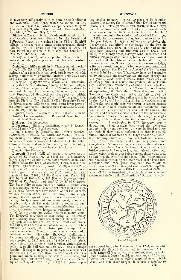
DHUISK
in 1870 were sufficiently calm to permit the landing of
the materials. The light, which is visible for 18Jnautical miles, is fixed white, except between S by Wh W, and W £ N, where it is fixed red. See the Builder
for Feb. 2, 1872, and May 6, 1876.
Dhuisk or Dusk, a rivulet of Colmonell parish, in the
S of Carrick, Ayrshire. Formed by the Feoch andPollgowan Burns, at a point 1| mile ESE of Barrhill
village, it thence runs 6 miles north-westward, closely
followed by the Girvan and Portpatrick railway, till
near Pinwherry station it falls into the Stinchar.
—
Orel. Sur., shs. 8, 7, 1S63.Dibaig, a hamlet, with a public school, near the
mutual boundary of Applecross and Gairloch parishes,
Ross-shire.
Dichmont, a hill-summit in St Vigeans parish, Forfar-
shire, 1 mile NE of St Vigeans village. It rises to analtitude of 323 feet above sea-level, and is crowned witha large hollow cairn or mound, anciently used as a seat
of justice, and now* clothed with greensward.
Dichty or Dighty Water, a stream of S Forfarshire.
Rising in four head-streams, among the Sidlaw Hills, in
the W of Lundie parish, it runs 15 miles east-south-
eastward through Auchterhouse, Mains and Strathmar-tine, Dundee, and Monifieth parishes ; receives, withinDundee parish, the tribute of Fithie Water ; and falls
into the Firth of Tay If mile ENE of Broughty Ferry.
It drives several mills in the middle and lower parts of
its course, and is well stocked with trout.
—
Orel. Sur.,
shs. 48, 49, 1S6S-65.
Digrnore, a small harbour in North Uist island, OuterHebrides, Inverness-shire, on Balranald farm, towardsthe middle of the island.
Dildawn. See Daldawn.Dillarburn, a village in Lesmahagow parish, Lanark-
shire, 1J mile NNE of Abbeygreen.Dilty, a morass in Carmylie and Guthrie parishes,
Forfarshire, 1J mile ESEof Kirkbuddo station. Measur-ing about J mile either way, it sends off two streamlets
in opposite directions—the head-stream of the Elliot
running eastward directly to the sea, and a tributarystreamlet running westward to the river Dean.
Dinart. See Durness.Dingwall (Scand. 'hill of justice'), a town and a
parish of SE Ross-shire. A royal and parliamentaryburgh, the town stands on the north-western shore, anda little below the head, of Cromarty Firth, which hereis joined by the Peffer ; by road it is 13J miles NW of
Inverness vid Kessock Ferry, and by rail, as junction of
the Dingwall and Skye railway (1870) with the mainHighland line (1862), 53 ENE of Strome Ferry, 82|SW by S of Helmsdale, 184 NW of Inverness, 210JNNW of Edinburgh, and 226| N by W of Glasgow.The beautifully-wooded plain on which it stands wasonce a swampy marsh, but since 1817 thorough drainageand spirited agriculture have made it one of the loveliest
valleys in the N of Scotland. The burgh, lying snuglyamong rich clumps of trees, at the entrance of StrathPeffer, chiefly consists of one main street, a mile in
length ; and, while the majority of its houses are irre-
gularly disposed and unpretentious architecturally, still
there are several very handsome residences, most of
which have sprung up within the past thirty years.
Yet Dingwall is a place of hoar antiquity, the countytown, having arisen under the shelter of the neighbour-ing castle of the Earls of Ross, which, built close besidethe Firth, was almost surrounded by water, but now hasleft hardly a vestige, its site being partly occupied by amodern mansion. The Town-house is a curious old-
fashioned edifice, with a spire ; the County Buildings, ahandsome castellated pile a little way E of the town,were erected in 1845 at a cost of £5000, and contain acourt-house, county rooms, and a prison with eighteencells. A public hall was built in 1S71 ; and a cottagehospital, H-shaped in plan, in 1872-73, as a memorialto the iate Dr William Ross. Near the church is aplain and simple obelisk, 6 feet square at the base, and57 feet high, but thrown slightly off the perpendicularby an earthquake of 1816 ; in 1875 it nroved upon
DINGWALL
exploration to mark the resting-place of its founder,
George Mackenzie, the celebrated first Earl of Cromartie(1630-1714). The parish church itself, with a steeple
and 800 sittings, was built in 1801 ; the present hand-some Free church in 1869 ; and the Episcopal church of
St James, an Early Decorated structure with 120 sittings,
in 1872, its predecessor having been destroyed by fire
the year before. In 1874 a public park, adjoining theBeauly road, was gifted to the burgh by the late Sir
James Matheson, Bart, of the Lews, who had at onetime been provost ; and Dingwall besides has a postoffice, with money order, savings' bank, insurance, andrailway telegraph departments, branches of the Bank of
Scotland and the Caledonian and National banks, 21
insurance agencies, 3 hotels, gas-works, a masonic lodge,
a literary association, militia barracks, a poorhouse, anda Friday paper, the Ross-shire Journal (1875). A cornmarket is held on every Wednesday from 26 Septemberto 30 May, and the following are the fairs throughoutthe year :—New Year Market, third Wednesday of
January ; Candlemas (cattle and produce), do. of Febru-ary ; Janet's, first Wednesday of June ; Colin's (cattle,
etc. ), first Tuesday of July ; Fell Maree, first Wednesdayof September ; Martha's, do. of November ; and Peffer,
Tuesday before Christmas. After the forfeiture of theEarls of Ross in 1476 Dingwall seems to have gone downin the world ; and its petition of 1724 to the Conventionof Burghs sets forth that ' the town is almost turneddesolate, as is weel known to all our neighbours, andthere is hardly anything to be seen but the ruins of old
houses, and the few inhabitants that are left, having nowno manner of trade, live only by labouring the neigh-bouring lands, and our inhabitants are still daily de-
serting us.' Accordingly, in 1733, Inverness sent a
deputation, which brought back word that Dingwallhad no trade, though one or two were inclined to carry
on trade if they had a harbour, also that it had noprison, and that for want of a bridge across an adjacentlake the people were kept from both kirk and market.Now, though its trade is still not very great, andthough manufactures are conspicuous by their absence,
Dingwall at least has a harbour. A mile below the
bridge coasters had once to load and unload on the mudat low-water, their cargoes being carried along a bad road
to and from the E end of the town. This inconveniencewas remedied by shaping the lower reach of the Peffer into
a regular canal, 2000 yards long, with two wharfs at
which vessels of 9 feet draught can lie—such improve-ments being carried out in 1815-17 at a cost of £4365, of
which £1786 was furnished by the Highland road commis-sioners and £600 by the Convention of Burghs. Erected
Seal of Dingwall.
into a royal burgh by Alexander II. in 1226, and having
adopted the General Police and Improvement Act of
1862, Dingwall is governed by a provost, a senior and a
junior bailie, a dean of guild, a treasurer, and 10 coun-
cillors, who also act as police commissioners. WithWick, and four other burghs, it returns a member to
355
DINGWALL AND SKYE RAILWAY
parliament, its municipal and parliamentary consti-
tuency numbering 229 in 1882, when the annual value
of real property, exclusive of railway, was £7533, whilst
the corporation revenue for 1881 was £152, and the har-
bour revenue £210. Pop. (1841) 1739, (1851) 1966,
(1861) 2099, (1871) 2125, (1881) 1918. Inhabited houses(18S1) 351.
The parish is bounded N and NE by Kiltearn, SE bythe head of Cromarty Firth and by the river Conan,separating it from the Nairnshire district of Ferintosh,
S by the Tollie section of Fodderty and by Urray, andSW by the main body of Fodderty. It has an utmostlength of 6g miles from NNW to SSE, and its widthvaries between 9J furlongs and 4J miles, whilst tapering
north-westward to a point. The Peffeu winds 2J mileseast-south-eastward along the Fodderty border andthrough the interior to the Firth ; the Skiach runs 1Jmile north-eastward across the northern interior ; andLoch Ussie (6A x 4§ furl.) lies at an altitude of 419 feet,
partly within a western projecting wing. Except for
the low level strip, 3 furlongs wide, between the Firth
and the Inverness highroad, and for a portion of Strath
Peffer, the surface is everywhere hilly, even mountainous,from S to N attaining 259 feet near Blaekwells, * 628
near Croftandrum, *882 at Cnoc Mor, * 450 at Knock-bain, 1109 at Cnoc a' Bhreac, and * 2000 at Meall naSpeireig, those heights that culminate on the parish's
borders being marked with asterisks, and one and all
being dominated by Ben Wwis (3429 feet). The rocks
are gneiss and mica slate in the northern uplands, andin the S conglomerate and Old Bed sandstone. Aroundthe town there is a deep deposit of loam with a large
admixture of clay, very suitable for the growth of wheat,but demanding great care in the cultivation ; the soil
on the lower slopes of the rising-grounds is also clayey ;
and the higher cultivated land is mountain clay or
moorish soil, the former becoming very fertile with long-
continued good treatment, the latter very difficult to
improve (Mr James Macdonald in Trans. Sight, and Ag.Soc, 1877). In the N are remains of an ancient Cale-
donian stone circle. Tulloch Castle is the chief man-sion ; and 2 proprietors hold each an annual value of
£500 and upwards, 12 of between £100 and £500, 21 of
from £50 to £100, and 26 of from £20 to £50. Ding-wall is the seat of a presbytery in the synod of Ross
;
the living is worth £436. A public school, with accom-modation for 360 children, had(18S0)an average attend-
ance of 222, and a grant of £177, 3s. Valuation (1881)£4992, 18s. 2d., of which £2654 was held by DuncanDavidson, Esq. of Tulloch. Pop. (1801) 1418, (1831)
2124, (1861) 2412, (1871) 2443, (1881) 2217.—Ord. Stir.,
shs. S3, 93, 1881.
The presbytery of Dingwall comprises the old parishes
of Alness, Contin, Dingwall, Fodderty, Kilmorack, Kil-
tearn, Urquhart, and Urray and Kilchrist, and the quoadsacra, parishes of Carnoch and Kinlochluichart. Pop.
(1871) 16,562, (1S81) 15,517, of whom 330 were com-municants of the Church of Scotland in 1S78.—The FreeChurch also has a presbytery of Dingwall, with churchesat Alness, Dingwall, Fodderty, Garve, Kilmorack,Kiltearn, Maryburgh, Stsatheonon, Urquhart, and Urray,which together had 4351 members and adherents in
1881.
Dingwall and Skye Railway, The, designed to openup to railway facilities the western coasts of Boss andInverness, and by means of steamers to afford access to
the principal islands of the Outer and Inner Hebrides,was originally projected to reach Kyle Akin (the Strait
of Haco), where the island of Skye is separated from themainland by a narrow channel. A bill for a line to this
point was obtained in 1S64, but the difficulty of raising
the capital caused the adoption of a modified scheme,carrying the line to its present western terminus on LochCarron. The railway, branching from the Highland line
at Dingwall, rises a short distance therefrom upon a steep
incline, on which is situated the first station, Strathpeffer
(4J miles). This station occupies a remarkably elevated
position, the famous spa that gives it name being situated
H mile away in the deep valley below. The view from356
DIPPIN
this portion of the line is magnificent; prominent amongst
the objects of interest being Castle-Leod, belonging tothe Duchess of Sutherland (Countess of Cromartie in herown right), which is seen in the midst of fine trees.
After leaving Strathpeffer, the line passes through acutting close under Craig-an-fhitaich, the 'Raven'sRock,' whose precipitous face, 250 feet high, beetles
ominously over the railway. Half-a-mile further the line
enters Ross-shire, and passes Loch Garve, the first of aseries of fine lochs which skirt the route. The shoresare nicely wooded. The station of Garve (11J miles)forms the starting-point for Lochbroom and Ullapoolby a wild coach road over the Diridh More. The line
afterwards passes Loch Luichart, where there is a station
(17 miles), and the Grudie, Loch Cullin, and Strathbranafford varying aspects of Highland scenery. Achanaultstation (21J miles) is a favourite starting-point for theascent of a number of the giant mountains of Ross-shire.
Auchnasheen station (27| miles) is the starting-point
for the coach to Gairloch, the road passing along thewhole length of Loch Maree, and forming one of thefinest drives in Scotland. Beyond Auchnasheen theline, after crossing the Bran on a fine lattice bridge,
reaches its summit-level, and immediately begins to
descend to the western coast. There is here some re-
markably wild and bleak scenery ; and at Auchnashel-lach, the shooting-lodge of Lord Wimborne, surroundedby fine grounds, appears like an oasis in the desert.
The line then skirts Loch Dougall, 4 miles in length,with vast precipitous hills rising from it. Strathcarronstation (45J miles) at the head of Loch Carron is nextreached, forming the station for Janetown on the op-
posite side of the loch, and for the wild region of LochTorridon. From Attadale, the line skirts the upperwaters of Loch Carron, and reaches its terminus at StromeFerry (53 miles). The line was cheaply constructed,the principal works being the cutting above Strathpeffer
and a few large bridges. The total capital expenditureamounted to £330,000. In 1881 the line was amalga-mated with the Highland railway. In the winter of
the same year high tides damaged the line, which sub-sequently was blocked by a heavy fall of rock, these inter-
ruptions occurring between Attadale and Strome Ferry ;
and the traffic was on both occasions interrupted for a
number of days.
Dingy's How, an ancient tumulus 36 feet high on theisthmus at the southern extremity of St Andrews parish,
Orkney.Dinlabyre, an ancient chapelry in Castleton parish,
Roxburghshire, on the left bank of Liddel Water, 1 mileSSE of Steele Road station. An old-fashioned mansion,now a farm-house, occupies the site of its chapel.
Dinmurehie. See Bake.Dinnet, a station, a burn, and a moor of S Aberdeen-
shire. The station is on the Deeside section of theGreat North of Scotland railway, 4J miles W of Aboyne.The burn, issuing from Loch Daven, and receiving also
the effluence of Loch Kinord, runs 2J miles south-east-
ward along the boundary between Aboyne and Glen-muick parishes, falls into the Dee in the vicinity of
the station, and may be regarded as the line of demar-cation between the Lowlands and Highlands of Dee-side. The moor flanks the W bank of the burn, is ableak dismal tract, and contains several cairns andseveral vestiges of ancient warfare. Near the station is
a Gothic church, built in 1875 at a cost of £700 as
a chapel of ease to Aboyne, and raised to quoad sacra
status in 1881.
Dinwoodie, a station in Applegarth parish, Annan-dale, Dumfriesshire, on the Caledonian railway, 6 miles
NNW of Lockerbie. Dinwoodie HiU (S71 feet), 1Jmile to the ENE, is crowned with two hill-forts ; andon its SE slope is the graveyard of a chapel, said to havebelonged to the Knights Templars.
Dionard. See Durness.Dippen, an estate, with a mansion, in Saddell parish,
E Kintyre, Argyllshire, close to Carradale village.
Dippin, a grandly mural headland on the SE coast of
Arran island, Buteshire, 1 1 mile NE of Kildonan Castle,
DIPPLE DIVIE
and 4 miles S byW of the southern entrance of LamlashBay. A range of precipice 300 feet high, it rises
sheer from the water's edge ; is leapt by a brook, in a
curve of spray, to the sea ; and forms a very conspicuous
landmark to mariners.
Dipple, an ancient parish of NE Elginshire, on the
left bank of the river Spey, opposite Fochabers. It wasunited with Essil in 1731 to form Speymouth parish.
Its church was dedicated to the Holy Ghost ; and at its
lychgate stood a small building known as ' The Houseof the Holy Ghost.' Around this building funeral
parties would always bear the corpse, following the course
of the sun ; nor could they be driven from that practice
till the house was demolished.
Dippool Water, a rivulet of Carnwath parish, ELanarkshire, rising near the Edinburghshire border at
an altitude of 1050 feet above sea-level, and running 7Jmiles south-south-westward, till it falls into MouseWater, 2 miles NKW of Carstairs Junction. Its waters
contain good store of tine large trout.
—
Ord. Sur., sh.
23, 1865.
Dirie or Dirrie More, a desolate mountain pass in
Lochbroom parish, central Eoss-shire, on the road fromDingwall to Ullapool. On the watershed between theAtlantic and German Oceans, it attains its maximumaltitude (909 feet) near the head of Loch Droma, 16Jmiles NW of Garve station, and 3J miles SSE of thesummit of Ben Dearg (3517 feet).
—
Ord. Su?\, sh. 92,
1881.
Dirleton, a village and a coast parish of N Hadding-tonshire. The village stands, towards the middle of theparish, 2| miles WSW of North Berwick, and 1| mileNW of Dirleton station, this being 2§ miles NNE of
Dreni, under which Dirleton has a post office. One of the
prettiest villages in Scotland, it chiefly consists of neat
modern cottages, each with its plot of flowers and shrubs,
arranged along two sides of a large triangular green, onwhose third or south-eastern side the ivy-clad ruins of
Dirleton Castle stand amidst gardens of singular beauty,
their bowling-green adorned with grand old evergreenoaks. This seems to be the identical stronghold that in
1298 offered a stubborn though fruitless resistance to
Anthony Beck, the fighting Bishop of Durham ; its
ruinous state is due in great measure to the ordnance of
Monk and Lambert, who, in 1650, captured it from a
garrison of mosstroopers, hanging their captain andtwo of his followers. The parish church, at the N endof the village, bears date 1661, and, altered and enlarged
in 1825, contains 600 sittings. There are also a Freechurch, an inn, a library, and a public school. Pop.
(1861) 354, (1871) 323, (1SS1) 403.
The parish, containing also the villages of Gullane,Kingston, and Fenton, is bounded NW and N by theFirtli of Forth (here 8J miles broad at the narrowest), Eby North Berwick, and S by Athelstaneford and Aber-lady. Its length, from E to W, varies between 2J and 5^miles ; its utmost breadth, from N to S, is 3§ miles ; andits area is 10,798J acres, of which 1620J are foreshore
and 2 water. The coast-line, 9 miles long, rises almostboldly to 100 feet above sea-level at Eldbottle Wood,but elsewhere is mostly fringed by the flat sandy East,
West, and Gullane Links ; to the W it is indented byGullane and Aberlady Bays ; and off it to the N lie thethree islets, composed of greenstone rock, of Eyebroughy,Fidra, and Lamb. The sluggish Peffer Burn, tracingthe southern boundary, is the only noteworthy rivulet
;
and inland the surface is very slightly undulated, its
highest point (118 feet) occurring on the road to Drem,J mile SSW of the village. The rocks are partly eruptive,partly carboniferous, and including dark-red jasper veins,
excellent building sandstone, some coal, and considerablequantities of ironstone. The soil is extremely various
—
in one part a deep, stiff, alluvial clay, and near thecoast stretches of the lightest sand, burrowed by hun-dreds of rabbits ; whilst there is also much deep, free
loam, the product of which in summer and autumnpresents an appearance of almost unrivalled luxuriance.Fenton Barns, If mile N by E of Drem, is famous inagricultural annals as the home, till 1873, of George
Hope, Esq. (1811-76), an interesting Life of whom, byhis daughter, was published in 1881. Sir John Haly-burton, slain at the battle of Nisbet in 1355, had weddedthe daughter and co-heiress of William De Vaux, lord of
Dirleton, and got with her that estate : his grandson,Sir Walter, Lord Treasurer of Scotland, founded a col-
legiate church at Dirleton in 1446, and six years earlier
was created Lord Halyburton of Dirleton—a title for-
feited in 1600 by John, third Earl of Gowrie and sixth
Lord Euthven and Dirleton, who won over Logan of
Eestalrig to his plot by the proffered bribe of the landsand castle of Dirleton. ' I care not,' wrote Logan, ' for
all else I have in this kingdom, in case I get grip of
Dirleton, for I esteem it the pleasantest dwelling in Scot-
land.' (See Perth and Fast Castle. ) To-day the Earlof Mar and Kellie bears the title of Baron Dirleton andViscount Fentoun, conferred in 1603 and 1606 on Sir
Thomas Erskine, afterward Earl of Kellie, who with his
own hand had slain the Earl of Gowrie ; that of Earl of
Dirleton was held, from 1646 till his death before 1653,by Sir James Maxwell, who seems, in 1631, to havebought the estate. In 1663 it was once more sold to
Sir John Nisbet, who as Lord Advocate bore the title
Lord Dirleton, and whose descendant, Lady Mary Nisbet-Hamilton, of Archerfield and Biel, owns two-thirdsof the parish. Five other proprietors hold each anannual value of £500 and upwards, 4 of between £100and £500, 4 of from £50 to £100, and 11 of from £20 to
£50. Dirleton is in the presbytery of Haddington andsynod of Lothian and Tweeddale ; the living is worth£509. Three public schools—Dirleton, Gullane, andKingston—with respective accommodation for 145, 81,
and 123 children, had (1S80) an average attendance of
100, 34, and 56, and grants of £74, £16, 14s., and£32, 3s. Valuation (1882) £16,499, 8s. Pop. (1801)
1115, (1831) 1384, (1861) 1540, (1871) 1419, (1881) 1506.—Ord. Sur., shs. 33, 41, 1S63-57. See vol. ii. of
Billings' Baronial and Ecclesiastical Antiquities (1852).
Dirlot Castle, an ancient fortalice in Halkirk parish,
Caithness, on a rugged crag above the river Thurso, 15miles S of Thurso town. It is said to have been thestronghold of a daring freebooter, a kinsman of theDunrobin Sutherlands, and to have been accessible onlyby a drawbridge, but is now represented by slight
remains.
Dirrie. See Dirie.
Dirrington, Great and Little, two of the LammermuirHills in Longformacus parish, Berwickshire. GreatDirrington culminates if mile SSE of Longformacushamlet, and has an altitude of 1309 feet above sea-level
;
aud Little Dirrington culminates nearly 11 mile further
SSW on the boundary with Greenlaw parish, and hasan altitude of 1191 feet.
Diru, Loch. See Derrie.Disblair, an estate, with a mansion, in Fintray parish
Aberdeenshire, 2J miles WSW of New Machar station.
Distinkhorn, a hill in Galston parish, Ayrshire, 5
furlongs from the Lanarkshire border, and 5f miles ESEof Galston village. It has an altitude of 1259 feet
above sea-level, and commands a magnificent view.
Ditch Hall, an ancient structure of earth and turf onInverchadain farm, in Fortingal parish, Perthshire. It
is described by Blind Harry ; is said to have been Sir
William Wallace's resting-place for a few days, and theplace where he was joined by the men of Eannoch , onthe eve of his march against the English at Dunkeldand Perth ; and is still represented by some remains.
Divach, a shooting-lodge in Urquhart and Glen-moriston parish, Inverness-shire, 2i miles SW of Druni-nadrochit hotel. Komantically situated between theCoiltie and its affluent, the Allt Coire na Euighe, withthe lofty Divach Falls, it was a favourite residence of
John Phillip, R.A. (1817-67), and figures in Shirley
Brooks' Sooner or Later.
Divie, a rivulet of Cromdale and Edinkillie parishes,
Elginshire, rising, at an altitude of 1400 feet, on the Eslope of Cam Bad na Caorach (1557 feet), 3 miles SEof Dava station, and thence running 12J miles north-north-westward, till, after receiving Dorbock Burn, it
357
DOBSON'S WELL
falls, near Relugas, into the river Findhorn. A capital
trout stream, strictly preserved, it almost vies with theFindhorn in the wild and varied beauty of its scenery,
and is subject to terrific freshets, that of Aug. 1829doing damage at Dunphail to the extent of £5000.Near Edinkillie church the Divie is spanned by a viaduct
of the Highland railway, which, measuring 500 feet in
length of masonry, and comprising 315 feet of arching,
rises to a maximum height of 170 feet above the ordi-
nary level of the stream. Four battlemented towerscommand the approaches, which are gained by embank-ments containing 190,000 cubic yards of material.
—
Ord. Sur., sh. 84, 1S76. See chaps, v. -vii. of Sir
Thomas Dick Lauder's Moray Floods (Elgin, 1830
;
3d ed. 1873).
Dobson's Well, a weak chalybeate spring in Hadding-ton parish, $ mile W of Haddington town.
Dochart, a loch, a river, and a glen in Killin parish,
Perthshire. Lying at the head of the glen, 1 mile E of
Crianlarich station, and 512 feet above sea-level, the
loch measures 6 by 1J furlongs, is overhung to the SEby conical Benmore (3843 feet), and contains a small
wooded islet, on which stand the ruins of a castle of the
Campbells of Lochawe. At its head it receives the
Fillan, and from its foot sends off the river Dochart,which flows 13J miles east-north-eastward to the headof Loch Tay (290 feet), in the first § mile of its course
expanding into Loch Tubhair (1J mile x 2^ furl. ; 512feet), and J mile from its mouth being joined by the
Lochy. Just above Killin, it 'takes up a roaring
voice, and beats its way over a rocky descent amonglarge black stones ; islands in the middle turning the
stream this way and that ; the whole course of the river
verv wide.' Stream and lochs contain salmon andtrout, also—unluckily—pike. Glen Dochart, at a point
24 miles SW of Killin, is joined at right angles fromthe S by Glen Ogle, and takes up thence, past LochDochart, the Callander and Oban railway ; along it
from W to E are Lochdochart Lodge, Luib station
and hotel, Auchlyne House, and Ardchyle hamlet.
For an exquisite picture of loch and river and glen
we must recur to Dorothy Wordsworth, who, withher brother, drove from King's House to Luib on Sun-day, 4 Sept. 1803:—'We had about eleven miles to
travel before we came to our lodging, and had gonefive or six, almost always descending, and still in the
same vale (Strath Fillan), when we saw a small lake
before us, after the vale had made a bending to the left.
It was about sunset when we came up to the lake ; the
afternoon breezes had died away, and the water was in
perfect stillness. One grove-like island, with a ruin
that stood upon it overshadowed by the trees, wasreflected on the water. This building, which, on that
beautiful evening, seemed to be wrapped up in religious
quiet, we were informed had been raised for defence bysome Highland chieftain. All traces of strength, or
war, or danger are passed away, and in the mood in
which we were we could only look upon it as a place of
retirement and peace. The lake is called Loch Dochart.
We passed by two others of inferior beauty, and con-
tinued to travel along the side of the same river, the
Dochart, through an irregular, undetermined vale
—
poor soil and much waste land. ... On Mondaywe set off again a little after six o'clock—a fine morning—eight miles to Killin—the river Dochart always onour left. The face of the country not very interesting,
though not unpleasing, reminding us of some of the
vales of the north of England, though meagre, nipped-
up, or shrivelled compared with them. Within a mile
or two of Killin the land was better cultivated, and,
looking down the vale, we had a view of Loch Tay.
. . . We crossed the Dochart by means of three
bridges, which make one continued bridge of great
length. On an island below the bridge is a gatewaywith tall pillars, leading to an old burying-ground be-
longing to some noble family' (pp. 185-187 of Recollec-
tions of a Tour in Scotland, ed. by Princ. Shairp, 1874).
This burying-ground is that of the Macnabs, from whomGlen Dochart was named the Macnab country. It now
353
DOLL
is included in the Breadalbane territory, the clan havingemigrated to Canada in the first two decades of thepresent century. Francis, twelfth laird (1734-1816),was an eccentric character, who, in company once withsome English gentlemen connected with the Excise,
answered a query respecting the state of Glen Dochartwith : ' Ther was once a crater callt exciseman sent
up to my country, but—they kilt him.'
—
Ord. Sur., sh.
46, 1872.
Dochfour, a lake in Inverness parish, Inverness-shire,
in the Great Glen, 5 miles SW of Inverness town. Anexpansion of the river Ness, separated by a run of
only J mile of that river from the foot of Loch Ness, it
measures 1J by J mile, and is sometimes called Little
Loch Ness. The hills around are beautifully wooded,and a burn that runs into it makes some pretty cascades.
Dochfour House, on its western shore is a mansion in
the Venetian style, described by Prince Albert as ' newand very elegant, with a fine garden, ' on occasion of his
visit here, 16 Sept. 1847. Its owner, Evan Baillie, Esq.
(b. 1798), holds 141,148 acres in the shire, valued at
£15,931 per annum.—Ord. Sur., sh. 83, 1881.
Dochgarroch, a hamlet in Inverness parish, Inver-
ness-shire, on the Caledonian Canal, at the foot of LochDochfour, 4J miles SW of Inverness. It has a regulat-
ing lock on the canal, for averting winter floods of LochNess whenever these rise above the standard-level of the
navigation ; and has also a public school.
Dodburn. See Allan, Roxburghshire.Dod Hill. See Wanlockhead.Dods-Corse Stone, an ancient cross on Boon farm, in
Legerwood parish, Berwickshire, 4 miles ESE of Lauder.
It is a sandstone shaft, sunk into a square sandstone
block, and is said to have been a market-cross.
Dodside, a hamlet in Mearns parish, SE Renfrewshire,
near Newton-Meai'ns.Doecleugh, a place on Skelfhill farm, in Teviothead
parish, Roxburghshire, 7 miles SSW of Hawick. It has
an aifcient Caledonian hill-fort, and it adjoins the line
of the Catrail.
Dogden, an extensive moss on the mutual border of
Greenlaw and Westruther parishes, Berwickshire.
Dogs, Isle of, a tiny wooded island in Loch Laggan,Laggan parish, Inverness-shire, nearly opposite Ardveri-
kie. It is said to have contained the kennel of ancient
Scottish kings for their huntings in Lochaber.
Dog's Stone (Gael. Clach-a-Choin), a huge isolated
conglomerate block on the shore of Oban Bay, Argyll-
shire, J mile NNW of Oban town. With a deeply
water-worn base, and an outline somewhat similar to
that of an inverted cone, it embeds large fragments andboulders, and seems at one time to have formed part of
a high precipitous sea beach. Curious legends are
attached to it—that Fingal here tethered his ' blue-eyed
hunter' Bran, and that the Lords of Lorn kennelled
their hounds beside it at their hunting expeditions with
the Lords of the Isles.
Dogton, a farm in Kinglassie parish, Fife, 4J miles
NW of Kirkcaldy. It contains an ancient hewn stand-
ing stone, 4| feet high above the socket, and 11 inches
thick.
Doine, a lake in Balquhidder parish, Perthshire, in
the upper part of the Balquhidder vale, 4J miles Wby S of Balquhidder hamlet. Lying 420 feet above sea-
level, it has an utmost length and breadth of 74 and 2Jfurlongs ; is overhung steeply to the N by Meall Mona-chyle (2123 feet) ; and by a reach of the river Balvag,
1J furlong in length, communicates eastward with LochVoil, from which it is separated by only a low patch
of haugh, that in times of freshet is sometimes over-
flowed.—Ord. Sur., sh. 46, 1872.
Doll, a glen in the NW of Cortachy and Clova parish,
Forfarshire, near the meeting-point with Perth andAberdeen shires. It is traversed by the White Water,
running 6} miles east-south-eastward to the river South
Esk, at a point 3 miles WNW of Clova hamlet ; and it
is remarkable for the variety of its flora and for an over-
hanging rock, the Scnrrie of the Doll.
—
Ord. Sur., sh.
65, 1870.
DOLLAR
Dollar (Celt, dal-aird, 'vale amid the hills'), a small
town and a parish of Clackmannanshire. The townstands at the foot of the Ochils, ISO feet above sea-
level, and 5 furlongs N of the right hank of the Devon
;
and by the Devon Valley section (1851-71) of the NorthBritish it is 6J miles NE by E of Alloa, 41J NW of Edin-
burgh, 12f ENE of Stirling, and lOf WSW of Kinross.
Traversed by Dollar Burn, whose glen, followed up-
wards, leads to the noble ruins of Castle-Campbell,it has been greatly improved and extended in recent
years, and presents a pleasant picturesque appearance
;
at it are a post office, with money order, savings' bank,
and telegraph departments, a branch of the Clydesdale
Bank, the Castle-Campbell hotel, gas-works, the Dollar
club, a working men's reading-room, ableachfield (1787),
and two brick and tile works. Fairs are held on the
second Monday in May and the third Monday in Octo-
ber. Places of worship are the parish church (1841
;
700 sittings), an imposing Gothic structure, with a con-
spicuous tower ; a neat Free church (1858 ; 600 sittings)
;
a TJ.P. church (1876 ; 360 sittings), built at a cost of
£4500, and adorned with a spire 70 feet high ; and the
new Episcopal church of St James the Greater (1882),
Early English in style, with apsidal chancel, 7 rose
windows, 8 lancets, etc. John M'Nab (1732-1802), a
Dollar herd-boy, who as a sea-captain had risen to wealthand settled at Mile-end, London, left £55,110 Three per
Cents, the half of his fortune, ' for the endowment of a
charity or school for the poor of the parish of Dollar.
'
With this bequest, which by the end of 1825 had accum-ulated to £74,236, was founded in 1818 Dollar Institu-
tion or Academy, whose board of trustees comprises 15
ex officio members under an Act of 1S47, and which,with a principal and 20 other teachers, gives (1S82)
instruction to 402 paying and 110 free scholars in classics,
French, German, English, history, mathematics, mecha-nics, science, drawing, singing, and other branches of a
liberal education ; whilst its lower and infant depart-
ments, with accommodation for 597 children, had (1880)an average attendance of 373, and a grant of £323. Thebuilding, erected in 1819 after designs by W. Playfair,
of Edinburgh, and greatly extended in 1867, is a Grecianedifice, 186 feet long and 63 wide, with a hexastyleportico ; a dome, upborne by fluted columns ; a library,
45 feet square and 45 high, containing 5000 volumes ; a
splendid upper hall, 60 feet long, 42 wide, and 24 high;
and a well-kept garden of 5 acres. The Institution hasdrawn, on the one hand, many families to Dollar ; and,
on the other, a number of its scholars board with the
principal or under masters : its former alumni includeJames Dewar, since 1875 Jacksonian professor of naturaland experimental philosophy at Cambridge, and a goodlylist besides of distinguished ministers, engineers, mer-chants, and others. Its income in 1881 comprised£2235 from endowment, £1750 from school fees and£739 from other sources ; whilst the expenditureamounted to £4605, of which £3075 was for salaries.
Pop. of town (1841) 1131, (1851) 1079, (1861) 1540,(1871) 2090, (1881) 2120.
The parish, containing also Sheardale village, If mileto the SSW, is bounded NW by Blackford, and N byGlendevon, in Perthshire ; E by Muckhart and Fossoway,both also in Perthshire ; S by Clackmannan ; and W byTillicoultry. Its utmost length, from N to S, is 3f miles
;
its breadth, from E to W, varies between lg and 3^ miles
;
and its area is 4795-J acres, of which 22 are water. TheDevon, entering from Muckhart, winds 3| miles west-ward, across the southern interior and on or close to
the Tillicoultry border, and receives on the way DollarBurn, which, itself hurrying 1J mile south-by-eastwardpast the town, is formed just below Castle-Campbell bythe Burns of Sorrow and Care, running 1\ miles east-
south-eastward, and 1J mile south-south-eastward andsouthward, from the northern confines of the parish.Westward along the Devon the surface declines to close
upon 50 feet above sea-level, thence rising southward to353 feet near Sheardale, and northward to 538 nearHillfoot House, 2111 at King's Seat on the westernborder, and 2110 at Whitewisp Hill in the N—smooth
DOLPHINTON
summits these of the green pastoral Ochils, that com-mand magnificent views. A spongy morass, MaddyMoss, on the NW border, lying at an altitude of from1500 to 1750 feet, and covering upwards of 150 acres,
occasionally bursts its barrier, and sends down a muddytorrent, by the Burn of Sorrow, to the Devon. The rocksof the hills are eruptive, those of the valley carbonifer-
ous. Coal and sandstone are plentiful ; copper, iron,
and lead were formerly wrought in the Ochils, a little
above the town ; and beautiful agates have been foundon the top of Whitewisp ; whilst a chalybeate spring,powerfully astringent and of medicinal efficacy both ex-
ternally and internally, was discovered in 1830 at Vicar'sBridge. The soil is argillaceous along the Devon, andon the lands thence to the hills is light and gravelly
—
about 1740 acres being either arable or grass land, 230under wood, and all the rest either hill-pasture or waste.In 877 the Danes, expelled by the Norwegians fromIreland, entered the Firth of Clyde, and, passing throughthe region watered by the Teith and Forth, attacked theprovince of Fife. A battle fought by them at Dollarwent against the Scots, who, fleeing north-eastward to
Inverdovet in Forgan, were there a second time routed,King Constantin mac Kenneth being among the multi-tude of the slain (Skene's Celtic Scotland, i. 327, 1876).The other chief episode in Dollar's history is the burningof its vicar, Thomas Forret, for heresy, at Edinburgh,in 1538. From 1493 to 1605 most of the parish belongedto the Earls of Argyll ; at present 4 proprietors hold eachan annual value of £500 and upwards, 10 of between£100 and £500, 18 of from £50 to £100, and 44 of from£20 to £50. Dollar is in the presbytery of Stirling andsynod of Perth and Stirling ; the living is worth £243.Valuation (1866) £6049, (1882) £12,641, 15s. Pop.
(1801) 693, (1831) 1447, (1861) 1776, (1871) 2524.
(1S81) 2499.—Od. Sur., sh. 39, 1867.
Dollar Law, a mountain on the mutual bor er of
Manor and Drummelzier parishes, Peeblesshire, 4j milesSE of Drummelzier village, and 9$ miles SW by S ofPeebles. Rising 2680 feet above sea-level, it commandsa view over the Lothians, and away over Berwickshire,to Northumberland.
Dollars, an estate, with a mansion, in Riccarton parish,
Ayrshire, on the left bank of Cessnock Water, 4J milesSE of Kilmarnock.
Dollas. See Dallas.Dollerie, a mansion in Madderty parish, Perthshire,
2f miles E by S of Crieff. Its owner, Anthony Murray-Esq, (b. 1802 ; sue. 1838), holds 1104 acres in the shire',
valued at £176S per annum.Dolls. See Glenochil.Dolphingston, a hamlet in Prestonpans parish, Had-
dingtonshire, 14 mile W of Tranent. It contains several
broken walls and gables, evidently of great antiquity,
and probably monastic.
Dolphinton, a post-office hamlet and a parish on theeastern border of the upper ward of Lanarkshire. Thehamlet stands 7 furlongs SSW of Dolphinton station,
which, as the junction of two branches of the Caledonianand North British, is 11 miles E by N of Carstairs, 1CWSW of Leadburn, and 27J SW of Edinburgh.The parish is bounded NE and E by Linton, and SE
by Kirkurd, in Peeblesshire , SW by Walston ; and ITWby Dunsyre. In shape a triangle, with southward apex,it has an utmost length from N by E to S by W of 3Jmiles, an utmost breadth from E to W of 2J miles, andan area of 3581J acres, of which 7J are water. Thedrainage belongs partly to the Clyde, partly to theTweed, inasmuch as South Medwin Water runs 2Jmiles south-westward along all the boundary with Dun-syre, Tarth Water 1 mile southward along that with Lin-ton ; and Back Burn, rising in the S of the parish, flows
3 miles north-eastward to the Tarth through the interior.
In the W along the Medwin the surface declines to a little
more, in the E along the Tarth to a little less, than 700feet above sea-level ; and the ' divide ' between the tworiver systems is marked by White Hill (1437 feet) andBlack Mount (1689). The rocks, over nine-tenths of
the entire area, are eruptive ; the soil, in most parts, is
3^9
DOLPHISTON
a dry friable earth or sandy loam. More than 300 acres
are under wood, and about 250 acres of the uplandsmight be profitably reclaimed. The manor belonged in
the former half of the 12th century to Dolfine, elder
brother of the first Earl of Dunbar, after whom it re-
ceived its name ; subsequently it became a pertinent of
Bothwell, and shared long in the fortunes of that
barony. Major Learmont, who commanded the Cove-nanting horse at the battle of Rullion Green (1666), andlong lay in hiding from pursuit by the authorities, heldthe property of Newholm, and was interred in Dolphin-ton churchyard; William Leechman, D.D. (1706-85),
professor of theology in Glasgow university, was son of
a Dolphinton farmer ; and Dr Aiton, author of interest-
ing works on Palestine, was minister, and wrote the
article ' Dolphinton ' for the Neio Statistical Account.
Dolphinton House, a little W of the village, is the seat
of John Ord Mackenzie, Esq., W.S. (b. 1811 ; sue. 1850),
who owns 3027 acres, valued at £2262 per annum. Thisparish is in the presbytery of Biggar and synod of Lothianand Tweeddale ; the living is worth £208. The churchis old, and contains 140 sittings ; whilst a public
school, with accommodation for 83 children, had (18S0)
an average attendance of 46, and a grant of £48, 18s.
Valuation (1882) £3464, 4s. Pop. (1801) 231, (1831)
302, (1861) 260, (1871) 231, (1881) 292.—Ord. Sur.,
sh. 24, 1864.
Dolphiston, a farm in Oxnam parish, Roxburghshire,near the right bank of Jed "Water, 4J miles SSE of
Jedburgh. Its curious old Border fortalice, now de-
molished, was the haunt of a brownie, till, hurt by the
offer of a coarse linen shirt, he departed, and in depart-
ing sang
—
1 Sin' ye've gien me a harden ramp,Nae mair u' your corn I will tramp.'
Don, a river of S Aberdeenshire, that forms a sort of
twin stream to the Dee, ranking next thereto amongAberdeenshire rivers as regards at once basin, magni-tude, and notability, and possessing like it much volumeof water and much fine scenery, with very little com-mercial importance. Yet the Don differs essentially
from the Dee in some great characters and even presents
some striking contrasts. It rises, as a small mossystream, 1| mile SSW of Meikle Geal Charn (2833 feet),
close to the Banffshire border, and within a mile of the
river Aven ; and thenee winds eastward in a direction
somewhat parallel to the Dee, at a mean distance of
about 9 miles to the N, but through a country muchless mountainous, and abounding far more in plains andmeadows. With little or none of the impetuousness or
fitfulness of the Dee, it displays a prevailing current of
gentleness, calmness, and regularity, and, making great
loops and bends now to the right, now to the left, it
falls at last into the German Ocean, 1 mile NE of OldAberdeen, and 2^ miles N of the mouth of the Dee.
From source to mouth it has a total length, following
its windings, of 82J miles, viz., 20§ to Castle-Newe
bridge, 42f thence to the Ury's influx, and 19J thence
to the sea. And from 1980 feet above sea-level at its
source, it descends to 1320 at Cock Bridge near Corgarff
Castle, 900 near Castle-Newe, 450 near Alford, and 170
at the mouth of the Ury. Its chief tributaries are the
Conrie, the Carvie, and the Leochel on the right bank,
and the Ernan, the Nochty, the Bucket, the Kindy, andthe Ury on the left. The parishes traversed or boundedby it are Strathdon, Tarland, Glenbucket, Kildrummy,Towie, Leochel, Auchindoir, Alford, Tullynessle, Eeig,
Tough, Monymusk, Oyne, Chapel of Garioch, Kemnay,Inverurie, Kintore, Keithhall, Fintray, Kinnellar, Dyce,
New Machar, Newhills, and Old Machar ; and in ourarticles on these parishes details will be found as to the
villages, seats, etc. , along its banks.
The river's course, from the head of Strathdon to the
upper part of Alford, lies chiefly along a series of glens;
contracts then, for a short distance, into a narrow gullet
;
but opens presently into a considerable vale, with great
expanses of meadowland on the immediate banks ; andlastly, from the New Bridge of Old Aberdeen to the sea,
is a narrow artificial channel. Its original mouth is
360
DOON
presumed to have been identical with that of the Dee;
was afterwards at a point nearly midway between theDee's and its own present mouth ; and was diverted toits present situation by the cutting of an artificial chan-nel for its lower reach, about the year 1750, under thedirection of Professor James Gregory. The river is sub-ject to great freshets ; sweptaway, in the autumn of 1768,the greater part of the crops on the haughs and level
lands adjacent to its bed ; made similar devastation inAug. 1799 ; rose, on 4 Aug. 1829, to a height of 14feet above its ordinary level ; and is now preventedfrom working similar havoc only by extensive embank-ments in the parts of its course most subject to inunda-tion. It is one of the best trouting streams in Scotland(especially in its upper waters), and has some valuablesalmon fishings. Pike are fortunately few ; but rivertrout, ranging in weight from J lb. to 5 lbs. , abound, asalso do salmon and sea-trout. As many as forty salmonwere killed in one season, by a single rod, in one poolnear Alford Bridge ; and 3000 salmon and grilse werenetted at its mouth in a single week of July 1849.Between 1790 and 1800 the yearly average number ofsalmon and grilse caught in the Don amounted to
43,240, between 1813 and 1824 to 40,677 ; and in 1881towards the end of July and throughout August the netfishings of the nether Don yielded between 300 and 400salmon per day, but this was a great improvement overthe past two years.
—
Ord. Sur., shs. 75, 76, 77, 1S76-73.See chap. xxii. of Sir Thomas Dick Lauder's MorayFloods (Elgin, 1830 ; 3d ed. 1873).
Don, a sea-loch in the E of Mull island, Argyllshire,opposite the middle of Kerrera. Striking 1\ miles north-westward, and nowhere exceeding 1 mile in width, it
has, at the S side of its mouth, the hamlet ofAchnaceaig.Donald's Cleuch, a cul de sac in the SE of Tweedsmuir
parish, Peeblesshire, striking off from Gameshope Burnto Donald's Cleuch Head (2616 feet) on the Dumfries-shire border. It is thought to have got its name frombeing a retreat of the famous Covenanter, Donald Cargill.
Donan, a small island at the SW corner of Ross-shire,
in Loch Alsh, at the point where that sea-loch forks
into Lochs Long and Duich.Donan Castle. See Castle-Donnas'.Donavourd, an estate, with a mansion, in Logierait
parish, Perthshire, near the left bank of the Tay, 2 milesSE of Pitlochry. Its owner, George Gordon, Esq. (b.
1816 ; sue. 1838), holds 2760 acres in the shire, valuedat £577 per annum.
Don, Bridge of, a suburb of Old Aberdeen, in OldMachar parish, Aberdeenshire, on the river Don, 2 milesN of Aberdeen, under which it has a post office.
Donibristle, an estate in Dalgety parish, Fife, on theFirth of Forth, 3 miles WSW of Aberdour. Long theproperty of the abbots of Inchoolm, it was granted alongwith the other possessions of that abbey to Sir JamesStuart, Lord Doune, whose son and namesake, the' Bonny Earl of Moray, ' was slain here by Gordon of
Cluny and the Earl of Huntly on 7 Feb. 1592—anepisode that forms the theme of a fine old ballad. Thepresent Earl of Moray holds 7463 acres in Fife, valuedat £11,086 per annum. The mansion of Donibristle hasthrice been burned, on the last occasion in 1858, whena number of valuable portraits perished in the flames.
Donibristle Colliery, a village, with a public school,
in Aberdour parish, Fife, 2 miles ESE of Crossgates.
Doon, a steep round hill (945 feet) in Tynron parish,
Dumfriesshire, terminating the SE end of a hill-range
between Scar and Shinnel Waters, 4 miles WSW of
Thornhill. It seems anciently to have been thickly
clothed with forest, and was crowned at an early period
by some kind of fortalice or habitation, which is said
to have been a retreat of Robert Bruce, after Ms slaying
the Red Comyn at Dumfries.
Doon, a long hill of considerable height (582 feet), the
outmost spur of the Lammermuirs, in Spott parish, Had-dingtonshire, 2J miles S by E of Dunbar. On its topand slope lay David Leslie's Scotch army, 23,000 strong,
the two first days of September 1650, the third being that
of the Battle of Dunbar.
DOON DORES
Doon, a loch partly in Kirkcudbrightshire, but chiefly
in Ayrshire, and a river dividing the Ayrshire districts
of Carrick and Kyle. Lying 680 feet above sea-level,
the loch extends 5§ miles north-by-eastward and north-westward to within 3 miles of Dalmellington town, andvaries in width between 2 and 6J furlongs. It receives,
at its head, Gala and Carrick Lanes, discharging theeffluence of Lochs Enoch, Macaterick, and Kiecawr ; onits western side, is joined by Garpel Burn, flowing outof Loch Finlas ; and, at its foot, sends 'off the river
Doon. Its surface is studded with five little islands
or groups of islands, viz. , from S to N, Pickinaw Isles,
Castle Island, Saugh Island, Garpel Islands, and Gor-don's Island, on the second of which is a ruined octan-
gular tower— ' Balliol's Castle.' By Chalmers this wasidentified with Laight Alpin, the scene of the deathof King Alpin of Dalriada in 741, which Skene, how-ever, places on the eastern shore of Loch Ryan ; byTytler it is said to have been basely yielded to the Eng-lish in 1306, when Seaton, its lord, who had married a
sister of Bruce, was carried to Dumfries and executed. In1S26, nine ancient canoes, hollowed each from a single
oak tree, and from 16J to 22J feet long, were foundsunk in the loch near this islet. Boats are kept, andtrout and char are fairly plentiful. ' Viewed from a
distant eminence,' says Mr Harper, 'Loch Doon hasmore the appearance of a river than a lake. It is sur-
rounded by lofty hills (1000 to 2000 feet in height) onboth the Carsphairn or Galloway and the Straiton or
Carrick side, the Gallowegian being green and grassy,
excellent for sheep pasture, to which they are almostentirely devoted. Those on the Carrick side are wildand solitary, with nought but rocks and heather. Bytunnels, which have been formed to prevent the lake,
when swollen by heavy rains, from overflowing the ex-
tensive tracts of meadow-land along the banks of theriver, its waters have been lowered considerably fromtheir original level, and the exposure of tracts of barrensand, gravel, and stone on its banks, detracts consider-
ably from its beauty ' (IlamMcs in Galloway, 1S76).
The river Doon, emerging by these two tunnels, cut outof the solid rock, rushes impetuously into Ness Glen, a
romantic wooded gorge some 30 feet wide, 300 deep, and1 mile long ; expands next into Bogton Loch (6 x 2J-
furl. ), in the vicinity of Dalmellington ; and thencewinds north-westward, pastWaterside, Patna, Dalrymple,Cassills House, Auchendrane House, and Alloway, till,
after a total course of 26J miles, it falls into the Firthof Clyde, If mile S by W of Ayr. Its tributaries are
numerous, but small. The parishes, on its left bank,are Straiton, Kirkmichael, and Maybole ; on its right,
Dalmellington, Dalrymple, and Ayr or Alloway. Forthe first 3 miles below Bogton Loch the Doon's rightbank is fringed by the crescent-shaped vale of Dalmel-lington ; for the next 5, on either side rise treeless,
heathy knolls, or tame, uninteresting hills ; but thence,right onward to the sea, the stream has channelled outa mighty furrow, 10 to 200 feet deep, and 30 to 150yards wide at the top, its bosky sides
—
' the bonnie winding banksWhere Doon rins, wimplin, clear.'
' Naebody sings the Doon,' thus Burns complained in1785 ; but Burns himself atoned for the neglect, so thatits 'Banks and Braes,' the Downans of Cassillis, andauld Kirk-AUoway ' shine wi' the best ' now, even withTweed and Yarrow. Its waters contain good store oftrout, sea-trout, and salmon ; and large pike lurk in its
more sluggish pools.
—
Ord. Sur., shs. 8, 14, 1863.Doon Hill. See DooN".
Doonholm, a mansion in Ayr parish, Ayrshire, on theright bank of the Doon, 3 miles S of the town of Ayr.It is the seat of the judge, Colin Blackburn, P.O. (b.
1813), who in 1876 received a life-peerage as BaronBlackburn of Killearn, and who holds 154 acres in theshire, valued at £344 per annum.
Doonside, an estate, with a mansion, and with ves-tiges of an ancient castle, in Maybole parish, Ayrshire,on the left bank of the Doon, 3 miles S of Ayr.
Dorary, an isolated hilly pendicle of Thurso parish,
Caithness, surrounded by Reay and Halkirk parishes,
4J miles SSW of the main body of Thurso parish. It
belonged to the Bishops of Caithness ; it has remains of
an ancient chapel, called Gavin's Kirk or Temple Gavin;
and it commands a very grand and extensive view.
Dorback Burn. See Abernethy, Inverness-shire.
Dorbock, a picturesque rivulet of Edinkillie parish,
Elginshire, issuing from Loohisdoke (969 feet), andrunning 8J miles north-north-eastward along the Crom-dale border and through the interior, till, J mile S of
Dunphail House, it falls into the Divie, like which it
wrought great havoc in the August floods of 1829.—Ord.Sur., sh."~84, 1876.
Doreholm, an islet of Northmaven parish, Shetland, onthe N side of St Magnus Bay, 1J mile ESE of the south-western extremity of Northmaven mainland. It rises
roekily and massively from the water, and is pierced by anatural arch or tunnel, 54 feet high, lighted by an open-ing at the top, and permitting boatmen to fish under it.
Dores. See Kettins.Dores, a village and a parish of NE Inverness-shire.
The village stands on the eastern shore of Loch Ness,towards its foot, 7 miles SSW of Inverness, under whichit has a post office ; at it are a small inn and a steam-boat pier.
The parish is bounded NE by Inverness, SE byDaviot-Dunlichity and the Farraline section of Bole-skine, SW by Boleskine-Abertarff, and N¥ by LochNess and Inverness. Its utmost length, from NNE to
SSW, is 15J miles ; its breadth, from WNW to ESE,varies between 1 furlong and 4J miles ; and its landarea is 25,693 acres, including the two small Dell andKillin sections, surrounded by Boleskine. The river
Farigaig, entering from Daviot, and winding 6\ milesnorth-north-westward and south-westward to Loch Nessat the south-western corner of the parish, is the onlyconsiderable stream ; and the eastern half of the lowerlOf miles of Loch Ness belong to Dores. Other lakes,
with utmost length and breadth and altitude, are LochsBunachton (J x \ mile, 701 feet), Dundelchack (3|miles x 1 mile, 702 feet), and Ruthven (2J miles x 4Jfurl., 700 feet), on the Daviot border ; Loch Faeraline(9 x 2J furl. , 650 feet), on the Boleskine detached bor-
der ; and, in the interior, Loch Ashey (1§ mile X 5furl., 716 feet), Lochan nan cun Ruadha (3f x 2 furl.,
750 feet), Loch Ceo-Glas (7x1 furl., 760 feet), andeight smaller ones. Except for the narrow strip alongLoch Ness, traversed by Wade's military road, whichranges in altitude between 56 and 106 feet above sea-
level, for Strath Dores, and for a portion of Strath-
errick, the surface everywhere is hilly or mountainous,elevations from NNE to SSW being Drumashie Moor(776 feet), Creag a' Chlachain (1000), Ashie Moor (790),Tom Bailgeann (1514), Cam an Fheadain (1445), andCairn Ardochy (1116). Most of the land is suited onlyfor sheep-pasture, the light arable soils lying chiefly
along the bottom of the valleys, but with patches here
and there among the hills. The rocks are mainlygranitic ; and woods and plantations cover a consider-
able area, especially along the shore of Loch Ness.Vestiges of an ancient fort, supposed to be Scandinavian,and called Dun-Richnan or the Castle of the King of theOcean, are at the head of Loch Ashey, \\ mile SE of thevillage ; and several cairns a little to the E, one of themalmost equal in size to all the rest, are fabled to com-memorate a victory won by Fingal over Ashi, the son of
a Norwegian king, and give the name of Drumashie('Ashi's ridge') to their site. Aldourie Castle is
the principal mansion ; and 3 proprietors hold eachan annual value of £500 and upwards, 4 of between£100 and £500. Dores is in the presbytery of Inver-ness and synod of Moray ; the living is worth £300.The parish church, at the village, was built in 1828,and contains 500 sittings. A preaching-station is at
Torness, in Stratherrick, 6 miles S of the village ; anda Free church for Dores and Bona stands If mile NNEof the same ; whilst three public schools—Aldourie,Bunchrubin, and Stratherrick—with respective accom-
361
DOEMONT
modation for 125, 80, and 110 children, had (1880) anaverage attendance of 20, 18, and 48, and grants of
£35, Is., £26, and £55, 18s. Valuation (1881) £9008, 9s.
Pop. (1801) 1313, (1831) 1736, (1861) 1506, (1871) 1401,
(1881) 1146.—Ord. Sur., shs. 73, 83, 1878-81.
Dormon t, an estate, with a mansion, in Dalton parish,
Dumfriesshire. The mansion, standing on the right bankof the Annan, 6 miles SSW of Lockerbie, was built in
1823, and is an elegant edifice, amid charming grounds;
its owner, William Carruthers, Esq. (b. 1867; sue. 1878),holds 6355 acres in the shire, valued at £4698 per annum.
Dormont, a small vale in Hounam parish, Roxburgh-shire.
Dornadilla, an ancient ' dun ' or tower in Durness par-
ish, Sutherland, in Strathmore, near the S base of BenHope. Traditionally said to have been built by a Scottish
king, to serve as a hunting seat, it is now reduced to a
fragment, which, 16 feet high and 150 feet in circum-ference, consists of two concentric walls of slaty stones.
Dornal, a loch on the mutual border of Colmonell par-
ish, S Ayrshire, and Penninghame parish, NE Wigtown-shire, 5| miles SE of Barrhill station. Lying 380 feet
above sea-level, it is 5 furlongs long from E to W ; varies
in width between 1 and 4^ furlongs ; is studded with six
or seven tiny islets ; contains pike and trout, the latter
of from h lb. to 5 or 6 lbs. weight ; and sends off Carrick
Burn, running 2J miles eastward to the Cree, at a point
2 miles W by S of Bargrennan.
—
Orel. Sur., sh. 8, 1863.
Dornie, a fishing village in Kintail parish, Ross-shire,
at the head of Loch Alsh, where it branches into LochsLong and Duich, and in the vicinity of Castle-Donnan,
7$ miles S of Strome Ferry. It contains some goodhouses, and has a post office under Lochalsh, a girls'
public school, and a ferry across the outlet of Loch Long.Dornoch, a coast town and parish of SE Sutherland.
The capital of the county, and a royal and parliamentary
burgh, the town is 8j miles N by E of Tain vid MeikleFerry, 14J E of Bonar- Bridge station, and 7 SSE of the
Mound station, with which it communicates daily bymail gig, and which itself is 20i miles SW of Helms-dale, 23 ENE of Bonar-Bridge, 80| NNE of Inverness,
272J NNW of Edinburgh, and 289 NNE of Glasgow.'Close outside the town,' says Worsaae, 'there stands
the Earl's Cross, a stone pillar in an open field, whichis simply the remains of one of those market-crosses, so
often erected in pre-Reformation times. As a matter of
course, the arms of the Earls of Sutherland are carved
on one side of the stone, and on the other are the armsof the town—a horseshoe. Tradition, however, will
Seal of Dornoch.
have it that the pillar was reared in memory of a battle,
fought towards the middle of the 13th century by anEarl of Sutherland against the Danes. In the heat ofthe fray, while the Earl was engaged in hand-to-handcombat with the Danish chief, his sword broke : but inthis desperate strait, he was lucky enough to lay holdof a horseshoe (the whole leg of a horse, say some) thataccidentally lay near him, with which he succeeded inkilling his antagonist. The horseshoe is said to have
362
DORNOCH
been adopted in the arms of the town in memory of this
feat ;' and the name Dornoch is popularly derived fromthe Gaelic dorn-eich, 'a horse's hoof,' though dor-n-ach,' field between two waters,' is a far more probableetymon. Be this as it may, Dornoch, to quote Profes-sor J. S. Blackie, who wandered hither in the autumnof 1881, is 'an old-fashioned, outlying, outlandish greynest, to which no stranger ever thinks of going exceptthe sheriff of the county, and he only half a stranger
;
. . . an interesting old town, with a splendidbeach for bathing, a fresh, breezy, and dry atmosphere,and a golfing ground second to none in Scotland. ' Ofthe last, indeed, Sir Robert Gordon wrote in 1630 that' about this toun, along the sea coast, there are thefairest and largest linkes or green feilds of any pairt of
Scotland, fitt for archery, goffing, ryding, and all otherexercise ; they doe surpasse the feilds of Montrose or
St Andrews.' The town itself—no more than a village
really—consists of wide regular streets, and has a postoffice, with money order, savings' bank, and telegraphdepartments, a branch of the Caledonian Bank, 6 in-
surance agencies, 2 hotels, a newsroom, and a publiclibrary. The see of Caithness, first heard of about 1130,had here its principal church, dedicated to St Bar or Fin-
bar; by Bishop Gilbert de Moravia (1222-45) this churchwas organised as the cathedral of the Virgin Mary, witha chapter of ten canons, a dean, precentor, chancellor,
treasurer, and archdeacon ; and, as rebuilt by him, in
the First Pointed style, it consisted of an aisled nave,transept, choir, and massive central tower, topped witha dwarfish spire. The tower is all that remains of StGilbert's work, since in 1570 the cathedral was burnedby John Sinclair, Master of Caithness, and lye Mackayof Strathnaver, who, taking advantage of the minorityof Alexander, twelfth Earl of Sutherland, besieged andplundered Dornoch with a small army from Caithness.
Fortunately the tower escaped, and with it some fine
Gothic arches, which latter, however, fell before theterrific gale of 5 Nov. 1605—the day on which the Gun-powder Plot was discovered. In 1614 the thirteenth Earl
of Sutherland partially repaired the cathedral, to makeit available for parish church ; and in 1835-37 it wasrebuilt by the Duchess of Sutherland at a cost of £6000.The present fabric, containing 1000 sittings, is a mix-ture of Gothic and Vandalism, and measures 126 feet
by 92 across the transepts. In the southern transept
lie sixteen of the Earls of Sutherland ; in the northernis a stone sarcophagus, removed from the choir, andsurmounted by a cross-legged effigy of either the founderor the founder's brother, Sir Richard de Moravia ; andthe choir, now mausoleum of the Sutherland family, is
graced by a fine marble full-length statue of the first
Duke (1758-1833) by Chantrey, with a large tablet
behind, recording the lineage and virtues of his Duchess-Countess (1765-1839). An old tower, fronting thecathedral, represents the Bishop's Palace, which, also
burned in 1570, lay in ruins till 1813, when part of it
was fitted up as the county courthouse and gaol. Subse-
quently the whole was removed, excepting this westerntower, lofty and picturesque ; and on the site thuscleared were built the large and handsome CountyBuildings, comprising courthouse, prison, record-room,
and county meeting-room. The prison was discontinued
in 1880, that of Dingwall taking its place ; and in 18S1the ancient tower was refitted and refurbished as a quaintdwelling-place for English sportsmen. Of a monasteryof Trinity Friars, alleged by Gordon to have beenfounded here between 1270 and 1280, not even a vestige
remains. Besides the Cathedral, now used as the parish
church, there is also a Free church ; and a public school
and a Christian Knowledge Society's school, with respec-
tive accommodation for 135 and 84 children, had (18S0)
an average attendance of 49 and 42, and grants of
£39, 5s. 6d. and £32, 3s. Erected into a free royal
burgh and port by Charles I. in 1628, Dornoch is
governed by a provost, 2 bailies, a dean of guild, a
treasurer, and 4 councillors ; with Wick, Tain, Ding-wall, Cromarty, and Kirkwall it returns one member to
parliament. The municipal and parliamentary consti-
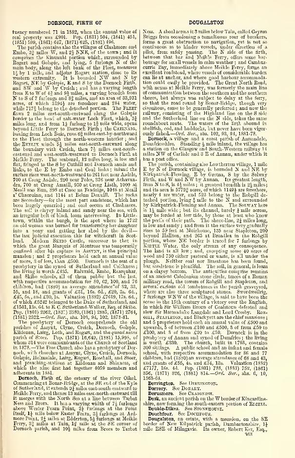
DORNOCH, FIRTH OF
tueney numbered 71 in 1832, when the annual value of
real property was £901. Pop. (1831) 504, (1841) 451,
(1851) 599, (1861) 647, (1871) 625, (1881) 496.
The parish contains also the villages of Clashmore and
Embo, 3j miles W, and 1\ NNE, of the town ; and it
comprises the Kinnauld portion which, surrounded byRogart and Golspie, and lying, 5 furlongs N of the
main body, along the left bank of the Fleet, measures
1J by 1 mile, and adjoins Rogart station, close to its
western extremity. It is bounded NW and N byRogart, NE by Golspie, E and S by the Dornoch Firth,
and SW and W by Creich ; and has a varying length
from E to W of 4f and 9£ miles, a varying breadth from
N to S of 7 furlongs and 8§ miles, and an area of 33,931
acres, of which 31944 are foreshore and 284 water,
while 717g belong to the detached portion. The Fleetflows 2 miles east-south-eastward along the Golspie
border to the head of salt-water Loch Fleet, which, 3Jmiles long, and from 1J furlong to 1§ mile wide, opens
beyond Little Ferry to Dornoch Firth ; the Cairnaig,issuing from Loch Buie, runs 6| miles east-by-northward
to the Fleet through the north-western interior ; andthe Evelis winds 5J miles east-south-eastward along
the boundary with Creich, then "t\ miles east-south-
eastward and west-south-westward to Dornoch Firth at
Meikle Ferry. The seaboard, 12 miles long, is low andflat, fringed to the S by Cuthill and Dornoch sands andlinks, to the E by Embo and Coul links ; inland the
surface rises west-north-westward to 261 feet near Asdale,
700 at Creag Asdale, 290 near Poles, 326 near Achavan-dra, 700 at Creag Amaill, 930 at Creag Liath, 1000 at
Meall nan Eun, 89S at Cnoc na Feadaige, 1048 at Meall
a' Chaoruinn, and 1144 at Beirm Donuill. The rocks
are Secondary—for the most part sandstone, which has
been largely quarried ; and coal occurs at Clashmore.
The soil is clayey inland and sandy near the sea, withan irregular belt of black loam intervening. In Little-
town, within the burgh, is the spot where in 1722an old woman was burned for transforming her daughter
into a pony and getting her shod by the devil
—
the last judicial execution this for witchcraft in Scot-
land. Modern Skibo Castle, successor to that in
which the great Marquis of Montrose was temporarily
confined after his capture in Assynt, is the principal
mansion ; and 2 proprietors hold each an annual value
of more, 3 of less, than £500. Dornoch is the seat of a
presbytery in the synod of Sutherland and Caithness;
the living is worth £435. Balvraid, Embo, Rearquhar,
and Skibo schools, all of them public but the last,
with respective accommodation for 80, 62, 100, and 76
children, had (1880) an average attendance'of 32, 33,
55, and 18, and grants of £31, 16s. 6d., £20, 3s. 6d.,
£45, 5s., and £30, Is. Valuation (1882) £7619, 17s. 6d.,
of which £5242 belonged to the Duke of Sutherland, and£1501, 13s. 6d. to E. C. Sutherland-Walker, Esq. of Skibo.
Pop. (1801) 2362, (1831) 33S0, (1861) 2885, (1871) 2764,
(1881) 2522.—Ord. Sur., shs. 103, 94, 102, 1878-81.
The presbytery of Dornoch comprehends the old
parishes of Assynt, Clyne, Creich, Dornoch, Golspie,
Kildonan, Lairg, Loth, and Rogart, and the quoad sacraparish of Stoer. Pop. (1871) 16,649, (1881) 15,998, of
whom 314 were communicants of the Church of Scotlandin 1878.—The Free Church also has a presbytery of Dor-noch, with churches at Assynt, Clyne, Creich, Dornoch,Golspie, Helmsdale, Lairg, Rogart, Rosehall, and Stoer,
and preaching-stations at Eildonan and Shinness, of
which the nine first had together 4059 members andadherents in 1881.
Dornoch, Firth of, the estuary of the river Oikel.
Commencing at Bonar-Bridge, at the SE end of the Kyleof Sutherland, it extends 9J miles east-south-eastward to
Meikle Ferry, and thence 13 miles east-north-eastward till
it merges with the North Sea at a line between TarbatNess and Brora. It has a varying width of 7J furlongsabove Wester Fearn Point, 2J furlongs at the Pointitself, 1J mile below Easter Fearn, 3J furlongs at Ard-more Point, 2J miles at Edderton, 5J furlongs at MeikleFerry, 3J miles at Tain, If mile at the SE corner of
Dornoch parish, and 10J miles from Brora to Tarbat
DOUGALSTON
N ess. A shoal across it 3 miles below Tain, called GeyzenBriggs from occasioning a tumultuous roar of breakers,
forms a great obstruction to navigation, yet is not so
continuous as to hinder vessels, under direction of a
pilot, from safely passing. The N side of the firth,
between that bar and Meikle Ferry, offers some har-bourage for small vessels in calm weather ; and Cambus-currie Bay, immediately above Meikle Ferry, forms anexcellent roadstead, where vessels of considerable burdencan lie at anchor, and where good harbour accommoda-tion could easily be provided. The Great North Road,with nexus at Meikle Ferry, was formerly the main line
of communication between the southern and the northernshores, but always was subject to delay at the ferry,
so that the road round by Bonar-Bridge, though verycircuitous, came to be generally preferred ; and now therailway, consisting of the Highland line on the S side
and the Sutherland line on the N side, takes the sameroundabout route. The waters of the firth abound in
shellfish, cod, and haddocks, but never have been vigor-
ously fished. —Ord. Sur., shs. 102, 93, 94, 1881-78.
Dornock, a village and a coast parish of Annandale,Dumfriesshire. Standing $ mile inland, the village hasa station on the Glasgow and South-Western railway 14miles NW of Carlisle and 3 E of Annan, under which it
has a post office.
The parish, containing also Lowthertou village, 1 mileE by N of Dornock village, is bounded N and NE byEirkpatrick-Fleming, E by Gretna, S by the SolwayFirth, and W and NW by Annan. Its greatest length,from N to S, is 4£ miles ; it greatest breadth is 2J miles
;
and its area is 5779| acres, of which 1149$ are foreshore,
nearly 4 are water, and 523 belong to the Robgill de-
tached portion, lying l mile to the N and surroundedby Kirkpatrick-Fleming and Annan. The Solway hereis 1J mile wide ; but its channel, barely \ mile across,
may be forded at low tide, by those at least who knowthe perils of their path. The shore-line, 2J miles long,
is low and sandy ; and from it the surface very graduallyrises to 59 feet at Muirhouse, 135 near Stapleton, 200beyond Hallton, and 265 at Broadlea in the Robgillportion, whose NE border is traced for 7 furlongs byKiktle Water, the only stream of any consequence.The land is all low ; and, excepting some 40 acres of
wood and 750 either pastoral or waste, is all under theplough. Neither coal nor limestone has been found,but sandstone is plentiful. The soil, in general, is loamon a clayey bottom. The antiquities comprise remainsof an ancient Caledonian stone circle, traces of a Romanmilitary road, the towers of RobgUl and Stapleton, andseveral curious old tombstones in the parish graveyard,where are also three sculptured stones. Swordwellrig,
7 furlongs WNW of the village, is said to have been thescene in the 15th century of a victory over the English,
in which Sir William Broun of Coalstoun defeated andslew Sir Marmaduke Langdale and Lord Crosby. Rob-gill, Stapleton, and Blackyett are the chief mansions
;
and 5 proprietors hold each an annual value of £500 andupwards, 5 of between £100 and £500, 3 of from £50 to
£100, and 3 of from £20 to £50. Dornock is in thepresbytery of Annan and synod of Dumfries ; the livingis worth £330. The church, built in 1793, contains300 sittings. A public school and an infant and femaleschool, with respective accommodation for 86 and 77children, had (1880) an average attendance of 68 and 43,and grants of £55, 4s. and £34, 13s. "Valuation (1882)£7177, 16s. 4d. Pop. (1801) 788, (1831) 752, (1861)856, (1871) 826, (1881) 814.—Ord. Sur., shs. 6, 10,1863-64.
Dorrington. See Dirrington.Dorrory. See Dorary.Dorusmore. See Ceaignish.Dosk, an ancient parish on theW border of Kincardine-
shire, now forming the south-eastern portion of Edzell.Double-Dikes. See Stonehouse.Douchfour. See Dochfour.Dougalston, an estate, with a mansion, on the SE
border of New Kilpatrick parish, Dumbartonshire, 1Jmile ESE of Milngavie. Its owner, Robert Ker, Esq.,
<ifi3
DOUGLAS
holds 1800 acres, valued at £3575 per annum. Dougal-ston Loch (4J x 1 furl. ), on the Stirlingshire border,
contains an islet, and abounds in water plants, some of
them of rare species.
Douglas, a burn in Yarrow parish, Selkirkshire, rising,
at an altitude of 2000 feet above sea-level, on Black-
house Heights, contiguous to the Peeblesshire border,
and running 6 miles east-south-eastward and south-
south-eastward, till, 2 miles below Blackhouse Tower,it falls into Yarrow Water, at a point li mile E by Nof the foot of St Mary's Loch. With a fall of 1200 feet,
it traverses a deep and gloomy glen (hence its namedubh-ghlcis, 'dark grey'), and teems with capital trout
of about \ lb. weight.—Ord. Sur., shs. 24, 16, 1864.
Douglas, a town and a parish in the Upper Ward of
Lanarkshire. The town stands on the right bank of
Douglas Water, 3J miles SSW of Douglas station on a
branch of the Caledonian, this being 7J miles SSW of
Lanark, 11 SW of Carstairs Junction, 39J SW of Edin-burgh, and 13£ ENE of Muirkirk. Formerly a place of
much political importance, a burgh of barony with highmagisterial powers, and a seat of considerable trade andmarketing, it has fallen into great decadence, and nowpresents an antique and irregular appearance. Its streets
are narrow, some of the houses look as if they still be-
longed to the Middle Ages ; and the townsfolk, with fewexceptions, are weavers, mechanics, orlabourers. Acottonfactory, established in 1792, continued in operation onlya few years ; and a connection with Glasgow in handloom-weaving is now, too, all but extinct. The town, never-
theless, is still a place of some provincial consideration,
possesses a fair amount of local business, and is replete
with antiquarian interest. It has a post office underLanark, with money order, savings' bank, and railwaytelegraph departments, branches of the Commercial andEoyal Banks, 7 insurance agencies, the Douglas Armsinn, gas-works, the parish church, a Free church, a U.P.church, a public school, and fairs on the third Friday of
March and October. The kirk of St Bride, founded in
the 13th century, but Second Pointed in style, was aprebend of Glasgow cathedral, and seems to have beena large and stately edifice, now represented by only a
small spire and the choir, which latter was always till
1761 the burial-place of the Douglas family. In 1879-81it underwent an extensive restoration, the vault beneaththe High Altar being entirely renewed and much en-
larged. The old coffins have been removed, and in thenew vault are now interred the late Earl and Countess of
Home. In the centre of the floor of the choir above is a
beautiful marble and alabaster monument of the Coun-tess, which presents a striking contrast to the faded andmutilated effigies around it ; and the E window is filled
with stained glass in memory of the Earl. ' Here, ' saysSir Walter Scott, 'a silver case, containing the dust of
what was once the brave heart of Good Sir James, is still
pointed out ; and in the dilapidated choir above appears,though in a sorely ruinous state, the once magnificenttomb of the warrior himself. This monument is sup-posed to have been wantonly mutilated and defaced bya detachment of Cromwell's troops, who, as was their
custom, converted the kirk of St Bride of Douglas intoa stable for their horses. Enough, however, remains to
identify the resting-place of the great Sir James. Theeffigy, of dark stone, is cross-legged, and in its original
state must have been not inferior in any respect tothe best of the same period in Westminster Abbey.'*The Covenanters, in the times of the persecution, had
* Thus Sir Walter, but the minister of Douglas, the Kev. W.Smith, writes : 'As to the silver heart-case, I am not sure. Thereare two enclosed in a modern box ; but they are neglected, as it is
not known whose hearts they are ; and as to being silver, mostpeople would say they were lead. Last century the school stoodin the churchyard. There was no door on the choir, and the boyshad full liberty to do as they liked, which liberty they undoubtedlytook. So that the mutilation of statues attributed to Cromwellwas performed by inferior destructionists. The lead cases in theshape of hearts are much broken, having had the same treatmentas the monuments. I may mention that, though the body of theGood Sir James was brought to Douglas according to tradition orhistory, no bones were found when recently the space under thestone effigv was opened.'
364
DOUGLAS CASTLE
close connection with the town, being better shelteredin its neighbourhood than in most other districts, andin April 1689 the Cameronian regiment was here em-bodied in defence of the Protestant government ofWilliam and Mary, under the command of the eldestson of the second Marquis of Douglas. Pop. (1841)1313, (1861) 1426, (1871) 1371, (1881) 1262.The parish, containing also the villages of Uddington
and Rigside, 2| and 4 miles NE of the town, as likewiseInches station, 6| miles SW of Douglas station, is
bounded NW by Lesmahagow, NE by Carmichael, E byWiston-Roberton, SE and S by Crawfordjohn, and Wby Muirkirk in Ayrshire. Its utmost length is 11Jmiles from NE to SW, viz., from the confluence ofPoniel and Douglas Waters to Cairntable ; its utmostbreadth, from NW to SE, is 6J miles ; and its area is
34.317J acres, of which 180§ are water. DouglasWatek, rising 1500 feet above sea-level, in the south-western corner of the parish, winds 16^ miles north-eastward through all the interior, on the way receivingMonks and Kennox Waters, Glespin and Parkhall Bums,and Poniel Water, which last, running 9i miles east-
north-eastward, traces nearly all the boundary withLesmahagow ; whilst Duneaton Water flows 6j mileseast-by-southward, along all the southern border, on its
way to the Clyde. The surface, declines to less than600 feet above sea-level at the north-eastern corner,where Douglas Water passes from the parish ; andelevations to the left or N of its course, from NE toSW, are Poniel Hill (842 feet), Arknev Hill (1225),Windrow Hill (1297), Hagshaw Hill (1540), Shiel Hill(1122), *Hareshaw Hill (1527), *Brack Hill 11306), and*Little Cairntable (1693), asterisks marking those sum-mits that culminate on the Ayrshire border. To theright or S of the Douglas rise Robert Law (1329), ScaurHill (1249), Parkhead Hill (1241), Pagie Hill (1273),Auchensaugh Hill (1286), PinkstoneRig (1255), Hart-wood Hill (1311), Douglas Rig (1535), and Caientable(1944). The rocks of the valley belong to the Carboni-ferous formation, and comprise very fine coal (includingvaluable gas coal), some ironstone, limestone, and beau-tiful white sandstone. The coal is extensively mined, bothfor home use and for exportation, and the limestone andsandstone are quarried. There are several pretty strongchalybeate springs. The soil in most parts of the strathis a free black mould, in some is lighter and gravelly,
and in others is clay ; on the moors it is mostly humus ormoss, but even here in places a deep loam. Fully three-
sevenths of the rental are from arable land, nearlyone-half is from pasture, and the rest is from minerals.
Cairns are on Auchensaugh and Kirkton hills ; and alarge one, found to contain a sarcophagus, stood formerlyon Poniel farm. Ancient churches or chapels were at
Andershaw, Glenlaggart, Parishholm, and Chapel Hill.
The chief residences are Douglas Castle, Carmacoup,Springhill, and Crossburn ; and 2 proprietors, besides
the Earl of Home, hold each an annual value of £500and upwards, 2 of between £100 and £500, 7 of from£50 to £100, and 17 of from £20 to £50. Douglas is in
the presbytery of Lanark and synod of Glasgow and Ayr
;
the living is worth £471. Three new public schools
—
Douglas, Rigside, and Stablestone—with respective ac-
commodation for 250, 130, and 130 children, had (1881)an average attendance of 161, 96, and 82, and grantsof £144, lis. , £89, Is. , and £87, 10s. Valuation (I860)
£12,S36, (1S82) £21,545, 8s. Pop. (1801) 1730, (1831)
2542, (1861) 2490, (1871) 2624, (1881) 2641.—On*. Sur.,
shs. 23, 15, 1865-64.
Douglas Castle, an ancient ruin and a modern seat
in Douglas parish, Lanarkshire, near the right bank of
Douglas Water, f mile NNE of Douglas town. TheDouglases, ' whose coronet so often counterpoised thecrown,' and who so closely linked the district of Dou-glasdale to Scottish story, 'were,' says Hill Burton,' children of the soil, who could not be traced backto the race of the enemy or stranger, as, whatevermay have been their actual origin, they were knownas rooted in Scotland at the time when the Normanadventurers crowded in.' The first great man of the
DOUGLAS CASTLE
house was the Good Sir James, the friend and com-panion of Robert the Bruce in his valorous efforts to
achieve the independence of Scotland. His own castle
of Douglas had been taken and garrisoned by the troops
of Edward I. ; and he resolved to recapture it, and at the
same time inflict signal chastisement on the intruders.
Tradition tells us that a beautiful English maiden, the
Lady Augusta de Berkely, had replied to her numeroussuitors that her hand should be given to him who shouldhave the courage and ability to hold the perilous castle
of Douglas for a year and a day ; and Sir John de Walton,anxious to winby his valour so lovelyaprize, with Edward'sconsent, undertook the defence of the castle. Forseveral months he discharged his duty with honour andbravery, and the lady now deeming his probation accom-plished, and not unwilling perhaps to unite her fortunes
to one who had proved himself a true and valiant knight,
wrote him a letter of recall. By this time, however, hehad received a defiance from Douglas, who declared
that, for all Sir John's valour, bravery, and vigilance,
the castle should be his own by the Palm Sunday of
1307 ; and De Walton deemed it a point of honour to
keep possession till the threatened day should be past.
On the day named Douglas, assembling his followers,
assailed the English as they returned from the church,and, having overpowered them, took the castle. Sir
John de "Walton was slain in the conflict, and the letter
of his lady-love, being found on his person, afflicted thegenerous and good Sir James 'full sorely.' The accountof this capture of the Castle of Douglas, taken fromBarbour's Brus by Hume of Godscroft, is somewhatdifferent. ' The manner of his taking it is said to havebeene thus—Sir James, taking with him only two of his
servants, went to Thomas Dickson, of whom he was re-
ceived with tears, after he had revealed himself to him, for
the good old man knewhim not at first, being in mean andhomely apparel. There he kept him secretly, in a quiet
chamber, and brought unto him such as had been trustyservants to his father, not all at once, but apart, by oneand one, for fear of discoverie. Their advice was, thaton Palm Sunday, when the English would come forth
to the church, and his partners were conveened, thatthen he should give the word, and cry "the Douglasslogan," and presently set upon them that should happento be there, who being despatched the castle might betaken easily. This being concluded, and they come, as
soon as the English were entred into the church withpalms in their hands (according to the custom of thatday), little suspecting or fearing any such thing, Sir
James, according to their appointment, cryed too soon,
"A Douglas, a Douglas!" which being heard in thechurch (this was St Bride's church of Douglas), ThomasDickson, supposing he had beene hard at hand, drewout his sword and ran upon them, having none to secondhim but another man, so that, oppressed by the numberof his enemies, he was beaten downe and slaine. In themeantime, Sir James being come, the English that werein the chancel kept off the Scots, and having the advan-tage of the strait and narrow entrie, defended themselvesmanfully. But Sir James, encouraging his men, not so
much by words as by deeds and good example, andhaving slain the boldest resisters, prevailed at last, andentring the place, slew some twenty-six of their number,and tooke the rest, about ten or twelve persons, intend-ing by them to get the castle upon composition, or to
enter with them when the gates should be opened to
let them in. But it needed not, for they of the castle
were so secure that there was none left to keep it, savethe porter and the cooke, who knowing nothing of whathad hapned at the church, which stood a large quarterof a mile from thence, had left the gate wide open, theporter standing without, and the cooke dressing thedinner within. They entred without resistance, andmeat being ready, and the cloth laid, they shut the gatesand took their refection at good leisure. Now that hehad gotten the castle into his hands, considering withhimself (as he was a man no lesse advised than valiant)that it was hard for him to keep it, the English beingas yet the stronger in that countrey, who if they should
DOUGLAS CASTLE
besiege him, he knewe of no reliefe, he thought it better
to carry away such things as be most easily transported,
gold, silver, and apparell, with ammunition and armour,whereof he had greatest use and need, and to destroythe rest of the provision, together with the castle itselfe,
than to diminish the number of his followers there
where it could do no good. And so he caused carry themeale and meat, and other cornes and grain into thecellar, and laid all together in one heape : then he tookthe prisoners and slew them, to revenge the death of his
trustie and valiant servant, Thomas Dickson, minglingthe victuals with their bloud, and burying their carkassesin the heap of come : after that he struck out the headsof the barells, and puncheons, and let the drink runnthrough all ; and then he cast the carkasses of deail
horses and other carrion amongst it, throwing the salt
above all, so to make all together unuseful to the enemie
;
and this cellar is called yet the Douglas lairder. Lastof all he set the house on fire, and burnt all the timber,and what else the fire could overcome, leaving nothingbut the scorched walls behind him.
'
In 1313, Sir James took the castle of Roxburgh, andin the following year commanded the centre of theScottish van at Bannockburn. In 1317 he defeatedthe English under the Earl of Arundel ; and in 1319,in conjunction with Randolph, Earl of Moray, heentered England by the west marches with 1500men, routed the English under the Archbishop of Yorkat the so-called Chapter of Mitton, and, eluding EdwardII., returned with honour to Scotland. When Robertthe Bruce was on his deathbed, in 1329, he sent for his
true friend and companion in arms the Good Sir James,and requested him, that so soon as his spirit haddeparted to Him who gave it, he should take his heartand 'bear it in battle against the Saracens.' Douglasresolved to carry the request of the dying king into
execution, and for this purpose obtained a passportfrom Edward III., dated 1 Sept. 1329. He set sail in
the following year with the heart of his hououredmaster, accompanied by a splendid retinue. Havinganchored off Sluys, he was informed that Alphonso XI.,
the King of Leon and Castile, was engaged in hostilities
in Grenada with the Moorish commander Osmyn ; andthis determined him to pass into Spain, and assist the
Christians to combat the Saracens. Douglas and his
friends were warmly received by Alphonso, and encoun-tering the Moslems at Theba, on the frontiers of Anda-lusia, on Aug. 25, 1330, put them to rout. Douglaseagerly followed in the pursuit, and, taking the casket
which contained the heart of Bruce, he flung it before
him, exclaiming, ' Onward, as thou wert wont, thounoble heart, Douglas will follow thee !
' The Saracens
rallied, and the Good Sir James was slain. His com-panions found his body upon the field along -with the
casket, and sorrowfully bore them back to Scotland,
where the heart of the Bruce was deposited at Melrose,
though his body was interred in the royal tomb at Dun-fermline, whilst Sir James was buried at Douglas, anda monument erected to him by his brother Archibald.
The old poet Barbour, after reciting the circumstances
of Sir James's fall in Spain, tells how
—
' Quhen his men lang had mad murnyn,Thai dehowlyt him, and syneGert scher hiin swa, that myeht he taneThe flesoh all haly fra the bane,
And the carioune thar in haly place
Erdyt, with rycht grret worschip, was.
The'banys have thai with them taneAnd syne ar to thair schippis ganeSyne towart Scotland held thair way,And thar ar cummyn in full gret hyAnd the banys honorabillyIn till the kirk off Douglas warErdyt, with dull and mekill car.
Schyr Archebald lias sone gert synOff alaibastre, baith fair and fyne,
Or save a tumbe sa richh-
As it behowyt to swa worthy.'
Sir James's nephew was raised to the earldom of Douglas
in 1357 by David II. ; and during this reign and the
two which succeeded the house of Douglas attained a
degree of power scarcely inferior to that of royalty itself;
365
DOUGLAS CASTLE
so that, as has been remarked by an old historian, it
became a saying that ' nae man was safe in the country,
unless he were either a Douglas or a Douglas man. ' TheEarl went abroad with a train of 2000 men, kept a sort
of court, and even created knights. In 1424, Archibald,
the fourth Earl, became possessed of the dukedom of
Touraine, for services rendered to Charles VII. of France.
William, the sixth Earl, a stripling not yet 15, succeeded
to the famfy power at a stage when it had attained a
most formidable height. Their estates in Galloway
—
where they possessed the stronghold of Threave—andthose of Annandale and Douglas, comprised two-thirds
of Scotland to the S of Edinburgh ; the people viewedthem as the champions of Scotland, especially after the
victory of Otterburn, and since single-handed they hadwon back the border lands ceded to England by EdwardBaliol ; lastly, through the marriage of the Good Sir
James's brother and heir with Dornagilla, the RedComyn's sister and Baliol's niece, the Douglases could
found a most plausible claim to the Scottish throne, and,
but for Baliol's unpopularity, might have contested the
accession of Robert II. It was at this time, however,the policy of Crichton—one of the ablest of those whohad the direction of affairs during the minority of JamesII.—to humble the overgrown power of the nobles ; andaccordingly Earl William, having been decoyed into the
castle of Edinburgh, was subjected to a mock trial for
treason, and beheaded 24 Nov. 1440. ' This noble
youth and his brother and a few other principal friends,'
says Hume of Godscroft, ' on their arrival in Edinburgh,went directly to the castle, being led as it were anddrawn by a fatal destiny, and so came in the power of
their deadly enemies and feigned friends. At the veryinstant comes the Governor, as was before appointedbetwixt them, to play his part of the tragedj', and bothhe and the chancellor might be alike embarked in the
action, and bear the envy of so ugly a fact, that the
weight thereof might not be on one alone. Yet to playout their treacherous parts, they welcome him mostcourteously, set him to dinner with the king at thesame table, feast him royally, entertain him cheerfully,
and that for a long time. At last, about the end of
dinner, they compass him about with armed men, andcause present a bull's head before him on the board.
The bull's head was in those days a token of death, sayour histories ; but how it hath come in use to be takenand signify, neither do they nor any else tell us ; neitheris it to be found, that I remember, anywhere in history,
save in this one place ; neither can we conjecture whataffinity it can have therewith, unless to exprobrate gross-
ness, according to the French and our own reproachingdull and gross wits, by calling him calfs-head (tctc
de vcau) but not bull's head. The young nobleman,either understanding the sign as an ordinary thing, or
astonished with it as an uncouth thing, upon the sight
of the bull's head, offering to rise, was laid hold of bytheir armed men, in the king's presence, at the king'stable, wdiich should have been a sanctuary to him. Andso without regard of king, or any duty, and without anyfurther process, without order, assize, or jury, withoutlaw, no crime objected, he not being convicted at all, a
young man of that age, that was not liable to the law in
regard of his youth, a nobleman of that place, a worthyyoung gentleman of such expectation, a guest of thatacceptation, one who had reposed upon their credit, whohad committed himself to them, a friend in mind, wholooked for friendship, to whom all friendship was pro-mised, against duty, law, friendship, faith, honesty,humanity, hospitality, against nature, against humansociety, against God's law, against man's law, and thelaw of nature, is cruelly executed and put to death.David Douglas, his younger brother, was also put to
death with him, and Malcolm Fleming of Cumbernauld
;
they were all three beheaded in the back court of thecastle that lieth to the west.'
* When Earl Douglas to the Castle cameThe courts they were fu' grim to see
;
And he liked na the feast as they sat at dine,The tables were served sae silentlie.
366
DOUGLAS CASTLE
' And full twenty feet fro the table he sprangWhen the gristy bull's head met his e'e,
But the Crichtouns a' cam' troupin in,
An' he coudna fight an' wadna flie.
( O, when the news to Hermitage came,The Douglasses were brim and wrud
;
They swore to set Embro' in a bleeze,An' slochen't wi' auld Crichtoun's blood.'
The dukedom of Touraine reverted to the French king
;
but, after three years of depressed fortune, the Douglasesrose to a greater degree of power than ever in theperson of William, the eighth Earl, who, professing to
be in favour with the young king, James II., appointedhimself Lieutenant-General of the kingdom. Havingfallen, however, into partial disgrace, he went abroad(1450), and his castle of Douglas was demolished duringhis absence by order of the king, on account of his
vassals' insolence. On the return of the Earl, he madesubmission to the king, a submission never meant to besincere. He sought to assassinate Crichton the chancel-
lor, hanged Hemes of Terregles in despite of the king's
mandate to the contrary, and in obedience to a royal
warrant delivered up the Tutor of Bombie—headless.
By leaguing, moreover, with the Earls of Crawford andRoss, he united against his sovereign almost one-half of
the kingdom. But his credulity led him into the selfsame
snare that had proved fatal to the former Earl. Relyingon the promise of the king, who had now attained to theyears of manhood, and having obtained a safe-conductunder the great seal, he ventured to meet him in Stirling
Castle, 13 Jan. 1452. James urged him to dissolve theBands, the Earl refused. 'If you will not,' said the en-
raged monarch, drawing his dagger, ' then this shall !
'
and stabbed him to the heart. The Earl's four brothersand vassals ran to arms with the utmost fury ; and,dragging the safe-conduct, which the king had grantedand violated, at a horse's tail, they marched to Stirling,
burned the town, and threatened to besiege the castle.
An accommodation ensued, on what terms is not known
;
but the king's jealousy, and the new Earl's power andresentment, prevented its long continuance. Bothtook the field, and met near Abercorn (1454), at
the head of their armies. That of the Earl, composedchiefly of Borderers, was far superior to the king's,
in both numbers and valour ; and a single battle mustin all probability have decided whether the house of
Stewart or the house of Douglas was henceforth to sit
upon the throne of Scotland. But while his troops im-patiently expected the signal to engage, the Earl orderedthem to retire to their camp ; and Sir James Hamiltonof Cadzow, in whom he placed the greatest confidence,
convinced of his lack of genius to improve an oppor-tunity, or of his want of courage to seize a crown,deserted him that very night. This example was fol-
lowed by many ; and the Earl, despised or forsaken byall, was soon driven out of the kingdom, and obliged to
depend for his subsistence on the King of England.The overgrown strength of this family was destroyed in
1455 ; and the Earl, after enduring many vicissitudes,
retired in his old age to Lindores Abbey in Fife, anddied there in 1488.
The title of Earl of Douglas, of this the first branchof the family, existed for 98 years, giving an average of
11 years to each possessor. The lands of the familyreverted to the Crown, but shortly afterwards werebestowed on the Earl of Angus, the head of a youngerbranch of the old family, descended from George Dou-glas, the only son of William, first Earl of Douglas, byhis third wife, Margaret, Countess of Angus, who in
13S9, on his mother's resignation of her right, received
her title. This family assisted in the destruction of the
parent-house ; and it became a saying, in allusion to
the complexion of the two races, that the red Douglashad put down the Hack. Among its members wereseveral who figured prominently in Scottish story,
such as Archibald, fifth Earl, known by the soubriquet
of ' Bell-the-Cat;
' and Archibald, sixth Earl, who, marry-ing Margaret of England, widow of James IV., wasgrandfather of the unfortunate Henry Lord Darnley,
the husband of Queen Mary and father of James VI.
DOUGLAS CASTLE
This Archibald, during the minority of his step-son
James V., had all the authority of a regent. William,
eleventh Earl of Angus, was raised to the inarquisate of
Douglas, in 1633, by Charles I. This nobleman was a
Catholic and a royalist, and inclined to hold out his
castle against the Covenanters, in favour of the king
;
but he was surprised by them, and the castle taken
(1639). He was one of the best of the family, and keptup to its fullest extent the olden princely Scottish hospi-
tality. The king constituted him his lieutenant on the
Borders, and he joined Montrose after his victory at
Kilsyth (1645), escaped from the rout at the battle of
Philiphaugh, and soon after made terms with the ruling
powers. The first Marquis of Douglas was the father
of three peers oi different titles—Archibald, his eldest
son. who succeeded him as second Marquis ; William,
his eldest son by a second marriage, who became third
Duke of Hamilton ; and George, his second son, by the
same marriage, who was created Earl of Dumbarton.Archibald, third Marquis, succeeded in 1700, and wascreated Duke of Douglas in 1703. In the '15 he adhered
to the ruling family of Hanover, and fought as a volun-
teer in the battle of Sheriffnmir. He died childless at
Queensberry House, Edinburgh, in 1761, when the ducal
title became extinct, the Marquisate of Douglas devolv-
ing on the Duke of Hamilton, on account of his descent
from the first Marquis. The real and personal estate
of the Duke of Douglas was inherited by his nephew,Archibald Stewart, Esq. , who assumed the surname of
Douglas, and in 1790 was created Baron Douglas of
Douglas—a title re-granted in 1875 to the eleventh Earl
of Home (1799-1881), who had married the grand-daughter of the above-named Archibald Stewart, andnow borne by his son and successor, Chs. Alex. DouglasHome (b. 1S34), the present Earl, who holds in Lanark-shire 61,943 acres, valued at £24,764 per annum, besides
a large and increasing revenue from minerals. (See also
Bothwell and The Hiesel.)
Such are some of the memories of this time-wornruin, interesting also as the ' Castle Dangerous ' of Sir
"Walter Scott's last romance, and the last place to whichhe made a pilgrimage in Scotland. His preface, trans-
mitted from Naples in 1S32, contains the followingpassage:—'The author, before he had made much pro-
gress in this, probably the last of his novels, undertooka journey to Douglasdale, for the purpose of examiningthe remains of the famous castle, the Kirk of St Bride of
Douglas, the patron-saint of that great family, and thevarious localities alluded to by Godscroft, in his accountof the early adventures of Good Sir James. But thoughhe was fortunate enough to fiud a zealous and well-
informed cicerone in Mr Thomas Haddow, and hadevery assistance from the kindness of Mr AlexanderFinlay, the resident chamberlain of his friend LordDouglas, the state of his health at the time was so feeble
that he found himself incapable of pursuing his re-
searches, as in better days he would have delighted to
do, and was obliged to be contented with such a cursoryview of scenes, in themselves most interesting, as couldbe snatched in a single morning, when any bodilyexertion was painful. Sir Haddow was attentive enoughto forward subsequently some notes on the points whichthe author had seemed desirous of investigating ; butthese did not reach him until, being obliged to preparematters for a foreign excursion in quest of health andstrength, he had been compelled to bring his work, suchas it is, to a conclusion. The remains of the old castle
of Douglas are inconsiderable. They consist, indeed, of
but one ruined tower, standing at a short distance fromthe modern mansion, which itself is only one wing of
the design on which the Duke of Douglas meant to
reconstruct the edifice, after its last accidental destruc-tion by fire. His grace had kept in view the ancientprophecy that, as often as Douglas Castle might bedestroyed it should rise again in enlarged dimensionsand improved splendour, and projected a pile of build-ing, which, if it had been completed, would have muchexceeded any nobleman's residence then existing in
Scotland ; as, indeed, what has been finished, amounting
DOULAS
to about one-eighth of the plan, is sufficiently extensive
for the accommodation of a large establishment, andcontains some apartments the extent of which is mag-nificent. The situation is commanding ; and thoughthe Duke's successors have allowed the mansion to
continue as he left it, great expense has been lavished
on the environs, which now present a vast sweep of
richly undulated woodland when viewed from theCairntable mountains, repeatedly mentioned as thefavourite retreat of the great ancestor of the family in
the days of his hardships and persecution.' See DavidHume of Godscroft, History of the House and Mace ofDouglas and Angus (1644 ; new ed. by Ruddiman, 2vols. 1743).
Douglasdale. See Douglas Water.Douglas-Mill, a quondam inn (well known in old
coaching days) in Douglas parish, Lanarkshire, 2J milesNE of Douglas town. Coleridge and Wordsworth andhis sister Dorothy dined here 20 Aug. 1803.
Douglas-Park, an estate, with a mansion, in Bothwellparish, Lanarkshire, on the right bank of South CalderWater, If mile E of Bothwell village.
Douglastown, a village in Kinnettles parish, Forfar-
shire, on the right bank of Arity Water, at the westernverge of the parish, 3J miles SW of Forfar, under whichit has a post office. At it stand the handsome newparish school and a large flax-spinning mill, founded,like the village, in 1792.
Douglas Water, a burn of Arrochar and Luss parishes,
Dumbartonshire, formed by two head-streams, within Jmile of Loch Long, and running 4f miles east-by-south-ward, chiefly along the mutual boundary of the twoparishes, to Loch Lomond at Inveruglas, oppositeRowardennan. Its basin is a grand glen, flanked on theN side by Tullich Hill (2075 feet), "Ben Vreac (2233),and Stob Gobhlach (1413), and on the S bv Doune Hill
(2409), Mid Hill (2149), and Ben Dubh (2106).—Ord.Sur., sh. 38, 1871.
Douglas Water, a burn in Inverary parish, Argyll-shire, issuing from Loch Dubh-ghlas (4 x § furl. ; 1050feet), and curving 6J miles eastward to Loch Fyne, at apoint 2f miles SSW of Inverary town. It containssalmon, sea-trout, and yellow trout. A section of rockin its channel, 100 feet high, shows alternate strata of
mica slate and limestone.
—
Ord. Sur., sh. 37, 1876.
Douglas Water, a stream of SW Lanarkshire, rising,
1500 feet above sea-level, between Cairntable (1944 feet)
and Little Cairntable (1693), at the SW corner of
Douglas parish, within a furlong of the Ayrshire border.
Thence it winds 16^ miles north-eastward throughDouglas parish, and 3| miles north-north-eastward alongthe mutual boundary of Carmichael and Lesmahagowparishes, till, after a total descent of fully 900 feet, it
falls into the Clyde at a point nearly li mile aboveBonuington Linn, and 2| miles SSE of Lanark. It
receives, on its left bank, Monks and Poniel Waters, and,
on its right bank, Kennox Water and Glespin, Parkhall,Craig, Ponfeigh, Shiels, and Drumalbin Burns ; con-tains good store of trout ; and gives the name of Douglas-dale to its basin or valley, which, comprising nearly all
Douglas parish and considerable portions of Carmichaeland Lesmahagow, is so overhung by a conspicuous part
of a great range of watershed catching the rain cloudsfrom the S and W, as to render the volume of theDouglas nearly equal to that of the Clyde at the pointof confluence, and has such a configuration as to impartsome peculiarity to the climate. ' The district, ' saysthe New Statist, ' is exposed to high winds, particularly
from the SW and W, which, being confined as in afunnel by the high grounds on each side, sweep downthe strath with tremendous violence. '
—
Ord. Sur. , shs.
15, 23, 1864-65.
Doulas or Dulaieh, a loch in Lairg parish, S Suther-land, 2J miles NE of Lairg village. Lying 480 feet
above sea-level, it measures 3 by 1^ furlongs, sends off a
rivulet to Loch Shin at Lairg village, and itself receives
one, running | mile eastward from Loch Craggie, like
which it abounds in very fine trout, running about t lb.
each.—Ord. Sur., sh. 102, 1881. g67
DOULE
Doule, a lake in Stratlicarron, Ross-shire, adjacent to
the Dingwall and Skye railway, 6 miles NE of the headof Loch Carron. It it an expansion of the river Carron,measures about 2 miles in length, contains three islands,
and is well stocked with trout.
Douloch or Dubh Loch, a lake in Inverary parish,
Argyllshire, at the foot of Glen Shira, 2 miles NE of
Inverary town. An expansion of the Shira rivulet,
measuring f mile by 1J furlong, it lies only 25 feet abovethe level of Loch Fyne, extends to within 5 furlongs of
the Shira's mouth, and in spring-tides receives somesmall portion of Loch Fyne's sea-water. It yields trout
and salmon, sometimes in the same net wTith herrings
and other sea fish ; and takes the name of Douloch,signifying 'the black lake,' from the sombreness anddepth of its waters. A baronial fortalice of the Lairdsof Macnaughton stood on its southern shore, and is
now a ruin.
—
Orel. Sur., sh. 37, 1876.
Doune or Dun of Creich. See Creich, Sutherland.Doune, a modern mansion, in the Rothiemurchus por-
tion of Duthil parish, E Inverness-shire, on the left bankof the Spey, 2J miles SSW of Aviemore station. Its
owner, Sir John Peter Grant of Rothiemurchus, K. C. B.
,
G.C.M.G. (b. 1S07 ; sue. 1848), was Lieut. -Governor of
Bengal 1859-62, and Governor of Jamaica 1866-73 ; heholds 24,457 acres in the shire, valued at £2291 perannum.Doune, an oval, flat-topped mound in Strathdon
parish, W Aberdeenshire, at the "VV side of the Water of
Noehty, just above its influx to the Don. Mainly (it
would seem) of drift or diluvial formation, artificially
altered and fortified, it was surrounded by a moat 26feet wide and 16 deep, and measures 970 feet in circum-ference at the base, 60 in vertical height, and 562 in
circumference at the top, which, about half an acre in
area, shows foundations of buildings. According to
vague tradition, it was the site of Invernochty church.
Doune, a mountain in Luss parish, Dumbartonshire,at the head of Glenmallochan, 5J miles NW by W of
Luss village. It has an altitude of 2409 feet above sea-
level.
Doune or Down Law, a hill (663 feet) in the SW of
Roxburgh parish, Roxburghshire, adjoining Peniel
Heugh in Crailing.
Doune (Gael, 'the hill'), a village in Kilmadockparish, S Perthshire, with a station on the Dunblaneand Callander section of the Caledonian, 78 miles ESEof Oban, 7J SE of Callander, 3J W by N of Dunblane,8| NW of Stirling, 45 NW of Edinburgh, and 38± NNEof Glasgow. It stands near the left bank of the swift
river Teith, which here receives Ardoch Burn, and here
is spanned by a noble two-arched bridge, founded in
1535 by Robert Spittal, tailor to the Most Noble Princess
Margaret, the Queen of James IV. , and widened 3 feet
in 1866. The village of Bridge of Teith adjoins it, andon the opposite side of the river, 1 mile to the W, stands
that of Deanston ; whilst just to the S frown the hoaryruins of Doune Castle, and behind rise the heatheryBraes of Doune, which culminate in Uamh Bheag (2179feet), 6| miles to the NW. Itself, Doune mainly con-
sists of a larger and two smaller well-built streets,
radiating from an old central market-cross ; and has a
post office, with money order, savings' bank, and tele-
graph departments, branches of the Royal and UnionBanks, 5 insurance agencies, an hotel and 2 inns, a gascompany, a public library, a volunteer corps, curling
and bowling clubs, a masonic lodge (1789), a Free Gar-deners' lodge (1819), and a horticultural institution
(1837). Thursday is market-day ; and fairs are held onthe second Wednesday of May, the last Wednesday of
July (hiring), the Tuesday before the first Wednesday of
November (sheep), the first Wednesday of November(cattle and horses), and the fourth Wednesday of No-vember (sheep and cattle), four of these fairs havingbeen authorised by Act of Parliament in 1665. Oncefamous for its manufacture of Highland pistols andsporans, Doune now depends chiefly upon Deanstoncotton-mill, started in 17S5. Places of worship are theparish church (1822 ; 1151 sittings'!, a Gothic edifice,
36S
DOUNREAY
with handsome tower and beautiful pulpit ; a Freechurch ; a U.P. church at Bridge of Teith, of which DrJohn M'Kerrow, historian of the Secession, was ministerfrom 1813 till his death in 1867 ; the Roman Catholicchurch of SS. Fillan and Alphonsus (1875 ; 300 sittings);
and St Modoc's Episcopal church (1878 ; 120 sittings),
which, Early English in style, consists of a four-bayednave barrel-vaulted in oak, a three-bayed chancel groinedin stone, a N organ transept, and a N sacristy, withbeautiful stained-glass E and W windows and woodentriptych reredos. A public and an infant school, withrespective accommodation for 131 and 94 children, had(1880) an average attendance of 56 and 42, and grantsof £48, 14s. and £2S. The superior of the village is theEarl of Moray, whose Perthshire seat is Doune Lodge.Pop. (1841) 1559, (1851) 1459, (1861) 1256, (1871)1262,(18S1) 997.—Orel. Sur., sh. 39, 1869.
Doune Castle, a stately baronial stronghold, at theSE end of Doune village, on the steep, woody, green-sward peninsula, formed by the river Teith and ArdochBurn. Roofless and ruinous, though still a majesticpile, it has been said to date from the 11th century, butprobably was either founded or enlarged by MurdochStewart, second Duke of Albany, and Governor of Scot-
land from 1419 to 1424. At his execution (25 May1425) on the heading-hill of Stirling, it went to theCrown, and, given by James IV. to Margaret, his queen,passed in 1525 to her third husband, Henry Stewart, alineal descendant of the first Duke of Albany. To his
brother, Sir James, the custody of it was afterwardsgranted by James V. ; and his son and namesake, createdLord Doune in 1581, coming into full possession, trans-
mitted the same to his posterity, the Earls of Moray.From time to time a residence of royalty, iucluding of
course Queen Mary, it was garrisoned in the '45 for PrinceCharles Edward by a nephew of the celebrated Rob Roy,and then was mounted with a twelve-pounder andseveral swivels. Scott brings his hero ' Waverley
'
within its walls ; and it was really the six days' prison
of Home, the author of Douglas, who, with five fellow-
captives from the field of Falkirk, escaped by means of
a blanket-twisted rope. This noble specimen of Scottish
baronial architecture measures 96 feet each way, and,
with walls 10 feet in thickness and 40 in height, com-prises a massive north-eastern keep-tower, which, 80feet high, commands a most lovely view ; within are
the court-yard, guardhouse, kitchen, great hall (63 by25 feet), the Baron's Hall, and Queen Mary's Room.' The mass of buildings,' says Dr Hill Burton, 'formsaltogether a compact quadrangle, the towers and curtains
serving as the extensive fortifications, and embracing a
court-yard nearly surrounded by the buildings. Thebastioned square tower of the 15th century is the ruling
feature of the place ; but the edifice is of various ages,
and includes round staircase towers and remains of
the angular turrets of the beginning of the 17th cen-
tury. Winding stairs, long ranging corridors andpassages, and an abundance of mysterious vaults, strong,
deep, and gloomy, reward the investigatorwho has leisure
enough to pass an hour or two within its hoary walls;
but, as we generally find in the old Scottish baronial
edifices, there are few decorative features, and immensestrength has been the great aim of each builder.' SeeBillings' Baronial Antiquities (1852).
Doune Lodge, a mansion in Kilmadock parish, Perth-
shire, 1J mile NW of Doune village. Till some time
into the present century it bore the name of Cambus-wallace, and as such is remembered as the house where,
on 13 Sept. 1745, Prince Charlie 'pree'd the mou' of
Miss Robina Edmondstone. From the Edmondstonesit has come to the Earls of Moray, the tenth of whom,about 1852, did much to improve the estate, building
new lodges and extensive offices, crowned by a conspi-
cuous steeple ; and George Stuart, present and thirteenth
Earl (b. 1814 ; sue. 1872), holds 40,553 acres in the shire,
valued at £10,800 per annum. (See Moray, Doni-bristle, Darnaway, and Castle-Stuart.)
Dounies. See Downies.Dounreay. See Reay.
DOUR
Dour, a burn in Aberdour parish, Aberdeenshire, run-
ning 3J miles north-by-eastward to the Moray Firth at
a point 1 mile N of New Aberdour village.
Doura, a village in Kilwinning parish, Ayrshire,
3J miles ESE of the town. Extensive coal-works are
in its vicinity, and are connected with the Ardrossanbranch of the Glasgow and South-Western railway bya single-line railroad.
Dourie, a burn of Marykirk parish, Kincardineshire,
formed, 5 furlongs SE of Fettercairn village, by Balna-
kettle, Crichie, and Garrol Burns, and thence running
3J miles south-south-eastward along the Fettercairn
border and through the interior, till, 9 furlongs NNWof Marykirk station, it falls into Luther Water.
—
Ord.
Sur., shs. 66, 57, 1871-68.
Dovan. See Devon.Dovecothall, a village on the S border of Abbey
parish, Renfrewshire, on the river Levern, conjoint
with Barrhead. It contains the oldest of the cotton
mills in the Barrhead district, and shares largely in the
bleachfield and printBeld business of Barrhead.
Dovecotwood. See Kilsyth.Dovehill, one of the Barrhead villages in Renfrew-
shire.
Doveran. See Deveron.Dovesland, a suburb in Abbey parish, Renfrewshire,
on the S side of Paisley. It forms part of Charlestondistrict, was mainly built after the year 1830, and has alarge population, chiefly weavers.
Dow. See Glendow.DowaL See Doule.Dowally, a village in the united parish of Dunkeld
and Dowally, central Perthshire, 5 furlongs SSE of
Guay station on the Highland railway, this being 5Jmiles NSW of Dunkeld station. It stands on the left
bank of the Tay, which here is joined by Dowally Burn,and, J mile higher up, is spanned by Dalguise viaduct.Dowally Burn issues from Lochan Oisinneach Bheag(ljxf full.) in Logierait parish, and runs 7J milessouth-south-westward, traversing Lochan OisinneachMhor {4 x 2J furl. ) and Loch Ordie (5 x 3 J furl. ), whilstreceiving a streamlet that runs J mile north-westwardfrom Dowally Loch (If x f furl.). At the village are apublic school and an Established church (1818 ; 220sittings), which retains the old jougs of the church of StAnne, built here by Bishop George Brown of Dunkeldin 1500, when Dowally, till then a chapelry of Caputh,was constituted a separate parish. It now is united toDunkeld, but stands so far distinct, that it is a Gaelic,
while Dunkeld is an English, district. Pop. of Dowallyregistration division (1S61) 486, (1871) 461, (1881) 431.—Ord. Sur., sh. 55, 1869.
Dowalton Loch, a former lake on the mutual border ofSorbie, Kirkinner, and Glasserton parishes, SE Wig-townshire, 6 miles SSW of Wigtown. With a length of
If mile from WSW to ENE, a varying breadth of 1 and5J furlongs, and a depth of from 6 to 20 feet, it covered212 acres, but was entirely drained in 1862-63 by its
three proprietors Sir W. Maxwell of Monreith, VansAgnew, and Lord Stair, its bottom now forming excel-lent meadow-land. Of its eight little islets two nearthe north-western or Kirkinner shore were then dis-
covered to be artificial crannoges or pile-built lake-dwellings. These yielded bones of the ox, pig, anddeer, bronze vessels (one of them of Roman workman-ship), iron axe and hammer heads, glass and amberbeads, and part of a leather shoe, with finely-stampedpattern, twenty-six of which relics are now in theEdinburgh Antiquarian Museum ; and in the neighbour-ing waters of the loch five canoes were found, from 21 to26 feet long. On the shore of a western inlet stoodLongcastle, the ancient keep of the M'Doualls, fromwhom the loch got its name ; its site is now marked byfragments of crumbling wall
—
Ord. Sur., sh. 4, 1857.See Dr John Stuart's ' Notices of a Group of ArtificialIslands in the Loch of Dowalton ' in vol. vi. of Procs.Soc. Ants. Scotl., and pp. 45-47 of Win. M'llraith'sWiqtmimsliirc (2d ed., Dumf., 1877).Dowie Dens. See Yarrow.
24
DRAINIE
Dowloch. See Douloch.Down. See Dottne.
Downan, a quondam ancient chapelry in Glenlivet,
Inveraven parish, Banffshire, near the Livet's confluence
with the Avon. A bridge over the Livet at UpperDownan being almost entirely destroyed by the flood of
1829, a new one, on a better site lower down the stream,
was built in 1S35.
Downans. See Castle-Donnan.Downess. See Downies.Downfield, a village, with a public school, in Mains
and Strathmartin parish, Forfarshire, 2 miles N by Wof Dundee, under which it has a post office, with moneyorder and savings' bank departments.Downie. See Cambustane.Downie Park, an estate, with an elegant modern man-
sion, in Tannadice parish, Forfarshire, on the left bankof the South Esk, 1 mile SE of Cortachy Castle, like
which it belongs to the Earl of Airlie.
Downies, a fishing hamlet, with a small harbour, in
the extreme SE of Banchory-Devenick parish, Kincar-dineshire, 1 mile S by E of Portlethen station.
Downreay. See Reay.Dow-Well. See Innerleithen.Draffan Castle. See Dunino.Dragon-Hole, a cave in the rocky face of Kinnoull
Hill, near the mutual boundary of Kinnoull and Kin-fauns parishes, Perthshire. It is difficult of access ; hascapacity for about twelve men ; is traditionally said to
have been a hiding-place of Sir William Wallace ; and,till after the era of the Reformation, was a scene of
superstitious observances.
Drainie, a coast parish of Elginshire, comprising theancient parishes of Kinneddar and Ogstoun, and contain-
ing the villages of Beanderburgh and Stotfield, andthe post-town and station of Lossiemouth, 5| miles Nby E of Elgin. It is bounded N by the Moray Firth,
NE and E by Urquhart, SE by St Andrews-Lhanbryd,S by Spynie, and SW by Duffus. Its length, from Eto W, varies between 3J and 4J miles ; its utmostbreadth, from N to S, is 3J miles ; and its area is 7254Jacres, of which 273j are foreshore and 16J water.
The coast-line, 5 miles long, is partly low and flat,
partly an intricate series of cavernous rocks, noticedunder Covesea. On the Duffus border, \ mile inland,
the surface attains 241 feet above sea-level, at Covesea195, near Lossiemouth 124 ; but to the S it every-
where is low and flat, ranging between 43 feet at theparish church and only 9 at Watery Mains. The river
Lossie curves 2J miles northward, north-westward, andnorth-eastward, along all the Urquhart border, and just
above its mouth receives the Spynie Canal, bending 3|miles Qorthward from the former bed of Loch Spynie,which, lying upon the southern boundary, was origin-
ally about 3 miles long and 1 mile broad, but by drainage
operations, carried out about 1S07, and again in 1860-70,
has been reduced to a sheet of water in St Andrews-Lhaubryd parish of only 5 by \\ furlongs. Low tracts
along the Lossie were formerly subject to inundation,
and suffered much damage from the flood of 1829, butnow are protected by embankments. A white andyellow sandstone quarried here is in great request, bothfor local building and for exportation ; and a vein of
limestone lies between Lossiemouth and Stotfield, wheresurface lead ore also has thrice been the object of fruit-
less operations—during last century, in 1853, and in
1879-81. The soil is so various that scarcely 20 acres
of any one same quality can be found together, and it
often passes with sudden transition from good to bad.Rich loam or marly clay lies on the low drained fields,
elsewhere is mostly a lighter soil, incumbent on gravel
or on pure white sand ; and about a square mile of thinheathy earth, in the middle of the parish, havingresisted every effort to render it arable, was at last con-verted into a small pine forest. Kinneddar Castle, astrong occasional residence of the Bishops of Moray,stood by Kinneddar churchyard, whilst the first churchof Drainie (1673) exists still in a state of ruin. Gerar-dine's Cave or Holy-Manhead, near Lossiemouth, was
369
DRAKEMYRE
probably the abode of a hermit, and, measuring 12
feet square, had a Gothic doorway and window, whichcommanded a long view of the eastern coast, but in the
course of working the quarries it was totally destroyed.
Gordoxstown is the only mansion ; and 2 proprietors
hold each an annual value of £500 and upwards, 2 of
between £100 and £500, 4 of from £50 to £100, and 30of from £20 to £50. Drainie is in the presbytery of
Elgin and synod of Moray ; the living is worth £327.The parish church, 2J miles SW of Lossiemouth, wasbuilt in 1823, and contains 700 sittings. A chapel of
ease and a Free church are at Lossiemouth ; U.P. andBaptist churches at Brandenburgh ; and three public
schools—Drainie, Kinneddar, and Lossiemouth—withrespective accommodation for 85, 246, and 400 children,
had (1880) an average attendance of 61, 199, and 293,
and grants of £41, 6s., £133, 15s., and £253, 16s. 6d.
Valuation (1860) £7565, (1881) £12,099, 19s. Pop.
(1801) 1057, (1831) 1206, (1861) 3028, (1S71) 3293, (1881)3988.—Ord. Sur., sh. 95, 1876.
Drakemyre, a village in Dairy parish, Ayrshire,
i mile N of Dairy town. Pop. (1831) 126, (1861) 426,
(1871) 536, (1881) 325.
Dreel, a burn in the East Neuk of Fife, rising in the
NW of Carnbee parish, at an altitude of 580 feet abovesea-level, and running 6 miles southward, south-eastward,
and eastward, through Carnbee and along the boundarybetween Abercromby and Pittenweem on the right, andCarnbee, Anstruther-Wester, and Anstruther-Easter onthe left, till it falls into the Firth of Forth at Anstrutherold harbour.
Dreghorn, a village and a parish on the southernborder of Cunninghame district, Ayrshire. The village,
standing 3 furlongs from the right bank of the river
Irvine, is 2J miles ESE of Irvine and 5 W of Kilmarnock,having a station on the branch of the Glasgow andSouth-Western between those towns ; at it is a post
office, with money order, savings' bank, and railway
telegraph departments. It'chiefly consists of irregular
lines of whitewashed houses, interspersed with trees,
and, occupying a gentle acclivity above adjacent flats,
commands a fine view of the waters and screens of the
Firth of Clyde. Pop. (1861) 901, (1871) 821, (1881)936.
The parish comprises the ancient parishes of Dreghornand Perceton, united in 1668, and contains the greater
part of llankhead and Perceton villages. It is boundedNW and N by Stewarton, E by Fenwick, SE by Kil-
maurs, S by Dundonald, and W by Irvine. Its utmostlength, from NE to SW, is 6 miles ; its breadth, fromNW to SE, varies between \ mile and 2§ miles ; and its
area is 5661§ acres, of which 36 are water. The river
Irvine glides 2§ miles westward along all the southernborder ; Carrier Burn, running 6J miles south-westwardto Carmel Water, and Carmel Water, running 4J fur-
longs westward to the Irvine, trace nearly all theboundary with Eilmaurs ; whilst Annick Water,another of the Irvine's affluents, winds 10J miles south-
westward on or near to all the boundary with Stewartonand Irvine. Sinking at the south-western corner of the
parish to 30 feet above sea-level, the surface thencerises gently north-westward to 97 feet beyond Dreghornvillage, 150 near Warwickdale, 226 near Albonhead,and 258 near Whiterig. The rocks are mainly carboni-
ferous. Coal is largely worked, and ironstone, lime-
stone, and sandstone abound. The soil, in the SWranging from loam to gravel, is elsewhere mostly a deeprich loam ; and all the land, excepting some acres of
wood and meadow, is under cultivation. Though nowmuch subdivided, the entire parish belonged in
the 12th century to the De Morvilles, lord highconstables of Scotland, from whom it passed in
1196 to Roland, Lord of Galloway. Mansions are
Annick Lodge, Cunxixghamhead, Perceton, Spring-side, and Warwickhill ; and 9 proprietors holdeach an annual value of £500 and upwards, 9 of
between £100 and £500, 3 of from £50 to £100, and 14of from £20 to £50. In the presbytery of Irvine andsynod of Glasgow and Ayr, Dreghorn gives off about
370
DRIMNIN
450 acres, with 350 inhabitants, to the quoad sacraparish of Crosshouse ; the living is worth £448. Theparish church (1780 ; reseated 1876 for 500) standsat the village, where also are a Free Church mis-sion station and an Evangelical Union chapel ; andDreghorn Free church is at Perceton village. Three pub-lie schools—Crossroads, Dreghorn, and Springside—withrespective accommodation for 100, 300, and 300 children,had (1880) an average attendance of 34, 248, and 234,and grants of £32, 4s. , £237, 8s. , and £200, 15s. Valua-tion (1860) £18,915, (1882) £22,679, 9s., plus £3243 for
railways. Pop. (1801) 797, (1831) 888, (1841) 1222,(1861) 3283, (1871) 3241, (1881) 3949.—CW. Sur., sh.
22, 1865.
Dreghorn Castle, a 17th century mansion, twice en-larged within the last 80 years, in Colinton parish,
Edinburghshire, at the northern base of the Pentlands,
| mile SE of Colinton village. The estate, whence JohnMaclaurin (1734-96) assumed the title of Lord Dreghornon his elevation to the bench, belonged in 1671 to SirWilliam Murray, Master of Works to Charles II., andin 1720 to the Homes, whose tutor, the poet DavidMallet, here wrote the famous ballad of William andMargaret. Afterwards it passed to the Trotters, andnow is owned by Robert Andrew Macfie, Esq. , who, bornin 1811, was member for Leith from 1S68 to 1874, andwho holds 968 acres in the shire, valued at £2136 perannum. In Sept. 1881 Dreghorn Castle was honouredby a visit from Kalakaua, King of the HawaiianIslands.
Drem, a village and a barony in Athelstaneford parish,
Haddingtonshire, 4J miles N by W of Haddington.The village stands on the North British railway at thejunction of the branch to North Berwick, being 4| milesSSW of that town, and 17| E by N of Edinburgh ; atit is a post office, with money order, savings' bank, andtelegraph departments. The barony, comprising morethan 800 acres of fine land, belonged once to the KnightsTemplars, and is now the property of the Earl of Hope-toun. A small Roman station seems to have been onit, and J mile distant therefrom was a Caledonian orRomano-British town, which appears to have beenstrongly fortified, and has left distinct traces on thecrown of a conical eminence to the extent of about 2acres. The priest's house of the Knights Templars' esta-
blishment is still standing, as also are a holly hedge thatfenced the priest's garden and the greater part of a little
chapel, served by the priest ; but the graveyard attachedto the chapel has been converted into a fruitful garden.About 100 yards from the old chapel a very perfect
specimen was discovered in April 1882 of an ancientsepulchre, formed of six red sandstone flags, and contain-ing a skull and a clay urn.
Drhuim. See Dhruim.Drimachtor. See Drumochter.Drimadoon, a small bay on the SW side of the Isle
of Arran, Buteshire, opening from Kilbrannan Sound,nearly opposite Saddel Castle. It is a mere encurvature,measuring 2 miles along the chord, and 4J furlongsthence to its inmost recess ; receives the Black Water
;
and is flanked on the N side by Drimadoon Point, sur-
mounted by remains of an extensive doon or fort and bya standing stone.
Drimarbane, a village in Kilmallie parish, Inverness-shire, on the E shore of lower Loch Eil, 2J miles SW of
Fort William.
Drimmashie. See Drujimossie.Drimmie, an estate in the W of Longforgan parish,
SE Perthshire. The mansion on it was the residenceof the Kiunaird family after the destruction of MoncurCastle by fire in the beginning of last century ; but it
was taken down about the year 1830. The Snabs of
Drimmie (177 feet) are an abrupt termination of a beauti-
ful bank, extending north-westward from the bold rockypoint of Kingoodie ; and they command a fine view of
the Carse of Gowrie.
Drimmieburn. See Persie.Drimnin, an estate, with a mansion, in Morvern
parish, Argyllshire, on the Sound of Mull, opposite
DRIMSYNIE
Tobermory, 12J miles NW of Morvern hamlet. Its
owner, Joseph Clement Gordon, Esq. (b. 1838 ; sue.
1845), holds 7422 acres in the shire, valued at £853 per
annum. St Columba's Roman Catholic church here,
with 80 sittings, was built in 1833 by the late Sir
Charles Gordon of Drimnin ; and, overlooking the Sound,
occupies the site of an old castle, of no great import-
ance, which was demolished to give place to the church.
Drimsynie, an estate, with a mansion, in Lochgoil-
head parish, Argyllshire. The mansion stands in the
mouth of a romantic ravine, J niile W of Lochgoilhead
village, and has finely wooded grounds.
Drimyeonbeg, a bay (7x6 furl. ) on the E side of
Gigha island, Argyllshire, to the N of Ardminish Point.
It is capacious enough for local trade, and has goodanchoring ground.
Drochil Castle, a ruin in Newlands parish, Peebles-
shire, on the brow of a rising-ground between the
confluent Tarth and Lyne AVaters, 7 miles WNV of
Peebles. A noble pile, mantled in ivy and crusted withyellow lichens, its basement story converted into byres,
it was, says Pennicuik, ' designed for a palace morethan a castle of defence, and is of mighty bulk ; founded,
and more than half built, but never finished, by the
then great and powerful Regent, James Douglas, Earl of
Morton. Upon the front of the S entry of this castle
was J.E.O.M., James, Earl of Morton, in raised letters,
with the fetter-lock, as Warden of the Borders. Thismighty Earl, for the pleasure of the place, and the
salubrity of the air, designed here a noble recess andretirement from worldly business ; but was prevented byhis unfortunate and inexorable death three years after,
anno 1581 ; being accused, condemned, and execute bythe Maiden, at the Cross of Edinburgh, as art and part
of the murder of our King Henry, Earl of Darnley,
father to King James the Sixth ' (Description of Tweed-dale, 1715). See also vol. ii. of Billings' BaronialAntiquities (1852).—Ord. Svr., sh. 24, 1S64.
Droma, a troutful loch in Lochbroom parish, central
Ross-shire, 6 milesWNW of Aultguish inn, and 16£ BWof Garve station. Lying 905 feet above sea-level, it has
an utmost length and breadth of 1J and | mile, andsends off the Droma rivulet 5J miles west-north-west-
ward, to form, with the Cuileig, the river Broom.—Orel. Sur., sh. 92, 1881.
Dromore. See Drumore.Dron, a hill in Longforgan parish, Perthshire, ad-
jacent to the boundary with Forfarshire, 2 miles NW of
Longforgan village. It rises to an altitude of 684 feet
above sea-level ; and it has, within a dell on its southernslope, some remains of a chapel of the 12th century,
belonging to Coupar-Angus Abbey.Dron, a parish of SE Perthshire, whose church stands
2 miles SSE of its station and post-village, Bridge of
Earn, that being 3| miles SSE of Perth. It includes adetached district separated from the W side of the mainbody by a strip of Dunbarney, 1 furlong to J mile across
;
and it is bounded N by Dunbarney, NE and E by Aber-nethy, SE by the Fifeshire and S by the Perthshiresection of Arngask, SW and W by Forgandenny. Its
utmost length, from E to W, is 3J miles ; its breadth,from N to S, varies between 1 J and 2J miles ; and its
area is 4192| acres, of which 631§ belong to the detacheddistrict, and 5 are water. The Farg winds 3J milesalong the south-eastern and eastern border ; and in theNE, where it passes off into Abernethy, the surface
sinks to 45 feet above sea-level, thence rising to 751 onBalmanno Hill and 950 on Dron Hill—grassy, copse-decked summits of the Ochils these. The rocks are
mostly eruptive, but include some sandstone, and showappearances of coal. The soil on the low grounds is
chiefly clay and loam, and on the uplands is compara-tively light and shallow. About five-eighths of theentire area are in tillage, nearly one-tenth is under wood,and the remainder is pasture. The detached district is
called Ecclesiamagirdle, and probably got its name froman ancient chapel of which some fragments still exist.
Here and in Dron churchyard are two Martyrs' graves;
on Balmanno Hill is a large boulder rocking - stone.
DRUMBLADE
Balmanno Castle and Glenearn House are the chief
residences ; and the property is divided among 7, 4
holding each an annual value of £500 and upwards, 1 of
between £100 and £500, 1 of from £50 to £100, and 1
of from £20 to £50. Dron is in the presbytery of Perthand synod of Perth and Stirling ; the living is worth£256. The church is a good Gothic edifice, built about1S26, and containing 350 sittings ; the public school,
with accommodation for 62 children, had (1880) anaverage attendance of 44, and a grant of £32, 9s. Valua-tion (1882) £4639, 6s. Pop. (1801) 428, (1831) 464,
(1861) 376, (1871) 343, (1881) 335.—Ord. Sur., sh. 48,
1868.
Dronach, a haugh in Methven parish, Perthshire, onthe left bank of the Almond, J mile WNW of LynedochCottage, and 4 miles NW of Almondbank. Here,overshadowed by yew-trees, and enclosed by an iron
railing, is the grave of ' Bessie Bell and Mary Gray,' whodied of the plague in 1666. Their gravestone bearsinscription: 'They lived—they loved—they died.' SeeLynedoch.Drongan, a station on the Ayr and Cumnock section
of the Glasgow and South-Western railway, 9J milesESE of Ayr. In its vicinity are Drongan House, Drongancolliery, and a tolerably entire but ruined tower, oncethe residence of a branch of the Crawford family.
Drongs, a curious insulated rock in Northmavenparish, Shetland, at the back of Hillswick Ness. Risingalmost sheer from the water to a height of 100 feet,
it is cleft in three places nearly to the bottom, and,seen through a fog or at a distance, resembles a shipunder sail.
Dronley, a village in the S of Auchterhouse parish, SWForfarshire, 1| mile WSW of Dronley station on theNewtyle branch of the Caledonian, this being 11 miles
NNW of Dundee. See Auchterhouse.Dronochy, a broken, ancient, sculptured cross in For-
teviot parish, SE Perthshire, on a rising-ground to theS of Forteviot Halyhill. It is one of several crosses or
pillars that mark the precincts of the ancient Pictavian
palace of Forteviot.
Dropping Cave, a stalactite cavern in the coast cliffs of
Slains parish, Aberdeenshire, 3 furlongs E by N of theparish church. Its entrance is low, but its interior is
lofty and capacious, and is encrusted, less richly nowthan once, with numerous beautiful stalactites.
Druidhm. See Dhruim.Druidibeg, an isleted loch in South Uist island, Inver-
ness-shire, 1 6 miles N of Loch Boisdale hotel. It measures3 miles in length and 1 mile in width ; abounds in
trout ; and sends off a copious streamlet, which drives
the chief mill of the island.
Druids' Bridge, a series of huge submerged blocks of
stone in Glenorchy parish, Argyllshire, extending a con-
siderable distance into Loch Awe, a little to the N of
Cladich. They are traditionally said to be part of the
foundation of an intended ancient bridge across the lake.
Druids' Hill. See Dundroich.Druie. See Duthil.Druim. See Dhruim.Drum, an estate, with a mansion, in Liberton parish,
Edinburghshire, J mile SE of Gilmerton. Long heldby the Lords Somerville, the thirteenth of whom built
the present house towards the middle of last century, it
now is the property of John More Nisbett, Esq. of
Cairnhill, who owns 270 acres in Midlothian, valuedat £951 per annum.Drumachargan, a conical, copse-clad hill (512 feet)
in Mouzievaird and Strowan parish, Perthshire, near the
left bank of the Tay, 1J mile WNW of Crieff.
Drumadoon. See Drimadoon.Drumalban. See Grampians.Drumbaig. See Assynt.Drumbeg. See Drymen.Drumblade, a parish of NW Aberdeenshire, whose
church stands 4| miles E by N of Huntly, under whichthere is a post office of Drumblade.The parish, containing also Huntly station, is bounded
NE and E by Forgue, SE bv Inseh, SW by Gartly, W371
DRUMBLAIR
and NW by Huntly. Its greatest length, from N to S,
is 5§ miles ; its greatest breadth, from E to W, is 5Jmiles ; and its area is 9332J acres. The Bogie winds 3§miles northward along the Gartly and Huntly border ;
and Glen Water, a head-stream of the Ury, 1J mileeast-north-eastward along all the boundary with Inseh
;
whilst several burns either traverse the interior or trace
the remaining boundaries. The surface, sinking in the
NE along the Burn of Forgue to 306 feet above sea-
level, thence rises to 671 feet near Garrieswell, 637 at
Boghead, 700 at Ba Hill, 716 at Woodbank, and 906near Upper Stonyfleld, the southern division of the
parish being occupied by a series of gently-rounded hills.
Clay-slate, grey granite, and trap are the prevailing
rocks ; and masses of limestone occnr to the E of Lessen -
druru. The soil, in the valleys, is chiefly a deep rich
loam ; on the higher grounds, it is thin and gravelly,
but fairly fertile. Fully three-fourths of the entire area
are arable, extensive reclamations having been carried
out within the last fifty years ; woods cover aboutone-sixteenth ; and the rest is either pastoral or waste.
The chief historic event is Bruce's encampment at Sliach
in 1307, when, sick though he was, he held Comyn'sforces in check ; and Robin's Height and the Meet Hil-
lock are supposed to have been occupied by his troops. ARoman road is said to have run past Meikletown ; andantiquities are two prehistoric tumuli, a few remainingstones of a ' Druidical ' circle, and the Well of St Hilary,
the patron saint, which was formerly resorted to bypilgrims. Lessendeum is the only mansion ; and 3
proprietors divide most of the parish. Drumblade is in
the presbytery of Turriff and synod of Aberdeen ; the
living is worth £206. The parish church, built in 1773,
contains 550 sittings ; and 1 mile SW stands a Free
church. A public and a girls' and industrial school,
with respective accommodation for 99 and 51 children,
had (1880) an average attendance of 31 and 50, whilst
the latter received a grant of £38, 15s. Valuation(1881) £8533, 4s. 8d. Pop. (1801) 821, (1831) 978,
(1861) 926, (1871) 931, (1881) 943.—Ord. Sur., sh. 86,
1876.
Drumblair, an estate, with a modern mansion, in
Forgue parish, W Aberdeenshire, 10 miles ENE of
Huntly.Drumcarrow. See Cameron.Drum Castle, a mansion in Drumoak parish, Aber-
deenshire, 1 mile NW of Drum station on the Deesiderailway, this being 10 miles WSW of Aberdeen. Thehouse itself is a large Elizabethan edifice, built in 1619,and adjoins a three-story, massive granite keep, the
Tower of Drum, which, dating from the 12th or 13thcentury, measures 60 by 40 feet, and is 63 feet high,
with walls 12 feet in thickness. This was the royal
fortalice conferred, with the Forest of Drum, in 1323, byRobert Bruce, on his armour-bearer, Sir William deIrvine, whose grandson, Sir Alexander, commanded andfell at Haklaw (1411), whilst his thirteenth descendant,
also a Sir Alexander (d. 1CS7), has been identified withthe ' Laird o' Drum ' of a good old ballad. The present
and twenty-first laird, Alexander Forbes Irvine, Esq.
(b. 1818; sue. 1861), holds 7689 acres in the shire,
valued at £5210 per annum. The Hill of Drum, extend-
ing west-south-westward from the mansion, rises gra-
dually, on all sides, from gently undulated low groundto an elevation of 414 feet above sea-level, and from its
SE shoulder commands an extensive view. At its
south-western base, 1J mile W of Park station, lies theshallow, weedy Loch of Drum (6 x 2^ furl. ; 225 feet),
which, receiving a streamlet from Banchory-Ternan,sends off its effluence southward to the Dee.
—
Orel. Sur.,
shs. 76, 66, 1874-71.
Drumcharry, a hamlet in Fortingal parish, Perth-shire, on the left bank of the Lyon, 7h miles W of
Aberfeldy.
Drumclog, a wide boggy moorland tract in Avondaleparish, Lanarkshire, near the Ayrshire border, and 6
miles SW of Strathaven. Here stands a somewhatshowy monument, inscribed, ' In commemoration of thevictory obtained on this battlefield, on Sabbath the
372
DRUMGELLOCH
11th of June 1679, by our Covenanted forefathers overGraham of Claverhouse and his dragoons. ' On 29 May1679, eighty horsemen had affixed to Rutherglen market-cross the ' Declaration and Testimony of the True Pres-byterian Party in Scotland,' and, following up this
public defiance, an armed conventicle met on 11 Juneon the boggy slope of conical Loudon Hill, whereBruce, 370 years before, had defeated the English in-
vader. Service was scarce begun, when the watchersbrought word that Claverhouse was at hand, and, thecongregation breaking up, the armed men moved off to
the farm of Drumclog, 2| miles to the eastward. Twohundred or more in number, all well armed with fusils
and pitchforks, and forty of them mounted, they wereofficered by Hall of Haughhead, Robert Fleming, Balfourof Burley, and Hackston of Rathillet, who wisely tookup position behind a cleft, where lay the water of aditch or 'stank.' Across this cleft the skirmishers of
either side kept firing ; the question appeared to be,
which would cross first, or which hold longest out
;
when suddenly two parties of the Covenanters, oneheaded by young William Cleland the poet, swept roundboth ends of the stank with so much fury that thedragoons could not sustain the shock, but broke andfled, leaving thirty-six dead on the field, where onlythree of their antagonists were killed. Such was Drum-clog, preceded by Magus Muir, followed by BothwellBrig, an episode immortalised by Scott in Old Mortality,
sung too by Allan Cunningham, and thus alluded to byCarlyle, under date April 1820 :
—' Drumclog Moss is
the next object I remember, and Irving and I sitting byourselves under the silent bright skies among the "peat-hags," with a world all silent around us. These peat-
hags are still pictured in me ; brown bog all pitted andbroken into heathy remnants and bare abrupt wideholes, 4 or 5 feet deep, mostly dry at present ; a flat
wilderness of broken bog, of quagmire not to be trusted
(probably wetter in old days there, and wet still in rainy
seasons). Clearly a good place for Cameronian preach-
ing, and dangerously difficult for Claverse and horse
soldiery if the suffering remnant had a few old muskets.
... I remember us sitting on the brow of a peat-hag,
the sun shining, our own voices the one sound. Far, far
away to the westward over our brown horizon, towersup white and visible at the many miles of distance ahigh irregular pyramid. "Ailsa Craig," we at onceguessed, and thought of the seas and oceans away yon-der.'—Ord. Sur., shs. 22, 23, 1865. See W. Aiton's
History of the Rencounter at Drumclog (Hamilton, 1821)
;
vol. vii., pp. 221-226, of Hill Burton's History of Scot-
land (ed. 1876) ; and vol. i., p. 178, of Carlyle's Remini-scences (1881).
Drumcoltran, an old, strong, square tower in Kirk-
gunzeon parish, Kirkcudbrightshire.
Drumderfit, a ridge of hill (482 feet) in Eilmuir-Wester parish, Ross-shire, 4 miles N byW of Inverness.
The ridge, which projects from the N side of Ord Hill,
was the scene about 1400 of the destruction of an armyof the Lord of the Isles, by a stratagem and a night
attack on the part of tbe men of Inverness ; and is
extensively studded with cairns.
Drumderg, a prominent hill (1250 feet) in Loth parish,
Sutherland, flanking the head of Glen Loth, and formingthe southern shoulder of Beinn Dobhrain (2060 feet).
The glen at its foot was the scene in the 16th century
of a bloody conflict between the inhabitants of Lothand the men of Strathnaver.
Drumellie or Marlee Loch, a lake in Lethendy parish,
Perthshire, 2J milesW by S of Blairgowrie. An expan-
sion of the river Lunan, it lies 190 feet above sea-level,
has an utmost length and widtli of 1 mile and 3J fur-
longs, and teems with perch and pike, the latter running
up to 30 lbs. Its trout, of from 2 to 5 lbs., are very
shy.—Ord. Sur., sh. 56, 1870.
Drumelzier. See Drummelziee.Drumgeith, a village, with a public school, in Dun-
dee parish, Forfarshire, 3 miles ENE of Dundee.Drumgelloch, a village in New Monkland parish,
Lanarkshire, 7 furlongs E of Airdrie.
DRUMGLOW
Drumglow or Dumglow. See Cleish.
Drumgray, a village in New Monkland parish, Lanark-shire, 4 miles ENE of Airdrie.
Drumin, a mansion in Inveraven parish, Banffshire,
between the confluent Livet and Aven, 5 miles S of Bal-
lindalloch. Close to it are the ruins of Castle-Deumin.Druminnor House. See Atjchindoir and Keaen.Drumkilbo, an estate, with a mansion, in Meigle par-
ish, E Perthshire, 9 furlongs E by N of Meigle village.
Drumlamford, an estate, with a mansion of 1838, in
Colmonell parish, S Ayrshire, 4 miles SE of Barrhill
station. Near it is Drumlamford Loch (2 x 1 J furl. ).
Drumlanrig Castle, a seat of the Duke of Buccleuchin Durisdeer parish, Upper Nithsdale, Dumfriesshire,
17 miles NW of Dumfries, and SJ NNW of Tkornhill.
It crowns the last spur of a drum or long ridge of
hill, on the right bank of the Kith ; and, visible fromafar, stately, embowered in trees, itself has a view downall the Nith's rich valley, away to the heights of
Criffel. It forms a hollow square, four stories high,
surmounted with corner turrets, and presenting suchan array of windows, that, say the dalesfolk, there
are as many as the year has days. From the inner
quadrangle staircases ascend at the angles in semicircular
towers ; without, the architraves of windows and doors
are profusely adorned with hearts and stars, the armorial
bearings of the Douglases. The castle fronts N, but has
also a noble facade to the E, combining on either side
aspects of strength and beauty, the lineaments of amansion and a fortress ; herein, too, that it is nightly
secured, not only by a thick door of oak, but by a pon-derous gate of iron. Falsely ascribed to Inigo Jones,
like Heriot's Hospital, which it no little resembles, the
present castle took ten years in building, and wasfinished in 16S9, the year after the Revolution. Wil-liam, first Duke of Queensberry—celebrated in civil
history as a statesman, and in the annals of the Cove-nanters as an abettor of persecution—planned and com-pleted it ; and he expended upon it such enormous sumsof money, and during the only night that he passedwithin its walls, was so 'exacerbated by the inaccessi-
bility of medical advice to relieve him from a temporaryfit of illness,' that he quitted it in disgust, and after-
wards wrote on the bills for its erection, ' The Deil pikeout his een wha looks herein !
' Among seventeen por-
traits, by Lely and Kneller mostly, one of "William III.
bears marks of claymore wounds—a memorial of theHighlanders' brief sojourn in the castle on their retreat
from Derby (1745). The barony of Drumlanrig belongedto the Douglases as early at least as 1356, and for fourcenturies passed from father to son with only a single
break (1578), and then from grandsire to grandson. In1388 James, second Earl of Douglas, conferred it on theelder of his two natural sons, Sir William de Douglas,first Baron of Drumlanrig, whose namesake and ninthdescendant was created Viscount of Drumlanrig in 1628and Earl of Queensberry in 1633. William, third Earl(1637-95) was created Duke of Queensberry and Earl of
Drumlanrig in 1684 ; and Charles, third Duke (1698-
1778), was succeeded by his first cousin, William, thirdEarl of March and Ruglen (1725-1810). 'Old Q,' thatspoiler of woods and patron of the turf, the ' degenerateDouglas' of Wordsworth's indignant sonnet, was in
turn succeeded by Henry, third Duke of Buccleuch,great-grandson of the second Duke of Queensberry ; andhis grandson, the fifth and present Duke, is seventeenthin descent from Sir William, the first baron, and ownsin Dumfriesshire 253,514 acres, valued at £97,530 perannum. (See Dalkeith.) Among the episodes inDrumlanrig's history are its pillage by the Englishunder Lord Wharton (1549), an entertainment given atit to James VI. (1 Aug. 1617), its capture by the Par-liamentarians (1650), and Burns's frequent visits to its
chamberlain, John M'Murdo (1788-96). From 1795 till
his death 'Old Q.' wrought hideous havoc in the woods,tere as at Neidpath ; so that the hills which Burns hadknown clad with forest, Wordsworth in 1803 foundbleak and naked. The castle, too, unoccupied by its
lords for upwards of forty years, fell into disrepair, but
DRUMMELZIER
the present Duke, on attaining his majority in 1827, atonce took in hand the work of restoration and replant-ing, so that the castle, woods, and gardens of Drum-lanrig are now once more the glory of Upper Nithsdale—the woods, which retain a few survivors from thepast (finest among these, two oaks, two beeches, asycamore, and the limetree avenue of 1754) ; and thegardens and policies, which were thus described byPennant (1772) :
' The beauties of Drumlanrig are notconfined to the highest part of the grounds ; the walks,for a very considerable way by the sides of the Nith,abound with most picturesque and various scenery.Below the bridge the sides are prettily wooded, but notremarkably lofty ; above, the views become wildly mag-nificent. The river runs through a deep and rockychannel, bounded by vast wooded cliffs that rise sud-denly from its margin ; and the prospect down from thesummit is of a terrific depth, increased by the rolling ofthe black waters beneath. Two views are particularlyfine—one of quick repeated but extensive meandersamidst broken sharp-pointed rocks, which often dividethe river into several channels, interrupted by a shortand foaming rapids coloured with a moory taint ; theother is of a long strait, narrowed by the sides, precipi-
tous and wooded, approaching each other equidistant,horrible from the blackness and fury of the river, andthe fiery-red and black colours of the rocks, that haveall the appearance of having sustained a change by therage of another element.' The Glasgow and South-western railway, a little N of Carronbridge station,
traverses a stupendous tunnel on the Drumlanriggrounds, 4200 feet in length, and nearly 200 feet be-neath the surface, with an archway measuring 27 feet
by 29.—Ord. Sur., shs. 15, 9, 1864-63. See Dr CraufurdTait Ramage's Drumlanrig Castle and the Douglases(Dumf. 1876).
Drumlean, a hamlet in Aberfoyle parish, Perthshire,near the NE shore of Loch Ard, 3 miles WNW of Aber-foyle hamlet.
Dramlemble. See Campbeltown.Drumlithie, a village in Glenbervie parish, Kincar-
dineshire, with a station on the Caledonian railway, 7Jmiles SW of Stonehaven. At it are a post office underFordoun, -with railway telegraph, a school, GlenbervieFree church, and St John's Episcopal church (1863), aGothic edifice, with organ and two stained-glass win-dows.
Dmmmaehloy, Glenmore, or Ettrick Burn. See Bute.Drummellan, an estate, with a mansion, in Maybole
parish, Ayrshire, 1 J mile NE of Maybole town.Drummellie. See Dkumellie.Drummelzier, a decayed village and a parish of SW
Peeblesshire. The village, standing upon Powsail Burn,\ mile above its influx to the Tweed, is 24 miles SE of
Broughton station, 8 ESE of its post-town Biggar, 3WSW of Stobo station, and 9| WSW of Peebles.
The parish included Tweedsmuir till 1643, and since
1742 has comprehended the southern and larger portionof the old parish of Dawick. It is bounded N by Stobo,E by Manor, SE by the Megget section of Lyne, S byTweedsmuir, and W by Crawford and Cnlter in Lanark-shire and by Broughton. In outline rudely resemblinga boot, with heel at SE and toe at SW, it has an utmostlength of 11J miles from its north-eastern angle nearStobo station to its south-western near Coomb Dod, anutmost breadth from E to W of 6£ miles, and an area of
18,0294, acres, of which 81 are water. For 5f milesthe silver Tweed, entering from Tweedsmuir 3 furlongsbelow Crook inn, meanders north-by-eastward across thesouth-western interior and on or close to the boundarywith Broughton, next for 3| miles east-by-northwardalong most of the Stobo border. During this course it
falls from about 740 to 590 feet above sea-level, and is
joined by five streams that rise in Drummelzier—Pol-mood Burn (running 4 miles WNW, mostly along theTweedsmuir border), Kingledoors Burn (5f miles NE),Stanhope Burn (4J miles WNW), Carton Burn (2£ milesW by N), and Powsail Burn (\\ mile NW), this last
being formed by Drummelzier Burn (2| miles NW) and373

DRUMMIDOON
Scrape Burn (2J miles WNW). The surface sinks, then,
to 590 feet at the north-eastern angle of the parish, andrises thence southward and south-westward to * BreachLaw (1684 feet), Scawd Law (1658), Den Knowes (1479),
Finglen Rig (1295), Dulyard Brae (1609), the * Scrape
(2347), *Pykestone Hill (2414), Drummelzier Law (2191),
Glenstivon Dod (2256), Craig Head (1550), *Long GrainEnowe (2306), Taberon Law (2088), * Dollar Law(2680), Lairdside Knowe (1635), Polmood Hill (1548),
Birkside Law (1951), Hunt Law (2096), Dun Rig (2149),
*Dun Law (2584), *Cramalt Craig (2723), and *BroadLaw (2723), on the right or E side of the Tweed ; and,on the left, to Quilt Hill (1087), *Glenlood Hill (1856),
Nether Oliver Dod (1673), * Coomb Hill (2096), *Glen-whappen Rig (2262), Hillshaw Head (2141), and * CoombDod (2082), where asterisks mark those summits thatculminate on the borders of the parish. These bigbrown hills fill nearly all the parish ; only to the N1Vthe Plain of Drummelzier, a fertile alluvial haugh, ex-
tends for about 2 miles along the Tweed, being, it is
said, the largest level space on the river above Kelso.
The rocks are mainly Lower Silurian, and include someworkable slate and a mass of compact and very whitelimestone. The soil is rich loam on the haughs, andelsewhere is generally sharp and strong. The entire
area is either pastoral or waste, with the exception of
barely 700 acres in tillage and a little over 400 underwood, the latter chiefly on the Dawick estate. Drum-melzier Castle, crowning a rocky knoll on the Tweed, 1
mile SW of the church, is a sheltered fragment of the16th century fortalice of the head of the Tweedie sept
;
and on the top of a high pyramidal mount, 3i furlongs
E by ET of the church, are vestiges of the more ancientTinnies or Thanes Castle, demolished by order of JamesVI. in 1592. ' At the side of the Powsail Burn,' to
quote from Pennicuik's Description of Tweediale (1715),' a little below the churchyard, the famous prophetMerlin is said to be buried. The particular place of his
grave, at the foot of a thorn tree, was shown me, manyyear ago, by the old and reverend minister of the place,
Mr Richard Brown ; and here was the old prophecy ful-
filled, delivered in Scotch rhyme to this purpose
:
' " When Tweed and Powsail meet at Merlin's grave,Scotland and England shall one monarch have ;"
for the same day that our King James the Sixth wascrowned King of England, the river Tweed, by an extra-
ordinary flood, so far overflowed the banks, that it metand joined with Powsail at the said grave, which wasnever before observed to fall out, nor since that time.
'
Dawick House is the chief mansion ; and the propertyis divided among five. Drummelzier is in the presby-tery of Peebles and synod of Lothian and Tweeddale
;
the living is worth £319. St Cuthbert's chapel, in theupper part of the strath of Kingledoors, has disappeared
;
the present church, at the village, contains nearly 200sittings ; and a public school, with accommodation for
44 children, had (1880) an average attendance of 31, anda grant of £40, 15s. 6d. Valuation (1881) £4579,13s. 3d. Pop. (1801) 278, (1831) 223, (1861) 209,
(1871) 221, (1881) 208.—Oral. Sur., sh. 24, 1864.
Drummidoon. See Drimadoon.Drummilling, an estate in West Kilbride parish, Ayr-
shire, near the village.
Drummin. See Drumin and Castle-Drumin.Drummochy, a village on the seaboard of Largo parish,
Fife, a little W of Largo station.
Drummond Castle, the Scottish seat of Lady Wil-loughby de Eresby, in Muthill parish, Perthshire, on apicturesque rocky site, 3J miles SSW of Crieff, and 3|WNW of Muthill station. It was founded in 1491 bythe first Lord Drummond, on his removal from Stob-hall ; and was the seat of that nobleman's descendants,the Earls of Perth. The founder of the Drummondfamily is said to have been one Maurice, a Hungariannoble, who in 1067 arrived with Eadgar ^Etheling andSt Margaret at the court of Malcolm Ceannmor, andwho from that king received the lands of Drymen or
Drummond in Stirlingshire. His sixth descendant, Sir
374
DRUMMORE
Malcolm Drummond, was rewarded by Bruce with landsin Perthshire for services done at Bannockburn (1314),where he advised the use of caltrops against the enemy'shorse—advice referred to in the family motto, ' Gangwarily.' Annabella Drummond (1340-1401), his great-grand-daughter, was queen to Robert III., and so theancestress of Queen Victoria ; and Sir John Drummond(1446-1519), twelfth in descent from the founder, wasfather to fair Mistress Margret, the wife but not queenof James IV., who, with her sisters Euphemia andSybilla, was poisoned at Drummond Castle in 1502.The same Sir John was created Lord Drummond in1487 ; and James, fourth Lord Drummond, was createdEarl of Perth in 1605. James, fourth Earl (1648-1716),was, like his predecessors, a zealous Royalist, and fol-
lowed James II. into exile, from him receiving the title
of Duke of Perth. His grandson, James, third titular
Duke of Perth (1713-46), played a prominent part inthe '45, commanding at Prestonpans, Carlisle, Falkirk,and Culloden. The Drummond estates, forfeited to theCrown, were conferred by George III. in 1784 on CaptainJames Drummond, who claimed to be heir-male of LordJohn Drummond, this third Duke's brother, and whoin 1797 was created Baron Perth and Drummond of Stob-hall. At his death in 1800 they passed to his daughter,Clementina-Sarah, who in 1807 married the Hon. PeterBurrell, afterwards nineteenth Baron Willoughby deEresby ; and their daughter, Clementina ElizabethHeathcote-Drummond-Willoughby (b. 1809), widow ofLord Aveland, Baroness Willoughby de Eresby, andJoint Hereditary Chamberlain of England, in 1870succeeded her brother in the Drummond estates, whichfrom 186S to 1871 were unsuccessfully claimed by GeorgeDrummond, Earl of Perth and Melfort, as nearest heir-
male of the third Duke. Her Ladyship owns in Perth-shire 76,837 acres, valued at £28,955 per annum.Drummond Castle is twofold, old and modern. The
old edifice was visited often by James IV. , and twice byQueen Mary in July and the Christmas week of 1566.
It suffered great damage from the troops of Cromwell,and fell into neglect and dilapidation after the Revolu-tion of 1688 ; hut was strengthened and garrisoned bythe royal troops in 1715, and, that this might not happenagain, was mostly levelled to the foundation by theJacobite Duchess of Perth in 1745. Partially rebuilt
about 1822, it was put into good habitable condition,
preparatory to a visit of Queen Victoria and PrinceAlbert in Sept. 1842 ; and now is partly fitted up as anarmoury, well stored with Celtic claymores, battle-axes,
and targets. The modern edifice, standing a little E of
the old, forms two sides of a quadrangle, facing N andW ; and is of plain construction, comparatively poor in
architectural character ; but contains some interesting
portraits of the Stuarts. A temporary wooden pavilion,
within the quadrangle, served as a banqueting hall dur-
ing the visit of the Queen and Prince Albert ; and anapartment in which Prince Charles Edward had slept,
served as Prince Albert's dressing-room. A beautiful
garden, often pronounced the finest in Great Britain,
lies in three successive terraces, on a steep slope, underthe S side of the castle rock ; comprises about 10 acres
;
and exhibits the three great styles of European horticul-
ture—the Italian, the Dutch, and the French. A nobly-
wooded park * about 2 miles in diameter, with many a
feature of both natural beauty and artificial embellish-
ment, spreads all round the castle, as from a centre.
Within it are the conical hill of Torluni (1291 feet), 1|mile to the WNW ; and the Pond of Drummond (5 x 2Jfurl.), J mile to tho ENE. The exquisite scenery of
Strathearn lies under the eye and away to the E ; and a
sublime sweep of the Grampians fills all the view to the
N.
—
Ord. Sur., sh. 47, 1869. See Beauties of UpperStrathearn (3d ed., Crieff, 1870).
Drummore. See Drumore.* The Transactions of the Highland and Agricultural Society
for 1S80-S1 give the dimensions of twelve magnificent beecheshere and seven oaks, according to which the tallest of the beechesis 101 feet high and 15 feet in girth at 1 foot from the ground, thethickest being 29 feet in girth and 71 feet high ; whilst of the oaksthe largest is 70 feet high and 19i in girth.
DRUMMOSSIE MUIR
Drummossie Muir, a bleak, broad-backed, sandstoneridge on the mutual border of Dores, Inverness, Daviot,
and Croy parishes, NE Inverness-shire. Forming the
north-eastern and declining portion of the continuoussouth-eastern hill-screen of the Great Glen of Scotland,
it presents to the view, from the neighbourhood of In-
verness, an almost straight sky-line ; has an average
summit elevation of 800 feet above sea-level ; and in-
cludes, at the NE end, the battlefield of Culloden.Drummuir. See Botriphnie.Drumnadrochit, a hamlet, with an hotel, in Urquhart
and Glenmoriston parish, Inverness-shire, in the mouthof Glen Urquhart, 1$ mile W by S of Temple Pier, onthe W shore of Loeh Ness, and 14 miles SW of Inver-
ness, under which it has a post office, with money order,
savings' bank, and telegraph departments. Cattle fairs
are held here on the Tuesdays of October and Novemberbefore Beauly.
Drumnetermont. See Dkummietermost.Drumoak, a parish partly in Kincardine, but chiefly
in Aberdeenshire, traversed by the Deeside section of
the Great North of Scotland, with Drum and Parkstations thereon, 10 and 11 miles WSW of Aberdeen,under which Drumoak has a post office. It is boundedN by Echt and Peterculter, SE by Peterculter, S byDurris, and SW by Banchory-Ternan ; and rudely re-
sembling a triangle in shape, with apex to ENE, it hasan utmost length from E to W of 5J miles, an utmostbreadth from N to S of 3J miles, and an area of 7401
J
acres, of which 2021i are in Kincardineshire, and 164Jare water. The broadening Dee flows 4J miles east-
north-eastward along all the boundary with Durris ; andGormack Burn 5| miles eastward along that with Echtand Peterculter, to form with Leuehar Burn the Burn of
Culter, which itself for J mile continues to separate Drum-oak and Peterculter. Towards the SWthe shallow, weedyLoch of Drum (6 x 2J furl. ) lies at an altitude of 225 feet.
Sinking along the Burn of Culter to 123, and along theDee to 82, feet above sea-level, the surface rises to 350feet on Ord Hill, 414 on the central ridge of the Hill of
Drum, and 254 at the parish church. Gneiss and granite
are the prevailing rocks ; and the soil, light and sandyalong the Dee, elsewhere ranges from good black loamyon the higher southern slope to gravelly and moorishoverlying moorband or retentive blue stony clay. Nearlya fourth of the entire area is under wood, over a sixthis pastoral or waste, and the rest is in cultivation. JamesGregory (1638-75), the greatest philosopher of his agebut one, that one being Newton, was born in Drumoak,his father being parish minister ; and so perhaps was his
brother David (1627-1720), who himself had a singular
turn for mechanics and mathematics. Arrow-heads,three stone coffins, and silver coins have been found
;
a curious sculptured stone was transferred in 1822 fromKeith's Muir to the top of Hawk Hillock in the policies
of Park ; but the chief antiquity is the Tower of Drum,which is separately noticed, as likewise are the man-sions of Drum and Park. Five proprietors hold each anannual value of more, and3ofless, than£100. Drumoakis in the presbytery and synod of Aberdeen ; the livingis worth £230. The church, J mile N of Park station,
is a good Gothic edifice of 1836, containing 650 sittings;
and a Free church, erected at a cost of £1500, was openedat Park in January 1880. Drumoak public, Sunnysidefemale Church of Scotland, and Glashmore sessional
school, with respective accommodation for 108, 33, and49 children, had (1880) an average attendance of 63, 25,and 22, and grants of £61, 16s., £18, 2s., and £15, 6s.
Valuation (1881) £5678, 19s. 8d., of which £1025,19s. 5d. was for the Kincardineshire section. Pop.(1801) 648, (1831) 804, (1861) 996, (1871) 1032, (1881)930.—Ord. Sur., shs. 76, 77, 66, 1871-76.
Drumochter (Gael. druim-uacJidar, ' upper ridge '), amountain pass (1500 feet) over the Central Grampians,on the mutual border of Perth and Inverness shires,
5J miles S of Dalwhinnie station, and 2 NNW of Dal-naspidal. Flanked to the W by the Boar of Badenoch(2452 feet), Bruach nan Iomalrean (3175), and BenUdlaman (3306), to theW by Creagan Doire an Donaidh
DRUNKIE
(2367) and Chaoruinn (3004), it is traversed both bythe Great North Road from Perth to Inverness and bythe Highland railway, being the highest point reachedby any railway in the Kingdom. Snow often drifts
here to a great extent, lying 30 feet deep in the stormof March 1881.—Ord. Sur., sh. 63, 1873.
Drumochy. % See Drummochy.Drumore, a lochlet (1 x \ furl.) on the mutual border
of Kirkmichael and Maybole parishes, Ayrshire, J mileNNW of Kirkmichael village.
Drumore, a seaport village in Kirkmaiden parish,
SW Wigtownshire, on a small bay of its own name, at
the W side of Luce Bay, 5 miles N by W of the Mull ofGalloway, and VJ\ S by E of Stranraer, with which it
communicates daily by coach. It has a post office, withmoney order and savings' bank departments, 4 inns, a
public school, a small harbour with a quay and goodanchorage, and ruins of a castle, still habitable in 1684
;
and it carries on some small commerce in the export ofagricultural produce, and the import of coals and lime.
Drumore, an estate, with a mansion, in Prestonpansparish, Haddingtonshire, on the coast, 1J mile ENE of
Musselburgh. Its owner, Col. William Aitchison (b.
1827 ; sue. 1846), holds 121 acres in the shire, valuedat £S72 per annum, including £538 for minerals.
Drumore, a station at the mutual boundary of Anwothand Kirkmabreck parishes, SW Kirkcudbrightshire, onthe Castle-Douglas and Portpatrick railway, 4j milesENE of Creetown.Drumour. See Dunkeld, Little.Drumpellier, extensive iron-works and mineral pits
of Old Monkland parish, Lanarkshire, in the westernvicinity of Coatbridge. Drumpellier House, 1J mileW of the town, is the property of D. Carrick-Buchanan,Esq. of Carradale, who holds 868 acres in Lanark-shire, valued at £500 per annum.Drumry, an estate on theW border of New Kilpatrick
parish, Dumbartonshire, 2J miles ESE of Duntocher.From the Callendar family it passed in 1346 to theLivingstones, and from Sir James Hamilton of Fynartin 1528 to Laurence Crawfurd of Kilbirnie, ancestor of
the Crawfurd-Polloks of Pollok. Some ruins on it
have been thought to be those of a chapel which hefounded, but more probably are a remnant of DrumryCastle.
Drumsargard or Drumsharg, an ancient barony in
Cambuslang parish, Lanarkshire. Comprising nearly
two-thirds of the parish, it belonged successively to theOliphauts, Murrays, Douglases, and Hamiltons, andchanged its name in the 17th century to Cambuslang.Its stately castle, crowning a round flat-topped mound,20 feet high, 1J- mile ESE of Cambuslang church, hasleft scarcely a vestige.
Drumsharg. See Drumsaegard.Drumshoreland, a station and a moor in Uphall
parish, Linlithgowshire. The station is on the Edin-burgh and Bathgate section of the North British, 1 mileS of Broxburn, 7f miles E by N of Bathgate, and 11| Wof Edinburgh. The moor, extending from the southern
vicinity of the station to the Almond or Edinburgh-shire border, comprises some 200 acres of uncultivated
land, one-half of it covered with natural wood.
Drumsleet. See Troqueer.Drumsturdy, a straggling village in Monifieth parish,
Forfarshire, at the N base of Laws Hill, 6 miles ENEof Dundee.Drumtochty Castle, a mansion in Fordoun parish,
Kincardineshire, on the left bank of Luther Water nearits source, 1 mile NNE of Strathfinella Hill (1358 feet),
2 miles WNW of Auchinblae village, and 4J NW of
Fordoun station. A splendid Gothic edifice, built at acost of £30,000 from designs by Gillespie Graham, andstanding in finely-wooded grounds, it is the seat of MajorAndrew Gammell of Countesswells, who holds in Kin-cardineshire 4823 acres, valued at £2224, 9s. per annum.
Drumvaich, a hamlet in Kilmadock parish, Perth-
shire, on the left bank of the Teith, 4 miles WNW of
Doune.Drunkie, a loch on the mutual border of Aberfoyle
375
DRYBRIDGE
and Port of Monteith parishes, Perthshire, 3 miles NNEof Aberfoyle hamlet, and 3 SE of the Trosachs Hotel. Ly-ing 450 feet above sea-level, it extends 9 furlongs north-
north-eastward to within J mile of Loch Venachar, andvaries in width between 1 and 7-J- furlongs, the latter
measured along a narrow westward arm. Its shores
are prettily wooded, and it contains fine red-fleshed
trout, running from § to 1 lb.
—
Ord. Sur., sh. 38, 1871.
Drybridge, a village in Whitburn parish, Linlithgow-shire, 1 mile NE of the meeting-point of Linlithgow,
Edinburgh, and Lanark shires, and within f mile of
Fauldhouse and Crofthead stations.
Drybridge, a station in Dundonald parish, Ayrshire,
on the Kilmarnock and Troon railway, 5 miles W by Sof Kilmarnock.Dryburgh Abbey, a noble monastic ruin in Merton
parish, SW Berwickshire, 1| mile E of Newtown StBoswell's station, and i% miles ESE of Melrose, or 6 byway of Bemersyde Hill. It stands, 200 feet above sea-
level, in the midst of a low green haugh, that, measur-ing 3f by 2J furlongs, is sheltered northward by a woodyhill (58S feet), and on the other three sides is washed bya horseshoe bend of 'chiming Tweed,' whose right or
opposite bank is steep and copse-clad—beyond it the
triple Eildons (1385 feet). The haugh itself is anorchard, dedicated by ' David, Earl of Buchan, to
his most excellent Parents ;' and the ruins, of reddish-
brown sandstone, hewn from the quarry of Dryburgh,are so overgrown with foliage that ' everywhere youbehold the usurpation of nature over art. In oneroofless apartment a fine spruce and holly are to he seen
flourishing in the rubbish ; in others, the walls are
completely covered with ivy ; and, even on the top of
some of the arches, trees have sprung up to a con-
siderable growth, and, clustering with the aspiring
pinnacles, add character to the Gothic pile. These agedtrees on the summit of the walls are the surest records
we have of the antiquity of its destruction' (Monastic;
Annals of TcvioidaU). The site is uneven, the chapter-
house standing ten steps below, and the church ten
steps above, the cloisters, which, grassy and open now,were 93 feet square. To the N of them stood the church
;
to the S the refectory (100 x 30 feet), with beautiful
W rose-window of twelve lights ; and to the E, the
abbot's parlour, library (23 x 23 feet), dormitory(45 x 23 feet), chapter-house (47 x 23 feet ; 20 high),
St Modan's chapel or sacristy (24 x 13 feet), etc. All
the conventual buildings are in the Transition style
from Romanesque to First Pointed ; and the mostperfect of them all is the chapter-house, which still
retains its barrel - vaulted roof and arched sedilia
along its eastern wall, whilst a double circle on the
floor marks, it is said, the founder's sepulchre. Nearlyopposite this chapter-house is a goodly yew-tree, as old
as, if not older than, the abbey. The church was cruci-
form, and comprised a six-hayed nave (98 x 55 feet), ashallow transept (75 x 20 feet) with eastern aisles,
and a two-bayed choir with a presbytery beyond, in
place of a lady chapel—the whole building measuring190 feet from end to end. Transept and choir are
First Pointed in style ; but the nave, restored in thefirst half of the 14th century, is altogether SecondPointed. ' Are ' and ' is,' we say, though little remainsof this great monument of former piety save the nave's
western gable, the gable of the S transept with its large
and fine five-light window, and St Mary's Aisle—a frag-
ment of choir and N transept, containing the tombs of
the Haigs of Bemersyde, of the Erskines, and of Sir
Walter and Sir Walter's kinsfolk. St Mary's Aisle,
whereof wrote Alexander Smith, that ' when the swollenTweed raves as it sweeps, red and broad, round theruins of Dryburgh, you think of him who rests there
—
the magician asleep in the lap of legends old, thesorcerer buried in the heart of the land he has madeenchanted.
'
The eleventh Earl of Buchan, we are told by AllanCunningham, waited on Lady Scott in 1819, when theillustrious author of Wavcrley was brought nigh to the
grave by a grievous illness, and begged her to intercede
S76
DRYBURGH ABBEY
with her husband to do him the honour of being buriedin Dryburgh. ' The place,' said the Earl, ' is verybeautiful,—just such a place as the poet loves ; and ashe has a fine taste that way, he is sure of being gratified
with my offer.' Scott, it is said, good-humouredlypromised to give Lord Buchan the refusal, since heseemed so solicitous. The peer himself, however, wasburied in Dryburgh three years before the bard. Thelast resting-place of Sir Walter Scott is a small spotof ground in an area formed by four pillars, in one of
the ruined aisles that belonged to his boasted forbears
—
the Haliburtons of Merton, an ancient baronial family, ofwhich Sir Walter's paternal grandmother was a member,and ofwhich Sir Walter himself was the lineal representa-
tive. On a side wall is the following inscription :—
' Subhoc tumulo jacet Joannes Haliburtonus, Baro de Mer-toun, vir religione et virtute clarus, qui obiit 17 dieAugusti, 1640.' Beneath there is a coat-of-arms. Onthe back wall the later history of the spot is expressedon a tablet as follows :
—' Hunc locum sepultures D.
Seneschallus Buchania? Comes Gualtero, Thomse et
Roberto Scott, Haliburtoni nepotibus, concessit, 1791;
'
—that is to say, the Earl of Buchan granted this placeof sepulture in 1791, to Walter, Thomas, and RobertScott, descendants of the Laird of Haliburton. Thepersons indicated were the father and uncles of Sir
Walter. The second of these uncles, however, and hisown wife, were the only members of his family thereinterred before him. Lady Scott was buried therein May 1826 ; Sir Walter himself on 26 Sept. 1832
;
his son. Colonel Sir Walter Scott, in Feb. 1847 ; andJohn Gibson Lockhart, ' his son-in-law, biographer, andfriend,' in Nov. 1854. So small is the space that thebody of ' the mighty minstrel ' had to be laid in adirection north and south, instead of eastward, lacingthe Advent dawn.
' So there, in solemn solitude,
In that sequester'd spotLies mingling with its kindred clayThe dust of Walter Seott
!
Ah ! where is now the flashing eyeThat kindled up at Flodden field,
That saw, in fancy, onsets fierce,
And clashing spear and shield,
—
' The eager and untiring step,
That urged the search for Eorder lore,
To make old Scotland's heroes knownOn every peopled shore,
—
The wondrous spell that summon'd upThe charging squadrons fierce and fast.
And garnished every cottage wallWith pictures of the past,
—
' The graphic pen that drew at onceThe traits alike so truly shown
In Bertram's faithful pedagogue,And haughty Marmion,
—
The hand that equally could paint,
And give to each proportion fair,
The stern, the wild Meg Merrilies,
And lovely Lady Clare,
—
' The glowing dreams of bright romanceThat teeming filled his ample brow,
—
Where is his daring chivalry,
Where are his visions now ?
The open hand, the generous heartThat joy'd to soothe a neighbour's pains ?
Naught, naught, we see, save grass and weedsAnd solemn silence reigns.
4 The flashing eye is dimm'd for aye ;
The stalwart limb is stiff and cold
;
No longer pours his trumpet-noteTo wake the jousts of old.
The generous heart, the open hand,The ruddy cheek, the silver hair,
Are mouldering in the silent dust-All, all is lonely there !'
The same eleventh Earl of Buchan was devotedly at-
tached to Dryburgh. At a short distance from the abbeyhe constructed, in 1817, an elegant wire suspension-bridge
over the Tweed, 260 feet in length, and 4 feet 7 inches
between the rails, which was blown down about 1850.
His Lordship also erected on his grounds here an Ionic
temple, with a statue of Apollo in the inside, and
DEYBURGH ABBEY
a bust of the bard of The Seasons surmounting the
dome. He raised, too, a colossal statue of Sir WilliamWallace on the summit of a steep and thickly-planted
hill ; which, placed on its pedestal 22 Sept. 1814,
the anniversary of the victory at Stirling Bridge in 1297,
was the first Wallace monument in Scotland. ' It
occupies so eminent a situation,' says Mr Chambers,'that Wallace, frowning towards England, is visible
even from Berwick, a distance of more than 30 miles.'
The statue is 21| feet high, and is formed of red sand-
stone, painted white. It was designed by Mr JohnSmith, a self-taught sculptor, from a supposed authentic
portrait, which was purchased in France by the father of
the late Sir Philip Ainslie of Pilton. The hero is re-
presented in the ancient Scottish dress and armour, with
a shield hanging from his left hand, and leaning lightly
on his spear with his right. A tablet below bears anappropriate inscription.
Burns visited the ruins on 10 May 1787, Words-worth and his sister Dorothy on 20 Sept. 1S03 ; andSir Walter Scott, in his Minstrelsy of the Scottish Border,
gives an interesting account of one who actually dwelt
amongst them—the Nun of Dryburgh. This was a
poor wanderer, who took up her abode, about the middleof last century, in a vault which during the day she never
quitted. It was supposed, from an account she gave of
a spirit who used to arrange her habitation at night,
during her absence in search of food or charity at the
residences of gentlemen in the neighbourhood, that the
vault was haunted ; and it was long, on this account,
regarded with terror by the country folk. She nevercould be prevailed upon to relate to her friends the
reason why she adopted so singular a course of life.
' But it was believed,' says Sir Walter, ' that it wasoccasioned by a vow that, during the absence of a manto whom she was attached, she would never look uponthe sun. Her lover never returned. He fell during
the civil war of 1745-6, and she never more beheld the
light of day.
'
The name Dryburgh has been derived by followers of
Stukely from the Celtic darach-bruach, ' bank of the
grove of oaks ; ' and vestiges, we are told, of Paganworship have been found in the Bass Hill, a neighbour-
ing eminence, among which was an instrument used for
killing the victims in sacrifice. St Modan, a championof the Pioman party, came hither from Ireland in the
first half of the 8th century ; but it is something worsethan guesswork to suppose, with Mr Morton, that hefounded a monastery which ' was probably destroyed bythe ferocious Saxon invaders under Ida, the flame-bearer,
who landed on the coast of Yorkshire in 547, and, after
subduing Northumberland, added this part of Scotlandto his dominions by his victory over the Scoto-Britons
at Cattraeth. ' St Mary's Abbey was founded by Hughde Morville, Lord of Lauderdale and Constable of Scot-
land, in 1150.* According to the Chronicle of Melrose,
Beatrix de Beauchamp, wife of De Morville, obtained a
charter of confirmation for the new foundation fromDavid I. ; and the cemetery was consecrated on StMartin's Day, 1150, ' that no demons might haunt it
;
'
but the community did not come into residence till 1
3
Dec. 1152. The monks or canons regular (to give themtheir proper title) were Premonstratensians from Alnwick;and their garb was a coarse black cassock, covered by awhite woollen cope, ' in imitation of the angels of heaven,who are clothed in white garments, ' hence their familiar
designation—White Friars. Tradition says, that theEnglish, under Edward II., in their retreat in 1322,provoked by the imprudent triumph of the monks in
ringing the church bells at their departure, returned andburned the abbey in revenge. Bower, however, as DrHill Burton remarks, ' cannot be quite correct in sayingthat Dryburgh was entirely reduced to powder, since
* On p. 166 of his History and Poetry of the Scottish Border(1878), Prof. Veitch remarks that ' Dryburgh was founded a little
later [than 1136] by Hugh de Morville, who succeeded his fatherin 1159, and died in 1162. Some hold that Morville was implicatedin the murder of Thomas d Becket. If so, the founding: and richendowment of Dryburgh was probably an expiation for this earlydeed of his life.' But, surely, Becket was murdered in 1170.
DEYFE
part of the building yet remaining is of older date thanthe invasion.' King Robert the Bruce contributed
liberally towards its repair ; but it has been doubtedwhether it ever was fully restored to its original magni-ficence. Certain flagrant disorders, which occurred hers
in the latter half of the 14th century, drew down the
severe censure of Pope Gregory XI. upon the inmates.
An alumnus of Dryburgh about this period has beenclaimed in the ' Philosophicall Strode,' to whom andthe ' moral Gower ' Chaucer inscribed his Troilas andCresseide ; nay, Chaucer himself is said to have paid a
visit to Dryburgh. Alas ! the claim is ruthlessly de-
molished by Dr Hill Burton in Billings' Antiquities.
Within 20 miles of the Border, the abbey was ever ex-
posed to hostile assaults ; and we hear of its burning byRichard II. in 1385, by Sir Robert Bowes and Sir BryanLatoun in 1544, and again by the Earl of Hertford in
1545, in which last year, some months before, JamesStewart, the abbot commendator, had with other chief-
tains crossed the Tweed into Northumberland, andburned the village of Horncliffe, but by the garrisons
of Norham and Berwick had been attacked and driven
back with heavy loss, before he could effect moredamage. This same James Stewart was, through a
natural daughter, the ancestor of the Rev. HenryErskine of Chirnside (1624-96) and his two sons, the
founders of the Secession, Ebenezer (1680-1754) andRalph (1685-1752). Of these Henry and Ebenezer wereboth of them born at Dryburgh, and the former is
buried here.
Annexed to the Crown in 1587, the lands of Dryburghwere by a charter of 1604 granted to John Erskine,
Earl of Mar, and erected into the lordship and baronyof Cardross. From the Earl's great-grandson, Henry,third Lord Cardross, they passed by purchase in 16S2 to
Sir Patrick Scott, younger of Ancrum, in 1700 to
Thomas Haliburton of Newmains, in 1767 to Lieut. -Col.
Charles Tod, and finally in 1786 to David StewartErskine, eleventh Earl of Buchan. Their present holder
is his great-great-grandson, George Oswald HarryErskine Biber-Erskine, Esq. (b. 1858 ; sue. 1870), whoowns 359 acres in the shire, valued at £977 per annum.His seat, called Dryburgh Abbey, adjoins the ruins, as
also does Dryburgh House. The latter, a Scottish
Baronial edifice, enlarged by Messrs Peddie & Kinnearin 1877, was for some time the residence of the RightHon. Charles Baillie, Lord Jerviswoode (1804-79).
—
Ord. Sur., sh. 25, 1865. See James Morton's MonasticAnnals of Teviotdale (Edinb. 1832) ; Sir D. Erskine's
Annals and Antiquities of Dryburgh (Kelso, 1836) ; J.
Spottiswoode's Liber S. Marie de Dryburgh (BannatyneClub, Edinb., 1847); Dryburgh Abbey : its Monks andits Lords (3d ed., Lond., 1864) ; vol. ii., p. 321, of the
Rev. J. F. Gordon's Monasticon (Glasg. 186S) ; and Jas.
F. Hunnewell's Lands of Scott (Edinb. 1871).
Dry Burn, a rivulet in the E of Haddingtonshire,
issuing from little Black Loch (500 feet), in Spott
parish, on the northern slope of the Eastern Lamnier-muirs, and running 5f miles east-north-eastward, chiefly
along the boundary between Innerwick and Dunbarparishes, to the sea in the vicinity of Skalcraw, 4 miles
ESE of Dunbar town.
Dryfe, a small river of Annandale, Dumfriesshire,
rising in the northern extremity of Hutton parish, at
an altitude of 1900 feet, on the southern slope of LochFell (2256 feet), within 1J mile of the Selkirkshire
border, and 5J miles E by S of Moffat. Thence it runs
18^ miles southward and south-south-westward, throughthe northern half of Hutton, across the eastern wing of
Applegarth, and through the W of Dryfesdale, till it
falls into the Annan at a point 2 miles W of Lockerbie,
and 140 feet above sea-level. Its basin, above Huttonchurch, is hilly moorland ; but, in the middle and lower
parts, is champaign country, nearly all under the plough.
Open to the public, its waters contain abundance of
trout, herrings, and a few salmon. In fair weather
small and singularly limpid, it swells after heavy rain
into rapid and roaring freshet, and occasionally, over
breadths of rich loamy soil, cuts out a new channel.
377
DRYFE SANDS
The ancient parish church of Dryfesdale stood onKirkhill, on the SE of the Dryfe. In 1670, both it
and part of its graveyard were swept away, and their
site converted into a sand-bed, by one of the Dryfe's
impetuous inundations. Next year, a new church wasbuilt near the former site, on what was thought a moresecure spot
;yet even this was, in a few years, so
menaced by the encroachments of the river, which tore
away piece after piece of the graveyard, that, along with
its site, it was finally abandoned. These disasters were
regarded as the verification of an old saying of Thomasthe Rhymer, which a less astute observer of the furiously
devastating power of the Dryfe than he might very
safely have uttered
—
' Let spades and shools do what they may,Dryfe shall tak Drysdale kirk away.'
The church of 1670, and even greater part of the ceme-tery, have now wholly disappeared. A story has longbeen current in Annandale, that ' a Dryfesdale man onceburied a wife and married a wife in ae day, ' which fell
out thus. A widower, after mourning for a reasonable
time the spouse whom he had buried in Dryfesdale, wasproceeding, on a wet and stormy day, to take to him-self a second helpmate, when, crossing the bridge at the
head of the bridal part}', he saw the coffin of his formerwife falling from ' the scaur ' into the torrent, andgliding towards the spot on which he stood. To rescue
it from the water, and re-commit it to the earth was nolong task, after which the wedding proceeded merrily.
The tract along the lowermost reach of the Dryfe is a
stretch of low level land, consisting of silt and detritus
brought down by the freshets, and called Dryfe Sands.The spot is memorable as the scene of a sanguinaryconflict, in Dec. 1593, between the Maxwells and theJohnstones. The former, though much superior in
numbers, were routed and pursued with the loss of
700 men, including their commander, Lord Maxwell.Many, on reaching Lockerbie, were there cut down in a
manner so ruthless as to give rise to the proverbial
phrase for a severe wound, ' a Lockerbie lick. ' Twovery aged thorn-trees, the 'Maxwell Thorns,' stood onthe field of conflict, J mile below the old churchyardof Dryfesdale, but about 1845 were swept away by a
freshet.—Ord. Swr., shs. 16, 10, 1864. See pp. 232-234of Robert Chambers' Popular Rhymes of Scotland (ed.
1870).
Dryfe Sands. See Dryfe.Dryfesdale (popularly Drysdale), a parish in the middle
of Annandale, Dumfriesshire, containing in the S thevillage of Bengall, and towards the centre the town of
Lockerbie, whose station on the main line of the Cale-
donian is 25§ miles NW of Carlisle, and 75J S by W of
Edinburgh. It is bounded N and NE by Applegarth,E by Hutton, SE by Tundergarth, S by St Mungo, SWby Dalton, and W by Lochmaben. Its utmost length,from NNE to SSW, is 71 miles ; its breadth, from E to
W, varies between 1 mile and 4j miles ; and its area is
10,372 acres, of which 140f are water. From belowApplegarth church to just below Daltonhook the Annanwinds 9 miles soutli-by-eastward, tracing, roughly or
closely, the Lochmaben and Dalton boundaries ; andDryfe Water, its affluent, flows 4 miles south-westwardon the Applegarth border and through the north-western interior. Along the Hutton border CoreieWater runs If mile southward to the Water of Milk,which itself meanders 2f miles south-westward along all
the Tundergarth boundary. In the flat S, the surface,
where the Annan quits this parish, sinks to less than 140feet above sea-level, thence rising north -north-eastwardto 234 feet at Bengali Hill, 391 near Lockerbie Hill, 733at Whitewoollen Hill, 708 at Sloda Hill, 734 at Croft-
head Hill, and 774 on Newfield Moor—heights thatcommand a very extensive view. The rocks of the hills
are eruptive and Silurian ; those of the plains include a
very soft sandstone and a dark-coloured limestone. Thesoil, on most of the hills, is rich enough to be arable
;
on much of the low flat grounds, is light and dry ; andalong the streams, is deep, fertile, alluvial loam. About
378
DRYMEN
350 acres are pastoral or waste, 250 are under wood, andall the rest of the land is either regularly or occasionally
in tillage. Vestiges of strong old towers are at Nether-place, Old Walls, Kirkton Mains, Myrehead, and Dal-tonhook. Remains of eight camps, some square orRoman, others circular or Caledonian, occur in different
places, chiefly on eminences ; and two of them, Romanand Caledonian, confront each other on hills to theNE of Bengali village. Traces exist, too, of a Romanroad, running northward from England by way of
Brunswark Hill, and sending off a westward branch to
Nithsdale. Mansions are Lockerbie House and Dryfe-
holm ; and 6 proprietors hold each an annual value of
£500 and upwards, 15 of between £100 and £500, 15 of
from £50 to £100, and 35 of from £20 to £50. Dryfes-
dale is in the presbytery of Lochmaben and synod of
Dumfries ; the living is worth £222. The churches are all
at Lockerbie, where Dryfesdale public school, a Gothicbuilding erected in 1875 at a cost of £4500, with accom-modation for 600 children, had (1880) an average attend-
ance of 407, and a grant of £323, 18s.* Valuation (1860)
£10,881, (1882) £18,833, 2s. 6d. Pop. (1801) 1893,
(1831) 2283, (1861) 2509, (1871) 2S25, (1881) 2971.—Ord. Sur., sh. 10, 1864.
Drygate. See Glasgow.Drygrange, an estate, with a mansion, in Melrose
parish, Roxburghshire, on the right bank of LeaderWater, f mile above its influx to the Tweed, and 1\miles ENE of Melrose. The mansion, a fine old build-
ing, amid ancestral trees, occupies the site of the chief
granary of Melrose Abbey. Granted by the Abbey to
David Lithgow in the reign of James V. , the estate has
come, through several hands, to Sir George HectorLeith-Buchanan, seventh Bart, since 1775 (b. 1833 ;
sue. 1842), who married in 1861 the only daughter of
the late Thomas Tod, Esq. of Drygrange, and who holds
1315 acres in the shire, valued at £1724 per annum.Drygrange Bridge, across the Tweed near the Leader's
confluence, takes over the road from Melrose and St
Boswells to Lauder, and commands a beautiful view of
—
' Ercildoune and Cowdenknowes,Where Homes had ance commanding ;
And Drygrange \vi' the milk-white ewes,'Twixt Tweed and Leader standing.'
Dryhope, a burn, a hill, and a Border peel-tower in
the W of Yarrow parish, Selkirkshire. The burn rises
on Deepslake Knowe (1717 feet), and runs 2^ miles south-
south-eastward to Yarrow Water, at a point 24 furlongs
NE of the foot of St Mary's Loch. The hill, called
Dryhope Rig, flanks the right side of the upper course
of the burn, and has an altitude of 1712 feet above sea-
level. Dryhope Tower, crowning a slight eminence onthe right bank of the burn, 5 furlongs N of the Loch,
and 15J miles WSW of Selkirk, was one of the strongest
peel-houses in Ettrick Forest—square and lofty, com-manding a glorious view up the vale of the Yarrow andover the Loch of the Lowes away to the Moffatdale Hills.
Here, about 1550, was born the 'Flower of Yarrow,'
Mary Scott, the bride of Wat Scott of Harden, whomher father engaged to find in man's and horse meat at
his tower of Dryhope for a year and a day, in return for
the profits of the first Michaelmas moon. Five barons
pledged themselves for the observance of the contract,
which was signed for all parties by a notary public,
none of the seven being able to write his name. Wateither succeeded or ousted his father-in-law, for on 13
July 1592, James VI. issued at Peebles a warrant to
demolish the fortalice of Dryhope, ' pertaining to WalterScott of Harden, who was art and part of the late
treasonable fact perpetrate against his highness' ownperson at Falkland. ' Demolished, however, Dryhope wascertainly not, for the tower, though roofless, is still in
good preservation—the property still of a Scott, the
Duke of Buccleuch.—Ord. Sur., sh. 16, 1864.
Drymen, a village and a parish of SW Stirlingshire.
The village stands lg mile N by W of Drymen station,
on the Forth and Clyde Junction section of the NorthBritish, this being 6j miles ENE of Balloch and 234,
WSW of Stirling ; and, forming a good centre for visit-
DRYMEN
ing some of the fine scenery in the W of Stirlingshire,
it has a post office under Glasgow, with money order,
savings' bank, and railway telegraph departments, a
branch of the Royal Bank, and fairs for cattle, sheep,
and horses on the last Wednesday of April, 17 May, andthe Friday before the first Donne November market, for
hiring on 21 May and the first Friday of November.The parish is bounded N by Aberfoyle and Port of
Monteith, in Perthshire; E and SE by Kippen, Balfron,
and Eillearn ; S and SW by Dumbarton and Kilmaro-nock, in Dumbartonshire ; and W by Buchanan. Its
utmost length, from N by E to S by W, is 11 miles;
its breadth varies between 6J furlongs and 10J miles;
and its area is 30,973| acres, of which 123 are water.
Endrick Water, entering from Killearn, flows 7f miles
southward and west-north-westward 'in many a loopand link ' along the Killearn and Kilmaronoek bordersand across the southern interior ; from the N it is
joined here by Altquhar, from the SW by Catter,
Burn. Duchray and Kelty Waters, again, both head-streams of the Forth, trace 4 and 2J miles of the Aber-foyle border ; and the Forth itself winds 3f miles east-
ward along all the boundary with Port of Monteith.The drainage belongs thus partly to the Clyde andpartly to the Forth ; but the ' divide ' between the tworiver systems is marked by no lofty height. Along the
Endrick the surface sinks to about 30 feet above sea-
level, along the Forth to 40 ; and the highest point in
Drymen between is Bat a' Charchel (750 feet), whilstthe road from Drymen village to Bucklyvie nowhereexceeds 310 feet. In the southern wing of the parish
are Meikle Caldon (602 feet) and Cameron Muir (530)
;
in the north-western, Drum of Clasmore-(577), MaolRuadh (624), *Gualann (1514), Elrig (683), Maol anIarairne (720), and the * south-eastern shoulder (1750) of
Benvraick, where asterisks mark those heights that rise
on the Buchanan boundary. The tract along the Endrick,a narrow vale, in places scarcely a mile in width, con-trasts strongly with the wide desolate moorlands on either
side of it, and presents in some parts very beautiful scenery.A stretch of about 3 miles by 2A, to the S of this valley,
mainly consists of Cameron Muir, which passes into
junction with the western skirts of the Lennox Hills;
and the region to the N of the valley, measuring about
8J miles by 9, and bisected by the watershed betweenthe Clyde and Forth, is almost all either moss or mooror mountain, its north-eastern portion forming part of
Flanders Moss, which, lying along the Forth, has beenin recent years extensively reclaimed. The greater por-tion of the arable land lies at elevations of from 40 to
250 feet above sea-level ; but here and there cultivationhas been carried as higli as 450 feet. The soil rangesfrom fertile clay and rich brown loam, through nearlyall gradations, to moorish earth and spongy moss ; butthe commonest soil is poor and tilly, over a cold retentivebottom. About 9944 acres are in tillage, 1350 pas-ture, 556 under wood, and 21,700 waste. DuchrayCastle is an interesting antiquity. A large cairn, inwhich sarcophagi and human bones were found, was onEast Cameron farm ; and remains of a Roman fort,
known as Garfarran Peel, are on Garfarran farm, at thewestern extremity of Flanders Moss. Drumbeg, nearthe parish church, was long but falsely believed to bethe birthplace of John Napier of Merchiston (1550-1617),whose patrimonial inheritance was partly situate here,and who at the house of Gartness, on the Endrick, closeto a waterfall, the Pot of Gartness, worked out muchof his famous treatise on logarithms. Mansions areEudrickbank and Park House. The Duke of Montroseand Wm. C. G. Bontine, Esq. of Gartmore, own landrespectively to the yearly value of £4000 and £2053
;
and 8 other proprietors hold each an annual value of£500 and upwards, 12 of between £100 and £500, 8 offrom £50 to £100, and 13 of from £20 to £50. Drymenis in the presbytery of Dumbarton and synod of Glas-gow and Ayr ; the living is worth £368. The parishchurch (1771 ; 400 sittings) stands near the village,where also is a U. P. church (1819). Two public schools,Aucuintroig and Drymen, with respective aecommoda-
DTJBTON
tion for 56 and 120 children, had (1880) an average
attendance of 20 and 75, and grants of £33 and £69,19s. 2d. Valuation (1860) £11,508, (1882) £16,455,7s. 3d., plus £8671 for railway. Pop. (1801) 1607,(1831) 1690, (1861) 1619, (1871) 1405, (1881) 1431.—Ord. Sur., shs. 38, 30, 1871-66.
Drynie, an estate, with a mansion, in Kilmuir-Westerparish, Ross-sliire, near theW shore of the Moray Firth,
4 miles N by E of Inverness.
Drynoch, a burn in Bracadale parish, Isle of Skye,Inverness-shire, running 4J miles westward to the headof Loch Harport.
Drysdale. See Dryfesdale.Duag, an alpine streamlet in the W of Blair Athole
parish, Perthshire, rising near the watershed of thecentral Grampians, and running impetuously 2f milessouth-south-eastward to the Garry in the vicinity of
Dalnaspidal.
Dualt, a burn of Strathblane and Killearn parishes,
Stirlingshire, rising on Auchineden Hill, at an alti-
tude of 830 feet, and running 3 miles north-north-east-ward, chiefly along the mutual boundary of the parishes,
till, near Killearn House, it falls into the Carnock, a sub-affluent of the Endrick. In a deep, wooded glen a little
above its mouth, it forms, with several smaller falls, onebeautiful cascade of 60 feet.—Ord. Sur., sh. 30, 1866.
Duard or Rudha Dubh Ard, a headland (91 feet) to
the N of the entrance of Loch Broom, NW Ross-shire,
opposite Horse island, and 8 miles NW of Ullapool.
Duart, a small bay and a ruined castle in Torosayparish, Mull island, Argyllshire. The bay, opening at
the north-eastern extremity of Mull, opposite the SWend of Lismore, measures 1 by f rnile. The castle, 4£miles N of Achnacraig, stands on a bold headland at theE side of the bay, and commands one of the grandestprospects in the Western Highlands. Dating from someunknown period of the Norsemen's invasion, and first
coming into record in 1390 as the stronghold of theMacleans of Mull, it comprises a massive square tower(75 x 72 feet) of seemingly the 14th century, and a rangeof less ancient buildings. In 1523 Lachlan Maclean ofDuart exposed his wife, the Earl of Argyll's daughter,on a tide-swept islet between Lismore and Mull, the' Lady's Rock,' whence she was rescued by a passingboat—an episode dramatised in Joanna Baillie's FamilyLegend, and only one out of the many tragedies wit-
nessed by Duart's walls in the endless feud between theMacdonalds and the Macleans, from whom the estate
passed to the Argyll family in the latter half of the 17thcentury. Modern Duart House, 1J mile NNW of
Achnacraig, is the seat of Arbuthnot Charles Guthrie,Esq. (b. 1825), who owns 23,012 acres in the shire,
valued at £3217 per annum.Dubbieside or Innerleven, a coast village on the E
border of Wemyss parish, Fife, at the right side of themouth of the river Leven, opposite Leven town. It
communicates with Leven by a suspension-bridge overthe river, shares in its industries, and has a U. P. church.
Dubbs Cauldron, a pretty cascade on WamphrayWater, in Wamphray parish, NE Dumfriesshire.
Dubcapon. See Dunkeld and Dowally.Dubford, a hamlet in Gamrie parish, NE Banffshire,
1 mile S of Gardenstown, and 7J miles E of Banff, underwhich it lias a post office.
Dubh Loch. See Douloch.Dublin Row, a village on the N border of Lesmahagow
parish, Lanarkshire, almost continuous with Kirkfield-
tank, If mile W of Lanark.
Dub of Hass. See Dalbeattie.Dubston, a hamlet in Gamrie parish, Banffshire, near
Dtjbford.Dubton, a railway junction in the NW corner of
Montrose parish, Forfarshire, on the Scottish North-Eastern section of the Caledonian, at the deflection of
the branch line to Montrose, near Hillside village, 3milesNNW of Montrose. Dubton House, in its vicinity,
is the seat of Thomas Renny-Tailyour, Esq. (b. 1S12 ;
sue. 1849), who holds 557 acres in the shire, valued at
£2081, 7s. per annum.379
DUCHALL
Duchall, an estate, with a mansion of 1768, in Kil-
malcolm parish, Renfrewshire, on the right bank of the
Gryfe, If mile SSW of Kilmalcolm village. From the
13th century the estate, with a castle standing 1J mileto the WNW, belonged to the Lyles, the seventh of
whose line was created Lord Lyle about 1446. Thefourth and last Lord sold it a century later to JohnPorterfield of Porterfield, whose descendants held it for
fully 300 years. It is now the property of Sir MichaelShaw-Stewart of Ardgowan.
Duchal Law, the eastern summit (725 feet) of the
Braes of Gleniffer in Abbey parish, Renfrewshire, 3£miles S of Paisley. It commands an extensive and verylovely view.
Duchray, an estate, with an old castle, in Drymenparish, Stirlingshire. The castle, on the right bank of
Duchray Water, 3 miles WSW of Aberfoyle hamlet, and10 NW of Bucklyvie station, was formerly a strongholdof those Grahams who in 1671 fought the Earl of Airthupon Aberfoyle bridge, and is now beautifully mantledwith ivy. Its orchard contains some aged filbert trees,
producing a peculiarly large and fine-flavoured nut.
Duchray Water, the southern head-stream of the river
Forth, in Stirling and Perth shires, rises, at an altitude
of 3000 feet, on the N side of Ben Lomond (3192), andthence winds 13| miles north-north-eastward, south-
eastward, and east-north-eastward through the interior
or along the borders of Buchanan, Drymen, and Aber-foyle parishes, till, at a point 1 mile W of Aberfoylehamlet, it unites with the Avondhu to form the Laggan.See Forth.—Ord. Sur., sh. 38, 1871.
Ducraig, a rocky islet of Dunfermline parish, Fife, in
the Firth of Forth, | mile SW of Rosyth Castle, and 2fmiles NW of Queensferry. The depth of water adjacent
to it, at the lowest ebb tide, is 21 feet.
Duddingston, a village and a coast parish of Mid-lothian. The village, 1§ mile WSW of Portobello
station, and 24 miles SE by E of Edinburgh Post Office
through the Queen's Park, stands, at an altitude of
150 feet above sea-level, at the south-eastern base of
Arthur's Seat and near the north-eastern shore of Dud-dingston Loch. With backgroimd of hill, and foregroundof park and manse and antique kirk and lake, it is
itself a pretty little place, consisting of a small backstreet and a single row of plain good old-fashioned
villas. At it are an inn, a post office under Edinburgh,and a plastered house to the E in which Prince CharlesEdward is said to have passed the night before thebattle of Prestonpans ; whilst at Duddingston Mills,
a hamlet \ mile nearer Portobello, are a publicschool and Cauvin's Hospital. A plain white villa-
like building this, founded by Louis Cauvin, Frenchteacher in Edinburgh, and afterwards farmer at Dud-dingston, who, dying in 1825, bequeathed his pro-
perty for the maintenance and education of the sons of
poor but honest teachers and farmers, or, failing such,
master-printers, booksellers, and farm servants. It wasopened in 1833, and gives instruction to 17 boys in
classics, modern languages, mathematics, etc.
The parish, containing also the town of Portobelloand Joppa, and the village of Easter Duddingston, is
bounded N by South Leith, NE by the Firth of Forth,S by Liberton, SW by St Cuthberts, and W by Canon-gate. Its utmost length is 3g miles from ENE to WSW,viz., from the Firth, at the mouth of Burdiehouse Burn,to the old Dalkeith road above Echo Bank ; its utmostwidth is 1^ mile ; and its area is 1899J acres, of which143 are foreshore and 25J water. Burdiehouse or
Brunstane Burn winds 2 miles east-north-eastward to
the Firth along the Liberton border, which westwards,near Peffermill, is traced for \ mile by the straightened
Burn of Braid ; and the Burn of Braid, or Figgate, or
Jordan (its aliases are many), thereafter flows 2J milesnorth-eastward to the Firth at the NW end of Porto-bello, through Duddingston Park and the wooded dell
of Duddingston Mills. Reed-fringed Duddingston Loch,580 yards long, and from 70 to 267 yards wide, wascleared of its weeds, and thereby greatly improved, in
the summer of 1881. It is truly a beautiful little sheet380
DUDDINGSTON
of water, in summer with its swans and waterfowl, in
winter with its crowds of skaters and curlers, andalways with the church, the boathouse tower, and thebold Hangman's Craig. The coast-line is low, thoughrocky to the E, whose boulder-clay mussel-beds gavename to Musselburgh ; and the shore is fringed with aterrace or raised sea-beaeh that marks the former marginof the Firth. Inland the surface is gently undulatingbut nowhere hilly, attaining its highest point (300feet) at the eastern shoulder of Dunsapie Rock, andeverywhere so dominated by Arthur's Seat (822 feet) as
to look flatter than it really is. The rocks are mainlycarboniferous, in the W belonging to the CalciferousSandstone series, next to the Carboniferous Limestoneseries, and to the coal-measures in the furthest E, andyielding coal, sandstone, limestone, and brick clay.
The soil is loamy, resting on strong clay, towards theSE ; light and sandy along the coast ; and elsewhere abrownish earth of no great natural fertility. Less thantwo centuries since the entire parish was an unreclaimedmoor, covered with sand, and diversified only by thestunted growth of the Figgate Whins, that forest whereWallace is said to have mustered his forces for the siege
of Berwick, and Gibson of Durie to have been pouncedupon by Christie's Will.* But about 1688, the owner of
Prestonfield, Sir James Dick, became Lord Provost ofEdinburgh ; and, better acquainted than his contempo-raries with the fertilising powers of city manure, availedhimself of ready and thankful permission to enrich there-with the sterile soil of his estate. So successful were hispolicy and example that, arid and worthless as Dudding-ston had been, it ranks now among the most highly-rented land in the United Kingdom, with its lush grass-
meadows and steam-tilled cornfields. In 1745, JamesHamilton, eighth Earl of Abercorn (1712-89), boughtfrom the Duke of Argyll the barony of Duddingston,and here, in 1768, built Duddingston House, a Grecianpile designed by Sir William Chambers, which cost,
with its pleasure-grounds, £30,000, and now stands in afinely-wooded park. His descendant and namesake, thefirst Duke and tenth Earl of Abercorn (b. 1811 ; sue.
1818), holds 1500 acres in Midlothian, valued at £7400per annum. Prestonfield is the other chief mansion
;
and 4 proprietors hold each an annual value of £500 andupwards, 52 of between £100 and £500, 125 of from£50 to £100, and 130 of from £20 to £50. The Fish-
wives' Causey, an obscure by-road near Portobello
brickworks, is an undoubted fragment of the Romanroad between Inveresk and Cramond ; and over Burdie-house Burn, leading up to Brunstane House, is abeautiful old bridge, Roman so-called ; whilst from thebed or shores of Duddingston Loch bronze implementshave been dredged or dug up in such numbers as to
suggest that in the Age of Bronze an extensive manufac-ture of weapons must have been carried on at its margin.In Duddingston died Sir John Hay (1600-54), a senator of
the College of Justice ; in Duddingston was educatedAVilliam Smellie (1740-95), the printer-naturalist ; andin Duddingston, son of a farmer at Clearburn, was bornthe Rev. Thomas Gillespie (1708-74), founder of the
Relief body. But the name associated most closely withthe parish is that of the great landscape painter, its
minister from 1805, the Rev. John Thomson (1778-
1840)—'Thomson of Duddinston, heavy and strong,'
as Dr John Brown calls him—who at the manse here
was visited by Sir Walter Scott, John Clerk of Eldin,
Sir Thomas Dick Lauder, Turner, Wilkie, etc. In the
presbytery of Edinburgh and synod of Lothian andTweeddale, this parish is divided ecclesiastically into
Portobello and Duddingston, the latter a living worth£440. The church, with chancel, nave, N transept,
low square tower, 350 sittings, and organ, dates fromthe Norman era of church architecture, and underWilliam the Lyon (1166-1214) was acquired by the
monks of Kelso Abbey. It has been grievously knockedabout and added to at various periods, a window of the
transept bearing date 1621, but it still retains a
* Falsely, since the seizure took place near his own seat in Fife
(Hill Burton, Hist. Scot., vi. 17, ed. 1S76). See Durie.
DUDDINGSTON, EASTER
beautiful chancel arch and S doorway of Romanesqueworkmanship ; and at the churchyard gate the old' loupin'-on-stane ' is still to be seen, with the iron jougs
hanging beside. The public school, with accommoda-tion for 147 children, had (1880) an average attendanceof 57, and a grant of £40, 14s. Valuation (1882)
£14,450, exclusive of Portobello, but including £2604for railways. Pop. (1801) 1003, (1831) 3862, (1861)
5159, (1871) 6369, (1881) 7815, of whom 1124 were in
Duddingston ecclesiastical parish.
—
Ord. Sur. sh. 32,
1857. See J. W. Small's Leaves from my Sketch-Books(Edinb. 1880).
Duddingston, Easter, a village in Duddingstonparish, Midlothian, 1J mile ESE of Portobello station.
Dudhope. See Dundee.Dudwick, an estate in Ellon parish, Aberdeenshire,
4 miles NNE of Ellon village. The semi-castellated
mansion on it was the seat of General James King(1589-1652), the Swedish veteran, who, by Charles I.,
was created Lord Eythin or Ythan in 1642. Havinglong been a farmhouse, it was demolished within the last
twenty years. Dudwick Hill (572 feet) is one of the
highest points in Buchan.Duff House, a seat of the Earl of Fife in Banff parish,
Banffshire, near the middle of an extensive plain, onthe left bank of the river Deveron, 3 furlongs S by E of
the town of Banff. Built in 1740-45 by William LordBraco, after designs by the elder Adam, at a cost of
£70,000, it is a large quadrangular four-storied edifice,
in the Roman style, with balustrades and domical tower-like projections at the four angles, and is adorned ex-
ternally with statues and vases. Two wings, that wouldhave given it an oblong shape, were never added.Within is a fine collection of paintings, comprisingportraits of the Constable de Bourbon by Titian, of
Charles I., Henrietta Maria, Strafford, Lord Herbert,and the Countess of Pembroke by Van Dyck, of MrsAbingdon and the Duchess of Gordon by Sir JoshuaReynolds, of the fourth Earl of Fife by Raeburn, andof the late Countess by Sir Francis Grant, beside pictures
by Quentin Matsys, Murillo, Cuyp, Ruysdael, Snyders,Wouvermans, Domenichino, Holbein, Velasquez, etc.
The Library, 70 feet long, contains over 15,000 volumes,and is rich in 17th century pamphlets and Spanishworks, collected mostly by James, fourth Earl (1776-
1851), during his Peninsular campaign. The wholewas reorganised and catalogued by Mr A. Robertson in
1881. The Armoury, among other relics, contains threeAndrea Ferraras, and the target and huge two-handedsword of the freebooter M 'Pherson, who was hanged at
Banff in 1701. In 1780 William Nicol and Burnswent over Duff House, where the latter was greatlytaken with portraits of the exiled Stuarts. The finely-
wooded park, extending nearly 3 miles along the Deveronfrom Banff to Alvah Bridge, comprises parts of twocounties and four parishes, and measures 14 miles in
circumference ; abounds in drives and walks of singularbeauty ; and includes the site of St Mary's Carmelitefriary, founded before 1324, which site is now occupiedby the Gothic mausoleum of the Fife family. Alex-ander-William-George Duff, sixth Earl Fife since 1759(b. 1849 ; sue. 1879), holds 152,S20 acres in Banff, Elgin,and Aberdeen shires, valued at £72,813 per annum.
—
Ord. Sur., sh. 96, 1876. See James Imlach's History ofBanff (Banff, 1868).
Duff-Kinnel, a rivulet in the NW of Annandale, Dum-friesshire. It rises in Kirkpatrick-Juxta parish, andruns about 4 miles south-eastward, chiefly along theboundary between that parish and Johnstone, to a con-fluence with the Kinnel, a little above Raehills.
Dufftown, a small police burgh in Mortlach parish,Banffshire, 1 mile S of a station on the Great North ofScotland railway, this being 4 miles SE of CraigellachieJunction, lOf SW of Keith, and 64 NW of Aberdeen.With Conval and Ben Rinnes to the SW, AuchendounCastle to the SE, and Balvenie Castle to the N, it stands,600 feet above sea-level, within J mile of the Fid-dich's left bank ; and founded in 1817 by James Duff,fourth Earl of Fife, it is laid out in the form of a crooked-
DUFFUS
armed cross, with a square and a tower in the centre
At it are a post office, with money order, savings' bank,and railway telegraph departments, branches of theNorth of Scotland and the Aberdeen Town and CountyBanks (the latter rebuilt in 1880), 7 insurance agencies,
an hotel, a distillery, and limeworks. Cattle fairs are
held on the third Thursday of May and September, andthe fourth Thursday of all the other ten months ; feeing
fairs on the Wednesday before 26 May, the third Wed-nesday of July, and the Wednesday before 22 Novem-ber. Mortlach parish church stands 3J furlongs to
the S ; and at the village itself are a Free church, theRoman Catholic church of Our Lady of the Assumption(1825 ; 200 sittings), and St Michael's Episcopal church(1880 ; 130 sittings), a pretty little Gothic building this.
Queen Victoria drove through Dufftown in the summerof 1867. Its municipal constituency numbered 230 in
1882, when the annual value of real property was £2300.Pop. (1841) 770, (1851) 998, (1861) 1249, (1871) 1250,
(1881) 1252.—Ord. Sur., sh. 85, 1876.
Duffus, a village and a coast parish of Elginshire. Aneat clean place, lying 1 mile inland, the village of NewDuffus is 4| miles E by S of Burghead station, 2 ESEof Hopeman, and 5J NW of Elgin, under which it hasa post office. Pop. (1S61) 159, (1871) 170, (1881) 161.
The parish, containing also the small towns and vil-
lages of Bubghead, Hopeman, Cummingston, andRoseisle, is boimded W and NW by the Moray Firth,
NE by Drainie, SE by New Spynie, and SW byAlves. Its length, from E to W, varies between 3Jand 6J miles ; its utmost breadth, from N to S, is 3Jmiles ; and its area is 9865J acres, of which 1 is
water, and 386| are foreshore. The coast-line, 7Jmiles long, is fringed to the W, along Burghead Bay,by low sandy links ; elsewhere, at Burghead and alongthe north-western shore, it is almost everywhere rocky,
in places precipitous, to the E being pierced by somelarge and remarkable caves. Inland, the fiat-looking
surface attains 225 feet at Clarkly Hill, 235 near Inver-
ugie, 241 near Burnside, and 2S7 at Roseisle, thenceagain gently declining southward and south-eastward to
only 32 feet at Bridgend and 11 at Unthank. The sea-
board, to the breadth of J mile, was once a rich culti-
vated plain ; but having been desolated by sand drift,
in a similar manner to the Culbin Sands, was afterwards
reclaimed for either pasture or the plough, and nowpresents an appearance of meagre fertility. The rest of
the land is all arable. No river touches the parish,
scarcely even a rivulet ; and springs are few and scanty.
Sandstone and limestone occur, and are quarried. Thesoil, in the E, is a deep and fertile clay, like that of the
Carse of Gowrie ; in the W, is a rich black earth, oc-
casionally mixed with sand, but generally yielding first-
rate crops. So that, not from its situation, but from its
great fertility, this parish has been called the Heart of
Morayshire. Fully five-eighths of the entire area are in
tillage, about one-third is pasture, and some 350 acres
are under wood. Duffus Castle, 1| mile SE of the vil-
lage, was built in the time of David II. , and, crowninga mound near the NW shore of Spynie Loch, was sur-
rounded with a moat, and approached by a drawbridge
;
its walls, 5 feet in thickness, consisted of rough, cementedstones. Belonging originally to the family ofDe Moravia,
it afterwards was long the seat of the family of Suther-
land, who bore the title of Lords Duffus from 1650 till
1843 ; and it is now a picturesque ruin. An obelisk,
falsely thought to have been erected by Malcolm II. in
commemoration of a victory over the Danes under Camus,stood till within the present century near Kaim ; andseveral tumuli are on the heights at the shore, whilst
sarcophagi have been exhumed on the estate of Inverugie.
Duffus House, 3 furlongs ESE of the village, is the
seat of Sir Archibald Dunbar of Northfield, sixth Bart,
since 169S (b. 1803 ; sue. 1847), who owns 1828 acres
in the shire, valued at £3414 per annum. Anothermansion is iNVErJTGlE ; and the whole parish is divided
among 27 proprietors, 7 holding each an annual value
of £500 and upwards, 1 of from £50 to £100, and 19 of
from £20 to £50. In the presbytery of Elgin and381
DUGALSTONE DULL
synod of Moray, this parish is divided ecclesiastically
into Duffus and Burghead, the former worth £358. Its
church is a handsome edifice of 1868, with a spire.
Four public schools— Burghead, Duffus, Hopeman, andEoseisle—with respective accommodation for 351, 126,
362, and 38 children, had (1S80) an average attendanceof 256, 93, 240, and 23, and grants of £204, 16s. 6d.,
£97, 15s. 6d., £198, 19s., and £29, 12s. 6d. Valuation
(1881) £13,949, 19s. Pop. (1801) 1339, (1831) 2308,
(1861) 3308, (1871) 3716, (1881) 3985.—Ord. Sur., sh.
95, 1876.
Dugalstone. See Dougalston.Dugden. See Dogden.Duich, a beautiful sea-loch in the SW corner of Ross-
shire, deflecting from the head of Loch Alsh, and striking
5J miles south-eastward along the SW side of Eintail
parish. From a width of J mile at its entrance it ex-
pands to 1J at the head ; and it takes up roads fromthe coast, along its northern and southern shores, to
respectively Strathaffric and Glenshiel. Its screens con-
sist of mountains, rising right from its margin, partly
in bold acclivities, and partly in gentle undulatingascents, clothed with verdure or variegated with rocks
and trees. Within 6 miles of its head stand BenAttow (3383 feet) and Scuir na Cairan (3771).
Duirinish or Durinish, a parish in the W of Skye,Inverness-shire, containing the village of Dunvegan,on Loch Follart, 23$ miles W by N of Portree, underwhich it has a post office, with money order, savings'
bank, and telegraph departments. Extending from the
Grishinish branch of Loch Snizort on the N to LochBracadale on the S, it is bounded on its E or landwardside by the parishes of Snizort and Bracadale ; its
length is 19, and its breadth 16, miles ; whilst its coast-
line, measured along the bays and headlands, is about
80 miles ; and its area must be fully 100 square miles.
Sea-lochs run far up into the interior, cutting it into anassemblage of peninsulas ; and are flanked with groundsrising in some places rapidly, in other places gently,
from their shores. The headlands are mostly huge lofty
masses of rooks, which rest on bases descending sheer
into deep water ; and the coast of the northern district
is a continuous alternation of vertical cliffs and lowshores, striking enough when first beheld, but wearyingthe eye by its monotony. The shores and islets of
Loch Follart or Dunvegan Loch, with Dunvegan Castle
for centre-piece, form a grandly picturesque landscape;
and the coast, from Dunvegan Head to Loch Bracadale,
consists for the most part of cliffs, very various in
height and slope, many of them lofty and almost per-
pendicular, and nearly all of such geological compositionas to present a singular striped appearance. Someisolated pyramidal masses of rock, similar to the ' stacks
'
of Caithness and Shetland, stand off the coast, andfigure wildly in the surrounding waters, the most strik-
ing and romantic of these being known as MacLeod'sMaidens. The northern district consists of Vaternishpeninsula, and constitutes the quoad sacra, parish of
Halen ; the other districts may be comprised in three
—
Glendale, extending westward from a line near the headof Dunvegan Loch ; Eilmuir, extending southward fromDunvegan Loch to Loch Bay, and containing the parish
church ; and Arnisort, extending eastward from Kilmuirto the boundaries with Snizort and Bracadale. Theonly mountains are the Greater and Lesser Helvel or
Halivail, in the western peninsula, which, rising to analtitude of 1700 feet above sea-level, and ascending in
regular gradient, with verdant surface, are truncated at
the top into level summits, and to seamen are familiar
as Macleod's Tables. Hills occur in two series, but are
neither very high nor in any other way conspicuous.
Numerous caverns, natural archesj and deep crevices
are in the cliffs of the coast. Issay Island is nearly2 miles long, and has a fertile soil and a considerable
population ; but all the other islands are small anduninhabited. The rocks are chiefly trap ; but they in-
clude beds of fossiliferous limestone, thin strata of verysoft sandstone, and thin seams of hard brittle coal.
Zeolites of every variety are very plentiful ; steatite
382
abounds, especially about Dunvegan ; and augite andolivine are found. The soil in a few tracts is clayey
;
and in still fewer is gravelly, in most parts being eitherpeat moss or a mixture of peat moss and disintegratedtrap. Dunvegan Castle is at once the chief mansionand antiquity. Other mansions are Vaternish, Orvost,and Grieshernish ; and other antiquities are fifteen Dan-ish forts, several tumuli, and a number of subterraneanhiding-places. Macleod of Macleod is owner of half theparish, 3 other proprietors holding each an annual valueof £500 and upwards, and 3 of between £100 and £500.In the presbytery of Skye and synod of Glenelg, this
parish is divided ecclesiastically into Halen and Duir-inish, the latter being a living worth £208. Its church,built in 1832, contains nearly 600 sittings ; and there is
also a Free church of Duirinish. The eight public schoolsof Borreraig, Borrodale, Colbost, Dunvegan, Edinbain,Enockbreck, Lochbeag, and Valtin Bridge, and theFree Church school of Arnisort, with total accommoda-tion for 923 children, had (1880) an average attendanceof 477, and grants amounting to £413, 0s. 5d. Valua-tion (1881) £7683, 12s. Pop. (1801) 3327, (1831) 4765,
(1861) 4775, (1871) 4422, (1881) 4317.
Duirinnis or Duiniish, a grassy islet (3 x 1J furl.) of
Ardchattan parish, Argyllshire, in Loch Etive, oppositeBunawe. It contains a dwelling-house, and is con-nected with the mainland by a stone bulwark.
Duisky, a village in Eilmallie parish, Argyllshire,
on the southern shore of Upper Loch Eil, 7 miles Wby N of Fort William.
Duke's Bowling-Green. See Argyll's Bowling-green.
Dulaich, Loch. See Doulas.Dulcapon. See Dunkeld and Dowally.Duloie-Bridge. See Dulsie-Bridge.Dull, a village and a parish of central Perthshire.
The village stands in the Strath ofAppin, | mile from theTay's left bank, and 34 milesW of Aberfeldy ; an ancientplace, but now decayed and small, it retains in its centre
a ponderous cruciform pillar, one of four that marked thelimits of the ancient sanctuary of Dull. Two of them, re-
moved to form an ornamental gateway to the house of the
local factor, have been recently placed for preservation
in the old church of Weem ; the fourth has disappeared.
The parish consists of three distinct portions—the
first containing Dull village, the second containing the
greater part of Aberfeldy and also the village of
Amulree, and the third or Garrow section, which, verymuch smaller than either of the others, lies 5| miles
WNW of Amulree. Its total area is 64,730 acres, of
which 1313 are water, whilst 47,233§ belong to the mainbody, and 17, 496J to the detached portions. The mainbody is bounded NW and NE by Blair Athole, E byMoulin, Logierait, and Little Dunkeld, S by detachedportions of Logierait, Weem, and Fortingal, and SWand W by Fortingal. It has an utmost length of 18§miles from NW to SE, viz., from the north-western
slope of Craig nan Garsean to a little beyond LochCeannard ; its utmost width is 12 miles from NEto SW, viz., from the river Garry, opposite Auld-
clune, to the confluence of Keltney Burn withthe Lyon. The said Lyon flows 1J mile east-south-
eastward along the southern border to the Tay
;
and the Tay itself at three different points has a total
east-north-easterly course of 8| miles—2J from the
Lyon's confluence to just above Dunacree, f mile along
the northern border of the Aberfeldy section, and 5i miles
along the N of the Grandtully portion of the mainbody—descending during that course from 280 to 210
feet above sea-level. The Tummel winds 13 miles
eastward along the northern border and through the
northern interior, its expansion, Loch Tummel (2| x £mile), belonging half to Blair Athole and half to Dull
;
and the Garry, the Tummel's affluent, has here at twopoints a total east-south-easterly course of 1J mile
between Blair Athole and Auldclune villages. Lakes,
other than Loch Tummel, are Loch Einardochy (3x2furl. ), Lochan a' Chait (2i x f furl. ), Loch Ceannard(5Jx3 furl.), and five or six smaller ones dotted ovei
DULL
the interior ; Loclis Derculich (4| x 4 furl. ) andGlassie (3JxlJ furl.), partly belonging to Logierait
;
and Loch Bhaic (3x1 furl. ), of which two-thirds are in
Blair Athole. The surface sinks to about 210 feet
above sea-level along the Tay, 360 along the Tum-mel, and 390 along the Garry ; and the chief elevations
are Grandtully Hill (1717 feet), to the S of the Tay;*Beinn Eagach (2259), Farragon Hill (2559), WeemHill (1638), theRock of Dull (1557), Craig Odhar (1710),
Meall Tarruin chon (2559), Dun Coilloch (1866), the*north-eastern shoulder (3100) of Schiehallion, andCraig Kynachar (1358), between the Tay and the Tum-mel ; and, to the N of the Tummel, Meall na h-Iolaire
(1443) and *Craig nan Garsean (1566), where asterisks
mark those summits that culminate on the borders of theparish. The Aberfeldy and Amulree portion, again,
has an utmost length from N to S of 9g miles, and a
varying breadth from E to W of f mile and 4| miles,
being bounded N by the Tay, E by Weem (detached),
Little Dunkeld, and Fowlis-Wester, S by Crieff, andSW and W by detached sections of Fowlis-Wester,Monzie, Kenmore, Fortingal, and Logierait. In the Sthe Quaich has an east-south-easterly course of 3|miles, traversing Loch Fkeuohie (If mile x 3 J furl.),
which mostly belongs to this portion of Dull, otherlakes thereof being Loch Hoil (3 x 2i furl. ), Lochs naCraig (4x1 furl.) and Fender (2| "x 2 furl.) on theeastern border, Lochan a'Mhuilinn (1J x § furl.), andLoch Uaine (2J x J furl. ). The surface sinks at Amulreeto close on 900 feet, and the chief elevations to the S of theQuaich are *Geal Cham (2000 feet), *Beinn na Gainimh(2367), and *Meall nam Fuaran (2631), whilst to the Nof it rise *Creag an Loch (1760), *Meall Dubh (2021),and Craig Formal (1676). Lastly, the Garrow portion,
measuring 3| by If miles, is bounded W and N byEenmore, and on the other sides by detached sections of
Weeni and Monzie. The Quaich flows 3f miles alongits northern border ; and the surface, sinking at thenorth-eastern corner to 990 feet, thence rises to GarrowHill (2402 feet), Cam Bad an Fhraoich (2619), andCam nan Gahbhar (2790), all three of which culminateupon the southern border. Mica slate, occasionally in-
terspersed with quartz, granite, chlorite, and horn-blende slate, is the predominant rock ; limestone formsa considerable bed, and is quarried at Tomphobuil ; abluish building stone, similar to chlorite and talc slate,
occurs on the Aird of Appin ; and marl, in smallquantities, is found in several places. The soil, in
some parts, is a thin mould or a brownish loam, mixedwith sand ; in others, is a mixture of clay and loam ; in
others, is light and gravelly ; and in others, is of a wetmossy nature. Between 651 and 661 St Cuthbert,coming to a town called Dull, forsook the world, andbecame a solitary. On the summit of Doilweme, orWeem Hill, 1J mile to the NE, he brought from thehard rock a fountain of running water, erected a largestone cross, built an oratory of wood, and hewed a bathout of a single stone. At Dull, within seventeen yearsof St Cuthbert's death in 687, Adamnan founded amonastery, which was dedicated to himself, and towhich a very extensive territory was annexed—the' abthanrie ' or abbacy of Dull. Embracing a largeportion of the western part of the earldom of Athole,and containing the two thanages of Dull and Fortingal,this was possessed in the first half of the 11th centuryby Crinan, lay abbot of Dunkeld, and ancestor both ofthe royal dynasty that terminated with Alexander III.
and of the ancient Earls of Athole (Skene's Celtic Scot-land, vols, ii., iii., 1877-80). The antiquities include anumber of forts, cairns, and standing stones, a stonecircle, and three moat-hills. Mansions, separatelynoticed, are Grandtully, Foss, Moness, and Derculich
;
and the chief proprietors are the Earl of Breadalbane,Sir Robert Menzies, and Sir Archibald Douglas-Drum-mond-Stewart, 4 others holding each an annual valueof £500 and upwards, 6 of between £100 and £500, 3 offrom £50 to £100, and 6 of from £20 to £50. In thepresbytery of Weem and synod of Perth and Stirling,
this parish is divided ecclesiastically among Foss, Ten-
DULSIE-BRIDGE
andry, Amulree, and Dull, the last a living worth £360.Dull parish church, a pre-Reformation edifice, consistingof nave and chancel, and, as recently renovated, con-taining 330 sittings, stands at the village ; it was dedi-
cated to St Adamnan, under his Celtic name of Eonan.Other places of worship are noticed under Aberfeldy,Amulree, Grandtully, and Tummel-Bridge. The publicschools of Dull, Foss, Grandtully, and Tummel-Bridge,with respective accommodation for 95, 48, 75, and 38children, had (1880) an average attendance of 44, 13, 48,and 20, and grants of £43, Is., £26, 2s., £49, 19s., and£35, Is. Valuation (1866) £16,754, 9s. 3d., (1882)£19,759, 5s. Pop. of parish (1801) 4055, (1831) 4590,(1861) 2945, (1871) 2681, (1881) 2578 ; of registrationdistrict (1871) 677, (1881) 615.—Ord. Sur., shs. 55, 47,1869.
Dullan Water, a stream of Mortlach parish, Banff-shire, formed by the confluence of Tavat and Corry-habbie Burns at the head of Glen Rinnes, and thencerunning 5J miles north-eastward, till it falls into theFiddich, J mile E of the centre of Dufftown. All opento the public, it contains abundance of trout, running4 or 6 to the lb.—Ord. Sur., sh. 85, 1876.
Dullatur, a tract of low land on the northern borderof Cumbernauld parish, Dumbartonshire, traversed bythe Forth and Clyde Canal, the line of Antoninus'Wall, and the Edinburgh and Glasgow section of theNorth British railway, 1J mile WNW of Cumbernauldtown, and 2 miles ESE of Kilsyth. Lying almost ona level with the canal, it was all till a recent period adeep and spongy, almost impassable morass, immedi-ately N of what is supposed to have been Brace'smustering-ground on the eve of his march to Bannock-burn (1314), and S of the Kilsyth battle-field (1645).At the cutting of the canal through it in 1769-70,swords, pistols, and other weapons were found in it, sup-posed to have been lost or thrown away in the routfrom Kilsyth ; bodies of men and horses, including amounted trooper completely armed, were also broughtto light ; and myriads of small toads, each much thesize of a nut or Turkey bean, issuing from it, hoppedover all the fields northward for several miles, and couldbe counted from 10 to 30 in the space of 1 square yard.Dullatur Villas here, on a plot of 164 acres, round theold mansions of Dykehead and Dullatur, were erected in
1875-76 ; and Dullatur station, opened in the latter year,
is 12| miles NE of Glasgow.—Ord. Sur., sh. 31, 1867.Dulnain, a river of Badenoch, NE Inverness-shire,
rising at an altitude of 2600 feet among the Monadh-liath Mountains, 8 miles W by N of Kincraig station,
and running 28 miles north-east-by-eastward, till it
falls into the Spey at Ballintomb, 3 miles SSW of Gran-town, after a descent of 1900 feet. It traverses theparishes of Kingussie, Alvie, Duthd, and Cromdale, theInverness-shire and Elginshire portions of Cromdalebeing parted by the last 9 furlongs of its course ; andjust above its mouth it is crossed by an iron-trellised
viaduct of the Highland railway. It has generally asmall volume, yet is very rapid ; and, when swollenwith rain or melted snow, it often does much damageto the corn lands on its banks. The tract traversedby it in Duthil parish is called Dulnainside ; was ex-tensively covered with a forest which was destroyedby a fierce conflagration about the beginning of last
century ; and was, till then, a haunt of wolves. Its
waters contain good store of trout, some pike, andoccasional salmon and grilse.
—
Ord. Sur., sh. 74, 1877.Dulnain-Bridgc, a hamlet in the Inverallan section of
Cromdale parish, Elginshire, with a bridge (1791) overDulnain river, 3 miles SW of Grantown, under which it
has a post office.
Dulsie-Bridge, a hamlet in Ardclach parish, Nairn-shire, on the river Findhorn, 5 miles above Ardclachchurch, and 12 SSE of Nairn. The river here tra-
verses a rocky and wooded gorge of singular beauty,and is crossed by a bridge, which, carrying over Wade'smilitary road from Grantown to Fort George, has a
bold main arch of 46 feet in span, with a subsidiarysmaller arch.
383
DUMBARNIE
Dumbarnie. See Dunbarnie.Dumbarrow. See Dunbaerow.Dumbarton, a town and parish of Dumbartonshire.
A seaport, a royal and parliamentary burgh, and thecapital of the county, the town stands on the left bankof the Leven, J mile above its influx to the Clyde, andat the junction of the Glasgow & Helensburgh andVale of Leven sections of the North British railway, bywater being 4f miles E by N of Port Glasgow and 1\ Eof Greenock, by rail 4i S of Balloch Junction, 34|WSW of Stirling, 8J ESE of Helensburgh, 16 WNWof Glasgow, and 63J W of Edinburgh. Its site is a lowflat plain, skirted to the W by an east-south-easterly
curve of the Leven, and screened to the E by theKilpatrick Hills (1313 feet), whilst south-south-east-
ward, between the town and the Clyde, stands thecastle-crowned Rock of Dumbarton. From the crescent-
shaped High Street, running 5 furlongs concentric withand near the course of the Leven, Cross Vennel andChurch Street strike north-north-eastward to Broad-meadow ; and a stone five-arch bridge, 300 feet long,
built towards the middle of last century, leads over the
Leven to the western suburbs, in Cardross parish, of
Bridgend and Dennystoun—the latter founded in 1853,and named in honour of its projector, William Denny.Within and without, Dumbarton, it must be owned,presents an irregular and unattractive appearance, little
in keeping with its fine surroundings ; and, as seen fromthe Clyde, it looks a mere aggregate of huddled houses,
chequered in front by the timbers of shipyards, andovertopped by more chimneys than steeples. Yet fewScotch towns have made more rapid progress than hasDumbarton since 1852, in point of dwellers rather thanof dwellings, whence overcrowding ; but now (1882)
Messrs Denny propose to erect a new suburb for 2000families at the eastern extremity of the town, and at the
same time to form a new graving-dock that will take in
the largest vessel afloat. Amongst the improvementsof the last thirty years are the opening of a large andbeautiful cemetery (1854) ; the embanking of Broad-meadow (1858) ; the introduction of water from Gar-shake Reservoir (1859) at a cost of £8500, the presentsupply exceeding 15,000,000 gallons; the taking overof the gas-works, which date from 1832, by the Corpora-tion (1874) ; and the adoption of the Free Libraries Act(1881). The chief want now is a better public park or
recreation ground than marshy Broadmeadow.The Burgh Hall and Academy, built in 1865-66 at a
cost of £7000, is a goodly edifice in the French Gothicstyle of the 13th century, with a frontage of 132 feet,
and a central tower 140 feet high. The Academy, in
front, comprises four large class-rooms ; and the Hall, to
the rear, is 80 feet long, 40 wide, and 37 high, havingaccommodation for nearly 1000 persons. The CountyBuildings and Prison, built in 1824 at a cost of over
£5000, were in 1863 enlarged by two wings and other-
wise reconstructed at a further outlay of £5170 ; andthe Prison now contains 31 cells. A Combination Poor-house, with accommodation for 156 paupers and 40lunatics, was erected at a cost of £7000 in 1865 ; anepidemic hospital in 1874. St John's Masonic Hall(1874-75) has accommodation for 200 persons ; thePhilosophical and Literary Society (1867) occupies thelower portion of the Town Mission House (1873) ; andthere are also a Mechanics' Institute (1844), the SalmonClub (1796), a curling club (1815), a bowling club (1839),a Burns club (1859), a friendship association (1861), etc.
Dumbarton has a post office, with money order, savings'
bank, and telegraph departments, branches of the Com-mercial, Clydesdale, and Union Banks, agencies of 32insurance companies, 2 hotels, and 2 newspapers—theWednesday Liberal Dumbarton Herald (1851) and theSaturday Independent Lennox Herald (1862). Tuesdayis market-day, and fairs are held on the third Tuesdayin March (St Patrick's) for seeds and horses, the first
Wednesday in June (Carman) for cattle and horses, andthe second Wednesday in August (Lammas) for cattle
and hay.
Extensive glass and chemical works, established in384
DUMBARTON
1777, and employing 300 men, were closed about twoyears after the death in 1831 of Provost Dixon and hisson, then for a time reopened, and finally discontinuedin 1850, when their three prominent brick cones weretaken down. The stoppage of these works seemedlikely to deal a great blow to Dumbarton's well-being
;
but their place has been more than supplied by ship-
building, which now employs upwards of 4000 hands.The two great shipbuilding firms are those of MessrsM'Millan (1834) and Messrs Wm. Denny & Bros. (1844).
From the yard of the former firm, which covers 5 acres,
198 vessels of 116,348 tons were launched during 1845-
76. Messrs Denny removed in 1857 from the WoodYard, on the Cardross side, to the Leven Shipyard, onthe Dumbarton side, which, covering 15 acres, has six
landing berths, each of 3000 tons capacity ; and theyduring 1844-76 turned out 192 vessels of 234,358 tons.
Two lesser, but still large, shipyards have been openedsince 1871 ; and the total output was 14,000 tons in
1872, 18,400 in 1873, 32,000 in 1874, 33,000 in 1875,
17,500 in 1876, 28,500 in 1877, 41,557 in 1878, 33,230in 1879, 34,036 in 1880, and 26,296 in 1881. Dum-barton's first iron steamer was launched in 1844, its
first screw in 1845, and its first steel steamer in 1879 :
whilst among the more notable vessels built here are
the Peter Stuart (1S67) of 1490 tons, the largest iron
sailing ship till then constructed in any Scottish port
;
the Stuart Hahnemann do. (1874) of 2056 tons ; andthe Ravenna Peninsular and Oriental steam-liner (1880)of 3448 tons. The other industrial establishments of
Dumbarton comprise Denny & Co.'s engineering works(1851); Paul & Co.'s engine and boiler works (1847);Ure & Co.'s iron foundry (1835) ; the DennystounForge (1854), with a 5-ton double-actingNasmyth steam-hammer ; 3 saw-mills ; a rope and sail yard ; brass-
founding, boat-building, and ship-painting works, etc.
In 1658 the magistrates of Glasgow made overtures to
their brethren of Dumbarton for the purchase of groundfor an extensive harbour, which the latter rejected onthe ground that ' the influx of mariners would tend to
raise the price of butter and eggs to the inhabitants.'
Port Glasgow was thereupon founded, and Dumbartonthus lost the chance of becoming a seaport second to
few in the world. Down to 1700 the burgh retained its
chartered privilege of levying customs and dues on all
ships navigating the Clyde between the mouth of the
Kelvin and the head of Loch Long, but in that year it
sold this privilege to Glasgow for 4500 merks, or £260sterling. This and the deepening of the Clyde to
Glasgow have done much to lower Dumbarton's com-mercial prestige, and it now ranks merely as a sub-port.
Nor are its harbour accommodations great, the improve-
ments carried on since 1852—such as the deepening of
the Leven's channel—having generally had less regard
to shipping than to shipbuilding. An excellent quay,
however, and a capacious dock have been constructed,
mainly at the expense of the late James Lang ; and in
1874-75 a splendid pier of pitch pine was built at a cost
of £8000. Extending from the Castle Rock into the
Clyde, it consists of gangway (640 x 15 feet) and pier-
head (90 x 25 feet), the river's depth at the extremity
of the pier-head being 10 feet at low water, so that
steamers can touch at any state of the tide.
St Patrick's collegiate church, founded in 1450 byIsabella, Duchess of Albany, at the end of Broadmeadow,fell into disuse at the Reformation, and now is repre-
sented by a single tower arch, removed to ChurchStreet in 1850 to make room for the railway station.
The old parish church, at the foot of High Street, aquaint, begalleried, cruciform structure, with western
spire, was built about 1565, and demolished in 1810.
Its successor, completed in 1811 at a cost of £6000, is ahandsome edifice, with spire and clock, 1500 sittings,
and three stained-glass windows, two of them geomet-
rical designs, and the third (1876) depicting Christ's
Sermon on the Mount. A second Established church is
now (1882) about to be built in the town ; and on the
Cardross side is Dalreoch quoad sacra church (1873 ;
cost £2000 ; 620 sittings). Free churches are the North
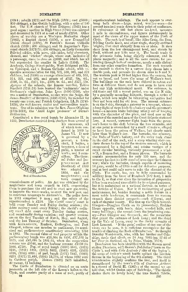
DUMBARTON DUMBARTON
(1841 ; rebuilt 1877) and the High (1864 ; cost £5000;
850 sittings), a fine Gothic building, with a spire of 140
feet. The U.P. church of West Bridgend (1861) has a
good organ ; another in High Street (1826) was enlarged
and decorated in 1874 at a cost of nearly £2700. Otherplaces of worship are a Wesleyan Methodist chapel
(1S62), a Baptist chapel (1S76), a new Evangelical
Union chapel (1882), St Patrick's Roman Catholic
church (1S30 ; 500 sittings), and St Augustine's Epis-
copal church (1872-73 ; 650 sittings), an Early GeometricPointed edifice, with nave, side-aisles, lofty clerestory,
chancel, and ' sticket ' steeple, whose cost, inclusive of
a parsonage, came to close on £9000, and which has all
but superseded the smaller St Luke's (1856). TheAcademy, College Street public, West Bridgend public,
an Episcopal, and a Roman Catholic school, with re-
spective accommodation for 826, 371, 530, 361, and 373children, had (18S0) an average attendance of 485, 533,
314, 221, and 262, and grants of £527, 19s. 6d.,
£398, 5s. 6d., £271, 14s., £220, 2s. 6d., and £177, lis.
Apropos of the schools, the famous novelist, TobiasSmollett (1721-74) here learned the ' rudiments ' underBuchanan's vindicator-
, John Love (1695-1750), whowas a native of Dumbarton, as also were the judge, Sir
James Smollett of Boniiill (1648-1731), its member for
twenty-one years, and Patrick Colquhoun, LL. D. (1745-
1820), the well-known statist and metropolitan magis-trate. One of its ministers was the Rev. James Oliphant(1734-1818), the 'Auld Light professor' of Burns'sOrdination.
Constituted a free royal burgh by Alexander II. in
1222, Dumbarton received fresh charters from several of
his successors, all
of which were con-
firmed in 1609 byJames VI. It nowis governed by aprovost, a town-clerk, 3 bailies, atreasurer, a dean of
guild, a master of
works, and 8 coun-cillors. The Gene-ral Police and Im-provement Act(Scotland) of 1850was adopted in
1854, and themagistrates andtown council are
commissioners of police. An Act was obtained by themagistrates and town council in 1872, empoweringthem to purchase the old and to erect new gas-works,to improve the water-works, to erect the new pier, andto construct tramways to Alexandria. The police forcein 1881 comprised 9 men ; and the salary of thesuperintendent is £150. The sheriff county court is
held every Tuesday and Friday during session ; thedebts recovery court every Friday ; the sheriff's ordin-ary small_ debt court every Tuesday during session,and occasionally during vacation ; and quarter sessionsare on the first Tuesday of March, May, and August,and the last Tuesday of October. Dumbarton, alongwith Kilmarnock, Renfrew, Rutherglen, and PortGlasgow, returns one member to parliament, its muni-cipal and parliamentary constituency numbering 1758in 1882. The annual value of real property within theparliamentary burgh was £15,004 in 1S56, £37,532 in1875, and £45,898 in 1881-82, when the corporationrevenue was £1048, and the harbour revenue £1339 (in1866, £738). Pop. of royal burgh (1801) 2541, (1811)3121, (1821) 3481, (1831) 3623, (1841) 4391, (1851)4590, (1861) 6090 ; of pari, burgh (1851) 5445, (1861)8253, (1871) 11,404, (1881) 13,782, of whom 3482 werein Cardross parish. Houses (1881) 2478 inhabited,40 vacant, 51 building.
The Castle of Dumbarton is situated on an acutepeninsula at the left side of the Leven's influx to theClyde, and consists partly of a mass of rock, partly of
25
Seal of Dumbarton.
superincumbent buildings. The rock appears to over-
hang both rivers— huge, mural, weather-worn— for
several hundred yards down to their point of confluence.
It culminates at 240 feet above sea-level, measures1 mile in circumference, and figures picturesquely in
most of the views of the upper waters of the Firth of
Clyde. The rock is of basalt, like Ailsa Craig, the Bass,
Stirling Castle Rock, and other single, sharply-outlinedheights, that start abruptly from sea or plain. It rises
sheer from the low circumjacent level, and stands byitself, without any hills near it. The basalt tends to
the prismatic form, being slightly columnar, and in
places magnetic ; and is all the more curious for pro-truding through beds of sandstone, nearly a mile distant
from any other eruptive formation. The rock towardsthe summit is cloven by a narrow deep chasm into a
double peak, and presents its cloven sides to S and N.The western peak is 30 feet higher than the eastern, butnot so broad, and bears the name of Wallace's Seat.
The buildings on the rock have differed in extent andform at different times, and do not seem to have everhad any high architectural merit. The entrance, inold times and till a recent period, was on the N side,
by a gradually ascending footpath, through a series of
gates, which now might be interesting antiquities hadthey not been sold for old iron. The present entranceis on the S side, through a gateway in a rampart, whencea long flight of steps leads to a battery and the governor'shouse—a modern white building utterly out of keepingwith the character of the place, and used now as thequarter of the married men of the Coast Brigade stationedhere. A second, narrower flight leads from the gover-nor's house to the cleft between the two summits, andat one point is overarched by a small structure, alleged
to have been the prison of Wallace, but clearly muchlater than Wallace's day. The barracks, the armoury,the Duke of York's battery, and the water tank standin the cleft of the rock, and a steep winding stair con-ducts thence to the top of the western summit, which is
surmounted by a flagstaff, and retains vestiges of asmall circular building, variously pronounced a wind-mill, a Roman fort, and a Roman pharos. The barrackscontain accommodation for only 150 men, and thearmoury has lost its 1500 stand of arms since the Crimeanwar ; while the batteries, though capable of mounting16 guns, would be of little avail for defensive purposes,and at best could only serve to rake the channel of theClyde. The castle, too, can be fully commanded byartillery from the brow of Dumbuck (547 feet), 1 mileto the E, so that ever since the invention of gunpowderit has been rendered unavailable for its original purposes,but it is maintained as a national fortress, in terms ofthe Articles of Union. Nor is it undeserving of goodmaintenance, for, besides forming a noble feature in amost noble landscape, it commands from its westernsummit three distant prospects—each different, andeach of singular beauty. The first up the Clyde towardsGlasgow—Dunglass Castle on its promontory, ErskineHouse opposite, with boats, ships, wooded hills, andmany buildings ; the second down the broadening estu-
ary—Port Glasgow and Greenock, and the mountainsthat guard the entrance of Loch Long ; and the third
up the Vale of Leven, away to the dusky summits of
Loch Lomond. ' If the grand outline of any one of theviews can be seen, it is sufficient recompense for thetrouble of climbing the Rock of Dumbarton. ' So thoughtDorothy Wordsworth, who, with her brother and Cole-
ridge, made that climb, on 24 Aug. 1803 (pp. 57-62 ofher Tour in Scotland, ed. by Princ. Shairp, 1874).
Dumbarton has been identified with the Roman navalstation Thcodosia, with Ossian's Balclutha ( ' town on theClyde '), and with Urbs Legionis (' city of the legion '),
the scene of Arthur's ninth battle against the heathenSaxons in the beginning of the 6th century. The third
identification slightly confirms the first, and itself is
strengthened by the town's title of Castrum Arthuriin a record of David II. (1367) ; of the second we are
told that, whilst Ossian says of Balclutha, ' The thistle
shakes there its lovely head,' the true Scotch thistle,
385
DUMBARTON
though really rare in Scotland, does still grow wild onDumbarton Rock. On this rock (in alto inontis Thm-bretcn) the legend of St Monenna, who died in 519,
records that, consecrated a virgin by St Patrick, she
founded one of her seven Scotch churches. Be this as
it may, from the battle of Ardderyd (573) we find the
Cumbrian British kiugdom of Strathclyde comprisingthe present counties of Cumberland, "Westmoreland,
Dumfries, Ayr, Lanark, Peebles, Renfrew, and Dum-barton ; its northern half occupied by the Damnonii,belonging to the Cornish variety of the British race ; its
first king Rhydderch Hael, Columba's and Eentigern's
friend ; and its capital the strongly fortified rock on the
Clyde's right bank, termed by the Briton's Alcluith
('height on the Clyde'), and by the Gadhelie people
iMawreatan (' fort of the Britons '). By the victory in
654 of Osuiu or Osway of Northumbria over Penda of
Mercia, the ally of these Britons, the latter became Osuiu's
tributaries ; but Ecgfrid's crushing defeat at Dunniehenin 685 restored them to full independence. This lasted
down to 756, when a Northumbrian and Pictish armyunder Eadberct and Angus mac Fergus pressed so hardupon Alclyde, that the place was surrendered after a
four months' siege ; and four years later we hear of the
burning of its fortress, ' which,' says Hill Burton, ' wasprobably, after the fashion of that day, a large collec-
tion of wooden houses, protected by the height of the
rock on which it stood, and, where necessary, by em-bankments.' In 870 Alclyde sustained a second four
months' siege, this time by the Vikings, under Olaf the
White, Norwegian King of Dublin, who reduced its
defenders by famine. Before which siege, with the dis-
organisation of Northumbria, the whole of the British
territory from the Clyde to the Derwent had once morebecome united under its line of independent kings,
claiming Roman descent, the last of whom, Donald,died in 908. Thereon the Britons elected Donald,brother to Constantin, King of Alban ; and thus Alclydebecame dependent on Alban, till in 1018 its sub-kingOwen or Eugenius the Bald was succeeded by Duncan,Malcolm II. 's grandson— the 'gracious Duncan' of
Macbeth. Malcolm dying in 1034, Duncan succeededhim as King of Scotia, in which Strathclyde thenceforth
becomes absorbed. In 1175 the northern portion of the
old Cumbrian kingdom, nearly representee! by Dumbar-tonshire, was formed by "William the Lyon into the
earldom of Levenach or Lennox, and conferred on his
brother David. By 1193 this earldom had come into
possession of Aluin, the first of a line of Celtic earls,
who, down to their extinction in 1425, frequently figure
in Dumbarton's history, but who only retained thecastle till 1238, from which year onward it was alwaysa royal fortress. As such, during the competition for
the Scottish crown (1292), it was delivered up to EdwardI. of England, who gave it over to Baliol, on the ad-
judication in his favour ; but from 1296 to 1309 it washeld again by the English, with Sir Alexander Monteithfor governor. He it was who on 5 Aug. 1305 tookVT
allace captive at Glasgow, so that likely enough the' ubiquitous troglodyte ' was really for a week a prisoner
here, where (as elsewhere) his huge two-handed sword is
preserved in the armoury, along with old Lochaberaxes and skene-dhus 'from Bannockburn,' flint pistols,
rude pikes, and tattered regimental colours. In 1313,according to our least veracious chroniclers, Bruce,almost single-handed, achieved the capture of Dumbar-ton Castle. A sort of Guy Fawkes and Bluebeard episodethis, with keys and a cellar figuring largely therein
—
the cellar first full of armed English soldiery, who are
overawed by the Monarch, and the traitor Monteithnext led to it in fetters, but presently pardoned by themagnanimous Hero. Anyhow, by Bruce the castle wascommitted to the governorship of Sir Malcolm Flemingof Cumbernauld, whose son was one of the few thatescaped from Halidon Hill (1333), when Dumbartonbecame the rallying-point of the remnant adhering to
the boy-king, David II. Sir Robert de Erskine wasnext appointed governor (1357), and after him Sir Johnde Dennistoun or Danielstoun. He was succeeded by
386
DUMBARTON
his son, Sir Robert, on whose death in 1399 "Walter,
his brother, the parson of Kincardine O'Neil, forcibly
seized the castle, as belonging heritably to his family.He held it till 1402, surrendering it then in the hope of
obtaining the vacant see of St Andrews—a hope cutshort by his death before the end of the year. In 1425James Stewart, son of the late Regent Albany, andgrandson of the eighth and last Celtic Earl of Lennox,assaulted and burned the town of Dumbarton, andmurdered the king's uncle, Sir John Stewart, who heldthe castle with only thirty-two men. Dumbarton wasnext besieged in 1481 by the fleet of Edward IV., butwas bravely and successfully defended by Sir Andrew"Wood of Largo. For the next half century the historyof Dumbarton is virtually that of the Stewart Earlsof Lennox. Their founder, John, having taken uparms against James IV. , the castle was twice besiegedin 1489—first by the Earl of Argyll without success,
and then by the young king himself, who after a six
weeks' leaguer compelled the four sons of Lennox to
capitulate. The surprise of the castle one stormy nightby John, third Earl (1514), the landing here of Albanyfrom France (1515), the establishment of a Frenchgarrison (1516), the interception of a large French sub-sidy (1543) by Matthew, fourth Earl, Lord Darnley'sfather, and his design of betraying the fortress to Eng-land (1544)—these are events that can merely be glancedat in passing. On 7 Aug. 1548 Queen Mary, thensix years old, embarked at Dumbarton for France ; in
July 1563 she paid a second visit to the castle ; andhither her army was marching from Hamilton when its
progress was barred at Langside, 13 May 1568. Fornearly three years the castle held out for her under its
governor, John, fifth Lord Fleming ; and the story of
how it was taken by escalade on the night of 1 April1571 deserves to be told with some fulness. CaptainThomas Craufurd of Jordanhill, to whom the attackwas entrusted, had long been attached to the house of
Lennox. He it was whose evidence was so importantregarding the death of Darnley, and who afterwardsaccused Lethington as one of the murderers, since whichtime he appears to have resumed the profession of arms.In the enterprise he was assisted by Cunningham, com-monly called the Laird of Drumwhassel, one of the
bravest and most skilful officers of his time, and he hadbeen fortunate in bribing the assistance of a man namedRobertson, who, having once been warden in the castle,
knew every crag of the rock, 'where it was best to climb,
and where fewest ladders would serve.' With him anda hundred picked men Craufurd set out from Glasgowafter sunset. He had sent before him a few light horse
to prevent intelligence by stopping all wayfarers, andabout midnight he arrived at Dumbuek, within a mile
of the castle, where he was joined by Drumwhassel andCaptain Hume. Here he explained to the soldiers the
hazardous service on which they were engaged, pro-
vided them with ropes and scaling ladders, and,
advancing quickly and noiselessly, reached the rock,
whose summit was fortunately wrapped in a heavy fog,
whilst the bottom was clear. But, on the first attempt,
all was likely to be lost. The ladders lost their holdwhile the soldiers were on them ; and had the garrison
been on the alert, the noise must have inevitably be-
trayed them. They listened, however, and all was still.
Again the ladders were fixed, and, their 'craws' or
steel hooks this time catching firmly in the crevices, the
leaders gained a small out-jutting ledge, where an ash
tree had struck its roots. Fixing the ropes to its
branches, they speedily towed up the rest of their
comrades. They were still, however, fourscore fathomsfrom the wall. They had reached but the middle of the
rock, day was breaking, and when, for the second time,
they planted their ladders, a singular impedimentoccurred. One of the soldiers in ascending was seized
with a fit, in which he convulsively grasped the steps so
firmly, that no one could either pass him or unloose his
hold. But Craufurd's presence of mind suggested a
ready expedient ; he tied him to the ladder and turned
it round, so the passage was once more free. They were
DUMBARTON
now at the bottom ot the wall, where the footing wasnarrow and precarious ; but once more fixing their
ladders in the copestone, Alexander Ramsay, Craufurd's
ensign, and two other soldiers, stole up, and though at
once discovered by a sentinel, leapt down and slew him,sustaining the attack of three of the guard till they werejoined by Craufurd and the rest. Their weight andstruggles to surmount it brought the wall down with a
run, and afforded an open breach, through which theyrushed in shouting, 'A Darnley, a Darnley!' Craufurd's
watchword, given evidently from affection to his hapless
master, the murdered king. According to Dr Hill
Burton, the point thus gained was the top of thewestern peak, the ascent being made to the left of thepresent entrance ; and from this vantage-ground theassailants now turned the cannon on the garrison, who,panic-struck, attempted no resistance. Fleming, the
governor, from long familiarity with the rock, managedto escape down the face of an almost perpendiculargully, and, passing through a postern which opened uponthe Clyde, threw himself into a fishing-boat, and so
passed over to Argyllshire. In this achievement theassailants lost not a man, and of the garrison only four
were slain. In the castle were taken prisoner JohnHamilton, Archbishop of St Andrews, who was foundwith mail shirt and steel cap on, Verac, the Frenchambassador, Fleming of Boghall, and John Hall, anEnglish gentleman, who had fled to Scotland after
Dacre's rebellion. Lady Fleming, the wife of thegovernor, was also taken, and treated by the Regentcourteously, being suffered to go free, and carry off withher her plate and furniture. But Hamilton, the primate,was instantly brought to trial for the murder of Darnleyand Moray, condemned, and hanged and quarteredwithout delay.
In 15S1, as a signal and crowning favour, EsmeStewart, the new-made Duke of Lennox, received thegovernorship of Dumbarton Castle, one of the threegreat national fortresses ; in 1639 it was seized on aSunday by the Covenanters, its captain, ' a vigilant
gentleman,' attending church with so many of thegarrison that, they being taken on their homeward way,the place was defenceless. It was, however, recapturedby the Royalists, to be lost again on 28 Aug. of thefollowing year. Thereafter the castle drops quietly outof history, a visit from Queen Victoria on 7 Aug. 1847being all that remains to be noticed. Nor of the townis there anything worthier of record than the injurydone it by floods of the Leven in 1334, and again in theearly years of the 17th century, when the magistratesfelt obliged to apply to parliament for aid in construct-ing bulwarks. A commission of 1607 reported that ' naless nor the sowme of threttie thousand poundis Scottis
money was abill to beir out and furneis the necessarcharges and expenses in pforming these warkis that are
liable to saif the said burgh from utter destructioune.
'
A grant of 25,000 merks Scots was accordingly made for
the purpose by parliament ; and, this proving insuffi-
cient, a farther sum of 12,000 was afterwards granted byKing James. In 1675 Dumbarton gave the title ofEarl in the peerage of Scotland to George, third son ofthe first Marquis of Douglas, but this peerage becameextinct at the death of his son about the middle of the18th century.
The parish of Dumbarton is bounded NW by Bonhill
;
N by Kilmaronock ; NE by Drymen and Killearn inStirlingshire ; SE by Old Kilpatrick ; S, for 3 furlongs,by the river Clyde, which separates it from Renfrewshire
;
and W by the river Leven, dividing it from Cardross.Its utmost length, from NE to SW, is 6J miles ; its
breadth, from E to W, varies between l\ furlong and5§ miles ; and its area is 8563 acres, of which 98| areforeshore and 174 water. The Leven winds 4$ milessouthward along all the western border, and is joinedfrom the interior by Murroch Burn ; whilst OvertonBurn, tracing much of the south-eastern boundary, anditself joined by Black Burn, flows direct to the Clyde.The southern and western districts, to the mean distanceof 1J mile from the Leven, present no striking natural
DUMBARTONSHIRE
feature except the Castle Rock, in whose vicinity theylie so little above sea-level as to be sometimes flooded
by spring tides. From this low valley the surface rises
north-eastward to Auchenreoch and Dumbarton Muirs,attaining 895 feet at Knockshanoch, 1228 at DoughnotHill, 1118 at Knoekupple, and 892 at Knockvadie.Limestone abounds at Murioch Glen, 24 miles NNEof the town ; red sandstone is quarried on the moors
;
and an excellent white sandstone occurs at Dalreoch,in Cardross parish. The soil—in a few fields a rich
alluvium—in some of the arable tracts is very clayey, in
others gravelly, and in most somewhat shallow, yetgenerally fertile ; whilst that of the moors is sparse,
and of little value. Strathleven, on the river Levenopposite Renton, is the chief mansion. Dumbarton is
seat of a presbytery in the Synod of Glasgow and Ayr;
the living is worth £202. Valuation of landward portion(18S2) £5108, 5s. Pop. of entire parish (1801) 2541,
(1831) 3623, (1861) 6304, (1871) 8933, (1S81) 10,837, of
whom 538 were in the iandward portion. —Ord. Sur.,
sh. 30, 1S66.
The presbytery of Dumbarton comprises the old
parishes of Arrochar, Baldernock, Balfron, Bonhill,Buchanan, Cardross, Drymen, Dumbarton, Fintry, Kil-
learn, Kilmaronock, New Kilpatrick, Old Kilpatrick,
Luss, Roseneath, Row, and Strathblane ; the quoadsacra parishes of Alexandria, Clydebank, Craigrownie,Dalreoch, Garelochhead, Helensburgh, Jamestown,Milngavie, and Renton ; and the chapelries of Dun-tocher, Helensburgh - West, and Kilcreggan. Pop.(1S71) 56,216, (1881) 70,0S1, of whom 8971 were com-municants of the Church of Scotland in 187S.—TheFree Church also has a presbytery of Dumbarton, with2 churches at Dumbarton, 2 at Helensburgh, 3 at
Renton, and 14 at respectively Alexandria, Arrochar,Baldernock, Bonhill, Bowling, Cardross, Duntocher,Garelochhead, Killearn, Luss, Old Kilpatrick, Rose-neath, Shandon, and Strathblane, which 21 churchestogether had 4262 members in 1SS1.
See, besides works cited under Dumbartonshire,John Glen's History of the Toion and Castle of Dumbar-ton (Dumb. 1847); William Fraser's The Lennox (2 vols.,
Edinb., 1874) ; and Donald Macleod's Castle and Townof Dumbarton (Dumb. 1877).
Dumbarton and Helensburgh Railway. See NorthBritish Railway.Dumbartonshire, a county, partly maritime, butchiefly
inland, in the W of Scotland, comprising a main bodyand a detached district. The main body is boundedN by Perthshire, E by Stirlingshire, SE by Lanark-shire, S by the river Clyde and the upper Firth of Clyde,
which divide it from Renfrewshire, and W by Argyll-
shire. Its eastern boundary, from Island Vow, aboveInversnaid, to the mouth of Endrick "Water, runs alongthe middle of Loch Lomond ; thence, to the mouth of
Catter Burn, is traced by Endrick Water ; and, in the
extreme SE, for 3 miles above Maryhill, is traced
by the river Kelvin. Its western boundary, except
for 9J miles in the extreme N, is all formed byLoch Long. Its outline bears some resemblance to that
of a crescent with the convexity towards the NE. Its
length, from N to S, varies between 4| and 24J miles,
its breadth, from E to W, between \\ and 18J miles.
The detached district, commencing i\ miles E by N of
the nearest point of the main body, and 5 NNE of
Glasgow, comprises the parishes of Kirkintilloch andCumbernauld ; is bounded N and E by Stirlingshire, Sand W by Lanarkshire ; and measures 12g miles in
maximum length from W by S to E by N, and 4 in
maximum breadth. The area of the entire county is
270 square miles or 172,677 acres, of which 3S14 are
foreshore and 14,312| water, whilst 19,030 belong to the
detached district.
All the northern or Arrochar district of the county,
lying partly around the head of Loch Lomond, partly
between that lake and Loch Long, is a group of moun-tains, intersected by deep glens. Culminating in BenVorlich (3092 feet) and Ben Vane (3004), it displays all
the most characteristic features of grand, romantic,387
DUMBARTONSHIRE
beautiful Highland scenery. The central part fromFinnart and the middle of Loch Lomond to the hill-
screens of the Firth of Clyde, but including the penin-sula of Roseneath, is a region varying between thehighland and lowland, and exquisitely blends many a
feature of sternness and wildness with many of the sweet-
est loveliness. The lofty hills of Arrochar and Luss,in particular, contrast most strikingly with the wide ex-
panse of the pellucid waves of the queen of lakes, far-
famed Loch Lomond. ' Here savage grandeur, in all
the towering superiority of uncultivated nature, is seenside by side with the very emblem of peace and tran-
quillity, an alpine lake, which the winds reach onlyby stealth.' The southern district, comprising theseaboard of the Clyde, the Vale of Leven, and the tract
eastward of that vale to the extremity of the main bodyof the county, is generally lowland and rich almost to
excess with gentle contour and tasteful ornamentation;
yet even this is diversified—to some extent broadlyoccupied—with characters of abruptness and boldness,
shown in the shoulders of the Cardross hills, in the massof Dumbarton Rock, in the brows of Dumbuck and of
basaltic ranges northward of it, and in the capriciously
escarped, romantic acclivities of the Kilpatrick Hills,
which, extending 54 miles from E to W, and attaining
a maximum altitude of 1313 feet in Duncomb and Fyn-loch, contain many rich close scenes, and commandsome of the finest and most extensive views in Scotland.The detached district is all lowland, and of tame appear-ance, nowhere exceeding 480 feet above sea-level, yet
extends so near the roots of the Campsie Fells as to
borrow effects of scenery similar to those which thetracts along the Clyde borrow from the Kilpatrick Hills.
No region in Scotland can boast of finer scenery thanthe count}' of Dumbarton ; and certainly none morevaried, or oftener visited and admired by strangers.
Considerably more than one-half of Loch Lomond,and fully two-thirds of the islands in it, belong to Dum-bartonshire. Loch Sloy in Arrochar, Lochs Humphreyand Coclmo in Old Kilpatrick, Fynloch in Dumbarton,Fannyside Loch in Cumbernauld, and several smallerlakes, have aggregately a considerable area. The river
Clyde, from opposite Blythswood to the influx of theLeven, runs 8| miles along the southern border ; and,like the Firth, onward to the south-western extremityof Roseneath, teems with the vast commercial traffic
of Glasgow. The Leven, winding 7J miles south-
ward from Loch Lomond to the Clyde, bisects thelowland district of the county's main body, and is
notable at once for the purity of its waters, the richness
of its vale, and the profusion of bleachfields and print-
works on its banks. The Endrick, over all its run onthe eastern boundary, is a beautiful stream. The Kel-
vin, though ditch-like where it approaches the mainbody's south-eastern border, yet at Killermont andGarseube exhibits much exquisite beauty. AllanderWater drains most of New Kilpatrick to the Kelvin.
The Falloch, Inveruglas, Douglas, Luss, Finlas,
Fruin, and other brooks and torrents, with manyfine cascades, drain most of the Highland tracts
into Loch Lomond. The Kelvin traces most of thenorthern boundary of the detached district, but every-
where there retains its ditch-like character. The slug-
gish Luggie drains the western part of the detacheddistrict to the Kelvin, and some tiny streamlets drainthe eastern part to the Carron. Many beautiful rivulets
and burns are in the interior of the main body, runningeither to the principal rivers, or pursuing independentcourses to the Clyde, Gare Loch, or Loch Long. TheForth and Clyde Canal traverses the N border of thedetached district, and afterwards passes along the Sborder of the main body to the Clyde at Bowling Bay.Springs of excellent water are almost everywhere nume-rous and copious.
The climate is exceedingly various. Some parts of
the county, such as the seaboard of the Clyde and the
Vale of Leven, are comparatively genial, while other
parts, as the pastoral lands of Arrochar and the plateauxof the Kilpatrick Hills, are comparatively severe. Even
388
DUMBARTONSHIRE
small tracts only a few miles distant from one anotherare so strongly affected by the configuration of the sur-
face as to differ widely in regard to heat, moisture, andthe winds. Nowhere in Scotland do heights and hol-
lows act more powerfully on climate, the former in theway of attracting or cooling, the latter in ventilating or
warming. Even in places so near and like one anotheras Keppoch, Camus Eskan, Ardincaple, and Bellretiro,
the aggregate rain-fall, as ascertained by gauges all
of one construction, was respectively 43 '15, 45 '5, 50 '57,
and 52 '5. The climate, on the whole, however, is good.
There is more moisture, indeed, than in many other
parts of Scotland, but the excess is not so much in the
quantity that falls as in the length of time it takes to
fall ; and whatever disadvantage arises from a corre-
sponding excess of cloudiness, seems to be well counter-
balanced by the prevalence of the genial "W windduring no less than about nine months in the year.
Sharp E winds blow in spring, but, even in their
sharpest moods, they are not so keen as in the eastern
counties, and are much less accompanied with frosty
fogs.
The formation consists of mica slate in the N, withdykes of whinstone and greenstone ; Lower Silurian
towards the S ; and Old Red sandstone along the Clydeestuary, where trap rocks of various kinds form Dum-barton Castle Rock and Dumbuck Hill, besides themain bulk of the Kilpatrick Hills. Mica slate, alwaysstratified, often laminated, and generally compris-
ing much mica, much quartz, and very little fel-
spar, forms the greater part of the highest andmost striking uplands of the N. The quartz of the
mica slate is sometimes so extremely abundant as to
render the rock more properly quartzose than micaceous.
The mica slate likewise passes occasionally into talc
slate, and both the mica slate and the talc slate, be-
tween Tarbet and Luss, are intersected by beds of
greenstone, felspar, and porphyry. Clay slate is also
plentiful in the N, lies generally on the mica slate, is
frequently traversed by veins of quartz, abounds with iron
pyrites, and is quarried as a roofing slate at Luss andCamstradden. A kind of limestone slate, or a laminatedrock strongly charged with lime, occurs in the sametracts as the clay slate. Greywacke, chiefly amorphous,seldom slaty, and often abounding with quartz, com-mences a little S of Camstradden slate quarry, and formsa large portion of the parishes of Row and Cardross. Abluish-black limestone is frequently associated with the
greywacke. Old Red sandstone extends from the lower
part of Loch Lomond, through the western part of Bon-hill, and through Cardross and Row, to the SW of Rose-
neath. A yellow sandstone of quite different lithological
character from the Old Red sandstone, easily chiseled,
but hardening by exposure, occurs at some parts of the
seaboard of the Clyde, and extends at intervals and fit-
fully to Netherton-Garscube. Carboniferous limestone,
coal, shale, and small beds of ironstone lie above the
sandstones in the eastern wing of the main body of the
county, and throughout the detached district ; butthey aggregately yield a very poor produce comparedwith that of other Scottish regions of the coal forma-
tion, Dumbartonshire's mineral output for 1S78 being
210,520 tons of coal and 3000 of fireclay.
The land area of the county is 154,541^ acres, but
was formerly over-estimated at 167,040 acres ; and, by a
competent agricultural authority, who so over-estimated
it, was classified into 6050 acres of deep black loam,
30,970 of clay on a subsoil of till, 25,220 of gravel or
gravelly loam, 3750 of green hilly pasture, 99,400 of
mountain and moor, 720 of bog, and 930 of isles in
Loch Lomond. The rivalry of proprietors in the
lowland districts, the demand from the markets of
Glasgow and Greenock, the great increase of general
local trade, and the new facilities of communication bysteamboats and railways, have powerfully stimulated
agricultural improvement. Draining, fencing, reclama-
tion, skilful manuring, ameliorated courses of rotation,
and the use of better implements, have all been brought
largely into play, with the result of greatly enhancing
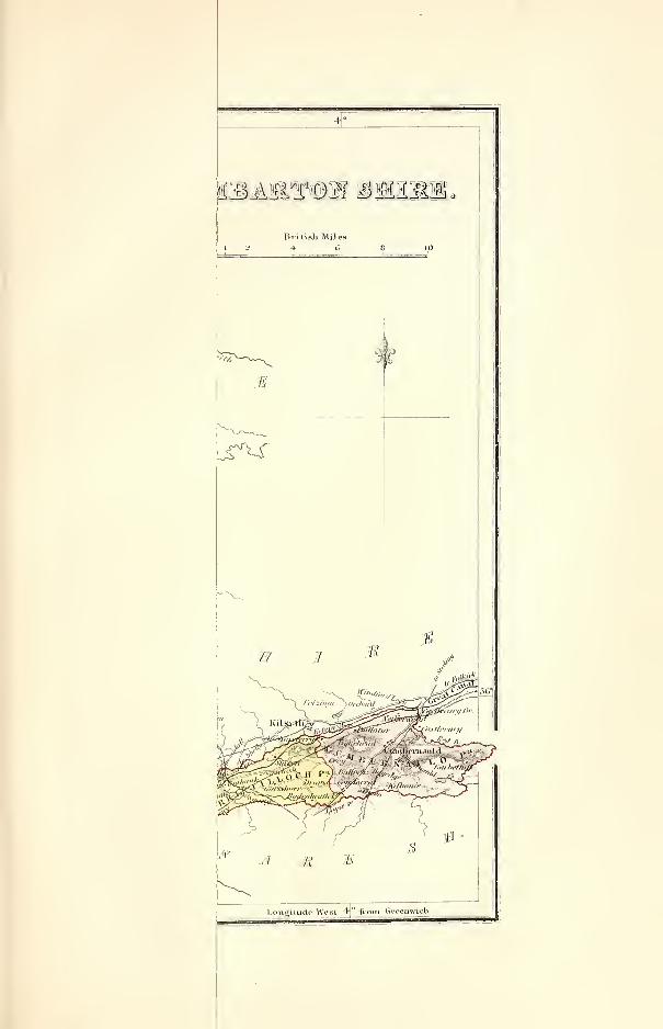
sioMMMn $igiogl
jr^s
4°
.British Miles4- 6
M
4 1 I
Longitude West 4° from Greenwich.
DUMBARTONSHIRE
the value of land and increasing the amount of produce.
In 1S70 the percentage of the cultivated area was 24 '9,
in 1SS1 26 '8, viz., 5'8 under corn crops, 2'8 under green
crops, 7 '7 under clover, etc., and 10 '4 under permanentpasture. A great extension of sheep-farming, begun in
the early part of the present century, went on vigorously
and rapidly in the upland districts ; and was accom-panied there by the practice of moor-burning, whichoccasioned such a change on the face of the hills, that
tracts formerly brown and heathy are now covered withpasture. The growth of copsewood on lands unfit for
tillage or pasture has long been much practised ; and,
besides being ornamental to the landscape, yields a
considerable revenue. In 1872 there were 8388 acres
under wood. The cattle, in the upland districts, are
of the Highland breeds ; in the lowland districts, gene-
rally either crosses between these and the Ayrshire, or,
on dairy farms or for dairy purposes, pure Ayrshire.
The sheep, on the hill districts, are mostly the black-
faced ; on the low grounds, are generally the Cheviot,
wdth some mixture of English breeds. The native horses
are small animals, of intermediate character betweenthe ordinary cart-horse and Highland pony ; and withfew exceptions are scarcely ever used in field labour.
Clydesdale horses, either purchased in the Lanarkshiremarkets or bred from good stallions, are in common use
on the arable farms. Swine, mostly for home use, are
kept by almost all the farmers, and by many cottagers.
Herds of fallow deer are on Inchmurrin and Inchlonaigin Loch Lomond ; and red deer once abounded in the
mountain districts, but were long ago exterminated.
Bee-keeping is largely carried on, especially at Clynder.
Manufactures struck root in Dumbartonshire in the
year 172S, and were greatly stimulated and extendedby the formation of good roads, the deepening of the
Clyde, the opening of the Forth and Clyde Canal, the
introduction of steam navigation, and the opening of
successively the Dumbartonshire, the Vale of Leven, the
Forth and Clyde, the Dumbarton and Helensburgh,and the Strathendrick railways. They have also derivedincrease, from demands and facilities for shipbuilding,
from the growing increase of summer tourists to LochLomond and Loch Long, and from summer residence of
multitudes of Glasgow citizens at Helensburgh, Gareloch-
head, Eoseneath, Kilcreggan, Cove, Arrochar, and other
places ; and they now figure so largely and vigorously as to
compete in value with the arts of agriculture. Most of
the low tracts of the county, even such as possess nocoal within their own limits, have followed Glasgow andtried to rival it in some of its departments of manufac-ture. The Vale of Leven, in particular, is crowded withbleaehfields, printfields, dye-works, and cotton-works,
giving employment to thousands. Cotton-printing,
cotton-spinning, paper -making, iron-working, ship-
building, the making of chemicals, and the distilling of
whisky are all more or less prominent. The salmon andherring fisheries are also highly important and lucrative.
The Forth and Clyde Canal, besides serving for waterconveyance, concentrates some trade around its W endat Bowling Bay. The deepening of the Clyde, in addi-
tion to its greatly improving the navigation and stimulat-
ing commerce, produced the incidental advantage of
adding to the county about 600 acres of rich land—the
spaces behind the stone walls, formed for confining thetidal current, having rapidly filled up with a fine
alluvial deposit, which soon became available first
for meadow and next for the plough. The steamboatcommunication is very ample, including lines up anddown Loch Lomond, and connecting all the chief places
on the Clyde and on the sea-lochs with Greenock andGlasgow. The railways comprise a continuous line
from Helensburgh east-south-eastward through Dum-barton to the south-eastern boundary at the Kelvin, andvarious other lines and branch lines, which are all linked
by junctions into the general railway system of Scotland.
The only royal burgh is Dumbarton. The other
towns are Helensburgh, Kirkintilloch, Alexandria,Bonhill, Kenton, and Cumbernauld. The chief villages
are Arrochar, Balloch, Bowling Bay, Cardross, Clyde-
DUMBARTONSHIRE
bank, Condorrat, Cove, Dalmuir, Dalsholm, Dum-buck, Duntocher, Faifley, Gairlochhead, Garscadden,Garscube, Hardgate, Jamestown, Kilcreggan, Knights-wood, Little Mill, Luss, Milton, Netherton, New Kil-
patrick, Old Kilpatrick, Roseneath, Smithston Rows,Waterside, with parts of Yoker and Lenzie. The prin-
cipal seats are Arden House, Ardincaple, Ardmore,Ardoch, Auchendennan, Auchentorlie, Auchentoshan,Balloch Castle, Balvie, Baremman, Barnhill, Bloomhill,Bonhill Place, Boturich Castle, Cameron House, CamusEskan, Clober House, Cockno House, Cowden Hill,
Craigrowuie, Cumbernauld House, Darleith, DumbuckHouse, Edinbarnet, Finnart, Garscadden, Garscube,Gartshae House, Glenarbuck, Helenslee, Keppoch,Killermont, Kilmahew, Kilmardinny, Knoxland, Len-noxbank, Roseneath Castle, Rossdhu, Strathleven,
Stuckgowan, Tillechewan Castle, Westerton House,and Woodhead. According to Miscellaneous Statistics
of the United Kingdom (1879), 153,736 acres, with a
total gross estimated rental of £325,407, were divided
among 2346 landowners, one holding 67,041 acres
(rental £12,943), two together 15,979 (£8794), eight
20,221 (£29,970), twelve 17,515 (£24,745), eighteen
12,152 (£15,336), sixty-three 14,737 (£67,632), etc.
The places of worship within the civil county, in 1881,
were 17 quoad civilia parish churches, 9 quoad saera
parish churches, 3 chapels of ease, 21 Free churches, 11
U.P. churches, 1 United Original Secession church, 1
Independent chapel, 2 Baptist chapels, 1 Methodistchapel, 1 Evangelical Union chapel, 3 Episcopal churches,
and 5 Roman Catholic churches. In Sept. 1880 the
county had 50 schools (39 of them public), which, withtotal accommodation for 11,695 children, had 9729on the registers and 7171 in average attendance, the
certificated, assistant, and pupil teachers numbering96, 8, and 87.
The county is governed (1882) by a lord-lieutenant,
a vice-lieutenant, 22 deputy-lieutenants, a sheriff, a
sheriff-substitute, and 109 magistrates. The sheriff
court for the county, and the commissary court are
held at Dumbarton on every Tuesday and Fridayduring session ; sheriff's small debt courts are held at
Dumbarton on every Tuesday during session and occa-
sionally during vacation ; at Kirkintilloch, on the first
Thursdays of March, June, September, and December ;
and quarter sessions are held at Dumbarton on the first
Tuesdays of March, May, and August, and the last
Tuesday of October. The county gaol is at Dumbarton,and has been noticed in our account of that town. Thecommittals for crime, in the annual average of 1841-45,
were 77 ; of 1846-50, 127 ; of 1851-55, 141 ; of
1856-60, 87 ; of 1S61-65, 77 ; of 1865-70, 89 ; of 1871-
75, 50 ; of 1876-SO, 57. The police force of the county,
in 1881, excluding 9 men for Dumbarton, comprised 43
men ; and the salary of the chief constable was £250.
The number of persons tried at the instance of the
police, in 18S0, was 785 ; convicted, 731 ; committed for
trial, 45 ; not dealt with, 35. Exclusive of Dumbarton,the county returns a member to parliament (Liberal
1837-41, Lib. -Con. 1841-6S, Con. 1868-81), its constitu-
ency numbering 3009 in 1882. The annual value of real
property, assessed at £71,587 in 1815, was £147,079 in
1843, £272,138 in 1S75, and £3S4,627 in 1882, or, in-
cluding railways, etc., £458,761, 13s. Pop. (1801)
20,710, (1811) 24,169, (1821) 27,317, (1831) 33,211,
(1841) 44,296, (1S51) 45,103, (1861) 52,034, (1871)
58,857, (1881) 75,327, of whom 37,311 were males, and38,016 females. Houses (1881) 14,259 inhabited, 1238
vacant, 191 building.
The registration county takes in a part of New Kil-
patrick parish from Stirlingshire, and had, in 1881, a
population of 78,176. All the parishes are assessed for
the poor, and 9 of them, with 3 in Stirlingshire and 1 in
Perthshire, are included in Dumbarton poor law com-bination. The number of registered poor, during the
year ending 14 May 1880, was 1313 ; of dependants onthese, 881 ; of casual poor, 899 ; of dependants onthese, 773. The receipts for the poor in the sameyear were £14,408 ; and the expenditure \vas£13,790.
383
DUMBARTONSHIRE RAILWAY
The number of pauper lunatics was 148, and the ex-
penditure on their account was £1163, 3s. 6d. The per-
centage of illegitimate births was 6 '7 in 1871, 5 '9 in
1876, 5-4 in 1879, and 4'8 in 1880.
The territory now forming Dumbartonshire belongedanciently to the Caledonian Damnonii or Attacotti ; wasincluded by the Romans in their province of Vespasiana
;
and, exclusive of its detached district, was long a mainpart of the ancient district of Lennox or Levenax.That district included a large part of what is now Stir-
lingshire, and portions of what are now Perthshire andRenfrewshire. It was constituted a countyby William the
Lyon, and underwent curtailments after some period in
the 13th century, reducing it to the limits of the present
main body of Dumbartonshire. The county then changedits name from Lennox to Dumbartonshire ; and, in the
time of Robert I. , had annexed to it its present detacheddistrict. It was the scene of many contests betweenCaledonians and Romans, between Cumbrians andSaxons, between Scots and Picts, between Highlandclan and Highland elan, between the caterans and the
Lowlanders, between different parties in the several
civil wars of Scotland ; and made a great figure, espe-
cially in the affairs of Antoninus' Wall and those
of the Cumbrian or Strathclyde kingdom, in the events
of the wars of the succession, and the turmoils of the
cateran forays in the time of Rob Roy. Some of the
salient points in its history are touched in the account
of Dumbarton Castle, and in the article on Lennox.Several cairns and a cromlech still extant, several
rude stone coffins, and fire-hollowed canoes foundimbedded in the mud of the river close to the castle a
few years ago, are memorials of its Caledonian period.
A number of old rude forts or entrenchments, parti-
cularly in its Highland districts, are memorials of
Caledonian, Pictish, and Scandinavian warfare withinits limits. Vestiges of Antoninus' Wall, and relics
found on the site of that wall along all the N border of
its detaohed district, and along the SE border of its
main body onward to the wall's western end at Chapel-hill in the vicinity of Old Kilpatrick village, and anancient bridge and a sudatorium at Duntocher, are
memorials of the Romans. Several objects in Dum-barton Castle, and particularly historical records in
connection with the castle, are memorials of the civil
wars ; a mound in the E end of Cardross parish, notfar from Dumbarton town, indicates the last residence
or death-place of Robert Bruce ; numerous old castles,
some scarcely traceable, some existing as ruins, someincorporated with modern buildings, as at Faslane, Bal-
loch, Ardincaple, Dunglass, and Kirkintilloch, are
relics of the several periods of the baronial times ; andother objects in various parts, particularly in Glenfruin,
are memorials of sanguinary conflicts among the clans.
See Joseph Irving's History of Dumbartonshire, Civil,
Ecclesiastical, and Territorial (Dumb. 1860) ; his Boole
of Dumbartonshire (3 vols. 1879) ; and William Fraser's
Chiefs of Colquhoun and their Country (2 vols., Edinb.,
1869).
Dumbartonshire Railway. See Caledonian Rail-way.Dumbreck, a hill on the mutual boundary of Strath-
hlane and Campsie parishes, SW Stirlingshire, culminat-
ing 1 J mile NNE of Strathblane village, and rising to analtitude of 1664 feet above sea-level. It forms part of
the western chain of the Lennox Hills ; and overhangsBallagan Glen on the W, and Fin Glen on the E.
Dumbroek, a triangular loch (2 x § furl. ) in Strath-
blane parish, SW Stirlingshire, 1 mile SW of Strath-
blane village.
Dumbuck, a village and a mansion in the W of OldKilpatrick parish, Dumbartonshire. The village standsnear the Clyde, If mile E by S of Dumbarton ; and theneighbouring mansion, Dumbuck House, is the propertyof John Edward Geils, Esq. (b. 1812; sue. 1843), whoowns 655 acres in the shire, valued at £1209 per annum.Wooded Dumbuck Hill (547 feet), immediately to the
N, is a bold basaltic abutment from the south-westernextremity of the Kilpatrick Hills, that stoops preci-
390
DUMFRIES
pitously to Dumbarton plain. It commands a magni-ficent prospect from Tinto to Arran, and from theGrampians to Ayrshire ; and so much outtops Dum-barton Castle as easily to command it by artillery, yetwas occupied with little effect by Prince Charles Edward'sforces in the '45.
Dumbuils, an eminence (300 feet) in Forgandennyparish, SE Perthshire, 1 mile SE of Forgandenny village.
Low, craggy, and elliptical, it has traces on the crests
of its accessible sides of an ancient bulwark, formed of
very large granite boulders ; and it commands a brilliant
view of Lower Strathearn and the Firth of Tay.Dumcrieff, a handsome mansion, with finely wooded
grounds, in Moffat parish, N Dumfriesshire, on theright bank of Moffat Water, 2 miles SE of Moffat town.Owned first by Murrays, then by the future Sir GeorgeClerk of Penicuik, it was the residence about 1785 of
John Loudon Macadam, of road-making celebrity, andnext of Burns's biographer, Dr James Currie (1756-
1805), by whom, a few months before his death, it wassold to Dr John Rogerson (1741-1S23), court physicianat St Petersburg for close upon fifty years. It nowbelongs to his great-grandson, Lord Polio, who holds7220 acres in the shire, valued at £3044 per annum.See Duncettb.
Dumfin, an eminence (200 feet) in Luss parish, Dum-bartonshire, on the left bank of Fruin Water, 3 milesENE of Helensburgh. It takes its name, signifying
'the fort of Fin,' from its legendary connection withFingal ; and it has traces of an ancient fort.
Dumfries, a town and a parish on the SW border of
Dumfriesshire. A royal and parliamentary burgh, aseaport—since the era of railways of little importance—a seat of manufacture, the capital of Dumfriesshire, theassize town for the south-western counties, and practically
the metropolis of a great extent of the S of Scotland,
the town stands on the left bank of the river Mth, andon the Glasgow and Sonth-Western railway at thejunction of the lines to Lockerbie and Portpatrick, byrail being 14i miles WSW of Lockerbie, 15* TOW of
Annan, 19* NE of Castle -Douglas, SO* EKE of Port-
patrick, 42A SE of Cumnock, 92 SE by S of Glasgow,39| S byW of Edinburgh, 33 TOT," of Carlisle, and 333|NNW of London. The site is mainly a gentle elevation,
nowhere higher than 80 feet above sea-level, partly the
low flat ground at its skirts ; extends about 1 mile from Nto S, parallel to the river ; rises steeply from the banksat the N end, and is blocked there by a curve in theriver's course ; and bears the lines of Castle Street andHigh Street along its summit. Maxyvelltown, alongthe Kirkcudbrightshire bank of the Nith, directly oppo-site and nearly of the same length as Dumfries, seemsto be rather a part of the town than a suburb, and is
partly included in the parliamentary (though not in theroyal) burgh. Behind Maxwelltown to theW is Corbelly
Hill, a broad-based, round, and finely-outlined elevation,
on the summit of which stand a church and convent of
the Immaculate Conception, erected in 1881-82, from de-
signs by Messrs Pugin, for Nuns of the Perpetual Adora-tion of the Blessed Sacrament ; whilst a little lower downis a picturesque building, serving the double purposeof an observatory and a museum of natural history andantiquities The view from the top of this hill is veryextensive, and also of great natural beauty—the broadand level valley, for the most part highly cultivated,
of the Nith, abounding in mansions, villas, gardens, andnursery grounds ; the Moffat and Galloway Hills, withthe higher peaks of Queensberry and Criffel ; and, over
the Solway, the far-away Cumberland mountains. Alto-
gether, the landscape, seen from the top of Corbelly Hill,
is not so unlike the plains of Lorubardy. Dumfries itself,
in architectural structure, relative position, social charac-
ter, marketing importance, and general influence, holds a
high rank among the towns of the kingdom. It is a
minor capital, ruling in the S with nearly as much swayas Edinburgh in the E. It has either within itself or
in its immediate outskirts an unusually large proportion
of educated and wealthy inhabitants, giving evident
indication of their presence in the tone and manners
;
DUMFRIES
and is seen at once, by even a passing stranger, to be a
place of opulence, taste, and pretension. It has some-times been called, by its admirers, ' the Queen of the
South ;
' and it was designated by the poet Burns, ' Maggieby the banks o' Kith, a dame wi' pride eneueh.' It is
the cynosure of the south-western counties ; and it
sways them alike in the interests of mind, of trade,
and of commerce. It has no rival or competitor,
none at least that can materially compare with it,
between Ayr and Carlisle, or between the Irish Sea andthe Lowther Mountains. And even as a town, thoughother influential towns were not remote, it challengesnotice for its terraces and pleasant walks beside
the river ; for its lines and groups of villas aroundits outskirts ; for its picturesqueness of aspect as
seen from many a vantage-ground in the near vici-
nity ; for the spaciousness of its principal streets
;
and for a certain, curious, pleasing romance in thestyle and collocation of many of its edifices. It so
blends regularity of alignment with irregularity as to
be far more fascinating than if it were strictly regular;
and it so exhibits its building material, a red-colouredPermian sandstone, now in the full flush of freshness
from the quarry, now in worn aspects of erosion by time,
as to present a tout ensemble of mingled sadness andgaiety.
Three bridges connect Dumfries and Maxwelltown;
but only the uppermost one is available for carriages
;
and this commands a good view of all the riverwardfeatures of the burgh and the suburb, stretching partlyto the N but chiefly to the S. The space along theDumfries bank, between the bridges, is a wide street-
terrace ; the space further down, to a much greater dis-
tance, is an expanded or very wide street-terrace, usedpartly as the cattle market, partly as a timber market,and called the Sands ; and the space still further down,opposite the foot of tbe town and a long way past it, is
a broad grassy promenade, fringed along the inner side
by a noble umbrageous avenue, and called the Dock.The central streets present an array of fairly well-ap-pointed shops. All the streets are paved, drained, clean,
and well-lighted ; and outlets on the roads to the 1ST, to
the S, and to the E are studded with villas. Yet partsof the town, particularly numerous lanes or closes off
High Street, some intersecting lanes from street to
street, and portions of the old narrow streets are disagree-
able and unwholesome. The Nith contributes much to
both salubrity and beauty ; approaches, in long windingsweeps, under high banks richly clothed with wood
;
breaks immediately beyond the lower bridge, over ahigh caul, built for the water supply of grain mills onthe Maxwelltown side ; swells into a lake-like expanseabove the caul ; leaps into rapid current at low tide
below it ; is driven back by the flow of tide against it
;
and, both above and below the town, to the extent ofseveral miles, has verdant banks tracked with publicroads and footpaths.
The uppermost bridge was built in 1790-94 ; encoun-tered great difficulties in the erection ; cost, with theapproaches to it, £4588 ; and occasioned, for the formingof Buccleuch Street, an additional cost of £1769 ; and is
a structure more substantial than elegant, yet not desti-
tute of beauty. The middle bridge was built in the 13thcentury by Devorgilla, mother of John Baliol ; and formany long generations was held to be second onlyto London Bridge. It had originally nine arches, andis commonly, but erroneously, said to have had thirteen
;
suffered, in course of burghal improvements, demolitionof about one-third of its length at the Dumfries end
;
has now only six arches ; is ascended, at the Dumfriesend, by a flight of steps, so as to be accessible only byfoot passengers ; and makes a prominent figure both incurious picturesqueness and as a great work of the earlymediaeval times. The lowermost bridge was opened onthe last day of 1875 ; cost nearly £1800 ; is an ironsuspension structure for pedestrians ; measures 203 feetin length and 6-J feet in width ; and has sides of trellis
work rising 35 feet from the roadway to the finial. TheCounty Buildings stand on the S side of the lower part
DUMFRIES
of Buccleuch Street ; were erected in 1S63-66, after
designs by David Rhind, of Edinburgh, with aid of
£10,418 from Government ; are in the Scottish Baronial
style, with peaked towers and open Italianised para-
pets; present an imposing castellated appearance ; rise
to a height of four stories, including a sunk story ; andcontain a court-hall with accommodation for 300 persons,
and offices or rooms for all departments of the countybusiness. The prison of 1851, adjoining the E end of
the County Buildings, is surrounded by a high wall,
that greatly disfigures the aspect of the street. Thisbuilding, not fulfilling the requirements deemed necessary
in modern prisons, has been condemned ; and a site for
a new one was purchased by government in 1881 for
£1400 on the western outskirts of Maxwelltown. TheTown-Hall, on the N side of Buccleuch Street, oppositethe prison, was originally the spacious chapel or ' taber-
nacle' erected by Robert Haldane in 1799. Havingstood for some years unoccupied after the Haldanecollapse, it was purchased in 1814, altered, renovated,and architecturally adorned, to be used as the countycourthouse ; and, after the opening of the new CountyBuildings in 1866, was sold for £1020 to the towncouncil. Within it hang portraits of William and Maryof Orange, and Charles, the third Duke of Queensberry
;
and here is preserved the famous Silver Gun of the SevenTrades, the mimic cannon, 10 inches long, which JamesVI. presented to the craftsmen in 1617, to be shot for
on Kingholm Merse—a custom kept up till 1831. Thestack of buildings in the centre of High Street, cleavingit for a brief space into two narrow thoroughfares, con-tains the old town council room, and is surmounted bya steeple called originally the Tron, but now the Mid,Steeple. This steeple was erected in 1707, at a cost of
£1500, from designs (not of Inigo Jones, but) of a cer-
tain Tobias Backup of Alloa. It figures prominently,both in the High Street's own range and in every land-
scape view of the town, but has now a weather-worn andneglected appearance. The Trades Hall, on the E side
of High Street opposite the Mid Steeple, was rebuilt
in 1804 at a cost of £11,670 ; and, the trades' corpora-
tion privileges having been abolished in 1846, wassold to a merchant in 1847 for £650. The AssemblyRooms stand in George Street, were erected at a compara-tively recent period, and are neat and commodious.The Theatre, in Shakespeare Street, built in 1790, andrebuilt and decorated in 1876, was the scene of early
efforts of Edmund Kean and Macready. A Doric columnto the memory of the third Duke of Queensberry waserected in Queensberry Square in 1804 ; and an orna-
mental public fountain (I860) stands in the centre of
the lower expansion of High Street.
The railway station stands at tbe north-eastern extre-
mity of the town ; was constructed, in lieu of a previous
adjacent one, in 1S63 ; and contains accommodation for
the junctions of the lines from Lockerbie and Portpatrick
with the Glasgow and South-Western. It includes a fine
suite of buildings for offices, waiting-rooms, and hotel
;
had, till 1876, all its building on the W side of the rail-
way, confronted, along the opposite side, by a broadbrilliant parterre ; but in 1875-76, preparatory to its be-
coming the working nexus between the Scottish systemsand the English Midland system, irnderwent great exten-
sion and improvement by the erection of a booking-office
and other buildings on the E side, the provision of three
times the previous amount of accommodation for goods,
the construction of new premises for engines and smiths'
shops, the formation of a great series of new sidings, thelaying down of three new lines of rails, and the openingof a new approach street, so that it is now a station at
once handsome, picturesque, and commodious. A via-
duct of the Glasgow and North-Western railway crosses
the Nith about a mile N of the station ; and some other
railway works of considerable magnitude are in thevicinity. Most of the banking-offices in the town are
neat or handsome edifices, and several of them are of
recent erection. The King's Arms Hotel and the Com-mercial Hotel, on the confronting sides of the lower ex-
pansion of High Street, are old and spacious establish-
391
DUMFRIES
merits ; and the latter was the headquarters of PrinceCharles Edward during three days of Dec. 1745.
The Queensberry Hotel, near the junction of EnglishStreet and High Street, is a recent elegant erection.
The Southern Counties Club, in Irish Street, waserected in 1874 ; is a handsome two-story edifice ; and con-tains an elegant billiard room, 45 feet by 25, and otherfine large apartments. Nithsdale woollen factory, atthe foot of St Michael Street, overlooking the Dockpromenade, was erected in 1858-59 ; is a vast, massive,turreted edifice, almost palatial in aspect ; and has achimney stalk rising to the height of 174 feet. Tro-queer woollen factories, on the Kirkcudbrightshire side
of the Nith, almost directly opposite the Nithsdale fac-
tory, are two structures of respectively 1866-67 and1869-70, and more than compete with the Nithsdalefactory in both extent of area and grandeur of appear-ance.
St Michael's Established church stands off the E side
of St Michael Street, near the site of its pre-Eeformationpredecessor. Built in 1744-45, and repewed and reno-
vated in 1869 and 1881, it contains 1250 sittings, andis surmounted by a plain but imposing steeple, 130 feet
high. The churchyard around it—a burial-place for
upwards of seven centuries—is crowded with obelisks,
columns, urns, and other monuments of the dead, com-puted to number fully 3000, and to have been raised at
an aggregate cost of from £30, 000 to £100, 000. Amongthem are the mausoleum of the poet Burns, a granite
pyramid (1834) to the memory of three martyrs of theCovenant, and over 300 ' first-class monuments. ' Grey-friars Established church stands on the site of DumfriesCastle, fronting the N end of High Street, and succeededa previous church on the same site, built in 1727 partly
of materials from the ancient castle. Itself erected in
1866-67, after designs by Mr Starforth, of Edinburgh,at a cost of nearly £7000, it is a richly ornamentedGothic edifice, the finest in the burgh, with a beautiful
spire 164 feet high. St Mary's Established church, at
the N end of English Street, on the site of a 14thcentury chantry, reared by the widow of Sir ChristopherSeton, was built in 1S37-39, after designs by John Hen-derson, of Edinburgh, at a cost of £2400. It also is
Gothic, with an open spire formed by flying buttresses,
and was renovated and reseated in 1878. The Freechurch in George Street, built in 1843-44 at a cost of
£1400, is a plain mansion-like edifice, containing 984sittings. The Territorial Free church, at the junction of
Shakespeare Street with the foot of High Street, wasbuilt in 1864-65 at a cost of £1800, and contains
500 sittings. The U.P. church in Loreburn Street,
rebuilt in 1829 at a cost of more than £900, contains500 sittings. The U.P. church in Buccleuch Street, re-
built in 1862-63, after designs by Alexander Crombie,at a cost of £2000, is a handsome Gothic edifice,
and contains 700 sittings. The U.P. church, in Town-head Street, was built in 1867-68 ; succeeded a previous
church in Queensberry Street, built in 1788 ; is a
handsome edifice ; and contains 460 sittings. TheReformed Presbyterian church, on the E side of Irving
Street, was built in 1831-32, and interiorly recon-
structed in 1S66 ; is a neat building ; and contains 650sittings. The Independent chapel, on the W side of
Irving Street, was built in 1835, enlarged in 1S62,
repewed and renovated in 1880 ; is a neat structure in
the Italian style ; and contains 650 sittings. The Wes-leyan chapel in Buccleuch Street, at the corner of Castle
Street, is a modest edifice, and contains 400 sittings.
The Episcopal church of St John's, in Dunbar Terrace,
was built in 1867-68, after designs by Slater andCarpenter, of London ; is a striking structure in pureFirst Pointed style, with a tower and spire 120 feet
high ; and contains 460 sittings. The Catholic Apos-tolic chapel, in Queen Street, was built in 1865 at a
cost of £1000, and is a small building with a towerlet
and pinnacle 58 feet high. The Baptist chapel in
Newall Terrace, successor to one in Irish Street, is a
solid, plain edifice, seated for 420, erected in 1880at a cost of £1900. The Roman Catholic church of St
392
DUMFRIES
Andrew, pro-cathedral of the diocese of Whithorn or
Galloway, in Shakespeare Street, near English Street,
was built in 1811-13 at a cost of £2600. Romanesquein style with Byzantine features, it received the additionof a fine tower and octagonal spire (1843-58), 147 feet
high, of N and S transepts and a domed apse (1871-72)
;
and in 1879 the interior was beautifully decorated witharabesque designs. For all these improvements StAndrew's is indebted to the Maxwells of Terregles, andmainly to the late Hon. Marmaduke Constable Maxwell,a monument to whom was placed in it in 1876. TheRoman Catholic schools adjoining the church are ex-
cellent buildings with separate departments for boys,
girls, and infants. Pupils on roll, 430 ; average attend-ance, 360 ; Government grant, May 1881, £296, 0s. 6d.
The Marist Brothers, a R.C. teaching order, a lay as-
sociation of men, under vows of obedience, poverty, andchastity, have, since 1874, had their head house for thethree kingdoms at St Michael's Mount, formerly LauralBank, a mansion within 5 or 6 acres of ground in asouth-eastern suburb. St Michael's Mount is also usedas a sanatorium for the invalided brothers of the Order ; aProvincial resides ; and there is a Novitiate attached. StJoseph's Commercial College, formerly the old infirmary
building, altered and enlarged, is a R.C. middle-class
boarding school for boys, conducted by these MaristBrothers. About 40 pupils from various parts of the
kingdom, and a few foreigners, are instructed in modernlanguages, mathematics, English, etc.
The Academy or High School, erected in 1802 on the
brow of the Nith's steep bank near Greyfriars' church,
is surrounded by a playground, 1J acre in extent,
and presents a plain yet imposing appearance. Withaccommodation for 500 scholars, it gives instruction
to boys and girls in classics, modern languages,
mathematics, arithmetic, writing, drawing, and all de-
partments of English. Under the school-board, the
Academy is conducted by a rector, 3 other masters,
3 assistants, and 1 lady teacher, with endowmentsamounting to £262, and £48 per annum to keep upfabric from the town. In 1SS2 there were 281 pupils
on the roll. There are several bursaries—1 of £1S, 1 of
£15, 3 or 4 each of £12, and a number of special prizes,
besides 22 bursaries provided for by additional bequests,
entitling successful competitors to a free education at
the Academy, with use of books. There are 1 private
school for boys and 2 ladies' schools, all well attended.
There are 3 elementary board schools—Loreburn Street,
St Michael Street, and Greensands, of which the twofirst were erected in 1876 at a cost of £3770 and £2800.
With respective accommodation for 500, 400, and 236,
the three had a total average attendance of 1064 during
1881.
School fees—Elementary schools, . £639 10 3
,, Academy, . . . 1510 12 9
School rate 1182 16 1
Teachers' salaries—Elementary schools, 1467 6 6
„ Academy, . . 1660 4 10
The Episcopal school—a small plain building in St
David Street—has 130 scholars on the roll, an average
attendance of 100, and a government grant of £S0. TheIndustrial school, Burns Street, founded in 1856, withaccommodation for 80 boys in 1882, is supported partly
by voluntary contribution and partly by governmentgrant. There are also an Industrial Home for destitute
and orphan girls, supported by voluntary contribution;
and several charitable associations of a minor character.
In 1S80, a Young Men's Christian Association and a
Young Women's do. were established, both having since
been fairly well supported. The Mechanics' Institute
(1825), near the foot of Irish Street, was built in 1859-61,
and is a First Pointed edifice, including a lecture-hall
(76 x 58 feet ; 46 high), with accommodation for 1000
persons, in which cheap public lectures are delivered
during the winter months. Connected with the mainbuilding, but facing St Michael Street, stands the
antique town-house of the Stewarts of Shambelly, whichserves for reading-room and library, and is also the
librarian's residence. The Crichton Institution, on a
DUMFRIES
rising-ground off the public road, 1J mile SSE of the
town, originated in a bequest of over £100,000 by DrJames Criehton of Friars Carse. He had thought of a
university ; but, owing to the failure of attempts to
obtain a charter, his trustees decided to construct a
lunatic asylum for affluent patients. As partially built
(1S35-39), at a cost of fully £50,000, it was to havetaken the form of a Greek cross, with central lowoctagonal tower, but, as completed (1870) at a further
outlay of £40,000, it has somewhat departed from theoriginal plan, the whole being now a dignified Italian
edifice, one of whose finest features is the magnificentrecreation hall. The neighbouring Southern CountiesAsylum, for pauper lunatics, was erected in 1848 at acost of £20, 000 ; it and the Criehton Royal Institution
had respectively 359 and 145 inmates in 1SS1.
The Dumfries parish schools (landward) are Catherine-
field, Noblehill and Throhoughton, Eelton and Brown-hall combined—three in all. For 1881 the aggregatefees were £187, 5s. 5d. ; annual education grant £372,10s. 6d. ; balance from rates £215, 16s. 7d. ; teachers'
salaries £652, 14s. lid. ; retiring allowances £70.In 1S79, the estate of Hannahfield and Kingholm
having fallen to the Queen as ulti'ina hares, that portion
of the estate to the south of the town on the river bank,known as Kingholm Merse, has been made over to thecorporation—subject to servitude in favour- of the WarDepartment—for golf, cricket, and purposes of generalsport and recreation. The crown has also granted agift of £9500 from the estate, in trust, for the improve-ment of education in the counties of Dumfries and"Wigtown and in the stewartry of Kirkcudbright ; thetrustees to create bursaries and scholarships, open to
competition for pupils educated in primary schools,
under the condition that successful competitors shall
continue their education at secondary schools or atuniversities. The trustees have now in operation a' tentative scheme for the Hannahfield bursaries ' in thethree counties, which is likely to be of great advantageto many deserving students. But the scheme in its pre-
sent form is thought to be open to objection, and will
certainly be referred to the Education Department unless
a compromise is arrived at with objecting school-boards.
The Dumfries and Galloway Royal Infirmary standsin a situation similar to that of the Criehton Institu-
tion, a little nearer the town ; was erected in 1S69-71,after designs by Mr Starforth, at a cost of £13,000
;
has arrangements and appliances on the most ap-proved plans ; and is maintained chiefly by legacies, sub-
scriptions, parochial allowances, and annual grants fromthe counties of Dumfries, Kirkcudbright, and Wigtown.The workhouse occupies an airy healthy site to the S of
the town ; was erected in 1853-54 at a cost of more than£5500 ; contains accommodation for 1 27 pauper inmates
;
serves entirely for the parish of Dumfries ; and hascommonly from 70 to 80 pauper inmates, maintained at
an annual cost of about £600. Morehead's Hospitalstands in St Michael Street, opposite St Michael'sChurch ; was founded and endowed, in 1733, by twopersons of the name of Morehead
;gives lodging and
support to poor orphans and aged paupers of both sexes,
and pensions to upwards of 40 widows at their ownhomes ; and is maintained, partly by its own funds,partly by subscriptions and donations.
Dumfries is broadly stamped with the name of thepoet Bums (1759-96). His term of residence hereflashed on the popular mind so vividly as to have beenat once and till the present day esteemed an epoch
—
'the time of Burns.' The places in it associated withhis presence outnumber, at least outweigh, those in Ayr,Irvine, Kilmarnock, Tarbolton, Mauchline, or Edin-burgh. He appeared first in the town on 4 June 1787,and came to it then on invitation to be made anhonorary burgess. He became a resident in it, on re-
moval from Ellisland, in December 1791. For eighteenmonths he lived in a house of three small apartments,on the second floor of a tenement on the N side ofBank Street, then called the Wee Vennel. He thenremoved to a small, self-contained, two-story house
DUMFRIES
on the S side of a short mean street striking eastward
from St Michael Street, in the northern vicinity of St
Michael's Church. The street was then called Millbrae
or Millbrae-Hole ; but, after Burns's death, was desig-
nated Burns Street. The house, in the smaller of whosetwo bedrooms he died on 21 July 1796, was occupied
afterwards by his widow down to her death in 1834,
and purchased in 1850 by his son, Lieut. -Col. WilliamJficol Burns. It is now occupied by the master of the
adjoining Industrial School, continues to be as much as
possible in the same condition as when Burns inhabited
it, and, through courtesy of its present occupant, is
shown to any respectable stranger. Nearly a hundredof Burns's most popular songs, including ' Auld Lang-syne,' 'Scots wha hae wi' Wallace bled,' 'A man's a manfor a' that,' 'O whistle and I'll come to ye, my lad,'
'My love is like a red, red rose,' 'Ye banks and braes o'
bonnie Doon,' 'Canld kail in Aberdeen,' 'Willie Wastle,'
'Auld Rob Morris,' and 'Duncan Gray, ' were written byhim either in this house or in the house in Bank Street.
Many objects, too, in and near the town, and many per-
sons who resided in or near it, are enshrined in his
verse. The High School which preceded the present
academy was made accessible to his children by a special
deed of the Town Council (1793), that put him on thefooting of a real freeman. The Antiburgher Churchin Lorebnrn Street, on the site of the present U.P.church there, was frequently attended by him in ap-
preciation of the high excellence of the minister whothen served it. The pew which he more regularly
occupied in St Michael's Church bore the initials, ' R.
B, ' cut with a knife by his own hand ; and was sold, at
the repairing of the church in 1869, for £5. A windowpane of the King's Arms Hotel, on which he scratched
an epigram, drew for a long time the attention of bothtownsmen and strangers. A volume of the Old Statisti-
cal Account of Scotland, belonging in his time to thepublic library of which- he was a member, was transferred
to the mechanics' institute, and bears an original verse
of his in his own bold handwriting. Another volumethere, a copy of De Lolmc on the British Constitution,
presented by him to the library, contains an autographof his which was interpreted at the time to indicate
seditious sentiments. The Globe Tavern which he usedto frequent, and on a window of which he inscribed thequadrain in praise of ' Lovely Polly Stewart ' and a newversion of 'Coming through the Rye, ' retains an old-
fashioned chair on which he was wont to sit ; and themere building, situated in a narrow gloomy close off HighStreet, is hardly less replete with memories of him thanis the house in which he lived and died. To the Trades'
Hall, already noticed, his coffined corpse was removedon the eve of his public funeral. The matrix of thecast of his skull, taken at the interment of his widowin 1S34, continued in the possession of the townsmanwho took it, and probably is still in safe keeping in
the town. His remains were originally buried in the Ncorner of St Michael's churchyard, with no other monu-ment than a simple slab of freestone * erected by his
widow ; but, in 1815, were transferred to a vault in a moreappropriate part on the SE border, and honoured with amausoleum, erected by subscription of fifty guineas fromthe Prince Regent and of various sums from a multitudeof admirers. The mausoleum, in the form of a Greciantemple, after a design by Thomas F. Hunt, of London,cost originally £1450, and contains a mural sculpture byTurnerelli, representing the Poetic Genius of Scotlandthrowing her mantle over Burns, in his rustic dress, at
the plough. It is now glazed in the intervals betweenits pillars, to protect the sculpture from erosion by theweather ; and, besides Burns's own remains, covers thoseof his widow and their five sons. The late WilliamEwart, M. P. ,
placed a bust of the poet in a niche of thefront wall of the Industrial School ; and on 6 April 1882Lord Rosebery unveiled Mrs D. O. Hill's fine marble
* So says Mr M'Dowall, but, according: to Dorothy Wordsworth,there was ' no stone to mark the spot ' when, on 18 Aug. 1803, withColeridg-e and her brother William, she stood beside the ' untimelygrave of Burns.' Can it be that here too they were misinformed,as in the case of Kob Roy's grave, noticed under Balquhidder?
393
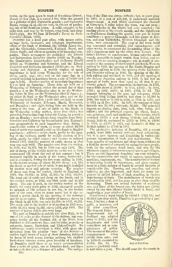
DUMFRIES
statue, on the open space in front of Greyfriars Church.
Nearly 10 feet high, it is raised 5 feet from the groundon a pedestal of grey Dalbeattie granite ; and represents
Burns, resting on an old tree root, in the act of produc-
ing one of his deathless lyrics. A collie snuggles to his
right foot, and near by lie bonnet, song-book, and shep-
herd's pipe. See William M'Dowall's Burns in Dum-friesshire (Edinb. 1870).
Dumfries has a head post office, with money order,
savings' bank, insurance, and telegraph departments,
offices of the Bank of Scotland, the British Linen Co.
,
and the Clydesdale, Commercial, National, Royal, andUnion Banks, and offices or agencies of 30 insurance com-panies. Three newspapers are published—the Liberal
and Independent Dumfries Courier (1809) on Tuesday,
the Conservative Dumfriesshire and Galloway Herald
(1835) on Wednesday and Saturday, and the Liberal
Dumfries and Galloway Standard (1843) also on Wed-nesday and Saturday. A weekly market of muchimportance is held every Wednesday for the sale of
sheep, cattle, pigs, etc. ; and on the same day, in a
covered building in Loreburn Street, a sale of butter andeggs is held. Another market of secondary importance
is also held on Saturday. Horse fairs are held on a
Wednesday of February, either the second day of that
month o. s. or the Wednesday after it, on the Wednes-day before 26 May, on the Wednesday after 17 June o. s.,
on either 25 Sept. or the Wednesday after, and on the
Wednesday before 22 Nov.;pork fairs are held on every
Wednesday of January, February, March, November,and December ; and eight hiring fairs are held in the
course of the year. A sale of cattle on the Sands, at
the Wednesday weekly market, dates from 1659 ; waspreceded, from a time long before the Union, by a weeklysale on Monday ; drew always large supplies from Dum-friesshire and Galloway for transmission into England
;
rose progressively to such importance that, during a
considerable course of years, so many as about 20,000
head of cattle were annually sold on the Sands to English
purchasers ; suffered a severe check, partly by the open-
ing of the railways, partly by weekly auction of live
stock, partly by other causes ; and became so reducedtoward 1S65, that the number of cattle shown in that
year was only 9605. The number sent from the station,
in 1859, was 13,975, but in 1866 was only 3470. Thesale of sheep, at the weekly markets, seems not to have
commenced till about the end of last century ; but it
increased rapidly in result of the turnip husbandry
;
and it amounted, during the five years ending in 1866,
to the annual average of about 28,000 sheep ; yet, like
the Sands or market sale of cattle, it was much curtailed
by auction sales and private transfer. The numberof sheep sent from the station, chiefly to England, in
1859, was 43,932; in 1865, 47,105; in 188l] 60,000.
The total sale of cattle and sheep on the Sands, and in
the auction marts, in 1866, was 9828 cattle and 47,239
sheep. The sale of pork, in the weekly market on the
Sands, for many years prior to 1S32, amounted usually
to upwards of 700 carcases in one day, in the busiest
part of the year, often to many more, but it also re-
ceived a severe check by the opening of the railways
and by other causes. The number of carcases shown onthe Sands in all 1859, was only 13,550 ; in 1867, 10,235.
The stock sold in the market or at auction in 1881 were,
cattle 26,415, sheep 82,327, calves 1352, pigs 10S6. Thenumber of horses sold is also very large.
The port of Dumfries is strictly the river Nith, in its
run of 14J miles to the channel of the Solway, but com-prises besides all the Scottish side of the Firth, fromSarkfoot to Eirkandrews Bay ; and includes, as creeks or
sub-ports, Annan, Barlochan, and Eirkcudbright. Its
harbourage nearly everywhere is tidal, with great dis-
advantage from the peculiar ' bore ' of the Solway—
a
sudden rapid breast of water of short duration, followed
by hours of total recess, leaving nothing but shallow
fresh-water streams across great breadths of foreshore.
At Dumfries itself there is no better accommodationthan a series of quays, one at Dumfries dock, and three
at intervals down to a distance of 5 miles. The naviga-
394
DUMFRIES
tion of the Nith was always difficult ; but, in years prior
to 1834, at a cost of £18,930, it underwent materialimprovement. A rock which obstructed the channelat Glencaple, 5 miles below the town, was cut away
;
other obstacles in the river's bed were removed ; th6landing-places at the river's mouth, and the lighthouseon Southerness flanking the mouth, were put in better
condition ; a quay at Glencaple, and two quays at Eel-ton, and near Castledyke, between Glencaple and thetown, were constructed. The quay at the town itself
was renovated and extended, and embankments andother works, to counteract the devastating effect of thetide's impetuous rush up the river, were formed. Thetown's harbour, in consequence, became safer for smallvessels, accessible to larger vessels than before, and ac-
cessible also to coasting steamers;yet, in result of suc-
cessively the opening of the Glasgow and South-Westernrailway in 1850, the opening of the Castle-Douglas andDumfries railway in IS 59, the opening of the Lockerbieand Dumfries railway in 1863, the opening of the Sil-
loth railway and wet-dock in 1864, and the opening of
the Solway Junction railway in 1869, it has lost anamount of traffic more than equal to all that it pre-
viously gained. The revenue from the harbour, in 1831,was a little short of £1100 ; in 1844, £1212 ; in 1S64,
£555; in 1867, £474; in 1881, £332, 7s. 9d. Thetonnage belonging to the port and sub-ports, whichaveraged 8292 during 1840-44, had risen to 15,286 in
1860, but sank to 11,682 in 1S66, to 7764 in 1873, andto 3971 on 31 Dec. 1881. In 1881, the tonnage of shipsinwards was 32,469; outwards, 32,869. The principal
imports are timber, slate, iron, coal, wine, hemp, andtallow ; and the principal exports are wheat, barley,
oats, potatoes, wool, and sandstone. The customs, whichaveraged £8576 a year during 1840-44, and £11,540during 1845-49, amounted to £6524 in 1864, to £49S6in 1869, to £4583 in 1874, and (inclusive of duty onBritish spirits) to £7500 in 1881.
The productive industry of Dumfries, till a recent
period, went little beyond ordinary local artisanship,
but it is now vigorous and flourishing in various im-portant departments of trade and manufacture. Thelarge number of warehouses and shops bears evidence to
a healthy amount of competition among business people,
both for the ordinary retail trade, and also for thewholesale supply of numerous county towns and villages.
There are two important foundries, one very extensive,
for the construction and repair of engines, agricultural
machines, implements, etc. The manufacture of hosiery
is increasing yearly in importance, and gives employ-ment to a large number of hands in several factories of
considerable size. Tanning and currying, and coach-
building are also important, and there are many em-ployers of skilled labour, of high standing, in various
departments of trade. The manufacture of tweeds wasintroduced in 1847, and has gone on since then steadily
increasing. There are several factories of moderatesize, and three of the largest size, the latter now (1SS2)
owned by one firm (Messrs Walter Scott & Sons), andemploying a large number of hands.
Constituted a royal burgh by David I. (1124-53), anddivided into four wards, Dumfries is governed by a pro-
vost, 3 bailies, a dean of
guild, a treasurer, and22 other councillors.
The General Police andImprovement Act of
Scotland was adoptedprior to 1871 ; and the
magistrates and towncouncillors act as com-missioners of police.
The income of the police
commissioners arises
chiefly from rates, andin 1880-81 amounted to
£4619, 19s. 7d. Theassize or justiciary court
is held twice a year. The sheriff court for the county is
Seal of Dumfrio
DUMFRIES DUMFRIES
held every Tuesday and Friday during session ; the sheriff
small debt court, and the debts recovery act court, every
Tuesday in time of session, and on the same days that
ordinary courts are held in vacation. A court of countyjustices is held in Dumfries every Monday. The waterand gas works of the burgh are public property, and are
well managed, the rates to consumers steadily diminish-
ing. With Annan, Kirkcudbright, Lochmaben, andSanquhar, Dumfries returns one member to parliament(always a Liberal since 1837) ; in 1SS2 its parliamentaryconstituency numbered 1S5S, its municipal 1282.
Corporation revenue (1867) £1599, (1875) £2360, (1881)£2204. Valuation (1861) £30,028, (1870) £42,860,
(1882) £57,713, of which £4344 was in railways. Pop.
of royal burgh (1841) 10,069, (1851) 11,107, (1861)
12,313, (1871) 13,710, (1881) 15,759: of parliamentaryburgh (1851) 13,166, (1861) 14,023, (1871) 15,435,
(1881) 17,090, of whom 9283 were females. Housesin parliamentary burgh (1881) 3642 inhabited, 174vacant, 17 building.
The name Dumfries was anciently written Dunfres,and is supposed to have been derived from the Gaelic
words dun and phreas, signifying 'a mound covered
with copsewood,' or 'a hill-fort among shrubs.' Aslight rising-ground on the area now occupied by Grey-friars Church was the site of an ancient fort, afterwardsreconstructed into a strong castle ; is presumed to havebeen clothed with copse or natural shrubs ; and appearsto have given origin to the name. The burgh's armorialbearing was anciently a chevron and three fleur-de-lis,
but came to be a winged figure of St Michael, tramplingon a dragon and holding a pastoral staff. The mottois, 'A'loreburn'—a word that, during centuries of
struggle against invaders, was used as a war-cry to
muster the townsmen. The side toward the Englishborder being that whence invasion usually came, a placeof rendezvous was appointed there on the banks of a rill
called the Lower Burn, nearly in the line of the presentLoreburn Street ; and when the townsmen were sum-moned to the gathering, the cry was raised, ' All at theLower Burn, '—a phrase that passed by elision into theword 'A'loreburn.' A village, which ere the close of
the 10th century had sprung up under the shelter ofthe fort on the copse-covered mound, grew graduallyinto a town, and was the seat of the judges of Gallowayin the reign of William the Lyon, who died in 1214, aboutwhich period or a little later it seems to have become acentre of considerable traffic. Streets on the line of thepresent Friars' Vennel and of the northern part of HighStreet, with smaller thoroughfares toward Townheadand Loreburn Street, appear to have been its oldestportions ; and are supposed to have had, about themiddle of the 13th century, nearly 2000 inhabitants.The erection of the old bridge before the middle of the13th century, together with the high character whichthat structure originally possessed, indicates distinctly
both the importance then attained by the town and.
the line in which its chief riverward thoroughfareran ; and another structure, erected by the samebountiful lady who erected the bridge, also indicates theposition of the nucleus around which the town lay.
This was a Minorite or Greyfriars' monastery, situatednear the head of Friars' Vennel, where now the BurnsStatue stands ; and, small though it was, as comparedwith many abbeys, it seems to have been a goodlyFirst Pointed edifice, comprising an aisled church, arange of cloisters, a refectory, and a dormitory. In1286 Robert Brace the Competitor and the Earl ofCarrick, his son, with banner displayed assaulted andcaptured the castle of Dumfries, a royal fortress of thechild-queen Margaret, the Maid of Norway ; and inthe summer of 1300 King Edward I., on his way to thesiege of Caerlaverock, seized and garrisoned this castle,
and added the high square keep, part of which re-
mained standing till 1719. In the beginning of 1306the famous Robert Bruce was in London, called thitheras King Edward's counsellor, when a warning of perilwas sent him by the Duke of Gloucester, his friend
—
a sum of money and a pair of spurs. The hint was
enough ; that day he started for Scotland, his horse shodbackwards, that the hoof-prints might throw pursuersoff the track. On February the 4th he halted at Dum-fries, where the English justiciars were sitting in assize
—John Comyn of Badenoch, surnamed the Red, amongthe throng of barons in attendance. Him Bruce en-
countered in the church of the Minorites, and, falling
into discourse, made the proposal to him :' Take you
my lands, and help me to the throne ; or else let metake yours, and I will uphold your claim.' Comynrefused, with talk of allegiance to Edward, and their
words waxed hotter and hotter, till, drawing his dagger,
Bruce struck a deadly blow, then hurried to his friends,
who asked if aught were amiss. ' I must be off,' was theanswer, 'for I doubt I have slain the Red Comyn.''Doubt !' cried Kirkpatrick of Closeburn, 'I mak sikar
;'
and, with Sir John de Lindsay, rushing into the church,despatched the wounded renegade outright. A frenzy
seized them ; they carried the castle by assault ; andthus was rekindled the War of Independence. Oneepisode therein was that, in this same year of 1306, Sir
Christopher Seton, Bruce's brother-in-law, was hangedby the English at Dumfries, on the Crystal Mount,where his widow afterwards founded a chapel in honourof the Holy Rood.The town was burned by the English prior to 1448
;
suffered devastation by them at other periods ; and, in
1469, obtained from the Crown all the houses, gardens,
revenues, and other property which had belonged to the
Grey Friars. It was burned again by the English in 1536,and was then revenged by Lord Maxwell. That noble-
man, with a small body of retainers, made an incursioninto England, and reduced Penrith to ashes ; and either
he or some member of his family, mainly with materials
from the Greyfriars' monastery, strongly reconstructed
Dumfries Castle. Queen Mary, in October 1565, whenthe town was held by Murray and other disaffected nobles,
favourers of the Reformation, marched against it withan army of 18,000 men, at whose approach the leaders
of the opposition retreated over the Border. The castle
was again taken and the town sacked, in 1570, by the
English under Lord Scrope and the Earl of Essex. Thetownsmen, in 1583, erected a bartizaned, two-storied
stronghold, called the New Wark, to serve both as afortress to resist invasion and as a retreat under dis-
comfiture ; and, either about the same time or at anearlier period, they constructed likewise, between thetown and Lochar Moss, a rude fortification or extendedrampart, called the Warder's Dike. But all vestiges of
these works, of the castle, and of the monastery are nowextinct.
In 1617 James VI. spent two days at Dumfries in
royal state, and was sumptuously entertained at a pub-lic banquet. The town snared largely in the disasters
that overspread Scotland under Charles I., and still
more largely in those of the dark reign of Charles II.,
when, in November 1666, a fortnight before the battle
of Rullion Green, fifty mounted Covenanters and a larger
party of peasants on foot here seized Sir James Turner,
and, with him, a considerable sum of money. TheCameronians, or those of the Covenanters who resisted
the settlement at the Revolution, were comparatively
numerous in the surrounding district ; and, on 20 Nov.1706, about 200 of them rode into the town, issued
a manifesto against the impending union of Scotland andEngland, and burned the articles of union at the cross,
but did not succeed in precipitating the town into any seri-
ous disaster. In October 1715 word was brought to the
magistrates that the Jacobite gentry of the neighbour-hood had formed a design to surprise the town ; and, it
being the sacramental fast-day, and the provincial synodbeing then in session, the clergy mustered their fencible
parishioners, so that 'a crowd of stout Whigs flocked in
from the surrounding districts and villages, with their
broad bonnets and grey hose, some of them mounted ontheir plough -horses, others on foot.' Thatverv eveningthey were joined by a strange ally, no other tnan SimonFraser, the infamous Lord Lovat, who, with five fol-
lowers, all armed to the teeth, rode up to the head inn,
395
DUMFRIES
en route from London to the North. Hill Burton de-
scribes the suspicions aroused by the presence of this
large, square-built, peculiar-looking man ; how, havingshown his credentials, he presently helped to bring
in the Marquis of Annandale, beset by the Jacobites
under Viscount Kenmure ; and how their courteous andpartly convivial meeting was interrupted by a rumourof attack, a body of horse having ridden up close to
the town.* A party of the townspeople, during the
insurrection of 1745, cut off at Lockerbie a detach-
ment of the Highlanders' baggage ; and, in conse-
quence, drew upon Dumfries a severer treatment fromPrince Charles Edward than was inflicted on any other
town of its size. Prince Charles, on his return fromEngland, let loose his mountaineers to live at free
quarters in Dumfries ; and he levied the excise of the
town, and demanded from its authorities a contribution
of £2000 and of 1000 pairs of shoes ; but, an alarm havingreached him that the Duke of Cumberland had masteredthe garrison left at Carlisle and was marching rapidly onDumfries, he hastily broke away northward, accepting for
the present £1100 for his required exaction, and taking
hostages for the payment of the remainder. The townsuffered loss to the amount of about £4000 by his visit,
besides the damage caused by the plundering ofhis troops;
but, in acknowledgment of its loyalty to the Crown, andas part compensation for its loss, it afterwards got £2800from the forfeited estate of Lord Elcho. Later events
have mainly been either commercial, political, or social
;
and, with the exception of a dire visitation of cholera (15
Sept. to 27 Nov. 1832), by which nearly 500 perished,
they have left no considerable mark on its annals. It
may, however, be noticed that the Highland and Agri-
cultural Society has held its meeting herein 1830, 1837,
1845, 1860, 1870, and 1878. The town, on the wholesince 1746, has plenteously participated in the benigneffects of peace and enlightenment ; and, though mov-ing more slowly than some other towns in the course of
aggrandisement, it has been excelled by none in thegracefulness of its progress, and in the steadiness andsubstantiality of its improvement.The title Earl of Dumfries, in the peerage of Scot-
land, conferred in 1633 on the seventh Baron Crichtonof Sanquhar, passed in 1694 to an heiress who marriedthe second son of the first Earl of Stair. Her eldest
son, "William, who succeeded her in 1742 as fourth Earlof Dumfries and his brother James in 1760 as fourth
Earl of Stair, died without issue in 176S, when the
former title devolved on his nephew, Patrick Mac-dowall of Feugh (1726-1803), whose daughter marriedthe eldest son of the first Marquis of Bute ; and the
title now is borne by her great-grandson, John (b. 1881),
son and heir of the present Marquis of Bute. On thetown's roll of fame are the following eminent natives or
residents, the former distinguished by an asterisk :
—
The Rev. William Yeitch, who was minister of Dumfriesduring the conflict between Presbyterianism and Epis-
copacy, and whose biography was written by the Rev.Dr M 'Crie ; the Rev. Dr Henry Duncan of Ruthwell(1774-1846), author of the Philosophy of the Seasons,
who started the Courier, and founded here the earliest
of all savings' banks, and a statue of whom is in front
of the Savings' Bank building ;* Dr Benjamin Bell
(1749-1806), the eminent surgeon; Sir Andrew Halliday(1783-1839), a famous physician, who spent his latter
years and died in Dumfries ;* Sir John Richardson
(1787-1865), the surgeon and naturalist of Sir JohnFranklin's overland Polar expedition ; *Sir James An-derson (b. 1824), the telegraph manager; *Gen. WilliamM'Murdo, C.B. (b. 1819), the son-in-law and favourite
officer of Sir Charles Napier, the hero of Scinde ; JohnM'Diarmid (1790-1852), editor of the Scrap Book, authorof Sketchesfrom Nature and a Life of Cowper, and for 35years the talented conductor of the Dumfries Courier
;
Thomas Aird (1802-76), the well-known poet, and editor
of the Dumfriesshire Herald from 1835 to 1863 ; William
* It is noteworthy that the first book printed at Dumfries wasPeter Rae's History of the Rebellion in Scotland, in Dumfries,Galloway, etc. (1718).
396
DUMFRIES
M'Dowall (b. 1815), author of the Man of the Woods andof the History of Dumfries, and editor of the DumfriesStandard from 1846; * James Hannay (1827-73), authorof Eustace Conyers, Singleton Fontenoy, and other worksof fiction; *Dr Robert Carruthers (1799-1878), of Inver-ness, but long connected with Dumfries, the author of aLife of Pope, the Highland Note-Book, the Encyclopaedia,
of English Literature, etc., and of ten Dumfries Por-traits, which appeared in the Dumfriesshire MonthlyMagazine, begun in 1821 ; William Bennet, editor of
the three volumes of the Dumfries Monthly Magazine,begun in 1825 ; Allan Cunningham, John Mayne,Robert Anderson, Joseph Train, Robert Malcolmson,Dr Browne, and Dr John Gibson, who contributedlargely to these two periodicals ; the Rev. WilliamDunbar, editor of the Nithsdale Minstrel, a volume of
original poetry published in 1815 ; William Paterson(1658-1719), the founder of the Bank of England, andthe projector of the Darien Expedition ; Patrick Millerof Dalswinton (1731-1815), the distinguished inventorand agriculturist ;
* Robert Thorburn, A.R.A. (b. 1818),the famous miniature painter ; Kennedy, the landscapepainter ; Dunbar and Currie, the sculptors ;
* JamesPagan (1811-70), journalist ;
* Joseph Irving (b. 1830),historian and annalist ; Thomas Carlyle (1795-1881), a'writer of books;' *John Mayne (1759-1846), minorpoet and journalist ; and not a few besides.
The parish, containing also the villages of George-town, Gasstown, and Locharbriggs, with part of the
village of Kelton, is bounded NW by Holywood andKirkmahoe, NE by Tinwald, E by Torthorwald, S byCaerlaverock, andW by Troqueer and Terregles in Kirk-cudbrightshire. Its greatest length, from N to S, is 6fmiles ; its greatest breadth is 3J miles ; and its area is
10,200 acres, of which 69J are foreshore and 98| water.
The Nith winds 7 miles south-by-eastward along all
the boundary with Holywood and Kirkcudbrightshire,
and sluggish Lochar Water 7f south-south-eastwardalong that with Tinwald and Torthorwald. Near Loch-thorn, 2J miles NNE of the town, is a little lake (1 J x §furl.), which, in time of hard frost, is much frequented
by skaters and curlers. A mineral spring, called
Crichton's Well, occurs in Lochar Moss ; another, astrong chalybeate, on Fountainbleau farm. The pictur-
esque low height of Clumpton rises 2 miles NE of the
town ; and an undulating low eminence, as formerly
noticed, forms chief part of the site of the town, south-
ward of which another low ridge of hills runs nearly
parallel to the Nith, at about half a mile's distance,
into Caerlaverock ; and rises at Trohoughton to 312 feet.
The rest of the surface is nearly a dead level, sink-
ing to 40, and rarely exceeding 100, feet. The western
face of the ridge, overlooking the Nith, is gently sloping,
and highly embellished ; but the eastern breaks downin abrupt declivities, presents a bold front and a com-manding outline, and forms, about 1J mile from the
town, two precipitous ledges, called the Maiden BowerCraigs, one of them containing a remarkable cavity,
said to have been used by those mythic beings, the
Druids, as a sort of ' St Wilfrid's needle, ' or ordeal of
chastity. A broad belt of Lochar Moss, along the
eastern border, continued all sheer morass down into
the present century, but now is extensively reclaimed,
and partly clothed with verdure or with wood. Permiansandstone is the prevailing rock, and has been largely
quarried. The soil, in the SW, is a pretty strong clay ;
in the flat lands by the Nith, is mostly clay incumbent
on gravel ; in the N and NE, is a light reddish sandy
earth resting on sandstone ; and in the E, is either native
moss, reclaimed moss, or humus. Nearly four-fifths of the
entire area are regularly or occasionally in tillage, some350 acres are under wood, and nearly all the rest of the
land is capable of remunerative reclamation or culture.
An ancient castle of the Comyns stood § mile SSE of
the town, on a spot overlooking a beautiful bend of the
Nith, and. still called Castledykes. A meadow near it
bears the name of Kingholm, and may have got that
name either by corruption of Comyn's holm or in honour
of Robert Bruce. Another meadow, by the riverside
DUMFRIES HOUSE
northward of the town, is called the Nunholm, from its
lying opposite the ancient Benedictine nunnery of
Lincluden. This parish is the seat of both a pres-
bytery and a synod, and it is divided ecclesiasti-
cally into the three parishes of St Michael, Greyfriars,
and St Mary, the value of the two first livings being£436 and £336. Valuation, exclusive of burgh, (1882)
£20,877, 18s. Id. Pop. of entire parish (1801) 72S8,
(1831) 11,606, (1861) 13,523, (1871) 14,841, (1881)16,839.—Ord. Sur., shs. 10, 9, 1864-63.
The presbytery of Dumfries comprises the old par-
ishes of Caerlaverock, Colvend, Dumfries-St Michael,Dumfries-Greyfriars, Dunscore, Holywood, Kirkbean,Kirkgunzeon, Kirkmahoe, Kirkpatrick-Durham, Kirk-patrick-Irongray, Lochrutton, Newabbey, Terregles,
Tinwald, Torthorwald, Troqueer, and Urr, and thequoad sacra parishes of Dumfries-St Mary, Dalbeattie,
and Maxwelltown. Pop. (1871) 38,967, (1881) 41,099,
of whom 7072 were communicants of the Church of
Scotland in 1878.—The Free Church also has a presby-tery of Dumfries, with 3 churches in Dumfries, 2 at
Dunscore, and 12 at Corsock, Dalbeattie, Dalton, Glen-caple, Hightae, Irongray, Kirkbean, Kirkmahoe, Kirk-patrick-Durham, Maxwelltown, Newabbey, and Ruth-well, which 17 had together 3216 members in 1881.
—
The U. P. Synod likewise has a presbytery of Dumfries,with 3 churches in Dumfries, 2 in Sanquhar, and 10at Burnhead, Castle-Douglas, Dalbeattie, Dairy, Dun-score, Lochmaben, Mainsriddle, Moniaive, Thornhill,and Urr, which together had 2814 members in 1880.
The synod of Dumfries comprises the presbyteriesof Dumfries, Lochmaben, Langholm, Annan, and Pen-pont. Pop. (1871) 94,023, (1881) 96,018, of whom17,897 were communicants of the Church of Scotlandin 1878.—The Free Church also has a synod of Dum-fries, comprising presbyteries of Dumfries, Lockerbie,and Penpont, and superintending thirty-four congrega-tions, which together had 7256 members in 1881.
See John M'Diarmid's Picture of Dumfries and its
Environs (Edinb. 1832) ; William M'Dowall s History ofthe Burgh of Dumfries; with Notice's of Nithsdale,Annandale, and the Western Border (Edinb. 1867 ; 2ded. 1873) ; and his Memorials of St Michael's, the OldParish Churchyard of Dumfries (Edinb. 1876).
Dumfries House, a seat of the Marquis of Bute in
Old Cumnock parish, Ayrshire, near the left bank of
Lugar Water, 2 miles W of Cumnock town, and f mileN of Dumfries House station on the Ayr and Cumnocksection of the Glasgow and South-Western, this being
15J miles E by S of Ayr. Built about 1757 by WilliamDalrymple, fourth Earl of Dumfries, it has a drawing-room hung with very fine old tapestry, said to have beenpresented by Louis XIV. to one of the former Earls,
and stands amid finely wooded grounds that contain theruins of Terringzean Castle, and extend into Auchinleckparish, on the opposite bank of the Lugar, which here is
spanned by an elegant bridge. The Marquis holds113,734 acres in Ayrshire, valued at £25,263 per annum,including £2506 for minerals.
—
Ord. Sur., sh. 14, 1863.Dumfriesshire, a coast and Border county in the S of
Scotland. It is bounded N by Lanark, Peebles, andSelkirk shires ; NE by Roxburghshire ; SE by Cumber-land ; S by the Solway Firth ; SW by Kirkcudbright-shire ; and NW by Ayrshire. Its length, from W to E,varies between 21 and 46J miles ; its breadth, from Nto S, between 13 and 32 "miles ; and its area is 1103square miles or 705,945f acres, of which 20,427 areforeshore and 5301J water. Its outline is irregularlyellipsoidal, being indented to the depth of 13 milesby the southern extremity of Lanarkshire, and to thedepth of 5| miles by Ettrick Head in Selkirkshire.Its boundary line, over all the W, NW, N, and NE,to the aggregate extent of 120 miles, is mainly moun-tain watershed ; over most of the march with Cum-berland, to the aggregate extent of 11 miles, is variouslyLiddel Water, Esk river, and Sark Water ; over all the S,to the extent of 21 miles, is the Solway Firth ; along theSW, to the extent of 15 miles, is the river Nith and CludenWater. The summits on or near the upland boundary line
DUMFRIESSHIRE
include Auchenchain (1271 feet) and Blackcraig (1961)
at the Kirkcudbrightshire border ; Blacklorg (2231),
M'Crierick's Cairn (1824), and Halfmerk Hill (1478), at
the Ayrshire border ; Mount Stuart (1567), WanlockDod (1808), Lowther Hill (2377), Well Hill (1987),
Wedder Law (2185), and Queensberry (2285), at the
Lanarkshire border ; Hartfell (2651) and White Coomb(2695), at the Peeblesshire border ; Herman Law (2014),
Andrewhinney (2220), Bodesbeck Law (2173), Capel Fell
(2223), Ettrick Pen (2269), Quickningair Hill (1601),
and Black Knowe (1481), at the Selkirkshire border;and Stock Hill (1561), Roan Fell (1862), and WatchHill (1642), at the Roxburghshire border.
All the northern part of the county is prevailingly
upland. Mountains or high hills, with similar altitudes
to those on the boundary line, and intersected with onlya small aggregate of glens or vales, occupy all the north-
western, the northern, and the north-eastern border to
a mean breadth of 7 or 8 miles ; and spurs or prolonga-tions of them strike south-eastward, southward, andsouth-westward, to lengths of from 2 or 3 to 7 or 8 miles,
sometimes shooting into summits nearly as high as those
on the borders, but generally sinking into low hills, andseparated from one another by broadening vales. Theseuplands constitute a large and prominent portion of theSouthern Highlands of Scotland ; but they differ much,in both segregation and contour, from the upland massesof most of the Northern Highlands. Few or none of
the mountains have the ridgy elongations, the rugged,craggy outlines, or the towering peaked summits so
common in Argyll, Perth, Inverness, and Ross shires;
but almost all of them, whether on the borders or in theinterior, lie adjoined in groups, rise from narrow bases
over rounded shoulders, and have summits variously
domical, conical, and tabular or flat. Three of the mostremarkable of the interior heights are Cairnkinna (1S13feet) in Penpont, Langholm Hill (1161) in the vicinity
of Langholm, and Brunswark Hill (920) in the NE of
Hoddam, all three having forms of peculiar character,
quite in contrast to those prevailing in the NorthernHighlands. The region southward of the uplands breaksinto three great valleys or basins, traversed by the rivers
Nitli, Annan, and Esk ; and is intersected, between theNith and the Annan, to the extent of about 7 miles
southward from the vicinity of Amisfield, by the rangeof the Tinwald, Torthorwald, and Mouswald Hills, withcurved outlines, cultivated surfaces, and altitudes of
from 500 to 800 feet above sea-level, and commandinggorgeous, extensive, diversified prospects. The basins
of the Annan and the Esk S of a line drawn fromWhinnyrig, past Ecclefechan, Craigshaws, Solway Bank,and Broomholm, to Moorburnhead, cease to be valleys,
or are flattened into plains, variegated only by occa-
sional rising-grounds or low hills, either round-backedor obtusely conical. The valley of the Nith also, for
10 miles before it touches the Solway, is in all respects
a plain, with exception of a short range of low hills in
Dumfries and Caerlaverock parishes and a few unim-portant isolated eminences ; and the E wing of it,
partly going flatly from it to the base of the TinwaldHills, partly going southward, thence past the small
Dumfries and Caerlaverock range to the Solway Firth, is
the dead level of Lochar Moss.
The river Nith and one or two of its unimportant andremote tributaries enter Dumfriesshire through openingsor gorges in its north-western boundaries, and a smalltributary of the Annan enters through a gorge in the
N ; but all other streams which anywhere traverse the
county rise within its own limits. The Nith, from thepoint of entering it, and the Annan and the Esk, fromshort distances below the source, draw toward themnearly all the other streams, so as to form the countyinto three great valleys or basins, but the Nith givingthe lower part of the light side of its basin to Kirkcud-brightshire, and the Esk going entirely in its lower part
into England. The three livers all pursue a south-
south-easterly course—the Nith in the W, the Annan in
the middle, and the Esk in the E ; and, with theexception of some small curvings, they flow parallel to
397
DUMFRIESSHIRE
one another, at an average distance of about 12 miles,
imposing upon their own and their tributaries' basins
the names of respectively Mthsdale, Annandale, andEskdale. The streams which run into them are verynumerous, yet mostly of short course, of small volume,and remarkable chiefly for the beauty or picturesqueness
of the ravines or the dells which they traverse. Thechief of those which enter the Nith are, from the W,the Kello, the Euchan, the Scar, the Cairn, and the
Cluden ; from the E, the Crawick, the Minnick, the
Enterkin, the Carron, the Cample, and the Duncow.The chief which enter the Annan are, from the W, the
Evan and the Kinnel ; from the E, the Moffat, the
Wamphray, the Dryfe, the Milk, and the Mein. Thechief which enter the Esk are, from the W, the BlackEsk and the Wauchope ; from the E, the Megget,the Ewes, the Tarras, and the Liddel. Four rivulets,
each 10 miles or more in length, have an indepen-dent course southward to the Solway— the Locharand the Cummertrees Pow in the space between the
Nith and the Annan ; the Kirtle and the Sark in the
space between the Annan and the Esk. Several of the
tributary streams, like the three main ones, give their
names to their own basins—the Moffat, the Dryfe, andthe Ewes in particular giving to their basins the namesof Moffatdale, Dryfesdale, and Ewesdale. A group of
lakes, the largest of them Castle Loch (6 x 5£ furl.),
lies near Lochmaben ; and dark Loch Skene (6 x Iffurl. ), remarkable for emitting the torrent of the ' GreyMare's Tail, ' lies on the N border at the source of MoffatWater. Pure springs are almost everywhere abundant
;
chalybeate springs are near Moffat, Annan, and Ruth-well ; and sulphureous at Moffat and Closeburn House.
The Geology.—The oldest rocks in Dumfriesshire are of
Silurian age, consisting mainly of greywackes, flagstones,
and shales, belonging to the upper and lower divisions
of that formation. A line drawn from the head of EwesWater in Eskdale,south-westwards by Lockerbie toMous-wald, marks the boundary between the two divisions,
the Lower Silurian rocks being met with to the N of
this limit. The members of both series have been muchfolded ; but by means of the lithological characters of
the strata, and with the aid of certain fossiliferous bandsof shales yielding graptolites, it is possible to determinethe order of succession. In the neighbourhood of Moffatthe fossiliferous black shales of the lower division are
typically developed, where they have been divided into
several well-marked zones by means of the graptolites
which occur in them in profusion. They are admirablydisplayed at Dobbs Lynn, near the head of Moffat-dale, and in the streams on the S side of the Moffatvalley. The Silurian rocks, which now form the great
mass of high ground throughout the county, were ele-
vated so as to form a land barrier towards the close of
the Silurian period. In the hollows worn out of this
ancient tableland, the strata belonging to the Old RedSandstone, Carboniferous, and Permian periods were de-
posited. But even these newer palaeozoic formations havebeen so denuded that only isolated fragments remainof what once were more extensive deposits.
Along the county boundary in Upper Nithsdale therepresentatives of the Lower Old Red Sandstone are metwith, where they consist of sandstones and conglome-rates, associated with contemporaneous volcanic rocks.
They form part of the great belt of Lower Old Redstrata stretching from the Braid Hills near Edinburghinto Ayrshire. The Upper Old Red Sandstone, on theother hand, forms a narrow fringe underlying the car-
boniferous rocks from the county boundary E of the EwesWater south-westwards by Langholm to Brunswark. Atthe base they consist of conglomeratic sandstones, theincluded pebbles having been derived from the waste of
the Silurian flagstones and shales. These are overlaid
by friable Red sandstones and marls, which pass con-
formably underneath the zone of volcanic materials
which always intervene between them and the overlyingCarboniferous strata. The zone of igneous rocks just
referred to is specially interesting, as it points to theexistence of volcanic action on the S side of the Silurian
398
DUMFRIESSHIRE
tableland at the beginning of the Carboniferous period.The igneous rocks consist mainly of slaggy and amygda-loidal porphyrites, which were spread over the ancientsea bottom as regular lava flows. Brunswark Hill is
made up of this igneous material. Some of the volcanicorifices from which the igneous materials were dis-
charged are still to be met with along the watershedbetween Liddesdale and Teviotdale in the adjacentcounty of Roxburgh.The carboniferous rocks are met with in three separate
areas:—(1.) in the district lying between Langholm andRuthwell
; (2. ) at Closeburn near Thornhill; (3. ) in the
neighbourhood of Sanquhar. The first of these areas is
the most extensive, measuring about 22 miles in length,and varying in breadth from 2 to 7 miles. The strata
included in it belong to the Calciferous Sandstone series
which forms the lowest subdivision of the Carboniferousformation. The following zones were made out in thecourse of the geological survey of the district. Theyare given in descending order:—(7.) Canonbie coals;
(6.) Marine Limestone series of Penton, Gilnockie, andEcclefechan
; (5. ) Volcanic zone of fine tuff and porphy-rite, including about 50 feet of fine shales
; (4.) IrvineBurn and Woodcock air sandstones
; (3.) Tarras Water-foot Cementstone series; (2.) White sandstones; (1.)
Brunswark and Ward Law volcanic rocks.
The recent discovery which has proved so interesting
and importaut was met with in the fine shales of zone(5) and partly in zone (3). Upwards of twenty newspecies of ganoid fishes were obtained from these
beds near Langholm, and out of the sixteen generato which these species belong five are new to science.
Very few of the species are common to the carboniferousrocks of the Lothians, which has an important bearingon the history of that period. Along with the fishes
were found about twelve new species of decapod crus-
taceans and three new species of a new genus of Phyllo-
pods. Of special importance is the discovery of four
new species of scorpions. Hitherto the occurrence of
fossil scorpions in rocks of Carboniferous age has beenextremely rare. The specimens recently obtained are
admirably preserved, and from a minute examination of
them it is evident that they closely resemble their living
representatives. The remains of several new plants
were also found in the fine shales already referred to.
Within the Silurian area, Carboniferous rocks are metwith in the Thornhill and Sanquhar basins. Thesedeposits lie in ancient hollows worn out of the Silurian
tableland which date back as far as the Carboniferous
period. At Closeburn and Barjarg there are beds of
marine limestone associated with sandstones and shales
which probably belong to the Calciferous Sandstoneseries. Again, at the south-eastern limit of the Sanquharcoalfield there are small outliers of the Carboniferous
Limestone series, consisting of sandstones, shales, andthin fossiliferous limestones. The latter rapidly thin
out, and the true coal measures rest directly on, the
Silurian platform. From these facts it would appearthat in Upper Nithsdale the Silurian barrier did not
sink beneath the sea-level till the latter part of the
Carboniferous period, not in fact till the time of the
deposition of the coal measures. The Sanquhar coal-
field is about 9 miles in length, and from 2 to i miles
in breadth. It contains several valuable coal seams,
and from the general character of the strata it is pro-
bable that they are the southern prolongations of the
Ayrshire coal measures. Another fact deserves to be
mentioned here, which was established in the course of
the survey of the county. The Canonbie coal seams do
not belong to the true Coal Measures as has hitherto
been supposed, but are regularly intercalated with the
members of the Calciferous Sandstone series.
The strata next in order are of Permian age whichare invariably separated from the Carboniferous rocks
by a marked unconformity. Indeed so violent is the
unconformity that we find the Permian strata to the
E of Lochar Moss stealing across the edges of the Cal-
ciferous Sandstone beds till they rest directly on the
Silurian rocks.
DUMFRIESSHIRE
Permian strata occur in five separate areas—1 at Moffat,
2 at Lochiuaben and Corncockle Moor, 3 between Annanand the mouth of the Esk, 4 the Dumfries basin, 5 the
Thornhill basin. In addition to these areas there is a
small patch of contemporaneous igneous rocks overlying
the Sanquhar coalfield, which is believed to be of the sameage. In the neighbourhood of Moffat the breccias are
evidently an ancient morainie deposit of glacial origin.
Several well-striated stones were found in them resemb-ling the scratched stones in ordinary boulder clay. In
the red sandstones of Corncockle Moor reptilian foot-
prints have been detected, produced by reptiles mov-ing in a S direction, which led to the watty remark of
Dean Buckland ' that even at that early date the migra-
tion from Scotland to England had commenced. ' Be-tween Annan and Canonbie the strata consist of red
sandstones, wdiile in the Dumfries basin the red sand-
stones of Locharbriggs are overlaid by an alternation of
red sandstones and breccias. An interesting feature
connected with the Thornhill basin is the occurrence
of contemporaneous volcanic rocks at the base of the
series. They form a continuous ring round the northernhalf of the basin cropping out from underneath the
breccias and red sandstones. In the Sanquhar basin
also there are several 'necks' or volcanic vents filled
with agglomerate, which in all likelihood mark thesites from which lavas of Permian age were discharged.
It is interesting to note the proofs of the original ex-
tension of the Permian strata over areas from which theyhave been completely removed by denudation. Some of
the Carboniferous strata in the Sanquhar coal-field havebeen stained red by infiltration of iron oxide, and in theS of the county the Calciferous Sandstone beds overlying
the Canonbie coals have been so much reddened as to
resemble externally the Permian sandstones. Even onEskdalemuir the Silurian greywackes have been stained
in a similar manner. In these cases the older rockswere buried underneath strata of Permian age fromwhich the percolating water derived the iron oxide.
Within the limits of the county there are intrusive
igneous rocks of which the most conspicuous example is
the mass of granite on Spango Water, about 5 miles Nof Sanquhar. This mass is about 3 miles long, andupwards of 1 mile in breadth. There are also dykes or
veins of felstone and basalt. One example of the latter
deserves special notice. It has been traced from theLeadhills south-eastwards by Moffat, across Eskdalemuirbj' Langholm to the English border. In texture it varies
from a dolerite to tachylite, which is the glassy form of
basalt.
Only a passing allusion can be made to the proofs of
glaciation which are so abundant throughout the county.
During the period of extreme glaciation the general trendof the ice sheet was SE towards the Solway Firth andthe English border. The widespread covering of boulderclay which is now found in the upland valleys and onthe low grounds is the relic of this ancient glaciation.
But in the valleys draining the main masses of highground there are numerous moraines deposited by local
glaciers. Amongst the finest examples are those roundLoch Skene at the head of Moffatdale.
Economic Minerals.—Coal seams occur at Sanquharand Canonbie, and limestone at Closeburn, Barjarg,
Kelhead, and Harelaw Hill, Liddesdale. Veins of
silver and lead ore are met with at Wanlockhead, anti-
mony at Glendinning and Meggat Water. The buildingstones in greatest demand are the white sandstones of
the Carboniferous formation, the Permian red sandstonesof Thornhill, Dumfries, Corncockle, and Annan ; whilein the neighbourhood of Moffat the coarse grits of
Silurian age are much used. (B.N.Peach, F.R.S.E.,and J. Home, F.R.S.E., of the Geological Survey of
Scotland.
)
The soil in the mountain districts is mainly moorish,mostly unsuitable for tillage, and partly irreclaimable
;
but in places where it has a dry subsoil, is capable ofgradual transmutation into loam. The soil, in the low-land districts, is generally of a light nature, incumbenton either rock, gravel, or sand ; in Nithsdale and Annan-
DUMFRIESSHIRE
dale, is mostly dry ; in Eskdale, is generally wet ; in
some places, where it lies on a retentive subsoil, is cold,
and occasions rankness of vegetation ; in considerable
tracts of the outspread plain, is of a loamy character,
rich in vegetable mould ; on the gentle slopes of themidland district, is an intermixture of loam with other
soils ; on the swells or knolls of the valleys, and evenof the bogs, is of a gravelly or sandy character ; on themargins of streams, is alluvium, or what is here called
holm-land, generally poor and shallow in the uplanddells, but generally rich and deep in the lowland valleys.
Clay, as a soil, seldom occurs, except as mixed withother substances ; but, as a subsoil, is extensively found,
either white, blue, or red, under the greensward of
hills, and beneath soft bogs. Peat-moss exists in greatexpanses both on the hills and in the vales ; and whereverit so lies as to be amenable to drainage, is of such acharacter as to be convertable into good soil. Sea-silt,
or the saline muddy deposit from the waters of the Sol-
way, spreads extensively out from the estuary of theLochar, and both forms a productive soil in itself, andserves as an effective top-dressing for the adjacent peat-
moss. The percentage of cultivated area is 32 '5 ; 27,472acres are under wood ; and little short of two-thirds of
the entire county is either pastoral or waste.
Arable farms range mostly between 100 and 150 acres,
yet vary from 60 to 800 ; and sheep-farms range from300 to 3000 acres. Some farms, chiefly along themutual border of the upland and the lowland regions,
are both pastoral and arable, and are regarded as par-
ticularly convenient and remunerative ; and these
comprise about one-third of the total acreage underrotation of crops. The cattle, for the dairy, are mostlyof the Ayrshire breed ; for the shambles or for exporta-
tion, are mostly of the Galloway breed. The sheep, onthe uplands, are either black-faced or Cheviots ; in thelowlands are a mixed breed, resulting from crosses of
the Cheviots with Leicesters, Southdowns, and Spanishbreeds. The draught horses are of the Clydesdale breed.
Pigs are raised chiefly for exportation of pork and baconinto England ; and they have, for many years, been anobject of general attention among both farmers andcotters. The value of the pork produced rose from£500 in 1770 to £12,000 in 1794, to £60,000 in 1812,and to £100,000 in 1867, since which last year it hassomewhat fallen off, there being only 10,286 pigs in thecounty in 1881 against 15,0SS in 1877, and 1S,612 in
1866.
The commerce of the county is all conducted throughDumfries andits sub-ports. Manufactures in hosieryandtweeds have recently become important in Dumfries ; butmanufactures in other departments, either there or
throughout the county, are of comparatively smallamount. Hosiery employs many looms in Thornhill,
Lochmaben, and other towns and villages ; woollenfabrics, of various kinds, are made at Sanquhar andMoffat
;ginghams are manufactured at Sanquhar and
Annan ; muslins, at Kirkconnel ; course linens, at
Langholm. Weaving, in different departments, em-ploys many hands ; artificership, in all the ordinary
departments, employs many more ; and operations con-
nected with coal and lead-mining employ a few. Theenergies of the county, as compared with those of other
counties, either in Scotland or in England, are notsmall ; but, partly in consequence of dearth of coal,
partly for other reasons, they are mainly absorbedin the pursuits and accessories of agriculture ; andyet, since at least the commencement of the present
century, they have been so spent as to produce anamount of prosperity scarcely, if at all, inferior to whathas been realised in other counties. The roads, thefences, the dwelling-houses, the churches, the people's
dress, and the people's manners in Dumfriesshire, takenas indices of progress and refinement, will bear compari-
son with those of any other district in Great Britain.
The railways within the county are the Glasgow andSouth-Western, down Nithsdale, and across the foot of
Annandale ; the Caledonian, down the entire length of
Annandale ; the Dumfries and Lockerbie, across the399
DUMFRIESSHIRE
interior from Dumfries to Lockerbie ; the Solway Junc-tion, in the S of Annandale, from the Caledonian near
Kirtlebridge to the Solway Firth near Annan ; small
part of the Castle-Douglas and Dumfries, on the W bor-
der of Dumfries parish ; and branches of the Hawick andCarlisle section of the North British to Langholm andGretna.
The quoad civilia parishes, inclusive of two whiehextend slightly into Lanarkshire, amount to 43. Theroyal burghs are Dumfries, Annan, Lochmaben, andSanquhar. The burghs of barony are Moffat, Lockerbie,
Langholm, Eeclefeehan, Thornhill, and Moniaive. Theprincipal villages are Springfield, Eaglesfield, Sunnybrae,Bridekirk, Gasstown, Heathery Row, Hightae, Park, Dun-reggan, Rowan Burn, Wanloekhead, Greenbrae, Glen-
caple, Torthorwald, Roucan, Collin, Penpont, Kirkconnel,
Kirtlebridge, Waterbeck, Domock, Cummertrees, Ruth-well, Clarencefield, Mouswald, Closeburn, Holywood,Kelton, Locharbriggs, Amisfield, Dalswinton,Wamphray,Carronbridge, and Crawick Mill. The principal seats
are Drumlanrig Castle, Langholm Lodge, Castlemilk,
Kinmount, Kiuharvey House, Glen Stewart, TinwaldHouse, Comlongan Castle, Dumcrieff House, Springkell,
Jardine Hall, Rockhall, Westerhall, Raehills, Craw-fordton, Amisfield House, Closeburn Hall, DalswintonHouse, Hoddam Castle, Mossknow, Halleaths, MountAnnan, Craigdarroch, Blackwood House, Murraythwaite,Broomholm, Barjarg Tower, Speddoch, Dormont, Elshie-
shields, Carnsalloch, Conheath, Capenoch, Courance,Glenae, Kirkmichael House, Rammerscales, Craigielands,
Corehead, Langshaw, Cove, Maxwelltown House, War-manbie, Bonshaw, Northfield, Boreland, Broomrig,Cowhill, Portrack, Gribton, Newtonairds, Milnhead,Burnfoot, Lanrick, and Corehead. According to Mis-cellaneous Statistics of the United Kingdom (1879),
676,971 acres, with a total gross estimated rental of
£595,512, were divided among 4177 landowners, oneholding 253,514 acres (rental £97,530), one 64,079
(£27,884), six together 82,759 (£56,690), twelve 81,881
(£59,150), twenty-six 76,576 (£50,977), twenty-eight
36,800 (£26,318), fifty-three 37,505 (£129,105), etc.
The county is governed (1882) by a lord-lieutenant,
a vice-lieutenant, 11 deputy-lieutenants, a sheriff, a
sheriff-substitute, and 97 magistrates. The principal
courts are held at Dumfries ; and sheriff small-debt
courts are held at Annan on the first Tuesday of
January, May, and September ; at Langholm on the
third Saturday of January, May, and September ; at
Lockerbie on the first Thursday of April, August, andDecember ; at Moffat on the first Friday of April,
August, and December ; and at Thornhill on the secondThursday of April, August, and December. The police
force, in 1881, besides 10 men for Dumfries and 2 for
Annan, comprised 35 men ; and the salary of the chief
constable was £400. The number of persons tried at
the instance of the police, in 1880, besides those in
Dumfries and Annan, was 785 ; convicted, 749 ; com-mitted for trial, 38 ; not dealt with, 226. The countyprison is at Dumfries. The committals for crime, in the
yearly average of 1836-40, were 71 ; of 1841-45, 96;
of 1846-50, 209 ; of 1851-55, 141 ; of 1856-60, 99 ; of
1861-65, 50 ; of 1865-69, 29 ; of 1871-75, 50 ; and of
1876-80, 50. The annual value of real property, as-
sessed at £295,621 in 1815, was £319,751 in 1843,
£350,636 in 1861, and £572,945 in 1882, including
£75,286 for railways. The four royal burghs, together
with Kirkcudbright, send one member to parliament,and the rest of the county sends another, and had a con-stituency of 3469 in 1882. Pop. (1801) 54,597, (1811)
62,960, (1821) 70,878, (1831) 73,770,(1841) 72,830,
(1851) 78,123, (1861) 75,878, (1871) 74,808, (1881)
76,124, of whom 35,956 were males. Houses (1SS1)
15,656 inhabited, 835 vacant, 109 building.
The registration county takes in small parts of Moffatand Kirkpatrick-Juxta parishes from Lanarkshire ; andhad, in 1881, a population of 76,151. All the parishes
are assessed for the poor. Dumfries parish has a poor-
house for itself ; and respectively 6 and 9 parishes formthe poor-law combinations of Kirkpatrick-Fleming and
400
DUMFRIESSHIRE
Upper Nithsdale. The number of registered poor, in
the year ending 14 May 1880, was 1688 ; of dependantson these, 872 ; of casual poor, 1312 ; of dependants onthese, 1007. The receipts for the poor, in that year,
were £19,638, Is. 6|d ; and the expenditure was£19,446, 8s. lOd. The number of pauper lunatics was211, their cost being £3816, 18s. 8d. The percentageof illegitimate births was 15 '9 in 1872, 157 in 1877,13-5 in 1879, and 13-8 in 1880.
Dumfriesshire, in the times of Established Episcopacy,formed part of the diocese of Glasgow, and was dividedinto the deaneries of Nithsdale and Annandale. Andnow, under Established Presbyterianism, it lies whollywithin the province of the synod of Dumfries, but doesnot constitute all that province. Its parishes are dis-
tributed among the presbyteries of Dumfries, Annan,Lochmaben, Langholm, and Penpont ; but those inDumfries presbytery are conjoined with 12 in Kirkcud-brightshire, those in Langholm presbytery with Castle-
ton in Roxburghshire. In 1882 the places of worshipwithin the county were 49 Established (14,373 com-municants in 1878), 27 Free (5882 members in 1881),22 U.P. (4381 members in 1880), 2 Independent, 4
Evangelical Union, 1 Baptist, 1 Methodist chapel, 3Episcopal, and 2 Roman Catholic. In the year ending30 Sept. 1880, the county had 115 schools (96 of thempublic), which, with accommodation for 15,126 children,
had 12,424 on the rolls, and 9709 in average attendance.The territory now forming Dumfriesshire, together
with large part of Galloway, belonged to the CaledonianSelgovte
;passed, after the Roman demission, to the
kingdom of Cumbria or Strathclyde ; was much over-
run by the Dalriadans, both from the N of Ireland andfrom Kintyre ; rose, for a time, into a condition of rudeindependence ; was subjugated by the Scots or Scoto-Dalriadans after the union of the Scoto-Dalriadan andthe Pictavian kingdoms ; and was constituted a county or
placed under a sheriff by William the Lyon. But,during a considerable period, its sheriffs had direct
authority only within Nithsdale, and no more thannominal authority in the other districts. Both Annan-dale and Eskdale, from the time of David I. till that of
Robert Bruce, were under separate or independentbaronial jurisdiction ; held, in the former, by RobertBruce's ancestors, in the latter, by various great land-
owners. The county then consisted of the sheriffship of
Nithsdale, the stewartry of Annandale, and the regality
of Eskdale ; and was cut into three jurisdictions nearly
corresponding in their limits to the basins of the three
principal rivers. [Bruce, after his accession to thethrone, framed measures which issued in a comprehen-sive hereditary sheriffship ; and an Act, passed in the
time of George II., adjusted the jurisdiction of the countyto the condition in which it now exists.
Great barons, about the time of David I., were pro-
prietors of most of the lands in the county. Donegal,the ancestor of the Edgars, owned great part of Niths-dale, and was called Dunegal of Stranith. The Maccus-wells, ancestors of the Maxwells, held the lands of
Caerlaverock ; the Comyns held the estates of Dal-
swinton and Duncow, and lands extending thence south-
ward to Castledykes in the southern vicinity of Dum-fries ; the Bruces, ancestors of the royal Bruce, held
Annandale, and resided chiefly at Lochmaben ; the
Kirkpatricks, the Johnstons, the Carlyles, and the
Carnocs held portions of Annandale as retainers of the
Bruces ; and the Soulises, the Avenels, the Rossedals,
and others held Eskdale. The Baliols also, thoughnot properly barons of the county itself, but only im-
pinging on it through succession to the lords of Gal-
loway, yet powerfully affected its fortunes. Dumfries-
shire, during the wars between the Bruces and the
Baliols, was placed betwixt two fires ; or, to use a
different figure, it nursed at its breasts both of the
competitors for the crown ; and, from the nature of its
position bearing aloft the Bruce in its right arm, andboth the Baliol and the Comyn in its left, it was pecu-
liarly exposed to suffering. The successful Bruce, after
his victory of Bannockhurn, gave the Comyns' manor
DUMGLOW
of Dalswinton to Walter Stewart, and their manor of
Duncow to Robert Boyd ; bestowed his own lordship of
Annandale, with the castle of Loehmaben, on Sir
Thomas Randolph, and created him Earl of Moray ; andconferred on Sir James Douglas, in addition to the gift
of Douglasdale in Lanarkshire, the greater part of Esk-dale, and other extensive possessions in Dumfriesshire.
The county suffered again, and was once more the chief
seat of strife during the conflicts between the Bracesand the Baliols in the time of David II. Nor did it
suffer less in degree, while it suffered longer in dura-
tion, under the subsequent proceedings of the rebel-
lious Douglases. These haughty barons, 'whose coronet
so often counterpoised the crown, ' grew so rapidly in at
once descent, acquisition, power, and ambition, as prac-
tically to become lords-paramount of both Dumfriesshireand Kirkcudbrightshire. Their possessions, at their
attainder in 1455, reverted to the Crown, and were in
part bestowed on the Earl of March ; yet still, throughold influence and through action of old retainers andtheir descendants, continued to give the Douglases a
strong hold upon the county, such as enabled them to
embroil it in further troubles. The county was invaded,in 1484, by the exiled Earl of Douglas and the Duke of
Albany ; and thence, during a century and a half, it
appears never to have enjoyed a few years of continuousrepose. Even so late as 1607, the martial followers of
Lord Maxwell and the Earl of Morton were led out to
battle on its soil, in a way to threaten it with desola-
tion ; and all onward till the union of the Scottish andthe English crowns, marauding forces and invadingarmies, at only brief intervals of time, overran it fromthe southern border, and subjected it to pillage, fire,
and bloodshed. The county sat down in quietude underJames VI., and begun then to wear a dress of social
comeliness ; but again, during the reign of the Charleses,
it was agitated with broils and insurrections ; and, in
the rebellions of 1715 and 1745, especially in the latter,
it was the scene of numerous disasters. The Jacobites
were strong in it, and worked so vigorously in the cause
of the Chevalier and the Pretender as to draw destruc-
tion on their own families. The Maxwells, in particular,
were utterly overthrown by the attainder of the Earl of
Nitksdale in 1715 ; and several other great families lost
all their possessions and their influence either then or in
1746. The Dukes of Buccleuch, partly through exten-sion of their own proper territories, partly throughinheritance of those of the Dukes of Queensberry, are
now by far the largest and most influential landownersof the county ; and the Marquis of Queensberry andHope-Johnstone of Annandale hold a high rank.
Caledonian cairns, camps, and hill-forts are numerousin many of the upland districts, particularly on thesouth-eastern hills ; remains of Caledonian stone circles
are in the parishes of Gretna, Eskdalemuir, Wamphray,Moffat, and Holywood ; Roman stations, Roman camps,or remains of them are at Brunswark, Castle O'er,
Raeburnfoot, Torwoodmoor, Trohoughton, Gallaberry,Wardlaw Hill, and Caerlaverock ; Roman roads con-nected the Roman stations with one another, and wentup Annandale, and westward thence to Nithsdale. Aremarkable antiquity, supposed by some writers to beAnglo-Saxon, by others to be Danish, is in Ruthwellchurchyard ; old towers are at Amisfield, Lag, Achin-cass, Robgill, and Lochwood ; and ancient castles, somein high preservation, others utterly dilapidated, are atCaerlaverock, Comlongan, Torthorwald, Closeburn, Mor-ton, Sanquhar, Hoddam, "Wauchope, and Langholm.Ancient monasteries were at Dumfries, Caaonbie, Holy-wood, and other places ; and a fine monastic ruin is
still at Lincluden. Vast quantities of ancient coins,
medals, weapons, and pieces of defensive armour havebeen found. Numerous places figure prominently in SirWalter Scott's Guy Mannerimj, Redgauntlet, and Abbot.See, besides works cited under Annandale, Caer-LAVEIIOOK, DrUMLANRIG, DUMFRIES, LOOHMABEN, andMoffat, two articles on Dumfriesshire in Trans. Eight,and Ag. Soc, 1869.
Dumglow. See Drumglow.26
DUNAGOIL
Dumgree, an ancient parish in the upper part of
Annandale, Dumfriesshire, now divided between Kirk-
patrick-Juxta and Johnstone. The larger section of it
is within Kirkpatrick-Juxta, and retains there, near the
right bank of Kinnel Water, some traces of the ancient
church.
Dumphail. See Duniphail.Dun, a parish of NE Forfarshire, containing, towards
its south-western corner, Bridge of Dun Junction onthe main line of the Caledonian, 4 miles E bySof Brechin,
154 ENE of Forfar, and 5J (3J by road) W by N of Mon-trose, under which it has a post and railway telegraph
office. Bounded N by Logiepert, NE by Montrose, SEby Montrose Basin, S by the river South Esk, dividingit from Maryton, SW by Brechin, and NW by Straca-
thro, the parish has an utmost length from E to W of
3J miles, an utmost width from N to S of 2f miles,
and an area of 6030 acres, of which 1586| are fore-
shore and 1374 water. Montrose Basin, over all its
connection with the parish, is alternately an ornamentand an eyesore—at high-tide a beautiful lagoon, but at
ebb a dismal expanse of black and slimy silt. The'South Esk, along all the southern border, is a fine
stream, abounding with salmon and sea-trout, and it is
crossed at Bridge of Dun by a handsome three-archedbridge, built in 1787. A loch called Dun's Dish (44 x14 furl.) lies at an altitude of 242 feet in the north-western corner, and sends off a burn to the South Esk.The land along the river and the basin is low, fiat, andprotected by embankments, thence rises gently to thecentre of the parish, and thence to the western andnorth-western borders is somewhat tabular, attaining
230 feet above sea-level near Balnillo, 202 near DunHouse, 207 near Glenskinno, 279 in Dun Wood, and290 near Damside. The soil, on the low flat ground,is a fertile clayey loam ; on the ascent thence to thecentre is partly light and sandy, partly rich blackish
mould ; and beyond is first of good quality, next wetand miry. About three-fourths of the entire area are in
tillage, and nearly one-sixth is under wood. In Dun,in 1839, was born Alexander Hay Jaap (' H. A. Page'),
sub-editor of Good Words since 1865 ; and John Erskine,
the Laird of Dun (1508-91), was born at the family seat
of Dun. He was a leader of the Reformation party, andat his house in 1555 John Knox preached almost daily,
making many converts. David Erskine, Lord Dun(1670-1755), an eminent, lawyer, and a stanch upholderof the Episcopalian non-jurors, was also born at DunHouse, which, standing 7 furlongs NNE of Bridge of
Dun, is now the seat of Augustus Jn. Wm. Hy.Kennedy-Erskine, Esq. (b. 1866 ; sue. 1870), owner of
1727 acres in the shire, valued at £3571 per annum.The other chief mansion is Langley Park ; and theproperty is mostly divided among four. Dun is in thepresbytery of Brechin and synod of Angus and Mearns
;
the living is worth £245. The parish church, 94 fur-
longs N by W of Bridge of Dun, was built about 1S33,
and contains 300 sittings ; a public school, with accom-modation for 140 children, had (1880) an average
attendance of 84, and a grant of £77, 2s. Valuation
(1882) £7846, 3s. 6d., plus £2024 for railway. Pop.
(1S01) 680, (1831) 514, (1861) 552, (1871) 565, (1881)541.—Ord. Sur., sh. 57, 1868.
Dunach, an estate, with a mansion, in Kilmore parish,
Argyllshire, on the N shore and near the head of salt-
water Loch Feochan, 34 miles S of Oban. It was pur-
chased in 1871 for £16,500 by Neil Macleod Macdonald,Esq. (b. 1836), who holds 463 acres in the shire, valuedat £409 per annum.Dunaehton, a barony in Alvie parish, Inverness-shire,
1J mile SW of Kincraig station. It passed by marriage,
about 1500, from the M'Nivens to the Mackintoshes;and had a castle, burned in 16S9, and never rebuilt.
Dunagoil, a headland on the SW coast of the Isle of
Bute, 1J mileNW of Garroeh Head. Rising to a height
of 119 feet, and offering to the sea a steep and rugged ac-
clivity, that terminates in a lofty, cavernous cliff, it pre-
sents also to the land side a precipitous ascent, difficult
of access, and scaleable chiefly by a narrow rugged ledge
401
DUNAIDH
at the southern extremity. Its flattish summit, retain-
ing vestiges of an ancient vitrified fort, supposed to beScandinavian, commands an extensive view along Eil-
brannan Sound and the Firth of Clyde.Dunaidh, a large, high, almost inaccessible rock in
Eillarrow parish, Islay island, Argyllshire, near theMull of Islay. An old castle or fort on it, that seems to
have been a place of remarkable strength, is now an utter
ruin, without any characters of architectural interest.
Dunain or Dunean, an estate, with a mansion, in
Inverness parish, Inverness-shire, 3 miles SW of Inver-
ness town. It anciently had a baronial fortalice ; andto the N rises Dunain Hill (940 feet).
Dun Alastair or Mount Alexander, a fine modernScottish Baronial mansion in Fortingall parish, Perth-shire, on the left bank of the Tummel, 3 miles E of
Kinloch Rannoch, and 17 W of Pitlochry. Its prede-
cessor was the seat of the Struan Robertsons, and it owesmuch of its ornamental planting to the Jacobite poet-
chieftain of Clan Donnachie, Alexander Robertson (1670-
1749), the prototype of Scott's ' Baron of Bradwardine.'The present house was built by Gen. Sir John Mac-donald, E.C.B. (1788-1866). There is a post and tele-
graph office of Dun Alastair. See Dalchosnie.Dunamarle. See Dunimarle.Dunan, a bold promontory (100 feet) on the Atlantic
coast of Lochbroom parish, Ross-shire, on the northernside of the entrance to Loeh Broom, 10J miles NW of
Ullapool.
Dunan-Aula, a tumulus in Craignish parish, Argyll-
shire, in the valley of Barbreck. It is said to havebeen formed over the grave of a Danish prince of the
name of Olaf or Olaus, who led an invading force into
sanguinary battle with the natives on ground in its
vicinity ; and J mile distant are a number of rude monu-ments erected in memory of the warriors who fell in the
battle.
Dunans, an estate, with a mansion, in Eilniodanparish, Argyllshire, near the head of Glendaruel, 4 miles
NNE of Glendaruel House, and 23 NNW of Rothesay.Dunaskin, a post office, with money order, savings'
bank, and telegraph departments, in Dalmellingtonparish, Ayrshire, near Waterside station.
Duuaverty, a quondam castle in Southend parish,
Argyllshire, on a small bay of its own name, 5 miles Eby N of the Mull of Eintyre, and 10J SSW of Campbel-town. Crowning a steep pyramidal peninsula (95 feet),
with cliff descending sheer to the sea, and defended onthe land side by a double or triple rampart and a fosse,
it appears, both from its site and from its structure, to
have been a place of uncommon strength, and com-manded the approach to Scotland at the narrowest part
of sea between Scotland and Ireland. An early strong-
hold of the Lords of the Isles, said to have given shelter
to Robert Bruce at the ebb of his fortunes, it was cap-
tured and garrisoned by James IV. in 1493, and in the
following year recaptured by Sir John of Isla, who hangedthe governor from the wall, in the sight of the Eingand the fleet. In 1647 it capitulated to General DavidLeslie, who put every mother's son of its garrison to the
sword, instigated thereto by Mr John Nave, his excel-
lent chaplain, who ' never ceased to tempt him to that
bloodshed, yea, and threatened him with the curses
befell Saul for sparing the Amalekites.' The castle has
been so completely demolished that scarcely a vestige of
it now exists.
Dunavourd. See Donavourd.Dunbar (Gael. dnn-Tiarr, 'fort on the point'), a town
and a parish on the north-eastern coast of Haddington-shire. A royal and parliamentary burgh, seaport, andseat of considerable traffic, the town by road is 11 miles
ENE of Haddington, and llj ESE of North Berwick,
whilst by the North British railway it is 29^ E of Edin-
burgh, and 28J NW of Berwick-upon-Tweed. It
stands, Carlyle says, ' high and windy, looking down over
its herring-boats, over its grim old Castle now muchhoney-combed,—on one of those projecting rock-pro-
montories with which that shore is niched and vandyked,as far as the eye can reach. A beautiful sea
;good land
402
DUNBAR
too, now that the plougher understands his trade ; a.
grim niched barrier of whinstone sheltering it from thechafings and tumblings of the big blue German Ocean.Seaward St Abb's Head, of whinstone, bounds yourhorizon to the E, not very far off ; W, closeby,isthedeepbay and fishy little village of Belhaven ; the gloomy Bassand other rock-islets, and farther the hills of Fife, andforeshadows of the Highlands, are visible as you lookseaward. From the bottom of Belhaven Bay to that ofthe next sea-bight St Abb's-ward, the town and its
environs form a peninsula. . . . Landward, as youlook from the town of Dunbar, there rises, some shortmile off, a dusky continent of barren heath hills, theLammermuir, where only mountain sheep can be at
home.' To which need only be added that the townitself chiefly consists of a spacious High Street and twosmaller parallel streets.
At the foot or N end of the High Street stands DunbarHouse, within the old park of the castle, exhibiting to
the street a large couchant sphinx with extended wings,and to the sea a handsome facade with central circular
portico. Built by the Messrs Fall, and thereafter a
mansion of the Earl of Lauderdale, it was purchased in
1859 by Government, and converted into a barrack.The park around it, which serves as the parade-groundof the Haddingtonshire militia, contained, till its
levelling in 1871-72, two large artificial mounds, sup-posed to be of prehistoric origin. The castle, foundedat an early period of the Christian era, but many timesreconstructed in the course of wellnigh a thousandyears, bore for a long time prior to the invention of
gunpowder the reputation of impregnability, and wasone of the grandest fortresses of the Border counties,
exerting a powerful influence on the national historydown to its demolition in 1568. Its ruins, alreadygrievously dilapidated, were still further reduced by ex-
cavations for the Victoria Harbour ; but Grose has left
us two views, and Miller a full description, of themin their more perfect condition. Of Miller's description
the following is a summary :—The castle is foundedon a reef of trap rocks, which project into the sea,
and, in many places, rise like bastions thrown upby nature to guard these stern remains of feudal
grandeur against the force of the waves. The bodyof the buildings measures 165 feet from E to W,and in places 207 from N to S. The South Battery
—
by Grose supposed to have been the citadel or keep, andnow converted into a fever hospital—is situated on a
detached rock, which, 72 feet high, and accessible onlyon one side, is connected with the main part of the castle
by a passage of masonry 69 feet long. The citadel mea-sures 54 feet by 60 within the walls, and in shape is
octagonal. Five of the gun-ports, or so-called ' arrow-
holes,' remain, and measure 4 feet at the mouth, butonly 16 inches at the inner extremity. The buildings are
arched, and extend 8 feet from the outer walls, and look
into an open quadrangle, whence they derive their light.
About the middle of the fortress, part of a wall remains,
through which there is a doorway, surmounted witharmorial bearings, and leading seemingly to the prin-
cipal apartments. In the centre are the arms of George,
eleventh Earl of Dunbar, who succeeded his father in
1369 ; and who, besides the earldom of Dunbar andMarch, inherited from his heroic mother the lordship of
Annandale and the Isle of Man. The towers had com-munication with the sea, and dip low in many places.
NE from the front of the castle is a large natural cavern
of black stone, supposed to have formed part of the
dungeon, which, Pennant observes, ' the assistance of a
little art had rendered a secure but infernal prison.'
But as it has a communication with a rocky inlet fromthe sea on the W, it is more likely that it is the dark
postern through which Sir Alexander Ramsay and his
brave followers entered with a supply of provisions to
the besieged in 1339. It was a place also well suited for
securing the boats belonging to the garrison. The castle
is built of a red stone like that of the neighbouring
quarries. Part of the foundation of a fort, which wasbegun in 1559 for the purpose of accommodating a
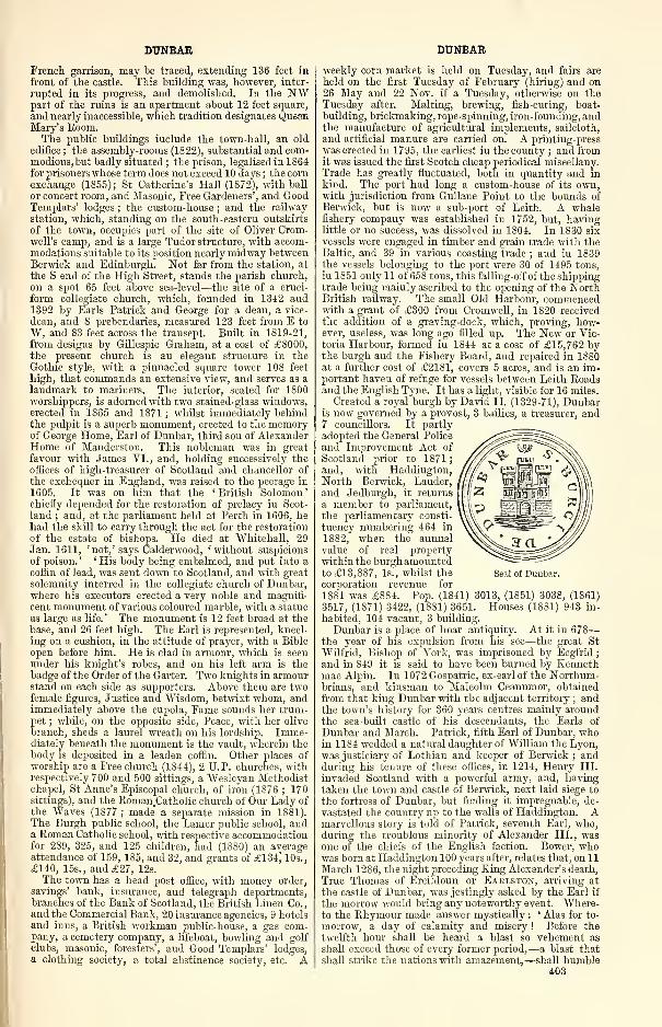
DUNBAR
French garrison, may be traced, extending 136 feet in
front of the castle. This building was, however, inter-
rupted in its progress, and demolished. In the NWpart of the ruins is an apartment about 12 feet square,
and nearly inaccessible, which tradition designates QuesnMary's Room.The public buildings include the town-hall, an old
edifice ; the assembly-rooms (1822), substantial and com-modious, but badly situated ; the prison, legalised in 1864for prisoners whose term does not exceed 10 days ; the corn
exchange (1855) ; St Catherine's Hall (1872), with ball
or concert room, and Masonic, Free Gardeners', and GoodTemplars' lodges ; the custom-house ; and the railway
station, which, standing on the south-eastern outskirts
of the town, occupies part of the site of Oliver Crom-well's camp, and is a large Tudor structure, with accom-modations suitable to its position nearly midway betweenBerwick and Edinburgh. Not far from the station, at
the S end of the High Street, stands the parish church,
on a spot 65 feet above sea-level—the site of a cruci-
form collegiate church, which, founded in 1342 and1392 by Earls Patrick and George for a dean, a vice-
dean, and S prebendaries, measured 123 feet from E to
W, and 83 feet across the transept. Built in 1819-21,
from designs by Gillespie Graham, at a cost of £8000,the present church is an elegant structure in theGothic style, with a pinnacled square tower 108 feet
high, that commands an extensive view, and serves as alandmark to mariners. The interior, seated for 1800worshippers, is adorned with two stained-glass windows,erected in 1865 and 1871 ; whilst immediately behindthe pulpit is a superb monument, erected to the memoryof George Home, Earl of Dunbar, third son of AlexanderHome of Manderston. This nobleman was in great
favour with James VI., and, holding successively theoffices of high-treasurer of Scotland and chancellor of
the exchequer in England, was raised to the peerage in
1605. It was on him that the 'British Solomon'chiefly depended for the restoration of prelacy in Scot-
land ; and, at the parliament held at Perth in 1606, hehad the skill to carry through the act for the restoration
of the estate of bishops. He died at Whitehall, 29Jan. 1611, 'not,' says Calderwood, 'without suspicions
of poison. '' His body being embalmed, and put into a
coffin of lead, was sent down to Scotland, and with great
solemnity interred in the collegiate church of Dunbar,where his executors erected a very noble and magnifi-
cent monument of various coloured marble, with a statue
as large as life.' The monument is 12 feet broad at the
base, and 26 feet high. The Earl is represented, kneel-
ing on a cushion, in the attitude of prayer, with a Bible
open before him. He is clad in armour, which is seenunder his knight's robes, and on his left arm is thebadge of the Order of the Garter. Two knights in armourstand on each side as supporters. Above them are twofemale figures, Justice and Wisdom, betwixt whom, andimmediately above the cupola, Fame sounds her trum-pet ; while, on the opposite side, Peace, with her olive
branch, sheds a laurel wreath on his lordship. Imme-diately beneath the monument is the vault, wherein thebody is deposited in a leaden coffin. Other places ofworship are a Free church (1844), 2 U.P. churches, withrespectively 700 and 500 sittings, a Wesleyan Methodistchapel, St Anne's Episcopal church, of iron (1876 ; 170sittings), and the Roman.Catholic church of Our Lady of
the Waves (1877 ; made a separate mission in 1881).The Burgh public school, the Lamer public school, anda Roman Catholic school, with respective accommodationfor 289, 325, and 125 children, had (1880) an averageattendance of 159, 185, and 32, and grants of £134^ 10s.,
£140, 15s., and £27, 12s.
The town has a head post office, with money order,
savings' bank, insurance, and telegraph departments,branches of the Bank of Scotland, the British Linen Co.,and the Commercial Bank, 20 insurance agencies, 9 hotelsand inns, a British workman public-house, a gas com-pany, a cemetery company, a lifeboat, bowling and golfclubs, masonic, foresters', and Good Templars' lodges,a clothing society, a total abstinence society, etc. A
DUNBAR
weekly corn market is held on Tuesday, and fairs are
held on the first Tuesday of February (hiring) and on26 May and 22 Nov. if a Tuesday, otherwise on thoTuesday after. Malting, brewing, fish-curing, boat-
building, brickmaking, rope-spinning, iron-founding, andthe manufacture of agricultural implements, sailcloth,
and artificial manure are carried on. A printing-press
was erected in 1795, the earliest in the county ; and fromit was issued the first Scotch cheap periodical miscellany.
Trade has greatly fluctuated, both in quantity and inkind. The port had long a custom-house of its own,with jurisdiction from Gullane Point to the bounds ofBerwick, but is now a sub-port of Leith. A whalefishery company was established in 1752, but, havinglittle or no success, was dissolved in 1804. In 1830 six
vessels were engaged in timber and grain trade with theBaltic, and 39 in various coasting trade ; and in 1839the vessels belonging to the port were 30 of 1495 tons,
in 1851 only 11 of 658 tons, this falling-off of the shippingtrade being mainly ascribed to the opening of the NorthBritish railway. The small Old Harbour, commencedwith a grant of £300 from Cromwell, in 1820 receivedthe addition of a graving-dock, which, proving, how-ever, useless, was long ago filled up. The New or Vic-toria Harbour, formed in 1844 at a cost of £15,762 bythe burgh and the Fishery Board, and repaired in 1S80at a further cost of £2181, covers 5 acres, and is an im-portant haven of refuge for vessels between Leith Roadsand the English Tyne. It has a light, visible for 1 6 miles.
Created a royal burgh by David II. (1329-71), Dunbaris now governed by a provost, 3 bailies, a treasurer, and7 councillors. It partly
adopted the General Police
and Improvement Act of
Scotland prior to 1871;
and, with Haddington,North Berwick, Lauder,and Jedburgh, it returns I
a member to parliament,'
the parliamentary consti-
tuency numbering 464 in
1882, when the annualvalue of real propertywithin the burghamountedto £13,887, Is., whilst the
corporation revenue for
1881 was £884. Pop. (1S41) 3013, (1851) 3038, (1861)
3517, (1871) 3422, (18S1) 3651. Houses (1881) 943 in-
habited, 104 vacant, 3 building.
Dunbar is a place of hoar antiquity. At it in 678
—
the year of his expulsion from his see—the great St
Wilfrid, Bishop of York, was imprisoned by Ecgfrid
;
and in 849 it is said to have been burned by Kennethmac Alpin. In 1072 Gospatric, ex-earl of the Northum-brians, and kinsman to Malcolm Ceannmor, obtained
from that king Dunbar with the adjacent territory ; andthe town's history for 360 years centres mainly aroundthe sea-built castle of his descendants, the Earls of
Dunbar and March. Patrick, fifth Earl of Dunbar, whoin 1184 wedded a natural daughter of William the Lyon,was justiciary of Lothian and keeper of Berwick ; andduring his tenure of these offices, in 1214, Henry III.
invaded Scotland with a powerful army, and, havingtaken the town and castle of Berwick, next laid siege to
the fortress of Dunbar, but finding it impregnable, de-
vastated the country up to the walls of Haddington. Amarvellous story is told of Patrick, seventh Earl, who,during the troublous minority of Alexander III., wasone of the chiefs of the English faction. Bower, whowas born at Haddington 100 years after, relates that, on 1
1
March 1286, the night preceding King Alexander's death,
True Thomas of Ereildoun or Eaklston, arriving at
the castle of Dunbar, was jestingly asked by the Earl if
the morrow would bring any noteworthy event. Where-to the Rhymour made answer mystically :
' Alas for to-
morrow, a day of calamity and misery ! Before the
twelfth hour shall be heard a blast so vehement as
shall exceed those of every former period,.—a blast that
shall strike the nations with amazement,—shall humble403
Seal of Dunbar.
DUNBAR
what is proud, and what is fierce shall level with, the
ground ! The sorest wind and tempest that ever washeard of in Scotland!' Next day, the Earl and his
companions having watched till the ninth hour withoutobserving any unusual appearance in the elements, beganto doubt the powers of the seer, and, ordering him into
their presence, upbraided him as an impostor, wheretohe replied that noon was not yet past. And scarce
had the Earl sat down to the board, scarce had the shadowof the dial fallen upon the hour of noon, when a mes-senger rode furiously up, who, being questioned, cried
:
' Tidings I bring, but of a lamentable kind, to be
deplored by the whole realm of Scotland ! Alas, ourrenowned King has ended his fair life at Kinghorn !'
'This,' said True Thomas, 'this is the scatheful windand dreadful tempest which shall blow such calamity
and trouble to the whole state of the whole realm of
Scotland !
'
Patrick, eighth Earl of Dunbar—surnamed BlackBeard—succeeded in 1289, and in the same year appearedat the parliament of Brigham as Comes de Marchia (Earl
of March or the Merse), being the first of his line so de-
signated. He was one of the ten competitors for the
crown of Scotland (1291) ; and when, in 1296, EdwardI. with a powerful army entered Scotland, the Earl of
Dunbar took part against his country. His Countess,
however, more patriotic than he, delivered the castle
over to the leaders of the Scottish army. Edward de-
spatched the Earl of Warrenne with 12,000 men to the
siege ; whilst the Scots, sensible of the importance of
this fortress, whose capture would lay their countryopen to the enemy, hastened with their main army of
40,000 men, under the Earls of Buchan, Lennox, andMar, to its relief. "Warrenne, undaunted by the superior
numbers of the Scots, left part of his army to blockade
the castle, and with the rest advanced to meet the
foe. The English had to descend into a valley before
the}' could reach the Scots ; and as they descended, the
Scots, observing some confusion in their ranks, set up a
shout of exultation, and, causing their horns to besounded, rushed down from their position of advantage.
But when Warrenne emerged from the glen, and ad-
vanced undismayed against their formidable front, the
undisciplined troops, after a brief resistance, fled, andwere chased with great slaughter as far as Selkirk Forest.
Edward, next day, with the main body of the Englisharmy, came up to Dunbar, and compelled the garrison to
capitulate. So, at least, runs the story, but Dr Hill
Burton observes, that ' evidently there was not a great
battle, with organised troops and known commanderspitted against each other' (Hist. Scot., ii. 170, ed. 1876).
According to Blind Harry, when Wallace first undertookto deliver his country, the Earl of Dunbar refused to
attend a meeting of the Estates at Perth. ThereuponWallace encountered Patrick in a field near Innerwick,
where the Earl had assembled 900 of his vassals, andwith half that number compelled the traitor, after a
terrible conflict, to retreat to Cockburnspath, himself
falling back on Dunbar. Patrick now went to Nor-thumberland to crave the aid of the Bishop of Durham ; buthis ostensible reason, the Minstrel tells us, was 'to bring
the Bruce free till his land. ' Vessels were immediatelysent from the Northumbrian Tyne to blockade Dunbar,and cut off supplies, while the Earl, with 20,000 men,hastened to retake his fortress. In the interim Wallacehad repaired to the W in quest of succour, and, return-
ing by Yester, was joined by Hay and a chosen body of
cavalry. With 5000 men he marched to the support of
Seton, while the Bishop of Durham, who had remainedat Norham with Bruce, came to the assistance of Dun-bar, and threw himself into an ambuscade near Spott-
moor. By this unexpected movement Wallace wascompletely hemmed in, when Seton fortunately came to
his relief. The two armies closed in mortal strife. TheScots pushed on so furiously against the Southrons, that
they were just about to fly, but Patrick was
' Sa cruel of intent,That all his host tuk of him hardiment;Throuch his awne hand he put mony to paiD.'
404
DUNBAR
The desperate valour of the Wallaces, the Ramsays, andthe Grahams was of little avail against the superiorforce of the English ; so that when the ambuscade of
Bishop Beck appeared, they were on the point of retir-
ing. Dunbar singled out Wallace amidst the throng,and wounded him ; but the hero, returning the blowwith sevenfold vengeance, clove down Maitland, whohad thrown himself between. Wallace's horse was killed
beneath him, and he was now on foot dealing destructionto his enemies, when
1 Erie Patrick than, that had gret craft in war,With spears ordand guid Wallace doun to bear.'
But 500 resolute warriors rescued their champion, andthe war-worn armies were glad to retire. The samenight Wallace traversed Lammermuir in quest of the
retreating host, while Bishop Beck, Earl Patrick, andBruce fled to Norham. On his return, the champion,still mindful of the odium attached to his name by the
Earl of Dunbar,
—
' Passit, with mony awfull men,On Patrickis land, and waistit wonder fast,
Tuk out guids, and places doun thai cast
;
His steads, sevin, that Mete Hamys was call'd,
Wallace gert break the burly biggings bauld,Baith in the Merse, and als in Lothiane,Except Dunbar, standand he leavit nane.'
In 1314 Edward II. of England, after seeing his armyannihilated at Bannockburn, fled with a body of horse
towards Berwick ; but Sir James Douglas, with 80chosen horsemen, so pressed on the royal fugitive, that
he was glad to shelter himself in the castle of Dunbar.Here he was received by Patrick, ninth Earl, 'full
gently;
' and hence, in a fishing-boat, he coasted
along the shore till he reached the towers of Bam-brough. After this, the Earl of Dunbar made peace
with his cousin, King Robert, and was present at
Ayr in May 1315, when the succession to the Crown of
Scotland was settled on Bruce's brother. But after
the defeat at Halidon Hill (1333), Edward at Berwickonce more received the fealty of the Earl of Dunbar withseveral others of the nobility ; and the castle of Dunbar,which had been dismantled and razed to the ground onthe approach of the English, was now rebuilt at the
Earl's expense, for the purpose of maintaining anEnglish garrison.
In 1339 the castle was again in the sole possession of
its lord, and at the service of the Crown of Scotland ;
and then the Earls of Salisbury and Arundel advanced
at the head of a large English host to take it. TheEarl of Dunbar was absent in the North ; so that the
defence of his stronghold devolved upon his Countess, a
lady who, from her swarthy complexion, was called
Black Agnes, and who was daughter to the great ThomasRandolph, Earl of Moray. During the siege, Agnesperformed all the duties of a bold and vigilant com-mander. When the battering engines of the English
hurled stones or leaden balls against the battlements, in
scorn she would bid a maid wipe off with a clean white
handkerchief the marks of the stroke ; and when the
Earl of Salisbury, with vast labour, brought his sowclose to the walls, the Countess cried :
—
' Beware, Montagow,For farrow shall thy sow !'
Whereupon a large fragment of rock was hurled from
the battlements, and crushed the sow to pieces, with all
the poor little pigs—as Major calls them—who were
lurking beneath it. The following is Wyntoun's rhym-ing narrative of this most memorable siege :
—
' Schyre William Montague, that suaHad tane the siege, in hy gret maA mekil and richt stalwart engine,And up smertly gert dress it ; syneThey warpit at the wall great stanesBaith hard and heavy for the nanys,But that nane merrying to them made,And alsua when they castyne had,With a towel, a damiselleArrayed jollify and well,
Wippit the wall, that they micht see
To gere them mair annoyed be
;
DUNBAR DUNBAR
There at the siege well lang they lay,
But there little vantage got they
;
For when they bykkyne wald, or assail,
They tint the maist of their travaile.
And as they bykeryd there a' day,Of a great shot I shall you say,For that they had of it ferly,
It here to you rehearse will I.
William of Spens percit a Blasowne,And thro' three faulds of Awbyrehowne,And the Actowne through the third plyAnd the arrow in the bodie,
While of that dynt there dead he lay
;
And then the Montagu gan say
;
" This is ane of my Lady's pinnis,Her amouris thus, till my heart rinnls."While that the siege was there on this wiseMen sayis their fell sair juperdyis.For Lawrence of Prestoun, that thenHaldin ane of the wichtest men,That was in all Scotland that tide,
A rout of Inglismen saw ride,
That seemed jru.de men and worthy,And were arrayed right richly;
He, with als few folk, as they were,On them assembled he there
;
But at the assembling, he was there(ntil the mouth stricken with a spear,While it up in the harnys ran
;
Till a dike he withdrew him than.And died ; for nae mair live he might.His men his death perceived noucht
;
And with their faes faucht stoutly,
While they them vanquish'd utterly.
Thus was this guid man brought till end,That was richt greatly to commend.Of gret wirschipe and gret bownteHis saul be aye in saftie.
Sir William als of GalstownOf Keith, that was of glide renown.Met Richard Talbot by the wayAnd set him to sa hard assay,That to a kirk he gert him gae,And close there defence to ma
;
But he assailed there sae fast,
That him behov'd treat at the last,
And twa thousand pound to pay,And left hostage and went his way.The Montagu was yet lyand,
Sieging Dunbare with stalwart handAnd twa gallies of Genoa had he,For till assiege it by the sea.
And as he thus assiegend lay,
He was set intil hard assay
;
For he had purchased him covynOf ane of them, that were therein,That he should leave open the yete,And certain term till him then setTo come ; but they therein halilyWere warnit of it privily.
He came, and the yete open fand,And wald have gane in foot steppand.But John of Cowpland, that was thenBut a right poor simple man,Shut him off back, and in is gane,The portcullis came down on ane;And spared Montagu, thereoutThey cryed with a sturdy shout"A Montagu for ever mair !"
Then with the folk that he had thereHe turned to his Herbery.And let him japyt fullyly.
Syne Alexander, the Ramsay,That trowed and thought, that theyThat were assieged in Dunbar,At great distress or mischief were;That in an evening frae the Bass,With a few folk, that with him wag,Toward Dunbar, intil a boat,He held all privily his gate;And by the gallies all slylyHe gat with his company
;
The lady and all that were thereOf his coming well comfort were,He issued in the morning in hy,And with the wachis sturdily,Made ane apart and stout melle.And but tynsel entered he.While Montagu was there lyand,
The King Edward of EnglandPurchased him help and alyawns.For he wald amowe were in France;And for the Montagu he sends ;
For he cowth nae thing till endForowtyn him, for that time heWas maist of his counsel privieWhen he had heard the king's biddingHe removed, but mair dwelling,When he, I trow, had lying thereA quarter of a year and mair.Of this assiege in their hethyng
The English oysid to make karping
*' I vow to God, she makes gret stere
The Scottish wenche ploddere,Come I aire, come I late,
I fand Annot at the yate."
'
Amongst the nobles who fell in the field of Durham,in 1346, "was Thomas, Earl of Moray, brother to the
heroic Countess of Dunbar. As he had no male issue,
Agnes inherited his vast estates ; and her husbandassumed the additional title of Earl of Moray. Besides
the earldom of Moray, the Earl of Dunbar and his
Countess obtained the Isle of Man, the lordship of
Annan dale, the baronies of Morton and Tibbers in
Nithsdale, of Morthingtoun and Longformacus, and the
manor of Dunse in Berwickshire, with Mochrum in
Galloway, Cumnock in Ayrshire, and Blantyre in Clydes-
dale.
George, the tenth Earl of Dunbar and March, suc-
ceeded his father in 1369. From his vast possessions
he became one of the most powerful nobles of southernScotland and the great rival of the Douglases. Hisdaughter Elizabeth was betrothed, in 1399, to David,Duke of Rothesay, son and heir to Robert III. ; and onthe faith of the Prince, who had given a bond to performthe espousals, the Earl had advanced a considerable por-
tion of her dowry. But Archibald, Earl of Douglas
—
surnamed the Grim—jealous of the advantage which this
marriage promised to a family whose pre-eminence in
the state already rivalled his own, protested against thealliance, and, by his intrigues at court, through theDuke of Albany, had the contract between Rothesayand Lady Elizabeth cancelled, and his own daughtersubstituted in her place. Stung by the insult, Earl
George withdrew to England, where Henry IV. grantedhim a pension of £400 during the continuance of warwith Scotland, on condition that he provided 12 men-at-arms and 20 archers with horses, to serve against
Robert. With a Douglas at Otterburn (1388), he haddefeated Hotspur ; now, with Hotspur, at Homildon(1402), he defeated a Douglas. At last, through themediation of Walter Halyburton of Dirleton, a recon-
ciliation was effected in 140S, Douglas consenting to
Dunbar's restoration, on condition that he himself shouldget the castle of Lochmaben and the lordship of Annan-dale, in lieu of the castle of Dunbar and earldom of
March, which he then possessed.
George, eleventh Earl of Dunbar and March, suc-
ceeded his father in 1420, being then nearly 50 years
old. In 1434, he and his son Patrick visited England*The motive of this visit to the English court is notknown; but the slumbering jealousies of James I.
—
who had already struck a blow at the power of thebarons—were easily roused ; and he formed the boldplan of seizing the estates and fortresses of a familywhich for ages had been the wealthiest and most power-ful on the Scottish border. The Earl of Dunbar wasarrested and imprisoned in the castle of Edinburgh,while the Earl of Angus, Chancellor Crichton, and AdamHepburn of Hailes were despatched with letters to thekeeper of the castle of Dunbar, who immediately sur-
rendered it to the King's authority. In a parliamentassembled at Perth on 10 Jan. 1435, George was accusedof holding his earldom and estates after their forfeiture
by his father's treason. In vain did he plead that his
father had been pardoned and restored by Albany ; it
was answered, that a forfeiture incurred for treason couldnot be pardoned by a regent ; and the parliament, in
compliance with this reasoning, adjudged, ' that, inconsequence of the attainder of George de Dunbar, for-
merly Earl of March and Lord of Dunbai*, every rightboth of property and possession in all and each of thoseestates in the earldom of March and lordship of Dunbar,and all other lands which he held of our said lord theKing, with all and each of their appurtenances, did anddoes exclusively belong and appertain to our lord theKing.' Thus earldom and estates were vested in theCrown ; and by James II. the lordship of Dunbar wasbestowed on his second son, Alexander, third Duke of
Albany, then in his infancy.
In 1483 Albany gave the castle of Dunbar into the405
DUNBAR
hands of the English ; a condition of the truce withHenry VII. was, that its recapture by the Scots shouldnot be deemed an act of war. On the marriage of Mar-garet of England with the King of Scotland in 1502, theearldom of Dunbar and lordship of Cockburnspath, withtheir dependencies, were assigned as the jointure of the
young Queen ; but the castle of Dunbar is expressly
mentioned as being reserved by the King to himself.
In 1516 John, fourth Duke of Albany, placed a Frenchgarrison here, under poor De la Bastie ; and by the
French it was held till James V. , during his marriagesojourn in Paris (1537), expressly bargained for its
evacuation. Three years later an English spy wroteword how James ' at least twice every week in properperson, with a privy company of six persons and himself,
repairs secretly by night, at the hour of twelve of theclock or after, to his said castle of Dunbar, and there so
continues sometimes by the space of one day, and some-times of two days, and returns by night again, andhath put all his ordnance there in such case that the
same are in full and perfect readiness to be removed andset forward at his pleasure.'
The English, in the inroad under the Earl of Hertford,
in 1544, after their return from the siege of Leith, andafter burning Haddington, encamped the second night—26 May—near Dunbar. ' The same day,' says Patten,' we burnt a fine town of the Earl of Bothwell's, called
Haddington, with a great nunnery and a house of friars.
The next night after we encamped besides Dunbar, andthere the Scots gave a small alarm to our camp. Butour watches were in such readiness that they had novantage there, but were fain to recoil without doing of
any harm. That night they looked for us to have burntthe town of Dunbar, which we deferred till the morningat the dislodging of our camp, which we executed by500 of our hackbutters, being backed with 500 horse-
men. And by reason we took them in the morning,
who, having watched all night for our coming and per-
ceiving our army to dislodge and depart, thought them-selves safe of us, were newly gone to their beds ; and in
their first sleeps closed in with fire, men, women, andchildren, were suffocated and burnt. That morningbeing very misty and foggy, we had perfect knowledgeby our espials that the Scots had assembled a great
power at a strait called the Pease.
'
In 1547, Hertford, now Duke of Somerset, invadedScotland with an army of 15,000 men ; and havingcrossed the pass of Pease, with ' puffying and payne, ' as
Patten says, demolished the castles of Dunglass, Inner-
wick, and Thornton. ' This done, about noon, wemarched on, passing soon after within the gunshot of
Dunbar, a town standing longwise upon the seaside,
whereat is a castle—which the Scots count very strong
—that sent us divers shots as we passed, but all in vain :
their horsemen showed themselves in their fields beside
us, towards whom Bartevil with his 800 men, all
hackbutters on horseback—whom he had right well ap-
pointed—and John de Rybaud, with divers others, did
make ; but no hurt on either side, saving that a man of
Bartevil's slew one of them with his piece. The skirmish
was soon ended.' In 154S, Dunbar was burned byGerman mercenaries under the Earl of Shrewsbury, onhis return to England from the attack on Haddington.
On Monday, 11 March 1566, just two days after
Rizzio's assassination, Mary at midnight slipped out
from Holyrood, and, with Darnley and six or seven
followers, riding straight to Seton House, there got anescort on to the strong fortress of Dunbar, whosegovernor ' was amazed, early on Tuesday morning, bythe arrival of his king and queen hungry and clamorous
for fresh eggs to breakfast.' Having thus seduced
Darnley to abandon his party, the Queen's next step
was to avenge the murder of her favourite. A proclama-
tion was accordingly issued from Dunbar on 16 March,calling on the inhabitants of Edinburgh, Haddington,Linlithgow, Stirling, etc., to meet her at Haddingtonon Sunday the 17th ; but it was not till the 27th that
Bothwell, with 2000 horsemen, escorted the royal pair
back to Edinburgh. Melville, the interim secretary,
406
DUNBAR
tells how at Haddington during this homeward journeyMary complained bitterly of Darnley's conduct in thelate assassination ; and on 19 April, in parliament,she, ' taking regard and consideration of the greatand manifold good service done and performed, not onlyto her Highness's honour, weill, and estimation, butalso to the commonweill of her realm and lieges thereof,
by James, Earl Bothwell, and that, through his great
service foresaid, he not only frequently put his personin peril and danger of his life, but also super-expendedhimself, alienated and mortgaged his livings, lands, andheritage, in exorbitant sums, whereof he is not hastily
able to recover the same, and that he, his friends andkinsmen, for the most part, dwell next adjacent to herHighness's castle of Dunbar, and that he is most habile
to have the captaincy and keeping thereof, and that it
is necessarily required that the same should be well en-
tertained, maintained, and furnished, which cannot bedone without some yearly rent, and profit given to himfor that effect, and also for reward of his said service :
therefore, her Majesty infefted him and his heirs-male in
the office of the captaincy keeping of the castle of
Dunbar, and also in the crown lands of Easter andWester Barns, the lands of Newtonleyes, Waldane, etc.
So it was to Dunbar Castle that Bothwell broughtMary ' full gently, ' when, with 800 spearmen, he mether at Fountainbridge, on her return from Stirling, 24April 1567, ten weeks after the Kirk-of-Field tragedy.
The Earl of Huntly, Secretary Maitland, and Sir JamesMelville, were taken captives with the Queen, while therest of her servants were suffered to depart ; and Mel-ville himself was released on the following day. Of Both-well and Mary, Buchanan tells that, ' they had scarcely
remained ten days in the castle of Dunbar, with nogreat distance between the Queen's chamber and Both-well's, when they thought it expedient to return to the
castle of Edinburgh.
'
The marriage at Edinburgh, the retreat to Borth-wiok, and the flight thence in page's disguise to Cake-mtjik—these three events bring Mary once more to
Dunbar, for the third and last time, on 13 June. WithBothwell she left next day to levy forces, and the dayafter that comes Carberry Hill, whence Bothwellreturns alone, to fly on shipboard, which ends Dunbar'sgreat three-act tragedy.
On 21 Sept. 1567, four companies of soldiers weresent to take Dunbar, which surrendered to the Regenton 1 Oct., and in the following December the castle,
which had so often sheltered the unfortunate and the
guilty, was ordered by Parliament to be destroyed. In1581, among several grants excepted by James VI. fromthe general revocation of his deeds of gift made throughimportunity, mention is made of the ' forthe of Dunbargranted to William Boncle, burgess of Dunbar. ' This
probably referred to the site of the fortress, and per-
haps some ground adjacent.
On 22 July 1650, Cromwell, at the head of 16,000men, entered Scotland ; on 3 Sept. he fought the
Battle of Dunbar. Of which great battle and the events
that led to it we have his own account in a letter to
Lenthall, Speaker of the Parliament of England :
—
' We having tried what we could to engage the enemy, 3
or 4 miles W of Edinburgh ; that proving ineffectual,
and our victual failing, we marched towards our ships
for a recruit of our want. The enemy did not at all
trouble us in our rear, but marched the direct way to-
wards Edinburgh ; and partly in the night and morningslips-through his whole army, and quarters himself in a
posture easy to interpose between us and our victual.
But the Lord made him to lose the opportunity. Andthe morning proving exceeding wet and dark, we re-
covered, by that time it was light, a ground where they
could not hinder us from our victual ; which was an
high act of the Lord's Providence to us. We being
come into the said ground, the enemy marched into the
said ground we were last upon ; having no mind either
to strive or to interpose between us and our victuals, or
to fight ; being indeed upon this aim of reducing us to
a lock, hoping that the sickness of our army would
DUNBAR DUNBAR
render their work more easy by the gaining of time.
Whereupon we marched to Musselburgh to victual, andto ship away our sick men ; where we sent aboard near
500 sick and wounded soldiers.' And upon serious consideration, finding our weakness
so to increase, and the enemy lying upon his advantage,
at a general council it was thought fit to march to Dun-bar, and there to fortify the town. Which, we thought,
if any thing, would provoke them to engage. As also,
that the having a garrison there would furnish us withaccommodation for our sick men, and would be a goodmagazine, which we exceedingly wanted, being put to
depend upon the uncertainty of weather for landing pro-
visions, which many times cannot be done, though the
being of the whole army lay upon it ; all the coasts
from Berwick to Leith not having one good harbour.
As also, to lie more conveniently to receive our recruits
of horse and foot from Berwick.' Having these considerations, upon Saturday, the
30th of August, we marched from Musselburgh to Had-dington. Where, by that time we had got the van-
brigade of our horse, and our foot and train, into their
quarters, the enemy had marched with that exceeding
expedition that they fell upon the rear-forlorn of our
horse, and put it in some disorder ; and indeed had like
to have engaged our rear-brigade of horse with their
whole army, had not the Lord, by His Providence, puta cloud over the moon, thereby giving us opportunity to
draw off those horse to the rest of the army. Whichaccordingly was done without any loss, save of three or
four of our afore-mentioned forlorn ; wherein the enemy—as we believe—received more loss.
' The army being put into a reasonable secure posture,
towards midnight the enemy attempted our quarters, onthe W end of Haddington ; but through the goodnessof God we repulsed them. The next morning we drewinto an open field, on the S side of Haddington ; we notjudging it safe for us to draw to the enemy upon his
own ground, he being prepossessed thereof; but rather
drew back, to give him way to come to us, if he had so
thought fit. And having waited about the space of four
or five hours, to see if he would come to us, and notfinding any inclination in the enemy so to do, weresolved to go, according to our first intendment, to
Dunbar.' By that time we had marched three or four miles, we
saw some bodies of the enemy's horse draw out of their
quarters ; and by that time our carriages were gottennear Dunbar, their whole army was upon their marchafter us. And, indeed, our drawing back in this man-ner with the addition of three new regiments added to
them, did much heighten their confidence, if not pre-
sumption and arrogancy. The enemy that night, weperceived, gathered towards the hills, labouring to
make a perfect interposition between us and Berwick.And having in this posture a great advantage, throughhis better knowledge of the country he effected it, bysending a considerable party to the strait pass at Cop-perspath [Cockburnspath], where ten men to hinder,are better than forty to make their way. And truly
this was an exigent to us, wherewith the enemy re-
proached us ; as with that condition the Parliament'sarmy was in, when it made its hard conditions with theKing in Cornwall. By some reports that have come to
us, they had disposed of us, and of their business, in
sufficient revenge and wrath towards our persons, andhad swallowed up the poor interest of England, believing
that their army and their king would have marched to
London without any interruption ; it being told us, weknow not how truly, by a prisoner we took the nightbefore the fight, that their king was very suddenly to
come amongst them, with those English they allowedto be about him. But in what they were thus lifted up,the Lord was above them.
' The enemy lying in the posture before mentioned,having those advantages ; we lay very near him, beingsensible of our disadvantages ; having some weakness offlesh, but yet consolation and support from the LordHimself to our poor weak faith, wherein I believe not a
few amongst us stand : That because of their numbers,because of their advantages, because of their confidence,
because of our weakness, because of our strait, we werein the Mount, and in the Mount the Lord woidd beseen ; and that He would find out a way of deliverance
and salvation for us ; and indeed we had our consola-
tions and our hopes.' Upon Monday evening—the enemy's whole numbers
were very great, as we heard, about 6000 horse and16,000 foot at least ; ours drawn down, as to sound men,to about 7500 foot and 3500 horse,—upon Mondayevening, the enemy drew down to the right wing abouttwo-thirds of their left wing of horse. To the rightwing ; shogging also their foot and train much to theright, causing their right wing of horse to edge downtowards the sea. We could not well imagine but thatthe enemy intended to attempt upon us, or to placethemselves in a more exact position of interposition.
The Major-General and myself coming to the EarlRoxburgh's house [Broxmouth], and observing this
posture, I told him I thought it did give us an oppor-tunity and advantage to attempt upon the enemy. Towhich he immediately replied, that he had thought to
have said the same thing to me. So that it pleased theLord to set this apprehension upon both of our hearts at
the same instant. We called for Colonel Monk, andshowed him the thing ; and coming to our quarters at
night, and demonstrating our apprehensions to some of
the colonels, they also cheerfully concurred.' We resolved, therefore, to put our business into this
posture : That six regiments of horse and three regimentsand a half of foot should march in the van ; and that theMajor-General, the Lieutenant-General of the horse, andthe Commissary-General, and Colonel Monk to com-mand the brigade of foot, should lead on the business
;
and that Colonel Pride's brigade, Colonel Overton'sbrigade, and the remaining two regiments of horse,
should bring up the cannon and rear. The time offalling-on to be by break of day ; but, through somedelays, it proved not to be so ; not till six o'clock in themorning.
' The enemy's word was The Covenant, which it hadbeen for diver days. Ours, The Lord of Hosts. TheMajor-General, Lieutenant-General Fleetwood, and Com-missary-General Whalley, and Colonel Twisleton, gavethe onset ; the enemy being in a very good posture to
receive them, having the advantage of their cannon andfoot against our horse. Before our foot could come up,the enemy made a gallant resistance, and there was a
very hot dispute at sword's point between our horse andtheirs. Our first foot, after they had discharged their
duty, being overpowered with the enemy, received somerepidse, which they soon recovered. For my own regi-
ment, under the command of Lieutenant-Colonel Goffe,
and my Major, White, did come seasonably in ; and, at
the push of pike, did repel the stoutest regiment theenemy had there, merely with the courage the Lord waspleased to give. Which proved a great amazement tothe residue of their foot ; this being the first action be-
tween the foot. The horse in the meantime did, with agreat deal of courage and spirit, beat back all opposition,
charging through the bodies of the enemy's horse, andof their foot ; who were, after the first repulse given,
made by the Lord of Hosts as stubble to their swords.
Indeed, I believe I may speak it without partiality,
both your chief commanders and others in their several
places, and soldiers also, were acted [actuated] with as
much courage as ever hath been seen in any action since
this war. I know they look to be named ; and there-
fore I forbear particulars.' The best of the enemy's horse being broken through
and through in less than an hour's dispute, their wholearmy being put into confusion, it became a total rout
;
our men having the chase and execution of them neareight miles. We believe that upoji the place and nearabout it were about three thousand slain. Prisoners taken:
of their officers, you have this enclosed list ; of private
soldiers, near 10,000. Thewhole baggage and train taken;wherein was good store of match, powder, and bullet;
407
DUNBAR
all their artillery, great and small—thirty guns. Weare confident they have left behind them not less thanfifteen thousand arms. I have already brought in to menear two hundred colours, which I herewith send you.
What officers of theirs of quality are killed, we yet can-
not learn ; but yet surely divers are ; and many men of
quality are mortally wounded, as Colonel Lumsden, the
Lord Libberton, and others. And, that which is nosmall addition, I do not believe we have lost 20 men.Not one commissioned officer slain as I hear of, save onecornet, and Major Eooksby, since dead of his wounds
;
and not many mortally wounded. Colonel Whalleyonly cut in the hand-wrist, and his horse (twice shot)
killed under him ; but he well recovered another horse,
and went on in the chase. Thus you have the prospectof one of the most signal mercies God hath done for
England and His people, this war ' (Carlyle's Cromwell*part vi.).
The subsequenthistory ofDunbar presents nothingverymemorable. At it Cope landed his troops from Aberdeen,16 to 18 Sept. 1745—the week of the battle of Preston-pans In 1779, Paul Jones's squadron hovered a brief
space in front of the town, and, in 1781, Captain G. Fall,
another American privateer, threatened a descent, butsheered off on perceiving preparations making for givinghim a warm reception. By a strange coincidence theprovost in the latter year was Robert Fall, member of a
family that, from the middle of the 17th to the close of
the 18th century, figures largely in the annals of Dunbaras one of the chief merchant houses in the kingdom.The Falls of Dunbar married into the Scottish baronetcy,and gave a Jacobite member to Parliament
;yet Mr
Simson adduces many reasons for believing that theycame of the selfsame stock as the Gipsy Faas of Kirk-Yetholm—Faa being the form under which we first meetwith the name at Dunbar, in the Rev. J. Blackadder'sMemoir, under date 1669. When on 22 May 1787Robert Burns arrived at ' this neat little town, ridinglike the devil, and accompanied by Miss , mountedon an old carthorse, huge and lean as a house, herself as
fine as hands could make her, in cream-coloured riding-clothes, hat and feather, etc'—he ' dined with ProvostFall, an eminent merchant (Mrs F. a genius in paint-ing).' Which is about the last that we hear of the Fallsat Dunbar, where, in 1835, there was 'not even a stoneto tell where they lie.' At York there are Falls at thepresent day, who likewise lay claim to Romani origin(Simson'&\History of the Gipsies, 2d ed., New York, 1878
;
and Notes and Queries, 1881).
The parish, containing also the villages of Belhavenand East and West Barns, is bounded N and NE bythe German Ocean, SE by Innerwick, S by Spott andStenton, W by Prestonkirk, and NW by Whitekirk-Tynninghame. Its utmost length, from W by N to Eby S, is 7J miles ; its breadth, from N to S, varies be-tween 24 furlongs and 3 miles ; and its area is 8803acres, of which 1284J are foreshore and 214 water.At the western boundary is the mouth of the riverTyne ; Dry Burn winds 4J miles east-north-eastward tothe sea along all the Innerwick border ; and to the seathrough the interior flow Spott Burn and Beil Water.The coast to the W, indented by Tynninghame andBelhaven Bays, presents a fine sandy beach ; but east-ward from the mouth of Beil Water is bold and rocky,'niched and vandyked' with headlands of no greatheight, yet here and there jagged and savage in theirway. The interior exhibits a pleasant diversity of hill
and dale, rising gradually towards the LammermnirHills, and commanding a prospect of seaboard and oceanfrom St Abb's Head to the Bass and the hills of Fife.
The highest points are Brunt Hill (737 feet) and DoonHill (582), these rising 3 and 2J miles SSE of the town,the latter on the boundary with Spott ; since Dunbar* John Aubrey, in his Miscellanies (1696), records a circum-
stance unnoticed by Carlyle. ' One that I knew,' he says, ' thatwas at the Battle of Dunbar, told me that Oliver was carried onwith a Divine Impulse ; he did laugh so excessively as if he hadbeen drunk ; his Eyes sparkled with Spirits. He obtained a greatVictory ; but the Action was said to be contrary to HumanPrudence.'
408
DTJNBARNY
Common, 6J miles SSW of the town, though sometimesregarded as part of the parish, is really divided amongSpott, Stenton, and Whittinghame. A part of theLammermnirs, with drainage towards the BerwickshireWhitadder, it attains at Clints Dod a height of 1307feet. The rocks of the parish exhibit interesting
phases both of eruptive and of secondary formations.Coal occurs, but not of sufficient thickness to beworked ; excellent grey limestone has long been quar-ried ; and red sandstone, more or less compact, is
plentiful. The soil is partly a fertile loam, partly clay,
partly a light rich mould ; and the entire area, withslight exception, is under tillage. A rough tombstone,rudely inscribed with the name of Sir William Douglas,is in the vicinity of Broxmouth House ; and in Brox-mouth grounds is a small mound, crowned with a cedarof Lebanon, and known as Cromwell's Mount, since
from it Cromwell beheld the descent of Leslie's armyfrom Doon Hill. Three ancient chapels stood at thevillages of Belton, Hedderwick, and Pinkerton ; butboth they and the villages have long been extinct. Amonastery of Red or Trinity Friars was founded at thetown, in 1218, by Patrick, fifth Earl of Dunbar, and hasbequeathed to its site the name of Friar's Croft ; andby Patrick, seventh Earl, a monastery of White or Car-
melite Friars was founded in 1263 near the town, it is
thought on ground where some Roman medals wereexhumed at the forming of a reservoir. A Maison Dieuof unknown date, stood at the head of High Street.
Mansions are Broxmouth Park, Lochend House, Bel-
ton House, Hedderwick House, and Winterfield House;
and 9 proprietors hold each an annual value of £500 andupwards, 12 of between £100 and £500, 31 of from £50to £100, and 81 of from £20 to £50. The seat of apresbytery in the synod of Lothian and Tweeddale, this
parish is divided ecclesiastically into Dunbar proper andBelhaven, the former a living worth £443. Threeschools under the landward board—Belhaven, EastBarns, and West Barns—with respective accommodationfor 122, 107, and 200 children, had (1880) an average
attendance of 53, 122, and 102, and grants of £37, 3s.,
£90, lis., and £82. Valuation (1843) £27,701, (1882)
£37,635, 16s. 4d. Pop. of civil parish (1801) 3951, (1S21)
5272, an increase due to the cotton factory of Belhaven1815-23
; (1831) 4735, (1861) 4944, (1871) 49S2, (1881)5393 ; of ecclesiastical parish (1881) 4049.—Ord. Sur.,
sh. 33, 1863.
The presbytery of Dunbar comprises the old parishes
of Cockburnspath, Dunbar, Innerwick, Oldhamstoeks,Prestonkirk, Spott, Stenton, Whittinghame, and White-kirk-Tynninghame, and the quoad sacra parish of Bel-
haven. Pop. (1871) 12,432, (1881), 12,663, of whom2545 were communicants of the Church of Scotland in
1878. See James Miller's History of Dunbar (Dunb.1830 ; new ed. 1859).
Dunbarny, a parish of SE Perthshire, containing the
post-office village of Bridge of Earn, with a station onthe North British, 3| miles SSE of Perth, and also, 1
mile S by W, the village of Eintillo. It is houndedNW by the Craigend section of Forteviot, N by Perth,
NE by Rhynd, E by Abernethy, SE by Dron, and Wby the Glenearnhill section of Dron and by Forgandenny.Its greatest length, from NNE to SSW, is 4| miles ; its
greatest breadth, from E to W, is 4 miles ; and its
area is 4136J acres, of which 76| are water. The river
Earn winds 5f miles east-by-sonthward along the For-
teviot and Abernethy borders and through the interior
between banks of singular beauty ; and from its low-lying
valley the surface rises northward to 725 feet on richly-
wooded Moncreiffe, southward to 800 on the westernslopes of Dron Hill. Trap and Old Red sandstone are
the prevailing rocks, and both have been largely quarried.
Five mineral springs at Pitcaithly enjoy a high medi-cinal repute, and attracted so many invalids and other
visitors, as to occasion the erection of Bridge of Earnvillage, and of hotels both there and at Pitcaithly. Thesoil of the arable lands is variously till, clay, loam, andalluvium, and has been highly improved. Illustrious
natives or residents were Robert Craigie (1685-1760),
DUNBARROW
Lord President of the Court of Session ; Robert Craigie,
Lord Craigie (1754-1834), also an eminent judge ; Sir
Francis Grant (1803-78), president of the Royal Aca-demy ; and his brother, General Sir James Hope Grant,
G.C.B. (1808-75). Mansions are Ballendrick, Kil-graston, Moncreiffe, Dunbarny, and Kinmonth, thetwo last being 2 miles W by N, and 3 miles NE, of
Bridge of Earn ; and 5 proprietors hold each an annualvalue of £500 and upwards, 3 of between £100 and £500,3 of from £50 to £100, and 12 of from £20 to £50.Dunbarny is in the presbytery of Perth and synod of
Perth and Stirling; the living is worth £300. Theancient church stood at the extinct village of Dunbarny,close to Dunbarny House ; its successor was built near
Bridge of Earn in 1684 ; and a few yards E of the site
of this is the present church (1787 ; 650 sittings).
Chapels subordinate to the ancient church stood at
Moncreiffe and at Kirkpottie in Dron ; and that at Mon-oreiffe continues to be the burying-place of the Mon-creiffe family. There is also a Free church ; and apublic school, erected in 1873, with accommodation for
180 children, had (1880) an average attendance of 106,
and a grant of £104, 5s. Valuation (18S2) £8429,12s. 7d. Pop. (1801) 1066, (1S31) 1162, (1851) 1056,
(1871) 913, (1881) 756.—Ord. Sur., sh. 48, 1868.
Dunbarrow, a detached south-eastern section of Dun-nichen parish, Forfarshire, bounded on the SE by Car-myllie, and on all other sides by Kirkden, a strip of
which, hardly a furlong broad at the narrowest, separates
it from Dunnichen proper. With utmost length andbreadth of If and 1 mile, it rises in all directions to a
hill-summit (500 feet) of its own name, on which are
some vestiges of an ancient fort.
Dunbarton. See Dumbarton.Dunbeath, a village, a bay, and a stream of Latheron
parish, Caithness. The village stands on the left bankof Dunbeath Water, J mile above its mouth, 6J milesNNE of Berriedale, and 20 SW of Wick, under whichit has a post office, with money order, savings' bank,and telegraph departments. An ancient place, the kirk-
town once of a parish of its own name, it possesses aninn and a public school ; and fairs are held at it on thethird Tuesday of August and November. DunbeathCastle, crowning a peninsulated sea-cliff, 1 mile S of thevillage, is partly a fine modern mansion, partly anancient baronial fortalice, which, in April 1650, wascaptured and garrisoned by General Hurry for the Mar-quis of Montrose. Its owner, Win. Sinclair-Thomson-Sinclair, Esq. of Freswick (b. 1844 ; sue. 1876), holds
57,757 acres in the shire, valued at £6207 per annum.The bay is small, and has no capacity for shipping,but possesses value for its salmon fisheries, and as anexcellent station for herring-fishing. Dunbeath Water,issuing from little Loch Braigh na h-Aibhne (980 feet),
runs 14-| miles north-eastward and east-south-eastwardalong a picturesque strath, and falls into the northerncurve of the bay.—Ord. Sur., shs. 110, 109, 1877-78.
Dun-Bhail-an-Righ. See Beregonium.Dunblane (Gael. ' hill of Blane '), a town and a parish
of Strathallan, S Perthshire. The town stands, 250 feet
above sea-level, on the left bank of Allan Water, whichhere is spanned by a one-arch bridge, built early in the15th century by Bishop Finlay Dermoch ; its station onthe Scottish Central section of the Caledonian, at thejunction of the Callander line, is 11 miles ESE of Cal-
lander, 28 SW of Perth, 5 N by W of Stirling, 41JTOW of Edinburgh, and 34J NE of Glasgow. Anancient place, it was burned under Kenneth mac Alpin(844-60) by Britons of Strathclyde, and in 912 wasravaged by Danish pirates, headed by Regnwald. Butits church dates back to even remoter times, to the 7thcentury, and seems to have been an offshoot of Kingarthin Bute, for its founder was St Blane, of the race of theIrish Picts, and bishop of that church of Kingarth whichCathan his uncle had founded. The bishopric ofDunblanewas one of the latest established by David I., in 1150or somewhat earlier ; among its bishops was Maurice,who, as Bruce's chaplain and abbot of Inchaffray, hadblessed the Scotch host at Bannockburn. Long after,
DUNBLANE
in post-Reformation days, the saintly Robert Leighton(1613-84) chose it as the poorest and smallest of Scot-
land's sees, and held it for nine years till his translation
in 1670 to the archbishopric of Glasgow. In him Dun-blane's chief interest is centred ; and his memory lives
in the Leightonian Library, the Bishop's Well, and theBishop's Walk, a pleasant path leading southward notfar from the river, and overshadowed by venerablebeech trees. Then, too, there is Tannahill's song,
Jessie, the Flower o' Dumblanc, recalled when the sungoes down behind Ben Lomond ; or one may rememberthat Prince Charles Edward held a levee in BalhaldieHouse, now an old ruinous mansion, on 11 Sept. 1745,and that the Queen drove through Dunblane on 13Sept. 1844. The title of Viscount Dunblane in thepeerage of Scotland, conferred in 1675 on PeregrineOsborne, who in 1712 succeeded his father as Duke ofLeeds, is now borne by his sixth descendant, George-Godolphin Osborne, ninth Duke of Leeds and eighth Vis-
count Dunblane (b. 1828 ; sue. 1872).
The town itself, though ranking as a city, is townlikein neither aspect nor extent. Richard Franck, indeed,
who travelled in Scotland about the year 1658, calls it
' dirty Dunblane, ' and adds, ' Let us pass by it, and notcumber our discourse with so inconsiderable a corpora-
tion.' But to-day the worst charges to be broughtagainst Dunblane are that its streets are narrow, its
houses old-fashioned—light enough charges, too, whencounterweighed by charming surroundings, a brand-newhydropathic establishment, a good manyhandsome villas,
and various public edifices of more or less redeem-ing character. Foremost, of course, comes the prison,
which, erected in 1842 on the site of Strathallan Castle,
had its front part converted in 1882 into commodiouspolice barracks, whilst a new wing to the rear contains
10 cells for prisoners whose term does not exceed afortnight. The neighbouring courthouse was built in
1869, with aid of £3973 from Government. TheLeightonian Library is also modern, a small house,
the marble tablet on whose front bears the Bishop's
arms and the inscription ' Bibliotheca Leightoniana ;
'
it contains his bequest of 1400 volumes for the useof the clergy of the diocese, a number since con-
siderably added to, and serves now as a public read-
ing-room. On a rising knoll beyond the cathedral is amineral spring, which, according to analysis made in
1S73, contains 19'200 grains of common salt to 14'400
of muriate of lime, 2 '800 of sulphate of lime, 4 '00 of
carbonate of lime, and 1/36 of oxide of iron. Thisspring having been acquired by a limited company, a
fine hydropathic establishment, capable of accommodat-ing 200 visitors, was built (1875-76), at a cost of £22,000,on grounds 18 acres in extent. It commands a magni-ficent prospect of the Grampians, and, designed byMessrs Peddie & Kinnear, is English in style, withcentral clock-tower, projecting wings, a recreation room40 yards long, billiard room, etc. The town has,
besides, 2 hotels, a post office, with money order, savings'
bank, insurance, and telegraph departments, branches
of the Bank of Scotland and the Union Bank, a local
savings' bank, 13 insurance agencies, gas-works, a public
reading and amusement room, 2 curling clubs, a volun-
teer corps, a building company, and an agricultural
society. Thursday is market-day ; and fairs are held
on the first Wednesday in March o. s., the Tuesdayafter 26 May, 10 August o. s., and the first Tuesday in
November o. s. Handloom weaving is almost whollyextinct, but employment is given to a number of the
townsfolk by the wool and worsted mills of Keir andSpringbank.Of Dunblane Cathedral Archbishop Laud remarked
in 1633 that ' this was a goodly church before the De-formation. ' It consists of a ruinous aisled, eight-bayed
nave (130 by 58 feet, and 50 high), a square tower, andan aisleless choir (80 by 30 feet), with a chapter-house,
sacristy, or lady-chapel to the N. The four lower stages
of the tower, which stands awkwardly into the S aisle of
the nave, are all that remains of King David's Normancathedral, and exhibit a shafted N doorway, a SW stair-
409
DUNBLANE
case, and a rib-vaulted basement story ; to them twmore have been added, of Second Pointed date, ending in
a parapet and a low wooden spire, the height to whosetop is 128 feet. The nave is almost entirely pure First
Pointed, the work apparently of Bishop Clement (1233-
58), who at Rome in person represented to the Popethat, the Columban monastery having fallen into lay
hands,* the church had remained for nearly ten years
without a chief pastor ; that he, when appointed, foundthe church so desolate that he had no cathedral whereinto lay his head ; and that in this unroofed church the
divine offices were celebrated by a single rural chaplain.
In the clerestory the windows are of two lights, with a
foiled circle set over them, very plainly treated outside,
but highly elaborated by a range of shafted arches run-
ning continuously in front of the windows within, so
much apart from them as to leave a narrow passage roundthe building in the thickness of the wall. The E windowis rather an unusual variety of triplicate form for a large
building, the central light being much taller and widerthan that on each side of it. In the W front the ar-
rangement is peculiarly fine. Over the doorway andits blind arch on either side are three very long andvery narrow two-light windows of equal height, with a
cinquefoil in the head of the central window, and a
quatrefoil in the head of the side windows ; whilst above
is a vesica, set within a bevilled fringe of bay-leaves
arranged zigzagwise with their points in contact. It
was of this W front that Mr Ruskin thus spoke to anEdinburgh audience :
—' Do you recollect the W window
of your own Dunblane Abbey ? It is acknowledged to
be beautiful by the most careless observer. And whybeautiful ? Simply because in its great contours it has
the form of a forest leaf, and because in its decoration it
has used nothing but forest leaves. He was no commonman who designed that cathedral of Dunblane. I knownothing so perfect in its simplicity, and so beautiful, so
far as it reaches, in all the Gothic with which I amacquainted. And just in proportion to his power of
mind, that man was content to work under Nature's
teaching ; and, instead of putting a merely formal dog-
tooth, as everybody else did at the time, he went down to
the woody bank of the sweet river beneath the rocks onwhich he was building, and he took up a few of the
fallen leaves that lay by it, and he set them in his arch,
side by side forever.' The choir, which since the Re-
formation has served as the parish church, retained veryfew of its pristine features, when in 1872-73 it was re-
stored and reseated, at a cost of £2000, by the late Sir G.
G. Scott. The eighteen oaken stalls, of 16th century
workmanship, with misereres and ogee-headed canopies,
were ranged N and S of the site of the high altar ; a
fine organ was erected ; and two stained-glass windowswere inserted by the late Sir William Stirling-Maxwell
of Keir, whose skilful eye watched over the whole workof restoration. In the course of it a sculptured stone
was discovered, which, measuring 6 by 2 feet, bears
figures of a finely carved cross, a man on horseback, a
dog or pig, etc. ; among other interesting monumentsare effigies of Bishop Finlay Dermoch, Bishop MichaelOchiltree, Malise Earl of Strathearn, and his Countess
;
but during the unfortunate repairs of 1817 the plain blue
marble slabs were removed that marked the graves of
James IV. 's spouse (not queen), fair Margaret Drummondand her two sisters, who all were poisoned at DrummondCastle in 1502. The bishop's palace, overlooking the
Allan, to the SW of the cathedral, has left somevestiges ; but nothing remains of the deanery or of the
manses of abbot, treasurer, prebends, and archdeacon.
The Free church was built in 1854, the U.P. church in
1835, and St Mary's Episcopal church in 1844, whichlast, Early English in style, consists of a nave with Sporch and structural sacristy.
A burgh of barony, with the Earl of Kinnoull for
superior, and also a police burgh, the town is nowgoverned by a senior magistrate, 3 junior magistrates,
and 6 police commissioners. The municipal constituency
* Skene overthrows the commonly-received belief that Dunblanewas ever a seat of Culdees (Celt. Scot., ii. 403).
410
DUNBLANE
numbered 232 in 1882, when the burgh valuationamounted to £7608. Pop. (1841) 1911, (1851) 1816,(1861) 1709, (1871) 1921, (1881) 2186.The parish, containing also the village and station of
Kinbuck, 2| miles NNE of Dunblane, is bounded NEby Ardoch, E by Blackford and Alva, SE by Logie, SWby Lecropt and Kilmadock, W by Kilmadock, and N byMonzievaird (detached) and Muthill. Its utmost length,from NNW to SSE, is 7J miles ; its width, from E to W,varies between 7 furlongs and 6| miles ; and its area is
18,636§acres, ofwhich93|arewater. AllanWater winds8$ miles south-south-westward, partly along the Ardochboundary, but mainly through the interior ; and WharryBurn, its affluent, runs 5f miles west-south-westward,chiefly along the south-eastern border ; whilst ArdochBurn meanders 5J miles south-south-eastward and south-ward through the western interior on its way to theTeith. The surface declines along the Allan, in thefurthest S of the parish, to close on 100 feet above sea-
level, thence rising north-eastward to 878 feet beyondLinns, 1500 at Glentye Hill, 2072 at *Blairdenon Hill,
1955 at *Mickle Corum, and 1683 at *Little Corum—north-north-westward to 370 near Hillside, 509 nearBlarlean, 617 at Upper Glastry, 902 near Cromlix Cot-tage, and 1653 at *Slymaback, where asterisks markthose summits that culminate on the confines of theparish. So that Dunblane comprises the principal partof Strathallan, with a skirting of the Ochils on the E,of the Braes of Doune on the W, and exhibits, especially
along the banks of its clear-flowing river, a series of
charming landscapes. The district to the N of thetown is mostly bleak and dreary, that towards the NWconsists in large measure of moors and swamps, and thattowards the E includes part of Sheeiffmuie, and else-
where is occupied by heathy heights ; but to the S of
the town is all an assemblage of cornfields, parks, andmeadows, of wooded dells, and gentle rising-grounds.
The climate of the strath, in consequence partly of
immediate shelter from the winds, partly of the strath's
position in the centre of Scotland, at nearly equal dis-
tance from the German and Atlantic Oceans and fromthe Moray and Solway Firths, is singularly mild andhealthy, free alike from biting E winds and from therain-dropping mists of the W. Eruptive rocks prevail
throughout the hills, and Red sandstone underlies all
the arable land, whose soil varies from gravel to reddish
clay. James Finlayson, D.D. (1758-1808), the eminentdivine, was born at Nether Cambushinnie farm—nowin Ardoch parish, but then in that of Dunblane,—andwent to school at the town. The Keie estate extendsinto this parish, mansions in which are Kippenross, Kip-pendavie, Whitecross, Duthiestone, Kilbeyde Castle,
and Cromlix Cottage. Eight proprietors hold each anannual value of £500 and upwards, 6 of between £100and £500, 6 of from £50 to £100, and 27 of from £20 to
£50. Dunblane is the seat of a presbytery in the synodof Perth and Stirling ; the living is worth £413. Dun-blane public, Kinbuck public, and Dunblane Episcopalschools, with respective accommodation for 364, 92, and62 children, had (1880) an average attendance of 223,
76, and 87, and grants of £191, 18s., £63, 18s., and£67, 17s. Valuation (1866) £19,075, 12s. 7d., (1882)
£27,687, 4s. lid. Pop. (1801) 2619, (1831) 3228, (1861)
2528, (1871)2765, (1881) 3122.—Ord. Sur., sh. 39, 1869.
The presbytery of Dunblane comprises the ancient
parishes of Aberfoyle, Balquhidder, Callander, Dun-blane, Kilmadock, Kincardine, Kippen, Lecropt, Logie,
Port of Monteith, Tillicoultry, and Tulliallan, and the
quoad sacra parishes of Bridge of Allan, Bucklyvie,
Gartmore, and Trossachs, with the chapelry of Norris-
ton. Pop. (1871) 25,804, (1SS1) 26,501, of whom 5054were communicants of the Church of Scotland in 1878.
—The Free Church also has a presbytery of Dunblane,with churches at Balquhidder, Bridge of Allan, Buck-lyvie, Callander, Dunblane, Gartmore, Kilmadock, Kip-
pen, Norriston, and Tillicoultry, which together had2263 communicants in 1881.
See vol. ii. of Billings' Baronial and Ecclesiastical
Antiquities (1852) ; T. S. Muir's Characteristics of Old
DUNBLANE, DOUNE, & CALLANDER RAILWAY
Church Architecture (1861) ; and a History of Dunblane,by Mr John Miller, of Glasgow, announced as preparing
in Aug. 1881.
Dunblane, Doune, and Callander Railway. See Cale-donian Railway.Dunbog, a parish of NW Fife, whose church stands
3| miles E by S of the station and post-town Newburgh.Bounded SW by the Firth of Tay, NE by Flisk, the
Ayton section of Abdie, and Creich, SE by Moni-mail, and SW by the main body of Abdie, the parish
has an utmost length from NW to SE of 3§ miles, a
varying breadth of 3 furlongs and 2J miles, and an area
of 2396J acres, of which 1-4 are 'inks' and 70§ fore-
shore. From a shore-line, 7i furlongs in extent, thesurface rises rapidly to 400 feet at Higham and 707 onDunbog Hill, the former of which eminences is culti-
vated to the top, and commands a superb view of the
basin and screens of the Tay, of lower Strathearn, andof the frontier Grampians, whilst the southern is uncul-tivated and almost barren. The valley between con-
tains the hamlet and the church, and is traversed bythe road from Newburgh to Cupar. The rocks are
mainly eruptive ; and the soil in a few fields is argilla-
ceous, but mostly is a shallow rich black mould, resting
on either rock or gravel. About 1820 acres are arable,
and 30 or so are under wood. Dunbog House, belongingto the Earl of Zetland, occupies the site of a preceptoryof the monks of Balmerino ; and is alleged, but not ongood authority, to have been built by Cardinal Bethune.Collairney Castle is a ruin. In the presbytery of
Cupar and synod of Fife, Dunbog includes, quoad sacra,
portions of Abdie and Flisk ; the living is worth £345.The church, built in 1803, contains 240 sittings ; and a
public school, with accommodation for 120 children,
had (1880) an average attendance of 76, and a grant of
£58, 9s. Valuation (1882) £3799, 2s. lid. Pop. of
civil parish (1831) 197, (1861) 207, (1871) 220 ; of q. s.
parish (1871) 395, (1881) 386.—Oral. Sur., sh. 48,1868.
Dunborerraig, an inland hill in Killarrow parish,
Islay island, Argyllshire. A ruined ancient fortalice is
on it ; has walls 12 feet thick, with a gallery runningthrough them ; measures 52 feet in diameter within thewalls ; and is thought to have been built by the Scandi-navians, and used by the Macdonalds.Dun, Bridge of. See Dun, Forfarshire.
Dunbuck. See Dujieuok.Dunbuy, an insulated rock in Cruden parish, Aber-
deenshire, J mile S by W of the Bullers of Buchan.Pierced by a magnificent natural arch, it is thought tobe the prototype of the Scrath Rock in Shirley's Cam-paign at Home, and is mentioned by Sir Walter Scottin his Antiquary ; whilst Dr Johnson described it as ' adouble protuberance of stone, open to the main sea onone side, and parted from the land by a very narrowchannel on the other.' Its name (dun-buidhe) signifies
the ' yellow rock,' and alludes to its being covered withguano from innumerable sea-fowl.
Duncanlaw, an ancient chapelry in the E of Yesterparish, Haddingtonshire. Its chapel was endowed byRobert III. , but is now quite extinct.
Duncansbay Head, a promontory in Canisbay parish,Caithness, forming the north-eastern extremity of theScottish mainland, If mile E of John o' Groat's House,and 18J miles N by E of Wick. Rising almost sheerfrom the sea to a height of 210 feet, it is clothed to thevery brink of the precipice with a mixture of green-sward and stunted heath, and bears remains of an ancientwatch-tower on its highest point, which commands amagnificent view of the Pentland Firth and the Orkneys,and over the Moray Firth, away to the seaboard and hills
of Elgin, Banff, and Aberdeen shires. In its northernfront, near the top of the precipice, is a vast cavern,called the Glupe ; and elsewhere its seafowl-hauntedcliffs are gashed with deep wide fissures, one of themspanned by a natural bridge. The Stacks of Duncansbay,two rocky islets | mile SSW of the promontory, arestupendous pyramidal masses of naked sandstone, thatlift their fantastic summits far into the air, and look
DTJNDAFF
like huge pinnacles of some old Gothic pile.—Ord. Sur.
,
sh. 116, 1878.
Duncansburgh, a quoad sacra parish formed in 1860out of the Inverness-shire portion of Kilmallie parish,
and including the post-town Fort William. It is in
the presbytery of Abertarff and synod of Glenelg ; thestipend is £120. A new parish church and manse werebuilt at Fort William in 1881 at a cost of £5000.Duncan's Height, a tumulus 36 feet high in St Andrews
parish, Orkney, on the isthmus at the southern extremityof the parish.
Duncan's Hill, a round mound in the N of Caputhparish, Perthshire, a little SW of Glenbirnam House, inthe southern vicinity of Dunkeld. It has traces of arude ancient fortification, and is popularly said to havebeen the seat of King Duncan's court.
Duncharloway, a ruined circular fortification in Lochsparish, Lewis, Ross-shire, on the southern shore of LochCarloway.
Dunchifie, a ruined, ancient, strong fortification nearthe middle of Gigha island, Argyllshire.
Duncomb, a conical hill on the N border of Old Kil-
patrick parish, Dumbartonshire, 3J miles NNW ofDuntocher. It has an altitude of 1313 feet above sea-
level ; and it commands, through openings among neigh-bouring hills, a magnificent prospect to the S, to the E,and to the W.Duncow, a village, a burn, and a barony of Kirkmahoe
parish, Nithsdale, Dumfriesshire. The village, on theburn's left bank, 5 miles N by W of Dumfries, tookits name from a round hill or ' dun ' adjacent to it,
and retained down to 1804 a large stone marking thesite of the cottage in which James V. is said to havepassed the night preceding his visit to Amisfield. It
now has a post office under Dumfries, a public school,
and a parochial library. The burn, rising within theS border of Closeburn parish, runs 8 miles south-by-eastward through Kirkmahoe parish, and falls into theNith 3 miles N by W of Dumfries. The barony, mainlyconsisting of the burn's basin, belonged to the Comyns,the ancient competitors for the Scottish crown. For-feited by them, along with the neighbouring baronyof Dalswinton, and given to the Boyds, at the accessionof Robert Bruce, it afterwards passed to the Maxwells,Earls of Nithsdale, and about 1796 was sold in sections
to various purchasers.—Ord. Sur., sh. 9, 1863.
Duncraggan, a quondam hamlet in Callander parish,
Perthshire, between Lochs Achray and Venachar, ad-jacent to the charred remains of the New TrosachsHotel. It was the first stage of the fiery cross, as de-scribed in the Lady of the Lake—
• Duncraggan's huts appear at last,
And peep, like moss-grown rocks, half-seen,Half-hidden in the copse so green.'
Duncreich. See Creich, Sutherland.Duncrevie, a village in the Kinross-shire section of
Arngask parish, 3J miles NNE of Milnathort.Duncrub, an estate, with a mansion, in Dunning
parish, SE Perthshire, 1 mile WNW of Dunning town.Granted to John de Rollo in 1380 by David, 'Earl ofStrathearn, and erected in 1511 into a free barony, it
now is held by John Rogerson Rollo, tenth Baron Rolloof Duncrub in the peerage of Scotland since 1651, andfirst Baron Dunning of Dunning and Pitcairns in thatof the United Kingdom since 1869 (b. 1835 ; sue. 1852),who owns 10,148 acres in the shire, valued at £8419 perannum. See Dumcrieff.Duncryne, an abrupt, conical, and finely-wooded hill
in the centre of Kilmaronock parish, Dumbartonshire, 4miles NE of Balloch pier. Resting on a basis of about2 acres, and rising 462 feet above sea-level, it consists oftrap rock disintegrated on the surface by subaerial de-nudation. Its summit is gained by a winding pathway,and commands a splendid view of Strathendrick, theVale of Leven, and the hill-screens of Loch Lomond.
Dundaff, a waterfall on the mutual boundary of Lanarkand Lesmahagow parishes, Lanarkshire, on the riverClyde, 2J furlongs below Corra Linn. It has a descentof not more than 10 feet, but presents a pretty miniature
411
DUNDAFF
of the greater falls in its vicinity, and is well seen from
a spot near New Lanark village.
Dundaff, a range of hills in the W of St Niniansparish, Stirlingshire. Forming the north-eastern section
of the Lennox Hills, it is divided on the S from the
Kilsyth Hills by Carron Water, on the W from the
Fintry and the Gargunnock Hills partly by EndrickWater, partly by a line of watershed ; and, extending
about 5| miles from N to S, and 4 miles from W to E,
it commences in Dundaff proper (1157 feet), flanking
the Carron 7 miles SW by S of Stirling, and terminates
in Scout Head (709), near the Forth, 4 miles W by Sof Stirling. Between these rise Drummamock (909),
Cairnoch (1354), Hart Hill (1428), and Earls Hill (1443),
with several other summits of similar altitudes. TheDundaff range resembles the other sections of the LennoxHills in geognostie formation, but differs from them in
being less verdant or more heathy ; it belonged formerly
to the Grahams, ancestors of the Duke of Montrose,
and gives to the Duke, in the peerage of Scotland, the
title of Viscount Dundaff.
—
Orel. Sur., shs. 31, 39,
1867-69.
Dundalav, a conical, steep, rocky hill in Lagganparish, Inverness-shire, near the right bank of the Spey,
2f miles WSW of Laggan Bridge, and 13 WSW of
Kingussie. Its small tubular summit, rising 600 feet
above the circumjacent ground, commands a very exten-
sive prosjject of the upper part of Badenoch, and is
crowned with remains of one of the most remarkable
ancient Caledonian forts in Scotland, formed of walls
from 5 to 25 feet thick, and measuring interiorly 420 feet
in length, and from 75 to 205 in width. The hill has
two projections or sub-summits on its sides, and seems
to have thence got its name—Gael. dun-da-laim7i, ' fort
of the two hands.
'
Dundarave (Gael, dun-da-raimh, 'castle of the twooars '), a strong old turreted tower in Kilmorich parish,
Argyllshire, occupying a low site on the shore of LochFyne, 4J miles ENE of Inverary. A principal seat of
the Macnaughtons, it bears their motto ' I hoip in God,'
with the date 1596, and still continues in good preserva-
tion.
Dundardil, an ancient fort in Dores parish, Inverness-
shire, supposed to have been one of a chain of forts or
signal stations extending along all the Gleat Glen fromInverness to Fort William.
Dundargue, an ancient baronial fortaliee on the coast
of Aberdour parish, N Aberdeenshire, 3£ miles WSW of
Kosehearty. Crowning a sandstone peninsula 65 feet
high, it was built by the Englishman, Henry de Beau-
mont, fifth Earl of Buchan by right of his wife. Fromhim it was captured by the regent, Sir Andrew Moray,in 1333 ; and now it is represented by mere vestiges.
Dundas Castle, a mansion in Dalmeny parish, Lin-
lithgowshire, on the north-eastern extremity of a lowbasaltic ridge called Dundas Hill, If mile SSW of
Queensferry. The estate was held by a family of its
own name from 1124 or thereabouts till 1875, when it
was purchased by the trustees of the late James Kussel,
Esq. ; it comprises 2082 acres, valued at £4724 per
annum. The castle, partly of high antiquity, waspartly rebuilt by the late James Dundas, Esq. of Dun-das (1793-1881) ; and, with its thick walls and its vaulted
chambers, is one of the finest and best-preserved baronial
fortalices in Scotland. It sustained a siege in 1449, andon 24 July 1651 received a visit from Oliver Cromwell.
Dundas Hill, extending | mile from SE to N¥, presents
to the SW a precipitous columnar front about 70 feet
high, attains an elevation of 380 feet above sea-level,
and terminates abruptly in a bold wooded bluff.
Dun-Daviot. See Daviot, Inverness-shire.
Dundee, a town and a parish, or group of parishes onthe southern border of Forfarshire. The town stands
chiefly in its own parish, but partly also in the parish of
Liff and Benvie. It is a royal burgh, a great seat of
manufacture, an extensive seaport, the largest seat of
population in Scotland next to Glasgow and Edinburgh,and the rival, or more than the rival, of these cities andof the most prosperous of other Scottish towns, in
412
DUNDEE
modern rapidity of extension. It occupies a reach of
flats and slopes on the N side of the Firth of Tay,
3£ miles W of Broughty Ferry, 9 W of Buddon Ness,14 S by W of Forfar, 21| ENE of Perth, 42 {vid Cupar-Fife) N by E of Edinburgh, and 84 NE of Glasgow.
Seal of Dundee.
The ground beneath and around it rises rapidly from a
belt of plain, through undulating braes, to rounded
hills, and culminates directly N of the town, about 1Jmile from the shore, in the summit of Dundee Law.
The edificed area, seen in profile, is picturesque ; the
outskirts are well embellished with wood and culture ;
Dundee Law, rising to an altitude of 571 feet above sea-
level, has a fine, verdant, dome-shaped summit ; Balgay
Hill, a lesser eminence a little further W, is sheeted
with wood ; and the entire town and environs, beheld in
one view from Broughty Ferry Road, or from the S side
of the Tay, look richly beautiful. ' Bonnie Dundee
'
is a designation originally given to the persecutor
Claverhouse, recognising his outward or physical comeli-
ness, and ignoring his inward or moral hideousness
;
and it applies in a somewhat analogous way to the town,
whence he took his title of Viscount, recognising it
truly as most attractive in its exterior, but making no
allusion to the character of its interior. The site, having
at once amenity, salubrity, and commerce, is singularly
advantageous ; but, for purposes of military defence it is
utterly untenable, being thoroughly commanded by the
neighbouring heights, and for the uses of facile
thoroughfare, social convenience, and sanitary law, it
has not, as we shall see, been judiciously aligned.
The ancient burgh stood on low flat ground along the
shore, only J mile long, between Tods Burn and Wallace
Burn ; and comprised only two principal streets, Sea-
gate, next the Tay, and Cowgate, somewhat parallel on
the N. The modern burgh as far exceeds the ancient
one as a great town exceeds a mere village. In one
great line of street, somewhat sinuous, but mostly not
much off the straight line, it stretches from W to E,
near and along the shore, under the name of Perth Road,
Nethergate, High Street, Seagate, and Crofts, nearly If
mile. In another great line, first north-westward, next
northward, and again north-westward, it stretches from
the shore, through Castle Street, Murraygate, Wellgate,
and Bonnet Hill, upwards of f mile ; and even there
struggles onward through distinct beginnings of further
extension. A third line of street, commencing on the
W at the same point as Perth Road, but diverging till
nearly J mile distant, and called over this space Hawk-hill ; then, under the name of Overgate, converging
toward it till both merge into High Street ; then, at the
latter street diverging northward through that part of
the second line which consists of Murraygate, and at the
end of that street debouching eastward under the name
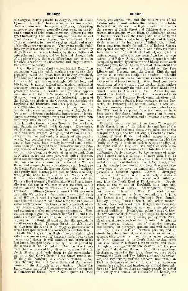
DUNDEE DUNDEE
of Cowgate, nearly parallel to Seagate, extends about
1J mile. But while thus covering an extensive area,
the town possesses little regularity of plan. Exceptingnumerous new streets, generally short ones, on the Nand a number of brief communications between the twogreat lines along the low ground, not even the trivial
grace of straightness of thoroughfare is displayed. Mostof the old streets, too, are of varying width, and manyof the alleys are very narrow. Yet, by its public build-
ings, by its latest extensions, by its crowded harbour, byits great and numerous factories, by its exhibitions of
enterprise and opulence, and by, here and there, a dashof the picturesque, the town offers large compensationfor what it wants in the neat forms and elegant attrac-
tions of simple beauty.
High Street was anciently called Market Gate, fromconnection with the public markets ; was at one timepopularly called the Cross, from its having contained,
for a long period subsequent to 1586, the old town cross;
forms an oblong square or rectangle, 360 feet long and100 broad ; is mostly edificed with modern, substantial
four-story houses, with shops on the ground floor ; andpresents a bustling, mercantile, and grandiose appear-ance similar to that of Trongate or Argyll Street of
Glasgow. Seagate was once the fashionable quarter of
the burgh, the abode of the Guthries, the Afflecks, theBrightons, the Burnsides, and other principal families ;
is a long, sinuous, and very narrow thoroughfare, quite
denuded of its ancient splendour ; has, within the last
few years, undergone considerable improvement ; is pro-
longed eastward, through Crofts and Carolina Port, withcontinuity with Broughty Ferry road ; and communi-cates laterally, through Queen Street, St Roque's Lane,and Sugarhouse Wynd, with Cowgate. Murraygate,which is now comparatively wide and well built, branches,its N end, into Cowgate, Wellgate, and Panmure Street.
Cowgate inclines eastward ; is mostly of disagreeable
aspect, but contains some good and lofty buildings
;
has, of late years, been greatly improved ; and termi-nates a few yards beyond in an interesting ancient gate-
way, known as Cowgate Port. King Street subdividesand contracts Cowgate ; deflects at an acute angle fromits N side ; is, for the most part, well built
; possesses,
at its commencement, several elegant private residences
and handsome shops ; runs north-eastward to WallaceBurn ; and merges there in the Arbroath road, leading to
the Baxter Park and the Eastern Necropolis. "Wellgate
rises gently from Murraygate;goes northward to Lady
Well, giving name to it ; and leads to Victoria Road,Hilltown, Maxwellton, Smithfield, and other suburbs.Victoria Road (formerly Bucklemaker Wynd) goes later-
ally from the top of Wellgate to Wallace Burn, and is
flanked on the 1ST by an extensive rising-ground called
Forebank. Hilltown (formerly Bonnet Hill) goes on aline with Wellgate ; climbs a steep ascent, and so is
called Hilltown ; took its name of Bonnet Hill fromonce being the abode of bonnet-makers ; is now a seat ofvarious extensive manufactures ; consists generally of ill-
built houses,5confusedly interspersed with jutefaetories;
and presents a motley and grotesque appearance. Max-wellton occupies grounds between Bonnet Hill and Hill-
bank, northward of Forebank, and is a suburb of recentorigin ; and Hillbank, situated on the villa grounds, is
a still newer suburb. Panmure Street, the third street
striking from the N end of Murraygate, possesses someof the best specimens of the town's street architecture.
Castle Street goes from High Street, at right angleswith the commencement of Seagate ; leads down to theharbour and docks ; is well edificed ; and breaks at its
foot into a fine open space, recently much improved bythe removal of the fishmarket. Crichton Street goesfrom the SW corner of High Street ; runs parallel withCastle Street ; and leads down to the greenmarket,and on to Earl Grey's Dock. Dock Street runs E andW along the harbour ; is a spacious, well-built, andbusy thoroughfare ; and has at its E end the custom-house and the Arbroath railway station. Under theImprovement Act of 1871 an enlargement and extensionof Commercial Street, from Albert Square to Dock
Street, was carried out, and this is now one of the
handsomest and most architectural streets in the town.
Reform Street strikes from High Street in a direction
the reverse of Castle Street and Crichton Street ; waserected after designs by Mr Burn, of Edinburgh, as oneof the finest streets in the town ; and both as to the
style of its buildings and as to the splendour of its shops,
rivals some of the best parts of Edinburgh. BankStreet goes from nearly the middle of Reform Street
;
was opened shortly before 1870 ; and takes its namefrom the office of the Bank of Scotland, occupying its
eastern corner. Albert Square opens from the northernextremity of Reform Street ; surrounds a space formerly
occupied by unsightly tenements and hideous time-wornerections ; was formed by clearances of these about theyear 1864 ; contains the Albert Institute, the FreeLibrary and Museum, and the Burns, Kinloch, andCarmichael monuments ; adjoins a number of splendidpublic edifices ; and is as handsome a central place as
any provincial town can boast. Ward Road goes west-
ward from Albert Square ; Constitution Road strikes
northward from nearly the middle of Ward Road ; Bell
Street intersects Constitution Road ; Parker Square,
named after the late Provost Parker, lies westward fromBell Street ; and Dudhope Road, communicating withthe north-eastern suburbs, leads westward to the Bar-
racks, the Infirmary, the Barrack Park, the Law, andthe open country beyond. The Pleasance also lies in
the NW, and is supposed, from its name, to havebeen once a charming suburban quarter ; but is now a
dense assemblage of factories, and of miserable unwhole-some dwellings.
Overgate, going westward from the NW corner of
High Street, is one of the oldest thoroughfares of thetown
;possessed in former times town mansions of the
Marquis of Argyll, the Earls of Angus, Viscount Dundee,Stirling of East Baikie, and other magnates ; wasoriginally called Argyllgate from its connection with the
family of Argyll ; sends oft' various wynds or alleys to
the right and the left ; exhibits, together with these
wynds, an utter recklessness of architectural taste or
uniformity, feebly redeemed by the presence of manygood houses ; has a total length of more than J mile
;
and terminates at the West Port, one of the most busyand stirring parts of the town. South Tay Street, form-ing the principal communication from Overgate to thelower part of the town, is handsomely edificed, andpossesses a beautiful square. HawkhilL diverging
in a line westward from the West Port, contains anumber of large factories and many good buildings,
and joins the Perth Road at Blacknessgate. GowriePlace, at the W end of Hawkhill, is a large andsplendid block of houses. Scouringburn, runningnorth-westward from the West Port, contains ex-
tensive factories and a dense population, and join3
the Lochee Road opposite Dudhope Free church.
Lindsay Street, Barrack Street, and other modernthoroughfares northward from Overgate and Scouring-
burn present good lines of new and pleasingly con-
structed buildings. Nethergate, going westward fromthe SW corner of High Street, is prolonged to the westernoutskirts by Perth Road ; forms, jointly with PerthRoad, a continuous reach of about a mile in length ; is
of very unequal breadth, and of somewhat unequalarchitecture, but averagely spacious and well edificed
;
exhibits, in its middle and western portions, and in
streets branching from it, as aristocratic an air as cancomport with proximity to manufacturing and commer-cial stir ; contains, in its Perth Road section, somehandsome villas with flower-plots in front ; and leads,
through a forking continuation seaward, into the pro-
menade of Magdalene Green. Union Street goes fromNethergate, opposite the town churches, northwardstowards the West and Tay Bridge stations, the esplan-
ade, the Tay ferries, and the harbour ; was formed in
1828 on clearances of many old, unsightly, time-wornhouses ; is a spacious and handsomely edificed thorough-
fare ; and had its southern extremity greatly improvedin 18S2 by the removal of a block of old houses, the
413
DUNDEE
abodes of the very lowest classes of inhabitants. Yea-man Shore and Exchange Street are well-built thorough-fares of comparatively modern construction adjoining
the harbour. Several other streets, in addition to those
we have named, contribute good features to the newparts of the town and to its outskirts.
Although rich in historical associations, few build-
ings now remain which are of much interest to the
antiquary. The imperious demands of an ever-increasing
population and of a constantly expanding trade, haveled to the removal of numerous tenements of historic
value, which for many centuries had withstood the
destroying hand of Time. No fewer than 19 ancient
churches or chapels, all now extinct, stood within the
town or its suburbs ; and in many instances were so
prominent as to give their names, in some manner or
other, to localities near or around them. St Paul's
Church was the oldest, stood within Murraygate andSeagate, and gave the name of Paul's Close to an alley
which was closed so late as about 1866. St Clement'sChurch occupied the site of the present Town-Hall in
High Street ; was a large, oblong structure, with a highsteep roof, and with small circular turrets at the four
corners ; is seen towering above the surrounding build-
ings in Slezer's view of the town, published in 1696
;
and gave its name to St Clement's Lane, leading to the
shore. St John's Church stood on a rock a short way Eof Carolina Port, nearly 1J mile from High Street ; wascalled originally Eilcraig, signifying ' the church uponthe rock,' but called afterwards by the Roman Catho-lics the Church of the Holy Rood ; and is commemo-rated in the name of an adjacent burying-ground, called
Rood Yard. St Roque's Chapel stood outside of Cow-gate Port, between Denbridge and the E end of Seagate,
and is commemorated in the name of an alley runningfrom Seagate to King Street, and called St Roque's Lane.
St Salvator's Chapel stood on a rocky rising-ground Nof High Street and Overgate, and is commemorated in
the name of an adjacent close. Our Lady's Chapel stood
at the foot of Hilltown, and is commemorated in the
names of Ladywell and Ladywell Yard. St Nicholas'
Chapel stood on a rock at the western part of the har-
bour, and gave to its site the name Nicholas Rock,afterwards changed into Chapel Craig. St Michael's
Chapel adjoined to the town mansion of the old Earls of
Crawford, and was demolished to make way for UnionStreet. St Mary's Chapel stood on the E side of Couttie's
Wynd, and was represented till recently by a vestige of
its basement. Logie Church stood westward of thetown, within the present parish of Liff and Benvie, andwas a mensal or table-furnishing church of the Bishopof Brechin. St Blaise's Chapel stood on the W side of
Thorter Row. St Thomas' Chapel occupied part of a
rock which was cut away to make room for ReformStreet. Cowgate Chapel, also called Our Lady's Chapel,
stood on the S side of Cowgate, at the top of SugarhouseWynd, previously called Fintry's Wynd, and originally
called Our Lady's Wynd. St Serf's Chapel, St Stephen's
Chapel, St Fillan's Chapel, St James the Less's Chapel,
St James the Greater's Chapel, and St Margaret's Chapeloccupied sites which cannot now be identified.
The Greyfriars' Monastery, adjacent to what is nowthe Howff, is said to have been founded about 1260 byDevorgilla, mother of King John Baliol ; was the meet-ing-place, in 1309, of a great national ecclesiastical
council recognising Robert Bruce as King of Scotland;
and was entirely demolished at the Pieformation. ABlackfriars' monastery stood on the W side of BarrackStreet, originally called Friars' Vennel, is said to havebeen founded in the 15th century by a burgess of Dun-dee ; had gardens and orchards extending westward to
Lindsay Street ; and was swept away at the Reforma-tion. A Piedfriars' monastery stood conjunctly with a
hospital at the foot of South Tay Street ; was founded,in 1392, by Sir James Lindsay of Crawford ; seems,
with the hospital, to have formed a large and splendid
group of buildings, surmounted by a tower ; was partly
burned, in 1645, by the Marquis of Montrose ; and con-
tinues still to figure in the town's landscape at the pub-414
DUNDEE
lication of Slezer's view in 1696. A Franciscan nunnery,or nunnery of St Clair, stood at the top of MethodistClose, off the N side of Overgate ; was a large, massive,lofty pile, forming three sides of a quadrangle round asmall court ; came to be occupied in modern times by anumber of poor families ; retained in its interior, eventhen, some relics of ancient grandeur ; and was de-
molished so late as Nov. 1870. A Magdalene establish-
ment stood near the river, at the SW side of the town;
seems to have occupied a spot there, at which several
fragments of statues were exhumed at the digging of
foundations for modern houses ; and gave name to theopen ground still called Magdalene Green.
The most notable of still existing antiquities is StMary's Tower, or the Old Steeple as it is popularly termed,situated in the Nethergate. This massive and venerabletower is among the most ancient piles in the country,having survived storm and tempest, fire and siege, for
many centuries. According to the commonly received
account, this tower was founded by David, Earl of
Huntingdon, in 1189, but recent research assigns it to the
middle of the 14th century. The tower rises to a heightof 156 feet, is square, the inside of the square measuring8 yards, with walls nearly 8 feet in thickness. Thegrand entrance is in the W front, and exhibits a great
variety of decoration. The ascent to the top of the
tower is by an octagonal staircase, in the NE wall, in
one unbroken line from base to summit—the frequentrepetition of loop-holes or windows surmounting eachother giving an air of loftiness to the imposing mass,
which completely neutralises the lowering effect of the
horizontal lines prevailing on its different stages. Onentering the lower part of the tower by the western
door, the visitor finds himself in a spacious apartment,with an area of 576 square feet. The sedilia, or stone
seats, still remain entire, and extend along the N, S,
and W walls. The groined roof, remarkable for its
loftiness, is supported at each corner by pillars of hugeproportions, and has a rich as well as a dignified effect,
the bosses on its groined arches being bold and full,
with a large circular aperture in the centre of the groin.
On the W front of the middle parapet is an admirablefigure of the Virgin and Child ; a figure of our Lord,
sitting on his throne, with a sceptre in his right hand,and an orb in his left, occupies a niche on the E side
;
and a standing figure of St David, the founder of the
tower, with his sceptre and orb, is on the S side. In1871-73 the fabric underwent a thorough restoration
under the supervision of Sir Gilbert Scott, at a cost of
about £8000, the most of which was raised by public
subscription, but latterly the work was taken in handand completed by the town council. The tower con-
tains a splendid peal of bells, which were formally
inaugurated on May 21, 1873, on which day also the
memorial stone of the restoration was laid with masonichonours. Previous to the restoration the Old Steeple
had a clock, with four dials ; but those were abolished,
as not being in harmony with the architectural features
of the venerable pile ; but in 1882, in deference to
public opinion, the town council restored the clock, sub-
stituting ornamental skeleton dials, at a cost of £130.
The Old Town's Cross, originally erected in 1586, at
first in the Seagate, at the S end of Peter Street, subse-
quently in the middle of the High Street, now stands
to the S of the Old Steeple ; was removed from the HighStreet in 1777, the place where it stood being still indi-
cated by the stones being arranged in a circular form ;
for many years the stones forming the Old Cross were
stowed away about the base of the Old Steeple ; andwere re-erected in their present position in 1876. Theshaft, which is still in a pretty good state of preserva-
tion, is the original one ; but the unicorn is a reproduction,
the original having been so broken and decayed as to be
incapable of restoration. At the top of one of the sides
of the shaft are the burgh arms, with the town's motto,' Dei Donum,' now somewhat obliterated, and the date
1586.
The Cowgate Port, at the eastern extremity of the
street which bears this name, has a central archway,
DUNDEE
8£ feet wide and 11 high ; but must have been higher
originally, as the ground has been raised in the course
of years ; has been frequently ' improved, ' the mostrecent having been in 1877, when a plate was fixed onthe outer or E side, with the following inscription :
—
' During the plague of 1544 George Wishart preached
from the parapet of this port, the people standing within
the gate, and the plague-stricken lying without in
booths. "He sent His Word and healed them"(Psalm cvii. ). Restored in 1877.' Dundee was in olden
times the occasional residence of royalty, and a palace
formerly stood on the S side of the Nethergate (then
known as Fleukargate), a little to the E of Union Street.
A close leading from the Nethergate still bears this
name, but the only portion of the original wall of the
palace that now remains, and has traces of antique
carving upon it, is now doomed to demolition in the
course of contemplated town improvements. In March1S79 an old building on the N side of High Street,
nearly opposite the top of Criehton Street, and knownas 'Our Lady "Warkstair's Land, ' was taken down ; wasfour stories in height ; had a wooden front with twotriangular elevations ; was supposed to have been built
about the year 1500, to have been a repository of a charity
or almshouse under the church, and dedicated, according
to the fashion of the times, to Our Lady the Virgin.
The old Custom House, at the corner of Fish Street andGreenmarket, is another ancient building destined to
early demolition ; furnished the scene of many of theincidents in the novel of The Yellow Frigate, by MrJames Grant ; and is remarkable from the fact that, at
the beginning of the present century, a large quantity of
silver coin, numbering nearly 200 pieces, was found em-bedded in the mortar—this money, it is believed, havingbeen concealed by some townsman prior to the siege of
the town in 1651. The Luckenbooths stood at the eastern
end of the Overgate, where it joins the High Street, andis still recognisable by the flat-capped turret at its north-
eastern angle, and is noteworthy as having been theresidence of General Monk, after he captured the town,and as being the birthplace of Anne Scott, Countess of
Buccleuch. Dudhope Castle, originally the principal
seat of the Scrymseours, hereditary constables of Dundee,and situated on a terrace at the foot of the Law, is nowused as an infantry barracks ; towards the end of last
century was turned into a woollen manufactory, whichproving unsuccessful the building passed into the handsof the Government, in whose possession it has since re-
mained. In quite recent years the removal of theTrades' Hall at the E, and of Union Hall, at the W endof High Street, has caused two well-known public
buildings to disappear from view, whilst greatly improv-ing that central thoroughfare.The increase of Dundee has been strikingly exhibited
in its population, which has almost quadrupled in asingle generation :—1841, 63,732; 1861, 90,426; 1871,120,547 ; 1881, 140,054. The municipal and parlia-
mentary constituency was—1871, 16,281 ; 1877, 18,964;
1881, 15,827. The revenue of the town proper—knownas the ' common good '—consists of lands, houses,churches, and salmon fishings, and has varied consider-
ably at different periods, and now amounts to about£6000 annually. The revenue from the common good,however, is dwarfed by that of the several Boards intowhich the Town Council has been constituted by recentacts of parliament. The accounts for the year 1881showed that as a police board it raised £93,878, ex-pended £96,211, and had a debt of £687,037. As awater commission it raised £37,532, expended £39,440,and had a debt of £430,938. The harbour board, to
which it appoints members, had a revenue of £50,163,expended £45,533, and had a debt of £349,621. Thegas commission had a revenue of £58,609, expended£61,288, and had a debt of £121,309. In addition, theschool-board had a revenue of £22,217, expended£20, 444,and had a debt of £60,995. The combination parochialboard raised £25,786, expended £26,052, and had a debtof £15,466. Several other minor boards brought therevenue of the various public corporations for 1881 to
DUNDEE
£303,991, the expenditure to £303,121, and the total
debt to £1,724,258. The increase in the value of groundin Dundee has been very remarkable. According to anauthentic statement, in 1746 ' the highest rent in the
High Street did not exceed £3, ' and some extraordinaryinstances are recorded of the manner in which propertyhas since risen in value. A wood-yard, bought at the
beginning of the century for £600, was sold in 1826 for
£5000; and in 1835 it was resold in portions at prices
which brought the total purchase-money up to £15,000.In more recent years the same upward tendencies havebeen exhibited. In 1858 a tenement on the W side of
Reform Street to the N of Bank Street was purchased at
equal to £1600 ; in 1875 it was sold at £4500. In 1867a shop in the W side of Union Street was sold by public
roup at £750 ; at the end of 1876 it was resold at
£3200. In 1859 a property in the High Street waspurchased at £1400 ; it was resold in 1873 at £5250.In like manner, the feuing of ground in the centre of
the town has greatly increased, and in some instances inrecent times has been known to be trebled in aboutthree years. Union Street was opened up in 1S28, whenthe population of Dundee was some 40,000. The lots
on either side of this street were sold at feu-duties rang-ing from £2, 6s. Id. to £8, 17s. 2d. per pole. ReformStreet was opened up about the year 1833, and the feus
in it vary from £2, 0s. lOd. to £19, 16s. 5d. per pole.
Panmure Street, the next of the more important im-provements of Dundee, was opened about the year 1841.The feu-duties there ranged from £3, 4s. to £15, 9s. 2d.
per pole. Bank Street followed, and was given off at
rates varying from £1, 10s. lid. to £3, 4s. LindsayStreet was opened up earlier than Bank Street or Pan-mure Street ; and the rate varied from about £1, 15s.
to about £2, 16s. lOd. per pole. Under the operationof the Improvement Act of 1871, the whole propertyconstituting what is called the Victoria Road Improve-ment has been feued by the commissioners of police atrates varying from £3, 10s. 6d. to about £19, 14s. Sd. perpole ; while the feus in the centre of the town havegone up to rates varying from £28, 5s. 4d. to £35,13s. 7d. per pole. If Lindsay Street be contrasted withVictoria Road—and the contrast in point of situationappears to be all in favour of Lindsay Street—we haveon the whole an increase of fully 400 per cent. ; and if
Reform Street be contrasted with the new feus in thecentre of the town—in other words, with the new Com-mercial Street feus—there is an increase on the averageof fully 300 per cent. also. This, in little more than ageneration
—
viz., from say 1830 to 1877—is marvellous.The details of purchases along Victoria Road are pro-bably even more instructive. For instance, the pro-perty in Ladywell Lane belonging to the town of Dun-dee was sold to the police commissioners in 1872 at
about £3 per pole, and, after providing for the formationof the street, what remained was refeued at double thatrate. The same remark applies to the property on theW side of Powrie Lane ; while, with regard to propertyin Bucklemaker Wynd, purchased by the police com-missioners in 1870 at equal to £1, 12s. per pole, it wasfeued to the Victoria Road Calendering Company atequal to £3, 16s. 3d. per pole. The upward tendencyin the value of property and ground, however, receiveda severe check in 1877, and for a number of years sub-sequently there was a continuous deterioration in values.
Under the extended powers of the Town Council, a largenumber of assessments of different kinds are now levied.
The tendency of late years has been to have these re-
duced. The following was the assessable rental of thetown, and the rates per £1 of the police and other burghassessments for a series of years—1831, £72,821, rate
Is. 3d. ; 1841, £107,126, rate Is. 5d.; 1851, £111,003,rate Is. 2d. ; 1861, £209,333, rate Is. lljd. ; 1871,£370,122, rate Is. 6d. ; 1876, £541,551, rate Is. lid.
;
1880, £588,829, rate Is. lid. ; 1881, £595,570, rate
Is. lljd. The Improvement Act of 1871 did verymuch to improve the town, by procuring the demoli-tion of old and dilapidated buildings, widening theleading and more crowded thoroughfares, and forming
415
DUNDEE
additional means of communication between importantbusiness parts of the town. A spacious thorough-fare, known as Victoria Road, has been constructed
along what used to be known as Buckleniaker Wynd,extending from Bell Street to Cotton Road, substi-
tuting a handsome street, 60 feet wide, for the gullet
of the Bucklemaker "Wynd, which had only 13 feet of a
carriage-way, and over which at least 1000 vehicles daily
passed and repassed. A commodious bridge was also
constructed across the Dens, now known as Victoria
Bridge, connecting the south-eastern district of the
town with the north-eastern. The approaches to the
eastern district by Powrie Lane and Water Wynd havebeen greatly improved. The continuation of CommercialStreet, between Meadowside and the Murraygate, not
only gives a short cut from the High Street to the Ex-change, but also provides a large number of first-class
shops and business premises. The widening of whatwas previously known as the Narrow of the Murraygate,by demolishing all the old buildings between it and the
Seagate, has got rid of a description of property whichwas a disgrace to the town. The opening up of the
High Street by the removal of the Clydesdale Bank at
one end and the Union Hall at the other, and the
removal of the old houses in the neighbourhood of Fish
Street, are all palpable improvements. The gross value
of the property scheduled for these extensive improve-ments was £400,000, the police commissioners havingpower to borrow to the extent of £200,000, and to levy
an improvement rate of 4d. in the £1.
The Town-Hall stands on the S side of the HighStreet ; occupies the site of the old church of St Clement
;
was erected in 1734, after designs by the elder Adam ;
projects several feet from the line of the adjacent build-
ings ; is in the Roman style, with piazzas and Ionic
pilasters ; is surmounted, through the roof, by a spire
140 feet high, in which is a clock, with bells that chimeevery quarter of an hour ; underwent restoration in
1853-54 ; contains the council chamber, the guildhall,
and the offices of the town clerk. The new Town-Hall,erected to the rear of the town buildings, was erected in
1873, and is now used as the offices of the Dundee Com-bination Parochial Board. The Royal Arch, on the Sside of Dock Street, was erected in 1853, to comme-morate the landing of the Queen at Dundee in Sept.
1844, by public subscription at a cost of more than£3000, towards which the harbour trustees voted £500and the late Lord Panmure contributed £750 ; com-prises a great central arch and two side arches, sur-
mounted by two central turrets ; and is in the Anglo-Saxon style, with profuse ornamentation. The Custom-House stands at the E end of Dock Street ; was erected
in 1843 at a cost of £8000 ; is a large fine structure,
with a portico in the Roman Ionic style ; and contains
accommodation for the Customs, the Excise, and the
Harbour Trust. The Albert Institute stands in the
centre of Albert Square ; was erected in 1865-68 as a
subscription memorial to the late Prince Consort, after
designs by Sir Gilbert Scott ; stood then and for someyears afterwards incomplete, with an unsightly gap in
its SW wing ; was nevertheless even then an imposingstructure, particularly in its northern front ; is in the
Gothic style, with an exquisite wheel window in the
N gable, a splendid fleche on the summit, and other
richly artistic features ; contains in the upper story a
noble hall, with fine open roof, and has a commodioussuite of rooms attached ; the eastern portion, used as a
free museum and picture gallery under the provisions
of the Free Libraries Act, was completed in 1874, havingbeen erected from a plan by Mr D. M 'Kenzie, a local
architect ; has a public fountain on the E, which is madeto play on certain special occasions, the architectural
features being in keeping with the nature of the groundand the style of the Institute buildings ; the basins are
of Polmaise stone, flanked by polished shafts of Peter-
head granite, and ornamented with carved heads of
lions, etc. The Albert Institute having been wound up,
the building was, on March 28, 1879, put up for sale bypublic auction, and acquired by the Corporation for the
416
DUNDEE
nominal upset price of £1000, it being a condition of
sale that the building shall not be otherwise used thanfor a philosophical institute, comprising a museum,lecture-rooms, reading-rooms, and picture gallery ; andthat they shall in all time coming be appropriated to
the purposes for which they were originally designed.
The Royal Exchange stands at the N end of PanmureStreet ; was built in 1853-56, after designs by DavidBryce, of Edinburgh, at a cost of more than £12,000 ; is
an elegant structure in the Flemish style of the 15thcentury, common in Brussels and other large towns of
the Low Countries ; shows a side frontage of two stories,
surmounted by a range of dormer windows, withtraceried heads and crocheted gables ; contains a lofty
handsome hall, or reading-room, 77 feet long and 34wide, with fine ornamented roof ; and has a tower whichwas intended to be 120 feet high, with a stone crown,but could not be finished in consequence of the groundbeneath it threatening to sink, and was terminated at
only one stage above the main building, in a curvedparapet and flat roof. The Eastern Club stands onthe S side of Albert Square, opposite the Albert In-
stitute ; was erected in 1S70 ; is in the Venetian style
;
and has a highly ornate front. The Court -Housebuildings, for the holding of justiciary and sheriff
courts, are in West Bell Street ; consist of a long-drawnand lofty range of massive stone buildings ; were erected
in 1864-65, with aid of £13,587 from government ; andare a handsome and spacious edifice, with portico sur-
mounted by the royal arms in bold relief. The Kinlochmonument stands to the WW of the Albert Institute,
facing towards the SW ; commemorates George Kinloch,
the first member for Dundee in the reformed parliament
;
was inaugurated on Feb. 3, 1872 ; and consists of a
bronze statue by Sir John Steell, R.S.A., of Edinburgh,about 8 feet high. The Carmichael statue stands to the
SE of the Albert Institute ; was erected by public sub-
scription to commemorate the leading member of the
firm of James and Charles Carmichael, iron-founders,
who conferred a boon upon the trade with which he wasconnected by the invention of the fan blast ; the sculptor
was Mr John Hutchison, R.S.A. , of Edinburgh, and the
statue was cast in bronze at the Manor Iron-works,
Chelsea ; the figure is in a sitting posture, and, including
the red granite pedestal, the monument stands about 18
feet high ; the statue was formally unveiled on June 17,
1876. The Burns statue stands to the SW of the Albert
Institute ; is by Sir John Steel], being a replica in bronze
of a statue sent to New York, and represents the poet in
a sitting posture ; the figure is colossal, being about 12
feet in height ; the cost of the replica was 1000 guineas,
and of the pedestal, which is of Peterhead granite, £230
;
the total cost of the work was about £1400, the greater
portion of which was raised by means of a bazaar ; the
statue was formally unveiled on Oct. 16, 1880, on whichoccasion a grand procession, numbering between 6000
and 7000 persons, and composed of representatives of the
different trades, took place. The Market Shelter is
opposite the Albert Institute on the N side, and in a
recess at the "W end of the Exchange buildings ; waserected for the accommodation of the gentlemen attend-
ing the market, which is held on the street facing the
Exchange ; is 123 feet long, 36 feet wide, and in the
centre of the roof 25 feet high ; has an open passage, aver-
aging 8 feet in width, at the two ends and at the back;
has three entrances open from Albert Square, one at
each end of the market and one in the centre ; and wasopened for business in the summer of 1882. The Kinnaird
Hall is on the S side of Bank Street ; was erected in
1856-58 after designs by Charles Edward, of Dundee
;
contains a hall 130 feet long, 60 wide, and 40 high,
capable of accommodating from 2500 to 3000 persons;
has a fine open roof supported by iron girders, and the
side walls are tastefully decorated ; and has a fine organ,
built by Messrs Fosters & Andrews, of Hull, and in-
augurated on Oct. 5, 1S65. The Volunteer Drill Hall,
on the N side of West Bell Street, is a plain brick build-
ing of ample proportions ; is 160 feet in length, including
one gallery, 80 feet in breadth, and 42 feet in height
DUNDEE
to the apex of the roof; and was erected in 1867,mainly by means of subscriptions among the friends of
the volunteer movement. The other public halls are
—
Albion, Overgate ; Ancient Mason Lodge, High Street
;
Arcade, Arcade Buildings ; Bnchan's, Bank Street
;
Cainperdown, Barrack Street ; Cutlers', Murraygate;
Dundee, Barrack Street ; Forfar and Kincardine MasonLodge, Meadow Street ; Good Templars', Reform Street
;
Gray's Assembly Rooms, Perth Road ; Larch Street
;
Operative Mason Lodge, Overgate ; Operative Tailors,
Overgate ; Panmure, Bain Square ; Plasterers', TallyStreet ; Smellie's, Barrack Street ; Strathmore, SeaWynd, Nethergate ; Thistle, Union Street ; Trades',
Eing's Road ; Victoria, Victoria Road ; Wellgate ; andWright's, Key's Close, Nethergate.
Three parish churches under one roof—called vari-
ously St Mary's, St Paul's, and St Clement's ; the East,
the South, and the West ; the Old, the New, and theSteeple—stand between Overgate and Nethergate, nearthe W end of High Street ; are adjoined, at their westernextremity, by a massive ancient tower 156 feet high
;
and form a cathedral-looking structure, both historically
interesting and scenically prominent and imposing. Thepile has for ages been popularly called the town churchesand the tower ; and it is conspicuous at once as visibly
connecting the town with antiquity, as bulking largelyamong its public edifices, and as constituting the mostdistinctive feature in its burghal landscape. Whetherseen in full front, or seen through a vista from any partof the town's interior, the tower looms largely in theview, looking the impersonation of Time casting its
gloom upon the evanescent scenes around ; or seen fromany point or distance in the environs or in the circum-jacent county, whether from the E or from the W orfrom the S, the tower lifts its grand bold summit highabove the undulating surface of a sea of roofs, and sug-
gests thoughts of many generations who have spenttheir ephemeral life beneath its shadow. The churchesoriginated in a chapel founded somewhere between 1196and 1200 by Prince David, Earl of Huntingdon, onground then beyond the limits of the town, and longknown as the ' Kirk in the Field ; ' they grew, by re-
construction of the chapel and by successive extensions,
into a great cruciform edifice 174 feet long, with a choir
95 feet long, 29 broad, and 54 high ; they comprised,besides three churches of the same names as the presentthree, a fourth one, called variously St John's, theNorth, and the Cross ; they suffered damage from theEnglish, before the national Union, to an extent whichrequired St Clement's to be entirely rebuilt in 17S9
;
they were almost totally destroyed by accidental fire in
Jan. 1S41 ; they were partly restored, but mainly reno-vated, in periods thence till 1847, after designs byMessrs Burn & Bryce, of Edinburgh, at a cost of £11, 135
;
they retain the crucial form of the original structures,
with the choir or chancel for St Mary's, the transeptfor St Paul's, and the nave for St Clement's ; and theyare in a laudable variety of the Decorated Pointed style.
St Mary's and St Paul's were entirely rebuilt, and theformer has a very fine stained-glass window ; but StClement's was merely restored, and is an extremelyplain portion of the pile. The tower, which has alreadybeen noticed, is the only part of the early pile nowstanding.
St John's parish church, formerly called also theNorth or Cross Church, ceased at the burning of thetown churches in 1841 to stand conjunct with St Mary's,St Paul's, and St Clement's, and is now an edifice inSouth Tay Street, formerly used as a Gaelic church. StAndrew's Church, on the N side of the Cowgate, is nowthe oldest established church in the town ; was origin-
ally built in 1772 by means of voluntary subscriptionsby the kirk-session and trades of that period, and con-tinued to be owned and managed by them as a pro-prietary body until 1872, when the congregationobtained the entire management and control of thechurch, and of the property connected with it ; wasendowed in the following year, and put on the footingof one of the parochial charges of the Church of
27
DUNDEE
Scotland ; is a plain building with a handsome spire,
which rises to an altitude of 139 feet, and contains a set
of fine musical bells ; has undergone repeated renova-tions, the most recent being in 1S74, when extensive
alterations, both internally and externally, were madeupon it, costing about £2000. Chapelshade Church, in
Constitution Road, is a large, plain-looking buildingwith about 1200 sittings ; was erected into a parish
church in 1872, with a suitable district attached. StDavid's Church stands in North Tay Street ; wasoriginally an Independent chapel, built in 1S00
;passed
by sale to the Church of Scotland in 1823 ; is exteriorly
a very plain edifice, but interiorly handsome ; and con-tains nearly 2000 sittings. Wallaeetown Church wasopened in May 1840, and in March 1874 was erected
into a parish quoad sacra. St Mark's stands in PerthRoad ; was built in 1869, after designs by Pilkingtonand Bell, at a cost of £6000 ; and is highly ornamental.St Enoch's, in Nethergate, was originally a Free church,erected in 1873, standing on the street line adjoined byother buildings ; has a highly effective character ; andwas erected into a parish church in March 1876.
Rosebank Church, in Constitution Street, was erected
as a mission station in 1872 at a cost of nearly £2000;
is a Gothic structure in the Early Church form, withabout 600 sittings ; and in Jan. 1875 was erected into aparish church. St Matthew's, in the Ferry Road, is in
the Early English Gothic style, with transepts ; standsin a district inhabited chiefly by the poor and working-classes ; and was built in 1S75, as a chapel of ease, at a
cost of about £3400. Clepington Church is in theEarly English style ; was the last of five churches built
under a scheme for providing additional accommodationfor members of the Church of Scotland in Dundee ; andwas opened on Jan. 16, 1881. St Paul's Free Church,in Nethergate, was built in 1852, after designs byCharles Wilson, of Glasgow, at a cost of about £5000
;
is a cruciform structure in the Early Pointed style ; andhas a finely proportioned spire 167 feet high. St Peter's
Free Church, in St Peter Street, was built in 1836 ; is
a plain structure, with a neat spire containing a peal of
bells rung by water power ; and was the scene of theministry of the lamented M'Cheyne. The M'CheyneMemorial Church, in Perth Road, was built in 1871after designs by Pilkington & Bell, and is an edifice
tastefully and elaborately ornate. Chapelshade, Wal-lacetown, Dudhope, Chalmers, Wellgate, Willison, andthe High Free churches are all tasteful edifices ; butSt Andrew's, St David's, St John's, Hilltown, Bonnet-hill, and Ogilvie Free churches are remarkably plain
structures. The Bell Street U.P. Church is a massive,
elegant, and spacious edifice. School Wynd Church,known also as George's Chapel, in Lindsay Street,
erected in 1825, was for 42 years the scene of the pas-
toral labours of George Gilfillan. The Dudhope RoadU.P. Church superseded a previous one in Temple Lane
;
was built in 1S70 after designs by Pilkington & Bell
;
and is a handsome structure. The Tay Square, Cowgateor Wishart, James', as well as those in Butterburn,
Victoria Street, and Ryehill, are internally comfortable,
but externally plain. The Gilfillan Memorial Church,formed of adherents of the Rev. David Macrae,deposed from the ministry of the U.P. Churchin 1879, and who number over 1300, temporarilyworship in the Kinnaird Hall. The Reformed Pres-
byterian Church and the Original Secession churches,
are small but substantial buildings. Of the Con-gregationalist places of worship the oldest is WardChapel in Constitution Road ; was built in 1833after designs by Mr Smith, of Dundee ; and is a beautiful
edifice in the Second Pointed style. Panmure Street
Chapel was built in 1855 after designs by Mr Bryce, ofEdinburgh, and is a picturesque structure with a boldly
traced circular window and two octagonal towers.
Castle Street, Lindsay Street, Princes Street, and Rus-sell Congregational chapels are all respectable. Thaold Scotch Independent Chapel, in Euclid Street, wasbuilt after designs by Mr Maclaren, of Dundee, and is a
handsome edifice. Trinity and St James's Evangelical
417
DUNDEE
Union chapels are plain but comfortable buildings.
Baptist chapels are in Rattray Street and in Long Wynd,the former being erected in 1878 in place of a chapel in
Meadowside that had to be removed to make way for the
town improvements. The Catholic Apostolic Church,at the corner of Constitution Road and Dudhope Cres-
cent Road, is a very handsome edifice, and is divided
into nave and aisles, the latter being lighted by twolight windows, and the nave from a clerestory. Wes-leyan Methodist chapels are in Ward Road and Welling-ton Street ; both are neat structures ; and the latter wasbuilt in 1S69 after designs by Alexander Johnston, of
Dundee. The Unitarian Christian Chapel, in Constitu-
tion Road, was built in 1870, also after designs byAlexander Johnston. St Paul's Episcopalian Church,at the top of Seagate, was built in 1852-55, after designs
by Sir Gilbert Scott, at a cost of £13,000 ; is in theSecond Pointed style, of crucial form, with nave, aisles,
transepts, chancel, and octagonal apse ; has both a noble
exterior and a very beautiful interior ; and is surmounted,
at its W end, by a tower and spire rising to the height
of 220 feet, and figuring conspicuously in almost every
view of the town. St Mary Magdalene's Episcopalian
Church, in Blinshall Street, is a recent edifice in similar
style to St Paul's Episcopalian Church but of smaller
size, and erected at about one-fifth of the cost. St
Salvador's Episcopalian Church, in Clepington, also is a
recent erection. The Catholic Apostolic Church, in
Constitution Road, was built in 1867 ; is a large andhandsome edifice in the Pointed style ; and has a very
tastefully decorated interior. St Andrew's RomanCatholic Church, in Nethergate, was built in 1836 ; is
an elegant edifice in the Pointed style, with a beautiful
interior ; and contains 1200 sittings. St Mary's RomanCatholic Church, at Forebank in Hilltown, was built in
1851 ; has a planrexterior in Anglo-Saxon style and a verystriking and gorgeous interior; and contains 2500 sit-
tings. St Joseph's Roman Catholic Chapel, in Wilkie's
Lane, was built in 1872-74 at a cost of about £5000 ; is
a cruciform structure 147J feet in length from N to S, and40 in width in both nave and transepts ; and contains
1200 sittings. The Glassite Meeting House, on the Nside of King Street, is an octagonal-shaped building,
having a very plain appearance. Salem Chapel, in Con-stitution Road, erected in 1872, is a neat specimen of
Gothic architecture.
The Howff or old burying-ground lies off BarrackStreet ; superseded the three ancient burying-grounds of
St Paul, St Roque, and St Clement, all now quite extinct
;
was formed, about 1567, in what had been the garden of
the Greyfriars' Monastery ; became so crowded and in-
sanitary as to be closed by order of the Privy Council in
1858 ; and equals or surpasses every other old burying-
ground in Scotland, not excepting that of the EdinburghGreyfriars, in the number and variety of its interesting
old monuments. The burying-ground, on the W side
of Constitution Road, was opened in 1836 ; is tastefully
laid out in mounds and walks ; but, like the Howff,
is now closed against interments. The Western Ceme-tery, on the N side of Perth Road, was opened in 1845
;
comprises six acres, beautifully laid out in compartmentsand promenades ; has a very grand gateway ; and con-
tains a monument to the poet William Thorn, whodied in Dundee in 1848. The Eastern Necropolis, onthe N side of Arbroath Road, about 2 miles from HighStreet, was opened in 1862 ; is laid out with great taste
and beauty in serpentine walks ; and has an admirablydesigned gateway. A project for a Roman Catholic
cemetery was started about 1860, and won some contri-
butions, but fell to the ground. Balgay Cemetery,
which occupies the western portion of Balgay Hill, is
very tastefully laid out.
The Baxter Park, at the north-eastern extremity of
the town, is so named from having been the gift of the
late Sir David Baxter and his two sisters ; is about 38
acres in extent, and cost the donors nearly £40,000, in
addition to which they gave a sum of £10,000 for the
maintenance of the park in all time coming ; and is well
laid out, with a pavilion in the centre of the terrace in
418
DUNDEE
which is a marble statue of Sir David Baxter, erected
by public subscription. Balgay Hill, to the westwardof the town, was acquired by the police commissionersof the burgh as a place of public recreation in 1871
;
covers 60 acres of ground, a portion of which has beenlaid out as a cemetery ; enjoys the advantage of hav-ing been previously beautifully wooded ; commands agorgeous view over all the lower Tay and the Carse of
Gowrie, with their periphery of hills and mountains ; is
encircled with a drive 25 feet wide, and intersected withumbrageous drives and walks, looking like well-shadedavenues ; has its main approach on the S, from Black-ness Road, through a handsome entrance-lodge in theScottish Baronial style ; and has two other approaches,
respectively on the W from Hillside and on the N fromthe Ancrurn Road. The cemetery and the park jointly
cost about £13,000, and were opened by the late Earl of
Dalhousie, amid great public demonstrations, in Sept.
1871. In May 1882, Sir John Ogilvy, who for manyyears was one of the Parliamentary representatives of
Dundee, made a gift to the town of his rights in theFair Muir, a field about 12 acres in extent, lying to the
N of the town, which has now been added to the
parks available for purposes of public recreation.
Dundee Law, which stands to the N of the town,has also been acquired by the police commissioners for
use as a public pleasure-ground. It rises gently to anelevation of 571 feet above sea-level, and culminates in
a round, green summit, the prospect from which is far-
reaching and picturesque. The slopes around the Law,where not built upon, are cultivated. On the summitare the vestiges of a fortification, said to have beenerected by Edward I. The Magdalene Green is an opengrassy slope, which adjoins the river in the neighbour-
hood of the N end of the Tay Bridge, and is famous in
local history for the large public gatherings which havetaken place upon it in times of political agitation. Theesplanade, adjoining the Magdalene Green, is a splendid
marine parade, extending to the Craig Pier ; was con-
structed at the joint expense of the Caledonian andNorth British Railway Companies, the harbour trustees,
and the town ; and was opened in July 1S75. TheBarrack Park, a spacious piece of ground above the
barracks, is leased from the government by the corpora-
tion as a place of public recreation. The Bleaching
Green is to the E of the Barrack Park, and whilst prin-
cipally used as an adjunct to the public washing-house
that stands in the centre, is also available to the public
for recreative purposes.
The harbour extends from Craig Pier on the W, nearly
opposite Union Street, to Carolina Port on the E ; lies
almost all, like the harbours of Greenock and Liverpool,
within the line of low-water mark ; offers commodiousingress in very reduced states of the tide ; and is one of
the finest, safest, and most convenient harbours in
Great Britain;yet, prior to 1815, had no better accom-
modations for shipping than a small pier and a few ill-
constructed erections, which could not be reached byvessels of any considerable draught. Between 1815 and1830, at an aggregate cost of £162,800, a wet-dock, with
a graving-dock attached to it, was constructed, the tide
harbour was deepened and extended, sea-walls and ad-
ditional quays were built, and various other improve-
ments were made. The wet-dock then constructed bears
the name of King William's Dock, covers an area of 6£acres, and has its adjoining graving-dock in correspond-
ing proportion. A second wet-dock was formed subse-
quent to 1830, bears the name of Earl Grey's Dock, andcovers 5£ acres. Two other wet-docks, further to the
E, were partially formed in 1863-65 and completed in
1873-75 ; bear the names of Camperdown Dock andVictoria Dock ; cover respectively 8J and 10J acres
;
admit vessels drawing 20 feet at high water of spring
tides, and vessels drawing 15J feet at high water of neap
tides ; and are connected with a new graving-dock for
the largest class of vessels. A stupendous crane, bywhich eight men easily lift a weight of 30 tons, is on
the quay of Earl Grey's Dock ; a caisson, on a new and
peculiar principle, and working with great facility and
DUNDEE DUNDEE
ease, is at the entrance of Camperdown Dock ; and the
great outer sea-wall extends considerably to the E andhas a skilful structure and a massive appearance. All
the works formed from 1815 till 1875 are considerably
within the range of high-water mark, leaving an im-
Eortant space of ground between them and the town to
e occupied as the site of buildings, and as a continua-
tion of Dock Street ; and parts of them are also within
low-water mark, leaving even there, between the wet-
docks and the sea, a space for warehouses and shipbuild-
ing yards. The docks are accessible, in various direc-
tions, by spacious streets or roads ; and have adaptations,
in every way, to secure the speedy and effective loading
and unloading of any number of vessels which they maycontain. The Camperdown and Victoria Docks lie the
furthest to the E, and are used mainly, or almost entirely,
by the vessels of largest burden ; while the other docks
have less depth of water, and are used by middle-class
and smaller vessels. By an act of parliament, passed
in June 1830, the management of the harbour wastransferred from the commissioners appointed under a
previous statute to a board of trustees, elected annually;
and by a subsequent act, obtained in the year 1869, the
constitution of this trust was changed, and the repre-
sentation enlarged. Previously, the board consisted of
21 members ; but the recognition of the Chamber of
Commerce, shipowners, and harbour and municipalratepayers as elective bodies, increased it to 32. Sevenmembers have seats ex officio—the provost, 4 bailies,
the dean of guild, and the box-master of the seamenfraternity ; the county elects 4, the guildry 6, the NineTrades 3, the Three Trades 1 , the chamber of commerce3, the shipowners 3, the harbour ratepayers 3, and the
municipal ratepayers 2. Shipowners are qualified as
electors who possess 100 tons of shipping ; and the har-
bour ratepayers, before being entitled to vote, must showthat they have paid £10 of rates in respect of vessels
or goods. The county choose their representatives at
the Michaelmas meeting in October, and the others are
elected in the beginning of November. The trustees of
the harbour are thus in all respects a thoroughly popularbody, elected by the parliamentary constituency andothers who have the deepest interest in the right manage-ment of the harbour. Of late years, the powers of thetrust have been greatly increased, and their jurisdiction
has been correspondingly extended. In 1873, theyacquired the management and working of the TayFerries from the Caledonian Railway Company, uponpayment of a sum of £20,000—the purchase involvingan outlay altogether of £35,000 ; and in 1S75, theyentered into an arrangement with the seamen fraternity
for the transference of the lighting and buoying of theriver from that body to the trust. The compensationpaid to the fraternity was a sum of £15,000, besides
relieving them of a debt of £4060 due to the publicworks loan commissioners. This arrangement wassanctioned by an act of parliament passed in the sameyear. This act was a consolidated measure, and repealedall previous legislation subsequent to the constitution ofthe trust, with the exception of the acts regulating theTay Ferries. In this consolidated act, however—whichmay, indeed, be said to be the Magna Charta of theport of Dundee—all the previous powers and privileges
of the board were retained, while additional ones wereconferred, and the trustees were declared to be the con-servators of the river Tay and estuary. In the act of 6and 7 Vict. , chap. 83, provision was made for the gradualreduction and extinction of the debt, by which the credit
of the harbour has been raised, and a large reductionobtained in the rate of interest. Compared financially
with any other harbour in the kingdom, that of Dundeemaybe said to stand pre-eminent; for while the revenuehas more than doubled in the last 20 years, the debt,notwithstanding the gigantic works that have beenundertaken, remains about the same. The revenue for
1881 amounted to £50,163. The whole of the moneyslevied or leviable by the trustees under their different
harbour acts are exclusively applied to the maintenanceand extension of the harbour and its works ; and the
surplus of the revenue over the expenditure is devotedto paying a portion of the new works rather than bor-
rowing the whole sum. The gross cost of the harbour,in 1881, was £844,957, and the debt £349,621 ; andthe whole amount has been borrowed at 4 per cent. Sowell have the affairs of the harbour been managed, that,
since the year 1815, surpluses to no less a sum than£278,000 have been applied to the extinction of debt.
The accounts of the trustees are made up annually, andaudited by a qualified person named by the sheriff of
the county ; and when so audited, an abstract of theaccounts is printed and circulated. The following table
shows the progressive state of the finances of the Dun-dee harbour trust, being the amount of revenue and ex-penditure in the various years ending May 31, with theamount of debt at date :
—
Year. Revenue. Expenditure. Debt.
1854 £23,428 £19,779 £189,3981S60 24,677 20,446 164,0621865 29.S79 24,679 210,S081S70 33,502 24,813 190,2321S71 40.63S 25,432 194,0731S72 43,915 31,585 1S9.6991873 41,316 32,967 237,3081874 53,396 34,839 275,5831S75 45,233 39,794 31S.3671876 45.2S2 3S.947 342,3201S77 50,751 42.S71 350,4051878 51,339 43,890 352,1481S79 46,906 46,308 360,1831880 4S.533 44,143 360,4941881 50,163 45,533 349,621
Attempts have from time to time been made to esta-
blish a college in Dundee ; but these all failed until MissBaxter, sister of the late Sir David Baxter, and Dr J.
B. Baxter, for upwards of fifty years Procurator-Fiscalfor Dundee, took the matter in hand. In Feb. 1882,the details of a scheme which had previously been an-
nounced were made public. It was then stated thatMiss Baxter and Dr Baxter had executed a deed of trust
providing a sum of £140,000 for the foundation of thecollege. For £35, 000 of this sum St John's Free Church,with the dwelling-houses fronting the Nethergate be-
tween Small's "Wynd and Park Place, had been obtained,and at little expense could be converted into classrooms
;
while £100,000 was set apart as an endowment for
salaries to professors and other charges, the incomebeing about £4000 annually. The governing body hadthus from the beginning a larger revenue than thegovernors of Owen's College, Manchester, whose endow-ment was £90,000, and for whom no site or buildings
were provided. The governing body is divided into
three branches—the Governors, the Council, and theEducation Board. The Governors, who are supreme in
the management, are all subscribers ; the Lord-Lieu-tenant and Convener of the county of Forfar ; themembers of Parliament for the county and burghs ; theSheriff of the county ; the Dean of Guild of Dundee ; arepresentative from the Dundee Chamber of Commerce
;
one from the High School Directors ; and one from theCommittee of the Free Library. The Council, which is
the managing body of the College, consists of 18 mem-bers, 9 of whom are elected by the Governors. The ex
officio members are the Provost of Dundee ; the Sheriff-
Substitutes of Dundee and at Forfar ; the members of
Parliament for Dundee ; one member elected by Owen'sCollege, Manchester ; one by the Lord President of thePrivy Council or the Minister of Education ; and oneby the Principal and Professors of the College. TheEducation Board consists of the Principal and Professors,
under the direction of the Council and Governors. TheCollege begins its work with Chairs for Natural Historyand Mathematics, Chemistry, Classics and History, andEnglish Literature and Language. The High Schoolstands at the N end of Reform Street, looking downalong its area, and facing the Albert Institute ; super-
seded an English school, a grammar school, and anacademy, dating from respectively the 13th century, the16th century, and the latter part of the 18th century
;
419
DUNDEE
was built in 1833, after designs by Mr Angus, at a cost of
more than £10,000 ; is in the Doric style, with a portico
of eight fluted columns, copied from the Parthenon of
Athens ; contains a science room, measuring 42 feet by40, a museum room of the same dimensions, anotherroom measuring 57 feet by 30, and a total of 14 class-
rooms ; has a gravel playground of about an acre in
extent ; is conducted by a rector, an English master, a
writing and arithmetic master, a commercial master, amathematical master, a classical master, a French master,
a German master, and a master of science and art ; affords
incomes to its masters ranging from £139 to £4S0 ; andis governed by a Board of Directors, one-half of whomare elected by the annual subscribers to the institution,
and the other half by the Town Council. "When the
School-Board was formed in Dundee, an attempt wasmade, but unsuccessfully, to transfer the managementof the institution to that body, on the ground that it
was a burgh school. The proposal was revived in 1880,
and expensive litigation was threatened, when the diffi-
culty was happily solved by the offer of Mr WilliamHarris, a local philanthropist, to give £20,000 towardsthe better endowment of the High School, and £10,000to the School-Board for the erection of a secondaryschool, on condition that the School-Board agreed to
the continuance of the High School under the existing
management—which offer was joyfully accepted by all
the parties interested. During the period that the
School-Board has been established in Dundee, it hasvigorously carried out the Education Act for the ele-
mentary education of the people, and a number of newand admirably constructed and equipped schools havebeen opened by them. The school accommodation re-
quired was supplied by a sum of £60,000, borrowed fromthe Public Works Loan Commissioners, at a low rate of
interest, and on a scale of repayment spread over forty
years. The income for 18S0 was £5498, and the expen-diture £5588 ; in 1881 the income was £5697, and theexpenditure £5575. The assessment imposed by theBoard has varied from Id. in 1874 to 3d. in 1877. Pri-
vate schools are numerous, various, and generally good;
some of high mark for polite education, many of ordi-
nary range for the common branches, a few of special
adaptation for the children of certain classes or condi-
tions of the community. In 1861 a Working Men'sCollege was commenced in Dundee ; but, after twoyears' working, the support given was so small that it
had to be discontinued. The Young Men's Christian
Association, in Constitution Road, has a handsome andcommodious building for its various purposes, including
a splendid reading-room, well supplied with newspapersand periodicals ; classrooms for young men engaged in
handicrafts during the day, where instruction is givenin those higher departments of education likely to proveof practical value to them in their several occupations.
Dundee has of late years made a great advance in thecultivation of music, both vocal and instrumental ; andfor cultured musical talent it will bear comparison withany other town in Scotland. The late Mr John Curwen,President of the Tonic Sol-Fa College in London, at a
musical demonstration held in the Kinnaird Hall on 30March 1880 (within two months of his death), com-plimented Dundee by saying that it had more well-
taught singing and more well-trained children, in pro-
portion to its population, than any other town heknew. To Dundee also belongs the honour of havingintroduced the novelty of giving a highly-successfulrendering of Handel's Messiah by children, which hasbeen performed in several of the largest towns in Scot-land by a party of youthful choristers trained by Mi-
Frank Sharp. Dundee now possesses a large numberof musical associations, both vocal and instrumental,and concerts are now periodically given, at which clas-
sical music is interpreted by the leading vocalists andinstrumentalists in the country.The Morgan Hospital occupies a fine site at the
junction of the Forfar and Brechin roads, immediatelyN of Baxter Park ; sprang from a bequest of £70,000 byJohn Morgan, a native of Dundee, who amassed a large
420
DUNDEE
fortune in India ; was, subsequent to considerable liti-
gation, erected in 1863-66 after designs by Peddie andKinnear, of Edinburgh ; is in the Scottish Baronial style,
with four fa9ades, enclosing an oblong court 125 feet by50 ; has a main front 183 feet long, surmounted at thecentre by a lofty turreted tower ; cost, for its erection,
about £18,000 ; is surrounded by an extensive play-
ground ; and gives board and education, somewhat after
the manner of Heriot's Hospital in Edinburgh, to about60 boys, sons of respectable parents, belonging to Dun-dee and other towns of Forfarshire. The Industrial
Schools stand in Ward Road, in front of the new Court-houses ; were erected in 1856 after designs by MrCharles Edward ; are in the Early English style, bothpleasing and commodious ; were originally occupied byboth boys and girls, but latterly have been occupied bygirls only. For the boys a new and additional institu-
tion was, in 1878, erected at Baldovan, about 3 miles Nfrom Dundee, on a site, 13 acres in extent, feued fromSir John Ogilvy, where a handsome building in theGothic style, two stories high and 180 feet in length, wasprovided. In connection with the Industrial Schools, a
Home for Apprentice Boys was opened in Ward Road on23 Nov. 1881, in which accommodation is provided for
20 boys who had left the institution, and were serving
apprenticeships to various trades in Dundee. In 1881there were 195 boys and 85 girls in the Industrial
Schools. The Royal Orphan Institution stands in FerryRoad, about 1J mile from High Street ; superseded anold building, amidst crowded tenements, in Small's
Wynd ; was erected in 1870 after a design by Mr W.Chalmers, Broughty Ferry ; is a large and handsome-building, well adapted to its special benevolent pur-
poses ; and in 1881 the inmates were 27 boys and 28-
girls, while the revenue for the year amounted to £1385and the expenditure to £1233. The Mars training-ship
lies anchored in the Tay, about a mile to the W of
Newport ; is used for the board, maintenance, educa-
tion, and training of boys in the duties of a seafaring
life ; was originally a two-decked 80-gun line-of-battle
ship, subsequently converted into a screw of 400 horse-
power, and subsequently adapted, at a cost of over
£4000, into a training-ship ; in 1881 had 380 boys onboard, while the receipts for the year amounted to
£6979 and the expenditure to £6961 ; and in June 1881received a new tender, named the Francis Mollison, to
replace the Lightning, which had become unseaworthy.
The Institution for the Blind originated in 1865, by the
purchase of Danfield House by Mr and Mrs Francis
Mollison ; since then the premises have been from timeto time enlarged, and accommodation is now provided
for both males and females, where the blind can carry
on their work in comfort, and earn their own living.
The Deaf and Dumb Institution stands in Lochee Road,
on a commanding and salubrious site ; was opened on5 Sept. 1870, and superseded a much smaller building
in the Bucklemaker Wynd ; and provides an excellent
training for the unfortunate class for whom it was de-
signed. The Old Infirmary stood in King Street, on an
elevated site sloping to the S, well detached from other
buildings ; was erected in 1798 ; was subsequently used
as a female lodging-house ; and latterly was converted
into a Board school. The New Infirmary occupies a
commanding site on the rising-ground immediately above
the Barracks, with a clear exposure to the S ; was erected
in 1852-54, after designs by Messrs Coe & Godwin, of
London, at a cost of about £15,000 ; is a magnificent
edifice in the Tudor style ; has a S frontage 350 feet in
length, with two wings running back each 160 feet, anda projection backward from the middle ; exhibits, in the
centre of its frontage, a projecting portion loftier than
the rest, flankedwith four-story battlemented turrets, andsurmounted by a pyramidal crown with lantern finial
;
is arranged internally on the corridor system, in a man-ner very airy and eminently convenient ; was originally
constructed to accommodate 220 patients under ordinary
circumstances, but has had additions since made so as
to accommodate about 400 persons. The following table
shows the number of patients, together with the amount
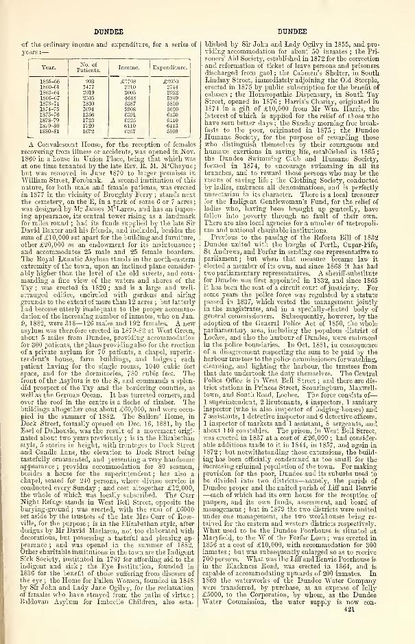
DUNDEE DUNDEE
of the ordinary income and expenditure, for a series of
years :
—
Year.No. of
Patients.Income. Expenditure. !
1S55-56 903 £1708 £20501S60-61 1477 2210 27441863-64 2019 3005 29221866-67 2505 464S 5S491873-74 1830 53S7 58101874-75 1694 5908 56201S75-76 1356 6391 6430187S-79 1723 6225 C4401S79-S0 1720 6110 64431880-81 1672 6257 5809
A Convalescent House, for the reception of females
recovering from illness or accidents, was opened in Nov.1S60 in a house in Union Place, being that which wasat one time tenanted by the late Rev. R. M. M'Cheyne
;
but was removed in June 1870 to larger premises in
"William Street, Forebank. A second institution of this
nature, for both male and female patients, was erected
in 1877 in the vicinity of Broughty Ferry ; stands nextthe cemetery, on the E, in a park of some 6 or 7 acres
;
was designed by Mr James M'Laren, and has an impos-ing appearance, its central tower rising as a landmarkfor miles round ; had its funds supplied by the late Sir
David Baxter and his friends, and included, besides the
sum of £10,000 set apart for the building and furniture,
other £20,000 as an endowment for its maintenance;
and accommodates 25 male and 25 female boarders.
The Royal Lunatic Asylum stands in the north-eastern
extremity of the town, upon an inclined plane consider-
ably higher than the level of the old streets, and com-manding a fine view of the waters and shores of the
Tay ; was erected in 1820 ; and is a large and well-
arranged edifice, encircled with gardens and airing
grounds to the extent of more than 12 acres ; but latterly
had become utterly inadequate to the proper accommo-dation of the increasing number of inmates, who on Jan.
9, 1882, were 318—126 males and 192 females. A newasylum was therefore erected in 1S79-82 at West Green,about 5 miles from Dundee, providing accommodationfor 300 patients, the jalans providing also for the erection
of a private asylum for 70 patients, a chapel, superin-
tendent's house, farm buildings, and lodges ; eachpatient having for the single rooms, 1040 cubic feet
space, and for the dormitories, 780 cubic feet. Thefront of the Asylum is to the S, and commands a splen-
did prospect of the Tay and the bordering counties, as
well as the German Ocean. It has turreted corners, andover the roof in the centre is a fleche of timber. Thebuildings altogether cost about £60,000, and were occu-
pied in the summer of 1882. The Sailors' Home, in
Dock Street, formally opened on Dec. 16, 1881, by theEarl of Dalhousie, was the result of a movement origi-
nated about two years previously ; is in the Elizabethanstyle, 5 stories in height, with frontages to Dock Street
and Candle Lane, the elevation to Dock Street beingtastefully ornamented, and presenting a very handsomeappearance
;provides accommodation for 80 seamen,
besides a house for the superintendent ; has also achapel, seated for 240 persons, where divine service is
conducted every Sunday ; and cost altogether £12,000,the whole of which was locally subscribed. The CurrNight Refuge stands in West Bell Street, opposite theburying-ground ; was erected, with the sum of £6000set aside by the trustees of the late Mrs Curr of Rose-ville, for the purpose ; is in the Elizabethan style, after
designs by Mr David Maclaren, not too elaborated withdecoratious, but possessing a tasteful and pleasing ap-
pearance ; and was opened in the summer of 1882.Other charitable institutions in the town are the IndigentSick Society, instituted in 1797 for affording aid to theindigent and sick ; the Eye Institution, founded in1836 for the benefit of those suffering from diseases of
the eye ; the Home for Fallen Women, founded in 1848by Sir John and Lady Jane Ogilvy, for the reclamationof females who have strayed from the paths of virtue
;
Baldovan Asylum for Imbecile Children, also esta-
blished by Sir John and Lady Ogilvy in 1855, and pro-
viding accommodation for about 50 inmates ; the Pri-
soners' Aid Society, established in 1872 for the correction
and reformation of tieket-of-leave persons and prisoners
discharged from gaol ; the Cabmen's Shelter, in SouthLindsay Street, immediately adjoining the Old Steeple,
erected in 1875 by public subscription for the benefit of
cabmen ; the Homoeopathic Dispensary, in South TayStreet, opened in 1876 ; Harris's Charity, originated in
1874 in a gift of £10,000 from Mr Wm. Harris, theinterest of which is applied for the relief of those whohave seen better days ; the Sunday morning free break-fasts to the poor, originated in 1S75 ; the DundeeHumane Society, for the purpose of rewarding thosewho distinguish themselves by their courageous andhumane exertions in saving life, established in 1865 ;
the Dundee Swimming Club and Humane Society,
formed in 1874, to encourage swimming in all its
branches, and to reward those persons who may be themeans of saving life ; the Clothing Society, conductedby ladies, embraces all denominations, and is perfectly
unsectarian in its character. There is a local treasurer
for the Indigent Gentlewoman's Fund, for the relief of
ladies who, having been brought up genteelly, havefallen into poverty through no fault of their own.There are also local agencies for a number of metropoli-tan and national charitable institutions.
Previous to the passing of the Reform Bill of 1832Dundee united with the burghs of Perth, Cupar-Fife,St Andrews, and Forfar in sending one representative to
parliament ; but when that measure became law it
elected a member of its own, and since 1868 it has hadtwo parliamentary representatives. A sheriff-substitute
for Dundee was first appointed in 1832, and since 1865it has been the seat of a circuit court of justiciary. Forsome years the police force was regulated by a statute
passed in 1S37, which vested the management jointlyin the magistrates, and in a specially-elected body of
general commissioners. Subsequently, however, by theadoption of the General Police Act of 1850, the wholeparliamentary area, including the populous district of
Lochee, and also the harbour of Dundee, were embracedin the police boundaries. In Oct. 1881, in consequenceof a disagreement respecting the sum to be paid by theharbour trustees to the police commissioners forwatching,cleansing, and lighting the harbour, the trustees fromthat date undertook the duty themselves. The CentralPolice Office is in West Bell Street ; and there are dis-
trict stations in Princes Street, Scouringburn, Maxwell-town, and South Road, Lochee. The force consists of
—
1 superintendent, 2 lieutenants, 4 inspectors, 1 sanitaryinspector (who is also inspector of lodging-houses) and7 assistants, 1 detective inspector and 6 detective officers,
1 inspector of markets and 1 assistant, 8 sergeants, andabout 140 constables. The prison, in West Bell Street,
was erected in 1S37 at a cost of £26,000 ; had consider-able additions made to it in 1844, in 1S57, and again in
1872 ; but notwithstanding those extensions, the build-
ing has been officially condemned as too small for theincreasing criminal population of the town. For makingprovision for the poor, Dundee and its suburbs used to
be divided into two districts—namely, the parish of
Dundee proper and the united parish of Liff and Benvie—each of which had its own house for the reception of
paupers, and its own funds, assessment, and board of
management ; but in 1879 the two districts were unitedunder one management, the two workhouses being re-
tained for the eastern and western districts respectively.
What used to be the Dundee Poorhouse is situated atMaryfield, to the W of the Forfar Loan ; was erected in1856 at a cost of £10,000, with accommodation for 300inmates ; but was subsequently enlarged so as to receive
700 persons. What was the Liff and Benvie Poorhouse is
in the Blackness Road, was erected in 1864, and is
capable of accommodating upwards of 200 inmates. In1869 the waterworks of the Dundee Water Companywere transferred, by purchase, at an expense of fully
£5000, to the Corporation, by whom, as the DundeeWater Commission, the water supply is now con-
421
DUNDEE DUNDEE
trolled. The water supply formerly came from Moni-kie, but in 1875 an additional source of supply fromthe Loch of Lintrathen was made available, fromwhich about 4,000,000 gallons are daily brought into thetown's reservoirs. A gas company was first formed in
Dundee in 1825, a second in 1846 ; and in 1868 theworks and plant of both companies were acquired by amixed body, of whom the Corporation formed the majo-rity, and who now, as the Dundee Gas Commission,supply the commuuity with gas. The works are in EastBock Street, and have been from time to time extendedto meet the increasing requirements of the town. InSept. 1881 a gasholder, the second largest in Scotland,
was brought into use, having cost upwards of £15,000.In the parliamentary session of 1882 the Gas Commissionapplied to parliament for a bill authorising them to
manufacture and supply the electric light. A commo-dious and convenient cattle market, with slaughter-
houses and other adjuncts, was provided in 1876 by thepolice commissioners at Carolina Port, adjoining theEast Dock Street railway station, at a cost of about£35,000. The extent of ground is about 6| acres, andthe frontage to the Ferry Road on the N, and DockStreet on the S, is between 500 and 600 feet. TheGreenmarket—the open street between the foot of
Crichton Street and Dock Street—is where a large por-
tion of the marketing of the working-classes is conducted.The Fish Market is held in an enclosure to the E of theGreenmarket. The Arcade occupies a large plot of
ground lying between King Street and Victoria Road,having a frontage to King Street on the S, "Victoria
Road on the N, King's Road on the E, and Idvies andCharles Streets on the W ; and was opened on Dec.
10, 1881. The Post Office, situated at the top of ReformStreet, contains all the departments of a head office,
with telegraph office attached, but is scarcely on a scale
or in a style commensurate with the town's importance.Postal receiving-houses, with money order and savings'
bank departments, are in King Street, Hilltown, PerthRoad, Scouringburn, Princes Street, and Blackscroft.
Telephonic communication is provided by two separatecompanies.
Dundee was the second town in Scotland to open a
Free Public Library, which it decided to do at a publicmeeting held on Sept. 6, 1866, but the library itself wasnot opened until July 1, 1869, and the reference depart-ment three months afterwards. The success of the FreeLibrary was so great that ultimately arrangements weremade by which the Albert Institute directors conveyedto the town the ground necessary for the erection ofadditional buildings to be occupied as a picture gallery
and museum, and also, as has already been stated, vestedthe whole of the Albert Institute in the Town Council,as trustees for carrying out the purposes for which theinstitute was founded. In 1873 a branch of the Lend-ing Library was opened in Lochee ; but it was takenadvantage of to so small an extent, that it was discon-
tinued after a few months' trial. The museum occupiesthe extreme E end of the Albert Institute buildings
;
was formally opened to the public on May 9, 1874;
contains a large number of geological, botanical, andnatural history specimens, besides a splendid collection
of articles from the Arctic regions. The Picture Galleryis enriched with some choice works of art, although thecollection is not nearly so large as it ought to be. Anannual Fine Art Exhibition is now held in the AlbertInstitute buildings. Dundee was first provided withpublic baths by a joint-stock company in 1848 ; but in
1871 they were acquired by the Corporation, and havesince been greatly extended and improved. The bathsare situated on the West Protection Wall, closely ad-joining the river, so that an abundant water supply canat all times be had. They include a handsome Turkishbath, splendid swimming ponds, and excellent plungebaths. Dundee furnishes two contingents to the For-farshire Rifle Volunteer Corps—the 1st Forfarshire, con-sisting of 8 companies, with about 800 men of all ranks
;
and the 2d Forfarshire (Dundee Highland), of 6 com-panies, with about 600 men of all ranks. It also fur-
422
nishes a corps (the 4th) to the Forfarshire Artillery
Brigade. In the end of 1881 an attempt was made toraise a brigade of Naval Artillery Volunteers ; but in
Jan. 1882, the Lords Commissioners of the Admiraltydeclined to sanction the undertaking, as a sufficient
number of volunteers had not come forward. Dundee,however, furnishes a larger contingent towards the RoyalNaval Reserve than any port in Scotland, and more thanany port in the kingdom in proportion to its seafaring
population. For their training the Unicorn, formerlya double-decked frigate, has been specially fitted up,and now lies moored in Earl Grey's Dock. The Savings'Bank is situated in Euclid Street, nearly opposite WardChapel; was originally established in 1815, but removedto its present handsome quarters in 1867. The progressof the bank is shown by the following statement of thesum due to depositors during a series of years, endingat Nov. 20 in each year:— 1860, £108,779; 1865,£150,897; 1870, £256,400; 1875, £409,558; 1876,£441,080 ; 1877, £471,660 ; 1878, £485,865 ; 1879,£519,617 ; 1880, £566,608 ; 1881, £600,244. A work-ing men's club, with suitable premises in South TayStreet, was established in 1873 by the munificence of
Mr George Armitstead, one of the parliamentary re-
presentatives of the burgh, but after maintaining alanguishing existence was closed in Dec. 1881. Thetheatre stands in Castle Street, was once elegant, butbecame dingy and desolate, and although improved fromtime to time, and excellently managed, is structurally
inadequate to the requirements of modern times. TheDundee Music Hall, formerly the Exchange Room,stands at the foot of Castle Street, the entertainmentoffered being of the usual music hall description. Acircus, erected by the Brothers Cooke behind theQueen's Hotel, Nethergate, was opened in Feb. 1878,and is visited at occasional intervals by these well-
known equestrians. A circus was erected in East DockStreet by Mr James Newsome in 1875, but was given upin 1881. Dundee possesses a number of yachting androwing clubs ; has a fine skating pond at Stobsmuir ; anopen-air bathing pond at Buckingham Point, and anopen-air bathing association ; a chess club, founded in
1826 ; and several angling clubs, besides numerouscricket and bowling clubs, and a snuff and twopennywhist club. Amongst its miscellaneous institutions are
a time gun, in the grounds attached to the barracks,
connected by an electric wire with the Observatoiy at
Greenwich, and fired daily at one o'clock ; and two Rus-sian guns, captured from the Russians during the Russianwar, and placed in front of the Volunteer Drill Hall.
Dundee has three railway stations—one at the E endof Dock Street, another at the W end, and a third theTay Bridge station—immediately adjoining the Esplan-ade. Attempts have frequently been made to secure a
commodious central station, but have always failed, andthe lamentable accident to the Tay Bridge seems to haverendered the accomplishment of this object more remotethan ever. This bridge was one of the longest in theworld, its length, including the extension on thenorthern shore, being 10,612 feet. This great length
was taken in 85 spans of varyiug width, the widest, of
which there were 11, being 245 feet. The level at theshores was between 70 and 80 feet above the sea ; in the
middle it was 130 feet above high water, giving a clear
water-way of 88 feet at high-water mark. The platform
on the top of the bridge, which carried the single line
of rails, was only 15 feet wide, and, as seen from theheights above Newport, was so narrow as to appear amere cable swung from shore to shore ; and seeing a
train puffing along for the first time is said to haveexcited the same kind of nervousness felt by those whowatched Blondin crossing the Niagara. The bridge,
which was designed by Thomas Bouch (afterwards
knighted), cost £350,000, and was opened for traffic onMay 31, 1878. On the evening of Sunday, Dec. 28,
1879, during a severe storm, the whole of the high
central girders of the bridge were blown down while
a passenger train was crossing from the S to the
N, and every individual in the ill-fated train perished.
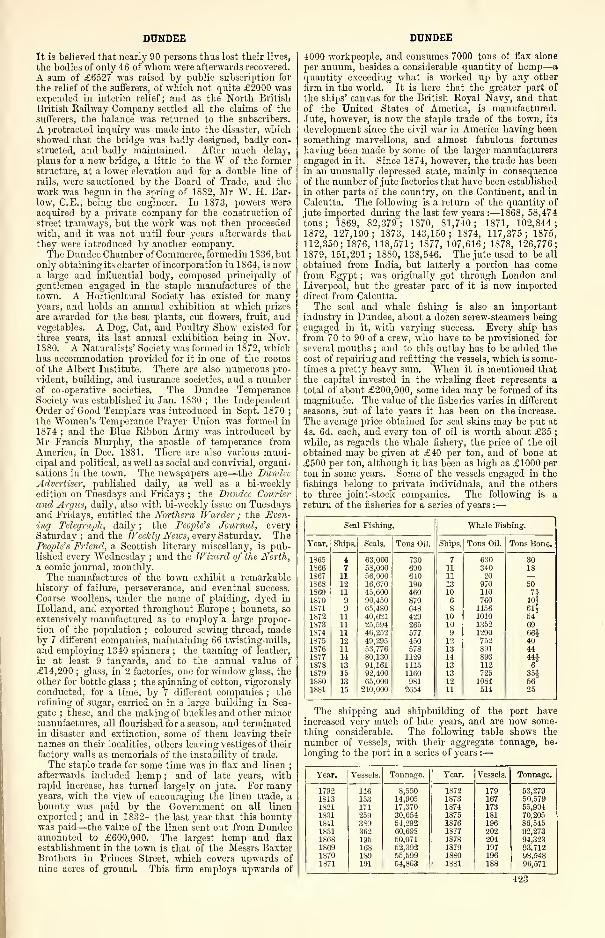
DUNDEE
It is believed that nearly 90 persons tilus lost their lives,
the bodies of only 46 of whom were afterwards recovered.
A sum of £6527 was raised by public subscription for
the relief of the sufferers, of which not quite £2000 wasexpended in interim relief ; and as the North British
British Railway Company settled all the claims of the
sufferers, the balance was returned to the subscribers.
A protracted inquiry was made into the disaster, whichshowed that the bridge was badly designed, badly con-
structed, and badly maintained. After much delay,
plans for a new bridge, a little to the W of the formerstructure, at a lower elevation and for a double line of
rails, were sanctioned by the Board of Trade, and the
work was begun in the spring of 1SS2, Mr W. H. Bar-
low, C.E., being the engineer. In 1S73, powers wereacquired by a private company for the construction of
street tramways, but the work was not then proceededwith, and it was not until four years afterwards that
they were introduced by another company.The Dundee Chamber of Commerce, formed in 1836, but
only obtainingit-; charter of incorporation in 1S64, is nowa large and influential body, composed principally of
gentlemen engaged in the staple manufactures of the
town. A Horticultural Society has existed for manyyears, and holds an annual exhibition at which prizes
are awarded for the best plants, cut flowers, fruit, andvegetables. A Dog, Cat, and Poultry Show existed for
three years, its last annual exhibition being in Nov.1880. A Naturalists' Society was formed in 1872, whichhas accommodation provided for it in one of the roomsof the Albert Institute. There are also numerous pro-
vident, building, and insurance societies, and a numberof co-operative societies. The Dundee TemperanceSociety was established in Jan. 1S30 ; the IndependentOrder of Good Templars was introduced in Sept. 1870
;
the Women's Temperance Prayer Union was formed in
1874 ; and the Blue Ribbon Army was introduced byMr Francis Murphy, the apostle of temperance fromAmerica, in Dec. 1881. There are also various muni-cipal and political, as well as social and convivial, organi-
sations in the town. The newspapers are—the DundeeAdvertiser, published daily, as well as a bi-weeklyedition on Tuesdays and Fridays ; the Dundee Courier
and Argus, daily, also with bi-weekly issue on Tuesdaysand Fridays, entitled the Northern Weirder ; the Even-ing Telegraph, daily ; the Peoples Journal, everySaturday; and the Weekly News, every Saturday. ThePeople's Friend, a Scottish literary miscellany, is pub-lished every "Wednesday ; and the Wizard of the North,a comic journal, monthly.The manufactures of the town exhibit a remarkable
history of failure, perseverance, and eventual success.
Coarse woollens, under the name of plaiding, dyed in
Holland, and exported throughout Europe ; bonnets, so
extensively manufactured as to employ a large propor-
tion of the population ; coloured sewing thread, madeby 7 different companies, maintaining 66 twisting-mills,
and employing 1340 spinners ; the tanning of leather,
in at least 9 tanyards, and to the annual value of
£14,200;glass, in 2 factories, one for window glass, the
other for bottle glass ; the spinning of cotton, vigorouslyconducted, for a time, by 7 different companies ; therefining of sugar, carried on in a large building in Sea-
gate ; these, and the making of buckles and other minormanufactures, all flourished for a season, and terminatedin disaster and extinction, some of them leaving their
names on their localities, others leaving vestiges of their
factory walls as memorials of the instability of trade.
The staple trade for some time was in flax and linen;
afterwards included hemp ; and of late years, withrapid increase, has turned largely on jute. For manyyears, with the view of encouraging the linen trade, a
bounty was paid by the Government on all linen
exported ; and in 1832—the last year that this bountywas paid—the value of the linen sent out from Dundeeamounted to £600,000. The largest hemp and flax
establishment in the town is that of the Messrs BaxterBrothers in Princes Street, which covers upwards of
nine acres of ground. This firm employs upwards of
DUNDEE
4000 workpeople, and consumes 7000 tons of flax alone
per annum, besides a considerable quantity of hemp—
a
quantity exceeding what is worked up by any other
firm in the world. It is here that the greater part of
the ships' canvas for the British Royal Navy, and that
of the United States of America, is manufactured.
Jute, however, is now the staple trade of the town, its
development since the civil war in America having beensomething marvellous, and almost fabulous fortunes
having been made by some of the larger manufacturersengaged in it. Since 1874, however, the trade has beenin an unusually depressed state, mainly in consequence
of the number of jute factories that have been established
in other parts of the country, on the Continent, and in
Calcutta. The following is a return of the quantity of
jute imported during the last few years :—1868, 58,474tons; 1869, 82,379; 1870, 81,740; 1871, 102,844;1872, 127,190; 1873, 143,150; 1874, 117,375; 1875,
112,350; 1876, 118,571; 1877, 107,616; 1878, 126,776;1879, 151,291 ; 1880, 138,546. The jute used to be all
obtained from India, but latterly a portion has comefrom Egypt ; was originally got through London andLiverpool, but the greater part of it is now importeddirect from Calcutta.
The seal and whale fishing is also an importantindustry in Dundee, about a dozen screw-steamers beingengaged in it, with varying success. Every ship hasfrom 70 to 90 of a crew, who have to be provisioned for
several months ; and to this outlay has to be added the
cost of repairing and refitting the vessels, which is some-times a pretty heavy sum. When it is mentioned that
the capital invested in the whaling fleet represents a
total of about £200,000, some idea may be formed of its
magnitude. The value of the fisheries varies in different
seasons, but of late years it has been on the increase.
The average price obtained for seal skins may be put at
4s. 6d. each, and every ton of oil is worth about £35 ;
while, as regards the whale fishery, the price of the oil
obtained may be given at £40 per ton, and of bone at
£500 per ton, although it has been as high as £1000 pel-
ton in some years. Some of the vessels engaged in thefishings belong to private individuals, and the others
to three joint-stock companies. The following is a
return of the fisheries for a series of years :
—
Seaf Fishing. Whale Fishing.
Year. Ships. Seals. Tons Oil. Ships. Tons Oil. Tons Bone.
1S65 t 63,000 730 7 630 301S66 7 58,000 690 11 340 181S67 11 56,000 640 11 20 —186S 12 16,670 190 13 970 501S69 11 45,600 460 10 140 7*1S70 9 90.450 870 6 760 40*1871 9 65,480 648 8 1156 61§1S72 11 40,621 429 10 1010 541873 11 25,594 265 10 1352 691874 11 46,252 677 9 1290 66*1S75 12 49,295 450 12 752 401S76 11 53,776 578 13 891 441877 14 80,130 1129 14 893 44J1S7S 13 94,161 1115 13 112 61S79 15 92,400 1160 13 725 35£1SS0 13 65,000 981 12 1084 561SS1 15 210,000 2654 11 514 25
The shipping and shipbuilding of the port haveincreased very much of late years, and are now some-
thing considerable. The following table shows the
number of vessels, with their aggregate tonnage, be-
longing to the port in a series of years :—
•
Year. Vessels. Tonnage. Year. Vessels. Tonnage.
1792 116 8,550 1872 179 63,2791S13 153 14,905 1873 167 50,5791821 171 17,370 1874 173 65,9941831 259 30,654 1875 181 70,205
1S41 389 54,292 1876 196 86,545
1S51 362 60,698 1877 202 92,2731S6S 195 50,074 187S 204 94,3231S69 163 52,392 1879 197 93.7121S70 189 55,599 18S0 196 98.5481871 191 64,863 1SS1 188 96,571
423
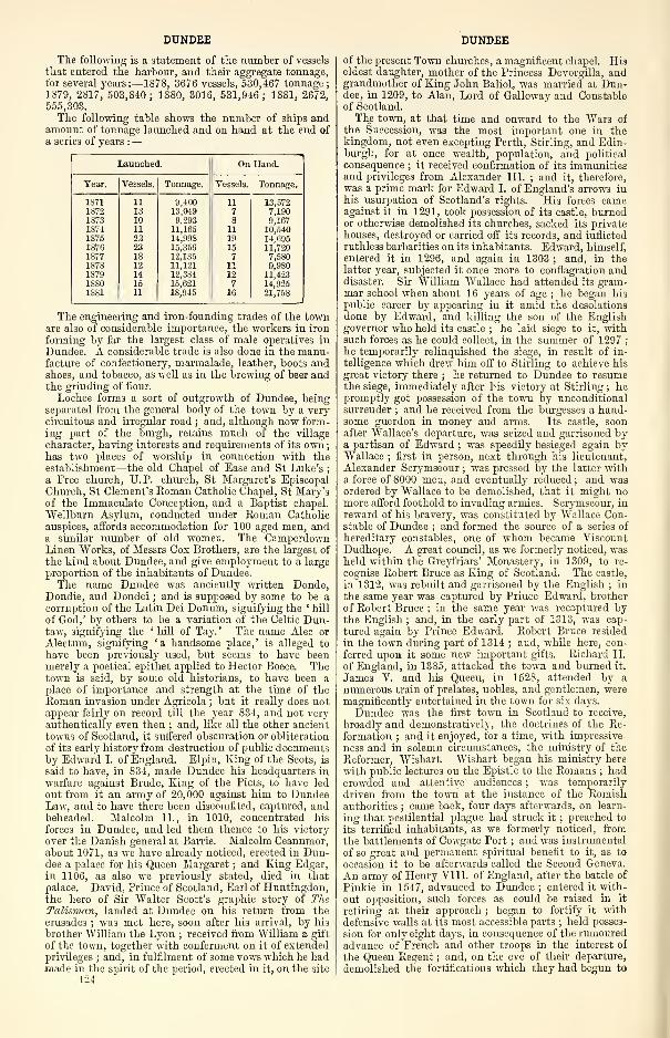
DUNDEE
The following is a statement of the number of vessels
that entered the harbour, and their aggregate tonnage,for several years:—1878, 3676 vessels, 530,467 tonnage
;
1879, 2817, 503,840; 1880, 3016, 531,946; 1881, 2672,555,303.
The following table shows the number of ships andamount of tonnage launched and on hand at the end of
a series of vears :—
Launched. On Hand.
Tear. Vessels. Tonnage. Vessels,j
Tonnage.
1871 11 9,400 11 13,5721S72 13 13,049 7 7,1901873 10 9,293 8 9,1671874 11 11,165 11 10,5401875 23 14,998 19 14,6951876 23 15,356 15 11,7201877 18 12,135 7 7,5801878 12 11,121 11 9,9801S79 14 12,384 12 11,4231SS0 15 15,621 7 14,9251SS1 11 1S,945 16 21,758
The engineering and iron-founding trades of the townare also of considerable importance, the workers in iron
forming by far the largest class of male operatives in
Dundee. A considerable trade is also done in the manu-facture of confectionery, marmalade, leather, boots andshoes, and tobacco, as well as in the brewing of beer andthe grinding of flour.
Lochee forms a sort of outgrowth of Dundee, beingseparated from the general body of the town by a verycircuitous and irregular road ; and, although now form-ing part of the burgh, retains much of the village
character, having interests and requirements of its own
;
has two places of worship in connection with theestablishment—the old Chapel of Ease and St Luke's
;
a Free church, TJ.P. church, St Margaret's EpiscopalChurch, St Clement's Roman Catholic Chapel, St Mary'sof the Immaculate Conception, and a Baptist chapel.
Wellburn Asylum, conducted under Roman Catholic
auspices, affords accommodation for 100 aged men, anda similar number of old women. The CamperdownLinen Works, of Messrs Cox Brothers, are the largest of
the kind about Dundee, and give employment to a large
proportion of the inhabitants of Dundee.The name Dundee was anciently written Donde,
Dondie, and Dondei ; and is supposed by some to be acorruption of the Latin Dei Donum, signifying the ' hill
of God,' by others to be a variation of the Celtic Dun-taw, signifying the ' hill of Tay. ' The name Alec or
Alectum, signifying 'a handsome place,' is alleged to
have been previously used, but seems to have beenmerely a poetical epithet applied to Hector Boece. Thetown is said, by some old historians, to have been aplace of importance and strength at the time of the
Roman invasion under Agricola ; but it really does notappear fairly on record till the year 834, and not veryauthentically even then ; and, like all the other ancient
towns of Scotland, it suffered obscuration or obliteration
of its early history from destruction of public documentsby Edward I. of England. Elpin, King of the Scots, is
said to have, in 834, made Dundee his headquarters in
warfare against Brude, King of the Picts, to have led
out from it an army of 20,000 against him to DundeeLaw, and to have there been discomfited, captured, andbeheaded. Malcolm II., in 1010, concentrated his
forces in Dundee, and led them thence to his victory
over the Danish general at Barrie. Malcolm Ceannmor,about 1071, as we have already noticed, erected in Dun-dee a palace for his Queen Margaret ; and King Edgar,in 1106, as also we previously stated, died in that
palace. David, Prince of Scotland, Earl of Huntingdon,the hero of Sir Walter Scott's graphic story of TheTalisman, landed at Dundee on his return from the
crusades ; was met here, soon after his arrival, by his
brother William the Lyon ; received from William a gift
of the town, together with conferment on it of extendedprivileges ; and, in fulfilment of some vows which he hadmade in the spirit of the period, erected in it, on the site
424
DUNDEE
of the present Town churches, a magnificent chapel. Hiseldest daughter, mother of the Princess Devorgilla, andgrandmother of King John BalioL was married at Dun-dee, in 1209, to Alan, Lord of Galloway and Constableof Scotland.
The town, at that time and onward to the Wars of
the Succession, was the most important one in thekingdom, not even excepting Perth, Stirling, and Edin-burgh, for at once wealth, population, and political
consequence ; it received confirmation of its immunitiesand privileges from Alexander III. ; and it, therefore,
was a prime mark for Edward I. of England's arrows inhis usurpation of Scotland's rights. His forces cameagainst it in 1291, took possession of its castle, burnedor otherwise demolished its churches, sacked its privatehouses, destroyed or carried off its records, and inflicted
ruthless barbarities on its inhabitants. Edward, himself,entered it in 1296, and again in 1303 ; and, in thelatter year, subjected it once more to conflagration anddisaster. Sir William AVallace had attended its gram-mar school when about 16 years of age ; he began his
public career by appearing in it amid the desolations
done by Edward, and killing the son of the Englishgovernor who held its castle ; he laid siege to it, withsuch forces as he could collect, in the summer of 1297
;
he temporarily relinquished the siege, in result of in-
telligence which drew him off to Stirling to achieve his
great victory there ; he returned to Dundee to resumethe siege, immediately after his victory at Stirling ; hepromptly got possession of the town by unconditionalsurrender ; and he received from the burgesses a hand-some guerdon in money and arms. Its castle, soonafter Wallace's departure, was seized and garrisoned bya partisan of Edward ; was speedily besieged again byWallace ; first in person, next through his lieutenant,
Alexander Scrymseour ; was pressed by the latter witha force of 8000 men, and eventually reduced ; and wasordered by Wallace to be demolished, that it might nomore afford foothold to invading armies. Scrymseour, in
reward of his bravery, was constituted by Wallace Con-stable of Dundee ; and formed the source of a series of
hereditary constables, one of whom became ViscountDudhope. A great council, as we formerly noticed, washeld within the Greyfriars' Monastery, in 1309, to re-
cognise Robert Bruce as King of Scotland. The castle,
in 1312, was rebuilt and garrisoned by the English ; in
the same year was captured by Prince Edward, brother
of Robert Bruce ; in the same year was recaptured bythe English ; and, in the early part of 1313, was cap-
tured again by Prince Edward. Robert Bruce resided
in the town during part of 1314 ; and, while here, con-
ferred upon it some new important gifts. Richard II.
of England, in 1385, attacked the town and burned it.
James V. and his Queen, in 1528, attended by a
numerous train of prelates, nobles, and gentlemen, weremagnificently entertained in the town for six days.
Dundee was the first town in Scotland to receive,
broadly and demonstratively, the doctrines of the Re-formation ; and it enjoyed, for a time, with impressive-
ness and in solemn circumstances, the ministry of the
Reformer, Wishart. Wishart began his ministry here
with public lectures on the Epistle to the Romans ; hadcrowded and attentive audiences ; was temporarily
driven from the town at the instance of the Romishauthorities ; came back, four days afterwards, on learn-
ing that pestilential plague had struck it;preached to
its terrified inhabitants, as we formerly noticed, from
the battlements of Cowgate Port ; and was instrumental
of so great and permanent spiritual benefit to it, as to
occasion it to be afterwards called the Second Geneva.
An army of Henry VIII. of England, after the battle of
Pinkie in 1547, advanced to Dundee ; entered it with-
out opposition, such forces as could be raised in it
retiring at their approach ; began to fortify it with
defensive walls at its most accessible parts ; held posses-
sion for only eight days, in consequence of the rumouredadvance of French and other troops in the interest of
the Queen Regent ; and, on the eve of their departure,
demolished the fortifications which they had begun to
DUNDEE DUNDEE
erect, rifled the town and set fire to its churches and to
man j' of its houses. The Queen Regent's troops entered
without resistance ; united with the townspeople in
quenching the conflagration which was going on ; and re-
constructed and extended the defensive fortifications. Ahody of the townsmen, to the number of nearly 1000,
headed by their provost, Hallyburton, in 1559, hearing of
the hostile intentions of the Queen Regent, marched into
junction with the army of the Reformers, and contributed
largely to their victory at Perth. Queen Mary, duringher progress through Scotland, in 1565, spent two daysin Dundee ; and, despite the antagonism between her
religious tenets and those of the townspeople, wastreated with every mark of loyalty and affection. Thetown gave refuge, in 1584, both to the celebrated Pro-
fessor Melville of St Andrews and the notable Earl of
Gowrie, who figured in the raid of Ruthven. James VI.visited the town at periods between 1590 and 1594 ; re-
visited it, with pompous ceremonial, in 1617 ; and, onthe latter occasion, was welcomed in a panegyrical speech
and two Latin poems, delivered by the town-clerk.
The Marquis of Montrose, in 1645, with a force of
only about 750 men, stormed the town, plundered its
churches and principal houses, and set parts of it on fire;
but was suddenly chased from it by an army of 3800under Generals Baillie and Harry. Charles II., in
1651, immediately before his march into Worcester,
spent some weeks in Dundee;got sumptuous entertain-
ment from the magistrates ; and was provided by theinhabitants with a stately pavilion, six pieces of artil-
lery, and some troops of horse. General Monk, in the
same year, besieged the town ; encountered a stubborn,
prolonged, and sanguinary resistance beneath its walls ;
broke eventually into it with terrible impetuosity
;
slaughtered all its garrison and more than 1200 of its in-
habitants, and subjected it to such a pillage that eachsoldier in his army received nearly £60 sterling. Grahamof Claverhouse, in 16S9, two yearsafterhe had been created
Viscount Dundee, and about six weeks before he fell onthe battlefield of Killiecrankie, approached the townwith intention of inflicting on it signal vengeance ; butwas met, and mainly repelled, by a prompt armed em-bodiment of the burgesses
;yet succeeded in setting fire
to the entire suburb of Hilltown. Graham of Duntroon,in Sept. 1715, proclaimed in Dundee the Pretenderas King of the British dominions ; and the Pretenderhimself, in the following January, made a public en-trance into the town and spent a night, as we formerlymentioned, in the town mansion of Stewart of Grand-tully. A force of Prince Charles Edward, consisting of
about 600 men under the command of Sir James Kin-loch, held possession of the town from 7 Sept. 1745 till
14 Jan. 1746. Queen Victoria and the Prince Consort,in Sept. 1844, on their way to Blair Castle, landed at
Dundee ; and the Prince and Princess of Wales, in Sept.
1S64, embarked at it for Denmark. The Queen, thePrince and Princess of Wales, Prince Leopold, GeneralGrant, ex-President of the United States, and othereminent personages also visited it after the first TayBridge was opened.Many natives of Dundee and its vicinity, and many
other persons who have resided in it, are on the roll of
fame. Some of the chief are Sir William Wallace, whoattended its grammar school, and possibly was a native
;
Sir Nieol Campbell of Lochow, the ancestor of the Dukesof Argyll ; John Blair, who celebrated the enterprisesof Sir William Wallace in a Latin poem, now lost
;
Alexander Scrymseour, already mentioned as the first
of the hereditary constables of Dundee; Hector Boece,the old Scottish historian ; Robert Pittiloch or Patullo,
who commanded the Scottish guard in the service ofFrance, and acquired distinguished military honours,under Charles VII. ; James Hallyburton, provost of thetown for more than thirty years, and a strenuous de-fender of the principles of the Reformation ; JamesWedderburn and his brother, vicar of Dundee, whoconsiderably aided the overthrow of Popery by theirsatires on its clergy ; Dr Kinloch, physician to JamesVI. ; the elder Marr, the friend and fellow-labourer of
Napier of Merchiston, the inventor of logarithms;
James Gleg, wdio left a professor's chair in St Andrewsto become rector of Dundee grammar school ; Sir GeorgeMackenzie, Lord-Advocate of Scotland, author of theInstitutes of the Scots Law, and founder of the Advocates'Library in Edinburgh ; John Marr, the constructor, in
the 17th century, of a remarkably accurate chart of theFirth of Tay and North Sea ; George Yeaman, the re-
presentative of the town in the last Scottish parliament,and one of the ablest and most patriotic legislators of
his country ; Robert Fergusson, the talented but unfor-
tunate Scottish poet, who early came to a disastrous endin Edinburgh ; Robert Stewart, an eminently literary
man, and a distinguished surgeon ; Sir James Ivory,
the celebrated mathematician ; James Weir, also a pro-
found mathematician ; Admiral Viscount Duncan, thehero of Camperdown, and of many other naval battles
;
Dr Robert Small, the author of an Explanation of the
Astronoinical Theories of Kepler ; the Rev. John Glass,
founder of the religious body called Glassites ; the Rev.John Willison, author of the Afflicted Man's Companion;the Rev. Dr Russell, author of a number of religious
works, and a powerful preacher ; the Rev. R. M.M'Cheyne, author of a Mission to the Jews, and amost effective preacher ; Thomas Hood, the humourist
;
William Thom and Robert Nicoll, the well-known poets
;
William Gardiner, author of the Flora of Forfarshire,and other botanical works ; J. B. Lindsay, a distin-
guished mathematician, electrician, and linguist ; Alex-ander Wedderburn, first Earl of Rosslyn ; and CharlesMiddleton, first Lord Barharn ; Sir David Baxter, aneminent manufacturer, and a distinguished local bene-factor ; the Rev. George Gilfillan, a popular lecturer,
author, and divine.
The parish of Dundee contains also parts of Locheeand Broughty Ferry, and comprises a main body and a
detached district. The main body lies along the Firthof Tay ; contains the greater part of the town of Dun-dee ; and is bounded N by Liff, Mains, and Murroes, Eby Monifieth, and W by Liff and Benvie. It has anelongated form, stretching from E to W, broadest at theE end, narrowest at the middle ; and it measures 6Jmiles diagonally from NE to SW, 5j miles in direct
length from E to W, and 24; miles in extreme breadthfrom N to S. The detached district commences about4 mile N of the broadest part of the main body ; is
bounded on the W by Tealing, on all other sides byMurroes ; and has nearly the outline of a square 1J milewide. The entire area is 4582 acres, of which 150J are
detached, 173 foreshore, and 38 water. The surface of the
main body rises gently from the shore ; swells somewhatsuddenly into braes in the northern outskirts of the town
;
ascends boldly thence to the green round summit of
Dundee Law, at an elevation of 571 feet above sea-level
;
forms, to the W of the Law, the lesser, yet considerable
and finely-wooded height of Balgay Hill ; and all, as
seen from the Fife side of the Tay, presents a beautiful
appearance. The view from most parts of it is charming,and that from the top of Dundee Law is at once exten-
sive, panoramic, and splendidly picturesque. E and S,
as far as the eye can reach, the mouth of the Tay, thebay and towers of St Andrews, the German Ocean, andthe greater part of Fife, are seen spread out as in a map.Turning to the opposite point of the compass, the darkridges of the Sidlaw Hills, with a broad valley inter-
vening, and the more distant peaks of the Grampians,meet the eye. The Taj, opposite the town, is rather
less than 2 miles broad ; and it contracts further downto a width of barely 1 mile. Dighty and Fithie Waterstraverse the north-eastern part of the main body, andmake a confluence at the boundary with Monifieth. Therocks are chiefly porphyry, sandstone, amygdaloid, andtrap, and they lie geognostically subjacent to the Car-
boniferous strata. Paving-stone and slate are raised in
small quantity ; and excellent sandstone abounds in thedetached district, and is extensively quarried. The soil,
in the E, is partly alluvial, partly argillaceous, andgenerally good ; in the W, is thin and dry ; in the NWaud behind Dundee Law, is poor, upon a tilly bottom.
425
DUNDEE AND ARBROATH RAILWAY
Mansions, separately noticed, are Craigie, Claypots, andDuntrune. Dundee is the seat of a presbytery in thesynod of Angus and Mearns. It ranked till 1834 as
one parish, but was served by two ministers from theReformation till 1609 ; it acquired a third minister in
1609, a fourth and a fifth in 17S9 ; and it now is
divided into the quoad civilia parishes of Dundee proper,
St Mary, St Clement, and St Paul, with large parts of
St David and St John, and contains whole or part of thequoad sacra parishes of St Mark, St Andrew, St Enoch,Chapelshade, Wallacetown, Rosebank, and Logie, andthe chapelries of St Matthew and Clepington.
—
Ord.
Sur., shs. 48, 49, 1868-65.
The presbytery of Dundee comprises the old parishesof Dundee, Abernyte, Auchterhouse, Inchture, Kinnaird,Liff and Benvie, Longforgan, Lundie and Fowlis, Mainsand Strathmartine, Monifieth, Monikie, Murroes, andTealing ; the quoad sacra parishes of Broughty Ferry,Broughty Ferry-St Stephen, Dundee-St Mark, Dundee-St Andrew, Dundee-St Enoch, Chapelshade, Wallace-town, Rosebank, Logie, Lochee, and Lochee-St Luke
;
and the chapelries of Dundee-St Matthew and Cleping-ton. Pop. (1871) 139,485, (1881) 163,732, of whom19,809 were communicants of the Church of Scotlandin 1878. The Free Church also has a presbytery of
Dundee, with 18 churches in Dundee, 3 in BroughtyFerry, 2 in Monifieth, and 7 in respectively Abernyte,Liff, Lochee, Longforgan, Mains, Monikie, and Tealing,which 30 churches had 11,075 communicants in 1881.The U.P. Synod also has a presbytery of Dundee, with10 churches in Dundee, 2 in Kirriemuir, 2 in BroughtyFerry, and 6 in respectively Lochee, Alyth, Blairgowrie,Ferry-Port-on-Craig, Newbigging, and Newport, which20 churches had 7140 members in 1880.
See Chs. Mackie's Historical Description of the Town ofDundee (1836) ; C. C. Maxwell's Historical and Descrip-tive Guide to Dundee (1S58) ; James Thomson's History
of Dundee (1847); A. J. Warden's Linen Trade Ancientand Modern (1864) ; Warden's Burgh Laios (1872) ; W.Nome's Dundee Celebrities of the Nineteenth Century(1873) ; W. Norrie's Handbook to Dundee Past and Pre-sent (1 876) ; Beatts's Municipal History ofDundee (1873)
;
J. Maclaren's History of Dundee (1874) ; W. Hay'sCharters, Writs, and Public Documents of the RoyalBurgh of Dundee (1880); and Beatts's Reminiscences ofan Old Dundonian (1882).
Dundee and Arbroath Railway, a railway in the Sand SE of Forfarshire, from Dundee east-north-eastwardto Arbroath. It was authorised, in 1836, on a capital of
£266,700 in shares and £88,900 in loans ; was opened in
April 1840 ; became amalgamated with the ScottishNorth-Eastern in July 1863 ; and passed, with theNorth-Eastern, to the Caledonian in July 1S66. OnFeb. 1, 1880, the North British Railway Co. becamejoint owners of the line with the Caledonian Co. It
is 17 miles long ; traverses the parishes of Dundee,Monifieth, Barry, Panbride, St Vigeans, Arbirlot, andArbroath ; and has junctions at Broughty Ferry withthe northern terminus or Dundee-ward fork of theNorth British railway, and at Arbroath with the E endof the Arbroath and Forfar railway, and through thatwith the Aberdeen section of the Caledonian. It com-mences at Trades Lane in Dundee ; runs parallel withDock Street ; crosses, for about a mile, a baylet of theFirth of Tay ; traverses a very deep rock cutting on theCraigie estate ; intersects, at two different points, theroad between Dundee and Broughty Ferry
;goes along
Broughty Ferry links, and through the barren sands of
Monifieth and Barry ; traverses thence, for 6J miles, atract of little interest ; and has, in its course, bothunder and over it, a number of beautifully constructedbridges.
Dundee and Forfar Railway, a railway in the S ofForfarshire, from Dundee north -north-eastward to For-far. It was authorised, in July 1864, on a capital of£125,000 in shares and £40,000 in loans ; is 17J mileslong; and was opened in Nov. 1870. It belonged, atfirst, to the Scottish North-Eastern Company ; andpassed, with the rest of the North-Eastern system, to the
426
DUNDELCHACK
Caledonian. It gives direct communication betweenDundee and Forfar, in lieu of the circuitous route byway of Arbroath ; and connects, at Forfar, with thelines thither from respectively Arbroath and Perth. Aplot of 9 acres for its use at Forfar was purchased, onthe eve of its opening, from the Forfar Town Council.
Dundee and Newtyle Railway, a railway in the SWof Forfarshire, from Dundee north-westward to Newtyle.It was originally a single truck line, 10J miles long,
formed on an authorised capital of £140,000 in sharesand £30,000 in loans, and opened in 1831 ; was leased
in perpetuity, under an act of 1846, to the Dundeeand Perth Company, with further authorised capital
of £50,000 in shares and £16,606 in loans; underwentalterations and extensions, under both that act and anact of 1859, with still further authorised capital of
£70,000 in preference shares ; was again extended andimproved, to the aggregate length of 4J miles, underacts of 1862 and 1864, on further authorised capital
of £49,000 in shares and £14,900 in loans ; becameamalgamated as part of the Dundee and Perth systemwith the Scottish Central in 1863 ; and passed, as
part of the Scottish Central system, to the Caledonianin 1865. It originally left Dundee on an inclined plane800 yards long, with a gradient of 1 yard in 10, andproceeded through a shoulder of Dundee Law in atunnel 340 yards long ; and had a branch for goodstraffic, through the streets of Dundee to the terminusof the Dundee and Perth railway ; but these features of
it have disappeared. A new reach, in lieu of the dis-
carded portions, and measuring 7J miles in length, wasopened in June 1859 ; and a branch to Lochee, 6 milesin length, was opened in June 1861. It traverses theparishes of Dundee, Liff and Benvie, Mains and Strath-
martine, Auchterhouse, and Newtyle ; ascends aninclined plane, in the gorge of the Sidlaws, to a summit-elevation of 544 feet above sea-level, and descends a
second inclined plane, through the Slack of Newtyle,into the valley of Strathmore ; connects there, withthe North-Eastern section of the Caledonian system, bybranches, some of which were originally its own ; andcommunicates, through these, with Coupar- Angus,Meigle, Glamis, and Forfar.
Dundee and Perth Railway, a railway in Forfar andPerth shires, from Dundee west-south-westward, alongthe northern bank of the Tay, to Perth. It is 21|miles long, and, opened in May 1847, was amalga-mated in 1863 with the Scottish Central, with whichit passed to the Caledonian in 1865. It commencesat Yeaman Shore, in Dundee ; skirts the western part
of that town on a sea embankment ; runs along the
face of the romantic cliff of Will's Braes ; traverses
the charming beach of Invergowrie Bay, near Inver-
gowrie village ; crosses the great sandstone quarries of
Kingoodie on a stupendous viaduct;passes near Inchture
Bay and Powgavie Harbour ; sheers off to some little
distance from Errol, and northward of Inchyra ; coin-
cides again with the river's bank, past Kinnoull ; crosses
the Tay, from Barnhill, on a magnificent bridge of great
length, in the form of a segment of a circle, with the
central part resting on an island ; terminates at the
Princes station in Perth ; and connects, at its E end,
with the Dundee and Newtyle railway—at its W end,
with the several railways radiating from Perth. Thescenery along its course, through the Carse of Gowrie,
and past Kinnoull Hill all onward to Perth, is every-
where beautiful, in many places brilliant, from Glen-
carse to Perth superb. The final meeting of the share-
holders as an independent company was held on Jan. 6,
18S2.
Dundavid. See Duntulen.Dundelchack or Dun na Seilcheig, a loch on the
mutual border of Daviot and Dores parishes, NE Inver-
ness-shire, 84 miles SSW of Inverness. Lying 702 feet
above sea-level, it has an utmost length from SW to NEof 3f miles, whilst its breadth varies between 2§ furlongs
and 1 mile. It sends off a rivulet eastward to LochClachan, and thence to the river Nairn. Trout and red
char are plentiful, the former running up to 4 lbs. , but
DUNDONALD
neither rise very freely to the fly ; and pike of from 3 to
20 lbs. may be taken by trolling.
—
Orel. Sur., shs. 73,
83, 1878-81.
Dundonald, an ancient castle in the centre of Killean
and Kilchenzie parish, Kintyre, Argyllshire. From the
Macdonalds, Lords of the Isles, it passed to the ances-
tors of the Duke of Argyll, and is now represented byrude remains.
Dundonald, a village and a coast parish of Kyle, Ayr-shire. The village stands, 113 feet above sea-level, Ifmile S by E of Drybridge station, 4J miles NE of Troon,
4| SE of Irvine, and 5J SW of Kilmarnock, under whichit has a post office. Dundonald Castle, crowning a
beautiful round hill a little W of the village, seems,
from the style of its architecture and from other circum-stances, to have been erected in the 12th or 13th century.
According to legend, it was built entirely of wood, withnever a wooden pin, by one Donald Din, or Din Donald,the story of whose enrichment by the discovery, througha dream, of a pot of gold is related also of a Norfolkchapman, a spendthrift of Dort, and a Baghdad beggar
(pp. 236-238 of Robert Chambers's Popular Rhymes ofScotland, ed. 1870). The residence of several princesof the Stewart dynasty and the death-place of Robert II.
(1390), it has given the title of Baron since 1647, of
Earl since 1669, to the family of Cochrane ; and now,with 5 roods of land adjoining, it is the last remainingproperty in Ayrshire of that family. Tradition relates
that it was shorn of its topmost story for building orimproving their neighbouring house of Auchans ; but it
still forms a massive two-story ruin, measuring 113 feet
by 40, and retains on its western wall, in high relief butmuch obliterated by time, the armorial bearings of theStewarts. At its southern end are shattered remains of
two or three arched cells, which belonged to its keep orprison ; and it seems, from vestiges still visible, to havebeen surrounded by a rampart and a moat. SamuelJohnson and Boswell were here in 1773.The parish, containing also the seaport of Troon and
the Fullarton suburb of Irvine, is bounded N byIrvine, Dreghorn, and Kilmaurs, E by Riccarton, SE bySymington and Monkton-Prestwick, SW and W by theFirth of Clyde. Rudely resembling a triangle in shape,with southward apex, it has an utmost length fromNNW to SSE of 7i| miles, an utmost breadth fromENE to WSW of 6J miles, and an area of 13,404|acres, of which 940 are foreshore and 99JJ water. Thecoast-line, 8g miles long, from the mouth of the Irvineto that of the Pow Burn, is low and sandy, broken onlyby the promontory of Troon, but fringed by Lappock,Stinking, Mill, Garden, and Seal Rocks, and Little andMeikle Craigs. The surface for some way inland is
almost a dead level, and at its highest point but little
exceeds 400 feet above the waters of the firth—said pointoccurring near Harpercroft, and belonging to the so-
called Claven or Clevance Hills. All under tillage,
pasture, or wood, these form a central tract, and, ex-tending about 3 miles south-eastward and 1J mile south-westward, converge to a oilmen, which commands awide panoramic view, said to comprise portions of four-teen counties. From just above Gatehead station to its
mouth, the river Irvine, winding 11 miles west-north-westward, roughly traces all the boundary with Kil-maurs, Dreghorn, and Irvine ; whilst Rumbling Burnfollows that with Symington and Monkton, and one ortwo smaller rivulets flow through the interior to thefirth. The rocks in the Claven Hills, and elsewhere inpatches, are eruptive \ in all other parts, belong to theCarboniferous formation. Coal has long been minedat Shewalton and Old Rome ; excellent sandstone is
quarried for exportation at Craiksland and Collennan;
and hone-stone, of a very superior quality, abounds onthe estate of Curreath. The soil, to the breadth ofabout \ mile on nearly all the coast, except roundTroon, is sandy and barren ; in the adjacent tracts tothe E, is of various character from light to loamy ; inthe extreme E, is mostly a loamy fertile clay ; and is astiffish clay in some other parts. A very large propor-tion of the entire area is under cultivation, and much is
DUNDRENNAN
devoted to dairy husbandry. A native was the cobbler-
artist, John Kelso Hunter (1802-73). A famous pre-
Reformation church, ' Our Lady's Kirk of Kyle,' ad-joined Dundonald Castle, but has disappeared ; and anancient chapel stood on Chapel Hill, near Hillhousemansion ; whilst not far from Newfield are remains of astructure, supposed to have been a Boman bath or reser-
voir. A vitrified fort, now in a state of utter dilapida-
tion, crowned a projecting eminence between two ravines
at Kemplaw ; and two ancient camps are on the heightsabove Harpercroftfarm. Aitchans House is an interesting
object ; and mansions of comparatively modern erection
are Fullarton, Shewalton, Newfield, Fairlie, Curreath,and Hillhouse, 7 proprietors holding each an annualvalue of £500 and upwards, 9 of between £100 and£500, 31 of from £50 to £100, and 100 of from £20 to
£50. In the presbytery of Ayr and synod of Glasgowand Ayr, this parish is divided into the quoad sacraparishes of Troon, Fullarton, and Dundonald, thelast being a living worth £446. Its church, built in
1803, contains 630 sittings ; and four public schools—Dundonald, Fullarton, Loans, and Troon—with respec-
tive accommodation for 129, 180, 60, and 160 children,
had (1880) an average attendance of 136, 126, 39, and249, and grants of £87, 3s., £90, 17s., £27, 6s., and£207, 18s. 6d. Valuation (1860) £27,538 ; (1882)£39,095, 3s. 9d.,plus £8060 for railway. Pop. of civil
parish (1S01) 1240, (1831) 5579,* (1861) 7606, (1871)6964, (1881) 8089 ; of Dundonald registration district
(1871) 1507, (1S81) 1509.—Ord. &«., sh. 22, 1865. Seethe Rev. J. Kirkwood's Troon and Dundonald : withtheir surroundings, Local and Historical (3d ed., Kilm.,
1881).
Dundonnell, an estate, with a mansion, in Lochbroomparish, Ross-shire, on the right bank of Stratkbeg river,
8 miles S of Ullapool. Its owner, Murdo Mackenzie,Esq. (b. 1843 ; sue. 1878), holds 64,335 acres in theshire, valued at £3672 per annum.
Dundonnie, a small green islet of Peterhead parish,
Aberdeenshire, opposite Sterling Hill, and 5 furlongs Sby W of Buchan Ness. It formerly had a salt-pan.
Dundornadil. See Dornadilla.Dundreieh, a huge rounded hill near the eastern bor-
der of Eddleston parish, NE Peeblesshire. It culminates
2J miles NE of Eddleston village at an altitude of 1954feet above sea-level, and commands views into Lanark-shire, over the Lothians, and from the Cheviots to theGrampians.Dundrennan (Gael, dun-nan-droigheann, ' fort of the
thorn bushes'), a village and a ruined abbey in Rer-wick parish, Kirkcudbrightshire. The village standsin a narrow valley, on the right bank of Abbey Burn,1^ mile N by W of the coast at Port Mary, and 5 milesESE of Kirkcudbright, under which it has a post office.
Its environs are charming, with vantage grounds com-manding fine views inland, down the valley, and across
the Solway Firth ; and the village itself consists of asingle row of one-story houses containing many stones
from the ruined abbey, and interspersed with fine old
trees. At it are 2 inns, the manse and parish churchof Renvick, and a public school. Tho abbey, standingin the south-eastern vicinity of the village,was foundedin 1142, for Cistercian monks, by Fergus, Lord of Gal-
loway;passed, with its property, in 1587 to the Crown;
and was annexed, in 1621, to the royal chapel of Stir-
ling. It fell into such neglect and dilapidation as longto form a quarry for repairing or erecting neighbouringhouses ; but still is represented by considerable remains,with interesting architectural features, and in 1842 wascleared out and put into a state of conservation by theCommissioners of Woods and Forests. Its church wascruciform, comprising a six-bayed nave (1304 x 30 feet),
with side aisles 15J feet wide, a transept (107 x 28 feet),
a choir (45 x 26 feet), and a central tower and spire 200feet high ; and was partly in the Transition Normanstyle, but chiefly in the First Pointed. The cloisters
were on the S side of the church, and enclosed a
* An increase largely due to the annexation of Troon, Halfway,and Shewalton from Irvine.
427
DTJNDTJFF
square area of 108 by 104 feet ; various monasticoffices stood still further S, and occupied a space of
nearly 300 square feet ; and to the S of the S transept
stood the chapter-house (514x35 feet). The chief extant
portions of the pile are the N and S walls of the choir;
the E aisle of the S transept;part of the N transept ; a
few feet of the piers of the central tower, remarkable for
their unequal dimensions ; the doorway of the chapter-
house, flanked on each side by a double window ; the
cells or cellars at the entrance to the garden ; andseveral curious monuments—of Allan Lord of Galloway
(1234), Prior Blakomor, an abbot, a nun (1440), a cellarer
(1480), Sir William Livingstoun (1607), etc. QueenMary is commonly said to have ridden straight fromLangside to Dumlrennan, or at least to have passed the
last night (May 15, 1568) of her sojourn in Scotlandhere ; but Dr Hill Burton questions this belief, chal-
lenging the authenticity of her letter to Elizabeth 'from
Dundrennan,' and upholding the counter-claims of Ter-hegles, Lord Hemes' house. The estate of Dundren-nan lies round the village and the abbey, and has longbeen the property of the Maitlands of Dundrennan andCompstone.— Orel. Sur., sh. 5, 1857. See the Rev.
JEneas B. Hutchison's Memorials of the Abbey of Dun-drennan (Exeter, 1857), and J. H. Maxwell's Dundren-nan Abbey, and its History (Castle-Douglas, 1875).
Dunduff, a farm in Maybole parish, Ayrshire, 6 miles
SW of Ayr. It contains a ruined baronial fortalice, the
shell of the ancient church of Kirkbride, with a burying-
ground still in use, and a field called the Priest's Landadjoining that graveyard.
Dundurcus, an ancient parish on the E border of
Elginshire, on both sides of the river Spey, 6J miles
SSW of Fochabers. It was suppressed in 1782 or 1788,
when the part of it on the right side of the Spey, except-
ing the small property of Aikenway, was annexed to
Boharm ; whilst that on the left side, together withAikenway, was annexed to Rothes. The portion of it
adjacent to the river is a beautiful haugh, and bears the
name of Dundurcus Vale. Its church and burying-ground were situated on the verge of a plateau over-
looking the haugh, 2 miles NE of Rothes village ; andthe church still exists in a state of ruin ; while the
burying-ground was re-enclosed, about 1835, with a sub-
tantial wall.
Dundurn, an ancient parish in Strathoarn, Perthshire,
at the foot of Loch Earn, now annexed to Comrie, andoriginally called Duinduirn or Dundearn after a dun or
fortified hill at the foot of the loch. The principal
stronghold of the district of Fortrenn, this dun wasbesieged in 683 ; and Grig or Girig, King of the Picts,
was slain at it in 889. See St Fillans.Dundyvan. See Coatbridge.Dunearn Hill. See Burntisland.Duneaton Water, a stream of the upper ward of
Lanarkshire, rising on the SE slope of Cairntable (1944feet) at an altitude of 1550. Thence it winds 19 miles
east-by-northward, partly on the boundary betweenDouglas and Crawfoedjohn, but chiefly through the
interior of the latter parish, till, after a total descent of
800 feet, it falls into the Clyde at a point If mile belowAbington. It receives so many little affluents, that
over the last 4 or 5 miles of its course it has an average
width of 40 feet ; it is frequently swept by freshets,
overflowing alluvial lands on its banks ; it occasionally
changes portions of its channel and lines of its fords;
and it is an excellent trouting stream.
—
Orel. Sur., sh.
15, 1864.
Dunecht, a seat of the Earl of Crawford in Echtparish, Aberdeenshire, 5J miles SSW of Kintore sta-
tion, and 12 W of Aberdeen, under which there is a
post office of Dunecht. Originally a Grecian edifice of
1820, it has received a number of additions, the latest
and most important that of 1877-81, from designs bythe late Mr G. E. Street, R.A. Among its more note-
worthy features are the observatory, the library, andthe private chapel, from the vault beneath which, in
the summer of 1881, was stolen the body of AlexanderWilliam Lindsay (1812-80), twenty-fifth Earl of Craw-
428
DUNFERMLINE
ford since 1398 and eighth Earl of Balcarres since 1651,who was author of works on the Lindsay family, theMar peerage, Etruscan inscriptions, etc. His son andsuccessor, James Ludovic Lindsay (b. 1847), who is
president of the Royal Astronomical Society, holds 8855acres in the shire, valued at £6160 per annum. SeeCrawford and Balcarres.
Duneira. See Dunira.Dunemarle. See Duntmarle.Dunevan, an ancient fort near Cawdor, in Nairnshire.
It has two ramparts, enclosing an oblong level space, onthe top of a hill ; it contains, within that space, tracesof a well, and remains of a large mass of garrison build-ings ; and it held beacon communication, through inter-
mediate forts, with Dundardil on Loch Ness.Dunfallandy, an estate, with a mansion, in Logierait
parish, Perthshire, near the right bank of the Tummel,1| mile SSE of Pitlochry. Its owner, Miss Fergusson(sue. 1836), holds 842 acres in the shire, valued at £513per annum. Of two stones here, one] marks the sceneof a dreadful murder and usurpation ; the other, half-
sunk in the ground, is carved with grotesque figures of
animals, and was long regarded with much superstitiousawe.
Dunfermline, a city and parish in the SW of Fife.
A royal and parliamentary burgh, a place of manufacture,and the seat of administration for the western division of
the county, the city stands on the North British line of
railway from Thornton Junction to Stirling, at thejunction of a mineral line southward to Charlestownharbour, and of a passenger line south-eastward to
North Queensferry, by road being 5J miles NW of
North Queensferry, 16 NW of Edinburgh, and 29 Sof Perth, whilst by rail it is 7* WSW of Lochgelly,
15J WSW of Thornton Junction, 29 SW of Cupar, 13iE by S of Alloa, 20^ E by S of Stirling, and 42J NEby £ of Glasgow. Its site is variously flat and slop-
ing, but consists mainly of a longish eminence, which,stretching from E to W, rises to a height of 354 feet
above sea-level, and presents a somewhat bold ascent to
the N. The environs abound in diversities of surface,
enriched with floral ornament, and gemmed with fine
close views ; and they contain a number of mansions,villas, and pretty cottages. The city, as seen from anypoint near enough to command a distinct view, yetdistant enough to comprehend it as a whole, looks to beembosomed in wood ; and over the tree-tops rise QueenAnne Street U. P. church, ' with its enormous rectilinear
ridge,' the steeples of the County Buildings, the TownHouse, and the old Abbey church, with the fine square
tower of its modern neighbour. A stranger, approachingDunfermline for the first time, forms a very mistakennotion of its extent, supposing it to be little else thana large village in a grove ; and, on entering, is sur-
prised to find himself in a city teeming with activity,
bustling with trade, and every way worthy of rankingwith the foremost burghs. Some vantage spots withinthe town, especially the vicinity of the Abbey and the
top of the Abbey church tower, command extensive
panoramic prospects. First, from the top of the
tower are seen the rich tracts of south-western Fife,
together with their equally fine continuation throughthe detached district of Perthshire and through Clack-
mannanshire, to the Ochils ; beyond is the Firth of
Forth, from North Queensferry to Culross, sometimesconcealed by an elevated strip of coast, but here andthere beheld in all its breadth through various open-
ings, and rendered everywhere more picturesque bythus being chequered with land ; further still are the
southern banks and screens of the Forth, beautifully
undulated and luxuriantly fertile, the many-woodedswells of the Lothians, the heights of Edinburgh, occa-
sionally its very spires, the pleasure-grounds of Hope-toun, the promontory of Blackness, the harbour of
Borrowstounness, and the ' links ' of the Forth to the
vicinity of Stirling ; and, at the limits of vision, are
the Lammermuirs of Haddington and Berwick shires,
Soutra Hill at the watershed of the Gala and the Tyne,
the Pentlands in Midlothian, Tinto in Lanarkshire, the
DUNFERMLINE
Campsie Fells in Stirlingshire, and Ben Lomond andBen Ledi among the south-western Grampians.The alignment and architecture of the town are far
from corresponding with the exterior views. The older
streets are narrow and irregular ; the principal streets,
though containing substantial houses, want somecharacter of spaciousness, length, or elegance, to renderthem imposing ; and all the streets taken together fail
to present an urban aspect. Yet some portions, either
from their neatness, from their impressive antiquity, or
from combinations of striking natural feature and fine
artificial ornature, are variously pleasing, attractive,
and picturesque. Several streets are entirely modern
—
one of the newest in a style displaying much goodtaste ; others, even the oldest, have been materially
improved ; and a large suburb in the W is entirely
modern. A bridge, 294 feet in length, was built (1767-70)at a cost of more than £5500 by George Chalmers, across
Pittencrieff Glen or the glen of the Tower Burn, andbecame so surmounted by excellent houses and goodshops, as to be one of the best of the modern streets.
Pittencrieff Glen, even within itself, through combina-tion of romantic natural features with interesting ancientmonuments, is highly attractive ; and, as to situation,' is a most agreeable surprise, hanging on the skirts of a
manufacturing town like a jewel on an Ethiop's ear.'
The demesne, around Pittencrieff mansion, includes theglen, and spreads away to the SW ; and the glen con-tains the remains of a tower of Malcolm Ceannmor,and of a subsequent royal palace,—which ruins, withground around them sufficient to give access thereto,
were in 1871 pronounced by the House of Lords to
be Crown property. 'The moment you leave thestreet,' says Mercer, 'you enter a private gate, andare on the verge of a deep glen filled with fine oldtrees, that wave their foliage over the ruins of theancient palace ; and a little further on is the peninsularmount on which Malcolm Ceannmor resided in hisstronghold. Bound the base of the mount winds arivulet, over which is a bridge leading to the mansion-house, situated on the further bank in a spacious park,well-wooded, adorned with shrubberies, and having asplendid prospect to the S. The ground, too, is classical,
for amidst this scenery, three centuries ago, when it waseven more romantic than it is at present, must oftenhave wandered the poet Henrysoun, holding sweet dal-
liance with the Muses.
'
Malcolm's Tower is believed to have been built between1057 and 1070. It crowned a very steep eminence,rising abruptly from Pittencrieff Glen, and forming apeninsula ; and was described by Fordun as extremelystrong in natural situation, and defended by rocky cliffs.
Its foundations were 70 feet above the level of therivulet below, but could not, from the nature of thesite, have been ofvery great extent, probably not morethan about 60 feet from E to W, and 55 feet from Nto S, with a pyramidal roof. The tower appears tohave had great thickness of wall, but has been strippedto the ground of all its hewn outside stones, and is nowonly represented by a connected angle or fragment ofthe S and W walls, measuring 31 feet on the S, and 44feet on the W, with a height of about 8 feet. In spiteof its diminutive character, however, this tower was theplace of Malcolm Ceannmor's marriage to the Saxonprincess, St Margaret, in the spring of 1068, as well as
the birthplace of ' the Good Queen Maud,' wife of HenryI. of England. About 290 yards NNE of the Tower is
St Margaret's Cave, which, as cleared of debris in 1877,measures llf by 8J feet, and is 6J feet high. TheRoyal Palace may have been founded as early as 1100,though the so-called Arabic numerals of the Annuncia-tion Stone turned out in 1859 to be really the last fourletters of the motto Gonfido. More likely it was notbuilt till after the departure of Edward I. of England inFebruary 1304. Said to have been burned by Richard II.
in 1385, it was restored and enlarged about 1540 byJames V.; passed into neglect after Charles II. 's time
;
and, becoming roofless in 1708, is now a total ruin. It
occupies a romantic site a little SE of Malcolm's Tower,
DUNFERMLINE
!and comprises no more than remains of the SW wall,
!measuring 205 feet in length, 59 in exterior height, and 31
interiorly from the sill of a window on the first floor ; is
|
strongly supported by 8 buttresses ; and has several cross-
mullioned windows, and one oriel, over which a 16tUcentury sculpture representing the Annunciation wasdiscovered in 1812. In that year the old palace was so
far repaired by the proprietor of Pittencrieff as to belikely to resist, for a long period, any further dilapida-
tion. The kings of Scotland, from Robert Bruce onward,appear to have frequently resided in this palace. JamesIV. was more in it than any of his immediate prede-cessors ; James V. and his daughter, Queen Mary, re-
sided here ; James VI. subscribed the Solemn League andCovenant in it ; and at it were born David II. (1323),James I. (1394), Charles I. (1600), and his sister Eliza-
beth (1596), the ' Winter Queen ' of Bohemia. Here,too, the 'young man, Charles Stewart,' kept his smallcourt, and was kept in courteous restraint, at the timeof Cromwell's invasion in 1650 ; here on 16 Aug. hesubscribed the ' Dunfermline Declaration,' a testimonyagainst his own father's malignancy.A building called the Queen's House, to the NE of the
Royal Palace, with which it communicated by a gallery,
stood in the middle of the street, to the N of the presentPended Tower, and extended nearly to the greatW doorof the Abbey Church ; took its name from having beenrebuilt in 1600 by Queen Anne of Denmark and fromhaving been her personal property ; was partially in-
habited till 1778, but was entirely removed in 1797.
The residence of the Constable of the royal buildings
stood immediately N of the Queen's House. Anaperture, originally about 4 feet high, and 2Jfeet wide,but now so choked with earth as to be only 2i feet high,
is near the N¥ corner of the Palace, and forms theentrance to a dark subterraneous passage branching into
offshoots, and measuring 98J feet in total length. ThePended or Pended Tower, connecting the Palace and theAbbey, is a massive oblong structure, with elegant groinedarchway on the line of the street ; presents interesting
features of strong ribbed arches and Transition Normanwindows ; and now is 35 feet long, 47 high, and 16broad, but was formerly more extensive. The oldmarket-cross of 1626, similar to the ancient crosses of
Edinburgh, Aberdeen, Peebles, and other old burghs,
according to the Vandal taste with which such thingswere regarded in last century, was removed in 1752,when its shaft, about 8 feet high, surmounted by a
unicorn bearing a shield with St Andrew's Cross, wasbuilt into the corner of a neighbouring house. There it
remained till 1868, when it was re-erected within therailings of the County Buildings.
The Abbey originated in the founding in 1072 of thechurch of the Holy Trinity by Malcolm Ceannmor. It
was endowed both by that king and by his sons Ethelredand Eadgar, and was completed and further endowed byAlexander I. in 1115. Remodelled in 1124 as a Benedic-tine Abbey by David I., who placed in it an abbot andtwelve brethren brought from Canterbury, it had becomeby the close of the 13th century one of the most extensive
and magnificent monastic establishments in Scotland.
Matthew of Westminster, speaking of what it was at
that time, says, ' Its boundaries were so ample, con-
taining within its precincts three carrucates of land,
and having so many princely buildings, that three
potent sovereigns, with their retinues, might have beenaccommodated with lodgings here at the same time with-
out incommoding one another. ' It was occupied by Ed-ward I. of England from 6 Nov. 1303 till 10 Feb. 1304
;
and by him was set on fire, and otherwise much injured,
along with the Palace, at his departure. It was re-
stored in much less probably than its former magnifi-
cence, after the kingdom became settled under Bruce;
but, on 28 March 1560, its choir, transepts, and belfry
were, with the monastic buildings, ' cast down ' by theReformers. The nave alone was spared, and this wasrefitted in 1564, as again iu 1594-99, for use as a parish
church, acquiring then a north-western spire, 156 feet
high ; and so continuing, under the name of the Auld429
DUNFERMLINE
Kirk, till 1821. The church, when complete, musthave been cruciform, comprising a seven-bayed navewith side aisles (106 x 55 feet), a transept (115 x 73 feet),
a choir with a lady-chapel (100 x 55 feet), and three
towers—two western ones terminating the aisles, andflanking the gable of the nave ; and the great central
tower, rising from the crossing. Four tall and beautiful
Pointed windows, in the N wall of the N transept, con-
tinued standing till 1818, when they were removed,along with the remains of the choir, to give place to the
new church. Judiciously repaired by the Commissionersof Woods and Forests in 1847, the nave now serves as a
noble vestibule to the said new church, and is a fine
specimen of the architecture of the age in which it waserected (1072-1175). Most of its windows have beenfilled with stained glass—memorials to Queen Anna-bella (1860), the Rev. Dr Chalmers (1871), the Reids
(1873), the Alexanders (1873), the Douglases (1877), etc.
The style is Anglo-Norman, but the external effect is
a good deal marred by the enormous buttresses of 1594.
Over the grand western doorway is a window of ThirdPointed character, and, on either side of that doorway,a narrow square tower, with Second Pointed windows.
The N aisle is entered by a porch, with a Normanarcade above it ; the inner doorway has very rich
Norman moulding ; the archway next the door forms part
of James VI. 's reconstruction, and is in the First Pointed
style. The groined roof is of later date than most of the
interior, and out of keeping with the Norman ornaments,
and the channelled piers separating the aisles from the
nave have decorations somewhat similar to those of
Durham Cathedral. ' The upright mouldings or pilasters
are of Norman character, alternately polygonal and cir-
cular, the shafts undecorated. The interior tiers of mould-ing of the arch are of toothed and rose work ; while a
broad band of sculpture, representing grotesque heads,
animals, and foliage, spreads round the whole, and is
surmounted by a narrow decorated moulding, resembling
the character of a later period. ' The frater-hall or re-
fectory (121 x 34 feet) of the monks stood to the S of the
church, and still exists in a state of ruin to the extent
of the S front wall and the W gable. It has, in the Sfront wall, nine tall and graceful windows ; and in the
W gable a well-preserved Decorated window of 7 lights,
measuring 20 feet in height, and 16 feet in breadth, andcharacterised by the intertwining of its mullions into
compartments, each crossed in quatrefoil.
The Abbey had great wealth and power, owned nearly
all the lands in western Fife, part of the lands in south-
ern and eastern Fife, various lands in other counties, andat one time the barony of Musselburgh in Midlothian.
It possessed the right of a free regality, with civil juris-
diction equivalent to that of a sheriff over the occupiers
of the lands belonging to it, and with a criminal juris-
diction equivalent to that of the Crown, wielding the
power of life and death. A bailie of regality, appointed
by the abbot and officiating in his name, resided in anedifice called the Bailie House, near the Queen's House,
and presided in the regality courts. The property of
the Abbey was held, from 1560 till 1584 by Robert
Pitcairn, from 15S4 till 1587 by the Master of Grey, andfrom 1587 till 1589 by Henry Pitcairn ; and was then
constituted a temporal lordship, and conferred uponAnne of Denmark, queen of James VI. The office of
heritable bailie of the lordship was given, in 1593, byQueen Anne to Alexander Seton, who afterwards becameEarl of Dunfermline ; and was regranted, along with a
57 years' lease of the fen-duties and rent of the lordship,
by Charles I. to the second Earl of Dunfermline. In1665 it passed to the Earl of Tweeddale
;in lieu of a
debt due to him by the Earl of Dunfermline ; was con-
firmed or vested, in 1669, to the Marquis of Tweeddale byroyal charter ; and, in common with the other heritable
jurisdictions in Scotland, was abolished in 1748, its value
(reckoned at £8000) being compensated with £2672.
The Abbey Church succeeded Iona as the place of royal
and princely sepulture, and so received the ashes of
many kings, princes, and other notable persons. Thechief of these were Malcolm Ceannmor, his queen St
430
DUNFERMLINE
Margaret,* and their sons Eadward, Eadmund, andEthelred ; King Donald Ban ; King Eadgar ; Alex-ander I. and his queen Sibylla ; David I. and his
two queens ; Malcolm IV. ; Malcolm, Earl of Athol,and his countess, in the reign of William the Lyon
;
Alexander III., his queen Margaret, and their sonsDavid and Alexander ; King Robert Bruce, his queenElizabeth, and their daughter Mathildis ; AnnabellaDrummond, queen of Robert III. and mother of
James I. ; Constantine and William Ramsay, Earls of
Fife ; Randolph, Earl of Moray, Regent of Scotlandduring the minority of David II. ; Robert, Duke of
Albany and Governor of Scotland ; Elizabeth Wardlaw,author of Hardicanute, and other famous ballads ; andRalph Erskine, one of the founders of the SecessionChurch. The remains of King Robert Bruce, as strik-
ingly narrated in Sir Walter Scott's Tales of a Grand-father, were discovered in 1818 at the digging for thefoundation of the new parish church. They were foundwrapped in a pall of cloth of gold, thrown apparentlyover two coverings of sheet-lead in which the body wasencased, all being enclosed in a stone coffin. There wasstrong internal evidence of the remains being those of
Robert Bruce, and, after a cast of the skull had beentaken, they were replaced in the coffin, immersed in
melted pitch, and reinterred under mason-work in front
of the pulpit of the new parish church. Not Bruce'stombstone, then, was that which Robert Burns ' kneltdown upon and kissed with sacred fervour,' thereafter
ascending the pulpit and delivering a rebuke to his
friend who had mounted the cutty stool, 20 Oct.
1787.
The new parish church, or New Abbey Church, wasbuilt in 1818-21 at a cost of nearly £11,000. Cruciformin plan and Perpendicular in style, it contains, amongother decorations, a stained-glass window, erected in
1881 as a memorial of the late Earl of Elgin and Kincard-ine, Governor-General of India, and illustrative of in-
cidents in the life of Christ. In the S transept are
three much admired white marble monuments, GeneralBruce's by Foley (1868), the Hon. Dashwood Preston
Bruce's by Noble (1870), and Lady Augusta Stanley's
by Miss Grant of Kilgraston (1876). The church has,
near the E end, a fine square tower 103 feet high, withterminals indicating it to be practically a mausoleumover the remains of the royal Bruce. These terminals
show an open-hewn stonework, in the place of a Gothicbalustrade, having in capital letters 4 feet high, on the
four sides of the tower's summit, the words ' King RobertThe Bruce, ' with royal crowns surmounting the letters
;
and at each corner of the tower there is a lofty pinnacle.
The church was repaired in 1835, and contains nominally2050 sittings, but is available practically for only about
1400 persons. St Andrew's Church, in North ChapelStreet, built in 1833 as a chapel of ease, and constituted
a quoad sacra church in 1835, contains 797 sittings. TheNorth Church, at the E end of Golfdrum Street, was built,
in 1840, as an extension church ; is likewise now a quoadsacra parish church ; and contains 800 sittings. ThreeFree churches are in the town, and bear the same namesas the three Established ones—Abbey, St Andrew's, andNorth (1850 ; 760 sittings). In 1882 the congrega-
tion of Free Abbey Church, dating from 1843, built
a new church in Canmore Street. A Romanesqueoctagonal structure, with pinnacles at the corners,
this, as seen from a distance, presents a pyramidalappearance, the total height being 100 feet. It seats
800, and cost, with adjoining hall, £5500. Four TJ. P.
churches also are in the town—Queen Anne Street
* Malcolm was buried first at Tyneniouth, but afterwards takento Dunfermline ; and here in 1250 his bones were laid by his
wife's when these were translated to a richly-decorated shrine.
The history of St Margaret's head is curious—in 1560 brought to
Edinburgh Castle at Queen Mary's request ; in 1567 removed to the
Laird of Durie's house ; in 1597 delivered to the Jesuits ; in 1620
exposed to veneration at Antwerp ; and in 1627 transferred to the
Scots College at Douay, whence it disappeared in the FrenchRevolution. Her other relics, with those of her husband, seemto have been placed by Philip II. of Spain in the church of St
Lawrence at the Escurial (Hill Burton, Hist. Scott., i. 381, ed.
1876).
DUNFERMLINE
(1798-1800; 1642 sittings), Chalmers Street (1861-62;
430 sittings); St Margaret's (1S26-27 ; 979 sittings), andGillespie (1848-49 ; 600 sittings), the last, on the highest
ground in the city, being a handsome Gothic edifice,
with stained windows and a marble font. QueenAnne Street U.P. church occupies the site of a former
church built in 1741 for Ralph Erskine, one of the
parish ministers of Dunfermline, and afterwards one of
the founders of the Secession body. It is a gaunt andungainly edifice, remarkably conspicuous, but inter-
nally very commodious. On a plot of ground in front
is a stone statue (1849) of Ralph Erskine, by HandysideRitchie. The Independent Chapel, in Canmore Street,
was built in 1841, has a good organ, and contains 700sittings. The Evangelical Union Chapel, in Bath Street,
is more recent, and contains 310 sittings. A new Gothic
Baptist chapel was built in Viewfield Place in 1882at a cost of £3000, and contains 600 sittings. Trinity
Episcopal Chapel stands in Bath Street, was built in
1842, and is a Gothic edifice, in the form of a Greekcross, with a fine organ. St Margaret's Roman Catholic
church, in Holyrood Place, rebuilt in 1871-73 after
designs by Thornton Shiells, of Edinburgh, consists
of an aisleless nave and a semicircular apse, with twosemicircular chapels projecting therefrom. An Irvingite
congregation dates from 1835.
The Old Town House at the corner of Kirkgate andBridge Street, with a tower and spire 132 feet high,
becoming inadequate, and being in a somewhat incon-
venient situation, was demolished, along with adjacent
tenements, in 1875, through the operations of an im-provement scheme. This scheme resulted in the widen-ing of Bridge Street by 4 feet and of the Kirkgate by22, and in the erection of the new Corporation Build-
ings (1876-79), after designs by Mr J. C. Walker, of
Edinburgh, at a cost of over £20,000. These, in acombination of the Scottish Baronial and FrenchGothic styles, have one front to Kirkgate of 144feet, and another to Bridge Street of 66 feet, whilst
at the connecting corner of the two is a clock tower,rising to the height of 117 feet, and 23 feet square.
The principal entrance is round-arched, having massivebuttresses and granite columns supporting a balconyand projecting windows, over which are sculptured theRoyal Scottish arms. The Kirkgate front has fanciful
and grotesque ornaments, while that of Bridge Street
has busts of Malcolm Ceannmor, St Margaret, RobertBruce, and Elizabeth his queen. The council chamberis 39J by 25J feet, with an open timber roof ; whilethe burgh courtroom measures 50J feet by 31J, andhas a similar roof to that of the council chamber.There are a number of portraits of local celebrities in the
Corporation Buildings, as well as the famous cartoon of
Sir Noel Paton's ' Spirit of Religion ' (1S45), presentedby the artist in 1881. A stucco model of Mrs D. O.
Hill's statue of Burns, erected at Dumfries in April1882, has also been placed in the vestibule. Theburgh prison, standing near the public park, is a veryplain building, but with good internal arrangements
;
and was erected in 1844-45 at a cost of £2070. TheCounty Buildings, formerly known as the Guild Hall,were erected, in 1807-11, by a number of private personsin the district. The frontage to High Street has 24 win-dows, and is surmounted by a spire 132 feet high. In-tended originally as a Guild or Merchant House, it wasconverted into an hotel in 1817, and in 1849-50 into acourt-house for the western district of Fife. The burghpost office is in this building. St Margaret's Hall, in StMargaret Street, was completed in 1878 at a cost of
£9000, in Early English style, with simple exterior de-corations. The large hall affords accommodation for 1320persons, and has a very fine organ, with 26 stops, 1522pipes, and hydraulic blowing engine ; there are also alecture hall, reading-room, and committee rooms. Closeto this hall is the new free public library, erected in1880-81 at a cost of £5000, by Mr Andrew Carnegie, ofNew York, who further gave £3000 for books DomesticTudor in style, and three stories in height, it compriseslibrary, reading, recreation, and smoking rooms. At a
DUNFERMLINE
cost of £5000, the same gentleman founded the CarnegieBaths (1877), in School End Street. This buildingis of the height of two stories in the centre elevation,
with a square tower surmounted by a flagstaff; andthough altogether of a somewhat dwarfed appearance,is considerably relieved with mullioned windows, highly-pitched gables with finials, and corbelled turrets. Twoswimming baths measure respectively 70 by 35 and25 by 17 feet, each sloping from 3 to 6 feet in depth
;
and the larger of the two has accommodation for 500spectators on occasion of an aquatic fete. The MusicHall, in Guildhall Street, was erected 'in 1851-52. Thebuilding has a clear rise of wall to the height of 90 feet,
and it contains no fewer than three halls, the principal
one accommodating 1500 persons, and having a pro-
scenium and other appliances necessary for a theatre.
The Grammar School or High School stands at thehead of the town ; is a recent, neat, oblong edifice,
erected on the site of former schools built about 1560and destroyed by fire in 1624, re-erected in 1625 andremoved in 1817 for the present building ; now com-prises two large schoolrooms and excellent dwelling-
house ; is surmounted by a low, ornamental, circular
tower, meant for an observatory ; and has a playgroundin front. The Commercial Academy was erected by theGuildry in 1S16, and was long one of the principal
elementary schools in the town. The Rolland Schoolsprang from a donation of £1000 by the late AdamRolland of Gask, and was originally under the direction
of the Town Council. All these schools, together withthe Female Industrial School, the Free Abbey ChurchSchool, and others, were acquired by the Burgh School-Board after the passing of the Education Act of 1872,and since then the board has erected a school, at a cost
of £4136, at the W end of the town ; shared the cost of
another further N with the Parish School-Board, besides
purchasing one for £1200, which was in connection withSt Leonards Weaving Factory. A central school has also
been substituted for the Rolland and Commercial Schoolsat a cost of £5143, and altogether there are six publicschools under the board, whilst it also exercises super-
vision over four others. With total accommodation foi
3055 children, these had (1SS0) an average attendance of
2215, and grants amounting to £1928, 7s. 6d. Thereare also a young men's literary institute, a school of
arts, an agricultural society, an orchestral society, a
horticultural society, an ancient society of gardeners,
a co-operative society (1861-66, 2200 members, and£19,600 capital), a building company, a property invest-
ment society, two masonic lodges, a Burns's club, agymnasium, curling, bowling, cricket, football, andswimming clubs, a cemetery (1863), a public park (1863),
etc.
The town has a head post office, with money order,
savings' bank, insurance, and telegraph departments,branches of the Bank of Scotland and the British LinenCo., Commercial, National, and Royal Banks, a national
security savings' bank, offices or agencies of 21 insurance
companies, 2 stations, and 6 hotels. Two weekly news-papers— the Independent Liberal Dunfermline Press
(1859) and the Liberal Dunfermline Journal (1872)
—
are published on Saturday. A weekly corn market is
held on Tuesday, and a monthly horse and cattle marketis held on the third Tuesday of every month.The burgh, at the beginning of the 17th century, was
entirely rural, and had no more than 1600 inhabitants.
Down to the beginning of the ISth century, it con-
tinued to be almost without trade, but now it is thechief seat of the manufacture of table-linen in GreatBritain, perhaps in the world. This manufacturebegan slowly, but advanced steadily till it became so
important as to bring much wealth to the town and give
employment to a large population. The weaving of
huckaback and diapers led the way to the weaving of
damask, which was introduced in 1718 ; a great im-provement on the damask loom was effected in 1779 ; a
further improvement, in the shape of what was called
the comb draw-loom, in 1803 ; and the Jacquardmachine was introduced in 1825. A drawing academy,
431
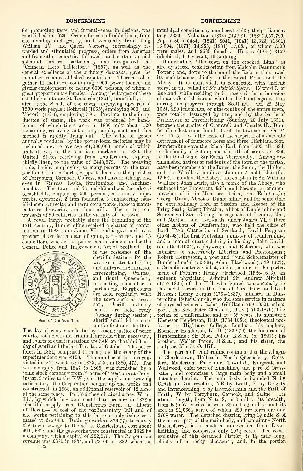
DUNFERMLINE
for promoting taste and inventiveness in designs, wasestablished in 1826. Orders for sets of table-linen, fromthe nobility and gentry, and eventually from KingWilliam IV. and Queen Victoria, increasingly re-
warded and stimulated progress; orders from Americaand from other countries followed ; and certain special
splendid fabrics, particularly one designated the
'Crimean Hero Tablecloth' (1857), as well as the
general excellence of the ordinary damasks, gave the
manufacture an established reputation. There are alto-
gether 11 factories, containing 4000 power looms, andgiving employment to nearly 6000 persons, of whom a
great proportion are females. Among the largest of these
establishments are St Leonards (1851), beautifully situ-
ated at the S side of the town, employing upwards of
1500 work-people ; Bothwell (1865), employing 900 ; andVictoria (1876), employing 750. Previous to the intro-
duction of steam, the work was produced by hand-looms, of which there were in 1880 only about 120remaining, receiving but scanty employment, and this
method is rapidly dying out. The value of goodsannually produced by the power-loom factories may be
reckoned now to average £1,000,000, much of whichfinds its way to the American markets—in 1880, the
United States receiving from Dunfermline exports,
chiefly linen, to the value of £443,879. The weavingtrade, besides employing so many persons in the townitself and in its suburbs, supports looms in the parishes
of Torryburn, Carnock, Culross, and Inverkeithing, andeven in Kinross, Leslie, Strathmiglo, and Auchter-muehty. The town and its neighbourhood has also 5
bleaehfields, employing 500 persons, a tannery, rope-
works, dyeworks, 3 iron foundries, 3 engineering esta-
blishments, fireclay and terra-cotta works, tobacco manu-factories, breweries, and flour-mills. There are, too,
upwards of 20 collieries in the vicinity of the town.
A royal burgh probably since the beginning of the
12th century, Dunfermline received a charter of confir-
mation in 15S8 from James VI., and is governed by a
provost, 4 bailies, a dean of guild, a treasurer, and 15
councillors, who act as police commissioners under the
General Police and Improvem ent Act of Scotland. It
is the residence of the
sheriff-substitute for the
western district of Fife;
and unites with Stirling,Inverkeithing, Culross,
and South Queensferryin sending a member to
parliament. Burgh courtsare held regularly, withthe town-clerk as asses-
sor ; sheriff ordinarycourts are held everyTuesday during session
;
sheriff small-debt courtson the first and the third
Tuesday of every month during session; justice of peace
courts, both civil and criminal, are held when necessary
;
and courts of quarter sessions are held on the third Tues-day of April and the last Tuesday of October. The police
force, in 1881, comprised 11 men ; and the salary of thesuperintendent was £150. The number of persons con-victed in 1874 was 546 ; in 1875, 425 ; in 1880, 473. Thewater supply, from 1847 to 1865, was furnished by ajoint stock company from 37 acres of reservoirs at Craig-luscar, 3 miles to the NW ; but, the supply not provingsatisfactory, the Corporation bought up the works andconstructed, in 1868, an additional reservoir of 12 acresat the same place. In 1876 they obtained a new WaterBill, by which they were enabled to procure in 1878 aplentiful supply from Glensherrup Burn, an affluent
of Devon—the cost of the parliamentary bill and ofthe works pertaining to this latter supply being esti-
mated at £72,000. Drainage works (1876-77), to conveythe town sewage to the sea at Charlestown, cost about£10, 000 ; and the gas-works were constructed in 1829 bya company, with a capital of £22,575. The Corporationrevenue was £870 in 1834, and £8100 in 18S2, when the
432
Seal of Dunfermline.
DUNFERMLINE
municipal constituency numbered 2460 ; the parliamen-tary, 2330. Valuation (1874) £43,281, (1882) £57,790.Pop. (1801) 5484, (1821) 8041, (1841) 13,323, (1861)13,504, (1871) 14,958, (1881) 17,085, of whom 7500were males, and 9585 females. Houses (1881) 3159inhabited, 111 vacant, 19 building.
Dunfermline, 'the town on the crooked Linn,' as
already stated, took its origin from Malcolm Ceannmor'sTower ; and, down to the era of the Reformation, owedits maintenance chiefly to the Royal Palace and theAbbey. It is mentioned, in connection with ancientstory, in the ballad of Sir Patrick Sjjew. Edward I. ofEngland, while residing in it, received the submissionof many Scottish barons who had held out against himduring his progress through Scotland. On 25 May1624, 220 tenements, or nine-tenths of the entire town,were totally destroyed by fire ; and by the battle of
Piteeavie or Inverkeithing (Sunday, 20 July 1651),between the armies of Cromwell and Charles II., Dun-fermline lost some hundreds of its townsmen. On 24Oet. 1715, it was the scene of the surprisal of a Jacobite
detachment of fourscore horse and three Highland foot.
Dunfermline gave the title of Earl, from 1605 till 1694,
to the family of Seton ; and the title of baron, in 1839,
to the third son of Sir Ralph Abercromby. Among dis-
tinguished natives or residents of the town or the parish,
have been members of the Bruce, the Seton, the Halket,and the Wardlaw families ; John or Arnold Blair (flo.
1300), a monk of the Abbey, and chaplain to Sir WilliamWallace ; John Durie, also a monk of the Abbey, whoembraced the Protestant faith and became an eminentpreacher of it in Montrose, Leith, and Edinburgh
;
George Durie, Abbot of Dunfermline, and for some timean extraordinary Lord of Session and Keeper of thePrivy Seal ; Robert Pitcairn, Abbot of Dunfermline andSecretary of State during the regencies of Lennox, Mar,and Morton, and afterwards under James VI. ; three
other Abbots of Dunfermline, who held the office of
Lord High Chancellor of Scotland ; David Ferguson(1534-98), the first Protestant minister of Dunfermline,and a man of great celebrity in his day ; John David-son (1544-1604), a playwright and Reformer, who wasminister at successively Liberton and Prestonpans
;
Robert Henrysoun, a poet and 'guid Scholemaister of
Dunfermline' (1450-99); Adam Blackwood (1539-1623),
a Catholic controversialist, and a senator in the parlia-
ment of Poitiers ; Henry Blackwood (1526-1613), aneminent physician ; Admiral Sir Andrew Mitchell
(1757-1S06) of the Hill, who figured conspicuously in
the naval service in the time of Lord Howe and LordNelson ; Henry Fergus (1764-1837), minister in Dun-fermline Relief Church, who did some service in mattersof physical science ; Robert Gilfillan (179S-1850), minorpoet; the Rev. Peter Chalmers, D.D. (1790-1870), his-
torian of Dunfermline, and for 52 years its minister ;
Ebenezer Henderson, D.D. (17S4-1858), theological pro-
fessor in Highbury College, London ; his nephew,Ebenezer Henderson, LL.D. (1809-79), the historian of
Dunfermline; Sir Noel Paton, R.S.A. (b. 1821); his
brother, Waller Paton, R.S.A. ; and his sister, the
sculptor, Mrs D. O. Hill.
The parish of Dunfermline contains also the villages
of Charlestown, Halbeath, North Queensferry, Cross-
ford, Masterton, Patiemuir, Townhill, Kingseat, andWellwood, chief part of Limekilns, and part of Cross-
gates ; and comprises a large main body and a small
detached district. The main body is bounded N byCleish in Kinross-shire, NE by Beath, E by Dalgetyand Inverkeithing, S by Inverkeithing and the Firth of
Forth, W by Torryburn, Carnock, and Saline. Its
utmost length, from N to S, is 8 miles ; its breadth,
from E to W, varies between 3§ and 5J miles ; and its
area is 21,066| acres, of which 229 are foreshore and
270J water. The detached district, lying If mile S of
the nearest part of the main body, and containing NorthQueensferry, is a modern annexation from Inver-
keithing, and comprises only 197| acres. The coast,
exclusive of this detached district, is If mile long,
chiefly of a rocky character ; and, in the portion
DUNFERMLINE
immediately in front of Broomhall House, rises steeply,
and is covered with fine wood. The detached district
is a peninsula between St Margaret's Hope and Inver-
keithing Bay, projecting to within 3 furlongs of Ineh-garvie island, and rises from its point northward to
a height of 200 feet. The southern division of themain body, with a general ascent from S to N, exhibits,
though nowhere exceeding 253 feet above sea-level,
in most parts, diversities of undulation and acclivity,
and displays over most of its surface rich wealthof both natural feature and artificial culture. Thenorthern division is much more diversified in generalcontour, attaining 449 feet at Baldridge, 529 at Colton,
705 at the Hill of Beatii, 744 at Craigluscar, 746 at DinMoss, 1189 at Knock Hill, 883 at Muirhead, 921 at
Craigencat, and 1014 at Outh Muir—heights that havegenerally a bleak and naked aspect. The islets Long-Craig, Du-Craig, and Bimar lie within the seawardlimits, but are all small and rocky. The only streamsare brooks, the chief of these being Lyne Burn, BaldridgeBurn, and that which runs through Pittencrieff Glen.Town Loch (3x1 furl.), Craigluscar Reservoir (lfxlfurl. ), and Lesser Black Loch (J x \ furl. ), lie within thenorthern division ; Loch Glow (6 x 3 J furl. ) and theGreater Black Loch (2 x § furl.), on the Kinross-shire
border ; whilst on the boundary with Beath is shallowLoch Fitty (1 x J mile). A small mineral spring oc-
curs in the vicinity of Charlestown. The rocks ofthe hills are chiefly eruptive, and throughout great partof the lower grounds belong to the Carboniferoussystem. Trap, sandstone, and limestone are exten-sively worked ; ironstone, chiefly in balls and in thinbands, was formerly worked to the extent of about 4500tons annually ; copper pyrites, in small quantities,
occur in the ironstone ; and coal was mined here prior to
1291, earlier, that is, than in any other place in Britain,
unless it be Tranent. It continues to be turnedout in vast quantities, both for home use and for expor-tation. The soil, in most parts of the southern division,
is a rich brown loam, in other parts of a light natureincumbent on strong clay ; in some portions of thenorthern division is of fair quality, but in others is poorand shallow. Rather less than two-thirds of the entire
area are under cultivation ; about 1100 acres are underwood ; and the rest of the land is either pastoral orwaste. Broomhall, the seat of the Earl of Elgin, is aprominent feature, and has been separately noticed.
Pitreavie, Pittencrieff, Pitfirrane, Garvoch, Craigluscar,Halbeath, Gask, Blackburn, Middlebank.Pitliver, South -
fod, Keirsbeath, Sunnybank, Netherbeath, Northfod,and Balmule are the principal estates ; and most ofthem, as well as some others, are noticed either separ-ately or in other articles. This parish is the seat of apresbytery in the synod of Fife, and is divided ecclesi-
astically into Dunfermline proper, Dunfermline-North,and Dunfermline -St Andrew. The population, in 1881,of Dunfermline proper, was 17,817 ; of Dunfermline-North, 4028 ; of Dunfermline-St Andrew, 4503. Thecharge of Dunfermline proper is collegiate. At Town-hill is an Established chapel of ease (1878) ; and thereare also U.P. churches of Crossgates (1802) and Lime-kilns (1825). Nine public schools, under the landwardboard, with total accommodation for 2318 children,had (1880) an average attendance of 1482, and grantsamounting to £1332 ; and a neat oblong poorhouse, onthe Town Green to the ENE of the burgh, was erectedin 1843 at a cost of £2384, and contains accommoda-tion for 187 pauper inmates. Landward valuation (1866)£40,715, 12s. 10d., (1882) £49,854, Is. 5d. Pop. ofentire parish (1801) 9980, (1831) 17,068, (1861) 21,187,(1871) 23,313, (1881) 26,348.—Ord. Sur., shs. 40, 32,1867-57.
The presbytery of Dunfermline comprises the oldparishes of Aberdour, Beath, Carnock, Culross, Dal-gety, Dunfermline, Inverkeithing, Saline, and Torry-burn, the quoad sacra parishes of Dunfermline-StAndrew, Dunfermline-Korth, and Mossgreen, and thechapelry of Townhill. Pop. (1871) 38,356, (1881)41,510, of whom 5882 were communicants of the Church
28
DUNGLASS
of Scotland in 1878.—The Free Church has also a pres-
bytery of Dunfermline, with 3 churches in Dunfermline,and 8 in respectively Aberdour, Carnock, Culross, Las-sodie, North Queensferry, Saline, Torryburn, and TullLallan, which 11 churches had 2106 communicants in
1S81.—The U.P. Synod likewise has a presbytery of
Dunfermline, with 4 churches in Dunfermline, and 7
in respectively Alloa, Cairneyhill, Crossgates, Inver-
keithing, Kincardine, Limekilns, and Lochgelly, which11 churches had 4363 members in 1880.
See John Fernie's History of the Town and Parish ofDunfermline (Dunf. 1815) ; Andrew Mercer's History ofDunfermline (Dunf. 1828) ; Cosmo Inues' Registrum de
Dunfermelyn (Bannatyne Club, 1842) ; the Rev. PeterChalmers' Historical and Statistical Account of Dunferm-line (2 vols. , Edinb. , 1844-59) ; Dr Ebenezer Henderson'sRoyal Tombs at Dunfermline (Dunf. 1856) ; his Annalsof Dunfermline and Vicinity from 1069 to 1878 (Glasg.
1S79) ; and J. C. R. Buckner's new edition of Clark's
Guide to Dunfermline audits Antiquities (Dunf. 1880).
Dunfermline and Queensferry Railway. See NorthBritish Railway.Dunfermline and Stirling Railway. See North
British Railway.Dunfillan, a verdant conical hill in Comrie parish,
Perthshire, 7 furlongs E by S of the foot of Loch Earn.It rises to a height of 600 feet, and terminates in arock popularly called St Fillan's Chair, whence thesaint whose name it bears is alleged to have bestowedhis benediction on the surrounding country.
Dun Fionn, a vitrified fort in Kiltarlity parish,
Inverness-shire, on a high conical mound above a cliff,
on the S side of the Dhruim, 4j miles WSW of Beauly.It is on the Lovat estate ; and, a number of years ago,
was laid open, by order of the late Lord Lovat, for theinspection of the curious.
Dungavel, a bold, green, double-topped hill (1675feet) in the central part of Wiston and Roberton parish
,
Lanarkshire, overhanging the river Clyde, at the mouthof Roberton Burn, 24 miles S by W of Tinto.
Dungavel, a hill (1502 feet) in Avondale parish,
Lanarkshire, 6 miles SSW of Strathaven.
Dungeon, a lake in the N of Kells parish, Kirkcud-brightshire, 8 miles NW by W of New Galloway.Lying 1025 feet above sea-level, it is | mile long, andfrom | furlong to £ mile wide ; it contains both troutand char ; and it sends off a rivulet to Pulharrow Burn,an affluent of the Ken.—Ord. Sur., sh. 8, 1863.
Dungeon, Dry, Round, and Long Lochs of the, threeneighbouring lakes of W Kirkcudbrightshire, the first
lying on the mutual border of Carsphairn and Minni-gaff parishes, and the two last in the N of Minnigaff.
Their measurements and altitude above sea-level are
—
Dry Loch (lxl furl. ; 1075 feet), Round Loch (2x1furl. ; 910 feet), and Long Loch (2J x 1 furl. ; 900 feet).
Dry Loch, at the 'divide' between the Firth of Clydeand the Solway Firth, sends off its effluence partly
northward by Gala Lane to Loch Doon, partly south-
ward by a burn that traverses the other two to CooranLane, and so to the Dee ; and all three abound in smalltrout.—Ord. Sur., sh. 8, 1863.
Dunglass, a small rocky promontory in Old Kilpatrickparish, Dumbartonshire, 3 furlongs W by S of BowlingBay, and 2!2 miles ESE of Dumbarton. Almost sur-
rounded by the Clyde, it may have been possibly aRoman outpost, but has been wrongly regarded by someantiquaries as the western termination of Antoninus'Wall ; was long a stronghold of the chiefs of the ClanColquhoun, and retains round all its crest loopholed,
ivy-clad ruins of their ancient castle ; and is crowned,on its highest point, by an obelisk, erected in 1839 tothe memory of Henry Bell, the originator of steamnavigation.
Dunglass, a mansion in Oldhamstocks parish, EHaddingtonshire, standing in the midst of a fine park,
f mile inland, and 1J mile NW of Cockburnspath.An elegant edifice, surmounted by a tower, it occu-pies the site of a strong castle of the Lords Home,which, passing, on their forfeiture in 1516, to the
433
DUNGYLE
Douglases, was besieged and destroyed by the
English under the Earl of Northumberland in the
winter of 1532, and again under the Protector Somersetin 1517. It was rebuilt in greater extent and grandeurthan before, and gave accommodation in 1603 to JamesVI. and all his retinue when on his journey to London
;
but, being held in 1640 by a party of Covenantersunder the Earl of Haddington, whom Leslie had left
behind to watch the garrison of Berwick, it was blownup with gunpowder on 30 August. An English page,
according to Scotstarvet, vexed by a taunt against his
countrymen, thrust a red-hot iron into a powder barrel,
and himself was killed, with the Earl and many others.
Dunglass is the seat now of Sir Basil Francis Hall,
seventh Bart, since 1687 (b. 1828; sue. 1876), who holds
SS7 acres in the shire, valued at £2158 per annum.Dunglass was the birthplace of his grandfather, Sir
James Hall (1761-1S32), the distinguished geologist andchemist. A wooded, deep ravine called Dunglass Dean,and traversed by Berwick or Dunglass Burn, extends
4J miles north-north-eastward to the sea, along the
mutual border of Haddington and Berwick shires. It
is spanned by two bridges not far from each other onold and new lines of road, and by an intermediate mag-nificent railway viaduct, whose middle arch is 135 feet
in span, and rises 125 feet from the bed of the stream to
the top of the parapet. With five other arches towardthe ravine's crests, this viaduct is, in itself, an object
of great architectural beauty ; and combines with the
adjacent bridges and with the ravine's features of rock
and wood and water to form an exquisitely striking
scene.—Ord. Sur., sli. 33, 1863.
Dungyle, a green hill (600 feet) in Kelton parish,
Kirkcudbrightshire, near the N base of the Screel, 3jmiles S by E of Castle-Douglas. An ancient Caledonian
circular hill-fort on it has three ramparts of stones
mixed with earth, and measures 117 paces in diameter.
Dungyle, Buteshire. See Dunagoil.Dunhead, an ancient triangular camp or fort in Car-
myllie parish, Forfarshire, on a peninsular eminence at
the junction of the Black Den and the Den of Guyndravines. Probably formed by the Caledonians, and re-
modelled by the Danes, it was defended on two sides
by precipices, and on the third by a rough rampart anda ditch ; and it is now represented by mere vestiges.
Dun-I, an abrupt hill, 327 feet high, in Iona island,
Argyllshire, J mile NNW of the Abbe}'.
Dunian, a lumpish, round-backed, ridgy hill in
Bedrule and Jedburgh parishes, Roxburghshire. It
rises from a base of between 2 and 3 miles in breadth;
extends about 3 miles between the Teviot and the Jeddown to the vicinity of their point of confluence ; bears
most of the town of Jedburgh on its north-eastern skirt
;
attains, on a cap or nodule within Bedrule parish, analtitude of 1095 feet above sea-level ; is traversed over
its back, not far from the crowning cap, by the road
from Jedburgh to Hawick ; and commands, from muchof that road, and especially from its summit, extensive
and splendid views. Its name signifies the ' hill of St
John.'
Dunimarle, an estate in Culross parish, Perthshire,
a little to the W of Culross town. An ancient castle
here was one of the traditional scenes of the murder of
Lady Macduff and her children ; the present mansion is
almost entirely modern, built by the late Mrs SharpeErskine, and containing a good library, with paintings
and other works of art.
Dunino or Denino, a hamlet and a parish in the E of
Fife. The hamlet lies between Cameron and Chesters
Burns, 4J miles SSE of St Andrews, under which it has
a post office.
The parish is bounded N and NE by St Andrews, Eby St Leonards, SE by Crail, S and SW by Carnbee,
and W by Cameron. Irregular in outline, it has anutmost length from N to S of 3 miles, an utmost widthfrom E to W of 2 miles, and an area of 2737J acres, of
which 22f lie detached. The surface is drained byCameron, Wakefield, and Chesters Burns, whose waters
unite in the NE corner of the parish, to flow as Kenlv434
DUNIPACE
Burn toward the sea ; and takes a general south-west-ward rise, from less than 200 to over 500 feet above sea-
level. The rocks belong chiefly to the Carboniferousformation, and coal was at one time extensively mined.Ironstone is not rare, having once been collected fromthe side of one of the brooks to the amount of 40 tons ;
and sandstone of excellent quality is abundant, but hasnot been much quarried. The soil in some parts is
clayey, in others sandy. About 100 acres are underwood. Pittairthie Castle, a roofless ruin in the SW of theparish, is partly very ancient, partly a structure of 1653
;
and in its oldest portion consists of a large square tower,with vaults beneath. Stravithie Castle, another baronialfortalice, a little to the NW of the hamlet, stood entire
about the year 1710, but now has left no traces. DraffanCastle, too, supposed to have been built by the Danes,has completely disappeared. An ancient nunnery stoodon the highest ground in the parish, whence its ruinswere removed in 1815. Three stones, by ChestersBurn, 100 yards W of the church, are supposed to havebeen part of an ancient Caledonian stone circle. TheEev. Charles Rogers, LL.D., antiquary, was born at
the manse in 1825 ; and Win. Tennant, author of
Aiistcr Fair, was parish schoolmaster (1813-16).
Dunino is in the presbytery of St Andrews and synodof Fife ; the living is wortli £300. The parish church,a Gothic building of 1826, contains 230 sittings ; anda public school, with accommodation for 92 children,
had (1880) an average attendance of 79, and a grant of
£53, lis. Valuation (1882) £4213, 18s. 7d. Pop.(1801) 326, (1831) 383, (1861) 370, (1871) 325, (1881)415.—Ord. Sur., sh. 41, 1857.
Dunipace, a village and a parish of E Stirlingshire.
The village, called the Milton of Dunipace, stands onthe left bank of the river Carron, opposite the town of
Denny, with which it is connected by a bridge, andwith which it has formed a police burgh since 1876 ;
and is itself a considerable place, sharing in Denny'sindustries. Pop. (1881) 1258.
The parish, containing also the village of Torwood,took its name from two famous mounds, to be after-
wards noticed ; and, anciently a chapelry of Cam-buskenneth, acquired parochial status at the Refor-
mation. In 1624 it was united on equal terms to Lar-
bert, and came in course of time to be considered as
subordinate to, or as absorbed into, it ; but since
the passing of the Poor-law Act (1834) has again beentreated, in various respects both civil and ecclesiastical,
as a distinct or separate parish. It is bounded W andN by St Ninians, E by Larbert, SE by Falkirk, and Sand SW by Denny. Its utmost length, from E to W, is
5J miles ; its breadth, from N to S, varies between §mile and 3-J miles ; and its area is 5629 acres, of which43 are water. The Carron winds 5J miles east-south-
eastward on or close to the Denny border, then 1 mile
eastward through the south-eastern interior, here being
joined by Bonny Water, which for the last 1| mile of
its crooked east-north-easterly course roughly traces
most of the boundary with Falkirk. The eastern dis-
trict is part of the Carse of Stirling, and sinks to less
than 100 feet above sea-level ; thence the surface rises
to 206 feet near Househill, 250 near Doghillock, 354 in
the Tor Wood, 496 near Rullie, and 846 near Buckie-
side, at the north-western extremity of the parish.
Trap rock prevails over about one-third of the area, andsandstone over the other two-thirds ; the latter is parti}'
capital building material, partly of a character well
suited for flag or pavement. The soil ranges from moorish
earth to argillaceous alluvium, but for the most part is
extremely fertile. Of the entire area, 3800 acres are in
tillage, 986 pasture, 300 waste, and 500 under wood.
Mining has fallen off of recent years, but Dunipace finds
an outlet for its labour in the neighbouring industries
of Denny parish. Torwood Castle is a venerable ruin,
and, with the remnant of Torwood Forest, is separately
noticed. Herbertshire Castle is a very ancient mansion,
standing amid finely-wooded grounds ; originally a royal
hunting-seat, it passed in the 1 5th century to the Earls
of Orkney, in the 16th to the Earls of Linlithgow
:
DUNIPHAIL
md, coming afterwards to the Stirlings and the More-
heads, was sold in 1S35 to Forbes of Callendar. Car-
brook House, too, occupies a romantic site, amid well-
wooded grounds, within half a mile of Torwood Castle;
whilst Dunipace House and Quarter House are elegant
modern mansions. Dunipace mounds, or the ' Hills of
Dunipace,' whence the parish derived its name, are
situated on a small plain adjacent to the Carron, 2 miles
ESE of Milton village ; and, covering 2 Scotch acres,
rise to a height of 60 feet. According to GeorgeBuchanan, they were raised to commemorate a treaty
of peace between some Caledonian king and the RomanEmperor Severus (hence their name Dimi Pads, ' hills
of the peace'!); according to Dr Hill Burton, they
are ' evidently residuary masses left by retreated waters,
in which they have made shallows or islands. This
will account for their form without the necessity of
supposing that they were ever rounded by art. If
analogy did not support this view, it would be strength-
ened by the incident of a third hill in the same place
having been levelled about 1835, and showing complete
internal evidence of natural formation.' Some finely-
preserved Roman utensils, one of them of a unicpue
kind, have been discovered near Dunipace village
;
and, in result of a search instigated by the discovery
of these relics, distinct vestiges of a previously un-
noticed Roman camp were found in a neighbouringwood. Forbes of Callendar and Harvie-Brown of
Quarter are the chief proprietors, 2 others holding
each an annual value of £500 and upwards, 12 of be-
tween £100 and £500, 9 of from £50 to £100, and 13
of from £20 to £50. In the presbytery of Stirling
and synod of Perth and Stirling, this parish forms a
joint charge with Larbert, the stipend and allowance
for communion elements amounting to £404. Theplain old parish church, whose graveyard is still in
use, stood within a few yards of the Hills of Dunipace;
the present one, on a knoll 1^ mile to the WNW, is a
Gothic edifice, built in 1834 at a cost of £2500, andcontaining 604 sittings. There is also a Free church
;
and two public schools, Dunipace and Torwood, withrespective accommodation for 300 and 60 children, had(1880) an average attendance of 155 and 31, and grants
of£130, 18s. 6d. and £23, 4s. Valuation (1882) £10,761,18s. 10d., including £1032 for railway. Pop. (1801)
948, (1841) 1578, (1861) 1731, (1871) 1733, (1881)1875.—Orel. Sur., sh. 31, 1867.
Duniphail or Dunphail, an estate in Edinkillie parish,
Elginshire, with a station of its own name on the High-land railway, near the right bank of the Divie, 1J mile
SSE of its influx to the Findhorn river, and 8J miles
S by W of Forres. The estate, extending southwardfrom the station to nearly the source of the Divie, be-
longed anciently to the Coinyns, and, after passing suc-
cessively to the families of Dunbar and Cumming-Bruce,came by marriage in 1864 to Thomas-John Hovell-Thurlow, who, born in 1838, in 1874 succeeded his
brother as fifth Baron Thurlow (ere. 1792), and in thesame year assumed the additional surnames of Cumming-Bruce. He owns 10,518 acres in the shire, valued at
£11S2 per annum. Dunphail Castle, which crowns a
green conical hill, three-fourths engirt by a narrowravine, supposed to have been at one time the channelof the Divie, was vainly besieged in the beginning of the14th century by Randolph, Earl of Moray, after the' Battle of the Lost Standard, ' and is now a fragmentaryruin. The present mansion, erected in 1828-29, fromdesigns by Playfair, of Edinburgh, and considerablyenlarged in 1842, is a splendid edifice in the Venetianstyle, with very beautiful grounds. It was built on a
terrace 26 feet above and 200 yards distant from theDivie ; but in the great flood of 3 and 4 Aug. 1829 it
was all but destroyed by that impetuous stream, thebank falling in within one yard of the foundation of theE tower.—Orel. Sur., sh. 84, 1876. See Divie.
Dunira, a fine modern mansion in Connie parish,
Perthshire, 2| miles E of St Fillans, and 3 WNW of
Connie. From its wooded hill-side it commands a mag-nificent view of Strathearn ; it was the favourite resid-
DUNKELD
ence of that unfortunate statesman, Henry Dundas, first
Viscount Melville (1742-1S11) ; and it now is a seat of
Sir Sidney James Dundas of Beechwood, who holds in
Perthshire 5529 acres, valued at £2725 per annum.Dunkeld (Celt, dun-calden, 'fort of the Keledei' or
Culdees), a small but very interesting town of Strathtay,Perthshire, partly in the parish of Caputh, partly inthat of Dunkeld and Dowally. A burgh of barony, it
stands 216 feet above sea-level, on the left bank of theTay, which here receives the Bran, and here is spannedby a magnificent bridge, leading 1 mile south-south-eastward to Bihnam village and Dunkeld station on theHighland railway (1856-63), this being 80J miles S byE of Grantown, 8J NW of Stanley Junction, 15J NNWof Perth, 61J NNW of Edinburgh, and 77J NE by N ofGlasgow. The town lies low, deep sunk among woodedheights—behind it, Newtyle (996 feet) and Craigiebarns
(900) ; and opposite, with the broad deep river between,Craig Vinean (1247) and Birnam Hill (1324). Gray, indescribing the approach to it, speaks of the rapid Tay,seeming to issue out of woods thick and tall, that rise
upon either hand ; above them, to the W, the tops of
higher mountains ; down by the river-side under thethickest shades, the town ; in its midst a ruined cathe-
dral, the tower and shell still entire ; and a little be-yond, the Duke of Athole's mansion. Dunkeld is,
indeed, the portal of the Grampian barrier ; and its
environs offer an exquisite blending of all that is mostadmired in the Highlands with one of the richest mar-gins of the Lowlands.About 815, or nine years after the slaughter of the
monks of Iona by Vikings, Constantin, King of thePicts, founded the Culdee church of Dunkeld, as seat of
the Columban supremacy in Scotland ; wdiich churchwas either completed or refounded by Kenneth macAlpin, who in 850 translated to it a portion of StColumba's relics. So richly does Kenneth seem tohave endowed this church, that, prior to 860 its wealthexposed it to pillage by the Danes, under the leadershipof Ragnar Lodbroc. The first of its bishops was also
first bishop of the Pictish kingdom, the Bishop of Fort-ronn ; but at his death in 865 the primacy was transferred
to Aberuethy, since the second abbot is styled merely' princeps ' or superior, and may have been either a cleric
or a layman. Lay abbots certainly, and probablyhereditary, were Duncan, who fell in battle at Drum-crub (965), and Crinan, who was son-in-law to MalcolmII. of Scotia, and father of the 'gracious Duncan,' andwho, says Dr Skene, ' was in reality a great secular chief,
occupying a position in power and influence not inferior
to that of any of the native Mormaers.' During histime the abbey itself appears to have come to an end,
for in 1027 Dunkeld was ' entirely burnt. ' The bishopricwas revived in 1107 by Alexander I. , among its thirty-
seven holders were Brace's ' own bishop, ' William Sin-
clair (ob. 1338), and Gawin Douglas (1474-1522), thetranslator of Virgil's Aeneid. Once and once only Dun-keld has figured markedly in history, when on 21 Aug.1689, twenty-five days after Killiecrankie, the cathedral,
Dunkeld House, and the walls of its park were success-
fully held against 5000 Highlanders by the new-formedCameronian regiment, 1200 strong, under Lieut. -Col.
William Cleland, the same young poet Covenanter bywhom, ten years before, Drumclog had been mainlywon. He now fell early in the siege, which was main-tained from early morn till close on midnight ; but hismen withstood stubbornly every wild onslaught of themountaineers, and, being galled by musketry from thetown, sent out a party with blazing faggots, fastened to
long pikes. They fired the dry thatch, and burnedevery house save three ; nay, some of the zealots withcalm ferocity turned the keys in the locks, and left theunhappy marksmen to their doom. At length, wornout, the Highlanders retreated, wdrereon the Cameronians' gave a great shout and threw their caps in the air, andthen all joined in offering up praises to God for somiraculous a victory. ' So ended this conflict betweenthe ' Hillmcn ' and the Mountaineers, which, trifling as
it may seem, had all the effect of a decisive battle in
435
DUNKELD
crushing the hopes of James VII. 's Scottish adherents
(vii. 385-390 of Hill Burton's Hist. Scotl., ed. 1876).
In olden times Dunkeld received many a visit fromroyalty, on its way to hunt in Glen Tilt—from Williamthe Lyon in the latter half of the 12th century, fromJames V. in 1529, and from Queen Mary in 1564. AndQueen Victoria, three times at any rate, has driven
through the town. First, with Prince Albert, on 7
Sept. 1842, when 500 Athole men escorted her from thetriumphal arch to the luncheon tent in the midst of anencampment of 1000 Highlanders. There she was wel-
comed by the late Duke of Athole (then Lord Glenlyon),who, through over-fatigue, had suddenly become quite
blind ; and there she beheld a sword-dance. Next, withPrince Albert still, on 11 Sept. 1844, when they 'gotout at an inn, which was small, but very clean, to letVicky have some broth ; and Vicky stood and bowed to
the people out of the window.' Thirdly, incognita,
with the Dowager Duchess of Athole, on 3 Oct. 1865.
Nor have other illustrious visitors been rare—the poetGray (1766), Robert Burns (1787), Wordsworth (1803),
etc., etc., etc.
The pretty village of Birnam, which has been sepa-
rately noticed, is connected with the town by Telford's
noble stone bridge erected in 1805-9 at a cost of £33,978,of which £7027 was advanced by the commissioners of
Highland roads, £18,000 borrowed on the security of thetolls, and the rest defrayed by the Duke of Athole. Mea-suring 685 feet in length, 26J in width, and 54 in height,
it has seven arches—the middle one 90, two others each
84, two others each 74, and the two land-arches each 20,
feet in span. The pontage was abolished in 1879. Thetown is laid out in the form of a cross ; and, as ap-
proached from the right side of the Tay, is not seen in
its full extent till one reaches the middle of the bridge.
The street leading from the bridge was commenced in
1808, along a new reach of the Great North Road, fromPerth to Inverness, by way of the bridge, and wasdesigned to be a sort of new town, more elegant thanthe old ; at the lower or bridge end stand the AtholeArms and the Free church, at the upper the RoyalHotel and the City Hall. The street at right angles to
it comprises most of the old town, as reconstructed after
the siege of 1689, and with a single exception consists
of houses later than that date. The one exception is
the ancient deanery, standing not far from the choir
of the cathedral, and characterised by great thicknessof wall.
The cathedral stands by the river side, at the W endof the old street, a little apart from the town, and onone side is shaded by trees, on the other bordered by a
flower garden. It comprises a seven-bayed nave (1406-
65), 122 feet long by 38 feet wide, and 40 high to thespring of the roof, with side aisles 12 feet wide , a four-
bayed aisleless choir (1318-1400), 104 by 27 feet ; a rec-
tangular chapter-house (1457-65), on the N side of thechoir; and a massive north-western tower (1469-1501),24 feet square, and 96 feet high. All are Second Pointedin style, except the choir, which retains some scantyportions of First Pointed work, and is the only part notruinous. Not long had the belfry been finished, when,on 12 Aug. 1560, Argyll and Ruthven required theLairds of Airntully and Kinvaid ' to pass incontinent to
the Kirk of Dunkeld, and tak doun the haill imagesthereof, and bring furth to the kirkyard, and burnthem openly. And siclyke cast doun the altars,
and purge the kirk of all kinds of monuments of
idolatry ; and this ye fail not to do, as ye will do ussingular empleasure, and so commits to the protection
of God. Fail not but ye tak good heid that neither thedesks, windocks, nor doors be onyways hurt or broken,either glassin work or iron work. ' The tenderness of
the closing injunction would seem to have been neglected,
since the roofs were included in the demolition ; andnot until 1600 was the choir re-roofed to serve as theparish church. Such it is still, and Dorothy Words-worth describes the ruin in 1803 as ' greatly injured bybeing made the nest of a modern Scotch kirk with sashwindows, very incongruous with the noble antique
436
DUNKELD
tower ;
' but in 1815 Government gave £990 and theDuke of Athole £4410 towards its renovation, and it
now contains 655 sittings. In the nave may benoticed abundant features of the French Flamboyant.The great W window, for instance, so far as can bajudged from the remaining fragments of its tracery,
appears to have been designed on a peculiarly florid
pattern, and so deflects from the vertical line of thegable, as to give space for a smaller circular windowwith double spiral mullions, above which is a foliated
cross, still quite entire. The windows of the side aisles
are very beautiful, and present no fewer than eightdistinct patterns of tracery. The massive round piers
dividing the side aisles from the nave are 10 feet high tothe capital and 13J in circumference, and out of Scot-land might almost be taken for Romanesque. Thearches between them, however, are unmistakablySecond Pointed, with fluted soffits. The triforinm con-sists of plain semicircular arches, divided by mullionsinto two lights, with a trefoil between ; and the clere-
story likewise consists of two-light windows, with tre-
foil heads and quatrefoil interval. Buttresses project
between the windows, and are surmounted in the choirportion by crocketed pinnacles. An octangular turret,
resembling a watch tower, at the south-western angle of
the nave, terminates in a small parapeted gallery,
supported on a rose carved moulding, and takes up astaircase, communicating by an ambulatory with themain tower, in which hang four bells. An elaborately
sculptured monument of Bishop Robert Cardeny (1436),comprising a statue of him in his robes, beneath acrocketed canopy, is in the S aisle of the nave ; astatue of Bishop William Sinclair (1338) is in the Naisle ; a gigantic stone effigy of Alexander Stewart, Earlof Buchan, the ' Wolf of Badenoch ' (1394), arrayed in
panoply of mail, is in the spacious vestibule of thechoir, where also a Gothic mural tablet was erected in
1872 to the memory of the officers and men of the 42dHighlanders who fell in the Crimean War and IndianMutiny. The upper part of it contains a sculptured
froup, in high relief, representing a scene on a battle-
eld, all in pure white marble from the chisel of Sir
John Steell, of Edinburgh. The chapter-house, adjoiningthe N side of the choir, is still entire ; is lighted by four
tall lancet windows, with trefoil heads, and, serving as
the burying place of the ducal line, contains a fine
marble statue of the fourth Duke of Athole (1833), withmonuments of other members of the family.
The episcopal palace, a little S\V of the cathedral,
consisted of several long two-story houses, with thatchedroofs, till in 1408 it was superseded by a strong castle,
rendered necessary by frequent annoyance from High-land caterans ; and, though now long extinct, hasbequeathed to its site the name of Castle Close. Thebishops made a great figure in their day. They had four
palaces, at Dunkeld, Clunie, Perth, and Edinburgh,and got their lands S of the Forth erected into the
barony of Aberlady, and those in the N into the
barony of Dunkeld, which latter extended, not onlyaround the town but continuously, with considerable
breadth, for a distance of 7 miles to the palace of Clunie.
A hill on which the bishops hanged many a freebooter
rises close to the second lodge of the ducal grounds, andto the rear is a hollow in which many persons accused of
witchcraft were burned at the stake. An ancient chapel,
on ground now occupied by Athole Street, was built
about 1420 by Bishop Cardeny, who endowed it with the
rents of the lands of Mucklarie, eventually transferred to
the rector of the grammar school. Another ancient
chapel stood on Hillhead to the E of the town ; waserected principally for the inhabitants of Fungarth ; is
now represented by only an enclosure wall around its
site ; and, having been dedicated to St Jerome, has
bequeathed to the people of Fungarth the ludicrous
nickname of ' Jorums.
'
Dunkeld House, the modest seat of the Dukes of
Athole, is a plain square mansion of the 17th century,
behind the cathedral. A new palace, a little to the W,beside the Tay, was founded by the fourth Duke, who
DUNKELD
left it unfinished at his death in 1830. Planned on a
sumptuous scale, this promised to form a magnificent
Gothic edifice ; but the site did not please the next
Duke, so two stories only were nearly finished, with a
gallery 96 feet long, a private chapel, a spacious stair-
case, and many fine mullioned windows. The whole,
after Hopper's designs, would have cost £200,000, of
which £30,000 was actually expended. The grounds con-
nected with Dunkeld House are of great extent, and,
highly improved by the sixth Duke of Athole, who died
in 1861, are surpassingly rich in features of natural andartificial beauty, including a home-farm, extensive gar-
dens with vineries and greenhouses, an ' Americangarden,' 50 miles of walks and terraces, 30 miles of
carriage-drives, the Rumbling-Bridge, the Falls of Bran,
Ossian's Hall, etc. Plantations alone cover 18,500 acres,
of larch principally, which is commonly said to have here
been introduced to Scotland—a claim disputed, underdate 1725, by Dawick in Peeblesshire. Anyhow, ' it
was in 1738 that Mr Menzies of Meggernie broughtsmall plants of the tree from London, and left five at
Dunkeld and eleven at Blair, as presents to the Dukeof Athole. These sixteen plants no doubt formed the
source whence sprang the great proportion of the larch
plantations throughout Scotland during last and the
early part of the present century. . . . The entire
area under larch in the Athole forest is stated at 10,324
acres, and the trees originally planted on it at 14,096, 719.
. . . Of the five planted in 173S, two were cut in
1809 ; one of them contained 147, and the other 168,
cubic feet of timber ; and they were sold at 3s. per cubic
foot. . . . The two remaining ones of the five are
still in a growing condition, and though they have begunto show signs of decay, they might yet survive manyyears. In 1831 their girth at 4 feet from the groundwas 12 and 11 feet; in 1867, 16| and 14f ('Larch
Forests,' in Tram. Sight and Ag. Soc, 1869). Besides
these 'Mother Larches,' there are two oaks, two beeches,
and a sycamore, whose huge dimensions are recorded in
the same Transactions for 1880-81.
The old town cross, about 20 feet high, with four iron
jougs attached to it, was removed about the beginning
of the present century ; in 1S66 a fountain was erected
by public subscription on its site to the memory of the
sixth Duke. In 1877 a substantial City Hall was built
at a cost of £1500 ; and Dunkeld has besides a post
office, with money order, savings' bank, insurance, andtelegraph departments, branches of the Bank of Scot-
land and the Union Bank, a local savings' bank, 5 in-
surance agencies, 2 hotels and 2 inns, a public library,
gas-works (1851), a good water-supply (1866), 2 masonic
lodges, a Good Templars' lodge, curling and cricket clubs,
a horticultural and poultry association (1869), a rose asso-
ciation (1873), a young men's Christian association, etc.
Saturday is market-day ; and fairs are held on 13 Feb.,
5 April, 20 June (St Columba's), and the second Tuesdayin November (cattle and horses), but they have dwindledgreatly in importance. Nor are there any manufactures,
the liuen industry having been long extinct. Places of
worship, other than the Cathedral, are an Independentchapel(1800 ; 310 sittings)and the new Free chureh(1874-75 ; 1000 sittings). The latter, which cost above £3000,presents a large gable frontage, with a tower uponeither side, of which the western terminates in a slated
spire, 85 feet high. The interior is adorned witha stained-glass memorial window to Fox-Maule Ramsay,eleventh Earl of Dalhousie, who laid the foundation
stone. The royal grammar school was founded in
1567, the Duchess of Athole's girls' industrial school
in 1853. St George's Hospital, endowed by BishopGeorge Brown in 1510 for seven old bedesmen, wassucceeded by small cottages after the siege of 1689, and,
through the loss of its charter, was stripped of mostof its property about 1S25. The town is governed by a
baron bailie, under the Duke of Athole, having neveravailed itself of Queen Anne's charter of 1704 erecting it
into a royal burgh. Pop. (1831) 1471, (1841) 1094,
(1851) 1104, (1861) 929, (1871), 783, (1881) 768.—Orel.
Sur., shs. 48, 47, 1868-69.
DUNKELD AND DOWALLY
Dunkeld is the seat of a presbytery in the synod of
Perth and Stirling, which meets on the last Tuesday of
every second month, and comprises the old parishes of
Auchtergaven, Blair Athole, Caputh, Cargill, Clunie,
Dunkeld and Dowally, Little Dunkeld, Kinclaven, Kirk-michael, Lethendy and Kinloch, Moulin, and Rattray,with the quoad sacra parishes of Glenshee and Tenandry.Pop. (1871) 17,750, (1881) 17,030, of whom 3825 werecommunicants of the Church of Scotland in 1878.
—
There is also a Free Church presbytery of Dunkeld, withchurches of Auchtergaven, Blair Athole, Bnrrelton,Cargill, Clunie, Dalguise and Strathbran, Dunkeld,Kirkmichael, Lethendy, Moulin, and Struan, whichtogether had 1548 communicants in 1881.
See Canon Alexander Myln's Vitce Dunkeldcnsis Eccle-
sice Episcoiporum (edited for Bannatyne Club by T.Thomson, 1823-31) ; vol. ii. of Billings' Baronial andEcclesiastical Antiquities of Scotland (1852) ; Dunkeld,its Stratlis and Glens (new ed., Dunkeld, 1879); andpp. 149-162 of Dr "William Marshall's Historic Scenes inPerthshire (1880).
Dunkeld and Dowally, a Strathtay united parish of
central Perthshire, containing the villages of Dowallyand Kindallaohan, and also part of the town of Dun-keld, which part, however, lies detached from the mainbody, a little to the SE. Bounded N by Logierait, Eby Clunie and Caputh, and S and "W by Little Dunkeld,it has an utmost length from N to S of 6J miles, a vary-ing breadth from E to W of | mile and 4J miles, and anarea of 9825J acres, of which only 18J belong to theDunkeld portion. The remaining 9807£ acres belong-ing to Dowally include 369 of water, and comprise adetached section, the barony of Dalcapon, which, lyingmainly on the left bank of the Tummel, 1J mile N of
Ballinluig Junction, and surrounded on three sides byLogierait, has a length from SW to NE of 4 miles, witha varying width of 1\ and 7 furlongs. The Tay flows
6£ miles south-south-eastward along all the boundarywith Little Dunkeld, and receives Kindallachan andDowally Burns from the interior. In the interior, too,
are Loch Oedie (5 x 3J furl.), Lochan na Beinne (lj x jfurl.), St Colme's Loch (2x1 furl.), and Dowally Loch(lfxf furl. ), whilst at the meeting-point of Logierait,
Moulin, and the Dalcapon section lies Loch Broom (5Jx 2 furl. ). Along the Tay the surface declines to less
than 200 feet above sea-level, thence rising eastward to
1440 feet near Lochan na Beinne and 1622 at ChapelHill. Dorothy "Wordsworth has left us her impres-sion of this parish, through which she drove with herbrother on 8 Sept. 1804 :
—' We travelled down the
Tummel till it is lost in the Tay, and then, in thesame direction, continued our course along the vale
of the Tay, which is very wide for a considerableway, but gradually narrows, and the river, alwaysa fine stream, assumes more dignity and importance.Two or three miles before we reached Dunkeld, weobserved whole hill-sides, the property of the Duke ofAthole, planted with fir trees till they are lost amongthe rocks near the tops of the hills. In forty or fifty
years these plantations will be very fine '—a prediction
abundantly verified, woods, mostly of larch, now cloth-
ing the entire parish, with the exception of barely one-fortieth in pasture and little more than a tenth undercrops. The Queen, too, remarks in her Journal on thebeautiful windings of the Tay and the richly-woodedheight, rocky and pyramidal, of Craigiebarns. A large
white building, St Colme's, 7 furlongs SSE of Dowallyand 4 miles NNW of Dunkeld, is the model farm of theDowager Duchess of Athole ; and the Duke of Athole is
the sole proprietor. This parish is in the presbytery ofDunkeld and synod of Perth and Stirling ; the living is
worth £232. The churches are noticed under Dowallyand Dunkeld ; and Dowally public, Dunkeld Duchess of
Athole's, and Dunkeld Royal schools, with respectiveaccommodation for 107, 135, and 151 children, had (1880)an average attendance of 42, 85, and 58, and grants of
£48, 17s., £86, 5s. 6d., and £54, Is. Valuation (1882)£3356, 10s. 8d. Pop. of parish (1801) 1857, (1831) 2037,(1841) 1752, (1861) 971, (1871) 839; of Dunkeld regis-
437
DUNKELD AND PERTH RAILWAY
tration district (1871) 881, (1881) 882.—OrcZ. Sur., shs.
55, 56, 47, 1869-70.
Dunkeld and Perth Railway. See Highland Rail-way.
Dunkeld, Little, a Strathtay parish of central Perth-
shire, containing the villages of Birnam, Inver, Dal-
guise, and Balnaguard, with the stations of Murthly,Dunkeld, and Dalguise. It is bounded N by Logierait,
NE by Dunkeld-Dowally and Caputh, E by Kinclaven,
S by Aucktergaven, the Tullybeagles section of Methven,the Logiealmond section of Monzie, and Fowlis Wester,W by Dull and a fragment of Weem. Its utmostlength, from N to S, is 11J miles ; its width varies be-
tween 2§ and 14| miles, the latter measured fromW byNto E by S, viz. , from Loch Fender to the Tay near Murthlystation ; and its area is 41, 941! acres, of which 872J are
water. The Tay sweeps 17f miles east-south-eastward,
southward, and east-south-eastward again, along all the
boundary with Logierait, Dunkeld-Dowally, and Ca-
puth ; its affluent, the Bran, from 9 furlongs below its
exit from Loch Freuchie, winds 12J miles east-north-
eastward, partly along the southern border, but mainlythrough the interior. Loch Skiach (6 x 3J furl. ) andLittle Loch Skiach (2J x 1J furl.) lie towards the middleof the parish ; and on its western border are LochsCreagh (If x | furl. ) and Fender (2| x 2 furl. ). In thefurthest E the surface sinks along the Tay to less than•200 feet above sea-level, thence rising westward andnorth-westward to Kingswood (451 feet), Birnam Hill
(1324), Little Trochrie Hill (1199), Creag Liath
(1399), Airlich (1026), Meikle Crochan (1915), CraigVinean (1247), Druim Mor (1203), Meall Mor (1512),
Craig Hulich (1809), Meall Dearg (2258), CreagMhor (1612), Creag an Eunaich (1506), Meall Reamhar(1659), Elrick More (1693), Craig Lochie (1700),and Creag Maoiseach (1387), where the eleven last
are all to the N of the Bran. Roofing-slate, of
excellent quality and of a deep-blue hue, has been quar-ried on Birnam Hill, and fine-grained sandstone nearMurthly, while potters-clay occurs in Strathbran. Thesoil is black loam throughout most of the eastern valley,
on the other arable lands is partly black mould, partly
a mixture of sand and gravel, and on the hills is verypoor. Nearly three-sevenths of the entire area are
regularly or occasionally in tillage, less than a fifth is
pastoral, about one-thirteenth is under wood, and all
the remainder is waste. A considerable though ever
lessening number of cairns, stone circles, and hill-forts
make up the antiquities, with ' Duncan's Camp ' uponBirnam Hill, the ruins of Trochrie Castle, an old bridge
across the Bran a little higher up, and a memorial stoneat Ballinloan that marks the meeting-place of feudal
courts. In the days of Bishop James Bruce, about themiddle of the 15th century, this parish suffered severely
from the raids of Robert Reoch Macdonnochie ; and at
some period unknown to record its church and its
clergy would seem to have fared but poorly at the handsof its own parishioners. For
—
1 Oh ! sic a parish, oh ! sic a parish !
Oh ! sic a parish is Little Dunkcl1
!
Theyhae hangit the minister, droun'd the precentor,Dung doun the steeple, an' fuddl'd the bell.'
Thanks to the beauty of its scenery, Little Dunkeld hasmany interesting memories of visits from illustrious per-
sonages—the poets Gray and Wordsworth, the Queenand Prince Consort, Millais the painter, and others.
Perhaps the most interesting of all is that thus noted in
Burns's Highland Tour .-—' 30 Aug. 1787. Walk withMrs Stewart and Beard to Birnam top—fine prospectdown Tay—Craigiebarns hills—Hermitage on the Bran,with a picture of Ossian—breakfast with Dr Stewart
—
Neil Gow plays—a short, stout-built, honest, Highlandfigure, with his greyish hair shed on his honest social
brow—an interesting face, marking strong sense, kindopenheartedness, mixed with unmistrusting simplicity
—
visit his house—Marget Gow.' Neil Gow (1727-1807)was born at Inver ; so was his son, Nathaniel (1766-
1831), who was himself a masterly violinist. The prin-
cipal mansions are Murthly Castle, Dalguise House,438
DTJNLOP
Kinnaird House, Kinloeh Lodge, Torwood, St Mary'sTower, and Erigmore ; and 6 heritors hold each an annualvalue of £500 and upwards, 7 feuars of between £100and £500, 9 of from £50 to £100, and 7 of from £20 to
£50. Giving off portions to the quoad sacra parishes of
Amulree and Logiealmond, Little Dunkeld is in thepresbytery of Dunkeld and synod of Perth and Stirling
;
the living is worth £358. There are two churches—theone, by the Tay, nearly opposite Dunkeld, built in
1798, and containing 820 sittings ; the other, in Strath-
bran, near Rumbling- Bridge, 3 miles to the WSW,rebuilt in 1851, and containing^ 250. There is also aFree church of Strathbran and Dalguise, standing nearTrochrie, 4 miles WSW of Dunkeld ; and the five
schools of Drumour, Little Dunkeld, Murthly, Balna-guard, and Dalguise, with respective accommodation for
67, 200, 88, 37, and 56 children, had (1880) an averageattendance of 46, 137, 59, 27, and 56, andgrants of £37,14s., £144, 5s. 6d., £57, lis. 6d., £37, 3s., and £52,17s. Valuation (1843) £8960, 6s. 10d., (1882) £20,209,6s. lid. Pop. of parish (1801) 2977, (1831) 2S67, (1861)
2104, (1871) 2373 ; of registration district (1871) 2352,
(1881) 2149.—Ord. Sur., shs. 47, 48, 55, 1S68-69.
Dunkenny, an estate, with a mansion, in Eassie andNevay parish, Forfarshire, 2 miles WSW of Glamisstation. Its owner, John Ramsay L'Amy, Esq. (b. 1813;
sue. 1854), holds 475 acres in the shire, valued at £700per annum.
Dunlappie, an ancient parish in the N of Forfarshire,
united in 1612 to Stracathro. It forms the north-
western district of the present Stracathro parish ; takes
its name from the two words Dun and Lappie, signifying
a ' hill ' and ' water ;' and consists partly of Lundie
Hill (800 feet), with West Water flowing around much of
the hill's base, and partly of lower grounds traversed bynumerous streamlets.
Dun Leacainn, a massive hill (1173 feet) in Inverary
parish, Argyllshire, rising from the margin of LochFyne to the NE of Furnace village, 8 miles SW of
Inverary town. A granite quarry, furnishing stones of
fine grain and colour for exportation, is worked in a
spur of the hill, and was the scene of a stupendous blast
in Oct. 1871, when 4 tons of gunpowder, deposited in a
deep boring, the result of more than a twelvemonth's
operation, exploded with a muffled roar, and with a
slight upheaval of the hill-front ; and tore into pieces,
ready for working to the desired size, many thousandtons of the solid rock.
Dunliath, an old Scandinavian fort in Kilmuir parish,
Isle of Skye, Inverness-shire.
Dunlichity, an ancient parish of NE Inverness-shire,
united in 1618 to Daviot, and lying along Strathnairn
to the SW of Daviot. It takes its name, originally
Dunlecatii, and signifying ' the hill of the Catti, ' froma hill adjacent to its church ; it forms the larger portion
of the united parish of Daviot and Dunlichity ; and it
still has a church of its own, rebuilt in 1758, and con-
taining 300 sittings. The Catti, whose territory lay in
and around it, were the ancestors of the Clan Chattan,
comprising Macintoshes, MacPhersons, Davidsons,
MacGillivrays, MacBeans, VicGovies, Gows or Smiths,
and others, all followers of Macintosh of Macintosh.
Dunlop, a village in the N of Cnnninghame district,
Ayrshire, and a parish partly also in Renfrewshire. Thevillage, standing on the right bank of Glazert Burn, has
a post and telegraph office, a branch of the Clydesdale
Bank, and a station on the Glasgow, Barrhead, and Kil-
marnock Joint railway, 2§ miles NNW of Stewarton, 7JNNW of Kilmarnock, and 16 SW of Glasgow ; fairs are
held at it on the second Friday of May, o. s., and 12
Nov. Pop. (1861) 330, (1871) 380, (1881) 357.
The parish, containing also Lugton Junction, 2J miles
N of Dunlop and 5^ E by S of Beith, is bounded N andNE by Neilston, SE and S by Stewarton, and NW byBeith. Its utmost length, from NE to SW, is 5J miles
;
its breadth, from NW to SE, varies between 3i furlongs
and 2J miles ; and its area is 7181J acres, of which 1101
belong to Renfrewshire, and 2 are water. Three streams
all run south-westward, on their ultimate way to the
DUNLOSKIN
Irvine
—
Lugton Water along the boundary with Beith,
Corsehill Burn along that with Stewarton, and GlazertBurn right through the interior ; Halket Loch, covering9 or 10 acres, was drained about 1830. Sinking to 280feet above sea-level at the south-western corner of the
parish, the surface rises thence to 444 feet near Ravens-lie, 447 near Dunlop station, 583 near Titwood, 828near Craignaught, 687 near East Halket, and 749 at
Drumgrain—steep rocky knolls or hills these last thatcommand a brilliant panoramic prospect. The rocksare partly eruptive, partly carboniferous ; claystone-
porphyry, amygdaloid, greenstone, and basalt have beenextensively quarried ; limestone is plentiful, and haslong been worked ; and coal exists, but of very inferior
quality. Columnar basalt, its pillars generally penta-
gonal and somewhat curved, occurs at Lochridge Hills,
and has been laid bare by quarrying operations. Thesoil in a few spots is moss, in some is a fine loam, andmostly is of a clayey retentive nature, very productive,especially in grass. Barbara Gilmour, a woman whosewits had been sharpened by exile in Ireland duringScotland's troubles between the Restoration and theRevolution, settled down in Dunlop as a farmer's wife,
and, having specially turned her attention to the pro-
duce of the dairy, attempted successfully to manufacturefrom unskimmed milk a species of cheese till then un-known in Scotland, and differing vastly from the hornyinsipidity of her foregoers. Her process soon was copiedby her neighbours; and 'Dunlop cheese' came in ashort time into such demand, that whether made byBarbara or her neighbours, or by the housewives of
adjoining parishes, it found a ready market far and near.
Even Cobbett himself pronounced it 'equal in quality to
any cheese from Cheshire, Gloucestershire, or Wiltshire.
'
The Cunninghame cattle of the present day, from whosemilk this famous cheese is mostly made, are descendantsfrom several foreign animals—Alderneys, according to
tradition—purchased about the middle of last centuryby Mr John Dunlop of Dunlop House. Aiket Castle
is the principal antiquity ; a pre-Reformation chapel, Jmile from the village, having left no vestiges. From at
least 1260 down to 1858 the lands of Dunlop were heldby a family of the same name, the last but one of whomJohn Dunlop (1806-39), M.P. forthe county, was createda baronet in 1838. He it was that built Dunlop Housein 1833, a fine Tudor mansion, 1J mile E of Dunlopstation. At present 3 proprietors hold each an annualvalue of £500 and upwards, 21 of between £100 and£500, 13 of from £50 to £100, and 13 of from £20 to
£50. Dunlop is in the presbytery of Irvine and synod ofGlasgow and Ayr ; the living is worth £367. The parishchurch, built in 1S35, is a handsome edifice, containing750 sittings. There is also a Free church ; and a publicschool, with accommodation for 221 children, had (1880)an average attendance of 144, and a grant of £107, 15s.
Valuation (1860) £9750; (18S2) £13,104, 19s., plus£2550 for railway. Pop. (1801) 808, (1831) 1040, (1861)1038, (1871) 1160, (1881) 1363.—Ord. Sur., sh. 22,1865.
Dunloskin, a farm with a small fresh-water lake inDunoon parish, Argyllshire, on the Hafton estate, 1mile N by W of Dunoon town. Loch Loskin (500 x 200yards) lies at an altitude of 110 feet above sea-level, andis famous for water-lilies and other aquatic plants ; Wof it rises peaked Dunan (575 feet), which commands asplendid view.
Dunlugas, an estate, with a mansion in Alvah parish,Banffshire, on the right bank of the Deveron, 44 milesMW of Turriff. Built in 1793, the mansion is a hand-some three-story granite edifice, with very beautifulgrounds. Its owuer, Captain Hans George Leslie,
owns 1568 acres in the shire, valued at £1447 perannum. See Alvah.Dunmacsniochan. See Beregoniuh.Dunmaglass (Gael, dun-im-glas, ' grey castle '), an
estate, with a shooting-lodge, in the detached Nairn-shire section of Daviot and Dunlichity parish, 15 milesSSW of Daviot church, and 6J E by S of Inverfarigaigpier, upon Loch Ness. Since 1626 the estate has
DUNMTAT
belonged to the heads of the Macgillivrays, its present
holder being Neil John Macgillivray, Esq. , of Montreal,
in Canada ; and, extending over 12,600 acres of £1000annual value, it comprehends all the upper waters of the
Farigaig.Dunman, a rocky hill on the SW coast of Kirkmai-
den parish, Wigtownshire, overhanging the sea, 4J miles
WNW of the Mull of Galloway. It rises to a height of
522 feet ; is crowned with the vestiges of an ancient
fort, probably of the times of the Strathclyde or Cum-brian kingdom ; and, about the end of last century, hadan eagle's eyrie on its cliffs.
Dunmhieraonaill or Ronaldson's Tower, a ruined
ancient beacon or watch-tower in Kilninver and Kilmel-
fort parish, Argyllshire, on a point on the coast of the
Sound of Mull.Dunmoor. See Dun, Muir or.
Dunmore, a conspicuous height (841 feet) in Comrieparish, Perthshire, 1| mile N by W of Comrie village.
It is crowned by a handsome granite obelisk, 72 feet
high, erected in 1815 to the memory of Henry Dundasof Dusira, first Viscount Melville (1742-1811) ; and it
commands a magnificent view of Strathearn.
Dunmore, a hill (1520 feet) in Crieff parish, Perth-
shire, flanking the left or E side of the Sma' Glen of
Glenalmond, 5 miles S of Amulree. A ruined ancient
fort surmounting it, about half a rood in extent, consists
of strong stone bulwarks, in places double, and partly
vitrified on the W side. Inaccessible on all sides except
one, and there defended by a deep trench, 30 paces be-
yond the bulwarks, it is believed to belong to the ancientCaledonian times ; and has, by popular tradition and bysome credulous antiquaries, been regarded as a habita-
tion of Fingal. See Clach-na-Ossian.Dunmore. See Kiloalmonell.Dunmore, a village and a noble mansion in Airth
parish, Stirlingshire. The village stands on the right
shore of the Forth, 2J miles NNE of Airth station,
and 8 ESE of Stirling, under which it has a post andtelegraph office. Its small harbour is a place of call
for the Stirling and Granton steamers. The mansion,
| mile WSW of the village, is a plain castellated
edifice, and stands amid splendid gardens and beauti-
fully wooded grounds, containing and commandingdelightful views. Its private Episcopal chapel, StAndrew's (1850-51), is a good Early English structure,
with stained-glass windows, monuments to the two last
earls, and an exquisite marble one to the Hon. Mrs C. A.Murray, who died in 1851. Beneath the chapel is theDunmore mausoleum, and close to it is the tower of theold Elphinstone castle. Dunmore is the chief Scottish
seat of Charles Adolphus MurrajT, seventh Earl of Dun-
more since 1686 (b. 1841 ; sue. 1845), who is fifth in
descent from the second son of the first Marquis of
Athole, and who owns in Stirlingshire 4620 acres,
valued at £S923 per annum. See Harris.Dun, Muir of, a hamlet in Dun parish, Forfarshire,
3 miles N by W of Bridge of Dun Junction. It has fairs
on the first Tuesday of May, old style, and the third
Thursday of June.
Dunmyat, an abrupt commanding hill in the Perth-shire portion of Logie parish, to the N of the Linksof Forth, and 3| miles NE of Stirling. A frontier
mass of the Ochils, it projects somewhat from thecontiguous hills, standing out from them like a but-
tress, and presenting to the Carse of the Forth anacclivity of steeps, precipices, and cliffs ; it consists of
rocks akin to those of the neighbouring hills, butpenetrated with large workable veins of barytes ; it
rises to an altitude of 1375 feet above sea-level ; and it
commands, from its summit, a prospect of great extentand diversity, almost unrivalled in gorgeousness, andcomprehending the domain of Airthrey, the vale of theDevon, Cambuskenneth Abbey, the town and castle of
Stirling, the Carse of the Forth, the luxuriant Lothians,
the fertile strath between the Forth and the Clyde awayto the centre of Clydesdale, the upper basin of the Forthto the river springs on Ben Lomond, and the peaks andmasses of the frontier Grampians and of the Southern
439
DUNN
Highlands, from the centre of Perthshire all round to
the Pentlands.—Ord. Sur., sh. 39, 1869.
Dunn, a hamlet, with an inn, in Watten parish,
Caithness, near the head of Loch "Watten, 9 miles SEof Thurso.Dun-na-Feulan or Gull Rocks, two rocky islets near
the cliffs of Sanda island, in Small Isles parish, Argyll-shire. Of different magnitudes, but of similar height,
rising 100 feet above sea-level, they form striking scenic
combinations with surrounding objects ; and, when the
mountains of Rum are swathed in clouds and the inter-
vening sea-sound is lashed into tumult by a storm, their
appearance is singularly grand. One of them is so
slender as to present some resemblance to a steeple ; andit consists partly of trap rock and partly of conglome-rate, divided from each other by a vertical plane.
Dunnagoil. See Dunagoil.Dunneehtan. See Dunnichen.Dunnemarle. See Dtjnimakle.Dunnet, a village and a parish in the N of Caithness.
The village stands, near the north-eastern corner of
Dunnet Bay, 3 miles NNE of Castletown and 9 ENEof Thurso by road, only 2| and 6| by sea ; a little place
with a beautiful southern exposure, it has a post office
under Thurso, an inn, and fairs on the first Tuesdayof April, the last Tuesday of August, and the secondTuesday of October.
The parish is hounded NW and N by the PentlandFirth, E by Canisbay, SE by Bower, SW by Bower andOlrig, and W by Dunnet Bay. Its utmost length, fromN to S, is 8 miles ; its breadth, from E to W, varies be-
tween 4^ furlongs and 6$ miles ; and its area is 17, 758
J
acres, of which 3S3§ are foreshore and 519 water. Thecoast-line, about 15 miles in length, is occupied over
more than half that distance by the bold promontory of
Dunnet Head ; comprises a reach of 1J mile in the
extreme SW of level sand, and a reach of 2J miles in the
extreme E of low shore accessible at several creeks ; and,
in all other parts is rocky and more or less inaccessible,
Dunnet Bay (3J x 2^ miles) strikes east-south-eastward
from the Pentland Firth, along the SW base of DunnetHead, and, extending to the said reach of level sand,
belongs on its southern shore to Olrig parish. Through-out its connection with Dunnet it affords no shelter for
vessels, but forms there excellent fishing ground for
saithe, flounders, etc., and is sometimes frequented, in
July and August, by shoals of herrings. Dunnet Head,4 miles long and from If to 3 miles across, goes north-
ward from the vicinity of the village to a semicircular
termination ; and, consisting mainly of a hill ridge
diversified with heights and hollows, it stoops precipi-
tously to the sea all round its coast in broken rocks
from 100 to 306 feet high. It contains at or near the
water line several caves, and is crowned on its extremity
by a lighthouse, erected in 1831 at a cost of £9135,and showing a fixed light, visible at the distance of 23
nautical miles. The rest of the land is comparatively lowand flat, attaining only 200 feet above sea-level at Bar-
rock near the Free church, and 216 near Greenlandschool. Besides ten little lakes on Dunnet Head, the
largest of them the Loch of Bushtas (3x1 furl.), there
are in the interior St John's Loch (6^- x 4^ furl. ) aud LochHailan (8£ x 3J furl. ) ; but Loch Syster (If x J mile), onthe Canisbay border, was drained in 1866 at a cost of
£840, whereby 269 acres of solum were exposed—150
of them capable of cultivation. Sandstone, of compactstructure suitable for ordinary masonry and for mill-
stones, rollers, and gate posts, forms the main mass of
Dunnet Head ; sandstone-flag, suitable for pavementand similar to the famous Caithness flag of other parts
of the county, underlies the interior districts ; and bothare extensively quarried. The soil, on Dunnet Head, is
mostly moss, incumbent on moorland -pan ; on the eastern
seaboard, is black loam, overlying sandy clay ; on the
south-western seaboard, round Dunnet village, is a dry,
black, sandy loam ; over 2000 acres eastward of DunnetBay is benty sand or links, formerly in commonage, but
now divided among several farms, and considerably
•'lothed with herbage ; over 3000 acres in the extreme
440
DUNNICHEN
E is moss, from 2 to 6 feet deep, resting upon blueclay; and in the southern districts is an argillaceousloam, incumbent on a bed of clay from 2 to 5 feet
deep. If the entire land surface be classified into 17parts, about 5 of them are in cultivation, 2 are links, 6are moss, and 4 are improvable waste. Several of theancient structures, usually called Picts' houses, are in theparish, one of them at Ham being still fairly entire ; in
1873, a cist at Kirk o' Banks yielded 5 penannular silver
armlets, about 3 inches in diameter, which now are inthe Edinburgh Antiquarian Museum. A pre-Reforma-tion chapel at Dunnet Head and two others in different
localities have left some vestiges. Timothy Pont, thetopographer, was minister during 1601-8. Dunnet is
in the presbytery of Caithness and synod of Sutherlandand Caithness ; the living is worth £311. The parishchurch at the village is ancient, and, repaired andenlarged in 1837, contains 700 sittings. There is also a
Free church at Barrock, 2J miles to the E. Three publicschools—Dunnet, Cross Roads, and Greenland—with re-
spective accommodation for 100, 185, and 68 children,
had (1881) an average attendance of 115, 54, and 24,
and grants of £91, £48, and £33, 6s. Valuation (1881)£6237, lis., of which £4343, 18s. belonged to JamesChristie Traill, Esq. Pop. (1801) 1366, (1831) 1906,
(1861) 1861, (1871) 1661, (1881) 1625, of whom 63 wereGaelic speaking, and 16 tinkers dwelling in caves.
—
Ord.
Sur., sh. 116, 1878.
Dunnichen, a village and a parish of Forfarshire.
The village stands 1J mile E by N of Eingsmuir station,
on the Dundee and Forfar section of the CaledonianRailway, and 3| miles ESE of its post-town, Forfar.
A great March fair once held at it is now extinct.
The parish, containing also Letham village and Eings-muir station, is bounded N and NE by Rescobie, E byKirkden and Carmyllie, S by the Eirkbuddo section of
Guthrie, SW by Inverarity, W and NW by Forfar.
Its utmost length, from N to S, is 3J miles ; its width,from E to W, varies between 7J furlongs and 3j| miles
;
and its area is 4922 acres, of which 827^ belong to
the Dtjnbakrow detached section, and 5 are water.
The surface, sinking near Letham to close on 300 feet
above sea-level, thence rises south-westward to 418 nearCraichie, 513 near Fairhead, and 614 near Draffinn
;
and west-north-westward to 764 at Dunnichen Hill, onthe Rescobie border, which, either cultivated or planted
to its summit, was originally called Dun-Nechtan, per-
haps after Nectan Morbet, a Pictish king (457-81).
The rivulet Vinney, running from W to E along the
base of Dunnichen Hill, receives some rills in its pro-
gress, and passes into Kirkden, there to fall into the
Lunan. A marsh of some 50 acres in extent, called the
Mire of Dunnichen, and containing an islet on whichthe ancient church of Dunnichen is said to have beenbuilt, was drained, and is now under cultivation.
Sandstone, quarried for various purposes, is the pre-
vailing rock ; and the soils, for the most part, are
either friable loams with predominance of sand, or
friable clays on retentive bottoms. Fully three-fourths
of the entire area are either regularly or occasionally in
tillage, a little more than one-tenth is under wood, andthe rest is either pastoral or waste. A Caledonian or
Pictish fort, on a low southern shoulder of DunnichenHill, had left some vestiges, which were partly removedfor building dykes, and partly obliterated by a quarry
;
another ancient fort on Dunbarrow Hill is still traceable
in its foundations. In a sanguinary battle, fought onthe East Mains of Dunnichen, the revolted Picts de-
feated and slew Ecgfrid, the Northumbrian king, re-
covering thus their independence, 20 May 685. Their
victory has left its vestiges in stone-covered graves, with
urns and human bones, both on the East Mains of Dun-nichen and in a round gravel knoll near the Den of
Letham. Dunnichen House, near the village, at the
foot of the southern slope of Dunnichen Hill, is a fine
mansion, beautifully embosomed in trees ; the estate,
purchased about 1700 by a Dundee merchant of the nameof Dempster, was greatly improved by the eminent agri-
culturist, ' honest George Dempster,' M. P. (1735-1818),
DUNNIDEER
and now is held by Lady Dempster-Metcalfe (sue. 1875),
who owns 3970 acres in the shire, valued at £4S6S per
annum. Two other proprietors hold each an annualvalue of more, and two of less, than £750 ; and there
are, besides, a number of small feuars. Dunnichenis in the presbytery of Forfar and synod of Angusand Mearns ; the living is worth £204. The parish
church (1802 ; 456 sittings) stands at Dunnichenvillage, and at Letham are Free and Congregationalchurches ; whilst three public schools—Craichie, Lethaminfant, and Letham mixed—with respective accommo-dation for 100, 95, and 200 children, had (1880) anaverage attendance of 66, 62, and 92, and grants of
£54, 4s., £46, 4s., and £97, 13s. Valuation (1882)
£8421, 10s. lid., plus £472 for railway. Pop. (1801)
1043, (1831) 1513, (1861) 1932, (1871) 1536, (1881)1422.—Ord. Swr., sh. 57, 1868.
Durrnideer, an isolated hill in Insch parish, Aber-deenshire, 1J mile W of Insch village. Separated onlyby the narrow vale of the Shevock rivulet from Christ's
Kirk Hill (1020 feet) in Eennethmont parish, and stand-
ing nearly in a line with the W end of Foudland (1529)
3J miles to the N, it rises abruptly in the form of a cone,
a little flattened at the top, to a height of 876 feet abovesea-level, or 470 above the village. It is crowned byremains of a vitrified fort, and by the fragment of anancient tower, with walls 7 feet thick and from 50 to
60 feet high, variously alleged to have been built either
by Grig or Girig, King of the Picts, or by David, Earl
of Huntingdon.Dunnikier, a mansion in Kirkcaldy parish, Fife, 3
miles N of Kirkcaldy town. The estate,, comprisingmuch of the seaboard of Dysart parish and aboutseven-eighths of the landward part of Kirkcaldy, hasbelonged since the close of the 17th century to the
Oswalds, a family that has produced an eminent states-
man and a distinguished general in the Right Hon.James Oswald (c. 1715-80) and Sir John Oswald, G.C.B.(c. 1770-1840). The son and successor of the latter,
James Townsend Oswald, Esq. (b. 1820), holds 1623acres in the shire, valued at £4672 per annum, in-
cluding £466 for coal. See Kirkcaldy.Dunnikier, a hill in Kilconqukar parish, Fife, 3J
miles NSW of Colinsburgh. It rises to an altitude
of 750 feet above sea-level, and commands an extensive
and very brilliant view over much of Fife, and overparts of the Firths of Forth and Tay, to the Lammer-muirs, the Sidlaws, and the Grampians.Dunninald House, a mansion of 1S25 in Craig parish,
Forfarshire, J mile from the lofty sea-cliffs of Boddinand 3 miles S byW of Montrose. The estate (663 acres,
of £2281 annual value) is the property of the daughtersof co-heiresses of the late Patrick Arkley, Esq.,—MaryCharlotte Smyth and Eliza Stansfeld. See Craig.Dunning (Gael, dunan, ' small fort '), a village and a
parish of Lower Strathearn, SE Perthshire. The vil-
lage stands, 200 feet above sea-level, on Dunning Burn,near the northern base of the Ochils, 1| mile SE of
Dunning station on the Scottish Central section of theCaledonian, this being 4J miles NE of Auchterarder,
23J NE of Stirling, 60J NNW of Edinburgh, 53J NEof Glasgow, and 9i WSW of Perth, under which Dun-ning has a post office, with money order, savings' bank,and railway telegraph departments. Burned by Mar'sforces in the retreat from Sheriffmuir to Perth, with theexception of a single house, on 14 Nov. 1715, it now is
a neat little place, held in feu of Lord Rollo, under abaron-bailie ; and possesses a branch of the Union Bank,a local savings' bank, an hotel, gas-works, a town-hall,
a library and reading-room, a mutual improvementsociety (1858), bowling and curling clubs, and a breadsociety. A thorn-tree, planted to commemorate its burn-ing by the Jacobites, and protected by a strong circular
wall, still stands in the centre of the village. Wednes-day is market-day ; and fail's are held on the last Tues-day of April, 20 June, and the Monday before the first
Tuesday of October. The parish church contains 1000sittings, as rebuilt and enlarged in 1810, when only thetower was spared of the Norman church of St Serf,
DUNNOTTAR
built in the beginning of the 13th century. This, withits saddle-roof and SW stair-turret, is a very character-
istic structure, tapering upwards in three unequalstages to a height of 75 feet. In the course of recent
repairs, a fine Norman arch between the tower and theinterior of the church, which had been barbarously
bricked up and disfigured, was reopened and restored.
There are also a Free church and a U. P. church ; whilst a
public and an infant and industrial school, with respec-
tive accommodation for 241 and 68 children, had (1880)an average attendance of 116 and 60, and grants of
£86, 8s. and £50, 6s. Pop. (1841) 1068, (1861) 1105,
(1S71)943, (18S1) 1113.
The parish, containing also the village of Newton of
Pitcairns, is bounded N by Findo-Gask, NE by For-teviot, E and SE by Forgandenny, S by Orwell in
Kinross and by Fossoway, SW by Glendevon, and Wby Auchterarder. Its utmost length, from N to S, is
6j miles ; its breadth, from E to W, varies between 2£and 5J miles ; and its area is 14,92S acres, of which 18Jlie detached, and 73 are water. The Earn, here wind-ing 3J miles eastward, roughly traces all the northernboundary, and here receives Dunning Burn, running 3Jmiles north-by-eastward over a gravelly bed ; anotherof its affluents, the Water of May, rises on the eastern
slope of John's Hill, at the SW corner of the parish,
and thence flows 4J miles eastward and north-eastwardthrough the southern interior and along the Forgan-denny border, till it passes off into Forgandenny. Inthe W is triangular White Moss Loch (If x 1J furl, ),
and in the E the tinier Loch of Montalt (1 x J furl. ).
Sinking in the NE along the Earn to 34 feet above thesea, the surface rises southward to the green pastoral
Ochils, and, tolerably level over its northern half, attains
193 feet near Mains of Duncrub, 171 near Nether Gar-vock, 1064 at Rossie Law, 932 near Montalt, 1419 at
Simpleside Hill, 1302 at Skymore Hill, 1337 at CockLaw, 1558 at Corb Law, and 1500 at John's Hill, thetwo last culminating on the Auchterarder border. Traprock prevails in the S, sandstone throughout the centre
and the N; and both have been quarried. The soil is light
and sandy along the Earn, clay or gravel in other arable
tracts, and on the Ochils such as to yield good pasturagefor sheep. A fort is on Rossie Law, a standing stonenear Crofts ; and urns have been found and pieces of
ancient armour. Mansions are Duncrub House, Gar-vock, Pitcairn, Inverdunning, and Kippen ; and 5 pro-
prietors hold each an annual value of £500 and upwards,7 of between £100 and £500, 5 of from £50 to £100,and 15 of from £20 to £50. Dunning is in the presby-
tery of Auchterarder and synod of Perth and Stirling;
the living is worth £415. Valuation (1882) £13,886,Is. 3d. Pop. (1S01) 1504, (1831) 2045, (1861) 2084,
(1S71) 1832, (1881) 1635, this singular decrease in thelandward part of the parish being due to the absorption
of small farms into large.
—
Ord. Sur., shs. 40, 39,
48, 47, 1S67-69.
Dunnottar (anc. Dunfoitker ; Gael, dun-oitir, 'fort of
the low promontory '), a coast parish of Kincardineshire,
containing the fishing village of Crawton and all the old
town of Stonehaven. It is bounded NW and N byFetteresso, E by the German Ocean, S by Kinneff, andSW by Arbuthnott and Glenbervie. Rudely resembling
a triangle in outline, with westward apex, it has anutmost length from E to W of 5 miles, an utmostbreadth from N to S of 3| miles, and an area of 7884§acres, of which 16 are foreshore and 86 water. Thecoast is rock-bound and precipitous, consisting partly
of detached masses and headlands, but chiefly of a
range of cliffs rising to heights of 100 and 200 feet
above the deep water that washes their base. In its
loftiest portion for about a mile it presents an un-
broken wall-like face, thronged with sea-birds, and hencecalled Fowlsheugh ; elsewhere it exhibits fantastic formsof isolated or creviced rock, several large caverns androck-tunnels, and a natural arcade more than 150 yards
long, through the base of a high promontory, whichmay be traversed by an ordinary-sized boat. The sea
can be gained from the land only by a few narrow grassy
441
DUNNOTTAR CASTLE
declivities that lead down to coves or baylets, fenced bysunken rocks against access by ships or large boats.
Cakkon Water winds 6J miles east-by-northward alongall the boundary with Fetteresso ; and the northerndivision of the parish along its bank forms the eastern
end of the Howe of Mearns—the eastern commencement,that is, of the great hollow which extends diagonally
across Scotland, and bears in Forfarshire and Perthshire
the name of Strathmore. Otherwise the surface has a
general westward or west-south-westward ascent, to 433feet near Kittlenaked, 492 at Law of Lumgair, 638 at
Cloch-na Hill, and 700 near Carmont on the Glenbervie
border. The predominant rock is sandstone conglome-rate, containing nodules of quartz and limestone ; whilst
porphyritic granite forms a stratum at Carmont. Graniteand gneiss boulders are not unfrequent ; columnar basalt
forms part of a ledge of rock at Crawton ; and a build-
ing-stone, known locally as ' red craig, ' has been quarried
on a sandstone cliff above Stonehaven Harbour. Thesoils are variously clayey, loamy, gravelly, and moorish ;
and they occur, not in separate expanses or in strictly
distinguishable sections, but mixedly in all parts of the
parish, and often on one farm or even in one field.
About three-fifths of the entire area are under cultiva-
tion, rather more than one-fifth is hill pasture or moor,and fully one-twelfth is under wood. DunnottarCastle is the chief antiquity, others being a cairn at
Carmont and a ' Pict's kiln ' on Lumgair Law. Ban-as,
the seat once of a branch of the Ogilvies, 31 miles SSWof Stonehaven, is now a ruin ; and the principal man-sion is Dunnottar House, 1 mile SW of Stonehaven,which, built about 1802, is a plain but large edifice,
with gardens formed at a cost of £10,000 and upwards.Its owner, William Nathaniel Forbes, Esq. (b. 1826
;
sue. 1851), holds 6528 acres in the shire, valued at
£5494 per annum ; and 2 other proprietors hold each anannual value of £500 and upwards, 2 of between £100and £500, 2 of from £50 to £100, and 20 of from £20 to
£50. Dunnottar is in the presbytery of Fordoun andsynod of Angus and Mearns
; the living is worth £308.The parish church stands by the Carron, 1 mile WSWof Stonehaven, and was built in 1782 on the site of the
church of St Bridget ; in its graveyard is a stone to theCovenanters who perished in the Castle, and here it wasthat in 1793 Scott met Robert Paterson or ' Old Mor-tality. ' Backmuirhill and Dunnottar public schools,
with respective accommodation for 94 and 212 children,
had (1880) an average attendance of 51 and 209, andgrants of £46, 15s. and £158, 2s. lid. Valuation (1S56)
£8294; (1882) £12,078, 8s. Id., plus £1384 for railway.
Pop. (1801) 1973, (1831) 1852, (1861) 1828,(1871)2102,(1881) 2498.—Ord. Sur., sh. 67, 1871.
Dunnottar Castle, a ruined fortress on the coast of
Dunnottar parish, 11 mile S by E of Stonehaven. It
crowns the flat summit, 4J acres in extent, of a stupen-
dous rock, which, somewhat resembling that of Edin-burgh Castle, is all but severed from the mainland by a
chasm, and on all other sides rises sheer from the sea to
a height of 160 feet. The ancient capital of the Mearns,this natural stronghold figures early in history, for, in
681, we hear of the siege of 'Dunfoithir' by Bruidhe,King of the Picts, and, in 894, of a second siege underTuran, his successor. Then, in 900, Donald, King of
Alban, was cut off here and slain by the Danes ; and, in
934, Aethelstan, ravaging Scotland with his land forces,
penetrated so far as Dunnottar. Of much laker date,
however, is the present castle, which, from its situation
and extent, forms one of the most majestic ruins in thekingdom, and which, prior to the era of artillery, musthave been well-nigh impregnable. The only approach to
it is by a steep path winding round the body of the rock,
which has been scarped and rendered inaccessible byart. The entrance is through a gate, in a wall about 40feet high ; whence, by a long passage, partly archedover, and through another gate pierced with four ceilettes
or loop-holes, the area of the castle is reached. Thispassage was formerly strengthened by two iron portcul-
lises. The area is surrounded by an embattled wall,
and occupied by buildings of very different ages, which,442
DUNNOTTAR CASTLE
though dismantled, are, for the most part, tolerably
entire, wanting but roofs and floors. The oldest, withthe exception of the chapel, is a square tower said tohave been built towards the close of the 14th century.A large range of lodging-rooms and offices, with a longgallery of 120 feet, appears to be comparatively modern—not older than the latter end of the 16th century.There are ruins of various other buildings and conveni-ences necessary or proper for a garrison, such as barracks,
a basin or cistern of water 20 feet in diameter, a bowling-green, and a forge said to have been used for castingiron bullets. The building now called the chapel was at
one time the parish church ; for, notwithstanding its
difficulty of access, the church, and even the churchyardof the parish, were originally situated on this rock. Sir
William Keith, Great Marischal of Scotland, made an ex-
cambion of certain lands in the counties of Fife and Stir-
ling with William de Lindsay, Lord of the Byres, for partof the lands of Dunnottar ; and the natural strength of its
rock led him to build a castle on it as a refuge for
himself and his friends during those troublous times.
But, to avoid offence, he first built a church for theparish in a more convenient place ; notwithstandingwhich, the Bishop of St Andrews excommunicated himfor violation of sacred ground. Sir William, on this,
applied to Pope Benedict XIII., setting forth the exi-
gency of the case, and the necessity of such a fortress,
with the circumstance of his having built anotherchurch ; on which his holiness issued a bull, dated 18July 1394, directing the bishop to take oft' the excom-munication, and to allow Sir William to enjoy thecastle at all times, on the payment of a certain recom-pense to the church ; after which it continued in theKeith family till the forfeiture of the last Earl in 1716.
Prior to this, however, a castle of Dunnottar is said
to have been taken about 1296 by Sir William Wallace,who burned 4000 Englishmen in it. Blind Harry gives
the following lively account of this achievement :
—
'The Englishmen, that durst them not abide.
Before the host full fear'dly forth they flee
To Dunnotter, a swake within the sea.
No further they might win out of the land.
They 'sembled there while they were four thousand,Ean to the kirk, ween'd girth to have taue.
The lave remain'd upon the rock of stane.
The bishop there began to treaty ma,Their lives to get, out of the land to ga
;
But they were rude, and durst not well.
Wallace in fire gart set all hastily,
Burnt up the kirk and all that was therein.
Attour the rock the lave ran with great din;
Some hung on crags, right dolefully to dee,
Some lap, some fell, some fluttered in the sea,
No Southern in life was left in that hold,
And them within they burnt to powder cold.
When this was done, feil fell on their knees down,At the bishop asked absolution.
When Wallace leugh, said, I forgive you all
;
Are ye war-men, repent ye for so small ?
The)* rued not us into the town of Air,
Our true barons when they hanged there !
'
In 1336, too, we hear of the castle of Dunnottar beingrefortified by Edward III. in his progress through Scot-
land ; but scarce had he quitted the kingdom when it
was retaken by Sir Andrew Moray, the Regent of Scot-
land. No further event of historic interest occurred for
many centuries afterwards, during which it was the
chief seat of the Marischal family. But, in the time of theGreat Rebellion it was besieged by the Marquis of Mon-trose, the Earl Marischal of that day being a stanch
Covenanter. The Earl had immured himself in his
castle, along with many of his partisans, including 16
Covenanting clergymen who had here sought refuge
from Montrose. The Earl would have come to termsbut for this ministerial party, and the Marquis at oncesubjected his property to military execution. Stone-
haven and Cowie, which belonged to the vassals of the
Earl Marischal, were burned ; the woods of Fetteresso
shared the same fate ; and the whole of the lands in the
vicinity were ravaged. The Earl is said to have deeply
regretted his rejection of Montrose's terms, when hebeheld the smoke ascending from his property ;
' but
the famous Andrew Cant, who was among the number
DUNOLLY DUNOON
of his ghostly company, edified his resolution at once
to its original pitch of firmness, by assuring him thatthat reek would be a sweet-smelling incense in thenostrils of the Lord, rising, as it did, from propertywhich had been sacrificed to the holy cause of theCovenant.'
At Dnnnottar Castle, in 1650, William, seventh EarlMarischal, entertained Charles II. ; and in the following
year it was selected by the Scots Estates and PrivyCouncil as the strongest place in the kingdom for thepreservation of the regalia from the English army,which then overran the country. These being here
deposited, the Earl obtained a garrison, with an order
for suitable ammunition and provisions. Cromwell'stroops, under command of Lambert, besieged the castle,
which was put under command of George Ogilvy of
Barras, in the parish of Dunnottar, as lieutenant-
governor ; the Earl himself having joined the king's
forces in England. Ogilvy did not surrender until thesiege had been converted into a blockade, when he wasreduced by famine and a consequent mutiny in the gar-
rison. He had previously, however, removed theregalia by a stratagem on account of which he waslong imprisoned in England. Mrs Granger, wife of
the minister of Kinneff, had requested permission of
Major-General Morgan, who then commanded the be-
sieging army, to visit Mrs Ogilvy, the lady of theLieutenant-Governor. Having gained admission, shepacked up the crown among some clothes, and carried it
out of the castle in her lap, whilst the sword andsceptre seemed to have formed a sort of distaff for a
mass of lint which, like a thrifty Scots matron, shewas busily spinning into thread. The English generalvery politely assisted the lady to mount her horse ; andher husband that night buried the regalia under theflags of his church, where they remained till the Restor-
ation, in 1660, when they were delivered to Mr GeorgeOgilvy, who presented them to Charles II. For this
good service, with his long imprisonment and loss of
property, Ogilvy received no farther mark of royalfavour or reward than the title of Baronet and a newcoat-of-arms. Sir John Keith, brother to the EarlMarischal, was created Earl of Kintore ; but honest MrGranger and his wife had neither honour nor reward.
Dunnottar was used, in the year 1685, from early in
May till towards the end of July, as a state prison for
167 Covenanters, men and women, who had been seized
at different times in the W of Scotland, during the per-
secution under Charles II. In the warmest season of
the year they were all barbarously thrust into a vault,
still called ' The "Whigs' Vault,' where 9 of them died.
About 25, in a state of desperation, crept one night fromthe window, along the face of the awful precipice, in thehope of escaping ; but two of these perished in theattempt, and most of the others were captured, andsubjected to horrible tortures. In 1720 the dilapidatedestate of George, tenth Earl, was sold to the YorkBuilding Company for £41,172, and Dunnottar Castle
dismantled ; but in 1761 the Earl repurchased it, tosell it, however, in 1766, to Alexander Keith, writer in
Edinburgh, who, as exercising the office of Knight-Marischal of Scotland in 1822, was created a Baronet byGeorge IV. Dunnottar went to his daughter, and, at
her death in 1852, to her son, Sir Patrick Keith-Murrayof Ochtertyre, with whom it remained till 1875, when it
was purchased by Alexander Innes, Esq. of Raemoirand Cowie. See James Napier's Stonehaven and its
Historical Associations, being a Guide to DunnottarCastle, etc. (Stoneh. 1870).
Dunolly, an estate, with an ancient castle and amodern mansion, in Kilmore and Kilbride parish,
Argyllshire. The ancient castle, crowning a precipitousrocky promontory between Oban Bay and the mouthof Loch Etive, 9 furlongs NNW of Oban town, is be-lieved to have taken its name, signifying ' the fortified
hill of Olaf,' from some ancient Scandinavian prince orking ; and occupies a romantic site, well adapted by its
natural character for military defence. Originally per-haps a rude fortalice, altered or extended in the course
of centuries into a strong castle, it dates in record
so early as the 7th century, but retains no masonryearlier than the latter part of the 12th ; as long the
principal seat of the Macdougalls, Lords of Lorn, figures
boldly in old history and in curious legend ; and is
now a gloomy, lonely, fragmentary ruin. ' The prin-
cipal part of it which remains,' says Sir Walter Scott,' is the donjon or keep ; but fragments of other build-
ings, overgrown with ivy, attest that it had once beena place of importance, as large apparently as Artornishor Dunstaffnage. These fragments enclose a courtyard,
of which the keep probably formed one side, the en-
trance being by a steep ascent from the neck of the
isthmus, formerly cut across by a moat, and defendeddoubtless by outworks and a drawbridge.' An eagle,
kept chained within the ruin, was seen by the poet
Wordsworth in 1831, and forms the subject of a stinging
sonnet from his pen. A stalactite cavern was acci-
dentally discovered, about 1830, in what long had beengarden ground contiguous to the base of the castle rock ;
was ascertained to have had an entrance which hadbeen blocked by a wall ; and was found to contain manyhuman bones, some bones of several of the lower animals,
pieces of iron, remains of broadswords, and a few defaced
coins. Thomas Brydson, in his Pictures of the Past,
says respecting Dunolly Castle
—
' The breezes of this vernal dayCome whisp'ring through thine empty hall,
And stir, instead of tapestry,
The weed upon the wall,
* And bring from out the murm'ring sea,
And bring from out the vocal wood,The sound of Nature's joy to thee,
Mocking thy solitude.
1 Yet proudly, 'mid the tide of years,
Thou lift'st on high thine airy form,Scene of primeval hopes and fears,
Slow yielding to the storm !
' From thy grey portal, oft at morn,The ladies and the squires would go ;
"While swell'd the hunter's bugle-hornIn the green glen below
;
' And minstrel harp, at starry nigbt.
Woke the high strain of battle here,
"When, with a wild and stern delight,
The warriors stooped to hear.
All fled for ever ! leaving noughtSave lonely walls in ruin green,
"Which dimly lead my wandering thoughtTo moments that have been.'
Modern Dunolly Castle, a little to the N, is a fine
edifice, embosomed among wood, and contains the
famous Brooch of Lorn, taken from Robert Bruce in
the skirmish of Dairy, with several other curious relics
of antiquity. The estate belonged to the Macdougalls
from very early times ; was forfeited for participation
in the '15, but restored just before the outbreak of the'45
; and now is held by Lieut. -Col. Charles Allan Mac-Dougall of MacDougall_(b. 1831 ; sue. 1867), who owns3339 acres in the shire, valued at £1302 per annum.One of its proprietors fell in the Peninsular Campaign
;
another, in 1842, steered the barge of Queen Victoria-
through Loch Tay, in her progress from Taymouth to
Drummond Castle.
Dunoon, a favourite watering-place and a parish of
Cowal district, Argyllshire. The town extends more than3 miles along the western shore of the Firth of Clyde,
from the entrance of Holy Loch south-south-westward
to beyond West or Balgay Bay, and consists of Hunter's
Quay to the N, Kirn, and Dunoon proper to the S. Eachhas its separate steamboat pier, that of Hunter's Quaybeing 6 milesWNW of Greenock and f mile N of Kirn's,
which is 1 mile NNE of Dunoon's, which again is 1j mile
W by N of Cloch Lighthouse, 11 miles NNW of Largs,
and 11 NNE of Rothesay. Old Dunoon arose beneath
the shadow of an ancient castle, which, crowning a small
rocky headland between the East and West Bays, is
supposed by some antiquaries to have been founded bydim Dalriadic chieftains in the early years of the 6th
443
DUNOON
century, and later to have been held by Scandinavianrovers. However that may be, from the reign of Mal-colm Ceannmor (1058-93) this castle was the seat of the
Lord High Stewards of Scotland, on the accession of
the sixth of whom, Robert, to the throne in 1370, it
became a royal palace, under the hereditary keepership
of the Campbells of Lochow, ancestors of the Duke of
Argyll. By royal charter of 1472 Colin, Earl of Argyll,
Lome, and Campbell, obtained for himself certain lands
around the Castle of Dunoon, which in 1544 was be-
sieged and taken by Lennox, the would-be regent, andon 26 July 1563 received a visit from Mary Queen of
Scots. In 1646 it was the scene of a cruel atrocity
wrought by the Campbells on the Lamonts of Cowaland Bute, thirty-six of whom were most traitorously
carried from the houses of Escog and Castle-Toward to
the village of Dunoon, and there were hanged on anash-tree at the kirkyard. ' Insomuch that the Lordfrom heaven did declare his wrath and displeasure bystriking the said tree immediately thereafter, so that
the whole leaves fell from it, and the tree withered,
which being cut down there sprang out of the very heart
of the root thereof a spring like unto blood, popling up,
and that for several years, till the said murderers or
their favourers did cause howk out the root.' Hence-forward the castle, which seems to have covered an acre
of ground, and to have had three towers, was left to
utter neglect, its stones abstracted for neighbouringcottages, so that now its bare outline can hardly be
traced, though the greensward of course is imagined to
cover a perfect labyrinth of vaults. Hard by, on the
site now occupied by the parish church, stood the castle
chapel—a nunnery in popular belief ; and also near werethe butts or cuspars, the gallows' hill, and a moat-hill
(Gael. Tom-a-mhoid). As the castle decayed, so too
decayed the village of Dunoon, in spite of its being the
regular ferry between Cowal and Renfrewshire and anoccasional resort of invalids for the benefit of drinking
goat's whey. The year 1822 found it a Highlandclachan, with a church, a manse, three or four slated
cottages, and a sprinkling of thatched cottages or huts.
But in that year the late James Ewing, Esq., LL.D.,purchased a feu here, and built thereon the handsomemarine villa called, from the neighbouring castle, Castle
House ; and it was not long before others followed his
lead, steam navigation having by this time broughtDunoon within comparatively easy reach of Glasgow.Fringing the sweeping curves of East and "West—or
Milton and Balgay—Bays, modern Dunoon stands partly
on the low platform of the Firth's old sea-margin, partly
on gentle ascents, with immediate background of broken,
heather-clad braes, and, beyond, of the Cowal heights.
The whole exhibits a charming indifference to town-like
regularity, villas and cots being blended with gardensand trees ; sea, wood, and mountain being all withineasy access ; and the views of the Clyde and its basin
being wide as they are lovely, from the Castle Hill
embracing parts of the five shires of Renfrew, Dum-barton, Ayr, Argyll, and Bute. Good bathing-groundoccurs at Balgay Bay ; boats may be had for hire ; andthe excursions alike by land and by water comprise nota little of Scotland's fairest scenery.
To descend to details, the town has two post offices of
Dunoon and Kirn, with money order, savings' bank,and telegraph departments, branches of the Clydesdale
and Union Banks, 21 insurance agencies, 10 hotels, agas company, an excellent water supply, fed by a reser-
voir with storage capacity of 45,000,000 gallons, agricul-
tural and horticultural societies, a capital bowling-green,
fairs on the third Thursday of January and February,and three weekly papers—the Independent SaturdayArgyllshire Standard (1870), the Independent Wednes-day Cowal Watchman (1876), and the Liberal SaturdayDunoon Herald and Cowal Advertiser (1876). TheBurgh Buildings, erected in 1873-74 at a cost of £4000,are a two-storied Scottish Baronial pile, and contain themunicipal offices, with a hall that, measuring 73| by35J feet, can accommodate 500 persons, and is adornedwith a stained-glass window. A fine stone edifice,
444
DUNOON
Romanesque in style, and originally erected at a cost of£11,000 for a hydropathic establishment, was, thanksto Miss Beatrice Clugston of Lenzie, opened in 1869 asthe West of Scotland Convalescent Sea-side Homes.Fitted with splendid baths, and accommodating 150inmates, as enlarged by a new wing in 1880 at a cost of£8000, these Homes have hitherto (1882) been themeans of restoring 19,000 invalids to health ; on 5 Aug.1872 they were honoured with a visit by the PrincessLouise and the Marquis of Lome. A skating rink,with asphalte floor, 118 feet long and 60 wide, wasopened in 1876. The first wooden steamboat jettyformed by a private joint stock company in 1835 prov-ing insufficient, the present pier, with waiting-roomsand separate allotment for vehicle traffic, was built afew years ago by the late Mr Hunter of Hafton ; it ex-tends 390 feet into the water, which at its head has adepth of about 4 fathoms. Kirn pier is of similar con-struction ; whilst Hunter's Quay is a stone erection of1828, with a projection and slip, and, near it, the RoyalClyde Yacht Club-house. In 1880 a broad esplanade,protected by a breast-wall, was formed along the northernshore of Balgay Bay at a cost of £500 ; beyond, spanningBalgay Bum, is the Victoria Bridge (1878). The parishchurch, built in 1816, and enlarged in 1834 and 1839,is a good Gothic edifice, with 838 sittings, and amassive square pinnacled tower ; in its graveyard aretime-worn tombstones to the Rev. John Cameron andAndrew Boyd, Bishop of Lismore, bearing date 1623 and1636. The Free church, dating from 1843, was rebuilt
(1876-77) in the French Gothic style at a cost of £10,000
;
and a Free Gaelic church is the old U.P. church of 182S,converted to its present purpose in 1875, in which yearthe U.P. body built a handsome new Gothic church at
a cost of £5000. A Scottish Episcopal church, HolyTrinity, Early English in style, with nave, chancel, andstained-glass windows, was built in 1850 ; a RomanCatholic church, St Mun's, in 1863. Other places ofworship are an English Episcopal church and a Baptistchapel, both open only during the summer months
;
with a quoad sacra and a U.P. church (1863) at Kirn.The beautiful cemetery, 2 acres in extent, contains thegraves of Robert Buchanan of Ardfillayne (1785-1873),professor of logic in Glasgow University, and the late
James Hunter, Esq. of Hafton (d. 1855) ; but at Greenock,not here at her birthplace, rests Mary Cameron, Burns's'Highland Mary' (d. 1786). Dunoon public, Kirn pub-lic, and Dunoon Free Church schools, with respective
accommodation for 200, 118, and 180 children, had(1880) an average attendance of 171, 79, and 142 chil-
dren, and grants of £132, 12s., £80, 4s., and £115, 13s.
Since 1868 a burgh, with Kim and Hunter's Quay, underthe General Police and Improvement Act, Dunoon is
governed bjT a senior and two junior magistrates, and by9 other police commissioners. The municipal constitu-
ency numbered 944 in 1882, when the burgh valuationamounted to £6S,963, whilst the revenue including
assessments for 1881 was £3400. Pop. (1844) 1296,
(1S61) 2968, (1871) 3756, (1881) 46S0—a number raised
by summer visitors to upwards of 7000.
The parish comprises the ancient parishes of Dunoonand Kilmun, and, besides the town and suburbs of
Dunoon, contains the post-office villages of Sandbank,Kilmun, Steone, Blaiemoee, Aedentinny, andInellan. It is bounded N by Strachur, NE by Loch-goilhead, E by Loch Long and the Firth of Clyde, S bythe Kyles of Bute, W by Inverchaolain, and NW byKilmodan. Its utmost length is 16J miles from N to
S, viz. , from Whistlefield inn to Toward Point ; its
breadth, from E to W, varies between 2 and 7§ miles
;
and its land area is 44,595 acres. The coast-line, reach-
ing from 1\ mile NNE of Glenfinart to opposite Rothesay,
extends about 23 miles—7 along Loch Long, 5 aroundHoly Loch, 9 along the Firth of Clyde, and 2 along the
Kyles of Bute. It is everywhere bordered with the
low green platform of the old sea-margin, a natural
terrace thickly fringed with town and village and plea-
sant mansion, and backed by hills or mountains. The3 lower miles of narrow Loch Eck belong to Kilmun ; and
DUNOON
from its foot the Eachaig river winds 5J miles south-
south-eastward to the head of Holy Loch, and receives
by the way the Massen and Little Eaehaig, the formerrunning 8J miles southward and south-eastward throughthe interior, the latter 4J miles east-north-eastward
along the boundary of Kilmun with Inverchaolain andDunoon. Dunoon is not so mountainous as Kilmun,its chief elevations from S to N being Inellan Hill (935
feet), Ben Ruadh (1057), Garrowehorran Hill (1115),
Corlorach Hill (1371), Kilbride Hill (1294), Horse Seat
(1282), the Badd (1215), *Bishop's Seat (1651), Dunan(575), Strone Saul (993), Finbracken Hill (649), andDalinlongart Hill (643) ; whilst in Kilmun rise KilmunHill (1535), Stronchullin Hill (1798), Ben Ruadh(2178), *Creachan Mor (2156), and Cruach a' Bhuie(2084) to the E of the Eaehaig and Loch Eck, and, to
the W thereof, Ballochyle Hill (1253), Clachaig Hill
(1708), Sgarach Mor (1972), A' Chruach (1570), ClachBeinn (2109), and Benmore (2433), where asterisks
mark those summits that culminate on the confines of
the parish. Clay slate, greenish, greyish, or bluish in
hue, sometimes finely laminated and firmly grained, is a
predominant rock, and has been quarried for roofing
purposes on Toward estate and near the town of Dunoon.Highly indurated mica slate, traversed by veins of com-pact quartz and contorted into every variety of curve,
is still more prevalent, forming by far the greater portion
of the ancient parish of Dunoon, and passing into clay
slate in the southern part of Kilmun Hill. Silurian
rock, course-grained and merging out of junction withclay slate, occurs at Strone Point and Toward ; whilst
Old Red sandstone skirts the shore from Inellan to
within about a mile of Toward Castle, and has beenquarried, at different periods, for building purposes.
Limestone, in small quantity and here and there of
quality akin to marble, occurs contiguous to the OldRed sandstone, which near Toward Point is traversed
by dykes of trap ; and serpentine, taking a high polish,
is fairly plentiful on the coast near Inellan. The soils
are generally light and shallow, consisting chiefly of
humus, sandy gravel, or sandy loam. Great agricul-
tural improvements have lately been effected, especially
on the Benmore estate, where and at Castle Towardhundreds of acres have been planted with millions of
trees. On Ardnadam farm is a cromlech ; ancient stonecoffins have been found in various places ; an artifi-
cial mound, 90 by 73 feet, and 10 feet high, on Ardin-slat farm, is supposed to have been formed by theRomans ; and Kilmun has interesting ecclesiastical anti-
quities. The principal mansions, all separately noticed,
are Castle-Toward, Hafton House, Benmore House, andGlenfinart House ; and 6 proprietors hold each an annualvalue of £500 and upwards, 32 of between £100 and£500, 99 of from £50 to £100, and 360 of from £20 to
£50. Dunoon is the seat of a presbytery in the synodof Argyll ; and the civil parish is divided ecclesiastically
among Dunoon-Kilmun itself (a living worth £426) withthe chapelries of Strone and Toward, and the followingquoad sacra parishes, with date of erection as such
—
Ardentinny (1874), Inellan (1873), Kirn (1874), andSandbank (1876). The seven schools, all of them publicbut the last, of Ardentinny, Inellan, Kilmun, Rashfield,
Sandbank, Toward, and Glenloan, with total accom-modation for 655 children, had (1880) an average at-
tendance of 386, and grants amounting to £375, 17s.
Valuation (1860) £34,889, (1882) £80,774, 16s. 6d.
Pop. (1S01) 1750, (1831) 2416, (1841) 4211, (1S61) 5461,
(1871) 6871, (1881) 8003.— Oral. Sur., sh. 29, 1873.See S. Martin's Guide to Dunoon (Dunoon, 1881).The presbytery of Dunoon comprises the old parishes
of Dunoon and Kilmun, Inverchaolain, Kilfinan, Kil-
modan, Kingarth, Rothesay, Lochgoilhead and Kil-
morich, and Stralaehlan and Strachur, the quoad omniaparish of North Bute, the quoad sacra parishes of NewRothesay, Ardentinny, Inellan, Kirn, and Sandbank,and the chapelries of Strone, Toward, Kilbride, Tigh-nabruaich, and Rothesay-Gaelic. Pop. (1871) 21,627,(1881) 23,711, of whom 3102 were communicants of theChurch of Scotland in 1878.—The Free Church has a
DXJNROD
presbytery of Dunoon, with 3 churches in Rothesay,
2 in Dunoon, 2 in Kingarth, and 8 at respectively
Inellan, Kilfinan, Kilmodan, Kilmun, North Bute,
Sandbank, Strachur, and Tighnabruaich, which together
had 3237 members in 1881.
Dunpender. See Tp.aprain.Dunragit, a hamlet and a mansion on the W border
of Old Luce parish, Wigtownshire. The hamlet lies
near a station of its own name on the Castle-Douglas
and Portpatrick railway, 3J miles W of Glenluce, andhas a post and telegraph office. To the S of the station
is the Mote of Dunragit, a roundish eminence, nowovergrown with whins ; and to the N, on the hillside,
stands Dunragit House, a modern edifice, a seat of JohnCharles Cuninghame, Esq. of Craigends.
Dunreggan. See Moniaive.Dun-Richnan. See Doees.Dunrobin Castle, the Scottish seat of the Duke of
Sutherland, in Golspie parish, Sutherland, on a terrace
overlooking the sea, near a private station on the High-land railway, 1J mile NE of Golspie, and i\ WSW of
Brora. It boasts to be the oldest inhabited house in the
kingdom, founded in 1098 or 1275 by Robert, Thane or
Earl of Sutherland, after whom it received its name, butof whom history knows absolutely nothing ; the greater
portion of it, however, ismodern, built bythe secondDukebetween 1845 and 1S51. It thus forms two piles con-
joint with one another, and together constituting a solid
mass of masonry, 100 feet square, and 80 feet high. Theancient pile on the seaward side is a plain but dignified
specimen of the old Scottish Baronial architecture. Thenew is very much larger than the old, and, blending the
features of German schloss, French chateau, and Scottish
fortalice, makes a goodly display of oriel windows, battle-
ments, turrets, and pinnacles ; whilst its great entrance-
tower, at the north-eastern angle, is 28 feet square and 135
high. Internally, the castle is arranged in suites distin-
guished by the names of different members or relations of
the family, as the Duke's, the Argyll, the Blantyre, andthe Cromartie Rooms, the last so called after George, the
Jacobite third Earl of Cromartie, who here was madeprisoner by the Sutherland militia, 15 April 1746.
Each of these suites comprises a complete set of sitting
and bed rooms, and is decorated in a style of its own ;
and that on the seaward front is separated from the
others by a wide gallery or passage, is adorned and fur-
nished in the most costly and elegant manner, com-mands from a bedroom oriel window a wide and magnifi-
cent view, and was set apart for the use of the Queenso long ago as 1851. From one cause and another HerMajesty's visit was postponed till September 1872, whenit fell to her to lay the foundation stone of a monumentto her late mistress of the robes, the second Duchess(1806-68). A beautiful Eleanor cross, 40 feet high, with
a bronze bust by Noble, this monument, finished in
1874, crowns a slight eminence to the right of the prin-
cipal avenue. Prior to the Queen's visit, Dunrobin hadtwice received the Prince and the Princess of Wales
—
in 1866 and 1871. Very fine flower gardens, between a
terrace (100 yards long) and the sea, are reached by suc-
cessive broad flights of steps ; behind is the beautiful
park, in which are two 'brochs' or dry-built circular
towers. One of these, being excavated by the Rev. DrJoass, yielded two little plates of brass, the one oblong,
the other semicircular (Mr Joseph Anderson, RhindLecture, 31 Oct. 18S1). Both castle and grounds are
accessible to the public. George Granville WilliamSutherland-Leveson-Gower, present and third Duke (b.
1828 ; sue. 1861), holds 1,176,343 acres, or more than
nine-tenths of the shire, valued at £56,396 per annum.See Sutherland, Cromarty, and Ben-a-Bhragie.—OrA- Sur., sh. 103, 1878.
Dunrod, an ancient parish on the coast of Kirkcud-
brightshire, united about the year 1663 to Kirkcudbright,
and now forming the southern part of that parish. Its
name signifies 'a red hill,' and seems to have been de-
rived from an oblong reddish-coloured hill adjacent to
the site of its church. This, with its fragment of a
Norman fort, stood 4 miles SSE of Kirkcudbright town,
445
DUNROD
and measured 30 feet in length and 15 in breadth. Thechurchyard is still in use, and has a circular form.
Dunrod, an ancient barony in Innerkip parish, Ren-frewshire, taking name from a hill to the E of KipWater, and traversed by a burn of its own name. Thehill culminates 2 miles ENE of Innerkip village, and,rising to an altitude of 936 feet above sea-level, figures
conspicuously in the gathering grounds of the Greenockwater-works. The burn belongs naturally to the basin
of the Kip, but flows eastward into one of the reservoirs
of the Greenock water-works ; and it is spanned, at a point
1J mile ENE of Innerkip village, by a curious and veryancient bridge, supposed to be Roman. The barony be-
longed to Sir John de Lindsay, Bruce's accomplice in
the Red Comyn's murder (1306), and remained 'with his
descendants till 1619, when it was sold to ArchibaldStewart of Blackball by Alexander Lindsay of Dunrod,who from the haughtiest baron in the West country sunkto a warlock beggar, selling fair winds to fishermen andsea-captains, and died at last in a barn. An old rhymesays of him
—
' In Innerkip the witches ride thick,
And in Dunrod they dwell
;
But the greatest loon among them a*
Is auld Dunrod himsel.'
See pp. 31-39 of Gardner's Wcmyss Bay, Innerkip, etc.
(Paisley, 1879).
Dunrossness, a parish in the S of Shetland, containing
the hamlet of Boddam, near the head of a long voe, onthe E coast, 7 miles N of Sumburgh Head, and 20 SSWof Lerwick, under which there is a post office of Dun-rossness, with money order, savings' bank, and telegraph
departments. There are also post offices at Connings-burgh, Virkie, Fair Isle, and Sandwick, the last withtelegraph department.The parish comprises the ancient parishes of Dunross-
ness, Sandwick, and Conningsburgh ; and, besides a
large tract of Mainland, includes a number of islands.
The Mainland portion is bounded on the N by Quarff,
and on all other sides by the sea, extending south-
ward to Sumburgh Head ; and measuring in straight
line, from N to S, about 18 miles. The chief islands are
Mousa, in the NE ; Fair Isle, far to the S ; and Colsay
and St Ninians on the W. The coasts are rocky andunequal ; and the principal bays or creeks are QuendaleVoe, West Voe, Grutness, and Aiths Voe. SumburghHead rises boldly in the extreme S of Mainland, andis crowned by a lighthouse, showing a fixed light,
visible at the distance of 22 nautical miles. Fitful
Head, as bold and loftier, rises on the N side ofQuendale Voe, 5f miles NNW of Sumburgh Head.The interior consists largely of bleak mossy hills
;
and in the S end, much of what formerly wasarable land has been destroyed by sand drifts
; yet a
considerable aggregate of moss and moor has beenbrought into a state of pasture or tillage by processes of
reclamation. The rocks of the western half are claystone
slate, of the eastern secondary sandstone ; and at Sand-lodge is Scotland's one active copper mine, from which,in 1879, were raised 778 tons of copper ore, valued at
£2723. Several small lakes, abounding with fish, are
dotted over the surface ; and the neighbouring seas
yield to the crofters a richer harvest than their fields.
Between 1872 and 1877 three Runic and two Ogham in-
scriptions were discovered near the ancient burying-ground of Conningsburgh church, which, dedicatedto either St Paul or Columba, stood close to the seashore,
a little E of the present Free church. Inland is thebroch of Aithsetter, and across the bay to the south-
ward is the more celebrated broch of Mousa (Procs. Soc.
Ants. Scotl. 1879, pp. 145-156). Two proprietors divide
most of the land, 1 other holding an annual value of
between £100 and £500, 1 of from £50 to £100, andabove 40 of less than £50. In the presbytery of Lerwickand synod of Shetland, this parish is divided quoadsacra into Sandwick and Dunrossness, the latter aliving worth £29.0. Its church, built in 1790, contains858 sittings. There are also Free churches of Dunross-ness and Conningsburgh, and Baptist and Wesleyan
446
DUNSCORE
chapels of Dunrossness. Eight public schools havebeen recently built in the civil parish, at Connings-burgh, Sandwick, Bigtown, Levenwick, Boddam, Quen-dale, Virkie, and Fair Isle, with respective accommoda-tion for 90, 130, 80, 60, 110, 60, 70, and 40 children.Valuation (1881) £3728, 8s. 9d. Pop. of civil parish
(1801) 3201, (1831) 4405, (1861) 4830, (1871) 4522 ; ofregistration district (1871) 1970, (1881) 1604.
Dunsappie, a small lake (233 x 67 yards) at the Eborder of Canongate parish, Edinburghshire, on the de-pressed E shoulder of Arthur's Seat, contiguous to themost easterly reach of the Queen's Drive, 3 furlongsE by N of the summit of Arthur's Seat, and 1J mileby road SE of Holyrood Palace. It lies 360 feet abovesea-level, amid grounds on which Prince Charles Ed-ward's army encamped both before and after the battleof Prestonpans ; it points the way of the easiest ascentto the summit of Arthur's Seat ; and, in winter, beingone of the first places to bear, is often crowded withskaters.
Dunscaith, a ruined baronial fortalice on the W coast
of Sleat parish, Isle of Skye, Inverness-shire. It be-
longed to the Barons of Sleat, and seems, from remainsof a prison and of a draw-well, to have been a place of
considerable strength.
Dunscore (Gael, dun-sgoir, ' fort of the sharp rock '),
a village and a parish of Nithsdale, W Dumfriesshire.The village, Dunscore or Cottack, standing 3 furlongsfrom the Cairn's left bank, and 320 feet above sea-level,
is 4| miles WSW of Auldgirth, and 9 NW of Dumfries,under which it has a post office.
The parish is bounded N by Glencairn and Keir, NEby Kirkmahoe, S by Holywood and Kirkpatrick-Dur-ham in Kirkcudbrightshire, and W by Balmaclellan,also in Kirkcudbrightshire ; and by Glencairn and Holy-wood it is all but cut into two separate halves, easternand western, at a point on the Cairn, 1J mile SW of thevillage. Its utmost length, from E to W, is 11J miles ; its
breadth varies from barely 150 yards to 3J miles ; and its
area is 14,923J acres, ofwhich lOSJ are water. The Nithwinds 2| miles south-south-eastward along the boundarywith Kirkmahoe ; Cairn Water courses 2| miles south-ward along that with Glencairn, next for 150 yards across
the belt connecting the two halves, and lastly 1J milealong the Holywood border ; whilst from BalmaclellanDunscore is separated by Loch Urr (5x4 furl.) and UrrWater, flowing If mile southward therefrom. Throughthe western half Glenessland Burn runs 4£ miles east-
north-eastward to the Cairn ; through the eastern, Lag-gan Burn 5J to the Nith. The surface sinks along the
Nith to 80, along the Cairn to 195, and along the Urrto close on 500, feet above sea-level ; and the chief
elevations are Rose Hill (717 feet), Crawston Hill (711),
and Cats Craig (637) in the eastern half, and, in the
western, Stroquhan Moor (1027), Craigdasher Hill (958),
Craigenputtoch Moor (1038), Knochoute (1070), andBogrie Hill (1416), the last-named culminating on the
north-western border. The parish presents a striking
variety of scenery—in the E, the Nith's fertile holms,
with soft environment of wooded hills ; and in the W, the
heathery granite heights and black morasses that stretch
through Galloway, almost to the Irish Sea. Its rocks
are partly Silurian, partly Devonian ; and the soil is a
rich alluvium along the Nith and the Cairn, on other
low grounds mostly sand or light gravel, and on the
uplands a light stony loam, overlying a tilly bottom.
Fully one-third of the entire area has never been culti-
vated, little indeed of it admitting of reclamation
;
about 60 acres are covered with natural wood, and 440with plantations of larch and Scotch firs. Antiquities,
other than four ancient camps or forts, a ' Druidical
'
stone circle, and several tumuli, are the towers of
Bogrie and Lag. The latter ruin, If mile NE of the
village, was the seat of the Griersons from 1408, its last
inhabitant being that noted hunter-down of Covenanters,
Sir Robert Grierson of Lag (1650-1736). He is buried
in the graveyard of the ancient church, which, disused
since 1649, stood towards the SE corner of the parish, §
mile SW of Ellisland. The said farm of Ellisland was
DTJNSCRIBEN
Robert Burns's home from 17S8 to 1791,asCnAiGENPUT-toch was Thomas Carlyle's from 182S to 1S34, so that
Dunseore has memories such as few parishes in Scotland
have. John "Welsh himself (1570-1623), John Knox'sson-in-law, has been claimed as a native. Friars Causeand Stroquhan House are the principal mansions ; and 4
proprietors hold each an annual value of £500 and up-
wards, 33 of between £100 and £500, 11 of from £50 to
£100, and 10 of from £20 to £50. Dunseore is in the pres-
bytery and synod of Dumfries ; the living is worth £230.
The present parish church, at the village, is a Gothicedifice of 1823, with a handsomeW tower and 850 sittings.
There are also Free churches of Dunseore and Craig andaU.P. church; whilst four public schools—Burnhead,Dunseore, Dunseore infant and female, and Glenessland
—with respective accommodation for 96, 88, 58, and 60
children, had (18S0) an average attendance of 63, 85, 33,
and 55, and grants of £51, 16s., £60, 13s., £25, 12s.,
and £58, 12s. Valuation (1S60) £9881, (18S2) £13,917,Is. 2d. Pop. (1801) 1174, (1831) 1488, (1861) 1554,
(1871) 1504, (1881) 1405.—Ord. Sur., sh. 9, 1S63.
Dunscriben, a small vitrified fort in Urquhart andGlenmoriston parish, Inverness-shire, on the brow of a
hill fronting Loch Ness, 1J mile SSW of Bunloit ham-let.
Dunscuddeburgh, a ruined fort in Kihnuir parish,
Isle of Skye, Inverness-shire.
Duns Dish. See Dun.Dunse or Down Law, a hill (665 feet) at the south-
western extremity of Roxburgh parish, Roxburghshire,
conjoint with Peniel Heugh in Crailing parish, and 2
miles NE of Ancrum village.
Dunse or Duns (the spelling till 1740, revived in
18S2), a town and a parish of central Berwickshire.
Standing, 420 feet above sea-level, on a plain at the
southern base of Dunse Law, the town by road is 44
miles ESE of Edinburgh, 15| "W of Berwick-on-Tweed,and 3 furlongs N by W of Dunse station on a loop-
line of the North British, this being 8J miles SWof Reston Junction, 55J ESE of Edinburgh, and 22 NEof St Boswells. The original town, which by charter of
1489 was made a burgh of barony, was built on the dunor Law, but, overthrown and burned by the English in
1545, was thereafter abandoned to utter decay and ex-
tinction. This Law is a round, smooth, turf-clad hill,
rising gradually from a base of 2^ miles in circumference
to a tabular summit 700 feet high and nearly 30 acres
in area, and itself consists of trap or greenstone rock,
through which obtrudes a block of the Old Red sand-
stone, highly metamorphosed by the action of heat,
—
the 'Covenanters' Stone.' Here in the spring of 1639Leslie encamped with an army, numbered variously at
from 12,000 to 30,000 men. Charles was at Berwick,
whence through a telescope he saw the hillside stirring
with pikemen and musqueteers, stout ploughmen andSwedish veterans, and Argyll's supple Highlanders withtheir targes and plaids anddorlachs; before every captain's
tent a standard bearing the legend, in golden letters,
'For Christ's Crown and Covenant.' ' Our hill,' writes
Principal Baillie, ' was garnished on the top towards Sand E with mounted cannon, well-nigh to the numberof 40, great and small. Our regiments lay on the sides
of the hill almost round about. The place was not a
mile in circle—a pretty round rising in a declivity with-
out steepness to the height of a bowshot. On the top
somewhat plain, about a quarter of a mile in length, andas much in breadth, as I remember, capable of tents for
40,000 men. The crouners lay in canvas lodgings highand wide ; their captains about them in lesser ones ; the
soldiers about them all in huts of timber covered withdivot or straw. ' Ministers also there were to superfluity,
who encouraged the soldiers by ' their good sermons andprayers, morning and even, under the roof of heaven, to
which drums did call them for bells. ' So the host lay,
barring the royalists' progress, till a ' humble supplica-
tion ' on the part of the Scots and a ' gracious proclama-
tion ' on that of his Majesty led to the hollow Pacification
of Berwick, 18 June 1639. The Stone, an oblong, mea-suring originally 5 by 2| feet, had been chipped away
DUNSE
by relic-mongers almost to nothing, when, in 1878, it
was enclosed and cleared of the surrounding turf, so
that now once more it stands 2J feet above the ground.The present town, the 'Dunse that dings a',' was
founded about 1588, and at first was defended on three
sides by a deep morass, long since drained and obli-
terated. In 1670 it was constituted a burgh of baronyunder Sir James Cockburn of Cockburn, who had boughtthe estate of Dunse from Hume of Ayton ; and downto 1696 it claimed to be one of Berwickshire's county-towns, a rank that it once more shares with Greenlawunder an act of 1853. The single episode in its history,
apart from the prayerful encampment, is that of the'Dunse demoniac' in 1630, a poor woman whom theEarl of Lauderdale believed to be possessed by an evil
spirit, and who spoke better Latin even than the minister(Chambers's Bom. Ann., ii. 43); but Dunse has producedsome very worthy sons. Foremost among them, doubt-fully, the 'Angelic Doctor,' Duns Scotus (1265-1308),author of Realism and greatest of schoolmen. After-
wards, certainly, the Rev. Thomas Boston (1676-1732),author of The Fourfold State, whose birthplace. in New-town Street is marked by a tablet ; Cadwallader Golden
,
M.D. (168S-1776), botanist and lieutenant-governor of
New York ; James Grainger, M.D. (1724-67), a minorpoet; Thomas M'Crie, D.D. (1772-1835), biographer of
Knox and Melville ; James Cleghorn (1778-1838), anaccomplished actuary; John Black (17S3-1855), for
twenty-three years editor of the Morning Chronicle;and Robert Hogg (b. ISIS), botanist. The Rev. AdamDickson, too, an able writer upon agriculture, wasminister from 1750 till his death in 1776. Lighted bygas since 1S25, and well supplied with water by a com-pany founded in 1858, the town has a modern and well-
to-do aspect, with its square or market-place, its spacious
streets, and its pretty suburbs, studded with tasteful
villas. The Town-Hall, in the centre of the market-place, a Gothic structure with elegant spire, is of modernerection, as likewise are the County Buildings and theCorn Exchange, the latter opened in 1S56. A mechanics'institute dates from 1840 ; and in 1875 a public library
hall was built at a cost of £670. Dunse has besides a
post office, with money order, savings' bank, insurance,
and railway telegraph departments, branches of the Bankof Scotland (1833), the British Linen Co. (1784), andthe Royal Bank (1856), 20 insurance agencies, 3 hotels,
2 masonic lodges, a horticultural society (1842), a volun-
teer corps, and a Tuesday paper—the Berwickshire News(1869). An important corn market is held on everyTuesday, and hiring fairs are held on the first Tuesdayof March, May, and November ; sheep, cattle, and horse
fairs on the first Thursday of June, the second Thursdayof July, 26 August (or the Tuesday after if the 26th falls
on Saturday, Sunday, or Monday), the third Tuesday of
September, and 17 November or the Tuesday after.
There is also an auction mart, with fortnightly sales of
sheep and cattle, at which a large business is done. Theparish church, a very plain building of 1790, that super-
seded an ancient Norman edifice, was almost destroyed
by fire in 1879. As reopened on 16 Jan. 1881 after
restoration at a cost of nearly £4000, it contains 920sittings, of pitch-pine, stained and varnished ; is beauti-
fied with several stained-glass windows ; and has a fine
new organ, its congregation having been the second in
the Church of Scotland to employ instrumental music.
Boston Free church, repaired in 18S1 at a cost of nearly
£700, contains 650 sittings ; and three U.P. churches
—
East, South, and West—contain respectively 650, 640,
and 900. There are also a Roman Catholic chapel (1882)and an Episcopal, Christ Church (1854 ; 200 sittings), in
simple Norman style. A new combined public school,
erected at a cost of £5760, was opened on 9 Feb. 1880.
Dunse now is governed by 9 police commissioners,
having adopted the General Police and ImprovementAct in 1873, when the burgh bounds were extended.In 1882 its municipal constituency numbered 400, andits burgh valuation amounted to £8400. Pop. (1834)
2656, (1861) 2556, (1871) 2618, (1SS1) 2438.
The parish is bounded NE by the detached section of
447
DUNSHELT
Longformacus and by Bunkle, E and SE by Edrom, SWby Langton, and NW by Longformacus proper andAbbey St Bathans. Its utmost length, from NW to
SE, is 7J miles ; its breadth, from NE to SW, varies
between If and 5 miles ; and its area is 11,474§ acres,
of which 78J are water. From just above the Retreat
to a little below Cumledge, Whitadder Water, winding6| miles south-south-eastward, traces all the north-
eastern border ; and Blackadder Water for a few yards
touches the south-eastern corner of the parish, being
joined here by Langton Burn, which, coming in fromLangton, runs 3| miles on or close to the southern andsouth-eastern boundary. The surface sinks to 250 feet
above sea-level at the confluence of Langton Burn withthe Blackadder, and along the Whitadder to close on280, thence rising north-westward to 700 feet at DunseLaw, 869 at Jennies Wood, 1000 at Black Hill, 1033 at
Commonside, 960 near Windyshiel, and 1065 at Cock-burnlaw—heights that belong to the southern ridge of
the Lammermuirs. The rocks of the hills are partly
eruptive, mainly Silurian ; and those elsewhere are sand-
stone of three different formations, which has beenquarried, and which in places is rich in vegetable fossils.
More than once copper has been mined on the banks of
the Whitadder, but never with profitable results. Asharpish gravel is the prevailing soil throughout the N,and a very rich light deep loam over most of the S,
with patches near the town of dark deep sandy loam.
About one-half of the entire area is in tillage, and as
much as one-sixth perhaps is under wood. By the gale
of 14 Oct. 1881 great havoc was done to the trees here,
especially to the limetree avenue at Dunse Castle. This,
the chief mansion in the parish, standing 1 mile W byN of the town, near the south-western base of the Law,is a splendid modern castellated pile, with an ancient
tower adjoining it that is said to have been built byRandolph, Earl of Moray, and with beautiful groundscontaining an artificial lake (4 x § furl. ). Its owner,
Wm. Jas. Hay, Esq. (b. 1827 ; sue. 1876), holds 5812acres in the shire, valued at £10,094 per annum. Othermansions are Manderstccn", Wedderburn Castle, Berry-
well, Cairnbank, Cumledge, and Wellfield ; and, in all,
7 proprietors hold each an annual value of £500 andupwards, 10 of between £100 and £500, 18 of from £50to £100, and 54 of from £20 to £50. Dunse is the seat
of a presbytery in the synod of Merse and Teviotdale;
the living is worth £479. Dunse public school andMillburn school, with respective accommodation for 739and 95 children, had (1880) an average attendance of
326 and 42, and grants of £268, Is. and £41. Valua-tion (1864) £22,495, (1882) £26,513. Pop. (1801) 3157,
(1831) 3469, (1861) 3595, (1871) 3602, (1881) 3353.—Ord. Sur., shs. 26, 34, 33, 1864-63.
The presbytery of Dunse comprises the parishes of
Abbey St Bathans, Bunkle and Preston, Cranshaws,Dunse, Eccles, Fogo, Greenlaw, Langton, Longformacus,and Polwarth. Pop. (1871) 9615, (1881) 8810, of whom2169 were communicants of the Church of Scotland in
1878.—The Free Church has a presbytery of Dunse andChirnside, with churches at Allanton, Chirnside, Dunse,Eyemouth, Greenlaw, Houndwood, Langton, Longfor-
macus, Mordington, Reston, and Swinton, which to-
gether had 2212 members in 1881.
Dunshelt. See Daneshalt.Dunsinane, a hill and an estate in Collace parish,
Perthshire. One of the Sidlaws, ' high Dunsinane hill
'
culminates 8 miles NE of Perth, and, conical in form,
with truncated summit, rises gradually on the NW side,
steeply or murally on the other sides, to an altitude of
600 feet above the circumjacent ground, and 1012 abovethe level of the sea. It commands a fine view of Strath-
more and Blairgowrie, and is crowned with vestiges of a
strong ancient fort. This—Macbeth's Castle, accordingto Shakespeare and local tradition—occupied an oval
area 210 feet long and 130 feet wide, and was defendedboth by a rampart and by fosses quite round the upperpart of the hill. Excavations, made on its site in 1857,led to the discovery of a doorway and an undergroundchamber, and of an exquisitely worked bronze finger-
448
DUNSTAFFNAGE
ring in the form of a spiral double serpent. The estate
comprises the entire parish, and has long been the pro.
perty of the Nairnes, who held a baronetcy from 1704 to
1811, the fifth and last baronet, Sir William Nairne,having in 1786 been raised to the bench as Lord Dunsi-nane. The present proprietor, William Nairne, Esq. (b.
1852; sue. 1866), owns 3330 acres in the shire, valuedat £3529 per annum. The mansion, 3 miles WNW of
the hill, and 7 NNE of Perth, has a fine southern ex-
posure, and is an elegant edifice, greatly improved andmodernised about 1830, with extensive and beautiful
grounds.—Ord. Sur., sh. 48, 1868.
Dunskeig, a hill in Kilcalmonell and Kilberry parish,
Argyllshire, at the S side of the mouth of West LochTarbert. Rising very steeply from the seaboard to aheight of 300 feet, it commands an extensive view, andis crowned with remains of two very ancient forts, oneof them vitrified.
Dunskellar. See TJist, North.Dunskerry, an islet of Durness parish, Sutherland, in
the Pentland Firth, 4 miles N of Fair-aird Head.Dunskey, an old castle in Portpatrick parish, Wig-
townshire, 4J furlongs SSE of Portpatrick town. Crown-ing the brink of a giddy precipice, 100 feet high, at thehead of Castle Bay, it was built about 1510 by Adair of
Kilhilt on the site of an older stronghold, plunderedand burned in 1489 by Sir Alexander M'Culloch of Myr-toun. From the Adairs it came to the Blairs in 1648,
but was quite ruinous in 1684. Dunskey Burn and a
cave near its mouth were popularly thought, down to acomparatively recent period, to possess some magic pro-
perties of healing. Near the head of Dunskey Glenstands Dunskey House, amid extensive wooded grounds,
1J mile N by W of Portpatrick. Built in 1706, andgreatly enlarged and improved about 1830, it is the
property of Sir Edward Hunter-Blair of Blairquhan,who holds in Wigtownshire 8255 acres, valued at £4948per annum.
Dun's Muir. See Dun, Mum of.
Dunstaffnage, a famous ancient castle in Kilmore andKilbride parish, Argyllshire, on a small, tabular, rockypromontory at the S side of the mouth of Loch Etive, 3£miles NNE of Oban. Its name has been derived fromGaelic words signifying ' the fortified hill with the twoislands,' alluding partly to its own strong site, and partly
to Eilean Mor and Eilean Beag, two islets lying a little to
theNE. The original castle is alleged tohavebeen foundedeither by 'Ewin, a Pictish monarch, contemporary withJulius Caesar,' or by some early chief of the Lorn branchof the Dalriads ; and to have been occupied as a royal
seat by the later Dalriadan kings till 844, when Kennethmac Alpin succeeded to the crown of Pictavia. Skene,
however, remarks that ' of Dunstaffnage, as a royal seat,
history knows nothing ;
' and by him the Dalriadan
capital is placed at Dunadd in Glassary parish. TheScandinavian Vikings, who in the 9th century began to
make bold descents upon the western coasts, had pos-
sibly here a fortress ; and this may have been altered,
enlarged, or rebuilt at various periods, till it acquired its
ultimate form about the 13th century. Having comeinto the possession of the Macdougals, Lords of Lorn, it
was besieged and captured by Robert Bruce in 1308,
soon after his victory in the Pass of Awe ; and by himwas conferred on Sir Archibald Campbell of Lochawe,
whose fourth descendant, Colin, first Earl of Argyll, in
1490 made a grant of Dunstaffnage to his younger son,
Alexander. In 1836 his twelfth descendant received a
baronetcy, which became extinct at the death of its
third holder in 1879. The estate—3000 acres of £916annual value—then passed to Alex. Jas. Hy. Campbell,
Esq., who is now hereditary captain of the castle, andwhose mansion, Dunstaffnage House, stands 1 mile
WSW of Connel station, and i\ miles NE of Oban.
Dunstaffnage Castle itself must have undergone im-
portant alterations subsequent to the time of Robert
Bruce ; and, as it now stands, cannot claim much higher
antiquity, or possibly even less, than the neighbouring
castle of Dunolly. It gave refuge to James, last Earl of
Douglas, after his forfeiture in 1455, serving him as a
DUNSYRE
place of eonncil with Donald, Earl of Ross and Lord of
the Isles; and it served as a military post, with a small
English garrison, during the rebellions of 1715 and 1745.
Flora Macdonald was for a short time a prisoner here in
the summer of 1746.
The castle is now a mere shell, tall and irregular, butnot without majesty ; and to the sea it presents a grandand striking aspect, sharing in the magnificent scenery
round the head of the Firth of Lorn. Its immediatesite, or the crown of the rock on which it stands,
measures 300 feet in circumference ; its own periphery,
round the exterior of its walls, is about 270 feet ; andits form is quadrangular, with internal measurementof 87 feet from wall to wall, these walls being 30 to
70 feet high and 9 feet thick. Three of its angles haveeach a round tower, and the fourth is rounded ; three of
its sides are bare and weather-worn, and the fourth
forms part of a modern dwelling ; and the main entrance
to it was by a staircase from the sea, and is supposed to
have been protected by a fosse with a drawbridge. Somebrass guns which belonged to vessels of the SpanishArmada, wrecked off the coast of Mull, are on the walls.
A ruined chapel, standing 400 feet distant, and formerly
used by the inmates of the castle, is in the Early Pointedstyle, much defaced by alterations, and measures 78 feet
in length, 26 in breadth, and 14 in height. It is sup-
posed to contain within its area the ashes of some of
the Dalriadan kings or princes, as also of Alexander II.,
who in 1249 died in the neighbouring island of Kerrera;
and it returns a very fine echo. Some of the ancient
regalia are said to have been preserved in the chapel till
about the beginning of the ISth century; and to have thenbeen stolen by servants of the keeper. Two other fine
relics were afterwards found in it—the one a battle-axe,
9 feet long, of beautiful workmanship, embossed withsilver ; the other a small ivory figure representing a
crowned monarch with a scroll in his hand, and supposedto have been a coronation sculpture. The famous coro-
nation stone, or Stone of Destiny, described by Wyn-toun in his CronyJcill as the palladium of the liberty of
Scotland, is alwaj's said to have been removed hence byEenneth mac Alpin to Scone ; and, according to DrMaceulloch, is strictly homogeneous with stones in the
castle's masonry, and therefore likely to have been really
hewn from some quarry in the neighbourhood. Dun-stafihage figures largely in Barbour's Brus, in Sir WalterScott's Lord of the Isles, and, as 'Ardenvohr,' in his
Legend of Montrose.—Ord. Sur., sh. 45, 1876.
Dunsyre (perhaps 'fort of the marsh'), a village and aparish on the NE border of the upper ward of Lanark-shire. The village, standing 750 feet above sea-level,
near the right bank of South Medwin "Water, has a post
and railway telegraph office under Noblehouse, and a
station on a branch line of the Caledonian, 2^ miles Wby N of Dolphinton, and 8A ENE of Carstairs Junction.
The parish is bounded NE by "West Calder in Edin-burghshire, E by Linton in Peeblesshire, SE by Dolphin-ton and "Walston, and "W, NW, and N by Carnwath.Its length, from N to S, varies between Sh and 5f miles
;
its utmost breadth, from E to W, is 4| miles ; and its
area is 10,759| acres, of which 16 are water. SouthMedwin Water, rising in the NE corner of the parish,
winds 9J miles SSE and WSW along all the eastern andsouthern border, and receives AVest Water with twoor three smaller burns from the interior, where, to theNW, lies tiny Crane Loch (§ x J furl ). The surface
sinks along South Medwin Water, at the south-westerncorner, to less than 700 feet above sea-level, and rises
thence to 960 feetat Easthills, 1313 at Dunsyre Hill, 1347at Mid Hill, 1210 at Left Law, 1460 at Bleak Law, 1070at Cairn Enowe, 1336 at Black Law, 1360 at HarrowsLaw, and 1425 at White Craig—these forming the Pent-lands' south-western termination. Springs of excellentwater are numerous and copious ; and springs chargedwith iron ore abound on the verge of a marsh. Therocks are partly crystalline, partly stratified, and thestratified ones comprise sandstone and limestone, andare supposed to belong to the Carboniferous formation.Copper ore and calc-spar are found. The soil is
29
DTJNTOCHER
generally sandy, and not very fertile ; about 3000 acres
being in tillage, 30 under wood, and the rest either
pastoral or waste. The chief of the two estates in the
parish was part of the lands exchanged in 1492 by the
first Earl of Bothwell, with the Earl of Angus, for thelands and castle of Hermitage in Liddesdale ; and pass-
ing by sale from the Marquis of Douglas to Sir GeorgeLockhart, president of the court of session (1685-S9),
belongs now to his descendant, Lockhart of Lee andCarnwath. Dunsyre Castle, 300 yards from the parish
church, had a basement vault and a two-storied super-
structure ; and down to about 1740 was a seat of baronial
courts, and possessed its instruments of torture. Nofewer than eight other old fortalices stood within theparish—five at Easter Saxon, two at Westhall, and one at
Todholes. Several cairns have been found to containurns ; and the route by which Agricola's army went fromTweeddale to the Roman camp at Cleghorn, traversed
the parish, and still is traceable in the form of an earthendike. Dunsyre was a frequent retreat of the Covenantersin the times of the persecution ; and William Veitch,
one of the most distinguished of their preachers, wastenant of Westhills up to the battle of Rullion Green(1666) ; whilst Donald Cargill, the martyr, preached, in
1669, on Dunsyre Common. Dunsyre is in the presby-tery of Biggar and synod of Lothian and Tweeddale
;
the living is worth £200. The church is an old build-
ing, with iron jougs and a Gothic tower, added in 1820,and contains 245 sittings. A public school, with accom-modation for 46 children, had (18S0) an average of 46,
and a grant of £51, lis. Valuation (18S2) £6326, 8s.
Pop. (1801) 290, (1831) 335, (1861) 312, (1871) 302,
(1881) 254.—Oni Sur., sh. 24, 1864.
Duntelchaig. See Dundelchack.Duntiblae, a village in Kirkintilloch parish, Dumbar-
tonshire, on Luggie Water, If mile ESE of Kirkintil-
loch town. It was the residence and death-place of the
weaver-poet Walter Watson (17S0-1854).
Duntocher, a small manufacturing town in Old Kil-
patrick parish, Dumbartonshire, on Dalmuir Burn, in agap of the Lower Kilpatrick Hills, 1 mile NE by N of
Dalmuir station, and 9 miles by road NW of Glasgow.
It occupies a romantic site, in front of picturesque
groupings of the Kilpatrick Hills ; has charming en-
virons, with many delightful walks ; and, extendingwith its eastern suburbs of Faifley and Hardgate to a,
length of fully 1 mile, consists chiefly of plain two-story houses, many of them with small gardens attached.
A bridge over it at the town is very ancient ; bears aLatin inscription, placed upon it in 1772, stating it to
have been built by the Romans ; and is firmly believed
by most of the townspeople, and even thought by someantiquaries, to be really a Roman structure, perhaps the
oldest bridge in Scotland ; but has been so often repaired
as to retain few or no indications of its date, and very
probably was no otherwise Roman than in having beenbuilt with stones abstracted from a previous Romanstructure. A Roman fort stood on a neighbouring hill
;
and, though now almost entirely obliterated, continued
till Pennant's time (1772) to be distinctly traceable, andhas yielded some important relics. Three subterranean
vaulted chambers were discovered on the side of this hill
in 1775 ; included several rows of pillars, arranged in a
labyrinth of passages ; and were conjectured to havebeen a sudatorium or hot bath for the use of the garri-
son. Roman tablets, altars, vases, coins, and querns
were found either on the hill or in a neighbouring field
;
and most of them were deposited for preservation in
the Hunterian Museum of Glasgow College. Antoninus'
Wall also passed a short distance to the S, and mightreadily have yielded its materials for the constructing
of buildings after the Roman times. The town, thenonly a village, about the end of last century became a
seat of cotton manufacture ; but its mill was closed in
1808, when the Gartclash property passed to AVilliam
Dunn (1770-1849). By him the mill was reopened andgreatly extended, and to him Duntocher owed its rapid
expansion. Since 1831 it was the seat of trade for the
four large cotton - mills of Duntocher itself, Faifley,
449
DUNTREATH
Hardgate, and Miltonfield, all four within a mile of oneanother. These mills long turned out annually abouta million of pounds of cotton yarn, and two millions of
yards of cotton cloth ; and afforded the chief means of
support to the population. But there are also, in the
town, a manufactory of agricultural implements, and, in
its near vicinity, lime-works, coal-works, and quarries.
The town has a post office under Glasgow, a chapel of
ease (1836; 800 sittings), a Free church, a U.P. church(670 sittings), St Mary's Roman Catholic church (1850;500 sittings), public and Roman Catholic schools, a
public library, and a savings' bank. Pop. (1851) 2446,
(1861) 2360, (1871) 1367, (1881) 1561.—Ord. Sur., sh.
30, 1866.
Duntreath, an old castellated mansion in Strathblane
parish, SW Stirlingshire, on the right bank of BlaneWater, 2-| miles WNW of Strathblane village. Built in
the form of an open quadrangle, but never completed onthe S side, it was long unoccupied after 1740, and fell into
great decay. It retains on the N side a chapel whichby tradition is said to have ' undergone a crash duringthe celebration of divine service;' and it stands in a
moderately large and very beautiful park. At the for-
feiture of the last Celtic Earl of Lennox in 1425, Dun-treath was granted to a younger branch of the Edmon-stone family, and now is held by Admiral Sir WilliamEdmonstone, fourth Bart, since 1774 (b. 1810 ; sue.
1871) who sat for Stirlingshire from 1874 to 1880, andwho holds 9778 acres in the shire, valued at £16,129per annum, including £8451 for minerals. See Colziu.m.
Duntroon Castle, an ancient baronial fortalice, re-
paired and modernised into a comfortable mansion, in
Kilmartin parish, Argyllshire, on a headland projecting
from the northern shore of Loch Crinan, 4 miles SW of
Kilmartin village. Long the seat of the Campbells of
Duntroon, it was unsuccessfully besieged by Colkitto in
1644; now it belongs to Malcolm of Poltalloch, andpresents an imposing appearance as seen from the CrinanCanal.
Duntrune, a beautiful mansion in the detached section
of Dundee parish, Forfarshire, near the left bank ofFithie Burn, 4J miles NE of Dundee town. From its
high site, 330 feet above sea-level, it commands a mag-nificent prospect—over Ballumbie and Linlathen woods,Bronghty Ferry and the Firth of Tay, to St Andrews,with its grand old tower of St Rule standing out clear
on the sky-line. Here lived and died the author of
Mystifications, shrewd, witty, kindly Miss Stirling
Graham (1782-1877), whose nephew and heir, JohnEdmund Lacon, Esq., holds 441 acres in the shire,
valued at £1366 per annum. A neighbouring hamletbears the name of Burnside of Duntrune. See DrJohn Brown's John Leech and oilier Papers (Edinb. 18S2).
Duntulm, an ancient castle in Kilmuir parish, Isle ofSkye, Inverness-shire, on a little promontory, over-hanging Loch Scour, 9 miles N of Uig. Built on thesite of a Scandinavian fort, it was long the seat of theMacdonalds, descendants of the Lords of the Isles, till
they were driven out of it to Mugstot by the ghost ofone Donald Gorm. It bore originally the name of Dun-david or St David's Fort, in honour of a Scandinavianking or viking who had resided in the previous fortalice
;
and seems to have been a splendid structure, so strongas to be impregnable alike by land and by sea ; but nowis reduced to a mere shell—a fragment of a tower anda portion of flanking wall. A neighbouring hamlet ofDuntulm has a post office under Portree. See chap. xi.
of Alexander Smith's Summer in Skye (Lond. 1865).Dunure, a seaport village and an ancient castle in May-
bole parish, Ayrshire. The village stands on a small bay,6 miles SW of Ayr, and 5£ NW of Maybole ; and hasan artificial harbour, which, lying on the SW side ofthe bay, within a small headland called Dunure Point,was formed in 1811 at a cost of £50,000, but proving ofsmall value, was allowed to go into decay. The waterround the headland has a depth of from 4 to 20 fathoms,with a level, clean, sandy bottom, and good anchorage
;
and a passage, 150 feet wide at bottom, was cut thence,through solid rock, to a square basin, with from 700
450
DUNVEGAN
to 1000 feet of quay, all sheltered by high ground, andlined with buildings forming a quadrangle. The access
is easy and safe in almost any wind ; and the egress is
so facile that a vessel, immediately on leaving the har-bour, can at any time and at once put out to sea. Thedepth of water in the harbour is 12 feet at ordinaryspring tides, but could be artificially increased to nearly30 feet. Yet in spite of all these advantages, on a coast
devoid of natural shelter, inhospitable to shipping, andoverlooked by a productive country, the only craft fre-
quenting this place has been an occasional sloop in theagricultural interests and a few fishing boats. Crowninga cliff that overhangs the harbour, the castle bearsmarks of great antiquity and strength, and had formerlydefences of rampart and fosse. From the fourteenthcentury onwards it was long a seat of the Marquis of
Ailsa's ancestors, and figured prominently in such wildscenes in the history of the Kennedys as the roasting
of the commendator of Crossraguel; but is now afragmentary ruin, belonging to Kennedy of DalquharranCastle.—Ord. Stir., sh. 14, 1863.
Dunvegan, a village, a castle, a sea-loch, and a head-land in Duirinish parish, Isle of Skye, Inverness-shire.
The village lies near the head of the sea-loch, 23J miles
W by N of Portree, and 11 NNW of Struan ; is a place
of call for steamers from Glasgow to Skye and the OuterHebrides ; and has a post office, with money order,
savings' bank, and telegraph departments, under Portree,
a good hotel, Duirinish Free church, and a new public
school, erected in 1875-76 at a cost of £915. DunveganCastle stands, near the village, on a rocky headland,washed on three sides by the sea, and on the fourth
approached by a bridge over a narrow ravine. Formingthree sides of a quadrangle, it presents ' an amorphousmass of masonry of every conceivable style of architec-
ture, in which the nineteenth jostles the ninth century;
'
and has, from time immemorial, been the seat of the
chiefs of the Macleods, proprietors once of Lewis, Uist,
and the greater part of Skye. And still, as says Alex-
ander Smith, ' Macleod retains his old eyrie at Dun-vegan, with its drawbridge and dungeons. At night hecan hear the sea beating on the base of his rock. His"Maidens "are wet with the sea-foam; his mountain" Tables" are shrouded with the mists of the Atlantic.
The rocks and mountains around him wear his name,ever as of old did his clansmen. "Macleod's country,"
the people yet call all the northern portion of the island.
'
The present chief, Norman Macleod of Macleod (b. 1812;sue. 1835), holds 141,679 acres in Inverness-shire, valued
at £8464 per annum. The oldest portion of Dunvegan,on the seaward side, is described by the Lexicographer
as ' the skeleton of a castle of unknown antiquity, sup-
posed to have been a Norwegian fortress, when the
Danes were masters of the island. It is so nearly entire,
that it might easily have been made habitable, werethere not an ominous tradition in the family that the
owner shall not outlive the reparation. The grandfather
of the present laird, in defiance of prediction, began the
work, but desisted in a little time, and applied his
money to worse uses.' A lofty tower was added byAlastair Crotach ( ' Crookback Alexander'), who, dying
at a great age in Queen Mary's reign, was buried at
Rowardill in Harris. A third part, a long low edifice,
was built by Rory More, who was knighted by James VI.
;
the rest consists of modern reconstructions and addi-
tions ; and the whole forms one of the most interesting
castles in the Highlands. Its history is marked, moreeven than that of most old Highland places, with legends
of weird superstition ; and furnished Sir Walter Scott
with the subject of the last of his Letters on Demonology.
Sir Walter spent a night in its Fairy Room in the sum-
mer of 1814, and wrote a description of it more picturesque
than true. And forty years earlier, in the autumn of
1773, Dr Samuel Johnson 'tasted lotus here, and was
in danger of forgetting that he was ever to depart, till
Mr Boswell sagely reproached him with sluggishness
and softness.' Two singular relics are preserved at
Dunvegan Castle. One is the 'fairy flag,' alleged to
have been captured at the Crusades by one of the
DUNWAN DAM DURISDEER
Macleods from a Saracen chief, and consisting of a square
piece of very rich silk, enwrought with crosses of gold
thread and with elf-spots. The father of Dr NormanMacleod records how strangely a Gaelic prophecy ful-
filled itself in 1799, when, as a boy, he was present at
the opening of the iron chest in which this flag wasstored. The other relic is a curiously-decorated drink-
ing-horn, holding perhaps two quarts, which the heir of
Macleod was expected to drain at one draught, as a test
of manhood, before he was suffered to bear arms, or
could claim a seat among grown-up men. This— ' RoryMore's horn '—is mentioned in a bacchanalian song of
Burns, and was placed in the South Kensington Museumduring the International Exhibition of 1862. DunveganLoch, known also as Loch Follart, separates the penin-
sula of Vaternish on the NE from that of Diminish onthe SW ; measures 7J miles in length, and 2J miles in
mean width ; and affords safe anchorage, in any wind,for vessels of the heaviest burden. Dunvegan Headflanks the SW side of the sea-loch's entrance, or ter-
minates the peninsula of Duirinish. It presents asingularly bold and precipitous appearance, rising to a
height of more than 300 feet ; and commands a fine viewof the loch, the Minch, and the glens and mountains of
Harris. See Samuel Johnson's Tour to the WesternIslands (1775); chap. x. of Alexander Smith's Summerin Skye (1S65); and vol. i., pp. 333-335, of the Memoirof Norman Macleod, D.D. (1S76).
Dunwan Dam, a crescent-shaped lake in Eagleshamparish, SE Renfrewshire, 2 miles SW by S of Eagleshamvillage. Lying 850 feet above sea-level, it is 7i fur-
longs long ; has a varying width of 1% and 3 furlongs;
and sends off Holehall Burn, driving Eaglesham Mills,
and-falling into the White Cart. —Ord. Sur., sh. 22, 1865.
Dupplin Castle, a noble mansion of Lower Strathearn,
in Aberdalgie parish, Perthshire, If mile NE of For-teviot station, and 5| miles SW of Perth. Standingwithin a half mile of the Earn's left bank, amidst a large
and finely-wooded park, it succeeded a previous edifice,
destroyed by fire in 1827 ; and, built during 1828-32 at
a cost of £30,000, is a splendid Tudor structure, com-manding a view of nearly all Strathearn, and containinga library famous for rare editions of the classics. It is
the seat of George Hay, eleventh Earl of Kinnoull (ere.
16-33) and Viscount Dupplin (1627), who, born in 1S27,
succeeded his father in 1866, and owns 12,577 acres in
the shire, valued at £14,814 per annum. On 6 Sept.
1S12 Dupplin Castle was honoured by a passing visit
from the Queen and Prince Albert. In its vicinity, onthe night of 12 Aug. 1332, was fought the Battle of
Dupplin, when Edward Baliol and the ' disinherited
barons,' to the number of 500 horse and 3000 foot, sur-
prised and routed a host of 30,000 under Mar, the newRegent of Scotland, who himself was slain with 13,000of his followers. A stone cross, quite entire, stands onthe face of an acclivity, on the opposite bank of theEarn, almost in the line of the ford by which Baliol's
army passed the river ; and a large tumulus, J mile to
the N, was found to contain some stone-formed graves,
with many fragments of bones. See Aberdalgie.—Ord. Sur., sh. 48, 1868.
Dura Den, a small ravine in Kemback parish, Fife,
2J miles E of Cupar. It is traversed by Ceres Burn onits northerly course to the Eden, and, barely 9 furlongsin length, is famous for the wealth of fossil ganoid fish
enshrined in its yellow sandstone. This yellow sand-stone is one of the upper beds of the Old Red, and hasa thickness here of between 300 and 400 feet. The fish
are found crowded together in one thin layer, nearly ahundred finely-preserved specimens having been countedon a single slab about 5 feet square ; and they consist of
two species of Holoptyehius (Andersoni and Fiemingii),
besides Dipterus, Platygnathus, Phancropleuron Ander-soni, Glyptolcemus, Glyptopomus, and Pamphractus. SeeDr J. Anderson's Dura Den, a Monograph of the YellowSandstone and its Remarkable Remains (Edinb. 1S59).
—
Ord. Sur., sh. 49, 1865.
Durhamtown, a village in Bathgate parish, Linlith-gowshire, 1 mile SSW of Bathgate town.
Durie, an estate, with a mansion of 1762, in Scoonie
parish, Fife, 1\ mile NNW of Leven. The estate, ex-
tending to the coast and including the feus of Leven,
belonged to a family of its own name from the 13th till
the first half of the 16th century, when it passed bymarriage to James V. 's favourite, Sir Alexander Kemp.From his posterity it was purchased in 1614 by the
great lawyer, Sir Alexander Gibson, whose notes onimportant decisions were published posthumously as
Durie's Practicks, and who in 1621, on being appointeda lord of session, assumed the title of Lord Durie. Hedied at Durie House in 1644, having in 1628 received a
Nova Scotia baronetcy, whose present holder is GibsonCarmichael of Castle Craig. The strangest tale is
told of this Sir Alexander, how, prior to his elevation
to the bench, he was walking one day on the beach notfar from Leven, when he was seized and gagged by aparty of Borderers, headed by Christy's Will, and wascarried over the Firth to Leith, from Leith to Edin-burgh, and thence through Melrose over the EnglishBorder to Harbottle Castle, there to be kept eight daysa prisoner, till a lawsuit was ended to which his pre-
sence might have proved inimical. This seems a cor-
recter version of the story than Sir Walter Scott's,
according to which three months was the term of im-prisonment, the Earl of Traquair its instigator, and its
scene the lonely peel-tower of Graham. ' Not for years
after, when travelling in Annandale, did Lord Durierecognise in the names of Maudge the cat and Batty the
shepherd's dog, belonging to Will's establishment, the
only words which, loudly called from time to time, hadreached his ears during his days of captivity ' (Chambers'sDomestic Annals, i. 355). Durie was sold in last centuryto the ancestor of its present proprietor, Robert Christie,
Esq. (b. 1818 ; sue. 1872), who holds 2134 acres in Fife,
valued at £5884 per annum, including £193 for minerals
—a colliery, namely, long so famous for output andquality that even in Holland any prime coal was knownas 'Durie coal.'
—
Ord. Sur., sh. 40, 1867.
Durine. See Durness.Durinish. See Duirinish.Durisdeer, a village and a parish of Upper Nithsdale,
NW Dumfriesshire. The village stands, 575 feet abovesea-level, on the left bank of Kirk Burn, 2 miles NNEof Carronbridge station, this being 24| miles ESE of
Old Cumnock, 17|NNW of Dumfries, and 6 N of Thorn-hill, under which Durisdeer has a post office.
The parish, containing also part of the village of
Carronbridge, and since 1727 comprising half of the
ancient parish of Kilbride or Kirkbride, is boundedNW by Sanquhar, NE by Crawford in Lanark-shire, SE by Morton, SW and W by Penpont.Its utmost length is 8|- miles from N by E to S byW, viz. , from Lowther Hill to the Nith above MortonMill ; its breadth, from E to W, varies between J mile
and 6f miles ; and its area is 19,852 acres, of which134£ are water. The Nith has here a south-south-
easterly course of 7J miles, partly along the Sanquharand Penpont borders, but mainly through the interior,
and here receives Enterkin Burn and Carron Water,which last traces 3J miles of the boundary with Morton.In the furthest S the surface sinks along the Nith to less
than 200 feet above sea-level, thence rising north-west-
ward and north-north-westward to 595 feet near Auchen-skeoch, 744 near Mar, 696 near Cleuch-head, 1229 near
Ballaggan, 112S at Birny Rig, 1195 at FardingmullachHill, and 724 near Crairiepark ; whilst to the left or Eof the Nith, the chief elevations from S to N are HighEnoch (676 feet), Nether Hill (1290), *Scaw'd Law(2166), *Durisdeer Hill (1861), Black Hill (1740), Cosh-ogle Rig (1214), *Well Hill (1987), Thirstane Hill
(1895), and Lowther Hill (2377), where asterisks markthose summits that culminate right on the Lanarkshire
border. The leading formation of the northern uplands,
a portion these of the wild, bleak Southern Highlands,is Silurian ; and a reddish friable sandstone prevails
over most of the low tracts to the S. The soil is wetand heavy in some of the arable lands, in others gravelly
or sandy ; but, as a rule, is loamy and very fertile.
451
BURN
About two-fifths of the entire area are either regularly or
occasionally in tillage ; woods and plantations cover morethan one-ninth ; and the rest is either pastoral or waste.
A charming glimpse of the scenery of Durisdeer is givenby Dorothy Wordsworth, who with her brother andColeridge drove up from Thornhill to "Wanlockhead on19 Aug. 1804 :
—'About a mile and a half from Drum-lanrig is a turnpike gate at the top of a hill. We left
our car with the man, and turned aside into a field
where we looked down upon the Nith, which runs far
below in a deep and rocky channel ; the banks woody ;
the view pleasant down the river towards Thornhill ; anopen country, cornfields, pastures, and scattered trees.
Returned to the turnpike house, a cold spot upon a
common, black cattle feeding close to the door. Ourroad led us down the hill to the side of the With, andwe travelled along its banks for some miles. Here wereclay cottages perhaps every half or quarter of a mile.
The bed of the stream rough with rocks ; banks irre-
gular, now woody, now bare ; here a patch of broom,there of corn, there of pasturage ; and hills green or
heathy above ' ( Tour in Scotland, ed. by Princ. Shairp,
1874). Then, too, there is the Enterkin, made famousby Defoe and the author of Rab andMs Friends; and Wellor Wald Path, the Roman way from Nithsdale to Strath -
clyde, runs up from Carronbridge to Durisdeer village,
7 furlongs NNE of which are remains of a Roman camp.Drumlanrig Castle is the most prominent object, andthe Duke of Buccleuch is sole proprietor Durisdeer is
in the presbytery of Penpont and synod of Dumfries
;
the living is worth £302. The cruciform church, at thevillage, was built in 1699, and contains 540 sittings
;
its northern transept is the Douglas mausoleum.Here is a sumptuous marble monument with twosculptured figures in the Roubilliac taste, brought fromRome, and representing James, second Duke of Queens-berry (1622-1711), and his Duchess ; the vault beneathcontains twelve Douglas coffins, ranging in date between1693 and 1777. There is also a Free church preaching-station ; and Birleyhill and Durisdeer public schools,
with respective accommodation for 107 and 103 children,
had (1880) an average attendance of 54 and 62, andgrants of £61, 6s. and £56, 12s. Valuation (1882)
£9501, 13s. Pop. (1801) 1148, (1821) 1601, (1861)
1320, (1871) 1189, (1881) 1107.—Ord. Sur., shs. 15, 9,
1864-63. See Dr C. T. Ramage's Drumlanrig Castle,
with tlie Early History and Ancient Remains of Duris-deer (Dumf. 1876).
Durn, a hill and a burn in Fordyce parish, N Banff-
shire. The hill culminates 2 miles SW of Portsoy, and,
rising to an altitude of 651 feet above sea-level, is
crowned with remains of an ancient camp, supposed to
have been Danish ; a quarry on its northern side yields
a beautiful variety of quartz, exported to England for
the use of the potteries. The burn, rising near Smith-field, at an altitude of 600 feet, runs 6 miles north-
north-eastward to the sea at Portsoy.
—
Ord. Sur., sh.
96, 1876.
Durness, a coast parish of NW Sutherland, containingDurine village, 2§ miles SSE of the northernmost point
of Fair-aird, 13 ESE of Cape Wrath, 20J WNW of
Tongue vid Heilem, Hope, and Tongue ferries, and
55J NNW of Lairg, under which it has a post office
(Durness), with money order and savings' bank depart-
ments. At it also are Durness hotel, Durine public
school, the parish church, and (in Sangomore hamlet, 5
furlongs S by E) a Free church.
The parish, till 1724 forming one with Tongue andEddrachillis as part of ' Lord Reay's country,' is boundedN by the North Sea, E by Tongue, SE by Farr, SAV byEddrachillis, and W by the Atlantic. From N to S its
utmost length is 20J miles ; its utmost breadth, from Eto W, is 17 miles ; and its area is 147,323| acres, of
which 3726J are water and 2541 foreshore, and whichincludes the three islands of Choartc, Hoan, andGorvellan, with a number of smaller islets. Thewestern coast is very slightly indented, offering a rock-
bound and lofty front to the Atlantic, and terminating onthe N in the huge promontory of grim Cape Wrath
452
DURNESS
(523 feet). Thence 5J miles eastward the northern coastis solely or mainly broken by Kearvaig Bay, but onwardthence to the eastern boundary it is deeply intersected
by the Kyle of Durness and Loch Emboli Everywherealmost it exhibits some of the finest rock scenery inScotland, the cliffs about Cape Wrath, Fair-aird, andWhiten Head rising sheer from the water to a heightof 200 or 700 feet, and being fringed with ' stacks,' andtunnelled by caverns, of which the most celebrated arethose of Whiten and Smoo. The river Dionard orGrudie, rising on the north-eastern slope of Meall Hornat 1760 feet of altitude, and in its upper course travers-
ing Lookan Ulabhith (If x 1 furl.), An Dubh Loch
(2J x 1 furl.), and Loch Dionard (5J x 1J furl. ; 1380 feet
above sea-level), runs 14J miles northward to the Kyleof Durness, which, itself winding 5J miles northward,with a varying width of 2J and 6J furlongs, is left nearlydry at low water, and itself expands into Dumess orBaile na Cille Bay, lg mile long, and from It to 2 miles
broad. The Polla, issuing from Loch Dubh (If x J furl.;
631 feet), and presently traversing Loch Staonsaid
(5 x 1J furl. ; 585 feet), runs 7J miles north-by-westwardalong Strath Beg to the head of Loch Eriboll, which,penetrating the land for 10i miles southward and south-south-westward, varies in width between 5 furlongs and
2J miles over its upper portion, while its entrance is 3miles broad, from Hoan island to Whiten Head. Lastly,
the river Hope, formed by three principal head-streamsat an altitude of 94 feet, flows 6J miles along Strath
More to fresh-water Loch Hope (5g miles x 1 to 7 furl.
;
12 feet), whence issuing it continues If mile northwardto Loch Eriboll, at its south-eastern side. There are
besides, a multitude of lesser streams and lakes, as LochsBorlat, Crasptjl, and Meadaidh (6 x 1| furl. ; 221 feet),
which sends off a stream 2 miles north-north-eastwardto the sea near Smoo House. The surface is everywheremountainous, moorish mostly and rocky, with little
green land except along the coast. The chief elevations
from N to S, those marked with asterisks culminatingon the borders of the parish, are Cnoc Ard an Tionail
(603 feet), Cnoc nan Earbagan (800), Creagan na Speireig
(746), *Creag Riabhach Bheag (1521), Ben Hope (3040),
Cnoc na Pogaile (1169), Cnoc a' Chraois (1143), and *BenHee (2864), to the E of the Hope ; Beinn Heilem (585),
Beinn Poll (756), Meall a' Bhaid Tharsuinn (902), Creagna Faoilinn (954), An Lean Cam (1705), and Feinne-bheinn Mhor (1519), to the E of Loch Eriboll and the
Polla ; Beinn Ceanna-beinne (1257), Meall Meadhonach(1387), Meall nan-erath (1605), Benspentje (2537),
Cran Stackie (2630), Conamheall (1587), and * CamDearg (2613), to the E of the Kyle of Durness and the
Dionard ; and, between these and the Atlantic, Cnoc a'
Ghuish (982), Meall Sgribhinn (1216), Cnoc na BaRuaidhe (726), *Ben-derg-vore (1528), Beinn an Amair(911), Glasven (1085), Foinaven (2980), *Creag Dionard
(2554), and Meall Horn (2548). The rocks are chiefly
gneiss, granitic gneiss, quartzite, and mica slate, withoccasional veins of porphyry and felspar ; but in someparts are variously conglomerate, red sandstone, andlimestone, which last is extensively wrought not far
from Cambusan-down on Loch Eriboll. Although there
are several good patches of mixed gravel and moss, withhere and there a piece of fairish loam, it may almost be
said that Durness contains no land suitable for cultiva-
tion ; but it is an excellent grazing district, the lime-
stone that underlies the surface-soil proving a valuable
stimulant to its pasture. The holdings some of them are
very large, Eriboll, Keoldale, and Balnakiel extending
to from 30,000 to 40,000 acres, whilst Melness, lying
partly in Tongue, and partly in Durness, is supposed to
exceed 70,000, being thus the largest farm, not merely
in Sutherland, but probably also in the United Kingdom.The rent of these four vast holdings is £1307, £1237,
£1385, and £1257 ; and on the first and last there are but
150 and 90 arable acres. The sheep are all of the Cheviot
breed. The fresh- and salt-water fisheries of salmon,
trout, char, sea-trout, herrings, cod, haddock, and ling
are highly productive ; but the lobster fisheries of LochEriboll have greatly fallen off within the last thirty years.
DUENO
The chief antiquities are ten round ' duns ;' and of these
the most perfect is Dun Dornadilla in Strath More,which, 16 feet high, and 50 yards in circumference, con-
sists of two concentric walls of slaty stones. At Atjltna-caillich, not far from this famous ' dun,' was born the
Gaelic poet, Robert Donn. Durness is in the presby-
tery of Tongue and synod of Sutherland and Caithness;
the living is worth £205. The parish church of 1619,
occupying the site of a cell of Dornoch monastery, is
now a ruin ; the present church contains 300 sittings.
Durine public school, with accommodation for 127children, had (18S0) an average attendance of 63, anda grant of £61, lis. Valuation (1860) £3672, (1882)£6615, 15s. 2d.—all but £139 held by the Duke of
Sutherland. Pop. (1801) 1208, (1S31) 1153, (1861) 1109,
(1S71) 1049, (1881) 987, of whom 900 were Gaelic-
speaking. —Ord. Sur., shs. 114, 113, 108, 1880-82.
See pp. 57-72 of Arch. Young's Sutherland (Edinb.
1880).
Durno, a village in Chapel of Garioch parish, Aber-deenshire, 2 miles N of Pitcaple station. It has a
branch of the Aberdeen Town and County Bank.Duror, a hamlet and a quoad sacra parish in Lismore
and Appin parish, Argyllshire. The hamlet stands onthe right bank of Duror rivulet, and on the road fromOban to Fort William, within 1 mile of the shore of
Loch Linnhe, and 5 miles WSW of Ballachulish. At it
are a post office, an inn, a public school, the Established
church (1826 ; 323 sittings), and St Adamnan's Episco-
pal church (1851 ; 100 sittings). Fairs are held here onthe Saturdays before the last Wednesdays of May andOctober. A capital trout-stream, the rivulet Durorrises at an altitude of 1S00 feet, and runs 6 miles west-
north-westward and west-south-westward to the head of
Cuil Bay. The quoad sacra parish is in the presbytery
of Lorn and synod of Argyll ; the stipend is £120, withmanse and glebe. Pop. (1881) 492.—Ord Sur., sh. 53,
1S77.
Durran. See Olrig.Durris, a Deeside village and parish of 1ST Kincardine-
shire. The village, Kirkton of Durris, stands on the
right bank of the Burn of Sheeoeh, immediately aboveits confluence with the Dee, If mile E of Crathes station,
this being 3 miles E by N of Banchory, and 14 WSW of
Aberdeen, under which Durris has a post office. Fairs
are held on the third Tuesday of January, February,
March, and April, the second Tuesday of May, the
Saturday before the second Wednesday of June, theMonday in July before Paldy fair, the last Wednesdayof September, the third Tuesday of October, o. s., andthe third Tuesday of December.The parish is bounded N by Banchory-Ternan and
the Aberdeenshire portion of Drumoak, E by Mary-culter, SE by Fetteresso and Glenbervie, W by Strachanand Banchory-Ternan. Its utmost length, from E to
W, is 6J miles ; its breadth, from N to S, varies
between 3£ and 4g miles ; and its area is 15,435 acres,
of which 141 are water. The Dee winds 6 mileseast-north-eastward along all the northern border
;
and its impetuous affluent, the Burn of Sheeoeh, rising
If mile beyond the south-western extremity of theparish, runs 8J miles north-north-eastward throughthe interior. In the NE the surface sinks along theDee to 82 feet above sea-level, thence rising south-west-
ward to 570 feet near Corsehill, 865 at Brunt Yairds,
975 at Strathgyle, 1245 at Cairn-mon-earn, 1054 at
Craigbeg, 1232 at Mongour, 725 at Cairushee, 829 at
Mulloch Hill, 578 at the Ord, 1207 at Shillofad, and1231 at Monluth Hill, the last two culminating on theborders of the parish. Gneiss, the predominant rock,
often shows bare on the hill-sides, and forms, too,
great detached blocks upon the cultivated lands. Thesoil of the low grounds is mostly a fertile loam, of thehigher grounds either clayey or gravelly, the subsoil
being generally cold damp clay ; but great improve-ments have been effected in the way of drainage andreclamation within the last 40 years. Nearly four-
fifteenths of the entire area are in tillage ; rather morethan another fifteenth is under wood ; and the rest is
DUTHIL
either pasture, moss, moor, or waste. Castle Hill, aknoll by the Dee, 5 furlongs NE of the village, is engirt
by a ditch, and seems to have been a military post ; in
various parts are remains of cairns, tumuli, andstone circles, which form the subject of an article in
Procs. Soc. Ants. Scotl. (vol. ii., new series, 1880).
The eminent antiquary, Cosmo Innes (1798-1874), was anative. Excepting Corsehill farm, the whole parish is
comprised in the Durris estate, which, held from the 13thcentury by a branch of the Frasers, went by marriageto the celebrated Charles Mordaunt, Earl of Peterborough(1658-1735). His daughter in 1706 married the secondDuke of Gordon, and in 1824 the estate devolved uponthe fourth Duke as heir of entail. In 1834 it was pur-
chased by Anthony Mactier, late of Calcutta ; and in
1871 it was sold once more, for £300,000, to JamesYoung, Esq., F.R.S., of Kelly in Renfrewshire (b.
1811), who owns in Kincardineshire 16,659 acres,
valued at £10,104. His seat, Durris House, stands
If mile E of the village and 1J SSE of Park station,
and, built in the 17th century, was enlarged both byMr Innes' father and by Mr Mactier ; not far from it
is Durris Tower, erected in 1825 to commemorate thewinning of a lawsuit by the Duke of Gordon. Durrisis in the presbytery and synod of Aberdeen ; the living
is worth £197. The parish church, at the village, wasbuilt in 1822, and contains 550 sittings. There is also
a Free church ; and two public schools, Dhualt andWoodlands, with respective accommodation for 100 and130 children, had (18S0) an average attendance of 79 and92, and grants of £64, 9s. 6d. and £75, 15s. Valuation
(1856) £6370, (1882) £9834, 0s. lid. Pop. (1S01) 605,
(1S31) 1035, (1S61) 1109, (1871) 1021, (1881) 1014.—Ord. Sur., sh. 66, 1871.
Durrisdeer. See Durisdeer.Dusk. See Dhuisk.Duthich. See Duich.Duthil, a hamlet and a parish of NE Inverness-shire.
The hamlet, standing 817 feet above sea-level, on theleft bank of the Dulnan, is 2J miles ENE of Carrbridge,
6| N by W of Boat-of-Garden Junction, and 7 WSW of
Grantown.The parish, containing also the village of Care-
bridge and the stations of Aviemore and Boat-of-Garden, comprises Duthil and Rothiemurchus, lying
left and right of the Spey, and the former till 1870belonging to Elginshire. It is bounded NE by Crom-dale in Elginshire, E by Abernethy, SE by Crathie-
Braemar in Aberdeenshire and by Alvie, SW by Alvie,
and NW by Moy-Dalarossie and by Cawdor and Ard-clach in Nairnshire ; and has an utmost length of 22|miles from N to S, viz., from Cam Allt Laoigh to a
point 1§ mile S by E of Loch Eunach, with an utmostbreadth from E to W of 10J miles. The Allt na BeinneMoire, issuing from Lochan nan Cnapan, in the extremeS of Rothiemurchus, runs 10 miles northward throughLoch Eunach and along Glen Eunach, to a confluence
with the Luineag, coming 3 J miles west-north-westward
from Loch Morlieh ; and, as the Druie, their united
waters flow If mile west-north-westward to the Spey,
nearly opposite Aviemore station. The Spey itself has
here a north-eastward course of 12J miles—first 2| along
the Alvie border, next 2| across the interior (parting
Duthil from Rothiemurchus), and lastly 7 along the
boundary with Abernethy ; its tributary, the Dulnan,winds 12J miles east-north-eastward through the interior,
then 1J mile along the Cromdale border. The largest
of twelve lakes in Duthil proper, with utmost length
and breadth and altitude, are Lochs Mor (3Jx§ furl.,
800 feet) and Vad (3 x 2J furl. , 752 feet), whilst ten in
Rothiemurchus include Lochs Eunach (10 x 2J furl.,
1700 feet), An Eilein (7i x 4A furl., 840 feet), Morlieh(8x5 furl., 1046 feet), and Phitiulais (5 x 2J furl., 674feet), the two last lying mainly in Abernethy. Imme-diately along the Spey the surface sinks little below,
and little exceeds, 700 feet above the sea ; and from NEto SW, between the Spey and the Dulnan, the chief
elevations, belonging to the Monadhliath range, are
Creag an Fhithich (1325 feet), Docharn Craig (1214),
453
DWARFIE STONE
Cam Lethendy (1415), Beiim Ghuilbnich (1895), CamAvie (1907), Garbh-ruheall Mor (1880), Cam Sleamhuinn(2217), *Carn Dearg Mor (2337), and *Craigellachie(1500), where asterisks mark those summits that cul-
minate on the borders of the parish. Beyond the Dul-nan, again, rise Tullochgriban High (1010 feet), *CarnAllt Laoigh (1872), Creag na h-Iolaire (1750), *CarnGlas (2162), Cam Dubh (1409), Iuverlaiduan Hill
(1511), *Carn na Larach (1957), Cam Aluinn (1797),
*Carn Phris Mhoir (2021), and *Sgum an Mor (2037).
And lastly from N to S in Rothiemurchus the principal
summits, part of the Cairngorm group, are Cadha Mor(2313), Cam Elrick (2433), *Castle Hill (2366), Ineh-
riach (2766), *Creag na Leacainn (3448), *Braeeiach(4248), and *Sgoran Dubh (3658). The rocks are
chiefly granitic ; and the arable soil along the Spey andthe Dulnan is mostly alluvial on a deep clay bottom,that of the higher lands being thin and gravelly, with a
considerable admixture of stones. The cultivated area,
however, bears but a small proportion to moorland anddeer forest, with miles upon miles of pinewood, natural
or planted ; and game has a far higher value than crops
or farm-stock, Rothiemurchus Forest alone letting for
£2300 in 1881. The Indian commander, Gen. Sir
Patrick Grant, G. C. B. , G. C. M. G. , was born in this parish
in 1804. Mansions are the Doune and AviemoreHouse ; and the chief proprietors are the Earl of Seafield,
Sir John P. Grant, and the Duke of Richmond and Gor-don. In the presbytery of Abernethy and synod of
Moray, the civil parish is divided into the quoad sacra
parishes of Duthil and Rothiemurchus, the stipend andcommunion elements allowance of the former amountingto £336, 17s. 6d. Duthil church (1826 ; 850 sittings),
at the hamlet, adjoins the' splendid Seafield Mausoleumerected in 1837 ; and Rothiemurchus church stands onthe Spey's right bank, 2J miles SSW of Aviemorestation. There are also a Free church at Carrbridge,
and the three public schools of Deshar, Duthil, andRothiemurchus, the first two built in 1876 at a unitedcost of £2071. With respective accommodation for 120,
120, and 129 children, these had (18S0) an average at-
tendance of 68. 52, and 55, and grants of £71, lis.,
£55, 13s., and £56, 3s. Valuation (1843) £3329,13s. 9d.
; (1881) £9753, 17s. 2d., of which the Earl of
Seafield owned £5963, 14s. Pop. (1801) 1578, (1831)
1895, (1861) 1928, (1871) 1S72, (1SS1) 1664, of whom1371 belonged to Duthil q. s. parish, and 293 to that of
Rothiemurchus.—Ord. Sur., shs. 74, 64, 1877-74.
Dwarfie Stone, a remarkable block of sandstone in
Hoy island, Orkney, 2 miles SE of the summit of WartHill. It is 18 feet long, 14 broad, and from 2 to 6 high
;
and has been hollowed out into three chambers.Whether a Troll's abode, according to the island folklore,
or a Christian hermitage, according to the antiquaries,
it is woven, in Scott's Pirate, into the storv of ' Nomaof the Fitful Head.'
Dyce, a village and a parish of SE Aberdeenshire.
The village lies near the Don's right bank, 4£ furlongs
NNE of Dyce Junction on the Great North of Scotland,
this being 6J miles NW of Aberdeen, under which it hasa post office, with money order, savings' bank, and rail-
way telegraph departments.Bounded N by Fintray, NE by New Machar, E by
Old Machar, S by Newhills, and W by Kinnellar, theparish has an utmost length from E to W of 4f miles,
an utmost breadth from N to S of 3$ miles, and an area of
5285J acres, ofwhich 48J are water. The Don, winding 6gmiles east-south-eastward, roughly traces all the Fintray,
New Machar, and Old Machar border, descending in this
course from 146 to 104 feet above sea-level ; and fromits broad level haugh the surface rises to 241 feet nearFarburn and 822 on wooded Tyrebagger Hill. Gneissoccurs along the valley of the Don ; but the principal
rock is granite, which, suited alike for building and for
paving, has long been worked for exportation to London.The soil of the low grounds is a fertile alluvium ; but,
on Tyrebagger, is so thin and moorish as to be unfit for
either tillage or pasture. Fully one-half of the entire
area is in tillage, extensive reclamations having been454
DYKE
carried out within the last thirty years ; and plantationsof larch and Scotch firs may cover about one-fourthmore. Antiquities are several tumuli on small emi-nences ; an ancient Caledonian stone circle, comprisingten rough granite stones, from 5 to 10 feet high, and8 feet distant one from another, on a gentle acclivity at
the SE side of Tyrebagger ; a large block of granite,
called the Gouk Stone, said to commemorate thedeath of some ancient leader, on the NE of Caskieben ;
and a large, oblong, curiously-sculptured stone, in theenclosure-wall of the churchyard. Pitmedden andCaskieben are the chief mansions ; and the property is
divided among 13, 4 holding each an annual value of
£500 and upwards, 3 of between £100 and £500, 1 offrom £50 to £100, and 5 of from £20 to £50. Dyce is
in the presbytery and synod of Aberdeen ; the living is
worth £200. The old parish church, of pre-Reformationdate, standing inconveniently in the NE, on a rockypromontory washed by a bend of the Don, a handsomenew one has been built, a mile nearer the station, in
the course of the last ten years, at a considerable cost.
There is also a Free church ; and a public and an infant
and female public school, with respective accommoda-tion for 103 and 100 children, had (1880) an averageattendance of 96 and 70, and grants of £80, 12s. and£61, 2s. Valuation (1881) £5717, 4s. lOd. Pop.(1S01) 347, (1831) 620, (1851) 470, (1861) 585, (1871)945, (1881) 1162.—Ord. Sur., sh. 77, 1873.
Dye Water, a stream of Strachan parish, Kincardine-shire, rising, at an altitude of 2000 feet, on the south-eastern slope of Mount Battock (2558 feet), near themeeting-point of Kincardine, Forfar, and Aberdeenshires. Thence it winds 7\ miles eastward and 7J milesnorth-by-eastward, till, after a total descent of 1740feet, it falls into the Feugh, \ mile WSW of Strachanchurch. Traversing a rocky Highland glen (Glen Dye),it is subject to sudden and violent freshets, and aboundsin trout of about \ lb. each.
—
Ord. Sur., sh. 66, 1871.
Dye Water, a stream of Longformacus and Cranshawsparishes, in the Lammermuir district of Berwickshire.
It rises, at an altitude of 1600 feet, on the Haddington-shire border, 2i miles E by S of Lanner Law, andthence winds 13f miles eastward, till, after a total
descent of 1000 feet, it falls into the Whitadder, f mileWSW of Ellem inn. A little above Longformacus vil-
lage it receives Watch Water, running 6 miles east-by-
northward through or along the eastern border of thesouthern section of Cranshaws
;passes, higher up, the
curious old shooting-box of Bykeoleuch ; and every-
where, but especially in its upper reaches, abounds in
excellent trout.—Ord. Sur., sh. 33, 1863.
Dye Water. See West Water.Dyke, a village of NW Elginshire, and a parish
partly also in Nairnshire. The village stands on theleft bank of the Muckle Burn, 1 mile NE of Brodiestation on the Highland railway, this being 6 miles Eof Nairn and 3JW by S of the post-town, Forres. On a
rising-ground at the N end of the village is the newschool, built in 1877 at a cost of over £1500, Elizabethan
in style, with belfry and clock-tower.
The parish, containing also the villages of Kintessack
and Broom of Moy, comprises the ancient parishes of
Dyke and Moy, united to each other in 1618. It is
bounded NW and N by the Moray Firth, E by Kinloss
and Forres, SE by Edinkillie, SW by Ardclach, and Wby Auldearn. Rudely resembling a triangle in outline,
with southward apex, it has an utmost length fromNNE to SSW of 9J miles, an utmost breadth from Eto W of 4J miles, and an area of 15,464 acres,
inclusive of 1496J acres of foreshore and 257i of water,
but exclusive of 29 acres, to the E of the Findhorn,belonging to Nairnshire (detached). Roughly tracing
all the eastern boundary, the Findhorn flows 6£miles north-north-eastward to its mouth in the
Moray Firth, just above which it is joined by the
MtrcKLE Burn, winding lOf miles north-eastward
along the Auldearn border and through the interior.
Buckie Loch (5^ x 1J furl.) lies close to the coast-
line, which, 6| miles long, is everywhere low, backed
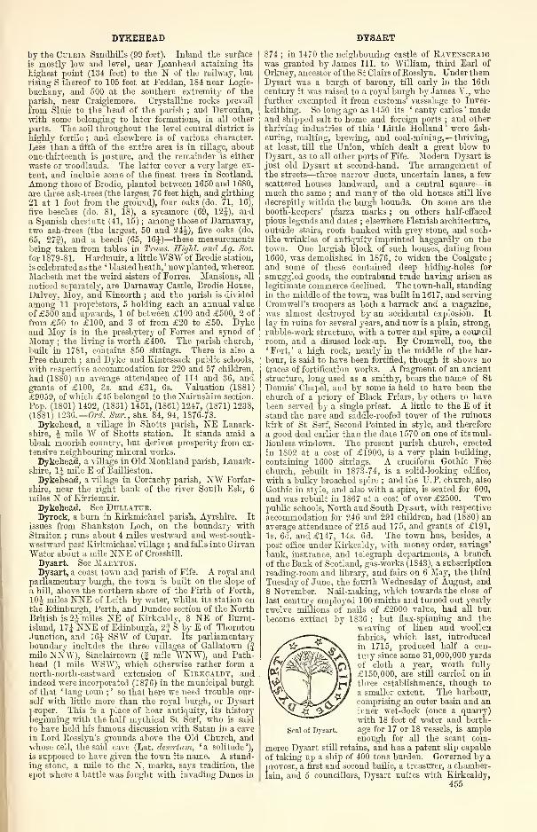
DYKEHEAD
by the Cttlein Sandhills (99 feet). Inland the surface
is mostly low and level, near Loanhead attaining its
highest point (134 feet) to the N of the railway, but
rising S thereof to 105 feet at Feddan, 184 near Logie-
buchany, and 500 at the southern extremity of the
parish, near Craigiemore. Crystalline rocks prevail
from Sluie to the head of the parish ; and Devonian,with some belonging to later formations, in all other
parts. The soil throughout the level central district is
highly fertile ; and elsewhere is of various character.
Less than a fifth of the entire area is in tillage, aboutone-thirteenth is pasture, and the remainder is either
waste or woodlands. The latter cover a very large ex-
tent, and include some of the finest trees in Scotland.
Among those of Brodie, planted between 1650 and 1680,
are three ash-trees (the largest 76 feet high, and girthing
21 at 1 foot from the ground), four oaks (do. 71, 16),
five beeches (do. 81, 18), a sycamore (69, 12J), anda Spanish chestnut (41, 15) ; among those of Darnaway,two ash-trees (the largest, 50 and 24J), five oaks (do.
65, 27J), and a beech (65, 16J)—these measurementsbeing taken from tables in Trans. HigM. and, Ag. Soc.
for 1879-81. Hardmuir, a littleWBW of Brodie station,
is celebrated as the ' blasted heath, ' now planted, whereonMacbeth met the weird sisters of Forres. Mansions, all
noticed separately, are Darnaway Castle, Brodie House,
Dalvey, Moy, and Kincorth ; and the parish is divided
among 11 proprietors, 5 holding each an annual value
of £500 and upwards, 1 of between £100 and £500, 2 of
from £50 to £100, and 3 of from £20 to £50. Dykeand Moy is in the presbytery of Forres and synod of
Moray ; the living is worth £400. The parish church,
built in 1781, contains 850 sittings. There is also a
Free church ; and Dyke and Kintessack public schools,
with respective accommodation for 220 and 57 children,
had (18S0) an average attendance of 114 and 36, andgrants of £100, 3s. and £31, 6s. Valuation (1881)
£9059, of which £45 belonged to the Nairnshire section.
Pop. (1801) 1492, (1831) 1451, (1861) 1247, (1371) 123S,
(1881) 1236.—Ord. Sur., shs. 84, 94, 1876-73.
Dykehead, a village in Shotts parish, NE Lanark-shire, A mile "W of Shotts station. It stands amid a
bleak moorish country, but derives prosperity from ex-
tensive neighbouring mineral works.
Dykehead, a village in Old Monkland parish, Lanark-shire, 1J mile E of Baillieston.
Dykehead, a village in Cortachy parish, N¥ Forfar-
shire, near the right bank of the river South Esk, 6
miles N of Kirriemuir.
Dykehead. See Dullatur.Dyrock, a burn in Kirkmichael parish, Ayrshire. It
issues from Shankston Loch, on the boundary withStraiton ; runs about 4 miles westward and west-south-
westward past Kirkmichael village ; and falls into GirvanWater about a mile NNE of Crosshill.
Dysart. See Mahyton.Dysart, a coast town and parish of Fife. A royal and
parliamentary burgh, the town is built on the slope of
a hill, above the northern shore of the Firth of Forth,
10J miles NNE of Leith by water, whilst its station onthe Edinburgh, Perth, and Dundee section of the NorthBritish is 2| miles NE of Kirkcaldy, 8 NE of Burnt-island, 17J NNE of Edinburgh, 2J S by E of ThorntonJunction, and 16J SSW of Cupar. Its parliamentary
boundary includes the three villages of Gallatown(
j
mile NNW), Sinclairtown (f mile WNW), and Path-head (1 mile WSW), which otherwise rather form anorth-north-eastward extension of Kirkcaldy, andindeed were incorporated (1S76) in the municipal burghof that ' lang toun ;
' so that here we need trouble our-
self with little more than the royal burgh, or Dysartproper. This is a place of hoar antiquity, its history
beginning with the half mythical St Serf, who is said
to have held his famous discussion with Satan in a cave
in Lord Rosslyn's grounds above the Old Church, andwhose cell, the said cave (Lat. desertum, ' a solitude '),
is supposed to have given the town its name. A stand-
ing stone, a mile to the N, marks, says tradition, the
spot where a battle was fought with invading Danes in
DYSART
874 ; in 1470 the neighbouring castle of Ravenscraigwas granted by James III. to William, third Earl of
Orkney, ancestor of the St Clairs of Rosslyn. Under themDysart was a burgh of barony, till early in the 16thcentury it was raised to a royal burgh by James V. , whofurther exempted it from customs' vassalage to Inver-
keithing. So long ago as 1450 its ' canty carles ' madeand shipped salt to home and foreign ports ; and other
thriving industries of this ' Little Holland ' were fish-
curing, malting, brewing, and coal-mining,—thriving,
at least, till the Union, which dealt a great blow to
Dysart, as to all other ports of Fife. Modern Dysart is
just old Dysart at second-hand. The arrangement of
the streets—three narrow ducts, uncertain lanes, a fewscattered houses landward, and a central square—is
much the same ; and many of the old houses still live
decrepitly within the burgh bounds. On some are thebooth-keepers' piazza marks ; on others half-effaced
pious legends and dates ; elsewhere Flemish architecture,
outside stairs, roofs banked with grey stone, and such-like wrinkles of antiquity imprinted haggardly on thetown. One largish block of such houses, dating from1660, was demolished in 1S76, to widen the Coalgate
;
and some of these contained deep hiding-holes for
smuggled goods, the contraband trade having arisen as
legitimate commerce declined. The town-hall, standingin the middle of the town, was built in 1617, and serving
Cromwell's troopers as both a barrack and a magazine,was almost destroyed by an accidental explosion. It
lay in ruins for several years, and now is a plain, strong,
rubble-work structure, with a tower and spire, a council
room, and a disused lock-up. By Cromwell, too, the' Fort, ' a high rock, nearly in the middle of the har-
bour, is said to have been fortified, though it shows notraces of fortification works. A fragment of an ancient
structure, long used as a smithy, bears the name of StDennis' Chapel, and by some is held to have been the
church of a priory of Black Friars, by others to havebeen served by a single priest. A little to the E of it
stand the nave and saddle-roofed tower of the ruinous
kirk of St Serf, Second Pointed in style, and therefore
a good deal earlier than the date 1570 on one of itsmul-
lionless windows. The present parish church, erected
in 1802 at a cost of £1900, is a very plain building,
containing 1600 sittings. A cruciform Gothic Free
church, rebuilt in 1873-74, is a solid-looking edifice,
with a bulky broached spire ; and the U.P. church, also
Gothic in style, and also with a spire, is seated for 600,
and was rebuilt in 1867 at a cost of over £2500. Twopublic schools, North and South Dysart, with respective
accommodation for 246 and 291 children, had (1880) anaverage attendance of 215 and 175, and grants of £191,
Is. 6d. and £147, 14s. 6d. The town has, besides, apost office under Kirkcaldy, with money order, savings'
bank, insurance, and telegraph departments, a branch
of the Bank of Scotland, gas-works (1843), a subscription
reading-room and library, and fairs on 6 Ma}', the third
Tuesday of June, the fourth Wednesday of August, and8 November. Nail-making, which towards the close of
last century employed 100 smiths and turned out yearly
twelve millions of nails of £2000 value, had all but
become extinct by 1836 ; but flax-spinning and the
weaving of linen and woollen
fabrics, which last, introduced
in 1715, produced half a cen-
tury since some 31,000,000 yards
of cloth a year, worth fully
£150,000, are still carried on in
three establishments, though to
a smaller extent. The harbour,
comprising an outer basin and aninner wet-dock (once a quarry)
with 18 feet of water and berth-
age for 17 or 18 vessels, is ampleenough for all the scant com-
merce Dysart still retains, and has a patent slip capable
of taking up a ship of 400 tons burden. Governed by a
provost, a first and second bailie, a treasurer, a chamber-
lain, and 5 councillors, Dysart unites with Kirkcaldy,
455
Seal of Dysart.
EACHAIG
Kinghorn, and Burntisland in returning a member to
parliament. Its parliamentary constituency numbered1771, and its municipal 399, in 1882, when the annualvalue of real property within the parliamentary burghwas £35,156, 10s. 9d., whilst the corporation revenuefor 1881 was £1152, 3s. 3id. Pop. of royal burgh (1831)
1801, (1851) 1610, (1861) 1755, (1871) 1812, (1881) 2623
;
of parliamentary burgh (1851) 8041, (1861) 8066, (1871)
8919, (1881) 10,874. Houses in latter (1881) 2440 in-
habited, 166 vacant, 15 building.
The parish of Dysart, containing also Gallatown,Sinclairtown, and Pathhead, with most of Borelandvillage, is bounded N by Kinglassie, NE by Markinch,E by Wemyss, SE by the Firth of Forth, and W byKirkcaldy, Abbotshall, Auchterderran, and Kinglassie.
Its utmost length, from NNW to SSE, is 4 miles ; its
width, from E to W, varies between If and 2fmiles ; and its area is 4197 acres. Lochty Burnflows 2£ miles east-by-southward along all the northernboundary, on its way to the sluggish Ore, whichitself winds 3 miles east-by-northward across thenorthern interior and along the Markinch border. Thebold and rocky coast-line, 2| miles long, rises steeply to
178 feet at the north-eastern extremity of the town ; in-
land, the surface undulates gently, attaining 226 feet
near Gallatown, 300 near Carberry, 271 near Bogleys, 218near Middle Balbeiggay, and 227 near Wester Strathore,
whilst dipping slightlytowards the above-named streams.
The rocks, belonging to the Carboniferous formation, in-
clude excellent sandstone, claystone, limestone, iron-
stone, and coal, all of which have been largely worked.As a coal district Dysart has long been famous. Fourcenturies have passed since first the coal was worked in
shallow mines, the excavations increasing to their
present gigantic extent. The coal has been often onfire ; and in the burgh records for 1578 we read that'ane evil air enterit the main heuch, the door being thenat the west entrie of the toun.' This evil air set themine on fire. Again and again combustion took place
—in 1622, 1741, and 1790—Assuring and scorching theearth, causing Regent Buchanan of St Andrews to write
Latin hexameters on its startling effects upon thescenery, and giving commemorative names to streets
and lanes in the vicinity. The soil is generally good,and the entire area is in tillage, with the exception of a
EAGLESHAM
few acres of pasture and some 400 under wood. Anantiquity, other than Ravenscraig Castle and the stand-ing stone, was a so-called Roman camp at Carberry,which, however, has long since wholly disappeared ; theRed Rocks, too, to the E of the town, are associated bylegend with the burning of certain witches. Threenatives of Dysart were Robert Beatson of Vicarsgrange,LL.D. (1741-1818), an author; David Pitcairn, M.D.(1749-1809), an eminent physician ; and William Wal-lace (1768-1843), a mathematician. The title Earl of
Dysart, conferred in 1643 on William Murray, son of
the Rev. William Murray, minister of Dysart and pre-
ceptor to Charles I.,passed to his elder daughter, who
married first Sir Lionel Tollemache of HelminghamHall, in Suffolk, and secondly the celebrated Duke of
Lauderdale ; it now is held by her eighth descendant byher first marriage, William John Manners Tollemache,who, born in 1859, succeeded as eighth Earl in 1878,
and has his seats at Ham House in Surrey and Buck-minster Park in Leicestershire. Dysart House, a little
W of the town, is a plain but commodious mansion,with beautiful gardens, commanding a splendid viewacross the Firth ; and is the Scottish seat of Francis
Robert St Clair Erskine, fourth Earl of Rosslyn since
1801 (b. 1833 ; sue. 1866), who owns 3221 acres in Fife,
valued at £9673 per annum, including £1224 for
minerals. (See Roslin. ) Six other proprietors hold eachan annual value of £500 and upwards, 17 of between£100 and £500, 17 of from £50 to £100, and 92 of from£20 to £50. Dysart is in the presbytery of Kirkcaldyand synod of Fife ; and the charge is collegiate ; the
first minister's stipend being £373 with manse and glebe
worth £71, 10s., and the second's £317, 8s. 6d., whilst
ecclesiastically the parish is divided into Dysart proper
and Pathhead. The four public schools of Gallatown,
Pathhead, Sinclairtown, and Boreland, with respective
accommodation for 205, 375, 300, and 87 children, had(18S0) an average attendance of 240, 361, 379, and 46, andgrants of £197, lis., £315, 8s. 6d., £331, 12s. 6d., and£25, 13s. lid. Valuation (1865) £15,489, 8s. 2d., (1882)
£42,707, 9s. 2d. Pop. (1801) 5385, (1831) 7104, (1861)
8842, (1871) 9682, (1881) 11,627.—Orel. Sur., sh. 40,
1867. See Notices from the Local Records of Dysart
(Glasg., Maitland Club, 1853), and W. Muir's Gleanings
from the Records of Dysart, 1545-1796 (Edinb. 1862).
EEACHAIG, a small river in the Kilmun portion of
the united parish of Dunoon and Kilmun, Argyll-
shire. Issuing from the foot of Loch Eck, it
winds 5^ miles south-south-eastward along Strath
Eachaig to the head of Holy Loch, on its right side
receiving the Massan near Benmore House and the Little
Eachaig very near its mouth, a little higher up beingspanned by an iron bridge of 1878 on the Inverary
route. It is a very good salmon and trout stream,
let to a Glasgow Angling Club.
—
Orel. Sur., sh. 29,
1875.
Eagerness or Eggerness ('Edgar's ness'), a headlandof Sorbie parish, E Wigtownshire, flanking the N side
of Garliestown Bay, 6| miles SE by S of Wigtown. Pro-jecting | mile from the mainland, and contracting froma width of 7£ furlongs to a point, it rises to a height of
100 feet, and presents a rocky though not precipitous
face to the sea. On its eastern side stood EggernessCastle, whose scanty ruin is so overgrown with brush-
wood and rank vegetation as to be hardly discernible.
Its date and history are alike unknown.
—
Orel. Sur., sh.
4, 1857.
Eagle. See Edzell.Eaglescarnie, an estate, with a mansion, in Bolton
parish, Haddingtonshire, on the left bank of Gifford or
Coalstoun Water, 4J miles S by E of Haddington. Its
owner, Alexander Charles Stuart, Esq. (b. 1814 ; sue.
456
1855), holds 465 acres in the shire, valued at £627 per
annum.Eaglesfield, a village in Middlebie parish, Dumfries-
shire, on the right side of Kirtle Water, 7 furlongs NNEof Kirtlebridge station on the Caledonian, and 2| miles
E of Ecclefechan, under which it has a post office, withmoney order and savings' bank departments. Here is
also a General Assembly's school.
Eaglesham, a village and a parish of SE Renfrewshire.
The village, standing 500 feet above sea-level, is 4 miles
S of Busby, 8J S of Glasgow, 11 SE of Paisley, and 3| Sby E of Clarkston station on the East Kilbride branch
of the Caledonian, with which it communicates byomnibus. Successor to an older village that during the
reign of Charles II. was important enough to acquire byact of parliament a weekly market, it was founded bythe twelfth Earl of Eglinton in 1796, and, had its
founder's plan been carried out, would have ranked
second to scarce a small town in Scotland. Even as it
is, it presents a remarkably regular and pleasant aspect,
with its double row of neat two-story houses, facing
each other at the distance of 100 yards at the upper and250 at the lower end ; whilst midway between themflows a rivulet, whose gently-sloping banks are partly
greensward, partly adorned with trees. The parish
church (1790 ; 550 sittings) is a plain structure with
a chaste steeple ; and other places of worship are a
EAGLESHAY EARLSFEEEY
U.P. church (350 sittings), a Free church (320 sittings),
and St Bridget's Roman Catholic church (1858 ; 350
sittings). Eaglesham has besides a post office underGlasgow, a branch of the Clydesdale Bank, 2 hotels,
gas-works, and a flower show on the third Thursday of
August o.s. Handloom weaving, once the staple in-
dustry, is all but extinct ; and a cotton-mill, somej'ears ago destroyed by fire, has never been rebuilt.
Hence the rapid decrease in the number of the inhabit-
ants. Now, however, the bracing and healthy air is
proving a strong attraction to many Glasgow families,
and in summer there is a large influx of visitors. Apublic and a girls' industrial school, with respective
accommodation for 166 and 150 children, had (1880) anaverage attendance of 125 and 52, and grants of £109,
7s. lOd. and £39, 2s. Pop. (1861) 1769, (1871) 1237,
(1881) S85.
The parish is bounded NW by Mearns, NE by Catli-
cart and East Kilbride in Lanarkshire, E and SE byEast Kilbride, S by Loudoun in Ayrshire, and SW byFenwick, likewise in Ayrshire. Its utmost length, from
NW to SE, is 6J miles ; its utmost breadth, from NEto SW, is 5J miles ; and its area is 16,003| acres, of
which 337| are water. White Cart Water, gathering
its head-streams from the eastern moors, winds 5J miles
north-westward along all the north-eastern border ; andEarn Water flows to it north-eastward along the boun-
dary with Mearns ; whilst through the interior run
Ardoch and Boreland Burns, with others of its tribu-
taries. In the S, however, rise several affluents andsub-affluents of the river Irvine. To the SW lie BinesdLoch (5x2 furl.), Dunwan Dam (7J x 3), and LochGoin or Blackwater Dam (7x3); nearer the village are
High Dam (If x 1J), Mid Dam (1 x f ), and Picketlaw
Eeservoir (2 x 1 J). In the furthest N the surface sinks
along the Cart to 380 feet above sea-level, thence rising
to 832 at Moor-Yett plantation, 1084 at Balagich Hill,
1035 at Blackwood Hill, 9S7 at Melowther Hill, and1230 near the south-eastern border. The rocks, with
slight exception, are alternations of greenstone, clay-
stone, and greywaeke—part of the great trap mass that
predominates so extensively in the hills of Renfrewshire.
The soil, though reposing almost everywhere on trap,
varies greatly in quality, some parts being specially rich,
and others being represented by barren moors or deep
bogs. The pasture is generally excellent. About five-
twelfths of the entire area are under cultivation, three-
fourteenths are meadow or natural pasture, 178} acres
are under wood, and all the rest is either moss or
moor. The moors, especially about Loch Goin, figure
often in the history of the Covenant, two of whosemartyrs rest in the parish kirkyard. North Moorhousefarm, near Earn Water, 3 miles to the W of the village,
was the birthplace of Robert Pollok (1799-1827), the
gifted author of the Course of Time ; and in that epic
one lights again and again on sketches of the ' hills andstreams and melancholy deserts ' round his home, that
home overshadowed by four goodly trees
—
* Three ash and one of elm. Tall trees they were,
And old ; and had been old a centuryBefore my day.'
The barony of Eaglesham formed part of the grant madeby David I. (1124-53) to Walter, the founder of the
house of Stewart, by whom it was transferred to Robert
de Montgomery ; and it was loug the Montgomeries'
chief possession, Sir John, who wedded the heiress of
Eglinton, here building the castle of Polnoon towards
the close of the 14th century. Eaglesham House,
late Pobaoon Lodge, to the NE of the village, is
the seat of Allan Gilmour, Esq. (b. 1820 ; sue. 1849),
who owns 16,516 acres in the shire, valued at £12,106
per annum. With the exception of 10 acres, he is sole
proprietor. Eaglesham is in the presbytery of Glasgow
and synod of Glasgow and Ayr ; the living is worth£369. Valuation (1860) £11,350, (1882) £14,731, 12s. 6d.
Pop. (1801) 1176, (1831) 2372, (1851) 2524, (1861) 2328,
(1871) 1714, (1881) 1382.—Ord. Sur., sh. 22, 1865.
Eagleshay or Egilshay, a low-lying island of Rousayparish, Orkney, separated from the E side of Rousay
island by Howa Sound, and lying 11 miles N of Kirk-
waU. It measures 3 miles in length from N to S,
by 1£ mile in breadth, and includes a small bay of
shell sand, a large tract of benty sand, burrowed byhundreds of rabbits, and a small fresh-water lake. Therocks belong to the Lower Old Red sandstone, and the
soil is good, but poorly cultivated. Dr Baikie of Tanker-ness is the proprietor. Eagleshay is notable as the
place where St Magnus was murdered by his cousin
Hakon about the year 1110 ; and at its western ex-
tremity, on the scene, it is said, of his murder, are the
remains of a small ancient church of St Magnus, with a
round tower at its W end, and a vaulted choir at the E.
There is a public school under Rousay school-board.
Pop. (1831) 228, (1851) 192, (1861) 205, (1871) 163,
(1881) 158.
Eagleshay or Egilshay, an island of Northmavenparish, Shetland, in Islesburgh cove, on the E of St
Magnus Bay. It measures about li mile both in length
and in breadth, is excellent grazing-ground, and teemswith rabbits.
Eagton or Eglin Lane, a troutful stream in the SE of
Straiton parish, Ayrshire. Issuing from Loch Enoch(1650 feet), at the boundary with Kirkcudbrightshire,
it runs 6| miles north-north-eastward to the head of
Loch Doon (6S0 feet), and receives by the way the
effluents of Lochs Macaterick and Riecawr.
Ealan. See Ellan.Eanaig or Einig, a stream in Kincardine parish, Ross-
shire, formed by the confluence of Rappach Water andAbhuinn Dubhach, and running 4 miles east-north-
eastward to the Oykell, at a point J mile SE of Oykell-
Bridge. It is a good trouting stream, also frequented
by grilse.—Ord. Sur., sh. 102, 1881.
Earbusaig. See Loohalsh.Earlcairney, a dilapidated cairn in Dalmeny parish,
Linlithgowshire, on the top of a high sea-bank, 1 mile
W of Barnbougle Castle. It was originally 500 feet in
circumference, and 24 feet high.
Earl's Burn, a rivulet in the W of St Ninians parish,
Stirlingshire, rising at an altitude of 1300 feet, just
within the confines of Gargunnock parish. Thence it
runs 6J miles south-south-eastward among the LennoxHills, till, after a total descent of 550 feet, it falls into
Carron Water at the SW base of Dundaff Hill (1157
feet), 5J miles W by N of Denny. A reservoir, feeding
the mills of Denny, was formed near its source, about
1834, by means of an embankment 22 feet high, at a
cost of close upon £2000 ; covers an area of nearly 60
acres; and, in October 1839, after a heavy rain, burst
the embankment, rushed down in impetuous torrent,
and did great damage to property along all the course
of the Carron.—Ord. Sur., shs. 39, 31, 1869-67.
Earl's Cross. See Dornoch.Earlsferry, a decayed coast village possessing the status
of a royal burgh, in Kilconquhar parish, Fife, immedi-ately W of Elie. It is
traditionally said to havebeen constituted a burghby Malcolm Ceannmorat the request of Mac-duff, Earl of Fife, who,in his flight from the
vengeance of Macbeth,was concealed in a cave
at Kincraig Point, andthence was ferried over
the firth to Dunbar byfishermen of the place.
The legend on the face
of it is false ; but, what-
ever its date, the original
charter having been ac-
cidentally destroyed by
Seal of Earlsferry.
fire in Edinburgh, James VI.
granted a, new one in" 1589, which speaks of Earls-
ferry as ' of old, past memory of man, erected into ane
free burgh.' Then and afterwards it seems to have
been a place of considerable trade, with two weekly
markets and two annual fairs, the privilege of levying
457
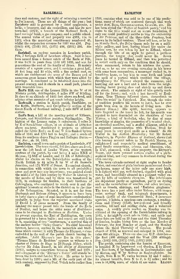
EAELSHALL
dues and customs, and the right of returning a memberto Parliament. These are all things of the past ; butEarlsferry still is governed by a chief magistrate, abailie, a treasurer, and six councillors, and has its newtown-hall (1872), a branch of the National Bank, a
local savings' bank, a gas company, and a public school.
The annual value of real property was £924, lis. in
1882, when the municipal constituency numbered 45,
whilst the corporation revenue for 1881 was £86. Pop.
(1841) 496, (1861) 395, (1871) 406, (1881) 286. SeeElie.
Earlshall, an ancient mansion in Leuehars parish,
Fife, 7 furlongs ESE of Leuehars village. Said to havebeen named from a former estate of the Earls of Fife,
it was built in years from 1546 till 1620, and was for
generations the seat of the family of Bruce. It mainlyconsists of a square tower, and it contains a great hall,
50 feet long and 18 wide, with a fine arched roof, onwhich are emblazoned the arms of the Bruces and of
numerous great houses with which they were allied bymarriage. It continued to be inhabited down into thepresent century, and it stands in a small park, plantedwith venerable trees.
Earl's Hill, one of the Lennox Hills in the W of StNinians parish, Stirlingshire, 6 miles SW of Stirling.
It rises to an altitude of 1443 feet above sea-level, andadjoins other summits of not much inferior height.
Earlsmill, a station in Keith parish, Banffshire, onthe Keith, Dufftown, and Craigellachie section of theGreat North of Scotland railway, f mile SSW of Keithstation.
Earl's Seat, a hill at the meeting-point of Killearn,
Campsie, and Strathblane parishes, Stirlingshire. Thehighest of the Lennox range, it culminates, 3 miles Nby E of Strathblane village, at an altitude of 1894 feet
above sea-level. Southward it projects an offshoot
called the Little Earl ; on E and W it is flanked by twohills of 1345 and 1781 feet in height ; and it sends off
from its southern slopes Finglen and Ballagan Burns.—Orel. Sur., sh. 30, 1866.
Earlston, a small town and a parish of Lauderdale, SWBerwickshire. The town stands, 345 feet above sea-level,
near the left bank of Leader Water, at the westernconfines of the parish, by road being 4 miles NNE of
Melrose, 7J SSE of Lander, and 31 SE of Edinburgh
;
whilst its station on the Berwickshire section of theNorth British is 4$ miles N by W of St BoswellsJunction, and 17J WSW of Dunse. Its ancient church,in connection with which the town in all probability
arose and grew into any importance, was granted aboutthe middle of the 12th century by Walter de Lindsay to
the monks of Kelso, and by them was transferred in
1171, in exchange for Gordon, to their brethren of
Coldingham, who continued to watch over it and thespiritual interests at stake in the district on to the timeof the Reformation. Situated, as it is, not far fromDryburgh and Melrose Abbeys, it appears to have beenin early times a place of some importance—ecclesiastical
probably, to judge from the reported occasional visits
of David I. of pious memory. From the family of
Lindsay the manor passed into the hands of the Earls
of Dunbar, and hence the older name of Ercildounecame to be changed to Earlstoun or Earlston. Underits present superior, the Earl of Haddington, the townis governed by a baron bailie ; and courts are still heldin it, consisting of two ' bourlawmen, ' a survival this of
the ancient border ' Birley Courts. ' Its chief historical
interest, however, centres in the memorials and tradi-
tions which connect it with Thomas the Rhymer, a stoneembedded in the wall of the parish church bearing in-
scription, ' Auld Rhymer's race lies in this place.
'
' Thomas Rimor de Ercildun ' appears as witness to acharter of Petrus de Haga to Dryburgh Abbey, whichcharter Mr John Russell, in his Haigs of Bemersyde(1881), assigns to somewhere between 1260 and 1270
;
and a fragment of the ' Rhymer's Tower ' still stands be-
tween the town and Leader Water. He seems to havebeen dead by 1299 ; and a MS. of the early part of the14th century, supposed by Prof. Veitch to be earlier than
458
EARLSTON
1320, contains what was said to be one of his predic-tions, many of which are scattered through this workunder Ale, Bass, Cowdenknowes, Criffel, etc. Hehas been styled the ' Father of Scottish poetry, ' and his
claim to the title would rest on secure foundation, if
only one could positively ascribe to him the authorshipof Sir Tristrem, and of the three-fytte Prophecy, bestknown in its ballad versions. These tell how, as he layon Huntly Bank, the Fairy Queen rode by on a milk-white palfrey, and how, having kissed her under theEildon tree, he was taken by her to Elfland, wherethrough the bite of an apple he gained a perilousguerdon, the tongue that could never lie. Sevenyears he tarried in Elfland, and then was permittedto revisit earth only on the condition that he should,when summoned, return to his mistress the queen.And so, as he sat one evening carousing in his towerwith some boon companions, a messenger rushed in, in
breathless haste, to beg him to come forth and breakthe spell of a portent which troubled the village.
Straightway the Rhymer obeyed the summons, andhurrying out saw a hart and a hind from the neigh-bouring forest pacing slow and stately up and downthe street. The animals at sight of him quietly madeoff for the forest ; and, with a last farewell to Ercil-
doune, True Thomas followed them, thenceforth to' dree his weird ' in Fairyland. Nor, though the voice
of tradition predicts his return to earth, has he everagain been seen in the haunts of living men. (See
Eildon Hills.) His spirit, however, appears to
have lingered in the tower he left, for his mantle wasreputed to have descended on the shoulders of 'oneMurray, a kind of herbalist, who, by dint of someknowledge of simples, the possession of a musical clock,
an electrical machine, and a stuffed alligator, added toa supposed communication with Thomas, lived for
many years in very good credit as a wizard.' So Sir
Walter in his Scottish Minstrelsy; but Mr RobertChambers, in Popular Rhymes of Scotland, shows thatthis hearsay account refers to Mr Patrick Murray, anenlightened and respectable medical practitioner, of
good family connections, talents, and education, who,in 1747, possessed, with other property, the Rhymer'sTower, and there pursued various studies of a philo-
sophical kind, not very common in Scotland during the
ISth century.
The town extends eastward at right angles to LeaderWater, and consists of plain business premises and dwell-
ing-houses, many of the latter only one story high.
It is lighted with gas, well drained, supplied with goodwater, and beautifully situated in a pleasant valley en-
girt by hills of moderate elevation. The inhabitants
are dependent partly on agriculture, partly on dyeingand on the manufacture of woollen and other textures,
such as tweeds, shirtings, and 'Earlston ginghams.'The town has a post office under Melrose, with moneyorder, savings' bank, and telegraph departments, abranch (1S62) of the Commercial Bank, 8 insurance
agencies, 2 hotels, a spacious corn exchange, a reading-
room and library (1856), horticultural and friendly
societies, billiard and curling clubs, and a volunteer
corps. A weekly grain market on Monday was in-
stituted at the opening of the Berwickshire railway in
1863, a fortnightly stock sale in 1864 ; and cattle andhorse fairs are held on 29 June and the third Thursdayof October, besides hiring fairs on the last Monday of
February, the first Monday of April, and the Mondaybefore the third Thursday of October. The parish
church of 1756, as renewed and enlarged in 1834, con-
tains 600 sittings. There are also two U.P. churches
—
the East (400 sittings) and the West (330 sittingsl.
Pop. (1861) 980, (1871) 1168, (1881) 1010.
The parish, containing also the hamlet of Redpath,is bounded N by Legerwood and Gordon, E by Humeand Nenthorn, S by Smailholm in Roxburghshire andby Merton, and W by Melrose in Roxburghshire. Its
length, from E to W, varies between If and 7 miles
;
its utmost breadth, from N to S, is 3| miles ; and its
area is 10,009J acres, of which 41 are water. Leader
EARLSTON EARN
Water winds 4J miles southward, for the first 5 furlongs
cutting off a small north-western wing of Earlston, butelsewhere tracing its boundary with Melrose ; and EdenWater runs 3J miles south-by-westward along all the
Nenthorn border. Between these troutful streams the
surface rises—in places steeply from the Leader—to 825feet on Huntshaw Hill, 708 near Crossrigs, 1031 onconical Black Hill of Earlston, 8S5 near Craig House,and 806 near Darlingfield. Black Hill is porphyritie,
overlying red sandstone ; and at the E eud of Earlstonthe pelvis and other bones of the Cervus elaphus havebeen found, 12 feet from the surface, in. a vegetable
deposit, above which were marly and reddish clays. Thesoil is in some parts clayey, in others a light dry loam
;
while elsewhere it is strong and very fertile. Thereis a good deal of marshy ground in the E, and in the N are
several hundred acres of moss. About two-thirds of theentire area are in tillage, woodlands cover nearly one-
ninth, and the rest is either pastoral or waste. On the
summit of Black Hill are the remains of a camp,commonly said to be Roman, but probably of native
origin. Mansions are Mellerstain, Cowdenknowes,Carolside, and Kirklauds ; and the Earl of Haddingtonis chief proprietor, 2 others holding each an annualvalue of £500 and upwards, 8 of from £100 to £500,11 of from £50 to £100, and 29 of from £20 to £50.Earlston is the seat of a presbytery n the synod of Merseand Teviotdale, which was, till recently, for an interval
of a century, designated the presbytery of Lauder ; theliving is worth £298. A new public school, erected at
the town in 1876 at a cost of £2470, with accommodationfor 323 pupils, had (1880) an average attendance of 215,
and a grant of £204, 14s. 6d. Valuation (1864) £11,119,(1SS2) £14,022, 10s. Pop. (1801) 1478, (1831) 1710,(1S61) 1S25, (1871) 1977, (1881) 1767.—Ord, Sur., sh.
25, 1S65.
The presbytery of Earlston comprises the parishes of
Channelkirk, Earlston, Gordon, Lauder, Legerwood,Mertoun, Smailholm, Stow, and Westruther. Pop.
(1871) 10,212, (1881) 9503, of whom 2972 were communi-cants of the Church of Scotland in 1878.
See an article by G. Tait in Procs. Berwickshire Natu-ralists' Club (1S67) ; Dr J. A. H. Murray's Romance andProphecies of Thomas of Ercildoune (Early Eng. TextSoc. 1S75) ; and chap. viii. of Prof. John Veitch'sHistory and Poetry of the Scottish Border (1878).
Earlston, a mansion in Borgue parish, S Kirkcud-brightshire, 4| miles WSW of Kirkcudbright, and 5
SSE of Gatehouse. A large and elegant edifice, built
about 1835, and embosomed among woods, it is theseat of Sir William Gordon, sixth Bart, since 1706 (b.
1S30 ; sue. 1843), who was one of the 'Five Hundred'in the famous Balaclava charge, and who owns 765acres in the shire, valued at £1179 per annum.
Earlston, an old castle and a burn in Dairy parish, NKirkcudbrightshire. The castle, standing near the left
bank of the Ken, 2 miles 1ST by W of Dairy village, hasthe form of a tali square tower, and bears over its doorthe date 1655. It was the seat of Sir William Gordon'sancestors, who figured prominently among the Cove-nanters ; has long been unoccupied, but retains a strongoaken roof ; and might easily be rendered habitable.
Earlston Burn runs 4 miles south-westward to the Ken,and, in the southern vicinity of the castle, makes a fine
waterfall, called Earlston Linn.Earn, a rivulet of SE Renfrewshire, rising at the
boundary with Ayrshire, and running 6 miles north-eastward along the mutual border of Eaglesham andMearns parishes to the White Cart, at a point 2 milesN of Eaglesham village. Professor Wilson, while apupil at the manse of Mearns, fished often in its waters;and Pollok, the author of the Course of Time, spent alarge portion of his few years on earth among its seques-tered banks and braes.
—
Ord. Sur., sh. 22, 1865.Earn, a loch and a river, giving the name of Strath-
earn to its basin. The lake impinges, at its head, onBalquhidder parish, but elsewhere belongs to thewestern or upper part of Comrie. It commencesnear Lochearnhead village, at the foot of Glen Ogle
;
is approached there by the Callander and Oban Railway;and extends in a direction of E by N to the village of
St Fillans. Lying 306 feet above sea-level, it is 6Jmiles long ; its breadth varies between 3J and 6£ fur-
longs ; and its depth, in many places, is 600 feet. Its
temperature varies so little throughout the year that,
not only does the lake itself never freeze, even in thekeenest frost, but the river Earn, which flows from it,
seldom, if ever, freezes till it has run a distance of at
least 5 miles. Its waters contain abundance of fine
trout, and can be fished conveniently from either Loch-earnhead or St Fillans. Its shores and foregroundscreens, to the mean breadth of about £ mile, are
clothed with wood ; its midground screens are a diver-
sity of waving, rolling, receding hill and mountainintersected by ravines ; and its sky-line on the Sside soars into the broken fantastic heights of Stuc-a-
Chroin (3819 feet) and the monarch mountain of BenVorlich (3224), whilst to the N rises Sron Mor (2203).
Streamlets and torrents enter it from the ravines, and oneof them—the Burn of Ample, near Lochearnhead—just
before entering it, forms, in the grounds of Edinample,a picturesque double waterfall. Ardvoirlioh House,on its southern shore, has beautiful grounds, and is the' Darnlinvarach ' of Sir Walter Scott's Legend of Mont-rose; and its one islet, Neish, near its foot, is clothed
with wood, and has curious historical associations.
Good roads go down both sides of the lake, and eachcommands a pleasing series of views ; but only the
northern one is travelled by public coaches, though the
southern commands the finer prospects. The scenery,
on the whole, is more charming than imposing, morebeautiful than grand, yet compares advantageouslywith the scenery of other admired lakes, and has features
of at once picturesqueness, romance, and sublimity.' Limited as are the dimensions of Loch Earn,' says DrMacculloch, 'it is exceeded in beauty by few of our lakes,
as far as it is possible for many beauties to exist in so
small a space. I -will not say that it presents a great
number of distinct landscapes adapted for the pencil,
but such as it does possess are remarkable for their con-
sistency of character, and for a combination of sweet-
ness and simplicity with a grandeur of manner scarcely
to be expected within such narrow bounds. Its style is
that of a lake of far greater dimensions ; the hills whichbound it being lofty and bold and rugged, with a
variety of character not found in many of even far
greater magnitude and extent. It is a miniature and a
model of scenery that might well occupy ten times the
space;yet the eye does not feel this. There is nothing
trifling or small in the details ; nothing to diminish its
grandeur of style, to tell us that we are contemplating a
reduced copy. On the contrary, there is a perpetual
contest between our impressions and our reasonings.
We know that a few short miles comprehend the whole,
and yet we feel as if it was a landscape of many miles, a
lake to be ranked among those of the first order anddimensions. While its mountains rise in majestic sim-
plicity to the sky, terminating in those bold and various
and rocky outlines which belong to so much of the
geological line from Dunkeld to Killiecrankie—even to
Loch Katrine, the surfaces of the declivities are equally
various and bold, enriched with precipices and massesof protruding rock, with deep hollows and ravines, andwith the courses of innumerable torrentswhich pour fromabove, and, as they descend, become skirted with trees
till they lose themselves in the waters of the lake.
Wild woods also ascend along the surface in all that
irregularity of distribution so peculiar to these rockymountains,—less solid and continuous than at LochLomond, less scattered and less romantic than at LochKatrine, but, from these very causes, aiding to confer
on Loch Earn a character entirely its own. If the
shores of the lake are not deeply marked by bays andpromontories, still they are sufficiently varied ; nor is
there one point where the hills reach the water in that
meagre and. insipid manner which is the fault of manyof our lakes, and which is the case throughout the far
greater part even of Loch Katrine. Loch Earn has no459
EAEN, BRIDGE OF
blank. Such as its beauty is, it is always consistent
and complete.'
The river Earn, issuing from Loch Earn at St Fillans
village, takes a general easterly course along Strathearn,
and falls into the Tay, at a point 1J mile NNE of Aber-nethy, 1 mile W of the boundary between Perthshire
and Fife, and 6J miles SE by S of Perth. Its course
abounds in serpentine folds, which contribute much to
its beauty and to its abrasive power ; and, measuredalong which, it has a total length of 46£ miles—viz. , 13§to Crieff Bridge, 24§ thence to Bridge of Earn, and 8Jthence to its mouth. It draws not only from the
numerous mountain feeders of the lake, but also fromnumerous mountain streams on both flanks of the upperpart of its own proper basin, so that it always has a
considerable volume and a lively velocity, and is liable
in times of rain to swell suddenly into powerful freshets;
and it sometimes bursts or overflows its banks, particu-
larly in its lower reaches, with devastating effect onthe crops or soils of the flooded district. Its chief
tributaries on the left are the Lednock at Comrie andthe Turret at Crieff; on the right, the Ruchill at Comrie,the Machany at Kinkell, the Ruthven at Trinity-Gask,
and the May at Forteviot. The first 13 miles of its
course, from Loch Earn onward, lie through the parish
of Comrie and the parish of Monzievaird and Strowan;
and the rest of its course, though occasionally intersect-
ing wings or districts of parishes, is mainly the boundaryline between Crieff, Monzie, Trinity-Gask, Findo-Gask,Aberdalgie, Forteviot (detached), and Rhynd on the
N, and Muthill, Blackford, Auchterarder, Dunning,Forteviot, Forgandenny, Dunbarny, and Abernethy onthe S. Its flow is so comparatively rapid, and so
briefly affected by the tide, as to prevent it from beingnavigable, even for vessels of from 30 to 50 tons' burden,
higher than to the Bridge of Earn. Its waters contain
salmon (running up to 48$ lbs. ), perch, and pike, andhave great abundance of common trout, yellow trout,
and sea trout. Its scenery, throughout the upperreaches onward to the vicinity of Crieff, vies withthat of Loch Earn in all the elements of natural beautyand power, and, throughout the middle and lowerreaches onwards to its foot, is unexcelled by that of
any Lowland tract in Britain. The Highland features,
excepting varieties of detail, have already been suffi-
ciently indicated in our account of the lake, and the
Lowland ones will be described under Stratheakn.—Ord. Sur., shs. 46, 47, 48, 1868-72.
Earn, Bridge of, a village in Dunbarny parish, SEPerthshire, on the right bank of the Earn, with astation upon the Edinburgh, Perth, and Dundeesection of the North British, 3J miles SSE of Perth.
It took its name from an ancient bridge, now super-
seded by a fine modern three-arch structure, and it
consists of two parts, old and new—the old founded in
1769, on leases of 99 years ; the new begun in 1832,
for the accommodation of visitors to the neighbouringmineral wells at Pitcaithly, and formed on a symmet-rical plan in a row or street of handsome houses. Nest-
ling beneath the wooded slopes of Moncreiffe Hill
(725 feet), it is a charming little village, and has a post
office, with money order, savings' bank, insurance, andtelegraph departments, a very commodious hotel, a
ball-room, a library, gas-works, etc. The Queenchanged horses here on 6 Sept. 1842. Pop. (1841)
119, (1861) 381, (1871) 326, (1881) 250. See Dun-barny.—Ord. Sur., sh. 48, 1868.
Earnock, an estate, with a mansion, in Hamiltonparish, Lanarkshire. The mansion, standing 2J miles
WSW of Hamilton, is a modern square edifice, withvery fine pleasure-grounds.
Earnock, Meikle, a village in Hamilton parish,
Lanarkshire, 2 miles SW of Hamilton. An ancient
tumulus adjoining it, though formerly much larger,
now measures 12 feet in diameter and 8 in height, andhas yielded several urns.
Earnside, an ancient forest in Dunbarny parish, SEPerthshire, and eastward thence, along the Earn andthe Tay to the eastern border of Abdie parish, around
460
EASSIE AND NEVAY
Lindores Abbey, in Fife. It is said by Sibbald to havebeen 4 miles long and 3 broad, but it could not havebeen less than 8 miles long, and, though taking namefrom the river Earn, it extended so far beyond thatriver's present confluence with the Tay as to counten-ance a tradition that the Earn once flowed to the baseof the hills in the NW of Fife, that the Tay closely
skirted the heights which now screen the N side of theCarse of Gowrie, and that the two rivers did not unitetill they reached a point considerably to the E of theirpresent confluence. Earnside Forest was the tradi-
tionary scene of adventures of Sir "William Wallace,notably of a sanguinary conflict which he maintainedwithin it against the English ; and it was sometimescalled ' Black Earnside, ' a name referring probably to
the dense gloom of its trees. It was long ago destroyed,but large masses of black oak, supposed to be remainsof it, are found imbedded in the soil of various parts of
the territory which it once occupied.
Earraid, an islet of Kilfinichen parish, Argyllshire,
separated by a narrow channel from the south-westernextremity of Mull. In 1871 it had a temporary popu-lation of 122, engaged in the construction of Dhtthear-tach Lighthouse.
Earsay. See Iorsa.Easdale, an island and a village of Kilbrandon parish,
Argyllshire. The island lies 16 miles SW of Oban, off
the W shore of Seil island, from which it is separatedby a strait only 400 feet wide at the narrowest. With a
somewhat roundish form, measuring 850 and 760 yardsin the two greatest diameters, it rises at one point to aheight of 130 feet above sea-level, but generally is verylittle higher than tide-mark. It presents an unattrac-
tive appearance, but is highly interesting for its valuableslate quarries. Commenced about 1631, these, in onepart, have been carried to a depth of 220 feet below sea-
level, being there kept dry by steam pumps and by theaccumulated dibris thrown up in the way of embank-ment ; they have long been worked with the appliances
of steam-engines and railroads ; and they belong to theEarl of Breadalbane. In 1866 they were let to a com-pany of workmen formed on co-operative principles,
but, favourable as were the terms of the lease, theventure proved unprofitable, so in the following yearthey were transferred to a company of slate merchants,who have continued to work them with great vigour.
They employ about 280 men, and turn out annuallybetween seven and nine millions of slates, worth notless than £14,000. The strait between Easdale and Seil
is used by the inhabitants of the two islands much in themanner of a highway, or similarly to the manner in whichthe people of Venice use their canals, the workmen especi-
ally disporting themselves on it in boats at all available
times, and regularly crossing it at meal hours ; it also
is part of the ordinary marine highway of the westernsteamers between the Clyde and the N, affording passen-
gers an opportunity of seeing the curious operations in
the quarries ; and it likewise serves as a good harbour,
and has been entered in the course of a year by as manyas 400 sailing vessels, most of them sloops, and many of
them, even to the number of more than twelve at a
time, waiting their turn to be cargoed with slates.
The village stands on both sides of the strait, or is
partly Easdale proper on Easdale island, and partly
Ellanabriech on Seil ; consists chiefly of snug, slated,
one-story houses ; and has a post office under Oban,with money order, savings' bank, and telegraph depart-
ments, a new pier (1873), a public school, a youngmen's improvement association, a library, and occasional
lectures on popular and scientific subjects. QueenVictoria, when on her way to Ardverikie in 1847, hada brilliant reception at Easdale. Pop. of island (1841)
531, (1861) 449, (1871) 504, (1881) 490 ; of village,
(1861) 772, (1871) 855, (1881) 805. See p. 76 of
Trans. Eighl. and Ag. Soc. for 1878.
Easnambroc, a waterfall of 30 feet in Eiltarlity
parish, Inverness-shire, on the river Glass, 1 mile aboveFasnakyle.
Eassie and Nevay, a united parish on the W border
EAST BARNS
of Forfarshire, containing, towards its NE corner, Eassie
station on the Scottish Midland section of the Caledonian,
5| miles ENE of the post-town Meigle, and 2j W by Nof Glamis, by road ; whilst by rail it is 2J miles SW of
Glamis station, 4J NE of Alyth Junction, and 24J NEof Perth. United before the middle of the 17th century,
the ancient parishes of Eassie and Nevay were nearly
equal to each other in extent—Eassie on the N, Nevayon the S. The whole is bounded N by Airlie, E andSE by Glamis, S and SW by Newtyle, andW by Meigle
in Perthshire. Its greatest length, from NNE to SSW,is 4g miles ; its breadth varies between 1J and 2| miles
;
and its area is 5061J acres, of which 8 are water. DeanWater creeps 2j miles west-by-southward along all the
northern border, with scarcely perceptible current, yet
sometimes in winter, bursting its strong embankments,floods all the neighbouring fields. Eassie Burn rises in
the N of Auchterhouse parish, and, running 6J miles
north-by-westward through Dexoon Glen in Glamisparish, and across the north-eastern extremity of Eassie
past Eassie station, falls into Dean Water at a point 2fmiles WNW of Glamis village. The level northern andnorth-western portion is part of Strathmoee, and sinks
along Dean Water to 160 feet above the sea ; south-
wards the surface rises to the Sidlaws, attaining 371 feet
near Murleywell, 621 at Ingliston Hill, and 947 on the
south-eastern border, whilst Kinpurney Hill (1134 feet)
culminates just within Newtyle. The rocks of the up-
lands are partly eruptive, partly Devonian ; that of the
Strathmore division is Old Red sandstone ; and here the
soil is mainly a soft sand}' loam of high fertility, as
there it is partly moorish, partly a thin black mould.Nearly half of the entire area is in tillage ; about 240
acres are under wood ; and the rest is either pastoral or
waste. A circular mound, with traces of an ancient
deep, wide moat, is occupied by Castle-Nairne farm-
house ; and a large sculptured stone, similar to the
famous sculptured stones of Meigle and Aberlemno, is
near the old church of Eassie. All Nevay belongs to the
Earl of Wharncliffe, the rest of the parish being divided
among 4 proprietors. This parish is in the presbytery
of Meigle and synod of Angus and Mearns ; the living is
worth £259. Two churches, the one in Eassie, the other
in Nevay, were formerly in use alternately ; and bothof them still stand as ruins, with burial grounds at
each, beyond the station. The present church, 2 miles
SW of Eassie station, was built in 1833, and contains 400sittings. A public school, with accommodation for 127
children, had (1SS0) an average attendance of 65, and a
grant of £55, 3s. lid. Valuation (1882) £6974, lis.,
phis £2026 for railway. Pop. (1801) 638, (1831) 654,
(1861) 748, (1871) 586, (1881) 561.—Ord. Sur., sh.
56, 1870.
East Barns, etc. See Bakns, East, etc.
Eastend, an estate, with a modern mansion, in Car-
michael parish, Lanarkshire, 2 miles WSW of Thanker-ton. Its owner, Maurice Thomson-Carmichael, Esq. (b.
1841 ; sue. 1875), holds 2125 acres in the shire, valued
at £2058 per annum.Easterfield. See Inveekeitbtng.Easterhill, an estate, with a mansion, in Shettleston
parish, Lanarkshire, on the right bank of the Clyde, 5
furlongs SSW of Tollcross.
Easterhouse, a collier village in Old Monkland parish,
Lanarkshire, with a station on the Glasgow and Coat-
bridge branch of the North British, 3J milesW of Coat-
bridge.
Easterhouse, Dumbartonshire. See Rosexeath.Easterskene, an estate, with a mansion, in Skene
parish, SE Aberdeenshire. The mansion stands near
the NE shore of Loch Skene, 9 miles W by N of Aber-deen, and S by E of Kintore station. Built about 1832,
it is a large edifice in the Tudor style, with fine grounds,
and commands an extensive prospect to the frontier
Grampians. Its owner, William M'Combie, Esq. (b.
1802 ; sue. 1824), holds 2179 acres in the shire, valued
at £1052 per annum. See Lyxtuek.Eastertown, a hill on the S border of Fyvie parish,
Aberdeenshire, projecting from the Bethelnie range in
EATHACK OR EIGHEACH, LOCH
Meldrum, and finely diversifying the upper vale of
Ythan Water.Eastertyre, an estate, with a mansion, in Logierait
parish, Perthshire, near the left bank of the Tay, 2Jmiles WNW of Ballinluig Junction.
Eastfield. See Rutherglen.East-Grange Station. See Culeoss.East-Haven, a fishing village in Panbride parish, For-
farshire, with a station on the Dundee and Arbroathrailway, 4J miles SW of Arbroath. It sends large
quantities of live lobsters to the London market, and of
white fish to Dundee, Forfar, and other towns.Eastmuir. See Shettleston.Eastwood, a mansion in Caputh parish, Perthshire,
in the south-eastern vicinity of Dunkeld. Its groundsare very beautiful, commanding at one point a splendidview of the town, the bridge, the cathedral, and theenvirons of Dunkeld. In 1879 Eastwood was rented byMr J. E. Millais, R.A.Eastwood or Pollok, a parish in the E of Renfrew-
shire. It contains the post-town of Pollokshaws (3
miles SSW of Glasgow) and the village of Thornlie-bank, with the stations of Pollokshaws, Kennishead,Thornliebank, and Giffnock. It is bounded N by Govan,E by Cathcart, S by Mearns, SW by Neilston, and Wby Abbey-Paisley ; and at its north-eastern corner ap-
proaches very near to the southern suburbs of Glasgow.Its utmost length, from NW to SE, is 4§ miles ; its
greatest breadth is 3| miles ; and its area is 5690 acres,
of which 93| are water. The White Caet winds 4
miles west-north-westward through the interior andalong the boundary with Abbey-Paisley ; Levern Waterruns 2i miles, partly along that boundary, partly
across a narrow western wing ; and Auldhouse Burn,another of the White Cart's tributaries, comes in fromMearns, and traverses the interior, itself receiving
Brock Burn, which rises close to the south-eastern bor-
der. The surface is charmingly diversified with shallowvale and gentle eminence, westward declining to 50 feet
above sea-level, whilst rising to 167 near Knowehead,170 near Haggbowse, 221 near Giffnock station, and 302at Upper Darnley. The rocks are chiefly of the Car-
boniferous formation, and include valuable beds of sand-
stone, limestone, ironstone, and coal, all of which havebeen worked. The Giffnock sandstone has a fine grain
and a whitish hue ; the Eastwood pavement stone is a
fine foliated limestone ; and the Cowglen coal is of goodquality, and occurs in numerous seams, none of themmore than 2t feet thick. The soil on the banks of thestreams is very fertile alluvium ; on the higher grounds,
is generally a thin earth on a till bottom ; and else-
where, is of various quality. Rather less than half the
entire area is in tillage, as much or more is pasture,
and some 350 acres are under wood. Extensive fac-
tories are at Pollokshaws, Thornliebank, and Green-bank ; and the whole parish teams with industry, as if
it were immediately suburban to Glasgow. RobertWodrow (1679-1734), author of a well-known History ofthe Church of Scotland; Matthew Crawfurd (d. 1700),
author of a voluminous unpublished work of the sametitle; and Stevenson Macgill, D.D. (1765-1840), pro-
fessor of divinity in the University of Glasgow, wereministers of Eastwood ; whilst Walter Stewart of Par-
dovan, author of the Pardovan Collections, died in theparish, and was interred in the Pollok burial-aisle.
Darnley and Pollok, both separately noticed, are estates
with much interest attaching to them ; and Stirling-
Maxwell is the chief proprietor, 12 others holding each
an annual value of £500 aud upwards, 42 of between £100and £500, 73 of from £50 to £100, and 89 of from £20to £50. In the presbytery of Paisley and synod of Glas-
gow and Ayr, this parish is ecclesiastically divided into
Eastwood proper and Pollokshaws, the former a living
worth £602. The various places of worship and the
schools are noticed under Pollokshaws and Thornlie-
bank. Valuation (1860) £32,503, (1882) £64,598, Is. 5d.
Pop. (1801) 3375, (1831) 6854, (1861) 11,314, (1871)13,09S, (1881) 13,915.—Ord. Sur., sh, 30, 1866.
Eathack or Eigheach, Loch. See Gauie.461
EATHIE
Eathie, a picturesque reach of coast, traversed by a
romantic burn—a noble Old Red sandstone ravine—in
the NE of the Black Isle district of Ross and Cromarty.Its liassic deposit, amazingly rich in fossil organisms,
possesses high interest both in itself and in connectionwith those early researches of Hugh Miller, which he de-
scribes in chap. viii. ofMy Schools aiul Schoolmasters.
Ebrie, a burn of N Aberdeenshire, rising in NewDeer parish, 1^ mile SE of New Deer village, and run-ning 8J miles southward to the Ythan, at a point 2|miles WNW of Ellon. It is followed, over the greater
part of its course, by the Buchan and Formartine sec-
tion of the Great North of Scotland ; has Arnage Houseand Arnage station on its left bank ; gives the name of
Inverebrie to a detached section of Methlick parish con-
tiguous to its mouth ; and, in times of heavy rain,
becomes a voluminous torrent.
—
Orel. Sur., sh. 87, 1876.
Ecclefechan (Celt. ' Church of Fechan ' *), the birth-
place of Thomas Carlyle, is a village in Hoddam parish,
Annandale, Dumfriesshire. It stands 171 feet abovesea-level, f mile ESE of Ecclefechan station, on the
main line of the Caledonian, this being 3| miles WNWof Kirtlebidge, 20 NW of Carlisle, 5| SE by S of
Lockerbie, 81 S by W of Edinburgh, and 81£ SE by Sof Glasgow. At it are a post office, with money order,
savings' bank, insurance, and railway telegraph depart-
ments, a branch of the Royal Bank, gas-works, 3 hotels, aGothic Free church (1878 ; 2S0 sittings), a Gothic U.P.church (1865 ; 600 sittings), and a public school ; andfairs are held here on the Tuesday after 11 June and theTuesday after 20 October. ' The village of Ecclefechan
'
(we quote from the Scotsman of 11 Feb. 1881), 'situated
midway between Lockerbie and the Solway Firth, hasbeen generally identified as the '
' Entepfuhl " of Carlyle's
Sartor Ecsartus. There it is, little altered from what it
was when Carlyle knew it in his early days, lying in ahollow, surrounded by wooded slopes, with its little
" Euhbach " still gushing kindly by—where not coveredover—to join Mein "Water at the foot of the town, before
the Mein loses itself in Annan Water, 1J mile lowerdown the valley. There are the beechrows ; and here,
by the side of the road, is the field where the annualcattle fair is held— '
' undoubtedly the grand summaryof Entepfuhl child's culture, whither, assembling fromall the four winds, come the elements of an unspeakablehurly-burly." Built along the Glasgow and Carlisle
highway, the stage-coach in the old days wended its
way night and morning through Ecclefechan ; but thecheery horn of the guard is no more heard, and, therailway having passed it by, the village is now probablythe scene of less bustle than it was eighty years since.
The weaving industry, which at a time less remote, gaveemployment to not a few men and women, has nowalmost deserted it, and the quietude of the place has beenfurther increased by a diversion of the turnpike road to
the higher ground along the western boundary, in orderto avoid the hollow in which Ecclefechan is situated.
The inhabitants are now, for the most part, peopleengaged in agricultural pursuits, and shopkeepers andothers who minister to their wants. The village has aparticularly neat and tidy appearance, from the fact
that nearly all the houses not faced with the red sand-stone of the district are regularly whitewashed aboutthe time of the fair. Most of the older cottages andother tenements are said to have been erected by thefather and uncle of Carlyle, who, it is known, followedthe trade of mason, and who are still well rememberedin Ecclefechan. The house in which Thomas Carlylewas born stands on the W side of the main street nearthe S end of the village. It is a plain two-story build-ing, whitewashed like so many of its neighbours, andmay be said to be divided into two parts by a large
keyed arch, which gives access to a court and somegardens behind. At present it is occupied by two separatefamilies, who enter their respective dwellings by door-
* Fecbin of Pore, probably, the Vigeanus of the Scottish Calen-dar, who, according to Skene, wag an Irish anchorite of the latterhalf of the 6th century, about which period St Kcntigem first fixedhis see at HoDDAii.
462
ECCLES
ways on either side of the arch. It was in the northern-most division, in a small chamber immediately overthe archway, that Carlyle first saw the light, on 4 Dec.1795. The room, which is reached from the groundfloor by a well-worn staircase of red sandstone flags, is
of small proportions—4 or 5 feet wide by 8 or 9 inlength—with a bed-place formed in the old style bymaking a recess in the wall.* Closely adjoining this
interesting tenement is a lane, known as Carlyle's Close,
in which stood a house afterwards tenanted by Carlyle's
father, and in which all the other children were born.Here Carlyle was brought up. This house in the lapse
of time has undergone considerable changes ; and thePhilistinism of Ecclefechan has at last transformed it
into the village shambles. The churchyard lies on theW side of the village, 50 yards or thereby along thebeech-fringed road which leads to Hoddam Castle. It
is only about half an acre in extent ; and in the centreof it many years ago stood the ancient church of StFechan, of which not a stone remains. Close to thechurchyard on the E side is a handsome Gothic churchin red sandstone, cruciform in shape, with a squareclock-tower, which is the most prominent object in thevillage. This belongs to the U.P. congregation, andtook the place of the old Secession church, in which, it
is understood, Carlyle was baptized by the Rev. MrJohnston, who afterwards taught the youthful geniusLatin. By the side of the churchyard is a long cottage-like building in a fair state of repair—the old parishschool, where Carlyle learnt '
' those earliest tools of
complicacy which a man of letters gets to handle—his
class-books." This old school-house, said to have beenbuilt with the stones of the ruined church, ceased somefive and twenty years ago to he used by the village
schoolmaster, who removed to a more commodiousbuilding within a stone's cast, which since the passingof the Education Act has been enlarged and dignified
with a clock-tower. The old school-house is now acasual poorhouse and soup-kitchen.' In the churchyarditself are headstones to Archibald Arnott, Esq. (1772-
1855), Napoleon's medical attendant at St Helena ; to
Robert Peal (1692-1749), said to be the great-grand-father of Sir Robert Peel ; and, in the W corner, to
James Carlyle (1758-1832) and Margaret Aitken (1771-
1853), his second wife, who 'brought him nine chil-
dren, whereof four sons and three daughters survived,gratefully reverent of such a father and mother.' Twoof those sons have since been laid beside her—Dr JohnAitken Carlyle (1801-79), the translator of Dante, andThomas Carlyle himself, whose funeral on 10 Feb.
1881, a cloudy, sleaty day, was attended by Prof. Tyn-dall, Mr J. A. Froude, Mr J. M. Lecky, etc. No stone
as yet marks his grave, but the churchyard wall wasrebuilt and walks were laid out in the winter of 1881-82.
Pop. of village (1841) 768, (1861) S84, (1S71) 846, (1881)769.—Orel. Sur., sh. 10, 1864. See also Annan, Kirk-caldy, Haddington, and Craigenputtoch.
Eccles, a Border village and parish of Berwickshire.The village stands, 244 feet above sea-level, in the SWof the parish, 2 miles NNW of the nearest reach of theTweed, 5|r SE of Greenlaw station, 5| NNE of Kelso,
and 6J WNW of Coldstream, under which it has a postoffice. Though now consisting of but one small street,
it represents an ancient town of no little consequence,
the seat of St Mary's Cistercian nunnery, founded in 1155.
Town anil nunnery were burned in Hertford's raid of
1545 ; and nothing remains now of the latter save twovaulted cells and a fragment of wall near the churchyard.The parish, containing also the villages of Birgham
and Leitholm, is bounded N by Fogo, E by Swintonand Coldstream, S by Northumberland and by Sprou-ston in Roxburghshire, SW by Ednam and Stiehill
in Roxburghshire, W by Hume, and NW by Green-
law. Its length, from ENE to WSW, varies between2| and 6 1 miles ; its utmost breadth is 5\ miles ; and
* So the Scotsman, but, according to Carlyle's brother, whostill resides in the neighbourhood, it was not in this room, but inthat at the top of the stair, on the right hand side, that the Sageof Chelsea was born.
ECCLESCRAIG
its area is 12,48S§ acres, of which 70J are water. TheTweed, here a glorious fishing river, sweeps 3 miles east-
north-eastward along all the Sprouston and Northum-berland border ; Leet Water, ditchlike but troutful,
flows 2 miles south-south-westward along the boundarywith Coldstream ; and, through the northern interior,
Lambden Burn, after tracing 2£- miles of the Greenlawborder, meanders 4J miles eastward to the Leet, past
Leitholm. A partially drained bog near Birgham is
much frequented by wild ducks. The surface sinks
along the Tweed to SO feet above sea-level, thence rising
in gentle parallel ridges to 230 feet near Wester Whit-rig, 272 at Bartle Hill, 296 near Harlaw, 338 at Eccles
Hill, and 353 near Hardacres. The chief rocks are a
sandstone resting on clay-stone porphyry, and quarried
for masonry ; a sandstone covered by amygdaloid, con-
taining green steatite and calcareous spar ; a dark slaty,
marly sandstone, containing 25 per cent, of carbonateof lime ; a magnesian limestone, containing red horn-stone and crystals of calcareous spar ; and red massygypsum, in thin beds, containing feruginous crystals.
The soil is light on the bank of the Tweed ; in themiddle and northern districts, is chiefly clay and loam.
All the land, with slight exception, is arable and veryproductive, having fine embellishments of enclosures andplantations, and presenting a rich and charming appear-
ance. Karnes was the birthplace of the distinguished
judge and philosopher, Henry Home (1696-1782), whofrom it assumed the title of Lord Kames, and here wasvisited in 1759 by Benjamin Franklin. Leitholm Tower,a ruined Border peel, stands beside Lambden Burn
;
and at Deadriggs is the sculptured stone of Crosshalls.Eccles House is the property of James Lewis Greig, Esq.
(b. 1S68 ; sue. 1S69), who owns 363 acres in the shire,
valued at £871 per annum. Other mansions, most of
them noticed separately, are Anton's Hill, BelchesterHouse, Bughtrig, Kames, Mersington House, PurvesHall, Spring Hill, and Stoneridge ; and 17 proprietors
hold each an annual value of £500 and upwards, 5 of
between £100 and £500, 1 of from £50 to £100, and 10of from £20 to £50. Eccles is in the presbytery of
Dunse and synod of Merse and Teviotdale ; the living
is worth £348. The parish church, at the village, withhandsome spire and 1000 sittings, was built in 1774,successor to its ancient predecessor which was dedicated
first to St Cuthbert, afterwards to St Andrew. Thereare also a Free church (2S0 sittings) of Eccles and aU.P. church (300) of Leitholm ; whilst the three publicschools of Birgham, Eccles, and Leitholm, with respec-
tive accommodation for 8S, 114, and 119 children, had(1880) an average attendance of 23, 70, and 117, andgrants of £18, ISs., £57, 3s. , and £103, 15s. Valuation(1864) £22,846, 4s. 2d., (1882) £25,265, 17s. lOd. Pop.(1801) 1682, (1831) 18S5, (1861) 1861, (1871) 1780, (1881)1546.—Ord. Sur., shs. 25, 26, 1865-64.
Ecclescraig. See St Cyrus.Ecclesfechan. See Ecclefechan.Ecclesiamagirdle (Celt. ' church of St Grizel '), a de-
tached portion of Dron parish, SE Perthshire, lyingwestward of the main body, and parted therefrom by astrip of Dunbarny, 1 furlong broad at the narrowest.With utmost length and breadth of 1| and f mile, it
has an area of 631§ acres ; contains Gleneakn Houseand a fragment of an ancient chapel ; and is all so over-
shadowed by the Ochils, that, according to an old-worldrhyme
—
' The lasses o' ExmagirdleMay very weel be dun ;
For frae Michaelmas till WiitsundayThey never see the sun.'
Ecclesmachan (Celt, 'church of St Machan'), a village
and a parish of Linlithgowshire. The village stands 2Jmiles N byW of Uphall station, 3 WSW of Winchburghstation, and 4| ESE of Linlithgow.The parish consists of two portions, separated by a
strip of Linlithgow parish, 1 mile broad at the narrowest.The north-eastern of the two, containing the village at
its SW corner, is bounded N by Abercoru and the Ald-eathie section of Dalmeny, E by Kirkliston, S by Uphall,
ECHT
and SW and W by Linlithgow ; and, with an utmostlength and breadth of If and 1^ mile, has an area of
1107 acres. The south-western portion, bounded N byLinlithgow, E by Uphall, S by Livingston, and SW andW by Bathgate, is the larger, measuring 3 miles from Eto W by 1J mile from N to S, and having an area of
1540-J acres. The surface rises gently from 300 to 600feet above sea-level in the north-eastern, from 480 to
720 in the south-western, division ; and the latter is
drained by Brox, the former by Niddry, Burn. Therocks are partly eruptive, partly carboniferous. Sand-stone is plentiful ; and great beds of indurated clay, in-
terspersed here and there with seams of clay-ironstone,
occur in conjunction with trap ; whilst coal has beenmined in the N. Bullion Well, a mineral spring that
issues from the trap rocks of Tor Hill, near the manse,and is weakly impregnated with sulphuretted hydrogen,was formerly held in some medicinal repute. With theexception of 130 acres under wood, the whole almost of
the land is in tillage. The eminent surgeon, RobertListon (1794-1847) was a native, his father being parish
minister ; so too, perhaps, was the poet William Hamil-ton of Baugour (1704-54), who is best remembered byhis exquisite Braes of Yarrow. The property is mostlydivided among three. Ecclesmachan is in the presby-
tery of Linlithgow and synod of Lothian and Tweeddale
;
the living is worth £393. The church, which early in
last century was mainly rebuilt, contains 153 sittings ;
and a public school, with accommodation for 115 chil-
dren, had (1880) an average attendance of 68, and a
grant of £61, 9s. Valuation (1882) £3361, 16s. 5d.
Pop. (1801) 303, (1S31) 299, U861) 309, (1871) 329,
(1SS1) 27S.—Ord. Sur., sh. 32, 1857.
Echline. See Dalmeny.Echt, a village and a parish of SE Aberdeenshire.
The village, Kirkton of Echt, stands 332 feet above sea-
level, 6 miles NNW of Park station and 12 W of Aber-deen, under which it has a post office. At it are an innand a branch of the Aberdeen Town and County Bank :
and cattle and horse fairs are held here on the first
Monday of January, February, April, June, August,September, and December, and the last Tuesday of Sep-
tember o. s. ; horse fairs on the first Monday of Marchand the Monday in July before St Sairs, and hiring fairs
on the first Monday of March, the second Monday of
May, and the second Tuesday of November.The parish is bounded N by Cluny, NE by Skene, E
by Skene and Peterculter, S by Drumoak and Banchory
-
Ternan in Kincardineshire, and W and NW by Midnrar.
Its utmost length, from N to S, is 5| miles ; its breadth,
from E to W, varies between 3J and 5J miles ; and its
area is 12,003§ acres, of which 55f are water. Kin-nernie Burn runs 4J miles east-by-southward to LochSkene, along all the northern and north-eastern bor-
der ; Loch Skene (7x5 furl.) itself and Leuchar Burn,issuing from it, form part of the eastern boundary ; andthe Burn of Echt, coming in from Midrnar, runs across
the south-western district to Gormack Burn, whichtraces part of the southern boundary. In the furthest Ethe surface declines to 252 feet above sea-level alongLeuchar Burn, along Gormack Burn to 190, and rises
thence to 478 at Knockquharn, 410 at Dunecht, 800at conical Barmekin Hill, 1179 at Meikle Tap, and1291 at Greymore, the two last being summits of the
Hill of Fake. The Howe of Echt is a valley along the
course of the Burn of Echt, overhung on the SW by the
Hill of Fare, and has a very mild and salubrious climate.
The principal rocks are reddish granite and gneiss ; andthe soil is in some parts mossy, in others is light andsandy, and on the best lands is chiefly a light loam in-
cumbent on clay. About 8000 acres are in cultivation;
fully 3000 are under wood (nearly all of it planted duringthe present century) ; and the rest of the land is pastoral
or waste. Cairns and ancient Caledonian standing stones
make up the antiquities, with the celebrated fortress on theBarmekin, which has been separately noticed, as likewise
has the battle of Corrichie. Dunecht is the only man-sion ; and the Earl of Crawford is much the largest pro-
prietor, 1 other holding an annual value of more, and463
ECK
13 of less, than £100. Echt is in the presbytery of
Kincardine O'Neil and synod of Aberdeen ; the living
is worth £220. The parish church, at the village, wasbuilt in 1804, and contains 600 sittings ; a Free churchstands J mile to the E. Three public schools—Cullerley,
Kirkton, and Waterton—with respective accommodationfor 70, 207, and 106 children, had (1880) an average at-
tendance of 42, 120, and 66, and grants of £37, 15s.,
£102, 18s.,and£55, lis. Valuation (1843) £5690, (1881)£7486, 9s. 8d. Pop. (1801) 972, (1831) 1030, (1861) 1287,
(1871) 1259, (1881) 1296.—Ord. Sur., sh. 76, 1874.
Eck, a long narrow loch of singular beauty in Strachurand Dunoon parishes, Cowal, Argyllshire. Lying 67 feet
above sea-level, it extends 6J miles from N by W to Sby E ; off Whistlefield inn has a maximum width of 3
furlongs ; and receives the Cur at its head, whilst sendingoff the Eachaig at its foot. The western shore is flankedby Ben Bheag (2029 feet), Ben More (2433), and ClachBen (2109) ; its eastern, by Ben Dubhain (2090), Cruaeha Bhuic (2084), and Ben Ruadh (2175) ; and the latter
takes up the road from Dunoon and Holy Loch to
Strachur and St Catherine's ferry on Loch Fyne.A steamboat, launched on its waters so long ago as
1830, was shortly discontinued; but now once more,since 1877, the yacht-like screw Fairy Queen plies back-
wards and forwards in connection with the circular
Loch Eck route to Inverary. The loch contains abun-dance of salmon -trout, the ' gwyniad ' or fresh-water
herring, and a remarkably translucent fish, 4 or 5 incheslong, provincially called the ' goldie. ' A round hillock,
near its head, bears the name of Tom-a-Chorachasich(' the hill of Chorachasieh'), and is traditionally said to
mark the grave of a gigantic Scandinavian prince, whohere was slain 'in battle with the natives.
—
Orel. Sur.,
shs. 37, 29, 1876-73.
Eckford, a village and a parish of lower Teviotdale,
Roxburghshire. The village stands, 200 feet above sea-
level, near the right bank of the Teviot, 1$ mile SE of
Eirkbank station, 6J miles NE of Jedburgh, and 5|miles S by W of the post-town Kelso.
The parish, containing also the hamlets of Kirk-bank, Cessfoed, and Caveeton, is bounded NW byRoxburgh, N by Kelso and Sprouston, E by Linton andMorebattle, SE by Hounam, S and SW by Jedburgh,andW by Crailing. Its greatest length, from N by E to
S by W, is 6| miles ; its utmost breadth, from E to W, is
4| miles ; and its area is 10,097J acres, of which 99| are
water. The Teviot, entering from Crailing, winds 2Jmiles northward through the western interior ; and its
affluent Kale Water, in many ' a loop and link, ' runs 4Jmiles west-north-westward, nearly through the centre
of the parish. To the S of the village is a small loch
(2 by § furl.), containing tench, perch, trout, andsplendid eels. The surface sinks in the NW along theTeviot to 180 feet above sea-level, thence rising south-
ward and eastward to 260 near Kirkbank station, 606 at
Bowmont Forest, 481 at Caverton Hill, 651 at WoodenHill, 754 at Bank Hill, and 800 in the furthest S—heights that command extensive views of the beautiful
country around. Trap and sandstone are the predomi-nant rocks, and have been worked in several quarries.
The soil, on the low grounds in the W, is a lightish
mould ; on the higher grounds towards the S, is
clayey ; and elsewhere is extremely various, sometimeseven on the same farm, but generally fertile. Aboutthree-fourths of the entire area are in cultivation ; 800acres are under wood ; and the rest of the land is pas-
toral or waste. The Kale is here spanned by two stone
bridges ; the Teviot by a suspension-bridge, 180 feet longand 16 wide. The ruins of Cessford Castle are thechief antiquity ; but old peel-houses stood at Eckford,Ormiston, Wooden Hill, and the Moss ; whilst several
stone coffins, a Roman urn, and a Roman coin havebeen found. Haughhead estate belonged, in the reign
of Charles II., to that zealous Covenanter, Hobbie or
Henry Hall, and was the place where Richard Cameronreceived his licence to preach the gospel. A deep ravine
•n the eastern part of the course of Kale Water was thescene of frequent assemblies of the persecuted for wor-
464
EDAY
ship ; and several artificial caves, a little farther down,were used by them as retreats from danger. Sir WilliamBennet, the intimate friend of the poets Thomson andRamsay, was born at Marlefield, and spent the greaterpart of his life in the parish. By some he has beendeemed the prototype of Ramsay's ' Sir William Worthy ;'
and a sequestered spot, within a short distance of Marie-field, traversed by a runnel flowing to the Kale, has beenfalsely claimed for the genuine ' Haebie's Howe. ' Saw-mills are at Bowmont Forest and Teviotfoot. Kirk-bank is the only mansion ; and most of the propertyis divided between the Dukes of Buccleuch and Rox-burghe, 3 lesser landowners holding each an annualvalue of £500 and upwards, 2 of between £100 and£500, and 1 from £50 to £100. Eckford is in the presby-tery of Jedburgh and synod of Merse and Teviotdale
;
the living is worth £353. The church, erected in 1662,retains its old iron jougs, and contains 300 sittings.
Two public-schools, Caverton Mill and Eckford, withrespective accommodation for 93 and 100 children, had(1880) an average attendance of 56 and 64, andgrants of £32, 8s. and £52, 5s. Valuation (1864)
£10,751, 4s. lid., (1882) £13,735, 15s. 3d. Pop. (1801)
973, (1831) 1148, (1861) 957, (1871) 931, (1881) 912.—Orel Sur., shs. 25, 17, 1865-67.
Eday, an island and a parish in the North Isles district
of Orkney. The island, at its southern extremity, lies
3J miles N by E of Shapinshay, 4| WNW of Stronsay,6 E of Rousay, and 13J NNE of Kirkwall ; and extends
7J miles in a direction nearly due N, to within 1^ mileWofSanday, and 2J miles E by S of Westray. It contracts,
in the form of an isthmus at the middle, from an ex-
treme width of 3 miles in the S and of 2 in the N ; formsthe headlands of Warness in the extreme S, Venness in
the SE, Fersness at the north-western extremity of its
southern division, and Red Head, a high promontory of
red granite, in the extreme N ; and has two excellent
harbours, Fersness Bay, immediately N of Fersness
Head, and Calf Sound, a narrow strait dividing it in
the extreme NE from Calf island. The interior, whichcontains several small fresh-water lakes, rises to a
moderate elevation in a ridge extending almost fromend to end ; abounds in an excellent kind of sandstone,
which is quarried, and has been much used for buildingin Kirkwall, and even exported to London ; comprisessome fertile land to the E and S, with soils variously of
sand, gravel, loam, and clay, but is mostly a deep heath-
covered peat moss, a plentiful store of fuel for the
northern Orkneys. By the trustees of the late MrSamuel Laing the estate of Carrick, already noticed,
was sold to the late Robert James Hebden, Esq., whointroduced sheep-farming on a large scale into Edaywith much success, his flock being composed of Cheviots,
which thrive well on the island. He further improveda large extent of land around his residence in the NEpart of the island, and built a commodious farm-steading,
with water-driven machinery. His son and successor,
Harry Carwardine Hebden, Esq. (b. 1841 ; sue. 1S77),
holds 7500 acres, valued at £1351 per annum. Theantiquities of Eday comprise a number of tumuli, re-
mains of several Picts' houses, and an ancient standingstone 16 feet in height. There is a post office of Edayunder Kirkwall ; a small inn stands at Calf Sound ;
and two public schools, North and South Eday, withrespective accommodation for 75 and S2 children, had(1880) an average attendance of 49 and 43, and grants of
£50, 17s. 6d. and £39, 4s. 6d. Pop. (1861) 897, (1871)
822, (1881) 720.
The parish comprehends also the island of Pharay,
with its holms, protecting the harbour of Fersness ;
the islet of Red Holm, lying to the N of Pharay ; the
Calf of Eday island, flanking the outer side of Calf
Sound ; and the islets of Little Green Holm and MeikleGreen Holm, lying to the SW of Eday—all, except
Pharay, uninhabited and pastoral. Ecclesiastically it
is united to Stronsay, forming one charge with that
parish. There are in it an Established Church (1816),
served by a missionary of the royal bounty ; a U. P.
Church (1831) ; and a new Baptist chapel (1881).
EDDERTON
Valuation (1881) £1654, 7s. Pop. (1801) 718, (1831)
961, (1861) 979, (1871) 905, (1881) 802.
Edderton, a parish of NE Ross-shire, containingBalelair distillery and Edderton station on the High-land railway near the S shore of Dornoch Firth, 5J miles
WNW of Tain, and there having a post and rail-
way telegraph office. It is bounded N by DornochFirth, E by Tain, SE by Logie- Easter, S by Kilmuir-Easter and Rosskeen, and W by Kincardine. Its
utmost length, from E to W, is 8J miles ; and its
breadth, from N to S, varies between 4J and 5§ miles.
The shore-line, closely followed for 8J miles by theHighland railway, is everywhere sandy, exceptwhere Struie Hill descends to the water's edge, andthere it is fringed with rocks. Cambuscurrie Bay,where a Danish fleet is said to have once cast anchor,
is now not more than a fathom deep at high water ; butArdmore has a tolerable harbour. Four rivulets—Edder-ton Burn, Allt Muidh a Bhlair, Easter Fearn Burn,and Wester Fearn Burn—drain the interior to the firth,
and, though of small volume in dry weather, are easily
swollen by heavy rains, and then are very impetu-ous. To the W lies triangular Loch Muidh a Bhlair
(2J x 1J furl. ). From the low narrow terrace that marksthe old sea-margin of the firth, the surface rises inland
to 1000 feet at Edderton Hill, 1116 at Cnoc an t-Sa-
bhail, 794 at Cnoc Al nan Gamhainn, 1082 and 1218 at
Struie Hill, 1274 at Cnoc an Liath-bhaid, 1566 at BeinnClach an Fheadain, 1792 at Cnoc Muidh a' Bhlair, 1763at Beinn nan Oighreagan, 6S2 at Cnoc Bad-a-bhacaidh,728 at Carr Dubh, and 1845 at Cnoc Leathado na Sior-
ramachd, the first and last of which summits mark theeastern and western limits of the parish. The leading
formation is Old Red sandstone, mixed a good deal
with granite, gneiss, and schistose limestone. The soil
along the coast is very light, and mostly rests on a sandybottom ; inland it may be said to range in a regular
series upward of gravel, deep alluvial loam, poor sand,
and a mixture of gravel, moss, and clay. Fearn Abbey,rebuilt in 1338 within the parish to which it now gives
name, was originally founded about 1227 in the westernextremity of Edderton, and has bequeathed its name to
several localities. Scandinavian round towers of the kindcalled 'duns,' that formerly were numerous on the hills,
have all been mainly or entirely destroyed ; but twosculptured stones stand near the old church, the one in
the graveyard, the other behind the old school-house.
(See Cauhtblair. ) Edderton is in the presbytery of
Tain and synod of Ross ; the living is worth about £331.The present parish church, erected in 1842, isahandsomeedifice, containing 700 sittings. The old parish churchof 1743 was soon after the Disruption taken possession
of by the adherents of the Free Church. A public
school, with accommodation for 150 children, had (1880)an average attendance of 79, and a grant of £78, lis.
Valuation (1881) £4661, 13s., of which £3266, 5s. washeld by Sir Charles Ross of Balnagowan. Pop. (1S01)
899, (1831) 1023, (1861) 836, (1871) 860, (1881) 789.——Orel. Sur., shs. 93, 94, 1881-78.
Eddleston (' Eadulf's town '), a village and a parish
of N Peeblesshire. A neat little place, founded about1785, the village stands, 680 feet above sea-level, onthe left bank of Eddleston Water, a bridge over whichleads to Eddleston station on the North British railway,
4J miles N by W of Peebles and 23| S of Edinburgh;
at it are a post office, with railway telegraph, the parish
church, and a public school.
The parish is bounded N and NE by Penicuik andTemple in Midlothian, E by Innerleithen, S by Peebles,
SW by Lyne, and W by Newlands. In outline re-
sembling a triangle, with northward apex, it has anutmost length from NNE to SSW of 9J miles, an utmostwidth from E to W of 5^ miles, and an area of 18,590Jacres, of which 100J are water. Eddleston Water, rising
in the extreme N, close to the Edinburghshire border,at 880 feet above sea-level, flows 6£ miles southwardthrough this parish, next 2J miles through that of
Peebles, till, after a total descent of 330 feet, it falls
into the Tweed at Peebles town. It is joined in Eddleston30
EDDRACHILLIS
by thirteen tributary burns, on one of which is the pic-
turesque waterfall called Cowie's Linn, and is a capital
trout-stream. Perch, pike, and eels abound in pretty
Portmore Loch (now an Edinburgh reservoir), which,
lying 2J miles NNE of the village, sends off Loch Burnnorthward to the South Esk river, so that the drainage
belongs partly to the Forth, though mainly to the Tweed.The surface presents an assemblage of big, green, roundedhills—from S to N attaining, to the left or E of EddlestonWater, 1204 feet near Windylaws, 1763 at * WhitesideEdge, 1928 at *Cardon Law, 2040 at DundREICH, 2004at 'Jeffries Corse, 1178 at Northshield Rings, 1024 near
Westloch, and 926 at Scarce Rig ; to the right or W,1020 near Cringletie, 1561 at Crailzie Hill, 1327 at
Kilrubie Hill, 1521 at the Cloich Hills, and 1062 nearWhiterig, where asterisks mark those summits that cul-
minate on the confines of the parish. The rocks belongchiefly to the Lower Silurian formation ; the soils are of
varying quality. Less than a fifth of the entire area is
in tillage, one-twentieth is under wood, and fully seven -
tenths are pastoral or waste. Of five prehistoric hill-
forts, the best preserved are Northshield (450 x 370 feet)
and Milkiston (550 x 450), the former consisting of three
concentric oval walls and ditches, the latter of four.
The mansions are Portmore, Darnhall, and Cringletie,
all separately noticed ; and 3 proprietors hold each anannual value of more than £500, 3 of between £100 and£500, and 2 of from £20 to £50. Eddleston is in the
presbytery of Peebles and synod of Lothian and Tweed-dale ; the living is worth £423. The church, built in
1829, contains 420 sittings ; and the school, with accom-modation for 106 children, had (1S80) an average attend-
ance of 83, and a grant of £76, Is. 6d. Valuation (1881)
£10,319, 19s. Pop. (1801) 677, (1831) 836, (1S61) 758,
(1871) 700, (1881) 711.—Orel. Sur., sh. 24, 1864.
Eddrachalda or Calda. See Assynt.Eddrachillis (Gael, eaclar-de-chaolas, 'between two
firths'), a coast parish in the W of Sutherland, containing
the village of Scourie, at the head of Scourie Bay, 21
miles S by W of Cape Wrath, 29 NNE of Loch Inver(vid Kylesku Ferry), and 43J NW of Lairg, under whichit has a post office, with money order and savings' bankdepartments. Till 1724 forming one parish withDurness and Tongue as part of 'Lord Reay's country,'
it now is bounded NE and E by Durness, SE by Lair.,'
and Creich, S and SW by Assynt, and W by the
Atlantic Ocean. Its utmost length, from N by W to
S by E, is 28J miles ; its utmost breadth from E to W,exclusive of islands, is 15J miles ; and its area is 226square miles, or 144,617 acres, of which 1059J are fore-
shore and 7985| water. Of thirty-five islands andislets belonging to the parish, and lying at distances of
from a few yards to 2i miles from the mainland, onlyHanda challenges special attention. Kylesku projects
far inland from the sea, along the boundary withAssynt, and forks at its head into Lochs Glendhu andGlencoul. Laxford and Inchard are only less con-
siderable sea-lochs ; and, save to the N, the entire coast
is niched and vandyked by a multitude of lesser inlets.
The district between Lochs Laxford and Inchard, andeastward thence to the boundary with Durness, is called
in Gaelic Ceathramh-garbh, or the ' rough territory ;
'
whilst that to the N of Loch Inchard bears thename of Asliir, or 'cultivable country.' The coast,
which rises steeply in the N to a height of 600 feet
above sea-level, as seen from the sea at a distance of
some miles, bears a striking resemblance to many parts
of the coasts of Norway ; both seaboard and interior
are reputed to be wilder and more rugged than anyother region of similar extent in Scotland ; and the
entire surface, with rare exception, is a grand assem-
blage of crags, hills, glens, ravines, defiles, lochs, tarns,
torrents, and towering mountains. The glens andravines, in many instances, are so narrow, tortuous,
rugged, and precipitously flanked as to be dangerous to
strangers unattended by a guide. Of lakes there is a
veritable net-work, among the larger being SandwoodLoch (9x3 furl. ), Loch na Claise Carnaich (7| x 4 furl.
;
490 feet above sea-level), Loch Slack (2i miles x 1 mile
;
465
EDEN
IIS feet), Loch More (4 miles x 3 furl. ; 127 feet), andLoch an Leathaid Ehuain (If mile x 3J furl. ; 690 feet).
These generally afford good sport to anglers, as likewise
do the river Laxford and numerous lesser streams. Themountains are variously isolated, clustered, or in ranges,
and, with a great diversity of form and altitude, exhibit
a high degree of grandeur and pieturesqueness, including,
from N to S, *Creag Riabhach (1592 feet), Ben DeargMhor (1527), An Socach (1165), *Fotnaven (2952), Sail
Mhor (2580), Ben Auskaird (1265), Ben Stack (2364),
Meallan Liath (2625), Ben Strome (1374), *Ben Hee(2864), Ben Leoid (2597), and *Ben Uidhe (2384), whereasterisks mark those summits that culminate on the
borders of the parish. The rocks comprise hornblendeslate, red sandstone, and limestone, but mainly are
either gneissic or crystaline. Very little land is in
tillage, and even that little is cultivated solely bymanual labour, or with very little aid from the plough.
The arable soil on the coast and in the valleys, all the
way between Kylesku and Loch Inchard, is principally
a mixture of gravel and moss ; but in Ashir district is
dark loam intermixed with sand. A vast proportion of
the parish is included in the Duke of Sutherland's deer
forest, and a very large area is devoted to sheep walks.
Fishing is actively prosecuted, in many instances bythe crofters. From remote ancestors of the Duke of
Sutherland the entire territory was conveyed in the
early part of the 13th century to the Morays of Culbin,
and, passing by marriage about the year 1440 to the
Kinnairds of Kinnaird, afterwards went to the Mae-leods. About 1550 it was seized by a branch of the
Mackays, who took the designation of Mackays of
Scourie ; and in 1829 it was repurchased by the Suther-
land family, and has since undergone great improve-ment in its dwellings, roads, and general economy.Some ancient Caledonian standing stones are at
Badnabay ; and remains of Scandinavian forts are at
Kylestrome and Scourie.—The parish is in the presby-
tery of Tongue and synod of Sutherland and Caithness,
and is ecclesiastically divided into Eddrachillis properand Kinlochbervie, the former a living worth £218.The church, at the head of Badcall Bay, 2J miles SSEof Scourie, contains 275 sittings. There are also Freechurches of Eddrachillis and Kinlochbervie ; and three
public schools—Badcall, Oldshore, and Scourie—with re-
spective accommodation for 57, 59, and 55 children, had(1880) an average attendance of 44, 36, and 3S, and grants
of £34, £22, 15s., and £50, Ss. Valuation (1860) £3760,(1882) £5167, 2s. lid.—all but £119 held by the Dukeof Sutherland. Pop. (1801)1253,(1831)1965, (1861)
1641, (1871) 1530, (18S1) 1523, of whom 603 were in
Scourie registration district and 920 in that of Kinloch-
bervie. —Ord. Sur., shs. 107, 10S, 113, 1S80-82.
Eden, an estate, with a mansion, in King-Edwardparish, Aberdeenshire. The mansion, standing on the
right bank of the Deveron, 4 miles SSE of Banff, and
2J NW by N of King-Edward station, is a modernedifice, with beautiful grounds, and commands an ex-
tensive view of the Deveron's valley. It was the birth-
place in 1829 of the Right Hon. Mountstuart Elphin-
stone Grant Duff, who represented the Elgin burghsfrom 1857 to 1881, when he became Governor of Madras.
An old castle, j mile S of Eden House, was once a place
of considerable strength, but now is a shapeless ruin.
Eden, a river of northern and north-eastern Fife,
formed by the confluence of Carmore and Beattie Burnsat Burnside, on the Kinross-shire border, 3J miles NEof Milnathort, and 3| WSW of Strathmiglo. Thenceit runs through the parish of Strathmiglo ; between the
parishes of Auchtermuchty, Collessie, and Monimail on
the left, of Falkland, Kettle, and Cults on the right
;
through the parish and past the town of Cupar ; andbetween the parishes of Dairsie and Leuchars on the
left, of Kemback and St Andrews on the right—till, at
St Andrews Bay, it falls into the German Ocean. Its
prevailing direction is first ENE, next E, next ESE,next and mainly, or from about the middle of its con-
tact with Collessie, ENE. Its length of course, mea-bured along the windings, is 29-i miles, viz., 17J from
466
EDGEESTON
Burnside to Cupar Bridge, and llj thence to EdenMouth. Its tributaries are numerous, but all small.
Its basin, for the most part, is a fine flat valley, of greatfertility and highly cultivated, more beautiful than boldin natural features, and bearing the names of Strathedenand the Howe of Fife. Large portions of land on its
banks were formerly devastated by its floods, but arenow protected by canal cuts and embankments. FromBurnside the total fall is only 300 feet ; and the currentthroughout the greater part of its course, particularlybelow the town of Cupar, is very slow, yielding scantywater-power, but skilfully husbanded lor driving mills.
In spite of these mills, the Eden is a very fair troutingstream, but the ascent of salmon is hindered by variousdams. Its lowest reaches, to the extent of 6 miles, are
estuary, mostly left bare at the recess of the tide ; andhave, midway, extensive beds of cockles and mussels.The river might, at no great expense, be rendered navi-gable to Cupar.—Ord. Sur., shs. 40, 48, 49, 1865-68.
Edendon Water, a mountain rivulet in Blair Atholeparish, Perthshire, rising, at an altitude of 2700 feet,
among the central Grampians, close to the Inverness-shire border, and 3| miles SSE of Dalwhinnie Hotel.Thence it runs 10 miles partly eastward, but chiefly
southward, and falls into the Garry J mile WNW of
Dalnacardoch, after a total descent of 600 feet.
—
Ord.
Sur., shs. 64, 55, 1874-69.
Edenham. See Ednam.Edenkillie. See Edinkillie.Edenshead, Edentown, or Gateside, a village in
Strathmiglo parish, Fife, near the left bank of theEden, 2 miles WSW of Strathmiglo town. It includesthe hamlet of Edensbank to the E ; adjoins EdensheadHouse on the S ; and has a post office (Gateside), a sta-
tion (Gateside) on the Fife and Kinross section of theNorth British, and a U.P. church.
Edenstown, a neat modern village in Collessie parish,
Fife, 1J mile WNW of Ladybank/Eden Water, a stream of Berwick and Roxburgh shires,
rising in Legerwood parish, SiA miles ESE of Lauder,at an altitude of 860 feet. Thence it winds 23J mileseastward, southward, and eastward again, through or
along the border of Legerwood, Westruther, Gordon,Hume, Earlston, Nenthorn, Smailholm, Stichill, Kelso,
and Ednam, till, after a total descent of 760 feet, it falls
into the Tweed, at a point 1J mile E of Ednam village
and 3J miles NE of Kelso tow-n. It is a first-rate trout-
stream, especially above Stichill Linn ; and the lowerpart of its course is very beautiful, through rich andfinely-wooded pastoral scenery.
—
Ord. Sur., sh. 25,
1S65.
Edenwood, a mansion in Ceres parish, Fife, on the
right bank of the Eden, 2 miles SSW of Cupar. Its
owner, Sir George Campbell, K. C.S.I, (b. 1S25 ; sue.
1854), holds 245 acres in the shire, valued at £367 pel-
annum. He was Lieut. -Governor of Bengal from 1871to 1874, and since 1875 has represented the Kirkcaldyburghs.
Ederdoun. See Edderton.Ederham. See Edrom.Ederline or Aligan, a pretty loch on the western
border of Glassary parish, Argyllshire, with Ford vil-
lage near its foot. Lying 122 feet above sea-level, it
has an utmost length and breadth of 4 and 2J furlongs;
contains a few trout and some big pike, running up to
30 lbs. ; and sends oif a stream 7 furlongs northward to
the head of Loch Awe.
—
Ord. Sur., sh. 37, 1876.
Edgar. See Pout Edgar.Edgebucklin Brae. See Pinkie.Edgehead, a hamlet in Liberton parish, Edinburgh-
shire, 5 furlongs SSW of Gilmerton.
Edgehead, a hamlet in Cranston parish, Edinburgh-shire, 3 miles ESE of Dalkeith.
Edgerston, a quoad sacra parish on the southern bor-
der of Roxburghshire, 7J miles SSE of its post-town
and station, Jedburgh. Comprising the detached sec-
tions of Jedburgh parish, with portions of Oxnam andSouthdean, it is in the presbytery of Jedburgh andsynod of Merse and Teviotdale ; the minister's stipend
EDINAMPLE EDINBURGH
is £120. The church was built in 1838, and contains
200 sittings. Edgerston House here, near the left hankof an affluent of Jed Water, is the seat of William Alex-
ander Oliver-Rutherfurd, Esq. (b. 1818 ; sue. 1879),
who owns 7703 acres in the shire, valued at £3463 per
annum. A public school, with accommodation for 60
children, had (1880) an average attendance of 61, and a
grant of £62, lis. Pop. (1861) 359, (1871) 365, (1881)358.—Ord. Sur., eh. 17, 1864.
Edinample, an estate, with a mansion, in Balquhidderparish, Perthshire. The mansion, standing in the
mouth of Glen Ample, on the southern side of the
upper part of Loch Earn, 2 miles NE of Lochearnheadstation, is an ancient castellated edifice ; and has roman-tic wooded grounds, traversed by Ample Water, whichforms, in front of the mansion, a picturesque double
waterfall.
Edinbain, a hamlet in Duirinish parish, Isle of Skye,
Inverness-shire, at the head of Loch Grishinish, 104
miles E of Dunvegan, and 13J NW of Portree, underwhich it has a post office, with money order, savings'
bank, and telegraph departments. At it are a comfort-
able little inn, a merchant's shop, a smithy, a mill, a
public school, a shooting-lodge, and a slated, stone-
built hospital, founded and amply endowed by the late
Mr Macleod of Grishinish.
Edinbellie. See Balfeon.Edinburgh, the metropolis of Scotland and county
town of Midlothian, is situated 2 miles S of the Firth
of Forth. Its Observatory on the Calton Hill stands in
lat. 55° 57' 23" N, and long. 3° 10' 30" W. It is SSW of
Aberdeen, S by W of Dundee, S by E of Perth, E by Nof Glasgow, NE of Ayr, and N by E of Dumfries. Its
distance in straight line, as the crow flies, is 186 miles
from John o' Groat's House, and 337 from London. Its
distance, by road, is 35i miles from Stirling, 42 fromDundee, 42J from Glasgow, 44 from Perth, 49 fromHawick, 57 from Benvick-upon-Tweed, 71 from Dum-fries, 92J from Carlisle, 108 from Aberdeen, 156J fromInverness, and 392 from London ; while, by railway,
the distance is 36 miles from Stirling, 45 from Perth,
47J from Glasgow, 49i from Dimdee, 53 from Hawick,57| from Berwick-upon-Tweed, 88 from Ayr, 90 fromDumfries, 98J from Carlisle, 112J from Aberdeen, 163
from Stranraer, 189 from Inverness, and 398A from Lon-don by way of the Trent Valley or Midland Railway,
402 by way of Carlisle and Birmingham or London andNorth-Western, 407-J of Berwick and York, Great Northern and East Coast.
Site.—The city is built on ridges of east-and-west-
ward extension of varying height, and on the valleys
between or the slopes beyond. The hills are partly
overlapped by, and partly extend beyond, the city
;
they occupy an area within a circuit of about 6 miles;
and, at their northern margin, about 2 miles fromthe Firth, are bounded by a slightly inclined plain,
which extends from them to the shore. These hills
consist mainly of erupted rocks, thrown up from w?hat
was once a flat surface by a series of upheavals, andafterwards much modified by denudation and other
causes ; and, in their natural state, before they were
taken possession of by man, must have formed a sin-
gularly striking and imposing group. Arthur's Seat,
to the SE of these, rises S22 feet above sea-level,
sloping or rolling to the E over a base of nearly a mile,
and presenting to the W a bold, precipitous, diver-
sified face of rugged rock, with an outline, as seen at
short distances a little to the S of W, resembling that
of a lion couchant. A sloping valley lies along the
W base of this hill, known as the Hunter's Bog,
which, though not long ago as solitary as any remoteHighland glen, is now used almost daily by the Edin-burgh garrison and local volunteers as a range for
rifle practice. Westward of this valley the ground rises
regularly over a base of about 700 yards, till it attains
a height of 574 feet above sea-level ; then in a semi-
circle, sweeping round convexly from the S to the N,breaks sheer down in the rugged greenstone precipices
of Salisbury Crags. At the base of these crags there is
a footpath several feet in width, vulgarly known as
the Radical Road, from which a most commandingand beautiful prospect is obtained. A belt of lowground, variously flat, sloping, and undulating, lies
round the skirts of these two hills, the whole attached
to the royal grounds of Holyrood, and included in whatis now called the Queen's Park. The Calton Hill, whichcommences about 200 yards NW of the N end of the
Salisbury semicircle, rises, in somewhat rounded con-
tour, to an altitude of 348 feet above sea-level, and re-
presents, to the NW, an abruptly sloping face, over-
looking what was an old village, called Greenside ; but,
in other directions, the declivities, though rapid, are byno means steep, and it has here been so terraced by art
as to afford room for rows all round of elegant privatehouses. It bears on its shoulders and summit various
public buildings and monuments ; and, like the loftier
hills to the SE, is distinguished for the magnificence
of the views which it offers, as well as the additional
feature it contributes to the general aspect of the city.
The ground to the W of the hollow at the base of
Salisbury Crags rises in rapid gradient, till, at the
distance of 500 yards, it attains an elevation in StLeonard's Hill of 248 feet ; and forms thence a broad-
backed ridge of about 1400 yards from E to W. Thisground declines from its summit to a flanking ravine onthe N, and slopes S by imperceptible gradation, till,
at the distance of a mile, it merges in flat or softly un-dulating open countiy. It is covered over nearly all its
area by the streets and suburbs of the more modernsection of the Old Town. The ravine stretching E andW along the N base of this ridge is occupied by anancient street known as the Cowgate, once the abode of
the nobles and grandees of Scotland, but now a hauntof the poorest classes, bearing nearly the same relation
to Edinburgh as the district of St Giles bears to Lon-don. A hill, which has been aptly compared to a longwedge lying flat on the ground, ascends gradually west-
ward from the hollow between Salisbury Crags and the
Calton Hill, to a distance of 1S00 j'ards, flanking closely
the N side of the Cowgate. It commences on the Eat level ground in front of Holyrood Palace, and ter-
minates on the W, at an altitude of 437 feet above sea-
level, in the frowning citadel crowning the grandlymassive precipice of the Castle rock. It was along the
ridge of this hill that the original city was at length built,
which consisted, as it still does, of one long street stretch-
ing steadilyupwards from the Palace to the Castle, flanked
all the way by tall tenements, and sending oft' no end of
close lanes of similar piles in downward slope to the
right and left, so that the whole has been compared to
some huge reptile figure, of which the closes were the
lateral members, Holyrood the tail, and the Castle the
head. A vale, averaging about 200 yards wide, extends
along the N base of this wedge-shaped hill, which, whereit lies under the wing of the city proper, was formerly the
bed of a sheet of water, called the Nor' Loch ; but is
now drained, being occupied partly by public gardens,
partly by railway lines and a station, and crossed by a
mound and bridges. An eminence, or very gentle andbroad-backed ridge, with features much less salient than
those of any of the other rising-grounds, ascends north-
ward from the vale to a distance of about 250 yards, anddescends thence, in the main, in a long easy slope, to
the plain between the city and the Firth. It swells,
near its eastern extremity, into a considerable roundedshoulder, terminating at that end in a curving gorge
which separates it from the Calton Hill ; declines, at its
W extremity partly in almost imperceptible slope to the
environing low ground, partly in considerable declivity
to the banks of the Water of Leith ; and bears, on its
southern half, the original New Town, and on its northern
half and western slopes, the second New Town.Most travellers who have visited both cities have re-
marked a resemblance, as to site and general appearance,
between Edinburgh and Athens. Stewart, the author
of The Antiquities of Athens, was the first to remarkand describe the similarity ; and he has been followed
by Dr Clarke, Mr H. W. Williams, and many other
467
EDINBURGH
descriptive writers well qualified to form a correct judg-ment, so that Edinburgh has, by almost general consent,
been called ' Modern Athens, ' and the ' Athens of theNorth.' 'The distant view of Athens from the iEgeanSea,' says Mr Williams, 'is extremely like that of Edin-burgh from the Firth of Forth, though certainly the
latter is considerably superior. ' 'There are,' he adds,
'several points of view on the elevated grounds nearEdinburgh, from which the resemblance between thetwo cities is complete. From Torphin in particular,
one of the low heads of the Pentlands immediatelyabove the village of Colinton, the landscape is exactly
that of the vicinity of Athens as viewed from the bottomof Mount Anchesmus. Close upon the right, Brilessus
is represented by the Mound of Braid ; before, in theabrupt and dark mass of the Castle, rises the Acropolis;
the hill Lyeabettus, joined to that of the Areopagus,appears in the Calton ; in the Firth of Forth we beholdthe jEgean Sea ; in Inchkeith, ^Egina ; and the hills of
Peloponnesus are precisely those of the opposite coast of
Fife. Nor is the resemblance less striking in the generalcharacteristics of the scene ; for, although we cannot ex-
claim, "These are the groves of the Academy, and that
the Sacred Way !
" yet, as on the Attic shore, we certainly
here behold '' a country rich and gay, broke into hills with
balmy odours crowned, and joyous vales, mountains andstreams, and clustering towns, and monuments of fame,and scenes of glorious deeds, in little bounds." It is,
indeed, most remarkable and astonishing that two cities,
placed at such a distance from each other, and so dif-
ferent in every political and artificial circumstance,should naturally be so alike.' When comparing thetwo cities as to their interior structure, however, MrWilliams sees a considerable difference between them, andpronounces Edinburgh to be the superior. He says,' The epithets Northern Athens and Modern Athenshave been so frequently applied to Edinburgh that themind unconsciously yields to the illusion awakened bythese terms, and imagines that the resemblance betweenthese cities must extend from the natural localities andthe public buildings to the streets and private edifices.
The very reverse of this is the case ; for, setting aside
her public structures, Athens, even in her best days,
could not have coped with the capital of Scotland.'
Scenery.—Edinburgh, from whatever point the eyeregards it, presents a variety of scenic groupings of suchsingular effect as is met with in no other city of theworld. Though there is nothing gorgeous or sumptuousin any one feature, neither is there anything mean ; it
is, in a scenic regard, a city all over, and bespeaks a
presence as of something at once grand and venerable.
A stranger coming within fair view of it from anyquarter sees no aerial dome towering above a sea of
of humbler piles as in Rome and London, and no groveof turrets shooting up from some majestic cathedral as
in Milan and York ; but, wherever he turns, there is
presented to him a rich and varied assemblage of sub-stantial, often imposing, structures—now retiring into
the valleys, now climbing the acclivities, now spreadingover the slopes, and anon crowning the summits of its
romantic hills. He observes nowhere, as in so many of
the other cities of world repute, a mere dingy conglo-meration of commonplace houses, clustered round somemagnificent edifice, or hugging the environs of somehandsome airy street, but on all hands elegance, beauty,variety, and grandeur struggling for ascendancy, andcontributing by their harmony to produce the mostunique and superb effects. Plainness, poverty, un-sightliness, even offensive squalor, as well mal-arrange-ment and positive confusion, do, as in all our large
towns, indeed ehallenge censurable regard ; but these
do not strike the eye with such obtrusiveness as to
mar the general effect, or, if they do, it is often withsome redeeming feature or association as to contributeto, rather than detract from, the impression the city
as a rule imparts. Nor, as the eye surveys them,are the surroundings, far as well as near, of the city,
the framework in which the jewel is set, less strikingLlian the interior. These extend from the Lammermuirs
468
EDINBURGH
on the SE to the Grampians on the NW, and from theopen sea of the German Ocean to the very sources of theForth ; and, besides what may still further be regardedas back-ground, consisting of high lands and low, theyembrace nearly the whole of the Firth, a great part ofFife, and a still greater part of the richly cultivated,
fairly wooded, hill-and-dale expanse of the Lothians;
so that, if we except the moodily desolate, the wildlygrand, and the savagely terrible, there is hardly a single
aspect of Nature to be met with elsewhere of which wemay not trace some feature here. It is thus these scenesare described by Delta in the well-known lines—
* Traced like a map the landscape lies,
In cultured beauty stretching wide
;
There Pentland's green acclivities,
There ocean with its azure tide,
There Arthur's Seat, and, gleaming; throughThe southern wing, Dunedin blue ;
While in the Orient Lammer's daughters,A distant giant range, are seen,North Berwick Law, with cone of green,
And Bass amid the waters.'
Picturesque views of the city, either by itself or in com-bination with strips of foreground, may be obtainedfrom various points all round and beyond the outskirts,
each one of which, as it embraces separately distinct
features and groupings, will be found to be more or less
substantially different from the others. One at handon the W, especially from the lands of Coates, takesin the new princely piles in the neighbourhood, thespire of St Mary's Cathedral, the dome of St George'sparish church, the campanile of Free St George's, with,farther back, the tower and pinnacles of St John's, andthe massive, bastioned, mural rock of the Castle ; whileat a station more remote, particularly from Corstor-
phine Hill, a view of wider range is obtained, which,besides including the objects mentioned in diminishedproportions, embraces a great part of the New Townas it slopes down to the shores of the Forth, with the
heights of the Old declining away eastward, dominatedby the smoke-veiled cliffs of Salisbury Crags with Arthur'sSeat in their rear. A near view from the N side, espe-
cially one from Warriston Cemetery and another fromthe Botanic Garden, comprises all the New Town to
the N as it slopes upward to the Old Town with its
towers and castle-battlements invading the sky, flanked
to the right by the heights above the Dean, and to the
left by the Calton Hill with its monuments, and anothersideward view of Arthur's Seat and the Crags. Farther
N this view, though always of course on a smaller scale,
becomes more and more picturesque, till, as you ap-
proach and land on the Fife shores right opposite, the
whole assumes a toy-box dimension, with the ports of
Leith and Granton on the foreground and the blue ridges
of the Lammermuirs and the Pentlands traced on the
vault behind. Views of the city from the E may beobtained from the Calton Hill, Salisbury Crags, andArthur's Seat. That from the Calton Hill, from whichthe view all round is of a kind to baffle description,
overlooks the city along the line of Princes Street with
the New Town, backed by the western hills, on the
right, as it first rises with its spires and monuments,and slopes away down to the N ; and the Old Town onthe left, as it slopes upwards, flanked by the Crags, fromHolyrood to the Castle summit, with the hazy Pentlandslooming in the background.
The view from the face of Salisbury Crags is thus de-
scribed by Sir Walter Scott :' The prospect, in its
general outline, commands a close-built, high-piled city,
stretching itself out in a form which, to a romanticimagination, may be supposed to represent that of a
dragon ; now a noble arm of the sea, with its rocks, isles,
distant shores, and boundary of mountains ; and now a
fair and fertile champaign country, varied with hill,
dale, and rock, and skirted by the picturesque ridge of
the Pentland mountains ; but as the path gently circles
around the base of the cliffs, the prospect, composed as
it is of these enchanting and sublime objects, changes at
every step, and presents them blended with, or divided
EDINBURGH
from, each other in every possible variety which can
gratify the eye and the imagination.' The view fromthe top of Arthur's Seat is much the same as that fromSalisbury Crags, except that it is more sweeping, andhas the crest of the crags on the western foreground. Agood view from the E of the city proper, exclusive of
the environs, is obtained from St Anthony's Chapel.
Here at his feet the spectator sees on the right the
northern section of the Queen's Park, with HolyroodPalace and the Chapel Royal ; beyond these, the terraced
ascent of the Calton Hill, with its tiers in rows andseparate piles of remarkable architectures and sculp-
tures ; in front the valley between the Old Town andthe New, spanned by the lofty North Bridge ; and toward
the left, all the old city itself, towering upward from the
point of the wedge, ridge above ridge, and grandly fretted
and crowned with heaven-pointing spires and defiant
battlements. The views from the S, both near and dis-
tant, are at once numerous and excellent, most of these
affording distinct profiles of Arthur's Seat and Salisbury
Crags on the right and of the Castle rock and ramparts
on the left, with much of the intermediate architecture
of the Old Town and the suburb of the city in the
foreground, which already all but occupies the entire
southern slope. One of the noblest on this side is the
view from Blackford Hill, and is thus described by Sir
Walter Scott as seen by Lord llarmion, 'fairer scene
he ne'er surveyed:'
' The wandering eye could o'er it go,
And mark the distant city glowWith gloomy splendour red ;
For on the smoke-wreaths, huge and slow,That round her sable turrets flow,
The morning beams were shed,And tinged them with a lustre proudLike that which streaks a thundercloud.Such dusky grandeur clothed the heightWhere the huge castle holds its state,
And all the steep slope down,Whose ridgy back heaves to the sky,Piled deep and massy, close and high,Mine own romantic town !
But northward far, with purer blaze,
On Ochil mountains fell the rays,
And as each heathy top they kissed,
It gleamed a purple amethyst.Yonder the shores of Fife you saw ;
Here Preston Bay and Berwick Law
;
And broad, between them rolled,
The gallant Firth the eye might note,
Whose islands on its bosom float,
Like emeralds chased in gold.'
The views of the city from the interior are often noless striking than those from without, and the formeras well as the latter often give rise to impressions that
are quite unique. Not to mention the more artificial
adornments, architectural and other, with their groupingand array, there are the imposing natural features, withbeetling cliffs and hollow or open dells, and rich inter-
spaces of wooded lawn, tended by the art of the gardener,
and interspersed or bordered here and there with gayparterres. The streets also, even in the central parts,
afford, through abrupt openings, numerous prospects,
both charming and extensive, along unobstructed vistas,
or over masses of house-tops, away, by varied landscape,
over firth and dale, on to the often far-off mountains,
and in one direction the open sea. ' The finest viewfrom the interior,' says Alexander Smith, 'is obtained
from the corner of St Andrew Street, looking W.Straight before you the Mound crosses the valley, bear-
ing the National Gallery buildings ; beyond, the Castle
lifts, from grassy slopes and billows of summer foliage,
its weather-stained towers and fortifications, the half-
moon battery giving the folds of its standard to the
wind. Living in Edinburgh there abides, above all
things, a sense of its beauty. Hill, crag, castle, rock,
blue stretch of sea, the picturesque ridge of the OldTown, the squares and terraces of the New—these things,
seen once, are not to be forgotten. The quick life of
to-day sounding around the relics of antiquity, andovershadowed by the august traditions of a kingdom,makes Edinburgh more impressive than residence in anyother British city. "What a poem is that Princes Street
!
EDINBURGH
The puppets of the busy many-coloured hour moveabout on its pavement, while across the ravine Timehas piled the Old Town, ridge on ridge, grey as a rockycoast washed and worn by the foam of centuries, peakedand jagged by gable and roof, windowed from basementto cope, the whole surmounted by St Giles's airy crown.
The New is there looking at the Old. Two Times are
brought face to face, and are yet separated by a thousandyears. "Wonderful on winter nights, when the gully is
filled with darkness, and out of it rises, against thesombre blue and the frosty stars, that mass and bulwarkof gloom, pierced and quivering with innumerable lights !
There is nothing in Europe to match that. Could youbut roll a river down the valley, it would be sublime.
Finer still, to place one's self near the Burns' Monumentand look toward the Castle. It is more astonishingthan an Eastern dream. A city rises up before youpainted by fire on night. High on air a bridge of
lights leaps the chasm ; a few emerald lamps, like
glowworms, are moving silently about in the railwaystation below ; a solitary crimson one is at rest. Thatridged and chimneyed bulk of blackness, with splendourbursting out at every pore, is the wonderful Old Town,where Scottish history mainly transacted itself ; while,
opposite, the modern Princes Street is blazing through-out its length. During the day the Castle looks downupon the city as if out of another world ; stern with all
its peacefidness, its garniture of trees, its slopes of grass.
The rock is dingy enough in colour ; but, after a shower,
its lichens laugh out greenly in the returning sun, whilethe rainbow is brightening on the lowering sky beyond.How deep the shadow which the Castle throws at -noon
over the gardens at its feet where the children play !
How grand when giant bulk and towery crown blackenagainst sunset ! Fair, too, the New Town sloping to
the sea. From George Street, which crowns the ridge,
the eye is led down sweeping streets of stately architec-
ture to the villas and woods that fill the lower groundand fringe the shore ; to the bright azure belt of theForth, with its smoking steamer or its creeping sail
;
beyond, to the shores of Fife, soft blue, and flecked withfleeting shadows in the keen clear light of spring, darkpurple in the summer heat, tarnished gold in the autumnhaze ; and further away still, just distinguishable on thepaler sky, the crest of some distant peak carrying theimagination into the illimitable world.' The finest
close view of the northern half of the city is seen at thehead of the Castle Hill, from the N side of the Castle
esplanade ; or, still better, from the bomb-battery of
the Castle itself, where the lovely space between the OldTown and the New appears almost perpendicularly underthe eye, with the Scott Monument on its further vergo,
the Melville Monument rising a little beyond, and thegreater part of the New Town all around.
* Saint Margaret, what a sight is here !
Long lines of masonry appear ;
Scott's Gothic pinnacles arise,
And Melville's statue greets the skies,
And sculptured front and Grecian pile
The pleased yet puzzled eye beguile
;
From yon far landscape where the seaSmiles on in softest witchery
;
Till, riant all, the hills of Fife
Fill in the charms of country life.'
Geology.—Edinburgh has always been a favourite field
for geological investigation. Ever since the days of
Hutton, the volcanic rocks which are so well developed
on Arthur's Seat, the Calton Hill, and at the Castle, havebeen the subject of careful study among geologists. Thestriking features to which these igneous rocks give rise,
arrest the attention even of the non-scientific observer.
Indeed, few cities present such remarkable facilities for
examining the structure and physical relations of ancient
volcanic rocks. The literature bearing on the geology
of Edinburgh and its environs is rather voluminous.Amongst the various writers on the subject, the namesof Hutton, Playfair, Sir James Hall, Hibbert, Jamieson,Hay Cunningham, Edward Forbes, Hugh Miller, Charles
M'Laren, A. Geikie, R. Chambers, Milne Home, andJudd, may be mentioned. Special reference ought to be
469
EDINBURGH EDINBURGH
made to the admirable volume on The Geology of Fife
and the Lothians, by Charles M 'Laren, and to Professor
A. Geikie's lucid description of the Geology of Edin-burgh. *
With the exception of Blackford Hill, which is a con-
tinuation of the Lower Old Red Sandstone volcanic rocks
of the Pentlands, the newer portion of Arthur's Seat,
and several isolated veins of igneous rock, the solid
rocks which underlie the city of Edinburgh and Leith
belong to the lowest divisions of the Carboniferous
system. On account of the strata being largely impreg-
nated with lime, they were appropriately named byM'Laren the Calciferous Sandstone Series—a term whichis now generally applied to them. They may be arranged
in three divisions :
—
CementstoneSeries.
Red SandstoneSeries.
( _ (Z. An upper division of white sand-
) stones, black and blue shales,
|containing; nodules of clay iron-
ic stone.
2. A middle division of interbeddedvolcanic rocks, consisting- of
basalts, porphyrites, and tuffs,
Calciferous with intercalated beds of sand-Sandstone -( stone.
Series. (\. A lower division of red andmottled sandstones, red, green,and grey shales and marls, withcalcareous nodules and bandsmerging- occasionally into purelimestones. Coarse conglomer-ates occur at the base of this
V (, group.
The members of the lowest division occupy an irregular
area, bounded by the Braid Hills on the S, Arthur's
Seat on the E, and the Calton Hill on the N, while the
western limit is sharply defined by the great fault ex-
tending from Craiglockhart north-eastwards by Merchis-
ton and the Castle esplanade, to the NW slope of
Calton Hill. Within this area the strata are arranged
in the form of a low arch, the crest of which runs fromBlackford Hill to St Andrew Square. As this anticlinal
fold is truncated on the W by the fault just referred to,
it is only on the E side of the arch that the complete
succession can be traced. The lowest beds are exposedin the neighbourhood of Blackford Hill where they con-
sist of conglomerates composed of pebbles, chiefly derived
from the Old Red Sandstone volcanic rocks. They rest
unconformably on these igneous rocks, and are notfaulted against them as has hitherto been supposed. It
is important to note that the strata to the W of Black-
ford Hill occupy a higher horizon than those on the Eside. As we pass to the SW this overlap gradually
increases till the members of the Upper or CementstoneSeries rest directly on the Old Red Sandstone formation.
This overlap indicates the gradual submergence of the
Pentland ridge in the early part of the Carboniferous
period. At the beginning of that period the Pentlandsformed a promontory jutting far into the sea, in whichthe red sandstones were deposited, but eventually the
ridge was submerged and buried beneath the accumulat-
ing sediment of the succeeding groups. Excellent
sections of these basement conglomerates are to beseen at present in the cuttings of the new Suburbanrailway.
Next in order come the sandstones of Craigmillar, andthe strata which are exposed in the southern part of the
town, consisting of red sandstones with red and green
marls. In the districts of Newington, Grange, the
Meadows, and Warrender Park, these beds dip to the Nat angles varying from 10 to 15 degrees, while to the Wof these localities they dip to the NW—thus indicating
the dome-shaped arrangement of the strata. Excellent
sections have been recently exposed in the course of ex-
cavations in Warrender Park. They also occur in
Gilmore Place with an inclination to the NW, and theyreappear at the head of Keir Street with an easterly dip.
The anticlinal axis must therefore run northwards be-
tween these two points. The same beds are well dis-
played on the S slope of the Castle esplanade as seen
from Johnston Terrace. In this well-known section, the
* Geological Survey Memoir accompanying Sheet 32 of the1-inch Map.
470
honeycombed sandstones with red and green marls are
brought into conjunction with the plug of basalt on whichthe Castle stands, by the great fault already referred to.
They dip to the E at an angle of from 15 to 20 degrees,
but as they approach the fault they become horizontal,
and eventually bend over till they conform to the hade of
the fault which is inclined at an angle of 80 degrees to
the NW. The SE slope of the plug of basalt is
beautifully slickensided. The strife, however, are notvertical, but are slightly inclined to the NE, show-ing a faint lateral thrust in that direction, as well
as a downthrow to the NW. From the Castle east-
wards to Holyrood and the Hunter's Bog there is a
continuous easterly dip at an average angle of 15 de-
grees, where they pass conformably below the inter-
bedded volcanic rocks of Arthur's Seat (division 2).
Fossils rarely occur in the red sandstones. Fragmentsof wood have been found in the beds at Craig-
millar, which are probably the remains of pine-like
Araucaria. In the quarry above Salisbury Crags, asmall Estheria Peachii was found by Mr Grieve. UnderSt Anthony's Chapel, in a bed crammed with vegetable
matter, Mr Bryson found specimens of Dadoxylon, andProfessor A. Geikie obtained fragments of Poacites andthe remains of Ehizodus Hiolerti. The beds at that
locality lie above the first interbedded lava-flow, nowrepresented by the Long Row, and it is probable, there-
fore, that they belong to the Cementstone Series.
Towards the close of the deposition of the red sand-
stones, volcanic activity seems to have begun in the
neighbourhood of Edinburgh. From certain volcanic
orifices, streams of lava and showers of ashes were
ejected and spread over the sea-floor, which, at intervals
were commingled with ordinary sediment. The records
of this volcanic action are still preserved to us onArthur's Seat, the Calton Hill, and at Craiglockhart.
These interbedded volcanic rocks must be carefully dis-
tinguished from the three great intrusive sheets of
igneous rock which were injected between the red sand-
stones forming the western base of Arthur's seat. Onaccount of their durability these intrusive sheets have
more successfully resisted the denuding agencies than
the intervening sandstones, and hence they now form
the prominent escarpments of St Leonard's, Salisbury
Crags, and the Dasses. The first outflow of lava is re-
presented by the compact basalt of the Long Row whichis overlaid by tuffs, volcanic breccias, and ashy sand-
stones which are well exposed at the Dry Dam.The general character of these volcanic ashes is
different from the coarse agglomerate which now forms
the higher part of the hill, and which was ejected
at a much later date. The tuffs and ashy sandstones
are succeeded by basaltic lavas and porphyrites, the
latter forming the slopes of the Whinny Hill and Dun-sappie. Thejunction of these rocks with the overlying
shales and sandstones (division 3) is not seen on the
eastern slope of Arthur's Seat, owing to the covering of
superficial deposits. The evidence is supplied, however,
by the section on Calton Hill.
The contemporaneous volcanic rocks of Arthur's Seat
are truncated on theN side by an E and W fault—an off-
shoot from the main dislocation trending from Craiglock-
hart by the Castle to the NW slope of Calton Hill. This
branching fault has a downthrow to the N, and bymeans of it the outcrop of the interbedded volcanic rocks
of Arthur's Seat has teen shifted about half a mile to
the W as far as the Calton Hill. The existence of this
fault was clearly proved several years ago in the course of
draining operations along the Canongate, where a con-
tinuous section was exposed of red sandstones and marls,
with a few dykes of igneous rock. The succession of
the volcanic rocks of Calton Hill closely resembles that
of Arthur's Seat. At the base there is a series of basaltic
lavas and tuffs which are overlaid by porphyrites forming
the higher part of the hill. To the E they are rapidly
succeeded by black shales and sandstones (division 3)
occurring in the gardens of Royal Terrace, while on
the NW slope of the hill they are abruptly cut off by
the great fault already described.
EDINBURGH
The strata of the upper division differ from the redsandstones in lithological character, and particularly in
the greater abundance of fossils. Within the presentarea, the prominent members of the Cementstone Series
are the white sandstones of Granton and Craigleith,
and the Wardie shales. Beyond the limits of the Edin-burgh district, it comprises the well-known oil shales of
Midlothian and the Burdiehouse Limestone which hasbecome celebrated for the great abundance of ichthyo-
lites and crustaceans embedded in it. The occurrenceof such a thick mass of limestone in the series, however,is quite exceptional, as the calcareous bands are usuallyfound in seams only a few inches thick. It wasformerly supposed that the sandstones of Granton andCraigleith occupied a higher horizon than the Wardieshales, but it is evident from recent investigations
that they underlie the shales. On the shore, at Granton,the standstones form an arch the axis of which runsN and S. On the E side of the anticline they dip to
the E, and are succeeded by thin bedded sandstones andshales which eventually pass underneath the Wardieshales. The latter are repeated by gentle undulationseastwards as far as Trinity. The sandstones at Craig-
leith are evidently the inland prolongations of those onthe shore, as the strike of the beds is nearly N and S.
In this quarry the beds dip both to the E and SWas if curving round an anticlinal fold. A charac-teristic feature of the sandstones at both localities is thepresence of numerous remains of plants in a fragmen-tary form, one of the most abundant being Spenopteris
affinis. Huge trunks of coniferous trees have also beenobtained from these beds. These sandstones make ex-
cellent building material, and have been largely quarriedfor this purpose ; indeed the greater part of Edinburghhas been built of this stone.
The Wardie beds consist of black and blue shales, in
which are embedded nodules of clay ironstone. Thenodules have yielded fish remains, coprolites, and plants.
When these beds are traced inland, they become inter-
calated with bands of sandstone, but the shales formthe essential feature of the subdivision. By means of
the fault extending from Craiglockhart by the Castle to
Calton Hill, the members of the Cementstone Series are
brought into conjunction with successive beds of theRed Sandstone division. On the NW slope of theCalton Hill they are thrown against the volcanic series
(division 2), while to the NE of that locality the effect
of the displacement is to bring different members of theCementstone Series against each other. It is evidenttherefore that the fault is decreasing in amount towardsthe NE. Along the W side of this fault the Wardieshales are generally inclined to the NW. In the neigh-bourhood of St Andrew Square, however, they form a
well-marked anticline, which has already been referred
to as the northern prolongation of the arch runningsouthwards to Blackford Hill. In 1S65 Mr G. C. Has-well recorded an interesting exposure on the W side of
Hanover Street, at the corner of Rose Street, where thestrata, consisting of sandstones, shales, and fireclay,
form an anticline and syncline within a horizontal dis-
tance of about 12 feet. They were lately seen on the Eside of Hanover Street, in the course of excavations at
Rose Street, having a north-westerly dip at angles vary-ing from 40 to 50 degrees. M'Laren noted the occur-rence of similar beds at the New Club in Princes Street.
Upwards of 100 feet of dark shales dip to the NW at
the West Church Manse. They crop out in the cut-
tings of the Caledonian and new Suburban railways,and they are also exposed at the Dean near the DeanBridge. At these localities they are inclined to theNW, and a similar dip continues to near Coltbridge,which forms the centre of a synclinal fold. From this
point westwards we have a gradually descending series
towards the Corstorphine Hill and the Craigleith sand-stones.
Reference has already been made to the fish remainsand plants embedded in the ironstone nodules, butthere are certain bands of shales in this subdivision,
which are of special importance on account of the
EDINBURGH
marine fauna which they have yielded. They occur at
Granton, Craigleith, the Dean Bridge, Drumsheugh,and Woodhall, and at all these localities there is a
marked identity in the species of fossils. These hori-
zons have been explored by Messrs Henderson andBennie, who have collected a great variety of marineforms from them, upwards of 17 well-defined species
having been disinterred from the Woodhall shales alone.
Some of the species are typical of the Carboniferous
Limestone, which overlies the Cementstone Series.
The following fossils are characteristic of these beds :
Spirorbis carbonarius, Lingula squamiformis, L.
mytiloidcs, Avicula Hendcrsoni, Myalina crassa, Bel-
leroplwn decussatus, Murchisonia striatula, Orthoceras
attenuatum, 0. cylindraceum. This assemblage of fossils
is widely different from that met with in the Burdie-house Limestone, which is essentially a fresh or brack-ish water deposit. Indeed, a careful examination of
the fossils derived from the various members of theCementstone Series seems to prove that during their
deposition there must have been an alternation of estu-
arine and marine conditions.
The interbedded volcanic rocks at Craiglockhart are
probably on the same horizon as those on Arthur's Seatand Calton. At the base there is a considerable de-velopment of felspathic tuff which is overlaid bybasaltic lava. This latter rock, which is a coarse
variety of basalt, presents features of great beauty whenexamined microscopically, showing prisms of labrado-rite with minute grains of augite. This mineral also
occurs in distinct crystals, and the olivine, which is
apparent even to the naked eye, is also well represented.
These volcanic rocks are inclined to the NW, and are
succeeded by sandstones and shales, while, on the Nside, they are abruptly cut off by a fault.
The history of the intrusive igneous rocks of theEdinburgh district and the later volcanic rocks of
Arthur's Seat is full of interest. Reference has alreadybeen made to the three great intrusive sheets of theHeriot Mount, Salisbury Crags, and the Dasses whichbelong to the period of volcanic activity towards theclose of the deposition of the red sandstones. Theserocks, which consist of coarsely crystalline dolerites,
were not erupted at the surface like the contemporaneouslavas and tuffs of the Long Row, the Dry Dam, andWhinny Hill. Their intrusive character is clearly
proved by their relations to the overlying and under-lying strata. The sandstones and shales both aboveand below these sheets have been altered by contactwith them, and the two lower ones gradually steal across
the edges of the intervening strata till they unite to
form the great columnar mass of Samson's Ribs.
But these igneous masses are of older date than thosewhich cap the hill. There can be little doubt that theformer belong to the period of volcanic activity at theclose of the Red Sandstone Series. We have already
pointed out that the older volcanic rocks of Arthur'sSeat lie on the E side of the anticlinal axis, on whichthe S part of Edinburgh stands, and that they are regu-
larly succeeded by the higher divisions of the Carboni-ferous system. Long before the eruption of the later
volcanic materials, the older rocks had been tilted to
the E, and had been subjected to prolonged denudation.
A vast thickness of material had been removed. Thesofter sedimentary strata had been worn into hollows,
and the harder igneous rocks of Salisbury Crags, theDasses, and the Long Row projected as ridges before
the renewal of volcanic activity. The later igneousrocks consist of coarse agglomerate and basalt, the for-
mer being ejected before the basalt. The coarse ash is
admirably displayed in the Queen's Drive, where theblocks are extremely large, from an examination of
which it is evident that they have been derived fromthe older rocks of the hill. On the top of Arthur's Seat
there is a mass of basalt, filling the vent from whichthese coarse agglomerates were discharged. The basalt
of the lion's haunch is part of a lava flow which rests
on the agglomerate, and sends down a branching veininto it. No precise age can be assigned to these later
471
EDINBURGH EDINBURGH
ejections. All that can be safely averred is, that theyare more recent than the Lower Carboniferous period.
The rock on which the Castle stands consists of acompact basalt with a marked columnar structure. It
is an oval-shaped mass, which, save on the E side, is
surrounded by beds of division 3, and on account of
its greater hardness has more successfully resisted denu-dation. It closely resembles many of the volcanic
necks which are so common among the Scotch Carboni-
ferous rocks. They represent the vents from which the
lavas and ashes were discharged, and are now filled
with tuff or crystalline rocks. The neck on which theCastle stands is abruptly truncated on the E side by the
great fault which has been frequently referred to, andby means of this dislocation it must have been throwndown from a much higher level.
At various localities throughout Edinburgh veins anddykes of basalt and dolerite occur. Some of these havean E and W trend, and are probably of Tertiary age.
One of these is exposed in the path leading up to theCalton Hill, at the back of Greenside church, where it
is intruded among the volcanic rocks of the hill. Theyare also to be seen in the Water of Leith near the DeanBridge, and in the cutting of the Caledonian railway
near Coltbridge. Several veins have been traced in theold part of the town : one from the foot of St Marj'
Street to St Patrick Square, and another from theeastern part of the Cowgate to the University.
The effects of glaciation are still fresh in the neigh-
bourhood of Edinburgh. The rounded contour of theground and the striated surfaces alike point to theoperation of this agent. On the Corstorphine Hill
several striated surfaces occur which were first observedby Sir James Hall, the direction of the markings beinga few degrees N of E. At one point on the N side of
the Castle, nearly horizontal strhe were observed on avertical face of rock pointing in a similar direction. Onthe Calton Hill there are several examples. Till recently
a striated surface was exposed at the side of the roadleading to the Nelson Monument. Fresh instances havebeen met with lately at the side of the Low Calton,
owing to the removal of the boulder clay, the general
trend being ENE. In the Queen's Park they occur onthe top of the Salisbury Crags, and the splendid roche
moutonnie in the Queen's Drive, above Samson's Ribs,
is now well known. A remarkable example of an over-
hanging cliff with a striated surface is to be seen on theroad leading to Duddingston, in what is locally desig-
nated ' the Windj7 Gowl '—a phenomenon wdiich could
only have been produced by glacier ice. In the course
of this year well-preserved stria?, were observed by MrB. N Peach within 100 feet of the top of Arthur'sSeat, at the top of the gully, known by the name of' the Gutted Haddy. ' Here the ice-markings ascendthe slope at an angle of 20° on a nearly vertical face of
rock. The direction is E 18° N, and from the appear-
ances presented by the striated surfaces it is evidentthat they were produced by ice moving towards theENE. At Craigmillar the strise run approximately Eand W ; and again, on the Braid Hills, where they are
very plentiful, the trend is to the S of E. ' Striated
pavements' in the boulder clay have been observedboth by Hugh Miller and Professor A. Geikie, indi-
cating an ice movement in an ENE direction. All
these instances prove that Edinburgh was glaciated byice moving towards the E, while here and there slight
local deflections were produced by the irregular contourof the ground.The greatest accumulation of boulder clay is that
which covers Princes Street. In the low-lying parts of
the town it is buried beneath the alluvial deposits of
ancient lochs or is overlapped by the accumulations of
the raised beaches. Along the coast-line it crops out
from underneath these marine deposits. A few years
ago a fine exposure of boulder clay was made in the
course of the excavations for the Albert Dock at Leith.
It consisted of a tough dark clay charged with blocks
of various sizes from widely separated localities. Alongwith the blocks of local origin there were stones which
472
had come from Corstorphine Hill, the Moris Hill,
Campsie Fells, and the Grampians. Similar evidenceis obtained from the patches of boulder clay roundArthur's Seat. On the Queen's Drive, where the secondescarpment begins leading down to Duddingston, thereis a considerable thickness of this deposit overlying theCarboniferous red marls. It is fawn-coloured, andconsists mainly of sandstone blocks associated withboulders of carboniferous limestone, fragments of coal,
black shale, diabase, porphyrites, quartz rock pebblesfrom the neighbourhood of Callander, and schists fromthe Grampians. The same commingling of foreign andlocal rocks is observable in the small patch, in thegully, named ' the Gutted Haddy, ' at a height of over700 feet. This locality is considerably above the levelof the sources from which some of the blocks have beenderived, so that they could not have been transportedby the agency of floating ice.
The deposits of the 100 feet beach lap round the hills
on which Edinburgh stands, their inland margin neverrising much above this level. They consist of a greatseries of stratified sands and clays whieh once formedan almost continuous plain, but which has been trenchedand worn into hollows by prolonged denudation. Wherea section can be obtained it is evident that the moundson which the marine deposits rest have been carved outof the solid rock. Though the finely stratified sandspredominate in these beds, yet in places they whollyconsist of finely laminated clay free from stones. Oc-casionally there are laj'ers of small stones as if theyhad been dropped into the accumulating sediment byfloating ice. These are mostly local, but a few havebeen transported from the Grampians. Some chalkstones and chalk flints also occur in the clays, theformer resembling the Danish chalk in the island of
Faxoe. One of the best sections for examining this
deposit is the clay pit at Portobello. In this section
there are certain bands highly crumpled, while the bedsabove and below are undisturbed. Last year an excel-
lent exposure was seen in Warriston Park, nearly oppo-site the gate leading into the Botanic Garden, whereseveral layers of these crumpled beds occurred, the inter-
vening layers of sand being free from any contortion.
The folds were mostly inverted, and inclined to theSW. These phenomena may be accounted for by sup-posing that, during the deposition of these beds, theywere occasionally subjected to the movement of packice driven on to the banks of sand and mud during lowtide by the NE winds blowing up the Firth. Thepartly consolidated clays were pushed laterally by theice as it was driven shorewards. As the ice floated or
melted away, the crumpled clays were again overlaid
by ordinary sediment. The crumpling might recur at
intervals with severe weather, a low tide, and NEwinds. This supposition is strengthened by an ex-
amination of the contents of the beds. The shells are
of an arctic type, and are not abundant ; while theForaminifera and Entomostraea are also arctic. Theclays consist of the finest sediment—the flour of therocks, in fact, and are almost destitute of organicmatter. They point to a time when the rivers flowing
into the Forth were turbid with glacial mud, whenthe land surface was nearly devoid of vegetation, andwhen the estuary was not suitable for the growth of
algte.
The 50 feet beach has been carved out of the deposits
of the older terrace, the underlying boulder clay, and the
solid rock. It forms a narrow strip along the coast,
the broadest part occurring at the Leith Links. Thisancient beach is bounded by a low inland cliff which is
still tolerably steep where it consists of solid rock, butin those places where it is carved out of boulder clay, or
the 100 feet terrace, it is merely a sloping bank. Thestrata consist of sand and gravel with occasional shells.
Hugh Miller drew attention to some interesting facts
connected with the old beach near Fillyside Bankbetween Leith and Portobello. The stones found on the
surface are encrusted by Serjmlce and perforated bySaxicava, while the under valves of oysters are fre-
EDINBURGH
quently attached to the boulders. Equally interesting
is the occurrence of Mya trwncata, which has been
preserved with the siphuncular end uppermost in the
act of burrowing in the boulder clay which forms the
floor of the beach at this point. In all likelihood this
part of the old sea bottom may have formed an oj'ster
scalp. The localities where these shells occur are from4 to 8 feet above the highest stream tides, and from 30
to 38 feet above the position where they are now foundliving. The elevation of the land to its present level
seems to have taken place since its occupation byman, for in the continuation of this beach farther
up the Firth numerous skeletons of whales havebeen found along with the rude implements whichwere used by our aneestoi's. A few years ago, a whalewas discovered near Gargunnock, the brain of which, in
all probability, had been extracted for food, the skull
having been broken open at the thinnest part. Hardby was found the implement which had evidently been
used for this purpose. A comparison of the marks on the
face of the implement with those on the skull showedthat they perfectly agreed. Kitchen middens are found
at various places along the base of the cliff forming the
inner margin of this terrace. The bed of oyster shells
referred to by M'Laren as occurring at Seafield is in all
probability of this nature. It is rather a remarkablefact that the brick clays belonging to this beach have a
fetid odour owing to the amount of animal and vegetable
matter they contain. At the head of the Leith Linksthere are several dunes of blown sand which date backto the time when the sea rolled inwards on this beach.
In the course of the excavation of its present channel,
the Water of Leith has formed several alluvial terraces
which belong to post-glacial and recent times, the high-
est, of course, being the oldest. The successive ter-
races are best developed where the river has cut throughthe deposits of the 100 feet sea beach. The lower por-
tion of the Warriston Cemetery occupies one of these
higher terraces. In connection with this subject it is
interesting to note the occurrence of a buried river
channel near Coltbridge, which was proved by a series
of bores put down by Mr Jeffrey. One bore, which wassunk to the S of the brewery, passed through 60 feet
of superficial deposits before reaching the sandstones
and shales. In a second bore, a short distance to the N,72 feet of drift were pierced when a dyke of igneous rock
was reached. A few yards further N a third bore wasput down through 200 feet of superficial deposits before
reaching the solid rock. As the surface of the groundat that locality is only about 150 feet above the sea, it
is evident that the bottom of this old channel must be
considerably below the present datum-line. This is
evidently one of those buried river-channels, of whichthere are several examples on the E coast of Scotland
and England, pointing to a considerable elevation of
the land, probably in pre-glacial times.
Edinburgh formerly possessed several sheets of waterwhich have now disappeared. The hollow along whichthe North British Railway passes was occupied by a
chain of lochs. The Nor' Loch, to the N of the
Castle, was celebrated as the place where the witches
passed through their ordeal. The Grassmarket and the
Cowgate overlie the alluvium of an ancient loch, the
traces of which are now almost obliterated. In the
Queen's Park, the place known as the King's Mire wascovered by a sheet of water. The Meadows occupy the
site of the Borough Loch, the shell marl being occa-
sionally exposed in the drains there, varying in thick-
ness from a few inches to 6 feet. Several species of
Limncea, Planorbis, Cyclas, and Valvata have beenobtained from this deposit, along with a few valves of
Entomostraca. The skull and horns of the Cervus
Elcphas have also been disinterred from the alluvial
deposits of the Meadows. This interesting relic is nowpreserved in the Museum of the Antiquarian Society in
Edinburgh. A large sheet of water formerly extendedfrom Corstorphine to Gorgie and Coltbridge, which hasbeen drained by the gorge of the Water of Leith. Aninteresting notice occurs in the Scotsman of 13 April
EDINBURGH
1833, with reference to the occurrence of a considerabledepth of moss in the old town. In the course of theexcavations of the new court buildings in ParliamentSquare, a remnant of the City Wall, erected in 1450,was laid bare ; and in the mossy soil below it, about 3
feet under the foundation, a number of entire skeletonswere found, showing that the ground had been used for
burial before the wall was built. In some places themoss was 15 feet deep.
Though the physical features of Edinburgh weremainly determined in pre-glacial times, there can belittle doubt that they were largely modified during theglacial period. Those remarkable features of ' crag andtail,' which are well displayed on the Castle rock, theCalton Hill, Salisbury Crags, and Arthur's Seat, werepartly developed during the great extension of the ice.
In the foregoing examples the projecting crags or bosses
of rock face the W, which is the direction from whichthe ice came ; while the ridge or ' tail ' on the lee side
slopes gently towards the E. As the ice impinged onthese projecting masses, the lower portion of the sheetwould be deflected and compelled to move round thesides, while the higher portion would overflow the es-
carpments. One can readily understand that the erosion
would necessarily be greatest at the base and round thesides of the crags. The Nor' Loch and the GrassmarketLoch were probably rock basins due to this cause. Thehollow at the Meadows may likewise be of glacial origin.
At that locality the strike of the beds nearly coincides
with the direction of the ice-flow ; and as the red sand-stones crop out to the S in Warrender Park, it is pro-bable that they are overlaid by softer strata occupyingthe site of the Meadows, which would be more readily
excavated by the ice. And so also the hollow at Mor-ningside must have been deepened by the pressure ofthe ice escaping round the N end of Blackford Hill.
Indeed it is rather remarkable that the hollows andancient lochs throughout Edinburgh are found in thoseplaces where they ought theoretically to occur, on thesupposition that the district was glaciated by an ice
sheet moving in an ENE direction.
Botany.—The flora within a radius of twenty-five
miles around the city of Edinburgh is most varied andextensive. From the nature of the soil, elevation, andexposure, this might be expected. There are the shores
of the Firth of Forth and many fresh-water rivers
—
there are extensive ranges of hills—there are plains,
woods, valleys, moors, and cultivated lands, all of
which have their peculiar native vegetable productions.
There has been recently enumerated 410 genera, 1012species, and 80 varieties of flowering plants. Thisnumber, however, embraces several plants not indi-
genous, but which have escaped from cultivation, andhave become naturalised in different localities. OfFerns and their allies there are 18 genera and 43 species
and varieties. These include the forked spleenwort,
the alternate spleenwort, the filmy fern, the sea spleen-
wort, the adder's tongue, the moonwort fern, etc.
There are 520 species and varieties of mosses, liver-
worts, lichens, and charas. The Firth of Forth is rich
in seaweeds (Alga?), but their numbers have not recently
been calculated. The forms of fungi, desmids, and di-
atoms are innumerable. Woodfoi'de first publisheda catalogue of plants found around Edinburgh ; andabout the same time Dr Greville issued his FloraEdinensis, containing descriptions of the flowering
and floweriess plants met with within ten miles of thecity. This was an excellent book, and is still (1882) awork of reference. The last publication on the botanywas that of Balfour and Sadler in 1871, entitled TheFlora of Edinburgh, intended for the use of studentsattending the Botanical Classes. In 1761, when DrJohn Hope was appointed professor of botany, heencouraged his pupils to study and collect the wildplants in the neighbourhood of Edinburgh, and offered
a medal annually for the best collection of dried plants.
The medal was gained on one occasion by Sir JamesEdward Smith. The practice of giving a medal hasbeen continued by all the succeeding professors.
473
EDINBURGH
Local Advantages.—The situation of Edinburgh is
scarcely less subservient to advantage than its scenery-
is replete with beauty. The sloping inclination of the
ground on all hands, with its close neighbourhood to
the sea, is favourable to drainage, and affords facilities
for cleanliness. The elevation of the hills, with thespacious natural funnels that intervene, is provocative
of a constant stir in the air, and contributes to a healthyventilation. The comparative vicinity of coal fields andof seaports, with the easy access there is to these, offers
ready facilities for manufacture and commerce, such as
might well tempt capitalists to essay here enterprises
which have long been successfully prosecuted in townsfar less favourably situated, such as Dunfermline,Hawick, and even Manchester, Leeds, and Sheffield,
not to say Birmingham, and others which might bementioned. As it is, the resources it possesses for
a generous education, its varied natural stores, its
splendid scenery, its historical associations, native to
itself and as the capital of the country, as well as its
institutions, expressly established, thoroughly equipped,
and in active operation for this end, are such as to
enable Edinburgh to compete with any other city as a
seat of learning. If we add to these its tranquil air andits social atmosphere, as well as its museums, libraries,
and schools of arts, there are few places better fitted for
the cultivation of those studies which are best prose-
cuted away from the hum of busy labour, and the hurryand bustle of merely commercial life. ' Residence in Edin-burgh,' remarks Alexander Smith, 'is an education in
itself. Of all British cities—Weimar-like in its intel-
lectual and aesthetic leanings, Florence-like in its free-
dom from the stains of trade, and more than Florence-
like in its beauty—it is the one best suited for the con-
duct of a lettered life. The city, as an entity, does notstimulate like London ; the present moment is not nearly
so intense ; life does not roar and chafe—it murmursonly ; and this interest of the hour, mingled with some-thing of the quietude of distance and the past—whichis the spiritual atmosphere of the city—is the mostfavourable of all conditions for intellectual work or in-
tellectual enjoyment.' 'What the tour of Europe wasnecessary to see elsewhere,' says Sir David Wilkie, ' I
now find congregated in this one city. Here are alike
the beauties of Prague and of Salzburg ; here are theromantic sites of Orvietto and Tivoli ; and here is all
the magnificence of the admired bays of Genoa andNaples ; here, indeed, to the poet's fancy, may be foundrealised the Roman Capitol and the Grecian Acropolis.
'
And, says Mr Hallarn :
—
1 Even thus, methinks, a city reared should bo,
Yea, an imperial city, that might holdFive times a hundred noble towns in fee,
And either with their might of Babel oldOr the rich Roman pomp of Empery,Might stand compare, highest in arts enrolled,
Highest in arms, brave tenement for the free,
Who never crouch to thrones, or sin for gold.
Thus should her towers be raised, with vicinageOf clear bold hills, that curve her very streets,
As if to vindicate 'mid choicest seatsOf art, abiding Nature's majesty,
—
And the broad sea beyond, in calm or rage,Chainless alike, and teaching liberty.'
The walks and shrubberies and public gardens, also,
are rich in objects of natural interest. Robinias, lirio-
dendrons, auracarias, and some other rare ligneous plantswhich are as familiar here as oaks and elms are elsewhere,
bespeak the regard of the curious in the matter of trees
;
while rare flowering plants and shrubs, continually underthe eye, render it in a measure familiar with the pro-
ductions of foreign climes.
Climate.—The climate of Edinburgh is much the sameas that all over the E coast of Scotland, but rather colder
than in the low-lying environs. Some spots in the city,
as compared with others—for example, Holyrood as
compared with the Castle, and Newington as comparedwith Broughton—are sheltered and warm. The Astro-nomer Royal states that ' the average mean annualtemperature about the observatory on the Calton Hillis approximately 46-0 Fahr. ; the annual rainfall, 24 '0
474
EDINBURGH
inches yearly. The strength and quantity of the windon and about the site are excessive, almost all throughthe year, and whatever quarter the winds blows from.'
Easterly winds prevail in April and May, sometimesalso in March ; and are usually cold and dry, oftenvery chilling, and occasionally accompanied by in-
jurious fogs called haars. Westerly and south-westerlywinds prevail in all the other months, and are usuallygenial, but often highly charged with moisture. Inone year, which probably was not far from being anaverage one, northerly winds blew 10 days, north-easterly winds 18 days, easterly winds 101J days,south-easterly winds 14 days, southerly winds 42 days,
south-westerly winds 30J days, westerly winds 138days, north-westerly winds 11 days. Thunder-stormscome almost invariably from the S, and occur mostlyin the latter part of May and throughout June ; butin summer, when easterly or northerly winds prevail,
thunderstorms rarely occur near the city ; these spendtheir force considerably to the W or to the N. Thesalubrity of the climate, or the aggregate effect of it
upon health and life, will afterwards be shown in a
section on the related statistics.
The City Walls.—A very ancient wall ran northwardfrom the foot of the Castle esplanade to the Nor' Loch,and another probably from the E end of the Nor'Loch to the foot of Leith Wynd ; and these, with the
intermediate reach of the Nor' Loch, and with a con-
tinuous range of houses from the foot of Leith Wynd to
the head of Canongate or foot of High Street, defendedthe ancient city on its northern or most assailable side.
A wall, entirely surrounding the old city, was con-
structed in 1450, under authority from James II., andby means of a tax on the inhabitants. This commencedwith a small fortress at the NE base of the Castle rock
;
thence ran eastward, along the S side of the Nor' Loch,till nearly opposite the foot of the Castle esplanade
;
it then proceeded in a southerly direction till it gained
the summit of the hill, where it was intersected by agateway, communicating between the Castle and the
town ; thence it ran obliquely down the hill, towardthe SE, till it arrived at the first turn in the descent of
the West Bow, and there was intersected by a gateway,
called the Upper Bow Port ; it thence proceeded nearly
due eastward, along the face of the ridge between HighStreet and Cowgate, till it struck Gray's Close or MintClose ; thence went north-eastward till it touched the
foot of High Street, a little W of the head of Leith
Wynd, and there was intersected by a gateway, com-municating between the city and Canongate ; it thance
went down the W side of Leith Wynd to the valley;
and then proceeded westward, along the S side of the
Nor' Loch, to a junction with its commencement at the
NE base of the Castle rock. The ancient city was thusconfined to very narrow limits ; consisted simply of
Castle Hill, Lawnmarket, and High Street, with the
closes or alleys leading from them ; and was dependentfor further extension, not on extending its buildings
along the surface, but on raising them up in the air.
An extension-wall, chiefly for enclosing suburbs whichhad arisen on the S, was erected in 1513. This beganat the SE base of the Castle rock ; thence extended, in
a south-easterly direction, to the W end of Grassmarket,
where it was intersected by a gateway, called the WestPort ; thence ascended part of the eminence flanking
the S side of Grassmarket, turned eastward, and wentalong the S side of what is now the park of Heriot's
Hospital ; it next, on approaching Bristo Street, turned
northward, and traversed the eastern part of what is
now the Greyfriars' Cemetery ; it then trended eastward,
passed the lines of Bristo Street and Potterrow, and wasintersected on these lines by gateways, called Bristo
Port and Potterrow Port ; next went southward for a
few yards from Potterrow Port, and then, making anabrupt turn, proceeded along the S side of the site of
the College and the N side of what is now DrummondStreet, till it touched the Pleasance, where it deflected
almost at a right angle to the N ; across Cowgate, and
up the W side of St Mary's Wynd ; and was intersected
EDINBURGH EDINBURGH
in that reach, by two gateways called Cowgate Port andSt Mary Wynd Port ; terminating at the point of the
older wall near the junction of High Street and Canon-gate. Considerable portions of this wall, especially at
the N side of Drammond Street and at the W side of
the N end of the Pleasance, still exist ; and a portion,
long hid out of view and forgotten, was brought to light
in 1869 by the clearing away of houses in Argyle Squarefor extension of the Industrial Museum.The gateway in the wall of 1450 at the foot of High
Street stood about 50 yards W of the line of St Mary'sWynd and Leith "VVynd, but it was found to occupy a
position unfavourable to defence. A second gateway,in lieu of that, was erected in 1571 by the partisans of
Queen Mary, on a line with St Mary's Wynd and Leith
Wynd, and was so flanked as to possess considerable
military strength. A third gateway supplemented the
second in 1606, and occupied the same site. It is sup-
posed to have been constructed on the model of one of
the ancient gates of Paris, and was by far the mostimportant of all the gates of the city. It figured con-
spicuously and picturesquely in the scenery of HighStreet ; and became famous in history in connection
with a bill (which was not passed), introduced into the
British parliament, in consequence of the indignation
excited by the Porteous mob, to have it razed to the
ground. It extended quite across the thoroughfare,
from house-line to house-line, and comprised a mainbody, of house-like structure, two stories high, crownedwith battlements. It was pierced with a carriage arch-
way to the height of the lowest story, and with a wicketfor pedestrians to the S of the carriage archway ; had,
on its flanks, massive round towers, with sharp conical
roofs ; and was surmounted, above the carriage arch-
way, by a four-story square tower, bearing aloft a taper-
ing hexagonal spire. This pile was a principal ornamentof the city, and, had it been allowed to stand, wouldhave been one of the grandest relics of olden times ; but,
partly in consequence of an act of parliament which pro-
scribed the city walls of London, partly on the pretext of
obstructing the thoroughfare, it was taken down in 1764.
Small extensions of the wall of 1450, in Leith Wyndand at the foot of Halkerston's Wynd, were erected in
1540 and 1560, that in Leith Wynd having a gatewaycalled Leith Wynd Port, with a wicket at its side
giving access to Trinity College Church. A small ex-
tension of the wall of 1513, at the W side of the eminenceflanking the S side of Grassmarket, was erected in 1618,part of which still forms the western boundary of the
grounds of Heriot's Hospital. The only extant vestige
of the wall of 1450 is the fragment of a tower, on the
spot where the wall commenced at the XE base of theCastle rock, bearing the name of Wallace's tower, ori-
ginally or properly Well-house tower ; and, in 1872,
this was proposed to be so far rebuilt or restored as to
represent again the original tower structure. The wall
of 1450 was constructed in consequence of panic after
the battle of Sark ; and that of 1513 after the battle of
Flodden ; but these do not seem to have ever had muchmilitary strength ; and were improved, from time to
time, at periods of alarm, by additions to their thick-
ness and their height, and by the erection of flanking
towers and bulwarks. Even in their best condition,
however, they offered no great resistance to the arts of
modern warfare ; and, in 1745, when they ought to haveprevented the entrance or entirely arrested the progress
of the Jacobite army, they proved to be of little or
no use. Thenceforth they were looked upon only as
obstructions to the thoroughfares ; and, during thespirited period of the civic modern extension, weresweepingly removed. (See P. Keill's Notes relative to
the fortified Walls of Edinburgh. Edinb. 1829.)Extent.—Edinburgh, owing to the open spaces in-
cluded within it, occupies a larger area than from theheight of the houses we may be apt to imagine. FromCanonmills Bridge on the N to Grange Road on the
S, it measures geographically 3860 yards ; from Hay-market on the W to Pilrig Street on the E, it measures3660 yards ; and these points indicate tire sides of a
rectangle, the area of which, with some comparatively
unimportant exceptions, is all included in the town. Butoutside the area of this rectangle, on each of the four sides,
are wings more or less extensive, which, if included in
the city's measurements, would add considerably to boththe extreme length and breadth. The excepted spaces
within the rectangle lie mostly in the very heart of the
city, and either contain very few edifices or are entirely-
unbuilt upon. The area of Princes Street Gardens andthe Castle rock, which extends about 900 yards from E to
W, and between 200 and 270 yards from N to S, if we ex-
cept the structures of the Castle and those on the Mound,has scarcely any buildings. The area of Queen Street
Gardens measures 850 yards by 130 ; the aggregate area
of other public or conjoint-proprietary gardens measuresfully more ; and these are entirely without edifices.
The limits we have given are those of the city re-
garded as a town. Other limits, defining jurisdictions
of various kinds, ancient and modern, differ widely fromthese and from one another : some of them, too, are
either of no interest or of such intricacy as to be onlyperplexing ; and only four of them are either importantenough to challenge notice or sufficiently clear to be
easily understood. These four define the city in suc-
cessive concentric areas—first, the ancient royalty, nearly
identical with the space formerly enclosed by the OldTown walls ; second, the city proper, comprising boththe ancient royalty and an extended royalty ; third, the
county of the city, comprising all in the former andconsiderable tracts beyond ; fourth, the parliamentary
burgh, comprehending the county of the city and a
large surrounding district, and forming altogether anirregular polygon of nearly 10 miles in circumference,
with St Giles' Church in the centre. The parliamentary
burgh is defined by a line drawn from a point on the
Leith and Queensferry Road, 400 yards W of the Inver-
leith Road at Goldenacre, straight to the north-western
corner of John Watson's Hospital ; thence straight to
the second stone bridge on the Union Canal ; thence
straight to the Jordan or Pow Burn at the enclosure of
the Morningside Lunatic Asylum ; thence down that
burn to a point on it 150 yards below the transit of the
Carlisle Road ; thence straight to the summit of Arthur's
Seat ; thence straight to the influx of a burn at the Wside of Lochend Loch ; thence straight to the junction of
Pilrig Street and Leith Walk ; thence along Pilrig Street
and Bonnington Road to the Leith and Queensferry Road;thence along that road to the point first described.
Thoroughfares.—The plan, contour, and setting of the
city, with the directions and intersections of the streets,
and the positions of the various places of interest cannot
be clearly defined in words ; for an idea of all this the
reader must be referred to the accompanying map.What we have to say of the prominent objects in the
city and its neighbourhood, such as the Castle, Holy-
rood, and the principal buildings and institutions, will
fall to be said further on. Meanwhile, we propose to
sketch the leading thoroughfares, and as we traverse
them indicate such objects of interest as attract atten-
tion and will repay regard.
The line of street, which, beginning with the head of
the Canongate, ascends upwards along the ridge of the
central hill to the esplanade in front of the Castle,
forms the main portion of the ancient city, and bears,
as you go westwards, successively the names of the
Netherbow, the High Street, the Lawnmarket, and the
Castle Hill. This line of street is intersected by twomain thoroughfares running N and S, as well as byother streets of less extension, and an array of lanes andcloses which are of ancient date, but are gradually dis-
appearing to make way for modern improvements. TheNetherbow, at the lower extremity, is a comparatively
short and narrow section of the whole ; and it was so
called from a massive battlemented pile, surmountedby a tower and steeple, which stood here and formed, byits arched gateway, for centuries the outlet from the
city on the E. The High Street, to which it wasoriginally the approach from that quarter, is 470
yards in length, and very spacious, and expands to-
475
EDINBURGH
wards its upper extremity into an area in front, of
the Parliament House occupied by St Giles' Till the
latter part of last century it had no lateral openingsexcept by the wynds or closes referred to, and presented
till that time the appearance of a long, wide, compactstreet of high-piled houses, the architecture of whichbelonged to several successive epochs, and exhibited ele-
ments that had an imposing and picturesque effect. Afew of the older houses still preserved enable us to con-
ceive somewhat of the ancient aspect of the street, andhow it must have looked when it was the scene in the
olden time of events affecting not only the city but the
whole country from end to end. The Lawnmarket,which is about 230 yards in length, and possesses
similar features of both architectural and historic in-
terest, derived its name from the stalls and boothswhich used to be erected here, especially on market-days, for the sale of ' linen. ' It communicated withthe High Street, so late as 1817, by means of a lane
on the S, for foot-passengers, and a narrow carriage-way
on the N, of the Luckenbooths, which extended alongthe street to the S of St Giles', and it was blocked at its
W end till 1822 by a public weigh-house. Till the open-
ing of Bank Street on the N in 1798, it had no lateral
outlets except the closes to right and left, and a quaint
old street, called the West Bow, which descended west-
ward in steep corkscrew fashion at its SW corner into
the Grassmarket under the S of the Castle. The Castle
Hill extends beyond the Lawnmarket as far as the es-
planade of the Castle ; it is about 150 yards long, and is
more contracted in width. It was once a patrician
quarter of the city, but a great part of it has beencleared away for modern structures and a thoroughfare
westward by the S side of the Castle. The upper endof it was in early times a place of public execution for
heretics, witches, traitors, and common criminals.
The old closes and small courts, not yet abolished,
that branch off from this entire line of street, still retain,
though for most part in a sadly faded and broken downcondition, many of the houses once inhabited by dis-
tinguished families and associated with the names of
people who played an illustrious part in the past history
of the city and country. Tweeddale Court, No. 10Netherbow, contains what was once the town mansionof the noble family of Tweeddale, and in the after-times
the head office of the British Linen Company's Bank,but what is now the publishing establishment of Oliver
and Boyd. The alley which leads to this court was in
1806 the scene of a mysterious murder, whereby a porter
of the bank of the name of Begbie, after being stabbed to
the heart, was robbed of £4932, which he was conveyingto the main office from a sub-office in Leith. Suspicion
attached to a professional thief from London, who wasafterwards arraigned and brought to justice for anotheroffence. Nearly opposite to Tweeddale Court stands JohnKnox's House, a good example of the more ancient pic-
turesque and curiously gabled houses of the Old Town.Along the lintel of the ground floor, in old spelling, is
the inscription, ' Love God above all, and your neigh-
bour as yourself;' whilst at the corner there is an effigy
of what, from a frame there was once round it, was sup-
posed to represent the reformer preaching, but was after-
wards found, when the frame was removed, to be Mosesreceiving the ten commandments from the Lord, a morelikely symbol for the house of the reformer than anyeffigies of himself. Hyndford's Close, at No. 50 HighStreet, contained the ancient mansion of the Earls of
Hyndford, which was afterwards occupied by Sir WalterScott's maternal grandfather, and a frequent resort of
Sir Walter when a boy. It was in this close the famousDuchess of Gordon and her sister stayed in their romp-ing girlhood. Here, too, lived Lady Anne Bernard,
the authoress of the ballad of ' Auld Robin Gray. ' SouthGray's Close, at No. 56, contains the old town mansionof the Earls of Selkirk and Stirling, which is now the
residence of the priests of St Patrick's Roman Catholicchurch ; and it leads down to Elphinstone's Court, wherewere the residences of Sir James Elphinstone and LordLoughborough among others ; and to Mint Court, the
476
EDINBURGH
site of the national mint, which was erected in 1574,and the residences of Dr Cullen, Lord Hailes, LordBelhaven, the Countess of Stair, Douglas of Cavers, andthe famous Earl of Argyll, all of the latter part of the17th century. Chalmers' Close, at No. 81, contained themansion of the ancestors of the Earls of Hopetoun andthe residence of Lord Jeffrey's grandfather, often fre-
quented by Lord Jeffrey in his boyhood. Paisley's Close,
at No. 101, was entered through a large lofty house of
1612, which contained the shop of Sir William Fettes,
the founder of Fettes College, and which, on a night in
November 1861, suddenly fell, burying 23 persons in
its ruins. Todrick's Wynd, nearly opposite Paisley
Close, was the scene, in 1590, of a grand banquet givenby the city magistrates to the Danish nobles who accom-panied the queen of James VI. to Scotland. Black-friars' Wynd, at No. 96, now superseded by Blackfriars
Street, took its name from a Blackfriars' Monasterywhich stood on the slope facing its S end. It was, for
more than five centuries, a highly aristocratic quarter,
and contained residences of bishops, archbishops, car-
dinals, nobles, and princes. This wynd is specially
distinguished as the site of a palace of Cardinal Beaton,which stood at its foot ; it had an ancient church, whichcontinued to be used till about 1835 as a Roman Catholicchapel and an Episcopalian church, long attended by afashionable and wealthy congregation. It has witnessedmany scenes of political intrigue and conflicts of faction.
Strichen's Close, at No. 104, contains what was thetown mansion of the abbots of Melrose, which wasafterwards occupied by Sir George Mackenzie, ' thebluidy Mackenzie' of persecuting fame. Dickson'sClose, at No. 118, contained the town mansion of thethe Halliburtons, and also the residence of ' the Scot-
tish Hogarth,' David Allan. Bishop's Close, at No. 129,
took its name from containing the town mansion of
Archbishop Spottiswood, which was afterwards occu-
pied by Lady Jane Douglas ; it contained also the man-sion of the first Lord President Dundas, and was thebirthplace of the first Viscount Melville. Carrubber'sClose, at No. 135, contained, till a few years ago, a veryold Episcopalian church, then the oldest in Scotland,
and the only one in the S of Scotland that had beenduly consecrated ; and a house built by Allan Ramsay in
1736 for a theatre, which, however, as the speculation
failed, the city authorities being adverse, was soonturned to other uses, and afterwards in its time ' playedmany parts,' being used successively as a scientific
lecture-room, a Rowite chapel, and a revival meeting-house. It contained also the house of Sir WilliamForbes, as also that of Captain Matthew Henderson,much frequented by the poet Burns, and the ori-
ginal workshop of James Ballantyne, the author of the
Gaberlunzie's Wallet. Most of these have now beenswept away in connection with city improvements to
form part of the roadway of Jeffrey Street. No. 153was Allan Ramsay's house, an ancient timber-fronted
tenement ; in the first floor was his first publishing
establishment, and in the second his dwelling-house.
Niddry's Wynd, opposite Allan Ramsay's house, con-
tained a temporary residence of James VI. and his queenin 1591, and a famous chapel of 1505, founded by the
Countess of Ross, and known as St Mary's Chapel ; butthis wynd was nearly all rebuilt at the constructing of
the South Bridge in 1785-88, and is now called NiddryStreet. Halkerston's Wynd, at No. 163, served in
ancient times as an outlet from the city, by way of a
gate at its foot and a low narrow mound across the
Nor' Loch, and was long an important thoroughfare;
but now it scarcely possesses a vestige of what it was.
North Bridge and South Bridge, jointly forming the
great thoroughfare which intersects High Street throughits middle, will be noticed in a subsequent paragraph.
Cap and Feather Close stood on part of the ground nowoccupied by North Bridge ; is still represented by someof the houses on the E of the Bridge line ; and wasthe birthplace of the poet Fergusson. Marlin's Wyndstood on part of the ground now occupied by SouthBridge and adjoining the 'Iron Church ; it took its
EDINBURGH EDINBURGH
name from a Frenchman of the 16th century whofirst paved the High Street, and was entered througha large archway or pend, in a stately block of housesfronted with an arcade-piazza. Hunter Square, a small
quadrangle partly occupied by the Tron Church at
the W corner of High Street and South Bridge, andBlair Street, a short thoroughfare descending from the
SW corner of that quadrangle, were formed when the
South Bridge was being constructed, and took their
names from Sir Hunter Blair. Kennedy's Close stood onthe site of Hunter Square, and it was here the famousGeorge Buchanan died. Here, on his deathbed, find-
ing that the money he had was too little to pay the
expense of his funeral, he ordered it to be distributed
among his poor neighbours, adding that his townsfolk
might bury or not bury his bones as it seemed good to
them. These were interred next day in the Greyfriars'
Churchyard at the public charges. Milne Square, at No.173 High Street, immediately W of North Bridge, wasbuilt in 1689 by the architect Robert Milne ; it is entered,
from the street, by an archway, and was long an aristo-
cratic quarter ; two flats of it, now on the line of Cock-burn Street, were occupied by Charles Erskine of Tin-
wald, Lord Justice-Clerk, who died in 1763. CockburnStreet was formed in 1859, and will be noticed further
on. Covenant Close, at No. 162 High Street, contains
an ancient edifice, in which the National Covenant wassigned in 1638, and which has three crow-steppedgables figuring curiously in close views from the S. OldAssembly Close, at No. 172, contained the City AssemblyRooms from 1720 till 1726, as it did previously the man-sion of Lord Durie, the hero of the ballad of Christie's
Will. Fishmarket Close, at No. 190, contained the resi-
dences of George Heriot, and the elder Lord President
Dundas, of convivial celebrity. Fleshmarket Close, at No.199, was long the residence of Henry Dundas, afterwards
Viscount Melville, and is now intersected by CockburnStreet. Stamp Office Close, at No. 221, contained the
town mansion of the ninth Earl of Eglintoun, whichafterwards became, as a tavern, a famous rendezvous for
men of rank and fashion ; it was used by the Earl of
Leven, as Lord High Commissioner, for his levees duringthe sittings of the General Assembly. Anchor Close, at
No. 243, contained the residence of Lord ProvostDrumrnond and a famous printing office established bySmellie, author of the Philosophy of Natural History,
and it retains some architectural carvings indicative
of its importance in times bygone. Writers' Court, at
No. 315, contained the original library of the Writersto the Signet, and still boasts of containing, in decayedcondition, the meeting-place of the Mirror Club, famousfor the ' high jinks ' described in Sir Walter Scott's GuyMannering. Warriston Close, at No. 323, contained
the residences of Sir George tjrquhart, Sir ArchibaldJohnston, and other distinguished persons ; and waslong one of the most important alleys of the city ; butnow possesses scarcely any trace of its ancient features.
Roxburgh Close, at No. 341, took its name from con-
taining the town mansion of the Earls of Roxburgh.Advocates' Close, at No. 357, contained the residences
of Lord Westhall, Lord Advocate Stewart, and other
distinguished lawyers, and figures in connection withAndrew Crosbie, as the prototype of ' Councillor Pleydell,'
in Sir Walter Scott's Guy Mannering. ParliamentSquare, largely occupied on its N side by St Giles'
Church, is of comparatively small extent, and occupies
part of an area which was a public cemetery from veryearly times till the end of the 16th century. It contains,
at or near a spot now marked with a small stone lettered
I. K., what is presumed to be the grave of John Knox;was long called the Parliament Close ;
derived its namefrom the Scottish Parliament, which was held there
;
and is occupied entirely with public buildings. Herestands an equestrian statue of Charles II. erected in
1685 on a spot previously selected for a monument to
Oliver Cromwell. County Square, opening narrowlyfrom the NW of Parliament Square, and flanked on the
N by the open thoroughfare of Lawnmarket, is also
of comparatively small extent ; it occupies the site of
three closes which had fallen into ruins, and takes its
name from being flanked on the W by the County Hall.
It was formerly the place where were erected the hustings
in connection with elections of members of parliament
for the city and county. A heart formed of causewaystones at its NE corner marks the site of the Old Tol-
booth, 'the Heart of Midlothian.' Dunbar's Close, at
No. 413 Lawnmarket, opposite the County Hall, received
its name from being the headquarters of Cromwell's army-
after the battle of Dunbar, and adjoins a large handsomehouse to the N, said to have been occupied by the Pro-
tector himself. Libberton's Wynd, now an extinct alley
southward from Lawnmarket, between the rear of the
County Hall and the roadway of George IV. Bridge,
figures in extant documents so early as the year 1477.
It was a principal thoroughfare for pedestrians to thesouthern outskirts ; contained a famous tavern, fre-
quented by poets, artists, antiquaries, advocates, andjudges throughout the latter part of last century, andbecame so noted for carousings by Robert Burns andhis admirers as to be eventually called Burns' Tavern.
The head of this close, from 1817, when the Old Tol-
booth was demolished, till the date of the last public
execution, was the place where the gibbet was erected,
the spot being now indicated by three reversed stones
in the causeway.Bank Street and George IV. Bridge, forming the
modern carriage thoroughfare across Lawnmarket, will
be afterwards noticed. Old Bank Close, off the S side
of Lawnmarket, on ground now occupied by the
pavement of Melbourne Place at the N end of
George IV. Bridge, contained a house of 1588, longoccupied by the Bank of Scotland, an ancient large
edifice belonging to Cambuskenneth Abbey, and a
house of 1569, built on the ruins of the Cambusken-neth one, owned for some time by the Crown for the
accommodation of state prisoners and ambassadors, andinhabited afterwards successively by Sir Thomas Hope,the Lord President, Sir George Lockhart, and other
judges. Brodie's Close, on the S of Lawnmarket, just
above Melbourne Place, contained the Roman EagleHall, notable for its masonic meetings in Burns' time,
which were at length dissolved on account of the dis-
grace which their intemperate proceedings brought onthe craft. In it is still shown in the front tenementthe house of the notorious Brodie. Riddle's Close, at
No. 322, was inhabited by Provost Sir John Smith, byBailie Macmoran, who entertained at his table hereJames VI. and Queen Anne of Denmark ; by DavidHume, who wrote here part of his History of England ;
and by Lord Royston, Sir Roderick Mackenzie, andseveral other distinguished persons. Lady Stair's Close,
which was the chief thoroughfare for foot passengers to
the New Town prior to the opening of Bank Street, at
No. 447, contains the house where the fashionable
society of the city was long presided over by theDowager Cotmtess of Stair, whose subsequent history,
as Viscountess Primrose, forms the groundwork of Sir
Walter Scott's story of My Aunt Margaret's Mirror.
Baxter's Close, at No. 469, contains the house in whichthe poet Burns lodged in the winter of 1786-87, payingIs. 6d. a week for share of a poor lodging and a chaff
bed with a Mauchline friend, and a house which be-
longed to the Countess of Elgin, the governess of thePrincess Charlotte. James' Court, at No. 501, was built
in 1727 as an aristocratic quarter, superseding several
ancient closes. It contained the abodes of judges,
nobles, and ecclesiastical dignitaries. It extends, as asort of terrace, formed on a rapid slope overlooking theNew Town, and presents a rear front of nine stories,
which are seen there towering stupendously, and com-mand a magnificent view to the N. Its western half
contained, from 1762 till 1771, the house of DavidHume, and also the residence of James Boswell, the bio-
grapher of Dr Johnson, who stayed here in 1773 as hepassed through the city on his famous Scottish tour.
It was destroyed by fire in 1857 ; but is now replacedby lofty picturesque buildings in florid old Scottish Baro-nial style. Milne's Court, at No. 517, was partlv built in
' 477
EDINBURGH
1690 by the architect who constructed Milne Square;
but retains, on its W side, houses of previous periods,
one of these the town mansion of Sir John Harper ofCambusnethau, and another that of the lairds of Comis-ton. The West Bow, descending sinuously first south-ward and then south-westward from the upper end ofLawnmarket, took its name from a bow or arch in the oldtown wall, which formed the western outlet from thecity. It was probably the earliest approach to the citywhile as yet it was confined to a few houses within andaround the Castle, and was early built upon, down bothits sides, by densely-packed, timber-fronted tenements,and served, narrow, winding, steep, and rugged as it
was, till the latter part of last century, as the carriageegress from the city to all places in the W. It witnessedthe corteges of at least six monarchs, and was a busy placeof shops and workshops, as well as traffic, even in thememory of people still alive ; and contained originally
the workshops of the higher class of artisans, tenementsof the : Knights Templars surmounted by crosses, thehouse of the reputed wizard Major Weir, the city
Assembly Rooms from 1602 till 1720, and the provost'smansion in which Prince Charles Edward was enter-
tained in 1745 ; but about 1830 it underwent such total
alteration as, except in a house or two at the top andbottom, to be no longer recognisable by those who knewit before the work of demolition began. Demolitionsof recent date, and going on just now, have extin-guished all traces at the top. The Castle Hill, withcloset and small courts leading from it, was long, as
already noted, a highly aristocratic quarter ; it con-tained a palace of the Queen Regent, Mary of Guise,and a mansion of the Marquis of Argyll ; and still con-tains houses which were once inhabited by such notablesas the Dukes of Gordon, the Earls of Lennox, the Earlsof Cassillis, the Earl of Dumfries, Dowager Countess of
Hyndford, Lord Sempill, Lord Rockville, Lady Eliza-
beth Howard, Lord Holyroodhouse, and General SirDavid Baird. Ramsay Lane, descending northwardfrom the N side of Castle Hill, contained the residenceof the 'Laird o' Cockpen,' one of the Ramsays of Dal-housie, and leads to a garden off its W side, containingwhat was Allan Ramsay's House, a curious octagonaledifice built by the poet himself, enlarged by his son,afterwards owned by the late Lord Murray, and vulgarlyknown in the poet's lifetime as the ' Goose Pie. ' On theE side of Ramsay Lane stands the Original RaggedSchool, founded by Dr Guthrie.
Canongate.—Canongate was originally a suburb of thecity, extending eastward from the Netherbow to Holy-rood. It sprang up in connection with the Abbey
;
was founded in the time of David I. by its canons or
monks, and was so called as forming the approach to theAbbey from the city and Castle. A burgh of regality
almost from its birth, it received charters of incorpora-
tion or burgh privileges in succession from David I.,
Robert I., and Robert II. ; and the abbots of Holyrood,being made superiors of the burgh, are said to haveappointed for its government bailies, a treasurer and a
council, with right to enrol burgesses, and with variousother privileges. These privileges, with certain feu-
duties and other rights, were afterwards conveyed abso-
lutely to the burgh of Canongate, the abbots retainingonly the bare superiority, which they continued to holdtill the dissolution of the abbey at the time of the Refor-mation. The superiority passed then to Robert Stewart,i.ommendator of Holyrood, next to Sir Lewis Bellendenof Broughton, afterwards to several others, till at lengthin 1630 it was acquired by the city of Edinburgh. Theonly rights left to the ancient suburb consisted of thesuperiority over certain properties within its bounds,the right to levy petty customs, market dues, and cause-
way mail. The magistrates were next deprived of their
jurisdiction in criminal cases, but still allowed to hold aweekly court for civil causes, and for some classes of
questions within the competency of sheriffs and magis-trates of royal burghs. They still, also, acted as justices
of peace for their own territory, assisted by an assessor,
who was a member of the faculty of advocates. They478
EDINBURGH
continued to hold these powers under the superiority ofthe city till the year 1856, when the jurisdiction wasfinally merged in that of the Edinburgh corporation bythe Municipal Extension Act. This jurisdiction ex-
tended at one time not only over the Canongate, butalso the Holyrood precincts, or Abbey, St Cuthbert's,
Pleasance, North Leith, and Coalhill, South Leith ; andno one but a burgess or freeman of Canongate was atliberty to carry on trade or manufacture within thebounds, and even this liberty was restricted to burgessesenrolled as members of particular crafts. The admissionfee for becoming a burgess was £3, 3s. in the case of astranger, and £1, lis. 6<1. for the son of a burgess. Theincorporated trades were hammermen, tailors, wrights,
bakers or baxters, shoemakers, weavers, fleshers, andbarbers, and they were incorporated by royal charter in
1630. They possessed considerable funds ; and for themanagement and appropriation of these funds for behoofof poor members and members' widows, the trades' in-
corporations still have nominal existence in one unitedassociation.
The burgh of Canongate was long divided from thecity by a trench of open ground, and had much of thecharacter of a separate town. Many of its older housesare believed to have been built for the accommodationof the retainers of the court of Holyrood, and as thesewere added to for craftsmen and tradesmen, the burghextended gradually westward till it marched with the city
at Netherbow. Its streets and closes striking oil' the
main thoroughfare opened originally, where they openedat all, on the country, or were enclosed only by a wall
so slender as to be practically useless for defence ; butthe burgh enjoyed a sufficient protection from maraudersand military assault under cover of the ecclesiastical
authorities of the Abbey. This immunity, however,was rudely broken in 1543, when the forces of HenryVIII. ravaged the burgh, inflicting great havoc. Prior
to this, eventful as the times were, the burgh can besaid to have had little history of its own, figuring as it
did maiuly as an appanage of the Abbey, and even its
sacred affairs, both as regards church and cemetery, weredown to Revolution times all identified with Holy-rood. During the siege of Edinburgh in 1571, the
burgh was for a brief period the seat of parliament, the
basis of attack upon the city, and the scene of some not-
able incidents, when it suffered severe injury from the
artillery of Kirkaldy of Grange.
The Canongate retains none of its buildings erected
prior to 1544, but a number of those extant were townmansions of the nobility subsequent to the reign of
Queen Mary, offering, some of them, features attrac-
tive to the antiquary, while several derive an interest
from historical and other associations. The mainstreet begins at the area in front of Holyrood, andstretches upward and westward for about 650 yards to
the Netherbow gateway already described, which till
1762 separated the burgh from the High Street. It
thus occupies the E end of the wedge-shaped ridge or
central hill on which the more ancient division of the
city stands ; forms part of the noble old street extending
from the Castle to Holyrood, which, though it presents
now a broken-down and dingy appearance, is not yet
shorn of all its ancient picturesque grandeur. Wynds,courts, and closes strike off both sides, leading to twoparallel thoroughfares called respectively the North andthe South Back of Canongate, and there are partly onthe street line and partly within these alleys and courts
a number of old aristocratic and public buildings. TheNorth Back strikes off from the E end of the mainstreet, passes along the gorge between the central hill
and Calton Hill, and is overhung on the N side byprecipitous slopes, by some public buildings, and bythe mural rocks which bear aloft the walls and castel-
lated towers of the Prison ; it joins at its western endwith Low Calton, and is now altogether unimpressive
save as the site here and there of places of antiquarian
interest. The South Back strikes westward from the
SW corner of the Holyrood area ; runs partly on low
ground verging on the Queen's Park and partly along
EDINBURGH
the gorge between the central and southern hills of the
old city ; and measures 750 yards in length. It con-
tains extensive breweries, a Retreat, connected withQueensberry House, built about 1860, a glass work,several manufactories, St Andrew's Episcopal Church,Moray Free Church ; and is winged partly on its
southern side by long ranges of workmen's houses ex-
tending towards Durnbiedykes and confronting Salis-
bury Crags. On the same side, at the western end, is
St John's Hill, now of little account, but anciently be-
longing in succession to the Knights Templars and the
Knights of St John of Jerusalem ; and the street ter-
minates on the N of this hill in a line with Cowgate,where St Mary Street strikes N and the Pleasance S.
New Street descends N from the Canongate to NorthBack, was formed as a genteel place of residence before
the New Town was thought of, and contained the townmansion of the Earls of Angus and a house occupied bythe French Ambassador to the Court of Queen Mary.New Street had for occasional occupants, last century,
Lord Kaimes, Lord Hailes, and Sir Philip Anstruther;
now the gas-works, though the houses are still in fairly
good order, have a large section of frontage on one side.
Leith Wynd, which formerly descended northward fromthe W end of the Canongate to Low Calton, and is nowabsorbed in its upper part into the line of Jeffrey Street,
was at one time a thoroughfare from Edinburgh to
Leith, and contained anciently several public build-
ings, as Paul's Work and Trinity College, with hospital,
which have been removed to make way for the goodsstation and other offices of the North British railwayterminus. St Mary Street, formerly St Mary's "Wynd,descends southward from the W end of the Canongateto South Back, and took its name from an ancientCistercian nunnery, with chapel and hospital, dedicatedto St Mary. Several principal inns stood here at onetime, as this wynd was long a chief southern outlet
from the city to the S prior to the construction of
South Bridge. Originally a mere alley of some pie-
turesqueness, it became at length a nest of such squalidmisery as to be one of the first places to come under theImprovement Scheme of 1867, and it is now a spaciousand well-aired street, having a range of neat new build-
ings in a Gothic style on the E side. Pleasance, whichruns S from St Mary Street, received its name by cor-
ruption from an ancient nunnery dedicated to St Maryof Placentia, and was originally a suburban village of
the Canongate ; it is now a densely peopled street con-
nected southward and laterally by side streets westwardwith the southern extension of the city. St John Street
strikes off nearly opposite New Street to South Back, it is
entered from the main street through an archway, butterminates openly and widely on the S, and has a spa-
cious appearance, and large uniform self-contained housesbuilt about 1768. Designed as an aristocratic quarter,
St John Street was inhabited for some time by judges,baronets, barons, and Earls, among these being LordMonboddo, Lord Eskgrove, the first Earl of Hopetoun,and the Earl of Dalhousie, and Smollett, the novelist,
also lived here.
At the foot of Canongate directly opposite the barrier
called the Watergate, and a main approach to the city
before the erection of the North Bridge, at onetime the principal entrance to the burgh, stood theGirth Cross, the site of which is now identified by anarrangement of stones in the causeway, indicating theboundary of the Abbey sanctuary ; it was originally asmall structure on a pediment, consisting of a few steps,
and figures in history as the scene of some notable publicexecutions. White Horse Close, or Davidson's Close,
on the N side further W, contains a range of housesbuilt in 1523, long used as the principal inn of the oldburgh, and graphically depicted by Scott in JVaverley.
Whiteford House, W from White Horse Close, is
entered by a lane or entry, and occupies the site of anancient mansion of the Earls of Winton, the scene of
several incidents in Scott's Abbot; it was built by Sir
John Whiteford, and at his death passed to Lord Banna-tyne, but is now turned into a type-foundry. Queens-
EDINBURGH
berry House, situated in an enclosure off the S side, wasbuilt in 1681 by Lord Halton, afterwards third Earl of
Lauderdale;passed by purchase to the first Duke of
Queensberry ; was a frequent residence of his immediatesuccessors to the title ; and figured largely as a scene of
riotous turmoil and revelry about the time of the Union.
It was eventually sold to government, stripped of muchof its rich decorations, and converted into an infantry
barrack ; by-and-by it became a fever hospital, and is
now a plain sombre building occupied as a house of
refuge for the destitute. Milton House, within another
enclosure on the same side, further W, was built byFletcher of Milton, a relative of Fletcher of Saltoun, andoccupies ground partly attached as a garden to a mansionof the Earls of Roxburgh. It still bears indications of
having once been a handsome building ; it was aboutthirty years ago a Roman Catholic school, and has since
been put to a variety of uses. Canongate Church, in anopeu area on the N side, built in 16SS, is a very plain
quasi-cruciform edifice, and bears on the top of its front
gable a horned deer's head with a cross, representing the
crest of the old burgh, and intended as an emblem of
an alleged incident in the life of David I. which gaverise to the erection of Holyrood Abbey. This churchwas originally built on account of the Abbey church,
which the inhabitants of Canongate had attended fromthe time of the Reformation, having, in 1687, beenhanded over by James VII. for service according to the
rites of the Roman Catholic Church. The churchyardlying round the church, extending to North Back, is
crowded in every part, and contains the remains of
Adam Smith, David Allan, Dugald Stewart, Dr Gregory,
Provost Drummond, and the poet Fergusson, over whosegrave Robert Burns erected a monument, and on whichhe inscribed lines to his memory. In 18S0 a rose-
coloured granite monument, 26 feet high, was erected
here in memory of the soldiers who died in EdinburghCastle from 1692, and had been interred here. TheTolbooth, immediately N of the church, is a pic-
turesque, rather grim, building of 1591, having over anarchway the inscription
—
Patrice et posteris, and witha small spire and projecting clock ; it was long used for
parochial board purposes, and is now employed partly
for the registrar of the district, partly as a public read-
ing-room, and partly as a police sub-office. An ancient
cross, which formerly stood in the centre of the adjacent
thoroughfare, and was used as a pillory for offenders
against morality, is now attached to a corner of the Tol-
booth. Tolbooth Wynd, close by, formerly contained
the Canongate Poorhouse, opened in 1761, but nowdisused. Bakehouse Close, a squalid lane nearly oppo-
site, is fronted towards the street by a building of 1570,
at one time the town residence of the first and second
Marquises of Huntly. Moray House, on the S side a
little below St John Street, forms a massive pile withstone balcony, an entrance gateway with pyramidal stone
posts, and large garden area. It was built in Charles I. 's
time by the Dowager Countes3 of Home ; became the re-
sidence of the Earls of Moray ; and was temporarily occu-
pied by Cromwell and by Lord Chancellor Seafield. It
was on this balcony the Marquis of Argyll and his family
stood to witness the Marquis of Montrose carried along to
execution. It afterwards became successively an office
of the British Linen Company's Bank, a paper ware-
house, a sugar refinery, a temporary home for the chil-
dren of the Orphan Hospital, and is now occupied bythe Free Church Normal School, while in part of the
garden ground stands Moray Free Church, built in 1S62
in Early English style, with main entrance from SouthBack. A considerable addition to Moray House School
was made in 1877 at a cost of about £5400. This newbuilding was 110 feet in length by 45 in width, and wastwo stories in height ; is of plain character in front,
with windows having splayed polished facings, mouldedsills and trusses. Holyrood Free Church stands amida block of buildings adjacent to the Abbey area, and is
a plain edifice. Playhouse Close, an old lane at No.196, contains a building of 1746, which was the first
regular theatre in Edinburgh. Jack's Land, a large lofty
479
EDINBURGH
pile opposite St John Street, was once the residence of
the Countess of Eglintoun, and was afterwards occupied
by David Hume from 1753 till 1762. Morocco Land, a
large square tenement, still retains in its front a curious
effigy of a Moor, of which there are various traditions,
these generally identifying it with the last visitation of
the plague to Edinburgh. Chessels Court, at No. 240,
still shows remains of a better class of architecture, andabout the middle of last century contained the Excise
office. The parish of Canongate includes most of Queen'sPark, extends eastward to Dunsappie Loch, south-east-
ward to Duddingston Loch, S to Prestonfield ; and is
bounded on the N by South Leith, on the E by Dudding-ston village, on the S by Liberton, on the SW by StCuthbert's. The parish formerlyhad a poorhouse, but it is
now combined with that of St Cuthbert's. (See J. Mac-kay's History of the Burgh of Canongate, with Notices
of the Abbey and Palace of Holyrood, Edinb. 1879.)
St Cuthbert's.—St Cuthbert's, originally beyond the
city walls and W of Nor' Loch, ranks in respect of
antiquity next to the Castle and High Street. Thisparish is bounded on the N by the Firth of Forth, NEty North Leith and South Leith, E by the old royalty
and Liberton, SE and S by Liberton, SW by Colinton,
W by Corstorphine, and NW by Cramond. The greatest
length is 5 miles;greatest breadth 3| miles ; and its
area is 6675 acres, of which 76^ lie detached, 14 are
foreshore, and 13J are water. The portions of this
parish beyond the parliamentary bounds conjoin withthe district of Dean in a school-board of their own.The parish extends in one direction from Braid Hills to
Trinity, in others from Slateford to Queen's Park, andfrom Corstorphine Hill to North Leith. The surface of
the parish is exceedingly diversified, and comprises abroad zone of the city, the lands of the Braids andBlackford, portions of the suburban districts of Mor-ningside and Grange, the Meadows and Bruntsfield
Links, the plain extending westward to Murrayfield,
the dell of the Water of Leith from Slateford down to
Bonnington, and the tract of land, rich in gardens andnursery grounds, stretching from the Water of Leith to
Craigleith, and northwards to the shore at Trinity.
Originally St Cuthbert's parish was of such extent as to
comprise many of the present parishes of the city, as
well as those of North Leith, South Leith, Corstorphine,
and Liberton. The original church is said to have been a
Culdee cell, which derived its name from the Culdee mis-
sionary, St Cuthbert, who, after itinerating as a preacher
from York to the Forth, became head of the monastichouse ofLindisfarne orHoly Island, and whose name, after
his death in 687, was thus perpetuated here as elsewhere
in the S of Scotland. The parish, besides being the
oldest, by-and-by became one of the wealthiest ; its first
church is believed to have been built about or soon after
St Cuthbert's death, acquiring endowments at or before
the date of the charter of Holyrood ; and, with its ' kirktown ' and other rights, it was given by David I. to Holy-rood Abbey. The limits of the parish were considerably
reduced in Romish times, and were afterwards still fur-
ther reduced by the withdrawal of those portions wdiich
now form the parishes of the New Town. Even as re-
duced at first, however, St Cuthbert's had a number of
ecclesiastical institutions, one of these being the nunnerydedicated to St Mary of Placentia, already referred to
as adjacent to the city wall, at that portion of the city
now forming the E of Drummond Street, and still
leaving traces of the name, Pleasance, given to the dis-
trict. Besides this there were others in St Cuthbert'sparish—a chapel or hospital dedicated to St Leonard,which stood on the E side of the road leading south-
ward to Dalkeith, as the name of the adjoining locality
still witnesses ; another chapel, belonging to the KnightsTemplars, which occupied a rising-ground in Newington,with a cemetery attached, in which were found, aboutthe beginning of last century, several bodies with swordsalongside ; a convent of Dominican nuns, founded byLady St Clair of Roslin, and dedicated to St Catherineof Sienna, which stood in the Grange near the Meadows,and gave the name of Sciennes to a district around its
480
EDINBURGH
site, a house in St Catherine's Place showing a tablet
in its front plot to indicate the supposed site of this
convent ; St Roque's Chapel, which stood on the Wend of Boroughmuir, and had also a cemetery, whichwas used by the citizens of Edinburgh for about twocenturies, and was specially a place of interment for
persons who died of epidemic diseases ; St John's Chapel,which stood E of St Roque's ; and another, dedicatedto the Virgin Mary, which occupied a spot in the suburbof Portsburgh still known as Chapel Wynd. St Cuth-bert's Church, or the 'West Kirk,' as it is popularlycalled, has always stood at the W end of the Nor'Loch valley, close to the base of the Castle rock. Theoriginal building disappeared at some period unknownto record, and that which was erected in its place was alarge cruciform edifice with a massive square tower,
which, after undergoing many repairs and alterations,
and suffering much damage during the siege of theCastle in 16S9, was pronounced incapable of restoration.
Taken down at last in 1775, it then gave place to thepresent building, which, exclusive of the steeple, cost
£4231. It is an exceedingly plain structure, buthas a most commodious interior, containing 3000 sit-
tings. The steeple was a later addition, and waserected by subscription in the hope of lessening the un-gainliness of the church, which, though it has on the
whole a heavy appearance, now with this added feature
blends fairly well with the neighbouring scenery. Anextensive churchyard surrounds the edifice, dating fromvery ancient times, and contains a great number of
monuments—one of these, to the memory of advocateJamieson, son of the Scottish lexicographer, is adornedwith sculpture, representing the advocate as protecting
the innocent and bringing the oppressor to justice ; andanother, by Handyside Ritchie, on the basement of
the steeple, is commemorative of Dr Dickson, a highly-
esteemed and popular minister of St Cuthbert's, andrepresents him as the consoler of the widow and orphan.
De Quincey, Dr Combe, the physiologist, and many-other eminent persons have been interred in this church-
yard. (See George Seton's Convent of Saint Catherine
of Sienna, near Edinburgh, Edinb. 1871.)
The modern thoroughfares off the line of Netherbow,High Street, and Lawnmarket are of various dates andcharacter ; and they were rendered necessary as the
city extended further northward and southward. Ofthese, George IV. Bridge extending southward and the
approach westward were formed in the years 1825-36,
under the authority of a special act of parliament, at a
cost of about £400,000. North Bridge, South Bridge,
Bank Street, and Cockburn Street were constructed andcompleted respectively in 1772, 1788, 179S, and 1859. StMary Street, Blackfriars Street, and Jeffrey Street, onthe line of Netherbow and High Street, arose out of the
Improvement Scheme of 1867, authorised by parliament,
on an estimate that it would cost £300,000 for the mereacquisition of old property and the laying out of newstreets, and require upwards of thirty years for comple-
tion. This last scheme originally provided for the open-
ing of new diagonal streets across the wynds and closes
flanking the main thoroughfares, the widening of several
closes to the breadth of airy streets, the opening of
broad passages through archways to the new diagonal
streets, the removal of wooden fronts from the older
houses, and the forming of open paved courts in the
denser and more ruinous portions of the closely-built
areas flanking the main thoroughfares—aiming thus at
two main objects, first, the amelioration of the evils
arising from overcrowding and defective ventila-
tion ; and, secondly, increased facilities for business
traffic. The plan was subsequently much modified
;
and one of the earliest operations connected with its exe-
cution was the clearing away of a number of unsightly
houses, and the opening of a spacious and handsomethoroughfare past the N side of the College, nowforming Chambers Street. So rapid was the progress of
the work under the new scheme, that in the course of a
few years a very material improvement was shown in
the neighbourhood of Netherbow and High Street. St
EDINBURGH EDINBURGH
Mary Street, already referred to as forming originally
part of an ancient line of cominunication to the S, wasanother of the improvements following upon the schemeof 1867. It retains, on the W side, the buildings of
the old St Mary's Wynd, somewhat altered and re-
faced ; but on the E side it is lined with new and neat
buildings in the old Scotch domestic style. Blackfriars
Street, running parallel to St Mary Street, about 150
yards to the W, was formed, in the same connection, bythe widening of Blackfriars "Wynd and the entire re-
building of its E side, and it now presents a similar
appearance to St Mary Street. Jeffrey Street, com-mencing in a line with St Mary Street northward, wasbegun early in 1872, and so farfinished about 1876. Theformation of this street occasioned the removal of manyold and filthy tenements at the head of the old LeithWynd ; it follows for a short distance the line of that
wynd, and then bends round behind what is known as
Ashley Buildings, and runs westward to the S basementof North Bridge, opening up in its way the lower endsof several old courts and dense closes. Its average slope
is about 1 in 56 feet, but the ground it passes over as
it turns off from Leith Wynd is so irregular that a viaduct
of ten arches had to be thrown across. This street is
being built generally on its southern side in the Scottish
domestic style, the northern side being necessarily left
unbuilt.
77k; Bridges.—When the erection of the New Townwas resolved upon, the opening up or construction of
some easier means of communication than then existed,
became imperatively necessary. Accordingly in 1763the valley containing the Nor' Loch was drained, andon the 21 Oct. of the same year the foundation stone
of the new bridge was laid. The work, however, wasnot begun till two years after, when through miscalcula-
tions of the builder a considerable portion of the in-
completed structure gave way in Aug. 1769, causing
loss of life and other damage. This mishap being re-
paired, the bridge was securely completed in 1772 at a
cost of about £18,000. It consists of three great semi-
circular arches of 72 feet span each, two flanking arches
of 20 feet span, and several smaller ones concealed at
each end. The breadth of the piers is 13J feet each,
and the height from the base of the great arches to the
parapet 68 feet, the breadth within wall originally 40
feet over all the main part, widening to 50 feet at theends ; the length of the open section being 310 feet,
whilst that of the entire thoroughfare from Princes
Street to High Street is 1125 feet. In 1876 this
thoroughfare, owing to the greatly increased traffic, waswidened to 57 feet, this being effected by side footpaths
over massive iron brackets and box gilders, which,though they detract from the outward appearance, havegreatly contributed to the widening of the roadway of
the bridge. The southern extension of the North Bridgeis lined with lofty houses on both sides, some of which,those of the E side, namely, belonged to an ancient close,
the Cap and Feather, which the street opened up
;
while the northern extension is lined on its westernside by a symmetrical range of modern houses, whichare about twice as high in rear as in front, and are
chiefly occupied as places of business. Opposite theNew Buildings, as they are called, is the grand orna-
mental mass of the General Post Office. South Bridgewas formed to extend the thoroughfare of North Bridgeto the southern districts. It cost, for purchase of pro-
perty, upwards of £50,000 ; for its own erection, £15,000
;
but the building areas along its sides yielded in returnupwards of £80,000. It comprises 22 arches, all of
which, with the exception of one central arch, are con-
cealed by the substructure of the buildings, so that it
presents the appearance of an ordinary levelled street.
As originally edificed there were, in the lower stories,
often two tiers of shops immediately over one another,those in one tier a few steps above, and those in theother twice or thrice as many below the street level.
Cockburn Street, opening from the N side of HighStreet, a little W of North Bridge, was formed under aa special Act in 1853, and designed to facilitate com-
31
munication between the Old Town and the railwayterminus at its foot. It curves somewhat in the shapeof the letter S over a total length of about 260 yards
;
has a pretty steep slope, yet with sufficiently practicable
gradients. It is mainly built in the Scottish style of
the 16th century, and lays open to view some romanticsections of the dense masses of the architecture of theancient closes. It is somewhat grandly overhung near its
centre on the S side by the lofty rear of the Royal Ex-change ; and, except for the unsightly gap which its
upper end makes in High Street, has added consider-
ably to the picturesqueness of the great N flank of theOld Town.Bank Street descends about 60 yards northward from
the line of Lawnmarket to the front of the Bank of Scot-
land; thence it deflects downwards to the W about 130yards, and terminates in an expanding curve northwardby the Mound, over the valley of the Nor' Loch, to
Princes Street. It retains, in its uppermost section, oldbuildings which belonged to closes through which it wascarried ; but where it sweeps westward it forms a ter-
race which is overhung by, among other structures, thelofty, massive, commanding rear-front of James' Court.
The view from this terrace westward is very striking,
particularly towards sunset on a summer evening. GeorgeIV. Bridge extends about 360 yards southward on a line
with the upper reach of Bank Street. Its erection occa-
sioned the demolition of many picturesque old houses,
and exposed to view the rear elevations of the CountyHall and the Advocates Library. It is constructed of
three splendid open central groined arches, seven con-cealed minor arches, and a great mass of embankments,and forms a spacious thoroughfare. The houses are sub-stantial structures, those towards the middle of the bridge
being of great elevation. It is the site of several publicbuildings, among others, the county and sheriff courts,
and the chambers of the Highland and AgriculturalSociety.
St Giles Street, a little to the E of the uppermostsection of Bank Street and parallel with it, is of recent
construction, and affords a ready approach from theNew Town to the Parliament House. A long flight of
steps from it at the foot of it leads to the WaverleyBridge, and it contains the offices of the Daily EeBieiv
and the Courant.
The New Western Approach, striking off from the headof Lawnmarket at a sharp angle, and skirting on theSW the Castle rock, has a total length of about 900yards, and bears successively the names of JohnstonTerrace, King's Bridge, and Castle Terrace. It com-municates, about 130 yards from the E end, by longflights of steps, 'with the upper end of Castle Hill, andcommands, at points, romantic close views of the Castle
rock and surmounting edifices. Johnston Terrace,
comprising fully one-half of the entire western ap-
proach, contains, among other buildings, the barracks
of the married soldiers of the Castle garrison, but is
mainly an open roadway. King's Bridge occupies a
curve across a dell in continuation of the ravine alongthe S side of the wedge-shaped hill of the Old Town
;
and has, at the middle of the curve, a single archedbridge, subtended by high embankments. Castle Ter-
race goes from the extremity of the King's Bridge curvenorth-westward to Lothian Road, about 140 yards S of
the W end of Princes Street. It was long, like JohnstonTerrace, little else than an open roadway, but is nowadorned on most of its SW side, by very handsome build-
ings. The chief of these, erected in 1868-72 with highly-
ornate features on a kind of geometric plan, is faced, alongthe other side, by rows of trees and hanging gardens,and is winged, on the SW side, by several new, short,
neatly edificed streets. Midway between King's Bridgeand Lothian Road stands the United Presbyterian Hall,
an account of which is given elsewhere. A new street
connected with the Improvement Scheme of 1867, hasbeen cut from the SE end of Castle Terrace, across anintervening dense suburb, by the side of the Cattle
Market to Lauriston, and contributes materially both to
facility of communication and sanitary improvement.481
EDINBURGH
The Cowgate occupies the ravine along the S skirt of
the main or -wedge-shaped hill of the Old Town, andparallel with it. It measures about 2000 feet in length,
and is comparatively narrow. Originally an open road,
broadly fringed with copsewood, connecting Holyroodwith St Cuthbert's or West Church, it began to be built
upon, as a patrician quarter, in the time of James III.,
and was long a choice residence of peers and other menof high rank. It continued up to last century even to
be the abode of such distinguished persons as LordMinto, and it contained mansions of the Bishops of
Dunkeld, Cardinal Beaton, the Marquis of Tweeddale,the first Earl of Haddington, Henry Mackenzie (TheMan ofFeeling), Sir Thomas Hope, and Lord Brougham'sfather, besides a hall which was twice used for great
national conferences. An old pile here, called the
Magdalene Chapel, with a battlemented steeple, to the
W of George IV. Bridge and conspicuous from it, is
famous as the meeting-place of the first General As-sembly of the Scotch Church, which was convened here
in 1578, under the presidency of John Knox. It is nowused as premises for the Edinburgh Medical Mission.
The Cowgate still retains some relics of its former gran-
deur ; but is now nearly all given over to the poorest of thepopulation ; and, as seen from the arches of South Bridgeand George IV. Bridge, seems little else than a wilderness
of battered walls, ragged roofs, and rickety chimneys.The march of city improvement has lately swept manyof its old buildings away, leaving open spaces or courts.
The Horse Wynd, so called as affording an outlet for
horses and vehicles, extended S from the middle of the
Cowgate, the continuation of it being still represented
by the lane between the University and the Industrial
Museum and the street of Potterrow. It was one of theoldest outlets from the city S, and contained the housesof many of the nobility and gentry, its vicinity beingthe birthplace of Sir Walter Scott. Immediately E of
and parallel to it was the College Wynd.The Grassmarket, which extends westward almost on
a line with the Cowgate, is a spacious rectangle 300yards in length. It is overhung on the N and NW bythe Castle Hill and Castle rook, which is here very pre-
cipitous, and on the S is subtended by Heriot's Hospitaland grounds ; and it still contains not a few of its old
picturesque buildings, which belong to the city archi-
tecture of the 17th century. It was constituted into a
weekly market-place for country produce in 1477, andwas in 1513—a time when the city had begun to
spread itself beyond its original barriers—includedwithin an extension wall. It opens westward by twothoroughfares, of which the one in the SW, called
the West Port, was the ancient egress from the city onthe W, and the scene of the Burke and Hare murders in
1828. Its E end was the place of public execution in
the persecuting times of Charles II. and James VII.,
and the scene of the execution of Capt. Porteous by themob in 1736. The socket of the public gallows was dis-
covered here at some depth beneath the street in 1869,and a St Andrew's cross marks the spot. The Grassmar-ket was, before the times of the railway, the centre of
the carrier traffic to and from all parts of the country.
On the S side stands a spacious Corn Exchange. TheCandlemaker Row, which branches off S from wherethe Grassmarket joins the Cowgate, and runs betweenGreyfriars' Churchyard and George IV. Bridge, is athoroughfare which was opened up for traffic with the Sby Bristo Port at the head of it, and as such, pretty
much superseded the original outlet in that direction bythe Horse Wynd and Potterrow. The place is, as also
an old hospital that once stood on the site of ChambersStreet close by, familiar to all readers of Dr John Brown'sMab and his Friends, though it is much changed fromthose days. The West Bow, already referred to, woundupwards from the SE corner of the Grassmarket to thehead of the Lawnmarket, and the course it took is
indicateil in a way by means of a flight of stairs. Thisquaint old street has been all but abolished to makeway for Victoria Street, which curves up eastward in
a pretty steep gradient to George IV. Bridge, and con-482
EDINBURGH
tains near its top some modern buildings on a founda-tion far below its own level, one of these on the S sidebeing a massive pile in the old Scottish Baronial style,
erected in 1867-68, and called India Buildings.Chambers Street, between George IV. Bridge and South
Bridge, is a new thoroughfare formed chiefly in 1872-76,under the Improvement Act of 1867, and so called inhonour of Sir William Chambers, then provost of thecity, the chief promoter of the scheme. It extends 310yards in length, and has a general width of 80 feet.
The construction of this street made away with AdamSquare at the E end, Argyle Square near the centre,and Brown Square at the W end, of North CollegeStreet, as well as Horse and College Wynds whichopen ed up here from the Cowgate. The two latter squareswere a fashionable quarter of the city before the erectionof the New Town, and they were originally approachedfrom the W by an archway or pend, which pierced oneof the tenements of Candlemaker Row. Here stood, onthe S side, the mansion of the Earls of Minto, after-
wards a surgical hospital, and here, on the site of theIndustrial Museum, the Trades' Maiden Hospital andone of the Independent Chapels erected by the Haldanesat the close of last century. It is now flanked on theone side by the University and the Industrial Museum,and on the S by a Free church, a Normal School, theMinto House Surgical School, the School of Arts, andseveral other buildings.
Infirmary Street, which extends eastward from Cham-bers Street, contains the old Infirmary and SurgeryHospitals as well as two churches. It occupies an areaof 270 yards by 120, and is famous for having been inancient times the site of Blackfriars Monastery, and ofthe original High School, in an area at the foot of it
called High School Yards. All this region is fated toundergo some day soon sweeping changes.
Nicolson Street and Clerk Street continue the greatthoroughfare of North Bridge and South Bridge, about1080 yards southward, from the front of the College tothe commencement of Newington. Nicolson Street wasconstructed toward the end of last century, along anopen tract of ground belonging to Lady Nicolson, whosemansion stood on a spot near the eastern extremity ofSouth College Street. It extends about 445 yards to anintersection by Crosscauseway ; is mainly edificed in theplainest Italian style ; and contains wdiat was the mansionof the eminent chemist, Joseph Black, M.D., author of
the theory of latent heat, and now belongs to theblind asylum. Nicolson Square, on the W side of thestreet, about 165 yards S of the College, was intendedto be an aristocratic quarter, but it failed to competewith any of the New Town Squares ; it contains a houselong occupied by the sixth Earl of Leven, for manyyears Lord High Commissioner to the General Assembly.Nicolson Square has beengreatlyimproved bythe openingof Marshall Street through its western side, and thenceto Bristo Street, leading right down into George Squarethrough Charles Street. Marshall Street contains a large
board school, a U. P. church, and a Baptist chapel. Thegarden in the centre of Nicolson Square, though neatenough in itself, has a bald appearance from the wantof some striking central feature. West Nicolson Street,
a plain short thoroughfare, striking westward fromNicolson Street, about 130 yards S of Nicolson Square,was the residence of the painter Runciman, probably at
the time he received visits from the poet Fergusson;
and the residence also, in his early days, of the dis-
tinguished painter, David Wilkie, afterwards Sir David.Numerous streets lie eastward of Nicolson Street, to
distances of from 300 to 500 yards, and include manyintersections and one or two small squares ; but all are
plain, some are dingy, and none possess any particular
interest. Clerk Street is mainly of similar character to
Nicolson Street, but its environs are less crowded, andits extensions consist of houses for most part of a better
class and of a more modern type. Clerk Street forms the
main thoroughfare to the suburb of Newington, which is
being gradually extended from the SE, by Echo Bank,Craigmillar, Powburn, Blackford Hill, and Grange Loan
EDINBURGH EDINBURGH
to Morningside, which again joins on to Merchiston,
and thence round to Dairy. The new portions of
Newiugton suburb, as well as the lands S of the Meadowsand those of "Warrender Park, are being filled up mainlyby elegant villas, and streets and crescents, displaying
great symmetry and good taste, intersected by wideopen roadways.
Potterrow, which runs parallel on the W to Nicolson
Street, is, as already said, a continuation of the OldHorse Wynd, and commences at the W end of SouthCollege Street. It has a length of about 299 yards, butthe street is narrow and squalid looking, though, like
other parts, it has seen better days, having been anaristocratic quarter, and containing, so late as 1716, the
residence of the Earl of Morton. Marshall Street,
which now cuts it at right angles, is, in its western
section, the site of Middleton's Entry, where the flaxen-
haired ' Chloris ' of the poet Burns lived, and of
General's Entry, where Viscount Stair and General
Monk resided ; and in its eastern section the site of a
court, part of which still stands, called Alison Square,
where Campbell wrote his Pleasures of Hope, and Burnsvisited his Clarinda. Charles Street, which leads into
George Square, W of Marshall Street, is where LordJeffrey was born, and whence, by way of Middleton's
Entry belike, he might be seen in schoolboy days mov-ing every morning with his satchel for the High School
Yards. George Square, commencing on a line withCharles Street, extends about 220 yards westward, andis of nearly equal length and breadth. It was formedin 1766, in competition with the scheme then afloat to
extend a new town on the N, and was, for many years,
a highly aristocratic quarter, numbering among its
residents the Duchess of Gordon, the Countess of
Sutherland, the Countess of Glasgow, Viscount Duncan,Lord President Blair, Henry Erskine, and the fatherof Sir'
Walter Scott, who lived in No. 25. It is a spacious square,
surrounding a well-kept enclosure of lawn and shrub-
bery, and has maintained much of its old air as a place of
residence, presenting a striking contrast to some of the
confined, dingy, disagreeable quarters a little way to the
E of it. Buccleuch Place, to the S of George Square, wasbuilt at the same time, and contains tall tenements, onein the centre No. 15, now divided into flats, as they are
called, having been used for balls and assemblies, and aflat in No. 18 having witnessed, in Jeffrey's quarters,
the hatching of the Edinburgh Review.
The Waverley Bridge, which extends across what wasthe E end of the Nor' Loch, from the foot of CockburnStreet to Princes Street, was erected in connection withthe North British railway, to the station of which there
slopes down from it a broad approach. It traverses thespace originally occupied by what was called the Little
Mound. At the N end of the Waverley Bridge, and ex-
tending between Princes Street and the station, is theWaverley Market, a large open area roofed in for thesale of garden produce. The roof is on a level withPrinces Street, and is laid out with flowers, offering a
convenient lounge aside from the street traffic. Thisarea is let for musical promenades, and was this yearthe scene of the great fisheries exhibition. Mr Glad-stone held one of his great meetings here in 1880,
during the political campaign which led to the fall of
Lord Beaconsfield's administration. The Mound,which crosses the valley of what was the Nor' Loch,280 yards W of the Waverley Bridge, was gradually
formed by deposits of earth and rubbish dug out for thefoundations of the houses of the New Town from1781 to 1830, being preceded by a slight pathway for
foot-passengers called ' Geordie Boyd's Brig,' whichconsisted chiefly of a succession of steps or stepping-
stones across the as yet half-drained loch. It is com-puted to contain two million cart-loads of earth-rubbish,
to deposit which would cost about £50,000 at the rate
of only sixpence a load, and it measures 800 feet fromwhere it begins in Bank Street to where it joins Princes
Street. For long its main area was left open and let for
temporary wooden erections, mostly of an ungainly char-
acter, a pavemented footpath and carriage-way running
down its E side. After the erection of the Art Galleries
behind the Royal Institution at the foot, these struc-
tures were removed, a broad stairway took the place of
the original footpath, and a carriage-road with pave-
ments swept down by the W. It is pierced by a tunnel
and flanked by gardens, where everything is done that
the gardener's art can do to make up for the egregious
blunder of draining the valley.
The New Town may be regarded as divisible into four
sections, a southern, a northern, an eastern, and a
western. The southern section is the original NewTown, and was begun to be built in 1767 and completedabout 1S00, chiefly after a plan by Mr James Craig, a
nephew of Thomson the poet. It runs parallel in its
main direction with the High Street, and terminates
westward opposite the W extremity of the Castle. It is
1300 yards in length, and 365 in breadth, and occupies
the W of the broad-based eminence immediately to the
N of the Loch valley. A long broad street terminated
by two spacious squares runs along the ridge, andparallel with it two terraced ones looking respectively
N and S, with narrow parallel streets between, andothers of good width at right angles, the whole being in
outline a regular parallelogram, and in mass compared byProf. Frank of Wilna ' to a regiment of soldiers divided
into companies, and standing three deep.' All this sec-
tion was originally edificed on a regular plan with houses
rising from a sunk enclosed area to a height of three
stories, but by alterations, renovations, and reconstruc-
tions, especially in the southern and central portions, it
has gradually come to assume a great diversity of ap-
pearance.
Princes Street, which extends along the S side of the
parallelogram, and looks up over the gardens to the tall
piles of the romantic Old Town, occupies the line of anold country road called the Lang Gaitt (way), and after-
wards, when fenced in by stone walls, the Langdykes.
It has of late years undergone so many renovations that
it has lost nearly all its originally stiff character, andpresents now a rich and diversified array of ornate archi-
tecture. It has recently been widened, moreover, as
a thoroughfare, a broad handsome pavement for the
pedestrian being added on to its S side along its
entire length. It is the principal street and mostfashionable promenade of the city, and, if we regard
it at once in itself and its surroundings, is perhaps the
finest street of any city of the world. It presents, onthe one hand, an array from end to end of handsomeshops, hotels, clubs, and public offices, and on the other
avenued walks, interspersed with monuments, of whichthat to Scott is the chief. The view from the W look-
ing E is particularly striking ; the bold Castle rock
towers sheer up on the right, the Old Town slopes
grandly down E of it till lost to sight, the Calton Hill
bounds the view as you look straight onward, while the
whole with its garden enclosures between is guardedbeyond by the blue-veiled heights of Salisbury Crags
and Arthur's Seat. The first glimpse of the city from
the W, when everything is in full bloom, is a sight
never to be forgotten by any stranger ; the native eye is
too accustomed to it to enjoy the full spell of its glory.
St Andrew Square, at the E end of George Street,
which ruus along the ridge behind Princes Street, wasbuilt in 1772-78. It measures about 170 yards each
way, and was, when first built, the most aristocratic
quarter of the city. It is now surrounded by banks,
and insurance and other public offices, and contains a
spacious enclosure with a monument in the centre to
Viscount Melville, which, as seen from a distance, tower-
ing above the other buildings, forms a conspicuous
feature of the city. No. 21 on the N side of this square
was the birthplace of Henry Lord Brougham, and the
house which stands at the corner of South St DavidStreet was the one in which David Hume lived latterly,
and where he died. George Street extends westwardnearly j mile, and is 115 feet wide. It was built
at first throughout on one uniform plan, but this has
been broken in upon of late years, to the improvementof the general aspect, by the erection of banks and pub-
483
EDINBURGH
lie offices, and the decoration of fronts. The Commer-cial and Union Banks, the Assembly Rooms, with theMusic Hall and Freemasons' Hall, are on the S side of thestreet, and at three of the intersections are monumentsto George IV. , William Pitt, and Thomas Chalmers, theMelville Monument being at its eastern extremity, andthe Prince Consort Memorial at its western in CharlotteSquare, under the dome of St George's Church. No. 92was for seventeen years the abode of Lord Jeffrey, and for
four years of Lord Cockburn ; No. 108 that of Sir Wal-ter Scott in 1797 ; and No. 133 that of Sir Henry Rae-burn. Charlotte Square, of similar extent to St AndrewSquare, was constructed in 1S00 after designs by RobertAdam, and displays an array of elegant and symme-trical facades overlooking a well-kept enclosure with theMemorial just referred to in the centre.
Queen Street, the northern terrace thoroughfare of
the southern New Town, was originally built in thesame style as Princes Street and George Street, and hasundergone less change than either of these. It contains
at No. 62 the abode of Lord Jeffrey from 1802 till 1810,at No. 52 that of Professor Sir James Simpson ; is sub-
tended on the N, over the greater part of its length, bypleasant gardens, well sheltered all round by trees,
and 120 yards broad; and it commands superb views,
over these gardens and the northern New Town, of
the expanse of the Forth and the hills beyond. Thestreets of the southern New Town, which run from S to
N, bear the names, as you go W, of St Andrew, St
David, Hanover, Frederick, Castle, Charlotte, and HopeStreets. Built originally in the same style as the mainstreets, they have lately undergone considerable changes,
particularly those in the E. Castle Street is notable for
containing, at No. 39, the house which was inhabitedby Sir Walter Scott from 1S00 till 1826, and afterwards
by Macvey Napier.
The northern New Town declines N on a slope
immediately N of Queen Street Gardens, and wasbuilt between the years 1803 and 1822. It resembles
the southern New Town in general outline and in ar-
rangement of thoroughfares, but has some graceful
peculiarities and considerable superiority of architecture.
It extends from E to W, parallel to the southern NewTown, in the form of a parallelogram ; and is disposed
in two lateral terraces, a spacious middle street, twointermediate parallel streets, two terminal spacious areas,
and several intersecting streets. The parallelogram
which it forms is shorter and broader than that of the
southern New Town ; the eastern parts of its terraces
are in the form of crescents, its eastern terminal area
partly crescents, its western terminal area a compoundof polygon and circus, and its lines of edifices in great
ranges of massive symmetrical facade. It still retains
nearly all its original arrangement and features. Aber-croniby Place, the eastern part of the southern terrace,
is a fine crescent about 300 yards long; and Heriot Row,the western part of that terrace, contains at No. 6 the
house in which Henry Mackenzie (The Man of Feeling)
spent the last years of his life. Drurnniond Place, the
eastern terminal area, was formed around a mansionof General Scott, built about the middle of last century,
and converted at length into the headquarters of the
Board of Customs for Scotland. These offices were re-
moved to Waterloo Place in 1845, and the house takendown in consequence of operations underneath for the
construction of a railway tunnel. Great King Street,
the central thoroughfare from E to W, is so spacious as
to look almost like a rectangle ; is edificed with ornate
symmetrical ranges of facade, those on the one side cor-
responding to those on the other ; and contains the
houses of Sir William Allan, the distinguished painter,
and Sir William Hamilton, the great Scotch meta-physician. The Royal Circus, the western terminal
area, stands on a westward slope, across the mainthoroughfare from the city to Stockbridge suburb. It
occupies, at one point, the site of a curious ancient grave,
discovered at the digging of the foundations in 1822, andoverlooks an ancient village, part of which is still ex-
tant, called Silvermills, 270 yards to the NE. The484
EDINBURGH
Royal Crescent, forming the eastern part of the northernterrace, measures about 200 yards in length ; continues to
be but partially edificed ; and overlooks a spacious hollowarea, mainly occupied by workshops, and by the pondsand apparatus of the. Royal Patent Gymnasium.
Stockbridge.—Beyond the hollow area the northernNew Town passes into connection with the formervillage of Stockbridge, which, with the neighbouringSilvermills and Canonmills, is all now within theparliamentary bounds, lying principally along bothsides of the Water of Leith from Dean to Warriston.Originally an unimportant locality, except for theflour-mills in its neighbourhood, Stockbridge can nowboast of many beautiful streets, terraces, and crescents,
and such structures, in and around, as Fettes College,
Craigleith Poorhouse, the Deaf and Dumb Institution,
the Edinburgh Academy, Tanfield Hall, a Board School,
Heriot Free School, etc., which are all noticed else-
where. Three neat bridges span what is now not so
much a river as a river-bed, most of the water beingcarried away by the 'lead,' or dam, which supplies themotive power for the mills on its banks from the villages
above down to Bonnington. The river is thus alwaysa paltry stream, except in heavy floods, and was longlittle better than a large open sewer, till this wasremedied some years ago by a system of sewerage carried
down beneath the river-bed all the way to Leith. Afourth bridge farther down the stream crosses it in con-
nection with the roadway which leads from Canonmillsto Warriston Crescent, Inverleith Row, and Newhaven.From the upper bridge the stream is seen over-
arched by woods on both sides above, the view beingclosed in by the Dean Bridge and the high houses of
Moray Place and Randolph Cliff. The middle bridge of
the upper three leads—by Raeburn Place, where Sir
Henry lived (1756-1823), and by Comely Bank, abeautifully situated row of houses with flower plots in
front and southern exposure, in No. 21 of which ThomasCarlyle resided,—to Fettes College and to Craigleith, at
the latter of which there is a freestone quarry, one of
the most valuable and extensive in Scotland. A fine
public park and recreation ground occupies a gradually
rising slope between Comely Bank and the Dean. StBernard's Crescent, with houses in good architectural
style, the central area of the crescent being occupied bya fine row of old trees, Danube Street, Carlton Street,
Upper and Lower Dean Terrace, and Ann Street, bring
the old village into close connection westward with the
new modern extension of the city beyond Dean Bridge,
which is noticed further on.
The eastern New Town presents a great diversity of
character. It absorbed great part of the ancient small
burghs of Calton and Broughton, and the villages of
Moutrie and Picardy, and spreads over the eastern
slopes of the long broad-based hill which supports the
southern and northern New Towns, across the gorge run-
ning north-eastward from the line of St Mary Street,
around Calton Hill, and is in immediate contiguity with
the southern and the northern New Towns. St JamesSquare, on the tabular crown of the hill adjacent to
the E end of the southern New Town, occupies the
site of the ancient village and mansion of Moutrie, the
scene of some tragical events in the civil war of 1572.
It was built prior to St Andrew Square, on a private
plan, with houses much plainer than those of any of the
squares or crescents to the W. Its piles soar aloft
above their surroundings in romantic masses, which, in
some views from the NE, appear almost as striking as
the structures on the Castle rock ; and it contains, at
No. 30, the rooms in which the poet Burns spent the
winter of 1787-88, and where he wrote his letters to
' Clarinda. ' Leith Street, deflecting from the E end
of Princes Street, slopes about 130 yards to the NE, and
forms part of the main line of communication between
Edinburgh and Leith. It is entirely a business thorough-
fare, crowded with traffic, inconveniently narrow, and
disagreeably steep, and possesses, on its NW side, what
is called a terrace, a one-storied row of shops projecting
from a line of upper stories, with a broad pathway along
EDINBURGH
the summit of the row. At the foot of Leith Street, onthe right, a road emerges from what is called the LowCalton, spanned by the arch of Regent Bridge, 50 feet
wide, and about 50 feet high. It was anciently the line
of either a Caledonian road or a Roman road, or first
one and then the other, from the southern parts of Scot-
land to the Firth of Forth ; and it was a main outlet
from the eastern parts of the old city to the N prior to
the construction of the North Bridge. Greenside Street,
or Greenside Place, prolonged about 290 yards further
NE than the termination of Catherine Street, at the top
of this road, takes its name from an extensive rapid
slope in its rear, down to the skirts of Calton Hill,
which is now all covered with lanes and factories ; andhas several narrow openings leading down to the lanes.
This slope, which, till near the end of last century, wasclothed with grass, and literally a ' green side, ' served,
from the time of James II. , as an arena for tournaments,
wapenshaws, athletic sports, and dramatic exhibitions.
Even then its sides were arranged in successive ascents,
somewhat like the tiers of an amphitheatre, and the
spot was used also as a place of capital punishment of
those convicted of heresy and witchcraft. Shakespeare
Square stood on the E side of North Bridge, at the
eastern extremity of Princes Street. It was erected about
the same time as the North Bridge, and formed three
sides of a small quadrangle, edificed on the E and N. It
contained, with frontage to the N, the Theatre Royal, andwas demolished partly about 1S16 at the formation of
Waterloo Place, and mainly about 1S62 at the construc-
tion of the new General Post Office, which occupies the
greater part of its site.
Waterloo Place, striking eastward on a line withPrinces Street, was planned in 1S15, and opened in 1S19.
Its construction occasioned the demolition of part of the
ancient burgh of Calton, the removal of part of Caltonburying-ground, and the excavation of about 100,000cubic yards of rock. It extends about 230 yards east-
ward, to a shoulder of Calton Hill ; crosses the ravine
of Low Calton by Regent Bridge, surmounted by colon-
nades ; and is mainly edificed with substantial, lofty,
symmetrical houses, showing Corinthian pilasters andother Grecian decorations ; but toward the eastern
end has frontage only of lofty retaining wall. RegentRoad commences on a line with Waterloo Place,
makes curves east-south-eastward and east-north-east-
ward, and then proceeds entirely in the latter direction.
It has a total length of about 1050 yards, being all
formed in the way of terrace along the declivity of
Calton Hill ; the Prison is on its S side adjacent to
AVaterloo Place, and the High School on its N side a
little further E, the monument to Burns and the NewCalton burying-ground being farther on on the right.
It commands, from its eastern reaches, picturesque
views over Canongate and Holyrood, and forms, while
it leads to the new and rapidly-increasing suburb of
Norton Park, the main carriage communication to
PortobeUo, Musselburgh, and other places in the E.
Jacob's Ladder strikes off from Regent Road, opposite
the High School, and descends a steep declivity to NorthBack of Canongate, serving as a short cut to pedestrians.
It comprises two mutually converging and then diverg-
ing lines of descent, the latter mostly by flights of
steps ; and commands from its summit, but still better
from points a little way down, very striking views of
the buildings and the flanks of the E extremity of thevalley of the Nor' Loch. Regent Terrace, CarltonTerrace, and Royal Terrace, the first turning off fromthe N side of Regent Road immediately E of theHigh School, sweep in a prolonged terrace-line roundthe slope of Calton Hill to an aggregate length of about1200 yards. They consist of ranges of elegant self-con-
tained houses, those of Royal Terrace beiug adorned withGrecian colonnades, and they command, all round, verypicturesque views, commencing with Canongate, Salis-
bury Crags, and Holyi-ood on the S, and ending with thewaters of the Firth of Forth and hills of Fife on the N.Blenheim Place, at the extremity of Royal Terrace
on the N, affords a good instance of the remarkable
EDINBURGH
inequality between the front and the rear heights of
many of the edifices in Edinburgh, its houses rising
only one story above the pavement-level in front, butrising four stories in the rear. London Road, which,striking at an acute angle from the lower end of Blen-
heim Place, goes eastward, and is joined at a pointabout 960 yards from its commencement by the
thoroughfare from Regent Road, skirts all the N base of
Calton Hill along the margin of a slightly inclined
plain descending northward to Leith, and which is nowoccupied by a number of new streets. It is edificed over
about 200 yards of the N side of its W end by the hand-some houses of Leopold Place, with openings into theelegant but unfinished lines of Windsor Street and Hill-
side Crescent, and is becoming a main approach to a ris-
ing suburb to the E of the city. It was the latest outlet
from the city to London, and in mail-coach times, before
the railways were constructed, a place of busy traffic.
Leith Walk, deflecting from the lower end of Catherine
Street, runs north-north-eastward to South Leith, measur-ing about 5 furlongs in length to the burgh boundaryat Pilrig Street, and nearly the same thence onward to
Leith. It was originally an unformed track across anopen plain, which was turned into a line of defensive
earthwork, with trench and parapet, in 1650, byGeneral Leslie, to oppose the approach of Cromwell, andwas transmuted, after the Restoration, into a level foot-
way, 20 feet broad, in which capacity it assumed thename of Leith Walk. At the opening of the NorthBridge in 1772, it was converted into a carriage-way,
and at a later period formed part of a contemplated ex-
tension of the city northward, from London Road to
Leith, which collapsed with the general building schemesfor the New Town about the year 1820. The consequencewas, that it was only partially, fitfully, and irregularly
edificed, and, till about 1867, had little more thansingle lines of houses. It bears, in sections of its upperparts, the separate names of Greenside Place, Baxter's
Place, Elm Row, Union Place, Antigua Street, Gayfield
Place, and Haddington Place, where it is of verygreat width ; and, from end to end, is an airy
thoroughfare, and a busy line of traffic betweenEdinburgh and Leith. Gayfield Square, off the W side
of Leith Walk, about 3S0 yards from its head, is a
small plain quadrangle, with an enclosed pleasure-
ground, and contains a house in which Lord ProvostMackenzie, in 1S19, entertained Prince Leopold of Saxe-
Coburg, afterwards King of the Belgians. A sand-hill
of small height, but conspicuous in the midst of the cir-
cumjacent plain, stood on the W side of Leith Walk,440 yards NNE of the site of Gayfield Square, which,under the name of Gallowlee, was the site of a per-
manent gallows, where the bodies of criminals usedafter their execution to hang for a longer or shorter
period exposed in chains. This hill was removedpiecemeal to form mortar for the building of the NewTown, and gave place to a hollow, now partly traversed
by the northward line of the North British railway andpartly by new streets. A tract on the same side of theWalk, above the Gallowlee, was the site of the Edin-burgh Botanic Gardens for many years prior to 1824.
The gardens stood, before they were transferred to Leith
Walk, in the hollow behind Shakespeare Square, nowoccupied by the North British railway, and were knownas the Physic Gardens.Bronghton Street, striking northward from the head
of Leith Walk, descends, with varying slope, to the
northern extremity of what was the burgh of Bronghton,and is a tolerably well-built business thoroughfare.
York Place, striking from Broughton Street at right
angles about 80 yards N of the head of Leith Walk,goes westward into line with Queen Street. It measuresabout 340 yards in length, and is a very spacious andwell-built street. It contains houses which were in-
habited by Sir Henry Raeburn, Francis Horner, DrJohn Abercromby, Dr George Combe, and other dis-
tinguished persons. Picardy Place, eastward in exten-
sion of York Place, was the site of the village of Picardy,
built by French refugees from the province of Picardy,
485
EDINBURGH
after the revocation of the Edict of Nantes in 1685, andcontains the house in which the famous wit, JohnClerk, Lord Eldin, lived and died. There are several
streets to the N, running parallel with York Place, withmore or less handsomely built houses, occupied by well-
to-do people, but these, except in one or two of their
edifices to be noticed afterwards, do not call for anyspecial account.
The western section of the New Town is contiguousto the southern and the northern sections. It is sepa-
rated by the Water of Leith from recent large, elegant
extensions, between Stockbridge and the Dean, andspreads south-westward, from the SW corner of the
southern section of the New Town, to an extent of
about 1000 yards by 600. It approaches, on the S andthe SW, Fountainbridge and Dairy, and, with com-paratively small exception, consists entirely of regular,
airy, elegant places, crescents, and streets. MorayPlace, which is entered from the line of Heriot Row byDarnaway Street, was built in 1S22 and following
years. It forms a duodecagon, or twelve-sided area,
about 220 yards in diameter, and exhibits uniformsymmetrical confronting facades, adorned at regular
intervals with massive attached Doric columns. It
contains, at No. 24, the house which was the last townresidence of Lord Jeffrey, and has a central, ornate,
enclosed pleasure-ground. Doune Terrace and Glou-
cester Place, on a curving descent from the N side of
Moray Place, are charming short thoroughfares, and the
latter contains the house which was occupied by JohnWilson, and where he died. Great Stuart Street, open-
ing from the WSW side of Moray Place, extends about270 yards to the WSW ; expands, in its central part,
into the double crescent of Ainslie Place, with enclosed
ornamental shrubbery ; and is all regularly and veryelegantly edificed. Randolph Crescent is entered at the
west-south-western extremity of Great Stuart Street,
forms a semicircle on a chord of about 140 yards, is all
beautifully edificed, and has an enclosed shrubbery,
with a curious group of old trees. These thoroughfares,
from Moray Place to Randolph Crescent, stand on whatwas a finely wooded tract, which belonged to the Earl of
Moray, and bore the name of Moray Park. They were
all constructed on a plan by Gillespie Graham, and are
regarded by some critics as the beau-ideal of a fashionable
city quarter ; by others as ' beautifully monotonous andmagnificently dull.' Theycommand, from asmany oftheir
windows as face the W, very splendid extensive views;
are subtended, on that side, by gardens and shrubberies
on a steep declivity which slopes down to the bank of
the Water of Leith. Some think that they should havebeen built in terraces and crescents with frontages towardthe distant view. Queensferry Street, striking at an acute
angle from the western extremity of Princes Street, runsabout 250 yards north-westward to the chord of Ran-dolph Crescent, and is mainly a business thoroughfare.
Randolph Cliff lines the NE side of the thoroughfare
from Randolph Crescent to Dean Bridge, and directly
surmounts the rocky steeps of the Water of Leith
ravine. Lynedoch Place strikes at an acute angle fromthe north-western extremity of Queensferry Street,
extends about 220 yards to the WNW, and is a well-
edificed terrace.
Dean.—The new extension from the north-western
section of the New Town lies across Dean Bridge, andcomprises a number of streets, crescents, and terraces
of a highly ornate character, built upon the slopes
declining E to Stockbridge, and on the high groundsoverlooking on the W the ancient villages of Dean andWater of Leith. The Dean receives its name from a little,
old-fashioned, confused-looking village, lying seques-
tered in a deep ravine on the banks of the Water of
Leith, westward from Dean Bridge, from the S end of
which it is reached by a rapid slope. This village
existed in the time of David I., as is plain, from mills
belonging to it being among the grants conveyed in his
charter to Holyrood Abbey, and it still contains
some old cottages of the 17th century, as well as old
Hour-mills and other buildings, on the left side ; those
486
EDINBURGH
on the opposite bank of the stream, across a very old
single-arched bridge, and on the steep rising road lead-
ing to Dean Cemetery and Queensferry Road, being
mixed up with others of a more modern date. Thisroad formed the old route westward to Queensferry till
the building of Dean Bridge. The village spreads
stragglingly upwards from the hollow into connectionwith the elegant crescents and streetsofthe newextension,
to which, however, this bridge is the direct approach.
The cemetery of Dean was formed, in 1845, on the site
and grounds of Dean House, a curious old mansion built
in 1614, and long the family residence of the Nisbets of
Dean, and afterwards of John Learmonth, Esq. , the
gentleman who built Dean Bridge. The cemetery is
very tastefully laid out, still retains many of the old
trees, and has terraced walks on the slopes leading downto the river, a considerable extension to the groundsbeing made in 1871-72, and measuring 1000 feet by 80.
It has within it many beautiful monuments, and a
number of distinguished people have found their last
resting-place here, among whom may be mentioned Sir
William Allan, David Scott, W. H. Playfair, AlexanderRussell, Professors Forbes, Wilson, and Aytoun, LordsJeffrey, Cockburn, and Rutherford, and many local
celebrities. In 1881 a beautiful memorial cross waserected here to the memory of Lieut. Irving, one of the
officers of H.M. ship Terror, lost in the Franklin ex-
pedition in search of the North-West Passage, which left
this country in 1845. North of Dean Bridge is Trinity
Episcopal Church, built in 1839, after designs by JohnHenderson. It is an elegant building in the Gothic
style, with nave and aisles, and a square tower, and has
also a small cemetery of its own. Still further westwardis Dean Established Church, built in 1836, a plain
cruciform edifice with a belfry. Dean Free Church, at
the S end of the bridge, is a very plain building.
The Orphan Hospital, Stewart's and John Watson'sHospitals, are near at hand. Dean is now a quoad sacra
parish in the presbytery of Edinburgh, but was for-
merly a chapel of ease. The Edinburgh School-Board
has a fine school at Dean, built at a cost of more than
£6000, having accommodation for 450 scholars, andwith spacious playgrounds.
Dean Bridge, crossing from the end of RandolphCliff and Lynedoch Place, over the Water of Leith, to
the new extension of Dean, is a very handsome struc-
ture. It was built in 1832 after designs by Telford, has
four arches each 96 feet in span, measures 447 feet in
length and 39 in breadth between parapets, and rises to
the height of 106 feet above the rocky bed of the stream
below. The footpaths on each side are on arches of
greater radius than those of the roadway, and have the
appearance of being merely attached to the main build-
ing. The bridge commands very extensive views N andNE down the Water of Leith and far over the Firth of
Forth to the hills of Fife. In the valley below the
bridge, and close to the footpath leading from Water of
Leith village to Stockbridge, is an open circular mimictemple, with a statue of Hygeia under its vault, built
by Lord Gardenstone in 1790 over St Bernard's mineral
well, the water of which is sulphureous, of a similar
nature to the waters of Moffat and Harrogate Wells.
From the river-bed at this point there extend rapidly
rising slopes on both sides, which have been beautifully
terraced and laid out with walks, lawns, and shrub-
beries.
A parallelogram of streets and places extends south-
westward from the flank of Queensferry Street and the
extremity of Princes Street. It measures about 480
yards by 380 ; consists chiefly of Chester Street, Melville
Street, Alva Street, Maitland Street, and Athole Place
in direction from NE to SW, and of Stafford Street,
Walker Street, and Manor Place in direction from NWto SE. It was built mainly about the same time as the
Moray Place group, but good part of it about 1863-69,
and is nearly all an aristocratic quarter, in some parts
less elegant than the Moray Place district, but in others
more so. It includes, in the line of Maitland Street, a
beautiful expansion in the form of two confronting
EDINBURGH
crescents—Coates Crescent and Athole Crescent, withenclosed shrubberies, and a row of stately trees. Thisbeing at one time the approach by road from Glasgowand other places in the W of Scotland, it was here manya stranger received, not it might be without some sensa-
tion of surprise, his first impressions of the architecture
of Edinburgh. Melville Street, running parallel to
Maitland Street, about 200 yards to the NW, contains
houses which were occupied by Dr Andrew Thomsonof St George's Church, Dr David Welsh, the historian
Tytler, aud Dr Candlish ; and Manor Place, crossing
the SW end of Melville Street, contains, on its NEside, a house which was occupied by the distinguished
authoress, Mrs Grant of Laggan. Rutland Square, a
small, neat, aristocratic quadrangle, lies a little SE of
Maitland Street ; and Rutland Street, also neatly built,
and originally akin to the Square, leads from it to a
convergence of thoroughfares at Princes Street, but waspartly demolished in 1869 by clearances for the Cale-
donian station. An area, partly SW and partly Nff of
the parallelogram terminating in Manor Place, was laid
out in years subsequent to 1864 for a western extension
of the city, and is now being extensively covered withelegant houses. The chief places in it are West Chester
Street, Palmerston Place, Lansdowne Crescent, GrosvenorCrescent, Grosvenor Place, Coates Gardens, MagdalaCrescent, Belgrave Crescent, Elgin Street, Burns Terrace,
Buccleuch Crescent, Douglas Crescent, and Argyle Cres-
cent. Most are in styles of elegance vying with oneanother and with the best of the earlier portions of the
New Town ; and it is proposed, for easy communicationwith the left bank of the Water of Leith, to erect a newbridge from the N end of Magdala Crescent to a point in
Bells Mills road opposite the Orphan Hospital. Anotherextension arose contemporaneously with this, whichnearly adjoins it on the SW, extending southerly to
the Merchiston district. It includes crescents, places,
and streets, called Caledonian Crescent, Road, andPlace, Orwell Terrace, West End Place, etc., reaching
out as farW as Tynecastle, and consists, in great degree,
of working-men's houses. A considerable aggregate of
streets and places occupies a triangular area betweenLothian Road, West Maitland Street, and Dairy, butpasses into junction on the S with Fountainbridge, andthese are not of a character to challenge detailed notice.
Morningside.—This suburb adjoins the south-western
extremity of the city, and occupies generally a south-
ward slope, extending from the breezy Bruntsfield Linksto the foot of the Braid and Blackford Hills, on whichit looks out. It comprised for long only a main street
of various character descending southward, and leading
to that point on the 'furzy hills of Braid,' whenceScott took his well-known description of the city,
which appears in Marmion. This main road has nowa great many branching streets and crescents of fine
and oi'nate character, running eastward to Grange andNewington, and westward by Merchiston to Dairy,
the occupants of these having been generally drawn to
the district by its mild climate, contesting, as it does,
with Inveresk the fame of being the Montpelier of the
E of Scotland, and attracting many summer residents
and invalids. At the bottom of the slope runs the
Jordan Burn, which here skirts the foot of the hills, andfences the lands of ' Canaan ' and Canaan House. Several
buildings flank the main street, among these the LunaticAsylum at the foot westward ; Established, Free, U. P.
,
and Episcopalian churches, the Morningside Athenaeum,etc., at other points. The Established church, onthe E side of the main street, is a handsomebuilding with a spire, erected in 1S37 after designs
by John Henderson. Originally a chapel of ease to
St Cuthbert's, it is now a quoad sacra church. TheFree church stands a little further N on the W,being erected originally in 1844, but rebuilt andenlarged in 1874 at a cost of more than £3000. It is
now a neat structure in Early Pointed style with towerand spire 130 feet high. The original U.P. church is aneat edifice built about 1860, but being found too smallfor the wants of the congregation was sold in 1881,
EDINBURGH
and has been interiorly altered for the MorningsideAthenaeum ; a new and larger edifice of Normantype, with square tower, nave, aisles, and transepts,
having been erected on a neighbouring site. The Episcopalian chapel is in the French Gothic of the 13thcentury ; was built mainly in 1876, at a cost of between£10,000 and £11,000, from designs by Hippolyte J.
Blanc ; and has nave, transepts, chancel, an elegant
spire, and vestry. In a road running parallel to
the E called Whitehouse Loan is St Margaret's Con-vent, established in 1835, an educational institu-
tion and nunnery of the Roman Catholics, and havingwithin its grounds a small but handsome chapel de-
signed by Gillespie Graham. The whole district here
was anciently forest-land, known as the Boroughmuir,and was the scene of a desperate battle in 1336 betweena Scottish army under the Earls of Moray and Marchand a bod}' of foreign mercenary troops under CountGuy of Nanmr, who were on their way to reinforce the
army of Edward III., then encamped at Perth. A roadleading westward past the S wall of the Established
church, being hid by higher grounds on the N from the
view of any part of Edinburgh, was anciently the route
taken by military forces stealthily approaching or retir-
ing from the city, and was that used by Prince Charles
Edward's army in 1745 when they made their detour
round the city to Arthur's Seat. On a slope just abovethe Jordan Burn is the site of the ancient chapel of StRoque, and in the wall enclosing the Established churchis fixed what is known as the Bore Stane, a large unhewnblock of red sandstone, in which the royal standard wasplanted, by a lore or hollow in it, at the gathering of
the Scottish army previous to the disaster of FloddenField in 1513. About a mile S at the entrance to
Mortonhall is another stone, of probably similar intent,
sometimes confounded with it, called the Hare (i.e.,
army) Stane. Chnrchhill House in Churchhill, wasbuilt by Dr Chalmers, and occupied by him in his
latter years. The Judge Lord Gardenstone, and Pro-
fessor James Syme, the eminent surgeon, also lived anddied in this district.
On the Colinton road, Wfroni the main line of Morn-ingside a short distance, is the ancient baronial fortalice
of Merchiston Castle, dating from the 14th or 15th cen-
tury, a principal feature in which is a square tower,
with a projection on one side. Within the battlement
in accordance with an ancient Scottish fashion, a small
building with a steep roof rises above the tower. This
tower, as in other instances, is adorned with notchedgables and flanking turrets, which much enhance the
picturesque effect of the building. The castle belongedfrom ancient times to the Napier family, three membersof which were successively lord provosts of the city in
the times of James II. and James III., and another the
illustrious John Napier, the inventor of logarithms, whowas born here in 1550. The castle figured prominentlyas a fortified place of defence in the ' Douglas Wars
'
and the civil strifes of the time of Queen Mary. It still
gives the title of Baron Merchiston in the Scottish
peerage to the descendants of the ancient family of
Napier ; but the castle has received several modern ad-
ditions, and is now used as a private boarding school for
young gentlemen.Architecture.—The styles of building throughout the
city have, in some degree, been incidentally indicated
already, but they exhibit such great diversities andstriking contrasts, that some notice in detail is desir-
able. The architectures of the New Town and the Old,
considered in the aggregate, both in themselves andtheir groupings, may be characterised as in the one case
pedantically symmetrical, and in the other romantically
irregular, and exhibit a remarkable contrast. Thisstrikes one everywhere; whether in the E, where the
terraces of the New Town on the face of the CaltonHill look down upon the masses of the Old, huddledconfusedly together in the cliff-screened hollow, or in
the middle, where the two towns directly confront each
other on a common level with only the Nor' Loch valley
lying between ; or in the W, where, from the streets and487
EDINBURGH
squares and vistas of the New, you look up to the soar-
ing structures of the Old, beetling far aloft in brokenskydine, and appearing, in certain states of weather, as
if they belonged to a city in the clouds. The contrasts
in detail, among parts of the Old Town, and even the
New, themselves are numerous and striking. Those in
the Old Town, indeed, have been largely diminished bythe demolition that has been going on of late for modernstreet extension, and are to be met with mainly in the
oldest thoroughfares or closes.
A few houses of dates prior to the commencement of
the 16th century still exist, especially in the Cowgate,Grassmarket, and Pleasance. These contain a sub-
stantial ground flat, surmounted by a wooden story
reached by an outside stair, and sometimes projecting
over the basement flat and resting upon wooden beams,so as to form a sort of piazza underneath, with veryhigh pitched roofs, pierced by storm-windows, andoriginally covered with thatch, but now for the mostpart slated. Other houses of dates from 1500 till 1677are still standing, particularly in the closes, entirely
timber-fronted, in a series of stories, terminating in
gables. The successive stories project from one another,
so far as sometimes to make them seem more likely to
topple over than even the leaning tower of Pisa. Thesestand sometimes so near one another, front to front,
in the closes, that persons at the windows of their upperstories may almost shake hands across the intervening
space ; and, in some instances, they have an outer
or fore-stair leading up to a gallery in their secondstory. Others of similar character, but of somewhatlater date, are approached by archways underneathfrom the street, and have at their back circular or
octagonal towers up their entire height, with cork-
screw staircases, generally well lighted by large square
windows, and locally called turnpike-stairs. The old
stone-built houses are generally very lofty, rising to
a height of from five to seven, or even nine stories,
frequently much higher in the back facades than in the
front ones, and ordinarily surmounted at their gables
by tall chimney-stalks, being sometimes crowned there
with an ornamental finial, and occasionally crow-
stepped. Many houses of the 16th and 17th centuries
have roofs ornamented with cannon-shaped or grotesque
gargoyls ; many also have bartizanned roofs and orna-
mental copings ; and many likewise possess on the roof
elevation dormer windows with gablets and pediments,
the latter generally triangular, often surmounted by a
finial, and sometimes crow-stepped. Houses of the
time of James VI. and Charles I. have all high-
pitched roofs, with other more or less characteristic
features, and some of them with two tiers of dormerwindows, presenting the picturesque appearance of
the steep old Flemish roofs. The windows in the
better class of the older mansions were divided bystone mullions, furnished with leaden casements, some-times also by stone transoms. They were commonlysurmounted by pediments, either triangular or semi-
circular, often containing inscriptions ; they frequently
had carved lintels, with either dates, inscriptions, or
armorial bearings in strong relief, and were sometimesboldly corbelled out from the wall. The doorways of
most of the houses of the 16th and 17th centuries are
square - headed and richly moulded, having ornate
carvings of initials, names, and armorial bearings ontheir architraves and lintels, while those of a few are
of Gothic character, with ogee-arched and sculptured
tympana. The better class of the old ashlar-fronted
houses have ornamental string-courses, often of veryirregular character, and those of the 17th century fre-
quently have the eaves string-course carried round the
windows, in such a manner as to make them look as if
projecting from the wall. Houses of the 17th century,
at the time when Gothic forms began to give place to
the unbroken lines of Italian composition, want the
dormer windows of the roof, and have pedimentedwindows instead, appearing as panels in the wall-face
beneath. Some of the houses built prior to the Refor-
mation have decorated niches, thought to have origin-
488
EDINBURGH
ally contained statuettes of the Virgin Mary, and oftenlet into abrupt corners of the building ; and some oftimes later than the Reformation have also niches,which probably contained busts or effigies of thefounders or of eminent persons. The ground-floor ofa few of the larger old stone houses has the appearanceof an arcade, being formed of a series of arches restingon pillars, strong and massive enough to sustain thesuperincumbent weight of the upper stories. A castel-
lated style, borrowed from the French, was introducedin the time of James V., and is characterised chiefly
by circular turrets, commonly called pepper-box tur-
rets, resting on corbels of bold bulging abruptness,crowned with conical or ogee roofs, and placed at theangles of the building so as to command the interven-ing curtains. The Italian style, at least as to its mainfeatures, was introduced toward the close of Charles II. 's
reign. It occasioned the gradual disappearance of corbie
steps, and gave rise to gables in the form of pediments,surmounted by urns and similar ornaments, as well as
to square-headed entrances to courts and wynds, oftenhighly ornamented with pendent keystones, capitalled
pilasters, and Doric entablatures. The old publicbuildings also exhibit much diversity of style, but will
afterwards be noticed in detail.
The architecture of the New Town owes much of its
effect to the quality of the building material. This is afine-grained, compact, durable, light-coloured, silicious
sandstone ; and, though in some instances deterioratedby intermixture of argillaceous or ferruginous matter,is generally so firm as to receive and retain chisellings
and carvings nearly as well as good marble, and so
pure as to suffer little change of colour from atmo-spheric action. The architecture, in a few of thepublic buildings, is some variety or other of thePointed style—in three or four, is Saxon or Norman
;
but in all the rest of the public buildings, and in all theprivate ones, is some variety or other of the Renais-sance or the Italian. It has been denounced, by somehigh authorities, as too uniform or even, as plain
and insipid ;—and it certainly would have been moreeffective, had it included bolder and more numerous in-
stances than it does of other styles than the prevailing
one ;—still it exhibits a tolerably fair amount of nativediversity, is moderately rich in good ornamentation,
is comparatively free from meretricious ornature, andoften acquires extrinsic effectiveness from the grouping of
edifices one with another, and from their relations to site
and to surrounding objects. Many ranges of buildings,
and many entire streets, though constructed on someplan of a single facade, display, not monotony, butsymmetry, with great diversity of detail. Rustication
of the basement story, isolated iron balconies on the
next story, and balustered parapets along the summitprevail in some places, such as Alva Street. Pillared
doorways, continuous iron balconies, and massive cor-
nices are seen in others, such as Regent Terrace.
Massive pilasters, rising from the top of the basementstory, facing the next two stories, and surmounted byan attic story, distinguish many chief divisions andconspicuous ranges, such as the central parts of GreatKing Street and Royal Circus. Massive attached
columns, variously Doric, Ionic, and Corinthian, collo-
cated sometimes in twos, sometimes in fours, sometimesin sixes, rising from the top of the projected basementstory, facing the next two stories, and surmounted by anattic story, are met with in some divisions, such as part
of Albyn Place, great part of Moray Place, and thegreater part of Royal Terrace. The same feature, butwith the columns standing, not on a projected basement,
but in antes, characterise other places, such as the arc
on the SW extremity of Forres Street, the two arcs
at the S end of Windsor Street, and the two arcs
at the widening from Leith Walk toward respec-
tively Royal Terrace and London Road. The samefeatures, but with the columns surmounted by a pedi-
ment or by a lofty entablature, show themselves in other
places, such as the central parts of Albyn Place, of
Melville Street, and of the N and S sides of Char-
EDINBURGH
lotte Square. Porticoes in any similar relative situa-
tion are more rare, yet three tetrastyle Ionic onesoccur respectively on the two W gables of WaterlooPlace, and on a gable above the low houses of BlenheimPlace, looking toward Royal Terrace. Festoons andother florid ornamentations occur in some places, such as
Charlotte Square and Drummond Place ; even massivepieces of sculpture are not wanting, such as two greatsphinxes on the summit of the extremities of the N side
of Charlotte Square ; while most of the minor kindsof Grreeo-Italian ornature, such as rusticated basements,moulded architraves, window pediments, string-courses,
cord-cornices, and various sorts of balustrades, aboundalmost everywhere. The Venetian, the Florentine,
and other varieties of the ornate Italian style also are
not uncommon. A greater diversity and richer orna-ture have been introduced into the more recent buildings,
exhibiting varieties or features not previously adopted;
and this occurs as well in reconstructions upon old sites
as in new buildings on new ground. A taste for pillared
doorways, porticoes, mouldings, sculptures, and orna-
mentations in the renovation and remodelling of build-
ings or of parts of buildings, particularly for shops, ware-rooms, or other places of business, has, since about theyear 1830, been little short of a passion. Not in even thesmallest colonnades has Tuscan or Doric simplicity as a
rule been deemed sufficient ; but either Ionic grace or
Corinthian finery, though with good taste in the detail,
has been generally affected. The necessity of re-fashion-
ing old dwelling-houses into new shops at the smallest
possible cost, has also produced what may be called a newstyle in street architecture, by covering over the area of
the sunk fiats, projecting a new front to the first story
half-way across that area, and giving to the new front anaspect of pretensiousness or elegance, so as to make it
appear to be related to the old building in the samemanner as a porch or a verandah. Reconstructions of
this kind, however, are not always contiguous to oneanother, and even when contiguous are too often of diffe-
rent projections and in different fashions. The public
buildings, both civil and ecclesiastical, have diversities
of their own, and are so interspersed through thethoroughfares as to add very largely to the aggregatediversity of the street views, but will afterwards benoticed in detail.
The Castle.—The rock on which the Castle stands is
volcanic, of the variety called basaltic clinkstone.
Its mineral constituents are principally lamellar felspar
and titaniferous iron, with very little augite. It pre-
sents a striking specimen of an erupted mass, soaring
steeply up, comparatively little weathered, and spreading
out on the summit into an inclined tabular form. Its base,
from N to S, measures about 300 yards ; from W to the
line of the Castle's outworks on the E about 360 yards.
Its northern, western, and southern sides are precipi-
tous—in some parts, almost perpendicular ; and its
highest point rises nearly 300 feet above the vale
below, and 383 feet above the level of the sea. Thenorthern skirts, at least in their eastern parts, un-dulate down in grassy pleasure-grounds to "WestPrinces Street Gardens ; the western skirts go down in
bare rock almost sheer to the valley ; and the southernskirts have been very much altered by operations con-nected with the New Western Approach. On some parts
of the shoulders and the slopes, beyond the present ram-parts, are vestiges of former fortifications. On the face
of the precipice, on the N side in particular, standsa fragment called Wallace's Cradle ; and at the base of
that precipice is a small old ruin of date 1450, called
Wallace's Tower—the name Wallace, in both instances,
being a corruption of Well-house. In the slopingpleasure-ground, on the N, also, is a curiously sculp-
tured upright stone ; and, adjacent to it, is a walkcarried through the subterranean remains of some oldoutworks.The area immediately E of the present Castle ram-
parts, at the head of Castle Hill, has now the form ofan esplanade or spacious glacis, and slopes gently intoline with the hill-ridge which slants E to Holyrood.
EDINBURGH
It measures about 120 yards from E to W, and about80 yards from N to S, and had, till about 1753, a ridgy
form, defended all round by strong military outworks.
It is now entirely open, with merely parapet walls alongits side, and serves both as a parade ground for the
garrison and a lounge for the idle. It contains three
monuments, afterwards to be noticed ; overlooks the
romantic masses of the south-western part of the OldTown ; and commands magnificent views of the NewTown and of the country beyond. The rock of the hill
eastward from the esplanade, and of part of the esplanadeitself, is principally sandstone, intermingled with redand blue slate-clay, and the strata of it incline towardsthe erupted rock in the vicinity of it, but dip away fromit in other places. The original level of the esplanadewas considerably lower than it is at present, and com-municated with the entrance to the Castle by a longflight of steps ; and it had, on its eastern verge, anancient battery, called the Spur, which was demolishedabout 1649. The present level arose from the for-
mation of a narrow roadway after the demolition of
the Spur battery, extended by deposits of earth, dugfrom the N side of High Street, about the year
1753, at the founding of the Royal Exchange. A line
of wall, from Wallace's Tower on the N to the oldOverbow Port on the SE, anciently crossed the head of
Castle Hill, separating the esplanade from the town,and was pierced, in the line of approach to the Castle,
by a gateway called the Barrier Gate, which was tem-porarily restored when George IV. visited Scotland in
1822, and to isolate the garrison when the cholera ragedin the city in 1832. The ground E of the line of thatwall, on the mutual border of the esplanade and Castle
Hill, was, as far as the head of the West Bow, the site of
the original Edwinesburg, or nucleus of Edinburgh city.
This ground was partly excavated to a great depth in
1850, for the formation of a large water reservoir, andwas then found to contain relics of successive periods
back to the 9th or the Sth century. First were foundcoins of the early mintage of George III. ; next vestiges
of the outwork fortifications demolished in 1649 ; thena stratum of moss containing a well-preserved coin of
the Lower Empire ; and lastly, at a depth of more than20 feet below the present surface, sepulchral relics werefound, indicating a burying-ground of apparently notlater date than the centuries referred to.
The Castle occupies the crown of the Castle rock Wof the esplanade, and measures above 6 acres in area andabout 700 yards in circumference. It is supposed to
have been occupied as a military stronghold long before
the Christian era. The Caledonian Reguli held it in the5th century, and perhaps much earlier ; they and the
Northumbrian Saxons often sharply contested for the
possession of it from 452 till the time of Malcolm II.
;
and the Northumbrian king Edwin reconstructed its
fortifications about the year 626, and gave it the nameof Edwinesburg, signifying Edwin's Castle, afterwards
transmuted into Edinburgh. Its buildings have under-
gone many alterations, extensions, demolitions, and re-
movals at various periods ; so that they presented, bothinternally and externally, in the Middle Ages an appear-
ance very different from what they present now. Indeed,
with one single exception, all of earlier date than the 15thcentury have been swept away. The principal ones in
1572, previous to a siege of thirty-three days by the
troops of the Regent Morton and the English auxiliaries
under Sir William Drury, are described as follows in
the memoirs of Kirkaldy of Grange :—
' On the highest
part of the rock stood, and yet stands, the square towerwhere Mary of Guise died, James VI. was born, andwhere the regalia have been kept for ages. On the Na massive pile, called David's Tower, built by the secondmonarch of that name, and containing a spacious hall,
rose to the height of more than 40 feet above the pre-
cipice, which threw its shadows on the loch 200 feet
below. Another, named from Wallace, stood nearer to
the city ; and where now the formidable Half Moonrears up its time-worn front, two high embattled walls,
bristling with double tiers of ordnance, flanked on the
489
EDINBURGH
N by the round tower of the Constable 50 feet high, andon the S by a square gigantic peel, opposed their faces
to the city. The soldiers of the garrison occupied the
peel, the foundations of which are yet visible. Belowit lay the entrance, with its portcullis and gates, to
which a flight of forty steps ascended. The other towers
were St Margaret's, closed by a ponderous gate of iron,
the kitchen tower, the large munition house, the ar-
mourer's forge, the bakehouse, brewery, and gun-house,
at the gable of which swung a sonorous copper bell for
calling the watchers and alarming the garrison. TheCastle then contained a great hall, a palace, the regalia, a
church, and an oratory endowed by St Margaret.' Theeastern front looked then entirely different from what it
does now ; and, in the siege by Regent Morton, suffered
such utter demolition, that David's Tower and the Con-stable's Tower were reduced to a heap of sheer debris.
The present eastern front was all constructed by the
Eegent Morton immediately after the siege. The for-
tress, prior to the invention of gunpowder, was so strong
by nature that art either made it, or might easily havemade it, impregnable ; but it is now so easily approach-
able by artillery from the E side, that it possesses very
little real military strength. It stands there, however,a monument of natural grandeur, a memorial of Scottish
history, and a garrison for royal troops.
The entrance to the Castle goes through a palisadoed
outer barrier ; across a drawbridge spanning a deep dryfosse, now serving as a tennis-court for the soldiers
;
through a gateway, flanked by low batteries ; up a cause-
way, between rock and masonry ; and through a longvaulted archway, with traces of two ancient portcullises
and several ancient gates. An edifice surmounts the
vaulted archway, which was erected on the site of anancient battery for the purposes of a state prison, andin which the Earl of Argyll, the Marquis of Argyll,
Principal Carstares, Lord Balcarres, and many others,
n Jacobite rebellion times especially, were incarcer-
ated. Argyll battery, facing the N, a few paces be-
yond the archway, has twelve guns, which are onlyused for firing salutes ; and commands a fine viewover all the New Town, away to the distant horizon.
A low range of barracks and the armoury are at the
NW corner, a little beyond the Argyll battery ; the
armoury, standing at the foot of a short roadway, is a
large building, with storage for 30,000 stand of arms,
and contains a rich assortment of weapons and trophies.
A high bastion behind the armoury was erected about1856 on the site of an ancient sally-port, which com-municated precipitously with ancient outworks. Con-siderable alteration was made on both rock and buildings
at the erection of that bastion, involving the destruction
of the cliff, and resulting in assimilating the NW corner
more to the aspect of modern fortification work at the
expense of natural picturesqueness. The governor's
house, erected in the time of Queen Anne, and the newbarracks, built in 1796, stand on the verge of the rock,
with their back to the "W", a little beyond the highbastion ; and the latter has three stories in front butfour in the rear, rests there on a range of arches, andappears at a considerable distance like a large factory
mounted on the brow of a precipice. The road sweepspast these buildings in an ascending curve, and proceeds
eastward, through a strong gateway in a separate en-
closure, into the inner or higher division of the Castle,
sometimes called the Citadel.
A quadrangle, called the Grand Parade or the Palace
yard, occupies the southern part of the citadel, measures100 feet each way, surmounts the edge of the cliffs over-
hanging the Old Town on its S and E sides, and is
built on all its four sides. A large church, probablyof Norman date, and seemingly of fine Norman character,
long stood on the N side of the Grand Parade. It figures
conspicuously in ancient extant pictorial views of the
Castle, but was converted, after the Eeformation, into
storage-rooms and armoury, and gave place, aboutthe middle of last century, to a plain oblong pile of
barracks; which, about 1860-62, was remodelled and em-bellished after designs by Billings. The old Parliament
490
EDINEURGH
Hall occupies the S side of the Grand Parade. It wasa magnificent apartment, 80 feet long, 33 wide, and27 high, and had a character similar to that of theParliament House in Parliament Square. It wasused no less for royal banquets than for meetingsof Parliament, but has been extensively subdivided, andis now the garrison hospital. The old Royal Palaceoccupies the S and E sides of the Grand Parade. It waserected at various periods down to 1616, and was loDgthe residence or the retreat of the kings and queens ofScotland. The view from it was one the most superbto be had anywhere of the suburbs to the S of thecity. Queen Mary's room, where Queen Mary gavebirth to James VI., afterwards I. of England, in 1566,is on the ground-floor, at the SE corner, and has anirregular form and length of less than 9 feet. It re-
tains its original ceiling, in ornamental wooden panels,
with the initials J. R. and M. R. , and a royal crown inalternate compartments ; it retains also some of theoriginal wainscoat panelling, interpatched with taste-
less renovations, and is open to the public. The CrownRoom is on the E side of the Grand Parade, and containsthe ancient regalia of Scotland, comprising crown,sceptre, sword of state (presented to James IV. by PopeJulius II.), lord treasurer's rod, and various royaljewels. It underwent some alterations in 1872, for im-proved conservation and exhibition of the regalia ; andis accessible daily to the public from 12 till 3 p.m.The regalia had been lodged here in 1707 at the time of
the Union, but it was surmised they had been afterwardsconveyed away by stealth to London. Only when acommission was appointed in 1818 by the Regent, werethey found to be still there, and laid open to the viewof the lieges. The Half-Moon Battery is on the E face
of the Citadel, and in front of the Grand Parade. It
was constructed in 1574 on the site of David's Tower,overlooks the Old Town in the line of Castle Hill andHigh Street, and is mounted with fourteen guns. Anelectric clock and apparatus connected with the RoyalObservatory on Calton Hill discharges a time-gun here
daily at one o'clock, by means of a wire stretching
from the hill to the Castle ; and it was from behind theflagstaff here that Ring George IV. and Queen Victoria
surveyed the city. The King's Bastion is on the NEverge of the citadel, occupying the highest cliff of the
Castle rock. It forms a tier above the Argyll Battery,
commands a most gorgeous panoramic view, over the
New Town, to Ben Lomond and the Ochil Hills, andwas formerly mounted as a bomb battery. It now con-
tains only, and as a mere show-piece, the famous old
monster-gun called Mons Meg, the oldest in Europe, it
is said, save one in Lisbon, composed of thick iron bars
held together by a close series of iron hoops. It wasconstructed, it is now understood, in 1455, by native
artizans, at the instance of James II. when baffled withthe siege of Threave in Galloway, a stronghold of the
Douglases, tradition adding that certain loyal lieges
of the King, or more properly enemies of the Douglas,
contributed each a bar to its construction, and that
the name bestowed on the gun was in honour of the
wife of the smith who hammered out its ribs, andhooped them together. It was employed by JamesIV. in 1497 at the siege of Dumbarton Castle, rent
in 1682 when firing a salute in honour of the Dukeof York's visit, removed to the Tower of London in
1754, and returned to Edinburgh in 1829 by the Dukeof "Wellington in response to the petition of Sir WalterScott. St Margaret's Chapel, behind the King's Bastion,
is the only building of the Castle of earlier date thanthe 15th century, and the oldest extant building in
Edinburgh. It was the private oratory of Margaret, queen
of Malcolm Ceannmor. It measures only 16J by 10J feet
within the nave ; suffered long neglect, and was for
some time used as a powder magazine ; underwentrestoration and adornment with stained-glass windowsin 1S53 ; and is now used as the garrison baptistry.
An extensive suite of barracks, auxiliary to the Castle,
is situated on Johnston Terrace, with one frontage to
that thoroughfare, and another overlooking Grassmarket.
EDINBURGH
They were erected in 1S72-73 in a style so severely plain,
as to positively disfigure the romantically picturesque
scenery among which they were planted ; but as the result
of representations respecting them made to Governmentthey were subjected, at a cost of about £2500, to several
ornamental structural alterations. A semi-octagon tower,
with large door-way openings and loop-holes in theangles, and an angular or V tower with narrow loop-
holes, were introduced to the N elevation ; a large squaretower, with an open gallery carried on corbels round its
first floor, was placed in the middle of the S elevation;
two square towers, with staircases and balconies between,were erected at each end ; and all the towers are in quasi-
Gothic style, and finished at the top with high-pitchedroofs and iron finials. (See J. Grant's Memorials of the
Castle of Edinburgh, Edinb. 1862 ; and G. Oliver's
Guide to the Castle, Edinb. 1857.)Holyrood, in Canongate parish, consisting of an
ancient Abbey and Royal Palace, stands on the Eside of a quadrangular area called the Palace-yardclose to the foot or E end of Canongate, and is withinthe parliamentary boundary of the city. It originated
as an abbey in the time of David I., and the groundoccupied by it, as well as that occupied by the burgh of
Canongate, was till that period a natural deer forest,
which extended eastward nearly as far as Musselburgh.Monkish legend asserts that, on Rood-day, or thefestival of the Exaltation of the Cross, King David I.
proceeded from the Castle to hunt in the forest, andthat, when in the hollow between the present site of
the Abbey and the N end of Salisbury Crags, andseparated from his retinue, the King was assailed,
unhorsed, and driven to bay by a strong vicious hart. with powerful antlers. Just at that moment a dazzling
cross, or 'holy rude,' was miraculously extended to theKing by an arm shrouded in a dark cloud, and thesheen of this cross struck such sharp terror into theinfuriated deer that it at once turned and took to
flight. On the following night the King was ad-
monished in a dream or vision to erect and endow a
monastery on or near the spot where this happened, in
token of his supernatural deliverance ; and here accord-
ingly, it is said King David founded an Augustinianabbey, and dedicated it to the Holy Rude. Such is thelegend which is, no doubt, a fiction invented some timeafter the King's death, but the invention was probablysuggested by some unusual incident occurring duringthe hunt on an annual church festival. It is more pro-
bable that the Abbey owes its name to a cross, that wasfabled to contain a portion of the actual ' rude ' onwhich Christ was crucified, and that had been be-
queathed to David by his mother, the pious Margaret,who had brought it with her to Scotland, probably as
a relic she cherished of Edward the Confessor. TheAbbey would almost seem to have been erected to guardthis relic ; anyhow something of the sort was committedto. the care of the monks by David when the Abbey wasfounded, and it appears to have been religiously guardedby them as a talisman on which depended not only thefortunes of the Abbey, but the fate of the country. DavidII.
;apparently in this belief, had it carried before his
army when he invaded England, but it passed ominouslyinto the hands of his enemies at the battle of Neville's
Cross, and was placed by them in Durham Cathedral,
where it was long preserved, both as a trophy of victory
and as an object of religious veneration.
The Abbey was founded in 1128, and was bestowedwith large revenues on the canons regular of theAugustinian order. It was designed and built in thegrandest manner, and became very soon one of the richest
and most splendid monastic establishments in thekingdom. The Abbey comprised lodging accommo-dation' for both poor and wealthy wayfarers, apart-
ments for royal guests, cloisters for the use of its ownmonks, and a magnificent cruciform church, having all
theaccessories of a cathedral—nave, transepts, and choir
—with two towers on its western front, and a great central
tower at the intersection of the nave and transepts. Theapartments for royal guests stood on the S of the
EDINBURGH
church, and were long used in conjunction with Edin-burgh Castle as a substitute for a royal palace, but these
eventually gave place to entirely new buildings on thesame site, represented by the present palace. Thecloisters projected from the S side of the church'snave eastward to the S transept, but were eventuallyremoved to make room for extensions of the original
royal buildings, and are now traceable in only a part of
their N side. The church choir, as usual, had aLady chapel at its E end, and both it and thetransepts must have been of an extent and in a style
corresponding with the size and elegance of the nave;
but these were totally demolished by the English in
1543, and no trace of them is left. The nave, 148 feet
long and 66 broad, underwent improvements and re-
storations at various periods, both before and alter thedestruction of the other parts of the pile ; and, with theexception of its roof, its central tower, the spires of its
western towers, and some of the upper parts of thewalls, is still standing. A wall across its E end wasbuilt at the Reformation to convert it into a parish
church ; it was constructed with defaced materials of thedemolished choir and transepts, and has in its centre,
between the western two of the four pillars which sup-
ported the great central tower, a large coarse window,with ninllions and quatrefoils. The cloister doorway is
still apparent on its S side, and shows beautiful
shafts and rich chevron moulding in Norman archi-
tecture. The buttresses, side windows, and a doorwayon the N side were reconstructed about the middleof the 15th century, and exhibit ornate features of thelater Gothic. Hying buttresses project from the side
walls, and have tiers of small pointed arches resting onslender shafts. Each of the side windows was dividedinto two lights by a pillar, and had a pointed arch in
each light, an embracing pointed arch on both lights, andquatrefoil ornaments in the spandril. Most of the Wfront is the unaltered work of the original builders ;
forms an exquisite specimen of the Transition Normanarchitecture, with mixture of pure Norman and EarlyGothic ; displays in its great doorway surpassing beautyof ornamentation ; and has on the face of its NW toweran elaborately sculptured arcade, with boldly cut headsbetween the arches. The windows over the great door-
way, and an ornamental tablet between them, wereintroduced in the time of Charles I., and have apeculiar, yet well-decorated character.
The Abbey rose and flourished in times when mitredabbots were more than a match for civil grandees, andoccasionally dared to measure their strength with kings
;
and, being situated near one of the strongest military
posts in Scotland, where the royal court had increas-
ingly frequent occasion to sojourn, it began from thetime of its completion to share with Edinburgh Castle
the honours of the seat of royal power. The membersof the royal family often lodged in it
;parliaments of
Robert Bruce and Edward Baliol were held in it ; JamesI. and his queen loved it better than any of their ownpalaces ; James II. , who was born as well as crownedwithin its precincts, put it into close proximity to thethrone, by constituting Edinburgh the national metro-polis ; James III. resided in it for lengthened periods
;
while James IV. and subsequent kings identified it
with the Crown by erecting and extending, in juxta-
position with it, a permanent royal palace. CharlesII. restored the nave, and converted it into a chapel
royal. A throne was then erected for the sovereign,
and twelve stalls for the Knights of the Thistle, andthe floor tessellated with variously-coloured marble.
A mob, at the Revolution, in revenge for James VII.having used the chapel for Romish worship, unroofed,
gutted, and reduced it to a state of ruin. A restora-
tion was attempted, and a stone roof placed over it
in 1758 ; but the roof, being too heavy for the old
walls, fell in suddenly in 176S, bringing down part of
the walls, and ruining all the recent work of restora-
tion. The pile was then abandoned to neglect, andbecame a crumbling ruin, choked with rubbish, till
1816, when it was put into orderly condition ; and in
491
EDINBURGH
1857, in connection with extensive improvementthroughout the Palace-yard, was laid much better
open than before to public view.
A royal burying-vault was early constructed, near the
high altar, in the choir ; and after the choir was de-
molished, a new vault was constructed in the S aisle
of the nave, to receive the remains of Scottish kingsand princes which had been entombed in the old vault.
It eventually received also the remains of Mary of
Gueldrea, removed to it from Old Trinity College
church ; and it contains also the ashes of David II.
,
James II., the queen of James II., the third son of
James IV., James V., the queen and the second son of
James V., the Duke of Albany, and Lord Darnley.There are likewise within the walls the tombs of Hep-burn, the last abbot of Holyrood, and of Wishart, thebiographer of the great Marquis of Montrose ; an in-
teresting recumbent statue of Lord Belhaven, the
strenuous opponent of the National Union ; and memo-rials or remains of many other notable persons. Thoughnow a place of gloom aud silence, it yet affects the
imagination and the heart at once by its historical
associations, its architectural features, its monuments,and its picturesque combinations. An interior view of
it, under a cloudy sky, and especially in moonlight, is
solemnly impressive ; and exterior views of it onthe N or the E, with a large breadth of it before the
eye, and its intricate outline well-defined, are full of
character.
A charter of the Abbey, as already extant, of date
somewhere between 1143 and 1147, still exists. Thisgives, among other grants, the canons the privilege of
erecting their burgh of Canongate ; one of the king's
mills of Dean, and the tenth of his other mills at Deanand at Liberton ; and likewise the churches of Edin-burgh Castle, St Cuthbert, Liberton, Corstorphine, andAirth, with the priories of Blantyre in Clydesdale, St
Mary's Isle in Galloway, Rowadill in Ross, and Crusay,Oransay, and Colunsay, in the Hebrides. The canonsalso held the fishings of the Water of Leith, the privi-
lege of mills at Canonmills, the right to certain sums of
money from the exchequer, grants of land in various
places, additional to those connected with their churchesand priories, and a right of trial by duel and of thewater and fire ordeal. Their jurisdiction was very ex-
tensive, and of a rather absolute character, if indeed thepower of protecting refugee delinquents and crimiuals
from punishment or interference belonged to the Abbey,and was not rather a royal prerogative connected withthe Palace. The exercise of that power was known as theright of sanctuary, and extended over all the precincts
from the Girth Cross at the foot of Canongate to theutmost limits of the royal park. This power of sanctuarywas used, in the Romish times, for shielding every de-
scription of offender, but came afterwards to be usedonly for protecting insolvent debtors, in times especi-
ally when the law gave greater powers to creditors thanit afterwards did. The refugees within the sanctuarywere, for a long time, popularly and satirically called' Abbey Lairds, ' and were made the subject of an old
comic song, entitled The Cock Laird. A group of
old plain houses, called St Ann's Yards, was their
principal retreat. These houses stood on ground nowwithin the enclosure on the S side of the Palace, andfigure as the scene of Sir Walter Scott's Chronicles oftlie Canongate, but were demolished partly in 1S50,and wholly in 1857. NE from the Abbey is the old-
fashioned suburb of Abbeyhill, which still containssome curious old houses, one of these being the ancienthouse of Croft-an-Rkjh (i.e., King's Croft), having cor-
belled turrets and dormer windows, and having at onetime an entrance to the Abbey ; another was ClockmillHouse, within an enclosure, and surrounded by fine old
trees, some of which still remain, but the house wasrecently purchased and removed by government, andthe grounds added to the Queen's Park.The Palace, as distinct from the Abbey, was founded
by James IV. in 1501 ; enlarged by James V. in 1528;
mostly destroyed, by the English forces under the Earl492
EDINBURGH
of Hertford, in 1543 ; rebuilt, on a much larger scale
and in greater splendour, in the immediately followingyears ; mostly destroyed again by fire when occupied bythe soldiers of Oliver Cromwell ; and partly restored,
but mainly reconstructed, by Charles II. on an entirely
new plan, after designs by Sir William Bruce of
Kinross, in 1671-79. The contract for the demo-lition of the old pile of buildings and their recon-
struction at this date has recently been discovered.
It shows that at 1671 the amount for the work wasreckoned at £4200 ; but that there was a second contract
in March 1676 for £324, and a third in July 1676 for £350.The pile of 1528 is still represented by the northernprojecting wing of the front range of the existing
palace. The Palace erected immediately after 1544comprised five courts : the first projecting toward the
foot of Canongate, and entering from thence through a
strong gateway flanked with towers ; the second andthe third occupying nearly the same ground as thepresent palace ; the fourth and the fifth of small size,
and situated to the S. The present Palace consists of
the small remaining part of the pile of 1528, and the en-
tire edifice of 1671-79 ; and has the form of an open quad-
rangle, enclosing a square court of 94 feet each way.It underwent exterior renovation in 1826, interior im-provement in 1842 ; and was entirely renewed as to the
roof of the Palace in the years 1878-80, at a cost of
about £5000. It has, all round the S, the E, and the
N sides, a uniform three-story elevation, in plain Italian
style;presents its main front to the W ; and consists
there of centre and wings,—the centre a two-story
architectural screen, pierced with the entrance doorway,surmounted by a balustrade and by a small clock
lantern, with an open, carved, stone cupola in form of
an imperial crown. The wings project about 40 feet,
rising to the height of three stories, and are flanked bycircular cone-capped turrets. In its enclosed court it
exhibits an arcade-piazza basement, and three upperranges of fluted pilasters, successively Doric, Ionic, andCorinthian ; shows, in the centre of the front toward
the W, a pediment charged with a large well-carved
sculpture of the royal arms ; and contains the royal
private apartments, a spacious hall, called the picture
gallery, and Queen Mary's apartments. The royal
private apartments occupy the S and the E sides, andare reached by a grand staircase from the SE angle of the
court. They were formed on a model aggregated from
all the older royal residences in Scotland ; lay long in a
state of great neglect ; and, preparatory to the visits of
Queen Victoria, were entirely refitted in a style of muchelegance. The picture gallery is on the N ; measures
150 feet in length, 24 feet in breadth, and about 20 feet
in height ; is hung with more than one hundred alleged
portraits of reputed Scottish kings, all in barbarous
style, painted in 1684-86 by the Flemish artist De Witt.
There is also a remarkable triptych, painted about
1484, containing portraits of James III. and his
queen, Margaret of Denmark, believed to have been
originally an altar-piece in the church of the HolyTrinity. This picture gallery was used by Prince
Charles Edward, in 1745, for his receptions and balls
;
and is the place where the Scottish peers elect their
representatives for parliament, and where the Lord
High Commissioner to the General Assembly of the
Church of Scotland holds his levees. Queen Mary's
apartments occupy the extant portion of the pile of
1528, or north-western projection of the present Palace,
entering from a stair in the NW angle of the court, andcontinue in nearly the same condition as when QueenMary inhabited them. These apartments have such anti-
quarian associations and curious furnishings that Queen
Victoria, at the time of the interior improvements of
the Palace, issued a special order to leave them undis-
turbed. They include a vestibule with some dark
stains, fabled to have been made by the blood of David
Rizzio ; an audience chamber, hung with ancient tapestry,
and containing some richly-embroidered chairs, where
the famous interviews occurred between Queen Mary and
John Knox; and a bed-chamber, containing Queen
EDINBURGH
Mary's bed and portrait, and portraits of Henry VIII.
and Queen Elizabeth.
A critical event in the history of the Palace was the
murder of Rizzio in 1566. Few royal personages haveoccupied it since the time of Queen Mary, and these
few only fitfully, and not much in the way of royal
administration. James VI., however, resided here for
longer or shorter periods at intervals, and he was staying
here when he received the tidings of Elizabeth's death,
and of his own accession to the throne of England. It
was in 1633 the scene of the coronation of Charles I.,
the last transaction of the kind its walls have witnessed.
James VII., before he reached the throne, whenonly Duke of York, resided here in a species of exile
during the times of the Popish plot and the supremacyof the Whig party, and made it odious by his bigotry.
The Duke had a habit of perambulating a line of walkin the neighbourhood within the royal park on the E,
which, from that circumstance, bore popularly thename of the Duke's "Walk. Prince Charles Edward, in
the brief period of his presence in Edinburgh, duringthe rebellion of 1745, held high state in the Palace,
in such a style as greatly to delight the Scottish
Jacobites. The Duke of Cumberland, after crushingthe rebellion on the field of Culloden, and, on his
return to the S, occupied the same apartments andthe same bed in the Palace which had been occupied
by Prince Charles Edward. Charles X. of Francetwice took up his abode as an exile in these apart-
ments; first, in 1795, when he was Comte d'Artois
;
and again, in 1830, when driven from his throne bythe revolution of that year. George IV., during his
brief sojourn at Dalkeith in 1S22, held his levees in
the picture gallery of Holyrood ; and Queen Victoria
made similar use of it in 1842. Queen Victoria with herfamily used to spend two nights in the royal private apart-
ments of the Palace, on her way to and from Balmoralin each of most of the years from 1850 till 1861 ; andshe occupied them during parts of three consecutive
days in October of the last of these years, along withthe Prince Consort, a short time before his death, whenhe laid the foundation-stones of the new General PostOffice and the National Museum of Science and Art.
The enthusiasm of the citizens, on each of the occasions
of Queen Victoria and the Prince Consort's visits, wasfervid and universal
;great multitudes standing along
the whole route from the royal private railway station
at St Margaret's to the Palace, as well as on the adjacentheights, to greet them with shouts of loyalty, and maketheir progress through the park an imperial ovation.
The Prince of "Wales inhabited the Palace during thesession of his attendance at Edinburgh University ; andQueen Victoria, though she ceased to frequent it for
many years after the death of Prince Albert, is nowagain paying occasional visits to the old Palace, andshe remained in August 1881 for three days and twonights, on the occasion of the great review of ScottishVolunteers.
The site of the Palace with the surroundinggrounds is low and level. It is immediately E ofthe convergence of the Calton and Cowgate ravines,
amid all the Old Town's natural drainage, and closely
adjoining the dingy and malodorous tail of the Canon-gate ; and was for long and until lately well-nighchoked by old erections and encumbrances on andaround the Palace-yard. A series of improvementswas commenced in 1851, and prolonged till 1862,which effected advantageous clearances, and intro-
duced or created important amenities. A spaciouscarriage-way was formed from Abbeyhill southwardacross the W side of the Palace-yard to a new entranceinto the Royal Park, this carriage-way bisecting an en-closed area on the N side of the Palace-yard, and of theAbbey-ruins known as Queen Mary's Garden ; anotherextensive area, situated on the S side of the Palace, andpartly occupied by the old dingy houses of St Ann'sYards, was cleared and handsomely railed off and em-bellished ; a considerable section of the Eoyal Park,south-eastward, eastward, and north-eastward of the
EDINBURGH
Palace, was conjoined with these two areas to form a
private royal garden or home park, and enclosed along
the S and E sides by lofty walls ; a range of offices, com-prising guard-house, royal mews, and other conveniences,
was erected in a castellated style along the W side of the
Palace-yard ; the surface of the yard and of much of the
adjacent ground was all relaid ; the drainage there andall around was reconstructed or amended ; and a vast
amount of improvement was, at the same time, effected
on the adjacent grounds, drives, and entrances of theRoyal Park. A curious appendage to the Palace, in
Queen Mary's time and earlier, was a lions' den, a small
embellished enclosure adjoining one of the windowson the N, but it has entirely disappeared. Anothercurious object associated with Queen Mary's name is
a sun-dial, situated in the vicinity of the lions' den,
which still stands a few yards E of the new carriage-
way from Abbeyhill, has a graduated octagonal base,
and rises into a well-formed ornamental head. Alodge, called Queen Mary's bath, formerly adjoined the
W entrance to Queen Mary's Garden ; it looks now, in
consequence of the bisection of the garden by the newcarriage-way, as if isolated, toward the W on thestreet-line of the reach of Abbeyhill toward the foot of
Canongate, and is a small, squat, irregularly outlined
tower, originally ornate, but afterwards weather-worn.
When under repair about 1852, there was found, in
the sarking of its roof, a richly inlaid ancient dagger,
supposed to have been stuck there by the murderers of
Rizzio on their escape from the Palace. A series of
pointed arches in a high blank wall on the S side of
thoroughfare from the Palace-yard to Canongate, be-
longed to a Gothic porch and archway built about 1490,
and serving for some time as the outer entrance to the
Abbey. The edificed space southward from thatthoroughfare, all between the Palace-yard and HorseWynd, and now mainly occupied by the new guard-house and royal mews, was the site of the ancient mint,the offices of the chancellor, the residence of Rizzio, the
residence of Francis Lord Napier, and the ancient royal
mews. A standing sandstone statue of Queen Victoria,
on an ornamental pedestal, with sculptured groups of
figures, from the chisel of A. H. Ritchie, was erected in
the centre of the Palace-yard in 1850, but it was removedin 1857. An ornamental fountain now occupies its site,
which was erected, at a cost of £1700, in 1859 after
designs by Mr Matheson, being a restoration of a ruinedfountain in Linlithgow Palace. It has three ranges of
statuettes, representing, in the highest range, four old
Canongate heralds ; in the middle range, Rizzio, QueenElizabeth, the old town drummer of Linlithgow, LadyCrawford, the Earl of Stair, Queen Mary, Sir John Cope,
and Arabella of France ; in the lowest range, the Dukeof Sussex, George Buchanan, etc., together with headsof Shakespeare, Oliver Cromwell, Edward I. of England,and other celebrated persons. (See The History of the
Abbey, Palace, and Chapel Royal of Holyroodhouse, with
an Account of the Sanctuaryfor Insolvent Debtors, Edinb.
1821 ; D. Laing's Historical Description of the Altar-piece
in the reign of James III. of Scotland, and belonging to
Her Majesty in the Palace of Holyrood, Edinb. 1857.)
The Royal Park extends from the Palace eastward to
the vicinity of Jock's Lodge, south-eastward to Dudding-ston, and south-south-westward to the vicinity of
Newington; comprehends Arthur's Seat, Salisbury Crags,
part of St Leonard's Hill, and a diversity of slope,
hollow, and plane around these heights. It measures,
in circumference, nearly 5 miles, and, according as the
reigning sovereign is a king or a queen, is called theKing's Park or the Queen's Park. It continued, for
ages after the erection of the Abbey, to be natural
forest. It was first enclosed and improved by James V.
;
received rich embellishments in the time of Queen Mary,but lost them by devastation in the time of Cromwell
;
passed from Charles I. to Sir James Hamilton and his
heirs, who rented it off to tenants ; and, in 1844, wasre-purchased by the Crown for £30,674, put under themanagement of the Commissioners of Woods and Forests,
and thereafter subjected to extensive re-improvement.493
EDINBURGH
A large marsh in it was drained ; rough portions of sur-
face were levelled ; unsightly objects were removed;
portions of its plains were worked into fine sward ; anda grand carriage-drive round all its circuit, not far fromits margin, was formed. This drive passes over a great
diversity of ground ; commands, in reaches, or brief
glimpses, a splendid variety of both near and distant
views ; and, except during night or at late hours, is
freely open to the public ; the entire park, however,also is always open to pedestrians. The park, in
fact, is practically a recreation ground for the citizens,
nor is it shut or placed under any restriction duringthe presence of the Sovereign at Holyrood. A belt
of plantation was begun to be formed in the latter
part of 1870, which extends along its western borderfrom near the entrance at the Palace-yard to the vicinity
of St Leonard's Hill, following the line of carriage-drive,
and consists of elm, oak, beech, and other trees broughtfrom the grounds of Linlithgow Palace, and is pro-
tected by a light iron-railing. The question has often
been discussed whether clumps and belts of trees woiddembellish Arthur's Seat and Salisbury Crags, or whetherthey would not rather mar the bold, salient, and strik-
ing features of these grand romantic heights.
Parliament Square.—Parliament Close, the original
of Parliament Square, took its name from the erection in
1631-36 of the Parliament House. It comprised only a
small area on the S side of St Giles' Church, communi-cating by narrow passages with High Street and Lawn-market ; and is, even in its present form, and under its
present name of Parliament Square, not much longerthan St Giles' Church, and scarcely half as broad as it is
long. The space occupied by it, together with moreon the southward slope, open to the Cowgate, was at first
a burying-ground, the most ancient of any note in thecity, which had at length, on its lower part, a chapelof the Holy Rood, and, at itsNW corner, the residences
of the St Giles clergy, and it was used exclusively as
such till the end of the 16th century, at which time
—
in 1566 it was, by gift of Queen Mary—the publicburying-place was transferred to the neighbourhood of
Greyfriars' monastery across the valley, under the nameere long of the Greyfriars' Churchyard. About that time
it became a pedestrian thoroughfare, a public lounge for
the lackey sort mainly, and a place of crowded resort
noisy with litigants. It was used, in 1617, as the sceneof a splendid banquet to James VI. , on occasion of his re-
turn to Scotland ; and, about the time of the erection of
the Parliament House, was largelyappropriated by a hete-
rogeneous array of buildings, devoted variously to trade,
law business, and civil administration. A congeries of lowbooths, in particular, was constructed along so much of
it as to leave only narrow openings past the ends of StGiles' Church ; and this, except what continued for longafter to cluster around the wall of St Giles', was soonsuperseded by a curious and very lofty range of build-
ings, which was more or less destroyed by great fires in
1676, 1700, and 1824, and afterwards either modified in
its own structure, or succeeded by new buildings. Adescription of it as it existed in its most characteristic
period, says :' On the S was a tenement towering to
the clouds, containing above a dozen stories, all denselypeopled by a respectable class of citizens ; on the E wasa land with a piazza walk under which was situated
John's Coffee House, the resort of Dr Pitcairn and otherwits of the day ; and further on were the shops of theprincipal jewellers and booksellers, wherein were wont to
congregate daily the great and learned of the land.'
On the E side of the square stood John's Coffee House,Sir William Forbes's Bank, and the printshop of
Kay, the delineator of the famous Portraits. Now,however, the square is a quiet dignified recess ; has,
on the northern part of its E side, the police buildings,
and in the northern part of the W side, the end facade
of the Signet library ; and is edificed, on the rest of the
E and W sides, and along all the S side, by a uniformfacade on the buildings of the Exchequer Office, theCourt of Session, and the Parliament House,The police buildings present a northern elevation to
494
EDINBURGH
High Street, and a western one to Parliament Square;
they were erected in 1849, in plain, neat Italian style,
with little of ornamental feature, and were enlargedand improved in 1875 at a cost of nearly £3000. Theyhad previously a plain main entrance from High Street,
and now have it from Parliament Square ; and are veryextensive, and contain excellent accommodation for theordinary police business, and for courts, collecting, andsuperintendence. The uniform range of facade, belong-ing to the Exchequer Office and the Court of Session, is
partly the original front of modern buildings, and partlya new front to old ones. Its basement story is 20 feet
high, rusticated and pierced with semicircular arches so
as to form arcade-piazzas ; its central part projects several
feet, and is surmounted by a handsome hexastyle Doricportico ; its two retiring portions, instead of beingangles, are curves ; these portions, together with portionsof the E side and the W side, have columns and opengalleries uniform with those of the portico, and support-ing a continuous cornice ; and the crown of the entire
wall is surmounted by a balustrade and six sphinxes.
The portion formerly occupied by the Union Bank at
the E corner, it is now proposed to utilise as an addi-tional court-room for jury trials, and partly to providebetter accommodation for certain of the public depart-ments, such as Her Majesty's "Work Office, etc. ; offices
will also be provided here for the Under Secretary of
State for Scotland. The Court of Session buildingsoccupy large portions of both the S and the W sides of
the square, and extend far back on the slope toward theS ; have a height of 40 feet in the front and of 60 feet in
the rear, a breadth of 60 feet at the narrowest part andof 98 feet at the widest part, and a total length of 133feet. They were mainly erected in 1631-40 at a cost of
£14,600, receiving their present front in 1808 ; cannotnow be distinguished in front from the contiguousmodern buildings, but are markedly distinguishable andvery salient in the rear. They have undergone, at various
periods, some additions and extensive renovations or
alterations ; and they include the court-room of theHigh Court of Justiciar}', large modern elegant court-
rooms of the First and Second Divisions of the Court of
Session, smaller court-rooms of the Lords Ordinary, andthe great hall of Parliament House.The great hall was the principal portion of the erection
of 1631-40, costing £11,600 ; it was built for the useof Parliament, which had previously held its sittings in
the Tolbooth, and served that purpose till the Union in
1707. It was long detached from the other buildings,
having an open area to the E and the S; with very plain
walls, surmounted by an ornate parapet, and flanked byogee-roofed turrets, and was furnished with a thronefor the sovereign, seats for the peers and bishops, formsfor county and burgh representatives, a pulpit for theuse of preachers, and a small gallery for the accommo-dation of visitors. This hall is now an almost unfur-
nished area, serving as a waiting-room for the practi-
tioners of the courts, a magnificent promenade, and a
lounge for visitors ; and exhibits, during session, a scene
of great bustle and animation. It had, for a long time,
fittings at its sides for the business of the Lords Ordinary
;
communicates, at the S end, with all the present court-
rooms ; retains the dimensions and some of the features
which belonged to it in the times of the Scottish
parliament ; and measures 122 feet in length and 49
in breadth and 60 in height. It has a beautiful oakfloor and roof—the latter arched and trussed similarly
to the roof of "Westminster Hall ; is pierced, on the
W side, by four windows, much improved in 1870;
has, in the S end, a large ornamental window of
stained-glass, by Kaulbach, inserted at a cost of about
£2500, representing the foundation of the Court byJames V. in 1532 ; contains statues of Lords Forbes,
Melville, Blair, Dundas, Boyle, Jeffrey, and Cockburn
;
and was the scene of three splendid banquets—the first,
in 1656, to General Monk and his officers—the second,
in 16S0, to James, Duke of York, afterwards James VII.
—the third, in 1S22, to George IV. The statue of LordPresident Forbes of Culloden is by Roubillac, and was
EDINBURGH
erected in 1752 ; represents the judge in his robes rest-
ing on his left arm and uplifting his right ; and is anexquisite work of art. The statue of the first ViscountMelville in white marble was erected in 1811, and is byChantrey. That of Lord President Blair was also erected
in 1811, and is likewise by Chantrey, but wants grace-
fulness in disposition ; that of Lord President Dundas,in 1819, a recumbent figure, also by Chantrey; of
Lord President Boyle, in 1841, which is by Steell ; of
Lord Jeffrey, in 1850, likewise by Steell ; and that of
Lord Cockburn, in 1854, by Brodie. The hall con-
tains also fine portraits of Lord Advocate Dundas, LordJustice-Clerk Hope, Lords Robertson, Colonsay, Aber-cromby, and of Professor Bell ; also a full length por-
trait of Lord Brougham, as chancellor of the university,
by Macnee.The Advocates Library occupies a group of buildings,
partly beneath the Parliament House, partly projecting
westward from it, has rear-fronts towards George IV.Bridge, with access thence, and is accessible also byflights of steps from a door at the N¥ curve of Parlia-
ment Square. Erected with reference solely to accom-modation, and without any proper public frontage, thelibrary stood here originally amid a mass of narrowold lanes, on ground much lower than that of the
open area of Parliament Square. It presents to GeorgeIV. Bridge a somewhat unsightly appearance, thoughthat is relieved by modern decoration ; and it has longbeen designed to have an elegant extension, with mainfrontage and grand entrance in that quarter. It includes
two noble and very elegant rooms, on different floors,
with busts or other sculptures of George II., BaronHume, Lord Erskine, Lord Jeffrey, Lord Rutherfurd,and Sir Walter Scott, and with portraits of Sir GeorgeMackenzie, Lord Presidents Spottiswood, Forbes, andLockhart, as well as other famous lawyers. The library
originally occupied apartments in a group of lofty old
houses in the south-eastern vicinity of ParliamentSquare, where the library was founded by Sir GeorgeMackenzie in 1682, and where it made a narrow escape
from utter destruction by a great fire. It is one of five
libraries entitled to a copy of every book published in
Great Britain; contains upwards of 250,000 printed
volumes, about 2000 manuscripts, and a varied collection
of literary curiosities. Of these there may be mentioneda manuscript Bible of St Jerome's translation, believed
to have been written in the eleventh century, and knownto have been used as the conventual copy in the abbey of
Dunfermline ; a copy, in two volumes, of the first printed
Bible by Faust and Guttenburg, printed in bold blackletter, and supposed to be worth over £3000 ; the
Gospels, in the Tamnl language, written upon dried
leaves or weeds; five parchment copies, in MS., of
the National Covenant of 1638, with the actual signa-
tures of Rothes, Montrose, Loudon, and others ; letters
of Mary Queen of Scots ; the Woodrow manuscripts
;
the first stereotype plates ; the original manuscript of
Waverlcy, ancient classics, etc. Among the chief
librarians have been Thomas Ruddiman, David Hume,Adam Ferguson, Dr Irving, and Samuel Halkett , andit is very liberally accessible to visitors. That part of
the library beneath the Parliament House included at
one time the Star Chamber and a State prison, and waslong called the Laigh Parliament House. It comprisedseveral apartments, all inconvenient, dark, and ill-
ventilated, but these underwent sweeping improvementin 1870-71, and are now all one hall, measuring about130 feet in length, 45 in width, and 20 in height, dividedfrom end to end along the centre by a series of plain
optagon stone piers with intermediate arches.
The Signet Library adjoins Parliament House on theN, and extends to the W. It presents uniform eleva-
tions, in the Grecian style, of two stories, to Parlia-
ment Square and County Square ; has a lower apart-
ment, 170 feet long, 40 wide, and 22 high, with tworows of Corinthian pillars and open arches dividing it
into unequal sections ; and includes a splendid staircase,
adorned with busts and portraits of eminent lawyers,
leading to an upper hall of magnificent character, pro-
EDINBTJRGH
bably the largest and most superb of its kind in Scot-
land, erected at a cost of £25,000, which belongedonce to the Faculty of Advocates, but passed from themby purchase. The library contains about 65, 800 volumes,exclusive of pamphlets and tracts ; it was begun to becollected about the middle of last century ; and is pecu-liarly rich in works on topography, antiquities, bio-
graphy, and British and Irish history. It is maintainedentirely by the contributions of the Writers to theQueen's Signet ; and, like the Advocates Library, is liber-
ally accessible to visitors. Its upper apartment measures142 feet in length and 42 in breadth, has a richly-
panelled arched ceiling, supported by 24 pillars and 36pilasters in Corinthian style, and is divided by the pillars
into three compartments, the central one crowned by acupola. It is enriched with oil-paintings of Apollo, theMuses, and well-known historians, philosophers, andpoets, and was used as a drawing-room by George IV.on the day of the banquet in Parliament House. Forabout forty years the venerable scholar, the late DavidLaing, was its chief librarian.
Judicial Buildings.—A gloomy edifice which servedsuccessively as a parliament hall, a justiciary court, anda metropolitan prison, stood along the junction of HighStreet and Lawnmarket ; extended, in oblong form, fromE to W ; and was separated from the northern house-line by a roadway 14 feet wide, and from the NW cornerof St Giles' Church by a narrow lane for pedestrians.
It eventually bore the name of Old Tolbooth, and figures
in oue of the most famous of Sir Walter Scott's novels as
the 'Heart of Midlothian.' It comprised three structures
—eastern, middle, and western ; and, on account of its
greatly obstructing the thoroughfare, was all demolishedin 1817, the gate, with the keys, being given to SirWalter Scott, and placed by him in Abbotsford. Theeastern structure was built about 1468 ; consisted of a
massive square tower of polished stone, with four mainstories and an attic, and with a spiral stair ; had a char-
acter resembling a strong Border fortaliee ; and was origi-
nally the residence of the dean or provost of St Giles' col-
legiate church. The middle structure was built in 1561,by order of Queen Mary, on the site of an ancient tol-
booth ; was a plain oblong pile of rubble work ; and,like the eastern structure, had four main stories and anattic. The western structure was built at a much later
period ; was of comparatively small size, and only twostories high ; and had a flat roof for public executions.
The eastern structure, from first to last the chief scene
of historical interest, formed, in the 16th century, thescene of the councils of state, the supreme courts of
justice, and several great parliaments ; was the place of
the queen's councils, in 1572, at the period of hersharpest contest with her nobles ; witnessed, in 1596,the origination of the tumult which drove the king fromthe city ; and was afterwards used as a lower prison for
debtors, an upper prison for criminals, and a surmountingstrong box for the worst of convicts. The ground floor
of nearly the entire pile was eventually converted into
shops, and the upper parts of the middle structure cameto be used mainly as a debtor's prison. The central
part of the site is now indicated by the figure of a heart
in the causeway.The County Hall stands at right angles with the
western extremity of the Signet Library, and presents a
main front to County Square, an ornamental side front
to Lawnmarket, and (being erected while tall tenementsscreened it to the W) a very plain rear front to GeorgeIV. Bridge. It was built in 1S17, after a design byArchibald Elliot, at a cost of £15,000. The main front
was modelled after the temple of Erectheus at Athens ; hasa main entrance from a lofty and very broad platform,
reached by a flight of steps ; and is adorned with four
large, fine, fluted columns, surmounted by a pediment.The court-room measures 43J feet in length, 29 inwidth, and 26 in height, and has a gallery at the Send. The room for the county meetings measures 50feet in length, 26J in width, and 26 in height, and is
very handsome. In the hall is a statue by Chantrey of
Lord Chief Baron Dundas. The Sheriff-Court Buildings
495
EDINBURGH EDINBURGH
stand on the E side of George IV. Bridge immediately Nof the bridge's open arches ; were erected in 1866-68, after
designs by David Bryce, at a cost of more than£44,000 ; are in the Italian style, with considerable
ornature ; have a very lofty rear elevation, and animposing front one ; and contain ample accommodationfor the sheriff's court and for the offices of the various
functionaries. The City Council-Room and the BurghCourt-Room are in the Royal Exchange buildings.
Exchanges.—The Royal Exchange stands on the Nside of High Street, nearly opposite the E end of St
Giles' Church. The foundation-stone having been laid
with full masonic honours, by Provost Drummond as
grand-master, on the 13th of September 1753, it was,
after some delay, completed in 1761 at a cost of
£31,457, and occasioned the removal of several ancient
lanes and ruinous houses. It has the form of anopen quadrangle, or of a square with open court, andmeasures 111 feet from E to W, 182 feet from S to N,and 86 feet by 96 in the open court, and stands on sucha slope northward that, while the end parts in its
front elevation have a height of 60 feet, all the rear
elevation has a height of 100 feet. The S side, ex-
cept at the ends, that is, co-extensively with the breadthof the court, consists of a range of seven archways,
about 25 feet high, adorned with balustrade and vases,
and roofed with a platform. The central archway is
open, and forms the entrance to the court ; but the
other archways are built up and constructed into shops.
Two wings extend northward from the end of the arch-
ways, are 60 feet high on the street-line, and have a
length of 131 feet to the front line of the main building
in rear of the court. The building is faced at the base-
ment by an arcade-piazza; rises into view from the street
over the front range with archway ; and is adorned in its
central part with four Corinthian pilasters, surmountedby a pediment, sculptured with the city arms. Theedifice contains the City Council Chamber, the LordProvost's apartments, the Burgh Court-Room, and a
variety of offices connected with the public affairs of
the city ; it has a hanging stair 20 feet square and 60
feet deep, ascending to its upper floors ; and, in 1S71,
underwent extensive interior alterations—improvingthe chief apartments. The ancient convention of royal
burghs holds its sittings in the Council Chamber yearly.
This convention, which is now little other than a Cham-ber of Commerce, is a representative assembly, consist-
ing of two deputies from each burgh, and is presided
over by the Lord Provost for the time being. A pro-
posal was made in the early part of 1S71 to reface, in
an ornamental style, the N front of the edifice, so as to
improve its dingy appearance as seen from the NewTown ; but this was not carried into effect.
The Corn Exchange stands on the S side of the Grass-
market, towards the W end ; was erected in 1849, after a
design by Mr Cousin, at a cost of nearly £20,000 ; andis a massive and elegant structure in the Italian style,
well suited to its site and uses. Its facade comprises a
main front of three stories, 98 feet long and 60 feet high,
and two small wings recessed 13 feet from the line of the
main front, both of them containing staircases, and the
western one surmounted by a bell-tower. The doorwaj7
is adorned with two rustic Doric columns ; the windowshave ornate mouldings, and are varied in design in all
the three stories. The portion of the edifice equal in
height to the facade extends only so far as to containthe vestibule ; and the main part for business, in whichthe sample-bags of grain are ranged in line for inspection,
extends to the rear over a distance of 152 feet. It has anelevation and an outline similar to those of a railway
station ; and is lighted entirely from the roof, in a triple
arrangement of patent tile-glass, supported by two rowsof metal pillars. The Corn Exchange is often used for
great public meetings, political, municipal, and mis-
cellaneous.
Banks.—The Bank of Scotland, established in 1695,stands terraced on the northern slope of the Old Townhill. It presents its entrance-front, or rather the middleportions of that front, to the S extension of Bank Street,
looking toward George IV. Bridge, and its rear-front,
rising from a lofty arched substructure, conspicuouslyand picturesquely, to East Princes Street Gardens con-
tributing an additional feature to the Old Town, beingseen from most of Princes Street. It was originally
built in 1806, after a design by Richard Crichton, at acost of £75,000, and underwent restoration, reconstruc-
tion, and an addition to the extent of two wings in
1868-70, after designs by David Bryce. It is in the
Italian style, originally somewhat plain, but now highlyornate ; and comprises campanile towers, a great central
dome, and surmounting pieces of statuary. It has, onthe apex of its central dome, a graceful but diminutive-
looking figure of Fame, cast in zinc, and gilt, andmeasures 175 feet in length of facade, 55 feet in heightof its front facade, 90 feet in height of its campaniletowers, and 112 feet in total height from the pavementat its front in Bank Street to the top of its dome.The new Union Bank, built in lieu of former premises
below the Exchequer Chambers in Parliament Square,
stands on the S side of George Street, a little E of
Frederick Street. It was erected near the end of 1874 ; is
in ornate Italian style, after designs by David Bryce ;
and with a frontage of more than 100 feet, extends back-
ward to Rose Street Lane. It rises from a sunk basementto a height of three stories, crowned with attics ; is
screened from the pavement by a handsome stone
balustrade;presents three Ionic porticos at separate en-
trances ; shows, on the first and the second floors,
ranges of nine windows, each flanked with richly-headed
pilasters, and surmounted by a triangular ped iment ; andterminates, on the wall head, in a bold cornice, support-
ing a balustrade. It contains a magnificent telling-room,
fully 80 feet long and nearly 50 wide ; and is arranged,
through all the interior, in a style of commodiouselegance. The Clydesdale Bank stands at the E corner
of George Street and North Hanover Street, with its
principal front to George Street, but a longer front to
North Hanover Street. It was erected in 1842 for the
Edinburgh and Glasgow Bank, now extinct ; is adorned
with Corinthian pillars and pilasters, and with hand-
some stone balcony ; and has an elegant and commodiousinterior. The Commercial Bank, established in 1810,
stands on the S side of George Street, midway between
Hanover Street and St Andrew Square ; was built in
1847 after designs by David Rhind ; and has a facade
95 feet long, with profusely decorated windows, and a
superb Corinthian portico. It is entered through a
lofty spacious vestibule, surrounded by a gallery,
adorned with tiers resting on Ionic columns, andlighted from a panelled roof, supported by Corinthian
columns rising in the same line with the columns sup-
porting the gallery ; and has a telling-room 90 feet long
and 50 wide, with dome roof supported by Corinthian
columns, the entire entablature and dome enriched with
flowing ornaments in alto-relief. The portico on the
facade rises from the platform of a flight of steps, with
6 fluted columns 35 feet high, and with bold, graceful,
well-relieved capitals ; the entablature is 9 feet broad
;
the pediment measures 15J feet from base to apex ; andthe tympanum is filled with a sculptural embodimentin high relief, from the chisel of A. HandysideRitchie, of commercial, manufacturing, and agricultural
enterprise. The group of statuary comprises a central
figure of Caledonia on a pedestal, supported at the sides
by figures of Prudence, Ceres, Agriculture, Commerce,
Enterprise, Manufactures, Mechanical Science, and
Learning ; this group is also figured on the notes of
the Bank.The National Bank, established in 1825, stands
on the E side of St Andrew Square, at the corner of
West Register Street. It was originally a large private
mansion, one of the earliest aristocratic structures of
the New Town ; underwent rearward enlargement in
1868 ; and is exteriorly a plain edifice, but interiorly
commodious and handsome. The British Linen Com-pany's Bank, established in 1746, stands on the E side
of St Andrew Square, immediately N of the National
Bank ; was built in 1852, after designs by David Bryce,
EDINBURGH
at a cost of £30,000 ; and is a magnificent edifice, in arich variety of the Palladian style. Its front shows a
rusticated basement story and two upper stories, and is
about 60 feet high. The windows of the basementstory are plain ; those of the second story have decorated
pediments and carved trusses, the tympanums filled
with sculpture ; while those of the third story have small
balconies supported on carved consoles and massivewreaths of ash-leaves, suspended by rosettes at the topof the architraves. Six fluted Corinthian columns rise
from the basement to the height of about 31 feet, inclu-
sive of their pedestals ; and all stand in individual
isolation, like those of the triumphal arches at Rome.A balustrade, about 4 feet high, on the top of the base-
ment cornice, runs between the pedestals. The entabla-
ture of the columns is about 7 feet high, has a finely
sculptured frieze in alto-relief, and is recessed from thesides of each column to nearly the face of the wall. Sixstatues, each 8 feet high, from the chisel of A. H. Ritchie,
representing Agriculture, Mechanics, Architecture, In-
dustry, Commerce, and Navigation, stand on the entabla-
ture over the columns. A balustrade, about 7 feet high,
on the top of the wall, perpendicular with its face, runsbehind the statues. The interior of the building is
entered by a flight of steps, and by a lobby 15 feet wide.
The telling-room is a splendid cruciform saloon, 74 feet
by 69, lighted by a cupola 30 feet in diameter, and 50feet high. The floor is a brilliant mosaic of encaustictiles ; the roof is supported by eight Corinthian columnsand twenty-four Corinthian pilasters, their pedestals of
marble, their shafts of polished Peterhead syenite, their
capitals of bronze ; and a panelled arrangement beneaththe cupola contains allegorical figures of Mechanics,Science, Poetry, and History, and busts of the founder of
the Bank of England, George Buchanan, Adam Smith,Fletcher of Saltoun, Lord Karnes, Dr Duncan, Napierof Merchiston, Sir "Walter Scott, Professor "Wilson,
Rennie, Watt, and Wilkie. The proprietors' roomis in the second story, and measures 54 feet in
length, 22 in breadth, and 18J in height. TheRo3*al Bank, established in 1727, stands at the head of
an enclosed and paved recess on the E side of St AndrewSquare, immediately N of the British Linen Com-pany's Bank, and directly confronting George Street.
It was originally the town mansion of Sir LawrenceDundas, the ancestor of the Earl of Zetland ; was built,
after a design by Sir "William Chambers, on the modelof a villa near Rome ; and passed by sale to the Boardof Trade, and afterwards to the Royal Bank. It presents
a neat front, with four Corinthian pilasters, surmountedby a pediment, with a sculpture of the royal arms. Allthe banks have sub-offices in different parts throughoutthe whole city.
Insurance Offices.—The Life Association Office standsm Princes Street, nearly opposite the Mound, and wasbuilt in 1855-58. It is a splendid edifice, rising to theheight of three double stories, each with main lights
and attics, and having a width proportionate to its
height ; and looks, at first sight, as if covered all overits facade with colonnades and sculptures. The basementstory is in rusticated Doric, and has a grand central
archway, the second is Ionic, and the third Corin-thian ; the basement story being divided from thesecond, and the second from the third, by a cornice anda balustrade. Both of the upper stories have ranges of
columns between the windows, and pairs of small pillars
adjoining the sides of the main lights ; and these lights
are recessed and arched, and have spaces over themfilled with elaborate sculptures. Only a part of theedifice is occupied by the Life Association ; and the rest
is disposed in shops, a hotel, and rented offices. TheScottish Widows' Fund Life Assurance Office is onthe W side of St Andrew Square, at the corner of RoseStreet. It was built in 184S by the Western Bank Com-pany, stood a considerable time unoccupied after thatCompany's failure in 1857, and was then sold to its
present owners at a price greatly below its originalcost. It is a large, elegant, symmetrical edifice in theFlorentine style, with screen balustrade, neat porch,
32
EDINBURGH
handsome window-mouldings, and heavy projecting
roof. The Scottish Provident Institution, on the
S side of St Andrew Square, a little E of St DavidStreet, was erected in 1867, and is an elegant edifice
in Italian style. The Standard Insurance Company'sOffice, on the N side of George Street, near St AndrewSquare, has a neat attached Corinthian portico,
showing on the tympanum a group of sculpture bySteele, representing the parable of the Ten Virgins.
The Caledonian Insurance Company's Office stands in
the same line of street a little further W, and has four
beautiful Corinthian columns, with massive entablature.
The Edinburgh Life Insurance Company's Office is onthe S side of George Street, a little E of Hanover Street,
and was formerly partly occupied by the AntiquarianMuseum. It has Doric features and two porches in its
basement story, Corinthian features in its second story,
and a massive cornice and a balustrade on its summit.The North British and Mercantile Insurance Company'sOffice stands in Princes Street, to the E of HanoverStreet, and has a neat, projected basement story, sur-
mounted by a statue of St Andrew with his cross. TheScottish Union and National Insurance Company occupythe handsome building formerly used as Douglas' Hotelin St Andrew Square. There are no fewer than aboutSO other insurance offices, many, however, being merelybranches, having their headquarters elsewhere, but someof their buildings are highly ornamental.
Post Office.—The Post Office occupied formerly part of
the buildings on the S side of Waterloo Place, con-tiguous to the E side of Regent Bridge, and was distin-
guished from the other adjoining edifices mainly by aspacious open porch, and by being surmounted with aa sculpture in relief of the royal arms. It was built in
1819 at a cost of £15,000 ; underwent sweeping changesin the interior of its basement story after its relin-
quishment for post office uses, and is now occupied asan hotel. The new Post Office stands at the E corner of
Princes Street and North Bridge, and occupies the sites ofthe old Theatre Royal and of Shakespeare Square. Thefoundation-stone was laid on 23 Oct. 1861 by the late
Prince Consort, almost the last public act of his life ; andit was opened for business in May 1S66. It cost, inclusive
of the site, about £120,000, and is a magnificent edifice,
in a moderately rich type of the Italian style, after
designs by Robert Matheson. It forms an imperfect
quadrangle ; measures 140 feet in breadth from E to W,160 along the E side, and 180 in length along the Wside ; includes a central open area, measuring 54 feet by30 ; and has three exposed fronts toward respectively
the N, the W, and the S. The N front, toward PrincesStreet, is the principal one, and contains the public
entrance ; faces a pavement 43 feet wide, composed of
large beautiful slabs, with a broad flight of outside steps
ascending to a chastely decorated vestibule, measuring34 feet by 32 ; and consists of a recessed centre twostories high, and massive tower-like wings three stories
high. The recessed centre is pierced with three lofty
circular-headed arches, resting on massive piers, andgiving entrance to the vestibule ; has, on each side of
the basement story, a window of a character correspondingto the entrance arches ; shows, in the upper story, five
windows with balustrades in front, and with alternately
circular and angular pediments ; and is decorated withsingle Corinthian columns, flanking the windows. Thebasement story of each wing is rusticated, and contains
three richly moulded circular-headed windows ; thesecond story rises over an enriched belt course, contains
in each of the exposed sides three balustraded windowswith alternately circular and angular pediments, and is
adorned with pairs of Corinthian columns flanking thecentral window, and surmounted by a massive circular
pediment extending into the third story ; and the third
story has circular-headed windows, with moulded archi-
traves and imposts, and divided by pairs of pilasters.
The W front is entirely similar to the N front, withthe exception that it has no vestibule. The Sfront is recessed like the N and the W fronts, but is
three stories high from the street-line, and, in conse-
497
EDINBURGH
quence of rapid slope of the site, rises 125 feet in heightfrom the foundation ; so that, as seen from below the
bridge, it presents a very commanding appearance. Amassive cornice and balustrades surmount all the three
fronts, and the balustrades are intersected at intervals
by pedestals supporting ornamental vases. The numberof Corinthian columns on the N and W fronts is 68
;
each being 1 6 feet high, and consisting of a single stone.
The interior contains spacious saloons and numerousapartments, constructed in excellent adaptation to the
business of the office ; is everywhere well lighted andventilated ; and has ample accommodation, not only for
the present business of the office, but also for almost
any increase which may eventually arise. There are
3 branch offices, with working staffs, at 71 GeorgeStreet, 2 Lynedoch Place, and 41 South Clerk Street;
and there are also throughout the city nearly SO pillar
posts and receiving offices, of the latter of which about15 are telegraph stations, and 30 money order andsavings' bank offices.
A Telephonic Company has its head office in Frederick
Street, with several branch stations throughout the city.
Register Souse.—The General Register House of Scot-
land not only contains the registers of sasines, inhibi-
tions, and adjudications, but also the national records,
the official writings of the clerks and extractors of the
Court of Session, Jury Court, Court of Justiciary, the
Great and Privy Seal, the Chancery, the Lord Lyon'soffice, and of the Bill Chamber, and the duplicate regis-
trations of births, marriages, and deaths. The ancient
national records were destroyed by Edward I. and byCromwell ; while those of later date, prior to the building
of the Register House, were almost inaccessible, lay con-
stantly exposed to risk of destruction by fire, and suffered
much injury from damp. The Register House was erected
both for the safe keeping of these records and for the
depositing of property documents, in such arrangementthat they could be promptly found when wanted. Therecords of the proceedings in suits determined by the Courtof Session to the year 1868, and the original deeds andprotests registered for preservation till that year, occu-
pied the shelving of twenty-one distinct apartments in
the Register House, and were likely to accumulate in
increasing ratio ; while the volumes containing other
records affecting property, chiefly folios, amounted in
the same year to no fewer than 42,835, and it was anti-
cipated that they would have an annual average increase
of not fewer than 490. The general register of sasines
began on 1 Jan. 1S69 to he conducted on a new arrange-
ment, comprising so many as thirty-five separate series.
The Register House, till 1860, was only one building,
but it now includes two additional ones, completed in
respectively 1860 and 1871. The original Register
House stands at the E end of Princes Street, opposite
North Bridge ; was built partly in 1774-76, partly in
1822-26, after designs by Robert Adam, in the Italian
style, and cost about £S0,000. An elegant curtain
wall, on each side of a central, spacious, double flight
of steps, divides a space in front of it from the street
;
it stood originally at a distance of 40 feet from the
fajade, but was brought nearer and considerably im-proved, in 1850. The double flight of steps has hand-some balustrades, and leads up to the principal entrance.
The front of the edifice is 200 feet long, has a basementstory mostly concealed by the structures in front of it,
and two upper stories full in view, and is ornamentedfrom end to end with a beautiful Corinthian entabla-
ture. It projects slightly in its central portion, and is
adorned there with four Corinthian pilasters surmountedby a pediment, in form of an attached portico ; has, in
the tympanum of the pediment, a sculpture of the roj'al
arms ; and is crowned, in a slightly projecting part at
each end, by a clock -turret, terminating in a cupola andvane. The two flanks, E and W, are of the same lengthas the front, but have little ornament. A circular courtis in the centre of the edifice, measures 50 feet in
diameter, and is surmounted or canopied by a dome;
and a saloon is there, 50 feet in diameter, balconied all
round with a railed gallery, sending off communications498
EDINBURGH
into 23 subordinate departments, and lighted from thetop by a window 15 feet in diameter. The rest of theinterior is partly arranged into nearly 100 small archedapartments on each of the upper floors, leading off fromlong corridors ; and also containing small rooms for theuse of functionaries connected with the supreme courts,and larger apartments for the stowage of registers. Astatue of George III., in white marble, by the Hon.Mrs Darner, is in a recess of the dome. The secondRegister House stands immediately behind the original
one, partly in direct rear of it, partly fronting thethoroughfare of West Register Street. It was erectedin 1857-60 at a cost of £26,440, and is approached andentered through a railed enclosure from West RegisterStreet. It forms a quadrangular pile, much smallerthan the original edifice, but in a similar style of
architecture, though considerably more ornate ; and is
mainly occupied with the department of duplicate regis-
trations of births, marriages, and deaths. The thirdedifice stands behind the first, and to the E of thesecond, and cannot well he seen except from EastRegister Street. It is connected with the first by astone corridor, 40 feet in length, and was erected in
1869-71, after a design by Mr Matheson, at a cost of
about £S00O. It serves entirely for record volumes, andis a circular structure, 55 feet in diameter and 65 inheight, surmounted by a dome, and lighted entirely fromwindows in the dome. Eight massive piers, at regularintervals, project from the general line of the exterior
wall ; a dado course divides the elevation into lowerand upper sections ; the projecting piers in the lowersection are rusticated, and the interspaces are plain
;
both the piers and the interspaces in the upper section
are relieved with deeply moulded panelling ; a cornice
and a balustrade go round the wall head ; and the domerises thence to the height of 20 feet, and is dividedinto panelled compartments, corresponding to those of
the walls.
Prisons.—The Old Tolbooth, demolished in 1817, hasalready been noticed in the section on judicial buildings.
A guard-house erected in the time of Charles II. for theOld Town guard, with a dungeon or black-hole at its
AV end for the incarceration of unruly persons, stood onthe S side of the upper part of High Street. It presentedan unsightly appearance, being a huge structure encum-bering the thoroughfare
;yet, notwithstanding its ugli-
ness and obstructiveness, it was not taken down till aboutthe year 1787. A small prison of modern date, called
the Lock-up, stands contiguous to the rear of ParliamentHouse, and was occupied by criminals the night before
their execution. It was remodelled and legalised in 1857,and serves chiefly as an adjunct to the Justiciary Courtfor the temporary accommodation of criminals at the timeof their trial, and it is not permitted to detain any onein it longer than ten days at a time. The main prison
stands on the SW shoulder of Calton Hill, extendingfrom the E end of the S side of Waterloo Place, alongRegent Road, occupying the crown of a cliff overhang-ing the North Back of Canongate, and on the site of the
batteries used against the forces of Queen Mary's partyin 1571. They comprise three groups of buildings,
erected at different dates, within separate enclosures,
for separate purposes, but now within one enclosure
in communication with each other, and all under onemanagement. They are in differentvarieties ofthe castel-
lated Norman style, and exhibit massive features of gate-
way, turrets, and towers. They combine grandly withthe cliffs and acclivities beneath and above them ; and,
whether seen downward from the crown of Calton Hill,
horizontally from the level of Regent Road, or upwardfrom the lower parts of Canongate and the Queen's
Park, present an imposing and picturesque appearance.
The western group was built, as the town and countyjail in 1815-17, and is entered by a massive arch-
way, flanked by low, round towers, and surmountedby a platform. It contains, in the parts adjacent
to the entrance, apartments for the turnkeys, andbeyond an intervening area, the jail proper, extending
194 feet from W to E, and 40 feet from N to S, and
EDINBURGH
rising in the centre and at the ends in the form of
broad massive towers. It includes, behind the lower
flat, a number of small airing-yards, separated by highwalls, and radiating backward to a point where all are
overlooked by a small octagonal watch-house ; and has,
at the southern extremity, behind a small area of flower
plots, the governor's house, surmounted by a castellated
round tower, and perched on the edge of a precipice
overhanging the Old Town. The middle group wasbuilt, as the Town and County Bridewell, in 1791-96,
and was entered by a plain archway, now disused. It
has, adjacent to the entrance, a neat battlementedstructure, formerly the governor's house ; and, in its
main building or jail proper, stands E and W in the
same manner' as the town and county jail. It is of
similar size to that structure, but in a ruder style, andwith crow-step gables
;presents to the S a semicircular
form ; is largely disposed in workshops, and has suchinterior arrangement, that all these can be surveyedfrom an apartment in the governor's house without the
observer being himself seen. The eastern group wasbuilt, as the Debtor's Jail, in 1S45-47, but since the
passing of the Act abolishing imprisonment for debt,
it has formed part of the jail proper. A massive gateway,though not in use, faces the E, doubly flanked by square
towers ; and has near the entrance several massivetowers, all higher than those at the sides of the gate-
way, but differing from one another in height, breadth,
and form. It extends in ranges in line with the mainstructures of the other two groups ; expands, at the
ends, in the form of very broad, massive towers ; and,
as seen from most points of view, especially from the
Queen's Park, looks not unlike a romantic citadel or
a baronial hall. Plans for a reconstruction and re-
arrangement of Edinburgh prison have been sanctioned
by Government, and the work was expected to begin in
the spring of 1882.
Places of Amusement.—The old Theatre Royal stood
at the E corner of Princes Street and North Bridge. It
was built in 1769 at a cost of about £5000, and hadflanks and rear as plain as those of a barn, but the front
to the N had a piazza-porch and some sculptures. It
was demolished in 1S60-61 to give place to the newPost Office. The Adelphi Theatre stood at the corner of
Broughton Street and Little King Street, where boththese thoroughfares join the head of Leith "Walk. It
was used chiefly in summer while the Royal Theatre wasshut, had no kind of architectural ornamentation, andwas burned in 1S53. The Queen's Theatre and OperaHouse occupied the site of the Adelphi ; it was erected
in 1856, showed little exterior ornament, and wasburned in 1865. The new Theatre Royal occupies thesame site, and was erected, after designs by David Mac-gibbon, immediately after the destruction of the Queen'sTheatre ; it has an elevation to Broughton Street of anItalian tetrastyle portico, decorated pilasters, archedwindows, and a frieze ; was designed to have, in niches
of that elevation, allegorical statues of Tragedy, Comedy,Music, and Dancing
;presents to Little King Street a
plain wall, sparsely pierced with windows ; but was guttedby fire in Feb. 1875. It was restored in the later monthsof the same year, underwent improved internal arrange-
ments, with some increase of accommodation, in thecourse of the restoration, and was reopened in Jan. 1876.
It now contains sittings for 2300 persons. The RoyalPrincess Theatre stands on the E side of NicolsonStreet, nearly opposite Nicolson Square, being con-
structed, in 1862, out of previous buildings. It has nofrontage or proper structure of its own, but is entered
partly by a long lobby from Nicolson Street, partly bya stairway from a contiguous thoroughfare ; and containsaccommodation for about 1500 persons. The GaietyTheatre or Music Hall is in Chambers Street, at theback of a building near the E end, and is enteredthrough the ground-floor of the building in front. It
is not very far from the site of the house in which Sir
Walter Scott was born. It was erected in 1875 ; has ahandsome interior, adorned with Corinthian pilasters
and a bust of Scott; and contains about 1200 sittings,
EDINBURGH
having been interiorly renovated and re-decorated in
1881. Entering from the W side of Nicolson Street
by a covered way leading to a recess between South Col-
lege Street and Nicolson Square, is a large buildingwhich has passed through many different phases as a
place of public amusement. It was known some years
ago as the Southminster Theatre ; but was burned downin the spring of 1875, and reconstructed and reopenedbefore the close of the same year at a cost of nearly
£10,000. It has a plain exterior, but commodious in-
terior, and is variously and intermittently occupied as
circus, panorama, and music hall. Another building,
used very much in a similar way, stands, with veryordinary frontages to Grindlay and Cornwall Streets,
off Castle Terrace.
The Assembly Rooms are on the S side of GeorgeStreet, midway between Hanover Street and FrederickStreet ; were built in 1787 by subscription ; and havea plain Italian front, with a tetrastyle Doric portico,
on a rusticated piazza basement, over which hasrecently been added a projection to give room for anorchestra, which detracts somewhat from the appear-ance of the building. It contains a principal room92 feet long, 42 wide, and 40 high, and other apart-
ments, both commodious and elegant ; and underwentconsiderable improvement in 1871. The Music Hallis in the rear of the Assembly Rooms ; it is acces-
sible by the same entrance, and extends back to RoseStreet ; was built in 1843, after a design by MessrsBurn & Bryce, at a cost of more than £10,000
;
and contains a principal apartment 10S feet longand 91 feet wide, with richly panelled ceiling andshallow central dome, an orchestra large enough for
several hundred performers, and a large organ built byHill of London. It is much used for great publicmeetings—political, municipal, religious, and miscel-
laneous. The Calton Convening Room on the N side
of Waterloo Place, the Waverley Hall on its S side, theMasonic Hall on the S side of George Street, a little Eof Castle Street, the Oddfellows' Hall in Forrest Road,and some other halls are likewise occasional places of
amusement. Within a portion of the Waverley Marketthere is an aquarium, with seal-pond, and various otherattractions.
Short's Observatory stands on Castle Hill, at the Eside of the head of Ramsay Lane, having superseded aslender structure of 1S35 for a similar purpose onCalton Hill. It was erected in 1S47; is a substantial,
lofty stone edifice, terminating in a tower overlook-
ing most of the city, and commanding a magnificentpanoramic view ; was remodelled and extensively re-
fitted about 1S69 ; and contains a camera obscura,
powerful telescopes, a splendid collection of micro-scopes, some other scientific apparatus, and a numberof miscellaneous attractions.—The Royal Patent Gym-nasium occupies a large space on the N side of Fettes
Row and Royal Crescent, was opened in April 1S65in the presence of the magistrates, the councillors,
and numerous principal inhabitants of Edinburgh andLeith, and underwent enlargements and improvementsin subsequent years. It includes an extensive exhibition
hall, erected in 1868 ; contains a velocipede merry-go-round, 160 feet in circumference ; a gigantic see-saw,
100 feet long ; a compound pendulum swing, holdingabout 100 persons ; extensive ponds with supply of
small boats and canoes ; a training bicycle course, withsupply of bicycles, and grounds for foot-races.
Monuments.—An equestrian statue of Charles II. is
in the centre of Parliament Square, which was cast
in Holland in 1685 of lead, afterwards bronzed, at a re-
markably small cost. It is a figure, in design and general
effect, equal to that of many admired statues in GreatBritain ; and surmounts a handsome pedestal, containing
two marble tablets with inscriptions which read as
if they were meant to be ironical. There is a
bronze statue of the Duke of York, second son of
George III., on the NW border of the Castle Espla-nade ; it was executed by the sculptor Campbell,and erected in 1839. A monument to the memory
499
EDINBURGH
of the men of the 78th Highland Regiment (Haveloek's
heroes), who fell in conflict with the Indian mutineers
\n 1857-58, stands on the NE border of the Castle
fisplanade ; was erected by the surviving officers andsoldiers of the regiment, and has the fomi of a Runiccross ; and close by there is a memorial cross to ColonelStewart of the Cameron Highlanders. A sitting sand-
stone statue of James Watt surmounts the projecting
porch of the New School of Arts in Chambers Street.
It stood originally on a granite pedestal in Adam Square,
and was erected there in 1853 ; but in common withthe old School of Arts directly behind it, was removedthence in 1873 in the course of the formation of Cham-bers Street.
A bronze statue of George IV., by Chantrey, is at theintersection of George Street by Hanover Street, erected
in 1S32, and mounted on a granite pedestal; it exhibits
the monarch in a strikingly affected attitude. A similar
statue of William Pitt, also by Chantrey, at the inter-
section of the same street by Frederick Street, waserected in 1833 ; it possesses considerable dignity of
expression. Another of the Rev. Dr Chalmers, bySteell, erected in 1876, is in the same thoroughfareat the intersection by Castle Street. A bronze statue,
by Steell, of the second Viscount Melville, is in Mel-ville Street, at the central point where the street
expands into a double crescent ; it was erected in 1857,and stands on a sandstone pedestal. A Doric column,after Trajan's at Rome, to the first Viscount Melville,
stands in the centre of St Andrew Square. It was con-
structed in 1821-28, after a design by Mr Burn, at
a cost of £8000, and consists of basement, pillar, andstatue by Forrest, rising to the aggregate height of
150 feet. The basement is square and massive, andadorned with some beautiful architectural devices ; thepillar is fluted, diminishes in diameter from 12 feet 2inches at the bottom to 10J feet at the top, and contains
a spiral staircase, lighted by almost imperceptible slits
in the fluting; the statue is 14 feet high, but looksfrom any points of the neighbouring thoroughfares to
be only life-size. A bronze monument of GeneralSir John Hope, afterwards fourth Earl of Hopetoun,who succeeded to the command of the British armyafter the death of General Sir John Moore at Corunna,is within the recess in front of the Royal Bank ; it wasexecuted by Campbell, and erected in 1835, represents
the General in Roman costume, leaning on a charger
pawing the pedestal, and has inscriptions commemora-tive of his military exploits.
A colossal statue of Queen Victoria surmounts thefront of the Royal Institution, looking up South Han-over Street ; it is in grey sandstone, and was sculpturedby Steell, in 1844. It shows the Queen in a sitting
posture, with a mural crown encircling the brow
;
and, being flanked at near distance by finely sculpturedsphinxes from the chisel of the same artist, has an im-posing effect. A white marble statue of Allan Ramsay,by Steell, is in the NE corner of West Princes Street
Gardens, a few paces from the Royal Institution ; it
was erected in 1865 at the expense of the late LordMurray, a relation of Ramsay, and rests on a pedestal
decorated with medallions of Lord Murray, the wife of
the poet's son Allan, a grandson of the poet, and LadyCampbell and Mrs Malcolm, the poet's grand-daughters.
A bronze statue of Professor Wilson, also by Steell,
is in the NW corner of East Princes Street Gardens,
a few paces E of the Royal Institution ; it waserected at the same time as Ramsay's statue, is of
colossal size, on a symmetrical pedestal, and represents
well the 'lion-like' form of 'Christopher North.' Asitting bronze statue of Professor Simpson, by W. Brodie,
was erected in 1877 on a spot W of the Ramsay statue;
it represents the professor in academic robes, lecturing to
his students ; is about twice the size of life ; and, withinclusion of its pedestal, rises to the height of nearly 20feet from the ground. A bronze statue of Adam Black,
by J. Hutchison, is erected on a spot a little E of the Scott
Monument ; being preceded, in Mr Black's lifetime, bya bust of him, by the same artist, for the hall of the
500
EDINBURGH
Philosophical Institution. A bronze statue of theAfrican explorer, Dr Livingstone, by Mrs D. O. Hill,
was erected in 1876, on a spot a little E of Sir WalterScott's Monument, in line with those of Wilson andBlack.
Sir Walter Scott's Monument stands on the esplanadeof East Princes Street Gardens, opposite St David Street
;
was erected in 1840-44, after designs by George M. Kemp,at a cost of£1 5, 650. It is a cruciform Gothic spire, chiefly
modelled on the details of Melrose Abbey ; and includesbeneath its basement arches, a Carrara marble sitting
statue of Scott by Steell, costing £2000, and inauguratedin 1846. Four grand basement arches are connected to-
gether exactly in the same manner as those beneath thecentral tower of a cruciform Gothic cathedral. Fourother grand arches spring diagonally from the outer side
of the piers of these arches, and rest on strong, octagonal,
buttressed exterior piers, which are surmounted byturret-pinnacles. Elegant pierced flying buttresses
ascend from the inner side of the base of these pin-
nacles, and from the end of a pierced horizontal parapet
over the contiguous spandrils, to the middle of the
second stage of the monument. A contracting series of
galleries, arches, turrets, and pinnacles soars aloft fromthe summit of the four grand basement arches, stage
above stage, till it attains a height of about 200 feet
from the ground, and terminates there in a finial. Thecapitals, mouldings, niches, parapets, crochetings, andother ornaments are in the same style of decorated Gothicand on the same pattern as those of Melrose Abbey. Astair of 287 steps ascends to within a few feet of the top,
and reveals there a most magnificent bird's-eye view of
the city. In each front of the main basement, abovethe archivolt and in the parapet, are nine small niches ;
and in the exterior piers, in the turret-pinnacles abovethem, and in the prominent parts of the second stage,
are so many more as to make a total of fifty-six withinclear view from the ground. Figures of the principal
characters in Scott's poems and novels were originally
intended to occupy all the niches, and 4 of these wereforthcoming at the erection of the monument, 1 moreten years after, 27 statuettes, and 16 likenesses of
Scottish poets in 1874 ; 8 medallions in 1876—all these
greatly enhancing the beauty and interest of the whole.
One of the best statuettes is reckoned to be that of DianaVernon, on the outside niche of the SE pier, the workof George Lawson. Flights of steps from the ground,
on all the four sides, converge to a platform beneath the
four grand basement arches. The statue of Sir Walteris on a pedestal at the centre of that platform, and repre-
sents him in a characteristic attitude, attended by his
dog Maida. It was cut from a block of marble weighing
upwards of 30 tons, and is well-formed and harmonious
;
but, though large in itself, is so disproportioned to the
spacious lofty vault around it as to look relatively small
and almost dwarfish. The statuettes on the monumentrepresent the Lady of the Lake, the Last Minstrel, Prince
Charles Edward, and Meg Merrilies on respectively the
S, the W, the N, and the E of the main basement
;
Mause Headrigg, Dominie Sampson, Meg Dodds, andDandie Dinmont on respectively the S, the W, the N,and the E of the fourth gallery ; James VI. , MagnusTroil, and Halbert Glendinning on the upper tier of the
SW buttress ; Minnie Troil, George Heriot, and Bailie
Nicol Jarvie on the lower tier of the SW buttress ; AmyP.obsart, the Earl of Leicester, and Baron Bradwardine on
the upper tier of the NW buttress ; Hal o' the Wynd,the Glee Maiden, and Edith of Lorn on the lower tier
of the NW buttress ; Edie Ochiltree, Robert Bruce, andOld Mortality on the upper tier of the NE buttress
;
Flora M'lvor, Jeanie Deans, and the Laird of Dumbie-dykes on the lower tier of the NE buttress ; Saladin,
Friar Tuck, and Richard Cceur de Lion on the upper
tier of the SE buttress ; and the Jewess Rebecca,
Diana Vernon, and Queen Mary on the lower tier of the
SE buttress. The likenesses of Scottish poets are on
the capitals of the pilasters supporting the vaulted roof
;
and represent James Hogg, Robert Burns, Robert Fer-
gusson, and Allan Ramsay on the W front ; George
EDINBURGH EDINEURGH
Buchanan, Sir David Lindsay, Robert Tannahill, andLord Byron on the S front ; Tobias Smollett, JamesBeattie, James Thomson, and John Home on the Efront; Queen Mary, King James I., King James V.,and Drummond of Hawthornden on the N front. Themedallions are ranged in pairs, in spandrils between thepanels of the walls, and they represent the heads of
John Knox, James V., George Buchanan, James VI.,
Queen Mary, Charles I., Regent Moray, and the Mar-quis of Montrose. Thirty-two additional statues andstatuettes were added in 1SS2, and are the work of
various sculptors. Among these later additions are
figures of Oliver Cromwell, Helen Macgregor, MadgeWildfire, Sir Piercie Shafton, John Knox, the Fair Maidof Perth, the Dougal Cratur, Ravenswood, David Deans,etc., and they range from 6 feet to 3 feet in height. It
should be added that the upper part of the monument,though designed by Kemp in perfect harmony with all
the rest, and though figuring in that harmony in almostall the prints of it which have been published, waselongated from its fair proportions by order of the com-mittee who superintended the erection, solely for thepaltry reason of making it be better seen from the nearvicinity. Mr George M. Kemp, the architect, was a
self-made artist, who travelled through Europe studyingGothic architecture, supporting himself the while byworking as an ordinary stone mason. He did not live
to see the completion of the work, having been acciden-tally drowned while it was proceeding. The galleries
contain many relics and curiosities relating to Sir
Walter Scott.
Burns' Monument is on the S side of Regent Road,260 yards eastward of the Prison ; it crowns a rock 10feet higher than the level of the roadway, and overlooksall the valley of the Canongate and the Queen's Park.It was erected in 1830 after a design by Thomas Hamil-ton ; is a circular temple of florid character, withCorinthian cyclostyle of twelve columns raised on a
quadrangular base, and surmounted by a cupola in
imitation of the monument of Lysicrates at Athens,supporting a tripod with winged fabulous creatures
;
and contains a bust of Burns by W. Brodie, and anumber of interesting relics of the poet. A marblestatue of Burns by Flaxinan stood formerly in themonument ; but was removed first to the library-hall of
the College and next to the National Gallery. Amonument to Dugald Stewart, the distinguished Scottishphilosopher, was erected on the W face of CaltonHill, overlooking Waterloo Place, in 1831, after adesign by W. H. Playfair ; is in the style of a Greciantemple, partly copied from the Choragic monumentof Lysicrates ; and has a high basement, an open in-
terior, a beautiful funereal urn, a rich entablature,
and a cupolar canopy. Professor Playfair's monumentstands on the same face of Calton Hill, higher up, at
the SE corner of the New Observatory ; was erectedalso after a design by W. H. Playfair, the professor's
nephew ; and is a solid Doric structure of small dimen-sions, but great purity of style.
Lord Nelson's Monument surmounts a cliff towardsthe SW corner of Calton Hill, on a line with PrincesStreet, and figures conspicuously in almost every viewof the city. It was founded soon after Lord Nelson'sdeath, but not completed till 1S15, and it comprisesan octagonal battlemented basement, containing several
rooms, a spacious, circular, embattled tower of four
stories, a circular embattled turret of one story,
and a surmounting time-ball and flagstaff. Rising to
the height of 102 feet from the ground, and 450 feet
above sea-level, it commands from the parapets of
its tower and turret an extension of the magnificentparoramic view which is seen from the walks round thebrows of the hill. The entrance is surmounted by aninscription tablet, the crest of Nelson, and sculpture inbas-relief, representing the stern of the San Josef; theinterior contains a camera obscura, a solar microscope,telescopes, panoramic paintings, an autograph of Nelson,and various curiosities connected with his name andexploits. On its summit is a time-ball, with a diameter
of 5J feet, erected in 1852 to regulate the chronometersof the vessels at Leith and Granton. It is raised bymachinery every day a little before one to the height of
15 feet, and falls exactly at the hour by a drop whichacts in connection with an electric-clock in the adjoin-
ing Royal Observatory, a wire attached conveying, at
the same time, an electric current to the time-gun in
the Castle. The National Monument crowns a knoll of
the Calton Hill, a little to the N of Nelson's monu-ment, being projected in 1816 to commemorate the
Scottish heroes—naval and military—who fell in the
wars with Napoleon Bonaparte, and designed to be a
copy of the Parthenon at Athens, on a scale to cost
£50,000. Planned by W. H. Playfair, and promisingto reflect the highest credit on his genius, it wasfounded in 1822 during George IV. 's visit to Edin-burgh, and began to be built in 1824 ; but, in conse-
quence of failure in funds, it was never constructed
further than the erection of twelve columns, with base-
ment and architrave. The columns are large, fluted,
and beautifully proportioned ; cost upwards of £1000each, and were designed to form the western range of
the entire structure ; and, except for their looking like
the mere fragment of a stupendous ruin, they wouldproduce a striking effect. Various projects have been sug-
gested at different times, and some magnificent proffers
of liberality have been made, either to get the monu-ment completed according to the original design, or to
incorporate it in some other architectural conception,
but all have hitherto proved abortive.
The Duke of Wellington's Monument is a bronze
equestrian statue by Steell, on a pedestal of Peterhead
syenite in front of the Register House ; and it was in-
augurated on 18 June 1S52. The pedestal is 13 feet
high, and very plain ; the statue, nearly 14 feet high,
containing about 12 tons of metal, and cost £10,000.
The horse is rearing under the curb, as if pulled sud-
denly up when in full gallop, while the rider sits erect
and calm, holding in his left hand the horse's reins andhis plumed hat, and seeming, by the gesture of his right
hand and by the expression of his countenance, to be
issuing some command connected with the evolutions
of a battle. The weight of the entire figure rests on the
horse's hind legs and tail ; and it demanded great skill
to distribute the metal through the parts in such a wayas to produce a secure equipoise. The Duke not only
sat to the artist for his portrait, but also rode to him,
so as to give him exact ideas of his style of horseman-ship. The inauguration of the Wellington statue took
place in the midst of a violent thunderstorm, which gaveorigin to the following epigram :
—
1 'Mid lightning's flash and thunders deafening peal,
Behold the Iron Duke, in bronze, by Steell !*
The Prince Consort's Monument stands in the centre
of Charlotte Square, and is a very elaborate and magni-ficent structure, a period of fully thirteen years elapsing
between its conception and its completion in August1876. It was designed by Steell, and executed mainlyby him, but partly also by Brodie, Stanton, Mac-callum, and Stevenson. While the artists werebusy, the question as to the most suitable site for it,
whether on the pavement in front of the new Post Office,
in a recess opposite the Industrial Museum, in the
Queen's Park behind Holyrood, or in some one of
eight or nine other places, was long and keenly de-
bated, and was not decided in favour of Charlotte
Square till 1871. The monument rises from a platform
of Peterhead syenite, forms three stages, has a total
height of 35 feet, and stands in full view throughoutthe length of George Street. The platform measures 20
feet by 20, and is enriched with bas-reliefs and groups
of statuary ; the first stage is about 4 feet high, and has
at each angle a square projection, surmounted by a
group of figures ; the second stage has its sides covered
with quotations from the Prince Consort's public
speeches ; and the third stage is richly moulded,exhibits bronze bas-reliefs—the larger ones showingthe marriage of the Queen and the opening of the
501
EDINBURGH
Great Exhibition of 1851, while the two lesser panels
illustrate the domestic and artistic tastes of the Prince
Consort. The colossal equestrian statue of the Prince
is in the uniform of a field-marshal. The groups of
statuary on the first stage represent ' labour, ' by Mac-eallum and Stevenson; the 'services,' by Clark Stan-
ton ;' learning and science,' by Stevenson ; and the
fourth group by Brodie shows the nobility offering their
homage to the Prince ; while a group of emblematicobjects resting on the ledge formed by the projection of
the second stage beyond the third represents the Prince's
honours and pursuits.
A monument to Miss Catherine Sinclair is at the Eend of Queen Street, opposite St Colme Street ; waserected in 1868 ; and has the form of an elegant Eleanor
cross. David Hume's monument is a mausoleum in the
High Calton buryiug-ground, a few yards W of the
Prison, and surmounting the cliff overhanging the junc-
tion of Low Calton and North Back of Canongate. It
is a dark, low circular tower, open at the top ; andfigures conspicuously in various views from the OHTown. The Political Martyrs' monument, to the
memory of Muir, Palmer, Skirving, and others whosuffered banishment in 1794 for their efforts in the
cause of political reform, is in the vicinity of Hume'smonument. It was erected in 1845, and is a plain,
lofty, conspicuous obelisk. Visible from the street,
under the western arcade of the University, is the whitemarble statue of Sir David Brewster, the late principal
of the university. Close by St John's Episcopal Church,
and fronting Princes Street, is a memorial Ionic cross,
with medallions, erected in honour of Dean Ramsay,for many years incumbent of St John's, and morewidely known for his Reminiscences of Scottish Life andCharacter. The Rev. Dr Dickson's monument and that
of Mr Jamieson has been already noticed in the section onSt Cuthbert's. A monument in the Greyfriars' burying-
ground, though possessing no attractions as a work of art,
is intensely interesting as commemorating the martyrsof the Covenant executed at Edinburgh during the
twenty-seven years preceding the Revolution. Multi-
tudes of monuments in the several burying-grounds,
particularly in the newer ones, display much beauty;
while not a few, such as those of Dr Chalmers, HughMiller, Sir Andrew Agnew, and Dr Guthrie, in the
Grange cemetery ; Lords Jeffrey and Cockburn, andmany other celebrities, in the Dean ; Alexander Smith,the poet, Sir James Simpson, and others in Warriston—possess intense interest for their associations.
Extinct Civil Edifices.—The ancient City Cross stood
on the thoroughfare of High Street, opposite the site of
the Royal Exchange. It was the place for state pro-
clamations, the scene both of festive celebrations andof special executions, and it consisted of a basementbuilding and a surmounting pillar. The basement build-
ing was octagonal, measured 16 feet in diameter and 15
feet in height, and was in a mixed style of Gothic andGrecian. It had, at each corner, an Ionic pillar, sur-
mounted by a mimic Gothic bastion ; showed betweeneach two pillars a semicircular arch, and between eachtwo bastions a medallion sculpture ; was pierced, onthe E side, by a door, giving ingress to a staircase
leading to its summit ; and was roofed by a plat-
form. The surmounting pillar rose from the centre of
the platform, measured 18 inches in diameter and 15
feet in height, had a Corinthian capital decorated withthistles, and was crowned by a unicorn embracing anupright spear of nearly twice its own length. Theentire structure was removed, in 1617, to make way for
the procession of James VI. on his first visit to Scotlandafter his accession to the English throne, was afterwards
rebuilt, in an inferior style, on a spot a few paces fromits original site, but, on account of its obstructing thethoroughfare, was finally removed in 1756. A numberof the ornamental stones are preserved at Abbotsford
;
and the surmounting pillar long stood on the lawn of
Drum House near GUmerton. It was returned to
the city in 1869, and re-erected, on a new pedestal,
within the railings on the N side of St Giles' Church,502
EDINBURGH
but, instead of the unicorn originally belonging to it, it
has a new one carved in 1869. An octagonal figure inthe causeway marks the spot on which the cross stoodprior to 1756, bears the name of Market Cross, and is
the place at which all royal proclamations are still
made. It is thus Sir Walter Scott, whose own monu-mental cross is now the grandest structure of its class
in the world, expresses his regret over the demolitionof the city cross
—
1 Dunedin's cross, a pillar'd stone,Rose on a turret octagon.But now is razed that monumentWhence royal edict rang,
And voice of Scotland's law was sentIn glorious trumpet clang.
Oh ! be his tomb as lead to lead
;
Upon its dull destroyer's headA minstrel's malison is said."
1
The ancient Weigh-house stood on the thoroughfare atthe head of Lawnmarket and West Bow, and was a hand-some edifice, surmounted by a neat spire. It combinedwith the City Cross, the spire of St Giles' Church, andthe spire of the Ketherbow gateway, to give the line of
High Street a pieturesqueness of appearance greatly
superior to what it now possesses ; but it was demolishedby Cromwell in 1650. Another "Weigh-house, on thesite of the ancient one, was erected in 1660, of an un-gainly form, often called the Butter Tron, to distin-
guish it from a weigh beam in the central part of HighStreet, called the Salt Tron. It served the Jacobitearmy, in 1745, as a military post for blockading theCastle ; and was demolished in 1S22, in the course of
preparation for the public reception of George IV. TheLuckenbooths extended eastward between Lawnmarketand High Street, from the Old Tolbooth to thevicinity of the City Cross, being separated from St Giles'
Church by a lane for pedestrians. They consisted prin-
cipally of lofty houses, with timber fronts and project-
ing peaked gables ; were erected, probably in the timeof James III., to serve for shops and warehouses ; andwere demolished in 1817. The lane between them andSt Giles' was lined on both sides with shops ; those onthe S side adhering like excrescences to the walls of thechurch, began to be erected in 1555, and were called theKrames. A flight of steps led from the E end of thatlane, past St Giles' Church, called St Mary's Steps, re-
ceiving that name from a statue of the Virgin Maryin a niche on its W side. Another lane, called the OldKirk Style, led through the middle of the Luckenboothsto a porch, now extinct, in the northern part of St Giles'
Church, and was the scene of the murder, in 1525, of
Maclellan of Bombie by the lairds of Drurnlanrig andLochinvar. The easternmost house of the Luckenboothswas much less ancient than the others, and contained
a famous publishing establishment, occupied in 1725and subsequent years by Allan Ramsay, and from 1775till 1S15 by William Creech, twice lord provost of the
city. The Black Turnpike stood immediately W of the
site of the Tron Church, partly on ground now leading
into Hunter Square, partly on ground now otherwise
occupied. It was a large, stately, beautiful structure, oneof the most remarkable in High Street ; and was erected
about the beginning of the 15th century, but popularly
regarded as having been built near the end of the 10thcentury by King Kenneth III. It was the town man-sion of Sir Simon Preston, provost of Edinburgh in
1567, and was the place of Queen Mary's incarceration
on the day of her capture at Carberry Hill, and also
during the last night she spent in Edinburgh. TheDarien House, an oblong edifice, in the French style,
with high pitched roof, stood close by the City Wall,
on the W side of Bristo Place, being erected in 169S as
offices in connection with the famous and disastrous
scheme for Scottish colonisation on the Isthmus of
Darien. It came to be used as a pauper lunatic asylum,
and was, as such, the deathplace of the poet Fergusson.
It formed a curiously picturesque relic of its time, andwas taken down in 1871. Other extinct edifices have
been noticed in previous sections, and some will be
noticed in the sequel.
EDINBURGH EDINBURGH
The University.—The University of Edinburgh wasfounded in 1582 by James VI. The edifice it originally
occupied belonged, first to the Collegiate Church of St
Mary in the Fields, and next to the Earl of Arran.
The Church of St Mary in the Fields appears to havebeen founded in the 15th century, and stood, as its nameimplies, originally outside the City Walls ; but was in-
cluded within the extension-wall of 1513 ; occupyingground now partly covered by the south-eastern por-
tion of the present University buildings, and partly
forming the present street area thence to the NWcorner of Drummond Street. It was a large cruciform
edifice, surmounted by a lofty central tower, and ad-
joined by residences for its clergy ; was served by a
provost, S prebendaries, and 2 choristers ; was the
meeting-place of the Scottish ecclesiastics, convoked bythe papal nuncio Bagimont to ascertain the value of
beiiefices throughout the kingdom ; and acquired aninfamous notoriety from its provost's house being the
scene, in 1567, of the murder of Lord Darnley. Por-
tions of its buildings were appropriated in 1582 for the
uses of the University, and other portions were sweptaway. The University portions were enlarged, in 1617,
by additions containing a common hall and several
class-rooms ; but these were both unsightly and incom-modious, and part eventually became ruinous. A re-
solution was come to, after the middle of last century, to
sell part of the University's property, and raise public
subscriptions, for the erection of an entirely new edifice,
of great extent and magnificence ; and that resolution
issued in the realisation of about £32,000. The newedifice was founded in 17S9 ; was designed to have the
form of a hollow parallelogram ; was carried on till the
funds became exhausted ; and then consisted of only the
front or E part of the designed parallelogram. That part
became immediately available for the University, butformed a striking contrast to the old, plain, weather-
worn structures which required to be retained ; and it longstood in a condition of hopelessness as to the probability
of its ever becoming winged with the other elevations of
the original plan. In 1815, however, an act of parlia-
ment was obtained, allotting £10,000 a year to the
further construction of the edifice till it was completed.
The original design, which had been drawn by Adam,was then revised and extensively altered, particularly as
to the interior facades, by W. H. Playfair. The build-
ing operations went regularly on till the N and the Wsides of the parallelogram were completed ; they thencame again to a long pause ; and, after having been oncemore resumed, were brought to completion in 1834.
The last extant portion of the old buildings belonged to
the erection of 1617 ; and consisted of a small squaretower, which was taken down in 1827. (See Alex.
Bower's History of the University of Edinburgh, Edinb.1817-30. First ed. is in 2 vols. ; the second in 3 vols.)
The edifice presents its main front to South Bridge,
and its N front to Chambers Street, and forms anentire side of respectively West College Street and SouthCollege Street, and measures 358 feet from E to W, and255 feet from N to S. Its style of architecture is
Graeco-Italian, and the exterior fronts are in symmet-rical ornamental facades, and have four stories differing
much from one another in height. Were it situated ona rising-ground in an extensive park, it would appearalmost without a parallel among the modern edifices of
Scotland, but, standing as it does engirt with streets,
and confronted all round by lofty houses, it can be seenonly at such near successive views as to produce im-pressions chiefly of astonishment and confusion. Thebasement story is sunk and rusticated, the secondis lofty and adorned with window mouldings, thethird resembles the second, but is not so lofty or so
well adorned, and the fourth is an attic. The central
part of the main front contains the entrance, and hasthree lofty archways, of which only the middle oneis for carriages. A grand Doric portico of centre andwings adorns the entrance, the centres recessed andhaving two attached columns at the sides of the car-
riage archway, the wings having each two projected
columns and covering the side archways. All the sis
columns are of equal diameter and 26 feet high, andare each formed of a single block of stone. A verybroad entablature, with a long appropriate Latin in-
scription, surmounts the portico. A massive domewas designed by Adam to rise immediately behind theentablature, and to form the crowning feature of all
the main front, but it was not sanctioned in the revisa]
for completing the edifice, though a sum of moneyhad been bequeathed by a citizen for the purpose oi
raising this dome. The N front, flanking the eastern
part of Chambers Street, extends along the wholeof what was formerly North College Street, and there
is a proposal to bring this front into harmony withthe new blocks of building lining the rest of ChambersStreet.
The interior area is reached by ascent through thearchways, stands considerably higher than the exterior
level, is very spacious, and has finer architectural
features than those of the exterior fronts. A con-tinuous platform or small paved terrace goes roundthe base of the main elevations, considerably higherthan the level of the open court, is reached at intervals
by flights of steps, and both along its own lines and onthe lines of the flights of steps is adorned with hand-some balustrades. The fronts of the main elevations
have two lofty stories, the lower one rusticated, theupper adorned with columns ; the junctions of front
with front are not corners but curves, containing theentrances to most of the apartments, and the curves are
filled in the lower story with arcade-piazzas, in their
upper story with open galleries supported by Ionic
columns. The E front or that containing the street
entrances is adorned with Doric columns and entabla-
ture ; the W front is fitted in the central part of its
lower story with an arcade-piazza, within which is themonument to Sir David Brewster, late principal, and is
adorned in its upper story with Corinthian attached
columns and Venetian windows ; the N and S fronts
correspond to each other, and have on their upper story
a series of Corinthian attached columns. The library
occupies both stories of the S side ; has a magnificent
principal hall, occupying the greater part of the upperstory, and measuring 198 feet in length and 50 feet in
breadth; contains about 140,000 printed books and 2000volumes of manuscript, and numerous busts and pictures
of professors and distinguished alumni. The Museumformerly occupied a large portion of the W side, butwas removed to the adjacent Industrial Museum. Themusic class-room was formerly on the same side, butnow occupies a separate building in Park Place, about260 yards SW of the south-western corner of the
University, erected about 1856 ; and is a neat andspacious edifice, with an appearance somewhat like that
of a church.
The University originated in a bequest of 8000 merksby Robert Reid, Bishop of Orkney, twenty-four years
before the date of its formal foundation in 1582. It
was opened in 1583 by the amiable Professor RobertRollock ; did not acquire a second professorship till
1597 ; rose to have eight professorships in 16S5 ; intro-
duced the study of medicine into its curriculum in the
latter part of the 17th century ; and ran thence so
brilliant a course that a mere list of its highly distin-
guished professors and alumni would be too long for
insertion within our limits. (See A Catalogue of the
Graduates in the Faculties of Arts, Divinity, and Lawof the University of Edinburgh since its Foundation,
edited by David Laing, and published by the Banna-tyne Club, Edinb. 1858.) There are now seventeen
professorships in its faculty of arts, four in its faculty
of divinity, four in its faculty of law, and thirteen in its
faculty of medicine. The professorships, with the dates
of their foundations, are'humanity, 1597 ; mathematics.
1679 ; Greek, 1708 ; logic and metaphysics, 1708moral philosophy, 1708 ; natural philosophy, 1708history, 1719 ; rhetoric and English literature, 1760practical astronomy, 1786 ; agriculture, 1790; engineer
ing, 1868 ; theory of music, 1839 ; Sanskrit and com503
EDINBURGH
parative philology, 1862 ; geology and mineralogy,1871 ; commercial and political economy, and mercan-tile law, 1871 ; fine art, 1879 ; theory, practice, andhistory of education, 1876 ; divinity, 1629 ; Hebrewand Oriental languages, 1642 ; church history, 1694 ;
biblical criticism and biblical antiquities, 1846 ;public
law, 1707 ; civil law, 1710 ; Scots law, 1722 ; con-
veyancing, 1825 ; botany, 1676 ; institutes of medicine,
1685; practice of physic, 1685 ; anatomy, 1705 ; chem-istry and chemical pharmacy, 1713 ; midwifery anddiseases of women and children, 1726 ; clinical medi-cine, 1741 ; natural history, 1767 ; materia medica,
1768 ; clinical surgery, 1803 ; medical jurisprudence,
1807 ; surgery, 1831;
general pathology, 1831. Thepatronage of fifteen of the chairs, and partly that of six
others, was formerly held by the town council of Edin-burgh ; but, under the University Act of 1858, wastransferred to seven curators, four of them chosen bythe town council and three by the university court.
The patronage of the chairs of rhetoric, practical as-
tronomy, engineering, Sanskrit, geology, church history,
biblical criticism, public law, natural history, clinical
surgery, and medical jurisprudence is held by the Crown
;
that of the humanity chair by the Lords of Session,
the Faculty of Advocates, the society of Writers to the
Signet, and the curators ; that of history, civil law,
and Scotch law chairs by the Faculty of Advocatesand the curators ; that of the agriculture chair bythe Lords of Session, the University Court, and the
curators ; that of the music chair by the UniversityCourt ; that of the commercial and political economychair by the Merchant Company and the curators ; that
of the conveyancing chair by the Deputy-Keeper andSociety of Writers to the Signet and the curators ; andthat of all the other chairs is held by the curators.
Robert Rolloek, the first professor, took in 1585 the rankof principal, but his successor, in his capacity of prin-
cipal, is one who does not now fill any professorial chair.
The emoluments of the principal and the professors are
derived from various sources, and are as follow, exclu-
sive of class fees, which range from two to five guineas,
according to class :—Principal £1200, with official resi-
dence ; humanity £247, 10s.. assistant £100; mathe-matics £258, 6s. 8d., assistant £100; Greek £247,4s. 4d. , assistant £100 ; logic £322, 4s. 4d. ; moralphilosophy £322, 4s. 4d. ; natural philosophy £282,4s. 4d., assistant £100 ; rhetoric £280 ; history £170
;
astronomy £320 ; agriculture £370 ; music £420, assist-
ant £200 ; Sanskrit £450 ; engineering £400; geology
£420; political economy £450; education £210; fine
arts £427, 16s. 5d. ; divinity £426, 2s. 2d. ; Hebrew£300 ; church history £350 ; biblical criticism £630
;
public law £250 ; civil law £250 ; Scots law £100;
conveyancing £105 ; botany £200 ; institutes of medi-cine £150
;practice of physic £100 ; chemistry £200
;
midwifery £100 ; natural history £195, 15s. 2d. ; materiamedica £100, assistant £25 ; clinical surgery £100
;
medical jurisprudence £100, assistant £25 ; surgery£100
;general pathology £100. There is also a con-
siderable sum allowed to various of the professors for
class expenses.
Attached to the several faculties there are nearly 70fellowships and scholarships, tenable generally from twoto four years, and of the value variously of £20 up to
£120. Of bursaries in the arts faculty there are about160, of the annual value of upwards of £4000—the bur-saries ranging from £4 to £90 ; in divinity 32, annualvalue about £625, ranging from £7 to £60 ; in law 13,
annual value about £350, ranging from £19 to £30 ; in
medicine 23, annual value about £615, ranging from£20 to £60. Five additional fellowships in science andphilosophy have been added (1882) to the above, andare of the annual value of £100 each. They are tenablefor three years.
The chief officers of the University are a chancellor,
chosen by the general council ; vice-chancellor, chosenby the chancellor ; rector, chosen by the matriculatedstudents
; principal, chosen by the curators ; and five
assessors, chosen by respectively the chancellor, the504
EDINBURGH
town council, the rector, the general council, and theSenatus Academicus. The University Court consists of
the rector, the principal, the lord provost of Edinburgh,and the five assessors. The Senatus Academicus consists
of the principal and the professors. The winter session,
which comprehends all the faculties, opens in the be-ginning of November, and closes for certain classes
in the beginning and for others in the end of April.
The summer session, which comprehends only the facul-
ties of law and medicine, with tutorial classes in arts,
opens in the beginning of May and closes in the end of
July. The number of students for a number of years,
till about 1830, was generally as high as about 2000;
it afterwards fell till, about 1858, the number did notaverage much above 800, but subsequently rose againtill it reached 1513 in 1868, 1768 in 1871, 2076 in 1875,2617 in 1878, 2856 in 1879, 3172 in 1880 ; and there
were 3237 students in residence and on the register in
1881. The students were divided between the different
faculties in 1881 in the following proportions :—Facultyof arts, 1047 ; law, 458 ; divinity, 94 ; and medicine,
1638. The list of graduates for 1881 gave the following
results:—In arts, 97 took the degree of M.A., and 14
the degree of bachelor of science (B.Sc.) ; in divinity, 8
took the degree of bachelor of divinity (B.D.) ; in law,
7 took the degree of bachelor of laws (LL.B. ), and 2
that of bachelor of law (B. L. ) ; in medicine, 35 took the
degree of doctor of medicine (M.D.), 133 the doubledegrees of bachelor of medicine and master in surgery
(M. B. and CM.), and 4 the degree of M.B. only. Thecertificate of literate in arts (L.A. ) was granted to 4successful candidates. The General Council in 1881comprised about 4500 members. It meets twice a year,
on the first Tuesday after 14 April and on the last
Friday in October. The University of Edinburgh,under the Reform Act of 1867, unites with the Univer-
sity of St Andrews in sending a representative to parlia-
ment, and the number of members who voted at the
first election in 1S68 was 3263 ; in 1881, the number onthe roll was 4438 ; in 1882, 4525.
New Medical Buildings.—A new suite of college build-
ings, to comprise medical class-rooms and a university
hall, to accommodate 2000 persons, was, as originally
proposed, to occupy ground opposite the old RoyalInfirmary. The removal of the latter building, how-ever, led to a reconsideration of this proposal, and a
site was bought for the purpose at Teviot Row and ParkPlace for about £30,000. The projected new buildings
were estimated to cost altogether about £200, 000, andwere to include class-rooms, anatomical theatre, labora-
tories, and museums, with the latest scientific improve-
ments. The removal of these departments from the
original university buildings, it was expected, wouldallow the reorganisation of the existing class-rooms, andadapt them better to the requirements of the faculties of
arts, divinity, and law ;give room for a university hall
for the conferring of degrees ; and facilitate the improve-
ment of the front of the old building. The new buildings
adjoin the Meadow avenue, and are in the street line
with the new Infirmary, having their principal entrance
from Park Place, above the doorway being some fine
carved work, over which are the words, ' Surgery, Ana-tomy, Practice of Physic' The buildings are ranged
round two large quadrangular courts, which serve the
purposes of promoting ventilation and increasing the
facilities for lighting. The N court, measuring 127 by85 feet, lies parallel to Teviot Row, from which it enters
through a great central entrance, consisting of a spacious
archway for carriages and smaller arched foot passage
alongside, separated by a row of pillars. The range
of buildings on the N side of this court is intended for
the departments of materia medica and medical juris-
prudence. The S court, 97 by 53 feet, is occupied at
the E end by the anatomy class-room, 58 by 42 feet,
presenting to the quadrangle a semicircular outline,
and occupying the entire height of the building, which
is 46J feet. This room is seated for 500 students, for
whose use it is fitted up with iron desks, supported with
iron stanchions. In connection with this anatomy class-
EDINBURGH
room, there are on the E side a professor's retiring-
room, 14 by 20J feet ; a work-room, 29 by 20 feet ; andin the extreme SE corner a bone-room, 39 by 38 feet,
for tutorial purposes. The anatomical museum is 112feet long by 40 feet wide. Of the range forming the Sside of the S court, the upper floor, measuring 108 feet
in length, 39 in width, and 27 in height, is set apart as
the dissecting-room, the roof being formed in ridges
glazed towards the N, so as to afford a steady light.
There are also six windows, 14 feet high by about 7 feet
wide, which aid both the ventilation and the lightingof the room. Grouped conveniently at one end are
cloak-rooms and lavatory accommodation, while at theother end are a demonstration-room, 21 by 9J feet, andanother smaller room for the demonstrator. Above this
is a private dissecting-room, 20 by 39 feet. On the floor
beneath, adjoining the anatomy class-room, there are
the microscopic-room, 40 by 17 feet, with N light, andaccommodation for demonstrators and assistants ; whilethe remainder of the floor is set apart for laboratory andother rooms appropriated to this department of research.
All the class-rooms are furnished with ventilating grates
and stone fenders, the arrangements generally for heat-
ing and ventilating the entire building being of a mostcomplete description. Nearly all the rooms have ' ex-
traction shafts,' for the purpose of carrying away thevitiated air to the great ventilating stalk in the centre of
the buildings. This stalk rests on a square base 18 feet
wide, and rises to a height of about ISO feet. Near thebottom it is 50J feet in circumference, while at the topit is contracted to 17J feet. About 150 feet from thebase there are eight ornamental openings for the outlet
of the vitiated air led into the stalk from the different
class-rooms. Up the centre runs a chimney made of
malleable iron boiler-plate, 2-| feet in diameter, whichescapes at the cone-shaped summit of the shaft ; andwhich, by heating the air encircling it, produces anefficient draught for ventilating purposes. Owing to afall in the ground in the S court, space is obtained for
a commodious basement below the street floor-level,
\vhich is devoted to cellarage purposes. Here threeboilers are also fitted up—two in connection with theheating, and the third for supplying hot water ; whilethe engine-room likewise contains the accumulator for
working the various ' lifts ' in the schools. Every pre-caution has been taken against fire, hydrants beingfitted up in every floor ; while the pipes laid throughthe class-rooms rest on a concrete bottom, the coveringon the top consisting of flagstones. The buildings werefirst partially opened in October 1880.
Museum of Science and Art.—The Industrial Museum,or Museum of Science and Art, stands immediatelybehind the University, on the S side of ChambersStreet, and occupies the site of Argyle Square, the oldTrades' Maiden Hospital, and an Independent chapel.It was begun in the laying of its foundation-stone bythe late Prince Consort in October 1S61, and wasfinished to the extent of about one-third of the wholedesign, and formally opened to the public in May1S66, when it comprised a great hall 105 feet long,
70 wide, and 77 high, a natural history hall 130 feet
long, 57 wide, and 77 high, a S hall 70 feet long, 50wide, and 77 high, and a NE room 70 feet long and50 wide. In 1871 it was further enlarged to the ex-tent of more than one-third of the whole design, andcompleted in the spring of 1874. It contains in thatpart the continuation and completion of the great hall,
now 270 feet long, a refreshment hall 50 feet long and30 wide, an eastern annexe 62 feet long and 50 wide, awestern annexe S5 feet long and 70 wide, some otherspacious apartments, and a range of workshops ; butthe whole design will be completed by the erection ofits western wing, for which Government has made pro-vision in the estimates of 18S2-83. It will measure in its
completed state 400 feet in length, 200 in breadth, andaverage 90 in height. It is externally in the VenetianRenaissance style, and internally in that order of archi-tecture invented by Sir Joseph Paxton for the CrystalPalace, elaborated and systematised by Captain Fowke,
EDINBURGH
who also furnished the design. The exterior is con-
structed of white and red sandstone, the interior Uvariously and elaborately decorated ; the roofing is in
open timber-work and glass ; the artificial lighting is
effected by means of horizontal iron rods on the roof,
studded with thousands of gas-jets ; and the entire
aspect is light, rich, and elegant. A glazed gallery, in
form of a bridge spanning West College Street, com-municates between its E end and the interior of theUniversity buildings. Temporary entrances were in
use for some years, but the main entrance is now in
Chambers Street by two flights of broad steps, andconsists of three noble round-headed doorways separatedby pilasters, and opening into a spacious vestibule.
The Museum contains the splendid collections innatural history formerly in the University ; it acquired,in 1867, 4206 additional specimens in natural history, and2767 specimens in the department of industrial art; andhas continued in subsequent years to acquire by pur-chase or by gift correspondingly large accessions to its
contents. In its natural history department it contains
over ten thousand birds and upwards of a thousandmammalia. In its industrial department it has thelargest collections of raw products anywhere in theworld, together with illustrations of nearly all theprincipal manufactures of Great Britain, and manyof those of foreign countries. There are also sections
for constructive materials, mining, metallurgy, ceramicart, vitreous manufactures, decorative arts, textile
manufactures, photography, materia medica, chemistry,food, education, and other departments. Admissionis free on Wednesdays, Fridays, and Saturdays, but 6d.
is charged on Mondays, Tuesdays, and Thursdays.The number of visitors to it in the week ending Feb.
11, 18S2, was free days, 2536 ; evenings, 3016 ; paydays, 75—total, 5627 ; and this may be taken as a fair
average. The total number of visitors since the open-ing to the same date was 5,863,579. A series of lectures
to citizens, chiefly by University professors, was delivered
for several years in evenings of the winter months.It usually comprised six or seven courses, on as manydifferent sciences or scientific subjects ; was accessible
for a fee of one shilling for each course, and was attendedin 1869-70 by 13S6 persons, in the previous winter by alarger number ; but the lectures were eventually discon-
tinued in consequence of inadequate remuneration to
the lecturers. Space was afforded in the part finished in1874 for bringing into view great and valuable accumu-lations of interesting objects which could not pre-
viously be shown, and space will be available boththere and in the designed western wing for any amountof accumulations which can be made for many years to
come.Extra Mural Medical Schools.—Surgeons' Hall stands
on the E side of Nicolson Street, about 100 yards from theUniversity, and was built in 1833, after a design by W. H.Playfair, at a cost of £20,000. It is a large and splendid
edifice in the Grecian style, contrasting strongly withthe plain buildings in its neighbourhood
;presents a
main front to the street, mostly covered with a lofty
hexastyle Ionic portico, the base in the form of a
curtain-wall, the columns fluted and well proportioned,
the frieze and the tympanum adorned with fine carved
work ; is entered by two pedimented doorways at the
ends of the curtain-wall ; and contains apartments for
meetings, tastefully - fitted galleries, and valuable
museums, consisting chiefly of anatomical and patho-logical subjects. The Royal College of Surgeons, to
whom the hall belongs, was incorporated in 1505, andre-incorporated in 1778 ; maintains courses of lectures
to students of medicine ; issues diplomas, and serves as
a coadjutor to the medical faculty of the University
;
and, together with the Royal College of Physicians, is
recognised in the Medical Act of 1858. Its wintercourse of lectures comprises surgery, chemistry, physio-
logy, medical jurisprudence, clinical medicine, clinical
surgery, anatomy, pathology, and practice of physic
;
and the summer course includes some of these, and addsmidwifery, botany, natural philosophy, histology, in-
505
EDINBURGH
sanity, history of medicine, dental surgery, venerealdiseases, and surgical appliances.
The Physicians' Hall, from 1775 till 1845, was on the
S side of George Street, on the ground now occupied bythe Commercial Bank ; and was a beautiful structure
three stories high, in pure Grecian style, with a tetra-
style Corinthian portico. The present hall stands in
Queen Street, midway between St David Street andHanover Street ; was built in 1845 after designs by T.
Hamilton ; has a Corinthian portico of unique character,
comprising successively a tetrastyle, an entablature, adistyle in entablature, and a pediment ; and contains afine hall for meetings and a good museum. The tetra-
style of its portico has columns of the rare quasi-Corin-
thian kind called by some architects the Attic ; the endsof the first entablature are surmounted by statues of
Esculapius and Hippocrates, from the chisel of A. H.Ritchie ; and the apex of the pediment is crowned by a
statue of Hygeia. A new library-hall was added in
1877 ; this hall is 55 feet long and 32 feet wide, with a
circular ceiling, 27 feet 6 inches high in the centre,
divided into panels, ten of which are filled in with glass.
This hall is in the Italian style, and was designed byMr David Bryce. The Royal College of Physicians, to
whom the hall belongs, was incorporated in 1681;
possesses an exclusive but obsolete privilege of practising
medicine within certain limits of the ancient city ; is
charged with the public duty of preventing the sale of
adulterated drugs ; maintains an annual course of six
lectures on mental diseases ; and indirectly supports the
medical schools of the city.
The Minto House School of Medicine occupies verynearly the site of the old building which bore this name
;
is a very handsome building with ornate front in keepingwith the Industrial Museum, opposite which it stands
in Chambers Street ; and has a staff ofseventeen lecturers.
The Dental School, in Chambers Street, occupies one of
the old buildings in Brown Square, which has beenadapted for the purpose, and has a staff of five
lecturers. The School of Medicine and Pharmacy is
in one of the new buildings in Marshall Street, andhas five lecturers.
The Veterinary College stands on the N side of ClydeStreet, near the NE corner of St Andrew Square ; is a
modern three-story edifice in plain Doric style ; andpossesses apartments and appliances for the instruction
of students in veterinary medicine. The institution wasestablished in 1818 ; was patronised by the Highlandand Agricultural Society of Scotland in 1S23 ; and is
under the trusteeship and patronage of the magistrates
and town council of Edinburgh. It is conducted bya principal, four professors, and two assistants ; andmaintains lectures on veterinary medicine and surgery,
cattle pathology and materia medica, physiology,
chemistry and chemical pharmacy, anatomy andanatomical demonstrations, and on clinical medicineand clinical surgery. The winter session commencesearly in November, and continues till the end of April
;
and the summer session commences in the second weekof May, and continues till the end of July. The NewVeterinary College was established in 1873 within Gay-field House, off the N side of East London Street ; pos-
sesses new adjuncts of yards and premises suited to all
the purposes of instruction ; is affiliated with the RoyalCollege of Veterinary Surgeons, the board of examinersin Scotland, and incorporated by royal charter in 1844.
It is conducted by a principal and five professors ; andmaintains lectures in veterinary medicine and surgery,
anatomy and anatomical demonstrations, physiology,
chemistry and toxicology, materia medica and therapeu-
tics, botany at the Botanic Garden, practical pharmacy,and in clinical instruction.
Royal Institution.—The edifice called the Royal Insti-
tution stands on the N end of the Mound. It has a
proximately oblong form, with the short fronts to the Nand the S, and rests on a substructure of wooden piles
and cross-bearers, rendered necessary by the groundbeing travelled earth. It was founded in 1823, extendedin 1832, and completed in 1836, after designs by W. H.
506
EDINBURGH
Playfair, at a cost of £40,000, and is in pure Doric styleof the era of Pericles, and. somewhat resembles a perip-teral temple, with fluted columns along all the face ofits four sides, resting on flights of steps, and sur-mounted by a uniform entablature. The N front con-tains the principal entrance, approached by a nobleflight of steps ; and it has a magnificent portico withthree lines of columns, the first and the second line con-taining each eight columns, the third line containingtwo ; while a massive pediment, with richly carvedtympanum, surmounts the entablature. The S frontcorresponds, in form and ornament, to the N one, buthas only two lines of columns, the first with eightcolumns, and the second with four, in antes. The Eand the W fronts are precisely alike ; and each of themhas a distyle projection at both ends, and seventeencolumns between the two projections. The walls, at
the inter-columniations are pierced with windows ; thesummit of the N front, as formerly noticed, is crownedwith a colossal statue of Queen Victoria ; and the summitof each of the four distyle projections is crowned with apair of sphinxes. The edifice contains the apartmentsof the Royal Institution for the encouragement of thefine arts in Scotland ; the apartments of the Board of
Trustees for the encouragement of manufactures andfisheries ; those of the Royal Society of Edinburgh,comprising library, museum, and select gallery of por-
traits ; the class-rooms of the school of design ; agallery of statuary ; and the Antiquarian Museum.The school of design has a salaried staff of directors,
two preceptors, and a lecturer ; dates from the year1760 ; and was attended in 1880-81 by 490 male pupils,
and 326 female pupils—less by 25 the total of the preced-ing years, the falling off being attributable greatly to theinconvenient crowding of the class-rooms. The gallery
of statuary contains casts of the Elgin marbles, of all
the celebrated ancient statues, and of the Ghiberti gates
at Florence, as well as a series of casts of antique
Greek and Roman busts, originally collected at Rome ;
and it is open, for a charge of 6d., from 10 till
4 on Wednesdays and Fridays, and free from 10 till
4 on Saturdays. The Antiquarian Museum belongs
to the Society of Scottish Antiquaries, instituted in
1780, and chartered in 1783 ; is now maintained as anational museum, at the expense of Government ; waslodged from 1781 till 1787 in a house in Cowgate, till
1793 in Chessels buildings in Canongate, till 1813 in
Gosford's Close in Lawnmarket, till 1825 in the house42 George Street, till 1S44 in the Royal Institution, till
1860 in the building in George Street containing the
Edinburgh Life Assurance Company's office ; was thenbrought back to the Royal Institution ; was rearranged
there with much improvement ; and is open to the
public for a charge of 6d. on Thursdays and Fridays,
and free on Tuesdays, Wednesdays, and Saturdays.
Some of the many interesting objects in it are ancient
sculptures from various countries, Egyptian antiquities,
ancient British utensils and implements, Romano-British pottery and glass, old Scottish wood-carvings,
relics from the Swiss lake-dwellings, two metallic crosses
and a curious iron fetter from Abyssinia, instruments
of torture and punishment formerly used in Scotland,
the Scottish ' Maiden ' or guillotine, John Knox'spulpit from St Giles' Church, an old stool alleged to
have been that which Jenny Geddes hurled at the headof the Dean of St Giles', the ' stool of repentance ' fromOld Greyfriars' Church, the original copies on vellum of
Solemn League and Covenant, the banner of the covenant
used at the battle of Bothwell Brig, a collection of
relics and memorials of the principal political andother controversies of former times, the blue ribbon
worn by Prince Charles Edward as a Knight of the
Garter in 1745, a collection of old paper money, Scottish,
American, and French, and autographs of Queen Mary,James VI., Charles I., Cromwell, and other notable
persons. The number of visitors to the museum in the
course of a year has steadily increased from about 67,000
in 1861, to upwards of 120,000 at the present time.
Art Galleries.—The building, called variously the Art
EDINBURGH
Gallery and the National Gallery, stands on the central
and southern parts of the Mound, and occupies a site
computed to be -worth £30,000, but given free by the
town council. To erect it, vast excavations and sub-
structions had to be made, and extensive improvementson the adjacent ground had to be effected, either pre-
paratory to its own construction, or in order to har-
monise it "with surrounding structures. The building
was commenced in August 1850, in the laying of its
foundation-stone by the late Prince Consort, but did notreach completion till 1858, and cost, directly or in-
directly, about £40,000. It was designed to provide
suitable accommodation for the annual exhibition of the
Royal Scottish Academy, for the extension of the school
of design, and for the instituting of a Scottish national
gallery of painting and sculpture ; was erected after de-
signs by W. H. Playfair in the Greek-Ionic style, about
the same width as the Royal Institution, but nearly a
third longer ; and extends in main length from N to S,
but has a short, broad, high transept intersecting the
middle, so as to be comparatively cruciform. The N andS fronts are exactly alike, but the former is in a great
degree hidden by the Royal Institution, while the latter
stands so much lower than the adjacent roadway as to
be visible only at a very close view ; and each is com-pletely faced with an Ionic portico of two projecting
wings and a centre, each wing having four columns anda pediment, and the centre having two columns in antes
and a balustrade. The E and the W fronts are con-
spicuous from all points, high and low, whence the
Mound itself can be seen ; and the transept face of each
displays a handsome hexastyle Ionic portico with a
pediment, while the rest of the wall presents a bald ap-
pearance, relieved only by pilasters and by a balustered
parapet. The eastern division of the edifice contains
rive octagonal apartments, lighted by cupolas ; is occu-
pied by the Royal Scottish Academy ; and, from Februaryto May every year, is used for exhibitions of the worksof living artists, and then is so much frequented as to
be the most fashionable lounge in the city. The westerndivision has a similar arrangement to the eastern, andis devoted entirely to the National Gallery as a perma-nent collection of works of art. The collection includes
works, or copies of works, by Titian, Tintoretto, Guido,
Paul Veronese, Francesco, Albano, Spagnoletto, Van-dyke, Rembrandt, Velasquez, and other continental
masters;portraits by Sir Thomas Lawrence, Sir Henry
Raeburn, Sir John W. Gordon, and Graham Gilbert
;
works of Sir George Harvey, Sir Noel Paton, Horatio
Macculloch, Dyce, Etty, Roberts, Faed, Herdman,Chalmers, and other modern artists ; some very fine
specimens of water-colour drawings ; and the statue of
the poet Burns by Flaxman. Admission to the National
Gallery is given for a charge of 6d. on Thursdays andFridays, and free on Mondays, Tuesdays, Wednesdays,and Saturdays.
The Albert Gallery was projected in 1876, in connec-
tion with an institution to be styled the Albert Institute
of the Fine Arts, and erected on the N side of ShandwickPlace, at a cost of £25,000, from designs by W. Beattie
;
it was designed for an art exhibition and artist's studios,
with shops on the ground floor. The Ins/itute was in-
tended to promote the encouragement of fine art in
general, and contemporary Scottish art in particular, byan autumn exhibition of water colours, a winter exhibi-
tion of painting and sculpture, and generally throughoutthe year by the exhibition and sale of works of art.
Failing to succeed in these objects, this ornate building
is now occupied by the Scottish Meteorological Society,
the Edinburgh School of Cookery, and the offices of
several lawyers and others.
Scientific and Literary Institutions.—The old RoyalObservatory stands on Calton Hill, to the N of DugaldStewart's Monument, and was projected in 1736, but notfounded till 1776. It was erected after designs by Craig
and Adam, and intended to have the form of a fortress,
but completed to only a small portion of the design, andnever properly served its purpose. It is a plain, dingy,
three-story structure, in the form of a strong tower,
EDINBURGH
and contains a self-registering anemometer and a rain
gauge. The new Royal Observatory stands on the
summit of Calton Hill, on a tabular open tract E of
the old Observatory, and was founded in 1818, and built
after a design by W. H. Playfair, in the form of a St
George's Cross, measuring 62 feet from N to S, and from Eto W. It exhibits on each of its four fronts a hexastyle
Doric portico, with handsome pediment ; is surmounted,at the centre, by a dome 13 feet in diameter ; has the
mural circle in the W, the transit instrument and the
astronomical clock in the E, and a solid pillar 19 feet
high, for the astronomical circle, in the centre at the
dome. It was improved in 1871 by the construction of anastronomer's house, with supplementary rooms for pur-
poses of observation ; and maintains true time through-
out the city, partly by aid of electro-controlled clocks,
and partly by the two simultaneous signals of time-ball
and time-gun. Short's Observatory, on Castle Hill,
serves rather as a place of amusement than for strictly
scientific purposes, and has already been noticed.
The Royal Botanic Garden was founded by Sir AndrewBalfour and Sir Robert Sibbald in 1670, and was usedfor the purpose of teaching by the professor of botanyin the University from 1676. As already stated, its first
site was in the valley to the rear of the Post Office,
in a district long after known as the Physic Gardens.
In 1763 it was transferred to Leith Walk, whence,in 1824, it was removed to Inverleith Row. It wasgreatly enlarged about 1S67, by inclusion of the
contiguous Experimental Garden. It contains a super-
intendent's house, a lecture room, a museum, a mag-netic observatory, extensive hot-houses, splendid palm-houses, a Linnsean arrangement, an extensive Pine-
tum, collections of native plants and medical plants, a
winter garden, a magnificent rockery, and some tasteful
groupings of parterre and shrubbery. Within the last
few years the mansion-house and policy of Inverleith
have been acquired by government and the city cor-
poration, and the grounds, extending to about 30 acres,
are converted into an Arboretum or general collection
of trees and shrubs scientifically named and arranged.
There is one curator for Botanic Garden and Arboretum.The lecture-room is supplemented by a class museum, a
large herbarium, an apparatus for histology, and demon-strations in the hot-houses and in the open ground ; andis largely attended in the summer months by students of
both sexes in different classes. So popular have these
botanical classes become, that it was found necessary to
erect, in 1S80, an additional class-room to accommodate600 students, the former class-room not affording roomfor more than about 350, so that the professor had to
deliver the same lecture twice every day to separate
classes of students, there being at that time about 500students attending the Garden in the course of their
University studies. The new building is in the form of
an octagon, springing from theW gable of the old class-
room, and carried outwards in breadth 12 feet on either
side, and in length 50 feet. The hot-houses were foundedin 1835, and gradually extended to a great range, com-prising now a large octagon in the centre, and twolateral wings with each a central octagonal compartment
;
the large central octagon being added so late as 1S72.
This structure has a diameter of only 40 feet, but pro-
jects at the end into graceful connection with the wings
;
rises, in columnar form, from a 3-foot dado course, to aheight of 23 feet ; exhibits there a moulded entablature
of architrave, frieze, and cornice ; and has a roof of twostages, with an octagonal dome, 20 feet in diameter, 15
feet high, and crowned with ornamental cresting at anelevation of 45 feet from the ground. The chief Palm-house is 96 feet long, 57 wide, and 70 high ; and con-
tains magnificent specimens of both herbaceous andligneous endogens. The Rock-Garden is one of the
finest in Europe;
presents a succession of bays andangles ; rises, in terrace over terrace, to a height of 18feet ; has a width of 120 feet, and a length of 190 feet
;
is divided into uniform geometrical sections, and sub-
divided into more than 4000 variously-sized compart-ments ; and commands, from its topmost terrace, a
507
EDINBURGH
strikingly picturesque view of Edinburgh. Several trees
in the garden were planted as memorial trees by the
late Prince Consort, the Prince of "Wales, and the Dukeof Edinburgh. The garden is free to the public, onevery lawful day in winter, from daylight till dark—in
summer till 8 p. M.
The Experimental Garden, which lay contiguous to
the S side of the Botanic, and is now included in
it, was formed in 1824. It comprised about 10 acres
of ground ; contained a superintendent's house, anexhibition hall, several hot-houses, and a beautiful
arrangement of lawn, parterre, shrubbery, orchard,
and kitchen-garden ; and belonged to a society insti-
tuted in 1809 for improving the cultivation of flowers,
fruits, and culinary vegetables.—A large winter gardenoccupies the corner between Coates Gardens and theGlasgow Koad, in the vicinity of Haymarket, belongsto the proprietor of a neighbouring nursery, and wasformed in 1870-71. It has a S main front 130 feet long,
with a central building 50 feet wide and 30 long, sur-
mounted by a handsome dome 65 feet high ; includes a
northerly annexe, 50 feet long and 28 wide ; has, be-
neath the entrance dome, a terra-cotta fountain, and arich arrangement of hot-house plants ; and contains a
covered way, a fern-house 37 feet long and 20 wide,
several ranges of hot-houses, and a series of stove, green,
and propagating houses.—There was once a Zoological
Garden in Broughton Park, at the E end of East Clare-
mont Street, formed in 1840. It comprised a consider-
able extent of ground, tastefully disposed in walks andflower-plots ; contained, for a number of years, an in-
teresting collection of wild animals ; and was often usedfor musical promenades, firework fetes, and other enter-
tainments; but, proving a failure, was abolished in
1860.
The Watt Institution and School of Arts dates from1821. It had a plain building with several halls in AdamSquare, which required to be taken down in 1871 to
make way for the formation of Chambers Street
;
obtained in lieu of that building a site for a new onein Chambers Street, together with £7000 toward the
erection of the new edifice, and certain other concessions
worth about £350. It is patronised by the Lord Provost,
managed by a body of directors, and conducted byfifteen lecturers and teachers, and gives instruction in
mathematics, natural philosophy, chemistry, botany,and natural history, French, German, Greek, Latin,
English language and literature, phonography, arith-
metic, architectural, mechanical, geometrical, machine,and free-hand drawing, engineering, history, economicscience, physiology, geology, biology, and music ; servinggenerally as an academy of science, art, and literature to
the operative classes, and attended in 1877-78 by 3022students, in 1879-80 by 3100, in 1880-81 by 3176.
The new building for it is at the W corner of the semi-
circular recess opposite the Industrial Museum ; waserected in 1872-73 after designs by David Rhind ; rises
to the height of two stories, with an additional pavilion
story in the W ; has a projecting porch surmounted bythe statue of James Watt, which formerly stood in
Adam Square ; and contains a lecture-hall with accom-modation for 6S0 persons, another hall 34 feet long and33 feet wide, a chemical class-room 33 feet long and 23feet wide, a mechanical philosophy apparatus-room,and the spacious general class-rooms. It has been pro-
posed to affiliate the Watt Institution with the HeriotHospital Trust, and to call it in future the Watt-HeriotInstitute, but as yet this proposal has not received
practical effect.
The Royal Association for promoting the Fine Arts in
Scotland holds its ordinary meetings in a hall at 67
George Street, being founded in 1833, and incorporatedby royal charter in 1847 ; and though not maintainingany regular public lectures, it supplies from time to timeprelections on interesting subjects connected with theuseful arts. The Philosophical Institution has premisesat 4 Queen Street, a news-room, a reading-room, andan extensive library, and offers free admission to theseto strangers who are members of kindred institutions. It
508
EDINBURGH
affords class instruction, in some departments, to suchof its own members as desire it ; and maintains in aneighbouring hall, formerly occupied by the offices ofthe U. P. church, a winter course of lectures by distin-
guished men, on a variety of philosophical, literary,
and miscellaneous subjects. The Edinburgh LiteraryInstitute was incorporated in 1870 ; erected in SouthClerk Street a handsome edifice, which was publiclyopened in January 1872 ; has there a news-room and alibrary, each measuring 36 feet by 24, a ladies' readingand conversation room, a well-appointed billiard-room,
and a fine hall originally 107 feet long, 55 wide, and30 high, but curtailed and improved in 1875 at a cost
of about £400 ; and maintains lectures on a variety
of literary subjects, and occasional concerts. A similar
institution was opened in February 1S82 at Morningside.The Working Men's Club and Literary Institute occu-
pies a portion of the Royal Exchange Square, and hasnews-room, billiard, bagatelle, chess, and draughtrooms, and a library ; the number of visitors during18S1 being 51,183.
Other scientific and literary institutions are the RoyalMedical Society, instituted in 1737, chartered in 1778, andmeeting in a hall at 7 Melbourne Place ; the Speculative
Society, instituted in 1764, and meeting in a hall in
the University ; the Harveian Society, instituted in
1782 ; the Obstetrical Society, No. 5 St Andrew Square
;
the Medico-Chirurgical Society, instituted in 1821 ; the
Odonto-Chirurgical Society ; the North British Branchof the Pharmaceutical Society ; the Juridical Society,
instituted in 1773, and meeting in a hall at No. 40Charlotte Square ; the Seols Law Society, instituted in
1815 ; the Botanical Society, instituted in 1836 ; the
Geological Society, instituted in 1834 ; the RoyalPhysical Society, instituted in 1771, and chartered in
1788 ; the Arboricultural Society ; the Phrenological
Association and Museum in Chambers Street ; the
Meteorological Society, instituted in 1855 ; the Photo-graphic Society, established in 1861 ; the Horological
Society, instituted in 1862 ; the Tusculan Society, in-
stituted in 1822 ; the Actuarial Society, instituted in
1859 ; the Bankers' Literary Association ; the Diag-
nostic Society, instituted in 1816, and meeting weeklyduring the College winter session ; the University
Philomathic Debating Society, instituted in 1858 ; the
Architectural Association, No. 5 St Andrew Square
;
the Architectural Institute, constituted in 1850 ; the
Educational Institute, formed in 1847, and chartered
in 1857 ; the Subscription Library, No. 24 GeorgeStreet, instituted in 1794 ; the Select Subscription
Library, 26 Waterloo Place, instituted in 1800 ; andthe Mechanics' Subscription Library, No. 3 Victoria
Terrace, instituted in 1825.
Classical Schools.—The High School dates, under the
name of Grammar School, from 1519. It sprang from
a school at Holyrood, which probably existed as early
as the beginning of the 12th century, and had not, for
a number of years, any building of its own, either newor hired. It occupied, for some time a dwelling-house
in Blackfriars Wynd, which had been a palace of Arch-
bishop Beaton ; was removed in 1555 to a house at the
E side of Kirk of Field, near the head of what came to
be called High School Wynd ; and acquired in 1578 a
new building for itself, within the Blackfriars' cemetery,
on ground at the foot of Infirmary Street, giving to
the tract around it the name of High School Yards.
Another edifice, erected on or near the same site in 1777,
was neat and commodious, and might have continued
suitable for many years yet to come ; but, owing to the
plebeian character of its vicinity, and the unhealthiness
of the locality, it lost caste in the eyes of the citizens
of the New Town, when a new and more eligible site
was sought for, and the old school transferred to the
directors of the Infirmary, to be used as a surgical
hospital. The present edifice stands on the S face
of Calton Hill, a little above the line of Regent
Road, about 160 yards E from the Prison. It is
built on a terrace cut out of the solid rock, sheltered
from the N wind, but somewhat exposed to the E and
EDINBURGH
the TV ; commands along its front, towards the S, oneof the richest town and country views of Edinburgh andits environs ; and forms itself a noble feature in the viewsfrom most parts of the Queen's Park. It was erected in
1825-29, after designs by Thomas Hamilton, at a cost of
£30,000 ; has a curtain-wall in front of its main build-
ing, but at considerably lower level, extending in agentle curve along the edge of the public pavement,with two lodges at the ends, and measuring upwards of
400 feet in length ; consists, in its main building, of a
centre, two lofty open corridors, and two wings, withan aggregate frontage of 270 feet ; has a play-ground of
nearly 2 acres, formed into a level by deep cutting in
the face of the hill ; and is enclosed with neat iron-railing.
The two lodges are in the Doric style ; present their
flank to the road and their fronts toward each other
;
have each a tetrastyle portico ; and are disposed, theone for occupancy by the janitor, the other in two class-
rooms. Two doorways, in Egyptian architecture, boldlybreak the centre of the curtain-wall ; and a double flight
of steps, flanked half-way up by Egyptian projections,
ascends to a spacious platform at the level of the mainbuilding
;yet these features are merely ornamental, the
access being by a gateway on a higher level considerablyto the W and through the play-ground. A massiveDoric portico, with a front range of six columns, and a
rear range of two columns, rises from the platform at
the top of the double flight of steps ; covers all thecentre of the main building ; and is in pure Grecianstyle, copied from the temple of Theseus at Athens,with columns upwards of 20 feet high. The open cor-
ridors, connecting the centre with the wings, commenceat points slightly behind the portico ; and are eachsupported by six Doric columns. Each of the wings is
a large oblong, nearly flat-roofed;presents one of its
shorter elevations to the front ; and is adorned onlywith pilaster and entablature. The central part of themain building contains a splendid examination hall,
75 feet long, 43 wide, and upwards of 30 high, alibrary hall, the rector's apartments, and some smallerrooms ; and the wings contain four class-rooms, andapartments for four masters. The entire edifice, simplyas regards its class-rooms, has accommodation for 575scholars. It was at first a purely classical seminary
;
but it now furnishes systematic instruction in all the de-partments of a commercial as well as a liberal education
;
has classes for English, Latin, Greek, French, German,history, geography, physiology, chemistry, natural philo-
sophy, zoology, botany, mathematics, drawing, fencing,
gymnastics, and military drill ; spreads its entire curri-
culum over the period of six years ; and is conducted bya rector, 15 masters, and 2 lecturers. It formerly wasunder the magistrates and town council ; but, in termsof the Education Act of 1S72, it came under the eity
school-board. The number of pupils enrolled in 1879-80was 418 ; 1880-81, 423 ; 1881-82, 398. Previous to
1872, when the board's control of the school began, thenumber of pupils had been gradually decreasing. Theannual income of the school, varying according to fees,
is about £5900—of this £S20 arises from the GeneralEndowment Fund, held by the town council for behoofof the school ; the fees are fully £5000, and belongto the masters. (See The History of tlte High School ofEdinburgh, Edinb. 1849.)The Edinburgh Academy stands off the N side of
Henderson Row, with rear on tabular ground over-looking the Water of Leith, 570 yards WSW of Canon-mills
; originated in a scheme by a number of distin-
guished citizens, including Leonard Horner, HenryCockburn, Henry Mackenzie, Sir Walter Scott, and SirHarry Moncrieff ; and was erected in 1824, after designsby W. Burn, at a cost of £12,264. It is a low, neat, Doricstructure, containing class-rooms with accommodationfor 1700 pupils, and a common hall with commensurateaccommodation
; presents an appearance less elegantthan massive, but is admirably adapted to its purpose
;
and occupies the centre of a play-ground of 3 acres, withcovered sheds for exercise in wet weather. It has at somedistance a cricket-ground for the exclusive use of present
EDINBURGH
and former pupils ; belongs to a body of subscribers, underroyal charter from George IV. ; and is superintended bya board of fifteen directors, three of whom are elected an-
nually from the body of subscribers. It gives instruction
in all departments of an English, classical, commercial,
and liberal education, extending to a course of seven
years, on terms which render it less accessible than the
High School to the children of the middle classes
;
divides its pupils, in the latter part of its course, into
a classical school for the learned professions, and a
modern school for civil, military, or mercantile pur-
suits ; includes certain classes not belonging to its pro-
per course, treated as voluntary ; and is conducted bya rector, 4 classical masters, French and Germanmasters, 2 mathematical masters, masters for Englishand elocution, writing, drawing, fencing, fortification,
and military and civil engineering. The pupils havevaried in number from 300 to 500 ; and the income is
entirely derived from fees.
Fettes College stands on a gentle eminence on the
ground of Comely Bank, in the north-western outskirts
of Stockbridge, and was erected in 1865-70, after designs
by David Bryce, at a cost of about £150,000. It is an ex-
tensive and stately edifice in the semi-Gothic style pre-
valent in France and Scotland in the 16th century,
with central tower ; figures conspicuously and impos-ingly throughout a great extent of landscape ; and is
decorated with architectural features and carvings whichrender it as beautiful at hand as it is picturesque
in the distance. Fettes College originated in a bequestof Sir William Fettes of Comely Bank (b. 1750 ; d.
1836), and gives maintenance, free education, and outfit
to selected orphan boys, not at any one time exceedingfifty in number. It admits as day scholars or as boarders
large numbers of boys, at an entrance fee of £10, 10s.,
an annual fee of £25, and an annual boarding-housecharge of £60 ; is conducted on a plan similar to that
of the great public schools of England;gives a highly
liberal education, including classics, modern languages,
English, mathematics, science, singing, drawing, gym-nastics, and fencing ; is conducted by a head masterand eleven assistant masters ; and has provision for
two exhibitions worth £60 a year, each dating from1875, two fellowships in Edinburgh University worth£100 a year, and an exhibition to Oxford or CambridgeUniversity worth £100 a year, dating from 1876. Agymnasium stands apart from the College near its Ewing ; is a plain yet elegant structure ; contains a hall
80 feet long, 40 feet wide, and 22 feet high ; and is
adjoined at the E end by a fives-court. The infirmary,
or retreat for the sick, stands detached about 40 yards
E of the gymnasium, and is a handsome, unique, one-
story building, with a verandah along the greater part
of its S side. Two boarding-houses stand respectively
on the E and the W sides of the main approach, openedthe one in 1870, the other near the end of 1872 ; andcontain each private apartments for a master, dor-
mitories, and study-rooms for thirty pupils, and public
dining-room and sitting-room. A third boarding-house
of later erection stands in similar position, and contains
accommodation for fifty-two pupils. A gate-keeper's
lodge, built in 1871, is at the end of the W approach;
and another of later date is at the E approach, formedin continuation of Inverleith Place.
The Edinburgh Institution, though private property,
ranks pretty much as a competitor with the HighSchool and the Edinburgh Academy ; it was organised
in 1832 to serve for scholars who wished to devote
less time to classical studies than was required at the
two great public schools and more time to other
branches of a liberal education. It was originally in
George Street, afterwards in Hill Street, and removedin 1853 to Queen Street, being accommodated there
in two private houses slightly altered, containing twolarge rooms, a hall 60 feet by 30, and having a total
capacity for more than 900 scholars. It gives in-
struction in classics, French, mathematics, English,
drawing, practical chemistry, dancing, fencing, drill,
and gymnastics ; and is conducted by twelve masters.
509
EDINBURGH
Several other seminaries for a jointly classical andgeneral education, with each a large staff of masters,
are in various parts throughout the city and suburbs,
such as the Collegiate Schools, in Charlotte Square;
Craigmount, the Ministers' Daughters College, theSouth Side High School, in the Grange district ; andMerehiston School, located in the Castle of Napier of
the Logarithms, at Morningside ; but rank, in all re-
spects, as private establishments.
Merchant Company's Schools.—George Watson's Hospi-tal was originally an institution for maintaining and edu-
cating boys between 7 and 15 years of age, being children
or grand-children of decayed merchants in Edinburgh.It sprang from a bequest of £12, 000 by George "Watson, a
native of Edinburgh, first a merchant in Holland, after-
wardsabank-accountant in his native city, and waserectedin 1738-41 at a cost of about £5000, and greatly enlargedin 1857. It admitted at first only 12 boys on the founda-tion, but eventually about 80 ; stood on the N side of
the Meadows, in the angle between Lauriston and theMeadow Walk ; and in 1870, under provisional orders
obtained in connection with the Endowed Institution's
Act, underwent a sweeping change. The Hospital fundswere thenceforward devoted to the maintaining of the
foundationers in boarding-houses, and the providingof a liberal day-school education to large numbers of
both boys and girls. The Hospital building, in 1871,
was sold to the Royal Infirmary, and what was the
Merchant Maiden Hospital was purchased in the sameyear, to be used as a school for boys. This edifice
stands on the S side of Lauriston, with its front to
the Meadows, about 240 yards WSW of the site of
the original hospital. It was erected in 1816, after a
design by Burn, at a cost of £12,250 ; measures 180 feet
in length of frontage ; has a tetrastyle Ionic portico,
modelled after the Ionic temple on the Hyssus ; and ac-
quired, in 1872-73, an addition on the N side, formingan ornamental rear-front, and containing a lecture hall
83 feet long, 51 wide, and 42 high. The school is
called a college school ; affords an education qualifying
boys either for commercial life or for entering theUniversities ; has an average attendance of about 1200pupils ; and gives, by competition, bursaries or presenta-
tions aggregately worth about £700. The foundationers
are now not more than 60 in number ; require to be of
age between 9 and 14 ; must be elected, to at least one-
fourth of their number, by competitive examination fromboys attending some one or other of the Merchant Com-pany's Schools ; are boarded with families ; and receive
certain advantages at the completion of their term. Thegirls' school is in George Square ; bears the name of
George Watson's College School for Young Ladies ; hadoriginally accommodation for 600 scholars ; was enlargedin 1876 to contain accommodation for 200 additional
scholars ; includes in its enlargement a new buildingthree stories high, with ornamental frontage in the Italian
style;provides a high-class education, comprising Eng-
lish, French, German, Latin, writing, arithmetic, book-keeping, mathematics, physical science, drawing, singing,
pianoforte, drill, calisthenics, dancing, needlework, andcookery ; and affords, by competition, benefits estimated
at about £700.The Merchant Maiden Hospital was founded in 1695,
principally by contributions from the company of mer-chants, and by a large donation from Mrs Mary Erskine,
the widow of an Edinburgh druggist. It became incor-
porated in 1707 ; was held originally in a large tene-
ment at the corner of Bristo Place and Lothian Street,
on ground now occupied by St Patrick's Roman CatholicSchool ; and acquired, in 1816, the edifice noticed in ourpreceding paragraph. It served long for the maintenanceand education of from 90 to 100 girls, between 7 and 17
years of age, daughters or grand-daughters of merchantburgesses of Edinburgh ; and, in 1870-71, under the sameprovisional order which revolutionised George Watson'sHospital, underwent vast changes. The edifice, in 1870,was converted into a day-school for young ladies on thesame plan as George Watson's School in George Square
;
and, on being sold to the governors of George Watson's510 "
EDINBURGH
Hospital, was substituted by extensive premises at the Wend of Queen Street. These are partly remodellings of pre-existent buildings, and partly superstructures on them
;
have an extensive frontage, and a lofty imposing eleva-tion
; contain accommodation for 1200 scholars ; andfurnish the same course of instruction and the sameaccompanying benefits as the young ladies' school inGeorge Square. The changing of the classes from roomto room, which is effected to music at five minutes beforeeach hour, shows a model of organisation, and forms a veryinteresting sight. The foundationers to the Hospitalwere reduced under the provisional order to the numberof 50 ; must be of age between 9 and 16 ; are boardedwith families ; and, at the completion of their term, re-
ceive each £9, 6s. 8d.
Stewart's Hospital sprung from a bequest of about£30,000, together with some houses, by Daniel Stewartof the Exchequer, who died in 1814. It stands ad-jacent to the Queensferry Road about J mile Wof Dean Bridge ; was erected in 1849-53 after de-signs by David Rhind ; and is in a mixed style of oldcastellated Scottish and the latest domestic Gothic.It measures about 230 feet in maximum length, andupwards of 100 feet in minimum breadth, comprisesin its main structure three sides of a quadrangle, twoand three stories high, and a fourth side consisting of anarcaded screen, and projects considerably backward in its
central part. It is surmounted by two main towers, withturrets, embattled parapets, lanterns, and ogee roofs,
rising to the height of 120 feet, and by two smallertowers and several turrets ; and contains, in its central
part, a dining-hall and a chapel. It was instituted for
maintaining and educating boys of between 7 and 14years of age, the children of poor industrious parents
;
was converted, under a provisional order of 1870, into aday-school
;gives similar education to that in George
Watson's College School for boys, together with tech-
nical instruction ; affords to its pupils the same benefits,
by competition, as those afforded to the pupils of GeorgeWatson's schools ; admits as foundationers not morethan 40 boys, who must be of age between 9 and 15 ; andrequires that at least one-half of them shall be elected
from the day-scholars of some one or other of theMerchant Company's schools.
Gillespie's Hospital sprang from a bequest by JamesGillespie of Spylaw, merchant and tobacconist in Edin.burgh. It stands in a park opposite theW end of Brunts-field Links, about f mile S of the W end of PrincesStreet ; occupies the site of a picturesque, irregular,
turreted, ancient, baronial pile, belonging to the Napiersof Merehiston ; and was erected in 1801-3 after designs byBurn. It consists mainly of an oblong structure in cas-
tellated Gothic style, with three projections in front andturrets at the angles, and partly of a neighbouringedifice in the form of a large schoolhouse ; and wasfitted, in its main structure, for the accommodation andsupport of a limited number ofpoor aged men and women,and, in its school structure, for the education of about150 boys of between 6 and 12 years of age. It was, undera provisional order of 1870, converted into primary day-schools for boys and girls ; affords instruction in English,
writing, arithmetic, and singing, together with me-chanical drawing for the boys, and sewing and knitting
for the girls ; allows its pupils a limited portion of
similar benefits, by competition, as those open to the
pupils of the other Merchant Company's schools ; andhas an average attendance of about 1400 boys and girls.
The aged foundationers to the hospital require to beabove 55 years of age ; and now, instead of being main-tained in any building belonging to the governors, are
allowed each a pension of not less than £10, and notmore than £25.
Hospital Schools.—Heriot's Hospital sprang from a
bequest of George Heriot, a native of Edinburgh, gold-
smith, first to the Queen of James VI. , then to that Kinghimself, and stands in a park immediatelyWof Greyfriars'
Churches, between Grassmarket and Lauriston. It wasfounded in 162S, but not completed till 1650, and was
used by Cromwell as a military hospital for his sick and
EDINBURGH
wounded soldiers after the battle of Dunbar, and did
not become available for its own proper uses till 1659.
It is commonly said to have been erected after designs byInigo Jones, but probably owes most or all of its features
to some other architect, costing about £30,000, whichwould have absorbed more than the entire amount of
Heriot's bequest, had not the money for a long timebeen invested in a manner singularly lucrative. It
is a quadrangular pile, with open interior court,
measuring 162 feet along each side of the exterior, and94 feet along each side of the interior ; has often beencalled a Gothic structure, but is really in a style of
architecture quite unique ; and possesses such features
as render it strikingly picturesque. The corner portions
are massive square towers, four stories high, surmountedat the angles by round, projecting, oriental turrets ; the
central portion of the N side contains the entrance arch-
way, flanked with Doric columns, and surmounted by a
square dome-capped tower, rising to the height of 100
feet ; the central portion of each of the other sides has
a salient octagonal structure of medium character be-
tween tower and turret, rising higher than the summitof the adjacent walls ; all the other portions of the ele-
vations have a height of three stories ; and the windowsare 213 in number, and have mouldings and carvings in
such variety of design that, with one exception, no twoof them are alike. The enclosed court is paved withsquare stones, has an arcade 6 feet broad along itsN andE sides, and is pierced on its S side with a Corinthian
doorway, leading to a splendidly ornate chapel, measur-ing 61 feet by 22. The armorial bearings of Heriot andsome emblematic sculptures surmount the entrance arch-
way ; and a statue of Heriot, in the costume of his time,
from the chisel of Robert Mylue, occupies a finely carved
niche in the interior side. The old and ordinary access
is from Grassmarket ; and a modern entrance archway,with a lodge in a style of architecture similar to the
hospital itself, is in front of the park at Lauriston. Aterrace, with elegant stone balustrade, now surroundsthe main edifice ; and all the grounds within the parkhave been beautifully embellished. The hospital is
managed by the magistrates, town councillors, andparish ministers of Edinburgh ; maintains and educates
220 boys—120 resident, 60 non-resident, and 40 dayscholars, admissible at ages from 7 till 10, and requiring,
except under special permission of the governors, to leave
at 14 ; and gives instruction in English, French, Latin,
Greek, mathematics, writing, arithmetic, book-keeping,
shorthand, geography, drawing, vocal music, and dancing.It allows, at the expiry of their term, £30 a year for four
years to the most talented who wish to attend the Uni-versity, and £20 a year to ten more who attend the
University;gives to such as become apprentices for five
or more years a sum of £50, and to such as become ap-
prentices for fewer years a correspondingly smaller al-
lowance, and a bonus of £5 at the end of apprenticeship
;
and provides to all, on leaving the hospital, suits of
clothes and useful books. The annual income was at
first so limited as to maintain and educate only 18
bo3-s; it eventually became so large as to be able to
maintain and educate as many as the edifice coiddaccommodate ; and, under authority of an act of par-
liament obtained in 1836, the surplus still over wasdevoted to the erecting and maintaining of free ele-
mentary schools in other parts of the city. The num-ber of these schools has gradually increased, and the
last report (April 18S2) gave their average attendance as
follows :—Heriot Bridge, 2S8 ; Cowgate Port, 299 ; HighSchool Yards, 434 ; Old Assembly Close, 284 ; Borth-wick Close, 273 ; Brown Square, 227 ; Rose Street, 438
;
Broughton, 233 ; Abbeyhill, 301 ; Davie Street, 294
;
Stockbridge, 303; Infant Schools— Broughton, 90;Abbeyhill, 125 ; Davie Street, 147 ; Stockbridge, 110
;
Victoria Street, 131. Free education is thus providedto about 5000 children in day schools, and, reckoningevening classes, between 6000 and 7000 altogether,
of whom a few from the day schools are every yearelected as foundationers in the Hospital. The eveningclasses afford instruction to young men and women,
EDINBURGH
engaged in work during the day, in the various
branches of reading, writing, arithmetic, Latin, French,phonography, drawing, etc. All the buildings are com-modious, and some of them are ornamental. The one in
Cowgate Port was erected in 1840, and, though standingin one of the most squalid parts of the city, has piazzas,
towers, ornamented windows, and other architectural de-
corations ; the one in Broughton Street was built in 1855,and stands amid a tolerably fair display of New Townarchitecture, yet is so ornamented with ground arcades,
upper mouldings, and crowning statuary as to be, in amere architectural respect, a decided accession to theneighbourhood ; and the one in Abbeyhill was built in
1S74-75, and is both prominent and very handsome.Another school, jointly juvenile and infant, was erected
in Davie Street, in 1S75-76, at a cost of about £4000;
occupies the site of a plain, old, spacious, Lancastrianschool ; consists of a central block and two receding side
wings ; and is so ornamental as to exhibit features
corresponding, in many respects, with those of theHospital. Another was built at Dean Street, Stock-
bridge, about the same time, accommodating about600 children, and costing about £4000. The incomeof the Trust for 1881 was £27,395. (See Historical
and Descriptive Account of George Heriot's Hospital,
including a Memoir of the Founder, Edinb. 1S27; andSteven's History of George Heriot's Hospital, Edinb.
1859.)
John Watson's Hospital sprang from a bequest in
1759 by John Watson, a writer to the signet. It wasintended by him to be a foundling hospital, but wasturned by his trustees into a hospital for maintainingand educating destitute children. It stands on the left
side of the Water of Leith, a short distance WSW of
Dean Bridge ; was built in 1825-28 after designs byWilliam Burn ; is a large and solid edifice, with aDoric portico ; maintains and educates about 100 chil-
dren, between 7 and 14 years of age ; affords them in-
struction in English, Latin, French, mathematics, draw-ing, music, dancing, and drill ; is managed by fifteen
directors, comprising a treasurer, the keeper and deputy-keeper of the signet, and twelve commissioners of thewriters to the signet ; and, though originating in afund which amounted in 1781 to less than £5000, is
now, with its grounds and buildings, worth nearly
£133,000.The Orphan Hospital sprang from an effort of private
benevolence in 1727, and was countenancedandaided, dur-
ing their visits to Edinburgh, by Howard and Whitfield.
It became incorporated in 1742 ; occupied a hired house,
with about thirty children, in 1733-35 ; acquired, in
1735, a new commodious structure, with a spire, in theNor' Loch valley, immediately S of the rear of the Wsection of Waterloo Place ; and vacated that build-
ing, on account of the unhealthiness of the situation,
in 1S33, for a new edifice on the left side of the Waterof Leith, about \ mile WSW of Dean Bridge. It hasaccommodation there for 200 children
;gives main-
tenance and free education to as many as its funds cansupport ; and admits boarders or presentees at a charge
of £16 a year for a boy and £14 for a girl. It affords in-
struction in all the ordinary departments of an English
education, and is upheld almost solely by subscriptions
and donations. It suffered such depression of its re-
sources toward 1871 as not to be able to admit morethan 90 children, including boarders ; and was thenthreatened with removal to some smaller house andthe sale of the property ; but it experienced suchrevival in 1875 that the number of its children wasincreased in that year from S4 to 106. Its old build-
ing in the Nor' Loch valley became an asylum for des-
titute children, in connection with a charity work-house, but was eventually swept away by the operations
for the North British railway terminus. The newedifice was built in 1S31-33, after designs by ThomasHamilton, at a cost of nearly £16,000 ; stands on a
terrace, reached by a broad flight of steps ; comprises
a spacious centre and two moderately projecting wings,
all two stories high ; has, on the middle part of the
511
EDINBURGH
centre, a portico with seven Tuscan columns and a
plain pediment, overlooked in the rear by a small quad-rangular clock-turret ; and is surmounted, adjacent to
the wings, by two quadrangular towers of two stages,
cut with arches and terminating in turrets. The clock
of the Netherbow Port was placed in the spire of the old
structure, and transferred to the clock-turret of the newedifice.
The Trades' Maiden Hospital was originally a plain
edifice in Argyle Square, on part of the site of the In-
dustrial Museum, and is now a commodious house, withlarge garden, a little S of the Meadows. The institution
was founded in 1704, and incorporated in 1707 ; sprangfrom donations by Mrs Mary Ersldne and the incorpo-
rated trades of the city ; and is managed by the deaconsof these trades, thirteen in all, and fourteen other gover-
nors. It maintains 48 girls between 7 and 17 years of
age, chiefly children or grand-children of craftsmen, whowere educated formerly by a staff of teachers belongingto the hospital, but now receive their education at GeorgeWatson's school for young ladies in George Square.Each of the pupils, at the completion of her term, re-
ceives £10 and a Bible.
Donaldson's Hospital stands on the N side of theGlasgow Road, and on the right side of the "Water of
Leith, about 600 yards WWW of Haymarket, and sprangfrom a bequest of about £210,000 by James Donaldsonof Broughton Hall, proprietor and printer of the Edin-burgh Advertiser, who died in 1S30. It occupies a gentlyswelling ground, which exhibits it fully and distinctly in
very distant views, and is separated from the public roadby successively a bold screen wall with elegant gates, a
spacious terrace, a grand stone balustrade, and a fine
lawn. It was erected in 1842-51, after designs byW.H. Playfair, at a cost of about £100,000 ; forms an openquadrangle, measuring 258 feet by 207 in the exterior,
and 176 feet by 164 in the contained court ; and is asplendid, palatial, towered structure, in the Tudor style.
Its elevation, except at the towers, is about 50 feet high
;
is divided into two stories, with oriel windows, and withbuttresses between every pair ; and is surmounted by anembrasured parapet. Four octagonal towers, of five
stories, stand at the centre of the main front, flankingthe grand entrance, and rise to a height of 120 feet
;
four square towers, of four stories, stand at each of thecorners, and rise to a height intermediate between that
of the central towers and the smaller finials ; and all
the twenty towers have ogee roofs, and terminate in
vanes. The number of window-lights is 600. Thewhole exterior, with perforated scroll ornament sur-
mounting its oriels, ornamental lace-work, and armorialbearings on its corner towers, flowers and cherub-headson the tympanums of its buttresses, and shields withthistles, shamrocks, roses, and fleur-de-lis, is exceed-ingly elegant. The contained court is correspondingly
EDINBURGH
imposing ; shows impressively the symmetrical propor-
tions of the masses and apertures, the picturesque group-ings of the towers and turrets, and the continuous lines
of the mouldings and string-courses ; and has a richly
ornamented central pedestal, rising like a grand bouquetfrom the substantial pavements. The interior also is in
good keeping with the exterior. The corridors have anaggregate length of about 3500 feet ; the principal stair-
cases are about 20 feet square, and from 40 to 50 feet
high ; the apartments average 17 feet in height, and are
164 in number ; the public rooms average about 65 feet
in length, and 25 in breadth, and have panelled, cor-
belled, bossed ceilings, painted in imitation of oak ; the
corridors, staircases, and public rooms have a wainscot
lining to the aggregate length of more than 4 miles
;
and the chapel is splendidly decorated. The hospital
was erected and endowed for maintaining and educat-
ing poor boys and girls, after the plan of the OrphanHospital and John Watson's Hospital ; is managed bya mixed body of public functionaries and elected gentle-
men, amounting altogether to twenty-seven ; admits nochildren whose parents are able to maintain them
;gives
preference to children of the names of Donaldson andMarshall ; requires them to be between 6 and 9 years of
age at admission, and dismisses them at the age of 14 ;
gives them such a plain useful English education as fits
the boys for trades and the girls for domestic service ;
and has accommodation for 150 boys and 150 girls, of
whom a number are deaf and dumb.Board Schools.—In 1873 the city School-Board re-
ported that there were then within the city 169 primaryschools, having accommodation for 45,492 scholars;
that 7 of these, for 1218 scholars, were to be discon-
tinued ; and that room for upwards of 13,800 scholars in
higher-class schools was unappropriated. They computedthat primary school accommodation for 4160 scholars
was required, and resolved to erect 7 new schools for
4200 scholars, borrowing for this purpose from the
Public Works Department £70,000, to be repaid in
thirty annual instalments. In terms of the Education
Act of 1872, they so acquired schools, or provided tem-
porary accommodation, as to have in 1874 17 dayschools and 13 evening schools in operation ; but found
in 1S75 that further room for upwards of 1000 scholars
was required, and then opened 2 additional schools,
purchased and adapted large tenements for a school
in Canongate, and resolved to erect another in Dairy
district. Since then several of the lesser and temporary
schools have been discontinued, and the work of the
Board is now carried on in 13 schools, independently of
the High School, transferred to the Board by the towncouncil. The following table gives the costs of these
13 schools, together with their actual measurements,
with small side-rooms in some, and a district library in
another :
—
Name of School.Cost of Site,
includingExpenses.
Cost of Erection,including
Furnishings.Total Cost.
Accom-modationat 8 SquareFeet perScholar.
Cost perScholar ex-clusive of
Site.
Date of Opening.
*Dean £1,046 14
3,102 2 103,4S2 18 13,196 16 73,254 4 42,535 14 68,739 16 2
71 7 1
6,348 11 7
66 1 4J65 16
3.1S2 3
2,503 3 6
£5,C05 3
2,987 1310,956 17
14,466 119,712 79,051 12
10,518 2
10,223 11
9.9S9 S9,845 47,263 167,334 127,426 7
104
10233
7
Oi9"
51
£6,651 17 106,0S9 16 2
14,439 15 117,663 8 512,966 11 611,587 6 919,257 18 5
10,294 18 8
15,337 19 79,911 5 5
7,319 12 910,516 15 5
9,929 10 7
457792935
1,041633617857
1,155
1,023
1,132948997829
£12 5 3i3 15 5i
11 14 4J13 17 1115 6 10J14 13 4J12 5 Si
8 17 0i
9 15 Si8 13 11}7 13 2|7 7 H8 19 If
Sept.
MayJuneNov.Dec.Jan.Sept.
(Feb.
t Sept.
Jan.Jan.Sept.Sept.June
Oct.
1, 1S75.1876.
1, 1876.
3, 1876.
23, 1876.
8, 1877.
27, 1S77.
18, 1S78.
6, 1880.
6, 1879.
5, 1880.
6, 18S0.
6, 1880.
24, 1881.
1, 1377.
West Fountainbridge .
.
*Leith Walk
*Dalry (including addi-
)
Abbeyhill
New Writing Class-
)
room, R. H. School j
£36,5S5 9 0J £115,3S1 7
1,735
6i £151,966 16 7
1,735
11,416 £10 2 li
£36,585 9 0\ £117,116 7 6i £153,701 16 7
512
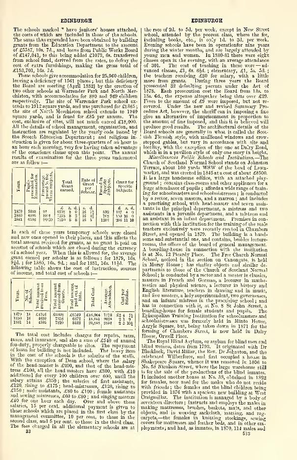
EDINBURGH
The schools marked * have janitors' houses attached,the costs of which are included in those of the schools.
The sums thus expended have been obtained by buildinggrants from the Education Department to the amountof £5587, 10s. 7d., and loans from Public "Works Boardof £147,041, to this being added £1073, 6s. transferred
from school fund, derived from the rates, to defray thecost of extra furnishings, making the gross total of
£153,701, 16s. 7d.
These schools give accommodation for 25,960 children,
leaving a deficiency of 1561 places ; but this deficiency
the Board are meeting (April 1882) by the erection of
two other schools at Warrender Park and North Mer-chiston, with accommodation for 880 and 969 childrenrespectively. The site of Warrender Park school ex-
tends to 1912 square yards, and was purchased for £1S65;
the site of North Merchiston school extends to 1940square yards, and is feued for £85 per annum. Thecost, exclusive of sites, will not much exceed £18, 000.
All the details of school management, organisation, andinstruction are regulated by the yearly code issued bythe Scotch Education Department ; and religious in-
struction is given for about three-quarters of an hour to
an hour each morning, very few having taken advantageof the conscience clause upon this point. The annualresults of examination for the three years undernotedare as follow :
—
** - • J
sJ2 ^3 *^ Total
Grant
Rate of
Grantper
Scholar.
•So i•sH| Grant for
Specific
^ 2So• So earned.Im!
Subjects.
CH
£ s. d. s. d. £ s. d.1879 5033 91 6308 S 16 7J 592 117 41SS0 609S 88 '4 735S 8 2 16 3J 763 150 1618S1 6516 90-39 7810 8 8 16 5 1202 206 11 10
In each of these years temporary schools were closedand new ones opened in their places, and this affects thetotal amount received for grants, as no grant is paid onaccount of schools which are closed during the currencyof a school year. When this is allowed for, the averagegrant earned per scholar is as follows : for 1879, 16s.
9Jd. ; for 1880, 16s. 9d. ; and for 1881, 16s. lljd. Thefollowing table shows the cost of instruction, sourcesof income, and total cost of schools :—
of5 oo£ .
rt v 4,
II
Usiff3 'so
goR 3 O3 °as~s
oOIs
oH
o Htea
S a
<
Cost
per
Scholar.
187918S01881
141614
£404646094595
£630873587810
£654968728442
£16,90418,84120,848
757S90249504
£2 4 7J2 192 3 10J
The total cost includes charges for repairs, rates,taxes, and insurance, and also a sum of £540 of annualfeu-duty, properly chargeable to sites. The repaymentof loans for building is not included. The heavy itemin the cost of the schools is the salaries of the staffs.With the exception of Dean school, where the salaryof the head-master is £200, and that of the head-mis-tress £100, all the head-masters have £300, with £10additional for every 100 children over 600, until thesalary attains £350; the salaries of first assistants,£120, rising to £175 ; head-mistresses, £120, rising to£150 ; male assistants, £80 to £100 ; female assistantsand sewing mistresses, £60 to £80 ; and singing masters£40 for one hour each day. Over and above thesesalaries, 15 per cent, additional payment is given tothose schools which are placed in the first class by themanagement committee, 10 per cent, to those in thesecond class, and 5 per cent, to those in the third class.The fees charged in all the elementary schools are at
33
EDINBURGH
the rate of 2d. to 5d. per week, except in New Street
school, attended by the poorest class, where the fee,
including books, etc., is only Id. to 3d. per week.Evening schools have been in operationfor nine years
during the winter months, and are largely attended byyoung men and women. In 1880-81 there were eight
classes open in the evening, with an average attendanceof 301. The cost of teaching in these were— ad-
vanced classes, £1, 6s. 6^d. ; elementary, £1, 5s. 5d. ;
the teachers receiving £20 for salary, with a little
more from grants. During three years the Boardprosecuted 32 defaulting parents under the Act of
1878. Each prosecution cost the Board from 18s. to
18s. 6d., the expense altogether being thus over £29.Fines to the amount of £9 were imposed, but not re-
covered. Under the new and revised Summary Pro-cedure Act, however, the sheriff can in imposing a fine
give an alternative of imprisonment in proportion to
the amount of fine imposed, and this it is believed milproduce good results. The architectural details of theBoard schools are generally in what is called the Scot-
tish Flemish style, with mullioned windows and crow-stepped gables, but vary in accordance with site andlocality, with the exception of the one at Dairy Road,which is in a pavilion style of only one story in height.
Miscellaneous Public Schools and Institutions.—TheChurch of Scotland Normal School stands on JohnstonTerrace, about 160 yards WSW of the head of Lawn-market, and was erected in 1845 at a cost of about £8500.It is a iarge handsome edifice, with an attached play-
ground ; contains class-rooms and other appliances for alarge attendance of pupils ; affords a wide range of train-
ing for schoolmasters and schoolmistresses ; is conductedby a rector, seven masters, and a matron ; and includesa practising school, with head-master and seven assis-
tants in the principal department, a mistress and twoassistants in a juvenile department, and a mistress andan assistant in an infant department. Premises in con-nection with this institution for the training of the maleteachers exclusively were recently erected in ChambersStreet, and opened in 1879. The building is a hand-some and substantial one, and contains, besides lecture-
rooms, the offices of the board of general management.A boarding-house in connection with the institution
is at No. 12 Picardy Place. The Free Church NormalSchool, noticed in the section on Canongate, is heldin Moray House ; has similar objects and similar de-partments to those of the Church of Scotland NormalSchool ; is conducted by a rector and a master in classics,
masters in French and German, a lecturer in mathe-matics and physical science, a lecturer in history andEnglish literature, teachers in drawing and in music,and five masters, a lady superintendent, two governesses,and an infants' mistress in the practising school ; andhas in connection with it, at No. 8 St John Street, aboarding-house for female students and pupils. TheEpiscopalian Training Institution for schoolmasters andschoolmistresses was formerly held in Minto House,Argyle Square, but, being taken down in 1871 for theforming of Chambers Street, is now held in DairyHouse, Orwell Place.
The Royal Blind Asylum, or asylum for blind men andblind women, dates from 1793. It originated with DrBlacklock, David Miller, the Rev. Dr Johnston, and thecelebrated Wilberforce, and first occupied a house inShakepeare Square, whence it was removed in 1806 toNo. 58 Nicolson Street, where the large warehouse still
is for the sale of the productions of the blind inmates.It included another house at No. 3S, obtained in 1822for females, now used for the males who do not residewith friends ; the females and the blind children beingprovided in 1876 with a spacious new building at WestCraigmillar. The institution is managed by a body ofseventeen directors ; instructs and employs the males inmaking mattresses, brushes, baskets, mats, and otherobjects, and in weaving sackcloth, matting, and rag-carpets,—the females in knitting stockings, sewingcovers for mattresses and feather beds, and in other em'ployments; and had, as inmates, in 1870, 114 males and
513
EDINBURGH
34 females ; in 1875, 146 males and 26 females. Both of
its buildings in Nieolson Street were originally private
houses ; both were purchased for its own uses, and fitted
up with every requisite accommodation and appliance;
and that at No. 58 was altered and adorned, about 1860,
at a cost of about £3500. A handsome new facade, withstone-faced dormer windows, and a neat cornice andbalustrade, was then erected ; and is pierced with a large
central door-way, flanked by two spacious windows, andsurmounted by a bust of the Rev. Dr Johnston. Thenew building at West Craigmillar stands on a rising-
ground S of Powburn, and is approached from Newiug-ton Road, nearly opposite Echobank cemetery. It waserected in 1874-76 at a cost of £21,000; is in light
French style, with a central handsome clock-tower 80feet high, surmounted by dome and lantern ; has a fron-
tage 160 feet long, and chiefly three stories high ; andcontains a circular reception hall 111 feet in diameter, a
dining hall and chapel 115 feet long and 28 wide, a work-room 72 feet long and 20 wide, and accommodation for
about 200 inmates. The school for blind children, prior
to its amalgamation with the Royal Blind Asylum, was in
a commodious building, originally a private house, at
No. 2 Gayfield Square ; was managed by a body of four-
teen directors ; and admitted boys and girls from 6 to 14
years of age. The Institution for the Deaf and Dumbdates from 1810 ; stood originally in Chessels Court, in
Canongate ; and acquired, in 1826, an edifice off the Nside of Henderson Row, in the western vicinity of theEdinburgh Academy. It is managed by a body of fourteen
directors, and conducted by a principal, two assistant
teachers, a matron, a female teacher, and a drawingmaster ; and early acquired so much celebrity, by theexcellence and success of its system of training, as to bemade a model for similar institutions in other cities.
The building was erected, by subscription, at a cost of
£7000 ; is large, commodious, and of not unpleasing ap-
pearance ; and is surrounded with pleasant garden-grounds.
The Roman Catholics have the following schools :
—
St Patrick's and St Ann's in Cowgate, St Mary's in
Lothian Street, St John's in York Lane, and anotherconducted by the Christian Brothers at Easter Road.
St George's day-school institution, founded by thelate Rev. Dr Andrew Thomson, at No. 10 Young Street,
All Saints in Glen Street, St Columbia's in JohnstonTerrace, Dr Bell's schools in Niddry Street and Green-side, the Original Industrial school in Ramsay Lane, theUnited Industrial school in Blackfriars Street, the CarseIndustrial school oft" Greenside, have buildings remark-able either for commodiousness, elegance, or both.
Theological Colleges.—The Free Church College, or
New College, was instituted in 1843, and originally
occupied halls modified out of private houses on the Sside of George Street. It was removed in 1850 to anew, spacious, imposing edifice of its own, in thePointed style of the 16th century, at the head of theMound, and is conducted bya principal and six professors,
occupying the chairs respectively of divinity, churchhistory, Hebrew and Oriental languages, exegetical
theology, evangelistic theology, and natural science
;
there being also a lecturer on elocution. Its wintersession extends from the first Wednesday of Novembertill an early day in April. The edifice was built in1846-50, after designs by W. H. Playfair, at a cost of
about £30,000, and is conjoined on the E with the FreeHigh Church. It comprises a hollow quadrangle, withinterior court measuring 85 feet by 56
;presents its
main frontage to the N, overlooking the Mound, and ex-
tending 165 feet from E to W ; measures 177 feet alongthe flanks ; is divided into two stories, crowned by arange of dormer windows ; has a groined archwayentrance surmounted by two large oriel windows, andflanked by two square towers, rising to the height of121 feet, buttressed at the corners from base to summit,and terminating each in four heavy crocheted pin-nacles ; shows, at the NE corner, belonging to the HighChurch, a similar tower 96 feet high ; is adorned on theS of its interior court with two octagonal towers sur-
514
EDINBURGH
mounted by ogee roofs and gilt vanes ; contains a libraryhall, a senate hall, nine class-rooms, and a number ofsmall apartments ; and has in the library hall a statueof Dr Chalmers by Steell. The library, which wasbegun only in 1843, now contains between 30,000 and40,000 volumes, comprising many works in patristic
theology, ecclesiastical history, and systematic theology,while other branches of literature are comparativelywell represented.
The United Presbyterian Theological Hall was formerlyin Queen Street, between St David Street and HanoverStreet, forming a conjunct building with the United Pres-byterian Synod Hall, and had till 1S76 four professorsand a teacher of elocution. In that year a change ofsession was made from two months in autumn to five
months in winter, and the curriculum was shortened fromfive years to three. The staff now comprises a principaland professors of New Testament literature and_exegesis,
Old Testament literature and exegesis, systematictheology and apologetics, church history, and practical
training, etc., as well as a teacher of elocution. Thebuilding was originally a private house, and wasexteriorly fitted with a plain large porch, and interiorly
altered to suit the uses of the Theological Hall, and to
give ingress to the Synod Hall ; and contained class-
rooms, library-rooms, and other apartments. The SynodHall, in the rear of the Theological Hall, was erectedin 1847 ; handsomely and suitably fitted up for thebusiness of the Synod, containing accommodation for
1100 persons ; and is still used on hire for the lectures
of the Edinburgh Philosophical Institution, as well as
for occasional public meetings—religious, educational,
philanthropic, and miscellaneous. The United Presby-terian Theological and Synod Halls now occupy a large
block of buildings on Castle Terrace, between CromwellStreet and Cambridge Street, with fine open view to
Princes Street. These premises were originally de-
signed for the West End theatre, opened when in-
complete as to exterior condition at the close of 1875,and intended to include an aquarium and winter gardenon its W side and a circus or music hall on the S, esti-
mated to cost altogether about £65,000. Built in a
style resembling Italian, worked upon geometric lines,
it presents its principal elevation to Castle Terrace,
with considerable ornamentation, and was designed
interiorly with much elegance, and had sittings for
3000. Purchased on the failure of the companyby the United Presbyterian Church in 1877, it wassubjected to considerable alteration both as to its
interior and exterior, and now contains one of the
largest halls in the city, designed primarily for the
annual meetings of the Synod, and has lecture-room
for the professors, library, and offices for the various
secretaries and other officials of the Church.—TheTheological College of the Episcopal Church in Scotland
is at 9 Rosebery Crescent, and has lecturers on theology,
ecclesiastical history, apologetics, and pastoral theology.
The Protestant Institute of Scotland was organised in
1850, and originated in an effort to stem the increase of
Romanism. It has its premises on theW side of George
IV. Bridge, immediately S of the central or openarches, and maintains classes, conducted by a pro-
fessor, for training students of all Protestant denomi-
nations in the polemics of the Romish controversy.
Its principal building was erected in 1862, partly to
afford requisite accommodation for its business, partly
to celebrate the tercentenary of the Reformation ;pre-
sents a neat front to George IV. Bridge ; and contains a
spacious hall and other apartments.
Ecclesiastical Halls.—Victoria Hall, the meeting-
place of the General Assembly of the Church of Scot-
land, and used also as the parochial church of Tolbooth
parish, stands at the forking of Lawnniarket into Castle
Hill and Johnston Terrace, and occupies a site only a few
feet lower than the Castle esplanade, and on a line with
the head of Grassmarket and the W side of the Mound.This hall was erected in 1842-44, after designs byGillespie Graham, at a cost of about £16,000, and is in
the decorated Gothic style. It has an oblong form, 141
EDINBURGH
feet in length, extending E and W ; presents to the E a
main front, with a massive tower pierced through the
basement with the grand entrance, crowned on the walls
with a circle of turret pinnacles, and surmounted byan elegant octagonal spire rising to the height of 241
feet from the ground ; shows, on each flank, five hand-some windows and a corresponding number of buttresses
and pinnacles ; and is commodiously and neatly fitted,
in all respects, to suit the business of the Assembly.The lower part of it is so closely adjoined by neighbour-
ing buildings and by a curve in Lawnmarket as to be
visible only at near distances ; but the spire, so adornedas to look in the distance almost like a sheaf of pinnacles,
soars above all the surrounding houses, and is fully
seen, as a conspicuous feature of the city, from several
parts of it and of the surrounding country. Imme-diately prior to the opening of Victoria Hall, the
Assembly met in St Andrew's parish church ; the
meeting-place for long previous periods being the S aisle
of St Giles' Church, and for a time between the TronChurch. The parish church of Tolbooth was formerly
the western part of St Giles'.
The Free Church Assembly met, from 1843 till 1858,
in a large, plain, low-roofed hall, carved out of anextensive suite of buildings in the style of a Moorishfortress, situated at Tanfield, on the "Water of Leith,
opposite Canonrnills, and erected in 1S25 for an oil gas-
work, which proved unsuccessful. This place was the
scene, in 1S35, of a great banquet to Daniel O'Connel,
and was used in 1847 for the amalgamation of the
United Secession and the Relief synods into the UnitedPresbyterian synod. The present Assembly Hall stands
on the N side of Castle Hill opposite Victoria Hall,
and immediately S of the Free Church College, onthe site of the palace of Mary of Guise. It waserected in 1S58-59, after designs by David Bryce, at a
cost of about £7000, and is in a style to harmonise withthat of the Free Church College. It measures nearly 100feet each way
;presents to Castle Hill a screen wall,
pierced by two entrances, and marked with panellings
and a bold stream course ; consists chiefly of a hall withaccommodation for about 1700 persons, and a spacious
corridor on the 1ST side with pointed arches and deeprecesses ; and has its main entrance, from the college
quadrangle up flights of stairs, through that corridor.
The Free Church offices are in a spacious edifice, erected
in 1859-61, after designs by Mr Cousin, in a florid variety
of the Scottish Baronial style, with frontage to the
Mound, and immediately E of tire Free Church College.
Established Churches.—St Giles' Church stands at
the junction of High Street, Lawnmarket, ParliamentSquare, and County Square. The original church onthe site was built before the year 854 ; but by whom, in
what circumstances, or why called St Giles', is notknown. A new church, in lieu of the original one, wasbuilt in the early part of the 12th century by David I.
;
stood on the site of the north-western portion of thepresent pile ; was extended, at different periods, byadditions of aisles, chapels, transepts, and a choir ; butsuffered demolition, in 1385, by an invading Englisharmy under Richard II. A reconstruction of this
church, with seemingly much of the old masonry,but consisting mainly of entirely new work, was com-menced in 1387, and went forward, in successive por-
tions, at successive periods, all in the Early Gothic style
which then prevailed. It acquired, about 1454, a large
southern aisle, with richly groined ceiling, originally
called the Preston, but at length the Assembly aisle,
because used after the Reformation as the meeting-place of the General Assembly. It underwent, in
1462, enlargement of its choir in a style of decorated
Gothic, with elevation of the central part into a cleres-
tory ; was constituted by James III., in 1466, a col-
legiate church, with a provost, a dean, 16 prebend-aries, a master of the choir, 4 choristers, a sacristan,
and a beadle, together with a number of chaplains
in attendance upon the 36 altars in the church, andbecame crowded with monuments, armorial bearings,
and costly private lofts or galleries. It was partitioned,
EDINBURGH
after the Reformation, into four churches and somelesser apartments, and put into repair by the proceedsof the sale of the paraphernalia belonging to its altars andconnected with Romish ceremonies ; was, from 1633 till
1638, the cathedral of the brief bishopric of Edinburgh;
witnessed, in July 1637, the well-known cutty-stool
exploit of Jenny Geddes, when the dean attempted to
introduce the Service Book, leading to events whichannulled Episcopacy and restored Presbyterianism ; andwitnessed also, in 1643, the swearing and subscribing of
the Solemn League and Covenant by the representatives
of the public bodies of Scotland ; but suffered much secu-
larisation in various parts, partly by the use of it as apublic exchange, and even a police station, partly by theimprisonment for several months in 1666 of the Cove-nanters taken at Rullion Green, and partly as a commonrendezvous for idle and dissolute persons. Till 1817what with the Krames, the Luckenbooths, the OldTolbooth, a western range of shops, the south-westernrange of New Tolbooth and Goldsmiths' Hall, and thesouth-eastern piazza range of Parliament Close, it
was so enveloped as to be entirely hidden from view,
with the exception only of its surmounting towerand parts of its southern and eastern fronts. It hadonce the ordinary cathedral cruciform outline, but,
by additions, alterations, and curtailments, lost nearlyall trace of its original form ; and it was in styles of
architecture ranging from pure Norman till the latest
Pointed, but now shows no feature of an earlier date
than the 14th century, and scarcely any style excepta comparatively plain variety of Gothic. It under-went, in 1829-32, under the direction of Mr Burn,with aid of a government grant of £12,600, an extensive
renovation, which, while giving it an aspect of fresh-
ness, harmony, and strength, swept away some of its
finest features, some of its unique parts, and nearly all
its antique character, so that now it presents exteriorly
an irregular, heavy, and comparatively tasteless appear-
ance, with little of either the symmetry of form or grace
of decoration commonly found in edifices of its age andclass
; yet by its massive breadth, and especially by its
surmounting tower, it strikes the eye as grand and im-pressive.
The length of the edifice, in its present form, is 206feet, and its breadth at the W end 110 feet, at the
middle 129 feet, at the E end 76 feet. The steeple wasrebuilt in 1648, on the model of a previous one, which,being weather-worn and dilapidated, required to betaken down ; it consists of square tower and lantern spire,
rises from the centre of the pile to a height of 161 feet
from the ground, and, being situated on an elevated
part of the High Street and Lawnmarket, is seen froma great distance, and forms a characteristic feature in
all views of the city. The tower terminates in a Gothicbalustrade ; the spire comprises an open octagonal lan-
tern and a crowning spirelet, showing the form of animperial crown ; and the lantern consists of intersecting
arches, set with pinnacles. "Within the spire there is a
chime of bells, which are played every week-day for anhour. The arrangement of the interior, since the Refor-
mation, has been repeatedly altered, as by the suppression
of one of the four parish churches, by changes on the
other three, and by disuse of the Assembly aisle for
Assembly purposes. In 1S72, it comprised the HighChurch in the E, the New North or West $t Giles'
in the W, and Trinity College Church in the S, but wasfreed from the last of these in 1878 by the erection of aseparate edifice for the Trinity College congregation
;
while, in 1881, that of West St Giles' was also removedto a temporary church at the NE corner of Bruntsfield
Links, pending the erection of a new edifice at ArgylePark Terrace, facing the West Meadows.An interior restoration of St Giles' was proposed in
1867, but delayed till 1872, and the part first undertakenwas the choir or High Church. Begun under the direc-
tion of Mr W. Hay, the process of renewal laid bare andrestored to light many beautiful features in pillar, wall,
and roof, as the old fittings were cleared away ; the
passages were then relaid with tiles bearing antique
515
EDINBURGH
Scottish devices ; an elegant royal pew, ornate stalls
for the lords of session and civic dignitaries, comfortable
open seats for the congregation, and a reredos and pulpit
of Caen stone, were all erected, which, with various
other improvements, cost about £4490. In its reno-
vated form, this portion of St Giles' was reopened in
March 1873. The southern part, occupied by theTrinity College Church congregation, was next under-taken in February 1879 ; began by lifting floors, re-
moving partitions, and opening up aisles ; and was com-pleted in August 1880 at a cost of about £3000, nearlydouble the estimated sum for the restoration of this
portion. The most conspicuous additions at this date
were the ornamental tiles laid in the S transept andthe Moray aisle, also the very tasteful iron-grill in
the same aisle. From this aisle there is a descent of a
few steps to a crypt, in which are the tombs of theRegent Murray, Alexander, fourth Earl of Galloway,and the Earl of Athole, Lord High Chancellor of Scot-
land, with marble tablets indicating the names anddates. From the crypt there is a further descent to thevault in which was entombed the Marquis of Montrose,in which the name and date, 1661, are likewise inscribed
on a tablet. When this vault was taken in hand, it
had been transformed into a coal cellar. It is now in
thorough order, and a few bones, being all that couldbe recovered in the vault, have been interred under thetablet on the floor. The Montrose vault is, perhaps, themost interesting historical spot in St Giles'. This com-pleted the restoration of two-thirds of the old cathedral,
and there remained only the nave, occupied by thecongregation of West St Giles', to be undertaken. Thisfurther restoration was completed in 1882, and in theexecution of it valuable specimens of 14th and 15th cen-
tury architecture have been discovered. This last portionincludes the Albany and St Eloise's (or Old Hammer-men's) chapels. These two chapels, as well as three
arches of the southern aisle, being of a higher level thanthe rest of the edifice, are enclosed within handsomescreens of wrought iron. In a recess in the Albanyaisle it is designed to place a recumbent figure in whitemarble of the dying Duke of Rothesay. All the win-dows in St Giles' are in the Perpendicular style of Gothicart which prevailed from the 14th to the 16th centuries,
and these are being filled with memorial windows in
stained glass, those in the choir being all illustrative of
the life of our Lord ; whilst the clerestory windows are
similarly filled with the armorial bearings of the several
incorporated trades of Edinburgh—the whole being thedesign and workmanship of Messrs Ballantine & Sons,under the superintendence of R. Herdman, R.S.A.When the work of restoration is fully completed, thecathedral church of St Giles' will be of valuable service
to the historian and the student of architecture, and a
place of interest second to none within the confines of
Edinburgh. It only remains to be noted that much of
what has been done and is doing in the restoration of StGiles', is owing in great measure to the public spirit andgenerous liberality of Dr William Chambers, the emi-nent publish er. (See Eegistrum Cartarum Ecclesice Sancti
Egidii de Edinburgh : a series of charters and original
documents connected with the church of St Giles', Edin-burgh, ed. by D. Laing, Edinb. 1859 ; and Chambers'sStory of St Giles' Cathedral Chwch, Edinb. 1879.)
Trinity College Church stood on the W side of thefoot of Leith Wynd ; was founded in 1462, by Mary of
Gueldres, consort of James II., as a collegiate churchfor a provost, 8 prebendaries, and 2 choristers ; and wasoriginally called the Collegiate Church of the HolyTrinity, but, after the Reformation, known as the CollegeKirk ; and was removed in 1848 by the clearances for
the North British Railway. It consisted of choir, tran-
septs, and unfinished central tower, with a richness of
design and beauty of execution equal to those of the best
Gothic structures in England, and showed, in its salient
parts, a great variety of exquisite sculptures, some of
them in natural, but most in grotesque or monstrous fea-
ture. It had an apsidal termination of its choir, piercedi^i-th three lofty and richly-traceried windows ; was
516
EDINBURGH
entered, at the S aisle, by a very fine doorway, beneatha beautiful porch with groined roof ; was seated onlyover the central aisle, leaving the pillars fully exposedto view ; and had there a lofty roof, in very rich groin-
ing, with remarkable variety of detail. The mortalremains of its royal foundress lay interred in an aisle onthe K side ; but, at the taking down of the church, these
were reinterred in the royal cemetery at Holyrood. Thestones of the edifice were removed under registry by a
skilful architect, with the view of being reconstructedon some other site ; but, becoming the subject of sharpand long-continued litigation, they lay bleaching on a
slope adjacent to the Low Calton burying-ground till
1872. The scheme for re-erection was not matured till
1871 ; and it then merged in designs by the architect
Mr John Lessels, for an entirely new building to serve
as the church, with an annexe formed out of the old
materials to serve as a congregational hall.
The new structure is oblong, and stands with front
and main entrance toward Jeffrey Street, and with oneside abutting on Chalmers Close. The front contains
the main entrance, in form of an exact reproduction of
the deeply-moulded doorway, with surmounting NormanGothic arch, which formed so notable an ornament of
the original church ; is pierced, over the entrance, with a
large, pointed, traceried window ; and has, on each side of
that window, a niche forastatue. It terminates in agable,
pierced with a circular cusped window, and surmountedby a cross ; is flanked, on the W side of the gable, by a
square three-story tower 115 feet high—on the E side,
by a turret, carried up from the ground, and finished at
the top with a stone roof and ornamental finial ; andmeasures 62 feet in width, inclusive of the tower andturret, and 70 feet in height to the top of the cross.
The tower is pierced with windows, has buttresses andcrocheted pinnacles ; and, at the height of 70 feet fromthe ground, takes the form of a broached spire of
octagonal section, relieved, half-way up, with a row of
dormer windows. The side elevations are pierced with
rows of lancet-shaped windows of two, three, and four
lights, rise to the height of 35 feet in clear wall, andare surmounted by a high-pitched roof of single span,
rising to the height of about 65 feet. Many of these
architectural details are reproductions of features in the
original church. A small building, at the S end of theWside, contains an entrance lobby and a minister's room.
The pulpit is a handsome structure of carved and mouldedwoodwork, and is another reproduction. The annexe is
mainly a reconstruction of the E end of the original
church, entirely from the old stones ; but, instead of
being placed end-on to the new structure, is so turned
round that the apse, with its three deeply-moiilded
lancet windows, and its buttresses and ornamental
finials, stands as part of the E elevation of the composite
edifice. A gable, reproducing the old transept window,
forms a corresponding feature in the W elevation ; twoarches, representing two in the old nave, pierce the Swall of the new building ; the width of the old nave,
and the height to the spring of the arch, respectively
24 and 48 feet, are preserved ; the length of the recon-
struction is 65 feet, nearly corresponding to the width
of the new church ; the arched spaces between the aisles
and the clerestory, with its beautiful roof of groined
stonework, reappear exactly as they were in the old
structure.
The Tron Church stands isolated in Hunter Square,
at the corner of High Street and South Bridge. It was
founded in 1637, opened in 1647, and completed in 1663,
at a cost of above £6000. Consecrated to Christ and the
Church, it received its name from being situated opposite
a public weighing beam or tron, called the Salt Tron. It
suffered curtailment in 1785, at the forming of South
Bridge ; lost the upper part of its original steeple, a
curious lead-covered wooden spire, by the great fire in
1824, but acquired, in 1828, a handsome new spire of
stone. It presents its main front, containing the en-
trance door-way, to High Street ; exhibits there char-
acters of architecture which have been styled the Scot-
tish Renaissance, but really do not belong to any regular
EDINBURGH EDINBURGH
style, and cannot be called interesting ; has, in each face
of its tower, a clock-dial which is illuminated from the
inside after nightfall ; and acquired, in 1870, a large
stained-glass window, of triplet tracery, divided by a
transom. (See The Tron Kirk, Edinburgh, a Lecture by
W. Findlay, Edinb. 1879.)
The Greyfriars' Churches, Old and New, stand in a
recess from the head of Candlemaker Row or S end of
George IV. Bridge; theytooktheirname from a monasteryfounded by James I. , situated at the SW corner of Grass-
market; and occupy a site on the crown or south-eastern
portion of an enclosure, which rises gently from Grass-
market to the summit at the ancient boundary of the
city, and was long the park or garden of the monastery.The monastery was an edifice of great size and muchmagnificence ; became, in 1449, the temporary residence
of the Princess Mary of Gueldres, and a few years after-
wards, the asylum of Henry VI. of England ; and wasdemolished in 1559, the garden being then given byQueen Mary to the citizens to be used as a public
cemetery. The Old church was built in 1612 ; had origi-
nally an ungraceful form, relieved only by a steeple at its
W end ; lost that steeple in 1718, by an explosion of gun-powder which had been lodged there by the city autho-
rities for security ; and was destroyed by fire in Jan. 1845.
It underwent restoration so tardily that it did not becomeagain serviceable till 1857, when it acquired windows of
beautifully stained-glass, and became notable as the first
Presbyterian Established church to adopt the use of the
organ. It numbers among its ministers Principal Rollock,
Principal Carstares, Principal Robertson, Dr JohnErskine, Dr John Inglis, Dr Guthrie, and Dr RobertLee ; and contains a beautiful medallion monument to
Dr Lee, sculptured by Hutchison, and put up in 1870.
This church figures in Sir "Walter Scott's Guy Mannering ;
and is famous for the signing of the Solemn Leagueand Covenant in 1638, partly within its walls, and partly
on a neighbouring tombstone. — New Greyfriars wasbuilt in 1721 at a cost of £3045, adjoining the W end of
the Old church. It forms, conjointly with the Oldchurch, a lengthy oblong edifice, with broad slated roof
and comparatively plain appearance. It shared in the
fire which destroyed the Old church in 1845, but suffered
much less injury, and was soon restored for use.
Lady Yester's Church was founded in 1647 by DameMargaret Ker, Lady Yester, being built, and partly en-
dowed from a gift of 15,000 merks, by that lady. It stood
a little to the E of the site of the new church which super-
seded it, and was surrounded by a small cemetery nowcovered with buildings. The new Lady Yester's Churchwas erected in 1803 on the N side of Infirmary Street,
a plain structure, without a spire, and has a quaint
nondescript front, sometimes erroneously described as
Gothic. In 1865, it underwent window decoration
and internal improvement at a cost of about £600, andagain, in Oct. 1881, was further altered and improved at
a cost of about £700.—St John's Church stands on the
S side of Victoria Street, was built in 1S3S, and is a
large edifice, in mixed architecture, with a Saxon door-
way, and without a tower.—Greenside church stands
on the northern slope of Calton Hill, at the W end of
Royal Terrace, and is sufficiently isolated to expose all
its sides to view. It was mainly built in 1838, butdid not acquire the greater part of its tower till 1S51
;
is a quasi-cruciform structure, in very poor modernGothic ; has a tower of only two stages, crowned withpoor pinnacles ; and, being a conspicuous object in the
near neighbourhood of great masses of Graco-Italian
architecture, is a blot upon the landscape.—The Gaelic
church stood at the corner of Horse Wyud and ArgyleSquare, adjacent to the W end of North College Street,
and was a plain building, without a spire. Being pur-
chased by the City Improvement Trustees for £6000,it was removed in the clearances for Chambers Street in
1371. The congregation, after worshipping for a timein the Reformation Society's Hall in George IV. Bridge,
occupy now a place of their own in Broughton Street,
which was some years ago vacated by the congregation
of the Catholic Apostolic church.
St George's Church stands on the W side of Char-lotte Square, on a line with George Street. It waserected in 1811-14, after designs by Robert Reid, at a
cost of £33,000 ; is in massive Grreco-Italian style, ona square ground-plan measuring 112 feet each way ; andis surmounted by a miniature of the dome of St Paul's
in London, but so large and beautiful as to be more like
a reduced copy than a mere miniature. The churchfront, toward the square, has a lofty Ionic portico, withfour columns and two pilasters, between two compara-tively plain projecting wings—the columns rising fromthe platform of a flight of steps, and surmounted byonly an entablature and a balustrade, with a heavyand tasteless appearance. The domed superstructure
comprises—first, a square basement, with massive cor-
nice ; next, a circular tower, engirt with an attic-
Corinthian colonnade ; next, a great lead-covered dome,and then, successively, a cyclostyle lantern, cupola, andcross,—the last at the height of 150 feet from theground, the whole being finely proportioned, admirablyexecuted, and gracefully impressive. It figures verynobly both in near views around the square, and in all
the general views of the New Town.—St Luke's Churchstands in Young Street, was originally a chapel of ease
to St George's, and is a large, plain, modern edifice,
without a tower.
St Andrew's Church stands on the N side of GeorgeStreet, opposite the Commercial Bank. It was built in
1785, in plain oval form, without a steeple, but acquired
afterwards an attached structure on its front, compris-ing an elegant tetrastyle Corinthian portico, surmountedby a tower and spire 168 feet high ; and is notable as the
meeting-place, in 1843, of the General Assembly, at
which occurred the Disruption, or secession of the FreeChurch. It underwent interior improvement and de-
coration in 1862. The tower is of three stages, verysymmetrical and adorned with pillars, and contains afine chime of eight bells ; the spire is octagonal andbeautifully tapering ; and the two together form a
graceful steeple, which figures conspicuously in almostevery view of the New Town.—St Stephen's Churchstands at the foot of the northern New Town, on a site
confronting the line of St Vincent Street. It waserected in 1826-28, after designs by AY H. Playfair, at acost of £21,000 ; is in a mixed style of architecture ; has
an octagonal outline and heavy appearance ; and presents
to St Vincent Street a narrow facade, with spacious lofty
flight of steps, leading to a massive arched doorway,flanked by comparatively plain receding fronts, andsurmounted by a massive square tower, rising 163 feet
from the ground, and terminating in a lofty balustrade,
with elegant double cross at each angle. Its com-modious interior underwent considerable alteration andrenovation consequent upon the introduction of anorgan in 1880.—St Mary's Church stands in the centre
of the unfinished Bellevue Crescent. It was built in
1824, after designs by Thomas Brown, at a cost of
£24,000 ; has an oblong form, with the NE end as
its main front ; and is adorned there, from the plat-
form of a spacious flight of steps, with a noble, lofty,
hexastyle, pedimented Corinthian portico, surmountedby a tower of three stages, terminating in a cupolar
superstructure, rising to the height of 186 feet. Thefirst stage of the tower is square, and has Doric pillars
at its corners ; the second and the third stages are
circular, and have respectively Ionic and Corinthianpillars around them ; the cupola is little more than anarched stone roofing over the third stage, and entirely
out of harmony with the rest of the pile, but is crownedby a beautiful, small, open cyclostyle in the form of alantern.
St Cnthbert's or West Church has been noticed in
the section on St Cuthbert's parish.—St Bernard'sChurch stands in West Claremont Street, was built in
1823 as a chapel of ease to St Cuthbert's, and is aspacious and comparatively plain edifice, with a low,
neat steeple.—Buccleuch church stands in BuccleuchStreet, opposite Crosscauseway, 120 yards E of GeorgeSquare, and was erected in 1755, as a chapel of ease to St
517
EDINBURGH EDINBURGH
Cuthbert's, at a cost of £800 ; but, being a veryunsightly structure, it underwent restoration and em-bellishment in 1866, after designs by D. M'Gibbon, at
a cost of more than £2000. It has now a lofty gable over
its entrance, and a turret 70 feet high on its S side, andis adorned with several very fine memorial windows,one of them erected by the Marquis of Bute to the
memory of his ancestress, Flora, daughter of Macleod of
Rasay.—St David's Church stands in Gardner's Cres-
cent, was originally a chapel of ease to St Cuthbert's,
and has a Grecian portico, but very plain flank.—Deanchurch stands in the suburb of Dean, erected as a
chapel of ease to St Cuthbert's, and has been already
referred to under Dean.—Lady Glenorchy's Church, in
Roxburgh Place, was built in 1809 as a chapel of ease to
St Cuthbert's ; was long called Roxburgh church ; and is
a plain edifice. The original Lady Glenorchy's Churchsprang from the beneficence of the wife of John Vis-
count Glenorchy. It was, for some time, a rented chapel
in Niddry's Wynd, designed for Evangelical ministers of
all denominations ; but by-and-by a large plain edifice of
1774, situated at the foot of Leith Wynd, in connectionwith the Establishment, and demolished for the NorthBritish Railway in 1845. It is now represented, onthe part of the Establishment, by Roxburgh church,
and on the part of the Free Church, by a new edifice in
Greenside Place.—Grange church stands at the corner
of Kilgraston Road and Strathearn Road ; was erected
in 1871, after designs by Robert Morham, at a cost of
about £6000, as a memorial to Professor James Robert-
son ; and consists of nave and transepts, with a steeple
in the centre of the breast gable, rising to a height of
150 feet.—Morningside church stands on the E side of the
upper part of Morningside suburb, and has been already
referred to under Morningside.—Newington church is
on the S side of Clerk Street, a little N of Newington;
was erected in 1823 as a chapel of ease to St Cuthbert's ;
is a neat, large, oblong edifice, with a Roman end front,
and a steeple 110 feet high.—Abbey church stands onthe S side of London Road, near Abbeyhill station ; waserected in 1875-76 at a cost of about £7000 ; is a hand-some edifice in the Gothic style, with tower and spire
;
contains 850 sittings ; and serves for a quoad sacra, parish
formed out of Greenside and South Leith parishes.—St
Leonard's Church stands in Parkside Place, opposite the
E end of Lutton Place ; was built in 1876 at a cost of
about £5500 ; contains 900 sittings ; and serves for a
quoad sacra parish formed out of St Cuthbert's, LadyYester, and Newington parishes.—Queen's Park churchstands in Prospect Place, Dnmbiedykes Road ; is in the
Gothic style, with a spire rising 150 feet, having accom-modation for 850 sittings ; and cost about £4000.—WestCoates church stands on the Glasgow Road, not far
from Donaldson's Hospital ; was erected in 1869, after
designs by Mr Bryce, at a cost of £7500, as a chapel of
ease to St Cuthbert's ; is in the later Pointed style, witha tower and spire 130 feet high ; and has been pro-
nounced 'clumsy, squat, and badly detailed.'—Mayfieldchurch is in Newington, and is also a neat, thoughsmall, building in Gothic style, with handsome interior.
A new church is at present in progress (1882) at NorthMerchiston, which is estimated to cost £13,000.
Free Churches.—Barclay Church stands on the westernverge of Bruntsfield Links, opposite the entrance to
Gillespie Crescent, and was erected in 1862-63, after
designs by F. T. Pilkington, at a cost of £10,000, de-
frayed from a bequest by a lady named Barclay. It is a
curiously intricate example of the Venetian-Gothic style,
pronounced by Professor Blackie, 'full of individual
beauties or prettinesses in detail, yet, as a whole, dis-
orderly, inorganic, and monstrous.' It has an elegant
tower and spire, rising to the height of 250 feet, reliev-
ing the monotony of the surrounding scenery, and figur-
ing grandly from many distant points of view. BarclayChurch underwent considerable interior alteration in
18S0, adding materially to the comfort of the congrega-tion.—Buccleuch church stands in the western sec-
tion of Crosscauseway, nearly confronting the Esta-blished Buccleuch church. It was erected in 1S56
518
in pleasing Gothic style, and acquired, in 1S61-62, after
a design by Hay of Liverpool, a lofty, well-proportioned,octagonal spire.—Canongate or John Knox's Church is
on the N side of Netherbow, immediately E of JohnKnox's House, and was erected in 1850. It has a remark-ably beautiful facade of florid Gothic, terminating in
four richly crocheted pinnacles, and in a decoratedpediment, surmounted by a cross.—Cowgate and Cow-gatehead churches are comparatively recent buildings,
erected on the territorial principle for Cowgate district.
—Dairy church is at the corner of Cathcart Place, Dairy.It is a very handsome building, with fine front and en-
trance porch, with several pinnacles on its roof, and at
its western corner a very graceful spire rising froma lantern tower. It has a congregational hall withrotunda-shaped front at its eastern side.—Dean churchhas been already noticed.—Grange or Chalmers' Memo-rial Church stands at the angle of Lovers' Loan andopposite Grange cemetery. It was erected in 1866,after designs by Patrick Wilson, at a cost of £5000,as a memorial of Dr Chalmers ; consists of nave andtransepts, respectively 60 and 67 feet long, and each
31 feet wide ; is in the Geometric style, with a highly-
pitched gable on the nave, forming the principal front ;
nas there a large four-light traceried window abovethe entrance door-way ; and was designed to have anoctagonal spire, surmounting a three-stage tower, andrising to the height of 165 feet.—Greyfriars' Church is
in Graham Street, and has a neat Saxon front, with twosmall turrets and a pediment.—High Church forms the
eastern part of the Free Church College buildings, is of
plainer character than the rest of these buildings, andhas, on its E side, a small neat porch.—Holyrood church
stands amid a block of buildings immediately W of the
Palace-yard of Holyrood, and is a plain edifice.
Lady Glenorchy's Church stands in Greenside Place,
opposite the junction of Picardy Place and Leith Walk ;
and has a factitious front in the Tudor style, with low,
broad, embattled tower.—M'Crie Church stands in
Davie Street, is a plain large building, formerly be-
longed to the Original Secession, and is notable for the
ministry in it of Dr M'Crie, the biographer of Knox andMelville.—Martyrs' Church, originally belonging to the
Reformed Presbyterians, amalgamated with the Free
Church in 1S76, and is on the W side of George IV.
Bridge. It was built in 1860, and has a Gothic front
;
a former building being in Lady Lawson's Wynd.—May-field church is at the corner of St Andrew's Terrace andMayfield Loan ; is Gothic in style, cruciform in plan ;
and has a very neatly decorated doorway and frontage.
—
Moray Church stands in the grounds of Moray House,
contiguous to South Back of Canongate ; was erected in
1862 ; and is a reduced copy of Barclay Church, without
the tower.—Morningside church has been already noticed
under Morningside.—Newington church is on the E side
of Clerk Street, a short distance S of Newington Esta-
blished church ; was built partly in plain style immedi-
ately after the Disruption, partly somewhat ornately a
number of years later ; and is a spacious edifice, with a
Gothic front.—New North Church stands in the sharp
angle at the junction of Forrest Road and Bristo Place,
confronting the line of George IV. Bridge. It was erected
about 1846 ; is an oblong edifice in the Gothic style,
with main front on the end toward George IV. Bridge ;
and has, on the basement of that front, a projection
about 12 feet outward, adorned with an unfinished Gothic
colonnade.—Pilrig church stands at the N corner of
Pilrig Street and Leith Walk, and was erected in 1861-62,
after designs by Peddie & Kinnear, at a cost of about
£6000. It is in the French-Gothic style, has two wheel
windows toward respectively Pilrig Street and Leith
Walk, and is surmounted by an octagonal spire 150
feet high.—Roseburn church stands near Coltbridge and
Murrayfield, and is a handsome modern edifice, with a
spire.—Pleasance church was a plain building in Pleas-
ance, but the congregation, in 1S75, purchased the In-
dependent Chapel in Richmond Place, an edifice erected
about 1842, and presenting pleasant Early Gothic
features.—Roxburgh church has a rear front to Rich-
EDINBURGH
iuond Place, and a neat porch opening into Hill Square,
and is a plain building.—St Andrew's Church standsbehind the street-line of the S side of George Street, andis entered by a lobby through the house which wasoccupied till 1850 by the Free Church College.—StBernard's Church stands on the S side of HendersonRow ; was erected, in lieu of a previous building, in
1856 ; and is in the Gothic style, consisting of nave andaisles with a small spiral tower.—St Columba's or theGaelic Church and St Cuthbert's Church stand in short
streets between Castle Terrace and Lothian Road, andare neat Gothic structures.—St David's Church standsin Morrison Street, and is a plain building, with a large
hall behind, added in 1881.
St George's Church stands at the corner of ShandwickPlace and Stafford Street, and superseded a previous
church in Lothian Road on ground now occupied by theCaledonian station. It was built in 1S66-69, after designs
by David Bryce, at a cost, including site, of about£31,000 ; is in the Palladian style, perfectly classical, butwith an aspect which would have been suited equally for
a music hall. It presents its main front to ShandwickPlace, with an entrance flanked by coupled Ionic columns,and slightly projecting wings adorned with Corinthianattached columns, and has also an elaborately finished
flank to Stafford Street. It measures 125 feet in lengthand 78 feet in width ; includes, over a vestibule andcorridor, a large congregational hall ; is fitted with low-backed seats, open at the ends ; and has a platform,instead of a pulpit, in an apse with semi-dome roof,
supported by six pillars of polished Peterhead syenite.
In 1882 a spire was added, rising from the SW cornerof the building, where from the level of the church roof
the campanile springs as a plain square tower, buttressedat the corners, and pierced with one small window nearthe base, to a height of 6S feet. Here the buttresses are
finished off with scrolls, while round the tower is carried
a deep frieze enriched with festoon ornaments. Overthe tower rises the belfry, showing double pilasters at
each corner, and having each side divided by Corinthianpillars into three-arched openings. Then comes anotherfrieze and cornice, which supports the lantern formingthe crowning stage of the structure. The angles of theoctagonal lantern are filled with vases, each of the eightsides presents a round-headed arch, and the pyramidaltop terminates in a small ornamental finial at the heightof 185 feet from the ground. There has been much dis-
cussion as to the harmony of the spire with the building.
—St John's Church stands at the E end of JohnstonTerrace, close by what in old times was the West BowPort, and was erected in 1847, after designs by RobertHamilton, in a mixed style of Early Gothic, with a con-siderable amount of pleasing embellishment. It presentsits main front, "with a moderate elevation, to the junctionof Lawnmarket and Johnston Terrace, nearly oppositeVictoria Hall ; rests its rear front on a lofty substructionfacing Victoria Street, nearly opposite St John's Esta-blished Church ; and is notable for the ministry in it ofDr Guthrie and Dr Hanna.—St Luke's Church standsbehind the house-line of Queen Street ; is entered by alobby thence ; and has, on the house-line, a factitious
front, in the Tudor style, with two crocheted turrets.
St Mary's Church is at the N corner of Albany Streetand Broughton Street, superseding a previous edifice inBarony Street, andwas erected inlS59-61, after designsbyJ. T. Rochead, at a cost ofabout £13, 000. It is in a mixedstyle of Third Pointed and Tudor ; exhibits some fine work,with occasionally an excess of detail ; and has a richlycarved steeple 180 feet high.—St Paul's Church standsin St Leonard's Street, nearly opposite the end of Ran-keillor Street. It was built before the Disruption, andhas a plain Roman front, surmounted by a quadrangularbelfry, each face of which is pierced with a wide arch.
—
St Stephen's Church is in "VVemyss Place, and was formedout of the upper parts of large private houses ; andshows lofty windows, surmounted by a broad entablature.—Stockbridge church, adjacent to the foot of DeanStreet, in Stockbridge, was erected in 1867 out of thematerials of St George's Church in Lothian Road, and is
EDINBURGH
mainly an exact reproduction of that church, originally
built after a design by Mr Cousin. It is in the Anglo-Norman style, with some mimic arcade decorations andtwo carved turrets, and acquired much heaviness of as-
pect by the carrying up of its original front into a broadpyramidally-roofed tower. — Tolbooth Church standsbehind the N side of St Andrew Square, with rear andflank exposure to the view from Queen Street, beingentered by a lobby through a house from St AndrewSquare. It was erected in 1857, and is in the Gothicstyle, with large end window and roof-lights.—TronChurch was formerly in a close off High Street, quite
concealed from general view, but now occupies an ornatebuilding in Chambers Street, opposite the Industrial
Museum.—Viewforth Church stands at the end of WestGilmore Place, and was built in 1871-72, after designs byPilkington & Bell, at a cost of about £4500. It is in theGeometric-Gothic style ; includes a sunk story, withschool-room and vestry ; and has an ornate front, withlarge central gable, smaller side gable, and a corner
tower 120 feet high.—West Port church stands in WestPort, was erected as the result of Dr Chalmers' personalterritorial mission work, and is in the Gothic style.
United Presbyterian Churches.—Argyle Place churchis cruciform in plau, presenting a gabled front to Car-
lung Place, through which is the principal entrance bya projecting porch, with the doorway recessed andflanked on both sides by two engaged columns, sup-
porting a finely carved arch pediment, flanked on the
NW angle with a square tower, above which a graceful
spire rises to a height of 150 feet from the ground ; thewhole is in Pointed Gothic style, and cost about £5000.—Arthur Street church belonged originally to Baptists ;
was purchased in 1833, by a Relief congregation, for
£2100 ; and became United Presbyterian at the unionof the Relief and the United Secession.—Blackfriars
Street church stands in Blackfriars Street, supersededa previous place of worship occupied as a missionchurch, was erected in 1871 at the rebuilding of the
Blackfriars Street portion of the city improvements,and is a neat edifice.—Bread Street church was built in
1831, and has a Roman front with pilasters andpediment.—Bristo Street church is in a court off
Bristo and Marshall Streets, and is on the site of
the oldest dissenting Presbyterian church in Edin'burgh. It was built in 1802 at a cost of £4084,enlarged at a cost of £1515, interiorly renovated in
1872 at a cost of about £1300 ; and is neat and veryspacious.—Broughton Place church stands across the Eend of Broughton Place ; was built in 1821 at a cost of
£7095, and repaired and altered in 1853 and 1870 eachtime at a cost of about £2000 ; has a Roman front, withelegant tetrastyle Doric portico ; and is notable for the
ministry of the Rev. Dr John Brown.— Canongatechurch superseded a previous place of worship usedas a mission church, was built in 1869 at a cost of
£3200, and is in the Early Pointed style.—College
Street church is in South College Street, was re-
built in 1857, has a front in the Florentine style, and is
roofed and lighted in the manner of a Gothic cleres-
tory.—Colston Street church is in a new street of that
name off Leith Walk, and is neat and elegant.—DrDavidson Memorial Church stands in Eyre Place, Canon-mills, and is occupied by the congregation which for-
merly worshipped in the Synod Hall, Queen Street.
—
Dairy Road or Haymarket church, a short distance SWof Haymarket station, superseded an iron structure of
1871, destroyed by a storm in Oct. 1874 ; was erected
in 1875 at a cost of about £5000 ; includes a basementtower, intended to be surmounted by a spire ; is in the
Gothic Romanesque style, with joint buttresses rising
to a height of about 100 feet ; and contains 840 sittings.
—Dean Street church stands in Stockbridge, and wasbuilt in 1828 at a cost of £2100.—Hope Park church
is adjacent to the E end of the Meadows, in the
near vicinity of the Newington Established and Free
churches ; superseded a previous church of 1793 in
Potterrow ; was erected in 1867 ; and is a handsomeedifice.—Infirmary Street church was built in 1822,
519
EDINBURGH
belonged for a time to the protesting Antiburghers,
was noted for the ministry of Rev. Dr Paxton, cameinto its present connection in 1856, and is adorned in
front with Doric pilasters.—James Place church wasbuilt in 1800 at a cost of £3600, and repaired in 1828
at a cost of £650 ; and is plain but spacious.—Lauriston
Place church was built in 1859, is a handsome Gothicstructure, a large congregational hall being recently
added to its western side.—London Road church stands
at the corner of London Road and Easter Road ; waserected in 1874-75 ; is in the Pointed style, with a towerand spire 160 feet in height ; and contains 950 sittings.
—Lothian Road church was built in 1831, and has anItalian front of three stories, with recessed centre, rusti-
cated basement, and surmounting balustrade.—Mor-ningside church has been already noticed.—Newingtonchurch stands at the corner of Grange Road and Cause-
wayside ; superseded a previous church in DuncanStreet, purchased in 1847 from Baptists ; was erected
in 1862-63 ; and is in the Early Pointed style, with a
tower.—Nicolson Street church stands near the S endof Nicolson Street ; was built in 1819 at a cost of
£6000 ; has a broad Gothic front, with turret pinnacles
90 feet high ; and is notable for the ministry of the
Rev. Dr John Jamieson, author of the Scottish Dic-
tionary and of various theological works.—North Rich-
mond Street church is small and neat.—PalmerstonPlace church stands on the SW side of the street, a
little SW of Coates Crescent ; was erected in 1873-75at a cost of about £13,000 ; is in classic Italian style,
with a hexastyle portico of circular-headed arches, andwith two massive flanking towers about 100 feet high ;
and contains about 1100 sittings.—Portsburgh church,in the Vennel, was built in 1828 at a cost of £1927.The congregation removed in 1881 to a new church in
Gilmore Place, costing £4600.—Rose Street church wasrebuilt in 1830 at a cost of £3042, and presents to the
street the greater side of an oblong, in Roman architec-
ture, with pilasters and balustrades.—Rosehall churchis on the E side of Dalkeith Road, adjoining Rosehall
Terrace ; is small and ornate in appearance ; has two side
entrances, arched and supported by pilasters ; recessed
over each of these are square towers, with open stone-
work lanterns at top ; has a font of Caen stone like that
of St Giles' ; behind is a large congregational hall.
Episcopalian Churches.—St Mary's Cathedral Churchfor the diocese of Edinburgh stands on the E side of
Palmerston Place, in a direct line with Melville Street.
It originated in a bequest by the Misses "Walker, whoowned the estate of Coates, comprising the sites of CoatesCrescent, Walker Street, Melville Street, and several
other thoroughfares in West End, and yielding a revenueof £20,000, which represents a capital of about £400,000.The whole was bequeathed for erecting and endowing acathedral, and for purposes connected with it, so far as
the funds would allow, and they became available in
1870. The work was begun in 1874 from designs bySir Gilbert Scott, after whose death, in March 1878, thebuilding was carried on and completed by his son, MrJohn Oldrid Scott, and formally consecrated and openedin Oct. 1879. The cathedral is cruciform in plan, withlofty central tower and spire ; the nave, choir, andtransepts are respectively seven, four, and two baysin length ; each of the four arms have aisles on bothsides, and by the arrangement of the reredos the choir
aisles are connected at the E end. At the W end thenave aisles are terminated by two steeples ; but thefunds were not available for carrying these above theroof-level of the nave, the cathedral being thus deprivedof a most interesting external feature. The style is thatwhich preceded the Early Pointed, and is partly foundedon that of Holyrood and Jedburgh Abbeys, and others of
the finest churches in Scotland. The choir, crossings,
and aisles are groined in stone, the nave and transeptsin wood. The four facades are varied in designs : theE end has three lancets commencing at the height of
15 feet, above is a range of niches containing figures
about life size, while over these is an ornate design of aseated figure of our Lord in glory, a series of angels being
520
EDINBURGH
grouped around ; the fronts of the N and S transeptspossess wheel windows ; the W front is occupied by agreat arch, within which are four lancet windows ofequal size and design, a beautiful rose window beingabove these. In this front is the main entrance, withrecessed arch and elaborate carving ; the doorway is
double, being divided by a central pier, on which rests
a sculptured tympanum. The total external length is
262 feet ; width across transepts, 132J feet ; across naveand aisles, 75 feet ; internal height of nave, 71 feet
;
choir, 60 feet ; of ridge of roof externally, 84 feet
;
diameter of central tower, 42 feet ; height of spire, 225feet. Internally the whole is of rich design—the pave-ment of the choir being of Sicilian marble and tiles
;
the wooden fittings, stalls, bishop's throne, etc. , being of
walnut wood. In 1880 there was added a reredos at theupper end of the chancel, of reddish-veined alabasterwith enrichments of variously coloured marbles, andsculptures in white Carrara—the most important of thelatter being a relievo of the Crucifixion by Miss Grant.The structure is approached by steps from the level ofthe chancel floor
;presents a central elevation and two
receding wings. The lower stage consists of a plainbase 5 feet high, with a row of medallions, and sur-
mounted by a carved cornice. Over this rises upon twopairs of marble shafts a wide pointed arch, decoratedwith beautiful carving, and carrying a crocheted gabletwith ornamental cross by way of finial ; the gablet sup-ports four angelic figures, and its tympanum is piercedby a six-leaved opening. Within and behind this archis a second, supported at either side by four columns of
pinkish Jura marble. Behind this again comes anarcade of three openings, resting on four octagonalcolumns of a darker shade, forming a screen to thecentral relievo of the Crucifixion, which entirely fills
the three openings. Two statues occupy the flankingwings of the reredos—on one side St Margaret of Scot-
land, on the other St Columba bearing the crosier of StFillan. (See History of the Erection of the CathedralChurch of St Mary, Edinb. 1879.
)
St Paul's Church, on the N side of the E end of YorkPlace, was previously the bishop's church or quasi-
cathedral, and was erected in 1816-18, after designs byArchibald Elliot, at a cost of about £12,000. It consists
of nave and aisles, standing E and W, and measuring 123feet by 73, and is an elegant edifice in the later Pointedstyle, with some intermixture of Tudor. Rich mould-ings, fine tracery, crocheted pinnacles, and beautiful
Gothic balustrades adorn the street side and the twoends ; a grand window is in the E, re-decorated withpainted glass in 1850 ; and four octagonal turrets,
almost wide and high enough to be called towers, all of
one pattern, rise from the four angles of the inner walls,
and are cut throughout their upper parts into openornate stone-work. The organ was originally built in
1774 by Schnetzler for the church which preceded thepresent, and underwent, from time to time, such improve-ments as won for it the reputation of being the finest
organ in Scotland. It underwent further improvementin 1870 ; measures 27 feet in length and 30 in height
;
and has forty stops, besides eight couplers. This churchis notable also for the ministry in it of the Rev. Archi-
bald Alison, author of Essays on Taste, who died
in 1839.
St John's Church stands at the corner of Princes
Street and Lothian Road, and was erected in 1818, after
designs by W. Burn, at a cost of £15,000. It is an ob-
long edifice, with nave and aisles, 113 feet long and 62wide, and is in a florid Gothic style, with details copied
from St George's Chapel at Windsor. It is adorned on the
sides with beautiful windows, symmetrical buttresses,
finely crocheted pinnacles, and large niches with richly-
carved brackets and canopies ; is surmounted at the Wend by a square well-proportioned tower, pierced throughthe basement with a noble doorway, relieved in its sides
by beautiful windows, and crowned, at the height of
120 feet, with ornate pinnacles ; rests along the S side
on ornamental burial-vaults, with a terrace and other
burial-vaults to the S ; and has attached to its E end a
EDINBURGH
large low vestry, in a style harmonious with the mainbuilding. The pillars and arches of the interior are
light and symmetrical ; the middle roof is ornamentedwith mouldings and a profusion of decorations ; thegreat E window is 30 feet high, and exhibits figures of
the twelve apostles by Eggington, of Birmingham ; thereredos is a splendid erection of 1871, after designs byPeddie & Kinnear ; and the organ is a very fine instru-
ment. An addition of a new chancel at the E end wasmade in 1882. This erection has a length of 25 feet
and a width of 21 feet, having large traceried windowsin each of its sides ; is carried to the full height of thenave ; and finishes on the top with ornamental parapetand pinnacles. A new entrance door in the side nestPrinces Street gives access to the church and to thechoir vestry below the chancel. The total cost of these
later alterations was about £2600. Dean Ramsay, theauthor of Reminiscences of Scottish Life and Character,
was long incumbent of St John's. A school-chapel, con-
nected with St John's, stands in Earl Grey Street ; wasbuilt in 1852, and enlarged in 1862 ; and is a plain
cruciform structure, used as a school on work-days,and as a chapel on Sabbaths.
Trinity Church is at the NW end of Dean Bridge,
and is noticed in the paragraph on Dean.—St George'sChurch stands on the S side of York Place, was built
in 1794 after designs by Robert Adam, and is a quaint-
looking edifice, in a mixed style of Gothic andGrecian.—All Saints' Church, in Brougham Street, waserected in 1867, after designs by R. Anderson, at a cost
of about £4000 ; consists of nave, aisles, transepts, andoctagonally-ended chancel ; is surmounted, at the SWcorner of the nave, by a tower 110 feet high, withrichly-moulded belfry stage and saddle-backed roof ; andin 1875-76, at a cost of about £1500, underwent muchalteration and improvement. It has a school attached,
entering also from Glen Street.—St Andrew's Churchstands in the South Back of Canongate, opposite StJohn Street ; was built in 1857 ; and is a small oblongedifice of unpolished stone in the Saxon style, with anapse and a low square tower.—St Columbia's Church,in Johnston Terrace, is a Gothic building, with onlyone flank exposed to full view ; and has, at its W end,a low square battlemented tower.—St James' Churchstands on the N side of the W end of Broughton Place,
and is a large plain building, uniform with the con-
tiguous range of private houses.—St Peter's Churchis in Lutton Place. It is a plain, high-roofed Gothic-windowed edifice of 1858, aud has a tower and spire of
later date, too large and lofty to harmonise with its ownbulk.—St Paul's Church, in Carrubber's Close, alreadyreferred to, was built by the Jacobites immediatelyafter the Revolution. It was cleared away on the for-
mation of Jeffrey Street, and a new Gothic edifice is
being erected in its place in the new street.—ChristChurch Scottish Episcopalian Church stands at Mor-ningside, and has been already noticed.
St Thomas' English Episcopalian Church standscompact with private houses on the E and the W
;
presents a S front to Caledonian Station ; has a N front
in the recess-angle facing the point where PrincesStreet, Hope Street, Queensferry Street, and MaitlandStreet meet ; and is adorned there, in the Normanstyle, with a beautiful porch, some exquisite mimicarcade-work, and a profusion of chevron ornaments.
—
Christ Church English Episcopalian Church stands in
St Vincent Street, opposite St Stephen's EstablishedChurch ; was built in 1856 ; is a small Gothic edifice,
with nave, chancel, N aisle, and spirelet ; and looks bothdwarfish and ambitious in comparison with the con-fronting massive form of St Stephen's.
Other Churches. —The United Original SecessionChurch stands at the W end of Victoria Terrace ; wasbuilt in 1866 at a cost of about £1700 ; is in theByzantine style, with an ornamented front gable ; andadjoins the old building in West Bow known as MajorWeir's house, now converted into a vestry and otheroffices in connection with the church.
Augustine Independent Church faces the E side of
EDINBURGH
George IV. Bridge, but rises from Merchant Street at
30 feet lower level. It superseded a previous church in
Argyle Square on ground now occupied by the Indus-trial Museum, and was erected in 1859-61, after designs byHay, of Liverpool, at a cost of about £15,000. It includes
two stories below the level of George IV. Bridge, dis-
posed in congregational hall, school-rooms, and otherapartments ; is in the Byzantine style, with three
recessed arched doorways, and a surmounting circular
headed window 16 feet high ; and is surmounted, onthe front, with a tower and minaret of pagoda-likeappearance, rising to the height of 120 feet.—AlbanyStreet Independent chapel stands at the SE corner of
Albany Street and Broughton Street ; was built in
1816 at a cost of £4009, and improved in 1867 at a cost
of more than £2000 ; and presents an ornamental flank to
Albany Street and an end front in mixed Roman style,
with entrance doorway, to Broughton Street.—Cale-
donian Road or Dairy Independent chapel was built in
1872, after designs by A. Heron, at a cost of more than£3000, and is in the Gothic style, with a belfry spire
100 feet high.—Hope Park Independent chapel standsat Hope Park Terrace ; was erected in 1875-76 at a cost
of about £4000 ; serves in lieu of Richmond Place chapel,
sold to the Pleasance Free church congregation ; is in theRomanesque style ; and contains 650 sittings.—Rich-mond Independent chapel is a plain building, formerlyused as a school ; stands in a recess off East PrestonStreet ; and is now almost shut out of view from thestreet by a range of houses.
The Brighton Street Evangelical Union chapel blocksthe head of Brighton Street, off the N side of LothianStreet ; was originally a Relief church ; and has a
Roman front of curved contour, with pilasters andpediment.—Buccleuch Evangelical Union chapel standsin West Crosscauseway, was erected in 1874 at a cost
of £2500, is a neat edifice with a Gothic front, andcontains 550 sittings. A similar building of the samedenomination is in Fountainbridge.
Dublin Street Baptist chapel was built in 1858, andis a handsome Gothic edifice, with a double transept
and a spirelet.—Charlotte Street Baptist chapel, at thecorner of West Rose Street and Charlotte Street, wasoriginally Episcopalian ; went by sale to Baptists ; hasa neat Roman front ; and is notable for the ministry of
Christopher Anderson, the author of several weB-known works.—Duncan Street Baptist chapel is in
Newington ; was originally Baptist ; went by sale, in
1847, to the United Secession ; returned by re-sale, in
1863, to Baptists ; and is a plain, but pleasant edifice.
—Bristo Place Baptist chapel has a neat Roman front.
—Marshall Street Baptist chapel is a new and neatbuilding.—The Glassite chapel in Broughton is veryplain.
The Catholic Apostolic church stands at the N corner
of Broughton Street and East London Street, and wasmainly built in 1S74-76 at a cost of about £17,000. It
is in the later Norman style, after designs by M. Ander-son ; measures 200 feet in iength, 45 in height to thewall head, 64 to the apex of the roof vault ; comprisesa nave 100 feet long and 45 wide, a chancel 61Jfeet long and 23 wide, an apse terminating the
chancel and containing an altar, an Episcopal throneand clerical stalls, and a circular baptistry 28 feet in
diameter ; and has a W end tower measuring 35 feet oneach side, a grand entrance porch through the base of
that tower, an arcaded passage from the S side of theentrance porch to the baptistry, three arched openingsin the division-line between the nave and the chancel,
and four massive, square, spired turrets at the corners
of the nave.
The Wesle3'an Methodist chapel stands at the SWcorner of Nicolson Square ; has a handsome Romanfront, with basement arcade and crowning balustrade
;
and was interiorly redecorated in 1872.—The PrimitiveMethodist chapel stands in Victoria Terrace ; was built
in 1866, after designs by Paterson & Shiells, at a cost of
about £1300 ; and is in simple Italian Gothic style, witha canopied bell-turret.—A Methodist chapel is aiso at
521
EDINBURGH
Stoekbridge.— The Unitarian chapel stands in Castle
Terrace, was built in 1835, and has a Roman Corin-
thian front, a fine interior, and a good organ.
St Mary's Roman Catholic church or Pro-Cathedral
is at the head of Broughton Street, on the ascent
toward St James Place ; was erected in 1813, after
designs by Gillespie Graham, at a cost of £8000 ; showsa handsome Gothic front with pinnacles 70 feet high
;
measures exteriorly 110 feet by 57 ; and has a fine
organ and a splendid altar-piece.—St Patrick's RomanCatholic church is at the E end of Cowgate ; was built
in 1771-74 at a cost of £7000 ; belonged originally
to Episcopalians, and was long occupied by Presby-terians ; is a large oblong edifice in the Italian style, witha bell tower ; and contains wall paintings by Runciman.—The original St Patrick's Roman Catholic churchstands at the corner of Lothian Street and Bristo Place
;
was built in 1839, and occupied as a church till about
1856, being then transmuted into St Mary's RomanCatholic school ; and has a handsome pinnacled Gothicfront.—The Roman Catholic church of the Sacred
Heart in Lauriston Street was built in 1859-60, and has
an Italian front and cupola lights.—St Margaret's RomanCatholic convent, already referred to, has attached to
it an elegant chapel in the Saxon style, after designs byA. W. Pugin.—St Catherine's Roman Catholic conventstands in Lauriston Gardens, adjacent to Chalmers'
Hospital ; was built in 1861 ; and is in the Collegiate
style.
Blackfriars' Monastery stood on or near the site of the
old High School, having gardens extending to Cowgate,Pleasance, and Potterrow. It was founded in 1230 byAlexander II., and became so frequent a residence of
its founder, as to be called the King's Mansion. It
had a large cruciform church, with central tower andlofty spire, which suffered partial destruction by fire
in 1558, and total demolition at the hands of the
Reformers of 1558, the lands belonging to it beinggiven by the Crown to build and endow Trinity Hospital.
—Greyfriars' Monastery has already been incidentally
noticed in our account of Greyfriars' churches.—TheCarmelite Monastery stood at the NE base of Calton
Hill, was erected in 1526, and disappeared at the
Reformation. — St Anthony's Chapel and Hermitagestood on a precipitous knoll, near the base of the
N side of Arthur's Seat; were founded in 1435 by Sir
Robert Logan of Restalrig ; and belonged to a preceptory
of St Anthony at Leith. The chapel stood 9 yards dis-
tant from the hermitage ; was a Gothic edifice 43 feet
long, 18 broad, and 18 high, with a square tower fully
broader than itself and about 40 feet high ; and con-
tinued to stand, in a roofless state, till about the middleof last century. The hermitage was 16 feet long, 12
broad, and 8 high ; and a fragment of it, with plain
corbels, and a piece of groined roof, still exists. A clear
cool spring, called St Anthony's Well, celebrated in the
old song, O waly, waly up yon hank, is at the foot of
the rock on which the fragment stands. A number of
other ancient ecclesiastical edifices, chiefly small chapels,
stood in various parts of the city and the suburbs, buteither were not of any note or have already been in-
cidentally noticed.
Cemeteries.—The first great cemetery of Edinburghhas already been incidentally noticed in our account of
Parliament Square, and lay around St Giles' Churchextending down the slope toward Cowgate. It re-
ceived the remains of John Knox in 1572 ; becamecompletely secularised before 1607 ; was then, or soon
afterwards, entirely effaced; and yielded up its best
known relic in 1800, in the form of a curiously sculp-
tured stone, found at the head of Forrester's Wynd,supposed to have been part of a decorated gateway at
the cemetery's western -boundary, and showing a groupof figures similar to those in Holbein's Dance of Death.
—Greyfriars' Cemetery has already been mentioned in
our account of Greyfriars' churches, and succeeded St
Giles' as the chief burial-place for the city. It became,and long continued, so overcrowded as to give cause for
alarm ; but it was subsequently relieved from pressure,
522
EDINBURGH
and adorned with walks and shrubbery. It commandspicturesque views of the S face of the Old Town andthe Castle rock ; exhibits a striking mixture of monu-ments, curious and beautiful, old and recent ; and has,on its enclosure walls, a number of richly sculpturedmonumental stones, chiefly of the 16th and the 17thcenturies. A spot at its E wall, where lie the remainsof most of the martyrs of the Covenant who wereexecuted in the Grassmarket, imparts a great interest
to this churchyard. Here are also the remains of RegentMorton, George Buchanan, George Heriot, AlexanderHenderson, Sir George Mackenzie, Sir James Stewart,Principal Carstares, Principal Robertson, Dr Pitcairn,
Sir John de Medina, Allan Ramsay, Colin Maclaurin,Dr Joseph Black, Dr Hugh Blair, Dr M'Crie, LordPresident Forbes, Lord President Blair, the two Pro-fessors Munro, Dr Carson, Patrick Fraser Tytler, andmany other distinguished men. (See Epitaphs andMonumental Inscriptions in Greyfriars' Churchyard,collected by J. Brown, Edinb. 1867.)
St Cuthbert's and Canongate Cemeteries have beenalready noticed. Several other ancient cemeteries laywithin or near the city, but were neither large nornotable, and are now mostly extinct.
High Calton Cemetery is comparatively modern. It
was broken in upon at the formation of Waterloo Place,
from which it is now fenced by a lofty retaining wall,
adorned with projections, niches, pillars, and cornice.
It is reached by a flight of steps commencing at adoorway in the retaining wall ; surmounts on its S side
a lofty cliff overhanging North Back of Canongate
;
is flanked on the two other sides by the old PostOffice and the Prison ; and contains the mausoleumof David Hume, the metaphysician and historian, the
political martyrs' monument, and that of David Allan,
the Scottish painter.—Low Calton Cemetery occupies
part of the slope between Regent Road and North Backof Canongate, was formed by removal of the tombsof High Calton Cemetery, and has many monumentaltombstones of good design.—Buccleuch Cemetery lies
round Buccleuch Established church, is small andobscure, and contains the remains of the blind poet,
Dr Blacklock, and the classical scholar, Dr Adam.
—
Warriston or Edinburgh Cemetery is on a southwardslope on the N side of the Water of Leith, 600 yards Nby E of Canonmills, and was formed, about 1844, in the
manner of an ultra-mural ground. It is all laid out
with much taste ; has broad winding walks, parterres,
and shrubberies ; and commands, from some of its
walks, one of the finest of the northern views of the
city and its environs. It is entered by two approaches,
the one from Canonmills by a bridge, the other fromInverleith by a road deflecting near the Botanic Garden.
It contains an ornate range of catacombs, a handsomeGothic chapel for Episcopalian burial service, a numberof beautiful monuments, and the remains, among others,
of the poet Alexander Smith, the distinguished physician
Sir James Y. Simpson, and other eminent persons.
—
Grange Cemetery lies in Grange suburb, and was formed
subsequently to Warriston Cemetery. It is large andornamental, and contains the remains of the Rev. DrChalmers, Sheriff Spiers, Sir Andrew Agnew, Sir ThomasDick Lauder, the second Lord Dunfermline, Hugh Miller,
Rev. Dr Robert Lee, Dr Guthrie, Dr Duff, Dr John Brown,and many other distinguished persons.—Dean Ceme-tery, a most picturesque and beautiful place, is noticed
in the paragraph on Dean.—Rosebank Cemetery lies onthe W side of the N end of Pilrig Street, is modern andornate, and contains, among many interesting monu-ments, a tombstone erected by Queen Victoria to the
memory of an attached servant who died in 1854.
—
Dairy Cemetery lies in the western outskirts, and is of
similar date and character to Rosebank Cemetery.
—
Echo Bank Cemetery, in the Newington district, is well
laid out, and has a railed-off portion set apart as the
Jews' place of burial.-—Morningside Cemetery lies in the
valley between the southward slope of Morningside and
the rising slopes of Braid Hills, beautifully situated and
ornately laid out.
EDINBURGH EDINBURGH
Infirmary and other Institutions.—The Royal Infirmary
was first contemplated in 1725, instituted on a small scale
in 1729, incorporated by royal charter in 1736, andprovided with suitable buildings in 1738. It maintainedfor a time a serious struggle with various difficulties,
but rose eventually to such eminence as to become a
national institution and a school of medicine ; admittedto its wards at length a yearly average of more than 3000patients ; and afforded courses of lectures and demonstra-tions to medical students. It long held property worthabout £26,000, exclusive of buildings which did not yield
any revenue, and also had a very large income fromvoluntary contributions. The principal building of the
old Infirmary was on the S side of Infirmary Street, off theE side of South Bridge, presenting a rear to DrummondStreet, and was erected in 173S. It formed three sides
of a quadrangle, 210 feet long and 94 wide, plain, andfour stories high in parts of the main building and in
the entire sides ; showing in the centre front a rusti-
cated basement, a surmounting attached Ionic portico,
a crowning attic terminating in a glazed turret, and, in
a niche above the entrance, a statue of George II. in
Roman costume. The arrangement generally was that
of separate wards for male and fomale patients, and it
contained about 400 beds. Other extensive buildings,
serving variously as fever, lock, and surgical hospitals
—
one of them the old High School, another the old hall
of the College of Surgeons, and a third a neat structure
of 1855—were in a large area extending from the prin-
cipal building eastward to the back of Pleasance, andseparated from Drirmmond Street by the old city wall,
cut down to half its original height and topped with aniron-railing. These buildings are all now, since theopening of the new ones, in Oct. 18S0, in disuse for
Infirmary purposes, with only the exception of a portionretained as a fever hospital by the city authorities, andrefitted for this purpose at a cost of about £3000. Thenew buildings stand on and around the site of George"Watson's Hospital, and are only separated from the newmedical schools of the University by the fine avenueleading to the Meadows, which the Infirmary closely
adjoins, thus enjoying the great requisites of fresh air
and the vicinity of excellent pleasure-grounds. Thesebuildings, the foundation-stone of which was laid withgreat public and masonic ceremonial by the Prince of
Wales in the latter part of 1870, were erected partlyfrom the Infirmary's own funds and partly from a verymunificent special public subscription ; and they occupyground purchased from the governors of George "Watson's
Hospital for £43,000 ; and are in a modified variety of
the old Scottish style of architecture, after designs byMr Bryce. They present a main frontage to Lauristonfully 100 feet long, four stories high, surmounted by a
massive square tower with round corbelled turrets at thecorners, and very similar to Holyrood Palace in appear-
ance ; and include ranges of pavilions connected withthe main building by corridors, and in similar architec-
ture to the main frontage, also a separate pathological
house and laundry house, and are all arranged and fitted
on the most approved methods for ventilation andmanagement. During 1881 there were 52S8 patients
admitted, of whom 2S01 were dismissed cured, and 1651relieved. Of the cases brought to a close during theyear, 480 were cases of infectious disease, 2113 ordinarymedical cases, and 2659 surgical cases. The daily aver-
age of patients during the year was 520. There was a
staff of 65 nurses and 36 probationers, and the incomefor 1881 was £28,474, 17s. lid. ; the expenditure (in-
cluding fever hospital), £31,720, 16s. 8d. — The Con-valescent Home of the Royal Infirmary for males wasformerly in Sciennes House, Grange, that for femalesin Preston Street ; but a number of years ago bothwere conjoined, and a large airy villa-like residence
erected for the purpose on a slope at Corstorphine Hill,
with large garden, and every necessary requisite for ahome of the kind. During 18S1 considerable improve-ments were effected in the internal arrangements, whichoccasioned an increase in the extraordinary expenditureof the establishment, while the ordinary expenses re-
mained the same. The number of patients during the
same year was 704, being 118 less than the precedingyear—the average period of residence being 22 days.
—
Ravenseroft Convalescent Home for poor people, invalids
from disease, belonging to Edinburgh and its neighbour-hood, has its quarters at Gilrnerton.—The Royal In-
firmary Samaritan Society, for assisting the families of
Infirmary patients, for giving clothing and other need-ful assistance to patients on leaving the Infirmary,
procuring work for, and generally befriending and aidingthem as far as possible, has a room for carrying on its
work in the Infirmary itself. The number of patients
who received pecuniary or other aid during 1881 for
themselves or their families was 178. The receipts in
1881, including a balance of £216, 16s. 6d. from pre-
ceding year, was £525, 17s. 3d., and the expenditure
£304, 7s. lid., leaving a balance in favour of the
society of £221, 9s. 4d.—The Incurables LongmoreHospital occupies ground in Salisbury Place, Newing-ton. Soon after the foundation of the hospital at
8 Salisbury Place in 1874, the association found their
accommodation insufficient for carrying on the work,and setting themselves to remedy this, were enabled,
shortly after, through the liberality of the trustees of
the late Mr Longmore, in voting a grant of £10,000 for
the purpose, to purchase the adjoining property. Tem-porary accommodation was found at Fisherrow for the
inmates till the new hospital was built, and opened on3 Dec. 1SS0. The new building has a frontage of 160
feet, and consists of a centre block and two wings three
stories in height. It is treated in the classic style, andhaving a large number of windows—no fewer than 48
in the frontage—possesses a light and cheerful appear-
ance. The windows on the second floor of the central
part are treated with pilasters and projecting balconies,
those above being plain. The entrance is through a porch
in keeping with the rest of the facade, and at the top of
the building over the entrance is a pediment containing
a large panel with the inscription, ' The Association for
Incurables, Longmore Hospital. ' There is a considerable
piece of ground at the back suitably laid out. The cost
of the site was £4000, and the outlay in erection about
£10,000. There is accommodation for 44 patients,
besides apartments for matron, nurses, etc., and also for
cases requiring special treatment.—The Royal Hospital
for Sick Children was commenced in 1S60 in a small
house in Lauriston Lane, acquired afterwards for itself
a separate building in the same locality with fine
frontage and lawn bordering the "West Meadows, andwas enlarged in 1871 by the addition of two fever
wards. During 1881 it admitted into the wards 528
children, and treated in the dispensary attached 6052,
making a total of 65S0. Since its establishment in
1860 the number of patients has year by year increased,
and altogether up to the end of 1881, 106,333 sick
children had received treatment in the hospital. For
1881 the income was £1S39, 2s. 5d., while the expendi-
ture was £2568, 5s. 3Jd. The expenditure over income
in 1881 had arisen mainly from placing the whole
sanitary arrangements of the hospital in a more efficient
state.—Chalmers' Hospital for the Sick and Hurt stands
in Lauriston, opposite the Cattle Market, and sprang
from a bequest by George Chalmers, a plumber in Edin-
burgh, of about £30,000, left at his death in 1836, andallowed to accumulate till 1861. The hospital was
erected in 1861-63, is an oblong edifice of comparatively
plain but pleasing aspect, and is under the managementof the dean and faculty of advocates. In 1SS1 the
number of patients treated in non-paying wards was
226, those in other wards, 60—in all, 2S6. The num-ber treated in the waiting-room and surgery as out-door
patients, 2620. Expenditure for the year, £1549, 7s. 3d. ;
income, £1631, 8s. 6d.—A Home for Cripple Children
under the age of 12, suffering from spinal affection andhip-joint disease, is at 20 North Mansionhouse Road,
Grange.—An Hospital for the Diseases of Women wasproposed in 1S70 to be erected in Edinburgh, as a
memorial of Sir James Y. Simpson, to be arranged in
accordance with the latest expressed views of that great
523
EDINBURGH
professor :—to afford both suitable relief to suffering
women, and instruction to medical students in women'sdiseases ; and to be available for patients from distant
places, even as far as London and Dublin. This pro-
posal was carried into effect and brought into conjunc-
tion with the Maternity Hospital, instituted in 1843;
has a fine building at West Lauriston Place ; and is
known at the Royal Maternity and Simpson MemorialHospital. — The Lying-in Institution, established in
1824, is at 46 Cockburn Street; it provides for deliver-
ing poor married women at their own houses, and has
attached to it a wardrobe department managed by a
committee of ladies.—The Society for relief of poormarried women of respectable character when in child-
bed is managed by ladies, and has a wardrobe-keeper at
20 Dublin Street.—The Royal Dispensary and VaccineInstitution is in West Richmond Street; was established
in 1776 ; became, toward 1872, utterly insufficient for
its objects, so as then to require some extension of the
building ; and during 1881 ministered to 8643 persons,
1190 of these being attended at their own homes. TheNew Town Dispensary is in Thistle Street, and was in-
stituted in 1815 ; the Throat Dispensary is also here.
—
A northern district dispensary is in Dean Street, Stock-
bridge, at which, in 1881, 1300 persons were attendedby the medical officers, 400 were visited in their ownhomes, 1500 free prescriptions were given, and 130children vaccinated.—The Eye Infirmary is at 6 Cam-bridge Street, and was instituted in 1834.—The EyeDispensary is at 54 Cockburn Street, and was instituted
in 1822.—The Ear Dispensary is in Cambridge Street,
and was instituted in 1857.—The Dental Dispensary is
conjoined with the Dental College at[32 Chambers
Street.—The Edinburgh Provident Dispensary, esta-
blished in 1878, is in Marshall Street.—The Scottish
Nursing Institution, established in 1872, has it home at
44 Castle Street, and the training institution for sick
nurses at 125 Princes Street.—A lepers' hospital waserected, after the Reformation, on the site of theCarmelite Monastery, at the NE base of Calton Hill,
and was under regulations which indicate both thefrequent prevalence of leprosy at the time, and the great
dread in which the distemper was held, but it has ceased
to be required, and has disappeared.
The Royal Lunatic Asjdum stands within a high wallenclosure at the foot of the W side of Morningside ; is
partly a large edifice of 1810-13, partly an extensive
addition of about 1850, jointly costing upwards of
£80,000; and has all the most approved arrangementsfor the treatment of the insane, with fine contiguousgarden-grounds.—The Midlothian and Peeblesshire dis-
trict Lunatic Asylum is also at Morningside, and con-sists of a main building two stories in height, withcentral block and two wings, presenting a frontage of
about 370 feet. Parallel with this building is anotherblock of 140 feet in length, connected with the first bya one-story range. Accommodation is provided for
about 250 patients. The architectural features are
Italian, and the buildings cost about £20,000.Refuge Asylums.—Trinity Hospital was founded, in
connection with Trinity College Church, by Mary of
Gueldres, consort of James II., being originally anedifice on the W side of Leith Wynd, which becameruinous about the time of the Reformation, and wasafterwards the residence of the provost and prebend-aries of Trinity College Church. Refitted for new use,
it formed two sides of a parallelogram two stories
high, and presented interesting features of monasticarchitecture, but was all swept away in 1845 by clear-
ances for the terminus of the North British Railway.It maintained 42 inmates, either burgesses of Edinburghor the wives or unmarried children not under fifty
years of age ; and gave to the inmates, at the de-
molition of the premises, pensions of £26 a year each.
A new scheme for Trinity Hospital was drawn up bythe Court of Session in Feb. 1880, and the number of
pensioners, of whom one-eighth are incurables, was fixed
at 60 on the higher pension of £25 a year, 22 of thesebeing appointed by private patrons ; on a lower pen-
524
EDINBURGH
sion of £15, the number was fixed at 100.—An hospital,
called the Hospital of our Lady, for the support of
12 poor men, stood in Leith Wynd, and was founded in
1479 by Thomas Spence, Bishop of Aberdeen. It passed,
at the Reformation, into the possession of the towncouncil, receiving then, in some unaccountable way,the name of Paul's Work, after which it was convertedfirst into a workhouse, next into a house of correc-
tion, and next into a broadcloth factory, bequeathingits name of Paul's Work to a court and cluster of
buildings on and around its site.—The House of Refugeand Night Refuge, or temporary pauper home of house-less wanderers and night asylum for the destitute, is
Queensberry House, a large building in Canongatealready noticed, managed by a committee, drawing its
income from voluntary contributions, an allowance bythe town council, payments by friends of inmates,
and the proceeds of work done within it. Accordingto its last biennial report (Jan. 1882), it had relieved
and sheltered, during the two preceding yeaTS, over
23,000 persons, besides giving breakfast and dinner to
numbers of poor children. — The Night Asylum andStranger's Friendly Society has its premises in OldFishmarket Close, off High Street.—Four sets of im-proved lodging-houses belonging to an association for
giving lodgers good accommodation and appliances for
health and comfort at low charges, are in Cowgate, WestPort, Merchant Street, and Mound Place respectively
—the first for 80 lodgers, the second for 58, the third
for 48 married persons and females, and the fourth, for
females only, accommodates 30 lodgers.—QueensberryLodge, for the treatment of ladies addicted to intemper-ance, stands within the grounds of Queensberry House,adjacent to South Back Canongate. It is a neat building
in the Scottish Baronial style, erected in 1860 ; and,
during the first four years after its opening, admittedas boarders 91 ladies from all parts of the kingdom ; andits estimation has risen so much since then that the daily
average of boarders has increased from about 7 to nearly20.—A training home for friendless girls of goodcharacter is in Lauriston Lane ; a girl's house of refuge
or western reformatory is near Dairy ; and an institu-
tion for the reformation of juvenile female delinquents is
at Dean Bank.—The Magdalene Asylum, instituted in
1797, is at Dairy; an industrial home for fallen womenis at Alnwick Hill, near Liberton ; and the rescue andprobationary home for fallen women, instituted in 1861,
is at St John's Hill.—An institution for the relief of
incurables was founded by the late Mrs Elizabeth Iveir
in 1805.
Workhouses.—The old workhouse for the city parishes,
built partly in 1743, and partly about a century later,
stood on theW side of Forrest Road, close to the groundsof Heriot's Hospital. It then comprised a huge barrack-
looking mass four stories high, and some separate struc-
tures, with accommodation originally for 450 inmates,
together with a children's hospital ; afterwards increas-
ing its accommodation first for 691, and then for 909
altogether ; but these buildings were sold in Dec. 1870and March 1871 for £23,000. —The new workhousestands at Craiglockhart, about 3 miles SW from the
centre of the city, and was erected in 1867-70 at a cost
of about £50,000. It is in the Scottish Baronial style
with a corbelled octagonal tower 105 feet high at the
centre of the main workhouse, and contains a dining-
hall 74 feet by 48, and a kitchen 30 feet square and 19
feet high. It comprises three distinct groups of build-
ings—the main workhouse in the centre, the infirmary
to the E, and the lunatic asylum to the W ; has accom-
modation for about 800 inmates in the main workhouse;and there is a detached villa for the governor.—Thetown offices stand on the W side of Bristo Place, oc-
cupying part of the site of the old Darien House, andwere erected partly in 1844, and the rest of them in
1871-72, and are neat and commodious. The return of
poor for Jan. 1882 showed that the number of paupers
on the out-door roll was 741, as against 772 in Jan.
1881, while the number of inmates in the poorhouse
was 695 as compared with 766 at the same time in 1881.
EDINBURGH
—St Cuthbert's Poorhouse formerly stood in St Cuth-bert's Lane, a short distance W of St Cuthbert's Church,and was a dingy group of buildings. They were re-
moved in 1866, along with St George's Free Church andother buildings, to give place to the new station of the
Caledonian Railway.—That of Canongate occupied a
series of old buildings in Tolbooth Wynd, overlooking
the churchyard lying round the parish church, and werein many respects altogether unfitted for their purpose.
—
The Combination Poorhouse for St Cuthbert's andCanongate stands in an airy situation near Craigleith,
in the western part of St Cuthbert's parish. It waserected at a cost of about £40,000, a considerable portion
of which sum accrued from the sale of the old buildings,
and is a most imposing edifice, thought by some to be
unduly attractive to paupers. It has considerably moreaccommodation than the old poorhouse ; yet, even withthis additional room, it was found inadequate to meetthe requirements, so that additional wings, four stories in
height at either end, and in unison with the original
design, were added in 1880. This extension cost about£10,000, and gave room for 192 more inmates. Fromthe inspector's report for the half-year ending Nov.1881 it appeared that the number of poor on the out-
door roll, exclusive of lunatics, was 1238, being an in-
crease of 12 compared with the number at the same date
of the previous year. The average number of inmates in
the poorhouse and dependants for the year was 641.
Market Structures.—The chief public flesh market is
situated on the northern slopes of the Old Town, close
by the North Bridge ; it comprises a series of terraces,
and is partitioned into departments, well-arranged andtidy. Smaller flesh markets were formerly at "West
Nieolson Street, Dublin Street, and Stockbridge, butare now as such almost wholly disused. Large quanti-
ties of fish are brought from the coast, chiefly fromNewhaven and Fisherrow, and sold in a fresh state
variously in markets, shops, and on the streets. Agreat weekly market of country produce in quantity,
connectedly with the sample sales of grain in the CornExchange, is held every Wednesday in the spacious
area of Grassmarket. The cattle market is a commo-dious enclosure, in the triangular space between WestPort, Lady Lawson's Street, and Lauriston Place ; andis open every Wednesday from an early hour for sales,
which commonly amounts to about 800 or 900 head of
cattle and about 2000 head of sheep. The old GreenMarket, for vegetables and fruit, lay in the bottom of
the valley to the E of the chief flesh market, and wastransferred in 1S69 to the North British Railway Com-pany, for extension of their station. The present vege-
table market adjoins Princes Street, opposite St AndrewStreet. It occupies the northern part of the site of whatwas the terminus of the Edinburgh, Perth, and DundeeRailway, now amalgamated with the North British, andwas constructed by the railway company in lieu of the
old market. It rests on a series of archways, so high as
to furnish storage places below, and so strong as to bear
any great public building which might be erected onthem ; is fenced from Princes Street by a neat iron rail-
ing, though it presented for a time so plain an appear-
ance as to be somewhat of an eyesore amid the many fine
public buildings in its neighbourhood. Of recent years
this has been greatly amended, and a platform roof wasmade, resting on a system of iron beams and maingirders, crossing the open space in two spans, supportedin the centre by a range of iron columns. The platform
roof has a series of wells or deep depressions, with glass
on sides and top to afford light to the market below ; is
furnished along the edges with a low parapet and railing,
having at intervals pedestals carrying flower vases;pre-
sents to the W a semicircular two-story fa9ade, close
beneath which is an aquarium ; and to the S, in full
view from North Bridge, a similar facade to that on theW ; whilst the greater portion of the roof is laid out in
walks and flower parterres, presenting quite an attractive
appearance, and known by the name of the WaverleyGarden.
Slaughter Houses.—These are so intimately connected
EDINBURGH
with markets, that they may be fitly noticed here. Theold shambles stood under the North Bridge, beside the
chief flesh market, and were a horrible nuisance. Thenew slaughter houses are situated on the grounds of Loch-rin, between Fountainbridge and Lochrin Distillery, at
the south-western extremity of the city ; they were openedin 1852, and occupy an area of nearly 4 acres. Theyare entered through a massive Egyptian facade at Foun-tainbridge, with emblematic figures and stone caryatides
of cattle, supporting arches and serving as corbels ; andare interiorly fitted with every convenience, comprisingranges of shambles, which are let out to the butchers of
the city.
Water Works.—All the supply of water for the city
was, in 1875, brought from springs and rills on the
northern slopes of the Pentlands, within the rivers-
systems of the North Esk and the Water of Leith ; andthe works, which afforded supplies also to Leith andPortobello, comprised erections for damming the rills,
appliances for filtering the water, trunk -pipes for bring-
ing it to Edinburgh, a reservoir on Castle Hill for re-
ceiving it, and pipes for distributing it through the city.
It was in 1621 that the magistrates obtained parlia-
mentary authority to cast 'seuchs and ditches,' in the
lands between the city and the Pentlands, for bringingwater, but they were not able for half a century to
execute any of the works ; about which time they en-
gaged a German plumber, in 1674, for £2950, to lay
down a leaden pipe, of 3 inches in diameter, from Comis-ton to a reservoir on Castle Hill. At length, in 1722,
a new pipe, of 4£ inches in diameter, was laid fromthe same quarter, with supply from additional springs
;
and subsequently new parliamentary authority was ob-tained for extending the works, and a cast-iron pipe, of 5
inches in diameter, was laid in 1787 from Comiston, andanother of 7 inches in diameter, in 1790, from springs
on the lands of Swanston. These works were executedout of the city funds, at a cost of £20,000; but, owingto increase of population, they failed to furnish a suffi-
cient supply, and could not be further extended except
on some basis of compulsory assessment. A water com-pany, with the town council holding shares in it as
representatives of the citizens, was accordingly formedin 1810, and incorporated in 1819, with a capital of
£135,000. The Company obtained new powers in 1826,
with a further capital of £118,000, and opened a newgrand source of supply at the Crawley springs, nearly 9
miles from the city. A cistern was formed at these
springs, 6 feet deep, 15 wide, and 45 long, with retaining
walls and an arched roof ; a large artificial pond beingalso formed to -provide compensatory supply to mills onthe North Esk. A cast-iron pipe, of from 15 to 20 inches
in diameter, was laid from the cistern along the vale of
Glencorse, through a tunnel of about a mile in length,
thence by Straiton, Burdiehouse, and Liberton Dams to
the N side of the Meadows, next through a tunnel 2160feet in length under the surface of Heriot's Green, thenacross Grassmarket, sending off there branch pipes to
reservoirs near Heriot's Hospital and on Castle Hill,
and proceeding by a tunnel 740 feet long through the
rock of Castle Hill, and 120 feet beneath the reservoir
there, to Princes Street. Pipes, which ramified fromthese reservoirs, were laid through all the principal
streets ; and, previous to being laid, were tested by apressure equal to a vertical column of 800 feet of water.
The new works cost nearly £200,000, and raised the
total supply of water to the rate of about 298 cubic feet
per minute;yet, from increase of population and great
scarcity in times of drought, even these works were notenough. The Company, therefore, obtained new powersin 1843 and at subsequent dates ; and from time to timemade repairs and improvements on their previous works,constructing extensive new ones, which drew large sup-
plies from the Black, the Listonshiels, and the Bavelawsprings, situated respectively 9, 10, and 12£ miles fromEdinburgh. The supplies from the Listonshiells andthe Bavelaw springs, about forty in number, which be-
came available in 1847, are coiiveyed, in clay pipes,
into a stone cistern at Westrigg, about 12 miles from525
EDINBURGH
the city ; tlience through an aqv.educt nearly 5 miles
long to Torphin Hill, and afterwards by an iron pipe of
16 inches internal diameter to the city. The reservoirs
then at Crawley, Loganlea, Clubbiedean, Bonally, andTorduff had collectively a storage capacity of 112,962,267cubic feet, and were capable of affording a supply of 3500cubic feet of water per minute for a period of four monthswithout rain. The Company, in 1863, though they ex-
pended altogether on their works £485,937, and wereable to give, or professed themselves able to give, a daily
supply of water to the amount of 31 -12 gallons for eachinhabitant, obtained powers to raise £46,000 for the pur-
chase of new gathering grounds and the construction of
new works ; and expected to be able, after the completionof the new works, to furnish a daily supply amountingto 39 gallons for each inhabitant. Dissatisfaction, how-ever, arose among a large section of the community
;
doubts were entertained as to the sufficiency of theworks ; complaints were made regarding great and fre-
quent scarcity in some districts of the city ; and this
eventually led to measures which terminated in thetransference of the works, by compulsory sale, to the
town council in 1869. The water trustees appointed bythe town council speedily concocted a gigantic schemefor bringing a new supply from St Mary's Loch in Sel-
kirkshire, variously estimated to cost about £500,000and upwards ; spent considerable sums in preparatorymeasures for that scheme, and in seeking authority for
it from parliament ; came eventually into collision withthe opinions of a large proportion of the ratepayers
;
and, in 1871, though they carried their scheme throughthe House of Commous, were defeated on it in the Houseof Lords, mainly on the ground that the evidence adducedby their opponents tended to prove that a sufficient
supply was obtainable from the gathering-grounds in thePentlands. The gentlemen who succeeded to the trustee-
ship in November 1871 mostly held views antagonistic
to the St Mary's Loch scheme, and they directed their
attention to the improvement of the existing works andto further survey of the Pentland gathering-grounds,but held themselves open to consider any scheme for
new works which might be desired or approved by the
general body of the ratepayers. An act was obtained in
1874 to construct works for bringing an additional sup-
ply from parts of the Moorfoot Hills within the basin of
the South Esk ; and another act was applied for, in thewinter of 1875, to grant power for the construction of
additional works within the basin of the North Esk,and making of arrangements for furnishing supplies to
Lasswade, Dalkeith, and Musselburgh. The water is of
excellent quality ; and, with exception of some denselypeopled and poor districts where defective distribution
has been more or less due to the bad fittings in thehouses, it has generally been supplied so regularly andplentifully as to contribute greatly to the comfort andhealth of the population. The average supply is
12,897,000 gallons per day, equal to 41 '54 gallons perhead to a population of 310,400. The total quantity of
water stored in the reservoirs is nearly 2,061,726,000gallons. Of the 12,897,000 gallons supplied, 4,473,000are from Listonshiels and Bavelaw, 7,080,000 from Aln-wickhill, 810,000 from Torduff, and 534,000 from Swans-ton and Comiston. The 7,080,000 gallons from Aln-\vickhill were made up as follow :—2,/00,000 were fromGlencorse, 3,048,000 from Gladhouse, 800,000 fromPortmore, and 532,000 from Tweeddale Burn.The reservoir on Castle Hill stands at the head of the
W corner of Ramsay Lane, near the NE verge of theCastle esplanade, and was originally constructed aboutthe year 1674. It was a remarkably plain structure,
5 feet deep, 30 wide, and 40 long, with a capacity for
about 6000 cubic feet of water ; but, being too smallfor the increasing wants of the city, it was demolishedin the autumn of 1849, to give place to a much larger
one. The present reservoir stands on the same site,
and is constructed with great strength, and has an orna-mental appearance, rising exteriorly to the height of onestory. It measures interiorly 30 feet in depth, 90 in
width, and 110 in length : has capacity for about526
EDINBURGH
297,000 cubic feet of water; is fed by a pipe whichdelivers 253 cubic feet per minute ; and sends off fromits bottom a series of pipes for distributing the water to
+he higher parts of the city. A large cistern, tbr
furnishing an ample ready supply to the troops in
garrison, and affording ordinary supply to such housesin Castle Hill, Lawnmarket, and the upper part of HighStreet a sare situated at a greater altitude than the re-
servoir on Castle Hill, is in the shot-yard of the Castle,
and was constructed in 1850.
There are drinking fountains in various parts of the
city and the suburbs, which originated chiefiyabout 1859,and are largely due to the beneficence of the late MissCatherine Sinclair. They are nearly all of simple action,
sending a flow of water into a metal cup by pressure of
a valve -stud, some being of iron, some of polished
granite, and several fitted in a species of well-case, withself-acting tap fixed to a wall front. A prominent oneis a neat triangular structure, erected in 1859 at the
expense of Miss Sinclair, on the thoroughfare at tha
meeting-point of Princes Street, Lothian Road, Mait-
land Street, and Hope Street. Another prominent one
is a neat structure, erected in 1869 at the expense of
Mrs Nicol of Huntly Lodge, at the NE of Borouglimuir-
head entrance to Morningside ; and both of these, in
addition to drinking-cups for pedestrians, have water-
troughs for cattle, and surmounting ornamental lamps.
A large ornate public fountain, designed by Durenne of
Paris, stands on the middle walk of West Princes Street
Gardens, was presented to the city by Mr Ross of
Rockville, and cost him upwards of £2000. It arrived
at Edinburgh, in 122 pieces, in the autumn of 1869,
and cost about £450 from private donations or other
sources before it could be erected. It forms an interest-
ing feature in the landscape seen from the Mound ; and,
being visible from Princes Street, is an ornament also
to that great thoroughfare. Another highly ornate
public fountain is in Holyrood Palace-yard, already
noticed in the section on Holyrood.
Gas Works.—The Edinburgh Gas-Light Companywas formed in 1817, and incorporated in 1818, with a
capital of £100,000 in shares of £25. Their chief
premises stand between Canongate, New Street, NorthBack of Canongate, and Canongate cemetery ; are very
extensive ; and have a principal chimney, erected in
1847, and rising to the height of 342 feet. The chimneyis a cylindrical brick column, springing from a square
stone pedestal measuring 30 feet each way ; it tapers
in diameter from 26 feet to 16 feet, is finished at the
top with belts and coping, and has an endless chain
inside, affording the means of ascent at any time to the
top. It stands so near the bottom of the hollow at the
southern base of Calton Hill as not to figure largely in
most of the architectural groupings of the city ; but, as
seen from some vantage-grounds of the southern environs,
particularly about Liberton, it soars well aloft. A gaso-
meter adjacent to the principal works has a diameter of
101J feet; seven other gasometers are in different situa-
tions; and about 100 miles of supply-pipes, from 1Jinch to 15 inches in diameter, are ramified through the
streets.—The Edinburgh and Leith Gas-Light Companywas formed in 1839 ;
purchased gas-works in Leith, be-
longing to a previous company ; and laid pipes through
the streets to supply both Leith and Edinburgh from
the Leith works.—Extensive premises for making oil-gas
were erected in 1825 at Tanfield; but, proving unsuc-
cessful, the buildings went by sale to the Edinburgh
Gas-Light Company, and were partly reserved, with four
gasometers, for supplying the northern parts of the city
from the Canongate works, and partly converted into a
large hall, used for the early meetings of the Free Church
Assembly, but now used entirely as warehouses.
Railway Works.—The Old Edinburgh and Dalkeith
Railway, now amalgamated with the North British,
commences at St Leonard's, near the boundary of the
Queen's Park, on the south-eastern verge of the city, and
passes through a sloping tunnel in the near neighbour-
hood of the terminus. It was used for passenger traffic in
carriages drawn by horses for some time after locomotive
EDINBURGH
engines ran on other railways, got thence the popularname of tne ' Innocent Railway,' and is now used only for
the conveyance of coal.—The original terminus of theCaledonian Railway was on the W side of Lothian Road,about 350 yards S from the W end of Princes Street, andwas designed to be a spacious ornamental edifice, butbecame little more than a huge open shed. It ceasedto be used for passenger traffic about the beginning of
1870; underwent then extensive changes, convertingthe whole of it into a goods station ; and presents now to
the street a long range of low stone front, partly orna-
mental, including a heavy goods store 65 feet long and30 wide, and a grain store 290 feet long and about 30wide, with ample room and every facility for all sorts
of goods traffic. The new terminus of the CaledonianRailway is in the angle between Lothian Road andRutland Street, at the W end of Princes Street, andoccupies part of an extensive area, reaching to the oldterminus. It was purchased and cleared at enormouscost, and fenced from Lothian Road by a lofty retainingwall. Erected in 1869 at a cost of more than £10,000,it presents a neat one-story elevation, 103 feet longand 22 wide ; and is intended to give place to a mag-nificent permanent structure, with an adjoining greathotel. The railway line, from both the old terminusand the new, passes beneath lofty houses at TobagoStreet and Gardner's Crescent, and has there a remark-ably interesting short tunnel. Beyond this tunnel thereis a sub-station for the convenience of passengers in thatportion of the city.—Haymarket Station stands in theangle between Corstorphine or Glasgow Road and DairyRoad, and was the original terminus of the Edinburghand Glasgow Railway. It presents a neat two-storyItalian front to the thoroughfare leading on to PrincesStreet ; has ample yards and other spaces for the different
departments of traffic ; and serves now as the station of
the North British system for the W end of the city, andas an extensive coal depot.
The ultimate terminus of the Edinburgh and GlasgowRailway, the original terminus of the North BritishRailway, and the terminus of the Edinburgh, Perth,and Dundee Railway, were all situated in the Nor'Loch valley, at the E side of Waverley Bridge. Thatbridge was erected in connection with the termini, andoccupied the site of a previous raised roadway, calledthe Little Mound. It was a substantial and somewhatneat stone structure, comprising several arches, all span-ning lines of railway ; rose to an elevation much belowthat of the margins of the valley ; and had neat,spacious, descending approaches from respectively thereach of Princes Street, between St Andrew Street andSt David Street, and the point of southern thoroughfareto which Cockburn Street was opened in 1861. Thethree termini occupied much ground ; occasioned thedemolition of several old streets, the old OrphanHospital, Lady Glenorchy's Church, Trinity Hospital,and Trinity College Church ; and were so well fitted
into the valley, and so neatly constructed, as to presentan appearance partly ornamental and entirely pleasant.The Edinburgh and Glasgow terminus, and that of theNorth British, were conjoint, the former on the S, thelatter on the N, and extended E and W. The station-house presented to the roadway of Waverley Bridge aone-story elevation with elegant arcade-piazza, and con-tained, on the level of the roadway, handsome booking-offices, with compartments sustained by Corinthian pil-
lars. The carriage platform was on a level two stories
lower, reached by long, spacious, descending flights ofsteps from the sides of the booking-offices, and covered,in the manner of a crystal palace, with a roof of greatheight, yet not so high as the level of Princes Streetroadway ; and offered egress both to pedestrians and tovehicles, by roads comparatively steep, and somewhatsimilar to many other ascending thoroughfares of thecity. The Edinburgh, Perth, and Dundee terminusstood between the other two and Princes Street, com-municating with them, in goods traffic, by undergroundrails, and separated from them, for passenger transit,
by only the breadth of a roadway.
EDINBURGH
The present North British terminus concentrates the
lines of all the three origiual termini, and occupies the
entire areas of the original North British and the Edin-burgh and Glasgow termini, about half that of the
Edinburgh, Perth, and Dundee terminus, the whole of
that of the old vegetable market, and other ground to
the E and S. Involving the entire reconstruction of the
Waverley Bridge, and material improvements on the
approaches, it consists partly of retained portions of the
original structures, but generally of entirely new works.
It was formed, in successive parts, throughout the years
1869-1873 ; is much more convenient and commodiousthan the three termini which .preceded it; and wasplanned with reference to any further extension whichsubsequent increase of traffic might require. The newWaverley Bridge was formed on a similar model to that of
the new Westminster Bridge in London, and rises to ahigher elevation, and less belowthe level of Princes Street,
than the previous bridge. It is also considerably widerthan that bridge was ; consists mainly of iron, with anappearance somewhat plain and stiff ; and rests on three
rows of iron pillars, supported by substantial stone piers.
The pedestrian approach from Princes Street is wider andmuch more convenient than the old pedestrian approachto the Edinburgh, Perth, and Dundee terminus ; de-
scends from the NE corner of new Waverley Market ; andhas also an entrance by flights of steps from North Bridge,
at the SE corner of the Post Office. The carriage access,
both from Princes Street and the Old Town, is a spacious
roadway in line with Waverley Bridge, which curves fromthat line round the retaining wall of the new vegetable
market, and terminates in a large paved space in front
of the booking-offices. These offices, together withwaiting and other rooms, have the form of an oblongsquare, and are two stories high, and flat-roofed. Theypresent a plain but neat elevation to the N, extend across
the terminus platform, and have a corridor from end to
end, affording easy access to any point of the platform.
The platform is of vast length, extending from a short
distance W of Waverley Bridge to the near vicinity of
Leith Wynd, and is considerably broader at the central
part, where the offices stand, than was the entire
previous platform of the original North British andEdinburgh and Glasgow termini. It resembles the New-castle-on-Tyne station in being one-sided ; has, alongits S side, four lines of rails for through traffic ; con-
tains, to the E and to the W of the booking-offices,
several ' docks ' for the local passenger traffic; permits
twelve trains, without more than ordinary bustle or
confusion, simultaneously to take in or discharge pas-
sengers ; and is covered, throughout its entire extent,
by a glazed iron roof, 40 feet high, of similar construc-
tion to that of the Victoria Station in London. Thegoods station lies to the S and E of the passenger plat-
form, a very large new shed having recently been erected
eastwards. The cost of the entire reconstruction of the
terminus was estimated to amount to about £90,000.
The westward line from the North British terminustraverses the centre of the East and West Princes Street
Gardens, being conducted by a tunnel through the
Mound. It passes under neat, light foot-bridges, withinWest Princes Street Gardens ; almost hugs the skirts
of the romantic cliffs of the Castle ; and then plungesinto a tunnel, running about 3000 feet under the streets
of the western New Town, and emerging at HaymarketStation. The northward line of the Edinburgh, Perth,
and Dundee Railway formerly passed immediately fromthe terminus into a tunnel at a decorated arch-workbeneath the brow of Princes Street ; descended that
tunnel, on a rapidly inclined plane beneath the wholebreadth of the New Town, to the foot of Scotland Street ;
and was worked along that inclined plane by means of
a stationary engine at the terminus, and an endless
cable. This tunnel was one of the most remarkablepieces of engineering work in modern times, only alittle less wonderful than the tunnel beneath the Thamesat London, and was formed at great cost, and not with-
out considerable degrees of risk;yet, subsequently to
the amalgamation of the Edinburgh, Perth, and Dundee527
EDINBURGH
Railway with the North British, was entirely relin-
quished, and is now a mere useless curiosity. The east-
ward line, or line of the North British proper, traverses
the southern spur of Calton Hill in a tunnel right
below Burns's Monument ; curves thence, above the
level of the surrounding hollows, partly on embank-ments and partly on arched viaducts, till it reaches the
railway engine and workshop depot at St Margaret's
;
and, at a point adjacent to Abbeyhill 450 yards E of
the end of the tunnel through the spur of CaltonHill, sends off a branch, completed in 1869, to com-municate with the N in lieu of the line down thetunnel to Scotland Street. That branch passes underthe London Road, or rather under a new, long, raised
roadway formed at great cost in lieu of the original
road ; curves rapidly from an east-north-easterly to a
west-north-westerly direction;goes under Leith Walk,
having there a depot and a station ; and passes thencenorth-north-westward, to a considerable distance, into
junction with the original line from Scotland Street.
A Suburban and Southside Junction Railway is in pro-
cess of construction (1882) in connection with the NorthBritish, and branches off W of Haymarket, passinground by Dairy, Morningside, Powburn, Newington,and thence onward to join with the main line nearJoppa Station.
The Tramways.—A system of tramways for the prin-
cipal thoroughfares of the city and its environs wasauthorised in the early part of 1871, and now compriseslines from the General Post Office to Leith, Newhaven,and Trinity ; from the General Post Office to Haymarketand Coltbridge ; from Princes Street, by St AndrewStreet, York Piace, and Picardy Place into junctionwith the first line in Leith "Walk ; from the GeneralPost Office, along Waterloo Place, Regent Road, andLondon Road to Portobello ; from the General PostOffice, along North Bridge, South Bridge, NicolsonStreet, and Clerk Street, to Newington and Powburn
;
from the W end of Princes Street, by Lothian Roadand Earl Grey Street, to Morningside, and thence east-
ward into junction with the Newington line at MintoStreet. An omnibus runs in connection with the tram-way system from Post Office to Stockbridge. A newextension of tramway lines goes by Gilmore Place to
Merchiston and other places westward, while another,
by way of Lauriston, Forrest Road, George IV. Bridge,
and High Street, connects the Merchiston district withthe heart of the town. For the last six months of 1881the average number of horses employed was about 600,
with 60 cars and 3 omnibuses. The Portobello section
of the tramway system was long only a single line of
rails with passing curves for meeting cars, but in thecourse of 1881 was made double the whole way. Par-
liamentary sanction has been given to the Company to
use mechanical traction power throughout their system,subject, however, to sanction being given by the Boardof Trade and a two-thirds majority of the town council.
Miscellaneous Buildings.—Most of the numerous hotels
are large and beautiful. The Regent, in Waterloo Place,
is a splendid edifice, erected in 1819 at a cost of nearly£30,000 ; the Waverley, in the same street, occupies
the old Post Office ; the Edinburgh, in Princes Street,
is a very large and finely embellished edifice of 1864;
the Royal extends through three edifices, and has a
sumptuous interior ; the Bedford is part of the gorgeousedifice of the Life Association of Scotland ; the Claren-
don, in Princes Street, is the greater part of an elegant
six-story structure, completed in 1876, and piercedthrough the basement with the entrance to a beautiful
bazaar-hall arcade ; whilst several others, in the sameline of street, compete with these in extent, embellish-
ment, and other attractions. The Cafe Royal, in WestRegister Street, is a beautiful, large, Italian edifice of
1865 ; the Cockburn, at the foot of Cockburn Street, is
a picturesque structure in the Scottish Baronial style;
whilst, in the central parts of the city, there are otherswhich have more or less of corresponding character.
The New Club, in Princes Street, a little W of HanoverStreet, was built, and is maintained for their own ex-
528
EDINBURGH
elusive use, by an association of noblemen and gentle-men, limited to 660 in number, and elected by ballot
;
is a very spacious edifice, after designs by W. Burn,with Tuscan doorway, projecting basement windows,stone balcony on curved trusses, and surmountingbalustrade ; and underwent considerable enlargementabout 1865. The University Club, in Princes Street,between Castle Street and Charlotte Street, was erectedin 1866-67, after designs by Peddie & Kinnear, at a costof nearly £14,000 ; is in the Palladian style, with elegantGrecian details
; and has a handsome interior, withaccommodation for 650 members. The United ServiceClub in Queen Street, and the Northern Club in GeorgeStreet, are also handsome and spacious buildings. TheLiberal Club, at the W end of Princes Street, is animposing dome-capped edifice ; and the new buildingsfor the Conservative Club at 112 Princes Street, builtin 1882, are of an imposing character.
The Masonic Hall, on the S side of George Street,stands behind the street -line of houses, and is entered bya vestibule through the house No. 98. It was erected in1858-59 after a design by David Bryce, and is a spaciouswell-arranged edifice. The Masonic Hall, on the newside of Blackfriars Street, was built in 1871, and is asubstantial structure in the Scottish Baronial style.
The Oddfellows' Hall, on the E side of Forrest Road,was built in 1872-73, after designs by J. C. Hay, at acost of about £5000 ; is in the Italian style, with bal-cony, several sculptured figures, and corner turrets
;
and contains a principal apartment with accommodationfor about 800 persons, another apartment with accom-modation for 300 persons, and several smaller rooms.The Calton Convening Rooms, at the E end of the Nside of Waterloo Place, have a one-story frontage to theS and to the E, adorned with Doric three-quartercolumns, and are interiorly adapted for public meetingsand popular exhibitions. The Young Men's ChristianAssociation building, on theW side of South St AndrewStreet, was erected in 1875, after designs by GeorgeBeattie & Son, at a cost of about £18,000 ; is a six-
story edifice in the Italian style ; and contains a hall60 feet long and 26 wide, a reading-room 26 feet square,a library, a conversation-room, and other apartments.The Catholic Young Men's Institute, in St Mary Street,
was built in 1869, after designs by D. Cousin, at a costof £4930 ; is in the old Scottish domestic style ; andcontains a hall, with accommodation for above 900persons.
The Inland Revenue Office stands on the S side of
Waterloo Place, and is the central building to the W ofRegent Bridge ; it rises to the height of four stories, andis in the Grreco-Italian style, harmonious with that of
the adjacent buildings. The Royal Academy building,
popularly known as the Riding School, stood on the Wside of Lothian Road ; was a large handsome edifice, withadjoining yards ; contained suites of apartments for theMilitary and Naval Academy, and apartments and otheraccommodation for teaching equestrian exercises ; butwas taken down in the course of the clearances for theCaledonian new railway station. The Volunteer Drill
Hall occupies part of the site of the old city workhouse,off theW side of Forrest Road. It was erected in 1872
;
comprises a main hall 135 feet long, 96 wide, 12 high in
side walls, and 46 high from the ground to the roof-
ridge, with segment-circular roof supported on iron ribs
and glazed in three stretches ; and includes a meeting-room, a store-room for 2500 rifles, a spacious room for
work and cleaning, a gallery 50 feet long and 8 widefor visitors, and other apartments. The Militia Depotstands off the E side of Easter Road, adjacent to the
new northern line of the North British Railway. It
was erected in 1868 ; comprises neat ranges of two-story
buildings, for the occupancy of the resident staff ; andhas commodious enclosed grounds for drill exercise.
Many of the business premises, in the principal tho-
roughfares, are both extensive and ornate. The arcade,
in Princes Street, was opened in 1876 ; stands associated
with the new Clarendon Hotel ; has an entrance throughthe basement of the hotel edifice, 13 feet wide, sur-
EDINBURGH
mounted by the royal arms ; and is not a thoroughfare, butrather a fashionable promenade bazaar-hall. It measuresupwards of 100 feet in length and about 30 in breadth
;
is floored with Austrian marble in alternate squares of
black and white, and roofed with glass supported onperforated girders of lace-work pattern, and picked outin gold and colours ; terminates in three circular-headedstained-glass windows, with handsome rope mouldingsand capitals ; and contains, on each side, seven elegantshops, each measuring 17 feet by 13. Cowan's warehouse,in West Register Street, was erected in 1865, after designsby Beattie & Son, at a cost of about £7000 ; it is in theVenetian-Gothic style, with profusion of carved work
;
presents ornamental fronts to the E, the S, and the W;
and has a height of four stories, besides a sunk one andan attic. Taylor & Son's premises, in Princes Street,
were erected in 1869, after designs by J. Lessels ; are in
the Italian style, with French features, and considerablevariety of detail
; present a facade 80 feet long and 60high to the wall top, 76 feet to the roof-ridge ; andhave a basement story disposed in shops, and threestories and attics fitted as a hotel. Jenner & Co. 's pre-
mises, in Princes Street and St David Street, compriseseveral spacious blocks of buildings, highly decorated.
Rows, ranges, and groups of working-men's houseswere erected in the years 1872-82, at Norton Park, Dum-biedykes, EastMontgomery Street, Dairy, andotherplacesin the city's outskirts or immediate environs ; and arenow so numerous that, had all been built in near neigh-bourhood, they would have formed a considerable town.They stand mostly in airy situations, with more or less
of rural surroundings, form generally symmetrical rangesor neat blocks, and present a striking contrast in struc-
ture, accommodation, and salubrity, to the dense andsqualid dwellings of the lower classes in the old andcentral parts of the city. They were, to a large extent,
erected by joint-stock companies ; and have, from yearto year, yielded good dividends on the subscribedcapital. The grounds of Warrender Park, S from theWest Meadows and Bruntsfield Links, have been largelybuilt upon also, and here many fine streets and cres-
cents are being formed of houses of a superior class tothose referred to above. The majority of the houses inthe wynds and closes are almost blocked against pureair and a due measure of light ; stand on steep inclines,
with inconvenient access to the main thoroughfares ; aresectioned, floor above floor, into small separate domi-ciles ; and are in the upper stories accessible by stair-
cases that are steep, dark, and dangerous. As many as121 families, at the census of 1861, occupied single-
roomed domiciles, each without a window ; as many as
13,209 families lived each in a domicile of only oneapartment; and 1530 of these families comprised eachfrom 6 to 15 individuals. Considerable relief from thisstate of things has been afforded by the erection of thenew houses for working-men ; and corresponding im-provement on the architectural aspects of the city hasaccrued partly from the erection of these houses, andpartly from the demolitions and reconstructions noticedin a previous section, as done under the City Improve-ment Act of 1S67.
Public Promenades.—Thoroughly public promenadesalways open, readily accessible, containing 'ample scopeand verge enough ' for exercise and games, are not sogood and abundant in Edinburgh as they ought to be,yet the space for such is much larger and better than inmany other populous towns. Not a few of the publicthoroughfares, likewise, comprising several in the OldTown, and the majority in the New, whether for walk-ing exercise, for good air, or for exquisite scenery, areeminently good public promenades.
East Princes Street Gardens were first formed in 1830,and then planted with 77,000 shrubs and trees, underthe direction of Dr Patrick Neill. When broken inupon by the extension of the Edinburgh and GlasgowRailway, they were re-formed in 1S49-50 at the expenseof £4400, received from the railway company as com-pensation. They comprise much diversity of ground,ascending from a deep centre over high graduated banks,
34
EDINBURGH
and are so skilfully and tastefully laid out as to contain,
within their comparatively narrow limits, a remarkablevariety of promenade, parterre, shrubbery, and grove.
A terrace about 100 feet broad, on the same level as
Princes Street roadway, extends along their N side ; is
traversed by a gravel walk 20 feet broad, and partly
occupied by the Scott, Wilson, Black, and Livingstonemonuments ; and is bounded, along the S, by a hand-some parapet wall 4 feet high, with pedestals at regular-
intervals for six statues. A walk about 10 feet wideextends along the middle of the face of the N slope
;
and is reached, from the ends of the terrace, by twofine flights of steps, each 15 feet wide at the top, ex-
panding with circular wing walls to nearly 30 feet
toward the bottom. The tract between the terrace andthat walk is carpeted with sward ; and the lower tracts
are variously sloping and level, have intersections ofwalks and interspersions of shrubbery, and are separatedfrom the railway by an ornamental embankment. TheW end, comprising the eastern skirts of the Mound, is
traversed by a broad gravel walk, connecting the N andthe Ssides, andcommandsthenceinterestingviews towardthe North Bridge and Calton Hill. It lost much of its
sylvan appearance by the operations for improving theMound about the year 1855, acquiring, instead, anornamental iron railing along the margin of the broad-
paved footpath then formed along the Mound. The Sside rises more steeply and to a higher elevation thanthe N side ; is laid out in a manner more diversified
and less embellished ; retains much of the appearancegiven it by the planting of 1S30 ; and has narrow wind-ing footpaths, commanding good views. The gardenscontain one or two bowling-green plots, but are nototherwise available for athletic sports.
West Princes Street Gardens, reclaimed from the
marshy and fetid remains of the Nor' Loch in that
quarter, were formed, under powers of a special statute,
in 1816-20. They have a similar appearance to that of
the East Princes Street Gardens, but extend to fully
twice the length, and ascend their southern acclivity
to the verge of the Castle esplanade. They belongedoriginally, as a common, to the citizens ; but were al-
lowed to become private property, attached to the tene-
ments in Princes Street. The town council unsuccess-
fully attempted about 1852 to recover them, either
wholly or partially, for public use ; after whichthey became accessible to the public, at certain
hours on certain days of the summer months, whenentertainments were given by regimental or other musicbands ; and could also at any time be entered by respect-
able strangers with keys easily obtainable from any of the
hotels and principal shops in Princes Street. About1876 they were, on terms of purchase and agreement, ob-
tained by the town council, and thrown completely opento the public, after undergoing alterations aud improve-ments. They exhibit now a kind and amount of embel-
lishment not much different from that of the East Princes
Street Gardens ; and it is even now (18S2) proposed to
add a new feature to them in the shape of a covered
rock garden and fernery, for the erection of which£1500 have been left by the widow of the gentlemanwho presented the Ross Fountain.
Calton Hill was formerly a common belonging to the
citizens, which, as such, suffered serious curtailment
by the formation of the Regent and the London Roads,
the construction of the Regent and Royal Terraces, andespecially the enclosing of all its gentler slopes to formgardens or pleasure-grounds to the houses of these ter-
races and to the High School ; so that now little morethan its mere crown is public property. Nevertheless
it has been so greatly improved there with broad, fine
walks, and made so easily accessible by stairs, gravelled
paths, and a carriage-way, as to form one of the finest
promenades in Great Britain. The walks and the
carriage-way were partly cut through solid rock ; the
former making such circuits and traverses round andover the crown as to afford a full and easy command of
the very extensive and surpassingly picturesque pano-
ramic views for which the hill is celebrated.—The529
EDINBURGH
Queen's Park far outrivals Calton Hill in spaciousness
—having a circuit of nearly 5 miles—as well as in
diversity and romance of aspect, due particularly to
the features it derives from Salisbury Crags and Arthur's
Seat. It competes with it likewise in the grandeur of
views commanded by its loftier vantage - grounds
;
excels it, too, in containing large expanses of level
ground, available for athletic sports ; while, thoughstrictly the property of the Crown, and under special
surveillance, it is scarcely more restricted than if it be-
longed directly and entirely to the citizens.
The Meadows extend west-north-westward from the
northern verge of Newington, and measure nearly f mile
in length and fully 1 furlong in mean breadth. Theywere anciently covered with a lake, called the South or
Borough Loch, which, being gradually drained in the
17th century, degenerated into a marsh, unsuited to
any useful purpose, and injurious to the salubrity of
the environs. In 1722 they were let, over their eastern
parts, to Mr Thomas Hope, under obligation to drain andenclose them, which was so effectually done—the father
of Robert Burns, it is said, assisting in the operation
—that they received, over these parts, the name of
Hope Park, and became, in the latter part of last cen-
tury, the favourite promenade of nearly all the literati
and the fashionables of the city. They were after-
wards, over their other parts, completely drained,
nicely levelled, beautifully enclosed, clumped withwood, and zoned all round and cut across the middleby broad level avenues between lines of trees ; andthen, as a whole, partly disposed in archery-groundfor the Queen's Body Guard in Scotland, let partly for
drying clothes, and partly for grazing cattle. Theyacquired in 1850 an ornamental wide entrance from the
E end of Lauriston Place, and were opened in 1854 to
general public use for promenading and athletic sports.
They were subsequently improved by the formation of
footpaths across them, the construction of a carriage-
drive along their S side, and various modifications of
their general surface, and underwent further improve-
ments, in completion of well-considered plans, duringthe five years ending in 1875. In 1881 a new and or-
namental entrance was erected opposite Hope ParkTerrace at the expense of the Messrs Nelson, andfurther embellishments are being added by the planting
of trees and the formation of shrubberies at prominentparts. The hall of the Queen's Body Guard or RoyalCompany of Archers stands in the neighbourhood of
Hope Park, and is a neat plain building. Bruntsfield
Links and Boroughmuir are continuous with the south-
western side of the Meadows. Bruntsfield Links, or
Downs, belong to the city, and are open to all the
citizens. They are claimed by the golfer, who is tena-
ciously jealous of his ancient rights over them, and theywere formerly used as a parade-ground for troops.
A large field at Raeburn Place, in Stockbridge, wasgiven to the public in 1854 by Mr Hope of Moray Place,
under special regulations, as a public promenade andplace of athletic sports.
Batlis.—Excellent facilities for summer sea-bathing
exist at the parts of the Firth nearest the city, especially
at Granton, Seafield, and Portobello. The dwelling-
houses, indeed, of even the New Town of Edinburgh,excepting in the more recent parts of it, are not near so
generally provided with fixture-baths as the dwelling-
houses in the new parts of Glasgow ; but an excellent
suite of safety swimming-baths, and of other baths of
all kinds, was erected about 1860 on the low groundat the foot of Pitt Street ; while another suite of swim-ming-baths was erected about the same time at the
South Back of Canongate. Good public baths, of
various kinds and various extent, for the upper andthe middle classes, are in several parts both of thecity and its environs. Public baths for the working-classes were long a desideratum, though earnestly de-
sired by many of the working-classes themselves. Aproposal to establish them by subscription was at lengthspiritedly begun in 1844, but somewhat flaggingly carried
out. The chief suite of them was fitted up in a tenement
EDINBURGH
purchased for the purpose in Nicolson Square. They costupwards of £1000 beyond the amount of the subscrip-tions paid in or obtainable
; passed under the immediatemanagement of persons who became bound for the extrasum ; and were so well constructed and so much appre-ciated that nothing but the debt upon them prevented theimmediate extending and cheapening of baths for work-ing-men.
Drainage and Cleaning.—The configuration of greatpart of the site of the city, with the inclination ofstreets and alleys, and the descent to natural outlets for
water, is favourable to good drainage at all seasons, andprovides powerful natural flushings in times of rain ; yetthis has not served to preserve certain portions from re-
markable foulness of condition, and contributed nothing,but the reverse, to the drainage of thoroughfares, orother places on dead levels, or in the bottoms of thevalleys. The artificial sewerage system, throughout thegreater part of the New Town and in some modern partsof the Old, is unexceptionable in structure, ramification,
and outlet; yet it is checked or marred, more or less in
most of these quarters, by mal-arrangement in its con-nection with houses or in its intersection by open foul
drainage ; and a good system of sewerage, in the otherparts of the city and in the outskirts, is in some cases
defective or wanting. The Water of Leith, whichreceives great part of the sewerage, has not waterenough, in times of drought, or even in times of moderaterain, to carry off impurities ;—and often, for successive
weeks, it used to be little else than a great open commonsewer ;—but, under an act ofparliament obtained in 1864,it was subjected to sweeping improvement all round its
vicinity to the city and onward to Leith, at a cost of
not much short of £100,000, and is now under the sur-
veillance of a board of commissioners, comprising thechief magistrates and certain town councillors of bothEdinburgh and Leith. The district of St Leonard's,
comprising an area of 413 acres, acquired for itself a
new sewerage system in 1871 at a cost of fully £10,000,and is drained by that system to an outfall of its ownin the Queen's Park opposite Salisbury Terrace. Thecity still requires a thorough and complete system of
main drainage, sweeping down towards Leith, and havingsuch outfall as might permit the sewerage to be utilised
for irrigation on some neighbouring tracts, or sold to
inland farmers.
The surface-cleaning of the streets, particularly in
the removal of solid refuse from houses, is conducted in
a way to yield the corporation an income of about £7000a year. Edinburgh sutlers little from the diffused manu-rial accumulation which prevails in Glasgow andsome other large towns, and which acts there as a
constant provocative of pestilential diseases ; and yet,
through its defective sewerage system, it suffers pro-
bably quite as much as if manurial accumulations werepermitted to be made. Ashes, rubbish, and all occa-
sional refuse are carried off daily, at stated hours, undera code of special regulations, in well-appointed police
wagons. The regulations, however, cannot always be
enforced ; and, notwithstanding somewhat vigorous
efforts to maintain them, are very extensively infringed.
They do not prevent the contents of many buckets
being emptied on the street, to lie there perhaps for
hours, or to be widely scattered by bone-gatherers andby the winds. Excrementitious matters also, in those
parts of the city where no connecting pipes exist be-
tween the houses and the sewers, are treated and carried
off in the same manner as the ashes ; and there the
nuisance is frightful—all the more so that these parts
of the city are just the parts where the population is
densest, or where the houses are highest and mostcrowded. Perhaps, too, the general deposits of the street
manure, the prodigious heaps which are formed by the
daily discharge of the wagons, are not far enough from
the city, not secluded enough from the nearest suburbs,
and not disposed of quickly enough to farmers ; so that
they have been blamed, we do not say with what justice,
as an appreciable exciting cause of pestilence.
A very large tract in the eastern environs, extending
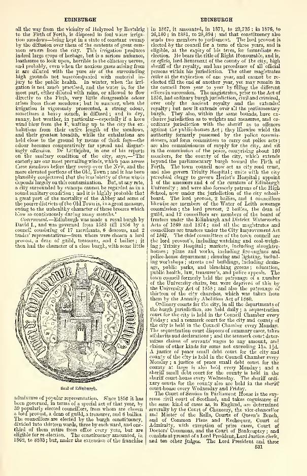
EDINBURGH EDINBURGH
all the way from the vicinity of Holyrood by Restalrig
to the Firth of Forth, is disposed in foul water irriga-
tion meadows—being kept in a state of constant swampby the diffusion over them of the contents of great com-mon sewers from the city. This irrigation producesindeed large crops of herbage, but is a serious nuisance,
loathsome to look upon, horrible to the olfactory nerves,
and probably, even when the noxious gases arising fromit are diluted with the pure air of the surroundinghigh grounds not unaccompanied with material in-
jury to the public health. In winter, when the irri-
gation is not much practised, and the water is, for themost part, either diluted with rains, or allowed to flow
directly to the Firth, very little disagreeable odourarises from these meadows ; but in summer, when theirrigation is vigorously prosecuted, a strong odour,
sometimes a heavy stench, is diffused ; and in dry,
sunny, hot weather, in particular—especially if a keenwind blow from the E, wafting up to the city the ex-
halations from their entire length of the meadows,and their greatest breadth, while the exhalations are
held close to the ground by means of thick fogs—theodour becomes comparatively far spread and disgust-
ingly offensive. Dr Littlejohn, in one of his reports
on the sanitary condition of the city, says,—
' Theeasterly are our most prevailing winds, which pass across
these meadows before they sweep over the New, and themore elevated portions of the Old, Town ; and it has beenplausibly conjectured that the insalubrity of these windsdepends largely on this contamination. But, at any rate,
a city surrounded by swamps cannot be regarded as in a
sound sanitary condition ; and it is highly probable that
a great part of the mortality of the Abbey and some of
the poorer districts of the Old Town is, in a great measure,
owing to the unhealthy character of these breezes whichblow so continuously during many months.
'
Government.—Edinburgh was made a royal burgh byDavid I., and was governed from 15S3 till 1856 by a
council consisting of 17 merchants, 6 deacons, and 2trades' representatives—from whom were chosen a lord
provost, a dean of guild, treasurer, and 4 bailies ; it
then had the character of a close burgh, with some little
Seal of Edinburgh.
admixture of popular representation. Since 1856 it hasbeen goverued, in terms of a special act of that year, by39 popularly elected councillors, from whom are chosena lord provost, a dean of guild, a treasurer, and 6 bailies.
The councillors are elected by the burgh constituency,divided into thirteen wards, three by each ward, and one-third of them retire from office every year, but areeligible for re-election. The constituency amounted, in1862, to 8833 ; but, under the extension of the franchise
in 1867, it amounted, in 1871, to 23,735 ; in 1876, to
26,180 ; in 1881, to 28,894 ; and that constituency also
sends two members to parliament. The lord provost is
elected by the council for a term of three years, and is
eligible, at the expiry of his term, for immediate re-
election. He bears the title of Right Honourable, and is,
ex officio, lord-lieutenant of the county of the city, highsheriff of the royalty, and has precedence of all official
persons within his jurisdiction. The other magistratesretire at the expiration of one year, and cannot be re-
elected till the end of another year, yet may remain in
the council from year to year by filling the different
offices in succession. The magistrates, prior to the Act of
1856, had ordinary burgh jurisdiction, civil and criminal,
over only the ancient royalty and the extendedroyalty ; but now it extends over all the parliamentaryburgh. They also, within the same bounds, have ex-
clusive jurisdiction as to weights and measures, and co-
ordinate jurisdiction with the sheriff as to offences
against the public-houses Act ; they likewise wield theauthority formerly possessed by the police commis-sioners, and form committees to carry out police acts
;
are also commissioners of supply for the city, and sit
in the commission of the peace, comprising about 160members, for the county of the city, which extendsbeyond the parliamentary burgh toward the Firth of
Forth. The town council now act as city road trust,
and also govern Trinity Hospital ; unite with the city
parochial clergy to govern Heriot's Hospital ; appoint1 of the assessors and 4 of the curators of EdinburghUniversity ; and were also formerly patrons of the HighSchool, now under the jurisdiction of the city school-
board. The lord provost, 2 bailies, and 4 councillors
likewise are members of the Water of Leith seweragecommission ; the lord provost, 2 bailies, the dean of
guild, and 12 councillors are members of the board oftrustees under the Edinburgh and District WaterworksActs of 1869 and 1874 ; and all the magistrates andcouncillors are trustees under the City Improvement Actof 1867. The chief committees of the town council are
the lord provost's, including watching and coal-weigh-
ing ; Trinity Hospital ; markets, including slaughter-
houses;
plans and works, including fire-engines andpolice-house department ; cleaning and lighting, includ-
ing workshops ; streets and buildings, including drain-
age, public parks, and bleaching greens ; education,public health, law, treasurer's, and police appeals. Thetown council formerly held the patronage of a numberof the University chairs, but were deprived of this bythe University Act of 1858 ; and also the patronage of
thirteen of the city churches, which was taken fromthem by the Annuity Abolition Act of 1860.
Ordinary courts for the city, in all the departments of
the burgh jurisdiction, are held daily ; a secpuestration
court for the city is held in the Council Chamber everyFriday ; and a tenmerk court for the city and county ofthe city is held in the Council Chamber every Monday.The sequestration court disposes of summary cases, takesalfidavits and declarations ; and the tenmerk court deter-mines claims of servants' wages to any amount, andclaims of other kinds for sums not exceeding lis. ljd.A justice of peace small debt court for the city andcounty of the city is held in the Council Chamber everyMonday ; a justice of peace small debt court for thecounty at large is also held every Monday ; and asheriff small debt court for the county is held in thesheriff court-house every Wednesday. The sheriff ordi-nary courts for the county also are held in the sheriff
court-house every Wednesday and Friday.The Court of Session in Parliament House is the sup-
reme civil court of Scotland, and takes cognisance ofthe same kind of cases as, in England, are determinedseverally by the Court of Chancery, the vice-chancellorand Master of the Rolls, Courts of Queen's Bench,and of Common Pleas and Exchecpuer, Court ofAdmiralty, with exception of prize cases, Court ofDoctors' Commons, and the Court of Bankruptcy ; andconsists at present of a Lord President, Lord Justice-clerk,and ten other judges. The Lord President and three
531
EDINBURGH
judges form the first division, the Lord Justice-clerk andtwo judges form the second division, of the court, these
two divisions being termed the Inner House ; the re-
maining five judges sit all separately from one another,
and are severally lords ordinary, and aggregately the
Outer House ; and the latest appointed attends particu-
larly to the business of the bill chamber or proceedings
of the nature of injunction or stay of process, whichrequire summary interposition. Each of the vast
majority of cases brought into the Court of Session is
tried, in the first instance, by one of the lords ordinary,
and may either terminate in his judgment on it, or
may be appealed to either division of the Inner House.No appeal lies from one division to the other, or from onedivision to the whole court
;yet either division may
call in the opinion of the other judges, and whateverjudgment may be given, either by one of the divisions
or by the whole court, when required to conjoin
opinion, is final as to all authority in Scotland, butmay be appealed to the House of Lords. The LordPresident, the Lord Justice-clerk, and five other judgesform the High Court of Justiciary, having supremecriminal jurisdiction ; they sit in Edinburgh, at occa-
sional times, for despatching criminal cases belongingto the three Lothians, together with such cases as,
from their importance or other reason, may bebrought from any of the assize towns to Edinburgh for
trial ; and they distribute themselves every year dur-
ing the vacations of the Court of Session for holdingassizes at Jedburgh, Dumfries, Ayr, Glasgow, Inverary,
Stirling, Perth, Dundee, Aberdeen, and Inverness.
The four senior lords ordinary form a court under anact of 1868, for hearing appeals from sheriff-courts ; oneof the lords ordinary transacts the business of the Courtof Exchequer ; and one that of the Court of Teinds,
embracing all questions as to modification of thestipends of the clergy, and the liabilities of parties sub-
ject to the payment of the stipend ; and three judgesform the Registration Appeal Court.
The High Court of Admiralty consisted, after theUnion, of a judge appointed by the lord vice-admiral of
Scotland, and functionaries of inferior jurisdiction
appointed by the judges ; and, in civil causes, was sub-
ject to review by the Court of Session. An admiraltyjurisdiction was possessed also by the city magistratesover the county of the city, and to the mid waters of theFirth of Forth, limited on the W by a line drawn fromWardie brow to the Mickrie stone, and on the E by a
line drawn from the extremity of the Pentland Hills to
the middle of the Firth E of Inchkeith. The com-missary court, or head consistorial court of Scotland,
was, as to its business, nearly all merged in the Court of
Session in 1830. Two deputies, with office chamber in
the New Register House, perform the duties of the Lyoncourt, or, more strictly, of the sinecure office of Lyon-King-at-Arms. The Convention of Royal Burghs, a courtconstituted in the reign of James III. , meets annually onthe first Tuesday of April in Edinburgh, and is presided
over by the lord provost of the city. It consists of dele-
gates chosen year by year by the several royal burghs,and possesses all the characters of a corporation, withqualities and privileges which have been conferred bystatute. It has no funds, yet possesses a statutory "powerto assess the burghs annually for the supplies of the
current year ; discusses and determines questions of
trade affecting the interests of the burghs ; and, before
dissolving itself at the end of its sittiugs, appoints a
committee, who wield its powers till the meeting of nextyear. Three portions of the city—Canongate, Ports-
burgh, and Calton—situated beyond the old royalty,
but lying contiguous to the old streets, had formerlyseparate burgh jurisdictions, but were annexed to thecity-burgh by the Municipal Extension Act of 1856. Atrivial separate jurisdiction over the precincts of Holy-rood still exists, and there is an ordinary court on thefirst Saturday of every month.
Police.—After the Battle of Flodden, the citizens
began voluntarily to perform the duty of what wascalled the watching and warding of the city, and did it
532
EDINBURGH
in rotations of four. In 1648, a paid guard of 60 men,with a captain and two lieutenants, was appointed for
the duty ; but it proved distasteful to the inhabitants,
and the voluntary system was resumed. About 1689,there was raised, under authority of an Act of Parliament,another paid body, 126 in number, which received thename of the town-guard, and had its rendezvous in thelower portion of the Old Tolbooth. This body perambu-lated the streets at night, clothed in old military
costume, with long blue coats and cocked hats, eachman carrying a huge Lochaber axe. A militia regiment,
called the trained bands, was contemporaneous with the
town-guard, comprised 16 companies of 100 men each,
and had the lord provost as colonel ; but was called outonly on great occasions, such as for some state pageantor on the anniversary of the King's birthday. A better
system was inaugurated in 1805, improved in 1S12and 1822, and matured in 1848, which acquired, andcontinues to retain, all the characteristics of the best
modern police organisation. It served, till 1856, not only
for all the parliamentary burgh, but also for a tract to
the N of it ; was originally administered by commis-sioners, some ex-officers, some elected by certain public
bodies, and others elected by rate-payers. By the
Municipal Extension Act of 1856, the administration wastransferred to the magistrates and town council, and re-
lieved from the charge of the northern tract, which wasassigned to the police district of Leith. The force consists
of 415 men of all ranks, with a chief constable at a salary
of £600. The court department comprises the city
magistrates, the county sheriff and sheriff's substi-
tutes, a public prosecutor and clerk, clerk of court
and depute-clerk, three superintendents, lieutenants,
inspectors, and a court sergeant ; and the civil de-
partment comprises the chief constable, medical officer
of health, burgh engineer, inspector of lighting andcleaning, inspector of nuisances, master of fire-engines,
inspector of markets, inspector of dealers in coals, a
treasurer, a collector of assessments, an accountant-
auditor, a law agent, and several other minor officials.
Stations, subsidiary to the head police office in HighStreet, are at Fountainbridge, Canongate, St JamesStreet, St Leonard's, and Stockbridge ; but they are
merely lock-ups, each in charge of a sergeant station-
keeper ; and the one at Fountainbridge contains only
very indifferent cells, inferior to those in small pro-
vincial burghs. Another station was added to these in
1874 at Torphichen Street, and was built in the style of
old Scottish architecture at a cost of £4000. All are in
communication with each other by telegraphic wires.
The revenues and expenditures will afterwards be noticed
under the head of finances.
Siib-Muiiici2}al Bodies. — The Guildry Court com-
prises the lord dean of guild, the old dean, 10 coun-
cillors, a clerk and extractor, a master of works, a
procurator -fiscal, and 2 officers ; and the guildry
council comprises the lord dean of guild, 15 councillors,
a secretary, a treasurer, and an officer. The juris-
diction of this court was at one time very extensive,
and included mercantile and maritime causes ; now,
however, its chief duty is to see that all buildings are
according to law, neither encroaching on private pro-
perty nor on the public streets ; and also that houses
in danger of falling be taken down ; no building can be
erected in the burgh without its sanction. The Mer-
chant Company was constituted by royal charter in
1681, embracing 'the then haill present merchants,
burgesses, ind gild brethren of the burgh of Edinburgh,
who were importers or sellers of cloths, stuffs, or other
merchandise for the apparel or wear of the bodies of menor women, for themselves and successors in their said
trade in all time comeing. ' They received ratification by
Act of Parliament in 1693, a second royal charter at a
subsequent date, and regulating ratifications by two
other Acts of Parliament. The latest of these, in May1827, admits, «u terms of these ratifications, all persons
'being merchants, burgesses, and guild brethren, or
entitled to be chosen merchant-councillors, or magis-
trates of the city of Edinburgh. ' It charges £63 as the
EDINBURGH
rate of entry-money, possesses property and fundsyielding about £1100 a year, and expended chiefly in
aiding widows and decayed members, and is managedby a master, 12 assistants, treasurer, secretary, andlaw agent, an accountant-auditor, a chamberlain, acollector, and widows' fund trustees. The Trades' Cor-porations were formerly bodies wielding much influence
and power in the community ; amounted to thirteen
under a eonvenery, and represented in the town council,
with two others standing apart from the convenery andthe town council representation ; and now form de-
cayed bodies, all still choosing their own deacons. Thethirteen under the convenery are waulkers, constituted
by seal of cause in 1500 ; skinners, by seals of cause in
1586 and 1630 ; furriers, by acts of council in 1593 and1665
;goldsmiths, by seal of cause in 1581, and crown
charters in 15S6 and 1687 ; hammermen, by seal of
cause in 1483 ; wrights, by act of council in 1475;
masons, by act of council in 1475 ; tailors, by seals of
cause in 1500, 1531, and 15S4, and by royal charters in
1531 and 1594 ; baxters or bakers, of date before 1522;
fleshers, by seal of cause in 1488 ; cordiners, by seals of
cause in 1440 and 1479, and by crown charter in 1598;
websters, by seals of cause in 1475 and 1520 ; andbonnet-makers, by seals of cause in 1530 and 1684.The two other corporations are candlemakers, con-stituted by deeds of 1517, 1597, and 1695, and barbers,
by deed of 1722. A remnant of incorporated trades,
with a convener, also exists in the ancient burgh of
Calton ; and remnants of eight incorporated trades,
with a convener, under a common royal charter of
1863, exist in Canongate. The High Constables, in-
stituted in 1611, are a, numerous body available for
aid in preserving the public peace in cases of emergency,and are ruled by a head functionary called the moderator,and have thirteen captains, one for each of the thirteenwards of the parliamentary burgh.
Finances.—The city corporation revenue is now de-rived principally from landed property, feu-duties, andmarket dues ; but was formerly derived also from theshore-dues of Leith, from imposts on wines and maltliquors, from the annuity-tax for ministers' stipends,and from the seat-rents of the city churches. Theamount of it in 1788 was about £10,000 ; in 1841-42,
£19,884; in 1853-54, £33,247; in 1870-71, £36,521;in 1881-82, £37,757. The value of the whole heritableand movable property in 1833—exclusive of the Leithdues, the church patronage, the High School, councilchambers, and the court-rooms—was £271,657 ; yet inthat year the corporation had long lain under heavyembarrassment, and was declared insolvent. No actualembezzlement or fraudulent malversation, but merelyimprudent management, over-sanguine expectations ofincreasing revenue, profuse expenditure for civic paradeand entertainments, and extravagant outlay on publicbuildings and public works, could be charged ascausing the disastrous state of the finances
;yet these
were cumulatively such as to require prompt andpermanent rectification, quite as much as if thecauses had been of a graver kind. A debt to govern-ment of no less than £228,374 for the works ofLeith docks had recently been contracted, other debtsto the amount of £407,181 were due at the insol-
vency, and these stood contrasted with a total debt ofonly £78,164 in 1723. An act of parliament legalis-
ing a settlement was obtained in 1838 ; and thisrelieved the corporation from all responsibility withthe Leith docks, assigned a certain annual payment fromthe dock revenues in aid of Edinburgh, and arrangedthat the public creditors of the city should receive bondsbearing 3 per cent, of perpetual annuity, that the bondsshould be transferable, and be redeemable only by pay-ment of the full sum, or by purchasing the bonds attheir market value. Since 1838 bonds have been can-celled representing £70,600 of debt and £2118 ofannuity; there being still outstanding in Aug. 1881bonds representing £314,435, 16s. 8d. of city debt,£9433, Is. 6d. of annuity being payable thereon.Other additions to the corporation liabilities, to the
EDINBURGH
aggregate amount of £96,557, arose out of respectively
the Cattle Market Act of 1844, the Corn Market Actof 1847, the Slaughter-houses Act of 1850, the Annuity-tax Abolition Act of 1860, and the Amendment Act of
the Annuity-tax Abolition Act of I860. What remainedof all these liabilities at 1 Aug. 1871 was only£338,145, 16s. 8d. of principal, or £10,144, 7s. 6d.
of annuity or interest, under the act of 1838 ; £5735,14s. 7d. of principal, or £229, 8s. 7d. of annuity or in-
terest, under the act of 1850 ; and £53,675 of principal,
or £1S78, 12s. 6d. of annuity or interest, under the
act of 1870.
The gross amount of municipal revenue for the year
ending 1 Aug. 1881 was made up as follows :—Creditors'
account, £17,987, 8s. 9d. ; proper municipal account,
£11,578, 18s. 6d. ; Water of Leith sewerage fund, £1101,14s. 2d. ; city clerk's fee fund, £1724, 14s. lOd. ; regis-
tration of births, deaths, and marriages, £2065, 6s. 5d. ;
valuation of lands, etc., £2131, lis. ; registration of
voters, £1653, 5s. 5d. ; markets and customs, £13,419,17s. 6Jd. ; slaughter houses, £4162, 14s. Ofd. ; Trinity
Hospital, £3S67, 2s. 9d. ; which, with the revenue from 35minor trusts, gave a total revenue of £71,047, 19s. ljd.,
against an expenditure on the same trusts of £62,911,10s. 0-|d. The Veterinary College trust income was£1194,"4s. 4d. ; expenditure, £1446, 6s. 6d.
The police revenue for the year ending 15 May 1881was £95,764, 6s. 8d. in current expenditure, £2172,3s. 6d. in capital expenditure, £18, 8s. 6d. sinkingfund—for general police purposes ; £20,558, 9s. 6d.
streets and public safety ; £5131, 0s. 9d. current ex-
penditure, £2540 capital expenditure—for general im-provements ; £4243, 17s. 5d. for sewers and drains
;
£2827, 14s. 3d. for public health ; allowances in
watching department, £264, 6s. 6d. —total revenue
£142,520, 7s. lid., against an expenditure of £169,409,7s. 3d.
The total amount of revenue in the two departments,police and municipal, was £246,141, 12s. lOd. , but thatsuffered deduction of capital sums in the municipal de-
partment of £3457, 3s. Id., in improvements depart-
ment of £6166, 10s., in police department of £4712,3s. 6d. , and therefore amounted practically only to
£231,805, 16s. 3d., which was thus classified in regard
to its destination or uses into six several departments
—
municipal, inclusive of city, markets, and slaughter-
house revenues, £40,513, 18s. 0|d. ;police, inclusive of
watching, lighting, cleaning, fire-engines, public parks,
sewers, public health, etc., £137,543, 17s. l^d. ; im-
provements, under act of 1867, £24,77S, 6s. ; registra-
tion, valuation, inspection, etc. , £7372, 7s. 5d. ; trust
revenues, inclusive of Trinity Hospital, etc., £11,111,2s. 3d. ; and other revenues transferred from oneaccount to another, £10,486, 5s. 4|d.
The income and the expenditure of the city improve-
ment trust are classified into two accounts, the cost
account and the revenue account ; and, in the year end-
ing 2 Aug. 1875, were as follow :—The income, underthe cost account, comprises £16,524, 19s. lid. for pro-
perties sold off or forming roadways, £695, 7s. 2d. of
the year's surplus on the revenue account, £15,000from the sinking fund for discharge of loans, and£193,984, Is. of loans on mortgages, etc. ; the expendi-
ture, under the cost account, comprised £42,753, 14s. 4d.
for properties acquired and in connection with the pur-
chases, and £8669, lis. 8d. for removal of old build-
ings, disposal of building areas, and formation of road-
ways, drains, etc. ; the income on the revenue account
comprised £20,656, 5s. 8d. of assessments, and £723,7s. 3d. of rents and ground-annuals ; and the expendi-
ture, on the revenue account, comprised £1395, 15s. 6d.
for management and collection, £7374, 10s. 3d. for in-
terest and feu-duties, and £11,914 of contribution to
the sinking fund. The total receipts from 1867 till 2
Aug. 1875 were £197,193, 7s. 5d. ; the total expenditure,
during the same period, was £383,565, 15s. 4d. ; and the
amount at credit of the sinking fund, at 2 Aug. 1875,
was £7611, 13s. Id. In 1881 this account stood as fol-
lows:—revenue, £31,379, 2s. 3d. ; expenditure, £14,314,533
EDINBURGH
3s. Id. ; sinking fund, £3995, 13s. 5d., leaving a gross
balance against the scheme of £108,887, 18s. 4d.
The yearly rental of the parliamentary burgh, since
the passing of the valuation act in 1855, has increased
more or less from year to year. The amount, in 1855-56,
was £761,863, 9s. Id. ; 1860-61, £844,542, 4s. Id.;
1865-66, £1,003,793, 8s. 4d. ; 1870-71, £1,214,046,0s. lOd. ; 1875-76, £1,419,043, 15s. 9d. ; 1880-81,
£1,727,740, 15s. 4d. ; showing a total increase since
1855 of £965,877, 6s. 3d.
Social Condition.—Edinburgh is strictly the metropolis
of Scotland, the centre of everything national whichremains to it since the union of its crown and its parlia-
ment with those of England. It is the principal seat
of the administration of justice for the whole country,
the meeting-place of the supreme courts of the several
religious denominations, the fountain-head of scientific
and literary activity, the seat of the greatest of the
Scottish universities and of numerous!first-class schools,
and the focus of influences of all kinds over the entire
country. The city contains so many people con-
nected with these interests, and draws such large num-bers of the refined classes of society, as visitors either
for business or for pleasure, that the population, in the
average months of any year, exhibits a proportion con-
nected with intellectual matters almost as large as the
population of Glasgow or Manchester exhibits in con-
nection with cotton manufacture. The status of the
city is truly national, or strictly Scottish. ' Nothing,'remarks Mr Lorimer, ' can be more erroneous than to
liken Edinburgh to such places as Bath or Cheltenham,or any of the mere pleasure-towns of England. Edin-burgh, after her quiet fashion, is a busy place enough,and, London excepted, unquestionably fulfils the idea
of a capital more than any other city in the UnitedKingdom. She has nothing of that air of a proconsular
residence which, while it confers on Dublin a certain
external splendour, unfortunately renders her more like
to what we imagine Calcutta or Montreal, than to the
capital of any European country, however small. Thereis no foreign ruling class in Edinburgh ; what she has
is Scotch, and what Scotland has is hers. The true
centre of Scottish life, from her, as from the heart of
the land, the life-blood of Scotland issues forth, and to
her it returns freely again. Every Scotchman finds in
her a common centre for his sympathies. The inhabi-
tants of Glasgow, Aberdeen, Dundee, Perth, and the
like, have no bond of union other than as the inhabi-
tants of a common country ; but ever}7 man of themfeels that he has a tie to Edinburgh. It is to her that
he looks for his news, his praise, his influence, his
justice, and his learning. And there is always a large
body of sojourners within her walls who compose a
fluctuating, but, as regards both wealth and position,
by no means an important part of her population.
These persons, we believe, are attracted hither for the
most part by one or other of the following causes—the
beauty of the place, the excellence and cheapness of theelementary education which they can here procure for
their families, and the prospect which Edinburghsociety holds out of their being able to gratify those
refined and cultivated tastes which they may have else-
where formed.'
The city has a calm, steady character, in keeping withthe predominance of legal, educational, literary, andartistic pursuits, from which it derives its chief main-tenance, and contrasts broadly with the fluctuations,
excitements, and mercantile convulsions, which produceso much vicissitude in manufacturing towns. ' Edin-burgh,' remarks Alexander Smith, 'is not only in point
of beauty the first of British cities, but, considering its
population, the tone of its society is more intellectual
than that of any other. In no other city will you find
so general an appreciation of books, art, music, andobjects of antiquarian interest. It is peculiarly free
from the taint of the ledger and the counting-house.It is a Weimar without a Goethe—a Boston without its
nasal twang. ' The number of capitalists, bankers, pro-
fessional men, and other liberally educated persons in
534
EDINBURGH
1831, in Edinburgh and Leith's total population of161,909, was 7463 ; while the number in Glasgow'spopulation of 202,426 was only 2723 ; in Manchesterand Salford's population of 182,812 was only 2821 ; inBirmingham's population of 146,986 was only 2388
;
and the respective numbers, in times subsequent to thatyear, have shown an increasingly greater proportion ofthe liberally educated class in Edinburgh apart fromLeith. The comparative wealth of the higher classes,
however, is widely different, seldom rising in Edinburghabove mere patrician competency, and it makes no suchdisplay among even the highest as among the merchantprinces of the great manufacturing towns. ' Edinburgh,'says Alexander Smith, ' is a patrician amongst Britishcities, "a penniless lass wi' a long pedigree." She haswit, if she lacks wealth ; she counts great men againstmillionaires.' Edinburgh has a reputation for taste incertain departments which ranks above that of mostother British cities, and to stand the test of her critics,
is accepted as an assurance of a splendid success.' The success of the actor,' remarks Alexander Smithagain, 'is insecure until thereunto Edinburgh hasset her seal ; the poet trembles before the Edinburghcritics ; the singer respects the delicacy of the Edin-burgh ear ; coarse London may roar with applause,but fastidious Edinburgh sniffs disdain, and sneers
reputations away.' The drama, formerly not verymuch patronised, has come increasingly into favour
;
the circus draws great assemblies ; music, in the form of
concerts, oratorios, and operas, has risen into enthusi-astic esteem ; exhibitions of the fine arts attract
crowds of connoisseurs ; travelling celebrities, of al-
most all kinds, are warmly welcomed ; the races inneighbouring towns are frequented by numbers ; andathletic sports in the open air, from the coarsest to themost refined, are zealously practised and extensivelyadmired. The poorer classes, however, as may be in-
ferred from statements in previous sections, are, to agreat extent, excessively poor and depressed, not fromany peculiar bad tendency in themselves, nor merelyfrom the bad influence of their unhealthy domiciles,
but also, and perhaps chiefly, from the want of scopefor industry, and of healthy stimulus to exertion. Thedisproportion of females over males, too, is much greater
than in almost any other town in the empire ; and hasbeen accounted for on two grounds—the one, the un-usually large proportion of female servants in the city,
tending to draw girls hither from the country ; the
other, the paucity of general industrial occupation, for-
cing young men to seek employment elsewhere, whilecompelling their sisters to remain in their native town.Numerous clubs and societies exist for purposes of
amusement or recreation. Among these are the Edin-burgh Chess Club, instituted in 1822 ; St Cecilia
Amateur Instrumental Society (1848) ; EdinburghChoral Union (1S58) ; Edinburgh Harmonists' Society ;
Scottish Vocal Music Association ; Amateur Quartette
Union ; the Southern Musical Society ; Greyfriars'
Choral Society (1865) ; St George Quartette Club
(1874) ; St Andrew Boat Club (1846) ; the Edin-burgh University Boat Club ; Midlothian Province of
Royal Caledonian Curling Club (1S38) ; DuddingstonCurling Club (1795) ; the Edinburgh Curling "Club
(1830); the Coates Curling Club (1854); MerchistonCurling Club ; "Waverley Curling Club and SkatingClub ; Lochend Skating Club ; Edinburgh Burgess Golf-
ing Society (1735) ; Honourable Company of EdinburghGolfers, instituted prior to 1744 ; Bruntsfield LinksGolf Club (1761) ; Bruntsfield Allied Golfing Club
(1856) ; TVarrender Golf Club (1858); the EdinburghThistle Golf Club (1871) ; Viewforth Golf Club (1872) ;
Salisbury Archers' Club (1836) ; Forth Swimming Cluband Humane Society (1850) ; Lome Swimming Cluband Humane Society (1870) ; Royal Caledonian Hunt(1777) ; Lothian Racing Club (1846) ; Celtic Society for
promoting the general use of the ancient Highlanddress in the Highlands of Scotland, and for encouraging
education among the Highlanders and the distribution
of prizes in schools, instituted in 1820. Of bowling
EDINBURGH
clubs, there are the Edinburgh, the Edinburgh andLeith Associated, the Whitehouse and Grange, andthe Drumdryan ; while of cricket and football clubs,
there is an innumerable host.
The clubs, institutions, and associations, which claim,
in some manner or other, to be patriotic or benevolent,
have purposes which range from that of mere self-
gratification to the highest flights of philanthropyand religion, and are exceedingly numerous. One set
of them are the Edinburgh City Artillery VolunteerCorps, with nine batteries ; the Edinburgh City Rifle
Volunteer Corps, with twenty companies ; the SecondEdinburgh Volunteer Corps, with six companies
;
the British League Cadet Corps ; Edinburgh and Mid-lothian Rifle Association (1861); the Midlothian Rifle
Club ; and, in some degree, the First Midlothian Rifle
Volunteer Corps, and the Midlothian Coast Artillery
Volunteers. Another set are the Grand Lodge of the
Freemasons in Scotland ; the Religious and Military
Order of the Temple ; the Grand Chapter of Royal ArchFreemasons of Scotland ; the Royal Order of Scotland,
dating from Kilwinning ; the Supreme Council for Scot-
land of the 33d and last degree of the ancient andaccepted Scottish rite ; Imperial Council of Scotland of
order of Red Cross of Constantine ; the Rosicrucian
Society of Scotland ; and the mason lodges in Edin-burgh—1, Mary's Chapel ; 2, Canongate Kilwinning
;
5, Canongate and Leith ; 8, Edinburgh Journeymen
;
36, St David's ; 44, St Luke's ; 48, St Andrew's
;
97, St James' ; 145, St Stephen's ; 151, EdinburghDefensive Band ; 160, Roman Eagle ; 291, Edinburghand Leith Celtic ; 349, St Clair ; 392, Caledonian ; 405,
Rifle. Another set are St Cuthbert's Lodge of Free
Gardeners (1824) ; St Andrew's Lodge of Free Gardeners
(1863) ; St George's Lodge of Free Gardeners ; AtholeLodge of Free Gardeners ; Barony of Broughton Lodgeof Free Gardeners ; and St Giles' Lodge of HusbandmenGardeners. Of Oddfellows, there are the City, Sir
Ralph Abercromby, Dun-Edin, St Bernard's, and the
Excelsior Lodges ; the Edinburgh School of Arts
Friendly Society (1S2S) ; the Saturday Half-HolidayAssociation (1854) ; the Edinburgh Christmas Club
(1867) ; the Edinburgh Booksellers' Society ; the Edin-burgh Academical Club ; the Edinburgh Institution
Club ; the High School Club (1849) ; the High School,
Bryee, and Donaldson Associations (1865) ; the
School of Arts Watt Club; the Edinburgh HealthSociety ; the Coekburn Association ; the Sanitary Pro-
tection Association ; the Edinburgh Naturalists' Field
Club ; the Cobden Club, instituted in 1868 ; and the
Edinburgh Parliamentary Society.
Of county associations in Edinburgh, there are the
Aberdeen, Banff, and Kincardine Association ; AngusClub (1841) ; Argyle, Bute, and Western Isles Associa-
tion ; Ayrshire Club (1854) ; Border Counties Associa-
tion (1865) ; Borderers' Union (1874) ; BreadalbaneAssociation (1S76) ; Caithness Association (183S) ; Dum-bartonshire and Lennox Association (1872) ; Dumfries-
shire Society ; Galloway Association (1843) ; Fife,
Clackmannan, and Kinross Association;; Clan-GregorSociety (1822) ; Inverness, Ross, and Nairn Club
(1863) ; the John o' Groat Association (1863) ; LanarkClub (1847) ; Upper Ward of Lanarkshire Association
(1840) ; East Lothian Association (1874) ; Morayshire
Club (1838) ; Peeblesshire Society (1782) ; Perthshire
Association ; Renfrewshire Association (1873) ; Suther-
landshire Association (1866).
Other associations are, the Society for the Sons of
the Clergy (1790) ; Widows' Fund of the Church andUniversities of Scotland ; Elders' Union of the Churchof Scotland ; Lay Association in support of the Schemesof the Church of Scotland ; College for Daughters of
Ministers of the Church of Scotland, and of Professors
in the Scottish Universities, opened at Whitehouse in
1863 ; The Edinburgh School of Cookery, instituted in
1875 ; Scottish Ladies' Association for promoting FemaleIndustrial Education in Scotland ; Scottish Ladies'
Association for the advancement of Female Education in
India ; Ladies' Association for promoting the Christian
EDINBURGH
Education of Jewish Females ; Ladies' Association for
the support of Gaelic Schools ; Free Church Ministers'
Widows' and Orphans' Fund ; Society for the benefit of
the Sons and Daughters of Ministers and Missionaries
of the Free Church ; Ladies' Society for Female Educa-tion in India and Caffraria ; Edinburgh Ladies' Associa-
tion on behalf of Jewish Females ; Ladies' ContinentalAssociation ; Association for the Religious Improvementsof the remote Highlands and Islands ; Society of Sonsof United Presbyterian Ministers ; Friendly Society for
providing Annuities for the Widows and Orphans of
Ministers in connection with the United PresbyterianChurch ; Scots Episcopal Fund ; Scotch EpiscopalFriendly Society ; Scottish Episcopal Church Society
;
Scottish Free and Open Church Association (1877)
;
Society for Promoting Christian Knowledge ; andEdinburgh Diocesan Association for the support of
Foreign Missions.
Another class are, the Society for the Relief of theDestitute Sick (1785) ; Senior Female Society for theRelief of Aged and Indigent Women (1797) ; Charitableor Junior Female Society for the Relief of Indigent OldWomen (1797) ; Edinburgh Society for Relief of Indi-
gent Old Men (1S06) ; Fund for the Relief of IndigentGentlewomen, founded in 1S47 ; Edinburgh Societyfor Promoting the Employment of Women ; thePaterson Fund for Assisting Decayed Old Men andWomen who have seen better days (1867) ; EdinburghAssociation for Improving the Condition of the Poor(1870) ; Edinburgh and Leith Society for the Relief of
Deserving Foreigners in distress ; Fund of Scottish
Masonic Benevolence, founded in 1846 ; the ThomsonMortification, for selling Oatmeal at reduced cost to
poor householders ; the Craigcrook Mortification, for
the benefit of Orphans and the Aged ; Scottish Society
for Prevention of Cruelty to Animals, established in
1839 ; Edinburgh Total Abstinence Society (1836) ;
Edinburgh Ladies' Total Abstinence Society ; manyvariously-named temperance associations, Good Templarlodges, etc. ; and the numerous hospital, asylum, andschool institutions, which were noticed in the accountof the city's public buildings. Another class still, are
the Edinburgh City Mission (1832) ; Edinburgh Paro-chial Mission, for the Employment of Scripture Readersin the Old Town ; Edinburgh Medical MissionarySociety ; Edinburgh Bible Society; Edinburgh Auxiliary
Naval and Military Bible Society ; Ladies' Association
in aid of that society ; Scottish Branch of the British
Army Scripture Readers' and Soldiers' Friend Society;
Royal Navy Scripture Readers' Society ; EdinburghAuxiliary to the London Missionary Society ; University
Missionary Association (1825) ; Edinburgh Church of
England Missionary Association ; Waldensian Missions'
Aid Fund ; Italian Evangelisation Society ; Scottish
Evangelistic Association (1862) ; Edinburgh Subdivi-
sion of the Evangelical Alliance ; Edinburgh YoungMen's Christian Association (1855) ; Edinburgh YoungWomen's Christian Association (1874) ; EdinburghWorking Boys' and Girls' Religious Society (1870)
;
Edinburgh and Leith Seamen's Friend Society (1820) ;
Edinburgh Gratis Sabbath School Society (1797) ; Edin-
burgh Sabbath School Teachers' Union (1841) ; Edin-burgh Sabbath School Teachers' Association, in connec-
tion with the Church of Scotland ; and Sabbath MorningFellowship Union (1840).
Trade.—Edinburgh abounds in productive industry,
in all departments of ordinary artificership, and in noble
efforts of both skill and labour; yet has not, and never
had, any considerable staple of produce for the supplyof the general market. Her manufactures, perhaps, are
more diversified, exhibit a larger aggregate of genius,
than those of many other great towns ; but some are of
the common kinds for the supply of local wants, andtherefore need not be mentioned, while the rest are all
on so limited a scale as to require only the briefest
notice. The linen manufacture was at one time con-siderable, but sank many years ago into decline, and is
now extinct. The making of rich shawls and plaids, in
imitation of India shawls, was commenced in 1805, and535
EDINBURGH
promised for a time to become a staple ; but never mademuch way against competition in other quarters, andeventually fell into decline. Silk manufacture wascommenced, in 1841, in a large handsome edifice at
Fountainbridge, but did not succeed, and was soon re-
linquished. The manufacture of overshoes and other
articles in india-rubber was commenced in 1855, in the
building which had been used for the silk manufacture;
employed for a time about 350 hands ; and now em-ploys about 600 within the premises, and about as
many more in an indirect way. A similar manufacture,bearing the name of vulcanite, was commenced in 1862,in a new building near that of the india-rubber work
;
underwent such increase of production and enlargementof premises as to be about fourfold greater in 1868 thanat the commencement ; turns out about 7,500,000 combsa year, and corresponding quantities of other articles
;
and employs about 500 persons.
Of the other industries carried on, there may be men-tioned that of carpet-making, floorcloth-making, fringe
and tassel making, and furniture print ; coach-building,coach-lace making, coach-spring making, and saddleryand harness
;glass-making, glass-cutting, glass-staining,
and glass chandeliers ; brass-founding, plumber workfittings, finishing, and gas-meters ; type-founding is
carried on in two establishments, and employs in one of
them upwards of 500 persons ; iron-working, the makingof agricultural implements and of machines, the makingof tools, carpenters' tools, saws, articles of cutlery, steel
punches, beams and steelyards, wire-work, and wire-
netting.
Working in electro-plate, silver, gold, and precious
stones employs upwards of 1000 persons, having for anumber of years been on the increase. This branch of
industry gives promise of still further increase, andhas long been noted for the excellence of skill and taste
displayed in it. A number of paper-mills in the vicinity,
particularly in the valley of the North Esk, may beregarded as belonging to Edinburgh, and are representedin it by a number of wholesale stationery warehouses.The brewing of malt liquors is carried on very exten-
sively, and it has long been famous for the superior quality
of its ales. The distilling of whisky is also carried onlargely, as well as the rectifying of spirits ; and one of
the distilleries, the Caledonian, erected in 1855, covers
5 acres of ground, and is 5 stories high in all its prin-
cipal buildings. Other branches are cabinet work,Venetian blinds, iron bedsteads, clocks and watches,trunks and portmanteaus, basket-making, brush-mak-ing, comb-making, whips and thongs, fishing-tackle,
glove-making, button-making, artificial flowers, band-ages and artificial limbs, and lasts ; colour-making,candle -making, and soap -making; coloured paper,
leather, ropes and sails, dies and stamps;
printers'
presses ; stuffing birds and quadrupeds ; stucco work,marble-cutting ; hats, pocket-books, and dressing-cases
;
philosophical instruments, musical instruments, andbuilding organs ; manufacturing chemicals, vinegar,
pipes ; refining sugar, refining metal;
printers' ink,
globes, chemical instruments, gold and silver lace, hair,
bits and spurs, bows, waterproofs, and air-proofs, mill-
stones, whiting, gelatine, and varnish. Extensive suites
of flour-mills stand in various parts of the suburbs ; andthe nurserymen likewise purvey extensively for a large
part of Scotland, and have their nurseries in the en-
virons of the city, or almost interlaced with some of its
outskirts, most of them being very large. The workersin the fine arts, particularly painters and sculptors, maywell be regarded as a great body of producers.
The city has a very extensive general retail trade, for
the supply of the wants of its own stated population,the many transient visitors and travellers passing throughit, and a large breadth of surrounding populous country.In consequence of being the winter residence of many ofthe country gentry, it also draws considerable portionsof the rents of distant estates, and of the dividends ofall kinds of stocks to its banks. It likewise is theseat of a large market for rural produce ; of weeklymarkets in Grassmarket for grain ; of weekly markets in
536
EDINBURGH
the cattle-market for sheep, black cattle, etc. ; and of
a great annual fair during three days of November, for
sheep, black cattle, and horses. By its intimate con-
nection with Leith and Granton, it carries on a verylarge commerce ; much of that of Leith and all that of
Granton being actually the commerce of Edinburgh, andtechnically regarded as separate, mainly for the reason
that these places are not within the city's municipalboundaries. Edinburgh is likewise the seat of numerouspublic bodies, boards, and committees, who control or
manage the traffic of great part of the kingdom ; andhas its own Merchant Company, established in 1681 ;
its Chamber of Commerce and Manufactures, instituted
in 1786 ; and its own Stock Exchange, formed in 1845.
The North British and the Caledonian Railway systemsdirectly connect the city with most parts of GreatBritain ; the Union Canal affords a cheap communi-cation with the mineral fields of Linlithgowshire andStirlingshire ; the Leith and Granton steamers openup ready intercourse with numerous continental ports,
with all the principal ports of the E coast of GreatBritain from London to Lerwick, and with the coast
towns and other accessible places of the Firth of Forth.
Printing and Publishing.—Literature, and the arts
connected with its production, may be said to hold the
most prominent place among the productive industries
of Edinburgh, employing many thousands in the
mechanical branches, as well as a goodly host of
literary men, who find the facilities accorded them bythe free use of the great libraries of very material
advantage—these facilities being, perhaps, greater in
Edinburgh than in any city of the kingdom, excepting
London. About thirty years after Caxton set up his
press in "Westminster Abbey, the first printing press in
Scotland was put up in the Cowgate, at the foot of
Blackfriars Wynd. Scotland's first printer was WalterChepman, with whom was associated Andro Myllar, andthe date of the introduction is about 1507. It may at
first seem strange that the art should have been so long
in coming to Scotland, when we know that such Scotch-
men as Duns Scotus, Barbour, Fordun, Hector Boece,
and others, lived and wrote prior to that date ; but
such an art like printing could not easily take root in a
country so disturbed and torn by faction as Scotland
had long been.
In an address at the Librarians' Congress in 1880,
Mr Clark, of the Advocates Library, says :—
' The facts
regarding the first introduction of printing into Scot-
land were settled beyond dispute by a discovery of the
late Mr William Robertson, of the General Register
House, who, about the end of last century, found amongthe records a patent dated 15th September 1507, granted
by King James IV. to Walter Chepman and Andro Myllar,
burgesses of Edinburgh, in which it is set forth that
they, "at his Majesty's request, for his pleasure, andthe honour and profit of his realm and lieges, had taken
upon them to bring hame ane print, with all stuff
belonging thereto, and expert men to use the same, for
imprinting within the realm of the books of the laws,
Acts of Parliament, chronicles, mass-books, and portuns
after the use of the realm, with additions and legends
of Scottish saints, now gathered to be eked thereto, andall other books that shall be necessary ; and to sell the
same for competent prices, by his Majesty's advice anddiscretion, their labours and expenses being considered.
"
To what extent Chepman and Myllar made use of this
privilege granted to them we cannot determine, but as
Chepman lived till 1530, we may reasonably conclude
that a great number of works issued from their press;
but of these only two are now known—the first, a
volume of metrical tales and ballads such as were
popular in those times ; and the second, the BreviariumAbcrdonensc. It was not till 1788 that any earlier
production of Chepman and Myllar's press than the
Aberdeen Breviary was known to exist, but in that year
there was presented by a Mr Alston, of Glasgow, to the
Advocates Library, the volume of ballads already
referred to, and of which that prince of re-printers, the
late Mr David Laing, of the Signet Library, in the pre-
EDINBURGH
face to his facsimile reprint of this volume, published in
1S27, says—"This neglected and long-forgotten volumeproved to be a collection of those tracts which had beenpublished in or about the year 1508 ; and which,mutilated and defective as it was, possessed an almostinestimable value, and contained various compositionsnowhere else preserved, as being a book completelyunique, and as exhibiting unquestionably the earliest
productions of the Scottish press." ' It is known that
Chepman was a burgess of Edinburgh, and that, as well
as being a printer, he was in a good position as amerchant in the city. He settled a chaplainry at thealtar of St John the Evangelist in an aisle which hadbeen built by him in St Giles' Church, and endowed thechaplainry with an annual rent of twenty-three merks.This aisle, built by Scotland's first printer, has recently
been restored by one who may also justly be styled
Scotland's first printer, as far as regards the publicationand dissemination of wholesome cheap literature—DrWilliam Chambers, who has also erected a tablet to thememory of Chepman. The tablet has the followinginscription, in which both the names of these ' first
printers ' are fittingly combined :' To the memory of
Walter Chepman, designated the Scottish Caxton, who,under the auspices of James IV. and his Queen Margaret,introduced the art of printing into Scotland 1507 ;
founded this aisle in honour of the King and Queen andtheir family, 1513, and died in 1532 ; this tablet is
gratefully inscribed by William Chambers, LL.D.,1879.'
Thomas Davidson, the next Scottish printer, appearsin 1536. His first work seems to have been a Strenaor Latin poem, written on the occasion of James V. 's
accession to power in 1528. The only copy known of
this work is in the British Museum. John Scott, or
Skot, was, in chronological order, Scotland's nextprinter, and he is supposed to have acquired the art in
St Paul's Churchyard and other places in London be-tween 1521-1537, and he probably came to Edinburgh in
1538. In 1539 the king granted to Scott chambers onthe N side of Cowgate, at the foot of Borthwick's Close.
It is thought that some of Scott's productions gave rise
to an Act of Parliament in 1551-52 against printing bookswithout licence, there being among the books enumeratedTragedies, as well in Latin as in Inglis tongue; probablythis was Lindesay's tragedy of The Cardinal. Scottapparently did not pay any attention to this enactment,for he appears to have been summoned before the PrivyCouncil ' for his demerits and faultes, ' a summons whichhe took care not to obey. The next printer is RobertLeyprevick, a contemporary of Scott, and who took anopposite side from him in the Reformation contests.In March 1564-65 Leyprevick received a licence to printthe Acts of Parliament, and also the Psalms of David in' Scottis metir ' for seven years. This licence was renewedin 1567-68 for twenty years, and again in April 1568, giv-ing the exclusive right to print Ane buik eallit ye InglisSybil imprentit of before at Geneva. But we do not findthat either these Psalms or Bible were issued by Ley-previck, and in 1574 the Privy Council found it neces-sary to levy a contribution of £5 from each parish inthe kingdom to enable Thomas Bassendyne to print anedition of the Bible. He became bound under penaltiesto deliver copies ' weel and sufficiently bund in paste ortimmer' for the sum of £4, 13s. 4d., the remainder ofthe enforced contribution being detained to defray thecost of collection. Having ' guid characters and prent-ing irons,' the council thought the work, great as it was,would go quickly on. The hope was not realised, forBassendyne found it necessary to petition for longertime in 1576 ; and in the following year he was orderedby the council to deliver up his printing-office and Bibleto Alexander Arbuthnot, who finished the work and hadit in circulation in 1579. The sale of this work wasrather enforced, for the council soon after enacted thatall persons worth £500 should possess a Bible in thevulgar tongue, under a penalty of £10. After so farovercoming its rudimentary stage, the art still made butcomparatively slow progress in Edinburgh till about the
EDINBURGH
middle of last century. Arnot, writing in 1779, says
regarding it,—
' Till within these forty years, the print-
ing of newspapers and of school-books, of the fanatic
effusions of Presbyterian clergymen, and the law papersof the Court of Session, joined to the Patent Bibleprinting, gave a scanty employment to four printing
offices. Such, however, has been the increase of this
trade, by the reprinting of English books not protected
by the statute concerning literary property, by the ad-
ditional number of authors, and many lesser causes, thatthere are now no fewer than twenty-seven printing offices
in Edinburgh.' Even with that number of printers at
work, literature could hardly in the strict sense be muchmore a source of employment at that time in Edinburghthan in Glasgow, Perth, or some other Scottish towns.
It soon, however, acquired a new energy, and increased
with such a rapidity, as eventually to earn for the city
the name of Modern Athens, in compliment as muchfrom being a seat of learning and a source of literature,
as from the corresponding features of the city's situation
and surroundings. Among its earlier publishers wasAllan Ramsay, who published and sold his own songsand his pastoral play of the Gentle Sliepherd, and wasamong the first to establish a circulating library. Ofthose who followed were Creech, Bell, Donaldson (father
of the founder of Donaldson's Hospital), Elliot, andConstable, the first publisher of the Waverley Novelsand the Edinburgh Review ; still later, we come to thewell-known names of Blackwood and Black, who havefully sustained the reputation of their predecessors for
enterprise and liberality.
Towards the end of last century and the beginning of
this, while Byron, Wordsworth, Shelley, Coleridge,
and a host of others were making their splendid con-
tributions to English literature, there arose a society of
litterateurs in Edinburgh which soon became world-
famous,— Jeffrey, Cockburn, Wilson (Christopher
North), Dugald Stewart, James Hogg (the Ettrick
Shepherd), Leonard Horner (the founder of the Schoolof Arts), Abercrombie, Jameson, Lockhart, and manyothers. These, though they might scarce comparewith their southern contemporaries, yet formed a lite-
rary body which had for its central point one of the
greatest authors of the age—Sir Walter Scott. Theearliest magazine of any note published in Edin-burgh, above the status of a newspaper, was the Soots
Magazine, begun in 1739, which was followed by the
WeeMy Magazine in 1768. The latter magazine was,
in consequence of a legal dispute, ultimately divided
into two sections—the one a literary miscellany, the
other simply a newspaper ; and both continued to exist
for a number of years. The increased literary vitality,
however, led to the starting, in the early part of this
century, of the Edinburgh Review, a celebrated critical
and political journal, the earliest of the large quarterlies,
and the first great expositor of Whig principles. Theopening number was published on the 10th of October1802. The idea of the Review originated with SydneySmith ; but Francis (afterwards Lord) Jeffrey becameeditor ; and with them were associated Horner,Brougham, John (afterwards Lord) Murray, and DrThomas Brown. Among the names of later contributors
are those of James Mill, Hallam, Sir William Hamil-ton, Hazlitt, Macaulay, and Carlyle. The projectors of
the Review found a publisher in Constable— ' to whom,'says Lord Cockburn in his Memorials, ' the literature of
Scotland has been more indebted than to any other
bookseller.' The largest circulation attained by the
Edinburgh Review was 13,000 copies in 1813 ; andJeffrey, as editor, received at first £50, and afterwards
£200, for each number. The literary criticisms of the
Review were often prejudiced, but always able ; while,
as for its editor Jeffrey, Carlyle says, in 1876, 'it is
certain there has no critic appeared among us since whowas worth naming beside him. ' The fame of his organ,
however, stands highest as a political organ. Thepublishing house of this Review has now been removedto London. A rival to this followed in 1817, when MrWilliam Blackwood issued the first number of the cele-
537
EDINBURGH
brated magazine which bears his name. Gatheringround him some of the ablest literary men of the day,
including Wilson, Hogg, and Lockhart, Blackwoodinstantly achieved success. Till his death, Sept. 16,
1834, Blackwood was the leading spirit of the magazine,
of which there was never a sole and irresponsible editor.
As a political organ of the Tory party it was long a
power, and at first a terror. But its forte was litera-
ture ; and if the ' sound of revelry by night ' was in the
old days too loudly echoed in its pages, it has nowcompletely died away. Yet it has not lost, but onlychanged its spirit. Under the successors of 'Ebony,
'
Blackwood maintains its position in the face of numerousand formidable rivals, and is still admirable for the
various talent it commands.Other similar literary ventures followed, such as
Tail's Edinburgh Magazine, with various success, butgenerally of short duration, till Dr William Chambersstarted Chambers's Edinburgh Journal in 1832, a periodi-
cal—purely literary and entirely unsectarian as regards
either politics or religion—which was at once successful,
and still retains, in undiminished degree, its excellence
and popularity. After its fourteenth number RobertChambers became joint editor, and the firm of Williamand Robert Chambers was established. By the sterling
merits both of the publishers and their works, the firm
soon became, and has ever since continued to be, one of
the foremost in the northern part of the kingdom. Thepeople of Scotland have long regarded it with a feeling
of national pride not bestowed on any other firm how-ever eminent. The jubilee of Chambers's Journal wascelebrated in February 1882. This firm did not con-
fine their attention solely to their Journal, but havebeen the publishers of many educational works andother books of a popular kind. Various other periodi-
cals and magazines are published in Edinburgh, butthese are mostly of a sectional or ecclesiastical character,
having limited circulations.
Perhaps the greatest work ever published by the press
of Edinburgh is the Encyclopaedia Britannica, first pub-lished in 1771 (the ninth edition of which being nowin course of publication) ; but important as that workwas in its first issue, it was but an imperfect indication
of the literary activity soon to follow, and which has
had so important an effect upon the city's prosperity.
The far-reaching speculations of Constable with his
popular Miscellany and other works, the many produc-
tions of the Ballantyne Press, with its everflowing
stream of novels from the pen of the author of Waver-ley, gave ample proof to the world that Edinburgh wasrapidly becoming a centre of literature. Since then this
has rapidly increased, and now it may be said to pro-
duce a more than proportional quantity of informational
standard works than any other city, with perhaps the
exception only of London. It ought not to be forgot-
ten, as an important aid to the cheap production of
literature, that the process of stereotyping was the
invention of an Edinburgh silversmith, named JohnGed, specimens of whose work may be seen in the
Advocates Library, where a case in one of the halls
contains stereo-plates of an edition of Sallust, whichwere made by him. The publishing firms now are
many, the printing establishments numerous and com-plete. That of Messrs Nelson, where publishing andprinting are combined, gives employment to nearly 700people, and that of Messrs Chambers to about 600,
while several others have nearly as many. Engraving,lithographing, and bookbinding are carried on also in
many large establishments—some in connection withprinting offices, and others independently, and alto-
gether many thousands of people are thus engagedin the production of books. The literary prestige
which the northern capital attained in the days of
Waverley and the Edinburgh, Meview has thus beenwell maintained, even although in these latter daysthe great capital attracts and absorbs the principalliterary talent of the nation.
Newspapers.—The newspaper press of Edinburgh ori-
ginated during the civil wars of the 17th century—the538
EDINBURGH
first being the Scots Intelligencer (1643), which wasfollowed in Oct. 1653 by a reprint of a London papercalled Mercurius Politicus. This was first issued at Leithby Christopher Higgins, a printer who came with Crom-well's troops in 1652 to garrison the citadel of that town,and who afterwards transferred his office to Edinburgh,where he continued to print his paper till 1660. ThePoliticus was almost wholly devoted to the affairs ofCromwell and of his army of invasion. Shortly after thediscontinuance of Higgins' reprint, the Mercurius Calc-
donius was issued, the first number bearing the date,
'From Monday Decemb. 31 to Tuesday, Jan. 8th, 1661,'
and this paper was the first which was wholly editedand published in Edinburgh. It shortly changed its
named to Mercurius Publicus, and was succeeded byThe Kingdom's Intelligencer. For some time the in-
habitants were wholly destitute of anything in theshape of a ' news-letter, ' till a printer named JamesWatson started the Edinburgh Gazette in 1669, and fol-
lowed this by the Edinburgh Courant in 1705, whichlasted long enough to issue 55 numbers. The Scots
Cmirant, also published by Watson, followed in 1706,and it again was succeeded by the Edinburgh FlyingPost and the Scots Postman. These papers were all
short-lived. In 1718 a privilege was given to a printernamed James M'Ewan to publish the Edinburgh EveningCourant three times a week, on condition that a copyshould be given to the magistrates before publication.
This paper, as The Courant, is still in existence as theorgan of the Conservative and EstablishedChurch parties.
The Caledonian Mercury was published first as a threetimes a-week paper in 1720 by James Rolland, but alwaysclaimed a longer history by tracing back its lineage to
the Mercurius Caledonius of 1660. The political his-
tory of this paper was full of change. The entranceof Prince Charles Stewart into Edinburgh altered its
sentiments from the soundest Hanoverianism to themost rabid Jacobitism, while the retreat from Derbywas the signal for a demonstrative rejoicing at the over-
throw of ' Rebellion. ' When Liberal doctrines beganto pervade Scotland, the Mercury espoused them withmoderateness ; and during this period, as well as for
many years previously, it was conducted with muchability. It latterly became a Radical organ of thefiercest sort, and about 1865 was finally merged in
the Weekly Scotsman. The Edinburgh Advertiser, esta-
blished in 1764, was also a Tory organ, and was so pro-
fitable a venture, combined as it was with a book-workoffice, that its proprietor, James Donaldson, at his deathin 1830 was enabled to leave £200,000 for the erection
and endowment of the princely hospital which bears his
name. Another, named the Edinburgh Weekly Journal,which continued down to 1848, was also a successful
paper. The Scotsman, founded in 1817 in the Whiginterest, has always been one of the ablest and mostconsistent of that party's organs, and fought the battles
of Reform and Free Trade with indefatigable vigour.
Under the editorship of Charles M'Laren, J. R. M'Cul-loch, and particularly Alexander Russel, it distanced
all competitors, and has now attained a circulation
greater than that of any paper in Britain out of London.The Scotsman was the first to initiate various enter-
prises, in which it has been followed with commendablealacrity by several other Scotch papers, such as the
establishment of special telegraphic wires to London,and the running of special trains to different parts of
the country for the transmission of early editions. It
also introduced the ' Walter Press ' into the printing
department before any other non-metropolitan journal.
It has two special London wires and three Walterpresses. Under its present management it has showna resolute determination to throw off the reproach of
provincialism (which Mr Russel's editorship, brilliant
though it was, tended to confirm), has boldly challenged
the infallibility of the London press, and on several
notable occasions anticipated the latter in the publica-
tion of important news. It has also conspicuously
widened the range of its intellectual sympathies—litera-
ture, education, and social progress receiving a much
EDINBURGH
larger and more liberal attention than formerly. TheEdinburgh Daily Meview, founded in 1861, took the
place of the old Witness as the leading Free Churchpaper, and has specially signalised itself by an almost
uninterrupted series of attacks on the Church of Scot-
land. It is certainly the most vehement and persistent
organ of Disestablishment N of the Tweed. Theother daily papers of Edinburgh are the Evening News(Liberal) ami the Evening Express (Conservative). Nu-merous others have been issued from time to time, butare all now extinct. There is also a number of weeklypapers, generally class organs, such as the Guardian(Episcopal Church), North British Agriculturist, etc.,
etc. A great impetus was given in Edinburgh as else-
where to newspaper enterprise by the successive repeal
of the various taxes on knowledge—the advertisement
duty on 4 Aug. 1853, the stamp duty on 15 June 1855,
and the paper duty on 1 Oct. 1861, and this broughtdown several of the above papers from their former highprices"to the almost universal penny.
Ecclesiastical Affairs.—Large portions of the parlia-
mentary burgh include St Cuthbert's and Canongateparishes, which have been already noticed as to their
ecclesiastical affairs ; there are also within the same area
portions of South Leith, North Leith, Duddingston,and Liberton parishes. Tolbooth parish comprehendsthe N side of the ancient royalty from the Castle
esplanade to Bank Street ; High Church parish, the Nside from Bank Street to North Bridge ; Trinity College
parish, the N side from North Bridge to Cranston Street
;
Old Church parish, from head of Canongate to St JohnStreet, and from thence by South Back of Canongate to
Cowgate at foot of South Gray's Close ; Tron Churchparish, the middle of South Gray's Close to Blair
Street, and from High Street to Cowgate ; New Northparish, the middle of Blair Street to George IV.Bridge, and from High Street and Lawnmarket to Cow-gate ; St John's parish, the middle of George IV. Bridgeto Castle Wynd, and from Lawnmarket to Grassmarket
;
New Greyfriars' parish, the S side from Vennel foot to
Candlemaker Row and Bristo Port ; Old Greyfriars'
parish, the S side from Bristo Port to College Wynd,and along Cowgate to Candlemaker Row ; Lady Yester's
parish, the S side of Cowgate from College Wynd to the
eastern line of the City "Wall at Surgeons' Square ; StGeorge's parish comprehends the parts of the extendedroyalty, southward from the line of Queen Street,
between the city boundary on the W and HanoverStreet on the E ; St Andrew's parish, the parts betweenQueen Street and York Place on the N, Hanover Street
on the W, and Picardy Place on the E ; Greensideparish, the parts between Leith Walk to foot of ElmRow on the N, Catherine Street on the W, and the. city
boundary on the E ; St Mary's parish, all the north-
eastern parts westward to Dundas Street and Pitt
Street ; St Stephen's parish, all the north-western parts
westward from Dundas Street and Pitt Street. Part of
St George's forms the quoad sacra parish of St Luke;
some portions of most of the parishes, or rather smallportions of their population, form the quoad sacraparish of the Gaelic Church, which has no definite
limits ; and small parts of the parishes of Greenside andLady Yester are included in the quoad sacra parishes of
Abbey, Newington, and St Leonard's.
The High, the Tron, and St Andrew's parishes wererecently collegiate, but are now single charges. Thepatronage of all the charges was held by the towncouncil till the abolition of the annuity tax in 1860, andby a body of ecclesiastical commissioners from 1860 till
the abolition of patronage in 1875. The ecclesiastical
commissioners were elected by certain public bodies, in
terms of the Annuity-tax Abolition Act, to administer
the temporal affairs of the city churches, and had power,at the next vacancies after 1860, to allow five charges—the second High, the second Tron, the second StAndrew's, the Old Church, and the Tolbooth—to lapse.
Prior to 1872 they had opportunity to allow all of themto lapse, retaining none except the Tolbooth charge.
The three second charges were allowed to become
EDINBURGH
extinct ; but that of the Old Church was taken underthe care of the Edinburgh presbytery, both as regardsprovision and patronage. The stipends of all the city
ministers, prior to 1860, were derived mainly from theannuity tax on houses and shops within the royalty,
and rose from £200 each in 1802 to £625 in 1850 ; but,
in consequence of the Annuity-tax Abolition Act of 1860,they were fixed at £600 to each of the existing incum-bents, which might afterwards be decreased to £550.Eventually these stipends were payable to only thirteen
ministers, and were raised partly from seat-rents, andpartly from new taxes mixed up with the police rates ;
came, by means of these taxes till 1870, through a bondof annuity for £4200 by the town council to the ecclesi-
astical commissioners ; and now, in terms of the Amend-ment Annuity-tax Abolition Act of 1870, are derivedfrom a redemption fund of £56,500 paid for extinction
of the annuity bond. The statistics of the Establishedchurches in Edinburgh show the number of communi-cants or members to be as follows : Buccleuch, 497 ;
Canongate, 1116; Dean, 430; Gaelic, 146; Greenside,
1480 ; New Greyfriars', 537 ; Old Greyfriars', 635 ; HighChurch, 443 ; Lady Glenorchy's, 743 ; Lady Yester's,
1855 ; Morningside, 559 ; Newington, 1342 ; Mayfield,
143 ; Old Kirk, 73 ; Robertson Memorial, 799 ; StAndrew's, 771 ; Elder Street, 219 ; St Bernard's, 1442;St Cuthbert's, 2796 ; Merchiston, 313 ; Dumbiedykes,123 ; St David's, 1104 ; St George's, 858 ; St John's,
427 ; St Mary's, 1503 ; St Stephen's, 2058 ; Tolbooth,
781 ; Trinity College, 836 ; Tron, 927 ; West Coates,
616 ; and Wrest St Giles', 527.
The Free churches within the parliamentary boundsand suburbs show the following number of membersand income in 1881 : Barclay, 1152, £4163 ; Buccleuch,
242, £713 ; Chalmers' Church, 1132, £879 ; Cowgate,799, £668 ; Cowgatehead, 161, £99 ; Dairy, 368,
£1239 ; Dean, 283, £480 ; Fountainbridge, 402, £276 ;
Grange, 698, £3615; Greyfriars', 379, £757; High,676, £2334 ; Holyrood, 359, £428 ; Knox's, 279, £248 ;
Lady Glenorchy's, 616, £1993 ; M'Crie, 265, £272
;
Martyrs', 250, £628 ; Mayfield, 252, £2193 ; Moray,494, £610; Morningside, 260, £1019; Newington,703, £1102 ; New North, 504, £3539 ; Pilrig, 586,
£1350 ; Pleasance, 1177, £535 ; Roseburn, 244, £543 ;
Roxburgh, 345, £2443 ; St Andrew's, 441, £886 ; StBernard's, 557, £802; St Columba's, 483, £778; St
Cuthbert's, 435, £2136 ; St David's, 804, £996 ; StGeorge's, 1084, £11,301 ; St John's, 341, £817 ; StLuke's, 567, £1721 ; St Mary's, 457, £1300 ; St Paul's,
465, £949 ; St Stephen's, 422, £1832 ; Stoekbridge,
747, £1336 ; Tolbooth, 380, £1957 ; Tron, 303, £533
;
and Viewforth, 1072, £1587.The United Presbyterian churches within the same
area in 1881 show the following results : Argyle Place,
230, £1073 ; Arthur Street, 340, £523 ; Blaekfriars
Street, 216, £131 ; Bristo Street, 990, £2359 ; BroughtonPlace, 1412, £3011 ; Canongate, 275, £190 ; Colston
Street, 207, £254 ; College Street, 1245, £1560 ; David-son Memorial, Eyre Place, 246, £1408 ; Dean Street,
627, £682 ; Gilmore Place, 1123, £1352 ; Haymarket,410, £2009 ; Hope Park, 719, £1059 ; Infirmary Street,
584, £1024 ; St James Place, 997, £1531 ; Lauriston
Place, 1120, £2340 ; London Road, 570, £866 ; LothianRoad, 900, £1246 ; Morningside, 557, £1591 ; Newing-ton, 677, £1958 ; Nicolson Street, 800, £1152 ; Rich-
mond Street, 627, £594 ; Palmerston Place, 691, £3123;
Portsburgh, 191, £521 ; Rose Street, 543, £1456 ; andRosehall, 86, £1090.The other places of worship in 1882 are the Original
Secession churches in Lauriston Street, in South Clerk
Street, and Forrest Road ; the United Original Secession
church in Victoria Terrace. Of Episcopal churches
there are, St Mary's Cathedral in Palmerston Place
;
St Paul's, York Place ; St Paul's, Jeffrey Street ; St
John's, Princes Street ; St George's, York Place ; StAndrew's, South Back of Canongate ; St Peter's, LuttonPlace ; St Columba's, Johnston Terrace ; St James's,
Broughton Place ; Trinity, Dean Bridge ; All Saints',
Brougham Street ; St John's School Chapel, Earl Grey539
EDINBURGH
Street ; High School Yards Mission Chapel, off Infirm-
ary Street ; St Thomas's, Rutland Street ; Christ ChurchChapel, Morningside ; and Christ Church, St VincentStreet. Of Independent or Congregational churchesthere are : Augustine chapel, George IV. Bridge
;
Albany Street chapel ; Hope Park chapel ; Richmondchapel, Preston Street ; and Caledonian Road chapel.
Of Roman Catholic places of worship there are : StMary's Cathedral at Broughton Street ; St Patrick's,
Cowgate ; Church of the Sacred Heart, Lauriston Street
;
and St Margaret's Convent chapel near Bruntsfield Links.
Of minor religious bodies there are Evangelical Unionchurches in Brighton Street, in Fountainbridge, andthe Buccleuch, in Crosscauseway ; Baptist chapels at
Dublin Street, Bristo Street, and Duncan Street, New-ington ; the German church at Bellevue, the WesleyanMethodist chapel in Nicolson Square, the PrimitiveMethodist Ebenezer chapel in Victoria Terrace, theCatholic Apostolic church in East London Street, theGlassite chapel in Barony Street, the Friends' or
Quakers' meeting-house in Pleasance, the Unitarianchapel in Castle Terrace, the Jews' Synagogue in ParkPlace, etc., etc.
A presbytery of the Church of Scotland takes namefrom Edinburgh, is in the synod of Lothian and Tweed-dale, and meets at Edinburgh on the last Wednesday of
every month except May. It has jurisdiction over all
the old parishes, quoad sacra parishes, and chapels of
ease within the parliamentary bounds of Edinburgh andLeith, the old parishes of Colinton, Corstorphine,Cramond, Currie, Duddingston, Kirknewton, Liberton,and Ratho ; the quoad sacra parishes of Gilmerton,Newhaven, and Portobello, and the chapelries of Gran-ton, Restalrig, Portobello Town-Hall, Mayfield, Merchis-ton, and Elder Street.—The Free Church also has a pres-
bytery of Edinburgh, comprehending the 41 churcheswithin the burgh and suburbs, 5 in Leith, and 7 at
respectively Juniper Green, Corstorphine, Cramond,Liberton, Newhaven, Portobello, and Ratho.—The U.P.presbytery of Edinburgh comprehends the 26 churcheswithin the burgh and suburbs, 5 in Leith, 3 in Dalkeith,2 in Dunbar, 2 in Haddington, 2 in Musselburgh, 2
in Portobello, 2 in Peebles, and 1 each at Aberlady,Balerno, Bathgate, Broxburn, Burra, East Calder, EastLinton, Fala, Ford, Gorebridge, Howgate, Lasswade, Ler-wick, Midcalder, Mossbank, Newlands, North Berwick,Ollaberry, Penicuik, Queen sferry, Slateford, Tranent,"West Calder, West Linton, and Whitburn.—The Re-formed Presbyterian presbytery of Edinburgh haschurches in Airdrie, Loanhead, Thurso, Douglas Water,Wick, and Wishaw.—The United Original Seceders'
presbytery of Edinburgh has churches in Edinburgh,Carluke, Kirkcaldy, and Midholm.—The Scottish Epis-copal diocese of Edinburgh, besides its 13 churcheswithin the bounds, has 22 at respectively Alloa, Alva, Ar-madale, Balerno, Sorrowstounness, Broxburn, Dalkeith,Dalmahoy, Dunbar, Dunmore, Dunse, Falkirk, Hadding-ton, Leith, Musselburgh, North Berwick, Penicuik, Por-
tobello, Roslin, Stirling, Trinity, and Greenlaw.—TheRoman Catholic diocese of St Andrews and Edinburghhas its seat in Edinburgh, and reckons within that diocese
the places of worship in Edinburgh, and 27 others re-
spectively at Leith, Portobello, Bathgate, Broxburn,Dalkeith, Denny, Dunbar, Dunfermline, Falkirk, Fauld-house, Galashiels, Haddington, Hawick, Innerleithen,
Jedburgh, Kelso, Kilsyth, Kirkcaldy, Lennoxtown, Lin-
lithgow, Loanhead, Oakley, Peebles, Ratho, Selkirk,
Stirling, and West Calder.
Edinburgh is always the meeting-place of the GeneralAssemblies both of the Established and the FreeChurches, the synod of the United Presbyterian Church,the Church of Scotland synod of Lothian and Tweeddale,as well as the same synod of the Free Church, and it
alternates with other of the chief towns of Scotland as
the meeting-place of the Reformed Presbyterian Synodand the Congregational Union.
Population.—The population of the parliamentaryburgh in 1841 was 140,241 ; in 1851, 160,302 ; in 1861,168,121 ; in 1871, in the 5 registration districts into
540
EDINBURGH
which the city is now divided, the census returns were—St George's, 50,985 ; St Andrew's, 39,781 ; Canongate,33,183; St Giles', 31,960; Newington, 41,079—total,196,988. In 1881 the returns were—St George's, males,
29,412; females, 36,016—total, 65,428; St Andrew's,males, 19,821; females, 24,766—total, 44,587; Canon-gate, males, 13,231 ; females, 15,459—total, 28,690 ; StGiles', males, 15,687 ; females, 16,954—total, 32,641 ;
Newington, males, 23,483 ; females, 30,612—total,
54,095: showing a gross total of males, 101,634; females,
123,801 = 225,435, being an increase in the ten years
from 1871 to 1881 of 28,447. Adding to this a numberof persons in the landward districts properly to be con-sidered as town population, the census returns of 1881show the population of Edinburgh to be altogether
228,190; separate families, 52,668; houses—inhabited,
41,230 ; vacant, 2616 ; building, 426 ; rooms with oneor more windows, 172,863.
Mortality.—In 1863 the death-rate was 26 per 1000,
but since 1867 there having been about 3000 unwhole-some houses removed, and over half-a-million spent
in city improvements, letting in fresh air and light
where they were unknown before, the death-rate hasgradually decreased, and the number of deaths in
March 1882 was 372, being at the proportion of 17 '18
per 1000 of the population ; in March 1881 the rate
was 21 -69 per 1000. In March 1882 the births regis-
tered were 352 males and 330 females= 682, of which 53were illegitimate.
History.—There can be little doubt that the Castle
rock early became a most desirable place in the eyes of
the ancient inhabitants of the district on which to
build their dwellings, since, from its precipitous char-
acter and limited accessibility, a defence could here be
easily made against the assaults of their enemies. Thatit was so used in early times appears from the namegiven to the Castle in the oldest record which mentionsit, viz., Castell-Mynd-Agned—signifying the 'fortress of
the hill of Agnes ; ' and there are some who affirm that,
before it received this appellation, it had been fortified
by the Ottadini ere their subjugation by the Romans,and after the introduction of Christianity dedicated to
St Agnes. At a later date, according to a monkishfable, it is said to have been the refuge of the daughters
of the Pictish kings, they being kept and educated here
as a place of safety in barbarous and turbulent times;
and, about 617, when the Anglo-Saxons absorbed the
Lothians, it derived from Eadwine, a powerful king of
Northumbria, the name of Eadwinesburh. The Castle
and town—the latter, according to Simeon of Durham,being about 854 only a considerable village, on the
eastern slope of the hill—next became a possession of the
Celtic kings in the reign of Indulf (945-961), and wasthen called Dun-Edin, signifying, in their language,' the face of a hill,' and descriptive of its natural aspect.
The name given to the Castle and the town, however,
by King Eadwine proved to be the one by which it wasever afterwards fated to be known, though it was not
till about the middle of the fifteenth century that it
came to be recognised as the capital city, being long
considered to be too near the English border to be a
place of safety. In 1093, on the death of Malcolm Ceann-
mor, Edinburgh became the place of refuge of his widowand children, and was besieged by Malcolm's brother,
Donald Bane, the usurper of the throne. The town,
though still consisting of mean thatched houses, hadgrown to be one of the most important by the time of
David I., being then constituted a royal burgh, and had
in the reign of William the Lyon made material pro-
gress. King William made the Castle a frequent place
of residence ; but having attempted to seize a portion of
Northumbria, the Scottish king was defeated by HenryII. of England, who took possession of the Castle in
1174. On its restoration in 1186, Alexander II., son
and successor of William the Lyon, held his first
parliament in Edinburgh, and in 1215 the pope's legate
here held a provincial synod. Alexander III. made it
the residence of his youthful queen, the daughter of
Henry III., and the depository of the regalia and the
EDINBURGH
archives ; and here also Alexander suffered a kind of
blocade by the rebellious Earl of Dunbar.Edinburgh shared greatly in the turmoils arising from
the wars of the succession, owing to the rivalry of Bruce
and Baliol for the crown. The Castle was surrendered
to Edward I. in 1291 ; and, having afterwards thrownoff his authority, it was again taken possession of byhim in 1294, when the authorities of Holyrood swore
fealty to the English king, the city holding out, how-ever, till 1296. After holding it for about twentyyears, the Castle was recaptured in 1313 by Randolph,Earl of Moray. According to a policy he adopted,
Robert Bruce, after the battle of Bannockburn in 1314,
ordered the demolition of this fortress, as he had doneseveral others, lest they should again become places of
protection and strength for the English. HolyroodAbbey was in 1322 plundered by an army of Edward II.
;
in 1326 it was the meeting-place of a parliament of RobertBruce, and in 1328 of that parliament which ratified the
treaty with Edward III. which secured the independenceof Scotland. In 1334, after Edward Baliol had usurpedthe throne of David Bruce, the Castle and town wereagain surrendered to Edward III., who had invadedScotland to support Baliol. While the King of Englandlay encamped near Perth in 1336, after a campaignwhich inflicted great distress on Scotland and reflected
little credit on England, the Earl of Moray encountered
a body of mercenary troops under Guy, Count of Namur,on their way to join Edward at Perth at the Borough-muir near Edinburgh. Moray defeated the mercenaries,
drove them in confusion into the town, overtaking andslaying a number of them in St Mary's Wynd andCandlemaker Row, and pursued the rest to the dis-
mantled heights of the Castle rock. Being unable to
defend themselves here, they surrendered next day to
Moray, by whom they were set free on condition of
never again bearing arms against David Bruce. TheCastle was rebuilt and strongly garrisoned in 1337 byEdward III. on his return from the N, but in 1341 it
was captured by Sir William Douglas through means of
a singularly expert stratagem. One of Douglas's party,
feigning to be an English merchant, went to the gover-
nor of the Castle and represented that he had a cargo of
wine, beer, and spiced biscuits in his vessel, just arrived
in the Forth, which he wished the governor to purchase.
Producing a sample of the wine and another of the beer,
both of which pleased the governor, he agreed upon a
price and an hour for the delivery of the goods, whichwas to be early in the morning, that they might not beintercepted by the Scots. At the hour appointed the
merchant arrived, accompanied by twelve resolute andwell-armed followers, habited as sailors, and the Castle
gates were immediately opened for their reception. Onentering the Castle, they easily contrived to overturn
the waggon on which the supposed goods were piled,
and instantly put to death the warder and the sentries.
The appointee! signal being given, Douglas, with a
chosen band of armed followers, quitted their place of
concealment in the neighbourhood, and rushed into theCastle. Being joined by their confederates, the pre-
tended sailors, they put the garrison, after a brief
resistance, to the sword, and the fortress was thusregained by the Scots.
Edinburgh now ceased for a time to be harassed bythe English, and began to grow more into consideration.
During the reign of David II. it was the seat of numer-ous parliaments, the source of several issues of coin, andconfessedly the chief town, though not j'et the actual
capital of Scotland. It was on the accession of theStuart dynasty that Edinburgh first became the chief
burgh of the kingdom, and its fortunes became identified
all throughout with those of that ill-fated house. Inthe reign of Robert II., the first king of that line, andwho made it the royal residence, the city was visited bya body of French knights and gentlemen, who came to
give aid to the King against the English. Froissart
describes the city at this time as consisting of about4000 houses, so poor that they could not afford theseFrench visitors anything like proper accommodation.
EDINEURGH
Richard II., in 1385, in retaliation for alleged wrongs,made an incursion into Scotland, set fire to St Giles'
Church, Holyrood Abbey, and the greater part of thetown, spending five days in their destruction, but wasfoiled in his attempt to capture the Castle. Henry IV.
,
in 1400, repeatedly assaulted the Castle, but he wasfirmly repelled by the Duke of Rothesay, then heir-apparent to the Scottish crown. In 1402, Edinburghagain became the meeting-place of a parliament, con-vened at this time to inquire into the assassination ofthe Duke of Rothesay ; but while James I. of Scotlandwas a prisoner in England, the city partook of thedesolation which swept generally over the country,arising very much from the continual strife of thedominant parties for the ascendency, when the Castlewas taken and retaken. After his release from captivityon the payment of the ransom, to which the city con-tributed 50,000 English merks, King James frequentlyresided here, and received, in 1429, at Holyrood, thesubmission of the rebellious Lord of the Isles. AtHolyrood his queen gave birth to a son, who afterwardsbecame James II. ; and the city in 1431, was scourgedwith a pestilence, which added not a little to thegeneral desolation resulting from the continual strifes ofthe turbulent nobility.
Edinburgh in 1436 was the scene of the last parlia-ment of James I., and after his murder on Feb. 20,1437, it became formally the metropolis of Scotland.James II. became king when only seven years of age,and was the first king crowned at Holyrood, this cere-
mony having previously taken place at the palace ofScone, near Perth. During his minority the Castle wasa frequent scene of contests and intrigues for the custodyof his person ; and this stronghold in 1444 was held byex-chancellor Crichton, in opposition to the regent, SirThomas Livingstone. A serious quarrel having occurredbetween the regent and Crichton, the king for a timewas kept as a kind of prisoner in the Castle, from whichhe was released by the artifices of his mother, whofavoured the regent's party. In 1445-46 the Castle wasbesieged by the King in person, and Crichton at lastcapitulated on terms of restoration to royal favour.About this time there occurred within its walls a singularinstance of the revolting barbarity of the times. TheEarl of Douglas, in the exercise of the great power whichhe possessed, encouraged the most galling oppressionover the country, and was sufficiently strong in hisnumerous retainers to bid defiance to the authority ofthe state. Cunning and unscrupulous in their policy,the regent Livingstone and Crichton managed to decoyDouglas into the Castle, where he was received with themost hypocritical demonstrations of friendship andmarks of favour. At the close of a banquet, of whichDouglas had partaken in company with the King, abloody bull's head was set before him—a signal thenwell known to be the precursor of an immediate andviolent death to him before whom it was presented.Understanding the fatal symbol too well, Douglassprang to his feet, but both he and his brother, who waspresent with him, were instantly seized by armed men,and, despite the tears and entreaties of the young kingfor their preservation, dragged to the outer court of theCastle, and there murdered. James II. and his queen,Mary of Gueldres, whom he married in 1449, were bothgreat benefactors to the city, which, by the grants andimmunities .they bestowed, was more indebted for its
prosperity to them than to any previous monarch.James III., during the course of his troubled reign,
also conferred on the city, which he made his chiefplace of residence, various other privileges ; and duringhis time Edinburgh became a place of refuge to HenryVI. of England, after his defeat at Towton in 1461.James III. married the Princess Margaret of Denmarkin 1469, an event which was celebrated by the city withmuch rejoicing ; but, shortly after, Edinburgh sufferedagain the desolating effects of pestilence, which was sodeadly and destructive that a parliament, summoned tomeet in 1475, was deterred from assembling. Troublesof another kind soon followed, for in 1478 the Duke of
541
EDINBURGH
Albany, a putative brother of the King, commenced a
series of intrigues which caused much disaster to the
city and kingdom. Albany was imprisoned in the
Castle, but effected his escape to France, whence hepassed in 1482 into England, and bargained there withEdward IV. for assistance in seizing the crown of Scot-
land, pledging himself to hold it as Edward's vassal.
In consequence of this, an English army under theDuke of Gloucester marched on Edinburgh, meetingthere with little or no resistance. The King took refugein the Castle, and the English were only induced to
depart after the reconciliation of the King and Albany,on payment of certain sums of money claimed by theEnglish, and the permanent cession of the town of
Berwick. The citizens contributed the money, andproceeded to the Castle to escort the King and Albanyto Holyrood, where they received from James muni-ficent expressions of gratitude. Albany not long after
again conspired against the King, who at once retired
to the Castle and roused the citizens, from whom hereceived such support as entirely crushed Albany's trea-
son. Early in 14S8 James again became hard pressedby a powerful combination of insurgent nobles, whenhe deposited his treasure and other valuable effects in
the Castle, and retired to the North. The royal armywas defeated by the rebels at Sauchie on 18 June 1488,and though the King escaped from the field, he wasafterwards discovered by one of the rebels and mur-dered.
Edinburgh, in the latter part of 1488, amid the tur-
bulence of rebellious faction, was the meeting-place of
the first parliament of James IV., and for some timethe city and Castle were under the domination of theEarl of Bothwell. James IV., as he grew in years,
made the city a frequent scene of tournaments andother like entertainments, and in 1503 he was marriedat Holyrood to the Princess Margaret of England,daughter of Henry VII., from which union descendedthat line of Stuart sovereigns which, in the following
century, united both kingdoms under one crown. In1513, while a dreadful plague was desolating the city,
James IV. made preparations for an imprudent expedi-
tion into England. After inspecting his artillery in theCastle and the outfit of his navy at Newhaven, he mus-tered all his available forces on the Boroughmuir, fromwhence he marched to encounter death on the field
of Flodden. The city lent him vigorous aid, sendingmany of its burgesses in his train to the field ; and, onreceiving news of his total defeat and death, adoptedresolute measures for a stern resistance—fortifying the
town, and ordering all the inhabitants to assemble in
military array to oppose the expected approach of theenemy. The privy council withdrew for some time to
Stirling, but, a peace with England having been effected,
James V. was there crowned. The Duke of Albany in
1515 was appointed regent by a parliament in Edin-burgh, receiving from the citizens great demonstrationsin his favour ; and he took up his residence at Holyroodin all the grandeur of royalty, causing the young Kingand his mother to retire to the Castle. Albany after-
wards adopted measures which first drove the dowager-queen to take flight with the young King to Stirling,
and next compelled her to surrender that fortress andreturn to Edinburgh, when the regent converted the
Castle into a state prison for the King. The conten-
tions of parties at this time filled the city with excite-
ment, deprived it of the most ordinary protection of
common law, and made it the scene of frequent strifes
among the turbulent nobles. One of the most noted of
these tumults arose between the Earl of Arran and Car-
dinal Beaton on the one side, and the Earl of Anguson the other. Angus having roused the jealousy of the
opposite party by the influence he had gained over theyoung King through his marriage with the queen-dowager, he and his friends were set upon near theNetherbow on 20 April 1515, and upwards of 250 per-
sons were slain in the skirmish, which was long after-
wards known under the name of ' Cleanse the causeway.'Not many years after a similar skirmish occurred,
542
EDINBURGH
through a dispute which had arisen between the Earlof Rothes and Lord Lindsay. With characteristic
ferocity they attacked each other with their retainerson the High Street, to the great danger of the inhabi-tants, and such was the fury of the strife that peacewas not restored till both noblemen were made prisonersby the city authorities. Pestilence also, and a menacingarmed force from the Borders, combined in 1519 and1520 to add to the city's calamities. Parliaments wereheld in 1522 and 1523, mainly to devise measures for
suppressing the prevailing lawlessness, but without mucheffect. In May 1524 Albany departed for ever fromHolyrood to France, leaving state affairs in utter con-fusion ; and the dowager-queen in the following Julyproclaimed that James V. , then in his thirteenth year,
had assumed the reins of government. While parlia-
ment was sitting in the November following, the Earlof Angus raised a disturbance, which drew disastrous
fire from the Castle upon a part of the city. Early in1525 James V. removed from the Castle to Holyrood,and met his parliament in the Tolbooth ; and Angus, inthe same year, acquired such ascendency as enabledhim to impoverish the city for the pampering of his
favourites. From this time till his forfeiture in 1528he had the entire kingdom under his control, occasion-
ing incessant disturbances not only in Edinburgh, butthroughout the whole country.
The College of Justice, the germ of the present Courtof Session, being instituted in 1532, speedily contributedto raise the dignity of the city, and draw to it manywealthy residents. The principles of the Reformationhad also begun to be privately diffused, and in 1534the fact was publiclynotified in the execution at Greensideof the martyrs Norman Gourlay and David Straiton. Thetwo successive consorts of James V. , Magdalene and Maryof Guise, in 1537 and 1538 respectively, made public
entrances into Edinburgh amid great rejoicings, andJames, having died at Falkland in Dee. 1542, wasburied in Holyrood by the side of Magdalene, his first
queen. Shortly after the death of James, Henry VIII.
of England proposed an alliance between his son Edwardand the infant Queen Mary, daughter of James V., onterms unequal and dishonourable to the Scots, in order
to obtain the dominion of their country ; but this pro-
posal, though at first favourably entertained as contain-
ing provisions agreeable to the reformed doctrines, wasresisted powerfully and successfully by Cardinal Beatonand the Catholic party. To revenge this insult, KingHenry sent an army under the Earl of Hertford, which,after landing at Leith, set fire to Edinburgh, HolyroodAbbey, the castles of Roslin and Craigmillar, and madean unsuccessful attempt upon Edinburgh Castle. JohnLesley, Bishop of Ross, who wrote a History of Scotland
in the Scottish language, of which a modernised edition
was printed by the Bannatyne Club in 1830, gives the
following account of this event :—
' On the next day,
being the sixth May' [the day after the English armymarched from Leith], ' the great army came forward with
the haill ordinances, and assailed the town, which they
found void of all resistance, saving the ports of the
town were closed, which they broke up with great
artillery, and entered thereat, carrying carted ordin-
ances before them till they came in sight of the Castle,
where they placed them, purposing to siege the Castle.
But the laird of Stanehouse, captain thereof, caused
shoot at them in so great abundance, and with so goodmeasure, that they slew a great number of Englishmen,amongst whom there was some principal captains andgentlemen ; and one of the greatest pieces of the English
ordinances was broken ; wherethrough they were con-
strained to raise the siege shortly and retire them. Thesame day the English men set fire in divers places of the
town, but were not suffered to maintain it, through con-
tinual shooting of ordinance forth of the Castle, where-
with they were so sore troubled, that they were con-
strained to return to their camp at Leith. But the
next day they returned again, and did what they could
to consume all the town with fires. So likewise they
continued some days after, so that the most part of the
EDINBURGH EDINBURGH
town was burnt in cruel manner ; during the whichtime their horsemen did great hurt in the country,
spoiling and burning sundry places thereabout, and in
special all the Castle and place of Craigmillar, wherethe most part of the whole riches of Edinburgh was putby the merchants of the town in keeping, which not
without fraud of the keepers, as was reported, was be-
trayed to the English men for a part of the booty andspoil thereof.'
After the battle of Pinkie in 1547 the city was again
troubled and pillaged by an English force, and in 1548was garrisoned by a French corps of 6000 men, sent byHenry II. of France to facilitate the intrigues of thequeen-dowager, Mary of Guise, in procuring the mar-riage of the infant Queen Mary to the Dauphin of France.
In 1551, the city gave a great reception to the queen-dowager, on her return from the court of Henry II. ,
after witnessing there the marriage of Queen Mary to
the Dauphin Francis. John Knox arrived in Edinburghin 1555, and by his impressive discourses to large andexcited audiences, soon attracted many zealous adherents,and speedily gained for the principles of the Reformationgeneral and popular acceptance. He retired for a timeto Geneva, but returning in 1559, found his partisansin an attitude of open resistance to the suppressivemeasures of the queen regent. Multitudes of the Re-former's party organised themselves into an army at
Perth, under the name of the Army of the Congregation,and, marching triumphantly to Edinburgh, took posses-
sion of the mint and other offices of government, andpresented a front of open hostility to the royal forces.
Leith, which was then put in a fortified condition,
became the headquarters of the Romish or governmentparty, who were aided by the opportune arrival of anauxiliary force from France. Edinburgh was the head-quarters of the Reform party, and entirely in their pos-session, whilst the plain which stretches between theCalton Hill and Leith became the scene of frequentskirmishes and resolute onslaughts. The irregular
troops of the Reformers could ill cope with the well-
disciplined auxiliaries from France ; but eventually,aided by a force sent by Elizabeth of England, they suc-
ceeded about the middle of 1560 in expelling the queenregent's forces from the kingdom. They then dismantledLeith, and removed every hindrance to the ascendencyand civil establishment of the principles for which theycontended. A parliament immediately assembled inthe city, and enacted laws for the abolition of Poperyand the establishment of the Presbyterian form of wor-ship.
Queen Mary, after the death of her husband Francis,sailed from France, and made a public entrance intoEdinburgh in Aug. 1561. The Ettrick Shepherd in-
dulges a poetic licence in the Queen's Wake, when de-scribing Queen Mary's progress from Leith to Holyrood,after her return from France :
—
* Slowly she ambled on her way,Amid her lords and ladies gay.Priest, abbot, layman, all were there,And presbyter with look severe.
' There rode the lords of France and Spain,Of England, Flanders, and Lorraine
;
While serried thousands round them stoodFrom shore of Leith to Holyrood.'
Mary set up her government at Holyrood, where shegave formal countenance publicly, but not privately, tothe settlement of the Reformation, and the city, withEnox for its minister, and the general assembly for its
most influential court, now gave tone to the wholecountry, sought to make an end of the very remnants ofPopery, and kept a keen and observant watch on thereligious predilections and social manners of the court.General displeasure soon showed itself at Mary's fond-ness for the Romish ritual, and her disregard of the Re-former's rigid notions of morality. Riotous crowds againand again assembled beneath her palace windows ; Rizzio,her favourite, was slain at her feet ; and on the death ofher second husband, Lord Darnley, and her subsequentmarriage to Bothwell, the popular indignation burst into
fury, the people pursuing her and Bothwell from the city,
and taking possession of the seat and powers of govern-
ment. Mary was brought back a captive from CarberryHill, and conducted through the streets amid the jeers
and insult of the citizens to the house of Sir SimonPreston, the provost, and sent off a prisoner next day to
Loch Leven Castle. All these portentous events werecrowded into the space of one year, 1567. Four succes-
sive regents, thence till 1573, failed either to bringpeace to the metropolis, or a cessation of hostilities be-
tween the two great conflicting parties of King's menand Queen's men, as the respective partisans of Maryand her son, James VI., styled themselves. The city,
at the time of Mary's escape from Loch Leven in 1568,was both desolated with pestilence and bristling witharms ; and, after the assassination of Regent Moray at
Linlithgow in 1570, suddenly passed under the militaryascendency of the Queen's party. Kirkcaldy of Grange,provost of the city, and governor of the Castle, and oneof the ablest soldiers of the period, ordered all opponentsof the Queen to leave the city within six hours, planteda battery on the roof of St Giles' Church, strengthenedthe City Walls, and provoked a long and disastrous strife.
Two parliaments sat in the city in May 1571—the oneon the Queen's part in the Tolbooth, the other for KingJames in Canongate, and while they fulminated for-
feitures at each other, their respective partisans main-tained a continuous conflict with frequent skirmishes inthe streets and lanes of the harassed city. The Castle
was held for the Queen with great superiority of ad-
vantage ; Calton Hill, overlooking and protecting Holy-rood, maintained a front of bravery for the young King,till an army sent by Queen Elizabeth in 1573 fromBerwick eventually brought victory to the followers of
the King, and forced the Castle to surrender.
On the coming of age of King James, the city was the
scene of a succession of excitements—a magnificent publicentrance was made by James into Holyrood, whenhe was escorted by a cavalcade of about two thousandhorsemen ; the Abbey received his parliaments, whichsat there in great style ; and there the King made astruggle for his personal liberties and royal prerogatives
against factions of the nobility. Costly entertainmentswere also given to ambassadors and other notables in
Holyrood at the city's expense, till at length he pro-
voked antipathy and insurrection by his greed andcontinuous encroachments on public rights. At timesJames would be on good terms with the citizens, re-
ceiving from them gifts of money and public services
;
while again, as at the beginning of 1579, lie was so in-
furiated at them that he left the city, removed all the
offices of national administration, threatening to utterly
destroy the city, and cherished such an intense resent-
ment that nothing short of the intercession of QueenElizabeth could induce him to abate his anger. Aftervarious negotiations, James was pleased to revoke his
declarations of hostility, and made another pompousceremonial entrance into Edinburgh, amid great demon-strations of loyalty ; but in 1599 he came once moreinto collision with the city, this time, however, with-
out any great disturbance of the public tranquillity.
He delivered a formal valedictory address in St Giles'
Church in 1603, on the eve of his departure to assumethe English crown, and, after a lapse of fifteen years,
visited the city again, when he was greeted with great
demonstrations of joy and much servile adulation, andpresented with a large sum of money.
Charles I. in 1633 was crowned King of Scotlandwith great splendour at Holyrood, and held in the city,
two days after, his first Scottish parliament ; but shortly
after, by his proceedings against Presbyterianism andattempted introduction of a liturgy and bishopric, on23 July 1637, excited strong disaffection to his govern-ment throughout the country, and kindled a resent-
ment which lasted more or less till the end of his
dynasty. In all this Edinburgh, as the seat of executivegovernment, had an extensive and distressing share.
The citizens were organised and trained, under direc-
tion of the town council, to resist the King's measures543
EDINBURGH
of ecclesiastical change. A stiff conflict of beleaguer -
ment and defence arose between the city and Castle,
which terminated in favour of the city ; and, thoughthe King afterwards appeared in person and was well
received and entertained by the magistrates, the city
still adhered to the cause of the Covenant, and embodieda regiment of 1200 men for its support. On the esta-
blishment of the Commonwealth in England, however,the city offered a large sum of money to maintain a
regiment in the service of the crown ; but afterwards,
on the plea of impoverishment by plague and civil war,
claimed exemption from paying it.
Charles II. in 1650 was proclaimed at the Cross, and,
could he have attained tolerable footing in England,would evidently have been well supported in Edinburgh.Cromwell, in September of the same year, following uphis signal victory over the Scottish army at Dunbar,took possession of Edinburgh, laid siege to the Castle,
and forced it to capitulate ; and towards the end of nextyear allowed the magistrates, who had all left the city,
to return and resume its management. The city enjoyed
a repose of several years under Cromwell, but was so
impoverished that its corporation could not meet a claim
upon it for £55,000, and scarcely any citizen was able to
pay his debts. The news of the Restoration in 1660was enthusiastically welcomed, and drew from the towncouncil a congratulatory address and gift of money to
the King ; but parliaments which met in Jan. 1661
and May 1662, and which hurled enactments against
Presbyterianism and in favour of Prelacy, renewed all
the former confusion, and gave rise to strong measuresagainst the Covenanters. Edinburgh was put in a pos-
ture of defence ; its gates were barricaded, and all ingress
and egress prohibited without a passport. The very
members of the law courts assumed arms ; the gentle-
men of the surrounding country were called in to afford
their aid ; and, from 1663 till the end of Charles II. 's
reign, the city was the scene of the trial, torture, andexecution of great numbers of Covenanters, many of
them the best and brightest men of the age. But the
tyranny which was exercised, the inquisitorial proceed-
ings carried on, the martyrdoms which were endured,
and the practising of military manoeuvres by a standing
army in their midst, did not for an hour coerce the
inhabitants into submission, and scarcely succeeded in
repressing them from attempting bold though hopeless
deeds of insurrection.
The Duke of York, afterwards James II. of Englandand VII. of Scotland, resided in Edinburgh from 1679
to 1682, and diffused among the people a ruinous taste
for show and extravagance, luring the magistrates into
many acts of mean servility. During his short reign
from 1685 till 1688, this morose and bigoted Kingadopted such strongly offensive local measures in favour
of Roman Catholics, as provoked general disgust, andcaused several riotous outbreaks. In particular, after
convoking a parliament in Edinburgh in 16S6, and find-
ing it not sufficiently pliable for his purposes, he, by his
own authority, did what the parliament refused to do
—
took the Catholics under his royal protection, assigned
for the exercise of their religion the chapel of HolyroodAbbey, and promoted as many Catholics as possible to
the privy council and other offices of government. Inall his actions he was utterly reckless, and prosecuted his
attempts to force the Catholic religion upon the people
with the most abhorrent cruelty and consummate mad-ness, which ended at last in the entire subversion of the
Stuart dynasty, after an existence of more than three
centuries. Towards the end of 16SS his officers of state
sank into inaction under fear of the anticipated move-ments of the Prince of Orange, the court of session
almost ceased to sit, the students of the Universityburned the Pope in effigy, and clamoured for a free
parliament, and the Earl of Perth, the acting head of
the government of Scotland, at length took flight to
the Highlands, leaving the city entirely at its owndisposal.
No sooner did it become known that the Prince of
Orange had landed in England, and that the regular
5ii
EDINBURGH
troops were withdrawn from Scotland, than Edinburghwas peopled with Presb}'terians from every part of thecountry, and the city became a scene of tumultuousconfusion. A mob, comprising citizens, students, andstrangers, rose at the beat of drum, gave riotous expres-sion of inveterate hatred against everything popish andprelatic, and proceeded to demolish the royal chapel ofHolyrood. There they were fired upon and repulsed bya guard of some hundred men, who still adhered to theinterests of James. The mob, however, soon rallied,
and overcame the guard, slaying some and capturingthe rest ; they then pillaged the Abbey Church, pulleddown the Jesuits' college, plundered and sacked otherreligious houses and private dwellings of Roman Catho-lics throughout the city, and burned at the cross theparaphernalia of the Roman Catholic chapels ; in short,
everything connected with the scorned religion or theecclesiastical policy of the dethroned monarch wasextirpated with a fierceness approaching to frenzy. Themagistrates, notwithstanding their former obsequious-ness to James, were equally zealous in their alacrity to
accept the Revolution, and promptly sent a congratu-latory address to the Prince of Orange, assuring him oftheir allegiance. A Convention of Estates, soon after
held at Edinburgh, declared the forfeiture of James VII. ,
and offered the crown of Scotland to William and Mary.It next abolished prelacy and re-established Presby-terianism ; and this convention was protected duringits sittings by 6000 Covenanters from the West. TheCastle continued for some time to be held for theJacobites by the Duke of Gordon, and received someslight support from a small armed force under ViscountDundee, prowling about the outskirts ; but though theJacobite party thus menaced the city and occasionedsome panic, it made no active demonstration, and after
the last hopes of the party were extinguished at Killie-
crankie, the Castle surrendered in June 1689.
The citizens of Edinburgh now cherished bright pros-
pects of prosperity, and began to turn their attention
to commerce, through which they saw great advantageswere gained by other states ; and a company wasformed to establish a colony on the Isthmus of Darien,which they thought might become an emporium for
American and Indian produce. They subscribed amongthemselves for this purpose about £400,000, to whichwas added more than as much again by merchants in
Holland and in Loudon. The jealousy of other trading
companies, and the remonstrances of the Spaniards, whofeared interference with their colonies, induced KingWilliam to withdraw his countenance from the scheme,
after he had sanctioned it by Act of Parliament ; but,
nevertheless, a gallant expedition, consisting of about1200 persons, sailed from Leith in July 1698, in presence
of great crowds assembled to witness the departure.
This expedition founded a town called New Edinburgh,about midway between Portobello and Cartagena,
under the ninth degree of latitude. During the winter
months everything seemed likely to answer the expecta-
tions of the colonists ; but summer brought disease,
and on their provisions running low, they found, to
their dismay, that they could get no supplies, the
Spanish colonists of the neighbouring countries being
forbidden to deal with them. In May and Sept. 1699,
ere intelligence of these circumstances could reach
home, two other expeditions had sailed, consisting of
1800 men, who were involved on their arrival in the
same disasters. After disease had swept off hundreds,
the last remaining colonists were attacked by the
Spaniards, to whom, after enduring incredible sufferings
from famine and disease, the survivors were compelled to
surrender in 1701, and scarcely a waif of either men or
means ever found the way back to Scotland. The failure
was believed to arise, in a great degree, from court
influence and intrigue ; and, being concurrent with
some other disastrous events in Scotland, it operated to
produce in Edinburgh strong feelings of sullenness andirritation, accompanied by tumults and riotous out-
breaks.
The accession of Queen Anne in 1702 was received
EDINBURGH
without much show of feeling, but the meeting of par-
liament at Edinburgh in 1706-7 to discuss tho proposal
for national union between Scotland and England causedmuch excitement. Even while the proposal was merelyhinted at, the citizens, smarting under the Dariendisaster, with the recent massacre of Glencoe still fresh
in their memories, and dreading the removal of govern-ment offices to London, regarded it with keen suspicion.
When the proposal became known in its details, thelong-cherished antipathies and jealousies of all classes
against England kindled into a fierce spirit of opposition,
and the citizens pressed in vast crowds to the Parlia-
ment House, and insulted there every member who wasbelieved to favour the union. They afterwards attackedthe house of their late provost, who was a strenuousadvocate for it, then scoured the streets, became ab-
solute masters of the city, and seemed as if actuatedby a desire to crush the authorities altogether. Thecrown-commissioner ordered a party of soldiers to takepossession of the Netherbow, posted a battalion of foot
guards in Parliament Square and other central localities,
and thus quelled for a time the surging riot. So deepand general, however, was the popular rage, and so
great the alarm of the authorities, that nothing less
than the whole available force was deemed sufficient for
protection. The horse guards attended the commissioner,a battalion was stationed at Holyrood, and three regi-
ments of infantry were constantly on duty in the city,
and these proved barely strong enough to protect theparliament during its deliberations on the union. Themembers encountered great difficulties, submitted to re-
markable privations, and adopted various devices, in
order merely to attach their signatures to the deed
—
first they retired in small numbers to a summer-housebehind Moray House in Canongate, and when discoveredand scared thence, went under cover of night to anobscure cellar in High Street, and then, before theycould he seen by persons early afoot in the morning,took a precipitate leave of the city and started for Lon-don. Scenes of similar violence to those in the city
also occurred in many parts of the country—the nationalpride having been fairly aroused at the thought thatScotland, after having given to England a race of kings,
should become a province of the latter country, and thepeople generally protested that the votes in parliamenthad been influenced by military compulsion. Edinburghnow suffered loss of a great part of her prosperity, andlay, for many years, in an impoverished and heart-stricken condition.
The Rebellion of 1715 commenced with an attempt tocapture Edinburgh Castle by surprise, but this waschecked at the outset by measures which foiled it.
Fifteen hundred insurgents marched from Fife uponthe city, but found it so well prepared by the forti-
fications which the magistrates had erected, and by thepresence of a force under the Duke of Argyll, to givethem a warm reception, that they declined to attack it,
and soon after dispersed. The arrival, shortly after, of6000 Dutch troops prevented the city from suffering
any further menace. A remarkable tumult occurred in
Edinburgh in 1736, which is known by the name of thePorteous Mob. Two smugglers, named Wilson andRobertson, had been condemned to death for robbingthe collector of excise at Pittenweem, in Fifeshire.
Both these criminals made an attempt at escape onenight by forcing a bar from the window of their cell inthe Tolbooth prison, but Wilson, being a stout andpowerful man, stuck fast in trying to get through, so
that the jailors were alarmed and the escape frustrated.
Wilson regretted much that he had attempted thepassage first, and considering that by doing so he hadprevented his fellow-culprit Robertson's escape, madea desperate resolve that he would yet give him anopportunity of evading the last penalty of the law.According to custom they were taken, under the chargeof four soldiers, to hear sermon at the Tolbooth Churchon the Sunday previous to their execution. When thecongregation was dismissing, Wilson suddenly seized
one of the guards with each hand, and a third with his
35
EDINBURGH
teeth, calling to Robertson to make his escape, whichhe very quickly did, after knocking down the fourth
guard. Wilson's hold exploit made him an object of
popular sympathy, and the magistrates, being afraid of
a riot and an attempt at rescue on the day of execution,
supplied the town-guard, then commanded by Captain
Porteous, with ball cartridge. After the execution of
Wilson in the Grassmarket, the crowd began to hoot,
and throw stones, as well as other missiles, at the
executioner and the guard, when Captain Porteous
rashly ordered his men to fire, and six people were killed
and eleven wounded. For this conduct Captain Porteous
was tried for murder and condemned to be hanged.
George II. was then in Hanover, and Queen Caroline,
who was acting as regent, gave a respite for six weeks to
the convict, preparatory, it was believed, to a full
pardon ; but such was the exasperation of the people,
that they determined he should suffer, despite the ro3'al
clemency. A party of citizens accordingly assembledon 7 Sept. 1736, the night previous to the day fixed
for Porteous' execution, and sounding a drum, soongathered an immense number to their aid, when theytook possession of and shut the gates of the city, to
prevent the entrance of the soldiers, and then seized
and disarmed the town-guard. The mob tried to force
the Tolbooth door with sledge-hammers and iron bars,
but finding these ineffectual, they had recourse to fire,
and soon gained an entrance. The rioters seized theunfortunate prisoner, and carried him on their shoulders
down the West Bow to the Grassmarket, calling at ashop on the way to provide themselves with a rope.
Wishing to despatch Porteous as near the place wherethe people were killed as possible, they selected for
the purpose a dyer's pole which stood on the S side
of the street, exactly opposite the Gallows Stone. Herethe unfortunate Captain's body was found dangling in
the morning by the authorities— the rioters havingquietly dispersed, leaving no trace, immediately after
the deed was done. Great indignation was excited byall this at court—the lord provost being taken into
custody, and not admitted to bail till after three weeks'confinement. The city was threatened with severe
punishment, and a bill passed the House of Lords to
confine the provost for a year, to abolish the city guard,
and raze the city gates ; but in the Commons this bill
was modified into an order upon the city to pay the
widow of Porteous a pension of £200 a year.
At the outbreak of the Rebellion of 1745, the city wasput in a posture of defence, and on 19 Aug. Sir JohnCope, with the troops stationed at Edinburgh, left that
city for the North to meet the rebels. Prince Charlesavoiding an engagement with Cope, if Cope did notrather avoid one with him, descended with his adher-ents upon the Lowlands by Perth, and crossed the river
Forth a few miles above Stirling. Rapidly proceeding,
the Prince soon reached Corstorphine, a village about 3
miles from Edinburgh, where, to avoid the guns of theCastle, he made a southerly detour to Slateford. Charles,
after an anxious night in camp, gave orders early in themorning to try and take the city by surprise. A partyof 24 men were placed at the Netherbow gate, and 60at the city gate at St Mary's Wynd. This latter gatebeing opened to let out a coach containing a deputationwhich had been sent out to Prince Charles and broughtback to Edinburgh, and was now on its way to theCanongate, gave access to the Highlanders, who rushedin, overpowered the guard, and soon obtained possession
of the town. Thus, on the morning of 17 Sept., thecitizens found the government of their capital trans-
ferred from King George to the Highlanders underPrince Charles Edward, acting as regent for his father,
and at noon that day the heralds with their usual for-
malities proclaimed James VII. as king, and read thePrince's commission of regency, dated at Rome, 23 Dec.1743. Charles, having learned that the city was inpossession of his troops, left his quarters and proceededto Edinburgh, taking a route which would not exposehim to the fire of the Castle guns, the fortress being still
held by the royal troops under General Guest. Passing545
EDINBURGH
round by Arthur's Seat, he rode forward to Holyrood,and for the first time saw the palace of his ancestors.
Here he commenced a round of festivities, compellingthe magistrates to furnish supplies and the citizens
to give up their arms, though he respected their private
property. After his return from the victory of Pres-
tonpans, he blockaded the Castle, provoking from it acannonade which did considerable damage, but after twodays he removed the blockade, and thus prevented further
mischief to the inhabitants. After the Prince's final
defeat at Culloden, the Duke of Cumberland visited thecity, and caused 14 of the standards taken from therebels to be burned at the cross—the standard of thePrince was carried thither by the common hangman, andthe remaining 13 by 13 chimney-sweeps.Famine tumults occurred in the city in 1763, 1764,
and 1765, and were quelled only by aid from themilitary. In 1778 an occurrence took place, which,though eventually terminated without bloodshed, at
first bore a threatening aspect, and caused great
anxiety. This was a mutiny of the Earl of Seaforth's
Highland regiment, then quartered in the Castle. It
having been determined to send the regiment to Indiaat a time when considerable arrears of pay were due,
the soldiers took counsel among themselves in regard
to their present condition and future prospects. Onemorning, as the regiment was at drill upon LeithLinks, an unusual place for this purpose, suspicion
was aroused that they were about to be entrapped onboard ship, and sent off without payment of their
arrears. Instantly, as in all probability bad beenpreviously arranged, the whole body shouldered their
arms and marched off at quick step to Arthur's Seat,
and fixed their quarters near its summit. Theirofficers, in the first instance, tried to soothe them withfair promises, but to these the men turned a deaf ear,
having already experienced their worthlessness. Threatswere then resorted to, but these were equally unavail-
ing, as the Highlanders knew they were so situated as
to place infantry at defiance, and that, from the natureof the ground, cavalry would be equally ineffective.
When it wag then represented to them that the Castle
guns would fire upon and dislodge them from their
position, the answer was simply that the Highlanderswould remove behind the hill, and so place that barrier
between them and the new danger. In these circum-
stances an accommodation through the intervention of
some one in whom the Highlanders would place confid-
ence was the only resource, and this was at last effected
through Lords Macdonald and Dunmore, on whosehonour the men had great reliance. Their differences
were arranged satisfactorily, and the regiment returned
to its allegiance, and shortly after embarked for foreign
service.
A no-Popery riot, on the occasion of the attempt to
repeal the penal laws against Catholics in 1799, led
to the demolition and plundering of several chapels, andthe destruction of considerable property belonging to
Roman Catholics ; but under military force order wasrestored without loss of life. The city, during the
menaces of Buonaparte against Britain, made great
demonstrations of loyalty, and raised a volunteer force
of between 3000 and 4000 men.In 1822 George IV. made a visit to Edinburgh, and
remained there from the 15th till the 29th of August,occasioning great excitement in the city, and drawingto it many visitors from all parts of the country. Twogreat fires broke out in the Old Town in 1824, on the
EDINBURGH
nights of 24 June and 15 November respectively,working great destruction. One of these lasted threedays, destroying the greater part of the High Streetbetween St Giles' and the Tron Church, and it was fearedat one time that it might involve the whole city. Thedemonstrations in Edinburgh which accompanied thegeneral demand for parliamentary reform in 1830, wereremarkably strong, as were also those associated withthe election of the first members for the city under thenew bill in 1832. Queen Victoria and Prince Albertvisited the city in 1842, at first only as lying on theirway to Dalkeith, but they were induced to make publicprocessions through the streets, and were everywherereceived with the greatest enthusiasm, even greater thanthat extended to George IV. The accounts of the suddenoverthrow of Louis Philippe's government at Paris inFeb. 1848, excited intense interest in Scotland. On the6th and 7th March alarming riots took place in Glasgow,and on the latter evening a serious riot also occurred inEdinburgh. Upwards of 3000 persons assembled at theTron Church, when the Lord Provost enrolled a numberof citizens as special constables, and sent to Piershill
and the Castle for military aid. The sheriff read theRiot Act, and advised the crowds to disperse. Theseenergetic proceedings succeeded in putting a stop to thedisturbances, but not before considerable mischief hadbeen done.
The royal family again visited Edinburgh in 1849and 1850, and on the latter occasion remained twonights at Holyrood. The Prince Consort at this timepublicly laid the foundation of the National Gallery,amid crowds of spectators computed to amount to about150,000. These royal visits were repeated again andagain, and the Prince of "Wales resided at Holyroodduring several months of 1859, partaking of the benefits
Edinburgh as a seat of learning. In 1860 Her Majestyreviewed upwards of 20,000 volunteers in the Queen'sPark ; and in 1861 the Prince Consort officiated at thelaying of the foundation-stones of the new GeneralPost Office and the Industrial Museum— this beingamong the last public appearances which the Princemade, as he died a few months afterwards. A great
public illumination was made in 1863 on the occasion of
the marriage of the Prince of Wales, which, alike for
the artistic beauty of many of its features and its
general effect, has rarely, if ever, been equalled by anycity. The Prince and Princess of Wales made a public
appearance, accompanied with great masonic display, onthe occasion of the Prince laying the foundation-stoneof the new Royal Infirmary in 1870. In 1874, on theoccasion of the marriage of the Duke of Edinburgh,another illumination took place, though on a smaller
scale than that of 1863. Repeated visits have been madeby Her Majesty to the city since the occasions alreadymentioned, and in Aug. 1881, the Queen again reviewedthe northern volunteers to the number of about 40,000in the Park at Holyrood.
Edinburgh was the meeting-place of the British
Association in 1834, 1850, and 1871 ; of the Social
Science Congress in 1863 and 1880 ; of the Highlandand Agricultural Society in 1842, 1848, 1859, 1869,
and 1877 ; and of the Librarians' Congress in 1880. InApril 1882 an International Fisheries Exhibition washeld in the Waverley Market, at which were shown acomprehensive variety of appliances relative to fishing
and the curing of fish, the stocking of lakes and rivers,
salmon ladders, fish-hatching, models of improvedfishing-boats, and other relative inventions.
546
INDEX TO EDINBURGH.
A. PAGE
Abbey Sanctuary, . . . 479
Abercromby Place, . . . 484
Advocates' Close, . . . 477
Advocates Library, . . . 495
Albert Gallery, . . .507Albert Memorial, . . .501Alison Square, .... 483
Anchor Close, . . . .477Ann Street, . . . .484Antiquarian Museum, . . 506
Arboretum, .... 507
Arcade, Princes Street, . . 528
Architecture, .... 487
Art Galleries, .... 506
Arthur's Seat, .... 467
Assembly Rooms, . . . 499
Asylums, 524
B.
Bakehouse Close, . . . 479
Bank of Scotland, . . .496Bank Street, . . . .481Baths 530
Baxter's Close, .... 477
Blackfriars Street, . . 481
Blair Street, . . . .477Blenheim Place, . . . 485
Blind Asylum, .... 513
Board Schools, . . . .512Boroughmuir, .... 4S7
Botanic Garden, . . . 507
Botany of Edinburgh, . . 473
Bridges, 481
British Linen Company Bank, . 496
Brodie's Close, .... 477
Bronghton Street, . . . 485
Bruntsfield Links, . . . 530
Buceleuch Place, . . . 483
Burns' Monument, . . . 501
Burns' Tavern,.... 477
Business Premises, . . . 528
, C.
Caledonian Insurance
Office, .
Calton Hill,
Candlemaker Row.
Canongate,
Cauongate Church
Canongate Parish,
Cap and Feather Close,
Carlton Street, .
Carlton Terrace,
Castle,
Castle Hill,
Castle Street, .
Castle Terrace, .
Catholic Apostolic Church
Cattle Market, .
Cemeteries,
Chambers Street,
Charles II., Statue of
Charles Street, .
Chessels Court,
Children, Hospital for Sick
Civil Edifices (Extinct), .
Co.
. 497
467, 529
. 482
. 47S
. 479
. 4S0
. 481
. 484
. 485
. 4S9
. 478
. 484
. 481
. 521
. 525
522
. 482
477, 499
. 483
. 480
. 523
. 502
PAGE
Classical Schools, . . . 508
Clerk Street, . . . .482Club Houses, . . . .528Clubs and Societies, . . . 534
Clydesdale Bank, . . .496Coates Crescent, . . . 487
Cockburn Street, . . 477, 481
College of Justice, . . . 542
College Wynd, . . . .482Comely Bank, . . . .484Commercial Bank, . . . 496
Corn Exchange, . . . 496
County Hall 495
County Square, . . . 477
Court of Session, . . . 494
Courts, Local and Imperial, . 531
Covenant Close, . . . 477
Cowgate, .... 467, 482
Danube Street,
Davidson's Close,
Dean, ....Dean Bridge,
Dean Cemetery,
Distance from Principal Towns,
Donaldson's Hospital,
Doune Terrace,
Drainage and Cleaning,
Drinking Fountains,
Drummond Place, . .
Dunbar's Close, . .
E.
Ecclesiastical A ffairs,
Ecclesiastical Halls, .
Edinburgh Academy,
Edinburgh Institution,
Edinburgh Life Insurance Co., .
Episcopalian Churches,
Established Churches, . 515.
Exchequer Chambers,
484
479
486
486
486
467
512
486
530
526
484
477
539
514
509
509
497
520
539
494
Fettes College, . . .509Finances, 533
Fishmarket Close, . . . 477
Fleshmarket Close, . . .477Fountains, .... 526
Frederick Street, . . . 4S4
Free Church College, . . 514
Free Churches, . . .518, 539
Free Church Normal School, . 479
G.
Gallowlee, .... 485
Gas Works, . . . .526General Post Office, . . .497General Register House, . . 498
Geology of Edinburgh, . . 469
George IV. Bridge, . . .481George Square 483
George Street, .... 4S3
Gillespie's Hospital and School, 510
Gloucester Place, . . . 486
Government, .... 531
Grassmarket, .
Great King Street, .
Greenside,
Greyfriars' Churches,
Gymnasium, Royal Patent,
page
. 482
. 484
467, 485
. 517
. 499
Hanover Street, . . 484
'Heart of Midlothian,' . 477Heriot Row, 484Heriot's Hospital and Schoo s,
.
510
High Church, . 515
High Constables, 533
High School, . 508
Hillside Crescent, 485History of City, 540
Holyrood Abbey and Palace,
491, 543,546Hope Street, 4S4
Horse Wynd, . 482
Hospital for Sick Children, 523
Hospitals, 523,524Hospital Schools, 510
Hotels, .... 528
House of Refuge, . 524
Hunter's Bog, . , 467
Hunter Square, 477
I.
Incurable Hospital, . 523
Industrial Museum, . 505
Industries and Trade, 535 , 536
Infirmary and other Institutions, 523
Infirmary Street, 482
Inland Revenue Office, 528
J.
Jack's Land, . 479
James' Court, . 477
Jeffrey Street, . 479 481
Johnston Terrace, 481
Jordan Burn, . 487
Judicial Buildings, . • 495
K.
Kennedy's Close, . m 477
King's Bridge, . 481
L.
Lady Glenorchy's Church 518
Lady Stair's Close, . 477
Lady Yester's Church, 517
Lang Gaitt, 483
Latitude, . 467
Leith Street, 484
Leith Walk, . 485
Leith Wynd, 479
Leopold Place, . 485
Libberton's Wynd, . 477
Libraries, . 495
Life Association Office, 497
Literary Institute, . 508
London Road, . 485
Low Calton, 485
Lunatic Asylum, 524547
EDINBURGH EDINBURGH
M. PAGE
Magdalene Chapel, . . 482
Manor Place, . . . .487Market Structures
—
Flesh and Fish Markets, . 525
qattle Market, . . .525Marshall Street, . . .483Masonic Lodges, . . . 535
Meadows,.... 529, 530
Medical College, New, . . 504
Medical Schools, Extra Mural, . 505
Melville Street, . . . .487Merchant Company, . . . 532
Merchant Company's Schools, . 510
Merchiston Castle, . . . 487
Milne's Court, . . . .477Milne Square, .... 477
Milton House 479
Minto House, . . . .506Monuments, .... 499
Moray House, .... 479
Moray Place, . . . .486Morningside, .... 487
Morningside Church, . 487, 518
Morocco Land, .... 480
Mortality of City, . . .540Mound, 483
Municipal Bodies, . . . 532
Museum of Science and Art, . 505
Music Hall, . . . .499
N.
National Bank, . . . 496
National Gallery, . . . 507
Nelson's Monument, . . . 501
New Buildings, . . . 481
Newspapers, .... 538
New Street, . . . .479New Town, . . . .483Nicolson Square, . . . 482
Nicolson Street, . . .482North Back of Canongate, . 478
North Bridge, . . . . 4S1
North British and Mercantile
Insurance Co. , . . . 497
Nor' Loch 481
O.
Old Assembly Close, . . 477
Old Bank Close, . . .477Old Tolbooth, . . . .477Original Ragged School, . . 478
Orphan Hospital, . . . 511
P.
Parish Churches, .
Parliament Square, .
Philosophical Institution,
Physicians' Hall,
Picardy Place, .
Pilrig Street,
Places of Amusement,Playhouse Close,
Pleasance,
Police,
Police Buildings,
Poorhouses,
Population of Burgh,
Post Office,
Potterrow,
Presbytery of Edinburgh,
Press,
548
515, 539
477, 494
. 508
. 506
. 485
. 485
. 499
. 479
. 479
. 532
. 494
525
540
498
483
540
538
524.
537.
PAGE
Princes Street, .... 483
Princes Street Gardens, . . 529
Printing and Publishing, . . 536
Prisons, 498
Public Halls, . . . .528Public Schools, . . . .513
Q.
Queen Street, . . . 484
Queensberry House, . . . 479
Queensferry Street, . . . 486
RRaeburn Place, . . . 484
Railway Works, . . . 526
Ramsay Lane, .... 478
Ramsay's (Allan) House, . . 47S
Randolph Crescent, . . . 486
Refuge Asylums, . . . 524
Regent Bridge, . . . 485
Regent Road, . . . .485Regent Terrace, . . . 485
Reservoir, Castle Hill, . . 526
Revenue and Expenditure, . 533
Riddle's Close, . . . .477Rock Garden and Fernery, . 529
Roman Catholic Churches, . 522
Roman Catholic Schools, . . 514
Roman Eagle Hall, . . . 477
Ross Fountain,.... 526
Roxburgh Close, . . . 477Royal Bank, . . . .497Royal Circus, .... 484
Royal Crescent, . . . 4S4
Royal Exchange, . . . 496
Royal Infirmary, . , . 523
Royal Institution, . . , 506
Royal Observatory, . . . 507
Royal Terrace, .... 485
Rutland Square, . . . 487
S.
St Andrew's Church, . .517St Andrew Square, . . . 483
St Andrew Street, . . , 4S4St Anthony's Chapel, . . 469St Bernard's Crescent, . . 484St Cuthbert's Parish, 480, 502, 517St David Street, . . .484St George's Church, . . . 517St George's Free Church, . . 519St Giles' Church, . . .515St Giles' Street, . . .481St James Square, . . . 484
St John's Episcopal Church, . 520
St John Street, . . . 479
St Margaret's Convent, . . 487St Mary's Cathedral, . . 520St Mary's Church, . . . 519St Mary Street, . . .479St Paul's Episcopal Church, . 520Salisbury Crags, . . . 467Scenery, 468School of Medicine, . . . 506
Schools, Board, . . . 612
Schools, Classical, . . . 508
Sciennes, 480
Scientific and Literary Institu-
tions, 507
Scott Monument, . . . 500
Scott, Sir Walter, . . 483, 484
PAGE
Scottish Provident Institution, . 497
Scottish Union and National In-
surance Co., . . 497
Scottish Widows' Fund, . 497
Seal of City, . . 531
Shakespeare Square, . . 485
Short's Observatory,
.
. 499
Signet Library,
.
. 495
Silvermills, . . . 484
Site, ....Slaughter Houses, . . 525
Social Condition, . 534
Societies and Clubs, . . 534
South Back of Canongate, . 478
South Bridge, . . 481
Stamp Office Close, . . 477
Standard Insurance Co. Office, . 497
Stewart's Hospital, . . 510
Stockbridge, . 484
Surgeons' Hall, . 505
T.
Telegraphs, . . 498
Telephonic Company, . 498
Theatres, . . 499
Theological Colleges, . 514
Tolbooth (Canongate), . 479
Trade and Industries, 535, 536
Trades' Maiden Hospital, . 512
Tramways, . 528
Trinity College Church, . 516
Tron Church, . . 516
u.
Union Bank, .... 496
United Presbyterian Churches,
519, 539
University, .... 503
V.
Veterinary Colleges, . 506
Victoria Hall, . . 514
Victoria Street, . 432
W.Warrender Park, . . 529
Warriston Close, . 477
Waterloo Place, . 485
Water Reservoir, . 526
Water Works, . . 525
Watson's (John) Hospital, . 511
Watt Institution and Sch ool of
Waverley Bridge, . 4S3
Waverley Market, . 483
Wellington's Monument, . 501
Wesleyan Churches, . . 521
West Bow, . 473
West Church, . . 517
West Church Poorhouse, . 525
West Port, . 482
White Horse Close, . . 479
Whitehouse Loan, . 487
Windsor Street, . 485
Workhouses, . 524
Working-men's Houses, . 529
Writers' Court, . 477
Y.
York Place, . . 485
EDINBURGHSHIRE
Edinburghshire or Midlothian, a maritime county in
the eastern part of the southern division of Scotland,
is bounded N by the Firth of Forth ; E by Haddington,Berwick, and Roxburgh shires ; S by Selkirk, Peebles,
and Lanark shires ; and W and NW by Linlithgow-
shire. Its greatest length, from E to W, is 36 miles,
its greatest breadth, fromNW to SE, is 24 miles ; and its
area is estimated at 234,926 acres, or 367 square miles. Its
outline is somewhat irregular, but forms approximatelythe figure of a half-moon, with the convex side resting
on the Forth and the horns stretching respectively to
the SE and SW. Its coast-line is neither rugged nor
bold, but stretches for about 12 miles along the southern
shore of the Firth, for the most part in sandy or
shingly beach. There are several havens for fishing-
boats, and large and important harbours at Leith andGranton.The surface of this county is exceedingly diversified
with hill and dale, but on the whole gradually ascends
from the sea towards the interior till it reaches its cul-
minating point (2136 feet) in Blackhope Scar among the
Moorfoot Hills in the SE. The effect of this far fromregular upward incline is to produce scenery of a verytolerably varied kind ; and though there is no part of
Edinburghshire that can be described as grand, yet
most parts are picturesque, and all are pleasant. Thereare several of those wooded dens or ' cleuchs ' that are
almost peculiar to southern Scotland and northern
England. On the south-eastern boundary of Edin-
burghshire stretch the western slopes of the Lammer-muirs ; further W, and occupying the S of the countyand extending into Peeblesshire, lie the Moorfoot Hills,
in a large triangular mass. In this group, almostwholly pastoral, the summits are generally rounded,often isolated, and nowhere linked into a continuouschain. About 3 miles from their western limit rise thePentland Hills, the chief range in the county. These,
springing steeply and suddenly about 4 miles SSW of
Edinburgh, stretch 12 miles SSW into Peeblesshire,
with a breadth averaging 3 miles, but gradually in-
creasing towards the S. The chief summits, in order
from the N, are Castlelaw Hill (1595 feet), Bell's Hill
(1330), Black Hill (1628), Carnethy (1890), Scald Law(1898), West Kip (1806), East Cairn Hill (1839), andWest Cairn Hill (1844). The various volcanic eminencesin the immediate neighbourhood of Edinburgh, whichadd so much to the charm of the city, are specifically
noticed in our article on Edinburgh. CorstorphineHill, 3 miles W of the Castle rock, rises to 520 feet
above sea-level, and stretches curvingly for about 2
miles. The Craiglockhart, Blackford, and Braid (69Sfeet) Hills form points in a rough semicircular line
round the S of the city, none of them much more than2 miles from it. The Carberry Hill ridge, on the NEborder, extends for nearly 6 miles from N to S, andattains its highest point at 680 feet above sea-level.
The streams of Edinburghshire are all too small to
deserve the name of river ; but the deficiency in indi-
vidual size is made up for by the number of smallstreams, which drain the county very thoroughly, andfor the most part fall into the Forth. The most easterly
is the Esk, formed by the junction of the North andSouth Esks about 6 miles from Musselburgh, where it
debouches. The Water of Leith drains the NW side of
the Pentlands, and enters the Forth at Leith. TheAlmond enters Edinburghshire from Linlithgowshire,
and, after forming the boundary between these twocounties for some miles, falls into the Firth at Cramond.The Tyne, rising near the middle of the E border,
passes off into Haddingtonshire after a course of 5 milesnorthwards ; while the Gala, with its source in theeastern Moorfoots, flows SSE into Roxburghshire. Someof these streams, notably the North Esk and the Waterof Leith, afford water-power for driving the numerouspaper-mills, whose produce is the chief manufacture of
the county. The natural lakes of Edinburghshire, withthe exception of Duddingston Loch at the base of
Arthur's Seat at Edinburgh, need not be separately
named ; there are large artificial reservoirs at Threip-
EDINBTJRGHSHIRE
muir, Loganlee, Harelaw, Torduff, Clubbiedean, Glads-
muir, Rosebery, and Cobbinshaw. There are mineralsprings at St Bernard's in Edinburgh, and at Bonning-ton, Cramond, Corstorphine, Midcalder, Penicuik, andSt Catherine's.
The geology of Edinburghshire is most interesting,
but our space only admits of its salient features beingsketched. The county naturally divides itself into
three districts. The first, embracing the Moorfoot andLammermuir Hills in the SE, is a portion of the ' great
Lower Silurian tableland of the South of Scotland, ' andits rocks consist of greywacke, grit, and shale folded
into a constant succession of NE and SW waves. Thesecond is that of the Pentland and Braid Hills, wherethe basement rocks are of Upper Silurian age, consisting
of greywackes, shales, and limestones, some of thembeing highly fossiliferous. These are conformably over-
laid by the lowest members of the Lower Old Red Sand-stone, while there rests on the upturned and denudededges of both an unconformable series of porphyrites,
tuffs, sandstones, and conglomerates, also of Lower OldRed age, pointing to upheaval, long continued denuda-tion, and subsequent volcanic activity during that
period. The third district takes in the remainder of
the county, and, with the exception of a few later in-
trusions of trap, is floored with carboniferous rocks.
The Pentland and Braid Hills wedge this into twobasins. In the western one the Calciferous sandstones
alone occur. These yield the rich oil shales of Mid-calder, the limestone of Raw Camps, and the building
stones of Granton, Craigleith, Hailes, and Redhall, andit is on members of this series that the capital stands.
In the eastern basin, however, all the several membersof this important system as developed in Scotland are
represented, viz.,—in ascending order the Calciferous
Saiidstone Series, including the Burdiehouse Limestone,noted for its excellence, and the Straiton oil shales ; the
Carboniferous Limestone Series, locally known as the
'Edge coals,' containing numerous coal and ironstone
seams, as well as several workable limestone, oil shales,
and building stones, forming together the most impor-tant portion of the Midlothian coalfield ; the barren
Millstone Grit and the true Coal Measures of Dalkeith,
Millerhill, and Dalhousie. This last series contains
several workable seams of coal and ironstone, and the
field gets the local name of the ' Flat Coals,' from the
low angles at which the beds lie, in contradistinction to
those of the Carboniferous Limestone Series. The vol-
canic rocks of Carboniferous age, the phenomena of gla-
ciation, and the ancient raised beaches are treated of in
the geological section of the article on Edinburgh city.
Coal seems to have been worked in Lasswade parish
so early as the beginning of the 17th century ; andsince then the increased facilities of working and of
transport have fostered the industry to a high degree.
Parrot coal of good quality occurs in the rising-ground
S of Newbattle, and has been much used for the manu-facture of coal-gas. In 1878 there were 19 collieries
at work, employing over 2000 hands ; and in that year
725,122 tons were raised in the county. There are,
besides, ironstone mines at Roslin, Gilmerton, andLasswade. In 1878 also 313,157 tons of oil shale and44,659 tons of fire-clay were raised. Building stone is
abundant, and paving stones are also found. Lead ore
has been discovered at the head of the North Esk, anda copper mine at Currie was projected in 1683.
Edinburghshire includes some of the finest agricultural
land in the country, and the methods of farming, theimplements used, and the science of the farmers are
inferior to none. The fertile districts in the N and Wsections of the shire are generally arable, and in a highstate of cultivation ; the S and SE sections, more par-
ticularly the latter, are, to a large extent, pastoral.
Only about one-eighth of the entire area is unprofitable.
In June 1881, 134,999 acres were under crops, bare fallow,
or grass. The soils of the low arable lands are muchdiversified. Clay, sand, loam, and gravel are, in somecases, all to be seen on the same farm—even in the samefield. It is difficult to determine which predominates.
549
EDINBUEGHSHIRE
Careful farming has done much to improve the poorand mossy soil on the high-lying tracts ; but the rangeof fertility between the best and the worst arable lands
is very great. Agricultural improvements on fairly
intelligent principles, or with fairly visible results,
began so late as about 1725 ; but since then, combinedefforts by societies, and single efforts by proprietors,
have united to advance the agricultural interests of thecounty. The use of sewage as manure was adoptednear Edinburgh tolerably early ; and the Craigentinnymeadows, separately noticed, are a signal instance of its
fertilising power. Areas at Lochend, at Dairy, and at
the Grange, all in the neighbourhood of Edinburgh, are
hardly less productive ; and the total aggregate value of
the land thus treated with the Edinburgh sewage is
fully £6000 per annum. The country round Edin-burgh is largely occupied by market gardens, whoseproduce is chiefly potatoes, cabbages, turnips, andstrawberries ; in 1877 there were 865 acres under this
form of cultivation—an area greater than in any otherScottish county. To orchards there were 94 acres, andto coppices and plantations 10,320 acres, given up in
Edinburghshire. Perthshire and Lanarkshire aloneexcel the metropolitan county in extent of orchard-
ground. The principal crops of the county, with their
average, are as follow :
—
Crops. 1856. 1866. 1875. 1876. 1877. 1880.
Wheat, . .
Barley, . .
Oats, . . .
Sown Grass,Potatoes, .
Turnips, . .
11,62810,12323,181
6,66814,517
6,241
4,20522,86626,9076,35813,629
5,24012,21220,S0933,1396,476
13,022
4,45611,98221,31131,8696,930
13,343
4,90611,811
22,22131,1167,063
12,987
4.S6611,095
22,32329,3907,59011,889
Totals, . 06,017 80,206 90,898 89,891 90,104 87,053
In June 1881, 134,099 acres were divided as follow:
—
corn crops, 38,273 acres; green crops, 21,534 acres;
sown grasses, 31,470 acres; permanent pasture, 43,532acres.
The tendency in Midlothian, in view of the low price
of grain and tho high price of cattle, is to turn attention
more and more from raising crops to raising cattle. But as
yet there is but little cattle-breeding in Edinburghshire.
In 1881 the county contained 18,250 cattle ; 154,966sheep ; 4160 horses used for agricultural purposes ; and5390 pigs. In the vicinity of Edinburgh very large
dairies, with from 30 to 70 cows, are maintained.
The Midlothian farms vary much in size. In 1876there were 477 farms of 50 acres and under ; 116 of be-
tween 50 and 100 acres ; 294 of between 100 and 300 ; 75of between 300 and 500 ; and 50 of over 500 acres—mak-ing 1012 in all. The rent per acre varies fully as much,but increases in direct ratio to the proximity of the farmto Edinburgh. The average rent of arable laud in Mid-lothian may be set down at from £2 to £3 per acre ; of
hill pasture at from 10s. to 15s. per acre. The farmsare generally held on 19 years' lease.
Edinburghshire enjoys a climate that is on the wholeequable, and not severe. In the N, it is mild and dry
;
among the hills, colder and moister. Generally speak-
ing, tho fruits of the ground ripen early, especially
garden-stuff and strawberries. The mean annual tern-
perature has been set down at 47 '1°, which is the exact
figure for the capital. Observations at 13 stations give
32 '66 inches as the average annual rainfall in the county.
The range is between 23 '75 inches at Corstorphine (the
driest station in Scotland) and 45 '52 at Colzium.Notwithstanding many and great natural advantages,
the metropolitan county has no very important manu-factures. When those carried on in Edinburgh andLeith and the immediate environments are subtracted,
there are but few left to represent the industrial activity
of the county proper. The pre-eminent manufacture is
that of paper, supported in great measure by the im-portant publishing and printing businesses of the capital.
The turnout of paper in 1878 was 24,000 tons of all
kinds. Gunpowder is manufactured at Roslin ; bricks
550
EDINBURGHSHIRE
and tiles at Portobello, Millerhill, Newbattle, Rosewell,and Bonnyrigg ; candles at Dalkeith and Loanhead
;
leather at Dalkeith ; and there are iron-works at Dal-keith, Westfield, Loanhead, Penicuik, and Millerhill.
Shale-mining with paraffin-oil working (chiefly near Mid-calder), and coal-mining, employ many hands ; fishing
is the main occupation of the inhabitants of Newhaven,Fisherrow, Musselburgh, and other coast villages ; whileLeith and Granton have a very large shipping industry.
The assessed rental for 1880-81 of paper-mills in thecounty was £12,700 (increase since 1870-71, £3295) ; of
other mills, £3917 (decrease, £335) ; of ' manufactories,'
£18,696 (increase, £6148). These figures exclude thotwo city parishes.
The roads in Edinburghshire are numerous and good.No fewer than nine chief roads diverge from the city
through the county, and these are connected with eachother by a network of cross-roads. The roads are main-tained by assessment levied on the city and county.The Union Canal extends from Edinburgh through thewestern part of the county, and joins the Forth andClyde Canal at Falkirk. Though no longer used for
passenger traffic, it still affords means of transit for coal
and other minerals. The North British and CaledonianRailway Companies' lines not only connect Edinburghwith all parts of the kingdom, but also provide verygood local communication within the county. A ferry
from Granton to Burntisland conveys much of thetraffic to the N of Scotland ; but this route will pro-
bably be largely superseded when the bridge over theForth at Queensferry has been completed. The assess-
ment on railways within the county for 1880-81 was£71,996 (increase since 1870-71, £6282); on private
railways, £600 (increase, £600).Edinburgh is the only royal burgh in the county
;
Leith, Portobello, and Musselburgh are municipal andparliamentary burghs ; Bonnyrigg, Dalkeith, and Peni-cuik are police burghs ; Canongate and Portsburgh wereformerly burghs of regality, but have been incorporated
with Edinburgh. Among the chief villages in Edin-burgh are (besides the above)—Balerno, Colinton, Cor-
storphine, Cramond, Duddingston, Eskbank, Fala, Gil-
merton, Gorebridge, Granton, Kirknewton, Lasswade,Loanhead, Midcalder, Newbattle, Newhaven, Ratho,Roslin, Slateford, and Stow. According to the Miscel-
laneous Statistics of the United Kingdom (1879), there
were 16,945 landowners in the county, with a total
holding of 231,742 acres, and a total gross estimated
rental of £2,129,038. Of these 3 held between 10,000and 20,000 acres, 47 between 1000 and 10,000 acres, and15,909 less than 1 acre. The assessed rental in 1880-81
of lands in the county (including the two city parishes)
was £288,549 (increase since 1870-71, £15,039) ; of
houses, shops, etc., £193,911 (increase, £79,908). Thereare many fine mansion-houses and gentlemen's seats in
the county, of which the chief are Dalkeith Palace,
Duddingston House, Newbattle Abbey, Dalhousie Castle,
Pinkie House, Dreghorn Castle, Hatton House, BonallyTower, and Craigcrook.
The county is governed by a lord-lieutenant, a vice-
lieutenant, 10 deputy-lieutenants, a sheriff, and 2
sheriff-substitutes. Besides these ex-officio justices of
the peace, there are 210 gentlemen in the commissionof the peace, of whom 137 have qualified. The police
force, exclusive of that for the burghs of Edinburgh andLeith, amounted, in 1880, to 62 men under a chief-
constable. Besides the head-office in Edinburgh, there
are 38 police-stations in the county. The number of
persons tried at the instance of the police in 1880 was2429 ; convicted, 2326 ; committed tor trial, 46 ; not
dealt with, 421. The prison of Edinburgh serves as the
county jail. In 1881-82 the assessments were as follow :
general county assessments, l^d.;police, l^d. ; regis-
tration of voters, -o^d. ;pauper lunatics, lfd. per £1.
The valued rent in the county for 1674 was £15,921;
the new valuation for 1881-82 gives it at £592,923(exclusive of railways and water-works, which, with the
exception of portions within burghs, were valued at
£116,392). The city of Edinburgh returns 2 members
EDINBURGHSHIRE
to parliament ; the Leith Burghs (Leith, Portobello,
and Musselburgh), 1 ; and the rest of the county, 1.
The parliamentary constituency of the county proper in
1881-82 was 4018. Pop. (1801) 122,597, (1811) 148,607,
(1821) 191,514, (1831) 219,345, (1841) 225,454, (1851)
259,435, (1861) 273,997, (1871) 328,379, (1881) 38S,977,
of whom 183,669 were males and 205,308 females.
Houses (1881) 72,677 inhabited, 5493 uninhabited,
1006 building.
The county contains 32 quoad civilia parishes, andparts of four others. Ecclesiastically it is divided into
59 quoad sacra parishes, and 'parts of 4 others ; andit includes also 5 chapelries. These are divided amongthe presbyteries of Edinburgh, Haddington, Linlithgow,
and Earlston ; and all, with the exception of a part of a
parish in Earlston presbytery, are included in the synodof Lothian and Tweeddale. In 1876 the Church of
Scotland had 67 churches in the county; the Free
Church of Scotland, 60 ; the '.United Presbyterians, 47;
Episcopalians, 21 ; Congregationalists, 8 ; Roman Catho-lics, 7 ; Baptists, 6 ; Evangelical Union, 5 ; Methodists,
3 ; Reformed Presbyterians, 1 ; United Original Seceders,
1 ; and other denominations, 10. In the year endingSept. 1880 the county had 198 schools (121 public),
which, with accommodation for 43,761 pupils, had43,990 on the rolls, and an average attendance of
34,403. The^ certificated teachers numbered 378,
assistant-teachers 37, and pupil-teachers 416.
The registration county gives off part of Kirkliston
parish to Linlithgow, but takes in parts from Linlithgow,
Selkirk, and Haddington shires, and had 388,649 in-
habitants in 1881. All the parishes are assessed for the
poor. The number of registered poor in the year ending14 May 1881 was 8129 ; and of casual poor, 4788. Thereceipts for the poor in the same year were £96,607, andthe expenditure £88,861. In 1881 pauper lunatics num-bered 808, their cost being £20,158. The percentage of
illegitimate births was 8'1 in 1871, 7 -2 in 1877, 7 '6 in
1879, and 7-3 in 1881.
The history of Edinburghshire cannot well be separ-
ated from the history of the larger district of the
Lothians. The territory now known as Midlothianwas included in the district usually ascribed to theCaledonian Otaleni or Otadeni and Gadeni. In Romantimes the tribe of Damnonii seems to have dwelt here
;
and the district was brought within the northern limit
of the Roman province in Britain by Agricola in 81 a.d.
Thence onwards the Lothians were the scene of manystruggles and wars for their possession ; and about thebeginning of the 7th century, when historians recognise
the four kingdoms of Dalriada, Strathclyde, Bernicia,
and the kingdom of the Picts, under tolerably definite
limits, Edinburghshire was the centre of what the latest
historian of early Scotland calls the ' debateable lands
'
—a district in which the boundaries of the four king-
doms approached each other, and which was sometimesannexed to one of these kingdoms, sometimes to another.Lodoneia or the Lothians was thus peopled by a mixedrace of Scots, Angles, and Picts ; but seems most often
to have been joined to Bernicia, with which it wasabsorbed into the great northern earldom of Nortlmm-bria. But the kings of Scotia or Alban, who, about the9th century, had established their rule from the Speyto the Forth, succeeded, after many efforts, in bringingthis rich district also under their sceptre. The final
scene was at the battle of Carham in 1018, in the reign
of Malcolm II. From that date an integral part of
political Scotland, practically without intermission, thecounty was the scene of many battles and skirmishesbetween the English and the Scotch. In 1303 a smallnative force defeated near Roslin a much larger army of
Southrons ; in 1334, the Boroughmuir, now a southernsuburb of Edinburgh, witnessed another victory of the
Scots .under Sir Alex. Ramsay over the English underCount Guy. In 1385 the county was devastated byRichard II. of England ; a century and a half later it
suffered the resentment of Henry VIII. ; and the fields
of Pinkie (1547), Carberry Hill (1567), and RullionGreen (1666), are all included within its limits.
EDINBURGHSHIRE
Central Lothian very probably was placed under the
administration of a sheriff, or under some similar ad-
ministration, as early as the epoch of the introduction
of the Scoto-Saxon laws. A sheriffdom over it can be
traced in record from the reign of Malcolm IV. down to
the restoration of David II. ; but appears to have ex-
tended during that period over all the Lothians. Thesheriffdom underwent successive limitations, at a num-ber of periods, till it coincided with the present extent
of the county ; it also, for many ages, was abridged in
its authority by various jurisdictions within its bounds
;
and it likewise, for a considerable time, was hamperedin its administration by distribution into wards, eachsuperintended by a Serjeant. The last sheriff under theold regime was the Earl of Lauderdale, who succeededhis father as sheriff in 1744 ; and the first under thepresent improved system was Charles Maitland, whoreceived his appointment in 1748.—A constable wasattached, from an early period, to Edinburgh Castle ;
and appears to have, as early as 1278, exercised civil
jurisdiction. The provost of Edinburgh, from the j'ear
1472, had the power of sheriff, coroner, and admiral,
within Edinburgh royalty and its dependency of Leith.
The abbot of Holyrood acquired from Robert III. a rightof regality over all the lands of the abbey, including thebarony of Broughton ; and, at the Reformation, he wassucceeded in his jurisdiction by the trustees of Heriot's
Hospital. The monks of Dunfermline obtained fromDavid I. a baronial jurisdiction over Inveresk manor,including the town of Musselburgh ; and, at the Refor-mation, were succeeded in their jurisdiction by Sir JohnMaitland, who sold it in 1709 to the Duchess of Buc-cleuch. The barony of Ratho, at Robert II. 's accession
to the crown, belonged to the royal Stewarts ; was then,
with their other estates, erected into a royal jurisdiction
;
went, in that capacity, to Prince James, the son of
Robert III. ; and, at the bisection of Lanarkshire into
the counties of Lanarkshire and Renfrewshire, was dis-
joined from Edinburghshire and annexed to Renfrew-shire. A right of regality over the lands of Dalkeithwas obtained by the Douglases, and passed to thefamily of Buecleuch. The estates in Edinburghshirebelonging to the see of St Andrews were erected into a
regality, and placed under the control of a bailie ap-
pointed by the archbishop. The lands of Duddingston,of Prestonhall, of Carrington, and of Carberry also wereregalities ; and the first was administered by a bailie,
the second by the Duke of Gordon, the third by LordDalmeny, the fourth by Sir Robert Dickson. Theseseveral jurisdictions comprised a large proportion of thecounty's territory, and a still longer one of the county's
population ; and they must, in the aggregate, havegreatly embarrassed the paramount or comprehensivecivil administration ; but all were abolished in 1747.
A justiciary of Lothian also was appointed in the timeof Malcolm IV. , exercised a power superior to that of
the sheriff, and had successors wielding that superior
power, or entitled to wield it, till the time when thebaronial jurisdictions became extinct. The power of
the Archbishop of St Andrews also, being both baronialover his own estates and ecclesiastical over the entire
county, was often, in the Romish times, practically para-mount to that of the sheriff; and even after the Reforma-tion, when the archiepiscopal prerogatives were whollyor mainly abolished, it continued for a time to throwimpediments in the way of the sheriff's movements.
There are Caledonian stone circles in Kirknewtonparish and at Heriot-town-hill ; and there are cairns
and tumuli at many places in the county. Pictish forts
may probably have preceded the Castles of Edinburghand Roslin ; and it is very possible that the caves at
Hawthornden House were either formed or enlarged bythe Picts also. Traces of Roman occupation are still to
be discerned ; and Roman coins, weapons, etc., havebeen found in various parts. There are several oldcastles, some forming most picturesque ruins. In manycases comparatively modern erections have supersededthe older buildings. Among the more interesting oldcastles are those at Roslin, Catcune, Borthwick, Crichton,
551
EDINCHIP HOUSE
and Craigmillar. Extensive monastic establishmentshave left their ruins at Holyrood, Newbattle, andTemple—the last, as its name suggests, having been animportant house of the Knights Templars. There are
vestiges of an ancient hospital on Soutra Hill.
There is no good history of Edinburghshire, butreference may be made to The County of Edinburgh
;
its Geology, Agriculture, and Meteorology, by MrRalph Richardson (1878), and The Geology of Edinburghand its Neighbourhood, by Prof. Geikie (1879). Bothare merely pamphlets ; the latter refers to other andlarger authorities. Comp. also Mr Farrall 'On theAgriculture of Edinburghshire,' in Trans. Sight, andAg. Soc. (1877).
Edinchip House. See Balquhidder.Edingight, a mansion in Grange parish, Banffshire,
at the W skirt of Knock Hill (1409 feet), 7 miles NE ofKeith, and 4 N by E of Grange station. It is the seat
of Sir Johnlnnes ofBALVENiE, twelfth Bart, since 1628(b. 1840 ; sue. 187S), whose estate is valued at £1810,5s. 6d. per annum.
Edinglassie, an estate, with an old mansion, inStrathdon parish, Aberdeenshire. It is included in theCastle-Newe property.
Edington, a hamlet and an ancient fortalice in Chirn-side parish, Berwickshire, 2J miles E of Chirnside vil-
lage. Only the S side of the fortalice continues standing.Edinkillie, a hamlet and a parish in the W of Elgin-
shire. The hamlet is on the small river Divie, close tothe point where the Highland railway, which intersects
the parish for a distance of 10 miles, crosses the streamon a lofty seven-arched viaduct. It is about a mile fromDimiphail station, which lies by rail 8J miles S by W of
Forres, 20f SW of Elgin, 33 ESE of Inverness, and 157£N byW ofEdinburgh. There is a post office under Forres.
The parish is bounded N by Dyke and Moy, NE byRafford, E by Dallas, SE by Knockando, S by Cromdale,and W by Ardclach in Nairnshire. Its greatest length,from N to S, from a point on the Findhorn near Mainsof Dalvey to Lochindorb, is 13J miles ; its breadth, fromE to W, varies considerably, attaining 7 miles at thewidest part ; and its area is 32,904J acres, of which 437|are water. The S and SE parts are mostly moorlandand hill pasture, the N and NW woodland and arable.
Between 3000 and 4000 acres are in tillage, between4000 and 5000 are under wood, and the remainder is
rough hill pasture or heath. The soil of the arabledistricts consists of a brown or black loam overlyingclay, sand, or gravel, and in some places the loam becomesvery light and sandy. In the upper part the moss lies
generally on clay or white sand. The surface is veryirregular. At the extreme N end of the parish theheight of the ground above sea-level is a little over 100feet, and from that point it rises in rugged undulationstill in the S and E it reaches an average height of from900 to 1000 feet, and rises in some places still higher,the principal elevations being Romach Hill (1012 feet),
Hill of Tomechole (1129), Sliabh Bainneach (1453),and Knock of Braemoray, the highest point (1493). Thelast summit commands a very extensive view. Theupper part of the parish to the S is drained by thestreams Divie and Dorbock and the smaller streamsthat flow into them. The Divie rises in Cromdale to
the S of Edinkillie, and flows northward to about themiddle of the parish, where, half a mile below thechurch, it is joined by the Dorbock, which forms theoutlet for the waters of Lochindorb. From the point of
junction the united streams, still retaining the name ofthe Divie, continue in a northern course for 2J miles byDuniphail and Relugas, and enter the Findhorn a shortdistance N of Relugas. The land immediately to the Sof the point where the streams unite is a small detachedportion of Nairnshire, and belongs to the parish of
Ardclach. The scenery along the greater part of thecourses of both streams is very picturesque. The river
Findhorn flows through the parish for 7 miles of its
course. Entering near the middle of the western side,
it first forms for a mile the western boundary of Edin-killie, thou passes across in a northerly direction, and
552
EDNAM
forms thereafter the eastern boundary for 3 miles at theN end of the parish. The course of the river is markedby fine rock and wood scenery, the vales of Logie, Sluie,
and St John being particularly pretty. The greaterportion of the district W of the Findhorn is coveredwith part of the great forest of Darnawat. The man-sions—Duniphail, Relugas, and Logie—are separatelynoticed, as also are the chief antiquities of the parish
—
Duniphail Castle and Relugas Doune. The principallandowner is the Earl of Moray. Three other proprietorshold each an annual value of £500 or upwards, and1 holds between £500 and £100. The parish is inthe presbytery of Forres and synod of Moray ; theminister's income is £222. The parish church waserected in 1741, and repaired in 1813 ; it contains 500sittings. There is a Free church. The schools of
Duniphail, Half Davoch, Conicavel, Logie, and Relugas,with respective accommodation for 100, 50, 56, 116, and51 children, had (1880) an average attendance of 44,
22, 22, 107, and 43, and grants of £44, 7s., £33, 4s.,
£23, 6s., £106, 19s. 6d., and £31, Is. 6d. Valuation(1881) £5979, 17s. Pop. (1801) 1223, (1831) 1300,
(1861) 1303, (1871) 1286, (18S1) 1175.—Ord. Sur., shs.
84, 85, 1876-77. .
(
Edinshall. See Cookburnlaw and the Antiquaryfor March 1882.
Edleston. See Eddleston.Edmonston Castle. See Biggar.Edmondstone House,"a mansion, with finely wooded
grounds, in Newton parish, Edinburghshire, 3J milesSE of Edinburgh. The estate belonged, from 1248. andearlier, to the family of Edmonstone, who are commonlysaid to have come to Scotland in 1067 with St Margaret,the queen of Malcolm Ceannmor, but who probably werea branch of the powerful race of Seton. (See-DuN-treath. ) From them it passed, about the beginning of
the 1 7th century, to the Raits ; and from them, by mar-riage, in 1671, to John Wauehope (1633-1709), a cadetof the Niddry Wauchopes, who, in 1672, on becoming a
lord of session, assumed the title of Lord Edmonstone.Its present holder, Sir John Don-Wauchope of Newton,eighth Bart, since 1667 (b. 1816 ; sue. 1862), owns 1350acres in the shire, valued at £6310 per annum, including
£267 for minerals. A hamlet of Edmonstone, with apublic school, stands a little to the E.
Ednam (12th century Ednaham, 'village on the
Eden '), a village and a parish of N Roxburghshire.The village stands, 190 feet above sea-level, on the left
bank of Eden Water, 2J miles NNE of its station andpost-town, Kelso. A pretty little x>lace > of hoarantiquity, burned by the English in 1558, it now is the
seat of a largish brewery, and retains, as outhouse of a
farmsteading, the former manse (and later village
school) in which James Thomson was born, 11 Sept.
1700. His father, nine or ten weeks afterwards, wastransferred to the ministry of Southdean ; but a minia-
ture of the poet, presented to the bygone Ednam Clubby the eleventh Earl of Buchan, is preserved in the
present manse ; and in 1820 an obelisk, 52 feet high,
was erected to his memory on a rising-ground 1 mile to
the S of the village. James Cook, the father of the
circumnavigator, has also been claimed for a native.
The parish is bounded N and NE by Eccles in
Berwickshire, SE by Sprouston, S and SW by Kelso, Wby Nenthorn in Berwickshire, and NW by Stichill.
Its utmost length, from E by N to W by S, is 3g miles;
its utmost breadth, from N to S, is 31 miles ; and its
area is 3919J acres, of which 70J are water. The Tweedsweeps 3 miles north-eastward along all the Sprouston
border ; and Eden Water winds 4J miles eastward to it,
along the boundary with Nenthorn and through the
interior. In the furthest E the surface sinks along the
Tweed to 95 feet above sea-level, thence rising withgentle undulation to 236 feet near Ferneyhill, 282 near
Cliftonhill, 278 near Kaimflat, and 265 near Harper-
town. Sandstone is the prevailing rock, and the soils
are of four kinds, in pretty equal proportions—loam,
incumbent on gravel ; clay and light gravel, both on
a porous bottom ; and a light humus on a moorish
. i «£ [
,r>