Embed Size (px)
Citation preview

INDONESIAN PETROLEUM ASSOCIATION
POST SYMPOSIUM FIELD TRIP 1995 MIOCENE - PLIOCENE
N.E. JAVA BASIN SEQUENCE STRATIGRAPHY
© IPA, 2006 - Miocene-Pliocene N.E. Java Basin Sequence Stratigraphy - Post Convention Field Trip, 1995

MIOCENE - PLIOCENE N.E. JAVA BASIN SEQUENCE STRATIGRAPHY
Field Trip Leaders: B. Yulihanto, LEh4IGAS S. Sofyan, LEMIGAS S. Musliki, PPT MIGAS
Guidebook authors: B. Yulihanto, LEMIGAS S. SoFyan, LEMIGAS S. Musliki, PPT MIGAS S. Wijaya, LEMIGAS B. Wiyanto, LEMIGAS S. Hastuti H. W., LEhlIGAS
INDONESIAN PETROLEUM ASSOCIATION
1995
CONTENTS
CONTENTS
PHOTOS
FIGURES
STRUCTURAL FRAMEWORK
STRATIGRAPHY
Stratigraphy of the Rembang Zone and the Randublatung Depression
Late Oligocene - Early Miocene extensional phase
Early Miocene basin subsidence phase
Middle Miocene extensional phase
Upper Miocene - Pliocene basin subsidence phase
Stratigraphy of the Kendeng Zone
FIELD TRIP STOPS
Field Localities, Semarang-Cepu:
Stop 1: Candi Area
Stop 2: Ngampel Village
Stop 3: Kalimodang Village
Stop 4: Blungun Village
Stop 4a(Optional) : Gadu Village
Field Localities, Cepu - Yogya:
Stop 5: Kadewan
Stop 6: Wonocolo Oil Field
History of Oil Exploration
i
i i i

3.2.4 Stop 7: Kerek Village
3.2.5. Stop 8: Kabuh Formation
3.2.6 Stop 9: Pucangan Formation
3.2.7 Stop 10: Trinil Museum
3.3. Field Localities, Yogyakarta-Merapi-Piyungan-Prambanan
3.3.1. The Historic City of Yogyakarta
3.3.2. Stop 11: Merapi Volcano
3.3.3. Stop 12: Piyungan Village
3.3.4. Stop 13: Prambanan Temple
REFERENCES CITED
ACKNOWLEDGMENTS

PHOTOS
1. Stop- 1 A, outcrop of Tawun Limestone with intensively sheared joints.
2. Stop-lB, Coarsening upward parasequence of Ngrayong sandstone
3. Stop-lC, outcrop of the Bulu Formation
4. Stop-2, outcrop of Tawun limestone and Ngrayong sandstone
5. Stop-2, mega crossbedded sandstone of the Ngrayong Member
6. Stop-4a, (Optional) crossbedded clean globigerinid sandstones
7. Stop-5, outcrop of mega-crosbedded Ledok Formation
8. Stop-6, traditional oil rig operated by men with an old truck
9. Stop-7, coarsening upwardturbidite sequence in the Kerek Formation
10. Stop-8, outcrop fluvial channel deposits in the Kabuh Formation
11. Stop-9, outcrop of the Pucangan Formation
12. Stop-10, The Trinil Prehistoric Museum, Pleistocene collecting site
13. Stop-1 1, Active volcano at Mt. Merapi
14. Stop-.I2A, Interbedded tuffaceous conglomeratic sandstone and shale of the Semilir Formation
15. Stop-12B, Poorly sorted conglomerates of the Nglangran Formation
iii

FIGURES
1. Location Map Showing Stops for the Central Java Field Trip
2. Tectonic Elements Map for the onshore NE Java Basin
3. Stratigraphic Column for the Rembang Zone (Harsono, 1983).
4. Stratigraphic Column for the Kendeng Zone (Harsono, 1983).
5. E-W seismic line segment showing depositional sequence development during the Oligo-Miocene Tensional Phase.
6. E-W seismic line segment showing depositional sequence development during the Middle Miocene Tensional Phase.
7. E-W Line drawing showing half-graben formation in the Upper Oligocene-Lower Miocene-Middle Miocene
8. N-S seismic line (north part) showing sequence stratigraphy analyses of the Middle Miocene-Pliocene section, NE Java Basin.
9. N-S seismic line (south part) showing sequence stratigraphy analyses of the Middle Miocene-Pliocene section. NE Java Basin.
10. Isopach of Highstand Systems Tract, MT-4 sequence (upper part of Ledok Formation).
11. Facies Map of MT-4 Seismic Sequence (upper Part of Ledok Formation).
12. Incised Valley Configuration, Top of MT-4 Sequence.
13. Facies Map of Upper Miocene-Pliocene Seismic Sequence(Lower part of the Mundu Formation).
14. Geological Map of the Blora Area (after GRDC, 1992).
15. Sequence Stratigraphic Analyses of BN-1 Well (Banyubang).
16. Detailed Stratigraphic Column for the Candi area.
17. Detailed Stratigraphic Column for the Ngampel area.
18. Pliocene Transgressive sequences of Ledok and Mundu Formations, Kalimodang (Km 12, Cepu-Blora).
19. Lower Pliocene lowstand deposits, Selorejo Member, Blungun Village.

20. Geological Map of Northern Ngawi.
2 1. Middle Miocene Kerek Formation, Kerek Village.
22. Turbidite sequences in the Kerek Formation, Kerek Village.
23. Pliocene Kabuh Formation, Ngawi Village.
24. Map Showing Distribution of the Merapi Surge.
25. Generalized Stratigraphy, Southern Mountains (after Suyoto, 1986)

1. STRUCTURAL FRAMEWORK
The NE Java Basin lies between the Sunda craton to the north and a volcanic arc to the south
(the Java Axial Range). The basin can be classified as a classic back-arc basin. It consists
largely of a foreland shelf dipping gently southward, which is covered by a relatively thin
stratigraphic section (averaging less than 6,000 feet). In contrast, the deep basin area contains
more than 30,000 feet of sediments.
This trip visits the western portion of the onshore NE Java Basin (Fig.1). Two major fault
systems can be recognized in the Cenozoic of this region: NE-SW left lateral and E-W
right-lateral oriented faults. These follow the established pre-Tertiary structural grain.
The structural configuration of the western part of the onshore NE Java Basin includes
subbasins with two different orientations (Fig. 2). The Pati Trough trends NE-SW, whereas
the Cepu and Bojonegoro subbasins are aligned E-W. The NE-SW orientation of the Pati
Trough typifies the development of assymmetrical half graben structures.
In general, the East Java area can be grouped into five sedimentary regimes. From north to
south, these are: 1) stable continental shelf of the Rembang Zone, 2) the transitional Randubla-
tung Zone, 3) a labile deep sea basin in the Kendeng Zone, 4) the volcanic belt, and 5) the
southern continental shelf (southern mountains).
2. STRATIGRAPHY
The Rembang and Randublatung zones, representing stable continental shelf and slope areas,
are dominated by shelf to basinal slope sediments. In contrast, the Kendeng zone to the south
consists predominantly of basinal volcanoclastics, mark, and carbonate sediments (Fig. 3 & 4).
2.1. Strntigraohv of Rembnn~ Zone and Rnndublatane Depression.
The Rembang Zone and Randublatung Depression represent the shelf and basin slope of the
East Java Basin. Figure 3 shows the general stratigraphy of this area.


Pigurc 2. Tcctonic Blcmcnts Map lor the onshorc NB Java 13asin

- AGE
M i d l
MIOCENE
l lue clay nnd mark, bedded with
intcrcalation o f coquina sandstone
......................................
ntcrkddcd between i onm in i f en
smdstonc and sandy limutone.
4arl, while grcy, massive compact, conlam toramtnltera.
...................................... iands~one. green. rcd b r o w glauconi~ic.
iandy m ~ r l s with u l o reous u n d y limutone. ...............................................
L l a r c n i ~ e . kdded, compact. hard. glauani~ic.
SJnbtonc, brown, r l ~a l y lignitic with ca lo r cn i~c intercalation.
Limutonc o rb i~o id and shale brown or lnnaccous
3ay a l a r e o u r WIII arcnacour Limu~onc. conl.
algae, and orbilioid.
Marl, lig111 Ercy, foraminifen.
L imutonc grey.
Way, b r o w , bcddcd, l imutone intucalation. conl. Iargc foraminifen.
Pigurc 3. Stratigraphic Column for thc Rcmbang Zonc (I-Iarsono,l983)

.[TI-IOLOGY C O L U M N DESCII I I 'TION
Pm. Mb.
Lahar, lull, tuffaceour sand Ruviatilc.uoss bedding sand VOIC, conglomerate, sandstone, clay, u n d
Marl, calcareous clay, tulf,sands~one, fossils : Dalnnus, M o l u m
, Corraline limestone, bedded globigerina
Intercalation o f sandstone, volcbreccia, tuff, lradded bedding.
, Massive globigcrina mark
t Linxaonc, luff, ulcuenile, Calcirudite, hard,
1 dense and bcddcd.
Tuff and clay.
1 7 1 P l y e n i t e , hard
~ n l u e l i i o n Of marl, Clay, and alarcni tc, contain large foraminifera.
Figure 4. Stratigraphic Column for thc Kcndcng Zonc (IIarsono, 1983).

Stratigraphic and structural analyses show four depositional cycles within the Tertiary sedi-
ments of this area: a Late Oligocene-Early Miocene extensional phase, followed by Early
Miocene basin subsidence, a Middle Miocene extentional phase, and Upper Miocene-Pliocene
basin subsidence.
2.1.1 Late Oligocene - Early Miocene extensional phase
The initial extensional phase is characterized by the formation of NE-SW oriented asymmetri-
cal half grabens. These occur in association with left lateral motion along a NE-SW fault
system that can be traced from the NE Java Basin across to south Kalimantan (Barito and
Asem-Asem basins). Three depositional sequences can be recognized in this phase (Figs.
5,6,7):
1. LOWSTAND SYSTEMS TRACT (Ngimbang Formation): the early phase of deposition
started with the Late Oligocene-Early Miocene sea level drop and includes a basin - floor
and progradational slope complex. Basin floor deposits formed mainly by carbonate de-
bris - flows resulting from the collapse of the eastern margin fault scarp. The prograda-
tional complex developed during the final phase of eustatic drop and consists of wacke - packstone lenses.
2. TRANSGRESSIVE SYSTEMS TRACT (Kujung Formation): the Late Oligocene-Early
Miocene sea level drop was followed by a rise in relative sea level. The associated trans-
gressive systems tract consists of fine grained sediments in the lower part of the Kujung
Formation. The dominant lithology is marl interbedded with thin bedded green fossilifer-
ous sandstone and limestone, and it contains larger forminifera, algae, and coral debris. In
the upper part of the Kujung, the monotonous marl is intercalated with bioclastic lime-
stone. At the type locality, the Kujung is 500 m thick. It was deposited in a deep, open
marine environment during the Late Oligocene.
3. HIGHSTAND SYSTEMS TRACT (Prupuh Formation): The final extensional phase is
topped by bioclastic limestone of the Prupuh Formation. It consists of interbedded reefal
bio-clacarenite, bio-calcilutite, and blueish gray marl. These accumulated in outer neritic
environments during the Late Oligocene.

M S r t4lghrrond S y ~ r e m TrocI L S T Lowrrond System frocr T S T Tronrgrerrive SysIem Tract
OL Oeporltlonol Sequence o f Oligocene MA D e p o r l t ~ o n o l Sequence of Lower Mlocene A f loor- slope b o r l n redimen) B R ! Sequence 8' Pro qrodotlonol compler r e d / m m t I 1
Figure 5. E-W scismic linc scgmcnt showing depositional scqucnccs dcvclopmcnt during the Oligo-Mioccnc Tensional Phase

L E G E N D :
H S T : #l/qhstond SyrIcm Tract
LST : Lowrrond Syrrrm Trocr T S T : I rmrqrrrs lw Syslcm T r o o Oliqoeen*-Lowr M;#m M T f - 4 : Deporil ionol requrnce 01 Ylddle Mlocenr BR : Sequrnce boundory
Figurc 6. E-W scismic linc scgmcnt showing dcpositional scqucnccs dcvclopmcnt during the Middlc Mioccnc Tensional P h s c .


2.1.2 Early Miocene basin subsidence phase
Early Miocene subsidence developed a ramp-type depositional platform (Figs. 5,6,7). Sedi-
mentation began in the Early Miocene with progradation of a fine grained complex of lower
shoreface or offshore deposits in a LOWSTAND SYSTEMS TRACT (Tuban Formation).
These may be associated in some places with development of incised valley fill.
A TRANSGRESSIVE PHASE accompanied the subsequent sealevel rise, with accumulation
of fine grained shale and marl in the Tawun Formation. Basinal subsidence closed in the Early
Miocene with accumulation of bioclastic limestone in a HIGHSTAND SYSTEMS TRACT
(upper part of Tawun Formation). The type locality of this formation is in Tawun Village and
its thickness is about 730 m. The lower part of the formation is dominated by black-gray
claystone and marl, changing gradually upward to gray siltstone. The siltstone intercalates
with bioclastic limestone, consisting of orbitoid wackstone-grainstone with large forams, coral
fragments, algae and molluscs. An upward increase in the bioclastic content of the limestone
indicates an isolated shallow marine environment.
2.1.3. Middle Miocene extensional phase
The Middle Miocene extensional phase is characterized by formation of a NE-SW asymmetric
half graben, which appears to have migrated eastward from the Late Oligocene-Early Miocene
graben (Figs.5,6,7). This second extensional phase is interpreted to result from rejuvenation
of NE-SW left-lateral fault movement due to Middle Miocene oblique subduction of the
oceanic Wharton plate under the continental Sunda plate.
Four depositional sequences developed during this phase: MT-I, MT-2, MT-3, and MT-4
(Tim Studi Cekungan Tersier, 1994; Figs. 5,6,7). The MT-I sequence consists dominantly of
slope-front fil l seismic facies, which are interpreted as slope-fan deposits of a LOWSTAND
SYSTEM TRACT. It can be correlated with the lower part of the Ngrayong Member. Subse-
quent sealevel rise resulted in development of a TRANSGRESSIVE SYSTEM TRACT,
including beach to shallow open marine deposits in the middle part of the Ngrayong Mem-
ber(Figs. 5-9).

a HIGHSTAN0 SYSTEM TRACT
TRANSGRESSIVE SYSTEM TRACT
INCISED VALLEY F I L L
M T U MIODLE-UPPER MIOCENE SEOIUENT
Pigurc 8. N-S scismic linc (north part) showing scqucncc stratigraphy analyses of thc Middlc Mioccnc-Plioccnc section, NB Java Basin.

L E G E N D :
HIGHSTAN0 SYSTEM TRACT
rm] TRANSGRESSIVE SYSTEM TRACT
INCISE0 VALLEY F I L L
Lower Miocene Sediment
1-
MT 1-4 MIOOLE-UPPER MIOCENE SEOIMENT
Figure 9. N-S scismic linc (south part) showing scqucncc stratigraphy analyscs of thc Middlc Mioccnc-Plioccnc scction, NB Java Basin.
Sealevel rise ended with development of a HIGHSTAND SYSTEMS TRACT of coastal plain
and deltaic deposits. These are included in the upper part of the Ngrayong Formation.
The MT-2 sequence is less well developed. This sequence consists mainly of
TRANSGRESSIVE and HIGHSTAND SYSTEMS TRACTS. These correlate with the Bulu
Formation, which mainly consists of bedded grainstone and wackstone, and the lower part of
the Wonocolo Formation, composed of interbedded fossiliferous sandy marl and thin bedded
gray fossilliferous calcarenites.
Similar to the MT-2, the MT-3 sequence consists mainly of TRANSGRESSIVE and
HIGHSTAND SYSTEMS TRACTS (Figs 5-9). The upper part of the Wonocolo Formation
is interpreted as the TRANSGRESSIVE SYSTEhl TRACT of MT-3, consisting of shale with
intercalations of calcarenite. The MT-3 HIGHSTAND SYSTEMS TRACT is characterized by
progradational sediments in the lower part of the Ledok Formation. The type locality is in
Ledok Village, Cepu, where the thickness of this formation ranges from 100 to 250 m. The
Lekok consists of thickening upward units of glauconitic, fossliferous, greenish-gray calcare-
ous sandstone, interbedded with thinning upward beds of fossliferous, greenish-gray sandy
marl. The upper part of the Ledok Formation is characterized by bioturbation and large cross
bedding, indicating outer to inner neritic environments.
Seismic stratigraphic analysis of the MT-4 sequence indicates that the middle part of the
Ledok Formation corresponds to progradational reflector patterns of a HIGHSTAND
SYSTEMS TRACT (Figs. lo,! 1).
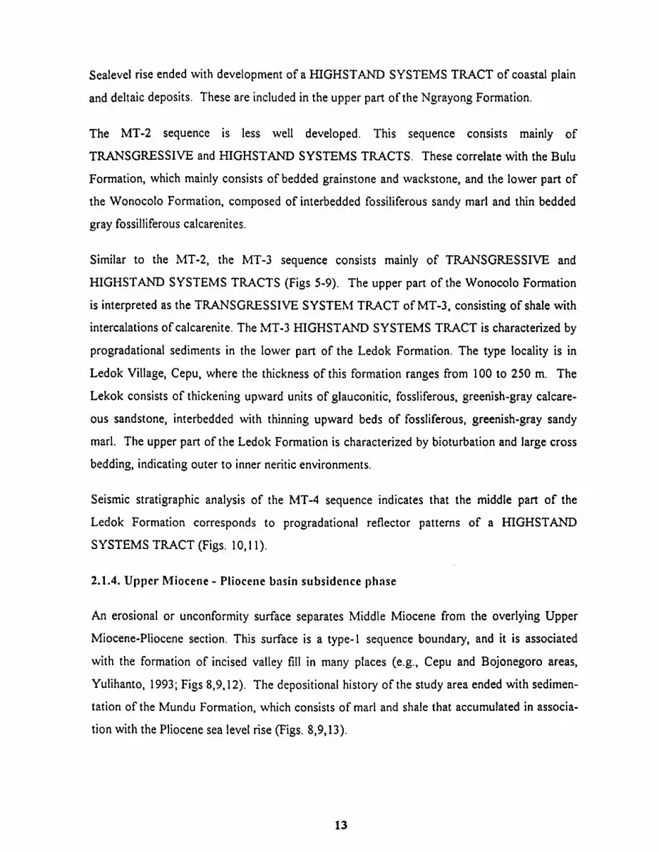
2.1.4. Upper Miocene - Pliocene basin subsidence phase
An erosional or unconformity surface separates Middle Miocene from the overlying Upper
Miocene-Pliocene section. This surface is a type-1 sequence boundary, and it is associated
with the formation of incised valley fill in many places (e.g., Cepu and Bojonegoro areas,
Yulihanto, 1993; Figs 8,9,12). The depositional history of the study area ended with sedimen-
tation of the Mundu Formation, which consists of marl and shale that accumulated in associa-
tion with the Pliocene sea level rise (Figs. 8,9,13).

N
0 -
direction of deposition.
Pigurc 10. The Isopach o f Highstand Systcm Tract, Mt-4 scqucncc (uppcr part of Lcdok Formation).
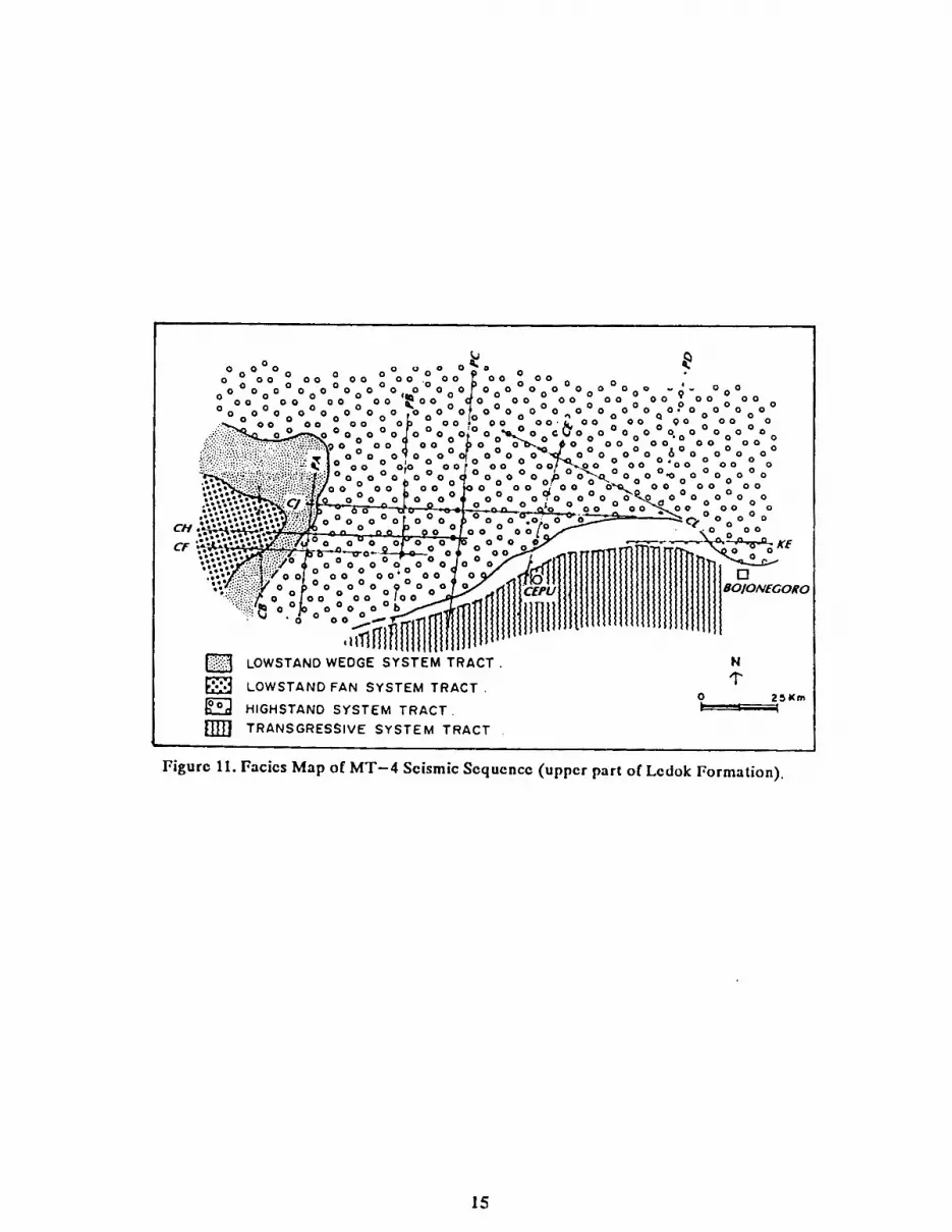
a LOWSTAND WEDGE SYSTEM TRACT
LOWSTAND FAN SYSTEM T R A C T .
a HIGHSTAND SYSTEM T R A C T . TRANSGRESSIVE SYSTEM TRACT
1 Pigurc 11. Fasics Map of MT-4 Scismic Scqucncc (uppcr part of Lcdok Formation).


HIGHSTAND SYSTEM TRACT
TRANSGRESSIVE SYSTEM TRACT
Pigurc 13. Pacics Map of Uppcr Mioccnc-Plioccnc Scismic Scqucncc (lowcr part of thc Mundu Formation).

Fossliferous, greenish-gray marl dominates the lower part of the Mundu, while the upper part
includes interbedded fossiliferous, greenish-gray sandy marl of the so-called Selorejo Member.
The formation was deposited in outer neritic environments during the Late Miocene to
Pliocene.
2.2. Stratieraphy of the Kendeng Zone
The Kendeng Zone represents the central deep of the East Java Basin. Most lithological
features show deep marine influence. The stratigraphy of the Kendeng zone is shown in figure
4 and includes the following units:
The type locality for this formation is in Pelang Village, south of Juwangi. The Pelang Forma-
tion there consists of 125 m. of alternating massive to bedded fossiliferous gray marls and gray
claystones with intercalations of bioclastic limestones. These strata accumulated in neritic
environments during the Early Miocene.
Kerek Formation
The name of Kerek comes from Kerek Village, in the vicinity of the Solo River (Bengawan
Solo). The formation consists of about 800 m. of turbidites, made up mostly by fining and
thinning upwards beds with sedimentary structures typical of density flows. Lithologies
include gray tuffaceous sandstones and gray claystones or marls.
Kaliberlg Formn fiou
This formation has a type locality along the Kalibeng River, north of Jombang. It consists of
massive fossiliferous greenish gray marl intercalated with thin bedded tuffs. These sediments
accumulated in a bathyal environment during Pliocene time.
The upper part of the Kalibeng (Atasangin Member) is composed of interbedded white
tuffaceous fine to coarse sandstones, white tuffs, and brown volcanic breccias. These were
deposited as turbidites.

Other facies of the Kalibeng are the Cipluk Member, with marl and claystone (200-500 m.);
The Kapung Member, which is composed of bioclastic wackstone and grainstone; and the
Kalibiuk Member, characterized by claystone and balanus marl.
Sonde Formafio/l
The type locality is in Sonde Village, west of Ngawi, where the thickness is 260 m. The lower
part of this formation (Klitik Member) is dominated by sandy marl interbedded with calcareous
sandstones and white tuffs, while the upper part consists of balamnus packstone and grain-
stone. The formation was deposited in shallow marine environments during Pliocene time.
Type locality for the Pucangan Formation is at Gunung Pucangan, north of Jombang. It
includes 323 m. of conglomeratic-coarse sandstones, tuffaceous sandstones, volcanic breccias,
and black clay containing fresh water molluscs. This formation was deposited in a limnic
environment during Late Pliocene to Pleistocene time.
Kabuh Village, north of Jombang, has the type locality for this formation. The formation is
150 m. thick, more or less, and it consists of interbedded coarse sandstones with cross bed-
ding, vertebrate fossils, lenses of conglomerates, and yellow tuffs. These accumulated in
continental, fluvial and lirnnic environment during the last 0.75 MY.
3. FIELD TRlP STOPS
3.1. Day 1 (Semnrnng - Cent11
3.1.1. Stop 1: Candi Area
The Candi Area is part of southern flank of the E-W trending Candi Anticline, where the
Tawun, Bulu and Wonocolo Formations (Middle-Upper Miocene) crop out (Fig. 14).

Parasequences that coarsening upward from sandy claystone to calcarenite form the lower part
of this section, equivalent to the upper part of the Tawun Formation (Photo 1). Data from the
BN-1 well indicate that this formation consists of successive coarsening upward parasequence
sets that grade from calcareous grey shales in the lower part to orbitoid limestone and moder-
ately sorted sandstone in the upper part (Figs. 15,16).
Farther north, this section changes vertically to terrigenous clastic lithologies of J%zravong
sandstone. There, the lower part consists of interbedded calcarenites and limestones 5-40 cm
thick. These pass vertically upward into interbedded fine-medium grained sandstone and grey
- dark grey mudstone with local sandy limestones that have parallel wavy laminations.
The lower part of the v ~ r a v o n ~ Member in the Randublatung area is interpreted as a
LOWSTAND deposit (Ardana, 1993; Budyani et. al. 1994). Lowstand Ngrayong deposits
accumulated in a slope to basin floor setting during the middle Miocene sea level drop (10-15
ma).
Biostriatigraphic analysis of sample CA-5 yielded Globorotalin fohsi fohsi, Globorotalia
lengtrer~sis, and Globorotalia drnggi. This assemblage indicates an middle Miocene age (N12).
The benthonic foraminifera1 assemblage includes Rotalia sp., Nonion sp., Textularia sp., and
Bolivina sp., which indicate a transitional depositional setting.
The upper part of the Ngrayong is dominated by coarsening upward parasequences (Photo 2)
of sandstone, consisting of yellowish white, medium grained, unconsolidated and well sorted
quartz arenite. These can be interpreted as HIGHSTAND SYSTEMS TRACT deposits.
The total thickness of the Ngrayong sandstone in this locality amounts to 98 m., more or kss.
The lower part of the formation, characterized by fining upward parasequences, can be
interpreted as prodelta environments associated with the TRANSGRESSIVE event during
that time. Overlying, coarsening sandstones accumulated as proximal distributary mouth bar
facies of a HIGHSTAND SYSTEMS TRACT.
A TRANSGRESSIVE phase returned in the late middle Miocene, with deposition of interbed-
ded bioclastic limestones and calcareous sandstones of the Bulu Formation. These consist of

Photo 1: STOP- IA, outcrop of Tawun Limestone with intensively sheared joints.
Photo 2: STOP- 113, coarsening upward parascquence of the Ngrayong sandstone.

FORMATION
Bulu
Ngrayong
Tawun
;ys tern ract -
TST
HST
TST
Figure IS. Scqucncc Stratigraphic h a l y s c s of BN-1 Wcll (Baoyubang).

IntercalaUon of andy limestones In massive mads.
Sandy I l m e s t m 5-20 an thkk, bedded. fosslliferws,
qua*, glauconlte, mcdlum sorted.
Interkddlng of cakareour sandstones and sandy
Hmestoncr. Calcareous sandstone, 20.30 cm thlck,
flnning and coancnlng upward quartz. glauconh.
Intercahtlon of sandy Rmesto~s In cakucou~
sandstones bc4h of them cmfst of quartz, glauconfie,
fossUifcrwr.
Sandy days, panRcl Iadnatkn, ahcaa, htmrstkn of sandy llmestoms (5-20 cm), fosslliferous, glauconb.
Mad, Ilght grey, lmpwllks of sand materials 1.0. quartz, fossils, glauunRe.
Attematlng of Umestoms, mads, and sandstoms.
Quartz sandstone, very good porosity, friable, coanenlng
upward, parallel bmlnatlon, bloturbalie, noncalcareous.
Claystom, wlth In Intercalation of Orbttolde limestone. sandy limestone and calcareous sandstone.
Orbltolde Ilmestone, c lass l f i as pacMone (Dunham, ' 62), hrge forams, medlum sorted.
Figure 16. Dctailcd Stratigraphic Column o f thc Candi arca.
27

foraminiferal packstone-grainstones that are gray, well bedded (5-20 cm thick; Photo 3). The
planktonic foraminifera assemblage of Sphls. srrbdehiscens, Gs. slrbqrradrat~rs, Gt. lenguensis,
and Gt. siakensis indicates a N13 age.
The upper part of the Bulu Formation consists of mads with intercalations of calcarenites
which pass upward into shale-dominated sediments of the Wonocolo Formation.
The marl is greenish grey, fossiliferous, and glauconitic. Biostratigraphic analysis of sample
CA-6 yielded foraminifera including Gt. pse~rdomiocenica, Gt. acostae~rsis, and Gt. hzrmerosa " of middle upper Miocene age (N19-N20). The occurrence of benthonic foraminifera Bolivina
sp., Cibicides sp., Uvigerina sp., Plcrnrrlina sp., and the planktonic to benthic ratio of 40-48%
indicate deposition in outer neritic to upper bathyal environments.
Late Upper Miocene time is characterized by sea level rise, during which the coarsening
upward sequence of the Ledok Formation was deposited. The Ledok Formation comprises
interbedded calcarenite and calcareous sandstones which contain fauna of late Upper Miocene
age(N19-N20), including Gt. plesiotumida, Gt. merotzrmida, and Gt. tmida. Based on the
occurrence of Bolivirla sp., Cibicides sp., Nonion sp., Texfrrlaria sp. and the plank-
tonic-benthic ratio of 17-20%, this formation was deposited in inner-middle neritic environ-
ment.
3.1.2. Stop 2: Ngampel Village
Middle Miocene regressive deposits of the Ngravong sandstone show coarsening upward
parasequences (Fig. 17). In general, the section consists of interbedded quartzose sandstones
and mudstones with several thin limestone intercalations in the lower part, passing upward into
medium to thick, cross bedded sandstones. The sequence is bounded at the base by grey,
thick bedded foraminifera1 packstone (Photo 4). The sandstones are mostly clean,
fine-medium grained but locally coarse grained, and moderately to well sorted. They exibit
medium to large, uni to bidirectional planar and trough cross bedding (Photo 5). The sand-
stones are interpreted to have accumulated as a series of sand waves and sand dunes. Bios-
tratigraphic analyses indicate deposition in inner neritic shelf conditions that accompanied a
HIGHSTAND period.

Photo 3. STOP-lC,outcrop of the Bulu Formation.

DESCRIPTION
- Ouarl t . rand, yellow - brn., lrl.,
well a r t , well round. parole1 B u o r r lomlnar.
- Ouarlr. rand. yellow - brn.. I r l , erorlonal a1 bore r r d - brn. COlW
1 F i or J well art., well round.
- Interbrddlng a l qua ru rond and rondf day
o u o r ~ r . rand, yellow- bm., very good
brddlnq ( S - 10 cm 1. WU round.
porallrl 8 crasr laminar
- Ouarlr. rands, o / a w l lh Inlercaiallon of catc... 111.
- Ouortr. rands, a / a w l l h cancrr l lan
01 colc. rrl., rare conc r r l l on 01 Ihe
lower par t ..
- Ouortr. r and , a / o very qood lomlnor
of bore rounded by red ar t .
- Ouarlr: rrl.. blue - grey. r o l l -mod.,
hard. mod.- art.. r l c h molurk
Palrcypod .
- Lrl.. r h l l r chalky. hard - mod..
hrd., / o l n l hq .
Pigurc 17. Dctailcd Stratigraphic Column of the Ngampcl arca.

Photo 4:STOP-2, outcrop of Tawun limestone and Ngrayong sandstone.
Photo 5 : STOP-2B, mega crosbeddcd sandstone of the Ngrayong Member.
3 1

This section can be correlated with the MT-1 sequence (Fig 16). The base of the sequence is a
type-1 sequence boundary. The lower part consists of LOWSTAND deposits, followed by
deposition of TRANSGRESSIVE and HIGHSTAND SYSTEMS TRACTS. The thickness of
this unit ranges fiom 180-27s m in the Merpati-1 and KE-5 wells (Ardana, 1993).
3.1.3. Stop 3: Kalimodang Village
This stop exibits fining upward parasequence sets in the upper part of L& and lower part of
Mundu Formations (Upper Miocene-Pliocene). These units dip southeastward and consist of
interbedded, glauconitic and fossiliferous, greenish grey, biotubated sandstone along with
fossiliferous, greenish grey sandy mark (Fig 18).
Biostratigraphic analysis indicates a foraminifera1 assemblage including Globigeriria praebu-
loides and Globorotalia plesiottrmida of Upper Miocene age (N17). Benthonic foraminifera
include Bolivirta sp., Uvigerina sp., Btrlimina sp., and Amphistigiria which indicate an outer
neritic depositional environment
The upper part of the section includes fining upward sequences of interbedded 40-100 cm
thick mark and 10- 15 cm thick calcarenites. These contain fauna such as Gt. plesiohrmida, Gt.
merotumida, and Gt. tzrmida of Upper Miocene age (N18). With benthonic foraminifera such
as Bolivirla sp.,Cibicides sp., Noniorz sp., and Texttilaria sp., the environment of this rock is
interpreted as inner neritic.
The regional sequence stratigraphic study of this region shows that the complete upper
Miocene sequence, equivalent to the -n, is represented by a shallowing upward
section equivalent to the MT-4 Sequence (Yulihanto, 1993). The upper part of the Upper
Miocene sequence contains a regional stratigraphic break as seen on seismic (Yulihanto,
1993), in wells (Ngasin-1, Gondang-1, Grigis Barat-1, and Bojonegoro-1), and in surface data
(Lunt, 1990). This major break is associated in some places with formation of incised valley
fill (Figs 8,9,12), which is also well recognized in the eastern part of the Bawean Area
(Bransden & Matthews, 1992).

Mnrls. p c y to light brown. soft. massive, concoidal fractured, fossilifzrous.
Calcareous clayey sandstones. brown, very fine gainned, mauivc.
Calc;lrcous clayey sandstones, hown, fine gainned,
massive, coarser grainned found at the lower part.
Sandy limestones (7 - 1Ocm thick), light brown, irrcpular base contact, bioturbatcd, hard. -
Pigurc 18. Plioccnc Transgrcssivc Scqucncc of Lcdok and Mundu Formation, Kalimodang (Km 12 Ccpu-Blora).

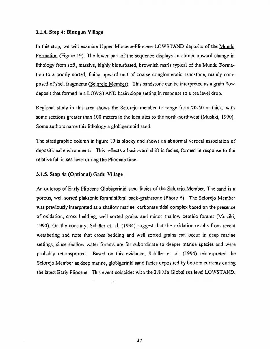
3.1.4. Stop 4: Blungun Village
In this stop, we will examine Upper Miocene-Pliocene LOWSTAND deposits of the Mundu
Formation (Figure 19). The lower part of the sequence displays an abrupt upward change in
lithology from soft, massive, highly bioturbated, brownish mark typical of the Mundu Forma-
tion to a poorly sorted, fining upward unit of coarse conglomeratic sandstone, mainly com-
posed of shell fragments (Selorejo Member). This sandstone can be interpreted as a grain flow
deposit that formed in a LOWSTAND basin slope setting in response to a sea level drop.
Regional study in this area shows the Selorejo member to range from 20-50 m thick, with
some sections greater than 100 meters in the localities to the north-northwest (Musliki, 1990).
Some authors name this lithology a globigerinoid sand.
The stratigraphic column in figure 19 is blocky and shows an abnormal vertical association of
depositional environments. This reflects a basinward shift in facies, formed in response to the
relative fall in sea level during the Pliocene time.
3.1.5. Stop 4a (Optional) Gadu Village
An outcrop of Early Pliocene Globigerinid sand facies of the &I oreio Member. The sand is a
porous, well sorted plaktonic foraminifera1 pack-grainstone (Photo 6) . The Selorejo Member
was previously interpreted as a shallow marine, carbonate tidal complex based on the presence
of oxidation, cross bedding, well sorted grains and minor shallow benthic forams (Musliki,
1990). On the contrary, Schiller et. al. (1994) suggest that the oxidation results from recent
weathering and note that cross bedding and well sorted grains can occur in deep marine
settings, since shallow water forams are far subordinate to deeper marine species and were
probably retransported. Based on this evidance, Schiller et. al. (1994) reinterpreted the
Selorejo Member as deep marine, globigerinid sand facies deposited by bottom currents during
the latest Early Pliocene. This event coincides with the 3.8 Ma Global sea level LOWSTAND.

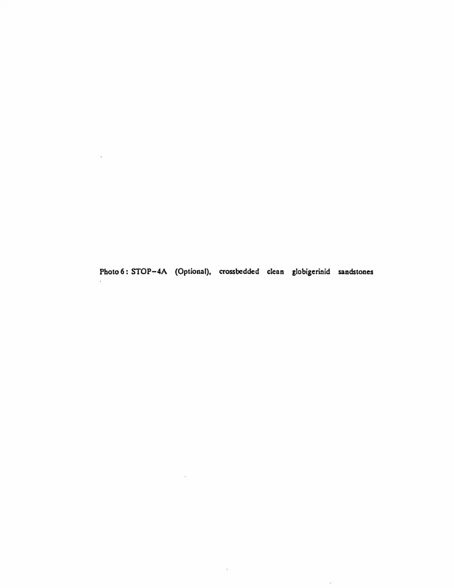
Photo 6 : STOP-4A (Optional), crossbedded clean globigerinid sandstones
3.2.1. Stop 5: Kadewnn
More than 40 m of the upper part of Ledok Formation (Upper Miocene) is exposed, consist-
ing of interbedded calcereous sandstones and calcarenites. This interval displays mega planar
cross bedding, indicating a shallow marine or inner neritic depositional setting (Photo 7). The
assemblage of benthic foraminifera include BoIivirlo sp., Cibicides sp., Nonion sp., and
Textularia sp., with a planktonic and benthonic ratio of 15-20%, all of which indicates an inner
neritic environment.
Biostratigraphic analysis of sample KD-1 from this locality yielded planktonic foraminifera
including Gt. plesiot~rmida and Gt. merottimido, which indicate an Upper Miocene age (N18).
The upper part of the Ledok Formation can be associated with progradational deposition
during a HIGHSTAND period.
3.2.2. Stop 6: Wonocolo Oil Field
Wonocolo oil field is located in the western part of the Kawengan Anticline. About 20 km
northeast from Cepu, it is unique - possibly the only oil field in the world which produced
neither by natural flow nor by artificial lift, but by manual labor. A small pipe is inserted down
the well and lifting up by a wire pulled by 5-6 people. This adds a new dimension to the
oilfield occupation of "pumper."
The field was discovered and developed in 1894, with 227 production wells ranging in depth
from 500-784 m. Maximum production was reached in 1920 with annual production of 79,886
m3 (503,000 bbls).
Wonocolo Oil Field was managed by Dordsche Petroleum Maatschaappij (DPM) starting in
1903, but in in 1923 it was taken over by Bataafsche Petroleum Maatschaappij (BPM). In the
early 19401s, the production was drastically decreased and finally abandoned prior to the
Japanese occupation in 1942.

Photo 7 : STOP-5, mega croosbedded Ledok Formation

Following the war, local people with their own knowledge and skill produced and refined oil
at Wonocolo using traditional methods (Photo 8). In April, 1988, PERTAMINA (Government
Oil Company of Indonesia) assumed operations for all of the oil fields in the Cepu area,
including Wonocolo. The production is managed by "KUD Bogosasono", although traditional
methods are still used. The crude is sold to Pertamina.
3.2.3. Histoly of Oil Exploration
Hydrocarbon exploration in the Northeast Java Basin started in 1871 based on surface geology
and occurrences of oil and gas seepages. Exploration drilling in the Surabaya area discovered
the KutiIGununganyar oil field in 1888 and the Lidah oil field in 1889. Near Cepu, Ledok oil
field was found in 1893 and Kawengan in 1894.
Following these initial discoveries, more than 25 oil fields were discovered and developed in
the Cepu-Surabaya area (onshore area of the northeast Java Basin) prior to 1900. Most were
subsequently abandoned, and only five oil fields and one gas field remain on production by
PERTAMINA.
Kawengan is the largest oil field in the onshore Northeast Java Basin, reaching cummulative
production of 5.437.000 m3 (34.000.000 bbls) in the 1990's. Kawengan produces from 12
zones: the lower pan of the Wonocolo Formation (3-9 zones), the Ngrayong Member (2
zones) and the upper part of the Tawun Formation (1 zone). In comparison, Wonocolo has 6
pay zones.
Quartz sands of the Ngrayong Member are the principal reservoir. Ranging in thickness from
35 to 110 m, these have porosity of 16-21%, permeability of 3 1-165 milidarcies, and water
saturation (Sw) of more than 90%. The recovery factor varies from 48-65% from producing
depths of 400-600 rn.
Structurally, Kawengan is an asymmetric anticline oriented NW-SE. The south flank is
bounded by a reverse fault with the same orientation. Several normal faults trending NE-SW
divide Kawengan Anticline into separate blocks or culminations and bound the individual

Photos: STOP-6, A traditional Oil Rig operated by men with an old car.

tions. These pools are (from east to west): Kidangan, Ngudal, Wonosari, Kawengan and
Wonocolo/DandangiIo.
The Wonocolo Formation crops out in the core of the anticline and is the oldest rock exposed
in the area. The Wonocolo consists of marl(cap rock) and sandy marl with intercalation of
calcarenites (reservoir rock), and it ranges in thickness from 600-1000 m.
Conformably overlying the Wonocolo Formation are shallow carbonate of the Ledok Forma-
tion which varies from 150-250 m thick in the area. The Ledok shows very good bedding with
planar and trough cross bedding structures. Down on the flank of the anticline, marl of the
Jvfundu Formation and clay of the Lidah Formation also crop out on the road from Cepu to
Kawengan.
- Oil and eas production
1. Kawengan - + 290 m3/day (1824 bbldday, 46 wells)
2. Ledok - + 60 m3/day (377 bbldday, 20 wells)
3. Nglobo - + 48 m3/day (302 bbldday, 22 wells)
4. Semanggi - + 4 1 1 m3/day (2585 bbldday, 2 wells)
5. Balun (gas) - + 52 m3/day (327 bbldday, 52 wells)
3.2.4. Stop 7: Kerek Village
This stop is situated on the Kendeng Zone, and it represents the type locality of the middle
upper Miocene Kerek Formation. This formation can generally be divided into two different
sedimentary facies. The lower part contains turbidite facies, while the upper part consists of
tuffaceous carbonate facies (Figs 20,2 1,22; Photo 9).
The turbidite facies consist of interbedded fine grained sandstones and calcareous claystones,
which pass upward into tufaceous sandstones, then laminated sandstones and calcereous


'ORMATION THICK.
GRAIN S I ~ E 1 , , , I DESCRIPTION
- w, grey, Irl. r lch Plank, Foram, Infercolafed w l fh t u f f $sf.,
yellow - brn., sol!. - Irl.
colc., l u l l . whir8 grey. mod. hard - h a r d .
- w., ruff, COIC., ssf., molr ls, wlfh
~arb011OfeI; volconlc rack
l ragmenfs .
- Hlghly repel l f lve o l f u l l art.. colc..
cloy and thin 1st.
- Highly repef i f lv r of l u l l ssf., w l fh clay pro'gmrnl, fhln laminae ronds.
and cafe. cloy.
- Highly repel l f lve 01 l u f f srf., graded.
thin' lamlnae ssl. ond corc. cloy.
- Hlghly repellflve of graded srf. and
Cole. Cloy.
Pigurc 21. Middlc Mioccnc Kcrck Formation, Kcrck Villagc.

CLASSIC BOUMA SEOUENCE :
Pigurc 22. Turbiditc scqucncc in thc Kcrck Formation, Kcrck Villagc.
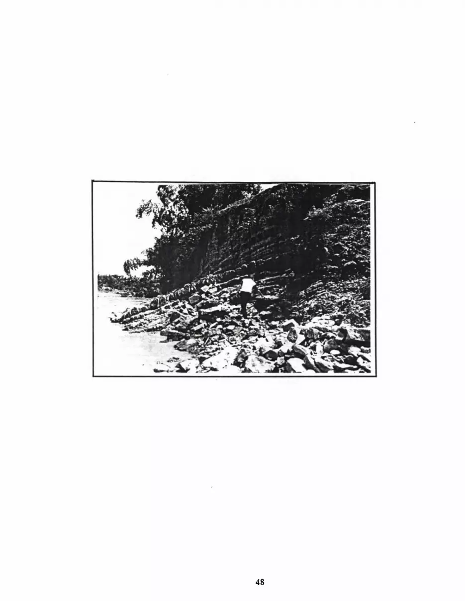

Photo 9 : STOP-7, outcrop showing a coarsening upward turbidite sequence in the Kerck Formation.

claystones with local hemipelagite facies. The tuffaceous carbonate facies comprise interbed-
ded tuff and white grey calcareous sandstones,
Regional stratigraphic correlation indicates that the middle-upper Miocene Kerek Formation
represents basin floor deposits of the NW Java Basin. The lateral equivalent is the Ngrayong
Formation.
3.2.5. Stop 8: Kabuh Formation
In this locality, we will examine Pleistocene deposits of the Kendeng Zone in the Kabuh
Formation. The basal part of this section consists of poorly sorted conglomeratic sandstones
composed predominantly of andesitic volcanic fragments. These grade upward into cross
bedded tuffaceous sandstones (Figure 23). This unit can be interpreted as Pleistocene fluvial
deposits. Sedimentation of this formation coincides with the upliAing of the southern margin
of the NE Java Basin in association with Quaternary volcanic activity (Photo 10).
3.2.6. Stop 9: Pucangan Formation
This locality displays the contact between blue grey clay (Lidah Formation equivalent) and
laharic breccia or debris flows of the Pleistocene Pucansan Formation (Photo 11).
3.2.7. Stop 10: Trinil Museum
The Trinil Archaeology Museum contains a collection of prehistorical horninid remains and
animal fossils which have been found in this area. The museum is situated adjoining the Solo
River in Trinil Village about 3 km northwest of Ngawi, in a locality where significant assem-
blages of life have been uncovered. In 1890, Dubois found the first fossil, a molar of Pithe-
cantropta erectrrs then named Trinil-1. This was followed by a Pithecnt~tropr~s erectrrs skull
(Trinil-2), and specimens up to Trinil-7 were found by 1900. Excavations were conducted by a
few Dutch paleontologists and anthropologists. The goverment recently constructed the
Archaeology Museum with an exibition hall, offices, and other facilities (Photo 12).

FORMATION GRAIN S I Z E - :LAY/SILT. I SAND
- Grovel, rond, lilt Aluvlol .
- Sat., brn., f r l , conglomerotlc 01
base, crorrb 'wd.
- C& l u f f , r a l . l m o t r l r I , vulcanlc rocks I rogmentc.
- Clay, grey, al l ly, # o f / .
- Ssl . , grey, aof t . - I r l .
- Srl.. brn., conglomrra l lc at b o r r of hard g round / feo r c ro rabedr , t o f t - f r l .
- Clay, b lur - grey. r o f t .
- S r t . - grey. ro f t . , .V lomlnoc .
- Sat., grey, + t t - I ~ I . , w l lh clay fragment# .
Pigurc 23. Pl ioccnc Ka buh Formation, Ngawi Villagc.
THICK. ( m ) DESCRIPTION
4


Photo 11 : STOP-9, conglomerates of the Pucangan Formation

Photo 12 : STOP- 10, Thc Trinil Prehistoric Museum, Plcistoccnc collecting site.

3.3. Day 3 Nowal<arta - Jakarta)
3.3.1. The Historic City of Yogyakarta
The Yogyakarta Special Region is one of the 27 provinces in Indonesia. It consists of five
regencies: Yogyakarta municipality (capital of the province) plus Bantul Regency, Sleman
Regency, Kulon Progo Regency and Gunung Kidul Regency. Yogyakarta covera an area of
about 3 140 square kilometers, and it has a total population of 2,912,342 friendly people.
With the Giyanty treaty in 1775, Yogyakarta became the capital of Yogyakarta sultanate, a
sub-division of the Mataram Kingdom. Before then, the kingdom was centered in Surakarta as
the Surakarta Hadiningrat sultanate.
Yogyakarta has long been a magnet for culture, tourism and education. As the centre of
Javanese culture, it has a unique ambiance that all can experience and enjoy. Indonesians
sometimes call Yogyakarta the cradle of Javanese culture.
As a major tourist for domestic and international tourists, Yogyakarta has an abundance of
attractions for visitors. A variety of special handicrafts are available, including handmade
objects of silver, leather, ceramics and batik.
Yogyakarta contains many museums, including the cultural and historical museum of Sono
budoyo, the biology museum of Gajah Mada University, and an art mueseum for the famous
painter Afandi. The surrounding countryside is dotted with at least 36 very ancient and unique
Buddhist and Hindu temples, relics of civilizations in the ninth century. These include the
world famous temples of Borobudur (Buddhist) and Prambanan (Hindu). For those who
interested in hiking, swimming and adventuring, there are also mountain trails, beaches,
limestone caves, and an abundance of beautihl scenery.
Yogyakarta's fame includes the University of Gadjah Mada, oldest and largest in Indonesia. It
draws students from all over Indonesia as well as overseas.

3.3.2. Stop 11: hlernpi volcano
Crater names: Pasarbubrah, Pusung London, Kawah 48 and Kawah 56
Volcano type: Stratovolcano with lava dome -
Location: 30 km north of Yogyakarta
Geographic position: Latitude 7" 32.5' S, Longitude 1 10" 26.5'
Elevation above Sea Level: 29 1 1 m
Elevation above Yogya: 2800 m
Geometry and structure: Merapi is a very active volcano situated along two major crossing
faults, i.e. transversal and longitudinal (Van Padang, 1951). Batulawang, the relatively older
side of Merapi, had been intensively eroded and faulted. Bemmelen (1949) noted that western
bank of G. Bukitlawang had undergone listric faulting around the year 1906.
The summit of Merapi is very dynamic (Photo 13). A crater formed in 1872-1883, and a dome
of viscous lava (East Dome) grew with the crater in 1883-1884. In 1888, the western part of
the dome collapsed. From 1902 until 1913, a new mass of lava appeared 130 m. west of the
earlier dome and formed West Dome, with a peak that grew to 2963 m. in the year 191 1. This
event was repeated in 1922 at a location 180 m. west of the latest dome. Those lava domes
were destroyed by major explosion in December 1930. Reksowirogo (1972) wrote that hot
lava flowed to the west in the years 1930, 1934, 1942 and 1943. Lava domes also grew
during that period, and the existing peak was formed in 1940. Ruins are still obserable from
Ngepos Observation Station.
New lava appeared to the northwest in 1953, 1954, and 1958. In 1961 a new lava dome
appeared in Lurah Batan. More lava domes appeared in 1967, 1968, 1969 and 1973. Suryo
(1968) noted that the 1967 and 1968 domes contained 2.85 million cubic m. of lava, and the
peak was 2866.7 rn. (Hajowarsito, 1972).

Photo 13: STOP 11, scenery of Mcrapi an active volcano.
A surge explosion (mvmparmm) destroyed the bank and foot of the hill over a fan shaped area
extending outward about 13 km to a width of 3 km (Fig. 24). Two recognized surge types are
formed by non volcanic explosion (Lacroix) and by volcanic explosion (vincent type, Escher).
The lower part of the surge, consisting of blocks and ash, ran as a lava flow to the valley
(ladu). The upper part is a surge containing abundance of dust and fine sands flowing down
the valley. These phenomena make a barren pathway, and they facilitate creeping down or
sliding which can further damage the landscape.
Mountaineering the summit:
The safest and easiest pathway to the peak is via the Selo Observation Station, from Plawan-
gan to Bukit Seloklopo Ngisor, the Old Observation Station at Seloklopo Nduwur, the old
crater Pasar Bubar, and up to the peak. It takes about four hours. The closest recommended
transit stop is Jrakah Station, which can be reached by four wheel drive vehicles.
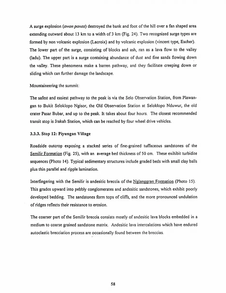
3.3.3. Stop 12: Piyungan Village
Roadside outcrop exposing a stacked series of fine-grained tuffaceous sandstones of the
Semilir Formation (Fig. 25), with an average bed thickness of 50 cm. These exihibit turbidite
sequences (Photo 14). Typical sedimentary structures include graded beds with small clay balls
plus thin parallel and ripple lamination.
Interfingering with the Semilir is andesitic breccia of the Ndaneo,ran Formation (Photo 15).
This grades upward into pebbly conglomerates and andesitic sandstones, which exhibit poorly
developed bedding. The sandstones form tops of cliffs, and the more pronounced undulation
of ridges reflects their resistance to erosion.
The coarser part of the Semilir breccia consists mostly of andesitic lava blocks embedded in a
medium to coarse grained sandstone matrix. Andesitic lava intercalations which have endured
autoclastic brecciation process are occasionally found between the breccias.

Figurc 24. Map Showing Distribution of Lhc Mcrapi Surgc.

PLEISTO- Z T t -
. . . . . . . . . . . - - - BUTAK FM. ' ' .
- - - - - - : . ' ' -'KEBO FM.{ : i :-: : . . . . .
Figure 25. Gcncralizcd Stratigraphy Southcrn Mountains. Ccntral Java (aftcr Suyolo,1986).

Photo 14. STOP- 12A, interbedded tuffaceous conglomemtic sandstone and shale of the Sernilir Formation.
Photo 15. STOP- 12B, Poorly sorted conglomcratic of the Nglangran Formation

3.3.4. Stop 13: Prarnbanaa Temple
The Prambanan temple is the largest Hindu temple in Indonesia, located about 17 km east of
Yogyakarta and 100 m off the highway. The main temple occupies an inner courtyard, sur-
rounded by several smaller structures called Penvara temples. Prambanan was built by the
Sanjaya Dynasty in the 91h century. Some of the small temples were contributed by local
chieftains as tokens of their acquiescene to the king.
The main temple has three shrines, dedicated to the Hindu Trinity of Shiwa, Wishnu and
Brahma. Each of these face smaller shrines for their attendants. The cow Nandi is the vehicle
of Shiwa, the destroyer god; the eagle Garuda attends Wishnu, the creator god, and the swan
Angsa serves Brahma, the guardian god.
Near the north entrance to the main temple is a statue of a very beautifil princes, Roro
Jongrang. According to legend, Roro Jongrang was the daughter of King Boko, who was
cursed into becoming a statue. A powerfd young man named Bandung Bondowoso later
wanted to marry Roro Jongrang. Since she did not love him, Roro Jongrang tried to avoid the
marriage by asking her suitor for a present. She said that she would marry Bandung Bon-
dowoso if he proved that he was really a powefil man. To accomplish this, Bandung Bon-
dowoso must build a thousand temples in one night. Having supernatural power, Bandung
Bondowoso almost completed the task. But Roro Jongrang tried to foil him. She asked the
maidens in villages east of the temples to burn the hay in the dead of night, so that this glowing
fire in the east would appear like a false dawn. A cock saw this light and began to crow, and
all supernatural beings fled thinking the sun was beginning to rise. Unable to control his anger
at this deception, Bandung Bondowoso cursed Roro Jongrang into becoming the statue that
now adorns the temple entrance.
From May until October, at f i l l moon, the story of Ramayana is presented at Prambanan in the
evening from 7:00 pm until 9:00 pm. In the traditional fashion, the dance is performed on an
open air stage to the west of the temple.

References
1. Ardana W.,1993. A. Depositional model for the Early Middle hliocene Ngrayong Forma-
tion and implications for Exploration in the East Java Basin. Proceed. Iildon. Petrol As-
soc. 20th. pp 395-444.
2. Brensden, P. J. E & Mattheus S.J. 1992. Structural and Stratigraphic Evolution of the East
Java Sea. Proceed. I~ldoti. Petrol. Assoc. 21st. pp 4 17-454.
3 . Hajoprawiro S., Sudana D., Achdan A., 1992. Geologicnl Mop of The Renibnilg Qund-
rn~rgle, Jawa. GRDC, Bandung.
5. Harsono P., 1983. Biosfrotigrcrpl1y doti Paleogeug~.opliy Cekl~tlgnll Jmva Timtrr Utcrra,
S~rnttr Perldekntall Bnrr~, Unpublished Report, Desertasi ITB Bandung.
6. Lunt,P., 1991. The Neogene Geological History of East Java, Some Unusual Aspects of
Stratigraphy. Proceed I~itlon. Assoc. Geol. ZOth, pp 26-36.
7. hlusliki,S.,1990. The Pliocene Selorejo Formation and its Hydrocarbon Prospects in Cepu
and Surrounding Areas. Proceed. Ii~don. Assoc. Geol. (IAGI) 19/11., 29 p.
8. Reksowirogo,L.D., 1 972. Mel~ligknpi d m sebq io~i merevisi petn dnercrh bahnycr G.
Mernpi Jmrn 7'etignh, Direkt. Geol.
9. Schiller, D.h4., Seubert, B. W.,Musliki S. & Abdullan, h4. 1994. The Reservoir Potential of
Globigerinoid Sand in Indonesia. Proceed Irldor~ Petrol Assoc. 23rd, pp 189-2 12.
10. Suyoto, Rodhi, A,, 1994. Eskwsi Besnr Gcologi Jmvn irin1rrr', UPN"VeteranW Yogyakarta.
11. Yulihanto B.,1993. Lenlbah Torehan hliosen Atas dan Peranannya dalam terbentuknya
perangkap stratigrafi Daerah Cepu dan sekitarnya. 1)roccetl. I~idoil. Assoc Geol. (7AGl)
2211d., pp 770-780.

12. Tim Studi Cekungan Tersier, 1994. Stud; Apliknsi S f r n ~ i g r n ~ Seismik & Rto~tromn
Slrafigrafi Cekmrgntl Jcnra Tinwr Ufnra. Unpublished Report, PPPTMGB "LEMIGAS".
2 2 ~
13. Van Bemmelen, R.W., 1949. Mernpi, (Ceiltral Jcrvn), The Geologi of Indonesia,
v.IA,p. 192- 194, 197-200, 206-207.
14. Van Padang, N.M., Mwop?, Cntnloglle of the m / i w \~olcn~~oes of the world. I)~cltrdit~g
solfnfnrnfieltis, v. 1 Indonesia, p. 120- 128.

We gretifully acknowledge the extensive logistical and technical support provideed by
PPPTMGB "LEhIIGAS" and PPT MIGAS Cepu. The Authors wish to thank Mr.
C.A.Caughey for His editing the guide book.
![Lacroce L. & Repetto G., 1999 - I Cancellaridi del Pliocene italiano. [Cancellariidae of the Italian Pliocene]](https://img.dokumen.tips/doc/110x75/63197486bc8291e22e0f1c66/lacroce-l-repetto-g-1999-i-cancellaridi-del-pliocene-italiano-cancellariidae.jpg)


