Embed Size (px)
Citation preview
GEOLOGICAL SURVEY PROFESSIONAL PAPER 1172
GeoindexBy PATRICIA FULTON and HAROLD JOHNSON,assisted by WILLARD L. MClNTOSH, MARGARET EISTER, LAWRENCE BALCERAK,DONALD HANSON, RICHARD THOENSEN, and PEARL PORTER
GEOLOGICAL SURVEY PROFESSIONAL PAPER 1172
Data base and data-base management system for the index to geologic maps
UNITED STATES GOVERNMENT PRINTING OFFICE, WASHINGTON: 1982
UNITED STATES DEPARTMENT OF THE INTERIOR
JAMES G. WATT, Secretary
GEOLOGICAL SURVEY
Dallas L. Peck, Director
Library of Congress catalog-card No. 82-600504
For sale by the Superintendent of Documents, U.S. Government Printing OfficeWashington, D.C. 20402
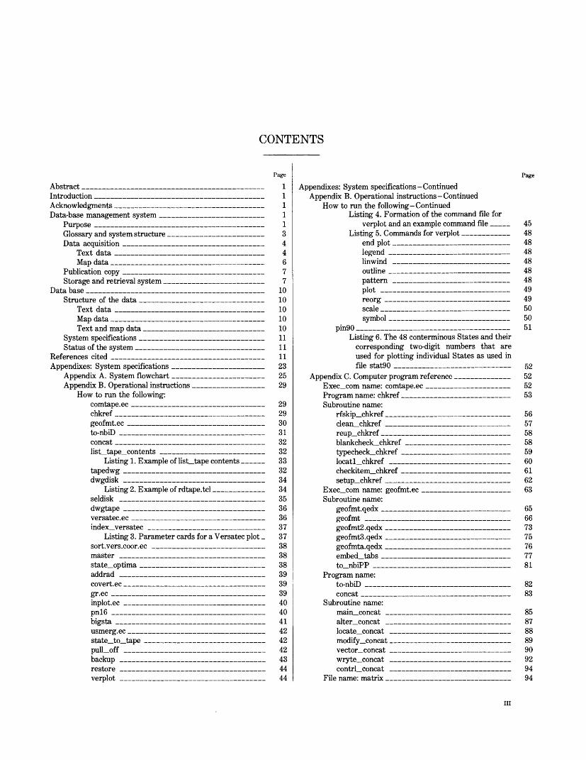
CONTENTS
AbstractIntroductionAcknowledgmentsData-base management system
Purpose
Text dataMap data
Storage and retrieval systemData base
Text dataMap data
System specificationsStatus of the system
References cited
Appendix A. System flowchartAppendix B. Operational instructions
How to run the following:comtape.ecchkrefgeofmt.ecto-nbiDconcatlist tape contents
Listing 1. Example of list tape contentstapedwgdwgdisk
Listing 2. Example of rdtape.tclseldiskdwgtapeversatec.ecindex versatec
Listing 3. Parameter cards for a Versatec plotsort.vers.coor.eemasterstate optimaaddradcovert.eeer.ecinplot.eepn!6bigstausmerg.ecstate to tapepull offbackuprestoreverplot
Page
1
1
1
1
1
344677
10101010101111119°.
2529
292930313232333234343536363737383838393939404041424242434444
Appendix B. Operational instructions -ContinuedHow to run the following -Continued
Listing 4. Formation of the command file forverplot and an example command file
Listing 5. Commands for verplotend plotleerendUnwindoutlinepatternplotreorgscalesymbol
pin90Listing 6. The 48 conterminous States and their
corresponding two-digit numbers that areused for plotting individual States as used infile stat90
Subroutine name:rfskip chkref/*] AQi"i f»Vllf T*PT
blankcheck_chkreftypecheck chkref
Exec com name: geofmt.ecSubroutine name:
geofmt
geofmtS.qedxgeofmta.qedx
to nbiPP
Subroutine name:main_concat
locate concatmodify concat
contrl_concatFile name: matrix
Page
454848484848484949505051
CO
5?,5?,53
565758585960616?,63
65667375767781
8?,83
85878889909?,9494
III
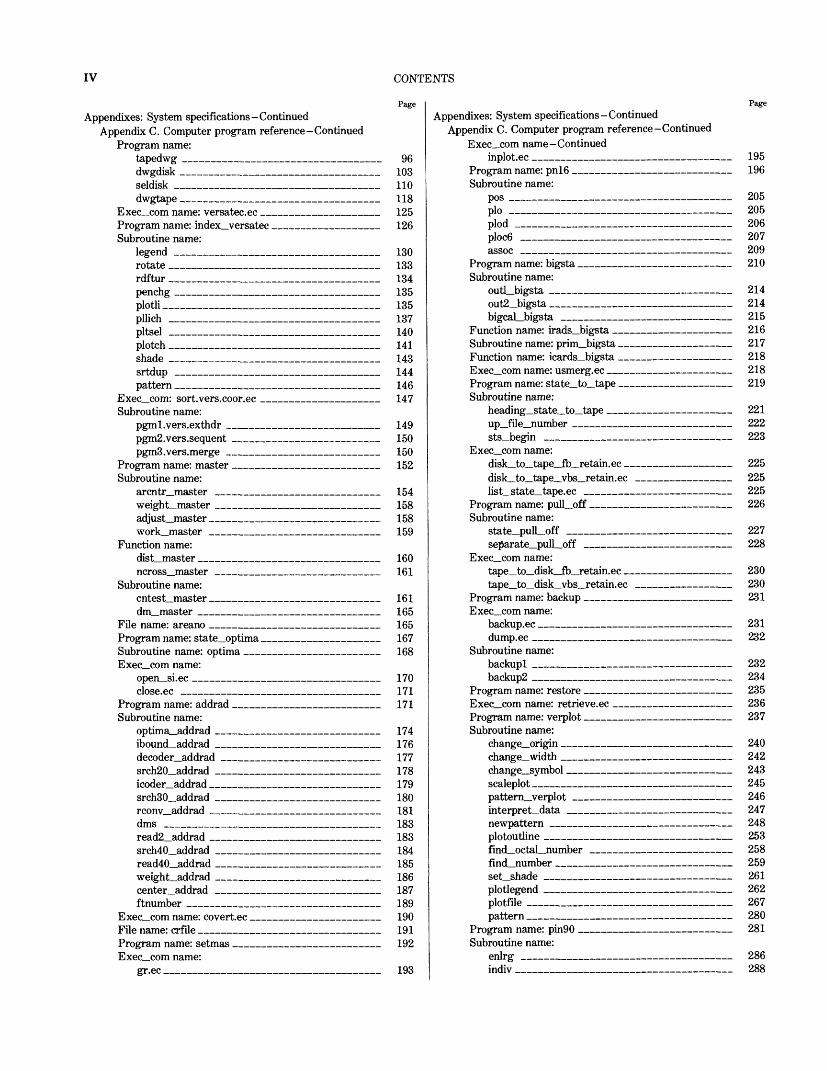
IV CONTENTS
PageAppendixes: System specifications-Continued
Appendix C. Computer program reference-ContinuedProgram name:
tapedwg _______________________ 96 dwgdisk ________________________ 103 seldisk _______________________ 110 dwgtape _______________________ 118
Exec_com name: versatec.ec _____________ 125Program name: index_versatec ____________ 126Subroutine name:
legend _______________________ 130 rotate ________________________ 133 rdftur __________________________ 134 penchg _______________________ 135 plotli _________________________ 135 pllich ________________________ 137 pltsel ________________________ 140 ploteh ________________________ 141 shade ________________________ 143 srtdup _______________________ 144 pattern _________________________ 146
Exec_com: sort.vers.coor.ee ______________ 147Subroutine name:
pgml.vers.exthdr __________________ 149 pgm2.vers.sequent _________________ 150 pgmS.vers.merge __________________ 150
Program name: master __________________ 152Subroutine name:
arcntr_master ____________________ 154 weight_master ____________________ 158 adjust_master _____________________ 158 work_master _____________________ 159
Function name:dist_master ______________________ 160 ncross_master ____________________ 161
Subroutine name:cntest_master _____________________ 161 dm_master ______________________ 165
File name: areano ___________________ 165Program name: state_optima _____________ 167Subroutine name: optima _______________ 168Exec_com name:
open_si.ec _____________________ 170 close.ec _______________________ 171
Program name: addrad __________________ 171Subroutine name:
optima_addrad ___________________ 174 ibound_addrad ___________________ 176 decoder_addrad __________________ 177 srch20_addrad ___________________ 178 icoder_addrad ___________________ 179 srch30_addrad ___________________ 180 rconv_addrad _____________________ 181 dms __________________________ 183 read2_addrad ___________________ 183 srch40_addrad ___________________ 184 read40_addrad ___________________ 185 weight_addrad ___________________ 186 center_addrad ___________________ 187 ftnumber _______________________ 189
Exec_com name: covert.ec ________________ 190File name: crfile _____________________ 191Program name: setmas __________________ 192Exec_com name:
gr.ec __________________________ 193
PageAppendixes: System specifications-Continued
Appendix C. Computer program reference-ContinuedExec_com name-Continued
inplot.ec _____________————————— 195Program name: pn!6 _____________———_ 196Subroutine name:
pos ___________________________ 205 plo ___________________________ 205 plod __________________________ 206 ploc6 _________________________ 207 assoc _________________________ 209
Program name: bigsta _________———————— 210Subroutine name:
outLbigsta ___________————————— 214 out2_bigsta _____________________ 214 bigcal_bigsta ______________————__ 215
Function name: irads_bigsta _____———————— 216Subroutine name: prim_bigsta _________——__ 217Function name: icards_bigsta _________—_ 218Exec_com name: usmerg.ec _______—————_ 218Program name: state_to_tape _________—_ 219Subroutine name:
heading_state_to_tape _______—————_ 221 up_file_number ___________——————__ 222 sts_begin _____________________ 223
Exec_com name:disk_to_tape_fb_retain.ec _____—————_ 225 disk_to_tape_vbs_retain.ec ___—————__ 225 list_state_tape.ec _________—————_ 225
Program name: pull_off ___________——_ 226Subroutine name:
state_pull_off ___________________ 227 se]5arate_pull_off _________________ 228
Exec_com name:tape_to_disk_fb_retain.ec ____________ 230 tape_to_disk_vbs_retain.ec ____————_ 230
Program name: backup ___________————__ 231Exec_com name:
backup.ec ______________————————— 231 dump.ec ________________________ 232
Subroutine name:backupl _______________________ 232 backup2 _______________________ 234
Program name: restore _____——————————— 235Exec_com name: retrieve.ec _____________ 236Program name: verplot ____________——_ 237Subroutine name:
change_origin ____________——————__ 240 change_width _______________——_ 242 change_symbol _____________————__ 243 scaleplot _______________—————_ 245 pattern_verplot ________——————————— 246 interpret_data ___________—————_ 247 newpattern ____________———————— 248 plotoutline _____________________ 253 find_octal_number ___________———__ 258 find_number ______________—————__ 259 set_shade _____________________ 261 plotlegend _____________________ 262 plotfile _______________________ 267 pattern ___________________—_ 280
Program name: pin90 ___________———_ 281Subroutine name:
enlrg __________________________ 286 indiv _________________________ 288
Appendixes: System specifications-ContinuedAppendix C. Computer program reference-Continued
Subroutine name-Continuedmin_max _______________________ 290 grid _________________________ 291 plocv _________________________ 294
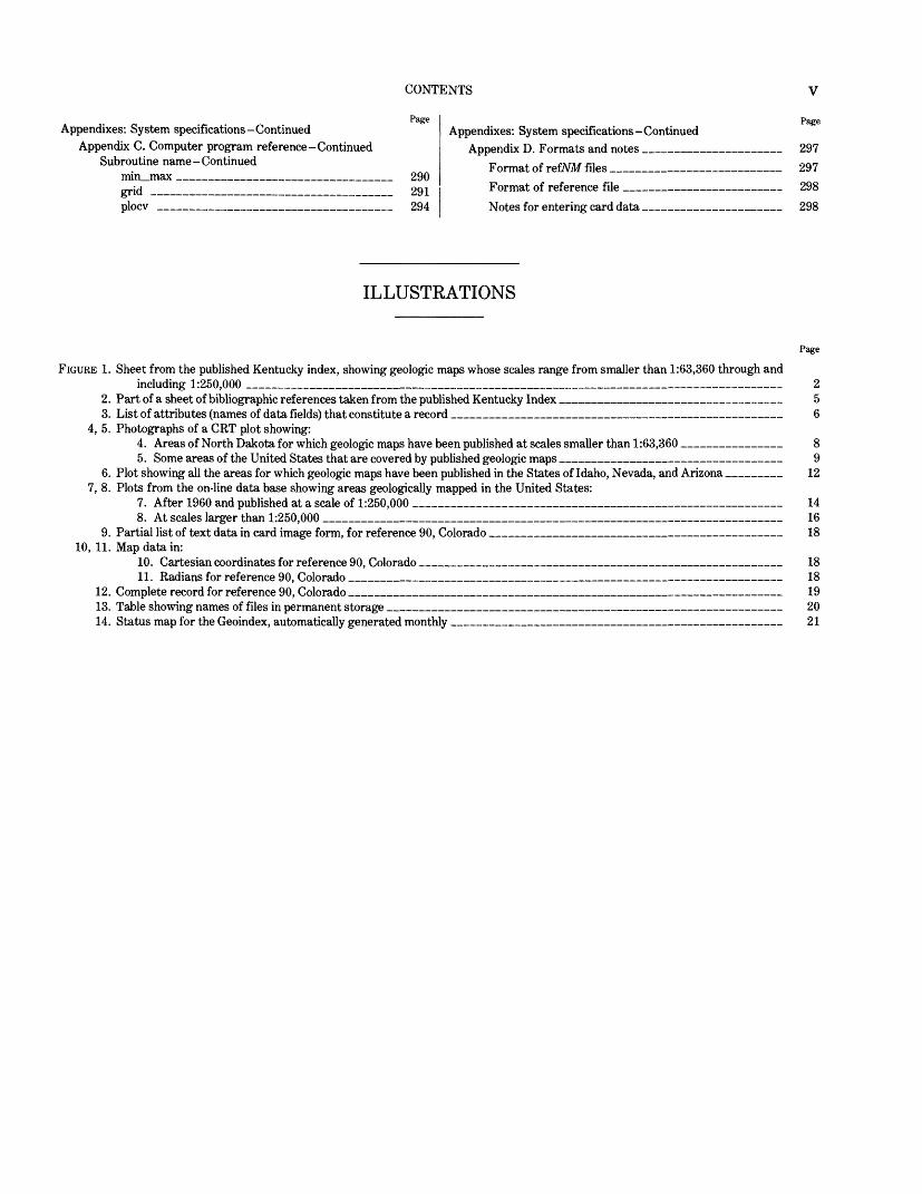
CONTENTS V
PageAppendixes: System specifications-Continued
Appendix D. Formats and notes ___——————————— 297 Format of refATM files _________________ 297 Format of reference file ____——————————— 298 Notes for entering card data ______________ 298
ILLUSTRATIONS
FIGURE 1. Sheet from the published Kentucky index, showing geologic maps whose scales range from smaller than 1:63,360 through andincluding 1:250,000 ___________________________________________________________ 2
2. Part of a sheet of bibliographic references taken from the published Kentucky Index _______________________ 53. List of attributes (names of data fields) that constitute a record __________________________________ 6
4, 5. Photographs of a CRT plot showing:4. Areas of North Dakota for which geologic maps have been published at scales smaller than 1:63,360 __________ 85. Some areas of the United States that are covered by published geologic maps _______________________ 9
6. Plot showing all the areas for which geologic maps have been published in the States of Idaho, Nevada, and Arizona _____ 12 7, 8. Plots from the on-line data base showing areas geologically mapped in the United States:
7. After 1960 and published at a scale of 1:250,000 ______________________________________ 148. At scales larger than 1:250,000 __________________________________________________ 16
9. Partial list of text data in card image form, for reference 90, Colorado ______________________________ 18 10, 11. Map data in:
10. Cartesian coordinates for reference 90, Colorado _____________________________________ 1811. Radians for reference 90, Colorado _____________________________________________ 18
12. Complete record for reference 90, Colorado _____________________________________________ 1913. Table showing names of files in permanent storage _________________________________________ 2014. Status map for the Geoindex, automatically generated monthly ___________________________——————— 21
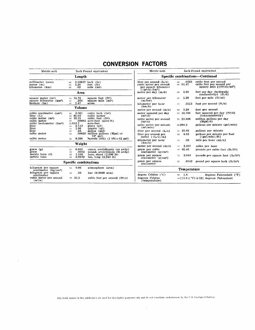
CONVERSION FACTORSMetric unit Inch-Pound equivalent
Lengthmillimeter (mm) meter (m) kilometer (km)
= 0.03937 inch (in) = 3.28 feet (ft) = .62 mile (mi)
Areasquare meter (m2 ) square kilometer (km2 ) hectare (ha)
= 10.76 square feet (ft2 ) = .386 square mile (mi2 ) = 2.47 acres
Volumecubic centimeter (cm3 ) liter (L) cubic meter (m3 ) cubic meter cubic hectometer (hm3 ] liter liter liter cubic metercubic meter
= 0.061 cubic inch (in3 ) = 61.03 cubic inches = 35.31 cubic feet (ft?) = .00081 acre-foot (acre-ft) = 810.7 acre-feet = 2.113 pints (pt) = 1.06 quarts (qt) = .26 gallon (gal) = .00026 million gallons (Mgal or
10« gal) = 6.290 barrels (bbl) (1 bbl = 42 gal)
Weightgram (g) gram metric tons (t) metric tons
= 0.035 ounce, avoirdupois (oz avdp) = .0022 pound, avoirdupois (Ib avdp) = 1.102 tons, short (2,000 Ib) rr 0.9842 ton, long (2,240 Ib)
Specific combinationskilogram per square
centimeter (kg/ cm2 ) kilogram per square
centimeter cubic meter per second
(mVs)
_ 0.96 atmosphere (atm)
— .98 bar (0.9*869 atm) = 35.3 cubic feet per second (ft3/s)
Metric unit
Specificliter per second (L/s) cubic meter per second
per square kilometer [(m3/s)/km2 ]
meter per day (m/d)
meter per kilometer (m/km)
kilometer per hour (km/h)
meter per second (m/s) meter squared per day
(mVd) cubic meter per second
(m?/s) cubic meter per minute
(m3/min)liter per second (L/s) liter per second per
meter [(L/s)/m] kilometer per hour
(km/h) meter per second (m/s) gram per cubic
centimeter (g/cm3 ) gram per square
centimeter (g/cm2 ) gram per square
centimeter
Inch-Pound equivalent
combinations — Continued= .0353 cubic foot per second = 91.47 cubic feet per second per
square mile [(ft3/s)/mi2 ]
= 3.28 feet per day (hydraulic conductivity) (ft/A)
= 5.28 feet per mile (ft/mi)
— .9113 foot per second (ft/s)
— 3.28 feet per second= 10.764 feet squared per day (ft2/d)
(transmissivity) = 22.826 million gallons per day
(Mgal/d) = 264.2 gallons per minute (gal/min)
= 15.85 gallons per minute = 4.83 gallons per minute per foot
[(gal/min) /ft] — .62 mile per hour (mi/h)
= 62.43 pounds per cubic foot (Ib/ft3 )
= 2.048 pounds per square foot (lb/ft2 )
= .0142 pound per square inch (lb/in2 )
Temperaturedegree Celsius (°C) degrees Celsius
(temperature)
= 1.8 degrees Fahrenheit (°F) = [(1.8X°C)+ 132] degrees Fahrenheit
Any trade names in this publication are used for descriptive purposes only and do not constitute endorsement by the I'.S. Geological Survey.

GEOINDEX
By PATRICIA FULTON and HAROLD JOHNSON,assisted by WlLLARD L. MclNTOSH,
MARGARET EISTER, LAWRENCE BALCERAK, DONALD HANSON, RICHARD THOENSEN, and PEARL PORTER
ABSTRACT
The acquisition and the dissemination of information are ever- increasing problems for Federal agencies engaged in research. To facilitate the publication of its geologic index maps, the U.S. Geological Survey has moved toward computer-based operations. The index to geologic maps (Geoindex) has been established and developed as a data base and data-base management system that provides three main capabilities. The primary capability is to provide the means to generate rapidly geologic index maps for publication. A second capability is to provide users an immediate access to all items in the data base. The third capability is to provide nationwide summary information to policy makers.
INTRODUCTION
The first U.S. Geological Survey indexes to geologic maps were published in the 1940's. They consisted of State base maps at scales of 1:750,000 or 1:1,000,000 on which the outlines of published geologic maps were shown. By the mid-1960's, most of the indexes were out of date. Revision was delayed because of the rising cost of color printing (six press runs) and the mechanical dif ficulty of showing legibly the additional (doubled) coverage produced in the 1950's and 1960's.
Some of the problems were solved in the publication of the Montana index in 1969. Heretofore, geologic index maps had shown all the geologic coverage. In the Mon tana index, only maps equal or better in quality and com prehensiveness than the State geologic map were in cluded. This limitation imposed a reasonable and stan dard criterion for determining what should be included in the index. All very small scale maps, as well as many sketchy or generalized maps, were omitted. Elimination of such material produced a more legible index without serious loss of geologic-map coverage. The revised in dex, like previous indexes, included both published and open-file maps of the U.S. Geological Survey, published maps of the State surveys, and maps published by other organizations.
When computer-assisted techniques were introduced, the project grew, and ideas continued to change and
evolve. Henceforth, maps published at the following scale ranges will be indexed on three separate sheets:1. Scales of 1:24,000 and larger2. Scales smaller than 1:24,000, through and including
1:63,3603. Scales smaller than 1:63,360, through and including
1:250,000
ACKNOWLEDGMENTS
The authors thank Joseph Moses Botbol and Roger Bowen for their assistance in the use of the GRASP system. Diane Lewis and Karen Shallcross completed compilation and entered the data into the Geoindex data base; Jane Timmins typed the manuscript and arranged it in the proper sequence; James Fisher, Kevin Laurent, and Maryjon McAvery helped in writing the computer programs and in constructing the data base. All these people are from the U.S. Geological Survey.
We also thank William Strauss, Denise Maurer, and Ray Wisecarver of the Johns Hopkins Applied Physics Laboratory for their invaluable assistance in the digitization of the data.
THE DATA-BASE MANAGEMENT SYSTEM
PURPOSE
The primary purpose of the Geoindex Data-Base Management System is to generate geologic index maps as quickly as possible. These published reports are wide ly distributed to a large, diverse group. A published geologic index consists of a series of map sheets and ac companying text material. The Geoindex is constructed State by State. Each map sheet consists of a State base map on which the outlines of published geologic maps and identifying numbers are superimposed (Fulton and Mclntosh, 1977). Figure 1 shows a map sheet from the published index for the State of Kentucky.
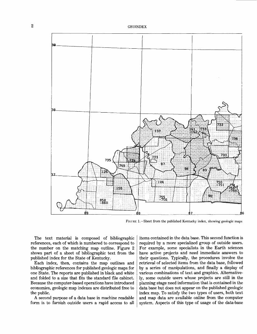
GEOINDEX
FIGURE 1.-Sheet from the published Kentucky index, showing geologic maps
The text material is composed of bibliographic references, each of which is numbered to correspond to the number on the matching map outline. Figure 2 shows part of a sheet of bibliographic text from the published index for the State of Kentucky.
Each index, then, contains the map outlines and bibliographic references for published geologic maps for one State. The reports are published in black and white and folded to a size that fits the standard file cabinet. Because the computer-based operations have introduced economies, geologic map indexes are distributed free to the public.
A second purpose of a data base in machine readable form is to furnish outside users a rapid access to all
items contained in the data base. This second function is required by a more specialized group of outside users. For example, some specialists in the Earth sciences have active projects and need immediate answers to their questions. Typically, the procedures involve the retrieval of selected items from the data base, followed by a series of manipulations, and finally a display of various combinations of text and graphics. Alternative ly, some outside users whose projects are still in the planning stage need information that is contained in the data base but does not appear on the published geologic index map. To satisfy the two types of users, both text and map data are available online from the computer system. Aspects of this type of usage of the data-base

THE DATA-BASE MANAGEMENT SYSTEM
whose scales range from smaller than 1:63,360 through and including 1:250,000.
management system are discussed later, under Storage and Retrieval System.
A third purpose of the data-base management system is to provide nationwide information to policy makers. Under this concept, one can access the data base as a single entity covering the entire United States instead of accessing merely one State at a time. The system can present a comprehensive overview of the whole country, but all the details shown on State maps are still avail able. For example, the total area for which geologic maps are available in the United States can be com puted. Such statistics are valuable for national planning.
To fulfill these requirements, the geologic map index exists in two very different forms: as computer files in the Geoindex data base, and as published reports. An ad
ditional reason for having two different forms is that as soon as data have been stored in a computer, new appli cations become feasible. As a result, computer resident data files serve a much larger community of users than previously imagined. Because the data files are in digital form, they become multifunctional in that retrievals from the files can assume totally different appearances. These additional capabilities more than justify the initial cost in creating machine readable map files.
GLOSSARY AND SYSTEM STRUCTURE
A technical dicussion of the data base structure first requires the definition of some of the terms (Honeywell Information Systems, Inc., 1978).
GEOINDEX
1. Data base. An integrated collection of data upon which operations (such as read, write, and revise) can be performed.
2. Data-base management system. A software system that accesses an integrated collection of data.
3. User. A person who retrieves, updates, or deletes data within the data base. Such a person actively maintains the data base.
4. Outside user. A person who retrieves data from the data base. This is a person who uses the system but does not maintain it.
5. Data model or schema. The description of the data base that defines the characteristics and organiza tion of the data within the data base.
The Geoindex data base is a relational data base and is derived from the mathematical theory of relations. The Geoindex Data Base Management System is a relational data-base management system. This structure is a natural consequence of having the Geologic Retrieval and Synopsis Program (GRASP) as the primary storage and retrieval program of the system because GRASP organizes data in relational form. GRASP is discussed more fully in the section entitled Storage and Retrieval System. The relational form is essentially a matrix com posed of the familiar rows and columns.
The mathematical terminology specific to a relational data base must also be defined:
6. File. A collection of organized data, a relation.7. Record. A representative "row" of data, a tuple.8. Attribute. Name of a data field within a record, a
column of information.9. Attribute value. Value of a data field within a
record.10. Domain. The set of all values a data field may
assume.11. Data submodel. User's definition of the data base. 12 Data model. Total definition of the data base.
A relational data base is in matrix form where the tuples (records) constitute the rows and the attributes (data items) constitute the columns. All tuples within a given relation have the same format (all records within a file have the same format). This last statement is a definitive characteristic of a relational data base.
The Geoindex is both large and complex. Size, of course, contributes to complexity, but the major source of complexity is the nature of the data that the system must process. The data comprise two distinct types: text and graphics. A record ("row," definition 7) exists for each map. The attribute values (columns, definition 9) are composed of text data derived from the bibliographic reference and of graphic data derived from the map out
line. See figures 1 and 2. The complete list of attributes handled by the data-base management system is shown in figure 3.
The data-base management system is functionally divided into four parts. The first part is composed of computer programs and procedures designed to per form two vital tasks. The first task is to capture and verify the data. The second task is to create the map sheets and bibliographic text sheets as camera copy ready for reproduction. The first part of the system will be discussed in the section Data Acquisition and the sec tion Publication Copy. The second part of the system is composed of computer programs and procedures that have one task to accomplish. This part of the system loads the data as relations into files that are accessible to GRASP, the storage and retrieval program. The third part of the system consists of GRASP and several plot programs. This third part is described in the section Storage and Retrieval System. The fourth part of the system consists of computer programs and procedures that insure the safety and integrity of the data by pro viding backup files and permanent archival data storage.
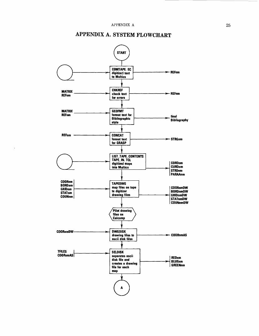
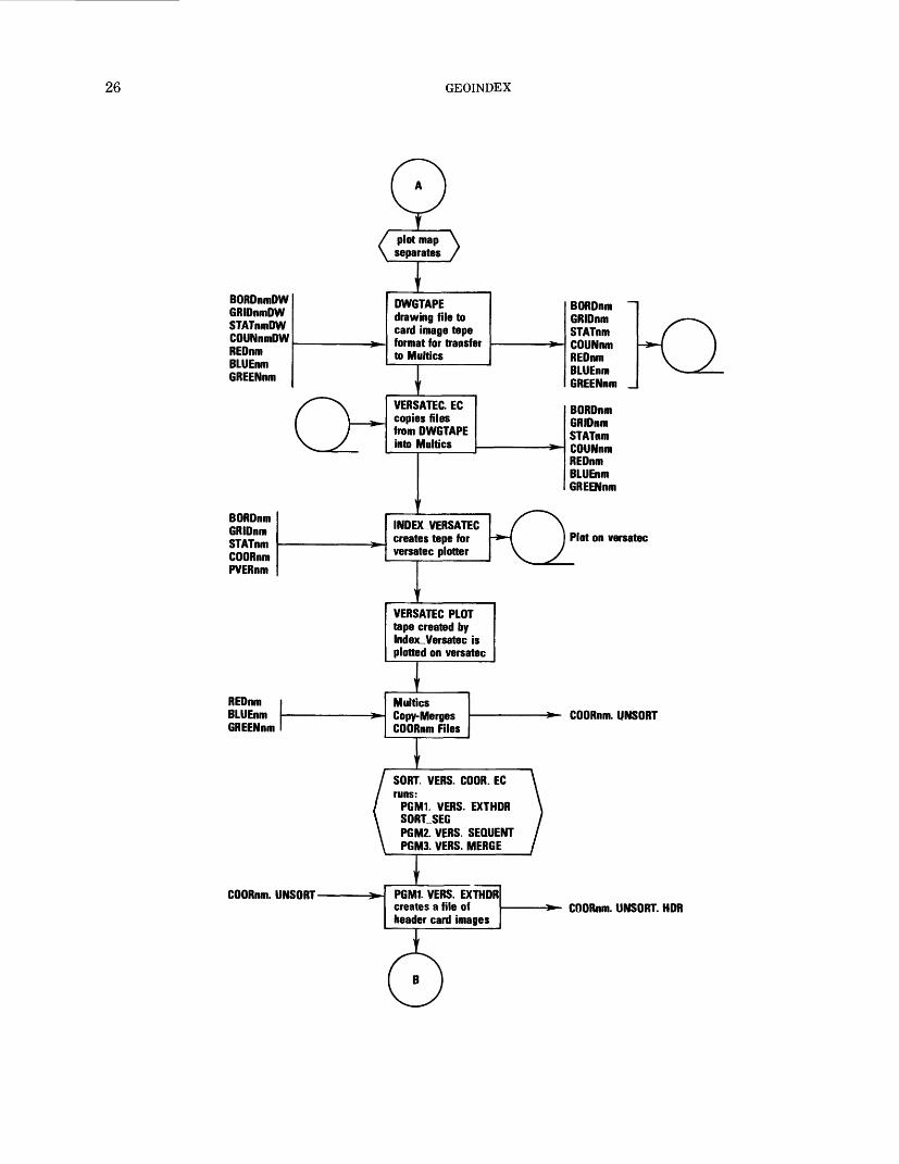
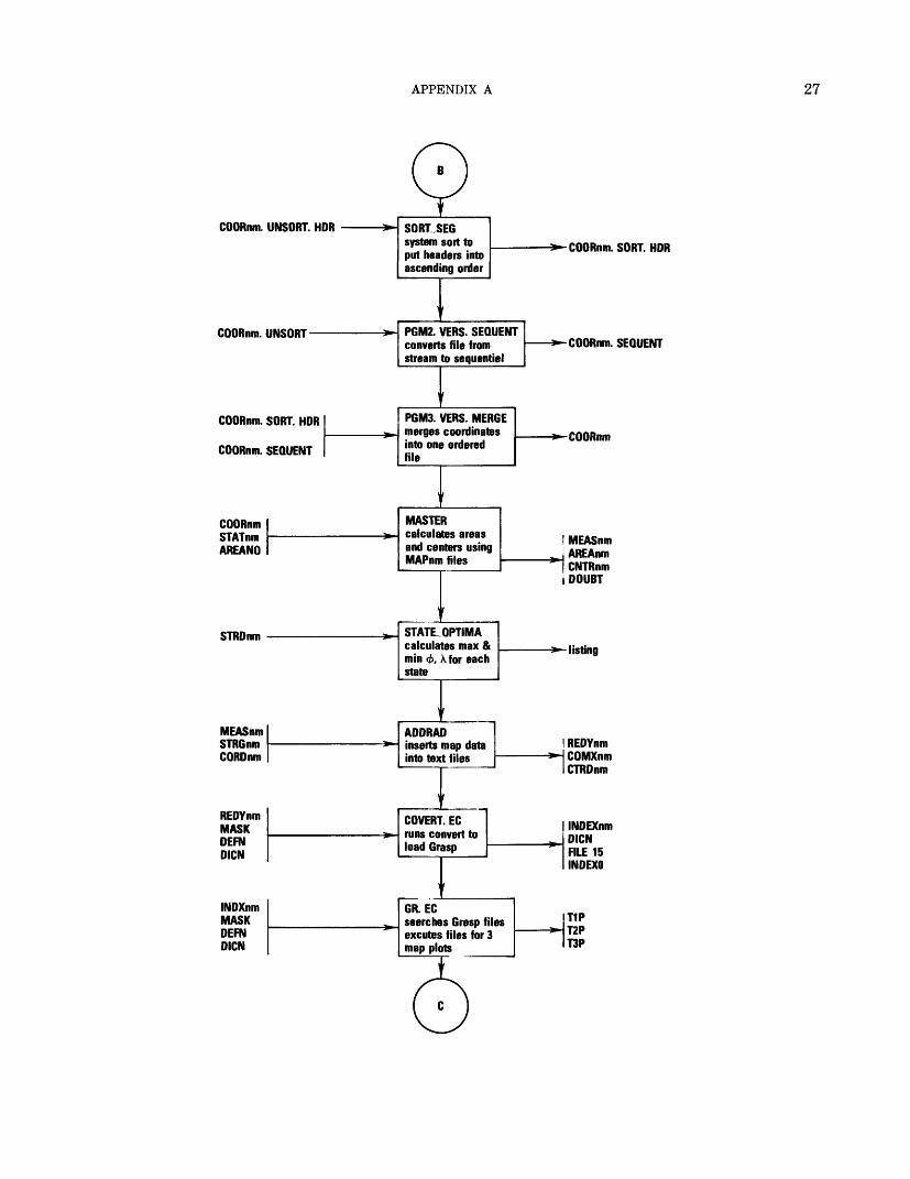
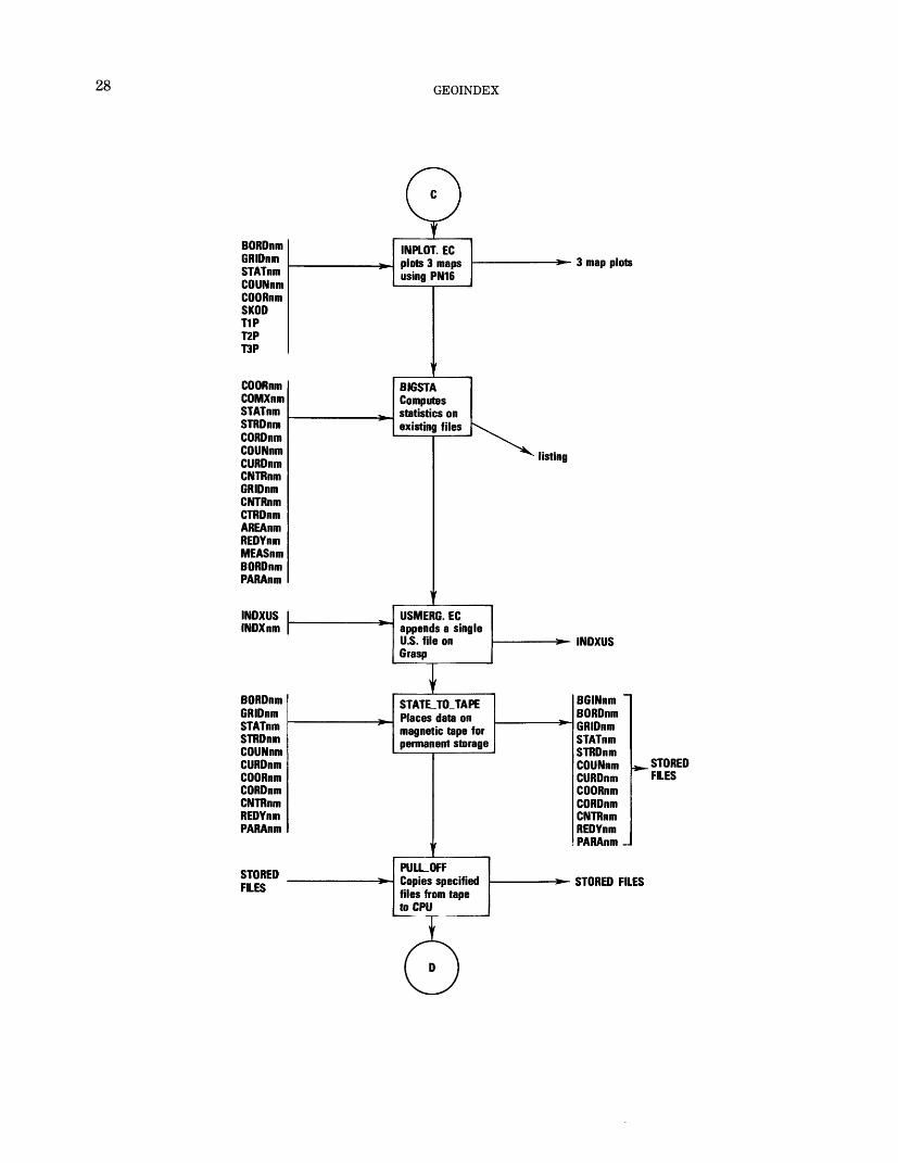
The system flow chart, illustrated in Appendix A, shows the chronological work flow that is virtually iden tical with parts one through four mentioned.
DATA ACQUISITION
TEXT DATA
The text data for an individual State are received in draft form, which is somewhat similar to that shown in figure 2. Each draft is examined, and a list of questions is prepared to cover any errors, omissions, or ambig uities that would slow the actual data-entry process. This list is returned to the geologist who compiled the in dex map and who then clarifies the uncertainties. After questions are answered and this list is returned, the physical keying of the text begins. The attributes, or record items, entered at this time are listed as follows: Identification number, author, year, title, publisher, county or region, emphasis, scale, and series.
The text material is prepared offline in card-image form on key-to-disk devices. These are word-processor computer terminals, which function both as stand-alone, offline, data-entry stations and as communications ter minals. Several types are available; however, each hard ware unit includes a keyboard for data entry, a cathode ray tube (CRT) screen that displays the characters entered from the keyboard and messages sent from a computer, and dual flexible disks that store data. Line printers, some switch-selectable among the units, supply the necessary hard copy.
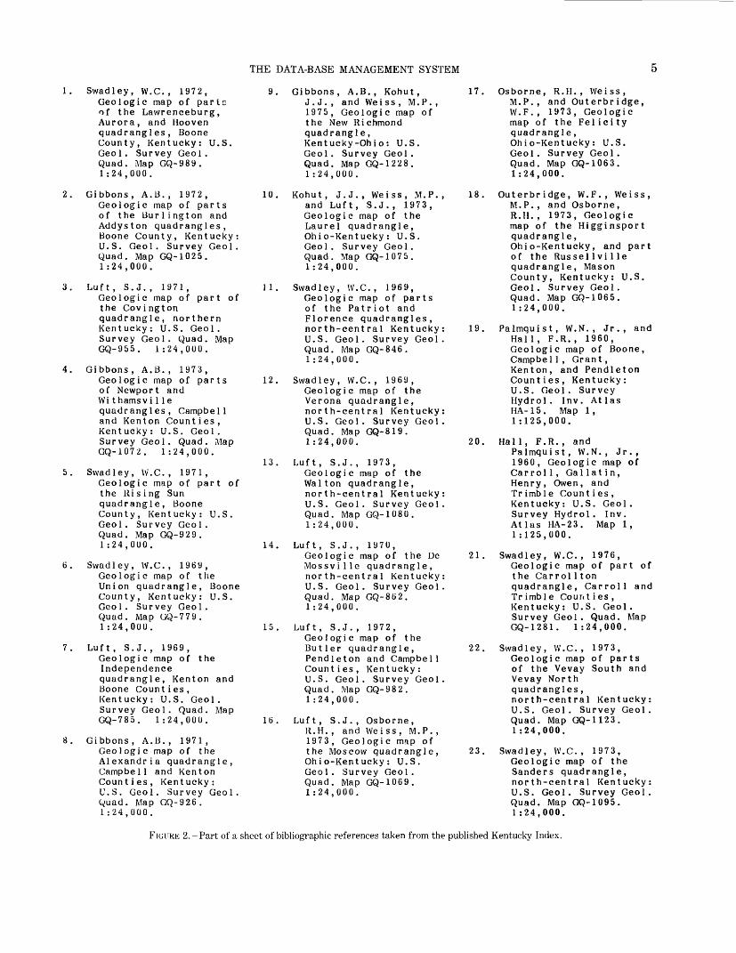
THE DATA-BASE MANAGEMENT SYSTEM
1. Swadley, W.C., 1972,Geologic map of pario of the Lawrenceburg, Aurora, and Hooven quadrangles, Boone County, Kentucky: U.S. Geol. Survey Geol. Quad. Map GQ-989. 1:24,000.
2. Gibbons, A.B., 1972,Geologic map of parts of the Burlington and Addyston quadrangles, Boone County, Kentucky: U.S. Geol. Survey Geol. Quad. Map GQ-1025. 1:24,000.
3. Luft, S.J., 1971,Geologic map of part of the Covington quadrangle, northern Kentucky: U.S. Geol. Survey Geol. Quad. Map GQ-955. 1:24,QUO.
4. Gibbons, A.B., 1973,Geologic map of parts of Newport and Wi thamsvi1le quadrangles, Campbell and Kenton Counties, Kentucky: U.S. Geol. Survey Geol. Quad. Map GQ-1072. 1:24,000.
5. Swadley, W.C., 1971,Geologic map of part of the Rising Sun quadrangle, Boone County, Kentucky: U.S. Geol. Survey Geol. Quad. Map GQ-929. 1:24,000.
6. Swadley, W.C., 1969, Geologic map of the Union quadrangle, Boone County, Kentucky: U.S. Geol. Survey Geol. Quad. Map GQ-779. 1:24,000.
7. Luft, S.J., 1969,Geologic map of the Independence quadrangle, Kenton and Boone Counties, Kentucky: U.S. Geol. Survey Geol. Quad. Map GQ-785. 1:24,000.
8. Gibbons, A.B., 1971, Geologic map of the Alexandria quadrangle, Campbell and Kenton Counties, Kentucky: U.S. Geol. Survey Geol. Quad. Map GQ-926. 1:24,000.
9. Gibbons, A.B., Kohut,J.J., and Weiss , M.P., 1975, Geologic map of the New Richmond quadrangle, Kentucky-Ohio: U.S. Geol. Survey Geol. Quad. Map GQ-1228. 1 :24,000.
10. Kohut, J.J., Weiss, M.P., and Luft, S.J., 1973, Geologic map of the Laurel quadrangle, Ohio-Kentucky: U.S. Geol. Survey Geol. Quad. Map GQ-1075. 1 :24,000.
11. Swadley, W.C., 1969,Geologic map of parts of the Patriot and Florence quadrangles, north-central Kentucky: U.S. Geol. Survey Geol. Quad. Map GQ-846. 1:24,000.
12. Swadley, W.C., 1969, Geologic map of the Verona quadrangle, north-central Kentucky: U.S. Geol. Survey Geol. Quad. Map GQ-819. 1:24,000.
13. Luft, S.J., 1973,Geologic map of the Walton quadrangle, north-central Kentucky: U.S. Geol. Survey Geol. Quad. Map GQ-1080. 1:24,000.
14. Luft, S.J., 1970,Geologic map of the De Mossville quadrangle, north-central Kentucky: U.S. Geol. Survey Geol. Quad. Map GQ-862. 1:24,000.
15. Luft, S.J., 1972,Geologic map of the Butler quadrangle, Pendleton and Campbell Counties, Kentucky: U.S. Geol. Survey Geol. Quad. Map GQ-982. 1:24,000.
16. Luft, S.J., Osborne,11.H. , and Weiss, M.P. , 1973, Geologic map of the Moscow quadrangle, Ohio-Kentucky: U.S. Geol. Survey Geol. Quad. Map GQ-1069. 1:24,000.
17. Osborne, R.H., Weiss,M.P., and Outerbridge, W.F., 1973, Geologic map of the Felicity quadrangle, Ohio-Kentucky: U.S. Geol. Survey Geol. Quad. Map GQ-1063. 1:24,000.
18. Outerbridge, W.F., Weiss, M.P., and Osborne, R.H., 1973, Geologic map of the Higginsport quadrangle,Ohio-Kentucky, and part of the RusselIvi1le quadrangle, Mason County, Kentucky: U.S. Geol. Survey Geol. Quad. Map GQ-1065. 1:24,000.
19. Palmquist, W.N., Jr., and Hall, F.R., 1960, Geologic map of Boone, Campbel1, Grant, Kenton, and Pendleton Counties, Kentucky: U.S. Geol. Survey Hydrol. Inv. At las HA-15. Map 1, 1 :125,000.
20. Hall, F.R., andPalmquist, W.N., Jr. , 1960, Geologic map of Carrol 1, Gallatin, Henry, Owen, and Trimble Counties, Kentucky: U.S. Geol. Survey Hydrol. Inv. Atlas HA-23. Map 1, 1:125,000.
21. Swadley, W.C., 1976,Geologic map of part of the Carrol 1 ton quadrangle, Carroll and Trimble Counties, Kentucky: U.S. Geol. Survey Geol. Quad. Map GQ-1281. 1:24,000.
22. Swadley, W.C., 1973,Geologic map of parts of the Vevay South and Vevay North quadrangles, north-central Kentucky: U.S. Geol. Survey Geol. Quad. Map GQ-1123. 1:24,000.
23. Swadley, W.C., 1973, Geologic map of the Sanders quadrangle, north-central Kentucky: U.S. Geol. Survey Geol. Quad. Map GQ-1095. 1:24,000.
FIGURE 2.-Part of a sheet of bibliographic references taken from the published Kentucky Index.
generally square
GEOINDEX
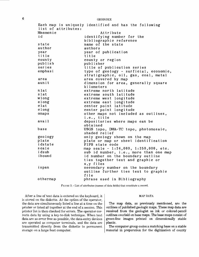
Each map is uniquely identified and has the followinglist of attributes:Mnemonic Attributeid identifying number for the
bibliographic reference state name of the state author authors year year of publication title title county county or region publish publisherseries title of publication series emphasi type of geology - surficial, economic,
stratigraphic, oil, gas, coal, metal area area covered by map aunit dimension for area,
k i1ome t e r snlat extreme north latitude slat extreme south latitude wlong extreme west longitude elong extreme east longitude clat center point latitude clong center point longitude omaps other maps not included
i.e., title avail depositories where maps
obta ined base USGS topo, DMA-TC topo,
shaded reliefgeology only geology shown on the map plate plate or map or sheet identification idstate FIPS state codescale map scale - 1:24,000, 1:250,000, etc. idsub sub id number, i.e., more than one map ibound id number on the boundary outline
ties together text and graphic orx,y f iles
ispan secondary number on the boundaryoutline further ties text to graphicfile
othermap phrase used in Bibliography
FIGURE 3. - List of attributes (names of data fields) that constitute a record.
as outlines
can be
photomosaic,
After a line of text data is entered on the keyboard, it is stored on the diskette. At the option of the operator, the data are simultaneously listed a line at a time on the printer or listed all together at the end of a session. This printer list is then checked for errors. The operator cor rects data by using a key-to-disk technique. When text data are as error free as possible, the data-entry devices are operated as computer terminals, and the data are transmitted directly from the diskette to permanent storage on a large host computer.
MAP DATA
The map data, as previously mentioned, are the outlines of published geologic maps. These map data are received from the geologist as ink or colored-pencil outlines overlaid on base maps. The base maps consist of green-line images printed on dimensionally stable plastic.
The computer group codes a matching base on a stable material in preparation for the digitization of county
THE DATA-BASE MANAGEMENT SYSTEM
outlines. These codes are the digits assigned to each county and State by the Federal Information Processing Standards Publications (FIPS PUBS). This digitization or conversion from graphics to machine-readable code is done manually on a type of drafting-table digitizer with a resolution of 0.025 mm (0.001 in.) (Fulton, 1975).
The lower left-hand corner of the neat line is designated as the origin, so that the entire map lies within the positive quadrant in the Cartesian coordinate system.
Only the end points of straight-line segments are recorded. Where the outlines are extremely convoluted, stream digitizing is performed and the spacing between points is generally about 1 mm (0.04 in.). The data are plotted for verification. Because of the complexity of the index maps, these plots must be drawn in different col ors so that each outline and its identifying number is distinct.
PUBLICATION COPY
After the computer-generated plots for the Geoindex are judged acceptable, they need further processing to create the final version of the maps. The first few published indexes were drawn in black ink by means of a drum plotter. Several different pens created the various line weights so that overlapping areas could be distinguished.
Index maps convey information concerning areas. Shading portrays areal information very effectively. Thus, those who prepared the later maps took advan tage of the newer technology inherent in a matrix plot ter. Such a plotter now generates the final maps. This plotter has a resolution of 160 dots per inch and an effec tive plotting width of 18 in. To date, 10 different pat terns supply sufficient contrast so that various mapped areas may be distinguished from one another. See figure1. which shows a Kentucky map sheet listing the maps that range in scale from 1:63,360 through 1:250,000.
At the same time that the map plots are generated, the text data are processed. The file is in a machine- readable form almost identical with card-image form, but the final output must be in the traditional bibliographic form. This change is accomplished by pro cessing the text data file through programs resident on a main-frame computer that strip out the extraneous data and codes and rearrange the order of the attributes (items). Then the modified file is transmitted over telephone lines back to the word-processor terminal. The final manuscript is printed on coated paper automatically. The map plots and text material are then sent for photographic reduction, a process that creates the photographic plates for mass production. See figure2. which shows a copy of part of a sheet of text data from the published Kentucky index.
STORAGE AND RETRIEVAL SYSTEM
This storage and retrieval system is the Geologic Retrieval and Synopsis Program (GRASP), written and developed within the Geological Survey by Roger W. Bowen and Joseph Moses Botbol (1975). GRASP is used extensively within the U.S. Geological Survey. It has also been installed on the computers of national agencies of several countries in South America and Europe.
The GRASP system implements searches of the text files by individual items or by any combination of two or more items. All the references for the published geologic maps that meet the search criteria are retrieved. The en tire contents of all the retrieved text records can be listed, or only one or two items can be selected. However, the boundary identification number, ibound, the bibliographic identification number, id, and the subidentification number, idsub, are the only items re quired to generate a graphic image. Thus, the numeric value of these three items are listed on a formatted disk file for subsequent plotting. The GRASP system is ex ited and the plot program pn16 is invoked. This pro gram, too, executes in an interactive mode. Its options provide for plots of the State outline, the graticule, the county boundaries in solid or dotted lines, and, of course, the file of geologic-map outlines. These graphics can be plotted interactively on a CRT terminal and then printed by a hard-copy unit attached to the terminal.
After a map has been drawn on the CRT, information from other files may be added by direct overlay to the original graphic on the screen. In addition to the features already described, this program offers the op portunity to enlarge any part of the plot repetitively un til a cluttered area becomes readable.
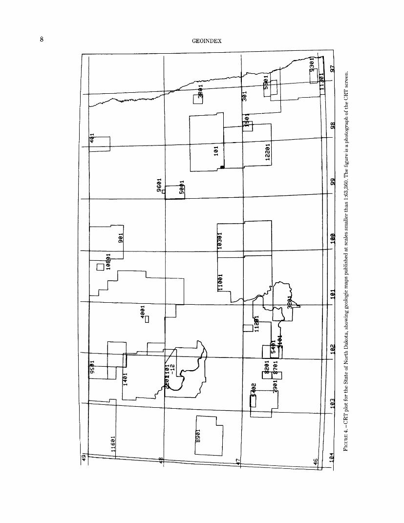
At present, the newly published geologic index maps are categorized according to scale. The retrieval can be executed in GRASP by designating the proper scale as the search criteria and querying the file. This first step in map generation from digital data is accomplished in teractively on a graphics CRT terminal. This same file, which has been plotted interactively, can then be directed to a drum plotter for reproduction at the original scale. Figure 4 shows the maps published at scales smaller than 1:63,360 for the State of North Dakota as drawn on the CRT screen.
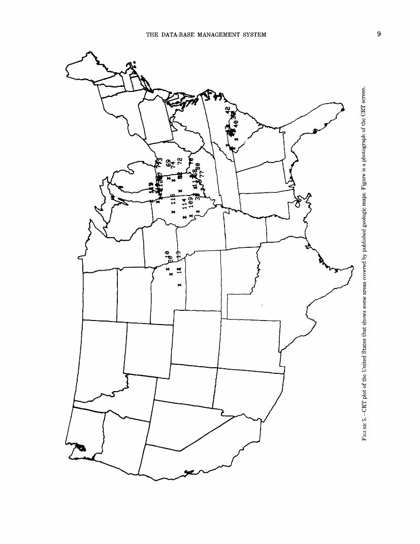
Several other programs enable a user to plot the en tire United States. The programs take geographic coor dinates from either a GRASP retrieval or directly from the map-data files. These programs convert the geographic coordinates to Cartesian coordinates. Then another plot program entitled pin90 operates in an in teractive mode similar to that of pn16 to plot these files. It, too, has options for specifying various combinations of files and enlarging designated areas. Figure 5 shows a CRT plot of some areas covered by published maps.
oo o M O § O
H X
FIGU
RE 4
. - C
RT p
lot f
or th
e St
ate
of N
orth
Dak
ota,
sho
win
g ge
olog
ic m
aps
publ
ished
at s
cale
s sm
alle
r tha
n 1:
63,3
60. T
he fi
gure
is a
pho
togr
aph
of th
e CR
T sc
reen
.
THE DATA-BASE MANAGEMENT SYSTEM
o
03
£o•a
O I
10 GEOINDEX
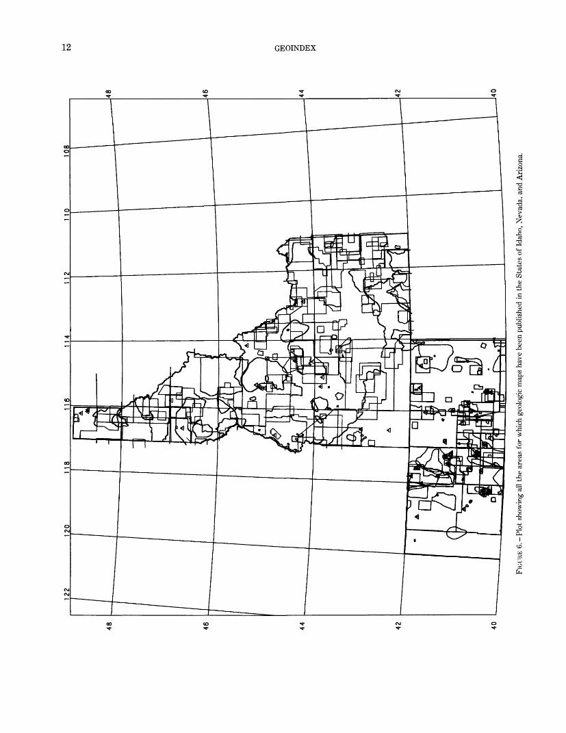
The system also utilizes some machine-independent plotting packages that were obtained specifically to pro vide diversity of output for the Geoindex as well as for the entire U.S. Geological Survey. Figure 6, which il lustrates geologic mapping on a regional basis, is a map showing all the areas covered by geologic maps in the western States of Idaho, Nevada, and Arizona.
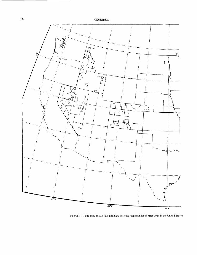
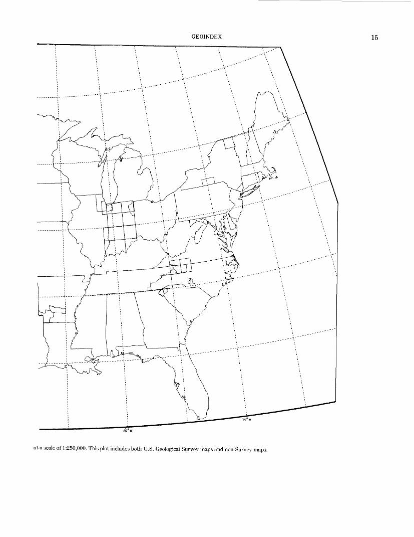
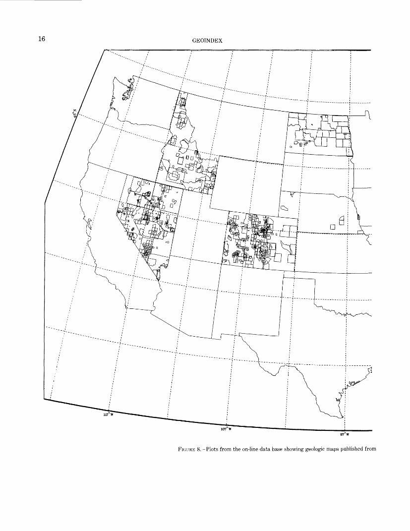
The storage and retrieval part of the Geoindex system has the capability of providing nationwide summary in formation to policy makers. Examples of maps that pre sent information of special interest to national planners are shown in figures 7 and 8. Both of these maps were generated from queries to the Geoindex and show geologic mapping on a national basis. These maps reflect the data resident in the data base at the time of query. Figure 7 shows the areas in the United States covered by geologic maps that were published at a scale of 1:250,000 after 1960. It includes both U.S. Geological Survey maps and non-Survey maps. Figure 8 shows geologic maps from all sources that were published at scales larger than 1:250,000.
DATA BASE
STRUCTURE OF THE DATA
TEXT DATA
As previously mentioned, the Geoindex comprises two distinct types of data: text and graphic. These two data types are handled separately throughout most of the system because of their dissimilar nature. After the bibliographic data are captured as keystrokes of coded data in digital form, they are usually called text data.
Initially, the text data in machine-readable form look very much like a listing of ordinary punched cards. The most obvious difference is that a printed line contains both uppercase and lowercase characters. Actual data fields vary from 4 to 60 characters. The Geoindex data base is generated on a State-by-State basis. Each State carries the two-digit code assigned by FIPS PUBS. Every file name for a particular State contains this same numeric code as a suffix. The leading three or four characters of the file name are descriptive of the type of data in the file. Thus, the initial reference data file for Colorado is named refOS.
The format for the text data is as follows:State identification ____ 2 digits.Reference number ________________ 4 digits. Item number ___________________ 2 digits. Informational data ________________ 4 to 60 characters.
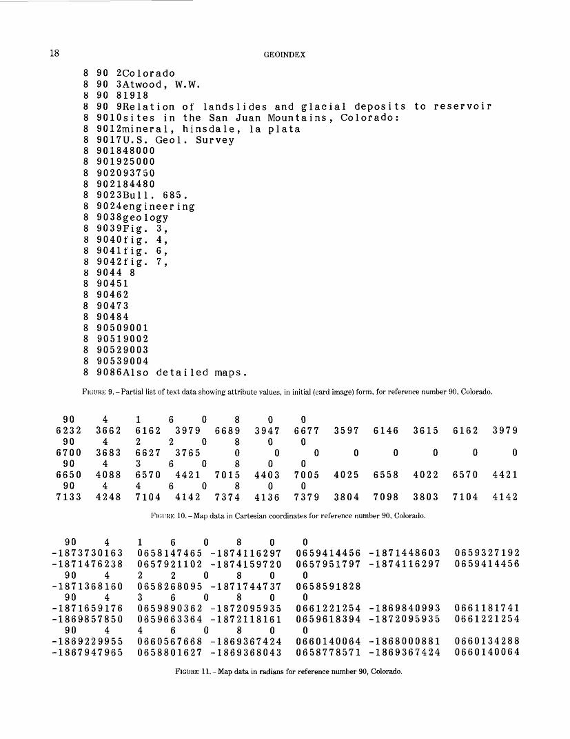
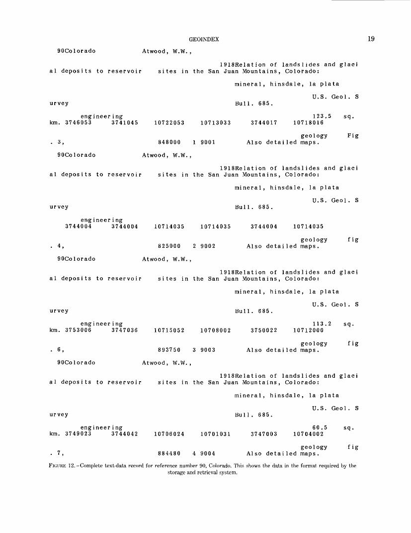
Figure 9 shows the text data for reference number 90 (a record in file refOS) for the State of Colorado as it looks in its initial form. This is a reference that contains four separate maps, and it was chosen to illustrate the complexities of the data structure.
MAP DATA
As stated earlier, the map data are digitized as Carte sian coordinates in the positive quadrant. These coor dinate files are structured so that several different types of map data are compatible and are handled efficiently within the one system. The two major types of graphic data are the index-map coordinates and the base-map coordinates. The base-map coordinates consist of political boundaries, such as State and county, and also the geographical positions of the graticule. One bibliographic reference may contain several maps, one map, or no map at all. Conversely, one map outline, typically a county, may be identified by a great number of bibliographic references. A unique identifier for each map is mandatory and is a combination of three at tributes. A primary identification number (id), a secon dary identification number (idsub), and a third number (second idsub) insure uniqueness. The data for each map outline are composed of two different parts. The first or header section under a format of (815) consists of number codes for the various map features. The features and the feature codes are listed as follows:1. Identification or feature number (id): neatline = 900,
State = 9NM (NM refers to FIPS code for the par ticular State)
2. Number of outlines that have this id3. First subfeature: adjacent county id number, adja
cent State = 9NM, national boundary = 993, lake boundary = 995
4. Number of points5. Second subfeature number6. State id number7. Graticule = 991, county = 992, island = 994 (values
recorded only for grid, county, and islands; blank for others)
8. Span- that is, one map outline for several referencesThe second part of the record has a format of (12F6.3)
and contains the string of Cartesian (x, y) coordinates that define the boundary of the published geologic map. The first Cartesian pair indicates the position for the identifying number. A listing of both parts of the Carte sian coordinate data record for reference number 90 for the State of Colorado is shown in figure 10.
TEXT AND MAP DATA
After the data are in digital form, only the map file (fig. 10) contains the information that can be used to complete the record, the list of attributes named in figure 3. The area covered by each geologic map is com puted from the Cartesian coordinates, and that informa tion is then stored along with the unit of measurement (currently square kilometers). All Cartesian coordinates
REFERENCES CITED 11
are also transformed into latitude and longitude and stored as radians. The header cards for the radian files are identical with the header cards for the Cartesian coordinate files. The data are in card-image form with a format of (6F12.9,I8). The decimal point is implied in the data files so that there are three latitude-longitude pairs per card image with space for sequence numbers. Figure 11 shows the radian data for reference number 90 for Colorado. The names of the files are similar.
Using the radian values, a program determines the maximum latitude and longitude for the four directions and then stores each map outline. The center of each map outline is computed in radians and is stored. The data-base management system performs these and other computations. The items listed above, derived from the map data, are merged into the record, or tuple, so that a complete record for each map contains all the information shown in figure 3. These two files, text and graphic, are compared to ensure that each reference is identified by the correct outline. Figure 12 shows a text- data record in its complete form. It represents the final form for reference number 90 for the State of Colorado. These text data correlate with the map-coordinate data shown in figure 10. The data shown in figure 12 are in the format required for the storage and retrieval system.
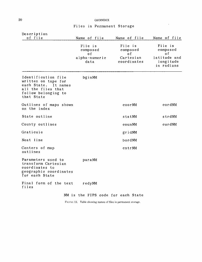
Twelve files are stored permanently on two sets of magnetic tapes. Each magnetic tape contains the data for five States. Figure 13 describes and identifies these files.
SYSTEM SPECIFICATIONS
The detailed system specifications are given in the ap pendixes. Appendix A contains the system flow chart, which also shows the input and output files. Appendix B contains the operational instructions, which detail the
minimum set of information needed to execute the pro grams.
Appendix C contains the computer-program reference guide. This guide gives complete descriptions of the computer programs and listings of the source code for each program. Appendix D contains the formats and notes needed for data entry.
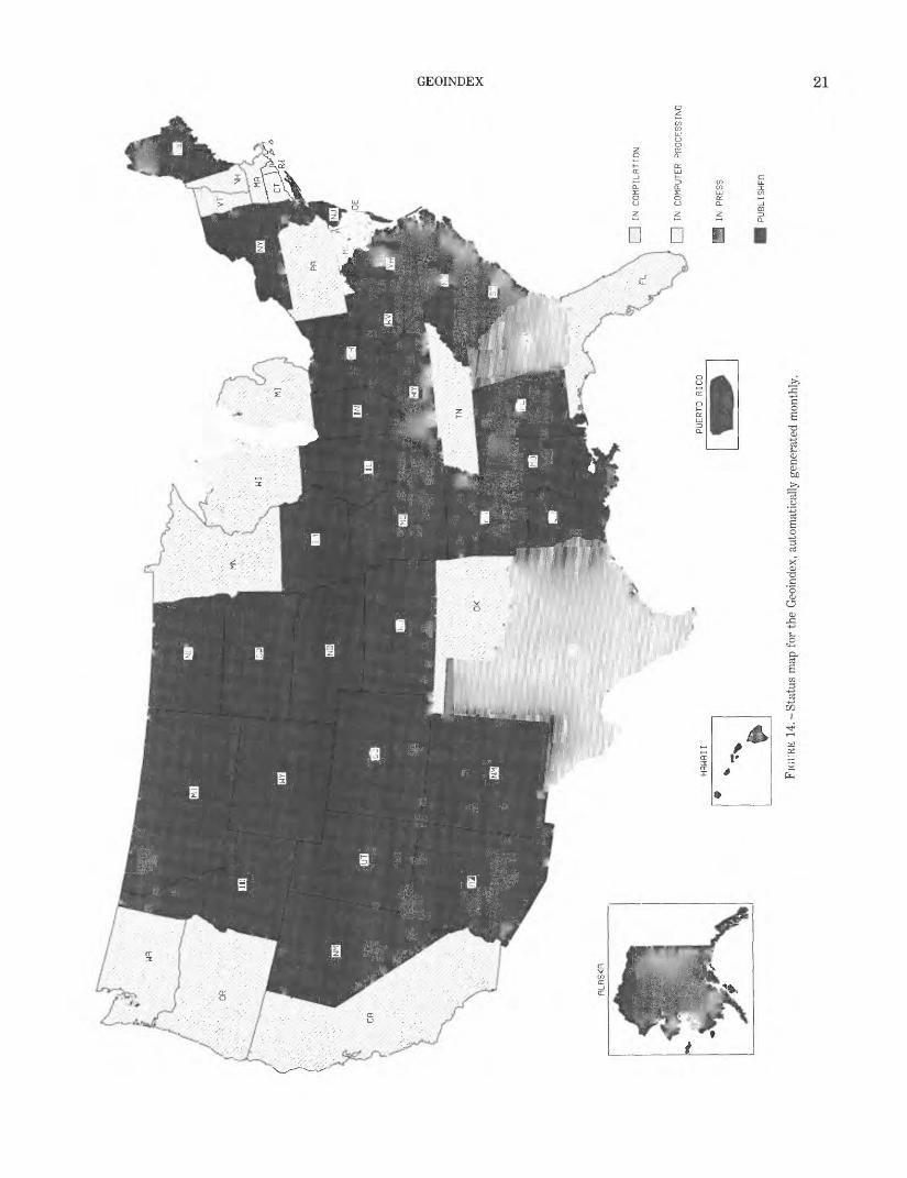
STATUS OF THE SYSTEM
The data-base management system has passed the operational phase and is a fully functional system. The primary objective, the generation of geologic index maps, is in a production mode, and the data base is growing daily. Figure 14 is another computer graphic that summarizes the present status of the Geoindex. The system automatically generates a new status map at the beginning of each month. The files can be accessed in an interactive mode, and personalized index maps plotted immediately, as shown in figures 4 and 5. The system becomes increasingly useful as a tool for policy makers as more States are added to the data base. Figures 6, 7, and 8 show summary maps that can be of value in mak ing policy and plans.
REFERENCES CITEDBowen, R. W., and Botbol, J. M., 1975, The Geologic Retrieval and
Synopsis Program (GRASP): U.S. Geological Survey ProfessionalPaper 966, 87 p.
Fulton, P. A., 1975, Mapping and Computers, in Rubinot'f, Morris, andYovits, M. C., eds.. Advances in Computers, v.13: New York,Academic Press, p. 73-108.
Fulton, P. A., and Mclntosh, W. L., 1977, Computerized Data Base forthe Geomap Index: The American Cartographer, v. 4, no. 1, pp.29-37.
Honey well Information Systems, Inc., 1978, Level 68 SoftwareMultics Relational Data Store (MRDS) Reference Manual, p. 1-1,2-3.
122
120
1 18
1 16
1 14
1 12
1 10
108
48 46 42 40
O
& O HH
£ G
& X
FIGU
RE 6
.-Pl
ot s
how
ing
all th
e ar
eas
for
whi
ch g
eolo
gic
map
s ha
ve b
een
publ
ished
in th
e St
ates
of I
daho
, Nev
ada,
and
Ariz
ona.

32
120
1 18
16
114
FIGU
RE 6
.-Con
tinue
d.
112
1 10
O
&
O I—I 5!
O
& X 00
14 GEOINDEX
FIGURE 7. -Plots from the on-line data base showing maps published after 1960 in the United States
GEOINDEX 15
at a scale of 1:250,000. This plot includes both U.S. Geological Survey maps and non-Survey maps.
16 GEOINDEX
97° W
FIGURE 8.-Plots from the on-line data base showing geologic maps published from
GEOINDEX 17
all sources, U.S. Geological Survey and non-Survey, at scales larger than 1:250,000.
18 GEOINDEX
8 90 2Colorado8 90 SAtwood, W.W.8 90 819188 90 9Relation of landslides and glacial deposits to reservoir8 9010sites in the San Juan Mountains, Colorado:8 9012mineral, hinsdale, la plata8 9017U.S. Geol. Survey8 9018480008 9019250008 9020937508 9021844808 9023Bull. 685.8 9024engineering8 9038geology8 9039Fig. 3,8 9040fig. 4,8 9041fig. 6,8 9042fig. 7,8 9044 88 904518 904628 904738 904848 905090018 905190028 905290038 905390048 9086Also detailed maps.
FIGLFRE 9. -Partial list of text data showing attribute values, in initial (card image) form, for reference number 90, Colorado.
90623290
670090
665090
7133
436624
36834
40884
4248
1608006162 3979 6689 3947 6677 3597 6146 3615 6162 39792208006627 3765 000000003608006570 4421 7015 4403 7005 4025 6558 4022 6570 44214608007104 4142 7374 4136 7379 3804 7098 3803 7104 4142
FIGURE 10.-Map data in Cartesian coordinates for reference number 90, Colorado.
90 41873730163187147623890 4187136816090 41871659176186985785090 418692299551867947965
1600658147465065792110222006582680953600659890362065966336446006605676680658801627
8 018741162971874159720
8 01871744737
8 018720959351872118161
8 018693674241869368043
0065941445606579517970
06585918280
066122125406596183940
06601400640658778571
18714486031874116297
18698409931872095935
18680008811869367424
06593271920659414456
06611817410661221254
06601342880660140064
FIGURE 11. - Map data in radians for reference number 90, Colorado.
GEOINDEX 19
90Colorado Atwood, W.W.,
1918Relation of landslides and glaci al deposits to reservoir sites in the San Juan Mountains, Colorado:
mineral, hinsdale, la plata
U.S. Geol. S urvey Bull. 685.
engineering 123.5 sq. km. 3746053 3741045 10722053 10713033 3744017 10718016
geology Fig . 3, 848000 1 9001 Also detailed maps.
90Colorado Atwood, W.W.,
1918Relation of landslides and glaci al deposits to reservoir sites in the San Juan Mountains, Colorado:
mineral, hinsdale, la plata
U.S. Geol. S urvey Bull. 685.
engineer ing 3744004 3744004 10714035 10714035 3744004 10714035
geology fig . 4, 825000 2 9002 Also detailed maps.
90Colorado Atwood, W.W.,
1918Relation of landslides and glaci al deposits to reservoir sites in the San Juan Mountains, Colorado:
mineral, hinsdale, la plata
U.S. Geol. S urvey Bull. 685.
engineering 113.2 sq. km. 3753006 3747036 10715052 10708002 3750022 10712000
geology fig . 6, 893750 3 9003 Also detailed maps.
90Colorado Atwood, W.W.,
1918Relation of landslides and glaci al deposits to reservoir sites in the San Juan Mountains, Colorado:
mineral, hinsdale, la plata
U.S. Geol. S urvey Bull. 685.
engineering 60.5 sq. km. 3749023 3744042 10706024 10701031 3747003 10704002
geology fig . 7, 884480 4 9004 Also detailed maps.
FIGURK 12.-Complete text-data record for reference number 90, Colorado. This shows the data in the format required by thestorage and retrieval system.
20
Descr ipt i on of file
GEOINDEX
Files in Permanent Storage
Name of file Name of file Name of file
File is composed
ofalpha-numer i c
data
File is c omp o s e d
ofCartes ian coordinates
File is composed
of latitude and
longi tude in radians
Identification file bginNMwritten on tape foreach State. It namesall the files thatfollow belonging tothat State
Outlines of maps shown on the index
State outline
County outlines
Grat i cule
Neat line
Centers of map out 1 ines
Parameters used to paraNM transform Cartesian coordinates to geographic coordinates for each State
Final form of the text redyNM files
coorNM
statNM
counNM
gr idNM
bordNM
cntrNM
cordNM
strdNM
curdNM
MM is the FIPS code for each State
FIGURE 13. Table showing names of files in permanent storage.
IN COMPILRTION
o H o
I1 IN CO
MPUT
ER PROCESSING
IN PR
ESS
PUBL
ISHE
D
FIGUR
E 14
.-Sta
tus
map
for t
he G
eoin
dex,
aut
omat
ical
ly g
ener
ated
mon
thly
.

APPENDIXES: SYSTEM SPECIFICATIONS
APPENDIX A. SYSTEM FLOWCHART
APPENDIX B. OPERATIONAL INSTRUCTIONS
APPENDIX C. COMPUTER-PROGRAM REFERENCE
APPENDIX D. FORMATS AND NOTES
Note:Program and subroutine names are printed in bold sans-serif type: chkref. Variable names are printed in italic sans-serif type: itype. Permanent-file names are printed in sans-serif type: matrix. Ordinary variables are printed in italics: x, y.

APPENDIX A
APPENDIX A. SYSTEM FLOWCHART25
MATRIX REFnm
MATRIX REFnm
REFnm
COORnm BORDnm GRIDnm STATnm COUNnm
COORnmDW-
REFnm
REFnm
final Bibliography
STRGnm
LIST TAPE CONTENTS TAPEJN. TCL digitized maps inte Multics
CORDnm CURDnm STRDnm PARAAnm
COORnmDW BORDnmDW GRIDnmDW STATnmDW COUNnmDW
;Pilot drawing files on Calcomp
-*- COORnmAS
TFILES COORnmAS
SELDISK separates ascii disk file and creates a drawing file for each map
———————— >-.REDnm BLUEnm GREENnm
26 GEOINDEX
( plotmap \ separates/
BORDnmDWGRIDnmDWSTATnmDWCOUNnmDWREDnmBLUEnmGREENnm
DWGTAPE drawing file to card image tepe format for transfer to Multics
BORDnm GRIDnm STATnm COORnm PVERnm
BORDnmGRIDnmSTATnmCOUNnmREDnmBLUEnmGREENnm
BORDnmGRIDnmSTATnmCOUNnmREDnmBLUEnmGREENnm
INDEX VERSATEC creates tepe for versatec plotter
-»-{ J Plot on versatec
VERSATEC PLOT tape created by Index^Versatec is plotted on versatec
REDnmBLUEnmGREENnm
»- COORnm. UNSORT
SORT. VERS. COOR. EC runs:
PGM1. VERS. EXTHDRSORT SEGPGM2. VERS. SEQUENTPGM3. VERS. MERGE
COORnm. UNSORT PGM1. VERS. EXTHDR creates a file of header card images
COORnm. UNSORT. HDR
APPENDIX A 27
COORnm. UNSORT. HDR
COORnm. UNSORT
COORnm. SORT. HDR
COORnm. SEQUENT
COORnm STATnm AREANO
STRDnm
MEASnm STRGnm CORDnm
REDYnm MASK DEFN DICN
INDXnm MASK DEFN DICN
^-COORnm. SORT. HDR
PGM2. VERS. SEQUENT converts file from stream to sequential
-COORnm. SEQUENT
PGM3. VERS. MERGE merges coordinates into one ordered file
COORnm
MEASnm AREAnm CNTRnm DOUBT
ADDRAD inserts map data into text files
COVERT. EC runs convert to load Grasp
GR. ECseerches Gresp files excutes files for 3 map plots
REDYnm COMXnm CTRDnm
INDEXnm DICN FILE 15 INDEXO
TIP T2P T3P
28 GEOINDEX
BORDnmGRIDnmSTATnmCOUNnmCOORnmSKODT1PT2PT3P
COORnmCOMXnmSTATnmSTRDnmCORDnmCOUNnmCURDnmCNTRnmGRIDnmCNTRnmCTRDnmAREAnmREDYnmMEASnmBORDnmPARAnm
INDXUS INDXnm
BORDnmGRIDnmSTATnmSTRDnmCOUNnmCURDnmCOORnmCORDnmCNTRnmREDYnmPARAnm
STORED FILES
3 map plots
listing
PULLOFF Copies specified files from tape to CPU
INDXUS
BGINnmBORDnmGRIDnmSTATnmSTRDnmCOUNnmCURDnmCOORnmCORDnmCNTRnmREDYnmPARAnm _
STORED FILES
STORED FILES
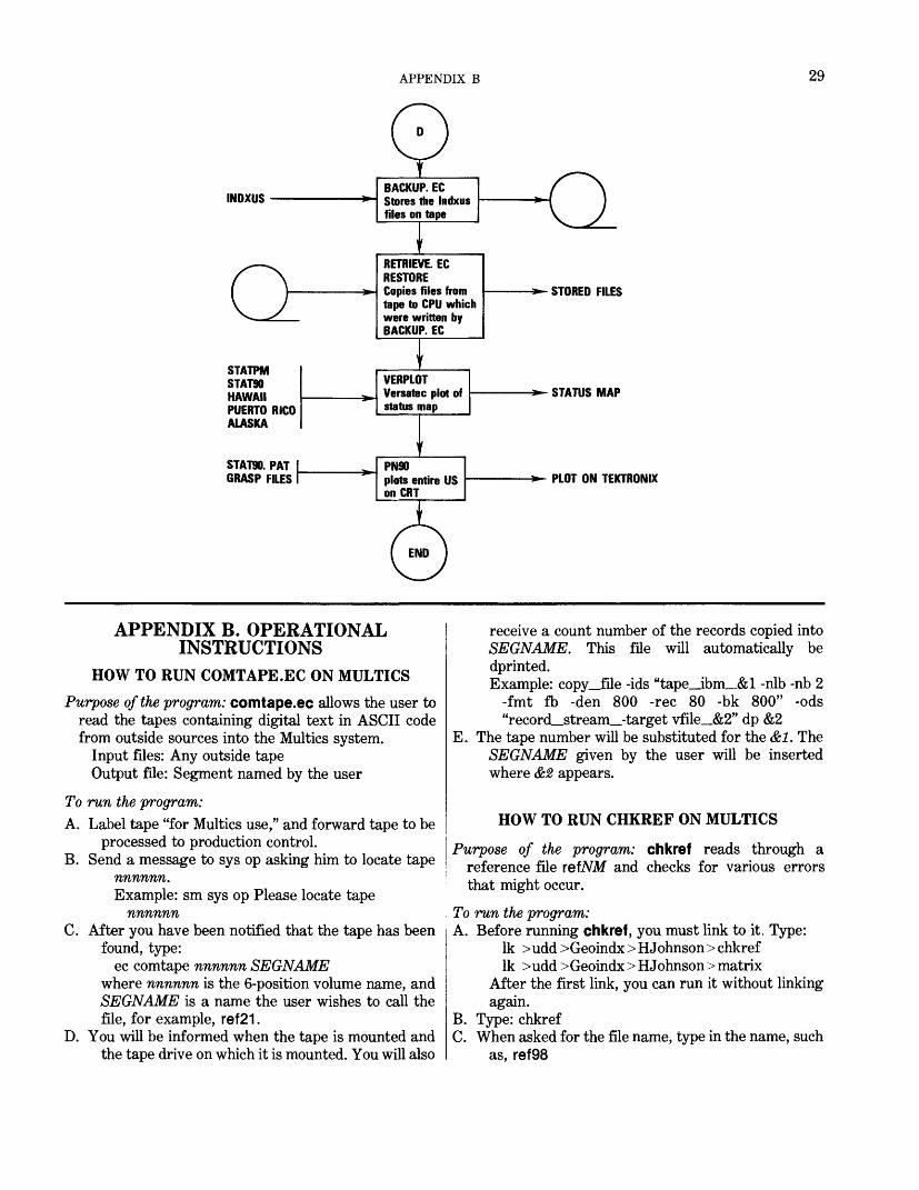
APPENDIX B 29
INDXUS
STATPM STAT90 HAWAII PUERTO RICO ALASKA
STAT90. PAT GRASP FILES
RETRIEVE. EC RESTORE Copies files from tape to CPU which were written by BACKUP. EC
STORED FILES
STATUS MAP
PLOT ON TEKTRONIX
APPENDIX B. OPERATIONAL INSTRUCTIONS
HOW TO RUN COMTAPE.EC ON MULTICSPurpose of the program: comtape.ec allows the user to
read the tapes containing digital text in ASCII code from outside sources into the Multics system.
Input files: Any outside tape Output file: Segment named by the user
To run the program:A. Label tape "for Multics use," and forward tape to be
processed to production control.B. Send a message to sys op asking him to locate tape
nnnnnn. Example: sm sys op Please locate tape
nnnnnnC. After you have been notified that the tape has been
found, type:ec comtape nnnnnn SEGNAME
where nnnnnn is the 6-position volume name, and SEGNAME is a name the user wishes to call the file, for example, ref21.
D. You will be informed when the tape is mounted and the tape drive on which it is mounted. You will also
receive a count number of the records copied intoSEGNAME. This file will automatically bedprinted.Example: copy__file -ids "tape_ibm_&l -nib -nb 2
-fmt fb -den 800 -rec 80 -bk 800" -ods "recorcLstream_-target vfile_&2" dp &2
E. The tape number will be substituted for the &1. TheSEGNAME given by the user will be insertedwhere &2 appears.
HOW TO RUN CHKREF ON MULTICS
Purpose of the program: chkref reads through a reference file reftVM and checks for various errors that might occur.
To run the program:A. Before running chkref, you must link to it, Type:
Ik > udd > Geoindx > HJohnson > chkref Ik > udd > Geoindx > H Johnson > matrix
After the first link, you can run it without linking again.
B. Type: chkrefC. When asked for the file name, type in the name, such
as, ref98
30 GEOINDEX
D. Study any error messages that chkref gives, make corrections to the reference file, and run chkref again until no error messages occur.
HOW TO RUN GEOFMT.EC ON MULTICSPurpose of the program: geofmt.ec executes a series of
commands and programs to read the reference file, to extract selected data, to arrange it in a predetermined order, and to create a columnarized output segment ready for printing.
Linking: Before running for the first time, you must link to the following segments:
Ik >udd>Geoindx>PPorter> geofmt.ec Ik > udd > Geoindx> PPorter> geofmt Ik >udd>Geoindx>PPorter>geofmt.qedx Ik > udd > Geoindx > PPorter> geofmta.qedx Ik > udd > Geoindx> PPorter> geofmt2.qedx Ik > udd > Geoindx > PPorter > geofmtS.qedx Ik > udd > Geoindx> PPorter> embed_tabs Ik > udd >Geoindx> PPorter>to-nbiPP
Special instructions:A. The program, geofmt.ec, can be run on any ter
minal. The only time that you must be on the NBI is to run the to-nbiPP program where you must use the proportional space printer.
B. To get a rough draft, type anything other than nbipp as the third argument of the exec_com.
Example: ec geofmt 84 10 nbino Upon termination, type:
dp -dl -nep geofmt.columnsIf a file has more than 550 references, do only half the file, and after you get the dprint, run the pro gram again using the last half of the file starting with a four-column page through the end of the file.
C. When three columns are desired on the first page with the map, follow the instructions in paragraph B with the exception of 8 and 9. For number of columns, enter 3 and return. -In answer to the col umn width, enter 48 and return.
D. When using the seven-column option, you can print a single three-column page giving the reference numbers for that page, but if more than one page is to be printed, you must start with a four-column page.
To run the program:A. Type: ec geofmt pagelength lines nbipp
Example: ec geofmt 84 10 nbipp Note: Pagelength specifies the number of lines on the page. It can be any number, but presently only 84 or 140 are used. Lines is an argument specify ing the number of lines that should be available at
the bottom of the page in order to print a complete reference. There must be a third argument. If you want proportional space printing, type: nbipp. Otherwise, type some letters or some word for the third argument.
B. Then you must respond to the following questions or statements:
1. ENTER FILE NAME: Enter the names (refNM) and cr (carriage return).
2. TYPE IN STATE NUMBER: Enter 2-digit FIPS code and cr.
3. WHAT IS YOUR STARTING REFERENCE NUMBER? (use 3 digits): Enter 3 digits and cr. Note: We strongly recommend that you do no more than 550 references at one time.
4. WHAT IS YOUR ENDING REFERENCE NUMBER? (use 3 digits): Enter 3 digits and hit cr.
5. fortran_io_: CLOSE FILES? Type yes and cr.
6. DO YOU NEED TO EDIT? Type yes or type no, and cr. If you typed no, go to step 7. If you typed yes, the following will appear on the screen:
EDIT.Enter q to exit editor. You are now in the edit mode. Line length is set to 80 to make the entire line visible on the screen. One line of geofmt.data may print out as three lines on the NBI screen. Make the necessary changes and be sure to write the segment before you exit the editor. Under no circumstances should you break or interrupt while in qx. After all changes, type:
wq
7. DO YOU WANT 7 COLUMNS? If you want a combination of 4,3,4,3, and so forth, type: yes. If you want four columns on every page, type: no.
8. EMBED_TABS ENTER NUMBER OF COL UMNS: Enter 4 and cr.
9. EMBED_TABS ENTER COLUMN WIDTH:Enter 42 and cr.
10. The ready message will appear on the screen,and the job is completed.
C. Before recording geofmt.columns on the diskette, enter qedx and check the beginning of each page to make sure that a new reference begins in each column. Also check the last page (not the final page) to make sure that you specified enough references to fill the page.

APPENDIX B 31
If you are using the seven-column option and do ing only part of the reference file, you should end with a three-column page (unless you are doing a single page). Delete the lines of the four-column page, write geofmt.columns and quit the editor.
D. The file, geofmt.columns, is now ready to be recorded on the diskette for printing. Before run ning to-nbiPP, issue the following commands:
stty -modes IfechoType ct, and then cr. Four options will appear on the screen. Type 4, representing computer 4, but not cr. Now type:
to-nbiPP cr1. The following message will appear:
Multics file name to be sent (or q to quit): Enter geofmt.columns followed by cr.
2. Multics will respond with ?.3. Hold down SHIFT key and press the XMIT
keys. The NBI now receives the document line by line. When the last line has been received, a single Greek character will remain on the screen.
4. Hit BREAK key. CONVERSATIONAL will appear on the screen.
5. Type: q crMultics will respond with STOP and ready message.
6. Hit HOME key. READY will appear on the screen and you are now back in NBI word processing.
7. Name the document by typing:co \e,l,document name
followed by cr.8. To print the document, insert and aline
paper and type the following command: pr \i,s:document name
HOW TO RUN TO-NBID ON MULTICSPurpose of the program: to-nbiD allows the user to
record segments from Multics on the NBI diskette (communications disk—four options only) while using the NBI System II as a terminal.
To run the program:A. Turn on machine and insert disk. After READY
appears on the screen, type ct and cr. Type 3, representing computer 3, but not cr. If you ac- cidently hit cr, COMMAND ERROR will appear on the screen. If this happens, again type ct, and when the four options appear on the screen, type: 3.
B. Type cm l,c and cr. Note: The 1 is an alphabetic character and not the number one. CONVERSA
TIONAL will appear on the screen. Insert telephone in modem and dial Multics number. When carrier light comes on, hit cr. Wait for the two-line Multics greeting. If you lose the carrier light or the greeting does not appear, hang up and redial. You are still in CONVERSATIONAL mode.
C. Login to Multics as you usually do. If you cannotlogin, hit cr and go back to step B.
| D. You must have the following link in your working directory:
Ik >udd >Geoindx > PPorter> to-nbiD Note: To print the greater-than sign, press the
key and CTRL key at the same time.E. To execute the program, type: to-nbiD crF. The following message will appear:
Multics file name to be sent (or q to quit):G. Type in name of file and then cr.H. Multics will respond with ?.I. Hold down SHIFT key and press the XMIT key. The
NBI now receives the document line by line. When the last line has been received, a single Greek character will remain on the screen.
J. Hit BREAK key. CONVERSATIONAL will appear on the screen.
K. Type: q crMultics will respond: STOP
fortran_Jo_: CLOSE FILES? Type: yes Multics will then respond with a ready message.
L. You may now logout of Multics as you usually do, or you may wish to edit the document to insure that it was received correctly. You are still in CONVER SATIONAL mode.
M. Hit HOME key. READY will appear on the screen and you are now back in NBI word processing.
N. Name the document by typing:co \e,l,document name cr
Note: This command expanded means copy letter, drive 1, and name you wish to call document.
0. To print the document, insert and aline paper and type the following print lines command:
pr \i,s:document name crNBI will buzz, giving you a chance to make sure that the paper is inserted correctly. Hit cr. Docu ment will start printing.
P. If you are no longer on Multics, go to step Q. If you did not logout in step L, you will now have to get back in CONVERSATIONAL mode. Type:
cm l,c (as in step B)CONVERSATIONAL will appear on the screen. Logout the way you usually do. After the logout
32 GEOINDEX
message appears on the screen, press the HOME key. READY will appear on the screen.
Q. Type: off crRemove disk during countdown, and then turn offmachine.
HOW TO RUN CONCAT ON MULTICSPurpose of the program: concat takes a reference file
and builds from it a file suitable for input into Bowen's (Bowen and Botbol, 1975) program convert. Be sure refNM is the file you want.
Input files: refNM, matrixOutput file: strgNM
To run the program:A. Before running concat the first time, you must link
it to your working directory. Type:Ik > udd > Geoindx > HJohnson > concat
B. Type: concatC. When asked for the State code, type in the FIPS
code for this State. Example: concat
ENTER THE 2-DIGIT CODE FOR THE STATE BEING PROCESSED
Type: 15YOU GOT TO MAINYOU WROTE THE 25th VECTOR TO THE STRG FILE STOPFORTRAN 10 : CLOSE FILES?
Type: yes
HOW TO RUN LIST_TAPE_CONTENTS ON MULTICS
Purpose of the program: list_tape_contents abstracts files from outside tapes containing digital map data in ASCII code.
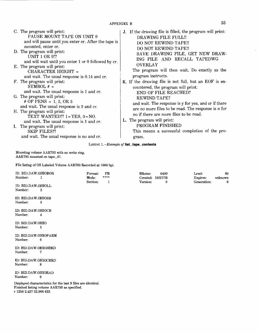
To run the program: After the normal procedure of tak ing the tape to production control, sending a message to the operator asking her to locate the tape, and being informed that tape is there, you then list the contents of the tape. This can be done by list_tape_contents, which prints information about files recorded on 9-track magnetic tape. This command will list only ANSI (American National Standards Institute) standard labeled and IBM OS/370 standard labeled tapes.
Example: list_tape_contents nnnnnn -long -iom tape__ibm_ where nnnnnn is the volume number, -long is an argument that will cause an extensive amount of information to be printed about the files, and "iom tape_ibm_ invokes the I/O module to at tach and read the specified tape volume. The
tape_ibm_ subroutine is specified in order to list OS standard labeled tapes. See listing 1.
Now that you have a list of the tape contents, determine which files you want to transfer to the disk. Transfer can be accomplished by the tape_in command, which uses a control file written by the user in the tape control language. See listing 2 for an example. The volume statement is the volume number of the tape. For most outside tapes, Tape, Storage, Density, Format, Record, and Block will be the same as those shown in listing 2. There will be a file number and path statement for each file to be transferred. The argument of the file statement will be an asterisk. The number statement will specify which file number it is on the tape. The argument for the path statement will be the name that you wish the file to be called after it has been transferred to disk.
The control file must have a suffix of .tcl. After you have created the control segment with a text editor, you can accomplish semantic checking with the following command:
tape_Jn rdtape.tcl -ckThe -ck argument does not cause a tape to be
mounted. If any errors occur, check the tape_incommand in the Honeywell Information Systems'"MPM Peripheral Input/Output Manual." Aftermaking corrections, type:
tape_in rdtape.tclTo simplify the process, procedures are listedbelow in steps:1. sm sys op Please locate tape nnnnnn.2. list__tape_contents nnnnnn -long -iom
tape_ibm_3. Create the .tcl segment. Use uppercase and
lowercase as shown in listing 2.4. tape_in rdtape.tcl -ck5. new_proc6. tape_in rdtape.tcl
HOW TO RUN TAPEDWG ON DATA GENERAL
Purpose of the program: tapedwg reads a hexadecimal ASCII (American Standard Code for Information In terchange) tape written by a 32 bit/word computer and places it in the format of a System 101 drawing file. The data consists of x, y coordinates in the format already specified for map data.
To run the program:A. Bring the empty drawing file onto the table. Be sure
to display it as a check that it is empty. B. Run the overlay program taped wg.
APPENDIX B 33
C. The program will print:PAUSE MOUNT TAPE ON UNIT 0
and will pause until you enter cr. After the tape is mounted, enter cr.
D. The program will print:UNIT 1 OR 0??
and will wait until you enter 1 or 0 followed by cr. E. The program will print:
CHARACTER HEIGHT = and wait. The usual response is 0.14 and cr.
F. The program will print:SYMBOL # =
and wait. The usual response is 1 and cr. G. The program will print:
# OF PENS = 1, 2, OR 3 and wait. The usual response is 3 and cr.
H. The program will print:TEXT WANTED?? 1 = YES, 0 = NO.
and wait. The usual response is 1 and cr. I. The program will print:
SKIP FILES?? and wait. The usual response is no and cr.
J. If the drawing file is filled, the program will print: DRAWING FILE FULL!! DO NOT REWIND TAPE!! DO NOT REWIND TAPE!! SAVE DRAWING FILE, GET NEW DRAW ING FILE AND RECALL TAPEDWG OVERLAY
The program will then wait. Do exactly as the program instructs.
K. If the drawing file is not full, but an EOF is en countered, the program will print:
END OF FILE REACHED? REWIND TAPE?
and wait. The response is y for yes, and cr if there are no more files to be read. The response is n for no if there are more files to be read.
L. The program will print:PROGRAM FINISHED
This means a successful completion of the pro gram.
LISTING I.-Example of list_tape_contents
Mounting volume AAR793 with no write ring. AAR793 mounted on tape_01.
File listing of OS Labeled Volume AAR793 Recorded at 1600 bpi.
ID: BID.DAW.OHIOBORNumber: 1
ID: BID.DAW.OHIOLL Number: 2
Format: FBMode: ****Section: 1
Blksize: 6400Created: 10/27/78Version: 0
Lrecl:Expires:Generation:
80unknown
0
ID: BID.DAW.OHIOSB Number: 3
ID: BID.DAW.OHIOCBNumber: 4
ID: BID.DAW.OHIONumber: 5
ID: BID.DAW.OHIOPARM Number: 6
ID: BID.DAW.OHIOSBRDNumber: 7
ID: BID.DAW.OHIOCBRDNumber: 8
ID: BID.DAW.OHIORAD Number: 9
Displayed characteristics for the last 9 files are identical. Finished listing volume AAR793 as specified, r 1256 2.427 52.966 633
34 GEOINDEX
M. System error messages are printed whenever a prob lem occurs. Consult the manuals and take appro priate measures.
HOW TO RUN DWGDISK ON DATA GENERAL
Purpose of the program: dwgdisk reads System 101 drawing files and creates an ASCII disk file contain ing the coordinate outline data in Geoindex standard format. The sequence is eight integer values com prising the header card information, followed by isfno (number of coordinate pairs) pairs of real numbers. The second outline immediately follows the first and so on.
To run the program:A. Bring desired drawing file onto table. Make sure
that the drawing file does not contain extraneous information or the program will not execute cor
rectly. For example, if you have deleted something from a drawing file, the deletion will change only certain parts of that particular record to a zero. The record still exists and will cause problems in the program. To delete an unwanted record, save the file and then bring it back.
B. Run the overlay program dwgdisk. C. The program will print:
PAUSE FOR OPERATORS and the program will wait for you to enter cr.
D. The program will print:NAME OF DISK OUTPUT FILE = ??
and will wait until you type a name in, followed by cr. Depending upon your answer, the program will type:
OLD-FILE OK?? NEW-FILE OK??
or print an error message, or end the program (if
LISTING 2.-Example of a tcl
rdtape.tcl 11/21/78 1455.7 estTue
Volume: AAR793Tape: ibmsl;Storage: unstructured;Density: 1600;Format: fb;Record: 80;Block: 6400;File: *;path: ohiobor;number: 1;File: *;path: ohioll;number: 2;File: *;path: ohiosb;number: 3;File: *;path: ohiocb;number: 4;File: *;path: ohio;number: 5;File: *;path: ohioparm;number: 6;File: *;path: ohiosbrd;number: 7;File: *;path: ohiocbrd;number: 8;File: *;path: ohiorad;number: 9;End;
r 1455 0.077 0.828 27
APPENDIX B 35
cr is the first character or the escape sequence, control d, is entered). A negative answer to the first two will cause it to ask the question again. After printing the error message, it will ask the question again.
E. The program will print:DO YOU WISH TO WRITE AN EOF FLAG ONTHIS FILE??
and wait for a y (yes) or n (no). The last part of the outline file must have an EOF flag.
F. The program will print:TYPE IN 2 DIGIT STATE NUMBER
Use the FIPS code for this State. This information goes on the header card.
G. The program will then ask:IS THIS THE GRID BEING PUNCHED
Answer y (yes) or n (no). No other answer will be accepted. This is needed to fill in the header card. If the answer is yes, the next question will be skip ped.
H. The program will ask:IS THIS THE COUNTIES BEING PUNCHED
Answer y(yes) or n(no).I. The program will start to process the data. It
assumes that there is text in the drawing file. If not, it will print the message:
NO TEXT IN FILE! and exit from the program.
J. When execution is complete, the program prints the message:
DONE rings a bell, and returns control to the table.
HOW TO RUN SELDISK ON DATA GENERAL
Purpose of the program: seldisk reads an outline disk file in Geoindex standard format and creates a System 101 drawing file. The format used is a header card with (815) format followed by the outline with x, y coordinate pairs in (12F6.3) format on each card. The drawing file will contain only those outlines identified by cards that have a feature number and a subfeature number. Note: The program does not replace the file on the table; instead it appends this data at the end of the existing file.
The ASCII disk file will usually be created by using the program dwgdisk.
The drawing file will consist of various outlines all having the following characteristics: Each outline resides in the subfile with a number equal to the feature number or 1,000 less than the feature number. There are from one to four lines of text, followed by one pen up and then a series of pen downs. The text consists of the feature number, the subfeature number
(if if no greater than 1), the span (if different from 0) and the second subfeature number (if different from 0).
The outlines will alternate through the three pens so that the colors will change for better visibility.
To run the program:A. Perform the steps necessary to make files available
from the digitizing table. If you wish to place theincoming data in a drawing file by itself, CLEARthe drawing file.
B. ACTIVATE AND DISPLAY the drawing file. Thistells the program where to write the information.
C. Load the cards in the hopper. First will come the T-file. This consists of cards with the feature number and subfeature number of those outlines wanted in the drawing file. These are in (18,12) format. Follow these cards with a card that has a -1 as a feature number (columns 7 and 8). This will be used as a flag for the end of the T-file.
D. Run the overlay program seldisk. E. The program will print:
ISELDISK OVERLAY IPAUSE TURN ON CARD READER
and wait for you to enter cr. This is a reminder to make sure it is turned on. If it is not correctly turn ed on, the program will print:
IFOPFL ERROR! and exit.
F. The program will print:ICHARACTER HEIGHT =
and wait for you to type an answer. This will be the height in inches of all text read in (usually 0.14).
G. The program will print:ISYMBOL # =
and wait for you to type an answer. The answer is the number of the symbol that is drawn wherever there is a single point for an outline.
H. The program will print:NAME OF COORDINATE OUTLINE FILE = ??
and wait for you to type in the name of a disk file. If this is a file that does not exist, the program will print:
NEW FILE TRY AGAIN!and return to ask the question again. Any other er ror will cause an error message to be printed, and then the question will be asked again. A control d or a cr on the first character will cause the pro gram to terminate.
I. The program will execute and when finished it returns control to the table with the new drawing file. Any error in execution will automatically put you into the command mode. Some kind of error
36 GEOINDEX
message will be given, and the error should be cor rected; then the whole procedure must be started again. As the program executes, it will print the feature number of all outlines selected for the draw ing file.
HOW TO RUN DWGTAPE ON DATA GENERALPurpose of the program: dwgtape reads a System 101
drawing file and writes to tape the header card and data cards for all outlines. Each separate outline has a header card with (815) format followed by data cards in (12F6.3) format. The text position is in the first position on the first data card. The program makes no attempt to sort the outlines; it just starts at the begin ning of the drawing file and processes the file in se quential order.
Several options are available. You can punch cards for the whole file or you can pick one subfile number (feature number). It will process all outlines that have the subfile number you have chosen. The second op tion gives you the choice of punching all the data cards of each outline or of punching only the header card and first data card for each outline. This is useful when many text position changes have been made that would affect only the first data card. The third option lets you skip files on the tape so that your file can be placed on a tape with other files.
To run the program:A. Bring desired drawing file onto table. Make sure
that the drawing file does not contain extraneous information or the program will not execute cor rectly. For example, if you have deleted something from a drawing file, the deletion will change only certain parts of that particular record to a zero. The record still exists and will cause problems in the program. To delete an unwanted record, save the file and then bring it back.
B. Run the overlay program dwgtape.C. The program will print:
PAUSE MOUNT TAPE ON UNIT 0 and will wait for you to enter cr. This gives you a chance to mount the tape if you have not already done so. The tape must have a write ring.
D. The program will print:!SUBFILE# = , TYPE 9999 FOR ALL!
This gives you the option of punching only one feature number (subfile) or everything in the file.
E. The program will print:!DO YOU WISH THE FIRST DATA CARD ONLY???
Answer y (yes) or answer n (no). No other answer will be accepted.
F. The program will print:TYPE IN 2 DIGIT STATE NUMBER.
Use the FIPS code for this State. This information goes on the header card.
G. The program will then ask:IS THIS THE GRID BEING PUNCHED??
Answer y (yes) or answer n (no). No other answer will be accepted. This is needed to fill in the header card. If the answer is yes, the next question will be skipped.
H. The program will ask:IS THIS THE COUNTIES BEING PUNCHED??
Answer y or answer n. I. The program will ask:
SKIP FILES?? Answer y or answer n.
J. The program will ask:HOW MANY FILES??
Type in the number of files you wish to be skipped. K. The program will start to process the data. It
assumes that there is text in the drawing file. If not, it will print the message:
!NO TEXT IN FILE! and exit.
L. When execution is complete, the program prints the message:
!DONE! and returns control to the table.
HOW TO RUN VERSATEC.EC ON MULTICS
Purpose of the program: versatec.ec creates the files that are to be used for input to the Multics Versatec programs. The input files are those files that were created on the Data General minicomputer by the pro gram dwgtape.
To run the program:A. Before you run this program for the first time, the
program must be linked. This is done by typing:Ik >udd >Geoindx>PPorter>versatec.ec
B. After this is done, the next step is to send the systems operator a message to locate the tape:
sm sys op Please locate tape tape number After the operator has located the tape, then type in:
ec versatec tape number numbers of files filel file2 .. . filen. filel, file2 . . . filen must not con tain more than 32 characters including blanks.
C. If there is more than one coordinate file, then these coordinate files must be merged into one large co ordinate file. This can be done in the editor qedx.
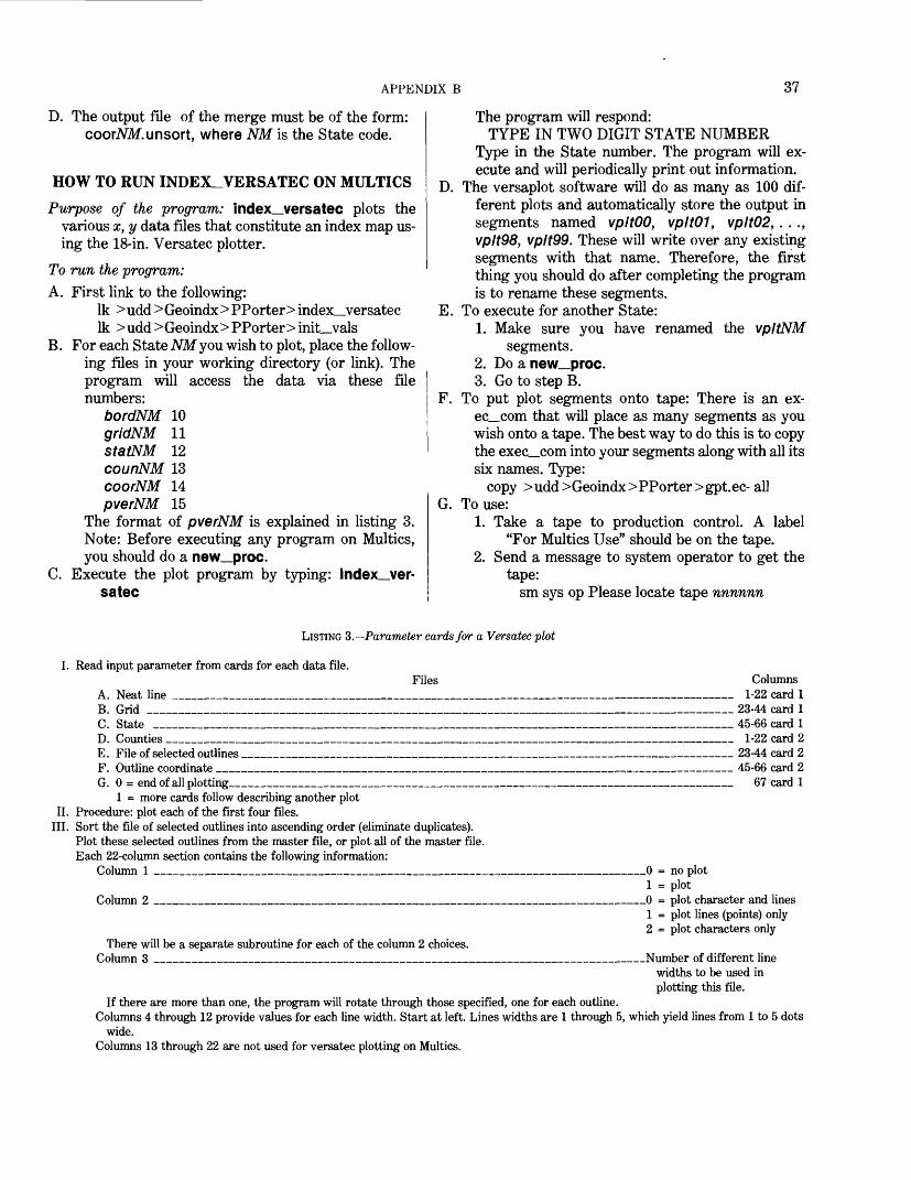
APPENDIX B 37
D. The output file of the merge must be of the form: coorNM.unsort, where NM is the State code.
HOW TO RUN INDEX_VERSATEC ON MULTICSPurpose of the program: index_versatec plots the
various x, y data files that constitute an index map us ing the 18-in. Versatec plotter.
To run the program:A. First link to the following:
Ik > udd > Geoindx > PPorter> index__versatec Ik > udd > Geoindx > PPorter > init_vals
B. For each State NM you wish to plot, place the follow ing files in your working directory (or link). The program will access the data via these file numbers:
bordNM 10 gridNM 11 statNM 12 counNM 13 coorNM 14 pverNM 15
The format of pverNM is explained in listing 3. Note: Before executing any program on Multics, you should do a new_proc.
C. Execute the plot program by typing: index_ver- satec
The program will respond:TYPE IN TWO DIGIT STATE NUMBER
Type in the State number. The program will ex ecute and will periodically print out information.
D. The versaplot software will do as many as 100 dif ferent plots and automatically store the output in segments named vpltOO, vpltOI, vplt02, . . ., vplt98, vplt99. These will write over any existing segments with that name. Therefore, the first thing you should do after completing the program is to rename these segments.
E. To execute for another State:1. Make sure you have renamed the vpltNM
segments.2. Do a new_proc.3. Go to step B.
F. To put plot segments onto tape: There is an ex- ec_com that will place as many segments as you wish onto a tape. The best way to do this is to copy the exec_com into your segments along with all its six names. Type:
copy >udd>Geoindx>PPorter>gpt.ec- allG. To use:
1. Take a tape to production control. A label "For Multics Use" should be on the tape.
2. Send a message to system operator to get the tape:
sm sys op Please locate tape nnnnnn
LISTING 3.--Parameter cards for a Versatec plot
I. Read input parameter from cards for each data file.Files
A. Neat lineB. Grid ____C. State _
Columns.________________________ 1-22 card 1 ________________________ 23-44 card 1 .__________________________ 45-66 card 1
D. Counties ___________________________________________________________ 1-22 card 2 E. File of selected outlines ___________________________________________________ 23-44 card 2 F. Outline coordinate ______________________________________________________ 45-66 card 2 G. 0 = end of all plotting_____________________________________________________ 67 card 1
1 = more cards follow describing another plotII. Procedure: plot each of the first four files.
III. Sort the file of selected outlines into ascending order (eliminate duplicates). Plot these selected outlines from the master file, or plot all of the master file. Each 22-column section contains the following information:
Column 1 ___________________________________________________0 = no plot1 = plot
Column 2 ___________________________________________________0 = plot character and lines1 = plot lines (points) only2 = plot characters only
._______________Number of different line widths to be used in plotting this file.
If there are more than one, the program will rotate through those specified, one for each outline. Columns 4 through 12 provide values for each line width. Start at left. Lines widths are 1 through 5, which yield lines from 1 to 5 dots
wide. Columns 13 through 22 are not used for versatec plotting on Multics.
There will be a separate subroutine for each of the column 2 choices. Column 3 _________________________________
38 GEOINDEX
Example: sm sys op Please locate tape aar711.
3. Wait for message from operator saying that she lias the tape(s).
4 . Execute the exec_com. Usage is:ec gpt &1 &2 &3 ... &n
where &1 is the tape number, and &2 to &n are segments to be put on this tape. Example:
ec gpt aarTll plotl plot2 plot3 which places three plots on the tape. Note: You can put approximately 1,100 pages of segments on a 1,000-inch tape and about 2,200 pages onto a 2,000-inch tape. The exec_com will split a segment between two tapes, but you do not want to do this. The plotter cannot handle a multiple-tape file pro duced in this fashion.
HOW TO RUN SORT.VERS.COOR.EC ON MULTICS
Purpose of the program: sort.vers.coor.ee creates the files that are to be used for input to the Multics Ver- satec programs. The input files are those files on the tape that was created on the digitizer by program dwgtape.
To run the program:A. Before you run these programs for the first time, the
programs must be linked. This is done by typing: Ik > udd> Geoindx> PPorter> pgml.vers.exthdr Ik >udd >Geoindx >PPorter >pgm2.vers. sequent Ik > udd >Geoindx> PPorter> pgmS.vers.merge Ik > udd>Geoindx> PPorter> sort.vers.coor.ee
B. If there is more than one coordinate file, then these coordinate files must be merged into one large coordinate file. This can be done in the editor qedx.
C. The output file of the merge must be of the form:coorNM.unsort
where NM is the State code.D. You must have coorNM.unsort in your directory or
be linked to it. To run, type:ec sort.vers.coorATM
where NM is the State code.E. This exec com is made up of three programs and one
sort, pgml.vers.exthdr creates an unsorted header record file from the unsorted coordinate file that was created in the qedx editor. This un sorted header record file is input to the system sort where a sorted header record file is created.
F. pgm2.vers.sequent converts the unsorted coor dinate file from a stream to a sequential file.
G. pgmS.vers.merge merges the sorted header file and
the sequential coordinate file into the sorted coor dinate file.
H. As sort.vers.coor.ee is executing, messages are displayed on the terminal indicating the progress of the job.
I. The files created by versatec.ec and sort.vers.- coor.ec can be input to the index_versatec pro grams.
HOW TO RUN MASTER ON MULTICSPurpose of the program: master reads coordinate files
for map outlines and calculates areas for each outline. It begins with the area for the entire State. After com puting this area, the program compares the area with the true area from a file named areano. The true area divided by the computed area gives a factor that is used to adjust each area computed for each outline.
At the same time, a center point is computed for each area. Then these centers are tested to make sure that they lie inside each outline and that they are not too close to the boundary. If they pass the test, they are written to a file cntrNM. Otherwise, they are put in a file named doubt. This must be checked by hand and, if necessary, adjusted by hand:
Input files: areano, statNM, coorNM.Output files: areaNM, cntrNM, measNM, doubt
To run the program:A. Before running master for the first time, you must
link it to your directory by typing: Ik > udd > Geoindx > H Johnson > master Ik > udd > Geoindx > H Johnson > areano
B. To run, type: masterC. When asked for it, type the FIPS code for the State.D. When asked for it, type the denominator of the map
scale for the map used for this State, format, (F8.0). For example, where the scale is given as 1/1,000,000, type 1000000.. Where the scale is 1/750,000, type 750000.. Be sure to include the decimal point.
E. After the State outline is used to compute State area, the machine will tell you the factor. This should be close to 1.0. If it is very different from 1.0, you may have the scale wrong or something may be wrong with the State file.
F. After the run is complete, list doubt and make cor rections.
HOW TO RUN STATE_OPTIMA ON MULTICSPurpose of the program: state_optima prints the max
imum latitudes and longitudes that border a State outline.
APPENDIX B 39
To run the program:A. You must have the following links:
Ik > udd > Geoindx > HJohnson > state_optimaYou must also be linked to the State radian filestrdNM.
B. Type: state_optimaand follow directions. You will be asked for FIPScode for the State.
HOW TO RUN ADDRAD ON MULTICS
Purpose of the program: addrad inserts correct areas, latitudes, longitudes, centers, and other data into the strgNM files for final input to the GRASP convert program.
Input files: strgNM, measNM, conxNM, ctrdNMOutput file: redyNM
To run the program:A. Before running addrad for the first time, you must
link it to your directory by typing:Ik > udd > Geoindx > H Johnson > addrad
B. To run, type: addrad C. When asked, type the FIPS code for the State.To check out error messages in addrad: A. While running addrad, the program may write error
messages in the form: THERE IS NO AREA WITH IF = 28 AND ISF
= 1B. These messages must all be checked out. C. The messages are caused by two conditions:
1. The outline for this IF and ISF is a single point. This condition is evident from an in spection of coorNM file, where the ISFNO number in the header card is 2. When this condition occurs, no record appears in measNM.
2. An error has occurred. When there is no outline for this IF and ISF, then I BOUND and IS PAN should not be present, or a record should be found in measNM.Inspect the reference file to see whether an outline is present, which is indicated by values in items 50-59, 76-85 (IBOUND and ISPAN). No record occurs in measNM for this IF and ISF.
D. Try running master again to see if the record inmeasNM was somehow dropped.
HOW TO RUN COVERT.EC ON MULTICS
Purpose of the program: covert.ec reads the redyNM file and creates a GRASP file for the State.
To run the program:A. Before running covert.ec for the first time, you
must create the following links: Ik > udd > Geoindx > PFulton > covert, ec Ik >udd>Geoindx>PFulton>indexO Ik >udd >Geoindx>PFulton> dicn Ik > udd >Geoindx >PFulton> defn Ik >udd >Geoindx> PFulton> mask Ik > udd >Geoindx> PFulton> setmas Ik > udd > Geoindx > PFulton > grasp Ik > udd > Grasp > grasp Ik > udd > Grasp > con vert
B. Before running, print the indexO, dicn, and maskfile.
C. Type:ec covert NM state
where NM is the FIPS code number for the State and state is the State name. Example:
ec covert 45 SouthCarolinaD. After running covert.ec, print indexO again to be
sure it has been updated properly. Also comparethe run printout with the sample to be sure it wassuccessfully completed.
E. After running, be sure you give access on the newindxNMftie to *.Gmap-Indx.*
F. If the State has to be run through covert.ec again, be sure to delete the indxNM file before running covert.ec, and delete the State line from indexO.
HOW TO RUN GR.EC ON MULTICSPurpose of the program: gr.ec sorts the State index file
by scale and creates three files:tip for scales less than or equal to 1:24000 t2p for scales greater than 1:63360 and t3p for scales between 1:24001 and 1:63360
To run the program:A. Before running gr.ec for the first time, create the
following link: Ik >udd >Geoindx>PFulton>gr.ec
B. Before running gr.ec, you must first have run covert.ec for the selected State.
C. Type: ec gr NMwhere NM is the FIPS code for the selected State. Example for Illinois: ec gr 17
D. The program will print the files tip, t2p, and t3p. These files should be inspected for accuracy. If any discrepancy is found, the redyNM file must be cor rected and covert.ec rerun for the selected State. Then gr.ec must be rerun to insure that the correc tions were entered properly.
E. The three files tip, t2p, and t3p must be kept and used in two succeeding programs:
40 GEOINDEX
1. They must be used in inplot.ec.2. They must be used in index_versatec. After
the final Versatec plots have been sent out for reproduction, the files should be deleted. If several States are processed through these programs at the same time, then the files should be renamed tlpNM, where NM is the FIPS code for the selected State. In this way, the data can be stored safely until the pro grams are actually executed, at which time the files must resume their original names.
F. Caution: If the execution fails, be sure to delete thefiles that may have been created: t1, t2, t3, tip,t2p, t3p, and output file. If not, the files willcause other retrievals to fail.
HOW TO RUN INPLOT.EC ON MULTICSPurpose of the program: inplot.ec plots the three files
created by gr.ec, which are tip, t2p, and t3p. It pro vides a visual check of the integrity of the plot files.
To run the program:A. Before running for the first time, you must establish
the links:Ik >udd>Grasp>assoc Ik > udd > Grasp > closer Ik >udd >Geoindx>PFulton> inplot.ec Ik >udd >Geoindx>PFulton> pn!6 Ik > udd > Geoindx > PFulton> pos Ik > udd >Geoindx> PFulton> plo Ik >udd>Geoindx>PFulton> plod Ik >udd>Geoindx>PFulton>ploc6
This program is run soon after gr.ec for the selected State and to access Tektronix routines type:
setup_tektronix__tcs.B. Before any execution of the program, you must also
have all the x, y coordinate files available, such as bordNM, coorNM, statNM, and counNM. This program must be run on a Tektronix terminal because it plots directly on the screen.
C. To run the program, type: ec inplot NM statewhere NM is the FIPS code for the State, and state is the name of the selected State. Example, for Il linois: ec inplot 17 Illinois
HOW TO RUN PN16 ON MULTICSPurpose of the program: pn16 plots a State index map
interactively on a Tektronix CRT screen. This is a two-step process. First, a GRASP retrieval is ex ecuted wherein a disk file is created that contains the links to the coordinate Geoindex files. This GRASP
file is identified as unit 13 and is described below. However, the program is also constructed so that the user has the option of plotting any combination of the input files.
To run the program:A. Before running pn16 you must link to it:
Ik >udd>Geoindx>PFulton>pn!6 IE >udd>Geoindx>PFulton> skod
B. Input: You must also have the State base-sheet files or link to them.
These files are:coorNM, bordNM, statNM, counNM, and gridNM
Optionally, you need files created by a GRASP retrieval or a file in the same format as the coorNM file.
C. Type: pn!6D. The program will supply the following prompts. The
user will supply the replies: Prompt 1: NEED STATE CODES (Enter y
for yes.) Reply: y (The skod file is then printed; n or
cr presents prompt 3.) Prompt 2: TYPE 1 AND HIT RETURN KEY
WHEN READY.Reply: 1 (MANDATORY REPLY) Prompt 3: ENTER STATE ID NUMBER. Reply: 18 (example showing FIPS code for
Indiana) Prompt 4: IF A COORDINATE FILE IS TO
BE PLOTTED, ENTER Y. Reply: y (presents prompt 5)
n or cr (presents prompt 7) Prompt 5: ENTER NAME OF FILE TO BE
PLOTTED. Reply: tip (example showing name of a file
created by GRASP)Prompt 6: IF INPUT SHOULD BE SORTED,
REPLY WITH A Y FOR YES. (This file should be sorted the first time it is used because the pro gram expects the numeric iden tifiers in ascending order; n or cr presents prompt 7.)
Reply: yPrompt 7: ENTER TITLE FOR MAP. Reply: Indiana for years greater than 1970
(example)Prompt 8: TO PLOT STATE ENTER 1. Reply: 1 (causes State boundary to be plot
ted)0 (No State boundary will be plot
ted.)

APPENDIX B 41
cr (No State boundary will be plot ted.)
Prompt 9: COUNTY PLOT (ENTER 1 FOR SOLID LINE, 2 FOR DOTTED, ELSE 0.)
Reply: 1 (County boundaries will be plottedin solid lines.)
2 (County boundaries will be plottedin dotted lines.)
0 (No county boundaries will beplotted—presents next prompt.)
cr (No county boundaries will beplotted—presents next prompt.)
Prompt 10: TO PLOT GRID ENTER 1. Reply: 1 (Latitude and longitude will be
plotted.) 0 (No latitude and longitude will be
plotted—presents next prompt.) cr (No latitude and longitude will be
plotted—presents next prompt.) Prompt 11: TO SUPERIMPOSE ANOTHER
FILE, ENTER 0 FOR NO, 1 FOR LINES ONLY, 2 FOR LINES AND CHARACTERS. (This prompt causes another plot file to be superimposed on the map. The file must have the same format as the coordinate files—for example, the locations of silver deposits could be plotted on the base or in dex map of Nevada.)
Reply: 1 (plots outlines and (or) points only;presents prompt 12)
2 (plots outlines and (or) points with an identifying number; presents prompt 12)
0 or cr (No superimposed file will be plotted; next erases screen and starts plotting.)
Prompt 12: ENTER FILE NAME. (This ques tion is asked only if 1 or 2 were the replies to prompt 9.)
Reply: cu3 (example of the name of a plotfile).
The screen is then erased, and the files are plotted. A bell rings when the plots are completed. For one hard copy, type the c and cr keys. For multiple hard copies, use the copy switch. When finished, cr.
Prompt 13: FOR AN ENLARGEMENT OF APART OF THIS PLOT, TYPE Y.
Reply: n or cr (No enlargement will bemade—presents prompt 16.)
y (An enlargement will be made ac
cording to the replies from prompts 14 and 15.)
Prompt 14: POSITION CURSOR AT LOWER LEFT OF DESIRED AREA; TYPE C.
Reply: Physically move the crosshair cur sor to the required position and type c and cr.
Prompt 15: POSITION CURSOR AT UPPER RIGHT OF DESIRED AREA; TYPE C.
Reply: Physically move the crosshair cur sor to the required position and type c and cr. (For best results, the window defined by the cross hair cursor should approximate the shape of the original plot; otherwise, geometric distortions will be introduced into the plot.)
The program from prompt 7 through 13 is then repeated.
Prompt 16: TO PLOT ANOTHER FILE ENTER Y FOR YES.
Reply: y (causes a return to prompt 4)n or cr (ends the program and
causes the message "good" to be printed to show a successful ex ecution)
The system prints STOP fortran_io: Close files?Reply: yes
HOW TO RUN BIGSTA ON MULTICSPurpose of the program: bigsta compiles statistics on
most of the files that we use in processing one State. It counts cards, computes lengths, and so forth, whenever appropriate.
Input files: coorNM, comxNM, statNM, strdNM, cordNM, counNM, curdNM, cntrNM, ctrdNM, gridNM, areaNM, redyNM, measNM, bordNM, and any others you wish to count
Output files: None
To run the program:A. Before running bigsta for the first time, you must
link it to your directory by typing: Ik > udd > Geoindx > HJohnson > bigsta Ik >udd >Geoindx > HJohnson > bigcal_bigsta Ik >udd >Geoindx > HJohnson > out2_bigsta Ik > udd > Geoindx > HJohnson > prim__bigsta Ik > udd > Geoindx > HJohnson > rads_bigsta Ik > udd > Geoindx > HJohnson > cards_bigsta
42 GEOINDEX
Ik >udd >Geoindx >HJohnson >outl_bigsta Ik >udd>Geoindx>HJohnson >ftnumber
B. Type: bigstaC. When asked, enter the two-digit FIPS State code.D. After running through the standard files, the pro
gram asks for any other files you wish processed. You may wish to type the following: paraNM
E. After the run is complete, the total number of cards is also given. The printout of the total should be filed.
HOW TO RUN USMERG.EC ON MULTICSPurpose of the program: usmerg.ec takes as input a
newly created indxNM file and appends it to the ex isting indxus. indxus is the GRASP file that con tains all the States. The output file is named usall. At the end of the run, it is dprinted for checking.
To run the program:A. Before running usmerg.ec for the first time, you
must establish the following links: Ik > udd > Geoindx > PFulton> usmerg. ec Ik > udd > Geoindx > PFulton> indxus
After establishing the link to indxus, copy it into your directory.
B. To run, type: ec usmerg NMwhere NM is the FIPS code for the State that is to be added to the indxus file. Example: ec usmerg 17 will take indx17 for the State of Illinois and ap pend it to indxus.
C. Study the program run listing for any errors, usall will be dprinted. Study the listing of usall for any errors.
D. If there are no errors, save the existing indxus by copying into a file called sindxus. Then delete indxus, and rename usall, indxus.
E. Run GRASP and check new indxus.F. If there is an error:
1. Delete usall and indxus.2. Copy sindxus to indxus.3. Rerun, starting at C.
HOW TO RUN STATE_TO_TAPE ON MULTICSPurpose of the program: state_to_tape must be run
on a console that gives a printout.To run the program:A. Be sure you have created the following links to the
program:Ik > udd >Geoindx > HJohnson > state_to_tape Ik >udd >Geoindx>HJohnson>
heading_state__to_tape Ik > udd >Geoindx > HJohnson > sts_begin
Ik >udd >Geoindx >HJohnson>list_state_tape.ec
Ik > udd >Geoindx > HJohnsori> disk_to_tape_fb_retain.t'C
Ik > udd > Geoindx > HJohnson >disk_to__tape__vbs_retain.ec
B. Be sure you have the following files in your directory or that you are linked to an actual segment con taining them:
coorNM, cordNM, statNM, strdNM, counNM, curdNM, cntrNM, gridNM, bordNM, redyNM, paraNM
C. Look up the number of this tape. D. Look up the last file number that was written to this
tape. If you have never run this program on this tape, then the last file number is 1 (the file that in itialized the tape).
E. Type:sm sys op Please find tape number (Tape number being your tape number)
F. Wait until the operator sends a message to your con sole that he has found the tape.
G. Type: state_to_tape(The program will prompt you for the information it needs.)
H. As directed by the machine, make two copies of the printout. Store these printouts for future reference. Then put the original printout in your log for this tape. You will need to refer to it whenever you add more records to the tape or whenever you want to print a listing of these files.
I. Remember to use a second backup tape with thesefiles.
J. To drop these files from your directory, link to:Ik > udd > Geoindx > HJohnson > drop, ec
and type: ec drop NM where NM is the State number.
HOW TO RUN PULL_OFF ON MULTICSPurpose of the program: pull_off enables the user to
select files from the Geoindex files and to write the selected files to disk.
To run the program:A. Make the following links:
Ik >udd >Geoindx > HJohnson >pull_off Ik >udd >Geoindx > HJohnson >
separate_pull_offIk >udd >Geoindx >HJohnson >state_pull_off Ik >udd >Geoindx >HJohnson >up^file__number Ik >udd Xjeoindx >HJohnson >
tape_to_disk_vbs_retain.ec
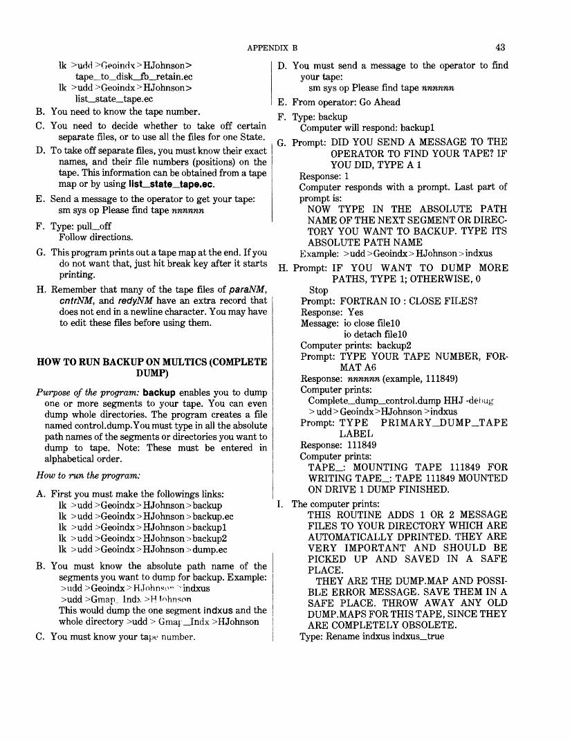
APPENDIX B 43
Ik >udd>Geoindx>HJohnson>tape_to_disk_jfb_retain.ec
Ik > udd > Geoindx > HJohnson >list_state_tape.ec
B. You need to know the tape number.C. You need to decide whether to take off certain
separate files, or to use all the files for one State.D. To take off separate files, you must know their exact
names, and their file numbers (positions) on the tape. This information can be obtained from a tape map or by using list_state_tape.ec.
E. Send a message to the operator to get your tape: sm sys op Please find tape nnnnnn
F. Type: pull_offFollow directions.
G. This program prints out a tape map at the end. If you do not want that, just hit break key after it starts printing.
H. Remember that many of the tape files of paraNM, cntrNM, and redyNM have an extra record that does not end in a newline character. You may have to edit these files before using them.
HOW TO RUN BACKUP ON MULTICS (COMPLETE DUMP)
Purpose of the program: backup enables you to dump one or more segments to your tape. You can even dump whole directories. The program creates a file named control.dump. You must type in all the absolute path names of the segments or directories you want to dump to tape. Note: These must be entered in alphabetical order.
How to run the program:
A. First you must make the followings links: Ik > udd > Geoindx > H Johnson > backup Ik > udd > Geoindx > H Johnson > backup, ec Ik > udd >Geoindx > H Johnson > backupl Ik > udd > Geoindx > H Johnson > backup2 Ik > udd > Geoindx > H Johnson > dump.ec
B. You must know the absolute path name of the segments you want to dump for backup. Example: >udd >Geoindx>HJohnso" ^indxus >udd >Gmap_Indx >H Johnson This would dump the one segment indxus and the whole directory >udd > Gmaj __Indx >HJohnson
C. You must know your tape number.
D. You must send a message to the operator to find your tape:
sm sys op Please find tape nnnnnn
E. From operator: Go AheadF. Type: backup
Computer will respond: backuplG. Prompt: DID YOU SEND A MESSAGE TO THE
OPERATOR TO FIND YOUR TAPE? IF YOU DID, TYPE A 1
Response: 1Computer responds with a prompt. Last part of prompt is:
NOW TYPE IN THE ABSOLUTE PATH NAME OF THE NEXT SEGMENT OR DIREC TORY YOU WANT TO BACKUP. TYPE ITS ABSOLUTE PATH NAME
E xample: > udd > Geoindx > H Johnson > indxusH. Prompt: IF YOU WANT TO DUMP MORE
PATHS, TYPE 1; OTHERWISE, 0 Stop
Prompt: FORTRAN 10 : CLOSE FILES? Response: Yes Message: io close filelO
io detach filelO Computer prints: backup2 Prompt: TYPE YOUR TAPE NUMBER, FOR
MAT A6Response: nnnnnn (example, 111849) Computer prints:
Complete_dump_control.dump HHJ -debug > udd > Geoindx >H Johnson > indxus
Prompt: TYPE PRIMARY_DUMP_TAPELABEL
Response: 111849 Computer prints:
TAPE_: MOUNTING TAPE 111849 FOR WRITING TAPE_: TAPE 111849 MOUNTED ON DRIVE 1 DUMP FINISHED.
I. The computer prints:THIS ROUTINE ADDS 1 OR 2 MESSAGE FILES TO YOUR DIRECTORY WHICH ARE AUTOMATICALLY DPRINTED. THEY ARE VERY IMPORTANT AND SHOULD BE PICKED UP AND SAVED IN A SAFE PLACE.
THEY ARE THE DUMP.MAP AND POSSI BLE ERROR MESSAGE. SAVE THEM IN A SAFE PLACE. THROW AWAY ANY OLD DUMP.MAPS FOR THIS TAPE, SINCE THEY ARE COMPLETELY OBSOLETE.
Type: Rename indxus indxus_true
44 GEOINDEX
HOW TO RUN RESTORE ON MULTICS
Purpose of the program: restore enables you to put a file from a backup tape, (created by the program backup) onto the Multics system
How to run the program:A. First make the following links:
Ik >udd >Geoindx >HJohnson >restore Ik >udd Xjeoindx >HJohnson >retrieve.ec
Decide which segments you want to restore from your backup tape. Check the dump.map for that tape to make sure that the segments are present. You must know their exact pathnames.
B. You must have these segments listed in the same order that they appear in the dump.map.
C. Be sure to rename your file before bringing it back from tape, such as change indxus to indxus_true.Then you can use the command:
compare indxus indxus__true to see if there are any differences.
D. Type: new_procand wait for system to respond; then type: restore
E. Prompt: DID YOU SEND A MESSAGE TO THE OPERATOR TO FIND YOUR BACKUP TAPE? IF YOU DID, TYPE: 1
F. Prompt: NOW TYPE THE ABSOLUTE PATH NAME OF THE NEXT SEGMENT OR DIRECTORY THAT YOU WANT TO RESTORE; THIS NAME IS ON YOUR BACKUP TAPE.
Use its absolute path name. Example: Ik > udd > Geoindx > HJohnson > indxus
G. Prompt: IF YOU WANT TO RESTORE MORE PATHS, TYPE 1; OTHERWISE, TYPE 0
H. Prompt: TYPE THE NUMBER OF YOUR BACKUP TAPE, FORMAT (A6). Exam ple: 111849
Computer prints:RETRIEVE CONTROL.RETRIEVE -DEBUGINPUT TAPE LABEL: 111849TAPE_: MOUNTING TAPE 111849 FORREADINGTAPE_: TAPE 111849 MOUNTED ON DRIVE1BEGIN AT 01/25/78 2053.3 EST WED.END OF READABLE DATA.BK_INPUT: ARE THERE ANY MORETAPES TO BE RELOADED?
User responds:No
Computer prints:NORMAL TERMINATION 01/25/78 2053.4EST WED.DPRINT -DL CONTROL.RETRIEVE.
RETRIEVE.MAP1 REQUEST SIGNALLED, 0 ALREADY INPRINTER QUEUE 3
This routine automatically dprints a retrieve map. Check to make sure that the requested files are in your directory.
User should then issue list command to find out whether the file has been restored. Example: Is indxus
User should then issue compare command to in sure the segment restored is the same as the seg ment that was written to tape using backup. Ex ample: Compare indxus indxus_true Computer responds:
NO DISCREPANCIES FOUND.
HOW TO RUN VERPLOT ON MULTICSPurpose of the program: verplot generates the status
map for the Geoindex. This program reads a file of commands and creates a Versatec plot file using the instructions from that file.
To run the program:
A. Link to the following Multics files:Ik >udd>Geoindx>PPorter>verplot Ik >udd >Geoindx>PPorter>init_vals
Copy or link to the following coordinate files: Ik >udd >Geoindx >PPorter >stat90 Ik >udd >Geoindx >PPorter >hawaii Ik >udd >Geoindx > PPorter > alaska Ik >udd >Geoindx >PPorter >puerto_rico
B. Create or link to some command file. See listing 4 for instructions on the contents of this file. An exam ple is shown in listing 5.
C. Run the program on Multics by typing: verplotD. The program will ask the following question:
WHAT IS THE NAME OF YOUR COMMAND FILE??USE NO MORE THAN SIX CHARACTERS!
and will read your answer, then attach and open this file for reading. A nonexistent file will give an error message on the terminal.
E. The program reads the data and calls the subroutine corresponding to that command. Any error in a command causes this error message to be written along with the entire data record:
APPENDIX B 45
THIS LINE CANNOT BE IDENTIFIED AS ACOMMAND.
Note: All error messages are written to a file called temp 10, which is created by the program and at the end of the run dprinted to provide a hard copy, which is always provided unless the pro gram does not run to completion (example: hitting break key); if it is not dprinted, you have no means to get the information in temp 10. An abnormal termination leaves tempIO as a zero length file.
F. As each subroutine is called, it will process the infor mation given in the command line and write messages to tempW for both valid operations and for errors. We have tried to take into account every type of possible error for which it gives an appropriate error message and have the program continue. This program should give a plot and a progress and error report to cross-check and to identify any errors and omissions. Any error for which a report is not given is not a common typing or omission error and must be resolved in a dif ferent manner.
G. After the program has finished the plots, it prints this message:
PLOT FINISHEDN VECTORS LOSTN ACTIVE LINES USED1 request signalled, N already in printer queue 3.Stop.
H. To put plot segments onto tape: An exec_com will place as many segments as you wish onto a tape. The best way to do this is to copy the exec_com in to your segments along with all six of its names. Type: copy > udd >Geoindex>PPorter>gpt.ec-all
I. To Use: Label a tape "For Multics Use" and take it to production control. Send message to system operator:
sm sys op Please locate tape number nnnnnn Wait for message from operator saying he has the tape(s). Execute the exec_com. Usage is:
ec gpt &1 &2 &3 . . . &nwhere &1 is the tape number, and &2 to &n are segments to be put on this tape. Example: ec gpt aar730 plotl plot2
LISTING 4. -Formation of the command file for verplot and an example command file
The file is composed of one or more instructions taken from a list of eight commands along with a variety of keywords that give almost limitless scope in creating a Versatec plot file. Restrictions for a command will be explained in that particular section.
I. All commands consist of records that have a maximum of 80 characters. This record length facilitates the use of cards if wanted.II. All commands and keywords can be either uppercase or lowercase, but must all be of one type in a particular word. The types can be mixed
within a record.III. Each command must start in column 1 (card-image terminology used) and must be immediately followed by a semicolon.IV. Keywords can be in any order but must be separated by commas. For each command, certain keywords are required and others are op
tional; default values are present if an optional keyword is missing. Many keywords include some data values.V. Except for the PLOT command, all commands and keywords must be on the same record.
VI. Blanks are ignored except in the following cases:A. All commands and keywords must be in a continuous string.B. Commands must start in column 1 and be immediately followed by a semicolon.C. Keywords that require a data value must be immediately followed by the character =.D. When used in a data value as a place holder. Example: x = Ml!!, will be interpreted as x = 100. Example: y = 2!.!!, will be interpreted
as y = 20.Note: "!" is the symbol used for a blank space.
VII. If at any time the same keyword occurs twice in a record, the second occurrence will take precedence. VIII. In all commands, if an error in the data value for a keyword occurs, that value will be either ignored or set to the default value if one exists.
IX. In all commands, if any required keyword is missing, the command is ignored.X. All numbers can be in either integer or real number format.
XI. An example of a command file, statpm, follows:
statpm
outline; npoint = 5,shade= 1 319.4,0.67,19.4,0.92,19.73,0.92,19.73,0.67,19.4,0.67
outline; npoint^S,shade= 1 219.4,1.59,19.4,1.84,19.73,1.84, 19.73,1.59,19.4,1.59
outline; npoint=5, shade=l19.4,2.51,19.4,2.76,19.73,2.76,19.73,2.51,19.4,2.51
46 GEOINDEX
LISTING 4. -Formation of the command file for verplot and an example command file-Continued
outline; npoint=5, shade=419.4,3.43,19.4,3.68,19.73,3.68,19.73,3.43,19.4,3.43
legend; x=19.88,y=0.72,height=0.1,nchar=9 PUBLISHEDlegend; x=19 88,y=1.64, height=0.1,nchar=8 IN PRESSlegend; x=19.88,y=2.56,height=0.1,nchar=22 IN COMPUTER PROCESSINGlegend; x=19.88, y=3.48,height=0.1,nchar=14 IN COMPILATION reorg; x^l.O, y=1.0 outline; npoint=50.0,0.0,0.0,3.2,3.4,3.2,3.4,0.0,0.0,0.0
legend; x-1.35, y=3.3, height=0.1, nchar=6 ALASKAplot; name-alaska, shadeall, pattern=l,13 end plot;reorg; x=5.6, y=-0.4 outline; npoint=50.0,0.0,0.0,1.3,2.0,1.3,2.0,0.0,0.0,0.0
legend; x=0.68, y=1.42, height=0.1, nchar=6 HAWAIIplot; name=hawaii, shadeall, pattern=l,13 end plot;reorg; x=8.0, y=0.7 outline; npoint=50.0,0.0,0.0,0.7,2.0,0.7,2.0,0.0,0.0,0.0
legend; x=0.37,y=0.8, height=0.1, nchar=ll PUERTO RICOplot; name=puerto_rico, shadeall, pattern=l,13 end plot;reorg; x=-14.6, y=-1.3 linwid; 4 outline; npoint=50.0,0.0,0.0,17.75,22.65,17.75,22.65,0.0,0.0,0.0
legend; x=6.775, y=16.8, height=0.3, lwidth=4, nchar=30 STATUS OF GEOLOGIC MAP INDICESlegend; x=7.725, y=16.0, height=0.3, lwidth=4, nchar=23 SATURDAY, MARCH 1, 1980 linwid; 1plot; name = stat90, textfield = 1,6, refclear=, height = 0.1,
select, selshade 1 1 134 1 135 1 136 1 18 1 139 1 1
12 1 1
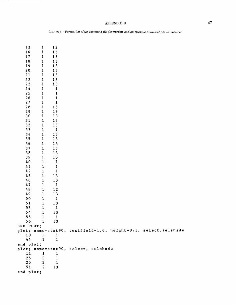
APPENDIX B 47
LISTING 4. -Formation of the command file for verplot and an example command file -Continued
13 1 1216 1 1317 1 1318 1 1319 1 1320 1 1321 1 1322 1 1323 1 1324 1 125 1 126 1 127 1 128 1 1329 1 1330 1 1331 1 1332 1 1333 1 134 1 1335 1 1336 1 1337 1 1338 1 1339 1 1340 1 141 1 142 1 145 1 1346 1 1347 1 148 1 1249 1 1350 1 151 1 1353 1 154 1 1355 1 156 1 13
END PLOT; plot; name = stat90, textfield= 1,6, height = 0.1, select,selshade
10 1 144 1 1
end plot; plot; name=stat90, select, selshade
11 1 125 2 125 3 151 2 13
end plot;
48 GEOINDEX
LISTING 5. -Commands for verplot
END PLOT
Purpose:
The command END PLOT informs the program that the information describing the plotting of a file is at an end. The only use is in conjunc tion with the PLOT command.
Command usage:
END PLOT; (or end plot;)-The program will continue reading the command file until the end plot command is reached.
LEGEND
Purpose:
The command LEGEND plots the character string given in a manner described by the keywords.
Command usage:
LEGEND; (or legend;) (keywords) followed by the text string on the next record.
Required keywords:
x- (or X=)-x coordinate of start of text string y= (or Y=)-y coordinate of start of text string height = (or HEIGHT'= )-Height of each characternchar= (or ATCHAR = )-Number of characters in text string on next record (Always start in column 1 and use no more than 80 characters,
which can be either uppercase or lowercase (or mixed).)
Optional keywords:
angle = (or ANGLE=)-The angle at which the text string is plotted (Default = 0 degrees.) lwidth= (or LWIDTH=)-The width of the line in dots (Default = 1 dot wide.)
LINWID
Purpose:
The command LINWID changes the line width of all subsequent plotting to the value given.
Command usage:
linwid; (or LINWID;) (number)-The number must be 1,2, 3, 4, or 5 because the Versatec software will accept no others. If no number is pres ent or an error is in the data, the default value of 1 will be used.
OUTLINEPurpose:
The command OUTLINE plots an outline whose coordinates are on the following record(s).
Command usage:
outline; (or OUTLINE;) (keywords)-Foliowed by the record(s) containing the data points.
Required keywords:
npoint= (or NPOINT= ) - The -number of data pairs of x, y coordinate points that follow (All coordinates must be separated by commas. No more than 20 pairs can be used, with no more than 20 values per record.)
Optional Keywords:
shade = (or SHADE=)- Tells the program to shade this outline and gives the reference number of the pattern to use in shading (The valid reference numbers are 1 through 20 with any other number defaulting to 1. However, numbers 14 through 20 are blank patterns that are reserved for use with the PATTERN command.)
noline (or NOLINE)- Causes the outline not to be plotted (This should not be used unless the shade option is also used).
PATTERN
Purpose:
The command PATTERN reads data values and stores these in an array that will be used as a pattern for shading at some later point in the program.
Command usage:
pattern; (or PATTERN;) (keywords)-Foliowed by one or more records containing the data values.
APPENDIX B 49
LISTING 5. -Commands for verplot-Continued
Required keywords:
refnum= (or REFNUM-)-T\\e reference number to be used in identifying this pattern (It must be from 14 through 20.)numword= (or NUMWORD- )-The number of data words on the following record(s) (This number can only be 1, 2, 4, 8, or 16. Any other
number will give an error. The maximum number of words accepted by Versatec is 16, and all the others divide evenly into 16.) type= (or TYPE=)-The only choices are INTEGER or OCTAL. The data values start on the next record. The program will read as many
records as necessary to satisfy the numword variable. All data values are separated by commas.
PLOT
Purpose:The command PLOT reads the name of a file, attachs and opens it for input and plots the data in that file according to the other keywords or
to the default values.
Command usage:
plot; (or PLOT;) (keywords)-Followed by records containing a selective records list. The END PLOT command must always be used in con junction with this.
Required keywords:name= (or NAME=)-Contains the name of the file to be plotted (Not more than 20 characters may be used.)
Example: PLOT; NAME=filenameEND PLOT;This constitutes the simpliest use of the plot command.
Note: This command will plot only those files whose outlines have a header card where the number of pairs of points in the outlines are listedin integer format in columns 16-20. The data points will follow in (12F6.3) format with the first data point being a text position.
Optional keywords:height= (or HEIGHT =)-The height of each character in the header card text; default value of 0.14 in.noline= (or M)L/M?=)-Does not plot the outline but allows all other options, such as character plotting and shading (Default is to plot the
outlines.)pattern= (or PATTERN=)~ Followed by a series of numbers (The first is the count of how many more numbers follow. The remaining
numbers are a sequence of pattern reference numbers, through which the program will rotate when shading outlines. Default pattern se quence is 1 through 10.)
refclear= (orREFCLEAR=)-Wi\\ clear the area around text when shading (This has one major problem. The Versatec software does not have a clearing function. Instead, if two or more areas are given in one shading command, the software will alternate shading and clear areas as the areas overlap. For our purpose, this is acceptable if the area to be cleared lies entirely within the outline. However, if areas overlap or the text lies outside, effects will be confusing. Default is not to clear the area.)
select= (or SELECT= )-Will plot only those outlines listed in the selective file following the keywords.selshade= (or SELSHAD£?=)-Will shade only those outlines that have a valid pattern reference number listed in the selective file following
the keywords.shadeall = (or SHADEALL =) - Will shade all outlines and will rotate through the pattern sequence given (or 1-10 by default) (An outline pat
tern can be changed by listing a valid pattern reference number in the selective file following the keywords.)textfield= (or TEXTFIELD= )- Folio wed by a series of numbers, the first number gives the count of how many numbers follow. The remain
ing numbers are a sequence representing some of the eight fields on the header cards. These are numbered from 1 to 8 from left to right. This sequence of numbers tells what fields will be plotted and in what order. Any blank or zero valued field will be ignored.
Example: text field=3,8,1,6 There are three fields to plot. First field 8, then field 1, and then field 6. Each field will be lined up underneath the previous one.
The keywords may occupy more than one record. All records containing keywords, except the last, must have a comma as the last entry on the record. This is the only indication that there are more keywords given.
A keyword with associated data values must be contained on one record. They cannot span records.The selective file following the keywords comprises records containing the reference number (field one of the header card), the
subfeature number (field three), and an optional pattern reference number. These are all five character fields contained in column 1 through 15 of the record. The two outline identifiers must be in this field exactly as they are in the five character header card field. The pat tern reference number is in format (15).
REORG
Purpose:The command REORG changes the software origin of the plot file. This has the effect of moving the subsequent plotting commands in rela
tion to those done previously.
50 GEOINDEX
LISTING 5. -Commands for verplot-Continued
Command usage:reorg; (or REORG;) (keywords)
One, but not both, of the following keywords must be present. If one is missing, the default of 0 for that value will be used. A movement to the left or down is negative; right or up is positive.
Keywords:x- (or .X"=)-The amount of movement (inches) in a left or right direction y= (or r=)-The amount of movement (inches) up or down
SCALE
Purpose:
The command SCALE changes the scale of all subsequent plotting.
Command usage:scale (or SCALE) (number)
A blank data value or an error will default to a scale of 1.
SYMBOL
Purpose:
The command SYMBOL changes the character plotted when a single point is encountered.
Command usage:symbol (or SYMBOL) (number)
The number represents some character. Any error in the number will default to a small triangle (number 2).

APPENDIX B 51
HOW TO RUN PIN90 ON MULTICSPurpose of the program: pin90 will plot the U.S. map
and then, if the user wishes, will plot numbers, sym bols, and outlines using GRASP files and will also plot the grid file.
Input files: f/7e74-stat90; file 15 -GRASP files; file16-grid file
Output files: None (The only output is the plot on the screen.)
To run the program:A. Before running pin90 for the first time you must link
it to your directory by typing: Ik > udd > Geoindx > PPorter> pin90 Ik > udd >Geoindx > PPorter> enlrg Ik >udd >Geoindx > PPorter> indiv Ik > udd >Geoindx > PPorter> min-max Ik > udd >Geoindx> PPorter>plocv Ik >udd >Geoindx> PPorter> grid
B. To run, type: pin90C. The user will then respond to the following ques
tions:1. NEED SYMBOL CODES? (ENTER Y FOR
YES.) If you want to see the symbol and cor responding number, type y and cr. Other wise, just enter cr and proceed to C3.
2. TAP 1 AND RETURN KEY WHEN READY3. Screen is erased.4. ENTER SYMBOL NUMBER AND FILE TO
BE PLOTTED. Example: 43silver You may enter as many as five files (maximum number of eight characters for file name). After each entry, enter cr and the message will appear again. When you have entered the last file or if you have no entry, just enter cr.
5. FOR SYMBOL AND NUMBERS (WITH PLOTTING), TYPE 1; FOR SYMBOL AND (OR) OUTLINE (NO NUMBERS), TYPE 2; FOR NUMBERS ONLY (NO SYMBOLS OR PLOTTING), TYPE 3. If you had no en try for C4 just enter cr. Otherwise, type in the number and cr.
6. Screen is erased.7. ENTER TITLE FOR MAP. Example: U.S.
MAP8. TO PLOT INDIVIDUAL STATES, ENTER
1-FOR ENTIRE U.S., ENTER 2. You must enter 1 or 2.
9. TO PLOT GRID, ENTER 1. If you want the grid, type 1 and cr; otherwise just type cr.
10. IF YOU WANT A HARD COPY UPON COM PLETION, TYPE C.
11. Screen is erased. If you entered 1 in response to C8, the following will appear on the screen:
GIVE NUMBER OF STATES TO BEPLOTTEDLIMIT OF 10 IN ASCENDING ORDERMUST BE A 2 DIGIT NUMBER, 01-51
For example, to plot the States of Illinois (12), Indiana (13), Kentucky (16), Ohio (34), and West Virginia (49), respond with the code number for each State, as follows: 1213163449.
This means a group of as many as 10 States. The States and their corresponding numbers appear on listing 6.
Screen is erased. The States along with GRASP files or grid file are plotting; if the user typed c in response to CIO, a hard copy will be made automatically at this time.
12. FOR AN ENLARGEMENT OF PART OF THIS PLOT, TYPE Y. Type y and cr if you want an enlargement; otherwise enter cr and proceed to C17.
13. FOR A HARD COPY AFTER ENLARGE MENT, TYPE C. If the user wants an automatic hard copy, type c and cr; other wise just enter cr.
14. POSITION CURSOR AT LOWER LEFT OF DESIRED AREA: TYPE C. Postion the vertical and horizontal cursors at the desired location, type c and cr.
15. POSITION CURSOR AT UPPER RIGHT OF DESIRED AREA, TYPE C. Position the vertical and horizontal cursors at the upper right location, type c and cr.
16. Screen is erased. An enlargement of the desired area is plotted, and an automatic hard copy is made upon completion if the user typed c in response to C13.
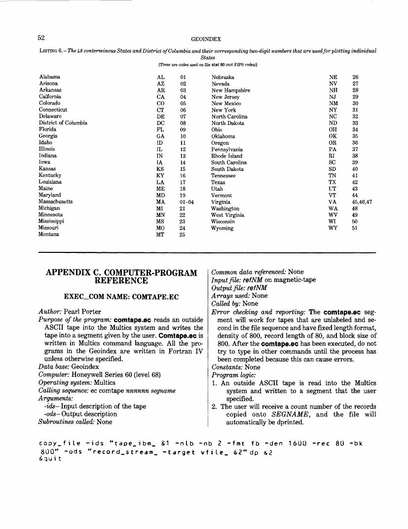
52 GEOINDEX
LISTING 6. - The 48 conterminous States and District of Columbia and their corresponding two-digit numbers that are used for plotting individualStates
[These are codes used on file stat 90 (not FIPS codes)]
AlabamaArizonaArkansasCalforniaColoradoConnecticutDelawareDistrict of ColumbiaFloridaGeorgiaIdahoIllinoisIndianaIowaKansasKentuckyLouisianaMaineMarylandMassachusettsMichiganMinnesotaMississippiMissouriMontana
ALAZARCACOCTDEDCFLGAIDILINIAKSKYLAMEMDMAMIMNMSMOMT
0102030405060708091011121314151617181901-042122232425
NebraskaNevadaNew HampshireNew JerseyNew MexicoNew YorkNorth CarolinaNorth DakotaOhioOklahomaOregonPennsylvaniaRhode IslandSouth CarolinaSouth DakotaTennesseeTexasUtahVermontVirginiaWashingtonWest VirginiaWisconsinWyoming
NENVNHNJNMNYNCNDOHOKORPARISCSDTNTXUTVTVAWAWVWIWY
2627282930313233343536373839404142434445,46,4748495051
APPENDIX C. COMPUTER-PROGRAM REFERENCE
EXEC_COM NAME: COMTAPE.EC
Author: Pearl PorterPurpose of the program: comtape.ec reads an outside
ASCII tape into the Multics system and writes the tape into a segment given by the user. Comtape.ec is written in Multics command language. All the pro grams in the Geoindex are written in Fortran IV unless otherwise specified.
Data base: GeoindexComputer: Honeywell Series 60 (level 68)Operating system: MulticsCalling sequence: ec comtape nnnnnn segno/meArguments:
-ids- Input description of the tape-ods- Output description
Subroutines called: None
Common data referenced: NoneInput file: refNM on magnetic-tapeOutput file: refNMArrays used: NoneCalled by: NoneError checking and reporting: The comtape.ec seg
ment will work for tapes that are unlabeled and se cond in the file sequence and have fixed length format, density of 800, record length of 80, and block size of 800. After the comtape.ec has been executed, do not try to type in other commands until the process has been completed because this can cause errors.
Constants: NoneProgram logic:1. An outside ASCII tape is read into the Multics
system and written to a segment that the user specified.
2. The user will receive a count number of the records copied onto SEGNAME, and the file will automatically be dprinted.
copy_file -ids "tape.ibm_ &1 -nib -nb 2 -fmt fb -den800" -ods "record_stream_ -target vfile_ &2" dp &2iqu i t
1600 -rec 80 -bk
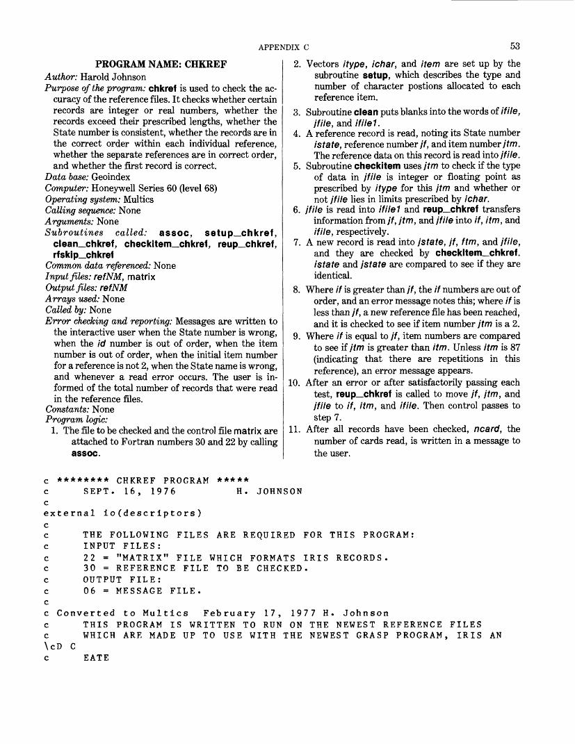
APPENDIX C 53
PROGRAM NAME: CHKREFAuthor: Harold JohnsonPurpose of the program: chkref is used to check the ac
curacy of the reference files. It checks whether certain records are integer or real numbers, whether the records exceed their prescribed lengths, whether the State number is consistent, whether the records are in the correct order within each individual reference, whether the separate references are in correct order, and whether the first record is correct.
Data base: GeoindexComputer: Honeywell Series 60 (level 68)Operating system: MulticsCalling sequence: NoneArguments: NoneSubroutines called: assoc, setup_chkref,
clean_chkref, checkitem_chkref, reup_chkref, rfskip__chkref
Common data referenced: NoneInput files: refNM, matrixOutput files: refNMArrays used: NoneCalled by: NoneError checking and reporting: Messages are written to
the interactive user when the State number is wrong, when the id number is out of order, when the item number is out of order, when the initial item number for a reference is not 2, when the State name is wrong, and whenever a read error occurs. The user is in formed of the total number of records that were read in the reference files.
Constants: NoneProgram logic:
1. The file to be checked and the control file matrix are attached to Fortran numbers 30 and 22 by calling assoc.
2. Vectors itype, ichar, and item are set up by the subroutine setup, which describes the type and number of character postions allocated to each reference item.
3. Subroutine clean puts blanks into the words of if He, /file, and ifilel.
4. A reference record is read, noting its State number istate, reference number jf, and item number/f/n. The reference data on this record is read into I file.
5. Subroutine checkitem uses jtm to check if the type of data in /file is integer or floating point as prescribed by itype for this jtm and whether or not jfile lies in limits prescribed by ichar.
6. I file is read into ifilel and reup_chkref transfers information from jf, jtm, and jfile into if, itm, and if He, respectively.
7. A new record is read into jstate, jf, ftm, and jfile, and they are checked by checkitem_chkref. i state and jstate are compared to see if they are identical.
8. Where if is greater than jf, the if numbers are out of order, and an error message notes this; where if is less than jf, a new reference file has been reached, and it is checked to see if item number jtm is a 2.
9. Where if is equal to jf, item numbers are compared to see if jtm is greater than itm. Unless itm is 87 (indicating that there are repetitions in this reference), an error message appears.
10. After an error or after satisfactorily passing each test, reup_chkref is called to move jf, jtm, and jfile to if, itm, and if He. Then control passes to step 7.
11. After all records have been checked, ncard, the number of cards read, is written in a message to the user.
c ******** CHKREF PROGRAM *****c SEPT. 16, 1976 H. JOHNSONcexternal io (descriptors)c
THE FOLLOWING FILES ARE REQUIRED FOR THIS PROGRAM:INPUT FILES:22 - "MATRIX" FILE WHICH FORMATS IRIS RECORDS.30 - REFERENCE FILE TO BE CHECKED.OUTPUT FILE:06 - MESSAGE FILE.
cccccccccc\cDc
Converted to Multics February 17, 1977 H THIS PROGRAM IS WRITTEN TO RUN ON THE
Johnson NEWEST REFERENCE FILES
WHICH ARE MADE UP TO USE WITH THE NEWEST GRASP PROGRAM, IRIS AN
EATE
54 GEOINDEX
c THIS PROGRAM IS DESIGNED TO RUN THROUGH THE REFERENCE FILES ANDc CHECK FOR THEIR ACCURACY.c IT CHECKS WHETHER THE FILE IS INTEGER OR REAL IF IT IS SUPPOSED\c TOc BEc IT CHECKS IF THE FILE IS WITHIN THE PRESCRIBED LIMITSc IT CHECKS ON THE STATE NUMBERc IT CHECKS ON THE ORDER OF THE SEPARATE FILE SUBJECTS.c IT CHECKS ON THE OREDER OF THE ITEMS WITHIN A SINGLE SUBJECT.cc
dimension itype(46),ichar(46),item(46,10),ifile(73),jfile(73)dimension ialpha(5),ifilel(50) character*32 filename
data iblank/" "/ call io ("attach","file22","vfile_ ","matrix","-append","-ssf")
call io ("open'V'file22","si")write(6,890)
890 format(" enter the file name to be checked :")read 895, filename
895 format (a32)call io ("attach","file30","vfile_",filename,"-append","-ssf")call io ("open","file30","si")
c c c c
idim=46c IDIM IS THE NUMBER OF RECORDS IN THE MATRIX FILE c
call setup_chkref(itype,ichar,item,idim)c THIS SET UP THE MATRICES ITYPE(IDIM),ICHAR(IDIM),ITEM(IDIM,IWII \cDE)c WHICH DESCRIBE THE TYPE AND NUMBER OF CHARACTER POSITIONS c ALLOCATED TO EACH ITEM. c
nfile=73call clean_chkref(ifile,nfile)
c THIS ROUTINE PUTS BLANKS INTO THE WORDS OF IFILE. c
call clean_chkref(jfile,nfile)nfile=40call clean chkref(ifile1,nfile)
call rf skip__chkref (ncard )c THIS ROUTINE READS DOWN FILE 30 LOOKING FOR THE FIRST TRUE RECOR \cD,c SKIPPING THE CARDS WHICH MERELY DESCRIBE THE REFERENCE FILE, c NCARD IS THE KEY NUMBER FOR THE FIRST RECORD, c IT POSITIONS 30 READY TO READ THE FIRST RECORD, c
ncard=1
APPENDIX C 55
Cread(30,930,end=1000,err=500)istate,jf,jtm,(jfile(k),k-l,73)
930 format(12,13,12,73al) c
call checkitem_chkref(Idim,ncard,Item,jtm,jfile ,ltype,ichar \c)c THIS ROUTINE CHECKS IF THE FILE IS INTEGER OR FLOATING POINT c WHEN ITS ITM NUMBER INDICATES THAT.c IT ALSO CHECKS IF THE FILE IS CONTAINED WITHIN THE BOUNDARY SET \cBYc ITS ITM NUMBER.c THESE TYPES AND LIMITS ARE READ FROM MATRIX AND FOUND HERE IN TH \cE c FILES ITYPE AND ICHAR.
do 5 k=l,40ifilel(k)=jfile(k)
5 continuecall reup_chkref(itype,ichar,item,idim,if,itm,ifile,jf,jtm,jfile)
c THIS ROUTINE PUTS INFORMATION IN THE J-FILES,JF,JT,JFILE, c INTO THE IFILES IF,ITM,IFILE. c 10 ncard=ncard+l
read(30,930,end=1000,err=500)jstate,jf,jtm,(jfile(k),k=1,73)call checkitem_chkref(idim,ncard,item,jtm,jfile,itype,ichar)if(istate .eq. jstate) go to 20write(6,940)ncard
940 format(" THE STATE NUMBER IS WRONG ON RECORD NUMBER M ,i6)write(6,93 l)jstate,jf,jtm,jfile
931 format(i2,13,i2,73al)call reup_chkref(itype,ichar,it em,idim,if,itm,iflle,jf,jtm,jfile)
.go to 10 c 20 if(if .le. jf) go to 30
write(6,950)ncard950 format(" THE IF NUMBER IS OUT OF ORDER IN RECORD NUMBER ",i6 \c)
write(6,93 l)jstate,jf,jtm,jfile call reup_chkref(itype,ichar,it em,idim,if,itm,ifile,jf,jtm,jfile)
go to 10 c 30 if(if .it. jf) go to 40
if((itm .It. jtm) .or. (itm .eq. 87)) go to 35write(6,960)ncard
960 format(" THE ITEM NUMBER IS OUT OF ORDER AROUND RECORD NUMBER",i6)write (6,93 l)jstate,jf,jtm,jfile
35 call reup_chkref(itype,ichar,item,idim,if,itm,ifile,jf,jtm,jfile)go to 10
c 40 if(jtm .eq. 2) go to 50
write(6,9 70)ncard 970 format (" THE ITEM SHOULD BE 2 IN RECORD NUMBER If ,i6)
write(6,93l)jstate,jf,jtm,jfile call reup_chkref(itype,ichar,item,idim,if,itm,if lie,j f,jtm,jfile)
go to 10
56 GEOINDEX
c 50
60 c
do 60 k=l,40 if (ifilel(k) cont inue
ne. jfile(k)) go to 70
call reup_chkref(itype,ichar,item,idim,if,itm,ifile,jf,jtm,jfile)go to 10
c70 write(6,980)ncard 980 format(" THE STATE NAME IS WRONG IN RECORD NUMBER ",i6)
write(6,931) jstate,jf,jtm,jfile call reup_chkref(itype,ichar,item,idim,if,itm,ifile,jf,jtm,jfile)
go to 10 c c500 write(6,990)ncard 990 formatC" THERE WAS A READ ERROR ON RECORD NUMBER ",16)
call reup_chkref(itype,ichar,item,idim,if,itm,if ile,j f,jtm,jfile)go to 10
c 1000 write(6,1900)ncard1900 format(" YOU REACHED THE EOF AFTER READING ",i6," RECORDS.") c ******************************************************
call io ("close","file22") call io ("close","fileSO") call io ("detach","file22") call io ("detach","fileSO")
c ******************************************************stop
end c ******** END **********
SUBROUTINE NAME: RFSKIP_CHKREF
Author: Harold JohnsonPurpose of the program: rfskip_chkref checks to locate
the record having reference number 1 and itemnumber 2, which should be the first record in mostreference files.
Data base: Geoindex Computer: Honeywell Series 60 (level 68) Operating system: Multics Calling sequence: call rfskip_chkref (j) Arguments: j-The record number in the reference file,
which has reference number 1 and item number 2 Subroutines called: None Common data referenced: None Input files: refNM
Output files: NoneArrays used: NoneCalled by: chkrefError checking and reporting: The record number of the
beginning record is always reported. If no correct first record is found, a message to that effect is sent to the user.
Constants: NoneProgram logic:1. referenceEach record is read to determine its
number, ib, and its item number, /c.2. These are compared with 1 and 2 until a match is
found. This matching record is reported to the user.
3. If no match is found, a warning message is written to the user, the file is closed, and control returns to chkref.
APPENDIX C 57
c ******* SUBROUTINE R F SKI P_C HKR E F *******c *c *******************************************************c
subroutine r f sk i p_chk ref ( j ) data ione/" 1 "/7itwo/"2 "/
1900
read (30,900,end = 1 00) ia/ib/icformat Ca2/a4,a1 )if(ib .eq. ione .and. ic .eq, ic) go to 10
go to 110 wri te(6/910) j 910 formatC" THE REFERENCE DATA BEGINS AT THE",i4,"TH RECORD")
back space 30return
c ***************************************************100 write(6,920)920 formatC' THERE WAS NO FIRST RECORD FOUND! what's wrong?")rewind 30returnend
SUBROUTINE NAME: CLEAN_CHKREFAuthor: Harold JohnsonPurpose of the program: clean_chkref inserts blank
characters in each word of the vector if lie. Data base: Geoindex Computer: Honeywell Series 60 (level 68) Operating system: Multics Calling sequence: call clean_chkref (ifile,nfile) Arguments:
if He-A vectorn file-The number of elements in if He
Subroutines called: None Common data referenced: None Input files: None Output files: None Arrays used: if He Called by: chkref, reup_chkref Error checking and reporting: None Constants: None Program logic:1. The blank character is inserted into each word of I file
by a do loop.
c ******* SUBROUTINE CLEAN_CHKREF *******subroutine clean.chkrefCifi Le/nf i Le)
c THIS ROUTINE PUTS BLANK WORDS INTO THE FILE IFILE. cc HJohnson February 16/ 1977 c
dimension ifile(nfile)data iblank/" "/do 10 k = 1,nfi Lei fi le(k) = id Lank
10 cont i nueretu rnend
c ********* END CLEAN.CHKREF *********
58 GEOINDEX
SUBROUTINE NAME: REUP_CHKREFAuthor: Harold JohnsonPurpose of the program: reup_chkref transfers the
characters in /file to if He. Data base: Geoindex Computer: Honeywell Series 60 (level 68) Operating system: Multics Calling sequence: call reup_chkref (itype,ichar,item,-
idim,if,itm,ifile,jf,jtm,jfile) Arguments:
if He A vector containing the reference data in a refer-record
jfHe- The same kind of vector as if lie Subroutines called: clean_chkref Common data referenced: None Input files: None Output files: None Arrays used: ifile(73), jfile(73) Called by: chkrefError checking and reporting: None Constants: None Program logic:1. clean_chkref is called to put blanks into If He.2. Characters in jfile are written into if He.
c ******* SUBROUTINE REUP_CHKREF *******subroutine reup_chkref(itype,ichar,item,idim,if,itm,ifile,jf,jtm,j
\cfile)dimension itype(idim),ichar(idim),item(idim,10),ifile(73),jfile(73
&)c H Johnson February 17, 1977c
If-Jfitm=j tmnfile=73call clean_chkref(ifile,nfile)
10
c c
do 10 k=l,73 ifile(k)=jfile(k) con tinuereturn
*******************************************************
endc ******* END REUP CHKREF *******
SUBROUTINE NAME: BLANKCHECK_CHKREF
Author: Harold JohnsonPurpose of the program: blankcheck__chkref checks to
see if the information in the current record beingchecked is within the limits prescribed by matrix.
Data base: Geoindex Computer: Honeywell Series 60 (level 68) Operating system: Multics Calling sequence: call blankcheck__chkref (ichar,jfile, -
ncard) Arguments:
ichar- The admissible length of the current reference item
I file- The vector of characters obtained from the cur rent reference record
ncard- The number of the record in the reference file currently being examined
Subroutines called: NoneCommon data referenced: NoneInput files: NoneOutput files: NoneArrays used: jfile(73)Called by: checkitem_chkrefError checking and reporting: When jfile is too long, a
message explaining the problem, giving the record number along with a printing of the file jfile and the number of the erroneous nonblank characters is sent to the user.
Constants: NoneProgram logic:1. All characters after the icharih are compared with
the blank character. Discrepancies are reported.

APPENDIX C 59
******* SUBROUTINE 3LANKCHtCK_CHKREF.FORTRAN ******* subroutine blankcheck_chkref(ichar*jfile^ncard)
this routine checks to see ifwithin ichar spaces by seeing
H Johnson February 16* 1977
the file jfile(73) is contained if the oth^r spaces are blank
10
900
dimension jfile(73)data iblank/" "/Jo 10 k=1,4i = i c har + kifCjfileCi) .ne. iblank) go to 20con t i nuereturnwri teC6,9UO)ncard/iformatC" THE FILE IS TOO LONG ON RECORD NUMBER i6 BECAUSE
CHARACTER ",i2/" IS NOT BLANK")writeC6,901)CjfileCk),k=1,73)
901 formatC" THIS DATA IS "*73a1)return
c ******************************************
end C *******£NO BLANKCHECK.CHKREF *******
SUBROUTINE NAME: TYPECHECK_CHKREF
Author: Harold JohnsonPurpose of the program: typecheck_chkref checks to
see whether the information in the current reference record represents an integer or floating-point number when that type is indicated by its item number.
Data base: GeoindexComputer: Honeywell Series 60 (level 68)Operating system: MulticsCalling sequence: call typecheck__chref (itype,ifile,ncard)Arguments:
itype- One of the type of 1 or 2 if He A vector of characters obtained from a record of
the reference file being checked ncard-The number of the current record being
checked
Subroutines called: NoneCommon data referenced: NoneInput files: NoneOutput files: NoneArrays used: NoneCalled by: checkitem_chkrefError checking and reporting: When if He is wrong, this
is reported to the user, along with the record numberand copy of if He.
Constants: None Program logic:1. If the item number is 1, each character in if fie is
checked to determine if it is 0,1,2,3,4, 5, 6,7,8,9, or blank.
2. If the item number is 2, each character is compared with these same integers and then with a period. The program checks that exactly one period occurs.
3. Any discrepancies are reported to the user.
******* SUBROUTINE TYPECHECK_CHKREF.FORTRAN *******subroutine typecheck__chkref (itype, if lie , ncard) dimension ifile(73),number(12)
this subroutine checks whether the type indicated by itypecorresponds to what is found in ifile.H Johnson February 16, 1977
60
c
\c","7 &","8
1 c c
GEOINDEX
data number/"0 1
15
10
c c20
II It Q It It It II II / » " » > « /
if(itype .eq. 2) go to 20
WHEN ITYPE IS 1 WE TEST TO SEE IF IFILE CONTAINS ONLY INTEGERS, do 10 j=l,20 do 15 k=l,11if(ifile(j) .eq. number(k)) go to 10 c ont inue go to 500 cont inue return
WHEN ITYPE IS 2 WE TEST TO SEE IF IFILE IS A REAL NUMBER.cont inueiflag=0do 30 j-1,20do 35 k=l,11if(ifile(j) .eq. number(k)) go to 30cont inueif (if il-e(j) .ne. number(12)) go to 510iflag = iflag+1if(iflag .ne. 1) go to 510cont inueif(iflag .ne. 1) go to 510return
c500 write(6,920)ncard920 format(" THERE IS SUPPOSED TO BE AN INTEGER IN RECORD NUMBER ",i6 \c)
write(6,92 l)ifile
35
30
921
c510 930 \ci6)
format(" THIS DATA IS ",73al) return
write(6,930)ncardformat(" THERE IS SUPPOSED TO BE A REAL NUMBER IN RECORD ",
write(6,921)ifile return
****************************************************
endc ******* END TYPECHECK CHKREF *******
SUBROUTINE NAME: LOCAT1_CHKREFAuthor: Harold JohnsonPurpose of the program: Iocat1_chkref determines the
line and column of matrix in which a given item number occurs by using the matrix, item, which was constructed from matrix.
Data base: Geoindex
Computer: Honeywell Series 60 (level 68)Operating system: MulticsCalling sequence: call locatl_chkref (jtm,idim,item,-
line,kolumn) Arguments:
jtm-An item number of the current reference recordidlm -The number of rows in item
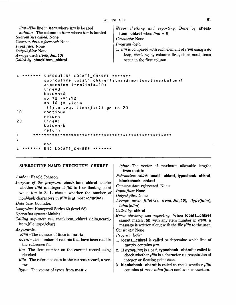
APPENDIX C 61
line -The line in item where jtm is located kolumn-The column in item where jtm is located
Subroutines called: NoneCommon data referenced: NoneInput files: NoneOutput files: NoneArrays used: item(idim, 10)Called by: checkitem_chkref
Error checking and reporting: Done by check-item_chkref when line = 0
Constants: None Program logic: 1. jtm is compared with each element of item using a do
loop, checking by columns first, since most itemsoccur in the first column.
c ******* SUBROUTINE LOCAT1_CHKREF *******subroutine Iocat1_chkref(jtm/idifn/item/line/kolumn)dimension item(ioim/10)line=UkoIumn=Uao 10 k = 1 ,10do 10 j=1/idimif(jtm .eq. item(jsk)) go to 20
10 cont inuereturn
20 Li ne = jkoIumn=kre t u rn
c ***************************************************
*******end END LOCAT1 CHKREF *******
SUBROUTINE NAME: CHECKITEM^CHKREF
Author: Harold JohnsonPurpose of the program: checkitem_chkref checks
whether jfile is integer if jtm is 1 or floating pointwhen jtm is 2. It checks whether the number ofnonblank characters in jfile is at most ichar(lin).
Data base: Geoindex Computer: Honeywell Series 60 (level 68) Operating system: Multics Calling sequence: call checkitem_chkref (idim,ncard,-
item,jfile,itype,ichar) Arguments:
idim- The number of lines in matrixncard-The number of records that have been read in
the reference filejtm-The item number on the current record being
checkedjfile-The reference data in the current record, a vec
toritype-The vector of types from matrix
ichar-The vector of maximum allowable lengthsfrom matrix
Subroutines called: Iocat1_chkref, typecheck_chkref, blankcheck_chkref
Common data referenced: NoneInput files: NoneOutput files: NoneArrays used: jfile(73), item(idim,10), itype(idim),
ichar(idim)Called by: chkrefError checking and reporting: When Iocat1_chkref
cannot match jtm with any item number in item, a message is written along with the file jfile to the user.
Constants: NoneProgram logic:1. Iocat1_chkref is called to determine which line of
matrix contains jtm.2. If itype(line) is 1 or 2, typecheck_chkref is called to
check whether jfile is a character representation of integer or floating-point data.
3. blankcheck_chkref is called to check whether jfile contains at most ichar(line) nonblank characters.
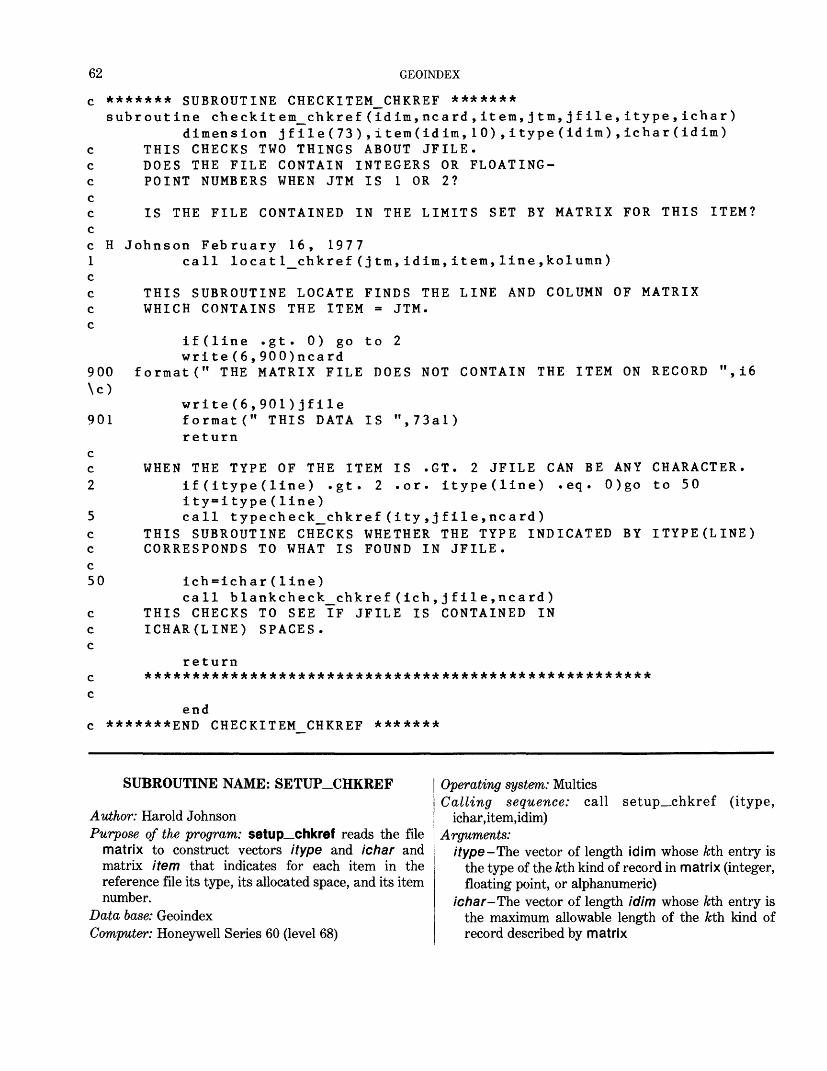
62 GEOINDEX
H
900 \c)
901
c c 2
c c c 50
c c c
c c
******* SUBROUTINE CHECKITEM_CHKREF *******subroutine checkitem_chkref(idim,ncard,item,jtm,jfile,itype,ichar)
dimension jfile(73),item(idim,10),itype(idim),ichar(idim) THIS CHECKS TWO THINGS ABOUT JFILE. DOES THE FILE CONTAIN INTEGERS OR FLOATING POINT NUMBERS WHEN JTM IS 1 OR 2?
IS THE FILE CONTAINED IN THE LIMITS SET BY MATRIX FOR THIS ITEM?
Johnson February 16, 1977call locatl_chkref(jtm,idim,item,line,kolumn)
THIS SUBROUTINE LOCATE FINDS THE LINE AND COLUMN OF MATRIX WHICH CONTAINS THE ITEM = JTM.
if(line .gt. 0) go write(6,900)ncard
formatC1 THE MATRIX FILE
write(6,901)jfile format(" THIS DATA return
to 2
DOES NOT CONTAIN THE ITEM ON RECORD
IS ",73al)
i6
IS .GT. 2 JFILE CAN BE ANY .or. itype(line) .eq. 0)go
WHEN THE TYPE OF THE ITEMif (itype(line) .gt. 2ity=itype(line)call typecheck_chkref(ity,jfile,ncard)
THIS SUBROUTINE CHECKS WHETHER THE TYPE INDICATED CORRESPONDS TO WHAT IS FOUND IN JFILE.
ich=ichar(line)call blankcheck_chkref(ich,jfile,ncard)
THIS CHECKS TO SEE IF JFILE IS CONTAINED IN ICHAR(LINE) SPACES.
return *****************************************************
CHARACTER, to 50
BY ITYPE(LINE)
end *******END CHECKITEM CHKREF *******
SUBROUTINE NAME: SETUP_CHKREF
Author: Harold JohnsonPurpose of the program: setup__chkref reads the file
matrix to construct vectors itype and ichar and matrix item that indicates for each item in the reference file its type, its allocated space, and its item number.
Data base: GeoindexComputer: Honeywell Series 60 (level 68)
Operating system: MulticsCalling sequence: call setup_chkref (itype,
ichar,item,idim) Arguments:
itype-The vector of length idim whose /cth entry is the type of the kth kind of record in matrix (integer, floating point, or alphanumeric)
ichar-The vector of length idim whose kth entry is the maximum allowable length of the kth kind of record described by matrix
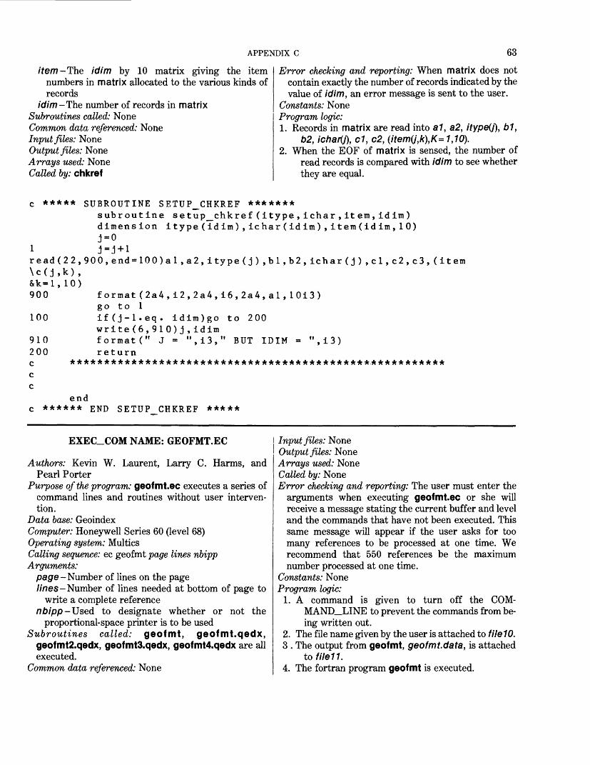
APPENDIX C 63
item -The idlm by 10 matrix giving the item numbers in matrix allocated to the various kinds of records
idim-The number of records in matrix Subroutines called: None Common data referenced: None Input files: None Output files: None Arrays used: None Called by: chkref
Error checking and reporting: When matrix does not contain exactly the number of records indicated by the value of idim, an error message is sent to the user.
Constants: NoneProgram logic:1. Records in matrix are read into a 1, a2, itype(j), b1,
b2, ichary), d, c2, (item(j,k\K= 1,10).2. When the EOF of matrix is sensed, the number of
read records is compared with idim to see whether they are equal.
c ***** SUBROUTINE SETUP_CHKREF *******subroutine setup_chkref(itype,ichar,item,idim) dimension itype(idim),ichar(idim),item(idim,10)J-o
1 J-J+1read(22,900,end=100)al,a2,itype(j),bl,b2,ichar(j),cl,c2,c3,(item \c(j,k), &k=l,10)900
100
910200ccc
format(2a4,i2,2a4,i6,2a4,al,10i3)go to 1if(j-l.eq. idim)go to 200write(6,910)j,idimformat(" J = ",i3," BUT IDIM = ",i3)return
*******************************************************
endc ****** END SETUP CHKREF *****
EXEC_COM NAME: GEOFMT.EC
Authors: Kevin W. Laurent, Larry C. Harms, andPearl Porter
Purpose of the program: geofmt.ec executes a series ofcommand lines and routines without user interven tion.
Data base: Geoindex Computer: Honeywell Series 60 (level 68) Operating system: Multics Calling sequence: ec geofmt page lines nbipp Arguments:
page- Number of lines on the pagelines- Number of lines needed at bottom of page to
write a complete referencenbipp-Used to designate whether or not the
proportional-space printer is to be used Subroutines called: geofmt, geofmt.qedx,
geofmt2.qedx, geofmtS.qedx, geofmt4.qedx are allexecuted.
Common data referenced: None
Input files: NoneOutput files: NoneArrays used: NoneCalled by: NoneError checking and reporting: The user must enter the
arguments when executing geofmt.ec or she will receive a message stating the current buffer and level and the commands that have not been executed. This same message will appear if the user asks for too many references to be processed at one time. We recommend that 550 references be the maximum number processed at one time.
Constants: NoneProgram logic:
1. A command is given to turn off the COM MAND—LINE to prevent the commands from be ing written out.
2. The file name given by the user is attached to fileW. 3 . The output from geofmt, geofmt.data, is attached
tofile11. 4. The fortran program geofmt is executed.
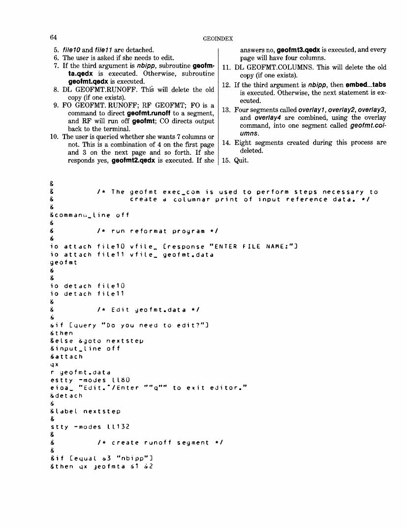
64 GEOINDEX
5. fileW and file11 are detached.6. The user is asked if she needs to edit.7. If the third argument is nbipp, subroutine geofm-
ta.qedx is executed. Otherwise, subroutine geof mt.qedx is executed.
8. DL GEOFMT.RUNOFF. This will delete the old copy (if one exists).
9. FO GEOFMT. RUNOFF; RF GEOFMT; FO is a command to direct geofmt.runoff to a segment, and RF will run off geofmt; CO directs output back to the terminal.
10. The user is queried whether she wants 7 columns or not. This is a combination of 4 on the first page and 3 on the next page and so forth. If she responds yes, geofmt2.qedx is executed. If she
answers no, geofmtS.qedx is executed, and every page will have four columns.
11. DL GEOFMT.COLUMNS. This will delete the old copy (if one exists).
12. If the third argument is nbipp, then embed_tabs is executed. Otherwise, the next statement is ex ecuted.
13. Four segments called over I ay 1, over I ay2, overlays, and overt ay4 are combined, using the overlay command, into one segment called geofmt.col umns.
14. Eight segments created during this process are deleted.
15. Quit.
&& /* The geofmt exec_com is used to perform steps necessary to& create a columnar print of input reference data* */&icomman online off&i /* run reformat program */£io attach f i I e 1 0 vfile_ [response "ENTER FILE NAME:"]io attach file11 vfile. geofmt. datageofmt
io detach filelO io detach file11
& /* Edit geofmt. data */£iif [query "Do you need to edit?"]it hen&else igoto nextstep& i nput .Line off&a 1 1 achqxr geofmt. dataest ty -modes I 180eioa. "Edi t. " /Enter&det ac hi& I abe I nextstep&s 1 1 y -modes I 1 1 32&& /* create runoff segment */&&if [equal &3 "nbipp"]&then qx jeofmta i 1 ci 2
"" q "" to exit editor.
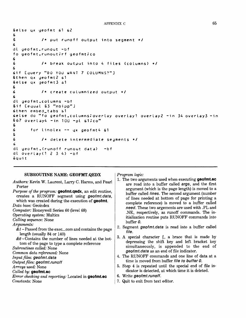
APPENDIX C 65
Seise qx geofmt S1 &<?&& /* put runoff output into segment */Sdt geofmt.runout -bffo geofmt.runout » rf geofmt^coS5 /* break output into A files (columns) */6Sif Cquery "00 YOU WANT 7 COLUMNS?"]Sthen qx geofmt2 S 1Seise qx geofmt3 i1&£ /* create columnized output */&dl geofmt.columns -bf&if Cequal S3 "nbipp"JSthen embed_tabs & 1Seise do "fo geofmt.coIumns^over lay overlayl overlay? -in 34 overlay3 -inS67 overlayA -in 100 -pi Si;co"&5 for linolex -- qx geofmtA £16S /* delete intermediate segments */Sdl geofmt . (runoff runout data) -bfdl over lay(1 2 3 A) -bfSqui t
SUBROUTINE NAME: GEOFMT.QEDX
Authors: Kevin W. Laurent, Larry C. Harms, and PearlPorter
Purpose of the program: geof mt.qedx, an edit routine,creates a RUNOFF segment using geofmt.data,which was created during the execution of geof mt.
Data base: GeoindexComputer: Honeywell Series 60 (level 68) Operating system: Multics Calling sequence: None Arguments:
&1 - Passed from the exec_com and contains the page length (usually 84 or 140)
<£#-Contains the number of lines needed at the bot tom of the page to type a complete reference
Subroutines called: None Common data referenced: None Input files: geofmt.data Output files: geofmt.runoff Arrays used: None Called by: geofmt.ecError checking and reporting: Located in geofmt.ec Constants: None
Program logic:1. The two arguments used when executing geofmt.ec
are read into a buffer called argrs, and the first argument (which is the page length) is moved to a buffer called lines. The second argument (number of lines needed at bottom of page for printing a complete reference) is moved to a buffer called need. These two argements are used with .PL and .NE, respectively, as runoff commands. The in itialization routine puts RUNOFF commands into buffer 0.
2. Segment geofmt.data is read into a buffer called file.
3. A special character {, a brace that is made by depressing the shift key and left bracket key simultaneously, is appended to the end of geofmt.data as an end of file indicator.
4. The RUNOFF commands and one line of data at a time is moved from buffer file to buffer 0.
5. Step 4 is repeated until the special end of file in dicator is detected, at which time it is deleted.
6. Write geofmt.runoff.1. Quit to exit from text editor.
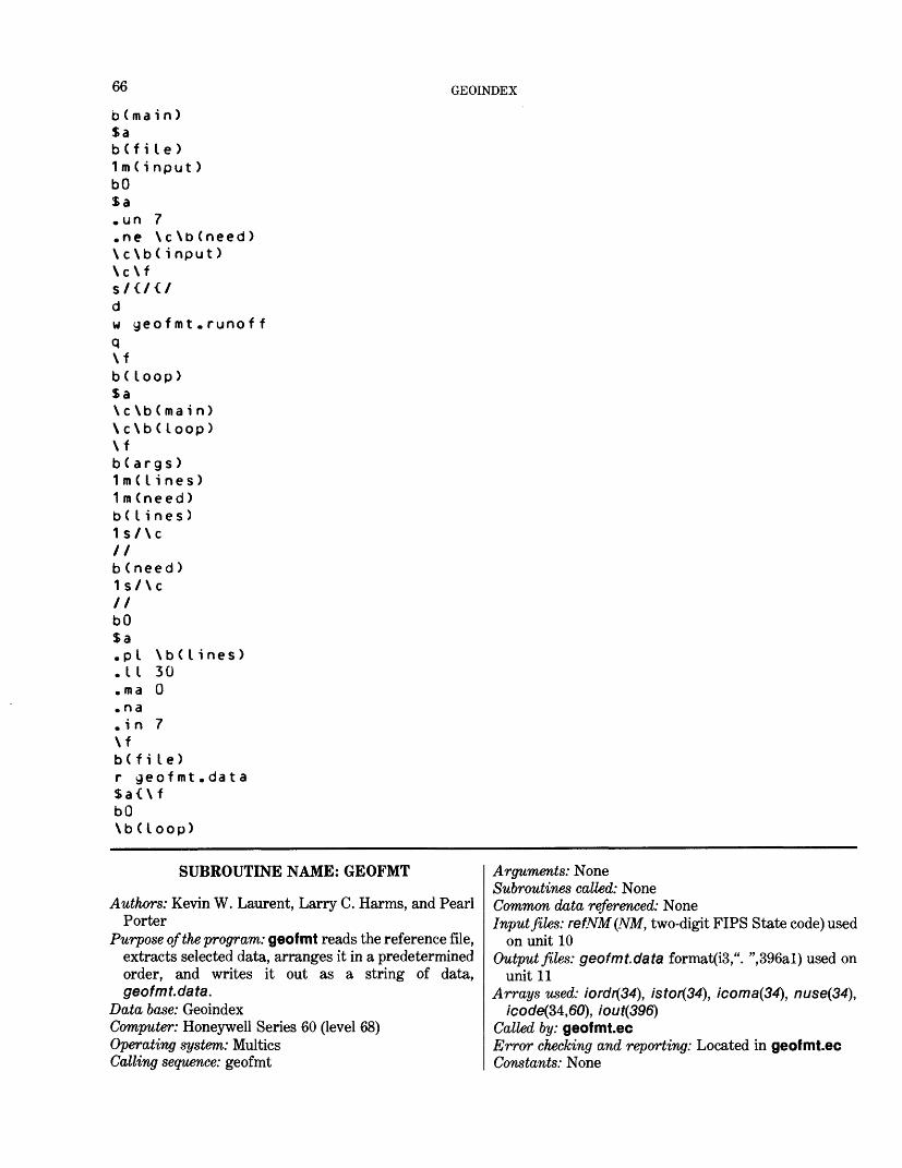
66 GEOINDEX
b (ma i n )$ab(f i le)1 m ( i nput )bOSa. un 7.ne \c \b (need )\ c \b( input )\c\f
w geof mt . runof fq\fb( Loop)Sa\ c \b ( ma i n)\c\b(loop)\fb ( args )1 in ( I i nes )1 m (need )b( I i nes )1s/\c//b (need )1s/\c
bO$a-Pi.11. ma. na.in 7\fb(f i le)r geofmt$a<\fbO\bdoop)
\bdines)300
dat a
SUBROUTINE NAME: GEOFMT
Authors: Kevin W. Laurent, Larry C. Harms, and PearlPorter
Purpose of the program: geof mt reads the reference file,extracts selected data, arranges it in a predeterminedorder, and writes it out as a string of data,geofmt.data.
Data base: GeoindexComputer: Honeywell Series 60 (level 68) Operating system: Multics Calling sequence: geofmt
Arguments: NoneSubroutines called: NoneCommon data referenced: NoneInput files: refNM(NM, two-digit FIPS State code) used
on unit 10 Output files: geofmt.data format(i3,". ",396al) used on
unit 11 Arrays used: iordr(34), istor(34), icoma(34), nuse(34),
/cocte(34,60), iout(396) Called by: geof mt.ecError checking and reporting: Located in geof mt.ec Constants: None
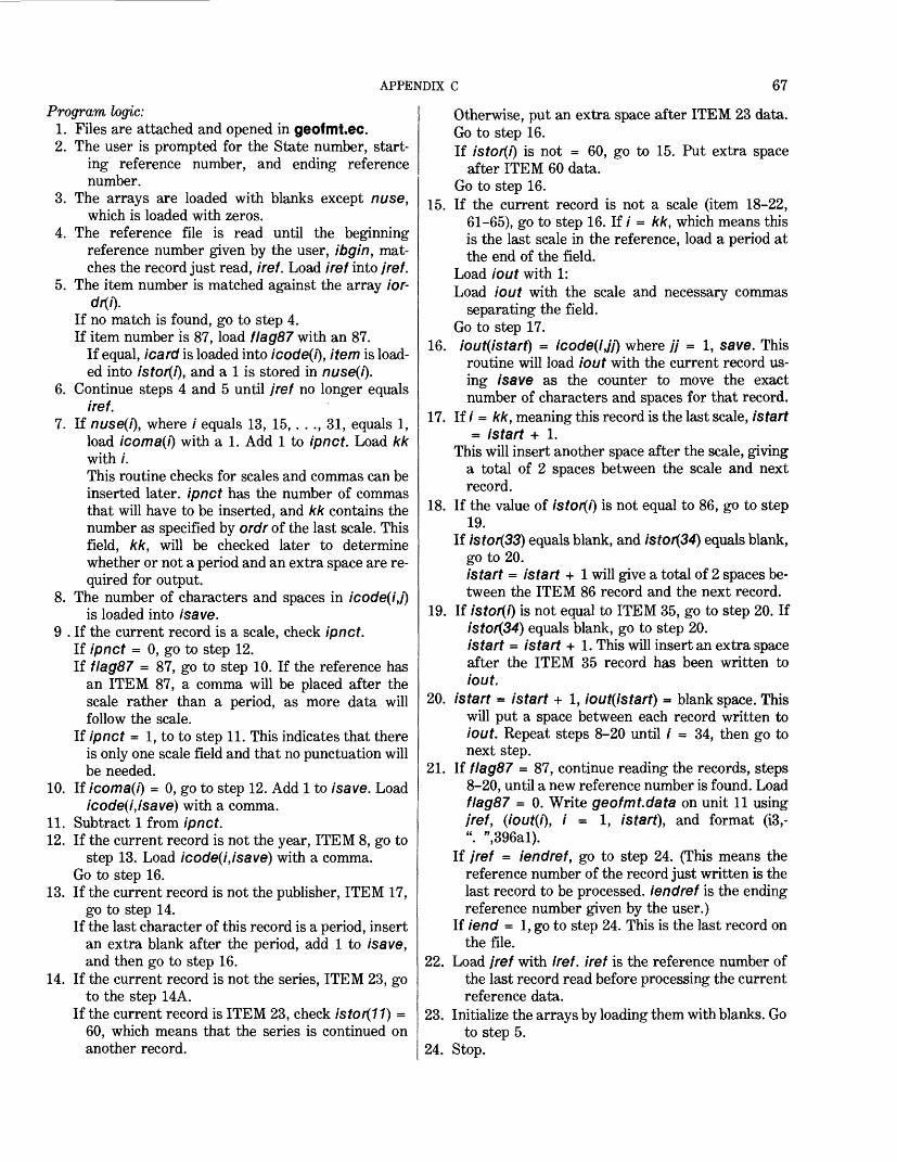
APPENDIX C 67
Program logic:1. Files are attached and opened in geofmt.ec.2. The user is prompted for the State number, start
ing reference number, and ending reference number.
3. The arrays are loaded with blanks except nuse, which is loaded with zeros.
4. The reference file is read until the beginning reference number given by the user, ibgin, mat ches the record just read, /re/. Load iref into /re/.
5. The item number is matched against the array /or-
If no match is found, go to step 4.If item number is 87, load flag87 with an 87.
If equal, /care/ is loaded into icode(i), item is load ed into istor(i), and a 1 is stored in nuse(i).
6. Continue steps 4 and 5 until jref no longer equals iref.
7. If nuse(i), where / equals 13, 15, . . ., 31, equals 1, load icoma(i) with a 1. Add 1 to ipnct. Load kk with /.This routine checks for scales and commas can be inserted later, ipnct has the number of commas that will have to be inserted, and kk contains the number as specified by ordr of the last scale. This field, kk, will be checked later to determine whether or not a period and an extra space are re quired for output.
8. The number of characters and spaces in icode(i,j)is loaded into /'save.
9 . If the current record is a scale, check ipnct. If ipnct = 0, go to step 12. If flag87 = 87, go to step 10. If the reference has
an ITEM 87, a comma will be placed after thescale rather than a period, as more data willfollow the scale.
If ipnct = 1, to to step 11. This indicates that thereis only one scale field and that no punctuation willbe needed.
10. If icoma(i) = 0, go to step 12. Add 1 to /save. Load icode(i,isave) with a comma.
11. Subtract 1 from ipnct.12. If the current record is not the year, ITEM 8, go to
step 13. Load icode(i,isave) with a comma. Go to step 16.
13. If the current record is not the publisher, ITEM 17,go to step 14.
If the last character of this record is a period, insert an extra blank after the period, add 1 to /save, and then go to step 16.
14. If the current record is not the series, ITEM 23, goto the step 14A.
If the current record is ITEM 23, check istor(11) = 60, which means that the series is continued on another record.
Otherwise, put an extra space after ITEM 23 data.Go to step 16.If istor(i) is not = 60, go to 15. Put extra space
after ITEM 60 data. Go to step 16.
15. If the current record is not a scale (item 18-22, 61-65), go to step 16. If / = kk, which means this is the last scale in the reference, load a period at the end of the field.
Load lout with 1:Load iout with the scale and necessary commas
separating the field.Go to step 17.
16. iout(istart) = icode(i,jj) where // = 1, save. This routine will load iout with the current record us ing /save as the counter to move the exact number of characters and spaces for that record.
17. If / = kk, meaning this record is the last scale, istart= istart + 1.
This will insert another space after the scale, giving a total of 2 spaces between the scale and next record.
18. If the value of lstor(l) is not equal to 86, go to step19.
If istor(33) equals blank, and istor(34) equals blank, go to 20.istart = istart + 1 will give a total of 2 spaces be tween the ITEM 86 record and the next record.
19. If istor(i) is not equal to ITEM 35, go to step 20. If istor(34) equals blank, go to step 20. istart = istart + 1. This will insert an extra space after the ITEM 35 record has been written to iout.
20. istart = istart + 1, iout(istart) = blank space. This will put a space between each record written to iout. Repeat steps 8-20 until / = 34, then go to next step.
21. If flag87 = 87, continue reading the records, steps 8-20, until a new reference number is found. Load flag87 = 0. Write geofmt.data on unit 11 using jref, (iout(i), i = 1, istart), and format (13,- ". ",396al).
If jref = iendref, go to step 24. (This means the reference number of the record just written is the last record to be processed, iendref is the ending reference number given by the user.)
If lend = 1, go to step 24. This is the last record on the file.
22. Load jref with iref. iref is the reference number of the last record read before processing the current reference data.
23. Initialize the arrays by loading them with blanks. Go to step 5.
24. Stop.
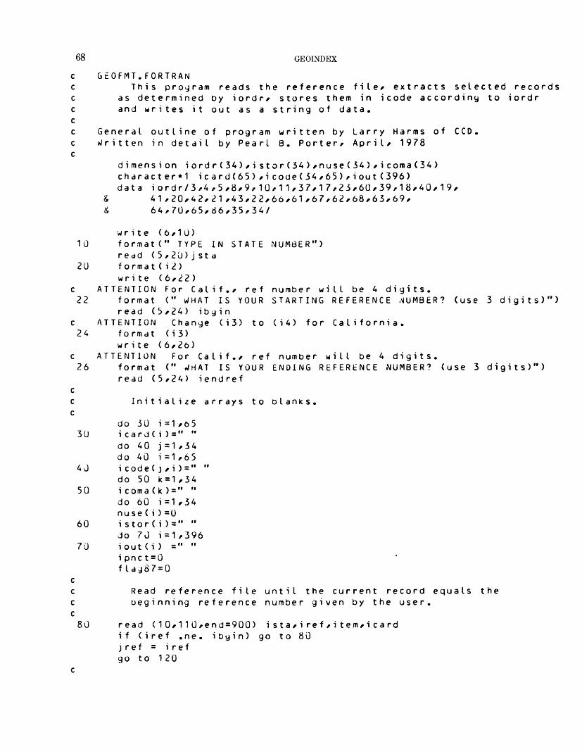
68 GEOINDEX
GEOFMT. FORTRANThis program reads the reference file/ extracts selected records
as determined by iordr/ stores them in icode according to iordr and writes it out as a string of data.
General outline of program written by Larry Harms of CCD. Written in detail by Pearl B. Porter/ April/ 1978
dimension iordr(34)/i stor(34)/nuse(34)/icoma(34)character*! icard(65) /i code(34/65)/iout (396)data iordr/3/4/5/8/9/10/11/37/17/23/60/39/18/40/19/
& 41 ,20/42/21 /43/22/66/61/67/62/ 68 /63/69/& 64/70/65/86/35/34/
10
20
22
24
26
30
40
50
60
70
80
STATE NUMBER")write (6/10)format(" TYPE INread ( 5/20) j st af orma t ( i 2 )write (6/22)
ATTENTION For Calif./ refformat (" WHAT IS YOURread (5/24) ibgin
ATTENTION Change (i3) tof o rmat ( i 3)write (6/26)
ATTENTION For Calif./ ref number will be 4 digitsformat (" WHAT IS YOUR ENDING REFERENCE NUMBER?read (5/24) iendref
number will be 4 digits. STARTING REFERENCE NUMBER? (use
(i4) for California.
3 digits)")
(use 3 digits)")
Initialize arrays to blanks
do 30 i=1/65 icard( i )=" " do 40 j=1/34 do 40 i=1/65 i code( j /i ) = " do 50 k=1/34 icoma(k)=" " do 60 i =1 /34 nu se ( i ) =0 i stor(i )=" " do 70 i=1/396 iout (i ) =" " i pnc t = 0 f I
Read reference file until the current record equals the beginning reference number given by the user.
read ( 1 O/ 1 1 0/end = 900) i s t a/ i re f / i t em/ i c a rd if (iref .ne. ibyin) go to 80 j ref = iref go to 120
APPENDIX C 69
c jref contains the reference number of the data being processed, c100 read(1J/110/end=155) ista/iref/item/icard
c ATTENTION For Calif./ change i3 to i4. 110 format(i2/i3/i2/65a1)
if (jref .ne. iref) go to 160 if (flag87 .eg. 87) go to 160
cc Does record contain an item code = to an item code in iordr c 120 do 130 i=1/34
if (item .eq. iordr(i)) go to 140 if (item .eq. 87) flag87 = 87
130 cont i nuego to 100
cc Load icode with icard as determined by iordr* store item in istor c and turn on nuse(i) which indicates there's data for this c particular it em. c140 do 150 j=1/65 150 icode(i / j) = icard(j)
i s tor(i ) = i t em nuse(i)=1 go to 100
c155 iend = 1
cc Check scales to determine how many commas will be needed c when written out to file11 (geofmt.data ) . c 160 do 170 i=13/31/2
if (nuse(i) .eq. 0) go to 170c If nuse(i) = O/ there's no data for this record,
i coma(i) = 1 kk = ii pnc t = i pnc t + 1
170 continue cc Store in isave the total numoer of characters and c significant spaces contained in the record, c
if (flag87 .eq. 87) go to 175 i start = 0
175 do 500 i=1/34 i save = 0if (nuse(i) .eq. 0) go to 50J do 180 j=1/o5if (icode(i/j) .eq. " ") go to 180 i save= j
180 cont i nue cc Check for scales and if there's more than one scale/ c insert commas after the scales.
70 GEOINDEX
Cif ((istor(i) .ge. 18 .and. istor(i) .le. 22) .or.
& (istorCi) .ge. 61 .and. istor(i) .le. 65)) go to 190go to 220
190 if (ipnct ,eq. 0) go to 220if (flag87 .eq. 87) go to 200 if (ipnct .eq. 1) go to 210
c200 if (icoma(i) .eq. 0) go to 220
i save = i save + 1 icode(i/isave)="/"
210 i pnc t = i pnct-1 cc If item d (year)/ put comma after the year, c220 if (istor(i) .ne. 8) go to 230
i s ave = isave+1 icode(i/isave)="/" go to 400
cc If the publisher has a period at end of field/ c two spaces must follow the period, c 230 if (istor(i) .ne. 17) go to 240
if (icode(i/isave) .eq. ".") isave=isave+1 go to 400
cc There must be 2 spaces after the series, c240 if (istor(i) .ne. 23) go to 245
if (istordl) .eq. 60) go to 245 i save = i save + 1 go to 400
c245 if (istor(i) .ne. 60) go to 250
i save = i save + 1 go to 400
cc When working with scales/ precede the scales with "1:" c 250 if ((istor(i) .ge. 18 .and. istor(i) .le. 22) ,or.
& (istor(i) .ge. 61 .and. istor(i) .le. 65)) go to 260go to 400
260 if (i .ne. xk) go to 270 i pnc t = 0if (flag87 .eq. 87) go to 270 i save = i save + 1 icode(i/isave)="."
270 iout(istart+1)= "1" iout(istart+2)= ":" i sta rt = i star t + 2 i korp = 0if (isave .le. 3)go to 400if (icode(i/isave) .eq. "/" .or. icooe(i/isave) .eq. ".*'
& ikorp=1
APPENDIX C 71
i thi = 3if ( i ko rp . eq.if (isave . ne.if ir = 2i sec = 3go to 330
1 )9)
i th i = 4go to 280
cc Depending on the size of the scale field/ there will be c from 1 to 3 moves to load the data in the output, c ithi (3rd load) will contain a 3 unless the last c position of the scale is a period or comma/ then it c will contain 4, isec (2nd) and ifir (1st) will c be loaded according to the number of digits in the c scales. A comma is loaded after ifir and isec. c 280 if (isave .ne. 8) go to 290
isec = 3ifir = 2if (ikorp .eq. 1) ifir = 1go to 330
c 29U if (isave .ne. 7) y o to 300
isec = 3ifir = 1if (ikorp .eq. 1) ifir = 0go to 330
c 300 if (isave .ne. 6) go to 310
ifir = 0isec = 3if (ikorp .eq. 1) isec = 2go to 330
c 310 if (isave .ne. 5) go to 320
ifir = 0isec = 2if (ikorp .eq. 1) isec = 1go to 330
c 320 ifir = 0
i sec = 1if (ikorp .eq. 1) isec = 0
cc Load the first (ifir) set of digits followed by comma, c 330 i pos = 1
i seemv = isecif (ifir .eq. 0) go to 350Jo 340 j j = i pos/ifiristart = istart-H
340 iout(istart)=icode(i/jj )iout(i start +1)="/"istart = istart-Hipos = i f i r+ 1isec = i sec + i f i r
72 GEOINDEX
Cc Load the second (isec) set of digits followed Dy comma, c350 if (isec .eq. U) go to 370
do 360 jj=ipos/isec is tart = istart+1
360 iout(istart) = icode(i/jj ) iout(istart+1)="/" istart = istart+1 i pos = i pos + i s ecmv ithi = i t h i + i s e c
cc Load third (ithi) set of digits, c 370 do 380 jj=ipos/ithi
istjrt = istart+1 380 iout(istart)=icode(i/jj)
90 to 425 cc Load iout with icode depending on isave. c400 do 420 j j = 1 /isave
istart = istart+1420 iout(istart) = icode(isjj) 425 if (i .eq. kk) istart = istart+1
cc If any data follows "Also other maps"/ c put 2 spaces after "Also other maps",
if (istor(i) .ne. 86) go to 430if ((istor(33) .eq. " ") .and. (istor(34) .eq. " ")) go to 450 istart = istart+1 go to 450
c 430 if (istor(i) .ne. 35) go to 450
if (istor(34) .eq. " ") go to 450 istart = istart+1
cc Increase istart by 1 so a space appears between records of data c 450 istart = istart+1
iout(istart) = " " 500 c ont i nue
cif (flag&7 .ne. 87) go to 525 if (jref .ne. iref) go to 510 if (iend .ne. 1) go to 565
510 istart = istart-1if (iout ( istart) .eq. "/") iout(istart) = "." if (iout (istart ) .ne. " ") go to 525 go to 510
c c c Write the string of data to file11 (geofmt.data)

APPENDIX C 73
AT550
560565
570
590
900905
1000
write (11/550) jref/(iout (i) * i = 1/istart) TENTION For Calif./ change i3 to iA. format(i3/". "396a1) i start = 0
iendref is the ending reference number given by the user if (jref .eq. iendref) go to 1000 if (iend .eq. 1) go to 1000
jref = iref
Initialize arrays before processing next reference.
do 560 i=1,396 iout(i) = " " do 570 j=1/3A do 570 i=1,65 icode(j/i) = " " do 590 i=1/3A icoma(i) - " " nuse(i) =0 i stor(i ) = " " cont i nue flag87 = 0 go to 120
write (6/905)format (" THE BEGINNING RECORD WAS NOT FOUND")
stopend
SUBROUTINE NAME: GEOFMT2.QEDX
Authors: Kevin W. Laurent, Larry C. Harms, and Pearl Porter
Purpose of the program: geofmt2.qedx formats the file geofmt.runout into alternating 4 and 3 columnar out put acceptable for use by the overlay command to create a columnarized output segment.
Data base: GeoindexComputer: Honeywell Series 60 (level 68)Operating system: MulticsCalling sequence: qx geofmt2 &1Arguments: &1-H contains the page length (84 or
140) and was passed from the exec_com, geofmt.ec.Subroutines called: NoneCommon data referenced: NoneInput files: geofmt.runoutOutput files: overlayl, overlay2, overlays, overlay4
Arrays used: None Called by: Executed by geofmt.ec Error checking and reporting: geofmt.ec Program logic:1. The initialization routine creates four segments:
overlayl to overlay4. A segment, geofmt.run out, is read into buffer, file. A special character is appended to the segment as an end of file indicator.
2. The loop macro will move a specified number of lines (determined by the page length argument when geofmt.ec was executed) into each of the four overlay segments. Then the specified number of lines are moved into overlayl, overlay2, and overlays. This loop alternates in moving data to all four segments, and then three segments, until the end of file indicator is read.
3. All four segments are written.4. Quit the text editor.
74 GEOINDEX
b(4col)$a\c\bC test)1*\c\b(args)m(input)b(inpu t)Or over Lay11/$w over lay 1\c\D(test)1*\c\b(args)m(input)b C i nput)Or overlay?1/$w overlay2\c\b(test)1*\c\b(args)m(input)b(i nput)Or overlays1/Sw overlay3\c\o(test)1*\c\b(args)m(input)b C input)Or ove r I ay41/$w overl ay4\c\b(3col)\fb(3col )$a\c\b(test)1/\c\b(args)m(input)b(inpu t)Or ove r I ay 11*$w over lay 1\c\b(test)1/\c\b(args)m(input)b(i nput)Or overl ay<21 f $w overlay2\c\bCtest)1/\c\b(args)m(input)b(input)Or overlays1*$w overl ay3\c\b(args)+1^$dU$s/".*$//Or overlay41 f $w ove r Iay4\c\b(4col)\fb( test)$ab(file)1s/"<:/t/q\fb Cargs )1s/\c
APPENDIX C 75
bOec r over lay(1 2 3 A)b(file)r geofmt•runoutia{\fbO\bUcol)
SUBROUTINE NAME: GEOFMT3.QEDXAuthors: Kevin W. Laurent, Larry C. Harms, and Pearl
Porter Purpose of the program: geofmtS.qedx formats
geofmt.runout into four files acceptable for use by theOVERLAY command to create a columnized outputsegment.
Data base: GeoindexComputer: Honeywell Series 60 (level 68) Operating system: Multics Calling sequence: qx geofmtS &1 Arguments: &1- Passed from the exec_com, geofmt.-
ec, and contains the page length (84 or 140) Subroutines called: None Common data referenced: None Input files: geofmt.runout Output files: overlay 1, overlay2, overlays, overlay4
Arrays used: NoneCalled by: Executed by geofmt.ecError checking and reporting: Located in geofmt.ecConstants: NoneProgram logic:1. The initialization routine creates four segments:
overlayl to overlay4. A segment, geofmt.runout, is read into buffer, file, and a special character {, a brace, which is made by depressing the shift key and left bracket key simultaneously, is appended as an EOF indicator.
2. The loop macro moves a predetermined number of lines (page length argument used in geofmt.ec) first to overlayl, over I ay2, and so forth, until the end of file indicator is read.
3. Write the four output segments.4. Quit the text editor.
b (loop)$a\c\b(test )1*\c\b(arcjs)m( input)b ( i npu t)Or overlayl1 * $w overlayl\c\b<test>1*\c\b(args)m(input)b ( i npu t)Or ove rIay21 * $w over lay 2\c\b(test)1*\c\b(args)m(input)b ( input)Or overt ay31 * $w overlay3\c\b(test)1*\c\o(arjs)m(input)b (input)Or ove rIayA1 f $w overt ayA\c\b(toop)\f
76 GEOINDEX
bCtest )$ab(fi le)1s/"</{/q\fb(arjs ) 1s/\c
bOecr overt ay(1 2 3 4)b( fi le)r -jeof m t. runout$aUfbO\b(loop)
SUBROUTINE NAME: GEOFMTA.QEDX
Authors: Kevin Laurent and Pearl PorterPurpose of the program: geofmta.qedx, an edit routine,
creates a RUNOFF segment using the file geofmt.-data, which was created during the execution ofgeofmt.
Data base: GeoindexComputer: Honeywell Series 60 (level 68) Operating system: Multics Calling sequence: qx geofmta &1 &2 Arguments:
&1 -It contains the page length (usually 84 or 140) and was passed from geof mt.ec.
&2-lt contains the number of lines needed at the bottom of the page to type a complete reference and was passed from geof mt.ec.
Subroutines called: None Common data referenced: None Input files: geofm t. da ta Output files: geofmt.runoff Arrays used: None Called by: geof mt.ecError checking and reporting: Located in geofmt.ec Constants: None Program logic: 1. This qedx routine is executed if the third argument
of geof mt.ec is nbipp. It is very similar to geofmt.qedx, except the .UN and .IN commands for RUNOFF were increased to allow for proportional-space printing. The line length was in creased from 30 to 42.
2. The two arguments used when executing geof mt.ec are read into a buffer called args, and the first argument (which is the page length) is moved to a buffer called lines. The second argument (number of lines needed at the bottom of the page for prin ting a complete reference) is moved to a buffer call ed need. These two arguments are used with .PL and .NE respectively as RUNOFF commands.
3. The initialization routine puts RUNOFF commands into buffer 0.
4. Segment geofmt.data is read into a buffer called file.
5. A special character {, a brace, which is made by depressing the shift key and left bracket key simultaneously, is appended to the end of geofmt.data as an end-of-file indicator.
6. The RUNOFF commands, and one line of data at a time is moved a from buffer file to buffer 0.
1. Step 6 is repeated until the special end-of-file in dicator is detected, at which time it is deleted.
8. Write geofmt.runoff.9. Exit from text editor.
b C ma i n )Sab(fi le)1m(i nput)bO$a. un 11.ne \c\o(need)
APPENDIX C 77
\ c \b ( i nput ) \c\f
w geof mt . runo f fq\fb ( loop )$a\ c \b (ma i n )\c\b( loop)\fb ( args )1 m ( I i nes )1 m (need)b( lines)1s/\c//b (need )1s/\c
bOSa• Pi. II.ma. na. i n\fb(fi le)r 9 e o f m t$a<\fbOVb(loop)
\bUines)420
11
data
SUBROUTINE NAME: EMBED_TABS
Author: Kevin LaurentPurpose of the program: embecLtabs, a PL/1 program,
embeds tab commands between the columns of the filegeofmtcolumns to produce a columnar proportionalspaced printout.
Data base: Geoindex Computer: Honeywell Series 60 (level 68) Operating system: Multics Calling sequence: embed__tabs &1 Arguments: &1 -It contains the page length (usually 84
or 140) and is passed from geofmt.ec. Subroutines called: None Common data referenced: None Input files: overlay 1, overlay2, overlays, overlay4 Output files: geofmtcolumns Arrays used: None Called by: None Error checking and reporting: If an error occurs the
error code is passed to the command processor, and aMultics system message is printed.
Constants: None Program logic:1. The program asks for the number of columns and the
column width.2. Tab positions are calculated depending on the column
width given by the user.3. The program writes a SET command to geofmt.col-
umns to be used by the NBI. Left margin is set to 1; top margin is set to 0; a code, J-1, is passed that specifies proportional spaced printing; line length is set to 132; page length and text length are set ac cording to the first argument given when ex ecuting geofmt.ec.
4. The four overlay segments are concatenated and written to geofmtcolumns.
5. If an entire line is blank, only the first tab will be written, in order to act as a line feed.
6. Files are closed and detached.

78 GEOINDEX
embed_tabs: et: proc (page_len); /* embed \ctab commands in nbi proportional spaced printer stream */
/* Written by KLaurent,USGS,CCD,BSAP 6/27/78 */
/* The embed__tabs program accepts input from the overlay files and ad \ cds
the embedded commands between line segments to tab the columns. */
del page_len char (*); /* page 1\cength parameter */del ioa_$ioa_switch entry options (variable); /* for wr\citing our concatenated lines to geofmt. columns */del iox_$attach_name entry (char (*), ptr, char (*), ptr, fixed bin\c(35)>; /* for all attachments */del iox_$open entry (ptr, fixed bin, bit (1) aligned, fixed bin (35)\c);del iox_$get_line entry (ptr, ptr, fixed bin (21), fixed bin (21), f\cixed bin (35) ) ;del iox_$close entry (ptr, fixed bin (35));del iox_$detach_iocb entry (ptr, fixed bin (35));del com_err_ entry options (variable); /* com_er\cr_ will interpret all the errors and print a standard message */del error_table_$end_of_info external fixed bin (35); /* use fo\cr end of file check */del command_query_ entry options (variable); /* use to\c ask for ncols and col_width */del continue_to_signal_ entry (fixed bin (35)); /* use to\c pass along the error code to the command processor */
del 1 query__info, /* for pa \cssing info to command_query_ */
2 vers fixed bin init (2), /* versio \cn of structure */
2 yes_or_no_sw bit (1) unal init ("0"b),2 suppress_name bit (1) unal init ("0"b),2 status_code fixed bin (35) init (0), /* not us
\ced here */2 query_code fixed bin (35) init (0); /* not us
\ced here */
del answer char (256) var ; /* answer\c returned from command_query_ */del query_info_ptr pointer; /*usedf\cor command_query_ */del (ncols, col_width) fixed bin; /* number\c of columns; column width */
/* Retrieve number of columns and column width */
query_info_ptr = addr (query_info);call command_query_ (query_info_ptr, answer, "embed_tabs",
\c"Enter number of columns:");ncols = answer; /* conver
\ct to internal format */
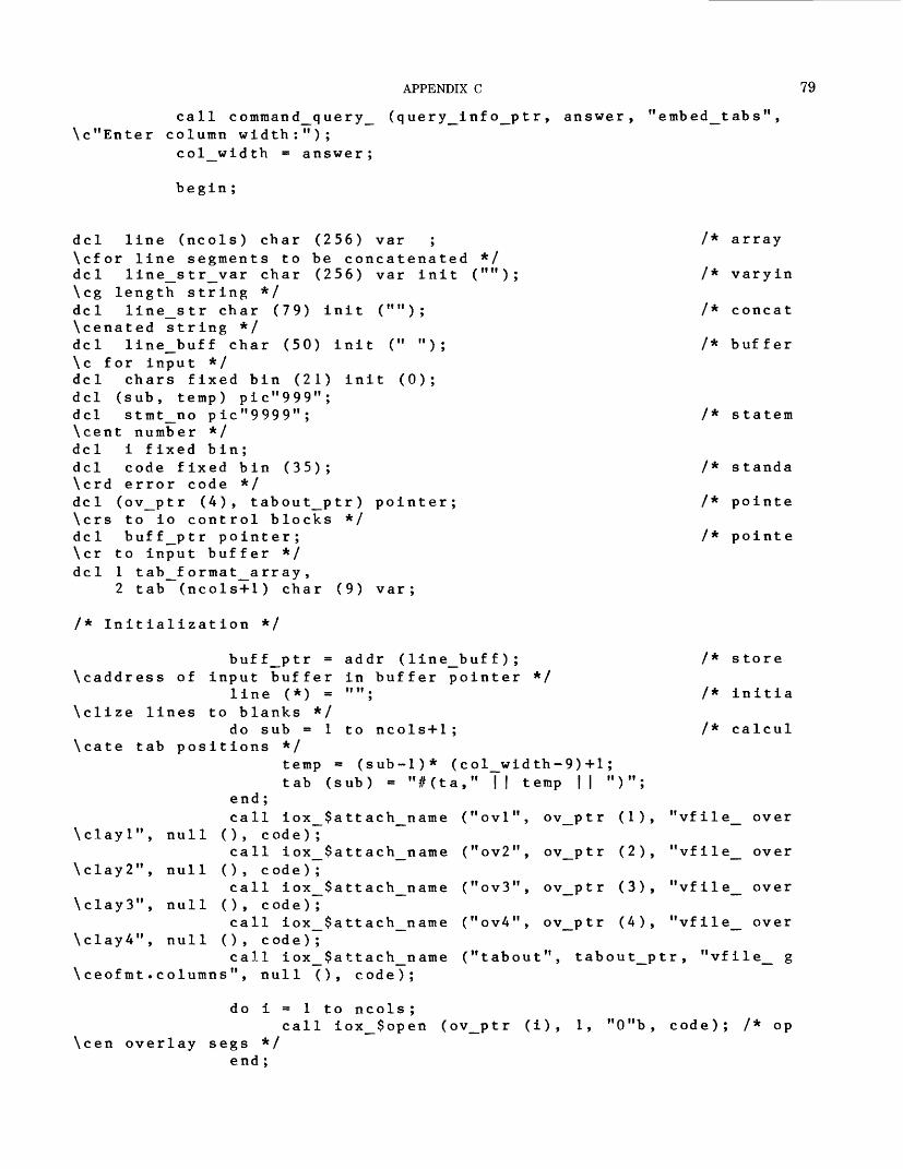
APPENDIX C
ca
ArrrjiNjjiA \^,
11 command_query_ (query_Info_ptr, answer, "embed_tabs", umn width:");
79
^— U. .*-_•- W V/ 111 «* t* i.& VI VJ U
\c"Enter column width:");col_width = answer;
begin;
del line (ncols) char (256) var ; /* array\cfor line segments to be concatenated */del line_str_var char (256) var init (""); /* varyin\cg length string */del line_str char (79) init (""); /* concat\cenated string */del line_buff char (50) init (" "); /* buffer\c for input */del chars fixed bin (21) init (0);del (sub, temp) pic"999";del stmt_no pic"9999"; /* statem\cent number */del i fixed bin;del code fixed bin (35); /* standa\crd error code */del (ov_ptr (4), tabout_ptr) pointer; /* pointe\crs to io control blocks */del buff_ptr pointer; /* pointe\cr to input buffer */del 1 tab_f ormat_array,
2 tab (ncols+1) char (9) var;
/* Initialization */
buff_ptr = addr (line_buff); /* store \caddress of input buffer in buffer pointer */
line (*) = ""; /* initia \clize lines to blanks */
do sub = 1 to ncols+1; /* calcul \cate tab positions */
temp = (sub-1)* (col_width-9)+1; tab (sub) = "#(ta," || temp || ")";
end;call iox_$attach_name ("ovl", ov_ptr (1), "vfile_ over
\clayl", null (), code);call iox_$attach_name ("ov2", ov_ptr (2), "vfile_ over
\clay2", null (), code);call iox_$attach_name ("ov3", ov_ptr (3), "vfile_ over
\clay3", null (), code);call iox_$attach_name ("ov4", ov_ptr (4), "vfile_ over
\clay4", null (), code);call iox_$attach_name ("tabout", tabout_ptr, "vfile_ g
\ceofmt.columns", null (), code);
do i = 1 to ncols ;call iox_$open (ov_ptr (i), 1, "0"b, code); /* op
\cen overlay segs */ end ;

80 GEOINDEX
call iox_$open (t about_p tr, 2, "O lf b, code); call ioa_$ioa_switch (tabout_ptr, "F 0001 #(se ml,tO,j
\c-l, 11 32 , p~a ,x~a ) " , page__len, page_len, code); /* set margins & prop \c print */
do stmt_no = 2 to 9999; /* do unt \cil endfile */
do i - 1 to ncols;call iox_$get_line (ov_ptr (i), buff_ptr, 50
\c, chars, code) ;if ((code = error_table_$end_of_info) & (i =
\c 1)) then goto endup;line (i) = substr (line__buff, 1, max (chars-
\cl, 0)); /* move input line to hold area */end ;if ((line (1) = "") & (line (2) = "") & (line (3)
\c = "") & (line (4) = ""))then do;
line_str_var = "F " | | stmt_no | | " " | | tab \c (1);
line_str = line_str_var; /* move v \carying length string to non-varying string */
call ioa_$ioa_switch (tabout_ptr, line_str, \c code ) ;
end; else do;
do i = 1 to ncols;
if i = 1then line_str_var - "F " || stmt_no ||
\c" " || tab (i) || line (i) || "//(EX)";else if i = ncolsthen line_str_var = "F " || stmt_no ||
\c"+" || tab (i) || line (i);else line_str_var = "F " || stmt_no ||
\c"+" || tab (i) || line (i) || "//(EX)";line_str = line_str_var; /* move v
\carying length string to non_varying string */call ioa_$ioa_switch (tabout_ptr, line_
\cstr, code);end ;
end ; end;
endup :do i = 1 to ncols ;
call iox_$close (ov_ptr (i), code); call iox_$detach_iocb (ov_ptr (i), code);
end;call iox_$close (tabout_ptr, code); call iox_$detach_iocb (tabout_ptr, code);
end; /* end be \cgin block */
end embed_tabs;
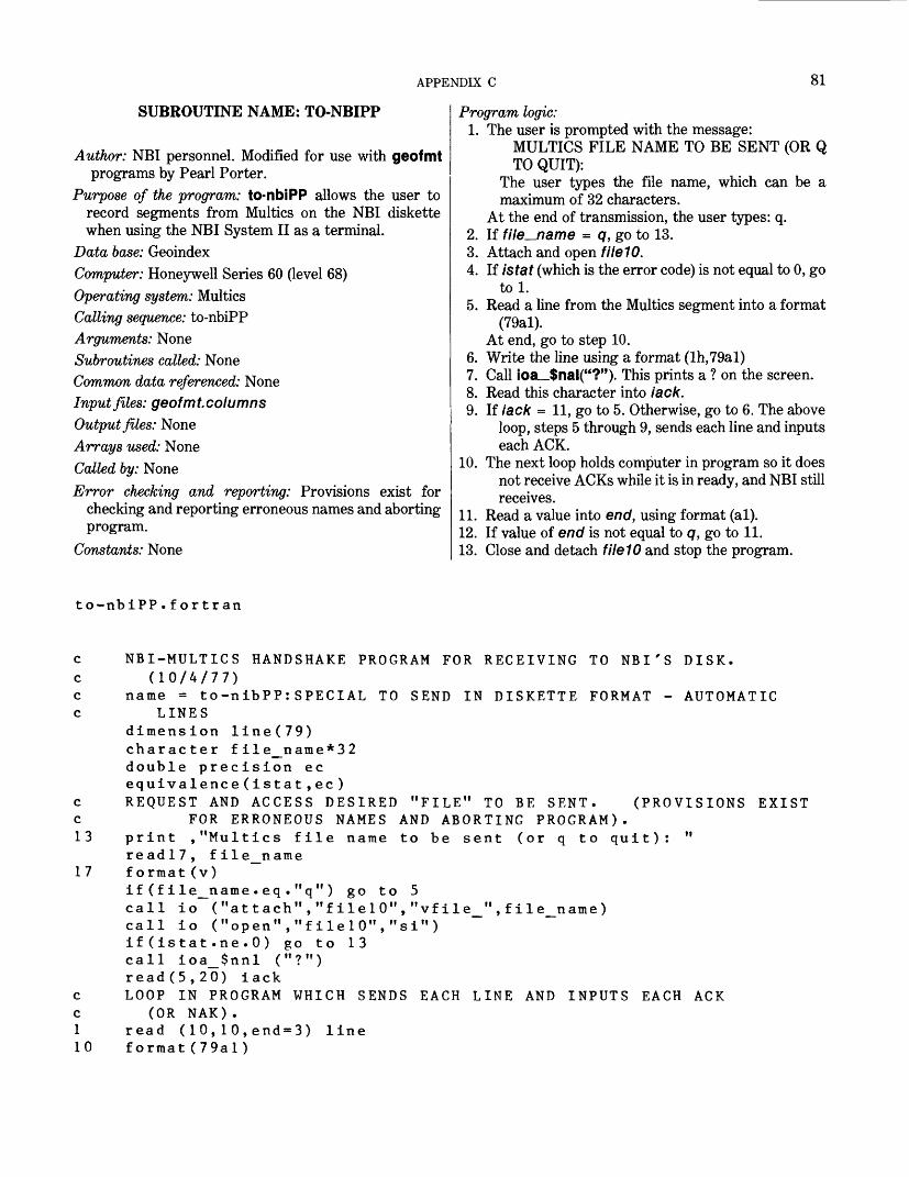
APPENDIX C 81
SUBROUTINE NAME: TO-NBIPP
Author: NBI personnel. Modified for use with geofmt programs by Pearl Porter.
Purpose of the program: to-nbiPP allows the user to record segments from Multics on the NBI diskette when using the NBI System II as a terminal.
Data base: GeoindexComputer: Honeywell Series 60 (level 68)Operating system: MulticsCalling sequence: to-nbiPPArguments: NoneSubroutines called: NoneCommon data referenced: NoneInput files: geofmt.columnsOutput files: NoneArrays used: NoneCalled by: NoneError checking and reporting: Provisions exist for
checking and reporting erroneous names and aborting program.
Constants: None
Program logic:1. The user is prompted with the message:
MULTICS FILE NAME TO BE SENT (OR Q TO QUIT):
The user types the file name, which can be a maximum of 32 characters.
At the end of transmission, the user types: q.2. If file^name = q, go to 13.3. Attach and open fileW.4. If istat (which is the error code) is not equal to 0, go
tol.5. Read a line from the Multics segment into a format
(79al). At end, go to step 10.
6. Write the line using a format (lh,79al)7. Call ioa_$nal("?"). This prints a ? on the screen.8. Read this character into lack.9. If lack = 11, go to 5. Otherwise, go to 6. The above
loop, steps 5 through 9, sends each line and inputs each ACK.
10. The next loop holds computer in program so it does not receive ACKs while it is in ready, and NBI still receives.
11. Read a value into end, using format (al).12. If value of end is not equal to q, go to 11.13. Close and detach fileW and stop the program.
to-nbiPP.fortran
(PROVISIONS EXIST
c NBI-MULTICS HANDSHAKE PROGRAM FOR RECEIVING TO NBI'S DISK.c (10/4/77)c name = to-nibPP:SPECIAL TO SEND IN DISKETTE FORMAT - AUTOMATICc LINES
dimension line(79)character file_name*32double precision ecequivalence(istat,ec)
c REQUEST AND ACCESS DESIRED "FILE" TO BE SENT, c FOR ERRONEOUS NAMES AND ABORTING PROGRAM). 13 print ,"Multics file name to be sent (or q to quit):
read!7, file_name 1 7 format(v)
if(file_name.eq."q") go to 5call io ( If attach","filel0","vfile_ n ,file_name)call io ("open","filelO","si")if (istat.ne.O) go to 13call ioa_$nnl ("?")read(5,20) iack
c LOOP IN PROGRAM WHICH SENDS EACH LINE AND INPUTS EACH c (OR NAK). 1 read ( 10,10,end-3) line 10 format(79al)
ACK
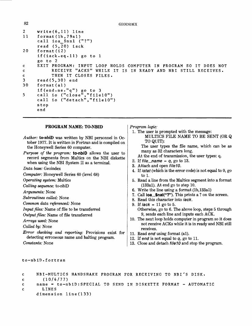
82 GEOINDEX
2 write(6,ll) line 11 format(lh,79al)
call ioa_$nnl ("?")read (5,20) lack
20 format(i2)if ( lack.eq.11) go togo to 2
c EXIT PROGRAM: INPUT c RECEIVE "ACKS" c THEN IT CLOSES 3 read(5,30) end 30 format(al)
if (end.ne."q") go to 3 5 call io ("close","fllelO")
call io ("detach","filelO")s topend
LOOP HOLDS COMPUTER IN PROGRAM SO IT DOES NOT WHILE IT IS IN READY AND NBI STILL RECEIVES. FILES .
PROGRAM NAME: TO-NBID
Author: to-nbiD was written by NBI personnel in Oc tober 1977. It is written in Fortran and is compiled on the Honeywell Series 60 computer.
Purpose of the program: to-nbiD allows the user to record segments from Multics on the NBI diskette when using the NBI System II as a terminal.
Data base: GeoindexComputer: Honeywell Series 60 (level 68)Operating system: MulticsCalling sequence: to-nbiDArguments: NoneSubroutines called: NoneCommon data referenced: NoneInput files: Name of file to be transferredOutput files: Name of file transferredArrays used: NoneCalled by: NoneError checking and reporting: Provisions exist for
detecting erroneous name and halting program. Constants: None
Program logic:1. The user is prompted with the message:
MULTICS FILE NAME TO BE SENT (OR Q TO QUIT):
The user types the file name, which can be as many as 32 characters long.
At the end of transmission, the user types: q.2. If file_name - q, go to 13.3. Attach and open filelO.4. If istat (which is the error code) is not equal to 0, go
tol.5. Read a line from the Multics segment into a format
(133al). At end go to step 10.6. Write the line using a format (lh,133al)7. Call ioa_$nal("?"). This prints a ? on the screen.8. Read this character into lack.9. If lack = 11 go to 5.
Otherwise, go to 6. The above loop, steps 5 through 9, sends each line and inputs each ACK.
10. The next loop holds computer in program so it does not receive ACKs while it is in ready and NBI still receives.
11. Read end using format (al).12. If end is not equal to q, go to 11.13. Close and detach filelO and stop the program.
to-nbiD.fort ran
c NBI-MULTICS HANDSHAKE PROGRAM FOR RECEIVING TO NBI'S DISK, c (10/4/77)c name = to-nbiD:SPECIAL TO SEND IN DISKETTE FORMAT - AUTOMATIC c LINES
dimension line(133)
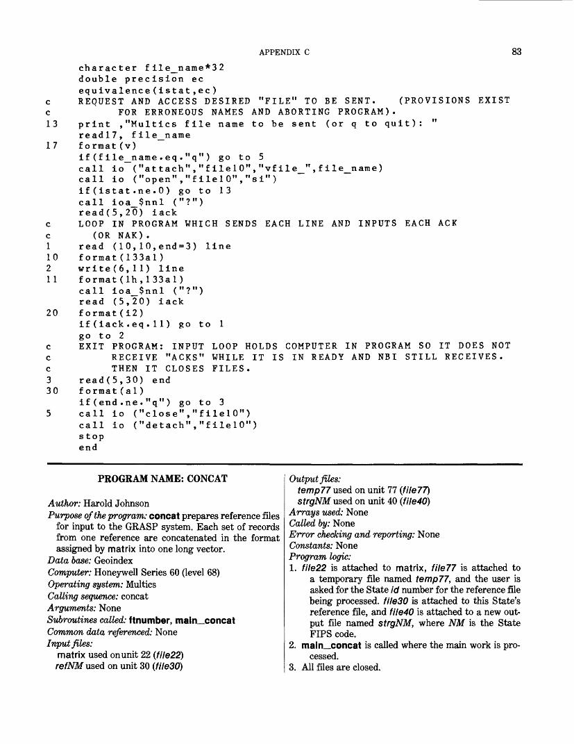
APPENDIX C 83
character file_name*32double precision ecequivalence(istat,ec)
c REQUEST AND ACCESS DESIRED "FILE" TO BE SENT. (PROVISIONS EXIST c FOR ERRONEOUS NAMES AND ABORTING PROGRAM). 13 print ,"Multics file name to be sent (or q to quit): "
readl?, file_name 1 7 format(v)
if(file_name.eq."q") go to 5call io ("attach","filelO","vfile_",file_name)call io ("open","filelO","si")if (istat.ne.O) go to 13call ioa_$nnl ("?")read(5,20) iack
c LOOP IN PROGRAM WHICH SENDS EACH LINE AND INPUTS EACH ACK c (OR NAK).I read (10,10,end-3) line10 format(133al)2 write(6,ll) lineII format(lh,133al)
call ioa_$nnl ("?")read (5,20) iack
20 format(i2)if (iack . eq . 1 1 ) go to 1go to 2
c EXIT PROGRAM: INPUT LOOP HOLDS COMPUTER IN PROGRAM SO IT DOES NOT c RECEIVE "ACKS" WHILE IT IS IN READY AND NBI STILL RECEIVES, c THEN IT CLOSES FILES. 3 read(5,30) end 30 format(al)
if(end.ne."q") go to 3 5 call io ("close","filelO")
call io ("detach","filelO")stopend
PROGRAM NAME: CONCAT
Author: Harold JohnsonPurpose of the program: concat prepares reference files
for input to the GRASP system. Each set of records from one reference are concatenated in the format assigned by matrix into one long vector.
Data base: GeoindexComputer: Honeywell Series 60 (level 68)Operating system: MulticsCalling sequence: concatArguments: NoneSubroutines called: ftnumber, main_concatCommon data referenced: NoneInput files:
matrix used onunit 22 (file22) refNM used on unit 30 (file30)
Output files:temp77 used on unit 77 (file??)strgNM used on unit 40 (file40)
Arrays used: None Called by: NoneError checking and reporting: None Constants: None Program logic:1. file22 is attached to matrix, file?? is attached to
a temporary file named temp??, and the user is asked for the State id number for the reference file being processed. file30 is attached to this State's reference file, and file40 is attached to a new out put file named strgNM, where NM is the State FIPS code.
2. main__concat is called where the main work is pro cessed.
3. All files are closed.
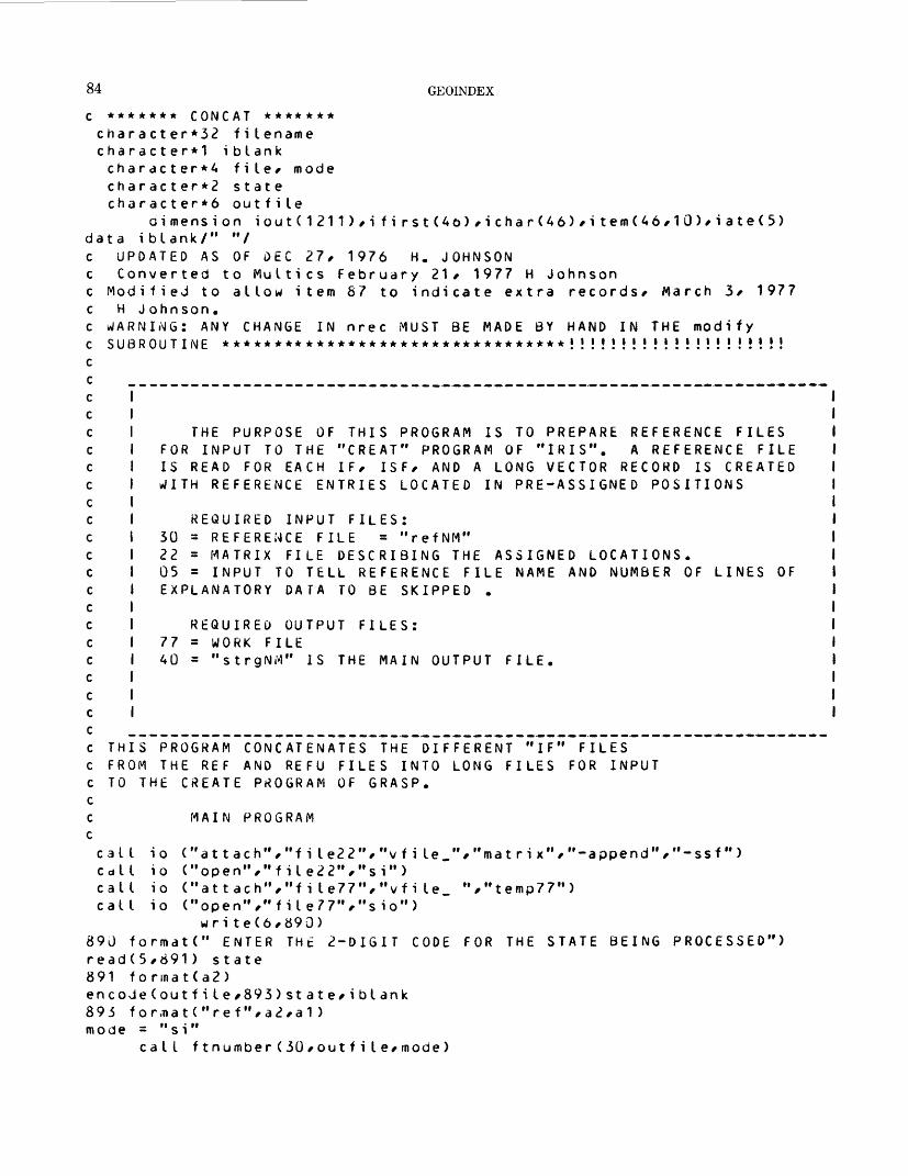
84 GEOINDEX
c ******* CONCAT ******* character*32 filename character*1 iblank character*^ file/ mode character*2 state character*6 outfile
dimension iout(1211),i first(46),ichar(46),item(46,10),iate(5) data iblank/" "/ c UPDATED AS OF DEC 27, 1976 H, JOHNSON
Converted to Multics February 21, 1977 H Johnson Modified to allow item 87 to indicate extra records, MaH J ohnson.
WARNING: ANY CHANGE IN nrec MUST BE MADE BY HAND IN THE SUBROUTINE *********************************! ' J ' ! * • J ' J
rch 3, 1977
mod i fy i i i i i i i i i i
THE PURPOSE OF THIS PROGRAM IS TO PREPARE REFER FOR INPUT TO THE "CREAT" PROGRAM OF "IRIS". A REF IS READ FOR EACH IF, ISF, AND A LONG VECTOR RECORD WITH REFERENCE ENTRIES LOCATED IN PRE-ASSIGNED POS
ENCE FILES ERENCE FILE IS CREATED
ITIONS
REQUIRED INPUT FILES: 30 = REFERENCE FILE = "refNM"22 = MATRIX FILE DESCRIBING THE ASSIGNED LOCATIONS. 05 = INPUT TO TELL REFERENCE FILE NAME AND NUMBER OF LINES OF EXPLANATORY DATA TO BE SKIPPED .
REQUIRED OUTPUT FILES: 77 = WORK FILE 40 = "strgNi-J" IS THE MAIN OUTPUT FILE.
THIS PROGRAM CONCATENATES THE DIFFERENT "IF" FILES FROM THE REF AND REFU FILES INTO LONG FILES FOR INPUT TO THE CREATE PROGRAM OF GRASP.
MAIN PROGRAM
FOR THE STATE BEING PROCESSED")
call io ("attach","fiIe22","vfile_","matrix","-append", call io ("open","file22","si")call io ("attach","fiIe77","vfi le. ","temp77") call io ("open","fiIe77","sio" )
wri te(6,890)890 format(" ENTER THt 2-DIGIT CODE read(5,891 ) state891 format(a2)encodeCoutfile,893)state,iblank
mode = "si"call ftnumber(30,outfiIe,mode)
-ssf")
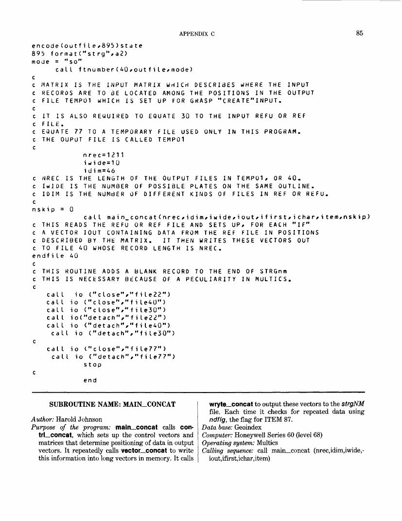
APPENDIX C 85
encodeCoutfi le/89!>)state 895 f ormatC'st rg",a2) mode = "so"
call ftnumberC40/outfiIe/mode)
MATRIX IS THE INPUT MATRIX WHICH DESCRIBES WHERE THE INPUT RECORDS ARE TO 3E LOCATED AMONG THE POSITIONS IN THE OUTPUT FILE TEMP01 WHICH IS SET UP FOR GKASP "CREATE"INPUT.
IT IS ALSO REQUIRED TO EQUATE 30 TO THE INPUT REFU OR REFFILE.EQUATE 77 TO A TEMPORARY FILE USEDTHE OUPUT FILE IS CALLED TEMP01
ONLY IN THIS PROGRAM.
nrec=1211i wi de = 10i d i m = 46
NREC IS THE LENGTH OF THE OUTPUT FILES IwIDE IS THE NUMBER OF POSSIBLE PLATES IDIM IS THE NUMBER OF DIFFERENT KINDS
TEMP01, OR 40. THE SAME OUTLINE.
FILES IN REF OR REFU.
C NREC IS THE LENGTH OF THE OUTPUT FILES INC IwIDE IS THE NUMBER OF POSSIBLE PLATES ONC IDIM IS THE NUMBER OF DIFFERENT KINDS OFcnsk i p = 0
call main_concat(nrec/idifn/iwide/iout*ifirst/ichar/item,nskip) c THIS READS THE REFU OR REF FILE AND SETS UP* FOR EACH "If" c A VECTOR IOUT CONTAINING DATA FROM THE REF FILE IN POSITIONS c DESCRIBED BY THE MATRIX. IT THEN WRITES THESE VECTORS OUT c TO FILE 40 WHOSE RECORD LENGTH IS NREC. endfile 40 cc THIS ROUTINE ADDS c THIS IS NECESSARY
A BLANK RECORD TO THE END OF STRGnm BECAUSE OF A PECULIARITY IN MULTICS.
call io ("close","file22") call io ("close","file40") call io ("close","ti Ie30"> calI io("detach","fi Ie22") call io ("detach","fiIe40") call io ("detach","fiIe30")
call io C"close","fi Ie77"> call io ("detach","file77")
stop
end
SUBROUTINE NAME: MAIN_CONCAT
Author: Harold JohnsonPurpose of the program: main_concat calls con-
trLconcat, which sets up the control vectors and matrices that determine positioning of data in output vectors. It repeatedly calls vector_concat to write this information into long vectors in memory. It calls
wryte_concat to output these vectors to the strgNMfile. Each time it checks for repeated data usingndflg, the flag for ITEM 87.
Data base: GeoindexComputer: Honeywell Series 60 (level 68) Operating system: Multics Calling sequence: call main_concat (nrec,idim,iwide,-
iout,ifirst,ichar,item)

86 GEOINDEX
Arguments:wee-The length of the output vectors idim - The number of different kinds of items - that is,
the number of rows in matrix iwide-The maximum number of different items
associated with a single row of matrix iout-The output vector of length nrec ifirst-The control vector of length idim whose /rth en
try is the starting position in iout of data associated with the name in the kth row of matrix
ichar-The control vector of length idim whose kth entry is the number of allowable characters for data associated with the name of the kth row of matrix
item-The control matrix of dimension idim by 10 ofitem numbers occurring in matrix
Subroutines called: contrLconcat, vector_concat,wry te__co neat, modify_concat
Common data referenced: None Input files: None Output files: None Arrays used: None
Called by: concatError checking and reporting: The user is informed:
YOU GOT TO MAINNumber of records written to strgNM is counted, and the user is informed every 25th record because, during the long interactive running of this program, the user may become anxious about loops and long CPU time.
Constants: NoneProgram logic:1. Subroutine contrLconcat is called to set up the con
trol matrices idim, ichar, and item.2. Subroutine vector_concat is called to set up the out
put vector for one reference.3. wryte_concat is called to output that vector.4. When an ITEM 87 is found, indicating repeated data,
modify_concat is called to modify the previous output vector according to the data that come after ITEM 87.
5. The count of output vectors is incremented and a message written each time the count equals a multiple of 25.
subroutine main_concat(nrec,idim,iwide,iout,ifirst,ichar, \citem, & nskip)c subroutine used in main program "concat" c updated as of dec. 27, 1976 h. Johnson c converted to multics february 27, 1977 h Johnson
dimension iout(nrec),ifirst(idim),ichar(idim),ifile(60)dimension itern(idim,10)write(6,9100)
9100 format(" you got to main") c
call contrl_concat(idim,ifirst,ichar,item) this sets up the control matrix to run this subroutine, item(line,kolumn) is the item number in refu. ifirst(line) is the starting position in the output file for the item.ichar(line) is the number of positions for itern(line,kolumn) in the outfile.
kount= 1c1 call vector_concat(nrec,idim,iout,ndflg,iwide,ichar,ifirst,item,kf\clg)c this reads through one "if" file in refu. for those itemsc in kolumn=l, it sets up a vector iout(nrec) which is to be the
first output for this "if", it writes the other cards having item with kolumn .gt. 1 into a file 77 which will be read repeatedly to produce new vectors iout. kflg = the number of cards written to 77. ndflag = 1 when end of file 30 is reached.

APPENDIX C 87
call wryte_concat(lout,nrec,item,idim,iwide,kflg, ichar,ifirst)this writes the iout received from vector to the output file, 40. it then reads through file 77 using the kolumn =2 to change iout, writes this new iout vector, then goes to kolumn = 2,3, . . .
if(ndflg .ne. -1) go to 5call modify_concat(iout,nrec,item,idim,iwide,kflg,ichar,ifirst,ndfl
\cg) cc this routine reads throught records which follow item = 87 until
the next item = 87 is encountered. it modifies iout only in those records which it finds in file 30 between these two items 87 and then writes the resulting vector and proceeds to modify until it senses a new "if".
continuekount=kount+lif (25*(kount/25) .It.write(6,9110)kount
9110 format(" you wrote the 10 if(ndflg .eq. l)return
go to 1 c
end
kount) go to 10
",i5,"th vector to the strg file")
SUBROUTINE NAME: ALTER_CONCATAuthor: Harold JohnsonPurpose of the program: alter_concat modifies the out
put vector when more than one item occurs associated with the same name classification. Those data have been written to file77, and alter_concat processes them.
Data base: GeoindexComputer: Honeywell Series 60 (level 68)Operating system: MulticsCalling sequence: call alter_concat (iout,nrec,item,idim,-
kolumn, mstop, ichar, ifirst)Arguments:
iout, nrec, item, idim, ichar, ifirst-See main_con-cat.
kolumn-An assigned column of item, which is to determine what data will be used to modify iout
Subroutines called: locate__concatCommon data referenced: NoneInput files: NoneOutput files: NoneArrays used: iout(nrec), ichar(idim), ifirst(idim),
ifile(60)Called by: wryte_concat Error checking and reporting: None Constants: None Program logic:1. mstop is set to 0.2. file77 is read, and id is compared with those in col
umn number kolumn in item. If a match is found, mstop is set to 1, iout is modified
according to the data in this record of file77, and the reading is repeated.
3. If no match is found, the next record in file77 is read.
c ******* SUBKOUTINE ALTER_CONCAT *******subrout ine a lter_concat(iout/nrec/i tern/i dim*kolumn*mstop/
i cha r* \ f i rs t)c SUBROUTINE USED IN MAIN PROGRAM "CONCAT" c UPDATED AS OF DEC. 17, 1976 H. JOHNSON c Converted to Multics FEBRUARY 18* 1977 H. Johnson
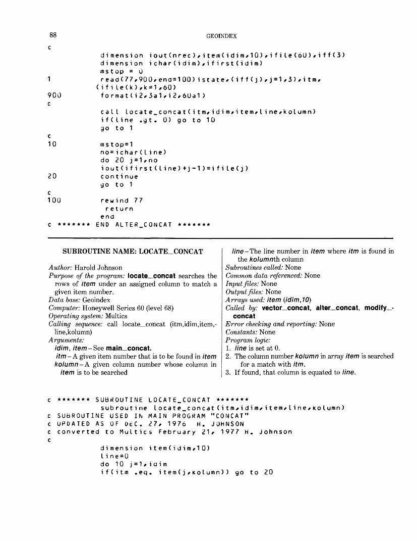
88 GEOINDEX
1
900 c
c 10
20
c100
dimension iout(nrec)/item(idim/10)/ifil.e(6U)/i ff(3) dimension ichar(idim)/ifirst(idim) ms t op = 0read(77,900,end=100)istate/(iff(j)/j=1/3)/itro,
(i fi le(k),k=1,60) format(i2/3a1/i2/6Ua1)
cal I locate_concat(i tm/idim/i tern* Ii ne/kolumn) i f( I i ne .9 t. 0) go to 10 go to 1
ms top=1no= ichar(line)do 20 j = 1/noiout(ifirst<line)+j-1)=ifile(j)con t i nuego to 1
rewind 77return
endC ******* END ALTER_CONCAT *******
SUBROUTINE NAME: LOCATE_CONCAT
Author: Harold JohnsonPurpose of the program: locate_concat searches the
rows of item under an assigned column to match agiven item number.
Data base: GeoindexComputer: Honeywell Series 60 (level 68) Operating system: Multics Calling sequence: call locate_concat (itm,idim,item,-
line,kolumn) Arguments:
idim, item-See main concat.itm -A given item number that is to be found in itemkolumn-A given column number whose column in
item is to be searched
I ine-The line number in item where itm is found inthe kolumnth column
Subroutines called: None Common data referenced: None Input files: None Output files: None Arrays used: item (idim,10) Called by: vector_concat, alter concat, modify_-
concatError checking and reporting: None Constants: None Program logic:1. line is set at 0.2. The column number kolumn in array item is searched
for a match with itm.3. If found, that column is equated to line.
******* SUBROUTINE LOCATE.CONCAT *******subroutine locate_concat(i tm*idim*item*line/kolumn)
SUBROUTINE USED IN MAIN PROGRAM "CONCAT" UPDATED AS OF DtC. 27, 1976 H. JOHNSON converted to Multics February 21, 1977 H. Johnson
dimension item(idim/10)line=0do 10 j =1 * i a i mif(itm .eq. item(j * KOIumn)) go to 20
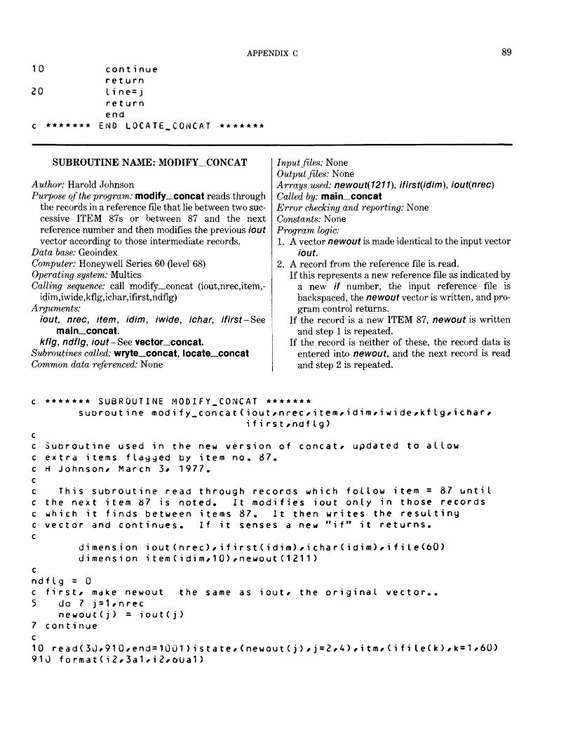
APPENDIX C 89
10
20
cont i nue return I i ne= j return end
EiMD LOCATE. CON CAT *******
SUBROUTINE NAME: MODIFY_CONCAT
Author: Harold JohnsonPurpose of the program: modify_concat reads through
the records in a reference file that lie between two suc cessive ITEM 87s or between 87 and the next reference number and then modifies the previous iout vector according to those intermediate records.
Data base: GeoindexComputer: Honeywell Series 60 (level 68)Operating system: MulticsCalling sequence: call modify_concat (iout, nrec, item, -
idim ,iwide ,kflg, ichar, ifir st, ndflg)Arguments:
iout, nrec, item, idim, iwide, ichar, ifirst-Seemain concat.
kflg, ndflg, iout-See vector concat.Subroutines called: wryte_concat, locate concatCommon data referenced: None
Input files: NoneOutput files: NoneArrays used: newout(1211), ifirst(idim), iout(nrec)Called by: main_concatError checking and reporting: NoneConstants: NoneProgram logic:1. A vector newout is made identical to the input vector
iout.2. A record from the reference file is read.
If this represents a new reference file as indicated by a new if number, the input reference file is backspaced, the newout vector is written, and pro gram control returns.
If the record is a new ITEM 87, newout is written and step 1 is repeated.
If the record is neither of these, the record data is entered into newout, and the next record is read and step 2 is repeated.
cnd c 5
7c1091
******* SUBROUTINE MOD IFY_CONCAT *******suorout i ne modi fy.concat(iout/nrec/i tem/idim/i w i de/kflg/ichar/
i f i rs t /ndfIg)
Subroutine used in the new version of concat/ updated to allow extra items flagged by item no. 87. H Johnson* March 3/ 1977.
This subroutine read through records which follow item = 87 until the next item 87 is noted. It modifies iout only in those records which it finds between items 87. It then writes the resulting vector and continues. If it senses a new "if" it returns.
dimension iout(nrec)/ifirst(idim)/ichar(idim)/ifi I e(60) dimension item(idim/10)/newout(1211)
fig = 0first/ make newout the same as iout/ the original vector..
do 7 j = 1/n recnewout(j) = iout(j)
continue
read(3J/910/end=10G1)istate/(newout(j)/j=2/4)/itm/(ifile(k)/k=1/60) U format(i2/3a1/i2/oUa1)
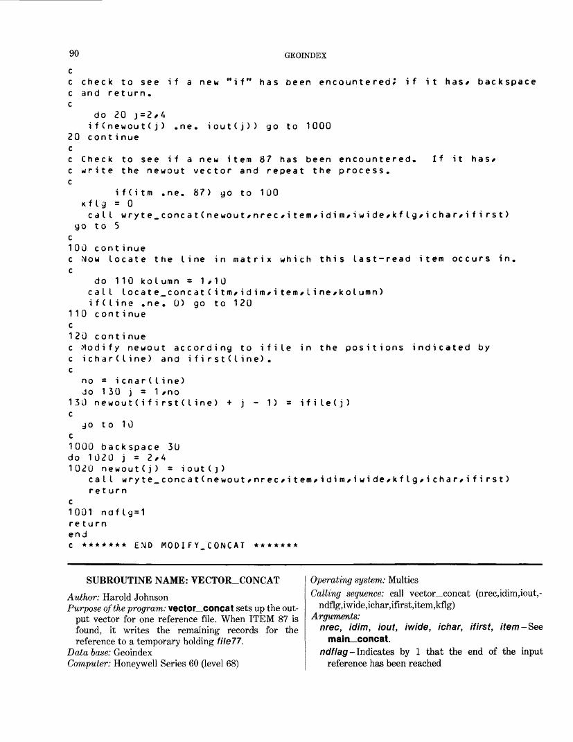
90 GEOINDEX
c check to see if a new "if" has been encountered; if it has* backspacec and ret urn.c
do 20 j=2,4if(newoutCj) .ne. iout(j)) go to 1000
20 cont i nue cc Check to see if a new item 87 has been encountered. If it has* c write the newout vector and repeat the process, c
i f(i tm .ne. 87) go to 100 Kflg = 0calI wryte_concat(newout/nrec/item/idim/iwide/kflg/i cha r/i fi rst)
go to 5 c100 cont i nuec Now locate the line in matrix which this last-read item occurs in. c
do 110 kolumn = 1/10calI locate^concat(i tm/i d i m/i tem/line/kolumn)i f( line .ne. 0) go to 120
110 cont i nue c120 cont i nuec Modify newout according to ifile in the positions indicated by c ichar(line) and ifirst(Iine) . c
no = icnar(line) Jo 130 j = 1/no
130 newout(ifirst( I ine) + j - 1) = ifile(j) c
jo to 10 c1000 backspace 3D do 1020 j = 2,4 1020 newout(j) = iout(j)
caI I wryte.concatCnewout/nrec/i tem/idim/iwide/kflg/i char/i fi rst)ret urn
c1001 ndflg=1 return end C ******* END MODIFY_CONCAT *******
SUBROUTINE NAME: VECTOR_CONCATAuthor: Harold JohnsonPurpose of the program: vector_concat sets up the out
put vector for one reference file. When ITEM 87 is found, it writes the remaining records for the reference to a temporary holding file77.
Data base: GeoindexComputer: Honeywell Series 60 (level 68)
Operating system: MulticsCalling sequence: call vector_concat (nrec,idim,iout,-
ndflg,iwide,ichar,ifirst,item,kflg) Arguments:
nrec, idim, iout, iwide, ichar, ifirst, item-Seemain__concat.
ndflag- Indicates by 1 that the end of the input reference has been reached
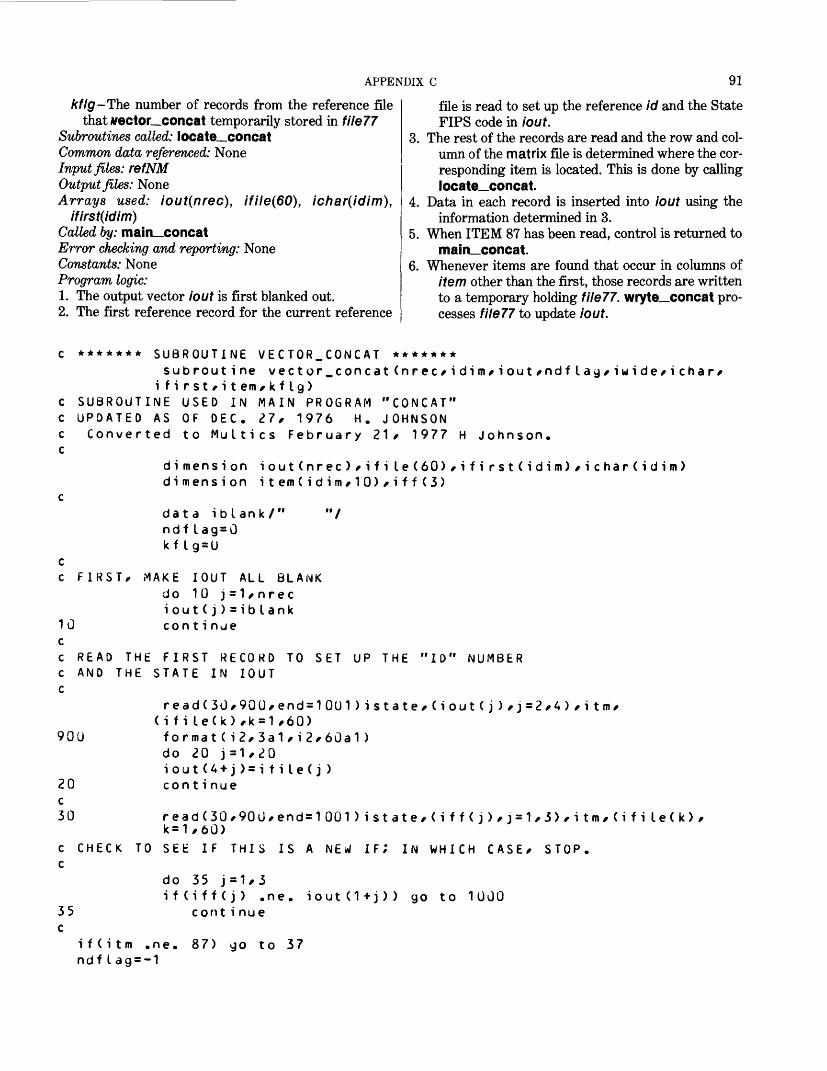
APPENDIX C 91
k fig -The number of records from the reference filethat vector__concat temporarily stored in file??
Subroutines called: locate__concatCommon data referenced: NoneInput files: refNMOutput files: NoneArrays used: iout(nrec), ifile(60), ichar(idim),
ifirst(idim)Called by: main_concat Error checking and reporting: None Constants: None Program logic:1. The output vector lout is first blanked out.2. The first reference record for the current reference
file is read to set up the reference id and the State FIPS code in lout.
3. The rest of the records are read and the row and col umn of the matrix file is determined where the cor responding item is located. This is done by calling locate_concat.
4. Data in each record is inserted into iout using the information determined in 3.
5. When ITEM 87 has been read, control is returned to main_concat.
6. Whenever items are found that occur in columns of item other than the first, those records are written to a temporary holding file??. wryte_concat pro cesses file?? to update iout.
c ******* SUBROUTINE VECTOR.CONCAT *******subroutine vector.concat(nrec/idim/iout/ndflag/iwide/ichar/
i f i rst f i tem/ k f lg)c SUBROUTINE USED IN MAIN PROGRAM "CONCAT" c UPDATED AS OF DEC. 27/ 1976 H. JOHNSON c Converted to Multics February 21/ 1977 H Johnson, c
dimension iout(nrec)/ifile(60),i f i rst(idim)/ichar(idim)dimension item(idim/10)/iff(3)
cdata iblank/" "/ndf lag = 0kflg=U
c c FIRST/ MAKE IOUT ALL BLANK
do 10 j = 1/nreci out(j) = iblank
10 continue cc READ THE FIRST RECORD TO SET UP THE "ID" NUMBER c AND THE STATE IN IOUT C
read(3U/90U/end=10U1)istate/(iout(j)/j=2/4)/itm/ (i file(k),k = 1,60)
900 format(i2/3a1/i2/60a1)do 20 j=1*20iout(4 + j) = i tile(j)continue20
c30 read(30*90u,end=1001)istate,<iff(j),j=1/3>,itm,(ifile<k>,
k=1,60)C CHECK TO SEE IF THIS IS A NEW IF; IN WHICH CASE/ STOP, c
do 35 j=1/3if(iff(j) .ne. iout(1+j)) go to 1000
35 conti nue c
i f(i tm .ne. 87) go to 37 ndf I ag = -1
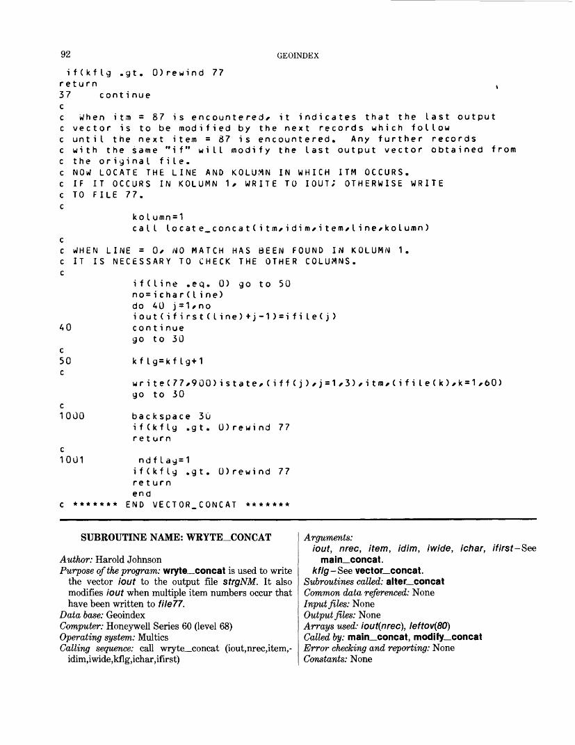
92 GEOINDEX
gt . 0) rewind 77i f (kf tgreturn % 37 cont i nue cc When itm = 87 is encountered/ it indicates that the last output c vector is to be modified by the next records which follow c until the next item = 87 is encountered. Any further records c with the same "if" will modify the last output vector obtained from c the original file.c NOW LOCATE THE LINE AND KOLUMN IN WHICH ITM OCCURS. c IF IT OCCURS IN KOLUMN 1 , WRITE TO IOUT; OTHERWISE WRITE c TO FILE 77.
40
c50c
koIumn=1ca I I locate_concat(i tm/idim/i tern* Iine/kolumn)
WHEN LINE = 0* NO MATCH HAS BEEN FOUND IN KOLUM.M 1. IT IS NECESSARY TO CHECK THE OTHER COLUMNS.
if(line .eq. 0) go to 50 no= ichar(line) do 40 j=1*noiout(ifirst(line)+j-1)=ifi le(j) con t i nue go to 30
kflg=kf lg+1
c1000
c1001
*******
write(77,900)istate,(iff(j),j=1,3),itm,(ifile(k),k=1,60) go to 30
back space 30i f (kf Ig .gt. 0)rewind 77ret urn
ndf lag=1if(kf Ig .gt. 0)rewind 77 return end
END VECTOR.CONCAT *******
SUBROUTINE NAME: WRYTE_CONCAT
Author: Harold JohnsonPurpose of the program: wryte_concat is used to write
the vector iout to the output file strgNM. It alsomodifies iout when multiple item numbers occur thathave been written to file??.
Data base: GeoindexComputer: Honeywell Series 60 (level 68) Operating system: Multics Calling sequence: call wryte_concat (iout,nrec,item,-
idim,iwide,kflg,ichar,ifirst)
Arguments: iout, nrec, item, idim, iwide, ichar, ifirst-See
main_concat. kfig -See vector_concat.
Subroutines called: alter__concat Common data referenced: None Input files: None Output files: None Arrays used: iout(nrec), leftov(80) Called by: main_concat, modify_concat Error checking and reporting: None Constants: None

APPENDIX C 93
Program logic:1. An 80-character vector named leftov is blanked out.2. Each successive 80-character segment of iout is writ
ten to strgNM until a segment of less than 80 characters remains.
3. This last segment, with blanks from leftov added to its right-hand side to make up 80 characters, is written to strgNM.
4. If kflg indicates that data exists in file?? for this reference, alter_concat is called to modify iout. Then step 2 is repeated, kolumn begins at 1 and is incremented by 1 until no match is found by alter_concat. In this way, repeated data are in troduced into iout one column at a time according to matrix.
******* SUBROUTINE WRYTE.CONCAT *******subroutine wryte_concat(iout*nrec*item*idim/iwide*k
i cha r, i f i rs t )SUBROUTINE USED IN MAIN PROGRAM "CONCAT"EARNING: THERE IS A SUBROUTINE CALLED WRYTE IN THE PROGRAM " UPDATED DEC. 2.1* 1976 H. JOHNSON converted to Multics February 18/ 1977 H. Johnson
tlg
dimension iout(nrec)*item(idim*10)*v(3) dimension ichar(idim)/ifirst(idim)/leftov(8J)data iblank/" " /
do 1000 j=1,80 lef tov( j )= i blank
1000 continue kol umn=1
90010
no=nrec/80 do 10 j = 1 *nowrite<4G*900)<iout(<JO*(j-1)+k),k format(SOal) con t i nuemo=(no+1)*80 - nrec no=80*no+1
if(kflj .eq. 0)return
kol urn n= kol umn + 1ifCkolumn ,gt. iwide)return
cat I alter_concat (iout^ ichar^ifirst)
c THIS RUMS THROUGH FILE 77 AND COMPARES ITM WITH ITEM c (J, KOLUMN) *J=1 /IOIM. WHEN A MATCH IS FOUND, IOUT IS c MSTOP = 0 WHEN NO MATCH HAS BEEN FOUND.
if(mstop .eq. 0) returnif(kolumn .eq. iwiae)returngo to 1
CHANGED
c *******end
END *RYTE_CONCAT *******
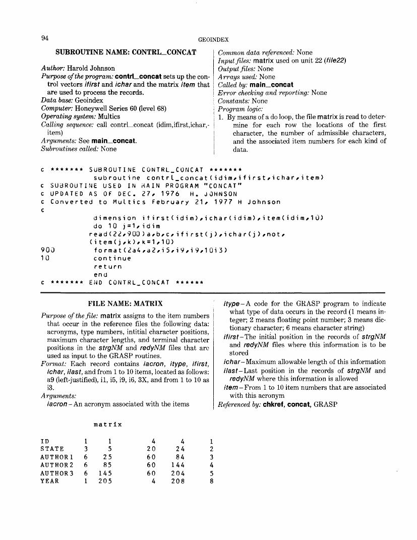
94 GEOINDEX
SUBROUTINE NAME: CONTRL_CONCAT
Author: Harold JohnsonPurpose of the program: contrLconcat sets up the con
trol vectors ifirst and ichar and the matrix item that are used to process the records.
Data base: GeoindexComputer: Honeywell Series 60 (level 68)Operating system: MulticsCalling sequence: call contrLconcat (idim, ifirst, ichar, -
item)Arguments: See main__concat.Subroutines called: None
Common data referenced: NoneInput files: matrix used on unit 22 (file22)Output files: NoneArrays used: NoneCalled by: main_concatError checking and reporting: NoneConstants: NoneProgram logic:1. By means of a do loop, the file matrix is read to deter
mine for each row the locations of the first character, the number of admissible characters, and the associated item numbers for each kind of data.
c ******* SUBROUTINE CONTRL_CONCAT *******subroutine contrl_concat(idim*ifirst*ichar*item)
c SUBROUTINE USED IN MAIN PROGRAM "CONCAT" c UPDATED AS OF DEC. 27, 1976 H. JOHNSON c Converted to Multics February 21 r 1977 H Johnson c
dimension itirst(idim)*ichar(idim)*item(idim*lU)do 10 j =1 * i d im
90010
(i tem(j,k),k=1,10) format(2a4,a2,i 5,i9,i 9,1Qi3) con t i nue return end
c ******* END CONTRL_CO!MCAT ******
FILE NAME: MATRIXPurpose of the file: matrix assigns to the item numbers
that occur in the reference files the following data: acronyms, type numbers, intitial character positions, maximum character lengths, and terminal character positions in the strgNM and redyNM files that are used as input to the GRASP routines.
Format: Each record contains iacron, itype, ifirst, ichar, Hast, and from 1 to 10 items, located as follows: a9 (left-justified), il, i5, i9, i6, 3X, and from 1 to 10 as i3.
Arguments: iacron-An acronym associated with the items
/type-A code for the GRASP program to indicate what type of data occurs in the record (1 means in teger; 2 means floating point number; 3 means dic tionary character; 6 means character string)
if irst-The initial position in the records of strgNM and redyNM files where this information is to be stored
ichar- Maximum allowable length of this informationHas t- Last position in the records of strgNM and
redyNM where this information is alloweditem -From 1 to 10 item numbers that are associated
with this acronym Referenced by: chkref, concat, GRASP
mat rix
IDSTATEAUTHOR 1AUTHOR2AUTHORSYEAR
136661
15
2585
145205
4206060604
42484
144204208
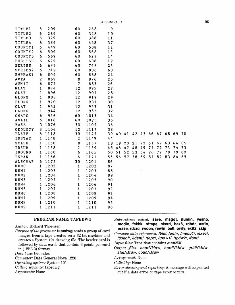
APPENDIX C 95
TITLE1TITLE2TITLESTITLE4COUNTY1COUNTY2COUNTY3PUBLISHSERIESSERIES2EMPHASIAREAAUNITNLATSLATWLONGELONGCLATCLONGOMAPSAVAILBASEGEOLOGYPLATEIDSTATSCALEIDSUBIBOUNDISPANALSOMAPDUMODUM1DUM2DUM3DUMADUM5DUM6DUM7DUMBDUM9
6666666666626111111663361111161111111111
209269329389449509569629689749809869877884896908920932944956
10161076110611181148115011581160116611721202120312041205120612071208120912101211
606060606060606060606087
121212121212606030123028266
301111111111
268328388448508568628688748808868876883895907919931943955
101510751105111711471149115711591165117112011202120312041205120612071208120912101211
91011371213141723602425262728293031323435363839 40 41 42 43 664418 19 20 21 22 6145 46 47 48 49 7150 51 52 53 54 7655 56 57 58 59 818687888990919293949596
67 68 69 70
62 63 64 6572 73 74 7577 78 79 8082 83 84 85
PROGRAM NAME: TAPEDWG
Author: Richard ThoensenPurpose of the program: tapedwg reads a group of card
images from a tape created on a 32 bit machine and creates a System 101 drawing file. The header card is followed by data cards that contain 6 points per card in (12F6.3) format.
Data base: GeoindexComputer: Data General Nova 1220Operating system: System 101Calling sequence: tapedwgArguments: None
Subroutines called: save, msgot, numin, yesno, modlc, fckbk, rdtape, ckcrd, hex8, rdhdr, asflc, erase, rdcrd, rwcon, rewin, bell, ovrly, exit2, skip
Common data referenced: Iblkl, Ipntr/, Imenull, /exec/, /dskbf/, /ident/, /tape/, /tpdwl/, /tpdw2/, /font/
Input files: Tape that contains mapNMOutput files: coorNMdw, bordNMdw, gridNMdw,
statNMdw, counNMdwArrays used: NoneCalled by: NoneError checking and reporting: A message will be printed
out if a data error or tape error occurs.
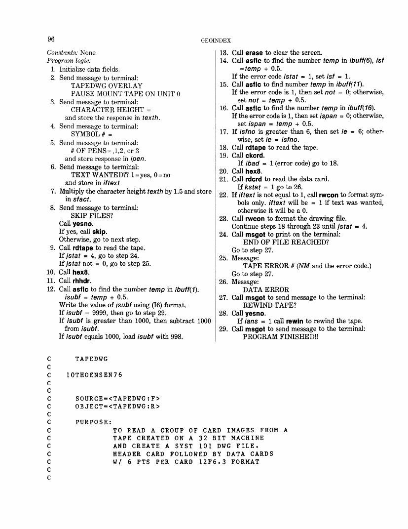
96 GEOINDEX
Constants: None Program logic:
1. Initialize data fields.2. Send message to terminal:
TAPEDWG OVERLAY PAUSE MOUNT TAPE ON UNIT 0
3. Send message to terminal:CHARACTER HEIGHT =
and store the response in texth.4. Send message to terminal:
SYMBOL # =5. Send message to terminal:
#OFPENS = ,1,2, or 3 and store response in ipen.
6. Send message to terminal:TEXT WANTED?? l=yes, 0 = no
and store in iftext7. Multiply the character height texth by 1.5 and store
in sfact.8. Send message to terminal:
SKIP FILES? Call yesno. If yes, call skip. Otherwise, go to next step.
9. Call rdtape to read the tape. Ifjstat = 4, go to step 24. Ifjstat not = 0, go to step 25.
10. Call hex8.11. Call rhhdr.12. Call asflc to find the number temp in ibuff(1).
isubf - temp + 0.5.Write the value of isubf using (16) format. If isubf = 9999, then go to step 29. If isubf is greater than 1000, then subtract 1000
from isubf. If isubf equals 1000, load isubf with 998.
13. Call erase to clear the screen.14. Call asflc to find the number temp in ibuff(6), isf
= temp + 0.5. If the error code istat = 1, set isf = 1.
15. Call asflc to find number temp in ibuff(11).If the error code is 1, then set not = 0; otherwise,
set not = temp + 0.5.16. Call asflc to find the number temp in ibuff(16).
If the error code is 1, then set ispan = 0; otherwise, set ispan = temp + 0.5.
17. If /sfr?o is greater than 6, then set ie = 6; other wise, set ie = isf no.
18. Call rdtape to read the tape.19. Callckcrd.
If ibad = 1 (error code) go to 18.20. CallhexS.21. Call rdcrd to read the data card.
If kstat = 1 go to 26.22. If iftext is not equal to 1, call rwcon to format sym
bols only, iftext will be = 1 if text was wanted, otherwise it will be a 0.
23. Call rwcon to format the drawing file.Continue steps 18 through 23 until jstat - 4.
24. Call msgot to print on the terminal:END OF FILE REACHED?
Go to step 27.25. Message:
TAPE ERROR # (NM and the error code.) Go to step 27.
26. Message:DATA ERROR
27. Call msgot to send message to the terminal: REWIND TAPE?
28. Call yesno.If ians = 1 call rewin to rewind the tape.
29. Call msgot to send message to the terminal: PROGRAM FINISHED!!
TAPEDWG
10THOENSEN76
SOURCE=<TAPEDWG:F> OBJECT=<TAPEDWG:R>
PURPOSE:TO READ A GROUP OF CARD IMAGES FROM A TAPE CREATED ON A 32 BIT MACHINE AND CREATE A SYST 101 DWG FILE. HEADER CARD FOLLOWED BY DATA CARDS W/ 6 PTS PER CARD 12F6.3 FORMAT
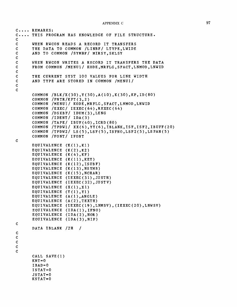
APPENDIX C 97
C.C.CCCCCCCCCCCC
REMARKS:THIS PROGRAM HAS KNOWLEDGE OF FILE STRUCTURE.
WHEN RWCON READS A RECORD IT TRANSFERS THE DATA TO COMMON /LINBF/ LTYPE,LWIDE AND TO COMMON /SYMBF/ MIRSY,SKLSY
WHEN RWCON WRITES A RECORD IT TRANSFERS THE DATA FROM COMMON /MENU1/ KODE,MRFLG,SFACT,LNMOD,LNWID
THE CURRENT SYST 100 VALUES FOR LINE WIDTH AND TYPE ARE STORED IN COMMON /MENU1/
COMMON /BLK/X(30),Y(30),A(10),K(30),KP,ID(80)COMMON /PNTR/KPT(3,2)COMMON /MENU1/ KODE,MRFLG,SFACT,LNMOD,LNWIDCOMMON /EXEC/ IEXEC(64),REXEC(64)COMMON /DSKBF/ IDUM(3),LENGCOMMON /IDENT/ IDA(3)COMMON /TAPE/ IBUF(40),ICRD(80)COMMON /TPDW1/ XX(6),YY(6),IBLANK,ISF,ISF2,IBUFF(20)COMMON /TPDW2/ LS(5 ) ,LSF(5),ISFNO,LSF2(5),LSPAN(5)COMMON /FONT/ IFONT
EQUIVALENCE EQUIVALENCE EQUIVALENCE EQUIVALENCE EQUIVALENCE EQUIVALENCE EQUIVALENCE EQUIVALENCE EQUIVALENCE EQUIVALENCE EQUIVALENCE EQUIVALENCE EQUIVALENCE EQUIVALENCE EQUIVALENCE EQUIVALENCE EQUIVALENCE
(K(2),K2) (K(4),KF) (K(11),KEY)
2) ,ISUBF)3) ,NSYMB)
(K(15),NCHAR) (IEXEC(31) , JUSTH) (IEXEC(32) , JUSTV)
(A(l) , ANGLE) (A(2) ,TEXTH) (IEXEC (19) ,LNMSV) (IDA(1),IFNO) (IDA(2) ,NOR) (IDA(3),NIF)
(IEXEC (20) , LNWSV)
DATA IBLANK /2H /
CALL SAVE(l)KNT = 0IBAD=0ISTAT=0JSTAT=0KSTAT=0

98 GEOINDEX
LSTAT=0MSTAT=0MRFLG=0SFACT=1LNMOD=1LNWID=0IFONT=0ANGLE=0JUSTH=1JUSTV=1IDA(1)=0IDA(2)=0IDA(3)=0
CALL MSGOT("ITAPEDWG OVERLAY")CALL NUMIN("j ITAPE DRIVE NO. (0 OR i)MTUNIT=TEMPPAUSE MOUNT TAPE PLEASE
",TEMP)
200 CALL NUMIN("|CHARACTER IF (TEXTH) 200,210,210
210 CALL NUMIN("|SYMBOL # < NSYMB-TEMP IF (NSYMB) 210,210,220
220 IF (NSYMB-200) 230,230 230 CALL NUMIN("|# OF PENS=
IPEN=TEMPIF (IPEN .LT. 1) GO TO IF (IPEN .GT. 3) GO TO
HEIGHT=",TEXTH)
'",TEMP)
210 ,1,2
230230
OR 3",TEMP)
CALL NUMIN("|TEXT WANTED?? 1 =YES,0=NO",TEMP) IFTEXT=TEMP
SFACT=1.5*TEXTH
CALL MSGOT("|SKIP FILES?")CALL YESNO(IANS)IF(IANS .EQ. 1)CALL SKIP (MTUNIT , JSTAT )IF(JSTAT .NE. 0)GO TO 6000
300 LNWID=LNWID+1IF (LNWID.GT.IPEN) LNWID=1
READ HEADER CARD
IFNO=0 ISFNO=0 NOR = 0
CHECK FOR FULL DRAWING FILE
CALL MODLC(KPT(1,2),-3000,MSTAT) GO TO (800,7300,7300) ,MSTAT
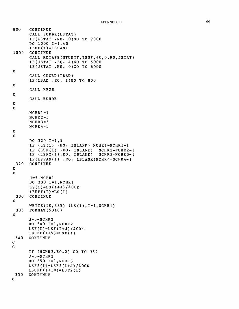
APPENDIX C 99
800
1000
320
330
335
340
0,80,JSTAT)
CONTINUECALL FCKBK(LSTAT)IF(LSTAT .NE. 0)GO TO 7000DO 1000 1=1,40IBUF(I)=IBLANKCONTINUECALL RDTAPE(MTUNIT,IBUF,40,IF(JSTAT .EQ. 4)GO TO 5000IF(JSTAT .NE. 0)GO TO 6000
CALL CKCRD(IBAD)IF(IBAD .EQ. 1)GO TO 800
CALL HEX8
CALL RDHDR
NCHR1=5 NCHR2=5 NCHR3=5 NCHR4=5
DO 320 1-1,5IF (LS(I) .EQ. IBLANK) NCHR1=NCHR1-1IF (LSF(I) .EQ. IBLANK) NCHR2=NCHR2-1IF (LSF2(I).EQ. IBLANK) NCHR3=NCHR3-1IF(LSPAN(I) .EQ. IBLANK)NCHR4=NCHR4-1CONTINUE
J=5-NCHR1DO 330 I=1,NCHR1LS(I)=LS(I+J)/400KIBUFF(I)=LS(I)CONTINUE
WRITE(10,335) FORMAT(50I6)
(LS (I),I=1,NCHR1)
350
J=5-NCHR2DO 340 I=1,NCHR2LSF(I)=LSF(I+J)/400KIBUFF(I+5)=LSF(I)CONTINUE
IF (NCHR3.EQ.O) GO TO 352J=5-NCHR3DO 350 I=1,NCHR3LSF2(I)=LSF2(I+J)/400KIBUFF(I+10)=LSF2(I)CONTINUE
100 GEOINDEX
C352 IF (NCHR4 .EQ. 0) GO TO 354
J=5-NCHR4 DO 353 I=1,NCHR4 LSPAN(I)=LSPAN(I+J)/400K IBUFF(I+15)=LSPAN(I)
353 CONTINUE C C
354 CALL ASFLC (IBUFF(1),NCHR1,TEMP,ISTAT)ISUBF=TEMP+.5
CWRITE(10,20) ISUBF
20 FORMAT(I6)IF (ISUBF .EQ. 9999) GO TO 500
CC CLEAR SCREEN C
KNT=KNT+1IF(KNT .NE. 26)GO TO 1100KNT = 0CALL ERASE
1100 CONTINUE C
CALL ASFLC(IBUFF(6),NCHR2,TEMP,ISTAT)ISF=TEMP+.5IF(ISTAT .EQ. 1)ISF=1CALL ASFLC (IBUFF(11),NCHR3,TEMP,ISTAT)NOT-TEMP+.5IF (ISTAT.EQ.l) NOT=0CALL ASFLC(IBUFF(16),NCHR4,TEMP,ISTAT)ISPAN=TEMP+.5IF(ISTAT .EQ. 1)ISPAN=0IE=ISFNOIF(ISFNO .GE. 6)IE=6
CC READ FIRST DATA CARD C 1200 CONTINUE
CALL FCKBK(LSTAT)IF(LSTAT .NE. 0)GO TO 7000DO 1500 1=1,40IBUF(I)=IBLANK
1500 CONTINUECALL RDTAPE(MTUNIT,IBUF,40,0,80,JSTAT)IF(JSTAT .EQ. 4)GO TO 5000IF(JSTAT .NE. 0)GO TO 6000
CCALL CKCRD(IBAD)IF(IBAD .EQ. 1)GO TO 1200
CCALL HEX8
CCALL RDCRD(KSTAT)IF(KSTAT .EQ. 1)GO TO 6500
APPENDIX C 101
C C C
IF (IFTEXT .NE. 1) GO TO 400 C
X1=XX(1)Y1=YY(1)NCHAR=NCHR1DO 360 I=1,NCHR1ID (I)=LS (I)
360 CONTINUEKEY=8KP=1CALL RWCON(KF,2)KEY=16CALL RWCON(KF,2)
C C
IF (ISF.EQ. 1 .AND.IFNO.EQ. 1) GO TO 375NCHAR=NCHR2DO 370 I=1,NCHR2
370 CONTINUEKEY=16CALL RWCON(KF,2)
C C 375 IF(ISPAN .EQ. 0)GO TO 380
NCHAR=NCHR4DO 377 I=1,NCHR4ID(I)=LSPAN(I)
377 CONTINUEKEY=16CALL RWCON(KF,2)
C C
380 IF (NOT.EQ.O) GO TO 400NCHAR=NCHR3DO 390 I=1,NCHR3ID(I)=LSF2(I)
390 CONTINUEKEY=16CALL RWCON(KF,2)
C C
400 X1=XX(2)Y1=YY(2)
CC SYMBOL NEEDED IF THIS IS SINGLE PT C
IF (ISFNO.GT.2) GO TO 410KEY=7KP = 1CALL RWCON(KF,2)GO TO 300
102 GEOINDEX
CC WRITE PEN UPC
410 KEY=1KP=1CALL RWCON(KF,2)JJ = 3GO TO 430
C 420 CONTINUE
CALL FCKBK(LSTAT)IF(LSTAT .NE. 0)GO TO 7000DO 2000 1=1,40IBUF(I)=IBLANK
2000 CONTINUECALL RDTAPE(MTUNIT,IBUF,40,0,80,JSTAT)IF(JSTAT .EQ. 4)GO TO 5000IF(JSTAT .NE. OJGO TO 6000
CCALL CKCRD(IBAD)IF(IBAD .EQ. 1)GO TO 420
CCALL HEX8
CCALL RDCRD(KSTAT)IF(KSTAT .EQ. 1)GO TO 6500
C C CC WRITE PEN DOWN C
430 KEY=6KP=1DO 440 I=JJ,IEX1=XX(I)Y1=YY(I)CALL RWCON(KF,2)
440 CONTINUEJJ=1IF (ISFNO-6) 300,300,450
450 ISFNO=ISFNO-6IE=ISFNOIF (ISFNO.GE.6) IE=6GO TO 420
CC EOF FOUNDC5000 CONTINUE
CALL MSGOT("|END OF FILE REACHED?")GO TO 7000
CC TAPE ERROR C 6000 CONTINUE
WRITE(10,1001)JSTAT
APPENDIX C 103
1001 FORMAT(IX,'TAPE ERROR #',!!)GO TO 7000
CC DATA ERROR C 6500 CONTINUE
WRITE(10,1002)1002 FORMAT(IX,'DATA ERROR') CC REWIND UNIT 0 C 7000 CONTINUE
CALL MSGOTC (REWIND TAPE?')CALL YESNO(IANS)IF(IANS .NE. 1)GO TO 7500CALL REWIN(MTUNIT)GO TO 7500
7300 CONTINUECALL BELLWRITE(10,1003)
1003 FORMAT(IX,'DRAWING FILE FULL|',2(/IX,'DO NOT REWIND TAPE||'),/1X \c,'
*SAVE DRAWING FILE,GET NEW DRAWING FILE AND RECALL TAPEDWG OVERLA \cY'
*)7500 CONTINUE CC DONE C
500 ISUBF=999CALL MSGOT ("(PROGRAM FINISHED(|")KEY=31CALL RWCON(KF,2)KP = 0CALL OVRLY(1,IER)CALL EXIT2END
PROGRAM NAME: DWGDISKAuthor: Lawrence BalcerakPurpose of the program: dwgdisk reads a System 101
drawing file and writes an ASCII disk file containingthe header card and data cards for each featureoutline.
Data base: Geoindex Computer: Data General Nova 1220 Operating system: System 101 Calling sequence: dwgdisk Arguments: None Subroutines called: fclfl, fopfl, save, numin, msgot,
yesno, rwcon, asflc, fcnot, ovrly, exit2, flnam, fdffl,xdmsg
Common data referenced: /PUNCHI Most Bendixsubroutines read from or write to common blocks.
Read "System 100 Programmers manual" (S100PM)for further information.
Input files: bordNMdw, gridNMdw, statNMdw, coun-NMdw, redNM, blueNM, greenNM
Output files: bordNM, gridNM, statNM, counNM,redNM, blueNM, greenNM
Arrays used: None Error checking and reporting: None Constants: None Program logic:
1. Pause. Stops execution of program until a return is sent. Prints message:
PAUSE FOR OPERATOR2. Call fclfl (clears a file and releases slot 0).3. Send message to terminal:
NAME OF DISK OUTPUT FILE = ??
104 GEOINDEX
4. Call f Inam to receive a file name from the keyboard and store in name, igood is the returned status code.
5. If igood = 1, go to step 6 (acceptable file name). If igood = 2, go to step 3 (file name too long). If igood = 3, go to step 78. Control d or cr on first
character was entered.6. Call fopfl. This opens the file name for writing and
assigns it to file slot 0. istat is the monitor error code.
7. If istat is not equal to 0, go to step 9. At this point a nonzero value is an error.
8. Send message to terminal:OLD FILE-OK???.
Call yesno. If yes, go to step 15. If no, go to step 2.9. If istat is not equal to octal 204, go to step 14. This
is the status code for a new file.10. Send message to terminal:
NEW FILE-OK??Call yesno. If yes, go to step 11. If no, go to step
2.11. Call fdffi, which defines a file name name, istat is
the monitor error code.12. If istat is not equal to 0, go to step 14.13. Call fopfl. This opens the file name for writing and
assigns it to file slot 0. If there are no errors then istat = 0; go to step 15.
14. Call xdmsg(/sfaf). This prints a disk operating system error message based on istat. Go to step 2.
15. Send message to terminal:!DO YOU WISH TO WRITE AN EOF FLAG
ON THIS FILE??.If you must run this program several times, you will later concatenate the several files and will need an EOF flag only in the last file.
16. Call save(1). This saves critical constants from the systems common blocks that are parameters describing the drawing file. These constants will be needed at the end of the program to restore the operation to the table with the same parameters.
17. Set nif = 0. This variable on the header card in dicates grid, county, and so forth.
18. Send message to terminal:TYPE 2 DIGIT STATE NUMBER
Call numin to receive number. Set nor = to returned number.
19. Send message to terminal:IS THIS THE GRID BEING WRITTEN??
20. Call yesno. If yes, go to step 21. If no, go to step 22.21. Set nif = 991 (indicates the grid).
Go to step 25.22. Send message to terminal:
IS THIS THE COUNTIES BEING WRITTEN??
23. Call yesno. If yes, got to step 24. If no, go to step 25.
24. Set nif = 992 (indicates the counties).25. Set lifno(i) = 0 for / = 1,2000.26. Set kpt(kf,1) = 1. Set the read pointer for the draw
ing file to the first record. Steps 27-30 will read the drawing file until the first text position that occurs in the drawing file is read.
27. Set kp = 1. When reading a drawing file, rwcon uses x(kp) and y(kp).
28. Call rwcon (kf,l). kf (equivalent to /r(4)) is the active file. The 1 indicates a read.
29. If key = 31 (EOF), go to step 77.Note: Several assumptions are made concerning the
drawing file. Each outline begins with a text string identifying the feature number, subfeature number, span and second subfeature number, with a default of 0 for any absent text. There can be any number of line segments that make up an outline.
30. If key is not equal to 8 (text position), go to step 27. Steps 31-39 read through the drawing file coun ting the number of points for each outline and counting the number of outlines that have the same feature number. This must be done before punching starts because the information is on the header card.
31. Set kount = 1. This is a count of the number ofpoints in an outline. The text position is the firstpoint.
Set inum = 1. This is a count of the number ofoutlines.
Set numtext = 0. This is the count of how manylines of text are in the outline being read.
32. Set kp = 1.Call rwcon to read a record.
33. If key = 31 (EOF), go to step 37.If key = 8 (text position), go to step 37.If key = 16 (text string), go to step 34.If key = I (pen up), or if key = 6 (pen down), or if
key = 7 (symbol position), add 1 to kount. Go to step 32.
34. Add 1 to numtext (one more text string found). If numtext is greater than 1, go to step 37. We are
interested in only the first text string at this time. Set ibuf(i) = /</(/). This contains the character string
just read.35. Call asf Ic to find the number, temp, represented by
the text in ibuf(i).If istat = I, go to step 32. An error code of 1 is
returned for any abnormality.36. Add 1 to the count of number of outlines that have
same feature number as the new outline just started. Go to step 32.
APPENDIX C 105
37. Set iburp(inum) = kount. This is a count of thenumber of points for each outline.
Set kount = 1. Start count over. Add 1 to inum (sequence number of next outline).
38. If key = 31 (EOF), go to step 40. There are two ways to reach this step: key - 31 or key = 8.
39. The only way to reach this step was if key = 8 (text position), which starts a new outline. Go to step 32. Steps 40-44 will read the drawing file until the first text position that occurs in the drawing file is read. These statements start reading the drawing file from the first record.
40. Set kpt(kf,1) = 1. This sets the read pointer for the drawing file to the first record.
41. Set inum = 1 (outline count).42. Set kp = 1. Call rwcon to read a record.43. If key = 31 (EOF), go to step 79. Then the program
is almost finished.44. If key is not equal to 8 (text position), go to step 42.45. Set kount = 0. This is a counter for the number of
text strings found for an outline. None is found yet.
Set knum = 2. This is a counter for the number of the point to be processed. One is already proc essed.
Set isfno = iburp(inum) (the number of points).Add 1 to inum (sequence number of next outline).Set iup = 1. This is the counter for the number of
pen ups or symbol positions found in one outline. The first is treated differently from the rest.
Set isf = 1. This will be 1 unless changed in a text string.
Set not = 0.Set /spa/? = 0 (default values).Setxp(7) = x1.Set yp(1) = y1. This is the text position.
46. For / = knum, 6: Set xp(/) = 0. Set yp(i) = 0.
47. If knum = 1, set knum = 0. This will be equal to 1 when a card has just been punched and more points are needed to complete the outline. It then branches to the previous step, where it must be 1, but logic further along demands that it be 0.
48. Set kp = 1.Call rwcon to read a record.
49. If key = 31 (EOF), go to step 72.50. If key = 8 (text position), go to step 72. This is true
for all outlines except the first outline.51. If key = 16 (text string), go to step 55.52. If key = 1 (pen up) or 7 (symbol position), go to step
67.53. If key = 6 (pen down), go to step 70.54. Go to step 48.
55. Add 1 to kount. Another text string found for this outline.
56. If kount is greater than 4, go to step 48. kount should never be greater than 4, because there are only four possible pieces of information.
57. For / = 1, 5, set ibuf(i) = id(i). id(i) contains the text string from the record read in statement 48.
58. Call asf Ic to find the number, temp, represented by the text in ibuf(i).
59. If istat = 1, go to step 48. An error code of 1 is returned for any abnormality.
60. If kount = 1, go to step 66 (the first text string). If nil = 992, go to step 64. If this is the county file,
isf represents a bordering county or other boun dary.
61. If there is only one outline and temp is greater than 0, set kount = 4.This must be a second subfeature number, but there should not be four text strings.
If there is only one outline and temp is less than 0, set kount = 3. This must be a span, but there should not be three text strings.
62. Set/ = kount -I. If / = 1, go to step 64. If / = 2, go to step 65. If / = 3, go to step 66.
63. Set isf - temp. To get to this step, one of three con ditions existed:this must have been the second text string with if- no greater than 1, or this is the counties, or temp = 0. Go to step 48.
64. Set /span = temp. This was the third text string, or second text string with temp less than 0. Go to step 48.
65. not = temp. This was the fourth text string, or temp greater than 0 and only one outline. Go to step 48.
66. iff = temp. This is the feature number, ifno = iifno(iif). This is the count of outlines with same feature number. Go to step 48.
67. If key = 1 (pen up) and iup is greater than 1, go to step 70. This is another line segment that must be concatenated to previous segments.
68. Add 1 to iup, which is a flag to show what position the next pen up has in the outline (used in previous step).
69. Setxp(2) = x1 Setyp(2) = y1.
Program writes the header card to the disk file. Go to step 48.
70. Add 1 to knum, which is counter for next position. Setxp(knum) = x1. Set yp (knum) = y1.
106 GEOINDEX
71. If knum is less than 6, go to step 48.Otherwise, go to next step. The card should have
six points to be written.72. If knum = 0, go to step 74. The last card written
had six points on it and finished an outline.73. Program writes xp(/) and yp(/) to the disk file.74. If key = 31 (EOF), go to step 78. Then, the program
is almost finished.75. If key = 8 (text position), go to step 45. A new
outline is to be processed; default values must be reset.
76. Set knum = 1.Go to step 46. There are more points in this outline.
77. Program writes message to terminal:NO TEXT IN FILE!
Go to step 79.78. Program writes message to terminal:
IDONE!
79. If ieof = 1, go to step 80.If ieof - 2, go to step 81. This is an indicator for
whether or not an EOF flag is to be written. This was done in step 15.
80. Set Hf = 9999 (the EOF flag). Program writes a header card to the disk file.
81. Close file slot 0.Call fcnot (" 7 ") several times to ring the bell. This
produces an audible signal to the operator. Pro gram writes message to terminal:
PROGRAM FINISHEDSet kp = 0.Call save(2) (restores critical constants).Call overly, a routine that overlays user memory
with selected main program (returns control to the table).
Call exit2 (overlays signoff for the system).
C DWGDISK
WRITTEN 2MAR78 BALCERAK
SOURCE=<DWGDISK:F> OBJECT=<DWGDISK:R>
PURPOSE:TO READ A SYSTEM 101 DRAWING FILE LOADED ON THE DRAWING TABLE-GET THE X,Y COORDINATES OF THE TEXT REFERENCES AND OF THE LINES AND WRITE TO DISK IN 12F6.3 FORMAT.
THE HEADER CARD FOR EACH OUTLINE WILL ALSO BE WRITTEN WITH ALL RELAVENT INFORMATION.
COMMON /BLK/ X(30),Y(30),A(10),K(30),KP,ID(80)COMMON /PNTR/ KPT(3,2)COMMON /LINBF/ LTYPE,LWIDECOMMON /MENU1/ KODE,MRFLG,SFACT,LNMOD,LNWIDCOMMON /EXEC/ IEXEC(64),REXEC(64)COMMON /DSKBF/ IDUM(3),LENGCOMMON /IDENT/ IDA(3)COMMON /PUNCH/ XP(6),YP(6),IBUF(5),IBURP(2000),NAME(10),
$ IIFNO(2000)
EQUIVALENCE EQUIVALENCE EQUIVALENCE EQUIVALENCE EQUIVALENCE EQUIVALENCE EQUIVALENCE
(K(2),K2) (K(4),KF) (K(ll),KEY) (K(15),NCHAR)
APPENDIX C 107
C C C C
10001010
1020
1030
C 1040
1050
C1
\c)
C
10
PAUSE FOR OPERATORCALL FCLFL (0,IER)CALL MSGOT ("|NAME OF DISK OUTPUT FILE=?? " )CALL FLNAM (NAME,IGOOD)GO TO (1020, 1010,500) ,IGOODCALL FOPFL (NAME , 0, 1 , ISTAT )IF (ISTAT .NE. 0) GO TO 1030CALL MSGOT ("|OLD-FILE. OK?? " )CALL YESNO (IANS)GO TO (1, 1000) ,IANSIF (ISTAT .NE. 204K) GO TO 1050CALL MSGOT (" | NEW-FILE. OK?? ")CALL YESNO (IANS)GO TO (1040, 1000) , IANS
CALL FDFFL (NAME, ISTAT)IF (ISTAT .NE. 0) GO TO 1050CALL FOPFL (NAME , 0 , 1 , IS TAT )IF (ISTAT .EQ. 0) GO TO 1CALL XDMSG (ISTAT)GO TO 1000
CALL MSGOT ("|DO YOU WISH TO WRITE AN EOF FLAG ON THIS FILE?? "
CALL YESNO (IEOF)
CALL SAVE(l)NIF = 0CALL NUMIN ("|TYPE 2 DIGIT STATE NUMBER ",TEMP)NOR=TEMPCALL MSGOT ("|IS THIS THE GRID BEING WRITTEN?? " )CALL YESNO (ISTAT)GO TO (2, 3), ISTATNIF=991GO TO 5CALL MSGOT ("|IS THIS THE COUNTIES BEING WRITTEN?? " )CALL YESNO (ISTAT)GO TO (4, 5), ISTATNIF=992DO 6 1=1,2000IIFNO(I)=0CONTINUEKPT(KF, 1)=1
START READING RECORDS AND WRITTING TO DISK
KP=1CALL RWCON (KF, 1)IF (KEY .EQ. 31) GOIF (KEY .NE. 8) GOKOUNT-1
TO TO
35010
108 GEOINDEX
INUM=1NUMTEXT=0
20 KP=1CALL RWCON (KF,1)IF (KEY .EQ. 31) GO TO 30IF (KEY .EQ. 16) GO TO 25IF (KEY .EQ. 8) GO TO 30IF ( (KEY .EQ. 1) .OR. (KEY .EQ. 6) .OR. (KEY .EQ. 7) )
* KOUNT=KOUNT+1GO TO 20
C25 NUMTEXT=NUMTEXT+1
IF (NUMTEXT .GT. 1) GO TO 20DO 27 1=1,5
27 IBUF(I)=ID(I)CALL ASFLC (IBUF,NCHAR,TEMP,ISTAT)IF (ISTAT .EQ. 1) GO TO 10IIF=TEMP+0.5
C30 IBURP(INUM)=KOUNT
KOUNT=1INUM=INUM+1IF (KEY .EQ. 31) GO TO 40IIFNO(IIF)=IIFNO(IIF)+1NUMTEXT=0GO TO 20
CC
40
CC
50
KPT (KF,INUM=1
KP=1
1)
CALL RWCON (KF,1)IF (KEY .EQ. 31) GO TO 500IF (KEY .NE. 8) GO TO 50
55 KOUNT=0KNUM=2ISFNO=IBURP(INUM)INUM=INUM+1ISF=1IUP=1NOT = 0ISPAN=0XP(1)»X1YP(1)=Y1
60 DO 65 I=KNUM,6XP(I)=0YP(I)=0
65 CONTINUEIF (KNUM .EQ. 1) KNUM=0
C C
70 KP=1CALL RWCON (KF,1)
APPENDIX C 109
IF (KEY .EQ. 31) GO TO 140 IF (KEY .EQ. 8) GO TO 140 IF (KEY .EQ. 16) GO TO 80IF ( (KEY .EQ. 1) .OR. (KEY .EQ. 7) ) GO TO 110 IF (KEY .EQ. 6) GO TO 130 GO TO 70
C C
80 KOUNT=KOUNT+1IF (KOUNT .GT. 4) GO TO 70 DO 85 1=1,5
85 IBUF(I)=ID(I)CALL ASFLC (IBUF,NCHAR,TEMP,ISTAT) IF (ISTAT .EQ. 1) GO TO 70 IF (KOUNT .EQ. 1) GO TO 105 IF (NIF .EQ. 992) GO TO 90IF( (IFNO .EQ. 1) .AND. (TEMP .GT. 0.0) ) KOUNT=4 IF ( (IFNO .EQ. 1) .AND. (TEMP .LT. 0.0) ) KOUNT=3 I=KOUNT-1GO TO (90,95,100),1
90 ISF=TEMP GO TO 70
95 ISPAN=TEMPGO TO 70
100 NOT=TEMP GO TO 70
105 IIF=TEMP+0.5IFNO=IIFNO(IIF) GO TO 70
C C110 IF ( (KEY .EQ. 1) .AND. (IUP .GT. 1) ) GO TO 130
IUP=IUP+1 XP(2)=X1 YP(2)=Y1WRITE (0,120) IIF,IFNO,ISF,ISFNO,NOT,NOR,NIF,ISPAN
120 FORMAT (IX,815)GO TO 70
C C130 KNUM=KNUM+1
XP(KNUM)=X1 YP(KNUM)=Y1IF (KNUM .LT. 6) GO TO 70
140 IF (KNUM .EQ. 0) GO TO 160WRITE (0,150) (XP(I),YP(I),1=1,6)
150 FORMAT (1X.12F6.3) 160 IF (KEY .EQ. 31) GO TO 500
IF (KEY .EQ. 8) GO TO 55 KNUM=1 GO TO 60
CC DONE C 350 CALL FCNOT ("|NO TEXT IN FILE|")
110 GEOINDEX
500 CALL FCNOT ( fl |DONE|")GO TO (510,520),IEOF
510 IIF=9999WRITE (0,120) IIF,IFNO,ISF
520 CALL FCLFL (0,IER)CALL FCNOT (CALL FCNOT (CALL FCNOT (KP = 0CALL SAVE(2)CALL OVRLY (1,IER)CALL EXIT2END
ISFNO,NOT,NOR,NIF,ISPAN
PROGRAM NAME: SELDISKAuthor: Lawrence BalcerakPurpose of the program: seldisk reads through an
ASCII disk file containing coordinate outlines andplaces selected outlines into a drawing file.
Data base: Geoindex Computer: Data General Nova 1220 Operating system: System 101 Calling sequence: seldisk Arguments: None Subroutines called: fclfl, fcnot, flnam, fopfl, msgot,
numin, ovrly, rwcon, save, xdmsg, asflc Common data referenced: /Punch/ Most Bendix
subroutines read from or write to common blocks.Read "System 100 Programmers Manual" (SIOOPM)for further information.
Input files: None Output files: None Arrays used: None Error checking and reporting: None Constants: None Program logic:
1. Call save(1) (saves critical constants from the systems common blocks that are parameters describing the drawing file). These will be needed at the end of the program to restore operation to the table with the same parameters.
2. Set mrflg = 0. mrflg is the mirror flag. 0 indicatesno mirroring.
Set sfact = 1. sfact is scale factor. Set Inmod = 1. Inmod is line type. 1 indicates a
solid line. Set In win = 0. In win is pen number (initial value,
which will be changed at a later time). Set ifont = 0 (system requirement). Set angle = 0 (angle of rotation for text). Set justh = 1. justh is horizontal text justification.
1 indicates that the text will be left justified start ing at the text location.
Set justv = 1. justv is vertical text justification. 1 indicates that the text will be above the text loca tion.
3. Send message to terminal: SELDISK OVERLAY PAUSE TURN ON CARD READER
and wait for the return to be pushed. This gives a chance to make sure that the card reader has been prepared correctly.
Steps 4-6 open the card reader for use.4. Call fclfl (clears a file and releases slot 0).5. Call fopfl (opens the card reader for reading and
assigns it to slot 0).If ier is equal to 0, go to step 7. Otherwise, go to
step 6. ier is the monitor error code (See SIOOPM, p. 236).
6. Write message to terminal:FOPFL ERROR
and then go to step 72.7. Call numin. This sends the message:
.'CHARACTER HEIGHT = to the terminal and waits for an answer, which it places in the real variable texth. This is usually 0.14 inches.
8. If texth is less than 0, go back to step 7. The system will accept a zero height but not a negative height.
9. Call numin. Sends message:ISYMBOL # =
and receives answer into temp. Set nsymb = temp. Change to an integer.
10. If nsymb is greater than 0, go to step 11.Otherwise, go back to step 9. This must be a positive
integer.11. If nsymb is greater than 200, go back to step 9. The
range of possible symbol numbers is 1-200.
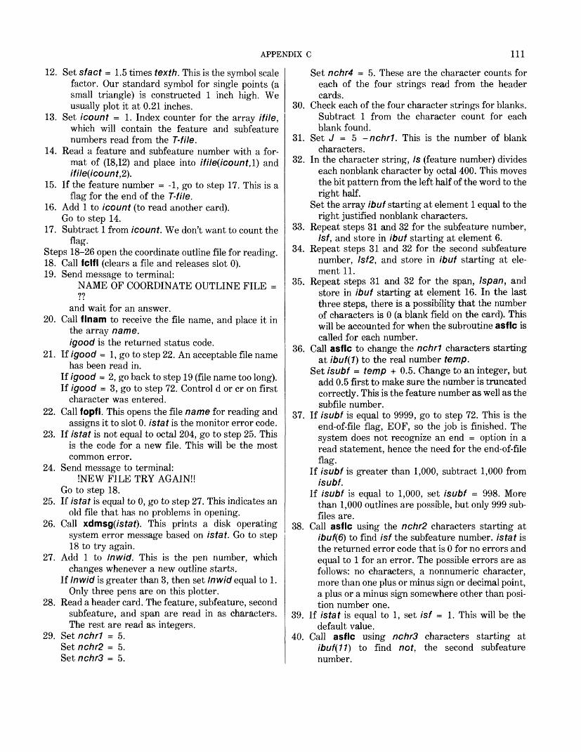
APPENDIX C 111
12. Set sfact = 1.5 times texth. This is the symbol scale factor. Our standard symbol for single points (a small triangle) is constructed 1 inch high. We usually plot it at 0.21 inches.
13. Set icount = 1. Index counter for the array if He, which will contain the feature and subfeature numbers read from the T-file.
14. Read a feature and subfeature number with a for mat of (18,12) and place into ifile(icount,l) and ifile(icount,2).
15. If the feature number = -1, go to step 17. This is a flag for the end of the T-file.
16. Add 1 to icount (to read another card). Go to step 14.
17. Subtract 1 from icount. We don't want to count theflag.
Steps 18-26 open the coordinate outline file for reading.18. Call fclfl (clears a file and releases slot 0).19. Send message to terminal:
NAME OF COORDINATE OUTLINE FILE = ??
and wait for an answer.20. Call flnam to receive the file name, and place it in
the array name, igood is the returned status code.
21. If igood = 1, go to step 22. An acceptable file namehas been read in.
If igood = 2, go back to step 19 (file name too long). If igood = 3, go to step 72. Control d or cr on first
character was entered.22. Call fopfl. This opens the file name for reading and
assigns it to slot 0. is tat is the monitor error code.23. If istat is not equal to octal 204, go to step 25. This
is the code for a new file. This will be the most common error.
24. Send message to terminal:!NEW FILE TRY AGAIN!!
Go to step 18.25. If istat is equal to 0, go to step 27. This indicates an
old file that has no problems in opening.26. Call xdmsg(/sfaf). This prints a disk operating
system error message based on istat. Go to step 18 to try again.
27. Add 1 to Inwid. This is the pen number, whichchanges whenever a new outline starts.
If Inwid is greater than 3, then set Inwid equal to 1. Only three pens are on this plotter.
28. Read a header card. The feature, subfeature, second subfeature, and span are read in as characters. The rest are read as integers.
29. Set nchrl = 5. Set nchr2 = 5. Set nchr3 = 5.
Set nchr4 = 5. These are the character counts for each of the four strings read from the header cards.
30. Check each of the four character strings for blanks. Subtract 1 from the character count for each blank found.
31. Set J = 5 -nchrl. This is the number of blank characters.
32. In the character string, Is (feature number) divides each nonblank character by octal 400. This moves the bit pattern from the left half of the word to the right half.
Set the array ibuf starting at element 1 equal to the right justified nonblank characters.
33. Repeat steps 31 and 32 for the subfeature number, Isf, and store in ibuf starting at element 6.
34. Repeat steps 31 and 32 for the second subfeature number, Isf2, and store in ibuf starting at ele ment 11.
35. Repeat steps 31 and 32 for the span, /span, and store in ibuf starting at element 16. In the last three steps, there is a possibility that the number of characters is 0 (a blank field on the card). This will be accounted for when the subroutine asflc is called for each number.
36. Call asflc to change the nchrl characters startingat ibuf(1) to the real number temp.
Set isubf = temp + 0.5. Change to an integer, but add 0.5 first to make sure the number is truncated correctly. This is the feature number as well as the subfile number.
37. If isubf is equal to 9999, go to step 72. This is the end-of-file flag, EOF, so the job is finished. The system does not recognize an end = option in a read statement, hence the need for the end-of-file flag.
If isubf is greater than 1,000, subtract 1,000 from isubf.
If isubf is equal to 1,000, set isubf = 998. More than 1,000 outlines are possible, but only 999 sub files are.
38. Call asflc using the nchr2 characters starting at ibuf(6) to find isf the subfeature number, istat is the returned error code that is 0 for no errors and equal to 1 for an error. The possible errors are as follows: no characters, a nonnumeric character, more than one plus or minus sign or decimal point, a plus or a minus sign somewhere other than posi tion number one.
39. If istat is equal to 1, set isf = 1. This will be the default value.
40. Call asflc using nchrS characters starting at ibuf(11) to find not, the second subfeature number.

112 GEOINDEX
41. If istat is equal to 1, set not = 0 (the default value).42. Call asflc using nchr4 characters starting at
ibuf(16) to find is pan, the span (should be negative or zero).
43. If istat is equal to 1, set ispan = 0 (the default value).
44. Go through the if He array to see if an entry matches the feature number, isubf, and the subfeature number, isf.
If a match is found, go to step 47.45. Read a data point record. Skip this outline.46. Subtract 6 from isf no. Six data points are on each
record.If there are more data point records for this outline,
isf no is greater than 0, go to step 44. Otherwise, go to step 28 to read the next header card.
47. Set ie equal to the minimum of (6,isf no). There are a maximum of six points per record.
48. Read ie data points from the next record into xx andyy.
49. Set x1 = xx(1}.Set y1 = yy(1). This is the data point written to the
drawing file when rwcon is called.50. Set nchar = nchrl. This is the number of
characters to be written as a text string when rwcon is called.
For /' = 1, nchrl, set id(i) = ls(i) (feature number). id is the array from which rwcon gets the text string.
51. Set key = 8 (the indicator that is a text position).52. Set kp = 1. When writing a drawing file record,
rwcon uses x(kp) and y(kp).Call rwcon(/r/,2). kf (equivalent to k(4)) is the active
file. The 2 indicates a write.53. Set key = 16 (text string indicator).
Call rwcon to write a record. This writes the text string record containing the feature number.
54. Write the feature number to the terminal. This leaves a record of what has been done to date, which may be needed if there is some sort of system failure.
55. If the subfeature number is not to be placed as text, go to step 57.
56. Set nchar = nchr2.Set id(i) = lsf(i), for / = 1, nchr2.Set key = 16.Call rwcon to write a text string record.
57. If the span is not to be placed as text, go to step 59.58. Set nchar = nchr4.
Set id(i) = lspan(i), for /' = 1, nchr4.
Set key = 16.Call rwcon to write a text string record.
59. If the second subfeature number is not to be placed as text, go to 61.
60. Set nchar = nchr3.Set id(i) = Isf2(i), for / = 1, nchrt.Set key = 16.Call rwcon to write a text string record.
61. Set x1 = xx(2).Set y1 = yy(2). Process the second point.
62. If isfno is greater than 2, go to step 64. Greater than 2 indicates a line segment. If equal to 2, it would indicate a single point.
63. Set key = 7 (the indicator for a symbol). Set kp = 1.Call rwcon to write a symbol record. Go to step 27 to start on the next outline.
64. Set key = I (the indicator for a pen up). Set kp = I.Call rwcon to write a pen-up record. Set //' = 3. We have already processed the first 2
points. Go to step 66.
65. Read ie data points from the next record into xx andyy.
66. Set key = 6 (the indicator for pen down). Set kp = I.
67. Do for / = //, ie. Setxl = yy(i). Set y1 = yy(i). Call rwcon to write a pen-down record.
68. Set //' = 1 (will start with first data point next time).69. If there are no more data points for this outline, go
to step 27 to start on the next.70. Subtract 6 from isfno. This computes how many
more points are left to complete the outline.71. Set ie = minumum of (6,isfno).
Go to step 64.72. Set isubf = 999. Subfile 999 indicates that the
whole drawing file is being referred to.73. Set key = 31 (the indicator for an EOF).
Call rwcon to write an EOF record. Call fclfl to clear the disk file and release slot 0.
74. Call fcnot (" 7 ") several times to ring the bell. Thisproduces an audible signal to the operator.
Write to the terminal:IPROGRAM FINISHED!!
Set kp = 1. Call ovrly. This overlays user memory with selected
main program; it returns control to the table. Call exit2 (overlays signoff for the system).
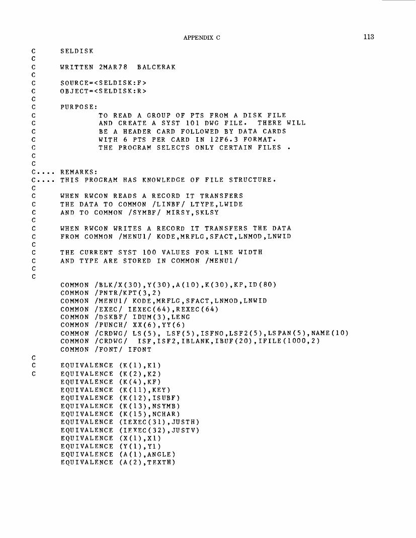
APPENDIX C 113
SELDISK
WRITTEN 2MAR78 BALCERAK
SOURCE=<SELDISK:F> OBJECT=<SELDISK:R>
PURPOSETO READ A GROUP OF PTS FROM A DISK FILE AND CREATE A SYST 101 DWG FILE. THERE WILL BE A HEADER CARD FOLLOWED BY DATA CARDS WITH 6 PTS PER CARD IN 12F6.3 FORMAT. THE PROGRAM SELECTS ONLY CERTAIN FILES .
REMARKS:THIS PROGRAM HAS KNOWLEDGE OF FILE STRUCTURE.
WHEN RWCON READS A RECORD IT TRANSFERS THE DATA TO COMMON /LINBF/ LTYPE,LWIDE AND TO COMMON /SYMBF/ MIRSY,SKLSY
WHEN RWCON WRITES A RECORD IT TRANSFERS THE DATA FROM COMMON /MENU1/ KODE,MRFLG,SFACT,LNMOD,LNWID
THE CURRENT SYST 100 VALUES FOR LINE WIDTH AND TYPE ARE STORED IN COMMON /MENU1/
COMMON /BLK/X(30),Y(30),A(10),K(30),KP,ID(80)COMMON /PNTR/KPT(3,2)COMMON /MENU1/ KODE,MRFLG,SFACT,LNMOD,LNWIDCOMMON /EXEC/ IEXEC(64),REXEC(64)COMMON /DSKBF/ IDUM(3),LENGCOMMON /PUNCH/ XX(6),YY(6)COMMON /CRDWG/ LS(5), LSF(5 ) ,ISFNO,LSF2(5 ) ,LSPAN(5 ) ,NAME(10)COMMON /CRDWG/ ISF,ISF2,IBLANK,IBUF(20),IFILE(1000,2)COMMON /FONT/ IFONT
EQUIVALENCE EQUIVALENCE EQUIVALENCE EQUIVALENCE EQUIVALENCE EQUIVALENCE EQUIVALENCE EQUIVALENCE EQUIVALENCE EQUIVALENCE EQUIVALENCE EQUIVALENCE EQUIVALENCE
(K(2),K2) (K(4),KF) (K(11),KEY) (K(12) ,ISUBF) (K(13) ,NSYMB) (K(15) ,NCHAR) (IEXEC(31) , JUSTH) (IEXEC(32) , JUSTV)
(A(l) , ANGLE) (A(2) ,TEXTH)
114 GEOINDEX
CDATA IBLANK /2H /
C C C C C
CALL SAVE(l)MRFLG=0SFACT=1LNMOD=1LNWID=0IFONT=0ANGLE=0.JUSTH=1JUSTV=1
CCALL MSGOT("ISELDISK OVERLAY") PAUSE TURN ON CARD READER CALL FCLFL(0,IER) CALL FOPFL("/CDR",0,0,IER)IF (IER) 150,200,150
150 CALL MSGOT("(FOPFL ERROR|")GO TO 500
C200 CALL NUMIN("|CHARACTER HEIGHT=",TEXTH)
IF (TEXTH) 200,210,210 210 CALL NUMIN("[SYMBOL # =",TEMP)
NSYMB=TEMPIF (NSYMB) 210,210,220
220 IF (NSYMB-200) 230,230,210 230 SFACT=1.5*TEXTH
CICOUNT=1
240 READ (0,250) IFILE(ICOUNT,1),IFILE(ICOUNT,2) 250 FORMAT (18,12,)
IF (IFILE(ICOUNT,1) .EQ. -1) GO TO 260 ICOUNT=ICOUNT+1 GO TO 240
260 ICOUNT=ICOUNT-1 C270 CALL FCLFL (0,IER)280 CALL MSGOT ("|NAME OF COORDINATE OUTLINE FILE=?? ")
CALL FLNAM (NAME,IGOOD) GO TO (290,280,500),IGOOD
290 CALL FOPFL (NAME,0,0,IS TAT)IF (ISTAT .NE. 204K) GO TO 295 CALL MSGOT ("[NEW FILE TRY AGAIN|| ") GO TO 270
295 IF (ISTAT .EQ. 0) GO TO 300 CALL XDMSG (ISTAT) GO TO 270
C300 LNWID=LNWID+1
IF (LNWID.GT.3) LNWID=1

APPENDIX C 115
cC READ HEADER CARD C305 READ (0,310) (LS(I),1=1,5),IFNO,(LSF(J),J = l,5),
* ISFNO,(LSF2(M),M=1,5 ),NOR,NIF,(LSPAN(L),L=l,5) 310 FORMAT (5A 1,1 5,5A1,I 5,5A1,215,5A1)
NCHR1=5NCHR2=5NCHR3=5NCHR4=5
C C
DO 320 1=1,5IF (LS(I) .EQ. IBLANK) NCHR1=NCHR1-1IF (LSF(I) .EQ. IBLANK) NCHR2=NCHR2-1IF (LSF2(I).EQ. IBLANK) NCHR3=NCHR3-1IF (LSPAN(I) .EQ. IBLANK) NCHR4=NCHR4-1
320 CONTINUE C C
J=5-NCHR1DO 330 I-1.NCHR1LS(I)=LS(I+J)/400KIBUF(I)=LS(I)
330 CONTINUE C
J=5-NCHR2DO 340 I=1,NCHR2LSF(I)=LSF(H-J)/400KIBUF(H-5)=LSF(I)
340 CONTINUEIF (NCHR3.EQ.O) GO TO 352
C C
J=5-NCHR3DO 350 I=1,NCHR3LSF2(I)=LSF2(H-J)/400KIBUF(H-10)=LSF2(I)
350 CONTINUE C C352 J=5-NCHR4
DO 353 I=1,NCHR4LSPAN(I)=LSPAN(H-J)/400KIBUF(H-15)=LSPAN(I)
353 CONTINUE
CALL ASFLC (IBUF(1),NCHR 1,TEMP,ISTAT) ISUBF=TEMP+.5
IF (ISUBF .EQ. 9999) GO TO 500IF (ISUBF .GT. 1000) ISUBF=ISUBF-1000IF (ISUBF .EQ. 1000) ISUBF=998
116 GEOINDEX
CCALL ASFLC(IBUF(6),NCHR2,TEMP,ISTAT)ISF=TEMP+.5IF (ISTAT .EQ. 1) ISF=1CALL ASFLC (IBUF(1 1),NCHR3,TEMP,ISTAT)NOT=TEMP+.5IF (ISTAT .EQ. 1) NOT=0CALL ASFLC (IBUF( 1 6),NCHR4,TEMP,ISTAT)ISPAN=TEMP+.5IF (ISTAT .EQ. 1) ISPAN=0
CDO 1000 I-l.ICOUNTIF (IFILE(I,1) .NE. ISUBF) GO TO 1000IF (IFILE(I,2) .EQ. ISF) GO TO 1050
1000 CONTINUE 1010 READ (0,355) XX(1)
ISFNO=ISFNO-6IF (ISFNO) 305,305,1010
C 1050 IE=ISFNO
IF(ISFNO .GE. 6)IE=6 CC READ FIRST DATA CARD C
READ (0,355) (XX(I),YY(I),I=1,IE) 355 FORMAT(12F6.3)
X1=XX(1)Y1=YY(1)NCHAR=NCHR1DO 360 I=1,NCHR1ID (I)=LS (I)
360 CONTINUEKEY = 8KP=1CALL RWCON(KF,2)KEY=16CALL RWCON(KF,2)
CWRITE (10,365) ISUBF
365 FORMAT (16) C
IF ( (ISF .EQ. 1) .AND. (IFNO .EQ. 1) ) GO TO 375NCHAR=NCHR2DO 370 I=1,NCHR2ID (I)-LSF(I)
370 CONTINUEKEY=16CALL RWCON(KF,2)
C C 375 IF (ISPAN .EQ. 0) GO TO 380
NCHAR=NCHR4DO 377 I=1,NCHR4ID(I)=LSPAN(I)
APPENDIX C
377 CONTINUEKEY=16CALL RWCON(KF,2)
C C
380 IF (NOT .EQ.O) GO TO 400NCHAR=NCHR3DO 390 I=1,NCHR3ID(I)=LSF2(I)
390 CONTINUEKEY=16CALL RWCON(KF,2)
C C
400 X1=XX(2)Y1=YY(2)
CC SYMBOL NEEDED IF THIS IS SINGLE PT C
IF (ISFNO.GT.2) GO TO 410KEY = 7KP = 1CALL RWCON(KF,2)GO TO 300
CC WRITE PEN UP C
410 KEY=1KP=1CALL RWCON(KF,2)JJ = 3GO TO 430
C420 READ(0,355) (XX(I),YY(I),1=1,IE)
CC WRITE PEN DOWN C
430 KEY=6KP = 1DO 440 I=JJ,IEX1=XX(I)Y1=YY(I)CALL RWCON(KF,2)
440 CONTINUE
IF (ISFNO-6) 300,300,450450 ISFNO=ISFNO-6
IE=ISFNOIF (ISFNO.GE.6) IE=6GO TO 420
CC DONE C
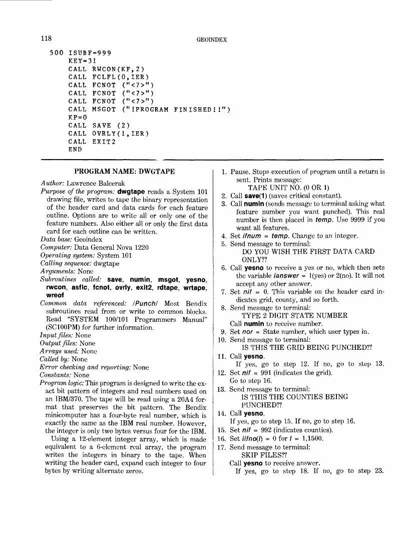
118 GEOINDEX
500 ISUBF=999 KEY=31CALL RWCON(KF,2) CALL FCLFL(0,IER) CALL FCNOT ("<7>") CALL FCNOT ("<7>") CALL FCNOT ("<7>")CALL MSGOT ("IPROGRAM FINISHED!!") KP = 0CALL SAVE (2) CALL OVRLY(1,IER) CALL EXIT2 END
PROGRAM NAME: DWGTAPEAuthor: Lawrence BalcerakPurpose of the program: dwgtape reads a System 101
drawing file, writes to tape the binary representation of the header card and data cards for each feature outline. Options are to write all or only one of the feature numbers. Also either all or only the first data card for each outline can be written.
Data base: GeoindexComputer: Data General Nova 1220Operating system: System 101Calling sequence: dwgtapeArguments: NoneSubroutines called: save, numin, msgot, yesno,
rwcon, asflc, fcnot, ovrly, exit2, rdtape, wrtape, wreof
Common data referenced: /Punch/ Most Bendix subroutines read from or write to common blocks. Read "SYSTEM 100/101 Programmers Manual" (SC100PM) for further information.
Input files: NoneOutput files: NoneArrays used: NoneCalled by: NoneError checking and reporting: NoneConstants: NoneProgram logic: This program is designed to write the ex
act bit pattern of integers and real numbers used on an IBM/370. The tape will be read using a 20A4 for mat that preserves the bit pattern. The Bendix minicomputer has a four-byte real number, which is exactly the same as the IBM real number. However, the integer is only two bytes versus four for the IBM.
Using a 12-element integer array, which is made equivalent to a 6-element real array, the program writes the integers in binary to the tape. When writing the header card, expand each integer to four bytes by writing alternate zeros.
1. Pause. Stops execution of program until a return is sent. Prints message:
TAPE UNIT NO. (0 OR 1)2. Call save(1) (saves critical constant).3. Call numin (sends message to terminal asking what
feature number you want punched). This real number is then placed in temp. Use 9999 if you want all features.
4. Set ifnum = temp. Change to an integer.5. Send message to terminal:
DO YOU WISH THE FIRST DATA CARD ONLY??
6. Call yesno to receive a yes or no, which then sets the variable /answer = l(yes) or 2(no). It will not accept any other answer.
7. Set nif = 0. This variable on the header card in dicates grid, county, and so forth.
8. Send message to terminal:TYPE 2 DIGIT STATE NUMBER
Call numin to receive number.9. Set nor = State number, which user types in.
10. Send message to terminal:IS THIS THE GRID BEING PUNCHED??
11. Call yesno.If yes, go to step 12. If no, go to step 13.
12. Set nif = 991 (indicates the grid). Go to step 16.
13. Send message to terminal:IS THIS THE COUNTIES BEING PUNCHED??
14. Call yesno.If yes, go to step 15. If no, go to step 16.
15. Set nif = 992 (indicates counties).16. Set iifno(l) = 0 for / = 1,1500.17. Send message to terminal:
SKIP FILES?? Call yesno to receive answer.
If yes, go to step 18. If no, go to step 23.
APPENDIX C 119
18. Call numin. Send message: HOW MANY FILES ??
Receive answer and store in temp.19. Set iskip = temp.
If iskip is less than 0, go to step 18.If iskip = 0, go to step 23.If iskip is greater than 0, go to step 20.
20. Do steps 21-22 for / = 1, iskip21. Call rdtape to read the tape, jstat is the status
return code.22. If jstat = 4 (EOF), go to step 20 to read next file.
If jstat does not = 0, go to step 84. Otherwise, go to step 21.
23. Set kpt(kf,1) = 1. Sets the read pointer for the drawing file to the first record. Steps 24-28 will read the drawing file until the first text position is read for the appropriate feature number.
24. Set kp = I. When reading a drawing file, rwcon uses x(kp) and y(kp).
25. Call rwcon(kf, 1). kf, equivalent to k(4), is the active file. The 1 indicates a read.
26. If key = 31 (EOF), go to step 83.Note: Several assumptions are made about the drawing
file. The subfile number is the same as the feature number. Each outline begins with a text string identi fying the feature number, subfeature number, span and second subfeature number, with a default of 0 for any absent text. Any number of line segments can make up an outline.
27. If isubf, subfile number, is not equal to ifnum, and if ifnum is not equal to 9999, go to step 24. This searches for the appropriate feature number.
28. Set kount = I. This is a count of the number of points in an outline. The text position is the first point.
Set inum = 1 (a count of the number of outlines).29. Set iifno(isubf) = 1. This is the count of how many
outlines that have the same feature number.30. Set ftp =1.
Call rwcon to read a record.31. If key = 31 (EOF), go to step 36.32. If this is not an appropriate outline (check isubf), go
to step 30.33. If key = 8 (text position), go to step 36.34. If key = I (pen up), or
If key = 6 (pen down), or If key = 7 (symbol position), add 1 to kount.
35. Go step 30.36. Set iburp(inum) = kount. This is a count of the
number of points for each outline. Set kount = I. Start count over. Add 1 to inum (sequence number of next outline).
37. If key = 31 (EOF), go to step 39. There are two ways to reach this step: key = 31 or key = 8.
38. Add 1 to the count of number of outlines that have same feature number as the new outline just started. This step can be reached only if key = 8 (text position), which starts a new outline. Go to step 30.
Steps 39-43 will read the drawing file until the first text position is read for the appropriate feature number.
39. Set kpt(kf,l) = 1. Sets the read pointer for the drawing file to the first record.
40. Set inum = I (outline count).41. Set kp = 1.
Call rwcon to read a record.42. If key = 31 (EOF), go to step 85. (Program is fin
ished.)43. If this is not an appropriate outline (check isubf),
go to step 41.44. Set kount = 0. This is a counter for the number of
text string found for an outline. None is found yet.Set knum = 2. This is a counter for the number of
the points to be processed. One is already process ed.
Set Hf = isubf (feature number).Set ifno = iifno(isubf). This is the number of
outlines with same feature number.Set isfno = iburp(inum) (the number of points).Add 1 to inum. This is a sequence number of the
next outline.Set isf = 1. This will be 1 less changed in a text
string.Set iup = 1. This is a counter for the number of pen
ups or symbol positions in one outline. The first is treated differently from the rest.
Set not = 0; set /span = 0 (default values).Set xp(7) = x7; set yp(7) = y1. This is the text posi
tion.45. For / = knum, 6, set xp(/) = 0; set yp(i) =0.46. If knum = 1, set knum - 0. This will be equal to 1
when a card image has just been written and more points are needed to complete the outline. It then branches to the previous step where it must be a 1, but logic further along demands that it be 0.
47. Set kp = 1; call rwcon to read a record.48. If key = 31 (EOF), go to step 76.49. If this is not an appropriate outline (check isubf), go
to step 47. More than one outline may have the same feature number.
50. If key = 8 (text position), go to step 76. This would be true when an outline other than the first comes up.
51. If key = 16 (text string), go to step 55.
120 GEOINDEX
52. If key = 1 (pen up) or 7 (symbol position), go to step 68.
53. If key = 6 (pen down), go to step 74.54. Go to step 47.55. Add 1 to kount. Another text is string found for this
outline.56. If kount = 1, or kount is greater than 4, go to step
47. If equal to 1, it is the feature number, which is the same as the subfile number. It should never be greater than 4.
57. For / = 1, 5, set ibuf(i) = id(i) (the text string).58. Call asf Ic to find the number, temp, represented by
the text in ibuf(i).59. If istat = 1, go to step 47. An error code of 1 is
returned for any abnormality.60. If nif = 992, go to step 64. If this is the counties, isf
represents a bordering county or other boundary.61. If there is only one outline and temp is greater than
0, set kount = 4. This must be a second sub- feature number, but there may not be four text strings.
62. If there is only one outline and temp is less than 0, set kount = 3. This must be a span, but there may not be three text strings.
63. Set / = kount - 1. If / = 1, go to step 64. If / = 2, go to step 65. If / = 3, go to step 66.
64. Set isf = temp. This must have been the second text string with if no greater than 1, or this is the counties, or temp = 0. Go to step 47.
65. Set /spa/7 = temp. This was the third text string, or second text string with temp less than 0. Go to step 47.
66. Set not = temp. This was the fourth text string, or temp greater than 0 and only one outline. Go to step 47.
67. If key = 1 (pen up) and iup is greater than 1, go to step 74. If these two conditions are met, then this is another line segment that must be concatenated to previous segments.
68. Add 1 to iup. This is a flag to show what position the next pen up has in the outline; used in previous step.
69. Setxp(2) = x1; setyp(2) = y1.70. Set iout(i) = /zero, for / = 1, 24.71. Set iout(2) = iif (feature number).
Set iout(4) = if no (the number of outlines). Set iout(6) = isf (subfeature number).
Set iout(8) = isf no (number of points).Set iout(10) = not (second subfeature number).Set iout(12) = nor (State number).Set iout(14) = nif (graticule identifier).Set iout(16) = /spa/7 (span).
72. If /spa/7 is less than 0, set iout(15) = ineg (makes the whole word negative.
73. Call wrtape to write the header card to the tape. If istat (error code) not = 0, go to step 84. Otherwise, go to step 47.
74. Add 1 to knum (counter for next position). Set xp(knum) = x1; set yp(knum) = y1.
75. If knum is less than 6, go to step 47.Otherwise, go to the next step. The card should
have six points to be punched.76. If knum = 0, go to step 80. Then, the last card
punched had six points on it and finished an outline.
77. Set/7? = -l;set/= - 3 (to start counters used laterat the proper place in the arrays).
Do steps 78-79 for / = 1, 12, 2.78. Add 4 to /.
Set iout(l) = itemp(i).Set iout(l + 1) = itemp(i + 1).Add 4 to m.Set iout(m) = jtemp(i).Set iout(m + 1) = jtemp(i + 7).
79. Call wrtape to write a data card to the tape. If jstat (error code) not = 0, go to step 84.
80. If key = 31 (EOF), go to step 85. Program is almost finished.
81. If key = 8 (text position), go to step 44. A new outline is to be processed; default values must be reset.
82. Set knum = 1.Go to step 45. More points are in this outline.
83. Write message to terminal:NO TEXT IN FILE!!
Go to step 85.84. Write jstat (error code) to the terminal.85. Write message to terminal:
!DONE!Call wreof to write EOF on tape. Set kp = 0.Call save(2) (restores critical constants). Call ovrly (overlays user memory with selected main
program). Here it returns control to table. Call exit2 (overlays signoff for the system).
DWGTAPE
WRITTEN 23NOV76 BALCERAK
SOURCE=<DWGTAPE:F> OBJECT=<DWGTAPE:R>
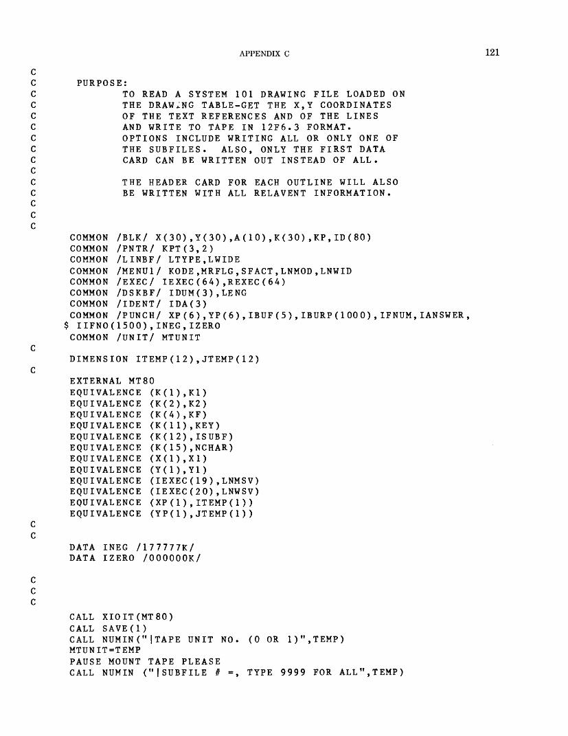
APPENDIX C 121
PURPOSE:TO READ A SYSTEM 101 DRAWING FILE LOADED ON THE DRAWING TABLE-GET THE X,Y COORDINATES OF THE TEXT REFERENCES AND OF THE LINES AND WRITE TO TAPE IN 12F6.3 FORMAT. OPTIONS INCLUDE WRITING ALL OR ONLY ONE OF THE SUBFILES. ALSO, ONLY THE FIRST DATA CARD CAN BE WRITTEN OUT INSTEAD OF ALL.
THE HEADER CARD FOR EACH OUTLINE WILL ALSO BE WRITTEN WITH ALL RELAVENT INFORMATION.
COMMON /BLK/ X(30),Y(30),A(10),K(30),KP,ID(80)COMMON /PNTR/ KPT(3,2)COMMON /LINBF/ LTYPE,LWIDECOMMON /MENU1/ KODE,MRFLG,SFACT,LNMOD,LNWIDCOMMON /EXEC/ IEXEC(64),REXEC(64)COMMON /DSKBF/ IDUM(3),LENGCOMMON /IDENT/ IDA(3)COMMON /PUNCH/ XP(6),YP(6),IBUF(5),IBURP(1000),IFNUM,IANSWER,
$ IIFNO(1500),INEG,IZEROCOMMON /UNIT/ MTUNIT
DIMENSION ITEMP(12),JTEMP(12)
EXTERNAL MT80EQUIVALENCE (K(1),K1)EQUIVALENCEEQUIVALENCEEQUIVALENCEEQUIVALENCEEQUIVALENCEEQUIVALENCEEQUIVALENCEEQUIVALENCEEQUIVALENCEEQUIVALENCEEQUIVALENCE
(K(2),K2) (K(4),KF) (K(11),KEY) (K(12),ISUBF) (K(15),NCHAR)
(IEXEC(19),LNMSV) (IEXEC(20),LNWSV) (XP(1),ITEMP(1)) (YP(1),JTEMP(l))
DATA INEG /177777K/ DATA IZERO /OOOOOOK/
CALL XIOIT(MTSO)CALL SAVE(l)CALL NUMIN("[TAPE UNIT NOMTUNIT=TEMPPAUSE MOUNT TAPE PLEASECALL NUMIN ("(SUBFILE # =
(0 OR 1)",TEMP)
TYPE 9999 FOR ALL",TEMP)
122 GEOINDEX
YOU (IANSWER)
IFNUM=IFIX(TEMP)CALL MSGOT ("|DOCALL YESNONIF = 0CALL NUMINNOR=TEMPCALL MSGOTCALL YESNOGO
WISH THE FIRST DATA CARD ONLY??")
("|TY E 2 DIGET STATE NUMBER ",TEMP)
THE GRID BEING PUNCHED?? ")
THE COUNTIES BEING PUNCHED?? ")
("|IS THIS (ISTAT)
TO (2,3),ISTAT2 NIF=991
GO TO 53 CALL MSGOT ("|IS THIS
CALL YESNO (ISTAT) GO TO (4,5),ISTAT
4 NIF=9925 DO 6 1=1,1500
IIFNO(I)=06 CONTINUE
CALL MSGOT (" SKIP FILES?? ") CALL YESNO (IT) GO TO (7, 12),IT
7 CALL NUMIN(" HOW MANY FILES?? ",TEMP) ISKIP=TEMP IF (ISKIP) 7,12,8
8 DO 11 1=1,ISKIP9 CALL RDTAPE (MTUNIT,IBURP,1000,0,JACNT,JSTAT)
IF (JSTAT .EQ. 4) GO TO 11 IF (JSTAT .NE. 0) GO TO 12 GO TO 9
11 CONTINUE
12 CONTINUE
KPT(KF,1)=1
START READING RECORDS AND PUNCHING OUT CARDS
GO TO 350 IFNUM) .AND GO TO 10
10 KP=1CALL RWCON (KF, 1)IF (KEY .EQ. 31)IF ( (ISUBF .NE.IF (KEY .NE. 8)KOUNT=1INUM=1IIFNO(ISUBF)-!
20 KP=1CALL RWCON (KF, 1)IF (KEY .EQ. 31) GO TO 30IF ( (ISUBF .NE. IFNUM) .ANDIF (KEY .EQ. 8) GO TO 30IF ( (KEY .EQ. 1) .OR. (KEY
(IFNUM .NE. 9999) ) GO TO 10
(IFNUM .NE. 9999) ) GO TO 20
EQ. 6) .OR. (KEY .EQ. 7) )
APPENDIX C 123
* KOUNT=KOUNT+1GO TO 20
C C
30 IBURP(INUM)=KOUNTKOUNT=1INUM=INUM+1IF (KEY .EQ. 31) GO TO 40IIFNO(ISUBF)=IIFNO(ISUBF)+1GO TO 20
CC
40
CC
50
KPT(KF,INUM=1
KP = 1
1)
CALL RWCON (KF,1)IF (KEY .EQ. 31) GO TO 500IF ( (ISUBF .NE. IFNUM) .AND. (IFNUM .NE. 9999) ) GO TO 50IF (KEY .NE. 8) GO TO 50
55 KOUNT=0KNUM=2IIF=ISUBFIFNO=IIFNO(ISUBF)ISFNO=IBURP(INUM)INUM=INUM+1ISF=1IUP«1NOT = 0ISPAN=0XP(1)=X1YP(1)=Y1
60 DO 65 I=KNUM,6XP(I)=0.YP(I)=0.
65 CONTINUEIF (KNUM .EQ. 1) KNUM=0
C C
70 KP=1CALL RWCON (KF,1)IF (KEY .EQ. 31) GO TO 140IF ( (ISUBF .NE. IFNUM) .AND. (IFNUM .NE. 9999) ) GO TO 70IF (KEY .EQ. 8) GO TO 140IF (KEY .EQ. 16) GO TO 80IF ( (KEY .EQ. 1) .OR. (KEY .EQ. 7) ) GO TO 110IF (KEY .EQ. 6) GO TO 130GO TO 70
C C
80 KOUNT=KOUNT+1IF ( (KOUNT .EQ. 1) .OR. (KOUNT .GT. 4) ) GO TO 70DO 85 1=1,5
124 GEOINDEX
85
90
95
100
110
120
130
140
150160
IBUF(I)=ID(I)CALL ASFLC (IBUF,NCHAR,TEMP,ISTAT)
GO TO 70 GO TO 90 AND. (TEMP .AND. (TEMP
IF (ISTAT .EQ. 1)IF (NIF .EQ. 992)IF( (IFNO .EQ. 1) .AND. (TEMP .GT. 0.0) ) KOUNT=4IF ( (IFNO .EQ. 1) .AND. (TEMP .LT. 0.0) ) KOUNT=3I=KOUNT-1GO TO (90,95,100),ISF=TEMPGO TO 70ISPAN=TEMPGO TO 70NOT=TEMPGO TO 70
IF ( (KEY .EQ. 1) .AND. (IUP .GT. 1) ) GO TO 130IUP=IUP+1XP(2)=X1YP(2)=Y1WRITE(22, 120)IIF,IFNO,ISF,ISFNO,NOT,NOR,NIF,ISPANFORMAT(1X,8I5)GO TO 70
KNUM=KNUM+1 XP(KNUM)=X1 YP(KNUM)=Y1 IF (KNUM .LT IF (KNUM .EQ
6) GO TO 70 0) GO TO 160
WRITE(22,150) (XP(I),YP(I),1=1,6)FORMAT(1X,12F6.3)IF (KEY .EQ IF (KEY .EQ IF (IANSWER KNUM=1 GO TO 60
DONE
31) GO TO 5008) GO TO 55
EQ. 1) GO TO 50
350 CALL FCNOT ("|NO TEXT IN FILE|")
500 CALL FCNOT ("|DONE|")CALL WREOF (MTUNIT,JSTAT)KP = 0CALL SAVE(2)CALL OVRLY (1,IER)CALL EXIT2END
APPENDIX C 125
EXEC_COM NAME: VERSATEC.EC
Author: James FisherPurpose of the program: versatec.ec, written in Multics
command language, reads the tape that was created on the Data General minicomputer and creates the Versatec border, grid, State, county, and coordinate files. If there is more than one coordinate file, the files must be combined on Multics by means of an editor, and then sort.vers.coor.ee must be run.
Data base: GeoindexComputer: Honeywell Series 60 (level 68)Operating system: MulticsCalling sequence: ec versatec nnnnnn nof filel . . .
filenArguments:
nnnnnn- Volume number of the tape nof-Number of files to be copied to disk filel . . . filen-Name of the files when copied to disk
Subroutines called: NoneCommon data referenced: NoneInput files: User's tapeOutput files: Files copied to diskArrays used: NoneCalled by: NoneError checking and reporting: NoneConstants: None
Program logic:1. To execute this exec_com, the operator must type:
ec versatec.ec, tape number, number of files, segl seg2. . . segN where segl, seg2, . . ., segN are the file names that are to be created, segl, seg2, . . ., segN must not exceed a total of 32 characters because of the value command used extensively in this exec_com. The value command returns a character string associated with a named item in a user symbol table segment. This enables ad ministrative exec_com segments to reference variables.
2. The exec_com uses the tape_ibm command with density 800, record size 80, and ASCII character mode.
3. The first file is read from tape and written to disk under the name given by segl.
4. The number of file parameters is then checked against the number of files that have been written. When they are not equal, the next file is attached by the I/O command.
5. After the segment is attached, copy_file is used to write the segment to disk.
6. This process continues until the number of file parameters is equal to the number of files that have been written.
7. When the parameters are equal, the tape is renamed and the execution of the exec_com is ended.
*************************************************************
use ec versatec.ec tape no no of files segl seg2.
where segl seg2....segn must not exceed a total
& ************************************************************&&& versatec.ec&&&&&&&&&&&&&&&&&command_line off&input_line off&value$set_seg value_segvalue$set file names [string
. .segn
of 32 char
funct ion:This ec reads the tape that was created on the Bendix minicomputer and creates the Versatec border, grid, statecounty, and coordinate files. If there is coordinate file, they must be combined on sort.vers.coor.ee must be run.
more than one Multics and then
&f 3]
126 GEOINDEX
value$set this_file_name &3value$set increment 0value$set tape_file_no 1&if [equal &2 1] &then value$set all_or_none none&else value$set all_or_none all&&label copyio attach input tape_ibm_ &1 -nib -nb [value tape_file_no] -den 800 -f\crnt fb -rec 80 -bk 80 -mode ascii -retain [value all_or_none]io attach output record_stream_ -target vfile_ [value this_file_name]copy_file -isw input -osw outputio detach (input output)&&if [equal [value tape_f ile_no] &2] &then &goto quitvalue$set tape_file_no [plus [value tape_file_no] 1]&if [equal [value tape_file_no] &2] &then value$set all_or_none nonevalue$set start_of_next_file_name [plus [length [value this__f ile_name]\c] [value increment] 2]value$set remnant [string [substr [string [value f ile__names ] ] [value s\ctart_of__next_file_name] ]]value*set nxtblnk [search [string [value remnant]] " "]&if [equal [value nxtblnk] 0] &then value$set next_file_length [length\c [value remnant]]&else value$set next_file_length [minus [value nxtblnk] 1]value$set next_file_name [substr [string [value remnant] ] 1 [value ne\cxt_file_length]]value$set increment [plus [value increment] [length [value this_file__n\came]] 1]value$set this_file_name [value next_file_name]&goto copy&&label quittruncate value_seg&quit
PROGRAM NAME: INDEX^VERSATECAuthor: Lawrence BalcerakPurpose of the program: index_versatec plots index
maps using the Versatec plotter.Data base: GeoindexComputer: Honeywell Series 60 (level 68)Operating system: MulticsCalling sequence: index_versatecArguments: NoneSubroutines called: io_call, ioa_$nnl, setup_ver-
saplot (Multics software), plots, plot, newpen, let ter, factor (Versaplot software), openf, rotate, legend, pattern, rdftur, srtdup, pltsel, closet
Common data referenced: size, end, istate, scale, Iparaml, in1, ipen, kpen, I word!
Input files: bordNM (fileW), gridNM (file11), statNM (file12), counNM (file13\ coorNM (file14), pverNM (file15)
Output files: Versatec plotArrays used: input 4(6) (used to read the six input files)Called by: NoneError checking and reporting: NoneConstants: in = 15, rsiz = 0.14, ipen = 4, rrsiz = 0.04,
kpen = 1 Program logic:
1. Set fmt2 = (6h(a4,2h,i2,lh)). This is used to put the State number into fmtl. The format is those characters between the outermost parentheses.
2. Attach to the file init_vals. This file contains those changes to the default parameters to the Ver saplot software needed for this plot. The file con tains xmas - 50.0, which should be adequate for most of our plotting.
3. Send message to terminal:TYPE IN TWO DIGIT STATE NUMBER
and read istate.
APPENDIX C 127
4. If istate is less than 10, then fmt2= (6h(a4,2h,lhO,il,lh)).
Do step 5 for / = 10, 15.5. Concatenate the State number to input(i) and place
into name. Call openf with lunlt - i, name = name, mode = "si".
6. Call setup__versaplot. This activates the Versaplot software.
7. Call plots (0,0,0). This initializes the default parameters. If initials is attached, it reads this file and makes those changes.
8. Set in 1 = 10. This is the reference number for bord-NM.
Set size = 17.99, which is the width of the plottingpaper.
Call rotate. Print value of scale. Call legend. Call pattern.
9. If deltay is less than 0.001, go to step 10. A value greater than 0.001 indicates that the plot is to be rotated and translated.
Transform xsym, ysym, xlet, and ylet.10. Call factor. Reset the scale to the value of scale.11. Read inum(5) and iwords(5) from pverNM.
Set iangle = 0.Find the starting aj-values (xsym and xlet) for the
text string iword(5). The values for the use of both text plotting subroutines (symbol and letter) are given. The visible difference in determining which one to use is in the fonts for their letters.
12. If deltay is less than 0.001, go to step 13.Transform xsym, ysym, and xlet, ylet.Set iangle = 270.Call plot (2.0,0.005,-3). This changes the software
origin. Trying to plot y = 0 or x = 0 when the hardware origin is in effect has presented prob lems in the past. Also, at times the upper left x value is negative.
Go to step 14.13. Call plot (2.0, 1.18, -3). Changes the origin to allow
negative y values, which are needed to plot the legends at the bottom.
14. Plot the five text strings in iwords(i). The letter subroutine is the one presently used. The dot width for letters is set at 4 except for the date, where it is 3.
15. Read the parameter plotting values into inparm.16. If inparm(1) is not equal to 1, go to next step. A
value of 1 indicates that the neat outline is to be plotted. A value of 0 indicates do not plot.
Set in1 = 10, which is the reference number for the neat outline.
Call rdftur.Rewind in1.
17. Repeat step 16 with inparm(23) and in1 = 11 (grid). Go to step 18 if no plot.
18. Repeat step 16 with inparm(45) and in 1 = 12(State).
Go to step 19 if no plot.19. Repeat step 16 with inparm(67) and in1 = 13 (coun
ties). Go to step 20 if no plot.
20. Repeat step 16 with inparm(111) and in 1 = 14(coordinates outlines).
Go to step 21 if no plot. Otherwise, go to step 22 after this is plotted.
21. If inparm(89) is not equal 1, go to next step. Set in1 = 14. Call srtdup(/m. Read in cards with the selected outlines, sort them
in ascending order, and remove duplications. Call \se\(inparm(89)). Plot the selected outlines. Rewind in1.
22. Call plot(0.,0.,999) (end of plot). Send message to terminal:
FINISH PLOT23. If inparm(133) is equal to 1, go to step 10.
Otherwise go to step 24.24. Call plot(0.,0.,-999).
End all plotting.25. Call setup_versaplot("-resef") (removes links to
Versatec software).Call closef(i) for /' = 10, 15 (closes and detaches all
files).
PROGRAM - INOEX.VERSATEC PLOT LAND USE ID'S
L.L. BALCERAK U. S. GEOLOGICAL SURVEY
common /rot/ size/end*xmax » ymax*ist a tecommon /param/ sea le*de 11ay t rsiz *rrsizcommon /dex/ if t \ ino* isf/isfno^not*nor*nif t ispan*in1 t ipen/kpen
128 GEOINDEX
common /word/ xsym(5) t ysym(5)/inum(5)/numsta(72 ) / &xlet(5)/ylet(5),iscale(5)/height(5)
character input*4(6)/fmt1*10/fmt2*21/name*6/i*ords*53(5)dimension inparm(133)external io_call (descriptors)/ioa_$nnl (descriptors)/
Ssetup.versaplot (descriptors ) / letter (descriptors)data input / "bord" ,"g r id"/" s t a t ","coun" ,"c oo r" , "pve r ff /in=15i pen = 4kpen=1rsi z=0.14rrsi z=0.04fmt2="(6h(a4,2h,i2,1h) )"
ccall io_cal I ("a11ach"/"init_vaIs","vfi le_","init_va I s")call ioa_$nnl (""/TYPE IN TWO-DIGIT STATE NUMBER: " >read 10/ istate
10 format (i2)if (istate .It. 10) fmt2 = "(6h(a4/2h/1hO,i1/1h ) ) "do 20 i=10/15encode (fmt1/fmt2) istateencode (name/fmtl) input(i-9)call openf (i/name/"si ")
20 continuecall setup_versaplot
cc SET ORIGIN ON PLOTTER c
call plots (U/0/0)in1=10size=17.99call rotateprint /"scale="/scalecall legend (iwords)call patternif (deltay .It. .001) go to 50do 40 i=1/4t emp = x sym(i)xsym(i ) = ysym(i)ysym(i)=deltay-tempt emp = x let(i)x let (i )=y let (i )ylet (i ) = deltay-temp
40 cont i nue 50 call factor (scale) cc BORDER INFORMATION c
read (in/60/end=180) inum(5)/iwords(5) 60 format (i2/a53)
i ang le = 0xsym(5)=(xmax-inum(5)*(height(5)+0.019))/2.xlet (5)=(xmdx-inum(5)*(iscale(5)*(0.0625-0.0029))) 12.if (deltay .It. .001) go to 70i ang I e = 2 70
APPENDIX C 129
ysym(5) = del tdy-xsym(i>)yLet (5)=deltay-xlet(5)xsym(5)=-0.61xlet(5)=-0.61caLL plot (2.0,0.005,-3)go to 80
70 call plot (2.0,1.18,-3) 80 do 90 i=1/5
j=4if (i .eq. 4) j=3call newpen (j)call letter (inum(i),iscale(i),iangle,xlet(i),ylet(i),iwords(i))
90 con t i nue cc READ INPUT INFORMATION c
read (i n , 1 00,end=1 71)) inparm 100 format (66i1/67i1) cc CHECK FOR PLOT OR NO PLOT c ON EACH ITEM cc NEAT OUTLINE c
if (inparm(1) .ne. 1) go to 110in1=10call rdftur (inparm(1))rewind i n1
cc GRID c 110 if (inparm(23) .ne. 1) go to 120
in1=11call rdftur (inparm(23))rewind i n1
cc STATE c 120 if (inparm(45) .ne. 1) go to 130
in1=12call rdftur (inparm(45))rewind i n1
cc COUNTIES c 130 if (inparm(67) .ne. 1) go to 140
in1=13call rdftur (inparm(67))rewind i n1
cc ALL FEATURES c 140 if (inparm(111) .ne. 1) go to 150
in1=14call rdftur (inparm(111))
130 GEOINDEX
C C C150
160
c c c170
180
190
rewind i n1 go to 170
SELECTED FEATURES
if (inparm(89) .ne. 1) go to 170in1=1ACdl I srt dup (in)call pltsel (inparm(89))rewind i n1
CHECK IF SOMETHING ELSE IS TO BE PLOTTED
call plot (O.,0.,999)print *"finish plot"if (inparm(133) .eq. 1) go to 50call plot (J. ,0.,-999)call setup.versaplot ("-reset")do 190 i=10/15call c losef(i )c ont i nuestopend
SUBROUTINE NAME: LEGEND
Author: Lawrence BalcerakPurpose of the program: legend initializes text strings
and beginning text positions for the index maps. Data base: GeoindexComputer: Honeywell Series 60 (level 68) Operating system: Multics Calling sequence: call legend (iwords) Arguments: iwords-Five text strings containing the
legends to be placed on the index maps Subroutines called: None Common data referenced: xmax, ymax, istate, xsym,
ysym, inum, numsta, xlet, ylet, iscale, height Input files: None Output files: None Arrays used:
iwords53(5)nstate20(72)- Array in which to read the States
Called by: index versa tec, index ca I com p Error checking and reporting: None Constants: None
Program logic:1. Set numsta(i) = the number of letters in the State
name, where / represents the FIPS code. Set iwords(1) and iwords(2) Set nstate(i) = State names Set iwords(3) = nstate(istate)
2. Find year date.Set iwords(4) = year date.
3. Set other variables: inum is the count of letters for each iword; height is the height of letters if using symbol to plot the legends; iscale is the height of letters if using subroutine letter to plot the legends; xsym, ysym are the starting x, y coor dinates if using symbol; xlet, ylet are the starting x, y coordinates if using letter.
Note: There are factors of 0.019 and -0.0029 for computing xsym and xlet. The factor for using symbol is to take into account the slight widening of the letter where line width is greater than 1. Where letter is used, the supposed width of a letter is slightly reduced, but no explanation is given in the manual.
subroutine legend (iwords) common /rot/ size*end*xmax^ymax*istate common /word/ xsym(5)*ysym(5)*inum(5)*numsta(72 ) *
6 xlet(5),ylet(5),iscale(5),height(5) character iwords*53(5)*nstate*20(72)*idt*6*year*4
iwordsd>="UNITED STATES GEOLOGICAL SURVEY" iwords(2)="OEPARTMENT OF THE INTERIOR"
APPENDIX C 131
nstated) ="ALABAMA" n s t a t e(2 > = "ALASKA"
nstateU) ="ARIZONA" nstate(S) ="ARKANSAS" nstate(6) ="CALIFORNI A" nstate(7) ="CANAL ZONE" nstate(8) ="COLORADO" nstate(9) ="CONNECTI CUT" nstate(10)="DELAWARE" nstated1)="DISTRICT OF COLUMBIA nstdted 2) = "FLORIOA" nstated3) = "G£ORGI A"
nstated 5) = "HAWAII" nstate(16)="IDAHO" nstate(17)="ILLINOIS" nstated8> = " INDIAN A" nstate(19)="IOWA" nstate(20)="KANSAS" nstate(21>="KENTUCKY" nstate(22)="LOUISIANA" nstate(23)="MAINE" nstate(24)="MARYLAND" nstate(25)="MASSACHUSETTS" nstate(26)="MICHIGAN" nstate(27)="MINNESOTA" nstate(28)="MISSISSIPPI" nstate(29)="MISSOURI" nstate(30)="MONTANA" nstate(31)="NEBRASKA" nstate(32)="NEVADA" nstate(33)="NEW HAMPSHIRE" nstate(3A)="NEW JERSEY" nstate(35)="NEW MEXICO" nstate(36)="NEW YORK" nstate(37)="NORTH CAROLINA" nstate(33)="NORTH DAKOTA" nstate(39)="OHIO" nstate(40)="OKLAHOMA" nstate(41)="OREGON" nstate(42)="PENNSYLVANIA"
nstate(44)="RHODE ISLAND" nstate(45)="SOUTH CAROLINA" nstate(4o)="SOUTH DAKOTA" nstate(47)="TENNESSEE" nstate(46)="TEXAS" nstate(49)="UTAH" nstate(50)="VERMONT" nstate(51)="VIRGINIA" nstate(52)="VIRGIN ISLANDS" nstate(53)="WASHINGTON" nstate(54)="WEST VIRGINIA" nstate(55)="WISCONSIN" nstate(56)="WYOMING"
132 GEOINDEX
Cnstate(60)="AMERICAN SAMOA"nstate(66)="GUAM"nstate(72)="PUERTO RICO"
ciwords(3)=nstate(i state)call pU .da te_ (i d t)decode (idt*10) year
10 format (a2)encode (iwords(4) , 20) year
20 format (2h19,a2) c
i num(1)=31i num(2) = 26inum(3) = numsta(i state)i num(A) = 4
cneightd )=0.18height(2)=0.18height(3)=0.18height(4)=0.14height(5)=0.28
ciscale(1)=3iscale(2)=3iscale(3)=3iscale(4)=3iscale(5)=5
cxsymd ) = 0.25ysym (1) = yma x + 0.35xsym(2)=0.2bysym(2)=ymax+0.68xsym(3)=xmax-inum(3)*(height(3)+0.019)-0,25ysym(3)=ymax+0.68xsym(4) = (xmax-inum(4)*(height(4)-«-0.019))/2.ysym(4)=-1.17ysym (5) = -0.61
cdo 30 i=1,5y I et (i) = ysym(i)
30 cont i nuex let (1 ) = xsym(1)x let (2) = xsym(2)xlet (3) = xmax-inum(3)*(iscale(3)*(0.0625-0.0029))-0.25xlet(4)=(xmax-inurn(4)*(iscale(4)*(0.0625-0.0029)))/2.re tu rnend
c c
block datacommon /word/ xsym(5)*ysym(5) » inum<5)*numsta( 72 ) *
& xlet(5),ylet(5),iscale(5),height(5)
APPENDIX C 133
data
end
nums t a &
& &
/ 7/20/ 8/ 8/ 6/1 8/ O/
6/ 7/ 9/6/1 2/0/1O/
o/7/5/ 3/O/ U/ O/
7/ 8/1 O/ 6/ 8/13/ 10/10/ 12/14/1 13/ 9/ O/ O/
0/1 5/ 8/ 8/1 2/ 7/ 4/
O/ 8/ 9/1 4/1 9/ O/ O/
8/1 7/
2/ 5/O/ O/
4, 8/ 4/ 4/ 0/1 O/
8/ 6/ 7/ 8/ 7/ 4/ O/ 0/1 1/
SUBROUTINE NAME: ROTATEAuthor: Lawrence BalcerakPurpose of the program: rotate checks bordNM to see if
it will fit on plotting paper at full scale. If not, it com putes a scale that produces the largest possible plot on the paper. The finished plot can be upright or rotated on its side.
Data base: GeoindexComputer: Honeywell Series 60 (level 68)Operating system: MulticsCalling sequence: call rotateArguments: NoneSubroutines called: NoneCommon data referenced: size, end, xmax, ymax,
scale, deltay, in1Input files: bordNMOutput files: NoneArrays used:
x(6)-x coordinate y(6)-y coordinate
Called by: index versatec, index calcompError checking and reporting: NoneConstants: NoneProgram logic:
1. Reads the header card (does not use).2. Reads data points (always six points).
3. Finds maximum x value and y value and stores in xmax and ymax.
4. Set parameters (assume upright at full scale): end = xmax + 8.0. In Calcomp plotting, this is the amount to move in x to start a new plot; scale = 1.0; deltay = 0.0. If plot is rotated, deltay is the amount of translation needed to bring plot back to plotting frame.
5. If ymax plus amount needed for legends at top and bottom is less than size (width of paper), go to step 10 (plot fits on paper).
6. If xmax is greater than size, go to step 8 (rotated plot too big to fit).
7. Rotated plot will fit at full scale. Set deltay = xmax Set end = ymax + 8.0 Go to step 10.
8. Plot must be scaled. If plot would be larger rotated on side, go to step 9. Otherwise, compute scale in upright position.
Go to step 10.9. Compute scale in rotated position.
Set deltay = xmax Set end = ymax + 8.0
10. Rewind data file.Return to calling program.
10
20
30
subroutine rotatecommon /rot/ size/end/xmax/ymax/istatecommon /param/ sca le/de 11ay/rsiz/rrsizcommon /dex/ if/ifno/isf/isfno/not/nor/nif/ispan^in1/ipen/kpendimension x(6)/y(6)read (in1/10) ifformat (i5)read (in1/20) ( x(i ) /y(i)/i = 1/6)format (12fb.3)xma x=x(2)ymax=y(2)do 30 i=3/6if (x(i) .gt. xmax) xmax=x(i)if (y(i) .gt. ymax) ymax=y(i)c on t i nue
134 GEOINDEX
40
50
60
end= xma x + 8« 0scale=1.0del tay=0.0if ((ymax + 2if (xmax .gt.de I t ay=xmdxend=ymax+8. 0go to 60if (xmax .It.seal e=size/(ymaxgo to 60scale=size/xmax-0.01de 1 1 ay=xmaxend=ymax+8. 0r ew i nd i n1returnend
05) . I e . size) size) go to 40
go to 00
(yma x + 2 . 05) ) . 05) -0.01
go to 50
SUBROUTINE NAME: RDFTURAuthor: Lawrence BalcerakPurpose of the program: rdftur reads a header card from
the file being plotted and branches to the designatedplotting subroutine.
Data base: GeoindexComputer: Honeywell Series 60 (level 68) Operating system: Multics Calling sequence: call rdftur (infom) Arguments: infom-Array of 22 elements with plotting
parameters for the file being read Subroutines called: plotch, plotli, pllich Common data referenced: if, ifno, isf, isfno, not, nor,
nif, in1 Input files: gridNM, statNM, counNM, coorNM
Output files: NoneArrays used: infom-Elements with plotting param
eters for the file being read Called by: index_versatec, index_calcompError checking and reporting: None Constants: None Program logic:1. infom(2) can have values of 0, 1, or 2 (see plotting
parameter cards). Add 1 and store in item.
2. Read a header card from file in1. If EOF, return to calling program.
3. Call subroutine, which will plot according to the parameter stored in infom(2).
4. After return from plotting subroutine, go to step 2.
c c c510
c c c20
subroutine rdftur (infom)
DETERMINE WHAT IS TO BE PLOTTED FOR THE SPECIFIED FEATURE
common /dex/ if * ifno*isf * isfno*not/nor*nif * ispan/in1/ipen^kpen dimension infom(22) i t em = i nfom(2)+1
READ A FEATURE CARD
read (in1*1 U/>end = 80) if*ifno*isf f isfno^not*nor*nif f ispanformat (8i 5 )go to (40*30*20)*item
CHARACTERS PLOTTED ONLY
call plotch (in fom) go to 5
APPENDIX C 135
C
C
C
30
C
C
C
40
30
LINES PLOTTED ONLY
call plotli (i nfom) go to 5
BOTH PLOTTED
call pi Ii ch (i nfom)go to 5returnencJ
SUBROUTINE NAME: PENCHGAuthor: Lawrence BalcerakPurpose of the program: penchg changes pen numbers
(Calcomp) or line widths (Versatec) in a sequencepredetermined by the plotting parameters.
Data base: Geoindex Computer: Honeywell Series 60 (level 68) Operating system: Multics Calling sequence: call penchg (infom,ipen) Arguments:
infom- Array of 22 elements with plotting parameters for the file being read
ipen- Counter for member of infom to examine Subroutines called: newpen (Versaplot and Calcomp
software)
Common data referenced: NoneInput files: NoneOutput files: NoneArrays used: infom(22)- Elements with plotting
parameters for the file being read Called by: plotch, plotli, pllich Error checking and reporting: None Constants: None Program logic:1. Set k = infom(ipen). k equals pen number (Calcomp)
or line width (Versatec).2. Call newpen(k)3. Add 1 to ipen.
If ipen is equal to 13, set ipen = 4. Or, if infom(ipen) = 0, set ipen = 4.
4. Return.
subroutine penchg (infom/ipen)
change pens
dimension infom(22)k = i n f om ( i pe n )call newpen(k)i pen= i pen + 1if Cipen .eq. 13) ipen=4if (infom(ipen) .eq. 0) ipen=4returnend
SUBROUTINE NAME: PLOTLIAuthor: Lawrence BalcerakPurpose of the program: plotli plots a coordinate outline
without accompanying text. Data base: Geoindex Computer: Honeywell Series 60 (level 68) Operating system: Multics Calling sequence: call plotli (infom) Arguments: infom-Array of 22 elements with plotting
parameters for the file being read
Subroutines called: plot, symbol (Versaplot), penchg Common data referenced: deltay, rs/z, Isfno, in1, ipen Input files: gridNM, statNM, counNM, coorNM Output files: None Arrays used:
xx(6)-x coordinate,yy(6)-y coordinateinfom(22)- Elements with plotting parameters for
the file being read Called by: rdftur, pltsel
136 GEOINDEX
Error checking and reporting: None Constants: None Program logic:
1. Call penchg.2. Set ie = minimum of (QJsfno).3. Read the first coordinate data card into xx(/), yy(/).
Set ang = 0.4. If deltay is less then 0.001, go to step 4. A value
greater than 0.001 indicates that the plot is to be rotated.Rotate and translate the data points. Set ang = 270.0.
5. If isfno is greater than 2, go to step 6.Otherwise, plot a centered symbol (#2) scaled to 1.5
times the character height rsiz.
9.
10.
11.
Return.Go to the first data point of outline with pen up.Set k = 2. This is the position in xx, yy at which to
start plotting. The first point is the text position. Plot points k to ie with pen down. Subtract 6 from isfno. If isfno is greater then 0 (there are more points to
plot), go to step 9. Otherwise return. Set ie = minimum of (6,/sfrio). Read another data card into xx, yy. If deltay is less then 0.001, go to step 11. Otherwise, rotate and translate xx, yy. Set k = 1. Go to step 7.
20
30
c c c 40
c c c 50
subroutine plotli (infom)
PLOT LINES ONLY
common /param/ sca Ie*de I1ay*rsiz*rrsizcommon /dex/ if f \ fno/isf/isfno^not*nor/nif/ispan^in1*ipen*kpendimension infom( 22 )*xx(6)*yy(6)
CHANGE PENS
call penchg (infom^ipen)
READ THE FIRST COORDINATE CARD
i e= i s fnoif (is fno .gt . 6) i e = 6read (in1*20/end=130 ) (xx (i ) *yy (i ) *i=1 , ie )format (12f6.3)ang=0.0if (deltay .It. .001) go to 40do 30 i=1,ietemp = x x(i )x x(i)=yy(i)yy(i)=deltay-tempcont i nueang=270.0
CHECK FOR A SINGLE POINT
if (isfno .ge. 3) go to 50call symool (xx(2)*yy(2)*1.5*rsiz*2jo to 13U
PLOT LINES
call plot (xx(2),yy(2),3)
APPENDIX C 137
60
70 cCc
8090100
110120
13J
do 70 i=k,iecalt plot (xx(i),yy(i),2)cont inue
CHECK FOR MORE COORDINATES
i sfno=i sfno-6if (isfno) 130,130,80if (isfno -6) 90,90,100i e= i s fnoread (in1,20,end=130)if (dettay .It. .001)do 110 i=1 ,iet emp = x x(i )x x(i)=yy ( i)yy(i)=de t ta y-tempcont inuek = 1go to 60returnend
(xx ( i ) ,yy ( i ) , go to 120
i e)
SUBROUTINE NAME: PLLICH
Author: Lawrence BalcerakPurpose of the program: pllich plots both the feature
number and outline from a coordinate file. Data base: GeoindexComputer: Honeywell Series 60 (level 68) Operating system: Multics Calling sequence: call pllich (infom). Arguments: infom- Array of 22 elements with plotting
parameters for the file being read Subroutines called: number, symbol, plot (Versaplot),
penchg, shadeCommon data referenced: deltay, rsiz, rrsiz, Idexl Input files: gridNM, statNM, counNM, coorNM Output files: None Arrays used:
xx(6) - x coordinateyy(6)-y coordinateinfom(22)- Elements with plotting parameters for
the file being used Called by: rdfftur, pltsel Error checking and reporting: None Constants: None Program logic:
1. Call penchg.2. Set /e = minimum of (6,/sfr?o).3. Read the first data card.
Set ang = 0.4. If deltay is less than 0.001, go to step 5. A value of
deltay greater than 0.001 indicates that the plot is to be rotated.
Rotate and translate xx, yy. Set ang = 270.0.
5. If kpen is greater then 0, call newpen(3). kpen serves a dual function. For Calcomp plots, it has a value of-1. For Versatec plots, it has a value greater than 0. Also, in Versatec plots it serves as a counter for the number of the pattern last used.
6. Set ff = if.Call number to plot the feature number.
7. If the subfeature number is not to be plotted, go tonext step.
The subfeature numbers are not to be plotted on theVersatec plots, so if kpen is greater then 0, go tothe next step.
Set ff = isf. The starting coordinate for thesubfeature number must be offset to place itdirectly under the feature number.
If the plot is not rotated, subtract the letter sizersiz and a small amount for a gap between linesrrsiz from yy.
If the plot is rotated, subtract rsiz and rrsiz from xx. Call number.
8. Repeat previous step for the span.9. Repeat previous step for the second subfeature
number.10. If isfno is greater then 2, go to step 11.
Otherwise, plot a centered symbol (#2) scaled to 1.5times the character height rsiz.
Return.11. If this is the coordinate outline file being read (in 1 =
14) and this is a Versatec plot (kpen greater than 0), go to step 12.
138 GEOINDEX
Otherwise, go to step 13.12. Call shade.
Return.13. Go to the first data point of outline with pen up.
Set k = 2. This is the position in xx, yy at which to start plotting. The first point is the text position.
14. Plot points k to ie with pen down.15. Subtract 6 from isfno.
If /S/A7O is greater than 0 (there are more points toplot) go to step 16.
Otherwise, return.16. Set ie = minimum of (6,isfno).
Read another data card into xx, yy.17. If deltay is less than 0.001, go to step 18.
Otherwise, rotate and translate xx, yy.18. Set k = 1.
Go to step 14.
10
20
c c c30
subroutine pllich (infom)
PLOT BOTH LINES AND CHARECTERS
common /param/ sca Ie/de11ay/rsiz/rrsizcommon /dex/ if*ifno » isf * \ sfno/not*nor/nif*ispan*in1/ipen/kpendimension infom( 22 ) f xx(6) fyy (6)
CHANGE PENS
call penchg (infom/ipen)
READ THE FIRST COORDINATE CARD
i e= i s f noifCisfno .gt. 6) i e = 6read (in1/1U*end=230) (xx(i) *yy (i )*i=1 *ie)format (12f6.3)ang=O.Gif (deltay .It. .001) go to 30do 20 i=1,ietemp = x x(i)x x(i)=yy(i)yy(i)=deltay-tempcont i nueang=270.G
PLOT FEATURE NUMBER
if (kpen .gt. 0) call newpen(3)f f=i fcall number (xx(1)*yy(1)*rsiz*ff*ang*-1>
CHECK FOR SUBFEATURE NUMBERc c c
if (ifno .eq. 1) go to 70C ******THE FOLLOWING LINE IS INCLUDED TO ELIMINATE THE SUBFEATURE c ****** NUMBER IN VERSATEC PLOTS
i f (kpen .gt. 0) go to 70if (deltay .gt. .001) go to 50yy(1)=yy(1)-rsiz-rrsizgo to 60
50 xx(1)=xx(1)-rsiz-rrsiz 60 ff=isf
call number (xx(1)*yy(1)*rsiz*ffsang*-1)
APPENDIX C 139
CC CHECK FOR SPANC70 if(ispan.eq. 0) go to 100
if (deltay .yt. .001) go to 80yy(1)=yy(1)-rsiz-rrsizgo to 90
80 xx(1)=xx(1)-rsiz-rrsiz 90 ff=ispan
call number (xx(1)/yy(1)/rsiz/ff/ang/-1) cC CHECK FOR SECOND SUBFEATURE NUMBER c 100 if (not .eq. 0) go to 130
if (kpen .gt. 0) go to 130if (deltay .gt. .001) go to 110yy(1)=yy(1)-rsiz-rrsizgo to 120
110 xx(1)=xx(1)-rsiz-rrsiz 120 ff=not
call number (xx(1) ,yy (1)/rsiz/ff/any/-1) cC CHECK FOR A SINGLE POINT c 13U if (isfno .ye. 3) go to 140
call symool (xx(2) /yy(2) f 1.5*rsiz/2/ang/-1)return
140 if ((in1 .eq. 14) .and. (kpen .gt. 0)) go to 220 cC RESET PEN C
i pen = i pen-1call penchg (infom/ipen)
cc PLOT LINES c
call plot (xx(2)/yy(2)/3)k = 2
150 Jo 160 i=k/iecall plot (xx (i)/yy (i ) /2)
160 cont i nue cC CHECK FOR MORE COORDINATES c
i s f no= i s fno-6if (isfno) 230/230/170
170 if (isfno-6) 180/180/190 180 i e= i s fno 19U read (in1/1O/end = 230) ( xx(i )/yy(i)/i=1/ie)
if (deltay .It. .001) go to 21Udo 200 i=1/ietemp = x x(i)xx(i)=yy(i)yy(i)=deIta y-temp
20U con t i nue 210 k=1
140 GEOINDEX
220230
go to 150 call shade return end
SUBROUTINE NAME: PLTSEL
Author: Lawrence BalcerakPurpose of the program: pitsel reads through a file of
coordinates, identifies those that are to be plotted, andbranches to the appropriate plotting subroutine.
Data base: GeoindexComputer: Honeywell Series 60 (level 68) Operating system: Multics Calling sequence: call pitsel (infom) Arguments: infom-Array of 22 elements with plotting
parameters for the file being read Subroutines called: plotch, plotli, pllich Common data referenced: ik, num, numsel, numsub, if,
isf, fsfno, in1 Input files: coorNM Output files: None Arrays used: infom(22)- Elements with plotting
parameters for the file being read Called by: index_versatec, index__calcomp Error checking and reporting: If some features cannot
be located, a message appears on the screen: SOMETHING IS WRONG WITH THIS NUMBER
along with the number.Constants: io = 0 sets the program for terminal output Program logic: 1. Set io = 0 (terminal output).
Set item = infom(2) + 1. infom(2) has possiblevalues of 0, 1, or 2.
Set Ik = 0. This is a counter for number of the outlinebeing plotted.
Set kount = 0. This is a counter for number of timesfile has been read.
2. Add 1 to ik.3. If ik is less than or equal to num go to step 4.
Otherwise, return, num is the total number of outlines to be plotted.
4. Read a header card. If EOF, go to step 8.5. If the feature and subfeature numbers of the header
card just read match with the selected feature, go to step 7. Otherwise, go to step 6.
6. Read through to data points to reach the next headercard.
Go to step 4.7. Call the appropriate plotting subroutine as identified
by item. Go to step 4.
8. Add 1 to kount. Rewind data file:If kount is less than 2, go to step 4. Otherwise go to
step 9.9. Write to terminal giving error message about
unbeatable features. Set kount = 0 Go to step 2.
10
2030
50
wro
subroutine pitsel (infom)
PLOT ONLY SELECTED FEATURES
/sortu/ i k num/ num se I ( 1 50U ) /numsub ( 1 500 ) f numgo ( 1 500 )i s f no / no t / no r /n i f * i span / i n 1 / i pen /kpen
if
commoncommon /dex/ i f f i f no / i s f dimension infom(22) io = 0i t em= infom(2)+1 i k = 0 koun t = 0 i k= i k + 1 = 0if (ik-num) 20/20/160 read ( i n 1 ,3 0 / end = 1 40 ) format (8i5 )if ((numsel(iK) .eq. if) .and. (numsub(ik) .eq.
((numsel(ik) .eq. if) .and. (iwro .eq. 1)) go to read ( i n 1 /oU / end = 1 40 ) x
i f , i f no / i s f / i s f no *not / no r /ni f * i span
isf)) 1 U 0
yo to 100
APPENDIX C 141
o) go to 20
(i nf om )
(i n fom )
130,150,160
60 format (f6 . 3 ) if (isfno .le. isfno=isfno"6 jo to 50
100 jo to (130,120,110),itern 110 call plotch (infom)
jo to 10 120 call plot li
jo to 1J 130 cal I pI Ii ch
jo to 10140 if (ik-nurr.) 150 Kount=kount+1
rewind i n1if ((iwro . e q . 1) .and. if (iwro .eq. 1) 90 to 20
i f (kount .It. 2) go to 20 write (io/155) numse I (ik)/numsuo(ik)
155 format (1x/ "SOMETHING IS WRONG WITH iwro = 1 isec = 1
K oun t = 0 go to 20
15 f kount = 0 isec = 0 iwro = 0 jo to 10
160 return end
(isec .eq. 1)) go to 157
THIS NUMBER.",2(3x,i5) )
SUBROUTINE NAME: PLOTCH
Author: Lawrence BalcerakPurpose of the program: plotch plots the feature
number of an outline and then reads through the datapoints for that outline.
Data base: Geoindex Computer: Honeywell Series 60 (level 68) Operating system: Multics Calling sequence: call plotch (infom) Arguments: infom-Array of 22 elements with plotting
parameters for the file being read Subroutines called: number (Versaplot), penchg Common data referenced: deltay, rsiz, rrsiz, if, if no, isf,
isfno, not, ispan, in1, ipen Input files: gridNM, statNM, counNM, coorNM Output files: None Arrays used: infom(22)- Elements with plotting
parameters for the file being read Called by: rdftur, pltsel Error checking and reporting: None Constants: None Program logic: 1. Call penchg.
2. Read text position from first data card into xx andyy-
3. Set // = // (the number to be plotted). Set ang = 0.0 (the angle at which to plot).
4. If deltay is less then 0.001, go to step 5. Otherwise, the plot is to be transformed. Set ang = 270.0. Rotate and translate xx, yy.
5. Call number to plot the feature number.6. If subfeature number is not to be plotted, go to next
step.Set // = isf. The starting coordinate for the subfeature number
must be offset to place it directly under the featurenumber:
If the plot is not rotated, subtract the letter size (rsiz)and a small amount for a gap between lines (rrsiz)from yy.
If the plot is rotated, subtract rsiz and rrsiz from xx. Call number.
7. Repeat previous step for the span.8. Repeat previous step for the second subfeature
number.9. If there are more data points, read through them to
position the file at next header card. Return

142 GEOINDEX
subroutine plotch (infom) cc PLOT CHARACTERS ONLY c
common /param/ s ca I e *de I 1 ay * r s i 2 * r r s i 2common /dex/ i f , i f no * i s f * i s f no^not / no r ,n i f r i span* i n 1 , i pen * kpendimension infom(22)
cc C H A ,M G E P E N S c
call penchy (infom/ipen) cc READ THE FIRST COORDINATE CARD c
read ( i n 1 ,1 U,end=1 20 ) xx^yy 10 format (12f6.3) cc PLOT THE FEATURE NUMBER c
f f = i fang=0. Uif (deltay .It. . 0 U 1 ) go to 2U
t emp = x xx x = y yyy = del tay-t emp
20 call number ( x x f yy * r s i 2 f f f * a ng*- 1 ) cc CHECK FOR SUQFEATURE NUMdbR c
if ( i f no . eq . 1 ) go to 5Uif (deltay .gt. ,001)go to 30yy=y y-rs i z~ r r s i 2jo to 40
30 x x= x x- r s i 2- r r s i z AO f f = i sf
call numoer (xx*yy*rsiz*ff*ang*-1) cC CHECK FOR SPAN c 50 if (ispan .eq. 0) 90 to 80
if (deltay .yt. .001) yo to 60y y=y y- PS i Z- r r S i 2
yo to 7060 x x= x x- r s i 2- r r s i 2 70 f f = i span
call number ( x x f y y * r s i 2 f f f f ang ,- 1 ) cc CHECK FOR SECOND SUBFEATURE NUMBER c 80 if (not .eq. 0) go to 110
if (deltay .yt. .001) go to 90yy = yy~" r siz-rrsi2yo to 100
APPENDIX C 143
90103
c c c11J
1 20
x x = x x-rs i z-r r s i zf f = notcall number ( xx/yy/rsiz/ff/ang/-1)
MUST PROCESS OTHER COORDINATE CARDS
if (isfno .Le.6) go to 120i s f no=i s fno-6read (in1/1O/end=120) xx/yygo to 110returnend
SUBROUTINE NAME: SHADE
Author: Lawrence BalcerakPurpose of the program: shade draws coordinate
outlines and shades them either as a sequential varietyof patterns or as a predetermined pattern. There arepresently 10 patterns.
Data base: GeoindexComputer: Honeywell Series 60 (level 68) Operating system: Multics Calling sequence: call shade (xx,yy) Arguments: xx, yy— Pairs of coordinates from first card
image read in calling subroutine Subroutines called: newpen, plot, tone (Versaplot) Common data referenced: ik, numgo, deltay, kpen, in1,
isfno, ip1-ip10 Input files: coorNM Output files: None Arrays used:
xx(6)- x coordinatey/(6)- y coordinatex(2000)~ Buffer area for as, coordinatesy(2000)— Buffer area for y coordinates
Called by: pllich
Error checking and reporting: None Constants: None Program logic:1. Add 1 to kpen. kpen is the counter by which the pat
terns rotate.2. Set first five elements of x, y = to elements 2 through
6 of xx, yy. The first coordinate pair of xx, yy is the text position.
3. Read rest of coordinates into x, y.4. If deltay is less than 0.001, go to step 5. deltay has a
positive value if the plot is to be rotated andtranslated. The first five elements of x, y havealready been transformed in the calling program.
Rotate and translate the remaining elements of x, y.5. Set the line width to two dots. Thick outlines are
more conspicuous.6. Plot the outline. Go to the first point with pen up. Go
to succeeding points with pen down.7. Set line width to one dot for the shading to follow.8. If numgo(ik) is greater than 0, then change the
shading pattern to that number. Otherwise, set the pattern to kpen.
9. Shade the outline. Return.
10
subroutine shade (xx/yy)common /sortd/ ik/num/numseI(1500)/numsub(1500)/numgo(1500)common /param/ scaLe/deItay/rsiz/rrsizcommon /dex/ if/ifno/isf/isfno/not/nor/nif/ispan/in1/ipen/Kpencommon /pat/ i p1 (1 6) / i p2 (1 6) / i p3 ( A ) / i p4 ( A ) / i p5 ( 1 6) / i pt> (1 6 ) /
i ip7(16),ip8(16)/ip9(16)/ip10(16) dimension xx(6)/yy(6)/x(2JOO)/y(2000) K pen = k pen+1if ( kpen .jt. 10) kpen=1 do 10 i=1/5 x ( i ) = x x (i +1 ) y(i )=yy(i +1 ) cont i nue number = i s fno-1 if (number-5) 50/50/20
144 GEOINDEX
30
4050
60
70
read (in1/30) ( x ( i ) / / ( i ) / i =6/numbe r )format ( 1 2f 6 . 3)if (deltay .It. .001) go to 50Jo 40 i=6/numbert emp = x ( i )x(i )=y (i )y(i ) = del t ay -t empc on t i nuecall newpen ( 2)cal I plot ( x(1 )/y( 1) /3)do 60 i=1 /numbercal I plot (x (i )/y ( i ) /2)con t i nuecall newpen ( 1 )if (numgo(iK) .le. 0) 90jo togo to
to 7(J(30/90/100/1 10/120/130/140/150/160/170) /numgoCi k) (80/9G/100/1 10/1 20/130/140/150/160/170) /kpen
80
90
1
1
1
1
1
1
1
11
OJ
10
2J
3J
40
50
60
7080
cagoc a90c agoc a90c aJOc ayocagocagoc agocaC dre
I
I
I
I
I
I
I
I
I
IIt
ItItItItItItItItItIIu
to
t0
to
t0
t0
to
to
to
to
tt
rn
one160one1bJone180one180one160one180one180one18Jone180oneone
(0.
(0.
( u.
(0.
(U.
(0.
( J.
(0.
(u.
(0.(x/
/O
/o/o/o/o/o/o/u
/o
/oy
./i p i
./ip2
./ip3
.,ip4
./ip5
./ip6
./ip7
./ip8
./ip9
./ip1numbe
/-16)
/-16)
,-4)
/-4)
/-16)
/-16)
/-16)
/-16)
/-16)
0/-16)r/1 )
end
SUBROUTINE NAME: SRTDUP
Author: Lawrence BalcerakPurpose of the program: srtdup reads the selected
feature numbers to be plotted, sorts them into ascen ding order, and removes all duplications.
Data base: GeoindexComputer: Honeywell Series 60 (level 68)Operating system: MulticsCalling sequence: call srtdup (in)Arguments: in-File number of parameter file pverNMSubroutines called: NoneCommon data referenced: num, numsel, numsub,
numgo
Input files: pverNMOutput files: NoneArrays used:
numsel( 1500) -Reference numbers numsub(1500)- Reference subfeature numbers numgo( 1500) -Optional shading pattern numbers
Called by: index_versatec, index__calcompError checking and reporting: NoneConstants: NoneProgram logic:1. Set num = 1. num counts the reference numbers as
they are read in.2. Read first:
numsel(1) (selected reference number).
APPENDIX C 145
numsub(1) (reference subfeature number). numgo(1) (optional shading pattern number).
lfnumsel(1) = -1, return.3. Read next line into /temp 7, itemp2, itemp3.
If/temp 7 = -1, return.4. If the number is a duplicate of some existing member,
go to step 3.If the number should be inserted between two ex
isting members at position k, go to step 6. Otherwise:
5. Add 1 to num.
Set:numsel(num) = /temp 7numsub(num) = itemp2numgo(num) = itemp3
Go to step 3.6. Shift all members of the arrays from position k
through num up one element. Set:
numsel(k) = /temp 7numsub(k) = itemp2numgo(k) = itemp3
Add 1 to num. Go to step 3.
cCc 30
50
60
subroutine srtdup (in)
READ I .M THE SELECTED FEATURE NUMBERS TO BE PLOTTED. SORT THEM IN AS C ENDE D I NG ORDER AND REMOVE ALL DUPLICATIONS
common /sortd/ i k t num* num se I ( 1 500 ) *nums ub ( 1 500 ) *numy o ( 1 500 )num= 1reau (in*20) nums e I ( 1 ) *n urns ub ( 1 ) *n umgo ( 1 )format ( i 8 * i 2 * i <? )if (numsel(1) .eg. -1) go to 9J
SORT AND REMOVE DUPLICATE CARDS AS EACH IS READ IN
read ( i n * <? 0 ) itemp1*itemp2*itemp3if (itempl .eq. -1) 30 to 90do 70 k = 1 , n u mif ( (i tempi .eg. numsel(k)) .and. (i temp 2 .eq. numsub(k)) )jo to 30
if (itempl . g t . numsel(k)) go to 70 it (itemp1.lt. numsel(k)) go to 50 if ( (iternp2 .It. numsuo(k)) .or. (i temp! .It. numsel(k)) )go to 50
k = k + 1if (k .gt. num) go to 80 go to 40 I =num+ 1Jo 6u j=k*num 1 = 1-1numsel( l*1)=numsel (L) numsub( L •»• 1 ) =numsub ( I ) numgo( L •*• 1 ) = numgo(l ) c on t i nuenumseL (n)=i tempi numsub(k)=i
7080
num=num+ 1 go to 30 con t i nue num = num* 1
146 GEOINDEX
90
numsel (num)= i tempinumsub(num)=i t emp2nuingoCnum) 3 i t e m p 3yo to 30returnend
SUBROUTINE NAME: PATTERN
Author: Lawrence BalcerakPurpose of the program: pattern sets the shading pat
tern variables to user-defined values. Data base: GeoindexComputer: Honeywell Series 60 (level 68) Operating system: Multics Calling sequence: call pattern Arguments: None Subroutines called: None Common data referenced: pat
Input files: NoneOutput files: NoneArrays used: ip1(16), ip2(16) ip3(4), ip4(4), ip5(16),
ip6(16), ip7(16), ipd(16), ip9(16), ip10(16) (shadingpattern arrays)
Called by: index_versatec, verplot Error checking and reporting: None Constants: None Program logic:1. Set all elements of the shading pattern arrays to
those interger values that will give the bit patterns desired.
10
20 c
subroutine patterncommon /pat/ i p1 ( 1 6) , i p2 ( 1 6 ) , i p3 ( 4 ) , i p4 ( 4 ) , i p5 ( 1 6) * i p6 ( 1 6 )
& ip7(l6),ip8(16),ip9(16),ip10C16) do 10 1=1,4 ip3( i)=0 ip4 ( i )=0 cont i nue do 20 i=1,1o ip1 ( i )=0 ip2( i )=0 ip5( i)=0 ip6( i)=0 ip7(i )=0 ip8( i)=0 ip9( i)=0 ip10( i )=0 con t i nue
ip1 (5) = l6*ip1 (1 ) ip1(9)=8*16**6+2*l6**2 ip1 (13) = 16* i1 (9)
i p 2 ( 8 ) = i p 1 ( 9 ) ip2(12)=ip1 (5) ip2( 1o)=ip1 C 1 )
ip3( 1 )=4*16**4+1
ip4(3)=4*l6**8+2*16**6+16**A+8*16
ip5 ( 1 )=4*16**7ip5 (2)=1b**8+16**7
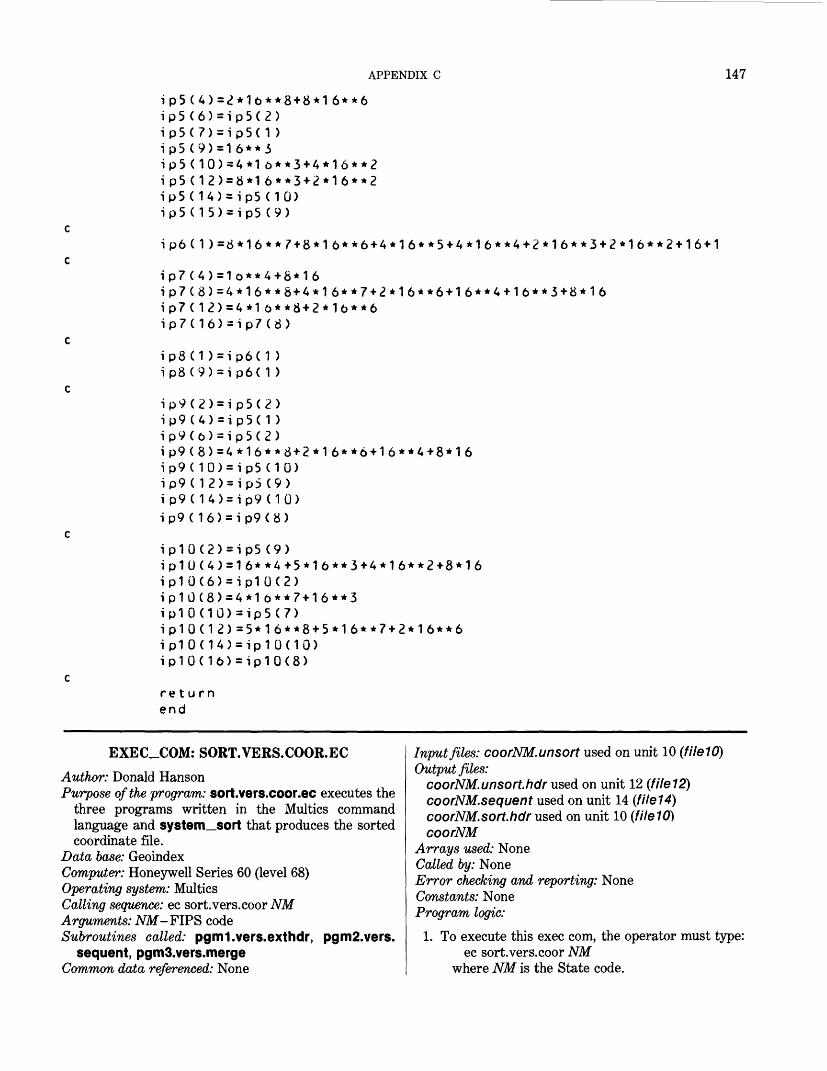
APPENDIX C 147
ip5(4)=2*1b**8+8*16**6 ip5(6)=ip5(2) ip5(7)=ip5( 1 ) ip5(9)=16**3 ip5(10)=4*1&**3+4*16**2 ip5(12)=8*16**3+2*16**2 ip5(14)=ip5 (10) ip5(15)=ip5 (9)
ip6(1)=8M6**7+8*l6**6+4*16**5+4*16**4+2*16**3+2*16**2+16+1
ip7 (4)=1o**4+8*16
ip7(12)=4*l6**8+2*1b**6 ip7(16)=ip7(8)
ip8(1 )=ip6(1 ) ip8(9)=ip6( 1 )
ip9(2)=ip5(2)ip9(4)=ip5(1 )ip9(b)=ip5(2)ip9(8)=4*l6**8+2*16**6+l6**4+8*16ip9(10)=ip5 (10)ip9(12)=ip5 (9)ip9(14)=ip9 (10)ip9(16)=ip9(8)
ip10(2)=ip5(9)ip10(4)=16**4+5*l6**3+4*16**2+8*16ip10(6)=ip10(2)ip10(8) = 4*1b**7-H6**3ip10(10)=ip5(7)ip10(12)=5*16**8-«-5*16**7-»-2*16**6ip10(14)=ip10(10)ip10(l6)=ip10(8)
return end
EXEC_COM: SORT.VERS.COOR.ECAuthor: Donald HansonPurpose of the program: sort.vers.coor.ee executes the
three programs written in the Multics commandlanguage and system_sort that produces the sortedcoordinate file.
Data base: Geoindex Computer: Honeywell Series 60 (level 68) Operating system: Multics Calling sequence: ec sort.vers.coor NM Arguments: JVM-FIPS code Subroutines called: pgml.vers.exthdr, pgm2.vers.
sequent, pgmS.vers.merge Common data referenced: None
Input files: coorNM.unsort used on unit 10 (fileW)Output files:
coorNM.unsort.hdr used on unit 12 (file12) coorNM.sequent used on unit 14 (file14) coorNM.sort.hdr used on unit 10 (1ile10] coorNM
Arrays used: NoneCalled by: NoneError checking and reporting: NoneConstants: NoneProgram logic:
1. To execute this exec com, the operator must type:ec sort.vers.coor NM
where NM is the State code.

148 GEOINDEX
2. A message will print that the first program has started executing. This program extracts the header records from the unsorted coordinate file.
3. The unsorted coordinate file (coorNM.unsort) is at tached to fileW, and the unsorted header file is at tached to file12.
4. The next step is the system sort, which sorts the header file by feature number and subfeature number. These are the first 10 characters of the header record.
5. A message will next appear that program 2 has been started. This program takes the unsorted coord inate file and converts it from a stream to a se quential file.
6. The stream coordinate file is attached to file13 and the sequential coordinate file is attached to file14.
7. When program 2 is completed, program 3 starts.8. The third program merges the sorted header file
and the unsorted coordinate file in to the sorted coordinate file.
9. The sorted header file is attached to fileW. The se quential coordinate file is attached to file13.
10. filel3 is opened with a mode of sequential update in order to allow records to be deleted after they have been written to filel2.
11. The sorted coordinate output file is attached to filel2.
12. At completion, all files are closed and a message appears:
JOB FINISHED
***************************************************
sort.vers.coor.ee
***************************************************
jse: ec sort.vers.coor.ee nm where nm is state code
function:this ec takes the unsorted coordinate file and produces a sorted coordinate file. The first program extracts the header records from the unsorted coordinate file. The header records are then sorted in sort_seg. The second program takes tne unsorted coordinate file and converts it from a stream to a sequential file. The third program merges the sorted header file and the unsorted coordinate file into the sorted coordinate file.
Sprint program 1 started
10 ati o atpgml .i o dei o de££p r i n£so r t _££p r i n£10 ati o atpgm2.i o de
tdch filelU vfile_ coor£1.unsort tach f i I e 1 <? vfile_ coor £1 . unso r t . hdr vers.exthdr tach fi le1G tach fi Ie12
t sort started
seg coor£ 1.unsort.hdr -sm coor£1.sort . hdr -fl 1 1U
t program 2 started
tach file13 vfile. coor£1.unsort tach fiIe 14 vfile_ coor£1 . sequent vers.sequent tach f iIe13
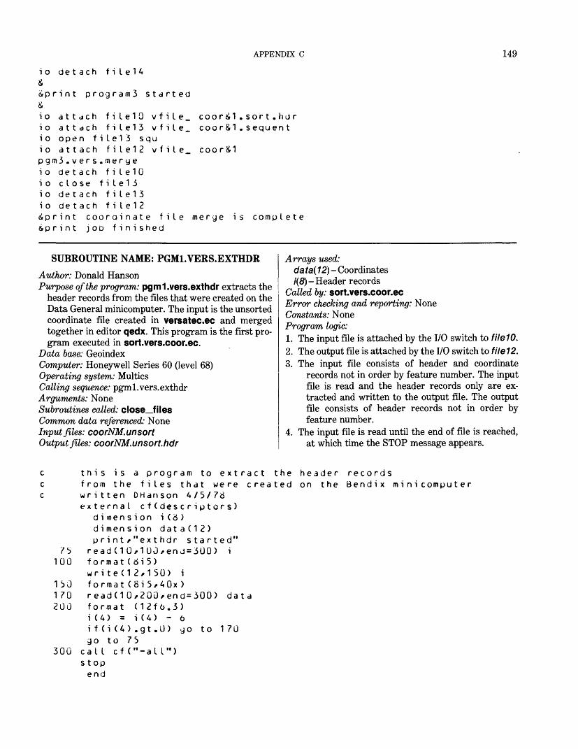
APPENDIX C 149
io detach f i I e 1 4&i p r i n t program3 started&io attach filelO v f i I e _ coorii1.sort.hdrio attach file13 vfile_ coor&1.sequenti o open f i I e13 squio attach file12 vfiIe_ coor£1pgm3.vers.mergeio detach filelOio close fiIe1 3io detach file13io detach f i I e 1 2iprint coorainate file merge is complete&print JOD finished
SUBROUTINE NAME: PGM1.VERS.EXTHDR
Author: Donald HansonPurpose of the program: pgml.vers.exthdr extracts the
header records from the files that were created on the Data General minicomputer. The input is the unsorted coordinate file created in versatec.ec and merged together in editor qedx. This program is the first pro gram executed in sort.vers.coor.ee.
Data base: GeoindexComputer: Honeywell Series 60 (level 68)Operating system: MulticsCalling sequence: pgml.vers.exthdrArguments: NoneSubroutines called: close_filesCommon data referenced: NoneInput files: coorNM. unsortOutput files: coorNM.unsort.hdr
Arrays used:da ta( 12)- Coordinates/(#)- Header records
Called by: sort.vers.coor.eeError checking and reporting: None Constants: None Program logic:1. The input file is attached by the I/O switch to filelO.2. The output file is attached by the I/O switch to file 12.3. The input file consists of header and coordinate
records not in order by feature number. The input file is read and the header records only are ex tracted and written to the output file. The output file consists of header records not in order by feature number.
4. The input file is read until the end of file is reached, at which time the STOP message appears.
c this is a program to extract the header recordsc from the files that were created on the Bendix minicomputerc written OHanson A/5/78
external cf(descriptors) dimension i (8 ) d i men si on dat a(12) print/"exthdr started"
75 readCI 0/100/enj=300) i 100 format(8i5)
write(12/150) i 150 format(8i5,40x) 170 read(10,200,end=300) data 200 format (12f6.3)
i (4) = i(4) - 6 i f(i (A) .gt.0) go to 1 70 go to 75
300 call cf("-all") s t op end
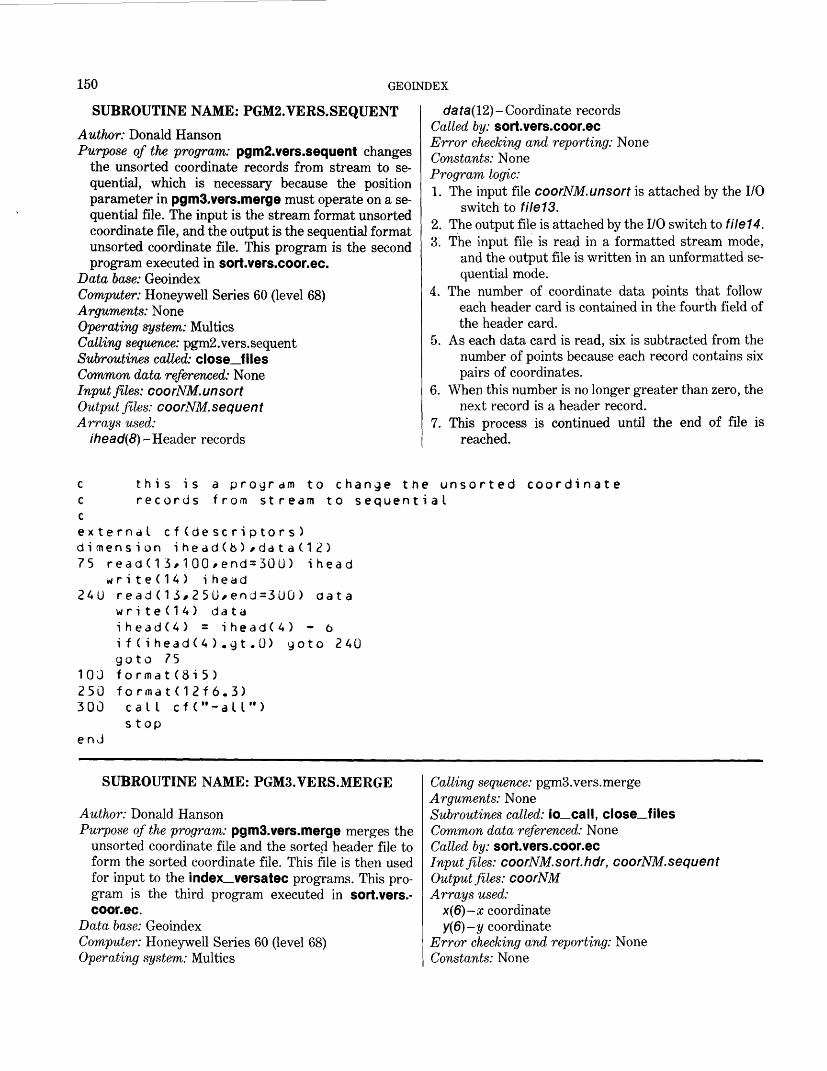
150 GEOINDEX
SUBROUTINE NAME: PGM2.VERS.SEQUENTAuthor: Donald HansonPurpose of the program: pgm2.vers.sequent changes
the unsorted coordinate records from stream to se quential, which is necessary because the position parameter in pgmS.vers.merge must operate on a se quential file. The input is the stream format unsorted coordinate file, and the output is the sequential format unsorted coordinate file. This program is the second program executed in sort.vers.coor.ee.
Data base: GeoindexComputer: Honeywell Series 60 (level 68)Arguments: NoneOperating system: MulticsCalling sequence: pgm2.vers.sequentSubroutines called: close_filesCommon data referenced: NoneInput files: coorNM.unsortOutput files: coorNM. sequentArrays used:
ihead(8)- Header records
data(l2)- Coordinate records Called by: sort.vers.coor.eeError checking and reporting: None Constants: None Program logic:1. The input file coorNM.unsort is attached by the I/O
switch to file13.2. The output file is attached by the I/O switch to file14.3. The input file is read in a formatted stream mode,
and the output file is written in an unformatted se quential mode.
4. The number of coordinate data points that follow each header card is contained in the fourth field of the header card.
5. As each data card is read, six is subtracted from the number of points because each record contains six pairs of coordinates.
6. When this number is no longer greater than zero, the next record is a header record.
7. This process is continued until the end of file is reached.
a program to change the unsorted coordinate from stream to sequential
c t h i s i sc recordscexternal cf(descriptors )dimension ihe ad(fa) f ddta (1 2 )75 read(13,100,end=300) ihead
wr i t e (14) i head 240 read(13,250,end=300) data
wr i te (14) datai head(4) = i headC 4) - 6if(ihead(4).gt.0) goto 240goto 75
10J format(8i5) 250 format(12f6.3) 300 call cf("-all">
stop en J
SUBROUTINE NAME: PGMS.VERS.MERGE
Author: Donald HansonPurpose of the program: pgmS.vers.merge merges the
unsorted coordinate file and the sorted header file to form the sorted coordinate file. This file is then used for input to the index versatec programs. This pro gram is the third program executed in sort.vers.- coor.ec.
Data base: GeoindexComputer: Honeywell Series 60 (level 68)Operating system: Multics
Calling sequence: pgmS.vers.mergeArguments: NoneSubroutines called: io_call, close_filesCommon data referenced: NoneCatted by: sort.vers.coor.eeInput files: coorNM.sort.hdr, coorNM.sequentOutput files: coorNMArrays used:
x(6)-x coordinatey(6)-y coordinate
Error checking and reporting: None Constants: None
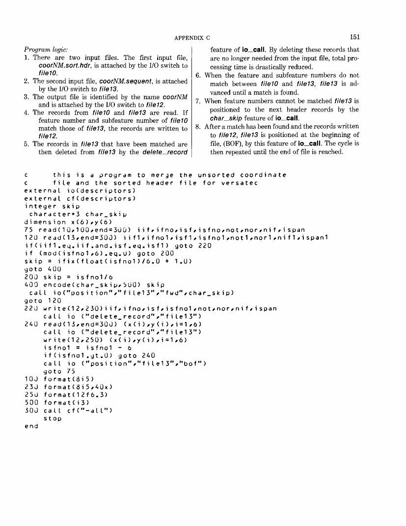
APPENDIX C 151
Program logic:1. There are two input files. The first input file,
coorNM.sort.hdr, is attached by the I/O switch to fileW.
2. The second input file, coorNM.sequent, is attached by the I/O switch to file13.
3. The output file is identified by the name coorNM and is attached by the I/O switch to file12.
4. The records from fileW and file13 are read. If feature number and subfeature number of fileW match those of file13, the records are written to file12.
5. The records in file13 that have been matched are then deleted from file13 by the delete—record
feature of io_call. By deleting these records that are no longer needed from the input file, total pro cessing time is drastically reduced.
6. When the feature and subfeature numbers do not match between fileW and file13, file13 is ad vanced until a match is found.
7. When feature numbers cannot be matched file13 is positioned to the next header records by the char_skip feature of io_call.
8. After a match has been found and the records written to file12, file13 is positioned at the beginning of file, (EOF), by this feature of io_call. The cycle is then repeated until the end of file is reached.
the unsorted coordinate file for versatec
c this is a program to merge c file and the sorted header external i o ( desc r i pto r s ) external c f ( de sc r i pto r s ) integer skipcharacter*3 char_skip
dimension x(6)/y(6)75 read ( 1 O/ 1 00/end=3uG) i i f/ i f no/ i s f/ i s f no/not /nor / ni f / i span 120 read(13*end=300) iif1/ifno1/isf1/isfno1/not1/nor1/nif1/ispan1 i f ( i i f 1 . eq. i i f . and . i s f . eq. i s f 1 ) goto 220 if (mod ( i sf no1 /6) . eq. U) goto 200 skip = i fix ( float ( i sfnol )/6.0 + 1.U) goto 400200 sk ip = isf no1/6 409 en code ( cha r.sk i p/ 5UO) skipcall ioC'posi t ion" /"f i Ie1 3" ,"fwd"/ char.sk ip)
goto 1 20 220 w r ite(12/230) i i f/ i fno/isf/ isfnol /not/nor/ni f/i span
call io ("delete_record","f i Ie13") 240 read(13/end = 300) ( x ( i ) /y ( i ) / i = 1 ,6 )
call io ("delete_record"/"f i Ie13")write(12/250) (x(i)/y(i)/i=1,6)isfnol = isfnol - 6i f (i sfnol .gt .0) goto 240call io ("posi tion"/"f i Ie13","bof")goto 75
10J format(8i5) 230 f o rmat (3i 5/40x ) 250 format(12f 6.3) 500 format(i3) 300 call cf("-all")
stop end
152 GEOINDEX
PROGRAM NAME: MASTER
Author: Harold JohnsonPurpose of the program: master uses the numerical
coordinate files for maps of the State and the reference outlines to calculate the areas in square kilometers, to calculate reasonable center-point coor dinates for each area, to test the reasonableness of these center points, and to output a file of center points that may not be suitably located.
Data base: GeoindexComputer: Honeywell Series 60 (level 68)Operating system: MulticsCalling sequence: masterArguments: NoneSubroutines called: arcntr_master, adjust—master,
closer, ftnumberCommon data referenced: true, sk, iaInput files:
areano used on unit 37 (file37) List of variables: it = true State area in square
miles.Formats: (16)Layout description: See areano.
statNM used on unit 31 (file31) coorNM used on unit 32 (file32)
Output files: areaNM used on unit 33 (file33)
Format: (215, F8.1)File created by: adjust—masterLayout description: Area is the summed areas of all
outlines having the same if. measNM used on unit 40 (file40)
List of variables: if, isf, area Formats: (215, F8.1) File created by: master Layout description: Area is the area of the outline
with the corresponding if, isf. Arrays used: None Called by: NoneError checking and reporting: None Constants: None Program logic:1. Input files are identified with Fortran numbers:
statNM, coorNM, are coordinate files for plotting the State outlines; areano is a file of State areas. The user is prompted for only the FIPS code number ia and for the scale used in the maps from which statNM, and coorNM were derived. Scale is 1 to sk.
2. areano is searched for the true area of this State.3. arcntr_master is called to compute the areas of the
outlines for this coorNM file, and areas are ad justed using the State areas.
4 . adjust—master is called to sum areas belonging to the same reference.
C ******* ,/| ASTER **** c **********c ________Cc c c c c c c c c c c c c c c c c c c c c
* * *MASTER ***************
THIS PROGRAM D1. USING "ARC " S T A T N \A " /2. READS THE RATION OF THES MULTIPLIES EVE3. EACH MAP 0 POINT IS CONST THE FILES "CNT4. USING "CNT THEIR NEARNESS OF THE OUTLINE SIDE OF THE 80 A FILE CALLED5. FINALLY THSArtE "IF" NUMB
THE F 0 L L 0 WI FILE 5 = TO IN FILE 37 = LIST FILE 31 = "STA FILE 3^ = "COO
OES THE FOLLOWING:NTR"/ MASTER CALCULATES THE STATE
TRUE STATE AREA FROM FILE "AREANO E TO GIVE A CORRECTION FACTOR "FA KY SUCCESSIVE AREA CALCULATION UTLINE IN "COORNM" IS THEN EXAMIN RUCTED ALONG WITH AN AREA. THESE RNM" AND "MEASnm", RESPECTIVELY EST" SUBROUTINE/ THESE CENTERS AR TO THE BOUNDARY OF THE OUTLINE W IS LARGE/ AND FOR THEIR POSITION
JNDARY. CENTERS WHICH FAIL THE T "DOUBT" AND TO FILE 6. E SUBROUTINE "ADJUST" SUMS ALL AR tR. THE OUTPUT FILE IS "AREANM".
AREA FROM FILE
" AND FORMS THE CFOR" WHICH IS
ED AND A CENTER ARE WRITTEN TO
E CHECKED FOR HEN THE DIAMETERINSIDE OR OUT-
EST ARE WRITTEN
EAS HAVING THE
NG INPUT FILES ARE REQUIRED: PUT AREA CODE AND MAP SCALE.OF STATE CODES AND TRUE STATE
TNM" RNM"
AREAS/ =ARfcANO"
APPENDIX C 153
c c cccccccc
FIFIF IFIF I
US
cc UPDATEDc conv er tccc PROGRAMc CENTERSc IT ALSOc
TH LELELELELE
JOE.
ASed
TOAR
E 333A15AO6
TE
0to
CE
SUMS
F 0 L L 0 W I = "ARE
.\IG OUTPUT FILE ANM" (SUMMED A
= "CNTRNM"= "DOU= "ME A
= MESSA
: vJHEN
F DtC.mu I t i c
ALCULATINSIDEAREAS
dT itSnm"GE
F
27s
ETHMil
S
IN
,
(C
s ARE REQUIRED:REAS)
ENTER POIN(DOUb(A
TO
ISH
197
LLTE
ED
6May 7 /
ARETH
EASOUTTH
TFULAREA
RMINA
TS)CENTER POINTS)s eL
/ CHANGE
H. J1977
AND CtLIE
OHMby
MTEf J E S ANDSAME IF.
Y SEPARATE IF/ ISF)
"ME A Snm" TO "ME A SNM" FOR FUTURE
SONH J ohnson .
RS FOR OUTLINES/ DETERMINE WHENWHEN PROPERLY CENTERED.
common true/Sk/ia character f i I e * A / state*2/ outfile*6/ m o d e * A
write(o/880) <J 8 J formatC' THIS PRO " PRODUCE JEW FILES a "QTHERE WILL bE ERROR " PREVIOUS RUNS."/ " IF a r e a N M / m e a s N il " DELETE THESE FILES cwr i t e ( 0/900) 900 f o r ,-n d t ( " 0 E iJ T E R r ead(b/91J) state 91 J f o r m a t ( a 2 )decode(state/913)
913 format(i2) write(6/91 A) 91 A forrnat(" YOUR read(5 ,916) sk 91 o for.iiat(f8.U> outfile = "areano" mooe = "si"
call ftnumber(37/ou fi Le = "coor" er>code(outtile/92U) s 92U format("coor"/a2)
call io ("attach"/"cal L io("open","fi
en code (outfiIe /922) s92^ format("stat"/d^>
call ftnumoer(31/ou mode = "so" encode(outfi Ie/92A) s 92A f ormat("area"/-a2)
call ftnumber(33/ou
GHAM USES THE FILES coorNM AND statNM TO"/reaNM/ cntrNM^ measNM AND douDt."/S IF THESE FILES ALREADY EXIST FROM "/
ALREADY EXIST/ HIT BREAK. "/ AND RUN MASTER AGAIN.")
IN THE 2-DIGIT CODE FOR THE STATE dEING STUDIED")
MAP HAS SCALE 1 TO WHAT - Fd.J -?")
tfi le/mode)
tate
fiIe32"/"vfile."/outfiIe/"-append","-ssf")Ie32","si")tate
tfi le/mode)
tate
tfi le/mode)
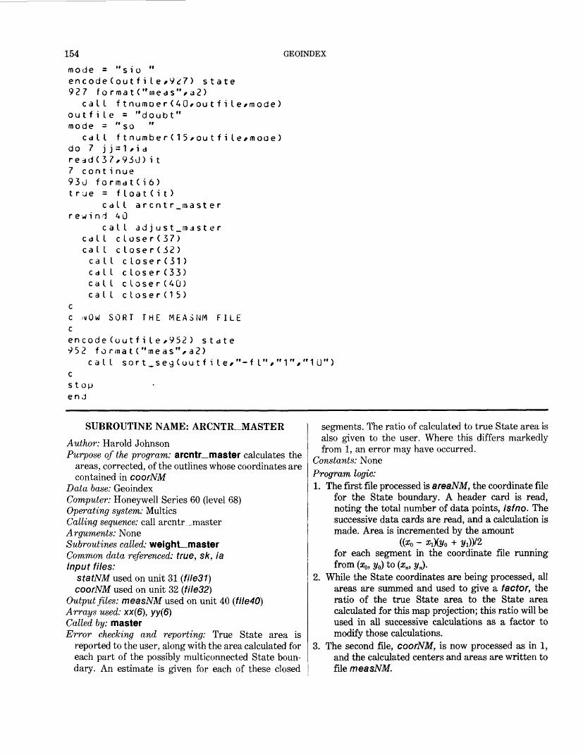
154 GEOINDEX
mode =encode927 fo
cal Iout f i Imode =
cal Ido 7 jread(37 con t93U fotrue =
crewind
ccal Ical Icalcalcalc a I
cc ix i cencode 952 fo
c a I cstop end
"sio "(outfile/927) state rmat("n»eas"/a2)ftnumoer(40/outfile/mode)
e = "doubt""so "ftnumber(15*outfi le/moae)
j=1,ia ?,93J)i t i nue rma t(i 6)
f loat(it) all arcntr master40
all ad j u st_ma st e rcloser(37)cIose r(32 )
I close r(31 ) I closer(33) I closer(40) I closer (15)
SORT THE MEASNM FILE
(outfile,952) statermat("meas%a2)I sort_se9(outfile,"-fl","1","1U")
SUBROUTINE NAME: ARCNTR_MASTERAuthor: Harold JohnsonPurpose of the program: arcntr_master calculates the
areas, corrected, of the outlines whose coordinates are contained in coorNM
Data base: GeoindexComputer: Honeywell Series 60 (level 68)Operating system: MulticsCalling sequence: call arcntr_masterArguments: NoneSubroutines called: weighLmasterCommon data referenced: true, sk, iaInput files:
statNM used on unit 31 (file31) coorNM used on unit 32 (file32)
Output files: measNM used on unit 40 (file40)Arrays used: xx(6), yy(6)Called by: masterError checking and reporting: True State area is
reported to the user, along with the area calculated for each part of the possibly multiconnected State boun dary. An estimate is given for each of these closed
segments. The ratio of calculated to true State area is also given to the user. Where this differs markedly from 1, an error may have occurred.
Constants: NoneProgram logic:1. The first file processed is areaNM, the coordinate file
for the State boundary. A header card is read, noting the total number of data points, isfno. The successive data cards are read, and a calculation is made. Area is incremented by the amount
((o?0 - #1X2/0 + 2/i))/2for each segment in the coordinate file running from (o?0 , i/0) to (xn, yn).
2. While the State coordinates are being processed, all areas are summed and used to give a factor, the ratio of the true State area to the State area calculated for this map projection; this ratio will be used in all successive calculations as a factor to modify those calculations.
3. The second file, coorNM, is now processed as in 1, and the calculated centers and areas are written to file measNM.
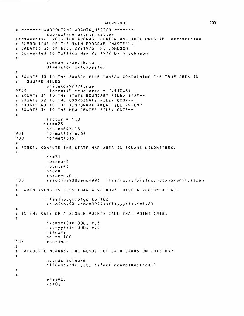
APPENDIX C 155
c ******* SUBROUTINE ARCNTR_MASTER *******subroutine arentr_master
c ********** WEIGHTED AVERAGE CENTER AND AREA PROGRAM *********** c SUBROUTINE OF THE MAIN PROGRAM "MASTER", c UPDATED AS OF DEC. 27,1976 H. JOHNSON c converted to Multics May If 1977 D y H Johnson c
common true/sk/iadimension xx(6)/yy(6)
cc EQUATE 30 TO THE SOURCE FILE TAREA/ CONTAINING THE TRUE AREA IN c SQUARE MILES
wr i te(6/9799)true9799 formatC' true area = M /f10.3) c EQUATE 31 TO THE STATE BOUNDARY FILE/ STAT-- c EQUATE 33 TO THE COORDINATE FILE/ COOR-- c EQUATE 40 TO THE TEMPORARY AREA FILE ARTEMP c EQUATE 34 TO THE NEW CENTER FILE/ CNTR— c
factor = 1.0 i tem=25sea Le = 645.16
901 formatd 2f 6.3) 900 format(3i5) cc FIRST/ COMPUTE THE STATE MAP AREA IN SQUARE KILOMETRES, c
in = 31i oa rea = 6i oc nt r = 6n run=1totdr=0.0
100 read(in/900/end=99) if/ifno/isf/isfno/not/nor/nif/ispan cc WHEN ISFNO IS LESS THAN 4 WE DON'T HAVE A REGION AT ALL c
if(isfno.gt.3)go to 102redd(in/901/end=99)(xx(i)/yy(i)/i=1/6>
cc IN THE CASE OF A SINGLE POINT/ CALL THAT POINT CNTR. c
i xc = xx(2)*1000. +.5iyc=yy(2)*1000. +.5i sfno=2go to 100
102 continue cc CALCULATE NCARDS/ THE NUMBER OF DATA CARDS ON THIS MAP c
nc a rds= i sf no/6if(6*ncards .It. isfno) ncards=ncards+1
c c
area=0.xc = 0.
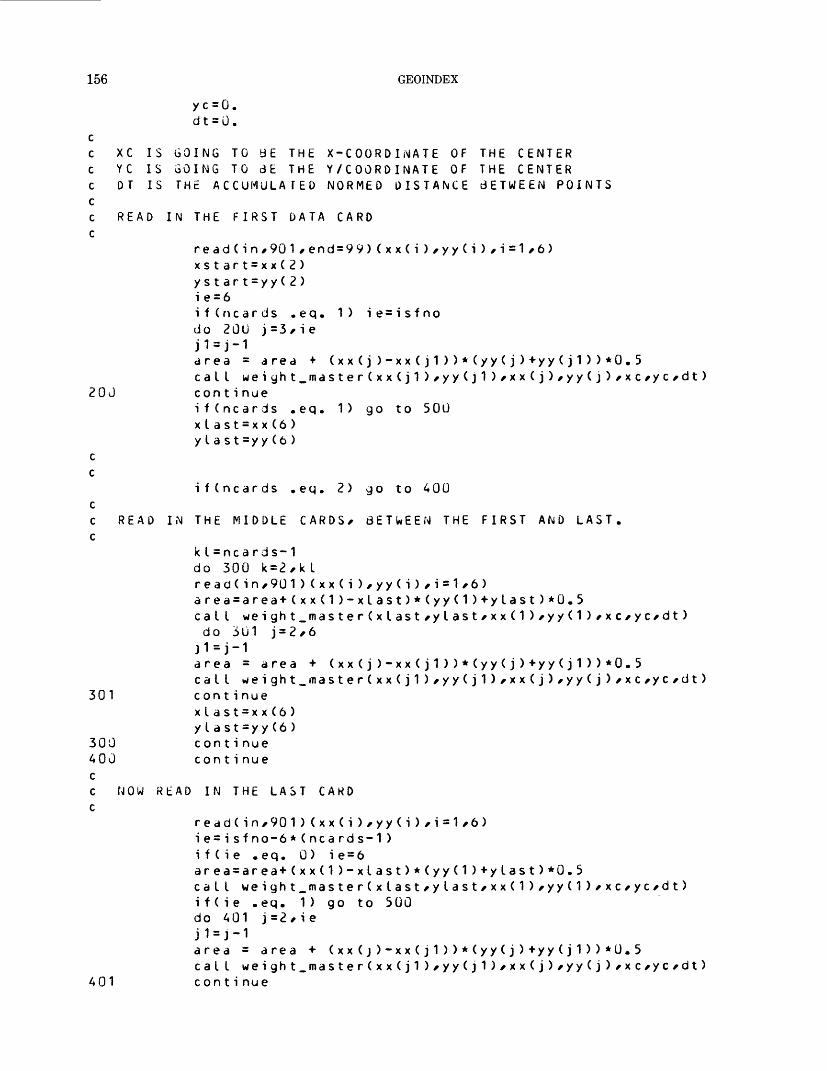
156 GEOINDEX
yc = 0.dt = 0.
cc XC IS GOING TO BE THE X-COORDINATE OF THE CENTER c YC IS GOING TO 3E THE Y/COOROINATE OF THE CENTER c OT IS THE ACCUMULATED NORMED DISTANCE dETWEEN POINTS cC READ IN THE FIRST DATA CARD C
read(in/901/end=99)(xx(i),yy(i)/i=1,6)xstart=xx(2)ys t ar t = yy(2)ie = 6i f (ncards .eq. 1) ie=isfnodo 20U j =3* i eJ1=j-1area = area + (xx(j)-xx(j1))*(yy(j)+yy(j1))*0. 5cat I weiyht_master(xx(j1)*yy (j1)*x x (j)/yy(j)*xc/yc*dt)
20 J con t i nueifCncards .eq. 1) go to 500xlast=xx(6)y I a st=yy(6 )
c c
ifCncards .eq. 2) go to 400 cc READ IN THE MIDDLE CARDS, BETWEEN THE FIRST AND LAST, c
kI = nca rds-1do 300 k=2,klread(in,901)(xx(i)/yy(i),i=1,6)area=area+(xx(1)-xlast)*(yy(1)+ylast)*0.5cat I weight_master(xlast*ylast*xx(1> *yy (1)*xc*yc*dt) do 301 j=2,6j1=j-1area = area + (xx(j)-xx(j1))*(yy(j)+yy(j1))*0.5cat I weight_master(xx(j1)*yy(j1)*xx(j)/yy(j)^xc^yc^dt)
301 con t i nuexlast=xx(6)ylast=yy(6)
300 con t i nue AOO continue cc NOW READ IN THE LAST CARD c
read(in,901)(xx(i),yy(i),i=1,6)ie=isfno-6*(ncards-1 )i f(i e .eq. 0 ) i e = 6area=area+(xx(1)-xlast)*(yy(1)+ylast>*0.5call weight_master(xlast*ylast*xx(1)*yy(1)*xc*yc*dt>i f ( i e .eq. 1) go to 500do A01 j=2,ieJ1=j-1area = area + (xx(j)-xx(j1))*(yy(j)+yy(j1))*0.5cat I weight_master(xx(j1)*yy(j1)*xx(j)*yy(j)*xc*yc*dt>
401 continue

APPENDIX C 157
500cC WHENC
501
90:5
503
905
906
continue
THE REGION IS NOT CLOSED/ WE MUST ADD THE LAST DATA POINT
test=(xx(ie)-xstart)**2 + ( yy(ie) -ys tart)**2i f(test . It..01) go to 501cat I weigh t_master(xx(ie)/yy(ie)/xstart/ystart/xc/yc/dt)area=area+(xstart-xx(ie))*(ystart+yy(ie))*0.5continueif(nrun.gt.1)go to 503f i s fno= i sf no-1error=dt*.G01+.UOOOJ1*(fisfno>error=error*scdle*((sk/1000000.)**2>write(6/903)if/isf/errorformatC" THE AREA CALCULATION FOR IF =",i5/" ISF =",i5,
" HAS ERROR BOUNDED 3Y",f10.3)continue area=dds(drea*scale*fdctor*((sk/10UOOGO.)**2))
x c = x c /dtyc=yc/dt
i sf no=2fo rmat(3 i 5 )i x c = xc*1000.i yc = yc*1000.fo rmat(12x *2 i 6)
wr i t e ( ioared*9U7) i f/i sf/areaif(if .eq. 995)go to 550 totar=totar * area
907 format (2i 5/f 6.1 )550 0)go to 100i f ( i span . eq
i span = - i spani f 1 = i f -»• 1
i one = 1do 600 j=if1*ispan
write(iodrea*9G7)j*ione*area 600 con t i nue c ON THE STATE AREA RUN/ WE WANT c WHICH IS THE RATIO OF THE TRUE c
go to 10099 ifCnrun .gt. 1)return c CHANGE TRUE TO SQUARE KILOMETRES
t rue = t rue*2 . 59 wr i te(6/9898) true
9898 format (f10.3)factor=true/totar
c NOW SET INPUTS TO READ THE COORDINATEwri te(6/9899)f actorformatC" FACTOR =",f10.3)
TO COMPUTE FACTOR/ TO CALCULATED AREAS.
AND COMPUTE RATIO.
FILES
9899 c
*******
nrun=2 totar=0.0in=32i oa rea = 4Ggo to 100end
END ARCNTR.flASTER *******
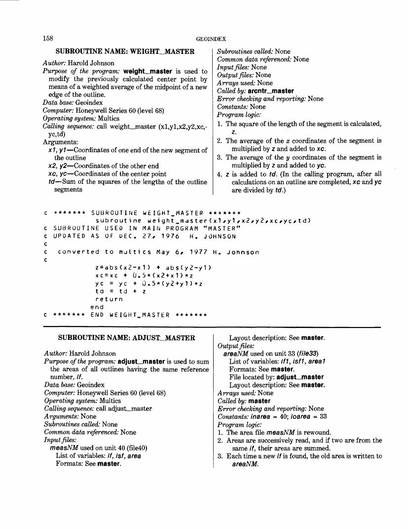
158 GEOINDEX
SUBROUTINE NAME: WEIGHT_JVIASTERAuthor: Harold JohnsonPurpose of the program: weight_master is used to
modify the previously calculated center point by means of a weighted average of the midpoint of a new edge of the outline.
Data base: GeoindexComputer: Honeywell Series 60 (level 68)Operating system: MulticsCalling sequence: call weight__master (xl,yl,x2,y2,xc,-
yc,td)Arguments:
x1, y1—Coordinates of one end of the new segment ofthe outline
x2, y2—Coordinates of the other end xc, yc—Coordinates of the center point td—Sum of the squares of the lengths of the outline
segments
Subroutines called: NoneCommon data referenced: NoneInput files: NoneOutput files: NoneArrays used: NoneCalled by: arcntr_masterError checking and reporting: NoneConstants: NoneProgram logic:1. The square of the length of the segment is calculated,
z.2. The average of the x coordinates of the segment is
multiplied by z and added to xc.3. The average of the y coordinates of the segment is
multiplied by z and added to yc.4. z is added to td. (In the calling program, after all
calculations on an outline are completed, xc and yc are divided by td.)
c ******* SUBROUTINE WEIGHT_MASTER *******subroutine weight_master(x1,y1,x2,y2,xc,yc/td)
c SUBROUTINE USED IN MAIN PROGRAM "MASTER" c UPDATED AS OF DEC. 27, 1976 H. JOHNSON cc converted to multics May 6/ 1977 H. Jonnson c
z=abs(x2-x1) + abs(y2-y1)xc=xc + 0.5*(x2+x1)*zyc = yc + G.5*(y2+y1)*ztd = td + zreturn
end c ******* END WEIGHT_MASTER *******
SUBROUTINE NAME: ADJUST_JVIASTER
Author: Harold JohnsonPurpose of the program: adjust_master is used to sum
the areas of all outlines having the same referencenumber, if.
Data base: Geoindex Computer: Honeywell Series 60 (level 68) Operating system: Multics Calling sequence: call adjust_master Arguments: None Subroutines called: None Common data referenced: None Input files:
measNM used on unit 40 (file40) List of variables: if, isf, area Formats: See master.
Layout description: See master. Output files:
areaNM used on unit 33 (file33)List of variables: if1, isfl, area 7Formats: See master.File located by: adjust—masterLayout description: See master.
Arrays used: None Called by: masterError checking and reporting: None Constants: inarea = 40; ioarea = 33 Program logic:1. The area file measNM is rewound.2. Areas are successively read, and if two are from the
same if, their areas are summed.3. Each time a new if is found, the old area is written to
areaNM.
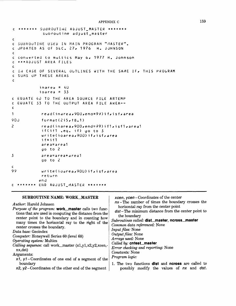
APPENDIX C 159
SUBROUTINE AUJUST_MASTER ******* subroutine adjust_master
C SUBROUTINE USED IN MAIN PROGRAM "FASTER".C UPDATED AS OF DEC. 27, 1976 H. JjHNSONcc converted to multics May 6* 1977 H. JonnsonC ***ADJUST AREA FILESCC I,\l CASE OF SEVERAL OUTLINES WITH THE SAME IF* THIS PROGRAMC SUMS UP THESE AREASC
i na red = 4U i oa rea = 33
c EQUATE 40 TO THE AREA SOURCE FILE ARTEMP c EQUATE 33 TO THE OUTPUT AREA FILE AREA-- c
90J
2
format (2i5, f 8.1 )
read(inarea*900*end=99)if1*isf1*area1if(if1 .eq. if) go to 3write(ioarea*9UU) if/isf*areai f =i f 1area=area1go to 2
a r ea = a r ea + a rea 1 go to 2
c 99 w r i t e ( i o«jrea *90U) i f t i sf / a rea
return end
c ******* END ADJUST_ rt ASTER *******
SUBROUTINE NAME: WORK.JMASTER
Author: Harold JohnsonPurpose of the program: work_master calls two func
tions that are used in computing the distance from the center point to the boundary and in counting how many times the horizontal ray to the right of the center crosses the boundary.
Data base: GeoindexComputer: Honeywell Series 60 (level 68)Operating system: MulticsCalling sequence: call work—master (xl,yl,x2,y2,xcen,-
nx,dst)Arguments:
x7, y1- Coordinates of one end of a segment of theboundary
x2, y2- Coordinates of the other end of the segment
xce/7, yce/7-Coordinates of the centernx-The number of times the boundary crosses the
horizontal ray from the center pointc/sf-The minimum distance from the center point to
the boundarySubroutines called: dist_master, ncross_master Common data referenced: None Input files: None Output files: None Arrays used: None Called by: cntest_master Error checking and reporting: None Constants: None Program logic:1. The two functions dist and ncross are called to
possibly modify the values of nx and c/sf.
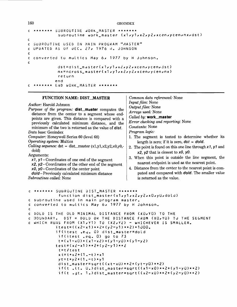
160 GEOINDEX
c ******* SUBROUTINE w/ORK_ MASTER *******subroutine work_master (x1/y1/x2/y 2 /xcen/ycen / nx/dst)
cC SUBROUTINE USED IN .MAIN PROGRAM "MASTER" c UPDATED AS OF DEC. 27, 1976 H. JOHNSON cc converted to multics May 6/ 1977 by H Johnson, c
dst=dist_mdster(x1/y1*x2/y<?/xcen/ycen/dst)nx=ncross_master(x1/y1/x2/y2/xcen/ycen/nx)return
end c ******* E,MD WGRK_MASTER *******
FUNCTION NAME: DIST_JVIASTER
Author: Harold JohnsonPurpose of the program: dist_master computes the
distance from the center to a segment whose end- points are given. This distance is compared with a previously calculated minimum distance, and the minimum of the two is returned as the value of dist.
Data base: GeoindexComputer: Honeywell Series 60 (level 68)Operating system: MulticsCalling sequence: dst = dist_jnaster (xl,yl,x2,y2,xO,yO,-
dold)Arguments:
x1, y1- Coordinates of one end of the segment x2, y2- Coordinates of the other end of the segment xO, yO- Coordinates of the center point c/o/c/-Previously calculated minimum distance
Subroutines called: None
Common data referenced: NoneInput files: NoneOutput files: NoneArrays used: NoneCalled by: work__masterError checking and reporting: NoneConstants: NoneProgram logic:1. The segment is tested to determine whether its
length is zero; if it is zero, dst = c/o/c/.2. The point is found on this one line through x1, y1 and
x2, y2 that is closest to xO, yO.3. When this point is outside the line segment, the
nearest endpoint is used as the nearest point.4. Distance from the center to the nearest point is com
puted and compared with c/o/c/. The smaller value is returned as the value.
******* SUBROUTIN funct ion
subroutine used i converted to mult
DOLD IS THE OLD MBOUNDARY. DST =HHICH RUNS FROM (
i test= ( ( xi f(i test
i f(i testt=(x1-xO
test = ( x2-t=t/testx t= t*x2 +yt=t*y2+d i s t.ma si f ( t .Iti f ( t .cjt
E DIST.MASTER *******di st_master (x1 / y1 /x2/y2/x(J/yU/dold)
n main program master, ics May 6 f 1977 by H Johnson.
INIMAL DISTANCE FROM (XU/YU) TO THEDOLD OR THE DISTANCE FROM (XG/YU) TO THE SEGMENTX1/Y1) TO (X2/Y2) - WHICHEVER IS SMALLER.2-x1)**2+(y2-y1)**2>*1GOO..eg. 0) dist_master=doId,eq. 0) go to 73
)*(x1-x2) -Ky1-yO)*(y1-y2) x1)**2+(y2-y1)**2
(1.-t)*x1(1.-t)*y1ter = sqrt( (xt-x(J)**2+(yt-yO)**2). 0.)dist_master=sqrt((x1-xO)**2+(y1-yU)**2). 1.)dist.masterssqrt((x2-xO)**2+(y2-yO)**2)
APPENDIX C 161
73C
ifCdold .It. dist_master) dist.master=dold con t i nue
return end
C ******* END DIST_MASTER *******
FUNCTION NAME: NCROSS_JMASTER
Author: Harold JohnsonPurpose of the program: ncross_master determines
whether or not the right horizontal ray from the center point crosses the line segment that has the given end points. If it does cross, nold is increased by 1.
Data base: GeoindexComputer: Honeywell Series 60 (level 68)Operating system: MulticsCalling sequence: nx = ncross_master (xl,yl,x2,y2,xO,-
yO,nold)Arguments:
x1, y1- Coordinates of one end of the segment y2, y2- Coordinates of the other end of the segment xO, yO- Coordinates of the center point nold- The number of crossings before this program
/?x-The number of crossings after calling this pro gram (increases nold by 1 if a crossing occurs in this routine)
Subroutines called: NoneCommon data referenced: NoneInput files: NoneOutput files: NoneArrays used: NoneCalled by: work_masterError checking and reporting: NoneConstants: NoneProgram logic:1. If the segment is nearly horizontal, nx - nold.2. The horizontal coordinate where the horizontal
crosses the line through the points of the segment is calculated.
3. When this coordinate is less than xO, nx = nold.4. Otherwise, nx = nold + 1.
******* NCRO$S_r1ASTtR *******function ncross_master(x1/y1/x2/y2/xO/yU/nold)
function used in main program master conv/erted to multics May 6* 1977 M Johnson.
N C R 0 S S SROSSES
*******
i o = c»INCREASES NOLD BY 1 IF THE SEGMENT FROM (X1,Y1) THE RIGHT HORIZONTAL RAY FROM (XO,YO) .ncross_master=noldifCabs(y1-y2) .It. .001) go to 7t=(yO-y1)/Cy2-y1)ifCt.lt.O. .or. t.gt.1. ) go to 7
x = t *x2 + (1 .-t)*x1i f(x .It. xO) go to 7ncross_master=ncross_master+1continuereturn
end END NCROSS.MASTER
TO (X2,Y2)
*******
SUBROUTINE NAME: CNTEST_JMASTER
Author: Harold JohnsonPurpose of the program: cntest_master tests whether
the center points are actually within the map outlines. It measures their distance to the boundary of the outline and computes the diameter of the outline.
When the point lies outside the outline or is too close to the boundary of a region whose diameter is not small, error messages to this effect are sent to the operator, and the center is written to a file named doubt.
Data base: GeoindexComputer: Honeywell Series 60 (level 68)

162 GEOINDEX
Operating system: MulticsCalling sequence: call cntest__masterArguments: NoneSubroutines called: work_master, dm_masterCommon data referenced: NoneInput files: NoneOutput files: NoneArrays used: xx(6), yy(6)Called by: masterError checking and reporting: When the boundary
crosses the right horizontal ray from the center an even number of times, a message that the center does not lie inside the outline is sent to the operator. When the center is too close to the edge of a region, a message about this is sent to the operator. In each case, the center coordinates are placed in doubt.
Constants: None Program logic:1. Center header card and coordinates are read. The
center is shifted by 0.0001 in., so that it cannot lie exactly on a line.
2. Coordinate file is searched for the corresponding header card.
3. Coordinates are read and work_master and dm__master are called to compute successive minimal distances, maximal distance from the ini tial coordinate point of the outline (used as an approximation to the diameter), and number of crossings that the outline makes over the right- hand ray from the center.
4. Indicated problems are reported to the user and writ ten to doubt.
subroutine cnte st _mas terc SUBROUTINE USED IN PROGR AM~"M A ST E R" c UPDATED AS OF DEC. 11, 1976 H. JOHNSON cc converted to muttics May 6* 1977 by H Johnson C$$$$S$$S$$$$$$$$CENTER TEST$$$$$$ $$$$$$$$$$$$$$$$$$$$$ cc THIS PROGRAM TESTS WHETHER POINTS CALLED "CENTER POINTS" c ARE ACTUALLY INSIDE THEIR MAP OUTLINES. cc IT ALSO COMPUTES THEIR DISTANCE TO THEIR MAP BOUNDARIES. c
dimension xx(6)*yy(6) c
io1=15
i 0=6in1=34wri te(6*VOu)formatC" THE FOLLOWING CENTERS ARE IN DOUBT")900
cc EQUATE 52 TO THE FILE OF MAP OUTLINES* COOR —c EQUATE 15 TO THE FILE DOUBT .c EQUATE 34 TO THt FILE OF CENTERS* CNTR--c
rewind 3<!c IT IS ASSUMED THAT THE CENTER DATA AND MAP OUTLINE DATA c ARE IN THE SAME ORDER* AND THAT EACH CENTER BELONGS TO SOME c MAP OUTLINE* BUT IT SKIPS OVER MAP OUTLINES WHICH HAVE NO DENTER. c1 read(in1*9Ui!*end=99)ifc*ifnoc*isfc*isfnoc*notc*norc*nifc 9902 format (1x* 7i i>)
read(in1*9U1 )inut l*jnutt*xcen*ycen 901 format(2i6*2f6.3) cc ADD .OJ01 TO XCEN AND YCEN TO MAKE THEM DIFFERENT FROM C ANY DATA POINT.
APPENDIX C 163
Cxcen=xcen+.0001ycen=ycen+.0001
cc READ THE DATA HEADER CARD 2 read(in*902*end=99)if*ifno/isf*isfno/not*nor*nif902 format(7i5)
nc a rds = i sf no/6if(6*ncards .It. isfno) neards=ncards+1
c c COMPARE NOMBERS. IF DIFFERE NT , SKIP THIS DATA
if((itc.eq.if).and.(isfc.eq.isf).and.(notc.eq.not)) go to 200do 50 k = 1 » nc ardsread(in,903)(xx(i),yy(i),i=1,6)
903 format(12f6.3> 50 continue
go to 220J continue c cc IGNORE CENTER FILES FOR SINGLE POINT PLOTS, c
ifCisfno . a t . 2) go to 210read(in,903)(xx(i),yy(i),i=1,6)go to 1
cC NOW HEAD THE FIRST DATA CARD AMD BEGIN THE CALCOLATI ONS . C WE SKIP THE FIRST DATA POINT. IT LOCATES PRINTING FOR C THE ID ,JJM8tRS. C210 dst=1UO.
Ji am = 0.0nx =0read(in ,903) (xx(i ),yy(i),i=1,6)ie = 6ifCisfno .It. 6) ie=isfnoxfi rst = xx(2)yfirst=yy(2)do 300 k = 3* i ecall work_master(xx(k-1)*yy(k-1)*xx(k)*yy(k)*xcen*ycen*nx*dst)diam=dm_master(xx(k-1)*yy(k-1)*xfirst*yfirst*aidm)
99J3 format(f6.3) 300 continue
xlast=xx(6)yldSt=yy(6)if(ncards .eq. 1) go to 500ifCncards .eq. 2) go to 400
cC NOW READ IN THE DATA CARDS BETWEEN THE FIRST AND LAST. C
n1=ncards-1do 380 I=2*n1read(in,903)(xx(i ),yy(i),i=1,6)edit worx^masterCxLast^ylast^xxC^^yyCI)/xcen^ycen/nx^dst)diam=dm_master(xlast/ylast*xfirst*yfirst/diam)
164 GEOINDEX
350
380cC NOWc400
xx(k-1),yy(k-1),xx(k),yy(k),xcen,ycen,nx,dst) (k-1 ),yy(k-1),xfi rst,yf i rs t,d i am)
401c50JcC WHEC
ccc50c60cccccccc
NOW
1
*/H EINS
WHTH
do 350 k=2,6caLL work_ma s ter(di am = dm_master(xxcontinuexLast=xx(6)yLast=yy(6)con t i nue
READ IN THE LAST CARD
read(in,903) (xx(i i e= i s fno-6*(ncard caLL work_master( diam=dm_master(xL i f(i e .eq. 1 ) go do 401 k=2,ie caLL wor k_ma ster( di am=dm_master(xx con t i nue
continue
•M THE REGION IS NOT CLO
test=(xx(ie)-xfirs if(test .L t . .01)
CdLL work_master(x diam=dm_master(xx
REPORT THE RESULTS
c ont i nue
nx=(-1)**nx
N NX = -1 THERE ARE AN ODD NUMBER OF CROSSINGS/ SO THE CENTER IS IDE THE REGION
),yy(i),i = 1,6)s-1 )xLast,yLast,xx(1),yy(1),xcen,ycen,nx,dst)ast,yLast,xfirst,yfirst,diam)to 500
xx(k-1),yy(k-1),xx(k),yy(k),xcen,ycen,nx,dst) (k-1 )/yy(k-1)/xfi rst/yfi rst/diam)
SED wt ADD THE LAST POINT TO CLOSE IT.
t)**2+(yy(ie)-yfirst) **2go to 501x(ie)/yy(ie)/xfirst/yfirst/xcen/ycen/nx/dst) (ie)/yy(ie)/xfirst/yfirst/diam)
EN NX=1 THERE ARE AN EV t CENTER IS OUTSIDE THE
EN NUMBER OF CROSSINGS,SO REGION
9991
write 99S1 i f (nx w r i't e 9933 70 i f write 9935 " is
and. (dst .gt. .09)) jo to 1 ) jo to 1
center is in doubt because :")
format(f6.3) if((nx .eq. -1) .
i f(diam .It. .3333 (0,9981) format (*'0the fol Lowing.eq. -1) go to 70
(6,9983)formatC* it does not Lie inside the ooundary.'*) (dst .gt. .09) go to 80 (6,9985) di am,ds t formatC" the region has ",f6.3," incnes from th
diameter If ,f6.3," ana the center "/ e bounda ry.")
APPENDIX C 165
80 write(io/905)i f/ifno/isf/isfno/not/nor/nif905 format(1x/7i5)
vj r i te(io/90b)xcen/ycen906 format(1x/2f6.3)
i oa red = 40 i yc en = yc en*1000. i x c en=x cen*1000. i s fno=1write(io1/902)if/ifno/isf/isfno/not/nor/nif
write(io1/9u7)ixcen/iycen907 format(12x,2i6)
go t o 199 return
end
SUBROUTINE NAME: DM_MASTERAuthor: Harold JohnsonPurpose of the program: dm_master is used to com
pute the diameter of an outline. It calculates the length on one segment and compares it with the previously calculated diameter.
Data base: GeoindexComputer: Honeywell Series 60 (level 68)Operating system: MulticsCalling sequence: diam = dm_master (xl,yl,x2,y2,dold)Arguments:
x1, y7-Coordinates for one endpoint of a segment x2, y2- Coordinates for the other endpoint do Id- Previously calculated maximum diameter
Subroutines called: NoneCommon data referenced: NoneInput files: NoneOutput files: NoneArrays used: NoneCalled by: cntest_masterError checking and reporting: NoneConstants: NoneProgram logic:1. diam is set to dold.2. The distance between the endpoints is calculated and
compared with dold.3. If this distance is more than dold, diam is set to this
distance.
******* SUBROUTINE DM.MASTER *******function dm_mdster(x1/y1/x2/y2/dold)
function used in main program master, converted to multics May 6 / 1977 H. Johnson
dm_mas t er = aold test=aos(x1-x2)+abs(y1-y2) ifCtest .gt. do Id)dm_master = test return end
******* END DM RASTER *******
FILE NAME: AREANO
Purpose of the file: areano is a list of true State areas. master calculates a State area and then reads areano to find the true area. The ratio of these is used as a correcting factor in the area calculations for the outlines of the State.
Format: The fcth record of areano contains the true area, format 16 (integer part), for the State with FIPS code number k. If no State has State code k, the record contains a zero.
Arguments: One integer occurs on each record, 16, and is the integral part of the true State area in square miles.
Referenced by: master
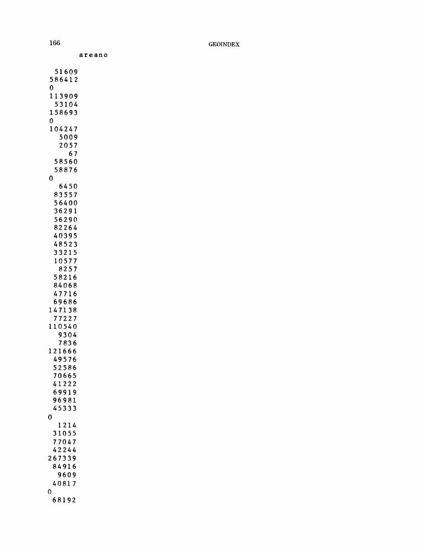
166 GEOINDEX
areano
51609586412011390953104
1586930104247
50092057
675856058876
06450
8355756400362915629082264403954852333215105778257
5821684068477166968614713877227
11054093047836
12166649576525867066541222699199698145333
01214
310557704742244
267339849169609
40817068192
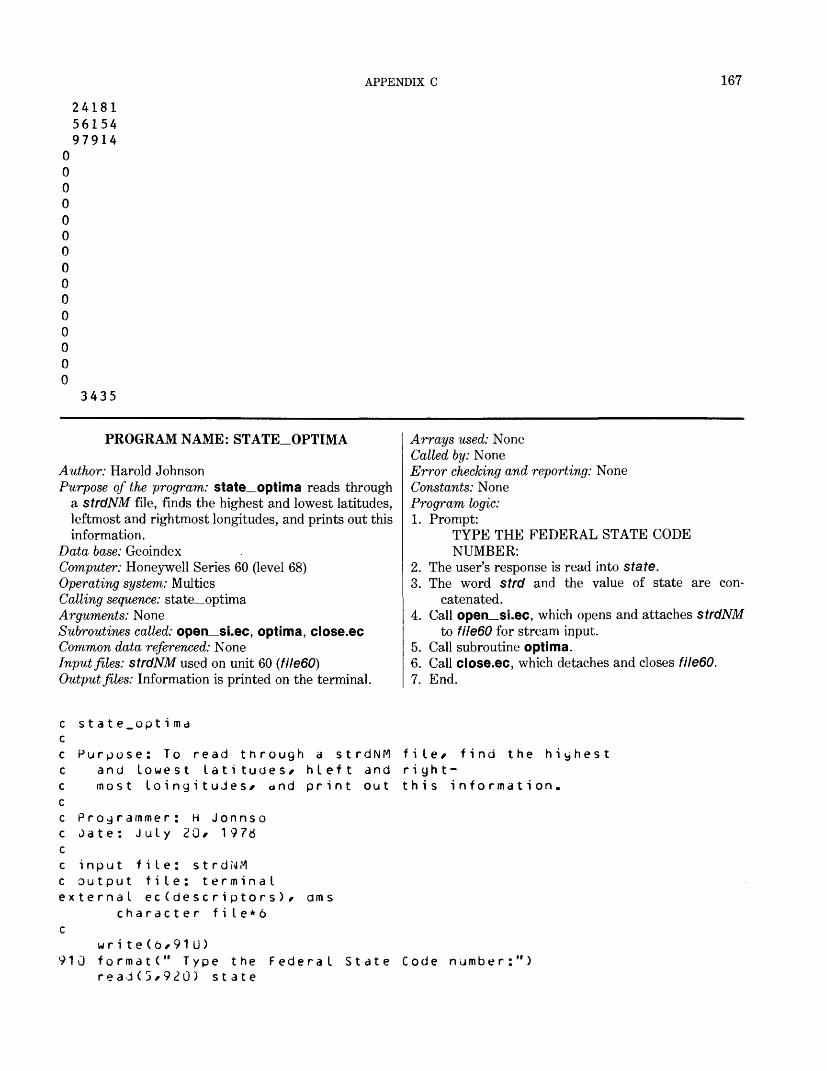
APPENDIX C 167
241815615497914
3435
PROGRAM NAME: STATE_OPTIMA
Author: Harold JohnsonPurpose of the program: state_optima reads through
a strdNM file, finds the highest and lowest latitudes, leftmost and rightmost longitudes, and prints out this information.
Data base: GeoindexComputer: Honeywell Series 60 (level 68)Operating system: MulticsCalling sequence: state_optimaArguments: NoneSubroutines called: open si.ec, optima, close.ecCommon data referenced: NoneInput files: strdNM used on unit 60 (filedO)Output files: Information is printed on the terminal.
Arrays used: NoneCalled by: NoneError checking and reporting: NoneConstants: NoneProgram logic:1. Prompt:
TYPE THE FEDERAL STATE CODE NUMBER:
2. The user's response is read into state.3. The word strd and the value of state are con
catenated.4. Call open_si.ec, which opens and attaches strdNM
to file60 for stream input.5. Call subroutine optima.6. Call close.ec, which detaches and closes filedO.7. End.
st a t e_opt i ma
Purpose: To read through a strdNM and lowest latitudes/ hleft and most loingitudes* and print out
Programmer; H Jonnso Jate: July 20* 1976
input file: strdNM output file: terminal
external ec(descriptors ) * character file*6
dm s
wri te(6*91U) 910 formatC" Type the
read(3*920) state
file* find the highestri gh t-t h i s info rma t i on.
Federal State Code number:")
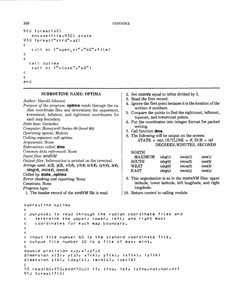
168 GEOINDEX
920 format(a2)encode(fi le/930) state
9.50 format("strd%a2) c
cjll ec ("open_si"/"60"/file) c c
call optimacall ec ("c lose"/"60")
c c end
SUBROUTINE NAME: OPTIMAAuthor: Harold JohnsonPurpose of the program: optima reads through the ra
dian coordinate files and determines the uppermost, lowermost, leftmost, and rightmost coordinates for each map boundary.
Data base: GeoindexComputer: Honeywell Series 60 (level 68)Operating system: MulticsCalling sequence: call optimaArguments: NoneSubroutines called: dmsCommon data referenced: NoneInput files: strdNMOutput files: Information is printed on the terminal.Arrays used: x(3), y(3), x1(4), y1(4) 1x1(4), iy1(4), z(4),
ideg(4), imin(4\ isec(4)Called by: state__optimaError checking and reporting: NoneConstants: NoneProgram logic:
1. The header record of the strdNM file is read.
2. Set ncards equal to isfno divided by 3.3. Read the first record.4. Ignore the first point because it is the location of the
written // numbers.5. Compare the points to find the rightmost, leftmost,
topmost, and lowermost points.6. Put the coordinates into integer format for packed
writing.7. Call function dms.8. The following will be output on the screen:
STATE = nor, OUTLINE = //, SUB = Isf DEGREES, MINUTES, SECONDS
NORTHMAXIMUM idegfl) iminfl) isecfl)
SOUTH ideg(2) imin(2) isec(2) , WEST idegfS) iminfS) isec(3) EAST ideg(4) imin(4) isec(4)
9. This organization is as in the comxNM files: upper latitude, lower latitude, left longitude, and right longitude.
10. Return control to calling module.
determine the upper/ lower/ left/ and right most coordinates for each map boundary.
subroutine optimacc purpose: to redd through the radian coordinate files andccccc input file number 60 is the standrd coordinate file.c outpue file number 30 is a file of max/ mins.cdouble precision x/y/x1/y1/zdimension x(3)/ y(3)/ x1U)/ y1(4)/ ix1U)/ iy1(A)dimension z(4)/ idegCA)/ iminCA)/ isec(A)c10 read(60/910/end=10uO) if/ ifno/ isf* isfno/not/nor/nif91J format(7i5)
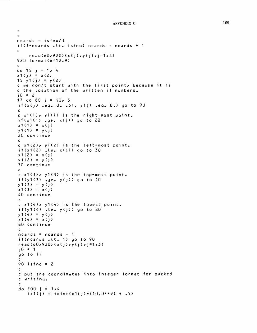
APPENDIX C 169
C Cncards = isfno/3if(3*ncards .It. isfno) ncards = ncards + 1c
read(60,920)(x(j),y(j),j=1,3) 920 format(6f12.9) cdo 15 j = 1 , A x1Cj) = x(2) 15 y1(j) = y(2)c we d o n,' t start with the first point/ because it is c the Location of the written if numbers. JO = 217 do 80 j = jU, 3if(x(j) ,eq. 0. .or. y(j) .eq. U.) go to 90 cc x1(1)/ y1(1) is the right-most point, i f(x1 ( 1 ) .ge. x(j)) go to 20 x1(1) = x( j ) y1(1) = y(j) 20 con t i nue cc x 1 ( 2 ) / y1(2) is the left-most point, i f(x1(2) .le. x(j)) go to 30 x1(2) = x(j) y1 (2) = y (j ) 30 con t i nue cc x1(3)/ y1(3) is the top-most point, i f(y1(3) .ge. y(j) ) go to 40 y1(3) = y (j > x1(3) = x( j ) AO cont i nue cc x1(A)/ y1(A) is the Lowest point, i f(y1 (A) .Le. y (3)) go to 80 y1(A) = y (j ) x1(A) = x(j) 80 cont i nue cncards = ncards - 1 i f(ncards . 11. 1) go to 90 re ad(60/920)(x(j),y(j),j=1,3> JO = 1 go to 17 c90 isfno = 2 cc put the coordinates into integer format for packed c writing, c do 200 j = 1/A
ix1(j) = idintCxKj)*(10.0**9) + .5)
170 GEOINDEX
200 iy1(j) = idint (y1(j)*(10.0**9) + .5)cz(1) = y1(3)z(2) = y1 (4)z(3) = x1(1)z(4) = x1(2)do 106 k = 1 / Az(k) = z(k)*180./3.1A1592653
call dms(z(k)/ijeg(k)/imin(k)/isec(k)) 106 continue
write(6/9*»0) nor/ it/ isf 9AO formatC' state = "/i5/"/ outline = "/
wr i te(6/950) 950 format(1Ax/"degrees minutes seconds")
write(6/960) ideg(1)/itnin(1)/isec(1) 960 formatC' north maximum M /i3/i8/i8)
write(6/970) ideg(2)/itnin(2)/isec(2) 970 formatC' south M /i3/i8/i8)
write(6/980) ideg(3)/imin(3)/isec(3> 980 formatC' west M /i3/i8/i8)
write(6/990) ideg(A)/imin(4)/isec(A) 990 formatC1 east M /i3/i8/i8>
i5 sub =
c this organization is as in the comxc upper latitude/ lower latitude/ Iftc longitude.c930 format(Ad20.9)cyo to 10c1000 c ont i nuereturn
files:long i tude/ right
EXEC-COM NAME: OPEN_SI.EC
Author: Harold JohnsonPurpose of the program: open_si.ec attaches and opens
a file for stream input. Data base: Geoindex Computer: Honeywell Series 60 (level 68) Operating system: Multics Calling sequence: call ec ("open_si","60",file) Arguments:
60—Unit numberfile—Name strdNM
Subroutines catted: io_attach, io_openCommon data referenced: NoneInput files: strdNMOutput files: NoneArrays used: NoneCalled by: state_optimaError checking and reporting: NoneConstants: NoneProgram logic:1. Call io to attach file60 via vfile_ to strdNM.2. Call io to open fileBO for stream input.3. Return control to the calling module.
A c omman J_ I i ne offio attach file&»1 vfile_i o open f i I e£ 1 si
-append -ssf
APPENDIX C 171
EXEC_COM NAME: CLOSE.EC
Author: Harold JohnsonPurpose of the program: close.ec detaches and closes
the file.Data base: Geoindex Computer: Honeywell Series 60 (level 68) Operating system: Multics Calling sequence: call ec ("close","60") Arguments: 60—Unit number Subroutines called: io_detach, io_close
Common data referenced: NoneInput files: strdNMOutput files: NoneArrays used: NoneCalled by: state_optimaError checking and reporting: NoneConstants: NoneProgram logic:1. Call io to detach fileBO.2. Call io to close fileBO.3. Return control to calling module.
Acorn mandoline io close f i I e io Je t dc h f i I
off
PROGRAM NAME: ADDRAD
Author: Harold JohnsonPurpose of the program: addrad inserts the correct
values for the areas, the latitude and longitude coor dinates for the centers and for the north, south, east,and west boundaries of the outlines for each mapreference contained in strgNM files.
Data base: GeoindexComputer: Honeywell Series 60 (level 68) Operating system: Multics Calling sequence: call addrad Arguments: None Subroutines called: ibound_addrad, srch20_addrad,
srch30_addrad, srch40_addrad, closer, ftnumber,center__addrad, optima_addrad
Common data referenced: None Input files:
strgNM used on unit 10 (fileW) Created by: concat
measNM used on unit 20 (file20) Created by: master
cordNM used on unit 60 (file60) Output files:
comxNM used on unit 30 (file3G) Created by: optima_addrad
ctrdNM used on unit 40 (file40) Created by: center_addrad
redyNM used on unit 50 (fileSO)Created by: addrad
Arrays used: iarea(8), iaunit(7), inlat(12), islat(12),iwlong(12), ielong(12), iclat(12), iclong(12),
Called by: NoneError checking and reporting: In subroutinesConstants: NoneProgram logic:1. The user is prompted for the 2-digit FIPS code of the
State being processed.2. Using this assoc will attach strgNM to Fortran
fileW, measNM to file20, comxNM to file30, ctrdNM to file40, cordNM to file60, and redyNM to fileSO. comxNM is the north, south, east, and west latitude and longitude file; ctrdNM is the latitude and longitude file of center points; redyNM is the output file ready for final input to the GRASP system.
3. Center_addrad is called to compute a center point for each outline in cordNM and store these in ctrdNM.
4. Optima_addrad is called to determine the extreme north and south latitudes and east and west longitudes for each outline in cordNM.
5. A record from strgNM is read.6. Subroutine ibound_addrad is called to determine
the if and isf for the map outline of this reference data.
7. srch20_addrad is called to search file20 for the area of the corresponding outline. This is inserted in the record from strgNM.
8. srch30_addrad and srch40_addrad are called to locate data in comxNM and ctrdNM belonging to this outline. This is inserted in the same record.
9. The record is written to redyNM. Control returns to step 2.
172 GEOINDEX
C ******* ADDRAD *******character f i I e * 4 , mode***/ state*2, outfile*6
C PROGRAM ADDRADC UPDATED AS OF DEC. 17, 1976 H. JOHNSONC THIS PROGRAM OPERATES ON THE FILES STRGNM CONTAINING THE OUTPUT C VECTORS OF THE CONCAT PROGRAM, BEFORE THEY ARE USED AS INPUT TO C THE CREATE PROGRAM. CC $$$$$$iit$J$$$i$S$$i$$i$i$$$:l>$$$$j;$$$$$i$ $$$$$$$$$$$$$$$$$$$$$$$$$$$$$ cCC WHAT THIS PROGRAM DOES IS TO INSERT CORRECT AREAS, LATITUDE ANDC LONGITUDE COORDINATES FOR THE CENTERS ,N,S,LAT ITUDES AND E,W,c LONGITUDES OF THE BOUNDARIES.C (IN REFNM ONLY ONE AREA,CENTER AND 30UNDARY IS GIVEN PER "IF")CC THE FOLLOWING FILES ARE REQUIRED FOR INPUT:C FILE 10 = INPUT STRGNM WHICH WAS PRODUCED BY CONCAT.c FILE 20 = AREA FILE PRODUCED BY "MASTER" PROGRAM, CALLED MEASNM.C FILt 30 = N,S LATITUDE ;E,W LONGITUDE FILE CALLED COMXNM.C FILE 40 = CENTER LONGITUDE-LONGITUDE FILE CTRDNM.c THE OUTPUT FILE PRODUCED 8Y THIS PROGRAM FOR CREATE:C FILE 50 = THE OUTPUT FILE REDYNM.CCc THE FOLLOWING VALUES ARE THE STARTING POSITIONS FOR THE VALUES OFc IdOU.MD, AREA, AUNIT, N LA T , SL A T , wLONG , EL ONG, C L AT , CLONG ASc DETERMINED BY THE FILE CALLED "MATRIX".cc $$$$i$$ss$s$$$ii$$$$$$$s$$$i$$$$$$$$$$$$$$$$$$$*$$$$$$$$$$$$i$$$$$$$$$
dimension iarea(8),iaunit(7),inlat(12),islat(12),iwlong(12) dimension ielong(12)dimension iclat(12),iclong(12),ifile(1211>
data nbound/1160/,narea/869/,naunit/S77/,nnlat/S#4/,nslat/d96/ data nwlong/90S/,nelong/920/,nclat/932/,nclong/944/,nrec/1211/
cc NOTICE THE DIMENSION OF IFILE IS THE SAME AS NREC, WHICH MUST BEc CHANGED IF NREC IS CHANGED.c
data iaunit/"s","q","."," ","k","m","."/
cwrite(6,910)910 formatC' ENTER THE 2-DIGIT CODE FOR THE STATE BEING PROCESSED")read ( 5,920) state920 format(a2)encodeCoutfile,925)state925 f ormatC'st rg",a2) mode = "si "
call ftnumber(1J,outfile,mode) encodeCoutfile,926)state926 format("cord",a2)
call ftnumoer(oO,outfiIe,mode) encode(outfile,927)state927 format(".neds",a2)
cat I ftnumber(2J,outfile,mode)
APPENDIX C 173
encode(outfi Ie /930) state 930 f o r .n a t ( " c o m x " / a 2) mode = "sio "
call ec ("open_sio"/"30"/outfile) encode(outfile/932)state 932 format("ctrd"/a2)
cill ftnumber(40/outfile/mode) encode(outfile/93/)state 937 formatC1 redy"/a2) mode = "so "
call ftnumber(50/outfile/mode) c
call center_addradc this routine computes a center point in radians for each c ou tIi ne. c
call op t i ma_add r<j ac this routine computes the extreme north and south latitude for c each outline/ and the extreme east and west longitude, c10 read(1U/940/end=100G)(ifile(j)/j=1/nrec) 940 format(30a1) c c vJE H.*WE READ ONE RECORD OF LENGTH NREC FROM STRGNM.
call ioound_addrad(ifi le/nbound/if/isf/nrec)c THIS ROUTINE "IbOUND" READS IFILE FROM NBOUND TO NbOUND+6 TO c DETERMINE THE "IF" AND "ISF" OF THE MAP OUTLINE WHICH IS THE OUTLI c Ec MAP FOR THIS REFERENCE/ IF ONE EXISTS. IF = 0 WHEN NONE EXISTS, c
if(if ,gt. u) go to 20go to 100
c 20 call srch20_addrad(if/isf/iarea/ifIag2Q)
if(iflag20 ,eq. 1) go to 50C THIS ROUTlNt SEARCHES FILE 20 TO LOCATE THE AREA OF THE OUTLINE c Ic HAVING THIS IF AND ISF. IAREA IS THE LEFT-JUSTIFIED/ DECODED AREA C FORMAT 6A1 . C
do 3U k=1/830 ifi I e(narea + k-1) = iarea(k) c C NEXT/ INSERT "S^.KM." IN IFiLE.
do 40 k=1/740 ifi I e(naunit + k-1) = iaunit(K) c 50 call srch30_addrad(if/isf/inlat/islat/iwlong/ielong/iflag30)
if(iflaj30 ,eq. 1) go to 70c THIS SEARCHES THROUGH FILE 30 FOR THE LAT I TUDE-LONG I TU0ES/ DECODES C THEM INTO A1 FORMAT, c
do 60 k=1 /12ifi le(nnlat+k-1) = inlat(k)ifi le(nslat+k-1) = islat(k)
174 GEOINDEX
60c70
c c c
80c100
ifi le(nwlong+k-1)=iwlong(K) i f i le(nelony+k-1 ) = i e I ony ( k )
call srch4U_addrad(if*isf*iclat*iclong*iflag40)i f ( i f I a 3 4 0 .eg. 1) go to 100
THIS ROUTINE SEARCHES FILE 40 FOR THE LATITUDE-LONGITUDE CENTER.
6 U K = 1 * 1
OF THE
O 6 U K = *ifi le(nclat+k-1)=icldt(k) i fi le(nc Ion g + k-1 ) = ic lony(k)
write(50,94u)(ifile(j),j=1/nrec) jo to 10
1000 call closer(lu) call c lose r ( 20) call c loser (3u) call c loser (40) end f i I e 50
c this is supposed to put c otherwise be lost.c
cal Ica I I
cS t Op
c lose r ( 50)c lose r (60)
a final blank record which might
end
SUBROUTINE NAME: OPTIMA_J^DDRAD
Author: Harold JohnsonPurpose of the program: optima_addrad reads through
the radian coordinate files and determines the upper most, lowermost, leftmost, and rightmost coordinates for each map boundary.
Data base: GeoindexComputer: Honeywell Series 60 (level 68)Operating system: MulticsCalling sequence: call optima_addradArguments: NoneSubroutines called: NoneCommon data referenced: NoneInput files: cordNMused on unit 60 (filedO)Output files: file30- a file of maximums and minimumsArrays used: x(3), y(3), x1(4), y1(4) 1x1(4), iy1(4)
Called by: addradError checking and reporting: NoneConstants: NoneProgram logic:1. The header record of the coordinate file is read.2. Set ncards equal to isfno divided by 3.3. Read the first record.4. Ignore the first point, because it is the location of the
written if numbers.5. Compare the points to find the rightmost, leftmost,
uppermost, and lowermost points.6. Put the coordinates into integer format for packed
writing.7. Write the upper latitude, lower latitude, left
longitude, and right longitude to file30.8. Continue steps 1 through 7 until the end of file is
reached.
subroutine optima_addraocc purpose: to read through the radian coordinate files and
determine the upper* lower* left* and right most coordinates for each map boundary.
APPENDIX C 175
c input file number 60 is the standrd coordinate file.c outpue file number 30 is a file of max/ mins.cdouble precision x*y*x1*y1dimension x(3)* y(3)* x1(4)* y1(4)s ix1(4)s iy1(4)rewind 60crewi nd 3010 read(60*910*end=1000) if* ifno* isf* isfno*not*nor*nif910 format(7i5)ccncards = i sfno/3if(3*ncards .It. isfno) ncards = ncards + 1c
read(60,92Q)(x(j),y(j),j=1,3) 920 format(6f12.9) cdo 15 j = 1, 4 x1 (j) = x(2) 15 yK j) = y(2)c we don't start with the first point* because it is c the location of the written if numbers. JO = 217 do 80 j = jO* 3if(x(j) .eq. 0. .or. y(j> .eq. 0.) go to 90 cc x1(1)* y1(1) is the right-most point, i f (x1 (1 ) .ge. x( j)) go to 20 x1(1) = x(j) yK1) = y(j) 20 cont i nue cc x1(2)* y1(2) is the left-most point, if (x1(2) .le. x( j)) go to 30 x1 (2) = x(j) y1 (2) = y(j) 30 continue cc x1(3)* y1(3) is the top-most point, if (y1(3) .ge. y(j)) go to 40 y1(3) = y(j) x1(3) = x(j) 40 cont i nue cc x1(4)* y1(4) is the lowest point, if (y1(4) .le. y(j)) go to 80 y1 (4) = y( j ) x1 (4) = x(j ) 80 cont i nue cncards = ncards - 1 ifCncards .It. 1) go to 90 read(60,920)(x(j),y(j),j=1,3) JO = 1
176 GEOINDEX
go to 17c90 isfno = 2
write(30/910) if/ifno/isf/isfno/not/nor/nif cc put the coordinates into integer format for packed c writing, c do 200 j = 1/4
ix1(j) = idint<x1<j)*(10.0**9) + .5) 200 iy1(j) = idint (y1<j>*<10.0**9) + .5) c
write (30/9 30) y1(3)/y1(4)/x1(1)/x1<2) c this organization is as in the comx files: c upper latitude/ lower latitude/ Ift longitude/ right c long i t ude. c930 format(Ad20.9) cgo to 10 c1000 endfile 30 rewind 30 return end
SUBROUTINE NAME: IBOUND_ADDRAD
Author: Harold JohnsonPurpose of the program: ibound_addrad reads the
characters in the vector ifile to interpret theassociated // and isf as integers.
Data base: Geoindex Computer: Honeywell Series 60 (level 68) Operating system: Multics Calling sequence: call ibouncL_addrad (ifile,nbound,if,-
isf,nrec) Arguments:
if He-A vector of characters from one record of strgNM
nbound-The number of the element of ifile that preceeds the data containing if and isf characters
//-The identification number for the currentreference outline
isf-The subidentification number for the currentreference outline
nrec-The length of ifile Subroutines called: decoder_addrad Common data referenced: None Input files: None Output files: None Arrays used: ifile(nrec), num(6) Called by: addradError checking and reporting: None Constants: None Program logic:1. The pertinent characters are read from ifile, and
decoder_addrad is called to interpret them as in tegers. These are summed with suitable powers of 10 to output the corresponding // and isf.
******* SUBROUTINE IdOUND_ADDRAD *******subroutine ibound_dddrdd(ifile/noound/if/isf/nrec)
SUBROUTINE USED IN MAIN PROGRAM "ADDRAD"UPDATED AS OF DEC. 27, 1*76 H. JOHNSON
converted to Multics May 21, 1977 by H Johnson
APPENDIX C 177
10 c20 c
c c 25
30cc
dimension ifile(nrec)/num(6) data iblank/" "/
THE PURPOSE OF THIS ROUTINE IS TO READ CHARACTERS IN IFILE TO DETERMINE THE IF/.ISF OF THE BOUNDARY FOR THIS MAP THE CHARACTERS CONSIST OF 1-3 NUMERALS FOR "IF" FOLLOWED BY 2 FOR "ISF".
WE FIRST READ THESE NUMBERS INTO A VECTOR NUM(K), STOPPING *HEN A BLANK IS ENCOUNTERED.
Jo 10 k=1/6i blah = i f i le(nbound + k-1)i f ( i f i le (nbound+k-1 ) .eq. iblank)go to 20call decoder_addrad(ifile(nbound + k-1)/nurr»1)num(k)=num1
i f (k .yt . 1 )go to 25WHEN THE RECORD IS ENTIRELY BLANK WE RETURN 0 FOR IF AND ISF.
i f = 0 i sf = 0 return
READ THE LAST T*0 NUMBERS INTO ISF: Kla s t = k-1 i sf = 0jo 30 j = 1 ,2isf=isf+num(klast-j+1)*10**(j-1) con t i nue
READ THE FIRST NUMBERS INTO IF:kI as t = kIast-2i f = 0do 50 j=1/klast
50 if=if+num(klast-j+1)*10**(j-1)returnend
c ******* END IBOLKJD.ADDRAD *******
SUBROUTINE NAME: DECODER_J^DDRAD
Author: Harold JohnsonPurpose of the program: decoder_addrad is used to in
terpret integer characters and output them as in tegers.
Data base: GeoindexComputer: Honeywell Series 60 (level 68)Operating system: MulticsCalling sequence: call decoder_addrad (iblah,iy)Arguments:
iblah- Integer character iy- Integer number
Subroutines called: NoneCommon data referenced: None
Input files: NoneOutput files: NoneArrays used: ino(10)Called by: ibound_addradError checking and reporting: When iblah is not the
character for any single integer, a message to that ef fect is written to the user.
Constants: NoneProgram logic:1. iblah is compared with each of the integer characters
0 through 9 until a match is found.2. If no match is found, a message is sent to the user
along with the character in question.3. If a match is found on the nth test, iy is equated to n
-1.
178 GEOINDEX
subroutine decoder_addrad(iblah*iy)cc subroutine used in dddradc written by H Johnson August 22* 1977cdi men s i on i no(10)data i n o/"0" ," 1"/"2"," 3" ," 4" ," 5" , "6"/"7" ," 8" ," 9"/cdo 10 n = 1*10if(iolah .eg. ino(n)) 90 to 2010 cont i nuewrite(6*910)i blah910 formatC" there is no way to decode iblah = "*a1)returnc20 iy = n-1returnend
SUBROUTINE NAME: SRCH20_J^DDRADAuthor: Harold JohnsonPurpose of the program: srch20_addrad searches
through the file number 20, measNM, to find that record with an assigned if and isf. It returns the area written there in character form.
Data base: GeoindexComputer: Honeywell Series 60 (level 68)Operating system: MulticsCalling sequence: call srch20__addrad (if,isf,iarea,iflag20)Arguments:
if-The reference number for an outline /s/-The subreference number for an outline /area-An 8-character vector giving the area for an
outlineiflag20-A flag that indicates by the value 1 that no
area was found in measNM for this outlineSubroutines called: icoder_addradCommon data referenced: NoneInput files: measNM used on unit 20 (file20)
Output files: NoneArrays used: iarea(8)Called by: addradError checking and reporting: When no record in
measNM can be located that has assigned if and isf, a message to that effect is sent to the operator.
Constants: NoneProgram logic:1. A record from measNM is read, giving its value for
if, isf, area.2. When this record indicates that it is beyond the
record we seek, file20 is rewound and control begins at step 1.
3. Reading begins again, and this time if a record is read that should be beyond the assigned if and isf, the error message is written and the subroutine returns.
4. When a match is found, the area value is decoded into character format, along with the decimal point, and left-justified into /area. iflag20 is set at 0.
c ******* SUBROUTINE SRCH 2 U_ADDRAD *******subroutine srch2G_addrad(if*isf*iarea*ifla,j2U)
cc SUBROUTINE USED IN MAIN PROGRAM "ADDRAD" c UPDATED AS OF DtC. 27, 1976 H. JOHNSON cc converted to Multics May 21* 1977 H Johnson cC THIS ROUTINE SEARCHES THROUGH THE AREA FILE 20 TO LOCATE AN IF* IS cC TO MATCH THE NUrtdERS GIVEN IN THE CALL, c
APPENDIX C 179
dimension iarea(8)data idot/"."/,izero/"0"/,iblank/" "/
if Idg20 = 010 reao(20,VOO,end=45)if1,isf1,ared 900 format(2i5,f6.1)
if(if1 .eq. if .and. isfl .eq. isf) go toif(if1 . g t. if .or. (if1 .eq. if .and. isfloa c k spac e 20
40 read(20,900,end=45)if1,isf1,aredif(if .eq. if1 .and. isf . eq . isf1)go to 100if(if1 .It. if .or. Cif1 .eq. if .and. isfl
45 wri te(6,910) i f ,i sf 910 formatC" THERE IS NO AREA WITH IF = ",i5,"
rewind 20i f I ag20 = 1return
100 a rea = a rea + .1do 105 k=0,6f = d rea/10. **kifx=ifix((f-float(ifix(f)))*10.)call icoder_addrad(ibI ah,ifx)
105 i area(7-k)=iblahiarea(&)=iarea(7)iarea(7)=idot
100• gt isf))rewind 20
.It. i sf))go to 40
AND ISF = " , i 5 )
c NOW, LEFT-JUSTIFYdo 135 k=1,6if(iarea(1) .rie. izero)go to-JO 130 1 = 1,7
130 iarea( I) = iarea( 1 + 1 )i area(8) = i DIank
135 continue 140 continue
i f Iag20 = 0returnend
c ******* t M D SRCH20 ADDKAD *******
140
SUBROUTINE NAME: ICODER_ADDRAD
Author: Harold JohnsonPurpose of the program: icoder_addrad determines
what character corresponds to a given input integer. Data base: GeoindexComputer: Honeywell Series 60 (level 68) Operating system: Multics Calling sequence: call icoder_addrad (iblah,iy) Arguments:
//?/a/7-The output character that symbolizes the in teger iy
/y-The input integer Subroutines called: None
Common data referenced: NoneInput files: NoneOutput files: NoneArrays used: ino(10)Called by: ibound_addrad, rconv_addrad, srch20_
addradError checking and reporting: When iy is not an integer
between 0 and 9, an error message is sent to the operator.
Constants: None Program logic:1. In a do loop, iy is compared with each integer from 0
to 9. When a match is made, the correct character is placed in iblah.
180 GEOINDEX
subroutine icouer_addrdd(iblah,iy)cc subroutine used in aadradc written by n. Johnson May 21 * 1977cd i mens ion i no(10)data ino/"0%"1", M ^%"3","4","5","b%"7",''8","9"/cdo 10 n = 1 , 10if(iy .eq. n-1) go to 1010 con t i nuecwri te(6*910)i y910 formatC' THtRE IS NO WAY TO ENCODE IY = ",i3)returnc20 iblah = ino(n)returnend
SUBROUTINE NAME: SRCH30_ADDRAD
Author: Harold JohnsonPurpose of the program: srch30__addrad searches
through file30 for a record that matches an assigned if and isf. It returns values in character format.
Data base: GeoindexComputer: Honeywell Series 60 (level 68) Operating system: Multics Calling sequence: call srch30_addrad (if,isf,inlat,islat,-
iwlong,ielong,iflag30) Arguments:
if- Reference identification number /sf-Subidentification number in fat -Vector containing the characters of the latitude
of the most northerly point of the outline islat— Vector containing the characters of the latitude
of the most southerly point of outline iwlong- Vector containing the characters of the
longitude of the most westerly point of the outline ielong- Vector containing the characters of the
longitude of the most easterly point of the outline /7/agr30-Flag indicating whether or not the search
was successfulSubroutines called: rconv_addrad, read2_addrad Common data referenced: None
Input files: comxNM used on unit 30 (file30)Output files: NoneArrays used: inlat(12), islat(12), iwlong(12), ielong(12)Called by: addradError checking and reporting: When no match is found,
this is reported to the operator. Constants: None Program logic:1. A record in file30 is read to determine an if1 and
isfl.2. If a match with the assigned if and isf is found,
rconv_addrad is called to convert the data into degrees, minutes, and seconds in character form. Then control returns to the calling program.
3. If the read record in file30 seems to be farther along than the assigned if, isf indicated, file30 is re wound and step 1 is initiated, with a flag indicating that this has occurred. If that flag was already set, the error message is written to the operator that no record exists in file30 with the if, isf, and the routine ends.
4. A second record is read and compared with the assigned //, isf, and this is repeated until the ex pected position of that record is passed. Then the error message is written.
5. When no record is found, iflagSO is set to 1. Other wise, it is set to 0.
******* SUBROUTINE SRCH30_ADDRAD *******subroutine srch30 addrad(if/>isf/>inI at/>isI at/iwIong,ieIong,if Idg30)
SUBROUTINE USED IN THE MAIN PROGRAM "ADDRAD" UPDATED AS OF DEC. 27, 1976 H. JOHNSON
APPENDIX C 181
C
C10
C
C
C
converted to Multics May 21/ 1977 H Johnson
THIS ROUTINE SEARCHES THE LATITUDE LONGITUDE FILE 30 FOR THE RECOR
HAVING IF AND ISF THE SAME AS THE ONES SUPPLIES 3Y THE CALLING PROGRAM. WHEN IT FINDS THEM IT READS THE NLAT/SLAT/WLONG/ELONG VALUES ON THE NEXT CARD/ ENCODES THEM TO INLAT/ISLAT/IWLONG/IELONG AND RETURNS.
dimension inlat(12)/i slat(12)/iwlong(12)/ielong(12) double precision uLat/sLat/w I ong/eLong
FIRST/ SEARCH FOR THE ASSIGNED IF AND ISF.call read2_aadrad(if1/isf1/ulat/slat/wlong/elong/kflag)ifCkflag .eq. 1) go to 45
THIS READS 2 CAKDS/ A HEADER CARD FOLLOWED BY COORDINATES. IT RETURNS THE IF AND ISF FROM THE HEADER CARD.
40
45910
100 c c c
i fi fc ai fi fi fwrfo
Cif1 .eq. if .and.(if1 .gt. if .or. (U read2_addrad( if 1(kflag .eq. 1) go t(if .eq. if1 .and.( i f 1 .It. if .or . (i te(6/910) i f /i sfrmat(" THERE IS NO
isf 1i f 1/isfo 45i sfi f 1
COMX
.e.eq1/u
• eq.eq
RE
Q•
I
.
.
. iif
at/
i sif
CORD
sf•
si
f 1•
W
) goand .a t / w
) goand .
ITH
to 100isf 1
I ong/ e
to 100isf 1
IF = "
.gt . iI ong/k
.It . i
/i5/"
sf ) ) rewf lag)
sf ))go
ISF = "
ind 30
to 40
/i5>
* * * *
rew i nd 30i fIdg30 =returncont i nue
AT 0 DEGREES/
cal Ical Ical Ical Ii fIag30 =returnend
*** END SRCH30.ADDRAD
1
THIS POINT THE NUMBERS ULAT/SLAT/WLONG/ELONG MUST BE CONVERTED
MINUTES AND SECONDS AND ENCODED. rconv_dddrad(ulat/inlat) rconv_dddrad(slat/i slat) rconv_addrad(wlong/iwlong) rconv_addrad(elong/ielong)
0
*******
SUBROUTINE NAME: RCONV_J^DDRADAuthor: Harold JohnsonPurpose of the program: rconv_addrad decodes a
12-digit floating point number into characters and writes them to a vector, one character put in each ele ment of the vector.
Data base: GeoindexComputer: Honeywell Series 60 (level 68)Operating system: Multics
Calling sequence: call rconv_addrad (radian,ifile)Arguments:
radian-A floating point number to be decoded if He-A 12-element vector, which is to contain the
decoded digits of radian as charactersSubroutines called: dms, icoder_addradCommon data referenced: NoneInput files: NoneOutput files: None
182 GEOINDEX
Arrays used: ifile(12)Called by: srch30_addrad, srch40_addradError checking and reporting: In subroutinesConstants: NoneProgram logic:1. radian is converted to degrees.
2. dms is called to convert these degrees to degrees, minutes, and seconds, I format.
3. These integers are written into if lie one at a time, with blanks in place of leading zeros. icoder_ad- drad is used to convert single integers to characters.
c ******* SUBROUTINE RCONV.AOORAO *******subroutine rconv_addrad(radian/i f ile)
C SUBROUTINE USED IN MAIN PROGRAM "ADDRAD" C UPDATED AS OF DEC. 27, 1976 H. JOHNSON c converted to Multics May 21 / 1977 h. Johnson c
double precision radian/x/pidimension i f ile(12 )data pi/3.141592653569793238A26A3383279/data iblank/" "/data izero/"0"/
cC THIS ROUTINE CONVERTS THE RADIAN ANGLE "RADIAN" INTO DEGREES, C MINUTElS AND SECONDS/ PACKING THEM INTO THE ARRAY IFILE.C C
x=dabs(radian*18U./pi)call dms(x/ideg/imin/isec )
991 format(1x,3i7) do 10 j = 1/3 iy = i deg/(10**(3-j))
call icoder_addrad(ib lah/iy) i f ile(j) = iblah i y = i y*(10**(3-j)) 10 i deg = i deg - i y if(ifile(1) .ne. izero) go to 15 i f i le( 1) = iblankif(ifile(2) .ne. izero) go to 15 i fi le(2) = iblankif(ifile(3) .ne. izero) go to 15 ifi le(3) = iblank 15 continue cdo 20 j = 1, 2 i y = i min/(10**(2-j))
call icoder_addrad(iblah/iy) i fi le(3 + j) = i blah iy = i y*(10**(2-j)) 20 imin = imin -iy ifCifile(A) .ne. izero) go to 25 if(ifile(5) .ne. izero) go to 25 25 c ont i nue c-do 30 j = 1/ 3 i y = i sec/(10**(3-j))
call icoder_addrad(ibI ah/iy) i f i le(5 + j) = iblah
APPENDIX C 183
iy = iy*(10**(3-j) )30 isec - isec - iyif(ifile(6) «ne. izero) goif(ifite(7) .ne. izero) goif(ifile(8) .ne. izero) go35 con t i nuecdo 40 j = 9,1240 i fi le(j) = iblank995 format(1x,12a1)returnendc ******* END RCONV.ADDRAD
to to to
353535
*******
SUBROUTINE NAME: DMS
Author: Harold JohnsonPurpose of the program: dms converts a double-
precision degree number to three integers represen ting degrees (between 0 and 360), minutes, and seconds.
Data base: GeoindexComputer: Honeywell Series 60 (level 68)Operating system: MulticsCalling sequence: call dms (x,ideg,imin,isec)Arguments:
x- A double-precision floating point value for degrees ideg- An integer representing the degrees in x imin— An integer representing the minutes in x
isec— An integer representing the seconds in x Subroutines called: None Common data referenced: None Input files: None Output files: None Arrays used: None Called by: rconv_addrad, optima Error checking and reporting: None Program logic:1. x is reduced modulo 360.2. The integer part of x is taken for Ideg.3. Ideg is subtracted from x, the result multiplied by 60,
and its integer part is Imin.4. imin is subtracted, the result is multiplied by 60, and
its integer part becomes isec.
c ******* QMS FUNCTlOiJ *******subroutine dms(x/ideg/imin,isec)double precision x/yy = 360.x - dmod(x/y)ideg = ifix(sngl(x))x = x - dfloat(iaevj)imin = ifix(sngI(60.*x))x = x*60. -dfI oat(imin )isec = ifix(sng I (oO.*x))returnendc ******* END DMS FUNCTION *******
SUBROUTINE NAME: READ2_ADDRAD
Author: Harold JohnsonPurpose of the program: read2_addrad is used to read
from the file comxNM the values for the latitudes andlongitudes and the values for if and isf.
Data base: Geoindex Computer: Honeywell Series 60 (level 68)
Operating system: MulticsCalling sequence: call read2_addrad (ifl,isfl,ulat,slat,-
wlong, elong,kflag) Arguments:
if1—The if of the record from comxNMisfl—The isf of the recordulat—The northernmost latitudeslat—The southernmost latitudewlong—The westernmost longitude
184 GEOINDEX
elong—The easternmost longitudekflag—A flag to indicate that the end of comxNMhas
been sensedSubroutines called: None Common data referenced: None Input files: comxNM used on unit 30 (file30) Output files: None
Arrays used: None Called by: srch30_addradError checking and reporting: None Constants: None Program logic:1. file30 is read according to its preassigned format.
When the end of the file is sensed, kflag is set to 1.
******* SUBROUTINE RhAD2.ADD9 AD *******subroutine read2_addr3d(if1/isf1/ulat*slat/wlong^elon9/kflag)
SUBROUTINE CALLED BY SRCH3J IN MAIN PROGRAM "ADDRAD"UPDATED AS OF DEC. 27, 1976 H. JOH.MSON
converted to multics May 21 , 1977 H Johnson
90J
910
100
*******
double precision ulat/sldt/wlong/elongread(3U,9GO,end=10u)if1,ifno,isf1for mat(3 i 5)read(30*910/end=100)ulat/slat/wlong/elongformat(4d2U.9)k f I a g = Jreturnkf tag = 1 return end END READ2.ADDRAD *******
SUBROUTINE NAME: SRCH40_jU)DRAD
Author: Harold JohnsonPurpose of the program: srch40_addrad searches
through file40 for a record having an assigned /'/ andIsf.
Data base: GeoindexComputer: Honeywell Series 60 (level 68) Operating system: Multics Calling sequence: call srch40_addrad (if,isf,iclat,iclong,-
jflag) Arguments:
if—The assigned reference identification numberisf—The assigned reference subidentification numberid at—A 12-character vector containing characters
that represent the latitude of the center point in degrees, minutes, and seconds
iclong—The 12-character vector of characters for the longitude of the center
jflag—A flag that, when set to 1, indicates that no
record in file40 was found to correspond to the given //, isf
Subroutines called: read40_addrad, dble, rconv_ addrad
Common data referenced: NoneInput files: ctrdNMused on unit 40 (file40)Output files: NoneArrays used: iclat(12), iclong(12)Called by: addradError checking and reporting: When no record is found
with the prescribed // and isf, a message is sent to theoperator.
Constants: None Program logic:1. Following the same logic stream as in srch20_
addrad, search the file for the record with the desired /'/ and isf values.
2. When found, the latitude and longitudes are made double precision, and rconv__addrad is called to convert them to vectors of characters.
******* SUBROUTINE SRCHAO.ADDRAD *******subroutine srch40_addrad(if/isf/icldt/iclong/jflag)
SUBROUTINE USED IN MAIN PROGRAM "ADDRAD" UPDATED AS OF DEC. 27, 1976 H. JOHNSON
APPENDIX C 185
THIS ROUTINE SEARCHES FILE 4U FOR THE RECORD HAVING THE GIVEN IF, IFTHE NEXT RECORD WILL CONTAIN THE LATITUDE/ LONGITUDE OF THE CENTERPOINT
dimension i c I at < 1 2 ) * i c long ( 1 2)douole precision radian
c cj f lag = 0c FIRST/ SEARCH FOR THE IF/ ISF IN THE CALLING PROGRAM. 10 call rea d40_addrad ( i f 1 / i sf1 / c lat/ c long/ i f lag 1 ) i f ( i f I ag1 .eq. 1 ) go to 45c THIS READ 2 CARDS. THE FIRST IS A HEADER CARD AND GIVES THE IF1/I c F1 c THE SECOND IS A LATITUDE LONGITUDE CARD.
if(it1 .eq. if .and. isfl .eq. isf)go to 100if(if1 .gt. if .or. (if1 .eq. if .and. isfl .gt. isf))rewind 40
40 call read40_addr ad ( i f 1 f i sf 1 /c lat / c I ong/ i f I ag1 ) i f ( i f I dg! . eq . 1 ) go to 45
ifCif .eq. if1 .and. i s f . eq . i s f 1 ) go to 100if(if1 .It. if .or. (if1 .eq. if .and. isfl .It. isf))go to 40
45 wri te(6/?10) i f /i sf 910
rewind 40J f lag = 1returnc103 radian = dble(clat)
call r conv_ addr ad ( rad i an/ i c I a t ) radi an = dble (c long) call r conv.addr ad ( rad i an/ i c long )
KCOMV CONVERTS "RADIAN" TO DEGREES/ MINUTES AND SECONDS AND ENCODE
C THE;1 AS CHARACTERS INTO ICLAT AND ICLONG. return end
c ******* END SRCH40_ ADDRAD *******
SUBROUTINE NAME: READ40_ADDRAD
Author: Harold JohnsonPurpose of the program: read40_addrad is used to read
from file40, ctrdNM. Data base: GeoindexComputer: Honeywell Series 60 (level 68) Operating system: Multics Calling sequence: call read40_addrad (ifl,isfl,clat,-
clong,iflagl) Arguments:
if 1-The if number of this outlineisfl -The isf number of this outlinec I at-The latitude of the center point of this outline
clong-The longitude of the center point iflagl -A flag to indicate the end of file40 has been
sensedSubroutines called: NoneCommon data referenced: NoneInput files: CtrdNM used on unit 40 (file40)Output files: NoneArrays used: NoneCalled by: NoneError checking and reporting: NoneConstants: NoneProgram logic:1. file40 is read, two cards at a time, to determine the
arguments, iflagl is set to 1 when the end of file is sensed.
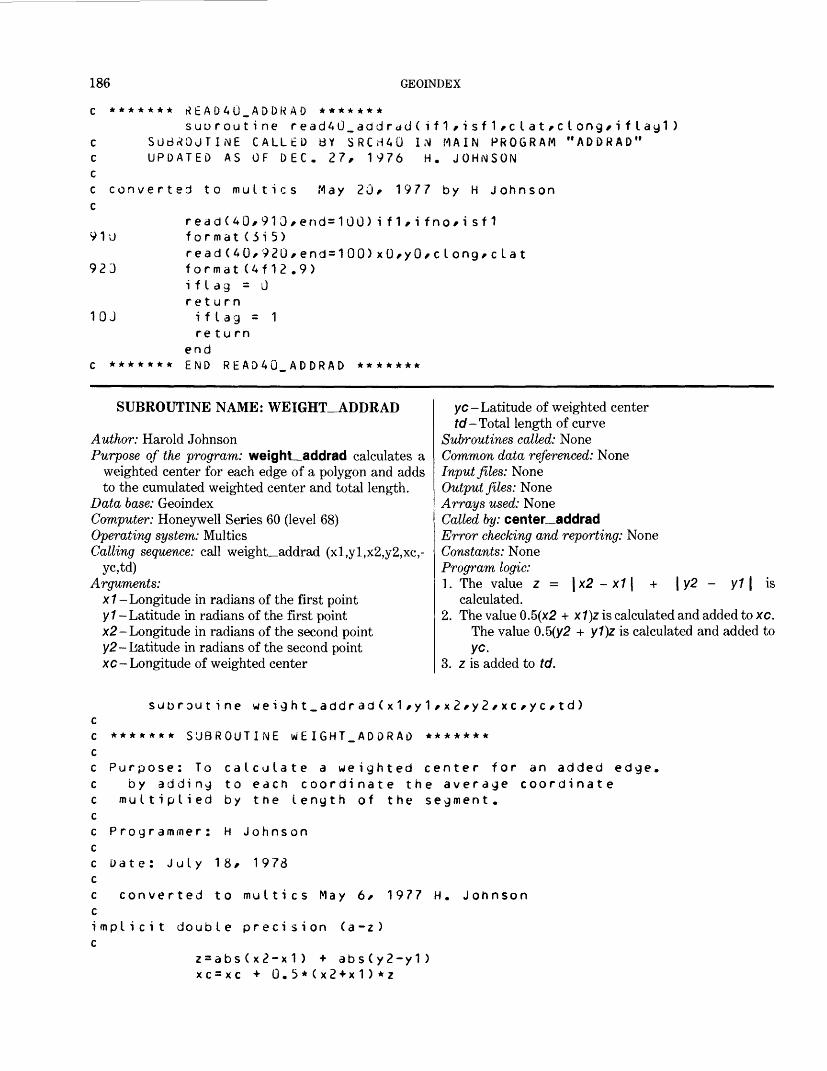
186 GEOINDEX
c ******* rtEAD4U_ADDRAD *******suoroutine read4u_addrdd(if1,isf1,clat,clong,iflag1)
c SUBROUTINE CALLED BY SRCHAG IN MAIN PROGRAM "ADDRAD" c UPDATED AS OF DEC. 27, 1976 H. JOHNSON cc converted to multics May 20, 1977 by H Johnson c
read(40,910,end=100)if1,ifno,isf1 91U format(3i5)
read(40*92u,end=100)xu,y0,clong,clat 923 format (4f12.9)
i f L ag = 0return
10J if lag = 1 return
end c ******* HMD READ40_ADDRAD *******
SUBROUTINE NAME: WEIGHT_ADDRAD
Author: Harold JohnsonPurpose of the program: weighL addrad calculates a
weighted center for each edge of a polygon and adds to the cumulated weighted center and total length.
Data base: GeoindexComputer: Honeywell Series 60 (level 68)Operating system: MulticsCalling sequence: call weight_addrad (xl,yl,x2,y2,xc,-
yc,td)Arguments:
x1 -Longitude in radians of the first point y 1 -Latitude in radians of the first point x2- Longitude in radians of the second point y2- Latitude in radians of the second point xc- Longitude of weighted center
yc- Latitude of weighted centertd -Total length of curve
Subroutines called: None Common data referenced: None Input files: None Output files: None Arrays used: None Called by: center addrad Error checking and reporting: None Constants: None Program logic:1. The value z = \x2 - x1 \ + \ y2 - y1 1 is
calculated.2. The value 0.5(x2 + x7)z is calculated and added to xc.
The value 0.5(y2 + y1)z is calculated and added to yc.
3. z is added to td.
suurout ine weight_addrad(x1,y1,x2,y2/xc,yc,td) cc ******* SUBROUTINE wEIGHT_ADDRAD ******* cc Purpose: To calculate a weighted center for an added edge, c by adding to each coordinate the average coordinate c multiplied by the length of the segment, cc Programmer: H Johnson cc Date: July 18, 1978 cc converted to multics May 6, 1977 H. Johnson cimplicit double precision (a-z) c
z=abs(x2-x1) + abs(y2-y1) xc=xc + 0.5*(x2+x1)*z
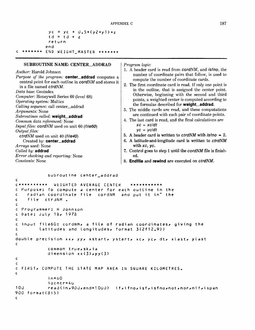
APPENDIX C 187
yc = yc + U. 5*(y2+y 1 ) *ztd = td + z return
end c ******* END WEIGHT.MASTER *******
SUBROUTINE NAME: CENTER_ADDRADAuthor: Harold JohnsonPurpose of the program: center addrad computes a
central point for each outline in cordNM and stores itin a file named ctrdNM.
Data base: GeoindexComputer: Honeywell Series 60 (level 68) Operating system: Multics Calling sequence: call center_addrad Arguments: NoneSubroutines called: weight_addrad Common data referenced: None Input files: cordNM used on unit 60 (fileBO) Output files:
ctrdNM used on unit 40 (file40)Created by: center_addrad
Arrays used: None Called by: addradError checking and reporting: None Constants: None
Program logic:1. A header card is read from cordNM, and isfno, the
number of coordinate pairs that follow, is used to compute the number of coordinate cards.
2. The first coordinate card is read. If only one point is in the outline, that is assigned the center point. Otherwise, beginning with the second and third points, a weighted center is computed according to the formulas described for weight_addrad.
3. The middle cards are read, and these computations are continued with each pair of coordinate points.
4. The last card is read, and the final calculations are xc = xcldt yc = ycldt
5. A header card is written to ctrdNM with isfno = 2.6. A latitude-and-longitude card is written to ctrdNM
with xc, yc.7. Control goes to step 1 until the cordNM file is finish
ed.8. Endfile and rewind are executed on ctrdNM.
subroutine center_addrad cc********** WEIGHTED AVERAGE CENTER *********** c Purpose: To compute a center for each outline in the c radian coordinate file cordNM ana put it in" the c file ctrdNM . cc Programmer: H Jonnson c Date: July 1 &/ 1978 cc input file60: cordNM/ a file of radian coordinates* giving the c latitudes and longitudes/ format 3(2f12.9>) cdouble precision xx/ yy/ xstart/ ystart/ xc/ yc/ dt/ xlast/ ylast c
common true/sk/iadimension xx(3)/yy(3)
c cc FIRST/ COMPUTE THE STATE MAP AREA IN SQUARE KILOMETRES, c
i n = 60i ocnt r = 4u
100 read(in/9GU/end=100J) if/ifno/isf/isfno/not/nor/nif/ispan 900 format(3i5) c
188 GEOINDEX
C WHEN ISFMO IS LESS THAN 4 WE DON'T HAVE A REGION AT ALL C
if(isfno.gt.3)go to 102read(in,901*end=1000)(xx(i),yy(i),i=1/3)
901 format(of 12.9) c cC IN THE CASE OF A SINGLE POINT/ CALL THAT POINT CNTR. C
i xc = xx(2)*(10.**9) + .5i yc=yy(2)*(10.**9) + . 5i s fno = 2wri te(iocntr,905)i f * i f no* i sf/i sfno,not*nor*ni f * i spanwrite(iocntr*908)ixc*iycgo to 100
102 cont i nue cC CALCULATE NCARDS, Trib NUMBER OF DATA CARDS ON THIS MAP C
ncards=i sfno/3if(3*ncards .It, isfno) nc a rds = nc a ras + 1
c c
x c = 0.yc=0.a t = 0 .
cC XC IS GOING TO BE THE X-COORDINATE OF THE CENTER c YC IS GOING TO BE THE Y/COORDINATE OF THE CENTER c DT IS THE ACCUMULATED NORMED DISTANCE BETWEEN POINTS cC READ IN THE FIRST DATA CARD C
reaa(in,901*end=10uO)(xx(i),yy(i),i=1,3)xstart=xx(2)ystart=yy(2)i e = 3ifCncards .eq. 1) ie=isfnodo 200 j=3,iej1=j-1call wei(jht_addrad(xxCj1)/yy(j1)/xxCj)/yy(j)/xc/yc/dt)
20J cont i nueif(ncards .eq. 1) go to 500xlast=xx(3)ylast=yy(3)
c c
if(ncards .eq. 2) go to 400 cC READ IN THE MIDDLE CARDS/ BETWEEN THE FIRST AND LAST. C
Kl=ncards-1ao 300 k=2,klread(in,901)(xx(i ),yy(i),i = 1,3)
APPENDIX C 189
301
call weight_addrad(xlast/ylast/xx(1)/yy(1)/xc/yc/dt)do 301 j = 2,3
j1=j-1cal I weight_addrad(xx(j1) / y y (j1) / x x (j)/yy(j)/xc/yc/dt) con t i nue xlast=xx(3) y I as t = yy(3) continue continue
300400cC NOW READ IN THE LAST CARDc
read(in,901)(xx(i)/yy(i),i=1,3)ie=isfno-3*(ncards-1)ifCie .eq. 0) ie=3call weight_addrad(xlast/ylast/xx(1)/yy(1)/xc*yc/dt)i f(ie .eq. 1) go to 500do 401 j=2/ie
call weight_addrad(xx(j1 )/yy(j1)/xx(j)/yy(j)/xc/yc/at) continue continue
401500cC WHEN THE REGION IS NOT CLOSED/ WE MUST ADD THE LAST DATA POINTc
t es t = (x x (i e ) -xs t a r t ) **2 * ( y y ( i e ) -y s t a r t ) * * 2i f ( test . It . .01 ) go to 501cal I weight_addrad(xx(ie)/yy(ie)/xstart/ystart/xc/yc/dt)
501 continue 503 continue
xc=xc/dtyc = yc/<?t
i s f no = 2wri te(iocntr/9G5) if/i f no/ i sf/i sfno/not/nor/ni f/ispan
905 f o rma t (6i 5)ixc= idint ( x c * 1 000000000 . -»-0 . 5 )iyc= idint ( y c * 1 000000000 . + 0.5)write(iocntr/908> ixc/iyc
905 format (<?4x,2i 12)go to 1001000 endfile 40rewind 40returnend
SUBROUTINE NAME: FTNUMBERAuthor: Harold JohnsonPurpose of the program: ftnumber is used to attach and
open a file on the Multics system. It allows for any filemode.
Data base: GeoindexComputer: Honeywell Series 60 (level 68) Operating system: Multics
Calling sequence: call ftnumber (iunit,name,mode) Arguments:
iunit- The Fortran number of a file being attachedname- The name of the segment being attached (This
can have as many as six characters.)mode- Type of file access method
Subroutines called: The Fortran routine encode and thesystem routine I/O
190 GEOINDEX
Common data referenced: NoneInput files: NoneOutput files: NoneArrays used: NoneCalled by: concat, master, addrad, out1_bigsta, out-
2_ bigstaError checking and reporting: None Constants: None
Program logic:1. The assigned Fortran number iunit is inserted into
the character string fname in the form fileNM, where NM is the number Iunit.
2. If the mode is not so, attachment is made using arguments -append and -ssf.
3. If the mode is so attachment is made.
c ******* SUBROUTINE F7NUMBER *******subroutine ftnumber(i un i t/name/mode)cc PURPOSE: To automatically attach and open files in Fortrancc PROGRAMMED: H Johnsonc DATE: Sept 30* 1977cc iunit = fortran i/o numberc name = up to 6-character c name of a file.c mode = "si","so"/ etc.cc modified from the program assoc of >udd>Grasp>RBowen>assocc by HJohnson May 20/ 1977.c
character name*e>/fname*6/mode*4*fmt*1 2 f m t = " ( 4 h f i I e / i 2 ) "if (iunit .le. 9) fait = "(5hfi IeO/i1)" encode(fname/fmt) iunit if (mode . eq. "so") yo to 20
call io (" attach %fname/"vf iIe_"/name/"-append"/"-ssf" )call io ("open"/fname/mode)
return c 20 call io ("attach"/fname/"vfile_"/name)
call io ("open"/fname/mode) return c end
EXEC-COM NAME: COVERT.EC
Author: P. A. FultonPurpose of the program: covert.ec, written in Multics
command language, reads the redyNM file andcreates a GRASP file for the State.
Data base: GeoindexComputer: Honeywell Series 60 (level 68) Operating system: Multics Calling sequence: ec covert NM state Arguments:
NM- FIPs code for the Statesfate-Name of the State
Subroutines called: setmas, convert Common data referenced: None
Input files: dicn, mask, crfile, indxNM, redyNM, defnOutput files: indexOArrays used: NoneCalled by: NoneError checking and reporting: NoneConstants: NoneProgram logic:
1. Turn off the COMMAND LINE.2. Attach the exec_com to setmas.3. Execute setmas.4. Upon completion of setmas, detach the files.5. Attach the exec_com to convert.6. The exec_com will pass the names of six
files-dicn, mask, crfile, indxNM, redyNM, and defn to be read by convert.
APPENDIX C 191
7. Detach the files.8. Attach the exec_com to ted, which is a text editor.9. Read indexO and then read file15, which will
append file 15 to indexO.10. Write indexO.
11. Quit and exit from the text editor.12. Detach the files.13. Delete file15.14. Quit the exec_com.
5 c omrnand_ I i ne off&a tt ac hse tmas1 18ye s£det achSattac hcorw er td i enmaskc r f i I ei ndx i 1nredy&1nde f nreference map file for& d e t a c h£a 11 ac htedr i nde xOr fi Ie1 5w i n a e x uq&det achdl file15£qui t
FILE NAME: CRFILEPurpose of the file: crfile is a control file for the GRASP
programs. It enables GRASP to read the redyNM files correctly.
Format: The first record contains nacr and nrec, for mat 13, 15. The remaining records contain acronm, itype, and ifirst, format A9, II, 15.
Arguments: nacr— The number of acronyms to follow = remaining
number of records in crfile nrec- The total length of the strgNM and redyNM
recordsacronm-The acronymns used in matrix itype- The type code used by GRASP ///fSf-The position in the records of strgNM and
redyNM where this type of data begins Referenced by: The GRASP programs, which set up
GRASP files.
crfile
38 1211ids ta teauthoryeartitle
13616
15
25205209
192 GEOINDEX
county publish s er iesemphasi areaaunitnlatslatwlong elong clatclong omaps availbasegeology plate idstatscaleidsubiboundispan alsomap dumOdumldum2dum3dum4dum5dum6dum7dum8dum9
6 6 66 261111 11 6 633 6 11111 6 1111111111
449 629 689809 869877884896908 920 932944 956 101610761106 1118 1 1481 15011581 1601 166 1172 1202120312041205120612071208120912101211
PROGRAM NAME: SETMASAuthor: P. A. FultonPurpose of the program: setmas creates the index file
required by GRASP. This GRASP file is limited to 10 entries. This program accepts a list of State FIPS codes and creates files containing a GRASP entry for each State.
Data base: GeoindexComputer: Honeywell Series 60 (level 68)Operating system: MulticsCalling sequence: setmasArguments: NoneSubroutines called: NoneCommon data referenced: NoneInput files: indexO used on unit 11 (f/7e77XState codes
entered interactively)Output files: index, a subset of indexO, used on unit 12
(file 12)Arrays used: ir(9,2), ir1(80)Called by: covert.ec, gr.ec, usmerg.ec
Error checking and reporting: System only Constants: None Program logic:1. This program executes interactively. It begins by re
questing the State codes: ENTER ONE DIGIT FOR NUMBER OF STATES TO QUERY AND FOLLOW BY LIST OF TWO DIGIT STATE CODES WITH BLANKS BETWEEN
Reply: 3 02 16 39This reply indicates 3 State entries are to be put into
the output file index. These States are coded 02 (Alaska), 16 (Idaho), and 39 (Ohio).
2. All I/O operations are handled internally by the pro gram.
3. The program compares the codes input via the term inal to the codes in file indexO. When the codes match, a State entry in proper GRASP format is placed in the output file index, index is then used by GRASP.
/"indexO")
'/"index")
APPENDIX C 193
setmascharacter ir*1/ir1*1
dimension ir(9/2)/ i r 1 ( o 0 )call io ("attach","fiIe11"/"vfi le_call io ("open"/"f He1 1"/"si")call io ("attach","fiIe12"/"vfi le_call io ("open"/"fiIe12"/"s io")
print/"enter one digit for numoer of states to query and follow" print/"oy list of two aigit state codes with blanks between" read (3/101) n/(ir(i/1)/ir(i/2)/i=1/n) 101 format (i1/x/9(2a1 / x ) ) 221 read (11/102/end=90 ) ir1 102 format (80a1) do 220 i = 1/nif ( i r ( i /1 ) .ne. i r 1 ( t>) ) if (ir(i/2) .ne. ir1(6)) write (12/ 102) i r 1 220 continuego to 221
90 continueend file 12call io ("close"/"fiIe11")call io ("close"/"fiIe12")
call io ("detach"/"fi Ie11")calI io ("detach","fi Ie12")
stop en d
go to 22U go to 22U
EXEC_COM NAME: GR.ECAuthor: P. A. FultonPurpose of the program: gr.ec, written in Multics com
mand language, sorts the State index file by scale and creates three files: tip for scales LE (less than) 1:24,000, t2p for scales GT (greater than) 1:63,360, and t3p for scales BE (between) 1:24,001 and 1:63,360.
Data base: GeoindexComputer: Honeywell Series 60 (level 68)Operating system: MulticsCalling sequence: ec gr NMArguments: NM- FIPS code for the StateSubroutines called: setmas, GRASPCommon data referenced: NoneInput files: indexOOutput files: tip, t2p, t3p, t1, t2, t3, and output—fileArrays used: NoneCalled by: NoneError checking and reporting: NoneConstants: None
gr.ec&command_ I ine offiat t ac hfosetmas1 £1
Program logic:1. Turn off the command line.2. Attach the exec_com to the program setmas.3. Designate the user output to a segment by the FO
command.4. Execute subroutine setmas.5. The exec com supplies answers to queries in set
mas.6. The file is detached.7. input—line is turned off.8. Attach the exec_com to the program GRASP.9. The exec_com contains responses to prompts in the
GRASP program.10. At the end of GRASP, the file is detached.11. User output is directed to the console by the RO
command.12. The file called output^file is deleted.13. The three files tip, t2p, and t3p are automatically
dprinted.14. Quit the exec_com.
194 GEOINDEX
ye s& d e t a c h& inpu t_ I i ne offiatt ac hgr aspcondscale le 24000scale gt 63360scale be 24001,63360
logi casearch
t1li st t1 50 cy tipi boundidi dsub
logicbsearch
t2listt250cyt2pnlogiccsearch
t3listt350cyt3p nqui t noaide t a c hCO
APPENDIX C 195
dl out pjt_f i I e dp tip dp t <?p dp t3p &qui t
EXEC-COM NAME: INPLOT.EC
Author: P. A. FultonPurpose of the program: inplot.ec, written in Multics
command language, plots the three files created bygr.ec-that is, tip, t2p, and t3p. It provides a visualcheck of the integrity of the plot files.
Data base: GeoindexComputer: Honeywell Series 60 (level 68) Operating system: Multics Calling sequence: ec inplot NM state Arguments:
NM-FIPS code for the Statestate- State name
Subroutines called: pn16 Common data referenced: None Input files: bordNM, coorNM, statNM, counNM,
gridNM
i np Lot .ec^command. I i ne off stty -modes pLO & i nput _ I i nes off &a tt ach pn 1 o n
Output files: Plots on the Tektronix screenArrays used: NoneCalled by: NoneError checking and reporting: NoneConstants: NoneProgram logic:1. command—line is turned off.2. page_length is set to 0 to disable end-of-page check
ing.3. &input_lines off disables the computer from accept
ing input from the terminal.4. &attach attaches the arguments in the exec_com
directly to pn16.5. Response to prompts in pn16 are fulfilled within the
exec_com.6. &detach detaches the exec_com from pn16.7. page^length is set to 114.8. Quit.
tipyscale1010cny yt2pyscale101Uc
1 :24GUU
I t 1 :63360
196 GEOINDEX
ny y t3 Pyscale between 1:24000/1:63360 4,21010cnyncount i es for &20100cnnye s£det a c hs11y -modes p111 ASqui t
PROGRAM NAME: PN16Author: P. A. FultonPurpose of the program: pn16 plots a State index map
interactively on a Tektronix CRT screen. This is a two-step process. First, a GRASP retrieval is ex ecuted wherein a disk file is created that contains the links to the coordinate Geoindex files. This GRASP file is identifed as unit 13. However, the program is constructed so that the user has the option of plotting any combination of the input files.
Data base: GeoindexComputer: Honeywell Series 60 (level 68)Operating system: MulticsCalling sequence: pn!6Arguments: NoneSubroutines catted: initt, anmode, erase, movabs,
dwindo, swindo, movea, drawa, ancho, bell, hdcopy, vcursr, finitt (Tektronix routines), plod, pos, plo, ploc6, assoc
Common data referenced: x1, y1, x2, y2Input files:
Input from terminal used on unit 5 (fileS) coorNM used on unit 10 (fileW) bordNM used on unit 11 (file11) GRASP file used on unit 13 (file13) statNM used on unit 14 (file14)
counNM used on unit 15 (file15) gridNM used on unit 16 (fileW) skod used on unit 17 (filelT) Superimposed file used on unit 20 (file20)
Output files: Output to terminal used on unit 6 (filed)Arrays used: lead(20), xx(6), yy(6), mort(300), ista(6)Called by: Can be executed by inplot.ecError checking and reporting: When the array size of
300 entries for the input plot file (file13) is exceeded, the program returns the error message:
BUFFER EXCEEDEDWhen the number of x, y coordinates does not match the number given on the header card (isfno), the pro gram returns the error message:
REC COUNT ERRAll error messages concerned with I/O handling are identified by system messages and system returns.
Constants: ingd = 10 and ing - 13 are file numbers; rsiz = 0.3 size in inches for numbers shown on plot; ichar = 43 character (+) for points plots.
Program logic:1. The program prompts the user for all the specific in
put and output desired. The first phase requires the user to identify the single, specific State.
2. The program does all the file handling internally to relieve the user of all systems duties. However, all

APPENDIX C 197
the files listed above must be available because they are attached and opened here at the beginn ing of the program.
3. The program requests the input file (file13), which is to be plotted. If necessary, the program sorts the data into ascending order by keying on the id number.
4. The plot window is computed from the coordinates of the border files, bordNM.
5. The annotation and exact data files that are to be plotted are elicited from the user.
6. The actual plotting is initiated in the following order: border, State, county, grid, and the input file, which was created by GRASP (file13) and which is to be plotted. The program reads the value of ibound from this input file and assigns to it the variable name /map.
7. The program reads through the coorNM file. From the header cards, it obtains the identification and subidentification numbers, which it combines into the variable if and compares to /map.
8. When these numbers from the two different files match, the outline is plotted. First the identifica tion number is plotted, its position determined by the first pair of x, y coordinates. Then the rest of the x, y coordinates are plotted to form the outline. The program uses the number of points (isfno) read from the header card to compute the end of a feature outline.
9. For very small areas, there is only one x, y coor
dinate pair for the outline, and the symbol ( + ) is plotted at that point.
10. After the entire input file (file13) has been plotted, the program tests to see whether another file should be superimposed. If so, it is plotted by subroutine ploc6. ploc6 plots this superimposed file similar to the way pn16 plots the coorNM file. The exception is that ploc6 plots the entire file that is to be superimposed but does not compare it to any other input file from GRASP.
11. After the plot is completed, the bell rings to alert the user to make hard copies of the plot and (or) to continue the execution of the program.
12. The next phase of the program permits the user to enlarge any part of the plot. The new plot window is defined by use of the crosshair cursor.
13. The program then loops back so that the appro priate annotation and files are used for the enlarg ed part of the plot. This enlargement cycle can be continued until the user is satisfied and decides to go on to the next part of the program.
14. The next part of the program enables the user to designate another input file from GRASP or simp ly to loop back through the program and plot any of the base sheet files. However, to plot another State, the program must be exited and reinitiated.
15. The final phase of the program closes the files. It then writes the message
GOODto the screen to indicate that the program ter minated successfully.
pn16program to plot map indices on tektronix
u. s. geological survey
June 1977
5 i nput6 output
coor d bord f i le st at
1 5 coun 16 grid
skod f i le
1 J 1 11314
17
i nput/output files from terminalto terminal
inate files
from grasp contains three items : ibound/id/idsub
- file with state names* numeric and alphabetic fips codes to superimposed same format as coor file
198 GEOINDEX
Cc
common x1/y1/x2/y2character skud*6/fname*8/fmt*12/ifi I e*8dimension lead(20)/xx(6)/yy(6)/mort(300)/ista(6)data jes/"y"//kop/"c"//ibnk/" "/data skud/"skod "/
ccall ini tt(960)
c c
ingd=10rs i 2 = 0. 5i c har = 4 3i ng = 13
c c assign files
call anmodeprint/"need state codes (enter y for yes)"read (5/130) i repif (irep .ne. jes) go to 383fmt="(a8)"encode (fname/fmt) skudcall assoc (17/fname/"si ")do 381 i=U54read (17/141) ista/ile/nmbwrite (6/142) ista/ile/nmb
142 format (1x/6a4/a2/5x/i2) 141 format (6a4/a2/i2) 381 continue
print/"type 1 ana hit return key when ready"read/readycat I closer (17)
383 call erasecall movabs (30/725)call anmodeprint/"enter state id number"read(5/140) i st ate
140 format (a4) c
fmt="(4hcoor/a4)"encode (fname/fmt) istatecall assoc (10/fname/"si ")fmt="(4hbord/a4)"encode (fname/fmt) istatecall assoc (11/fname/"si ")fmt="(4hstat/a4 )"encode (fname/fmt) istatecall assoc (14/fname/"si ")fmt="(4hcoun/a4)"encode (fname/fmt) istatecall assoc (15/fname/"si ")f mt = " (4hgrid/a4)"encode (fname/fmt) istatecall assoc (l6/fname/"si ")

APPENDIX C 199
cC
c request input file for plottingc380 con t i nue
call movabs (30/715)call anmodeprint/"if a coordinate file is to be plotted/ enter y"read (5/130) icorif (icor .ne. jes) go to 343print/ "enter name of file to be plotted"read (5/131 ) if i le
131 forrnat(a8)call assoc ( 1 3/ i f i le /" s i ")
cc eliminate duplicate id numbers c and sort id numbers into ascending order c
print/ "if input should be sorted reply with a y for yesread (5/1 30) i r ep
1 30 format ( a1 )if (irep .ne. jes) go to 343
crewind ingi m= 0
ci m 1 = 0
339 read (ing/124/end=340) imap 124 for-nat (i10)
i rn = i m + 1mort( im)=imapif (im .It. 300) go to 339print/ "buffer exceeded"
340 continuecall c loser (13)
do 338 i =1 / i mI e s = mo r t ( i )do 364 j = i / i mif (les .le. mort(j)) go to 364I e ss = mo r t ( j )mor t ( j ) = le sles = l es s
364 continuemort(i)=les
338 continue c
rewind ingcal I assoc (13/i f i le/"sio ")i mapl =mor t ( 1 )write (ing/124) imapl
200 GEOINDEX
do 363 i = 2 / i rni map=mo r t(i)if (imap ,eq. imapl) go to 3o3write (i ng/124) i mapi mapl = i map
363 continueend file ingrewind ing
343 continue cc set origin on plotter c
call pos(11/xx/yy)x1=amin1(xx(2)/xx(3)/xx(4)/xx(5)/xx(6))x2=amax1(xx(2)/xx(3)/xx(4)/xx(5)/xx(6))y1=amin1(yy(2)/yy(3)/yy(4)/yy(5)/yy(6))y2=amax1(yy(2)/yy(3)/yy(4)/yy(5)/yy(6))dx= x2-x1dy=y2-y1
cc use the bord file to compute the plot window c
call dwinao (0./dx/0./dy) 553 x=(dx*780.)/dy
i x = xix1=1023-ixif (dx .gt. dy) go to 550call swindo (ix1/ix/O/780)go to 551
550 y=(dy*1023.)/dxiy = yif (iy .gt. 780) go to 552call swindo (O/1023/O/iy)^o to 551
552 ix1=iy-780i x=1023-i x1call swindo (ix1/ix/O/780)
551 continue c cc border information c 303 continue
call movabs(30/650)call anmode
302 print/"enter title for map"read (5/122) lead
122 format (20a4)print/"to plot state enter 1"read (5/160) i s t at
160 format(i1)print/"county plot-enter 1 for solid line/ 2 for dotted/ else 0"read (5/160) i c ounprint/"to plot grid enter 1"
APPENDIX C 201
read (5/ 160) ig ri dprint/"to superimpose another file/enter 0 for no* "print*"1 for lines only/ 2 for lines and characters"read (5/160) i supif (isup .eq. 0) go to 304print/"enter tile name"read (5/131) if ilecall assoc (20/ifile/"si ")
304 continuecall erasecall movabs (30/750)call a n m o d ewrite (6/123) lead
123 format (1x/2Ja4) cc drawneatline c
if (kk .e^. 0) go to 419call movea(x1/y1)call drawa (x2/y 1 )call drawa ( x 2 / y <?)call drawa (x1/y2 )call drawa (x1/y1)
cc p I o t base map c419 cont i nue c
call plo(11)if (istat .ne. 1) go to 470cal I plo(14)
47J if (icoun .ne. 1) go to 476call plo (15)
476 if (icoun .ne. 2) go to 471call plod (15)
471 if (ijrid .ne. 1) go to 472call plocod 6)
c472 if (icor .ne. jes) go to 89
cc plot coor file c
rewind i ngrewind ingd
c c319 cont i nue
read (ing/124/end=89) imap320 read (ingd/111/end=89) if/ifno/isf/isfno/if 1 /jstat/jgrat/jspan
i f = (i f*100)+isf 111 format (8it>)
if (if-imap) 335/337/360 c 360 read (ing/124/end=89) imap
if (if-imap) 335/337/360
202 GEOINDEX
C335 do 336 j=1/isfno/6
read (ingd/126) ( xx ( i )/yy(i ) / i=1/6)336 continue
go to 320 c337 continuecc
i e= i s fnoif (isfno .ge. 6) i e = 6read (ingd/126) ( x x ( i ) / y y ( i ) / i = 1 / i e)
126 format (12f6.3) c
if (isfno .ge.3) go to 321 c
if ((xx(1) .Le. x1) .or. (yy(1) .Le. y1)) go to 320if ((xx(1) .-je. x2) .or. (yy(1) .ge. y2>) go to 320call movea (xx(1)/yy(1))c a I L anmodewrite (6/137) if
137 format (1 x/ i 5)if (jspan .eq. U) go to 520ry = yy(1 )-r s i zcall movea (xx(1)/ry)call anmodewrite (0/137) jspan
520 call movea ( xx(2 ) / yy(2 ) )call ancho(ichar)if (i f1 .eq. 0) go to 320r y= r y-r s i zcall movea (xx(1)/ry)call anmodewrite (6/137) i f1go to 320
c 321 continue
if ((xx(1) .le. x1) .or. (yy(1) .le. y1)) go to 449if ((xx(1) .ge. x2) .or. (yy(1) .ge. y2)) go to 449call movea ( xx(1 ) / yy (1 ))call anmodewrite (6/137) ifif (jspan ,et|. 0) go to 521ry = yy(1 )-rsi zcall movea (xx(1)/ry)call anmodewrite (6/137) jspan
c 521 i f (i f1 .eq. 0) go to 449
ry= ry-r sizcall movea (xx(1)/ry)call anmodewrite (6/137) if1
APPENDIX C 203
Cgo to 449
c c 447 continue
call movea (xx(1 )/yy(1 ))call anmodewrite (6/137) if
c 449 cont i nue
call movea (xx(2 )/yy (2 )) c
do 341 k = 2/ i ecall drawa (xx(k ) / yy(k ))
341 cont i nue c c 537 is fno= i s fno-6
if (isfno) 320/320/345 345 if (isfno-6) 322/322/333 322 ie=isfno333 read (ingd/126/end = 88) (xx(i)/yy(i)/i=1/ie ) c
do 342 k=1/iecall drawa (xx(k )/yy(k ))
342 cont i nue c
if (isfno-o) 32U/320/537 c 88 write (6/128) if / ifno/isf/isfno128 format (1x/i 3/2 i2/i5)
write (6/129)129 format (1x/"rec count err")
go to 99 cc superimpose another file c 89 cont i nue
if (isup-1) 305/505/506505 call plo (20)
call closer (20) go to 305
506 call ploc6 (20)call closer (20)
c cc copy and/or exit c
305 continuecall belIcall anmoderead (5/1 3D) i copy
204 GEOINDEX
452 c c c
c c c c 477
306
c 99
307106
if (icopy .ne call hdcopy cont i nue
kop) go to 452
selected portion of plot can be enlarged
call movabs(30*730)call anmodeprint*"for an enlargement of a part of this plot* type y"read (5*130) i repkk=kk+1if (irep .ne. jes) go to 477call movabs (30*720)call anmodeprint*"position cursor at lower left of desired area* type c"call vcursr(ichar*x 1 *y 1)call movabs (30*710)call anmodeprint*"position cursor at upper right of desired area* type ccall vcursr(ichar*x2*y2)call dwindo (x1 *x2*y1 *y2 )call erasego to 303
more data or exit
call movabs (30*710)call anmodeprint*"to plot anotherread (5*13D) i repif (irep .ne. jes)if (icor .ne. jes)call closer (13)cont i nuecall erasego to 380
file enter y for yes
go to 99 go to 306
cont i nuecall closer
closer c loser closer closer
cal I cal I cal I cal I
(10) (11 )(14)(15)(16)
if (icor .ne. jes) cal I closer (13) write (o*106) format (7h good) call finitt (0*0)
go to 307
stop
end
APPENDIX C 205SUBROUTINE NAME: POS
Author: P. A. FultonPurpose of the program: pos reads the bordNM data
file, which consists of a header card and a card with six x, y coordinate pairs. bordNM is the neat line around the map plot, and it serves to define the plot window.
Data base: GeoindexComputer: Honeywell Series 60 (level 68)Operating system: MulticsCalling sequence: call pos (ingd,xx,yy)Arguments:
ingd- The unit number assigned to the bordNM file(This is an input value to the subroutine.)
xx-An array containing six elements (The x coor dinates are stored in it and passed as output from the subroutine.)
yy-An array dimensioned 6 (The y coordinates are
stored in it and passed as output from the subroutine.)
Subroutines called: NoneCommon data referenced: NoneInput files: bordNMOutput files: NoneArrays used: xx(6), yy(6)Called by: pn16Error checking and reporting: NoneConstants: NoneProgram logic:1. The program picks up the device number via the
argument and reads the header and data images; then, it passes the x, y coordinates to the calling routine via the arguments and returns. This subroutine only accesses the file. The file opening, closing, and all other manipulations are done in the calling routine.
SUBROUTINE POS(Ii\GD,XX,YY)DIMENSION X X ( 0) / Y Y ( 6 )iE = oREWIND INGD
320 READ (1NGD,111,END=89) IF,IFNO,ISF,ISFNO,IF1 111 FORMAT (5Ib)
READ ( I N G D , 1 2 6 > <XX(I),YY(I),I = 1,IE> 126 FOR.4AT (12F6.3)
69 RETURNEND
SUBROUTINE NAME: PLO
Author: P. A. FultonPurpose of the program: plo plots solid outlines and
points for spatial data files that are structured thesame as the coorNM files. These are bordNM,gridNM, statNM, and counNM.
Data base: Geoindex Computer: Honeywell Series 60 (level 68) Operating system: Multics Calling sequence: call plo (in) Arguments: in-The unit number assigned to the file to
be plotted
Subroutines called: Tektronix plot routines- movea, an- cho, drawa
Common data referenced: NoneInput files: bordNM, statNM, counNM, gridNMOutput files: NoneArrays used: xx(6), yy(6)Called by: pn16Error checking and reporting: NoneConstants: ichar = 43, rsiz = 0.3Program logic:1. This subroutine only reads the file and plots the data.
The file opening and closing procedures are done inthe calling routine.
SUBROUTINE PLO(IN)
DIMENSION X X ( 0 ) / Y Y ( 6 >ICHAR=43RSIZ=J.3KEWliylD INIPEM=U
206 GEOINDEX
C PLOT DATA FROM FIRST SOURCE419 CONTINUE
420 READ (IN/1 11/END=319) I F / I FNO / I S F / I S FIMO / I F 1 111 F 0 R W A T (513) 132 FORMAT (1X/5I5)
IPEN=IPEN+1IF (I PEN .GT. 4) IPEN=1NL=NL+1
IE=ISFNOIF (ISF.MO .tit. 0) IE = o READ (IN/ 12o) (XX(I)/YY(I)/I=1/IE)
126 FORMAT (12F6.3) 127 FORMAT (1X/12F6.3)
IF (ISFNO .GE. 3) GO TO 448 CALL M 0 tf E A (XX(2)/YY(2)) CALL ANCHO(ICHAR) GO TO 420
443
441437
445422
433 C
CONTINUECALL MCVEA (XX(2)/YY(2))DO 441 K=2/IECALL DRAWA (XX(K) /YY (K ) )CONTINUEISFNO=I bFNO-6IF (1SFNO) 419/419/445IF (ISFNO-o) <*2 2/422/4 33IE=1SFNCREAD (IN/ 126/END = 8o) (XX(I)/YY(I)/ 1=1/ I E )
DO 442 K=1/IE CALL DRAWA (XX(K) /YY (K))
442 CONTINUE
IF (ISFNO-6) 419/419/437
88 CONTINUE 319 CONTINUE
R t TURN t ,M D
SUBROUTINE NAME: PLOD
Author: P. A. FultonPurpose of the program: plod plots points and dotted
outlines for spatial data files that are structured thesame as the coorNM files.
Data base: GeoindexComputer: Honeywell Series 60 (level 68) Operating system: Multics Calling sequence: call plod (in) Arguments: in-The unit number assigned to the file to
be plotted
Subroutines called: Tektronix plot routines- move a, an- cho, dasha
Common data referenced: NoneInput files: counNMOutput files: NoneArrays used: xx(6), yy(6)Called by: pn16Error checking and reporting: NoneConstants: ichar = 43, rsiz = 0.3Program logic:1. This subroutine only reads the file and plots the data.
The file opening and closing procedures are done inthe calling routine.
APPENDIX C 207
419420111132
SU3ROUTINE P L 0 D(IN)
bl PENSION X X(6)/Y Y(6)RSIZ=0.3I C H A R = 4 3REWIND INIPEN=0PLOT DATA FROM FIRST SOURCECONTINUEREAD (IN/1 11*END=319) I F* I FNO* I SF / ISFNO/ I F1FORMAT (515)FORMAT (1X*5I5)IPEN=1PEN+1IF (IPEN .GT. 4) IPEM=1•ML = iML-H
IE=1SFNOIF (ISFNO .iiE. 0) IE=6REAJ (IN* 126) (XX(I)*YY(I)*I=1*IE)
126 FORMAT (12F6.3)127 FORMAT (1X*12F6.3)
IF (ISFNO .GE. 3) GO TO 448 CALL ilOVEA (XX(2)*YY(2)) CALL ANCHO(ICHAR) GO TO 420
440 CONTINUECALL MOVE A (XX(2)*YY(2))DO <*41 K = 2,IECALL DAS HA (XX(O*YY(K)*1)
441 CONTINUE437 ISFNO=ISFNO-t»
IF (ISFNO) 419*419*445 445 IF (ISFNO-6) 422*422*433 422 IE=ISFNO 433 READ (IN* 126*END = 88) ( XX ( I )*YY ( I )* I = 1 * I E)
DO 442 K=1 /IECALL DASHA ( XX(K ) *YY ( K ) * 1 )
442 CONTINUE
IF (ISFNO-6) 419*419*437
88 CONTINUE 319 CONTINUE
RETURN END
SUBROUTINE NAME: PLOC6
Author: P. A. FultonPurpose of the program: plocG plots solid outlines,
points, and identification numbers for spatial data files that are structured the same as the coorNM files.
Data base: GeoindexComputer: Honeywell Series 60 (level 68) Operating system: Multics Calling sequence: call ploc6 (in)Arguments: in- The unit number assigned to the file to
be plotted

208 GEOINDEX
Subroutines called: Tektronix plot routines- movea, an- mode, ancho, drawa
Common data referenced: x1, y1, x2, y2 Input files: gridNM used on unit 16 (file16) Output files: None Arrays used: xx(6), yy(6)
Called by: pn16Error checking and reporting: NoneConstants: ichar - 43, rsiz = 0.3, ipen = 0Program logic:1. This subroutine only reads and plots the data. The
file opening and closing procedures are done in thecalling routine.
419420111132
SUBROUTINE PLOC6 (IN)DIMENSION XX(6),YY(6)COMMON X1,Y1,X2,Y2ICHAR=43RSIZ=0.3IPE.M = 0REWIND INCONTINUEHEAD (IN,111,END=319) IF,IFNO,ISF,ISFNO, I F1FORMAT (515)FORMAT (1X,5I5)IPEN=IPEN+1IF (IPEN ,GT. 4) IPEN=1
126127
137
450
421
IE=ISFNOIF (ISFNO .GE. 6) IE=6READ (IN, 126) (XX(I),YY(I),I=1,IE)FORMAT (12F6.3)FORMAT (1X,12F6.3)IF (ISFNO .GE. 3) GO TO 421
IF ((XX(1 )IF (( IFNOCALL MOVEACALL ANMODEWRITE (6*137) IFFORMAT (1X,I5)RY=YY (1 )-RSIZCALL MOVEA (XX( 1 ) ,RY)CALL ANMODEWRITE (6*137) ISFCALL MOVEA ( X X ( 2 )CALL ANCHO(ICHAR)GO TO 420
.GE. X2) .OR. (YY(1) EQ. 1) .AND. (ISF .EQ (XX(1),YY(1 ))
GE. Y2)) 1 )) GO
GO TO TO 450
420
Y Y ( 2 ) )
CONTINUECALL MOVEA (XX(1),YY(1))CALL ANMODEWRITE (6*137) IFCALL MOVEA (XX(2),YY(2))CALL ANCHO(ICHAR)GO TO 420
CONTINUE IF ((XX (1 ) .LE. X1) .OR. (YY(1) .LE. Y1)) GO TO 448

APPENDIX C
IF «XX(1) .GE. X2) .OR. (YY(1) .GE. Y2)) GO TO 448IF ((IFNO .EQ. 1) .AND. (ISF .EQ. 1)> GO TO 446CALL MOVEA (XX(1 )*YY(1 ))CALL ANMODEWRITE (6*137) IFRY=YY(1)-RSIZCALL MOVEA (XX(1)*RY)CALL ANMODEWRITE (6*137) ISFIF (IF1 .EQ. 0) GO TO 448RY=RY-RSIZCALL MOVEA (XX(1 )*RY)CALL ANMODEWRITE (6*137) IF1
GO TO 448
446 CONTINUECALL MOVEA (XX(1 )*YY(1 )) CALL ANMODE WRITE (6*137) IF
CONTINUECALL MOVEA (XX(2)*YY(2 ) )DO 441 K=2*IECALL DRAWA ( XX(K ) * YY (K ) )CONTINUE
ISFNO=lSFNO-6 IF (ISFNO) 419*419*445 IF (ISFNO-6) 422*422*433 IE=ISFNOREAD (IN* 126*END=86) ( XX(I)*YY(I)* 1 = 1 * IE ) DO 442 K=1*IE CALL DRAWA ( XX(K ) *YY(K ) )
442 CONTINUE
IF (ISFNO-6) 419*419*437
83 CONTINUE 319 CONTINUE
RETURN EiJD
209
448
441 C 437
445422
433
SUBROUTINE NAME: ASSOC
Author: R. W. BowenPurpose of the program: assoc performs the I/O func
tions necessary to access a file. These functions are at tach, open, close, and detach.
Data base: GeoindexComputer: Honeywell Series 60 (level 68)Operating system: MulticsCalling sequence: call assoc (iunit,name,mode)
Arguments:iunit- Fortran I/O unitname- Name of disk file data set (may be passed as a
character string literal with 8 characters, or as a double precision variable, or as a character string variable)
mode-"si" for formatted input, "so" for formatted output, "sqi" for unformatted input, "sqo" for unfor matted output, "di" for keyed input, "do" for keyed output
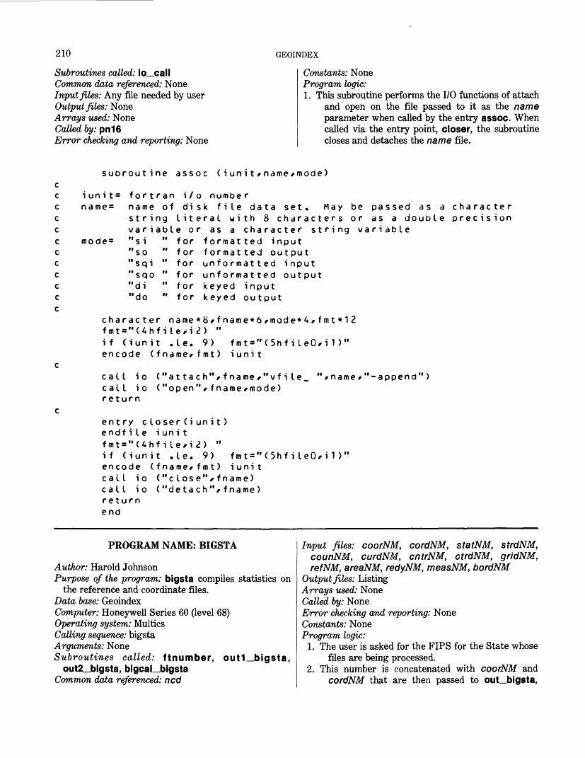
210 GEOINDEX
Subroutines called: io_callCommon data referenced: NoneInput files: Any file needed by userOutput files: NoneArrays used: NoneCalled by: pn16Error checking and reporting: None
Constants: NoneProgram logic:1. This subroutine performs the I/O functions of attach
and open on the file passed to it as the name parameter when called by the entry assoc. When called via the entry point, closer, the subroutine closes and detaches the name file.
subroutine assoc (iunit/name/mode)
i un i t= for t ran name = name of
i / o numbe rdisk file data set. May be passed as a character
string literal with 8 characters or as a double precision variable or as a character string variable
mode= "si " for formatted input"so " for formatted output"sqi " for unformatted input"sqo " for unformatted output"di " for keyed input"do " for keyed output
character name*8/fname*6/mode*4/fmt*12 fmt = "(4hfi le,i2) "if (iunit .le. 9) fmt="(5hfiIeO,i1)" encode (fname/fmt) iunit
call i o call i o return
( "attach",fname,"vfile_ ("open",fname/mode)
/name/"-append")
entry c loser(iunit)endf ile i un i tfmt="(4hfiIe,i2) "if (iunit .le. 9) fmt = "(5hfiIeO,i1 )encode (fname/fmt) iunitcall io ("close"/fname)call io ("detach"/fname)returnend
PROGRAM NAME: BIGSTA
Author: Harold JohnsonPurpose of the program: bigsta compiles statistics on
the reference and coordinate files. Data base: Geoindex Computer: Honeywell Series 60 (level 68) Operating system: Multics Calling sequence: bigsta Arguments: None Subroutines called: ftnumber, out1_bigsta,
out2_bigsta, bigcal__bigsta Common data referenced: ncd
Input files: coorNM, cordNM, statNM, strdNM, counNM, curdNM, cntrNM, ctrdNM, gridNM, refNM, areaNM, redyNM, measNM, bordNM
Output files: ListingArrays used: NoneCalled by: NoneError checking and reporting: NoneConstants: NoneProgram logic:
1. The user is asked for the FIPS for the State whose files are being processed.
2. This number is concatenated with coorNM and cordNM that are then passed to out_bigsta,
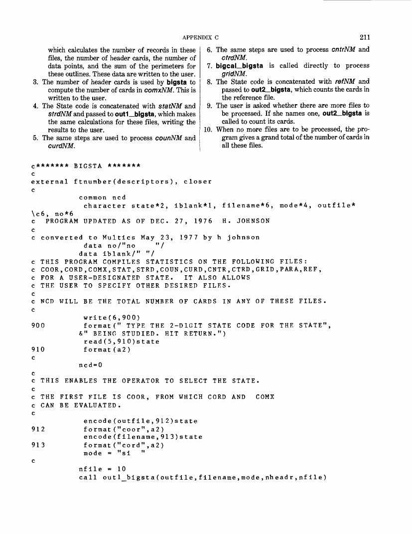
APPENDIX C 211
which calculates the number of records in these files, the number of header cards, the number of data points, and the sum of the perimeters for these outlines. These data are written to the user.
3. The number of header cards is used by bigsta to compute the number of cards in comxNM. This is written to the user.
4. The State code is concatenated with statNM and strdNM and passed to out1__bigsta, which makes the same calculations for these files, writing the results to the user.
5. The same steps are used to process counNM and curdNM.
6. The same steps are used to process cntrNM and ctrdNM.
7. bigcal_bigsta is called directly to process gridNM.
8. The State code is concatenated with refNM and passed to out2__bigsta, which counts the cards in the reference file.
9. The user is asked whether there are more files to be processed. If she names one, ou1t2__bigsta is called to count its cards.
10. When no more files are to be processed, the pro gram gives a grand total of the number of cards in all these files.
c ******* BIGSTA *******cexternal f tnutnber ( descr ip tor s ) , closerc
common ncdcharacter state*2, iblank*!, filename*6, mode*4, outfile*
\c6, no*6c PROGRAM UPDATED AS OF DEC. 27, 1976 H. JOHNSON c c converted to Multics May 23, 1977 by h Johnson
data no/"no "/ data iblank/" "/
c THIS PROGRAM COMPILES STATISTICS ON THE FOLLOWING FILES: c COOR,CORD,COMX,STAT,STRD,COUN,CURD,CNTR,CTRD,GRID,PARA,REF, c FOR A USER-DESIGNATED STATE. IT ALSO ALLOWS c THE USER TO SPECIFY OTHER DESIRED FILES. cc NCD WILL BE THE TOTAL NUMBER OF CARDS IN ANY OF THESE FILES. c
write(6,900)900 format(" TYPE THE 2-D1GIT STATE CODE FOR THE STATE",
&" BEING STUDIED. HIT RETURN.") read(5,910)state format(a2)910
cncd = 0
c THIS ENABLES THE OPERATOR TO SELECT THE STATE.cc THE FIRST FILE IS COOR, FROM WHICH CORD AND COMXc CAN BE EVALUATED.c
encode(outfile,912)state912 format ( If coor",a2)
encode(filename,913)state913 format("cord",a2)
mode = "si " c
nfile - 10call outl_bigst a(outfile,filename,mode,nheadr,nfile)
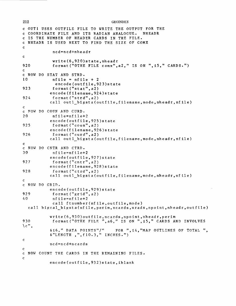
212 GEOINDEX
c OUT1 USES OUTFILE FILE TO WRITE THE OUTPUT FOR THE c COORDINATE FILE AND ITS RADIAN ANALOGUE. NHEADR c IS THE NUMBER OF HEADER CARDS IN THE FILE, c NHEADR IS USED NEXT TO FIND THE SIZE OF COMX c
ncd=ncd+nheadr c
write(6,920)state,nheadr920 format("OTHE FILE comx",a2," IS ON ",15," CARDS.") cc NOW DO STAT AND STRD. 10 nfile = nfile + 2
encode(outfile,923)state923 format("stat",a2)
encode(filename,924)state924 format("strd",a2)
call outl_bigsta(outfile,filename,mode,nheadr,nfile) cc NOW DO COUN AND CURD. 20 nfile=nfile+2
encode(outfile,925)state925 format("coun",a2 )
encode(filename,926)state926 format("curd",a2)
call out l__bi gsta(outfile,filename,mode, nheadr,nfile) cc NOW DO CNTR AND CTRD. 30 nfile=nfile+2
encode(outfile,927)state927 format( M cntr",a2)
encode(filename,928)state928 format("ctrd",a2)
call out l__bi gsta(outfile,filename,mode,nheadr,nfile) c c NOW DO GRID.
encode(outfile,929)state929 format( M grid",a2) 40 nfile=nfile+2
call f tnumb er(nfile,outfile,mode) call bigcal_bigst a(nfile,perim,ncards,nrads,npoint,nheadr,outfile)
write(6,930)outfile,ncards,npoint,nheadr,perim930 format("OTHE FILE ",a6," IS ON ",i5," CARDS AND INVOLVES \c",
&i6," DATA POINTS"/" FOR ",i4,"MAP OUTLINES OF TOTAL ",&"LENGTH ,",f!0.3," INCHES.")
cncd = ncd+n cards
cc NOW COUNT THE CARDS IN THE REMAINING FILES, c
encode(outfile,932)state,iblank
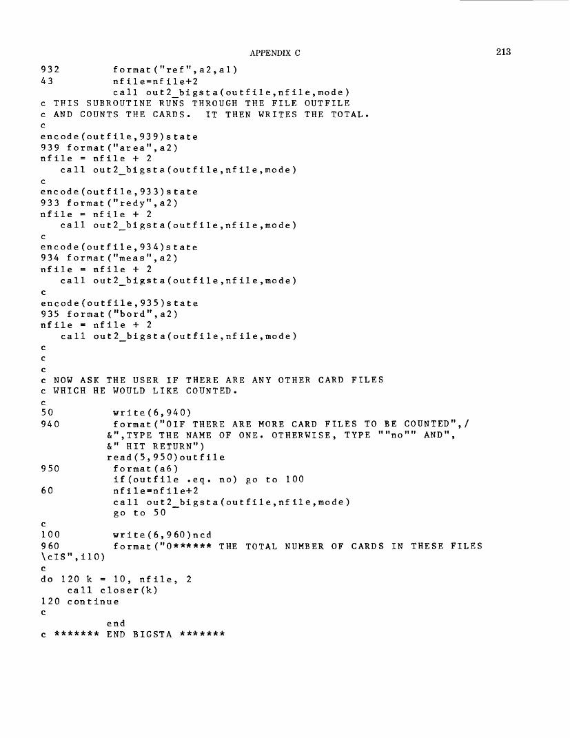
APPENDIX C 213
932 format("ref",a2,a 1 ) 43 nfile-nfile+2
call out 2_bigst a(outfile,nfile,mode) c THIS SUBROUTINE RUNS THROUGH THE FILE OUTFILE c AND COUNTS THE CARDS. IT THEN WRITES THE TOTAL. cencode(outfile,939)state 939 format("area",a2) nfile = nfile + 2
call out 2_bi gsta(outfile,nfile,mode) c encode(outfile,933)state933 format("redy",a2) nfile = nfile + 2
call out 2_bi gsta(outfile,nfile,mode) c encode(outfile,934)state934 format("meas",a2) nfile = nfile + 2
call out 2_bigst a(outfile,nfile,mode) c encode(outfile,935)state935 format("bord",a2) nfile - nfile + 2
call out 2_bigst a(outfile,nfile,mode) c c cc NOW ASK THE USER IF THERE ARE ANY OTHER CARD FILES c WHICH HE WOULD LIKE COUNTED. c50 write(6,940) 940 format("GIF THERE ARE MORE CARD FILES TO BE COUNTED",/
&",TYPE THE NAME OF ONE. OTHERWISE, TYPE ""no"" AND",&" HIT RETURN")read(5,950)outfile
950 format(a6 )if(outfile .eq. no) go to 100
60 nflle-nfile+2call out2_bigsta(outfile,nfile,mode) go to 50
c100 write(6,960)ncd960 format("0****** THE TOTAL NUMBER OF CARDS IN THESE FILES \cIS",ilO) c do 120 k - 10, nfile, 2
call clos er(k) 120 cont inue c
end c ******* END BIGSTA *******
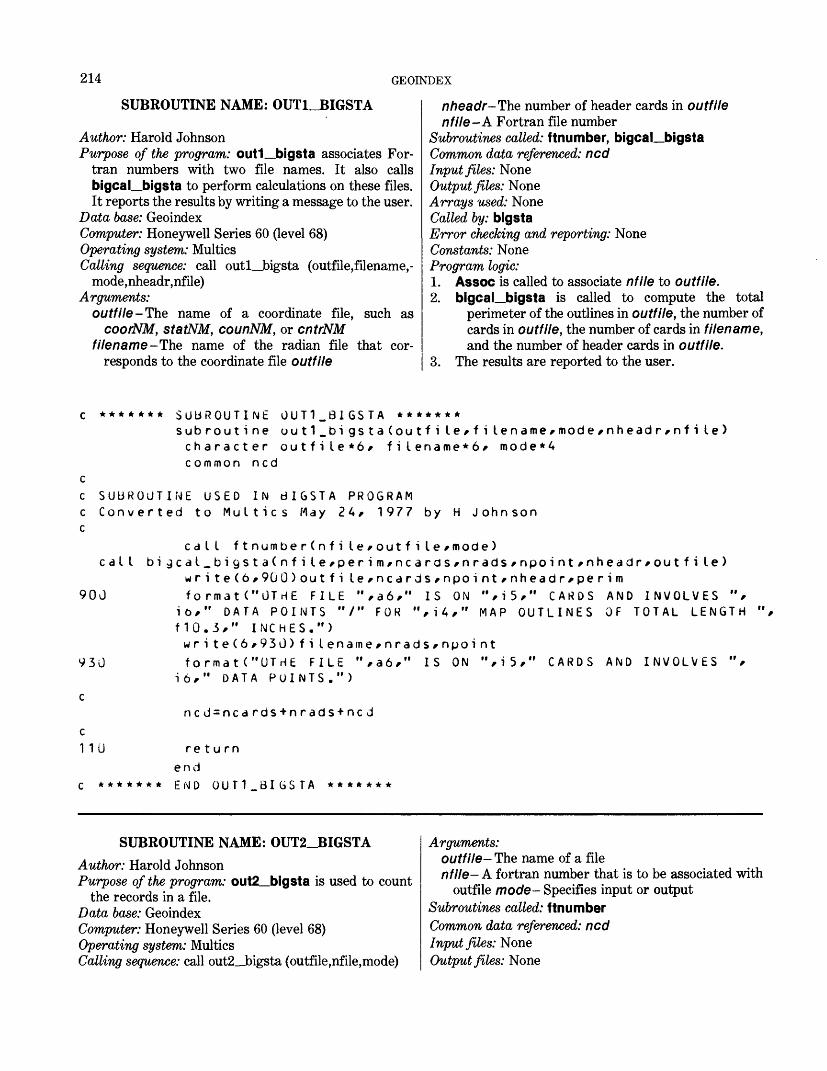
214 GEOINDEX
SUBROUTINE NAME: OUTUIGSTA
Author: Harold JohnsonPurpose of the program: out1__bigsta associates For
tran numbers with two file names. It also calls bigcal_bigsta to perform calculations on these files. It reports the results by writing a message to the user.
Data base: GeoindexComputer: Honeywell Series 60 (level 68)Operating system: MulticsCalling sequence: call outl_bigsta (outfile,filename,-
mode,nheadr,nfile)Arguments:
outfile-The name of a coordinate file, such ascoorNM, statNM, counNM, or cntrNM
filename-The name of the radian file that cor responds to the coordinate file outfile
nheadr-The number of header cards in outfilenfile -A Fortran file number
Subroutines called: ftnumber, bigcal_bigsta Common data referenced: ncd Input files: None Output files: None Arrays used: None Called by: bigstaError checking and reporting: None Constants: None Program logic:1. Assoc is called to associate nfile to outfile.2. bigcal_bigsta is called to compute the total
perimeter of the outlines in outfile, the number of cards in outfile, the number of cards in filename, and the number of header cards in outfile.
3. The results are reported to the user.
******* SUBROUTINE OUT1.BIGSTA *******subroutine ou 11_bi gstaCoutfi le, f ilename,mode,nheadr,nfi Le)character outfile*6, filename*6, mode*4common ncd
c SUBROUTINE USED IN dIGSTA PROGRAMc Converted to Multics May 24, 1977 by H Johnsonc
call ftnumberCnfi Le,outfile,mode) cal I bi gcal.bigstaCnfi le,perim,ncarcis,nrads,npoint,nheadr,outfi le)
wri te(6,9GO)outfi le,ncdrds,npoint,nheadr,perim900
930
format("UTHE FILE ",a6," IS ON 16," DATA POINTS "/" FOR ",i4," f10.3," INCHES.")write(6,930)filename,nrads,npoint formatC'UTHE FILE ",a6," IS ON ",i5,
16," DATA POINTS.")
",i5," CARDS MAP OUTLINES
AND INVOLVES ", OF TOTAL LENGTH ",
CARDS AND INVOLVES
c1 10
*******
ncd=ncards+nrads+ncd
return end END OUT1_BIGSTA *******
SUBROUTINE NAME: OUT2_BIGSTAAuthor: Harold JohnsonPurpose of the program: out2_bigsta is used to count
the records in a file. Data base: GeoindexComputer: Honeywell Series 60 (level 68) Operating system: Multics Calling sequence: call out2__bigsta (outfile,nfile,mode)
Arguments:outfile- The name of a filenfile- A fortran number that is to be associated with
outfile mode— Specifies input or output Subroutines called: ftnumber Common data referenced: ncd Input files: None Output files: None
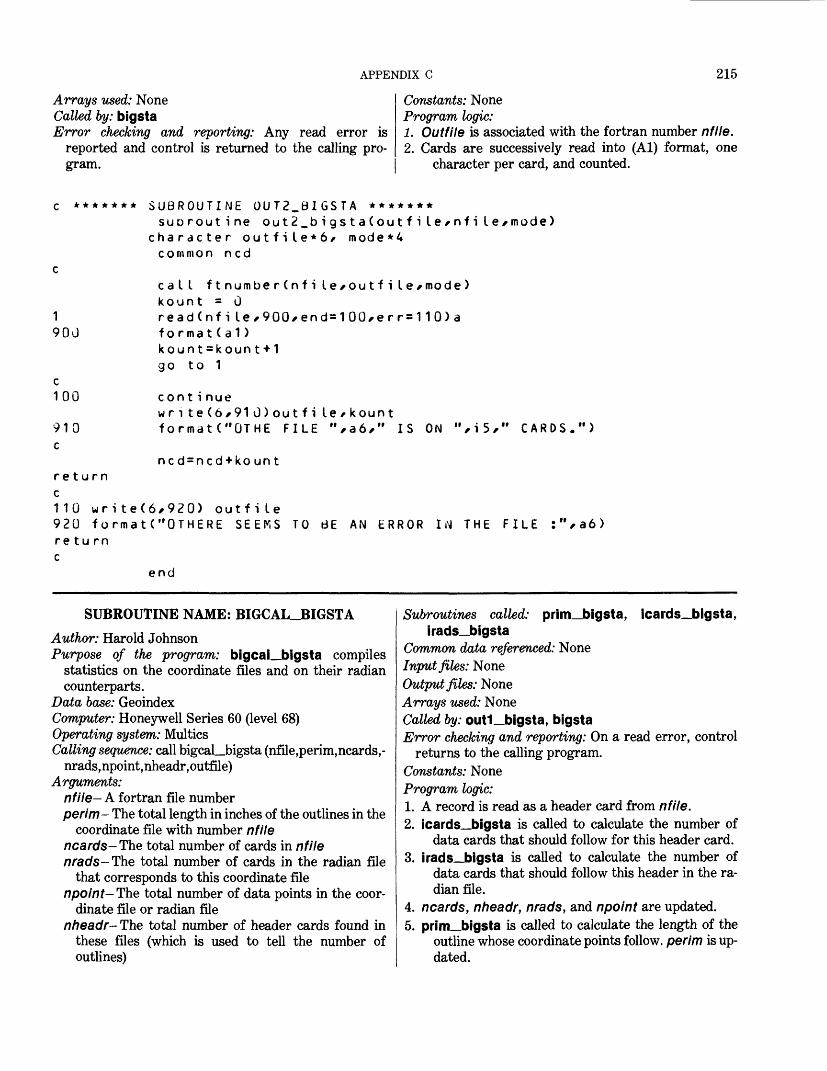
APPENDIX C 215
Arrays used: NoneCalled by: bigstaError checking and reporting: Any read error is
reported and control is returned to the calling pro gram.
Constants: None Program logic:1. Outfile is associated with the fortran number nfile.2. Cards are successively read into (Al) format, one
character per card, and counted.
c ******* SUBROUTINE OUT2_BIGSTA *******SUD rout ine out2_bigsta(outfi le^nfi le^mode)
1900
c 100
910 c
returnc110 wr920 foreturnc
character outfile*6/ common ncd
mode *A
cat I ftnumberCnfi le^outfi le^mode)kount = 0read(nfile*900*end=100,err=110)afo rmat(a 1)kount=kount+1go to 1
cont i nuewrite(6*91G)outfi le/kount formatC'OTHE FILE ",a6," IS
nc d = ncd + ko un t
ON ",i5," CARDS.")
ite(6*920> outfile rmatC'OTHERE SEEMS TO BE
end
AN ERROR IN THE FILE a6>
SUBROUTINE NAME: BIGCAL_BIGSTAAuthor: Harold JohnsonPurpose of the program: bigcal_bigsta compiles
statistics on the coordinate files and on their radian counterparts.
Data base: Geoindex Computer: Honeywell Series 60 (level 68) Operating system: Multics Calling sequence: call bigcaLJngsta (nfile,perim,ncards,-
nrads,npoint,nheadr,outfile) Arguments:
nfile- A fortran file number perim- The total length in inches of the outlines in the
coordinate file with number nfile ncards- The total number of cards in nfile nrads-The total number of cards in the radian file
that corresponds to this coordinate file npoint-The total number of data points in the coor
dinate file or radian filenheadr- The total number of header cards found in
these files (which is used to tell the number of outlines)
Subroutines called: prim_bigsta, icards_bigsta, irads_bigsta
Common data referenced: NoneInput files: NoneOutput files: NoneArrays used: NoneCalled by: out1_bigsta, bigstaError checking and reporting: On a read error, control
returns to the calling program. Constants: None Program logic:1. A record is read as a header card from nfile.2. icards_bigsta is called to calculate the number of
data cards that should follow for this header card.3. irads_bigsta is called to calculate the number of
data cards that should follow this header in the ra dian file.
4. ncards, nheadr, nrads, and npoint are updated.5. prim_bigsta is called to calculate the length of the
outline whose coordinate points follow, perim is up dated.
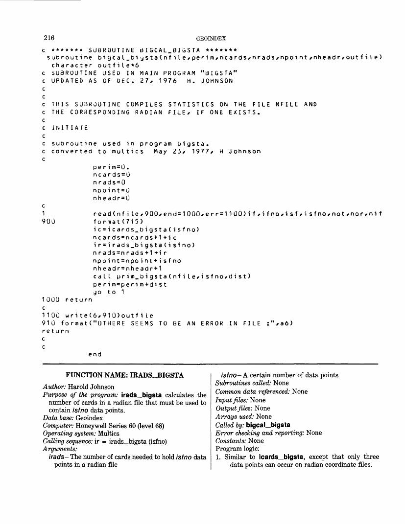
216 GEOINDEX
c ******* SUBROUTINE dIGCAL.BIGSTA *******subroutine bigcat_biysta(nfile,perim,ncards,nrads,npoint,nheadr,outfite) character outfile*6SUBROUTINE USED IN MAIN PROGRAM "BIGSTA" UPDATED AS OF DEC. 27, 1976 H. JOHNSON
THIS SUBROUTINE COMPILES THE CORRESPONDING RADIAN
INITIATE
subroutine used in program bigsta. converted to multics May 23, 1977, H
pe r i m = U. nc ards = U nrads=0 npo i nt = 0 nh eadr = U
Johnson
c 1 900
read(nfile,900,end=10UO,err=1100)if,ifno,i s f , i sfno,not,nor,niffo rma t(7 i 5)ic=icards_bigsta(isfno)ncards=ncards+1+i cir = irads_bigsta(i sfno)n rads = n rads + 1+i rnpoint=npoint+i sfnonh eadr=nheadr+1cat I prim_bigsta(nfi t e,i sfno,dist)peri m = peri m + di std o to 1
100U return c1100 write(6,910)outf i te910 formatC'UTHERE SEEMS TO BE AN ERROR IN FILE :",a6) return c c
end
FUNCTION NAME: IRADS_BIGSTAAuthor: Harold JohnsonPurpose of the program: irads_bigsta calculates the
number of cards in a radian file that must be used tocontain isfno data points.
Data base: GeoindexComputer: Honeywell Series 60 (level 68) Operating system: Multics Calling sequence: ir = irads_bigsta (isfno) Arguments:
irads- The number of cards needed to hold isfno data points in a radian file
isfno—A certain number of data points Subroutines called: None Common data referenced: None Input files: None Output files: None Arrays used: None Called by: bigcal_bigsta Error checking and reporting: None Constants: None Program logic:1. Similar to icards_bigsta, except that only three
data points can occur on radian coordinate files.
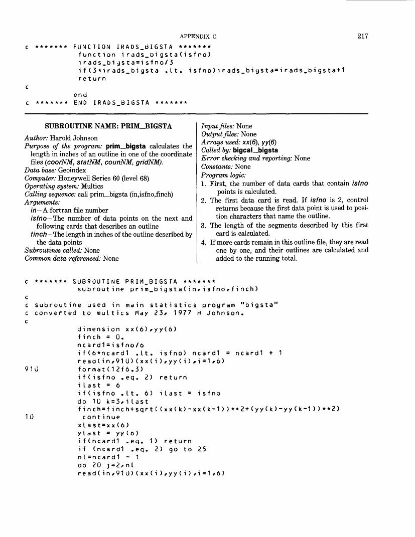
APPENDIX C
FUNCTION IRADS_6IGSTA ******* function irads.oigsta(isfno) i rads_bigsta=isfno/3if(3*irads_bigsta .Lt. isfno)irads_bigsta=irads_bigsta+1 return
217
*******end END IRADS.BIGSTA *******
SUBROUTINE NAME: PRIM_BIGSTAAuthor: Harold JohnsonPurpose of the program: prim_bigsta calculates the
length in inches of an outline in one of the coordinatefiles (coorNM, statNM, counNM, gridNM).
Data base: GeoindexComputer: Honeywell Series 60 (level 68) Operating system: MulticsCalling sequence: call prim_bigsta (in,isfno,finch) Arguments:
in—A fortran file numberisfno— The number of data points on the next and
following cards that describes an outlinefinch—The length in inches of the outline described by
the data points Subroutines called: None Common data referenced: None
Input files: NoneOutput files: NoneArrays used: xx(6), yy(6)Called by: bigcaL_bigstaError checking and reporting: NoneConstants: NoneProgram logic:1. First, the number of data cards that contain isfno
points is calculated.2. The first data card is read. If isfno is 2, control
returns because the first data point is used to posi tion characters that name the outline.
3. The length of the segments described by this first card is calculated.
4. If more cards remain in this outline file, they are read one by one, and their outlines are calculated and added to the running total.
910
******* SUBROUTINE PRIM_BIGSTA *******subroutine prim_bigsta(in*isfno*finch)
subroutine used in main statistics program "bigsta 1 converted to multics May 23* 1977 H Johnson.
dimension xx(6)*yy(6)finch = 0.ncard1 = i sfno/6if(6*ncard1 .It. isfno) ncardl = ncardlread(in/91U)(xx(i),yy(i),i =1*6)format(12f6.3)
return
10
i I ast = is fno
if(isfno .eq. 2)i last = 6i f (isfno .11. 6)do 10 k = 3/> ilastfinch=finch+sqrt((xx(k)-xx(k-1))**2+(yy(k)-yy(k-1))**2>c ont i nue
xI a s t = x x (6 ) ylast = yy(t>) if(ncard1 .eq. 1) return if (ncardl .eq. 2) go to 25 n I =ncard1 - 1 do 20 j=2/nl read(in,910)(xx(i),yy(i),i=1,6)
218 GEOINDEX
15
2025
30
*******
finch=finch+sqrt((xx(1)-xtast)**2+(yy(1)-ytast)**2)do 15 k = 2,6finch = finch + sqrt((xx(k)-xx(k-1)>**2-Kyy(k)-yy(k-1>)**2>cont i nuex I ast = x x (6)y t ast=yy (6)con t i nueread(in,91l»<xx(i>,yy(i>,i = 1,6>ilast = isfno - (ncard1-1)*6finch = finch + sqrt((xx(1)-xlast)**2«-(yy(1)-ytast>**2>ifCilast .eq. 1) returndo 30 k = 2/ilastfinch=finch+sqrt((xx(k)-xx(k-1))**2+<yy(k)-yy<k-1>>**2)cont i nuereturnendEND PRIH61GSTA ******
FUNCTION NAME: ICARDS_BIGSTAAuthor: Harold JohnsonPurpose of the program: icards_bigsta is used to com
pute from the isfno number in a coordinate file the number of data cards that should follow in order to contain the indicated number of points.
Data base: GeoindexComputer: Honeywell Series 60 (level 68)Operating system: MulticsCalling sequence: ic = icards_bigsta(isfno)Arguments:
ic— The number of cards that are required to hold isfno data points
isfno-A certain number of data pointsSubroutines called: NoneCommon data referenced: NoneInput files: NoneOutput files: NoneArrays used: NoneCalled by: bigcal_bigstaError checking and reporting: NoneConstants: NoneProgram logic:1. A maximum of six data points are on each card, so
icards_bigsta is isfno/Q unless 6 does not divide isfno, in which case one more card must be used.
******* FUNCTION ICARDS.BIGSTA ******* function i c ards.b i g s t a ( i sf no) i cards_bigsta=i sfno/6 i f ( 6* i c a rd s_bi gs t a .It. i sf no) i car re turn
_b i gs t a = i c ards_bi gst a+1
*******end END ICARDS.BIGSTA *******
EXEC_COM NAME: USMERG.EC
Author: P. A. FultonPurpose of the program: usmerg.ec, written in the
Multics command language, takes as input a newly created indxNM file and appends it to the existing in- dxus. indxus is the GRASP file that contains all the States. The output file is named usall. At the end of the run it is dprinted for checking.
Data base: Geoindex
Computer: Honeywell Series 60 (level 68) Operating system: Multics Calling sequence: ec usmerg NM Arguments: NM-FIPS code for the State Subroutines called: setmas, GRASP Common data referenced: None Input files: indxus, indxNM Output files: usall Arrays used: None Called by: None
APPENDIX C 219
Error checking and reporting: None Constants: None Program logic:1. command^line is turned off.2. Attach the exec_com to the program setmas.3. The exec_com contains two responses to prompts in
the program setmas.
4. When setmas is terminated, the program is detached from the exec_com.
5. The exec__com is attached to the program GRASP.6. GRASP is executed. The exec_com contains responses
to prompts made in GRASP.7. Detach the files.8. Quit.
&command_Iine off& a tt a c hse tmas2 us o 1yes&det ach&at tac hgraspi ndxusappendus a I Ii ndx usi ndxilyqui ty1/2lidetach iqui t
PROGRAM NAME: STATE_TO_TAPE
Author: Harold JohnsonPurpose of the program: state_to_tape enables a
user to copy all the State files for one State onto abackup tape, using IBM tape characteristics.
Data base: Geoindex Computer: Honeywell Series 60 (level 68) Operating system: Multics Calling sequence: state_to_tape Arguments: None Subroutines called: sts begin, heading_state_to_
tape, up_file_number, disk_to_tape_fb_-retain.ec, disk_to_tape__vbs_retain.ec, list_-statetape.ee, date_time
Common data referenced: None Input files: bginNM, coorNM, cordNM, statNM,
strdNM, counNM, curdNM, gridNM, bordNM,cntrNM, paraNM, redyNM
Output files: None Arrays used: flle_name(12) Called by: None
Error checking and reporting: If the user has not sent a message to the operator to locate his tape, the program will abort.
Constants: NoneProgram logic:
1. The user is asked to type 1 if he sent a message to the operator to find his tape; otherwise, 0. The user's response is read into ians.
2. If ians does not equal 1, the program stops.3. Prompt:
TYPE YOUR TAPE ID. The response is read into tape—number.
4. Prompt:TYPE THE 2-DIGIT FEDERAL STATE NUMBER CODE FOR THIS STATE, USING FORMAT A2
Response is read into state_number.5. Prompt:
TYPE THE NAME OF THIS STATE. Response is read into state_name.
6. The user is asked which file number to use. The response is read into file—number.
220 GEOINDEX
7. Subroutine sts_begin is called to set up a temp orary disk file that will contain a description of the records to be read into the bginNM file.
8. Subroutine heading_state_to_tape is called to set up file81 containing a description of the files being copied.
9. Call subroutine up_file_number.10. Call disk_to_tape_fb_retain.ec.
11. Subroutines up_file_number and disk_to_- tape_vbs_retain.ec are called for the last three input files as they are recorded with the VBS tape option.
12. Call list_state_tape.ec, which prints out the tape label and the file name and numbers.
13. Call date_time.14. End.
c PROGRAM state.to.tapecc PURPOSE: To enable a user to copy all the state files for onec state onto a backup tape/ using IBM tape characteristics.cc PROGRAMMER: H Johnsonc DATE: Jan 13, 1978c
character tape.nurober*6/ fi I e_name*4(12)/ fi I e_number*2character state_number*2/ state_name*36* file*6
cdata file_name/"bgin"/"coor"/"cord"/"stat"/"strd"/"coun"/"curd"/ "grid"/"bord"/"cntr"/" P ara"/"redy"/ c c
wri te(6/910)91J forrnatC'OlF YOU HAVE SENT A MESSAGE TO SYS OP TO FIND YOUR"/ " TAPE/ TYPE 1; OTHERWISE/ TYPE 0")
read(5/915) ians 915 format(i1)
ifCians .ne. 1) stop c
wri te(6/920) 920 formatC'OTYPE YOUR TAPE 10:")
read(5/925) tape_number 925 format(a6) c
wri te(6/927)927 format("OTYPE THE 2-OIGIT FEDERAL STATE NUM8ER CODE"/ " FOR THIS STATE/ USING FORMAT A2">
read(5/928) state_number928 format(a2) c
wri te(6/930) 930 formatC'OTYPE THE NAME OF THIS STATE:")
read(5/935) state_name 935 format(a36) c
write(6/940)940 formatC'OTYPE THE FILE-NUMBER OF THE TAPE FILE JUST"/ " dEFORE THE PLACE WHERE YOU WANT TO BEGIN WRITING THIS STATE."/ "OIF YOU ArtE WRITING THE FIRST STATE ON THIS TAPE/ TYPE OO;"/ " IF ADDING TO A PREVIOUS STATE/ TYPE THE LAST FILE NUMBER;"/
APPENDIX C 221
" IF WRITING OVER A PREVIOUSLY WRITTEN VERSION/ TYPE THE FILE"/ " NUMBER JUST AHEAD OF THE PLACE WHERE YOU WANT TO BEGIN."/ "OPLEASE TYPE THIS NUMBER FORMAT A2:") C
read(5/945) file_number 945 format(a2) cC NOW SET UP A TEMPORARY DISK FILE WHICH WILL CONTAIN A c DESCRIPTION OF THESE RECORDS/ TO 3E READ INTO THE BGIN FILE, c
cal I sts_begin(state_number/state_name/file_number) C THIS SETS UP A FILE 81 CONTAINING A DESCRIPTION OF C THE FILES BEING COPIED, c
cat I heading_state_to_tape(state_number/tape_number) c
do 50 i=1/ 9encode ( fi le/950) fi le.name(i )/ state_numoer 950 format(a4/a2) c
call up_fiLe.number(fiIe_number) c
cal L ec ("disk_to_tape_fb_retain"/tape_number/fi le/fi le_number) c50 con ti nue c
do 60 i=1O/ 12 c encode(fiLe/950) fi le_name(i)/ state_number
call up_fiLe_number(fiLe_number) c
call ec (" disk .. to_ tape. vbs_ retain "/tape_number/fi le/fi L e_ number) c60 cont i nue cc THE LAST 3 FILES ARE RECORDED WITH THE VBS TAPE OPTION, c
call ec ("List_state_tape"/tape_number) c
call dat e_ t i me c c end
SUBROUTINE NAME: HEADING_STATE_TO_TAPE
Author: Harold JohnsonPurpose of the program: heading_state_to_tape
writes headings for the output of the state_to_tapeprogram.
Data base: Geoindex
Computer: Honeywell Series 60 (level 68)Operating system: MulticsCalling sequence: call heading_state_to_tape
(state,tape_number)Arguments:
state- Two-digit FIPS State code tape_number- Six-position volume number
Subroutines called: None
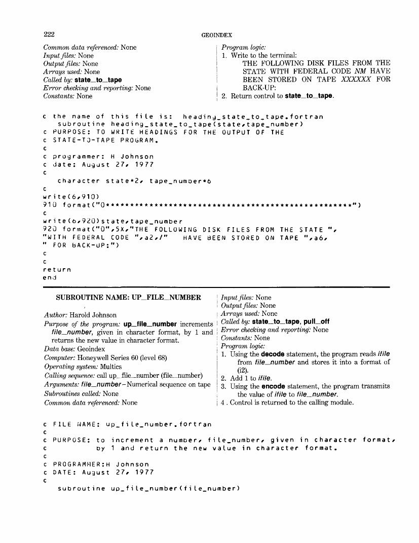
222 GEOINDEX
Common data referenced: NoneInput files: NoneOutput files: NoneArrays used: NoneCalled by: state_to_tapeError checking and reporting: NoneConstants: None
Program logic:1. Write to the terminal:
THE FOLLOWING DISK FILES FROM THE STATE WITH FEDERAL CODE NM HAVE BEEN STORED ON TAPE XXXXXX FOR BACK-UP:
2. Return control to state_to_tape.
c c c c c c
c wr91 c w r92"W «i
c cre en
the name of this file is: heading_state_to_tape.fortransubroutine heading_state_to_tape(state*tape_number)
PURPOSE: TO WRITE HEADINGS FOR THE OUTPUT OF THE STATE-TO-TAPE PROGRAM.
programmer: H Johnson date: August 27, 1977
character state*2* tape_numoer*6
i te(6/-910)0 formatC"0***************************************************")
i te(6*920)state,tape_number0 forrnat("0"/.5X/."THE FOLLOWING DISK FILES FROM THE STATE "/- ITH FEDERAL CODE "/.a2/-/" HAVE BEEN STORED ON TAPE M /-a6/- FOR bACK-UP: M )
turnd
SUBROUTINE NAME: UP_FILE_NUMBER
Author: Harold JohnsonPurpose of the program: up_file_number increments
file^_number, given in character format, by 1 and returns the new value in character format.
Data base: GeoindexComputer: Honeywell Series 60 (level 68)Operating system: MulticsCalling sequence: call up_file__number (file_number)Arguments: file—number- Numerical sequence on tapeSubroutines called: NoneCommon data referenced: None
Input files: NoneOutput files: NoneArrays used: NoneCalled by: state__to_tape, pull offError checking and reporting: NoneConstants: NoneProgram logic:1. Using the decode statement, the program reads if He
from file—number and stores it into a format of(12).
2. Add 1 to if He.3. Using the encode statement, the program transmits
the value of if He to file^number. 4 . Control is returned to the calling module.
c FILE NAME: up_fiIe_number.fortrancc PURPOSE: to increment a numoer* file.number* given in character format*c by 1 and return the new value in character format.cc PROGRAMMERS Johnsonc DATE: August 27* 1977c
subroutine up.file.number(fiIe_number)
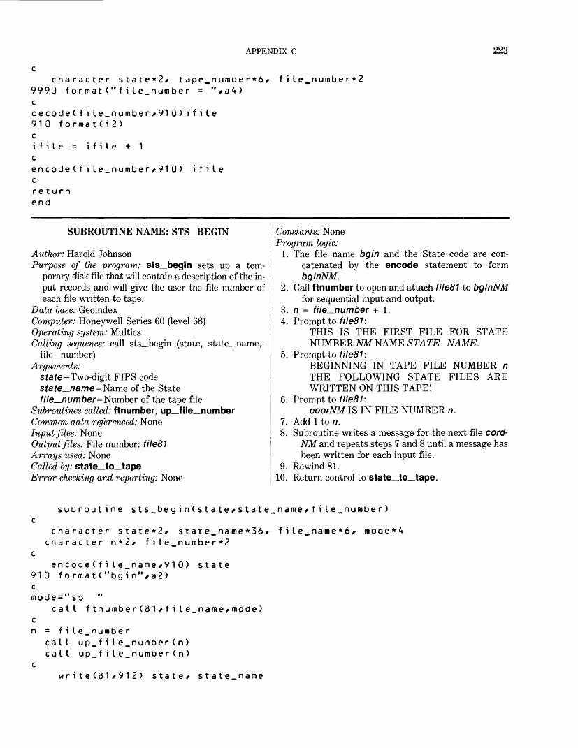
APPENDIX C 223
character state*2/ tape_numDer*6/ fi le.numbe r*2 9990 format("file.number = ",a4) cdecode(fi le_number/91 0)i file 910 formatCi2) cifile = ifile + 1 cencode(file_number/91 0) ifile creturn end
SUBROUTINE NAME: STS_BEGIN
Author: Harold JohnsonPurpose of the program: sts_begin sets up a tem
porary disk file that will contain a description of the in put records and will give the user the file number of each file written to tape.
Data base: GeoindexComputer: Honeywell Series 60 (level 68)Operating system: MulticsCalling sequence: call sts_begin (state, state_name,-
file_number)Arguments:
state -Two-digit FTPS code sfate_name-Name of the State file_number-Number of the tape file
Subroutines called: ftnumber, up_file__numberCommon data referenced: NoneInput files: NoneOutput files: File number: file81Arrays used: NoneCalled by: state_to__tapeError checking and reporting: None
Constants: None Program logic:
1. The file name bgin and the State code are con catenated by the encode statement to form bginNM.
2. Call ftnumber to open and attach file81 to bginNM for sequential input and output.
3. n = file^number + 1.4. Prompt to file81:
THIS IS THE FIRST FILE FOR STATE NUMBER NM NAME STATE-NAME.
5. Prompt to file81:BEGINNING IN TAPE FILE NUMBER n THE FOLLOWING STATE FILES ARE WRITTEN ON THIS TAPE!
6. Prompt to filed 1:coorNM IS IN FILE NUMBER n.
1. Add 1 to n.8. Subroutine writes a message for the next file cord-
NM and repeats steps 7 and 8 until a message has been written for each input file.
9. Rewind 81.10. Return control to state_to_tape.
suoroutine sts_begin(state/state_name/file.number) c
character state*2/ state_name*36/ file_name*6/ mode*4 character n*2/ fi le_number *2
cencode(fi le_name/910) state
910 f orfnat("bgin"/d2) c mode="so "
call ftnumber (6 1/fiIe_name/mode) c n = f i le_numbe r
call up_file_number(n) call up_fiIe_numDer(n)
cwrite (31/91 2 ) state/ state_name
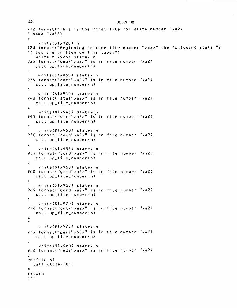
224 GEOINDEX
912 format("This is the first file for state number "/a2/" name "/a36)c
wri te(81/92Q) n920 formate"Beginning in tape file number "/a2/" the following state "/ "files are written on this tape:")
wri te(81/925) state/ n 925 format("coor"/a2/" is in file number M /a2)
call up_fiIe_number(n) c
wr ite(81/935) state/ n 935 format("cord"/a2/" is in file number M /a2)
call up_fi I e_number(n) c
write(81/940) state/ n 940 format("stat"/a2/" is in file number "/a2)
call up_fiIe_number(n) c
write(81/9A5) state/ n 945 f ormatC'st rd"/a2/" is' in file number M /a2)
call up_fiIe_number(n) c
write(81/950) sta te/ n 950 formatC* coun"/a2/" is in file number M /a2)
call up_f i I e_nurnbe r ( n) c
write(81/955) state/ n 955 format("curd"/a2/" is in file number "/a2)
call up_fiIe_numoer(n) c
wr i te(81/960) state/ n 960 formatC'yr id"/a2/" is in file number "/a2)
call up_fiIe_number(n) c
wr i te(81/965) state/ n 965 format("bord"/a2/" is in file number "/a2)
call up_fiIe_number(n) c
write(81/970) state/ n 970 f ormatC'cnt r",a2/" is in file number If /a2)
call up_fiIe.number(n) c c
wri te(81/975) state/ n 975 formatC* para "/a2/" is in file number M /a2)
call up.file_number(n) c
wri te(31/9oO) state/ n980 format("redy"/a2/" is in file number "/a2) c endf i le 81
call c loser(81) creturn end
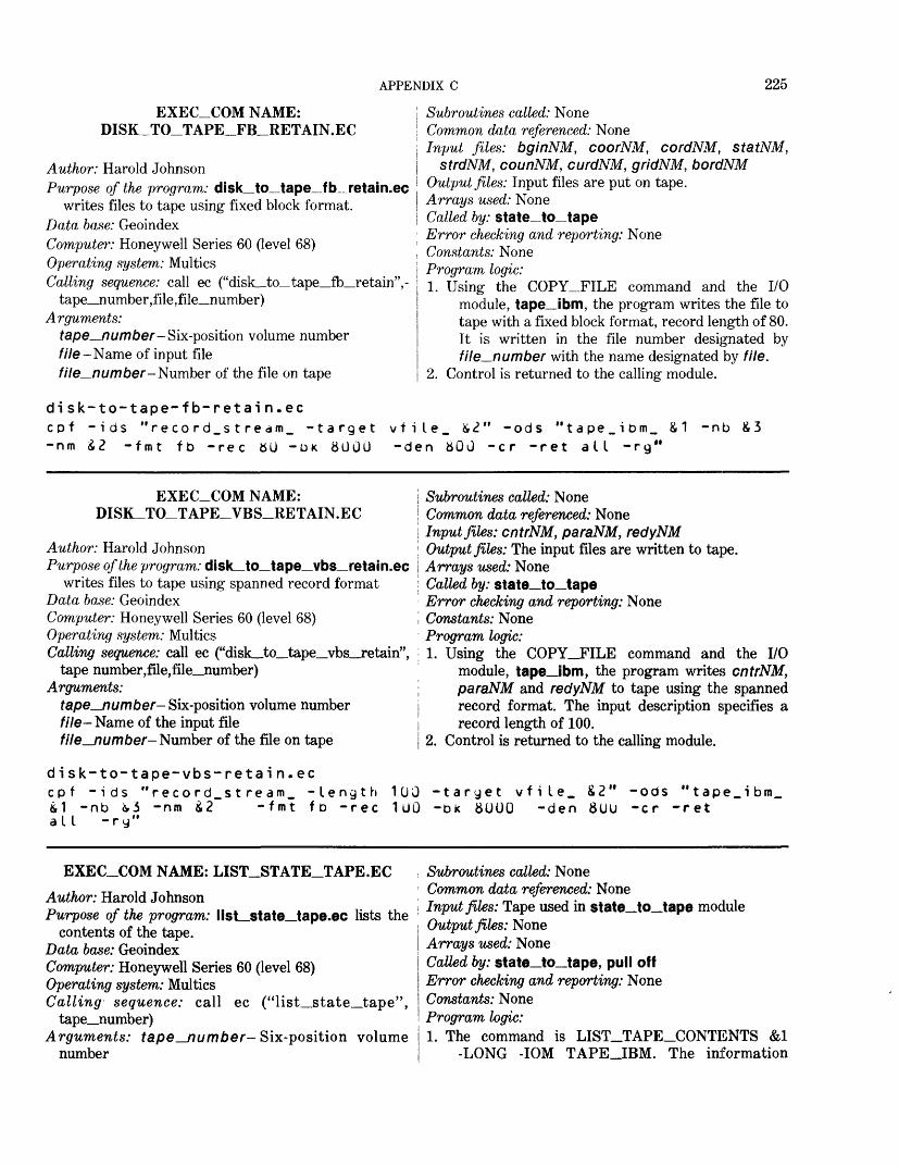
APPENDIX C 225
Subroutines called: NoneCommon data referenced: NoneInput files: bginNM, coorNM, cordNM, statNM,
strdNM, counNM, curdNM, gridNM, bordNM Output files: Input files are put on tape. Arrays used: None Called by: state_to_tape Error checking and reporting: None Constants: None Program logic:1. Using the COPY_FILE command and the I/O
module, tape_ibm, the program writes the file to tape with a fixed block format, record length of 80. It is written in the file number designated by file—number with the name designated by file.
2. Control is returned to the calling module.
disk-to-tape-fb-retain.eccpf -ids "record_stredm_ -target vfiIe_ £<?" -ods "tape_ibm_ £1 -nb £3-nm £2 -fmt fb -rec 80 -btc 8000 -den 800 -cr -ret all -rg"
EXEC_COM NAME: DISR_TO_TAPE_FB_RETAIN.EC
Author: Harold JohnsonPurpose of the program: disk_to_tape_fb_retain.ec
writes files to tape using fixed block format. Data base: GeoindexComputer: Honeywell Series 60 (level 68) Operating system: Multics Calling sequence: call ec ("disk to tape fh retain",-
tape_number,file,file_number) Arguments:
tape_number- Six-position volume numberfile-Name of input file
—number- Number of the file on tape
EXEC_COM NAME: DISK_TO_TAPE_VBS_RETAIN.EC
Author: Harold JohnsonPurpose of the program: disk_to_tape_vbs_retain.ec
writes files to tape using spanned record format Data base: GeoindexComputer: Honeywell Series 60 (level 68) Operating system: Multics Calling sequence: call ec ("disk_to_tape_vbs_retain",
tape number,file,file__number) Arguments:
tape_number- Six-position volume numberfile- Name of the input filefile_number- Number of the file on tape
disk-to-tape-vbs-retain.ec cpf -ids "record_stream_ -Length &1 -nb i.3 -nm £2 -fmt fb -rec all -ry"
Subroutines called: NoneCommon data referenced: NoneInput files: cntrNM, paraNM, redyNMOutput files: The input files are written to tape.Arrays used: NoneCalled by: state_to_tapeError checking and reporting: NoneConstants: NoneProgram logic:1. Using the COPY_FILE command and the I/O
module, tape_ibm, the program writes cntrNM, paraNM and redyNM to tape using the spanned record format. The input description specifies a record length of 100.
2. Control is returned to the calling module.
100 -taryet vfile. £2" -ods "tape_ibm_ 100 -bk 8UOO -den 800 -cr -ret
EXEC_COM NAME: LIST_STATE_TAPE.ECAuthor: Harold JohnsonPurpose of the program: list_state_tape.ec lists the
contents of the tape. Data base: GeoindexComputer: Honeywell Series 60 (level 68) Operating system: Multics Calling sequence: call ec ("list_state_tape",
tape_number) Arguments: tape_number- Six-position volume
number
Subroutines called: None Common data referenced: None Input files: Tape used in state_to_tape module Output files: None Arrays used: None Catted by: state_to_tape, pull off Error checking and reporting: None Constants: None Program logic:1. The command is LIST_TAPE_CONTENTS &1
-LONG -IOM TAPE_IBM. The information
226 GEOINDEX
printed by this command is extracted from the tape labels.
2. The -long argument prints the file identifier (id), the file sequence number (number), the record format (format), the physical block size (blksize), the logical record length (Irecl), the encoding mode (mode), the file creation data (created), the file ex piration date (expires), the file-set section number
(section), the file version number (version), the file generation number (generation), and the operating system that recorded the tape (system).
3. The -lorn argument invokes a system I/O module to attach and read the specified tape volume. The tape_ibm_ subroutine is specified in order to list OS standard labeled tapes.
4. Control is returned to the calling program.
I ist_tape_contents &1 -long -iom tape_ibm_
PROGRAM NAME: PULL_OFF
Author: Harold JohnsonPurpose of the program: pull_off enables the user to
pull off files from the Geoindex State files, and writesthe selected files to disk.
Data base: GeoindexComputer: Honeywell Series 60 (level 68) Operating system: Multics Calling sequence: pull_off Arguments: None Subroutines called: state_pull_off, separate_pull_-
offCommon data referenced: None Input files: User tape containing State files Output files: Files retrieved from the input tape Arrays used: None Called by: NoneError checking and reporting: None Constants: None
Program logic:1. The user is informed that she must know the tape
number, State number code, and file names, or she has the option of pulling off all the files for one State. If only selected files are to be pulled off, the user must know their file numbers on the tape, and the names and file numbers must be entered in ascending order according to the order on the tape.
2. Prompt:NOW TYPE THE TAPE ID:
3. The user's response is read into tape_number.4. Prompt:
IF YOU WANT THE ENTIRE SET OF FILES FOR A STATE, TYPE A 1; OTHERWISE, TYPE 0.
5. The users response is read into ians.6. If ians is not equal to 1, go to step 8.7. Call subroutine state__pull_off. Upon return, go to
step 9.8. Call subroutine separate—pull—off.9. Stop.
c PROGRAM: pull. offcc PROGRAMMER: H Johnsonc DATE: Feoruary 14, 1978cc INPUT FILES: A user tape, containing state files.c OUTPUT FILES: Whatever files were retrieved from the tape.c
character t ape_number *32
wr i te(6,910) 910 formatC" THIS 11 BACK TO DISK."/ " *** WARNING: be
PROGRAM ENABLES YOU TO PULL OFF FILES FROM A TAPE"/
sure these files do not already exist"/ in your directory or in links to another directory!!!"/ "/
IT IS ASSUMED THAT THESE ARE FILES FROM OUR STATE FILES."/ YOU MUST KNOW THE TAPE NUMBER, STATE NUMBER CODE, AND FILE OR, YOU CAN PULL OFF ALL THE FILES FOR ONE STATE."/
NAMES"/

APPENDIX C 227IF YOU WANT ONLY SOhE STATE FILES/ YOU MUST KNOW THEIR FILE NUMdER"/
11 ON THE TAPE. THEN YOU MUST ENTER THE NAMES AND NUMBERS IN "/" INCREASING ORDER ACCORDING TO THE ORDER ON THE TAPE."/ »» ti /
" NOW TYPE THE TAPE ID :") c
read(5/920) tape.number 920 format(a32) cc NOW DETERMINE WHETHER OR NOT THE USER WANTS A WHOLE STATE. c
wri te(6/930)930 format( M IF YOU WANT THE ENTIRE SET OF FILES FOR A STATE/"/ " TYPE A 1; OTHERWISE/ TYPE 0")
read(5/940) i ans 9AO formatC i1)
if (ians .ne. 1) go to 20 c
call state.pull_off(tape_number) go to 30 c20 call separate_pu I l_off(tape_number) c30 cont i nue end
SUBROUTINE NAME: STATE_PULL_OFFAuthor: Harold JohnsonPurpose of the program: state_pull_off determines
which States are to be retrieved from the tape andthen writes them to disk.
Data base: GeoindexComputer: Honeywell Series 60 (level 68) Operating system: MulticsCalling sequence: call state_pull_off (tape_number) Arguments: tape_number-The six-position volume
number Subroutines called: tape__to_disk_fb_retain.ec,
tape_to_disk_vbs_retain.ec, up_file_number,list state_tape.ec
Common data referenced: None Input files: A user tape containing State files Output files: bginNM, coorNM, cordNM, statNM,
strdNM, counNM, curdNM, gridNM, bordNM,cntrNM, paraNM, redyNM
Arrays used: None Called by: pull_off Error checking and reporting: None Constants: None Program logic:
1. Prompt:TO RETRIEVE ALL THE FILES FOR ONE STATE, YOU MUST KNOW THE STATE
NUMBER CODE AND THE FILE NUMBER OF THE FIRST FILE FOR THE STATE AS IT OCCURS ON THE TAPE.
2. Prompt:WHAT IS THE STATE NUMBER CODE? TYPE IT FORMAT 12.
3. Read the response into state.4. Prompt:
NOW TYPE THE FIRST FILE NUMBER OF THE BGIN FILE FOR THIS STATE, FOR MAT A2.
5. Read the response into file_number.6. Using the encode statement, concatenate the name
of the output file and the State code.7. Call tape_to_disk_fb_retain.ec.8. Call up_file_number subroutine.9. Repeat steps 6-8 for the first nine output files.
10. Using the encode statement, concatenate the name of the file and the State number.
11. Call tape_to_disk_vbs_retain.ec.12. Call subroutine up_file_number.13. Repeat steps 10-12 for the last three output files.14. Call lisLstate tape.ec to list the contents of the
tape.15. Return control to the calling program.
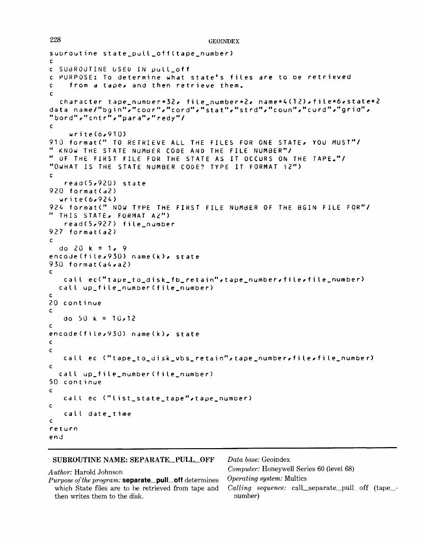
228 GEOINDEX
suuroutine state_pull_off(tape_number)cc SUBROUTINE USED IN pull.offc PURPOSE: To determine what state's files are to be retrievedc from a tape/ and then retrieve them.c
character tape_numoer*32 r fiIe_number*2/ name*4(12) f fi I e*6/state*2 data name/"bgin'^"coor"/"cord"/"stat"/"strd"/"coun"/"curd"/"grid"/ "bord"/"cntr"/"para"/"redy"/ c
wri te(6/910)910 format(" TO RETRIEVE ALL THE FILES FOR ONE STATE/ YOU MUST"/ " KNOW THE STATE NUMBER CODE AND THE FILE NUMBER"/ " OF THE FIRST FILE FOR THE STATE AS IT OCCURS ON THE TAPE."/ "OWHAT IS THE STATE NUMBER CODE? TYPE IT FORMAT i2") c
read(5/920) state 920 format(a2)
write(6/924)924 formatC" NOW TYPE THE FIRST FILE NUMBER OF THE 8GIN FILE FOR"/ " THIS STATE/ FORMAT A2")
read(5/927) file_number 927 format(a2) c
do 20 k = 1/ 9encode(file/930) name(k)/ state 930 format(a4/a2) c
cat I ec("tape_to_disk_fb_retain*'/tape_number/fi le/ f i le.number)call up_fiIe_number(file_number)
c20 c ont i nue c
do 50 k = 10/12 cencode(file/930) name(k)/ state c c
ca I I ec ("tape_to_di sk_vbs_retain"/tape_number/file/file_number) c
call up_fiIe_number(file_number ) 50 con t i nue c
call ec ("Iist_state_tape"/tape_numoer) c
call dat e_ t i me creturn end
SUBROUTINE NAME: SEPARATE_PULL_OFF Data base: GeoindexAuthor: Harold Johnson Computer: Honeywell Series 60 (level 68)Purpose of the program: separate_pull_of f determines Operating system: Multics
which State files are to be retrieved from tape and Calling sequence: call_separate_pull_off (tape- then writes them to the disk. number)
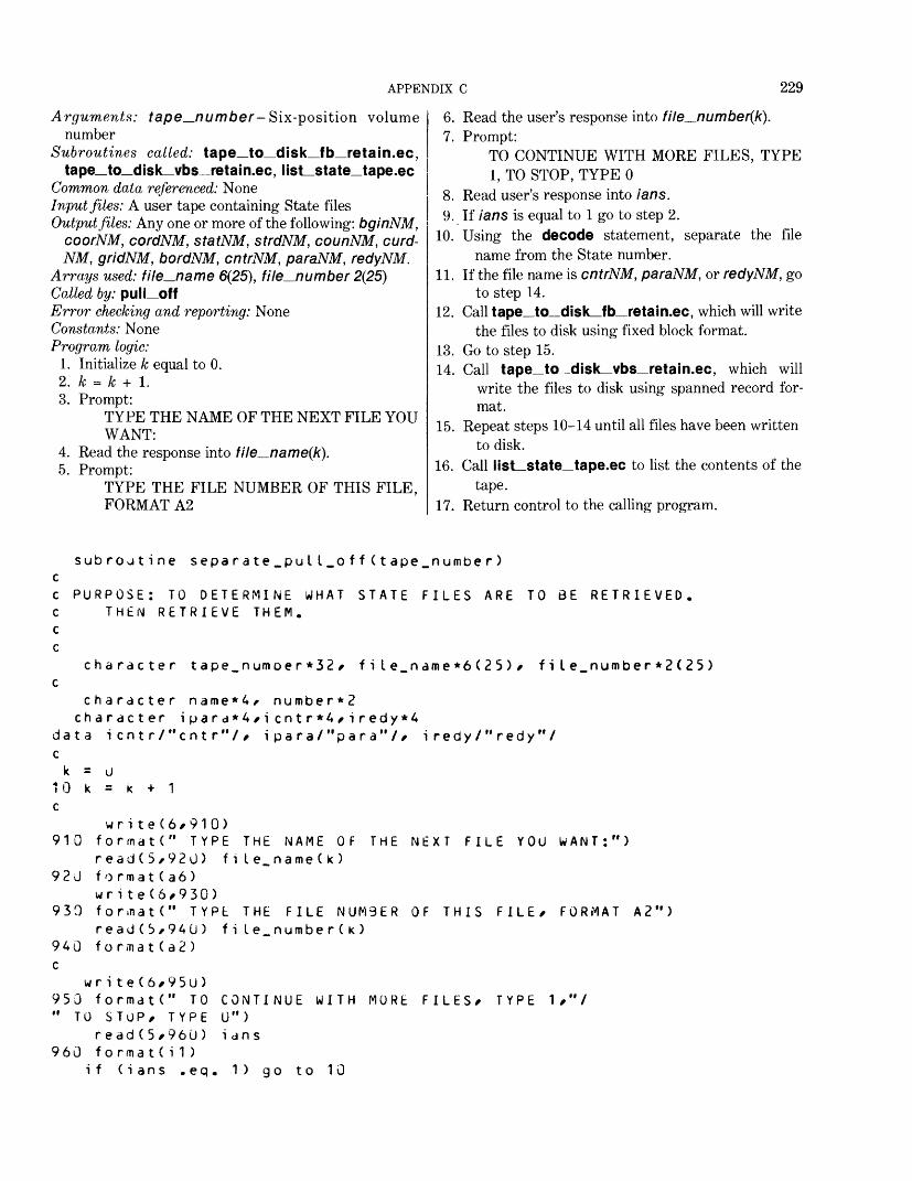
APPENDIX C 229
Arguments: tape^number- Six-position volumenumber
Subroutines called: tape_to_disk_fb_retain.ec,tape_to_disk_vbs_retain.ec, list_state_tape.ec
Common data referenced: NoneInput files: A user tape containing State filesOutput files: Any one or more of the following: bginNM,
coorNM, cordNM, statNM, strdNM, counNM, curd- NM, gridNM, bordNM, cntrNM, paraNM, redyNM.
Arrays used: file_name 6(25), file_number 2(25)Colled by: pulLoffError checking and reporting: NoneConstants: NoneProgram logic:
1. Initialize k equal to 0.2. k = k + 1.3. Prompt:
TYPE THE NAME OF THE NEXT FILE YOU WANT:
4. Read the response into file_name(k).5. Prompt:
TYPE THE FILE NUMBER OF THIS FILE, FORMAT A2
6. Read the user's response into file_number(k).7. Prompt:
TO CONTINUE WITH MORE FILES, TYPE 1, TO STOP, TYPE 0
8. Read user's response into ians.9. If ians is equal to 1 go to step 2.
10. Using the decode statement, separate the file name from the State number.
11. If the file name is cntrNM, paraNM, or redyNM, go to step 14.
12. Call tape_to_disk_fb_retain.ec, which will write the files to disk using fixed block format.
13. Go to step 15.14. Call tape_to_disk_vbs_retain.ec, which will
write the files to disk using spanned record for mat.
15. Repeat steps 10-14 until all files have been written to disk.
16. Call list_state_tape.ec to list the contents of the tape.
17. Return control to the calling program.
subroutine separate_pull_o f f(tape_number) cc PURPOSE: TO DETERMINE WHAT STATE FILES ARE TO BE RETRIEVED. C THEN RETRIEVE THEM, c c
character tape.numoer*32/ fi I e_name*6( 2 5)/ fi I e.number*2(25) c
character name*4/ number*2 character i pa r a*4/i cntr*4/iredy*4
data icntr/"cntr"// ipara/"para"// iredy/"redy"/ c
k = u10 k = k + 1 c
wri te(6/910) 910 formatC1 TYPE THE NAME OF THE NEXT FILE YOU WANT:")
read(5,92U) fiIe.name(k) 920 format(a6)
wri te(6,930) 930 fonnatC" TYPt THE FILE NUM3ER OF THIS FILE/ FORMAT A2")
read(5,940) fiLe_number(k) 940 f o rma t(a2) c
wr i te(6/95u)950 formatC' TO CONTINUE WITH MORE FILES/ TYPE 1/"/ " TO STOP/ TYPE U")
r ead(5/960 ) i an s 960 formatCi1)
if (ians .eq. 1) go to 10
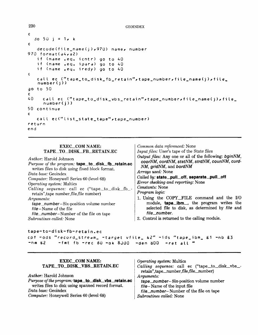
230
c
GEOINDEX
do 50 j = 1 t kC
decode(fiLe_name(j) t970 ) name* number 970 format(a4,a2)
if (name .eq. icntr) go to 40if (name .eq. ipara) go to 40if (name .eq. iredy) go to 40
ccat I ec ("tape_to_disk_fb_retain"*tape_number,file_name(j) * f i Le. number(j))
go to 50 c40 call ec ("tape_to_disk_vbs_retain"/tape.number f fiIe_name(j) f fiIe_
number(j))50 cont i nue c
call ec(" list _state_tape"*tape_ number) return end
EXEC_COM NAME: TAPE_TO_DISK_FB_RETAIN.EC
Author: Harold JohnsonPurpose of the program: tape_to_disk_fb_retain.ec
writes files to disk using fixed block format. Data base: GeoindexComputer: Honeywell Series 60 (level 68) Operating system: Multics Calling sequence: call ec ("tape_to_disk_fb__-
retain",tape number,file,file number) Arguments:
tape_number- Six-position volume number///e-Name of the filefile_number- Number of the file on tape
Subroutines called: None
Common data referenced: NoneInput files: User's tape of the State filesOutput files: Any one or all of the following: bginNM,
coorNM, cordNM, statNM, strdNM, counNM, curd-NM, gridNM, and bordNM
Arrays used: NoneCalled by: state_pull_off, separate_pull_off Error checking and reporting: None Constants: None Program logic:1. Using the COPY_JFILE command and the I/O
module, tape_ibm_, the program writes the selected file to disk, as determined by file and file—number.
2. Control is returned to the calling module.
tape-to-disk-fb-retain.eccpf -ods "record_stream_ -target vfile_ W* -ids "tape_ibm_ & 1 -nb S3-nm &2 -fmt fb -rec 60 -ok 8JOO -den SOO -ret all "
EXEC_COM NAME: TAPE_TO_DISK_VBS_RETAIN.EC
Author: Harold JohnsonPurpose of the program: tape_to_disk_vbs_retain.ec
writes files to disk using spanned record format. Data base: Geoindex Computer: Honeywell Series 60 (level 68)
Operating system: MulticsCalling sequence: call ec ("tape_to_disk_vbs_
retain",tape_number,file,file_number) Arguments:
tape_number- Six-position volume numberfile- Name of the input filefile_number- Number of the file on tape
Subroutines called: None
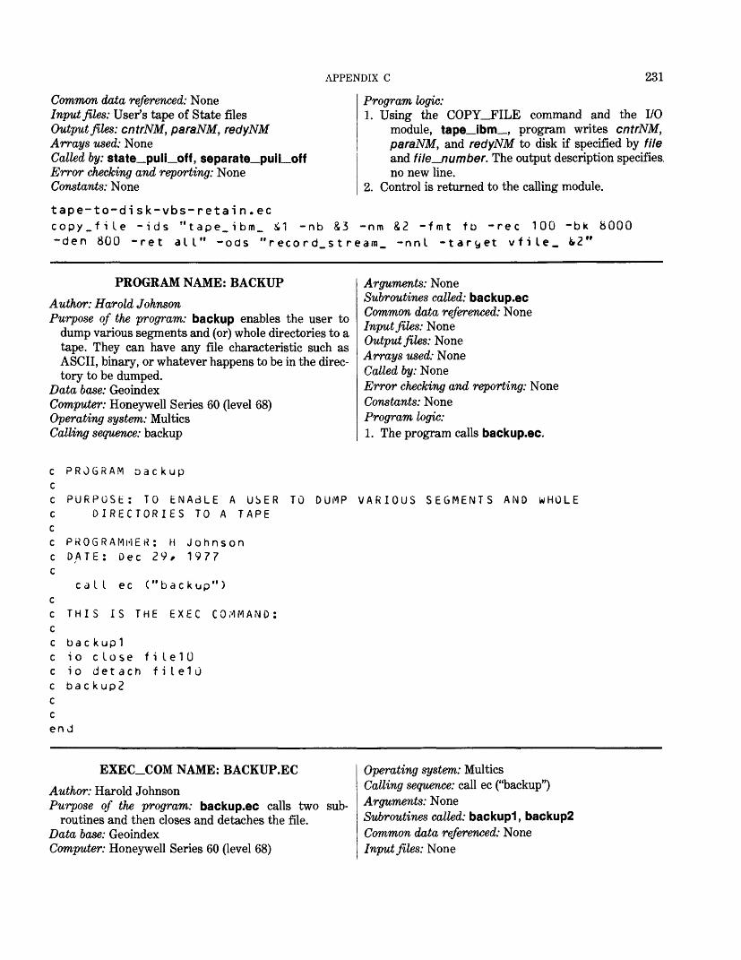
APPENDIX C 231
Common data referenced: NoneInput files: User^s tape of State filesOutput files: cntrNM, paraNM, redyNMArrays used: NoneCalled by: state_pull_off, separate_pull_offError checking and reporting: NoneConstants: None
Program logic:1. Using the COPY_FILE command and the I/O
module, tape_ibm_, program writes cntrNM, paraNM, and redyNM to disk if specified by file and file__number. The output description specifies, no new line.
2. Control is returned to the calling module.tape-to-disk-vbs-retain.eccopy.file -ids "tape.ibm_ il -nb S3 -nm &2 -fmt fb -rec 100 -bk 8000-den 800 -ret all" -ods "record.stream, -nnl -taryet vfile_ fc>2"
PROGRAM NAME: BACKUPAuthor: Harold JohnsonPurpose of the program: backup enables the user to
dump various segments and (or) whole directories to a tape. They can have any file characteristic such as ASCII, binary, or whatever happens to be in the direc tory to be dumped.
Data base: GeoindexComputer: Honeywell Series 60 (level 68)Operating system: MulticsCalling sequence: backup
Arguments: NoneSubroutines called: backup.ecCommon data referenced: NoneInput files: NoneOutput files: NoneArrays used: NoneCalled by: NoneError checking and reporting: NoneConstants: NoneProgram logic:1. The program calls backup.ec.
c PROGRAM Dackupcc PURPOSE: TO ENAdLE A USER TO DUMP VARIOUS SEGMENTS AND WHOLEc DIRECTORIES TO A TAPEcc PROGRAMMER: H Johnsonc DATE: Dec 29, 1977c
call ec ("backup") cc THIS IS THE EXEC COMMAND: cc ba c k up1 c io close f i le 1 U c io detach filelu c back up2 c c end
EXEC_COM NAME: BACKUP.ECAuthor: Harold JohnsonPurpose of the program: backup.ec calls two
routines and then closes and detaches the file. Data base: Geoindex Computer: Honeywell Series 60 (level 68)
sub-
Operating system: MulticsCalling sequence: call ec ("backup")Arguments: NoneSubroutines called: backup"!, backup2Common data referenced: NoneInput files: None

232 GEOINDEX
Output files: NoneArrays used: NoneCalled by: backupError checking and reporting: NoneConstants: None
backup.ecba c kuplio close f i I e 1 Uio detach filelObackup?
Program logic:1. This exec_com executes backup"!.2. Control is then returned to the exec_com and fileW
is closed and detached.3. It then executes backup2.
EXEC_COM NAME: DUMP.EC
Author: Harold JohnsonPurpose of the program: dump.ec places segments or
directories, specified in backup*! , on tape. Data base: GeoindexComputer: Honeywell Series 60 (level 68) Operating system: Multics - Calling sequence: call ec ("dump","control.dump","hhj",-
tape) Arguments:
control.dump—Dump control filehhj—Operatortape—Tape number
Subroutines called: None Common data referenced: None Input files: control.dump Output files:
*.dump.mappossibly an error file ending with .ef
Arrays used: None
dump.ec^attachcomp I e t e_dumpS3&qu i t
Called by: backup2Error checking and reporting: NoneConstants: NoneProgram logic:1. &ATTACH allows the arguments of the exec_com to
be passed directly to complete_dump.2. complete_dump requires a minimum of three
arguments as in the command: complete_dump: control.dump, hhj-debug, where control.dump is the name of a control segment, hh] represents the author's initials, and -debug disables calls to highly privileged system subroutines normally used when complete—dump is used by the operators during the weeky system backup ses sion. The argument tape is the volume identifier of the desired dump tape. One 2,400 ft. tape at 1,600 bpi can hold approximatley 7,500 disk pages (records).
3. The segments or directories stored in control.dump are written to tape.
4. Quit.
-debug
SUBROUTINE NAME: BACKUP1Author: Harold JohnsonPurpose of the program: backup"! allows a user to dump
various files and directories to a tape. Data base: GeoindexComputer: Honeywell Series 60 (level 68) Operating system: Multics Calling sequence: call backupl Arguments: None Subroutines called: None Common data referenced: None Input files: NoneOutput files: control.dump used on unit 10 (fileW) Arrays used: None
Called by: backup.ecError checking and reporting: The user will be asked
whether he has sent a message to the operator to locate his tape. If the user answers with other than 1, the program will abort.
Constants: NoneProgram logic:
1. The user is asked whether a message was sent to locate his tape. If the user responds with 1, pro cessing continues. Otherwise the program halts.
2. The program prints a message describing its pur pose.
3. fileW is attached to control dump and opened for stream output.
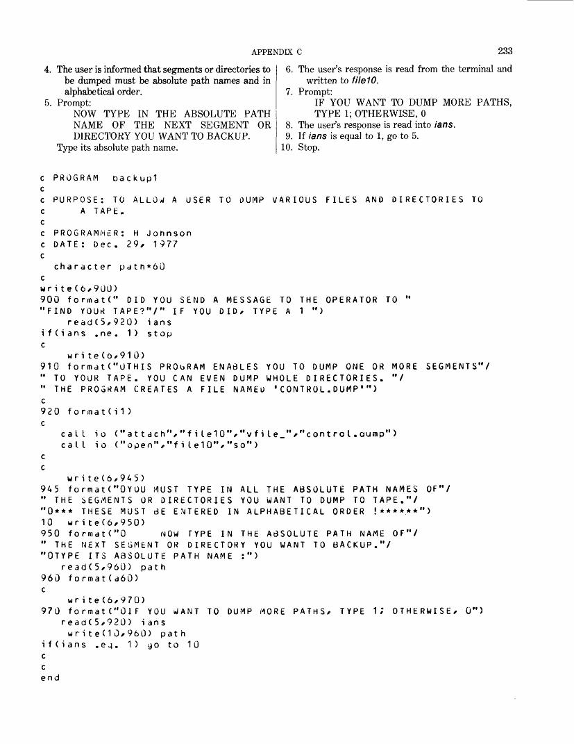
APPENDIX C 233
4. The user is informed that segments or directories to be dumped must be absolute path names and in alphabetical order.
5. Prompt:NOW TYPE IN THE ABSOLUTE PATH NAME OF THE NEXT SEGMENT OR DIRECTORY YOU WANT TO BACKUP.
Type its absolute path name.
6. The user's response is read from the terminal and written to fileW.
7. Prompt:IF YOU WANT TO DUMP MORE PATHS, TYPE 1; OTHERWISE, 0
8. The user's response is read into ians.9. If ians is equal to 1, go to 5.
10. Stop.
c PROGRAM oackuplcc PURPOSE: TO ALLOW A USER TO DUMP VARIOUS FILES AND DIRECTORIES TOc A TAPE.cc PROGRAMMER: H Johnsonc DATE: Dec. 29, 1977c
character pat h*60 cwrite(6,900)900 formatC" DID YOU SEND A MESSAGE TO THE OPERATOR TO " "FIND YOUR TAPE?"/" IF YOU DID/ TYPE A 1 ")
read(5/920) ians i f(i ans .ne. 1) stop c
write(6/910)910 format("OTHIS PRObRAM ENABLES YOU TO DUMP ONE OR MORE SEGMENTS"/ " TO YOUR TAPE. YOU CAN EVEN DUMP WHOLE DIRECTORIES. "/ " THE PROGRAM CREATES A FILE NAMEU 'CONTROL.DUMP 1 ") c920 f o rma t < i 1 > c
call io ("attach","fiIe10"/"vfiIe_"*"contro I.aump") call io ("open","fi Ie10"/"so")
c c
wr i te(6/945)945 formatC'OYOU MUST TYPE IN ALL THE ABSOLUTE PATH NAMES OF"/ " THE SEGMENTS OR DIRECTORIES YOU WANT TO DUMP TO TAPE."/ "0*** THESE MUST BE ENTERED IN ALPHABETICAL ORDER !******") 10 wri te(6/950)950 formatC'O iMOW TYPE IN THE ABSOLUTE PATH NAME OF"/ " THE NEXT SEGMENT OR DIRECTORY YOU WANT TO BACKUP."/ "OTYPE ITS ABSOLUTE PATH NAME :")
read(5/960) path 960 format(a60) c
wri te(6/970)970 formatC'OlF YOU WANT TO DUMP MORE PATHS/ TYPE 1; OTHERWISE/ 0")
read(5/920) i answr i te(10/960) pat h
i f(i ans .e^. 1) 90 to 10 c c end
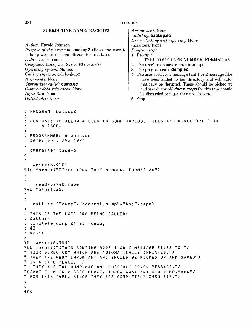
234 GEOINDEX
SUBROUTINE NAME: BACKUP2
Author: Harold JohnsonPurpose of the program: backup2 allows the user to
dump various files and directories to a tape. Data base: GeoindexComputer: Honeywell Series 60 (level 68) Operating system: Multics Calling sequence: call backup2 Arguments: None Subroutines called: dump.ec Common data referenced: None Input files: None Output files: None
Arrays used: NoneCalled by: backup.ecError checking and reporting: NoneConstants: NoneProgram logic:1. Prompt:
TYPE YOUR TAPE NUMBER, FORMAT A62. The user's response is read into tape.3. The program calls dump.ec.4. The user receives a message that 1 or 2 message files
have been added to her directory and will auto matically be dprinted. These should be picked up and saved; any old dump.maps for this tape should be discarded because they are obsolete.
5. Stop.
PROGRAM backup^
PURPOSE: TO ALLOW A USER TO DUMP v/ARIOUS FILES AND DIRECTORIES TO A TAPE.
PROGRAMMER: H Johnson c b A T E : Dec. 29, 1977 c
character t ape*6 c c
wr i te(6/910) 910 format("OTYPE c c
940 c
YOUR TAPE NUMBER/ FORMAT A6")
read(5/940)tape format(a6)
call ec ("dump"
THIS IS THE EXEC ia11 ac h
/"control.dump","hhj"/tape)
COM BEING CALLED:
c comp I ete_dump &1 £2 -debugc S3c &qui tc50 write(6,980)980 formatC* OTHIS ROUTINE ADDS 1 OR 2 MESSAGE FILES TO "/" YOUR DIRECTORY WHICH ARE AUTOMATICALLY DPRINTED."/" THEY ARE VERY IMPORTANT AND SHOULD BE PICKED UP AND SAVED'" IN A SAFE PLACE. "/" THEY ARE THE DUMP.MAP AND POSSIBLE ERROR MESSAGE."/"OSAVE THEM IN A SAFE PLACE. THROW AWAY ANY OLD DUMP.MAPS"/" FOR THIS TAPE, SINCE THEY ARE COMPLETELY OBSOLETE.")cCend
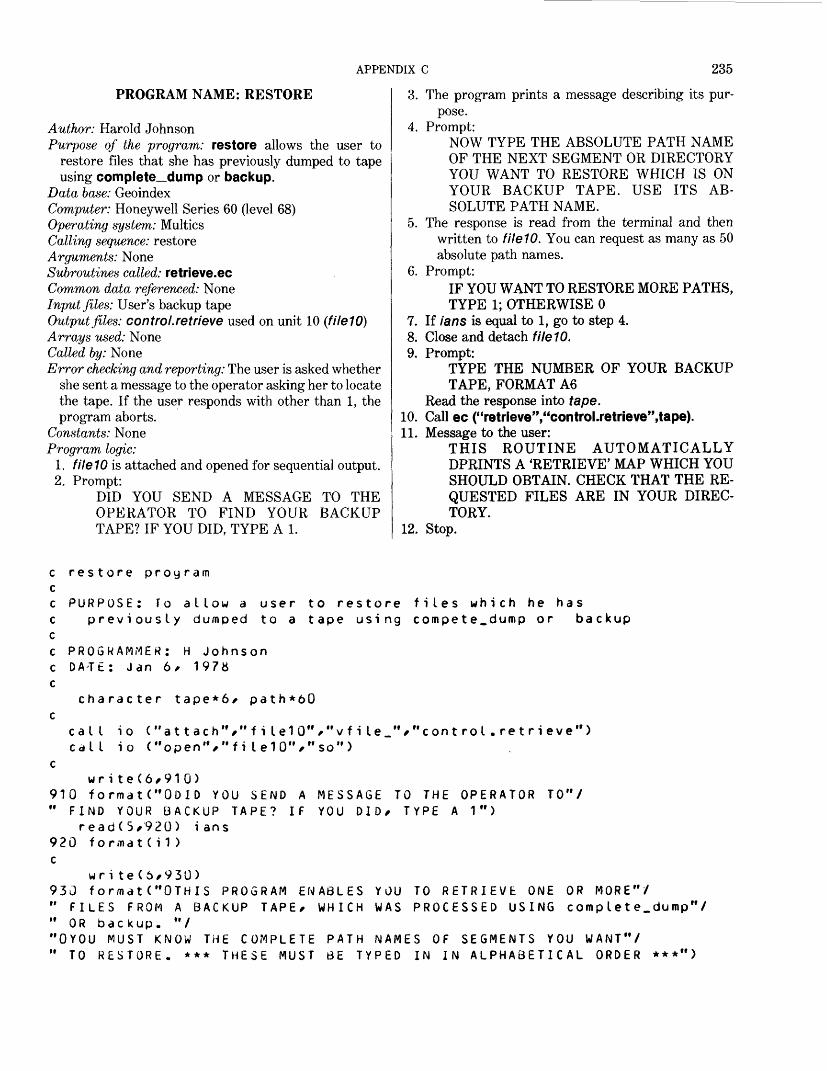
APPENDIX C 235
PROGRAM NAME: RESTORE
Author: Harold JohnsonPurpose of the program: restore allows the user to
restore files that she has previously dumped to tapeusing complete^ dump or backup.
Data base: GeoindexComputer: Honeywell Series 60 (level 68) Operating system: Multics Calling sequence: restore Arguments: None Subroutines called: retrieve.ec Common data referenced: None Input files: User's backup tape Output files: control.retrieve used on unit 10 (fileW) Arrays used: None Called by: None Error checking and reporting: The user is asked whether
she sent a message to the operator asking her to locatethe tape. If the user responds with other than 1, theprogram aborts.
Constants: None Program logic:
1. fileW is attached and opened for sequential output.2. Prompt:
DID YOU SEND A MESSAGE TO THE OPERATOR TO FIND YOUR BACKUP TAPE? IF YOU DID, TYPE A 1.
3. The program prints a message describing its pur pose.
4. Prompt:NOW TYPE THE ABSOLUTE PATH NAME OF THE NEXT SEGMENT OR DIRECTORY YOU WANT TO RESTORE WHICH IS ON YOUR BACKUP TAPE. USE ITS AB SOLUTE PATH NAME.
5. The response is read from the terminal and then written to fileW. You can request as many as 50 absolute path names.
6. Prompt:IF YOU WANT TO RESTORE MORE PATHS, TYPE 1; OTHERWISE 0
7. If ians is equal to 1, go to step 4.8. Close and detach fileW.9. Prompt:
TYPE THE NUMBER OF YOUR BACKUP TAPE, FORMAT A6
Read the response into tape.10. Call ec ("retrieve","control.retrieve",tape).11. Message to the user:
THIS ROUTINE AUTOMATICALLY DPRINTS A 'RETRIEVE' MAP WHICH YOU SHOULD OBTAIN. CHECK THAT THE RE QUESTED FILES ARE IN YOUR DIREC TORY.
12. Stop.
restore proy ram
PURPOSE: To allow a user to restore files which he haspreviously dumped to a tape using compete_dump or backup
PROGRAMMER: H Johnson DATE: Jan 6/ 1978
character tape*6/ path*6U
cal I cal I
t o i o
("attach ("open"/
/"f ilelO' fi lelO'V
/"vfile "/ so")
cont rol.retrieve")
MESSAGE YOU DID/
wri te(6/910)910 formatC'ODID YOU SEND A " FIND YOUR BACKUP TAPE? IF
read(5/920) ians 920 f o r m a t ( i 1 ) c
wri te(6/930)930 format("OTHIS PROGRAM ENABLES " FILES FROM A BACKUP TAPE/ WHICH " OR backup. "/"OYOU MUST KNOW THE COMPLETE PATH NAMES " TO RESTORE. *** THESE MUST BE TYPED
TO THE OPERATOR TYPE A 1")
TO"/
YOU TO RETRIEVE ONE OR MORE"/WAS PROCESSED USING comp lete.dump"/
OF SEGMENTS YOU WANT"/ IN IN ALPHABETICAL ORDER ***'
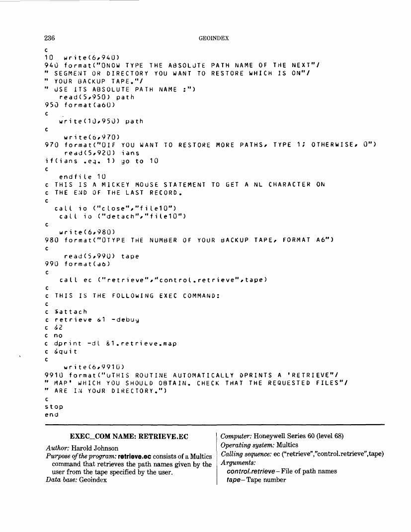
236 GEOINDEX
10 wri te(6/940)940 formatC'ONOW TYPE THE ABSOLUTE PATH NAME OF THE NEXT"/" SEGMENT OR DIRECTORY YOU WANT TO RESTORE WHICH IS ON"/" YOUR BACKUP TAPE."/" USE ITS ABSOLUTE PATH NAME :")
read(5/950) path 950 format(a6U) c
write (10/950) path c
wri teC6/970) 970 formatC'OlF YOU WANT TO RESTORE MORE PATHS/ TYPE i; OTHERWISE/ 0")
read(5/920) ians i f C i ans . eq. 1) go to 10 c
endfi Le 10c THIS IS A MICKEY MOUSE STATEMENT TO GET A NL CHARACTER ON c THE END OF THE LAST RECORD, c
call io ("close"/"fiIe10")call io ("detach","fiLe10")
cwri te(6/980)
980 formatC'OTYPE THE NUMBER OF YOUR BACKUP TAPE/ FORMAT A6") c
read(5/990) tape 990 formdt(d6) c
call ec ("retrieve"/"controt.retrieve"/tape) cc THIS IS THE FOLLOWING EXEC COMMAND: cc Sattachc retrieve &1 -debuy c &2 c noc dprint -dI &1.retrieve . map c igu i t c
wri te(6/991G)9910 format("UTHIS ROUTINE AUTOMATICALLY DPRINTS A "RETRIEVE"/ " MAP 1 WHICH YOU SHOULD OBTAIN. CHECK THAT THE REQUESTED FILES"/ " ARE IN YOUR DIRECTORY.") cstop end
EXEC_COM NAME: RETRIEVE.ECAuthor: Harold JohnsonPurpose of the program: retrieve.ec consists of a Multics
command that retrieves the path names given by the user from the tape specified by the user.
Data base: Geoindex
Computer: Honeywell Series 60 (level 68)Operating system: MulticsCalling sequence: ec ("retrieve","control.retrieve",tape)Arguments:
control.retrieve-File of path namestape— Tape number
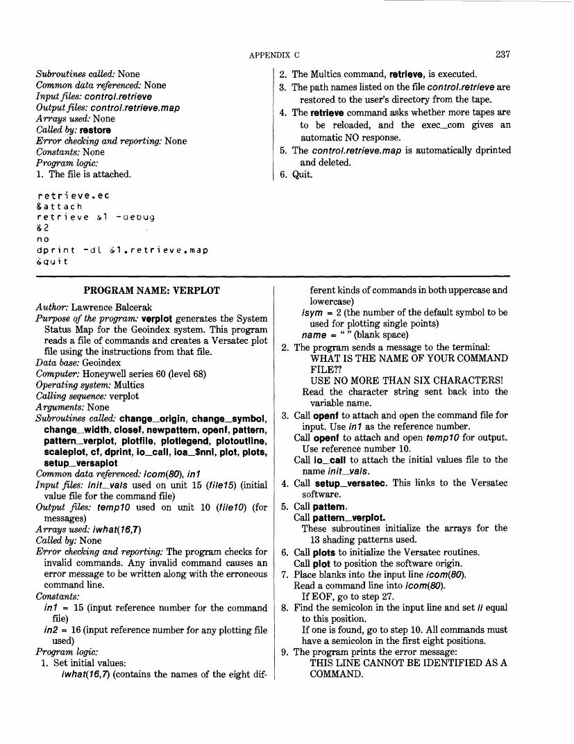
APPENDIX C 237
Subroutines called: NoneCommon data referenced: NoneInput files: control. retrieveOutput files: con trol. retrieve.mapArrays used: NoneCalled by: restoreError checking and reporting: NoneConstants: NoneProgram logic:1. The file is attached.
ret ri eve . ecSattachretrieve &1 -debug
nodprint -dl
ti1 . r e t r i ev e . map
2. The Multics command, retrieve, is executed.3. The path names listed on the file control.retrieve are
restored to the user's directory from the tape.4. The retrieve command asks whether more tapes are
to be reloaded, and the exec_com gives an automatic NO response.
5. The control.retrieve.map is automatically dprinted and deleted.
6. Quit.
PROGRAM NAME: VERPLOT
Author: Lawrence BalcerakPurpose of the program: verplot generates the System
Status Map for the Geoindex system. This program reads a file of commands and creates a Versatec plot file using the instructions from that file.
Data base: GeoindexComputer: Honeywell series 60 (level 68)Operating system: MulticsCalling sequence: verplotArguments: NoneSubroutines called: change_origin, change—Symbol,
change_width, closef, newpattern, openf, pattern, pattern_verplot, plotfile, plotlegend, plotoutline, scaleplot, cf, dprint, io_call, ioa_$nnl, plot, plots, setup_versaplot
Common data referenced: icom(80), in1Input files: initials used on unit 15 (file15) (initial
value file for the command file)Output files: tempW used on unit 10 (fileW) (for
messages)Arrays used: iwhat(16,7)Called by: NoneError checking and reporting: The program checks for
invalid commands. Any invalid command causes an error message to be written along with the erroneous command line.
Constants: in1 = 15 (input reference number for the command
file)in2 = 16 (input reference number for any plotting file
used)Program logic:
1. Set initial values:iwhat(16,7) (contains the names of the eight dif
ferent kinds of commands in both uppercase andlowercase)
isym = 2 (the number of the default symbol to beused for plotting single points)
name = " " (blank space)2. The program sends a message to the terminal:
WHAT IS THE NAME OF YOUR COMMAND FILE??USE NO MORE THAN SIX CHARACTERS!
Read the character string sent back into the variable name.
3. Call openf to attach and open the command file for input. Use in 1 as the reference number.
Call openf to attach and open tempW for output. Use reference number 10.
Call io_call to attach the initial values file to the name m/f_va/s.
4. Call setup_versatec. This links to the Versatec software.
5. Call pattern.Call pattern_verplot.
These subroutines initialize the arrays for the 13 shading patterns used.
6. Call plots to initialize the Versatec routines. Call plot to position the software origin.
7. Place blanks into the input line icom(80). Read a command line into icom(80).
If EOF, go to step 27.8. Find the semicolon in the input line and set // equal
to this position.If one is found, go to step 10. All commands must have a semicolon in the first eight positions.
9. The program prints the error message:THIS LINE CANNOT BE IDENTIFIED AS A COMMAND.
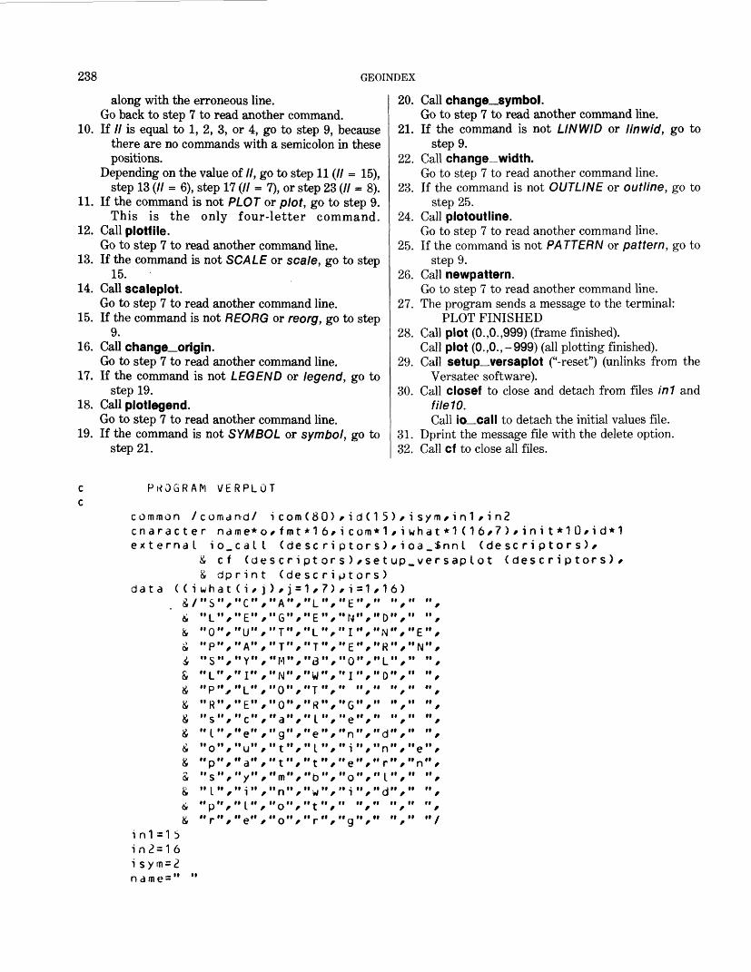
238 GEOINDEX
along with the erroneous line. Go back to step 7 to read another command.
10. If // is equal to 1, 2, 3, or 4, go to step 9, because there are no commands with a semicolon in these positions.
Depending on the value of //, go to step 11 (// = 15), step 13 (// = 6), step 17 (// = 7), or step 23 (// - 8).
11. If the command is not PLOT or plot, go to step 9. This is the only four-letter command.
12. Call plotfile.Go to step 7 to read another command line.
13. If the command is not SCALE or scale, go to step 15.
14. Call scaleplot.Go to step 7 to read another command line.
15. If the command is not REORG or reorg, go to step 9.
16. Call change_origin.Go to step 7 to read another command line.
17. If the command is not LEGEND or legend, go to step 19.
18. Call plot legend.Go to step 7 to read another command line.
19. If the command is not SYMBOL or symbol, go to step 21.
20. Call change_symbol.Go to step 7 to read another command line.
21. If the command is not LINWID or linwid, go to step 9.
22. Call change—width.Go to step 7 to read another command line.
23. If the command is not OUTLINE or outline, go to step 25.
24. Call plotoutline.Go to step 7 to read another command line.
25. If the command is not PATTERN or pattern, go to step 9.
26. Call newpattern.Go to step 7 to read another command line.
27. The program sends a message to the terminal: PLOT FINISHED
28. Call plot (O.,0.,999) (frame finished).Call plot (0.,0.,-999) (all plotting finished).
29. Call setup versaplot ("-reset") (unlinks from the Versatec software).
30. Call closef to close and detach from files in1 and fileW. Call io_call to detach the initial values file.
31. Dprint the message file with the delete option.32. Call cf to close all files.
PROGRAM VERPLOT
common /cnaracteex t erna L
data ( ( i&/^&&4&£&&&£S&&&&
coma nd/r
i&&wh"S"L"0"P"S"Lup"R"s"L"o
P"s"L
P
name*o_ccfdp rat (ii iiii iiii iiii iiii ii/ii iifit itii n/ii ii/ii itii ii
/ii iiii ii/'t
al(di ni /C"E"U"A"Y"I"L"E"c"e"u"ay"i "L"
e
oIetJ/,ftt,tttt'//''/
i com/ fmt
(des c r i
(de)/j ="A"/II r- It
II T It
II T II
" M " /"N"/"O"/"O"/"a"/"g"/" t "/
"m"/"n"/"o"/
o" /
(80)*16/sc r ipt orsc r i1/7)"L"/"E"/n i nII -r It
"8"/ii 1 1 nw /II -r II
"R"/"I "/"e"/"L"/
"b"/"w"/
r " /
/ ii cPts)Pt/ i"E"N"I"E"0"Iii"G"e"n"i
e"o"i
"g
d(1 5)/ i sym/in1 /in2om*1/iwhat*1 (16/7)/ini t*1or s ) / i oa_$nn I (descriptor/set up_ver sap lot (descripor s )=1/16)" f " "/" ","/"O"/" "/It II .1 II II f- It/ N / t /It tl n It It »| It
/ L / /II II r\ It II It
II II II II tl
It II II II It
tt II II II tt
"/"d"/" "/
"/"r"/"n"/ii ii i n it iiii ii .j ii it ii
t f t"/" "/" "/
s)/ tors) /
in1=15 in2=16
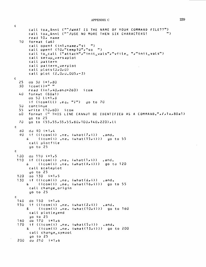
APPENDIX C 239
caLL ioa.SnnL ("~/WHAT IS THE NAME OF YOUR COMMANDcaLL ioa_$nnL (""/USE NO MORE THEN SIX CHARACTERS!read 10, name
10 format (a6)caLL openf (in1,name,"si ")caLL openf (10,"temp10","so ")caLL io_caLL (" attach"," initials ","vfile_caLl setup_versapLotcaLL patterncaLL pattern.verpLotcaLL pLots(0,0,0)caLL pLot (2.0,0.005,-3)
FILE??"))
V'init.vaLs")
25 do 30 i=1,80 30 icom(i)=" "
read (in1,40,end=260) icom 40 format (80a1)
do 50 L1=1,3if (icom(LL) .eq. ";") go to 70
50 continue 55 write (10,60) icorn oO format (" THIS LINE CANNOT BE IDENTIFIED AS A COMMA NO.",/,1x,80a1)
go to 25 70 go to (55,55,55,55,80,100,140,220),LI
80 do 90 i=1,490 if ((icom(i) ,ne. iwhat(7,i)) .and.
6 (icom(i) .ne. iwhat(15,i))) go to 55caLL pLotfiLego to 25
100 do 110 i=1,5 110 if ((icom(i) .ne.
& (icom(i) .ne.caLL scaLepLotgo to 25
120 do 130 i=1,5 130 if ((icom(i) .ne.
& (icom(i) .ne.caLl change_origingo to 25
iwhat(1,i)) iwhat(9,i)))
. and. go to 120
i wha t(3,i)) iwhat(16,i)))
and. go to 55
140 do 150 i=1,6 150 if ((icom(i) .ne.
& (i c om(i) ,n e.caLL p Lot Legendgo to 25
160 do 170 i=1,6 170 if ((i c om(i) .n e .
& (i c om(i) .ne .caLL change.symooLgo to 25
200 do 210 1=1,6
iwhat(2,i)) .and.iwhat(10,i))) go to 160
iwhat(5,i)) .and.iwhat(13,i))) go to 200
240 GEOINDEX
210 if ((icom(i) .ne. iwhat(6/i)) .and.& (icom(i) .ne. iwhat( 1 4 / i ) ) ) go to 55 call change.width yo to 25
220230
240250
260
do 230 i=1/7if ( (i com( i) .ne.
( i c om ( i ) .n e . call plot out Line yo to 25 do 250 i=1,7 if ( (i com( i) .ne.
(icom(i) .ne. call newpa 1 t e rn go to 25
i wha t(3/i )) .and.iwhat (11,i))) go to 240
i wha t(4/i)) .and. iwhat(12/i))) go to 55
call ioa_$nnl (""/PLOT FINISHED")call plot (0./0./999)call plot (0./0./-999)call setup_versaplot ("-reset")call closef (i n 1 )cal I c losef (10)call io.call ("detach"/"init_vaIs")call dprint ("-d I "/"templ0")call cf ("-all")stopend
SUBROUTINE NAME: CHANGE_ORIGINAuthor: Lawrence BalcerakPurpose of the program: change_origin identifies and
evaluates the x and y distances for a change in the origin and moves the origin that distance.
Data base: GeoindexComputer: Honeywell series 60 (level 68)Operating system: MulticsCalling sequence: call change_originArguments: NoneSubroutines called: fincLnumber, plotCommon data referenced: icom(80), id(15)Input files: NoneOutput files: tempW used on unit 10 (fileW) (for
messages)Arrays used: icom(80), id(15)Called by: verplotError checking and reporting: The subroutine checks for
a blank keyword field, an error in a keyword, and an error in a data value. If any are found, an appropriate message is written to a file, which is dprinted at the end of the run.
Constants: NoneProgram logic:
1. Set initial values. The keywords for x and y are not necessarily both present. The default values for
both are 0. The first position to look for a keyword (ipi ace) is 7, because the command takes up 6 spaces. The last nonblank character of the record is in position Hast, which is initialized to 81 to start.
2. Starting at the last position of the record (80), check in descending order for a nonblank character. If there is one, go to step 4.
3. The subroutine prints the error message:THE FIELD CONTAINS ALL BLANKS
and returns to the calling program.4. Find the first nonblank character in this field and
set i place equal to this position.5. If ic = iplace to Hast, then find the end of the next
keyword by looking for a comma. Set ic equal to one less than the position of the com
ma or to Hast if none exists. This is the position of the last character in this field.
6. If the keyword is x= or X= go to step 11.7. If the keyword is y= or Y= go to step 12.8. The subroutine prints the error message:
THIS FIELD IS NOT RECOGNIZED AS A KEYWORD!!
and the string involved.9. Set iplace = ic + 2, which is the first possible posi
tion for the next keyword.
APPENDIX C 241
10. If there are more characters to check (compare the present position, iplace, with the last possible position, Hast), go to step 4.
Otherwise, go to step 20.11. Set the switch key equal to 1.
Go to step 13.12. Set the switch key equal to 2.13. Add 2 to iplace. This is the first possible position for
the data string.14. Check for a nonexistent data string. If data string is
nonexistent, go back to step 9.15. Find the first nonblank character in this data string,
and if found go to step 16.If the whole string is blank, set mum = 0, and go to
step 19.16. Set num equal to the number of characters in the
string. If num is greater than 15, go to step 18.
17. Place the character string in the array id.Call find_number to translate the string into the
real number mum. If the error return code, istat, equals 0, go to step
19.18. The subroutine prints the error message:
THIS STRING HAS AN UNRECOGNIZABLE CHARACTER
and the string involved. Then it returns to the call ing program.
19. Depending upon the value of key, set xx (key = 1) oryy (key = 2) equal to mum.
Go back to step 10 to check for more data.20. Call plot to change the origin.21. The subroutine prints the message:
THE ORIGIN HAS BEEN MOVED BY X = nnnY = nnn
Return
10
20
3040
50
60
30
90100
subroutine c han je_or i g i n
common /comand/ i com ( 80) character icom*1/id*1
xx = 0.yy = o.i p I ace = 7 i last=81
i d ( 1 5 ) * i sym/ i n1 / i n2
FIND THE LAST NON-BLANKdo 10 i = i place/80iIast = iI ast-1i f (icom(ilast) .ne. " ")write (10*20) i comformat (" THE FIELD CONTAINSgo to 240
FIND THE FIRST NON-BLANK CHARACTERdo 40 m=iplace/i I astif (icom(m) .ne. " ") go to 50m=i lasti pIace = m
FIND THE LAST POSITIONdo 60 ic = ipi ace /ilastif (icom(ic) .eq. "/")i c = iI as tgo to 80i c = i c-1
IDENTIFY THE KEYWORDif (icom(ipiace + 1 ) .ne.if ( (i com ( i p lac e ) .eq,
& (icom(iplace) .eqif (Cicom(ip I ace) .eq
& (icom(iplace) .eq
CHARACTER OF THE RECORD
go to 30
ALL BLANKS"///1x/8Ga1 )
IN THIS FIELD
FOR THIS FIELD
90 to 70
90"="> go to "X") .or. "x"» go to 1 10 "Y") .or. "/">> go to 120
write (10/100) format (" THIS
(i com(i)/i=iplace/ic)FIELD IS NOT RECOGNIZED AS A KEYWORD! !"///1x/74a1)
242 GEOINDEX
105
110
120130
140
150
160
165170
190200
210
220
230240
FIND THE FIRST POSTION IN THE NEXT FIELDi pIace= i c + 2if (ilast-iplace) 220,220,30key = 1go to 130key = 2i place= i place + 2if (ic-iplace) 105,135,135
FIND THE FIRST NON-BLANK CHARACTER FOR THIS DATA FIELDdo 140 num=ipi ace,ic
") go to 150if (i com(num) .ne.rnum=0.go to 190iplace=numnum = i c-iplace + 1if (num .gt. 15) go to 1651 = 0do 160 i = i p I ac e,i c
i d( I) = i com(i)call find_number (id,num,rnum,istat)if ( i stat .eq. 0) go to 190write (10,170) (icom(i),i=ipiace,ic)format (" THIS STRING HAS AN UNRECOGNIZABLEgo to 240
go to (200,210),key x x = rnum go to 105 yy = rnum go to 105
CHARACTER",/,1x,74a1)
call plot (xx,yy,-3) write (10,230) x x,yy format (" THE ORIGIN return end
HAS BEEN MOVED BY X=",f10.3,/,30x,"Y=",f10.3)
SUBROUTINE NAME: CHANGE_WIDTH
Author: Lawrence BalcerakPurpose of the program: change—Width evaluates the
data string given and changes the line dot width tothat value.
Data base: Geoindex Computer: Honeywell series 60 (level 68) Operating system: Multics Calling sequence: call change_width Arguments: NoneSubroutines called: find—number, newpen Common data referenced: icom(80), id(15) Input files: None Output files: tempi0 used on unit 10 (fileW) (for
messages)
Arrays used: icom(80), id(15)Called by: verplotError checking and reporting: The subroutine checks for
a blank data field and an error in a data value. If either are found, an appropriate message is written to a file, which is dprinted at the end of the run.
Constants: NoneProgram logic:
1. Starting at the last position of the record (80), check in descending order for a nonblank character. If there is one, go to step 3.
2. Subroutine prints the error message:THE FIELD CONTAINS ALL BLANKS!
and goes to step 7.3. Find m, the first nonblank character in the field.4. Set inum equal to the number of characters in the
string. If inum is greater than 15, go to step 6.
APPENDIX C 243
5. Place the character string in the array id.Call find_number to translate the string into the
real number mum. If the error return code, istat, equals 0, go to step 8.
6. Subroutine prints the error message:THIS STRING HAS AN UNRECOGNIZABLE CHARACTER!!
7. Subroutine prints the message:THE DEFAULT VALUE WILL BE USED!!
Set rnum - 1, which is the default line width.8. Change the real number rnum to the integer Ms.9. Call newpen to change the line width to Ms.
10. Subroutine prints the message:THE LINE WIDTH HAS BEEN CHANGEDTO nn DOTS WIDE
Return
subroutine chanye.width
common /comand/ icom(80)/id(15)/isym/in1/in2 character icom*1/id*1
FIND THE LAST NON-BLANK CHARACTER ON THE RECORDdo 10 j=ti/60num=83-j
10 if (icom(num) .ne. " ") go to 30write (10/20) icom
20 format (" THE FIELD CONTAINS ALL BLANKS! "///1x/80aDjo to 75
FIND THE FIRST NON-BLANK CHARACTER IN THE DATA FIELD 30 do 40 m=8/num 40 if (icom(m) .ne. " ") go to 50
m = nurn 30 i num=num-m+1
if (inum .gt. 15) go to 751=0do 60 i = m/num1=01
60 id(L) = i com(i)call find.number (id/inum/rnum/istat)if (istat .eq. 0) goto 90write (10/70) (icom(i)/i=8/num)
70 format (" THIS STRING HAS AN UNRECOGNIZABLE CHARACTER* !" * I /1x/73a1 ) 75 write (10/80) 80 formdtC" THE DEFAULT VALUE WILL BE USED!!")
rnum=1 . 90 i v i s=rnum+0.5
call newpen (i v i s )write (10/100) i vi s
100 format (" THE LINE WIDTH HAS CHANGED TO "/i2/" dots wide")returnend
SUBROUTINE NAME: CHANGE_SYMBOL
Author: Lawrence BalcerakPurpose of the program: change—Symbol evaluates the
data string given and changes the number of the sym bol (used in plotting all single points) to that value.
Data base: GeoindexComputer: Honeywell series 60 (level 68)
Operating system: Multics Calling sequence: call change_symbol Arguments: None Subroutines called: find_number Common data referenced: icom(80), ld(15), isym Input files: NoneOutput files: tempi'0 used on unit 10 (fileW) (for
messages)
244 GEOINDEX
Arrays used: icom(80), id(15)Called by: verplotError checking and reporting: The subroutine checks for
a blank data field and an error in the data value. If either are found, an appropriate message is written to a file, which is dprinted at the end of the run.
Constants: NoneProgram logic:1. Starting at the last position of the record (80), check
in descending order for a nonblank character. If there is one, go to step 3.
2. Subroutine prints the error message:THE FIELD CONTAINS ALL BLANKS!
and goes to step 7.3. Find ra, the first nonblank character in this field.4. Set inum equal to the number of characters in the
string. If inum is greater than 15, go to step 18.
5. Place the character string in the array Id.Call find—number to translate the string into a real
number mum. If the error return code, istat, equals 0, go to step 8.
6. Subroutine prints the error message:THIS STRING HAS AN UNRECOGNIZABLE CHARACTER!!
7. Subroutine prints the message:THE DEFAULT VALUE WILL BE USED!!
Set mum = 2, which is the number of the default symbol.
8. Change the real number mum to the integer isym.9. Subroutine prints the message:
THE SYMBOL NUMBER HAS BEEN CHANGED TO nn
Return
subroutine chanye_symboI
common /comand/ icom(80)/id(15)/isyrn/in1/in2 character icom*1/id*1
FIND THE LAST NO ,M -BLANK CHARACTER OF THE RECORDdo 10 j =o/<SUnum=38-j
10 if (icom(num) .ne. " ") go to 30write (10/20) icom
20 format (" THE FIELD CONTAINS ALL BLANKS! " / / / 1 x /SO a1)90 to 75
FIND THE FIRST NON-BLANK CHARACTER IN THE DATA FIELD 30 do 40 m=8/num 40 if (icom(m) .ne. " ") go to 50
m = n u m 50 inum=num-m+1
if (inum .gt. 15) go to 751 = 0do oO i =m/num1=1+1
00 i d( I)=i c om(i)call find.number (id/inum/rnum/istat)if (istat ,eq. 0) go to 90write (10/70) ( icom(i ) /i=8/num)
70 format (" THIS STRING HAS AN UNRECOGNIZABLE CHARACTER!!"///1x/73d1) 75 write (10/80) 80 formatC' THE DEFAOLT VALUE WILL BE OSEDM")
rnum=2. 90 i s ym=rnum + 0.5
if ((isym .It. J) .or. (isym .gt. 127) ) isym=2.write (10/100) i sym
100 format (" THE SYMBOL NUMBER HAS BEEN CHANGED TO M /i4)re t jrnend
APPENDIX C 245
SUBROUTINE NAME: SCALEPLOT
Author: Lawrence BalcerakPurpose of the program: scaleplot evaluates the data
string given and changes the scale to that value.Data base: GeoindexComputer: Honeywell series 60 (level 68)Operating system: MulticsCalling sequence: call scaleplotArguments: NoneSubroutines called: find_number, factorCommon data referenced: icom(80), id(15)Input files: NoneOutput files: tempW used on unit 10 (fileW) (for
messages)Arrays used: icom(80), id(15)Called by: verplotError checking and reporting: The subroutine checks for
a blank data field and an error in the data value. If either are found, an appropriate message is written to a file, which is dprinted at the end of the run.
Constants: None
Program logic:1. Starting at the last position of the record (80), check
in descending order for a nonblank character. If there is one, go to step 3.
2. Subroutine prints the error message:THE FIELD CONTAINS ALL BLANKS!
and goes to step 7.3. Find m, the first nonblank character in the field.4. Set inum equal to the number of characters in the
string. If inum is greater than 15, go to step 6.5. Place the character string in the array id.
Call find—number to translate the string into thereal number scale.
If the error return code, istat, equals 0, go to step 8.6. Subroutine prints the error message:
THIS STRING HAS AN UNRECOGNIZABLE CHARACTER!!
7. Subroutine prints the message:THE DEFAULT VALUE WILL BE USED!!
Set scale = 1.8. Call factor to change the scale to the new value.9. Subroutine prints the message:
SCALE CHANGED TO nnn Return
subroutine sccileplot
common /comand/ icom(80)/id(15)/isym/in1/in2 chardcter icom*1 *id*1
c FIND THE LAST NON-BLANK CHARACTER OF THE RECORDdo 10 j=7/80num=d7-j
10 if (icom(num) .ne. " ") go to 30write (10/20) icom
20 format (" THE FIELD CONTAINS ALL BLANKS! "///1x/80aDgo to 75
c FIND THE FIRST NON-BLANK CHARACTER IN THE DATA FIELD 30 do 40 m=7/num 40 if (icom(m) .ne. " ") go to 50
m = num 50 inurn = num-m+1
if (inum .gt. 15) go to 751=0do 60 i =m/n urn1 = 1 + 1
60 i d(I) = i com(i)call find_nurnber (id/inum/scale/istat)if (istat .eq. 0) go to 90write (10/70) (icom(i)/i=7/num)
70 format (" THIS STRING HAS AN UNRECOGNIZABLE CHARACTER! !"/// 1 x/74a 1 ) 75 write (10/80) 80 formatC' THE DEFAULT VALUE WILL BE USED!!")
sea Le = 1 .
246 GEOINDEX
91) call factor (scale)write (10/100) scale
100 format ( " SCALE CHANGED return end
TO ",f1G.3)
SUBROUTINE NAME: PATTERN_VERPLOT
Author: Lawrence BalcerakPurpose of the program: pattern_verplot initializes
some of the shading pattern arrays used in verplot. Data base: GeoindexComputer: Honeywell Series 60 (level 68) Operating system: Multics Calling sequence: pattern_verplot Arguments: None Subroutines called: None
Common data referenced: NoneInput files: NoneOutput files: NoneArrays used: NoneCalled by: verplotError checking and reporting: NoneConstants: NoneProgram logic:1. The first three arrays are set to values whose bit pat
terns form the patterns needed. All other arrays are set to 0. These are used for the extra patterns that are defined by the user.
subroutine patter n_ verplot
common /userpat/
do 10 i=1,4 ip13( i )=0
1 0 cont i nue
do 20 i=1,16 ip14(i )=0 ip15( i)=0 ip16(i)=0 ip17(i)=0 ip15(i )=0 ip19( i )=0 ip20(i)=0
20 c ont i nue
ip11 ,ip12 ,ip13(4) * i p1 4 ( 1 6) si p1 5 (1 6) ip16(16),ip17(16),ip18(16),ip19(16),ip2G(16)
ip12 =
+2*16**6 +16**4 + 8*16
716
ip13(1)= 7*1b**d +11*16**6 -H3*16**4 +14 & 1b*(l6**7 -H6**5 -H6**3 +1 6 +1 )
ip13(2)=ip12 ip13(3)=ip13(2) ip13(4)=ip13(2)
return end
APPENDIX C 247
SUBROUTINE NAME: INTERPRET_DATA
Author: Lawrence BalcerakPurpose of the program: interpret—data interprets
numeric data strings on a record and returns the total number of data values on the record and the numeric value of each.
Data base: GeoindexComputer: Honeywell series 60 (level 68)Operating system: MulticsCalling sequence: call interpret—data (kind,
numback, realval)Arguments:
kind- Indicates type of data to be read on the cards numback- Number passed back to the calling pro
gram realval- The real value of the number
Subroutines called: find_number, find_octal_numberCommon data referenced: icom(80), id(15)Input files: NoneOutput files: NoneArrays used: realval(20)Called by: newpatternError checking and reporting: The subroutine checks for
blank data fields, empty data fields, data fields too long, and errors in a data field. If such data fields are found, the number for that field is set to 0 and the pro gram continues.
Constants: NoneProgram logic:
1. Set initial values.key = 1 (branching flag to show type of data); 1
indicates a real or integer value that is thedefault.
numback = 0 (the number of values returned tocalling program).
iplace = 1 (position to start processing). Hast = 81 (the last nonblank position of the
record).2. If the data is in octal, kind = "0", set key = 2.
3. Starting at the last position of the record (80), check in descending order for a nonblank character. If there is one, go to step 5.
4. Set realval(1) = 0.Return to calling program.
5. Find the first nonblank character in this field. Set iplace equal to this position.
6. Find the last position for this field. It will be just before the next comma or, if no commas are left, just before the last character, Hast.
7. Check for the possibility of two commas in succes sion, and if not found, go to step 8. Otherwise, go to step 15.
8. Set num equal to the number of characters in this field.
9. If num is greater than 15, go to step 15. This is an error and the default value will be used.
10. Place the character string in the array id.11. If this is a real or integer number (key = 1), go to
step 12. If this is an octal number (key = 2), go to step 13.
12. Call find_number to translate the character stringinto the real number rnum.
Go to step 14.13. Call f ind_octal_number to translate the character
string into the integer knum. Change the integer knum into the real number
mum.14. If the error return code, istat, is equal to 0, go to
step 16. A nonzero value indicates some kind of error in translation.
15. Set rnum = 0, which is the default value when an error occurs.
16. Add 1 to numback, the number of data fields translated and also the index for the array realval. Store the number rnum in realval.
17. Set iplace = ic + 2, which is the next place past the comma (if there was one). If there is another data field, go to step 5 to continue.
Return.
subroutine i nte rp re t_cl at a ( k i nd/ numbac k / rea I va I)
common /comand/ icom(80) f id(15)/isym/in1/in2 character icom*1,id*1 *kind*1 dimension realval(20)
KIND INDICATES THE TYPE OF DATA TO 6E READ ON THE CARDSDEFAULT VALUE=1 -EITHER INTEGER OR REAL
key = 1 numba c k = G i p I ace=1
248 GEOINDEX
cc F
10
2030
50
6070
90
100
1 10
120
1301401 50
160
i last=81if (kino .eq. "o") key=2
IND THE LAST NON-BLANK CHARACTER OF THE RECORD do 10 i = i p Lace/3C ilast = i last-1if (icom(ilast) .ne. " ") go to 20 reaIval(1)=0. return
FIND THE FIRST NON-BLANK CHARACTER IN THIS FIELD do 30 m=iplace/ilast if (icom(m) .ne. " ") go to 40 m= i last i p I a c e = in
FIND THE LAST POSITION FOR THIS FIELD do 50 ic = ipLace/i I ast if (icom(ic) .eq. "/") go to 60 i c = i Las t go to 70 i c = i c-1 if (ic-iplace) 140/90/90
njm = i c-i pIac e + 1if (num .gt. 15) go to 1401 = 0do 100 i = i p I a ce / i c
i d(L) = i com(i)go to (110/120)/keycall find_number ( i d/n urn/mum/i s t a t)go to 130call find_octal_number (id/num/knum/istat)rnum= knumif C i stat .eq. 0) go to 150r n u iti = 0 .numoack=numback+1realval(numback)=rnumi pIac e= i c + 2if (ilast-iplace) 16U/160/20returnend
SUBROUTINE NAME: NEWPATTERN
Author: Lawrence BalcerakPurpose of the program: newpattern reads and inter
prets data values representing some shading pattern, which is then stored in an array and which can be ac cessed by the program at a later time.
Data base: GeoindexComputer: Honeywell Series 60 (level 68)Operating system: Multics
Calling sequence: call newpatternArguments: NoneSubroutines called: find_number, interpret—dataCommon data referenced: icom(80), id(15), in1] some en
tries in I pat/ and luserpatl, depending on the shading patterns used
Input files: Command statements used on unit 15 (file15)
Output files: tempi0 used on unit 10 (fileW) (for messages)
APPENDIX C 249
Arrays used: keyword(10,7), new(112), newval(16), realval(20)
Called by: verplotError checking and reporting: The subroutine checks for
a blank data field, an invalid keyword, data value error, invalid reference number, wrong number of words, missing keyword, too many data values, and not enough data values. If any such errors are found, an appropriate error message is printed with, sometimes, the character string involved.
Constants: NoneProgram logic:
1. Set new(1) equivalent to ip14(1). This causes the array new to overlay some entries of the common block luserpatl and thereby enables the program to access these entries by just changing the index for the array.
2. Set initial values. keyword(10,7) contains the dif ferent keywords possible. There are five keywords, and each is in both uppercase and lowercase.
Set ir = 0. This is the flag for processing of the reference number keyword.
Set in = 0. This is the flag for processing of the number of data points keyword.
Set it = 0. This is the flag for processing of the type of data keyword.
Set key = 0. This is the branching switch.Set iplace = 9. This is the first position that a
keyword can start.Set Hast = 81. This is the position of the last
nonblank character of the record.3. Starting at the last position of the record (80), check
in descending order for a nonblank character. If there is one, go to step 5.
4. Subroutine prints the error message:THE FIELD CONTAINS ALL BLANKS
and returns to the calling program.5. Find the first nonblank character in this field and
set iplace equal to this position.6. For Ic = iplace to Hast, find the end of the next
keyword by looking for a comma. Set ic equal to one less than the position of the com
ma or to Hast if no comma is found. This is the position of the last character in this field.
7. Search the field for the character " = ". If one is found, go to step 10. Any keyword must have this character.
8. Subroutine prints the error message:PATTERN: THIS FIELD IS NOT RECOG NIZED AS A KEYWORD
along with the erroneous field.9. Set iplace = ic + 2, which is one position past the
comma.
If there are more characters to examine, go to step 5. Otherwise, go to step 33.
10. Set // equal to the count of characters including the= of the keyword.
If // is greater than 8, go to step 8. No keyword has more than 8 characters.
11. If // is equal to 1, 2, 3, 4, or 6, go to step 8. There isno such keyword.
If // is equal to 5, go to step 12. If // is equal to 7, go to step 19. If // is equal to 8, go to step 21.
12. To reach this step, the keyword contains 5 characters including the =. If the characters are not TYPE or type, there is an error, so go to step 8.
13. Add 5 to iplace, one character past the =.Check for a comma immediately following the = or
for no more characters in the string. If either condition is found, go to step 9 to examine
the next field.14. Check for a blank data field. If found, go to step 9 to
look at the next field. Otherwise, set iplace equal to the first nonblank character and to go to next step.
15. If the characters are not INTEGER or integer, go to step 17.
16. Set it = 1 (flag for type keyword processed).Set kind = "i". This indicates integer data when
calling interpret_data later. Go to step 9 to examine the next data field.
17. If the characters are not OCTAL or octal, go to step 8. This is an error message of some sort.
18. Set it = 1. This is the flag for type keyword process ed.
Set kind = "0" (indicates octal data). Go to step 9 to examine the next field.
19. If the characters are not REFNUM or refnum, go to step 8. This is an error of some kind.
20. Set key = 1. This is the branching switch used laterto indicate the reference number.
Add 7 to iplace (one postion past the =). Go to step 23 to interpret the number.
21. If the characters are not NUMWORD or numword, go to step 8. This is an error of some sort.
22. Set key = 2, which is the branching switch usedlater to indicate the number of data points.
Add 8 to iplace, which is one position past the =.23. Check for a comma immediately following the =
character or for no more characters in the string. If either condition is true, go to step 9 to examine the next field.
24. Check for a blank data field. If found, go to step 9 to examine the next data field. Otherwise, set iplace equal to the first nonblank character and go to next step.
250 GEOINDEX
25. Set num equal to the number of characters in the field. If num is greater than 15, go to step 27. The field is too large.
26. Place the characters in the array id.Call find__numbers to evaluate the data. The
returned value is in mum. If the error return code, istat, equals 0, go to step
28. A nonzero value indicates an error of sometype when interpreting.
27. Subroutine prints the error message:PATTERN: THIS STRING HAS AN UNREC OGNIZABLE CHARACTER
along with the erroneous field. Go to step 9 to examine the next field.
28. Depending on the value of key, go to step 29, key = I, or step 31, key = 2.
29. Set numref = mum.Set ir = 1. The flag indicates that the reference
number has been processed. If the reference number, numref, is equal to 14 through 20, go to step 9 to examine the next field.
30. The reference number is invalid. The subroutine prints the error message:
PATTERN: THE REFERENCE NUMBERMUST BE FROM 14 to 20
and returns to the calling program.31. Set num word = mum.
Set in = 1. The flag indicates the number of datawords that have been processed.
If numword is equal to 1, 2, 4, 8, or 16, go to step 9to examine the next field. These values are alleven divisors of 16.
32. The subroutine prints the error message:PATTERN: THE NUMBER OF WORDS MUST BE 1,2,4,8 or 16
and returns to the calling program. Note: At this point all keywords have been evaluated.
33. If all keywords have been processed, go to step 35.34. Subroutine prints the error message:
THIS PATTERN WILL NOT BE PROC
ESSED THERE IS SOME KEYWORD MISS ING!!
and returns to the calling program.35. Set iplace = I, which is the index for newval
(always indicates the next value).36. Read a data record into /com. If EOF, go to step 41.
Call interpret—data to evaluate all data fields on the new record.
37. If the number of values already processed plus the number just received from interpret—data is less than or equal to the total number of data values required, numword, go to to step 39.
38. The subroutine prints the error message:PATTERN: THERE ARE TOO MANY DATA VALUES!!
and returns to the calling program.39. Place the returned values into the array newval us
ing iplace as an index counter. Add numback to iplace. It is now equal to the total number of data values interpreted.
40. If there are more data values to be interpreted, go to step 36 to read another record. If there are too many data values, go to step 38. If the number of values interpreted equals numword, to to step 42.
41. Subroutine prints the error message:PATTERN: EOF REACHED WHEN TRYING TO READ ANOTHER RECORD!!
42. Place the new data values stored in newval into the common block by placing them into new(iplace), where iplace now takes on values based on the reference number, numref. There must be 16 values placed into new.
If numword is less than 16, repeat the sequence of values until 16 values have been exchanged.
43. Subroutine prints the message:NEW PATTERN ASSIGNED TO REFERENCE NUMBER nn
44. Return.
subroutine newpattern
common /comand/ icom(ttO)/id(15)*isym * in1 * in2common /pat/ ip1 (16)*ip2 (16)*ip3(4) /ip4(4) * ip5(l6)*
4 ip6(16),ip7(l6),ip8(16),ip9(16),ip1G(16)common /userpat/ ip11 *ip12 *ip13(4) * ip14(16)*ip15(16)
& ip16(l6),ip17(16),ip18(16),ip19(16),ip2G(16) character icom*1,id*1/keyword*1(10/7)^kind*1 dimension newd12)*newvaL(16)*realval(20)
equivalence (new(1)*ip14(1 ) )
data ((keyword(i*j)*j=1*7)/i=1*10)<S,/"R M ^"E"^"F M x"N"^"U"^"M"^" f%
V 'u' 'M'
APPENDIX C 251
fir& &Of
Of
6&&
11 1",, 0 ,i
"n"11 1"u ^ u"o"
/"Y"//"N"/ /"C"//"e"// "u" //"y"//"n" //"c "/
11 T " , "T",
" m " ^
P -
r"E"
r"A"p"n"p"w"r "e "r "e"p"a "
/ / /"G". /"L",/ "u"^/ " o " t' '/"g"^
p, " E "r
' "m"p " r "PP " e ">
1* o "/ r\ /
/"d"/
/ r // /
in = 0 i t = 0 k e y = 0 i p I dc e = 9 i Iast=tf1
cc FIND THE LAST NON-BLANK CHARACTER OF THE RECORD
do 10 i = i pi ace/80 ilast = i Last-1
1U if (icom(Uast) .ne. " ") go to 30write (1 U * 2 0 ) i c o m
20 format (" THE FIELD CONTAINS ALL BLANKS"///1x/80a 1 )return
cc FIND THt FIRST NON-BLANK CHARACTER IN THIS FIELD
30 ao 40 m=ip lace/i last 40 if (icom(m) .ne. " ") 90 to 50
m= i last 50 i pIac e = m
c c FIND THE LAST POSITION FOR THIS FIELD
do 60 ic = ipIace/i I ast oO if (icom(ic) .eq. " / ") go to 70
i c = iI a s t go to 80
70 ic=ic-1 cc IDENTIFY THE KEYWORD
80 do 90 I l=iplace/ic90 if (icom(ll) .eq. "=") go to 120 95 write (10/100) (icom(i> * i= ipIace/ ic )
100 format (" PATTERN: THIS FIELD IS NOT RECOGNIZED AS A KEYWORD"/& //1x/73a1)
1 10 iplace=i c + 2if (i last-iplace) 340/340/30
c 120 I 1 = 1 l-iplace + 1
if (II .gt. 8) go to 95 go to (95/95/95/95/130/95/200/220)/lI
cc FIND THE TYPE OF DATA 130 do 140 i=1/4 140 if ((icom(ipIace+i-1) .ne. keyword(3/i) ) .and.
6 (icom(ipIace+i-1) .ne. keyword (6 /i))) go to 95 i pIac e= i plac e + 5 if (i c-iplace) 110/145/145
252 GEOINDEX
145150
160
1 70
1 SO 190
200210
220230
do 150 k = i p I ac e/i c if (icom(k) . ne . " go to 110 i pIace= k do 170 i=1,7 if ((icom(ipIace+i-1)
& (i com(i pIac e+ i-1 ) i t = 1kind="i" go to 110
190 i=1,5 ((ic
) go to 160
.ne. keyword(4 / i)) .and.
.ne. keyword(9/i))) go to 180
do 190 i=1/5if ((icom(ipIace+i-1) .ne. keyword(5/i)) .and.
& (icom(ipIace+i-1) .ne. keyword(1O/i))) go t i t = 1kind="o"
go to 110
FIMD THE REFERENCE NUMBER FOR THE NEW PATTERNdo 210 i=1/6if ((icom(ipIace+i-1) .ne.
i (icom(ipIace+i-1) .ne.key = 1i p L ace= i p I ace + 7go to 240
o 95
keywo rd(1/i)) keyword(6/ i)))
.and. go to 95
FIND THE NUMBER OF DATA POINTSdo 230 i = 1/7if ((icom(iplace + i-1) .ne.
& (icom(ipIace+i-1) .ne.key = 2iplace=iplac e + 8
keyword(2 / i)) .and. keyword(7/i))) go to
240250260
270
2dO
290300
310320
i f do ifgoiplnum i f 1=0 do 1 = 1
cat i f wr i for
go
(ic-iplace) 110/250/250260 k= i pIac e/ i c(icom(k) .ne. " ") go to 270to 1 10ace = k= i c-i p I ace + 1(num .gt. 15) go to 290
280 i=iplace/ic+ 1I) = i com(i)I find_number (id/num/rnum/istat)(i stat .eq. 0) go to 310te (10/300) (icom(i)/i=iplace/ic)mat (" PATTERN: THIS STRING HAS AN
* //1x/73a1) to 1 10
UNRECOGNIZABLE CHARACTER"/
go to (320/330)/keynumref=rnum+0.5i r=1if ( (num re f .ge. 14)wri te (10/325)
.and. (numref ,le. 20) ) go to 110

325
330
335
340
350
APPENDIX C 253
format (" PATTERN: THE REFERENCE NUMBER MUST BE FROM 14 TO 20") returnnumword=rnum+G.5 in = 1if ((numword .eq. 1) .or. (numword .eq .or. (numword .eq. 8) .or. (numword .eq
write (10/335)format (" PATTERN: THE NUMBER OF WORDS MUST BE 1/2/4*8 OH 16") return
2) .or. (numword 16) ) go to 110
eq. 4 )
if ((ir .eq. 1) .and. (in .eg. 1) .and. (it .eq.write (10/350)format (" THIS PATTERN WILL NOT BE PROCESSED"///
&" THERE IS SOME KEYWORD MISSING!!") return
1) ) go to 360
3oO i p I ace = 1370 read (in1 / 380/end = 420) icom380 format (80a1)
call interpret_data (kind/numback/reatvat)if ( (ipIace+numback-1) ,Le. numword) go to 400
385 write (10/390)39J format (" PATTERN: THERE ARE TOO MANY DATA VALUES!!")
return
400 do 410 i=1/numDack410 newval(iplace+i-1)=reatval(i)+0.5
iplace=iplace+numbacki f ( i p I a ce-1-nurn word) 370/440/385
420 write (10/43u)430 format (" PATTERN: EOF REACHED WHEN TRYING TO READ ANOTHER
RECORD! ! ") stop
440 k=16/numwordiplace=(numref-14)*16+1do 460 i =1/Kdo 450 j=1/numwordnew(iplace) = newv/al(j )
45J ipLace=ipIace+1 4 oU continue
write (10/470) numref 470 format (" NEW PATTERN ASSIGNED TO REFERENCE NUM6ER"/i3)
returnenu
SUBROUTINE NAME: PLOTOUTLINE
Author: Lawrence BalcerakPurpose of the program: plotoutline reads and evaluates
keywords describing how a list of data points im mediately following should be plotted. It will then read and interpret the data points and plot them.
Data base: Geoindex
Computer: Honeywell Series 60 (level 68)Operating system: MulticsCalling sequence: call plotoutlineArguments: NoneSubroutines called: find_number, interpret—data,
plot, set_shade, tone Common data referenced: icom(80), id(15), in1

254 GEOINDEX
Input files: Command statements used on unit 15 (file15)
Output files: tempW used on unit 10 (fileW) (for messages)
Arrays used: keyword(6,6), jshade(16), xx(20), yy(20)Called by: verplotError checking and reporting: The subroutine checks for
a blank data field, an invalid keyword, data value er ror, too many data values, end of file, and missing keyword. If any such errors are found, an appropriate error message is printed with, sometimes, the character string involved.
Constants: NoneProgram logic:
1. Set initial values. keyword(6,6) contains the dif ferent keywords possible. There are three keywords, each in both uppercase and lowercase.
Set noline = 0, which is the flag for the noline option.
Set numpoint = 0, which is the number of points in the outline being plotted. It will be evaluated later.
Set numref = 0, which is the reference number of the pattern for the shading option.
Set key = 0, which is the branching switch.Set kind = "r", which indicates real number. It is
used when calling interpret data.Set iplace = 9, which is the first position of record
that keywords can start.Set Hast = 81, which is the position of the last
nonblank character of the record.Set the arrays xx and yy = 0.
2. Starting at the last position of the record (80), check in descending order for a nonblank character. If there is one, go to step 4.
3. Subroutine prints the error message:THE FIELD CONTAINS ALL BLANKS
and returns to the calling program.4. Find the first nonblank position in this field and set
iplace equal to this position.5. For ic = iplace to Hast, find the end of the next
keyword by searching for a comma. Set ic equal to one less than the position of the
comma or to Hast if no comma is found. This is the position of the last character in this field.
6. If the characters are not NPOINT or npoint, go to step 8.
7. Add 7 to iplace, the character position past the =.Set key = 1. This is the branching switch used
later to indicate the number of points in theoutline. Go to step 14 to interpret the data value.
8. If the characters are not SHADE or shade, go to step 10.
9. Add 6 to iplace, which is the character position past the =.
Set key = 2. This is the branching switch used later to indicate the reference number of shading. Go to step 14 to interpret the data value.
10. If the characters are not NOLINE or noline, go to step 12.
11. Set noline = 1. This is the flag to indicate that the outline is not to be plotted. Go to step 13.
12. Subroutine prints the error message:OUTLINE: THIS FIELD IS NOT RECOG NIZED AS A KEYWORD!
and prints the erroneous field.13. Add 2 to iplace. This is the position where the next
keyword could start. If there are more characters to check, go to step 4.
14. If the comma immediately follows the =, go to step 13.
15. Find the first nonblank character in this data field. If there is one, set num equal to this position and
go to step 16.If only blanks are in the data field, then set mum
= 0, and go to step 20.16. Set iplace = num, which is the position of the first
nonblank character in this data field. Find num, which is the number of characters in the
data field. If num is greater than 15, go to step 19. The field is too long.
17. Place the character string in the array id.Call find number to find mum, which is the
numerical equivalent of the string.18. If the error return code, is tat, is equal to 0, go to
step 20. A nonzero value indicates an error of some kind in translation.
19. Subroutine prints the error message:OUTLINE: THIS STRING HAS AN UNREC OGNIZABLE CHARACTER
along with the erroneous data field. Go to step 13 to examine the next data field, if any.
20. On the basis of the value of key, go to step 21 (key = 1) or go to step 22 (key = 2).
21. Set numpoint = mum. This is the number of datapoints.
Go to step 13 to examine the next data field (if any).22. Set numref = mum. This is the reference number
for the new pattern. Go to step 13 to examine the next data field (if any).
23. If numpoint is greater than 0, go to step 25. A zero value indicates that the npoint keyword was not present.
24. Subroutine prints the error message:OUTLINE: THE NUMBER OF POINTS WAS NOT GIVEN! THE OUTLINE WILL NOT BE PLOTTED
and returns to the calling program.25. Set iplace = 1, which is index for realval. It always
indicates the next value to use.
APPENDIX C 25526. Read a data record into /com. If EOF, go to step 31.
Call interpret—data to evaluate all data fields on the new record.
27. If the number of values already processed plus the number just received from interpret—data is less than or equal to the total number of data values required, numpoint, go to step 29.
28. Subroutine prints the error message:OUTLINE: THERE ARE TOO MANY DATA VALUES!!
and returns to the calling program.29. Place the returned values into the arrays xx and yy
using iplace as an index counter.30. If there are more data values to be interpreted, go
to step 26 to read another record. If there are too many data values to be interpreted, go to step 28. If the number of values interpreted equals num point, go to step 32.
31. Subroutine prints the error message:OUTLINE: EOF REACHED WHEN TRYING TO READ ANOTHER DATA RECORD!!
along with a list of the arrays xx and yy. Return to the calling program.
32. If noline is equal to 1, go to step 35. The outline is not to be plotted.
33. Call plot to move with pen up to the first coordi nate.
Call plot to move with pen down from point to point through the coordinate arrays.
34. Subroutine prints the message: OUTLINE PLOTTED
35. If numref is equal to 0, go to step 38. A zero value signifies no shading is to be done.
36. Call set_shade to place the 16 words that corres pond to the shading pattern identified by the reference number, numref, into the array jshade.
37. Call tone to set the shading pattern to that con tained in jshade.
Call tone to shade the outline. Subroutine prints the message:
OUTLINE SHADED38. Return
10
20
30
subroutine p lot out I i necommon /com and/ icom(80)/id(15)/isym/in1/in2 character icom*1 /id*1/keyword*1 (6/6)/kind*1 dimension jshade(16)/xx(20)/yy(20)/realval(20) data ((keyword(i/j)/j=1/6)/i=1/6)
V / *• tki •• " D •• "A " " T •• " M " " T "6f / N/r/U/1/N/ I /II " '* AH/A
& " n "/ " p" r " o" / " i " / "n " / " t " / & " s "/ "h "/ "a" /"d" / "e "/ " '*/& II _ II II _ II II I It M • II II _ II I* A II /
n/o*l/i/n/e/
no I i ne = 0 numpo i n t = 0 numref =0 key = 0 kind="r" i p I ace = 9 i last=81 do 5 i=1/20 xx ( i ) =0. yy(i)=0.
CHARACTER ON THE RECORDFIND THE LAST NON-BLANK do 10 i = i place/ 3U i last = i last-1 i f (icom(i last) .ne. " M ) write ( 1 0/20) i com format (" THE FIELD CONTAINS return
go to 30
ALL BLANKS"///1x/80a1)
FIND THE FIRST NON-BLANK do 40 m = iplace/i I ast
CHARACTER IN THIS FIELD
256 GEOINDEX
40
50
60
70
3090
100110
120
140150
160
170180190
195
if (icom(m) m = iLast i pIac e = m
.ne . ) go to 50
CHARACTER IN THIS FIELD
go to 70
FIND THE LAST NON-BLANK do 60 ic = ipI ace ,iLast if (icom(ic) .eq. ",") i c = i t as t go to 80 i c= i c-1
IDENTIFY THE KEYWORDdo 90 i=1,6if ((icom(ipIace + i-1) .ne. keyword(1 * i))
«i ( i com (i p I ac e + i -1 ) .ne. key word ( 4 * i ) ) )i p L ac e= i p L ace+7key = 1go to 170
. and. go to 100
do 110 i=1,5 if ((i com(i plac e + i-1)
(i com(i pIac e + i-1) i plac e= i pIac e+6key = 2go to 170
do 130 i=1,6 if ((i com(ip L ac e + i-1)
(icom(iplace+i-1) no L ine=1 go to 160
.ne . keyword(2,i))
.ne. key word(5,i))). and. jo to 120
.ne . keyword(3,i))
.ne. keyword(6,i))).and. go to 140
write (10,150) (icom(i),i = ipiace, ic ) format (" OUTLINE: THIS FIELD IS NOT& /,1x,73a1>
i pIace= i c + 2 if (i last-iptace) 260,260/30
FIND THE FIRST POSITION FOR THIS DATA FIELD if (ic-iptace) 160,180,180 do 190 num=ipi ace,ic if (icom(num) .ne. " ") go to 195 rnum=0. go to 230
i p L ace = numnum = i c-i p I ac e + 1if (nutn .gt. 15) go to 2101=0do 200 i=iptace,ic
200 id(l) = i com(i )call find_number (id,num,rnum,istat) if (istat .eq. 0) go to 230
210 write (10,220) (icom(i),i=ipi ace,ic)
RECOGNIZED AS A KEYWORD!",
APPENDIX C 257
220 format (" OUTLINE: THIS STRING HAS AN UNRECOGNIZABLE CHARACTER"/& //1x/73a1 )
go to 160 c230 go to (240/250)/key 240 numpoint=rnum+0.5
go to 160 250 numref=rnum+0.5
go to 160 c 260 if (numpoint .gt. 0) go to 280
write (10/270)270 format (" OUTLINE: THE NUMBER OF POINTS IS NOT GIVEN!"///
&" THE OUTLINE WILL NOT BE PLOTTED.")return
c280 iplace=1285 read (in1/290/end=340) icom 290 format (80a1)
call interpret_data (kind/numback/reaLvaL)if ( (numback + ipLace-1) .Le. (2*numpoint) ) go to 320
330 write (10/310) 310 format (" OUTLINE: THERE ARE TOO MANY DATA VALUES!!")
return c 320 do 330 i=1/numback/2
xx(iplace)=realvaL(i )yy(iplace)=realvaL(i+1 )
330 ip I ace=ipi ace + 1if (iplace-1-numpoint) 285/360/300
340 write (10/350) (xx(i)/yy(i)/i=1/20) 350 format (" OUTLINE: EOF REACHED WHEN TRYING TO READ"///
&" ANOTHER DATA RECORD!!"///20(2f10.3))return
c 360 if (noline .eq. 1) go to 380
call plot (xx(1)/yy(1)/3)do 370 i=1/numpoint
370 call plot (xx(i )/yy(i)/2)write (10/375)
375 format (" OUTLINE PLOTTED") 380 if (numref .eq. U) go to 390
call set.shade (numref/jshade)call tone (0 . /O./jshade/-16)call tone (xx/yy/numpoint/1)write (10/385)
385 format (" OUTLINE SHADED") 390 return
end

258 GEOINDEX
SUBROUTINE NAME: FIND_OCTAL_NUMBERAuthor: Larry BalcerakPurpose of the program: find_octal_number finds the
numeric value of a string of ASCII characters that represent an octal number.
Data base: GeoindexComputer: Honeywell Series 60 (level 68)Operating system: MulticsCalling sequence: call fincL_octal_number (id,num,-
knum,istat)Arguments:
id -The array of characters to be changed to a number num-The number of characters to be changed knum-The integer number that is returned 1st at-The error return code (0 = no error; 1 = some
kind of error in translation.)Subroutines called: NoneCommon data referenced: NoneInput files: NoneOutput files: NoneArrays used:
id( 15) -Contains the characters to be used karacterfd)- Contains all possible legitimate octal
charactersCalled by: interpret—dataError checking and reporting: Checks for too many
characters and invalid characters. Any error causes the error return code to be set to 1 and a return to the calling program.
Constants: NoneProgram logic:
1. Set inital values:islgn = 0 (flag for negation).istat = 0 (the error return code).knum = 0 (the returned integer number).
2. If num is greater than 12, go to step 3. If num is equal to 12, go to step 4. If num is less than 12, go to step 6.
3. There is an error-either an invalid character or toomany characters.
Set istat = 1 (indicates an error). Return to the call ing program.
4. If the octal character is not equal to 4, 5, 6, or 7, go to step 6.
5. Set Islgn = 1. An octal character value of 4 or more indicates a negative value because it has a 1 in the leftmost bit.
Do steps 6 through 10 for each character in turn (j = l,num).
6. Set k = num -j (the exponent for the octal number that represents the number times 8 raised to the kth power).
7. Search the array karacter for a match. No match in dicates an error; go to step 3. If there is a match, i is one more than the value of the character being examined.
8. If islgn is greater than 0, go to step 10.9. Add the numeric value represented to knum.
Go back to step 6 to examine the next character (if any).
10. This is a negative number and is stored in two's complement. The two's complement of an octal number n is (7 -n). Add the complementary value to knum. Go back to step 6 to examine the next character (if any).
11. If islgn is equal to 0, go to step 13.12. This must be a negative number. Add 1 to knum
(two's complement). Change the sign of knum.
13. Return
subroutine f i nd_oc t a l_number ( i a,num,knum, i s t at )
character i d * 1 ( 1 5 ) ,k ar ac t e r*1 (8 )
data ( k a rac t er ( i ) , i =1 t 8)/ " 0 " / " 1 " , " 2 " " " " " " " " " " "3 " , " 4 7 " /
i stat = 0 knum=0
if (num-12) 30,20,10
TOO MANY CHARACTERS FOR AN OCTAL NUMBER 1U istat=1
return
20
APPENDIX C
TWELVE CHARACTERS, CHECK FOR NEGITIVE NUMBERif ( (id(1) .ne. "4") .and. (id(1) .ne. "5") .and.
«. .and. (id(1) .ne. "7") ) go to 30i s i gn = 1
30 do 70 j=1*num K = n u nu - j do 40 i=1*8
40 if (id(j) .eq. kdracter(i)) yo to 50
UNKNOWN CHARACTER go to 10
50 if ( i s i j n .yt. 0) go to 60knum=knum-Ki-1) *8**kgo to 7u
60 knum=knum+(8-i ) *8**k ?Q cont i nue
if (isign .eq. J) go to 80knum= knum + 1knurt»=-knum
80 returnend
259
(id(1) .ne. "6")
SUBROUTINE NAME: FIND_NUMBER
Author: Lawrence BalcerakPurpose of the program: find_number finds the
numeric value of a string of ASCII characters representing either a real or integer value.
Data base: GeoindexComputer: Honeywell Series 60 (level 68)Operating system: MulticsCalling sequence: call find_number (id,num,rnum,istat)Arguments:
/c/-The array of characters to be changed to anumber, each element containing one character
num-The number of characters to be changed; max imum number of characters, 15
mum-The real number that is returned is tat-The error return code: 0 = no error; 1 = some
kind of error in translationSubroutines called: NoneCommon data referenced: NoneInput files: NoneOutput files: NoneArrays used: NoneCalled by: change origin, change symbol,
change width, interpret—data, newpattern, plot- file, plotlegend, plotoutline, scale
Error checking and reporting: The subroutine checks for invalid characters, too many signs ( + or -), and too many decimal points. Any error causes the error
return code to be set to 1 and a return to the callingprogram.
Constants: None Program logic:
1. Set intital values:mum = 0 (the returned real number).nsign = 0 (the number of sign characters).isign = 0 (flag for negation).idot = 0 (the number of decimal points).is tat = 0 (the error return code).if actor = 0 (the number of decimal places in the
final value).Do steps 2 through 9 for i = 1, num. These steps
identify the character and set appropriate flags, counters, and values.
2. Search through jascii for a character match. If there is a match, set key equal to the index number and go to step 3. Otherwise, this is an in valid character; go to step 15.
3. If key is greater than 10, go to step 5. This separates the numeric characters from the others.
4. Subtract 1 from key. key now has the value of the character.Multiply mum by 10 and add key. This gives the value of one more digit to mum). Go to step 2 to examine the next character (if any).
5. Subtract 10 from key.Go to step 4, 6, 7, or 8, depending on the value of key.
260 GEOINDEX
6. Set isign = 1, which is the flag for negative value.7. Add 1 to nsign, the number of signs found. If nsign
is greater than 1, go to step 15. Otherwise, go back to step 2 to examine the next character, if any.
8. Add 1 to idot, the number of decimal points found. If idot is greater than 1, go to step 15.
9. Set ifactor = num - /, which is the place for the decimal point in the final value. Go back to step 2 to look at the next character, if any.
10. If ifactor equals 0, go to step 12. The decimal point does not have to be moved.
11. Move the decimal point in mum to the left by ifac tor places.
12. If isign equals 0, go to step 14. Check for negation.13. Change the sign of rnum.14. Return to the calling program.15. Set istat = 1, which indicates some kind of error in
translating the data string.16. Return.
subroutine find.number(id/num/rnum/i stat)
character id*1(15 ) f jascii*1(14)
data (jascii(i),i=1,14) /"O", "1" /" 2" ,"3" /" 4","5" ,"6",on-711 "R" "o" " " "—" •• 4.•• ** "y
rnum=0. ns i gn = 0 i s i gn = 0 idot=0 i stat = 0 ifactor=0
IDENTIFY THE CHARACTER ao 100 i =1/num do 30 key=1/14
30 if (id(i) .eq. jascii(key)) go to 40 go to 130
40 if (key .gt. 10) go to 50 45 key=key-1
rnum=rnum*10.+keygo to 100
50 key=key-10go to (45,60,70/fcO),key
60 i s i gn = 1 70 nsign=nsign+1
if (nsign .ge. 2) go to 130go to 100
30 idot=idot+1if (idot .ge. 2) go to 130i fa ct or=num-i
100 cont i nue
if (ifactor .eq. 0) go to 110rnum=rnum/(10.**i factor)
110 if (isign .eq. 0) go to 120rnum=-rnum
120 returnERROR FLAG
130 i stat = 1returnend
APPENDIX C 261
SUBROUTINE NAME: SET_SHADEAuthor: Lawrence BalcerakPurpose of the program: Given the reference number of
a shading pattern, set_shade will return an array that will produce that pattern.
Data base: GeoindexComputer: Honeywell series 60 (level 68)Operating system: MulticsCalling sequence: call set_shade (numref,j shade)Arguments:
numref-The reference number being processed /s/7ac/e(76)-The 16-word array containing values
whose bit arrangement forms some pattern.Subroutines called: NoneCommon data referenced: Some entry in I pat I or I user-
pat/ depending on the value of numrefInput files: NoneOutput files: NoneArrays used: new(118), kold(136)Called by: set shadeError checking and reporting: A check is made for
numref to range from 1 to 20. Any value outside this range gives the default value of 1 for numref.
Constants: NoneProgram logic:
1. new(1) is set equivalent to ip11, and kold(1) is set equivalent to ipl(1).This causes one array to overlay each entry in a common block and thereby enables the program to access the whole block by just changing the index for the array.
2. If numref is outside the range 1-20, set numref = 1, which is the default value.
3. If numref is greater than 10, go to step 8. If numref
has a value from 5 to 10, go to step 6. If numref has a value of 3 or 4, go to step 5.
4. To get here, numref must be equal to 1 or 2.Compute the index for iplace. Set numword = 16, which is the number of words in the sequence that completes one pattern. Go to step 7.
5. The reference number must be 3 or 4 to reach thisstep.
Compute iplace. Set numword = 4. Go to step 7.6. The reference number must be 5 through 10 to reach
this step. Compute iplace. Set numword = 16.
7. Fill jshade with the pattern. If the pattern does not take 16 words, repeat the pattern until all 16 words are given a value. The correct pattern is found in kold by using the index iplace as a star ting point and reading numword words. Return to calling program.
8. If numref has a value from 14 to 20, go to step 11. If numref equals 13, go to step 10.
9. The reference number must be 11 or 12 to reach thisstep.
Compute iplace. Set numword = 1. Go to step 12.10. The reference number must be 13 to reach this step.
Set iplace = 3. Set numword = 4. Go to step 12.11. The reference number must be 14 through 20 to
reach this step. Compute iplace. Set numword = 16.
12. Fill jshade with the pattern. If the pattern does not take 16 words, repeat the pattern until all 16 words are given a value. The correct pattern is found in new by using the index iplace as a start ing point and reading numword words.
Return to the calling program.
suuroutine set_shade (numref/jshade)common /pat/ ip1(16)/ip2(16)/ip3(4) * i p 4(4) / i p 5 (1 6 ) /
S ip6(16),ip?(16),ip8(16),ip9(16),ip10(16)common /userpat/ ip11 /ip12 /ip13(4) *ip14(16)sip15(16)
& ip16(16),ip17(16),ip18(16),ip19(16),ip2U(16) dimension jshade(16)/new(118)/kold(136) equivalence (new(1)/ip11)/(kold(1)/ip1(1))
if ( (numref .It. 1)i f (numref .jt. 10)if (numref . g e. 5)if (numref . g e. 3)
THE REFERENCE NUMBER
.or. (numref go to 60 go to 20 go to 10
IS 1 OR 2.
gt. 20)) numref=1
10
iplace=(numref-1) * 1 6 +1 numwo rd = 10 go to 30
THE REFERENCE NUMBER IS iplace=(numref-3)
3 OR 4
262 GEOINDEX
numword=4 90 to 30
THE REFERENCE NUMBER IS 5 <>0 iplace= (numref-5) *16+41
numword=16
3D k = 16/num wo rd 1 = 000 50 i =1*k do 40 j =1^numword 1 = 1 + 1j shade( l) = koLd(i place) i pIace= i pIace + 1 iplace=i place-numword continue return
THRU 10.
40
50
60 if (numref .ge. 14) go to SOif (numref .eq. 13) go to 70
THE REFERENCE NUMBER IS 11 OR 12iplace=(numref-11) + 1numword =1go to 90
THE REFERENCE NUMBER IS 13.i pi ace = 3numwo rd = 4go to 90
THE REFERENCE NUMBER IS 14 THRU 20
1 00
110
i pi ace= (numref- 1 4 ) *1 6+7 numword= 1 6
K = 1 e>/ num wo rd1 = 0ao 110 i=1, kdo 100 j=1*numword1=1 + 1jshade( l)=new(iplace)i p I ace= i pi ace + 1iplace=iplace-numwordcont i nuereturnend
SUBROUTINE NAME: PLOTLEGEND
Author: Lawrence BalcerakPurpose of the program: plotlegend reads a character
string and plots the string using parameters given bythe keywords of the command.
Data base: Geoindex Computer: Honeywell Series 60 (level 68) Operating system: Multics Calling sequence: call plotlegend
Arguments: NoneSubroutines called: find_number, letter, newpenCommon data referenced: icom(80), id(15), in1Input files: Command statements used on unit 15
(filelS) Output files: tempW used on unit 10 (file 10) (for
messages)Arrays used: keyword(8,6), itext(60) Called by: verplot
APPENDIX C 263
Error checking and reporting: The subroutine checks for a blank data field, invalid keywords, data field too long, data-value error, and missing keyword. If any such errors are found, an appropriate error message is printed with, in certain circumstances, the character string involved.
Constants: NoneProgram logic:
1. Set initial values. keyword(8,6) contains the fourpossible keywords.Each of the four is in both uppercase and lower case.
Set iangle = 0. This is the default angle for plottingthe legend.
Set I width = 1. This is the default line width in dots. Set ix = 0. This is the flag to indicate that the
oj-coordinate has been processed. Set iy = 0. This is the flag to indicate that the
^/-coordinate has been processed. Set ih = 0. This is the flag to indicate that the
height has been processed. Set in = 0. This is the flag to indicate that the
number of characters has been processed. Set key = 0. This is the branching switch. Set iplace - 8. This is the first position that a
keyword can start. Set Hast = 81. This is the position of the last
nonblank character of the record.2. Starting at the last position of the record, 80, check
in descending order for a nonblank character. If there is one, go to step 4.
3. The subroutine prints the error message:THE FIELD CONTAINS ALL BLANKS
and returns to the calling program.4. Find the first nonblank character in this field, and
set iplace equal to this position.5. For ic = iplace to Hast, find the end of the next
keyword by searching for a comma. Set ic equal to one less than the position of the
comma or to Hast if no comma is found. This is the position of the last character in this field.
6. Search the field for the character =.If one is found, go to step 9. Any keyword must
have this character.7. Subroutine prints the error message:
LEGEND: THIS FIELD IS NOT RECOG NIZED AS A KEYWORD
along with the erroneous field.8. Set iplace = ic + 2, one position past the comma.
If there are more characters to examine, go to step 4. Otherwise, go to step 35.
9. Set // equal to the count of characters including the = of the keyword.
If // is greater than 7, go to step 7. No keyword is greater than 8 characters.
10. If // is equal to 1, 3, 4, or 5, go to step 7. If // is equal to 2, go to step 11. If // is equal to 6, go to step 15. If // is equal to 7, go to step 19.
11. If the characters are X or x, go to step 12.If the characters are Y or y, go to step 13. Other
wise, go to step 7.12. Set key = 1. This is the branching switch for the x
coordinate. Set ix = 1. This is the flag to indicate processing of
the x coordinate. Go to step 14.
13. Set key = 2. This is the branching switch for the ycoordinate.
Set iy = 1. This is the flag to indicate processing of the y coordinate.
14. Add 2 to iplace, first position past the = character. Go to step 23 to find the data value.
15. If the characters are not equal to NCHAR or nchar, go to step 17.
16. Set in = 1. This is the flag to indicate processing ofthe number of characters.
Set key - 3. This is the branching switch fornumber of characters.
Add 6 to iplace, first position past the = character. Go to step 23 to find the data value.
17. If the characters are not equal to ANGLE or angle, go to step 7.
18. Set key = 4. This is the branching switch for theangle.
Add 6 to iplace, first position past the = character. Go to step 21 to find the data value.
19. If the characters are not equal to HEIGHT or height, go to step 21.
20. Set h = 1. This is the the flag to indicate processingof the height.
Set key = 5. This is the branching switch for theheight.
Add 7 to iplace, first position past the = character. Go to step 23 to find the data value.
21. If the characters are not equal to LWIDTH or Iwidth, go to step 7.
22. Set key = 6. This is the branching switch for theline width.
Add 7 to iplace, first position past the = character.23. Check for a comma immediately following the =
character.If there is one, go to step 8 to check for the next
keyword.24. Find the position of the first nonblank character in
the data field.
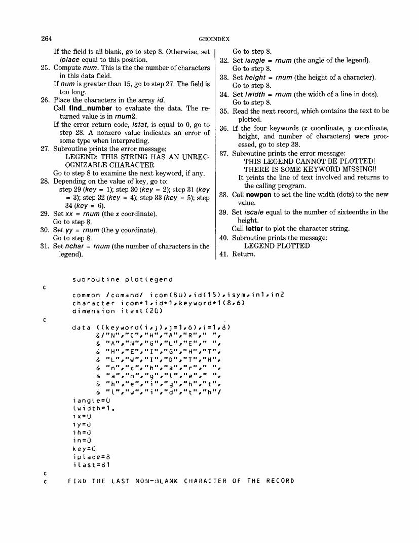
264 GEOINDEX
If the field is all blank, go to step 8. Otherwise, set iplace equal to this position.
25. Compute num. This is the the number of charactersin this data field.
If num is greater than 15, go to step 27. The field is too long.
26. Place the characters in the array id.Call find number to evaluate the data. The re
turned value is in rnumZ.If the error return code, istat, is equal to 0, go to
step 28. A nonzero value indicates an error of some type when interpreting.
27. Subroutine prints the error message:LEGEND: THIS STRING HAS AN UNREC OGNIZABLE CHARACTER
Go to step 8 to examine the next keyword, if any.28. Depending on the value of key, go to:
step 29 (key = 1); step 30 (key = 2); step 31 (key = 3); step 32 (key = 4); step 33 (key = 5); step 34 (key = 6).
29. Set xx = mum (the x coordinate). Go to step 8.
30. Set yy = mum (the y coordinate). Go to step 8.
31. Set nchar = mum (the number of characters in the legend).
Go to step 8.32. Set iangle = mum (the angle of the legend).
Go to step 8.33. Set height = mum (the height of a character).
Go to step 8.34. Set I width = mum (the width of a line in dots).
Go to step 8.35. Read the next record, which contains the text to be
plotted.36. If the four keywords (x coordinate, y coordinate,
height, and number of characters) were proc essed, go to step 38.
37. Subroutine prints the error message:THIS LEGEND CANNOT BE PLOTTED! THERE IS SOME KEYWORD MISSING!!
It prints the line of text involved and returns to the calling program.
38. Call newpen to set the line width (dots) to the new value.
39. Set /scale equal to the number of sixteenths in theheight.
Call letter to plot the character string.40. Subroutine prints the message:
LEGEND PLOTTED41. Return.
suoroutine pLotlegend
common /comand/ icom(8G)/id(15)/isyin*in1*in2 character icom*1/id*1/keyword*1(8*6) dimension itext(2(j)
data ( (&/&i&
&&&
kiiifiiii
iiii
ey woN"A"H"L"
nah"I"
if
tf/
ii/'"
'
/ii
ii
ra(C"/N"/E"/w",c"/n"/e"/w"/
i /"H"G"I"I
9"i"i
j > <it iii iif iii i
'/
fi ifi i
,j = 1•A"/•L"/'G",'D"/*a"/
'g".•d",
,6"R"E"H"T
e"h"t
)/i=1/8fi if »iif ii ii"/"T"/ii ii ii ii
' 'f f
II If 4. II
ii " h " /
)
i angIe = 0 I w i d t h = 1 . i x = U i y = J ih = 0 i n = G key = 0 i p I ace = 8 iIast=81
FIND THE LAST NON-BLANK CHARACTER OF THE RECORD
APPENDIX C 265
do 10 i = i pL a ce/60i Last = i Last-1
10 if (icom(Uast) .ne. " ") go to 30write (10/20) i c om
20 format (" THE FIELD CONTAINS ALL BLANKS"///1x/SOa 1 )return
cC FIND THE FIRST NON-BLANK IN THIS FIELD
30 do 40 m=ipLace/i last 40 if (icom(m) .ne. " "> go to 50
m= i Last 50 i p Lace = m
C FIND THE LAST POSITION FOR THIS FIELDdo 6J ic=ipLace/iLast
60 if (icom(ic) .eq. "/"> go to 70i c= i L as tyo to 80
70 ic=ic-1C IDENTIFY THE KEYWORD
60 do 90 LL=ipLace/ic90 if (icom(LL) .eq. "=") go to 120 95 write (1U/1JO) (icom(i)/i=ipLace/ic)
100 format (" LEGEND: THIS FIELD is NOT RECOGNIZED AS A KEYWORD"/& //1x/73a1 )
110 ipLace=i c+2 k e y = 0if (iLast-ipLace) 390/390/30
c 120 L L = lL-ipLace-H
i f (I I .gt . 7) go to 95 go to (95/130/95/95/95/170/210)/ll
C FIND THE X-VALUE OR THE Y-VALUE 130 if ((icom(iplace) .eq. "X") .or.
a, (icom(iplace) .eq. "x")) go to 140if ((icom(ipLace) .eq. "Y") .or.
« (icom(ipLace) .eq. "y")) go to 15090 to 95
140 key=1 ix = 1go to 160
150 key = 2iy = 1
1oO ipi ace = ipiace + 2go to 250
c FIND THE ANGLE OR THE NUMBER OF CHARACTERS 170 do 180 i=1/5 180 if ((icom(ipLace + i-1) .ne. keyword(1/i)) .and.
ir (i com (i p L ac e + i -1 ) .ne. key word ( 5/i ) ) ) go to 190 in=1 key = 3i p L ace= i p L ac e+6 go to 250
190 do 200 i=1/5 200 if ( (icom(ipLace+i-1) .ne. keyword(2/i)) .and.
266 GEOINDEX
6 (icom(ipIace+i-1) .ne. keyword(6*1))) go to 95key = 4i pIace= i p I ac e+6go to ,250
c FIND THE HEIGHT OR THE LINE WIDTH 210 do 220 i=1*6 220 if ((icom(ipIace+i-1) .ne. keyword(3*i )) .and.
& (icom(ipLace + i-1) .ne. keyword(7 *i))) go to 230ih = 1key-=5ip I ace=ipIace + 7yo to 250
230 do 240 i=1*6 240 if ((icom(ipIace+i-1) .ne. keyword(4 *i) ) .and.
i (icom(ipLace+i-1) .ne. keyword(8*1))) go to 95key = 6i p L a c e = i p L a c e + 7
250 if (ic-iplace) 110*260*260c FINi) THE FIRST NON-BLANK CHARACTER FOR THIS DATA FIELD 260 do 270 num=ipLace*ic 270 if (icom(num) .ne. " "> go to 280
yo to 110 280 i p L ace = num
num= i c-i pIac e + 1ifCnum ,gt. 15) go to 3001 = 0do 290 i = i p I ac e* i c1=1+1
290 id(L)=i com(i)call find_numoer ( i d*num* mum* i s t at)if (istat .eq. 0) go to 320
300 write (10*310) (icom(i)*i=ipLace*ic)310 format (" LEGEND: THIS STRING HAS AN UNRECOGNIZA3LE CHARACTER"*
& /*5x*73a1)go to 110
c320 go to (330*340*350*360*370*380)*key 330 x x = rnum
go to 110 340 yy= rnum
go to 110 350 nchar=rnum+0.5
go to 110 360 iangle=rnum+0.5
,go to 110 370 heicjht = rnum
go to 110 380 lwidth=rnum+0.5
go to 110 c c390 read (in 1 *395*end = 450) itext 395 format (20a4)
APPENDIX C 267
if ( (ix .eq. 1) .and. (iy .eq.& (in .eq. 1) ) yo to 430
write (10/400)400 format (" THIS LEGEND CANNOT BE
& " THERE IS SOME KEYWORD write (10/420) itext
420 format (1x/20a4) return
1) .and. (ih .eq. 1) .and
PLOTTED!"/// MISSING! !")
430 call newpen (Iwidth)iscale=height*1o+0.5call letter (nchar/isca I e/iang le/xx/yy/itext)write (10/440)
440 format (" LEGEND PLOTTED") 450 ret urn
end
SUBROUTINE NAME: PLOTFILEAuthor: Lawrence BalcerakPurpose of the program: plotfile reads the name of a file,
opens that file, and plots it.Data base: GeoindexComputer: Honeywell 60 (series 68)Operating system: MulticsCalling sequence: call plotfileArguments: NoneSubroutines called: closef, fincLnumber, io_call, let
ter, plot, set_shade, symbol, toneCommon data referenced: icom(80), id(15), isym, in1,
in2Input files:
Command statements used on unit 15 (file15) File to be plotted used on unit 16 (file16)
Output files: tempW used on unit 10 (file10) (for messages)
Arrays used: keyword(18,9), ipat(20), ne(2), jwhat(200), xx(2000), yy(2000), kplotfield(8), jshade(16), kfield(8), char(S,5), text(5), iwhat (200,2)
Called by: verplotError checking and reporting: The subroutine checks for
a blank data field, blank file name, file name too long, data field too long, invalid data character, invalid keyword, missing keyword, and end of file reached. If any such error is found, an appropriate error message is printed with, in certain circumstances, the character string involved.
Constants: NoneProgram logic:
1. Set initial values. keyword(18,9) contains the nine keywords possible. Each is in both uppercase and lowercase.
Set name equal to blanks. This will be the name of the file to be opened for plotting.
Set height = 0.14, which is the default height of each plotted character.
Set space = height divided by 5, which is the space between lines of character.
Set numpat = 0, which is the number of the pat tern to use for shading.
Set noline = 0, which is the flag for the noline option.
Set noname = 0, which is the flag for the process ing of the name keyword.
Set no select = 0, which is the flag for the select option.
Set noclear = 0, which is the flag for clearing the space around characters.
Set noshade = 0, which is the flag for the shade option.
Set nochar = 0, which is the flag for character plotting.
Set noselshade = 0, which is the flag for selecting shades.
Set item = 0, which is the index counter used to rotate through the different patterns.
Set i pi ace = 6, which is the first position that a keyword can be found.
Set Hast = 81, which is the position of the last nonblank character (initialized to one past the end of the record).
Set ipat(i) = i for / = 1,10, which is the default se quence of patterns to rotate through.
Set ipat(i) = 0 for / = 11, 20, which indicates that these patterns are not used in the rotation.
Set kplotfield(i) = 0 for / = 1,8, to indicate which
268 GEOINDEX
of the eight character fields from the header card are to be plotted and in what order.
2. Starting at the last position of the record (80), check in descending order for a nonblank character.
If there is one, go to step 4.3. Subroutine prints the error message:
THE FIELD CONTAINS ALL BLANKS and returns to the calling program.
4. Find the first nonblank character in this field and set iplace equal to this position.
5. For ic = iplace to Hast, find the end of the nextkeyword field by searching for a comma.
Set ic equal to one less than the position of the comma or to Hast if no comma is found. This is the position of the last character in this field.
6. If the characters in the keyword are not NAME or name, go to step 22.
7. Add 5 to iplace, the first position past the = character.
8. Set iplace equal to the first nonblank character inthe data field.
If the field is all blank, set iplace equal to ic, which is the last character in the field.
9. Compute m, the number of characters in the datafield.
Compute k, the number of characters in the recordthat lie before this data field.
If m is greater than 0, go to step 11. A zero valuewould occur with an all blank field or when acomma immediately follows the = character.
10. Subroutine prints the error message:NAME HAS NO CHARACTERS!!
Go to step 18 to examine the next keyword, if any.11. If m is less than or equal to 20, go to step 13.12. Subroutine prints the error message:
NAME IS MORE THAN 20 CHARACTERS LONG!!
along with the erroneous field. Go to step 18 to examine the next keyword, if any.
13. Backspace the command file.14. Compute fmtl, the format to be used in reading
the name of the file. This format must skip spaces and read m characters from the record in to name(k).
15. Read the file name from the record.16. Call io call to attach and open the file for input.
Use the value of in2 as the file number.17. Set noname = 1. This is the flag to indicate that
the file name has been processed.18. Set iplace equal to ic + 2, the first position past
the comma. This would be the first possible posi tion for the next keyword.
19. If there are more characters in the record to check, go to step 4 to examine the next keyword.
20. If there is not another record containing keywords, go to step 80 to read the select record, if any.
21. Read the next record into icom(80).If EOF, go to step 128. Set Hast = 81. Set iplace
= 1. Go to step 2 to interpret this record.22. If the characters in the keyword are not HEIGHT
or height, go to step 31.23. Add 7 to iplace, the first position past the =
character.24. If there are not any characters in this data field, go
to step 18 to examine the next keyword, if any.25. Find the first nonblank character in this data field
and set iplace equal to this position. If the field is all blank, go to step 18 to examine the next keyword, if any.
26. Compute num, which is the number of charactersin the data field.
If num is less than or equal to 15, go to step 28 to interpret the data.
27. Subroutine prints the error message:PLOT-HEIGHT: THIS FIELD HAS TOO MANY CHARACTERS
along with the erroneous field. Go to step 18 to examine the next keyword, if any.
28. Place the string of characters into the array id. Call find_number to evaluate the data. The
returned value is in mum.29. If the return error code, istat, is not equal to 0, go
to step 18 to examine the next keyword, if any. A nonzero value indicates an error of some type when translating.
30. Set height = mum.Set space = height divided by 5. Go to step 18 to
examine the next keyword, if any.31. If the characters of the keyword are not PA TTERN
or pattern, go to step 51.32. Add 8 to iplace, which is the first position past the
= character.Set kount = 0, the counter for the number of pat
tern reference number being interpreted.33. If the data field has no length, a comma follows the
=, go to next step. Otherwise, go to step 35.34. The subroutine prints the error message:
PLOT-PATTERN: THE PATTERN COUNT HAS AN ERROR!!
along with the erroneous field. Go to step 18 to examine the next keyword, if any.
35. Find num, the position of the first nonblankcharacter in this field.
If there is a nonblank character, go to step 38.
APPENDIX C 269
36. If kount = 0, go to step 34. This indicates an all- blank field for the count of numbers following.
37. The subroutine prints the error message:PLOT-PATTERN: THE FIELD CONTAINS AN ERROR AND WILL BE SET TO THE DEFAULT VALUE
along with the erroneous field. Go to step 46.
38. Set iplace = num, which is the first nonblank posi tion of the data field.
39. Compute the number of characters in the data fieldand store in num.
If num is less than or equal to 15, go to step 41.40. If kount is equal to 0, go to step 34. This should be
the pattern count.Go to step 37. There is an error in a pattern
reference number.41. Place the character string into the array id.
Call find number to evaluate the data. Thereturned value is in mum.
If the return error code, istat, = 0, go to step 43. Anonzero value indicates an error of some sortduring the interpretation.
42. If kount = 0, go to step 34. This is the pattern count that has an error. Otherwise, go to step 37.
43. If kount is greater than 0, go to step 45.44. Set num pat = mum. This is the count of the pat
tern reference numbers that follow. Go to step 46.
45. Set ipat(kount) = mum. Store the pattern reference number just translated.
46. Add 1 to kount.If kount is less than or equal to numpat, go to step
48.47. Zero out the rest of the ipat array.
Go to step 18 to examine the next keyword, if any.48. There are more numbers to translate.
Set iplace = ic + 2, the first position past the comma (if there was one).
If /7asf is less than or equal to iplace, go to step 47 because there are no more characters to inter pret on this record.
If Hast is greater than iplace, there is an error in the command file because the plot option and value must be on the same record.
49. Set iplace equal to the first nonblank character of this data field. There must be at least one.
50. For ic = iplace to /7asf, find the end of this keyword by searching for a comma.
Set Ic equal to one less than the position of the comma or to Hast, if no comma is found. This is the position of the last character in this field.
Go to step 35 to interpret the next data field.
51. If the characters of the keyword are not TEXT- FIELD or textfield, go to step 69.
52. Add 10 to iplace, first position past the =character.
Set kount = 0, which is the counter for the number of text fields being interpreted.
53. If the data field has no length (a comma follows the =), go to the next step. Otherwise, go to step 55.
54. Subroutine prints the error message:PLOT-TEXTFIELD: THE FIELD COUNT HAS AN ERROR!!
along with the erroneous field. Go to step 18 to examine the next keyword, if any.
55. Search for the first nonblank character in this data field, and set num equal to this position. If such a character is found, go to step 58.
56. If kount equals 0, go to step 54. This would be an all-blank data field for the number of text fields count.
57. Subroutine prints the error message:PLOT-TEXTFIELD: THIS FIELD CON TAINS AN ERROR AND WILL NOT BE PLOTTED!!
along with the erroneous field. Go to step 65 to examine the next number, if any.
58. Set iplace = num, the first nonblank character inthis field.
Compute num, which is the number of charactersin the data field.
If num is less than or equal to 15, go to step 60.59. If kount = 0, go to step 54. Otherwise, go to step
57.60. Place the characters in the array id.
Call find_number to evaluate the data. Thereturned value is in rnum.
If the error return code, istat = 0, go to step 62. Anonzero value indicates an error of some type.
61. If kount = 0, go to step 54. Otherwise, go to step 57.
62. If kount is greater than 0, go to step 64.63. Set num field = rnum, which is the count of text-
field numbers that follow. Go to step 65.
64. Set num = rnum.Set kplotfield(num) = kount. The array kplot-
field contains numbers indicating the order in which the character fields from the header card will be plotted. If kplotfield(num) is blank or zero, there will be no plotting. If value is other than blank or zero, the text field will be plotted.
65. Add 1 to kount, which is the next sequencenumber.
If kount is less than or equal to numfield, go to
270 GEOINDEX
step 67. There are more numbers in this se quence to interpret.
66. Set nchar = 1, which is a flag indicating that the textfield option is to be used. In other words, there are character fields to be plotted.
Go to step 18 to examine the next keyword, if any.67. Set iplace = ic + 2, the first position past the
comma.If there are no more characters left in this record,
go to step 66.68. Search the remainder of the string for a comma.
Set ic equal to one less than the position of thecomma or to Hast if no comma is found.
Go to step 55 to interpret this data field.69. If the characters are not NOLINE or noline, go to
step 71.70. Set noline = 1. This is a flag to turn on the noline
option. Go to step 18 to examine the next keyword, if any.
71. If the characters are not SELECT or select, go to step 73.
72. Set noselect = 1. This is a flag to turn on theselect option.
Go to step 18 to examine the next keyword, if any.73. If the characters are not REFCLEAR or refclear,
go to step 75.74. Set noclear = 1. This is a flag to indicate the clear
ing of the area around reference number is to be done.
Go to step 18 to examine the next keyword, if any.75. If the characters are not SHADEALL or shadeall,
go to step 77.76. Set noshade = 1. This is a flag to turn on the
shading options for all outlines. Go to step 18 to examine the next keyword, if any.
77. If the characters are not SELSHADE or selshade, go to step 79.
78. Set noshade = 1.Set noselshade = 1. These two flags will tell the
program to shade only those outlines that have pattern reference numbers listed in the selected outlines.
Go to step 18 to examine the next keyword, if any.79. The variable did not match any valid keyword.
The subroutine prints the error message:PLOT: THIS KEYWORD IS NOT VALID!!
along with the erroneous field. Go to step 18 to examine the next keyword, if any.
At this point in the program, all keywords have been read and evaluated. Next, the file of selected outlines is read and then plotted.
80. Set kount - 1. This is the counter for the number of feature numbers read in.
81. Read the next record from the command file ascharacters.
If EOF, go to step 128.82. If these characters are END PLOT or end plot,
this signifies the end of the information for plot ting this file.
Go to step 84.83. Add 1 to kount.
Go to step 81 to read another record.84. Subtract 1 from kount. The END FILE record is
not to be used.85. If noname = 1, go to step 87. A zero value in
dicates that the name keyword was not present or had an error in it.
86. The subroutine prints the error message:PLOT: NO PLOT FILE???
and returns to the calling program.87. Read a header card from the plot file. The eight
fields are read here as a character string. This is needed for comparison with the select outline file.
If the EOF reached, go to step 128.88. Backspace the plot file.89. Read the header card as separate characters. This
is needed later in the program when plotting the characters.
90. Backspace the plot file.91. Read isfno, the number of pairs of coordinate
points.92. Subtract 1 from isfno. The first position is a text
position.93. Read the x text position, the y text position, and
the outline points.94. Set isel = 0, which is a flag to indicate if outline is
in select file.Set key = 0. If the outline is in the select file, key
will take on the value of the pattern reference number given for that outline.
95. If kount equals 0, go to step 98. No outlines were listed in the select outline file.
96. If this outline is in the file of selected outlines go tostep 97.
Otherwise, go to step 98.97. Set isel = 1. This is a selected outline.
Set key = jwhat(i), which takes on the value of the pattern reference number listed.
98. If noselect = 1 and isel = 0, go to step 87 to read the points for another outline. This outline will not be plotted.
99. If isfno is greater than 1, go to step 101.100. This is a single point that has some character plot
ted at that point.
APPENDIX C 271
Call symbol to plot the character. Go to step 118 to plot the text, if any.
101. If noline equals 1, go to step 103. This indicates that the outline will not be plotted.
102. Use the subroutine plot to plot the outline.103. If noshade is not equal to 1, go to step 118. A
value of 1 indicates that the outline is to be shaded.
104. If noselshade equals 1, and isel equals 0 or key equals 0, go to step 118. A value of 1 for noselshade indicates that the selective shading option is in effect, and the shading pattern used will be in the selective outline file. A value of 0 for isel indicates that this outline is not in the selective file. A value of 0 for key indicates that a 0 value was in the pattern location for this outline.
105. Set ne(1) = isfno; set ne(2) = 0.This array contains the number of points in an outline(s) when using the subroutine tone for shading. If there is more than one outline, the subroutine will alternate the shading with blank areas, depending on the overlapping of the outlines. This will be used to clear areas around the text if needed.
Set numarea = 1, one area to start with.106. If noclear equals 0 or nochar equals 0, go to step
114. Either the clearing option was not used or no characters are wanted.
107. Set numvert = 0; set numhorz = 0. These are counters for the number of characters that will be plotted both vertically and horizontally. Do steps 108-111 for / = 1, 8.
108. If kplotfield(i) equals 0, the tth field of the header card will not be plotted; skip to the next value of /.
109. Add 1 to numvert. There is one more line of text.110. Set icheck = 5. A maximum of five characters is
in a field.Check each character in this field. For each leading
blank or zero, subtract 1 from icheck. All characters following nonzero characters are to be considered significant, even a blank.
111. Set numhorz equal to the maximum of icheck and numhorz. After checking all eight text fields, numhorz will hold the maximum number of characters in any line.
112. If numhorz equals 0, go to step 114. There are no lines of text to plot.
113. Set k = isfno + 1. This is the first index positionused to store the outline to be cleared.
Compute the coordinates of the four corners of the rectangle to be cleared and store in xx and yy im-
mediately after the main outline.Set ne(2) = 4. Four points are in the cleared rec
tangle.Set numarea = 2, two outlines.
114. Add 1 to item, item is used as an index counter torotate through all the different patterns used.
If item is greater than numpat, set item = 1. The total number of patterns used is numpat.
115. If ipat(item) is less than or equal to 0 or if ipat(item) is greater than 20, go back to step 114. These would be invalid reference numbers.
116. Set num = ipat(item). This is the reference number that comes from the sequence of pat terns.
If key has a value that represents a valid reference number, set num = key. This reference number takes the place of the default value.
117. Call seLshade to get the pattern values for thisreference number.
Call tone to set the pattern. Call tone to shade the outline. It will also clear the text area if wanted.
118. If nochar equals 0, go back to step 87 to read thenext header card.
Do steps 119-125 for / = 1, 8.119. Search kplotfield(f) for a value equal to /. This will
give the next text field to plot. If there is a match, go to the next step. Otherwise,
search for the next value of /.120. Count the number of leading blanks in the
character string, and set equal to num.121. If there are all blanks or the numeric value of the
field is 0, go back to step 119 to search for the next value of /.
122. Set n = 5 - num. This is the number of characters to be plotted. Store the characters to be plotted in itext.
123. Set posx = xpos. This is the x coordinate of thefirst line of text.
Set iscale equal to the number of sixteens in the height.
124. For each character in turn, call letter to plot thecharacter.
Add the height of a letter and an interletter space to the x coordinate to locate the next character.
125. Subtract enough room from the y coordinate to correctly position the next line of text.
126. Go to step 87 to read the next header card.127. Subroutine prints the error message:
PLOT: END OF FILE REACHED WHEN TRYING TO READ A DATA RECORD
Go to step 129.128. Subroutine prints the message:
FINISHED PLOTTING129. Call closet to close and detach the plot file. Return.
272 GEOINDEX
subroutine plotfilecommon /comand/ i c om ( 80 ) / i d ( 1 5 ) / i sy m / i n 1 / i n2character icom*1,id*1,keyword*1 (18/9)/ndme*20/fmt1*21/fmt2*21 /
& kfield*5(8)/name1*o/char*1 (6/5)/itext*1 (5)/iwhat*5(200/2) external io_call (descriptors) dimension ipat(20)/ne(2)/jwhat(200)/xx(2000)/yy(2000)/
6 kplotf i eld(8) ,j shaded 6)Kt
fir )
i6r
&
8*i6r
C,
&
&
&
&
*
&
Of
&
?y wo
"H"" p "II T II
"M"
S"R""S""S""n"
Pti f. ii
ii ii
r/////////f////
/
a v.A
"E"A"E"0
b"E"H"E
aea
"e
"e
> //
niiii /ii //
iiii /ii
///
ii /'
ii
J t1*1
"I
"T"X"L
L"F"A"L
mi
"x
"f
'J/
iiii /ii /ii //
ii /ii /ii /
///
ii /'
ii
= i /
"G"ii j iiII -r II
II r II
E 'ii /- iiII pv II
"S"•» e "
yii <. uu .j u
•I _ n
y////////////f'
/
) f
"H"E"F"N
"L"e"H
e"f
n
"L
i -/
"/iiii"/
/iiiiii /
///
u
/
ii /
i /
"T"R"I"E
1"E"A"A
r"i
e
"e
1 0
/ii /ii /ii /ii
fii /iiii
//t
ii
/
ii
>
ii"N"Eii
"A"Lii p.
1 n"e
"a
/iiiiii ///
ii /ii /ii /
///
ii //
ii /
/ii iiii ii"L"/„ „,
"R"/"L"/"E"/
///
" L " /
/
"r"/
/ii ii /ii ii"D"/„ » f
/ii iiii ii /ii ii
///
" ̂ i "d //
ii ii /
hei yht = 0.1 4space = he i ght / 5.numpa t = 10no L i ne = 0noname=Qno se L ec t = i)noc Lea r = 0noshade=Unocha r = 0no set shade = Ui t em = 0i p L ace = 6i Last = 81do 10 i = 1 /10
10 i pat ( i ) = ido 20 i = 1 1 ,20
20 ipat ( i ) =0do 30 i=1/8
30 kp.Lot f ie Ld(i ) =0 cc FIND rt-ib' LAST NON-BLANK CHARACTER ON THE RECORD
35 do 40 i = i p Lace/60i Last = i Last-1
40 if (icom(ilast) .ne. " "> go to 60write (10/50) icom
50 format (" THE FIELD CONTAINS ALL BL ANKS" / / / 1 x /80a 1 )return
APPENDIX C 273
CC FIND THE FIRST NON-BLANK CHARACTER IN THIS FIELD
60 do 70 m=ipIace,ilast 70 if (icom(m) .ne. " ") go to 80
m= i last 60 iplace=m
C FIND THE LAST NON-BLANK CHARACTER IN THIS FIELDdo 90 ic=iplace,ilast
90 if (icom(ic) .eq. ",") go to 100 i c = i L as t
100 c c c c
1 10120
130
135
go to 110 i c = i c-1
IDENTIFY TH
NAME OF PLOdo 120 i=if ( ( i c om (& ( i c om (i p I ace= i p Ido 130 m=if ( i com ( mm=i cip 1 ace = m
E KEYWORD
T FILE1,4i p lac e + i -1i pi ac e + i -1ace + 5i p I ac e, i c) .ne. " "
))
)
.ne
.ne
30
keyword(1,i)) .and. keywordC10,i))) go to 200
to 135
k= i piace-1m= i c-ki f (m .gt. 0) go to 145write (10*140)
140 format ("NAME HAS NO CHARACTERS!!")go to 170
145 if (,« . le. 20) go to 160write (10*150) (icom(i)»i s K*m)
150 format (" NAME IS MOKE THEN 20 CHARACTERS LONG!!",/,1x,80a1)go to 170
160 backspace in1fmt2="(1h(,i2,3hx,a,i2,1h))"if (m .It. 10) fmt2 = "(1h(,i2,3hx,a,i1*1h) )"encode (fmt1,fmt2) k*mread (in1*fmt1) namefmt1="(4hfiIe,i2)"if (in2 .le. 9) fmt1="(5hfiIeO,i1)"encode (name1*f:nt1> in2call io.call ("attach"*name1*"vfile_ "*name)call io.call ("open'^name 1 ^"s i ")noname=1
cc LOOK AT THE NEXT KEYWORD 170 i pIace= i c + 2
if (i last-iplace) 180,180,60 180 if (icom(ilast) .ne. ",") go to 790
read (in1,19u) icom 190 format (80a1)
i last = 81
274 GEOINDEX
i p I ace=1 90 to 35
cc HEIGHT OF THE CHARACTERS 200 do 210 i=1/6 210 if ((icom(ip I ace + i-1) .ne. key word(2/i ) ) .and.
S (i come iplace+i-1 ) .ne. keyword(11/i))) go to 260 i pIace= i p I ace + 7
c C CHECK FOR A VALID DATA WORD
if (ic-iplace) 170/220/220 22U do 230 num=ipI ace/ic 230 if (icom(num) .ne. " ") go to 240
go to 170 240 i p I ac e = num
num= i c-i p I ac e + 1 if (num ,le. 15) go to 260 write (10/250) ( icom(i)/i = ipIace/ic )
250 format (" PLOT-HEIGHT: THIS FIELD HAS TOO MANY CHARACTERS"/& //1x/70a1 )
go to 170 260 1=0
do 270 i = i pIac e/i c 1 = 1 + 1
270 id(l) = i com(i)call find_number (id/num/rnum/istat) if (istat .ne. U) go to 170 height 3 rnum space=height/5. go to 170
cC PATTERN SEQUENCE FOR SHADING 230 do 290 i=1/7 290 if ( (icom(ip I ace + i-1) .ne. keyword(3/i) ) .and.
& (icomCiplcice-H-1) .ne. keyword(12/i))> go to 470 iplace=iplac e + 8 kount =0if (ic-iplace) 300/320/320
3JO write (10/310) (icom(i )/i = ipIace/ic ) 310 formatC* PLOT-PATTERN: THE PATTERN COUNT HAS AN ERROR!!"/
& //1x/70a1 ) go to 170
c320 do 330 num=ipiace/ic 330 if (icom(num) .ne. " ") go to 350
if (kount .eq. 0) go to 300 335 write (10/340) (icom(i)/i = ip I ace/ic) 340 format (" PLOT-PATTERN: THE FIELD CONTAINS AN ERROR AND WILL
& dE SET TO THE DEFAOLT VALOE"///1x/7Oa1) go to 400
35u i pIac e = numnum = i c-iplace + 1if (num .le. 15) go to 360
APPENDIX C 275
if (kount .eq. 0) go to 30090 to 335
c 360 1=0
do 370 i = i pLac e r \ c1 = 1+1
370 id(L)=i com(i)call find.number (i d/num/mum / i s t at)if (istat .eq. 0) go to 360if (kount .eg. 0) go to 300go to 335
380 if (kount .gt. 0) go to 390numpa t = rnum+0.5go to AGO
390 ipat(kount)=rnum+0.5 400 kount=kount+1
if (kount .Le. numpat) go to 420 405 do 410 i = kount/2'J 410 ipat(i)=0
go to 170 c420 ip Lace=i c + 2
if (ilast .Le. iplace) go to 405do 430 m=ipLace/iLast
430 if (icom(m) .ne. " ") go to 440m = i Last
440 i pL ac e = mdo 450 ic = ipLace / iLast
450 if (icom(ic) .eg. "/") go to 460i c = i L as t9o to 320
460 i c = i c-1go to 320
cC TbXT FIELDS TO Bt PLOTTED 470 do 480 i=1/9 4<iO if ( (i com ( i p L ac e + i -1 ) .ne. ke y wo rd ( 4 / i ) ) .and.
$ (icom(ipLace+i-1) .ne. Keyword(13/i))> go to 670ipLace=ipLac e + 1Ukount=0if (ic-ipLace) 490/510/510
490 write (10/500) (icom(i)/i=ipLace/ic) 500 format (" PLOT-TEXTFIELD : THE FIELD COUNT HAS AN ERROR!!")
go to 170 c510 do 520 num=ipLace/ic 520 if (icom(num) .ne. " ") go to 550
if (kount .eq. 0) go to 490 530 write (10/540) (icom(i)/£=ipLace/ic)540 format (" PLOT-TEXTFIELD:" THIS FIELD CONTAINS AN ERKOR AND
& WILL NOT BE PLOTTED!!")go to 600
550 ipLace=numnum = i c-ip L ac e + 1
276 GEOINDEX
if Cnum .Le. 15) go to 560if (Kount .eq. U) go to 490go to 530
c 560 1=0
do 570 i=ipLace/ic1 = 1 + 1
570 id(L)=icom(i)call find.number (id/nurn/rnum/istat )if Cistat .eq. J) go to 580if (kount .eq. 0) go to 490go to 530
530 if Ckount .gt. 0) go to 590numfield=rnum+0.5yo to 600
590 num=rnum+Q.5kplot fi e IdCnum)=kount
600 kount=kount+1if (kount .Le. numfield) go to 620
610 noc ha r = 1go to 170
c 620 i p I ace= i c + 2
if (ilast .le. iplace) jo to 610do 630 m = ipi ace/i last
630 if (icom(m) .ne. " ") go to 640m= i Last
640 i p L ac e = mdo 650 ic = ipLace / iLast
650 if (icom(ic) .eq. "/") go to 660i c= i L as tgo to 510
6oO i c = i c-1go to 510
cC MOLINE OPTION 67u do 680 i = 1/o 630 if (Cicom(ipLace+i-1) .ne. keyword(5/i)) .and.
i (icom(ipLace+i-1) .ne. keyword(14/i))) go to 690no L i ne=1go to 170
cC SELECT OPTION 690 do 700 i=1,6 700 if ((icom(ipLace + i-1) .ne. key wora(6/i)) .and.
<i ( i com C ip L ac e+ i-1 ) .ne. keyword(15,i))) go to 710noseLect=1go to 170
cC CLEArt REFERENCE NUMBER 710 oo 720 1=1/6 720 if ((icom(ipLace+i-1) .ne. keyword( It i)) .and.
^ (icom(ipLace +i-1) .ne. key word(1o/i))) go to 730

APPENDIX C 277
noc tear=1 go to 170
cc SHADE ALL OPTION 730 ao 740 i=1/8 741) if ( (icom(ipIace + i-1 ) .ne. key wo rd ( S/ i ) ) .and.
& (icom(ipIace+i-1) .ne. keyword(17/i) ) ) go to 750 noshade=1 y o t o 1 7 0
cc SHADE SELECTIVELY OPTION 750 do 760 i = 1/& 760 if ((icom(ipIace + i-1 ) .ne. keyword ( 9/i) ) .and.
& ( i com( ip I ac e-H-1 ) .ne. keyword (1 8/i ))) yo to 770 noshade=1 nose Ishaoe = 1 13 o to WO
cC NO MATCH FOR A KEYWORD 7?0 write (10/760) (icom(i)/i=ipiace/ic) 780 format (" PLOT: THIS KEYWORD IS NOT VALID!!")
^o to 170 cc READ SELECT RECORDS AND END PLOT KEYWORD 790 kount=1800 read (in1/&10) (iwhat(kount/i)/i=1/ 2 )/jwhat(kount) 810 format (2a5/i5)
if (((iwhat(kount/I) .eg. "END P") .and. (iwhat(kount/2) ,eq. "LOT; ")) , 0 r.((iwhat(kount/1) .eq. "end p") .and. (iwhat(kount/ 2 ) ,eq. "Lot; ")) 90 to 820 k o u n t = k o u n t + 1 go to 800
cc START TO PLOT THE FILE 820 kount=kount-1
if (noname .eq. 1) go to 840 write (10/830)
830 format (" PLOT: NO PLOT FILE???")ret jrn
cc READ IN DATA y/ALOES FOR AN OUTLINE 840 read (in2/850/end = 1050) ( kfie I d(i)/i = 1/8) 850 format (8a5)
oackspace in2read (in2/855) ( ( char(i/j ) /j = 1/5)/i = 1/8)
855 format (8(5a1)) backspace in2 read (in^/860) isfno
860 forfeit (15x/i5) i s f no= i s f no-1read (in2/870/end = 1030 ) xpos / ypos/(xx(i)/yy(i)/i=1/isfno )
870 format (12f6.3) c
278 GEOINDEX
C CHECK FOR A MATCH WITH THE SELECTED FEATURES i sel = 0 key =Gif (kount .eq. 0) go to 900 ao 830 i =1/kount
880 if ((kfieldd) .eq. iwhatCi/1)) .and. (kfield(3) .eq. iwhat(i/2))) is, jo to 390jo to 9UO
890 isel=1key=jwhat(i)
c c CHtCK IF THIS OOTLINE IS TO dt PLOTTED900 if ((noselect .eq. 1) .and. (isel .eq. 0)) go to 840
c c CHECK FOR SINGLE POINT
if (i sfno .gt . 1 ) goto 9o5call symbol ( xx( 1 )/yy(1)/height/isym/0./-1) 90 to 9o0
cc CHECK FOR THE NOLINE OPTION 905 if (noline .eq. 1) go to 920
call plot (xx(1 ) /yy(1) ,3) do 910 i =1/i s fno
910 call plot CxxCi )/yy(i) ,2) cC CHECK FOR SHADING 920 if (noshade ,ne. 1) go to 960
if ((noselshade .eq. 1) .and.i ((isel .eq. 0) .or. (key .eq. 0))) go to 960
cc CHECK FOR CLEARING THE REFERENCE AREA AROUND THE CHARACTERS
ne(1)=isfno ne(2)=0 numarea=1if ((noclear .eq. 0) .or. (nochar .eq. 0)) go to 950 numvert=0 numho r z = u ao 940 1 = 1/8if CkplotfieldCi) .eg. 0) go to 940 numv/ert=numvert + 1 i c hec k = 5 do 930 j=1,5if ((cnar(i,j) .ne. " ") .and. (chard,j) ,ne. "0")) go to 935
930 icheck=icheck-1935 if (icheck .gt. numhorz) numhorz=icheck 940 continue
if (numhorz .eq. 0) go to 950k= i s fno*1x x(k)=x po s-0.04xx(k+1)=xx(K)xx(k-*-2)=xpos-*-numhorz*heiyht-*-0.02-*-spacexx ( K + 3) = xx ( k-*-2)yy ( k)=ypos-0.04
APPENDIX C 279
yy ( k + 2 ) =yy ( k +1 )yy(k+3)=y/(k)ne(2)=4nurnarea = 2
cC SHADE THE OUTLINE 950 it em= i t em-*- 1
if (item . g t . numpat) item=1if ((ipat(item) .le. 0) .or. (ipat(item) .gt. 20)) go to 950nu(n = ipat(item)if ((key .gt. 0) .and. (key .Le. 20)) num=keycall set_shdde (num,jshade)call t one (0 . ,0. t j shade ,-1 6 )call tone ( x x ,y y ,ne,numa r ea)
cC CHECK FOR CHARACTER PLOTTINb 9&0 if (nochar .eq. 0) go to 840
do 1025 i=1,8do 970 j = 1,8
970 if (kplotf ield( j > .eq. i) go to 980go to 1025
980 num=0do 990 k = 1,5if (char(j,k) .ne. " ") go to 1000
990 num=num+1 1000 if (Cnum .eq. 0) .or. (kfield(j) .eq. " 0")) go to 1U25
n= b-numi f (n .eq. 5 ) go to 1 01 5do 1010 m = 1,n
1010 i t e x t ( m ) =cha r ( j ,m+num) 1015 posx=xpos
iscale=height*16+0.5do 1020 k = 1,ncall letter ( 1 / i s ca I e/ 0, posx t y pos* i t e x t ( k ) )
1020 posx = pos x + he i gh t •*• spaceypos=ypos-height -space
1025 cont i nuego to 8AO
cc END OF FILE REACHED 1030 write (10,1040) 1040 format ("PLOT: END OF FILE REACHED
& WHEN TRYING TO READ A DATA RECORD")go to 1070
cc ALL FINISHED1050 write (10,1060) name1060 format ("FINISHED PLOTTING ",a20)1070 call closef (in2)
returnend
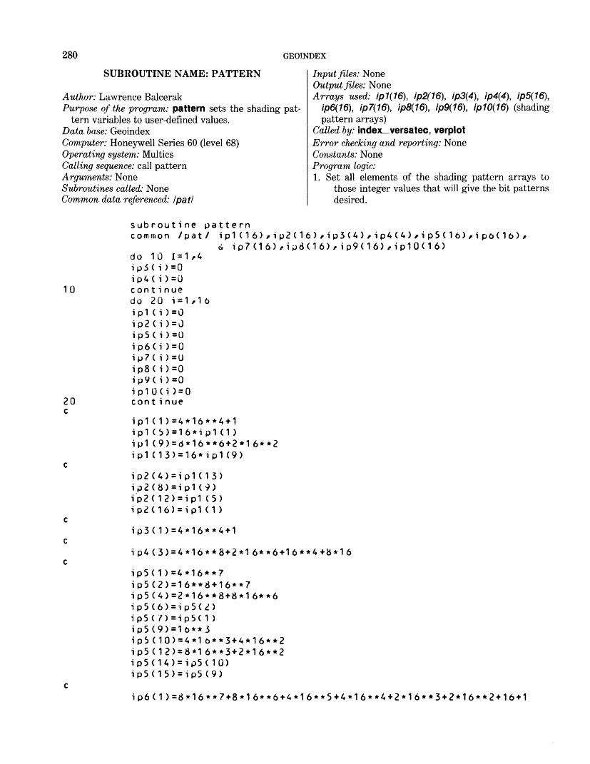
280 GEOINDEX
SUBROUTINE NAME: PATTERN
Author: Lawrence BalcerakPurpose of the program: pattern sets the shading pat
tern variables to user-defined values. Data base: GeoindexComputer: Honeywell Series 60 (level 68) Operating system: Multics Calling sequence: call pattern Arguments: None Subroutines called: None Common data referenced: I pat I
Input files: None Output files: NoneArrays used: /p7(76), ip2(16), ip3(4), ip4(4), ip5(16)t
ip6(16), ip7(16), ip8(16), ip9(16), ip10(16) (shading pattern arrays)
Called by: index_versatec, verplot Error checking and reporting: None Constants: None Program logic: 1. Set all elements of the shading pattern arrays to
those integer values that will give the bit patternsdesired.
10
20 c
subroutine patterncommon /pat/ ip1(16)/ip2(16)/ip3(4)/ip4(4)/ip5(l6)/ipo(l6)/
4 ip7(16)/ip3(16)/ip9<16)/ip10<16> do 10 1=1/4 ip3< i >=0 ip4( i )=0 continue do 20 1=1/16 ip1 (i )=0 ip2( i )=J ip5( i )=0 ip6(i )=0 ip7( i )=0 ip8( i)=0 ip9( i )=0 ip10(i )=0 cont i nue
ip1 ( 1 )=4*16**4+1ip1 (b) = 16*ip1 (1)ip1 (9)=d*16**6+2*16**2ip1 (13)=16*ip1 (9)
ip2(4)=ip1( 1 3) ip2(8)=ip1 (9) ip2(12)=ip1 (5) ip2(16)=ip1 (1 )
ip3( 1 )=4*16*
ip5( 1 )=4*16**7ip5(2)=16**8+16**7ip5(4)=2*16**8-«-8*16**6ip5(6)=ip5(2)ip5(/)=ip5( 1 )ip5(9)=l6**3
ip5(12)=8*16**3+2*l6**2 ip5(14)=ip5(10) ip5(15)=ip5 (9)
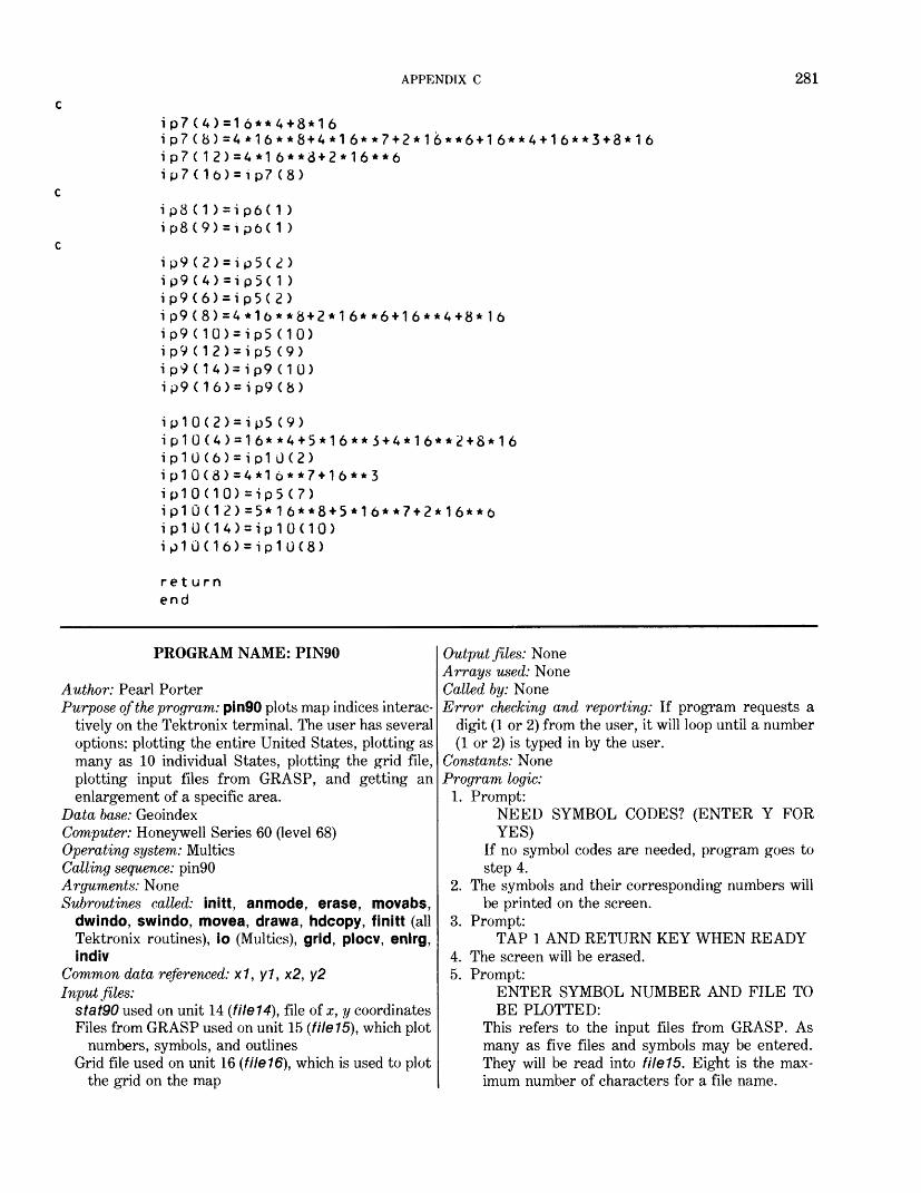
APPENDIX C 281
ip7(4)=16**4+8*16ip7(8)=4*16**8+4*16**7+2*16**6+16**4+l6**3+8*16 ip7(12)=4*16**8+2*16**6 ip7(1b)=ip7(8)
ip3(1)=ip6(1) ip8(9)=ipb(1)
ip9(2)=ip5(2)ip9(4)=ip5(1)ip9(6)=ip5(2)ip9(8)=4*l6**8+2*16**6+16**4+8*l6ip9(10)=ip5(10)ip9(12)=ip5(9)ip9(14)=ip9(10)ip9(16)=ip9(8)
ip10(2)=ip5(9)ip10(4)=16**4+5*16**5+4*16**2+8*16ip10(6)=ip10(2)ip10(8)=4*1b**7-H6**3ip10(10)=ip5(7)ip10(12)=5*16**8+5*l6**7+2*16**bip10(14)=ip10(10)ip10(16)=ip10(8)
return end
PROGRAM NAME: PIN90
Author: Pearl PorterPurpose of the program: pin90 plots map indices interac
tively on the Tektronix terminal. The user has several options: plotting the entire United States, plotting as many as 10 individual States, plotting the grid file, plotting input files from GRASP, and getting an enlargement of a specific area.
Data base: GeoindexComputer: Honeywell Series 60 (level 68)Operating system: MulticsCalling sequence: pin90Arguments: NoneSubroutines called: initt, anmode, erase, movabs,
dwindo, swindo, movea, drawa, hdcopy, finitt (all Tektronix routines), io (Multics), grid, plocv, enlrg, indiv
Common data referenced: x1, y1 , x2, y2Input files:
stat90 used on unit 14 (file14), file of x, y coordinates Files from GRASP used on unit 15 (file15), which plot
numbers, symbols, and outlines Grid file used on unit 16 (fileW), which is used to plot
the grid on the map
Output files: NoneArrays used: NoneCalled by: NoneError checking and reporting: If program requests a
digit (1 or 2) from the user, it will loop until a number(1 or 2) is typed in by the user.
Constants: None Program logic:
1. Prompt:NEED SYMBOL CODES? (ENTER Y FORYES)
If no symbol codes are needed, program goes to step 4.
2. The symbols and their corresponding numbers will be printed on the screen.
3. Prompt:TAP 1 AND RETURN KEY WHEN READY
4. The screen will be erased.5. Prompt:
ENTER SYMBOL NUMBER AND FILE TOBE PLOTTED:
This refers to the input files from GRASP. As many as five files and symbols may be entered. They will be read into file15. Eight is the max imum number of characters for a file name.
282 GEOINDEX
6. In reference to the files just read, the user has threeoptions.
Prompt:FOR SYMBOL AND NUMBERS (WITHPLOTTING), TYPE 1FOR SYMBOL AND/OR OUTLINE (NONUMBERS), TYPE 2FOR NUMBERS ONLY (NO SYMBOLS ORPLOTTING), TYPE 3
7. Screen is erased.8. Define screen and virtual window.9. The user is prompted by a series of questions at this
time because no communication can take place between computer and user after the plotting starts without destroying the screen. See steps 10-14.
10. Prompt:ENTER TITLE FOR MAP:
11. Prompt:TO PLOT INDIVIDUAL STATES, ENTER 1-FOR ENTIRE U.S. ENTER 2
12. Prompt:TO PLOT COUNTIES ENTER 1 FOR SOLID LINE, 2 FOR DOTTED LINE, ELSE ZERO
13. Prompt:TO PLOT GRID, ENTER 1
14. Prompt:IF YOU WANT A HARD COPY UPON COM PLETION, TYPE C
15. If the user entered 1 in response to step 11, the pro gram calls subroutine indiv. The program then goes to step 19.
16. If the user did not enter 1 or 2 for step 11, a message is printed on the screen:
AT THE PRESENT TIME, THE FILE YOU
WISH DOES NOT EXIST PLEASE ENTER 1 OR 2 FOR SECOND STATEMENT
Program returns to step 10. If 2 was entered, program goes to next step.
17. The program writes the title for the map, draws the borders, and uses Stat90, file14, to plot the States.
18. If 1 was entered in response to step 13, program calls grid subroutine and returns to next step.
19. If ///' = 0, program goes to 20 (///' = number of filesentered in step 5)
If ///' is not equal to 0, read first file name into file 15and call subroutine plocv.
Continue this step until the number of files enteredin step 5 /// = number of files read into filel 5 ///'.
20. If C was entered in step 14 or 23, a hard copy will bemade automatically.
If nl = 1, go to step 26. If nl does = 1, this indicates an enlargement or individual plotting has already been completed or the option to do so has already occurred.
22. Prompt:FOR AN ENLARGEMENT OF PART OF THIS PLOT, TYPE Y
23. Prompt:FOR A HARD COPY AFTER ENLARGE MENT, TYPE C
24. nl = 1 indicates that an enlargement option has been found.
25. If Y was entered for step 22, call subroutine enlrg and upon return, go to step 19.
26. Detach and close files.
21
PIN90 *****
cPLOT MAP INDICES ON TETCTRONIX****c U.S. Geological Surveyc Program name - pin90c INPUT:c stat90.pat = filelA
dimension lead(20),xx(6),yy(6)dimension jsym(9),isymb(5)external io (descriptors)character filename*8(5)common xl,yl,x2,y2
cdata jes/"y"/,kop/"c"/,iblk/" "/data jsym/35,36,37,38,42,43,45,79, 111/data izero/00/
APPENDIX C 283
ccall initt(960)
c c
ichar=43 c c ASSIGN AND OPEN FILES
call io ("attach","file14","vfile_ ","stat 90.pat","-append")call io ("open","filel4","si")
ccall anmodeprint ,"Need symbol codes? (enter y for yes) "read (0,100)irep
100 format (al)if (irep .ne. jes)go to 250do 200 i-1,9istb = jsym(i)ile - jsym(i)*2**27
c The above computation was made to shift the symbol to the leftmo \cst posit ion.
call anmodewrite (0,150) istb,ile
150 format (2x,i3,3x , a 1) 200 continuec Pause in execution so user can look at symbols and corresponding \c numbers•
print ,"Tap 1 and return key when ready"read (0,600)iredy
250 call erase c call movabs(30,725) c call anmodec print ,"Enter state id number" c read(0,300) istate c300 format(aA) c cc REQUEST INPUT FILE FOR PLOTTING c 350 continue
kk = 0iJJ-0 1J1-0call anmodecall movabs(30,725)
400 print ,"Enter symbol number and file to be plotted: " c iji will equal 1 more than the number of files read.
iji =* iji+1read(0,450)isym,filename(iji)
450 format (12,a8)if (isym .eq. izero) go to 500isymb(iji)=isymgo to 400
c 500 continue
284 GEOINDEX
Ccall movabs(30,625)call anmode
c User is given an option as to what he wants on the map.print ,"For symbol and numbers (with plotting), type I/
& For symbol and/or outline (no numbers), type 2/ & For numbers only (no symbols or plotting), type 3"
read (0,600) ideecall erase
cc SET ORGIN ON PLOTTER c
xl = .5x2=23.yl = l.y2=16.
c Define virtual windowcall dwindo(xl,x2,y1,y2)
c c Define Screen window
call swindo(0,1023,0,780) c 550 nl=0
call movabs(30,750)call anmode
560 print ,"Enter title for map: "read(0,570)lead
570 format (20a4)print ,"To plot individual states enter l--for entire U.S. en
\cter 2"read(0,600)istat
c print ,"To plot counties enter 1 for solid line,/ c 2 for dotted line, else zero " c read (0,600) icoun c print ,"To plot grid enter 1 " c read (0,600)igrid 600 format (il)
print ,"lf you want a hard copy upon completion, type c "read (0,100) icopycall erase
c If istat=l, user will choose up to 10 states to be plotted.if (istat .eq. 1) go to 1300call movabs(30,760)call anmode
c Lead contains title for map.write (0,610)lead
610 format (Ix,20a4) c
if (istat .ne. 2) go to 1400c If istat=2, the entire U.S. will be plotted, c c c DRAW BORDER FOR MAP
call movea(xl,yl)
APPENDIX C 285
call drawa(x2,yl)call drawa(x2,y2)call drawa(xl,y2)call drawa(xl,yl)
cc PLOT DATA FROM FIRST SOURCE, cc Read header information.700 read (14,750,end-1100)if,ifno,isf,isfno,if 1 750 format (5i5) c ISFNO is the number of x-y coordinates.
ie=isfnoif (isfno .ge. 6) ie=6call anmode
c Read x-y coordinates.read (14,800) (xx(i),yy(i),i= 1,ie)
800 format (12f6.3) c 825 call movea (xx(1),yy (1 ) )
do 850 k=l,iecall drawa(xx(k),yy(k) )
850 cont inueis fno=i sfno-6if (isfno)700,700,900
900 if (isfno-6)950,950,1000 950 ie = isfno 1000 read (14,800,end=1100) (xx(i),yy(i),i=1,ie)
do 1050 k-1, iecall drawa(xx(k),yy(k))
c Draw until isfno(no. of coordinates) has been exhausted. 1050 continue
if (isfno-6)700,700,850 c cc ATTENTION: When we get grid file, change end=1100 to end=1075 c!075 if (igrid .ne. 1) go to 1100c call io ("attach","f ile 16", "vfile_ ll ,"grid90", "-append") c call io ( Il o P en","filel6","si 11 ) c cc iji = number of files to be plotted. 1100 if (iji .eq. 0) go to 1200 c c PLOT MAIN FILE1150 ijj = iJJ+1
if (ijj .eq. iji) go to 1200isym = isymb(ijj)call io ("attach","filel5", M vfile_",filename(ijj) /'-append")call io ("open","filel5","si")c.ill plocv(isym,nl,idec)go to 1150
c c
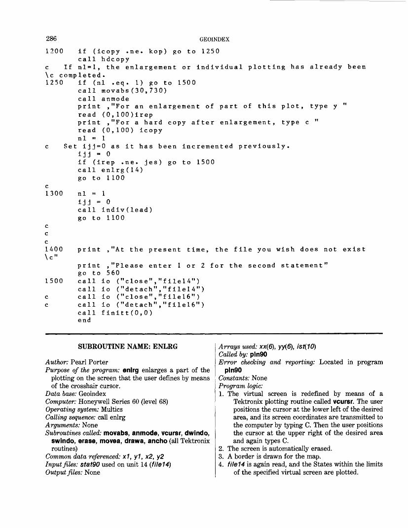
286 GEOINDEX
1200 if (icopy .ne. kop) go to 1250call hdcopy
c If nl=l, the enlargement or individual plotting has already been \c completed. 1250 if (nl .eq. 1) go to 1500
call movabs(30,730)call anmodeprint ,"For an enlargement of part of this plot, type y "read (0,100)irepprint ,"For a hard copy after enlargement, type c "read (0,100) icopynl = 1
c Set ijj=0 as it has been incremented previously.ijj = 0if (irep .ne. jes) go to 1500call enlrg(14)go to 1100
c 1300
ccc1400\c"
1500
c c
nl0
call indiv(lead) go to 1100
print ,"At the present time, the file you wish does not exist
print ,"Please enter 1 or 2 for the second statement"go to 560call io ("close","file!4")call io ("detach","filelA")call io ("close","file!6")call io ("detach","filel6")call finitt(O.O)end
SUBROUTINE NAME: ENLRG
Author: Pearl PorterPurpose of the program: enlrg enlarges a part of the
plotting on the screen that the user defines by meansof the crosshair cursor.
Data base: GeoindexComputer: Honeywell Series 60 (level 68) Operating system: Multics Catting sequence: call enlrg Arguments: None Subroutines called: movabs, anmode, vcursr, dwindo,
swindo, erase, movea, drawa, ancho (all Tektronixroutines)
Common data referenced: x1, y1, x2, y2 Input files: stat90 used on unit 14 (file14) Output files: None
Arrays used: xx(6), yy(6), ist(10)Called by: pin90Error checking and reporting: Located in program
pin90Constants: None Program logic:1. The virtual screen is redefined by means of a
Tektronix plotting routine called vcursr. The user positions the cursor at the lower left of the desired area, and its screen coordinates are transmitted to the computer by typing C. Then the user positions the cursor at the upper right of the desired area and again types C.
2. The screen is automatically erased.3. A border is drawn for the map.4. file14 is again read, and the States within the limits
of the specified virtual screen are plotted.
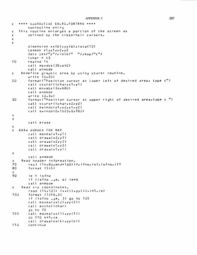
APPENDIX C 287c * * *
c Thiccc
30
* SJdROUTI.ME ENLRG.FORTRAN ****suo rou tine entry
s routine enlarges a portion of thejefined by the cross-hair cursors.
screen as
"//kop/"c"/
10
c Re
20
dimension xx(6)/yy(6)/ista(10) common x1/y1/x2/y2 data jes/"y"//iolk/" ichar = A3 rewind 1 Acall movabs(30/oVO) call an mode
define grapnic area by write (0/20)format("Position cursor at lower left call vcursr(ichar/x1/y1 ) call movabs(30/680) call a nmode write (0/30)format("Position cursor at upper right of desired area/type c call vcursr(ichar/x2/y2) call dwindo(x1/x2/y1/y2) call swindo(0/1023/0/780)
using vcursr routine.
of desired area/ type c
call erase c c DRAW BORDER FOR MAP
call rnovea(x1/y1)call d rawa(x2/y1 )call drawa(x2/y2)call or awa(x1/y 2)call drawa(x1/y1)
ccall anmode
c Read header information.70 rear! ( 1 A/80/end = 1 60) i f / i f no/i sf / i sf no/i f 1 80 format (5i5) c 90 i e = i s fno
if (isfno . ge. 6) ie=6call anmoae
c Read x-y coordinates.read (14,103) (xx(i)/yy(i)/i=1/ie)
100 format (12f6.3)if (isfno . g e. 3) go to 105call movea(xx(2)/yy(2))call ancho(ichar)go to 70
105 call movea(xx(1)/yy(1 ) )do 110 k=1/iecall drawa(xx(k)/yy(k))
110 cont i nue
288 GEOINDEX
120130c140
150 c
160c18U
i s fno= i s fno-6if (isfno)70,70,120i f (isfno-6)130,130,140i e = i s fno
Read x-y coordinates.read (14,100,end=160) (xx(i),yy(i),i=1,ie)do 150 k = 1,iecall drawa(xx(k),yy(k ))continue
Continue drawing until isfno(no. of coordinates) has been exhaustedif (isfno-6)70,70,110cont i nue
return end
SUBROUTINE NAME: INDIV
Author: Pearl PorterPurpose of the program: indiv is called when 1-10 States
are to be plotted. This routine negates plotting the en tire United States. If will enlarge the maps of in dividual States as an option.
Data base: GeoindexComputer: Honeywell Series 60 (level 68)Operating system: MulticsCalling sequence: call indiv (lead)Arguments: lead- Contains the title of the mapSubroutines called: movabs, anmode, erase, movea,
drawa (all Tektronix routines), min_maxCommon data referenced: NoneInput files: statQO used on unit 14 (file14)Output files: NoneArrays used: xx(6), yy(6), ista(10), lead(20)Called by: pin90
Error checking and reporting: Located in pin90 Constants: None Program logic:1. An array ista is loaded with blanks.2. The user is asked to type the corresponding 2-digit
number for the States to be plotted (limit of 10 in ascending order).
3. The numbers are stored in Ista.4. Call min_max subroutine to find the minimum and
maximum range for the x and y coordinates.5. The screen is erased.6. The title of the map is written on the screen and the
border is drawn.7. file14 is read until ista(J) equals if no (found in header
record). The coordinates are then plotted until isfno (number of x, y coordinates) has been ex hausted. The program continues to read through the file until the end of file is reached or /sfa(/) equals blanks.
****SUBROUTIIME INDItf.FORTRAN****subroutine indiv(lead)
This routine is used when only 1-10 states are to oe plotted. The user requests up to 10 states by number and these are stored in an array called ista. In order to use the entire screen, min_max routine is called to redefine the virtual screen thus giving an enlargement of the states requested.
dimension xx(6),yy(6),ista(10),lead(20) data iblk/" "/,kop/"c"/data izero/00/
nn3 = 993
Load ista with blanks
APPENDIX C 289
10 do 20 j=1*1Uista( j ) = iblk
20 cont i nue c
CdLL movabs(30,690)call anmodewr i te (0,30)
30 format ("Give code number of each state to be plottedLimit of 10 codes in ASCENDING order Must be a d digit number, 01-51")
read (0,40) (ista(j),j=1,10) AO format (10i2)c The min_max routine will find the minimum and maximum coordinates c for the states requested and redefine the virtual window.
call min_max(ista,x1,x2,y1,y2)call erasecall movabs(500,750)call anmode
c Lead is the title of the map to be plotted.write (0,45) lead
A5 format (1x,20aA) c c DRAW BORDER FOR MAP
call movea( x 1 ,y 1 )call d rawa(x2,y 1 )call d rawa(x2,y2 )call drawa(x1,y2)call drawa(x1,y1)
c50 do 160 j=1,10 c Read header information.60 read ( 1 A,70,end = 1 SO)if,ifno,isf,isfno,if1 70 format (5i5) c
if (ista(j) .eq. izero) go to 180if (ista(j) .ne. ifno) go to 60if (if .ne. nn3) go to 60
c Check if=993 to insure information from header record is c being compared rather than erronously matching the c state number against the coordinates. 80 i e = i s f no
if (isfno .ge. 6) ie=6 c Read x-y coordinates.
read (1A,90) (xx (i),yy(i ) ,i = 1,ie) 90 format (12f6.3)
if (isfno .ge. 3) go to 100call movea(xx(2),yy(2))go to 6U
100 call movea(xx(1),yy(1))do 110 k=1,iecall drawa(xx(K ) ,yy(k ))
110 continuei s fno = i s fno-6if (isfno)160,160,120
290 GEOINDEX
120 if (isfno-6)13U,130,140130 i e = i s fno140 read (14/90/end=160) (xx (i),yy(i)/i=1/ie)
do 150 k=1,iecall d ra wa ( x x ( k )/yy (k ))
150 cont i nue c Continue drawing ntil isfnoCno. of coordinates) has been exhausted,
if (isfno-o)160/160/110 160 cont i nue c 180 return
end
SUBROUTINE NAME: MIN_MAXAuthor: Pearl PorterPurpose of the program: min_max routine reads
through the individual States requested for plotting and compares each x and y coordinate to find the minimum and the maximum x and y coordinates. The program then redefines the virtual window.
Data base: GeoindexComputer: Honeywell Series 60 (level 68)Operating system: MulticsCalling sequence: call min_max (ista,xl,x2,yl,y2)Arguments:
ista -Array containing the numbers of the States tobe plotted
x7-TJsed to return the minimum x coordinate x2 - Used to return the maximum x coordinate y/ -Used to return the minimum y coordinate y2-Used to return the maximum y coordinate
Subroutines called: dwindo (Tektronix routine)Common data referenced: NoneInput files: NoneOutput files: NoneArrays used: None
Called by: indivError checking and reporting: Located in pin90Constants: nn3Program logic:1. Load x7 with the maximum x coordinate and x2 with
the minimum x coordinate.Load y1 with the maximum y coordinate and y2 with
the minimum y coordinate.2. Read through file14 until /sfa(/) equals if no.3. Compare each x coordinate to x7 and x2.
If it is less than x1, load x7 with the value of the xcoordinate.
If the x coordinate is greater than x2, load x2 withthe value of the x coordinate.
The same logic applies to the y coordinate.4. Compare each x and y coordinate until the number in
/S/A7O (header record) has been exhausted.5. If ista(J) is blank, go to next step. Otherwise, go to
step 3.6. Call dwindo (Tektronix routine) using new values
from step 3 for x7, x2, y7, y2 to define the virtual window.
7. Return
****SUt3ROUTINE MIN.rtAX.FORTRAN****subroutine min_max(ista/x1/x2/y1/y2)
This routine reads through the coordinates for the individualstates requested for plotting and compares each xx coordinate against x1 and x2 to find the minimum and maximum coor.It does the same to the yy coordinates, the maximum and x2 and y2 are set to the compares are made.
dimension xx(6)/yy(6)/ista(10) data izero/00/
x1 and y1 are set to minimum before the
APPENDIX C 291
10 20 c
50 c
6070
c110 c 120
nn3 = 993x1 = 23.x2 = .5y1 = 16.y2 = 1.do 110 3=1/10reaa (1 A/20/end=120) if / ifno/isf/isfno/if1forma t(5i 5 )
If ista = O/ all the requested data has been read.if (ista(j) ,eq. izero) go to 120if (ista(j) .ne. ifno) go to 10if (if .ne. nn3) go to 10
Check if=993 to insure this record is a header record.
c 30 AOccc
ie = 6 Read x-y c
read (1 format
Ready 1doifi fi fi f
each-2 to50 iC x x (( x x ((yy ((yy (
oord i na A/ AU/ en (12fo.3
XX
f= 1i)i )i)i )
andind t/ i e.It.• g t..It..gt.
tes d = 1
yyhe
x1x2y 1y2
20 >
coormi
))))
ni
xxyy
(xx(
di namum
1 =2 =1 =2 =
i)/
teand
x x (x x (yy(yy(
yy ( i ) / i =1 / i e)
and comparema x i mum.
i )i )i)i)
x1-2 and
cont i nue
i sfno = i sfno-6if (isfno)110/110/60if (i sfno-6)70/70/30i e = is fnogo to 30
cont i nueDefine virtual window from coordinates stored during min_max routine
call dwindo(x1/x2/y1/y2) rewind 14 return end
SUBROUTINE NAME: GRID
Author: Pearl PorterPurpose of the program: grid will plot the grid file,
file16, on the map drawn by pin90 Data base: GeoindexComputer: Honeywell Series 60 (level 68) Operating system: Multics Calling sequence: call grid Arguments: None Subroutines called: movea, anmode, ancho, drawa (all
Tektronix routines)
Common data referenced: x1, y1, x2, y2Input files: Grid file used on unit 16 (file16)Output files: NoneArrays used: xx(6), yy(6)Called by: pin90Error checking and reporing: Located in program pin90Constants: NoneProgram logic:1. iskp is set to 9, and a count is kept so that only every
10th record is plotted.2. The header record and first set of coordinates are
read.
292 GEOINDEX
3. If the first xx and yy coordinates are less than x7 or y1 or greater than x2 or y2, respectively, read the next set of coordinates (step 2)
4. If number of sets of coordinates is less than 3, write if, isf, and ichar.
Go to step 2.5. Plot the coordinates until isfno (number of coord
inates) has been exhausted.6. Read the next header record, add 1 to j and continue
until j equals iskp, which equals 9. Go to step 2.
c ****SUBROUTINE GRID****c THIS ROUTINE WILL PLOT THE GRID FILEc It has been determined to plot only every 10th setc of grid records since the Tektronix plot is so small*
subroutine grid c
dimension xx(6),yy(6)common xl,yl,x2,y2
ciskp = 9
c Set iskp=9 so as to plot only every tenth record c of the grid file.
j = 0ichar = 43rsiz = 0.3rewind 16
cc Read header information.10 read(16,20,end = 270) if,ifno , isf,isfno,if 1 20 format (5i5) c
ie = isfnoif (isfno »ge. 6) ie=6
c Read x-y coordinates.read(16,30) (xx(i),yy(i),i=l,ie)
30 format (12f6.3)if (isfno .ge. 3) go to 80
cc If coordinates are out of range, read next set of coordinat \ces .
if ((xx(l) .Ie. xl) .or. (yy(l) .Ie. yl)) go to 10if ((xx(l) .ge. x2) .or. (yy(l) .ge. y2)) go to 10if ((ifno .eq. 1) .and. (isf .eq. 1)) go to 60call movea(xx(1),yy(1))call anmode
c If there's less than 3 sets of coordinates, write if, isf a \cnd ichar.
write (0,40) if 40 format (Ix,i5)
ry=yy(1)-rs izcall movea(xx(1),ry)call anmodewrite (0,40) isfcall movea(xx(2),yy (2 ) )call ancho(ichar)go to 10
APPENDIX C 293
60 call movea(xx(1),yy(1))call anmodewrite (0,40) ifcall movea(xx(2),yy(2))call ancho(ichar)go to 10
c 80 continue
if ((xx(l) .le. xl) .or. (yy(l) .le. yl)) go to 120if ((xx(l) .ge. x2) .or. (yy(l) .ge. y2)) go to 120if ((ifno .eq. 1) .and. (isf .eq. 1)) go to 100call movea(xx(l),yy(1))call anmodewrite (0,40) ifry m yy(l)-rsizcall movea(xx(1),ry)call anmodewrite (0,40) isfif (ifl .eq. 0) go to 120ry » ry-rsizcall movea(xx(1),ry)call anmodewrite (0,40) iflgo to 120
c 100 continue
call movea(xx(l),yy(1))call anmodewrite (0,40) if
c 120 continue
call movea(xx(2),yy(2))do 130 k-2,iecall drawa(xx(k),yy(k))
130 continue c 140 isfno«isfno-6
if (isfno)200,200,150 150 if (isfno-6)160,160,170 160 ie « isfno 170 read (16,30,end»270) (xx(i),yy(i),1-1,ie)
do 180 k=l,iecall drawa(xx(k),yy(k))
c Draw until isfno(no. of coordinates) has been exhausted. 180 continue c
if (isfno-6)200,200,140 c200 j - j+1 c J is the count of header records read.
read(16,20,end-270) if,ifno , isf,isfno,if 1 210 ie - isfno
if (isfno .ge. 6) ie=6 220 read(16,30) (xx(i),yy(i),i-1,ie)
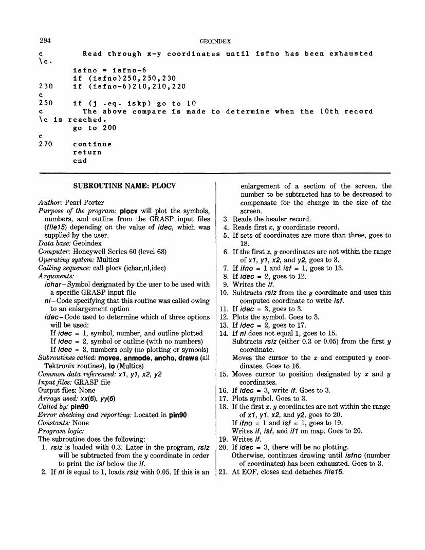
294
c \c.
230 c250 c
GEOINDEX
Read through x-y coordinates until isfno has been exhausted
isfno = isfno-6if (isfno)250,250,230if (isfno-6)2 10,210,220
if (j .eq. iskp) go to 10The above compare is made to determine when the 10th record
\c is reached.go to 200
c 270 continue
returnend
SUBROUTINE NAME: PLOCV
Author: Pearl PorterPurpose of the program: plocv will plot the symbols,
numbers, and outline from the GRASP input files(file15) depending on the value of idee, which wassupplied by the user.
Data base: GeoindexComputer: Honeywell Series 60 (level 68) Operating system: Multics Calling sequence: call plocv (ichar,nl,idec) Arguments:
ichar- Symbol designated by the user to be used with a specific GRASP input file
nl-Code specifying that this routine was called owing to an enlargement option
idee -Code used to determine which of three options will be used:If idee = 1, symbol, number, and outline plotted If idee = 2, symbol or outline (with no numbers) If idee = 3, numbers only (no plotting or symbols)
Subroutines called: movea, anmode, ancho, drawa (allTektronix routines), io (Multics)
Common data referenced: x1, y1, x2, y2 Input files: GRASP file Output files: None Arrays used: xx(6), yy(6) Called by: pin90Error checking and reporting: Located in pin90 Constants: None Program logic: The subroutine does the following:
1. rsiz is loaded with 0.3. Later in the program, rsiz will be subtracted from the y coordinate in order to print the isf below the if.
2. If nl is equal to 1, loads rsiz with 0.05. If this is an
enlargement of a section of the screen, the number to be subtracted has to be decreased to compensate for the change in the size of the screen.
3. Reads the header record.4. Reads first x, y coordinate record.5. If sets of coordinates are more than three, goes to
18.6. If the first #, y coordinates are not within the range
of x1, y1, x2, and y2, goes to 3.7. If if no = 1 and isf = 1, goes to 13.8. If idee = 2, goes to 12.9. Writes the //.
10. Subtracts rsiz from the y coordinate and uses this computed coordinate to write isf.
11. If idee = 3, goes to 3.12. Plots the symbol. Goes to 3.13. If idee = 2, goes to 17.14. If nl does not equal 1, goes to 15.
Subtracts rsiz (either 0.3 or 0.05) from the first y coordinate.
Moves the cursor to the x and computed y coor dinates. Goes to 16.
15. Moves cursor to position designated by x and y coordinates.
16. If idee = 3, write if. Goes to 3.17. Plots symbol. Goes to 3.18. If the first x, y coordinates are not within the range
of x1, y1, x2, and y2, goes to 20. If if no = 1 and isf = 1, goes to 19. Writes //, isf, and If1 on map. Goes to 20.
19. Writes if.20. If idee = 3, there will be no plotting.
Otherwise, continues drawing until isfno (number of coordinates) has been exhausted. Goes to 3.
21. At EOF, closes and detaches file15.
APPENDIX C 295 C ****SU3ROUTINE PLOCV ****C
suoroutine plocv (ichar*n I* \ dec) c
dimension xx(6)*yy(6)common x1*y1*x2*y2
cc If idee = 1* symbol* number and outline will be plotted, c If idee = 2* symbol or outline (with no numbers), c If idee = 5* numoers only (no plotting or symbols), c
rsiz=0.3if (nl .eg. 1) rsiz = 0.050rewind 15
10 cont i nuec Read header information.20 read (15*30*end=160) if* ifno*isf * isfno*if1 30 format (5i5) c
i e = i sfnoif (isfno .ge. 6) ie=6
c Read x-y coordinates.read (15*4U) ( xx(i)*yy(i)*i = 1 *i e)
40 format (12f6.3) c
if (isfno .ge. 3) go to 70 c
if ((xx(1) .le. xl) .or. (yy(1) .le. yD) 90 to 20if ((xx(1) .ye. x2) .or. (yy(1) .ge. y2)) go to 20if ((ifno .eq. 1) .and. (isf .eq. 1)) go to 60if (idee .eq. 2) go to 55call movea(xx(1)*yy(1 ))call anmode
c This routine writes if* isf and ichar.write (0*50) if
50 format (1 x*i 5)ry = yy(1)-rsizcall movea (xx(1)*ry)call anmodewrite (0*50) i sfif (idee .eq. 3) go to 20
55 call movea(xx(2)*yy(2 ))call ancho(ichar)go to 20
c60 cont i nue c This routine will write if and ichar depending on idee.
if (idee .eq. 2) go to 67if (nl .ne. 1) go to 62ry = yy(1 ) -r si zcall movea(xx(1)*ry)go to 65
62 call movea(xx(1)*yy(1)) 65 c d 11 a nmode
296 GEOINDEX
wri te(0/50) ifif (idee .eq. 3) go to 20
67 call movea(xx(2 ) /yy( 2 ))call ancho(ichar)go to 20
c70 continue
if C(xx(1) .le. x1> .or. (yyd) .le. y1)) go to 90if ((xx(1) .ge. x2) .or. (yyd) .ge. y2)) go to 90if ((ifno .eq. 1) .and. (isf .eq. 1)) go to 80if (idee .eq. 2) go to 90call movea (xx(1)/yyd))call anmode
c This routine will print out if/ isf and if1. write (0/50) ifry = yy(1)-rsizcall movea(xx(1)/ry)call anmodewrite (0/30) isfif (i f1 .eq. 0) go to 90ry = ry-rsizcall movea(xx(1) t ry )call a nmodewrite (0/50) i f1go to 90
c 80 cont i nue
if (idee .eq. 2) go to 90call movea(xx(1)*yy(1 ))call anmodewri te (0/50) i f
c 90 continue
call movea(xx(2)*yy(2 ))do 100 k=2/ieif (idee .eq. 3) go to 100
c If iaec = 3* Dypass any plotting.call drawa(xx(k)/yy(k))
100 cont i nue c 110 i sf no = i sfno-6
if (isfno) 10/10/120 120 if (isfno-6) 130/130/140 130 i e = i s fno c 140 readd 5/40,end = 1 60) ( xx ( i ) ,y y ( i ) / i = 1 , i e )
do 150 k = 1 ,ieif (idee .eq. 3) go to 150call drawa(xx(k)*yy(k ) )
150 continue c
if (isfno-6) 10/10/110
APPENDIX D 297
160 continuecall io ("close","f Ue15"> call io ("detach","fi Ie15") return end
APPENDIX D. FORMATS AND NOTES FORMAT OF REFNM FILES
Item No.
1234567 89
101112131415 16 17181920212223242526272829303132333435363738394041424344454647484950515253545556
' Item name
Id _StateAuthor 1 _Author 2Author 3
YearTitle 1Title 2Title 3County 1 or region 1 _ .County 2 or region 2County 3 or region 3 _ _ .County 4 or region 4 County 5 or region 5 PublisherScale 1Scale 2Scale 3Scale 4Scale 5Series 1 _EmphasisArea of coverageUnit for area of coverage
Extreme west longitudeExtreme east longitudeCenter-point latitude _Center-point longitude _Boundary id _Other map not includedDepositories _ _Base _Title 4 _Geology or geochemistryPlate 1 map plate namePlate 2 map plate name _Plate 3 map plate name
Plate 5 map plate name _Idstat --State codeIdsublId sub 2 _Id sub 3Id sub 4Id sub 5Bound 1Bound 2 _Bound 3 _ .Bound 4 _ .Bound 5 _ .Spanl_Sran2_ _
Character type
Integer-in automatic
dodo _
IntegerEmbedded character string
dododo _ _dodo _
Embedded character stringInteger
do _dodo _ _do _ —
Embedded character stringdo
RealEmbedded character stringInteger DDDMMSS S1
do — —dodo _ —do _do
Integer not used.Embedded character string
do _ _ _
Embedded character stringdodo _dododo _do
Integer —do _ _dododo _do _
do _ _do _do _do _do _do _
Maximum field length
420606060
4606060606060
6088888
6060
87
121212121212
60603060123030303030
2222226666666
298 GEOINDEX
ItemNo.
57585960616263646566676869707172737475767778798081828384858687
888990919293949596
Item name
Span 3Span 4Span 5Series 2Scale 6Scale 7Scale 8Scale 9Scale 10Plate 6Plate 7Plate 8Plate 9Plate 10Id sub 6Id sub 7 _Id sub 8Id sub 9 _Id sub 10Bound 6Bound 7Bound 8Bound 9Bound 10Span 6Span 7Span 8Span 9Span 10
DumOFlag for expansion. 1 prototype. 2 additional maps. DumlDum2Dum3Dum 4Dum 5Dum 6Dum 7Dum 8Dum 9
Character type
dododo _
Embedded character string
dodo _dodo
_ dododododododododododo
_ do _ .'dododododododo
Integer
Integerdodododododododo
Maximum field length
666
6088888
3030303030
2I 2
2226666666666
301
1
1111111
1 A space and S indicate a decimal point followed by one digit.
FORMAT FOR REFERENCE FILEColumns 1,2 Columns 3,4,5 Columns 6,7 Columns 8 to 67 State Reference Item No. Data
No.12 13 12 60 characters
maximum
NOTES FOR ENTERING CARD DATA
1. Do not put a comma after the year.2. Item 12: All counties or regions [for Item 12] are typed in small let
ters.3. Item 12: All counties or regions are typed on the same line and a
comma and a space separates each. Counties or regions cannot exceed 60 characters. Continue on the next line, creating Item 13.
4. Item 24 (emphasis) is always typed in lowercase. If there is more than one emphasis, add a comma and a space between each one.
5. Items 18-22, 61-65: Omit the period or semicolon after scale.6. Omit the one digit and colon before the scale.7. Omit commas between scales.8. Title can be not more than 60 characters of data; together with the
numeric data (State, ref, item number), 67 characters is max imum number for any one line.
9. Item 38 (geology) is always in lowercase.10. Items 3-5: Omit spaces between authors initials.11. Item 17: Omit space between U. and S. in U.S. Geol. Survey.12. Item 2 (the State name) always has first letter capitalized and the
rest in lower case, as in Missouri.13. Item 18-22, 62-65: Omit the (a), (b), (c), and so on, between scales.14. Item 39-43, 66-70: The first letter in the name of the first plate is
always capitalized, names of all other plates begin with small let ters.
15. If there is no series (Item 23), place a period after name of publisher.
16. Do not underscore entered data.17. Item 35: Type as shown in "Abbreviations for depositories." Use
no more than 60 characters.
Abbreviations for depositories
USBM = U.S. Bureau of Mines BM&G = Bureau of Mines and Geology GS = Geological Survey WYGS = Wyoming Geological Survey