Embed Size (px)
Citation preview
ELECTORAL AREA SERVICES COMMITTEE MEETING
Tuesday, March 15,201 1
Regional District Board Room 175 lngram Street, Duncan, BC
A G E N D A
1. APPROVAL OF AGENDA
2. ADOPTION OF MINUTES M I Minutes of March I , 201 1 EASC Meeting
3. BUSINESS ARISING FROM MINUTES
4. STAFF REPORTS R1 Rob Conway, Manager, regarding Application No. 3-I-IODPNAR
(Applicant: Michael Dix) . . . Carla Schuk, Planning ~echnician, regarding Application No, 8-I-10DP (Applicant: Ken Carbonneau) Alison Garnett, Planner II, regarding Application No. 2-E-IORS (Applicant: M. YounglF. Pywell) Rob Conway, Manager, regarding Application No. 14-B-IODP (Applicanf: Doug Makaroff) Carla Schuk, Planning Technician, regarding Soil Classification Mapping for Gordon Bay in Electoral Area F Ryan Dias, Parks &Trails Operations Superintendent, regarding Half IronMan Triathlon Special Event Request - referred from March 1, 201 1 EASC Ryan Dias, Parks Operations Superintendent, regarding 201 1 Capital Projects Schedule for Community and Sub-Regional Parks Katy Tompkins, Senior Planner, regarding 2010 Year End Report Katy Tompkins, Senior Planner, regarding South Cowichan OCP Mike Tippett, Manager, regarding Proposed change to Covenant Language - South Cowichan Mini Storage
EASC meeting March 15, 201 1 Page 2
5. CORRESPONDENCE C1 Grant in Aid Request -Area A - Mill BayIMalahat C2 Grant in Aid Request -Area A - Mill bay1Malahat C3 Grant in Aid Request -Area G - SaltairIGulf Islands C4 Grant in Aid Request -Area B - Shawnigan Lake C5 Grant in Aid Request -Area B - Shawnigan lake C6 Grant in Aid Request -Aea C - Cobble Hill
6. INFORMATION IN1 Minutes of Area E APC meeting of January 13, 201 1 IN2 Minutes of Area A APC meeting of March 8, 201 1 IN3 Minutes of Area C APC meeting of January 27,201 1 IN4 Minutes of Area H APC meeting of August 12, 2010 IN5 Minutes of Area H APC meeting of August 14, 2010 IN6 Minutes of Area H APC meeting of October 14, 2010 IN7 Minutes of Area I APC meeting of March 1, 201 1 IN8 BC Hydro District Energy incentive program IN9 Letter dated February 17, 201 1 from Ministry of Environment
Regarding Relocation of soil to 4975 Koksilah Road IN10 February 201 1 Building Report
7. NEW BUSINESS NBI Notice of Motion - Director L. Duncan
8. PUBLlClPRESS QUESTIONS
9. CLOSED SESSION Motion that the meeting be closed to the public in accordance with the Community Charter Part 4, Division 3, Section 90(1), subsections as noted in accordance with each agenda item.
10. ADJOURNMENT
NOTE: A copy of the full agenda package is available at the CVRD website www.cvrd.bc.ca
Director L. lannidinardo Director M. Marcotte Director B. Harrison Director K. Cossey Director G. Giles Director L. Duncan Director I. Morrison Director K. Kuhn Director M. Dorey
PRESENT
CVRD STAFF
Minutes of the Electoral Area Services Committee Meeting held on Tuesday, March 1, 2011 at 3:00 pm in the Regional District Board Room, 175 lngram Street, Duncan, BC.
Director L. lannidinardo, Chair Director B. Harrison, Vice-Chair Director M. Dorey Director G. Giles Director 1. Morrison Director K. Kuhn Director M. Marcotte Alt. Director Buddy Bhandar Absent: Director K. Cossey, Director L. Duncan
Tom R. Anderson, General Manager Brian Farquhar, Manager Mike Tippett, Manager Rob Conway, Manager Brian Duncan, Chief Building Inspector Carla Schuk, Planning Technician Alison Garnett, Planner I1 Rachelle Moreau, Planner I Cathy Allen, Recording Secretary
APPROVAL OF The Chair noted changes to the agenda which included adding six items of AGENDA listed new business, and two items of additional new business.
It was Moved and Seconded That the agenda, as amended, be approved
MOTION CARRIED
MINUTES
MI -Minutes It was Moved and Seconded That the minutes of the January 31, 201 1 EASC meeting be adopted.
MOTION CARRIED
It was Moved and Seconded That the minutes of the February 1, 201 1, EASC meeting be adopted.
MOTION CARRIED
Business Arising hec chair brought forward a question arising from the February 24" EASC budget meeting. Because not all areas use the feasibility study function to the same degree, do all areas need to participate in that function? The Chair noted that 90% of the function is used for water and sewer but can be used for other things such as fire departments as well. Director Dorey stated that he feels it requires more research and should be referred back to staff.
Minutes o f EASC-Meeting of March 1. 2011 (Con't.) Paae 2
It was Moved and Seconded That staff be requested to provide further information respecting electoral area participation in the feasibility study function.
MOTION CARRIED
DELEGATIONS
D l - Franson
STAFF REPORTS
R1 -Walter
R2 - Fraser
Hilding Franson was present regarding the Bamberton rezoning application. He stated that he has now had,an opportunity to read the staff report submitted by Rob Conway, Manager, Development Services Division, and addressed concerns he had in that report. Mr. Franson presented his 11 page report dated March 1'' and asked that the EASC reconsider their decision respecting the Bamberton application.
The Committee members provided comments to the delegate.
The Chair thanked Mr. Franson for appearing
Mike Tippett, Manager, Community and Regional Planning Division, advised that Director Cossey wishes Application No. 1-B-TORS (M. Walter) to be referred to the Area B Parks Commission for comment.
It was Moved and Seconded That Application No. 1-E-IORS (Michael Walter) be referred to the Area B Parks Commission for comment.
MOTION CARRIED
Carla Schuk, Planning Technician, presented Application No. 1-D-IOALR (Gordon Fraser) to allow construction of an addition to the existing building at 4461 Trans Canada Highway for the storage of an antique fire truck and equipment maintenance.
The Committee directed questions to staff and the applicant.
It was Moved and Seconded That Application No. 1-D-IOALR, submitted by Gordon Fraser, made pursuant to Section 20(3) of the Agricultural Land Commission Act to construct an addition on the side of an existing building for the storage of an antique fire truck and equipment maintenance space on the subject property be forwarded to the Agricultural Land Commission with a recommendation to approve the application.
MOTION CARRIED
Minutes of EASC Meetina of March I. 2011 (Con't.) Paue 3
R3 - McKercher Carla Schuk, Planning Technician, presented Application No. 2-D-IODVP (Peter and Margaret McKercher) to reduce the minimum required setback for the front parcel line from 7.5 metres to 5 metres to situate a new shop on their property located at 1145 Fairbanks Road.
There were no questions to staff or the applicant.
It was Moved and Seconded That Application No. 2-D-IODVP, submitted by Peter and Margaret McKercher for a variance to Section 8.l(b)(3) of Zoning Bylaw No. 1015 by reducing the minimum front parcel line setback from 7.5 metres to 5 metres for Parcel B (DD 348731) of Section 4, Range 7, Cowichan District, Except part in Plan 2454, and Except part of Cherry Road lying within the Limits of said Parcel B, be approved, subject to the applicant providing a survey confirming compliance with approved setbacks.
R4 - Casler
R5 - Lealand
MOTION CARRIED
Carla Schuk, Planning Technician, presented Application No. 8-G-IODP (Dan Casler) to legitimize and finish construction of a single family dwelling at 11 195 Chemainus Road, within the Ocean Shoreline DPA.
The Committee directed questions to staff and the applicant.
If: was Moved and Seconded That Application No. 8-G-IODP be approved, and that a development permit be issued to Dan Casler for Lot I, District Lot 34, Oyster District, Plan 18775 to legitimize and finish construction of a house, subject to compliance with the recommendations noted in the October 29'" 2010 report by Lewkowich Engineering Associates Ltd.
MOTION CARRIED
Carla Schuk, Planning Technician, presented Application No. 1-G-11 DPNAR (Jerry LealandlCromp) to construct a two metre wide deck and wheelchair ramp onto the existing house located at 3900 Linton circle, within the Ocean Shoreline DPA.
The applicant was present and provided further information to the application. --
There were no questions directed to staff or the applicant
It was Moved and Seconded That Application No. 1-G-IIDPNAR be approved, and that a development permit be issued to Brian and Sandra Cromp for Lot 4, District Lot 34, Oyster District, Plan 22516 and a variance to Section 3.24(1) of Zoning Bylaw No. 2524 to reduce the setback from a watercourse from 15 metres to 10 metres for the purpose of building a 2 metre wide deck and a wheelchair ramp on an existing house also be approved, subject to the applicant providing a survey confirming compliance with approved setbacks.
MOTION CARRIED
Minutes of EASC Meetinq of March I, 2011 (Con't.) Page 4
R6 - Hignell Alison Garnett, Planner 11, presented Application No. 1-F-IORS (David and Valerie Hignell) to rezone the subject property located at 5720 Riverbottom Road West, from C-4 to a residential River Corridor Zone to permit three lot residential subdivision.
The applicant was present and provided further information to the application. Mr. Hignell requested that the committee support Option B of the staff report.
There were no questions to staff or the applicant
It was Moved and Seconded 1. That the draft bylaws for Application No. 1-F-IORS (Hignell) be
forwarded to the Board for consideration of first and second reading; 2. That the application referrals from the Ministry of Transportation and
Infrastructure, Sahtlam Volunteer Fire Department, and Vancouver island Health Authority be accepted;
3. That a public hearing be scheduled with Directors Morrison, Kuhn and Dorey appointed as delegates of the Board, following receipt of a draft covenant that would limit the subdivision of the subject property to a maximum of 3 lots.
MOTION CARRIED
R7 - Brubaker Alison Garnett, Planner II, presented Application No. 1-I-IODVP (Rick Brubaker/Tonn) to increase the height of an accessory building located at 8360 Sa-Seen-os Road.
Greg Hall was present on behalf of the applicant.
The Committee directed questions to the applicant.
It was Moved and Seconded That Application No. 1-I-IODVP, submitted by Rick Brubaker for Debby Tonn respecting Lot 28, District lot 32, Cowichan District, Plan 1003, except part in Plan 1584RS be approved to increase the height of an accessory building from 6 metres to 7 metres, subject to a survey confirming compliance with the approved height variance prior to issuance of building permit.
MOTION CARRIED
Rachelle Moreau, Planner I, presented Application No. 4-B-IODVP (Jim and Lisa Lindsay) to reduce the required exterior side setback from 4.5 metres to 3 metres to build a workshop at 2180 Renfrew Road.
There were no questions to staff or the applicant.
Minutes of EASC Meetinq o f March 1, 2011 (Con't.) Paqe 5
It was Moved and Seconded That Application No. 4-6-10 DVP by Jim and Lisa Lindsay for a variance to Section 8.5(b)(3) of Bylaw No. 985 in order to reduce the required exterior side setback from 4.5 metres down to 3 metres on Strata Lot 8, Shawnigan Lake Suburban Lots, Shawnigan District, Strata Plan 731 (PID:000-020-711) be approved, subject to receipt of a post construction survey indicating the location of the workshop complies with the variance.
MOTION CARRIED
R9 - Salmen Rachelle Moreau, Planner I, presented a request by John Salmen to allow an accessory building fixture at 4465 Uphill Road.
The applicant was present and presented further information to the request.
The Committee directed questions to the applicant and staff,
It was Moved and Seconded That the request by John Salmen and Gretchen Hartley to allow a shower and utility sink, in addition to two permitted plumbing fixtures, within an accessory building at 4465 Uphill Road (Parcel C (DD 676071) of Section 3, Range I, Cowichan District PID: 009-534-555), be approved subject to registration of a covenant prohibiting occupancy of the accessory building as a dwelling.
MOTION CARRIED
R10 - Sidewalks Tom Anderson, General Manager, presented staff report dated February 16, 201 1, regarding Sidewalks within Ministry of Transportation road rights-of-way.
General discussion ensued
It was Moved and Seconded That pursuant to s.799 of the Local Government Act, the Board of the Cowichan Valley Regional District request that the Province provide the CVRD with additional powers and exceptions, including power to regulate, prohibit and impose requirements, in relation to the provision, construction, operation and maintenance of sidewalk services within Electoral Area A - Mill BaylMalahat of the CVRD.
MOTION CARRIED
R11 - Fire Department Appointments
It was Moved and Seconded That the following appoints to the CVRD Volunteer Fire Departments be approved: Mesachie Lake VFD - Fire Chief, Gary Eve and Deputy Fire Chief, David Middlemost; Youbou VFD - Fire Chief, Orest Smycniuk and Deputy Fire Chief, Stu McKee.
MOTION CARRIED
Minutes of EASC Meetinq of March 1, 2011 (Con't.) Paqe 6
R12 - Fire Tender
R13 - Bright Angel Park booking
R14 - Park Caretaker
R15 - Special Event Request
RIG- MTI amendments
R17 - Floodplain Mapping
It was Moved and Seconded That the overall expenditure of no more than $120,000 (increased from the original $100,000) for the purchase of a used fire tender for the Malahat Volunteer Fire Rescue Service, be approved, and further that the CVRD Purchasing Policy be waived and the expenditure be approved prior to approval of the 201 1 budget.
MOTION CARRIED
It was Moved and Seconded That the request by the Cowichan Valley Metis Nation to waive the park booking fees at Bright Angel Park to host a cultural camp scheduled for May 8- 13, 201 1, be approved.
MOTION CARRIED
It was Moved and Seconded That the Glenora Trails Head Park Caretaker Contract with the incumbent caretakers be extended for a maximum two year term extension beyond the original three year term, commencing March 1, 201 1 and completing February 29,2013.
MOTION CARRIED
It was Moved and Seconded That staff report dated February 22, 2011, from Ryan Dias, Parks & Trails Operations Superintendent, regarding Half Iron Man Triathlon Special Event Request, be referred to the next meeting when the Area B Director is present.
MOTION CARRIED
It was Moved and Seconded That staff report dated February 23, 2011, from Nino Morano, Bylaw Enforcement Officer, regarding MTI Ticketing amendments, be referred back to staff for a further detailed report.
MOTION CARRIED
Mike Tippett, Manager, presented staff report dated February 17, 2011, regarding floodplain mapping for the lower Cowichan River.
It was Moved and Seconded That staff be authorized to participate in the local government ad-hoc committee discussions regarding the new floodplain mapping for the lower Cowichan River, and to prepare a draft Floodplain Management Bylaw for the CVRD in conjunction with municipalities, for future consideration by the Electoral Area Services Committee.
MOTION CARRIED
R18 - Bylaw 3460 It was Moved and Seconded Referrals That CVRD Zoning Amendment Bylaw No. 3460 (Doole Road A1-A-2) be
referred to the Stz'uminus First Nation, the Agricultural Land Commission and the Ministry of Transportation and Infrastructure.
MOTION CARRIED
CORRESPONDENCE
C1 to C6 - Grants in It was Moved and Seconded aid That the following Grants-in-Aid be approved:
e Electoral Area C - Cobble Hill, in the amount of $500 to Bard@Brentwood to assist with production of "lnherrt the Wind.
e Electoral Area B - Shawnigan Lake, in the amount of $200 to Shawnigan Beach Estates Neighbourhood Association to assist with start-up costs to create an association. Electoral Area B - Shawnigan Lake, in the amount of $200 to Cowichan Spir~t of Women to assist with the operations of the Womens Resource Centre.
m Electoral Area D - Cowichan Bay, in the amount of $1,000 to Cowichan Wooden Boat Society to assist with funding for the 4'h Annual Prawn Festival.
e Electoral Area D - Cowichan Bay, in the amount of $375 to Bike to Work Cowichan to assist with costs for the bike to workweek program. Electoral Area D - Cowichan Bay, in the amount of $500 to Cowichan Seniors Community Foundation to assist with costs to offset staging a major fund raising.
MOTION CARRIED
INFORMATION
IN1 -Workshop Tom Anderson, General Manager, advised of the free half day Coastal Douglas Fir Stewards Workshop being presented by the BC Ministry of Natural Resource Operations at three Vancouver Island locations in March 201 I
It was noted thatinterested Directors need to send in their registration forms soon as space is limited.
IN2 to IN11 & NB7 - It was Moved and Seconded Minutes That the following minutes be received and filed:
Minutes of Area C Parks meeting of February 14,201 1 Minutes of Area I Parks meeting of February 8, 201 1 Minutes of Area E Parks meeting of January 20,201 1 Minutes of Area G Parks meeting of January 10, 201 1 Minutes of Area C Parks meeting of February 2, 201 1 Minutes of Area G APC meeting of February 10, 201 1 Minutes of Area B APC meeting of February 3, 201 1
e Minutes of Area E APC meeting of January 20,201 1 Minutes of Area I APC meeting of December 7,201 1 Minutes of Area A APC meeting of February 8, 201 1
Minutes of EASC Meeting of March 1, 2011 ICon't.) Page 8
Minutes of Area H Parks AGM meeting of February 8, 201 1
MOTION CARRIED
IN6 - Evergreen Motion extracted from IN6 Parks minutes: School agreement
It was Moved and Seconded That the CVRD enter into a partnership agreement with Evergreen Independent School Society to assist with the building of a sport court on their property through contribution of an amount not to exceed $28,500 from the 2011 Electoral Area C Community Parks (233) budget in exchange for which a community use agreement will be entered into between the CVRD and the Society for community after school, weekend and summer holiday use and potential summer programming.
MOTION CARRIED
IN7 - Saltair Ocean Motion extracted from IN7 APC minutes: Shoreline DPA
It was Moved and Seconded That staff be directed to forward letters to approximately 140 Saltair ocean front owners located within the Ocean Shoreline Development Permit Area advising of the need to obtain development permits for retaining walls and other activities within the DP Area.
MOTION CARRIED
IN12 - Building It was Moved and Seconded Report That the January 201 1 Building Report be received and filed.
MOTION CARRIED
NEW BUSINESS
NBI - Notice of It was Moved and Seconded Motion That Notice of Motion regarding two separate Engineering Committees, be
referred to the next meeting where Director Duncan will be present.
MOTION CARRIED
Additional public comments regarding Application No. I-G-1 IDP (Agenda Item R5) was received for information.
Additional public comments regarding Application No. I-I-IODVP (Agenda item R7) was received for information.
NB5 - Fire Protection It was Moved and Seconded Agreement That it be recommended to the Board that the Chair and Corporate Secretary
be authorized to sign the 2011 one-year Fire Protection and Emergency Response Services Agreement between the CVRD and the Capital Regional District for Malahat Fire Protection.
MOTION CARRIED
Minutes o f EASC Meeting o f March I, 2011 (Con't.) Page 9
NB6 - Ruxton Is. It was Moved and Seconded That staff be directed to work with the Ruxton Water Conservation Society to prepare a draft Stewardship Agreement for Ruxton Island Community Park for consideration by the Electoral Area Services Committee and Board based on the proposal submitted by the Society dated February 17, 201 1.
MOTION CARRIED
NB7 - Minutes Area H Parks AGM minutes - received under Information.
NB8 - Ministerial Mike Tippett, Manager, advised of letter dated February 21, 2011, from the Approval Ministry of Community, Sport and Cultural Development, advising of the
Ministry's acceptance of the CVRD's offer to participate in the regional district land use bylaw exemption initiative. The CVRD is exempt from the requirement for ministerial approval for official community plan bylaws plus four other types of land use management bylaws for a period of two years. The exemption will speed up the bylaw adoption process.
The letter was received for information.
Mr. Anderson noted that the CVRD can ask for bylaws that were previously sent to the Province to be returned, and noted that Mr. Tippett and Mr. Conway will review and advise what bylaws can be returned.
NB9 - Burning Provisions
Director lannidinardo expressed concern regarding fires burning at construction sites in Cowichan Bay. Materials being burned are creating poor air quality. Contractors are not following the CVRD land clearing bylaw. There are fire department regulations that exist that are also not being followed. A backyard burning bylaw was introduced but not passed in 2000. There are examples of burning bylaws from several other districts that could be used to prepare a new draft.
It was Moved and Seconded That the issue of drafting provisions to prohibit burning of construction materials be referred to the Engineering and Environmental Services Department for review.
MOTION CARRIED
NBIO - BC Ferry Director Giles advised Committee members that R. Dewar (formerly Island Board Savings Credit Union) who the CVRD nominated to the BC Ferry Board has
been selected.
CLOSED SESSION It was Moved and Seconded That the meeting be closed to the public in accordance with the Community Chatter Part 4, Division 3, Section 90(1), subsections as noted in accordance with each agenda item.
MOTION CARRIED
The Committee moved into Closed Session at 5:40 pm.
Minutes of EASC Meetina of March 1.201 1 ICon't.) Paae 10
Minutes It was Moved and Seconded That the minutes of the Closed Session EASC meeting of February 1, 201 1, be adopted.
MOTION CARRIED
Rise The Committee rose without report,
ADJOURNMENT It was Moved and Seconded That the meeting be adjourned.
MOTION CARRIED
The meeting adjourned at 541 pm.
Chair Recording Secretary
DATE: March 8,201 1 FILE NO: 3-1-1 ODPNAR
FROM: Rob Conway, MClP BYLAW No:
SUBJECT: Development Permit Application 03-1-1 ODPNAR (Michael Dix)
RecommendationlAction: That application 3-I-IODPNAR by Michael Dix for a single family dwelling and associated development at Island #4, Cowichan Lake (Block 1455, Cowichan Lake District, as shown on Plan 40413) be approved subject to the following conditions:
1. Authorization of the proposed SPEA encroachment by Department of Fisheries and Oceans and Ministry of Environment;
2. Compliance with RAR Assessment Report #1910; 3. On-site monitoring of construction by a Qualified Environmental Professional and
submission of a post development report confirming compliance with the recommendations of RAR Assessment Report #I910 and any conditions of approval specified by the Ministry of Environment and Department of Fisheries and Oceans;
4. Determination of the high water mark by legal survey and confirmation that the proposed building location is a minimum of 15 metres from the high water mark of Cowichan Lake;
5. Installation of a 'Type 3" or better sewage disposal system authorized by the Vancouver Island Health Authority;
Relation to the Corporate Stratesic Plan: NIA
Financial Impact: (Reviewed by Finance Division:
Background:
Location of Subiect Property: Billy Goat Island, lsland #4
Leaal Description: Block 1455, Cowichan Lake District, as shown on Plan 40413 (PID: 000-121-924)
Date Application and Complete Documentation Received: Initial Application Received January 15, 2010 Variance request received March 22, 2010 Amended application received February 9, 201 1.
Owner: Michael Dix
Applicant: As above
Size of Parcel: 21.45 hectares (3.6 acres)
Existing Zoninq: LR-1
Minimum Lot Size Under Existinq Zoning: 1 hectare
Existinq Plan Desiqnation: No designation
Existinq Use of Property: Vacant Land
Existinq Use of Surrounding Properties: Cowichan Lake
Services: Road Access: Boat access only
m: Lake Water Sewaqe Disposal: Proposed on-site system
Aqricultural Land Reserve The subject property is not within the ALR. Status:
Environmentallv Sensitive Areas: The subject property is located on Cowichan Lake, and is subject to the Riparian Area Regulation.
Archaeoloaical Sites: The CVRD has no knowledge of an archaeological site on the subject property.
Application Context: An application for a development permit and variance was initially submitted by Michael Dix in January, 2010. The initial application was for two dwellings on "Billy Goat Island" or lsland #4, which is located south of Youbou and east of Sa-Seen-0s Point on Cowichan Lake. The lsland is approximately 1.46 hectares in area and is comprised of an east and west lobe separated by a low area that floods'in winter. As the width of the island varies between about 25 and 47 metres, and the Riparian Area Regulation establishes a Streamside Protection and Enhancement Area (SPEA) of 15 metres on the north shore of Cowichan Lake (south shore of the lsland) and 30 metre from the south shore of the Lake (north shore of the lsland), almost the entire lsland is covered by SPEA.
The initial application proposed two dwellings - one on the east lobe and one on the west lobe of the lsland. The LR-1 (Lakefront Residential 1) zoning that applies to the lsland permits a single family dwelling as a permitted use. A secondary dwelling unit is also permitted by zoning, but is required to be a no closer than 60 metres from the natural boundary of the Lake. In order to obtain approval for the two dwellings, the owner required a development permit that would allow development within the SPEA for the two building sites and a variance to reduce the 60 metre setback for secondary dwelling unit from 60 metres to 15 metres.
The initial application was referred to the Area I APC, and notices were sent to adjacent property owners regarding the variance. The APC and some Youbou residents who responded to the notice were generally opposed to the variance. There was also general opposition any development on the lsland. APC minutes and letters received in response to the application notification are attached to this report for the Committee's information.
In December, 2010, the applicant amended to the application to remove the variance request and the proposed secondary dwelling unit. The amended application removed all proposed development from the west lobe and focused on a single building site on the east lobe. This report addresses only the amended application and requests a development permit to authorize development within a SPEA.
Proposed Development: The single family dwelling is proposed approximately at the high point of the Island's west lobe. This is the widest part of the lsland, where the approximate distance between the high water marks of the north and south sides of the lsland isabout 47 metres. There is a narrow2 metre strip where the house site is proposed that is outside of the SPEA, but because of the narrow width of the lsland, the majority of the house site is within the SPEA. Schedule 2 shows the proposed development relative to the riparian boundaries and high water mark.
The proposed dwelling is comprised of two detached wings connected by a covered porch and screened hallway. The footprint of the structure, including the porch and hallway, is about 300 square metres (3230 sq. ft.). A 28 square metre (300 sq. ft.) detached utility shed is also proposed. Floor plans of the proposed dwelling and an image of one of the proposed wings is shown on Schedule 3.
The established 200 year flood elevation (including free board) for Cowichan Lake is the 167.33 metre geodetic elevation. The floor elevation of habitable space must be constructed to this level. Although the high point of the lsland, where the dwelling is proposed, is at or slightly above the 167.33m elevation, much of the building's foot print is below this level and must be elevated to achieve the required main floor elevation. To minimize excavation and to avoid the placement of fill, the dwelling is proposed to be constructed on concrete pile foundation.
As the soils on the lsland are shallow and cannot support a conventional septic system, a "Type 3 sewage disposal system' is proposed that would treat sewage effluent to a high quality before it is discharge to a disposal field. The disposal field would be located a minimum of 50 metres from the shoreline and would require approximately 18 inches of sand to be added to the existing soil to achieve the required depth. The identified disposal area on the east lobe is considered sufficient to support a three bedroom dwelling. A preliminary report regarding the proposed sewage disposal system is provided in Schedule 4.
The applicant has provided a detailed description of the mitigation and protection measures that will be taken to prevent negative impacts of development on fish and fish habitat. This material is provided in Schedule 5.
' Type 3 is the highest level oftreatmei~t within the Minishy of I-Iealtli's Sewerage System Regulation. It is defined as treatment that produces effluent consistently containing less tha~i 10 ing/L of total suspended solids and having a 5 day biochemical oxygen deinand of less than 10 mglL and amediuiil fecal colifoi~n density of less than 400 Colony Forming Units per 100 inl.
Policv Context: The subiect oroDertv is located within the Watercourse Protection Develooment Permit Area (DPA). in ac'cordance with the YoubouIMeade Creek Official Community plan Bylaw No. 2650, the applicant must receive a development permit from the CVRD prior to commencing any site preparation or construction within 30 metres of the high watermark of Cowichan Lake. RAR Development Permit applications require an RAR assessment report, prepared by a Qualified Environmental Professional. The applicant has submitted an RAR assessment report prepared by Ted Burns (Schedule 6).
The RAR process and the Watercourse Protection Development Permit Area are primarily intended to protect riparian areas by directing development away from identified riparian areas. Although development within a SPEA is generally not supported, the Riparian Area Regulation does acknowledge that there may be situations where development with a SPEA is necessary. The Regulation is not intended to "sterilize" land by entirely precluding development that would otherwise be permitted. In situations of hardship, where compliance with the Regulation is not possible, the Regulation does allow variances to the SPEA to allow limited encroachment into it.
MoE and DFO have recently developed a Riparian Area Regulation Protocol that will establish a process for addressing variance requests to SPEA boundaries and cases of hardship. The Protocol has not yet been adopted by the agencies, but likely will be in the near future. The Protocol seems will suited to the current application and MoE staff has recommended that it be applied to the proposed development at Island #4.
The Draft RAR Variance Protocol is provided in Schedule 7. The Protocol essentially transfers the responsibility of determining hardship and SPEA relaxations to MoE and DFO. Local Government's role is primarily to minimize the extent of SPEA relaxations by relaxing other bylaw standards such as property boundary setbacks. Input from local government is strongly encouraged, and MoE has requested that the CVRD comment on the hardship aspect of the variance. If the EASC and Board consider the application to be a hardship situation and recommend that it proceeds, approval from MoE and DFO will still be required before the proposed development can proceed.
Staff Comments: This application has been challenging for the Area I APC, staff and the applicant. The owner's expectation to use the property in a manner suggested by the LR-1 zoning potentially could conflict with the objectives of the Watercourse Protection DPA and Riparian Area Regulation. The situation appears to be one that may require compromise by both the applicant and the approval authorities involved.
Staff believe the application is a hardship situation, because without a relaxation of the SPEA a dwelling could not be constructed on the Island as permitted by the zoning. The RAR recognizes this scenario as hardship and case law generally supports the right of an owner to construct a dwelling on land zoned for residential use.
While the owner appears to have a case of hardship, hardship does not necessarily oblige approval of any requested development within the SPEA. Perhaps the most significant issue associated with this application is not the relaxation the SPEA boundary itself, but rather the degree or extent of development that is proposed within the SPEA and if it is reasonable given the site constraints and potential impacts. The RAR Assessment Report that was submitted with the application advises that the proposed development will not negatively impact fish habitat, and staff have no reason to conclude that fish habitat or the lake will be negatively impacted by the proposed development. The proposed dwelling, however, is relatively large and it is arguable if the proposed development has found an appropriate balance between the owner's right to construct a dwelling on the Island and the policy objective of minimizing encroachment
into riparian areas. In the absence of evidence that the proposal would result in negative impacts, staff recommend approval of the application subject to the conditions listed in Option 1.
Options:
Option 1: That application 3-I-IODPNAR by Michael Dix for a single family dwelling and associated development at Island #4, Cowichan Lake (Block 1455, Cowichan Lake District, as shown on Plan 40413) be approved subject to the following conditions:
1. Authorization of the proposed SPEA encroachment by Department of Fisheries and Oceans and Ministry of Environment;
2. Compliance with RAR Assessment Report #1910; 3. On-site monitoring of construction by a Qualified Environmental Professional and
submission of a post development report confirming compliance with the recommendations of RAR Assessment Report #I910 and any conditions of approval specified by the Ministry of Environment and Department of Fisheries and Oceans;
4. Determination of the high water mark by legal survey and confirmation that the proposed building location is a minimum of 15 metres from the high water mark of Cowichan Lake;
5. Installation of a 'Type 3" or better sewage disposal system authorized by the Vancouver Island Health Authority;
Option 2: That application 3-I-IODPNAR by Michael Dix for a single family dwelling and associated development at lsland #4, Cowichan Lake (Block 1455, Cowichan Lake District, as shown on Plan 40413) not be approved in its current form, and that the applicant be requested to revise the proposal.
Rob Conway, MClP Manager, Development Services Division
L Planning and Development Department
Attachments: Schedule 1 -Location and Zoning Plan Schedule 2 -Site Plan Schedule 3 -Proposed Dwelling Plans Schedule 4 - Onsite Waste Water Svstem Report Schedule 5 - Prooosed ~onstructionklan
Schedule 8 -APC Minutes Schedule 9 - Notiiication Response Letter re: Variance (no longer applicable) Schedule 10 - LR-I Zone
Schedule 2
FORM 1 Ripaiian Areas Regulation -Qualified Environmental Professional - Assessment Repori
Section 3. Site Plan
Form 1 Page 8 of 17
Country eungabv
Covered Pol'cll and ScreanedHall\%rBy
Badrooins: 3 Baths: 3
250-74s-LESS Schedule 4
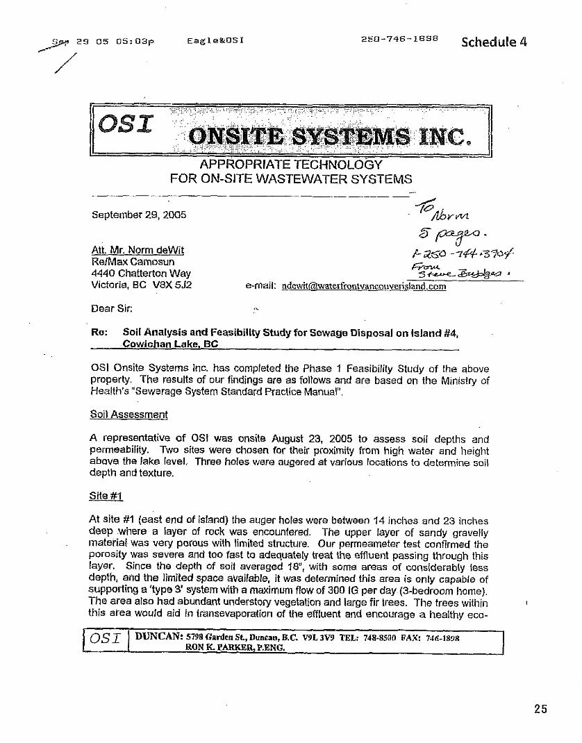
( I S L ONSITE SYSTEMS I N C ~ ~ ~ TECHNOLOGY
FOR ON-SITE WASTEWATER SYSTEMS - /
September 29, 2005 'Dfirm
5*- I /
Att. Mr. Norm dewit RelMax Camosun
E-250 -7# .3%+
4440 Chatterton Way F%?2e* A
Victoria, BC V8X 552 e-mail: ndewit~waterfrontvancouverisland.eorn
Dear Sir:
Re: Soil Analysis and Feasibility Study for Sewage Disposal on Island #4, Cowichan Lake, BC
OSI Onsite Systems Inc. has completed the Phase 1 Feasibility Study of the shove property. The results of our findings are as follows and are based on the Ministry of Health's "Sewerage System Standard Practice Manual".
Soil Assessment
A representative of OSt was onsite August 23, 2005 to assess soil depths and permeability. Two sites were chosen for their proximity from high water and height above the lake level. Three holes were augered at various locations to determine soil depth and texture.
Site #I
At site #I (east end of island) the auger holes were between 14 inches and 23 inches deep where a layer of rock was encountered. The upper layer of sandy gravelly material was very porous with limited sfructure. Our permeameter test confirmed the porosity was severe and too fast to adequately treat the effluent passing through this layer. Since the depth of soil averaged la", with some areas of considerably less depth, and the limited space available, it was determined this area is only capable of supporfing a 'type 3' system with a maximum flow of 300 IG per day (3-bedroom home). The area also had abundant understory vegetation and large fir trees. The trees within I
this area would aid in transevaporation of the effluent and encourage a healthy eco-
0s 1 DUNCAN: 5798 Garden St, Duncan, B.C. V9L 3V9 TEL: 768-8500 FAX: 7&i-!S'JR RON K. PARKER, P.ENG. I
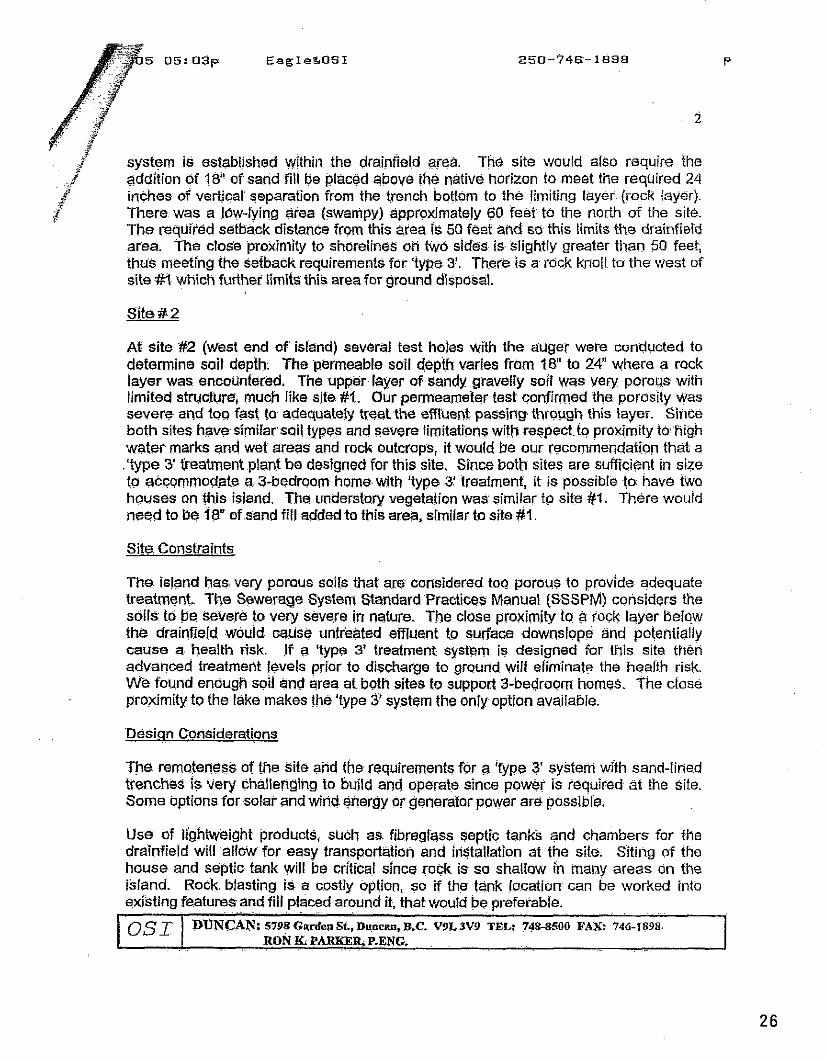
system is established within the drainfield area. The site would also require the addition of 1 8 of sand fill be placed above the native horizon to meet the required 24 inches of vertical separation from ihe trench bottom to the limiting layer. (rock iayer). There. was a low-lying giea (swampy) approximately 60 feet to the norih of the site. The required setback distance from this area is 50 feet and so this Limits the drainfierd area. The close proximity to shorelines on two sides. is- slightly greater than 50 feet, thus meeting the setback requirements for 'type 3'. The@ is a rock knoll. to the west of site #I which further limits this area for ground disposal.
At site: #2 (west end of' island) several test holes with the auger were conducted to determine soil depth. The permeable soil depth varies from 18" to 2il" where a rock layer was encounfered. The upper layer of sandy gravelly soil was very porous with limifed structure, much like site #I. Our pemeameter test confirmed the porosity was severe and too fast lo- adequately treat the efflirenL passing. through this layer. Since both sites haves'imi~arsoil types and severe limitations witl.1 reqpect.to pr~xj:~i ty t@ Righ water marks and wet areas and rock outcrops, it would. be our recommendation that a .'type 5 freatment plant be designed for this site. Since both sites are sufficient in size to accommodate a 3-bedroom home. with 'type 3.' treatment, it is possible to: have two h~uses on this island. The understory vegetation was similar tp sit.e #I. There would need to be 13" ofsand fill added to this arep, similar to site $1.
Site Constraints
The. island has: very porous soits that are considered to^ porous to provide adequate treatment. The Sewerage System Standard Practices Manual (SSSPM) considers the soils tb be severe to very severe in nature. The close proximity to $ rock layer Belw the drainfield would wuse untreated effluent. to surface downslope and potentially cause a health risk. If a 'type 3' treatment system is designed for this. site then advanced treatment levels prior to discharge to ground will eliminate the heal'i'h risk. We found enougR sdl and area at both sites to suppwt 3-bedroom homes. The close proximity to the lake makes the'fype 3' system the onlyoption available.
Design .. . Considerations
Tpe. remoteness of the site and the requirements for a 'fype 3 system with sand-liried trenches is very challenging to build and operate since power is required- at the Site. Some options for solar and wind. energy O r generator power are' possibl'e.
Use of lightweight products, such as fibreglass septic tanks and chambers for the drainfield will allow for easy transportation and installation at the site. Siting of the house and septic tank will be critial since rock is so shallow in many areas on the island. Rock. blasting is a costly option, so if the tank location can be worked into existing features ~ and .. . fill . .. placed ... around it, that would be preferable.
, . .
0s I DUNCAN: 5798 Gqrden St, Du,ncnn, B.C. V9L3V9 TEL: 74!&S500 FAX: 746-1898. 1 . .. RON K. PARlW.R, P.ENG. . . .. . . . . . .
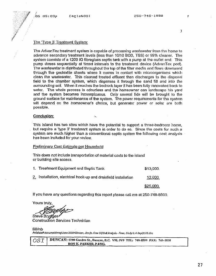
jrY The 'Tvpe 3' Treatment Svstem:
The AdvanTex treatment system is capable of processing wastewater from the home to advance secondary treatment levels (less than 10110 BOD. TSS) or 99% cleaner. The system consists of a 4200 IG fibreglass septic tank with a pump a1 the outlet end This pump doses sequentially at timed intervals to the treatment device (AdvanTex pod). The wastewater is distributed throughout the top of the filter media and flows downward through the geotexlile sheets where it comes in contact with microorganisms which clean the wastewater. This cleaned treated effluent then discharges to the disposal field to the chamber systern, which disperses it through the sand fill and into the surrounding soil. When it reaches the bedrock layer it has been fully renovated back to water. The whole process is odourless and the homeowner can landscape his yard and the system becomes inconspicuous. Only several lids will be brought to the ground surface for maintenance of the system. The power requirements for the system will depend on the homeowner's choice, but generator power or solar are both possible.
Conclusion: .'%
This island has two sites which have the potential to support a three-bedroom home, but require a 'type 3' treatment system in order to do so. Since the costs for such a system are much higher than a conventional septic system the following cost analysis has been included for your review.
Prelirninarv Cost Estimate per Household
This does not include transportation of material costs to the island or building site access.
1. Treatment Equipment and SepticTank $13,000.
2, installation, electrical hook-up and drainfield installation 12,000.
$zi&aL
If you have any questions regarding this report please call me at 250-748-8500
Yours truly.
SBfnb AnKeMaffdacumaWencyUune 2000+1Sowcn. J h [Is, Cow LkJlso?Anafy26 - Faas. Studyls 4 Sep26.OS.doc
~ . . .ji___,-__. -~ .
05 05:04p Eagle&OSI 250-746 -1898 P . 5
PERMEAMETER TEST
Remarks or Obrrrval onr
- ~01lhct.x Sand: 0 StructursdlormsL clays 0 U n r w s t u n d day 0
Sandfiebt - 75 8tFUCtUrM lolmi clay factor - 60.3 VnalrusNr~d slay fao(M= 32.4
CslsUatn HLR ImtnnchuM~ld : HUI = x = LI m2
HLR ( Urn2) = K(h) mmlday x El f luentqurUfy~ s Dml~n hydnuib loading re(. ( Urna
I Commene K(fs)mmlday = ssbmfed HLR In LI m' Measure AH tfie auger hole diameter i K(-t) k kau than K(fa) Rdernrc Mww, J.D.. mid D.H. WPIIU, 1803 OKSit. W~dwatw D w a l h Now Scoftll, Final Rapart, On-Site Waslrwtw ~sssarch ' .
P r o p m P h u @ 2 1 ~ 1 0 0 3 . Tmhnbl Unhronkj dNwa GEPli.
CaMdian Scwuge Salutlow Inc Form 214
Schedule 5
Billy Goat Island Proposed Construction $Pan
(February 8,2011)
Billy Goat Island is a 3.65 acre cigar-shaped land mass, approximately 340 metres in length, and comprised of two upland forested lobes separated by a marshy area a t the approximate halfway point. The island is located in Cowichan Lake approximately 250 metres from the north shore of the lake off Yonbou.
The current owner has maintained the island in its natural pristine state during his 5 ?/z years of stewardship. The owner desires to keep the island in as much of a natural state as possible, but now desires to construct a primaiy dwelling. It is proposed to build on the East Lobe of the island. The primary source of power will be solar PV, with a backup generator. Hot water and in-floor radiant heat will be by solar thermal heating. Potable water is proposed to be sourced from the lake.
The East Lobe of the island has professional survey markers [wooden stakes nailed to trees) in place identifying the 164 metre and the 167.33 metre marks. Ted Burns (QEP) has also conducted a RAR survey and the draft report has been prepared. The survey indicates the East Lobe of the island has a long narrow strip [approximately 2 metres wide) of upland outside of the SPEA, but this is too narrow for a desirable building design and septic disposal field. The entire West Lobe appears to be within the SPEA. A bend in the SPEA is requested for a building site on the East Lobe, for the primary dwelling, utility shed, dock, pathway for dock access, and for the septic system and field.
The following is the plan for low impact and soft touch construction methods proposed for the project. The plan is designed to avoid damage to fish and fish habitat. The construction will be performed in such a manner as to result in no harmful alteration, disruption or destruction of fish habitat, and the QEP will be used to monitor and ensure compliance.
Timing and Duration of Build The project is planned to commence in May/June 2011 when the lake level permits full access to the natural rock and gravel beaches. A natural solid rock beach adjacent to the proposed construction envelope will enable the landing of heavy materials and a small excavator by barge, with minimal impact on the natural foreshore and fauna. The project completion is planned for the end of September 2011, well in advance of the rainy season and the natural lake level rise that: typically occurs in November. In order to mitigate the risk of sediment runoff into the lake, work that creates dust or staining applications will be avoided during wet and rainy periods.
Site Preparation The building site will be professionally surveyed to lay out the exact position and perimeter of the building site footprint, and the location of the SPEA around the building site footprint will be marked with snow fencing. A registered arborist will he used to consult on any hazardous/problem trees and to advise on proper protection of trees around the
construction envelope. An access path will need to be cleared between the access beach and the building site, to permit the ingress/egress of materials and machinery. The removal of select plailts may be necessary to access the construction site. This removal will be kept to a minimum.
The clearing of the land for the building site will be kept to a minimum, but will require some degree of clearing to prepare a safe building envelope. A combination of manual labour and an excavator will complete the preparation of the building site. Standard safety and environmental protection procedures will be used in delivery, refueling and excavation practices t o minimize the effect on the lake water, foreshore, and upland.
Effective sediment and erosion control measures will be installed before starting work to prevent the entry of sediment into the lake. These control measures will be inspected regularly during the course of construction and all necessary repairs will be made if any damage occurs.
Use of existing natural and deer trails will be used wherever possible to avoid distubance to the riparian vegetation (vegetation that occurs adjacent to the lake).
Site Access Construction material and machinery will be delivered by barge and pontoon boat from the private boat launch at Cowichan Lake RV Resort, located on Sa-Seen-0s Road in Youbou. The primary site for unloading on the island will he the nearest rock beach on the south shore, and material will be stored in front of the proposed building site above the HWM.
The storage of material and equipment will be done in a manner that takes advantage of natural clearings, thereby minimizing the need to clear salal and other vegetation. A secondary construction access point for ingress/egress to the island via pontoon boat is proposed a t the nearest natural clearing on the north shore. Existing deer paths will be used where possible and widened to a maximum width of 2 metres, from the shore location to the building site. Eventually it is proposed to construct a permanent dock on the north shore, where it is protected from the prevailing winter winds, has suitable bank formation to accommodate a year-round ramp, and also has sufficient water depth a t late summer lowest lake level.
Machinery Operation Machinery will be operated primarily on land above the HWM or on water (from the barge) in a manner that minimizes disturbance to the banks or bed of the lake. Machinery will arrive on site in a clean condition and will be maintained free of fluid leaks, invasive species and noxious weeds. The washing, refueling and servicing of machinery and storing of fuel and other materials for the machinery will be away from the water to prevent any deleterious substance from entering the lake. An emergency spill kit will be kept on site in case of fluid leaks or spills from machinery. Banks will be restored to original condition if any disturbance occurs.
Foundations A concrete pad/pier system will be used for the construction of the foundations. This will minimize the amount of concrete required, will reduce the amount of excavation required to a minimum, and will protect against extreme high lake levels. The excavator will be used to dig the pad footings, and excavator movement will be restricted to the construction envelope. All concrete will be mixed on site in a temporary enclosure designed to prevent the wind blowing dry pre-mixed concrete materials onto the lake surface, and prevent any run-off of concrete or sediment into the lake.
Structural Framing, Electrical and Plumbing A proposed Structural Insulated Panel (SIP] house is planned for the primary dwelling. This includes the floor, walls, and roof system. This construction method will minimize the amount of on-site raw materials and waste, and will minimize the time to build this dwelling, thus again minimizing the effect on the island environment. Standard construction practices as per BCBC 2006 will be used for electrical and plumbing systems.
Servicing the Dwelling Lake water will be used as the primary water source. A submerged foot valve will need to b e located off the shore, with piping installed in a trench up to the dwelling. During dry land trenching for the water pipe, the material that is moved from the bank of the lake (below the HWM) will be stockpiled and returned to its original location once the pipe is installed.
Drinking water will either be from treatedlake water or brought in by 5-gallon containers. Eagle Engineering has identified a suitable Type 3 septic field site, and the system will be built as per provincial regulations. Some sand will likely be needed to be brought in for a traditional Type 3 septic system, but the owner is also considering an alternative septic system from Germany which is even more environmentally friendly (this system has recently been approved by DFO and will be installed on the Mainland this Spring on the banks of the Fraser River, and safely discharges directly into the river). Electrical service will be via a combination of solar panels, backup generatol; and possibly a wind turbine for winter use. A solar hot water system is also planned for heating water and for in-floor heating. The primary source of fuel for cooking, heating and the backup generator is proposed to be propane. A high efficiency wood stove is proposed for secondary heating.
Exterior Finishing Construction-grade timber removed from the building envelope will be cut on site and used for the build where feasible, for exterior trim and siding details. Environmentally friendly stain treatments will be utilized.
Interior Finishing The interior of the SIP skins will be either skim coated and then primedlpainted or covered in wood paneling. All finishes will confol-m to BCBC 2006.
Site Cleanup and Reparation All construction waste will be removed from the surrounding area to the building site and disposed/recycled at the CVRD's Meades Creek or Duncan facilities. Any temporary
structures for the preparation of concrete, staining, and cutting of wood, will be removed and the area restored to the original state of the site. Any disturbed areas will be re- vegetated by planting and seeding with native trees and shrubs. All planting will follow the DFO guidance on Riparian Re-vegetation.
Use of the QEP Ted Burns has been procured as the QEP for this project and he will be involved in - . monitoring and ensuring compliance during site preparation, construction, and at project conclusion. The SPEA and proposed alternative building sites have already been marked with survey tape by the QEP.
Request for CVRD and DFO Approval The owner respectfully requests the CVRD and DFO to approve of the proposed construction envelope and plans, under the above listed conditions.
Schedule 6
FORM 1 Riparian Aseas Regulation -Qualified Environmental Professional -Assessment Report
?leas2 ref-r lo sh.ori 3s on nsir~ci'ors avd 355issn CIII repoll g . de ines \',nen c o ~ l e l l ~ i y in&repcc Date L ~ a r c ! l l . ~ l o 1 .
I. Primary QEP lnformation
First Name Last Name
Designation Reoistration # -
Address City
Provlstate
Ted I Middle Name Burns
895 / Email [email protected]
9715 Epp Drive Chilliwack BC
II. Secondary QEP lnformation (use Form 2 for other QEPs)
Address
First Name Last Name
Designation Registration #
Address City
Provlstate
Ill. Developer lnformation
I Middle Name
I company 1 Email
I PostalIZip I Phone# 1 Country I
First " . ... . .. .
City Provlstate
IV. Development Information
V I G L U I I ~ 1 r u s r a s ~ ~ p votv a v o
BC 1 Countrv Canada
Ill. Developer lnformation
Development Type Area of Development (ha)
First Name Last Name Company
Phone #
Address City
Provlstate
V. Location of Proposed Development
Street Address (or nearest town) I Youbou Local Government I Cowichan Valley Regional District I City Duncan
Mike I Middle Name Dix
Completion of Database lnformation includes the Form 2 for the Additional QEPs, if needed. Insert that form immediately after this page.
250-477- 0101
Stream Name Legal Description (PID)
StreamIRiver Type Watershed Code
Latitude
Form 1
Email [email protected]
Cowichan Lake 000-121-924 ( Region Vancouver Island Lake / DFO Area South Coast 9202577 I 48 [ 51 1 60 I Longitude 1 124 1 11 / 07
Page 1 of 17
4596 Bonnieview Place Victoria I Postallzip V8N 3V6
BC I Country Canada
FORM 1 Riparian Areas Regulation . Qualied Environmental Professional -Assessment Report
Table of Confents for Assessmenf Reporf Page Number
1 . Description of Fisheries Resources Values ..................................... 3-5
2 . Results of Riparian Assessment (SPEA width) ................................ 6-7
3 . Site Plan ................................................................................. 8
4 . Measures to Protect and Maintain the SPEA (detailed methodology only) . 1 . Danger Trees ...................
.................... ..... ......................................... 2 . Windthrow .. .... . . 3 . Slope Stab~lrty ..................................................................
............................................................. 4 . Protection of Trees .... .............................. ...................... 5 . Encroachment .. ...
............................................... 6 . Sediment and Erosion Control 7 . Floodplain ......... .. .......................................................... 8 . Stormwater Management ...................................................
. . 5 . Environmental Mon~toring ............................................................. 11
.......................................... 7 . Assessment Report Professional Opinion
Form 1 Page 2 of 17
FORM 1 Riparian Areas Regulation -Qualified Environmental Professionai - Assessment Repori
Section I. Description of Fisheries Resources Values and a Description of the Development proposal
I Development Proposal I Mike Dix proposes to construct a home on the east lobe of Billy Goat lsland (Cowichan Lake) which is also known as lsland 4. The approximately 290 m long 1.46 ha island (which is two islands at higher water levels because the two lobes of the island are separated by a high water channel) is located adjacent to the eastern portion of Youbou which is Reach 56 of Cowichan Lake. The dwelling would cover some 253 m2 and there will be some additional intrusion for a septic system and a small shed for a total of approximately 300 m2 .~he island is about 47 m wide at the building site and a SPEA of 45 m is required. Therefore nearly all of the development footprint will overlap the SPEA and a bend in it will be necessary to accommodate the works. Because the West Lobe of the lsland is a separate riparian unit of about .6 ha and will remain undeveloped, the footprint can be compensated for there. It will also be necessary to procure a Section 9 Water Act Notification for a dock and a water licence for the domestic water supply nhich w II be p~mped frcm Coivichan _akc A Type 3 sept'c syst?n? (Eagle Eng'neering) iv I; be emp.oyed i%h~ch delivers high quality effl~ent to a land ospersal system on slte i Riparian Conditions The island has a riparian length of 692 m and approximately half of this is Class 1 o r2 fish habitat (most of the north shore and the channel which separates the two lobes of the island). The south shore of the island and its ends are exposed to both southeasters and west winds and the habitat value is much reduced by wave attack. The north shore riparian band is quite narrow (approximately 1 - 4 m wide but usually 1 - 2 m) and consists of Red Osier, Pacific Ninebark and occasional alders. The shore abruptly grades into dry Douglas fir-Salal upland on this side of the island. The south shore riparian community consists of sparse vegetation common to dry exposed shores on the South Island: Nootka Rose, Pacific Ninebark, a bit of alder and Sweet Gale. Much ofthe shore is not vegetated consisting of pocket beaches and bedrock. The south shore zone is broader than that of the north because of its low angle (3.5%) but very little of it is riparian in the biological sense of the word. Most of it is Class 3 or 4 in terms of fish habitat value. The interior of the island is entirely terrestrial dry upland with Salal-Douglas Fir and occasional Red Huckleberry, Western Red Cedar. Arbutus and Shore Pine. Maximum elevation of both lobes of the lsland is above the designated 200 year flood level of 167.33 m. The highest recorded lake level to date was 165.388 m. The building site is in the interior and well removed from riparian values. No fish habitat disturbance will result from building at the chosen location
Form 1
FORM 1 Ripa~an Areas Regulation -Qualified Environmental Professional -Assessment Report
Coivichnrt Lake a s Fish Habitnt
Co~lrichan Lake and, in pa~ticular, it shore zone, is very impo~tai t iisli habitat. Cowichan Lake is a large, deep, oligotrophic coastal lake. It covers asurface area of 62,043,000 m2, has avolume of 3,109,138,000 m3 and a perimeter of 102,740 ni. The shore zone has been divided into 85 reaches and sub-reaches (Bur~is, 2002). It has a strong and diverse fish community.
Table 1: Co\vichan Lake Physical Description
Cowichan Lake is utilized by rainbow and cutthroat trout, brown trout, Dolly Varden char, kokanee, chinook and coho salmon. Cliun~ salmon also use the lake on a shoe term basis. Tlueespine sticklebacks and sculpins are also present (Coftus asper and Cottus aleuticus). The Cowichan Lainpl-ey is also present (Table 2).
Table 2: The fishes of Cowichan Lake and their relative abundance
Reacher
85
Elevat~on
158-165
I Three- spine stickleback I Very abundant in the shorezone for mostafthe year /
Area [m2)
62,043,000
Relat~ve Abundance
Coho salmon
Rainbow trout
Dolly Varden
Volume (mi)
3,109,138,000
Very abundant in the shore zone between May and July Can perstst all summer in cool years.
--
Kokanee
Cutthroat trout
Very abundant but slightly less so than cutthroats
Formally abundant especially in the west portion of the lake but have declined markedly of late. Now
uncommon.
- -
Very abundant but mainly in open water
Very abundant. At ieasttwo races or formsin the lake.
Chinooksalmon
Mean Depth lm)
50 1
Scarce. Very abundant prior to 1950's in the form of early run (~une) that held In the lake until fail
rainsthen s~awned in a number oftributaries.
Max. Depth (ml
152
Fall Chinooks arestiil relatively abundant in the Cowichan system but they make little use ofthe
lake.
Penmeter (m)
102,740
Chum salmon Not abundant, spawns in several tributaries in small numbers, total escapement tothe lake tributaries usually less than 1000. Very
occasional beach spawning near Youbou and possibly at other sites. Young are in shore zone
from late April to June.
Form 1 Page4of 17
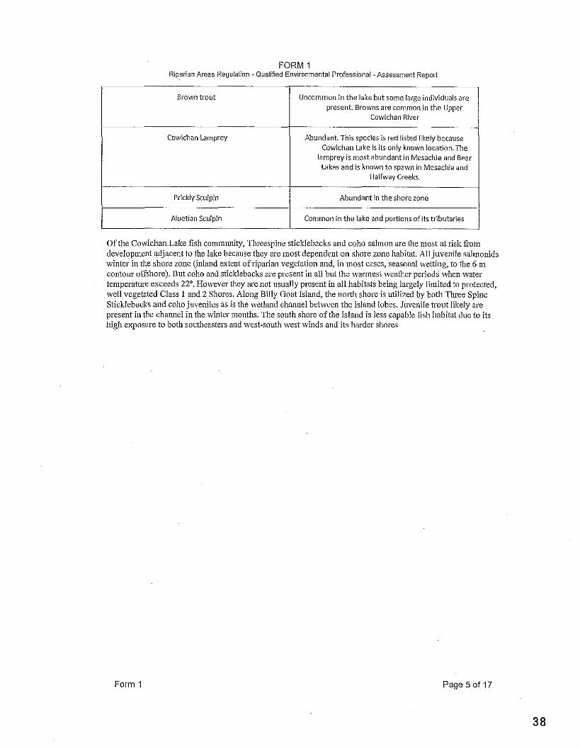
FORM 1 Riparian Areas Reouiaiion -Qualified Environmental Professional -Assessment Report
I lamprey is most abundant i n Mesachie and Bear Lakes and is known to sDawn in Mesachie and
Brown trout
Cowichan Lamprey
I Halfway Creeks.
Uncommon in the lake but some large individualsare present. Browns are common in the Upper
Cowichan River
Abundant. This species is red iisted likely because Cowichan Lake is its only known location.The
I Prickly Sculpin 1 Abundant in the shore zone I I Aluetian Sculpin / Common in the lake and p o r t i o n s o L f r i b u t a r 4
Of the Cowichan Lake fish community, Threespine sticklebacks and coho salinon are the most at risk fiom developnleiit adjacent to the lake because they are niost dependent on shore zone habitat. All juvenile sal~uol~ids winter in the shore zone (inland extent of riparian vegetation and, in most cases, seasoilal wetting, to the 6 m contour offshore). But coho and sticklebacks are present in all but the warmest weather periods when water temperature exceeds 22". However they are not usually present in all habitats being largely limited to protected, well vegetated Class 1 and 2 Shores. Along Billy Goat Island, the north shore is utilized by both Three Spine Sticklebacks and coho juveniles as is the wetland channel between the island lobes. Juvenile trout likely are present in the channel in the winter months. The south shore o f the island is less capable fish habitat due to its high exposure to both southeastel-s and dvest-south \vest winds and its harder shores
Form 1 Page 50f 17
FORM 1 Riparian Areas Regulation -Qualified Environmental Proiessional -Assessment Report
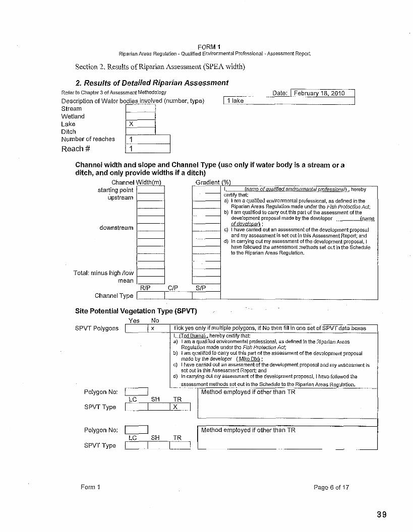
Section 2. Results of Riparian Assess~ne~~t (SPEA width)
2. Resulfs of Detailed Riparian Assessment Reier to Chapter 3 of Assessment Methodology Date: I February 18. 2010 Description of Water I I lake Stream Wetland Lake Ditch Number of reaches
Reach #
Channel width and slope and Channel Type (use only if water body is a stream or a ditch, and only provide widths if a ditch)
Total:
Channel Width(m). starting point
upstream
downstream
Gradient (%) 1, -anDrafessionan hereby certiiv that: a) I am a qualified environmental proiessional, as defined in the
Riparian Areas Regulation made under the Fish Protection Act; b) I am quaiifled to carry out this part of the assessment of the
development proposal made by the developer (name of develooerl ;
c) I have carried out an assessment o i the development proposal and my assessment is set out in this Assessment Report; and
d) In carrying out my assessment ofthe development proposal, I have iollowed the assessment methods set out in the Schedule to the Riparian Areas Regulation.
minus high /low
Channel Type
Site Potential Vegetation Type (SPW)
I assessment methods set out in the Schedule to the Riparian Areas Regulation.
Polygon NO: I Method employed if other than TR
Yes No
LC SH TR SPW Type I I I X I
SPVT Polygons I
Form 1 Page 6 of 17
I, (Ted Burns), hereby certiiythat: a) I am a qualified environmental proiessional, as denned in the Riparian Areas
Regulation made under the Fish Protection Act; b) I am qual~fied to carry out this part of the assessment of the development proposal
made by the developer (Mike ; c) I have carried out an assessment of the deveiopment proposal and my assessment is
set out in this Assessment Report; and d) In carrying out my assessment of the development proposal, I have followed the
x
--
Tick yes only if multiple polygons, if No then till in one set of SPW data boxes
Polygon NO: 0 LC SH TR
SPVT Type -1
Method employed if other than TR
FORM 1 Riparian Areas Regulation - Quaiified Environmental Professional - Assessment Report
Polygon No: / Method employed if other than TR SPVT Type / I
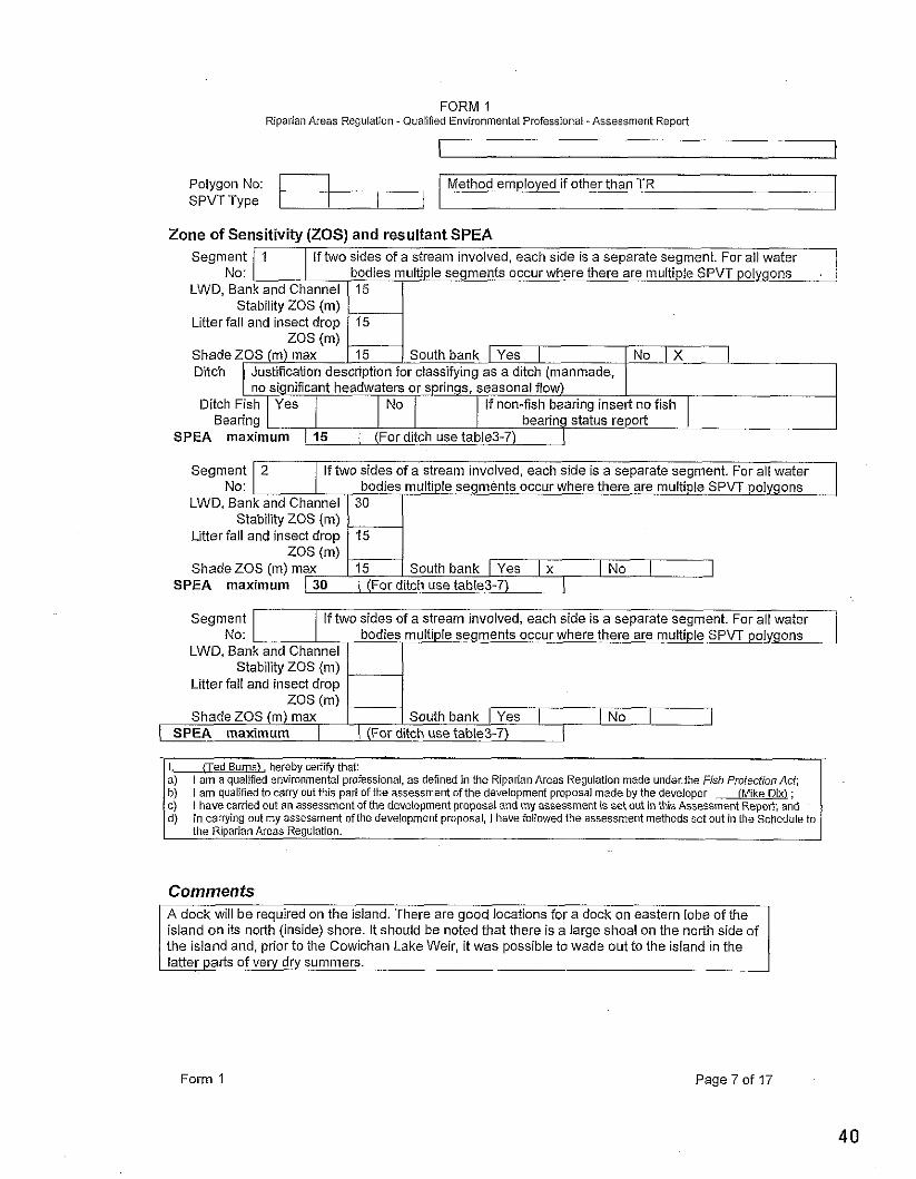
Zone of Sensitivity (ZOS) and resultant SPEA Segment / 1 I If two sides of a stream involved, each side is a separate segment. For all water I .
No: I LWD, Bank and Channel
Stability ZOS (m) Litter fall and insect droo
ZOS (m) Shade ZOS (m) max South bank I Yes I [No I X I Ditch Justiication description for classifying as a ditch (manmade,
n o n i f i c a n t headwaters or springs, seasonal flow) Ditch Fish I Yes j I No / I If non-fish bearing insert no fish I
Bearing 1-1 status report I SPEA maximum 1 15 1 (Forditch use table3-7) 1
Segment No:
Segment No:
I. (Ted Burns), hereby certi* that: a) I am a qualified environmental professional, as defined in the Riparian Areas Regulation made underthe Fish Protection Act; b) I am qualified to carry out this part of the assessment of the development proposal made by the developer (Mike Dix) ; c) i have carried out an assessment of the development proposal and my assessment is set out in this Assessment Repol?; and d) in carrying out my assessment of the development proposal, I have foiiowed the assessment methods set out in the Schedule to
the Rlparian Areas Regulation.
2
If two sides of a stream involved, each side is a separate segment. For all water^ bodies multiple segments occur where there are multiple SPVT polygons
ZOS (m) Shade ZOS (m) max
Comments A dock will be required on the island. There are good locations for a dock on eastern lobe of the island on its north (inside) shore. It should be noted that there is a large shoal on the north side of the island and, prior to the Cowichan Lake Weir, it was possible to wade out to the island in the latter parts of very dry summers.
If two sides of a stream involved, each side is a separate segment. For all water
LWD, Bank and Channel Stability ZOS (m)
Litter fall and insect drop ZOS (m)
Shade ZOS (m) max
LWD, Bank and Channel Stability ZOS (m)
Litter fall and insect d r 0 ~
South bank 1 Yes 1 I No /
Form 1
bodies multiple segments occur where there are multiple SPVT polygons
( SPEA maximum 1 1 (For ditch use table3-7) 1
Page 7 of 17
SPEA maximum 1- 30
30
15
15 South bank I Yes I x I No 1 1
FORM 1 Riparian Areas Regulation -Qualified Environmental Professional -Assessment Repoii
Section 3. Site Plan
Form 1 Page 8 of 17
FORM 1 Riparian Areas Regulation - Qualified Environmental Professional -Assessment Report
Section 4. Measures to Protect aid Maintain the SPEA i h s sx;I on IS r e m ' r r a$u l -?s . ;cs j l i r ; s Atlach :ei l or i':?l.melll f .:s, as n:cI 'cr i i a c i E zm?nr d sc.ss?d 1 rn3p!cr 1 1.3 c f A ~ i ( : s ~ ~ i ? n l E.41:lnod.: s;y I: s s.;32ili-a tllal ::ocLnl-21,:s b? c.:nv?l'<:n to ?Dl: b~i: , .? n i ~ r ' r g n.u .I.> 3ssessrnc:nr ,cooit L s ? )c:.r rc?llrn' o-ti01 on y1.r %<?ybc:rj n k r -..as11 i 112. Yo. r L s 1 address and sign off each measure. If a specific measure is not being recommended a justification must be provided.
1. Danger Trees There are some large Douglas fir vets on the island that are around 1 m diameter breast height. The trees appear wind firm and show little evidence o f die back or their advanced age. However, it is always possible that one o r more of these huge trees could come down o r lose branches in a heavy storm. T h e trees will be assessed for risk and appropriate measures will b e employed to reduce the risk as much as possible. Gord Closson of South Coast
I Standing Stem will make the assessment. I. i i ed Burnsl, hereby certiiy that: e) I am a qualified environmental professional, as defined in the Riparian Areas Regulation made under the Fish
Proterfion Act' ..... ~ ~~~, I am qualified to carly out this part ofthe assessment of the development proposal made by the developer (MiRe: I have carried out an assessment of the development proposal and my assessment Is set out in this Assessment Report: and In carrying out my assessment of the development proposal, I have foilowed the assessment methods set out in the Schedule to the Riparian Areas Regulation
I the land. It is very stable. -
I, l i e d Burns), hereby certify that: a. I am a qualified environmental professional, as defined in the Riparian Areas Reuulatlon made under the Fish
Windthrow
1 noted assessment will examine the pbssibiiity of windthrow. I. (Ted Burns), hereby certify that: a. I am a qualied environmental professional, as defined in the Riparlan Areas Regulation made under the Fish
Protection Act; b. I am quaiified to carry out this pad of the assessmenl of the development proposal made by the developer
(Mike; c. I have carried out an assessment of the development proposal and my assessment is set out in this Assessment
Report; and In carrying out my assessment of the development proposal. I have followed the assessment methods set out in the Schedule to the Riparian Areas Regulation
Although there are some old growth Douglas firs on The island of great size, there is little evidence of blow
down o r branch loss. Trees ail appear to b e quite wind firm.
Could clearing for the structures open the area t o higher Wind speeds? This is doubtful because of the small area Involved. The island forest is fairly thin as it is and an Increase in wind intensitv is not ant ic i~ated. The above
3. Slope Stability
I equipment to the work site (s) -
1, fled Burnsl, hereby certify that: a. i am a qualified environmental professional, as defined in the Riparian Areas Regulation made under the Fish
There are no significant slopes on the island which is somewhat flat or very gently rolling. There is one knoll on the east lobe which is some 5-10 m higher than the rest of
Profection Act; b. I am qualified to carry out this part of the assessment of the development proposal made by the developer
(Mike; C. I have carried out an assessment of the deveiopment proposal and my assessment is set out in this Assessment
Report; and In carrying out my assessment of the development proposal, I have followed the assessment methods set out in the Schedule to the Riparian Areas Regulation
Form 1 Page 9 o f 17
4. Protection o f Trees Trees not in the way o f the home sites o r access to them wiil be ~10 tec ted bv snow fencinct which wiil confine
FORM 1 Riparian Areas Regulation -Qualified Environmental Professional -Assessment Repolt
Form 1
Protection Ad; b. I am qualified to carry out this pari of the assessment of the development proposal made by the developer w; c. I have carried out an assessment of the deveiopment proposal and my assessment is set out in this Assessment
Report; and in carrying out my assessment of the development proposal. i have followed the assessment methods set olrt in the Schedule to the Riparian Areas Regulation
Page 10 of 17
5. Encroachment There is some potential for encroachment during construction and snow fencing will isolate the work site (s) from the surrounding forest once equipment and materials are on site. The SPEAS will be clearly marked with low fencing around the home site once construction is over. SPEA symbols will also be attached to trees.
I, (Ted BurnsL hereby cedify that: a. I am a qualified environmental professional, as defined in the Riparian Areas Regulation made under the Fish
Protection Act b. I em quaiified to carry olrt this part of the assessment of the development proposal made by the developer
(Mike; c. l have carried out an assessment of the deveiopment proposal and my assessment is set out in this Assessment
Repolt; and In canying out my assessment of the development proposal, I have followed the assessment meUlods set out in the Schedule to the Riparian Areas Regulation
6. Sediment and Erosion Control Heavy construction will be limited to the dry months. There are no moist areas near the potential building sites and the small footprint and low relief insure that no sediment generation will occur.
1, fled Burns), hereby cenify that a. I am a quaiified environmental pmfessional, as defined in the Riparian Areas Regulation made under the Fish
Protection Act; b. l am quaiified to carry olrt this part of the assessment of the development proposal made by the developer
(Mike Bk) ; c. I have carried out an assessment of the development proposal and my assessment is set out in this Assessment
Repoli; and In carrying out my assessment of the development proposal, I have followed the assessment methods set out in the Schedule to the Riparian Areas Regulation
7. Stormwater Management Storm water runoff generated by the small surface areas involved will be miniscule. Nonetheless, rock pits will be installed at the downspout outfalls to buffer the flow and direct it into the porous island soil.
I, (Ted Burns), hereby certify that: a. I am a qualified environmental professional, as defined in the Riparian Areas Regulation made under the Fish
Profection Act; b. I am qualified to c a w out this pari of the assessment ofthe development proposal made hy the developer
(name of developer) ; c. I have carried out en assessment of the development proposal and my assessment is set out in this Assessment
Report: and In carrying out my assessment of the development proposal, I have followed the assessment methods set out in the Schedule to the Riparian Areas Reguiation
8. Floodplain Concerns (highly mobile channel)
Of course there is no mobile channel here but there is some floodplain. The eastern most 35 m of the west lobe of the island is subject to flooding. This area is flooded by wave surges at high water and is covered with drift wood. The building site is well above flood level of 167 plus.
I, (Ted Burns). hereby certify that: a. I am a quaiified environmental professional, as defined in the Riperian Areas Regulation made under the Fish
Profection Act; b. I am qualified to carry outthis pait of the assessment of the development proposal made by the developer m; c. I have carried out an assessment of the development proposal and my assessment is set out in this Assessment
Report; and in carrying out my assessment of the development proposal. I have followed the assessment methods set out in the Schedule to the Riparian Areas Regulation
FORM 1 Riparian Areas Reguiafion -Qualified Environmental Professional -Assessment Report
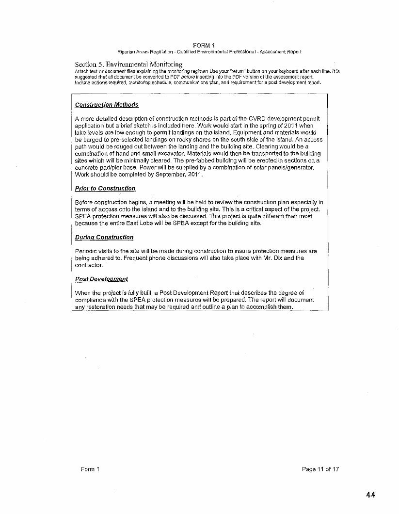
Section 5. Environ~neiltal Monitor ing
Consfruction Methods
A more detailed description of construction methods is part of the CVRD development permit application but a brief sketch is included here. Work would start in the spring of 201 1 when lake levels are low enough to permit landings on the island. Equipment and materials would be barged to pre-selected landings on rocky shores on the south side of the island. An access path would be rouged out between the landing and the building site. Clearing would be a combination of hand and small excavator. Materials would then be transported to the building sites which will be minimally cleared. The pre-fabbed building will be erected in sections on a concrete padlpier base. Power will be supplied by a combination of solar panelslgenerator. Work should be completed by September, 2011.
Prior to Construction
Before construction begins, a meeting will be held to review the construction plan especially in terms of access onto the island and to the building site. This is a critical aspect of the project. SPEA protection measures will also be discussed. This project is quite different than most because the entire East Lobe will be SPEA except for the building site.
Durinq Construction
Periodic visits to the site will be made during construction to insure protection measures are being adhered to. Frequent phone discussions will also take place with Mr. Dix and the contractor.
Post Develo~ment
When the ~roiect is fullv built, a Post Develo~ment Report that describes the degree of complianci? w.ith the SPEA p;otection measires will be prepared. The report wilidocument any restoration needs that may be required and outline a plan to accomplish them.
Form 1 Page 11 of 17
FORM 1 Riparian Areas Regulation - Quaiified Environmental Professional -Assessme
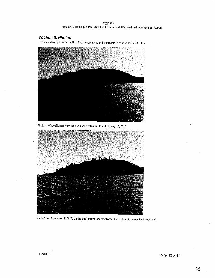
Section 6. Phofos Provide a description ofwhat the photo is depicting, and where it is in relation to the site plan
Photo 1: View of island from the norih. All phatos are from February 18,2010
Photo 2: A closer view: Bald Mtn.in the background and tiny Sweet Gale island in the centre foregro
Form 1
und.
Page 12 of 17
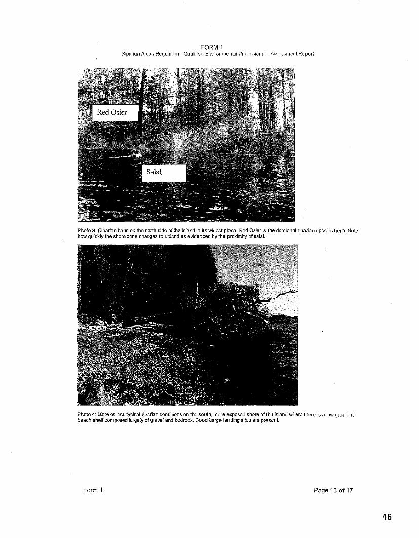
FORM 1 Riparian Areas Regulation -Qualified Environmental Professional -Assessment Report
Photo 3: Riparian band on the north side of the island in its widest place. Red Osier is the dominant riparian how quickly the shore zone changes to upland as evidenced by the proximity of saial.
Photo 4: More or less typical riparian conditionson thesouth, more exposed shore of the island where there beach shelf composed iargely of gravel and bedrock. Good barge landing sites are present.
lecies here.
; a low grad
Note
ient
Form 1 Page 13 of 17
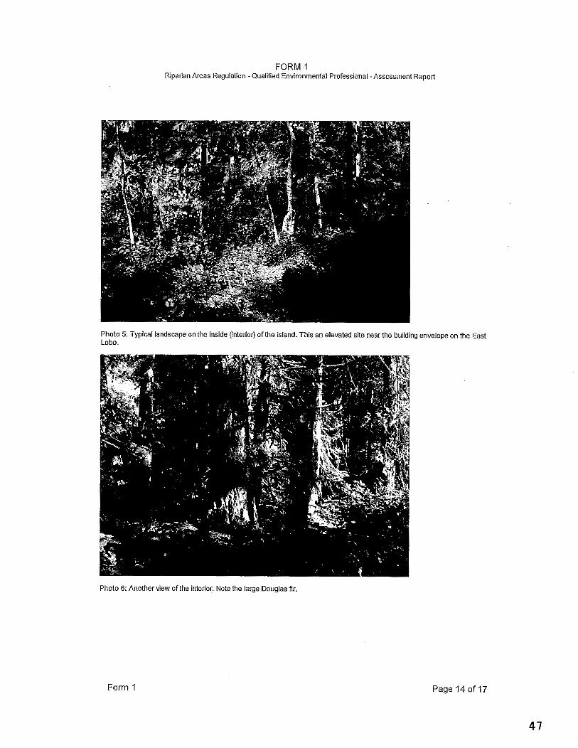
FORM 1 Riparian Areas Regulation -Qualified Environmental Professional -Assessment Remi t
Photo 5: Typical landscape on the inside (interior) of the island. This an elevated site near the building envelope on the East Lobe.
Photo 6: Another view ofthe interior. Note the large Douglasiir
Form 1 Page 14 of 17
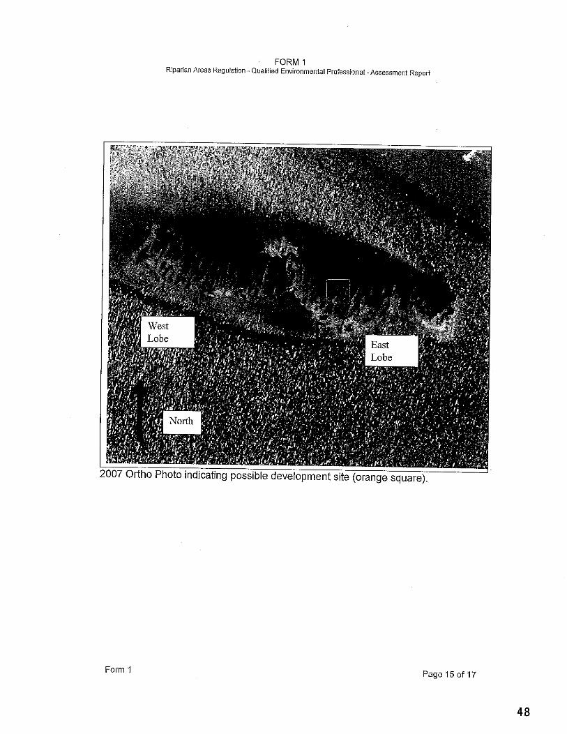
FORM 1 Riparian Areas Reguiation -Qualified Environmental Professional - Assessment Repoii
Form 1 Page 15 of 17
FORM 1 Riparian Areas Regulation -Qualified Environmental Professional -Assessment Report
Section 7. Professional Opinion
Assessment Report Professional Opinion on the Development Proposal's riparian area.
Date I February 28, 10 1 1. I/We Ted Burns
Piease list narneisl of Qualified environmenlal ~rofessionalls) and their orofessionai desisnation that are invoived in assessment.1
hereby certify that: a) I amme are qualified environmental professional(s), as defined in the Riparian
Areas Regulation made under the Fish Profecfion Act b) 1 amme are qualified to carry out the assessment of the proposal made by the
developer (Mike Dix) , which proposal is described in section 3 of this Assessment Report (the "development proposal"),
c) I haveme have carried out an assessment of the development proposal and mvlour assessment is set out in this Assessment Re~ort: and
d) ln.carrying out mylour assessment of the developm&t proposal, I haveiWe have followed the assessment methods set out in the Schedule to the Riparian Areas Regulation; AND
2. As qualified environmental professional(s), Ilwe hereby provide mylour professional opinion that: a) if the development is implemented as proposed by the development proposal
there will be no harmful alteration, disruption or destruction of natural features, functions and conditions that support fish life processes in the riparian assessment area in which the development is proposed, OR
(Note: include local government flex letter, DFO Letter of Advice, or description of how DFO local variance protocol is being addressed)
b) if the streamside protection and enhancement areas identified in this Assessment Report are protected from the development proposed by the development proposal and the measures identified in this Assessment Report as necessary to protect the integrity of those areas from the effects of the development are implemented by the developer, there will be no harmful alteration, disruption or destruction of natural features, functions and conditions that support fish life processes in the riparian assessment area in which the development is proposed.
[NOTE: "qualified environmental professional" means an applied scientist or technologist, acting alone or to(j~:l ?r :.:ih ancker 0 .s '?J cnb'r~l 1 cnt i l ~rch;; .n.l f
~ 1 ) 1113 ir.:;b s 1?g.S:11+J and n ~ o c o r t ino :r~ i l l i r i s i , (:ol~.llt'3 .; m a11 app':pna:e n f?s- ora ~1,q?n.?al'cn ~ 7 n j l t ~ t e 1 ~ n d i r $11 Act dr . :^~ .o&;ctn~t :ISSO: i : ' l l l i :oJ+ l1c:l :i .; .b;lct to c i- r I .irv . . action by that association, (b) the individual's area of expertise is recognized in the assessment methods as one that is acceptable for the purpose of providing all or part of an assessment report in respect of that development proposal, and (c) the individual is adng within that individual's area of expertise
Form 1 Page16 of 17

Form 1
FORM I Ripaiian Areas ReguiaBon -Qualified Environmental Professional - Assessment Report
Page 17 of 17
Schedule 7
1 Draft 7C Jan 21,2009
ProtocoI for Management of Riparian Area Regulatioion Variances
Between the Department of Fisheries & Oceans
and the Ministry of Environment Purpose:
The Deparbnent of Fisheries and Oceans (DFO) aid the Minisby of Enviromunent share responsibility for the deliveiy of consel~ation amid protection measures for fish and fish habitat under the Fishevies Act (FA). 111 the case of riparian vegetation, this is prhnitl'ily through S. 35(1) of the FA which milalces it illegal to hamlnfully alter, disiupt or destroy (HADD) fish habitat unless Authorised by S. 35(2) of the Act. Additional responsibilities for riparian protection deiive f?om the Riparian Areas Regulation (RAR) of the BC Fish Protection Act. Section 4(3) of the RAR allows for development to proceed within the Streamside Protection and Enhancement Area (SPEA) if DFO provides approval. The conditions upon which such approvals will be granted is explained in Section 3.4.2 of the Riparian Avea Regulation Guidebook (Januuy, 2006); specifically, approvals, lcnolvl~ as variances, will be granted when there is a hardship, or special circu~nstance. This protocol provides additional specific infonnation detailing the conditions and circumstances when such variances will be considered.
The following vaiance protocol is for local govenments (LG), developers and RAR- compliant Qualified Envirolllnental Professionals (QEP's) and is intended to infoiln all ]-'dies as to how Streamside Protection and E~lhancemnent Area (SPEA) variance RAR refemvals will be managed, including guidance relevant to final decision-mnakiug by DFO and the Minishy of Enviromnent (MoE). The variance protocol provides specific standards and inethods to detennine the amount of allowable encroach~nent into the SPEA ul cases of undue hadship and is based on site specific considerations such as the property size, configuration and present environmental condition (Appendix 1).
An important change to the previous process is that LG letters of support pertaining to undue hardship <kl no longer be required, as the methodology within the will determine if there is a justification of hardship.
Variance requests for which there is no undue hardship will not be supported by either agency.
Undue Hardship:
DFO and MoE will only co~lsides variance requests in circumstances where there is undue hardship. A deteimination of undue hardship will be made where no pmivate development of the laud remains available to the landowner1.
For example, a determination of undue hardship can be made where the project is a single, legal lot which:
a) was created in accordance with fish habitat legislation and guideliues of the day;
1 . R~parianProtcction and Compensation -Fish Protection Act-prepared by Linda Nowlan, West Coast Environinental Law Research Foundatioll for the BC Ministq of Environment, La~llds and Parks, Ja1ua.q 1999.
2 Draft 7C Ja l 21,2009
b) cannot be reasollably developed for the pmpose for which the lot was created with the curreill zoning and the required SPEA, and,
c) the Local govemneilt has relaxed other development restrictions as inuch as reasonably possible.
Situations where application of the SPEA still allows some uses of the land, even if those uses are unsatisfactory or less econol~lical to the landowner will not be considered to have undue hardship. At the subdivision stage or rezoiliug stage a loss of developlnent potential will not col~sidered ?due hardship.
Through the provincial RAR, the SPEA is recognized as an ecologically impoi-tant area that is to remain protected f?om developmnent. 'Illerefore, developinent sites that ineet the undue hardship criteria lnust be designed to minimize the development footprint within the SPEA and to provide offsetting measuses (i.e. illitigation or coinpensation) for any unavoidable encroachnent (Appendix 2).
Period of Effectiveness:
The variance protocol will remain in effect until December 31,2010 at which time it may be retained for a speciiied period of time, updated or discontinued. The protocol inay also be modified at my time should changes to RAR and/or policy warrant this action. Any changes to this protocol will be registered on the MoE RAR website.
Geographic Area of Effectiveness:
The variance protocol applies to all portiolls of the Province of BC in which the RAR applies (i.e. portions of Vancouver Island, the Lower Mainland and Sunshine Coast, the Thoinpson-Nicola Regional District, t l~e Coluinbia-Shuswap Regional District, and the Okanagan, Kettle ald S~nillfaneen areas, covering in whole or in p a t all of Mi isby of Enviromneut Regions 1,2,3,5 and 8 (see attached map, Appendix 3).
Variance Protocol:
The RAR places certain responsibilities on DFO and MoE as they relate to vaiiances of the Streanside Protection and Eilhaucemeut Area (SPEA).
Variances are of two fonns: 1. The SPEA can not be accommodated by the development plan, or local
govennnent permitting agency, a ld the~e is likely a HADD of fish habitat requuing a Fishevies Act S. 35(2) Autl~orisation.
2. The SPEA can not be inaintained by tile developme~lt plan, or local goveilunellt pelmining agency, but there is not necessarily a HADD of fish habitat.
The intent of the RAR is to protect areas of both existing a ~ d potential vegetation. Therefore, prior to applying this protocol to Non-HADD SPEA Variances or considering and applying to DFO for a SPEA variance with a HADD, tile QEP/proponent must uilderialce the following:
a) The project proposal must be assessed for all reasonable redesign a ~ d relocation options to avoid need for a SPEA Variance.
b) The QEPIProponent inust wok with the LG to consider changes to other ~nuilicipal restrictions such as adjusting other propeity line setbacl; requireinents or ii-outage distauces prior to their request for variance of the SPEA boundary.
c) Local Goveimnents have some limited discretionruy power to "flex" the SPEA boundary. Therefore, work with the Local Govemnent to apply "flexing" where appropriate.
d) Determine that there is no optioil to undeitake a reasonably sized developilient appropriate for the zoning, and therefore there would be an Undue Hardship if a variauce was not granted (direction in detenllining "reasonable" is provided in Appendix 1).
If there is still a requirement to encroach into the SPEA that can not be accoimodated by any of the above options, then the QEP must provide written verification that tliere has beell eveiy effoit made to relax other LG restrictions on the development such as fiont and side yard setbacks. Appendix 4 provides a template letter the QEP aud LG's can use to document the ve~ification.
Additional considerations in the deteimination of Variance allowances, as per Appendix 1, include the present condition of the property and the relative health and environmental functiorl of the riparian zone.
Propelties that have been previously developed and have a relatively low riparian h c t i o n ase defmed as "Brownfield" and tlie QEP will be expected to assu-e agencies that the project will not cause a HADD of fish i~abitat. T o determine if a riparian area is modified to such a degree as to be defined as "BrowSeld", if less than 30% of the site poteiltial vegetation is remaining, the site is to be considered a Brownfield site. The alteration must be froin histoiic activities aid not relate to recent property rnodifications. Propei-ties that are in a relatively unmodified state and have good riparian function, are considered "Greenfield". Greenfield Variances will likely result in a HADD determination. Therefore, if 30% or inore of the ripaian site potential vegetation is remaining, it is a "Greeilfield" site.
Only after all tile above considerations have beeu made can:
- the vasiance protocol be applied to Non-HADD SPEA variances wit11 subinission of notification to DFO; or, - the proponent apply to DFO for a SPEA Valiance with a HADD.
The Methodology to Deterrnirte the Degree ofAllowable Erzcroaclzaze~ft into the RAR SPEA under an Undue Hardslzip Justzjicatiorz in Appendix 1 is to be followed to determine the size, location and configuration of a development within the SPEA.
Encroachment nill require offsetting measures. Brownfield sites requiring mitigation shall follow the Mitigatiorz Measures Process and Standards in Appendix 2. For Greenfield sites, cornpensahon wi l l be negotiated by a DFO Habitat ~Gagernent assessor.
Process completion:
Non-HDD SPEA Variance
4 Draft 7C Jan 21,2009
If upon the co~npletion of an FAR assessment, a QEP determines that tlie SPEA can uot be accolmnodated, an undue hardship exists and confnuli~s that in their opinion that there will not be a HADD of fish habitat after the application of redesign, relocation and mitigation measures, then the project niay proceed provided that all the following have occurred:
the Methodology to Determine the Degree of Allowable Encroachnzent into the RAR SPEA under an Uizdue Hardship Justificatioiz ill Appelldix 1 is followed;
the initigatiou measures defined in Appendix 2 are applied; and
all the QEP's guidance and direction and any additional lneasures t l~a t 'ma~ be required to avoid a HADD of fish habitat are incolporated into the design.
The project call then be submitted to DFO. DFO will review tile project if it is in sahnon bearing habitat. For resident only habitat, the project will be referred to MoE to ~uldertalte the review and decision. If DFO or MoE's decision supports the variance request, a letter will be issued by DFO that must the11 be appended to the RAR assesslnent and submitted to the RAR Regisby. A A SPEA Variance can not be registered without such a letter of approval.
When registering their RAR Assessment in the notification system, the QEP will be required to include, attached to their assessment report, a lettev stating:
1. that the project is deemed to be a non-HADD aud explain how the brownfield detennination was made;
2. that their results were reached following this protocol document;
3. how the SPEA variance requirement was detelmined;
4. the llotification is being made in accordauce with direction provided by the DFO-MoE Variance Protocol document; and,
5. their professiolial opinion that if the development is implemented as proposed there will be no ha11-nful alteration, disruption or destmction of nak-a1 features, functions and conditions that suppo~t fish life processes in the ripaian assessment area.
The agencies will inonitor notifications to velify the accuracy and approp~iate~~ess of QEP EIADD determinations, the compliailce of developu~ents with QEP- prescribed mitigation measures and the effectiveness of these measures in avoiding a HALID of fish habitat.
SPEA Varia~zce with HADD
If, upon the completioll of a RAR assessinent, a QEP dete~ulniues that the SPEA cau not be accoimodated, a situation of undue hardship exists, and that there will be a HAI)D of fish habitat after applicatioil of redesign, relocation, iuitigation and other local govelnment measures, and as such the developnleut will require a FA S. 35(2) Authorisation with coipe~~sation to legally proceed, the development proposal is to be submitted for review by DFO. The project will still be required to follow the A!lethodoIogy to determine the degree of allowable eizcroachnzerzt into the RAR SPEA under an Undue Hardship JustrJicatio7z in Appendix 1. If DFO agrees that
5 Draft 7C Jan 21,2009
no other options exist, proposed comnpensation options for the HADD nlay be discussed with the appropriate DFO Habitat Management assessor. In order for the Depa~anent to properly assess the developnlent proposal and come to a decision as to whether to Authorise the proposed HADD or not, it will lilely be necessay for the proponent and QEP to provide the Deparhnent with Inore ulfollnation than is provided in an RAR assessment.
For all proposed HADD's in both sahnon (anadromous) and resident (11011- anadroinous) habitat, the developlueut proposal should be submitted to DFO with all infoilnation detailed in the Proporzent's Guide to Informatiorz Reguire~nents fov Review Under the Fish Habitat Protection Provisions of the Fishe1,ies Act. DFO will forward non-ana&omous I-IADD project proposals to MoE to assess risk to resident habitat and fish stocks.
Once a completed proposal for coinpe~~sation is received by DFO, DFO will review the infollnation provided and when applicable also consider MoE's assessment of foreshore aud habitat values in resident fish habitat. DFO will then deteimine if the proposed HADD of fish habitat should be authorised and will subsequeutly notify the appropriate paities (i.e. the QEP, MoE and the local goveimnent) of the decision. DFO will also consider MoE advice aud recolnmendatioils for appropiiate compensation requirements in resident fish habitat aseas. In most instances, a decision by the Department to issue a FA s. 35(2) Authorisation will trigger au environmental assessment under the Canadian Erzviroizrnerztal Assessnzeizf Act (CEAA).
Authorisations will be monitored for colnpliance with their te~ms and conditiolls.
It is the proponents' responsibility to ensue that all other legislation and regulations are met including, but not lunited to, the tfildli$e Act, the Species at Risk Act, the Water Act, md Local Government Bylaws. Although it is not a requirelnent of RAR, it is recommllended that this illfo~mation be included in the assess~nent I-epolt.
6 Draft 7C Jan 21,2009
Appendix 1
Methodology to Determine the Degree of Allowable Encroachment into the RAR SPEA under an Undue Hardship Justification.
1. Worlc with Local Gove~mueut (LG) to maximise LG setbaclcs and flexing options to accommnodate the development footpiint. The sublnission to DFO should provide written documentation of the effoits made to avoid ei~croaclunent into the SPEA, and that other options to acco~mnodate the development footprint are uot feasible.
2. Assess the total potential developable area of the site above the Mean Anuual High Water Mark (MAHWM), or designated lalce elevation / floodplain elevation. The developable area is the poltion of tile propeity that is not constrained by non-SPEA development restrictions. However, the SPEA may be included in the overall property area for the pupose of calculating the total developable area. Easements, right-of- ways (ROW), LG property setbacks and topographical constraints significant enough to preclude development should be subtracted fiom the overall property area to deteilnine the developable area, unless the restriction, or a portion of it, can reasonably be incorporated into the SPEA. See the attached diagram (Figure 1) for assistance.
3. A QEP is required to assess if the site is a Brownfield or Greenfield.
4. Undue hardship will only be collsidered in those situations where:
The development footpiu~t is less than 40% of the developable area on Brownfield lots, or - The development footprint is less than 30% of the developable area on Greenfield lots (see pg. 3 of the Protocol for d e f ~ t i o n s of "Brownfield" & "Greenfield".
lfthe developmentfootprint con not be achievedwithoud encroachnzent into the SPEA, and an Undue Hardship exists, a SPEA vaviance 17zay be requested.
The develop~nent footprint is to include all buildings aud other hard surface features, including proposed and existing buildings, outbuildings including garages, sheds, upland boathouse, gazebos, driveways, walkways, paths, patios, and decks.
5. The proposed develop~nent footprint within the SPEA is to be configured in such a way as to minimise the encroachment toward fish habitat (e.g. water's edge); therefore, the proposed development is to be located as far upland as possible. The footpint is to be tight to front yard and side yard setbaclcs, and there will be 110 feature projections into the SPEA, such as a building wing, pool, deck or overhanging sbuctures.
A project that clearly demonstrates that all standaxds have been achieved is lilcely to be approved without significant delay in the review process. Projects that do not mueet the variance protocol measures or are likely to cause a HADD, will r e q ~ - e a more detailed review. DFO will consider if the review can be accommodated though local government El~viro~nnental Review Co~muittee's, a semi-annual project review meetkg held between DFO, MoE and the LG, or via other legislative mechanisms such as review under CEAA.
Any proposals that exceed the allowable percentage will be rejected.

7 Draft 7C Jan 21,2009
Figure 1. Exar~tple Site Plurz to Defer.~zine the Developable Avea of a Browrfield Site usiizg the RAR Variance Protocol.
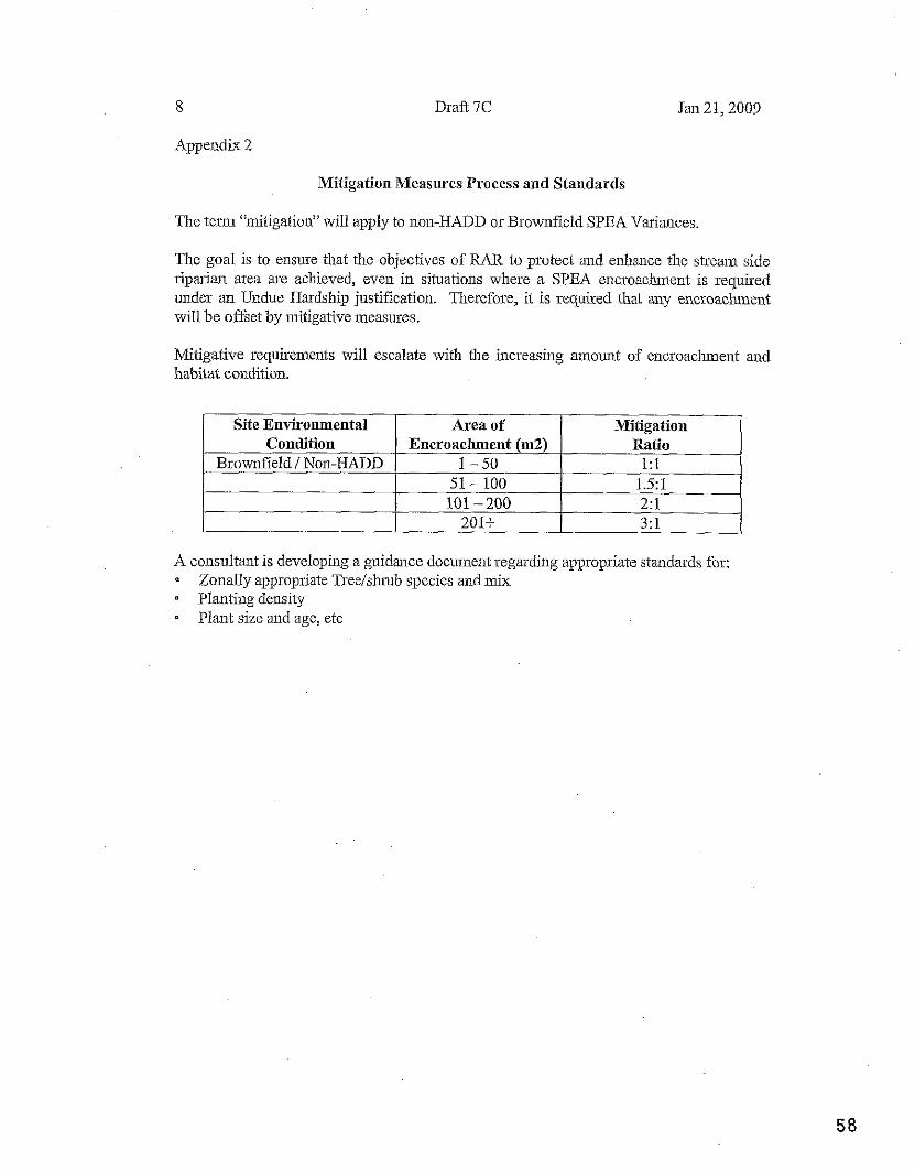
Appendix 2
Mitigation Measures Process and Standards
The telm 'initigation" will apply to non-HADD or Brownfield SPEA Variances.
The goal is to ensure that the objectives of RAR to protect and enhance the streau side riparian area are achieved, even in situations where a SPEA encroacluneut is required under an Undue Hardship justification. Therefore, it is required that any encroachment will be offset by ilutigative measures.
Mitigative requirements will escalate with t l~e increasing ainount of e~icroaclunent and habitat condition.
A consultant is developing a guidance docuinent regarding appropriate standards for: Zonally appropriate Treelsluub species and mix Planting density - Plant size and age, etc
Site Environmental Condition
Brow~lfield / Non-HADD
Area of Encroachment (m2)
1-50 51 - 100 101 - 200
201t
Mitigation Ratio
1:l 1 5 1 2:l 3:l
9 Draft 7C Jan 21,2009
10
Appendix 4
Draft 7C
Local Government Letterhead
Jan 21,2009
Date File #:
Contact N m ~ e Coinpany Date Address City, BC, Postal Code
Dear Sir or Madan:
QEP Assessmeilt # - Site Address (Legal)
Local Government Template Letter to Confirm Local Government Setback Relief
The (CitylDistricllVillageIRegional District) has reviewed the Riparian Areas Regulation (RAR) assessinent report for the above Property and the proposed inodified side yard and ftont yard setbacks.
The report proposes a nlodified Streamside Protection and Enhancement Area (SPEA), such that iu the opinion of the Qualified Envirolmental Professional (QEP), the overall ripaim area will fuuction to protect and enhance fish habitat values. In order to achieve the desired outcomes, the developinent is requixed to be placed as far from the high water inarWnatura1 boundary as reasonable. We aclcuowledge the level of effort given it1 the developinent plan to avoid the SPEA bounday.
The (LG) has agreed and approved the reduction of ftont and side yard setbacks horn X mebes to Y metres in order to maxiinise the developmern~t's setbaclc 50111 the high water marld~latural boundary.
Thus repoit will foim tile basis for support of a Developineirt Variance Peimit to (LG) Council wit11 regards to the protection of the natural featru-es, fuuctions and conditions that support fish life processes.
Respectfully,
(Title)
Schedule 8 Minutes of Electoral Aria I (Yaubouihieade Creek) ArcaPlmning CommissionMeeting held on September 7,2010
- 1 -
.*% 'E
CVRD
MHWTES OF ELECTOM% AREA 1 (Youbomeade Creek) AREA PLANNIXG COmISSBON I V E E T ~ G
DATE: September 7,2010 TIME: 7:OOpm
MINUTES of the Electoral Area I Planning Comlission meeting held on the above noted date andtime at the Youbou Upper Co~nmuuity Hall, Youbou, BC. Called to order by Chairperson Mike Mms at 7:05pm.
PRESENT: Chaiqerson: Mike Marrs Vice-Chairperson: Members: Jeff Abbott, S h a m Carlow, Gerald Thorn,
ALSO PRESENT: Director: Klaus Kuhn (7:30pm) Alternate Director: Recording Secretary: Tara Daly
REGRETS: George deLuse, Erica aiffith, Pat Weaver
GUESTS: Michael Dix, applicant for 3-I-1ODPIVAR (Dix); Pat Tosczak, delegation for 3-1- 1ODPNAR (Dix), Tyler Clarke (Lake Cowichan Gazette), Michelle Weisgerber, Trevor Gillott, Norma O'Connell, Dale O'Connell, Floyd Augustine, B a ~ y McLachlan, Rose Steven
AGENDA: It was Moved and Seconded to accept the agenda.
CARRIED
MINUTES: It was Moved andSeconded to accept the nzinutes ofJuneI, 2010 as circulated
CARRIED
DELEGATION. APPLICATION 3-I-1ODPNAR (DM) - M. Mairs explained the APC is an advisory body with final decisions being made by the CVRD Board of Directors; the applicant will make a presentation, the Commission men~bers will ask questions if needed, and then a recommendation will be made ifthe Colnrnissioll so desires; the public is only able to listen unless they've asked to make a presentation
e Michael Dix. the applicant, told the Commission he has been a resident property owner (sharel~older in Cowichan Lake Recreational Com~unity fornlerly Bell's Marina) in Youbou for the last four (4) years, has owned Billy Goat Island for the last five (5) years, and has been in the Cowicllan Lake area for the last ten (lo) years; he has taken time to deterwine how he wishes to develop Billy Goat
Minutes of Electoral Area I (Youbou/Meade Creek) AnaPlzmiug Commhsionhleeiing held on September 7,2010 - 2 -
Island, wants to keep it as piistine as possible, has picked up gxbage left by people usiug the island, hasn't put up 'private' signs.
o Mr. Dix noted, ill his opinion, the island's current LR1 zoning sl~ouldn't be applicable to islands and that Covvichan Lake islands recoguized as #3 and If4 are not mentioned in the Area I (YoubodMeade Creek) OCP; he has had dealings with CVRD Planning staff ~ o u g h developments in the Mill Bay1 Cobble Hill areas which focus on afFordable housing.
o the cment zoning allows one (1) dwelling wit11 a 60m set-back; Mr. Dix is asking for a bend of the SPEA to allow for a second dwelling
0 both dwellings would be above the 200 floodplain (165m) with top of the line septic systems Ted Burns, registered biologist, has little problem with development of the island
0 questionslcomments -the variance1 relaxation of the SPEA would be for the entire footprint as both dwellings would be within the Riparian Areas Regulations
a Has there been a detailed survey done? The island was staked out in the course of the backgvoundwork done in relation to the possible raising of the weir.
0 What kind of septic system? Type 3, full treatment, similar to what is currently on Island #5.
0 Has there been an mborist repoit done? Only the assessment done by Ted Burns. 0 Would there be a conuection or pathway between the two (2) dwellings? Yes, but
Seven (7) nzonths of the year that area is under water. o Are you aware of the vandalism that has occurred on some of the islands? Yes,
Island Sf3 and Island #5. 0 What kind of Lighting? Solar.
What kiud of heat source? Have nopuoblenz with covenants inplace the saine as Island #3.
Q How high would the dwelling be? It would be below the nzaxiilzurn allowed but built up on piles to keep clear of the winter weather; with the cupent stakes (inarkings) two-thirds of the house height would be above the pilings.
0 Would you live there y e a round? No, it wouldn't be theprinzaiy residence but it would be usedyear uouizd - How would the island be accessed? Fronz the lot currently olvned at Cowichan Lake Recreational Community. What is the size of the island? 3.56 acres.
Q Are you willing to sell the island? No, Iwant to enjoy the li$estyle the island will offer.
0 discussion/ comments by Commission members - don't understand why DFO puts iu regulations1 Nles and then allows them to be broken (refexling to Ted Buns assessmnemlt); setbacks are 15111 on the south facing side and 20m on the 110141 faciug side with the Riparian Areas Regulations (SPEA) set at 30m which effectively leaves no buildable land on the island; the relaxation of the SPEA would be needed for any dwellings on the island
dates back several decades in their attachment to Youbou. They are stroirongly opposed to t l~e development of Billy Goat Island. The natural environment needs to be p~otected; DPA aud Riparian Areas regulations need to be maiutained. The. island is home to a beaver danl and nesting area for Cauada geese. It is
Minutes of Electoral Area I (YoubouMeade Creek) AreaPIannjl~gCommi~~ionh?eetiug held on September 7,2010 - 3 -
submerged each wiuter. Ms. Tosczak questions the staking that has been done on the island, feeling it isn't correct. 'This development needs to be nipped in the blltt.'
0 discussion/ comments by Commission members -There would be anegative impact on the adjaceut parcels. A sllort discussion was held about whether or not Cowichan Lake is considered to be the adjacent properties; most of the Youbou residents are against the application moving forward in any form; most of the island is inside SPEA regulations; CVRD should pwchase for greenspace; one (1) large building is preferable to two (2) small buildings but there is a concern over Inore and more land being gobbled up; the current zoning allows for a siugle dwelling but the land is ecologically sensitive and regulations for RAR and SPEA would have to be relaxed; allowing a second dwelling would mean a second septic system and more abuse of the sensitive areas with the walkway between the he0 (2) dwellings
o the APC needs to make a statement, statistics are showing a deterioration of Cowichan Lake water quality, much laud has already been cleared and ruined around the lake, overall impact on the lalce is a concern, regulatiolls need to be maintaiued the APC felt the application was dealing with the building of a second dwelling on Billy Goat Island as the cusent zoning allows for a single dwelling but during discussions noted that even the single dwelliug would need to have arelaxation in the SPEA in order to be built
0 the Coinmission reiterated comments made at the June lSt meeting wbich are as follows: 'after much discussion, the Commission wanted to note that any infringements on Riparian Zones are not acceptable. The public, as well as, the APC wish to maintain the existing Riparian areas around the lake and increase, if possible."
0 attached to these minutes are comments made by David Hill, P. Eng. (resident of Youbou at 10210 Youbou Road), George deLure (member of the APC md unable to attend the meeting), Gerald Thorn (member of the APC), and Mike Mans (member of the APC); also attached is the assessment done by Ted Bums
li-was Moved andSeconded fhaf the Area I (Y~"u'bbou/~eade Creek) Area Planning Comn~ission reject Application File No. 3-1-1 ODPNAR (Din;).
CARWED
0 The Colnmission thanked Mr. Dix for going through the process rather than making rash decisions and then asking for forgiveness.
BUSrNESS ARISING FROM MWUTES:
OLD BUSINESS:
NEW BUSINESS: 0 an infQrmal discussion was held with respect to Lot 62 on Cypress Road;
although an application hasn't come fo~ward to the APC or the CVRD Planning Depalkent that is known, nearby residents are reonceined with comments made by the landowner of how he wauts to development the land including building a house, hanessing Coon Skin Creek for excess power to be sold to BC Hydro, desired placement of septic, excessive removal of trees for a beiter site-line for
Minutes ofElzctoral Area I (YoubodMcade Creek) AreaPIanning Comlission hteethg held on September 7,2010 - 4 -
lake views possibly affecting the stability of the creek bank, bank parallel to Youbou Road could be drastically effected, illegal use of MoTI prope~ty with installation of gate to 1:s proper@
o Coon Skin Creek is a fish-bearing creek, the bank slope is veiy steep, the end of Cypress Road is designated as a tumaround but hasn't been done, access by Fire Department and Ambulance is limited now but with a gate would be fwther hiudered
o - existing water license holders have received colrespondence informing them that because there is now a water system throughout Youbou, the laud owner no longer has to allow their water rights on Coon Sluu Creek; it is believed there is six-monthnotice needed when water licenses are aslced to vacate
o the homeowners were given some suggestiolls on who and w-hat to do leaving it in their hands to proceed
o Boat Launch -is very muchneeded in the Youbou area, the pseudo boat launch at the end of Coon Skin Creek Road is a problem with large boats, parking, and noise; possibly have bollards installed to deter large boats from launching, hope that Youbou Lauds puts in a boat launch very near the beginning of thek development
ANNOUNCEMENTS: o Next Meeting October 5,2010 at 7pm in Upper Youbou Hall (at the call of the
chair)
The meeting was adjourned at 8:50pm
IS/ Tua Daly Secretary
Minntes of EIectard h I (YoubauiMeade Creek) AreaPluning Commission Meeting held onDecember 7,2010 -1-
4% 'e
C.V-R.D
MINUTES OF EQECTOML AREA I (YoubouMeade Creek) AREA PLANNING COMMISSION mETBNG
DATE: December 7,2010 TIME: 7:OOpm
MINUTES of the Electoral Area I Planning Commission meeting held on the above noted'date and time at the Youbou Upper Community Hall, Youbou, BC. Called to order by Chairperson Mike Mans at 7:OOpm.
PRESENT: Chairperson: Mike Mans Vice-Chairperson: George deLure Members: Jeff Abbott, Shawn Cmlow, Gerald Thom
ALSO PRESENT: Director: Klaus Kuhn ~ e c o r d i n ~ 'Secretary: Tara Daly
REGRETS: Erica Griffith, Pat Weaver
GUESTS: Michael Dix, Teny Coughlin
8
AGENDA: It was Moved and Seconded to accept the agenda.
MOTION CARRIED
MINUTES: . .. It was Moved and Seconded to accept the minutes ofNovember 2,2010 as
ciuculate'd. MOTION CARRIED
DELEGATIONS: 0 APPLICATION NO: 3-I-1DP/l7AR pix) - Billy Goat Island M. Dix observed that Ted Buns noted there would be no impact on the fish; septic fields (Type 3) are approved for both sites (Eagle Engineering); considering withdrawing the application for the second dwelling; proposing one (either) end of the island as parkland to be purchased by Area I (YoubodMeade Creek) Parks; would consider selling the entire island for parkland; have spoken with TimberWest about purchasing the bottom of the lake in a way that would make the land mass a rectangle around both islands changing the positioning of the 164m mark; hydro would come down ROW (Grace Road) with CVRD having to agree to maintain the ROW; fiusbated iu the length of time the application is taking to process; have given CVRD staff two months for an answer Commission asked if the site plan was proper (no); wl~at's the height of building site (the knoll is about lm above 200 flood plane according to the rough staking1 elevation markings); Commission felt that, on either proposed site, a major bend in the SPEA would be required
Minutes of Electoral Area I WubouMeade Creek) Area Planning Conlmissiou Meeting held on Decembcr7, 2010 - 2 -
It was Moved and Seconded by Area I (YoubouJMeade Creek) APC, based on public sentiment and long-standing motions regarding the enforcement ofthe SPEA, not to support Application 3-1-1 ODP/RAR (Dix) and recoinrnends denial by the CVRD Board of Directors.
MOTION CARRIED - APPLICATION NO: 4-I-1ODPIRAR (Coughlin) The property has been in the family for thirty (30) years, bought before cunent S P E A and RAR in effect; felt Coonskin Creek was moved to allow a buffer for Youbou Bar & Grill, would be a seasonal residence (but not RV) meeting CVRD requirements, small plateau (approximate size 24x24) is the proposed site, retaining wall would need to be put in for the installation of a driveway; Commission concerns are the entire property is within the SPEA, grade o f the land, stability o f the bank, site-lines for highway access are dangerous, tree removal would put a lot o f pressure on the soil There i s a specific clause within the RAR regulations known as 'hardship', which must be supported by CVRD, MoEIDFO which may be an avenue to pursue
It was Moved and Seconded by Area I (YoubodMeade Creek) APC, based on public sentiment and long-standing motions regarding the enforcement of the SPEA, not to support Application 4-I-lODP/RAR (Coughlin) and recomnzends denial by the CVRD Board of Directors.
MOTION CARRIED
NEW BUSINESS It was Moved and Seconded by Area I (YoubodMeade Creek) APC that highwater and SPEA rneasureizents should be pinned and flagged on Mann property on north side of Bald Mountain, along ivith installation of a snowfince - - along the SPEA border, enforcing motion made when hfann property deve2opment was approved AND FURTHER THAT any future developments be surveyed, flagged, and$nced along the SPEA boundauy, $applicable, aspart of DP requirements.
MOTION CARRIED
ANNOUNCEMENTS: e Next Meeting at the call o f the Chairperson
The meeting was adjourned at 8:40pm
I S / Tara Daly Secretary
May 7,2010
CVRC), Attention Jill Collinson, Planning Technician,
We are writing this letter in response to the Application made by Michael Bix for a variance to bylaw No. 2465. File No. 3-I-10DPAlAR (Dix). We definitely have some concerns regarding this application, the consequences of these buildings and the finer details of the application.
In your letter you state that there has been an application to vary the distance between the lake and the proposed secondary building. Looking at the attached sketch of the island, its natural boundaries and High Water Mark. It appears to me, if the drawing is even close to scale, that the proposed Single Family Dwelling is also substantially closer to the Natural Boundary of the island than the required 60m. Are there differing rules governing the requirements of Primary Residence and a Secondary Residence? If so what are they. What are the actual measurements of the Set Backs of the proposed Primary Dwelling. Are the measurements given on the application taken from the natural boundary of the island or from the high water mark. As a full time resident of Youbou, who lives on the lake, directly across from the island in question I can tell you that those two measurements are VERY different, and can vary by many feet in a day.
The letter shows that the applicant is requesting that the boundaries be relaxed by 66%-75%. That leaves the proposed buildings sitting 25%-33% of the distance required by everyone else who has built homes on the lake. I think it would be setting a very strong precedent to allow this variance to go through. Opening a flood gate of applications of this type.
I believe that the ENTIRE island is lower that the 200 year flood plain. Our home has a basement that is lower than the 200 year flood plain and as such is uninsurable. By granting this variance are you opening up the possibilities for A) Other buildings to be constructed that close to the lake. B) €3) Existing buildings to apply for variances to the required setbacks to
allow for the insuring of basements and their contents.
We have some questions that are of high importance to us. How are they proposing to deal with the septic systems and if separate, their grey water required by the residences. My home collects its drinking water directly from the lake and as I have stated I am located directly across from the island on the Youbou side. Do these people own other property on the Lake or in the area. What do they plan to do with their vehicles, how will construction materials be transported to the island. How will concrete and other potentially toxic construction supplies be transported to the island. What are the plans for these buildings. Are they to be used as a residence and detached in-law suite by the owners and their family, or are they to be used as seasonal rentals?
Besides the concerns and questions I have posed in this letter I would like to very clearly state that I am opposed to the variance that has been applied for in File No. 3-1-IODPNAR (Dix).
Yours Truly,
Barrie and Renee Irving, 101 68 Youbou Road, Youbou, BC, VOR3E1 250-745-6258
&&$qirhaflalley Regional District ~- '*>,.~.. -.,.- < a.L.c . . .. i; ':...I .,:: 175 lngram Street - -.; ;;. . r . q
David Hill, P.Eng.
10210YoubouRoad
Youbou, BC
VOR 3E1
May 6,2010
Duncan, BC
V9L I N 8
Attention: Ms. Jill Collinson
Planning Technician
RE: ISLAND #4 BILLY GOAT ISLAND, BLOCK 1455, COWICHAN LAKE DISTRICT
APPUCATION FOR DEVELOPMENT PERMlT VARIANCE
FILE NO. 3-I-10DP/VAR (DIX)
Dear Ms. Collinson:
Further t o the posting of signage and our recent telephone conversation, this letter is written t o express
m y objections t o the approval of the Development Permit with Variance for the above noted property.
M y objections are based on non-conformance with existing set-back rules, environmental, health, water
supply and flood issues. Each of these issues is discussed below.
1. LR-1 ZONING SET-BACK RULES.
Review o f the LR-1 regulations required that a secondary dwelling unit be set back at least 60 m
from the natural boundary o f the lake. The application requests a 40 m relaxation from the
northern boundary and a 45 m setback from the southern boundary t o provide only a 20 and 15 m
setback from the northern and southern boundaries, respectively. This is an extreme relaxation,
reducing the setbacks by between 66% and 75%. We are not talking about a couple of metres here,
this is a wholesale abandonment o f the existing rules. These setbacks are established for good
reason for protection o f the environment and sensitive areas and t o totally disregard them in such
an extreme manner would essentially invalid the concept o f a setback for a l l future developments.
If this variance is issued, there will be many others requesting a similar variance and the CVRD will
have a very hard time refusing them due t o the precedence set at this property and it w i l l be very
difficult to put the genie back in the bottle.
RECOMMENDATION: Do not permit such a flagrant disregard o f the setback requirements.
2. APPLICATION FOR DP AND VARIANCES
From our discussions, I understand that Billy Goat Island is in a Watercourse Protections
Development Permit Area. Section 13.0 o f the OCP states that the Regional Board may give
favourable consideration to a variance for development in these areas where the variance wil l have
"..no negative impact on adjacent parcels and would enhance the aesthetics o f the site.''
Construction o f two residences, each with their own septic system could have negative impact on
the adjacent water body and would certainly not enhance the aesthetics of the site as trees would
have t o be cut down t o make room forthe structures.
Section 13.15 of the OCP has very rigorous Application Requirements including very detailed
description o f the proposed development including the buildings, wells, sewage systems, covered
surface, tree removal etc. as well as an inventory o f sensitive plant life and animal habitat. A report
prepared by a qualified environmental professional including a hydrogeological report addressing
the suitability and stability o f the soil for the proposed project. The issues related t o the above
noted report are discussed in some more detail below.
Recommendation: The CVRD should require the proponent to satisfy all the requirement o f Section
13.15 o f the OCP.
3. SEWAGE DISPOSAL AND LAKE WATER QUALITY
The sketch drawings you provided indicate that the proponent proposes to treat sewage using two
septic field systems, one for each residence. The design, construction and operation o f septic field
systems must conform to the requirement o f the BC Ministry of Health document "Sewage System,
Standard Practice Manual" Ver. 2, September 2007.
Wi th respect t o location, the Manual states that the minimum set-back o f a septic field from a water
body is 30 rn (100ft). Review o f the proposed septic field locations do not conform t o that
minimum standard. In fact, since the island is typically less than 60 m wide, there is virtually no
location on the island that can conform t o this standard.
RECOMMENDATION: The application be rejected on the basis of non-conformance with
the MoH setback requirements.
Septic System Design and Performance
To treat effluent effectively, septic systems require the following:
r a layer o f soil between the invert (bottom) of the distribution pipes and the high water table
level. The BC Manual requires a minimum of 1.1 m (3.5 ft) of unsaturated soil between the pipe
invert and the seasonal high water table level.
e the soil below the septic field should have a medium permeability (ability of water t o flow
through the soil). If the soil is too coarse grained (sand and gravel) the effluent flows
downwardsvery quickly and the exposure time for the natural bacteria i n the soil to "treat" the
effluent is insufficient and untreated effluent enters the water table. If the soil is too fine
grained (clay and silt), the effluent cannot flow downwards quickly enough and the field backs
up and effluent breaks out at ground surface and flows into the lake.
e bedrock should be well below ground surface. I f bedrock i s t oo close t o the ground surface
below the field, the effluent flow downward through the soil cover hits the bedrock surface and
then flows laterally towards the lake.
Following are concerns regarding the above requirements.
The drawings provided t o not provide any hard survey data regarding the ground surface elevation.
There are two contour lines shown (marked as El. 164 and 168 -presumably metres) but there are
no spot heights on the drawing that would support drawing those contour lines as shown. The
contours indicate significant relief across the island - possibly up t o 6 m since the normal lake level
is between El. 163 m and El. 165 m. 1 have not walked on the island but having boated around it
hundreds o f times, I am not convinced that there is as much relief as the drawing indicates (about
6 m o r 20 ft - a two storey building).
RECOMMENDATIONS: As a minimum, a topographic survey o f the island by a BC Land Surveyor
should be required t o confirm the ground surface elevations claimed.
Operation During Floods
The drawings indicate that both structures will be above the El. 168 m contour. I understand that
the 1:200 year flood level for Lake Cowichan is El. 167 m. Assuming that the septic field discharge
pipes are about 0.5 m below ground surface, the pipe invert will be at about El. 167.5 m. As the lake
level rises during the winter, the water table below the island will also rise due to the proximity of
the lake. A t maximum flood level, there may be only 0.5 m between the pipe invert and the water
table which does not conform t o the MoH requirements. No effective treatment o f the sewage can
be expected in that condition and it is likely that untreated or partially treated sewage could enter
the water table and ultimately, into the lake. This is an unacceptable condition. The water quality i n
Cowichan Lake is excellent and permitting sewage to enter the aquatic system is untenable.
Presence of Bedrockclose to Ground Surface
Billy Goat Island is probably a bedrock high that resisted erosion during the last glaciation. The
available geological mapping of the area (Geology of the Cowichan Lake Area, Vancouver Island,
B.C., BC Department of Mines, Bulletin No. 37) indicates that the island is underlain by shale and
sandstone bedrock of the Haslam Formation (photocopy of mapping is attached). There may be
shallow soil cover, but it is likely to be a veneer of soil cover over the bedrock surface.
Unfortunately, I have not had the opportunity to take my boat over and conduct a reconnaissance
t o examine the island for bedrock outcrops but I intend t o do so on the May long weekend. As
described above, a septic field will not be effective if the bedrock is too close to the ground surface.
As described above, permitting development where rock is close t o surface would create an
unacceptable condition whereby untreated or partially treated sewage could enter the aquatic
system.
This area o f the lake is heavily used by families for water skiing, wake boarding and tubing due t o
the shelter provided by the island. Kids are regularly in the water after falling off skiis, boards o r
tubes. If contaminated water is ingested by those participating in water sports, it could cause
severe health problems and huge liability to both the proponent and the District for approving the
development.
RECOMMENDATION: The proponent should be required t o conduct a geotechnical
investigation and percolation testing t o assess the feasibility of this
method of sewage disposal. The investigation and testing should be
carried out by a competent, qualified professional, experienced in the
investigation and design o f septic fields in accordance with the MoH
Manual. The groundwater level should be monitored over the winter
using a data logger to determine the high water level, as this would be
the critical condition.
4. WATER SUPPLY
The application does not make reference to the source o f potable water.
I f the owner intends to drill a well, a drill rig will have to be barged in and an access road cut through
the trees t o access the well site(s). This will cause a significant scar across the island and it will be
visually unpleasant to those immediately across the lake. Loss o f tree cover on the island will have a
very negative visual impact on the environment with increased surface erosion and silt entering the
lake.
I assume tha t the well will also be located on higher ground t o avoid surface water (and associated
contaminants from goose droppings) from entering the well casing. The MoH Manual requires a
setback o f 30 m between wells and septic fields. This may be difficult t o satisfy at this site.
RECOMMENDATION: Vancouver Island Health Authority be requested to review and
comment on the feasibility o f obtaining a reliable potable water supply
for this site within the constraints imposed by the MOT Standard
Practice Manual.
4. FLOOD LEVEL
I understand that development adjacent t o the lake requires that any residence be constructed
above the 1:200 year flood level, i.e. above El. 167 m. While the drawing indicates the building site
wil l be above El. 168 m, there is hard no topographic survey data t o support this. As recommended
above, a topographic survey o f the island should be carried out prior to demonstrate that this
requirement can be satisfied.
5. ACCESS
Access will obviously have t o be by boat. The proponent does not state where from the shoreline he
wi l l launch and moor his boat.
RECOMMENDATION: The proponent should be required t o provide information on how he
intends t o access the island.
6. CLOSURE
I understand that this application is for a development permit with a variance and that the issue at
this time is the set-back from the lake. However, if a variance is granted, it will be the thin edge of
the wedge and that, with this approval in hand, the proponent will push ahead t o the next step and
wi l l continue t o push the CVRD into a corner that will ultimately lead to full approval o f the
development and issue o f a Building Permit for th is risky and poorly conceived project.
RECOMMENDATION: I recommend that the CVRD reject this application a t this early stage to
put a nail in the coffin o f the proposal t o prevent an expectation of
approval of subsequent stages of the application for a Building Permit
based on issue o f a D.P.
I would be pleased t o discuss any item of this letter further with you. Should you wish t o d o so, please
do n o t hesitate t o contact me at work during business hours (604-684-4384) or at home (604-925-0419)
in the evening.
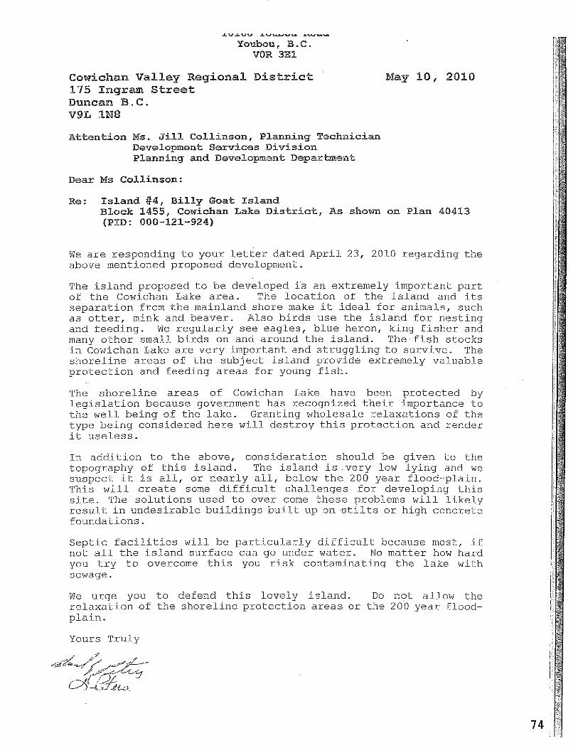
&V,."" L---- A%..,--
Youbou, B.C. VOR 3E1
Cowichan Valley Regional D i s t r i c t 175 i n g r a Street Duncan B.C. V9L IN8
M a y 10, 2010
Attentiorr Ms. Jill Collinson, Planning Technician Development Services Division Planning and Development Deparbenk
D e a r Ms Collinson:
Re: Island #4, Billy Goat Island Block 1455, Cowichan Lake District, As shown on Plan 40413 (PID: 000-121-924)
We a r e responding t o your l e t t e r da t ed A p r i l 23, 2010 r ega rd ing t h e above mentioned proposed development.
The i s l a n d proposed t o be developed i s an extremely impor tan t p a r t of t h e Cowichan Lake a r e a . The l o c a t i o n of t h e i s l a n d and i t s s e p a r a t i o n from t h e mainland shore make it i d e a l f o r animals , such a s o t t e r , mink and beaver . Also b i r d s use t h e i s l a n d f o r n e s t i n g and f eed ing . We r e g u l a r l y s e e eag le s , b l u e heron, k ing f i s h e r and many o t h e r smal l b i r d s on and around t h e i s l a n d . The f i s h s t o c k s i n Cowichan Lake a r e v e r y important and s t r u g g l i n g t o su rv ive . The s h o r e l i n e a r e a s o f t h e s u b j e c t i s l a n d provide extremely va luab le p r o t e c t i o n and f eed ing a r e a s f o r young f i s h .
The s h o r e l i n e a r e a s o f Cowichan Lake have been p r o t e c t e d by l e g i s l a t i o n because government has recognized t h e i r importance t o t h e w e l l be ing of t h e l a k e . Grant ing wholesale r e l a x a t i o n s of t h e type be ing cons idered h e r e w i l l d e s t r o y t h i s p r o t e c t i o n and render it u s e l e s s .
I n a d d i t i o n t o t h e above, cons ide ra t ion should be g iven t o -the topography of t h i s i s l a n d . The i s l a n d i s . v e r y low l y i n g and we suspec t it i s a l l , o r n e a r l y a l l , below t h e 200 y e a r f lood-p la in . This w i l l c r e a t e some d i f f i c u l t cha l l enges f o r deve loping t h i s s i t e . The s o l u t i o n s used t o over come t h e s e problems w i l l l i k e l y r e s u l t i n u n d e s i r a b l e b u i l d i n g s b u i l t up on s t i l t s o r high conc re t e founda t ions .
S e p t i c f a c i l i t i e s w i l l b e p a r t i c u l a r l y d i f f i c u l t because most, if n o t a l l t h e i s l a n d s u r f a c e can go under water . No m a t t e r how hard you t r y t o overcome t h i s you r i s k contaminat ing t h e l a k e with sewage.
We urge you t o defend t h i s l ove ly i s l a n d . Do n o t a l low t h e r e l a x a t i o n of t h e s h o r e l i n e p r o t e c t i o n a r e a s o r t h e 200 y e a r flood- p l a i n .
Yours Tru ly
Jill Collinson
From: Sent: To:
Subject:
CVRD Development Services Tuesday, May 11,2010 8:40 AM Alison Garnett; Ann KjerulC; Catherine Tompkins; Dana Leitch; Jill Collinson; Mike Tippett; Rob Conway FW: variance,FileNo. 3-1-IODPNAR[Dix]
" - . .- .. ." From: Norma O'Connell [mailto:[email protected]] Sent: Monday, May 10, 2010 9:12 AM To: CVRD Development Services Subject: variance,FileNo. 3-1-10DP/VAR[Dix].
M a y 10,2010 CVRD
Re: Island #4, Billy Goat Island W e are adamantly opposed to any development on Billy Goat Island. T o even consider development o n that small island is inconceivable. The environmental impact t o that shallow corner of Cowichan Lake would be devastating. W e need t o protect Cowichan Lake fo r future generations.
Dale and Norma O'Connell 10146 Youbou Rd. Youbou, B.C. VOR3E1
Lot 66
Jill Collinson
From: Jose Lommen [[email protected]] Sent: Thursday, May 06,2010 7:44 PM To: Jill Collinson Subject: Billy Goat Island Attachments: 201004231 14452566.pdf
Hello I i l l , I have received a copy of t h i s app l i ca t ion f o r a Development Permit with Variance from a f r i e n d a s I l i v e f a i r l y c l o s e t o t h e i s l and . I ' m wondering if you could answer me a quest ion? How i s t h e developer going t o d e a l w i t h hydro, water and e s p e c i a l l y s e p t i c ? I ' m i n q u i r i n g about hydro because of t h e p o s s i b i l i t y of a genera to r impacting our q u a l i t y of l i f e and about t h e s e p t i c because of t h e obvious p o l l u t i o n i s s u e wi th 100% of t h a t i s l a n d being s o c l o s e t o t h e lake . Thanks f o r your time.
Regards, l o s e Lommen
> > > Attached t o t h i s emai l is a copy of t h e ad jacen t p roper ty owner l e t t e r > and suppor t ing documents t h a t * requested e a r l i e r t h i s week > ( p e r t a i n i n g t o t h e development va r i ance permit a p p l i c a t i o n ) . > > Please f e e l f r e e t o con tac t me i f you have any f u r t h e r ques t ions o r > concerns. > > Regards, > > I i l l Col l inson > Planning Technician > Development Se rv ices Division > Planning and Development Department > Cowichan Val ley Regional D i s t r i c t > Phone: (250) 746-2620 > Fax: (250) 746-2621 > jcoll [email protected] > > > > > > >
September 23,2010
Alison Garnett, Planning technician
Cowichan Valley Regional District
175 lngram Street, Duncan V9L 1N8
Dear Ms. Garnett:
Re: lsland #4, Billy Goat Island
Block 1455, Cowichan Lake District, As Shown on Plan 40413 (PID: 000-121-924)
I am writing on behalf o f concerned citizens o f Youbou, BC. We are OPPOSED t o any
development what-so-ever o n Island #4 (Billy Goat Island).
This island is currently protected from development via the "Watercourse Protection
Development Permit Areai' (DPA). We are simply requesting the CVRD honour the setbacks
imposed on this property. These setbacks would prohibit any development anywhere on the
island based on the high water mark (a large portion of the island goes under water every
winter).
We were in attendance at the Youbou Advisory Planning Committee meeting of September 7,
2010 and I was on the agenda t o speak on behalf of the concerned citizens, which I did. I was
present t o hear, following the presentation, that the Youbou Advisory Planning Committee
voted t o recommend refusal o f the application. I attach the minutes o f the meeting and
subsequent newspaper article for your reference.
In addition t o the island being protected via the setbacks under the DPA, it has also been a
long-term home to a family of beavers for many years. This beaver dam is protected under
provincial law: Section 9 o f the."Wildlife Act" makes it an offence t o disturb, molest or destroy a
beaver or muskrat house, den or dam ..." This island is also a Canada Goose nesting site.
Additionally, any sewerage disposal system would be toxic t o the lake water, based on the high
water mark and would result in contamination. Section 35 of the federal Fisheries Act,
administered by the Department of Fisheries and Oceans, prohibits any "harmful alteration,
disruption or destruction offish habitat". The definition of fish habitat under the Act includes all
areas that provide habitat upon which "fish depend directly or indirectly in order to carry out
their life processes".
I am prepared t o attend any and all meetings regarding this and any future applications for
development on this island. Please keep me apprised of the process.
Xesidets of YO&UU don't :'a=t to look oni to B@ Goat kImd to see anf.thiug hut nature.
The fate of Bay Goat I s h d ;w discussed by
I'ouboti's Adrisow P h n i n g Commission (!PC), Trlesday, September 7. '~%iththe commissi~n rejscting jke island mner's request tu bugd a seconi! bdding
on the island. Although the -4PC made it clear that they are a g a W any development on Billy Goat island, &el* were only asked to delijerste, on the secoitd building.
T h e .@C is an aixisoiybody to i5e C S . 7 2 board of directors. -4s sucb, any dec&siions we &re noww7II b~
.. , I foncarded to the board,' ?.FC chair Marrs said, I i n f r o d e g f ie item. !
! Ha&g owned pr?perLyin You'pou for iom years, and ! in the heu-Lake area for 10 -~incLudin.g a .
number of low income properties5-Uh.fichae.I D-k said that he bought Bill0 Goat fsIand aborrt iive rears ago, oa a wfiim,
.. .
$ ~ p p & i 3 . 6 ~ ; & -&age i a ~ ~ s i z e , i sa aiacma~island, located bkveen -. ~ . & f ~ & & a n d ~ u a b o n . and is 25 ~ 35 ~ t e 5 ~ . ' n* at &;<a lOca l i0r l s i ' . . .
Biliy Gtst Z~i6nd C I L W ~ ~ T Mihae: Br, ie:: iisrrns a t soub;.s E.6liso~{ Pizn~ine C ~ n l m i $ ~ i ~ ~ 4i5zks~5 %C i l ; ~ ~ ~ U~ til isiaild. E.: e ~ h t 1 5 ~ P t chair &$ICE Ma-, ~ h c conmisjfon 6ecidec ma: ?hey wou!dn't send 3e l r siippoi+ o i r - rngda; ,~
rcsidaocc on ha isi+nc tc r". smD, rl,oogn th; fin=! .jEesico i~iiii be in the iien& or a e C9Rc scars jiielcij. . . . - ~- ~.
. . . . - ':I c a ' i pet zo;mc! Eshefies ssaLg up theje nles md rsZljaiio m... md 531 it to come io zs, a?_d br.=& - these des;'' aembzr 1e.E Knbott sai& of ihe 60 meter setback for a s e c o n k ~ di~~elling.
"The relxation of these setbacks is a serious concern to me," W C member Sham Carlow said. ir E T ou're m a g for a very large setback."
"From my dealings with the people of Youbo~ most of Youbou is not in favour of 'Ibis applicatioqn A9C mcmber GeraId Thom said. "Riparian zoncs on the Co~vichan Lake are heady threatened ... B e . more land left untarnished the better."
'T don't like to see the island being garbled up with a secondary proper@i/? Carlow agreed.
' % addition to members of the APC being allowed to spe& a deiqation with Youbou resident Pat L3> the speaker had its tutu i
6% \- Kozak's property, on Youbou Road, is onfae mainland across from Billy Goat Island.
"This desiption was made by a body far seater than us," she said, of the 60 meter setback, in addition to riparian zone iegdations be&- bioken
' "I'm here to ask that we nip this in the bud," Kozak said.
A n o h concern is with regards to the safe@ of the property, Kozak said.
"We've seen most of the island go under water winter after winter," she said. a
. . .- - - ,,. . ~ . . ~. -
The APC & ~ o u s l y shot 'down~jx's request of a secpndary residence on the island, though they were appmiafive thafix ii going through the proper channe1s;unlike some other Youbou are reside-, -&@ have been laown to clear cut riparian zones and then deal with the consequences after the . . : fact;-: . .
. . .. ~ ... : . . .. .
'- 'Tt'snice.to sw soipeonl: go .through the proce'ss. Looking around -the false, there's a lot going on around the Lake .W.ihoul~Wt,~' ~ h o m said
,. i,_.,._"..,,...__2~~-~. . . . . .
Following *meeting, Dix said that although he pretty well expected his request to be denied, h2 s m a t e d , regardless.
.. . .. . . . .
That .said D& said that he codd empathine with the concerns of Youbou residents about the island, a s they've be&&&gfhe'island . . for years as a kee park.
. . . . . 'They want if as:& $ark, withod having to fund it as a par$,, he sai4 of the islax& questioning why the CVRD didn'tpui'~;base the'islaed when it went up for sale. "Does it m&e.any sense to b v e a big . .
monster of a home, or to spend it b&ween two smaller opposite-sided buildings?" he asked
he fact that it took ~ i x nim months to get his inevitable no is also a of confusion
"The process is clearly broken whenit takes nine months to hear ano:' he said. '? could have predicted this before I sat: down." -- - - - Altbaugh Dix didn't get the APC support he'd hoped for, the issue wilI now go forward to the CVRD board of directors, who will decide whether or not p & w y and secondary dwellings will be allowed on the island
7 9
Schedule 10
5.3 LR-1 LAKEFRONT RESIDENTIAL 1 ZONE
Subject to compliance with the general regulations detailed in Part 3 of this Bylaw, the following regulations' apply in the LR-I Zone:
1. Permitted Uses
The following principal uses and no others are permitted in the LR-1 Zone: a. Environmental protection and conservation; b. Single-family dwelling;
The following accessory uses are permitted in the LR-1 Zone: c. Bed and breakfast accommodation; d. Buildings and structures accessory to a principal permitted use; e. Home occupation; f. Secondary dwelling unit or secondary suite, provided the unit would not be located closer than 60
metres to the natural boundary of the lake.
2. Minimum Parcel Size
The minimum parcel size in the LR-1 Zone is 2500 m2 if the parcel is connected to a community water system, and 1 hectare where the parcel is not connected to a communitj water system.
3. Number of Dwellings
Not more than one dwelling is permitted on a parcel, under 0.4 ha in &a, that is zoned LR-1. For parcels zoned LR-I that 0.4 in area or more, one additional secondary dwelling or secondary suite.is permitted on a parcel.
4. Setbacks
The following minimum setbacks apply in the LR-1 Zone:
In the LR-1 Zone, the height of all buildings and structures must not exceed 7.5 metres, except in accordance with Section 3.8 of this Bylaw.
Type of Parcel Line
Front parcel lime Interior side parcel line Exterior side parcel line Rear parcel line
6. Parcel Coverage
Residential and Accessory Buildings and Structures 7.5 metres 3.0 metres 4.5 metres 7.5 metres
The parcel coverage in the LR-l Zone must not exceed 20 percent for all buildings and stnictures.
5. Height
7. Parking
Off-street parking spaces in the LR-I Zone must he provided in accordance with Section 3.13 of this Bylaw.
29 Electoral Area I - Youbou/bleade Creek ZonirzgBylaw No. 2465
80
Schedule 11
SECTION 13. WATERCOURSE PROTECT ION DEVELOPMENT PERMIT AREA
13.1: CATEGORY The Watercourse Protection Development Permit Area is designated pursuant to Section 919.1(l)(a) and @) of the Local Govevnnzent Act for the protection of the natural environment, its ecosystems and biodiversity, and the protection of development from hazardous conditions.
13.2: SCOPE The Watercourse Protection Development Permit Area is coincidental with the Riparian Assessment Area as defined in the Riparian Areas Regulation. I t is indicated in general terms on Map 6. Notwithstanding the areas indicated on Map 6, the actual Watercourse Protection Develoument Permit Area will in every case be measured on the mound, and it will be: - (a) for a stream, the 30 metre strip on both sides of the stream, measured from the high water mark; (b) for a 3:l (verticaVhonzontal) ravine less than 60 metres wide, a strip on both sides of the stream . ,
measured from the high water mark to a point that is 30 metres beyond the top of the ravine bank, and
(c) for a 3:l (verticaVhorizonta1) ravine 60 metres wide or greater, a strip on both sides of the stream measured &om the high water mark to apoint that is 10 metres beyond the top of the ravine bank.
13.3: DEFINITIONS For the purposes of this Development Permit Area, the terms used herein have the same meaning that they do under the Riparian Areas Regulation @C Reg. 37612004).
13.4: JUSTIFICATION/OBJECTIVES (a) The province of British Columbia's Ripan'a~z Aveas Regulation (RAR), under the Fish
Protectiolz Act, aims to protect fish habitat. This regulation requires that residential, commercial or industrial development as defined in the RAR, in a Riparian Assessment Area near freshwater featnres, be subject to an environmental review by a Qualified Environmental Professional (QEP).
@) The environmental quality of Cowichan Lake, its tributaries, and associated riparian areas should be protected, as they provide critical habitat for an abundance of fish and aquatic animals, birds, plants, and land-based wildlife such deer, bear, cougar, and Roosevelt Elk;
(c) Increasing environmental awareness and declining fish stocks in the Strait of Georgia have led to the need for the protection of the OCP area's lake, streams, wetlands and adjacent riparian lands.
(d) The riparian areas along Cowichan Lake and its bibutaries act as natural water storage, drainage and purifying systems. These areas need to remain in a largely undisturbed state in order to prevent flooding, control erosion, reduce sedimentation, and recharge groundwater.
(e) This area requires careful management, as it includes hazardous lands that have physical characteristics that may lead to property damage or loss of life if improperly built on.
( f ) The water quality of Cowichan Lake and its tributaries requires protection as it provides an important existing and potential donlestic water source.
(g) Research into watershed hydrology and environmental resilience has demonstrated that once certain thresholds of impervious surfaces (total area of roofs, paving, concrete slabs, accessory buildings and other hard surfaces) are exceeded, irretrievable harm may be done to aquatic life. Many of the developed areas of the OCP area already exceed this threshold of
Electoral Area I-Youbou/Meade Creek Oficial Com~nuni@ Plan Bylaw No. 2650 Page 38 8 1
imperviousness. The OCP ahns to ensure that, henceforth, impervious surfaces are minimized to the extent possible, particularly in areas within close proximity to a watercourse.
(h) The vegetation within the riparian areas requires special consideration as it is essential to the water quality, protecting the water resource &om pollution and sedimentation, and permitting more regular water flows during the summer months than would occuiothenvise.
13.5: APPICABILITY A development permit must be applied for, and issued by the Cowichan Valley Regional District, prior to any of the following activities occurring in the Watercourse Protection Development Permit Area, where such activities are directly or indirectly related to existing or proposed residential, commercial or industrial land uses in any Zone or Land Use Designation: (a) removal, alteration, disruption or destruction of vegetation; (b) disturbance of soils; (c) construction or erection of buildings and structures; (d) creation of nonstructural impervious or semi-impervious surfaces; (e) flood protection works; (f) construction of roads, trails, docks, retaining walls, wharves and bridges; (g) provision and maintenance of sewer and water services; (h) development of drainage systems; (i) development of utility corridors; Cj) subdivision as defined in section 872 of the Local Government Act.
13.6: GENERAZ, GUIDELTNES Prior to undertaking any activities outlined in Section 13.5 above, an owner of land that is in the Watercourse Protection Development Permit Area shall apply to the CVRD for a development permit, and the application shall meet the following guidelines: (a) Sites shall be retained in their natural state where possible, preserving indigenous vegetation
and trees. If adequate, suitable areas of land for the use intended exist on a portion of the parcel located outside of the Watercourse Protection Development Pernut Area, the proposed development should be directed to those areas in order to minimize developlnent in the DPA. The precautionary principle will be applied, whereby the onus will be placed with the applicant to demonstrate that encroaching into the Watercourse Protection Development Permit Area is necessary due to circumstances such as topography, hazards or lack of alternative developable land, and that every effort is made to minimize adverse impacts.
@) Where a parcel of land is entirely within the Watercourse Protection Development Pemit Area, the development should be sited so as to maximize the separation between the proposed buildingtland use and the most sensitive area. In cases where the appropriate course of action is unclear, the applicant may be required to prepare, at hislher own expense, a report by a qualified professional biologist, which will identify the area of lowest environmental impact that is suitable for the use intended.
(c) Any work done m t l~e Watercourse Protection Development Permit Area must be canied out in amanner that minimizes the need for vegetation clearing. A n arborist should be consulted, to ensure that trees and shrubs in the riparian buffer area are carefully pruned, where necessary to enhance views, rather than removed. In order to control erosion and to protect the environment, the development permit may specify the amount and location of tree and vegetative cover to be planted or retained. Where a development proposal calls for the re~noval of vegetation within this Development Permit Area, the Regional Board may require
Electoral Area I-Youbou/Meade Creek Oficial Comn~uniQ) Plaiz Bylaw No. 2650 Page 39 8 2
the preparation of a report by a qualified biologist, payable by the developer, indicating measures required to achieve no net loss of habitat and appropriate implementation measures. The Board may require the re-vegetation of land in a Development Pennit.
(d) Recommendations in the Ministry of Water Land and Air Protection's Best Management Practices (Storm Water Planning - A Guidebook For British Columbia) should be applied, to reduce areas of impervious surfaces and increase natural groundwater infiltration. On-site stormwater management techniques that do not impact surrounding lands, should be used, rather than the culverting or ditching of stormwater runoff.
(e) The creation and implementation of a silt and sediment control plan and/or an integrated stormwater management plan, by qualified professionals may be required to pennit the controlled release of m o f f from the development and to buffer streams from the loading of sediment and nutrient materials. The Regional Board will require that a drainage study be completed by a licensed, professional engineer to determine the extent of the works required and to establish criteria for eliminating or minimizing storm flows from the developed site.
(f) Figures for total imperviousness on sites within this development permit area should be calculated by the proponent and submitted at the time of development permit application. The Board may specify maximum site imperviousness or effective imperviousness in a development permit.
(g) Where a subject property is located within a floodplain as shown on the "Cowichan Lake Floodplain Maps", buildings and structures will be subject to the flood constmction levels specified on the floodplain maps, administered under Section 56 of the Corn~nunity Charter.
(h) Roads and driveways should be located as far as possible horn the edge of a bank. or from a shoreline, so as to keep sand, gravel, leady oils and fuels, and road salt out of runoff. Driveways should be angled across the hill's gradient, where possible, and be composed of porous materials such as road mulch, small modular pavers or pre-cast colicrete lattice, to keep runoffto a minimum. For driveways that are already paved, a portion of the runoff can be diverted by the use of speed bumps in regular intervals. Settling pools can be installed in runoff ditches that slope to water.
(i) Footpaths to a shoreline should be planned to avoid erosion, using slope contours rather than a straight downhill lime, and be narrow to minimize impacts on drainage patterns. Impacts to a slope can be minimized by elevating stairs above the natural vegetation.
Cj) Retaining walls will be limited to areas above the high water mark, and to areas of active erosion. Backfilling behind a wall, to extend the existing edge of a slope, is not permitted unless it can be clearly demonstrated that the fill is necessary to prevent further erosion or slougbmg of the bank.
(k) Where a retaining wall is proposed, bioengineering - using native plants, will be encouraged. The use of concrete, rip rap, unsightly construction debris like broken co~~crete, bricks and shot rock are discouraged as materials to improve bank stability. The use of vegetation such as willows andior deadfalls or logs are encouraged as alternatives to minimize erosion and reduce the velocity of stream flows. Natural materials such as wood and stone, particularly darker colours that blend in with the natural shoreline and are less obtrusive when seen from the water. In cases where hard armouring, such as using solid concrete or heavy rocks or rock in wire cages, is necessary, the planting of native vegetation should be done to soften its impact, and the base of the wall should be constructed to be habitat ~ e n d l y ; Large, fortress like, uniform walls should not be permitted unless composed of pervious materials and stepped or softened to provide for water absorption.
Electoral Area I-Youbou/Meade Creek Oficial Conzrnunity Plaiz Bylaw No. 2650 Page 40 8 3
(1) Where a fence is constructed on, or in conjunction with, a uniform retaining wall or the highest uniform section of a retaining wall, the retaining wall or portion thereof should be considered to be an integral part of the fence for the purpose of determining height.
(m) Culturalheritage features of a site must be undisturbed. (n) Pilings, floats, or wharves should be consistent with the current Operational Statement of
Fisheries and Oceans Canada. (0) For subdivision proposals, where a sensitive area is proposed to be covenanted for
conservation purposes or dedicated to a public body or conservation group, the parcel lines mav abut or follow the boundaries of the sensitive area. Ln other cases, the appropriateness of - - proposed parcel line locations should be reviewed with respect to site-specific considerations and the overall goal of minimizing environmental impacts. - - -
(p) All development proposals subject to a development permit should be consistent with 'Bevelop With Care - Environmental Guidelines for Urban and Rural Land Development in British Columbia", published by the Ministry of Environment.
(q) The draining of wetlands or watercourses, and the land filling or dredging of a watercourse, including a lake, to increase a property size, create a sandy beach area, or restrict the public use of an area beyond property lines, is prohibited.
(r) Development proponents must ensure that the proposed development does not cause a harmful alteration, disruption or destmction to habitat.
13.7: RIPARIAN AREA REGULATION GUIDELINES Prior to undertaking any activities outlined in Section 13.5 above, an owner of land that is in the Watercourse Protection Development Permit Area shall apply to the CVRD for a development permit, and the application shall meet the following guidelines: (a) A qualified environmental professional (QEP) will be retained at the expense of the applicant,
for the purpose of preparing a report pursuant to Section 4 of the Riparian Areas Regulation. The QEP must certify that the assessment report follows the assessment methodology described in the regulations, that the QEP is qualified to cany out the assessment and provides the professional opinion of the QEP that: (i) if the development is implemented as proposed there will be no harmM alteration,
disruption or destruction of natural features, functions and conditions that support fish life processes in the riparian area; and
(ii) the streamside protection and enhancement area (SPEA) that is identified in the report is protected ffom the development and there are measures identified to protect the integdy of those areas £tom the effects of development; and
(iii) the QEP has notified the Ministry of Environment and Fisheries and Oceans Canada, both of whom have conhned that a report has been received for the CVRD; or
(iv) confirmation is received fiom Fisheries and Oceans Canada that a h-1 alteration, disruption or destruction of natural features, functions and conditions that support fish life processes in the riparian area has been authorised in relation to the development proposal.
(b) Where the QEP report describes a11 area designated as Streamside Protection and Enhancement Area (SPEA), the development permit will not allow any development activities to take place therein, and the owner will be required to implement a plan for protecting the SPEA over the long tenn through measures to be implemented as a condition of the development permit, such as:
a dedication back to the Crown Provincial, gifting to a nature protection organisation (tax receipts may be issued),
Electoral Area I-Youbou/Meade Cveek OJjicial Conzitzunity Plan Bylaw No. 2650 Page 41
a the registration of a restrictive covenant or conservation covenant over the SPEA confirming its long-term availability as a riparias buffer to remain free of development;
e management/windthrow of hazard trees; - drip zone analysis; e erosion and stormwater runoff control measures;
slope stability enhancement. (c) Where the QEP report describes an area as suitable for development with special mitigating
measures, the development permit will only allow the development to occur in strict compliance with the measures described in the report. Monitoring and regular reporting by professionals paid for by the applicant may be required, as specified in a development pe~mit;
(d) If the nature of a proposed project in a riparian assessment area evolves due to new information or some other change, a QEP will be required to submit an amendment report, to be filed on the notification system;
(e) Wherever possible, QEPs are encouraged to exceed the minimum standards set out in the RAR in their reports;
(9 Cowichan Lake is subject to natural water level fluctuations on an annual basis. Winter water (high) levels often flood shoreline areas of the lake. These shoreline areas provide important fish habitat, especially during winter periods. The QEP assessment must pay special attention to how the site may be within an active floodplain; the QEP should also assess the existence of floodplain plant species that are important fish refige areas during high water, and clearly delineate exactly where the high water mark is on the site.
(g) The mean anuual high water mark on Cowichan Lake has been calculated by the Ministry of Environment as being 164 metres above mean sea level, so Qualified Environmental Professionals are very strongly encouraged to incorporate this into their reports, as being the point itom which the SPEA will be measured.
13.8: EXEMPTIONS In the following circumstances, a development pennit will not be required: (a) Renovations, repairs and maintenance to existing buildings that are protected by Section 91 1 of
the Local Goveriznzent Act; (b) Minor interior and exterior renovations to existing buildings, excluding any additions or
increases in building volume; (c) Removal of invasive non-native vegetation such as Gorse, Scotch Broom, and its immediate
replacement with native vegetation; (d) Creation of a passage or trail not more than 1.5 metres in width cleared of vegetation, which
does not involve the removal of any tree greater than 5 metres in height or with a diameter at breast height (DBH) of 10 centimetres, to allow for passage to the water on foot.
13.9: VARIANCES Where a proposed development plan adheres to the guidelines of the Watercourse Protection - - - Development Permit Area, the Regional Board may give favourable consideration to variances of its bylaws where such variances are deemed by the Regional Board to have no negative impact on adjacent parcels and would enhance the aesthetics of the site in question. Such variances may be incorporated into the development permit.
13.10: FLOOD CONSTRUCTION LEVELS The Board. will not give relaxations to the flood construction levels in any circumstance.
Electoral Area I-Youbou/Meade Creek Oficial ConzinuniQ Plan Bylaw No. 2650 Page 42 85
13.11: CONCURRENT DEVELOPMENT PERMIT AREAS Where more than one development permit area applies to laad in the Watercourse Protection Development Permit Area (DPA), a single development permit may be issued. Where any other DPA guidelines would conflict with the Riparian Areas Regulation guidelines, the latter shall prevail.
13.12: VIOLATION (a) Every person who:
1. violates any provision of this Development Permit Area; 2. causes or permits any act or thing to be done in contravention or violation of any
provision of this Development Permit Area; 3. neglects to do or refrains from doing any act or thing required under this Development
Peimit Area; 4. carries out, causes or permits to be carried out any development in a manner prohibited by
or contrary to this Development Permit Area; 5. fails to comply with an order, direction or notice given under this Development Permit
Area; or 6. prevents or obstructs or attempts to prevent or obsbxct the authorised entry of the
Administrator, or person designated to act in the place of the Administrator; commits an offence under this Bylaw.
(b) Each day's continuance of an offence constitutes a new and distinct offence.
13.13 PENALTY A person who commits an offence against this Bylaw is liable, upon conviction in a prosecution under the Offence Act, to the maximum penalties prescribed under the Community Charter for each offence committed by that person.
13.14: SEVERABILITY If any section, sentence, clause, phrase, word or schedule of this Development Permit Area is for any reason held to be invalid by the decision of any Court of competent jurisdiction, the invalid portion shall be severed and the decision that it is invalid shall not affect the validity of the remainder of this Development Permit Area-
13.15 APPLICATION REQUIREMENTS (a) Before the CVRD authorizes the issuance of a development permit for a parcel of land in the
Watercourse Protection Development Permit Area, the applicant must submit a development permit application, which at a minimum includes: 1. A written description of the proposed project; 2. Reports or information as listed in the relevant Development Permit Guidelines; 3. Information in the form of one or more maps, as follows:
e Locationfextent of proposed work; 0 Location of watercourses, including top of bank;
Topographical contours; 0 Location of slopes exceeding 25 percent grade; * Location of lands subject to periodic flooding; e Percentage of existing and proposed ilnpervious surfaces;
Existing tree cover and proposed areas to be cleared;
Electoral Area I-Youbou/Meade Creek Oflicial ComnluniQ Plan Bylaiv No. 2650 Page 43
0 Areas of known sensitive or rare native plant communities; Areas of known wildlife habitat; Existing and proposed buildings;
e Existing and proposed properly parcel lines; * Existing and proposed roads, vehicular access points, driveways, and parking areas; e Existing and proposed trails; * Existing and proposed stormwater management works, including retention areas and
drainage pipes or ditches; - . -
0 Existing and proposed erosion nlitigation/watercourse hank alterations; Existing and proposed septic tanks, treatment systems and fields; Existing and proposed water lines and well sites.
4. A Qualified Environment Professional's report, prepared pursuant to Section 13.7.
(b) In addition to the requirements listed above, the applicant may he required to fiunish, at the applicant's expense, a report certified by a professional engineer with experience in geotechnical engineering which includes: 1. A hydrogeological report, which includes an assessment of the suitability and stability of
the soil for the proposed project, including information on soil depths, textures, and composition;
2. A report on the safety of the proposed use and structures on-site and off-site, indicating that the land may he used safely for the use intended; andlor
3. A stormwater management plan, which includes an assessment of the potential impact of the development on the groundwater resource;
4. To ensure that all of the applicable DPA guidelines are met, the CVRD may require, by Resolution of the Board, the deposit of a Security to he held until the requirements of a Permit have been met to the Board's satisfaction. Should a Development Permit holder fail to fulfill the requirements of a Development Permit, the CVRD may undertake and complete the works required at the cost of the Permit holder and may apply the Security in payment of the cost of the work, with any excess to be refunded to the Pennit holder. Should there he no default as described above, the CVRD will refimd the Security to the Permit holder.
Electoral Area I-Youbot~/Meade Creek Official Community Plan Bylaw No. 2650 Page 44 8 7
SECTION 14 WATERFRONT SUBDlVlSlON DEVELOPMENT PERMIT AB$A
POLICY 14.1 CATEGORY
The Waterfiont Subdivision Development Pennit Area is designated pursuant to Section 919.l(a) and (b) of the Local Govemment Act, for the purpose of protecting the environment, its ecosystems and biological diversity; and protection of development from hazardous conditions.
POLICY 14.2 SCOPE
The Waterfront Subdivision Development Permit Area applies only to lands designated as 'Waterfront Residential' and 'Waterfiont Commercial', within Electoral Area I, and includes:
(a) That portion of Block 118 south of Youbou Road, Cowichan Lake District.
POLICY 14.3 JUSTIFTCATION
(a) To protect the environmental quality of Cowichan Lake and the Cowichan River; (b) To encourage development that respects the environment, its ecosystems and biodiversity by
minimizing impacts on lands during subdivision; (c) To ensure a high level of sewage treatment to protect ground water and Cowichan Lake.
POLICY 14.4 GUIDELINES
No person shall subdivide land that is within the Waterfront Subdivision Development Permit Area, prior to the owner fist receiving a development permit, which conforms to the following guidelines:
(a) Sites shall be retained in their natural state where possible, preserving indigenous vegetation and trees. Disturbance to vegetation should be minimized.
@) Buildings and structures requkkg domestic water shall be connected to a community water system.
(c) Access roads, driveways md parking areas should use pervious materials that can absorb runoff.
(d) Vehicle access points, pedestrian pathways, parking, and circulation patterns shall be designed to encourage as safe a flow of pedestrians, service/emergency vehicles, and local vehicle traffic as possible.
(e) The latest Best Management Practices for land development of the Ministry of Water, Land and Air Protection and Fisheries and Oceans Canada, should be respected.
(f) Runoff from the development should be strictly limited to prevent storm flows &om damaging riparian areas. Impervious surfaces should be minimized.
POLICY 14.5 EXEMPTIONS
The terms of the Waterfront Subdivision Development Permit Area shall not apply to:
(a) Lot consolidations/elimination of interior parcel lines; @) Applications for a building pennit.
Electoral Area I-YoubodMeade Creek Oficial Conzrnuniiy Plan Bylaw No. 2650 Page 45
SCHEDULE 12
COWICHAN VALLEY REGIONAL DISTRICT
DEVELOPMENT PERMIT
- --. - . ~.M-@;y -- --- 3-1-1 ODPNAR
-=- -- ..-LE&TE: . APRIL 15,2011 --- .- - - --
MICHAEL DIX = ~z TO: -- = . .. =-
+- --= .- .--. .-
- -. - ADDRESS: 4596 BONNIEVIEW PLACE.^ - --
- -
VICTORIA, BC V8N 3i7
1. This Development Permit id .-- Kp l i ance with all 3 the bylaws of the Regional District app - h e r e t o , W&pt as specifically varied or
-. - supplemented by this Permit. EsL -W-
-= =- -- - - -- - - ~ - -- =
- -- - --. - ..
---- - -.
This D e ~ e l ~ p m e n ~ ~ ~ r r Q i t ---- applieqio andTl$kto thF&ands within the ---- *- ---* - s- -- .-*=. ~-
-. -.--*T= District describ&g@Crov&a - -. -~ -- -C-- B- -J -- -- .-.. = *- 7_L
-- - -- -.- - -- -~- -- - __=_ -B -.. -* - BLOCK ~ ~ C O W I C ? N LAKE DXRICT, --- AS SEWN ON PLAN 40413 (PID 000-liEZ4J -a-- --- ~-a - - ---. - --
---- -. ~z -
-a--- --- -. L- ------__. -- -a .-.-- -- =- - .-- - .-=-s r-- -- -.-~
-. ..a- =- ~-
-- . -- .. A ~ & ~ E t i ~ i : ~ ~ e r e b y ~ g ~ e n for%k& -- =--
awBdance w i th thx -z
Regional
. ~ a m to be subdivided and developed in
- d a n s T ~ d ~ c o n d i t i m i s t e d in Section 4 below. ~e -- -A
I --A =-a --. -- --. ---- --=~ -a I_
--. -- -- --. e d e " m e n t T- shallL@&arriedout subject to the following conditions: - - = .-
%- m -. - -- !@a" of t&@roposed SPEA encroachment by Department of Fisheries and __-.I .
a) ~ u t h o r z Oceans a n d w - l w of Environment;
%:=R Assessment Report #1910; -
b) Compliance c) On-site monito'ing of construction by a Qualified Environmental Professional and
submission of a post development report confirming compliance with the recommendations of RAR Assessment Report #I910 and any conditions of approval specified by the Ministry of Environment and Department of Fisheries and Oceans;
d) Determination of the high water mark by legal survey and confirmation that the proposed building location is a minimum of 15 metres from the high water mark of Cowichau Lake;
e) Installation of a 'Type 3" o r better sewage disposal system authorized by the Vancouver Island Health Authority.
5. The following schedules are attached:
m Schedule A - Site Plan
e Schedule B - Proposed Construction Plan
Schedule C - RAR Assessment Report #I910
Schedule D - Trail Head Rain Water and Storm Water Run-Off Plan
* Schedule E - Trail Head Home Plans . Schedule F - Building Permit Checklist -. p~
-a p~ . .- - .. . .. - . . . .-
--*. . .-- 6. This Permit is not a Building Permit Approval. N a s i l d i n g permit wi l l be issued until
.&a- all conditions and requirements of this Devel_opjmTnEgermit -%- -. have been completed to the satisfaction of the Planning and ~ e v e l o ~ m ~ T ~ e ~ i m e n t .
.-
Print Name Occupation
Date Date
STAFF REPORT
DATE: March 9, 201 1 FILE NO: 8-I-10DP
FROM: Carla Schuk, Planning Technician, Development Services Division, Planning & Development Department
SUBJECT: Development Permit Application No. 8-1-10 DP (Carbonneau)
Recommendation: That Application No. 8-I-10DP be approved, and that a development permit be issued to Ken Carbonneau for Parcel A (DD 27619W) of Lot 26, District Lot 22, Cowichan Lake District, Plan 4922 (PID: 006-016-651), subject to the following:
Strict compliance with the recommendations in Riparian Assessment Report No. 1777, submitted by Qualified Environmental Professional Trystan Willmott, of Madrone Environmental Services, on September 9, 2010; That the 10 metre SPEA be clearly demarcated with the use of flagging materials prior to commencement of development activities;
Relation to the Corporate Strate-clic Plan: N/A
Financial Impact: N/A
Purpose: To consider the issuance of a Development Permit for the construction of a single-family dwelling in accordance with the provisions of the Watercourse Protection Development Permit Area contained within OCP Bylaw No. 2650.
Backsround:
Location of Subiect Property: 10171 Youbou Road, Youbou
Leqal Description: Parcel A (DD 27619W) of Lot 26, District Lot 22, Cowichan Lake District, Plan 4922 (PID: 006-016-651)
Date Application and Complete Documentation Received: December 4, 2010
Owner: Sharon Moon
Applicant: Ken Carbonneau
Size of Parcel: 2 0.26 hectares (2 0.64 acres)
Existina Zoning: R-3 (Urban Residential 3 Zone)
Minimum Lot Size Under Existincl Zoning: 0.2 hectares if connected to a community water system
Existinq Plan Desiqnation: Urban Residential
Existinq Use of Property: Residential
Existing Use of Surroundinq Properties: North: Forestrv South: ~esidei t ia l East: Residential West: Residential
Services:
Road Access: Youbou Road m: Youbou Water System Sewaae Disposal: Septic system
Aaricultural Land Reserve Status: The subject property is not within the ALR
Environmentallv Sensitive Areas: The Cowichan Valley Environmental Planning Atlas identifies a Trim Stream with confirmed fish presence running through the property, and therefore the property is subject to the Watercourse Protection Development Permit Area.
Archaeoloqical Site: No archaeological sites have been identified
The Proposal:
An application has been made to: An application has been made to the Regional Board to issue a Development Permit in accordance with the requirements of the Watercourse Protection Development Permit policies contained within Official Community Plan (OCP) Bylaw No. 2650.
For the purpose of: construction of a single-family dwelling
Policv Context:
The Riparian Areas Regulation, under the Fish Protection Act, aims to protect fish habitat. This regulation requires that development within 30m of a watercourse be subject to review by a Qualified Environmental Professional (QEP). The QEP submits a Riparian Assessment Report to the Ministry of Environment. The Riparian Areas Regulation states:
"An assessment report for the purposes of this regulation must employ the assessment methods set ouf in the Schedule and must report on all of the following:
(a) the width of the streamside protection and enhancement area which must be protecfed;
(b) the measures necessary to protect the integrity of the streamside protection and enhancement area."
The Youbou - Meade Creek Official Community Plan, Bylaw No. 2650, supports the protection of the natural environment. The following policies are derived from the Natural Environment objectives section of the OCP.
"(b) To identify, protect and enhance natural areas, including stream corridors, for the long term benefit of natural ecosystems, including fish, wildlife and plant habitat;
(c) To suppott the presetvation of natural resources of the area for resource development, including forestry, fish and wildlife habitat, and tourism;
(d) To limit or prohibit development within hazardous or environmentally sensitive areas so as to protect area residents from personal injury or loss of propetfy and to safeguard the natural environmenf;
(g) To suppott the retention of a greenway of adequate width adjacent to all watercourses;
(i) To maintain the water quality of Cowichan Lake and the Cowichan River."
Further to these, CVRD Bylaw No. 2650 has established guidelines for the protection of the natural environment through the Watercourse Protection Development Permit Area. Because a stream is located on the subject property and construction of a single family dwelling are proposed within the 30m Riparian Assessment Area as outlined in the OCP and the Provincial regulation, the need for approval of a Watercourse Protection Development Permit was triggered.
Planning Division Comments: The subject property is located at 10171 Youbou Road in Electoral Area I - YoubouIMeade Creek. The property has an existing single family dwelling, which the applicant is proposing to replace with a new, smaller single family dwelling. The subject property is located within the Watercourse Protection Development Permit Area (DPA). As such, the applicant must receive a development permit from the CVRD prior to commencing any site preparation or construction, in accordance with YoubouIMeade Creek Official Community Plan Bylaw No. 2650. In compliance with the Watercourse Protection DPA guidelines, the applicant has retained the services of Trystan Willmott, a Qualified Environmental Professional (QEP), to conduct a Riparian Areas Regulation (RAR) Assessment.
The applicant is proposing to construct a 11 1.5 m2 (1200 ftz) house in the south eastern corner of the property outside of the SPEA. The existing driveway and an existing rockwall and stairs are within the SPEA boundaries. Because the above developments are existing uses and alterations are not being proposed as part of this application, they are not subject to the RAR assessment.
The following section will outline how the proposed development addresses the Watercourse Protection DPA guidelines. The attached excerpt from OCP Bylaw No. 2650 provides the complete guidelines.
(a) Retention of natural vegetation - The proposed dwelling will be built within the footprint of the existing dwelling, therefore no further vegetation removal is being proposed. The upper reaches of the property are largely forested and will not be disturbed by the proposed development.
(b) Coverage of entire area - The proposed new house will be built within the existing -
footprint of the house that currently exists on the property. I he new house will be smaller than the existing house and therefore reduce the coverage of the entire property.
(c) Riparian area protection -this guideline has been largely superseded by the Riparian Areas Regulation guidelines.
(d) BMP implementation -the role of the QEP is to examine all BMPs and integrate these into the Riparian Assessment Report. Report No. 1777 indicates the proponent will use rain gardens in order to moderate the impacts of roof run-off during peak rain events.
(e) Silt and sediment control - Report No. 1777 states that construction will follow a number of sediment and erosion control measures. The QEP reports that building within an existing building footprint minimizes the generation of sediments during the construction phase. The QEP recommends that the majority of site preparations be carried out during periods of drier weather, covering stockpiled soil with tarps, covering exposed areas with straw mulch and seeded to prevent sediment mobilization, and installing a silt fence around the western perimeter of the construction area.
(f) Imperviousness figures -The R-3 Zone permits 25% parcel coverage for all buildings and structures on a lot. However, the development proposal will result in far less parcel coverage than that permitted by the zoning, as well as less than what currently exists. The total house footprint including outdoor living area will be 11 1.5 m2 on a 0.28 ha lot, which results in approximately 4% parcel coverage.
(g) Floodplain -The QEP assessed the drainage of the property and confirmed that there was no evidence of drainage overtopping its banks and that there appeared to be no potential flooding concerns on the property. The property is also located above the 200 year floodplain (167m contour) for Cowichan Lake.
(h) Driveway design - The driveway of the property is already existing and changes to it are not being proposed.
(i) Footpaths -There are no footpaths being proposed as part of this development permit application
(j) Retaining walls - No retaining walls are being proposed as part of this development permit.
(k) Retaining wall appearance - see above. (1) Retaining wall with fence - see above. (m) Culturallheritage sites - no such sites were identified. (n) Pilingslfloats - No new such construction is proposed. (0) Applicable only to subdivision (p) Develop with care - the RAR Assessment Report will cover this within the Riparian
Assessment Area. fa) Wetlands - there are no wetlands located on the ~rooertv. \ a ,
(r) Harmful AlterationlDestruction or Disruption b f ksh-habitat - compliance with the RAR Assessment Report will by definition prevent a HADD.
Riparian Areas Reaulation Assessment Report:
RAR Assessment Report No. 1777 by Trystan Willmott identifies a 10 metre Streamside Protection and Enhancement Area (SPEA) on the both sides of the unnamed creek located on the subject property. The SPEA is measured from the high water mark of the creek. All proposed development will be located outside the designated SPEAs as shown in the site plan included within the RAR report. The existing driveway that is within the SPEA is a grandfathered use and will not be altered as part of this development proposal. The RAR report states that there are no danger trees located within the vicinity of the proposed development and that there will be no increase in the potential for windthrow. The report states that slope
stability is not an issue for the proposed development due to the limited slope of the SPEA in the lower portion of the property. The SPEA has been flagged on the property to prevent inadvertent encroachment during construction activity. The QEP's report states that the proposed development will reduce the amount of impermeable surfaces on the property and will not negatively impact the assessed SPEA if the recommendations from RAR Assessment Report No. 1777 are followed.
Advisorv Planninq Commission: Members of the Area I Advisory Planning Commission reviewed this application at a meeting held February XX, 201 1, and made the following recommendations:
"It was Moved and Seconded by Area I (Youbou/Meade Creek) APC, to support Development Permit Application No 8-I-IODP (Carbonneau) as presented."
Options: 1. That: Application No. 8-I-10DP be approved, and that a development permit be issued to
Ken Carbonneau for Parcel A (DD 27619W) of Lot 26, District Lot 22, Cowichan Lake District, Plan 4922 (PID: 006-016-651), subject to the following:
Strict compliance with the recommendations in Riparian Assessment Report No. 1777, submitted by Qualified Environmental Professional Trystan Willmott, of Madrone Environmental Services, on September 9, 2010;
* That the 10 metre SPEA be clearly demarcated with the use of flagging materials prior to commencement of development activities;
2. That application No. 6-1-10 DP be revised
Option 1 is recommended
Submitted by,
Carla Schuk, Planning Technician ~evelopment Services Division Planning and Development Department
Reviewed by: ager:
CS/ca Attachments
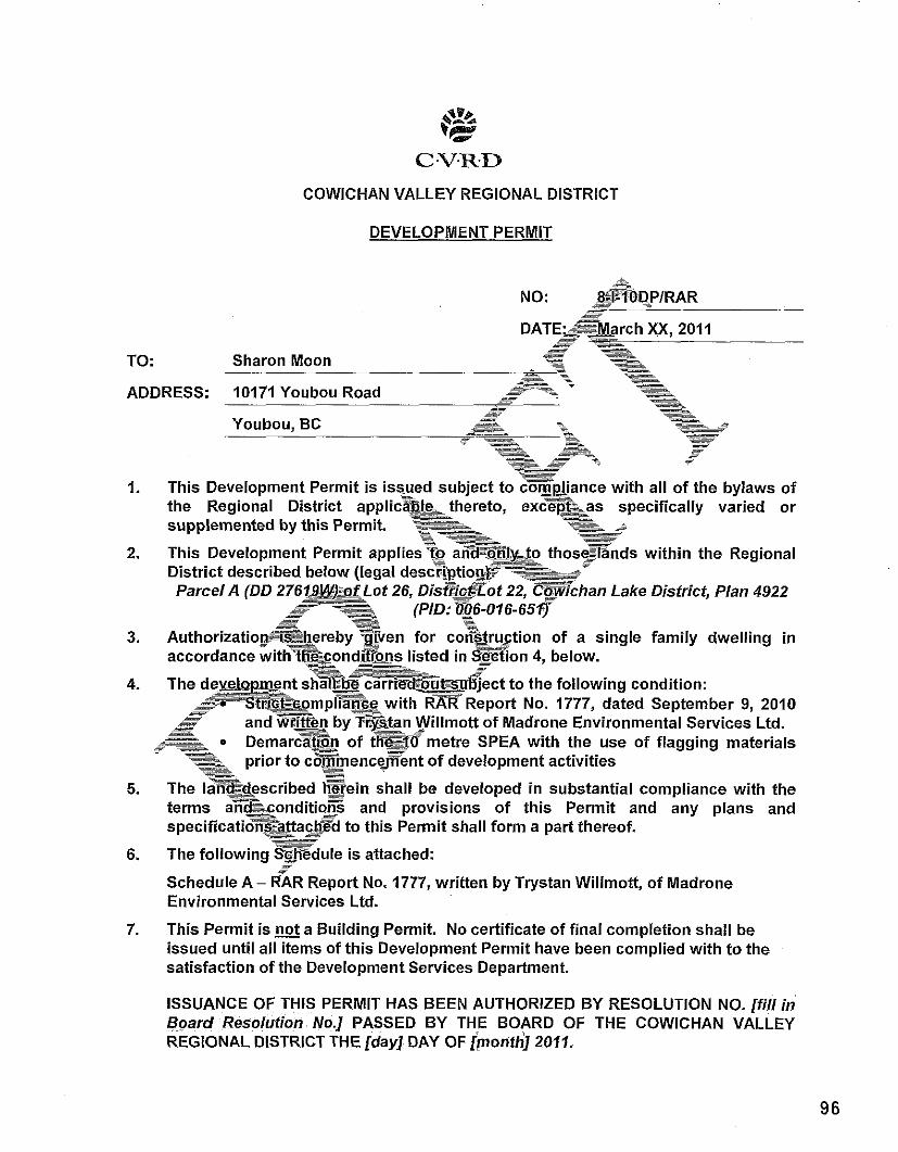
C.V.R.D
COWICHAN VALLEY REGIONAL DISTRICT
DEVELOPMENT PERMIT
NO: - -- 8swoDPIRAR -~ - -- -- -
DATEk&&arch -- -=~- X,X, 2011 -- .= -- -- .- -.
SZ w- -. TO: Sharon Moon - - --- - -
A = .. -. -. *--- =* -- - - -
ADDRESS: 10171 Youbou Road ..-
- - --
.. - -~ - - -- - - -- r- -- -- . -- -. --
-- -.
.- --=
Youbou, BC - .- ---
-. -- -~ - .. &;--- .* - -. = - -----
= -
- - - - - r-- -- - -y
=- .-
.- -- -- .- .. .- =
.- - .= .. - -
.*- *- - -- .=- .+- ---
I. This Development Permit is iss-ued subject to m p ~ a n c e with all o f the bylaws of - the Regional District applic8-kthereto, ----. excqf%as =- specifically varied or
--- supplemented by this Permit. -- - --- ---. .s A -- -& =
=E F
-. - 2. This Development Permit applies?~ a=my&o .--- those-Ends -- within the Regional
District described below (legal descFi$tiogtT-&&' Parcel A (DD 2761~L&)z@f -- Lot 26, D i s & l ? o t 22, & ? k h a n Lake District, Plan 4922
---- -- - -. P -- - -- - - -- .- - -- -- - __ - -- -- (PlD: @6-016-65fl -
3% - - 3. ~ u t h o r i z a t i o " & ~ ~ e r e b ~ ~ ~ v e n ~- -- for cot%tru.ction of a single family dwelling in
accordance withmcondi&ns e-A listed in -tion - 4, below. .-= - -- - -. - -~ .---*g= - /
4. The d w ~ p a e n t - -- shal~EbB ~arire~&~d~t%.u6ject to the following condition: .- -. -- .- -- - .e?SEE&~~mpli?g with RAR Report No. 1777, dated September 9, 2010 -- -- - .-. .- - -
-- -- - -. - - - - -- -- and GE&n by.-w?an Willmott of Madrone Environmental Services Ltd.
-- -7- -- ---~? .= DemarcZEn of thvaf6metre SPEA with the use of flagging materials *- ma
=- .--. prior to c8&menceEent o f development activities ~- .-a .LW.
5. The lm14escr ibed -- B e i n shall be developed in substantial compliance with the terms a n f c o n d i t i o B -- and provisions of this Permit and any plans and specificatio-Tata&@d to this Permit shall form a part thereof. -- .- --
P
6. The following s w d u l e is attached: -
Schedule A - RAR Report No. 1777, written by Trystan Willmott, of Madrone Environmental Services Ltd.
7. This Permit is a Building Permit. No certificate of final completion shall be issued until all items of this Development Permit have been complied with to the satisfaction of the Development Services Department.
ISSUANCE OF THIS PERMIT HAS BEEN AUTHORIZED BY RESOLUTION NO. [fill in Board Resolution No.] PASSED BY THE BOARD OF THE COWICHAN VALLEY REGIONAL DISTRICT THE [day] DAY OF [monfh] 2011.
Tom Anderson, MClP General Manager, Planning and Development Department
NOTE: Subject to the terms of this Permit, if the holder of this Permit does not substantially start any construction within 2 years of its issuance, this Permit
- .- will lapse.
-. - -- -- .---. = ---
I HEREBY CERTIFY that I have read the terms and conditionsethe -- ~ e v e l o ~ m e n t Permit contained herein. I understand and agree that the Cowic&@Ta!i!ey -- -- Regional. District has made no representations, covenants, warranties, guarmees,~&mises or agreements - (verbal or otherwise) with Sharon Moon other than t&eF2ntaine3r&this Permit. --- -- --
-- = --
- - -. = - .- ~-
-- - -. --- -- -- -- --
ST - =- -. - = .-
- - . - _ i A.
..- .* a - -- -- -. -- . = -- --- --
OwnerIAgent (signature) -
-%- - - -. .- * s -- -.
- - --- =-.x- - - -- .-
. -- - -=
-. ~- --- -- .- - -. .-
Print Name . -- -- =.- --- -. - -- Occupatro~=
= --- A - -
a -- -- = - -. -- --a-
= -- -- --- .* --== .- -- .- ~---- -- F. ---- - = - = -- =
-- - = -- - .- -. --. -- =
- ... - - -. - - --
Date --- = ... = ~ ~ . - - . & ~ ~ t ~ - - .- - -T
- =-- -. .-
.- -- --- - - -- = - =
= = -. -. - -. -- -- - - =
= - -
- - -- -. - - ~- - .- - - - --- =
.... - .- - .. =- A .-- - = -- .- = .-
-= - .- -. = .= -- -=
- .-
. .- - - - ~- -- - -=- - ---- +& -- .-
.-- - ---- e!!s- .- .-
- -- - - - -. -- -
-~ --
- -. -
-- A -- - -+= - --.-- - Vd
--= - -- .-z -J..
=- ~P-
- .. -.
--- .= -=
.- -- - -- -- -- - .. -- - - -= - - -- -= = - -
~ -- - . - -- -. .- .<-
A- -- T
u- .- --- - -- -. .- -- .-
--- - -= -- - .-
= -- -- - --.
- - - -- - - - - .- - .- .-
- ~- A -- .- =
rs -. - -. = ---= ---:
-=* -- -. e- -. -. - - - = -w - -- -- ~- --- = >- --- - -- =- -- = - - .- - - .. -- ...
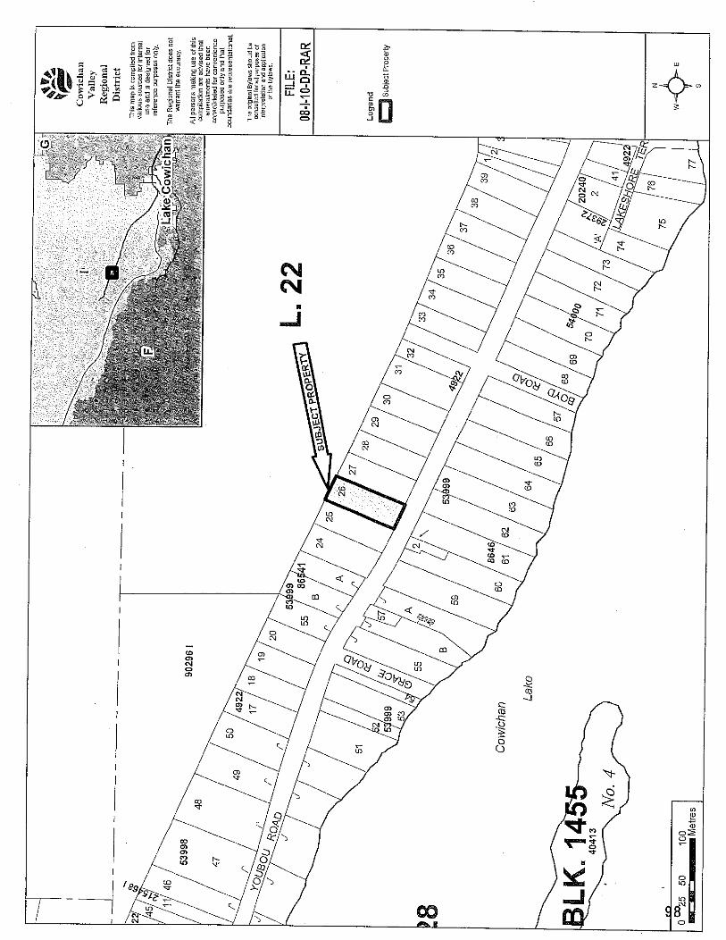
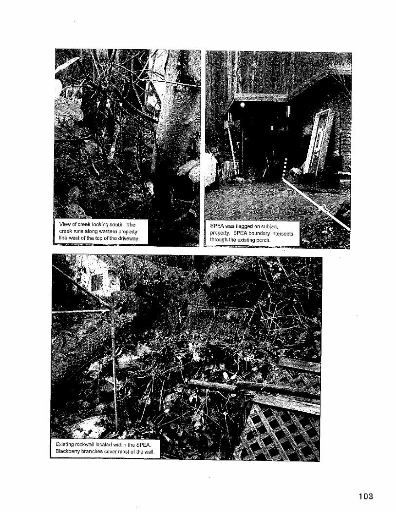
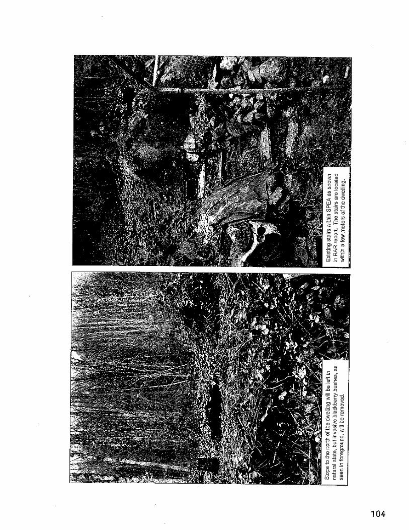
FORM 1 Riparian Areas Regulation - Qualified Environmental Professional -Assessment Repoit
Please refer to submission instructions and assessment report guidelines when completing this report. Date 12010-09-09
I. Primaw QEP lnformation
Registration # Address
City Provlstate
First Name Last Name
Designation I Ltd.
25491 I Email [email protected] 1081 Canada Avenue Duncan v 4 5 BC I Country Canada
Trystan I Middle Name Willmott A.Sc.T.- * 1 Company Madrone Environmental Services
II. Secondary QEP lnformation (use Form 2 for other QEPs)
First Name Last Name
Designation Registration #
Address City
Provlstate
Ill. Developer lnformation
, ~ - . . . . . . ,~ Provlstate I BC I Countrv Canada
I Middle Name
I Company 1 Email
I Postallzip I Phone# I Country I
First Name Last Name Company Phone# Address
Citv
IV. Development lnformation
Ken I Middle Name Carbonneau NIA (250) 710 2516 I Email: [email protected] 10171 Youbou Road Youbnu 1 PostallZio VOR 3E1 1
V. Location of Prooosed Develooment
Development Type Area of Development (ha)
Lot Area (ha)
Completion of Database lnformation includes the Form 2 for the Additional QEPs, if needed. Insert that form immediately after this page.
Proposed Start Date 1 2010-09-14 I
Single family residential
Street Address (or nearest town) 1 10171 Youbou Road
Form 1
0.01 0.25
Local Government Stream Name
Legal Description (PID) StreamlRiver Type
Watershed Code Latitude
Page 1 of 18
I 1
Cowichan Valley Regional District 1 City Youbou Un-named 006-016-651 I Region 1 Stream 1 DFO Area South Island NIA 1 48 1 52 1 7.6 / Longitude / 124 ] 10 1 56.8 1
FORM 1 Riparian Areas Regulation . Qualified Environmental Professional . Assessment Report
Table of Contents for Assessment Report Page Number
1 . Description of Fisheries Resources Values ............................................. 3
2 . Results of Riparian Assessment (SPEA width) ........................................ 5
3 . Site Plan ......................................................................................... 7
4 . Measures to Protect and Maintain the SPEA (detailed methodology only) . 1 . Danger Trees .......................... .. ................................................... 8 2 . Windthrow ............................ ................................................. 8 3 . Slope Stability .................................................................................... 8 4 . Protection of Trees ............................................................................ 9 5 . Encroachment .......................... 9 6 . Sediment and E ................... ... ........ .. .......................... 9 7 . Floodplain .............................................................................. I 0 and I I 8 . Stormwater Management ................................................................. 11
5 . Environmental Monitoring ................................................................. ..I2
6 . Photos ........................ .... ...... ... ... 13
.................................................. 7 . Assessment Report Professional Opinion 18
Form 1 Page 2 of 18
FORM 1 Riparian Areas Regulation - Qualifled Environmental Professional - Assessment Repori
Section 1. Description of Fisheries Resources Values and a Description of the Developmenf proposal (Provide as a minimum: Species present, type of fish habitat present, description of current riparian vegetation condition, connectivity to downstream habitats, nature of development, specific activities proposed, timelines)
Nature o f DevelopmentlSwecific Activities:
The proposed construction of a new residence at 10171 Youbou Road, Youbou, has triggered the requirement for a Riparian Areas Regulation Assessment. The focus lot currently has a dwelling located on the southern portion of the property, with an associated gravel driveway and parking area. A small drainage flows along the western edge of the property, which originates on the steeper forested slopes to the north of the existing residence.
The proposed construction would involve removing the existing house and building a smaller structure on the current disturbed footprint. The proposed residence would consist of a living area of 928 square feet, with a screened porch adding another 230 square feet, resulting in a total proposed footprint of 1158 square feet (refer to Site Plan). The existing house footprint is 1250 square feet. The porch of the current house extends partially into the SPEA of the drainage, although the new structure would be built further to the east, beyond the SPEA boundaries, as indicated on the site plan.
F ish Habitat Attributes, Connected Habitat Values and Existing Riparian Veaetation Condition
The focus drainage is an un-named first order system, which originates on steep slopes located along the northern portion of the property. The drainage does not contain habitat attributes necessary for fish life processes, but it does meet the definition of a "stream" under the RAR methodology. The stream is classified as a default "Step-Pool" system, due to the gradient and width, but the general lack of channel morphology attributes in the drainage do not represent a typical "Step-Pool" system. The stream is relatively well defined, with continuous alluvial deposits, consisting mainly o f large gravel and cobble. The stream was flowing during the assessment, which was likely in response to a rainfall event immediately prior to the field visit.
After it leaves the southern property boundary, the stream enters a vegetated swalelditch that parallels the northern edge o f Youbou Road. This ditch flows to the west before meeting a well defined stream flowing from north to south. This drainage enters a culvert underneath Youbou Road, and continues to flow to the south through private property before joining with Cowichan Lake. Despite the lack o f fish habitat attributes in the subject drainage, connectivity to confirmed fish habitat (Cowichan Lake) by surface flow does occur via the roadside ditch and neighbouring stream.
Riparian vegetation is sewing limited biological function in the developed area situated in the southern portion of the property. The SPEA in the developed zone consists mainly of a gravel driveway and parking area, with a narrow fringe of ornamental cedar (Thuja sp.), which forms a hedge. Young bigleaf maple (Acer rnacrophyllurn) are also
Form 1 Page 3 of 18
FORM I Riparian Areas Regulation - Qualified Environmental Professional -Assessment Report
interspersed throughout the immediate riparian area. The majority of the property, however, remains undisturbed. Upslope of the existing development footprint, the property consists of continuous young forest, with bigleaf maple (Acer macrophyllum) and red alder (Ainus rubra) dominating. The shrub vegetation consists of salmonberry (Rubus specfabilis), red huckleberry (Vaccinium pamifolium) and salal (Gaultheria shallon). Himalayan blackberry (Rubus discolour) is also common. The herb layer in the forested portion of the SPEAconsists of horsetail (Equisefum awense), bracken fern (Pferidium aquilinum), maidenhair fern (Odiafum pedafum), sword fern (Polysfichum munitum) and foamflower (Tiarella frifoliafa).
The property owners intend to maintain the area upslope of the development footprint as undisturbed forest. The proposed development would be limited to the existing building . . - - 1 footprint.
Form 1
FORM 1 Riparian Areas Regulation -Qualified Environmental Professional - Assessment Report
Secfion 2. Results of Riparian Assessment (SPEA width)
2. Results o f Defailed Riparian Assessment Refer to Chapter 3 of Assessment Methodology Date: [2010-09-09 Description of [ 1 Stream Stream Wetland Lake Ditch
Number of reaches
Reach #
Channel width and slope and Channel Type (use only if water body is a stream or a ditch, and only provide widths if a ditch)
Channel Width m Gradient % I. T Stan Wllimoti. hereby certify that:
s t a g upstream o n 0.9 FF a) I am a qualified environmental professional, as defined in the Riparian Areas Regulation made under the Fish Profection Act;
b) I am qualified to carly out this part of the assessment of the 0.7 development proposal made by the developer Ken Carbonneau . .
c) I have carried out an assessment of the development proposal and my assessment is set out in this Assessment Report: and
d) In carrying out my assessment of the development proposal, I have foliowed the assessment methods set out in the Schedule to the Riparian Areas Regulation.
n 7
Site Potential Vegetation Type (SPVT) Yes No
SPVT Polygons I I X
I assessment methods set out in the Schedule to the Riparian Areas Reguiation.
Form 1 Page 5 of 18
Tick yes only if multiple polygons, if No then fiil in one set of SPVT data boxes I, Trvstan Wllmott) . hereby certify that: a) I am a qualified environmental professional, as defined in the Riparian Areas
Regulation made under the Fish Protection Act; b) I am quaiified to cany out this pari of the assessment ofthe development proposal
made by the developer Ken Carbonneau; c) I have carried out an assessment of the development proposal and my assessment is
set out in this Assessment Report; and d) In carrying out my assessment of the deveiopment proposal, i have followed the
Polygon NO: ) LC SH TR
SPWType I I I X
Polygon No: 0 LC SH TR
SPWType -1
Method employed if other than TR
Method employed if other than TR
FORM 1 Riparian Areas Regulation - Qualified Environmental Professional - Assessment Report
I I
Method employed if other than TR
Zone o f Sensitivity ( 2 0 s ) and resultant SPEA
Segment 1 If two sides of a stream involved, each side is a separate segment. For all water No: bodies multiple segments occurwhere there are multiple SPVT polygons
Segment 12 1 1
LWD, Bank and Channel Stability ZOS (m)
Litter fall and insect drou ZOS (m)
Shade ZOS (m) max
10
10
2.4
No: 1 bodies multiple segments occur where there'are multi6le SPVT polygons
Stability ZOS (m) Litter fall and insect drop +I
South bank I Yes 1 X I N o I 1 Ditch
LWD, Bank and Channel Stability ZOS (m)
Litter fall and insect drou
Segment No:
Justification description for classifying as a ditch (manmade, no significant headwaters or springs, seasonal flow)
10
10
If two sides of a stream involved, each side is a separate segment. For all water bodies multiple segments occur where there are multiple SPVT polygons
I. TrVstan Wllmott , hereby certify that: a) I am a qualified environmental professional, as defined in the Riparian Areas Regulation made under the Fish Protection Act, b) I am qualified to cany out this part of the assessment of the development proposal made by the developer Ken Caibonneau; c) I have carried out an assessment of the development proposal and my assessment is set out in this Assessment Repol?; and d) In carrying out my assessment of the development proposal. I have followed the assessment methods set out in the Schedule to
the Riparian Areas Regulation.
LWD. Bank and Channel I
zos (m) Shade ZOS ( m ) max
Comments Due to the flat site conditions at the proposed construction site and ease of measurement, the 10m SPEA was measured out and demarcated during the field assessment.
Ditch Fish Bearing
South bank I Yes I I No I I
Form 1
I SPEA maximum I I (For ditch use table3-7) 1
SPEA maximum 1 10 1 (For ditch use table3-7) I
Yes No If non-fish bearing insert no fish bearing status report
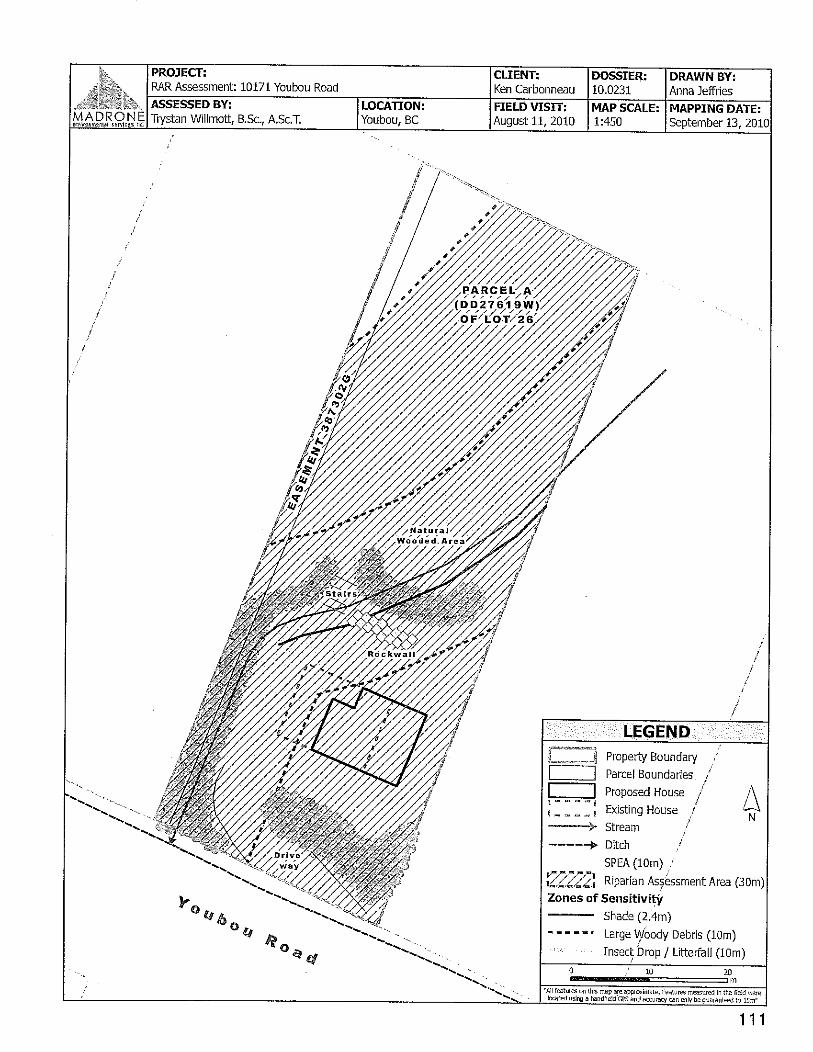
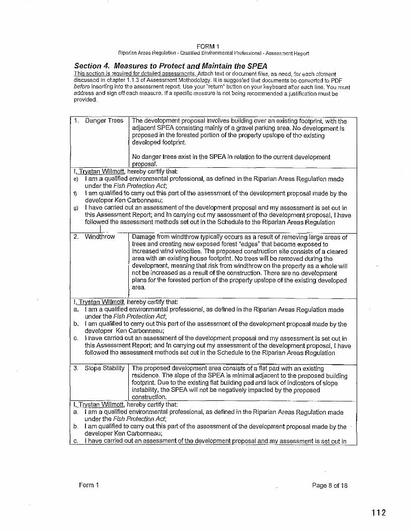
FORM 1 Riparian Areas Regulation - Qualified Environmental Professional -Assessment Report
Section 4. Measures to Protect and Maintain the SPEA This section is required for detailed assessments. Attach text or document files, as need, for each element discussed in chapter 1.1.3 ofAssessment Methodology. It is suggested that documents be converted to PDF before inserting into the assessment report. Use your "return" button on your keyboard after each line. You must address and sign off each measure. If a specific measure is not being recommended a justification must be provided.
I 1. Danger Trees The development proposal involves building over an existing footprint, with the adjacent SPEA consisting mainly of a gravel parking area. No development is proposed in the forested portion of the property upslope of the existing developed footprint.
I I No danaer trees exist in the SPEA in relation to the current develooment - I proposal. I, Trvstan Wlllrnott, hereby certify that: e) I am a qualified environmental professional, as defined in the Riparian Areas Regulation made
under the Fish Protection Act; q I am qualified to carry out this part of the assessment of the development proposal made by the
developer Ken Carbonneau; 9) I have carried out an assessment of the development proposal and my assessment is set out in
this Assessment Report; and In carrying out my assessment of the development proposal, I havs followed the assessment methods set out in the Schedule to the Riparian Areas Regulation
I 2. Windthrow Damage from windthrow typically occurs as a result of removing large areas of
trees and creating new exposed forest "edges" that become exposed to increased wind velocities. The proposed construction site consists of a cleared area with an existing house footprint. No trees will be removed during the development, meaning that risk from windthrow on the property as a whole wiil not be increased as a result of the construction. There are no development plans for the forested portion of the property upslope of the existing developed area.
I, Trvstan Wlllrnott, hereby certify that: a. I am a qualified environmental professional, as defined in the Riparian Areas Regulation made
under the Fish Protection Act; b. I am qualified to carry out this part of the assessment of the development proposal made by the
developer Ken Carbonneau; c. I have carried out an assessment of the development proposal and my assessment is set out in
this Assessment Report; and In carrying out my assessment of the development proposal, I havs followed the assessment methods set out in the Schedule to the Riparian Areas Regulation
I construction. I, Trvstan Willmott, hereby certify that: a. I am a qualified environmental professional, as defined in the Riparian Areas Requlation made
3. Slope Stability
- under the Fish Protection Act;
b. I am qualified to carry out this part of the assessment of the development proposal made by the developer Ken Carbonneau;
c. I have carried out an assessment of the development proposal and my assessment is set out in
The proposed development area consists of a flat pad with an existing residence. The slope of the SPEA is minimal adjacent to the proposed building footprint. Due to the existing flat building pad and lackof indicators of slope instability, the SPEA will not be negatively impacted by the proposed
Form 1 Page 8 of 18
FORM 1 Riparian Areas Reguiation -Qualified Environmental Professional -Assessment Report
/ this Assessment Renort: and In carrvina out mv assessment of the develonment orooosal. I have I , . iq!lovd the ; ~ ; ~ s r n ~ ~ ~ ? t n o d ~ & t our . 'r, - rhc Sci-e&cJo !he R carian &s.&~!al:o'n
4 I-'rotect on- Ao:acent to ib.c proposcd dsvelorniont area, [he-SEA consists of a qraiel t palking area. p he proposed construction will involve building on an existing footprint and there is, therefore, no potential for damage to trees located upslope
/ of the footprint. I, Trystan Willmott, hereby certify that: a. I am a qualified environmental professional, as defined in the Riparian Areas Regulation made
under the Fish Protection Act: b. I am qualified to carry out this' part of the assessment of the development proposal made by the 1 developer Ken Carbonneau: c. I have carried out an assessment of the development proposal and my assessment is set out in I this Assessment Re~ort: and In carrvina out mv assessment of the develooment oronosal. I have /
fo lewd rhe assessment methods skl out :n t h k s h c d ~ l e t c h ~ R'o%n rea as keblation I I . - ' -. 1 5. Encroach~iient C~rrently, tile proposed b,ild:ng area conssts of an estab ished resGnce. z h I
a graveldriveway and parking area. In addition, part of the existing porch extends into the SPEA. Immediately adjacent to the house, the SPEA is represented by the gravel parking area.
Current land uses and structures are considered legally non-conforming, but any new "developments" are not permitted inside the SPEA. It should be noted that the proposed residence will be smaller than the existing footprint and will be located further back from the stream in comparison with the current building configuration.
The upper portion of the property has been maintained as undisturbed young forest by the current landowners. There are no plans to develop any portion of the forested area.
It would be impractical to demarcate the edge of the SPEA during the construction process with temporary fencing, as it would be partly located across the existing parking area and property access. The SPEA has been flagged on site, and this flagged representation should remain during the construction nrocess to nrevent anv inadvertent encroachment from the construction
1 iootprint. '
I, Twstan Willmott, hereby certify that: a. I am a qualified environmental professional, as defined in the Rinarian Areas Reaulation made
I I The foilowing measures must be implemented during the construction process: (
under the Fish Protection Act; '
-
b. I am qualified to carry out this part of the assessment of the development proposal made by the developer Ken Carbonneau;
c. I have carried out an assessment of the development proposal and my assessment is set out in this Assessment Report; and In carrying out my assessment of the development proposal, I have followed the assessment methods set out in the Schedule to the Riparian Areas Regulation
- if possible, the majority of site preparation operations should be carried out during periods of drier weather; -any soil/fill stockpiles should be covered (e.g. with tarps) to prevent the
6. Sediment and Erosion Control
Form 1 Page 9 of 18
The potential for sediment generation will be partly mitigated by the fact that the construction will be occurring on an existing footprint. As a result, site excavations will be minimized. However, any excavations (even if minimal) have the potential to introduce sediment into the adjacent drainage.
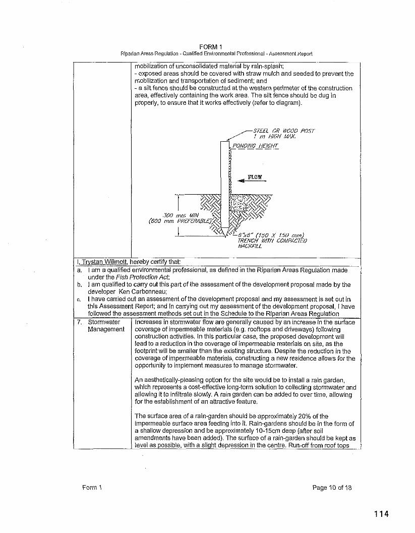
FORM 1 Riparian Areas Regulation - Qualiiied Environmental Professional -Assessment Repori
mobilization of unconsolidated material by rain-splash; - exposed areas should be covered with straw mulch and seeded to prevent the mobilization and transportation of sediment; and - a silt fence should be constructed at the western perimeter of the construction area, effectively containing the work area. The silt fence should be dug in properly, to ensure that it works effectively (refer to diagram).
SI££L Oh? WOOD POST f m /l/W MAX
6%'' (f50 X 150 mm/ TRENCH W/TH COMPACTEO HCKF/LL
I, Trvstan Willmott, hereby certify that: a. I am a qualified environmental professional, as defined in the Riparian Areas Regulation made
under the Fish Protection Act:
An aosthet:ca.ly-p1easi.g opt.on fcr the site ivould be to illstall a rain garden. &hich represents a cost-effective lone;-rcrm solution lo co lectira stcrmv~ater and
b. l am qualified to carly out thispart of the assessment of the development proposal made by the developer Ken Carbonneau;
c. I have carried out an assessment of the development proposal and my assessment is set out in this Assessment Report; and in carrying out my assessment of the development proposal, I have followed the assessment methods set out in the Schedule to the Riparian Areas Regulation
a 101. ng it to nfiltrate slonly A ra n garden can be added to over rlnie, a lo,, ng I for the estab sliment of an aitrect~ve feat~re I
7. Storrnwater Management
The surface area of a rain-garden should be approximately 20% of the impermeable surface area feeding into it. Rain-gardens should be in the form of a shallow depression and be approximately 10-15cm deep (afler soil amendments have been added). The surface of a rain-garden should be kept as level as possible, with a slight depression in the centre. Run-off from roof tops
Increases in stormwater flow are generally caused by an increase in the surface coverage of impermeable materials (e.g. rooflops and driveways) following construction activities. In this particular case, the proposed development will lead to a reduction in the coverage of impermeable materials on site, as the footprint will be smaller than the existing structure. Despite the reduction in the coverage of impermeable materials, constructing a new residence allows for the opportunity to implement measures to manage stormwater.
Form 1 Page 10 of 18
FORM 1 Riparian Areas Regulation -Qualified Environmental Professional -Assessment Report
can be directed into a rain-garden via flexible plastic pipes running from the downspouts. To prevent erosion, small gravel (e.g. pea gravel) should be placed around the pipe inflow.
After the rain-garden has been dug out, an adequate soil mix should be added, consisting of washed, coarse sand (approximately 50% by volume), hardwood mulch (15% by volume), weed free topsoil with a high organic content (30% by volume) and compost (5% by volume). It is important that the soil is not compacted (e.g. by foot traffic or machinery) after being spread. Minimal foot trampling will be unavoidable during the planting stage.
There are numerous options regarding potential plants to use in a rain-garden, but the following species are recommended: red osier dogwood (Cornus stoiinifera), salmonberry, red elderberry (Sarnbucas racernosa) and slough ~. I sedge (carex obnupfa):
-
I, TNStan Willmott, hereby certify that: a. I am a qualified environmental professional, as defined in the Riparian Areas Regulation made
Form 1
under the Fish Protection Act; b. I am qualified to carry out this part of the assessment of the development proposal made by the
developer Ken Carbonneau; c. I have carried out an assessment of the development proposal and my assessment is set out in
this Assessment Report; and In carrying out my assessment of the development proposal, I have followed the assessment methods set out in the Schedule to the Riparian Areas Regulation
8. Floodplain Concerns (highly mobile channel)
The drainage is relatively steep where it flows through the focus property. No indications of the drainage overtopping its banks were noted and there appear to be no potential flooding concerns on the property.
I, TNStan Willmott, hereby certify that: a. I am a qualified environmental professional, as defined in the Riparian Areas Regulation made
under the Fish Protection Act; b. I am qualified to carry out this part of the assessment of the development proposal made by the
developer Ken Carbonneau; c. I have carried out an assessment of the development proposal and my assessment is set out in
this Assessment Report; and In carrying out my assessment of the development proposal, I have followed the assessment methods set out In the Schedule to the Riparian Areas Regulation
I
FORM 1 Riparian Areas Regulation -Qualified Environmental Professional - Assessment Report
Section 5. Environmental Monitorina
The proposed development represents a low-impact proposal over an existing footprint adjacent to a SPEA that consists of a gravel parking area. The monitoring regime, therefore, shouid not be an in-depth, detailed operation.
Actions Reauired: I A pre-construction meeting shouid be held between the developer and monitor to discuss I
construction-related impacts (e.g. sediment mobilization). Details regarding the orooer irnoiementation of the sediment and erosion control olan would be discussed. to ensure ihai meas'ures are properly implemented and are site-speciiic. Stormwater management and potential location of the rain-garden would also be determined.
SchedulelComrnunications Plan: The developer is responsible for contacting a qualified environmental professional (QEP) to arrange for a pre-construction site meeting. The meeting should be held at least two days prior to the anticipated start-up of construction activities. A site visit mid-way through the construction process is recommended to ensure that the construction is occurring as per the development proposal and to determine whether the sediment and erosion control measures are being properly implemented. At this point, the QEP has the opportunity to modify measures, or make further recommendations to ensure that the development is occurring in an appropriate manner. A final site visit should also occur following the cessation of construction activities to check on the final configuration of the development. This final visit can occur prior to the completion of finishing work inside the house. The developer must contact the QEP to arrange for the recommended on-site visits.
Post Development Report: A post construction report is required, which details, in chronological order, the construction process and highlights the level of conformance to the stipulated measures. The report should contain site photographs to ensure the accurate portrayal of the development period.
Form 1 Page 12 of 18
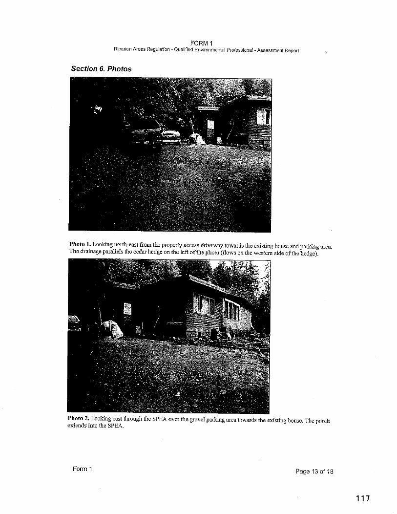
FORM 1 Riparian Areas Regulation - Qualiiied Environmental Professionai -Assessment Report
Secfion 6. Photos
Photo 1. Looking north-east from the property access driveway towards the existing house and parking area. The drainage parallels the cedar hedge on the left of the photo (flows on the westenl side of the hedge).
Photo 2. Looking east through the SPEA over the gravel parking area towards the existing house. The porch extends into the SPEA.
Form 1 Page 13 of 18
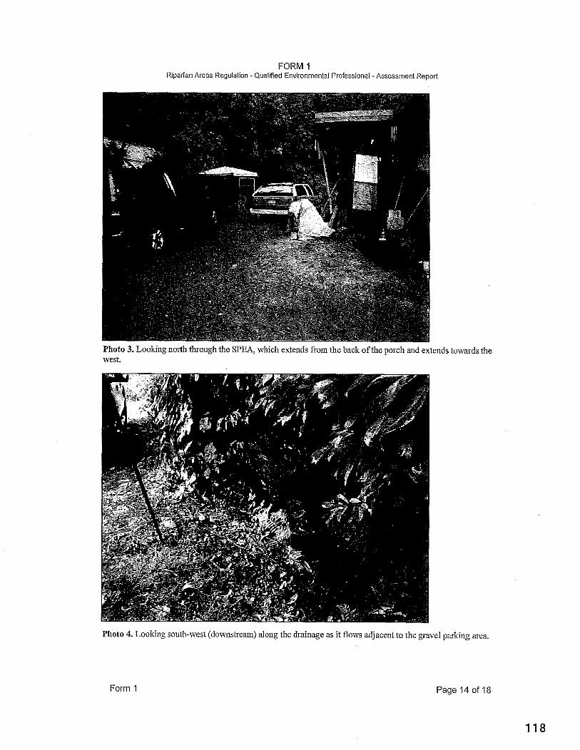
FORM 1 Riparian Areas Regulation -Qualified Environmental Professional -Assessment Report
nds towards the
Photo 4. Looking south-west (downstream) along the dl-ainage as it flows adjacent to the gravel parking area.
Form 1 Page 14 of 18
. - . . . . . . Riparian Areas Regulation - Qualied Environmental Professional -Assessment Rennri
Photo 5. Looking downstream (south-west) along the drainage (highlighted) where it flows though forest upslope ofthe developed portion of the property.
I the young
Photo 6. Looking downstream (south) along the drainage immediately upstream of Youbou Road.
Form 1 Page
FORM I Riparian Areas Regulation -Qualified Environmental Professionai - Assessment Repoit
rpslope of the existing development footprint
'ad. The subject
Form 1 Page 16 of 18
FORM I Riparian Areas Regulation - Qualified Environmental Professional - Assessment Report
Photo 9. Looking down at the inore obvious drainage located to the west of the subject property at the inflow of the culvert under Youbou Road. The course ofthe ditch shown in the previous photo is highlighted, which joins the larger drainage at the culveit inflow.
Form 1 Page 17 of 18
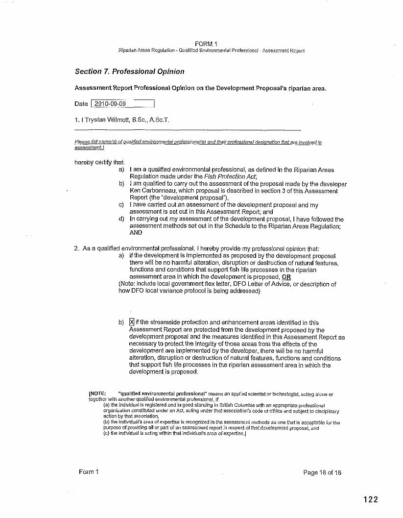
FORM 1 Riparian Areas Regulation - Qualified Environmental Professional -Assessment Repori
Section 7. Professional Opinion
Assessment Report Professional Opinion on the Development Proposal's riparlan area.
Date 1 2010-09-09
1. I Trystan Willmott, B.Sc., A.Sc.T.
Please list nameis1 of ouaiified envimnmenfal orofessionaiis) and fheir orofessional desionation fhaf are involved in assessmenf.1
hereby certify that: a) I am a qualified environmental professional, as defined in the Riparian Areas
Regulation made under the Fish Protection Act; b) I am qualified to carry out the assessment of the proposal made by the developer
Ken Carbonneau, which proposal is described in section 3 of this Assessment Report (the "development proposal"),
c) I have carried out an assessment of the development proposal and my assessment is set out in this Assessment Report; and
d) In carrying out my assessment of the development proposal, I have followed the assessment methods set out in the Schedule to the Riparian Areas Regulation; AND
2. As a qualified environmental professional, I herebv ~rovide my urofesslonal oainion that: a) if the development is implemented as proposed by the deveiopment proposal
there will be no harmful alteration, disruption or destruction ofnatural features, functions and conditions that su~aortfish life arocesses in the rioarian assessment area in which the debelopment is proposed, OR
(Note: include local government flex letter, DFO Letter of Advice, or description of how DFO local variance protocol is being addressed)
b) if the streamside protection and enhancement areas identified in this Assessment Report are protected from the development proposed by the development proposal and the measures identified in this Assessment Report as necessary to protect the integrity of those areas from the effects of the development are implemented by the developer, there will be no harmful alteration, disruption or destruction of natural features, functions and conditions that support fish life processes in the riparian assessment area in which the development is proposed.
[NOTE: "qualified environmental professional" means an applied scientist or technologist, acting aione or together with another qualified environmental professional, if
(a) the individual is registered and in good standing in British Columbia with an appropriate professional organization constituted under an Act, acting under that association's code of ethics and subject to discipiinary action by that association. (0) .IIP inol.. -1.3s a; 3 rfoupcnl3a is r-cor,l l ir i i n t'lo as~?i.rmcl. l l i l t l l .njs 3s Ono :?at fr ace:-b!.!Sc 1.r i t . ?
pl.rpc;r? of pro,': irg all or pan c f 3n 7sj2asnert rcpoll n risrcct ?it!i.i! icv:'~cn1c-1 r(~r;sa. ;no (c) IINC ind vlo.z :s &of :>q v: IP'n t i l ~ l no'\ J L ~ '4 5 . ~ 3 c I B x ~ ? ~ 'c.1
Form 1 Page 18 of 18

DATE: February 22,201 1 FILE NO: 2-E-10 RS
FROM: Alison Garnett, Planner II BYLAW NO:
SUBJECT: Rezoning Application 2-E-10 RS (Young and Pywell)
Re~ommendationlAction: That Application No. BE-IORS (Young and Pywell) be denied and that a partial refund of application fees be given in accordance with CVRD Development Application Procedures and Fees Bylaw No. 3275.
Relation to the Corporate Strateaic Plan: N/A
Financial Impact:. N/A
Background: Location:
Leqal Description:
3275 Glenora Road
Lot 1, Section 11, Range 5, Quamichan District, Plan 151 17 (PID 004-1 96-007)
Date Application Received: August 13, 2010
Owner(s): Applicant:
Michelle Young and Fisher Pywell Same
Size of Land Parcel: 3.1 hectares (7.9 acres)
Contaminated Sites Site Profile has been completed. No Schedule 2 uses noted Reaulation:
Existinq Use of Propertv: Residential
Existinq Use of Surrounding Properties:
North: Cowichan First Nation Reserve No. 1 South: Rural Residential zoning, gravel pit operation East: Rural Residential zoning West: Residential
Road Access: Glenora Road Water: On-site well
Sewaae Disposal: On-site septic
Aaricultural Land Reserve The property is not located in the ALR Siatus:
Environmentallv Sensitive None are identified in the CVRD Environmental Planning Atlas
Archaeoloqical Sites: None identified in CVRD mapping
Fire Protection: Eagle Heights Fire Service Area
Existing Plan Desiqnation: Rural Residential
Proposed Plan Desianation: New Residential designation
Existinq Zoninq: R-I Rural Residential
R-I Zone minimum lot size: 5 hectares (12.3 acres)
Proposed Zoninq: New residential zone
Min lot size under proposed 1 hectare (2.5 acres) m: Properiv Context: The subject property is a 3.1 hectare (7.9 acre) residential lot located on Glenora Road. There is currently a single family residence and accessory building on the lot, which are located adjacent to the western property line. These structures, as well as existing well and septic field, are identified on the attached conceptual subdivision plan submitted by the applicant. The lot is relatively level in the area closest to Glenora Road, however there is a steep bank at the rear of the existing house. There are no significant environmental features on the site, according to available ecosystem mapping.
The subject property's location is characterized by land that is zoned R-I and designated Rural Residential in Electoral Area E's Official Community Plan. Zoning Bylaw No. 1840 establishes a 5 hectare minimum lot size in the R-I zone, however subdivisions completed under preceding regulations have resulted in lots of various sizes, ranging from 35 hectares to 0.1 hectare. The majority of residential lots in the area are non-conforming with respect to the current 5 hectare lot size requirement.
As shown on the attached Official Community Plan map, this Rural Residential designated area is isolated by the surrounding Agricultural Land Reserve and Agricultural designation. Cowichan Tribes Reserve No. 1 occupies a large portion of land to the north of the subject property. We also note that a gravel extraction business historically operated opposite of the subject property on Glenora Road, and an active gravel extraction operation is located on Langtry Road. The agricultural hamlet of Glenora is located to the west of the subject property, and the higher density, fully serviced Eagle Heights residential area is located to the north- east, in close proximity to Duncan.
Proposal Overview: The aoolicants are orooosina to rezone their orooertv to a new residential zone with a ~, . minim& lot size of l'he~tarey2.5 acres), for the purpose of permitting a 3 lot subdivision. The conceptual plan of subdivision demonstrates that each of the proposed lots would have considerable road frontage along Glenora Road. As there are no community water or sewer systems in this area, the lots would require onsite wells and septic fields. At the subdivision stage, the applicants would be required to meet the septic waste requirements of the Vancouver Island Health Authority, as well as the potable water requirements of CVRD Subdivision Bylaw No. 1215.
As fewer than 3 new lots are being proposed, no parkland dedication would be required at the subdivision stage, pursuant to Section 941 of the Local Government Act.
Policv Context: Zoning This table summarizes the minimum lot size requirements for existing single family residential zones in Electoral Area E, based on the level of sewer and water servicing.
Zone
I system R-3 Urban Residential / 0.09 ha for oarcels served bv communitv water and sewer
Minimum Lot Size
R-2 Suburban Residential
0.2 ha for parcels served by; c o r n r n ~ n i ~ ~ water system 2.0 ha for parcels served neither by a community water or sewer system
R-I Rural Residentia
0.4 ha for parcels served by community water and sewer 0.4 ha for parcels served by community water system 2.0 ha for parcels served neither by community water or sewer
Although the subject property has no subdivision potential under the R-1 zone regulations, a small suite or secondary suite is theoretically permitted on the property. We note that no existing single family residential zone would permit subdivision of the 3 hectare sized subject property, based on the lack of community water system availability.
Official Community Plan Electoral Area E- Cowichan StationlSahtlam/Glenora- Official Community Plan Bylaw No. 1490 policies relevant to this application include the following:
Rural Residential Policy 7.2.1 Land designated as Rural Residential in the plan map comply with the following criteria: i) The land must be reasonably accessible to existing community facilities such as schools,
shopping and fire protection services. Distant isolated parcels are not considered appropriate for rural residential densities;
ii) The development of land will not disrupt or interfere wifh productive agricultural or forestry use; iii) The land is not anticipated to be sewiced wifh community wafer for at least twenty years; iv) The land must be outside of the ALR.
Policy 7.2.2 Land designated Rural Residential shall be subject to a maximum density of one parcel per 5.0 hectares.
In addition, some of the Residential Objectives noted in Section 2.2.6 of the OCP state: It is the objective of the Regional Board to:
a) Control the pattern and phasing of land development in order to ensure the orderly development of the area.
b) Accommodate a diversity of lifestyles by permitting a variety of lot sizes and residential densities, while discouraging the indiscriminate mixing of parcel size where it would result in inefficient land use and servicing or where if would destroy the quality of life enjoyed by existing residents.
f ) Ensure that residential development does not conflict with or preclude the utilization of resource lands and is in character with the rural setting.
Advisory Plannina Commission Comments: The Electoral Area E APC reviewed this application January 20, 2011, and passed the following motion:
The APC supports the application based on the individual characteristics of this application which does not necessarily suppod a desire for a major change in our R-1 zoning.
3 suppod, 2 against.
Referral Aaencv Comments: This application was referred to government agencies on January 4th, 201 1. The following is a list of agencies that were contacted and the comments received.
Ministry of Transportation and Infrastructure - No objection. Applicant will be required to meet Minisfly driveway standards at the subdivision stage. Dedication may also be required at that time. Vancouver Island Health Authority - This office has no objections to the above amendment at this time. During the subdivision referral phase, the applicants will be required to meet the Vancouver Island Health Authority Subdivision Standards. As the applicants have not indicated that the proposed subdivision will be connected to an approved community water system, individual wells will be required for each proposed lot. Cowichan Tribes - No comments received. Duncan Volunteer Fire Department - Driveways must be 6 metres wide. Addresses should be marked at road entrance (personal communication from City of Duncan staff) School District #79 - No comments received. CVRD Parks and Trails Division - Parks and Trails staff have reviewed the application and will not be referring it to the Parks Commission during the rezoning stage. CVRD Public Safety Department - Proposal is within the Duncan RCMP Detachment area. Proposal is within the BC Ambulance Station 152 (Duncan) Response area. Proposal is within the boundaries of the CVRD Regional Emergency Program. Proposal is within the contracted Eagle Heights Fire Protection response area and input from the Duncan Fire Department may further affect Public Safety concerns/comments. The Community Wildfire Protection Plan has identified this area as moderate to high risk for wildfire. Extra precautions should be taken such as full Firesmart compliance. A sprinkler system should be considered as firefighting in rural areas without a water system compliant with NFPA 1142, Standard on Water Supplies for Suburban and Rural Fire Fighting is extremely challenging. CVRD Environmental and Engineering Department (Water Management Division)- This property is not in any CVRD water or sewer service areas, therefore Water Management has no comment for this development.
Planning Division Comments: The subject property is located in an isolated pocket of rural residential land, surrounded by the Agricultural Land Reserve and the Agricultural Plan designation. As a result of historical subdivision practices, the settlement pattern of this residential area consists of quite varied lot sizes, many of which are non-conforming with respect to current minimum parcel size requirements. However, existing zoning regulations set a 5 hectare minimum lot size in the R-I zone, and this is reinforced through the Rural Residential OCP policy noted above. The introduction of a new zone with a 1 hectare minimum lot size would be a substantial deviation from these existing Zoning regulations and OCP policies.
We note that the APC supports this application. However, their comments provide a somewhat mixed recommendation, as they also state that they don't wish for a major change in the R-I zoning. Staff wish to highlight that larger lot sizes are associated with, and appropriate to, rural and resource lands. Alternatively, higher residential densities are generally encouraged in well defined urban areas, where community water, sewer and other infrastructure can efficiently provide services. Maintaining this distinction between rural and urban areas, and appropriately allocating density, is considered an efficient use of land, helps retain a genuine rural setting, and reduces potential conflict that exists between residential and resource uses of land, such as agriculture, forestry or gravel extraction.
Attached to this report is a list of signatures (provided to the CVRD by the applicant) of area residents who support this 3 lot subdivision proposal. If there is indeed support within the community for increasing residential densities in this area, staff suggest that this issue is best approached through a more broad Plan policy review, rather than by a site specific OCP and Zoning bylaw amendment. In staff's opinion, there does not appear to be enough merit in this application to justify a spot zoning amendment or an increase in residential density in this rural resource area, and we therefore recommend that the application be denied.
Options: A: I. That Application No. 2-E-IORS (YounglPywell) be denied and that a partial refund of application fees be given in accordance with CVRD Development Application Procedures and Fees Bylaw No. 3275.
B: - 1. That draft bylaws for application No. 2-E-IORS (YounglPywell) for a new rural residential zone be prepared and presented at a future EASC meeting;
2.That the application referrals from the Ministry of Transportation and Infrastructure, Duncan Volunteer Fire Department, Vancouver Island Health Authority, Cowichan Tribes and School District #79 be accepted.
Option A is recommended.
Submitted bv.
Alison Garnett Planner II Development Services Division Planning and Development Department
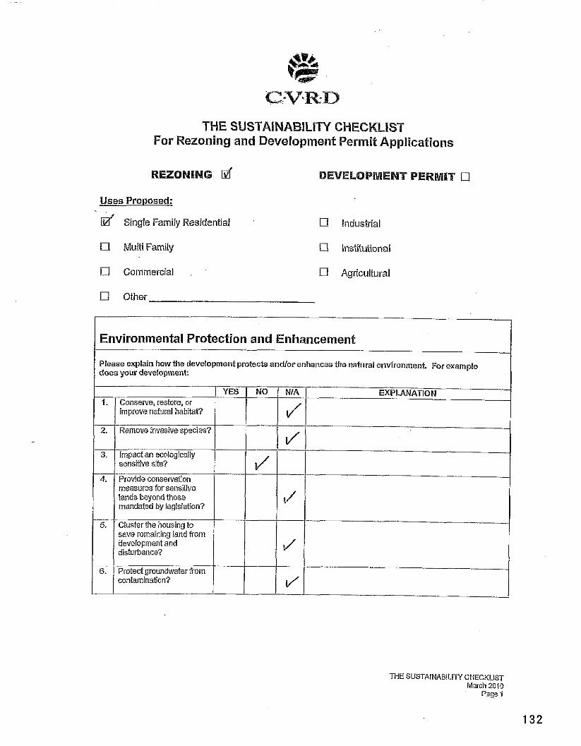
THE SUSTAINABILITY CHECKLIST For Rezoning and Devetopment Permit Applications
REZONING d BEVELQPMENT PERMIT
Uses Proposed: . . d Single Family Residential Industrial
17 Mulii Family Institutional
[7 Commercial . , Agricultural
[7 Other
Environmental Protection and Enhancement
I Please explain how the development protecb andlor enhances the natural environment. For example does your development: I
YES 1. Conserve, restore, or
improve natural habitat?
2. Remove invasive species?
sensitive sife?
measures for sensitive lands beyond those mandated by legislaiion?
save remaining land Worn UeveLopment and disturbance?
EXPLANATION
I I
M E SUSTAINABILITY CHECKLIST March 2010
Page 1
6. Protect grnundwaier from contamination?
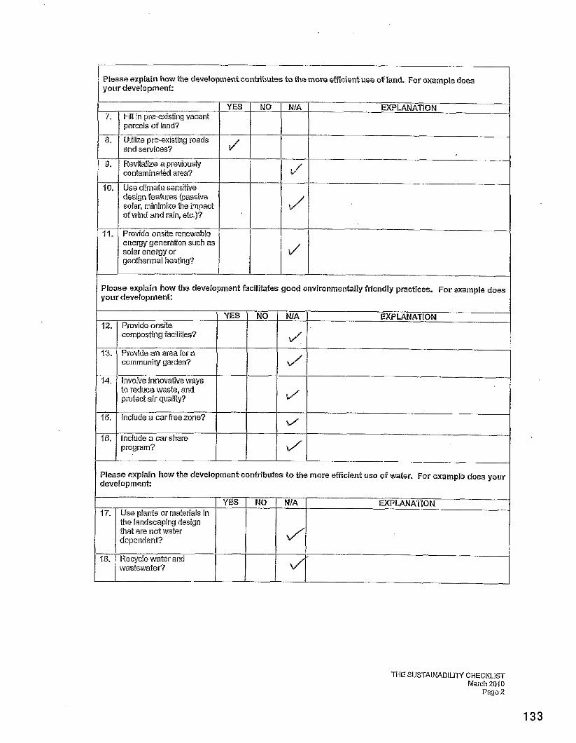
PIease explain how the development cantributes to the more efficient use of land. For example does your development:
Utilize pre-existing roads and services?
Revitalize a previously contaminat&i area?
Use climate sensitive design features (passive solar, minimize the impact of wind and rain, etc.)?
NO NIA E XPLANATION
Please explain how the development facilitafes good environmentally Friendly practices. For example does your development: I
11.
Provide an area for a community garden?
to reduce waste, and protect air quality?
Provide onsite renewable energy generation such as solar energy or geothermal heating?
program?
a/
7 EXPLANATION
J l
Please explain how the developmentcontributes to the more efficient use of water. For example does your development?
YES NO NIA I EXPLANATION 17. Use plants or materials in
the landscaping design that are not water dependant?
wasfewafer?
THE SUSTAlNABlLlN CHECKLIST March 2010
Page 2
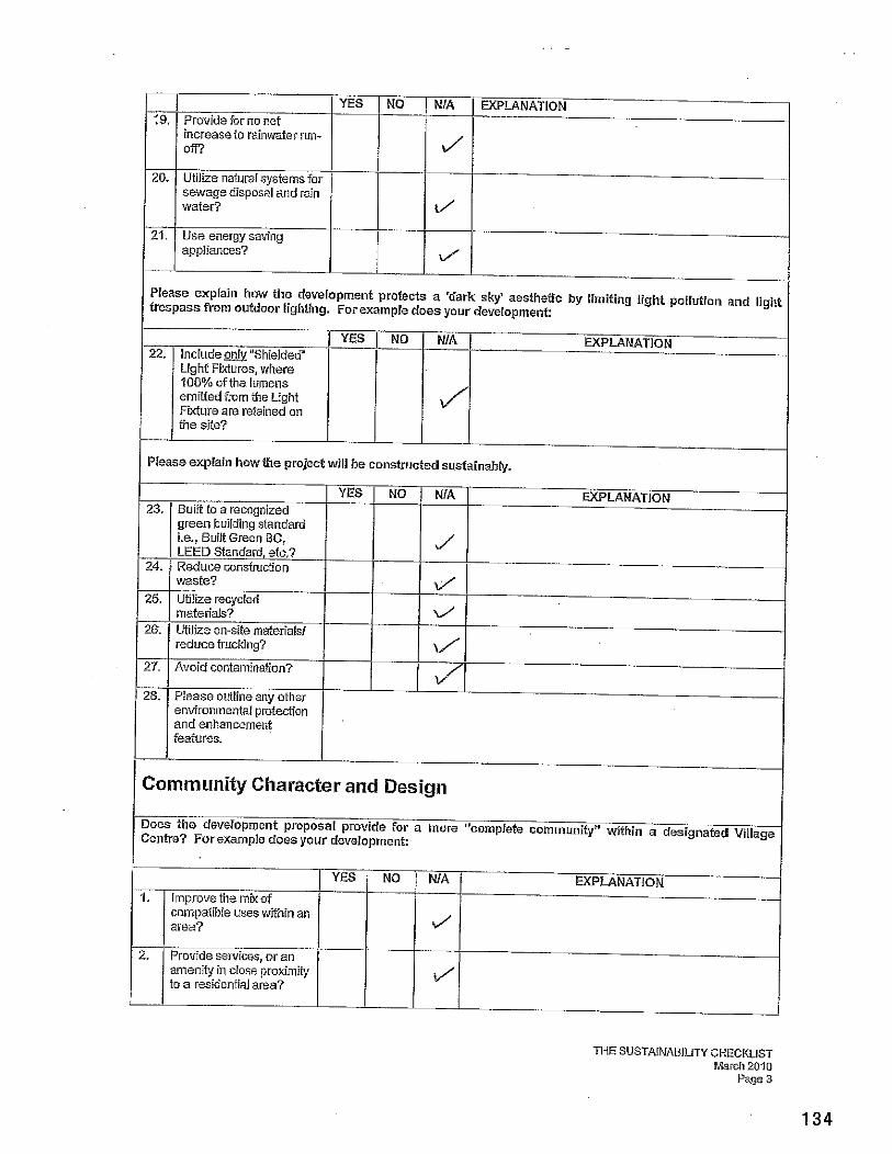
19.
20.
21.
28. Please ouilineany other environ~nental pmteciion and enhancement
Please explain how tile development protects a 'dark sky' aesthetic by limiting light pollution and light trespass from outdoor lighting. For example does your development:
Provide for no nst increaseto rainwater run- off?
Utilize natural systemsfor sewage disposal and rain water?
Use energy saving appliances?
22.
I ( features. I I
Piease explain how the projed will be Constructed sustainably.
YES I n d u d e m "Shielded' Light Fixtures, where 100% ofthe lumens emitted from the tight Fiwiure are retained on the site?
23.
24.
25.
26.
I I
Community Character and Design
YES
YES Built to a recagnized green building sfandard i.e., BuiN Green BC, LEED Standard, etc.? Reduce consiruction waste? Ubiize recycled materials? Utilize on-site maierialsi reduce trucking?
Does the development proposal provide for a more "complete community" within a designated Village Centre? For example does your development:
NO
1. Improve the mixof compatible uses wifhili an
NO
NO
1 area?
NiA
J
amenity in ciose broximiiy to a resideniial area?
NIA
J
i/
w'
EXPLANATION
WA
J
v'
b'
Lf'
YES NO NfA EXPLANATION
I
EXPLANATION
EXPLANATION
n i E SUSTAINABlLlTY CHECKLIST Mardi 2010
Page 3
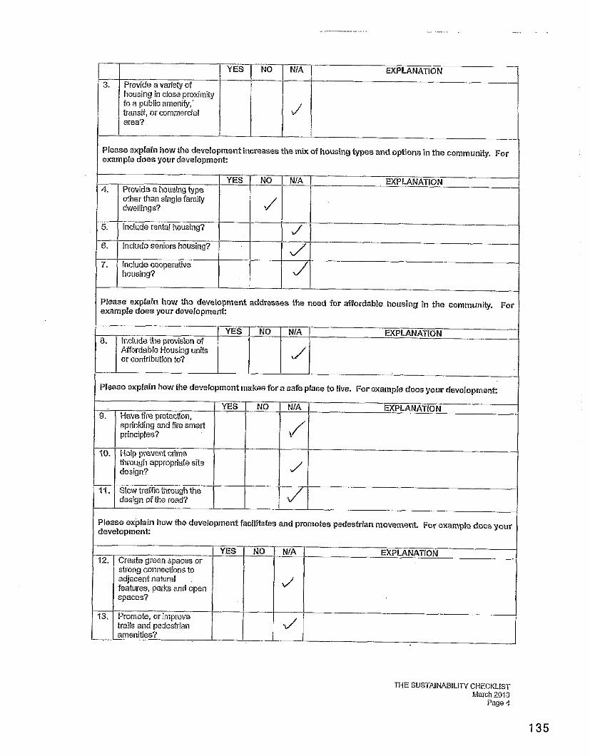
housing in close proximity to a pubiicameniiy,' fransii, or commercial area?
EXPLANATION 0 Please explain how the development increases the mix of housing types and options in the community. For example does your development:
Please explain how the development addresses the need for affordable housing in the communjty. For example does your development:
1- NO I NIA 1 EXPLANATION 8. 1 lnclude the oronision of 1 I I I
I i Affordable kousing units or contribution to?
I Please explain how the devecopment makes f a ra safe place to live. For example does your development: 1 9.
20.
I 1
ME SUSTAINABILITY CHECKLIST March 2010
Page 4
Please explain how ihe developmen% facilitates and promotes pedestrian movement. Far exampte does your development:
YES Have fire protection, sprinkling and fire smarl principles?
Help prevent crime ffimugh appropriate site design?
Slow traffic through the design of the road?
NO YES 12.
I
J --
NO
Create green spaces or strong connections to adjacent natural features, parks and open spaces?
13.
NIA
l/'
Promote, or improve trails and pedestrian amenities?
NIA
d'
J'
EXPLANATION
EXPLANATION
I distance &&e) I I / I I Please explain how the development facilitates community social interaction and promotes con~munity values. For example does your development:
14. NIA EXPLANATION / YES
Link to amen%= such a s school, beach &trails, grocery store, public transit. etc.? (provide
5.. Improve oppominiiies for
NO
6.
THE SUSTAlNABILlN CHECKLIST March 2010
Page 5
new and existing businesses?
Piease outline any other economic development features.
4"
Other sustainable features?
Disclaimer: Please note that staff are relying on the information provided by the applicant to co~nplete the sustainability checklist analysis. The GVRD does not guarantee that developn~ent will occur in this manner.
Signature of Agent
Dafe oecP_m/@? 5, 6) Date
THESUSTAINABILITY CHECKLIST March 20-10 . Page 6
. . . ~ . . - " 3- F ~ : 7: 5: TzE~-~rz m:Iiz&on of 3lrcaeJe Y o m g m& F&&mP4w%g for3275 a k ~ o r a
. . - - - . ~ -- - - - . .I I. ~ 3 - a Z&dcn6al) to a ne\v residential zone with a minirnuin parcel Si2= &TI hce*a& - -
% - --.- .,. A - ._. =&.a% i;~uIi: pe&t a 3 1at stibditisisn. . ~
. .
. .
. . . . ...
. .
I support the rezoning application of Michelle Young and Fisher PyweII for 3275 GIenora Road from R-1 (Rural .Residential) to a new residential zone with a minimum pace1 size of 1 hectare -~~
. . . .
I support the rezoning application of Michelle Young and Fisher Pp-ell for 3275 GIenora Road &om R-1 (Rural Residential) to a new residentid zone with a minimum parcel size of 1 hectare . .
(2.5 acres) '&at -v'?ould permit a 3 lot subdivision.
Name Address Signature
f support the rezoning application of Michelle Young a d Fisher Pjwell for 5275 GIeaora Road &om R-1 mural Residentid) to a iiewresidaxtial zone with a rrii~imum pareel size of i h~ctare
. . . . . . . . . . . . . . . . . . . . . . . . . . . . . . ... . . . . . . . ,. .:. , . .... . : . . . . . . . . . . . . . . .
. . . . - ' . . . G o a &e rezpning application of Michelle Young and Fisher PyweH for 3275 Glehora Road
.~ . -. ~ C E Z-1 (@-~i!l Reiidential) to a new residential zone with a mininum parcel size of 1 hectare ~. ~. . . ; :._ .c~~Laj - - - - - ' - &at wvould p e i i t a 3 lot subdivisioi~.
. .
%ame . .
Address Signature
..: . . , , ....... . . . . . . . . . ~ . . . . . . . .~ .:.. :.. . . . . . . . . . . . . ~. .
. . . . . . . . . . . . . . . . . .~.. . ~ . . . . .:, .~ . . ~.
I s&@olfthe &zoning application of WIcheLIe Yomg apd %ishex . ~ PyG;S~ f d d + ~ 2 ; i S . G ~ ~ . ~ & & . . . . . . . . . . . . . . . . . . <:. . . . . from R-l (Rural Reside~xtial) to a nepi sesideztial kose with a mirimwipxczB 5zc or 3 kctars. ~ ~
. . .
. . . . . . . . .
. ~. .. ,
.
DATE: March 7,201 1 FILE NO:
FROM: Rob Conway, MCIP BYLAW No:
SUBJECT: Development Permit Application 14-B-IODP (Elkington Forest - Phase 1)
RecommendationlAction: 1. That application No. 14-B-IODP (Elkington Forest - Phase 1) be approved, and that a
development permit be issued to Charles Clayton and Diana McKay for an 18 lot subdivision and associated development subject to: a. Com~liance with RAR re~or t #1850: b. em arc at ion of SPEA bdundaries with fencing and signage and submission of a post-
development report prepared by a Qualified Environmental Professional prior to . . subdivjsion;
c. Submission and approval of a drainage design that incorporates the rain management concepts described Schedule 7, prior to subdivision of lots in the Trail Head Hamlet;
d. Registration of a restrictive covenant to preclude multiple family use and further subdivision;
e. Registration of a restrictive covenant to preclude development of the identified Streamside Protection and Enhancement Areas and the protective zones identified in RAR Assessment Report #I850 and on Schedule 2;
f. Demonstration that proposed buildings comply with criteria listed on Schedule1 1 prior to issuance of a building permit for any residential or commercial building;
g. Compliance with Covenants CAI648147 and CAI648148 (Fire Protection); h. Compliance with Covenants CAI648144 and CAI648145 (Parks); i. Compliance with Covenant CAI648146 (Servicing); j. Installation of all wiring underground.
2. That Zoning Area "B" Zoning Bylaw No. 985 be amended to adjust the sub-zones in CL-1 Zone to comply with lot boundaries described development permit application 14-B-IODP.
Relation to the Corporate Strategic Plan: NIA
Financial Impact: (Reviewed by Finance Division:)
Propertv Information:
Location of Subiect Property: South Shawnigan Lake
Leqal Descriptions:
I. District Lot 201, Malahat District (PID 009-395-075)
2. That Part of Block 201, Malahat District, including part of Amended Parcel A (DD1896741) of Said Block. (PID 009-395-130)
Date Agplication..and Coniplere Docuinentation Received. ln~tal applicat~on s~~bmitred October --- I . 2010. Updates rece'ved January 5 and Febrbary I I . 201 I
Owners Dr Charles Clayton, Trustee and Ms Diana McKay, Trustee
Applicant: Living Forest Planning Consultants Ltd
Size of Parcel: Phase 1 Approximately 11.6 ha. (28.7ac.)
a: Community Land Stewardship (CLS-1)
Minimum Lot Size: No minimum specified
OCP Plan Designation: Community Land Stewardship
Existina Use of Property: ForestryNacant
Existina Use of Surrounding Properties: North: Forestry and Residential South: Capital Regional District Watershed; Forestry East: Forestry and Residential West: forestty
Services: Road Access: Goldstream Heights Drive Water: Community water Sewaae Disposal: Community Sewer or Private Sewer System Fire Protection: Malahat Fire Service Area.
Aaricultural Land Resewe Status: Out
Environmentallv Sensitive Areas: Creeks and tributaries subject to the Riparian Area Regulation are located within the current phase of development.
Archaeological Sites: None identified
Backaround: The Elkington Forest lands were rezoned in August, 2010 to a new Community Land Stewardship (CLS-1) Zone. The new zone applies to approximately 385 hectares of land, with 85% of the zoned land protected for eco-forestry and ecological conservation. The remaining 15% of the site is intended for agro-forestry use, clustered residential hamlets and low density residential use. A maximum of 90 dwelling units, excluding secondary suites, is permitted on the lands.
The majority of residential settlement on the Elkington Forest lands is planned in three phases of clustered development. Phase 1, referred to as the Trail Head Hamlet, is located at the east side of the property. Phase 11, the Ridgeview Hamlet, is located along the south property boundary. The third phase, located west of the Trailhead Hamlet and north of the Ridgeview Hamlet, is comprised of the Meadow Hamlet, agro-forestry parcels and the Midlands. A plan showing the Elkington Forest site and three hamlet areas is attached to this report as Schedule 1.
The subject development permit application is for Phase 1, or the Trail Head Hamlet. The application proposes 18 residential lots. Other uses contained with the first phase are a community hall, fire hall, utility facilities, public park, strata-owned common property and eco- forestry lands.
Policv. Context:
Zoning: Electoral Area "B" Zoning Bylaw No 985, zones the entire Elkington Forest Lands as Community Land Stewardship (CL-1). Within the CL-1 zone, five sub zones are identified that specify the uses, densities and development criteria that apply to various parts of the property.
The development proposed in Phase 1 falls within the Hamlet sub zone, the. Agro-forestry sub zone and the Eco-forestry sub zone. The primary residential use is clustered in the Hamlet sub zone, although some of the proposed lots also extend into the agro-forestry sub zone.
Since the Hamlet sub-zone permits multi-family use and does not have a minimum lot size, staff believe some limitation on use and subdivision is appropriate to maintain the owners' development rights on the remainder of the land and to avoid future disputes over land use and density on the property. A covenant is recommended to preclude multi-family use or future subdivision of the Trail Head lots following the initial subdivision.
A copy of the CL-1 zone is attached to this report as Schedule 12.
Official Community Plan: Shawnigan Lake Official Community Plan Bylaw No. 1010 includes the subject lands within the Community Land Stewardship Development Permit Area. This development permit area is intended to achieve the following objectives:
I. To protect the ecological of the area; 2. To protect life and property from hazardous conditions; 3. To promote energy conservation, water conservation and reduce greenhouse gas
emissions; 4. To minimize the degree of forest carbon emissions; 5. To ensure the form and character of intensive residential, commercial and industrial
development conforms to basic principles of ecological sustainability and vernacular tradition urban design.
Any development within the Community Land Stewardship Development Permit Area, including subdivision, construction and land clearing requires a development permit. All development within the development permit area is expected to demonstrate compliance with the applicable development permit guidelines.
The subject application primarily proposes to subdivide the first phase of the Elkington Forest project as shown on the submitted plan for the Trail Head Hamlet. The CLS Development Permit Area also requires development permits for dwellings and other structures. As the design for all future dwellings and structures has not been finalized, the applicant has requested a more generalized approach to the application of development permit guidelines for structures so that separate development permit applications will not be required for each building that will be built in Phase 1. It is proposed that the current development application establish criteria for future structures within the current phase, and that further development permit applications not be required, provided the proposed development complies with the terms and conditions of the guidelines and issued permit. The Committee should note that this approach differs from what was intended when the development permit area was drafted. Staff supports the proposed approach, as requiring individual development permits for all future dwellings within the project would be time consuming and administratively cumbersome. A checklist for subsequent building permit applications is described later in this report, which is proposed as the mechanism for ensuring Phase 1 structures are compliant with the development permit guidelines.
In addition to being within the CLS Development Permit Area, the subject lands are also within the Riparian Area Regulation Development Permit Area. A Riparian Area Assessment and protection measures in accordance with the Riparian Area Regulation development permit area guidelines are therefore required and this development permit application is expected to also comply with the RAR development permit are requirements.
Proposed Development:
Roads and Access: The Trail Head Hamlet will be accessed from Goldstream Heights Drive. An existing road stub that provides access to the Trans Canada Trail will be extended and a new road constructed to provide road access from the south side of the Hamlet. The road extension will require additional road dedication, which the applications are pursuing. The road extension is expected to also provide access to subsequent phases of development.
Lof Layouf: The Trail Head Hamlet will be developed as a bare land strata subdivision. Residential lots will be privately owned strata lots, with -the roads, green space, utilities and eco-fortestry lands owned in common by the strata corporation. Lots will be transferred to the CVRD for park land and a fire hall site. The majority of proposed lots within the strata subdivision will be oriented around a ring road and common open space. Lots surrounding the ring road vary in size between 685 square metres (7400 sq. ft.) and 1,554 square metres (16,730 sq. ft.). Three of the proposed lots, accessed from a shared driveway, are larger with lot sizes of between 0.29 and 0.69 hectares (0.72 to 1.7 ac.).
The zoning limits the footprints of dwellings to 200 square metres and the maximum floor area to 370 square metres. Covenants will be registered against the lots to limit the area that may be developed with structures, including fencing and retaining with the protected area left in a natural condition. Schedule 2 shows the protected areas of the residential lots.
Commercial and Comrnunify Uses: A small commercial building is proposed at the north end of the common space in the centre of the Trail Head Hamlet. The building is expected to accommodate community meeting space and a coffee shop that would serve residents and travelers using the Trans Canada Trail. It is also expected that basic groceries and convenience products will be sold from the building. The
building will have a footprint of approximately 200 m2, with the community centre and convenience store limited to floor areas of 100 m2 each.
Parks and Trails: 4.15 hectares of park land will be dedicated in Phase 1. The park land is comprised of a strip along the east property boundary that will provide a connection to the Trans Canada Trail, a 1,7 square metres area that will provide a trail head access to the Trans Canada Trail and over 3.0 hectares land north of the Trail Head Hamlet as a conservation area. The park land is shown on Schedule 4.
The trail head access will be developed with some limited parking (two spaces) and a washroom building and covered picnic area. Other park improvements include trail construction and an off-site parking area. A section 219 covenant is registered against the subject property to secure park improvements, so not all of the park requirements are explicitly addressed in the development permit.
In addition to the public park land, a large strata-owned green space is proposed in the centre of ring road. Trees and other vegetation will be retained in the common green space, but the area will be thinned and trails constructed within it to achieve a more park-like landscape.
Sen~ices: The Trailhead Hamlet will be serviced from a CVRD owned and operated community water system, supplied by on-site wells. Sewer service will be from a "Class A" sewer treatment system, as required by the CVRD's South Sector Liquid Waste Management Plan. It has not been confirmed yet if the sewage treatment system will be a CVRD utility or if the strata will own and maintain it.
Storm water will be managed on-site using a "natural drainage approach", whereby vegetated swales and natural drainage techniques will be used. A conceptual drainage plan has been prepared and is attached as Schedule 7. Detailed design for the storm water system and the sewer and water systems is not available at this stage but will be completed prior to subdivision.
Fire Protection: As the Elkington Forest lands were not in a fire protection service area when the lands were initially proposed for development, a number of fire protection measures were required as conditions of rezoning and inclusion of the properties in the Malahat Fire Service Area. These include construction of a new fire hall, provision of dry hydrants and lockable equipment storage, standards for Fire Smart construction standards and fire hazard fuel management procedures and cash contributions for fire fighting equipment. A section 219 covenant is registered against the subject lands to secure fire protection commitments and conditions of the covenant must be satisfied prior to subdivision.
The proposed fire hall location is at the southeast corner of the Trailhead Hamlet. This location is strategically situated at the main entrance to the development. The fire hall site layout is not finalized, but the Public Safety Department and Malahat Fire Department have indicated they generally support what has been proposed. The detailed design will be confirmed at a later stage.
Sustainable Development Features: Sustainable development features proposed with the development include homes built to the ~ u i l t ~ r e e n ~ ~ Gold standard, a rainwater management plan that includes rainwater collection and reuse and a community geothermal heating system. A full description of sustainable development features incorporated into the development is provided in Schedule 10
(Sustainability Checklist). A Checklist for the Green Built program is also provided in Schedule 8.
Compliance with Communitv Land Stewardship Guidelines Development Permit Guidelines: Four categories of development permit guidelines are identified in the Community Land Stewardship DPA. Rather than review each and every guidelines, staff comments regarding compliance with the guidelines are focused on the four general categories of the development permit area, as described below.
Environmental Protection: Guidelines require a "sustainable rain water management plan", based on Ministry of Environment Best Management Practices. The applicants have provided a plan that describes the types of rain water management techniques that will be employed (Schedule 7), but have not provided a detailed design that shows the specific rain water management infrastructure that will be constructed. Staff recommend that a detailed rain management design in accordance with the concept plan be required as a condition of the development permit.
The applicants have advised that they will target a Built re en^^ old" standard for commercial and residential buildings in the development. Built re en^^ is a checklist-based rating system for "green" building practices. The Built Green Gold standard has a minimum Energuide rating (a measure of energy efficiency and energy consumption) of 77. A minimum building design standard of Built Green Gold or better is recommended as a permit condition.
The proposed water and sewer systems for the development comply with guidelines for environmental protection.
Hazardous Conditions: No areas of erosion or ground instability have been identified in Phase 1, so a geotechnical assessment is not recommended at the development permit stage. Geotechnical assessment may be required at the building permit stage should such issues be identified prior to constructions of dwellings or other structures.
A covenant (CA1648148) is registered against the subject lands that establish subdivision and building standards intended to protect the proposed development from fire hazard. Prior to subdivision approval and issuance of building permits, the owner will need to demonstrate that conditions of the covenant have been satisfied. Conditions required prior to subdivision include design of access roads and driveways to accommodate emergency vehicles, installation of dry hydrants and fire suppression equipment, the management of forest fuels and wild fire hazards. Residential and commercial structures are required to have interior sprinklers and are to be constructed in accordance with Fire Smart guidelines.
Form and Character of Development within the Hamlet Areas: The 6 metre wide strata roads within the development will minimize cuts and fills and will have less impact on the landscape than public roads built to Ministry of Transportation standards.
No street lighting is proposed for the roadways. A "dark sky" approach exterior lighting is proposed, and the applicants have suggested making this a requirement for buildings and structures.
Concept plans for landscaping of the public areas of the Trail Head Hamlet have been provided, but the plan is far too general to know if these areas will be landscaped in accordance with the standards described in the development permit guidelines or if CPTED (Crime Prevention Through Environmental Design) principles have been followed. The Committee may wish to
consider if the general landscaping concepts submitted are acceptable, or if more detail is desired.
Many of the form and character design guidelines of the CLS Development Permit Area apply to structures, and are therefore not directly relevant to the proposed subdivision. The applicant has requested that the guidelines be applied prior to issuance of a building permit without further development permit review. The permit could be issued in this manner, but the review process would likely be much more cursory than would typically occur with a development permit review and staff would be responsible for determining compliance with this approach. A checklist is proposed on Schedule 11 that lists the proposed criteria for determining compliance with development permit guidelines prior to issuance of building permits. If the Committee and Board are agreeable with this approach, the checklist would become part of the development permit and would be use to review phase 1 building permit applications.
Energy Conservation, Wafer Consetvafion and Reduction of Greenhouse Gas Emissions: Proposed energy conservation measures include a geothermal vertical ground heat exchanger and buildings constructed to the Built re en^^ Gold standard. The Built Green rating system encourages water conservation through the use of low-flow fixtures, water efficient appliances, drought tolerant landscaping and rainwater and grey water re-use.
Compliance with Riparian Area Re~ulat ion Development Permit Guidelines: Any development within the riparian assessment area of a creek, as defined by the Riparian Area Regulation requires a development permit in accordance with the RAR development permit area guidelines. In order to submit an application for this development permit area, applicants must have a report prepared by a Qualified Environmental Professional that identifies the Streamside Protection and Enhancement Areas (SPEAs) and provides recommendations for appropriate protection measures.
The Riparian Assessment Report that was provided with this application identified two creeks and two tributaries in the current phase of development. The primary hamlet area, where 15 of the 18 units are clustered, is largely defined on the north and west boundary by these watercourses. As there is development proposed within 30 metres of the high water mark of watercourses, a Riparian Area Assessment is triggered and compliance with the RAR Development Permit Guidelines is required.
RAR Assessment Report #I850 was provided with the development permit application. The report identifies a 15 metre SPEA for the watercourse on the west side of the hamlet and a 10 metre SPEA for water courses that separates the three larger lots from the primary Hamlet. As the proposed residential development is relatively close to the watercourses, the identified SPEA areas are within some of the proposed lots. The RAR Report recommends SPEA protection measures during the subdivision construction phase and building construction such as temporary fencing and erosion and sediment control measures.
The Assessment Report notes that long-term SPEA protection measures should be implemented, but does not recommend specific measures. Instead, the report states, "... the owner and DFO agree on the protection measures required for the SPEA, given the large lot size and location of property boundaries within the SPEA. Staff recommend that the SPEA boundaries be marked on the ground with signage or fencing to ensure the SPEA boundary can be identified. To encourage compliance with the RAA report and protection of the SPEAs during subdivision construction, staff recommend that a post-development report from a Qualified Environmental Professional be required prior to subdivision and that letter reports be required prior to issuance of building permits to identify site specific protection measures prior to development of the individual lots,
As the Riparian Assessment Report is a lengthy document, it was not included in the agenda package. It is, however, available for review at the Planning and Development Department.
Advisorv Plannina Commission Comments: At the request of the Area Director, this application was not referred to the Area B APC.
Staff Comments: The Elkington Forest development is unique and has many innovative land use and development concepts incorporated into it. As it is a complex project, it has been challenging for staff to structure the development permit in a manner that provides certainty about development on the site without requiring all aspects of the development to be pre-determined. Staff have tried to take an approach with this application that builds some flexibility into the approvals process while attempting to ensure the objectives and guidelines of the Community Land Stewardship and Riparian Area Regulation Development Permit Areas are followed. Staff believe the proposal and draft development permit are consistent with the applicable development permit guidelines, but defer to the Committee to determine if the proposed permit provides enough certainty regarding future development on the site.
Staff also wish to highlight that proposed development in the Trail Head Hamlet differs slightly from where residential development was proposed at the time of rezoning. Now that a more detailed development plan is available, staff recommend that sub-zones in the Community Land Stewardship Zone be adjusted to conform to the approved lot layout as part of a future Area B Zoning Bylaw amendment.
Options:
Option I:
1. That application No. 14-B-IODP (Elkington Forest - Phase 1) be approved, and that a development permit be issued to Charles Clayton and Diana McKay for an 18 lot subdivision and associated development subject to: a. Compliance with RAR report #1850; b. Demarcation of SPEA boundaries with fencing and signage and submission of a post-
development report prepared by a Qualified Environmental Professional prior to subdivision;
c. Submission and approval of a drainage design that incorporates the rain management concepts described Schedule 7, prior to subdivision of lots in the Trail Head Hamlet;
d. Registration of a restrictive covenant to preclude multiple family use and further subdivision;
e. Registration of a restrictive covenant to preclude development of the identified Streamside Protection and Enhancement Areas and the protective zones identified in RAR Assessment Report #I850 and on Schedule 2;
f. Demonstration that proposed buildings comply with criteria listed on Schedule1 I prior to issuance of a building permit for any residential or commercial building;
g. Compliance with Covenants CAI648147 and CAI648148 (Fire Protection); h. Compliance with Covenants CAI648144 and CAI648145 (Parks); i. Compliance with Covenant CAI648146 (Servicing); j. Installation of all wiring underground; and
That Zoning Area " B Zoning Bylaw No. 985 be amended to adjust the sub-zones in CL-1 Zone to comply with lot boundaries described development permit application 14-B-IODP,
Option 2: That application No. 14-B-IODP (Elkington Forest - Phase 1) not be approved in its current form, and that the applicant be requested to revise the proposal.
Submitted bv.
Signature
Rob Conway, MClP Manager, Development Services Division Planning and Development Department
Attachments: Schedule 1 - Phasing Concept Plan Schedule2 -Trail Head Hamlet Subdivision Plan Schedule 3 - RAR Assessment Plan Schedule 4 -Park Dedication Plan Schedule 5 -Strata Phasing Plan Schedule 6 -Zoning Overlay Schedule 7 -Trail Head Rain Water and Storm Water Run-off Plan Schedule 8 -Green E%iitTM Checklist Schedule 9-Trail Head Home Plans Schedule 10- Sustainability Checklist Schedule 11 -Building Permit Checklist Schedule 12 - CL-1 Zone Schedule 13 -Community Land Stewardship Development Permit Area Scheduie 14 - Drat Development Permit
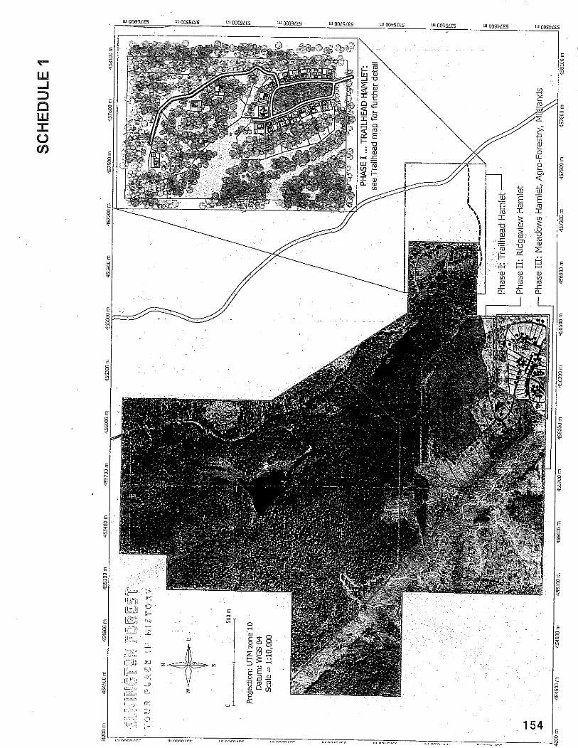
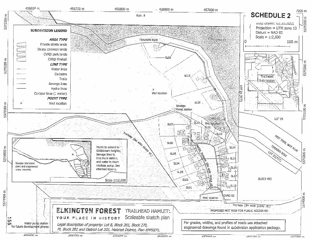
For grades, widths, and profiles of roads see attached engineered drawings found in subdivision application package.
SCHEDULE 5
Y O U R A H I S T O R Y Living Forest Couimunities - Strata pkiasing pIan
SCHEDULE 6
BYLAW 3223 Digitized overlay on Trailhead lots proposed in DP. s
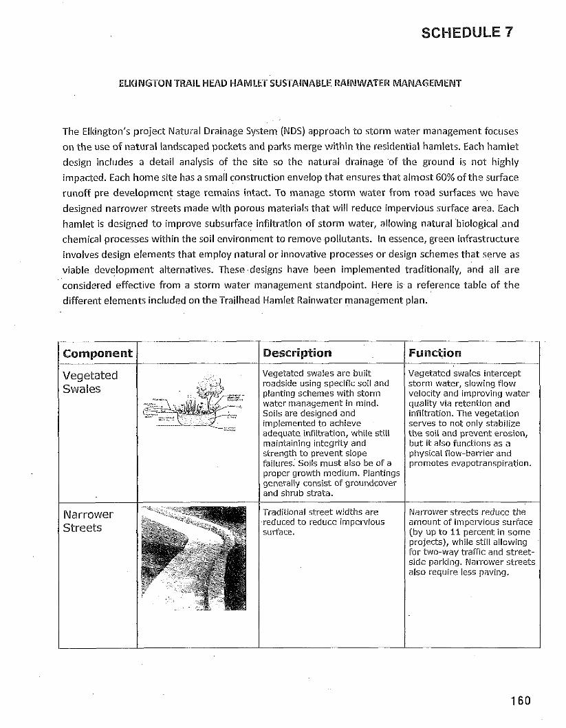
SCHEDULE 7
ELKINGTON TRAIL HEAD HAMLET SUSTAINABLE RAINWATER MANAGEMENT
The Elltington's project Natural Drainage System (NDS) approach t o storm water management focuses
on t h e use o f natural landscaped pockets and parks merge within t h e residential hamlets. Each hamlet
design includes a detail analysis o f t h e site so t h e natural drainage o f the ground is n o t highly
impacted. Each h o m e site has a small construction envelop t h a t ensures that almost 60% o f t h e surface
runof f pre development stage remains intact. To manage s torm water f rom road surfaces w e have
designed narrower streets made wi th porous materials tha t w i l l reduce impervious surface area. Each
hamlet is designed t o improve subsurface infi ltration o f storm water, allowing natural biological a n d
chemical processes within the soil environment t o remove pollutants. In essence, green infrastructure
involves design elements that employ natural o r innovative processes o r design schemes that serve as
viable development alternatives. These designs have been implemented traditionally, and all are
considered effective f rom a storm water management standpoint. Here is a reference table o f t h e
different elements included o n t h e Trailhead Hamlet Rainwater management plan.
Component I Description
Vegetated swales are built roadside using specific soil and planting schemes with storm water management in mind. Soils are designed and implemented to achieve adequate infiltration, while still maintaining integrity and strength t o prevent slope failures. So~ls must also be of a proper growth medium. Plantings generally consist of groundcover and shrub strata.
Traditional street widths are reduced t o reduce impervious surface.
Vegetated swales intercept storm water, slowing flow velocity and improving water quality via retention and infiltration. The vegetation serves to not only stabilize the soil and prevent erosion, but it also functions as a physical flow-barrier and promotes evapotranspiration.
Narrower streets reduce the amount of impervious surface (by up t o 11 percent in some projects), while still allowing for two-way traffic and street- side parkina. Narrower streets 1 also require less paving
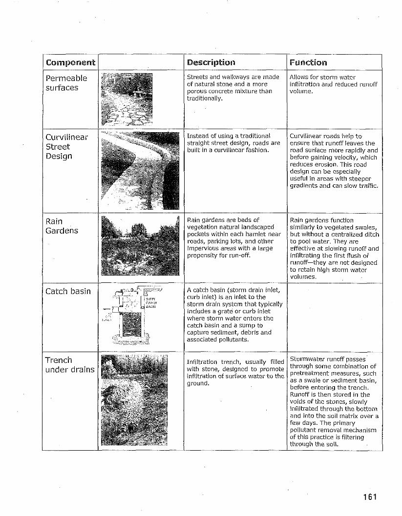
1 Component
Permeable surfaces
Curvilinear Street Design
Rain ..., Catch basin
Trench under drains
Description Furaction
Streets and walkways are made Allows for storm water of natural stone and a more infiitration and reduced runoff
Instead of using a traditional straight street design, roads are built in a curvilinear fashion.
Rain gardens are beds of vegetation natural landscaped pockets within each hamlet near roads, parking lots, and other impervious areas with a large propensity for run-off.
A catch basin (storm drain inlet, curb inlet) is an inlet t o the storm drain system that typically includes a grate or curb inlet where storm water enters the catch basin and a sump to capture sediment, debris and associated pollutants.
Infiltration trench, usually filled with stone, designed t o promote infiltration of surface water t o the ground.
Curvilinear roads help t o ensure that runoff leaves the road sutface more rapidly and before gaining velocity, which reduces erosion. This road design can be especially useful in areas with steeper gradients and can slow traffic.
Rain gardens function similarly to vegetated swales, but without a centralized ditch t o pool water. They are effective at slowing runoff and infiltrating the first flush of runoff-they are not designed t o retain high storm water volumes.
Stormwater runoff passes through some combination of pretreatment measures, such as a swale or sediment basin, before entering the trench. Runoff is then stored in the voids of the stones, slowly infiltrated through the bottom and into the soil matrix over a Few days. The primary pollutant removal mechanism of this practice is filtering through the soil.
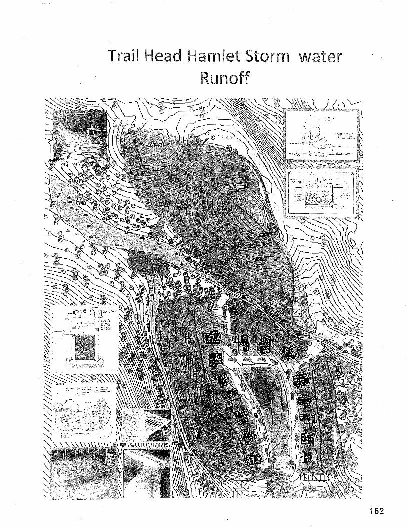
Trail Head Hamlet Storm water Runoff
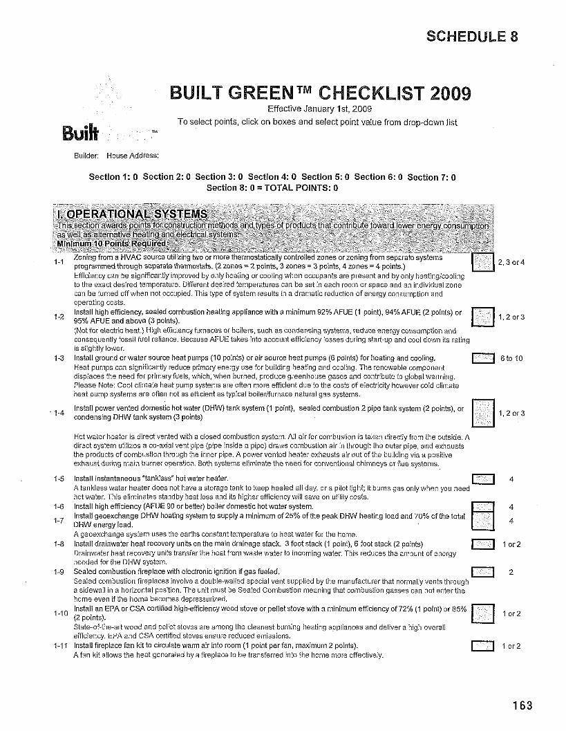
SCHEDULE 8
BUILT GREENTM CHECKLIST 2009 Effectwe January Ist, 2009
T o select polnts, click o n boxes and select polnt value from drop-down l ~ s t
Buik 7M
Builder: HouseAddress:
Sec t i on 1: 0 Sect ion 2: 0 Sect ion 3: 0 Sec t i on 4: 0 Sect ion 5: 0 Section 6: 0 Sec t i on 7: 0 Section 8: 0 = TOTAL POINTS: 0
. .
I. OPERATIONAL SYSTEMS Tn s section a ~ a r d s points for consrr,cnon rnelhoos and types of p rod~c ts tnat cortr o,te toward lower energy consumption as ne'. as a lernative hearing ano electical systems. Minimum 10 Points Required
. .. , , Loni;!g from a HVAC sc.rc? LI Izii'g PAO or m2ra illerrnostarca ly coltro loo zoncs cr xcrling irom si?;zrz:o systers I -... 8.3 proqrammed throucih separate thermostats (2 zones = 2 uolnts, 3 zones = 3 uo~nts, 4 zones = 4 points) 1 IL3"""
. . . ~ - Eificiency can be significantly improved by only heating or cooiing when occupants are present and by only heatinglcooling to the exact desired temperature. Diferent desired temperatures can be set in each room or space aiid an individual zone can be turned off when not occupied. Tliis type of system results in a dramatic reduction of energy consumption and operating costs. Install high efficiency, sealed combustion heating appliance with a minimum 92% AFUE (1 point). 94% AFUE (2 points) or '-' 95% AFUE and above (3 points). 1,2013
: ! : I ! " j?~ f f . : t r : ; .13:=+.> ' . . 3 . -. - - , :..:it ?.; ..( :r: (1.4 ::,.::(..: rcd.:~?? , e , ~ ) c:~\:,.\?:..c;~ .~r 1
I 0 s i . . ? 13 3 : : ~ . 11 ?Vc :-:I :<;:<, n; : f % , ~ L.! a-2 :: >.c:!.? .s 21 7 2
is slightly lower. 1 3 Install ground or water source heat pumps (10 points) or air source heat pumps (6 points) for heating and cooling. 11 6to10
Heat vumos can sioniiicaniiv reduce urimarv enerov use for buildino iheaiina and coolina. The renewable comaonent , -. a . I r : . f . 1 , 1 . 1 : : I - n . : t 1 . 1 .I * I : - , . . . . ... ..:-o ?,pvn. .s . 2 :fr:? -1,r.i , ' fc ; r :a. l '~~i 'z i : . ,~: r l <'.ill c : , (PC .,..;rcco : .,::> heat pump systems are often n i t asifhcient as typical boilerliurnace natural gas systems.
lnstali power vented domestic hot water (DHW) tank system ( I point), sealed combustion 2 pipe tank system (2 points), or condensing DHW tanksystem (3 points)
the products oicombustion through the inner pipe. A powervented heater exhausts air out of the buildingvia a positive exhaust during main burner operation. Both systems eliminate the need for conventional chimneys or iiue systems.
1-5 Install instantaneous "tankiess" hot water heater. A tankless water heater does not have a storage tank to keep heated ail day, or a pilot lighi: it burns gas only when you need
11 ihot water. This eiiminates standby heat loss and its higher efficiencywill save on utiiiiy costs.
1-6 lnstail high efficiency (AFUE 90 or betler) boiler domestic hot water system. lnstaii geoexchange DHW heating system to supply a minimum oi25% ofthe peak DHW heating load and 70% of the total DHW energy load. A geoexchange system uses tile earills constant temperature to heat water for the home.
1-8 Install drainwater heat recovely units on the main drainage stack. 3 foot stack ( I point), 6 ioot stack (2 points) 0 l o r 2 Drainwater heat recoveiy units transier the heat from waste water to incoming water. This reduces the ainount of energy needed for tile DHW system.
1-9 Sealed combustion fireplace with electronic ignition if gas fueled. Sealed combustion iiieplaces involve a doubie-waiied special vent supplied by the inailufacturer that normaliv vents throuoli
11 a sidewall in a horizontal position. The unit must be Sealed combustioi? mea'iiig that combustion gasses can not enter ti?; home evehi if the ihome becomes depressurized. lnstaii an EPA or CSA celiified highefficiency wood stove or pellet stove with a minimum efficiency of 72% (1 point) or 85%
'-I0 (2 points). I or2
State-of-the-a13 wood alid peliet stoves are among the cleanest burning iieating appiiances and deliver a lhigh overall eficiency. EP.4 and CSA certiiied stoves ensure reduced emissions.
1-1 1 Install fireplace fan kit to circulate warm air into room (1 point perian, maximum 2 points). 0 l o r 2 Afan kit allows the heat generated by a fireplace to be transferred into the home inore effectively.
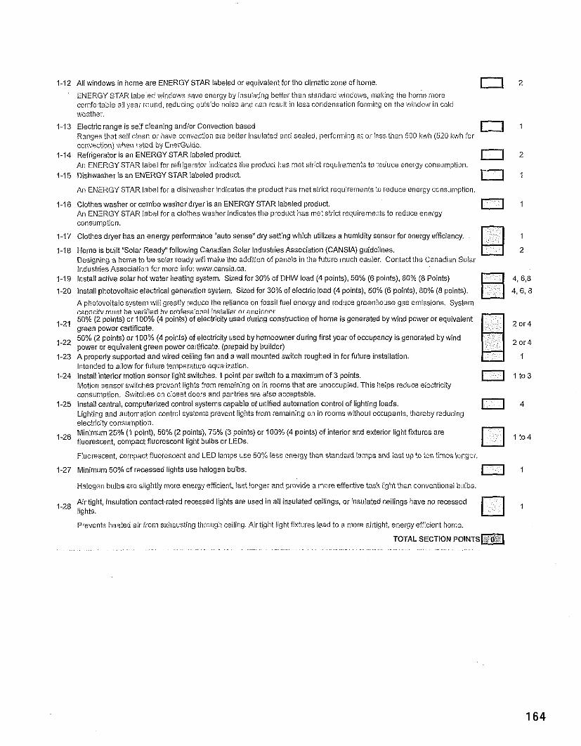
1-12 All windows in home are ENERGY STAR labeled or equivaient for the climaticzone o i home.
ENERGY STAR iabeied iiuindows save energy by insulating better than standard windows. ,making the home more T s l 2
comfoitabie all year round, reducing outside noise and can result in iess condensation formillg on tile wilidow in cold weather.
1-13 Electric range is self cieaning andlor Convection based Ranoes that self clean or have co~ivedion are better insulated and sealed. pelformins at or less than 500 kwh 1520 kwh for
0 1
convection) when rated by EnerGuide. 1-14 Refrigerator is an ENERGY STAR labeled product.
An ENERGY STAR labei for refrigerator indicates the product has met strict requirements to reduce energy consumption. r 1 2
1-15 Dishwasher is an ENERGY STAR iabeied product. o 1 An ENERGY STAR labei for a disi~washer indicates the product has met strict requirelneiits to reduce energy consulnption
4-16 Clothes washer or combo washer dryer is an ENERGY STAR iabeled product. An ENERGY STAR label for a clothes washer indicates the product has met strict requirements to reduce eilergy
0 1
consumption.
1-17 Clothes dryer has an energy periormance "auto sense" diy seiting which utilizes a humidity sensor for energy efficiency. 1
1-18 Home is built "Solar Ready"iollowing Canadian Solar Industries Association (CANSIA) guidelines. 2 Desionina a holne to be solar readv will mahe the addion o i uaneis in the future ~nuch easier. Contact the Canadian Solai- - Industries Association for more info: iw1.cansia.ca.
1-19 lnstail active solar hot water heating system. Sized for 30% of DHW load (4 points), 50% (6 points). 50% (8 Points) 4, 6,8
1-20 install photovoltaic electrical generation system. Sized for 30% of electric load (4 points). 50% (6 points), 80% (8 points). 4.6,s A ohotovoitaic svste~n wiii oreativ reduce the reliance on fossil fuel enersv and reduce greenhouse uas emissions. Svstem - . -. c&acih,mljst hiverifled hvnrofessinnal installer orenoineer
- 50% (2 points) or 100% (4 points) of electricity used during construction of home is generated by wind power or equivalent green power ceriificate. 50% (2 points) or 100% (4 points) of electricity used by homeowner during first year of occupancy is generated by wind power or equivaient green power certificate. (prepaid by builder)
1-23 A properly supported and wired ceiiing fan and a wall mounted switch roughed in for future instailation. Intended to allow for future teiiiperature equalization.
1-24 Install interior motion sensor light switches. 1 point per switch to a maximum of 3 points. 0 I t 0 3 Motion sensor switches prevent lights from r~maining on in rooms that are unoccupied. This helps reduce electricity consumotion. Switches on closet doors and an tries are aiso acceptable.
1-75 njla I entrai c~mp~lor ' zzd ccntro a)sleTs c;p;lc'c c i .I' fed z.torl12: cn CJrrrcl c f tyhl r q loads I.; I , . .- , ,=~~.~,!:T~: :- 2 ~ ~ , , l ~ : , ~ ~ r : ~ ~ c : ~ ~ l : v s i r : ~ ~ i : + ~ ~ z ~ ~ - g . 1 nrc. . ! rs .:'. ,, . . r 2 : : . r . d l ? ' f ~cr:.:,,'::i-.,r<
0 4
electricity consuniption Minimum 25% (1 point). 50% (2 points), 75% (3 points) or 100% (4 points) of interior and exterior light fixtures are fluorescent, compact fluorescent light bulbs or LEDs.
Fluorescent, colnpact fiuorescent and LED lamps use 50% less energy than standard lamps and last up to ten times longer.
2 Minimum 50% of recessed lights use halogen buibs. 0 I Halogen bulbs are siightiy more energyeificienf, last longer and provide a rnare effective task light than conventio~iai bulbs.
Air tight, insulation contact-rated recessed lights are used in all insulated ceilings, or insulated ceilings have no recessed 1-28 lights.
Prevents heated air fro~n exRausting through ceiiing. Airtight iight fixtures lead to a lnore ailtight, energy efficient liome.
TOTAL SECTION P O I N T S ~ . . . ~ , . . . . . ,~ . . ~. . . . ~ . . . . . .
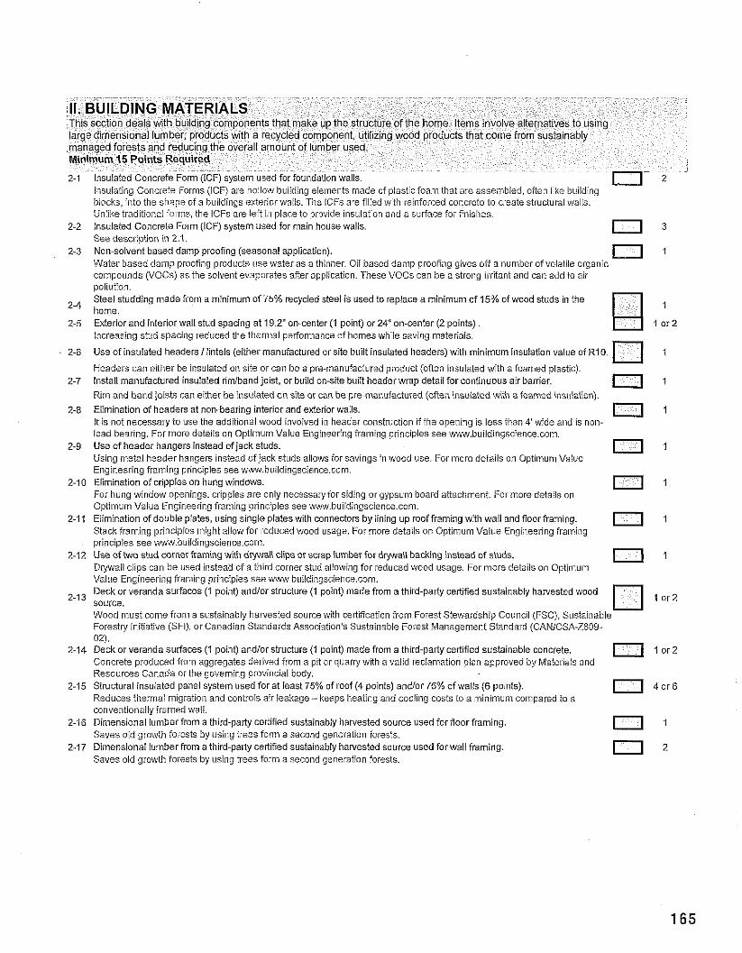
Unlikeiraditional fo~ms, the lCFs are ieft in place to provide ilisulation and a suriace foriinisiies. 2-2 Insulated Concrete Form (ICF) system used for main house walls.
See description in 2.1 0 3
2-3 Non-solvent based damp proofing (seasonal application). Water based damp proofing products use water as a thinner. Oil based damp proofing gives off a number of volatile organic
0 coinooi~nds (VOCsi as the solvent evaporates afferarr~,lication. These VOCs can be a stronci iriitant and can add to air . . po~iition. Steel studding made from a minimum of 75% recycled steel is used to replace a minimum of 15% of wood studs in the
2-4 home. 2-5 Exterior and interior wall stud spacing at 19.2" on-center (1 point) or 24" on-center (2 points)
Increasing stud spacing reduced tile theriiial perfonnance of homes while saving materiais.
2-6 Use of insulated headersliintels (either manufactured or site built insuiated headers) with minimum insulation value of R10. I
Headers can either he insuiated on site or can be a pra-manufactured product (offen insuiated with a foamed plastic). 2-7 Install manufactured insulated rimiband joist, or build on-site buiit header wrap detail for continuous air barrier. n 1 -
Rim and hand joists can either be insuiated on site or can be pie-manufactured (often insuiated with a foamed insulailon).
2.8 Elimination of headers at non-bearing interior and exterior walls. It is not necessary to use the additio~ial wood invoived in header construction if the opening is less than 4' wide and is non-
I l l
load bearing. For more details on Optimum Value Engineering fralning principles see w.buildingscience.com. 2-9 Use of header hangers instead of jack studs.
Using metal header haligers instead of jack studs ailows for savings in wood use. For more detaiis on Optimum Value 11
Eligineering framing principles see www.buiidingscience.com. 2-10 Elimination of cripples on hung windows.
For hung window openings, cripples are only lnecessary for siding orgypsulil board attachment. For more details on 1 1 1 - . , . v : . ? I 7 , 1; . 1:,,l?5~+~:,:.,. K - 2 I?.:<. !-l,.?c:,,,
2-1 1 E m n31?11 ,f cr . o a p a!es, LS ng ; n; a lil3!e; in ccrreciors by nng .p .oci'-an- r y ,;. r11 0 3 I and focr fran r g ,:15,:< .<3,,- -; ,:r .? ' . : " ! 1.. c I . < 1 c I , - 2 . . ; . ;c1 .' I : ' r . 1
0 " .
principles see w.buildin~science.com. - - "
2-72 Use of two stud corner framing with d w a l i clips or scrap lumber for d y a i i backing instead of studs. Drywall clips can be used instead of a third corner stud allowing for reduced wood usage. For more details on Optirnu~n
0 7
Value Enoineering framing princiuies see vw.buildin~science.corn Deck or veranda *urfaces(i point) andiorstructure ( I boint) made from a third-party cerilfied sustainably hawested wood
'-I3 source. '1. . I 5 : . ; f . 3 . I . n , . : . I ! , i . 1 . I , i . . . I-SI: S -.T q3.:.-.
I t i ..: .,.I . r C % . 3 ~ ?I) <I:.. l i . ~ ? A : . ' . . : C I S j . . ! r . i . ; : r-:.:sif?l.!f,,.~;n~:rt ::.:(,,..'> J C,;N.2:?.\-,'?13 ( i
2-11 O?zk or veralon s~rf3ccs (1 0o:ll) aro.'or s!ruc:.r? (1 p3 ni 172cd iron a ih rd-p2ilj CJ~I~CO 51!it:1 inilo'c c:nc,e!-. l o r ? c-r-,<l.?i. .,. :.Ifl:t, .C?,c,;'.:; .:+ ~ ~ ~ ~ . : - 1 5 i : . . . :::,~;..ln.: ... l,c:3rV:: ., ,, : , <:-:r:..>'., t.l?.!?. : > , , , 3 .. . . . . . Resources Canada or the governing provilicial body.
2-15 Structural insuiated panel system used for at least 75% of roof (4 points) and/or 75% of walls (6 points). 0 4 o r 6 Reduces therniai lnigration and controls air leakage - keeps lieating and coo!ing costs to a minimum colnpared to a conventionally framed waii.
2-16 Dimensional lumber from a third-party certified sustainably harvested source used for floor framing. Saves old growth forests by using trees form a second generation forests.
0 1
2-17 Dimensional lumber from a third-party certified sustainably hanested source used for wall framing. Saves old growth forests by using trees form a second generation forests.
0
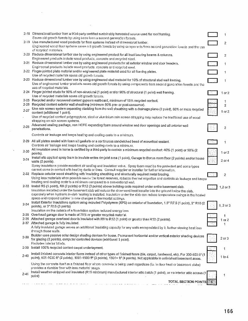
2-18 Dimensional lumber from a third-party certified sustainably harvested source used for roof framing Saves old growth forests by using trees form a second generation iorests.
2-19 Use manufactured wood productsfor floor systems instead of dimensional lumber. Engineered ihiood floor systenis saves old groiuth forests by using co~iiponents frolm second generation forests and the use of recycied rnatel-iais.
2-20 Reduce dimensional lumber use by using engineered product for ali load bearing beams &columns. Engineered products include vvood products, concrete and recycled steel.
2-21 Reduce dimensional lumber use by using engineered products for all exterior window and door headers. Engineered products include wood products, concrete and recycied steel.
2-22 Finger-jointed plate material and/or engineered plate material used for ail framing plates. Use of recycled inaterials saves old growth forests.
2-23 Reduce dimensional lumber use by using engineered stud material for 10% of structural stud wall framins - Use of engineered lumber products saves old growth forests by using components from second generation forests and the use of recycled materials.
2-24 Finger-jointed studs for 90% of non-structural (1 point) and/or 90% of structural (1 point) wall framing. Use of recycled materials saves old growth forests.
2-25 Recycled andlor recovered content gypsum wallboard, minimum of 15% recycled content. 2-26 Recycled content exteriorwall sheathing (minimum 50% pie- or post-consumer). - ~
2-27 userain screen system separating cladding from the wall sheathing with a drainage plane (2 point), 60% or more recycied content (additional 1 point). Use of recycled content polypropylene, steel or aluniinium rain screen strapping may replace the traditional use ofwood strappiing on rain screen systems. Advanced sealing package, non HCFC expanding foam around window and door openings and all exterior wail
2-28 penetrations.
Controls air leakage and keeps heatillg and cooling costs to a minimum
2-29 All sill plates sealed with foam sill gaskets or a continuous sandwiched bead of acoustical sealant. Controls air leakage aiid keeps heating and cooling costs lo a minimum.
11 1
All insulation used in home is celtified by a third-pa* to contain a minimum recycled content: 40% (1 point) or 50% (2 2-30 points). l o r 2
lnstail site applied spray foam to insulate entire rim joist area (1 point), Garage to Bonus room floor (2 points) and/or house 2-31 walls (2 points). [7 2 - 4
Spray insulatloiis provide excellent air sealing and insulation value. Spray ioam inust be fire protected and soine types cannot come in contact with heating ducts or lines. Consult supplier or instalier for furiher information.
2-32 Replace exterior wood sheathing with Insulating sheathing and structurally required metal bracing. Using less materials when possible saves the iorest reserves, reduces thermal migration and controls air leakage and keeps
0 2
heating and cooling costs to a minimum compared to a conventional wall. 2-33 Install R5 (1 point), R8 (2 points) or R12 (3 points) above building code required under entire basement slab. 0 1,2or3
Insulation installed under the basement siab wiil reduce the downward heat transfer into the ground below the slab, especially when lhydronic in-slab heatiiig is installed. Insulation under the slab can reduce temperature svvings in the heated space and respond quicker to new chancles in themiostat settinos. ~ r i s t a ~ ~ ~xterior'lnsulaiions system using extruded Polystyrene (Gs) on exterior of foundation, 1.5" R7.5 (1 point), 2" RIO (2
2-34 points), or 3"R15 (3 points) 1 ,2o r3
lnsuiation on the outside of afoundation system reduced energy ioss 2-35 Overhead garage door is made of 75% or greater recycled mateiial. 1 2-36 Attached garage overhead door is insulated with R8 to R12 (1 point) or greater than R12 (2 points). I or2 2-37 Attached garage is fully insulated. 1
A fully insulated garage serves an additional insulating capacity for any wails encapsulated by it, further slowing heat ioss throuoh those wails. Builder uses passive solar design shading devices for home. Permanent horizontal andlor vertical exterior shading devices
238 for glazing (2 points), computer controlled devices (additional 1 point). 2o r3
Excludes interior blinds. 2-39 Install 100% recycled content carpet underlayment. 1
Install finished concrete interior floors instead of other types of finished floors (tiie, carpet, hardwood, etc). For 300-500 ft2 (1 2-40 point), 501-1000 f12 (2 points), 1001-1500 fF (3 points), l501+ ft2 (4 points). Notappiicable in unfinished basement areas. I t 0 4
Using the concrete itself as a finished floor where concrete is being used regardless (fol ill floor heat or basenient slabs) provides a durable floor with less materiai usage. Install weather-stripped and insulated (R15 minimum) manofactured interior attic hatch (1 point), or no interior attic access (1
2-41 point)
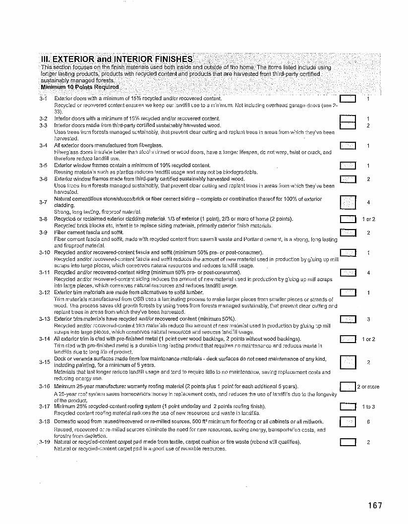
~ ~ .. - ~ - -~ . . ~
3-1 ~ x t e i b r doors with a minimum of 15% recvcled . Recycled or recovered content ensures we keep our iandfiil use to a minimum. Not including overhead garage doors (see 2- 33). Interior doors with a minimum of 15% recycled andlor recovered content. 1 Interior doors made from third-palty certified sustainably ha~ested wood. 2 Uses trees fromforests managed sustainably, that prevent clear cutiing and replant trees in areas from which they've been harvested. Ail exterior doors manufactured from fiberglass. Fiberglass doors insulate betterthan steei skitined orwood doors, have a longer lifespan, do not warp, mist or crack, and
0 1
therefore reduce landfill use. Exterior window frames contain a minimum of 10% recycled content. Reusing materials such as plastics reduces iandfiil usage and lnay not be biodegradabie.
0 1
Exterior window irames made from third-party certified sustainably harvested wood. Uses trees from forests lnanaged sustainably, that prevent clear cutting and replant trees in areas from which they've been
11 harvested. Natural cementitious stoneistuccolbrick or fiber cement siding - compiete or combination thereoifor 100% of exterior cladding. Strong, iong lasting, fireprooimaterial. Recycled or reclaimed exterior cladding material. 113 of exterior (I point). 213 or more of home (2 points).
0 4
11 l o r 2 Recycied brick blocks etc. intent is to replace siding materiais, primarily exterior fi~iish materials. Fiber cement iascia and soffit. Fiber cement iascia and sofit, niade with recycled content from sawmill waste a~?d Portland cement, is a strong, long iasting
0 2
and iireprooimaterial. 3-10 Recycled andlor recovered-content fascia and soffit (minimum 50% pre- or post-consumer).
Recycled andlor recovered-content fascia and soffit reduces the amount of new mateiiai used in production by gluing up miil I l l
scraps into large pieces, which conserves naturai resources and reduces landfiil usage. 3-1 1 Recycied andlor recovered-content siding (minimum 50% pre- or post-consumer).
Recycled andlor recovered-content siding reduces the amount of new material used in production by gluing up mill scraps 11 4
into large pieces, which conserves natural resources and reduces landfili usage. 3-12 Exterior trim materials are made irom alternatives to solid lumber.
Trim materiais manufactured irom OSB uses a laminating process to make larger pieces from snlaller pieces or strands of 1 1 1
wood. The process saves old growth forests by using trees frolo forests managed sustainably, that prevent clear cumng a11d replant trees in areas fro~n which they've been harvested.
3-13 Exterior trim materiais have recycled andlor recovered-content (minimum 50%). Recycled andlor recovered-conte~it trim niaterials reduce the amount o i new mateiial used in production by giuing up mill
11 3
scraps into large pieces, which conserves naturai resources and reduces landfill usage. 3-14 All exterior trim is clad with pre-iinished metal (1 point over wood backings. 2 points without wood backings). 11 l o r 2
Trim clad with pre-finished metal is a durable long lasting product that requires no maintenance and reduces waste ill landfills due to long iife of product. Deck or veranda suriaces made irom low maintenance materials - deck surfaces do not need maintenance of any kind,
3-15 including painting, for a minimum of5 years. 2
Materials that last longer reduce iandfiil usage and tend to require little to no maintenance, saving replacement costs and reducing energy use.
3-16 Minimum 25-year manufacturer warranty roofing material (2 points plus 1 point for each additional 5 years). 0 2 ormore A 25-year roof systetll saves ho~neowners nioney in replacement costs. and reduces the use of iandfilis due to the lonsevitv - . oi the~uroduct.
3-17 Minimum 25% recycled-content roofing system (1 point underlay and 2 points roofing finish). 0 I t 0 3 Recycled content roofing material reduces the use of new resources and ivaste in landfiiis.
3-18 Domestic wood from reusedirecovered or re-milled sources, 500 ftZminimum for flooring or all cabinets or all millwork.
Reused, recovered or re-miiied sources eliminate the need for new resources, saving energy. transpoiiation costs, and iorestrv from depletion.
3-19 Natural or recycied-content carpet pad made from textile, carpet cushion or tire waste (rebond still qualifies). Natural or rec)icled-content carpet pad is a good use of reusable resources.
1 1 2
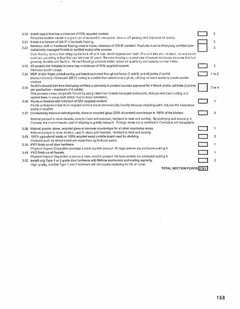
3-20 Install carpet that has a minimum of 50% recycled content. Recycled-content carpet is a good use of reneikiable resources, lessens off-gassing and iniproves air quality.
u 2
3-21 Install a minimum of 300f12 of laminate fiooring. Bamboo, cork or hardwood flooring used in home, minimum of 300 f12 installed. Products must be third-party certified from
3-22 sustainably managed forests or cefified sustainable sources. Cork flooring coines from stripping the bark oif cork oak, which regenerates itself. The coi~k tiles are moisture, rot and mould resistant, urovidir~q a floor that can last over 30 \rears. Bamboo fioorinq is a good use of natural resources because ii is fast . . - . -
growing, dui-able and flexibie. All hard Roorings promote better indoor air quailty by not trapping contaminates 3-23 All ceramic tile installed in home has a minimum of 25% recycled-content.
Reduces landiiil usage. 3-24 MDF andior finger jointed casing and baseboard used throughout home (1 point), and all jambs (1 point) I t 0 2
Medium Densiiv Fiberboard (MDF) casing is created from sawdust and glues, utilizing ail wood waste to create usable . . product. Solid hardwood trim from third-party certified sustainably harvested sources approved for millwork and/or cabinets (2 points
335 per application - maximum of 4 points). 2 o r 4
This process saves old growth forests by using trees from forests inanaged sustainably, that prevent clear cutting and replant trees In areas from which they've been harvested.
3-26 Paints or finishes with minimum of 20% recycled content. Paints or finishes ~nade form recycled content are environmentally friendly because recycling paint reduces the hazardous
0 1
waste in landfills. 3-27 Domestically sourced natural granite, stone or recycled glass (30% of content) countertops in 100% of ihe kitchen. n 2
Natural product is more durable, easy to ciean and lnaintain, resistant to heat aiid scoring. By quarrying and soilrcing in Canada, the environmentai cost of shipping is greatly reduced. Foreign stone cut or polished in Canada is not acceptabie.
3-28 Natural granite, stone, recycled glass or concrete countertops for ail other countertop areas. Naturai product is more durable, easy to clean and maintain, resistaiitto heat and scoring.
I l l
3-29 100% agricultural waste or 100% recycled wood particle board used for shelving. Produds such as wheat board are made from agricultural waste.
0 2
3-30 PVD finish on ail door hardware. Physicai Vapour Disposition provides a inore durable product. No toxic wastes are produced making it.
0 1
3-31 PVD finish on all faucets. Physicai Vapour Disposition provides a more durable product. No toxicwastes are produced making It.
0 1
3-32 Install only Type 1 or2 grade door hardware with lifetime mechanical and coating warranty. High cluality, diirabieType 1 and 2 hardware will !lot require replacing for life of home.
0 2
TOTAL SECTION POINTS=
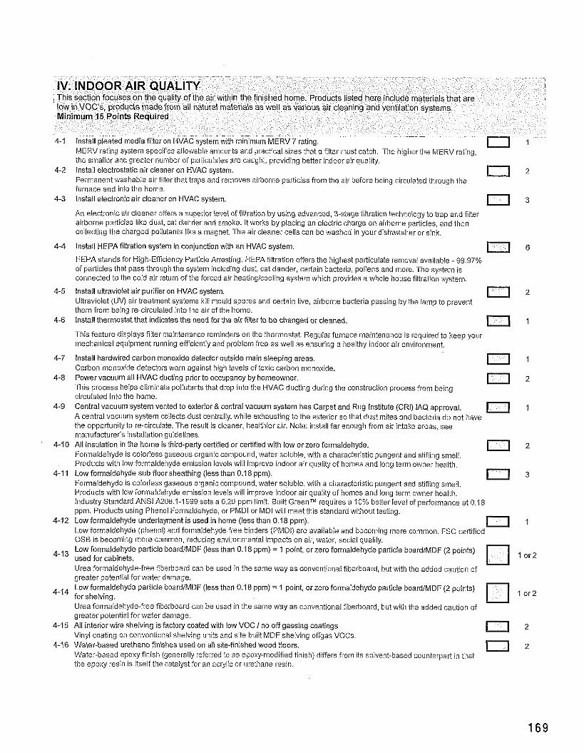
MERV rating system specifies alioiivabie amounts and practical sizes that a fiiter must catch. The hiaherthe MERV raiina. ". the smaller and greater nuliiber of pariiculates are caught, providing better indoor air quality.
4-2 lnstail electrostatic air cleaner on HVAC system. Perinanent washable air fiiterthat traps and relnoves airl~orlle pal7icies from the air before being circulated through the
0 2
furnace and into the home. 4-3 Install electronic air cleaner on HVAC system. 0 3
AII electronic air cleaner offers a superior levei of filtration by using advanced. 3-stage fitration technoloqy to ban and filter airborne particies like dust, cat daiider and smoke. It works by placing an electric charge on airborne par%;cles, and then coilectilig tlie charged pollutants like a magnet. The air cleaner cells can be washed In yoor dishwasher or sink.
4-4 lnstail HEPAfiItration system in conjunction with an HVAC system.
HEPA stands for High-Efficiency Paiticie Arresting. HEPA filtration offers the highest particulate renioval available - 99.97% n 6
of particles that pass through the system inciuding dust, cat dander, certain bacteria, pollens and more. The system is connected to the cold air return of the foi-ced air heatingicooling system which provides a whole house filtration system.
4-5 lnstail ultraviolet air purifier on HVAC system. Uit~aviolet (UV) air treatment systems kili mould spores and certain live, airborne bacteria passing hjrthe lainp to prevent
0 2
them from baing re-circulated into the air of the iiome. 4-6 lnstail thermostat that indicates the need for the air filter to be changed or cleaned.
This feature displays niter maintenance reminders on the thermostat. Regillar furnace maintenance is required to keep your 11 1
mechanical equipment running efficientiy and problem free as weil as ensuriiig a healthy indoor air environment.
4-7 lnstail hardwired carbon monoxide detector outside main sleeping areas. Carbon monoxide detectors warn against high levels of toxic carbon monoxide.
0 1
4-8 Power vacuum all HVAC ducting prior to occupancy by homeowner. This process helps eliminate pollutants that drop into tile I-IVAC ducting during the construction process from being
0 2
circulated into the home. 4 9 C=ntr,>l ,ac. .!il j)slom i~o-lsd :o c ~ ~ i r : , r & cr!r;l t3riLrri s,slini i -a i C d r ~ " ana R I . ~ lrsil-12 [CR I IAU RpI:rUVa
;:c..,, . . , , j,s:z,,, :c ::;<.,,,:.,I,:. , !,, ,?- , -2 . ; l , , - ' ? , ,~+A. l . :<s: r:1 :, :!r.':; 10, :2cc: , ' ! .>r.>l .-a.c: n 1
~ ~
the opportuiiity to re-circuiate. The result is cleaner, heaithier air:~ote: iiistail far enough from air intake areas, see manufacturer's installation guidelines.
4-10 All insulation in the home is third-party certified or certified with low or zero formaldehyde. Fonnaldeiiyde is coloriess gaseorls organic compound, water soluble, with a characiel.istic pungent and stifling smeil.
0 2
Products viiith iow formaldehyde emission levels wiil Iinprove indoor air quality of homes and long term owner health. 4-11 Low formaldehyde sub floorsheathing (less than 0.18 ppm).
Formaldehyde is colorless gaseoils organic compound. water soluble, vvith a cliaracteristic pungent and stifling smeil. 0 3
Products wiili low ior~naldehyde emission levels will improve indoor air quality of homes and iolig term owner heaith. Industry Standard ANSI A208.1-I999 sets a 0.20 ppin limit. Built Greenn" requires a 10% better levei oipelformance at 0.18 ppm. Products using Phenol Formaldehyde, or PMDI or MDI wiil meet this standard without testing.
4-12 Low formaldehyde underlayment is used in home (less than 0.18 ppm). Low iornialdeliyde (phenol) and formaldehyde-free binders (PMDI) are avaiiable and becoming more common. FSC certified
11 1
OSB is becoming more common, reducing environmental impacts on air, water, social quality. Low formaldehyde particle boardiMDF (less than 0.18 ppm) = I point, or zero formaidehyde particle boardlMDF (2 points)
4-13 used for cabinets. I or2
Urea formaidehyde-free fiberboard can he used in the same way as conventional fiberboard, but with the added uutioi i of greater potential for water damage. Low formaldehyde particle boardiMDF (less than 0.18 ppm) = 1 point, orzero formaldehyde particle boardiMDF (2 points)
4-14 for shelving. I or2
Urea formaldehyde-free fiberboard can be used in the saiiie way as conventional fiberboard, but with the added cautioli of greater potentiai for water damage.
4-15 Ail interior wire shelving is factoly coated with low VOC 1 no off gassing coatings Vinyi coating on conventional shtiving units and site buiit MDF shelving offgas VCCs.
0 2
4-16 Water-based urethane Fnlshes used on ail site-finished wood floors. Water-based epoxy finish (generally referred to as epoxy-modified finish) differs from its solvent-based counterpart in that
0 2
the epoxy resin is itself the catalyst for an acrylic or urethane iresin.
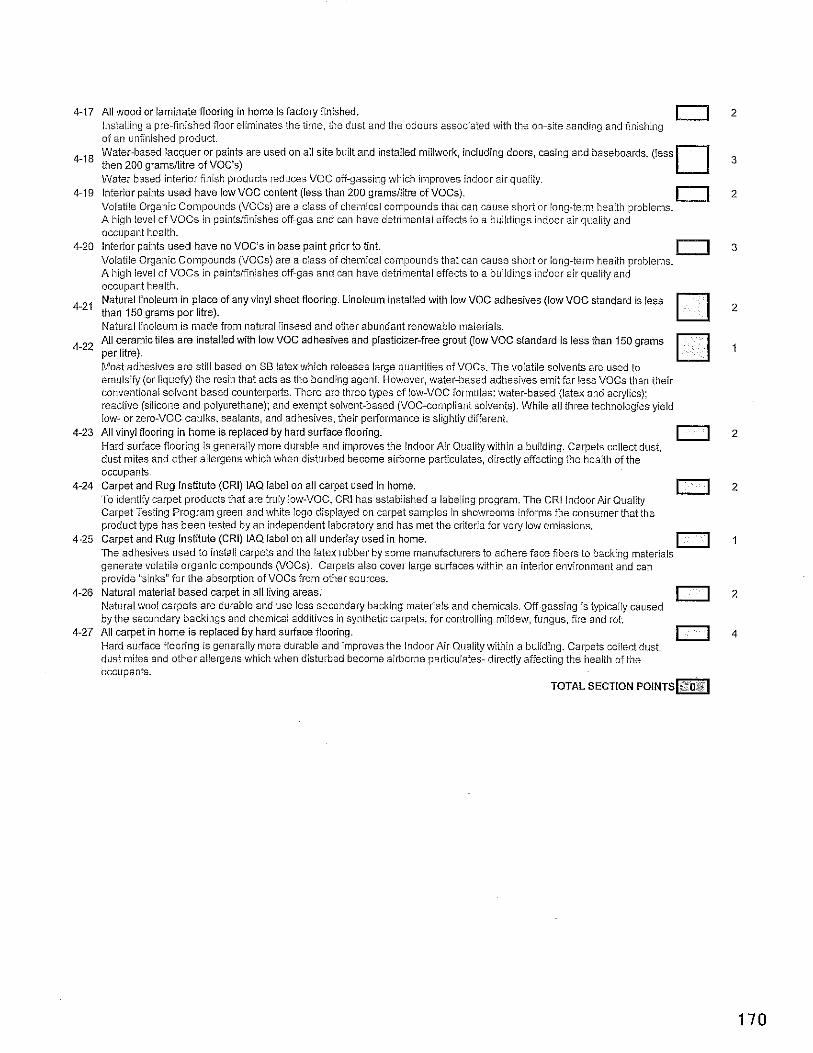
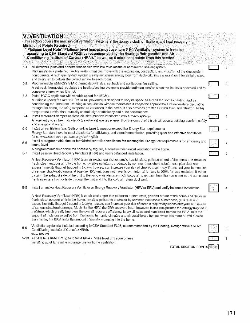
cornpolhents. A high quality duct system greatly minimizes energy loss from duchvork. he systeill should be airtight, sired and designed to deliver the correct airfiowto each room.
5-2 Pro?r;jrnnl,jc',? FNFIGY STAR ~.ht!i,:?l-t v. I i d-al scr t3ck 3-d c2ni ruc..s :dn sznin] 1 I . : . r 1 . 1 : Y O : , : I . . i l ; - . : <r.,'.,
0 2 . . .
coliselve energy %.when it is not. 5-3 lnstall HVAC appliance with variable speed fan (ECM).
Avariable speed fan lnotor (ECM or DC powered) is designed to vary its speed based on the homes heating and air 0 3
conditioning requirements. Working in conjunction with the thermostat, it keeps the appropriate air temperature circulating through the home, reducing telnperature valiances in the home. It also provides greater air circulation and filtration, better temperature distribution, humidity control, higher efficiency and quiet performance.
5-4 instail motorized damper on fresh air inlet (must be interlocked with furnace system). A constantiy ope!? fresh air supply (passive air) ivastes energy. Positive coiitroi of this air wiii assure building comfort, safety
1 1 1
and energy efficiency. 5-5 Install all ventilation fans (bath or in-line type) to meet or exceed the Energy Star requirements
Energy Star fans have to meet standards for efficiency, and sound transmission, providing quiet and efiective ventilation 0 2
fans. ~\w.oee.nrcan.gc.ca/energystar/english Install a programmable time or humidistat controlled ventilation fan meeting the Energy Star requirements ior efficiency and
5-6 sound level A programmable timer ensures necessary, regular, automatic mechanical ventilation oiihe home.
5-7 Install passive Heat Recovery Ventilator (HRV) and verify balanced installation.
0 2
1 1 2 A Heat RecovelvVentiiator IHRV) is an air exchanser that exhausts humid, stale, ooliuted air out ofthe ho~ne and draws in . . . . ~~ ~ ~
fresh, clean outdoor air into the home. Invisible poliutants produced by common household substances, plus dust and excess humidity that get trapped in today's houses, can increase your risk o i chronic respiratow illness and Vour homes risk of serious structurai damage. A passive HRV unit does not have its own internal fan and is 1 ~ 0 % furnace assisted, It works by tying the exhaust side of the unit to tlhe supply air plenum which forces air to exhaust irotn the home and at the same time fresh air enters from outside through the ilnit and into the cold air return duct work.
5-8 Install an active Heat Recovely Ventilator or Energy Recovery Ventilator (HRV or ERV) and verify balanced instaliation. 4
A Heat Recovery Ventilator (HRV) is an air exchanaer that exhausts lhumid. stale. polluted air out of tihe hoine and draws in fresh, clean outdoor air into the home. invisible poliutants produced by common household substances, plus dust and excess humidity that get trapped in today's houses, can increase your risk of chronic respiratory illness and your homes risk of serious structural damage. Mucll like the HRV. the ERV recovers heat: however. it also recuoerates the enerav traDlled in
than inside, the ERV limits the amount oiinoisture caning into the home
Veniilation system is installed according to CSA Standard F326, as recommended by the Heating, Refrigeration and Air 5-9 Conditioning Institute of Canada (HRAI). 5
v&nw.hrai.ca 5-10 All bath fans used throughout home have a noise level of 1 sone or less
Installing quiet fans vvili encourage use for lhome ventilation. 0 1
TOTAL SECTION POINTS=
VI. WASTE MANAGEMENT TIt s sect on d x ' s n t lh the ttand'ng of tS.ds:e marcla's un rbe cor~stt-ct on s ic arla snco..rajes ric,c r g Minimum 7 Points Required
3-1 Corprchc:s .? .ic:c 12 r c ~ r a n i i c r i.. u nqs 3 in.: . I t r j c ' d ~ ~ ? ' :n, s :o sqrzqe J b115 ll z
have been recycled. Not oniy does this reduce overaii waste of product, it ensures that as much product as possible is being utilized forthe production of future resources. Suppliers and trades recycle their own waste, including leftover material and packaging (1 point per trade - maximum 4 ooints). 1 to4
Trades being responsible for recycling and relnoval of waste not oniy reduces landfiii waste, but also promotes a cleaner and saierworlii~ig environment. Minimum 25% (2 points) or 50% (6 points) by weight of waste materials collected from construction site is diverted from waste stream. 2 o r 6
Trades being responsible for recycling and removal ofwaste not only reduces landfill waste, but also promotes a cleaner alid safer working enviranrneiit. Use of recycled materials derived from local construction sites (1 point for each different product used, to max. of 3). 0 I t 0 3 Products recycied from the construction site, such as mulched wood cutoffs or mulched gypsum are often useahie as either clayisoil water retention additives or for orga~iic burning. Trees and natural features on site protected during construction. Tlie protection of existing trees and other natural features such as streams, ponds and other vegetation redilces
I 1
environmental and ecosystem impact. Many of these features can be protected simply by following good waste management procedures. Metal or engineered durable form systems used for concrete foundation walls. Tlie use of metal forming systelns reduces the requirement of lumber. a limited resource.
0 1
Concrete used in home has a minimum supplementary cementing material of 25% (1 point) or40% (2 points) within the scope of proper engineering practices. [7 or2
For every one toil of Poriiand celnent geiierated, eighth tenths of a to11 of carbon dioxide is produced. Supplementary cementations products include fly ash, blast furnace slag as well as metakaolin. Reusable bracing is used for framing. The use of reusable braci~ig for framing reduces the r~quirement of iumher, a limited resource.
0 1
Install recycling center with two or more bins. 0 3
6-11 Provide composter to homeowner. Providing a composter promotes a reduction in wastes heading to tile laildiiil by giving hatmeowners an option for organic
n 2 waste such as food ieftovers.
6-12 Existing dwellings onsite are recycled or moved instead of demolished (recycled 2 points, moved 4 points), TOTAL SECTION POINTS • $#OS * O r 4
VII. WATER CONSERVATION Th s section enco..ragcs a r e a m on n tne amo-11: cf water L S ? ~ n the rlorre or in ' n ~ ,'2-3 ~ n t s a i n n NIL :i-stc~y t .. id l lgs Min imum 7 Points Required
/.I CSA apl:rui?J sir)<: r:..;h tc :kt 7/e,,?j'! 2 1 F Cl' l zr 'ess .>ii; od n a I b?to.c .nls 1: FI~I, n 7-2 instail a dual flush or pressure assisted toilet in one or more bathrooms (3 points for first. 1 additional point for each after) 0 3 or more
Duai flush toilets oiier a choice between tihi0 water levels for every fiush: at iiiiniinuln should use, 1.6 GPF (G LPF) or 0.8 CDF I? I DZ!
3 Ins13 I a ' 28 GPF tc IEI n ,rc or Tcr? brtrr:c^aj (2 F, r's f9r 'rsr 1 231 I znal p? or fo:eich al::r, ; ; 1 . s 1 . - . . , - ::Is,-. : I , > - ~ : . j . . , : . l r . i ,. m . ? . z 7 . . < , c , . -
7 4 Install maiufacturLd non-electric composting toilet (3 points each, max of 6 points). ' a 3o r6
A coinuosiina taiiet uses no water and is odourless, it uses a hioloaicai orocesses to breakdown the human excrcmcnt into . u " , organic compost material. Insulate the hot water lines with flexible pipe insulation, first three feet of the water iines (1 point) or all hot water iines (2
7-5 nninfq) l o r 2 - . . . .-, . - Minimizing the heat loss in the water line wi i decrease the initial water wasted by delivering hot water faster.
7-6 lnstall hot water recirculation line with insulted hot water lines and pump system. Having ihe hot water re-circulated from the liot water source to the fixture points will decrease the initial water wasted by
0 3
deliveiythe hot water faster. Puinp should be on prograln or tiinsr to reduce stand-by losses. 7-7 Install low flow faucets for all kitchen faucets and lavatories (2 points), ail showers & tubishowers (additional 1 point). 0 2 or 3
Reduces water consumption by lowering the flow rate. Showers must use 9.8 Umiih (2.2 imp. Gallmin) or less. Faucets, both kitchen and bath, must use 8.3 Llmin (1.8 imp. Gal.Imiih) or iess.
7-8 Install hands free iavatory faucets. 1 point per fauceiiunit. 0 I per unit Battery powered electronic seiisor minimizes the spread of germs and saves water.
7-9 Provide front loading clothes washer (3 points), or Condensing Combination washidry unit (4 points) 3 0 r 4
also conserve electrical or gas eiiergy by significantly reducing drying tilne for clothes with a more thorough spin cycie.
7-10 Instali water saving dishwasher that uses iess than 26.0 Liwater per load. Il 7
rnal?ufacturers and models of dishwashers and other appliances with water usage and energy efficieilcy ratings. 7-1 1 Install efficient irrigation technology that utilizes automatic soil moisture-based sensor technology at minimum
Show storill water management plan &design; water eiiicient irrigation systems, sensors, regulators, inicro drip feed 0 3
systems etc. 7-12 lnstall permeable paving materials for all driveways and walkways.
Permeable paving allows for storm water to flow backinto the ground rather than Into the storin sewers. 0 3
Provide a list of drought tolerant plants and a copy of the local municipality water usage guide to homebuyers with closing 7-i3 package.
Most municipalities provide a guide that gives the water requireinents of various plants and grasses. When properiy designed, landscaping choices can significaniiy contribute to water conservation.
n 1 7-14 Builder supplies a minimum of 8" of topsoil or composted yard waste, as finish grading throughout site.
Compared to subsoii materials, topsoil usually has lhigher aggregate stability. lower bulk density, and inore favorable pore 0 2
size distl-ibutions which leads to lhigher hydraulic conductivity, water holding capacity, and aeration porosity. Builder incorporates water wise landscaping or xeriscaping in show home or customer home (customers 50% of lawn 2
7-15 points. 100% 4 points). 2 o r 4
Xeriscaping (or drought resistant landscaping) plans and options can be obtained from professional landscaping contractors, and once a xeriscaping landscape is in piace, it requires no manuaiwatering. (Rain barrel usage, astro tui i ineligibie.)
Builder attaches water barrel with insect screen to downspout. Water barrel should also have a drain spout and overflow 7-16 spout (1 point per barrel - maximum of 3 barrels). 1,2013
Suppiying a water barrel encourages homeowners to use rainwater for landscaping needs and therefore save an potable i h , l i * i
Install greywater system colieciing waste from sinks, shower and/or kitchen to capture and treat for use in toilets or irrigation 7-'7 (6 pts), rough-in for future grey water system (3 points)
By reusing waste water. consumption can be drastically reduced. Rough-in most include ciearly identified grey water drain stack, separated iroln sewer line.
TOTAL SECTION P O I N T S ~
VIII. BUSINESS PRACTICE Ths section dca; rllore w :h m?n~f~?ct..rers and 0.. laers off ce end o ~ s ' r c s s pldcr ces Minimum 6 Points Required
8-1 tJrcil~c:s . s?2 icr -350 2 r ~ rrlrm.ia.:..re2 .\ :P .I :00 km 1 oc,?! f,r ,??ro c:,i~c! - rr?r n ..I" c i 5 I I i . ? i . . . Products made cioser to the location o i use voili have iess enibodieci energy. aasically this ineans that tile shoiter the transportation distance the iess energy used in ~noving the product. Less energy used means fev~rer emissions. Builder provides Buiit GreenN homeowner manual, completed Built GreenTM checklist and educational walkthrough with sale or possession.
8-3 Builders office and show homes purchase a minimum of 50% (1 point) or 100% (2 points) solar, wind or renewable energy.
Wind energy is a cleaner way to provide energy. Lower C 0 2 eiiiissions will benefit the Environment. 8-4 Manufacturers andlor suppliers purchase 50% or more solar. wind or renewable electricitv. . . . .
Wind energy is a cleaner way to provide energy. Lower C02 emissions will benefit tile environment.
8-5 Builder has wriiien an environmental policy which defines their commitment (must include an office recycling program and energy efficient lighting). A statement of colnmitment helps to emphasize priority and ultimately define a corporate culture. Manufacturer andlor supplier has written an environmental policy which defines their commitment (must include an of i i~e
0 1
8-6 recycling program and energy efiicient lighting). (1 point per suppiierlmanufacturer - maximum of2 points).
8-7 Builder has written an environmental poiicy which prioritizes milestones for future net zero housing developments. 8-8 Builders' company vehicles are hybrid or bio-diesel vehicles (1 point per vehicle - maximum of3 points).
A commitment to the environment shouldn't stop at construction. Using a hybrid vehicle produces lower harmful emissions. Diesei construction vehicles coiiverted to bio-diesel reduce fuel consumption by up to 75%.
:i: 8-9 Environmental celtification for builders place of business (building, ofiice, etc).
Many commerciai buildings have been rated with various energy efflcielicy standards. Does your company work within an 11 3
ENERGY STAR, EnerGuide for Houses (EGH), EnerGuide far Nevf Houses (EGNH). REAP or LEED (or other cernflcaiion standard) certified office building? Builder agrees to construct and iabel a minimum of 50% of ail homes to the Built GreenN standard per calendar year
8-10 (3 points for50%, 5 pointsfor 100%). 3 o r 5
Contracted trades andlor suppliers have successfully taken and maintained Built GreenTM BuilderTraining status (1 point 8-I per trade organization, Max 5). 1 to5 TOTAL SECTION POINTS
TOTAL CHECKLIST POINTS
SCHEDULE 9
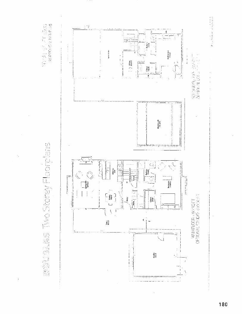
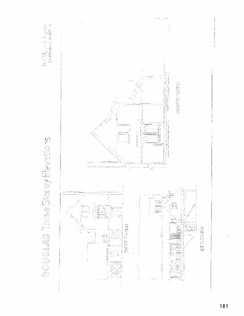
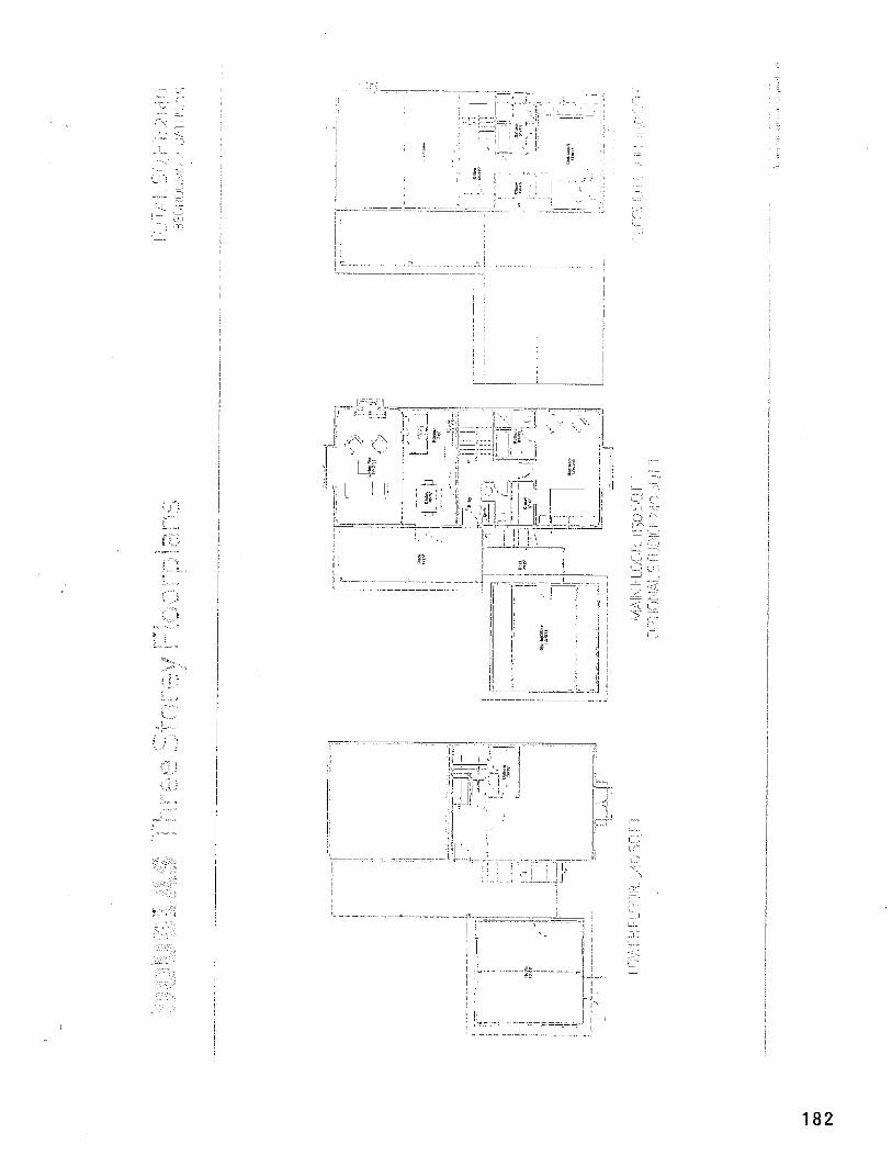
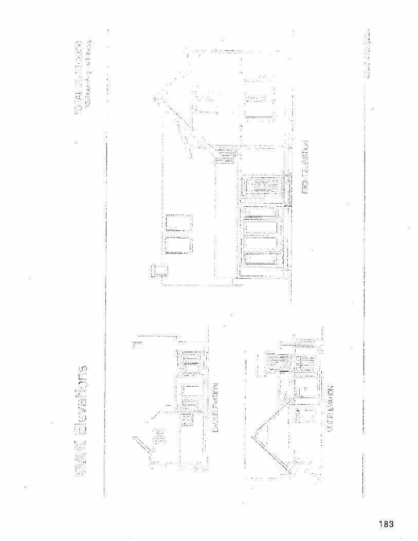
.- (I, ,-.. :+ .- L ? , .~ i 8
L= -. .- 5;:
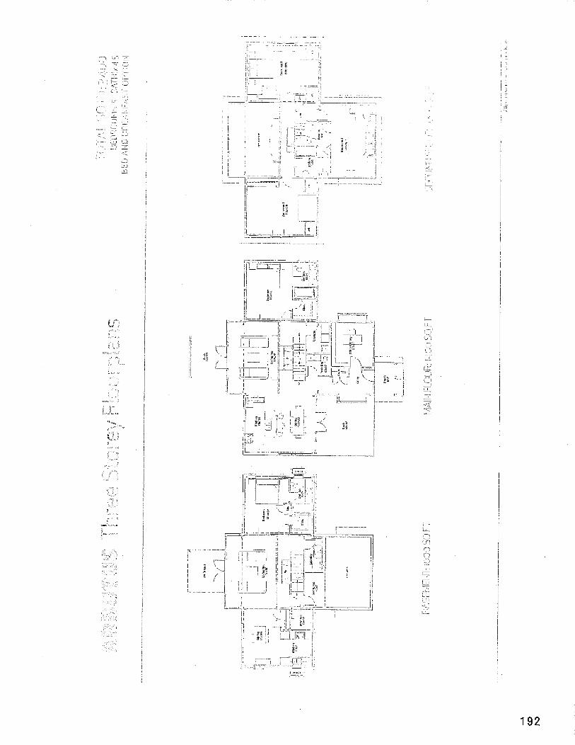
SCHEDULE 10
The Sustainability Checklist For Rezoning and Development Permit Applications
Application for: Development Permit Uses Proposed: Single Family Residential and Commercial
1 Part 1: Environmental Protection and Enhancement
Yes. Under the Community Land Stewardship Zone together with Legal Covenants covering Conservation and ECO/Managed Forest, 85% of the land base will remain permanently under pure conservation and ECOJManaged Forest. The development is focused on protection of the headwaters of a significant watershed, as well as related conservation lands and wildlife corridors. The TLC and the CVRD will hold the Covenants. The remaining 15% of the land base will be apportioned between residential and commercial mixed use, and will utilize a small development footprint (using green infrastructure) and perma culture.
Q2. Does your development remove hvasive species?
Yes. The Mimulus assessment report that details the biological baseline of the lands shows minimal invasive species i.e. grasses, American bullfrogs, etc. except for Scotch Broom. Through,out the development phases and under the monitoring of a QEP the developer will annually remove invasive species and encourage the dominance of endemic species.
(23, Does yozr development impact an ecoiogicaiiy sensitive site?
No. The focus of the development is on the protection of the existing biodiversity. An extensive baseline analysis was conducted by Mimulus to determine existing ecological inventory and to locate the development area away from the most sensitive lands. The proposed development sites are on the least ecologically sensitive lands as researched by Mimulus. During the proposed development phases a QEP will be retained to unsure continued monitoring of impact on protected species
Q4. Does your developrwnt provide conseivatjon mecisures for sensitive iands bej/ond those n~nndated by legisiation?
Yes. 85 %of the land will be protected by covenants and dedications ensuring a legacy for future generations. This is broken down into 25% protected as pure conservation land and 55% protected as managed forest that is FSC certified. This is stewardship
beyond any existing provincial/ municipal regulatidns.
In addition there will be 5% of the land base set aside as additional parkland dedicated for watershed protection, public recreation and conservation focused trails.
5 . Does you! del/eiopn?ei-r!- C I L I S ~ ~ T th;:e h3t.ish7g to save re,rn0i,ling /and from dei/eicpi?lent and disturbance?
Yes. The 15% of the lands dedicated for development and agriculture will have small footprint clustered housing within 3 hamlets, integrated with food production. The lots are small, being equivalent in many cases to urban lots in scale and clustered within tight habitation boundaries. The first hamlet (Trailhead) 'is the subject of this application.
Q6. Does your developn7eni protect gmundwater,kom coiltnminatioi??
The Development area footprint is concentrated to minimize the impact to natural services. All Strata homes will be subject to a homeowner's sustainability guide ensuring proper disposal of contaminates. A QEP has been retained to ensure no impact within the Riparian assessment area. A community sewage treatment system will be put in place to ensure protection of groundwater.
Q7. DCES your flevei~pmentf.ii/ ii? p?e-e:ist~i?g vocant parcels ofland?
No..The objective of this development is to conserve private forested resource lands at risk o f resource mismanagement and being developed under traditional rural sprawl development patterns.
Q9. Does your deveiopment uMze pre-exisking roncis and sei-uices?
Yes. All existing arterial roads will be utilized to access the development. Within the strata development, the existing forestry skidder roads are to be used as footprint of access roads and hiking trails to minimize the impact of the transportation footprint on the natural surroundings. In addition the strata roads are being designed to be narrow, contour hugging roads, subject to being designed to permit emergency vehicle access.
Q9. Does your deveiop17ient revitalize o pr?viously containi~?aied arm?
No. There is no previously known contamination in this area.
Yes. Subject to Fire smart guidelines, and the registered covenant, we are leaving as much o f the forested landscape in close proximity to the homes as natural wind barriers and as a natural mechanism to store ground water and manage storm runoff. The design orientation of the homes will be towards a southern aspect to maximize the input of solar radiation as a mechanism t o heat the home in the winter. Deciduous trees on the south aspect will provide shade in the summer and allow passive solar to warm the house in the cooler months.
Qll. Does your deve!opment provide on site reneiuubie energy genei-ation such as solar energy or geothermal heating?
Yes. We will be providing renewable energy generation on site. A community geothermal heating plan is being developed.
Q12, Does your developmerlt provide onsite-compostingfuciiiries?
Yes. Our hamlets will provide a cornposting facility in conjunction with community gardens and agriculture lots.
013. Does your dei/eloprnent provide an crreaj%r n coinr?iunity garden?
Yes. The hamlets will have community gardens accessible to all strata homeowners.
Q14. Does your development f17volve innovative ways t o reduce was!-e sac1 protect air quaiity?
Yes. The stewardship focus of the development maintains much of the natural capital on the property through covenants to act as a natural filter improving local air quality and t o protect the south Shawnigan watershed.
Q15. Does your development include a carfree zme?
Yes. The majority of the lands will be car free save for extremely limited non-public emergency and institutional access requirements. All hamlets will be linked by a series o f car free pathways serving also as emergency access routes. The dedicated public parks and trail ways will also be car free except for a parking lot as requested by CVRD.
No. Unfortunately there is no local car share available. We intend to explore this option in the future if one becomes available.
Q.77. Does youi development use plants o i fi?aier!'u!s it7 the laiidsmping desigil riiat are not warer dependent'?
Yes. The covenanted Fire Management Plan developed in conjunction with the CVRD deals with multiple Fire smart measures t o be implemented in regards to parks landscaping, utilizing native plantings, as well as choice and placement of the landscaping within 2 zones surrounding the buildings.
Q18. Does your development recycle water and wastewater?
Yes. Catchment of rainwater for household and agricultural irrigation uses will be implemented utilizing catchment tanks and cisterns.
019. Does your development provide for 170 net i17crecjse i-o r-ainviater run-off?
Yes. We will retain a QEP to provide an assessment of any impact on existing groundwater resources. In addition, a sustainable Rainwater Management Plan will be developed for each hamlet and each individual building lot as required by Bylaw #3222 and a legal covenant in favour of the CVRD. This plan will utilize Ministry of Environment Best Practices and ensure that runoff will be managed by gradual dispersion via natural or constructed wetlands.
Q20, Does your development utilize nulurtrl systemsfor sewage dis,oosal and rainwater?
Yes. A natural treatment system for sewage will be provided, subject to approval by the existing regulatory authoriries. Yes. Rainwater, pursuant to the Rainwater ~ a n a ~ e m e k Plan, will be. collected in a constructed wetlands and gravity feed for irrigational purposes.
021. Does your development use eneryy saving appliances?
Yes. Energy smart appliances will be provided with model strata homes. All custom homes will be highly encouraged to utilize the Energy Smart Program. All residential dwellings will have visible energy meters to increase transparency of energy consumption and decrease householder use.
Q22. Does your deirelopn-ient iiiciude oniji shielded fight fictureg. \/$here 100% of tj7e !urnens emittedfi-em ihe 1iyhtfi;ctui-es ore retained oi? site?
Yes. Each, hamlet's exterior lighting will be consistent with "dark sky" environmental policies and the existing OCP policies. All exterior light fixtures will be shielded to minimize light pollution. The use of bollard type exterior light fixtures will reduce light pollution as well and maintain a rustic evening environment.
423. Does your deve!opmeiit build to a recogi?ized green b~~ i i d i i i g stc~ndord S L I C ~ us built green 5.C or LEED standat-bs?
Yes. We will be building our model homes in compliance with either Build Green BC or LEED certification under the LEED for Homes Canada program. In addition we will be submitting an application for LEED neighbourhood certification as soon as the new 'neighbourhood development' criteria is in place in Canada.
QZ4. Does your development reduce construction waste?
Yes. As part of the construction monitoring by a QEP, a plan will be developed to ensure that waste will be minimized and where possible recycled on site.
Q25. Does your o'eveiapinent utilize recyc!ed niaieriais?
Yes. Recycled materials will be used as much as possible. In addition, local materials from the property will be utilized (aggregate, lumber) in construction.
QZ6. Does your development utilize on-site materials und/or reduce trucicii~g?
Yes. Building materials such as timber for framing and crushed rock for road development will be, as much as possible, drawn from the property. Some of the timber harvested under the Forest Management Plan will be milled on site t o reduce the transportation footprint.
Q27. Does your deveioprnent avoid contomination?
Yes. There will be ongoing Monitoring by a QEP focusing on the development impacts on land and watercourses within the DP Areas. In addition there will be ongoing monitoring of the 85% covenanted conservation lands base.
Q29. Please outliiie any other envii-onrne~ital protection ancl/or enhcincernenijeotures.
As mentioned there will be 80% of the property covenanted as conservation lands plus 5% de.dicated as public parks with public trail ways and amenities.
We are utilizing the latest green infrastructure with natural systems approach and we will be implementing an innovative stream keepers program to be established. Our infrastructure is focused on community water, community sewage treatment and community renewable energy systems. Where possible we will utilize locally sourced materials. The community is also designed using the latest BC Fire Smart guidelines.
/ Part 2: Community Character and Design
01. Does the ci'evdopn?eni- i i~prove the mi?: o,fcompetible irses within rip7 oi-ea?
Yes. The Elkington lands are being developed as a community of 3 hamlets of clustered housing with avariety of mixed uses located on the least ecologically sensitive lands and as permitted under the OCP and Zoning Bylaws. These include residential dwellings with secondary suites, B&B's and home occupations. There will be an established community center, a commercial convenience store, a guest lodge, educational facilities and 6 tree top canopy units. Institutional use developments will be the fire hall, Trans Canada Trail (TCT) Washrooms and a picnic shelter. There will be an area for Forestry Industrial use such as timber processing and secondary manufacturing, and agricultural uses. The first construction phase will be the Trailhead hamlet with 18 mixed-use residential units. It is a traditionally designed community of not so big home sites clustered around a public green and eligible for livelwork spaces or bed and breakfasts.
0.2. Does the developmei~t provide services, or ell ernenity in dose proximity to o residentiui crea?
Yes. The Trailhead hamlet includes coffee shop/store supplying amenities to residents and trail users. The hamlet is focused on the TCT that is immediately adjacent and includes a trail staging area and associated amenities for the public. We envisage a seasonal produce market selling local products occurring a t the public amenity. The Ridgeview hamlet located on the southern boundary of the Elkington lands will include a guest lodge and day spa. The future Midlands hamlet phase will have community gardens and associated agricultural processing facilities.
~ 3 . Does tile deveiopnieirt provide a vctiety of l~o~rsing in close pi-oxiinity to c public amenit]/, trciisii, or comniercinl area?
Yes. The zoning provides each residence with the opportunity for a secondary suite as well as home occupation. In effect each home could be a mix of ownership and rental housing. Each hamlet is designed to be in close proximity t o significant recreation amenities including the TCT and walkinglhiking pathways. The future Ridgeview hamlet phase has a guest lodge and day spa. The Trailhead Hamlet will have a commercial site devoted to providing services for residents and trail users. An auxiliary fire hall will be located at the trailhead site and a commuter "park and ride" stop is located within 4km of the Trailhead hamlet.
Q.7. goes the c/nve!opirient provide a /:ousing Iype other than singie-,f~t~+ly d+.iel!ings?
Yes. Each residence has the legal ability under the zoning to become a two family dwelling through secondary suites.
Yes. Each dwelling residence includes secondary suites as a permitted use that can be rented t o tenants.
46. Does the deveicpmeni include seniors hhousing?
The inclusions of secondary suites lend themselves to an intergenerational housing focus that may be accessible to all age groups. The creation of each hamlet community surrounding community gardens will encourage aging in place.
47. Does the developrnent include cooperative housi17j?
No.
48. Does the developrnent iiickide the prov!sior? of offorcinble units or cont-ribution to?
Yes. The Trailhead hamlet is designed to be market affordable. The small lot size and price point coupled with the legal ability to include a secondary suitelhome occupation/B&B etc. will make acquisition more affordable.
49. Daes the de!/e/opt-neni havefire protection, sptrii7kiing nndfire smart prii,ciples?
Yes. The Conservation Covenants provide for a managed forest that will have a written plan to maintain diversity thereby reducing invasive species spread. The plan will mandate harvesting practices designed to reduce the risk of wildfire, wind throw and increasing the health of the trees. The development has a legal requirement to provide a new fire hall, equipment, and volunteers in conjunction with a service boundaty extension. The legally required Fire Management Plan mandates all buildings t o be constructed according to fire smart principles including choice of materials, sprinklers, building design, community layout and emergency egress and access provisions. Finally it mandates, as well, landscape restrictions around buildings and management practices.
QIO. Does the development help prevent w-it??e through ffpproprioi-e site desi~n?
Yes. The Trailhead hamlet will be designed under CEPTED principles. For example we will ensure that adequate lighting is present in areas to reduce dark spots and deviant behaviour. We are clustering our homes on smaller lots and surrounding a common ground to create a sense of safety and promote neighborhood watch.
QIZ. Does the devei'opment s1ck:v tra2iic through the design qcl'i./~,z rood?
Yes. Traffic calming mechanisms such as skinny roads, pedestrian prioritized crossings, and winding roads are included in our road design subject to emergenci~ vehicle access considerations. We envisage that slow traffic speeds will be the result.
Q12. Sees the n'eveioprnent create 9,-e~n spaces or strong conr;ectioi?s to ad j~~cen i - nuturalfeatures, parks aiicl open spaces?
Yes. 85% of the development land base falls within registered covenants or dedicated lands which protect the natural capital of the development by placing 25% of the property into ecological conservation zones, 55% of the development as single stem selection FSC certified eco-forestry and 5% designated public parks. These are all located within close proximityto the trailhead hamlet. All hamlets will be connected with pathways. In addition agro-forestry and communal gardens will be integrated with the hamlet developments. The property abuts the Trans Canada Trail network that allows residents t o access a variety of adjacent natural and urbanfeatures. Finally we are constructing within the land base abundant walking and biking trails to access the natural features of the property.
QZ3. Does the de:eve/o,~Ineni pretnote or iinprove trails and pedestriair oinejiiiies?
Yes. See previous question. CVRD parks and services assisting those wishing to use the TCT will be provided as agreed in a registered covenant. Commercial services as well as a public staging area will be provided for trail users.
Q14. Does h e dewe/apnwnt link to amenities such as school, beach & trails, grocery store, pubiic transit, etc?
Yes. We will provide new amenities in the form of a coffee shop and small retail store to service both the community and trail users/local hikers. The development's trail network will linkto other regional parks such as Wrigglesworth Lake and the Sooke Hills Wilderness Reserve.
Q15. Does the develepment incorpor~te community social gati':ering places? (Village squo!-e, halls, youth andsenior facilities; bulletin boord, what$ or pier)
Yes. The Trailhead hamlet will provide a community hall, coffee shop, village square, bulletin boards, and communal seating in close proximity to the Trans Canada Trail, public meeting place with open sided BBQstructure, and associated amenities.
Q16. Does ~:~; le develc!imeni use colcur and pub!jc art to n(i'.d vi,br-h~?&jy and pi.~coot,- s~inmi.irriti/ values,?
Yes. The developments design guidelines will ensure the use of a traditional earth toned motif reflective of the pioneer simplicity and traditional values of European hamlet design. Public gardens will be an expression of the artistic and creative nature of the communities' vibrancy with expressive signage and natural landscaping. The detailing of the hamlet homes will add further artistic expression of the hamlets community values through personalized design and community identity.
Q17. Does the deveiopment preserve heritage valuzs?
Yes. The Conservation covenant protects the legacy value of this watershed landscape and associated biodiversity, for future generations. The mandated Forest Management Plan will restore the forest to i t s long-term historical nature. All existing old growth trees will be protected as outlined in the plan and culturally significant trees, as noted on archaeological report, are forever protected. The detailed design guidelines for the homes will restore a forest hamlet vernacular traditional to local cultural values.
QZ8. Piense outiine any oiher con7munity ci7~rcicter and design featutes.
The controlled detailing of hamlet homes t o maintain community character is a significant factor in enhancing community character and design. We will utilize neo- traditionalist signage amongst community urban design, community gardens and trail networks. The community hall and communal park space landscaping will be rich in natural expression with the use of local stone, timber, and native plant species.
I Part 3: Economic Development
Q1. Does the deveiopn~eni create pern?onentemptoyinent opportunities?
Yes. The Managed FSC Forest and related value added activities including timber processing would create jobs for local residents. The zoningpermits home occupations and will therefore permit homeowners to work from home. The commercial coffee shop and store permitted under the zoning will create a t least 1 job. We envisage that the guest lodge and free top canopy units together with the educational activities permitted could create several more local jobs. Finally the small-scale forest agriculture, and equestrian activities will create local jobs.
0.2. Does t.he dei~eiopment piorr~ote dfversificatioj-i of the loccl emnc~m:, l/io bu:ji!lpss type niid size ci,q?roprioter'r,!-- the a im?
Yes. The B&B and home occupations permitted will create small-scale diversified employment. The managed forest and related timber processing and manufacturing will help maintain and in the long term enhance employment related t o forestry. The TCT staging areas coupled with home occupations permitted, and small coffee shop/ store will create economic opportunities t o service TCT users. The trails, the guest lodge & spa and treetop dwellings as well as educational uses will create tourism and recreation and outdoor education employment opportunities and promote diversification within the local economy.
Q3. Does the development ii7crease communitjf opportunities for training, educntion, en!-eifainn~ent, or recreatioii?
Yes. See also prior answer. Several outdoor education and recreation opportunities are both available through the conservation and trails aspects of the development. We envisage an outdoor education aspect and demonstration managed forest educational training. We will have tree top canopy educational and cultural facilities. We are negotiating a partnership with educational institutions such as (Royal Roads, and other NGO's to conduct educational experiences on the conservation aspects o f our lands.
0.4. Does the development positively impact the local economy? How?
Yes. We see the creation of a net increase of local employment opportunities that will outlast the short-term construction aspects of the development. These will be directly related t o the managed forest and careful harvesting. There will be forestry manufacturing, recreational and educational job opportunities created. Finally the zoning permits each homeowner t o maintain self-employment at home t o service not only the region but also users o f the recreational opportunities on our doorstep.
Q5. Does the development inpi-ove opportunii-iesfor new and existing businesses?
Yes. Value added timber manufacturers have committed t o relocate and gain access t o our FSC harvested timber resources. The zoning and adjacent recreational opportunities affords our residents ability to be truly creative in servicing needs of those using the TCT and local recreational amenities. Agro forestry and perm culture will also create more jobs.
Q6. Flease ~utliiiille ony otirer econoinic bevt.lo(~rflentfe~1vres
This stewardship community development maintains forestry as an aspect o f South ~hawn i~an ' s cultural values, its natural capital and valued ecological services.
We will create a significan! draw for those residents and non-residents using the TCT trail. The guest lodge /spa and Bed and Breakfast accommodations will bring an additional type of tourist to Shawnigan than the traditional cottager.
/ Please outline any other sustainable features of the property.
Another positive impact on the surrounding community, and in keeping with, the principles of Bill 27 will be with respect to the benefits of maintaining the forest resources and preservation of the rich natural' capital with respect to carbon sequestration and watershed management.
SCHEDULE 11
Elkington Forest Phase 1 - Building Permit Checklist
Development Permit Criteria for Building Permit Application
Applications for building permits on lands subject to Development Permit 14-6-100P must demonstrate
compliance with the following criteria prior to issuance o f a building permit:
1. All residential and commercial buildings must be designed and built t o a minimum Built ree en^^ Gold standard or equivalent;
2. All exterior lighting is shielded t o minimize light pollution;
3. Primary heatingfor all residential and commercial buildings is to be from a geo-exchange heat pump
o r energy efficient equivalent;
4. All residential and commercial buildings are t o be constructed with interior sprinklers;
5. All structures shall be designed and constructed using Firesmart standards;
6. Rain water management plans will be prepared for individual lots that incorporate concepts
identified in the Elltington Trail Head Hamlet Sustainable Rainwater Management Plan and that are
consistent with the approved rain water management plan for the Hamlet;
7. Development on lots that include Streamside Protection and Enhancement Areas will incorporate
protection measures described in Riparian Areas Regulation Assessment Report No. 1850, Aqua-Tex
Scientific Consulting, November, 2010;
8. Building and development will comply with applicable covenant and bylaw requirements;
9. Residential buildings will generally comply with the design standards illustrated in the Elkington
Forest - Model Home Plans (attached).
10. Residential and Commercial buildings will comply with the following design guidelines, as specified
in the Community Land Stewardship Development Permit Area:
0 Dwellings will have vertical proportions with one, two and two and a half storey construction;
a The architecture will be predominately simple geometric proportions and massing; square,
rectangular, T-shape, cruciform, H shape, etc., with dormers, gables, projecting balconies,
recessed decks and doors, covered porches, and bay and box windows, designed with vertical
proportions;
o The main portion of all roofs will be a minimum o f 12/12 pitch, in grey, black, copper, and other
metal colors;
A palette of natural materials will be used, such as exposed timber frame trusses, beams, wood
siding or shingles, and small areas o f non-combustible rough textured stucco;
e Dwellings will not exceed 200 m2 in footprint, emphasizing efficiency in use of space, high
quality design, and practical storage areas. The exception is the Low-Density Areas, which would
include some larger, more private and less vertically oriented buildings;
e Dwellings will front onto a public square or common area, t o be accessible and public, while the
backs of the homes will be more private
The street frontage will be designed to reflect visual continuity with neighbouring houses, with
common but not mimicking features;
Deep usable porches, windows overlooking the street, and clearly visible entrances are
encouraged. Except for "curb-cuts" for driveways, there should be a continuity o f the street wall
incorporating the face of the dwellings, frontage walls, trellises, and vegetation;
Carports, garages, and parking areas are t o be hidden on the side or rear of houses, or tucked
into basement areas;
Fencing and walls to be restricted t o portions of yards and gardens immediately adjacent t o the
dwelling, and to areas that are intensively cultivated, farmed, or used for agro-forestry uses
(deer fencing is permitted);
0 The use o f rainwater catchment tanks and cisterns for re-use in irrigation is required;
The use o f alternative and renewable sources of energy in required.
SCHEDULE 12
BYLAW No. 3223
A Bylaw for the Purpose of Amending Zoning Bylaw No. 985 Applicable to Electoral Area B - Shawnigan Lake
W1IEWAS the Loco1 Governine~zt Act, hereafter referred to as the ':4ciV, as amended, eml~owers the Regional Board to adopt and amend zoning bylaws;
Am WHEREAS the Regional Disfzict has adopted a zoning bylaw for Electoral Area B - Shawnigan Lake, that being Zoniug BylawNo. 985;
AND WHEREAS the Regional Board voted on and received the required majority vote of those present and eligible to vote at the meeting at which the vote is taken, as required by the Act;
AND VrTBREAS after the close of the public hearing and with due rega-d to the reports received, the Regional Board co~lside~s it advisable to anlend Zoning Bylaw No. 985;
NOW THEREFORE the Board of Directors of the Cowicban Valley Regional District enacts as follo~vs:
Tbis bylaw shall be cited for all purposes as "CVRD Bylaw No. 3223 -Area B - Shawnigan Lake Zoning Amendment Bylaw Forest P l k g Consultai~ts/Ellringtou Estates), 2008".
2. AMENDMENTS
Cowichan Valley Regio~~al Distlict Zoning Bylaw No. 985, as mended from time to tin~e, is hereby sunended in the following maoller:
a) That folloiving Pact 11, a new Section be added as follows:
"PART TWELVE COMPREHENSIVE ZONES
12.0 Comprehensive zones
Community Land Stewardshiv Zone
CVRD Bylaw No. 3223 Page 2
General Regdations
1. The following general regulations apply in the Comiunity Laud Ste~vardship Zone:
a) Within tlme CLS Zone, there are five distinct sub-zones as identified on the CLS-I Sub-Zone Map. 'The five sub-zones are: Ecological Conservation Sub-zone, Eco-. Foreshy Sub-Zone, Ago-Forestiy Sub-zone, Low Density Sub-Zone(A,B and C), and Hamlet Sub-Zone.
b) Forestvy industrial uses, including timber processing, s a ~ ~ l l , planer mill and secondary wood pfocessing and mamfacturing, and accessory uses, shall not exceed 2 hectares for the entire Community Land Stewardship Zone;
c) Ago-forestry processing, geenhouses and accessoly buildi~~gs shall not exceed 1500 m2 for the entire Community Land Stewardslsp Zone;
d) Not Inore than one c o m u ~ i t y centre facility is permiited withim the entire Community Land Stewardship Zone.
e) Not more than one retail comercial area shall be peimitted within the entire Conunmity Land Stewardslup Zone.
i ) Not more than one Guest Lodge shall be peimitted within the entire Community Laid Ste~vardshil~ Zone.
g) No more than six guest lodge tree top ca~opy units are pelmitted within the entire Community Land Stewardship Zone, and no Guest Lodge tree top canopy unit is to be located more Uman 300 mekes ti-om the Guest Lodge, th~e maiu building of which is permitted w i t h the Handet Sub-Zotle.
h) Kitchen facilities are prohibited in the guest lodge Qee top canopy units. i) Ecological education and interprefi~e sbuctures shall not exceed 160 sq inetres in
b ta l floor area for the enti~e Conununity Land Ste~vardship Zone. j) Excavation and extraction of gavel, soil, fiu md rock, shall be used only within h e
Cornunity Land Stewardship Zone and shall not exceed 2 hectares in total Iand area; 1 ) A f ~ e hall is permitted in any sub-zone within the Commnuity Land Stewardship
Zone.
Ecological Conservatio~m Sub-Zone
1. Tile followi~mg uses and no others are permitted in the Ecological Conservation Sub-Zone:
a) Trails for use by pedestriaus, bicyclists and emergency and security vehicles; b) Management of forests for tlie purpose of maintaining the health of the fore.st,
and ~ n i ~ ~ z i u g the risk of wild fire, ~ v h d throw, or spread of bvasive species.
2. Conditions on Use for Ecological Conservation Sub-Zone
a) Setbacks fionm watercourses and natural features shall be a m i u h m of 30 meters or as otlierrvise determined by the Ripariau Areas Regulation.
CVRD Bylaw No. 3223 Page 3
Eco-forestry Sub-Zone
1 The followkg uses and no others are permitted in the Eco-forestry Sub-Zone:
a) Silvicdtqe; b) Horticulhure; c) Management, harvesting and cultivation of non-timber forest products and ago-
forestry products; d) Trails for use by pedestrians, bicyclists aud emergency and secwity vehicles; e) Timber processing, including sa'vvndl, plauer mill and secondary wood processing
and manufacturing; fl Excavation and extraction of gravel, soil, fa1 and roclc, for use only within the
Community Land Stewardship Zone; g) Guest Lodge tree top canopy units; h) Non-habitable ecological education stmctures.
2 Conditions on Use for Eco-foresty S11b-Zone a) Buildings and struchues shall be set back a mhimunl of 15.0 metres from parcel
lines, where the abutting parcel is uot zoned as CLS-I (Cormnunity Land Stewardship 1 Zone);
b) Buildings and structures shall be set back a minimum of 15.0 metres fiom lands outside of the Eco-forestry Sub-Zone;
c) The buildings and stxuctures associated with permitted wood processing, sawmius, timber manufacturing, agro-forest~y, greenhouses, and educational and recreational facilities shall be limited to a maximum height of 10.0 m, and a building footpriut of 2000 m2 in area, within the entire Community Land Stewardship Designation;
d) Setbaclcs &om watercourses and natural features shalI be a minimum of 30 meters or as otherwise determined by the Riparian Areas Regulation;
e) No ecological education structure shall exceed 40 mZ in floor area; f) Soil, fiIl and rock excavated and extracted on site shall only be used within the
Co~munity Land Stewardship Zone and sl~all not exceed 2 hectares in total land area;
Ap-forcstrv Sub-Zone
1. The following uses and no others are permitted i11 the Ago-forestry Sub-Zone;
a) Silviculture; b) Hol-ticulture; c) Managelllent, harvesting and cultivation of non-timber forest products and agro-
forestly prod~~cts, including 1101-ticultwe; d) Ag-0-foresm processing, greenhouses and accessory buiIditlgs;
. . ./4
CVRD Bylaw No. 3223 Page 4
e) Ti-ails for use by pedestrians, bicyclists and emergency and secuity vehicles; f) Timber processing, including sawmill, plauer n d l and secondavy wood processing
and manufacturing; g) Excavation and extraction of gravel, soil, frll ,and rock, for use only uiitl~iu the
Community Land Stewardship Zone; h) Guest lodge tree top canopy u~lits.
2. Conditions on Use for Ago-forestry Sub-Zone
a) Buildings and structures sball be set back a minimrun of 10 metres from parcel lines, where the abutting parcel is not zoned as CLS-1 (Co~lmnnity Land Stewardship 1 Zone);
b) Buildfngs and sk~ctures shall be set back a minimum of 10 metres from lands outside of the Ago-forestry Sub-zone;
c) The nail-habitable buildings and sCructures associated with permitted wood ~~rocessing, sawmills, timber manufactming, ago-forestry, greenhouses, and educational and recreational facilities shall be limited to a maximum height of 10.0 m, and a building footprint of 2000 in2 in area;
d) Ago-forestly processing, geenliouses and accessory buildings, shall not exceed 1500 m2 for the entire C o m m ~ f y Land Stewardship Zone;
e) Setbacks fkom watercouses and i~aturd featnres shall be a i m i m u u of 30 meters or as otl~erwise detei-mined by the Eparian Areas Regulation.
fl Soil, fill and roclc excavated and extracted on site shall only be used w i t h the Comnnity Land Stewardship Zone and shall not exceed 2 hectares i n total laud area.
Low Density Sub-Zone (A. B. and C')
1. The following uses and ilo others are permitted in tho Low-Density Sub-zone;
a) Mmagemeilt of forests for the yuyose of ensuing the practice of eco-system based foresky and maintaining .the health of the forest, and minimizing the risk of wild fire, wind throw, or spread of invasive species;
b) Trails for use by pedestrians, bicyclists and emergency and security vehicles; c) A maximum of five (5) single family dwelln~gs within Low-Density Sub-Zone A,
a maxhnum of eight (8) single fanlily dwellings ul Low-Density Sub-Zone B, and a maxiinum of 14 dwellings in Low-Density Sub-Zone C. For the purposes of t h ~ s section, a dwelling does not include a seconday suite;
d) Home Occupation; e) Secondary Suites; f) Bed and Breakfast (B & B) acco~lmod~tion; g) Guest lodge tree top canopy suites.
CVRD Bylaw No. 3223 Page 5
2. Condifioils on Use for Low-Density Sub-Zone
a) The miniirlum parcel size within the Low-Density Subzone is 1 ha, where the pace1 not serviced by a community water systein or a community sewer system, and 0.4 ha where a co~mnunity water system and a communiv sewer system11 are provided.
b) The maxinun height of all dwellings shall be 12 meters; c) Setbacks for structures or buildings shall be a nunimum of 5 m from parcel
boundaries, not including strata property lines; d) Dwellings shall be no greater than 400 sq. metres in floor area; e) Secondary suites shall be located withim the footprint of thepriucipaI dwelling; f ) Not more than one secondary suite shall be permitted within a dwelling; g) Setbacks &om watercowses a116 natural featwes shall be a minimum of 30 meters
or as otherwise determined by the Riparian Areas Regulation; h) Kitchen facilities are prohibited in guest house tree top campy units.
Hamlet Sub-Zone
1. The folIowing uses aud no others are permitted in tile Hamlet Sub-zone;
a) Manageme.nt of forests for the ptupose of ensuring the practice of eco-system based forestry aud maintaining tlle health of the forest, and minimizing t l ~ e risk of wild fire, wind throw, or spread of invasive species;
b) Trails for use by pedestrians, bicyclists and emergency and security vehicles; c) Single FmiIy auld multi-family dwellings, to a maximum density of one dwelling
per 4.5 ha land total land area, and where no more than a total of 77 dwelliigs are pei-mitted in the combined I-Iar~~iet Sub-Zone and the Low-Density C Sub-zone, and no more than 90 dwellings are permitted within the entire Co~muni ty Lalld Ste~vardship Zone. For the purposes of this section, a dwellu~g does not include a secondary suite;
d) Home Occupation; e) Secondary Suite; f ) Bed and Brealcf'ast (B & B) accommodation; g) Commlity centre building or structure; h) Convenience store; i) Guest Lodge, iucludi~lg tree top cano~~y units; j) Ecologicd education and iute~pretive recreational facilities, illcluding tree top and
gro~uid based structures;
2. Conditions on Use for I-Idct Sub-Zone
a) The nlaximum height of all dwellillgs shall be 12 meters; b) The nlaximum floor area of a dwelling shall not exceed 370 m2;
CT'RD Bylaw No. 3223 Page 6
c) Setbacks for structures or buildings shall be a minimum of 1.5 m fiom side aud rear parcel boundaries, not iucludiug strata property lines;
d) Setbaclcs &om u~atercourses and natural features shaH be a nlinimum of 30 meters or as otherwise determined by tlhe Riiiparian Areas Regulation.
e) The total number of dwellings pennitted in the ul the combined Low-Density and Hamlet Sub-Zoues, is limited to a maximum of 90 dwelling units, not includiug seconda~y suites. The average o~eraLl deilsity will not be geater than one dwelling unit per 4.5 hectares of laud, based on a land area of 41 1 1iectare.s as s h o ~ ~ n i11 the Cornunity Land Stewardship Sub-zoue Map;
f) Secondary suites shall be located within the footprint of the pincipal dwelliug; g) Not more tI1a1 one secondary suite shall be pennitted within a dwelling; h) Dwelliigs will not exceed 200 m% footprint. i) The community centre facility sh11 not to exceed 100 square meters in floor area j) The Guest House shall have a maxiulm floor area of 2000 sq metres, including
the treetop canopy suites and the spa and welh~ess facility; k) The Guest house is intended solely for the temporary accomda t ion of tourists,
and shall consist of: i. not more than 12 Guest Lodge accommodation suites within the main ECO-
Tomism Guest Lodge; ii. a Spa and wehess facility accessory to the Guest Lodge, to a ~naximum of
400 sq m in fioor area.; iii. a nlaximunl of 6 treetop campy suites (for the e n ~ e Colmu~lity Land
Stewardship Zone, where each treetop canopy suite s l d l not exceed a total floor area of 40 sq m, and shall not be located more than 300 m from the main Guest Lodge;
1) Kitchen facilities are prohibited in guest house tree top canopy LIIG~S. m) Tl~e convenience store shall not exceed 100 square meters in floor area.
b) 'Illat the Commuuty Laud Stewardship Sub-zone Map be attached to Section 12.1 CSL_ 1 -Comn~tu~it~ Land Stewasdship Zone;
c) That existing Section 12 be renumbered accosdingly.
d) That Sclledule A (Zoning Map) to Electoral Area B - Shawuigan Lake Zoning Bylaw No. 985 be amended by rezoning Bloclc 270 Malahat District; Disbict Lot 201, hifalahat District; Block 281, Malabat District; andthat part of Bloclc 201, Malahat Disbict including part of amended Parcel A (DD1896741) of said Bloclc, and withh Lot 26, District Lot 201, Malahat District Plan VIP78459 outlined in red on Plan 1522R; as shawl outlined in a solid blaclc line on Schedule A attached hereto and fo~ming part of this bylaw, numbered 2-3223, fiorn F-1 (Primary Foreshy) to CLS-1 (Community Land Stewardship 1).
e) That CLS-1 (Community Lauds Stewardship 1 Zone) be added to nlap legend.
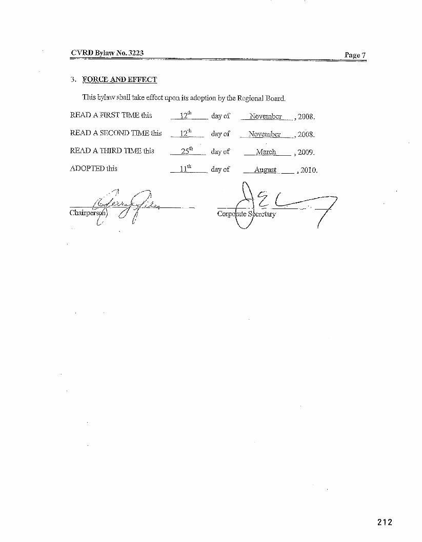
CVRD BylavNo. 3223 Page 7
3. FORCE AND EFFECT
This bylaw shaU take effect upon its adoption by the Regional Board.
READ A FIRST TIME this 12' day of November ,2008.
READ A SECOND TlME this 1 2 ~ ~ day of November ,2008.
READAnfRDTIMEfhk 25" b y of Mach ,2009.
hDOPTED this 11" day of A u w t ,2010.
Corp ate S&cretaiy $ / /'
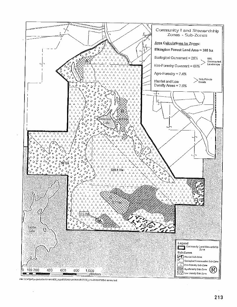
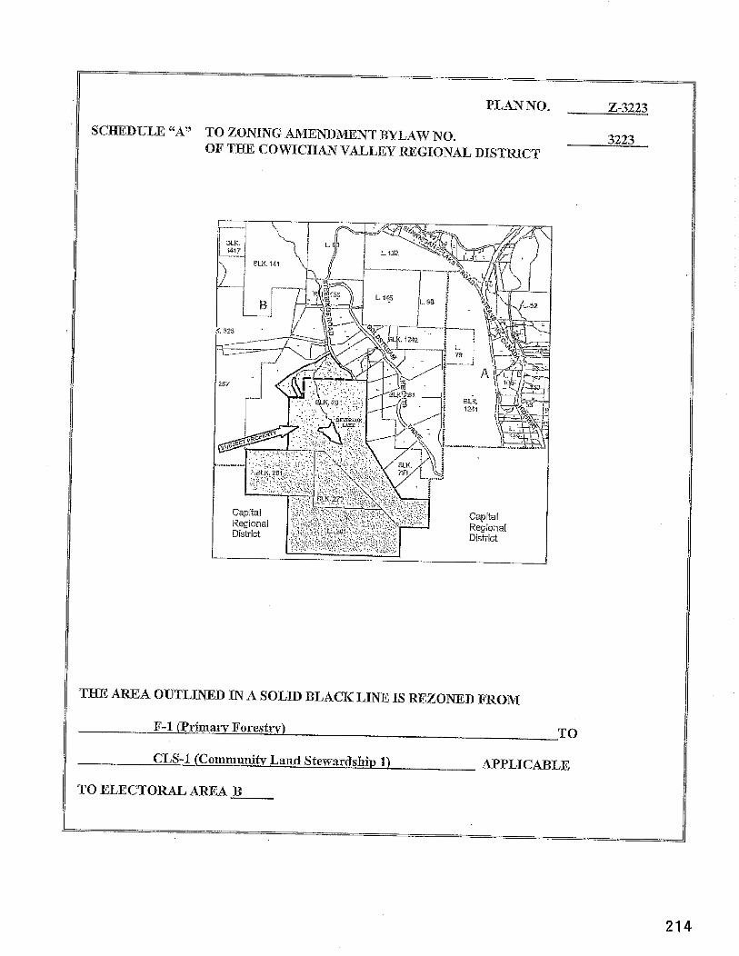
PLAN NO. 2-3223
SCHEDULE "A" TO ZONING AMF,NDB.IENT BYLAIV NO. 3223 OF THE COIVICHAN VALLEY REGIONAL DISTRICT
TJXE AREA OUTLINED IN A SOLID BLACK LINE IS REZONED FROM
F-1 t1irima1-y Forestrv) TO
CLS-I (Canlmunih. Land Stewardship 1) APPLICABLE
TO ELECTORAL AREA B
SCHEDULE 13
A Bylaw for the Purpose of Amending Official Community Plan Bylaw No. 1010, Applicable to Electoral Area B - Shawnigan Lake
WHEREAS the Local Government Act hereafter referred to as the "Act", as amended, empowers &Regional Board to adopt and amend official community $an bylaws;
AND WEEREAS the Regional District has adopted an ofEciaI co~~lnunily plan bylaw for Electoral AreaB - Shawnigan Lake, that being OfEcial Co~nmunity Plan Bylaw No. 1010;
AND WHEREAS the Regional Board voted on and received the required majority vote of those present and eligible to vote at the meeting at which the vote is taken, as required by the Act;
AND WEEREAS after the close of the public hearing and with due regasd to the reporis received, the Regional Board considers it advisable to amend Community Plan Bylaw No. 1010;
NOW THEREFORE the Board of Directors of the Cowichan Valley Regional District enacts as follows:
This bylaw shall be cited for all purposes as "CVRD Bylaw No. 3222 - Area B - Shawnigan Lake Ofiicial Community Plan Amendment Bylaw (Living Forest Planning ConsuItantsiE&in@on Estates) 2008".
Cowichm Valley Regional District Official Community Plan Bylaw No. 1010, as amended from tine to time, is hereby amended as outlined on the attached Schedule A.
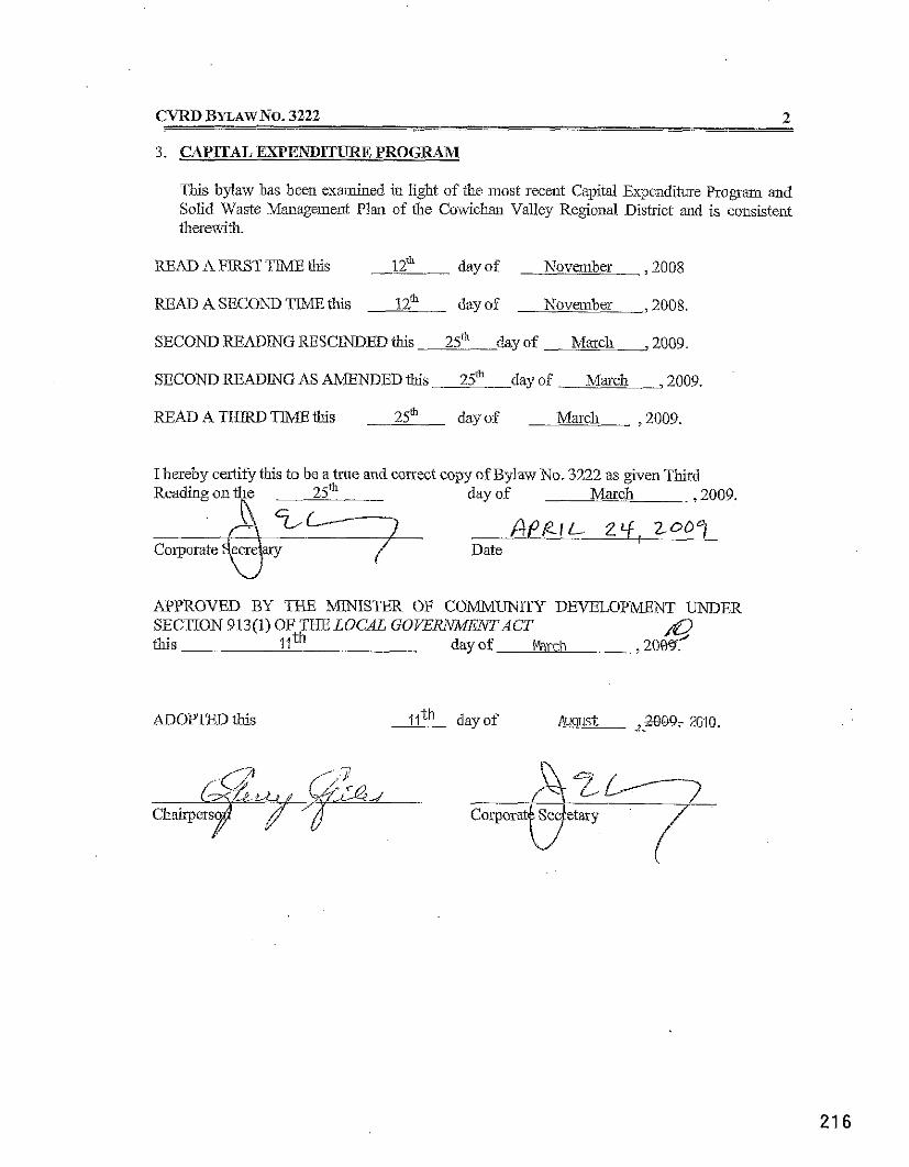
CVRD BYLAWNO. 3222 2 - 3. CAPITAL EXF'ENDITURE PROGRAM
This bylaw has been examined in light of the most recent Capital Expenditure Program and Solid Waste Management Plan of the Coniicha~~ Valley Regional District and is consistent therewith.
READ A FIRST TIME this - 1 2 day of November ,2008
READ A SECOND TIME this 1 2 day of November , 2008.
SECOND ftEADING RESCINDED this 25" day of March ,2009
SECOND READING AS AMENDED this 25& day of March ,2009.
READ A THEW TlME this dayof March ,2009.
I hereby certify this to be a true and correct copy of Bylaw No. 3222 as given Third Reading on +e 25" day of Mmch ,2009.
APPROVED BY THE ;?/mJISTER OF COMMUNITY DEVELOPmNT UNDER SECTION 913(1) OF THE LOCAL GOYERXIMFNTACT this 1lth day of Marcii
A' ,20&
ADOPTED this llth day of August ,2009, 2010. ....
C.V.R.D
SCHEDULE "A"
To CVRD Bylaw No. 3222
Official Cornmi@ Plan Bylaw No. 1010, is hereby amended as follows:
1. Part Four PLAN POLICZES is amendedby adding t l ~ e following after Section 9:
10. COMPREHENSIVE DESIGNATION POLICLES
a. Community Land Stewardship Designation Policies
Policy 10.1 The Community Land Stewardship Designation affects 411 hectares of land within Block 270 Malahat District; District Lot 201, Malahat District; Block 281, Malahat Districq and that part of Block 201, Malahat District including part of amended Parcel A (DD1896741) of said Block, and Lot 26, Dishiict Lot 201, Malahat District Plan VTP78459.
Policy 10.2 The Community Land Stewardship Designation aims to provide for the ecological sustainability of tlne land by requiring couse~ation and eco-forestry covenants on 85% of the land. The covenants are designed to protect the long teun ecological functioning of the Ian4 provide long-term employment (eco-forestry and organic agriculture)), and mitigate climate change impacts. The remaining 15% of the laud will incorporate low impact iufrast~ucture, nauow roads, and site designs that limit and contain the ecological footprint of the development.
Policy 10.3 The Community Land Stewardship Desipation is intended only for lands at least 400 ha in area, located in close proximity to existing comunities or transportation routes between existing communities, with mature forest cover existing on at least 70% of the lands.
Policy 10.4 Within the Co~n~nnnity Land Stewardskip Designation, a minimum of 85% of the land will be within the EcologicaI Conservation md Eco-forestry sub-areas. Up to 15% of the land base may be within the Agro-forestry, Hamlet and Low-Density sub-areas. The five sub- areas within the Community Land Stewardship Desigation are shown on Figure 2B "Conununity Land Stewarkhip Designation Sub-Areas Map".
CVRD S C E E D ~ E TO BYLAW NO. 3222 2
Policy 10.5 Buffer areas will be establislled on either side of watercourses and wetlands, according to the provincial Riparian Areas Regulation, the Forest Stewardship Council requirements, or equivalent, to protect the ecological integrity of these systeins fi-om potentially harmll human activities.
Policy 10.6 The 385 hectares of land within Block 270 Malahat District; District Lot 201, Malahat District; Block 251, Malahat Disttict; and that part of Block 201, Malahat District including part of amended Parcel A (DD1896741) of said Bloclc will be limited to not illore thm 85 dwellings. Furthermore, the 26 hectares within Lot 26, District Lot 201, Malahat District Plan VIP78459 will be Limited to 5 dwellings.
Policy 10.7 While primarily a conservation area, the peunitted uses within the Ecological Conservation Area will include trails and the management of forests so as to ~naiutain the health of the forest aud minimize the risk of wild fL-e, wiud throw or the spread of invasive species.
Policy 10.8 Lands within the Ecological Consewation Area will be subject to a conservation 'covenant, held by the CVRD and the L.and Conservancy of Canada, registered on the title of the lands.
Policy 10.9 Uses permitted within the Eco-forestry Area will include timber harvesting according to a Forest Stewardship Council management plan (or equivalent), silvicultnse, horticulture, cultivation of non-timber forest products and ago-forestry products. This sub-area will also permit recreational trails and small facilities or s'nuctures for ecological education, which may include non-habitable tree top canopy stmctuses. Linuted, small-scale timber milling, wood processing and other timber based manufactwing activities will be encouraged.
Policy 10.10 Lands within the Eco-Foreshy Area will be subject to a forestry conservation covenant, held by the C W D and the Land Conservancy of Canada, aud registered on the Title of the Parcels. Uses within the Bco-Forestry Area will be subject to the '"mall Operations Standards of the Forest Stewardship Council Regjonal Certification Standards for British Columbia (2005), or equivalent.
Policy 10.1 1 Uses yermitted within the Am-forestry Area, which is a more intensive agtculsural land sub-area than the Eco-Forestry Area, will include eco-foresby based forest management systems, including timber harvesting according to a Forest Stewardship Council management plan (or equivalent), silvicdture, hoiticulture, cultivation of non-timber forest products and ago-forestry products. This sub-zone will also pennit recreational trails and small facilities
. or structures for ecological education, which may include tree top canopy structures. Small scale, value-added agriculture, organic gardening, food production and psocessiug, greenhouses, and horticulture will be encouraged in this area. Limited, small scale, value added timber manufacturing, sawmills, planer nulls and other low impact timber based manufacturing activities will be ellmuraged in this area.
... /3
CVRD SCHEDULE A TO BYLAW NO. 3222 3
Policy 10.12 Uses aennitted within the Low-Density Area will include Single Familv iwide~itial units to a m&um density of five (5) dwell& in Asea A, eight 78) d w e k g s in Area B, and fourteen (14) dwellings in Area C. All Single Family dwellings may have a home occupation, a secondary suite, and a bed and breakfast accomnlodation. Other permitted uses include agsicultuse, recreational trails and the ~managemenf of forests in order to maintain the health of the forest andminimiie the iisk of wild he , thow or spread of invasive species.
Policy 10.13 Withfu the Low Density Area, no dwelling s h d be greater than 400 sqme metres in floor asea.
Policy 10.14 Uses aennitted within the Hamlet Area ~yill include Sin~le Family and multi-familv residential units. Up to 77 dwelling units will be pemutted in& 'Hamlet Area and the Low Density Area C Combined. Therefore, between 63 and 77 dwellings may occur in the Hamlet Area, depeuding on density within the Low Density Area C area All Single Family dwellings may have a home occupation, a secondary suite, and/or a bed and breakfast accommodation.
Policy 10.15 Within the Hamlet Area, all intensive residential and multi-family dwellings wwill he subiect - to the comun!ty ~ a u d Stewardship Development Pennit Area. -
-
Policy 10,16 Within the Hamlet Area, no dwelling shall be greater than 370 square metres iu floor area (iticluding basements).
Policy 10.17 Within the Harnlet Area, a Guest Lodge for tousist accommodation is pemitted with uu to 12 - A
suites within the Lodge, and with up to 6 accessory tree top canopy units for tourist accommodation. These tree top canopy units will not exceed 40 m2, aud may be located in an Eco-forestry, Ago-forestry, Low-Density, or Hamlet Area, provided that they are located within 300 metres of the Guest Lodge.
Policy 10.18
Within the Hamlet Area, a comnunity centre facility is permitted, not to exceed 100 square meters in area In addition, commi ty structures, gazebos, amphitheatres, community fire respo~lse cenkes or civic buildings are peimitted. Not more than one Guest Lodge and one community centre is permitted within the Community Land Stewardship Designation.
Policy 10.19 Within the Hamlet Area, a canveniei~ce store, not exceediug 100 square meters in floor asea, will be permitted.
CVRD S C H E D ~ E A TO BYL-4w NO. 3222 4
Policy 10.20 Within the Hamlet Area, other peunitted uses include recreatiolial trails auld the management of forests so as to maintain the health of the forest and miuinize the risk of wild fire, wind throw or spread of invasive species.
Policy 10.21 Land uses within the Community Land Stewardship Designation will utilize water resourcw found within the designation area, in order to contain the ecological footplint of the development.
Policy 10.22 An Archeological Overview Assessment was conducted for the Subject property ill 2007. Although all developable areas within the Community Land Stewardship Designation have been identified as having low probability of archaeological resources, nevertheless archaeological resources should be considered during all phases of project develop~nent.
2. That Figure 2B be added to Section 10.
3. That existing Sectiom 10 through 12 be renumbered accordiagly.
4. That Section 13 (formerly Section 12) be amended by adding the following subsection after 13.8:
13.9 COlMMUNlTY LAND STEWARDSIIZP DEVELOPMENT PERMIT B A
Category The Community Laud Stewardskip Development Permit Area is designated pwsuant to Section 919.1(l)(a), 0, (e), (0, 0, (i) and ij), for
(a) Protection of the natural environment, its ecosystems and biodiversity; (b) Protection of development ftom hazardous conditions, (c) Establishment of objectives for the form and character of intensive residential
development; (d) Establishment of objectives for the form and character of con~mercial, indusbial
aud mnultifdy residential development; (e) Establishment of objectives to promote energy conservation; (9 Establishment of objectives to promote wata conservation; and (g) Establishnmt of objectives to promote the reduction of geenhouse gas
emissions.
Jz~stiicatiorz The objectives of file Commmlity Land Stewardship Development Permit Area are:
(a) 3310 C o m m i t y Land Stewardship Development Pennit Area encompasses Devereaux Lake, Stebbings Lake and Stebbings Creek, wliich come to a confluence o n the property to form Shawnigaul Creek. The Stebbings Lake and Devereaux Lake watersheds constitute the complete upper watershed for Shawnigan Lake and, as suclh have a very sigxificant ecological value for the Shawnigai~ Lake community. The Board aims to protect the ecological values of this area
. . .I5
(b) The Board aims to protect life and propaty from hazardous conditions, including flooding, mud flows, toirents of debris, erosion, land slip, rock faIls, subsidence, avalanche, and wildke.
(c) The Board wishes to promote energy conse~vation, water conservation and a reduction iu geenhouse gas emissions.
(d) The Board wishes to m-e the degree of forest carbon e~~lissions. (e) The Board wishes to ensuse that the fom aud character of intensive residential,
comnercial and industrial development conforms to basic principles of ecological sustaiuability, andvenlacular traditional urban design as set out below.
Area The Conununiity Land Stewardship Developme~~t Palnit Area applies to those lands shown outlined in a thick black line on Figure 5F.
Ctddelines Subject to the exemptions listed below, prior to commencement of any development, including subdivision, construction, or land clearing, on lands within the Comnlunity Land Stewardship Development Pennit Area, the owner shall submit illfonnation that demonstrates how the proposed development meets the following ,g%delines:
Environmental Protection
1. A sustainable rain water management plan, based on Pvlinistry of Environment Best Management Practices, will be required to ensure gradual dispersal of water to constructed wetlands or into natural groundwater idiitration system, in order to prevent channelization, soil erosion, or sedimentation flo~viug into existing watercourses.
2. A rain water mloff plan will be prepared for every proposed building lot and reviewed for compliauce with the sustaiuable rain water management plan.
3. A Canadian Green Building Couucil LEED certification system, or its equivalent as agreed upou by the CVRD, is required for the Hamlet sub areas and all commercial and industd buildings.
4. The latest Best Management Practices for land development of the Minishy of Environment will be used.
5. Proposed sewage tseatment and disposal lnethods will be designed to avoid impacts upol~ the environment and shall meet the requirements of the South Sector Liquid Wade Management Plan.
6. The South Sector Liquid Waste Mmagement Plan will be respected. 7. Potable water must be provided from undergroui~d sources witlun the subject property.
Hazardous Conditions
8. The CVRD Board may, where it believes that development is proposed near or in an area that may be subject to erosion or ground instability, require the applicant , at the applicant's expense, to hire an engineer, experienced in natural hazards identification and mitigation. The engineer's recommendations will be incorporated into a DeveIoplnent Permit, if one is issued.
... 16
SCUEDULE A TO BYLAW NO. 3222 6
9. Provision of Fire Smart Measures will be implemented, includiug appropuiate fire fighting equipment on site, thinning of fuels around buildings, design of all dwellings with sprinklers and non-combustible roofing mateiials.
Folm and Character of Develovment w i t h &the Hamlet Areas
10. Narrow roads will be encouraged that follow the natural contours of the land and ruiulrnize cuttiug or filling. Where possible, steep slopes shall be avoided
11. Light pollution shall be avoided. Skeet and common area lighting desigo will provide adequate lighting while enmuiug that there is no spillover into adjacent areas.
12. Dwellings will have vertical proporlions with one, two and two and a half storey cons~ct ion.
13. The architecture will be predominately simple geometric proportions and massing; square, rectangular, T-shape, cruciform, H shape, etc., with doiulers, gables, projecting balcoiues, recessed decks and doors, covered porches, and bay and box window-s, designed with vertical proportions.
14. The main portion of all roofs w d be aiiuimunl of 22/12 pitch, in grey, black, copper, aud other metal colors.
15. A palette of natural mateiials will be used, such as exposed timber kame trusses, beams, wood siding or shingles, aud small areas of non-combustible rough textured stucco.
16. Dwellings will not exceed 200 d i n footprint, emphasizing efficiency in use of space, hi91 quality design, and practical storage areas. The exception is the Low-Density Areas, which would include some larger, more private and less vertically oriented buildings.
17. Dwellings will fiont onto a public square or common area, to be accessibie and public, while the backs of the homes will be more private.
18. The street froiltage will be designed to reflect visual continuity with ueighboluing houses, with common but not mimicking features.
19. Deep usable porches, windows overlooking the street, and clearly visible entrances are encouraged. Except for "curb-cuts" for driveways, there should be a continuity of the street wall incorporating the face of the dwellings, fconhge walls, irellises, and vegetation.
20. Carports, garages, and parking areas are to be hidden on the side or rear of houses, or tuclied into basement areas.
21. Fencing and walls to be restricted to portions of yards and gardens immediately adjacent to the dwelling, and to areas that are iutensively cultivated, f m e d , or used for ago- forestry uses (deer fencing is penuitted).
22. All public use areas wiZl be landscaped in accordance with an o v e d landscape plan. The landscape planmay be reviewed in accordance with the Bi-itisli Columbia Society of Landscape Architects (BCSLA) and the Biitish Columbia Nursery Trades Association (BCNTA).
23. Crime Prevention through Enviroilnleutal Design (CPTED) will be cotlsidered in landscaping plans and building desipns.
24. Vehicle access points, pedestrian pathways, and parldug and circulation patteins within the Hamlet Areas will be physically linked a d , where feasible, shared in order to encourage as safety and avoid unnecessary duplicatioii.
. . .I7
CVRD SCHEDULE A T 0 BYLAW N0.3222 7
25. Safe pedestrian routes across, withii and between sites shall be clearly delineated by ineans of separate walkways, sidewalks, or raised palhs where they cross parking areas.
26. Signs d l be desigued to reflect the architecture of the site and be in harmony with the landscaping plans for the site, but shall be limited in height and area commemate with the site characteristics.
27. Where possible, underground wiring is encouraged rather than overhead wiring.
Enerm Conservation, Water Conservation and Reduction of Greenhouse Gas Emissions
25. The use of rainwater catchment tanks and cisterns for re-use in inigation is requised. 29. The use of alternative and renewable soutces of energy in required. 30. A Canadian Green Building Council LEED Rating system, or its equivalent, is required. 3 1. Site plainkg for buildings and land uses will incorporate studies, submitted to the
CVRD, to facilitate utilization of energy and water conse~ationmeasures, including solar orientation, prevailing wind direction, elevation contours, existence of significant vegetation and means to retain matwe vegetation.
Exe7?ptions The terms of the Co~nmunity Land Stewardship Development Permit Area shall not apply to:
1. Lot consolidatiotls and minor boulldary reaIignments; 2. Iutesior renovatiom and minor exterior renovations of existing structures; 3. Forest Management that does not requixe the me of buildings or shuctures; 4. Recveational trails and small facilities or structmes for ecological educatio~l.
(a) Before the CVRD authorizes the issuance of a developnlent permit for a parcel of land in the Community Land Stewardship Development Permit Area, the applicant rnust submit a development pennit application, wi~ich at a minimum includes:
I . a written desc~iption of the proposed project; 2. reports or information as listed iu the relevant Development Permit Guidelines; 3. . information in the form of one or more maps at a scale of 1:2000, as follows:
a. Location and extent of proposed work; b. Site plan showing existing and proposed parcel lines, existing and psoposed
buildings and skuctures, vehicuIar access points, roads, driveways and parking areas;
c. Location of all natural watercourses/waterbodies, including springs; d. Setback distances from watercourses/waterbodies, including spiings; e. Existing tree cover, areas of sensitive native plant commu~uties, proposed areas to
be cleared; f. Locatiom and size of treed buffers; g. Topogaphical contours (1 metre), locatioli of slopes exceeding 25 percent grade.
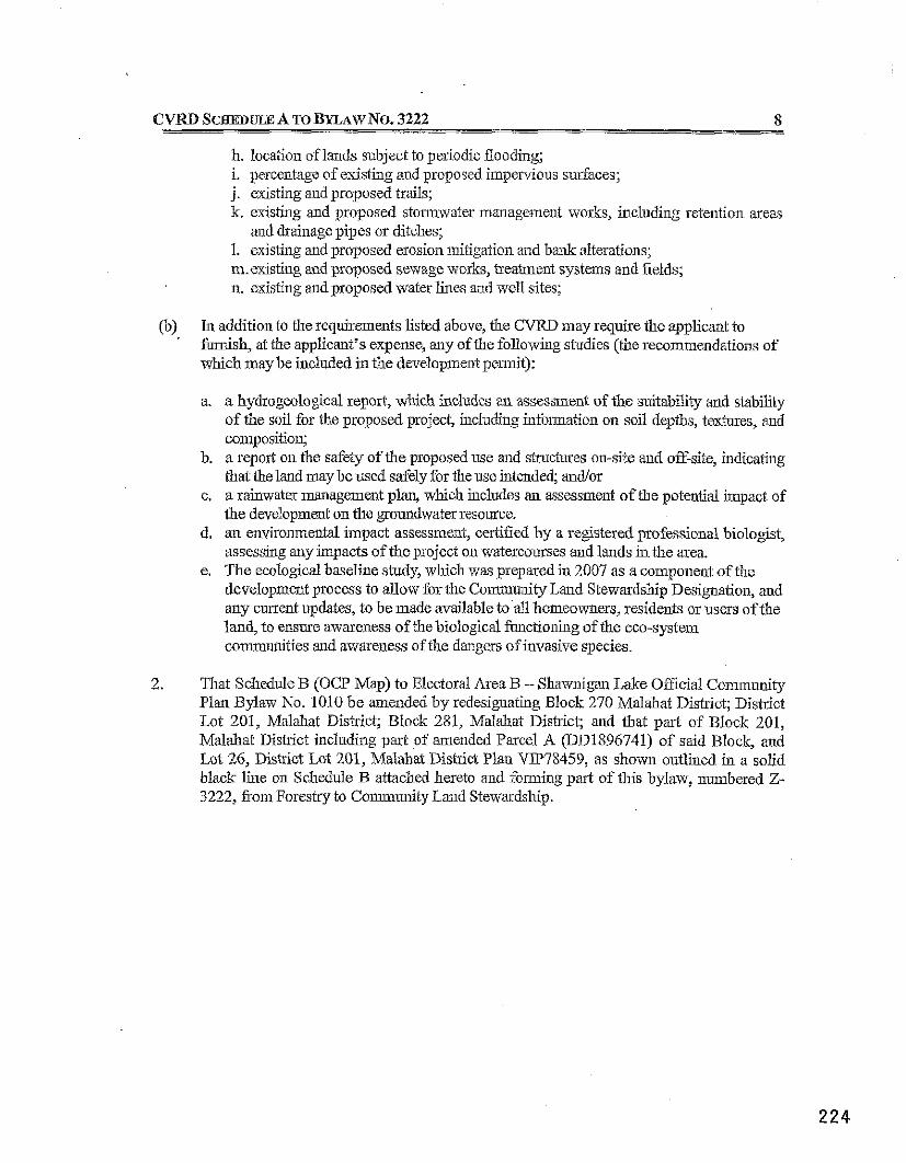
b. location of lands subject to periodic flooding; i. percentage of existing and proposed iiupervious surhces; j. existing and proposed trails; k. existing and proposed stoimwater management works, including retention areas
and drainage pipes or ditches; 1. existing and proposed erosion mitigation and b a k ylteratioiw; m.existing and proposed sewage works, treatment systems aud fields; n. existing and proposed water lines and well sites;
[b) In addition to ihe requirements listed above, the CVRL, may require the applicant to '
furnish, at the applicant's expense, any of the following studies (the recommendatioiw of which may be included in the development pei~nit):
a a hydrogeological report, which includes au assessment of the suitabity and stabdity of the soil for the proposed pmject, including infoimation on soil depths, textures, and composition;
b. a report on the safety of the proposed use and structures on-site and off-site, indicating that the land may be used safely for the use intended; andlor
c, a rainwater management plan, which includes an assessment of the potential impact of the development on the groundwater resource.
d, an environmental impact assessment, certified by a registered professional biologist, assessing any impacts of the project on watercourses and lands in the area.
e. The ecological baseline study, wluch was prepared in 2007 as a component of tile development process to allow for tile Community Land Stewardship Designation, and any current updates, to be made available to all homeowners, residents or users of the land, to ensme awareness of the biological functioniug of the eco-system conununitics and atvareness of the dangers of invasive species.
2. Tlxt Schedule B (OCP Map) to Electoral Area B - Shamigan Lake Official Co~llmunity Plal Bylaw No. 1010 be amended by redesignating Block 270 Malahat District; District Lot 201, Malahat District; Block 281, Malahat District; and that part of Block 201, Malahat District including part of amended Parcel A (DD1896741) of said Block, and Lot 26, District Lot 201, Malahat District Plan VP7S459, as shown outlined iu a solid black line on Schedule B attached hereto and forming part of tlus bylaw, um~bered Z- 3222, from Forestry to Community Laud Stewardslip.
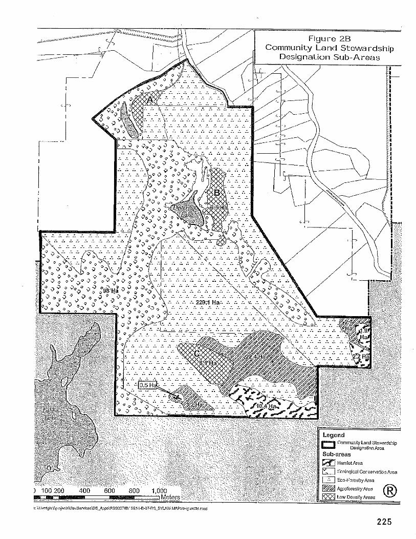
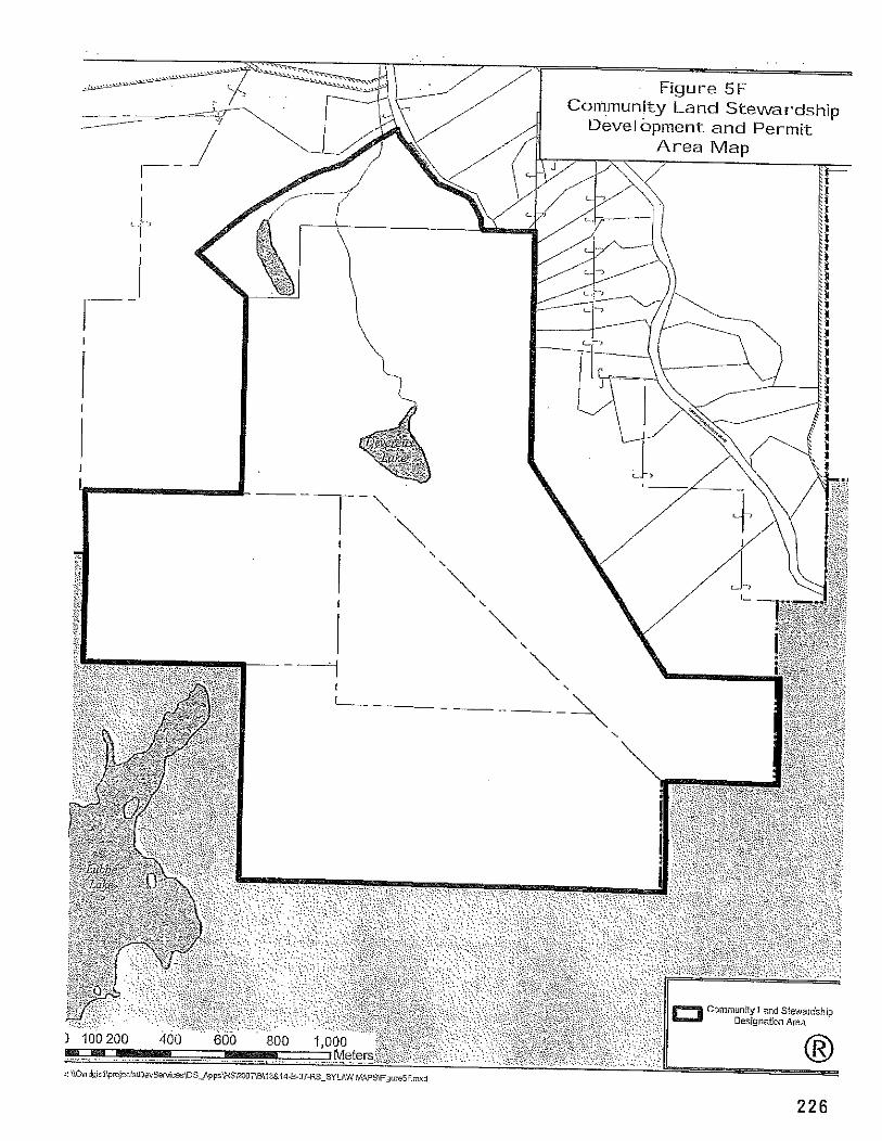
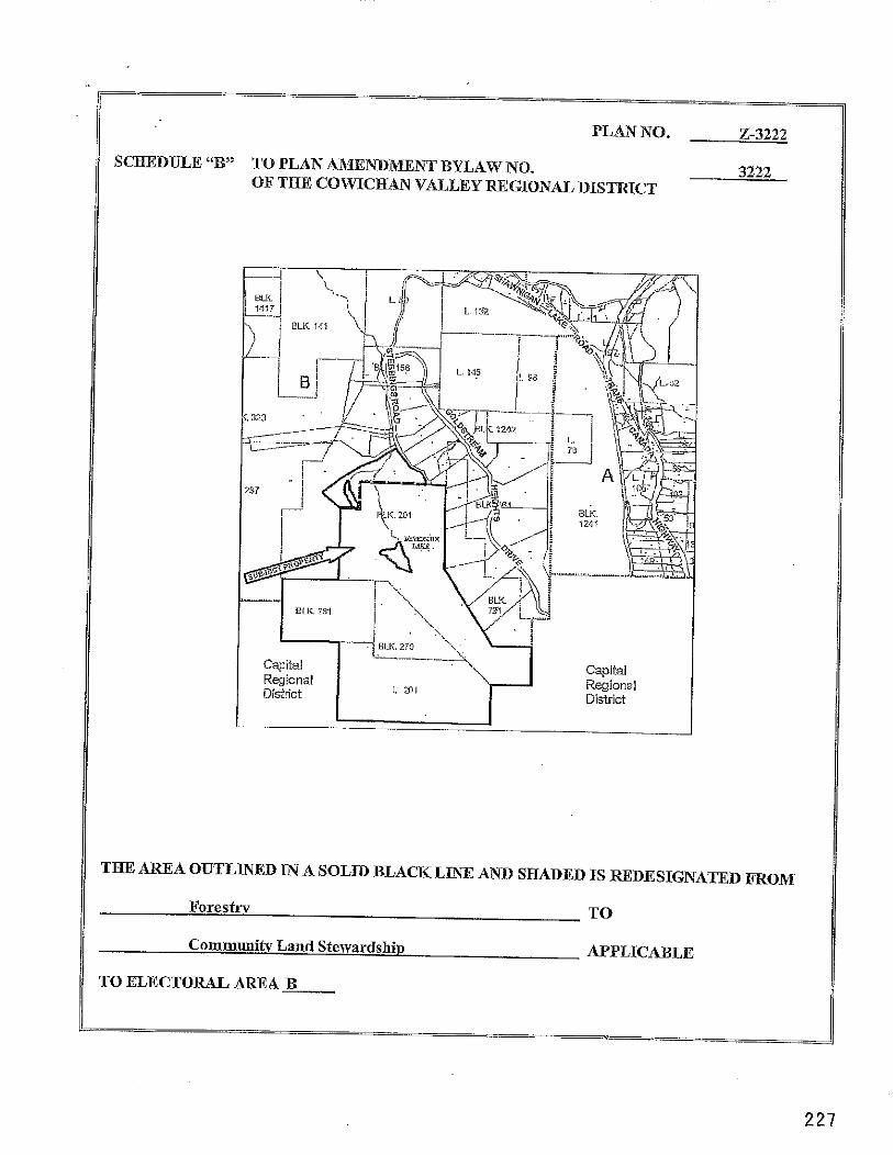
PLAN NO. 2-3222
SCaEDULE "B" TO PLAN AMENDMENT BYLAW NO. 3222 OF THE COWICHAN VhLLEY REGIONAL DISTRICT
TBE AREA OUTLINED IN A SOLID BLACK LINE AND SHADED IS REDESIGNATED m O M
Forestrv TO
Communitv Land Stewardshio APPLICABLE
TO ELECTORAL AREA B
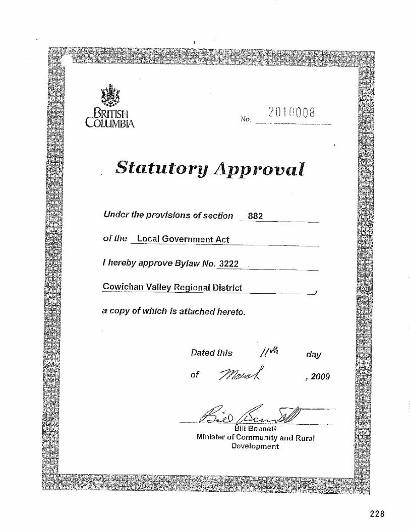
SCHEDULE 14
COWICHAN VALLEY REGIONAL DISTRICT
D E V E L O P M E N T P E R M I T
- == .= ,,,~j&>
=.- ~> .- -- -. 14-B-1 ODPlRAR
.- -- -- - . .-d -=DATE: APRIL 15,2011 s--L . ---
c-
TO: CHARLES CLAYTON and DIANAMFKAY -. --- %a=; .- ?-=A
c/o LIVING FOREST PLANNJmFcONSU LTANTYS- __ -*--- ADDRESS: #21- 21 DALLAS ROAD .-L
.~~Jc --- V\
-. -- . --- - . - .. - -- ---A. --. VICTORIA, BC . V8V 429 -& -a -- -
.L
-- 2__-
-- -- ?-.
---. -a-
- .-
- ---- -- -. -- -- - - ---a-
- -= -- ---
I. This Development Permit is isF@?@&bLect to cmp l iance with all of the bylaws of the Regional District applicmle .-J .- - r z e t o , ex;??& as specifically varied or --
-&-- - -- -- supplemented by t -@emi t . - -- = ---a. - -- -. .. .- .- .- .--- =s
.- -- - 2. This ~ e v e l o ~ m ~ ~ Z m & - p p l i e s m a n _ & i w @ t h o s ~ l a n d s within the Regional -- -A ---- .- =..
-&-
--. - District d e s c r i z b e l o w : -- --- =.&- - ---- .- v.- -- a -- .- - -& =- - ---. = .-
District ~-a ~ o t ~ ~ ~ ~ a / ~ ~ ~ l s f r i c t ----- f~E009-395-075) -A. ---s- -- .-
--.----A. -..-
.----- --z-- -- = --r-- -- - -- --~ - --* .--= ..-+ ~. -
-~%%?~&&~loc.k5~@, ~ a l a h 3 g & s f c i ~ ~ n c l u d i n ~ part of Amended Parcel A .- ~-- -.. - .-- - (DD18967ZRFof ~ai%81o.ck. (PID 00g395-130) -= ~-- .- -- .- - -- -
--- -. --. -. -- -. -a
---- ~--. - --- =
=- 9- =-- -. 3. ~uthgE&&n is hereTGgivenT& the land to be subdivided and developed in
accordam2with the pla?&and coFditions listed in Section 4 below. -==. - -= --. -- - -. .- 7- -- =-= -.-- - -- - .- .- -- .--
4. The d e v e l ~ ~ m e ~ h a l k ~ c a r r i e d --= out subject t o the following conditions: --. =-- -- - -- - =
a. Compliance with GR report #I85O;
b. Demarcation of the SPEA boundary with fencing orsignage andsubmission of a post-development report prepared by a Qualified Environmental Professional prior to sub division;
c. Submission and approval of a drainage design that incorporates the rain managemenf concepts described Schedule D, prior to subdivision;
d. Registration of a restrictive covenant to preclude multiple family use and further subdivision of lots in the Trail Head Hamlet;
e. Registration of a restrictive covenant to preclude development of the identified Streamside Protection and Enhancement Areas and the protective zones identified in RAR Assessment Report #I850 and on Schedule A;
f. Demonstration that proposed buildings comply with criteria listed on Schedule F prior to issuance of a building permit for any residential or commercial building;
g. Compliance with Covenants CAI648147 and CAI648148 (Fire Protection);
h. Compliance with Covenants CAI648144 and CA164&1&5 (Parks); ~-%=-. :--> . ~- - - - .. -- .---
i. Compliance with Covenant CAI648146 (Ser~ici&);~ -. --- .- _- ----
Bv --- ev --. -~ -.--. .- j. Installation of all wiring underground. . - - - m -
- -- --
-- - -- -- -- - -- .-
5. The following schedules are attached:E= -. -. -3 - -- -. =-a --- ne-
Schedule A - Trail Head ~ubdivisio%&gn .- --. -- - - . - - -.
-- ---.
---- - . a- -- -- -_-_ - --
-- .- -. .- - ---- e Schedule B - Park Dedic*&n Plan -- p-2 .-~- -d -.
-- :=-=. - =-=*- =-
-=- - -. - -..-. . Schedule C -Strata ~ l a n - ~ a = - - .-- -- - --=
---.. _ -=A - -- e Schedule D -Trail Head RaTuaam_nd -- ~tor&'@&~r Run-Off Plan
w- --.
.-... --= . Schedule E -XraikM.ead -- HomEaans =-ge.. - -- ---- .- .--- -.. ----- --- ------ -- --- =-
-- .- -- =-
a Schedule &@fl&ldfgsrmit chv$&is~= .>--A- =- -- --- - --
7ap -
p: - 6. This Permit i<TTt a ~uER3Tision A m v a l or a T"i lding Permit Approval. No
subdivision appr~al,shalb r e c o m m d e d or building permit issued until all conditioItTSand - req"~~m~T~t~&s~eve~Pment Permit have been completed to the . .- _-_- ---. --= -- --. s a & ~ t l o n - o & ~ P I a n ~ ~ g a n d - -=-. -. - ~ x % ~ ~ ~ D e p a r t m e n t .
-- e- -- --- -A-
ISSUANCE OF TXIS~PERTE~HAS ---. BEEFAUTHORIZED BY RESOLUTION NO. 11- O ~ ~ ~ O & A S S E D B Y ~ E BOAfXOF ---. THE COWICHAN VALLEY REGIONAL DISTRICT THE ~ ~ ~ ~ @ A Y O F A P R I ~ O ~ ~ . -&
-= . 7m --
. -. - -- -. -. .- - .- -= -- - -- -- - -J -- ~- -- - h- -- - -- -- ?- ..-=- -- - r&L% Tom Anderson, M-eI1pL-
-- General Manager, Planning and ~ e v e l o ~ m e n t Department
NOTE: Subject to the terms of this Permit, i f the holder of this Permit does not substantially start any construction within 2 years of its issuance, this Permit wil l lapse.
I HEREBY CERTIFY that I have read the terms and conditions of the Development Permit contained herein. I understand and agree that the Cowichan Valley Regional District has made no representations, covenants, warranties, guarantees, promises or agreements (verbal or otherwise) with CHARLES CLAYTON and DIANA McKAY, other than those contained in this Permit.
Signature of OwnerIAgent
Print Name
Date
Witness
Occupation
Date
DATE: March 9,201 1 FILE NO: 0360-20-ALCi01
FROM: Carla Schuk, Planning Technician BYLAW NO:
SUBJECT: Soil Classification Mapping for Gordon Bay in Electoral Area F
RecommendationlAction: That the Committee accepts this report for information
Relation to the Corporate Strateclic Plan: N/A
Financial Impact: N/A
Backaround: Soil classification mapping is not available for properties within Electoral Area F. Currently, the CVRD reviews applications for properties located within the Agricultural Land Reserve (ALR) in Electoral Area F without this information. After staff presented an application for subdivision within the ALR in Electoral Area F at the Committee meeting on November 23, 2010, the committee recommended that soil classification mapping be completed for ALR lands in Electoral Area F. At the Board meeting on December 8, 2010, resolution no. 10-261.5 was passed stating:
"That the Agricultuml Land Commission be requested to do soil classificafion mapping for the Gordon Bay area of Elecforal Area F which would provide the CVRD with the information needed fo make recommendations on future ALR applications. "
Staff contacted the Agricultural Land Commission (ALC) on January 24, 201 1, notifying them of the CVRD Board's recent resolution. The ALC's response outlined that due to lack of resources, they are not able to undertake soil classification mapping for the Gordon Bay area of Electoral Area F. Staff submits this report to the Committee for informational purposes.
Submitted by, 1 Reviewed bv:
Carla Schuk, Planning Technician Planning and Development Department
CSIca Attachment
Djvis' anager:
General nager.
21'' February 201 1
Agricultural Land Commission 133-4940 Canada Way Burnaby, British Columbia V5G 4K6 Tel: 604 660-7000 Fox: 604 660-7033 w.alc.gov.bc.ca
Reply to the attention of Roger Cheetham ALC File: 240-20lCVRD
Carla Schuk Planning Technician Development Services Division Planning and Development Department Cowichan Valley Regional District 175 lngram Street Duncan, BC V9L 1 N8
Dear Madam:
Re: Soil Classification Mapping for Gordon Bay Area o f Electoral Area F: Cowichan Valley Regional District
With reference to your letter dated 24th January, 201 1 the Commission's resources and priorities preclude the Commission undertaking of any soil capability mapping for the Gordon Bay Area.
When the Commission receives applications that are founded on an argument that soil capability ratings are diierent to those shown on the available soils information, it is not uncommon for the Commission to request that the applicant provide more detailed soils mapping undertaken by a soils Agrologist to substantiate the argument. The Board may like to consider doing the same if it considers that such information is needed in order for it to better evaluate a specific application.
Yours Truly
PROVINCIAL AGRICULTURAL LAND COMMISSION
Per:
Brian Underhill. Executive Director
DATE: February 22, 201 1 FILE NO:
FROM: Ryan Dias, Parks & Trails Operations BYLAW No: Superintendent
SUBJECT: Half IronMan Triathlon Special Event Request
RecommendationlAction: That the Committee provide direction on the request from Lifesport Coaching for the provision of a Parks staff person for the duration of the two day weekend event and relocation of trail access boulders, estimated in the order of $2,500, to be funded either through the Shawnigan Lake Community Parks budget or by the event organizers.
Relation to the Corporate Strateqic Plan: Achieve Excellence through Community Partnerships
Financial Impact: (Reviewed by Finance Division: N/A1
Backaround: The Cowichan Valley Regional Board in 2009 approved a multi-year approval for Lifesport Coaching of Victoria to stage the Shawnigan Lake Half lronman Triathlon Event in West ~hawnigan Lake Park and on portions of the Cowichan Valley Trail. For 2009 and 2010 the event organizers requested the assistance of the Regional District to undertake pre-event site preparation work at both West Shawnigan Lake Park (a BC Park operated at-cost by the CVRD through funding by the Electoral Area B Community Parks budget) and on the Cowichan Valley Trail, which was supported by the Shawnigan Lake Parks Commission and approved by the EASC and Board. For 2011, Lifesport BC has again submitted a letter requesting a number of items be addressed by the Regional District prior to and in support of the Shawnigan Lake Half lronman Triathlon Event scheduled for May 27-29 (see attachment).
The letter was forwarded to the Shawnigan Lake Parks Commission to their meeting of February 17", 2011 for consideration and feedback, due to the operational costs that would be incurred by the Electoral Area B Community Parks budget. In reviewing the requested support items from Lifesport Coaching, the Commission was supportive of a number of items that were at no additional cost, but expressed concerns over the expenditure of additional funds specific to items that were only of benefit to the event. As noted in the letter attached, the no additional cost items requested include providing the organizers with keys to the park and trail gates, sealing up existing toilets, mowing the grass areas and removing windfall (part of regular maintenance) and confirming sections of the Cowichan Valley Trail which will be accessible on the south side of the Kinsol Trestle.
However, the Parks Commission has expressed that such events should be supported at cost- recovery to the community. These additional cost items would include assignment of a CVRD Parks and Trails staff person to assist with any park logistics over the weekend of the event (would entail payment of overtime for staff coverage through the weekend and the removalireplacement of boulders on the connector trail (approximately $1,000 cost). A couple of items in the letter are also beyond the authority of the CVRD to provide, as it involves private lands or works by BC Parks, as well as the request also repeats a request for Cowichan Valley Trail improvements which were previously done in 2009 for the annual event.
Direction is therefore required on whether to apply incurred costs in support of the 2010 Shawnigan Lake Half lronman Triathlon Event to the Electoral Area B Community Parks budget or that the event organizers be advised that their request for an assigned CVRD Parks staff person for the duration of the event and relocation of boulders on the connecting trail between Shawnigan Lake Park and the Cowichan Valley Trail can be accommodated on the basis that the event cover these costs.
Submitted by,
Ryan Dias Parks and Trails Operations Superintendent Parks and Trails Division
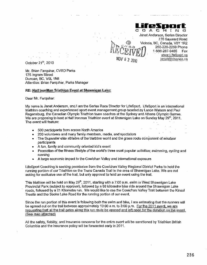
Janet Anderson, Series Director 770 Sayward Road
-3 w Victoria, BC, canada. V8Y I F 2 bn 250-220-2259 Phone
'n* fl M66-287-9465 Fax
October 2Iw, 2010
Mr. Brian Farquhar, CVRD Parks 175 lngram Street Duncan, BC, V9L 1N8 Attention: Brian Farquhar, Parks Manager
RE: Half IronMan Triathlon Event at Shawniaan Lake:
Dear Mr. Farquhar:
My name is Janet Anderson, and I am the Series Race Director for LifeSport. LifeSport is an international triathlon coaching and experienced spoFt eventmanagement group headed by Lance Watson and Paul Regensburg, the Canadian Olympic Triathlon team coaches at the Sydney and Athens Olympic Games. We are proposing to host a Half lronman Triathlon event at Shawnigan Lake on Sunday May 29", 2011. The event will feature: ..
. . 500 participants from across North America 200 volunteers and manyfamily members, media, and spectators
* -The Superstar elite athletes of the triathlon world and the grass roots component of amateur participants A fun, family and community oriented kid's event Promotion of the fitness lifestyle of the world's three most popular activities; swimming, cycling and running
* A large economic impact to the Cowichan Valley and international exposure
LifeSport Coaching is seeking permission from the Cowichan Valley Regional District Parks to hold the running portion of ourTriathlon on the Trans Canada Trail in the area of Shawnigan Lake. We are not asking for exclusive use of the trail, but only approval to hold an event using the trail.
This triathlon will be held on May 2nth, 2011, starting with a 7:00 a.m. swim in West Shawnigan Lake Provincial Park (subject to approval), followed by a 88 kilometre bike ride around the Shawnigan Lake roads, followed by a 21 Kilometre run. We woufd like to use the Cowichan Valley Trail between the Kinsol Trestle and the Sooke Lake Road for the running portion of our event.
Since the run portion of this event is following both the swim and bike, 1 am estimating that the runners will be spread out on the trail between approximately 10:OO a.m. to 3:00 p.m. For the 201 1 event. we are reauestinq that all the trait gates along this run route be opened and left open for the duration on the event. (See map attached)
All the safety, liability, and insurance concerns for the entire event will be sanctioned by Triathlon British Columbia and the insurance policy will be forwarded early in 2011.
Further to our trail access requestsfor the upcoming Triathlon we will be requesting that the items below be activated as well.
Provide access and full use of West Shawnigan Lake Provincial Park from May 27-29 Have the boulders moved and replaced from both ends of the connector trail across the road from West Shawnigan Lake Provincial Park Service Road (Friday, May 27 for removal and Repfaced Monday, May 30) Fill in the ditch and grade the first 12M of this connector trail lo allow safe access for the runners (Friday, May 27) Grade &compact section of Gowichan Valley Trail south of Butler Road for 2 miles (Any time before May 28) if necessary Provide a copy of the West Shawnigan Lake Park key for both the parking lot and Service road gates Seal the Existing Toilets so they cannot be used. Provide Key for gates on the Cowichan Valley Trail for the run course from (Key needed sometime before May 27 to be used only on race day - May 29) Assigna-staff rnem6er on site to assist with any park logistics for May 27-29 (limes to be Confirmed - 8:00 am - 7:00 pm) Confirm construction schedule and obstacles in the area south of the Kinsol Trestle as soon as possible. Confirm the brush mowing timeline as soon as possible. Provide GIS map of the CVRD. Confirm what is being done with the Goose Fencing at the edge of the Lake. Confirm if it is being left or whether it is being taken out. Cut the grass and removing the windfal from West Shawnigan Lake Provincial Park (May 25).
. Capital improvements as requested in 2009:
0 Paving shoulder on eastside (park side) south of West Shawnigan Lake park access road to main access road.
This year we have once again formed a partnership with the Gowichan Family Caregivers support Society, and joined forces in planning an entire weekend of events including the Caregivers Walk on Saturday.
Your approval of this event would be greatly appreciated, and please contact me if you require an other i! information, or clarification. Thank you very much for your assistance in our preparation for the 5 Annual
n w n i g a n Lake International Triathlon. f :
DATE: March 9, 201 1 FILE NO:
FROM: Ryan Dias, Parks Operations Superintendent BYLAW No:
SUBJECT: 201 1 Capital Projects Schedule for Community and Sub-Regional Parks
RecommendationlAction: That the Committee endorse the 201 1 Major and Minor Capital Work Program Schedule for Community and Sub-Regional Parks as the order and priority list for undertaking completion of capital project work approved in the 201 1 budget.
Relation to the Corporate Strateaic Plan: Comnlunity infrastructure planned for current and future generations.
Financial Impact: (Reviewed by Finance Division: N/A)
Backaround: Each year during the Fall budget planning process, Parks and Trails Division staff meet and/or request feedback from the various Parks and Recreation Commissions to plan major and minor capital project work for the coming year under each Electoral Area Community Parks and Sub- regional budget. The major and minor capital projects identified during this process are incorporated into a master project list which becomes the basis for implementation of the annual capital works schedule for the Community Parks and Trails Program. Preparation of the schedule takes into consideration a number of factors for each major and minor capital project including; pre-planningldesign work requirements, regulatory approval requirements, park use conflict considerations, weather considerations, environmental factors, Parks and Trails Division staff resource capacity/availability and partnershipslinvolvement of other parties.
With approval of the 201 1 CVRD budget by the Board on March 9, 201 1, and in keeping with the EASC Directors desire to have staff develop an annual work program action plan, the Parks and Trails Division has prepared the attached work program schedule for implementation of Community and Sub-Regional Major and Minor Capital Projects throughout the remainder of 201 1 (see attachment). The development of this schedule applied the various factors and considerations detailed above with respect to proposed timing of individual projects listed.
In the interest of orienting the Electoral Area Parks and Recreation Commissions with the proposed Major and Minor Capital Projects Schedule for 2011, a meeting of the Parks Commission Chairs is proposed in the coming weeks, to coincide with the Board's Purchasing Policies pertaining to commencement of capital projects no earlier than April IS'. The purpose of this meeting will be to review the schedule with the Chairs and advise of pre-planning work participation by individual Commissions with respect to specific projects, as well as identify the
purpose of this meeting will be to review the schedule with the Chairs and advise of pre- planning work participation by individual Commissions with respect to specific projects, as well as identify the staff resource requirements and efforts to effectively implement and manage the project schedule throughout the year to most effective complete the projects on the list.
The Committee is therefore requested at this time to review and endorse the schedule as the basis for implementing the Community and Sub-Regional Parks Major and Minor capital project work for 201 1. A regular report will be provided to the Committee advising of the progress in completing the projects listed in the Major and Minor Capital Projects Schedule through the year, including requesting direction where required on major changes, additions or deletions to the order and prioritization of the project work schedule.
Submitted by,
~ ~ 2 n Dias Parks Operations Superintendent Parks and Trails Division Parks, Recreation, and Culture Department
Reviewed by:
Approved by: ___---
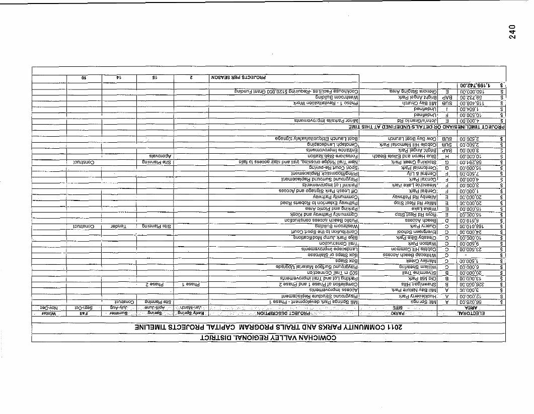
ELECTORAL AREA SERVICES COMMITTEE MEETING OF MARCH 15,201 1
DATE: March 9, 201 1
FROM: Katy Tompkins MClP Senior Planner
SUBJECT: 2010 Year End Report
Recommendation/Action: The Year End Report is submitted for information purposes only.
Relation to the Corporate Strateaic Plan: NIA
Financial Impact (Reviewed by Finance Division-
Backnround: Each year the Development Services Department compiles a Year End Report to document general trends in development applications during the year. The 2010 Year End Report is attached for your convenience. You will note that 2010 has been a busy year for the Development Sewices Department, with increases in activity in all Electoral Areas, with respect to both planning and building.
If you have any questions regarding the information provided in the Report, do not hesitate to contact the Planning and Development Department. The Year End Report is submitted to the EASC each year at this time, and is made available to the public throughout each year.
Submitted bv. I
I Reviewed by: I
Katy Tompkins MClP Senior Planner Community & Regional Planning Division Planning and Development Department
KTIca attachment
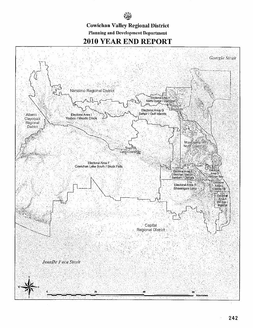
Cowichan Valley Regional District Planning and Development Department
2010 YEAR END REPORT
PART ONE: THE CVRD PLANNING AND DEVELOPMENT DEPARTMENT
1 . INTRODUCTION
This report provides statistical information respecting land use and building applications received by the Cowichan Valley Regional District Planning and Development Department during 2010. Although this document is generally limited to providing a statistical summary of applications, the Department has many additional responsibilities related to motions arising from the Electoral Area Services Committee and other committees of the Regional Board. A primary responsibility not covered in this report is to provide long range plans for the nine electoral areas. The department also provides guidance and information to assist CVRD elected officials in making sound and informed decisions. Advice is based on technical considerations or is given with the over-arching principle being protection of the community ("public") interest over the long term, while being respectful of private property owners' individual interests.
Another role of the Planning and Development Department is to help the public and private sector to access and understand past, present and future planning and development issues, policies and trends, by gathering, analyzing and reporting information. The Department responds to inquiries for information from the public, students, businesses, governments and non-profit agencies. Such requests range from basic to complex. Staff response time varies in accordance with the complexity of the inquiry received as well as the number of inquiries received at that time.
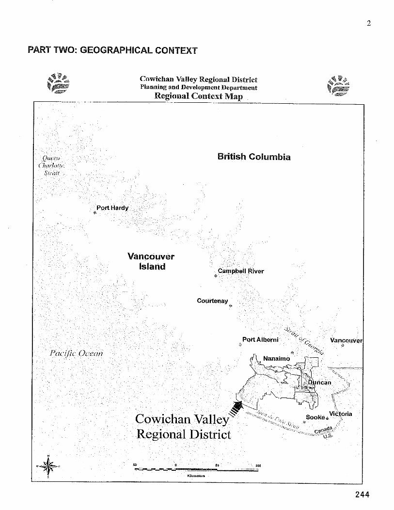
PART TWO: GEOGRBPHICAL CONTEXT
Comichan Valley Regional District Planning and Development Department
British Columbia
244
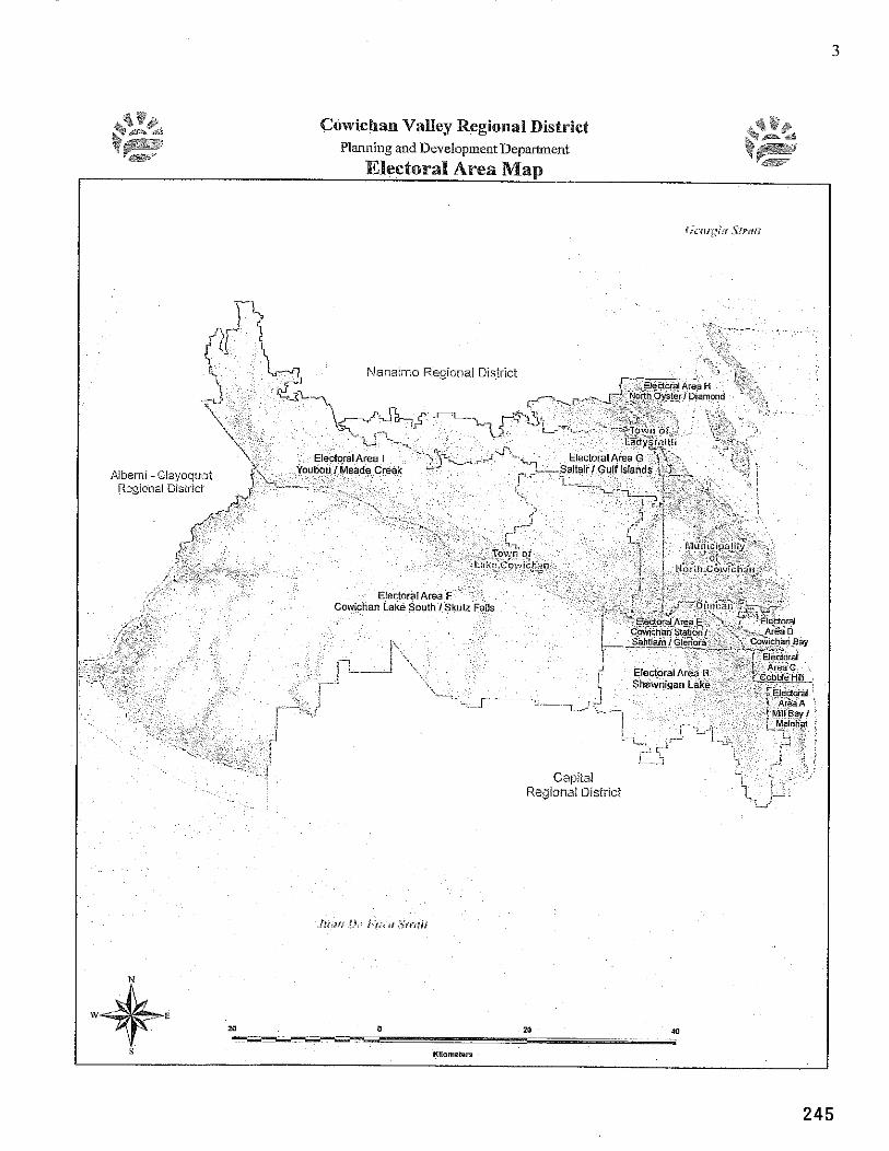
a F# +*,#a Cowiehan Valley Regional District bF P l a i ~ i i ~ ~ g atid Development Department k p F @ -sb
*JX Electoral Area Map m
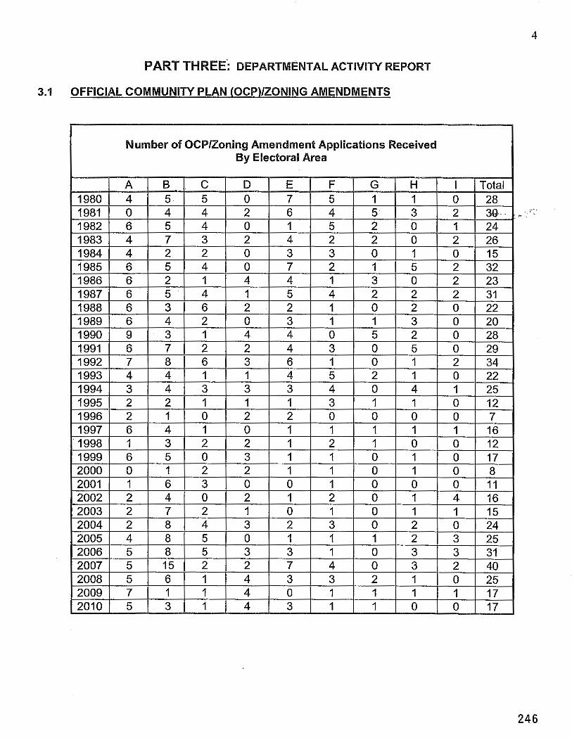
PART THREE: DEPARTMENTAL ACTIVIN REPORT
3.1 OFFICIAL COMMUNITY PLAN (0CP)IZONING AMENDMENTS
Number of OCPIZoning Amendment Applications Received By Electoral Area
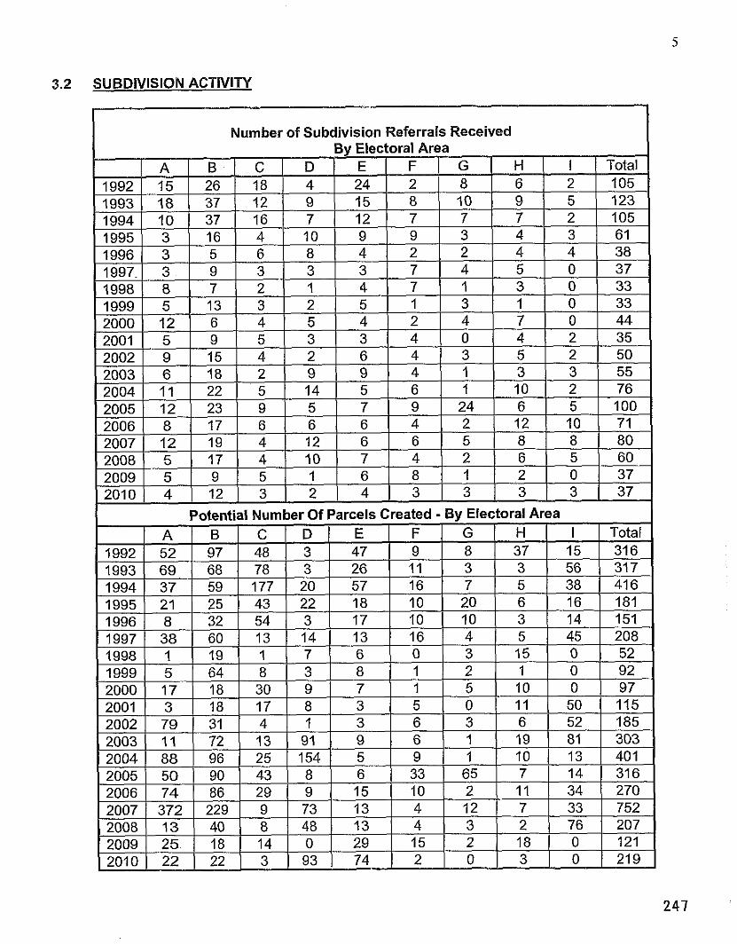
SUBDIVISION ACTIVITY
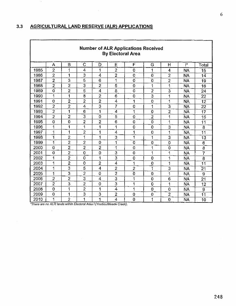
3.3 AGRICULTURAL LAND RESERVE (ALR) APPLICATIONS
Number of ALR Applications Received By Electoral Area
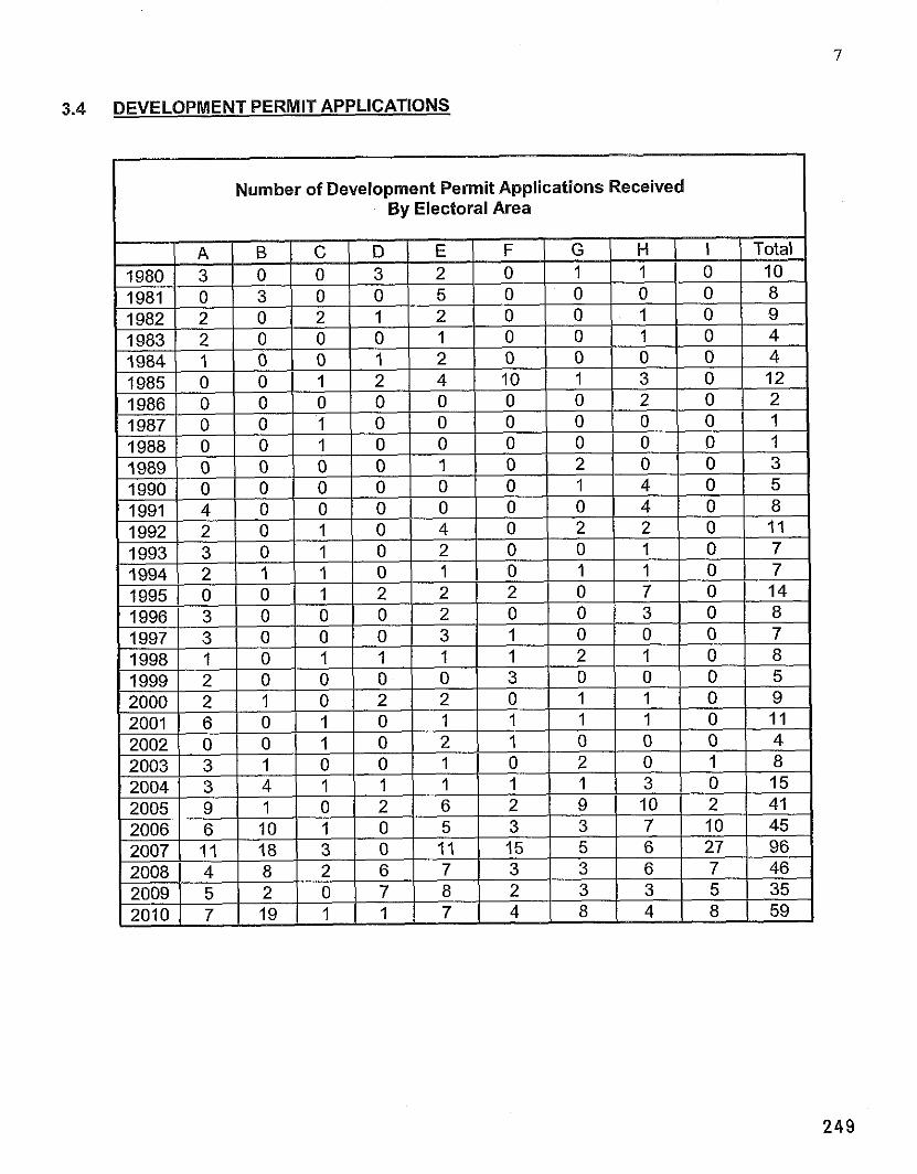
DEVELOPMENT PERMIT APPLICATIONS
Number of Development Permit Applications Received By Electoral Area
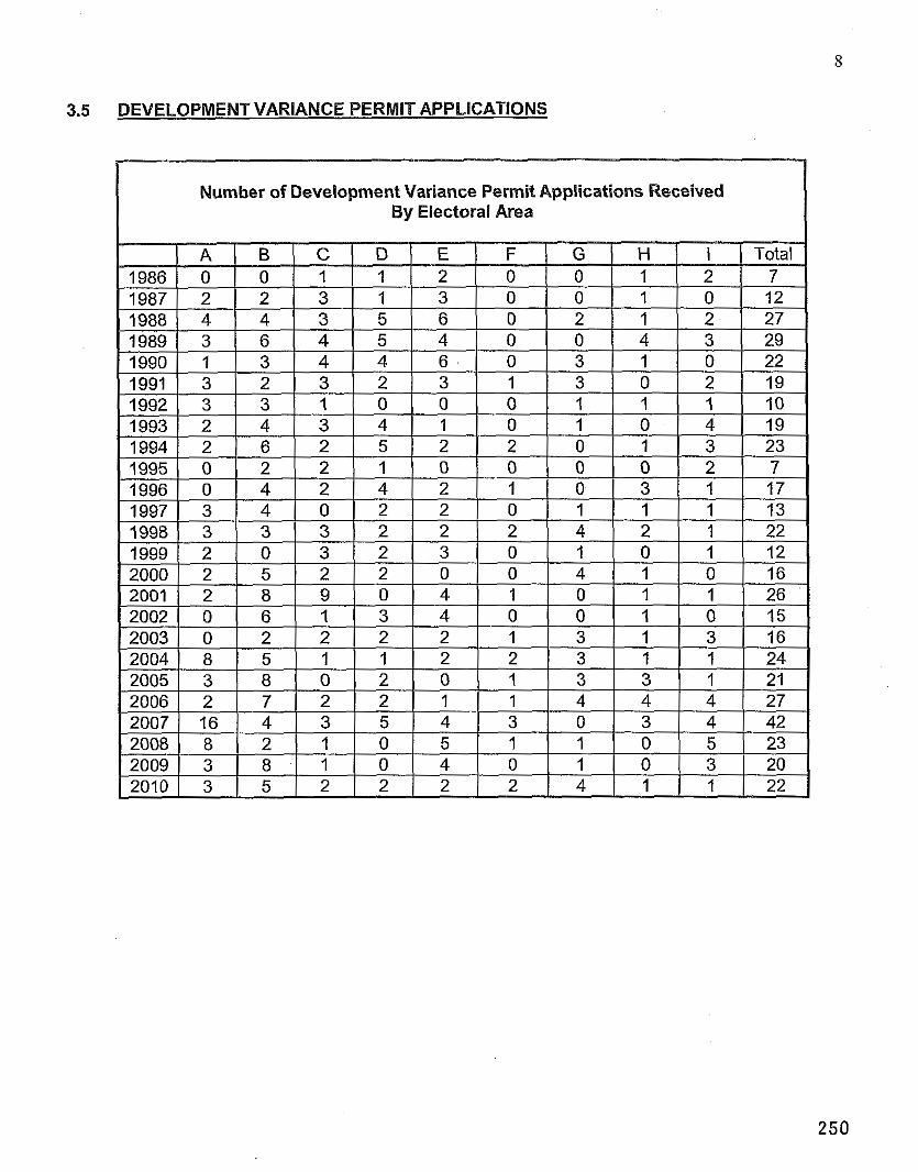
3.5 DEVELOPMENT VARIANCE PERMIT APPLICATIONS
Number of Development Variance Permit Applications Received By Electoral Area
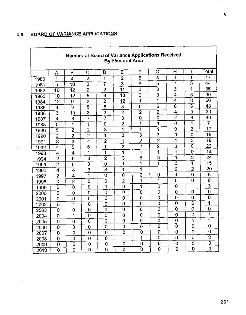
3.6 BOARD OF VARIANCE APPLICATIONS
I Number of Board of Variance Applications Received By Electoral Area
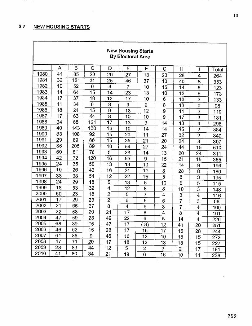
3.7 NEW HOUSING STARTS
New Housing Starts By Electoral Area
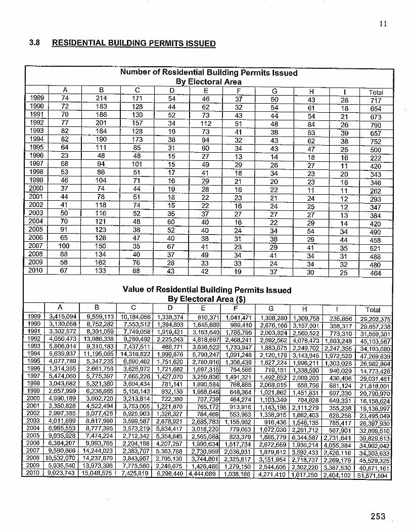
11
3.8 RESIDENTIAL BUILDING PERMITS ISSUED
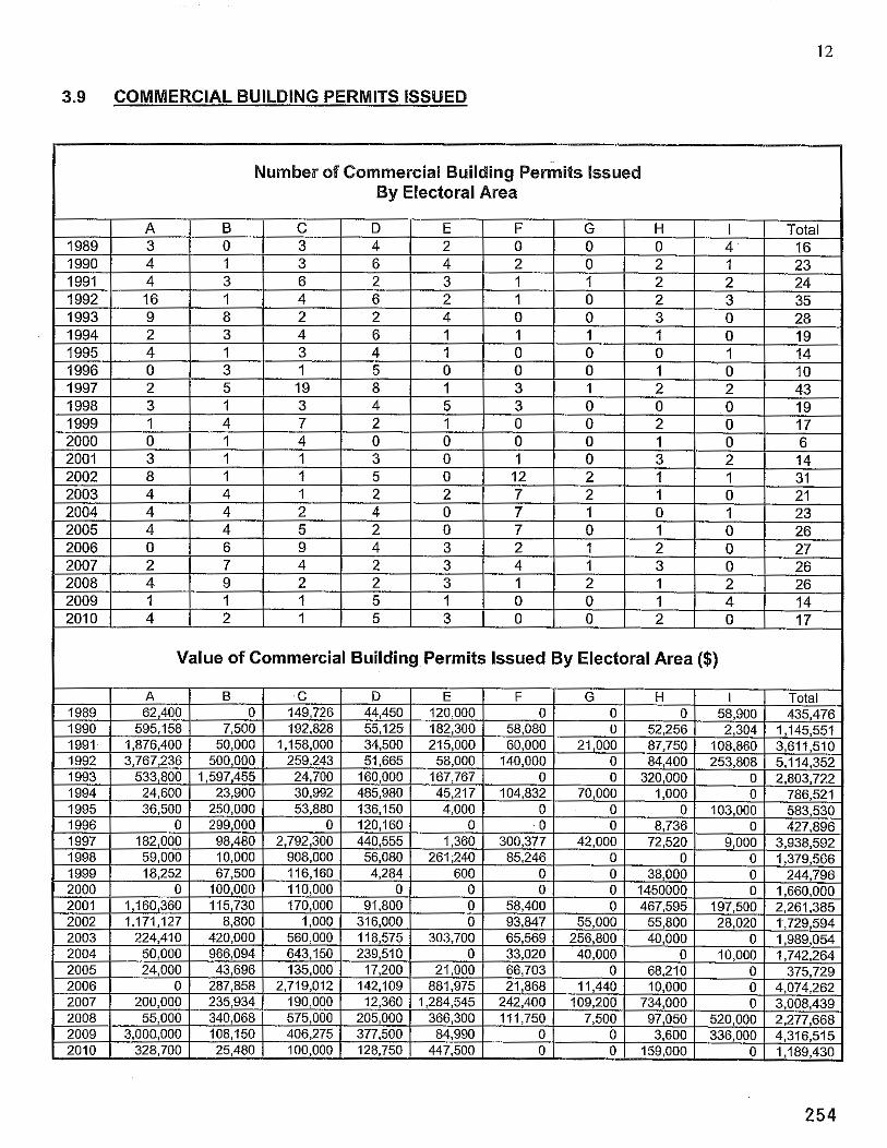
3.9 COMMERCIAL BUILDING PERMITS ISSUED
Number of Commercial Building Permits Issued By Electoral Area
I Value of Commercial Building Permits Issued By Electoral Area ($)
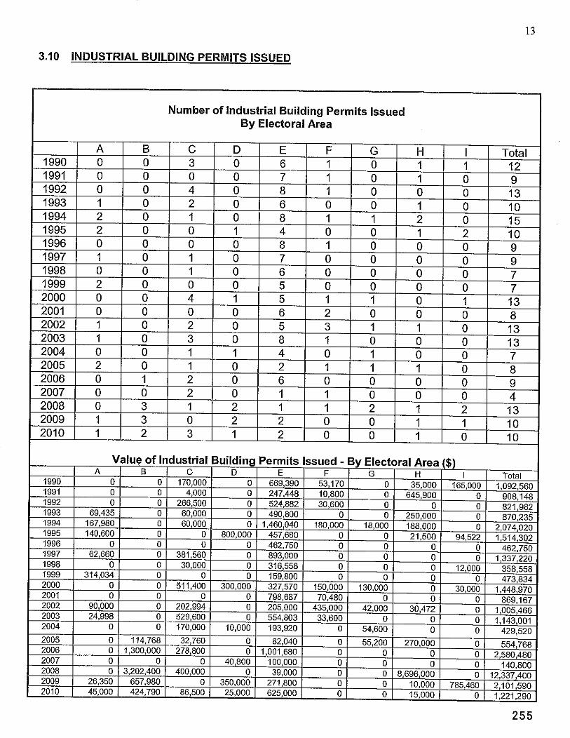
3.10 INDUSTRIAL BUILDING PERMITS ISSUED
Number of Industrial Building Permits Issued By Electoral Area
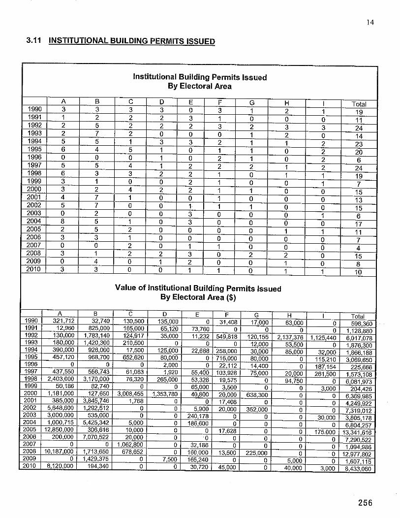
3.11 INSTITUTIONAL BUILDING PERMITS ISSUED
Institutional Building Permits Issued By Electoral Area
Value of Institutional Building Permits Issued By Electoral Area ($)
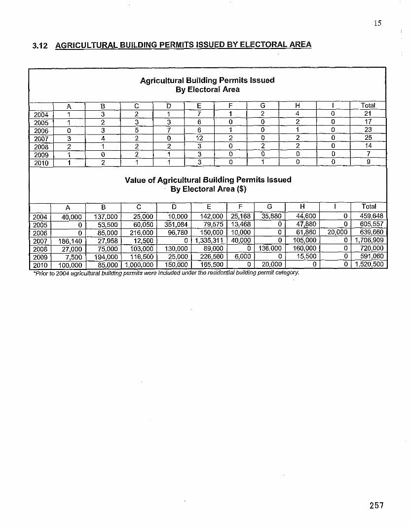
3.12 AGRICULTURAL BUILDING PERMITS ISSUED BY ELECTORAL AREA
Agricultural Building Permits Issued By Electoral Area
Value of Agricultural Building Permits Issued By Electoral Area ($)
*Prior to 2004 agricultural building permits were included under the residential building permit category.
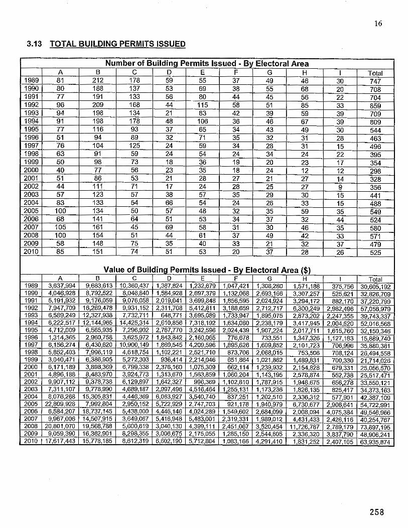
16
3.13 TOTAL BUILDING PERMITS ISSUED
DATE: March 8, 201 1
FROM: Katy Tompkins MClP Senior Planner
SUBJECT: South Cowichan Official Community Plan
Recommendation/Action: That the draft South Cowichan Official Community Plan be referred to Fisheries and Oceans Canada; Transport Canada; Cowichan Tribes; Malahat First Nations; Tsawout First Nations; Tsarrtlip First Nations; Chemainus First Nations; Paquachin Fist Nations; Agricultural Land Commission; Ministry of Community and Regional Planning - Intergovernmental Relations; Ministry of Forests and Range - Integrated Land Management Bureau; Ministry of Agriculture; Ministry of Energy and Mines; Ministry of Transportation and Infrastructure; Vancouver Island Health Authority; Ministry of Environment; Ministry of Community, Sport and Cultural Development; Land Titles and Survey Authority of BC; Capital Regional District; School District 79; Royal Canadian Mounted Police; Mill Bay Water Improvement District; Braithwaite lmprovement District; Shawnigan Lake lmprovement District; Cobble Hill lmprovement District;. Lidstech Holdings; Cowichan Bay Volunteer Fire Department; Malahat Volunteer Fire Department; Mill Bay Volunteer Fire Department; Shawnigan Lake Volunteer Fire Department; CWAV Safer Futures and Social Planning Cowichan.
Relation to the Corporate Strateaic Plan: NIA
Financial Impact: (Reviewed by Finance Division: N/A)
Background: On December 7, 2010, the Electoral Area Services Committee requested staff to provide a aeneral summarv of the Draft South Cowichan Official Communitv Plan (OCP). durincl the final public review stage of the process. This report summarizes some of the'main highlights of the OCP, and provides a brief description of the remainder of the planning process. The Draft South Cowichan OCP is attached, under separate cover, for your convenience.
As mentioned during previous EASC meetings, the South Cowichan OCP includes a main OCP document, three village plan documents, and corresponding land designation maps. The main OCP document affects the entire Plan area, and also has some land designation sections that pertain specifically to areas outside of the village containment boundaries (VCB). The three Village Plans affect lands within the Mill Bay VCB, Shawnigan Lake VCB, and Cobble Hill VCB.
Page 2
The OCP includes may provisions, too numerous to outline here, however the following list contains a few of the highlights:
1. The OCP provides a policy framework for the natural environment, the marine shoreline, the Shawnigan Lake Watershed, climate change1 energy efficiency, economic development, social sustainability, heritage conservation, village containment boundaries, transportation, community water services, liquid waste management, solid waste management, fire protection and plan implementation, and establishes land use designations for all lands within the Plan area.
2. Three village containment boundaries (VCBs) are established, for Mill Bay Village, Shawnigan Village, and Cobble Hill Village. Most future growth is anticipated in the VCBs, with some provision for growth in the rural areas as well;
3. In Shawnigan Village, the lake will have a higher profile, with the commercial area expanding toward the lake. Public lake views and access are encouraged.
4. In Cobble Hill Village, the commercial areas are expanded, and multifamily residential uses encouraged close to the commercial core area. A heritage design theme will be encouraged;
5. In Mill Bay, new policies are introduced for the Stonebridge area, a new designation is provided for multiple family developments, and more focus in placed on beach views and beach access;
6. In all three village areas, higher densities are encouraged in the commercial core areas. Single family residential areas are protected from undue impacts.
7. Streetscapinglbeautification plans are proposed for all three village areas. 8. Community amenity contributions that encourage future services, parkland and affordable
housing, are introduced to ensure the future liveability of the area. 9. 58 known heritage sites are identified and are proposed to be considered for inclusion on
the community heritage register. 10. In most cases the issuance of development permits will be dependent on the eradication or
management of invasive, non-native weeds, such as Scotch Broom and Scotch Gorse, as they are declared both unsightly and a threat to the natural environment.
11. A Marine Conservation Designation is introduced, and development permit guidelines are introduced.
12. The Shawnigan Lake watershed is provided a greater level of protection; 13. For agricultural lands, a development permit area is proposed to mitigate impacts of non-
farm uses. 14. A new institutional zone is proposed to include affordable housing opportunities in
Shawnigan Village and Cobble Hill Village. 15. Wildfire interface development permit: area guidelines are proposed for the rural area. 16. Development permit guidelines include protection of wildlife trees.
The Draft OCP has been prepared through a collaborative community effort which involved a broad cross section of South Cowichan residents, business owners, agencies and stakeholders. In particular, the Plan would not have been possible without the hard work and dedication of the South Cowichan OCP Steering Committee members, listed below:
June Laraman, Chair Brent Beach Geoff Johnson Rod Macintosh Ken Waldron Sarah Mallerby Archie Staats Jerry Tomljenovic Roger Burgess Rod de Paiva Mike Hanson Rosemary Allen Sarah Middleton John Clark John Krug
Brenda Krug Al Cavanagh Dave Thomson Bob Brooke Janice Hiles Larry George Roger Painter
The Steering Committee has requested that the Draft OCP be submitted for public review. A series of open houses have been scheduled, as follows:
March 17.2011: Mill Bay Community League Hall, 4-7 pm March 19.2011: Mill Bay Community League Hall, 10 am -2 pm March 22.2011: Shawnigan Lake Community Centre Gym, 4-7 pm March 24, 2011: Mill Bay Community League Hall, 4-7 pm
e March 26,2011: Mill Bay Community League Hall, 10 am -2 pm March 31. 2011: Cobble Hill Hall, 4-7 pm
0 April 2,2011: Shawnigan Lake Community Centre Gym, 10 am - 2 pm
The open houses will include a graphic presentation, primarily composed of posters and other written material, and will include a questionnaire component. The questionnaire will also be placed on the CVRD website, for the convenience of residents and stakeholders who are unable or do not wish to attend the open houses.
Further, although collaboration with external agencies has occurred throughout the process, a formal referral process should include the following local, provincial and federal agencies:
Fisheries and Oceans Canada Transport Canada Cowichan Tribes Malahat First Nations Tsawout First Nations Tsarrtlip First Nations Chemainus First Nation Paquachin Fist Nations Agricultural Land Commission Ministry of Community and Regional Planning - Intergovernmental Relations Ministry of Forests and Range - Integrated Land Management Bureau Ministry of Agriculture Ministry of Energy and Mines Ministry of Transportation and Infrastructure Vancouver Island Health Authority Ministry of Environment Ministry of Community, Sport and Cultural Development Land Titles and Survey Authority of BC

Page 4
Capital Regional District School District 79 Royal Canadian Mounted Police Mill Bay Water lmprovement District Braithwaite lmprovement District Shawnigan Lake lmprovement District Cobble Hill lmprovement District Lidstech Holdings Cowichan Bay Volunteer Fire Department Malahat Volunteer Fire Department Mill Bay Volunteer Fire Department Shawnigan Lake Volunteer Fire Department CWAV Safer Futures Social Planning Cowichan
The agencies will be requested to provide comments by April 8, 201 1. Following the open houses and the agency referral process, the Steering Committee will meet to review public and agency input, and will consider potential amendments to the draft OCP. The Plan will then be forwarded to the Electoral Area Services Committee for consideration.
The remaining components of the planning process include:
Summary of open houses; Completion of agency referral process; South Cowichan OCP Steering Committee Meeting Electoral Area Services Committee (to prepare bylaws, hearing delegation) Preparation of Bylaw First and Second Readings Public Hearing Third Reading Final Adoption
Submitted by,
Katy Tompkins MClP Senior Planner Community & Regional Planning Division Planning and Development Department
Reviewed by:
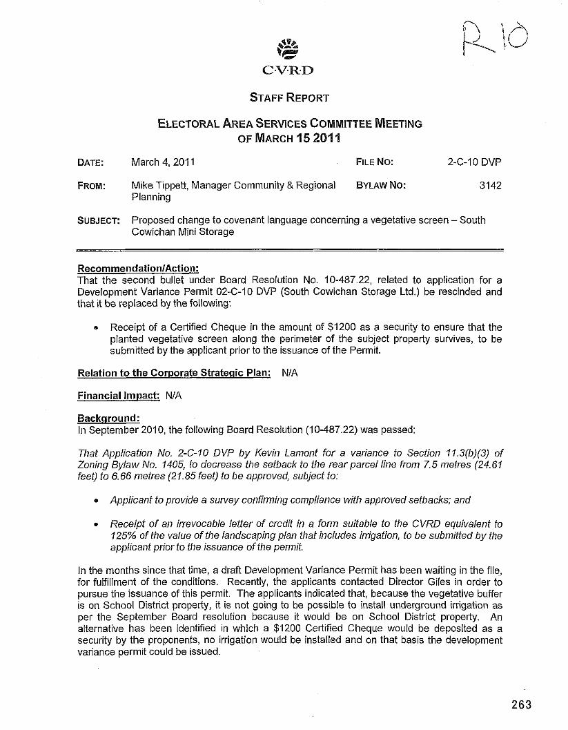
DATE: March 4, 201 I FILE NO: 2-C-I0 DVP
FROM: Mike Tippett, Manager Community & Regional BYLAW NO: 3142 Planning
SUBJECT: Proposed change to covenant language concerning a vegetative screen - South Cowichan Mini Storage
RecommendationlAction: That the second bullet under Board Resolution No. 10-487.22, related to application for a Development Variance Permit 02-C-10 DVP (South Cowichan Storage Ltd.) be rescinded and that it be replaced by the following:
e Receipt of a Certified Cheque in the amount of $1200 as a security to ensure that the planted vegetative screen along the perimeter of the subject property survives, to be submitted by the applicant prior to the issuance of the Permit.
Relation to the Corporate Strategic Plan: NIA
Financial Impact: NIA
Backaround: In September 2010, the following Board Resolution (10-487.22) was passed:
That Application No. 2-GI0 DVP by Kevin Lamont for a variance to Section 11.3(b)(3) of Zoning Bylaw No. 1405, to decrease the setback to the rear parcel line from 7.5 metres (24.61 feet) to 6.66 metres (21.85 feet) to be approved, subject to:
0 Applicant to provide a survey confirming compliance with approved setbacks; and
Receipt of an irrevocable letter of credit in a form suitable to the CVRD equivalent to 125% of the value of the landscaping plan that includes irrigation, to be submitted by the applicant prior to the issuance of the permit.
In the months since that time, a draft Development Variance Permit has been waiting in the file, for fulfillment of the conditions. Recently, the applicants contacted Director Giles in order to pursue the issuance of this permit. The applicants indicated that, because the vegetative buffer is on School District property, it is not going to be possible to install underground irrigation as per the September Board resolution because it would be on School District property. An alternative has been identified in which a $1200 Certified Cheque would be deposited as a security by the proponents, no irrigation would be installed and on that basis the development variance permit could be issued.
This proposal seems to resolve a difficult problem with respect to the conditions that were originally attached to the resolution, and would provide protection, through the $1200 security, that the vegetative screen could be maintained should some of the trees die in the absence of permanent irrigation.
Submitted by,
/
i
Mike Tippe
community and Regional Planning Division
MT/ca
! > C O W I c l w v VALLEY REGIONAL DISTRICT L.- \
Grantee: Grant Amount $ 3 58. L@
Contact Phone No:
PURPOSE OF GRANT: d-C/J l l l l ~ l $ I ' J 2 6 8 1 . p & D ~ r f l ~ d . - --
REQUESTED BY: . Director Requesting Grqt
~proval at Regional Board Meeting of ~ . . ...
T.GIL BUNCH CENTRE
Mr. Brian Harrison, Director, Electoral Area A Cowichan Valley Regional District 175 Ingram Street, Duncan, B.C. V9L IN8
Dear Brian:
Your support over the years for Bard@Brentwood is most appreciated. It has helped us to continue with our stated objective of providing arts and theatrical culture to our area in the Cowichan Valley.
We are all aware of the enormous pressure for support being placed on all agencies and organizations in these most stressful economic times.
Last year's production received no support £ram Direct Access Program Grant through the provincial government Lotteries Commission. This presented us with a significant challenge. We are pleased to advise that we managed to make it through thanks to a good amdance participation.
We are hopefid that your generous support in the past will be able to be continued through the CVRD Grant - In Aid program.
Our production this year will be the highly acclaimed "Inherit The Wind" directed by Gregg Perry with shows July 7,8,9,14,15 and 16.
Should you have any questions please do not hesitate to contact me:
Rod Pearce, Chair of Board 250-743-0760
8 , .
COWICEUN VALLEY REGIONAL DISTRICT 11. ! 1 i., .I..
SUBMISSION FOE A GRANT-lT?&AID @LECTOIIAI, AREAS) r,ilh~ - ..( .. I '
Grantee: -Grant Amount $ d?. 80 0
. .
B!d.~a$ 263
Contact Phone No:
PURPOSE OF GRANT:
. .~
REQUESTED BY:
ACach to letter h
lproval at. Regional Board Meeting of
. ~
> L. .Finance Authorization
~WaUi&oRMSbt-&aid f o m D e ~ 1 wO5.nf
Mill Baymalahat Historical Society P.O. Box 263
Mia1 Bay, B.C. VOR %PO .... m . . . . . . . . . . . . . . . m m m ~ ~ ~ ~ ~ . m ~ . ~ ~ n ~ ~ . m ~ ~ m m . . . ~ ~ . . m m . m . m . ~ . ~ m . m . . m m . . . . . . ~ . ~
November 24,2010 Director Brian Harrison Area A, Mill Bay, B.C.
Dear Brian,
As you are aware the alternate approval process proposed for MBMHS funding was defeated. This was a crushing blow for all our members and we are appealing to you for a grant-in-aid of $10,000 for 201 1 to allow us to continue our work.
The Mill BayMalahat Historical Society is committed to stimulating a greater appreciation of local history by collecting, preserving and presenting the history of Mill Bay and the Malahat. It is vitally important, not only for newcomers and tourists, but also for long time residents, that important archives, artifacts and historic sites are not only documented but maintained for future generations.
Thanks to last year's $10,000 grant-in-aid the MBMHS was able to open a museum in Pioneer Center, where we are currently cataloguing hundreds of artifacts and archives. Dozens of community groups have benefited &om our historical presentations and displays and all ages enjoyed the Seeds and Salt historical theatre performances that brought local history to life. We would like to host this highly successful theatre production in 201 1 and expand the event to include local musicians. This would involve local businesses as well and be promoted as Pioneer Days.
As Mill Bay does not have records of its veterans or a cenotaph, one of our projects for 2011 is the placing of crosses on graves in the area's cemeteries and commissioning a commemorative veteran's plaque. We are also currently working with the South Cowichan Chamber of Commerce, Cowichan Press, Cowichan Bay Maritime Society and the Shawnigan Museum to create a driving map showing the various historical sites in the area.
All of these projects develop pride in our community, and give visitors an incentive to stay longer in the area instead ofjust passing through.
Membership in the MBMHS has more than doubled in the last month and many more worthy projects have been suggested, so it is evident our efforts to raise public awareness and appreciation of this area's past have been successful and of benefit to the community.
Thank you for your consideration of this request and we look forward to hearing from you in the near future.
Yours very truly, Maureen Alexander MMIWS President Registered Society #54825 Charity # BN 812212827
C2V.R.D
COWICEAN VALLEY REGIONAL DISTRICT
SUBMISSION FOR A GRAWT-IN-MD (ELECTORAL AREAS) : --,, , ,; G
,. l .~l<~.:&LI~:i. l bi;: T ),-.L>8 !.~?epakyi~,{$!;ii
Submitted by Director RE y h e a
Grantee: Grant Amount $ .TD~ ' a
NAME:
ADDRESS: , Yf/y /d/ (//%kU- 57 /' zou / g r .
Contact Phone No: 2 50 - qd - 3 ~6 B-r- Z& - ?0&3 F
PURPOSEOFGRANT: 4 S / C & ~
+ Y &/A L'
REQUESTED BY:
FOR FINANCE USE ONLY
BUDGET APPROVAL Mail to above address:
Attach to letter from
Approval at Regional Board Meeting of
Finance Authorization =:\Orant inAi6lGrantin-AidFom 2OlO.m'
2 6 9
!dXi%Yi%:ST EOUSE feed ba& S%%ea h Need W e are ?&"ere t@ Lend a Emd
February 21, 2011
Mr Mel Dorey, Regional Representative, Area G, CVRD, 11095 Valdon Road, Ladysmith, BC V9G 122
Dear Mel:
Chemainus Harvest House Food Bank has experienced an increase of about 15% in the number of people requiring assistance in the past year. We have been forced to reduce the quantity of items provided and foresee a problem maintaining what is considered basic food requirements.The Harvest House directors are reviewing all expenditures and are making every effort to cut costs. We would greatly appreciate any assistance in the form of a Grant-in-Aid from the CVRD.
Harvest ~ 6 u s e . Food SankWas started in 200? and wgs re$stered as a nbnprofit society on April 16/02. Harvest House serves over 225 people each week manjlof whom are children. We do not have any paid staff and do not receive Provincial or Federal funding. Harvest House covers the areas of Crofton, Westholme, Chemainus, Saltair, Penelakut and Thetis Islands. We operate with approximately 25 volunteers who work on monday, thursday And friday of each week. Distributions are on friday in Chemainus and monday in Crofton to insure those in need can receive help.
Sincerely, " -
I 'I . . . i , ".> *.,>& ..- Dennis R Plante, Secretary
COWICHAN VALLEY REGIONAL DISTRICT i
c I- i, I r
SUBMSSION FOR A GWT-IN-AID (ELECTORAL AREAS) "'!flaocia! $f;ivi ci2,;. .:.
Area 2%- " ~ . > ?.:::r >.,;... . .-,,. Submitted by Director ~ ,. :,ti:: :
Grant Amount $ 5 ia"
Contact Phone No:
PURPOSE OF GRANT:
REQUESTED BY:
FOR FINANCE USE ONLY
BUDGET APPROVAL Mail to above address:
Attach to letter from
Approval at Regional Board Meeting of
Finance Authorization Z\Grui mAid\Granf in-Aid Form 2010 nf
Cowickan Seniors Cornmui?ity Foundation
135 Third St., Duncan, B.C. V9L l R 9 Tel: (250) 715-6481
[email protected] ~w~ .~~w ichansen io rs . ca
February 2, 2013.
Director Ken Cossey, CVRD Electoral Area B - Shawnigan Lake
Cowichan Valley Regional District,
175 ingram Street,
Duncan, BC V9L 1N8
Dear Ken,
RE: GRANT-IN-AID
Last year, the CVRD Directors in each electoral district were asked by the Cowichan Seniors Community
Foundation for assistance in the form of a Grant-In-Aid of $500.00 each that would help off-set the costs
in staging a major funding raising event, The Great Cowichan Caper, Sunday, June bfh. The Foundation
received $1,500.00 from Electoral Areas B,C and D. The Cowichan Seniors Community Foundation is
very grateful for your support in this regard.
The Great Cowichan Caper was a success and will be repeated this year, only with some important
changes to the venue and market audience. We were able to contribute $20,000.00 (not all raised at this
single event) to three most deserving community projects that benefit seniors here in Cowichan. This
year we are staging a Grand Family Day at the BC Forest Discovery Centre on Sunday, June !jth. This is a
partnering event with net profits being shared by these two organizations to support their respective
community projects. Admission will be free, with tickets being sold for rides, activities and "contests".
The expected attendance is between 1000 - 2000 visitors. Since admission is free, no one will be left out
due to financial circumstances. Enclosed is an overview of this fun family day and our projected costs
and revenues. The Cowichan Seniors Community Foundation will, once again, award another $20,000.00
to the successful candidate applying for the Seniors Community Fund.
We are again asking you to consider helping us with a grant to off-set this year's staging costs; $500.00
per electoral area. A recent letter that our Foundation endorsed for the City of Duncan in application for
funds to build an enhanced transit infrastructure, stated that over half the residents in the Cowichan
Valley are, or will soon be, over the age of 55. Our Foundation is aggressively trying to build capacity for
a community where aging in place may happen with the best possible programs and services available
locally.
Currently we are the umbrella for Meals On Wheels here, publish a very popular Seniors Guidance
Directory offered in hard copy and on line free of charge to the public, and participate in as many
community planning activities as possible. We support other agencies that have a senior constituency.
We have representation on the Cowichan Community Heaith Network, the Working Group for Cowichan
Lodge Re-Development, Community Futures and various business groups and service clubs.
Our events are run by a network of capable volunteers without whose help raising these funds would
not be possible.
Thank you for your time and consideration re: a request for a grant-in-aid.
Sincerely,
Carol Hunt, Executive Director
Cowichan Seniors Community Foundation
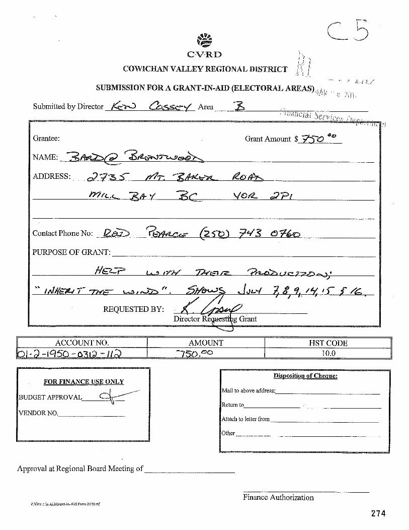
C.V.33.D i i \., / i ! VALLEY REGIONAL DISTRICT ? \ I~
I I , I ....
' .' L d p.,,7 SUBMSSION FOR A GRANT-IN-AD (ELECTORAL AREAS),: .I/!// - , <; : 1 ; . , j ;
Submitted by Director Area
P
Grantee: Grant Amount $ h-0
Contact Phone No:
PURPOSE OF GRANT:
REQUESTED BY:
FOR FINANCE USE ONLY
VENDOR NO.
Mail to above address:
Attach to letter *om
Approval at Regional Board Meeting of
Finance Authorization Z:\Grant in AiGiGranf-in-AidFom2010nf
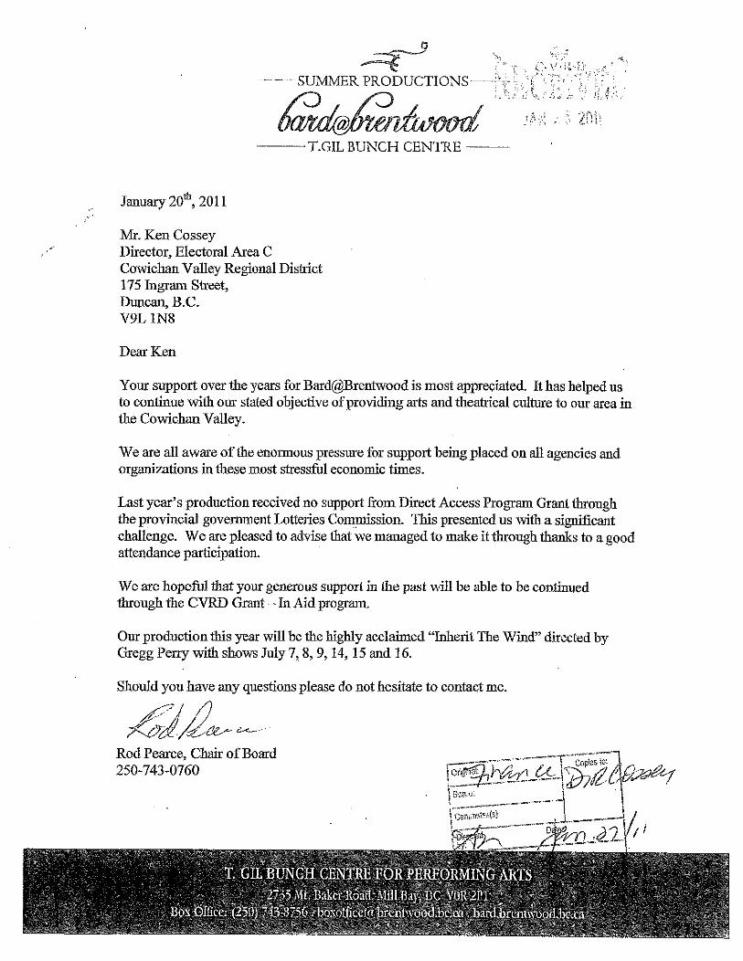
p~ SUMMER PRODUCTIONS-
T.GIL BUNCH CENTRE ---
January 2ofh, 201 1
Mr. Ken Cossey Director, Electoral Area C Cowichan Valley Regional District 175 Ingram Street, Duncan, B.C. V9L 1N8
Dear Ken
Your support over the years for Bard@Brentwood is most appreciated. It has helped us to continue with our stated obiective of providing arts and theatrical culture to our area in - - the Cowichan Valley.
We are all aware of the enormous pressure for support being placed on all agencies and organizations in these most stressful economic times.
Last year's production received no support from Direct Access Program Grant through the provincial government Lotteries Cowssion. This presented us with a significant challenge. We are pleased to advise that we managed to make it through thanks to a good attendance participation.
We are hopeful that your generous support in the past will be able to be continued through the CVRD Grant - In Aid program.
Our production this year will be the highly acclaimed "Inherit The Wind" directed by Gregg Perry with shows July 7,8,9,14,15 and 16.
Should you have any questions pIease do not hesitate to contact me.
Rod Peace, Chair of Board 250-743-0760
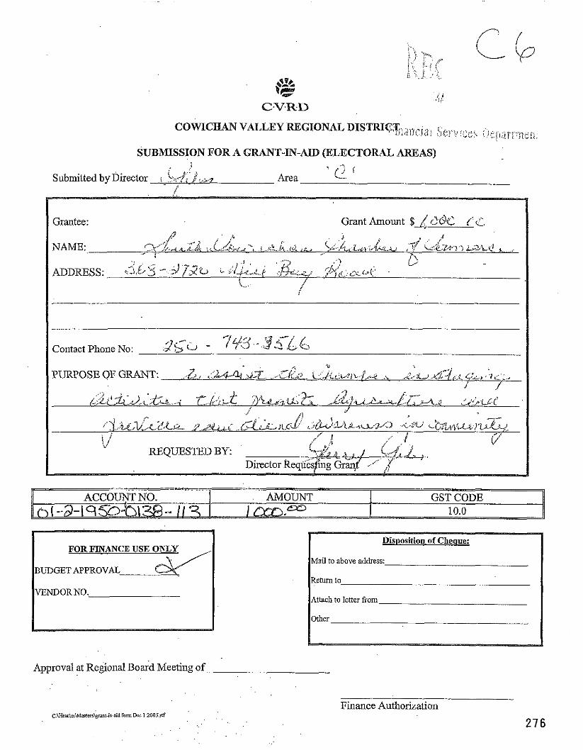
SUBMISSION FOR A GRANT-IN-AID (ELECTORAL AREAS) ! , -; L, 4.: ., Q I
Submitted by Director i . . , r .F .*:~.7 Area ,/
Grantee: Grant Amount $ 4 ( 2 C%2 l'. 4 . i a - ,
. i " 1
NAME: . . ~ :., 2' -3,,:4-tA,~,,.i4 ,~~.L.:;&..L.d -> .;.,,e:.,i, .,d &-,, 5 ~ : . d ~ : ~ ~ ~ , ~ , l ~ . , ~ ., ,, ~.=<cz.i.>.-~ ~ a ~ k ! .... A.
i , . ! . , , '? jt"
ii ADDRESS: 6 . b i . ' !di-&..q l.c$s.: **?.,$ :>$\f &,. , C.L - i u (.'
?? t.", ~ {
Contact Phone No: I ,' 2
,., ! . ' . r",& " -..- ~,.-~L~d~>-<,..L!~..~- ,,p.i&L.c , , .LC[~%~ JL,c*< ,&i buL2-0 -<,dG ~ . ~ ~ f ~ e , . ~ ; & T l ~ ~ , . ~ q ,
i i ... j :J i , 6'
REQUESTED BY. Director ~ ~ ~ i i & & e &&( ,.,'.."
BUDGET APPRO Mail to above address:
Attach to letter earn
Approval at Regional Board Meeting of
Finance Authorization ~ : ~ a & i r i ~ m t w i ~ t & . i d form~*r 1 ZOOS.^^ . .
.. .
Member of
6
February 3, 201 1
CVRD 175 lngram Street Duncan. BC V9L IN8
ATTENTION: Gerry Giles, Area Director, Cobble Hill Ken Cossey, Area Director, Shawnigan Lake Brian Harrison, Area Director, Mill Bay
RE: Grants in Aid
The South Cowichan Chamber of Commerce would like to apply for an on-going grant for permanent funding for Districts A, B and C. These areas cover our Chamber's business districts, Shawnigan Lake, Cobble Hill and Mill Bay.
Our Chamber's mandate is to strengthen business and community in the South Cowichan Valley. In order to achieve our mandate, we need funding and support from CVRD through the Grants in Aid program.
We are applying for $15,000. Some of our on-going projects and future projects are as follows:
e Signage for Cobble Hill, Mill Bay, Shawnigan Lake, Top of the Malahat
e New Visitors Information Centre
e Community Cafe - Business and public meetings to discuss issues and concerns of the South Cowichan Valley
I have enclosed a copy of our By-Laws, and Mission Statement along with our present Board Members.
For more information please call the Chamber Manger, Rosalie Power at 250-743- 3566 or email [email protected]
I am looking forward to your reply and meeting with you to discuss this request.
Mike Hanson, President
250-743-3566 (ph) 368 - 2720 Mill Bay Road 250-743-5332 (fax) Mill Bay BC VOR 2P1
Meeting of the Area E Advisory Planning Commission (APC)
January 13,201 1
Members Present: Dan Ferguson Coleen MacGregor Ben Marrs Frank McCorkell David Tattam ~ e i t h Williams
Also present: David and Ula Coulson, Applicants; Director Loren Duncan, Rachelle ~ o r e a u . CVRD Planner I
1-E-10 R S Urban Edge Properties Site Visit and Application Review
Members convened at the site at 4 9 0 pm t o conduct a site visit, followed by a discussion of the application.
A site visit was conducted on the subject property, 5241 Koksilah Road. Mr. Coulson toured APC members around the site describing the following:
0 History o f the site and buildings, Vision of the site for mixed-use and affordable housing; - Drainage right-of-way on the south side;
0 Riparian area on the east side; 0 Description of adjacent land uses; 0 Overview of the restoration and improvement to al l buildings including the McLay heritage
house.
The meeting re-convened inside the heritage house.
Nominations of Chair: Frank McCorkell was nominated and elected as Chair o f the APC,
Mr. Coulson indicated that the concept for this development, Urban Edge Properties, was inspired by European and international model communities/neighbourhoods, and significant resources have been put into preserving and renovating the heritage building suggesting that this should be seen as a community amenity. He also introduced the concept of a "woonerf", which is a multi-purpose, traffic calmingtype of road used t o encourage pedestrian and cycle use. The new cabins/single family dwellings are proposed to be approximately 650 sq. ft. He would like to see some commercial/institutional zoning applied to the heritage house to allow for non-residential uses such as consultant offices, health clinic, or educational facility. He would like t o see it leased for one tenant only and not multiple.
There was discussion regarding the location o f a proposed pathway. Director Duncan introduced the idea o f a trail corridor that would be dedicated t o the CVRD along the west and north property lines. The
applicant presented his proposal for trail(s) through the property, which would connect to the woonerf. It was advised that the Parks Commission and CVRD Parks Department will also be reviewing and making recommendations on this application.
No concerns were expressed regarding the proposed residential density on the lot. There was discussion regarding the proposed uses and that some of the uses as presented would allow more intensive industrial activity than the applicant intends. It was suggested that no business activitylwork activity should be allowed outdoors, and that more work is required t o fine tune the proposed uses.
Recommendation: APC agrees with the density and overall'concept of the proposal, however the proposed uses require more refining t o better reflect the small scale nature o f the proposed commercial and industrial uses. The APC would like to review the revised list of proposed uses.
Adjourned 6:40 pm
Meeting resumed at the Glenora Hall at 720 for application 3-E-10 RS (Wandering U Inc.)
Present: Dan Ferguson, Coleen MacGregor, Ben Marrs, Frank McCorkell, David Tattam, Keith Williams, Director Loren Duncan, Rachelle Moreau (CVRD staff)
Applicants: Roger Morgan and Rob Roycroft
Absent: David Coulson
Mr. Roycroft presented the application indicating that the business world is evolving, and that the agricultural implement industry needs t o be able t o carry different product lines than strictly agricultural equipment. The existing zoning on the property is too narrow, and is preventing the current tenant from offering different products. There are a number of different possible product lines that the current tenant John Deere can't offer as a result o f the restrictions on the zoning.
Potential products include weedwackers, lawnmowers, excavation equipment, and exercise equipment. Anything that is offered as another line o f products but associated with the principle tenant, and agricultural equipment is a potential.
APC members support agricultural business, but were concerned that permitting "equipment repair, sales, storage and rental" would allow an undesirable amount o f retail activity, and were concerned about the types o f products that would be for sale. Form and character of the business is also very important because of the location along the Trans Canada Highway.
Mr. Roycroft indicated that the size of the operation is limited by size of the site, there are no proposed changes t o the building, and that they have been good business stewards.
Recommendation: It was recommended that the application be approved with the revised wording, "equipment, repair, soles and rental accessory to the prime tenant."The prime tenant, or principle use, would still remain as "agricultural equipment manufacture, repair, storage and accessory retail and wholesale sales".
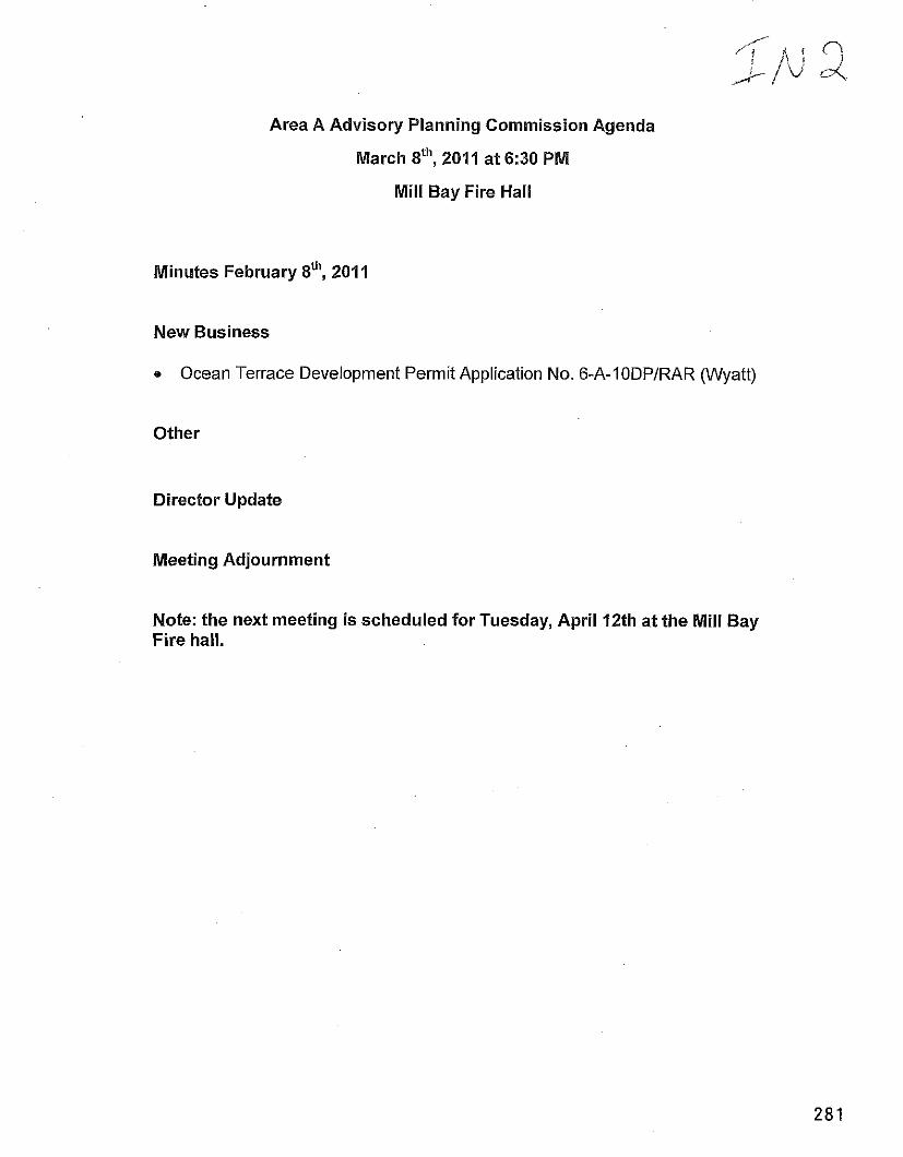
Area A Advisory Planning Commission Agenda
March Sth, 2011 at 6:30 PM
Mill Bay Fire Hall
Minutes February Sth, 2014
New Business
Ocean Terrace Development Permit Application No. 6-A-IODPIRAR (Wyatt)
Other
Director Update
Meeting Adjournment
Note: the next meeting is scheduled for Tuesday, April 12th at the Mill Bay Fire hall.
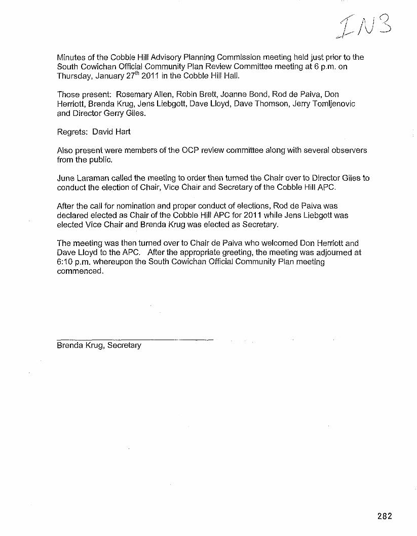
Minutes of the Cobble Hill Advisory Planning Commission meeting held just prior to the South Cowichan Official Community Plan Review Committee meeting at 6 p.m. on Thursday, January 27" 201 1 in the Cobble Hill Hall.
Those present: Rosemary Allen, Robin Brett, Joanne Bond, Rod de Paiva, Don Herriott, Brenda Krug, Jens Liebgott, Dave Lloyd, Dave Thomson, Jerry Tomljenovic and Director Gerry Giles.
Regrets: David Hart
Also present were members of the OCP review committee along with several observers from the public.
June Laraman called the meeting to order then turned the Chair over to Director Giles to conduct the election of Chair, Vice Chair and Secretary of the Cobble Hill APC.
After the call for nomination and proper conduct of elections, Rod de Paiva was declared elected as Chair of the Cobble Hill APC for 201 1 while Jens Liebgott was elected Vice Chair and Brenda Krug was elected as Secretary.
The meeting was then turned over to Chair de Paiva who welcomed Don Herriott and Dave Lloyd to the APC. After the appropriate greeting, the meeting was adjourned at 6:10 p.m. whereupon the South Cowichan Official Community Plan meeting commenced.
Brenda Krug, Secretary
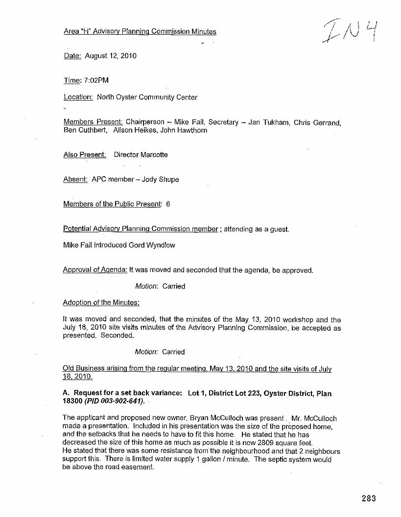
Area "H" Advisory Planninq Commission Minutes
Date: August 12,2010
Time: 7:02PM
Location: North Oyster Community Center
Members Present: Chairperson - Mike Fall, Secretary - Jan Tukham, Chris Gerrand, Ben Cuthbert, Alison Heikes, John Hawthorn
Also Present: Director Marcotte
Absent: APC member - Jody Shupe
Members of the Public Present: 6
Potential Advisory Planninq Commission member ; attending as a guest
Mike Fall introduced Gord Wyndlow
Approval of Aqenda: It was moved and seconded that the agenda, be approved.
Motion: Carried
Adoption of the Minutes:
It was moved and seconded, that the minutes of the May 13, 2010 workshop and the July 18, 2010 site visits minutes of the Advisory Planning Commission, be accepted as presented. Seconded.
Motion: Carried
Old Business arisinq from the reqular meetinq. Mav 13, 2010 and the site visits of July 18, 2010.
A. Request for a set back variance: Lot 1, District Lot 223, Oyster District, Plan 18300 (PID 003-902-641).
The applicant and proposed new owner, Bryan McCulloch was present. Mr. McCulloch made a presentation. Included in his presentation was the size of the proposed home, and the setbacks that he needs to have to fit this home. He stated that he has decreased the size of this home as much as possible it is now 2809 square feet. He stated that there was some resistance from the neighbourhood and that 2 neighbours support this. There is limited water supply 1 gallon 1 minute. The septic system would be above the road easement.
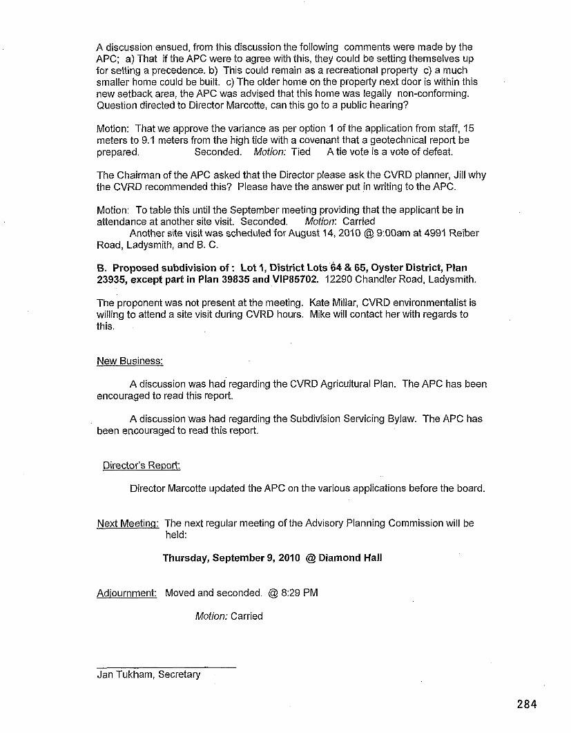
A discussion ensued, from this discussion the following comments were made by the APC; a) That if the APC were to agree with this, they could be setting themselves up for setting a precedence. b) This could remain as a recreational property c) a much smaller home could be built. c) The older home on the property next door is within this new setback area, the APC was advised that this home was legally non-conforming. Question directed to Director Marcotte, can this go to a public hearing?
Motion: That we approve the variance as per option 1 of the application from staff, 15 meters to 9.1 meters from the high tide with a covenant that a geotechnical report be prepared. Seconded. Motion: Tied A tie vote is a vote of defeat.
The Chairman of the APC asked that the Director please ask the CVRD planner, Jill why the CVRD recommended this? Please have the answer put in writing to the APC.
Motion: To table this until the September meeting providing that the applicant be in attendance at another site visit. Seconded. Motion: Carried
Another site visit was scheduled for August 14, 2010 @ 9:OOam at 4991 Reiber Road, Ladysmith, and B. C.
B. Proposed subdivision of : Lot 1, District Lots 64 & 65, Oyster District, Plan 23935, except part in Plan 39835 and VIP85702. 12290 Chandler Road, Ladysmith.
The proponent was not present at the meeting. Kate Millar, CVRD environmentalist is willing to attend a site visit during CVRD hours. Mike will contact her with regards to this.
New Business:
A discussion was had regarding the CVRD Agricultural Plan. The APC has been encouraged to read this report.
A discussion was had regarding the Subdivrsion Servicing Bylaw. The APC has been encouraged to read this report.
Director's Report:
Director Marcotte updated the APC on the various applications before the board.
Next Meetina: The next regular meeting of the Advisory Planning Commission will be held:
Thursday, September 9, 2010 @ Diamond Hall
Adiournment: Moved and seconded. @ 8:29 PM
Motion: Carried
Jan Tukham, Secretary
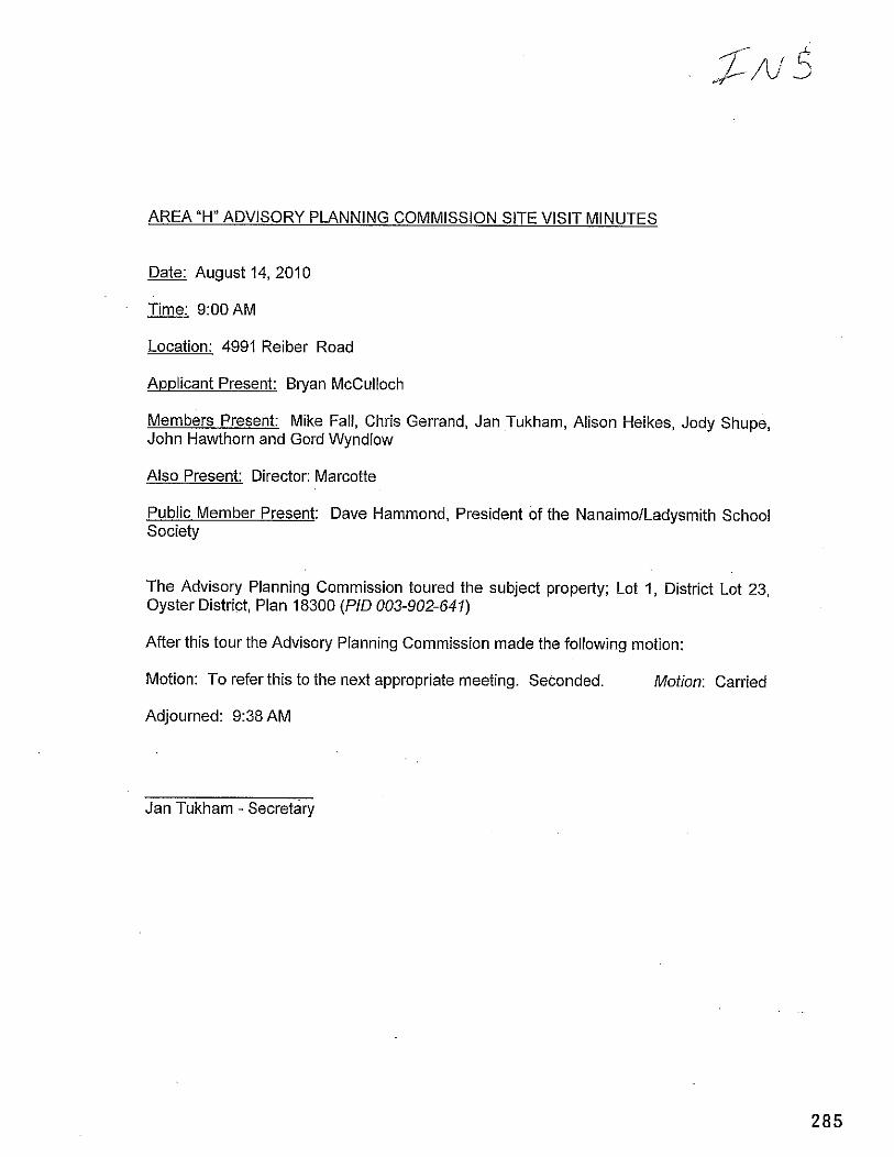
AREA "H" ADVISORY PLANNING COMMISSION SITE VISIT MINUTES
Date: August 14,2010
Time: 9:OOAM
Location: 4991 Reiber Road
Applicant Present: Bryan McCulloch
Members Present: Mike Fall, Chris Gerrand, Jan Tukham, Alison Heikes, Jody Shupe, John Hawthorn and Gord Wyndlow
Also Present: Director: Marcotte
Public Member Present: Dave Hammond, President of the NanaimolLadysmith School Society
The Advisory Planning Commission toured the subject property; Lot 1, District Lot 23, Oyster District, Plan 18300 (PID 003-902-641)
After this tour the Advisory Planning Commission made the following motion:
Motion: To refer this to the next appropriate meeting. Seconded. Motion: Carried
Adjourned: 9:38 AM
Jan Tukham - Secretary
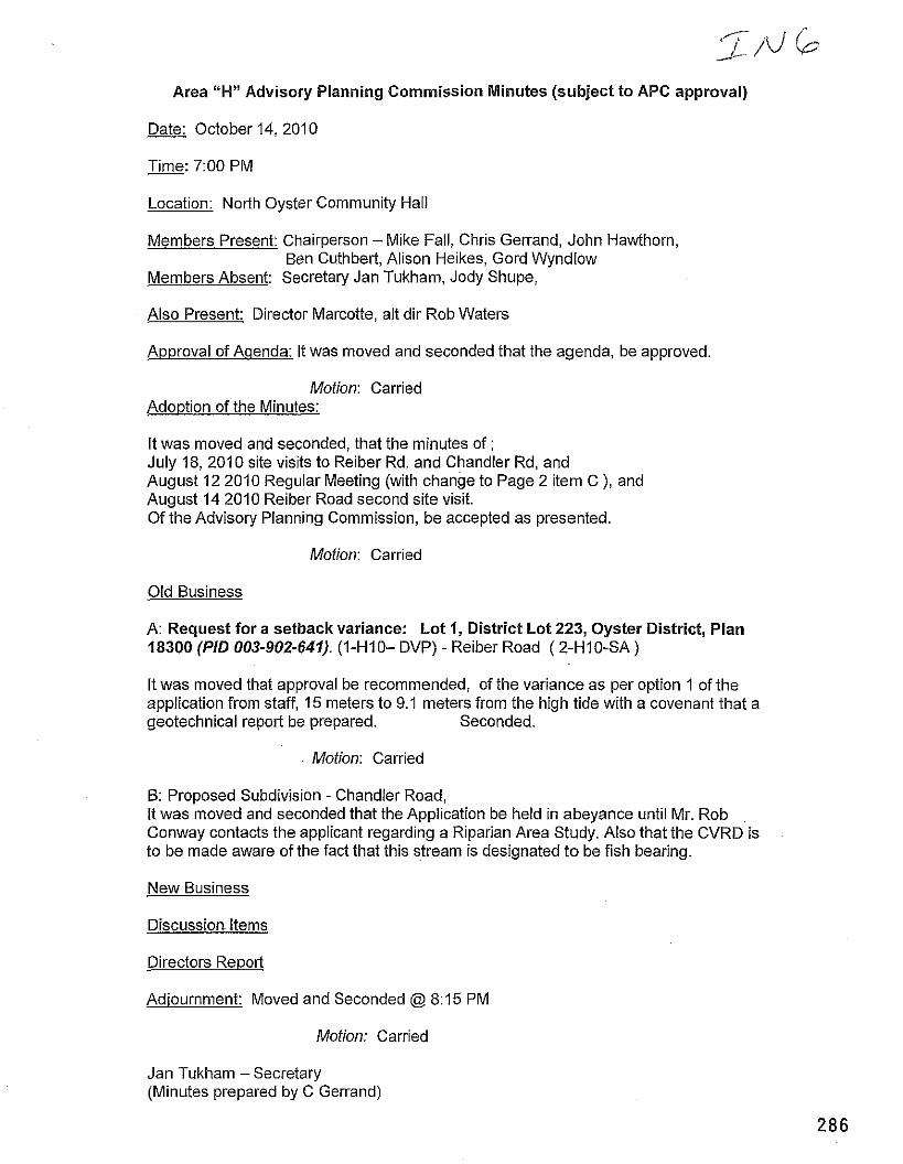
Area "H" Advisory Planning Commission Minutes (subject to APC approval)
Date: October 14, 2010
Time: 7:00 PM - Location: North Oyster Community Hall
Members Present: Chairperson -Mike Fall, Chris Gerrand, John Hawthorn, Ben Cuthbert, Alison Heikes, Gord Wyndlow
Members Absent: Secretary Jan Tukham, Jody Shupe,
Also Present: Director Marcotte, alt dir Rob Waters
A~proval of Aqenda: It was moved and seconded that the agenda, be approved.
Motion: Carried Adoption of the Minutes:
It was moved and seconded, that the minutes of ; July 18, 2010 site visits to Reiber Rd. and Chandler Rd, and August 12 2010 Regular Meeting (with change to Page 2 item C ), and August 14 2010 Reiber Road second site visit. Of the Advisory Planning Commission, be accepted as presented.
Motion: Carried
Old Business
A: Request for a setback variance: Lot 1, District Lot 223, Oyster District, Plan 18300 (PID 003-902-641). (I-HIO- DVP) - Reiber Road ( 2-H10-SA )
It was moved that approval be recommended, of the variance as per option 1 of the application from staff, 15 meters to 9.1 meters from the high tide with a covenant that a geotechnical report be prepared. Seconded.
Motion: Carried
B: Proposed Subdivision - Chandler Road, It was moved and seconded that the Application be held in abeyance until Mr. Rob Conway contacts the applicant regarding a Riparian Area Study. Also that the CVRD is to be made aware of the fact that this stream is designated to be fish bearing.
New Business
Discussion. Items
Directors Report
Adjournment: Moved and Seconded @ 8:15 PM
Motion: Carried
Jan Tukham -Secretary (Minutes prepared by C Gerrand)
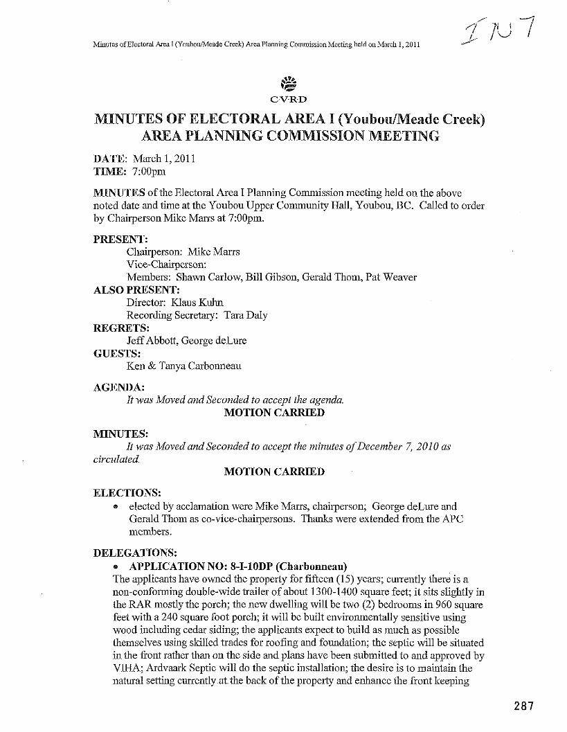
Minutes of Electoral Area I (Youbou/h.Ieade Creek) Area Planning Cornrnissio~l Meeting held on March 1,2011
MINUTES OF ELECTORAL AREA I (Youbou/Meade Creek) ARlEA PLANNING COMMISSION MEETING
DATE: March 1,201 1 T I : 7:OOpin
MINUTES of the Electoral Area I Planning Commission meeting held on the above noted date and time at the Youbou Upper Community Hall, Youbou, BC. Called to order by Chairperson Mike Marrs at 7:OOpm.
PRESENT: Chairperson: Mike Marrs Vice-Chairperson: Members: Shawn Carlow, Bill Gibson, Gerald Thom, Pat Weaver
ALSO PRESENT: Director: Klaus Kuhn Recording Secretary: Tara Daly
REGRETS: Jeff Abbott, George deLure
GUESTS: Ken & Tanya Carbonneau
AGENDA: It was Moved and Seconded to accept the agenda
MOTION CARRIED
MINUTES: It was Moved andSeconded to accept the minutes ofDecember 7,2010 as
circulated MOTION CARRIED
ELECTIONS: elected by acclamation were Mike Marrs, chairperson; George deLwe and Gerald Thom as co-vice-chairpersons. Thanks were extended fkom the APC members.
DELEGATIONS: APPLICATION NO: 8-I-1ODP (Charbonneau)
The applicants have owned the property for fifteen (15) years; cu~ently there is a non-conforming double-wide trailer of about 1300-1400 square feet; it sits slightly in the RAR mostly the porch; the new dwelling will be two (2) bedrooms in 960 square feet with a 240 square foot porch; it will be built environmentally sensitive using wood including cedar siding; the applicants expect to build as much as possible themselves using skilled trades for roofing and foundation; the septic will be situated in the fiont rather than on the side and plans have been submitted to and approved by VIHA; Ardvaark Septic will do the septic installation; the desire is to maintain the natural setting currently a t the back of the propeiq and enhance the front keeping
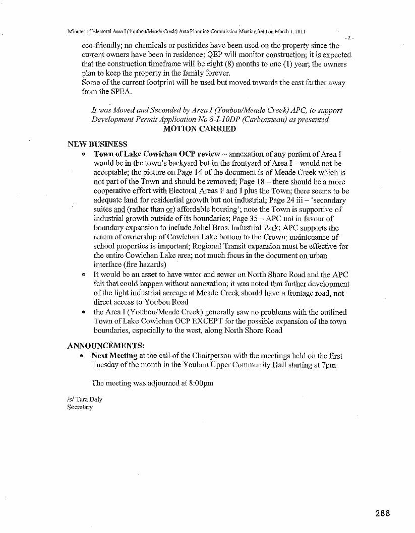
Minutes of Electoral Area I (YoubouiMeade Creek) Area Planning Commissioi~ Meeting held on March 1,201 1 - 2
eco-friendly; no chemicals or pesticides have been used on the property since the current owners have been in residence; QEP will monitor construction; it is expected that the construction timeframe will be eight (8) months to one (1) year; the owners plan to keep the property in the family forever. Some of the current footprint will be used but moved towards the east farther away from the SPEA.
It was Moved and Seconded by Area I (YoubodMeade Creek) APC, to support Developnzent Permit Application No.8-I-10DP (Curbonneau) aspresented
MOTION CARRIED
NEW BUSINESS * Town of Lake Cowichan OCP review - annexation of any portion of Area I
would be in the town's backyard but in the frontyard of Area I - would not be acceptable; the picture on Page 14 of the document is of Meade Creek which is not p a t of the Town and should be removed; Page 18 -there should be a more cooperative effort with Electoral Areas F and I plus the Town; there seems to be adequate land for residential growth but not industrial; Page 24 iii - 'secondary suites and (rather than or) affordable housing'; note the Town is supportive of industrial growth outside of its boundaries; Page 35 - APC not in favour of boundary expansion to include Johel Bros. Industrial Park; APC supports the return of ownership of Cowichan Lake bottom to the Crown; maintenance of school properties is important; Regional Transit expansion must be effective for the entire Cowichan Lake area; not much focus in the document on urban interface (fire hazards) It would be an asset to have water and sewer on North Shore Road and the APC felt that could happen without annexation; it was noted that further development of the light industrial acreage at Meade Creek should have a frontage road, not direct access to Youbou Road
* the Area I (YoubouIMeade Creek) generally saw no problems with the outlined Town of Lake Cowichan OCP EXCEPT for the possible expansion of the town boundaries, especially to the west, along North Shore Road
ANNOUNCEMENTS: * Next Meeting at the call of the Chairperson with the meetings held on the first
Tuesday of the month in the Youbou Upper Community Hall starting at 7pm
The meeting was adjourned at 8:OOpm
IS/ Tara Daly Secretary
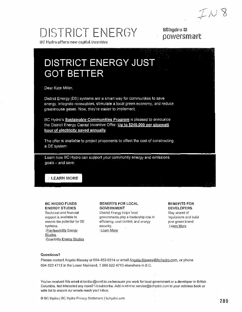
ENERGY EC Hydro offers new capital incentive
B C HYDRO FUNDS BENEFITS FOR LOCAL BENEFITS FOR ENERGY STUDIES GOVERNMENT DEVELOPERS Technical and financial District Energy helps local Stay ahead of support is available to governments play a leadership role in regulations and build assess the potential for DE efficiency, cost control, and energy your green brand. systems. security. Learn More : Pre-feasibility Enerqy Learn More Studies :Feasibility Enerav Studies
Questions?
Please contact Angela Massey at 604-453-6314 or email [email protected], or phone
604 522 4713 in the Lower Mainland, 1 866 522 4713 elsewhere in B.C.
You've received this email at [email protected] because you work for local government or a developer in British Columbia. Not interested any more? Unsubscribe. Add [email protected] to your address book or safe list to ensure our emails reach your inbox.
Q BC Hydro / BC Hydro Privacy Statement 1 bchydro.com
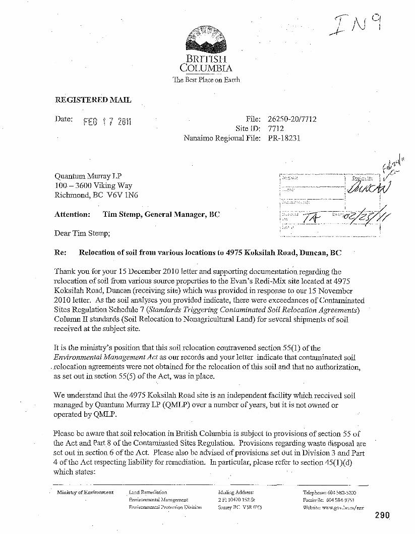
The Best Place on Earth
REGISTERED MAIL
File: 26250-2017712 SiteID: 7712
Nanaimo Regional File: PR-1823 1
Quantum Murray LP 100- 3600 Viking Way Richmond, BC V6V 1N6
Attention: Tim Stemp, General Manager, BC
Dear Tim Stemp;
Re: Relocation of soil from various locations to 4975 Koksilah Road, Duncan, BC
Thank you for your 15 December 2010 letter and supporting documentation regarding the relocation of soil %om various source properties to the Evan's Redi-Mix site located at 4975 Koksilah Road, Duncan (receiving site) which was provided in response to our 15 November 2010 letter. As the soil analyses you provided indicate, there were exceedances of Contaminated Sites Regulation Schedule 7 (Standards Triggering Contaminated Soil Relocation Agreements) Column 11 standards (Soil Relocation to Nonagricultural Land) for several shipments of soil received at the subject site.
It is the ministry's position that this soil relocation contravened section 55(1) of the Environmentai Management Act as our records and your letter indicate that contaminated soil relocation agreements were not obtained for the relocation of this soil and that no authorization, as set out in section 55(5) of the Act, was in place.
We understand that the 4975 Koksilah Road site is an independent facility which received soil managed by Quantum Murray LP (QMLP) over a number of years, but it is not owned or operated by QMLP.
Please be aware that soil relocation in British Columbia is subject to provisions of section 55 of the Act and Part 8 of the Contaminated Sites Regulation. Provisions regarding waste disposal are set out in section 6 of the Act. Please also be advised of provisions set out in Division 3 and Part 4 of the Act respecting liability for remediation. In particular, please refer to section 45(l)(d) which states:
Ministry of EnvLoment Land Remediation hlaiEng.ddrsr: Telephoile: 604 582-5200
Enrirommtal h,Imagment 2 Fi 10470 152 St Facrimiic 604 564-9751
EnvironmarWlProtcctionDirision SuneyBC V3ROY3 'Xkbsitc: \?r.goubc.n/mx,
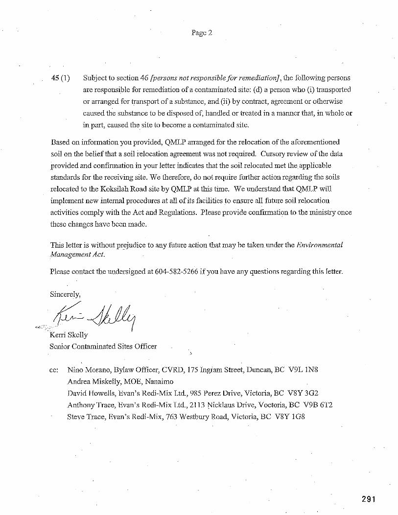
Page 2
45 (1) Subject to section 46 [persons not responsible for remediation], the following persons
are responsible for remediation of a contaminated site: (d) a person who (i) transported
or arranged for transport of a substance, and (ii) by contract, agreement or otherwise
caused the substance to be disposed of, handled or treated in a manner that, in whole or
in part, caused the site to become a contaminated site.
Based on information you provided, QMLP arranged for the relocation of the aforementioned
soil on the belief that a soil relocation agreement was not required. Cursory review of the data
provided and confirmation in your letter indicates that the soil relocated met the applicable
standards for the receiving site. We therefore, do not require further action regarding the soils
relocated to the Koksilah Road site by QMLP at this time. We understand that QMLP will
implement new internal procedures at all of its facilities to ensure all future soil relocation
activities comply with the Act and Regulations. Please provide confia t ion to the minisby once
these changes have been made.
This letter is without prejudice to any future action that may be taken under the Environmental Management Act.
Please contact the undersigned at 604-582-5266 if you have any questions regarding this letter.
Sincerely,
<..
Kem Skelly
Senior Contaminated Sites OfiTcer 5
cc: Nino Morano, Bylaw Officer, CVRD, 175 Ingram Street, Duncan, BC V9L IN8
Andrea Miskelly, MOE, Nanaimo
David Howells, Evan's Redi-Mix Ltd, 985 Perez Drive, Victoria, BC V8Y 3G2
Anthony Trace, Evan's Redi-Mix Ltd., 2113 Nicklaus Drive, Voctoria, BC V9B 6T2
Steve Trace, Evan's Redi-Mix, 763 Westbuy Road, Victoria, BC V8Y 1G8
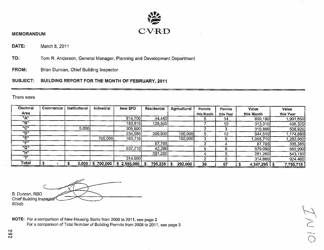
MEMORANDUM
DATE: March 8, 201 1
TO: Tom R. Anderson, General Manager, Planning and Development Department
FROM: Brian Duncan, Chief Building Inspector
SUBJECT: BUILDING REPORT FOR THE MONTH OF FEBRUARY, 2011
There were
B. Duncan, RBO Chief Building In BDIdb
NOTE: For a comparison of New Housing Starts from 2008 to 201 1, see page 2 For a comparison of Total Number of Building Permits from 2008 to 201 1, see page 3
N co N
Notice of Motion:
That the EAS Directors request that the Chair separate the present Engineering Committee into two separate committees. One to deal with Regional issues. One to deal with Electoral Area issues.
Loren Duncan


