Embed Size (px)
Citation preview

COPENHAGEN
PRESENTERS
Fatima Khan 2013-CRP-15
Ayesha Khurshid 2013-CRP-02
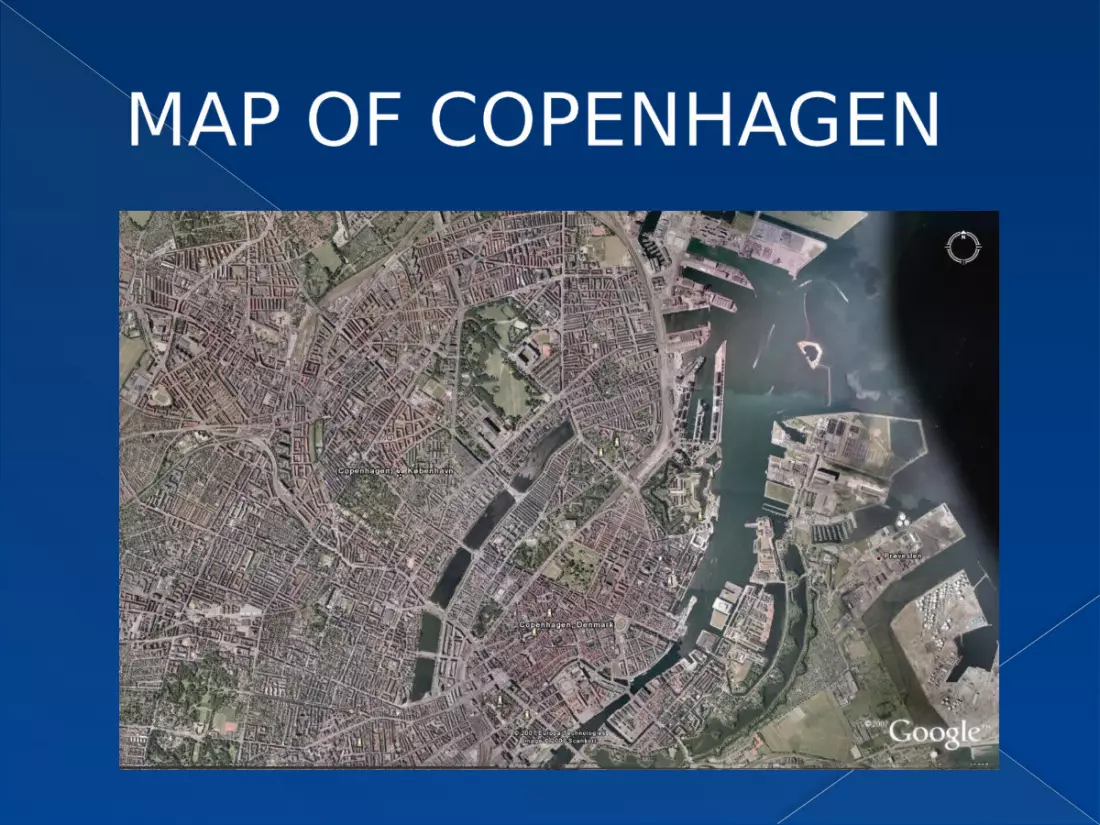
MAP OF COPENHAGEN
INTRODUCTION Copenhagen is the capital and most populated
city of Denmark It is called “Paris of North” it is the first carbon Neutral capital in the
world, declared as most livable city. Located on the eastern cost of Zealand 164 km
east of Odense and 28 km northwest of Malmo
INTRODUCTION
Total area of Copenhagen is 221,712 acres Its population is 580,184 Density Level : 23 people/ acre Park area 6143 acres Ethnicity77.3% Danish
22.7% Other

HISTORICAL GROWTH

OLD COPENHAGEN
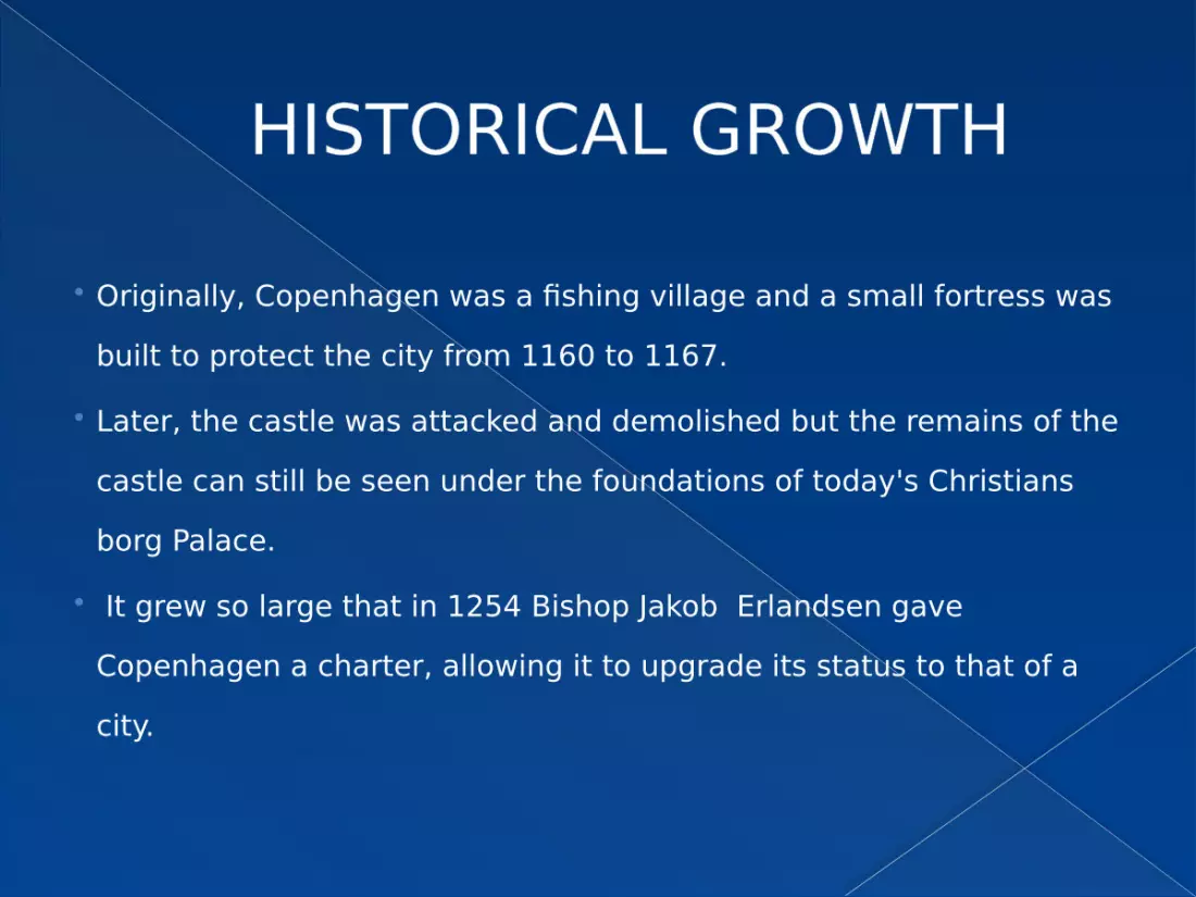
HISTORICAL GROWTH Originally, Copenhagen was a fishing village and a small fortress was
built to protect the city from 1160 to 1167. Later, the castle was attacked and demolished but the remains of the
castle can still be seen under the foundations of today's Christians borg Palace.
It grew so large that in 1254 Bishop Jakob Erlandsen gave Copenhagen a charter, allowing it to upgrade its status to that of a city.
HISTORICAL GROWTH
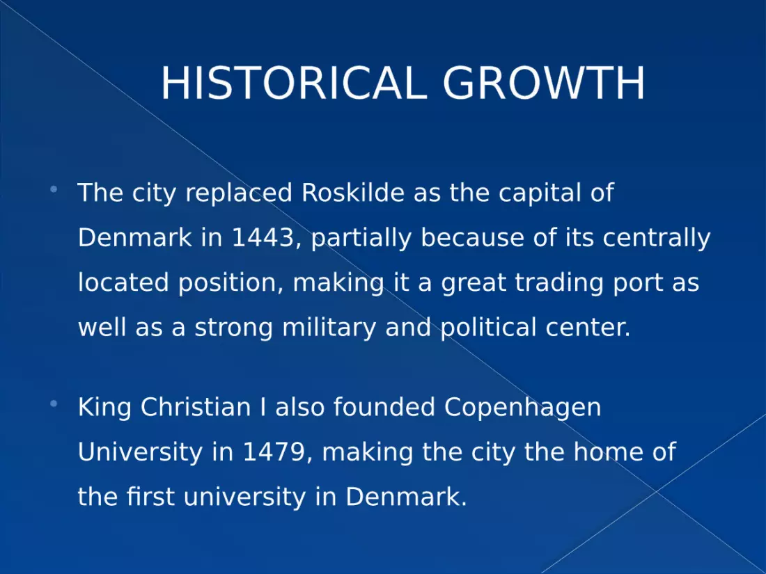
The city replaced Roskilde as the capital of Denmark in 1443, partially because of its centrally located position, making it a great trading port as well as a strong military and political center.
King Christian I also founded Copenhagen University in 1479, making the city the home of the first university in Denmark.

ADMINISTRATIVE SYSTEM
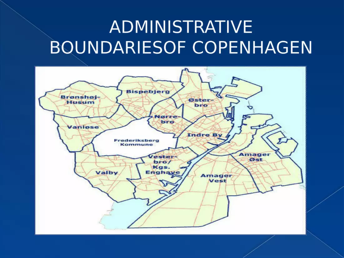
ADMINISTRATIVE BOUNDARIESOF COPENHAGEN
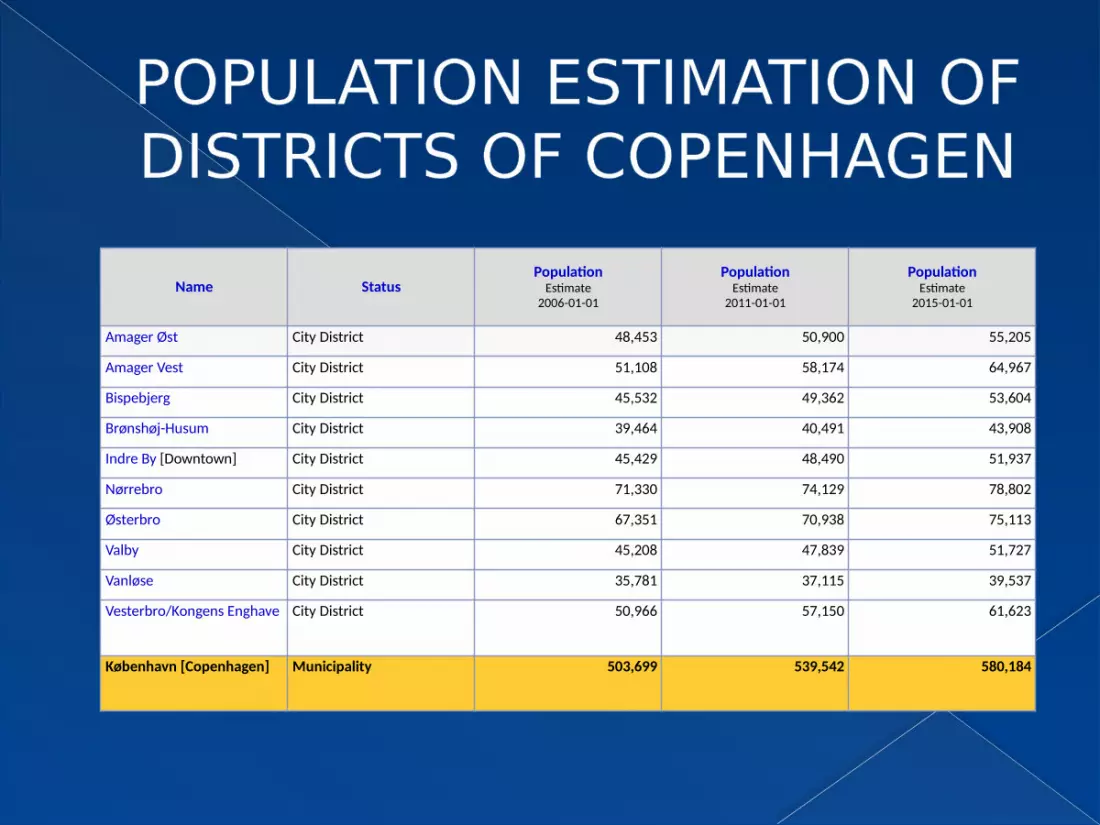
POPULATION ESTIMATION OF DISTRICTS OF COPENHAGEN
Name StatusPopulation
Estimate2006-01-01
PopulationEstimate
2011-01-01
PopulationEstimate
2015-01-01
Amager Øst City District 48,453 50,900 55,205
Amager Vest City District 51,108 58,174 64,967
Bispebjerg City District 45,532 49,362 53,604
Brønshøj-Husum City District 39,464 40,491 43,908
Indre By [Downtown] City District 45,429 48,490 51,937
Nørrebro City District 71,330 74,129 78,802
Østerbro City District 67,351 70,938 75,113
Valby City District 45,208 47,839 51,727
Vanløse City District 35,781 37,115 39,537
Vesterbro/Kongens Enghave City District 50,966 57,150 61,623
København [Copenhagen] Municipality 503,699 539,542 580,184

PHYSICAL PLANNING
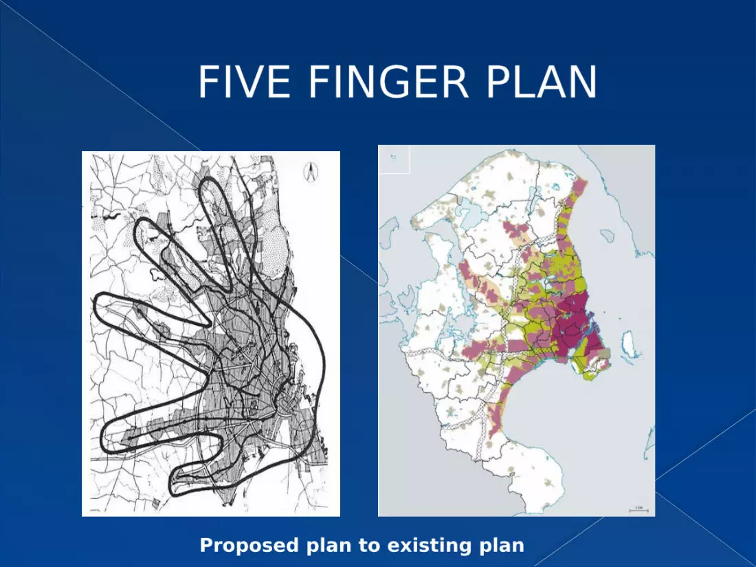
FIVE FINGER PLAN
Proposed plan to existing plan
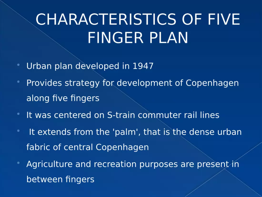
CHARACTERISTICS OF FIVE FINGER PLAN
Urban plan developed in 1947 Provides strategy for development of Copenhagen
along five fingers It was centered on S-train commuter rail lines It extends from the 'palm', that is the dense urban
fabric of central Copenhagen Agriculture and recreation purposes are present in
between fingers
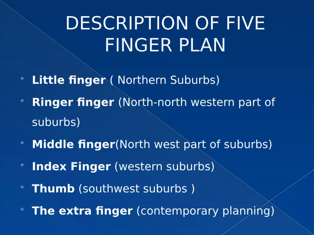
DESCRIPTION OF FIVE FINGER PLAN
Little finger ( Northern Suburbs) Ringer finger (North-north western part of
suburbs) Middle finger(North west part of suburbs) Index Finger (western suburbs) Thumb (southwest suburbs ) The extra finger (contemporary planning)
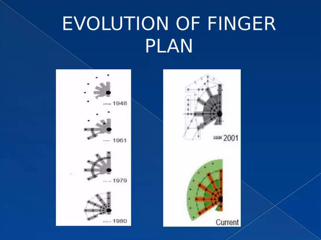
EVOLUTION OF FINGER PLAN
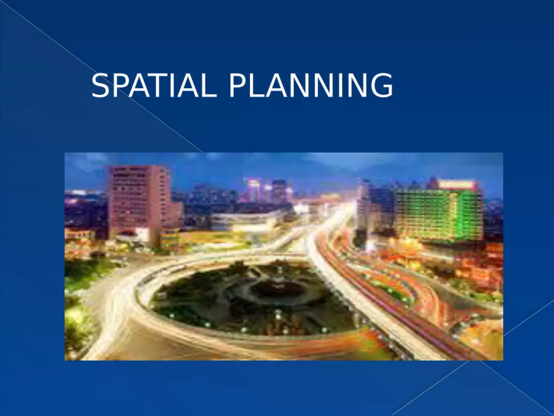
SPATIAL PLANNING
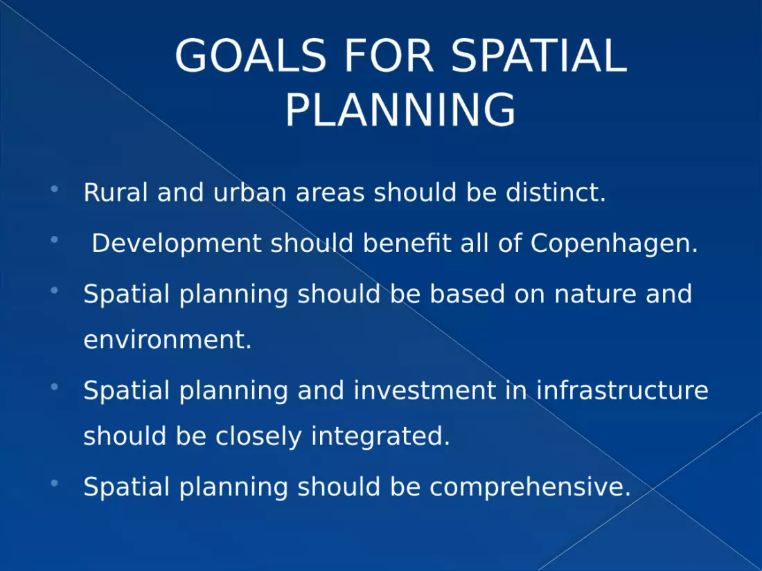
GOALS FOR SPATIAL PLANNING
Rural and urban areas should be distinct. Development should benefit all of Copenhagen. Spatial planning should be based on nature and
environment. Spatial planning and investment in infrastructure
should be closely integrated. Spatial planning should be comprehensive.

LAND USE MAP:
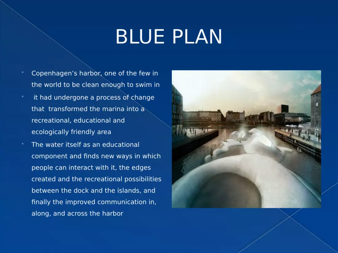
BLUE PLAN Copenhagen’s harbor, one of the few in
the world to be clean enough to swim in it had undergone a process of change
that transformed the marina into a recreational, educational and ecologically friendly area
The water itself as an educational component and finds new ways in which people can interact with it, the edges created and the recreational possibilities between the dock and the islands, and finally the improved communication in, along, and across the harbor

The ‘blue plan’ includes the construction of five artificial islands like fugleøe(bird island), krøyers pøl, sportsøen (sports sea) and operaparken (opera park) which focus on establishing a unique relationship between the user, the harbor, and an activity.

INFRASTRUCTURE OF COPENHAGEN
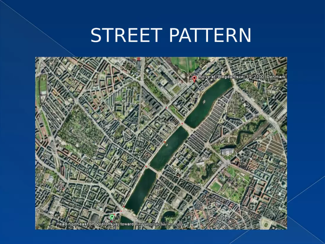
STREET PATTERN
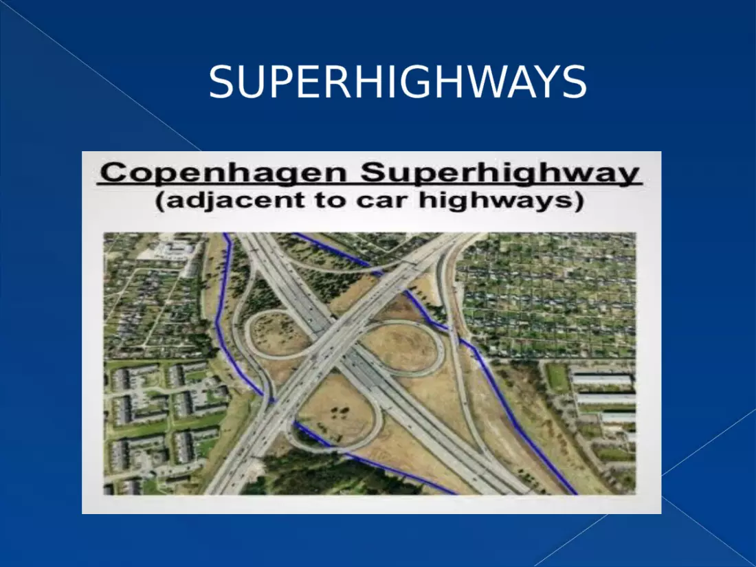
SUPERHIGHWAYS

BUILDINGS
Royal Danish Theatre Danish Museum of Art
Amalienborg Palace Christiansborg Palace

The Crystal Børsen
Frederik's Church Round Tower

TRANSPORTATION SYSTEM Like many other cities, economic growth in
Copenhagen has brought with it increased traffic congestion. however, by investing in an efficient, reliable and highly integrated public transport network.
It has been possible to deliver some of the highest levels of mobility in the world. alongside traffic, congestion and pollution have been reduced to levels that are extremely low by the standards of major international cities.

“CITY OF CYCLIST” Copenhagen is
called the city of cyclists as 35% of people living in Copenhagen use cycles for commuting purpose
35%
32%
26%
7%
Sales
CYCLING PUBLIC TRSNPORTATION
PRIVATE VEHICLE
WALKING
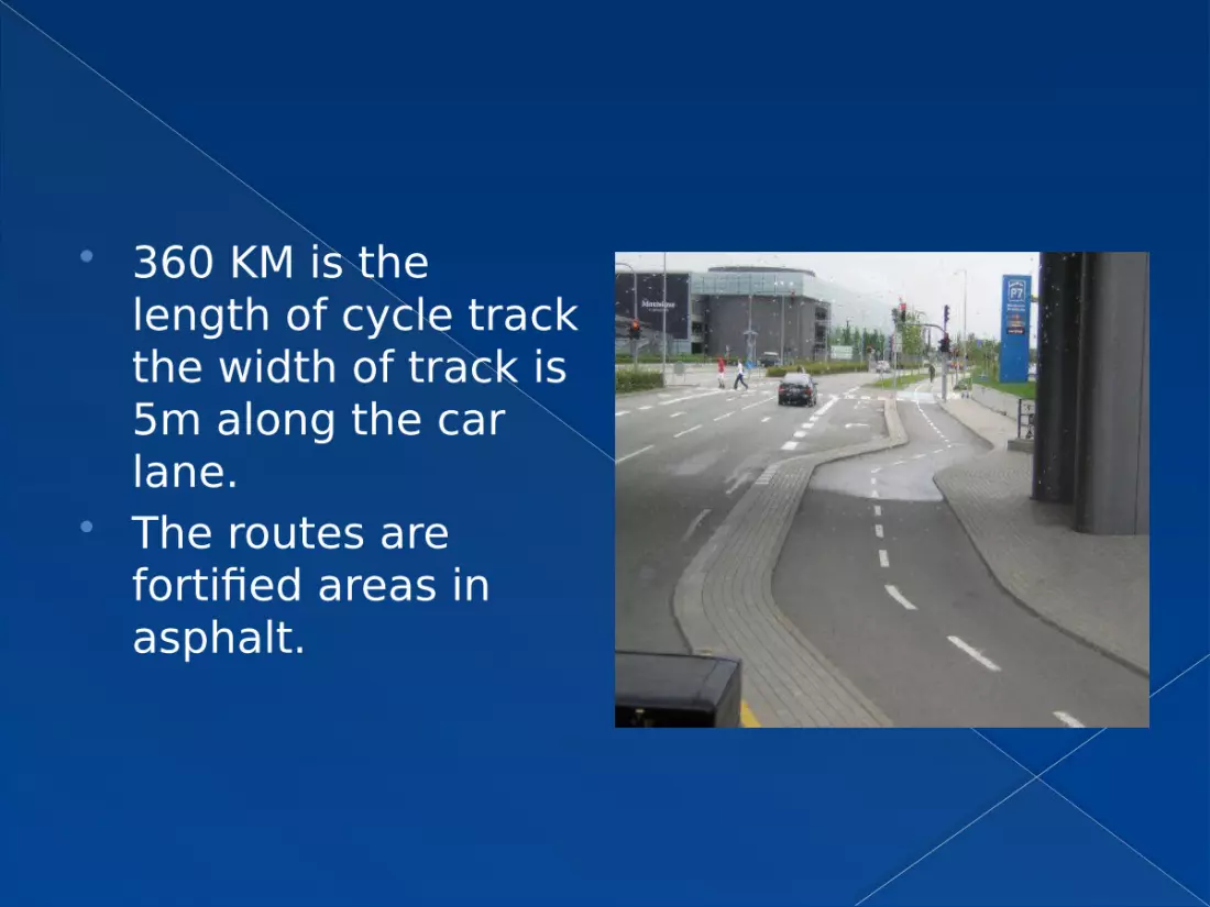
360 KM is the length of cycle track the width of track is 5m along the car lane.
The routes are fortified areas in asphalt.
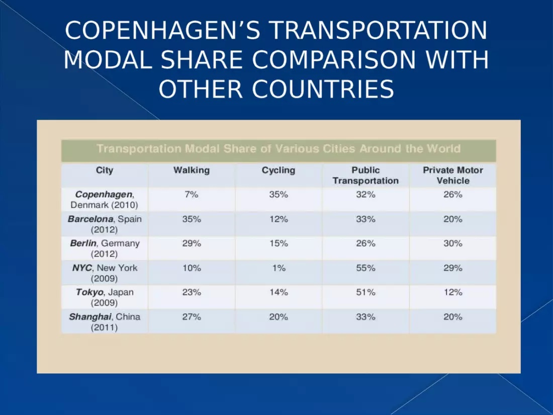
COPENHAGEN’S TRANSPORTATION MODAL SHARE COMPARISON WITH
OTHER COUNTRIES
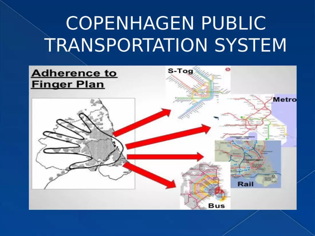
COPENHAGEN PUBLIC TRANSPORTATION SYSTEM
GOALS OF TRANSPORTATION SYSTEM

GOALS (PEDESTRIANS)
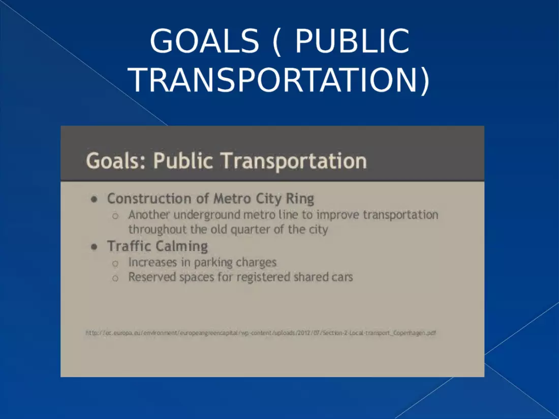
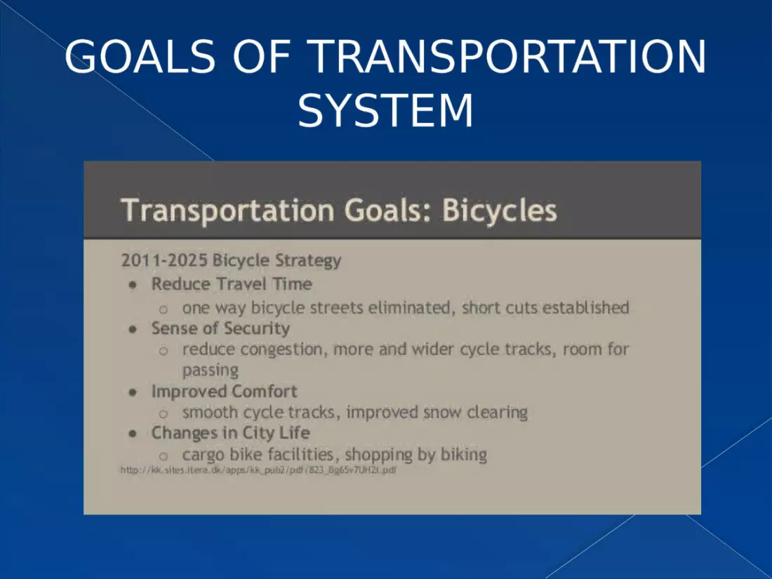
GOALS ( PUBLIC TRANSPORTATION)
PLANNING SYSTEM

PLANNING SYSTEM
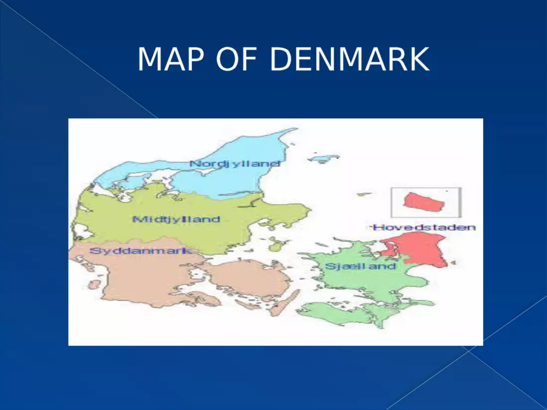
MAP OF DENMARK
THE MUNICIPIAL PLANNING STRATEGY
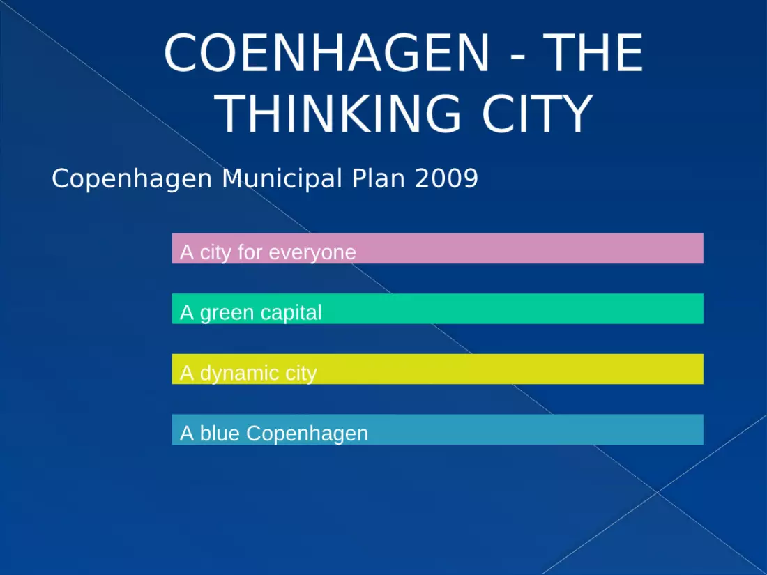
COENHAGEN - THE THINKING CITY
Copenhagen Municipal Plan 2009
A city for everyone
A green capital
A dynamic city
A blue Copenhagen
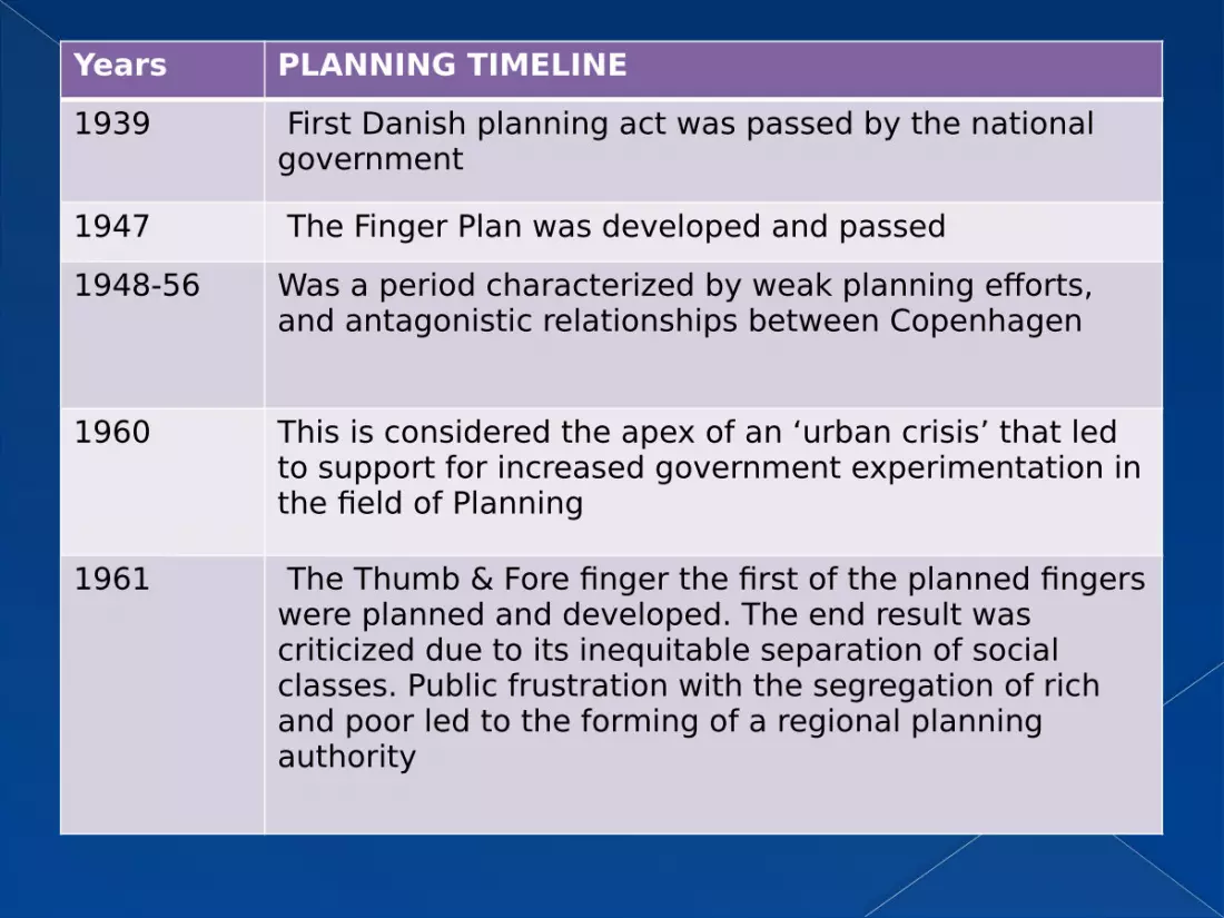
Years PLANNING TIMELINE1939 First Danish planning act was passed by the national
government
1947 The Finger Plan was developed and passed1948-56 Was a period characterized by weak planning efforts,
and antagonistic relationships between Copenhagen
1960 This is considered the apex of an ‘urban crisis’ that led to support for increased government experimentation in the field of Planning
1961 The Thumb & Fore finger the first of the planned fingers were planned and developed. The end result was criticized due to its inequitable separation of social classes. Public frustration with the segregation of rich and poor led to the forming of a regional planning authority

YEARS PLANNING TIMELINE1966 Regional Planning Authority Formed
1970 Parliamentary planning law was passed specifying how
regions should plan. The law was weak in the Copenhagen region due to a fear on the part of national policy of ceding power to the region which houses 1/3 of Denmark’s population.
1974-89 Greater Copenhagen Council was formed. This was a regional authority, it was criticized for having no teeth and was disbanded in 1988
Present The Greater Copenhagen Authority was established. This is a regional planning authority that oversees transportation planning, regional planning, transit operations, economic development, tourism and culture.
SOCIAL PLANNING
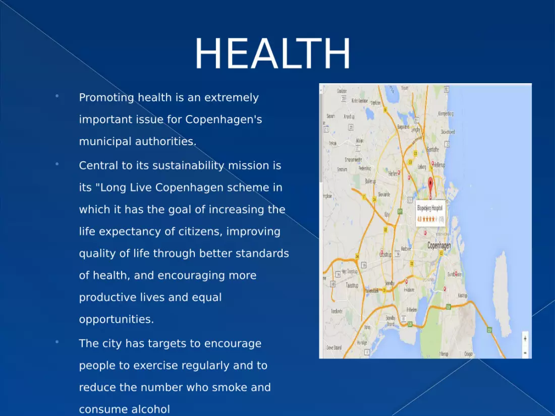
HEALTH Promoting health is an extremely
important issue for Copenhagen's municipal authorities.
Central to its sustainability mission is its "Long Live Copenhagen scheme in which it has the goal of increasing the life expectancy of citizens, improving quality of life through better standards of health, and encouraging more productive lives and equal opportunities.
The city has targets to encourage people to exercise regularly and to reduce the number who smoke and consume alcohol
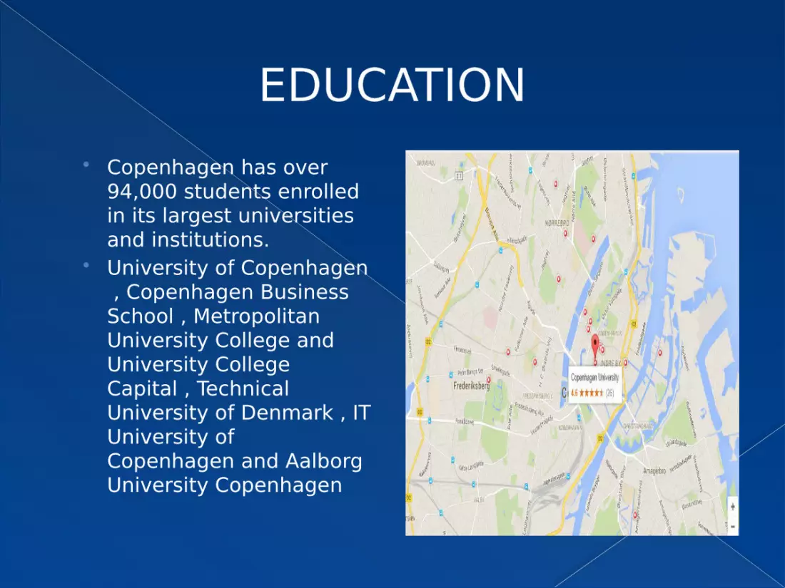
EDUCATION Copenhagen has over
94,000 students enrolled in its largest universities and institutions.
University of Copenhagen , Copenhagen Business School , Metropolitan University College and University College Capital , Technical University of Denmark , IT University of Copenhagen and Aalborg University Copenhagen

OPEN SPACES
open spaces cover 25% area of copenhagen.
Some important parks : Amaliehaven Christianshavns Vold City Hall Garden Copenhagen Botanical Garden Glyptoteque Garden Holmen's Cemetery Kongens Have Ørstedsparken Superkilen Urban Park Royal Library Garden

PERCENTAGES OF GREEN SPACE OF VARIOUS CITIES

SUPERKILEN URBAN PARK Superkilen is a 355,000
square foot urban park in Copenhagen
This project was awarded the 2013 AIA National Award for Regional & Urban Design.
The park is conceptually divided into three different zones of activity: the Red Square is an area for sports, cultural activities, and a weekly marketplace RED SQUARE

SUPERKILEN URBAN PARK the Black Square is
the “urban living room” where locals can meet and play chess or backgammon
BLACK SQUARE
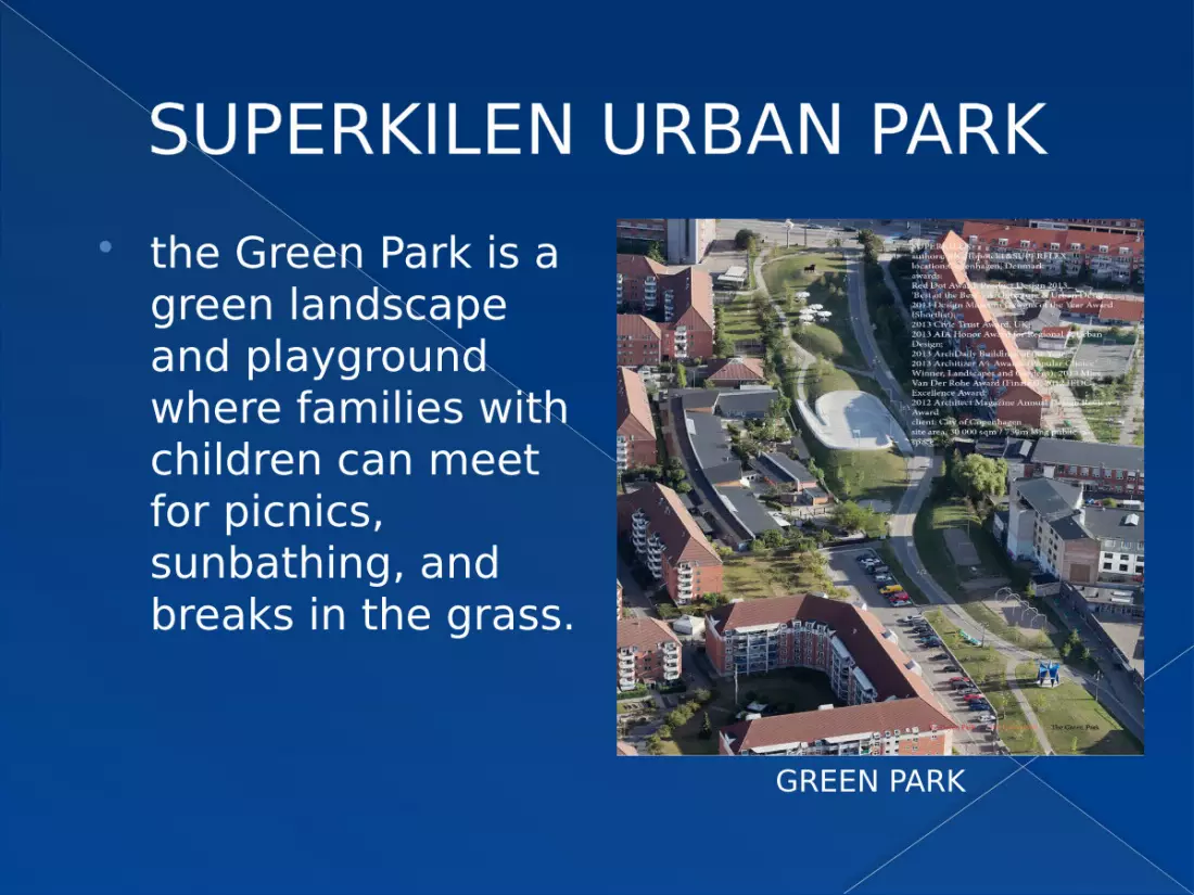
SUPERKILEN URBAN PARK the Green Park is a
green landscape and playground where families with children can meet for picnics, sunbathing, and breaks in the grass.
GREEN PARK
ECONOMIC PLANNING

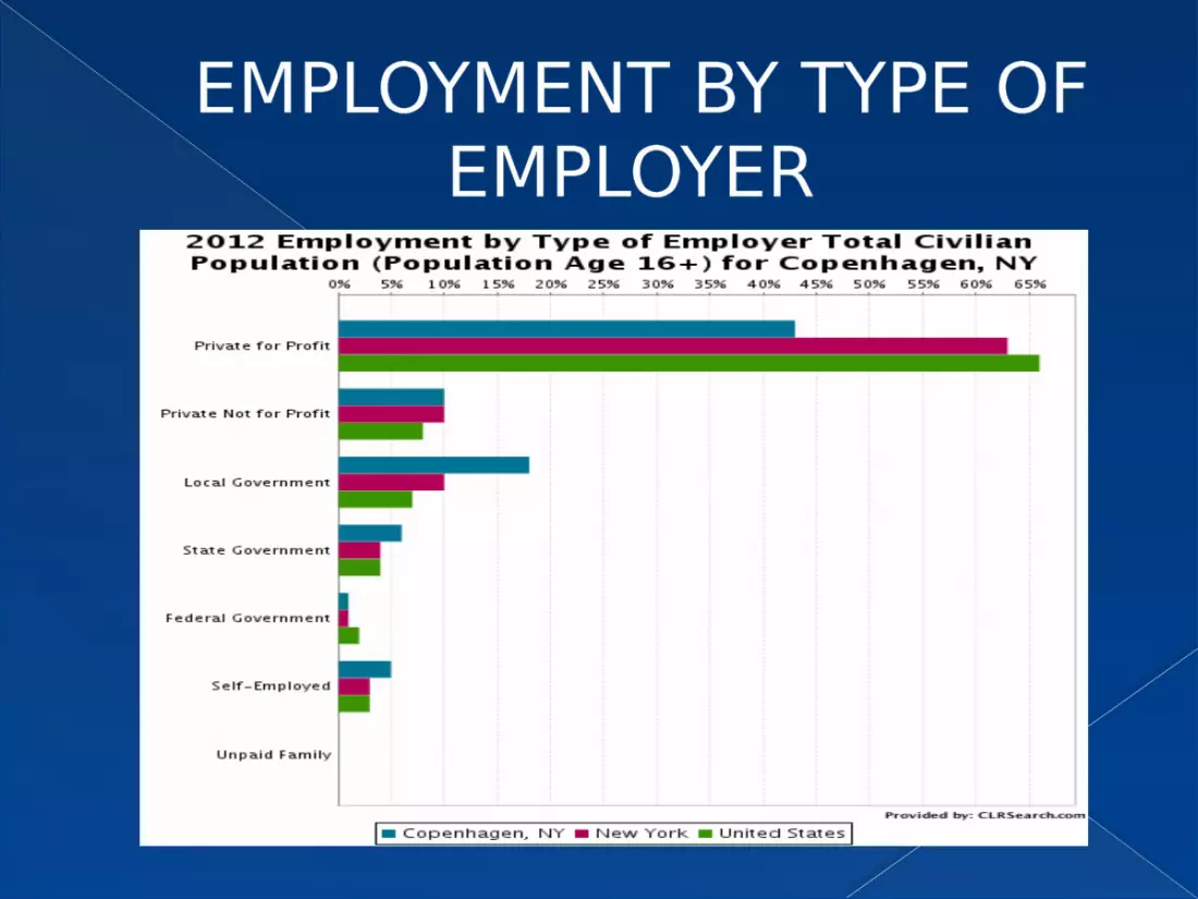
TYPES OF EMPLOYMENT Copenhagen is the economic and financial centre of
Denmark. Statistics for 2010 show that of the 350,000 people
working in Copenhagen the vast majority are employed in the service sector,
especially transport and communications, trade, and finance,
while less than 10,000 work in the manufacturing industries.
The public sector workforce is around 110,000, including education and healthcare.
From 2006 to 2011, the economy grew by 2.5% in Copenhagen .
EMPLOYMENT BY TYPE OF EMPLOYER
ECONOMIC ASPECTS In 2012, Copenhagen was third in the ranking of
the richest cities in the world in terms of gross earnings, dropping from first place in 2009.
In the 2011 UBS survey of prices and earnings, Copenhagen had fallen to fifth place for price levels
it held third place in gross wage levels and was said to have the highest purchasing power in terms of gross hourly wages
it was only in 12th place in terms of domestic purchasing power.
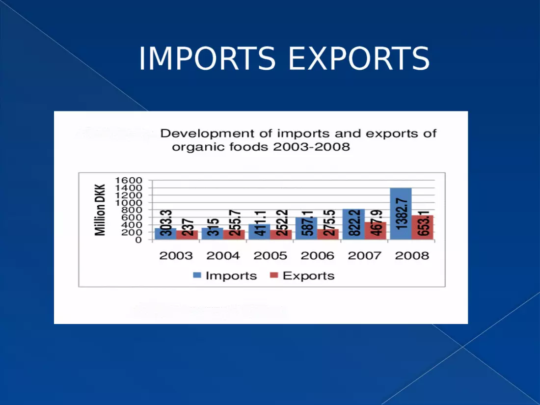
IMPORTS EXPORTS
TOURISM Tourism is also an increasingly important sector for
Copenhagen's economy, reaching record numbers in 2012 for the third year in succession.
The number of room nights reached 8.1 million, up 25% since 2008.
Between 2011 and 2012, room nights increased 9.2% overall, tallying a rise of 39% for Chinese visitors.
The numbers of airline and cruise passengers visiting the city were also at new highs while turnover for congress tourism reached DKK 1.2 billion with a total of 57 congresses in the year
ENVIRONMENTAL PLANNING
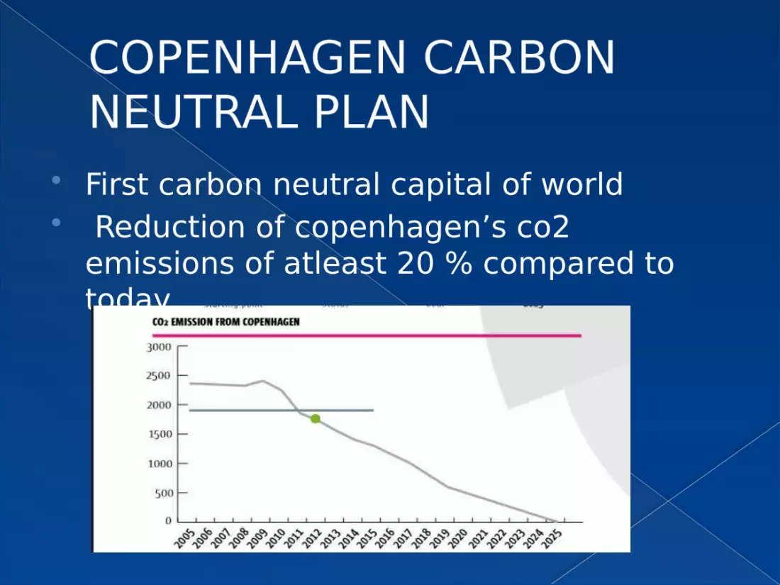
COPENHAGEN CARBONNEUTRAL PLAN
First carbon neutral capital of world Reduction of copenhagen’s co2
emissions of atleast 20 % compared to today.
A CLEAN AND HEALTHY/CITY
All schools and institutions are subjected on low traffic-noise levels.
There is 20% organic food in the city’s food consumption.
Copenhagen is Europe's cleanest capital and one of the cleanest capitals in the world. Rubbish should be cleared from public streets within eight hours
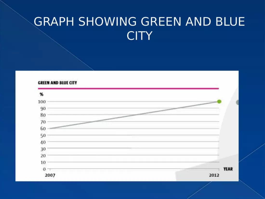
GRAPH SHOWING GREEN AND BLUE CITY

GRAPHS SHOWING CLEAN STREETS AND URBAN SPACES

COMMENTS BY PRESENTERS

IS COPENHAGEN A MODEL TRANSPORTATION SYSTEM?
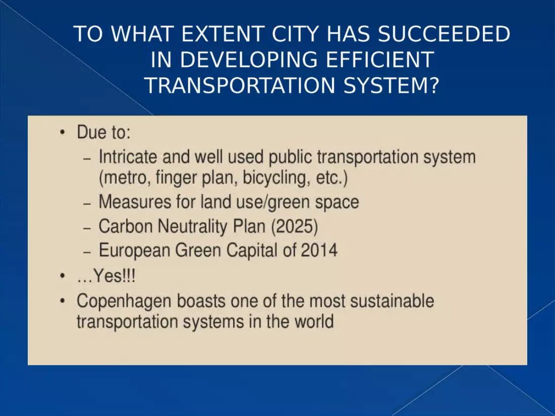
TO WHAT EXTENT CITY HAS SUCCEEDED IN DEVELOPING EFFICIENT TRANSPORTATION SYSTEM?

IS THIS A PERFECT EXAMPLE OF PLANNING OR THERE IS SOMETHING
LACKING?

BUT STILL COPENHAGEN HAS THE WORLD BEST URBAN
ENVIRONMENT….

THANK YOU


