Embed Size (px)
DESCRIPTION
Presentation from seminar on using Trail Based GPSr.
Citation preview

Using Your Trail GPS
Hiking, Geocaching & Mapping

John Robb Bio
• Early Adopter
• Using GPS since 2004
• Webmaster OGA
• Partner in Online Geocaching Store – cacheatnight.com
• Internet Consultant by Day

Topics For Today
• Set up tips• Power saving tips• Screen review Garmin GPSMAP 62s• Use of third party trail maps• Track Logs• Use of third party aerial imagery• Discussion on best practices
for geocaching• How to use and program
CHIRP accessories

Screen Protector

Calibrate Compass
• When Readings Erratic
• After a plane flight
• When you change batteries

Power Tips
• Set Screen Timeout
• Use Batter Saver
• Dim Screen
• Use External Cable(set in spanner mode)

Screen Order
Main Menu Setup Page Sequence

Track Setup
• Check your interval
• Show on Map

Track ↑↓
• Track UP
• North UP

Chose Maps
• More than one map
• Free Maps– OpenStreetMap
– ibycus.com
• Also Free– Ontario Trail Maps

Measurements
• I use Metric
• Can switch anytime

Position Format
• Online resourcesDegree, Decimal Minutes

Compass
• True
• Magnetic

Routing
• Changes by profile
• Use avoid options in automotive mode

Profiles
• Standard
• Custom

Mark Waypoints
• Use Frequently
• Use waypoint manager to edit

Mark Waypoint
• Change Name
• Edit Location
Optionally Change
• Icon
• Notes

Find Options
• Waypoints
• Geocaches
• Coordinates
Others
• Addresses, cities, amenities, etc

Waypoint Manager
• Edits after creation
• Additional Options– Average Location
– Project waypoint

Map View
• Common View
• Measure Distance
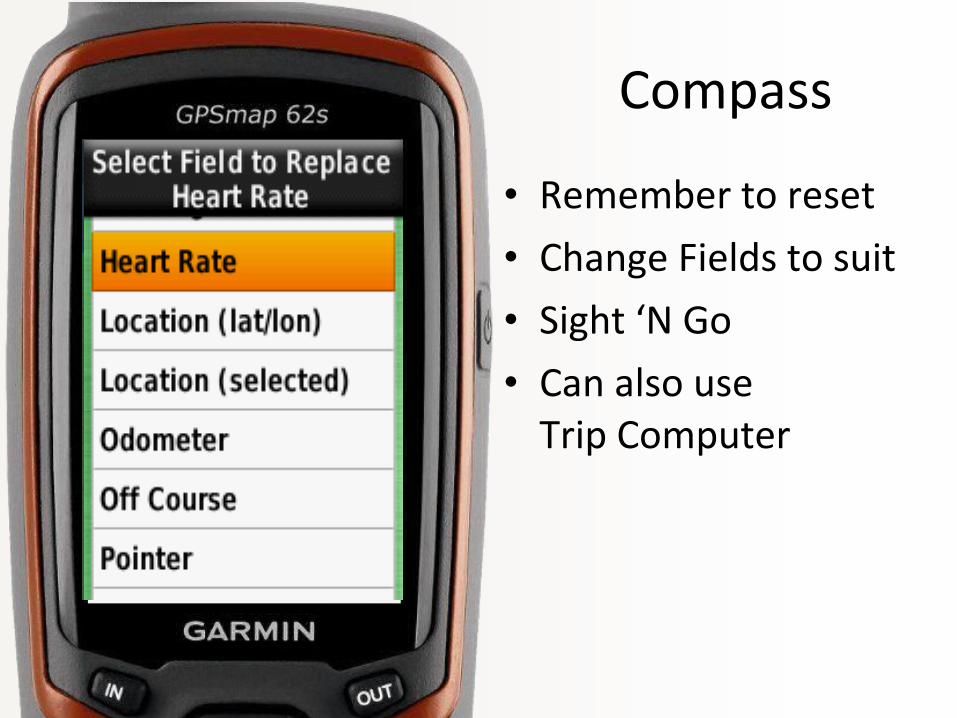
Compass
• Remember to reset
• Change Fields to suit
• Sight ‘N Go
• Can also use Trip Computer

Track Logs
• Make sure it’s on
• Upload online for tracking
• Using Mapsource for editing

3rd Party Images
• Custom Maps
• Scan, Download
Garmin Tutorial on Third Party Imagery

Geocaching
• High-tech treasure hunt using GPS receivers to find hidden containers.
• Biggest Area of Growth for GPSrManufacturers

Geocaching
• Paperless caching
• Quick saving of waypoints

chirp
• Garmin Technology
• Proximity based
• Special waypoint
• Colorado, Oregon, GPSMAP 62/76