Embed Size (px)
Citation preview

Aviation Weather Safety
Sensurion Aerospace February, 2016
Captain Joe Burns CEO
PRESENTATION NAME

Weather Safety in Real-‐0me: A Look at today’s avia0on weather capabili0es from
Drones to Airliners
PRESENTATION NAME
Typical sUAS Types
• Conven&onal Fixed wing Design • Hand, rail, gear takeoff • Flight dura&ons 60-‐120 mins • Mul&ple Payload op&ons • Best BLOS candidate • 0-‐60 kts, stall speeds 10 kts • 20 kt max l/d • Full autoflight avionics • Variety of landing systems
• Mul&rotor designs • Ease of flight • Flight dura&on <30 mins • Visual/EO sensors • 0-‐20 kts speed • Strong reliance on GPS • Manual flown • Limited autoflight • About 90% current vehicles
Magpie MP-‐1, typ. Fixed wing Sen&nel MP-‐4, typ. Mul&rotor
Weather input is critical to all UAS operations – Sensurion and UCAR will provide ADDS-like weather to sUAS operators..

400,000 + UAVs will need easy weather access… We are jointly building an ADDS-like site for UAVs
Societal benefits!
Sensurion/UCAR Drone-WX
• TAFS • METARS • PIREPS • AIRSPACE • WX MAPS
Current ADDS site
Drone-WX Mobile app
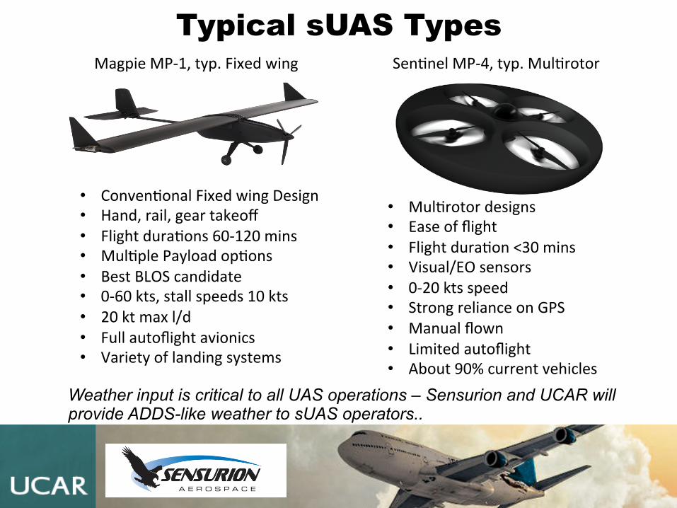
In addition to current weather sensors, weather gathering will be important for UAVs as well
Sensurion Magpie-1
Societal benefits!
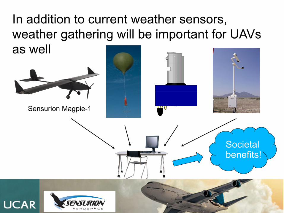
Using UAVs for HazMat Plume modelling
• Atmospheric modeling provides detail of hazard mo&on • Hazard plume track and concentra&on data helps with emergency planning and
during the event • Expanded sensor network benefits all (private & government) hazard aler&ng &
response • UAVs can also find release point
Sensors on other buildings & vehicles provide early warning
Plume Modeling and Hazard Alert
Hazard Release Point
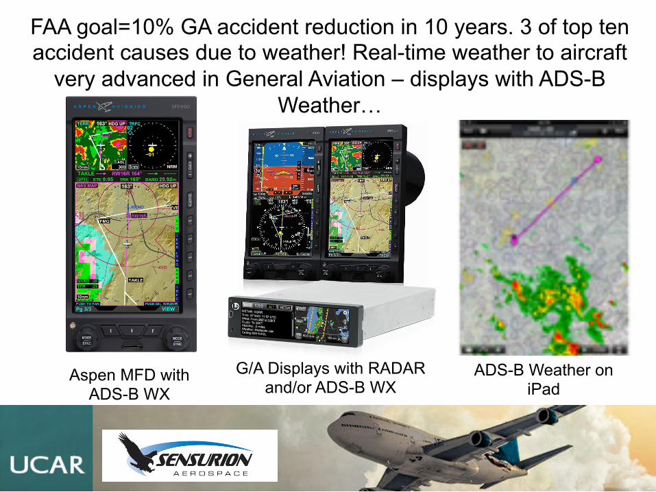
FAA goal=10% GA accident reduction in 10 years. 3 of top ten accident causes due to weather! Real-time weather to aircraft
very advanced in General Aviation – displays with ADS-B Weather…
Aspen MFD with ADS-B WX
G/A Displays with RADAR and/or ADS-B WX
ADS-B Weather on iPad
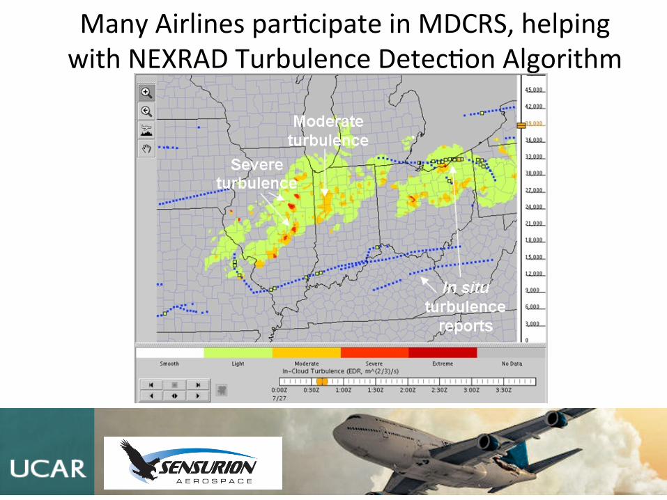
Many Airlines par&cipate in MDCRS, helping with NEXRAD Turbulence Detec&on Algorithm
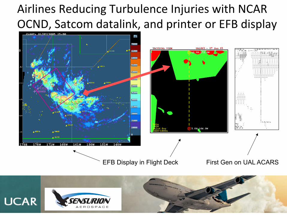
Airlines Reducing Turbulence Injuries with NCAR OCND, Satcom datalink, and printer or EFB display
+ 153744 + 160400
+ 155216
EFB Display in Flight Deck First Gen on UAL ACARS
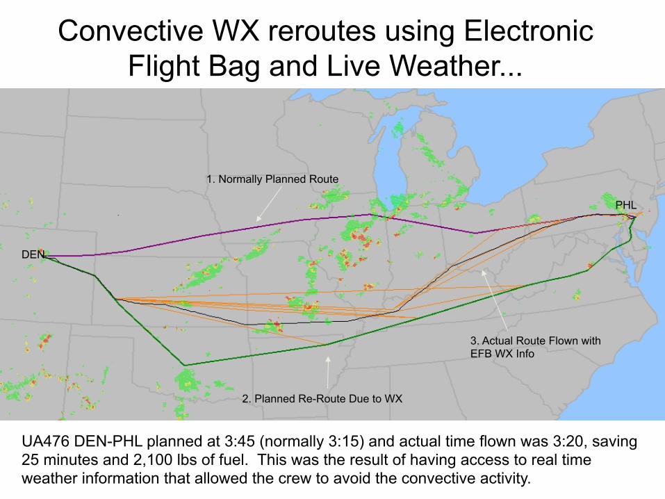
Convective WX reroutes using Electronic Flight Bag and Live Weather...
UA476 DEN-PHL planned at 3:45 (normally 3:15) and actual time flown was 3:20, saving 25 minutes and 2,100 lbs of fuel. This was the result of having access to real time weather information that allowed the crew to avoid the convective activity.
DEN
1. Normally Planned Route
PHL
2. Planned Re-Route Due to WX
3. Actual Route Flown with EFB WX Info