Embed Size (px)
Citation preview

“Waters of the U.S.” in Missouri Farmland
Maps by GeosyntecAnalysis by American Farm Bureau Federation

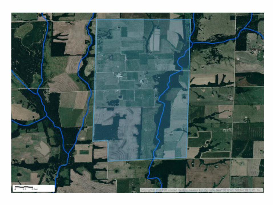
Area of focus is near Linneus in Linn County in Northcentral Missouri. The area is a rectangle that is 7.5 miles wide and 4.5 miles tall and includes the University of
Missouri’s Forage Systems Research Center.

Previous rules/guidance – Tributaries and Adjacent Wetlands
Absent case-specific “significant nexus” finding, only perennial and intermittent tributaries (blue lines) and adjacent wetlands (green shapes) deemed jurisdictional.
(Note: light blue shapes designate freshwater ponds.)
New WOTUS Rule – More Automatically Regulated “Tributaries”
Ephemeral tributaries (red lines) deemed jurisdictional without further analysis. Ditches also regulated if “excavated in” or “relocated” a tributary.
Note: This map does not show jurisdictional ditches and may not include all ephemeral tributaries.

New WOTUS Rule – Automatically Regulated Adjacent Waters
Includes all “waters”—including wetlands—that lie even partially within a 100-foot buffer (pink shading) around all perennial, intermittent and ephemeral streams.

New WOTUS Rule – More Automatically Regulated Adjacent Waters
Includes all “waters”—including wetlands—where any part is within the 100-year floodplain and not more than 1,500 feet from a tributary. Light green shading shows the 1,500-feet zone and hash marks show the known FEMA Flood
Zone maps (which may be out-of-date or may not be relied upon by the Corps). Absent definitive flood zone information from the Corps, any water partially within the light green shading is a possible “adjacent water.”
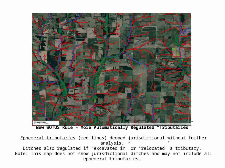
New WOTUS Rule – Maybe Regulated “Significant Nexus” Waters
Water/wetlands even partially within 4,000 feet (about ¾ mile) of a tributary can be regulated on a “significant nexus” finding. Orange shading shows land outside the possible adjacency zone but within the 4,000 feet zone.
Even without mapping around jurisdictional ditches, the area of possible regulation covers the entire map.

The scope of the final rule’s impact in the focus area is similar to the rest of the state
Why Should I Try to Identify WOTUS on the Land I Farm?
• Unpermitted discharges of “pollutants” into WOTUS are unlawful—and carry large potential penalties—even if the farmer or rancher has no knowledge that a feature is WOTUS. If a feature is later determined to be WOTUS, government or citizen enforcers could “reach back” and impose penalties for any discharge that occurred over the past five years.
• Because the WOTUS rule is so broad and complex, however, it will be almost impossible for farmers and ranchers to determine with confidence that any potential “water” feature is not WOTUS.
• Consultants may provide useful advice on identifying wetlands, measuring distances, locating available floodplain maps and searching publicly available historical records. But the only way to be confident that any water feature is not WOTUS is to request a jurisdictional determination or “JD” from the Corps of Engineers.
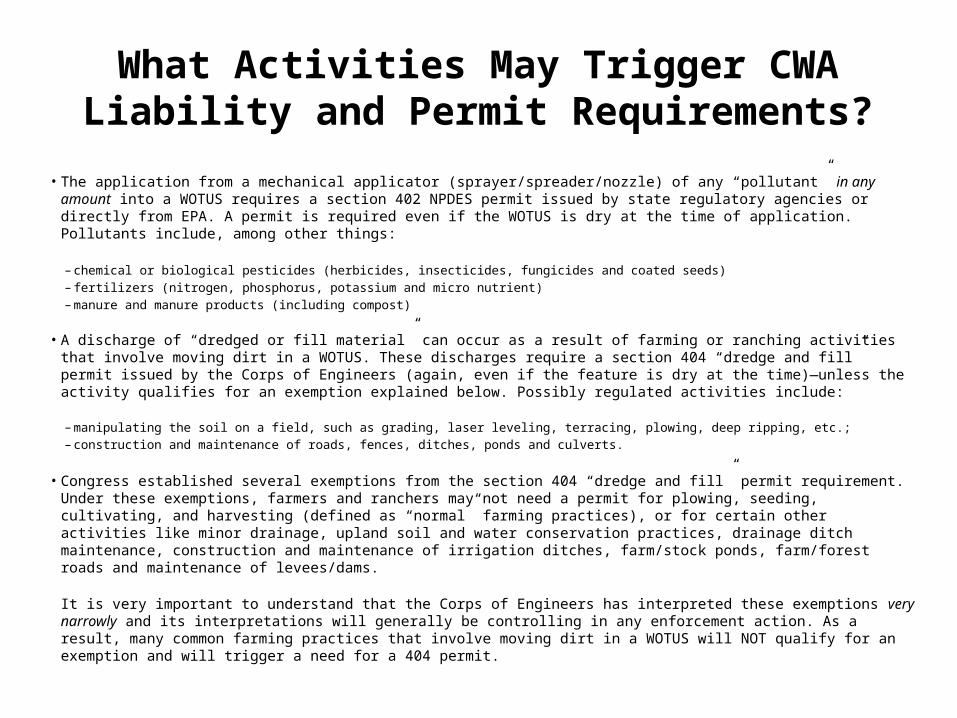
What Activities May Trigger CWA Liability and Permit Requirements?
• The application from a mechanical applicator (sprayer/spreader/nozzle) of any “pollutant” in any amount into a WOTUS requires a section 402 NPDES permit issued by state regulatory agencies or directly from EPA. A permit is required even if the WOTUS is dry at the time of application. Pollutants include, among other things:
– chemical or biological pesticides (herbicides, insecticides, fungicides and coated seeds) – fertilizers (nitrogen, phosphorus, potassium and micro nutrient) – manure and manure products (including compost)
• A discharge of “dredged or fill material” can occur as a result of farming or ranching activities that involve moving dirt in a WOTUS. These discharges require a section 404 “dredge and fill” permit issued by the Corps of Engineers (again, even if the feature is dry at the time)—unless the activity qualifies for an exemption explained below. Possibly regulated activities include:
– manipulating the soil on a field, such as grading, laser leveling, terracing, plowing, deep ripping, etc.;– construction and maintenance of roads, fences, ditches, ponds and culverts.
• Congress established several exemptions from the section 404 “dredge and fill” permit requirement. Under these exemptions, farmers and ranchers may not need a permit for plowing, seeding, cultivating, and harvesting (defined as “normal” farming practices), or for certain other activities like minor drainage, upland soil and water conservation practices, drainage ditch maintenance, construction and maintenance of irrigation ditches, farm/stock ponds, farm/forest roads and maintenance of levees/dams.
It is very important to understand that the Corps of Engineers has interpreted these exemptions very narrowly and its interpretations will generally be controlling in any enforcement action. As a result, many common farming practices that involve moving dirt in a WOTUS will NOT qualify for an exemption and will trigger a need for a 404 permit.
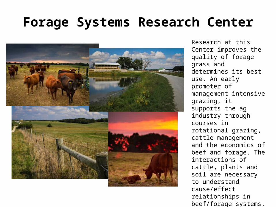
Forage Systems Research CenterResearch at this Center improves the quality of forage grass and determines its best use. An early promoter of management-intensive grazing, it supports the ag industry through courses in rotational grazing, cattle management and the economics of beef and forage. The interactions of cattle, plants and soil are necessary to understand cause/effect relationships in beef/forage systems. Since 1990, more than 3,000 farmers and educators from several states have attended the three-day intensive Missouri Grazing School.
Forage Systems Research Center
Before

Forage Systems Research Center
After
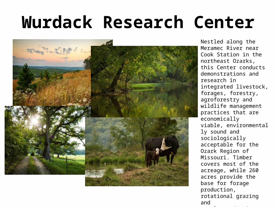
Wurdack Research CenterNestled along the Meramec River near Cook Station in the northeast Ozarks, this Center conducts demonstrations and research in integrated livestock, forages, forestry, agroforestry and wildlife management practices that are economically viable, environmentally sound and sociologically acceptable for the Ozark Region of Missouri. Timber covers most of the acreage, while 260 acres provide the base for forage production, rotational grazing and cattle production. Current research includes programs to improve forage, beef, agroforestry and timber.
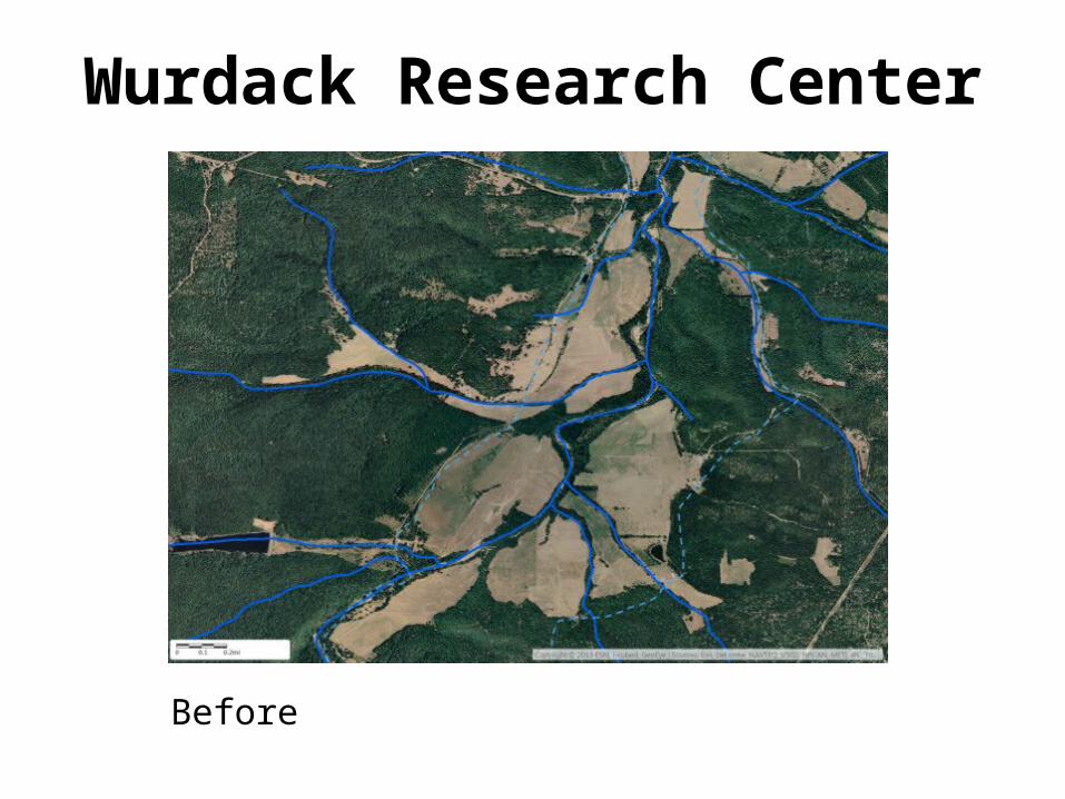
Wurdack Research Center
Before

Wurdack Research Center
After
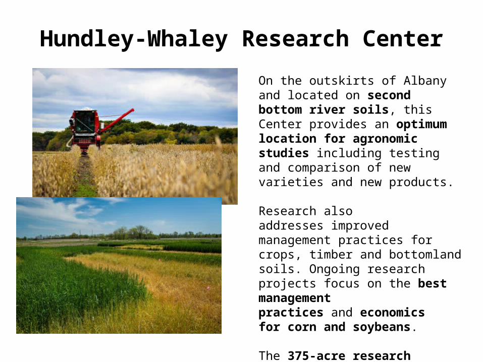
Hundley-Whaley Research CenterOn the outskirts of Albany and located on second bottom river soils, this Center provides an optimum location for agronomic studies including testing and comparison of new varieties and new products.
Research also addresses improved management practices for crops, timber and bottomland soils. Ongoing research projects focus on the best management practices and economics for corn and soybeans.
The 375-acre research center, located in Gentry County, is involved in pesticide evaluations and comparisons, and sustainable agriculture concepts.
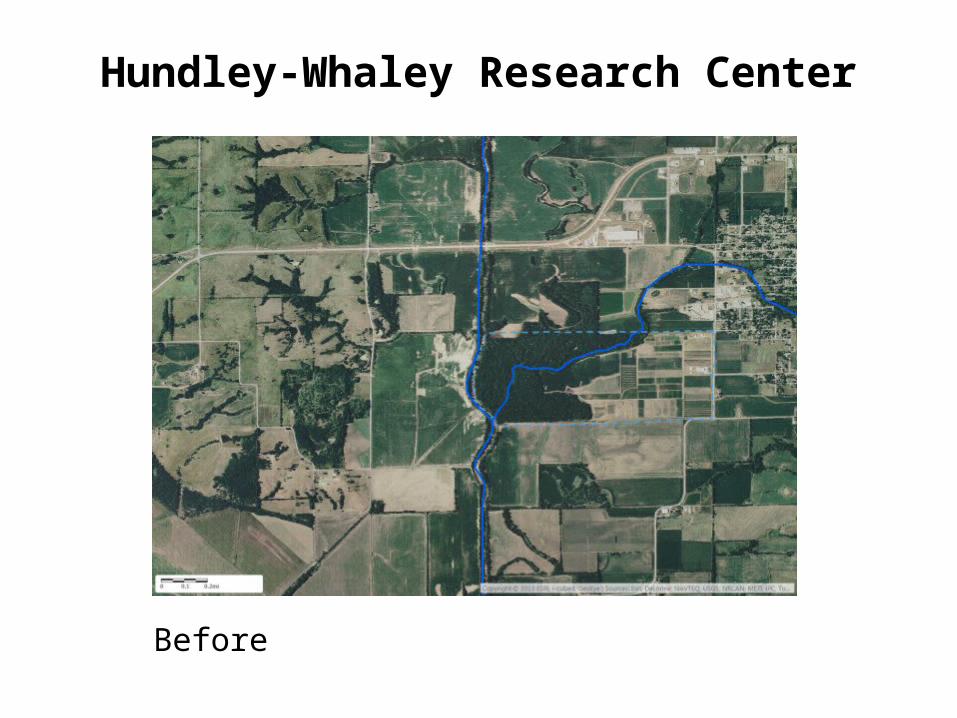
Hundley-Whaley Research Center
Before
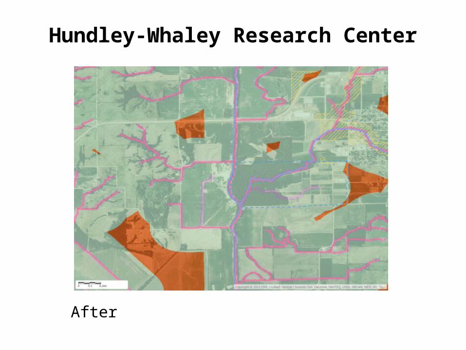
Hundley-Whaley Research Center
After
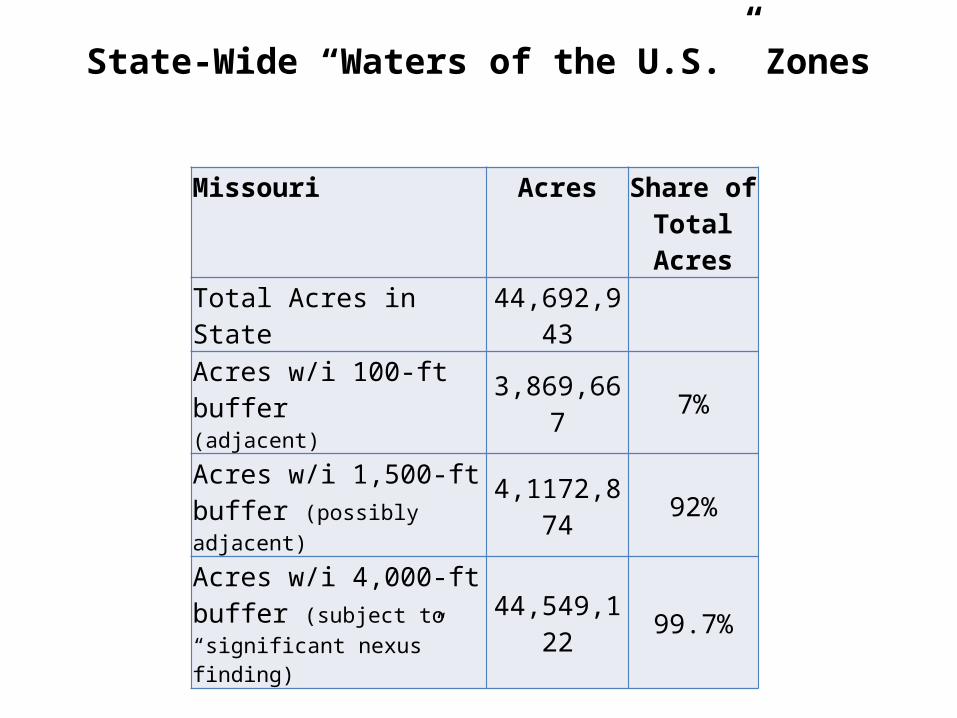
State-Wide “Waters of the U.S.” Zones
Missouri Acres Share of Total Acres
Total Acres in State 44,692,943
Acres w/i 100-ft buffer(adjacent) 3,869,667 7%
Acres w/i 1,500-ft buffer (possibly adjacent) 4,1172,874 92%
Acres w/i 4,000-ft buffer (subject to “significant nexus” finding)
44,549,122 99.7%


![Sediment Management - Geosyntec · Sediment Management 4UBUFNFOUPG2VBMJmDBUJPOT] About Geosyntec Section 1 About Geosyntec Technical Excellence, Teamwork and A Generous Spirit Recognized](https://img.dokumen.tips/doc/110x75/5d5dcc7788c993a30e8b8011/sediment-management-sediment-management-4ubufnfoupg2vbmjmdbujpot-about-geosyntec.jpg)