Embed Size (px)
Citation preview

The Santa Ynez Valley: Hinterland of Coastal California
BY RICHARD L. NOSTRAND
Hinterland studies, as topics of investigation in the literature of geography and history, are generally discussions of large inland regions tributary to major ocean ports.1 Often unmentioned are many small areas of back country not attached to important ports yet significant in a regional context. Santa Barbara County's Santa Ynez Valley is one such small back country area. Follow- ing its settlement by Europeans a century and a half ago, this interior valley has been a hinterland to many coastal landings and ports. It has been an area which has maintained contact with the outside. The purpose of this study is to examine the changing connections between the valley and the outside world: the routes followed, modes of transport used, and products which were exported.
The Santa Ynez Valley is located near the center of a seaward- extending corner of land which is coastal Santa Barbara County (Fig. i ) . This county has two Pacific coasts, one facing south, the other west. Rising parallel to the south coast are the Santa Ynez Mountains, and toward the county's interior are the northwest- southeast trending San Rafael Mountains. Where these two ranges join northeast of the south coast city of Santa Barbara, the headwaters of the Santa Ynez River collect to flow the seventy- mile length of the county from east to west along the northern base of the Santa Ynez Mountains. Locally, only the middle por- tion of this river valley is called the Santa Ynez Valley, and al- though the Santa Ynez River continues westward, discharging into the Pacific, the valley of its name is left some thirty miles be- hind. Thus, the Santa Ynez Valley has an interior position and is located midway between the Lompoc Valley, as the western end of the river valley is called, and the headwater subarea.2
As a consequence of their back-country position, valley inhabi- tants have been confronted with the difficulties of reaching one or
П37 3
Dow
nloaded from http://online.ucpress.edu/scq/article-pdf/48/1/37/333559/41169986.pdf by guest on 26 M
ay 2020

The Historical Society of Southern California another of the two coasts for contact with the outside. Never have routes of travel faced inland toward the uninviting, rugged, and virtually uninhabited mountains. South of the valley, mountains rising to 3,000 and 4,000 feet blocked the shortest distance to the Pacific, but early Spaniards discovered three important defiles in this barrier, from east to west known as San Marcos Pass, Refugio Pass, and Gaviota Pass. Toward the northwest, distance to the coast, not the undulating relief, deterred travel from the valley. The easiest valley exit led directly west along the river course but this gentle grade never became an important route because water at the river mouth was too shallow for anchorage and ships had no protection from storms. Such avenues as existed to the Pacific were explored and used after colonization of the area.
General Setting, Santa Barbara County's Santa Ynez Valley, early nineteenth century.
SANTA BARBARA COUNTY'S Uk / SANTA YNEZ VALLEY -_ J>Q
' V«, *c««'«<« 'Us ^O/. KLOMPOC *c««'«<«
(У/у
/ V
VÌVI ^- '^> N.
-*^ EL RANCHO HEADWATER
V - ^И/. N. ^"^^Л OSÁM MARCOS ^iiOAOr-A
Г ' С о с £ А Ы ^¿
Г383
Dow
nloaded from http://online.ucpress.edu/scq/article-pdf/48/1/37/333559/41169986.pdf by guest on 26 M
ay 2020

Santa Ynez Valley Several missions and a presidio were the earliest European set-
tlements in the vicinity of the valley. Colonization commenced with the building of a fortress on the coastal lowland south of the Santa Ynez Mountains in 1782, and in four years, the establish- ment of Mission Santa Barbara added the second settlement nu- clei to the present-day county (Fig. 1). Shortly thereafter, in 1 787, Mission La Purísima Concepción was dedicated in the Lom- poc Valley. Between the two missions, Spaniards traveled on the "royal highway" a mere trail which paralleled the coast south and west of the Sierra de Mescaltitlan, as the Santa Ynez Moun- tains were then known. The three prominent gaps leading inland through these mountains were used but little by early travelers until settlement of the back country was effected.
Establishment of Mission Santa Ines by Franciscan mission- aries initiated settlement of the interior.3 Before the end of the eighteenth century, Father Estévan Tápis, accompanied by a presidio captain, selected the site of a Chumash Indian ranchería for the church. Here, the hostile inhabitants of the San Joaquín Valley, called Tulareños, were to be Christianized along with the more numerous Chumash Indians.4 Father Tápis thought that the new mission would be "less visited" by coastal travelers than other missions because of the difficult mountains which had to be crossed.5 Nonetheless, this first valley settlement was dedicated on September 1 7, 1804, and with its founding, the western section of the littoral royal highway was abandoned and the route com- menced to swing inland over Refugio Pass.
It was with good reason that the highest of the three passes was chosen as a route to the back country. Refugio Pass, with its sum- mit elevation of 2,255 feet? was located in a direct line between the ranchería mission site and a south coast ranch. About 1 795, the Ortega family was granted land on the coast,6 and by 1 798, a path from their ranch to the valley existed through the pass.7 The Ortega ranch house provided a convenient resting place for mis- sionaries going to and from the valley and was probably a major reason for the choice of the Refugio route to the interior. More- over, Refugio Pass was more advantageous than Gaviota Pass be- cause the latter was located ten miles farther west, a distance of some consequence to those people from the Santa Barbara mission and presidio traveling on horseback or in ox-drawn carretas. Only
сзэз
Dow
nloaded from http://online.ucpress.edu/scq/article-pdf/48/1/37/333559/41169986.pdf by guest on 26 M
ay 2020

The Historical Society of Southern California San Marcos Pass, with a summit elevation some thirty feet lower than the Refugio crest, seemed to lie in a more direct route to the interior, but its tortuous course was more difficult to traverse than was the Refugio Pass road. Thus, it was over Refugio Pass that the royal highway became established and through this gap the road remained during the mission era.8
About the time the Ortegas and others were traveling to and from the Santa Ynez Valley by way of Refugio Pass, the San Mar- cos gap was being used to the same valley, but for different pur- poses. Earliest reports of the employment of this pass back of the Santa Barbara lowland date from the late eighteenth century when pine timber was hauled from the San Rafael Mountains to Mission Santa Barbara for construction of the mission. Indian laborers built a rough trail over San Marcos Pass to expedite the hauling.9 In 1 804, an asistencia called El Rancho San Marcos was founded by Franciscans from Mission Santa Barbara on land in the eastern Santa Ynez Valley held in usefruct by the church. That same year, at the asistencia, adobes were built, cattle were stocked, and vineyards were planted.10 Thus, by the time Mission Santa Ines was dedicated, San Marcos Pass was an established routeway to the interior with a station midway between the val- ley and the Santa Barbara Plain. Less used than Refugio Pass, however, San Marcos Pass served the occasional traveler and the south coast Franciscans in reaching their grazing lands.11 By mid- century, the San Marcos Pass road was described as a "bridle path or pack-route!'12
Because Gaviota Pass was located west of the other two passes, its use postdated that of the others. Somewhat ironically, how- ever, Gaviota Pass was less than half the height of the two eastern passes. (A summit elevation of approximately 900 feet occurs on Nojoqui grade located north of the pass popularly called "Gaviota Pass!') In 1818, it was reported that Sergeant Carillo of the pre- sidio traveled through Gaviota Pass from the Santa Ynez Valley to the coast to surprise pirate Bouchard as the latter was sacking the Ortega ranch.13 Several years later when the "first mercantile house" was established in California, it was likely Gaviota Pass over which Mission Santa Ines' hides and tallow passed from the back country to the coast.14 Cojo Bay, located immediately east of Point Conception, thirteen miles west of Gaviota Pass, was to be
C403
Dow
nloaded from http://online.ucpress.edu/scq/article-pdf/48/1/37/333559/41169986.pdf by guest on 26 M
ay 2020

Santa Y nez Valley the collection depot for the mission. The most practical route the heavily laden carretas could have followed from the interior to the bay would have been over Gaviota Pass.15 Still later, Father Bias Ordaz, missionary at Santa Ines between March, 1824 and April, 1833, reportedly rode through Gaviota Pass while travel- ing to the Santa Barbara mission and presidio to exchange hides and tallow with trading vessels.16 From the port at Santa Barbara, then more important than today,17 to Cojo Bay, mission hides and tallow, economic mainstay of the time, were exchanged for a myriad of goods18 which were carried between coast and hinter- land over Gaviota Pass.
The hide and tallow trade was but one of several reasons be- hind valley-coast communication. Church business often required travel from Mission Santa Ines to the institution from which it was founded, Santa Barbara. Moreover, Santa Ines, as well as several churches from La Purísima to San Fernando (located north of the Pueblo of Los Angeles) , was under the military jur- isdiction of the Santa Barbara presidio and, on occasion, soldiers were summoned to the interior mission to quell an Indian disturb- ance. The Santa Ynez Valley was also considered as a pastoral hinterland by south coast missionaries and soldiers, alike, who crossed the mountains to graze their livestock in the valley. Illus- trative of the tributary function which the back country served were the foodstuffs and supplies sent to the south coast presidio upon demand from Santa Ines.19
Secularization of Mission Santa Ines in June , 1836, was part of a movement throughout coastal California to divest missionaries of their land and power. However, shipment of hides and tallow from valley to coast was continued by valley ranchers after secu- larization. Between 1838 and 1846, the valley was carved into ten ranchos (Fig. 2), granted by Mexican provincial governors. Hides and tallow were major items of trade for the ranch grantees. Transporting these products to the coast presented prob- lems for the rancher which were similar to those encountered by missionaries, yet there existed one major difference between the ranches and mission. Control of the hide and tallow trade was no longer centered at the mission as it had been prior to seculariza- tion but was dispersed to several ranch headquarters. With de- centralization, the trade became less efficient.20 In contrast to pre-
П40
Dow
nloaded from http://online.ucpress.edu/scq/article-pdf/48/1/37/333559/41169986.pdf by guest on 26 M
ay 2020

The Historical Society of Southern California
Valley- south coast ranch grants and county road, mid-nineteenth century.
Л-^ [Я UNGRANTED
^^'^^ / ^^^ Ы LAND CORRIDOR
LA LAGUNA (.д7лсА N. О ^ ~~~ -- v_ i 1 Ц '^ MILE5
^ - I CORRAL DE I
] 'OUATE. ° * LA PURÍSIMA ' ~*- - V' ° CONCEPCIÓN Л '
- TsH
1
/ ' ' Xy 8ALLARDS STATION I ' Aj Г V' SAN CARLOS DE fei' J
' '.
Ufe ' Д J0NATA
P CAÑADA ОС LOS / '
V NOJOOUI VOMAS DE >аГ'Г" IIOASISTENCIA/ j ' YURIFICACIÓÍIJ ^^Г>^---я^-ч-^£^__
NOJOQUI ̂ ^-^ '^ ^^--v^_ GRAOtJ^
^ X »EFUGIO PASS
vV SAN MARCOS -SA/VTA Г YNE2 MOUNTAINS
vV > pass ^GAVfOIA
PASS
pacific осе^д, ^^Х. A---^^^^^^
vailing disorganization, the efficient operation of one ranch owner represented something of an anomaly.
Not only was the valley a grazing hinterland to the Santa Bar- bara mission and presidio, it was likewise a pastoral back country to Nicholas A. Den. As the enterprising owner of the south coast Rancho Los Dos Pueblos (Fig. 2), Den sought some "transalpine area"21 on which to graze his thousands of longhorns. In the 1840's and 1850's, he and his brother leased the Cañada de los Piños Ranch and purchased the Tequepis and San Marcos grants. Under Den management were three contiguous valley ranches totaling approximately 80,000 acres. To the interior grassland, cattle were driven from the south coast over Refugio Pass, and when ready for slaughter and sale to Yankee trading vessels, they were again herded across the mountains to the coast.22 In the early 1850's, northern California miners proved to be a lucrative mar- ket for beef, and Nicholas Den was an early rancher who drove his herds up the coast and profited from the trade.
For a dozen years after the creation of Santa Barbara County C42]
Dow
nloaded from http://online.ucpress.edu/scq/article-pdf/48/1/37/333559/41169986.pdf by guest on 26 M
ay 2020

Santa Ynez Valley in the new State of California, the sale of valley cattle for beef, hides, tallow, and other products continued. The end of this in- dustry came during a devastating drought between 1862-1864 when practically all valley cattle died.
The Santa Ynez Valley was soon to lose its interior isolation as the newly arrived Americans demanded better roads and mail service. These demands stemmed from Santa Barbara but affect- ed directly valley residents. In the mid-1850's, a Santa Barbara newspaper deplored the fact that no decent county roads had yet been constructed.23 Further lamenting that the only mail to ar- rive at Santa Barbara was by ship, pleas were made for a weekly overland postal service.24 In 1859, the county took action and voted sufficient funds to build a road from one end of the county to the other.25 Through Gaviota Pass, spoken of by a railroad surveying party as "the only known practicable wagon route through the Santa Ynez Mountains}'26 the county road was com- pleted in early 1 861 (Fig. 2 ) , and on April 1 of that year, the first stage arrived in Santa Barbara having journeyed from San Fran- cisco down the coast and through the Santa Ynez Valley.27
The county road on which the stage passed through the valley was located between two ranches on an ungranted north-south corridor of land (Fig. 2) . Extending for some seven miles north of the Santa Ynez River along the course of a small tributary creek, the one to two mile wide land corridor was the earliest lo- cation of valley farms. It was George W. Lewis, first American farmer in the area, who discovered the corridor to be government owned,28 and after his arrival in 1856, he acquired some 800 acres "through government claims and by script!'29 On this same un- granted corridor, William N. Ballard, superintendent of one of the stage lines, built, in i860, an overnight inn to accommodate passengers on passing Concord stages.30 Throughout the 1860's and into the 1870's, "Ballard's Station" served travelers between Santa Barbara and San Luis Obispo. New settlers arrived to farm the land corridor, and slowly portions of the two ranches adjacent to the government land were subdivided and sold off. As the in- flux of farmers increased, so, too, did the number of travelers to the county seat at Santa Barbara for such reasons as recording land purchases and sales at the court house.31
Demands for still better communication between the coast and
из]
Dow
nloaded from http://online.ucpress.edu/scq/article-pdf/48/1/37/333559/41169986.pdf by guest on 26 M
ay 2020
The Historical Society of Southern California interior again stemmed from Santa Barbara and culminated in the construction of a second road over the Santa Ynez Mountains, this time through San Marcos Pass. A franchise for the construc- tion of a toll road was given to a Santa Barbara resident who also happened to be the owner of the largest valley ranch, La Laguna. In 1868, part of the Santa Barbara and Santa Ynez Turnpike Road was completed, and a year later the valley stretch of the road was finished.32 Stages carrying passengers and mail jour- neyed the six hour trip between the coast and valley over San Marcos Pass until nearly the end of the century.
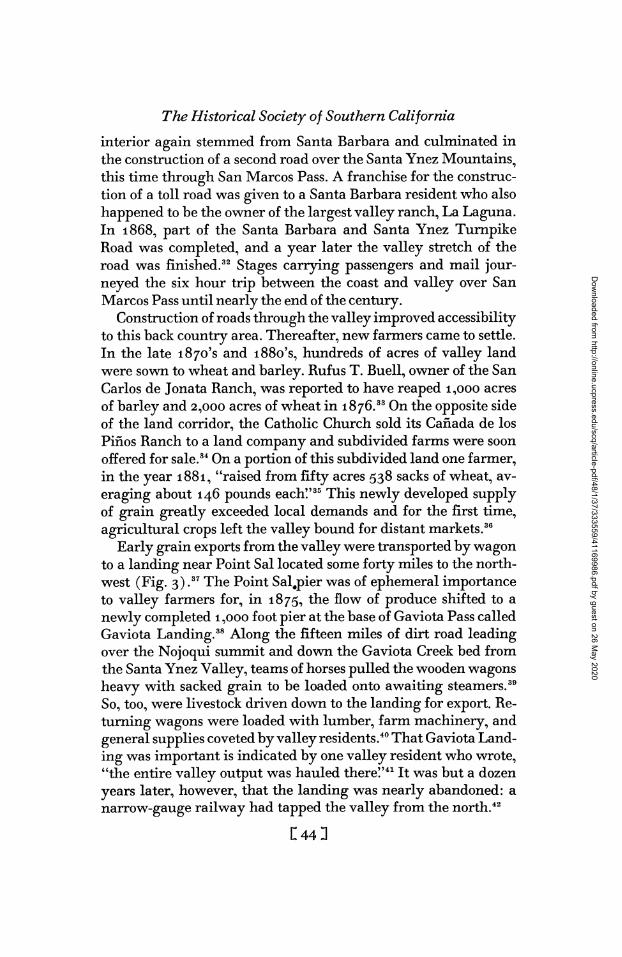
Construction of roads through the valley improved accessibility to this back country area. Thereafter, new farmers came to settle. In the late 1870's and 1880's, hundreds of acres of valley land were sown to wheat and barley. Rufus T. Buell, owner of the San Carlos de Jonata Ranch, was reported to have reaped 1,000 acres of barley and 2,000 acres of wheat in 1876.33 On the opposite side of the land corridor, the Catholic Church sold its Cañada de los Piños Ranch to a land company and subdivided farms were soon offered for sale.34 On a portion of this subdivided land one farmer, in the year 1881, "raised from fifty acres 538 sacks of wheat, av- eraging about 146 pounds each!'35 This newly developed supply of grain greatly exceeded local demands and for the first time, agricultural crops left the valley bound for distant markets.36
Early grain exports from the valley were transported by wagon to a landing near Point Sal located some forty miles to the north- west (Fig. 3) ,37 The Point Saljpier was of ephemeral importance to valley farmers for, in 1875, the flow of produce shifted to a newly completed 1,000 foot pier at the base of Gaviota Pass called Gaviota Landing.38 Along the fifteen miles of dirt road leading over the Nojoqui summit and down the Gaviota Creek bed from the Santa Ynez Valley, teams of horses pulled the wooden wagons heavy with sacked grain to be loaded onto awaiting steamers.39 So, too, were livestock driven down to the landing for export. Re- turning wagons were loaded with lumber, farm machinery, and general supplies coveted by valley residents.40 That Gaviota Land- ing was important is indicated by one valley resident who wrote, "the entire valley output was hauled there!'41 It was but a dozen years later, however, that the landing was nearly abandoned: a narrow-gauge railway had tapped the valley from the north.42
П443
Dow
nloaded from http://online.ucpress.edu/scq/article-pdf/48/1/37/333559/41169986.pdf by guest on 26 M
ay 2020

Santa Y nez Valley
During the time when the coastal landing was providing the interior with a much needed service, the valley's first three towns appeared. Each served as an agricultural trade center with its blacksmith^ general store, dry goods store, barber shop, harness shop, livery stable, and saloons. Ballard, first of the towns, was established in 1880 and was platted the next year by George W. Lewis (Fig. 3).43 In 1882, a Catholic bishop, preferring to have settlers live together rather than on separate farms, provided the Cañada de los Piños Ranch farmers with lots in what became the
Valley towns and routes to coast, late nineteenth and twentieth centuries.
♦ V ß& SAN LUIS OB/SPO continued ' r#'
]' A. S.LO.COUNT^ ' JA
L-~f- / Ь- -' 3W (^".couhty ' '"«J '' .Мс,пссо«тк, L-~f- Ь- SANTA 3W ' NfPNb Л
// ( '
*
/{ у*/ N^ DIVIDED HIGHWAY
/ i ^-^^^сод.Х - STATE HIGHWAYS
' ( -
^^-^ . REFUGIO PASS AND
'Л LO5 ALA(*O?55s»4a^,),
. OLD COUNTY WAOOM Mi
'k ^5^*? NO LONG tH EXTANT : ÛAVIOTA r Ö Д( LANDING, HARFORD'a WHA«F. Л
iï%*Ç^^, _j,WY, 2S, /SirOi 0LIV03 I PAClflC COAST RAILWAY.
/ ^W^£~^4 8ALLAR0 T' ? ? Ю / LOMPoc
^^-^^^¿^Í^L i-r^^NTA YNrZ MILCS ft isOVJ^lifrU-^^^ Jmi CACHU/AA
V=> - as ^ - аиу Л - -J "*~~<ШУ SANTA ^^^w
^^^BARBARA SANTA
^^^
town of Santa Ynez. And in 1887, Los Olivos was founded as the child of a land company which laid out the town as a terminus for the valley railway. By 1890, Ballard had already passed its peak of importance,44 Santa Ynez was in the midst of constructing an elaborate hotel in anticipation of the coming of the Southern Pacific Railroad, and Los Olivos was the bustling terminus of the narrow-gauge Pacific Coast Railway.
C453
Dow
nloaded from http://online.ucpress.edu/scq/article-pdf/48/1/37/333559/41169986.pdf by guest on 26 M
ay 2020

The Historical Society of Southern California The Pacific Coast Railway had its origin in San Luis Obispo
County (shown in the continued part of Fig. 3). Because of the paucity of coves or bays on the California coast, San Luis Obispo Bay, offering some protection to ships in rough weather, became an early shipping point. In 1873, John Harf ord built a pier, the third to be constructed into the bay.45 From "Harford's Wharf" a horse drawn tramway was constructed to Miles, a short distance inland, and from Miles freight brought in by ships was wagoned some seventy miles to the Santa Ynez Valley in the early i87o's.4e The tramway was soon replaced by a narrow-gauge railway which, under various names and different owners, was built to San Luis Obispo (1876), south to Santa Maria, then known as Central City (April, 1882), and to Los Alamos (October, 1882). During the process of this expansion, two railway lines and one steamship company came under the common ownership of one firm, the result being the consolidation of both land and sea oper- ations. It was this integrated transport facility which the Pacific Coast Railway represented as it laid its last rails to Los Olivos on November 16, 1887.47
The valley was then tied to the coast by an "iron horse" capable of negotiating with ease the seventy-five miles to San Luis Obispo Bay. Exported were mainly two commodities, grain and fruit. More than 150,000 sacks of grain left the valley by rail the first year after the connection at Los Olivos was made, 48 and such quantities of grain continued to be exported in the 1890's.49 A great surge in horticultural planting took place at this time as thousands of peach, apricot, pear, cherry, prune, walnut, and ol- ive trees were set out.50 At first, these plantings were not exten- sively irrigated, partially because of land company claims that irrigation was not necessary.51 That such ideas concerning irriga- tion were soon dispelled was indicated by the valley correspond- ent who wrote that "the dry season of 1893-4 awakened the valley to the necessity of irrigation!'52 Thus, from the valley, the narrow- gauge carried green and dried fruit. To facilitate all shipments, the railway maintained, near its Los Olivos station, a grain ware- house, stock pen, and lumberyard. The valley resident who wrote of the importance of Gaviota Landing could now have stated that the entire valley output left by rail.
Meanwhile, anticipation of the arrival of the Southern Pacific
с 46 a
Dow
nloaded from http://online.ucpress.edu/scq/article-pdf/48/1/37/333559/41169986.pdf by guest on 26 M
ay 2020

Santa Y nez Valley trunk line to the valley was keen. Some decades earlier, railroad surveyors had recommended one of two routes as feasible for rail- road construction through the county: an all-coast road, to be cheaper to build because of an easier grade, and a more expensive trans-Gaviota Pass road.53 Valley residents expected the latter of these routes to be chosen. By August, 1887, Southern Pacific track reached Santa Barbara from the south, and in May, 1894, San Luis Obispo was tapped from the north. Closing the gap between the two cities was now only a matter of time, but the announce- ment which eventually came shattered valley dreams. The South- ern Pacific, rather than tap the agricultural interior, chose the cheaper coastal route. Repercussions of the decision were soon felt. Having built south to Surf, then called Bridgeport (Fig. 3), at the mouth of the Santa Ynez River, by August, 1 896, the South- ern Pacific quickly extended a spur to the town of Lompoc and from this town, passengers were transported to Santa Barbara by stage. Los Olivos was replaced as a stage coach terminus and the narrow-gauge lost an appreciable portion of its earlier passenger traffic. The final gap between Santa Barbara and Lompoc was closed in January, 1901, but because much track had to be re-laid west of Santa Barbara, coastal service did not commence until that December. A valley through train did not become a reality.
Into the twentieth century, Pacific Coast Railway trains con- tinued to haul goods and people to and from the valley, but in the face of competition, revenue declined, first from a drop in passen- ger traffic, then freight traffic. Over 60,000 passengers were car- ried on the narrow-gauge in 1912, an all-time high for the com- pany despite competition from the Southern Pacific.64 As motor vehicles became more numerous, however, the total number of passengers carried decreased year by year. A stevedor's strike in 1927 was the turning point in successful freighting over the rail- way because steamship service was not able to uphold its end of the transport system.55 Still further declines in revenue were the result of the depression of the early 1930's, during which time the railway obtained more income from freight entering the valley at Los Olivos than from freight going out.56 Independent truckers, known as wildcatters, undercut the railway shipping prices and successfully outcompeted their rival. The last train to Los Olivos arrived and departed in January, 1934,57 and two years later,
Í471
Dow
nloaded from http://online.ucpress.edu/scq/article-pdf/48/1/37/333559/41169986.pdf by guest on 26 M
ay 2020

The Historical Society of Southern California tracks were taken up between Los Olivos and Los Alamos.58 Fifty years of port connection by rail had ended.
If competition for the transport of valley products then existed, it was only between truckers who, by the mid-1930's, could drive to Los Angeles or San Francisco over hard-surfaced highways. In the county and valley, old roads were improved and new ones were built. There existed a certain persistence in the routes used between the valley and south coast because of the channeling ef- fect of the three passes, but north of the passes, kinks and bends which formerly existed were ironed out. For example, in 1916, when Highway 101, Santa Barbara County's arterial, was open- ed, it passed through Gaviota Pass, but then abandoned the sinu- ous course of the county wagon road and proceeded directly north (Figs. 2 and 3). Also, in the mid-1920's, extensive repairs and straightening on the old San Marcos Pass road were undertaken.59 In 1931, it became a part of the state highway system (present- day Sign Route 154). In contrast to the above improvements which have continued to the present time,60 the road over Refugio Pass was neglected. This road was surfaced with black top only between the mountain crest and Highway 101 to the south and is today of little importance as a transport carrier. At present, over Highway 101, a four-lane freeway, and through the Gaviota defile passes a large volume of people and products between the south coast and valley.
When Highway 101 was completed through the valley, all four valley towns including Solvang, then only five years old, were by-passed to the west. Solvang was a community established by a colony of Danish- Americans who purchased 10,000 acres of the former San Carlos de Jonata Ranch land for agricultural pur- poses. The town was located at the junction of the north-south county road and the east- west road to the Lompoc Valley. Had the new colonists foreseen the construction of Highway 101, they might have located Solvang three miles west of where it is. In- stead, a fifth valley town came into existence where the Lompoc Valley road (present-day Sign Route 246) crossed Highway 101. There, an automobile garage opened and shortly thereafter other motorist-catering businesses commenced. In 1920, when a post office was completed, the community acquired the name Buellton. Buellton thrived as a highway service town, but Solvang grew
usu
Dow
nloaded from http://online.ucpress.edu/scq/article-pdf/48/1/37/333559/41169986.pdf by guest on 26 M
ay 2020

Santa Ynez Valley still faster as a town which served the farmers and, more recently, as a tourist center. Solvang is, at present, the valley's largest com- munity.61
Today, as in the past, agricultural products leave the valley bound for points outside. Contributed by Santa Ynez farmers is an important share of the county's total animal products and field crop production.62 Livestock, poultry, and their products repre- sented, in 1963, approximately one-third of the total county's value in agricultural production. Twenty-five per cent of this amount, some $5.2 million, was furnished by the valley in the form of cattle and calves, milk, eggs, hogs, chicken, sheep^ and wool.63 Irrigated and non-irrigated crops such as pasture grass, alfalfa, grain hay, sugar beets, barley, corn for silage, and beans (mostly limas and garbanzos) valued at $1.9 million constituted seventeen per cent of the county's total production of field crops. Also important agriculturally were valley walnut, seed crop (flowers, beans, and vegetables) , vegetable, and nursery products. These commodities left the valley for market by truck, livestock, poultry and their products traveling mainly to Los Angeles64 and the field crops to county processing plants as, for example, beans to Lompoc and Santa Maria, sugar beets to Santa Maria.65
Potable water, not always plentiful in this coastal environ- ment, is also transported to the south coast from its back country (Fig. 3) . In the early 1950's, the third water storage facility on the Santa Ynez River, the Cachuma Project, was completed.66 As part of the project, an earth and rock fill dam was built and be- hind the dam formed Cachuma Reservoir. In addition to the dam and reservoir, 6.4 mile long Tecolote Tunnel was excavated through the Santa Ynez Mountains to the south coast. An elabo- rate south coast water distribution system conveyed reservoir wa- ter to five county communities and supplied 20,000 acres with irrigation water.
In the Santa Ynez River Valley, the Santa Ynez Valley subarea has been the sole area to receive reservoir water. Prior to the con- struction of Cachuma Dam, an agreement had been signed be- tween the Cachuma Project and Santa Ynez River Valley officials which stated that water must be flowing at the surface at five points between the reservoir and the Lompoc Valley before the Cachuma Dam could be closed to store water. Thus, the Cachuma
П493
Dow
nloaded from http://online.ucpress.edu/scq/article-pdf/48/1/37/333559/41169986.pdf by guest on 26 M
ay 2020

The Historical Society of Southern California
Project did not lessen the valley's water supply.67 When the dis- tribution of municipal and agricultural water to the valley com- menced in 1962, however, farmers no longer had to rely entirely on precipitation and wells (replenished, in part, by the river) for their crops and townsfolk were assured a supply adequate to meet their needs.
In conclusion, one theme has prevailed throughout the course of the valley's history: maintaining contact with the outside. Each settler group, Spanish, Mexican, American and Danish- American was challenged to maintain outside contact for upon this depended its very livelihood. Maintaining contact inevitably meant change as, for example, in routes to the coast. The route over Refugio Pass long ago reached its peak in usefulness. Gavi- ota Landing was eventually washed away and the road to the landing fell to disuse for that purpose. Similarly, the narrow- gauge track was taken up. So, too, were there changes in the val- ley's products and in the modes of transport employed in their shipment. For example, ox-drawn carretas loaded with hides and tallow were replaced by the horse and wagon which transported wheat and barley; for a time, the railway was the supreme trans- port carrier but it, too, succumbed, in this case to the motor truck. Comparing the first business of Ballard, a blacksmith shop (1881), and that of Buellton, an automobile garage (1916), viv- idly illustrates the transition from wagons and buggies to motor vehicles. Most recent of the changes in valley products and modes of transport is the example of water, an export commodity which leaves the valley by underground pipe.
It is interesting that as the technology of transportation im- proved, distance to markets decreased. The early sailing vessels plying to Boston and European ports with their cargoes of hides and tallow were replaced by more ocean- worthy steamships (of the same firm as the Pacific Coast Railway) which carried valley grain less far, mainly to San Francisco. Still later, trucks trans- ported goods only to Los Angeles, Santa Barbara, Lompoc, and Santa Maria. The advent of trucks brought to a close the era when products were transported directly to coastal sites for transship- ment, but remaining unchanged was the basic problem of getting valley products out to market.
The Santa Ynez Valley is a coastal California hinterland. Per-
С50П
Dow
nloaded from http://online.ucpress.edu/scq/article-pdf/48/1/37/333559/41169986.pdf by guest on 26 M
ay 2020
Santa Y nez Valley
haps because of its relatively small size and rather remote loca- tion, the valley as a hinterland has been overlooked. Significant- ly, one of the very reasons for this neglect, remoteness from the coast, has shaped the valley's character and has been the central unifying theme in its history. Moreover, this valley is not untypi- cal of many small back country areas where the tradition of set- tlers has been to look beyond their local environment for places to trade and markets to send their products. Interesting similari- ties in problems and the outlook held in common by inhabitants of interior valleys would most likely be revealed through com- parative studies of such areas.
П5О
Dow
nloaded from http://online.ucpress.edu/scq/article-pdf/48/1/37/333559/41169986.pdf by guest on 26 M
ay 2020

NOTES
1Cited are two examples of such studies. Chapter V of Robert G. Albion's The Rise of New York Port, 1815-1860 (New York, 1939), entitled "Hinterland and Ca- nal" discusses the Hudson and Mohawk valleys as a portion of New York City's nineteenth century hinterland. Donald J. Patton's "General Cargo Hinterlands of New York, Philadelphia, Baltimore and New Orleans;* Annals, Association of Ameri- can Geographers, 48 (1958), 436-455, is a present-day study which attempts to delimit hinterlands based on railroad general cargo figures for June, 1955.
2There are no recognized boundaries which delimit the valley. As an indication of valley size, broadly defined, the California State Agricultural Society states that ara- ble land, classified as "mostly rolling;' totals 120,000 acres (187.5 square miles). Transactions, California State Agricultural Society, 1904 (Sacramento, 1905), P- 2Зб.
3The time of its founding and instructions given to the party which selected its site support the contention that Mission Santa Ines was considered to be California's first interior mission. The very year the last link in the coastal chain of missions (Mission San Luis Rey, 1798) was established, Father Tapis was instructed to "sur- vey the region east of the sierras" (the interior), and to select a mission site. Zephyrin Engelhardt, Mission Santa Ines Virgin y Mártir (Santa Barbara, 1932), p. 3. (See also note 4, post.)
4The Tulareños further support the contention that Mission Santa Ines was to be an inland institution. For the first time, these "people of the rush marshes" so-called because of their ill-drained San Joaquin habitat, were to be brought under the sphere of mission influence. The Tulareños are known today as the Yokut Indians. A. L. Kroeber, Handbook of the Indians of California (Washington, D.C., 1925), PP- 475" 476.
5Said Tapis, ". . . esta [Misión] será menos frequentada que las demás, por ser indispensable el paso por la Sierra de Mescaltitan [sic], ó por el Rancho de los Señores Ortegas, siendo uno y otro mucho mas incomodo y pesado, que el camino de la playa pa Monterey." Father Tápis to Governor Arrilaga, June 30, 1803. California Mission Section in the Santa Barbara Mission Archives, Santa Barbara, Document 427, p. 1. See also Engelhardt, Mission Santa Ines, p. 6, and Zephyrin Engelhardt, Missions and Missionaries of California (2nd ed.; 4 vols., Santa Barbara, 1930), II, 620-621.
6Written records do not exist for the Spanish grant of six league El Rancho de Nuestra Señora del Refugio to José Francisco de Ortega and his son. Therefore, the precise date of the first present-day county ranch is unknown. Thomas M. Storke, Calif ornia Editor (Los Angeles, 1958), pp. 17-18.
7One historian points out that the Ortegas had planted a grain field in the Santa Ynez Valley near the present-day mission by 1798. It is reasonable to assume that the field was reached by traveling through the pass. Reverend Maynard Geiger, "Some Observations on Santa Barbara County's Early RoadsJ' Noticias, X (Spring 1964), 5.
8One of the few pass descriptions known today was written by Alfred Robinson who, upon departing from the Ortega rancho in about 1829, wrote: "It is a winding road, in many places only of sufficient width for one animal to pass, and almost blocked up with loose stones. From the level summit to which we slowly ascended, we had on one side an extensive view of the shore from Point Conception to Santa Barbara, comprising more than sixty miles of sea-coast, and on the other a fine coun- try covered with woods and abounding in excellent pasturage. Here we rested a few moments to give our animals breath, and then commenced our gradual descent. This we found even more tedious, and often times, from the immense numbers of worn rocks and loose stones, more dangerous than had been our ascent. We accomplished
П52З
Dow
nloaded from http://online.ucpress.edu/scq/article-pdf/48/1/37/333559/41169986.pdf by guest on 26 M
ay 2020

Santa Y nez Valley the task, however, and soon beheld, upon a distant elevation, the Mission of Santa Ynes. The fording of a river and a short gallop soon brought us to its door!' Alfred Robinson, Life in California (Oakland, Calif., 1947), Part I, p. 31.
9Geiger, "Some Observations . . ." pp. 5-6, and Marvin W. Mikesell, "The Santa Barbara Area, California: A Study of Changing Culture Patterns Prior to 1865" (Unpublished M.A. Thesis, University of California, Los Angeles, 1953), pp. 90, 139.
10Zephyrin Engelhardt, Santa Barbara Mission (San Francisco, 1923), pp. 87, 254. 11 As an example of the use of this pass, in 1824, it is reported that the messenger
dispatched to Mission Santa Barbara with news of an Indian uprising at Mission Santa Ines traveled over San Marcos Pass. Engelhardt, Mission Santa Ines, p. 121.
12John G. Parke, Exploration for Railroad Routes from San Francisco Bay to Los Angeles, California, West of the Coast Range, 1854-1855 (Washington, D.C., 1857), p. 2. A decade earlier, the hardships which John C. Fremont encountered while crossing the Santa Ynez Mountains at San Marcos (Christmas Day, 1846), were described by Edwin Bryant who accompanied the battalion. Edwin Bryant, What I Saw in California (New York, 1848), Chapter 32.
13Geiger, "Some Observations . . ." p. 7. 14A contract was signed between McCulloch, Hartnell and Company, agents for
the English firm John Begg and Company, and Governor Sola in June, 1822, giving McCulloch and Hartnell the exclusive right to trade with California's missions for hides and tallow between 1823-1826. Adele Ogden, "Hides and Tallow: McCulloch, Hartnell and Company 1822-1828" California Historical Society Quarterly, VI, (1927), 254-255.
15Adele Ogden states that collection depots for the present-day county were a ". . . harbor near La Purísima; Coxo (Coro) for Santa Inés; Santa Barbara for mis- sions Santa Barbara and San Buenaventura; . . !' "Hides and Tallow" p. 257, note 11. Three years earlier, in her "McCulloch Hartnell and Company English Merchants in the California Hide and Tallow Trade" (Unpublished M.A. Thesis, University of California, Berkeley, 1924), p. 44, she stated: "Although embarkation at Coxo was easily accomplished, the road from La Purísima was in parts impassable for carts and in the rainy season was dangerous even for mules. A little to the south at Santa Inés, the harbor was poorly sheltered." This would indicate that Cojo (Coxo) Bay served Mission La Purísima, not Mission Santa Ines. A map between pages 42-43, entitled "Hide and Tallow Collection Depots of McCulloch Hartnell and Company" does not show routes leading from either Mission La Purísima or Santa Ines to Cojo Bay. (The route from Santa Ines leads directly south to the ocean.) Therefore, it is difficult to tell just what use was made of Cojo Bay and Gaviota Pass. Adele Ogden cites as her authority in both her thesis and her article a letter from McCulloch, Hartnell and Company to John Begg and Company written on November 27, 1824, Hartnell Letterbook, pp. 87-88. This letter, deposited in the Bancroft Library by one "Zabala" was evidently returned to its owner as it was no longer a part of the Ban- croft collection in June, 1964.
16"Not having any one to transact Mission business with merchants and skippers at the port of Santa Barbara, Fr. Ordaz, accompanied by a guard or an Indian, would on horseback make the journey by way of Las Cruces and Rancho del Refugio, and attend to the exchange of goods himself." Engelhardt, Mission Santa Ines, p. 180.
17One writer points out that as non-Spanish trading vessels were legally prohibited on California's coast prior to 1821, the Santa Barbara port reached its time of greatest importance during the mid-nineteenth century when the lucrative hide and tallow trade was in progress. Marvin W. Mikesell, "The Changing Role of the Port of San- ta Barbara!' abstract, Yearbook, Association of the Pacific Coast Geographers, 15 (1953), 43.
18Examples of imports, mainly from Boston, were listed by Richard Henry Dana in the 1830's: ". . . spirits of all kinds (sold by the cask), teas, coffee, sugars, spices,
П53З
Dow
nloaded from http://online.ucpress.edu/scq/article-pdf/48/1/37/333559/41169986.pdf by guest on 26 M
ay 2020

The Historical Society of Southern California raisins, molasses, hardware, crockery-ware, tinware, cutlery, clothing, of all kinds, boots and shoes from Lynn, calicoes and cottons from Lowell, crapes, silks; also, shawls, scarfs, necklaces, jewelry, and combs for the ladies; furniture; and in fact, everything that can be imagined, from Chinese fireworks to English cartwheels . . ." Two Years Before the Mast (New York, 1946), p. 90.
19Between 1822-1827, supplies valued at $10,767 were furnished the non self- supporting presidio personnel by Mission Santa Ines. Albert B. Lewis, "Santa Ines" in Frederick W. Hodge (ed.), Handbook of American Indians North of Mexico (Washington, D.C., 1910), Part II, p. 458.
20Speaking in general of coastal California in 1842, Vischer noted the inefficient handling of the hide and tallow business by ranchers. Edward Vischer, First Visit to California, trans, and ed. by Erwin G. Gudde (San Francisco, 1940), pp. 14-15.
21Walker A. Tompkins, Santa Barbara's Royal Rancho (Berkeley, i960), p. 75. A history of Los Dos Pueblos Rancho is the subject of this book.
22Use of Refugio Pass to and from the valley is documented through an incident which occurred about 1850. At the pass summit, Den's Irish foreman, Tom Meehan, was ambushed and killed while on route to the south coast. Ibid., p. 112.
23Demands for such service were in the form of editorials such as one in the Santa Barbara Gazette, May 24, 1855.
24In a letter to the newspaper, William Carey Jones claimed that Spanish and Mexican mail service compared favorably with American service. Santa Barbara Gazette, July 24, 1856.
25Before the southern half of Santa Barbara County seceded to form Ventura County on January 1, 1874, Santa Barbara County extended from the San Luis Obis- po County border to the Los Angeles County border.
26Parke, Exploration for Railroad Routes, p. 2. 27On April 4, 1861, four days after the passing of the stage, a geological party
crossed through Gaviota Pass. Speaking of the mountains and the pass, Brewer wrote: "This sandstone ridge is a continuous one, and has but one break, the Gaviota Pass, for a hundred miles or more. At the Gaviota a rent or fissure divides the ridge, but a few feet wide at the narrowest part and several hundred feet high. The road passes this 'gate' and then winds up a wild rocky canyon, the wildest pass I have yet seen here [in California] . The mountains rise very rugged about 2,000 feet on each side. The narrowest part is not the highest; the road continues to ascend for about six miles where we cross the summit. A horrible trail ran through this formerly, but now the road is good!' William H. Brewer, Up and Down California in 1860-1864 (Berkeley and Los Angeles, 1949), p. 75.
28The corridor was evidently created by American surveyors in the process of confirming ranch and mission land titles. Lewis, reported to have been "a surveyor of ability" found that the land was public domain. Santa Ynez Valley News (Sol- vang),July27, 1928, p. 7.
29Grace L. Davison, "Scrapbook" (Santa Ynez Valley Historical Society, Santa Ynez, Calif.), p. 63. Mrs. Davison was the valley correspondent for the Santa Bar- bara Daily News (renamed the News Press in 1932 after it merged with the Morning Press) between 1923 and approximately 1951.
30"The Adobes" as Ballard's Station is now called, are still standing, the southern- most adobe being the original built by Ballard. Davison "Scrapbook!' p. 25.
31County inhabitants north of the mountains deplored the arduous day's journey required to reach the county seat and return home again. Lompoc, Los Alamos, and Santa Maria settlers had aspirations of becoming their own county seats, and the inspired citizens of Lompoc went so far as to send lawyers to the state capitol to re- quest the formation of a new Purísima County. Walker A. Tompkins, California's Wonderful Corner (Santa Barbara, 1962), p. 128.
П54З
Dow
nloaded from http://online.ucpress.edu/scq/article-pdf/48/1/37/333559/41169986.pdf by guest on 26 M
ay 2020

Santa Ynez Valley ^Successful in getting the Turnpike Company to build over his Lomas de la Puri-
ficación Ranch south of the Santa Ynez River was the owner, Thomas W. Moore who, in an open letter to the Santa Barbara Post, May 19, 1869, offered the company $500 and the right-of-way over his land.
33Jesse D. Mason, History of Santa Barbara County (Oakland, Calif., 1883), p. 302. 34Purchased from Archbishop Alemany, the ranch was quickly subdivided by the
Santa Ynez Land and Improvement Company and farms were offered for sale in a series of newspaper advertisements as, for example, one in the Santa Barbara Morn- ing Press, January 5, 1888, and also by means of a pamphlet, "Santa Ynez Valley, Santa Barbara County, California" (San Francisco, 188?), 8 pp. A plat of the College Ranch, as it was called, can be seen in undated Book B, Assessor's Office, County Court House, Santa Barbara.
35Mason, History of Santa Barbara County, p. 304. 36The inchoation of grain-growing frontiers up and down the Pacific coast was not
uncommon at this time. See, for example, Donald W. Meinig, "Wheat Sacks Out To Sea: The Early Export Trade From Walla Walla Country" Pacific Northwest Quar- terly, 45 (1954), 13-18, and Donald W. Meinig, "The Growth of Agricultural Re- gions in the Far West, 1850-1910" Journal of Geography, 54 (1955), 221-232.
37Grace L. Davison, The Gates of Memory (Solvang, Calif., 1955), p. 49. 38Two Lompoc Valley ranchers, Hollister and Dibblee, built the landing to facili-
tate the export of their wool and to serve the interior producers of other products. Dibblee Poett, "The Gaviota PassJ' Noticias, X (Spring 1964), p. 8.
39George MacNeally, son of the "wharfmaster" at the landing, later said that at the landing, "Often there would be a train of as many as 36 4-, 6-, and 8-horse teams in line waiting a turn [to unload]." Santa Ynez Valley News (Solvang), July 9, 1926, p. 1.
40For example, Buell fenced forty miles of his ranch with redwood boards stacked five tiers high, the lumber all having been brought in from Gaviota Landing. Davi- son, Gates of Memory, p. 68.
41Ibid., p. 49. Mrs. Davison moved to the valley in December, 1882. Personal inter- view, August 14, 1963.
42Even before the railway was completed to the valley, Los Alamos was a railhead to which teamsters drove grain after 1882, to the dismay of Gaviota Landing pro- prietors. Mason, History of Santa Barbara County, p. 301.
43Lewis was reported to have wished to insure "social contacts" for his family when he founded Ballard. Davison, Gates of Memory, p. 35.
^Between 1889 and 1890, Ballard's population dropped from 142 to 30 as people rapidly emigrated to the more prosperous communities. Fred S. Oliver, "Scrapbook" (Santa Ynez Valley Historical Society, Santa Ynez, Calif.), p. 12b. This scrapbook is a collection of articles written for various newspapers between 1888-1894 by Oliver, a resident of Ballard and Los Olivos during the period.
46Gerald M. Best, Ships and Narrow Gauge Rails: The Story of the Pacific Coast Company (Berkeley, 1964), Chapter A.
46Clement Fisher, Jr., "Narrow Gauge Movie Star" in Frederic J. Shaw (ed.), Oil Lamps and Iron Ponies (San Francisco, 1949), p. 140.
47An enabling act passed in Sacramento in 1874 allowed the railway to build into Santa Barbara. Best, Ships and Narrow Gauge Rails, p. 18. On August 17, 1887, the Southern Pacific had reached Santa Barbara on its way to San Francisco, however, so the Pacific Coast built no farther. Herbert С Grundeil, former General Manager of the Pacific Coast Railway from 1935 to 1942, states that company over-investment in land was also important in ending the company building program. Personal inter- view, July 24, 1964.
C553
Dow
nloaded from http://online.ucpress.edu/scq/article-pdf/48/1/37/333559/41169986.pdf by guest on 26 M
ay 2020

The Historical Society of Southern Califórnia 48James V. Mink, "The Santa Ynez Valley: A Rural California Community of the
Eighties;' Quarterly Historical Society of Southern California, XXX (1948), 225. 49Davison, "Scrapbook" p. 42. 50By 1892, 3000 acres of horticulture including some 30,000 olive trees were plant-
ed in the valley. Annual Report of the State Board of Horticulture of the State of California for 1892 (Sacramento, 1892), pp. 236-237.
51Wrote the Santa Ynez Land and Improvement Company, "So abundant is the rainfall in this valley that irrigation has never been found necessary; however, an abundant supply of water exists in the Santa Ynez river, adjacent creeks, mountain streams and springs, for irrigation of all agricultural lands, ..." "Santa Ynez Valley, Santa Barbara County California" p. 5.
62Fred S. Oliver, San Francisco Evening Bulletin, May 12, 1894 ("Scrapbook" p. 34b).
53Parke, Exploration for Railroad Routes, pp. 15-16. 64Best, Ships and Narrow Gauge Rails, p. 63. 55Grundell interview. 56Harold M. Wollam, Agent, Pacific Coast Railway, Los Olivos, 1931-1934. Per-
sonal interview, July 24, 1964. 57Wollan interview. 68Best, Ships and Narrow Gauge Rails, p. 69. 59Two years of work in widening and resurfacing the San Marcos Pass road was
completed in 1926. Santa Ynez Valley News (Solvang), January 15, 1926, p. 1. ^Completed at the summit of San Marcos Pass in the spring of 1964 was a bridge
(Cold Springs Canyon Bridge) and span of highway which shortened the old road by nearly two miles eliminating some 88 curves and reducing the driving time to Santa Barbara from Solvang by about ten minutes. Santa Ynez Valley News (Sol- vang), February 14, 1964, p. 4B. By the spring of 1965, four-lane Freeway 101, by- passing Buellton one-fourth mile to the east, will be completed at a cost of $2.2 million. Santa Ynez Valley News (Solvang), January 31, 1964, p. 3A.
61Solvang's total population numbered approximately 1700 in late 1963. King Merrill, Editor, Santa Ynez Valley News, personal interview, December 26, 1963. This compared with 7,363, the figure given by the Santa Barbara County Planning Department on April 1, 1963, for the greater Santa Ynez Valley area.
62Although important economically, agriculture was surpassed by tourism as the valley's leading income earner in the 1950's. The development of Solvang as a tourist center since World War II has been a major factor for the displacement.
^Percentages were derived by comparing the county "Agricultural Crop Report" 1963, with the agricultural crop breakdown for the valley that same year. This information was obtained from thé Department of Agriculture, Santa Barbara County, Santa Barbara.
64For example, in the summer of 1964, the milk output of eight valley dairies was all shipped to one of two processing plants in Los Angeles. Correspondence from Thomas M. Petersen, Manager, Santa Ynez River Water Conservation District, Santa Ynez, California, August 10, 1964.
65The county does not record where crops are sent after their production and only generalizations on crop distribution are possible. Walter S. Cummings, Agri- cultural Commissioner, Santa Barbara County, personal interview, July 15, 1964.
66Gibraltar Dam and Reservoir supplied Santa Barbara with Santa Ynez River Valley water after 1920. A decade later, Juncal Dam and its reservoir, Jameson Lake, fulfilled the same function for Montecito, a second south coast community. The Cachuma Dam and Reservoir, largest of the three facilities, was a project of the Federal Bureau of Reclamation.
67Thomas M. Petersen, personal interview, November 27, 1963.
C56 3
Dow
nloaded from http://online.ucpress.edu/scq/article-pdf/48/1/37/333559/41169986.pdf by guest on 26 M
ay 2020