Embed Size (px)
DESCRIPTION
THE PRESENT and THE NEAR FUTURE of cGPS in the Caribbean. cGPS in northern South America. CA-SA-NA Plate Boundary: Block Tectonics and indentation-extrusion. (Audemard, 2002). Colombia. cGPS network of Colombia. cGPS in Caribbean Colombia. Venezuela. GNSS-REMOS Stations –IGVSB-. - PowerPoint PPT Presentation
Citation preview
11
THE PRESENT and
THE NEAR FUTURE
of cGPS in the Caribbean
22
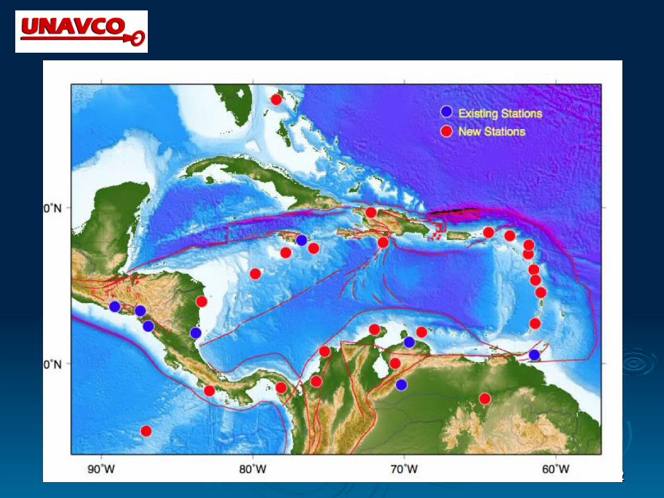
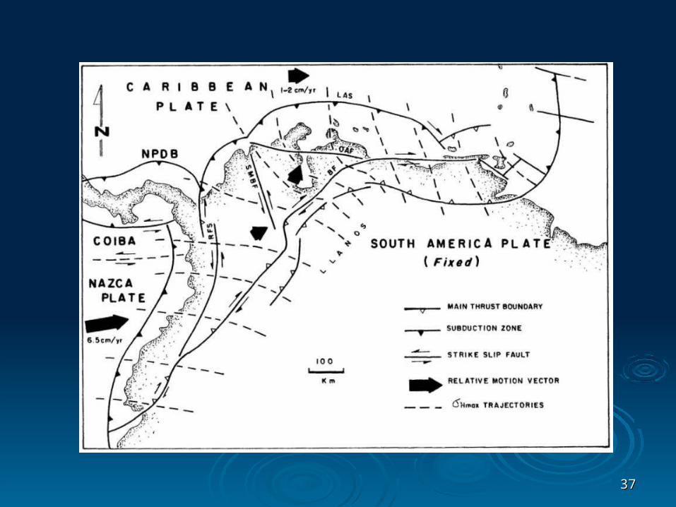
cGPS in northern cGPS in northern
South AmericaSouth America
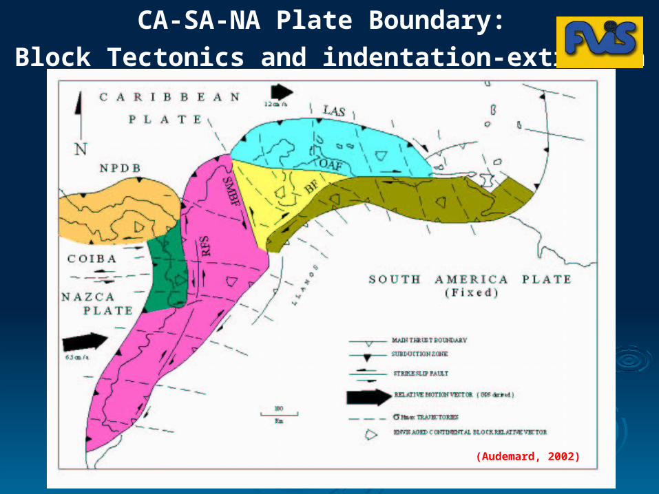
(Audemard, 2002)
CA-SA-NA Plate Boundary:
Block Tectonics and indentation-extrusion

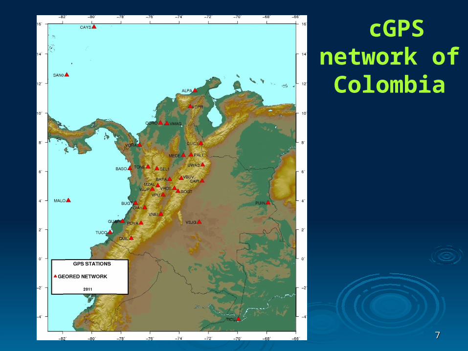
ColombiaColombia

66
COLOMBIAN INSTITUTE OF GEOLOGY AND MINING
GEORED PROJECT
NATIONAL GPS PERMANENT NETWORK FOR GEODYNAMICS RESEARCH
STATION ID STATION NAMELATITUDE LONGITUDE
º ' " º ' "
ALPA Guajira 11 31 40,74 -72 55 3,93
BAPA Base Aérea Palanquero 5 27 59,09 -74 39 27,03
BASO Bahía Solano 6 12 10,69 -77 23 35,63
BOGT Bogotá 4 38 24,27 -74 4 51,38
BUGT Buenaventura 3 49 32,47 -76 59 44,87
CAPI Yopal 5 21 5,12 -72 25 39,93
CAYS Cayo Serranilla 15 47 24,00 -79 50 45,60
CIA1 CIAT Palmira 3 30 19,04 -76 21 26,74
CORO Corozal 9 19 41,12 -75 17 16,28
CUC1 Cucúta 7 55 56,19 -72 30 46,13
GUAP Guapi 2 34 28,12 -77 53 40,85
MALO Malpelo 4 0 11,68 -81 36 22,10
MECE Barrancabermeja 7 6 26,09 -73 42 43,26
MZAL Manizales 5 1 47,98 -75 28 13,89
PAL1 Bucaramanga 7 8 10,47 -73 11 20,89
POVA Popayan 2 26 56,72 -76 36 53,08
PUIN Puerto Inírida 3 51 4,32 -67 54 12,03
QUIL Pasto 1 23 38,13 -77 17 27,41
SAN0 San Andrés 12 34 49,62 -81 42 56,60
SEL1 Santa Elena 6 11 27,13 -75 31 44,85
TICU Leticia -4 11 13,50 -69 56 21,79
TONE Urrao 6 19 27,93 -76 8 21,51
TUCO Tumaco 1 48 53,47 -78 44 51,73
UWAS Guican 6 27 2,57 -72 23 28,80
VBUV Chiquinquirá 5 31 59,54 -73 51 32,17
VDPR Valledupar 10 26 8,90 -73 14 52,18
VMAG Magangue 9 17 13,20 -74 50 49,20
VNEI Neiva 3 3 44,09 -75 15 19,10
VORA Apartadó 7 49 6,39 -76 43 18,51
VPIJ Ibagué 4 23 48,07 -75 6 24,09
VROS El Rosal 4 50 49,37 -74 19 23,98
VSJG San José del Guaviare 2 31 12,00 -72 37 48,00
VSJP Pereira 4 46 52,24 -75 50 8,02
77
cGPS network of Colombia
88
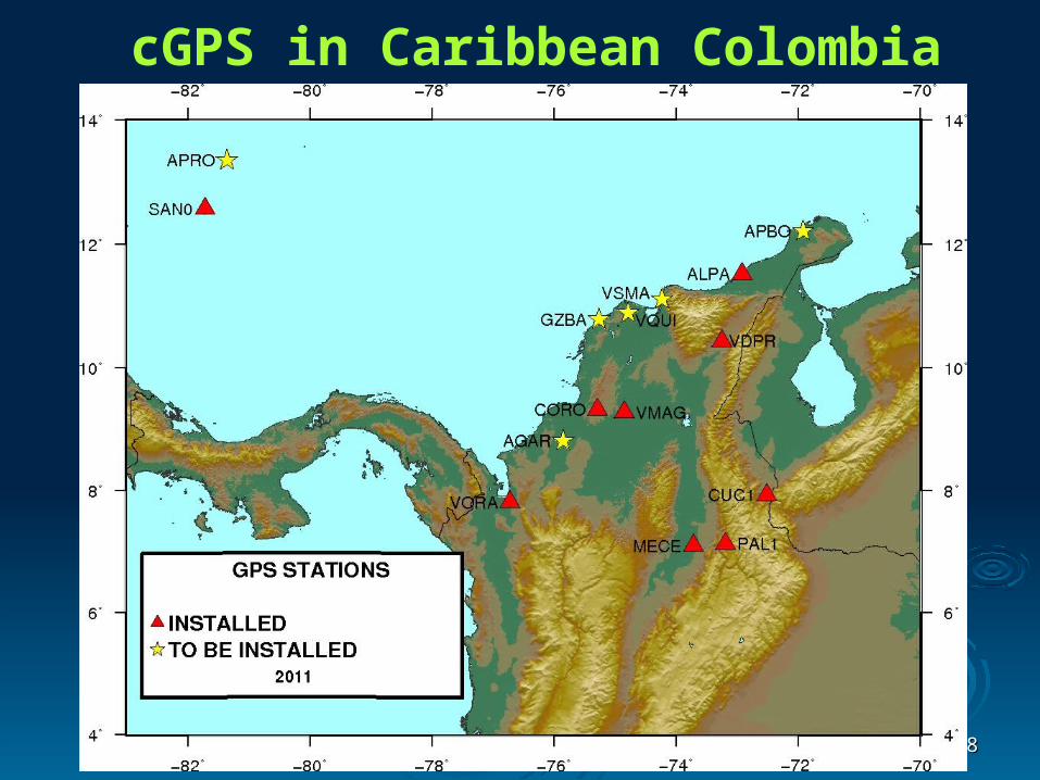
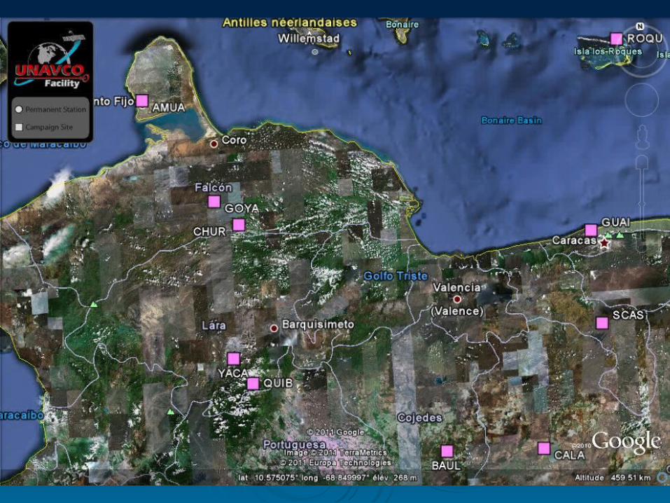
cGPS in Caribbean Colombia

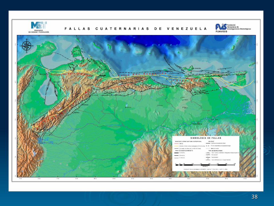
VenezuelaVenezuela
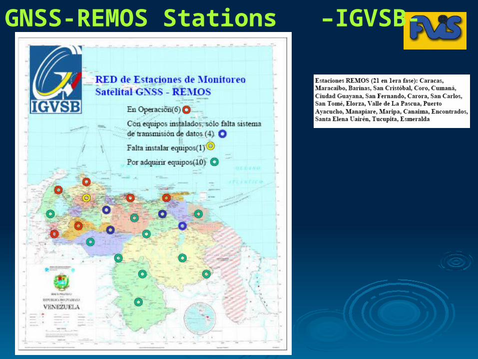
GNSS-REMOS Stations –IGVSB-
1111
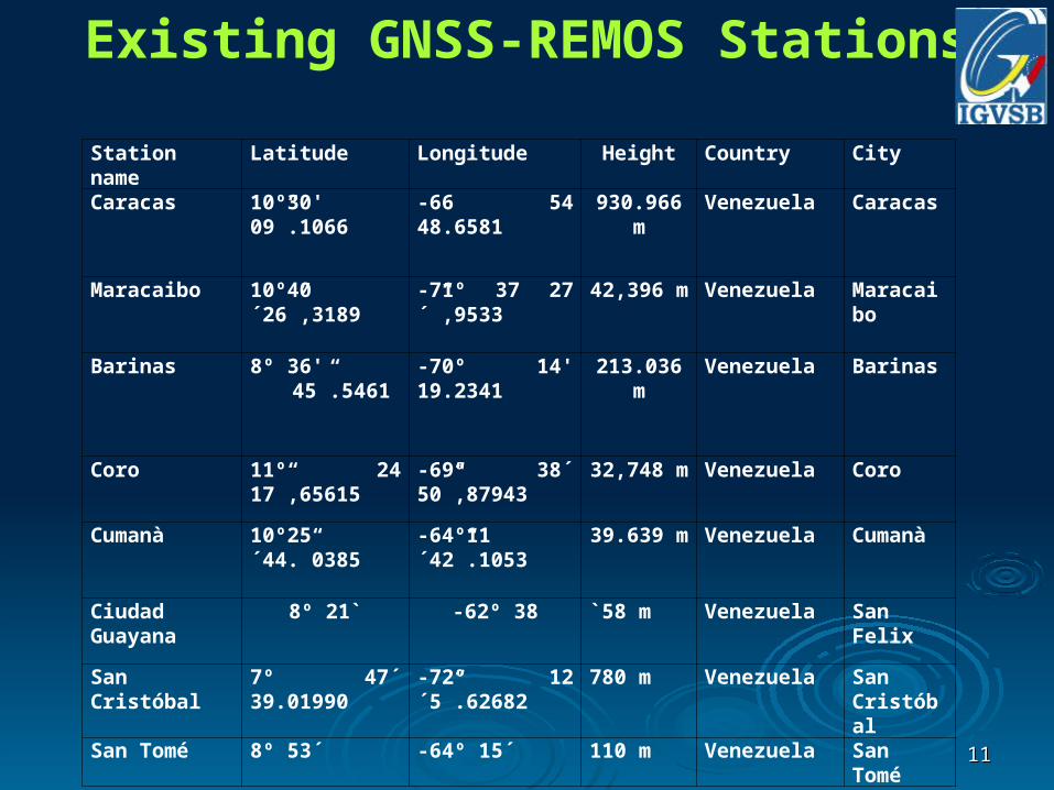
Station name Latitude Longitude Height Country City
Caracas 10º30' 09”.1066 -66 54 48.6581 930.966 m Venezuela Caracas
Maracaibo 10º40´26”,3189 -71º 37 27´”,9533 42,396 m Venezuela Maracaibo
Barinas 8º 36' 45”.5461 -70º 14' 19.2341 213.036 m Venezuela Barinas
Coro 11º 24 17”,65615 -69ª 38´ 50”,87943
32,748 m Venezuela Coro
Cumanà 10º25´44.”0385 -64º11´42”.1053 39.639 m Venezuela Cumanà
Ciudad Guayana
8º 21` -62º 38 `58 m Venezuela San Felix
San Cristóbal 7º 47´ 39.01990 -72º 12´5”.62682 780 m Venezuela San Cristóbal
San Tomé 8º 53´ -64º 15´ 110 m Venezuela San Tomé
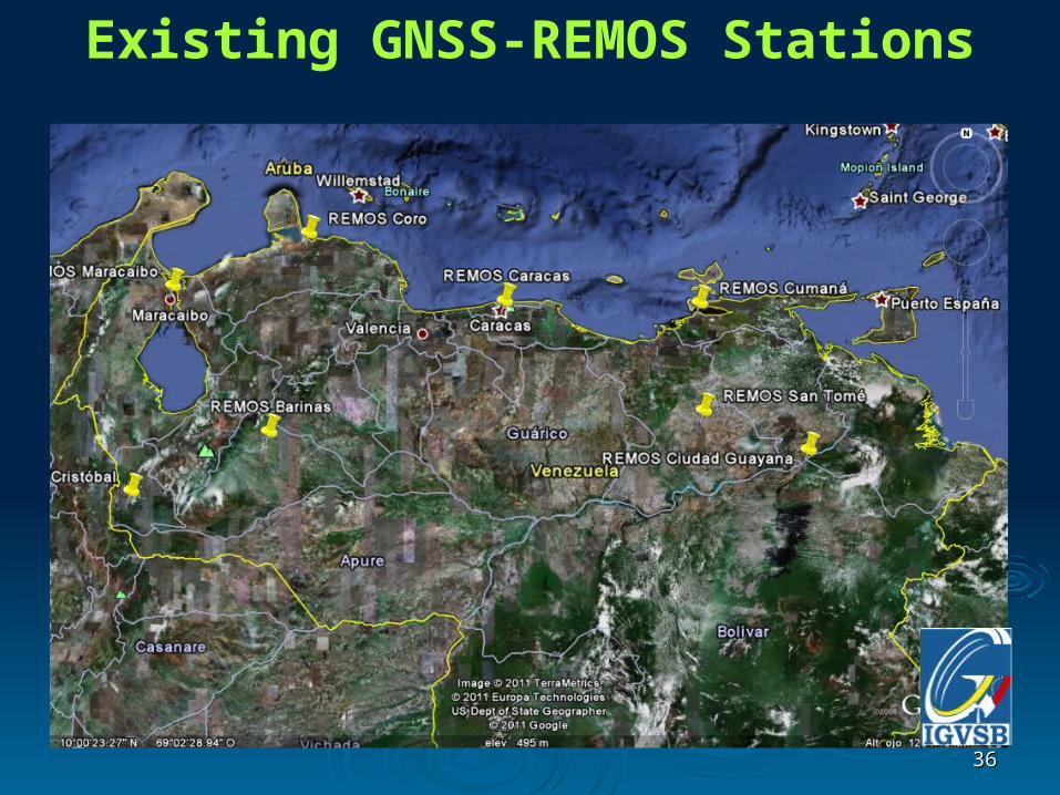
Existing GNSS-REMOS Stations
1212
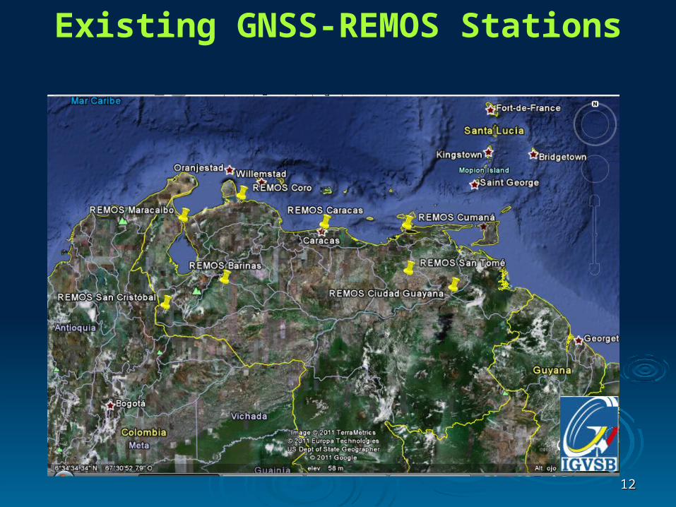
Existing GNSS-REMOS Stations
1313
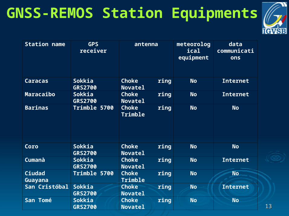
Station name GPS receiver antenna meteorological equipment
data communications
Caracas Sokkia GRS2700 Choke ring Novatel No Internet
Maracaibo Sokkia GRS2700 Choke ring Novatel No Internet
Barinas Trimble 5700 Choke ring Trimble No No
Coro Sokkia GRS2700 Choke ring Novatel No No
Cumanà Sokkia GRS2700 Choke ring Novatel No Internet
Ciudad Guayana Trimble 5700 Choke ring Trimble No No
San Cristóbal Sokkia GRS2700 Choke ring Novatel No Internet
San Tomé Sokkia GRS2700 Choke ring Novatel No No
GNSS-REMOS Station Equipments
1414
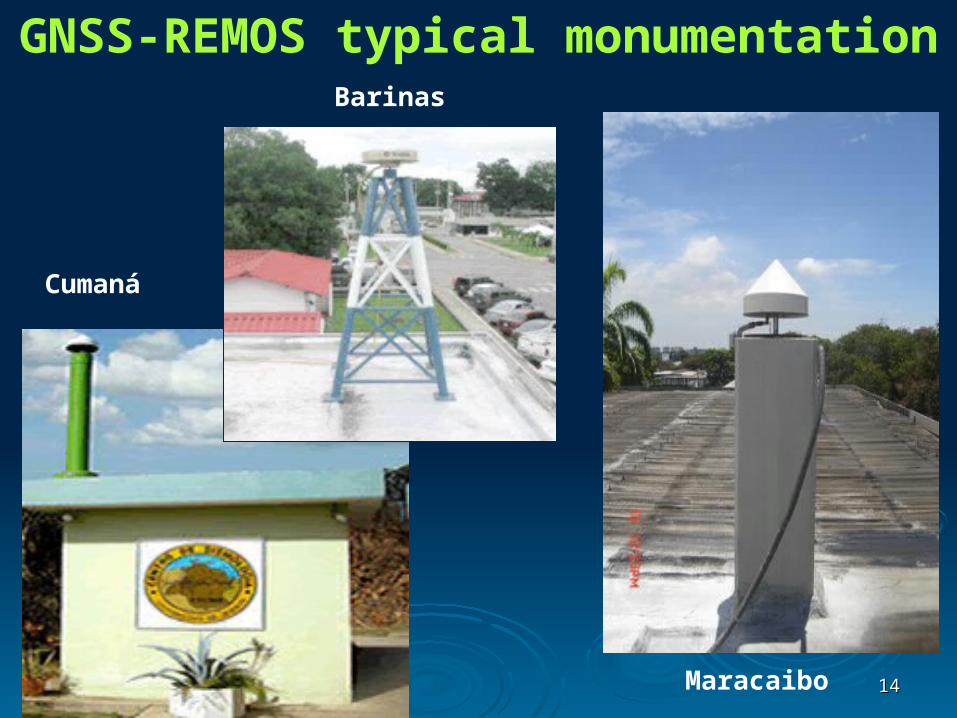
GNSS-REMOS typical monumentation
Maracaibo
Barinas
Cumaná
1515
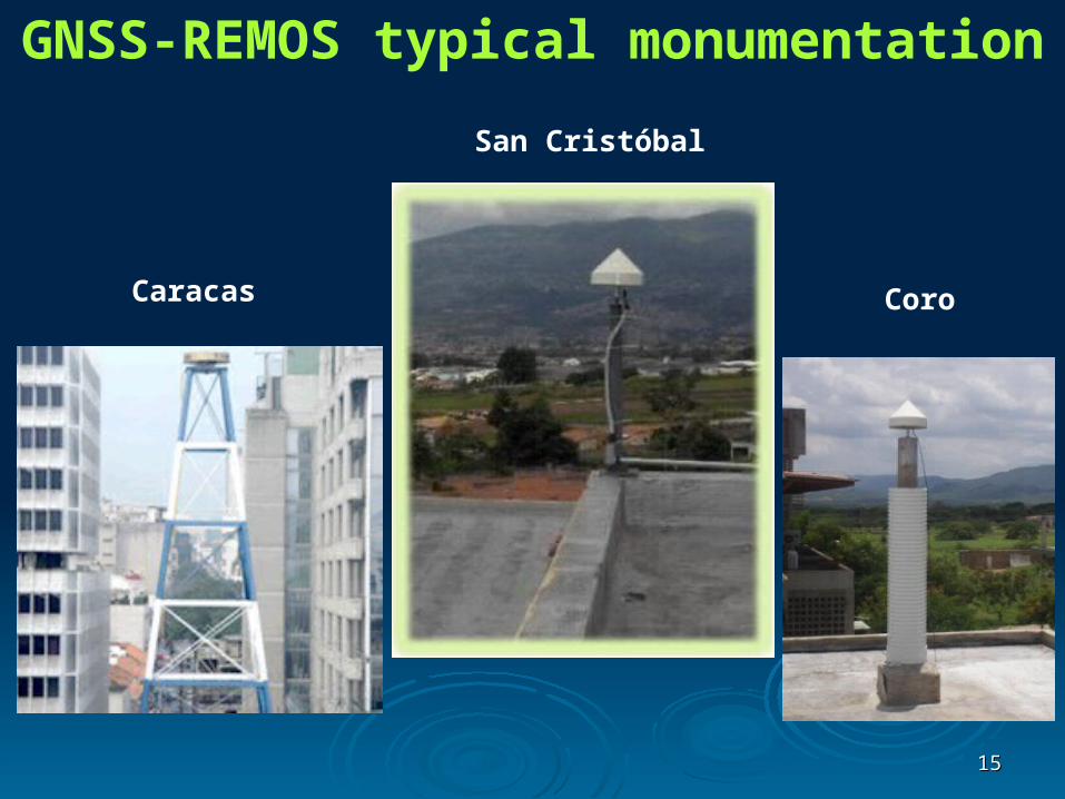
GNSS-REMOS typical monumentation
Caracas Coro
San Cristóbal
1616
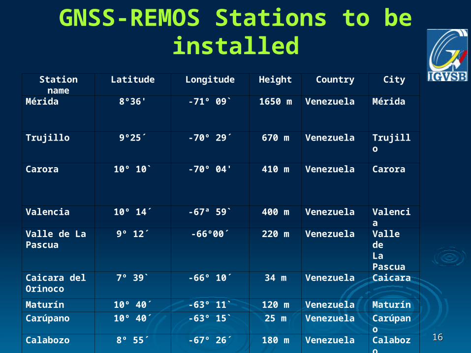
Station name Latitude Longitude Height Country City
Mérida 8º36' -71º 09` 1650 m Venezuela Mérida
Trujillo 9º25´ -70º 29´ 670 m Venezuela Trujillo
Carora 10º 10` -70º 04' 410 m Venezuela Carora
Valencia 10º 14´ -67ª 59` 400 m Venezuela Valencia
Valle de LaPascua
9º 12´ -66º00´ 220 m Venezuela Valle deLa Pascua
Caicara delOrinoco
7º 39` -66º 10´ 34 m Venezuela Caicara
Maturín 10º 40´ -63º 11` 120 m Venezuela Maturín
Carúpano 10º 40´ -63º 15` 25 m Venezuela Carúpano
Calabozo 8º 55´ -67º 26´ 180 m Venezuela Calabozo
Boca de Uchire 10º 08´ -65º 26´ 50 m Venezuela Boca de Uchire
GNSS-REMOS Stations to be installed
1717
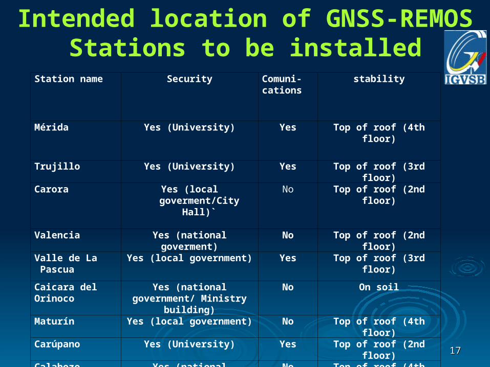
Station name Security Comuni-cations
stability
Mérida Yes (University) Yes Top of roof (4th floor)
Trujillo Yes (University) Yes Top of roof (3rd floor)
Carora Yes (local goverment/City Hall)`
No Top of roof (2nd floor)
Valencia Yes (national goverment) No Top of roof (2nd floor)
Valle de La Pascua
Yes (local government) Yes Top of roof (3rd floor)
Caicara del Orinoco
Yes (national government/ Ministry building)
No On soil
Maturín Yes (local government) No Top of roof (4th floor)
Carúpano Yes (University) Yes Top of roof (2nd floor)
Calabozo Yes (national goverment) No Top of roof (4th floor)
Boca de Uchire Yes (local government) No Top of roof (4th floor)
Intended location of GNSS-REMOS Stations to be installed
1818
Contact: Eng. José Napoleón Hernández
Instituto Geográfico de Venezuela Simón Bolívar –IGVSB-
Red de Estaciones de Monitoreo Satelital –REMOS-
Caracas, Venezuela
Email: [email protected]
Web: igvsb.gob.ve/remos
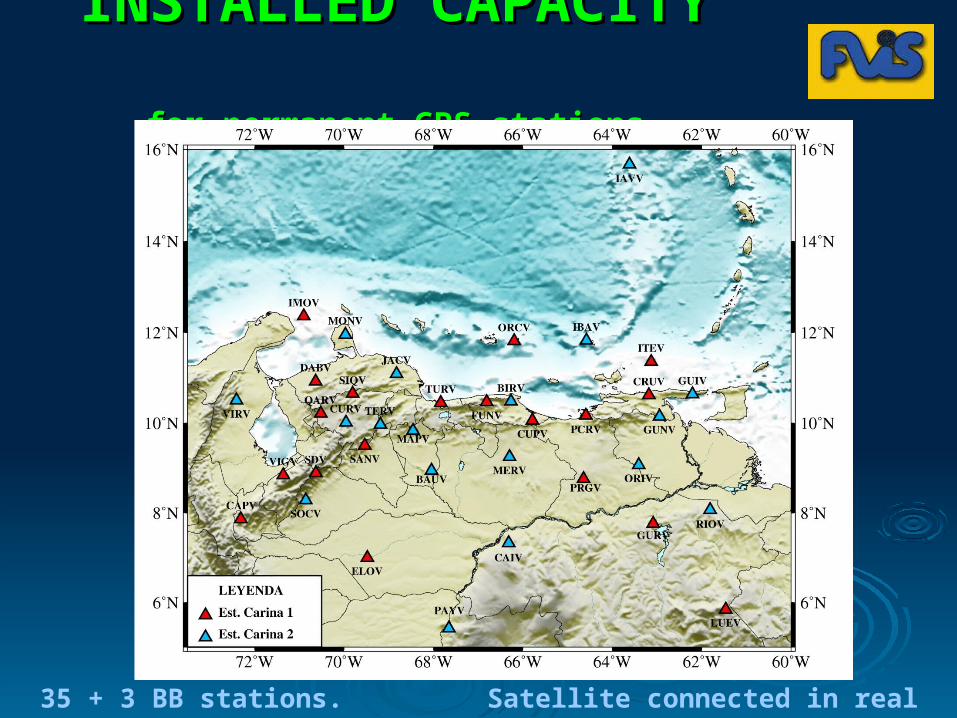
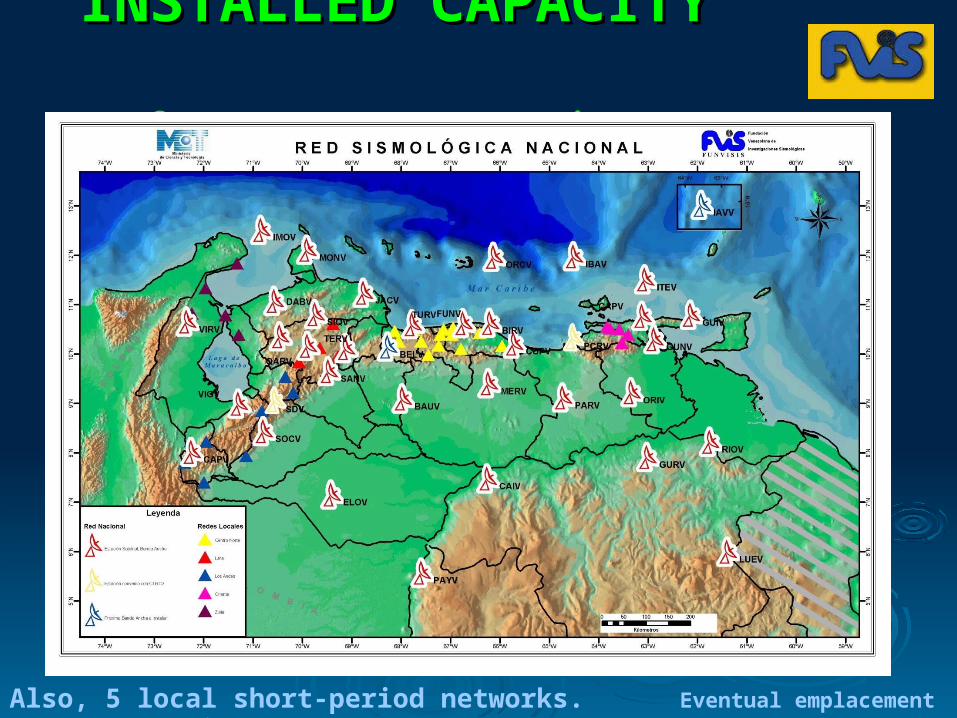
INSTALLED CAPACITY INSTALLED CAPACITY
for permanent GPS stationsfor permanent GPS stations
35 + 3 BB stations. Satellite connected in real time
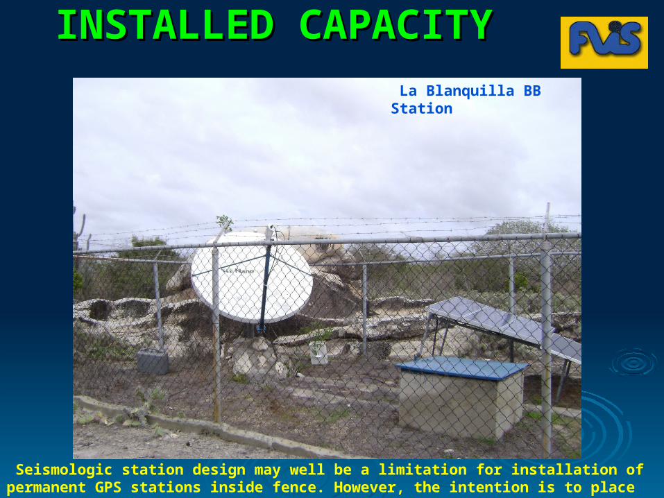
INSTALLED CAPACITY INSTALLED CAPACITY
for permanent GPS stationsfor permanent GPS stations La Blanquilla BB Station
Seismologic station design may well be a limitation for installation of permanent GPS stations inside fence. However, the intention is to place them nearby.
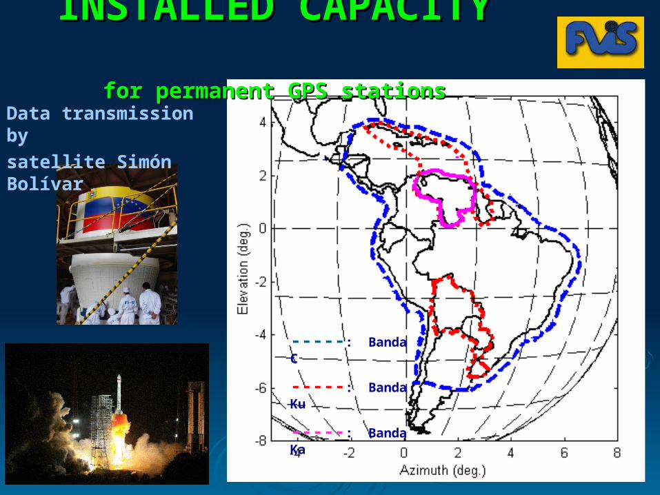
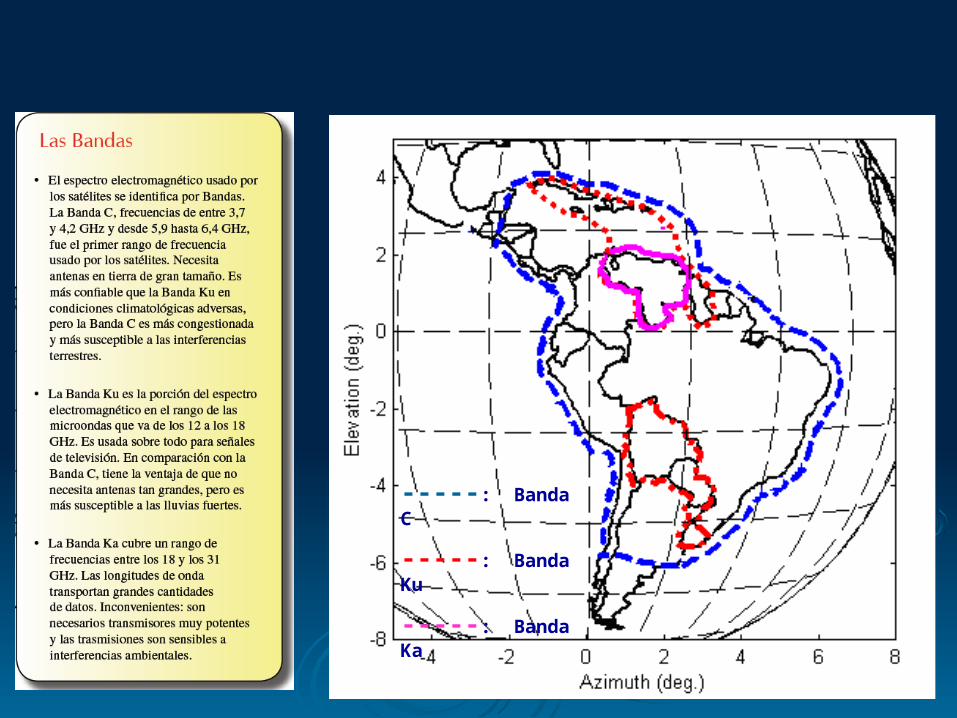
-----: Banda C
-----: Banda Ku
-----: Banda Ka
INSTALLED CAPACITY INSTALLED CAPACITY
for permanent GPS stationsfor permanent GPS stationsData transmission by
satellite Simón Bolívar
2222
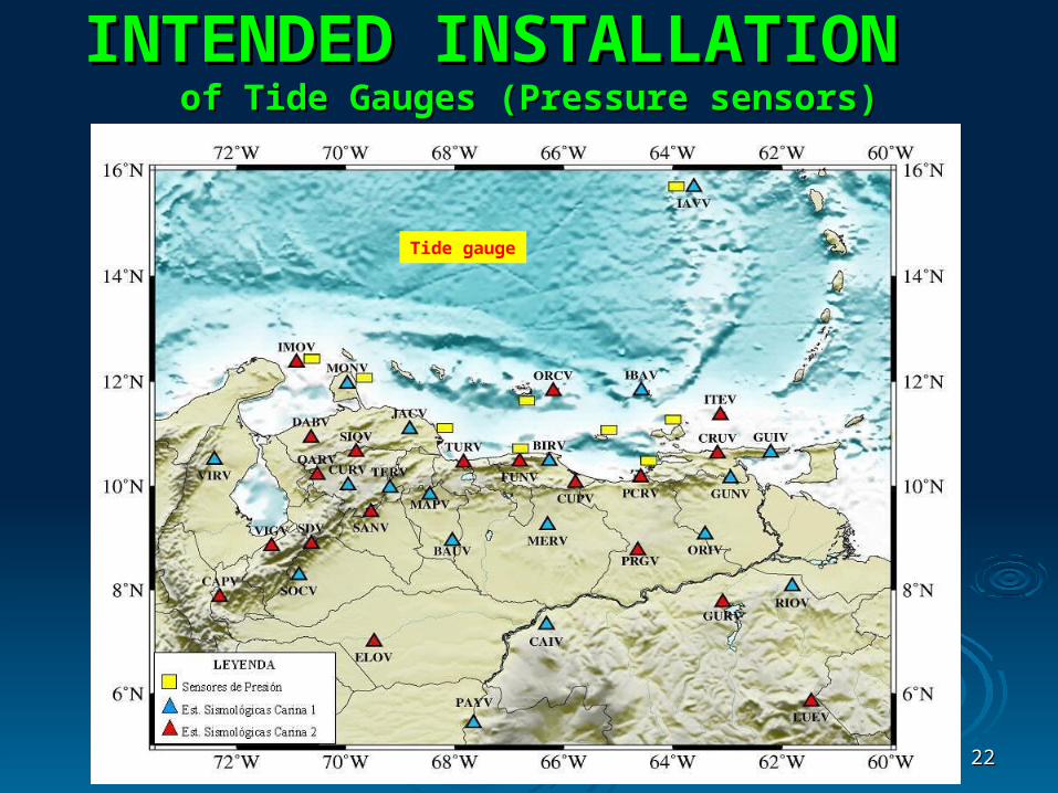
INTENDED INSTALLATION INTENDED INSTALLATION of Tide Gauges (Pressure sensors)of Tide Gauges (Pressure sensors)
Tide gauge
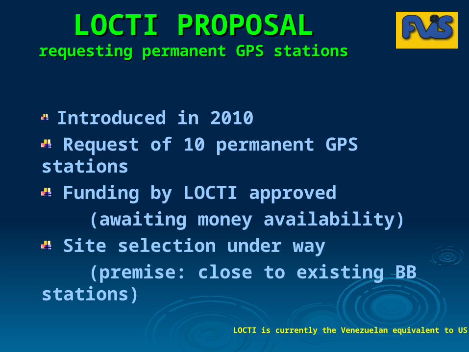
LOCTI PROPOSALLOCTI PROPOSALrequesting permanent GPS stationsrequesting permanent GPS stations
Introduced in 2010
Request of 10 permanent GPS stations
Funding by LOCTI approved
(awaiting money availability)
Site selection under way
(premise: close to existing BB stations)
LOCTI is currently the Venezuelan equivalent to US NSF

Thanks very muchThanks very much
Mil gracias por su Mil gracias por su atenciónatención
0800-0800-TEMBLORTEMBLOR(8362567(8362567
))
Fundación Venezolana de Investigaciones Sismológicas

2525
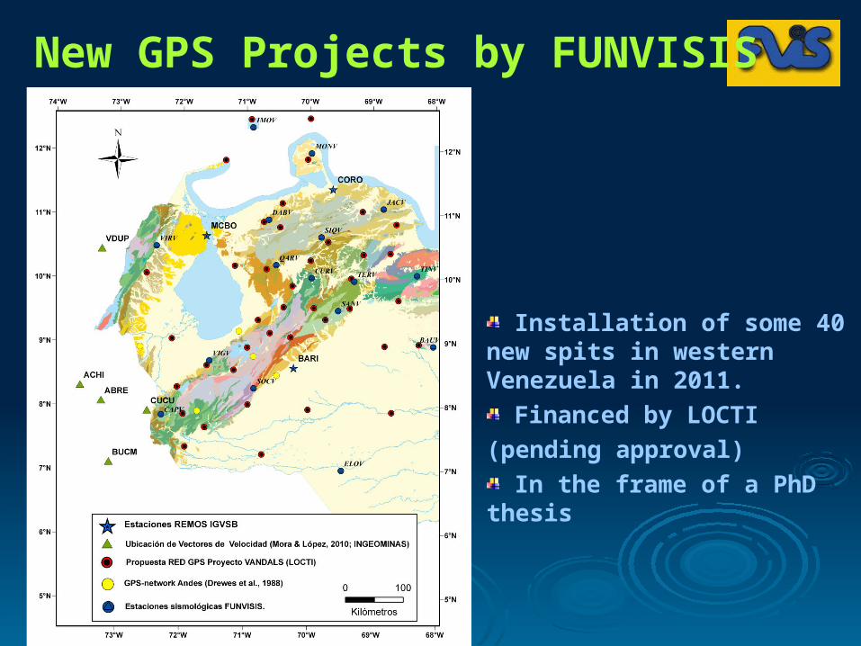
New GPS Projects by FUNVISIS
Installation of some 40 new spits in western Venezuela in 2011.
Financed by LOCTI
(pending approval)
In the frame of a PhD thesis
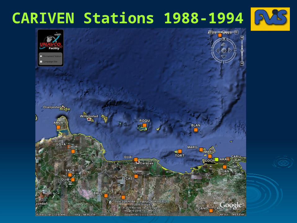
CARIVEN Stations 1988-1994
2828
INSTALLED CAPACITY INSTALLED CAPACITY
for permanent GPS stationsfor permanent GPS stations
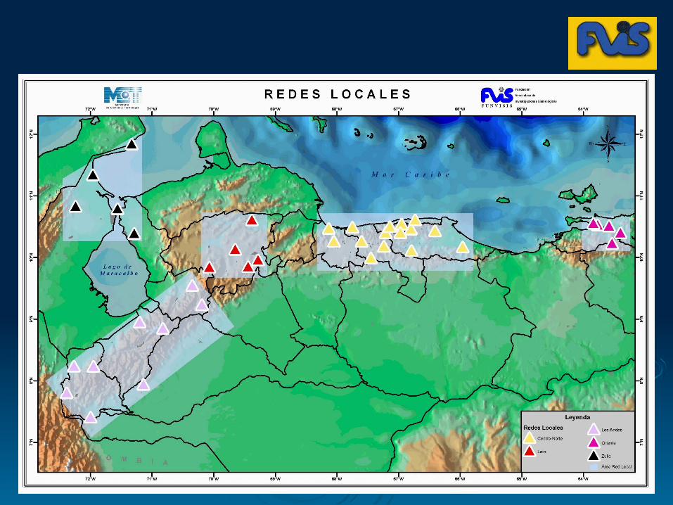
Also, 5 local short-period networks. Eventual emplacement of new GPS stations
3232
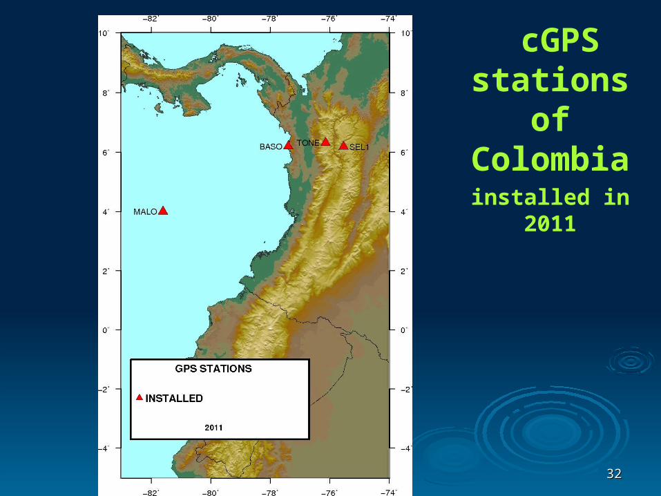
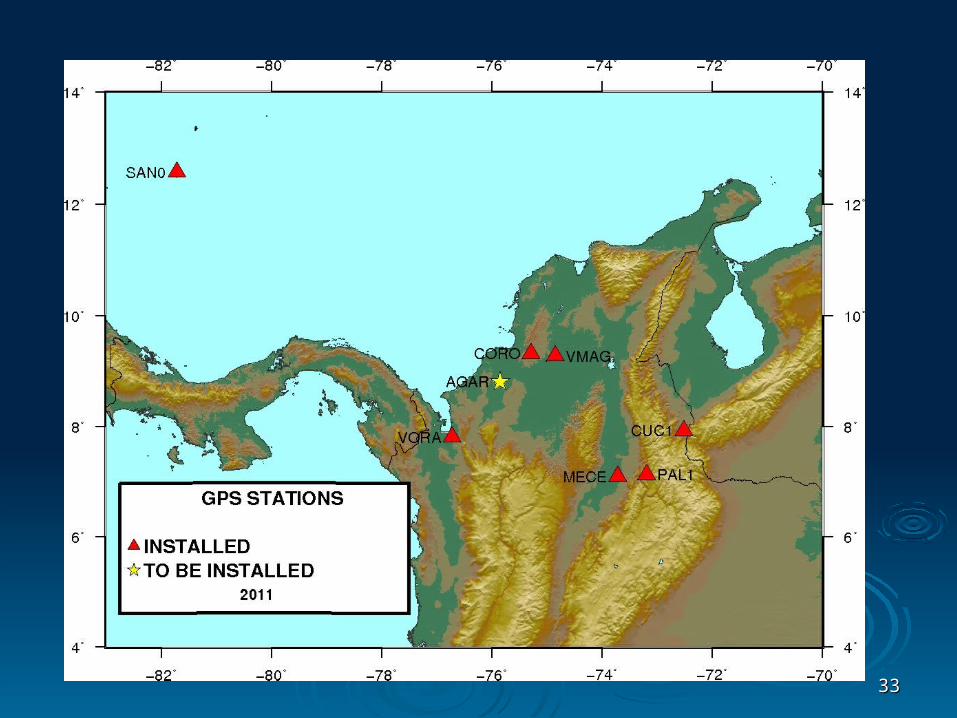
cGPS stations of Colombia
installed in 2011
3333
-----: Banda C
-----: Banda Ku
-----: Banda Ka
3535
3636
Existing GNSS-REMOS Stations
3737
3838
3939
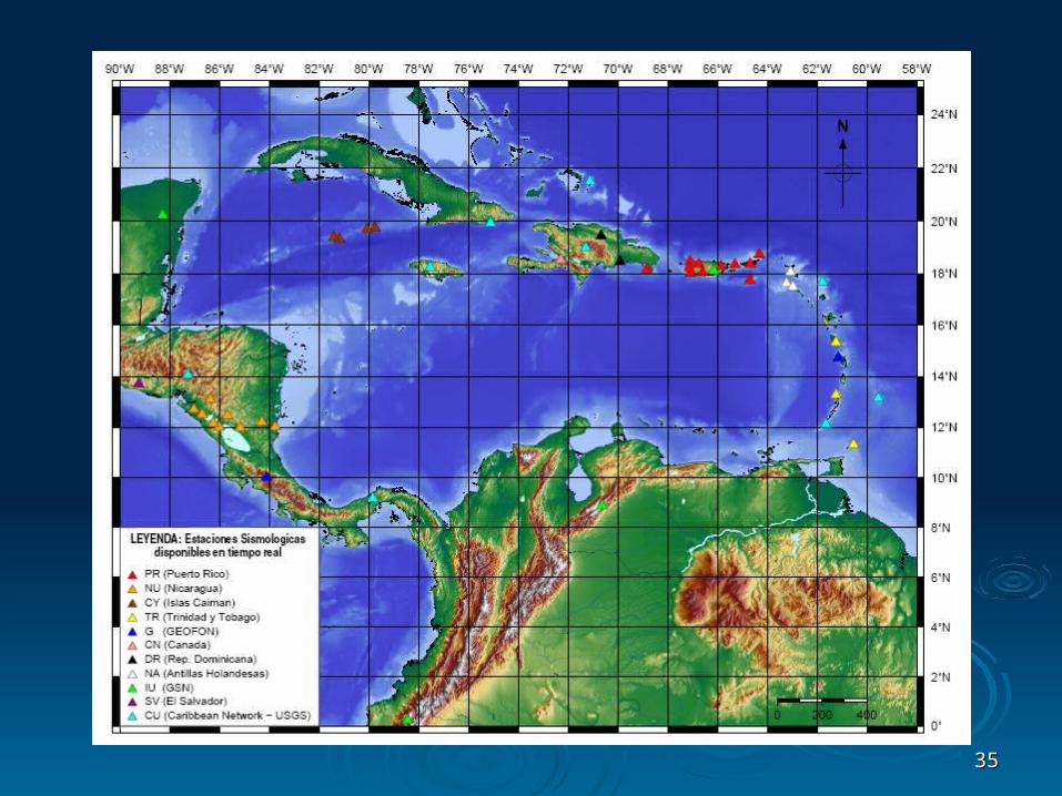
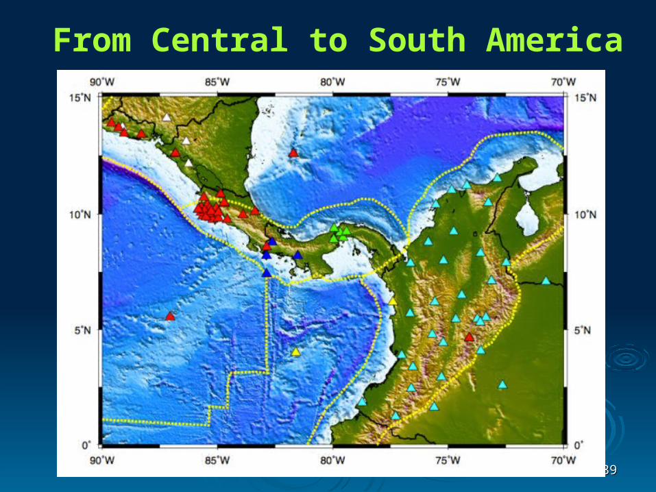
From Central to South America