Embed Size (px)
Citation preview
Research report
The HCPC andKennington
Foreword 1
Acknowledgements 2
1 Former premises 3
2 A history of Kennington 4
2.1 Kennington Cross 4
2.2 Kennington Row and Kennington Place 5
3 Kennington Park Road buildings 6
3.1 184 Kennington Park Road 6
3.2 186 Kennington Park Road 7
4 Stannary Street buildings 8
4.1 Background 8
4.2 Number 18 9
4.3 Number 20 9
4.4 Numbers 22 – 26 9
4.5 Numbers 31 – 35 10
Contents
This report provides a brief history of theHealth and Care Professions Council’s (HCPC)premises and their place in the changinggeography of Kennington. In addition to theHCPC’s main office in Park House onKennington Park Road, the organisation alsooccupies several buildings in Stannary Streetto the rear of Park House. At the time ofwriting, we are in the process of purchasing186 Kennington Park Road, the building nextdoor to Park House. We are also currentlyrenting office space at 33 Stannary Street.
Although none of the buildings occupied bythe HCPC are of historical or architecturalnote, the sites of 184 and 186 KenningtonPark Road, and the Stannary Street premises,have had buildings on them for over twohundred years. They were already developedby 1800, although the two roads were thencalled Kennington Row and Kennington Placerespectively. The addresses 184 and 186Kennington Park Road, but not the existingbuildings, go back to the late 1860s. Theyboth formed part of the redevelopment ofKennington, then in the County of Surrey. OurStannary Street sites, like the road itself, havehad a far more varied history. This reflects thechanging history and land use of our area, andof Kennington itself.
Foreword
The HCPC and Kennington 1
Acknowledgements
We have produced this account of the historyof our buildings from research carried out byTom Berrie, Information Services Manager atthe HCPC. This work included consulting therelevant electoral rolls, Ordnance Survey andother maps, as well as Post Office and othertrade directories at the Lambeth BoroughArchive. It also derives from Tom’s personalknowledge of working for both the HCPC andits predecessors, the Health ProfessionsCouncil (HPC) and the Council for ProfessionsSupplementary to Medicine (CPSM), since1984.
We would like to thank Purbrooks Ltd for theirinformation concerning the previous occupantsof numbers 22 – 26 Stannary Street.
The three black and white photographs arecopyright of the London Borough of Lambethand we are grateful for the Borough Council forpermission to use them.
The HCPC and Kennington2
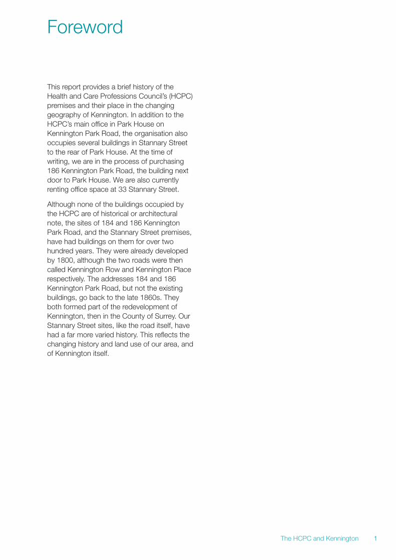
The HCPC’s predecessor, the Council forProfessions Supplementary to Medicine(CPSM), had its first offices in Lambeth beforemoving to Kennington. The photograph belowis a recent image of York House, the buildingwhere the CPSM offices were first based. Itwas then a much smaller organisation than itwould later become, had relatively fewemployees and only occupied the ninth floor ofthis building.
The CPSM moved to Park House onKennington Park Road in the mid-1970s,which it took over as a new-build. This buildingremains the main address for the HCPC today.
The HCPC and Kennington 3
1 Former premises
York House, 2013
2.1 Kennington Cross
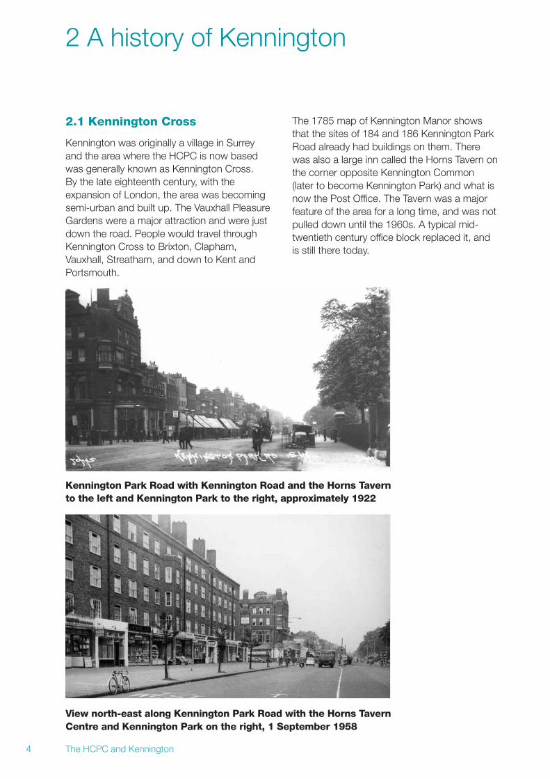
Kennington was originally a village in Surreyand the area where the HCPC is now basedwas generally known as Kennington Cross.By the late eighteenth century, with theexpansion of London, the area was becomingsemi-urban and built up. The Vauxhall PleasureGardens were a major attraction and were justdown the road. People would travel throughKennington Cross to Brixton, Clapham,Vauxhall, Streatham, and down to Kent andPortsmouth.
The 1785 map of Kennington Manor showsthat the sites of 184 and 186 Kennington ParkRoad already had buildings on them. Therewas also a large inn called the Horns Tavern onthe corner opposite Kennington Common(later to become Kennington Park) and what isnow the Post Office. The Tavern was a majorfeature of the area for a long time, and was notpulled down until the 1960s. A typical mid-twentieth century office block replaced it, andis still there today.
The HCPC and Kennington4
2 A history of Kennington
Kennington Park Road with Kennington Road and the Horns Tavernto the left and Kennington Park to the right, approximately 1922
View north-east along Kennington Park Road with the Horns TavernCentre and Kennington Park on the right, 1 September 1958
The HCPC and Kennington 5
Kennington Common had been marshy and aplace of public execution until the lateeighteenth century. The gallows was on thesite of St Mark’s Church. In 1854 theCommon was transformed into KenningtonPark in the Victorian drive to create town andcity parks.
In 1867 the whole of Lambeth was stilladministratively in the County of Surrey. This iswhy the nearby Oval is known as ‘SurreyCricket Ground’. In the late nineteenth centuryhowever it became part of the MetropolitanBorough of Lambeth, within the newly formedLondon County Council. Then in 1965 itbecame part of the London Borough ofLambeth.
The Victorian terraced buildings whichpredated Park House and Whitefield House onthe sites of 184 and 186 Kennington ParkRoad respectively were built in the late-1860s.
2.2 Kennington Row andKennington Place
A map from the beginning of the nineteenthcentury indicates two roads: Kennington Rowand Kennington Place. Kennington Row, whichis now part of Kennington Park Road and theA3, formed part of the Roman Road to thesouth coast. In this period, it consisted ofrelatively small buildings packed together inone long terrace, for shopkeepers and traders.The Post Office trade directories for London ofthe 1840s and 1850s have Kennington Rowlisted as the residences and places of work oftraders, shopkeepers and small businesses.
In comparison, Kennington Place containedtwo surgeons and several individuals with‘esquire’ at the end of their name, indicating amiddle class status. It also had two publichouses, one of which remained until veryrecently, and the Phoenix Gas Station.
The redevelopment of the area in themid-1860s partly reversed this situation,with some high status Victorian housesbeing built at the front on the newly developedKennington Park Road. Artisans and smallbusinesses also then moved into KenningtonPlace which was renamed Stannary Street.This remained the pattern of occupation anduse for the two roads for a long time, and tosome extent is still the case today.
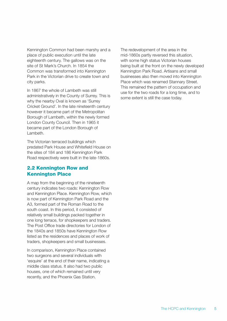
3.1 184 Kennington Park Road
Evidence from the trade directories and theelectoral roles indicate that 184 KenningtonPark Road was purely residential until around1934. In 1935 and 1945, the building hadelectors living there, but the directories alsolisted it as being the premises of Freezall FoodPreservation Company. This could be anexample of someone ‘living over the shop’ orthe business vote being given to owners ofpremises. From 1955 onwards, the electoralrole states that nobody lived in the building.
The building had a varied, but alwayscommercial, occupancy from 1955 onwards.In 1965 it was occupied by a travel agent.Then in 1969 and 1971 Autex Offset PrintingPlate Making Machinery was its occupant. In1975 and 1978 there was no listing in thedirectories or electoral rolls.
The current building, Park House, was built inthe late-1970s. This suggests that it was alsoaround this time that the old building waspulled down1. In 1980 it was listed as beingoccupied by the CPSM, which took it over as anew-build in autumn 1978.
The HCPC and Kennington6
3 Kennington Park Road buildings
Park House, 1989
1 Earlier maps show steps up to the building as today and it is possible that these are the original steps and the only remains of theoriginal Victorian building; this would account for the fact that in the early 2000s they were in such a poor condition that they had tobe extensively repaired.
The HCPC and Kennington 7
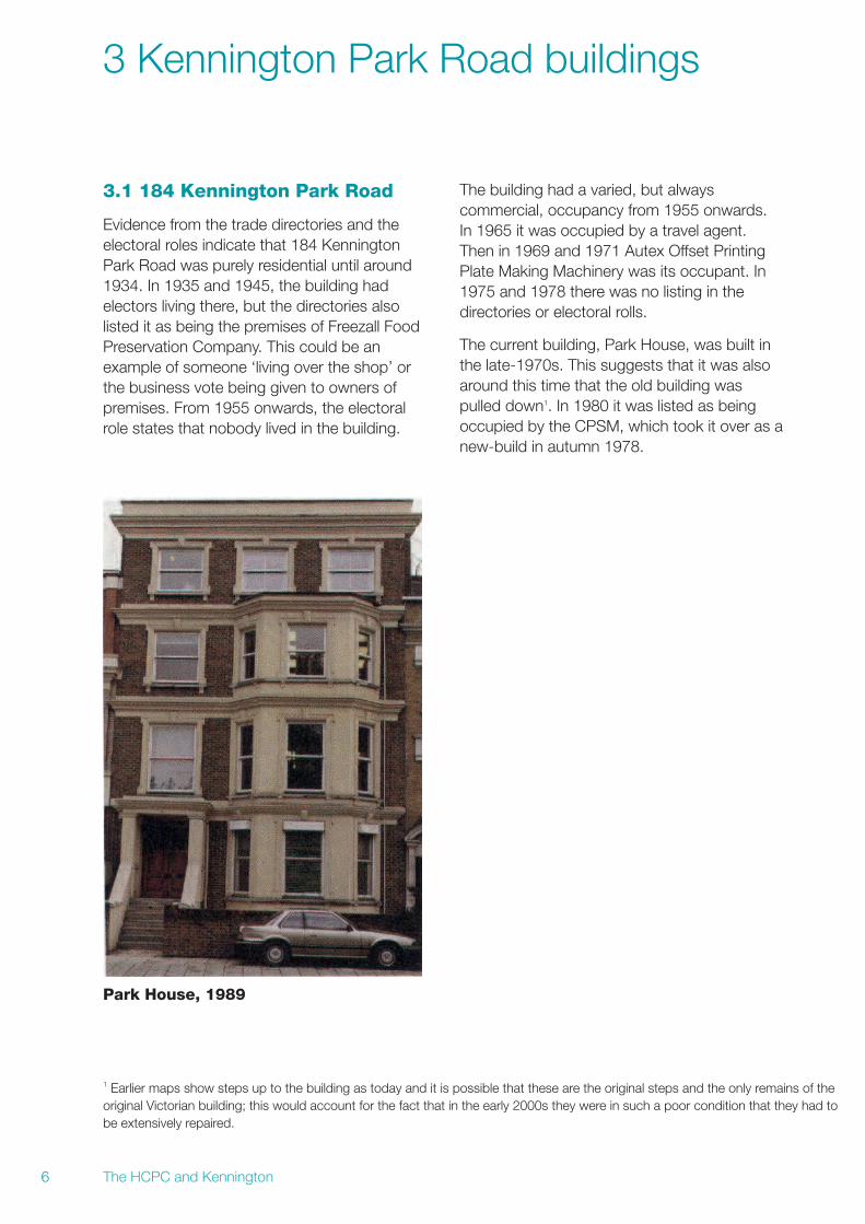
3.2 186 Kennington Park Road
The 1867 trade directory states that 186Kennington Park Road was occupied by a ‘gasmeter maker’. This would fit the time, as theuse of town gas was greatly expanding fromthe early nineteenth century onwards. Itremained in the same hands, ‘William Smith’,then ‘George Brown Smith’, then ‘SmithMeters’, until 1960.
During the late 1950s occupancy becomesmore complicated. In 1959 Smith Meters stilloccupied number 186, but with ‘Alder andMakay’ who were also gas meter makers.186A2 was listed very briefly as a ‘Ministry ofPower gas meter testing office’, in 1957 and1960. 186A spread to Stannary Street at theback of the building, because four or fiveindividuals at this testing station are brieflylisted in the 1950s as being electors inStannary Street. Presumably 186A wastherefore somewhere at the back, but thenquickly became part of 186 again. During thisperiod, there were only two listings for an
elector for 186 on the electoral rolls, in 1895and 1905, and the directories continue to listthe property as the premises of a gas-metermaking company in 1891 and 1905. After thatthere is no reference to an elector in theproperty. Smith Meters was a significantcompany and continues to operate elsewherein London.
At some point in the late-1950s / early-1960sthe present building replaced the formerVictorian one. In 1965, number 186 was thepremises of a ‘motor componentmanufacturers’. Then in 1969 there was nolisting for the site. In 1971 it was the premisesof ‘Alpha Architectural and Ironmongery Ltd’.1975 has no listing but in 1978 and 1980 thepremises was occupied by a ‘freightforwarding agents’. The Evangelical Alliance,an evangelical Christian organisation, took oversoon after. The title ‘Whitefield House’, beganwith the Evangelical Alliance, who named itafter George Whitefield, the eighteenth centuryevangelical and evangelist, one of the foundersof the Methodist movement.
182 – 186 Kennington Park Road, January 2013
2 This is the only time ‘186A’ appears.
4.1 Background
The road previously named Kennington Placebecame Stannary Street around 1880. Thestreet came to reflect the common eighteenth-and nineteenth-century urban pattern of grand,mostly residential, buildings on the main roads(Kennington Park Road and Kennington Road),with more complex, mixed commercial andartisan dwellings at the back.
According to the electoral rolls, there was atfirst extensive residency in the street, but thisgradually declined. The properties that we areinterested in are those currently occupied bythe HCPC: numbers 18A, 20, 22, 24 and 26and 33 Stannary Street3. These began asmixed business and residential buildings, butare almost certainly not the original buildings.
On the 1951 map, part of the street is listed asan ‘engineering works’, apparently either sideof the road. Then in 1955, according to theelectoral role, it becomes a ‘testing station’,with a number of electors living as staff inresidence. In 1960, only number 20 of thisgroup of buildings had an elector. Then from1965 onwards there are no electors listed inany of the buildings. The numbers began torun into each other because subsequentdevelopment in the early to middle years of thetwentieth century resulted in smaller dwellingsbeing knocked down or merged.
The HCPC and Kennington8
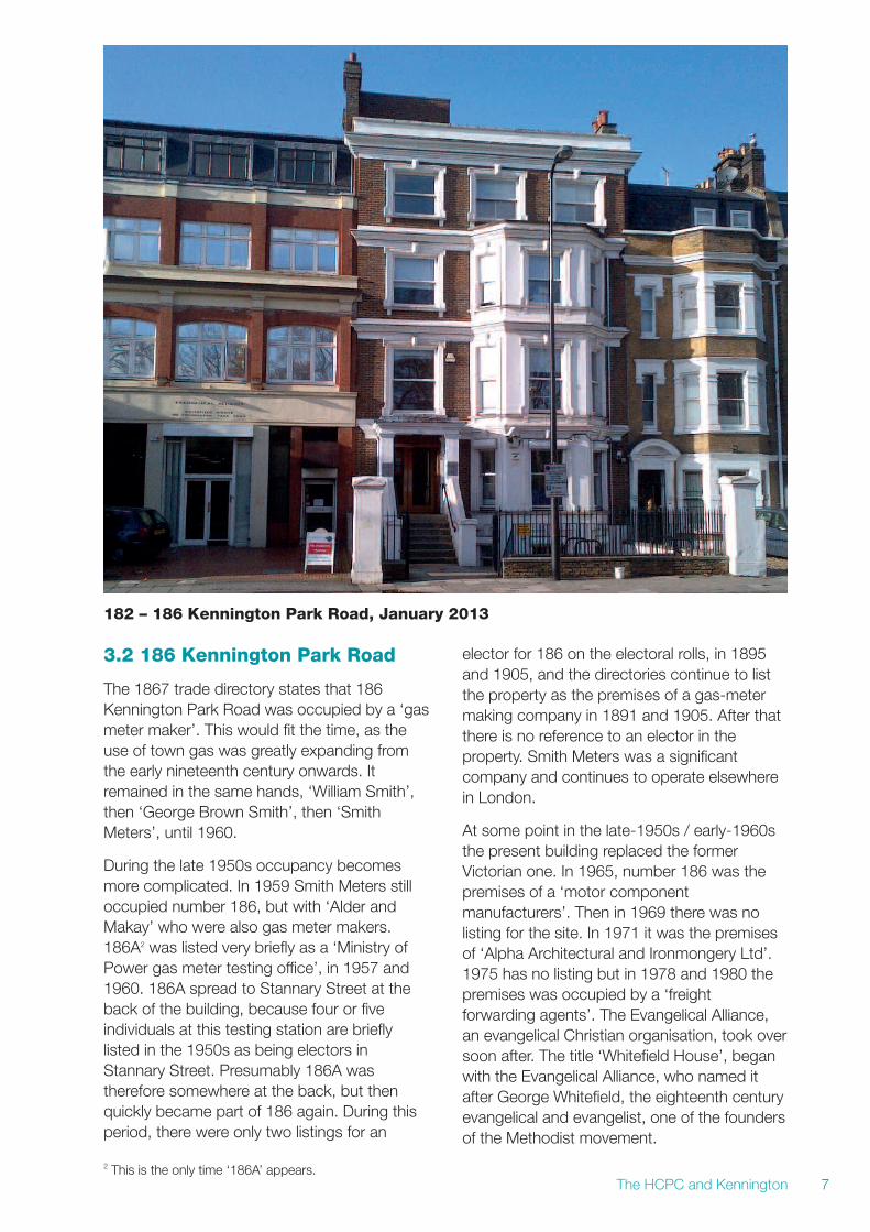
4 Stannary Street buildings
Stannary Street about 1979
3 At the time of writing, we are renting office space in 33 Stannary Street.
The HCPC and Kennington 9
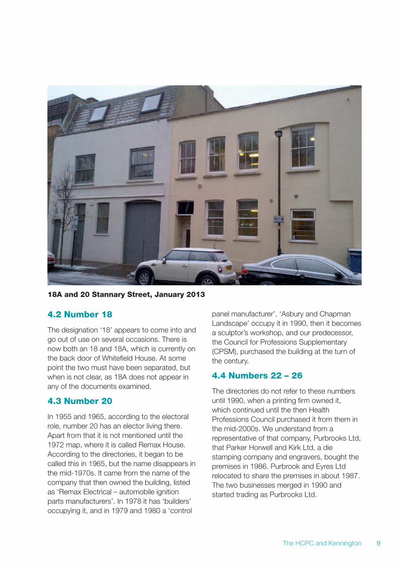
4.2 Number 18
The designation ‘18’ appears to come into andgo out of use on several occasions. There isnow both an 18 and 18A, which is currently onthe back door of Whitefield House. At somepoint the two must have been separated, butwhen is not clear, as 18A does not appear inany of the documents examined.
4.3 Number 20
In 1955 and 1965, according to the electoralrole, number 20 has an elector living there.Apart from that it is not mentioned until the1972 map, where it is called Remax House.According to the directories, it began to becalled this in 1965, but the name disappears inthe mid-1970s. It came from the name of thecompany that then owned the building, listedas ‘Remax Electrical – automobile ignitionparts manufacturers’. In 1978 it has ‘builders’occupying it, and in 1979 and 1980 a ‘control
panel manufacturer’. ‘Asbury and ChapmanLandscape’ occupy it in 1990, then it becomesa sculptor’s workshop, and our predecessor,the Council for Professions Supplementary(CPSM), purchased the building at the turn ofthe century.
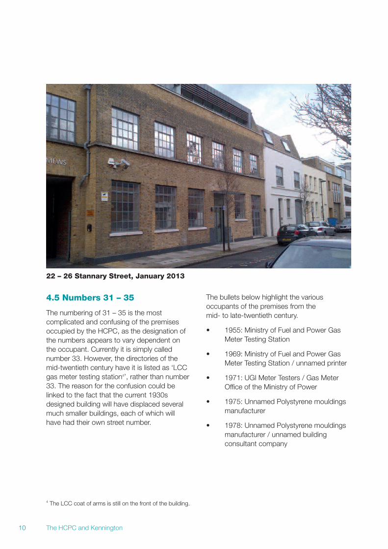
4.4 Numbers 22 – 26
The directories do not refer to these numbersuntil 1990, when a printing firm owned it,which continued until the then HealthProfessions Council purchased it from them inthe mid-2000s. We understand from arepresentative of that company, Purbrooks Ltd,that Parker Horwell and Kirk Ltd, a diestamping company and engravers, bought thepremises in 1986. Purbrook and Eyres Ltdrelocated to share the premises in about 1987.The two businesses merged in 1990 andstarted trading as Purbrooks Ltd.
18A and 20 Stannary Street, January 2013
The HCPC and Kennington10
22 – 26 Stannary Street, January 2013
4.5 Numbers 31 – 35
The numbering of 31 – 35 is the mostcomplicated and confusing of the premisesoccupied by the HCPC, as the designation ofthe numbers appears to vary dependent onthe occupant. Currently it is simply callednumber 33. However, the directories of themid-twentieth century have it is listed as ‘LCCgas meter testing station4’, rather than number33. The reason for the confusion could belinked to the fact that the current 1930sdesigned building will have displaced severalmuch smaller buildings, each of which willhave had their own street number.
The bullets below highlight the variousoccupants of the premises from themid- to late-twentieth century.
• 1955: Ministry of Fuel and Power GasMeter Testing Station
• 1969: Ministry of Fuel and Power GasMeter Testing Station / unnamed printer
• 1971: UGI Meter Testers / Gas MeterOffice of the Ministry of Power
• 1975: Unnamed Polystyrene mouldingsmanufacturer
• 1978: Unnamed Polystyrene mouldingsmanufacturer / unnamed buildingconsultant company
4 The LCC coat of arms is still on the front of the building.

The HCPC and Kennington 11
In 1979 the polystyrene company isinterestingly listed as 21 – 33. This is probablya misprint, as beyond number 31 is a school,and the building consultant that shares thepremises is still listed as occupying 31 – 35.
The 1990 trade directory indicates that 31 – 33is still occupied by the polystyrenemanufacturer. The building was then restoredin the early 2000s with the current design ofoffices at the front and flats at the back. It isinteresting to note that some of the studiooffices at the top of the front of the building arealso now flats. This continues the tradition ofjoint residential and business occupation bythe self-employed which Stannary Street /Kennington Place had from the beginning ofthe nineteenth century.
31 – 35 Stannary Street, January 2013

Notes
The HCPC and Kennington12

This document is available in alternativeformats and Welsh on request.Call +44 (0)20 7840 9806or email [email protected]
Park House184 Kennington Park RoadLondon SE11 4BU
tel +44 (0)845 300 6184fax +44 (0)20 7820 9684www.hcpc-uk.org
© Health and Care Professions Council 2013Publication code: BERRIE13 (printed March 2013)This publication is produced using trees from sustainable forests and recycled fibre.