Embed Size (px)
Citation preview
1
07. May 2009 FIG Working Week Eilat 2009 Prof. Günter Nagel
Survey of Bavaria (SOB)
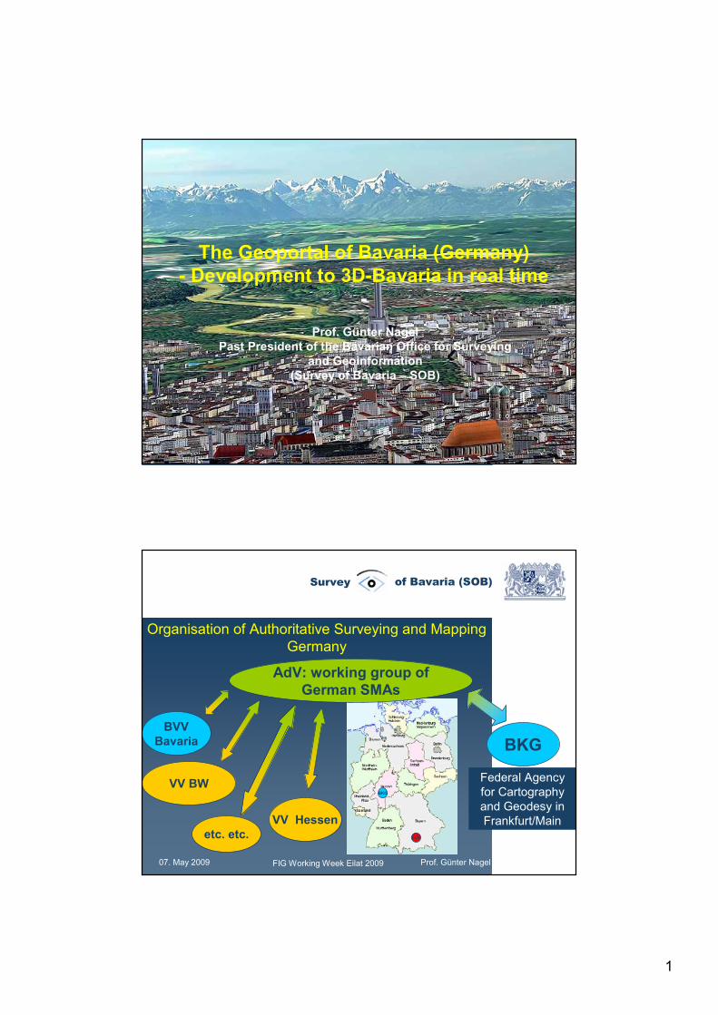
The Geoportal of Bavaria (Germany) - Development to 3D-Bavaria in real time
-Prof. Günter Nagel
Past President of the Bavarian Office for Surveyingand Geoinformation
(Survey of Bavaria – SOB)
07. May 2009 FIG Working Week Eilat 2009 Prof. Günter Nagel
Survey of Bavaria (SOB)
Organisation of Authoritative Surveying and MappingGermany
AdV: working group ofGerman SMAs
VV BW
BVVBavaria
VV Hessenetc. etc.
BKG
Federal Agency for Cartography and Geodesy in Frankfurt/Main
BKG
LVG
2
07. May 2009 FIG Working Week Eilat 2009 Prof. Günter Nagel
Survey of Bavaria (SOB)
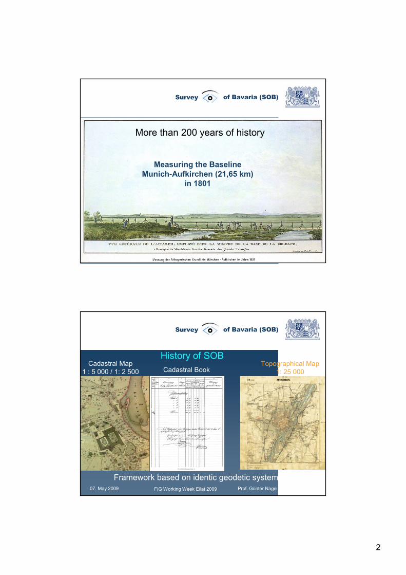
Measuring the BaselineMunich-Aufkirchen (21,65 km)
in 1801
More than 200 years of history
07. May 2009 FIG Working Week Eilat 2009 Prof. Günter Nagel
Survey of Bavaria (SOB)
Topographical Map1: 25 000
Cadastral Map1 : 5 000 / 1: 2 500
Framework based on identic geodetic system
Cadastral Book
History of SOB
3
07. May 2009 FIG Working Week Eilat 2009 Prof. Günter Nagel
Survey of Bavaria (SOB)
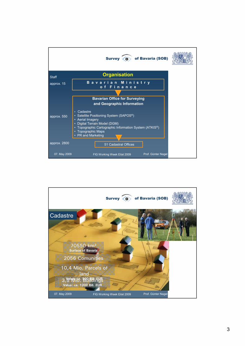
Staff
approx. 15
approx. 550
approx. 2800
Organisation
Bavarian Office for Surveying and Geographic Information
• Cadastre• Satellite Positioning System (SAPOS®) • Aerial Imagery• Digital Terrain Model (DGM) • Topographic Cartographic Information System (ATKIS®) • Topographic Maps• PR and Marketing
B a v a r i a n M i n i s t r y o f F i n a n c e
51 Cadastral Offices
07. May 2009 FIG Working Week Eilat 2009 Prof. Günter Nagel
Survey of Bavaria (SOB)
Cadastre
3,5 Mio. BuildingsValue: ca. 1200 Bill. EUR
10,4 Mio. Parcels of land
Value: ca. 500 Bill. EUR
70550 km²Surface of Bavaria
2056 Comunities
4
07. May 2009 FIG Working Week Eilat 2009 Prof. Günter Nagel
Survey of Bavaria (SOB)
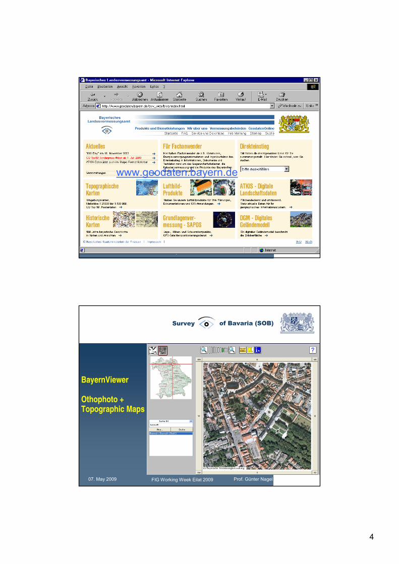
For more Information please visit: www.geodaten.bayern.de
www.geodaten.bayern.de
07. May 2009 FIG Working Week Eilat 2009 Prof. Günter Nagel
Survey of Bavaria (SOB)
BayernViewer
Othophoto +Topographic Maps
5
07. May 2009 FIG Working Week Eilat 2009 Prof. Günter Nagel
Survey of Bavaria (SOB)
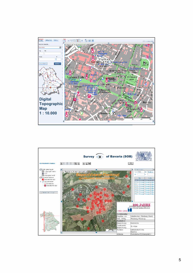
DigitalTopographicMap1 : 10.000
07. May 2009 FIG Working Week Eilat 2009 Prof. Günter Nagel
Survey of Bavaria (SOB)
BayernViewer-Denkmal(protected monuments)
6
07. May 2009 FIG Working Week Eilat 2009 Prof. Günter Nagel
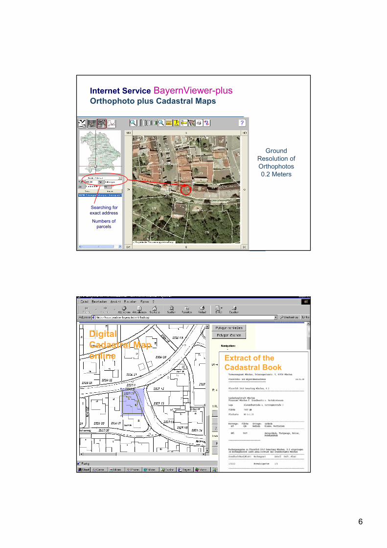
Survey of Bavaria (SOB)Internet Service BayernViewer-plusOrthophoto plus Cadastral Maps
GroundResolution of Orthophotos0.2 Meters
Searching for exact address
Numbers of parcels
07. May 2009 FIG Working Week Eilat 2009 Prof. Günter Nagel
Survey of Bavaria (SOB)
DigitalCadastral Maponline Extract of the
Cadastral Book
7
07. May 2009 FIG Working Week Eilat 2009 Prof. Günter Nagel
Survey of Bavaria (SOB)
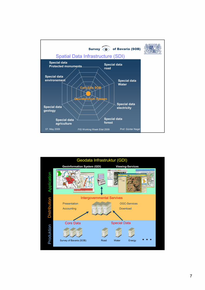
Coredata SOB
Georeferencin System
Special dataWater
Special dataelectricity
Special dataforest
Special dataroad
Special dataenvironement
Special datageology
Special dataProtected monuments
Special dataagriculture
Spatial Data Infrastructure (SDI)
07. May 2009 FIG Working Week Eilat 2009 Prof. Günter Nagel
Survey of Bavaria (SOB)
Road EnergyWaterSurvey of Bavaria (SOB)
Core Data Special Data
Pro
dukt
ion
Dis
tribu
tion Intergovernmental Servives
App
licat
ion
Presentation
DownloadAccounting
…
OGC-Services
Viewing-ServicesGeoinformation System (GDI)
Geodata Infrastruktur (GDI)
8
07. May 2009 FIG Working Week Eilat 2009 Prof. Günter Nagel
Survey of Bavaria (SOB)
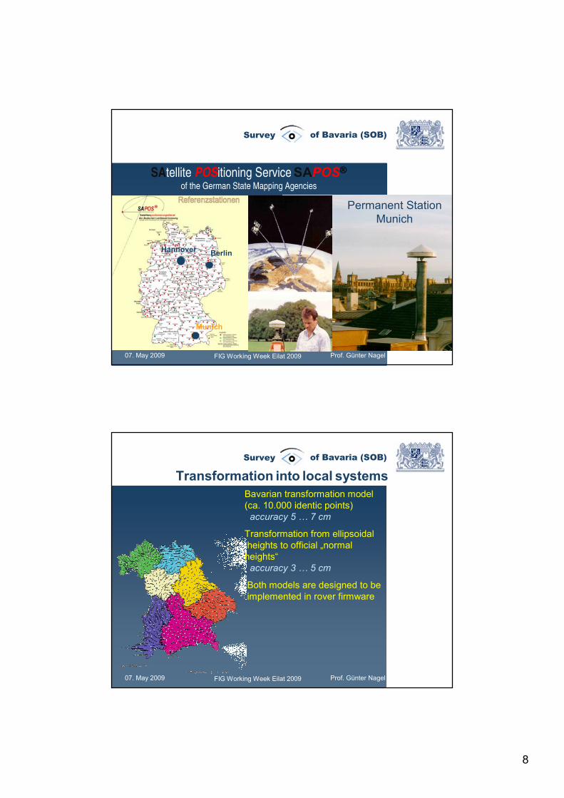
SAtellite POSitioning Service SAPOS®of the German State Mapping Agencies
Permanent Station Munich
Munich
BerlinHannover
07. May 2009 FIG Working Week Eilat 2009 Prof. Günter Nagel
Survey of Bavaria (SOB)
Bavarian transformation model(ca. 10.000 identic points)accuracy 5 … 7 cm
Transformation from ellipsoidalheights to official „normal heights“accuracy 3 … 5 cm
Both models are designed to beimplemented in rover firmware
Transformation into local systems
9
07. May 2009 FIG Working Week Eilat 2009 Prof. Günter Nagel
Survey of Bavaria (SOB)
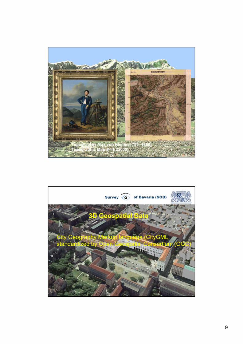
Topographer Max von Kienle (1795 -1860)Topographic Map M=1:25000)
07. May 2009 FIG Working Week Eilat 2009 Prof. Günter Nagel
Survey of Bavaria (SOB)
3D Geospatial Data
City Geography Markup language (CityGMLstandardized by Open Geospatial Consortium (OGC)
10
07. May 2009 FIG Working Week Eilat 2009 Prof. Günter Nagel
Survey of Bavaria (SOB)
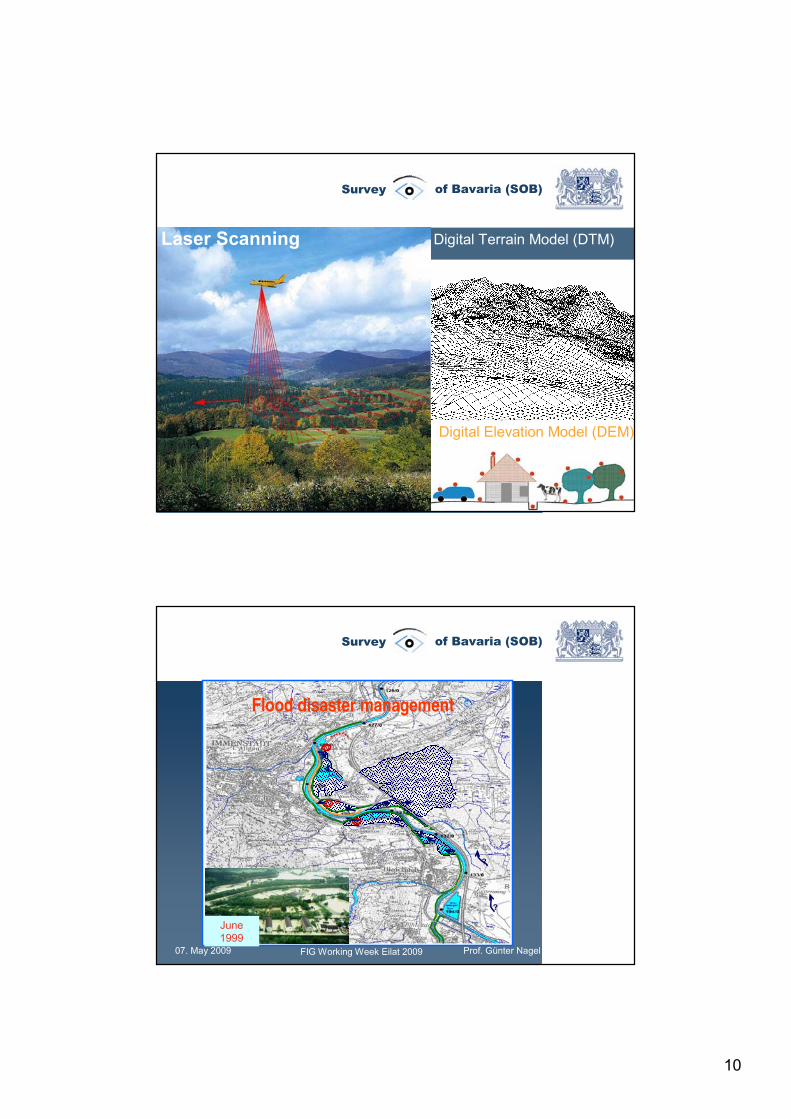
Digital Terrain Model (DTM)Laser Scanning
Digital Elevation Model (DEM)
07. May 2009 FIG Working Week Eilat 2009 Prof. Günter Nagel
Survey of Bavaria (SOB)
N
N
N
?
?
⊗
Flood disaster management
June1999
11
07. May 2009 FIG Working Week Eilat 2009 Prof. Günter Nagel
Survey of Bavaria (SOB)
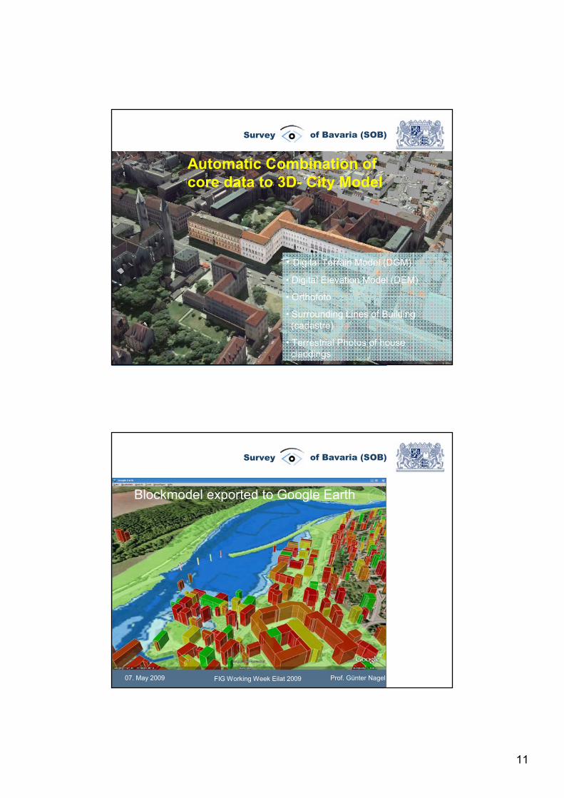
Automatic Combination ofcore data to 3D- City Model
• Digital Terrain Model (DGM)
• Digital Elevation Model (DEM)
• Orthofoto
• Surrounding Lines of Building(cadastre)
• Terrestrial Photos of housecladdings
07. May 2009 FIG Working Week Eilat 2009 Prof. Günter Nagel
Survey of Bavaria (SOB)
Blockmodel exported to Google Earth
12
07. May 2009 FIG Working Week Eilat 2009 Prof. Günter Nagel
Survey of Bavaria (SOB)
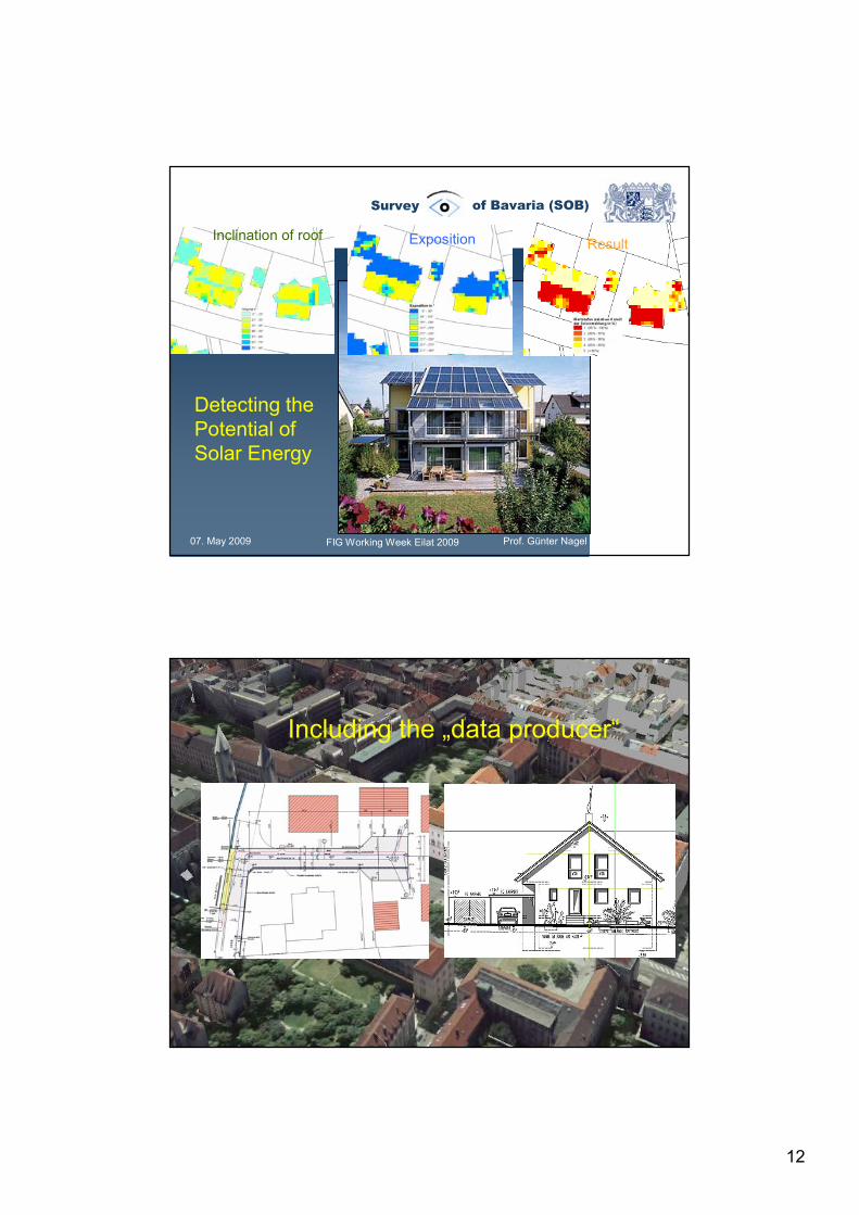
Detecting thePotential ofSolar Energy
Inclination of roof Exposition Result
07. May 2009 FIG Working Week Eilat 2009 Prof. Günter Nagel
Survey of Bavaria (SOB)
Automatic Combination ofcore data to 3D- City Model
Including the „data producer“
13
07. May 2009 FIG Working Week Eilat 2009 Prof. Günter Nagel
Survey of Bavaria (SOB)
2008
2010
2009
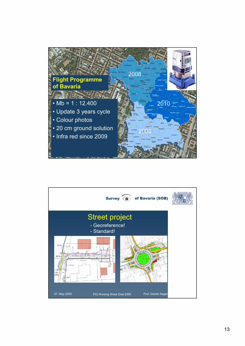
Flight Programmeof Bavaria
• Mb = 1 : 12.400• Update 3 years cycle• Colour photos• 20 cm ground solution• Infra red since 2009
07. May 2009 FIG Working Week Eilat 2009 Prof. Günter Nagel
Survey of Bavaria (SOB)
Street project- Georeference!- Standard!
14
07. May 2009 FIG Working Week Eilat 2009 Prof. Günter Nagel
Survey of Bavaria (SOB)
07. May 2009 FIG Working Week Eilat 2009 Prof. Günter Nagel
Survey of Bavaria (SOB)
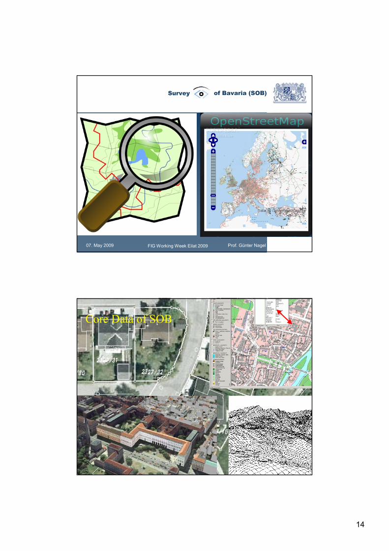
GeodatenOnline– DFKonline
(DFK = Digitale Flurkarte)
Core Data of SOB
15
07. May 2009 FIG Working Week Eilat 2009 Prof. Günter Nagel
Survey of Bavaria (SOB)
Thank you for your attention!