Embed Size (px)
Citation preview
Standards and Guidelines for Architectural and Historical
Investigations in Maryland
M ARYLAND HISTORICAL TRUSTMaryland Department of Planning
Standards and Guidelines for Architectural and Historical Investigations in Maryland
Maryland Historical TrustMaryland Department of Planning

All rights reserved. Published 2000.
Maryland Historical TrustDepartment of Planning100 Community PlaceCrownsville, Maryland 21032-2023
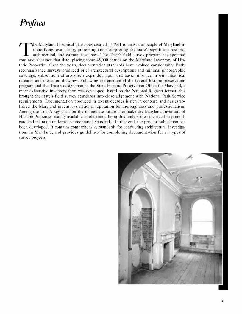
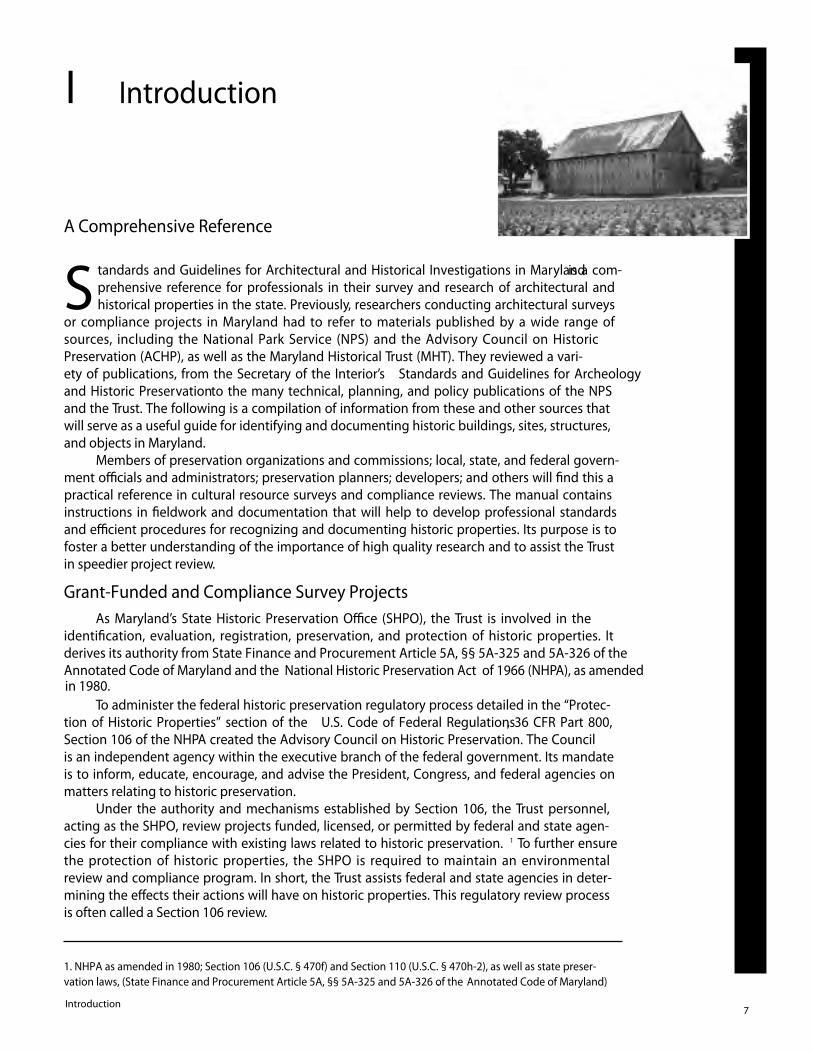
Cover photo: The Beatty-Cramer House, Frederick County, photographed by David L. Ames, Center for Historic Architecture & Engineering, University of Delaware
3
Preface
The Maryland Historical Trust was created in 1961 to assist the people of Maryland in
identifying, evaluating, protecting and interpreting the state’s significant historic,
architectural, and cultural resources. The Trust’s field survey program has operated
continuously since that date, placing some 45,000 entries on the Maryland Inventory of His-
toric Properties. Over the years, documentation standards have evolved considerably. Early
reconnaissance surveys produced brief architectural descriptions and minimal photographic
coverage; subsequent efforts often expanded upon this basic information with historical
research and measured drawings. Following the creation of the federal historic preservation
program and the Trust’s designation as the State Historic Preservation Office for Maryland, a
more exhaustive inventory form was developed, based on the National Register format; this
brought the state’s field survey standards into close alignment with National Park Service
requirements. Documentation produced in recent decades is rich in content, and has estab-
lished the Maryland inventory’s national reputation for thoroughness and professionalism.
Among the Trust’s key goals for the immediate future is to make the Maryland Inventory of
Historic Properties readily available in electronic form; this underscores the need to promul-
gate and maintain uniform documentation standards. To that end, the present publication has
been developed. It contains comprehensive standards for conducting architectural investiga-
tions in Maryland, and provides guidelines for completing documentation for all types of
survey projects.
4
PREFACE . . . . . . . . . . . . . . . . . . . . . . . . . . . . . . . . . . . . . . . . . . . . . . . . . . . . . . . . . . . . . . . . . . . .3
TABLE OF CONTENTS . . . . . . . . . . . . . . . . . . . . . . . . . . . . . . . . . . . . . . . . . . . . . . . . . . . . . . .4
PERSONNEL . . . . . . . . . . . . . . . . . . . . . . . . . . . . . . . . . . . . . . . . . . . . . . . . . . . . . . . . . . . . . . . .5
COMMONLY USED ABBREVIATIONS . . . . . . . . . . . . . . . . . . . . . . . . . . . . . . . . . . . . . . . . . .5
I. INTRODUCTION . . . . . . . . . . . . . . . . . . . . . . . . . . . . . . . . . . . . . . . . . . . . . . . . . . . . . . . . . . .7
· A Comprehensive Reference
· Grant-Funded and Compliance Survey Projects
· Professional Qualifications
· Other Cultural Resource Investigations
· Additional Information
II. ARCHITECTURAL INVESTIGATIONS IN MARYLAND . . . . . . . . . . . . . . . . . . . . . .11
· Introduction
· Grant Funded Investigations
· Compliance Investigations
III. RESEARCH DESIGN . . . . . . . . . . . . . . . . . . . . . . . . . . . . . . . . . . . . . . . . . . . . . . . . . . . . .17
· Standards for Identification
· Mandatory Components
· Research Design Format
IV. GUIDELINES FOR COMPLETING THE MARYLAND INVENTORY
OF HISTORIC PROPERTIES FORM FOR ARCHITECTURAL AND
HISTORICAL RESOURCES . . . . . . . . . . . . . . . . . . . . . . . . . . . . . . . . . . . . . . . . . . . . . . . .21
· Introduction
· Getting Started
· General Instructions for Completing Documentation
· Completing the MIHP Form
· Accompanying Documentation
V. FINAL SURVEY REPORTS . . . . . . . . . . . . . . . . . . . . . . . . . . . . . . . . . . . . . . . . . . . . . . . . .41
· Final Report Contents
· Suggested Content Outline
VI. COMPLIANCE REPORTS . . . . . . . . . . . . . . . . . . . . . . . . . . . . . . . . . . . . . . . . . . . . . . . . .45
· Report Format
· Coordinating With SHPO
· Determining the Area of Potential Effect (APE)
· Identification of Properties
· Evaluation of Properties
· Assessing Effects
· Treatment
VII. ACCESSIONING PROCEDURES . . . . . . . . . . . . . . . . . . . . . . . . . . . . . . . . . . . . . . . . . .55
· Maryland Inventory of Historic Properties Form
· Compliance Reports
· Final Survey Reports
· HABS/HAER Materials
VIII. SURVEY AND PLANNING MATERIALS . . . . . . . . . . . . . . . . . . . . . . . . . . . . . . . . . .59
· Technical Information
· General Reference
PHOTO CREDITS . . . . . . . . . . . . . . . . . . . . . . . . . . . . . . . . . . . . . . . . . . . . . . . . . . . . . . . . . . . 63
Table of Contents
5
Personnel
Office of Research, Survey and RegistrationOrlando Ridout V, Chief 410-514-7642
Marcia Miller, Administrator of Architectural Research 410-514-7646
Peter Kurtze, Administrator, Evaluation and Registration 410-514-7649
Maureen Kavanaugh, Archeological Survey Administrator 410-514-7659
Barbara Shepherd, Inventory Registrar 410-514-7656
Mary Louise de Sarran, Administrator of Library Services 410-514-7655
Jan Gowing, Administrative Assistant 410-514-7644
Office of Preservation ServicesMichael Day, Chief 410-514-7629
Elizabeth Cole, Administrator, Project Review and Compliance 410-514-7631
Patricia M. Blick, Preservation Officer 410-514-7637
Anne Bruder, Preservation Officer 410-514-7636
Office of Heritage Planning and OutreachElizabeth Hughes, Chief 410-514-7617
Nicole Diehlmann, Administrator of Statewide Preservation Programs 410-514-7625
Scott Whipple, Coordinator of Preservation Assistance Outreach Programs 410-514-7625
MHT FAX 410-987-4071
*This list is current as of August 2000. Please refer to the MHT website for the most up-to-date listing.
Area of Potential Effect APE
Advisory Council on Historic Preservation ACHP
Certified Local Government CLG
Cultural Resources Management CRM
Code of Federal Regulations CFR
Historic American Buildings Survey HABS
Historic American Engineering Record HAER
Historic Preservation Fund HPF
Historic Structure Report HSR
Maryland Historical Trust MHT, Trust
National Historic Preservation Act NHPA
National Park Service NPS
State Historic Preservation Office SHPO
Commonly Used Abbreviations
6
GarrettAllegany
Washington
Frederick
Carroll
Howard
Baltimore
Harford
Kent
Queen
Anne’s
An
ne
Aru
nd
el
PrinceGeorge’s
St. Mary’s
Charles
Ca
lvert
Ta
lbo
t
Dorchester
Wicomico
So
merse
t
Worcester
Ca
rolin
e
Cecil
Montgomery
A Comprehensive Reference
S tandards and Guidelines for Architectural and Historical Investigations in Marylandis a com-prehensive reference for professionals in their survey and research of architectural andhistorical properties in the state. Previously, researchers conducting architectural surveys
or compliance projects in Maryland had to refer to materials published by a wide range ofsources, including the National Park Service (NPS) and the Advisory Council on HistoricPreservation (ACHP), as well as the Maryland Historical Trust (MHT). They reviewed a vari-ety of publications, from the Secretary of the Interior’s Standards and Guidelines for Archeologyand Historic Preservationto the many technical, planning, and policy publications of the NPSand the Trust. The following is a compilation of information from these and other sources thatwill serve as a useful guide for identifying and documenting historic buildings, sites, structures,and objects in Maryland.
Members of preservation organizations and commissions; local, state, and federal govern-ment o�cials and administrators; preservation planners; developers; and others will �nd this apractical reference in cultural resource surveys and compliance reviews. The manual containsinstructions in �eldwork and documentation that will help to develop professional standardsand e�cient procedures for recognizing and documenting historic properties. Its purpose is tofoster a better understanding of the importance of high quality research and to assist the Trustin speedier project review.
Grant-Funded and Compliance Survey ProjectsAs Maryland’s State Historic Preservation O�ce (SHPO), the Trust is involved in the
identi�cation, evaluation, registration, preservation, and protection of historic properties. Itderives its authority from State Finance and Procurement Article 5A, §§ 5A-325 and 5A-326 of the Annotated Code of Maryland and the National Historic Preservation Act of 1966 (NHPA), as amended
To administer the federal historic preservation regulatory process detailed in the “Protec-tion of Historic Properties” section of the U.S. Code of Federal Regulations, 36 CFR Part 800,Section 106 of the NHPA created the Advisory Council on Historic Preservation. The Councilis an independent agency within the executive branch of the federal government. Its mandateis to inform, educate, encourage, and advise the President, Congress, and federal agencies onmatters relating to historic preservation.
Under the authority and mechanisms established by Section 106, the Trust personnel,acting as the SHPO, review projects funded, licensed, or permitted by federal and state agen-cies for their compliance with existing laws related to historic preservation. 1 To further ensurethe protection of historic properties, the SHPO is required to maintain an environmentalreview and compliance program. In short, the Trust assists federal and state agencies in deter-mining the e�ects their actions will have on historic properties. This regulatory review processis often called a Section 106 review.
7
I Introduction
Introduction
in 1980.
1. NHPA as amended in 1980; Section 106 (U.S.C. § 470f) and Section 110 (U.S.C. § 470h-2), as well as state preser-vation laws, (State Finance and Procurement Article 5A, §§ 5A-325 and 5A-326 of the Annotated Code of Maryland).
In accordance with the NHPA review process, the Trust is eligible for Historic Preserva-
tion Fund (HPF) grants for survey and documentation. This is covered by Section 110 of the
NHPA, which requires federal agencies to be responsible for documenting and preserving
historic properties that they own or control. Section 110 also includes inventorying and nomi-
nating eligible historic properties to the National Register as well as ensuring that such proper-
ties are not “inadvertently transferred, sold, demolished, substantially altered, or allowed to
deteriorate significantly.”
Assisted by HPF funds, the Trust maintains a statewide inventory of historic properties
and other survey information. It also nominates significant resources to the Maryland Register
of Historic Properties and the National Register of Historic Places. It works with federal agen-
cies to determine the eligibility of properties under their jurisdiction or control. In addition,
local governments often turn to the Trust for its cooperation and guidance in their develop-
ment of local historic preservation programs. These include the Certified Local Government
(CLG) program as well as many other eligible grant-funded activities requiring architectural
investigations.
At the state level, Maryland law also requires a review of state funded capital projects
affecting historic properties. It spells out certain steps that state bodies or agencies must take
before submitting a request for a capital
project.2 They are required to consult
with the Trust “to determine if the pro-
posed capital project or projects will
adversely affect any property listed in, or
eligible for, the Maryland Register of His-
toric Properties.” Like their federal coun-
terparts, state agencies are responsible for
identifying, documenting, and nominat-
ing all properties they own or control that
appear to qualify for the Maryland Regis-
ter of Historic Properties. They must also
ensure that any property listed or deter-
mined eligible for the Maryland Register
is “not inadvertently transferred, sold,
demolished, destroyed, substantially
altered, or allowed to deteriorate signifi-
cantly.” If a proposed capital project
requires substantial alteration or demoli-
tion of a historic property, the agency must negotiate with the Trust to determine the appro-
priate mitigating measures, such as survey and other documentation.
Professional Qualifications
The Trust’s requirements for personnel involved in architectural investigations by the
Trust conform to the national standards detailed in the Secretary of the Interior’s Standards forArcheology and Historic Preservation (Federal Register, 36 CFR Part 61). These professional
qualifications, reprinted below, are used by the National Park Service to define the minimum
education and experience necessary to perform identification, evaluation, registration, and
treatment activities.
A professional’s expertise must be relevant to the preservation task at hand. For example,
an architect would not be considered qualified to conduct a survey and perform documentation
tasks unless he or she also met the standards required for a historian or architectural historian.
Similarly, unless an architectural historian or historian also possesses a professional degree in
Introduction8
2. Art. 83B, §§ 5-617 and 5-618.
architecture or is a state-licensed architect, he or she would not be qualified to conduct the
stabilization, rehabilitation, or restoration of a historic property.
Depending on a project’s complexity or the nature of the resources involved, the Trust
may require multiple areas or levels of
expertise. This requirement is usually
fulfilled by a team approach. In all cases,
however, architectural investigators in
Maryland will be required to meet at
least one of the following professional
qualification standards.
Architectural Historian
The applicant, employee, consul-
tant, or advisor will have a graduate
degree in Architectural History or a
closely related field of study, such as Art
History; plus a minimum of two (2) years
of full-time professional experience
applying the theories, methods, and
practices of architectural history to the
identification, evaluation, registration,
documentation, or treatment of historic
properties in the United States and its territories; and products and activities that demonstrate
the successful application of acquired proficiencies in the discipline to the practice of historic
preservation; orAn undergraduate degree in Architectural History or a closely related field, such as Art
History, plus a minimum of four (4) years of full-time professional experience applying the
theories, methods, and practices of architectural history to the identification, evaluation, regis-
tration, documentation, or treatment of historic properties in the United States and its territo-
ries; and products and activities that demonstrate the successful application of acquired profi-
ciencies in the discipline to the practice of historic preservation.
Historic Preservationist
The applicant, employee, consultant, or advisor will have a graduate degree in Historic
Preservation or a closely related field of study, such as Environmental Studies; plus a minimum
of two (2) years of full-time professional experience applying the theories, methods, and prac-
tices of historic preservation to the identification, evaluation, registration, documentation, or
treatment of historic properties in the United States and its territories; and products and activi-
ties that demonstrate the successful application of acquired proficiencies in the discipline to
the practice of historic preservation; orAn undergraduate degree in Historic Preservation or a closely related field, such as Envi-
ronmental Studies; plus a minimum of four (4) years of full-time professional experience apply-
ing the theories, methods, and practices of historic preservation to the identification, evalua-
tion, registration, documentation, or treatment of historic properties in the United States and
its territories; and products and activities that demonstrate the successful application of
acquired proficiencies in the discipline to the practice of historic preservation.
Historian
The applicant, employee, consultant, or advisor will have a graduate degree in American
History or a closely related field of study, such as American Studies; plus a minimum of two (2)
years of full-time professional experience applying the theories, methods, and practices of
American history to the identification, evaluation, registration, documentation, or treatment of
historic properties in the United States and its territories; and products and activities that
9Standards & Guidelines
demonstrate the successful application of acquired proficiencies in the discipline to the prac-
tice of historic preservation; orAn undergraduate degree in American History or a closely related field, such as American
Studies; plus a minimum of four (4) years of full-time professional experience applying the the-
ories, methods, and practices of American history to the identification, evaluation, registration,
documentation, or treatment of historic properties in the United States and its territories; andproducts and activities that demonstrate the successful application of acquired proficiencies in
the discipline to the practice of historic preservation.
Other Cultural Resource Investigations
Cultural resource investigations in Maryland encompass a wide range of preservation ini-
tiatives beyond the scope and purpose of this document. Other major types of studies include
the preservation components of comprehensive master plans, Cultural Resource Management
plans, National Register nominations, and Historic Structure Reports. The focus of this docu-
ment is the identification and documentation of historic cultural resources in Maryland that
will initiate and support evaluation and registration program activities, such as the National
Register of Historic Places.
The National Register of Historic Places is the official federal list of districts, sites, build-
ings, structures, and objects significant in American history, architecture, archeology, engineer-
ing, and culture. This national repository of information on historic properties that have been
evaluated and documented according to uniform standards is a remarkable resource for preser-
vation planning and the study of America’s built environment. All Maryland properties
included in, or determined eligible for, the National Register are also given a parallel designa-
tion in the Maryland Register of Historic Properties. The Maryland Register, established by
the Maryland legislature in 1985, provides eligibility for certain state regulatory protections as
well as the availability of grant and loan programs. Inclusion in the Maryland Register requires
that the resource be listed in or determined eligible by the Director of the Maryland Historical
Trust for listing in the National Register of Historic Places. The National Park Service has
published extensive technical information and specialized bulletins related to the survey and
registration of historic properties.3
A Historic Structure Report (HSR), which records the
documentary and physical research concerning a structure’s
evolution, is used in the management of historic resources.
When used in conjunction with existing research, a HSR
minimizes the loss of significant material or design elements
when decisions are being made that affect a historic structure.
As outlined in the National Park Service’s Cultural ResourcesManagement Guideline (NPS-28, October 1980), a HSR usually
contains three major elements: an administrative data section,
a physical history, and an analysis section and appendix. Nor-
mally, a HSR is prepared whenever a proposed major alter-
ation of a historic site or structure will affect the qualities or
characteristics that qualify the property for inclusion on the
National Register.
Additional Information
Chapter VIII of this guide provides an extensive list of recommended readings applicable
to architectural investigations in Maryland.
Introduction10
3. See Bulletin 15: How To Apply the National Register Criteria for Evaluation; Bulletin 16A: How to Complete the NationalRegister Form; Bulletin 16B: How to Complete the National Register Multiple Property Documentation Form; and the Mary-land Supplement to Bulletin 16 (see Chapter VIII for a complete list of NPS technical information publications).
Introduction
Identifying and evaluating an area’s architectural and historical resources is basic to the
preservation of its cultural heritage and distinctive built environmental character. Effec-
tive preservation planning depends on a survey of an area’s above-ground cultural
resources, such as old and new buildings, street furniture, landscaping, open spaces, views, and
vistas. This comprehensive description of an area’s physical characteristics helps to establish its
historical character and to trace its development.
Preservation surveys define an area’s distinctive character and identify the historic and
cultural resources that meet the criteria for national, state, or local registers and merit whatever
legal protection is available. Surveys also create the groundwork for preservation plans.
Local designation created by city and county ordinances can go beyond the provisions
and requirements stipulated by national and state registers. A local ordinance may prohibit
demolition of recognized properties and may include design restrictions in a historic area.
11Standards & Guidelines
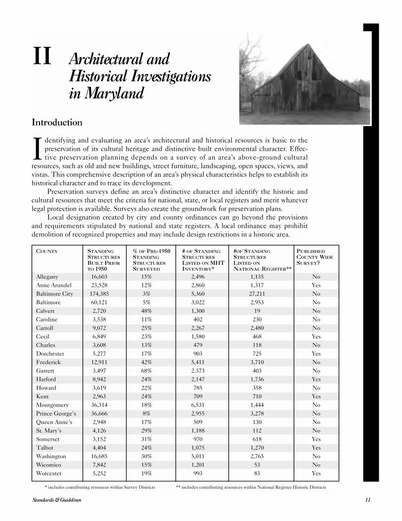
II Architectural andHistorical Investigationsin Maryland
COUNTY STANDING % OF PRE-1950 # OF STANDING #OF STANDING PUBLISHED
STRUCTURES STANDING STRUCTURES STRUCTURES COUNTY WIDE
BUILT PRIOR STRUCTURES LISTED ON MHT LISTED ON SURVEY?TO 1950 SURVEYED INVENTORY* NATIONAL REGISTER**
Allegany 16,603 15% 2,496 1,135 No
Anne Arundel 23,528 12% 2,860 1,317 Yes
Baltimore City 174,385 3% 5,360 27,211 No
Baltimore 60,121 5% 3,022 2,953 No
Calvert 2,720 48% 1,300 19 No
Caroline 3,538 11% 402 230 No
Carroll 9,072 25% 2,267 2,480 No
Cecil 6,849 23% 1,580 468 Yes
Charles 3,608 13% 479 118 No
Dorchester 5,277 17% 903 725 Yes
Frederick 12,911 42% 5,411 3,710 No
Garrett 3,497 68% 2.373 403 No
Harford 8,942 24% 2,147 1,736 Yes
Howard 3,619 22% 785 358 No
Kent 2,963 24% 709 710 Yes
Montgomery 36,314 18% 6,531 1,444 No
Prince George’s 36,666 8% 2,955 3,278 No
Queen Anne’s 2,948 17% 509 130 No
St. Mary’s 4,126 29% 1,188 112 No
Somerset 3,152 31% 970 618 Yes
Talbot 4,404 24% 1,075 1,270 Yes
Washington 16,685 30% 5,011 2,765 No
Wicomico 7,842 15% 1,201 53 No
Worcester 5,252 19% 993 83 Yes
* includes contributing resources within Survey Districts ** includes contributing resources within National Register Historic Districts
Grant-Funded Investigations
Because architectural and historical investigations are critical in the preservation planning
process and the rehabilitation of historic buildings, funding for specific survey projects is con-
sidered a good investment by both federal and state governments. Architectural and historical
surveys in Maryland are supported by federal and state historic preservation funding. The
Trust is the channel through which federal grant money is passed on to local governments and
other entities through a subgrant program.
The 1980 amendments to the NHPA are the authority for transfers of funds to local gov-
ernments and other entities. As amended, the NHPA established a Certified Local Govern-
ment (CLG) Program that expanded the federal-state preservation partnership to include local
governments, non-profit organizations, civic groups, and citizens. The state of Maryland
ensures that at least 10 percent of the congressionally appropriated Historic Preservation Fund
is passed on to “Certified Local Governments” that qualify under the federal regulations.4 The
grant funding is available for a wide
variety of projects, including but not
limited to the development of preser-
vation plans and architectural, archeo-
logical, or cultural surveys; educa-
tional outreach programs; and
National Register nominations. Most
often, CLG subgrants support some
type of identification and evaluation
of historic cultural resources.
The Trust also administers a
state Historic Preservation Grant
Fund established by the General
Assembly in 1976 to encourage the
preservation of historic properties.
This grant fund supports both capital
and non-capital Historic Preservation
Grant Programs. Non-profit organiza-
tions, local jurisdictions, and business
entities are eligible to apply for non-
capital grant funding. (For information concerning the eligibility of business entities see the
Non-Capital Grant Application.) State entities are not eligible to apply for funding.
Among the broad array of survey and identification projects funded by Maryland Non-
Capital Grants are projects designed to locate and identify architectural and historical
resources. These most commonly are countywide in scope. Collaborative regional heritage
studies and thematic surveys are becoming more commonplace. These comprehensive surveys
provide a basis for evaluating a county’s resources within their local historic context and aid in
developing broader regional and thematic contexts. They also identify highly significant or
endangered properties that should receive extensive documentation completed to HistoricAmerican Buildings Survey (HABS) standards including measured drawings, large-format pho-
tographs, and/or detailed building analyses by preservation professionals.
Evaluation and registration projects build on comprehensive surveys and determine if the
subject properties meet specified criteria to be formally recognized in a register of historic
properties. Such registration programs offer a number of benefits at community, county, state,
and national levels. These can range from honorific recognition to financial incentives, includ-
ing property and income tax deductions.
Architectural and Historical Investigations12
4. “Procedures for Approved State and Local Government Historic Preservation Programs,” Code of Federal Regula-tions, 36 CFR Part 61.
Listing in the National Register
of Historic Places is the most common
form of registration of historic proper-
ties in the state. Listing in the
National Register follows a process
established by the Code of Federal Regu-lations, 36 CFR Part 60. Properties
listed in the National Register are
listed concurrently in the Maryland
Register. Under state and federal
preservation laws, properties listed in
the Maryland and National registers
must be given due consideration in the
planning of federal and state projects
or actions and thus are given limited
protection.
The evaluation and registration
of historic properties in Maryland are
parts of the larger process of preserva-
tion planning; a process that organizes activities, such as identification, evaluation, registration,
and treatment of historic properties, into a logical sequence. Surveys—the identification and
evaluation steps—are the basic building blocks of this process. For the purposes of effective
preservation planning, a survey must consider the historic context in which a particular prop-
erty or resource exists.
A historic context is a format or method of organizing information about related historic
properties into manageable units based on a theme, geographical limits, or chronological
period. Establishing a historic context increases the reliability of decisions made concerning
the identification, evaluation, registration, and treatment of historic properties. In many cases
not all significant historic properties will have been identified at the beginning of the preserva-
tion planning process. Therefore, investigators should not only use all available existing data,
but should also continually develop and broaden historic contexts to form a framework upon
which preservation planning can build.
A historic context might encompass the development of an area, taking into account its
history, architecture, archeology, engineering, and culture. It also might identify the significant
patterns that individual properties represent within that context. One example is ScientificFarming in Montgomery County between 1790 and 1860. The study offers one theoretical construct
of the effect of a particular movement or advance upon the history of agriculture. It establishes
a time frame and geographical area from which discernible patterns in the county’s historical
and architectural development emerge. A set of such historic contexts can create a truly com-
prehensive view of an area’s history, thus providing a broad definition that is useful to preserva-
tion planners and surveyors. As a result, researchers are able to anticipate, identify, and evalu-
ate specific property types. The investigator should develop several levels of information that
can be used in local, state, and regional planning. This ensures that the survey includes a range
of properties representing all aspects of an area’s history rather than a small, biased sample.
One or more well-developed historic contexts for a geographical area can guide identification
activities and assist in estimating the level of effort and methodology required by large-scale
surveys.
Comprehensive Survey Components
All grant funded comprehensive surveys include three major components: a research
design, fieldwork and preparation of MHT inventory forms, and the final report.
The research design provides a framework that guides investigators in identification proce-
dures. It includes an outline of the survey’s objectives; a description of the research and field-
13Standards & Guidelines
work methods necessary to obtain data; and a discussion of expected results based on back-
ground research, experience, and a general knowledge of the survey area or of areas with a sim-
ilar environment or history (See Chapter III for detailed instructions and guidelines for prepa-
ration of the Research Design).
Fieldwork must be in keeping with the preservation goals or management needs that
direct the survey, which should have as its overriding objective the greatest possible protection
of the properties and historical context under study. Fieldwork techniques are usually related
to the level of effort required by the significance of the resources. Architectural investigations
are loosely organized into two levels: “reconnaissance” and “intensive” surveys.
The reconnaissance survey should document the kinds of properties identified; the
boundaries of the area surveyed; the method of survey, including the extent of the survey cov-
erage; the kinds of historic properties present in the surveyed area; specific properties that
were identified; and the categories of information collected. It should also list places examined
that did not contain historic properties.
The intensive survey should document the kinds of properties identified; the boundaries
of the area surveyed; the method of survey, including an estimate of the extent of the survey
coverage; a record of the precise location of all properties identified; and enough specific data
on the appearance, significance, integrity, and bound-
aries of each property to permit an evaluation of its
significance.
Architectural investigators may find it necessary
to use both reconnaissance and intensive field survey
techniques to accomplish the project goals. In devel-
oping their research design and methodology, investi-
gators should use existing information as the basis for
further research and ongoing fieldwork. As work pro-
gresses, they must continue to develop historic con-
texts as the underlying framework for identification
and evaluation of the properties.
The assembled data is evaluated as the basis for
determining eligibility for registration and for making
treatment decisions. To ensure uniformity of informa-
tion on properties surveyed in the state, the Trust has
developed a standard inventory form, the MarylandInventory of Historic Properties Form. Data recorded on
a particular site includes a description of the property,
a statement that justifies its significance in relation to its context(s), analysis of the integrity of
the property, and a record of when the property was surveyed and by whom. (See Chapter IV
for instructions and guidelines for the preparation of these forms.)
Grant-funded surveys conclude with the submission of a final report that includes a state-
ment of the survey’s objectives, definition of the survey’s geographical area, a discussion of the
methodology and intensity of coverage, a description and the location of the results of survey,
and recommendations for further work. (See Chapter V for detailed instructions and guidelines
for preparation of the Final Survey Report.)
Compliance Investigations
An important goal of this guide is to facilitate the review of projects requiring compliance
with federal and state historic preservation laws and regulations. Specific types of information
are required by the governmental agencies responsible for identifying and treating historic
properties, as well as by those who review activities affecting historic properties. On occasion, a
project’s cultural resources may also require archeological investigation, which is beyond the
scope of this guide. For materials and sources of information on terrestrial and underwater
archeology, preservation professionals should contact Trust staff.
Architectural and Historical Investigations14
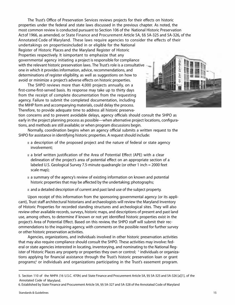
The Trust’s O�ce of Preservation Services reviews projects for their e�ects on historicproperties under the federal and state laws discussed in the previous chapter. As noted, themost common review is conducted pursuant to Section 106 of the National Historic PreservationAct of 1966, as amended, or State Finance and Procurement Article 5A, §§ 5A-325 and 5A-326, of the .Annotated Code of Maryland. These laws require agencies to consider the e�ects of their undertakings on propertiesincluded in or eligible for the National Register of Historic Places and the Maryland Register of Historic Properties respectively. It isimportant to emphasize that any governmental agency initiating a project is responsible for compliance with the relevant historic preservation laws. The Trust’s role is a consultative one in which it provides information, advice, recommendations, and determinations of register eligibility, as well as suggestions on how to avoid or minimize a project’s adverse e�ects on historic properties.
The SHPO reviews more than 4,000 projects annually, on a�rst-come-�rst-served basis. Its response may take up to thirty daysfrom the receipt of complete documentation from the requestingagency. Failure to submit the completed documentation, includingthe MIHP form and accompanying materials, could delay the process.Therefore, to provide adequate time to address all historic preserva-tion concerns and to prevent avoidable delays, agency o�cials should consult the SHPO asearly in the project planning process as possible—when alternative project locations, con�gura-tions, and methods are still available; or when program discussions begin.
Normally, coordination begins when an agency o�cial submits a written request to theSHPO for assistance in identifying historic properties. A request should include:
� a description of the proposed project and the nature of federal or state agencyinvolvement;
� a brief written justi�cation of the Area of Potential E�ect (APE) with a cleardelineation of the project’s area of potential e�ect on an appropriate section of alabeled U.S. Geological Survey 7.5-minute quadrangle (or other 1 inch = 2000 feetscale map);
� a summary of the agency’s review of existing information on known and potentialhistoric properties that may be a�ected by the undertaking; photographs;
� and a detailed description of current and past land use of the subject property.
Upon receipt of this information from the sponsoring governmental agency (or its appli-cant), Trust sta� architectural historians and archaeologists will review the Maryland Inventoryof Historic Properties for recorded standing structures and archeological sites. They will alsoreview other available records, surveys, historic maps, and descriptions of present and past landuse, among others, to determine if known or not yet identi�ed historic properties exist in theproject’s Area of Potential E�ect. Based on this review, the SHPO sta� will submit their rec-ommendations to the inquiring agency, with comments on the possible need for further surveyor other historic preservation activities.
Agencies, organizations, and individuals involved in other historic preservation activitiesthat may also require compliance should consult the SHPO. These activities may involve: fed-eral or state agencies interested in locating, inventorying, and nominating to the National Reg-ister of Historic Places any property or properties they own or control; 5 individuals or organiza-tions applying for �nancial assistance through the Trust’s historic preservation loan or grantprograms;6 or individuals and organizations participating in the Trust’s easement program.
15Standards & Guidelines
5. Section 110 of the NHPA (16 U.S.C. 470h) and State Finance and Procurement Article 5A, §§ 5A-325 and 5A-326 [a][1], of the Annotated Code of Maryland.
6. Established by State Finance and Procurement Article 5A, §§ 5A-327 and 5A-328 of the Annotated Code of Maryland.
Government agencies, professional historic preservation consultants, and others involved with
compliance reviews are reminded that the Trust’s insistence upon adherence to specific stan-
dards and guidelines stems, in part, from its legal responsibility to meet National Park Service
requirements.
An aid to agencies responsible for managing large installations or land tracts or adminis-
tering historic properties is the Cultural Resource Management Plan (CRMP), also referred to
as a Historic Preservation Plan (HPP). Such plans provide an overview of the project area’s his-
toric contexts, describe inventoried historic properties and predicted resources, and recom-
mend the appropriate treatment and management of the area’s historic properties, both known
and predicted. Generally, CRMPs are developed to address all historic property types on a par-
ticular site, including architectural and archeological resources.
To develop an effective plan, investigators should have a working knowledge and under-
standing not only of the area’s historic properties, but also of the agency’s mission, programs,
and processes. Prior identification and evaluation greatly enhances a plan’s usefulness in future
compliance-related decisions. Also, the degree of prior investigation will influence the focus
and research strategy for a given plan. For sites that encompass considerable acreage, for
instance, agencies may find it more practical to complete phased investigations before devel-
oping their plans.
As with other cultural resource investigations, agencies should consult the Trust and the
Federal Advisory Council on Historic Preservation, as appropriate, when deciding to develop
an HPP/CRMP and determining the appropriate level of effort required. The content and
form of an HPP will vary depending upon the nature of the agency, project area, and historic
properties involved. To determine the most appropriate methods and analysis, investigators
should be clear on the precise objectives of a particular HPP before initiating a study.
HPPs can be the basis of a formal Programmatic Agreement that covers an agency’s com-
pliance responsibilities under state or federal law. For Section 106 projects, the parties to the
agreement are the agency, the Trust, and the Federal Advisory Council on Historic Preserva-
tion. These agreements may help streamline the agency’s compliance responsibilities and
eliminate the need for extensive project-specific reviews.
Architectural and Historical Investigations16
Working with the Administrator of Architectural Research of the Maryland Historical
Trust, preservation planners and consultants for all grant-funded architectural inves-
tigations must prepare a research design incorporating the historic context frame-
work established by the Trust. The design is a guide for efficient, goal-directed background
research that occurs before field surveys are conducted. A chief component of the design is
development of localized historic contexts format, suitable in scale for the project area. An
effective research design ensures that objectives are clear and that the products of the research
and survey efforts are systematically collected and recorded and made available to those
responsible for preservation planning. In compliance projects, the research design should be
prepared in conjunction with a formal bid/proposal or statement of the scope of work.
Standards for Identification
As used in the Secretary of the Interior’s Standards and Guidelines for Archeology and His-toric Preservation, identification describes those activities undertaken to gather information
about historic properties. When these activities relate to historic and architectural resources,
they usually take the form of archival and background research, informant interviews, and sur-
veys of standing structures.
The scope and nature of architectural investigations always depend on the existing
knowledge of the survey or project area’s properties and the planning goals or current manage-
ment needs. Identification activities generally have multiple objectives, reflecting complex
goals and needs. As a result, combinations of these activities may be selected and assigned
appropriate levels of effort to produce a flexible series of planning options.
The objectives, methodology, identification of the survey area, and expected results of a
survey or compliance project are specified in the research design. These statements are
required in all grant-funded and compliance projects for architectural and historical investiga-
tions in Maryland before the fieldwork is performed. They must be reviewed and approved by
the Administrator of Architectural Research or the appropriate preservation officer for compli-
ance projects. This requirement, as defined by the Secretary of the Interior’s Standards andGuidelines, “provides a vehicle for integrating the various activities performed during the iden-
tification process and for linking those activities directly to the goals and the historic context(s)
for which the goals were defined.”
In practice, the research design also provides investigator(s) with the framework for
developing a work program that defines planning goals for determining historic contexts and
the scale and intensity of the survey work. It also specifies the proposed use of the survey data
and can provide important interpretive information to generate local interest and participation
in a survey project.
17Standards & Guidelines
III Research Designs
Mandatory Components
As the vehicle for the integration of activities performed during the identification process,
the well-crafted research design will, to the greatest extent possible, create linkages among the
tasks in a survey project. These tasks include archival and background research, development
of historic context(s), and fieldwork. Survey leaders will be responsible for ensuring the effec-
tive integration of all facets of the survey, which normally are conducted concurrently. The
research design should include the following major sections:
Project Goals and ObjectivesThis first section should include a statement of the survey or compliance investigation’s
goals and objectives. Ideally, the survey’s goals should be based on historic contexts even
though planning needs may determine the project’s scope and priorities. Preservation planners
should develop preliminary survey goals and objectives based upon current knowledge of a
specific area’s historic contexts or property types established through background research and
assessments of previous research.
For example, suppose that future plans for highway improvements give high survey pri-
ority to a community within the highway’s path. Background research reveals that the commu-
nity was a tobacco port during the eighteenth century; experienced growth as an agricultural
village in the nineteenth century after the construction of a turnpike; and developed into an
ethnic suburban community in the twentieth century with the booming growth of regional
urban centers and the construction of hard-surface roads.
Goals for a first stage survey effort might include determination of the boundaries of the
eighteenth-century port; identification of any buildings still standing from the period; location
of buildings requiring further study to determine whether they represent modernized eigh-
teenth-century buildings; determination of likely archeological sites; identification of any sur-
viving nineteenth-century agricultural or commercial properties; and identification of any eth-
nic neighborhoods or buildings that retain their architectural or cultural integrity.
The survey’s objectives might be to characterize the range of properties in the region or
planning area, to identify properties within a particular context, or to determine which proper-
ties in an area may be significant.
Survey planners should consult with SHPO staff
when preparing a research design. Staff members in
the Office of Research, Survey, and Registration and
the Office of Preservation Services are experienced in
designing and implementing surveys. They can pro-
vide valuable advice and models, as well as help
ensure that the design is consistent with statewide sur-
vey standards and Preservation Vision 2000: The Mary-land Plan.
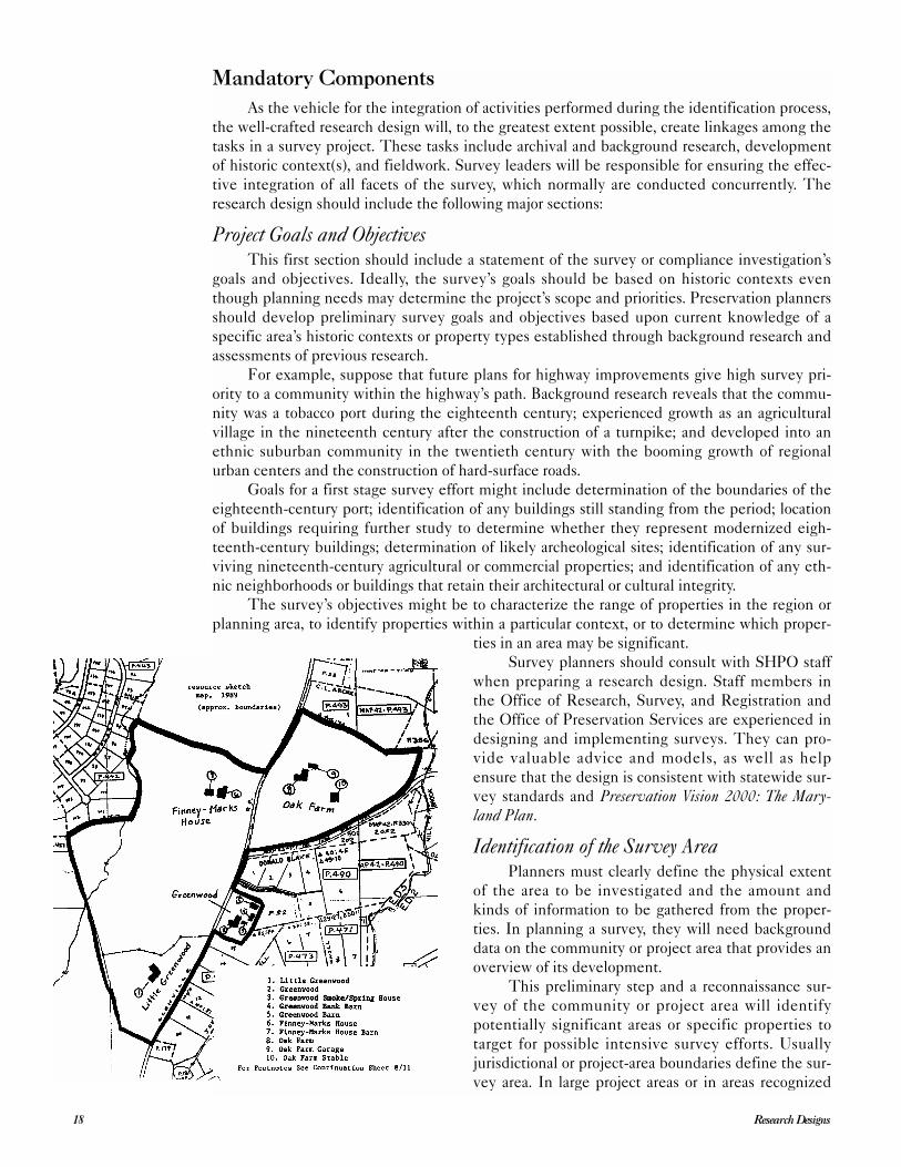
Identification of the Survey AreaPlanners must clearly define the physical extent
of the area to be investigated and the amount and
kinds of information to be gathered from the proper-
ties. In planning a survey, they will need background
data on the community or project area that provides an
overview of its development.
This preliminary step and a reconnaissance sur-
vey of the community or project area will identify
potentially significant areas or specific properties to
target for possible intensive survey efforts. Usually
jurisdictional or project-area boundaries define the sur-
vey area. In large project areas or in areas recognized
Research Designs18
for their development potential, however, survey efforts may be phased or targeted to address
endangered properties or specific historic contexts.
If the background research suggests that significant properties may be concentrated in
certain areas, the most cost-effective choice might be to survey those areas first. Areas where
historic properties are less likely to be found would be given lower priority. Because historically
significant places may not always be visually obvious, research designers should also make pro-
visions for adding properties and areas identified through documentary research and subse-
quent field survey.
Discussion of MethodologyThe research design should include a detailed explanation of data collection methods and
how those methods relate to the survey goals and objectives. The explanation should clearly
define background and archival research and field-study methods so that others using the find-
ings can understand how they were obtained and their possible limits or bias. Sources and
methods of selecting field-survey techniques should be described and related to the preserva-
tion goals directing the survey effort. Planners should also establish approximate time frames
within which the work, or particular phases of the work, should be completed. This statement
should also include, or be supported by, a brief description of the historic contexts to be inves-
tigated.
Expected ResultsTo the extent possible, those developing the research design should summarize their
expectations as to the kind, number, location, character, and condition of historic properties
from each historic context to be investigated.
Feedback for the Planning ProcessIn conclusion, the research design should specify the purposes for which the survey data
will be used. Typically data is used to develop historic contexts or strategies for the preserva-
tion of historic resources; to revise community development planning; and to evaluate proper-
ties for designation locally or for the Maryland Register of Historic Properties and National
Register of Historic Places. In the case of grant-funded survey contracts, resources identified
through project research would be the basis of a preliminary plan for the evaluation and regis-
tration and/or a preliminary plan for protection and treatment.
Research Design FormatAll initial research designs for survey and compliance projects should be submitted to the
Trust for review in the following format: narrative sections should be typed, single-spaced,
double-sided, on 8½” x 11” paper. For clarity, illustrations or maps may be larger than 8½” x
11”, if they can be folded to fit in the report as pages or inserts in a pocket. The final research
design will be a component of the Final Survey Report. It should reflect the project’s adjusted
goals and priorities, which usually are revised as the survey matures and new historic contexts
are developed and others are refined. (See Chapter V and VI for a description of research
designs for the Final Survey Report or compliance document.)
Suggested Research Design OutlineTitle Page
● Include the name, nature, and location (with county) of the project.
● Clearly designate the report’s author(s) with complete mailing address(es).
● Clearly designate the project’s principal investigator(s) with complete mailing
address(es).
● List names and complete mailing addresses of the lead government agency or
non-profit organization and of the government agent (e.g., engineering firm,
developer, or project sponsor, if applicable).
● Indicate the date.
19Standards & Guidelines
Introduction● Begin with a brief statement of the nature of the project, the source of funding,
and sponsors.
● Include locator maps.
Goals and Objectives● Include a detailed statement of goals and objectives.
● Explain the applicability of the work to broader county or regional historic and
architectural contexts.
Identification of the Survey Area● Clearly define the physical extent of the area to be investigated, including
acreage.
● Describe the amount and kinds of information to be gathered about the properties
in the area.
Methodology● Explain the research methods to be used to develop the historic context(s).
● Describe the field survey techniques available and the levels of effort that may be
assigned.
Historic Overview of the Project Area● Identify the concept, time period, and geographical limits for the historic
context(s).
● Collect and compile existing information about the historic context(s) in a written
narrative.
● Include maps depicting potential locations of resources along with boundaries of
the area to be surveyed.
Description of Expected Results of Field Investigations● Describe field conditions and constraints.
● Describe potential architectural and historic resources with reference to compara-
ble published studies, if known. Maryland Inventory site numbers issued by the
Trust’s Office of Research, Survey, and Registration must be utilized in the text
and illustrations of the final report.
● When possible and appropriate, include interpretations referring to historic con-
texts; research questions; and integrity/significance (i.e., eligibility for the
National Register).
A Plan for Evaluating and Registering Resources● State the minimum information necessary to evaluate properties against Maryland
Register and National register criteria.
● Explain how historic significance and historic integrity will be assessed and
related to the properties surveyed.
Preliminary Plan for Protection and Treatment● Summarize and evaluate the proposed methods and techniques to be used for
protection and treatment.
● Assess the need for additional investigations or resource treatment.
● Discuss the study’s public interpretation measures, if applicable.
Review of Bibliographic and Documentary Material● The style of all citations should follow the latest edition of The Chicago Manual of
Style.
Research Designs20
Introduction
T he Maryland Inventory of Historic Properties is a broadly based record of Maryland’shistorical and cultural heritage. It currently consists of information on more than 40,000properties, including districts, sites, buildings, structures, and objects of known or
potential value to the prehistory, history, upland and underwater archeology, architecture, engi-neering, and culture of the state.
Established primarily for information and record purposes, the inventory is an importantrepository of useful data for the study of Maryland’s history and culture. These records provideinformation on a wide range of historic properties and are used by scholars and planners toidentify the state’s heritage, evaluate that heritage, and plan for its preservation. Inclusion inthe inventory also serves as a red �ag, alerting preservationists, governmental agencies, organi-zations, and others that a property may have some level of historical signi�cance and mayrequire further study and evaluation.
Whereas a listing in the inventory is tacit recognition by the state that a property con-tributes to the historical and cultural heritage of Maryland, protective and �nancial bene�ts,often associated with historic properties, are not automatically extended to inventory proper-ties. Nor are inventory properties automatically evaluated with regard to signi�cance or eligi-bility for inclusion in the Maryland Register of Historic Properties or the National Register ofHistoric Places. Inventory documentation does, however, provide the basis upon which evalua-tion decisions can be made.
The Maryland Inventory of Historic Properties, created by an act of the Maryland Legis-lature, is maintained by the Maryland Historical Trust, an agency of the Maryland Department of Planning. 7 The inventory is divided into two parts: standing structures (i.e., buildings, structures,
archeological sites. Listed properties are usually at least �fty years
or state level. A property should also demonstrate the potential for historical signi�cance in one or more of four aspects of Maryland history:
� association with historic events or activities; � association with persons who are important to the community or to speci�c
developments of history;
21Standards & Guidelines
IV Guidelines forCompleting theMaryland Inventoryof Historic PropertiesForm for Architecturaland Historical Resources
7. State Finance and Procurement Article 5A, § 323(a), Annotated Code of Maryland.
objects, and districts) andof age and should be of potential signi�cance in relation to major historical trends at the local
● embodiment of distinctive characteristics of a type, period, method of construc-
tion, or the work of a master; and
● potential to provide important information about history or prehistory.
The Maryland Historical Trust also maintains the Maryland Register of Historic Proper-
ties and administers the state’s nominations to the National Register of Historic Places. The
National Register includes a broad range of types and levels of significance of properties, but
they reflect a more intensive level of documentation and evaluation not generally associated
with the Maryland Inventory of Historic Properties. To be entered in the National Register,
the property must go through a more rigorous nomination process than required for inclusion
in the inventory. All properties listed on the National Register, if they have not been previ-
ously recognized, are automatically included in the Maryland Inventory. For information and
questions on the National Register, please contact the Administrator of Evaluation and Regis-
tration, Maryland Historical Trust, at 410-514-7649.
Getting Started
The following guidelines describe the requirements for completing the form used to add
standing structures to the Maryland Inventory of Historic Properties. These guidelines may
also serve as a standard for more intensive survey projects. Survey work that uses state or fed-
eral funds or is required by the compliance process is directly supervised by the Trust and may
incorporate more specific requirements. For further information, consult the scopes of work or
Memoranda of Agreement applicable to the specific project.
The archeological section of the Maryland Inventory uses an entirely different form. For
information on the archeological inventory forms and inventory number assignment, please
contact the Administrator of Archeological Research. Copies of the Standards and Guidelines forArcheological Investigations in Maryland are available through the Office of Preservation Services,
MHT.
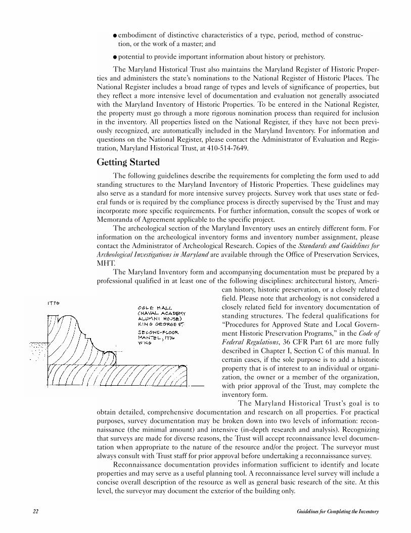
The Maryland Inventory form and accompanying documentation must be prepared by a
professional qualified in at least one of the following disciplines: architectural history, Ameri-
can history, historic preservation, or a closely related
field. Please note that archeology is not considered a
closely related field for inventory documentation of
standing structures. The federal qualifications for
“Procedures for Approved State and Local Govern-
ment Historic Preservation Programs,” in the Code ofFederal Regulations, 36 CFR Part 61 are more fully
described in Chapter I, Section C of this manual. In
certain cases, if the sole purpose is to add a historic
property that is of interest to an individual or organi-
zation, the owner or a member of the organization,
with prior approval of the Trust, may complete the
inventory form.
The Maryland Historical Trust’s goal is to
obtain detailed, comprehensive documentation and research on all properties. For practical
purposes, survey documentation may be broken down into two levels of information: recon-
naissance (the minimal amount) and intensive (in-depth research and analysis). Recognizing
that surveys are made for diverse reasons, the Trust will accept reconnaissance level documen-
tation when appropriate to the nature of the resource and/or the project. The surveyor must
always consult with Trust staff for prior approval before undertaking a reconnaissance survey.
Reconnaissance documentation provides information sufficient to identify and locate
properties and may serve as a useful planning tool. A reconnaissance level survey will include a
concise overall description of the resource as well as general basic research of the site. At this
level, the surveyor may document the exterior of the building only.
Guidelines for Completing the Inventory22
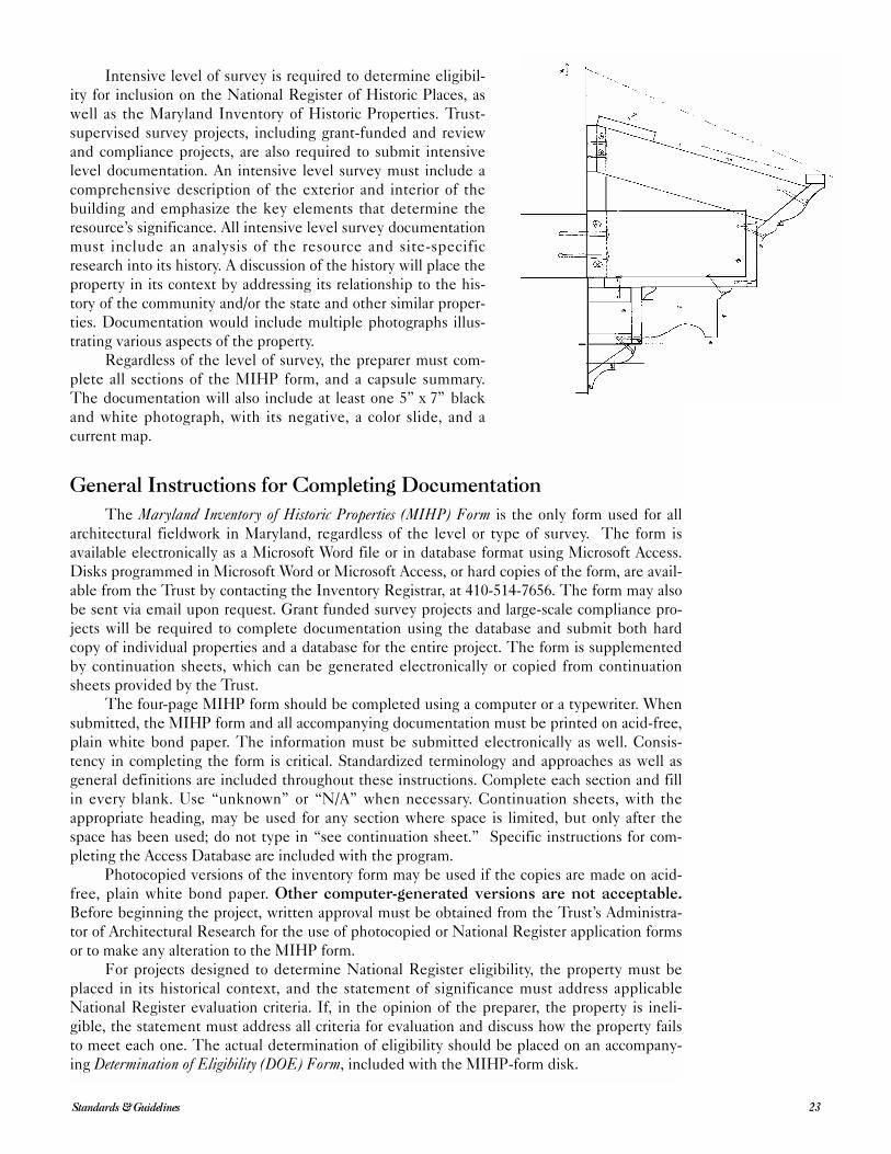
Intensive level of survey is required to determine eligibil-
ity for inclusion on the National Register of Historic Places, as
well as the Maryland Inventory of Historic Properties. Trust-
supervised survey projects, including grant-funded and review
and compliance projects, are also required to submit intensive
level documentation. An intensive level survey must include a
comprehensive description of the exterior and interior of the
building and emphasize the key elements that determine the
resource’s significance. All intensive level survey documentation
must include an analysis of the resource and site-specific
research into its history. A discussion of the history will place the
property in its context by addressing its relationship to the his-
tory of the community and/or the state and other similar proper-
ties. Documentation would include multiple photographs illus-
trating various aspects of the property.
Regardless of the level of survey, the preparer must com-
plete all sections of the MIHP form, and a capsule summary.
The documentation will also include at least one 5” x 7” black
and white photograph, with its negative, a color slide, and a
current map.
General Instructions for Completing Documentation
The Maryland Inventory of Historic Properties (MIHP) Form is the only form used for all
architectural fieldwork in Maryland, regardless of the level or type of survey. The form is
available electronically as a Microsoft Word file or in database format using Microsoft Access.
Disks programmed in Microsoft Word or Microsoft Access, or hard copies of the form, are avail-
able from the Trust by contacting the Inventory Registrar, at 410-514-7656. The form may also
be sent via email upon request. Grant funded survey projects and large-scale compliance pro-
jects will be required to complete documentation using the database and submit both hard
copy of individual properties and a database for the entire project. The form is supplemented
by continuation sheets, which can be generated electronically or copied from continuation
sheets provided by the Trust.
The four-page MIHP form should be completed using a computer or a typewriter. When
submitted, the MIHP form and all accompanying documentation must be printed on acid-free,
plain white bond paper. The information must be submitted electronically as well. Consis-
tency in completing the form is critical. Standardized terminology and approaches as well as
general definitions are included throughout these instructions. Complete each section and fill
in every blank. Use “unknown” or “N/A” when necessary. Continuation sheets, with the
appropriate heading, may be used for any section where space is limited, but only after the
space has been used; do not type in “see continuation sheet.” Specific instructions for com-
pleting the Access Database are included with the program.
Photocopied versions of the inventory form may be used if the copies are made on acid-
free, plain white bond paper. Other computer-generated versions are not acceptable.Before beginning the project, written approval must be obtained from the Trust’s Administra-
tor of Architectural Research for the use of photocopied or National Register application forms
or to make any alteration to the MIHP form.
For projects designed to determine National Register eligibility, the property must be
placed in its historical context, and the statement of significance must address applicable
National Register evaluation criteria. If, in the opinion of the preparer, the property is ineli-
gible, the statement must address all criteria for evaluation and discuss how the property fails
to meet each one. The actual determination of eligibility should be placed on an accompany-
ing Determination of Eligibility (DOE) Form, included with the MIHP-form disk.
23Standards & Guidelines
Completing the Maryland Inventory Form
Each section of the Maryland Inventory form should be completed according to the
instructions listed below. The instructions are organized according to the number and name of
each section of the form. Specific directions, terminology, and definitions are included.
The Inventory NumberAn inventory number must be included in the appropriate space at the top right-hand
corner of each page of the form and on all continuation sheets, maps, drawings, photographs,
slides, negatives, and the capsule summary. The preparer must confirm that the site does not
hold an existing inventory number before requesting a new number. It is the preparer’s respon-
sibility to identify previous documentation of the site. Inventory numbers should be added to
all documentation before submitting any forms or draft reports for review and compliance sur-
veys, as well as grant funded projects.
Inventory numbers are assigned only in coordination with the Inventory Registrar. Local
jurisdictions cannot assign numbers. If an inventory number has not already been assigned,
please contact the Inventory Registrar. The formal request should be made in writing and
should include the names and addresses of all properties with the sites clearly located on a
United States Geological Survey (USGS) map. This may be mailed or faxed to the Trust.
Section 1: Name of PropertyThis section identifies the various names by which the property has been known. The
term “property” refers to the entire historic resource being documented. A property may be an
individual building, site, structure, or object, or it may be a district consisting of numerous
buildings, sites, structures, or objects.
Historic Name: The historic name is generally the name associated with the historic
significance of the property. The historic name of the property will be used to identify the
property in the Maryland Inventory of Historic Properties and any publications. The historic
name is preferred for general reference because it continues to be meaningful regardless of
changes in ownership or use.
Other Name: In the space provided, enter any other names by which the property has
been commonly known, in chronological order of their use. These may reflect its history, cur-
rent ownership, or popular use, and may or may not fall into the category of historic name. In
some circumstances, there is reason to use a common name for the prop-
erty rather than the historic name. In this situation, enter “preferred”
after the appropriate name and explain the reason in Section 8: Signifi-
cance. Be consistent throughout the form—use the historic or preferred
name for all labels, including maps, drawings, and photographs.
If the property being documented is part of a historic district or the-
matic or multiple-property study for which a separate inventory form has
been prepared, include the name of the district or study in parenthesis to
the right of the historic or preferred name, and refer to the name and
inventory number of the district or study in the narrative.
Section 2: Location Street and Number: For individual buildings, structures, sites, and
objects, enter the number and name of the street or road where the prop-
erty is located using a mailing address. If the road has a route number
rather than a name, give the number and indicate whether it is a federal,
state, or county road. If a property does not have a specific address, give
the name of the nearest roads and the property’s relationship to the roads
(i.e., ½ mile east of Middletown Road; or northwest corner of Hampton
Road and Smith Avenue). The address must be as exact as possible to be
entered into the Trust’s searchable database. For districts, enter either the
Guidelines for Completing the Inventory24
inclusive street address numbers for all primary buildings and structures
(i.e., 12-157 South Street, 414 Eutaw Street, and 40-819 Maple Avenue);
or a rough description of the boundaries (i.e., roughly bounded by Per-
due, South, Roland, and Belmont streets; or eight blocks in downtown
Gouldville). If the location is not to be published for any reason, place
an “x” in the space allotted.
City, Town: Enter the name of the city or town where the prop-
erty is located. If the property is not located within the boundaries of a
local jurisdiction, then place an “x” in the space for vicinity.
County: Enter the county in which the property is located.
Section 3: Owner of the PropertyGive the names and addresses of all owners of the property at the time the inventory
form is completed. Use state assessment records as the source for this information. For ten or
fewer owners, list each one; use a continuation sheet if necessary. For more than ten owners,
enter “multiple ownership” in the space provided, and give the name of a contact person, if
appropriate.
Section 4: Location of Legal Description Usually, the legal description of a property is in the land records office in the courthouse
for the county or city in which the property is located. Cite the tax map, parcel designation,
and deed reference to Liber (deed book) and folio (page); these are usually included in the
assessment records. For more than ten owners, enter “multiple deeds” in the space provided,
with the name of a single contact person, if appropriate.
Section 5: Primary Location of Additional DataMark “x” in the appropriate spaces that apply to the property. Check, or list, any prior
historical or architectural studies in which this property was included. Indicate whether the
property has been listed on, or has been determined eligible for, the National Register of His-
toric Places or the Maryland Register of Historic Properties. Preliminary research should
include the completed DOE forms for individual properties determined eligible for the
National Register through review and compliance projects. These are located in separate note-
books in the Trust library. Also determine whether a Historic Structure Report or other field
report has been completed. List under Other any broad surveys that include the property. Site-
specific research should be listed in Section 9: Major Bibliographic References.
Section 6: ClassificationMark “x” in the appropriate spaces that apply to the property.
Category: Mark the one most appropriate resource type on the list. If the property has a
number of resources, choose the most important or main resource. Definitions of each resource
type are listed below.
● District: A district possesses a significant concentration, linkage, or continuity of
sites, buildings, structures, or objects united historically or aesthetically by plan or
physical development. Examples include residential areas, industrial complexes,
rural villages, transportation networks, and large landscaped parks.
● Building(s): A building, such as a house, church, hotel, or similar construction,
serves principally to shelter any form of human activity. The term building may
also be used to refer to a historically and functionally related unit, such as a court-
house and jail or a house and barn.
● Structure: The term structure is used to distinguish from buildings those func-
tional constructions usually made for uses other than human shelter. Examples
include bridges, corncribs, kilns, historic vessels, and roadways.
25Standards & Guidelines
● Site: A site is the location of a significant event, a prehistoric or historic occupa-
tion or activity, or a building or structure, whether standing, ruined, or vanished,
where the location itself possesses historic, cultural, or archeological value regard-
less of the value of any existing structure. Examples include gardens, ruins, ship-
wrecks, designed landscapes, and land areas having cultural significance.
● Object: The term object is used to distinguish from buildings and structures
those constructions that are primarily artistic in nature or are relatively small in
scale and are simply constructed. Although it may be movable by nature or design,
an object, as referred to here, is associated with a specific setting or environment.
Examples include monuments, boundary markers, and sculptures.
Ownership: Mark whether the property is currently public or private property.
Current Function: Mark the current use of the resource(s). Describe its historic func-
tion or use in the narrative portion of Section 8: Significance.
Resource Count: Count both the contributing and non-contributing resources that
make up the property, and place the numbers by each resource type (i.e., buildings, sites,
structures, objects) in the appropriate column. Total each column. Include in this count all
resources, regardless of whether they already appear in the Maryland Inventory or are listed in
the National Register. Completing this item requires three steps: 1) classify each resource by
category: building, site, structure, or object; 2) determine whether each resource does or does
not contribute to the historic significance of the property; 3) count the contributing and non-
contributing resources in each category.
Record the number of resources previously entered in the Maryland Inventory or listed
on the National Register in the space provided. This number should also be included in the
total resource count.
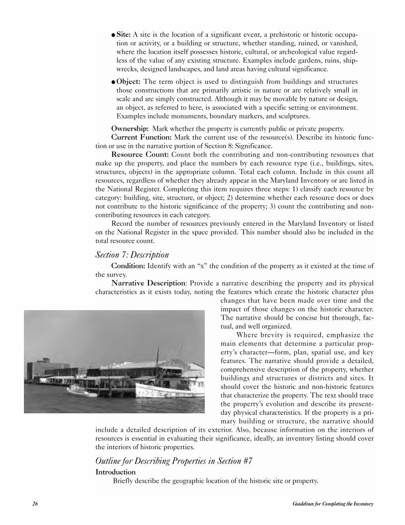
Section 7: DescriptionCondition: Identify with an “x” the condition of the property as it existed at the time of
the survey.
Narrative Description: Provide a narrative describing the property and its physical
characteristics as it exists today, noting the features which create the historic character plus
changes that have been made over time and the
impact of those changes on the historic character.
The narrative should be concise but thorough, fac-
tual, and well organized.
Where brevity is required, emphasize the
main elements that determine a particular prop-
erty’s character—form, plan, spatial use, and key
features. The narrative should provide a detailed,
comprehensive description of the property, whether
buildings and structures or districts and sites. It
should cover the historic and non-historic features
that characterize the property. The text should trace
the property’s evolution and describe its present-
day physical characteristics. If the property is a pri-
mary building or structure, the narrative should
include a detailed description of its exterior. Also, because information on the interiors of
resources is essential in evaluating their significance, ideally, an inventory listing should cover
the interiors of historic properties.
Outline for Describing Properties in Section #7Introduction
Briefly describe the geographic location of the historic site or property.
Guidelines for Completing the Inventory26
Summarize the physical setting and the number and type of buildings or features.
Include all structures, even if they are not considered to be significant and are not men-
tioned again in the form. Include approximate construction dates to the extent possible.
A discussion of specific dating evidence should be included in the appropriate sections
of the detailed description.
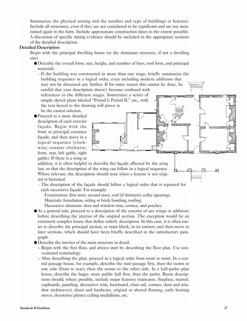
Detailed DescriptionBegin with the principal dwelling house (or the dominant structure, if not a dwelling
site).
● Describe the overall form, size, height, and number of bays, roof form, and principal
materials.
– If the building was constructed in more than one stage, briefly summarize the
building sequence in a logical order, even including modern additions that
may not be discussed any further. If for some reason this cannot be done, be
careful that your description doesn’t become confused with
references to the different stages. Sometimes a series of
simple sketch plans labeled “Period I, Period II,” etc., with
the text keyed to the drawing will prove to
be the easiest solution.
● Proceed to a more detailed
description of each exterior
façade. Begin with the
front or principal entrance
façade, and then move in a
logical sequence (clock-
wise; counter clockwise;
front, rear, left gable, right
gable). If there is a wing or
addition, it is often helpful to describe the façade affected by the wing
last, so that the description of the wing can follow in a logical sequence.
Where relevant, the description should note when a feature is not origi-
nal or historical.– The description of the façade should follow a logical order that is repeated for
each successive façade. For example:
Fenestration: first story, second story, roof (if dormers), cellar openings.
Materials: foundation, siding or brick bonding, roofing.
Decorative elements: door and window trim, cornice, and porches.
● As a general rule, proceed to a description of the exterior of any wings or additions
before describing the interior of the original section. The exception would be an
extremely complex house that defies orderly description. In this case, it is often eas-
ier to describe the principal section, or main block, in its entirety and then move to
later sections, which should have been briefly described in the introductory para-
graph.
● Describe the interior of the main structure in detail.
– Begin with the first floor, and always start by describing the floor plan. Use con-
ventional terminology.
– After describing the plan, proceed in a logical order from room to room. In a cen-
tral passage house, for example, describe the stair passage first, then the rooms to
one side (front to rear), then the rooms to the other side. In a hall-parlor plan
house, describe the larger, more public hall first, then the parlor. Room descrip-
tions should, where possible, include major features (staircases, fireplace, mantel,
cupboards, paneling, decorative trim, baseboard, chair rail, cornice, door and win-
dow architraves), doors and hardware, original or altered flooring, early heating
stoves, decorative plaster ceiling medallions, etc.
27Standards & Guidelines
– Describe each successive floor in a logical order. It is usually best to begin with
the first floor and move up to the attic, then describe the cellar, if one exists.
Upper floors are often similar to the first story but become simpler in detail as you
move away from the first floor.
– The attic description should, where possible, include a description of the principal
construction details of the roof, including evidence of the date (and possible
sequence) of construction.
– The cellar description should, where possible, include the plan, visible construc-
tion details, and a discussion of any evidence of room use (cooking fireplaces,
early shelving, hanging hooks, barred windows, lattice partitions, etc.)
● Describe the interior of any wings or additions. Particular attention should be paid to
the spatial and functional relationship of the wing to the house. For example, was
this a service wing for cooking and dining? Is there evidence of segregated living
space for servants or farm laborers (i.e., a separate ladder or stair to rooms over the
kitchen that has no direct access to the house) or other functions?
● After the house has been described, move out into the yard. Describe any outbuild-
ings or farm buildings that are considered significant, as well as historic landscape
features (terraced gardens, fully mature plantings, the family cemetery, etc.).
Other issues to be discussed in Section 7 include:● Deterioration due to vandalism, neglect, lack of use, or weather, and the effect it has
had on the property’s historic integrity.
● For moved properties:
– Date of move;
– Descriptions of location, orientation, and setting historically and after the move;
– Reasons for the move (if known);
– Method of moving; and
– Effect of the move and the new location on the historic integrity of the property.
● For restored and reconstructed buildings:
– Date of restoration or reconstruction;
– The historical basis for the work done;
– The amount of remaining historic material and replacement material;
– The effect of the work on the property’s historic integrity; and
– For reconstructions, whether the work was done as part of a master plan.
● For properties where landscape or open space adds to the significance or setting of
the property, such as rural properties, college campuses, or the grounds of public
buildings:
– The historic appearance and current condition of natural features; and
– Land uses, landscape features, and vegetation that characterized the property dur-
ing the period of significance, including gardens, walls, paths, roadways, grading,
fountains, orchards, fields, forests, rock formations, open spaces, and bodies of
water.
● For industrial properties where equipment and machinery are intact:
– The types, approximate date, and function of machinery; and
– Their relationship to the historic industrial operations of the property.
● For scenic roadways or viewsheds:
– The historic appearance and current condition of both man-made features (such as
bridges, buildings, farms, villages) and natural features throughout the area; and
– Land uses, features, and vegetation that characterized the roadway during its
period of significance.
● For architectural and historic districts:
– Natural and man-made elements comprising the district, including prominent
topographical features and structures, buildings, sites, objects, and other kinds of
development.
Guidelines for Completing the Inventory28
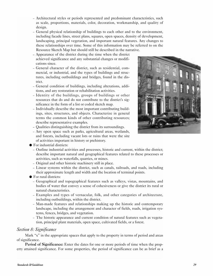
– Architectural styles or periods represented and predominant characteristics, such
as scale, proportions, materials, color, decoration, workmanship, and quality of
design.
– General physical relationship of buildings to each other and to the environment,
including facade lines, street plans, squares, open spaces, density of development,
landscaping, principal vegetation, and important natural features. Any changes to
these relationships over time. Some of this information may be referred to on the
Resource Sketch Map but should still be described in the narrative.
– Appearance of the district during the time when the district
achieved significance and any substantial changes or modifi-
cations since.
– General character of the district, such as residential, com-
mercial, or industrial, and the types of buildings and struc-
tures, including outbuildings and bridges, found in the dis-
trict.
– General condition of buildings, including alterations, addi-
tions, and any restoration or rehabilitation activities.
– Identity of the buildings, groups of buildings or other
resources that do and do not contribute to the district’s sig-
nificance in the form of a list or coded sketch map.
– Individually describe the most important contributing build-
ings, sites, structures, and objects. Characterize in general
terms the common kinds of other contributing resources;
describe representative examples.
– Qualities distinguishing the district from its surroundings.
– Any open space such as parks, agricultural areas, wetlands,
and forests, including vacant lots or ruins that were the site
of activities important in history or prehistory.
● For industrial districts:
– Outline industrial activities and processes, historic and current, within the district;
describe important natural and geographical features related to these processes or
activities, such as waterfalls, quarries, or mines.
– Original and other historic machinery still in place.
– Linear systems within the district, such as canals, railroads, and roads, including
their approximate length and width and the location of terminal points.
● For rural districts:
– Geographical and topographical features such as valleys, vistas, mountains, and
bodies of water that convey a sense of cohesiveness or give the district its rural or
natural characteristics.
– Examples and types of vernacular, folk, and other categories of architecture,
including outbuildings, within the district.
– Man-made features and relationships making up the historic and contemporary
landscape, including the arrangement and character of fields, roads, irrigation sys-
tems, fences, bridges, and vegetation.
– The historic appearance and current condition of natural features such as vegeta-
tion, principal plant materials, open space, cultivated fields, or a forest.
Section 8: SignificanceMark “x” in the appropriate spaces that apply to the property in terms of period and areas
of significance.
Period of Significance: Enter the dates for one or more periods of time when the prop-
erty attained significance. For some properties, the period of significance can be as brief as a
29Standards & Guidelines
year, whereas others may span many years and consist of beginning and closing dates. Base the
period of significance on specific events directly related to the significance of the property.
Areas of Significance: Mark all areas of significance that are directly related to the
property. Only enter those areas that are supported and justified by the narrative statement.
For districts, enter areas of significance applying to the district as a whole. If no category
applies to the property, mark “other,” and identify the area in which the property attained sig-
nificance.
The area of significance relates to the property’s contributions to the broader patterns
of American history, architecture, archeology, engineering, or culture. It is not the historic func-
tion. The terms are defined below:Agriculture The process and technology of cultivating soil, producing crops, and raising
livestock and plants.
Architecture The practical art of designing and constructing buildings and structures to
serve human needs.
Archeology The study of prehistoric and historic cultures through excavation and the
analysis of physical remains.
Art The creation of painting, printmaking, photography, sculpture, and decorative arts.
Commerce The business of trading goods, services, and commodities.
Communications The technology and process of transmitting information.
Community Planning/Development The design or development of the physical struc-
ture and communities.
Conservation The preservation, maintenance, and management of natural or manmade
resources.
Economics The study of the production, distribution, and consumption of wealth; the
management of monetary and other assets.
Education The process of conveying or acquiring knowledge or skills through systematic
instruction, training, or study.
Engineering The practical application of scientific principles to design, construct, and
operate equipment, machinery, and structures to serve human needs.
Entertainment/Recreation The development and practice of leisure activities for
refreshment, diversion, amusement, or sport.
Ethnic Heritage The history of persons having a common ethnic or racial identity.
Exploration/Settlement The investigation of unknown or little known regions; the
establishment and earliest development of new settlements or communities.
Health/Medicine The care of the sick, disabled, and handicapped; the promotion of
health and hygiene.
Industry The technology and process of managing materials, labor, and equipment to
produce goods and services.
Invention The art of originating by experiment or ingenuity an object, system, or con-
cept of practical value.
Landscape Architecture The practical art of designing or arranging the land for human
use and enjoyment.
Law The interpretation and enforcement of society’s legal code.
Literature The creation of prose and poetry.
Maritime History The history of the exploration, fishing, navigation, and use of inland,
coastal, and deep sea waters.
Military The system of defending the territory and sovereignty of a people.
Performing Arts The creation of drama, dance, and music.
Philosophy The theoretical study of thought, knowledge, and the nature of the
universe.
Politics/Government The enactment and administration of laws by which a nation, state
or other political jurisdiction is governed; activities related to political process.
Religion The organized system of beliefs, practices, and traditions regarding mankind’s
relationship to perceived supernatural forces.
Science The systematic study of natural law and phenomena.
Social History The history of efforts to promote the welfare of society; the history of
society and the lifeways of its social groups.
Guidelines for Completing the Inventory30
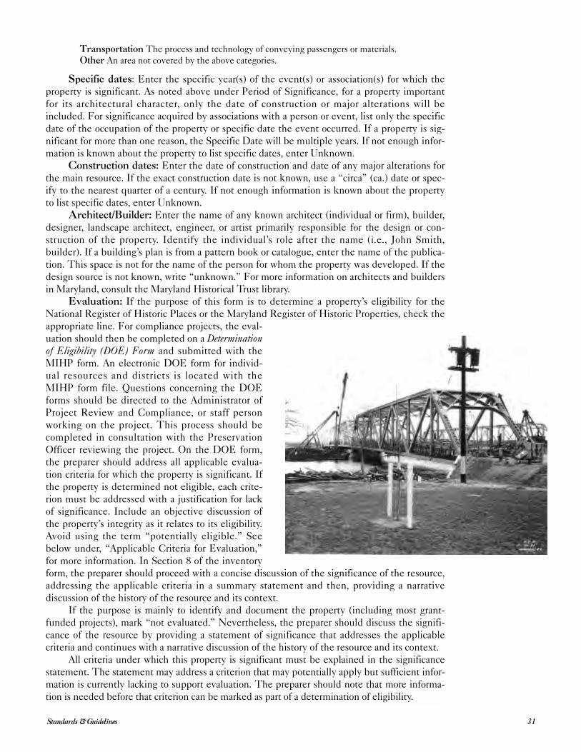
Transportation The process and technology of conveying passengers or materials.
Other An area not covered by the above categories.
Specific dates: Enter the specific year(s) of the event(s) or association(s) for which the
property is significant. As noted above under Period of Significance, for a property important
for its architectural character, only the date of construction or major alterations will be
included. For significance acquired by associations with a person or event, list only the specific
date of the occupation of the property or specific date the event occurred. If a property is sig-
nificant for more than one reason, the Specific Date will be multiple years. If not enough infor-
mation is known about the property to list specific dates, enter Unknown.
Construction dates: Enter the date of construction and date of any major alterations for
the main resource. If the exact construction date is not known, use a “circa” (ca.) date or spec-
ify to the nearest quarter of a century. If not enough information is known about the property
to list specific dates, enter Unknown.
Architect/Builder: Enter the name of any known architect (individual or firm), builder,
designer, landscape architect, engineer, or artist primarily responsible for the design or con-
struction of the property. Identify the individual’s role after the name (i.e., John Smith,
builder). If a building’s plan is from a pattern book or catalogue, enter the name of the publica-
tion. This space is not for the name of the person for whom the property was developed. If the
design source is not known, write “unknown.” For more information on architects and builders
in Maryland, consult the Maryland Historical Trust library.
Evaluation: If the purpose of this form is to determine a property’s eligibility for the
National Register of Historic Places or the Maryland Register of Historic Properties, check the
appropriate line. For compliance projects, the eval-
uation should then be completed on a Determinationof Eligibility (DOE) Form and submitted with the
MIHP form. An electronic DOE form for individ-
ual resources and districts is located with the
MIHP form file. Questions concerning the DOE
forms should be directed to the Administrator of
Project Review and Compliance, or staff person
working on the project. This process should be
completed in consultation with the Preservation
Officer reviewing the project. On the DOE form,
the preparer should address all applicable evalua-
tion criteria for which the property is significant. If
the property is determined not eligible, each crite-
rion must be addressed with a justification for lack
of significance. Include an objective discussion of
the property’s integrity as it relates to its eligibility.
Avoid using the term “potentially eligible.” See
below under, “Applicable Criteria for Evaluation,”
for more information. In Section 8 of the inventory
form, the preparer should proceed with a concise discussion of the significance of the resource,
addressing the applicable criteria in a summary statement and then, providing a narrative
discussion of the history of the resource and its context.
If the purpose is mainly to identify and document the property (including most grant-
funded projects), mark “not evaluated.” Nevertheless, the preparer should discuss the signifi-
cance of the resource by providing a statement of significance that addresses the applicable
criteria and continues with a narrative discussion of the history of the resource and its context.
All criteria under which this property is significant must be explained in the significance
statement. The statement may address a criterion that may potentially apply but sufficient infor-
mation is currently lacking to support evaluation. The preparer should note that more informa-
tion is needed before that criterion can be marked as part of a determination of eligibility.
31Standards & Guidelines
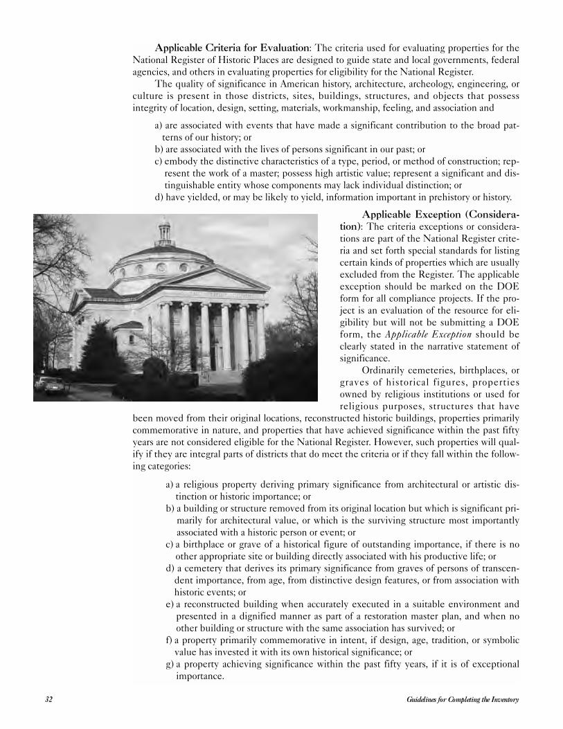
Applicable Criteria for Evaluation: The criteria used for evaluating properties for the
National Register of Historic Places are designed to guide state and local governments, federal
agencies, and others in evaluating properties for eligibility for the National Register.
The quality of significance in American history, architecture, archeology, engineering, or
culture is present in those districts, sites, buildings, structures, and objects that possess
integrity of location, design, setting, materials, workmanship, feeling, and association and
a) are associated with events that have made a significant contribution to the broad pat-
terns of our history; or
b) are associated with the lives of persons significant in our past; or
c) embody the distinctive characteristics of a type, period, or method of construction; rep-
resent the work of a master; possess high artistic value; represent a significant and dis-
tinguishable entity whose components may lack individual distinction; or
d) have yielded, or may be likely to yield, information important in prehistory or history.
Applicable Exception (Considera-tion): The criteria exceptions or considera-
tions are part of the National Register crite-
ria and set forth special standards for listing
certain kinds of properties which are usually
excluded from the Register. The applicable
exception should be marked on the DOE
form for all compliance projects. If the pro-
ject is an evaluation of the resource for eli-
gibility but will not be submitting a DOE
form, the Applicable Exception should be
clearly stated in the narrative statement of
significance.
Ordinarily cemeteries, birthplaces, or
graves of historical figures, properties
owned by religious institutions or used for
religious purposes, structures that have
been moved from their original locations, reconstructed historic buildings, properties primarily
commemorative in nature, and properties that have achieved significance within the past fifty
years are not considered eligible for the National Register. However, such properties will qual-
ify if they are integral parts of districts that do meet the criteria or if they fall within the follow-
ing categories:
a) a religious property deriving primary significance from architectural or artistic dis-
tinction or historic importance; or
b) a building or structure removed from its original location but which is significant pri-
marily for architectural value, or which is the surviving structure most importantly
associated with a historic person or event; or
c) a birthplace or grave of a historical figure of outstanding importance, if there is no
other appropriate site or building directly associated with his productive life; or
d) a cemetery that derives its primary significance from graves of persons of transcen-
dent importance, from age, from distinctive design features, or from association with
historic events; or
e) a reconstructed building when accurately executed in a suitable environment and
presented in a dignified manner as part of a restoration master plan, and when no
other building or structure with the same association has survived; or
f) a property primarily commemorative in intent, if design, age, tradition, or symbolic
value has invested it with its own historical significance; or
g) a property achieving significance within the past fifty years, if it is of exceptional
importance.
Guidelines for Completing the Inventory32
Statement of Significance: Provide a narrative stating the significant qualities and asso-
ciations that make the property important. Begin with a summary paragraph that briefly
explains why the property is significant in the areas marked and how it meets selected criteria.
In additional paragraphs, provide information to support your assertions regarding the signifi-
cance of the resource. Include a discussion of the historical context in which the resource has
been studied and the evaluative information that explains its significance in relation to other
properties of its type within precisely defined geographic boundaries, such as a neighborhood,
city, county, region, state, or the nation.
Include background information on events, development of the property (i.e., date of
construction, factors leading to the construction, etc.), and biographical data on persons associ-
ated with the property. If available, also include an evaluation of the importance of the prop-
erty in architectural history, and/or an assessment of the types of information the property may
be expected to provide.
Employ primary sources for research whenever possible and carefully document all
sources of information. Use footnotes to indicate sources, and provide photocopies of key
source documents, chain of title, etc., where appropriate.
Completing the Resource HistoryDocumentary research in libraries, archives, and other facilities can provide both primary
and secondary architectural and historic information. Several of the most basic archival sources
that describe known historic structures, sites, and objects and their locations are the Maryland
Inventory of Historic Properties, the National Register of Historic Places, and lists of sites for
which determinations of National Register eligibility have been made. Note also that archeo-
logical sites included in the Maryland Inventory and the National Register may also indicate
the possibility of architectural and historic resources from the historic period. Published and
unpublished reports or surveys in or near the current project area are also essential sources.
Other documentary materials, which can be useful in locating potentially significant architec-
tural and historic properties, depending on the nature of the undertaking and project tract,
include:
● historic maps and atlases, including early U.S. Geological Survey quadrangles;
● insurance records and maps;
● publications on local history;
● building permits;
● tax maps;
● publications on the nature and significance of the general property type;
● early lithographs and photographs;
● court records (deeds, mortgages, etc.);
● real property records;
● ordinances and resolutions;
● transportation records (i.e., ship manifests for a port);
● wills and probate inventories;
● census data;
● family histories (published and unpublished).
Informant interviews are another potential source of data on a project area’s architectural
and historic resources. Contacting people who live or work near a study site can yield very spe-
cific data on historic sites or standing structures and past land use. Preliminary field visits will
establish a network of local contacts; and meetings with local historical societies, civic associa-
tions, and/or citizen groups can provide access to an array of knowledgeable individuals.
MHT’s Office of Preservation Services can provide the names of contact persons and may, in
some instances, possess additional project-specific architectural and historical information.
Together, informant interviews and documentary research assist in predicting the num-
ber, location, and nature of cultural resources in a study area. Additionally, these activities
33Standards & Guidelines
enable the refinement of appropriate historic contexts for the interpretation of new architec-
tural and historical structures, sites, and objects. Fully developed contexts are the basis for
well-reasoned discussions of the potential significance of the resources with respect to impor-
tant research issues and comparative data from similar historic properties.
Important facilities for conducting archival and background research are:
● Maryland Historical Trust
● Maryland State Archives, Hall of Records
● Enoch Pratt Free Library
● Maryland Historical Society
● University of Maryland at College Park, Maryland Room and architectural library,
McKeldin Library
● National Trust for Historic Preservation Library, McKeldin Library, UMCP
● Smithsonian Institution
● National Archives and Records Service
● Library of Congress
● University and public libraries
● Local museums and historical societies
● County and municipal government offices.
Section 9: Major Bibliographical ReferencesEnter the primary and secondary sources of information used in documenting and evalu-
ating this property. These may include land records, published works, oral interviews, library
and historical society files, photograph collections, and drawings. Do not include general refer-
ence works, unless they provide specific information about the property or have assisted in
evaluating the significance of the property.
The format for bibliographical entries should be clear and consistent and follow the most
recent edition of the Chicago Manual of Style. Use a continuation sheet if necessary.
Section 10: Geographical DataAcreage of Surveyed Property: Enter the total number of acres surveyed. This may be
the acreage to which the present owner(s) hold(s) title, otherwise known as the tax parcel
boundary; the Area of Potential Effect for a large study area; or boundaries determined by the
surveyor. The acreage should include all of the land surveyed, even if large sections contain no
historic resources—but only if the entire area was actually considered. For example, if the
inventory form for a 300-acre farm complex includes ten resources grouped within only five
acres, it is important to know the surveyor found no other resources in the 300-acre parcel.
Thus, the acreage for the surveyed property should be 300 acres. The goal for intensive survey
is to carefully study the entire 300 acres to determine the extent of historic resources within
the entire area. However, if it is not possible to verify the existence or non-existence of
resources within the larger area, the preparer must include only five acres as the acreage sur-
veyed. Discuss the area of coverage within Section 7. For a compliance project, the Area of
Potential Effect should encompass the entire project area. Acreage should be accurate to the
nearest whole acre. For properties of less than one acre, round to the nearest quarter or tenth of
an acre, as appropriate. If the exact acreage is unknown, a close approximation must be given.
The National Park Service requires this information.
Acreage of historical setting: This refers to the property historically associated with the
resource(s). In many cases, the significant elements of a historic resource will occupy an area
that is different from—usually smaller than—the total area surveyed. For example, the 300-
acre farm complex mentioned above is comprised of ten buildings and structures related to the
farmstead within only five acres. It is surrounded by 295 acres of fields and woods on which no
additional resources are found. In this case, the historical setting would be five acres with an
explanation in the verbal boundary description and justification (see below). The significance
of the landscape or setting may increase the acreage, and should be addressed more carefully
Guidelines for Completing the Inventory34
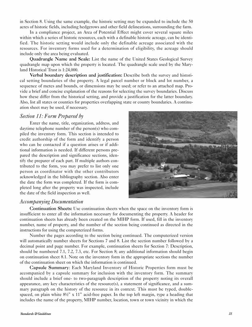
in Section 8. Using the same example, the historic setting may be expanded to include the 50
acres of historic fields, including hedgerows and other field delineations, surrounding the farm.
In a compliance project, an Area of Potential Effect might cover several square miles
within which a series of historic resources, each with a definable historic acreage, can be identi-
fied. The historic setting would include only the definable acreage associated with the
resources. For inventory forms used for a determination of eligibility, the acreage should
include only the area being evaluated.
Quadrangle Name and Scale: List the name of the United States Geological Survey
quadrangle map upon which the property is located. The quadrangle scale used by the Mary-
land Historical Trust is 1:24,000.
Verbal boundary description and justification: Describe both the survey and histori-
cal setting boundaries of the property. A legal parcel number or block and lot number, a
sequence of metes and bounds, or dimensions may be used; or refer to an attached map. Pro-
vide a brief and concise explanation of the reasons for selecting the survey boundaries. Discuss
how these differ from the historical setting, and provide a justification for the latter boundary.
Also, list all states or counties for properties overlapping state or county boundaries. A continu-
ation sheet may be used, if necessary.
Section 11: Form Prepared byEnter the name, title, organization, address, and
daytime telephone number of the person(s) who com-
piled the inventory form. This section is intended to
credit authorship of the form and identify a person
who can be contacted if a question arises or if addi-
tional information is needed. If different persons pre-
pared the description and significance sections, iden-
tify the preparer of each part. If multiple authors con-
tributed to the form, you may prefer to list only one
person as coordinator with the other contributors
acknowledged in the bibliography section. Also enter
the date the form was completed. If the form is com-
pleted long after the property was inspected, include
the date of the field inspection as well.
Accompanying DocumentationContinuation Sheets: Use continuation sheets when the space on the inventory form is
insufficient to enter all the information necessary for documenting the property. A header for
continuation sheets has already been created on the MIHP form. If used, fill in the inventory
number, name of property, and the number of the section being continued as directed in the
instructions for using the computerized forms.
Number the pages according to the section being continued. The computerized version
will automatically number sheets for Sections 7 and 8. List the section number followed by a
decimal point and page number. For example, continuation sheets for Section 7: Description,
should be numbered 7.1, 7.2, 7.3, etc. For Section 8; any additional information should begin
on continuation sheet 8.1. Note on the inventory form in the appropriate sections the number
of the continuation sheet on which the information is continued.
Capsule Summary: Each Maryland Inventory of Historic Properties form must be
accompanied by a capsule summary for inclusion with the inventory form. The summary
should include a brief one- to two-paragraph description of the property noting its overall
appearance, any key characteristics of the resource(s), a statement of significance, and a sum-
mary paragraph on the history of the resource in its context. This must be typed, double-
spaced, on plain white 8½” x 11” acid-free paper. In the top left margin, type a heading that
includes the name of the property, MIHP number, location, town or town vicinity in which the
35Standards & Guidelines
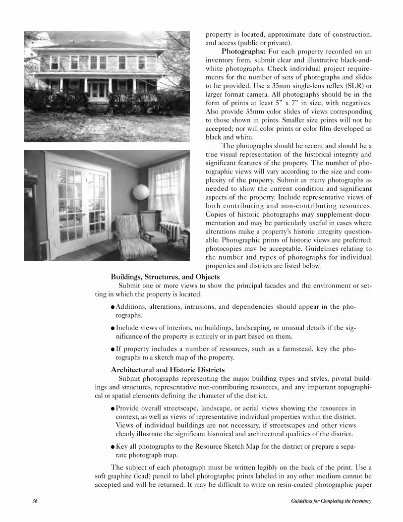
property is located, approximate date of construction,
and access (public or private).
Photographs: For each property recorded on an
inventory form, submit clear and illustrative black-and-
white photographs. Check individual project require-
ments for the number of sets of photographs and slides
to be provided. Use a 35mm single-lens reflex (SLR) or
larger format camera. All photographs should be in the
form of prints at least 5” x 7” in size, with negatives.
Also provide 35mm color slides of views corresponding
to those shown in prints. Smaller size prints will not be
accepted; nor will color prints or color film developed as
black and white.
The photographs should be recent and should be a
true visual representation of the historical integrity and
significant features of the property. The number of pho-
tographic views will vary according to the size and com-
plexity of the property. Submit as many photographs as
needed to show the current condition and significant
aspects of the property. Include representative views of
both contributing and non-contributing resources.
Copies of historic photographs may supplement docu-
mentation and may be particularly useful in cases where
alterations make a property’s historic integrity question-
able. Photographic prints of historic views are preferred;
photocopies may be acceptable. Guidelines relating to
the number and types of photographs for individual
properties and districts are listed below.
Buildings, Structures, and ObjectsSubmit one or more views to show the principal facades and the environment or set-
ting in which the property is located.
● Additions, alterations, intrusions, and dependencies should appear in the pho-
tographs.
● Include views of interiors, outbuildings, landscaping, or unusual details if the sig-
nificance of the property is entirely or in part based on them.
● If property includes a number of resources, such as a farmstead, key the pho-
tographs to a sketch map of the property.
Architectural and Historic DistrictsSubmit photographs representing the major building types and styles, pivotal build-
ings and structures, representative non-contributing resources, and any important topographi-
cal or spatial elements defining the character of the district.
● Provide overall streetscape, landscape, or aerial views showing the resources in
context, as well as views of representative individual properties within the district.
Views of individual buildings are not necessary, if streetscapes and other views
clearly illustrate the significant historical and architectural qualities of the district.
● Key all photographs to the Resource Sketch Map for the district or prepare a sepa-
rate photograph map.
The subject of each photograph must be written legibly on the back of the print. Use a
soft graphite (lead) pencil to label photographs; prints labeled in any other medium cannot be
accepted and will be returned. It may be difficult to write on resin-coated photographic paper
Guidelines for Completing the Inventory36
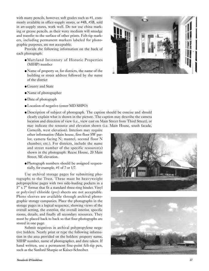
with many pencils, however, soft grades such as #1, com-
monly available in office-supply stores, or #4B, #5B, sold
in art-supply stores, work well. Do not use china mark-
ing or grease pencils, as their waxy medium will smudge
and transfer to the surface of other prints. Felt-tip mark-
ers, including permanent markers labeled for photo-
graphic purposes, are not acceptable.
Provide the following information on the back of
each photograph:
● Maryland Inventory of Historic Properties
(MIHP) number
● Name of property or, for districts, the name of the
building or street address followed by the name
of the district
● County and State
● Name of photographer
● Date of photograph
● Location of negative (enter MD SHPO)
● Description of subject of photograph. The caption should be concise and should
clearly explain what is shown in the picture. The caption may describe the camera
location and direction of view (i.e., view east on Main Street from Third Street), or
may indicate the resource and elevation shown (i.e. Main House, south facade,
Corncrib, west elevation). Interiors may require
other information (Main house, first floor SW par-
lor, camera facing N; mantel, second floor N
chamber; etc.). For districts, include the name
and street number of the specific resource(s)
shown in the photograph: Reese House, 20 Main
Street, SE elevation.
● Photograph numbers should be assigned sequen-
tially, for example, #1 of 7 or 1/7.
Use archival storage pages for submitting pho-
tographs to the Trust. These must be heavyweight
polypropylene pages with two side-loading pockets in a
5” x 7” format that fit a standard three-ring binder. Vinyl
or polyvinyl chloride (pvc) sheets are not acceptable.
Photo sleeves are available through archival photo-
graphic storage companies. Place the photographs in the
storage pages in a logical sequence, showing views of the
overall setting, the exterior, the overall interior, specific
rooms, details, and finally all secondary resources. They
must be placed back to back so that four photographs are
stored in one page.
Submit negatives in archival polypropylene nega-
tive holders. Neatly print or type the following informa-
tion in the area provided on the holders: property name,
MIHP number, name of photographer, and date taken. If
hand written, use a permanent fine-point felt-tip pen,
such as the Sanford Sharpie or Kaiser-Schreiber.
37Standards & Guidelines
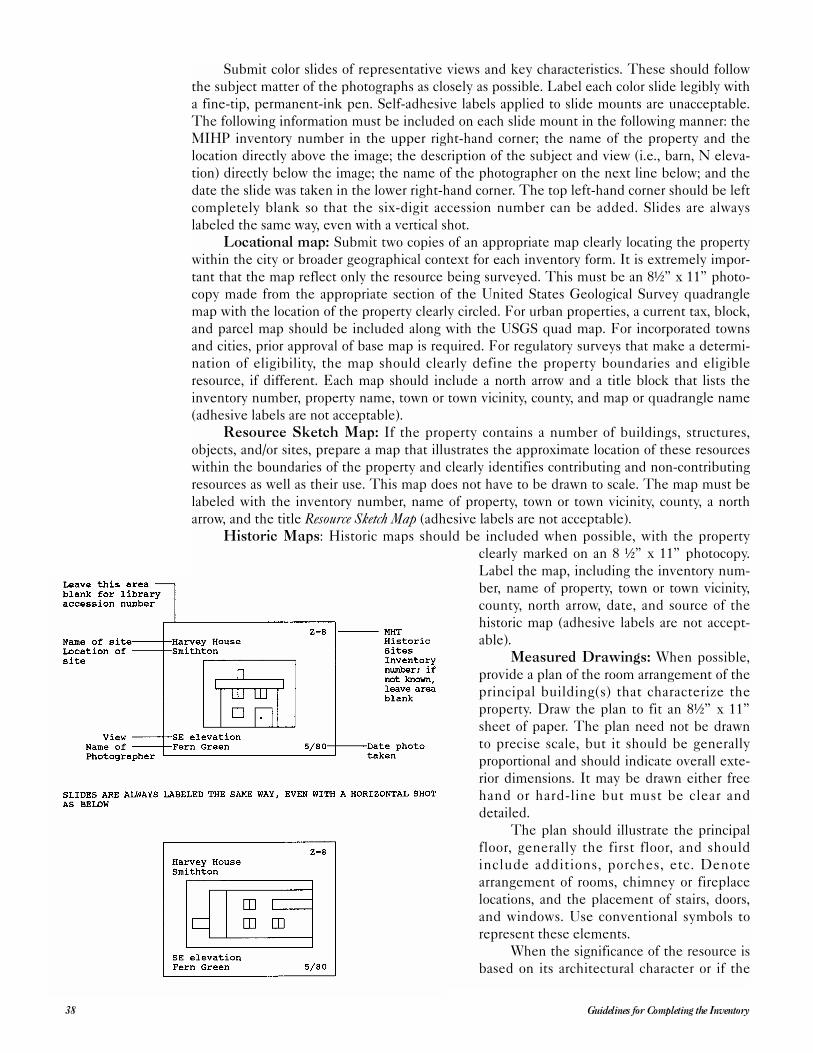
Submit color slides of representative views and key characteristics. These should follow
the subject matter of the photographs as closely as possible. Label each color slide legibly with
a fine-tip, permanent-ink pen. Self-adhesive labels applied to slide mounts are unacceptable.
The following information must be included on each slide mount in the following manner: the
MIHP inventory number in the upper right-hand corner; the name of the property and the
location directly above the image; the description of the subject and view (i.e., barn, N eleva-
tion) directly below the image; the name of the photographer on the next line below; and the
date the slide was taken in the lower right-hand corner. The top left-hand corner should be left
completely blank so that the six-digit accession number can be added. Slides are always
labeled the same way, even with a vertical shot.
Locational map: Submit two copies of an appropriate map clearly locating the property
within the city or broader geographical context for each inventory form. It is extremely impor-
tant that the map reflect only the resource being surveyed. This must be an 8½” x 11” photo-
copy made from the appropriate section of the United States Geological Survey quadrangle
map with the location of the property clearly circled. For urban properties, a current tax, block,
and parcel map should be included along with the USGS quad map. For incorporated towns
and cities, prior approval of base map is required. For regulatory surveys that make a determi-
nation of eligibility, the map should clearly define the property boundaries and eligible
resource, if different. Each map should include a north arrow and a title block that lists the
inventory number, property name, town or town vicinity, county, and map or quadrangle name
(adhesive labels are not acceptable).
Resource Sketch Map: If the property contains a number of buildings, structures,
objects, and/or sites, prepare a map that illustrates the approximate location of these resources
within the boundaries of the property and clearly identifies contributing and non-contributing
resources as well as their use. This map does not have to be drawn to scale. The map must be
labeled with the inventory number, name of property, town or town vicinity, county, a north
arrow, and the title Resource Sketch Map (adhesive labels are not acceptable).
Historic Maps: Historic maps should be included when possible, with the property
clearly marked on an 8 ½” x 11” photocopy.
Label the map, including the inventory num-
ber, name of property, town or town vicinity,
county, north arrow, date, and source of the
historic map (adhesive labels are not accept-
able).
Measured Drawings: When possible,
provide a plan of the room arrangement of the
principal building(s) that characterize the
property. Draw the plan to fit an 8½” x 11”
sheet of paper. The plan need not be drawn
to precise scale, but it should be generally
proportional and should indicate overall exte-
rior dimensions. It may be drawn either free
hand or hard-line but must be clear and
detailed.
The plan should illustrate the principal
floor, generally the first floor, and should
include additions, porches, etc. Denote
arrangement of rooms, chimney or fireplace
locations, and the placement of stairs, doors,
and windows. Use conventional symbols to
represent these elements.
When the significance of the resource is
based on its architectural character or if the
Guidelines for Completing the Inventory38
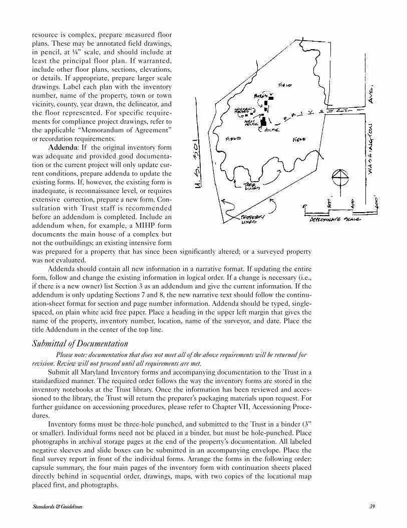
resource is complex, prepare measured floor
plans. These may be annotated field drawings,
in pencil, at ¼” scale, and should include at
least the principal floor plan. If warranted,
include other floor plans, sections, elevations,
or details. If appropriate, prepare larger scale
drawings. Label each plan with the inventory
number, name of the property, town or town
vicinity, county, year drawn, the delineator, and
the floor represented. For specific require-
ments for compliance project drawings, refer to
the applicable “Memorandum of Agreement”
or recordation requirements.
Addenda: If the original inventory form
was adequate and provided good documenta-
tion or the current project will only update cur-
rent conditions, prepare addenda to update the
existing forms. If, however, the existing form is
inadequate, is reconnaissance level, or requires
extensive correction, prepare a new form. Con-
sultation with Trust staff is recommended
before an addendum is completed. Include an
addendum when, for example, a MIHP form
documents the main house of a complex but
not the outbuildings; an existing intensive form
was prepared for a property that has since been significantly altered; or a surveyed property
was not evaluated.
Addenda should contain all new information in a narrative format. If updating the entire
form, follow and change the existing information in logical order. If a change is necessary (i.e.,
if there is a new owner) list Section 3 as an addendum and give the current information. If the
addendum is only updating Sections 7 and 8, the new narrative text should follow the continu-
ation-sheet format for section and page number information. Addenda should be typed, single-
spaced, on plain white acid free paper. Place a heading in the upper left margin that gives the
name of the property, inventory number, location, name of the surveyor, and date. Place the
title Addendum in the center of the top line.
Submittal of DocumentationPlease note: documentation that does not meet all of the above requirements will be returned for
revision. Review will not proceed until all requirements are met. Submit all Maryland Inventory forms and accompanying documentation to the Trust in a
standardized manner. The required order follows the way the inventory forms are stored in the
inventory notebooks at the Trust library. Once the information has been reviewed and acces-
sioned to the library, the Trust will return the preparer’s packaging materials upon request. For
further guidance on accessioning procedures, please refer to Chapter VII, Accessioning Proce-
dures.
Inventory forms must be three-hole punched, and submitted to the Trust in a binder (3”
or smaller). Individual forms need not be placed in a binder, but must be hole-punched. Place
photographs in archival storage pages at the end of the property’s documentation. All labeled
negative sleeves and slide boxes can be submitted in an accompanying envelope. Place the
final survey report in front of the individual forms. Arrange the forms in the following order:
capsule summary, the four main pages of the inventory form with continuation sheets placed
directly behind in sequential order, drawings, maps, with two copies of the locational map
placed first, and photographs.
39Standards & Guidelines
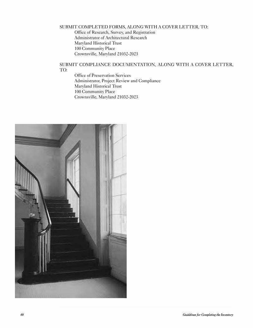
SUBMIT COMPLETED FORMS, ALONG WITH A COVER LETTER, TO:
Office of Research, Survey, and Registration
Administrator of Architectural Research
Maryland Historical Trust
100 Community Place
Crownsville, Maryland 21032-2023
SUBMIT COMPLIANCE DOCUMENTATION, ALONG WITH A COVER LETTER,
TO:
Office of Preservation Services
Administrator, Project Review and Compliance
Maryland Historical Trust
100 Community Place
Crownsville, Maryland 21032-2023
Guidelines for Completing the Inventory40
Historic resource surveys and their resulting inventories can form an important basis for
planning decisions affecting the quality of life in our communities. The final survey
report represents the culmination of a process of identification and gathering of data
on a community’s historic resources. It includes a field survey, the search for and recording of
historic resources, a summary of pre-survey planning and background research, and the estab-
lishment of a historical overview of the project area to document the broad patterns of a com-
munity’s historical development that will be represented by its historic resources.
Basic standards and guidelines for historic preservation surveys have been published as
part of the Secretary of the Interior’s Standards and Guidelines for Archeology and Historic Preserva-tion, and this chapter interprets these standards and guidelines for use in Maryland. The
National Park Service requires that all grant-funded projects complete a final survey report that
provides a summary of all aspects of the project for future reference. This report differs from a
final grant project report, which is primarily administrative in nature, in that it documents the
results of identification efforts. These results can then be integrated into the planning process
so that any evaluation decisions will be based on the best available information.
Final Report Contents
The final report should convey the thoroughness, consistency, and accuracy of all aspects
of the survey. It should clearly summarize and demonstrate the goals and objectives of the sur-
vey that provided the foundation for the organization of the historical research and field survey
work. A description of the methodology for the completed project should explain how specific
historical and cultural information relevant to the development of the survey area was discov-
ered and was related to the field work. The project’s results should be described, emphasizing
the quality and usefulness of the survey. Finally, a separate statement should address the dis-
position of all final products of the survey. (See suggested outline, below.)
Organization and review of the survey data is an ongoing process that begins while the
fieldwork is in progress. The methods used to compile, evaluate, and store the data will have a
direct effect on the usefulness of the inventory for planning purposes. Therefore, it is vital that
the inventory forms, field notes, photographs, maps, and other supporting documentation are
organized so that the disposition of the survey’s final products can be easily described and
located by planners and other interested individuals. The suggested organization and compo-
nents of the final survey report are discussed in the following detailed outline.
Suggested Content Outline
Title Page● Title of report.
● Name, nature, and location (with county) of the project.
● Clear designation of report’s author(s) with complete mailing address(es).
41Standards & Guidelines
V Final Survey Report
● Clear designation of project’s principal investigator(s) with complete mailing
address.
● Names and complete mailing addresses of the lead government agency and of the
government agent (i.e., engineering firm, developer, or project sponsor, if appro-
priate).
● Date of current version of report (i.e., latest production date).
Executive Summary● This summary—at most one half page long—should cover the survey’s purpose,
the location of the survey area findings, and recommendations.
Table of Contents● Entries with page numbers for all report chapters and headings/sub-headings.
● A figures list including all forms of illustrations (i.e., line drawings, plates) and
tables, with page numbers for all figures.
Introduction● A brief statement should give the purpose of the historic preservation work.
● Identify the lead governmental agency, or project sponsor, if appropriate.
● Include information on project funding and sources.
● Include locator maps.
● Specify dates when background research and architectural investigations were
conducted.
● Record the acres examined.
● Give the number and titles of historic preservation personnel involved.
● Describe the organization of the report.
Research Design● Open with a detailed statement of the survey’s goals and objectives, including
applicability of the work to broader county or regional historic and architectural
contexts.
● Describe the methods and techniques used, the archival and background research,
the survey, and final analysis, including the intensity of coverage and any changes
from proposed research design methodology.
● Summarize the results of the survey and other findings.
● Give the final disposition of field records and research information.
Historic and Architectural Context: Guidelines for organizing a historical overview of the
project area:
● Determine the kinds of events, patterns of development, or activities for which
properties meet the Maryland and National Register criteria. (See the list of areas
of significance in Section 8 of the Maryland Inventory of Historic Properties and
National Register forms.)
● Carefully analyze the survey area to identify themes in the area’s history and
within the general areas of significance that represent significant patterns of
American history, architecture, archeology, engineering, and culture and have
Final Survey Report42
made significant contributions to the historical development of the locality, state,
or nation.
● Identify the concept, time period, and geographical limits for the historic con-
text(s) based on historical research related to theme(s), area(s) of significance, and
geographical area.
Base this step on historical documentation of and fieldwork in the survey area. Consider
stages and patterns of area settlement and development; aesthetic and artistic values embodied
in the architecture or art such as craftsmanship, construction technology, or style; the work of a
master; research values or problems related to the area’s history; social and physical sciences
and humanities; and local cultural interest.
Results of Field Investigations● The report should include a statement of conditions and constraints that may have
affected the fieldwork.
● Include a qualitative and quantitative description and an analysis of the architec-
tural and historic resources with reference to comparable published studies.
● Include maps depicting the locations of identified resources and descriptive illus-
trations.
● When interpreting field-investigation results, refer to historic contexts and
research questions; and address the issue of integrity and/or significance as related
to the property’s eligibility for the National Register, if possible and appropriate.
● Use official Maryland inventory numbers (i.e., site numbers issued by the Trust’s
Office of Research, Survey, and Registration) to identify resources in the text and
in illustrations of both draft and final reports.
Summary and Recommendations● Summarize the results and evaluate the survey’s methods and techniques.
● Include a statement addressing the eligibility of identified cultural properties for
the National Register of Historic Places and the Maryland Register of Historic
Properties.
● Address the need for additional investigations or resource treatment, if applicable.
● Discuss the study’s appropriateness for public interpretation.
● Include recommendations for future work.
References Cited● The style of all citations should follow the latest edition of The Chicago Manual of
Style.
Appendices● Include a typed index that identifies all sites surveyed and includes for each the
survey number, building name, specific address or location, and town.
Final Report Format Original typed inventory forms, maps, and photographs must be submitted separately and should
not be placed in the bound report.
All final reports submitted to the Trust for review should consist of spiral bound, 8½” x
11” single-spaced, double-sided, typed pages. Three-ring binders are not acceptable. The final
43Standards & Guidelines
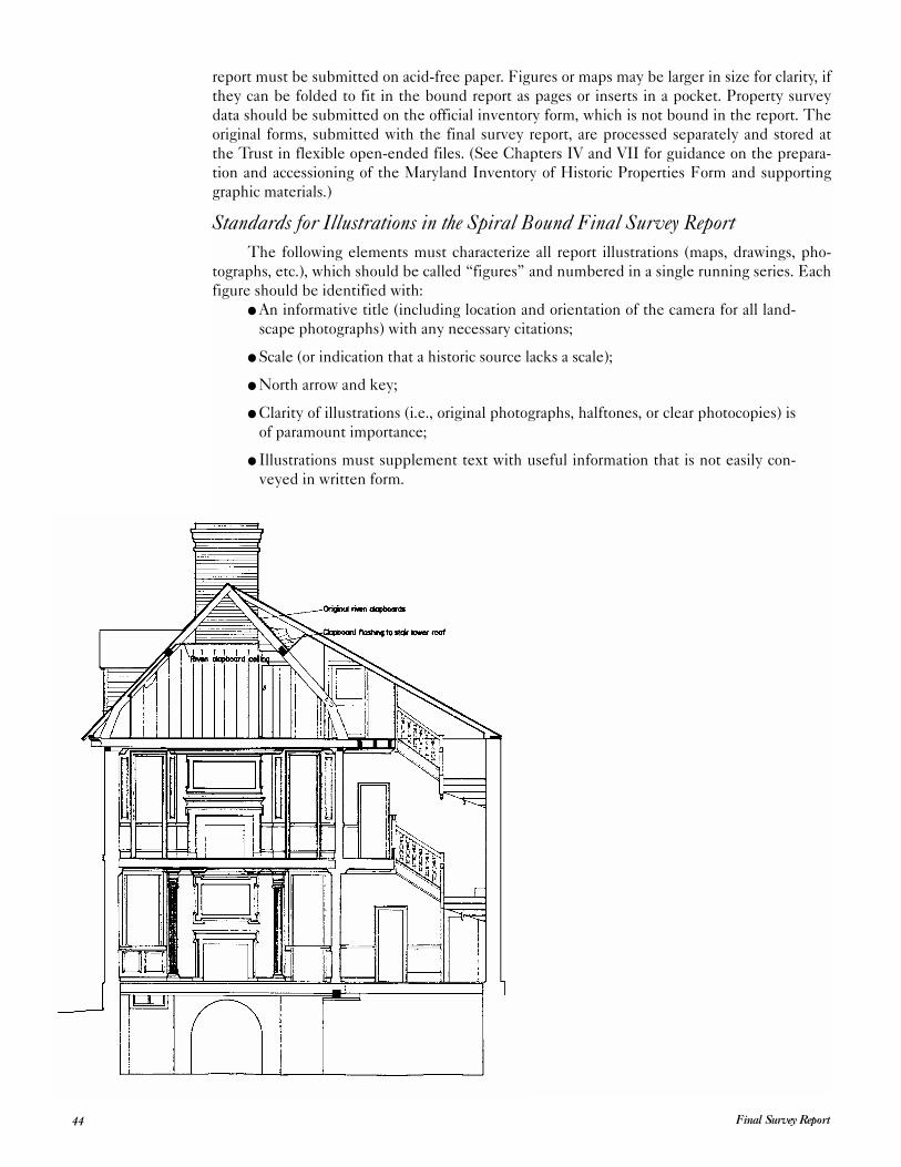
report must be submitted on acid-free paper. Figures or maps may be larger in size for clarity, if
they can be folded to fit in the bound report as pages or inserts in a pocket. Property survey
data should be submitted on the official inventory form, which is not bound in the report. The
original forms, submitted with the final survey report, are processed separately and stored at
the Trust in flexible open-ended files. (See Chapters IV and VII for guidance on the prepara-
tion and accessioning of the Maryland Inventory of Historic Properties Form and supporting
graphic materials.)
Standards for Illustrations in the Spiral Bound Final Survey ReportThe following elements must characterize all report illustrations (maps, drawings, pho-
tographs, etc.), which should be called “figures” and numbered in a single running series. Each
figure should be identified with:
● An informative title (including location and orientation of the camera for all land-
scape photographs) with any necessary citations;
● Scale (or indication that a historic source lacks a scale);
● North arrow and key;
● Clarity of illustrations (i.e., original photographs, halftones, or clear photocopies) is
of paramount importance;
● Illustrations must supplement text with useful information that is not easily con-
veyed in written form.
Final Survey Report44
The preceding chapters described the standards and guidelines for survey, identifica-
tion, and documentation of standing cultural resources in grant-funded investigations.
Although the same standards and guidelines apply to compliance documents, these
specialized reports also contain additional vital information that assists agency personnel (i.e.,
at the SHPO, the governmental agency sponsoring an undertaking, and the Federal Advisory
Council on Historic Preservation) in making informed decisions regarding the identification
and treatment of significant historic resources. The submission of reports that lack key infor-
mation may cause delays. For this reason, the Trust accepts only complete reports—not man-
agement summaries—for review. This chapter reviews the essential components of the compli-
ance report.
With respect to compliance projects, reports are always reviewed in two phases. The first
is a complete draft report submitted to the Trust’s Office of Preservation Services for review.
After review by SHPO staff, the report’s author(s) will prepare a final, revised document for
submission to the Trust.
Contractors and their clients, or the agencies that employ them, should decide which
party will submit the draft and final reports to the Trust’s Office of Preservation Services. Draft
and final reports should be accompanied by cover letters containing agency names. These
steps will help to eliminate confusion and prevent delays. Clear prose and illustrations will also
help reviewers to interpret the information in the reports. For questions of style in the presen-
tation of technical material, such as tables, footnotes, and the bibliography, follow the most
recent edition of The Chicago Manual of Style.For training in the preparation of compliance documents, historians and architectural his-
torians are encouraged to attend the Federal Advisory Council on Historic Preservation’s
course, “Introduction to Federal Projects and Historic Preservation Law.” On June 17, 1999,
revised regulations for the implementation of Section 106 became effective. The Trust
strongly recommends agencies, project sponsors, and preservation consultants become familiar
with the revised regulations before participating in the historic preservation review process.
The study of accepted final versions of recent cultural resource reports in the Trust library is
also instructive.
Report Format and Content
All reports submitted to the Trust for review should be spiral bound, using 8½” x 11”
acid-free paper. The pages should be typed single-spaced and double-sided. Bulky three-ring
binders are not acceptable. Illustrations or maps may be larger in size for clarity, if they can be
folded to fit in the bound report as pages or inserts in a pocket. Inventory forms are not bound
in the report. These original forms must be submitted in both the draft and final phases of the
compliance project. Scanned images or clear, sharp copies of photographs and the map may be
submitted with the draft, original photographs are required in the final submittal. After final
review and approval, the inventory forms are processed individually as separate documents
(see Chapters IV and VII for guidance on the preparation and accessioning of the Maryland
Inventory of Historic Properties Form).
45Standards & Guidelines
VI Compliance Reports
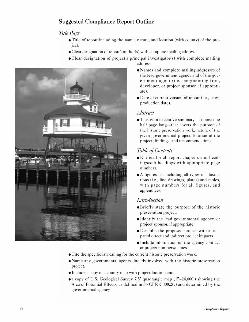
Suggested Compliance Report Outline
Title Page● Title of report including the name, nature, and location (with county) of the pro-
ject.
● Clear designation of report’s author(s) with complete mailing address.
● Clear designation of project’s principal investigator(s) with complete mailing
address.
● Names and complete mailing addresses of
the lead government agency and of the gov-
ernment agent (i.e., engineering firm,
developer, or project sponsor, if appropri-
ate).
● Date of current version of report (i.e., latest
production date).
Abstract● This is an executive summary—at most one
half page long—that covers the purpose of
the historic preservation work, nature of the
given governmental project, location of the
project, findings, and recommendations.
Table of Contents● Entries for all report chapters and head-
ings/sub-headings with appropriate page
numbers.
● A figures list including all types of illustra-
tions (i.e., line drawings, plates) and tables,
with page numbers for all figures, and
appendices.
Introduction● Briefly state the purpose of the historic
preservation project.
● Identify the lead governmental agency, or
project sponsor, if appropriate.
● Describe the proposed project with antici-
pated direct and indirect project impacts.
● Include information on the agency contract
or project numbers/names.
● Cite the specific law calling for the current historic preservation work.
● Name any governmental agents directly involved with the historic preservation
project.
● Include a copy of a county map with project location and
● a copy of U.S. Geological Survey 7.5’ quadrangle map (1”=24,000’) showing the
Area of Potential Effects, as defined in 36 CFR § 800.2(c) and determined by the
governmental agency.
Compliance Reports46
● Give the dates when background research and architectural investigations were
conducted.
● Specify the total number of acres examined.
● Give a brief description of the qualifications of historic preservation personnel
involved.
● Describe the organization of the report.
Research Design● Give a detailed statement of objectives, including applicability of the work to
broader county or regional historic and architectural contexts. If a formal scope of
work or proposal was prepared, authors may refer to this document, and include it
in an appendix to avoid lengthy repetition.
● Describe the methods and techniques of archival and background research, sur-
vey, and analysis.
● Discuss the expected results and the proposed disposition of field records and
research information.
Historic and Architectural ContextGuidelines for organizing a historical overview of the project area:
● Determine the kinds of events, patterns of development, or activities for which
properties meet the Maryland and National Register criteria (see the list of areas
of significance in Section 8 of the Maryland Inventory of Historic Properties and
National Register forms).
● Carefully analyze the survey area to identify themes in the area’s history and
within the general areas of significance that represent significant patterns of
American history, architecture, archeology, engineering, and culture and have
made significant contributions to the historical development of the locality, state,
or nation.
● Identify the concept, time period, and geographical limits for the historic con-
text(s) based on historical research related to theme(s), area(s) of significance, and
geographical area. Base this step on historical documentation of and fieldwork in
the survey area.
● Consider stages and patterns of area settlement and development; aesthetic and
artistic values embodied in the architecture or art, craftsmanship, construction
technology, or the style and work of a master; research values or problems related
to the area’s prehistory or history; social and physical sciences and humanities; and
local cultural interest.
Results of Field Investigations● Include a statement of field conditions and constraints and a qualitative and quan-
titative description and analysis of the architectural and historic resources with ref-
erence to comparable published studies.
● Include maps depicting locations of identified resources, with MIHP numbers,
along with boundaries of the Area of Potential Effect and descriptive illustrations.
● When interpreting field-investigation results, refer to historic contexts and
research questions; and
● Address the issue of integrity and/or significance as related to the property’s eligi-
bility for the National Register, if possible and appropriate.
47Standards & Guidelines
● Use official Maryland inventory numbers (i.e., site numbers issued by the Trust’s
Office of Research, Survey, and Registration) to identify resources in the text and
illustrations used in both draft and final reports
Summary and Recommendations● Discuss the impact of the governmental undertaking on identified cultural proper-
ties when recommended by the SHPO (36 CFR § 800.3).
● Include a summary of results and an evaluation of methods and techniques used.
● Include a statement addressing the survey’s level of intensity. If it was an inten-
sive survey, address the eligibility of identified cultural properties for the National
Register of Historic Places and the Maryland Register of Historic Properties.
(Chapter IV contains guidance on the application criteria used for compliance
evaluation.)
References Cited● List all references consulted in the report’s preparation according to the latest edi-
tion of The Chicago Manual of Style format.
Appendices● Include relevant project correspondence only.
● The scope of work or proposal, if appropriate.
● The qualifications of principal investigator(s). The maximum resume length
should be two (2) pages per individual. Each resume must clearly demonstrate
that the person meets National Park Service requirements published in the Code
of Federal Regulations (36 CFR Part 61 and discussed in Chapter I).
Standards for IllustrationsThe following elements must characterize all report illustrations (i.e., maps, drawings,
photographs, etc.), which are called “figures” and are numbered in a single running series:
● informative title, including location and orientation of the camera for all landscape
photographs, with any necessary citations;
● scale, or indication that a historic source lacks a scale;
● north arrow and key;
● clarity (i.e., original photographs, scanned images, halftones, or clear photocopies);
and
● utility, which means that illustrations should provide useful information that can-
not readily be transmitted in written form.
Coordinating with the SHPO
To provide adequate time to address all historic preservation concerns and to prevent
avoidable delays, agency officials, or their officially designated project sponsor, should consult
the SHPO as early in the project planning process as possible—when alternative project loca-
tions, configurations, and methods are still available; or when program discussions begin; etc.
An agency official should initiate coordination with the Trust with the submission of a
written request for assistance in identifying historic properties. To enable the Trust staff to
respond in a timely and effective manner, the request should include: 1) a brief description of
the proposed undertaking and the nature of federal or state agency involvement; 2) a clear
delineation of the project’s Area of Potential Effect marked on a section of a U.S. Geological
Survey 7.5’ quadrangle, or other 1”= 2,000’ scale map (see below for clear understanding of the
APE; 3) a summary of the agency’s review of existing information on known and potential
Compliance Reports48
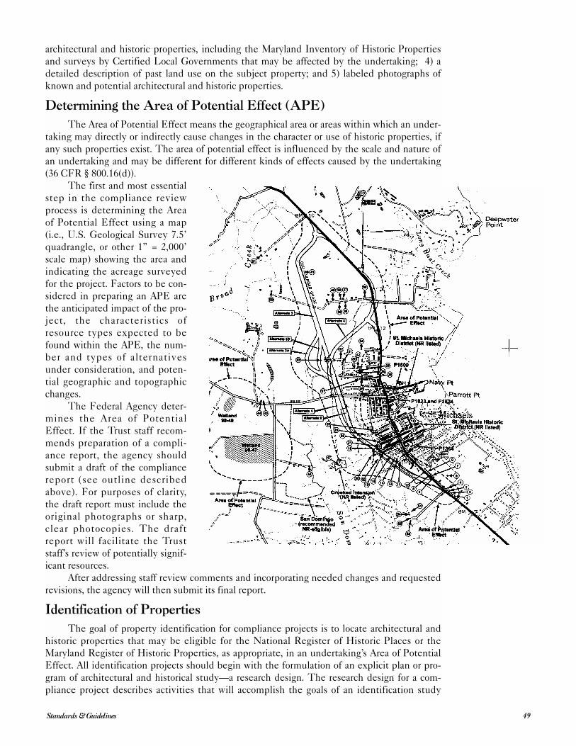
architectural and historic properties, including the Maryland Inventory of Historic Properties
and surveys by Certified Local Governments that may be affected by the undertaking; 4) a
detailed description of past land use on the subject property; and 5) labeled photographs of
known and potential architectural and historic properties.
Determining the Area of Potential Effect (APE)
The Area of Potential Effect means the geographical area or areas within which an under-
taking may directly or indirectly cause changes in the character or use of historic properties, if
any such properties exist. The area of potential effect is influenced by the scale and nature of
an undertaking and may be different for different kinds of effects caused by the undertaking
(36 CFR § 800.16(d)).
The first and most essential
step in the compliance review
process is determining the Area
of Potential Effect using a map
(i.e., U.S. Geological Survey 7.5’
quadrangle, or other 1” = 2,000’
scale map) showing the area and
indicating the acreage surveyed
for the project. Factors to be con-
sidered in preparing an APE are
the anticipated impact of the pro-
ject, the characteristics of
resource types expected to be
found within the APE, the num-
ber and types of alternatives
under consideration, and poten-
tial geographic and topographic
changes.
The Federal Agency deter-
mines the Area of Potential
Effect. If the Trust staff recom-
mends preparation of a compli-
ance report, the agency should
submit a draft of the compliance
report (see outline described
above). For purposes of clarity,
the draft report must include the
original photographs or sharp,
clear photocopies. The draft
report will facilitate the Trust
staff’s review of potentially signif-
icant resources.
After addressing staff review comments and incorporating needed changes and requested
revisions, the agency will then submit its final report.
Identification of Properties
The goal of property identification for compliance projects is to locate architectural and
historic properties that may be eligible for the National Register of Historic Places or the
Maryland Register of Historic Properties, as appropriate, in an undertaking’s Area of Potential
Effect. All identification projects should begin with the formulation of an explicit plan or pro-
gram of architectural and historical study—a research design. The research design for a com-
pliance project describes activities that will accomplish the goals of an identification study
49Standards & Guidelines
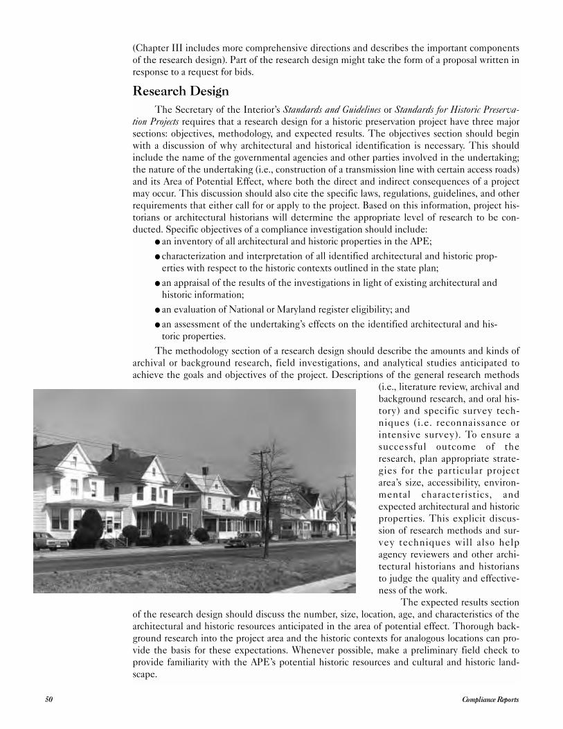
(Chapter III includes more comprehensive directions and describes the important components
of the research design). Part of the research design might take the form of a proposal written in
response to a request for bids.
Research Design
The Secretary of the Interior’s Standards and Guidelines or Standards for Historic Preserva-tion Projects requires that a research design for a historic preservation project have three major
sections: objectives, methodology, and expected results. The objectives section should begin
with a discussion of why architectural and historical identification is necessary. This should
include the name of the governmental agencies and other parties involved in the undertaking;
the nature of the undertaking (i.e., construction of a transmission line with certain access roads)
and its Area of Potential Effect, where both the direct and indirect consequences of a project
may occur. This discussion should also cite the specific laws, regulations, guidelines, and other
requirements that either call for or apply to the project. Based on this information, project his-
torians or architectural historians will determine the appropriate level of research to be con-
ducted. Specific objectives of a compliance investigation should include:● an inventory of all architectural and historic properties in the APE;
● characterization and interpretation of all identified architectural and historic prop-
erties with respect to the historic contexts outlined in the state plan;
● an appraisal of the results of the investigations in light of existing architectural and
historic information;
● an evaluation of National or Maryland register eligibility; and
● an assessment of the undertaking’s effects on the identified architectural and his-
toric properties.
The methodology section of a research design should describe the amounts and kinds of
archival or background research, field investigations, and analytical studies anticipated to
achieve the goals and objectives of the project. Descriptions of the general research methods
(i.e., literature review, archival and
background research, and oral his-
tory) and specific survey tech-
niques (i.e. reconnaissance or
intensive survey). To ensure a
successful outcome of the
research, plan appropriate strate-
gies for the particular project
area’s size, accessibility, environ-
mental characteristics, and
expected architectural and historic
properties. This explicit discus-
sion of research methods and sur-
vey techniques will also help
agency reviewers and other archi-
tectural historians and historians
to judge the quality and effective-
ness of the work.
The expected results section
of the research design should discuss the number, size, location, age, and characteristics of the
architectural and historic resources anticipated in the area of potential effect. Thorough back-
ground research into the project area and the historic contexts for analogous locations can pro-
vide the basis for these expectations. Whenever possible, make a preliminary field check to
provide familiarity with the APE’s potential historic resources and cultural and historic land-
scape.
Compliance Reports50
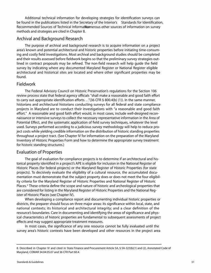
Additional technical information for developing strategies for identi�cation surveys canbe found in the publications listed in the Secretary of the Interior’s Standards for Identi�cation,Recommended Sources of Technical Information. Numerous other sources of information on surveymethods and strategies are cited in Chapter 8.
Archival and Background ResearchThe purpose of archival and background research is to acquire information on a project
area’s known and potential architectural and historic properties before initiating time-consum-ing and costly �eld investigations. Most archival and background studies should be completedand their results assessed before �eldwork begins so that the preliminary survey strategies out-lined in contract proposals may be re�ned. The non-�eld research will help guide the �eldsurvey by indicating where any documented Maryland Register or National Register eligiblearchitectural and historical sites are located and where other signi�cant properties may befound.
FieldworkThe Federal Advisory Council on Historic Preservation’s regulations for the Section 106
review process state that federal agency o�cials “shall make a reasonable and good faith e�ortto carry out appropriate identi�cation e�orts. . .”(36 CFR § 800.4(b) (1)). In the same manner,historians and architectural historians conducting surveys for all federal and state complianceprojects in Maryland are to conduct their investigations with “a reasonable and good faithe�ort.” A reasonable and good faith e�ort would, in most cases, include well-designed recon-naissance or intensive surveys to collect the necessary representative information in the Area ofPotential E�ect, and the systematic application of �eld survey techniques, whatever the levelused. Surveys performed according to a judicious survey methodology will help to reduce pro-ject costs while yielding credible information on the distribution of historic standing propertiesthroughout a project tract. (See Chapter IV for information on the preparation of the MarylandInventory of Historic Properties Form and how to determine the appropriate survey treatmentfor historic standing structures.)
Evaluation of PropertiesThe goal of evaluation for compliance projects is to determine if an architectural and his-
torical property identi�ed in a project’s APE is eligible for inclusion in the National Register ofHistoric Places (for federal projects) or the Maryland Register of Historic Properties (for stateprojects). To decisively evaluate the eligibility of a cultural resource, the accumulated docu-mentation must demonstrate that the subject property does or does not meet the four eligibil-ity criteria for the Maryland Register of Historic Properties and National Register of HistoricPlaces. 8 These criteria de�ne the scope and nature of historic and archeological properties thatare considered for listing in the Maryland Register of Historic Properties and the National Reg-ister of Historic Places (see Chapter IV).
When developing a compliance report and documenting individual historic properties ordistricts, the preparer should focus on three major areas: its signi�cance within local, state, andnational contexts; its historical and architectural integrity; and a clear de�nition of theresource’s boundaries. Care in documenting and identifying the areas of signi�cance and phys-ical characteristics of historic properties are fundamental to subsequent assessments of projecte�ects and may suggest appropriate treatment measures.
In most cases, the signi�cance of any one resource cannot be fully evaluated until thesurvey area’s historic contexts have been developed and other resources in the project area
51Standards & Guidelines
8. Described in Chapter IV and cited in State Finance and Procurement Article 5A, § 5A-323(b)(1) and (2), Annotated Code of Maryland, COMAR 34.04.05.07 and 36 CFR Part 60.4.
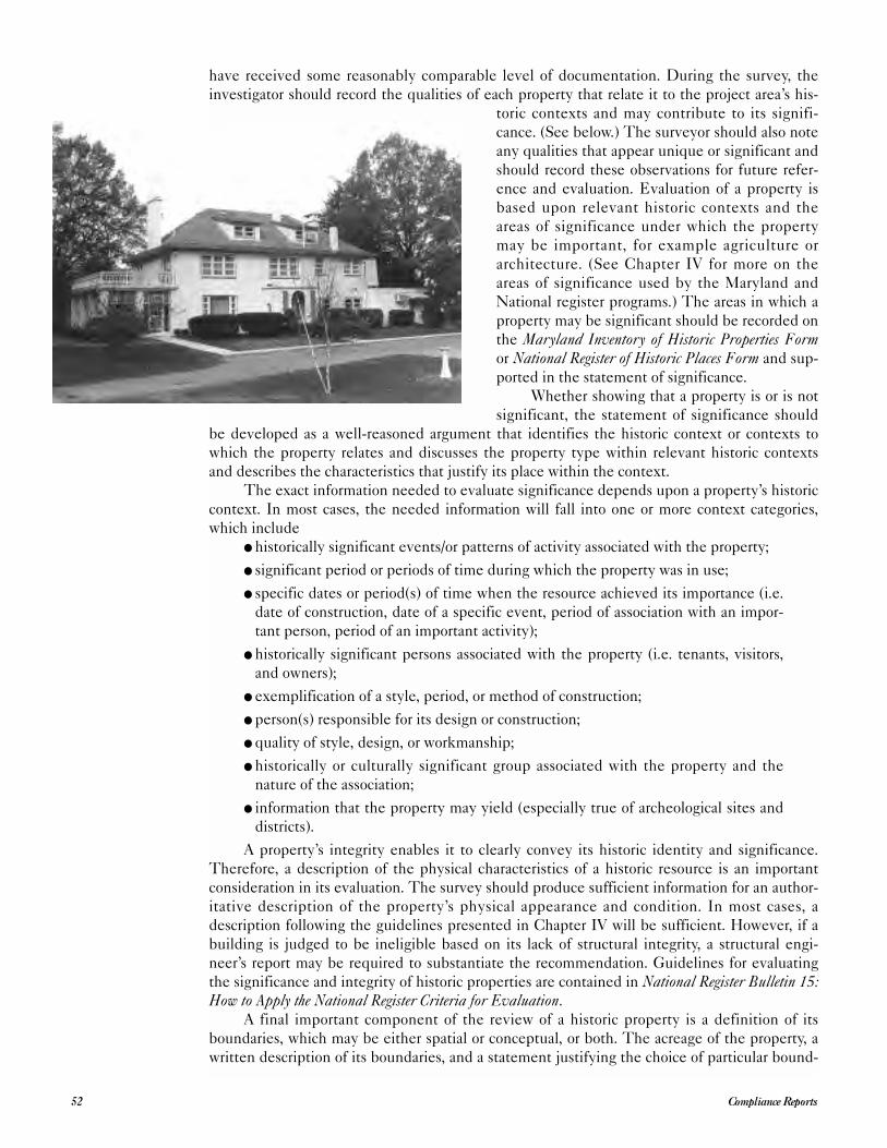
have received some reasonably comparable level of documentation. During the survey, the
investigator should record the qualities of each property that relate it to the project area’s his-
toric contexts and may contribute to its signifi-
cance. (See below.) The surveyor should also note
any qualities that appear unique or significant and
should record these observations for future refer-
ence and evaluation. Evaluation of a property is
based upon relevant historic contexts and the
areas of significance under which the property
may be important, for example agriculture or
architecture. (See Chapter IV for more on the
areas of significance used by the Maryland and
National register programs.) The areas in which a
property may be significant should be recorded on
the Maryland Inventory of Historic Properties Formor National Register of Historic Places Form and sup-
ported in the statement of significance.
Whether showing that a property is or is not
significant, the statement of significance should
be developed as a well-reasoned argument that identifies the historic context or contexts to
which the property relates and discusses the property type within relevant historic contexts
and describes the characteristics that justify its place within the context.
The exact information needed to evaluate significance depends upon a property’s historic
context. In most cases, the needed information will fall into one or more context categories,
which include● historically significant events/or patterns of activity associated with the property;
● significant period or periods of time during which the property was in use;
● specific dates or period(s) of time when the resource achieved its importance (i.e.
date of construction, date of a specific event, period of association with an impor-
tant person, period of an important activity);
● historically significant persons associated with the property (i.e. tenants, visitors,
and owners);
● exemplification of a style, period, or method of construction;
● person(s) responsible for its design or construction;
● quality of style, design, or workmanship;
● historically or culturally significant group associated with the property and the
nature of the association;
● information that the property may yield (especially true of archeological sites and
districts).
A property’s integrity enables it to clearly convey its historic identity and significance.
Therefore, a description of the physical characteristics of a historic resource is an important
consideration in its evaluation. The survey should produce sufficient information for an author-
itative description of the property’s physical appearance and condition. In most cases, a
description following the guidelines presented in Chapter IV will be sufficient. However, if a
building is judged to be ineligible based on its lack of structural integrity, a structural engi-
neer’s report may be required to substantiate the recommendation. Guidelines for evaluating
the significance and integrity of historic properties are contained in National Register Bulletin 15:How to Apply the National Register Criteria for Evaluation.
A final important component of the review of a historic property is a definition of its
boundaries, which may be either spatial or conceptual, or both. The acreage of the property, a
written description of its boundaries, and a statement justifying the choice of particular bound-
Compliance Reports52
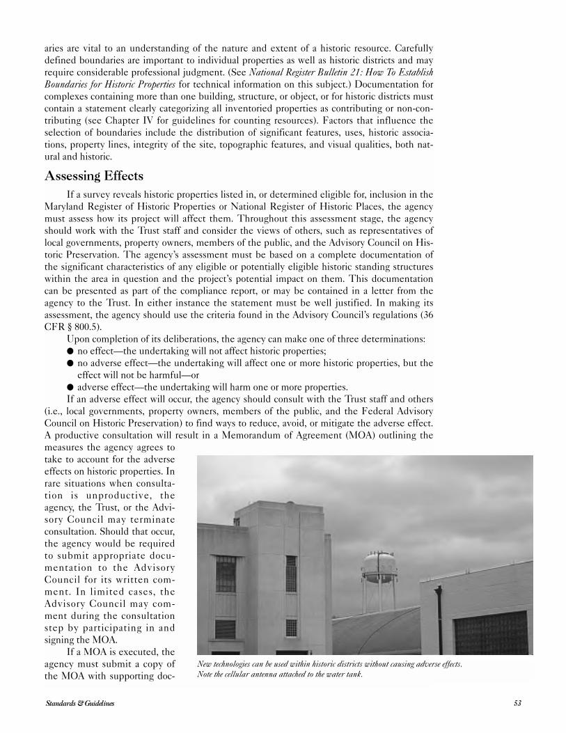
aries are vital to an understanding of the nature and extent of a historic resource. Carefully
defined boundaries are important to individual properties as well as historic districts and may
require considerable professional judgment. (See National Register Bulletin 21: How To EstablishBoundaries for Historic Properties for technical information on this subject.) Documentation for
complexes containing more than one building, structure, or object, or for historic districts must
contain a statement clearly categorizing all inventoried properties as contributing or non-con-
tributing (see Chapter IV for guidelines for counting resources). Factors that influence the
selection of boundaries include the distribution of significant features, uses, historic associa-
tions, property lines, integrity of the site, topographic features, and visual qualities, both nat-
ural and historic.
Assessing Effects
If a survey reveals historic properties listed in, or determined eligible for, inclusion in the
Maryland Register of Historic Properties or National Register of Historic Places, the agency
must assess how its project will affect them. Throughout this assessment stage, the agency
should work with the Trust staff and consider the views of others, such as representatives of
local governments, property owners, members of the public, and the Advisory Council on His-
toric Preservation. The agency’s assessment must be based on a complete documentation of
the significant characteristics of any eligible or potentially eligible historic standing structures
within the area in question and the project’s potential impact on them. This documentation
can be presented as part of the compliance report, or may be contained in a letter from the
agency to the Trust. In either instance the statement must be well justified. In making its
assessment, the agency should use the criteria found in the Advisory Council’s regulations (36
CFR § 800.5).
Upon completion of its deliberations, the agency can make one of three determinations: ● no effect—the undertaking will not affect historic properties;
● no adverse effect—the undertaking will affect one or more historic properties, but the
effect will not be harmful—or
● adverse effect—the undertaking will harm one or more properties.
If an adverse effect will occur, the agency should consult with the Trust staff and others
(i.e., local governments, property owners, members of the public, and the Federal Advisory
Council on Historic Preservation) to find ways to reduce, avoid, or mitigate the adverse effect.
A productive consultation will result in a Memorandum of Agreement (MOA) outlining the
measures the agency agrees to
take to account for the adverse
effects on historic properties. In
rare situations when consulta-
tion is unproductive, the
agency, the Trust, or the Advi-
sory Council may terminate
consultation. Should that occur,
the agency would be required
to submit appropriate docu-
mentation to the Advisory
Council for its written com-
ment. In limited cases, the
Advisory Council may com-
ment during the consultation
step by participating in and
signing the MOA.
If a MOA is executed, the
agency must submit a copy of
the MOA with supporting doc-
53Standards & Guidelines
New technologies can be used within historic districts without causing adverse effects. Note the cellular antenna attached to the water tank.
umentation noted in 36 CFR § 800.11(F) to the Advisory Council before approving the under-
taking. The agency proceeds with its undertaking under the terms of the MOA. In the absence
of an accepted MOA, the agency head must take into account the Advisory Council’s written
comments in deciding whether and how to proceed.
Treatment
Treatment measures may be agreed upon to mitigate or take into account any adverse
effects of the proposed undertaking. In some situations, historic properties cannot be saved
and consequently should be fully documented before destruction. More commonly, the goal is
to protect the historic properties. Protection is a broad term referring to the process of deter-
mining and implementing the steps that must be taken to preserve and enhance those historic
properties considered important.
When historical property protection relates to environmental review and compliance pro-
cedures, it has two aspects: integration into land use planning and zoning processes (at the
local level) and physical treatment. The planning aspects of protection in environmental
review have been discussed briefly in previous sections. Treatment concerns the historic mate-
rials in buildings, structures, sites, and objects listed in the National Register of Historic Places
and Maryland Register of Historic Properties.
The Secretary of the Interior’s Standards for the Treatment of Historic Preservation Projects(36 CFR Part 68) defines appropriate treatments for historic properties in roughly a hierarchical
order, determined by the amount of intervention into the building’s materials and form. This
hierarchy includes protection, which is a temporary act or process of applying measures to
defend or guard a historic property from deterioration, loss or attack; stabilization, which refers
to measures taken to reestablish a weather resistant enclosure or the structural stability of an
unsafe or deteriorated property; preservation, which refers to measures taken to sustain the
existing form, integrity, and material of a building or
structure; rehabilitation to return a property to a state
of utility through repair or alteration; and restoration,
which involves an accurate recovery of the form and
details of a property and its setting as it appeared in a
particular period of time.
Treatment measures may also be negotiated that
include public interpretation or architectural salvage,
moving a building, landscaping, design review of new
additions/new construction, interim protection of
property, and data recovery or recordation. One of the
principal forms of recordation used in Maryland is the
Maryland Inventory of Historic Properties Form (see
Chapter IV). In some cases, historic properties may
require other documentation, such as the National
Register Form for which forms and guidance materials
are available at the Trust’s Office of Research, Survey,
and Registration; and/or delineation according to the
Historic American Buildings Survey (HABS); or the
Historic American Engineering Record (HAER) stan-
dards (i.e., the Secretary of the Interior’s Standardsand Guidelines for Architectural and Engineering Docu-mentation: HABS/HAER Standards (1990) available
from the National Park Service).
Compliance Reports54
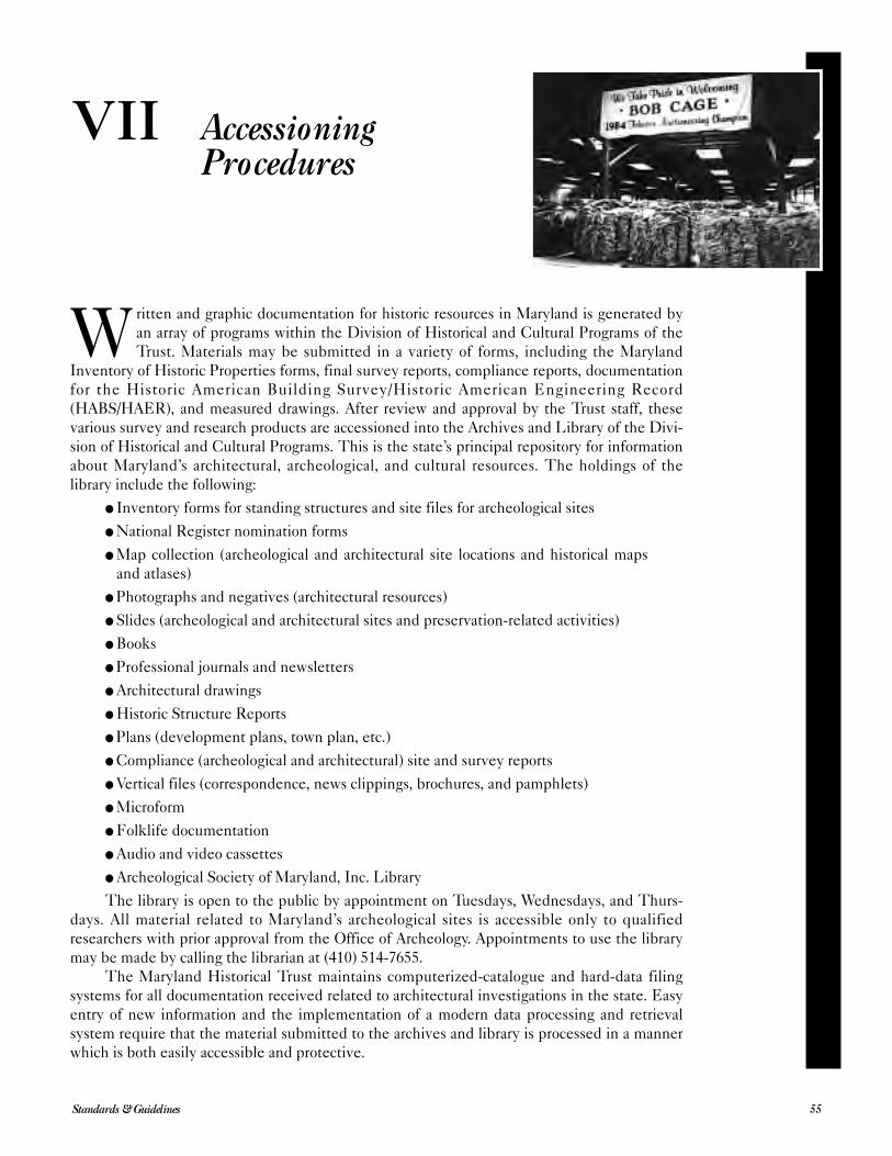
Written and graphic documentation for historic resources in Maryland is generated by
an array of programs within the Division of Historical and Cultural Programs of the
Trust. Materials may be submitted in a variety of forms, including the Maryland
Inventory of Historic Properties forms, final survey reports, compliance reports, documentation
for the Historic American Building Survey/Historic American Engineering Record
(HABS/HAER), and measured drawings. After review and approval by the Trust staff, these
various survey and research products are accessioned into the Archives and Library of the Divi-
sion of Historical and Cultural Programs. This is the state’s principal repository for information
about Maryland’s architectural, archeological, and cultural resources. The holdings of the
library include the following:
● Inventory forms for standing structures and site files for archeological sites
● National Register nomination forms
● Map collection (archeological and architectural site locations and historical maps
and atlases)
● Photographs and negatives (architectural resources)
● Slides (archeological and architectural sites and preservation-related activities)
● Books
● Professional journals and newsletters
● Architectural drawings
● Historic Structure Reports
● Plans (development plans, town plan, etc.)
● Compliance (archeological and architectural) site and survey reports
● Vertical files (correspondence, news clippings, brochures, and pamphlets)
● Microform
● Folklife documentation
● Audio and video cassettes
● Archeological Society of Maryland, Inc. Library
The library is open to the public by appointment on Tuesdays, Wednesdays, and Thurs-
days. All material related to Maryland’s archeological sites is accessible only to qualified
researchers with prior approval from the Office of Archeology. Appointments to use the library
may be made by calling the librarian at (410) 514-7655.
The Maryland Historical Trust maintains computerized-catalogue and hard-data filing
systems for all documentation received related to architectural investigations in the state. Easy
entry of new information and the implementation of a modern data processing and retrieval
system require that the material submitted to the archives and library is processed in a manner
which is both easily accessible and protective.
55Standards & Guidelines
VII AccessioningProcedures
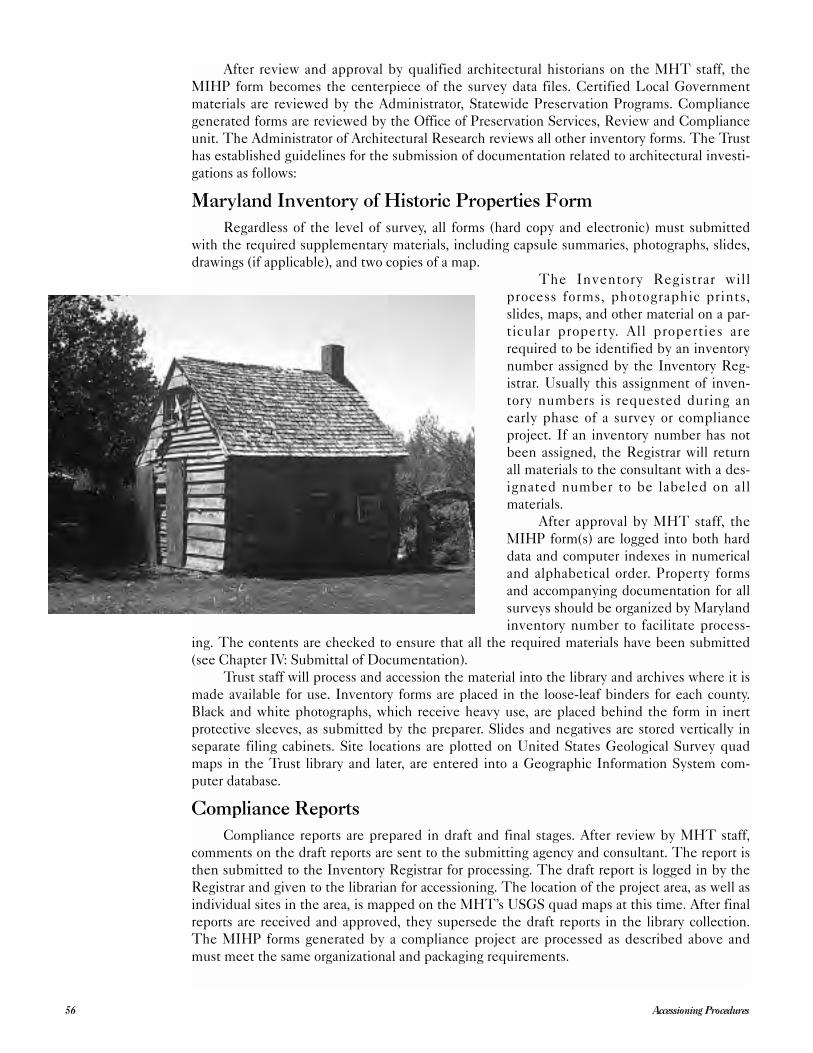
After review and approval by qualified architectural historians on the MHT staff, the
MIHP form becomes the centerpiece of the survey data files. Certified Local Government
materials are reviewed by the Administrator, Statewide Preservation Programs. Compliance
generated forms are reviewed by the Office of Preservation Services, Review and Compliance
unit. The Administrator of Architectural Research reviews all other inventory forms. The Trust
has established guidelines for the submission of documentation related to architectural investi-
gations as follows:
Maryland Inventory of Historic Properties Form
Regardless of the level of survey, all forms (hard copy and electronic) must submitted
with the required supplementary materials, including capsule summaries, photographs, slides,
drawings (if applicable), and two copies of a map.
The Inventory Registrar will
process forms, photographic prints,
slides, maps, and other material on a par-
ticular property. All properties are
required to be identified by an inventory
number assigned by the Inventory Reg-
istrar. Usually this assignment of inven-
tory numbers is requested during an
early phase of a survey or compliance
project. If an inventory number has not
been assigned, the Registrar will return
all materials to the consultant with a des-
ignated number to be labeled on all
materials.
After approval by MHT staff, the
MIHP form(s) are logged into both hard
data and computer indexes in numerical
and alphabetical order. Property forms
and accompanying documentation for all
surveys should be organized by Maryland
inventory number to facilitate process-
ing. The contents are checked to ensure that all the required materials have been submitted
(see Chapter IV: Submittal of Documentation).
Trust staff will process and accession the material into the library and archives where it is
made available for use. Inventory forms are placed in the loose-leaf binders for each county.
Black and white photographs, which receive heavy use, are placed behind the form in inert
protective sleeves, as submitted by the preparer. Slides and negatives are stored vertically in
separate filing cabinets. Site locations are plotted on United States Geological Survey quad
maps in the Trust library and later, are entered into a Geographic Information System com-
puter database.
Compliance Reports
Compliance reports are prepared in draft and final stages. After review by MHT staff,
comments on the draft reports are sent to the submitting agency and consultant. The report is
then submitted to the Inventory Registrar for processing. The draft report is logged in by the
Registrar and given to the librarian for accessioning. The location of the project area, as well as
individual sites in the area, is mapped on the MHT’s USGS quad maps at this time. After final
reports are received and approved, they supersede the draft reports in the library collection.
The MIHP forms generated by a compliance project are processed as described above and
must meet the same organizational and packaging requirements.
Accessioning Procedures56
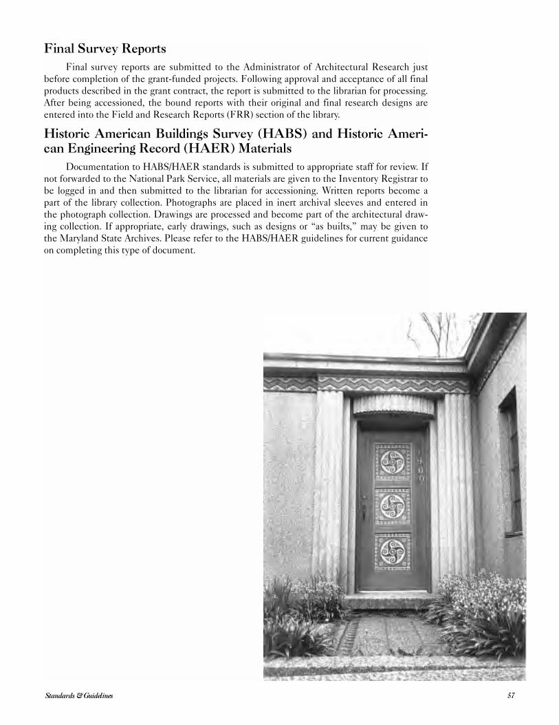
Final Survey Reports
Final survey reports are submitted to the Administrator of Architectural Research just
before completion of the grant-funded projects. Following approval and acceptance of all final
products described in the grant contract, the report is submitted to the librarian for processing.
After being accessioned, the bound reports with their original and final research designs are
entered into the Field and Research Reports (FRR) section of the library.
Historic American Buildings Survey (HABS) and Historic Ameri-can Engineering Record (HAER) Materials
Documentation to HABS/HAER standards is submitted to appropriate staff for review. If
not forwarded to the National Park Service, all materials are given to the Inventory Registrar to
be logged in and then submitted to the librarian for accessioning. Written reports become a
part of the library collection. Photographs are placed in inert archival sleeves and entered in
the photograph collection. Drawings are processed and become part of the architectural draw-
ing collection. If appropriate, early drawings, such as designs or “as builts,” may be given to
the Maryland State Archives. Please refer to the HABS/HAER guidelines for current guidance
on completing this type of document.
57Standards & Guidelines
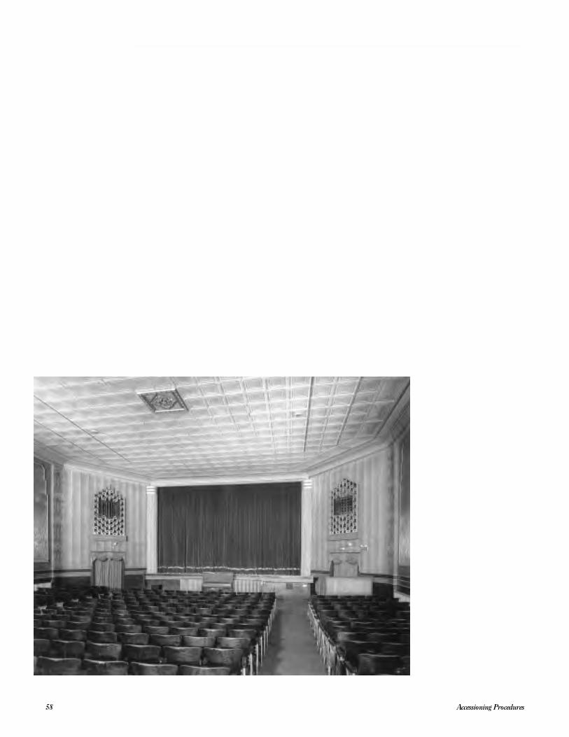
Accessioning Procedures58
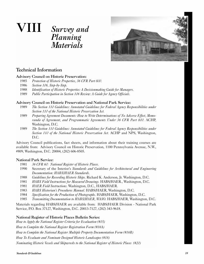
Technical Information
Advisory Council on Historic Preservation:1985 Protection of Historic Properties, 36 CFR Part 800.1986 Section 106, Step-by-Step.1988 Identification of Historic Properties: A Decisionmaking Guide for Managers.1989 Public Participation in Section 106 Review: A Guide for Agency Officials.
Advisory Council on Historic Preservation and National Park Service:1989 The Section 110 Guidelines: Annotated Guidelines for Federal Agency Responsibilities under
Section 110 of the National Historic Preservation Act.1989 Preparing Agreement Documents: How to Write Determinations of No Adverse Effect, Memo-
randa of Agreement, and Programmatic Agreements Under 36 CFR Part 800. ACHP,
Washington, D.C.
1989 The Section 110 Guidelines: Annotated Guidelines for Federal Agency Responsibilities underSection 110 of the National Historic Preservation Act. ACHP and NPS, Washington,
D.C.
Advisory Council publications, fact sheets, and information about their training courses are
available from: Advisory Council on Historic Preservation, 1100 Pennsylvania Avenue, N.W.,
#809, Washington, D.C. 20004, (202) 606-8505.
National Park Service:1981 36 CFR 60: National Register of Historic Places.1990 Secretary of the Interior’s Standards and Guidelines for Architectural and Engineering
Documentation: HABS/HAER Standards.1988 Guidelines for Recording Historic Ships. Richard K. Anderson, Jr. Washington, D.C.
1981 HABS Field Instructions for Measured Drawings. HABS/HAER., Washington, D.C.
1981 HAER Field Instructions. Washington, D.C., HABS/HAER.
1983 HABS Historian’s Procedures Manual. HABS/HAER, Washington, D.C.
1984 Specification for the Production of Photographs. HABS/HAER, Washington, D.C.
1985 Transmitting Documentation to HABS/HAER, WASO. HABS/HAER, Washington, D.C.
Materials regarding HABS/HAER are available from: HABS/HAER Division - National Park
Service, P.O. Box 37127, Washington, D.C. 20013-7127, (202) 343-9618.
National Register of Historic Places Bulletin Series:How to Apply the National Register Criteria for Evaluation (#15)
How to Complete the National Register Registration Form (#16A)
How to Complete the National Register Multiple Property Documentation Form (#16B)
How To Evaluate and Nominate Designed Historic Landscapes (#18)
Nominating Historic Vessels and Shipwrecks to the National Register of Historic Places (#20)
59Standards & Guidelines
VIII Survey andPlanningMaterials
How to Establish Boundaries for National Register Properties (#21)
Guidelines for Evaluating and Nominating Properties That Have Achieved Significance Within the LastFifty Years (#22)
How to Improve the Quality of Photos for National Register Nominations (#23)
Guidelines for Local Surveys: A Basis for Preservation Planning (#24)
Using the UTM Grid System to Record Historic Sites (#28)
Guidelines for Evaluating and Documenting Rural Historic Landscapes (#30)
Guidelines for Evaluating and Documenting Properties Associated with Significant Persons (#32)
Guidelines for Evaluating and Documenting Traditional Cultural Properties (#38)
Researching a Historic Property (#39)
Guidelines for Evaluating and Registering Cemeteries and Burial Places (#41)
Guidelines for Identifying, Evaluating, and Registering Historic Mining Properties (#42)
The National Register Bulletin Series may be obtained from the National Register of Historic
Places, National Park Service, U.S. Department of the Interior, P.O. Box 37127, Washington,
D.C. 20013-7127, (202) 343-9500.
Survey Publications
Blumgart, Pamela James, et. al., At the Head of the Bay: A Cultural and Architectural History of CecilCounty, Maryland, Elkton: Cecil Historical Trust, and Crownsville: Maryland Historical
Trust, 1996.
Bourne, Michael, Historic Houses of Kent County: An Architectural History 1642-1860, Chester-
town: the Historical Society of Kent County, 1998.
Bourne, Michael, Inventory of Historic Sites in Caroline County, Annapolis: Maryland Historical
Trust, 1980.
Bourne, Michael, et al. Architecture and Change in the Chesapeake: A Field Tour on the Eastern andWestern Shores, Crownsville: Maryland Historical Trust Press, 1998.
Getty, Joe, Carroll’s Heritage: Essays on the Architecture of a Piedmont Maryland County, West-
minster, Md.: Carroll County Commissioners and Historical Society of Carroll County, 1987.
Hughes, Elizabeth, Historic St. Michaels: An Architectural History, Chestertown, Md.: River Press,
1996.
Inventory of Historic Sites in Calvert County, Charles County and St. Mary’s County, Annapolis:
Maryland Historical Trust, 1980.
Larew, Marilynn M., Bel Air: An Architectural and Cultural History, 1782-1945, Bel Air: Town of
Bel Air and Crownsville: Maryland Historical Trust, 1995.
Miller, Marcia and Ridout, Orlando, eds. Architecture in Annapolis: A Field Guide, Crownsville:
Maryland Historical Trust Press, 1998.
Touart, Paul Baker, Along the Seaboard Side: The Architectural History of Worcester County, Mary-land, Snow Hill, Md.: Worcester County Commissioners, 1994.
__________________, Somerset: An Architectural History, Annapolis: Maryland Historical Trust,
1990.
Ware, Donna M., Anne Arundel’s Legacy: The Historic Properties of Anne Arundel County, Annapolis:
Maryland Historical Trust, 1990.
Weeks, Christopher, An Architectural History of Harford County, Maryland, Baltimore: Johns
Hopkins University Press, 1996.
__________________, ed., Between the Nanticoke and the Choptank: An Architectural History of Dor-chester County, Maryland, Baltimore: Johns Hopkins University Press, 1984.
Survey and Planning Materials60
__________________, et. al., Where Land and Water Intertwine: An Architectural History of TalbotCounty, Maryland, Baltimore: Johns Hopkins University Press, 1984.
General Reference
Blumenson, John J.-G., Identifying American Architecture, rev., ed., Nashville, Tennessee: Ameri-
can Association for State and Local History, 1981.
Burns, John A., ed., Recording Historic Structures, Washington, D.C.: The American Institute of
Architects Press, 1989.
Federal Historic Preservation Laws. Washington, D.C., 1993.
Glassie, Henry, Pattern in the Material Folk Culture of the Eastern United States, Philadelphia,
Pennsylvania, 1969.
Lanier, Gabriele and Bernard Herman. Everyday Architecture of the Mid-Atlantic, Baltimore:
Johns Hopkins, 1997.
Lounsbury, Carl R., ed., An Illustrated Glossary of Early Southern Architecture and Landscape, New
York and Oxford: Oxford University Press, 1994.
McAlester, Virginia and Lee, A Field Guide to American Houses, New York, Alfred Knopf, 1988.
Poppeliers, John, S. Allen Chambers, and Nancy B. Schwartz, What Style Is It? rev. ed., Wash-
ington: Preservation Press, 1983.
Saylor, Henry H., Dictionary of Architecture. New York: John Wiley & Sons, 1952.
Whiffen, Marcus, American Architecture Since 1780: A Guide to the Styles. Cambridge, Massa-
chusetts: MIT, 1969.
Selected Internet Resources
Advisory Council on Historical Preservation: www.achp.gov
HABS/HAER: www.cr.nps.gov/habshaer/
Heritage Preservation Services: www2.cr.nps.gov
Library of Congress: www.lcweb.loc.gov
Maryland Historical Trust: www.MarylandHistoricalTrust.net
Maryland State Archives: www.mdarchives.state.md.us
National Archives and Records Administration: www.nara.gov
National Conference of State Historic Preservation Officers: www.sso.org/ncshpo
National Park Service: www.nps.gov
National Register of Historic Places: www.cr.nps.gov/nr
National Center for Preservation Technology and Training: www.ncptt.nps.gov
61Standards & Guidelines
62
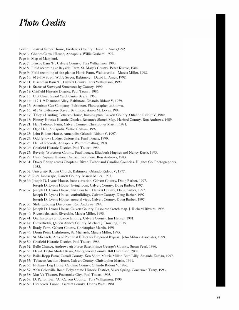
Cover: Beatty-Cramer House, Frederick County. David L. Ames,1992.
Page 3: Charles Carroll House, Annapolis. Willie Graham, 1997.
Page 6: Map of Maryland.
Page 7: Briscoe Barn ‘F’, Calvert County. Tora Williamson, 1990.
Page 8: Field recording at Bayside Farm, St. Mary’s County. Peter Kurtze, 1984.
Page 9: Field recording of site plan at Harris Farm, Walkersville. Marcia Miller, 1992.
Page 10: 612-614 South Wolfe Street, Baltimore. David L. Ames, 1992.
Page 11: Eisenman Barn ‘C’, Calvert County. Tora Williamson, 1990.
Page 11: Status of Surveyed Structures by County, 1999.
Page 12: Crisfield Historic District. Paul Touart, 1986.
Page 13: U.S. Coast Guard Yard, Curtis Bay. c. 1960.
Page 14: 117-119 Diamond Alley, Baltimore. Orlando Ridout V, 1979.
Page 15: American Can Company, Baltimore. Photographer unknown.
Page 16: 412 W. Baltimore Street, Baltimore. Aaron M. Levin, 1989.
Page 17: Tracy’s Landing Tobacco House, framing plan, Calvert County. Orlando Ridout V, 1980.
Page 18: Finney Houses Historic District, Resource Sketch Map, Harford County. Ron Andrews, 1989.
Page 21: Hall Tobacco Farm, Calvert County. Christopher Martin, 1991.
Page 22: Ogle Hall, Annapolis. Willie Graham, 1997.
Page 23: John Ridout House, Annapolis. Orlando Ridout V, 1997.
Page 24: Odd fellows Lodge, Unionville. Paul Touart, 1990.
Page 25: Hall of Records, Annapolis. Walter Smalling, 1994.
Page 26: Crisfield Historic District. Paul Touart, 1986.
Page 27: Beverly, Worcester County. Paul Touart, Elizabeth Hughes and Nancy Kurtz, 1993.
Page 29: Union Square Historic District, Baltimore. Ron Andrews, 1983.
Page 31: Dover Bridge across Choptank River, Talbot and Caroline Counties. Hughes Co. Photographers,
1933.
Page 32: University Baptist Church, Baltimore. Orlando Ridout V, 1977.
Page 35: Rural landscape, Garrett County. Marcia Miller, 1993.
Page 36: Joseph D. Lyons House, front elevation, Calvert County, Doug Barber, 1997.
Joseph D. Lyons House, living room, Calvert County, Doug Barber, 1997.
Page 37: Joseph D. Lyons House, first floor hall, Calvert County, Doug Barber, 1997.
Joseph D. Lyons House, outbuildings, Calvert County, Doug Barber, 1997.
Joseph D. Lyons House, general view, Calvert County, Doug Barber, 1997.
Page 38: Slide Labeling Directions, Ron Andrews, 1990.
Page 39: Joseph D. Lyons House, Calvert County, Resource sketch map. J. Richard Rivoire, 1996.
Page 40: Riversdale, stair, Riverdale. Marcia Miller, 1995.
Page 41: Oral histories of tobacco farming, Calvert County. Jim Hauser, 1991.
Page 44: Cloverfields, Queen Anne’s County. Michael J. Dowling, 1975.
Page 45: Brady Farm, Calvert County. Christopher Martin, 1991.
Page 46: Drum Point Lighthouse, St. Michaels. Marcia Miller, 1993.
Page 49: St. Michaels, Area of Potential Effect for Proposed Bypass, John Milner Associates, 1999.
Page 50: Crisfield Historic District, Paul Touart, 1986.
Page 52: Belle Chance, Andrews Air Force Base, Prince George’s County, Susan Pearl, 1986.
Page 53: David Taylor Model Basin, Montgomery County. Bill Hutchison, 2000.
Page 54: Baile-Repp Farm, Carroll County. Ken Short, Marcia Miller, Barb Lilly, Amanda Zeman, 1997.
Page 55: Tabacco Auction House, Calvert County. Christopher Martin, 1991.
Page 56: Fluharty Log House, Caroline County. Orlando Ridout V, 1996.
Page 57: 9900 Colesville Road, Polychrome Historic District, Silver Spring. Constance Terry, 1993.
Page 58: Mar-Va Theater, Pocomoke City. Paul Touart, 1993.
Page 59: D. Parron Barn ‘A’, Calvert County. Tora Williamson, 1990.
Page 62: Hitchcock Tunnel, Garrett County. Donna Ware, 1981.
63
Photo Credits

Notes

Architecture in annapolis
Architecture in Annapolis

Maryland Historical Trust
100 Community PlaceCrownsville, Maryland 21032-2023
Maryland Department of Planning