Embed Size (px)
Citation preview
Centre for SDIs and Land AdministrationDepartment of Geomatics
Spatially Enabled SocietySpatially Enabled Society
Abbas RajabifardVice Chair PCGIAP-WG3
Vice-President (President Elect), GSDI Association
International Seminar onLand Administration Trends and Issues in Asia and the
Pacific Region
Centre for SDIs and Land AdministrationDepartment of Geomatics
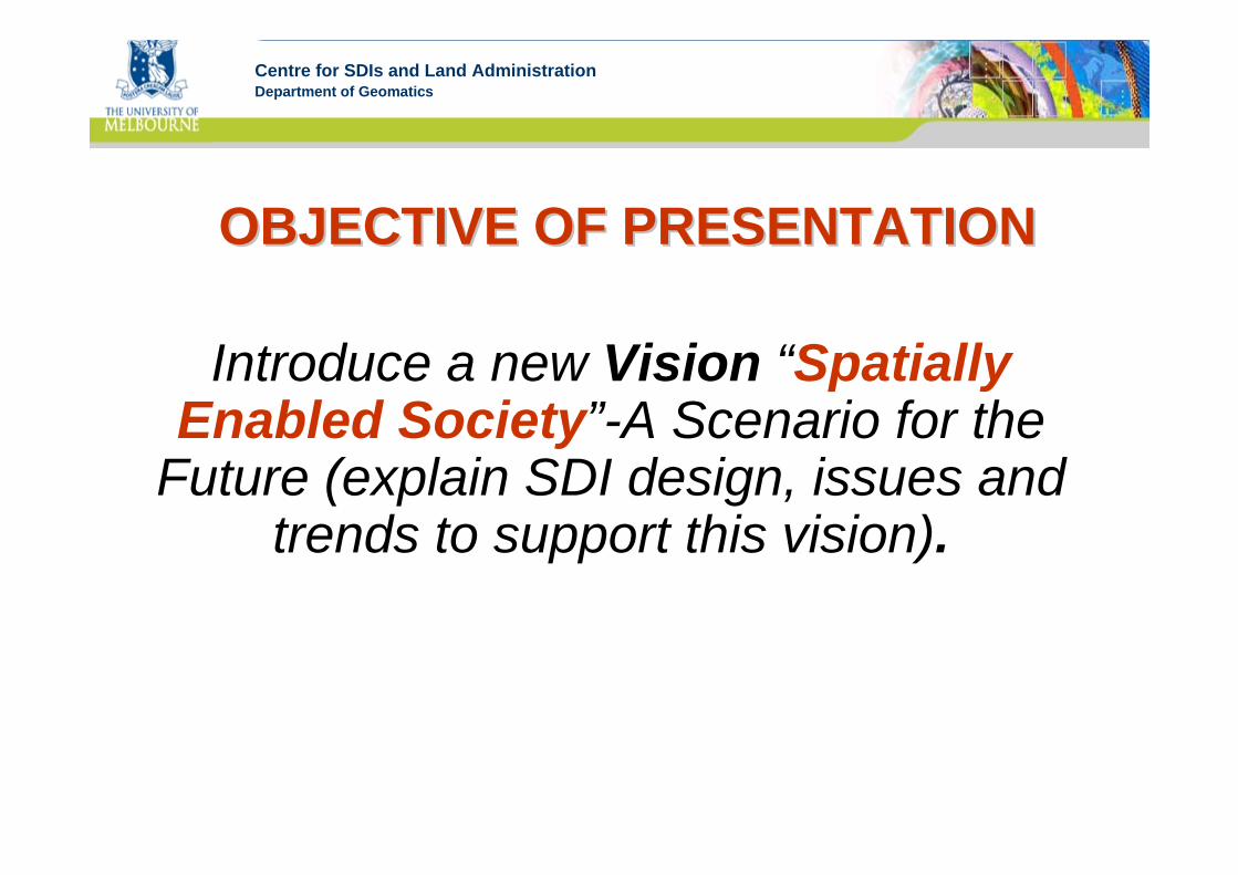
OBJECTIVE OF PRESENTATIONOBJECTIVE OF PRESENTATION
Introduce a new Vision “Spatially Enabled Society”-A Scenario for the
Future (explain SDI design, issues and trends to support this vision).
Centre for SDIs and Land AdministrationDepartment of Geomatics
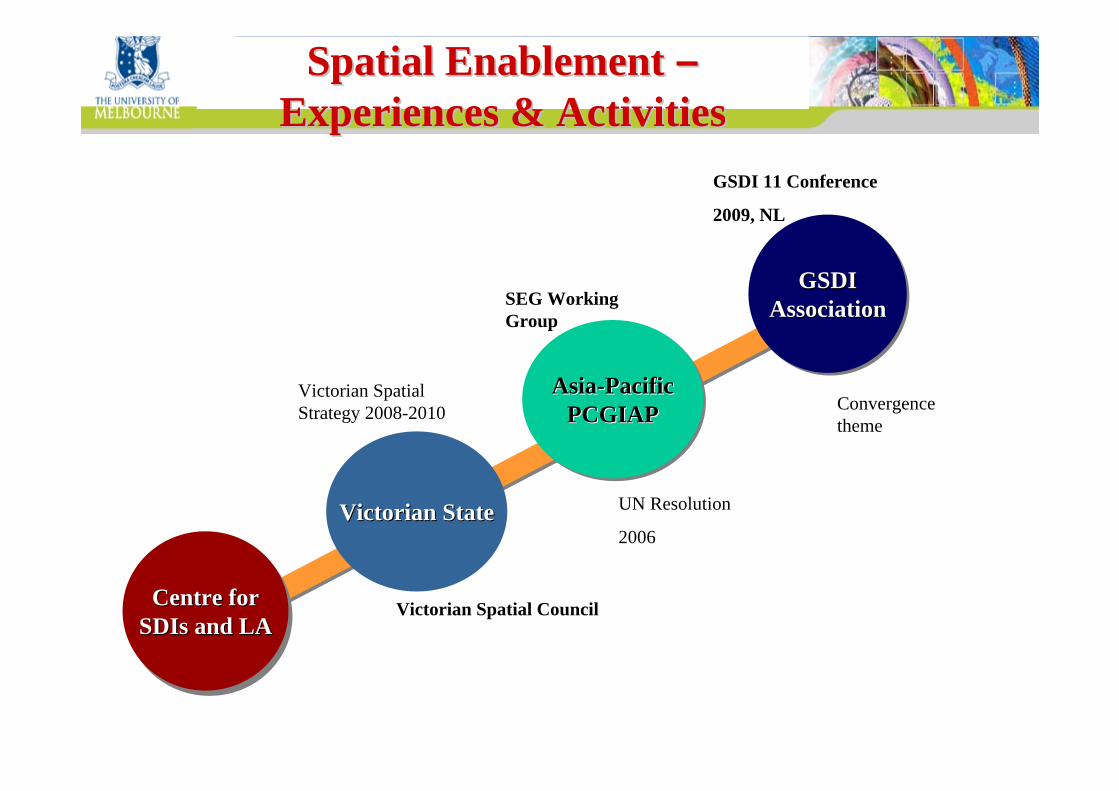
Spatial Enablement Spatial Enablement ––Experiences & ActivitiesExperiences & Activities
Convergence theme
GSDI 11 Conference
2009, NL
Centre forSDIs and LACentre forCentre for
SDIsSDIs and LAand LA
Victorian StateVictorian State
Asia-PacificPCGIAP
AsiaAsia--PacificPacificPCGIAPPCGIAP
GSDIAssociation
GSDIGSDIAssociationAssociation
Victorian Spatial Council
Victorian Spatial Strategy 2008-2010
UN Resolution
2006
SEG Working Group
Centre for SDIs and Land AdministrationDepartment of Geomatics
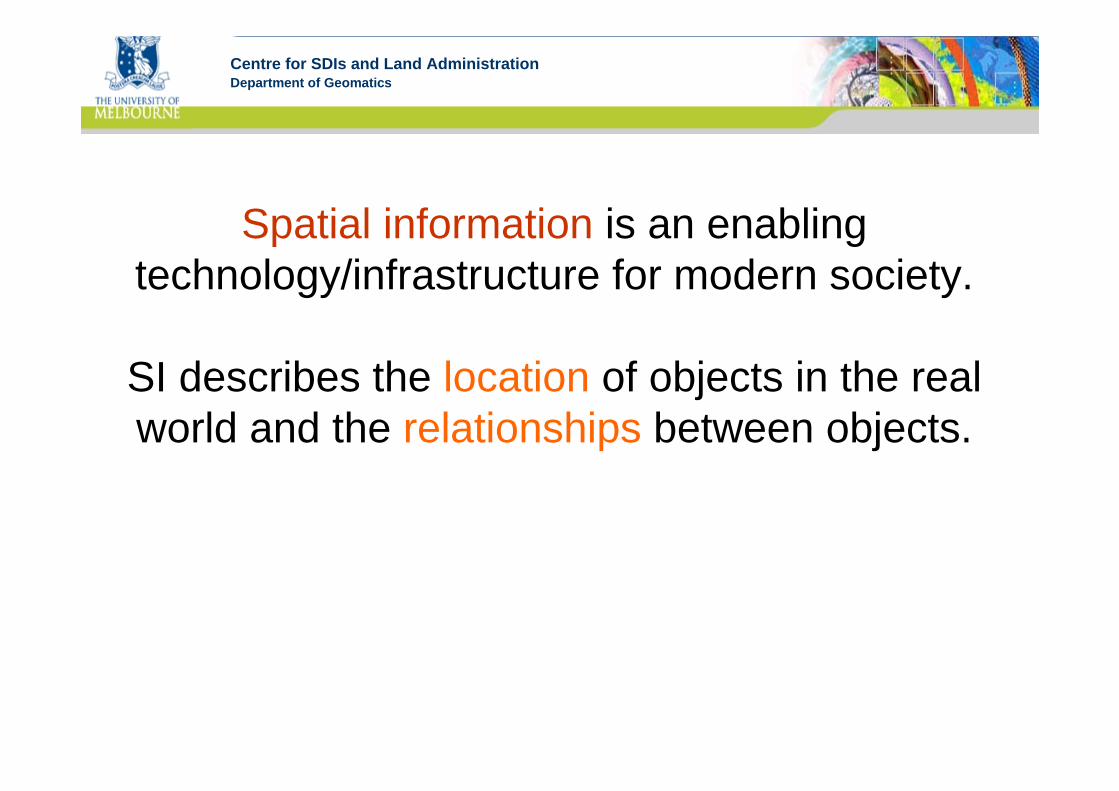
Spatial information is an enabling technology/infrastructure for modern society.
SI describes the location of objects in the real world and the relationships between objects.
Centre for SDIs and Land AdministrationDepartment of GeomaticsServices and Delivery ToolsServices and Delivery Tools
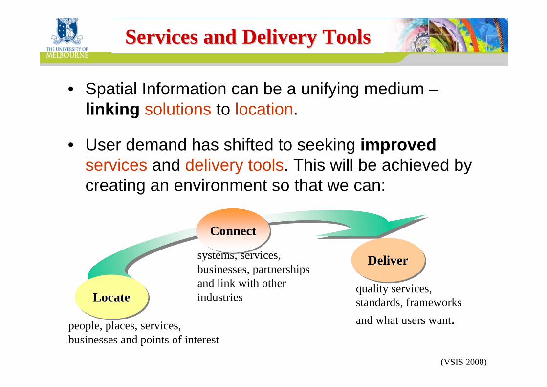
• Spatial Information can be a unifying medium –linking solutions to location.
• User demand has shifted to seeking improvedservices and delivery tools. This will be achieved by creating an environment so that we can:
DeliverDeliverDeliver
people, places, services, businesses and points of interest
systems, services, businesses, partnerships and link with other industries
quality services, standards, frameworks and what users want.
ConnectConnectConnect
LocateLocateLocate
(VSIS 2008)

Centre for SDIs and Land AdministrationDepartment of Geomatics
Ready and timely access to spatial information – knowing where people and
assets are – is essential for the creation of wealth in any jurisdiction.
It is a critical tool for making informed decisions on key economic, environmental
and social issues.
Centre for SDIs and Land AdministrationDepartment of Geomatics
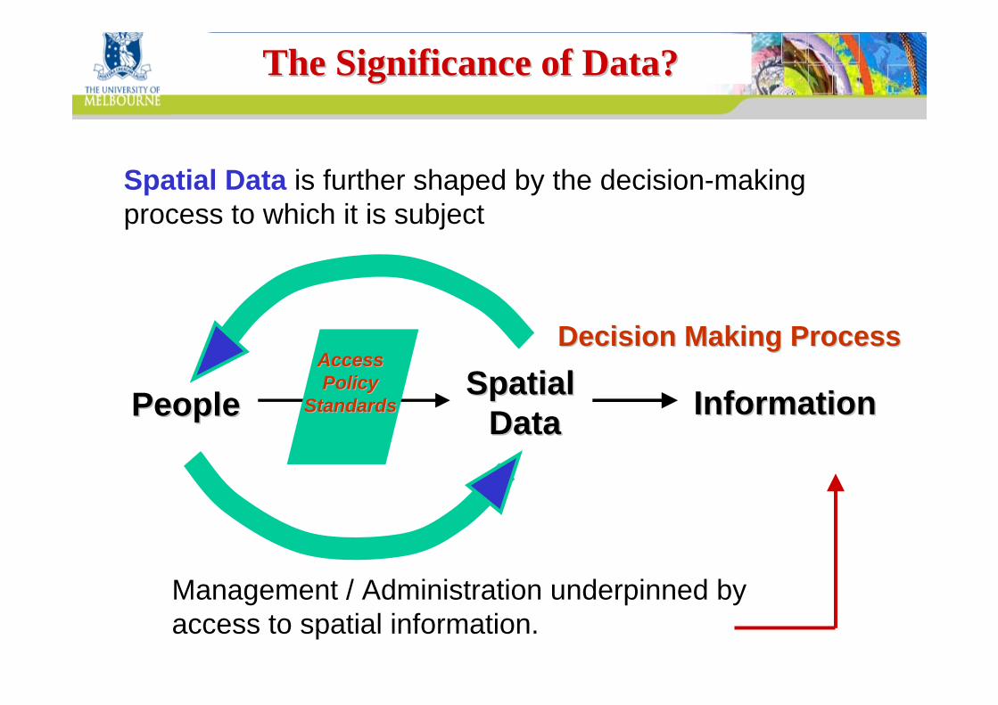
Spatial Data is further shaped by the decision-making process to which it is subject
Spatial Spatial DataDataPeoplePeople InformationInformation
AccessAccessPolicy Policy
StandardsStandards
Decision Making ProcessDecision Making Process
Management / Administration underpinned by access to spatial information.
The Significance of Data?The Significance of Data?
Centre for SDIs and Land AdministrationDepartment of Geomatics
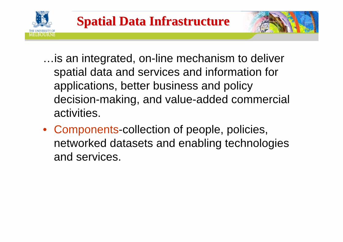
…is an integrated, on-line mechanism to deliver spatial data and services and information for applications, better business and policy decision-making, and value-added commercial activities.
• Components-collection of people, policies, networked datasets and enabling technologies and services.
Spatial Data InfrastructureSpatial Data Infrastructure
Centre for SDIs and Land AdministrationDepartment of Geomatics
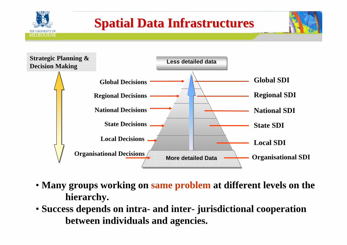
Global SDI
Regional SDI
National SDI
State SDI
Local SDI
Spatial Data InfrastructuresSpatial Data Infrastructures
Organisational SDI
Less detailed dataLess detailed data
Global Decisions
Regional Decisions
National Decisions
State Decisions
Local Decisions
More detailed Data
• Many groups working on same problem at different levels on the hierarchy.
• Success depends on intra- and inter- jurisdictional cooperation between individuals and agencies.
Strategic Planning & Decision Making
Organisational Decisions
Centre for SDIs and Land AdministrationDepartment of Geomatics
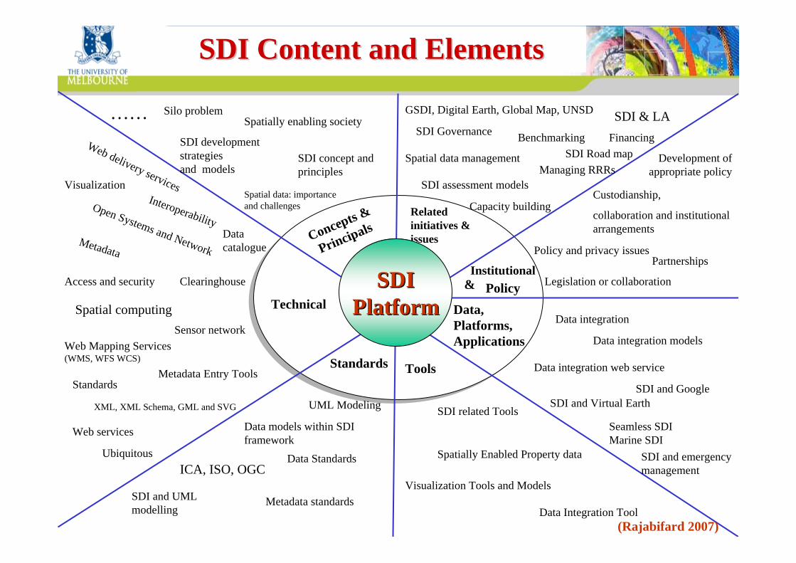
Concepts &
PrincipalsRelated initiatives & issues
Technical
Institutional &
ToolsStandards
Data, Platforms, Applications
PolicySDISDIPlatformPlatform
Spatial data: importance and challenges
SDI concept and principles
Spatially enabling society
SDI development strategiesand models
Silo problem ……
Data integration
Data integration models
Data integration web service
SDI and GoogleSDI and Virtual Earth
Seamless SDIMarine SDI
SDI and emergency management
GSDI, Digital Earth, Global Map, UNSD
SDI Governance
Spatial data management
SDI assessment models
Benchmarking
Managing RRRs
Capacity building
SDI & LA
SDI Road map Financing
Policy and privacy issues
Legislation or collaboration
Development of appropriate policy
Custodianship,
collaboration and institutional arrangements
Partnerships
UML Modeling
Data models within SDI framework
Data Standards ICA, ISO, OGC
Metadata standards SDI and UML modelling
Data catalogue
Clearinghouse
Interoperability
Access and security
Web delivery services
Open Systems and Network
Spatial computingSensor network
Ubiquitous
Metadata
Metadata Entry ToolsStandards
Web services
XML, XML Schema, GML and SVG
Web Mapping Services (WMS, WFS WCS)
Visualization
Spatially Enabled Property data
SDI related Tools
Visualization Tools and Models
Data Integration Tool
SDI Content and ElementsSDI Content and Elements
(Rajabifard 2007)
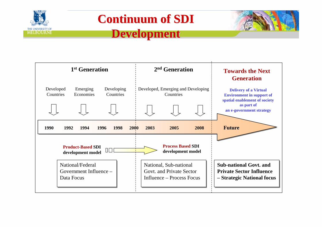
Centre for SDIs and Land AdministrationDepartment of GeomaticsContinuum of SDI Continuum of SDI
DevelopmentDevelopment
1990 1992 1994 1996 1998 2000 2003 2005 2008 Future1990 1992 1994 1996 1998 2000 2003 2005 2008 FutureFuture
Developing Countries
Emerging Economies
Product-Based SDI development model
Process Based SDI development model
National/Federal Government Influence –Data Focus
National/Federal Government Influence –Data Focus
National, Sub-national Govt. and Private Sector Influence – Process Focus
National, Sub-national Govt. and Private Sector Influence – Process Focus
1st Generation
Developed Countries
Developed, Emerging and Developing Countries
2nd Generation Towards the Next Generation
Sub-national Govt. and Private Sector Influence – Strategic National focus
Sub-national Govt. and Private Sector Influence – Strategic National focus
Delivery of a Virtual Environment in support of
spatial enablement of society as part of
an e-government strategy
Centre for SDIs and Land AdministrationDepartment of GeomaticsImplementation Implementation –– DriversDrivers
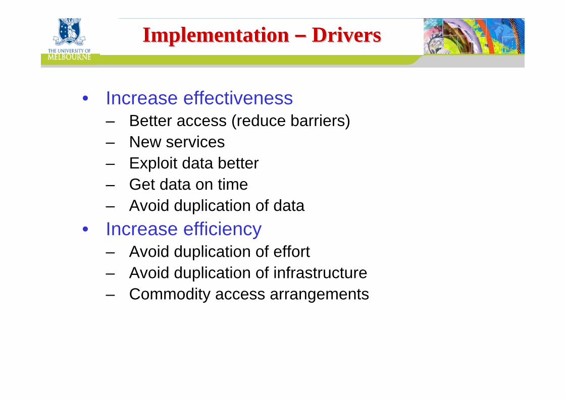
• Increase effectiveness– Better access (reduce barriers)– New services– Exploit data better– Get data on time– Avoid duplication of data
• Increase efficiency– Avoid duplication of effort– Avoid duplication of infrastructure– Commodity access arrangements
Centre for SDIs and Land AdministrationDepartment of Geomatics
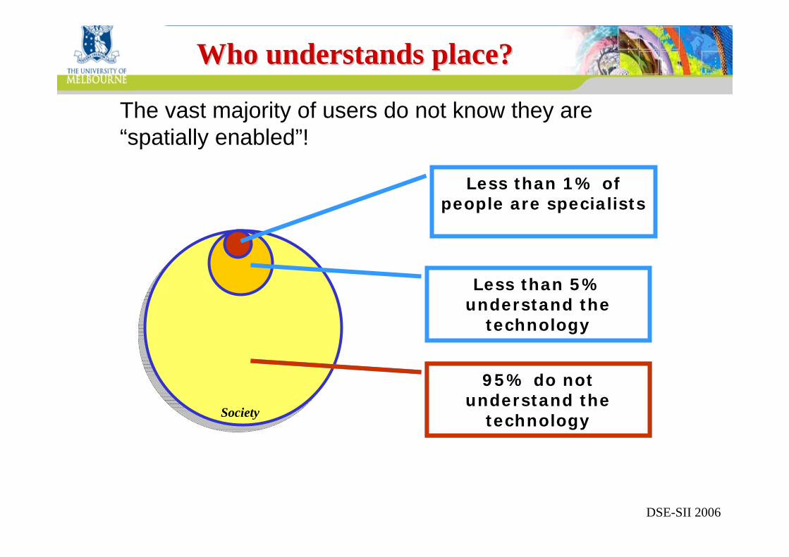
Less than 5% understand the
technology
95% do not understand the
technology
Who understands place?Who understands place?
Less than 1% of people are specialists
The vast majority of users do not know they are “spatially enabled”!
Society
DSE-SII 2006
95% do not understand the
technology
Centre for SDIs and Land AdministrationDepartment of Geomatics
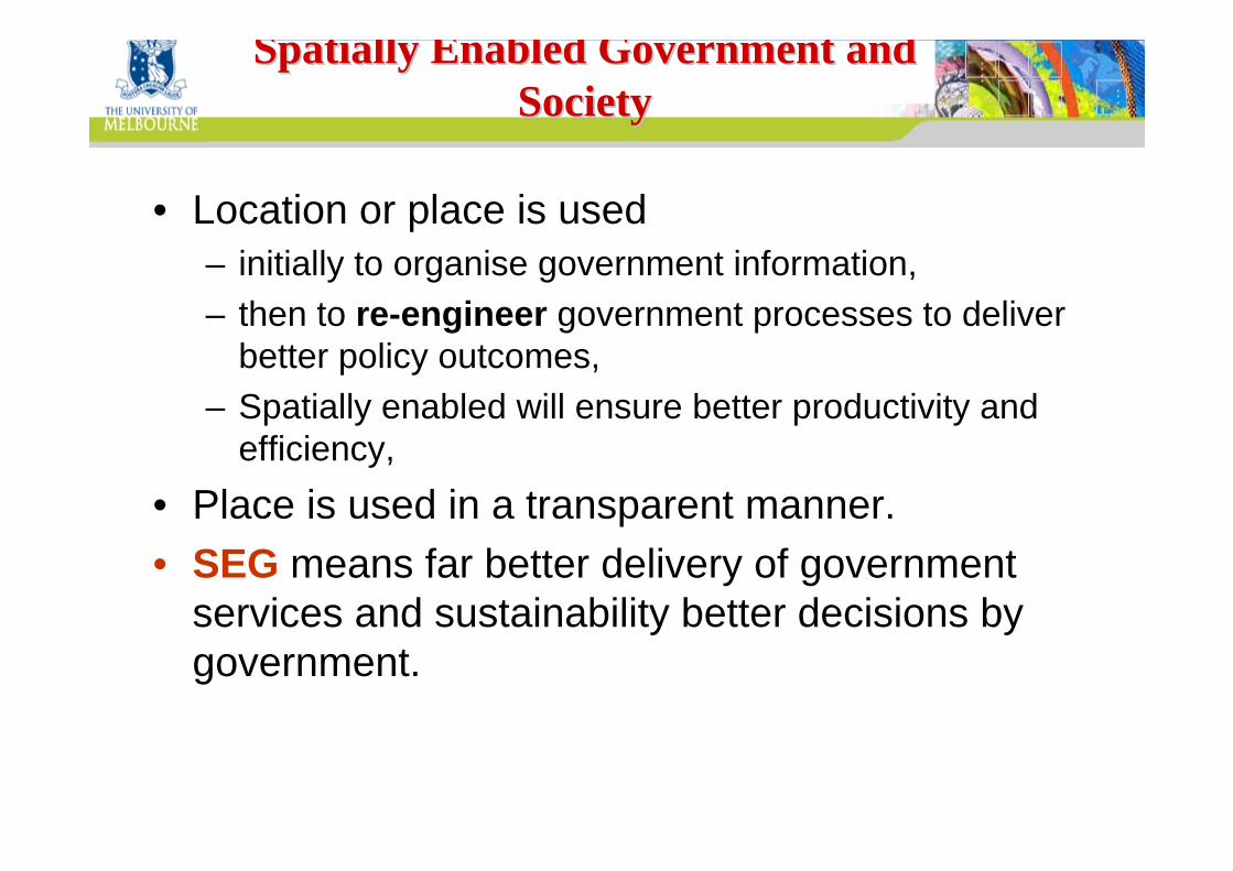
Spatially Enabled Government and Spatially Enabled Government and SocietySociety
• Location or place is used – initially to organise government information,– then to re-engineer government processes to deliver
better policy outcomes,– Spatially enabled will ensure better productivity and
efficiency,• Place is used in a transparent manner.• SEG means far better delivery of government
services and sustainability better decisions by government.
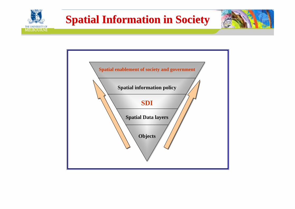
Centre for SDIs and Land AdministrationDepartment of GeomaticsSpatial Information in SocietySpatial Information in Society
Spatial enablement of society and government
Spatial information policy
SDI
Spatial Data layers
Objects
Centre for SDIs and Land AdministrationDepartment of Geomatics
Spatially Enabled Society Spatially Enabled Society –– A A Scenario for the FutureScenario for the Future
The ‘spatial enablement’ can reshapeour lives.
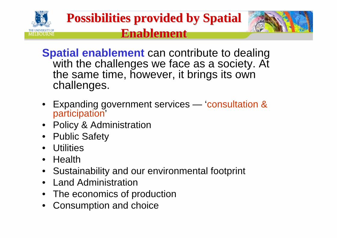
Centre for SDIs and Land AdministrationDepartment of GeomaticsPossibilities provided by Spatial Possibilities provided by Spatial
EnablementEnablementSpatial enablement can contribute to dealing
with the challenges we face as a society. At the same time, however, it brings its own challenges.
• Expanding government services — ‘consultation & participation’
• Policy & Administration• Public Safety• Utilities• Health• Sustainability and our environmental footprint• Land Administration• The economics of production• Consumption and choice
Centre for SDIs and Land AdministrationDepartment of Geomatics
FutureFutureVisionVision
Time
Ach
ieve
men
t
Present
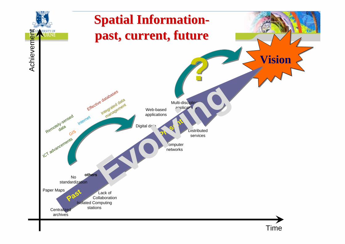
PastPaper Maps
Centralized archives
Isolated Computing stations
No standardization
Lack of Collaboration
others
Digital data
Computer networks
Web-based applications
Distributed services
Multi-disciplinary applications
??Internet
GISRemotely-sensed
data
Integrated data
managementEffective databases
ICT advancements
Spatial InformationSpatial Information--past, current, futurepast, current, future
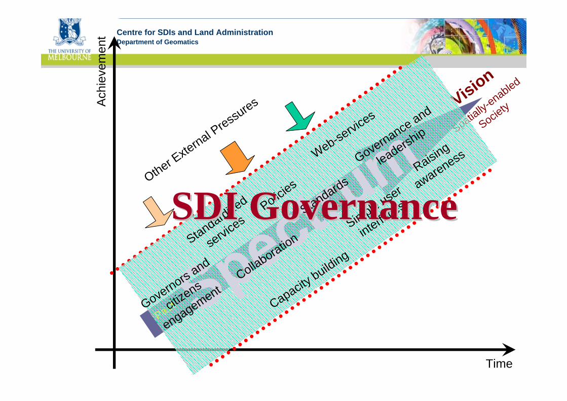
Centre for SDIs and Land AdministrationDepartment of Geomatics
Time
Ach
ieve
men
t
Current
situation
Past
Vision
Spatially-enabled
Society
Standardized
services
Policies
Standards
Simple user
interfaces
Web-servic
es
Capacity building
Collaboration
Raising
awareness
Governors and
citizens
engagement
Governance and
leadership
SDI GovernanceSDI GovernanceOther E
xternal P
ressures
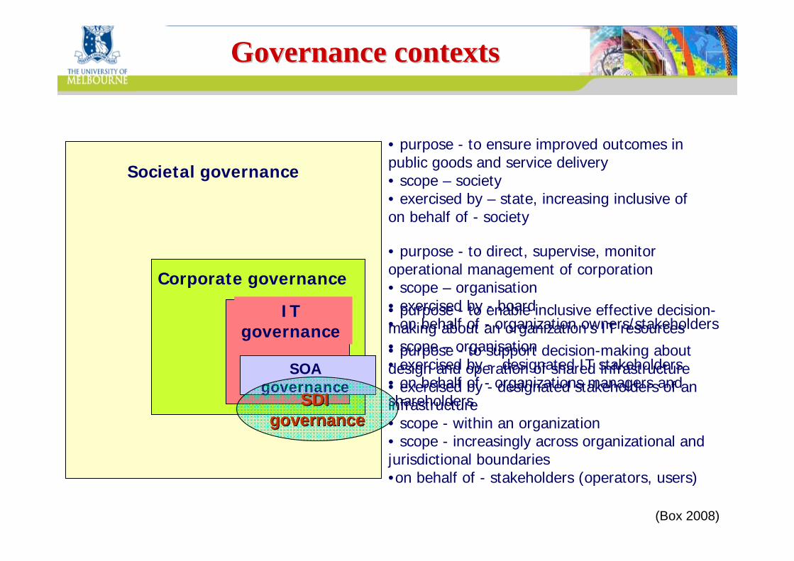
Centre for SDIs and Land AdministrationDepartment of GeomaticsGovernance contextsGovernance contexts
Societal governance
• purpose - to ensure improved outcomes in public goods and service delivery• scope – society• exercised by – state, increasing inclusive of on behalf of - society
• purpose - to direct, supervise, monitor operational management of corporation • scope – organisation• exercised by - board• on behalf of - organization owners/stakeholders• purpose - to enable inclusive effective decision-making about an organization’s IT resources• scope – organisation• exercised by - designated IT stakeholders• on behalf of - organizations managers and shareholders
Corporate governance
IT governance
SOA governance
• purpose - to support decision-making about design and operation of shared infrastructure• exercised by - designated stakeholders of an infrastructure • scope - within an organization• scope - increasingly across organizational and jurisdictional boundaries•on behalf of - stakeholders (operators, users)
SDI SDI governancegovernance
(Box 2008)
Centre for SDIs and Land AdministrationDepartment of Geomatics
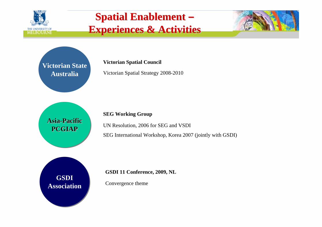
Spatial Enablement Spatial Enablement ––Experiences & ActivitiesExperiences & Activities
Convergence theme
GSDI 11 Conference, 2009, NL
Victorian StateAustralia
Asia-PacificPCGIAP
AsiaAsia--PacificPacificPCGIAPPCGIAP
GSDIAssociation
GSDIAssociation
Victorian Spatial Council
Victorian Spatial Strategy 2008-2010
UN Resolution, 2006 for SEG and VSDI
SEG International Workshop, Korea 2007 (jointly with GSDI)
SEG Working Group
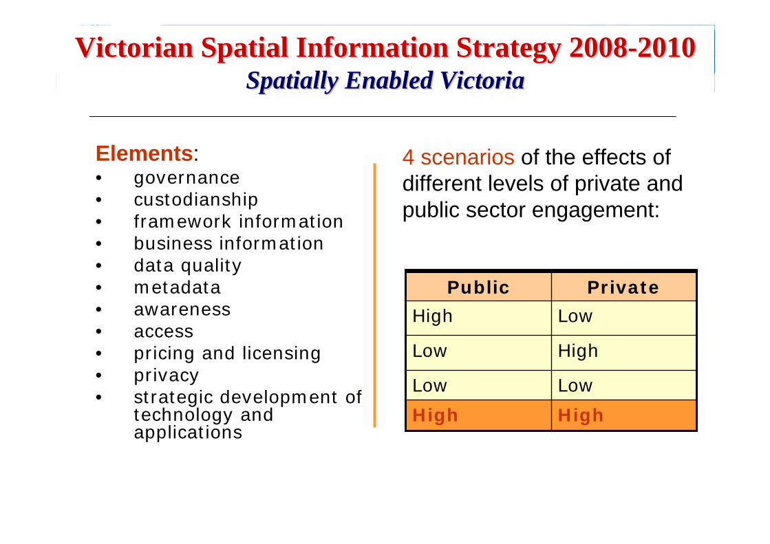
Centre for SDIs and Land AdministrationDepartment of GeomaticsVictorian Spatial Information Strategy 2008Victorian Spatial Information Strategy 2008--20102010
Spatially Enabled VictoriaSpatially Enabled Victoria
Elements:• governance• custodianship• framework information• business information• data quality• metadata• awareness• access• pricing and licensing• privacy• strategic development of
technology and applications
HighHigh
LowLow
HighLow
LowHigh
PrivatePublic
4 scenarios of the effects of different levels of private and public sector engagement:
HighHigh
LowLow
HighLow
LowHigh
PrivatePublic
Centre for SDIs and Land AdministrationDepartment of Geomatics
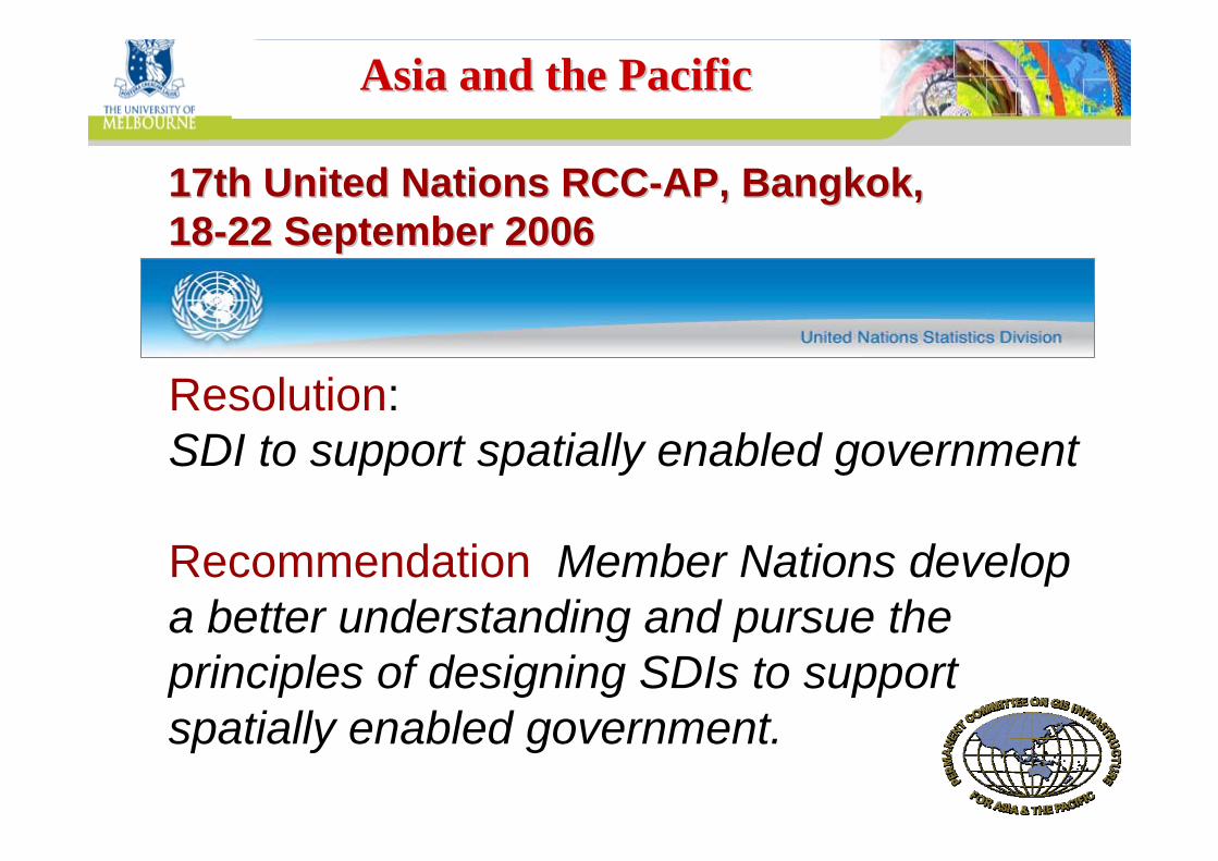
17th United Nations RCC17th United Nations RCC--AP, Bangkok, AP, Bangkok, 1818--22 September 200622 September 2006
Resolution: SDI to support spatially enabled government
Recommendation: Member Nations develop a better understanding and pursue the principles of designing SDIs to support spatially enabled government.
Asia and the PacificAsia and the Pacific
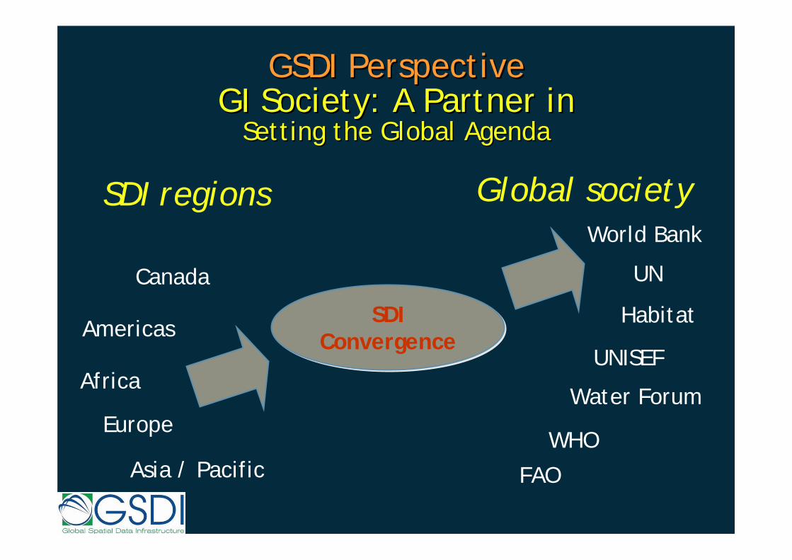
GSDI PerspectiveGSDI PerspectiveGI Society: A Partner in GI Society: A Partner in
Setting the Global AgendaSetting the Global Agenda
SDI Convergence
SDI Convergence
Canada
Americas
Africa
Asia / Pacific
Europe
SDI regions
FAO
Global society
UNISEF
Water Forum
World Bank
WHO
UN
Habitat
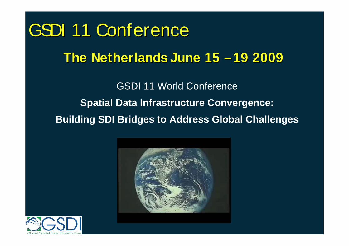
GSDI 11 ConferenceGSDI 11 ConferenceThe The NetherlandsNetherlands JuneJune 15 15 –– 19 200919 2009
GSDI 11 World Conference
Spatial Data Infrastructure Convergence:Building SDI Bridges to Address Global Challenges
GSDI 11 ConferenceGSDI 11 ConferenceThe Netherlands June 15 – 19 2009
Centre for SDIs and Land AdministrationDepartment of Geomatics
Thank youThank you


![Geographica: A Benchmark for Geospatial RDF Storesgeographica.di.uoa.gr/files/Geographica-ISWC-2013.pdfare various benchmarks for spatially-enabled RDBMS [17,13,4,14,15,11], there](https://img.dokumen.tips/doc/110x75/5ff6dbde10b4dc59fb61ebfd/geographica-a-benchmark-for-geospatial-rdf-are-various-benchmarks-for-spatially-enabled.jpg)