Embed Size (px)
Citation preview
Saskatchewan WatershedAuthority
LLoowweerr SSoouurriiss RRiivveerrWWaatteerrsshheedd AAddvviissoorryy
CCoommmmiitttteeeess
Table of Contents1. Commitment from Participants 1
1.1 A message from your Watershed Advisory Committee Chairs 1Ross MadsenJohn Van EatonWarren Steves
1.2 Lower Souris River Watershed Advisory Committee Mission Statement 11.3 A Message to Watershed Residents from your Watershed
Planning Team 2
2. Watershed Protection and You 22.1 One Step in the Multi-Barrier Approach to Drinking Water Protection 22.2 Secondary Benefits of Protecting Source Water: Quality and Quantity 3
2.2.1 Quality 32.2.2 Quantity 4
3. Lower Souris River Watershed 6
4. Watershed Planning Methodology 6
5. Interests and Issues 7
6. Planning Objectives and Recommendations 86.1 Watershed Education 86.2 Groundwater Threats and Protection 96.3 Community Water Supplies 116.4 Water Quality Monitoring and Moosomin Reservoir 126.5 Landfills (Waste Disposal Ground) 136.6 Municipal Sewage Lagoons 146.7 Agricultural Activities 156.8 Watershed Management 176.9 Fish Migration and Habitat 186.10 Water Supply for Small Communities 206.11 Auburton Reservoir Potential Spillway Failure 216.12 Operation of Moosomin Dam 226.13 Water Conservation 23
7. Implementation of the Source Water Protection Plan 24
8. Measuring Plan Success - The Yearly Report Card 25
9. Conclusion 26
Appendix 27

1
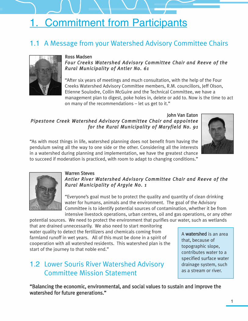
1. Commitment from Participants
1.1 A Message from your Watershed Advisory Committee Chairs
RRoossss MMaaddsseennFFoouurr CCrreeeekkss WWaatteerrsshheedd AAddvviissoorryy CCoommmmiitttteeee CChhaaiirr aanndd RReeeevvee ooff tthheeRRuurraall MMuunniicciippaalliittyy ooff AAnnttlleerr NNoo.. 6611
“After six years of meetings and much consultation, with the help of the FourCreeks Watershed Advisory Committee members, R.M. councillors, Jeff Olson,Etienne Soulodre, Collin McGuire and the Technical Committee, we have amanagement plan to digest, poke holes in, delete or add to. Now is the time to acton many of the recommendations – let us get to it.”
JJoohhnn VVaann EEaattoonnPPiippeessttoonnee CCrreeeekk WWaatteerrsshheedd AAddvviissoorryy CCoommmmiitttteeee CChhaaiirr aanndd aappppooiinntteeee
ffoorr tthhee RRuurraall MMuunniicciippaalliittyy ooff MMaarryyffiieelldd NNoo.. 9911
“As with most things in life, watershed planning does not benefit from having thependulum swing all the way to one side or the other. Considering all the interestsin a watershed during planning and implementation, we have the greatest chanceto succeed if moderation is practiced, with room to adapt to changing conditions.”
WWaarrrreenn SStteevveessAAnnttlleerr RRiivveerr WWaatteerrsshheedd AAddvviissoorryy CCoommmmiitttteeee CChhaaiirr aanndd RReeeevvee ooff tthheeRRuurraall MMuunniicciippaalliittyy ooff AArrggyyllee NNoo.. 11
“Everyone’s goal must be to protect the quality and quantity of clean drinkingwater for humans, animals and the environment. The goal of the AdvisoryCommittee is to identify potential sources of contamination, whether it be fromintensive livestock operations, urban centres, oil and gas operations, or any other
potential sources. We need to protect the environment that purifies our water, such as wetlandsthat are drained unnecessarily. We also need to start monitoringwater quality to detect the fertilizers and chemicals coming fromfarmland runoff in wet years. All of this must be done in a spirit ofcooperation with all watershed residents. This watershed plan is thestart of the journey to that noble end.”
1.2 Lower Souris River Watershed Advisory Committee Mission Statement
““BBaallaanncciinngg tthhee eeccoonnoommiicc,, eennvviirroonnmmeennttaall,, aanndd ssoocciiaall vvaalluueess ttoo ssuussttaaiinn aanndd iimmpprroovvee tthheewwaatteerrsshheedd ffoorr ffuuttuurree ggeenneerraattiioonnss..””
A wwaatteerrsshheedd is an areathat, because oftopographic slope,contributes water to aspecified surface waterdrainage system, suchas a stream or river.
2
1.3 A Message to Watershed Residents from your Watershed Planning Team
The Province of Saskatchewan formally initiated the watershed planning process in the spring of2003, but local residents had their own ideas about how to protect source water long before that.The 3 Creeks Watershed Board, which included rural municipalities in both Saskatchewan andManitoba, started gathering the information needed for watershed planning in 1999. Aconsiderable amount of that work is reflected in the Lower Souris River Watershed BackgroundReport. (The Background Report can be downloaded at www.swa.ca, or a hard copy or CD versioncan be requested from any Saskatchewan Watershed Authority office or by calling 1-866 SASKH2O.)The Moosomin Lake stewardship group monitored water quality in the lake but soon realized thatthe whole Pipestone Creek Watershed had a lot more to do with water quality than just the areasurrounding the lake. It was with this local foresight, vision and initiative in mind that the LowerSouris River Watershed was chosen as one of the first watersheds in Saskatchewan in which toinitiate watershed planning. It will be this same leadership, vision and genuine concern for people,the environment and source water protection that will see this plan succeed.
The planning team would like to thank all those that contributed to the development of this plan,and in particular, the three Watershed Advisory Committees whose understanding, perseveranceand patience during the process was much appreciated. A special thanks to the chairs of thecommittees – Ross Madsen, John Van Eaton and Warren Steves – for their leadership, direction andcommitment to this planning process, and to Jim Cairns of the Provincial Council of AgricultureDevelopment and Diversification (ADD) Boards for his participation as a co-chair in theEnvironmental Farm Plan group initiative.
Thanks to the invaluable advice and information provided by the Lower Souris River WatershedTechnical Committee, in particular the extraordinary efforts and support of Etienne Soulodre ofProjects and Partnerships, Saskatchewan Watershed Authority and Doug Brook of Ducks UnlimitedCanada. In addition, thanks go to our colleagues in the Watershed and Aquifer Planning unit,whose insights and mentorship during this new process helped to make it a success.
Also, a special recognition to Glen Campbell and Gregg Fotheringham of the West Souris RiverConservation District and Phil Weiss of Manitoba Water Stewardship, whose encouragement andsupport ensured success not only to the plan but to its implementation. This exemplary inter-provincial co-operation between watershed residents will prove that watershed health is moreimportant than provincial boundaries.
2. Watershed Protection and You
2.1 One Step in the Multi-Barrier Approach to Drinking Water Protection
The drinking water supply can be broken down into three parts: source water, the drinking watertreatment system, and the distribution system that carries the treated water to homes, businesses,
3
schools, and other buildings. As drinking water travels on itsjourney to you, it could become contaminated in many ways. Themulti-barrier approach to managing drinking water supplies isone preventive risk management approach that identifies all theseknown and potential hazards and makes sure barriers are in placeto reduce or eliminate the risk of contamination. Theimplementation of this Source Water Protection Plan representsthe first barrier in protecting source waters. It cannot be stressedenough that source water protection is only the first barrier ofdefence against waterborne diseases or illnesses. Another keybarrier is the routine treatment of water sources, usually bychlorination, and continual removal of unwanted waterborneelements such as bacteria, viruses, and organisms, by means ofreverse osmosis, filtering, etc. TThhee oonnllyy wwaayy ooff kknnoowwiinngg wwhhaattttrreeaattmmeenntt tthhee wwaatteerr ssuuppppllyy nneeeeddss iiss ttoo hhaavvee aann eexxppeerrtt ddoo aaccoommpprreehheennssiivvee tteesstt ooff tthhee ssoouurrccee wwaatteerr,, aanndd tthheenn iimmpplleemmeenntt rreeccoommmmeennddeedd mmeeaassuurreess ttoo rreedduuccee rriisskk..
Saskatchewan communities are required to meet strict standards of testing and treatment of theirwater supplies. The same cannot be said for private water supply systems. Although many peopleare encouraged to test their water supply, most limit it to the testing available from the ProvincialLaboratory for both E. coli and nitrates. As a reflection of this "what we don't know can't hurt us"attitude, almost half of the farm respondents surveyed in the Upper Qu’Appelle River Watershed
drank unfiltered water right from the tap (48.5%), and morethan half the farms (60.8%) did not have any type of treatmentunit or filter on their water system.1
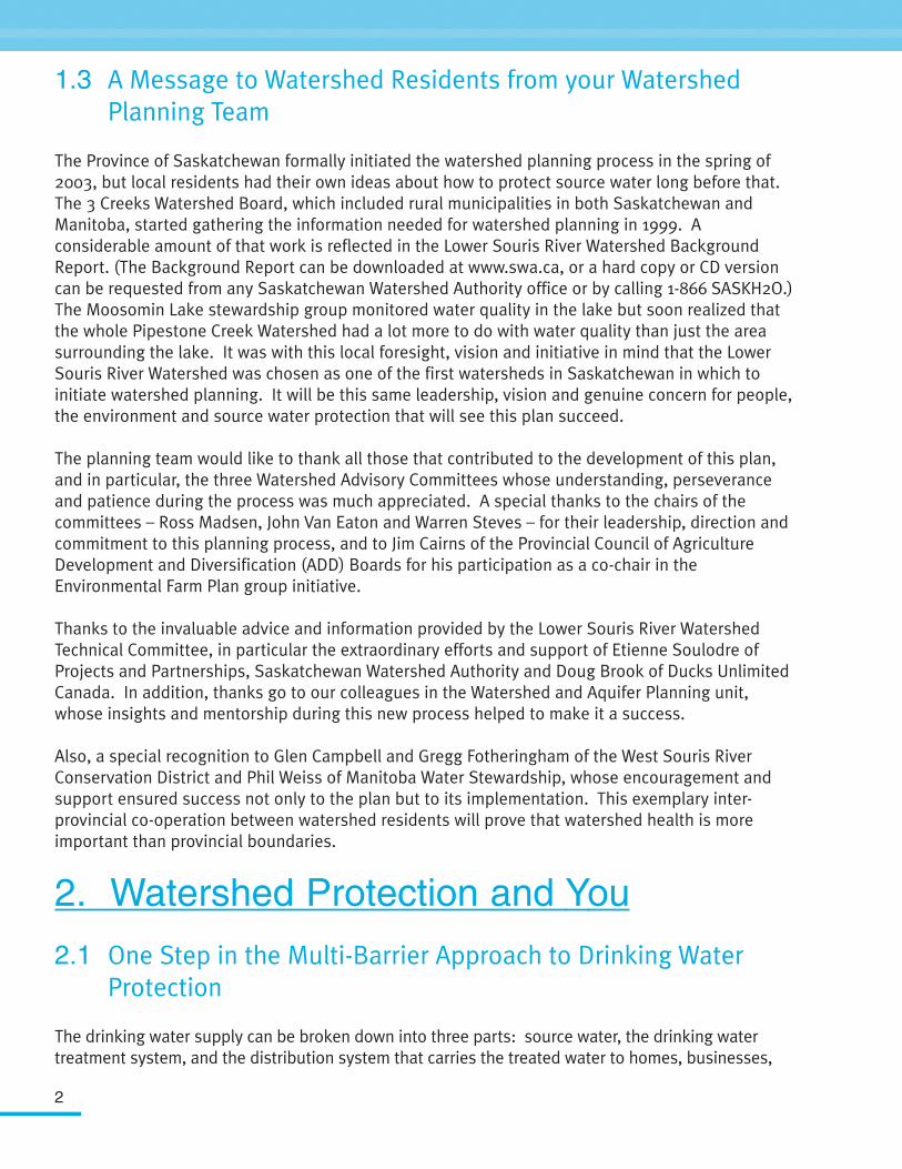
All watershed residents have an interest in protecting sourcewater and, as such, all should be responsible for theimplementation of this Source Water Protection Plan. Everyoneshould and can do their part. That includes big parts, such asbeing a councillor for a city or rural municipality which isresponsible for the drinking water of hundreds of people, or smallparts, such as practising stewardship and testing and treating thewater on your own farm. Get involved and do your part!
2.2 Secondary Benefits of Protecting Source Water: Quality and Quantity
2.2.1 Quality
Protecting source water can mean removing and/or reducing known point sources of pollution andaccumulative non-point source pollution. Source water protection can also mean maintainingnature's own purification systems and not overloading them.
Photo courtesy Ducks Unlimited Canada
1 Saskatchewan Watershed Authority, Summary of the Water Use Survey in the Upper Qu'Appelle River Watershed, April 2004
SSoouurrccee wwaatteerr is untreatedwater which will be used fora specified purpose, such ashuman use and consumption.Examples of source waterinclude lakes, reservoirs,rivers, streams andgroundwater. SSoouurrccee wwaatteerrpprrootteeccttiioonn is the preventionof pollution and soundmanagement of factors andactivities that (may) threatenwater quality and quantity.
4
Protecting specific ecosystems such aswetlands that remove contaminants andpurify our drinking water also meansprotecting water for recreational uses suchas swimming and boating and for livestockuse, as well as for wildlife and fishhabitats. Healthy riparian areas removesedimentation which can carry waterbornechemicals. The uplands are areas that havethe most human activity and therefore canpotentially affect runoff waters.
There are economic benefits to havinghigher quality water available in manyindustries, such as manufacturing andvalue-added agriculture. Many times agood quality, high quantity water sourcecan be the driving force that entices anindustry to locate in a particular area.
When source water is of the highest natural quality,treatment is less costly and less complex. The potentialhealth risks posed by the failure of treatment systems isalso reduced.
2.2.2 Quantity
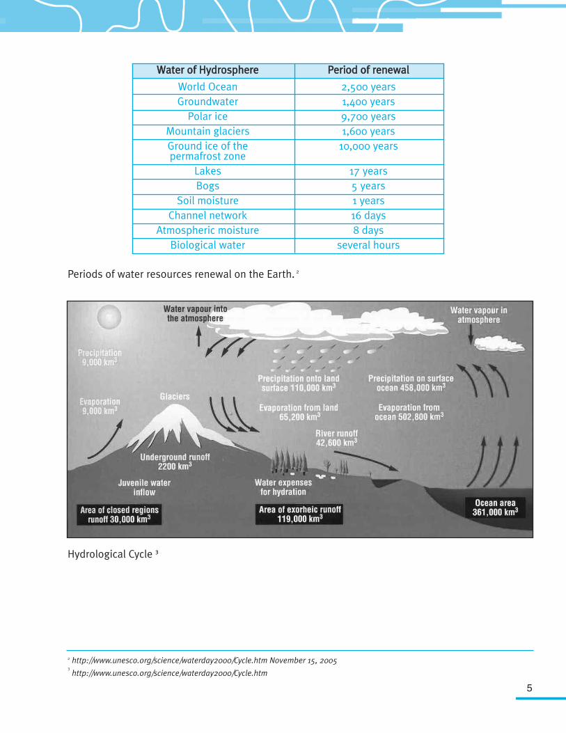
Water is a renewable resource. Different forms of water are fully replenished during thehydrological cycle, but at very different rates. For instance, the period for complete recharge ofoceanic waters takes about 2,500 years, permafrost and ice about 10,000 years and deepgroundwater and mountainous glaciers 1,500 years. Water storage in lakes is fully replenished over17 years, and in rivers about every 16 days (see page 5 - water resources renewal chart).
Surface water and groundwater are directly related and form a part of the hydrological cycle (seepage 5 - Hydrological Cycle diagram). Groundwater that is close to the surface can be influenced inboth quality and quantity by surface activities. Deeper groundwater is usually much less influencedby surface activities.
Ensuring water supplies are available now and in the future means there will be water for peopleand nature, and requires that we account for fluctuations in supply. While the potential effects ofclimate change are still being debated, what is not debatable is that there will be droughts, therewill be floods, and as such, we should plan to mitigate the effects from these natural occurrences.
RRiippaarriiaann aarreeaass are zones ofvegetation adjacent to rivers andstreams with a differing density,diversity, and productivity of plantand animal species relative tonearby upland areas.
5
Periods of water resources renewal on the Earth. 2
Hydrological Cycle 33
WWaatteerr ooff HHyyddrroosspphheerree
World OceanGroundwater
Polar iceMountain glaciersGround ice of the permafrost zone
LakesBogs
Soil moistureChannel network
Atmospheric moistureBiological water
PPeerriioodd ooff rreenneewwaall
2,500 years1,400 years9,700 years1,600 years
10,000 years
17 years5 years1 years16 days8 days
several hours
2 http://www.unesco.org/science/waterday2000/Cycle.htm November 15, 20053
http://www.unesco.org/science/waterday2000/Cycle.htm
6
3. Lower Souris River Watershed
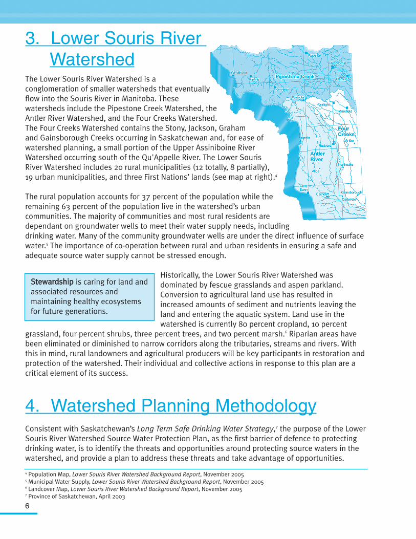
The Lower Souris River Watershed is aconglomeration of smaller watersheds that eventuallyflow into the Souris River in Manitoba. Thesewatersheds include the Pipestone Creek Watershed, theAntler River Watershed, and the Four Creeks Watershed.The Four Creeks Watershed contains the Stony, Jackson, Grahamand Gainsborough Creeks occurring in Saskatchewan and, for ease ofwatershed planning, a small portion of the Upper Assiniboine RiverWatershed occurring south of the Qu'Appelle River. The Lower SourisRiver Watershed includes 20 rural municipalities (12 totally, 8 partially),19 urban municipalities, and three First Nations’ lands (see map at right).4
The rural population accounts for 37 percent of the population while theremaining 63 percent of the population live in the watershed’s urbancommunities. The majority of communities and most rural residents aredependant on groundwater wells to meet their water supply needs, includingdrinking water. Many of the community groundwater wells are under the direct influence of surfacewater.5 The importance of co-operation between rural and urban residents in ensuring a safe andadequate source water supply cannot be stressed enough.
Historically, the Lower Souris River Watershed wasdominated by fescue grasslands and aspen parkland.Conversion to agricultural land use has resulted inincreased amounts of sediment and nutrients leaving theland and entering the aquatic system. Land use in thewatershed is currently 80 percent cropland, 10 percent
grassland, four percent shrubs, three percent trees, and two percent marsh.6 Riparian areas havebeen eliminated or diminished to narrow corridors along the tributaries, streams and rivers. Withthis in mind, rural landowners and agricultural producers will be key participants in restoration andprotection of the watershed. Their individual and collective actions in response to this plan are acritical element of its success.
4. Watershed Planning MethodologyConsistent with Saskatchewan’s Long Term Safe Drinking Water Strategy,7 the purpose of the LowerSouris River Watershed Source Water Protection Plan, as the first barrier of defence to protectingdrinking water, is to identify the threats and opportunities around protecting source waters in thewatershed, and provide a plan to address these threats and take advantage of opportunities.
4 Population Map, Lower Souris River Watershed Background Report, November 20055 Municipal Water Supply, Lower Souris River Watershed Background Report, November 20056 Landcover Map, Lower Souris River Watershed Background Report, November 20057 Province of Saskatchewan, April 2003
SStteewwaarrddsshhiipp is caring for land andassociated resources andmaintaining healthy ecosystemsfor future generations.
7
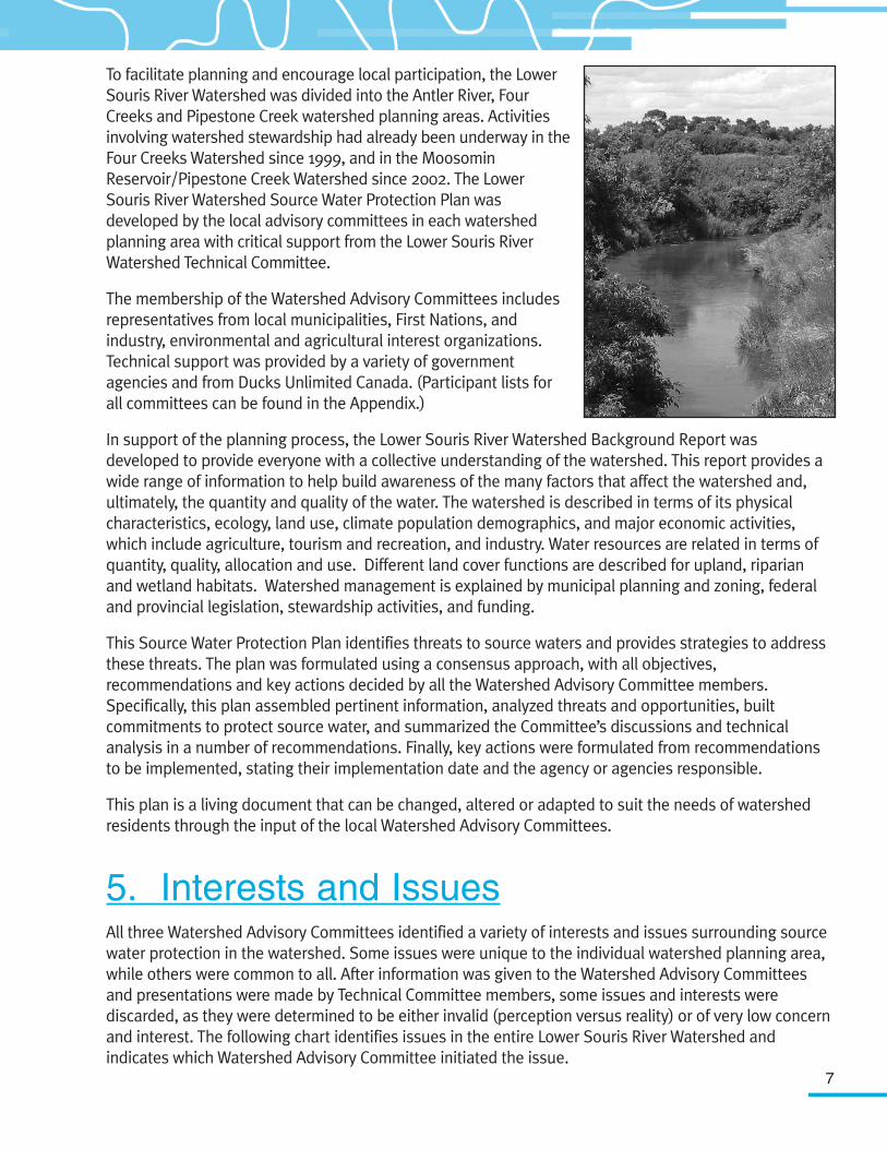
To facilitate planning and encourage local participation, the LowerSouris River Watershed was divided into the Antler River, FourCreeks and Pipestone Creek watershed planning areas. Activitiesinvolving watershed stewardship had already been underway in theFour Creeks Watershed since 1999, and in the MoosominReservoir/Pipestone Creek Watershed since 2002. The LowerSouris River Watershed Source Water Protection Plan wasdeveloped by the local advisory committees in each watershedplanning area with critical support from the Lower Souris RiverWatershed Technical Committee.
The membership of the Watershed Advisory Committees includesrepresentatives from local municipalities, First Nations, andindustry, environmental and agricultural interest organizations.Technical support was provided by a variety of governmentagencies and from Ducks Unlimited Canada. (Participant lists forall committees can be found in the Appendix.)
In support of the planning process, the Lower Souris River Watershed Background Report wasdeveloped to provide everyone with a collective understanding of the watershed. This report provides awide range of information to help build awareness of the many factors that affect the watershed and,ultimately, the quantity and quality of the water. The watershed is described in terms of its physicalcharacteristics, ecology, land use, climate population demographics, and major economic activities,which include agriculture, tourism and recreation, and industry. Water resources are related in terms ofquantity, quality, allocation and use. Different land cover functions are described for upland, riparianand wetland habitats. Watershed management is explained by municipal planning and zoning, federaland provincial legislation, stewardship activities, and funding.
This Source Water Protection Plan identifies threats to source waters and provides strategies to addressthese threats. The plan was formulated using a consensus approach, with all objectives,recommendations and key actions decided by all the Watershed Advisory Committee members.Specifically, this plan assembled pertinent information, analyzed threats and opportunities, builtcommitments to protect source water, and summarized the Committee’s discussions and technicalanalysis in a number of recommendations. Finally, key actions were formulated from recommendationsto be implemented, stating their implementation date and the agency or agencies responsible.
This plan is a living document that can be changed, altered or adapted to suit the needs of watershedresidents through the input of the local Watershed Advisory Committees.
5. Interests and IssuesAll three Watershed Advisory Committees identified a variety of interests and issues surrounding sourcewater protection in the watershed. Some issues were unique to the individual watershed planning area,while others were common to all. After information was given to the Watershed Advisory Committeesand presentations were made by Technical Committee members, some issues and interests werediscarded, as they were determined to be either invalid (perception versus reality) or of very low concernand interest. The following chart identifies issues in the entire Lower Souris River Watershed andindicates which Watershed Advisory Committee initiated the issue.
8
Most of the interests and issues below are interconnected. This is to be expected, as a watershedrepresents a complex interdependency of relationships.
6. Planning Objectives and RecommendationsThe Lower Souris River Watershed Advisory Committee has identified the following objectives,recommendations and key actions. The lead agency responsible for the key action is indicated in bold.
6.1 Watershed Education
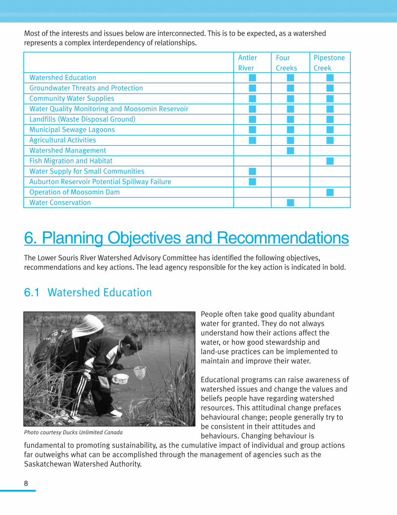
People often take good quality abundantwater for granted. They do not alwaysunderstand how their actions affect thewater, or how good stewardship andland-use practices can be implemented tomaintain and improve their water.
Educational programs can raise awareness ofwatershed issues and change the values andbeliefs people have regarding watershedresources. This attitudinal change prefacesbehavioural change; people generally try tobe consistent in their attitudes andbehaviours. Changing behaviour is
fundamental to promoting sustainability, as the cumulative impact of individual and group actionsfar outweighs what can be accomplished through the management of agencies such as theSaskatchewan Watershed Authority.
Watershed EducationGroundwater Threats and ProtectionCommunity Water SuppliesWater Quality Monitoring and Moosomin ReservoirLandfills (Waste Disposal Ground)Municipal Sewage LagoonsAgricultural ActivitiesWatershed ManagementFish Migration and HabitatWater Supply for Small CommunitiesAuburton Reservoir Potential Spillway FailureOperation of Moosomin DamWater Conservation
Photo courtesy Ducks Unlimited Canada
PipestoneCreek
AntlerRiver
FourCreeks
9
OObbjjeeccttiivvee:: To increase the watershed residents' knowledge and awareness of the intrinsic and economic valueof water and how they can protect the quality of water.
RReeccoommmmeennddaattiioonnss::• Support WET (Water Education for Teachers), which focuses on school students. • Support the “Living by Water” program, which focuses on cottage owners.• Support 4-H program camps.• Distribute watershed information to rural municipalities, villages, towns, schools, libraries, etc.• Provide water "manuals" to people with wells to help them better understand how to protect their
water supply.• Provide shock chlorination fact sheets to watershed residents.• Provide wellhead protection information to watershed residents.
KKeeyy AAccttiioonn:: DDeevveelloopp aanndd iimmpplleemmeenntt aann eedduuccaattiioonn aanndd ccoommmmuunniiccaattiioonnssttrraatteeggyy wwiitthhiinn tthhee wwaatteerrsshheedd..
KKeeyy AAccttiioonn:: IInniittiiaattee aa ffooccuuss ggrroouupp aanndd ssuurrvveeyy ttoo ttrraacckk ssuucccceessss ooff tthheeeedduuccaattiioonn aanndd ccoommmmuunniiccaattiioonn ssttrraatteeggyy wwiitthhiinn tthhee wwaatteerrsshheedd..
SSuucccceessss MMeeaassuurreemmeenntt::Reconvene a similar focus group in ten years and measure anyincrease in the focus group's awareness of the watershed.8
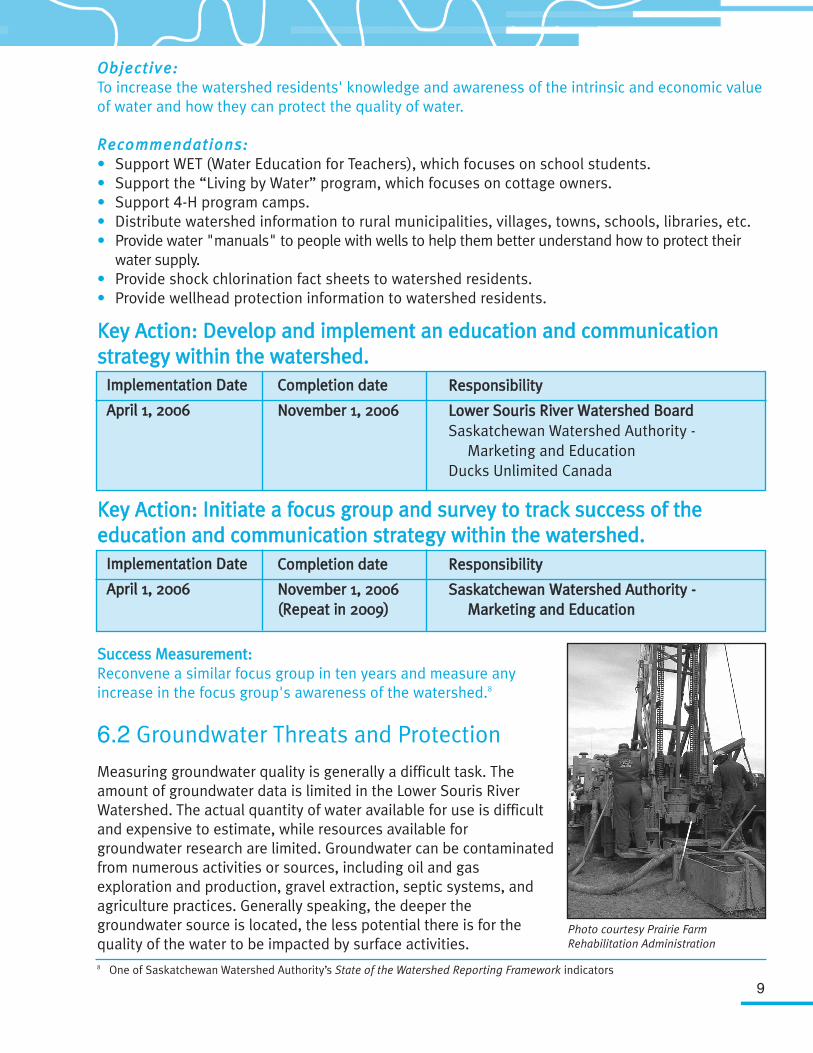
6.2 Groundwater Threats and Protection
Measuring groundwater quality is generally a difficult task. Theamount of groundwater data is limited in the Lower Souris RiverWatershed. The actual quantity of water available for use is difficultand expensive to estimate, while resources available forgroundwater research are limited. Groundwater can be contaminatedfrom numerous activities or sources, including oil and gasexploration and production, gravel extraction, septic systems, andagriculture practices. Generally speaking, the deeper thegroundwater source is located, the less potential there is for thequality of the water to be impacted by surface activities.
IImmpplleemmeennttaattiioonn DDaattee
AApprriill 11,, 22000066
CCoommpplleettiioonn ddaattee
NNoovveemmbbeerr 11,, 22000066
RReessppoonnssiibbiilliittyy
LLoowweerr SSoouurriiss RRiivveerr WWaatteerrsshheedd BBooaarrddSaskatchewan Watershed Authority -
Marketing and EducationDucks Unlimited Canada
IImmpplleemmeennttaattiioonn DDaattee
AApprriill 11,, 22000066
CCoommpplleettiioonn ddaattee
NNoovveemmbbeerr 11,, 22000066((RReeppeeaatt iinn 22000099))
RReessppoonnssiibbiilliittyy
SSaasskkaattcchheewwaann WWaatteerrsshheedd AAuutthhoorriittyy --MMaarrkkeettiinngg aanndd EEdduuccaattiioonn
Photo courtesy Prairie FarmRehabilitation Administration
8 One of Saskatchewan Watershed Authority’s State of the Watershed Reporting Framework indicators
10
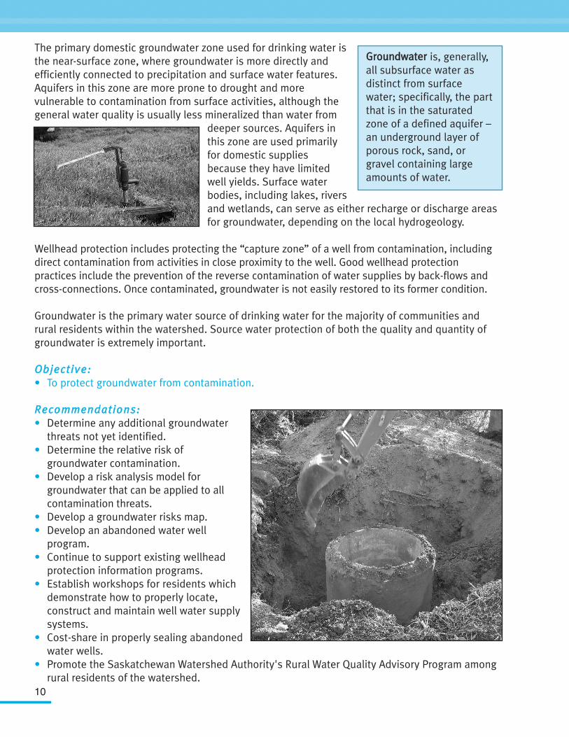
The primary domestic groundwater zone used for drinking water isthe near-surface zone, where groundwater is more directly andefficiently connected to precipitation and surface water features.Aquifers in this zone are more prone to drought and morevulnerable to contamination from surface activities, although thegeneral water quality is usually less mineralized than water from
deeper sources. Aquifers inthis zone are used primarilyfor domestic suppliesbecause they have limitedwell yields. Surface waterbodies, including lakes, riversand wetlands, can serve as either recharge or discharge areasfor groundwater, depending on the local hydrogeology.
Wellhead protection includes protecting the “capture zone” of a well from contamination, includingdirect contamination from activities in close proximity to the well. Good wellhead protectionpractices include the prevention of the reverse contamination of water supplies by back-flows andcross-connections. Once contaminated, groundwater is not easily restored to its former condition.
Groundwater is the primary water source of drinking water for the majority of communities andrural residents within the watershed. Source water protection of both the quality and quantity ofgroundwater is extremely important.
OObbjjeeccttiivvee:: • To protect groundwater from contamination.
RReeccoommmmeennddaattiioonnss::• Determine any additional groundwater
threats not yet identified.• Determine the relative risk of
groundwater contamination.• Develop a risk analysis model for
groundwater that can be applied to all contamination threats.
• Develop a groundwater risks map.• Develop an abandoned water well
program.• Continue to support existing wellhead
protection information programs.• Establish workshops for residents which
demonstrate how to properly locate, construct and maintain well water supply systems.
• Cost-share in properly sealing abandoned water wells.
• Promote the Saskatchewan Watershed Authority's Rural Water Quality Advisory Program among rural residents of the watershed.
GGrroouunnddwwaatteerr is, generally,all subsurface water asdistinct from surfacewater; specifically, the partthat is in the saturatedzone of a defined aquifer –an underground layer ofporous rock, sand, orgravel containing largeamounts of water.
11
• Provide educational information on:-- the effects of improperly sealed shot holes to
seismic exploration companies; and-- the legal requirements of seismic operations concerning shot hole use and abandonment.
• Locate and quantify aquifers within the watershed.
KKeeyy AAccttiioonn:: DDeevveelloopp aann aabbaannddoonneedd wweellll pprrooggrraamm wwiitthhiinn tthhee wwaatteerrsshheedd..
KKeeyy AAccttiioonn:: DDeevveelloopp aann iinnffoorrmmaattiioonnaall ppaacckkaaggee oonn hhooww tthhee ooiill aanndd ggaassiinndduussttrryy pprrootteeccttss tthhee wwaatteerrsshheedd''ss ssoouurrccee wwaatteerr..
6.3 Community Water Supplies
For most communities, source water is tested to determine proper water treatment. Any failure inthe treatment process can result in potential contamination of drinking water. In order to reducethe health risks due to such failures, source water should be of the highest natural quality. Man-made contamination risks can be reduced or eliminated through good stewardship practices andwellhead protection.
The Saskatchewan Watershed Authority is presentlyevaluating groundwater risks for communities in the LowerSouris River Watershed. This evaluation is scheduled forcompletion in the spring of 2006. Provincial agencies suchas Saskatchewan Environment and SaskatchewanGovernment Relations are also looking into tools thatcould be used to protect source water in the future. Theseinitiatives will be a major advancement in the knowledgeand preventative actions required to protect communitywater wells from contamination.
OObbjjeeccttiivvee:: To protect community water wells from contamination.
RReeccoommmmeennddaattiioonn::
Develop a methodology to determine the relative vulnerability of community source water supplies.
IImmpplleemmeennttaattiioonn DDaattee
AApprriill 11,, 22000066
CCoommpplleettiioonn ddaattee
MMaarrcchh 3311,, 22000077
RReessppoonnssiibbiilliittyy
SSaasskkaattcchheewwaann WWaatteerrsshheedd AAuutthhoorriittyy --GGrroouunnddwwaatteerr MMaannaaggeemmeenntt;; RReeggiioonnaall OOppeerraattiioonnss,, WWeeyybbuurrnn
Prairie Farm Rehabilitation AdministrationLower Souris River Watershed Board
IImmpplleemmeennttaattiioonn DDaattee
JJaannuuaarryy 11,, 22000066
CCoommpplleettiioonn ddaattee
AApprriill 11,, 22000066
RReessppoonnssiibbiilliittyy
CCaannaaddiiaann AAssssoocciiaattiioonn ooff PPeettrroolleeuumm PPrroodduucceerrss
Saskatchewan Industry and Resources
12
KKeeyy AAccttiioonn:: DDeevveelloopp aa ggrroouunnddwwaatteerr rriisskkss mmeetthhooddoollooggyy ffoorr ccoommmmuunniittyy wweellllsswwiitthhiinn tthhee wwaatteerrsshheedd..
KKeeyy AAccttiioonn:: DDeevveelloopp aa wweellllhheeaadd iinntteeggrriittyy pprrooggrraamm wwiitthhiinn tthhee wwaatteerrsshheedd..
SSuucccceessss MMeeaassuurreemmeenntt:: All communities understand the threats to their groundwater and take steps to reduce them.
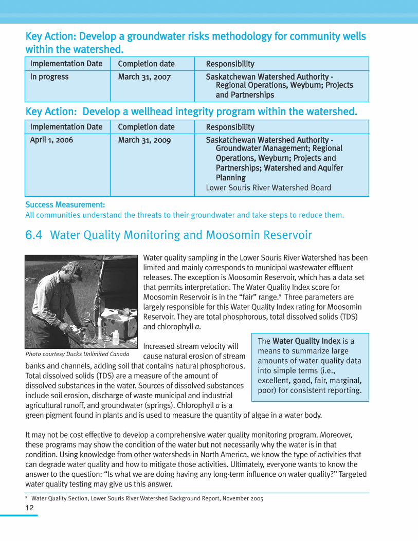
6.4 Water Quality Monitoring and Moosomin Reservoir
Water quality sampling in the Lower Souris River Watershed has beenlimited and mainly corresponds to municipal wastewater effluentreleases. The exception is Moosomin Reservoir, which has a data setthat permits interpretation. The Water Quality Index score forMoosomin Reservoir is in the “fair” range.9 Three parameters arelargely responsible for this Water Quality Index rating for MoosominReservoir. They are total phosphorous, total dissolved solids (TDS)and chlorophyll a.
Increased stream velocity willcause natural erosion of stream
banks and channels, adding soil that contains natural phosphorous.Total dissolved solids (TDS) are a measure of the amount ofdissolved substances in the water. Sources of dissolved substancesinclude soil erosion, discharge of waste municipal and industrialagricultural runoff, and groundwater (springs). Chlorophyll a is agreen pigment found in plants and is used to measure the quantity of algae in a water body.
It may not be cost effective to develop a comprehensive water quality monitoring program. Moreover,these programs may show the condition of the water but not necessarily why the water is in thatcondition. Using knowledge from other watersheds in North America, we know the type of activities thatcan degrade water quality and how to mitigate those activities. Ultimately, everyone wants to know theanswer to the question: “Is what we are doing having any long-term influence on water quality?” Targetedwater quality testing may give us this answer.
IImmpplleemmeennttaattiioonn DDaattee
IInn pprrooggrreessss
CCoommpplleettiioonn ddaattee
MMaarrcchh 3311,, 22000077
RReessppoonnssiibbiilliittyy
SSaasskkaattcchheewwaann WWaatteerrsshheedd AAuutthhoorriittyy -- RReeggiioonnaall OOppeerraattiioonnss,, WWeeyybbuurrnn;; PPrroojjeeccttss aanndd PPaarrttnneerrsshhiippss
IImmpplleemmeennttaattiioonn DDaattee
AApprriill 11,, 22000066
CCoommpplleettiioonn ddaattee
MMaarrcchh 3311,, 22000099
RReessppoonnssiibbiilliittyy
SSaasskkaattcchheewwaann WWaatteerrsshheedd AAuutthhoorriittyy -- GGrroouunnddwwaatteerr MMaannaaggeemmeenntt;; RReeggiioonnaall OOppeerraattiioonnss,, WWeeyybbuurrnn;; PPrroojjeeccttss aanndd PPaarrttnneerrsshhiippss;; WWaatteerrsshheedd aanndd AAqquuiiffeerr PPllaannnniinngg
Lower Souris River Watershed Board
9 Water Quality Section, Lower Souris River Watershed Background Report, November 2005
Photo courtesy Ducks Unlimited Canada
The WWaatteerr QQuuaalliittyy IInnddeexx is ameans to summarize largeamounts of water quality datainto simple terms (i.e.,excellent, good, fair, marginal,poor) for consistent reporting.
13
OObbjjeeccttiivveess::• To reduce levels of total phosphorous, total dissolved solids (TDS) and chlorophyll a by
25 percent within the next 10 years. • To determine the cause of water quality deterioration in the Moosomin Reservoir.
RReeccoommmmeennddaattiioonnss:: Conduct water quality monitoring in the watershed to determine the present state of the waterquality and track changes in water quality over time.
KKeeyy AAccttiioonn:: DDeevveelloopp aa ssoouurrccee wwaatteerr qquuaalliittyy mmoonniittoorriinngg ppllaann ttoo ttrraacckkpphhoosspphhoorruuss,, TTDDSS,, aanndd cchhlloorroopphhyyllll aa lleevveellss iinn tthhee wwaatteerrsshheedd ppllaannnniinngg aarreeaass..
SSuucccceessss MMeeaassuurreemmeenntt::1. Total phosphorous, total dissolved solids (TDS) and chlorophyll a are reduced on an average of
25 percent within the next 10 years.2. The Water Quality Index rating for Moosomin Lake improves from consistently “fair” to
consistently “good” within the next 10 years.
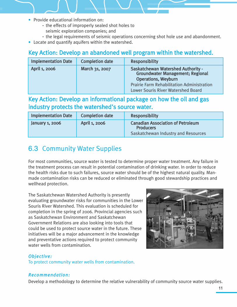
6.5 Landfills (Waste Disposal Ground)
Landfills are potential contaminators of bothgroundwater and surface water. The extent andpotential risk of contamination is directlydetermined by local geological characteristics ofthe individual landfill.
Landfills contain high levels of contaminants. Overtime communities have learned what not to put inlandfills. The licensing of landfills has improvedlandfill use, but there remains an unknown levelof threat to water quality.
OObbjjeeccttiivvee::To determine the relative risk of landfills to both groundwater and surface water.
RReeccoommmmeennddaattiioonnss::• Identify all abandoned landfills in the watershed. • Develop a risk analysis model that can be applied to all landfills to protect public water supplies.
IImmpplleemmeennttaattiioonn DDaattee
AApprriill 11,, 22000066
CCoommpplleettiioonn ddaattee
MMaarrcchh 3311,, 22000077
LLeeaadd RReessppoonnssiibbiilliittyy (Partners)
SSaasskkaattcchheewwaann WWaatteerrsshheedd AAuutthhoorriittyy -- MMoonniittoorriinngg aanndd AAsssseessssmmeenntt BBrraanncchh
Saskatchewan EnvironmentSaskatchewan Health
Photo courtesy Saskatchewan Environment
14
KKeeyy AAccttiioonn:: DDeetteerrmmiinnee tthhee lleevveell ooff rriisskk ttoo ssoouurrccee wwaatteerr wwiitthhiinn tthheewwaatteerrsshheedd ffrroomm ccoommmmuunniittyy llaannddffiillllss..
KKeeyy AAccttiioonn:: DDeevveelloopp aa ddaattaabbaassee ooff aallll eexxiissttiinngg aanndd aabbaannddoonneedd llaannddffiillllsswwiitthhiinn tthhee wwaatteerrsshheedd..
SSuucccceessss MMeeaassuurreemmeenntt::All communities understand the threat to their source water posed by landfills and, if necessary,take steps to reduce those risks.
6.6 Municipal Sewage Lagoons
Sewage lagoons can adversely affect both groundwater and surface water through ground leachingand wastewater releases. Municipal wastewater effluent discharge is one of the largest causes ofpoint-source pollution, by volume, to surface water in Canada.10 Some municipal lagoons wereestablished before their general environmental impacts to water were known. The extent of therelative risk they present is generally unknown. The risk of groundwater contamination by nitratescan be very high.
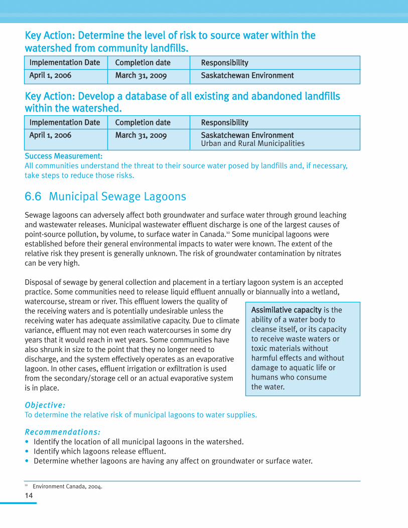
Disposal of sewage by general collection and placement in a tertiary lagoon system is an acceptedpractice. Some communities need to release liquid effluent annually or biannually into a wetland,watercourse, stream or river. This effluent lowers the quality ofthe receiving waters and is potentially undesirable unless thereceiving water has adequate assimilative capacity. Due to climatevariance, effluent may not even reach watercourses in some dryyears that it would reach in wet years. Some communities havealso shrunk in size to the point that they no longer need todischarge, and the system effectively operates as an evaporativelagoon. In other cases, effluent irrigation or exfiltration is usedfrom the secondary/storage cell or an actual evaporative systemis in place.
OObbjjeeccttiivvee::To determine the relative risk of municipal lagoons to water supplies.
RReeccoommmmeennddaattiioonnss::• Identify the location of all municipal lagoons in the watershed.• Identify which lagoons release effluent.• Determine whether lagoons are having any affect on groundwater or surface water.
IImmpplleemmeennttaattiioonn DDaattee
AApprriill 11,, 22000066
CCoommpplleettiioonn ddaattee
MMaarrcchh 3311,, 22000099
RReessppoonnssiibbiilliittyy
SSaasskkaattcchheewwaann EEnnvviirroonnmmeenntt
IImmpplleemmeennttaattiioonn DDaattee
AApprriill 11,, 22000066
CCoommpplleettiioonn ddaattee
MMaarrcchh 3311,, 22000099
RReessppoonnssiibbiilliittyy
SSaasskkaattcchheewwaann EEnnvviirroonnmmeennttUrban and Rural Municipalities
AAssssiimmiillaattiivvee ccaappaacciittyy is theability of a water body tocleanse itself, or its capacityto receive waste waters ortoxic materials withoutharmful effects and withoutdamage to aquatic life orhumans who consumethe water.
10 Environment Canada, 2004.
15
KKeeyy AAccttiioonn:: DDeetteerrmmiinnee tthhee lleevveell ooff rriisskk ttoo ssoouurrccee wwaatteerr wwiitthhiinn tthheewwaatteerrsshheedd ffrroomm ccoommmmuunniittyy llaaggoooonnss..
SSuucccceessss MMeeaassuurreemmeenntt: All communities understand the risk to their source water posed by lagoonsand wastewater effluent and, if necessary, take steps to reduce those risks.
6.7 Agricultural Activities
Agricultural activities take place on more than 99 percent of the land within the watershed.11
Cropland accounts for approximately 80 percent of the landcover use in the Lower Souris RiverWatershed.12 With this in mind, cropping practices have a significant influence on the quality ofwater. Agricultural threats to source water can becategorized as either point source or non-point source.
Potential point source threats from agricultural activities caninclude intensive livestock operations, manure storage,livestock wintering areas, chemical storage and disposalareas, septic systems, and fuel storage. Some potential non-point source agricultural threats include livestock grazing,chemical, fertilizer and manure application, and landdrainage, which adversely affects surface water and directlyor indirectly affects nature's ability to purify water. Many ofthese potential point and non-point pollution sources can beidentified and addressed on individual farms through thecompletion of an Environmental Farm Plan.
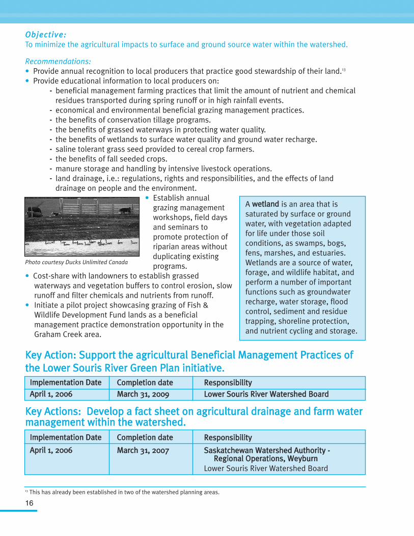
Accumulative effects from non-point sources are of thegreatest potential concern because they are largely fromactivities that, by themselves, do not appear very harmful.However, when these activities occur collectively within asignificant portion of the watershed, they can have majoreffects on water quality and the larger environment. Thedrainage of wetlands is one example. While the loss of one wetland is not necessarily significant tothe watershed, the collective loss of a significant amount of wetlands in the watershed can meanlosing the benefits they provide, such as moderation of downstream flooding, groundwaterrecharge, nutrient absorption, carbon sinks, and wildlife and fish habitat.
IImmpplleemmeennttaattiioonn DDaattee
AApprriill 11,, 22000066
CCoommpplleettiioonn ddaattee
MMaarrcchh 3311,, 22000077
RReessppoonnssiibbiilliittyy
SSaasskkaattcchheewwaann EEnnvviirroonnmmeenntt
PPooiinntt ssoouurrccee ppoolllluuttiioonn can betraced back to a specific sourcesuch as an oil spill, a dischargepipe or a sewage ditch.
NNoonn--ppooiinntt ssoouurrccee ppoolllluuttiioonncannot be traced back to aspecific source. Non-pointsource pollution is difficult toidentify because it can occur anyplace activities disturb land orwater. Agriculture, urban runoff,forestry, grazing, septic systems,construction, recreationalboating, careless householdmanagement, and sediment fromeroding stream banks can allcontribute to this type ofpollution.
11 Land Tenure Map, Lower Souris River Watershed Background Report, November 200512 Landcover Map, Lower Souris River Watershed Background Report, November 2005
16
OObbjjeeccttiivvee::To minimize the agricultural impacts to surface and ground source water within the watershed.
Recommendations: • Provide annual recognition to local producers that practice good stewardship of their land.13
• Provide educational information to local producers on: -- beneficial management farming practices that limit the amount of nutrient and chemical
residues transported during spring runoff or in high rainfall events. -- economical and environmental beneficial grazing management practices. -- the benefits of conservation tillage programs. -- the benefits of grassed waterways in protecting water quality. -- the benefits of wetlands to surface water quality and ground water recharge. -- saline tolerant grass seed provided to cereal crop farmers.-- the benefits of fall seeded crops.-- manure storage and handling by intensive livestock operations.-- land drainage, i.e.: regulations, rights and responsibilities, and the effects of land
drainage on people and the environment.• Establish annual
grazing management workshops, field days and seminars to promote protection of riparian areas without duplicating existing programs.
• Cost-share with landowners to establish grassed waterways and vegetation buffers to control erosion, slow runoff and filter chemicals and nutrients from runoff.
• Initiate a pilot project showcasing grazing of Fish & Wildlife Development Fund lands as a beneficial management practice demonstration opportunity in the Graham Creek area.
KKeeyy AAccttiioonn:: SSuuppppoorrtt tthhee aaggrriiccuullttuurraall BBeenneeffiicciiaall MMaannaaggeemmeenntt PPrraaccttiicceess oofftthhee LLoowweerr SSoouurriiss RRiivveerr GGrreeeenn PPllaann iinniittiiaattiivvee..
KKeeyy AAccttiioonnss:: DDeevveelloopp aa ffaacctt sshheeeett oonn aaggrriiccuullttuurraall ddrraaiinnaaggee aanndd ffaarrmm wwaatteerrmmaannaaggeemmeenntt wwiitthhiinn tthhee wwaatteerrsshheedd..
A wweettllaanndd is an area that issaturated by surface or groundwater, with vegetation adaptedfor life under those soilconditions, as swamps, bogs,fens, marshes, and estuaries.Wetlands are a source of water,forage, and wildlife habitat, andperform a number of importantfunctions such as groundwaterrecharge, water storage, floodcontrol, sediment and residuetrapping, shoreline protection,and nutrient cycling and storage.
Photo courtesy Ducks Unlimited Canada
IImmpplleemmeennttaattiioonn DDaattee
AApprriill 11,, 22000066CCoommpplleettiioonn ddaatteeMMaarrcchh 3311,, 22000099
RReessppoonnssiibbiilliittyyLLoowweerr SSoouurriiss RRiivveerr WWaatteerrsshheedd BBooaarrdd
IImmpplleemmeennttaattiioonn DDaattee
AApprriill 11,, 22000066
CCoommpplleettiioonn ddaattee
MMaarrcchh 3311,, 22000077
RReessppoonnssiibbiilliittyy
SSaasskkaattcchheewwaann WWaatteerrsshheedd AAuutthhoorriittyy -- RReeggiioonnaall OOppeerraattiioonnss,, WWeeyybbuurrnn
Lower Souris River Watershed Board
13 This has already been established in two of the watershed planning areas.
17
SSuucccceessss MMeeaassuurreemmeenntt:: 1. Have a minimum of 20 percent of all landowners within the watershed complete an
Environmental Farm Plan by 2010. 2. By 2010, see an overall improvement of 20 percent to Riparian Health, Riparian Buffer,
Rangeland Health, and Permanent Cover as measured by “State of the Watershed Reporting Framework” indicators by 2010.
6.8 Watershed Management
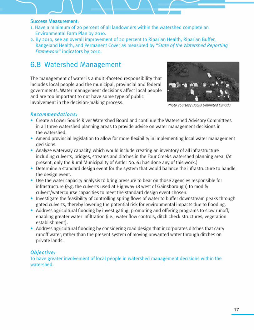
The management of water is a multi-faceted responsibility thatincludes local people and the municipal, provincial and federalgovernments. Water management decisions affect local peopleand are too important to not have some type of publicinvolvement in the decision-making process.
RReeccoommmmeennddaattiioonnss::• Create a Lower Souris River Watershed Board and continue the Watershed Advisory Committees
in all three watershed planning areas to provide advice on water management decisions in the watershed.
• Amend provincial legislation to allow for more flexibility in implementing local water management decisions.
• Analyze waterway capacity, which would include creating an inventory of all infrastructure including culverts, bridges, streams and ditches in the Four Creeks watershed planning area. (At present, only the Rural Municipality of Antler No. 61 has done any of this work.)
• Determine a standard design event for the system that would balance the infrastructure to handle the design event.
• Use the water capacity analysis to bring pressure to bear on those agencies responsible for infrastructure (e.g. the culverts used at Highway 18 west of Gainsborough) to modify culvert/watercourse capacities to meet the standard design event chosen.
• Investigate the feasibility of controlling spring flows of water to buffer downstream peaks through gated culverts, thereby lowering the potential risk for environmental impacts due to flooding.
• Address agricultural flooding by investigating, promoting and offering programs to slow runoff, enabling greater water infiltration (i.e., water flow controls, ditch check structures, vegetation establishment).
• Address agricultural flooding by considering road design that incorporates ditches that carry runoff water, rather than the present system of moving unwanted water through ditches on private lands.
OObbjjeeccttiivvee:: To have greater involvement of local people in watershed management decisions within thewatershed.
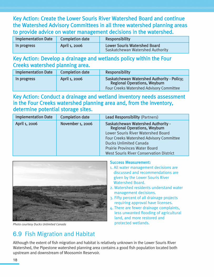
Photo courtesy Ducks Unlimited Canada
18
KKeeyy AAccttiioonn:: CCrreeaattee tthhee LLoowweerr SSoouurriiss RRiivveerr WWaatteerrsshheedd BBooaarrdd aanndd ccoonnttiinnuueetthhee WWaatteerrsshheedd AAddvviissoorryy CCoommmmiitttteeeess iinn aallll tthhrreeee wwaatteerrsshheedd ppllaannnniinngg aarreeaassttoo pprroovviiddee aaddvviiccee oonn wwaatteerr mmaannaaggeemmeenntt ddeecciissiioonnss iinn tthhee wwaatteerrsshheedd..
KKeeyy AAccttiioonn:: DDeevveelloopp aa ddrraaiinnaaggee aanndd wweettllaannddss ppoolliiccyy wwiitthhiinn tthhee FFoouurrCCrreeeekkss wwaatteerrsshheedd ppllaannnniinngg aarreeaa..
KKeeyy AAccttiioonn:: CCoonndduucctt aa ddrraaiinnaaggee aanndd wweettllaanndd iinnvveennttoorryy nneeeeddss aasssseessssmmeennttiinn tthhee FFoouurr CCrreeeekkss wwaatteerrsshheedd ppllaannnniinngg aarreeaa aanndd,, ffrroomm tthhee iinnvveennttoorryy,,ddeetteerrmmiinnee ppootteennttiiaall ssttoorraaggee ssiitteess..
SSuucccceessss MMeeaassuurreemmeenntt::1. All water management decisions are
discussed and recommendations are given by the Lower Souris River Watershed Board.
2. Watershed residents understand water management decisions.
3. Fifty percent of all drainage projects requiring approval have licenses.
4. There are fewer drainage complaints, less unwanted flooding of agricultural land, and more restored and protected wetlands.
6.9 Fish Migration and HabitatAlthough the extent of fish migration and habitat is relatively unknown in the Lower Souris RiverWatershed, the Pipestone watershed planning area contains a good fish population located bothupstream and downstream of Moosomin Reservoir.
IImmpplleemmeennttaattiioonn DDaattee
IInn pprrooggrreessss
CCoommpplleettiioonn ddaattee
AApprriill 11,, 22000066
RReessppoonnssiibbiilliittyy
LLoowweerr SSoouurriiss WWaatteerrsshheedd BBooaarrddSaskatchewan Watershed Authority
IImmpplleemmeennttaattiioonn DDaattee
IInn pprrooggrreessss
CCoommpplleettiioonn ddaattee
AApprriill 11,, 22000066
RReessppoonnssiibbiilliittyy
SSaasskkaattcchheewwaann WWaatteerrsshheedd AAuutthhoorriittyy -- PPoolliiccyy;;RReeggiioonnaall OOppeerraattiioonnss,, WWeeyybbuurrnn
Four Creeks Watershed Advisory Committee
IImmpplleemmeennttaattiioonn DDaattee
AApprriill 11,, 22000066
CCoommpplleettiioonn ddaattee
NNoovveemmbbeerr 11,, 22000066
LLeeaadd RReessppoonnssiibbiilliittyy (Partners)
SSaasskkaattcchheewwaann WWaatteerrsshheedd AAuutthhoorriittyy -- RReeggiioonnaall OOppeerraattiioonnss,, WWeeyybbuurrnn
Lower Souris River Watershed BoardFour Creeks Watershed Advisory CommitteeDucks Unlimited CanadaPrairie Provinces Water BoardWest Souris River Conservation District
Photo courtesy Ducks Unlimited Canada
19
The range of fish habitat andmigration in the Antler River andFour Creeks watershed planningareas is not fully understood.
The West Souris River ConservationDistrict has initiated a fisheriesinventory review for a number ofstreams in their region, including
the Jackson, Stony, and Graham Creeks. It is anticipated that this review willbe made public once completed.
Although not directly a source water protectioninitiative, fish populations and fish habitat are anexcellent indicator of the health of any watershed.
OObbjjeeccttiivvee:: To increase the knowledge of fish habitat andrange within the Antler River and Four Creekswatershed planning areas and improve both fishmigration and habitat in the Pipestone Creek watershed planning area.
RReeccoommmmeennddaattiioonnss::• Evaluate the barriers to fish migration on Pipestone Creek and
contributing major streams.• Develop a plan to improve fish migration on Pipestone Creek.• Determine the extent of fish habitat loss upstream of Moosomin
Reservoir and determine if action is required.• Conduct a fish habitat and migration survey to determine the extent
and range of fish species within the Antler River and Four Creeks watershed planning areas.
KKeeyy AAccttiioonn:: WWiitthhiinn tthhee PPiippeessttoonnee CCrreeeekk wwaatteerrsshheedd ppllaannnniinngg aarreeaa:: iimmpprroovveeffiisshh hhaabbiittaatt bbyy tthhee ddeevveellooppmmeenntt ooff rroocckk rriiffffllee ssttrruuccttuurreess ddoowwnnssttrreeaamm ooffMMoooossoommiinn DDaamm..
KKeeyy AAccttiioonn:: WWiitthhiinn tthhee AAnnttlleerr RRiivveerr aanndd FFoouurr CCrreeeekkss wwaatteerrsshheedd ppllaannnniinnggaarreeaass:: ccoonndduucctt aa ffiisshh hhaabbiittaatt aanndd mmiiggrraattiioonn ssuurrvveeyy ttoo ddeetteerrmmiinnee tthhee eexxtteennttaanndd rraannggee ooff ffiisshh ssppeecciieess..
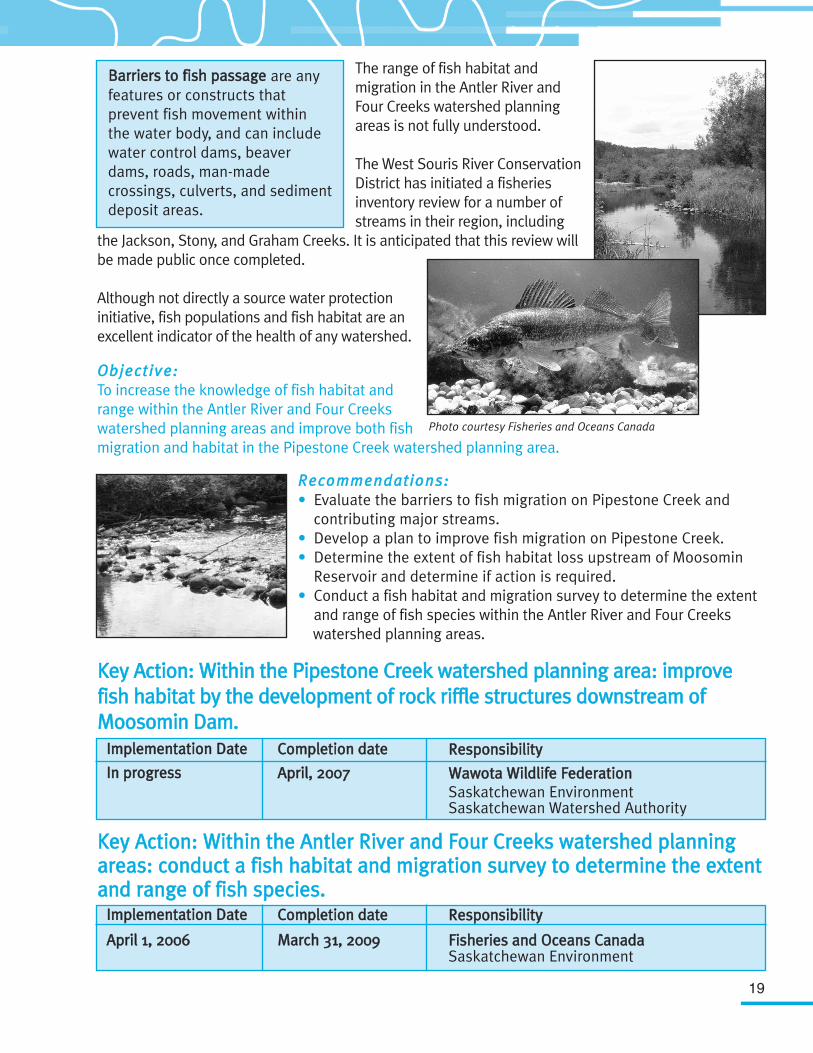
Photo courtesy Fisheries and Oceans Canada
BBaarrrriieerrss ttoo ffiisshh ppaassssaaggee are anyfeatures or constructs thatprevent fish movement withinthe water body, and can includewater control dams, beaverdams, roads, man-madecrossings, culverts, and sedimentdeposit areas.
IImmpplleemmeennttaattiioonn DDaattee
IInn pprrooggrreessss
CCoommpplleettiioonn ddaattee
AApprriill,, 22000077
RReessppoonnssiibbiilliittyy
WWaawwoottaa WWiillddlliiffee FFeeddeerraattiioonn Saskatchewan Environment Saskatchewan Watershed Authority
IImmpplleemmeennttaattiioonn DDaattee
AApprriill 11,, 22000066
CCoommpplleettiioonn ddaattee
MMaarrcchh 3311,, 22000099
RReessppoonnssiibbiilliittyy
FFiisshheerriieess aanndd OOcceeaannss CCaannaaddaa Saskatchewan Environment
20
KKeeyy AAccttiioonn:: EEvvaalluuaattee tthhee bbaarrrriieerrss ttoo ffiisshh mmiiggrraattiioonn uuppssttrreeaamm ooff MMoooossoommiinnRReesseerrvvooiirr oonn PPiippeessttoonnee CCrreeeekk aanndd ccoonnttrriibbuuttiinngg mmaajjoorr ssttrreeaammss..
SSuucccceessss MMeeaassuurreemmeenntt::1. Fish range and habitat has been increased in
the Pipestone Creek watershed planning area.2. A fish habitat and range map has been
developed for the Lower Souris River Watershed.
6.10 Water Supply for Small Communities
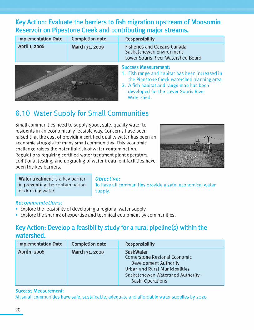
Small communities need to supply good, safe, quality water toresidents in an economically feasible way. Concerns have beenraised that the cost of providing certified quality water has been aneconomic struggle for many small communities. This economicchallenge raises the potential risk of water contamination.Regulations requiring certified water treatment plant operators,additional testing, and upgrading of water treatment facilities havebeen the key barriers.
OObbjjeeccttiivvee::To have all communities provide a safe, economical watersupply.
RReeccoommmmeennddaattiioonnss::• Explore the feasibility of developing a regional water supply.• Explore the sharing of expertise and technical equipment by communities.
KKeeyy AAccttiioonn:: DDeevveelloopp aa ffeeaassiibbiilliittyy ssttuuddyy ffoorr aa rruurraall ppiippeelliinnee((ss)) wwiitthhiinn tthheewwaatteerrsshheedd..
SSuucccceessss MMeeaassuurreemmeenntt::All small communities have safe, sustainable, adequate and affordable water supplies by 2020.
IImmpplleemmeennttaattiioonn DDaattee
AApprriill 11,, 22000066
CCoommpplleettiioonn ddaattee
MMaarrcchh 3311,, 22000099
RReessppoonnssiibbiilliittyy
FFiisshheerriieess aanndd OOcceeaannss CCaannaaddaa Saskatchewan Environment Lower Souris River Watershed Board
WWaatteerr ttrreeaattmmeenntt is a key barrierin preventing the contaminationof drinking water.
IImmpplleemmeennttaattiioonn DDaattee
AApprriill 11,, 22000066
CCoommpplleettiioonn ddaattee
MMaarrcchh 3311,, 22000099
RReessppoonnssiibbiilliittyy
SSaasskkWWaatteerrCornerstone Regional Economic
Development AuthorityUrban and Rural MunicipalitiesSaskatchewan Watershed Authority -
Basin Operations
21
6.11 Auburton Reservoir Potential Spillway Failure
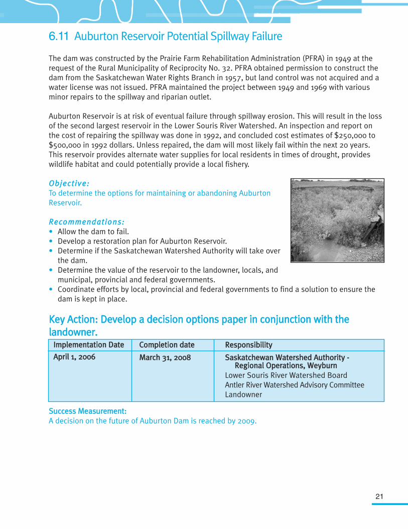
The dam was constructed by the Prairie Farm Rehabilitation Administration (PFRA) in 1949 at therequest of the Rural Municipality of Reciprocity No. 32. PFRA obtained permission to construct thedam from the Saskatchewan Water Rights Branch in 1957, but land control was not acquired and awater license was not issued. PFRA maintained the project between 1949 and 1969 with variousminor repairs to the spillway and riparian outlet.
Auburton Reservoir is at risk of eventual failure through spillway erosion. This will result in the lossof the second largest reservoir in the Lower Souris River Watershed. An inspection and report onthe cost of repairing the spillway was done in 1992, and concluded cost estimates of $250,000 to$500,000 in 1992 dollars. Unless repaired, the dam will most likely fail within the next 20 years.This reservoir provides alternate water supplies for local residents in times of drought, provideswildlife habitat and could potentially provide a local fishery.
OObbjjeeccttiivvee::To determine the options for maintaining or abandoning AuburtonReservoir.
RReeccoommmmeennddaattiioonnss::• Allow the dam to fail.• Develop a restoration plan for Auburton Reservoir. • Determine if the Saskatchewan Watershed Authority will take over
the dam.• Determine the value of the reservoir to the landowner, locals, and
municipal, provincial and federal governments.• Coordinate efforts by local, provincial and federal governments to find a solution to ensure the
dam is kept in place.
KKeeyy AAccttiioonn:: DDeevveelloopp aa ddeecciissiioonn ooppttiioonnss ppaappeerr iinn ccoonnjjuunnccttiioonn wwiitthh tthheellaannddoowwnneerr..
SSuucccceessss MMeeaassuurreemmeenntt::A decision on the future of Auburton Dam is reached by 2009.
IImmpplleemmeennttaattiioonn DDaattee
AApprriill 11,, 22000066
CCoommpplleettiioonn ddaattee
MMaarrcchh 3311,, 22000088
RReessppoonnssiibbiilliittyy
SSaasskkaattcchheewwaann WWaatteerrsshheedd AAuutthhoorriittyy -- RReeggiioonnaall OOppeerraattiioonnss,, WWeeyybbuurrnn
Lower Souris River Watershed BoardAntler River Watershed Advisory CommitteeLandowner
22
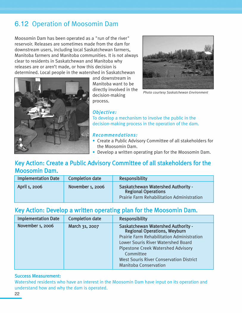
6.12 Operation of Moosomin Dam
Moosomin Dam has been operated as a "run of the river"reservoir. Releases are sometimes made from the dam fordownstream users, including local Saskatchewan farmers,Manitoba farmers and Manitoba communities. It is not alwaysclear to residents in Saskatchewan and Manitoba whyreleases are or aren’t made, or how this decision isdetermined. Local people in the watershed in Saskatchewan
and downstream inManitoba want to bedirectly involved in thedecision-makingprocess.
OObbjjeeccttiivvee:: To develop a mechanism to involve the public in thedecision-making process in the operation of the dam.
RReeccoommmmeennddaattiioonnss::• Create a Public Advisory Committee of all stakeholders for
the Moosomin Dam. • Develop a written operating plan for the Moosomin Dam.
KKeeyy AAccttiioonn:: CCrreeaattee aa PPuubblliicc AAddvviissoorryy CCoommmmiitttteeee ooff aallll ssttaakkeehhoollddeerrss ffoorr tthheeMMoooossoommiinn DDaamm..
KKeeyy AAccttiioonn:: DDeevveelloopp aa wwrriitttteenn ooppeerraattiinngg ppllaann ffoorr tthhee MMoooossoommiinn DDaamm..
SSuucccceessss MMeeaassuurreemmeenntt::Watershed residents who have an interest in the Moosomin Dam have input on its operation andunderstand how and why the dam is operated.
Photo courtesy Saskatchewan Environment
IImmpplleemmeennttaattiioonn DDaattee
AApprriill 11,, 22000066
CCoommpplleettiioonn ddaattee
NNoovveemmbbeerr 11,, 22000066
RReessppoonnssiibbiilliittyy
SSaasskkaattcchheewwaann WWaatteerrsshheedd AAuutthhoorriittyy --RReeggiioonnaall OOppeerraattiioonnss
Prairie Farm Rehabilitation Administration
IImmpplleemmeennttaattiioonn DDaattee
NNoovveemmbbeerr 11,, 22000066
CCoommpplleettiioonn ddaattee
MMaarrcchh 3311,, 22000077
RReessppoonnssiibbiilliittyy
SSaasskkaattcchheewwaann WWaatteerrsshheedd AAuutthhoorriittyy --RReeggiioonnaall OOppeerraattiioonnss,, WWeeyybbuurrnn
Prairie Farm Rehabilitation Administration Lower Souris River Watershed BoardPipestone Creek Watershed Advisory
CommitteeWest Souris River Conservation DistrictManitoba Conservation
23
6.13 Water Conservation
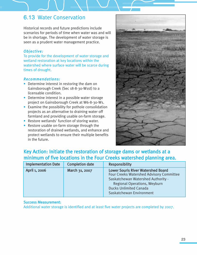
Historical records and future predictions includescenarios for periods of time when water was and willbe in shortage. The development of water storage isseen as a prudent water management practice.
OObbjjeeccttiivvee::To provide for the development of water storage andwetland restoration at key locations within thewatershed where surface water will be scarce duringtimes of drought.
RReeccoommmmeennddaattiioonnss:: • Determine interest in restoring the dam on
Gainsborough Creek (Sec 18-8-30-W1st) to a licensable condition.
• Determine interest in a possible water storage project on Gainsborough Creek at W6-8-30-W1.
• Examine the possibility for pothole consolidation projects as an alternative to draining water off farmland and providing usable on-farm storage.
• Restore wetlands' function of storing water. • Restore usable on-farm storage through the
restoration of drained wetlands, and enhance and protect wetlands to ensure their multiple benefits in the future.
KKeeyy AAccttiioonn:: IInniittiiaattee tthhee rreessttoorraattiioonn ooff ssttoorraaggee ddaammss oorr wweettllaannddss aatt aammiinniimmuumm ooff ffiivvee llooccaattiioonnss iinn tthhee FFoouurr CCrreeeekkss wwaatteerrsshheedd ppllaannnniinngg aarreeaa..
SSuucccceessss MMeeaassuurreemmeenntt::Additional water storage is identified and at least five water projects are completed by 2007.
IImmpplleemmeennttaattiioonn DDaattee
AApprriill 11,, 22000066
CCoommpplleettiioonn ddaattee
MMaarrcchh 3311,, 22000077
RReessppoonnssiibbiilliittyy
LLoowweerr SSoouurriiss RRiivveerr WWaatteerrsshheedd BBooaarrddFour Creeks Watershed Advisory CommitteeSaskatchewan Watershed Authority -
Regional Operations, Weyburn Ducks Unlimited CanadaSaskatchewan Environment
24
7. ImplementationA key element of any plan is its implementation. Without it, the plan is no more than a list of goodintentions. In the case of the Lower Souris River Watershed Source Water Protection Plan, theWatershed Advisory Committees recognize this fact and realize that there must be a concerted effortto ensure action items are followed through and acted upon. The Watershed Advisory Committees alsorecognize that watershed protection is a multi-jurisdictional and multi-agency activity involving localpeople and the support of both the provincial and federal levels of government. This support must notonly be moral, but also financial.
The Watershed Advisory Committees envision theimplementation and coordination of the watershed planbeing conducted at the local level. Although volunteers canbe effective in the short-term, they are not the answer tomaintaining long-term sustainable watershed protection. TheWatershed Advisory Committees are willing to considerhiring a Watershed Coordinator for plan implementation IIFFthere is a financial commitment from other source waterprotection partners with similar interests. The WatershedAdvisory Committees see this as the most cost-efficient and
pragmatic way to ensure watersheds are protected now and, more importantly, into the future.Commencing and organizing a watershed community initiative can be very rewarding, but also poseschallenges such as finding the right people and partners, communicating needs and results, raisingfunds, and staying afloat. Without this new direction, the Watershed Advisory Committees predict“more of the same old, same old”. The Four Creeks and Pipestone Creek Watershed AdvisoryCommittees have already organized themselves as non-profit organizations.
The Watershed Advisory Committees also recognize the invaluable advice and technical informationprovided by the Technical Committee. Based on this, the Watershed Advisory Committees recommendthat the Technical Committee continue to meet at least once per year for the purpose of advising andsupporting plan implementation, assessing the success of the plan, and for the continuing evolution ofthe plan.
KKeeyy AAccttiioonn:: HHiirree aa WWaatteerrsshheedd CCoooorrddiinnaattoorr oonn aa tthhrreeee--yyeeaarr ppiilloott pprroojjeecctt bbaassiiss..
KKeeyy AAccttiioonn:: CCoonnttiinnuuee wwiitthh tthhee LLoowweerr SSoouurriiss RRiivveerr WWaatteerrsshheedd TTeecchhnniiccaallCCoommmmiitttteeee aanndd mmeeeett aannnnuuaallllyy wwiitthh tthhee WWaatteerrsshheedd AAddvviissoorryy CCoommmmiitttteeeess..
IImmpplleemmeennttaattiioonn DDaattee
AApprriill 11,, 22000066
CCoommpplleettiioonn ddaattee
MMaarrcchh 3311,, 22000099
RReessppoonnssiibbiilliittyy
LLoowweerr SSoouurriiss RRiivveerr WWaatteerrsshheedd BBooaarrddSaskatchewan Watershed AuthorityDucks Unlimited Canada
IImmpplleemmeennttaattiioonn DDaattee
AApprriill 11,, 22000066
CCoommpplleettiioonn ddaattee
IInnddeeffiinniitteellyy
RReessppoonnssiibbiilliittyy
LLoowweerr SSoouurriiss RRiivveerr WWaatteerrsshheedd BBooaarrddSaskatchewan Watershed AuthorityLower Souris River Watershed Technical
Committee
25
8. Measuring Plan Success -The Yearly Report Card
The Saskatchewan Watershed Authority will continue to support integrated water managementthrough the plan’s implementation phase by committing at least one planning team member to beinvolved with the Watershed Advisory Committees. Consistent with the State of the WatershedReporting Framework, a yearly watershed report card will be prepared by the watershed planningteam to report on the progress of the action items,objectives and goals of the plan. The report card will reporton the achievements, opportunities and challenges ofmeeting the overall vision and make any adjustments to theplan that have been recommended by the WatershedAdvisory Committees.
MMeeaassuurreemmeennttss ooff SSuucccceesssseessSuccesses can be categorized into three time periods:• Short-Term (1-5 years) successes: Completion of tasks in
timeframe stipulated. • Medium-Term (5-20 years) successes: An observable
change in attitudes.• Long-Term (20+ years) successes: Realize changes in
the watershed.
Once completed, many of the action items will be a milestone achievement. The effects of thoseaction items may not necessarily be seen immediately. It may take decades to see a change in fishhabitat or environmental change and even generations to see the changes in water quality or thechange in attitude to protect source water.
In addition to the measurements of success included here, there will be other ways to measuresuccess. These include tracking of improvements in certain indicators found in the State of theWatershed Reporting Framework and improvement in the Water Quality Index where reported. TheState of the Watershed Reporting Framework is a report card based on a conceptual, but simplistic,model of a watershed that explicitly recognizes relationships between human activities (stressors),the state of the watershed (condition), impacts on the ecosystem, and associated managementactivities (responses). It will also reflect how we look at watersheds (structure and function) in thecontext of source water protection.
The intent of the SSttaattee ooff tthheeWWaatteerrsshheedd RReeppoorrtt iinnggFFrraammeewwoorrkk is to establish amethod for the consistentreporting of a standardized set ofindicators combined with arating system to assess overallsource water conditions. Thisreporting system will allowcomparisons of watershedhealth to be made amongwatersheds and within awatershed over time.
26
9. ConclusionThis Source Water Protection Plan is the start of making a difference in protecting source water inthe Lower Souris River Watershed. The development of this plan has already resulted in aheightened awareness of source water protection amongst watershed residents. This plan does notask all the questions, nor does it have all the answers, but it is a start towards local people makinga bigger difference in their own watershed. This is not the end, but rather a beginning. The workhas just begun. The success of this plan is dependant on watershed residents, as everyone can dohis or her own part to protect source water.
Taking up the challenge is both noble and the right thing to do. If you are interested in becominginvolved, contact your local Watershed Advisory Committee member or rural or urban municipalityabout making a difference in protecting source water. The Government of Saskatchewan, throughthe Saskatchewan Watershed Authority, is committed to supporting the implementation ofwatershed plans through programming, mentorship, and encouragement.
Appendix
Watershed Advisory Committees
AAnnttlleerr RRiivveerr WWaatteerrsshheedd AAddvviissoorryy CCoommmmiitttteeee
FFoouurr CCrreeeekkss WWaatteerrsshheedd AAddvviissoorryy CCoommmmiitttteeee
27
MMeemmbbeerr
Warren Steeves (Chair)
Jim Burnett
Rick Dancey
David Frecon
Ross Madsen
Wade McWhirter
Archie Miller
Brian Miller
Valerie Olney
Edwin Rucks
Jeff Sanborn
OOrrggaanniizzaattiioonn
R.M. of Argyle No. 1
Village of Glen Ewen
R.M. of Storthoaks No. 31
R.M. of Antler No. 61
R.M. of Antler No. 61
R.M. of Reciprocity No. 32
Village of Manor
R.M. of Mount Pleasant No. 2
R.M. of Argyle No. 1
R.M. of Enniskillen No. 3
Town of Redvers
MMeemmbbeerr
Ross Madsen (Chair)
David Frecon
George Howden
Jim Lorette
Lee McMillen
Bob Meredith
Elaine Morgan
Paul Poirer
Rick Poirer
Dell Real
Don Taylor
John Thiessen
Ian Thompson
OOrrggaanniizzaattiioonn
R.M. of Antler No. 61
R.M. of Antler No. 61
R.M. of Argyle No. 1
R.M. of Storthoaks No. 31
Saskatchewan Stock Growers Association
R.M. of Argyle No. 1
R.M. of Storthoaks No. 31
R.M. of Storthoaks No. 31
R.M. of Antler No. 61
R.M. of Storthoaks No. 31
Saskatchewan Association of Rural Municipalities
R.M. of Maryfield No. 91
Saskatchewan Stock Growers Association
28
PPiippeessttoonnee CCrreeeekk WWaatteerrsshheedd AAddvviissoorryy CCoommmmiitttteeee
MMeemmbbeerr
John Van Eaton (Chair)
Ross Allary
Jack Berglund
Ernest Briggs
Nancy Campbell
Jim Cairns
Chris Davidson
Ron Dube
Glen Ekert
Al Ferguson
Robert Fournier
Hal Garrett
Dean Godon
Rhonda Hall
James Hoff
Wesley Kemp
Kevin Kish
Terry Latham
Marshall McLeod
Elmer Molnar
Arthur Murray
Mervin Schmidt
Norm Schmidt
Terry Sheppard
Rob Stolz
Denise Swallow
Angus Turpie Jr.
OOrrggaanniizzaattiioonn
R.M. of Maryfield No. 91
Ochapawace First Nation
R.M. of Wawken No. 93
R.M. of Willowdale No. 153
Town of Wapella
R.M. of Silverwood No. 123
Moosomin Regional Park Board
R.M. of Hazelwood No. 94
Holistic Ranchers
Moosomin Regional Park Board
Saskatchewan WildlifeFederation
R.M. of Martin No. 122
Moosomin Regional Park Board
R.M. of Walpole No. 92
R.M. of Chester No. 125
R.M. of Kingsley No. 124
Town of Kipling
Wawota Wildlife Federation
R.M. of Moosomin No. 121
Village of Kennedy
Chester Conservation and Development Area Authority
R.M. of Elcapo No. 154
Moosomin Cottage Owners
Rocanville Fish and Wildlife
Saskatchewan Environment
Village of Windthorst
Moosomin Conservation and Development Area Authority
LLoowweerr SSoouurriiss RRiivveerr WWaatteerrsshheedd TTeecchhnniiccaall CCoommmmiitttteeee
29
MMeemmbbeerr
Kent M. Barrett
Doug Brook
Glen Campbell
Sheldon Clarke
Lars DePauw
Dwayne Donald
John Fahlman
Terry Hanley
Lorne Klein
Brian Mathieson
Allan McCutcheon
Maureen McKegney-Clay
Clint Molde
Bart Oegema
Kevin O'Neill
Kathleen Rispler
Girma Sahlu
Darlene Sakires
Etienne Soulodre
Phil Weiss
Rick West
Brent Wilson
Jim Yarotsky
OOrrggaanniizzaattiioonn
Agriculture and Agri-FoodCanada
Ducks Unlimited Canada
West Souris River Conservation District
Government Relations – Community Planning
Penn West Petroleum Ltd.
Ducks Unlimited Canada
Saskatchewan Watershed Authority
Saskatchewan Watershed Authority
Saskatchewan Agriculture and Food
Saskatchewan Industry and Resources
Saskatchewan Environment
Agriculture and Agri-Food Canada – Prairie Farm
Rehabilitation Administration
Saskatchewan WatershedAuthority
Saskatchewan Watershed Authority
Saskatchewan Watershed Authority
Regina Qu'Appelle Health Region
Environment Canada
Canadian Natural Resources Ltd.
Saskatchewan Watershed Authority
Manitoba Water Stewardship
Fisheries and Oceans Canada
Saskatchewan Environment
Agriculture and Agri-Food Canada
30
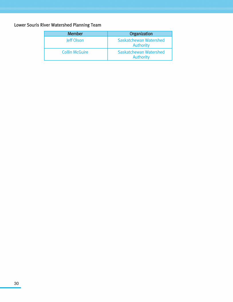
LLoowweerr SSoouurriiss RRiivveerr WWaatteerrsshheedd PPllaannnniinngg TTeeaamm
MMeemmbbeerr
Jeff Olson
Collin McGuire
OOrrggaanniizzaattiioonn
Saskatchewan Watershed Authority
Saskatchewan Watershed Authority