Embed Size (px)
Citation preview
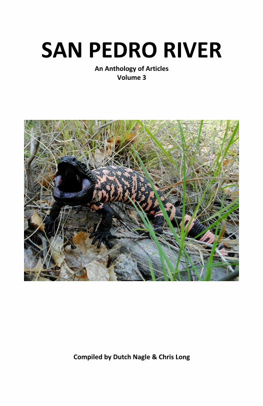
SAN PEDRO RIVER An Anthology of Articles
Volume 3
Compiled by Dutch Nagle & Chris Long

2

3
FORWARD: These articles were written for publication by the Sierra Vista Herald newspaper. They are intended to inform the public about the San Pedro Riparian National Conservation Area. The Friends of the San Pedro River hope that they are informative and improve understanding of the river, its ecology, and history. All the articles were written by BLM staffers or members of the Friends of the San Pedro River and reviewed by a panel comprised of Friends and BLM personnel. With thanks to all the writers and reviewers over the years. Friends of the San Pedro River 1763 Paseo San Luis Sierra Vista, AZ 85635 Phone: (520) 459-2555 Email: [email protected] Website: www.sanpedroriver.org Cover photo by Bob Herrmann

4
TABLE OF CONTENTS
Xericscape By Ted Mouras ......................... 5
Murray Springs Clovis Site By Jane Childress ...................... 8
San Pedro Ghosts? By Jim Mahoney ..................... 11
SPRNCA’s Biological Diversity? By Alan Blixt ........................... 14
The Friends of the San Pedro River By Gary Noonan ..................... 17
Grasslands of the SPRNCA By Alan Blixt ........................... 21
Riparian Areas of the SPRNCA By Alan Blixt ........................... 24
The Wild West Lives on at Fairbank By Chris Long .......................... 27
Off The Beaten Path By Nancy Doolittle.................. 30
Wildlife at the River By Ken Charters ...................... 33
Our Water Supply By Alexander “Sandy” Kunzer 36
Opossum By Marcia Radke .................... 39
Millville and Petroglyphs By Lyle Ford ............................ 42

5
Xericscape By Ted Mouras
People in the Upper San Pedro Basin are regularly asked to help preserve the San Pedro River and protect the future of Fort Huachuca by reducing their groundwater usage at home. One important way to accomplish this is to transition away from traditional water-intensive “lawns” by using xeric (low-water) landscaping techniques, which can lead to attractive yards that minimize or do entirely without the use of groundwater. There are, however, few, if any, local examples designed to actually demonstrate how to create a home xeriscape.
The Friends of the San Pedro River, with the help of the Sierra Vista Master Gardeners, designed a xeric landscape, or xeriscape, established in the vicinity of the San Pedro House. This “community” xeriscape serves as an educational model for the local area and, as such, has been endorsed by the Upper San Pedro Partnership.
The Community Foundation for Southern Arizona awarded the Friends of the San Pedro River a grant of $10,000 to help us implement this project. As a result of this very generous funding, we were able to start work on creating the San Pedro House Community Xeriscape.
Our goal is to show how “doing the right thing” can result in an attractive and affordable landscape with a minimal use of our most precious natural resource — groundwater. We included elements that appeal to the dedicated xeric landscaper intent on using no supplemental water other than rainwater, as well as elements that will appeal to those simply trying to do their part and reduce groundwater use at home.
The Community Xeriscape has been designed to be applicable to both those living in town as well as those living in more rural settings. We include signs explaining the techniques employed in creating the xeric landscape, signs with the names of the plants, a walkway through the xeriscape, a 1,550-gallon rainwater tank, and two 100-gallon rain-barrels. We also placed several bird nest boxes on posts in and around the Community Xeriscape. We incorporated a description of this xeriscape into our San Pedro House self-guided tour brochure and created a separate brochure that explains how homeowners can create their own xeriscapes based on our model.
6
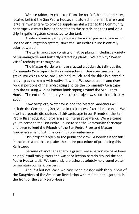
We use rainwater collected from the roof of the amphitheater, located behind the San Pedro House, and stored in the rain barrels and large rainwater tank to provide supplemental water to the Community Xeriscape via water hoses connected to the barrels and tank and via a drip irrigation system connected to the tank.
A solar-powered pump provides the water pressure needed to use the drip irrigation system, since the San Pedro House is entirely solar-powered.
The xeric landscape consists of native plants, including a variety of hummingbird- and butterfly-attracting plants. We employ “Water Wise” techniques throughout.
The Master Gardeners have created a design that divides the Community Xeriscape into three subsections. One area uses granite gravel mulch as a base, one uses bark mulch, and the third is planted in native grasses mixed with native flowers. We use boulders and river rock in portions of the landscaping and tie the Community Xeriscape into the existing wildlife habitat landscaping around the San Pedro House. The entire Community Xeriscape project was completed in July 2008.
Now complete, Water Wise and the Master Gardeners will include the Community Xeriscape in their tours of xeric landscapes. We also incorporate discussions of this xeriscape in our Friends of the San Pedro River education program and interpretive walks. We welcome you to come to the San Pedro House to see the Community Xeriscape and even to lend the Friends of the San Pedro River and Master Gardeners a hand with the continuing maintenance.
This project is open to the public for view. A booklet is for sale in the bookstore that explains the entire procedure of producing this Xeriscape.
Because of another generous grant from a patron we have been able to install rain gutters and water collection barrels around the San Pedro House itself. We currently are using absolutely no ground water to maintain our xeric gardens.
And last but not least, we have been blessed with the support of the Daughters of the American Revolution who maintain the gardens in the front of the San Pedro House.

7
The amphitheater at the San Pedro House with its new rain gutters
and water storage containers Photo by Ted Mouras
About the author: Ted Mouras is a retired Army Officer, a past president and a docent with the Friends of the San Pedro River.

8
Murray Springs Clovis Site By Jane Childress
Can you imagine herds of bison, elephant-like mammoths and mastodons, camels and saber-toothed cats roaming around the San Pedro Valley? It wasn’t that long ago that these animals thrived in the late-Ice Age, only about 13,000 years ago. What happened to these magnificent creatures? How different life would be if they were still alive today.
What about the people living here then? We know that they hunted the bison and mammoths with spears tipped with large, well-made stone points called “Clovis” points. Archaeologists call the people who made these points the Clovis people. Much of what archaeologists know about the animals, people, and environment of the late-Pleistocene was discovered through the excavation of sites found near the San Pedro River. Two of the richest Clovis sites ever found, the Lehner Site and the Murray Springs Site, lie on the San Pedro Riparian National Conservation Area, public land managed by the Bureau of Land Management (BLM).
Despite all of the rich information discovered when these sites were excavated in the 1950s and ‘60s, many, many questions remained unanswered. Scientists have no sure answers about who the Clovis people were, or where they came from. Many theorize that they walked from Asia across a land mass called Beringia now submerged by rising sea levels as the Ice Age ended. Or they may have arrived in boats. Very few skeletons have ever been found from the Clovis period; and the few that have been found have been in too poor condition to be of much help.
What caused the sudden extinction of so many species of animals? One of the first theories to emerge was the “Overkill Theory.” With this theory, you must start with the belief that 13,000 years ago, the Americas were a sort of wildlife refuge, with no humans present at all. Animals preyed on other animals, but humans as predators were unknown. Mammoths were so large that they didn’t have any predators to speak of. Enter humans wielding spears and throwing sticks (atlatls). With no fear of humans, the animals were easy prey, and some species were hunted to extinction.

9
Some scientists believe that climate change caused the demise of the large mammals. Or maybe it was a combination of the dynamics of human hunting and the changing climate. Perhaps it was disease.
The most dramatic theory is that an impact from a meteor or comet caused not just the extinctions, but also the wild fluctuations occurring in the climate at the time. The earth was warming, ice was slowly melting, and then suddenly, the climate turned very cold again for hundreds of years before the Ice Age was finally over. An impact could explain all of this, and also why there are so few archaeological sites for a few thousand years after the Clovis occupation. The impact would have ended life suddenly and dramatically and it would have taken several generations for the surviving people, animals, and ecosystems to recover.
Would you like to know more about all these things? The final report on the Murray Springs site is a good place to start. Murray Springs: A Clovis Site with Multiple Activity Areas in the San Pedro Valley, Arizona, edited by C. Vance Haynes and Bruce B. Huckell, has all of the details of the excavations. Twilight of the Mammoths, by Paul S. Martin, is an updated look at the overkill theory, originally postulated by the author decades ago. Cycles of Cosmic Catastrophes by Richard Firestone, Allen West, and Simon Warwick-Smith tells the graphic story of the impact theory with the results of scientific tests and Native American stories. All three of these books are available locally at the San Pedro House on Highway 90 west of the San Pedro River, and the Fairbank Schoolhouse, at the Fairbank Historic Townsite on Highway 82 east of the San Pedro River.
You can also learn more about the site by visiting Murray Springs, off Moson Road north of Highway 90. You can visit the site on your own or join the Friends of the San Pedro River on one of their regularly scheduled tours.
10
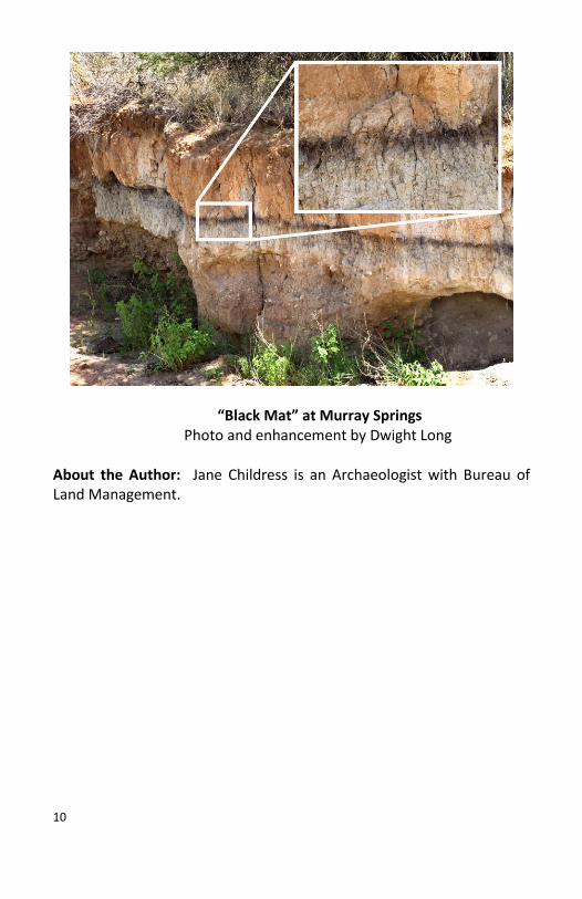
“Black Mat” at Murray Springs
Photo and enhancement by Dwight Long
About the Author: Jane Childress is an Archaeologist with Bureau of Land Management.

11
San Pedro Ghosts? By Jim Mahoney
Let’s say that you never had any contact in any way with the spirit, shade, specter, wraith, or phantom of a deceased human being. No bumps in the night, no queasy feeling like someone or something is watching you, no mysterious speech or sounds emanating from a room or a forest grove where no other person is present, never had the experience of finding possessions inexplicably misplaced, removed, or replaced in a location entirely out of context with their habitual roost. No worries then, because--you ain’t afraid of no ghosts!
If, on the other hand, you perceive a possibility of truth to the many accounts of sane, stable, persons having encounters with the souls of the departed, then consider the ghostly possibilities in the San Pedro Riparian National Conservation Area.
For more than 13,000 years, people have lived and died—often violently—in the San Pedro River basin. Imagine how many generations of your fellow human beings lived in perpetual intimacy with the San Pedro web of life. Part of the food chain! Saber-toothed cats, dire wolves, and black-widow spiders. Even today, walk San Pedro trails on an autumn day and picture in your mind’s eye what would have been crouching patiently in the tall grass just up ahead, long ago. Big creatures stalking prey with a big human brain, but basically slow, and mighty juicy. How many hunters-gatherers never returned to camp? How long do the spirits of dead people haunt the habitat of their homelands?
Native American people lived close to the land and often in close-knit communities. After the invention of farming, harvesting goodies like corn, melons, chilies, beans, squash, and agave, meant they didn’t have to worry so much about where the next mouthful was coming from. But the Apache, for example, chose not to engage themselves wholly in sedentary husbandry. One of their time-honored practices was called “ambush.” Similar to the predatory techniques of the mega-mammals, the Apache were known to swoop down on unsuspecting farmers and, as swiftly as possible, make off with all the goods they could get. Rest assured they left behind lifeless defenders of those gardens, and on occasion dead comrades. Are their ghosts here

12
still? Do they forever prepare the silty soil west of Fairbank or the San Pedro House for the next planting? Are the Apache on the eternal attack?
Latecomers to the San Pedro Valley are the Europeans, looking for gold and silver, looking for living souls to save, looking especially for land. At the Presidio Santa Cruz de Terrenate, the 18th Century adobe fort on the west bank of the San Pedro River, the Spanish made a foray into the San Pedro frontier. Unfortunately, the Spanish took little notice nor heed to the broad expanse of Apache occupation east of the river. So, the Spanish military and civilians, who had the grim misfortune to call Terrenate home for less than five years, suffered near constant “ambush.” The stories of deprivation, torture, and mutilation are true. No conjecture here. Visit the ruins of the Presidio at the end of a blustery October day -- preferably alone. Stand within the low mud walls of the old Spanish fort and gaze at the panorama. Close your eyes and listen. Dare yourself to stand in Spanish footprints—because you ARE.
Did you know that murder and robbery and rustling and betrayal took place up and down the San Pedro River? Mayhem provided by the justly famous Clantons and Earps, and an entire retinue of lawless, shiftless, and even a few respectable, characters? North of Contention City, a stagecoach ambush resulted in sudden death. At Fairbank Station bodies bound for graves elsewhere were loaded onto the trains. Brunckhow Cabin is known as one of the most murder-strewn little haciendas this side of Deadwood. And don’t forget the mine cave-ins, the love affairs gone sour, the shoot-outs in the saloons and brothels. So many lives ended in a flash by a bullet, or a sharp snap at the end of a rope. So many potential ‘ghosts.’
Consider these past few years, and the men, women, and children who have become lost, hiding and on the run, running out of food and water, and hope. Seared by the sun or chilled to the bone, succumbing to the irresistible river in flashflood. Does their shadowy essence still remain within the San Pedro landscape? I hardly think you could find a better place than the old San Pedro for encountering haunting memories and images.

13
About the Author: Jim Mahoney is an Outdoor Recreation Planner with the Tucson Field Office of the BLM.
Characters encountered the Halloween Night walk
Photo by Dutch Nagle
14
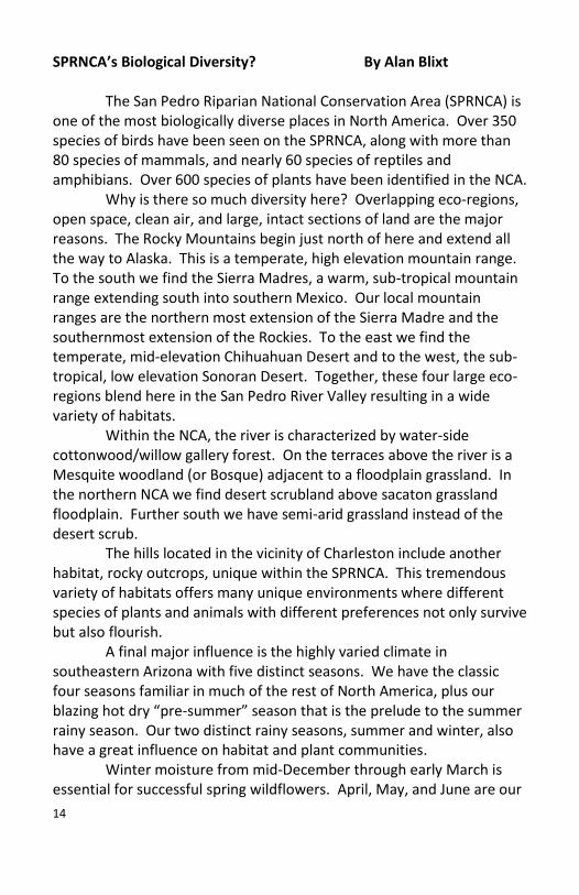
SPRNCA’s Biological Diversity? By Alan Blixt
The San Pedro Riparian National Conservation Area (SPRNCA) is one of the most biologically diverse places in North America. Over 350 species of birds have been seen on the SPRNCA, along with more than 80 species of mammals, and nearly 60 species of reptiles and amphibians. Over 600 species of plants have been identified in the NCA.
Why is there so much diversity here? Overlapping eco-regions, open space, clean air, and large, intact sections of land are the major reasons. The Rocky Mountains begin just north of here and extend all the way to Alaska. This is a temperate, high elevation mountain range. To the south we find the Sierra Madres, a warm, sub-tropical mountain range extending south into southern Mexico. Our local mountain ranges are the northern most extension of the Sierra Madre and the southernmost extension of the Rockies. To the east we find the temperate, mid-elevation Chihuahuan Desert and to the west, the sub-tropical, low elevation Sonoran Desert. Together, these four large eco-regions blend here in the San Pedro River Valley resulting in a wide variety of habitats.
Within the NCA, the river is characterized by water-side cottonwood/willow gallery forest. On the terraces above the river is a Mesquite woodland (or Bosque) adjacent to a floodplain grassland. In the northern NCA we find desert scrubland above sacaton grassland floodplain. Further south we have semi-arid grassland instead of the desert scrub.
The hills located in the vicinity of Charleston include another habitat, rocky outcrops, unique within the SPRNCA. This tremendous variety of habitats offers many unique environments where different species of plants and animals with different preferences not only survive but also flourish.
A final major influence is the highly varied climate in southeastern Arizona with five distinct seasons. We have the classic four seasons familiar in much of the rest of North America, plus our blazing hot dry “pre-summer” season that is the prelude to the summer rainy season. Our two distinct rainy seasons, summer and winter, also have a great influence on habitat and plant communities.
Winter moisture from mid-December through early March is essential for successful spring wildflowers. April, May, and June are our

15
driest months of the year and are windy resulting in tremendous wind pollination and seed dispersal. From early July through early September ("monsoon") we receive 50-60% of our yearly rainfall. These rains are critical for our summer wildflowers and warm-weather grasses. I have never seen an explosion of life anywhere to compare with the onset of our rainy season. Incidentally, the failure of our winter rains has resulted in “drought” conditions, which may be a return to historically normal rain patterns rather than a short-term drought.
Different habitats support different plants and the different plants support different animals. The floodplains and grasslands support bunch grasses, Soaptree Yucca, gourds, Pepper-weed, Golden Crownbeard, wild Sunflower, and many other plants. These plants support a wealth of grassland birds as well as a wide variety of insects, grazers and browsers, and the predators that consume those animals.
The riparian habitat has enough water for larger plants and trees such as Cottonwood, Willow, Ash, Walnut, and Seep Willow to grow. This wooded area supports yet another community of animals and insects. Here we find many of our larger animals such as bear and mountain lion. Beaver are only found in this habitat. It is also here that we find the greatest number of birds because this environment provides suitable nesting areas as well as abundant food.
Although the SPRNCA does not offer much elevation change within its boundaries, it is only a few miles to the mountains and canyons of the Huachuca Mountains, where the elevation increases to over 9,000 feet. The flora and fauna at these higher elevations are certainly different from those found along the river. However, because of the proximity of these mountains and the migratory nature of things, we often see plants and animals within the SPRNCA that do not normally reside here. When you realize the variety of habitats in this area it is easy to understand the diversity that we enjoy.

16
Riparian habitat and beaver dam with rocky terrain and elevation
change in the background Photo by Dutch Nagle
About the Author: Alan Blixt is a former member of the Board of Directors and a docent for the Friends of the San Pedro River.

17
The Friends of the San Pedro River By Gary Noonan Did you know that we have a verdant oasis a few miles east of
Sierra Vista? The oasis is a narrow belt of trees and other plants along the San Pedro River. The Bureau of Land Management (BLM) manages this desert oasis that provides a refuge for thousands of animals and plants. The Friends of the San Pedro River (FSPR), a volunteer, non-profit organization, supports BLM in its stewardship of the San Pedro Riparian National Conservation Area (SPRNCA).
I’m the historian of the Friends and want to share with you highlights about the 20 year history of the Friends helping BLM protect our nature preserve. Jim Herrewig, the Sierra Vista Planning Director, suggested the idea of the Friends during a 1986 meeting of the Sierra Vista City Council with BLM officials. Lester Rosenkrance, the Safford district manager for BLM, strongly encouraged formation of the Friends as subsequently did Erick Campbell after he became project manager for SPRNCA in July 1986. Early in 1987, ten concerned citizens incorporated the Friends: Jane Chambers; Debbie Collazo; Dave Dross; Jim Finley; Edward Lehner; Lester Mauk; Jerry Pratt; Jean Randle; Len Roberts; and Harry Woodward. On October 16, 1987 Len Roberts, the first FSPR president, signed a cooperative management agreement between the Friends and BLM. The Friends promised to assist with fundraising and to supply trained volunteers.
The earliest major FSPR project was restoration of the San Pedro House. It would be an information center and a focal point for nature-based programs. The former ranch house had been vacant for approximately 10 years and was in very poor shape. Lester Mauk led 29 volunteers who by September 20, 1989 had spent 1,799 hours on renovation. Over the last 20 years, FSPR has continued to maintain and enhance the house and spent more than $30,000 on it.
FSPR volunteers help visitors. Some people enjoy browsing the natural history bookstore and gift shop run by the Friends. Bookstore volunteers provide information about SPRNCA and other nearby preserves. The popular docent program began in 1993 when the Friends obtained grants for developing formal docent training. The highly trained docents lead guided walks, hikes, and provide

18
information about birds, plants, general natural history, and historical and archaeological topics.
Other FSPR volunteer efforts have included: 813 hours improving the Murray Springs Clovis site; repairing windmills that provide water for wildlife; clearing trails and installing signs; helping with the recent restoration of the Fairbank Schoolhouse; and trash removal. In a recent fiscal year volunteers provided over 12,500 hours of assistance in maintaining and interpreting SPRNCA. In addition, thousands of school children have been introduced to the river and its ecology over the last 20 years thru the Friends Education Program.
The Friends have also typically spent thousands of dollars a year supporting BLM stewardship and programs interpreting SPRNCA. Support has included: $22,600 on a solar powered electrical system for lights and water at the San Pedro House; $5,500 on interpretive signs at Murray Springs and the San Pedro House area; $3,000 for native plant seeds; $3,600 for electronic counters that tally the number of visitors using the trails; $2,400 for a trail clearing machine; $2,500 on brochures about SPRNCA; $6,000 to cater the 1989 dedication ceremonies for SPRNCA; $1,800 on picnic tables; $7,200 for videos about the preserve; and over $19,000 to help open the Fairbank Schoolhouse.
In 1988, the federal government gave the Friends a “Take Pride in America Award” and BLM provided the Friends another award for its volunteer services. The same year Arizona gave FSPR the “Governor's Award for Historic Preservation.” In 1990, the federal government awarded the “Theodore Roosevelt Conservation Award” to Jim Herrewig for suggesting the idea of the Friends and helping to organize it. Locally, FSPR volunteers and employees have won the “Sierra Vista U Rock” awards.
One way to understand the scope of the Friends’ efforts is to ask how things would differ if the organization never existed. There would be no information center at the San Pedro House. The house would either be boarded up or would have been torn down because of the lack of maintenance. There would be no or very few guided tours about the animals and plants of the preserve. Trails would be fewer and less well maintained. Trash would have accumulated in many places. Local schools would not be able to have docents visit them and give talks about the preserve or lead schoolchildren on visits to the river. Nor would the Fairbank Schoolhouse have been turned into a

19
welcoming visitor center and bookstore. In short, the preserve would be much less accessible, and visitors would have much less information about it.
The San Pedro House in 1987 before restoration
*
San Pedro House in 1988 after restoration Photos courtesy of BLM

20
About the Author: Gary Noonan is a retired senior curator of insects with a Ph.D. in entomology. He a member of the Friends of the San Pedro River and its Historian.

21
Grasslands of the SPRNCA By Alan Blixt
As a visitor arrives at the San Pedro House the first things they notice are the beautiful Fremont Cottonwood trees. These trees are riparian obligates, they need to have their roots in water or they will die. The tree behind the house was planted in 1948 so these are fast growing trees. Also in evidence are agave plants. These agaves bloom in the rainy season and provide nectar for bees, hummingbirds, and for two species of nectar eating bats. Cacti species are also in evidence. These cacti provided food, water, and medicine for Native Americans. Today they provide pollen for Cactus Bees and nest sites for Curved-billed Thrashers and Cactus Wrens. Look under the eaves of the house and you will find Barn Swallow nests. They arrive in the spring, build the nests, and spend the summer breeding season with us. Over 350 bird species have been recorded on the San Pedro Riparian National Conservation Area.
On your way to Green Kingfisher Pond, you enter the floodplain grasslands. Look for the Checkered-white Butterflies on their host plants- the Pepperweed. Watch for small black Pinacate beetles, which are the favored food for our only carnivorous mouse - the Northern Grasshopper Mouse. Grasshopper mice travel in packs at night and howl at the moon like coyotes. Look for scat on the trails. Scat with hair in it is probably from Coyotes. Eightly-two species of mammals have been recorded in and around the conservation area but most of them are nocturnal. Looking for animal sign, such as scat or tracks, is a lot of fun. The Velvet Mesquite trees on the grassland provide beans for coyotes, birds, and others. These beans can also be ground into nutritious mesquite flour. If you see a small turtle it is the Ornate Desert Box Turtle which eats insects, seeds, and fruits and lives as long as 30 years! More than 40 species of amphibians and reptiles have been seen here. The large native bunchgrass you see is called Sacaton. This grass helps prevent erosion and provides food and shelter for various animals. We have both Buffalo and Coyote Gourds and they are food for Javelina and many mice and rats. The tall plants you see are called Soaptree Yuccas, pollinated by the Yucca Moth. They provide perches for many grassland birds such as the American Kestrel,

22
Loggerhead Shrike, and the Cassin’s Kingbird. We are fortunate to have 24 species of flycatchers that breed here in Southeast Arizona. We also have 25 species of bats that eat insects. Thus we have 24x7 insect control! Look for little mounds of dirt as you walk. This aerated soil is excavated by the tunneling Pocket Gopher. The Gopher Snake is our most common snake and it feeds on the Gophers. Other common snakes seen are rattlesnakes and Mexican Hog-nosed snakes. rattlesnakes help to control rat and mice populations and the hog-nosed snake’s favorite food is the Spade-foot Toad that emerges in the rainy season.
Seeds blown about by the wind in our dry season become beautiful flowers and grasses when the rain soaks the aerated soil. Look for the lovely Scarlet Creeper, Arizona Blue-eyes, and many different Sunflower species in season. Sometimes you will see Harvester Ants and lizards on the trail. The Harvester Ants send out scouts to find seeds early in the morning and they return to the nest and show other workers where the seeds are located. Watch the ants carrying seeds on their mini highways. But watch out....They do sting! Our most common lizard is the Grassland Whiptail Lizard. These striped lizards are all female as they reproduce parthenogenically (the female lays a self-fertilized egg). They eat insects and are food for the Coachwhip Snake, Roadrunner, and the Gray Hawk. Two non-native invasive species are evident on the grasslands - Johnson Grass and Russian Thistle (tumbleweed). They dominate some areas and choke out the native plants. The Bureau of Land Management works to control these non-native plants and encourage re-growth of native plants.
As you continue down the trail towards the pond, notice the large mounds on either side of the trail. These mounds are home to the Kangaroo Rat. These are true desert creatures as they never need to take a drink. Right next to these mounds is a spiky plant known as Greythorn. This plant has leaves in the rainy season but drops them when there is not enough moisture. Many plants in our semi-arid grasslands have evolved a variety of drought adaptations and not only survive but also flourish. Wintertime is a lovely time to visit the grasslands. We have about 60 species of birds that migrate here to spend the winter with us. Many of these birds are raptors and sparrows. They find food, water, and cover here, and are a challenge to

23
identify and a joy to watch. Come take a walk with us on the grasslands
of the SPRNCA.
A sample of the myriad flowers to be seen within the SPRNCA Photos by Gary Noonan
About the Author: Alan Blixt is a former member of the Board of Directors and a docent for the Friends of the San Pedro River.

24
Riparian Areas of the SPRNCA By Alan Blixt
Park at the San Pedro House and you will find a map of the local trails on the porch. Follow the trail to Green Kingfisher Pond. As you arrive, note the large cottonwood at the north end of the pond. This is an “apartment building” for nesting birds in the summer. Vermilion Flycatchers, Yellow Warblers, and Yellow-billed Cuckoos have nested here. These birds all feed insects to their young thus playing a valuable role in insect control. Green Kingfishers are seen on occasion - check our sightings board and book on the porch of San Pedro House to see what’s around.
Over 350 species of birds have been recorded on the San Pedro Riparian National Conservation Area. Mexican Mallards and other waterfowl frequent the pond, particularly in winter. In summer, watch for Garter Snakes and the Texas Spiny-softshell Turtle. More than 40 species of reptiles and amphibians have been seen here. Listen for the calls of the beautiful Common Yellowthroat and our native Song Sparrow. It is not uncommon to see as many as five species of swallows catching flying insects. Tropical Kingbirds and Say’s and Black Phoebes often fly-catch above the pond. And don’t forget to look for the beautiful Queen and Pipevine Swallowtail Butterflies in season. Just south of the pond you will see a non-native invasive species - the Salt Cedar or Tamarisk. Other bushes you see are the native Four-winged Saltbush. These plants love alkaline soils. Lick a leaf and taste the salt. Also nearby, find a large green plant with huge white flowers, the Sacred Datura. Don’t handle this plant since it is toxic to humans. This is a beautiful plant that blooms at night and is pollinated by Sphinx Moths. Look for a Regal Ring-necked Snake that lives here. There are also rattlesnakes throughout the SPRNCA. Always give snakes a wide berth and watch where you step. Walk back along the river. The Fremont Cottonwood and Gooding’s Willow riparian habitat is a haven for migrating birds who find food, water, and shelter here. Only 2 % of Arizona is riparian habitat and 90-95% of this lowland riparian habitat has been degraded or destroyed. The Nature Conservancy has designated this area as one of the last great places on planet Earth. Eighty-two species of mammals have been recorded here. They depend on the riparian corridor and surrounding semi-arid
25
grasslands and desert scrub for their survival. Great Blue Herons often hunt fish and bullfrogs along the river. The Great Blue Heron is one of the few birds that uses tools to hunt. It will pick up dry grass from the bank and drop it into the river. When small fish rise to investigate, the heron eats them! Prior to the 1890’s there were 13 species of native fish in the river. We now have only two species: the Longfin Dace and the Desert Sucker, as a consequence of a variety of natural and manmade factors that have transformed our river.
Look for the scat and/or tracks of Raccoons, Coati, or Grey Fox in the mud at the water’s edge. Last summer we found a Beaver pelt with Mountain Lion hair on it so look for predator tracks and beaver dams. Bobcats have been seen as well. Great Horned Owls nest in the cottonwoods. These predators have no sense of smell. Thus, one of their favorite foods is skunk. We have four species of skunk here - Spotted, Striped, Hog-nosed, and Hooded.
Look in the trees for the beautiful Bullock’s Oriole and Summer Tanager. These colorful birds breed here in the summer. Watch the tree bark for Tree Lizards and Clark’s Spiny Lizards hunting for insects. Woodhouse’s Toads are out in the spring and Spadefoot Toads come out after the start of our summer rains. Then, the Mexican Hog-nosed Snake shows up to eat the Spadefoots. As you leave the river on the way back to San Pedro House, notice the increase in heat and the decrease in humidity. What an incredible place!! Every time you visit you will see something new and different. Come during different seasons and see different things. Come take a walk with us.

26
Green Kingfisher Pond Photo by Ted White
About the Author: Alan Blixt is a former member of the Board and a docent for the Friends of the San Pedro River.
27
The Wild West Lives on at Fairbank By Chris Long
Back in the 1880s you might have seen an advertisement like that describing what is today the Fairbank Historic Townsite. Now part of the Bureau of Land Management’s San Pedro Riparian National Conservation Area, Fairbank is being re-created. The recent meticulous restoration of the schoolhouse evokes, once again, the atmosphere of the 1920s. You can walk into the schoolhouse museum and gift shop and see authentic student desks, slate blackboards, and historical mementos of Fairbank in its heyday. The unique gypsum blocks used for the schoolhouse walls were a specialty of the Arizona Gypsum Plaster Company of Douglas, AZ.
Fairbank was named after Nathanial Kellogg Fairbank, a Chicago merchant who helped finance the first railroad into the area in 1881. The town was built on the old San Juan de las Boquillas y Nogales Mexican land grant that was bought by American interests and named the Boquillas Land and Cattle Co. in 1901. It became a transportation center shipping the processed ore mined in Tombstone and Bisbee. Fairbank was a family town, a center of local activity and commerce. It was sedate compared to the rowdiness of the stamp mill towns of Millville, Contention, and Charleston or the mining towns of Tombstone and Bisbee.
While the stamp mill towns died when the Tombstone mines flooded in the late 1880s, Fairbank lived on. It held on through the 1890 and 1894 floods and it made it through the 1887 earthquake. It even survived the notorious events of 1900 when Jeff Milton foiled a dastardly plot to rob the train. Jeff had the fight of his life and was
Heading off to Arizona Territory to try your luck at the
silver mines? Maybe as a merchant, laundress, truck
gardener, bartender, blacksmith, or school teacher? Are
you looking for a new life and new opportunities in the
growing towns of Arizona? Make Fairbank your goal! We
have four railroad lines, stage lines, and job opportunities
abound! You will find not only golden opportunities for
employment in the mines and nearby stamp mills, but you
will also find our town a great place to raise a family

28
seriously wounded. He traveled to San Francisco for medical attention to save his arm that was injured in the shoot-out, and he lived to tell the tale. Fairbank remained a transportation hub as long as the railroads came through to Mexico and points west. In fact, the school remained open until 1944 and the last residents only left in the mid 1970s.
The Townsite is well interpreted with informative signs to lead you through the town and “up the trail a piece” to the historical Fairbank Cemetery and the ruins of the Grand Central Mill.
The cemetery is just a short walk north of the townsite. Several graves are marked and still visited by descendents of those buried there. The view from the cemetery ridge shows miles of the San Pedro River wandering through desert grasslands and mesquite. Be sure to bring your camera.
Grand Central Mill was a typical silver processing stamp mill. Huge pistons crushed the rock, working day and night, and making dreadful noise. Then the crushed ore was processed with mercury in amalgamating pans to bind the silver. Imagine the health effects of the toxic mercury on the mill workers. Their lives were short.
On the west side of the San Pedro River, not far from Fairbank are the remains of the 18th Century Spanish Presidio Santa Cruz de Terrenate. When George Washington was fighting for independence from Britain in 1776, the Spanish were building this fortified town to protect the settlers and friendly Indians from the Apaches. They had a difficult time at this location due to the lack of a safe and steady supply route and regular Apache attacks. They gave up the effort and abandoned the location only four years later in 1780.
Put a visit to the Fairbank Townsite on your “to do list.” It is easy to reach, located just east of the San Pedro River on Highway 82 about 10 miles west of Tombstone. You will find not only the townsite, cemetery, stamp mill ruins, school house, and gift shop/bookstore, but also access to the San Pedro River for birding, a well established loop trail (about 4 miles) for hiking, biking, or horseback riding, and picnic tables for your family outing. About the Author: Chris Long is a 30-year resident of the area, a docent and a past president of the Friends of the San Pedro River.

29
A view of the restored Fairbank Schoolhouse
Photo by Dwight Long

30
Off The Beaten Path By Nancy Doolittle
Note: The FSPR Equestrian Program No Longer Exists but horseback riding is still
allowed
The San Pedro River slips quietly through dense groves of cottonwoods and willows as it makes its way north along some 40 miles of the BLM managed San Pedro Riparian National Conservation Area (SPRNCA). The River is a migratory corridor and is home to many birds, mammals, reptiles, insects and plants. This incredible ecosystem has been named one of the “Last Great Places” by the Nature Conservancy.
My first introduction to the SPRNCA was in the spring of 2007 when a friend and I drove along State Route 82 on our way to Tombstone. Noticing the Fairbank Historic Townsite sign, we decided to investigate. The old schoolhouse was under restoration and due to open in April. A sign on the door saying Volunteers Needed” prompted me to become a volunteer at the schoolhouse and a member of the “Friends of the San Pedro River.” After completing docent training through the Friends, I began to explore the trail network by horseback. I enlisted the help of a friend from Sonoita and we spent the entire summer riding the various sections of the trail. I learned that the Friends’ Equestrian program had lapsed for lack of participants and leadership. So, without a moment's hesitation, I volunteered to try and resurrect the program. We held our first ride in September of '07 at Fairbank with a barbeque following the kick-off ride. Thirteen brave souls and their horses followed me down the trail. This was the day I learned that my best laid plans for a leisurely three hour ride north of Fairbank were not to be. A hurricane in the Gulf resulted in heavy rainfall in our area, causing high and swift water in the river. The first half hour of the ride was an easy, groomed trail leading us past the Fairbank Cemetery and the Grand Central Mill, then on to Willow Wash. After crossing the dry, sandy wash we headed for our first water crossing. Almost everyone attempted to cross the river, but only a few actually did. We had people and horses in the river and the best thing I can say is that despite being
31
wet, we had a wonderful time. The riders said things like, “I didn't know my horse would do that!” or “I was expecting a boring trail ride.” But I did learn that it is best to avoid crossing the river during the summer rainy season.
I am happy to report that every ride since that “Monsoon Ride” has gone extremely well with no mishaps. We have ridden to Contention City, the Presidio Santa Cruz de Terrenate, the Little Boquillas Historic Ranch and the Petroglyph Rocks. We have ventured out from the San Pedro House in both directions, going north to Murray Springs and south along Del Valle Rd. The January ’08 ride saw our biggest turnout with over 20 riders. To minimize the impact of horses in the SPRNCA, we keep the riders to fewer than 20 on any given ride. There are 11 trail heads along the 40-plus miles of river which are accessible to horses. Some of the trails are groomed and easy while many of them are more of a challenge. The trails are also used by hikers, birders, and bicycle enthusiasts.
Both the San Pedro House, off State Route 90 and the Fairbank Schoolhouse off State Route 82 have information and maps as well as lots of great books all pertaining to life in the desert southwest and the SPRNCA. If you go, you can also pick up the handout with Equestrian Use Guidelines produced by the BLM. In addition to all the natural wonders the conservation area offers, there are numerous archaeological, historical, and paleontological sites to explore. Evidence of the Clovis culture from 13,000 years ago can be seen at the Murray Springs trail head off of Moson Rd. This important archaeological site yielded sixteen spear heads, many extinct animal bones, and a unique bone tool. This tool is now on display at the Arizona State Museum in Tucson.

32
A ride along the San Pedro River on a warm January day Photo by F. J. Forrey
About the Author: Nancy Doolittle is a docent for the Friends of the San Pedro River and former Equestrian Coordinator.
Note: The FSPR Equestrian Program No Longer Exists but horseback riding is still allowed.

33
Wildlife at the River By Ken Charters Be a Wildlife Watcher
When walking along the San Pedro River, I often ask other people where they live. Many times the answer is out of state and not infrequently outside the country. Contrast this with students’ responses in my biology classes at Cochise College when asked if they have ever visited the San Pedro River, and most say they have not. So people from other parts of the country and world spend their hard-earned vacation time and money to visit our backyard, while many locals have not visited the San Pedro River. Perhaps the knowledge that visitors make costly trips to our local river will serve to inspire more residents to enjoy the natural riches in our backyard. Be a Better Wildlife Watcher
Some people develop an appreciation for nature because they feel fulfilled when they see interesting things, and conversely some do not connect because they feel their attempts to view wildlife are often futile. In large part, success or futility in observing animals is rooted in an observer’s behavior, so changing one’s behavior may dramatically improve the outcome. Toward this end, a list of tips and behaviors is offered below.
To improve your wildlife viewing, try the following. First beg, borrow or buy binoculars. Binoculars will allow you to observe the natural behaviors of wildlife at a distance and literally open up new worlds. The first time many students view birds through binoculars, they are amazed. One exclaimed, “I never knew birds had so many colors and patterns!” They do. And binoculars are also great for watching lizards, butterflies, turtles, frogs, rabbits, and much more.
Second, slow down; watching wildlife is not a race. Memorable observations may occur when the wildlife comes to you. A thrilling sighting of a bobcat, occurred when I was resting motionless, and an unsuspecting bobcat strolled toward me, coming quite close. This may not have happened with a coyote, as dogs recognize motionless people, but cats do not distinguish us from the background unless we move. Try it with house cats first, and then work up to mountain lions! Birds,

34
mammals, reptiles, even insects, become more evident if we pause and let the normal activity of nature resume.
Third, prepare for field time by learning about where or what you plan to observe. This aspect of connecting with nature often follows a fun observation, which leaves the viewer curious and wanting to learn more. One of the really cool parts of watching wildlife is that there is a community of people who have been involved for years, and many have shared their knowledge in the form of books like field guides and various web sites. The docents of the Friends of the San Pedro River offer guided walks, hikes, educational programs, and are a great source of information about books or other resources.
Fourth, time your visit to coincide with “prime time.” In this sense, watching wildlife is similar to watching television: some times are better than others, though I have never had the experience of nothing to watch in nature like I have with television! The time of observation depends in part on what you hope to see, for example early morning is best for most birds. In addition, the concept of changing channels may be applied to nature observation; if there are few birds to view, concentrate instead on butterflies, mammal tracks, or flowers.
It is useful to think of wildlife as working different shifts. Day shift species are active during the day and are termed diurnal. Night shift species are active between sunset and sunrise; they are called nocturnal. Swing shift species are active during the transition times of dawn and dusk; they are said to be crepuscular. Species of each shift have adaptations that allow them to thrive in that time. Remember that animals have not read the books and do not know when they are supposed to be active, and may surprise you. Also the shift that a wildlife species works may change with the season. For example, javelina may feed during the night shift in summer, the day shift in winter and the swing shift in spring and fall. By being aware of when to expect a species to be active, you increase your chance of observing that species.
To see more wildlife try the above tips and wear subdued colors, move quietly with a nonchalant pace, and spend more time in the field. And never discount the role of luck, as one can do much right and strike out, and one can do much wrong and still make the observation of a lifetime. But lucky or not, you cannot make the observation of a lifetime unless you get off the couch and go down to

35
the river. And do not be surprised if a curious fellow asks where you are from.
This coati was seen at the San Pedro House Photo by Ted White
About the Author: Ken Charters is a biologist who teaches at Cochise College in Sierra Vista. He is a docent of FSPR and currently assists with school field trips.
36
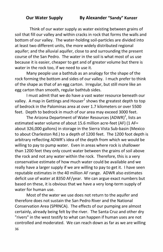
Our Water Supply By Alexander “Sandy” Kunzer
Think of our water supply as water existing between grains of soil that fill our valley and within cracks in rock that forms the walls and bottom of our valley. The water-holding soil-particles are divided into at least two different units, the more widely distributed regional aquifer; and the alluvial aquifer, close to and surrounding the present course of the San Pedro. The water in the soil is what most of us use because it is easier, cheaper to get and of greater volume but there is water in the rock too, if we need to use it. Many people use a bathtub as an analogy for the shape of the rock forming the bottom and sides of our valley. I much prefer to think of the shape as that of an egg carton. Irregular, but still more like an egg carton than smooth, regular bathtub sides. I must admit that we do have a vast water resource beneath our valley. A map in Gettings and Houser1 shows the greatest depth to top of bedrock in the Palominas area at over 1.7 kilometers or over 5500 feet. Depth to bedrock in much of our area may exceed 3000 feet. The Arizona Department of Water Resources (ADWR)2, lists an estimated water volume of about 15.6 million acre-feet (AF) (1 AF= about 326,000 gallons) in storage in the Sierra Vista Sub-basin (Mexico to about Charleston Rd.) to a depth of 1200 feet. The 1200 foot depth is arbitrary reflecting ADWR’s idea of the depth from which we would be willing to pay to pump water. Even in areas where rock is shallower than 1200 feet they only count water between the grains of soil above the rock and not any water within the rock. Therefore, this is a very conservative estimate of how much water could be available and we really have a larger supply if we are willing to pay to get it. I have seen reputable estimates in the 40 million AF range. ADWR also estimates deficit use of water at 8350 AF/year. We can argue exact numbers but based on these, it is obvious that we have a very long-term supply of water for human use. Most of the water we use does not return to the aquifer and therefore does not sustain the San Pedro River and the National Conservation Area (SPRNCA). The effects of our pumping are almost certainly, already being felt by the river. The Santa Cruz and other dry "rivers" in the west testify to what can happen if human uses are not controlled and moderated. We can reach down as far as we are willing
37
to afford with our wells but plants cannot reach much more than ten feet and most, not even that. The riparian, or water edge plants, are what support the diverse animal communities that we enjoy, and help support our lives and bring in millions of tourist dollars. If we lose the river there are additional consequences, such as land subsidence (around Eloy, between Tucson and Phoenix, this is over 25 feet) and ground cracking, which excess groundwater withdrawal can precipitate. As you can imagine, these occurrences can have devastating effects on many human activities (broken gas mains, broken sewage lines, broken underground cables, cracked foundations, etc.). We are not really talking about the whole volume of water in our aquifer but only about the top 10 feet or so. The best scenario is to balance what we take out with what nature and we put back in, so as not to decrease the supply at all. BUT If we are not concerned about balancing our needs and wants with the needs of the natural environment around us, then we must accept the loss of the San Pedro River and the entire riparian corridor. My bias is that in order to be rational stewards of our resources for ourselves and our descendents, we should be working hard to balance our uses with the needs of the environment. 1. Gettings, Mark E., and Brenda B. Houser, 2002, "Depth to bedrock in
the Upper San Pedro Valley, Cochise County, southeastern Arizona", US Geological Survey Open File Report 00-138, Online Version 1.1 available at: http://pubs.usgs.gov/of/2000/00-138
2. Arizona Department of Water Resources, "Groundwater Resources of the Upper San Pedro Basin, Arizona: Technical Report to the Upper San Pedro Basin AMA (Active Management Area) Review Report". Feb. 2005. Available from ADWR, 500 N. 3rd Street, Phoenix, AZ 85004.

38
View of the San Pedro River
Photo by Gary Noonan About the Author: Alexander “Sandy” Kunzer Is a Docent for the Friends of the San Pedro River, a Registered Geologist and a Certified Engineering Geologist

39
Opossum By Marcia Radke
The San Pedro Riparian National Conservation Area (SPRNCA) provides habitat for more than 400 bird species and as a consequence, it is a very popular area for birders from across the nation and around the world. Of equal interest to naturalists is the amazing diversity of mammal species found in the SPRNCA. This relatively small area supports more than 80 species of mammals, several of which reach their northern limit in southeastern Arizona. The opossum is one of a myriad of mammal species that occur in southeastern Arizona, and likely uses the SPRNCA as an avenue for dispersal. It also appears to be a fairly recent addition to the local mammal community.
In October 11, 2004, I collected a road-killed opossum near Nicksville, which was submitted to the University of Arizona as a study specimen. Biologists originally believed that the opossum we see in our area was descended from eastern opossum (Didelphis virginiana virginiana) transplanted to Arizona, however, specimens south of Tucson are identified as Mexican opossum (D. v. californica).
Individuals in southeastern Arizona probably represent a natural northern range extension that may have occurred approximately 200 years ago from northern Sonora, Mexico. This likely also resulted in the presence of other tropical mammals such as the collared peccary and white-nosed coati in southeastern Arizona. A probable reason for the seemingly recent northern range expansions may have been some years of relatively good precipitation. A good indication that the Mexican opossum may reach the northern part of its range in southeastern Arizona is that opossum do not hibernate. Non-hibernating opossum from this area show that they lose the tips of the ears and tail, probably from freezing temperatures.
Experts do not agree whether Mexican opossum is a new arrival or just not well documented in the historic record. Old records indicate accounts of Mexican opossum in Arizona as early as the 1870s, and are mentioned by a trapper in 1825. However, there is no archaeological evidence of them appearing in human trash middens before 1700.
Compared to eastern opossum, Mexican opossum have proportionally longer, darker tails, a dark eye stripe, and dark

40
extremities. The presence of the marsupium (pouch) makes the opossum the only native marsupial in North America north of the Rio Grande River. Females have an abdominal, fur-lined pouch containing teats, and do not begin reproducing until six to 12 months old. The neonates are born in an embryonic state after only about 12 days of gestation, and use the forelimbs to crawl from vulva to the marsupium. Those “extra” neonates die that do not attach to one of the 13 nipples. The neonates remain attached to the nipples for about two months, and weaning occurs at about three months. Females are polyestrous and will breed again if young are lost, but usually only two litters are weaned each year.
Opossum also have an opposable thumb on the hind foot, and a scaly, nearly naked, prehensile tail. Both the thumb and tail are used for stabilization when climbing and balancing in trees. A true omnivore, the opossum utilizes a wide variety of foods, including fruit, insects, grass, snails, rodents, reptiles, leaves, eggs, and carrion. Opossum use a temporary den from which to forage, and dens include hollow logs and trees, man-made structures, and holes or burrows. The den may be changed every few days.
Opossum are relatively short-lived, with the oldest known Virginia opossum recaptured at three years of age. An involuntary temporary state of catatonia (a motionless, apathetic state in which one is oblivious or does not react to external stimuli) is the opossum’s behavioral response to danger, which appears to have some survival value. This has given rise to the term “playing possum.” However, the relatively high number of neonates and short longevity results in high population turnover of individuals.
Opossum seem immune to pit viper venom and actively prey on snakes. Scavenging feeding behavior of opossum may also result in their high resistance to rabies and plague. This opportunistic behavior of the opossum is probably one reason they may be successful in extending their range into the SPRNCA and then to other areas.
Look for opossum in dense vegetation and in trees, and report any sightings or collect road-killed individuals for submission as museum specimens for documentation of subspecies.

41
Is it dead or just playing 'possum'?
Photo by Bill Radke
About the Author: Marcia Radke is a Wildlife Biologist for the BLM. She has a B.S. with a major in wildlife ecology and a M.S. with an emphasis in zoology.

42
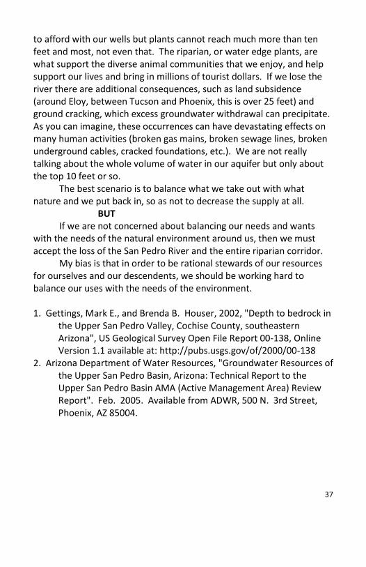
Millville and Petroglyphs By Lyle Ford BOOM...BOOM...BOOM...the merciless pounding echoes off nearby hillsides, shakes adobe walls, and rattles your teeth, day and night, day after day, every day, even Sunday. This endless thundering rhythm of the silver stamp mills was part of life in Millville, Arizona in the 1880s. Two of the more intriguing sites in the Bureau of Land Management's San Pedro Riparian National Conservation Area are the Millville stamp mill site and the Hohokam petroglyphs. Both sites are within easy walking distance of the same parking area, yet each involves a very different use of a readily available local resource: rocks. In 1879, Richard Gird and Ed Schieffelin began building a stamp mill on the east bank of the San Pedro River about 10 miles west of Tombstone to crush and process silver ore from their thriving Tombstone mines. Then Phillip and George Corbin established the 15-stamp Corbin Mill in January 1880 on the south end of Millville. These two mills were known as Millville. The thick-walled Gird House held the vault for the Tombstone Mining and Milling Company’s silver. At its peak in 1881-82, Millville produced $1.3 million in bullion. Millville began to decline in the mid to late 1880s for several reasons. Much of the Charleston/Millville area's trade from Mexico shifted to Nogales. In 1884, excessive silver production caused silver prices to drop, miners' wages to fall from $4 to $3, and led to a miner’s strike in Tombstone. The Grand Central Mine’s pump house fires of 1886 reduced the ability to keep the Tombstone mines from flooding. Millville faded into obscurity. Then on May 3, 1887, a 7.2 magnitude earthquake destroyed many of the vacant adobe dwellings and other buildings in Millville and the nearby town of Charleston, reducing the once thriving area to rubble. Thousands of years before the rocks were crushed to extract minerals in the ore milling community of Millville, native people settled the area, living in villages and storing foods through the winter. They made pottery and employed agricultural techniques to raise crops. Southern Arizona became home to the Hohokam people, who lived along the rivers and built networks of irrigation canals. The Hohokam also left behind petroglyphs.

43
At the base of the hill where the Millville ruins are located, the Petroglyph Discovery Trail leads to a series of ancient rock drawings known as petroglyphs. In Greek, petro means “rock” and glyph means “carving” or “drawing.” These pictures are subject to many different interpretations by different Indian Tribes and cannot be definitely defined. There is no “Rosetta stone” to help us read them. Use your imagination when viewing them and try to figure out their meaning.
The Bureau of Land Management offers the following information regarding your visit to the petroglyphs:
There are many things that can add to a good experience visiting an archaeological site. Most important is leaving with the knowledge that you have taken part in learning about the past and have left the area in good condition for others to enjoy.
The State Historic Preservation Office assembled a set of ethics for visiting archaeological sites. Following these tips will enhance your own experience and also that of the visitors who come after you.
Rock circles or alignments are trying to tell a story, moving them "closes the book" without anyone having a chance to interpret what they mean.
Walk lightly across desert pavement where your tracks could cause disturbance to geoglyphs or ancient paths/trails.
If you spot an object of archaeological interest, please stop to examine and photograph the item if you like, but please do not move or disturb it.
Ruins and petroglyphs are important to Indian people today just as they were hundreds of years ago. Altering the natural landscape can be offensive to contemporary tribal members who still visit these places as their ancestors did. Since 2005, the Millville and Petroglyph Discovery Trails have
directional signs, exhibits, a handicapped-accessible trail portion, and metal petroglyph viewing tubes thanks to the BLM, Sierra Vista Rotary, Southwest Gas, and local church youth volunteers.
Both Millville and the petroglyphs are accessible by trail from the parking area just east of the San Pedro River Bridge on north side of Charleston Road between Sierra Vista and Tombstone. Trail maps are
44
available at the trail head and interpretive signs offer additional information.
The foundation is all that remains of the old Gird Mill Photo by Lyle Ford
About the Author: FSPR member Lyle Ford is an accomplished photographer, whose photographs have appeared on NBC News, The Sierra Vista Herald’s front page, and in various magazines. Lyle lives in Sierra Vista and is currently working on a book about Arizona’s ghost towns.

45

46

47
48
Friends of the San Pedro River, Inc. 1763 Paseo San Luis
Sierra Vista, AZ 85635 (520) 459-2555
www.sanpedroriver.org