Embed Size (px)
Citation preview

RESOURCES AND
DEVELOPMENT
CLASS X (GEOGRAPHY)

NATURAL RESOURCES

TYPES OF RESOURCES• ON THE BASIS OF ORIGIN: BIOTIC RESOURCES
ABIOTIC RESOURCES

ON THE BASIS OF EXHAUSTIBILITY:RENEWABLE RESOURCES
NON – RENEWABLE RESOURCES
ON THE BASIS OF OWNERSHIP
• INDIVIDUAL RESOURCES
• COMMUNITY OWNED RESOURCES
• NATIONAL RESOURCES
• INTERNATIONAL RESOURCES

INDIVIDUAL RESOURCES

COMMUNITY OWNED RESOURCES

NATIONAL RESOURCES

INTERNATIONAL RESOURCES

ON THE BASIS OF STATUS OF DEVELOPMENT:
POTENTIAL RESOURCES
DEVELOPED RESOURCES
STOCK
RESERVE
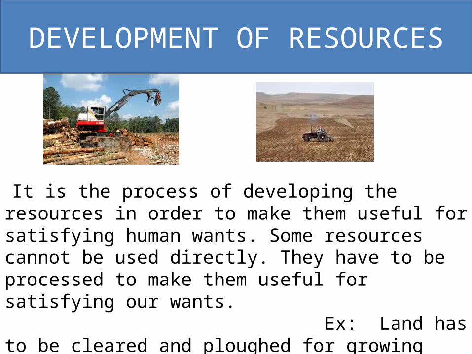
DEVELOPMENT OF RESOURCES
It is the process of developing the resources in order to make them useful for satisfying human wants. Some resources cannot be used directly. They have to be processed to make them useful for satisfying our wants. Ex: Land has to be cleared and ploughed for growing crops. Water has to be taken to the field to irrigate.
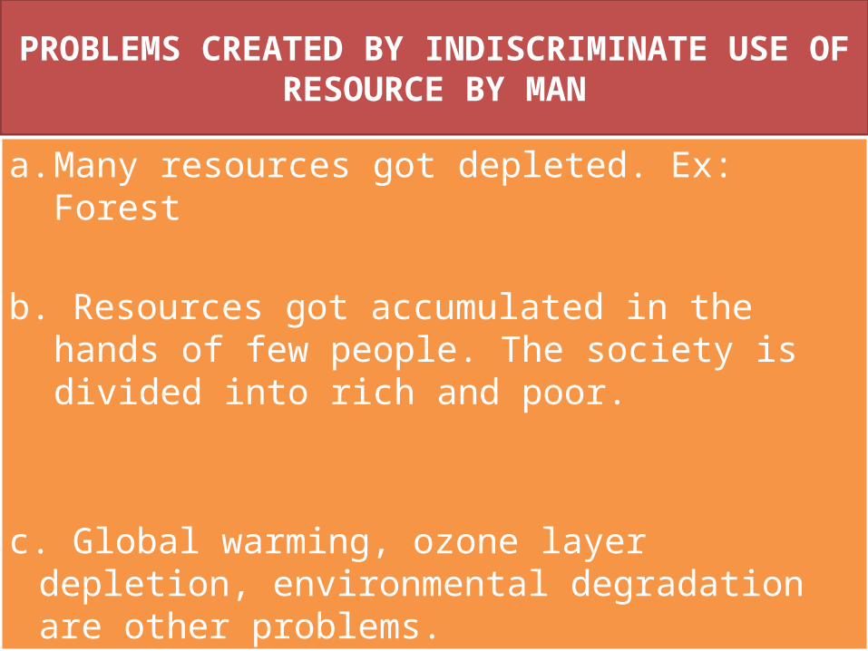
PROBLEMS CREATED BY INDISCRIMINATE USE OF RESOURCE BY MAN
a. Many resources got depleted. Ex: Forest b. Resources got accumulated in the hands of few
people. The society is divided into rich and poor.
c. Global warming, ozone layer depletion, environmental degradation are other problems.

SUSTAINABLE ECONOMIC DEVELOPMENT
• The economic development which does not damage the environment and at the same time takes care of the needs of the future generations is called sustainable development
• Sustainable Development is important because: 1) Many of the resources are non-
renewable and exhaustible. Over exploitation of these resources will affect the needs of our future generations.
2) Environmental pollution has become a major threat to the survival of human beings

RESOURCE PLANNING• Resource planning is a technique or skill of proper utilization of resources. STAGES OF RESOURCE PLANNING a) IDENTIFICATION AND LISTING OF RESOURCES Surveying, mapping and the measurement of the
qualities and the quantities of the resources are the important activities undertaken at this stage.
b) PLANNING FOR EXPLOITATION Develop a planning structure with suitable technology,
skill and institutional setup.
c) MATCH RESOURCE DEVELOPMENT PLANS WITH NATIONAL DEVELOPMENT PLANS.

IMPORTANCE OF RESOURCE PLANNING
It is necessary for the balanced development of India. 1) Some regions of India are rich in certain resources and poor in some
other resources. Ex: Rajasthan is poor in water resources but rich in solar and
wind energy. 2) Some regions are self sufficient while other regions are very poor in
important resources. Ex: Madhya Pradesh is rich in many resources but Ladakh is poor in resources.
3) Wastage of resources can be avoided by planning. 4) Environmental pollution can be reduced. 5) Over exploitation of resources can be avoided.

RESOURCE CONSERVATION• Planned use of resources in order to meet the present
needs and to store a part for the future generations is called resource conservation.
It is necessary because 1) Many resources are non-renewable
and exhaustible. If we conserve them we can use them for a longer period of time.
2) Conservation of resources helps us to reduce wastage. It will help in economic progress.
3) Resource conservation helps us to protect the environment.

IDEAS OF GANDHIJI ABOUT THE CONSERVATION OF RESOURCES.
• According to Gandhiji, “There is enough for everybody’s need and not for anybody’s greed.
• Greedy and selfish individuals and the exploitative nature of modern technology are the root cause for resource depletion.
• He was against mass production and wanted to replace it with production by masses.
LAND AS A RESOURCE.
• Land is the habitat of man.• All the economic activities are performed on land.• The soil cover on the land is essential for plant
growth. So land is necessary for agriculture. Land is used to setup industrial units.
• Roads and railways are built on the land. Commercial activities also require land. Natural vegetation and wild life are supported by land.

LAND UNDER DIFFERENT RELIEF FEATURES IN INDIA
• PLAINS - 43%• MOUNTAINS - 30%• PLATEAUES - 27% • 43% of India’s land area is plain. This region is good
for agriculture and industry. 30% of the land area is mountains. This region is rich in water resources. Plateaus occupy 27% of the land area. This region is rich in minerals, fossil fuels and forest.

LAND USE PATTERN IN INDIA• Total land area of India is 3.28 million square km. i). 43.41% of the land area is net sown area. ii). Forests occupy 22.57% of land area. iii). 6.29% of the land is waste land. iv). 7.92% of the land is used for non agricultural
purposes. v). 3.45% of the land is pastoral land. vi). 1.10% of the land is tree crops. vii). 4.41% of the land is cultivable waste. viii). 3.82% of the land is fallow other than current fallow. ix) 7.03% of the land is current fallow.

CAUSES OF LAND DEGRADATION
i). Large scale soil erosion caused by running water and wind.
ii). Dumping of waste materials from mining centers and industrial units.
iii). Over irrigation leads to increase in salinity and alkalinity in the soil.
iv). Over grazing by animals and deforestation by man. v). Waste water from the industrial units pollute the lands. vii).Mineral processing like grinding of limestone for cement
industry and calcite and soap stone for ceramic industry creates a lot of dust. This dust is deposited in the neighbouring land.

HOW DO INDUSTRIES CAUSE LAND DEGRADATION?
i). Some industries dump solid waste which contains harmful chemicals on the neighboring lands.
ii). Some industries discharge waste water to the fields.
iii). Mineral processing like grinding of limestone for cement industries and calcite and soap stone for ceramic industry creates a lot of dust. This dust is deposited in the neighbouring land.
iv). Clearing of forest for industrial purpose also cause degradation.

LAND CONSERVATION MEASURES
i). Soil erosion can be prevented by ending deforestation, controlling grazing, encouraging afforestation and practicing terrace farming in hilly areas.
ii). Preparation of shelter belts of plants and stabilizing of sand dunes by growing thorny bushes will help to prevent land degradation in deserts.
iii). Mining activities should be controlled. New technology which reduces wastage can be adopted.
iv). Industrial waste should be chemically treated to remove the harmful substances.
v). Urban waste should be used for the production of bio-gas and bio-manure.
vi). Over irrigation should be stopped and new method of irrigation should be followed
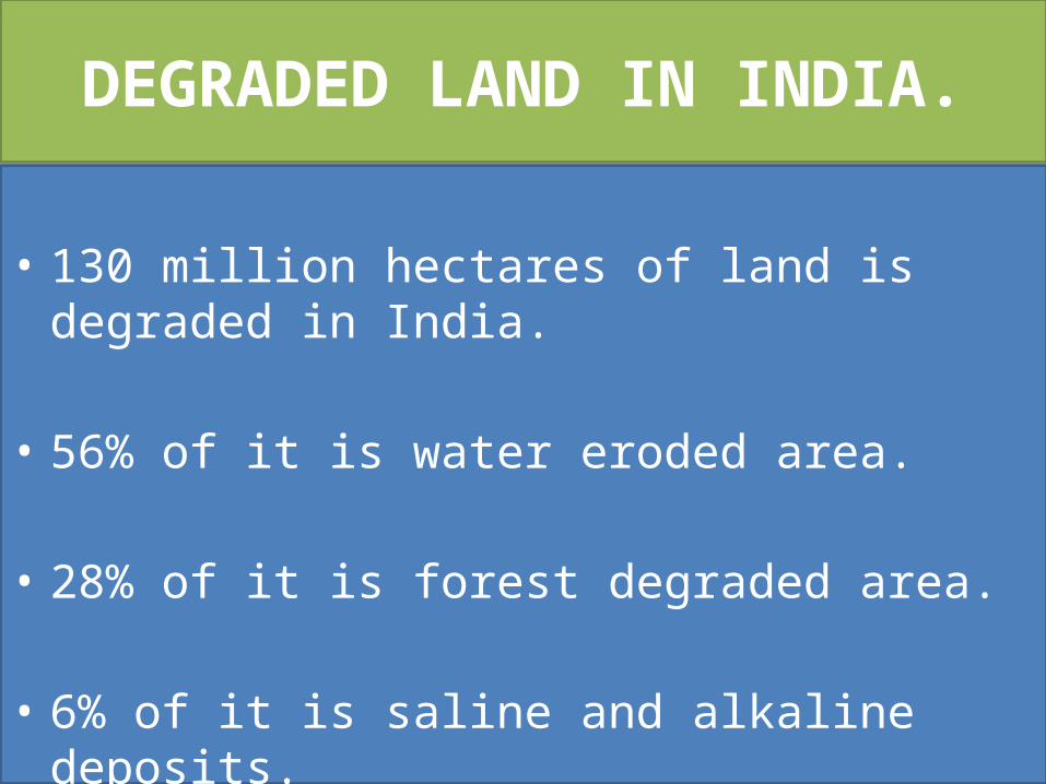
DEGRADED LAND IN INDIA.
• 130 million hectares of land is degraded in India.
• 56% of it is water eroded area.
• 28% of it is forest degraded area.
• 6% of it is saline and alkaline deposits.• 10% of it is wind eroded area.

SOIL

SOIL
• The upper most layer of the earth’s crust which is loose , broken and useful for plants is called soil.
• Soil consists of mineral matter such as sand and clay and
Organic matter such as humus, bacteria and earth worms.
• Soil is formed mainly due to the process of weathering. As a result of weathering a layer of loose rock materials is formed on the land surface. If this layer remains undisturbed for a long period of time, chemical, physical and organic changes take place in it. These changes lead to the formation of soil.

FACTORS WHICH INFLUENCE (OR) GOVERN THE SOIL FORMATION PROCESS
1) Climate: Climate decides the rate of weathering and the type
of vegetation. 2) Topography: Topography of the land decides the accumulation of soil. 3) Nature of parent rock: It decides compositions and texture of the soil. 4)Vegetation: Vegetation decides the amount of humus
available in the soil.
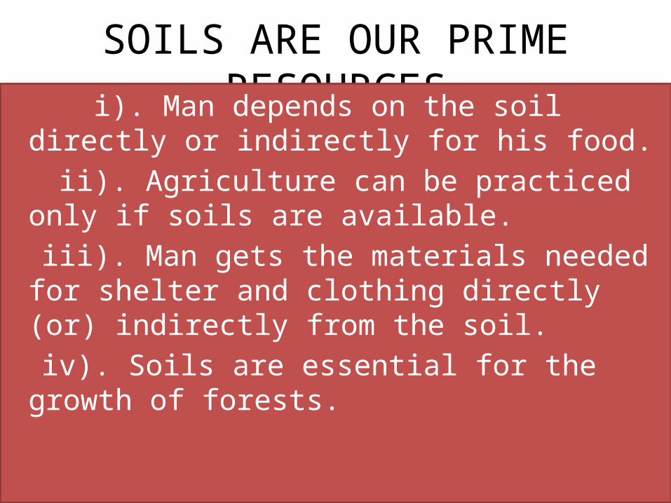
SOILS ARE OUR PRIME RESOURCES i). Man depends on the soil directly or
indirectly for his food. ii). Agriculture can be practiced only if soils are
available. iii). Man gets the materials needed for shelter
and clothing directly (or) indirectly from the soil.
iv). Soils are essential for the growth of forests.

ALLUVIAL SOILS

ALLUVIAL SOILS i). Alluvial soil is the most fertile and wide spread soil
found in India. ii). It is formed due to the deposition of fine silt
called alluvium by the rivers. iii). It is found in the northern plains, Gujarat plains
and the coastal plains. iv). It consists of sand, silt and clay. v). It is divided into khadar and Bangar [new alluvium
and old alluvium] It contains soil nutrients such as potash, phosphoric acid and lime. So, it is fertile and good for the growth of sugarcane, rice, wheat and pulses.

BLACK SOILS
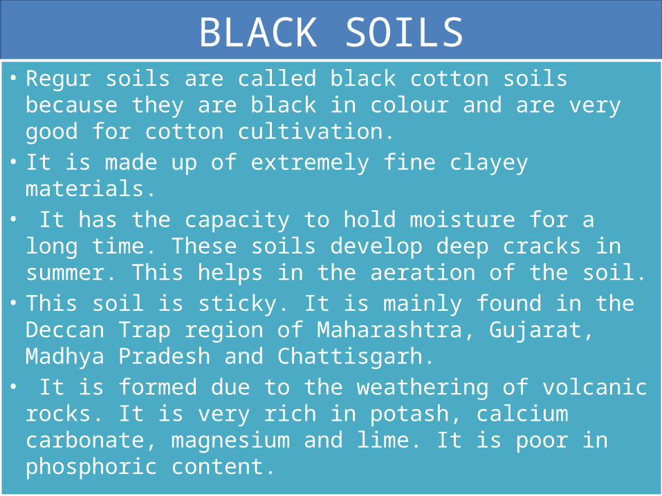
BLACK SOILS• Regur soils are called black cotton soils because they are
black in colour and are very good for cotton cultivation. • It is made up of extremely fine clayey materials.• It has the capacity to hold moisture for a long time.
These soils develop deep cracks in summer. This helps in the aeration of the soil.
• This soil is sticky. It is mainly found in the Deccan Trap region of Maharashtra, Gujarat, Madhya Pradesh and Chattisgarh.
• It is formed due to the weathering of volcanic rocks. It is very rich in potash, calcium carbonate, magnesium and lime. It is poor in phosphoric content.
RED SOILS

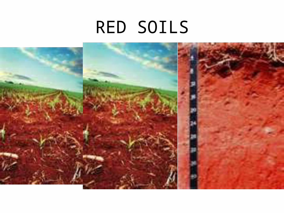
RES SOILS• Red soils are formed due to the weathering of
crystalline igneous rocks under low rainfall conditions.
• It is red in colour because of the presence of iron in it.
• It is found in Tamilnadu, Karnataka, Andhra Pradesh, Orissa, Chattisgarh and Jharkhand.

LATERITE SOILS

LATERITE SOIL• The word laterite originated from the Latin word
later which means brick.• Laterite soil is formed due to intense leaching
caused by tropical rainfall.• Humus content is less because the micro-organisms
get destroyed due to high temperature. • This soil can be cultivated by using manure and
fertilizers. It is good for the cultivation of tea, coffee and cashew nut. It is found in Kerala, Karnataka, Tamilnadu, Madhya Pradesh, Orissa and Assam.
•
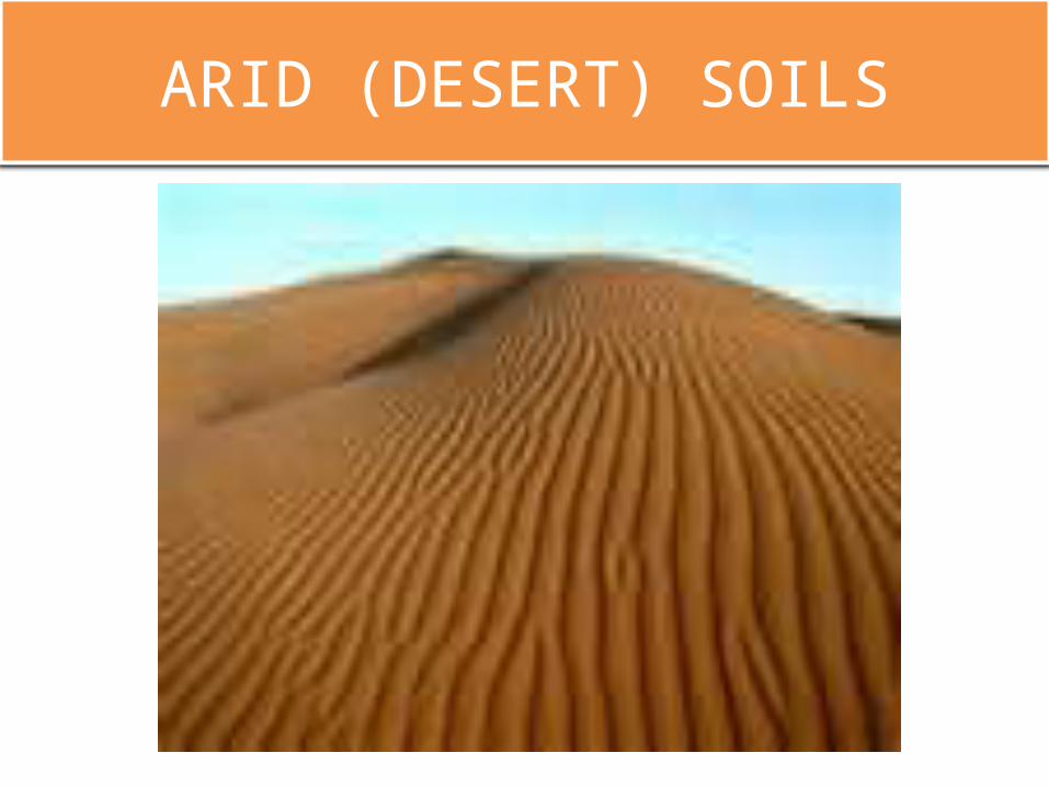
ARID (DESERT) SOILS

ARID SOILS• Arid soils are red or brown in colour. They are sandy
and saline.
• Humus and moisture contents are very less. They can be cultivated after irrigation.
• Kankar layer in the soil prevent the water from seeping under ground.

FOREST SOILS

FOREST SOILS• Forest soils are found in hilly and mountainous
regions. • They are loamy and silty in valleys and coarse in the
upper slopes.• In Himalayas they suffer denudation and are acidic
with low humus content. • The soils found in the lower slopes of the valley are
fertile.

SOIL EROSION
• Removal of top soil from one place to another by natural agencies is called soil erosion.
• It is caused by running water and wind. • Deforestation, over grazing and unscientific
agricultural practices are responsible for large scale soil erosion.

GULLY EROSION• The rain water when moves down on an uneven
land scoops away the soil and form deep channels called gullies. This type of erosion is called gully erosion.
• A land which is broken into many small parts by the gullies is called bad land. A bad land is unfit for cultivation and for other economic activities.
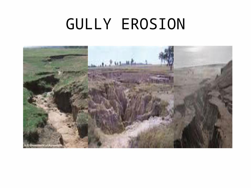
GULLY EROSION

SHEET EROSION
• Some times water flows as a sheet over large areas down a slope. The water takes away the top soil. This type of erosion is called sheet erosion.

SOIL CONSERVATION MEASURES
i). Contour ploughing reduces the flow of water and prevent soil erosion.
ii). In hilly areas terraced farming should be followed.iii). Strip farming helps to reduces the force of winds.iv). Shelter belts of plants around the fields reduce
soil erosion. v). Afforestation should be practiced on a large scale
and deforestation should be stopped.vi).Over grazing by animals should be avoided.