Embed Size (px)
Citation preview
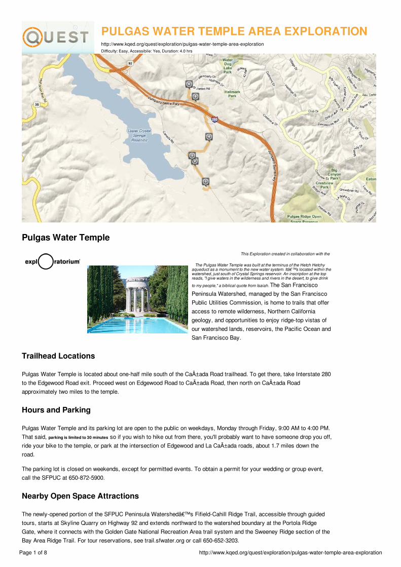
PULGAS WATER TEMPLE AREA EXPLORATIONhttp://www.kqed.org/quest/exploration/pulgas-water-temple-area-explorationDifficulty: Easy, Accessibile: Yes, Duration: 4.0 hrs
Pulgas Water TempleThis Exploration created in collaboration with the
The Pulgas Water Temple was built at the terminus of the Hetch Hetchyaqueduct as a monument to the new water system. It’s located within thewatershed, just south of Crystal Springs reservoir. An inscription at the topreads, "I give waters in the wilderness and rivers in the desert, to give drinkto my people," a biblical quote from Isaiah. The San FranciscoPeninsula Watershed, managed by the San FranciscoPublic Utilities Commission, is home to trails that offeraccess to remote wilderness, Northern Californiageology, and opportunities to enjoy ridge-top vistas ofour watershed lands, reservoirs, the Pacific Ocean andSan Francisco Bay.
Trailhead Locations
Pulgas Water Temple is located about one-half mile south of the Cañada Road trailhead. To get there, take Interstate 280to the Edgewood Road exit. Proceed west on Edgewood Road to Cañada Road, then north on Cañada Roadapproximately two miles to the temple.
Hours and Parking
Pulgas Water Temple and its parking lot are open to the public on weekdays, Monday through Friday, 9:00 AM to 4:00 PM.That said, parking is limited to 30 minutes so if you wish to hike out from there, you'll probably want to have someone drop you off,ride your bike to the temple, or park at the intersection of Edgewood and La Cañada roads, about 1.7 miles down theroad.
The parking lot is closed on weekends, except for permitted events. To obtain a permit for your wedding or group event,call the SFPUC at 650-872-5900.
Nearby Open Space Attractions
The newly-opened portion of the SFPUC Peninsula Watershed’s Fifield-Cahill Ridge Trail, accessible through guidedtours, starts at Skyline Quarry on Highway 92 and extends northward to the watershed boundary at the Portola RidgeGate, where it connects with the Golden Gate National Recreation Area trail system and the Sweeney Ridge section of theBay Area Ridge Trail. For tour reservations, see trail.sfwater.org or call 650-652-3203.
Page 1 of 8 http://www.kqed.org/quest/exploration/pulgas-water-temple-area-exploration

The historic Sawyer Camp Trail-once a segment of the main route between San Francisco and Half Moon Bay-windsapproximately six miles through SFPUC Watershed land from Crystal Springs Reservoir to San Andreas Lake.
Special thanks to John Fournet and Betsy Lauppe Rhodes of the San Francisco Public Utilities Commission, for assisting us on this project.
Page 2 of 8 http://www.kqed.org/quest/exploration/pulgas-water-temple-area-exploration

1. Pulgas Water Temple latitude 37.483531 longitude -122.316276
1a. The Pulgas Water temple
In this video, John Fournet of theSan Francisco Public UtilitiesCommission explains the originsof the Pulgas Water temple.
1b. The Pulgas Water Temple, continued
In this video, John Fournet of theSan Francisco Public UtilitiesCommission explains the uniquehistory and nature of the PulgasWater temple.
1c. Facing the Pulgas Water Temple
In 1934, the first rush of HetchHetchy water flowed through thegravity-driven tunnel system,across the California's centralvalley. It swooshed through thebase of the Pulgas Water Templeand into nearby Crystal Springsreservoir while San Franciscanscheered, and someconservationists frowned.
1d. Interior View of the Pulgas WaterTemple
Looking up through the top of thetemple to blue skies.
1e. Pulgas Water Temple dedication
The Pulgas Water Temple wasbuilt at the terminus of the HetchHetchy aqueduct as a monumentto the new water system. It'slocated within the watershed, justsouth of Crystal Springsreservoir. The plaque reads, "Igive waters in the wilderness andrivers in the desert, to give drinkto my people," a quote fromIsaiah.
Page 3 of 8 http://www.kqed.org/quest/exploration/pulgas-water-temple-area-exploration
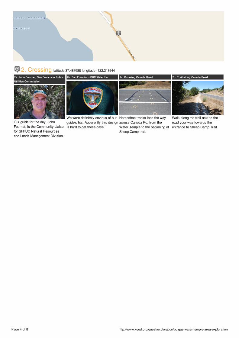
2. Crossing latitude 37.487688 longitude -122.318944
2a. John Fournet, San Francisco PublicUtilities Commission
Our guide for the day, JohnFournet, is the Community Liaisonfor SFPUC Natural Resourcesand Lands Management Division.
2b. San Francisco PUC Water Hat
We were definitely envious of ourguide's hat. Apparently this designis hard to get these days.
2c. Crossing Canada Road
Horseshoe tracks lead the wayacross Canada Rd. from theWater Temple to the beginning ofSheep Camp trail.
2b. Trail along Canada Road
Walk along the trail next to theroad your way towards theentrance to Sheep Camp Trail.
Page 4 of 8 http://www.kqed.org/quest/exploration/pulgas-water-temple-area-exploration
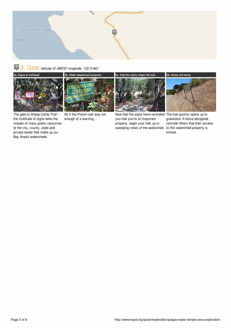
3. Gate latitude 37.488767 longitude -122.31967
3a. Signs at trailhead
The gate to Sheep Camp Trail -the multitude of signs belie themosaic of many public resourcesat the city, county, state andprivate levels that make up ourBay Area's watersheds.
3b. Water department property
As if the Poison oak was notenough of a warning....
3c. Past the signs, begin the trail
Now that the signs have remindedyou that you're on importantproperty, begin your trek up tosweeping views of the watershed.
3d. Grass and fence
The trail quickly opens up tograssland. A fence alongsidereminds hikers that their accessto this watershed property islimited.
Page 5 of 8 http://www.kqed.org/quest/exploration/pulgas-water-temple-area-exploration

4. Oaks and Friends latitude 37.49256 longitude -122.315356
4a. Oaks and other usual suspects
Further up the ascent, hikers findthemselves among common floraof the Bay Area landscape: coastlive oak, coyote brush, floweringannual grasses.
4b. Spanish moss
Many of the oaks are hosts toSpanish Moss (Ramalinamenziesii), which is actually alichen, a combination of a fungusand an algae. The lichen doesn'tharm the tree, though it can oftenbe found on leafless brancheswhere it can get more light.
4c. Moss on dying oak
This oak, an oddity for beingsomewhat of a loner rather thanamong a stand of trees, wasprobably once home to muchmore Spanish Moss, but has nowbecome too dry provide a goodsite for the lichen.
4d. Don't touch those leaves
And no Bay Area hike could becomplete with out spotting ourconstant companion, poison oak.Though the leaves are pretty,they're best left alone.
Page 6 of 8 http://www.kqed.org/quest/exploration/pulgas-water-temple-area-exploration
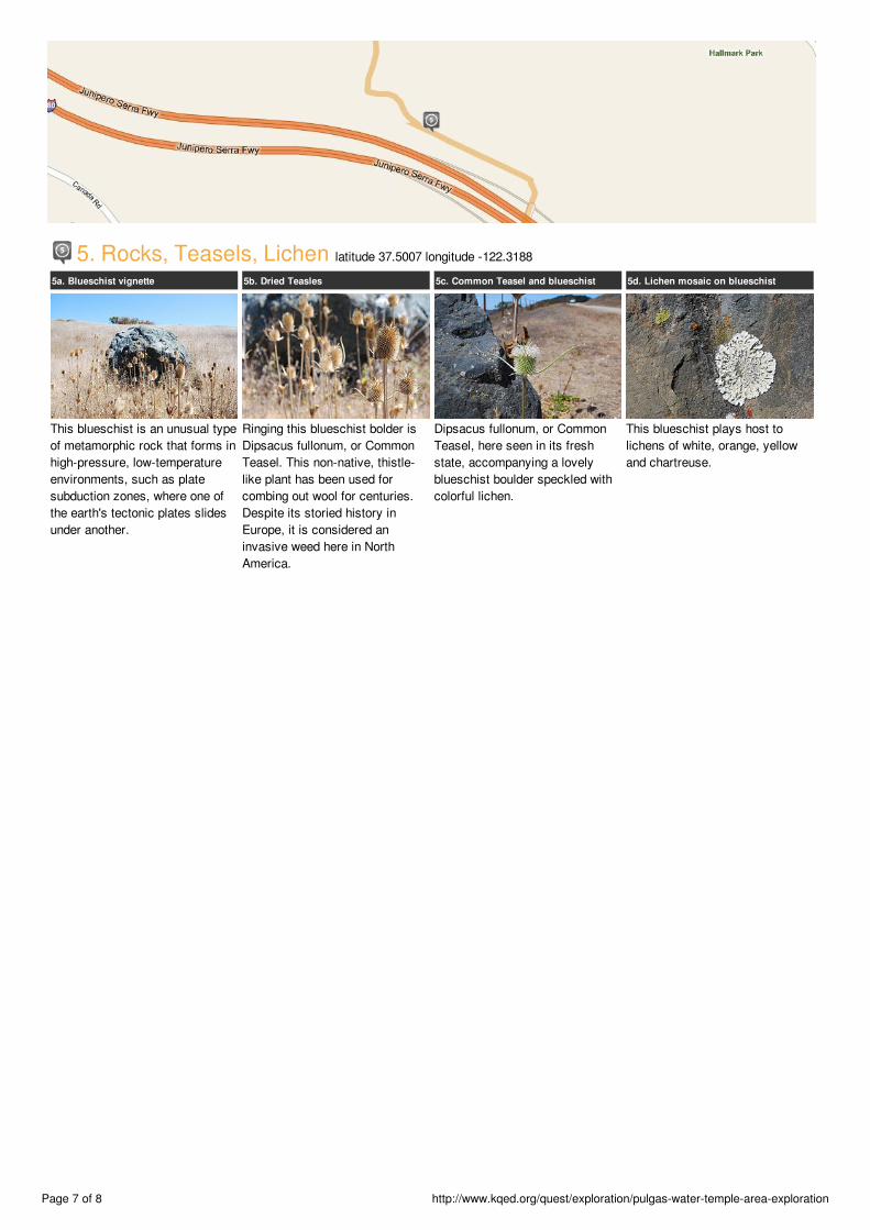
5. Rocks, Teasels, Lichen latitude 37.5007 longitude -122.3188
5a. Blueschist vignette
This blueschist is an unusual typeof metamorphic rock that forms inhigh-pressure, low-temperatureenvironments, such as platesubduction zones, where one ofthe earth's tectonic plates slidesunder another.
5b. Dried Teasles
Ringing this blueschist bolder isDipsacus fullonum, or CommonTeasel. This non-native, thistle-like plant has been used forcombing out wool for centuries.Despite its storied history inEurope, it is considered aninvasive weed here in NorthAmerica.
5c. Common Teasel and blueschist
Dipsacus fullonum, or CommonTeasel, here seen in its freshstate, accompanying a lovelyblueschist boulder speckled withcolorful lichen.
5d. Lichen mosaic on blueschist
This blueschist plays host tolichens of white, orange, yellowand chartreuse.
Page 7 of 8 http://www.kqed.org/quest/exploration/pulgas-water-temple-area-exploration
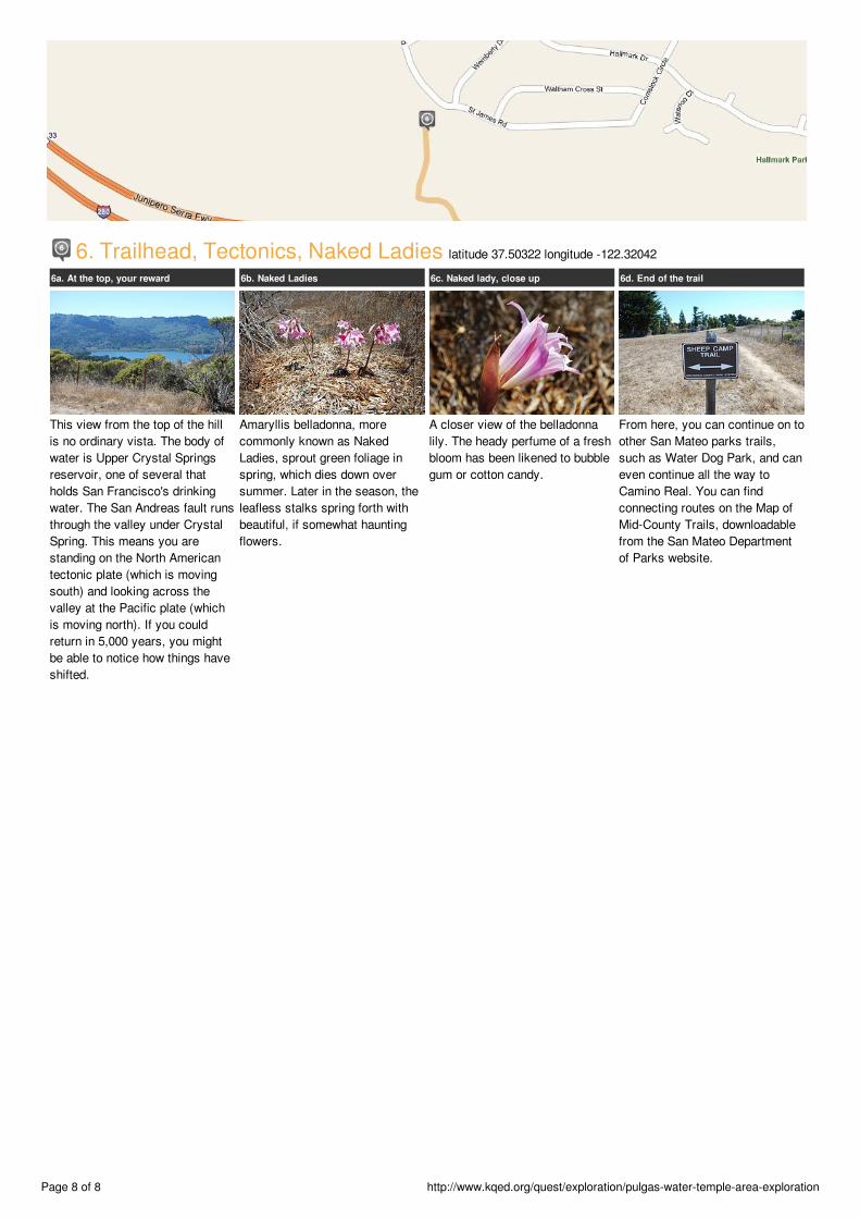
6. Trailhead, Tectonics, Naked Ladies latitude 37.50322 longitude -122.32042
6a. At the top, your reward
This view from the top of the hillis no ordinary vista. The body ofwater is Upper Crystal Springsreservoir, one of several thatholds San Francisco's drinkingwater. The San Andreas fault runsthrough the valley under CrystalSpring. This means you arestanding on the North Americantectonic plate (which is movingsouth) and looking across thevalley at the Pacific plate (whichis moving north). If you couldreturn in 5,000 years, you mightbe able to notice how things haveshifted.
6b. Naked Ladies
Amaryllis belladonna, morecommonly known as NakedLadies, sprout green foliage inspring, which dies down oversummer. Later in the season, theleafless stalks spring forth withbeautiful, if somewhat hauntingflowers.
6c. Naked lady, close up
A closer view of the belladonnalily. The heady perfume of a freshbloom has been likened to bubblegum or cotton candy.
6d. End of the trail
From here, you can continue on toother San Mateo parks trails,such as Water Dog Park, and caneven continue all the way toCamino Real. You can findconnecting routes on the Map ofMid-County Trails, downloadablefrom the San Mateo Departmentof Parks website.
Page 8 of 8 http://www.kqed.org/quest/exploration/pulgas-water-temple-area-exploration