Embed Size (px)
Citation preview


Copyright © 2017, Oracle and/or its affiliates. All rights reserved. |
Publishing Statistical Data and Geospatial Data as Linked Data Creating a Semantic Data Platform
Hans Viehmann Product Manager EMEA ORACLE Corporation January 22, 2017 @SpatialHannes
2
Copyright © 2017, Oracle and/or its affiliates. All rights reserved. |
Safe Harbor Statement
The following is intended to outline our general product direction. It is intended for information purposes only, and may not be incorporated into any contract. It is not a commitment to deliver any material, code, or functionality, and should not be relied upon in making purchasing decisions. The development, release, and timing of any features or functionality described for Oracle’s products remains at the sole discretion of Oracle.
3
Copyright © 2017, Oracle and/or its affiliates. All rights reserved. |
What is Linked Data
• Concept of publishing and interlinking structured data on the web
–Moving from documents to useable data
• Based on W3C standards
– Resource Description Framework (RDF), OWL, SPARQL ...
• Originally developed by Tim Berners-Lee
• Design principles
– Use Uniform Resource Identifiers (URIs) to uniquely identify things (data entities)
– Use HTTP URLs, corresponding to these URIs, so that information can be retrieved
– Provide metadata using open standards such as RDF
– Include links to related URIs, so that people can discover more things
4
Copyright © 2017, Oracle and/or its affiliates. All rights reserved. |
Why Linked Data for Statistics Agencies?
• Data dissemination is key to the work of NSIs
– Production of accurate data is not everything
• Need to broaden reach
– Simplifying access
• Various models to represent data in the past – eg. SDMX (Statistical Data and Metadata Exchange)
• Linked Data allow to
– Associate data with metadata (or meaning) – major step towards AI
– Use a common vocabulary
– Refer to data owner/authoritative datasource or other 3rd party datasets
5
Copyright © 2017, Oracle and/or its affiliates. All rights reserved. |
Two example projects
• CensLOD project, ISTAT, Italy
– Publishing 2015 census data as linked (open) data
– Infrastructure development to publish Linked Open Data
– Project details kindly provided by Monica Scannapieco
• Ordnance Survey Ireland publishing boundary data
– Used by Central Statistics Office (CSO) initially for 2011 census data
–Modelling boundary data at different resolutions, modelling provenance
– Focus on using GeoSPARQL
– Collaboration between OSi, CSO and ADAPTcentre (TCD)
–Material kindly provided by Dr. Christophe Debruyne (TCD)
Based on Oracle Spatial and Graph as Linked Data Platform
Copyright © 2017, Oracle and/or its affiliates. All rights reserved. |
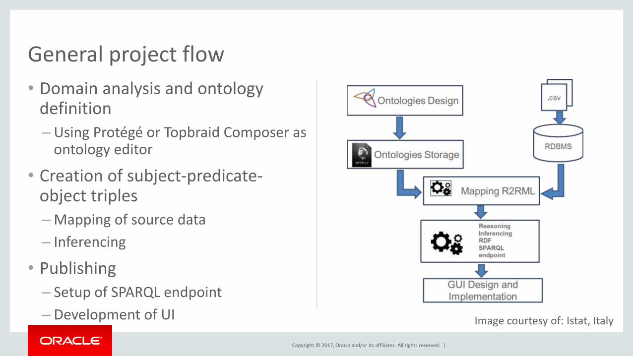
• Domain analysis and ontology definition
– Using Protégé or Topbraid Composer as ontology editor
• Creation of subject-predicate-object triples
–Mapping of source data
– Inferencing
• Publishing
– Setup of SPARQL endpoint
– Development of UI
General project flow
Image courtesy of: Istat, Italy
Copyright © 2017, Oracle and/or its affiliates. All rights reserved. |
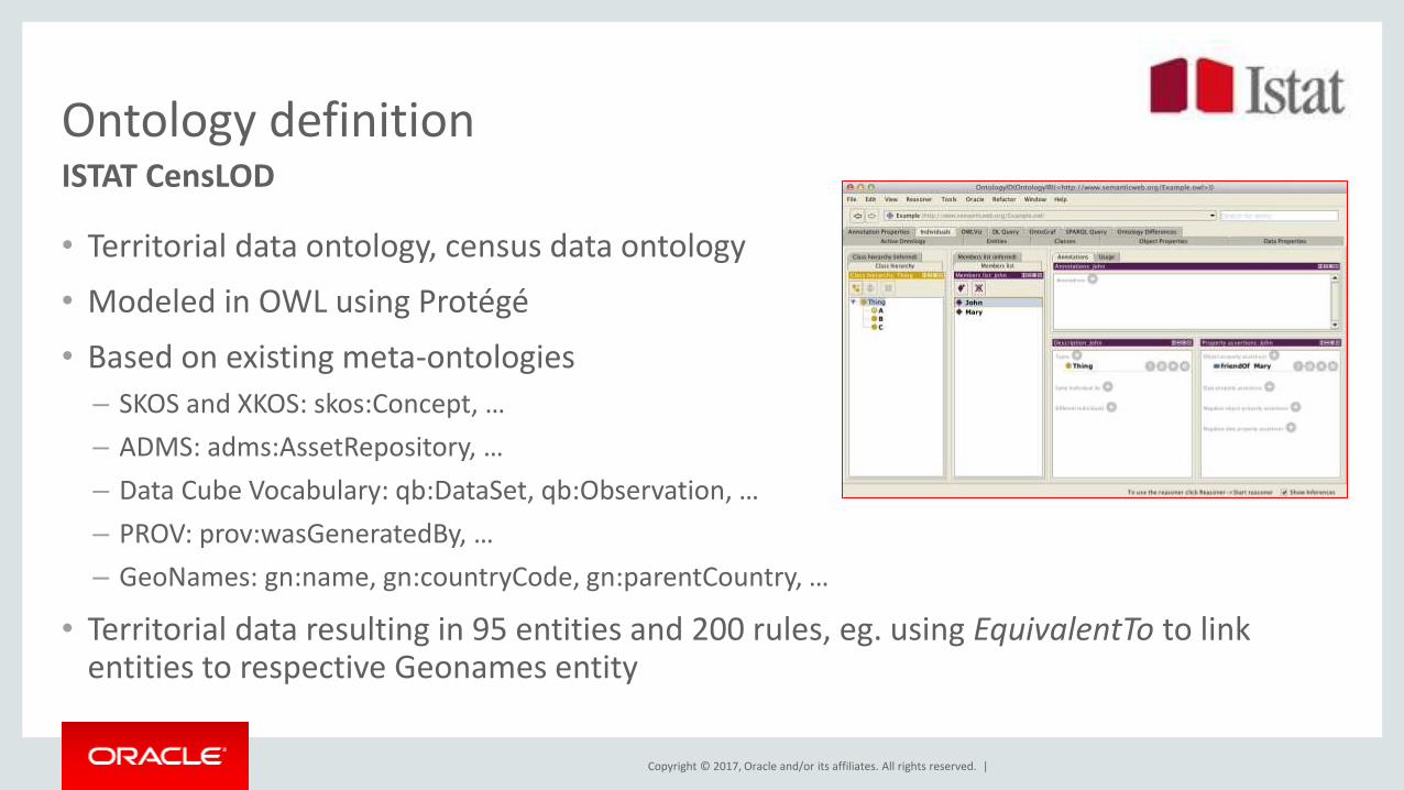
Ontology definition
• Territorial data ontology, census data ontology
• Modeled in OWL using Protégé
• Based on existing meta-ontologies
– SKOS and XKOS: skos:Concept, …
– ADMS: adms:AssetRepository, …
– Data Cube Vocabulary: qb:DataSet, qb:Observation, …
– PROV: prov:wasGeneratedBy, …
– GeoNames: gn:name, gn:countryCode, gn:parentCountry, …
• Territorial data resulting in 95 entities and 200 rules, eg. using EquivalentTo to link entities to respective Geonames entity
ISTAT CensLOD
Copyright © 2017, Oracle and/or its affiliates. All rights reserved. |
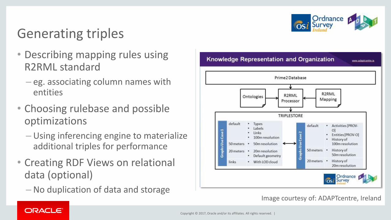
• Describing mapping rules using R2RML standard
– eg. associating column names with entities
• Choosing rulebase and possible optimizations
– Using inferencing engine to materialize additional triples for performance
• Creating RDF Views on relational data (optional) –No duplication of data and storage
Generating triples
Image courtesy of: ADAPTcentre, Ireland
Copyright © 2017, Oracle and/or its affiliates. All rights reserved. |
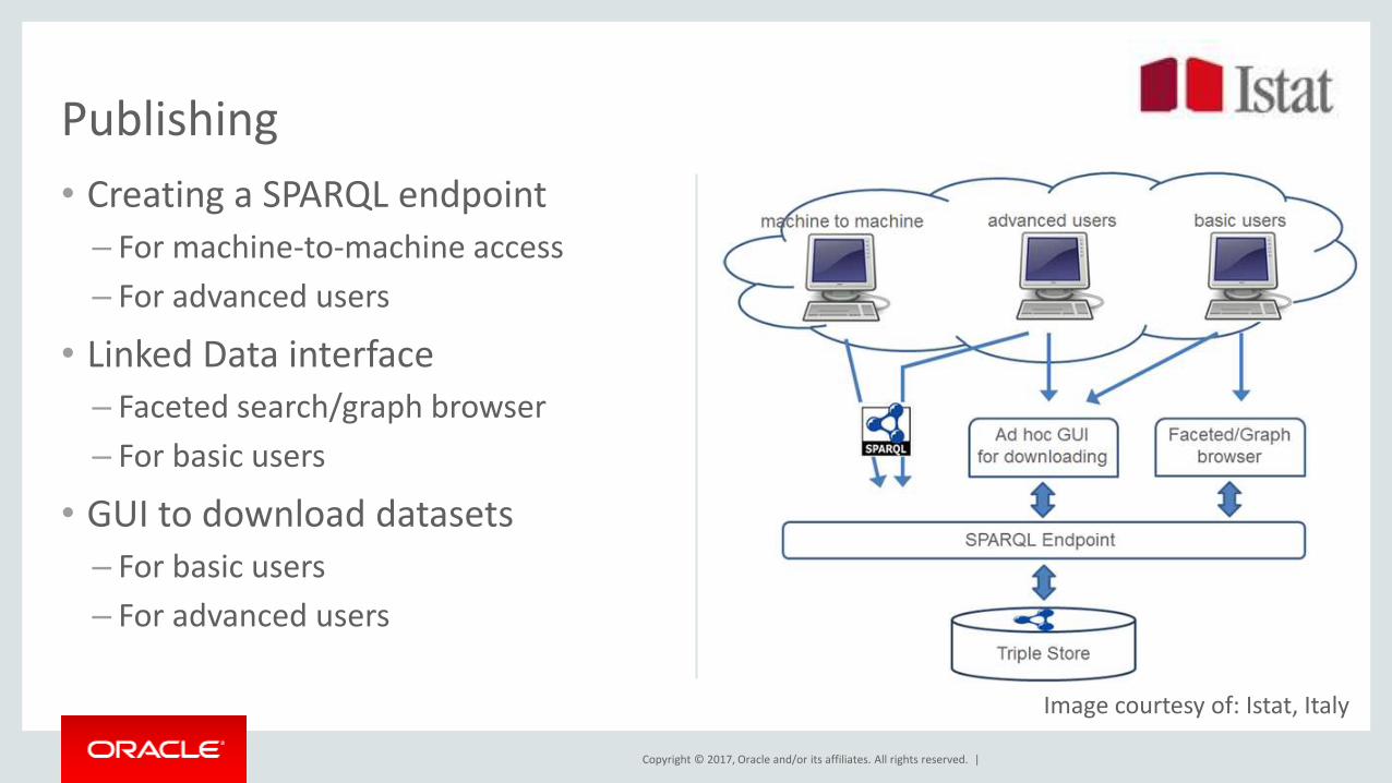
• Creating a SPARQL endpoint
– For machine-to-machine access
– For advanced users
• Linked Data interface – Faceted search/graph browser
– For basic users
• GUI to download datasets
– For basic users
– For advanced users
Publishing
Image courtesy of: Istat, Italy
Copyright © 2017, Oracle and/or its affiliates. All rights reserved. |
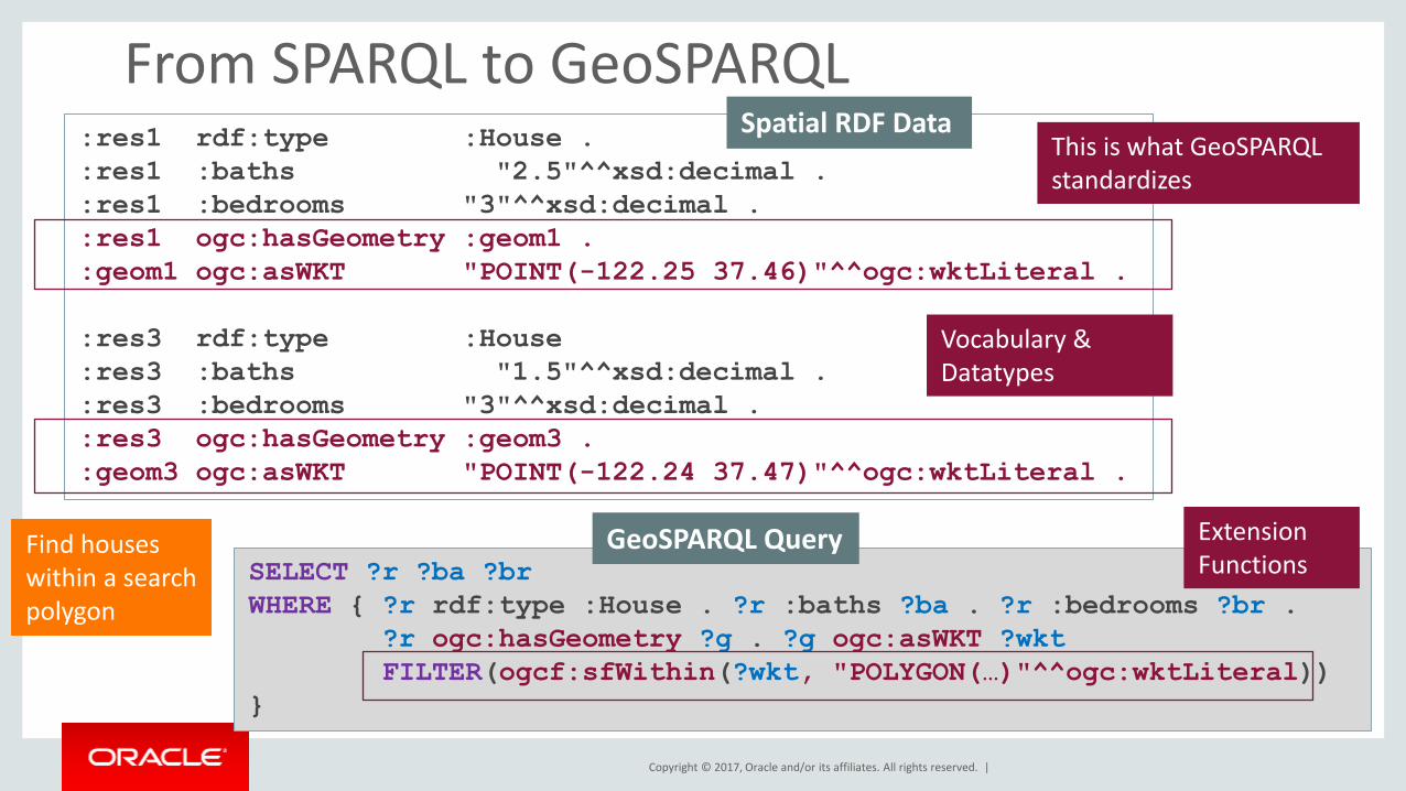
Linked Geodata and Semantic GIS
• GIS applications with semantically complex thematic aspects
– Logical reasoning to classify features, eg. land cover type, suitable farm land, etc., combined with spatial queries
– Linking to available datasources (geonames.org, dbpedia, ...)
• Requirements – Consistent modeling of geospatial data, both simple and complex
– Gemetric functions and topological queries based on Spatial indexing
• Conceptual solution provided by OGC standards – Simple Features as WKT literals, eg. "Point(-83.4 34.3)"^^ogc:wktLiteral
–Queries in GeoSPARQL
Copyright © 2017, Oracle and/or its affiliates. All rights reserved. |
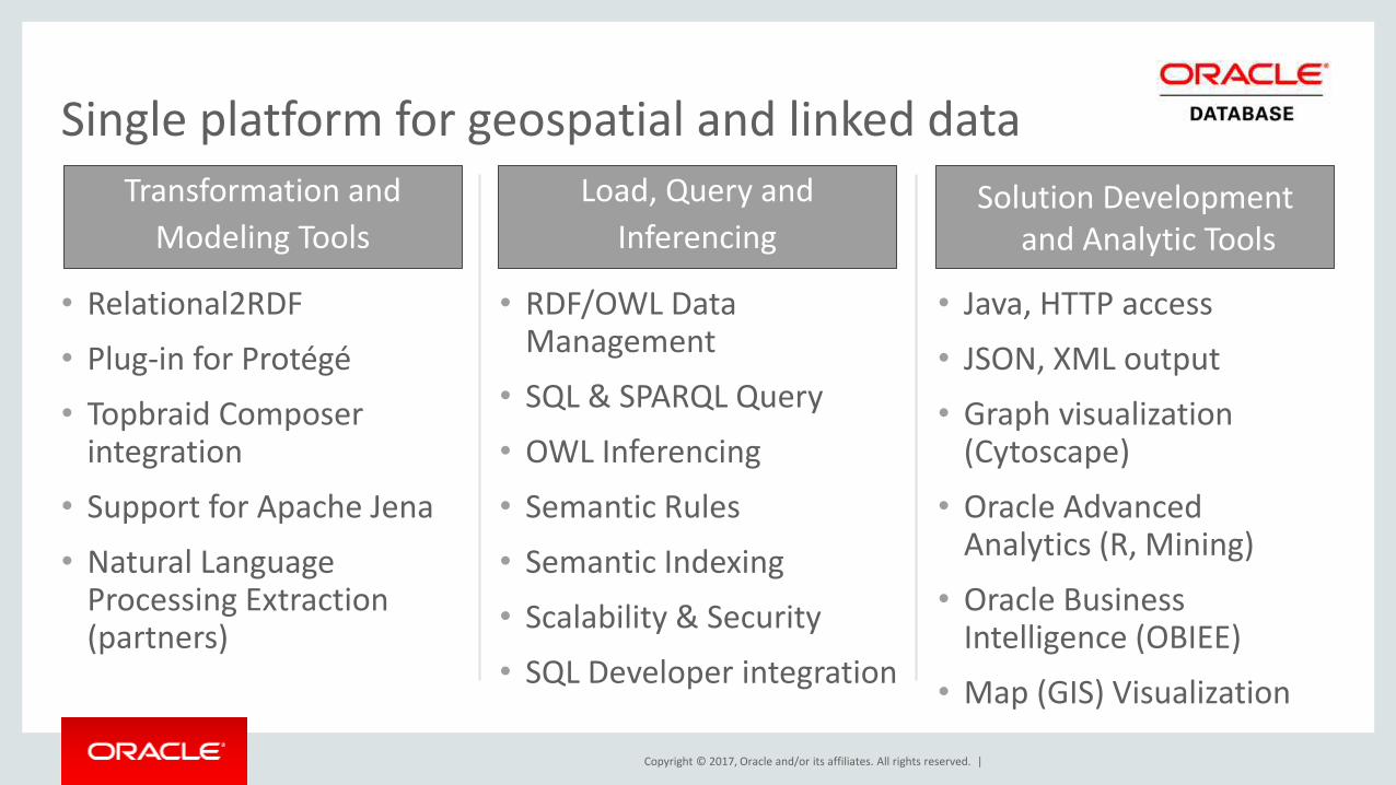
• Relational2RDF
• Plug-in for Protégé
• Topbraid Composer integration
• Support for Apache Jena
• Natural Language Processing Extraction (partners)
• RDF/OWL Data Management
• SQL & SPARQL Query
• OWL Inferencing
• Semantic Rules
• Semantic Indexing
• Scalability & Security
• SQL Developer integration
• Java, HTTP access
• JSON, XML output
• Graph visualization (Cytoscape)
• Oracle Advanced Analytics (R, Mining)
• Oracle Business Intelligence (OBIEE)
• Map (GIS) Visualization
Single platform for geospatial and linked data
Transformation and
Modeling Tools Solution Development
and Analytic Tools
Load, Query and
Inferencing
Copyright © 2017, Oracle and/or its affiliates. All rights reserved. |
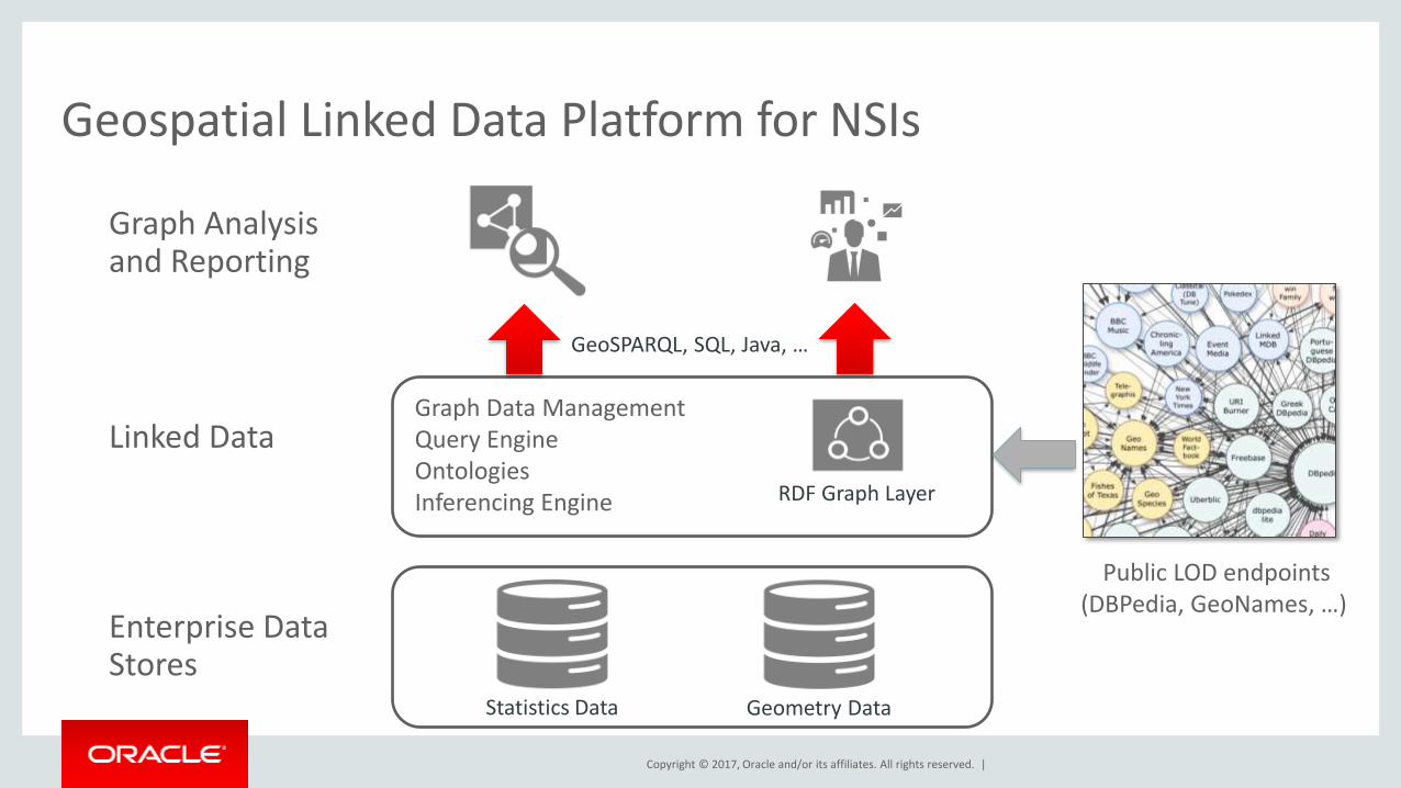
Geospatial Linked Data Platform for NSIs
Graph Data Management Query Engine Ontologies Inferencing Engine
Statistics Data
Linked Data
Enterprise Data Stores
Graph Analysis and Reporting
Public LOD endpoints (DBPedia, GeoNames, …)
RDF Graph Layer
GeoSPARQL, SQL, Java, …
Geometry Data
Copyright © 2017, Oracle and/or its affiliates. All rights reserved. |
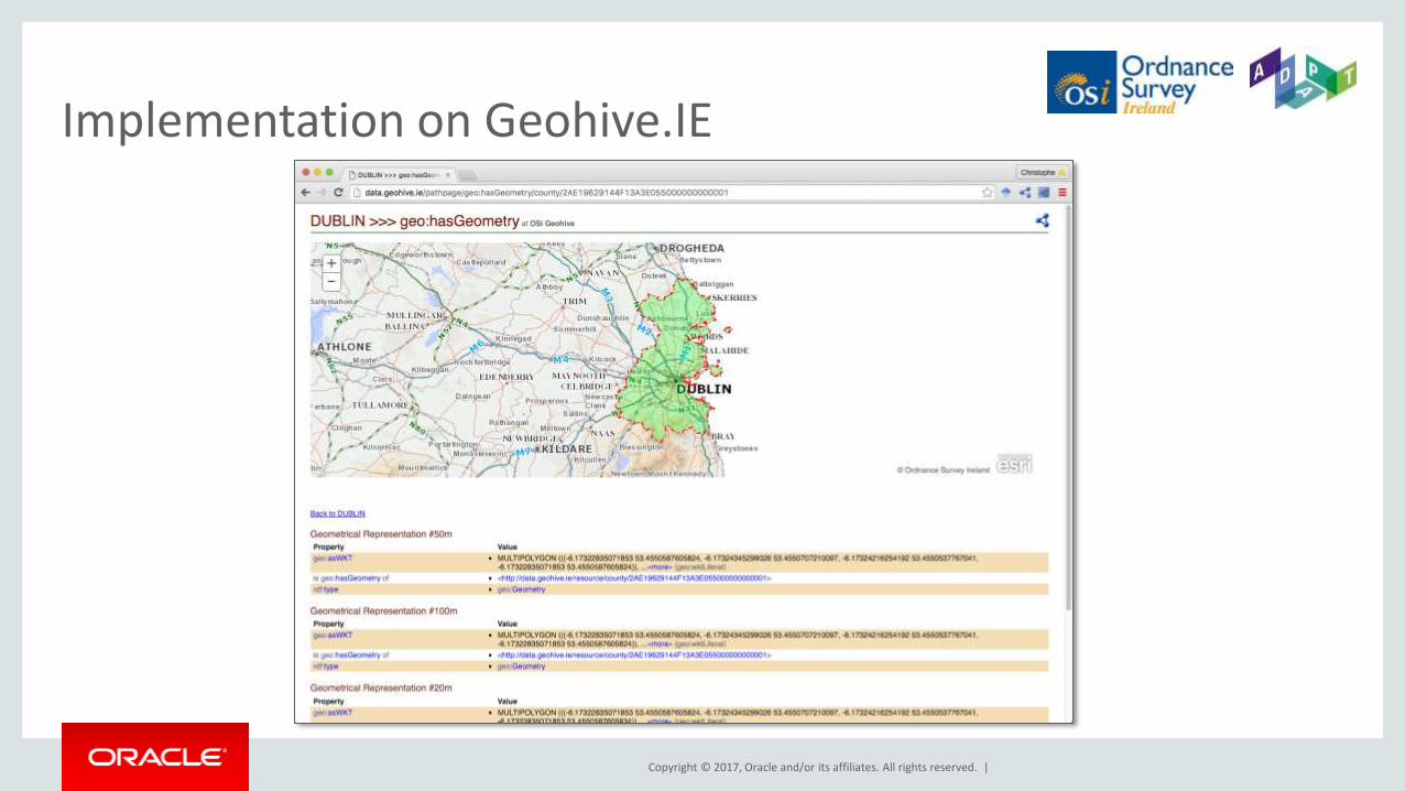
Implementation on Geohive.IE

Copyright © 2017, Oracle and/or its affiliates. All rights reserved. |
Implementation of Triple Fragments Client
Copyright © 2017, Oracle and/or its affiliates. All rights reserved. |
Resources
• Oracle Spatial and Graph OTN product page here
–White papers, software downloads, documentation and videos
– Performance White Paper on 1 Trillion Triple Benchmark
• Oracle Big Data Lite Virtual Machine - a free sandbox to get started: www.oracle.com/technetwork/database/bigdata-appliance/oracle-bigdatalite-2104726.html
• Hands On Lab with RDF Graph data included – Content also available on GITHub under http://github.com/oracle/BigDataLite/
• Blog – examples, tips & tricks: blogs.oracle.com/oraclespatial
• @OracleBigData, @SpatialHannes, @JeanIhm Oracle Spatial and Graph Group

Copyright © 2017, Oracle and/or its affiliates. All rights reserved. |


Copyright © 2017, Oracle and/or its affiliates. All rights reserved. |
Appendix OGC GeoSPARQL Support in Oracle Spatial and Graph 12c
Copyright © 2017, Oracle and/or its affiliates. All rights reserved. |
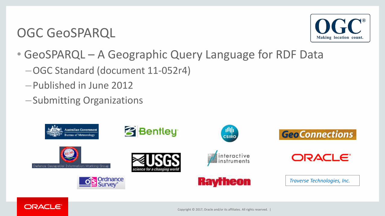
OGC GeoSPARQL
• GeoSPARQL – A Geographic Query Language for RDF Data –OGC Standard (document 11-052r4)
–Published in June 2012
–Submitting Organizations
Traverse Technologies, Inc.
Copyright © 2017, Oracle and/or its affiliates. All rights reserved. |
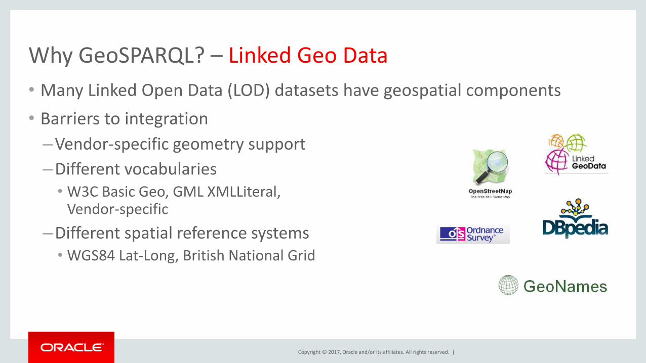
Why GeoSPARQL? – Linked Geo Data
• Many Linked Open Data (LOD) datasets have geospatial components
• Barriers to integration
–Vendor-specific geometry support
–Different vocabularies • W3C Basic Geo, GML XMLLiteral,
Vendor-specific
–Different spatial reference systems • WGS84 Lat-Long, British National Grid
Copyright © 2017, Oracle and/or its affiliates. All rights reserved. |
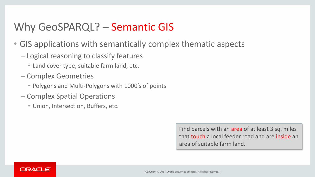
Why GeoSPARQL? – Semantic GIS
• GIS applications with semantically complex thematic aspects
– Logical reasoning to classify features • Land cover type, suitable farm land, etc.
– Complex Geometries • Polygons and Multi-Polygons with 1000’s of points
– Complex Spatial Operations • Union, Intersection, Buffers, etc.
Find parcels with an area of at least 3 sq. miles that touch a local feeder road and are inside an area of suitable farm land.
Copyright © 2017, Oracle and/or its affiliates. All rights reserved. |
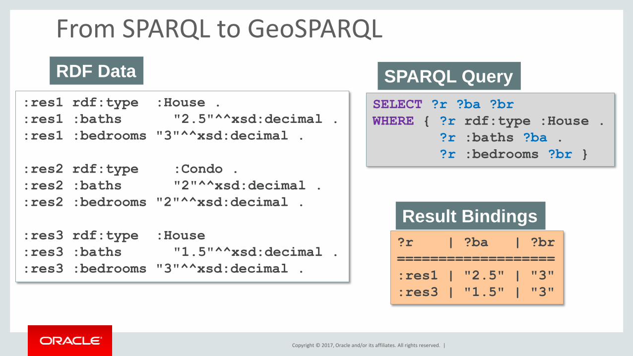
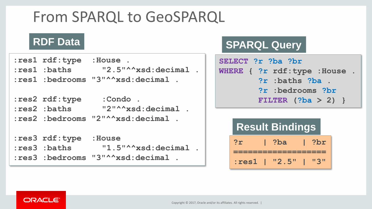
From SPARQL to GeoSPARQL
:res1 rdf:type :House .
:res1 :baths "2.5"^^xsd:decimal .
:res1 :bedrooms "3"^^xsd:decimal .
:res2 rdf:type :Condo .
:res2 :baths "2"^^xsd:decimal .
:res2 :bedrooms "2"^^xsd:decimal .
:res3 rdf:type :House
:res3 :baths "1.5"^^xsd:decimal .
:res3 :bedrooms "3"^^xsd:decimal .
RDF Data
SELECT ?r ?ba ?br
WHERE { ?r rdf:type :House .
?r :baths ?ba .
?r :bedrooms ?br }
SPARQL Query
?r | ?ba | ?br
===================
:res1 | "2.5" | "3"
:res3 | "1.5" | "3"
Result Bindings
Copyright © 2017, Oracle and/or its affiliates. All rights reserved. |
From SPARQL to GeoSPARQL
:res1 rdf:type :House .
:res1 :baths "2.5"^^xsd:decimal .
:res1 :bedrooms "3"^^xsd:decimal .
:res2 rdf:type :Condo .
:res2 :baths "2"^^xsd:decimal .
:res2 :bedrooms "2"^^xsd:decimal .
:res3 rdf:type :House
:res3 :baths "1.5"^^xsd:decimal .
:res3 :bedrooms "3"^^xsd:decimal .
RDF Data
SELECT ?r ?ba ?br
WHERE { ?r rdf:type :House .
?r :baths ?ba .
?r :bedrooms ?br
FILTER (?ba > 2) }
SPARQL Query
?r | ?ba | ?br
===================
:res1 | "2.5" | "3"
Result Bindings
Copyright © 2017, Oracle and/or its affiliates. All rights reserved. |
From SPARQL to GeoSPARQL :res1 rdf:type :House .
:res1 :baths "2.5"^^xsd:decimal .
:res1 :bedrooms "3"^^xsd:decimal .
:res1 ogc:hasGeometry :geom1 .
:geom1 ogc:asWKT "POINT(-122.25 37.46)"^^ogc:wktLiteral .
:res3 rdf:type :House
:res3 :baths "1.5"^^xsd:decimal .
:res3 :bedrooms "3"^^xsd:decimal .
:res3 ogc:hasGeometry :geom3 .
:geom3 ogc:asWKT "POINT(-122.24 37.47)"^^ogc:wktLiteral .
Spatial RDF Data
SELECT ?r ?ba ?br
WHERE { ?r rdf:type :House . ?r :baths ?ba . ?r :bedrooms ?br .
?r ogc:hasGeometry ?g . ?g ogc:asWKT ?wkt
FILTER(ogcf:sfWithin(?wkt, "POLYGON(…)"^^ogc:wktLiteral))
}
GeoSPARQL Query Find houses within a search polygon
This is what GeoSPARQL standardizes
Vocabulary & Datatypes
Extension Functions
Copyright © 2017, Oracle and/or its affiliates. All rights reserved. |
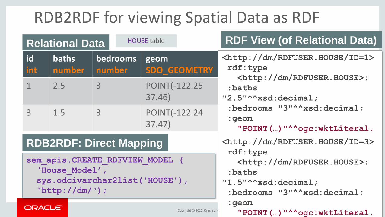
RDB2RDF for viewing Spatial Data as RDF
Relational Data
id int
baths number
bedrooms number
geom SDO_GEOMETRY
1 2.5 3 POINT(-122.25 37.46)
3 1.5 3 POINT(-122.24 37.47)
HOUSE table
sem_apis.CREATE_RDFVIEW_MODEL (
‘House_Model’,
sys.odcivarchar2list('HOUSE'),
'http://dm/‘);
RDB2RDF: Direct Mapping
<http://dm/RDFUSER.HOUSE/ID=1>
rdf:type
<http://dm/RDFUSER.HOUSE>;
:baths
"2.5"^^xsd:decimal;
:bedrooms "3"^^xsd:decimal;
:geom
"POINT(…)"^^ogc:wktLiteral.
<http://dm/RDFUSER.HOUSE/ID=3>
rdf:type
<http://dm/RDFUSER.HOUSE>;
:baths
"1.5"^^xsd:decimal;
:bedrooms "3"^^xsd:decimal;
:geom
"POINT(…)"^^ogc:wktLiteral.
RDF View (of Relational Data)
Copyright © 2017, Oracle and/or its affiliates. All rights reserved. |
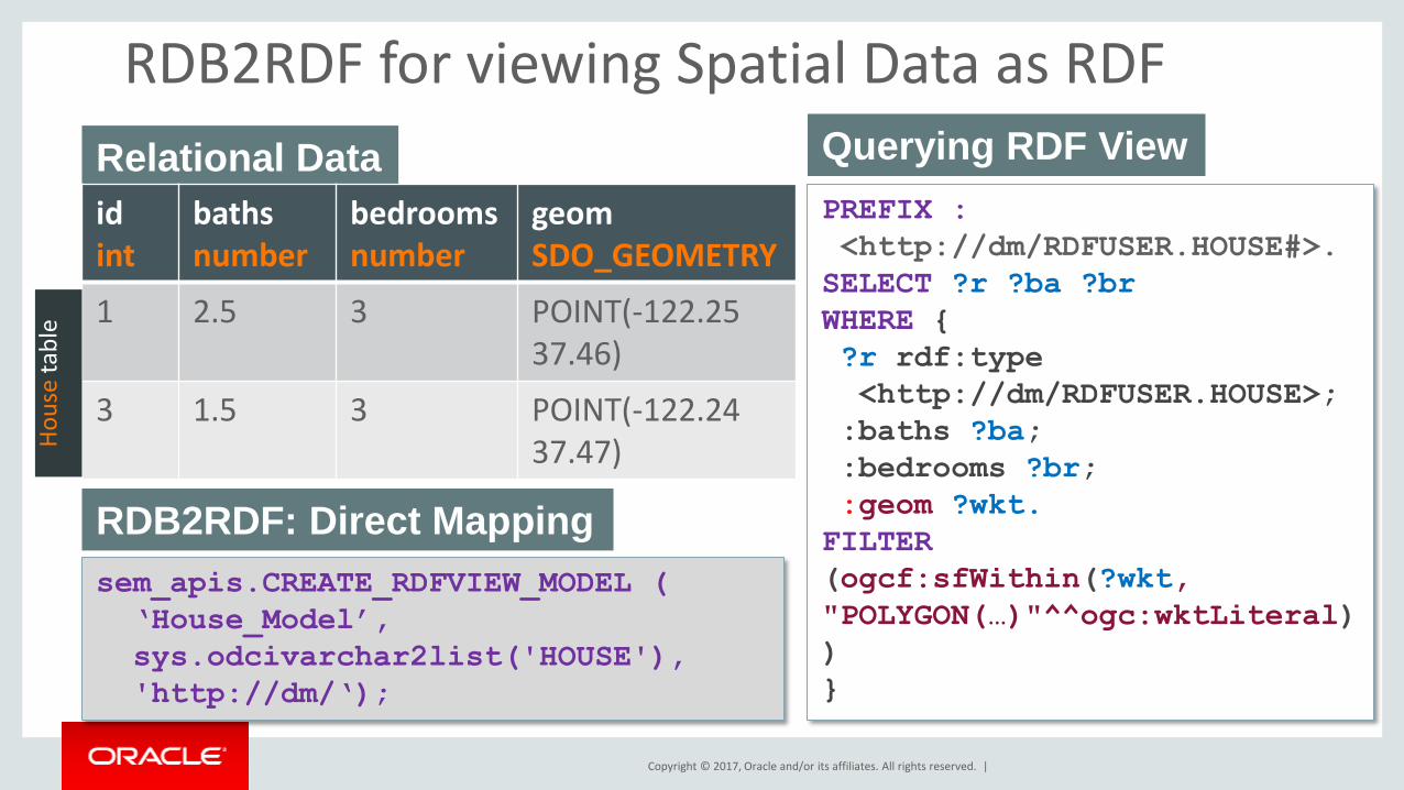
RDB2RDF for viewing Spatial Data as RDF
Relational Data
id int
baths number
bedrooms number
geom SDO_GEOMETRY
1 2.5 3 POINT(-122.25 37.46)
3 1.5 3 POINT(-122.24 37.47) H
ou
se t
able
sem_apis.CREATE_RDFVIEW_MODEL (
‘House_Model’,
sys.odcivarchar2list('HOUSE'),
'http://dm/‘);
RDB2RDF: Direct Mapping
PREFIX :
<http://dm/RDFUSER.HOUSE#>.
SELECT ?r ?ba ?br
WHERE {
?r rdf:type
<http://dm/RDFUSER.HOUSE>;
:baths ?ba;
:bedrooms ?br;
:geom ?wkt.
FILTER
(ogcf:sfWithin(?wkt,
"POLYGON(…)"^^ogc:wktLiteral)
)
}
Querying RDF View
Copyright © 2017, Oracle and/or its affiliates. All rights reserved. |
GeoSPARQL Support in Oracle
• Oracle Spatial and Graph supports the following conformance classes for GeoSPARQL
– Core
– Topology Vocabulary Extension (Simple Features)
– Geometry Extension (WKT, 1.2.0)
– Geometry Topology Extension (Simple Features, WKT, 1.2.0)
– RDFS Entailment Extension (Simple Features, WKT, 1.2.0)

Copyright © 2017, Oracle and/or its affiliates. All rights reserved. |
Builds on the power of Oracle Spatial
• Efficient Spatial Indexing
• Spatial Reference Systems
– Built-in support for 1000’s of SRS
– Coordinate system transformations applied transparently during indexing and query
• Geometry Types
– Support OGC Simple Features geometry types • Point, Line, Polygon
• Multi-Point, Multi-Line, Multi-Polygon
• Geometry Collection
– Up to 500,000 vertices per Geometry
Copyright © 2017, Oracle and/or its affiliates. All rights reserved. |
GeoSPARQL – New 12.2 Features
• New utility functions
• Support for EPSG SRID URIs
• Revised Geometry Storage Scheme – big performance gain
• SDO_JOIN
• Spatial Aggregates
• 3D Support
Copyright © 2017, Oracle and/or its affiliates. All rights reserved. |